Old Dale Mining District - Western...
53
Old Dale Mining District
Transcript of Old Dale Mining District - Western...
Old Dale Mining District
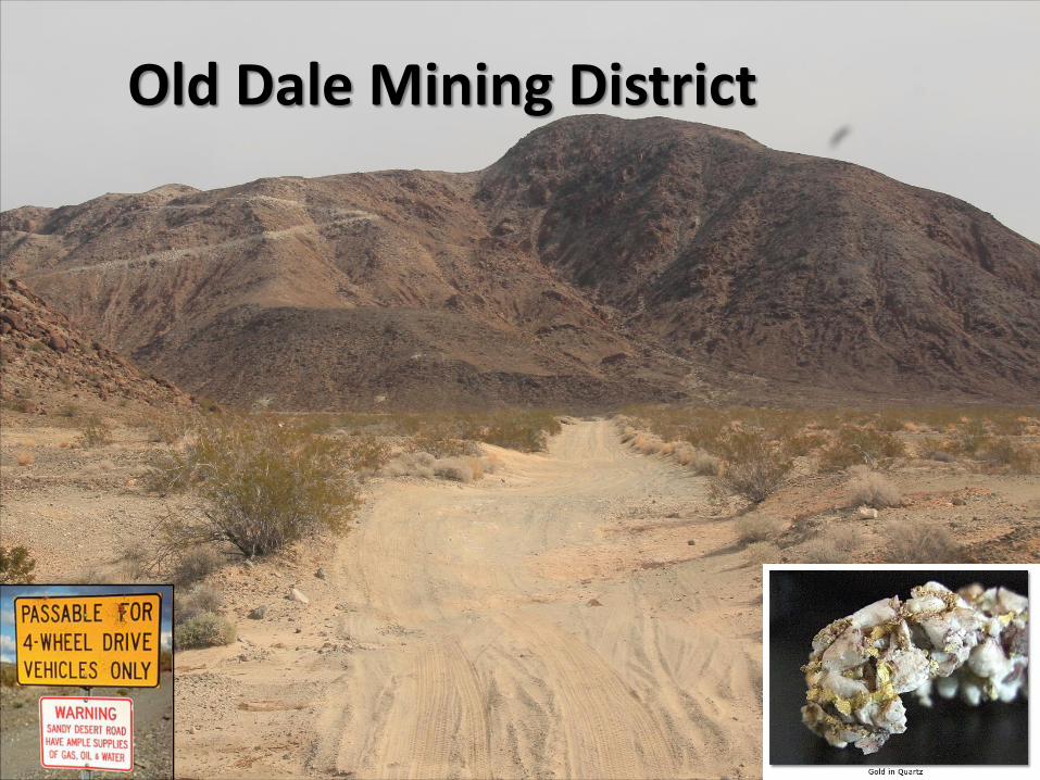
Joshua Tree Area Mining
DALE HIGHLIGHT

http://geomaps.wr.usgs.gov/archive/socal/geology/mojave_desert/yucca_valley.html
Joshua Tree Park
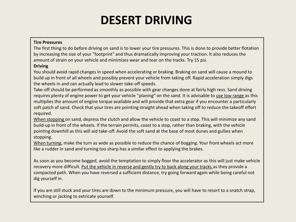
DESERT DRIVING
Tire PressuresThe first thing to do before driving on sand is to lower your tire pressures. This is done to provide better flotation by increasing the size of your "footprint" and thus dramatically improving your traction. It also reduces the amount of strain on your vehicle and minimizes wear and tear on the tracks. Try 15 psi.DrivingYou should avoid rapid changes in speed when accelerating or braking. Braking on sand will cause a mound to build up in front of all wheels and possibly prevent your vehicle from taking off. Rapid acceleration simply digs the wheels in and can actually lead to slower take-off speeds.Take-off should be performed as smoothly as possible with gear changes done at fairly high revs. Sand driving requires plenty of engine power to get your vehicle "planing" on the sand. It is advisable to use low range as this multiplies the amount of engine torque available and will provide that extra gear if you encounter a particularly soft patch of sand. Check that your tires are pointing straight ahead when taking off to reduce the takeoff effort required.When stopping on sand, depress the clutch and allow the vehicle to coast to a stop. This will minimize any sand build-up in front of the wheels. If the terrain permits, coast to a stop, rather than braking, with the vehicle pointing downhill as this will aid take-off. Avoid the soft sand at the base of most dunes and gullies when stopping.When turning, make the turn as wide as possible to reduce the chance of bogging. Your front wheels act more like a rudder in sand and turning too sharp has a similar effect to applying the brakes.
As soon as you become bogged, avoid the temptation to simply floor the accelerator as this will just make vehicle recovery more difficult. Put the vehicle in reverse and gently try to back along your tracks as they provide a compacted path. When you have reversed a sufficient distance, try going forward again while being careful not dig yourself in.
If you are still stuck and your tires are down to the minimum pressure, you will have to resort to a snatch strap, winching or jacking to extricate yourself.

DownhillStay Off The Brakes- When descending a steep slope, the natural reaction is to hit the brakes. Often times this causes the tires to lose traction and the vehicle to slide wherever gravity and fate take it. Gear Ratio – Use low range. If you don’t, your car will run away from you and it’ll get scary.Gear Selection – Use first gear. A combination of first gear and low range will keep you in control.Backout plan – If it gets too steep and scary then you’ll need to have a backout plan before you head down. Remember that getting out will probably mean reversing back up a steep hill.If you do start sliding, point the front tires downhill and accelerate to straighten the vehicle out.
UphillChose The Right Gear- The key to making it up (or down) excessively steep terrain is to pick the right gear. Too high of a gear and you risk stalling; too low of a gear and you might not have the speed to keep your vehicle moving. You want to have enough momentum to make it to the end of the climb without having to shift in the middle of the obstacle.
Survival1. RULE #1:Take at least 1 gallon of water per person per day. Take extra, you may be stuck alone for more than a day.2. Travel in a group of at least two vehicles in case of breakdown. If that isn’t possible, let someone reliable know where
you are going and when you will be back and stick to the plan. Cell coverage in many desert areas is non-existent.3. Respect the demands of the off-road and the desert. Take a suitable vehicle. If it says 4x4, don’t think your
passenger car is good enough.4. If you do break down, stay with your vehicle unless you have a clear line of sight to rescue. In summer temperatures
you may only last a mile or so walking. Seriously!5. Have food along. You can go without food for days but do you want to be stuck and hungry also?6. Take rescue gear, a tow cable, a spare, sand tracks, a shovel , a jack, and a sturdy board to go under the jack. Jacks
sink in soft soil and sand. Tools are good and so is extra motor oil.7. A hat, sturdy shoes or boots, suntan oil, gloves for scrambling or digging, and a first aid kit are advised.

Historic Photos: Old Dale Area
Cyanide Mill Dale City 1897Dale City 1897
Supply Mine 1927 General Store: New Dale 1913
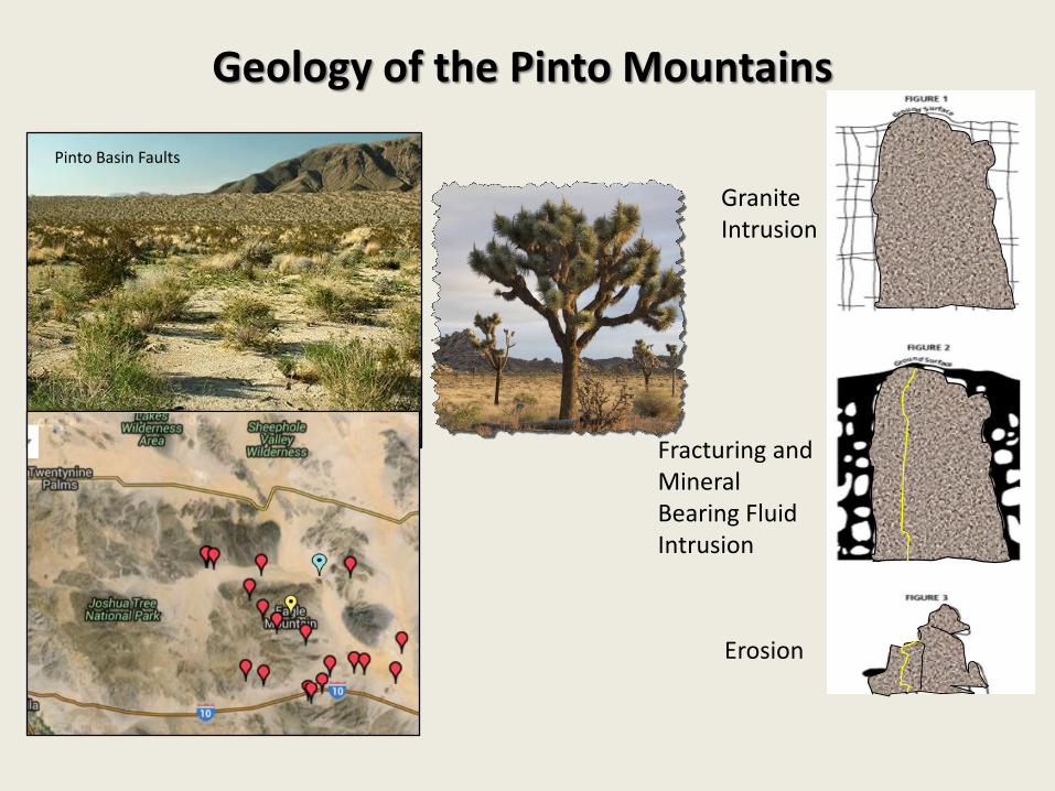
Geology of the Pinto Mountains
Pinto Basin Faults
Granite Intrusion
Fracturing and Mineral Bearing Fluid Intrusion
Erosion

Pinto Mountains Faults
Blue CutFault
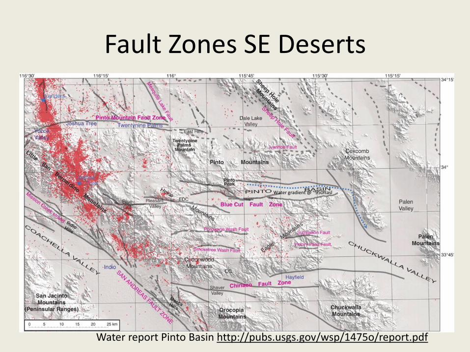
Fault Zones SE Deserts
Water gradient @ ~950ftasl
Water report Pinto Basin http://pubs.usgs.gov/wsp/1475o/report.pdf

Regional Pinto Mountains Map
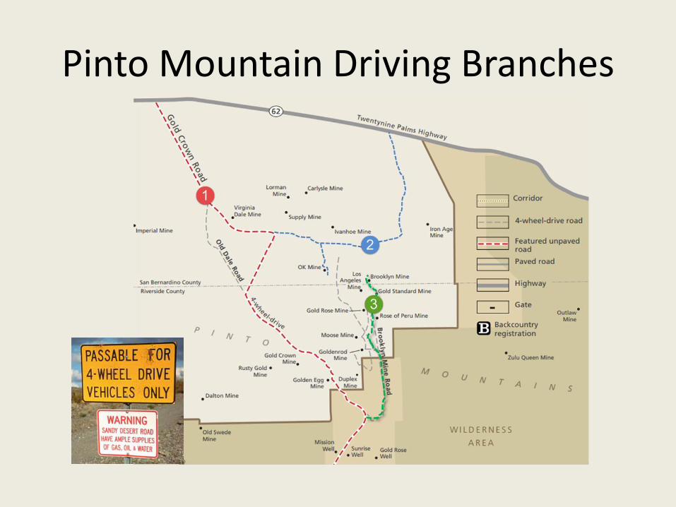
Pinto Mountain Driving Branches
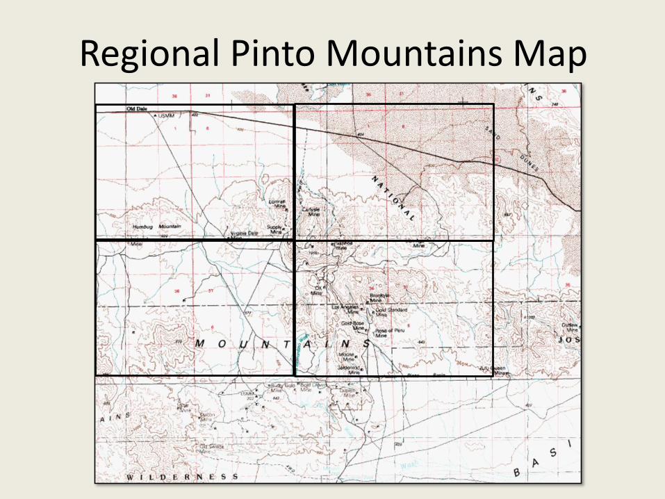
Regional Pinto Mountains Map
Golden Egg MineSunsetMine
Credits
Photos of mines were all taken by me In January 2016. Access, Items Of Interest and Dangers are my observations. Dangers are in no way complete as I didn’t visit every shaft, tunnel or adit, nor did I enter any mine as I was by myself. I did poke my nose into buildings and spent many hours scrambling and observing the rocks as I too am a geologist(retired) albeit of the petroleum kind. I met some interesting people in the greater Dale area and one cranky caretaker who warmed up after he found out I was photographing and not “mining”.
The Comments text is from a paper by Bob Dunkin who was a gold prospector in the Dale area of 29 Palms for most of his life, and as would be the case he had many, many stories to tell, which he did on Bill Southerns website “Nuggetshooter.com” under “Bob’s story Forum” He grew up in the Dale area and was a fixture there to a lot of people.
The old photos of Dale City(s) are from an article by James Wharff, in November 2013 Dezert Magazine 75.
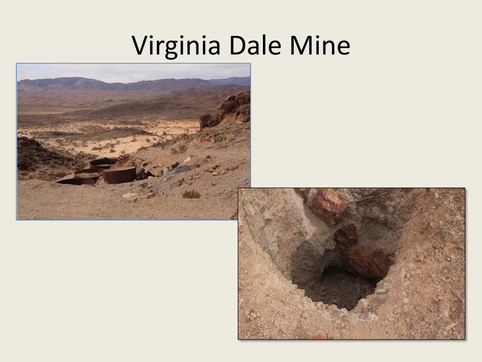
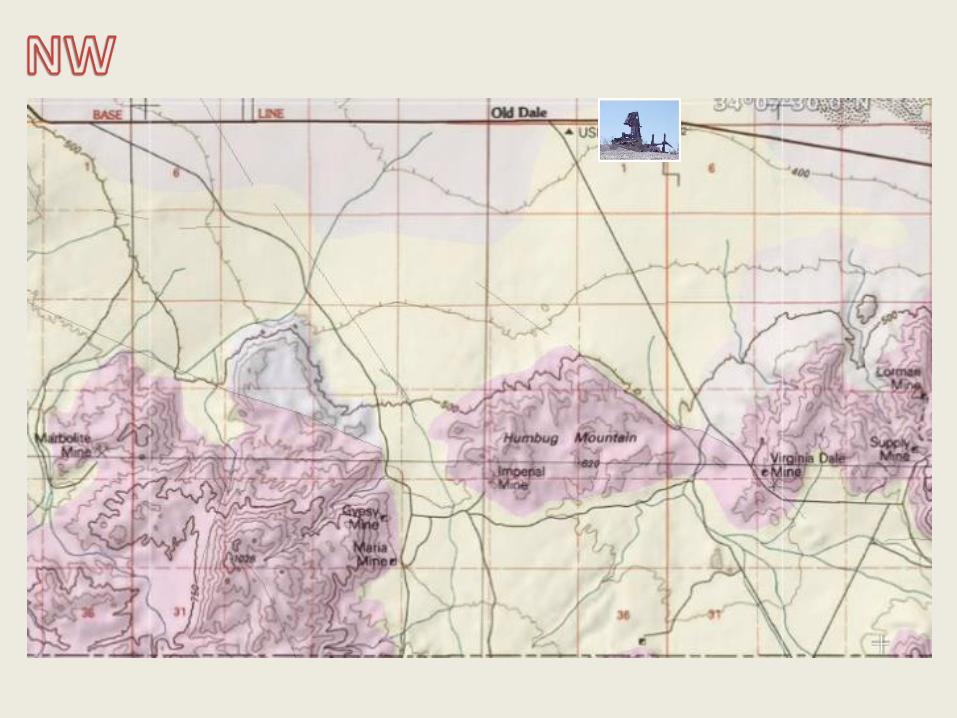
Virginia Dale Mine
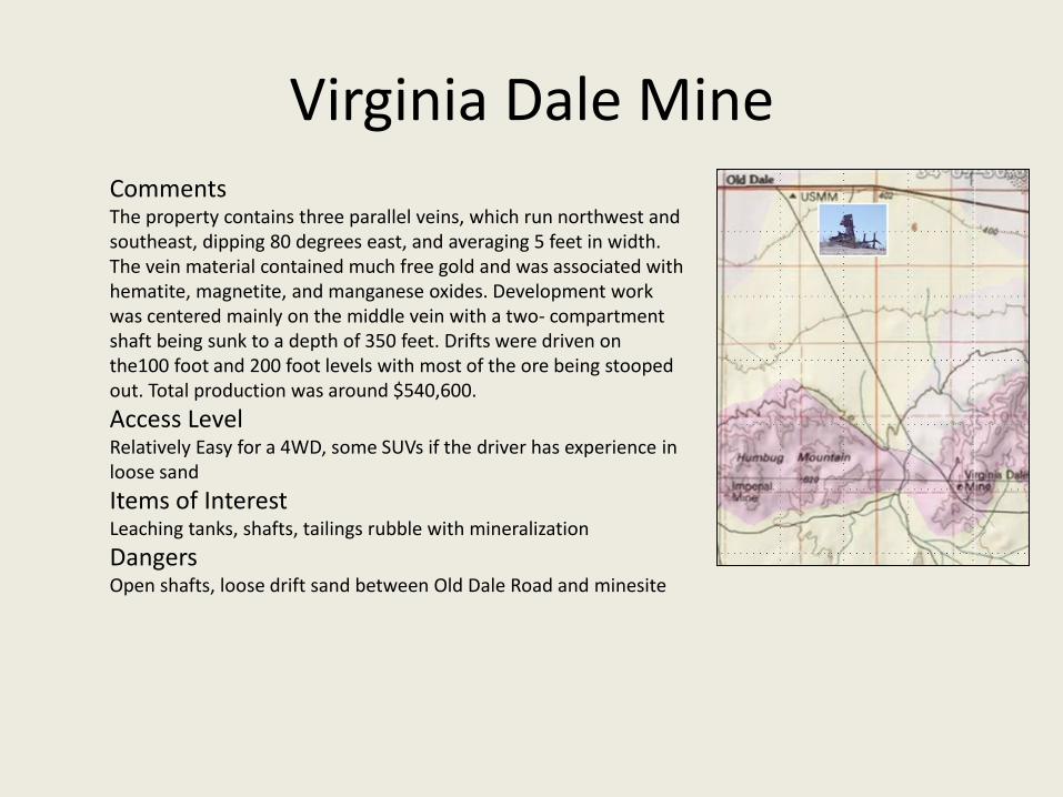
Virginia Dale MineCommentsThe property contains three parallel veins, which run northwest and southeast, dipping 80 degrees east, and averaging 5 feet in width. The vein material contained much free gold and was associated with hematite, magnetite, and manganese oxides. Development work was centered mainly on the middle vein with a two- compartment shaft being sunk to a depth of 350 feet. Drifts were driven on the100 foot and 200 foot levels with most of the ore being stooped out. Total production was around $540,600.
Access LevelRelatively Easy for a 4WD, some SUVs if the driver has experience in loose sand
Items of InterestLeaching tanks, shafts, tailings rubble with mineralization
DangersOpen shafts, loose drift sand between Old Dale Road and minesite

Lorman Mine

CommentsThe Gold Crown Mining Company operated Lorman mine.
Access LevelModerate, some rough spots
Items of InterestOld foundations, great view
DangersLast 1 mile up to Lorman mine is rough, but not too difficult.
Lorman Mine

Supply Mine
Open shaft!

CommentsThis property has two major veins, which run north and south, dip 85 degrees east, and average 8 feet in width. The main development was confined to the west vein and was developed by two shafts, The Supply and The Nightingale. The Supply shaft was sunk to a depth of 1250 feet with drifts run at intervals of 100 foot. Total underground drifting in this shaft was over 6500 feet. The Nightingale shaft was sunk to a depth of 2250 feet with over 8000 feet of drifting. Total production of this mine was about $2,141,165.
Access Driving LevelModerate but fairly steep No 2WD!. Needs fair clearance.
Items of InterestMany foundations of old mining buildings, large tailings area, awesome view of the Pinto basin. No actual buildings.
DangersThe road in (and UP) is quite steep and narrow with some rocks to cross. The side-slope on the road gets steep and high but most 4x4s should be okay. Be very careful walking on the trail above the open and deep shaft. If walking downslope, stay away from the slope above the shaft as the rock is loose and you will pick up speed heading for the open shaft! Also the rock around the shaft is collapsing inward and the shaft is deep and vertical.
Supply Mine

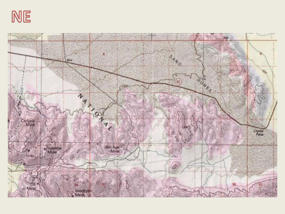
Ivanhoe Mine
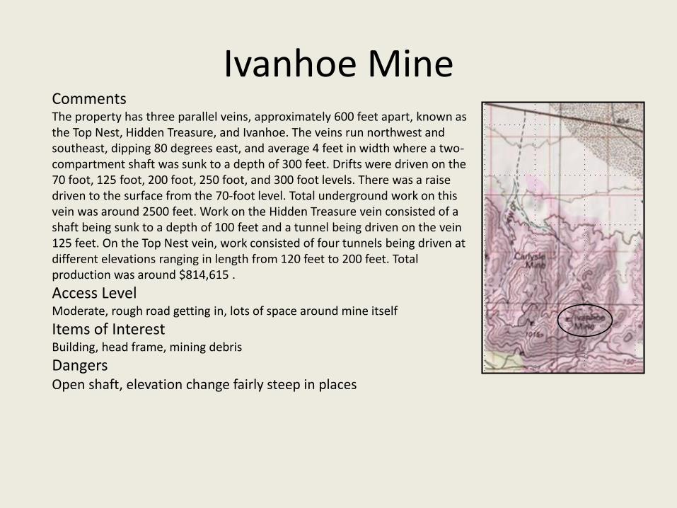
CommentsThe property has three parallel veins, approximately 600 feet apart, known as the Top Nest, Hidden Treasure, and Ivanhoe. The veins run northwest and southeast, dipping 80 degrees east, and average 4 feet in width where a two-compartment shaft was sunk to a depth of 300 feet. Drifts were driven on the 70 foot, 125 foot, 200 foot, 250 foot, and 300 foot levels. There was a raise driven to the surface from the 70-foot level. Total underground work on this vein was around 2500 feet. Work on the Hidden Treasure vein consisted of a shaft being sunk to a depth of 100 feet and a tunnel being driven on the vein 125 feet. On the Top Nest vein, work consisted of four tunnels being driven at different elevations ranging in length from 120 feet to 200 feet. Total production was around $814,615 .
Access LevelModerate, rough road getting in, lots of space around mine itself
Items of InterestBuilding, head frame, mining debris
DangersOpen shaft, elevation change fairly steep in places
Ivanhoe Mine
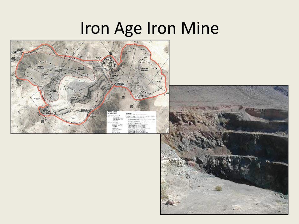
Iron Age Iron Mine
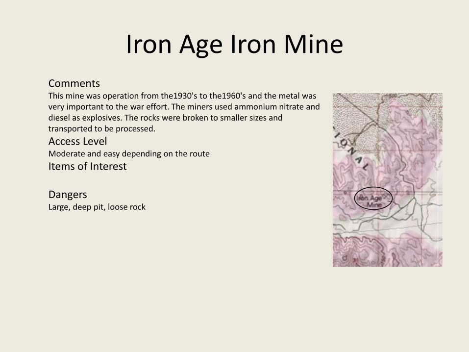
CommentsThis mine was operation from the1930's to the1960's and the metal was very important to the war effort. The miners used ammonium nitrate and diesel as explosives. The rocks were broken to smaller sizes and transported to be processed.
Access LevelModerate and easy depending on the route
Items of Interest
DangersLarge, deep pit, loose rock
Iron Age Iron Mine
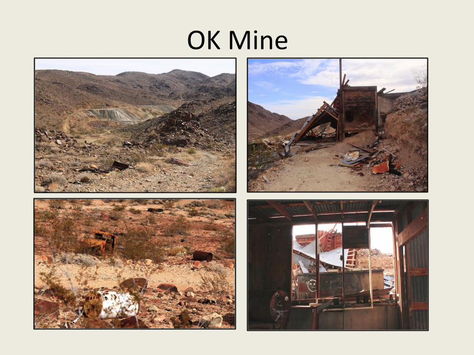
OK Mine

OK Mine
CommentsThe vein on this property runs north and south, dips 70 degrees west, and averages 6 feet in width. Development consisted of a two-compartment shaft sunk to a depth of 800 feet with drifts run at the following levels: 150 foot, 300 foot, 450 foot, 600 foot, and 750 foot. The total amount of underground drift work is estimated to be 1800 feet. The ore from this location was of higher grade than any of the other mines in the district. Total production was over $1,586,116
Access LevelModerate, rough road getting in, lots of space around mine itself
Items of InterestRuined wooden structures, some mine openings, some old metal including mine truck
DangersMuch wreckage, mining claims and posted No Trespassing although it is BLM land but rock picking is illegal.
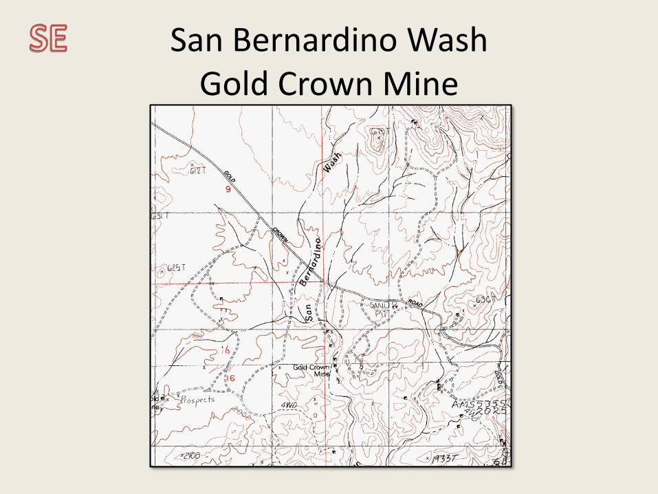
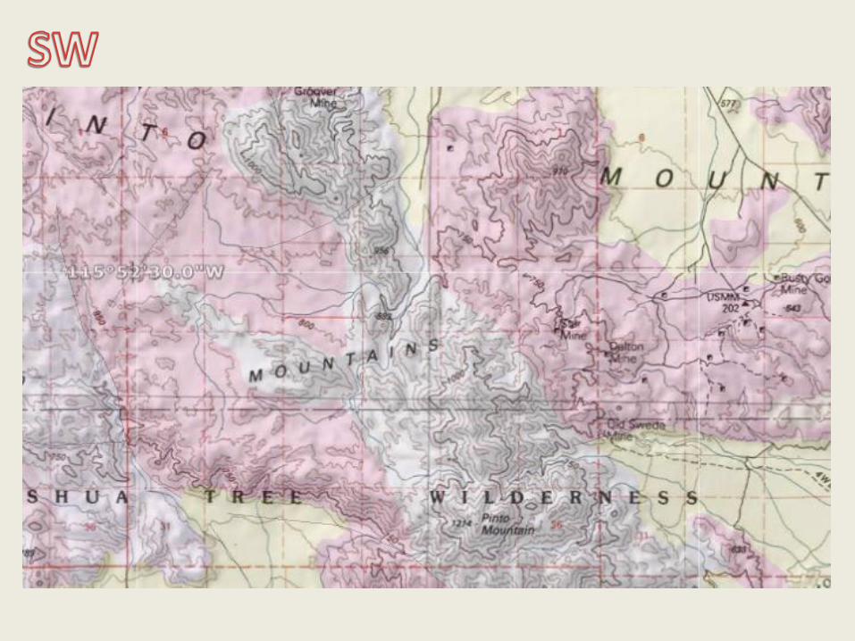
San Bernardino WashGold Crown Mine
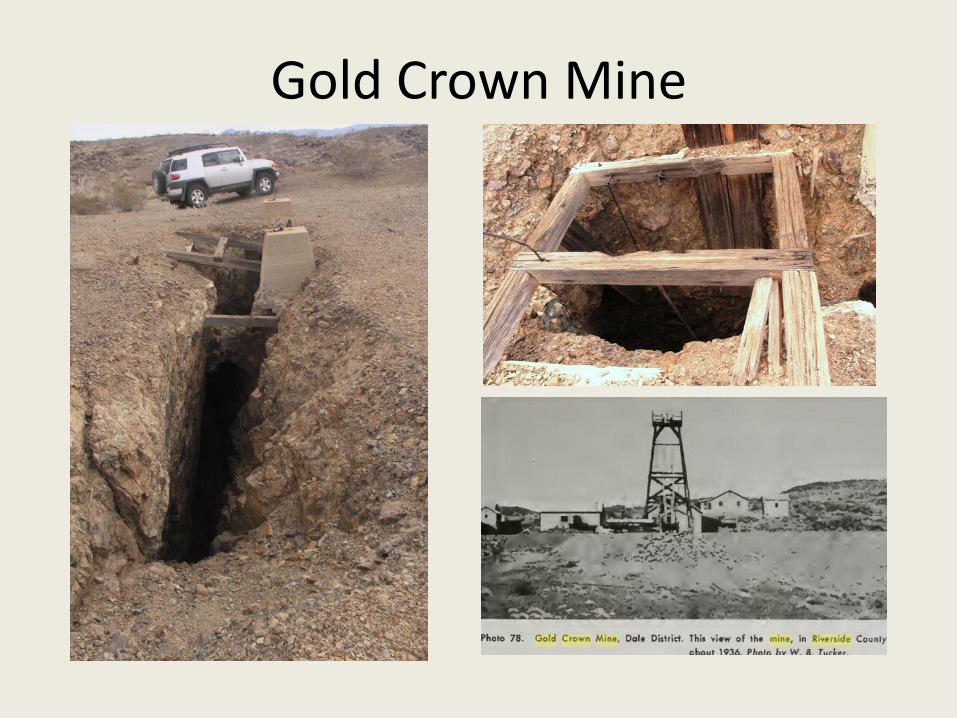
Gold Crown Mine
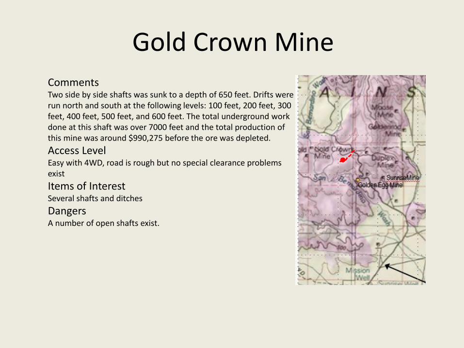
Gold Crown MineCommentsTwo side by side shafts was sunk to a depth of 650 feet. Drifts were run north and south at the following levels: 100 feet, 200 feet, 300 feet, 400 feet, 500 feet, and 600 feet. The total underground work done at this shaft was over 7000 feet and the total production of this mine was around $990,275 before the ore was depleted.
Access LevelEasy with 4WD, road is rough but no special clearance problems exist
Items of InterestSeveral shafts and ditches
DangersA number of open shafts exist.
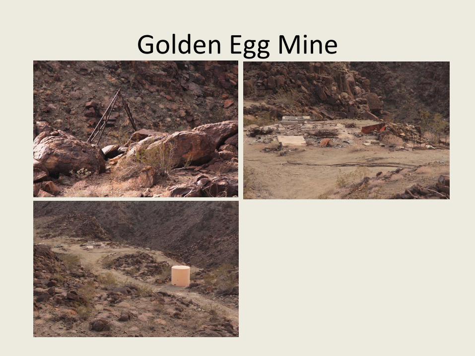
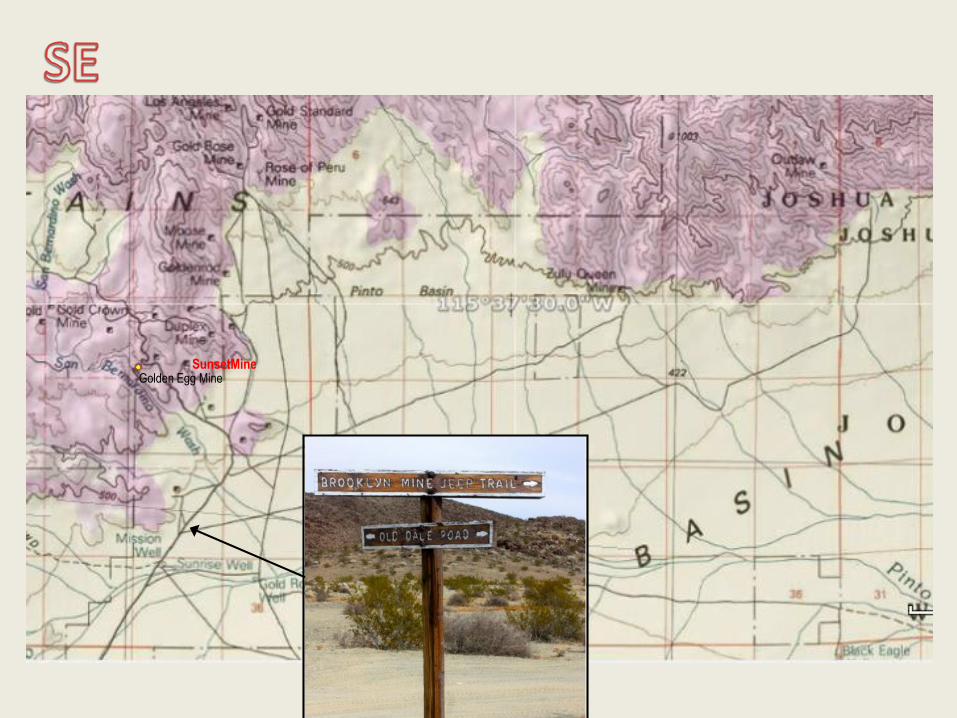
Golden Egg Mine

Comments
Access LevelOff the roughest area of the Old Dale Road, it is visible from the road but a switchback exit to the mine road is easy to miss. The road to the mine is smoother than the Old Dale Road that requires a fairly high clearance 4x4.
Items of InterestOld mine head, scraps of buildings and foundations,
DangersUneven walking, sharp scraps of steel, moderately difficult access
Golden Egg Mine
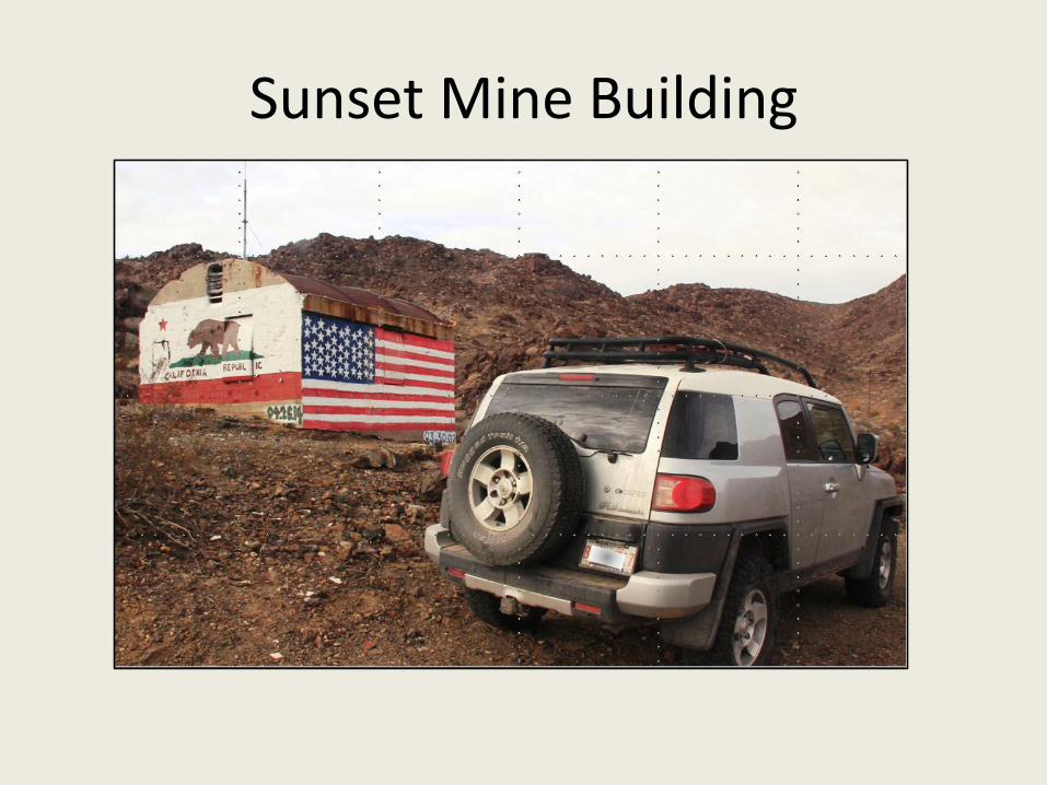
Sunset Mine Building

Comments
Access LevelDifficult part of Old Dale road requires a 4x4 with good clearance, road to mine is okay
Items of InterestAn interesting concrete building with some tasteful painting
DangersNone really except road in.
Sunset Mine Building

Duplex Mine
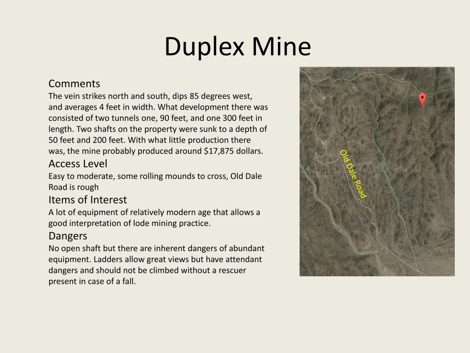
CommentsThe vein strikes north and south, dips 85 degrees west, and averages 4 feet in width. What development there was consisted of two tunnels one, 90 feet, and one 300 feet in length. Two shafts on the property were sunk to a depth of 50 feet and 200 feet. With what little production there was, the mine probably produced around $17,875 dollars.
Access LevelEasy to moderate, some rolling mounds to cross, Old Dale Road is rough
Items of InterestA lot of equipment of relatively modern age that allows a good interpretation of lode mining practice.
DangersNo open shaft but there are inherent dangers of abundant equipment. Ladders allow great views but have attendant dangers and should not be climbed without a rescuer present in case of a fall.
Duplex Mine

Brooklyn Mine Road Branch

Goldenrod Mine

Comments
Access LevelRelatively easy for a 4x4 with some soft sand sections and some washes to cross.
Items of Interest
DangersScrap, some shafts
Goldenrod Mine
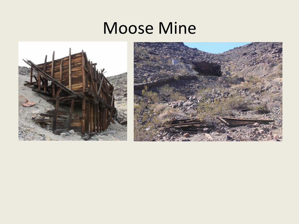
Moose Mine
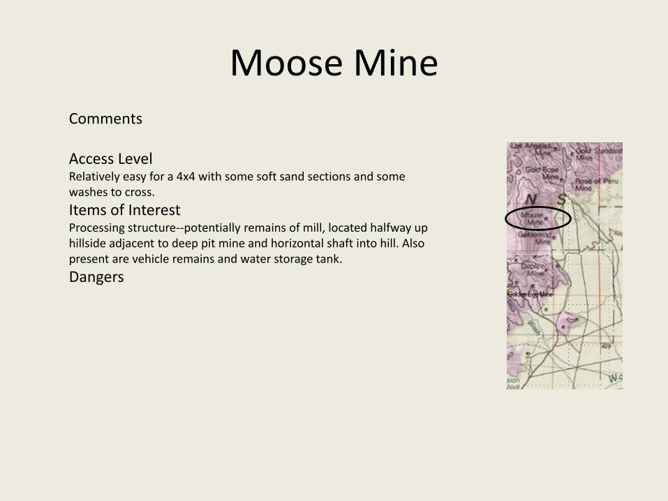
Comments
Access LevelRelatively easy for a 4x4 with some soft sand sections and some washes to cross.
Items of InterestProcessing structure--potentially remains of mill, located halfway up hillside adjacent to deep pit mine and horizontal shaft into hill. Also present are vehicle remains and water storage tank.
Dangers
Moose Mine

Gold Rose Mine

CommentsThere are four parallel veins on this property ranging in width from 3 feet to 6 feet. Development consisted of five shafts being sunk on different veins ranging in-depth of 100 feet to 250 feet. The number two-shaft and the number four-shaft are the deepest; both being sunk to a depth of 250 feet with drifts being driven on the 100 foot, 200 foot, and 250 foot levels. Total underground work on all shafts was 800 feet. Total production was about $95,920 .
Access LevelModerate sandy but one of the easier mines to access with a 4x4
Items of InterestConcrete building, patio and stone fire pit, a nice camping spot, watch the open shaft
DangersOpen shaft behind building
Gold Rose Mine

Rose of Peru Mine
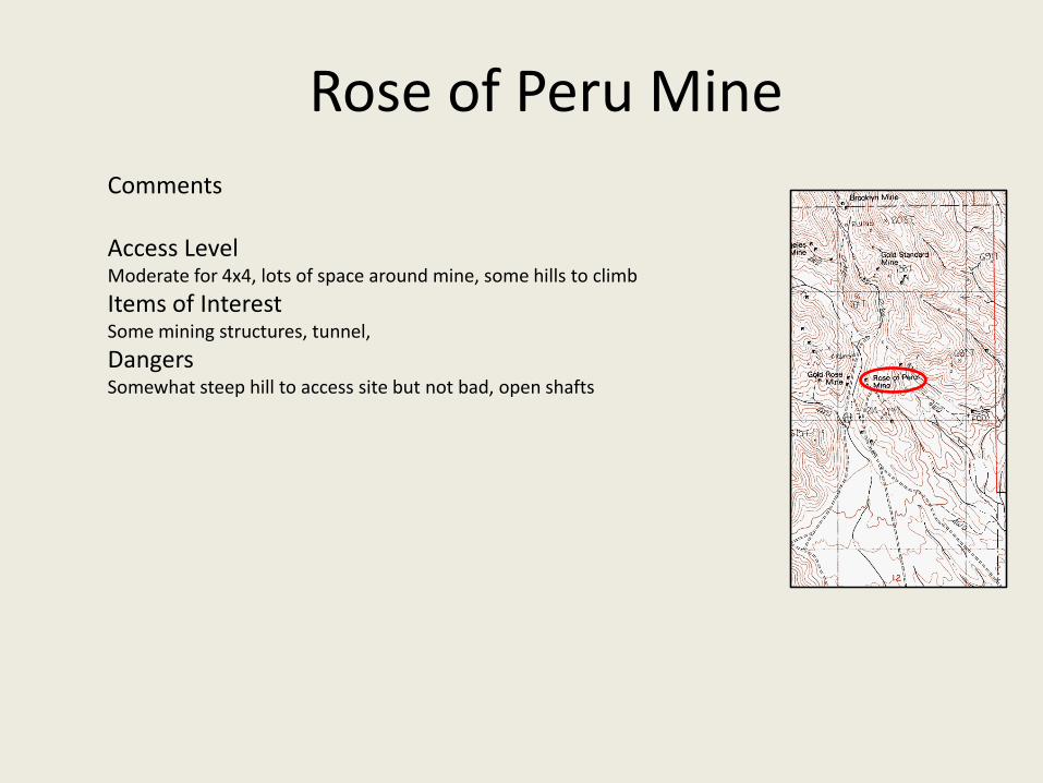
Comments
Access LevelModerate for 4x4, lots of space around mine, some hills to climb
Items of InterestSome mining structures, tunnel,
DangersSomewhat steep hill to access site but not bad, open shafts
Rose of Peru Mine

Gold Standard Mine

Los Angeles Mine
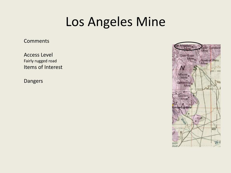
Comments
Access LevelFairly rugged road
Items of Interest
Dangers
Los Angeles Mine

Brooklyn Mine
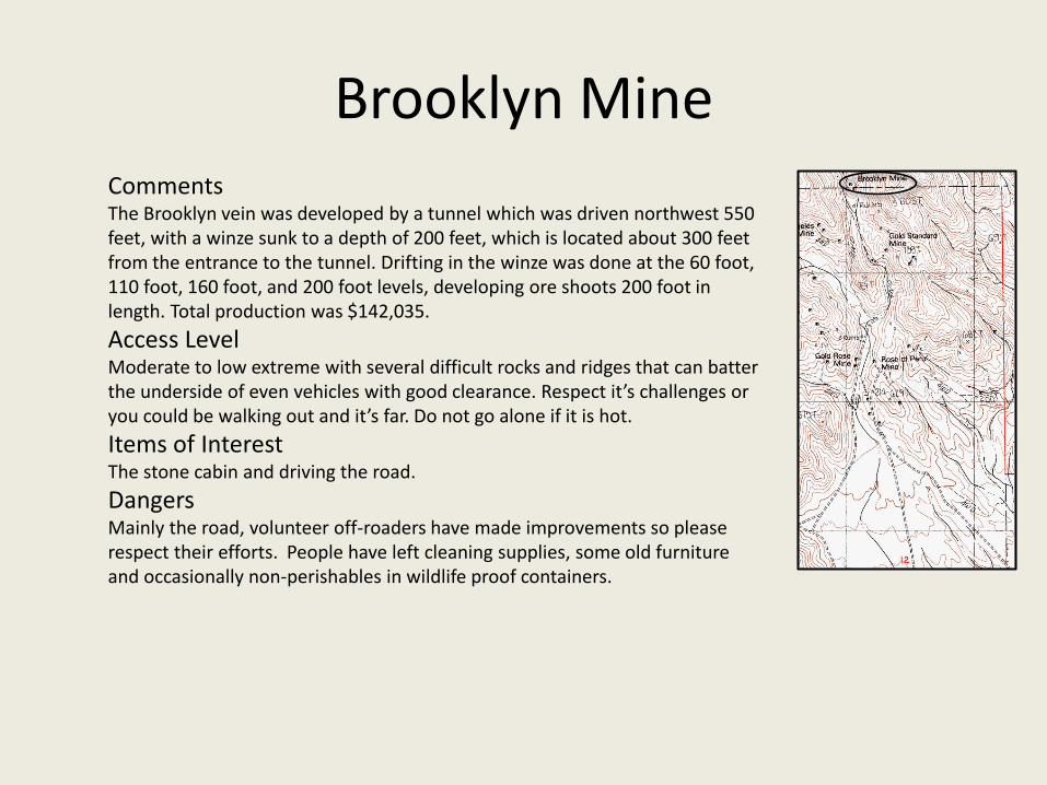
CommentsThe Brooklyn vein was developed by a tunnel which was driven northwest 550 feet, with a winze sunk to a depth of 200 feet, which is located about 300 feet from the entrance to the tunnel. Drifting in the winze was done at the 60 foot, 110 foot, 160 foot, and 200 foot levels, developing ore shoots 200 foot in length. Total production was $142,035.
Access LevelModerate to low extreme with several difficult rocks and ridges that can batter the underside of even vehicles with good clearance. Respect it’s challenges or you could be walking out and it’s far. Do not go alone if it is hot.
Items of InterestThe stone cabin and driving the road.
DangersMainly the road, volunteer off-roaders have made improvements so please respect their efforts. People have left cleaning supplies, some old furniture and occasionally non-perishables in wildlife proof containers.
Brooklyn Mine
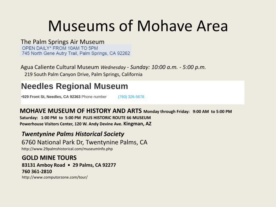
Museums of Mohave AreaThe Palm Springs Air Museum
Agua Caliente Cultural Museum Wednesday - Sunday: 10:00 a.m. - 5:00 p.m.219 South Palm Canyon Drive, Palm Springs, California
MOHAVE MUSEUM OF HISTORY AND ARTS Monday through Friday: 9:00 AM to 5:00 PM
Saturday: 1:00 PM to 5:00 PM PLUS HISTORIC ROUTE 66 MUSEUM
Powerhouse Visitors Center, 120 W. Andy Devine Ave. Kingman, AZ
Needles Regional Museum•929 Front St, Needles, CA 92363 Phone number (760) 326-5678
Twentynine Palms Historical Society6760 National Park Dr, Twentynine Palms, CAhttp://www.29palmshistorical.com/museumInfo.php
GOLD MINE TOURS 83131 Amboy Road • 29 Palms, CA 92277760 361-2810http://www.computorzone.com/tour/