
Official Northern 00 Nort Rich
454
Transcript of Official Northern 00 Nort Rich
7/27/2019 Official Northern 00 Nort Rich
http://slidepdf.com/reader/full/official-northern-00-nort-rich 1/453

7/27/2019 Official Northern 00 Nort Rich
http://slidepdf.com/reader/full/official-northern-00-nort-rich 2/453
From the collection of the
z " mPrelinger h
1 vJUibrary
t
San Francisco, California
2006
7/27/2019 Official Northern 00 Nort Rich
http://slidepdf.com/reader/full/official-northern-00-nort-rich 3/453
\

7/27/2019 Official Northern 00 Nort Rich
http://slidepdf.com/reader/full/official-northern-00-nort-rich 4/453
7/27/2019 Official Northern 00 Nort Rich
http://slidepdf.com/reader/full/official-northern-00-nort-rich 5/453
7/27/2019 Official Northern 00 Nort Rich
http://slidepdf.com/reader/full/official-northern-00-nort-rich 6/453
St. Paul, Minn.
A
MKVNKMKUIJY.I'lilVI'KlS-. HlM.KK- AMI KM; ItA V KKf
(II K Al it )
7/27/2019 Official Northern 00 Nort Rich
http://slidepdf.com/reader/full/official-northern-00-nort-rich 7/453
7/27/2019 Official Northern 00 Nort Rich
http://slidepdf.com/reader/full/official-northern-00-nort-rich 8/453
6 Contents.
PAGES'
Billings to Hunter's Springs 156-168
Livingston to Bozeman 170-175
Yellowstone National Park 172-174
A Big Barley Farm 177-178
The Three Forks of the Missouri 178-180
Helena 182-184
Across the Main Divide Garrison Hell Gate River
and Canyon 185189
Beaver Hill Missoula 190-194
Flathead Indian Reservation 195-198
Ravelli Paradise Valley and Horse Plains 198-201
Thompson's Falls On the Clark's Fork 201-206
IDAHO:
The State of Idaho 207-208
Cabinet Landing Lake Pend d'Oreille 208-211
Hope to Hauser Junction 211-214
WASHINGTON:
The Evergreen State 215-221
Spokane 221-223
Spokane Valley and Lake Coe.ir d'Alene 224
The Palouse Country 225-228
Cheney Sprague Pasco 228-231
West of the Columbia 231-234
Kennewick Prosser Zillah Sunnsyside Irrigated
Lands 284-236
The Yakima Basin North Yakima Yakima Canyon..236-239
The Kittitas Basin Ellensburg239-240
Roslyn The Great Stampede Tunnel Along Green
River 240-241
The Great Forests of Washington Felling a Giant Fir..244-252
Buckley Puyallup Valley.' '.252-254
Tacoma 254-260
Tacoma & Seattle Line 260-262
On Puget Sound 262-264
Seattle 264-267
Port Townsend 267
(Victoria, B. C.) 267-268
7/27/2019 Official Northern 00 Nort Rich
http://slidepdf.com/reader/full/official-northern-00-nort-rich 9/453
Contents. 7
PAGES.
Everett Anacortes Fairhaven New Whatcom 268-270
From Tacoma to Portland 270-272
Olympia Ceutralia Chehalis Kalama 272-275
Tenioo Bucoda 275-27.b
ORBGON:
Portland 276-284
River Excursions from Portland . . 284-290
BRANCH LINES.
WISCONSIN. Lake Superior Division:
Ashland. 291-292
Superior 294-300
MINNESOTA:
Duluth 300-303
Carlton Aitkin -Deerwood 304-305
Brainerd 305-307
Gull River to Staples 308
Little Falls and Dakota Branch:
Little Falls 51-52
S.uik Centre Glenwood Morris .309-311
Little Falls to Brainerd:
Belle Prairie Fort Ripley 311
Northern Pacific, Fergus Falls and Black Hills Branch:
Henning Clitherall Battle Lake 312-315
Fergus Falls Breckinridge. 315-317
NORTH DAKOTA:
Wahpeton Alilnor 317
MINNESOTA. The Manitoba Division:
Summary 318
Winnipeg Junction 61
Fertile Red Lake Falls Crookston East Grand
Forks 819-321
Red Lake Reservation ., ..320-321

7/27/2019 Official Northern 00 Nort Rich
http://slidepdf.com/reader/full/official-northern-00-nort-rich 10/453
g Contents.
NORTH DAKOTA: PAGER.
Grand Forks Grafton Drayton Pembina 832-325
MANITOBA:
WestLynne
Morris 325
Brandon 326-327
Winnipeg PorUge la Prairie 327-330
NORTH DAKOTA. Fargo and Southwestern Branch:
Fargo 77-79
Sheldon Lisbon LaMoure Edgeley 331-333
Sanborn, Cooperstown and Turtle Mountain Bncncli:
Cooperstowu 334-335
James River Valley Railroad:
Jamestown 89-90
Grand Ripids Glover Oakes 336-338
La Moure 332-333
Jamestown and Northern Railroad:
Carrington Sykeston New Rcckford 339-341
Fort Totten Minnewaukan Devil's Lake Leeds. .341-342
MONTANA: Rocky Fork & Cooke City R. R.
Liurel(l63) Red Lodge. 343-344
Rocky Mountain Railroad of Montana Yellowstone Park
Line:
Living^ >n (170-172) Horr Cinnabar 346
Northern Pacific & Montana Bianch:
Bozem;in Logan 175-178
Butte City 347-358
An iconda Deer Lodge 358-360
Helena & Jefftrton County and Helena, Moulder Valley
& Btitte Railroad*;
Heleaa (182-18 >) Boulder Elkhorn Wickes 361-362
Helena & Red Mountain and Helena & Northern Rail
roads:
Rimini Marysville 363
Drummond & Pli'li^lurg Railroad:
Drummond (133) Phtllipsburg Granite Mountain
. 364-365
7/27/2019 Official Northern 00 Nort Rich
http://slidepdf.com/reader/full/official-northern-00-nort-rich 11/453
Contents. 9
Bitter Boot Valley Railroad: PAGES*
Missoula (191-194) Stevensville (Tyler) Victor
Grantsdale 366-367
DeSmet & Caur d'Alene Branch.
Missoula DtSmet (191-194) 368
IDAHO:
Mullan Wallac3 Murray Wardner Mission
Coaur d'Alene City 368-371
WASHINGTON. Spokane & Palouse Railroad:
Spokane (221-223) Spangle Oakesdale Farmington
Garfleld Palouse City Pullman 372-373-
IDAHO:
Moscow The Potlatch Country The Genesee Coun
try Lewiston 373-375
WASHINGTON South of Snake River:
Whitman Walla Walla Waitsburg Dayton
Pomeroy 376-379
OREGON:Athena Pendleton The Snake River 379-381
WASHINGTON. Central Washington Railroad:
Spokane (221) Medical Lake Davenport Wilbur-
Coulee City 383-385
N. P. & Cascade Branch Crocker (main line) DoutyBurnett Wilkeson and Carbonado 387
United Railroadsof Washington:Tacoma (254) Elma Montesano Cosmopolis
Aberdeen Hoquaim Ocosta Westport Chehalis
Willapa City South Bend 388-390
Seattle, Lake Shore & Eastern Railway.
Seattle (264) Snoqualmie Falls SnohomishSumas 391-397
BRITISH COLUMBIA:
New Westminster Vancouver 898-400
A TRIP TO ALASKA. . . x . . ..401-442
7/27/2019 Official Northern 00 Nort Rich
http://slidepdf.com/reader/full/official-northern-00-nort-rich 12/453
ILLUSTRATIONS.
PAGE.
The"Dacotahs'
"Farewell to the Buffalo Frontispiece.
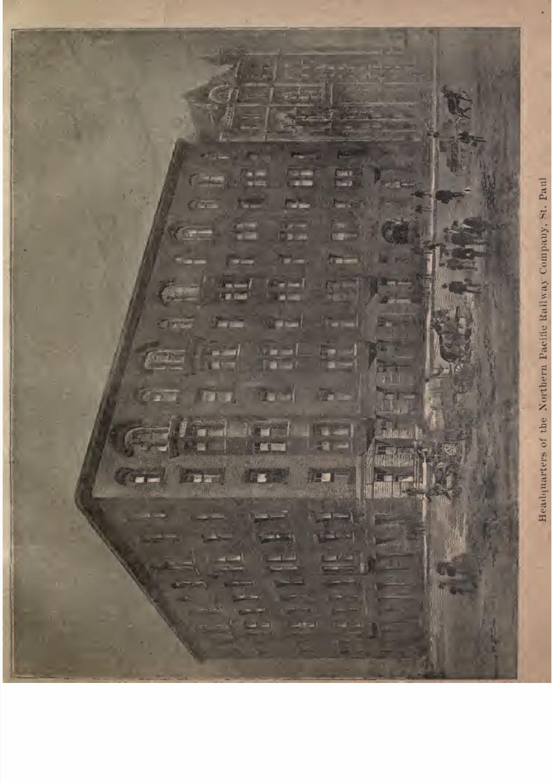
Headquarters Northern Pacific Railroad, St. Paul 19
Lumbering in the Minnesota Pineries 24
A View in St. Paul 29
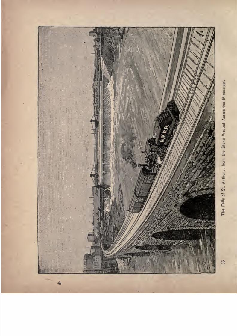
The Falls of St. Anthony, from the Stone Viaduct across the
Mississippi
36
Detroit Like, Minnesota 47
Threshing No. 1 Hard Wheat 63
Plowing on a Bonanza Farm 72
Seeding on a Bonanza Farm 76
Harrowing on a Bonanza Farm 80
Harvesting on a Bonanza Farm 84
The Northern Pacific Railroad Bridge over the Missouri River. 97
Indian Camp, on the Line of the Northern Pacific Railroad 104
Buffalo Hunting in Early Days 108
Pyramid Park Scenery 112
Buttes in Pyramid Park 116
Driving Cattle from the Range to the Railroad 120
Eagle Butte, near Glendive, Montana 128
Current Ferry over the Yellowstone 147
Big Horn River, Bridge and Tunnel 150
Pompey's Pillar, Yellowstone Valley 153
Valley of the Yellowstone above Billings158
Trout Fishing on the Big Boulder 164
Yellowstone River and Crazy Mountains 166
Gate of the Mountains, near Livingston 171
Three Forks of the Missouri Gallatin, Madison and Jefferson. 178
The Gate of the Rocky Mountains, Missouri River, near Helena 183
Beaver Hill, Hell Gate Canon, near Missoula 192
Mission Mountains, Flathead Country 196
Thompson's Falls, Clark's Fork of the Columbia 200
Along the Clark's Fork 203
(10)
7/27/2019 Official Northern 00 Nort Rich
http://slidepdf.com/reader/full/official-northern-00-nort-rich 13/453
Illustrations. 11
PAGE.
Cabinet Gorge, on Clark's Fork , 204
Skirting the Clark's Fork'
209
Lake Pend d'Oreille 210
Lake Coeur d'Alene 213
Distant View of Mount Tacoma 218
Northern Pacific Railroad Bridge over the Columbia River at
Pasco 230
Pictured Rocks on the Nachess River 233
In the Yakima Canyon 238
Eastern Slopes of Cascade Mountain, near the Stampede Tunnel 242
Western Portal of Stamped* Tunnel 243
Lake Kichelos, near Summit of Cascade Range 245
A Glimpse of Green River 248
Three Bridges and Tunnel of Green River 251
Hop Picking in the Puyallup Valley 253
Loading Vessels at Tacoma 255
Mt. Tacoma from Commencement Bay 257
Glaciers of Mt. Tacoma 259
261
Mt. Tacoma in August 263Snoqualmie Falls 265
Castle Rock 269
Leaping Salmon at the Dalles*
271
Cape Horn 277
Cascades of the Columbia 281
Multnomah Falls 283
Pillars of Hercules and Rooster Rock 285
Mt. Hood287On Docks at Ashland, Wis 298
Coal Docks at Superior 295
Birdseye View, Duluth and Superior 297
Lower James River Valley 337
Palisades of the Yellowstone 345
Silver Mine and Mill at Butte 351
Medical Lake 392
Lake Chelan 335
Greek Church, Alaska'
401
Sitka 402
7/27/2019 Official Northern 00 Nort Rich
http://slidepdf.com/reader/full/official-northern-00-nort-rich 14/453
12 Illustrations.
PAGE.
Thlinket War Canoe 407
The Thousand Islands. . .. 411
Fort Wrangell. . , 41&
Muir Glacier 421
Grave and Totem Poles 427
Juneau 432
An Alaska Steamer . . 488
7/27/2019 Official Northern 00 Nort Rich
http://slidepdf.com/reader/full/official-northern-00-nort-rich 15/453
INTRODUCTION.
Outline of the Northern Pacific Railroad's History.
HE charter and organization of the Northern
Pacific Railroad Company date from 1864; but
the project to build the railroad over substan
tially the same route now traversed by the com
pany's main line is much older. Indeed, it is the
oldest of all projects to open railway communication with
the Pacific coast. A railroad from the upper Mississippi
to the mouth of the Columbia river was advocated as long
ago as 1835, soon after the railway system was introduced
in this country. About ten years later, an enterprising
New York merchant, named Asa Whitney, who had made
a fortune in China, urged upon Congress, session after
session, a plan for building a railroad from the head of
Lake Michigan, or from Prairie du Chien, on the Missis
sippi river, to the mouth of the Columbia river, in Oregon.He asked a land grant of sixty miles in width along the
whole line of his proposed route. Many State legislatures
passed resolutions in favor of Whitney's project, and Con
gress gave it much serious consideration. At one time
Whitney's bill was within one vote of passing the Senate.
(13)
7/27/2019 Official Northern 00 Nort Rich
http://slidepdf.com/reader/full/official-northern-00-nort-rich 16/453
14 The Northern Pacific Railroad.
After the Mexican war came the annexation of Califor
nia, followed by the gold discoveries and the rapid growth
of population in that State. Then the general opinion in
Congress and the country naturally favored the building
of the first transcontinental line of railroad on a route end
ing at the Bay of San Francisco. Accordingly, the Union
and Central Pacific Companies were chartered in 1862,
with a grant of public lands and a large subsidy of gov
ernment bonds. Among the projectors of a line to Cali
fornia, was Josiah Perham,of Maine, then living in Boston,
who had a charter from the State of Maine for the People's
Pacific Railroad Company, and who, in vain, attempted to
get Congress to adopt his company, and give it the grants
subsequently given to the Union and Central companies.
Failing in this effort, Mr. Perham turned to the northern
road, which had been long and ably advocated as the best
line to the Pacific coast
bythe eminent
engineer,Edward
F. Johnson, and by Governor Stevens, of Washington Ter
ritory, who had been in command of the Government
expedition that surveyed the northern line of 1853.
Stevens' surveys had shown the northern road was not only
feasible, but was a better line in respect to grades and in
regard to the character of the country traversed than anyother.
In 1864, Congress passed a bill chartering the Northern
Pacific Railroad Company, and naming as incorporators,
among others, the men concerned with Perham in the old
abortive People's Pacific Company. Under this charter,
the company was organized in Boston, with Mr. Perham
as president, and an attempt was made to raise money for
the construction ofthe road by a popular subscription
to
shares of stock at $100 each. This attempt was an abso
lute failure, and after a year's futile effort Mr. Perham
7/27/2019 Official Northern 00 Nort Rich
http://slidepdf.com/reader/full/official-northern-00-nort-rich 17/453
Introduction . 1 5
and his associates turned over the charter of the company
to an organization of New England capitalists and railroad
men, who proposed to make the road tributary to Boston.
Theyelected
J. Gregory Smith,of the Vermont Central
Railroad, president of the Northern Pacific Company.Smith and his associates tried in vain for several years to
obtain legislation from Congress guaranteeing the interest
on the company's stock. The original charter did not
allow the issue of bonds. Attempts in this direction were
abandoned in 1869, and amendments to the charter were
procured allowing the companyto
mortgageits
road andland grant. A contract was then made with the banking
house of Jay Cooke & Co., of Philadelphia, to sell the
company's bonds. Mr. Cooke had negotiated the great
war loans of the government, and was regarded as the
most successful financier of the country. In the short
period of about two years, his firm disposed of over thirty
millions of dollars of Northern Pacific bonds, bearinginterest at 7^ per cent. With the money thus obtained,
the work of construction was begun in the spring of 1870 ;
and by the fall of 1873 the road had been completed from
Duluth, at the head of Lake Superior, to Bismarck, on the
Missouri river, and from Kalama, on the Columbia river,
in Washington Territory, to Tacoma, on Puget Sound, the
total number of miles completed being about 600.
The great financial panic of 1873 prostrated the house
of Jay Cooke & Co., wholly stopped the sale of Northern
Pacific bonds, and made it impossible to go on with the
road. The company was insolvent, and, after a time, its
directors threw it into bankruptcy, and, with the cordial
assent of the bondholders, reorganized its 'affairs so as to
free it from debt, by converting its outstanding bonds into
preferred stock. When the effects of the panic and the
7/27/2019 Official Northern 00 Nort Rich
http://slidepdf.com/reader/full/official-northern-00-nort-rich 18/453
10 The Northern Pacific Railroad.
succeeding hard times had begun to pass by, the managers
of the Northern Pacific recommenced the work of building
its long lines across the continent. Its construction began
with the Cascade branch, from Tacoma to the newly dis
covered coal fields at the base of the Cascade mountains.
Then a loan was negotiated for building the Missouri
division, from the Missouri to the Yellowstone river; and
shortly afterward another loan f<3r the construction of
the Pend d'Oreille division, from the mouth of the Colum
bia river to Lake Pend d'Oreille, in Idaho. In the mean
time, several changes had occurred in the presidency of
the road. President Smith had been succeeded, in 1874,
by General Cass, and he by Charles B, Wright, of Phila
delphia. Mr. Wright's resignation, in 1879, was followed
by the election of Frederick Billings, under whose management the work of construction was carried on until 1881.
A general first mortgage loan was negotiated to provide
the means for completing and equipping the entire line.
The credit of the company had by this time become so
good that its bonds were readily sold above par by a syn
dicate of the leading bankers of New York City.
In 1881, Henry Villard, who had previously obtained
control of all the transportation lines, both rail, sea and
river, in Oregon and Washington, purchased forhimself and
friends a controlling interest in the srock of the NorthernPacific Company, and was elected its president. His
purpose was to ally to the Continental Trunk Line, as
feeders and extensions, the lines then under his management on the Pacific coast. Under the management of
President Villard and Vice President Thomas F. Oakes, the
work on both ends of the Northern Pacific was prosecuted
with great vigor during the years 1881, 1882 1883, until
the ends of track, advancing from both sides of the conti-
7/27/2019 Official Northern 00 Nort Rich
http://slidepdf.com/reader/full/official-northern-00-nort-rich 19/453
Introduction . 1 7
nent, met near the summit of the Rocky mountains.
The last rail on the Northern Pacific railroad was laid
with impressive ceremonies on September 23d, 1883, at a
point in the valley of the Hellgate river, near the mouthof Gold creek. Four trains of invited guests came over
the road from the East, and one train from the Pacific
coast. Among the distinguished guests were a number
of members of the English and German parliaments, all
the British and American ambassadors- at Washington, and
members of the American Congress, General U. S. Grant,
the governors of all the States and Territories traversed bythe line, and the former presidents of the Northern Pacific
company; also a number of distinguished engineers and
scientists from both sides of the Atlantic, and many rep
resentatives of leading newspapers in America and
Europe. An oration was delivered by Hon. W. M. Evarts.
The last spike was driven by Henry Villard, then presi
dent of the company, and the road was immediately
opened for traffic.
In 1884, Villard was succeeded in the presidency byRobert Harris, long a director i-n the company. Under
his presidency the Northern Pacific built its line up the
Yakima valley from Pasco to the junction of the Colum
bia and Snake rivers, over the Cascade mountains to
Puget Sound. It had already built from Tacoma to Port
land, and the new road now had a line of its own to those
cities independent of its former connection with the
Oregon Railway Navigation company, running-down the
Columbia river, which had passed by lease into the hands
of the Union Pacific. The new road was opened to travel
in 1887, using a high grade switch line across the Stam
pede pass of the Cascade mountains, pending the completion of the great tunnel, which was finished in i8SS. In
7/27/2019 Official Northern 00 Nort Rich
http://slidepdf.com/reader/full/official-northern-00-nort-rich 20/453
18 The Northern Pacific Railroad.
that year, Thomas F. Oakes, the vice-president of the
company since 1880 and its general manager at Saint
Paul since1884,
was electedpresident.
Under hispresi
dency numerous additional branches were built in Dakota,
Manitoba, Montana, Idaho and Washington.
The Northern Pacific, which was predicted as a single
line from Lake Superior to Portland, Oregon, a distance
of a little over 2,000 miles, has now grown into a vast sys
tem of main line and branches, aggregating in length
nearly 5,000 miles.
7/27/2019 Official Northern 00 Nort Rich
http://slidepdf.com/reader/full/official-northern-00-nort-rich 21/453
7/27/2019 Official Northern 00 Nort Rich
http://slidepdf.com/reader/full/official-northern-00-nort-rich 22/453
FROM ST. PAUL TO THE PACIFIC
COAST.
MINNESOTA.
The tourist leaving St. Paul for the
Pacific coast travels through the State of Minnesota for the first 250 miles of the journey, and will naturally
wish to have some condensed information concerning this
great commonwealth. In its natural features, Minnesota
possesses many elements of special beauty. It has within its
borders over 7,000 lakes all well stocked with such excellent
food fish as the black bass, perch, pickerel, pike and mus-
kalonge. These lakes form beautiful features in the
scenery and are favorite summer resorts for pleasure seek
ers and sportsmen. The State has a shore line of over 100
miles on Lake Superior, the largest body of fresh water in
the world. It is traversed for the greater part of its length
by the Mississippi river, which rises in Lake Itaska in the
heart of the great forest in the northern part of the State,
and is fed by a multitude of lakes and small streams. Onthe plateau, where the Mississippi rises, the Red river of
the North and the Rainy river have also their sources,
their waters flowing northward to Hudson bay, and the St.
Louis river starts in the same region and runs into the
head of Lake Superior.
In its industrial life, Minnesota possesses many features
of special interest. It produces annually more wheat than
any other State in the Union. It makes more flour at its
20
7/27/2019 Official Northern 00 Nort Rich
http://slidepdf.com/reader/full/official-northern-00-nort-rich 23/453
From St. Paul to the Pacific Coast. 21
great milling city of Minneapolis than is made at anyother place in the entire world. It ships more wheat over
its
greatfresh water
portat Duluth than
goes directlyfrom
the wheat fields to any other place in the world. Minne
sota is also one of the very great lumber producing States
of the Union, sending out annually from its pine forests
about 1,500,000,000 feet of lumber. It has become in
recent years one of the great iron mining States and was
surpassed in this respect in 1890 by only two other States.
With the opening of its new Mesaba mines it will soonlead them all. Its population is about 1,500,000 and is
pretty evenly divided between people of American birth
and ancestors, emigrants of foreign birth and their chil
dren. The strongest foreign elements come from the
Scandinavian countries Sweden, Norway and Denmark.
Next in relative numbers come the Germans, Canadians
and Irish, while there are considerable contingents from
Poland, Finland, Bohemia and other countries.
The State of Minnesota lies between Wisconsin on the
east and North Dakota and South Dakota on the west,
stretching from Iowa on the south to the Canadian prov
ince of Manitoba on the north. It extends through five
and one-half degrees of latitude, the 49th parallel being
its boundary from the Red river of the North eastward to
the Lake of the Woods, from which the line of demarka-
tion between the State and the British possessions follows
the course of Rainy Lake river and the chain of lakes
eastward, beyond the western point of Lake Superior. Its
western boundary is regular, its eastern very irregular.
Its average breadth is about 250 miles, and its length 381.
Its area, according to the Government surveys, is 83,531
square miles, or 53,459,840 acres. More ihan~3,000,000
acres of this is water surface, the State being especially
7/27/2019 Official Northern 00 Nort Rich
http://slidepdf.com/reader/full/official-northern-00-nort-rich 24/453
22 The Northern Pacific Railroad.
noted for the number as well as the beauty of its inland
lakes. Only 42,477,682 acres of its surface has been
surveyed.The most of the
unsurveyed portion lies in thenorthern and northeastern counties, which are largely
timber and mineral lands. Its area exceeds that of all
the New England States together, and is nearly as great as
that of Ohio and Pennsylvania combined. The general
elevation of the State above sea level is high. There are
no mountains, properly so called, within its boundaries.
As a rule the surfaceis
pleasantly varied, while thereare within the State sufficient elevations of a considerable
height to redeem it from monotony, and give ample drain
age. The highest point, so far as ascertained, is about
2,200 feet above sea level.
The climate of Minnesota possesses those characteristics
which are peculiar to the northern belt of the temperate
zone at a considerable distance from the seaboard. Therange of the thermometer is great in all seasons, fre
quently exceeding 50 during the winter and spring
months, and showing variations of 40 in the summer sea
son. For six years the mean winter temperature, as given
by the United States Signal service at St. Paul, was 18
45' in winter, 45 50' in spring, 70 49' in summer, and 44
14' in autumn, and this included two remarkably cold
seasons. The bright sunshine of summer forces vegeta
tion with great rapidity and luxuriance. The thermome
ter in winter often drops under zero, sometimes register
ing 30 below; but the stillness and dryness of the air
make the cold far from disagreeable. An ordinary still
day in Minnesota, with the thermometer ranging from
zero to 10 or 12 below, is really enjoyable, and mechanics
are able to work out of doors at this temperature without
inconvenience. Spring does not linger in the lap of win-
7/27/2019 Official Northern 00 Nort Rich
http://slidepdf.com/reader/full/official-northern-00-nort-rich 25/453
From St. Paul to the Pacific Coast. 23
ter, but bursts forth on the approach of May; and the
Indian summer, late in November, is a season of almost
magical beauty and softness. The climate, indeed, is con
sidered one of the most healthy in the world. Persons
afflicted with pulmonary diseases are sent to Minnesota to
recover their strength and vigor, and thousands of con
sumptive patients bless the dry and balmy qualities in the
atmosphere, which are potent enough to rescue such
sufferers from untimely death.

7/27/2019 Official Northern 00 Nort Rich
http://slidepdf.com/reader/full/official-northern-00-nort-rich 26/453
7/27/2019 Official Northern 00 Nort Rich
http://slidepdf.com/reader/full/official-northern-00-nort-rich 27/453
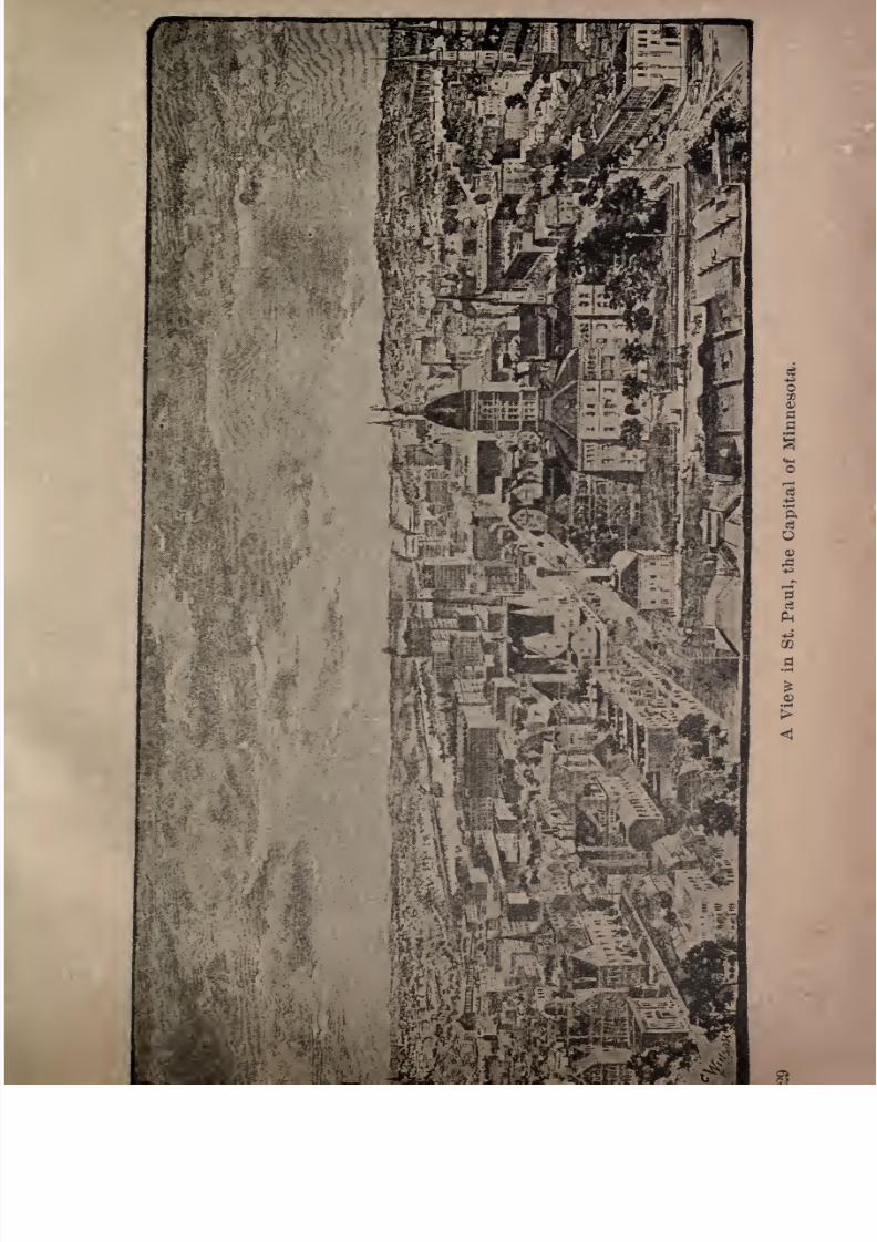
THE TWIN CITIES OF MINNESOTA.
St. Paul. The capital of Minnesota is a handsomeand wealthy city of about 175,000 inhabitants, situated at
the head of navigation on the Mississippi river. It is the
most important railway center in the entire Northwest,
and the greatest center of general jobbing and trading.
St. Paul is also extensively engaged in manufacturing, her
principal industries being the making of reapers and
mowers, boots and shoes, cordage, harness, stoves, steamengines, clothing and agricultural implements. It is built
upon benches and hills on both sides of the Mississippi
river, and is one of the most healthful and agreeable cities
for residence in the world, being well drained, well paved,
and being supplied with pure water from numerous spring-
fed lakes. Six railways connect the city with Chicago,
three with the Pacific coast, two with Manitoba, and fourwith the head of Lake Superior. Steamboats run on the
Mississippi for both freight and passengers. The banks,
insurance companies, wholesale houses and principal retail
stores occupy very substantial and magnificent structures.
Trie best residence district is noted for its beauty, and
.ummit avenue is regarded as one of the finest thorough
fares in America.St. Paul was fifty years old in October, 1891. In that
month of the year 1841, Father Gaultier, a Catholic mission
7/27/2019 Official Northern 00 Nort Rich
http://slidepdf.com/reader/full/official-northern-00-nort-rich 28/453
26 The Northern Pacific Railroad.
of Jackson street, and expressed the hope that it would
become the nucleus of a city. The Catholic churches ofSt. Paul celebrate the semi-centennial of the building of
this chapel, and in the course of an eloquent discourse
Archbishop Ireland spoke as follows :
"St. Paul in 1841, and St. Paul in 1891! What a change!
St. Paul, linked with her sister Minneapolis so near
together that they should not be named apart hold in
their embrace 350,000 souls; two million and more dwellin the old haunts of Sioux and Chippewas between the St.
Croix and Missouri rivers. This territory sends bread and
meat to the nations of the world. A dozen iron waysRome's imperial roads were merest shadows of them
spread out from our cities as vast arteries of trade, and
travel to the Pacific and Atlantic oceans, to Mexico's Gulf
and Canada's remote regions. Palaces of commerce line
the streets; their avenues and mansions scarce have rivals.
Colleges and Universities speak forth the wisdom of ages
past and the newness of scholastic prowess, of which the
past never did dream. The lightning of the skies changes
our night into day and whirls us in our daily journeyings
whither we would go with the rapidity of the wind. And
further on impatient we race; fifty years hence what a
story there will be to tell!
"Fifty years hence! What will it be ? God knows. I
confess to a wish to be present at the centennial celebra
tion, to see on the first of November, 1941, the city of St.
Paul and the diocese of St. Paul. My soul shall crave
from God on that day the privilege to roam the streets of
my beloved city and listen to the Te Deum in its majestic
cathedral. For you, my friends, and for myself I pray
that we do our part in the time allotted to us, so that the
7/27/2019 Official Northern 00 Nort Rich
http://slidepdf.com/reader/full/official-northern-00-nort-rich 29/453
The Twin Cities of Minnesota. 27
and as gratefully of us as we do of the priest and the
people of 1841."Priest and people of 1841 have nearly all left the scenes
of life. So shall we leave them, and so, too, they that are
coming to take our places. What then is life for man ?
Life for the individual, if nought there be but earth, is the
spray cast up by the breeze above the flowing waters, to
be again absorbed by them, and anniversaries and recol
lections of past years awaken in us but sadness and despair,
as
theybetoken our own annihilation. What then is
life ? It is immortality. Through all the ruins of
earth and over all the graves of men, the whisperings
of hope are heard;man's conscience and the revealing
voice of God confirm them and make certain for us the
knowledge that we shall live forever, and that our works
done on earth shall obtain retribution from God. Life
has its most solemnmeaning,
and there is a reason forour
well-being. The good done by those who have preceded
us remains for them, whether it is yet remembered in the
world, or all vestige of it has been swept away. The gooddone by us shall remain for us. Let us work well
;we
work for eternity."
St. Paul is built upon a succession of four distinct ter
races, which rise in gradation from the river. The first is
the low bottom which forms the levee. This was formerly
subject to overflow, but it has been raised above high-
water mark, and is now a very valuable property, occu
pied by warehouses, railroad tracks, the Union Depot and
business offices. On the second and third terraces the
principal part of the city is established. The second
terrace, which is about ninety feet above the level of the
river, is also devoted to business, and is thickly studded
with fine blocks of buildings. Some of these are so com-
7/27/2019 Official Northern 00 Nort Rich
http://slidepdf.com/reader/full/official-northern-00-nort-rich 30/453
23 The Northern Pacific Railroad.
mandingly situated on the high bluffs which overhang
the Mississippi as to be visible a long distance up and
downthe
stream, givingthe
city
animposing
architectural
appearance as it is approached by rail or river. The
third terrace, very little higher than the second, w-idens
out into a broad plateau, upon which stands much of the
residence portion of the city. These upper terraces are
on a foundation of blue limestone rock, from twelve to
twenty feet in thickness, forming an excellent building
material. Beneath this stratum is a bed of friable whitequartzose sandstone of unknown depth, which is easily
tunneled, and through which all the sewers have been
excavated. The fourth, or highest terrace, is a semicircu
lar range of hills, inclosing the main portion of St. Paul as
in an amphitheatre. The pictureesque sweep of these
heights, conforming to the curve of the river, with their
growth of native forests, and the stately residences whichare scattered over their slopes, is a characteristic charm of
St. Paul. Fine avenues have been laid out over manyof the hills, leading away to the prairie lands beyond, or
to some of the beautiful lakes in the neighborhood, and
the residence part of the city is rapidly extending in every
direction.
The best views of St, Paul are obtained from the Indian
mounds on Dayton's Bluff;from Merriam hill, near the
State capitol ;from the lookout on Summit avenue, and
from the bluffs in West St. Paul. Tourists should not
fail to drive on Summit avenue, which is one of the most
beautiful residence streets in the world. They should also
cross the new Smith avenue bridge, one of the highest
viaducts in the world, from which a superb view of the city
and of the river may be enjoyed ;and should return through
West St. Paul by way of the Robert street bridge.
7/27/2019 Official Northern 00 Nort Rich
http://slidepdf.com/reader/full/official-northern-00-nort-rich 31/453
mUS
7/27/2019 Official Northern 00 Nort Rich
http://slidepdf.com/reader/full/official-northern-00-nort-rich 32/453
30 The Northern Pacific Railroad.
There are many beautiful drives in the city and its
suburbs, and a large number of resorts in the neighbor
hood, which may be reached by river and rail. The drive
to Lake Como, four miles distant, is over a fine, hard gravel
road, and the jaunt thither on a cool summer evening is
delightful. There is a handsome boulevard drive around
the lake, passing through Como park, a beautiful pleasure
ground of 400 acres. Electric cars run to the park from
the center of the city.
The most conspicuous building in the city is the new
county court house, built of stone at a cost of about one
million dollars. It is the most imposing public structure
in the entire Northwest. Other noteworthy buildings are
the new $1,000,000 State capitol, now under construction,
the new United States Postoffice and custom house, ap
proaching completion and to cost $1,200,000, the Pioneer
Press newspaper building, thirteen stories high, the Globe
newspaper building, the Endicott Arcade, the Union depot,
the Ryan hotel, the German-American National bank, the
New York Life Insurance building, the Germania Life In
surance building, the Bank of Minnesota, the great apart
ment houses known as The Albion, The Colonnade, and
the Barto, the Minnesota Club house, numerous handsome
churches, the Northern Pacific building, and the Chamber
of Commerce building. The principal hotels are the Ryan,
Merchants', Metropolitan, Windsor and the Aberdeen.
The new Metropolitan opera house is the largest and best
built theatre in the Northwest.
St. Paul is an important educational center, having four
well-established colleges: Macalester, a Presbyterian insti
tution; Hamline University, under the control of the
Methodists; St. Thomas', a Catholic school; and the new*.
Hill University for the training of Catholic priests, liber

7/27/2019 Official Northern 00 Nort Rich
http://slidepdf.com/reader/full/official-northern-00-nort-rich 33/453
The Twin Cities of Minnesota. 31
St. Paul's Lake Resorts. White Bear Lake is the
most popular summer resort in the immediate vicinity of
St. Paul.It is
reached bythe St.
Paul & Duluth railroadin about half-an-hour, and by electric cars from East
Seventh street in about 45 minutes.
It is about nine miles in circumference. Its picturesque
shores are lined with summer hotels, excursion and picnic
resorts, and beautiful villas, and a large wooded island,
recently connected with the mainland by a causeway and
bridge, has been laid out by the wealthy residents of St.
Paul into plats of summer residences. The lake affords
excellent fishing, boating and bathing. Bald Eagle lake,
a mile beyond, noted for its scenery and good opportunities
for fishing, is quite popular for picnic parties. Lake Elmo,
on the Chicago, St. Paul, Minneapolis & Omaha railroad,
twelve miles eastward of St. Paul, is also a much fre
quented summer resort, offering great attractions for
boating, bathing and fishing.
On the shores of Lake Phalen, in the eastern part of the
city,the municipality has recently established a park.
Lake Como and its park have already been mentioned.
Other attractive lakes near St. Paul are Gervais, Vadnais,
McCaren's and Josephine, all lying within an easy drive
from the hotels.
Fort Snelling. This military post, the headquarters
of the Department of Dakota, was established in 1819, with
the view of protecting the few settlers who, at so early a
date, were brave enough to penetrate the great wilderness
west of the Mississippi. The fort is massively built on the
northern bank of the Minnesota river, just at its junction
with the Father of Waters. The situation of the fort is
strikingly picturesque, its white walls reared upon the
brink of a jutting bluff with an almost vertical face, its base
7/27/2019 Official Northern 00 Nort Rich
http://slidepdf.com/reader/full/official-northern-00-nort-rich 34/453
32 The Northern Pacific Railroad.
being washed by the flood one hundred feet below. Fort
Snelling was finished in 1822. Its form was circular, and
its high walls were broken at intervals by embrasures for
cannon to sweep the approaches. It has since undergonesome alterations; but the original structure still remains.
This fort has had an eventful history, having witnessed
many scenes of savage warfare. It is still one of the
most important posts in the West. Fort Snelling is about
half way between St. Paul and Minneapolis, being con
nected with the main road by a long iron bridge which
airily spans the Mississippi.
The Falls of Minnehaha. This beautiful waterfall,
made immortal by Longfellow in his poem"Hiawatha," is
to be seen on the road toward Minneapolis, two miles
beyond Fort Snelling. It is formed by an abrupt break in
the bed of Little Minnehaha creek, one of the outlets of
Lake Minnetonka. This stream babbles along through
miles of verdant meadows in the most quiet and common
place way, to make an unexpected leap at last into a deep
gorge, and find itself famous and beautiful. In a recent
issue of Harper s Magazine the Falls of Minnehaha are
aptly characterized by Ernest Ingersoll in this wise:
"The outlet of Lake Minnetonka is a sparkling little
brook that encircles the city, steals through the wheat
fields, races under a dark culvert where the phcebe birds
breed, and then, with most gleeful abandon, leaps off a
precipice sixty feet straight down into a maple-shadowed,
brier-choked canon, and prattles on as though nothing had
happened but a bit of childish gymnastics.
"It is very charming, this rough and rock-hemmed little
gorge through the woods and fern-brakes, and this fraud
ulent little beauty of a cascade; and it laughs without a
prick of [conscience, laughs in the most feminine and sil-
7/27/2019 Official Northern 00 Nort Rich
http://slidepdf.com/reader/full/official-northern-00-nort-rich 35/453
The Twin Cities of Minnesota 33
\
very tones, from a rainbow-tinted and smiling face, when
you remind it that it is a bewitching little thief of credit,
for the true Minnehaha is over on the brimming river, a
slave to the mills. But, right or wrong, little stream, thou
art a princess among all the cascades of the world. Thy
beauty grows upon us and lingers in our minds like
that of a lovely child, whether we wade into the brown
water at thy feet, scaring the happy fishes clustered there,
and gaze upward at the snowy festoons that with a soft,
hissing murmur of delight chase each other down the swift
slope, or creep to thy glassy margin above and try to count
the wavelets crowding to glide so glibly over the round,
transparent brink; or walk behind thy veil and view the
green valley as thou seest it, through the silvery and
iridescent haze of thy mist drapery. Thou hast no need
of a poet's pen to sing thy praise; but had not the poet
helped thy fraud,enchanting
Minnehaha, not half this
daily crowd would come to see thee and to drink beer on
thy banks, and murmur maudlin nonsense about Hiawatha
and his mystical maiden. Nevertheless, thou art the
loveliest of cascades, and an enchantress whose sins can be
forgiven because of thy beauty."
Minnehaha Falls can be conveniently reached from their
St. Paul or
Minneapolisfrom the latter
byelectric cars and
from the former by rail from the Union depot, or by electric
cars to either Ft. Snelling or Groveland and thence by small
steamboat on the Mississippi. If the tourist has the time to
spare for a carriage drive, the route from St. Paul past Snell
ing will be found a delightful one. The Minnesota Soldiers'
Home, for veterans of the Civil War, is in the immediate
vicinityof the falls and is a model institution of its
kind.The Inter-urban District. St. Paul and Minneapolis
are connected by three lines of railroad owned by the
7/27/2019 Official Northern 00 Nort Rich
http://slidepdf.com/reader/full/official-northern-00-nort-rich 36/453
34 The Northern Pacific Railroad.
Chicago, Milwaukee and St. Paul, the Great Northern and
St. Paul & Northern Pacific companies and by an electric
line running cars every few minutes. Numerous subur
ban villages have sprung up along the lines of these roads,
and the whole territory between the well-built portions of
the two cities is fast building up with residences and man
ufacturing concerns. The corporate limits of the two
municipalities touch each other, and the distance between
the thickly built districts is only about five miles. St. Paul
and Minneapolis are plainly destined to become a single
commercial centre. The distance from the western limits
of Minneapolis to the eastern limits of St. Paul is not as
great as that from the extreme northern portion of Chi
cago to its southern boundary. By the time the present
population of these two cities shall have doubled, the
whole territory between them will be covered with build
ings.
The principal suburban towns in the Inter-urban district
are now Merriam Park and Union Park; Minnesota Trans
fer, with its elevators, stock yards and twenty miles of
track one of the most important transfer points in Amer
ica; Macalester Park, with its college; Ifa inline, with its
university; St. Anthony Park; Como, with its beautiful
lake; and the suburb surrounding the big Northern
Pacific shops.
Minneapolis. The beautiful and prosperous city of
Minneapolis adjoins St. Paul on the west and like St. Paul
is built on both sides of the Mississippi river. Originally
it consisted of two villages, St. Anthony on the east side
of the river, close by the falls of the same name, which
was settled as a milling point soon after the foundation of
St. Paul, and Minneapolis, on the west side, the growth of
which was long delayed by the fact that the ground was
7/27/2019 Official Northern 00 Nort Rich
http://slidepdf.com/reader/full/official-northern-00-nort-rich 37/453
The Twin Cities of Minnesota. 35
held by the Government as a part of the Fort Snelling
Reservation until after the village on the east side had
obtained considerable size. Soon after the
opening
of
this part of the reservation the development of the west
side went forward with great rapidity and the two places
were consolidated into one city with the pretty invented
name of Minneapolis, which is half Greek and half Sioux
in its origin and may be translated to mean the smoky or
cloudy city. Its inventors no doubt intended it, however
as a contraction of Minnesota'smetropolis.
Minneapolis has a population of more than 200,000
and is the heaviest wheat-buying city in the country and
the largest flour-milling city. It is also the seat of an
enormous lumber manufacturing industry, the logs for
which are run down the Mississippi and its tributaries and
stored in great booms. The industrial spirit is paramountin the
city and thriving manufactories of woolens, paper,farm machinery and a multitude of other articles are
carried on. In fact the place is often nicknamed the
Western Boston, from its pushing New England spirit and
its success in a great variety of industrial enterprises. A
large part of the population is of New England birth or an
cestry. The leading foreign elements are Scandinavian
and French-Canadian.The topography of the city is greatly in its favor. Sit
uated on a broad plateau, high above the upper level of the
river at the falls, there is no danger from overflow; and yet
the level of the place is so near that of the surrounding
country, that the grades to and from the city admit the
construction of rail and wagon roads with comparative
ease, while the subsoil affords a foundation upon which themost massive buildings may be safely erected. The rela
tion of Minneapolis to the surrounding country is every-
7/27/2019 Official Northern 00 Nort Rich
http://slidepdf.com/reader/full/official-northern-00-nort-rich 38/453
7/27/2019 Official Northern 00 Nort Rich
http://slidepdf.com/reader/full/official-northern-00-nort-rich 39/453
The Twin Cities of Minnesota. 37
thing that could be desired. The city lies on the eastern
border of the great wheat belt of the Golden Northwest,
and on the southern borderof the
pineand hard-wood
timber region of Minnesota. Here the wealth of raw ma
terial naturally finds its way to be conveniently converted
into flour and lumber by the use of the grand waterpower,
estimated at the capacity of I2o,ooo-horse, within the city,-
and the product of the mills is afterward forwarded to the
markets of the world.
The Falls of St. Anthony, upon which the prosperityof Minneapolis is mainly founded, have a perpendicular
height of eighteen feet, and the Mississippi has a rapid
descent of eighty-two feet within the limits of the city.
The view of the rapids above the cataract is very fine; but
the picturesqueness of the water-fall has been sacrificed
to purpoies of utility. To prevent the wearing away of
the ledge of rocks, a broad, smooch wooden apron hasbeen constructed entirely across the river, sloping from
the edge of the fall to a point far beyond its base, and, on
reaching this, the water slips over, calmly and unvexed.
The best view of the scene is from the new steel bridge on
Hennepin avenue which spans the flood in graceful length,
and with picturesque effect, at about the center of the city.
From this vantage-point an outlook is obtained upon therailroad tracks that stretch along below the bluffs, and also
upon the river, with its channel above the falls almost
choked with booms of logs that are to be cut into lumber
by the extensive mills which line the shores. The water-
power 40,000 H. P. is used for. driving the machineryof the foundries, woolen mills and many other branches of
mechanical industry of which Minneapolis is the seat.
Minneapolis is regularly laid out, broad avenues run
ning from east to west, crossed by streets from north to
7/27/2019 Official Northern 00 Nort Rich
http://slidepdf.com/reader/full/official-northern-00-nort-rich 40/453
38 The Northern Pacific Railroad.
south. The thoroughfares are usually eighty feet in
width, with wide sidewalks, shaded by rows of forest
trees. There are
many imposing
business blocks, and the
residence portion of the city is attractive, with its fine,
spacious houses, and well-kept lawns and grounds. On the
outskirts of the city are thousands of pleasant cottages,
which are the comfortable homes of industrious mechan
ics who find employment in the mills and manufactories.
The business center of the city of Minneapolis is about
ten miles distant from that of thecity
of St. Paul. The
two places are frequently called the twin cities of Minne
sota, and also the dual metropolis of the Northwest.
The most notable buildings are the Chamber of Com
merce, the Exposition building, the Public Library, the
new Court House and City Hall, the Guaranty Loan build
ing, the New York Life Insurance building, the Tribune
building, the Corn Exchange, the Lumber Exchange, theState University, many handsome churches, the HighSchool building, the West Hotel, the Syndicate block, the
Union depot, and the flouring mills of the Washburn and
Pillsbury companies. Many of the business blocks are
built of stone, and present lofty and handsome architect
ural fronts. The importance of the lumber trade may be
judged by the fact that the saw-mills cut annually nearly
500,000,000 feet of lumber, besides large quantities of
shingles and lath. The annual output of flour is about
14,000,000 barrels. Minneapolis has become in recent years
the most important wheat market in the United States.
The receipts of wheat are over 75,000,000 bushels per
annum, a larger amount than is received in either Chicago
or New York.The best points from which to enjoy comprehensive
views of the city are the tower of the Exposition building
7/27/2019 Official Northern 00 Nort Rich
http://slidepdf.com/reader/full/official-northern-00-nort-rich 41/453
TJie Twin Cities of Minnesota. 39
and the roof of the tall Guaranty Loan building. To see
the best residence district tourists are advised to take a
carriage drive through its western districts as far as the
boulevard which skirts Lake Harriet and other small lakes.
These lakes form a very beautiful suburban feature and
their shores are generally improved with handsome homes
and grounds. The leading hotels are the West and the
Nicollet, the former a very spacious, handsome and well-
built structure, hardly surpassed in any respect by anyhotel in
Chicagoor New York.
The Mammoth Flour Mills. It is aptly said that
the history of the flour mills of Minneapolis is like the
story of Aladdin. In 1860 the product was 30,000 barrels,
and in 1897 over 13,000,000 barrels. The maximum daily
capacity of all the Minneapolis mills is about 60,000
barrels.
Anidea of the
gigantic proportions which thisbranch of this industry has assumed may be obtained by
remembering that the number of barrels of flour manufactured by one of the largest mills in the course of twenty-four hours is, greater than that produced by an average-sized mill in the course of a year. The capacity of the
largest mill, the PillsburyUA," is 5,200 barrels per diem;
that of the Washburn "A/' 3,000 barrels; and six othermills range from 1,200 to 2,000 barrels per day. The
capital invested in the flour milling industry is enormous,and the amount is constantly increasing. This is the
result of the changes in the mode of manufacturing flour,
which have been almost radical within the past twenty
years. The use of the old mill-stone has given place to
the system of gradual reduction by iron rollers. Thenew process has not only raised the grade of flour from
the dark and inferior quality formerly produced, to the
7/27/2019 Official Northern 00 Nort Rich
http://slidepdf.com/reader/full/official-northern-00-nort-rich 42/453
40 The Northern Pacific Railroad.
standard of the best Hungarian fancy brands, but has
increased the quantity obtained from the grain, as well
as the capacity of the mills; thus better flour is now
made at less expense than that which the inferior quality
previously cost to manufacture. The flour of the Minne
sota mills finds a ready market in all the Eastern cities,
and also in Great Britain, France, Germany, Holland,
Spain and Italy. Single orders are frequently taken
for from 10,000 to 15,000 barrels, and the millers find
it necessary, in
securing
the best trade, to control a
greatmanufacturing capacity. Otherwise they would not be
able to fill large orders promptly, nor obtain that uni
formity in quality without which both the foreign and
American market would soon be lost. Moreover, there is
economy both in the construction and operation of a large
mill over a small one. For example, the cost of one mill
with acapacity
of
4,000barrels
daily,is much less than
that of sixteen mills of 250 barrels capacity, or of eight
mills of 500 barrels capacity, or even of four mills of 1,000
barrels capacity. The relative cost of operating a large
mill is still less, and the chance of a uniform grade of flour
is increased in the same ratio as the capacity of the mill.
So medium-sized mills, a few years ago considered the
safest and most profitable, have been superseded bythose
of great capacity.
In order that some idea of a large Minneapolis flour
mill may be obtained, the following facts relating to the
Pillsbury "A" mill are given. This establishment is 180.
feet in length by 115 in width, the building material being
Trenton limestone, rock-faced, and laid in courses to the
height of seven stories. Inside, on the basement floor, is
a stone wall, 125 feet in length, and 15 in height, which
holds the water from the canal after its passage from the
7/27/2019 Official Northern 00 Nort Rich
http://slidepdf.com/reader/full/official-northern-00-nort-rich 43/453
The Twin Cities of Minnesota. 41
falls before it descends to the wheels. Within this canal
are the wheel-pits, dug out of the solid rock, fifty-three
feet in
depth.Inside these
pitsare flumes of boiler
iron,twelve feet in diameter, in which two fifty-five inch
wheels, each weighing, with the shafting, thirteen tons,
are placed. The hydraulic power of a column of water
twelve feet in diameter, with a fall of fifty-three feet, is
enormous. Only the strongest and toughest metal could
withstand the strain. Seventeen thousand cubic feet of
water rushes down each flume every minute, and the combined force of the wheels is estimated at 2,400 horse
power, equivalent to that of twelve steam engines, each of
200 horse-power. This power is geared and harnessed to
the machinery requisite to grind 25,000 bushels of wheat
in every twenty-four hours. On the first floor there are
the main shafts of the driving apparatus, with pulleys
twelve feet in diameter, weighing 13,000 ^pounds, overwhich runs belting of double thickness, forty-eight inches
wide, at the rate of 4,260 feet in a minute. From the
shafts also run thirty-inch belts perpendicularly to the
attic floor, over eight-foot pulleys, at the rate of 2,664 feet
per minute, furnishing the power which drives the bolting
and elevating machinery. There are other pulleys and
belting attached to the shafts for operating the rollers and
purifiers, the electric light and other machinery. On this
floor, also, is the wheat bin for stowing grain. This holds
35,000 bushels, and extends through to the ceiling of the
floor above, where it is connected with the weighing hop
per. On the second floor the wheat is ground; the third
floor is mainly devoted to packing; the fourth, fifth, sixth
and seventh floors are filled with bolting chests, mid
dlings-purifiers, bran-dusters and other machinery. Before
going to the rollers to be ground into flour, the wheat is
7/27/2019 Official Northern 00 Nort Rich
http://slidepdf.com/reader/full/official-northern-00-nort-rich 44/453
42 The Northern Pacific Railroad.
cleansed by passing through eight different sets of
machinery. It is purged in this manner of wire, nails,
cockle, small and imperfect kernels, and becomes actually
polished before it is converted into flour. On the packing
floor the flour is discharged constantly from twenty-four
spouts, and accumulates so fast that a car is either loaded
with flour or bran every twenty-five minutes throughout
the day. Any lack of transportation facilities at once
clogs the mill. To every bushel of wheat there are
thirteen pounds of bran or shorts; but for this "offal"
there is a steady demand on the part of stock-raisers in
the East. There are railroad tracks on either side of the
mill, and the loading and unloading methods are complete.
The establishment is provided with fire apparatus, electric
lights, passenger elevator, machine shop, and every appli
ance for its convenient working. In fact, it is one of the
model flouring mills of Minneapolis, and the visitor who
examines its features in detail will be well repaid,
The process of manufacturing flour in a typical Minne
apolis mill is clearly described by Ernest Ingersoll, in
Harpers Magazine:
"When the wheat comes in it is unloaded from the cars
by the aid of steam shovels into a hopper bin, whence it is
elevated to the fifth floor and fed into a receiving bin, the
bottom of which extends down to the fourth floor. Out
of this it empties itself into conveyors, consisting of small
buckets traveling upon an endless belt, and is taken to
storage bins on the first and second floors. Here it rests
until wanted for milling. When this time comes the wheat
travels by conveyors to the top floor, whence it is fed down
into thegrain separators
in thestory beneath,
which sift
out.the chaff, straw, and other foreign matter. This done,
it descends another story upon patented grading screens,
7/27/2019 Official Northern 00 Nort Rich
http://slidepdf.com/reader/full/official-northern-00-nort-rich 45/453
The Twin Cities of Minnesota. 43
which sort out the larger sized grains from the smaller, the
latter falling through the meshes of the screen, after which
the selected portion drops into the cockles on the floor beneath, and, these escaped, falls still further, into the brush
machines. All this time the wheat remains wheat the
kernel is entire. Its next move, however, begins its des
truction; for now the ending stones are encountered,which
break the germinal point off each grain. This matter
accomplished, the wheat is shot away up to the attic again
and, traversing the whole length of the mill, falls into an
aspirator on the seventh floor; having passed which it
slides down to the second floor, and is sent through the
corrugated rollers. These rollers have shallow grooves
cut spirally upon them, with rounded ridges between.
The opposing rollers are grooved in an opposite direction,
and it is impossible for a grain of wheat to get through
without being cracked in two, though the rollers are not
sufficiently near together to do much more than that.
It comes Out of this ordeal looking as though mice had
chewed it, and, pouring into special conveyors, speedily
finds itself up on the seventh floor again, where the flour
dust which has been produced by this rough handling is
bolted out in reels, and all that is left no longer wheat
is divided into 'middlings' and 'tailings/ The tailings con
sist of the hard seed-case and the refuse part, and go into
market as'
feed' and 'bran/ while the middlings are re
served for further perfection into flour: they are the
starchy, good centres of the grains." The first operation toward this end is the grading of
the middlings, for which purpose they pass upon silken
sieves arranged in narrow horizontal troughs, and given a
gentle shaking motion by machinery. There is a succes
sion of these bolting cloths, so that the middlings pass
7/27/2019 Official Northern 00 Nort Rich
http://slidepdf.com/reader/full/official-northern-00-nort-rich 46/453
44 The Northern Pacific Railroad.
through ten gradings. Next they go to a series of puri
fiers, which resemble fanning machines, and thence to
corrugated rollers, each successive set of which are more
closely apposed, where the meal is ground finer and finer.
There are five of these corrugations in all, and between
each occurs a process of bolting to get rid of the waste,
and a journey from bottom to top of the mill and back
again. Nevertheless, in spite of all this bolting, there re
mains a large quantity of dust, which must be removed in
order to make the flour of the best quality. And hereby
hangs a tale of considerable interest to Minneapolis men:" In the old mill which not long ago occupied the site
of this new one there stood upon one side the usual rows
of buhrs, in this case twenty in number. Through the
conveyor boxes connected with them was drawn a strong
current of air that took up all the fine particles of flour
dust, and wafted it with the strength of a tempest into two
dust-rooms, where it was allowed to settle. The daily
deposit was about three thousand pounds, which was
removed every morning. In addition to these small
chambers, there were several purifiers on the upper floors,
that discharged their dust right out into the room. The
atmosphere of the whole mill thus became surcharged
with exceedingly minute and fuzzy particles, which are
very inflammable, and, when mixed in certain proportions
with the air, highly explosive. Thismixturehad apparently
been brought by the millers to just about the right point,
when fate supplied a torch. A piece of wire fell between
the buhr stones, or into some rollers, and began a lightning
express journey through the machinery, in the course of
which it became red hot, when it found an exit, and
plunged out into the air. It was a most startling instance
of the conversion of heat into motion. A lighted match
7/27/2019 Official Northern 00 Nort Rich
http://slidepdf.com/reader/full/official-northern-00-nort-rich 47/453
The Twin Cities of Minnesota. 45
in a keg of powder is the only analogy to illustrate the
result. One room down stairs burst into flames, and the
watchman had only time to pull the electric fire alarm
near his hand, when he and the mill together disappeared
from the face of the earth. A terrific explosion, generated
throughout that great factory in an instant, rent all parts
of the immense structure as suddenly as a child knocks
over a tower of cards, leaving nothing but blazing ruins to
show where, a twinkling before, had stood the largest
flour mill in the
country.
Nor was this all. The land
was dug from under the foundations, and the massive
machinery buried out of sight. Two other mills and an
elevator near by were demolished, so that not one stone
remained above another; while of three other mills
cracked and tottering walls and charred interiors were the
only mementoes of the day's flourishing business.
" Thegood
that came out of this
seemingly whollyharmful episode, which scratched an end mark to one era
of the city's prosperity, was the introduction intp the new
mills of a system of dust-saving that renders such a calamity
improbable, if not impossible, in future. Now, instead of
being thrown abroad into a large room, the dust is dis
charged by suction pans into close fire-proof receivers,
where it
accumulatesin
great quantities, andis
sold as alow grade of flour. This dust having been removed, what
remains is the best quality of flour. It is barreled by the
aid of a machine permitting the precise weight of 196
pounds to be determined, packed and branded with great
speed."Bakers, however, use what is know as 'wheat' or
'straight' flour, which is the product of the five reductions, all the subsequent processes through which the mid
dlings pass in making fine flour being omitted. 'Fancy'
7/27/2019 Official Northern 00 Nort Rich
http://slidepdf.com/reader/full/official-northern-00-nort-rich 48/453
46 The Northern Pacific Railroad.
flour differs from the ordinary superfine in that the mid
dlings are ground through smooth rollers/'
Lake Minnetonka. Fifteen miles west of Minneapolis lies Lake Minnetonka, the most popular summer
resort of Minnesota. It is a beautiful sheet of water,
about twenty miles long, of very irregular form, having a
varying width of from half a mile to three miles. Its
shores are bold and prettily wooded with oak groves,
affording admirable sites for summer residences. A large
number of visitors come every summer to Minnetonkafrom the Southern States, attracted by the cool and agree
able climate, the excellent hotels and facilities for boating
and out-door life. The principal hotel is the Lake Park
Hotel, which has room for about 500 guests, the St. Louis
for about 300, and numerous other summer hotels and
private cottages have summer boarders. A fleet of nearly
a score of steamboats, large and small, ply upon the lake,
and hourly trains are run during the season to and from
St. Paul and Minneapolis.
Hundreds of pretty cottages fringe the shores, each
with its lawns, boat house and carriage house. A drive
fifty miles long makes the entire circuit of the lake. There
are two pretty villages onthe
lake, Wayzata andExcel
sior, each having a number of small hotels and boarding
houses.
The Upper Mississippi Valley. The Northern
Pacific crosses the Mississippi river twice within the limits
of Minneapolis, first on a magnificent steel bridge, near
the University of Minnesota and in sight of many of the
large flouring mills, and then in the upper part of the city,
on a steel bridge, from which the principal saw-mills and

7/27/2019 Official Northern 00 Nort Rich
http://slidepdf.com/reader/full/official-northern-00-nort-rich 49/453

7/27/2019 Official Northern 00 Nort Rich
http://slidepdf.com/reader/full/official-northern-00-nort-rich 50/453
48 The Northern Pacific Railroad.
the great log booms may be seen. The road after leaving
the city follows the east bank of the Mississippi for ninety-
seven miles, to Little Falls. The river was formerly navi
gated by steamboats on this part of its course, but nowthere are two railroads on the east bank and one on the
west bank and the boats have been driven off, so that the
only commercial function of the river is for running logs
from the pineries down to the Minneapolis and .other
mills. The valley presents many pleasing features of
scenery. Occasional glimpses are caught from the car
windows of placid stretches of the river, which everywhere flows between low, wooded banks. Many neat
villages are passed. The country is well-cultivated and
the farms have a prosperous look. A chief crop is Indian
corn, which flourishes in spite of the high northern lati
tude, because of the warm, sandy soil and the protection
afforded by the numerous belts of woodland from celd
winds.
The Overland Train. Although an every-day occur
rence, it is always an interesting and impressive sight to
watch a Northern Pacific through train wind like a huge
serpent slowly out of the shadows of the Union depot at
St. Paul, as it starts on its long journey of two thousand
miles to the Pacific coast. It is more impressive, perhaps,
to one who has made the trip; for while it is rounding the
curve in the yards he will think of it scudding across the
level prairies between the Red river and the Missouri,
following its tortuous path through the Bad Lands, climb
ing the eastern slope of the Rockies and hurrying on to the
still harder climb over the Cascades, then bowling easily
toward the ocean, as if conscious that its struggles were
over for a time. He will hear the dismal creak of the
wheels as the train crawls like a mere worm around some
7/27/2019 Official Northern 00 Nort Rich
http://slidepdf.com/reader/full/official-northern-00-nort-rich 51/453
The Overland Train. 41)
huge mountain and maybe catch the rebounding echo of
the engines' labored breath that breaks in upon the awful
stillness of the gorge.
The mail, express and baggage cars, the tourist cars, the
smoker, the day coaches, the dining car and the sleeping cars
altogether make a handsome train. The comfortable
tourist cars .are usually filled with immigrants, but fre
quently with fairly well-to-do families from the East, to
whom these cars offer conveniences not to be had elsewhere.
Local malepassengers generally occupy
the
smoker,and
the luxurious day coaches carry both local and through
passengers. The "diner," another popular feature of the
N. P., serves breakfast at 7 to 9:30; lunch at 12 to 1:30,
and dinner at 5:30 to 7:30 o'clock, at a price of one dollar
for breakfast and dinner; luncheon is served a la carte, with
an attractive menu at each. It answers also as a sort of
club room between meals, wheregentlemen may enjoy
the
liquid contents of a well-stocked sideboard, with good
cigars and plenty of room, and wide, deep windows throughwhich to view the varying scenery. The conductor of this
car goes through to Portland with his cooks and waiters, as
does each of the Pullman conductors. This means that
they travel eight to twelve thousand miles a month and that
two thirds to three-fourths of theiryear
is
spent on wheelsmoving over six big States. The conductor in charge of
the train, his brakemen, baggageman, engineer and fire
man are changed many times between St. Paul and. Port
land, each crew having a run of from two hundred to three
hundred miles. The ten or fifteen minutes' wait while the
engine is taken to the roundhouse and another brought out,
is
usuallytaken
advantage of,in
the daytime, by bothladies and gentlemen to indulge in a walk up and down the
l n g platform and to fill their lungs with prairie ozone or
mountain air.
7/27/2019 Official Northern 00 Nort Rich
http://slidepdf.com/reader/full/official-northern-00-nort-rich 52/453
50 The Northern I\icific Railroad.
Anoka (29 miles from St. Paul). This town, the
county seat of the county of the same name, is situated
twenty miles from Minneapolis, at the mouth of Rum
river, one of the most important logging streams in theNorthwest. Anoka has 6,000 inhabitants, and is a flourish
ing manufacturing town being principally engaged in the
sawing of lumber and the grinding of wheat. Rum river,
crossed by the railroad at Anoka, is the outlet of Mille
Lac, the second largest lake in Minnesota.
Elk River (41 miles from St. Paul; population, 1,500)
is the county seat of Sherburne county, and is located onthe Mississippi at the mouth of the Elk river, a logging
stream heading in the great pineries. The town has a
water power, and manufactures flour and lumber.
St. Cloud (76 miles from St. Paul; population, 8,000)
is one of the most important manufacturing and commer
cial towns and railroad centers in Northern Minnesota. It
is the county seat of Stearns county, one of the most
prosperous agricultural counties in the State, and has
many line public and private buildings. One of the State
Normal schools is located here, and the city is also the seat
of a Catholic bishop. The city is built upon a high
plateau, about fifty feet above the Mississippi and most of
its business blocks are built of yellow brick.
Here are a number of valuable granite quarries situated
at distances varying from one to four miles from the city,
on both sides of the Mississippi river, which furnish
excellent material for building, paving, etc. At one of
these quarries on the eastern side of the Mississippi, the
State of Minnesota is erecting a reformatory, employing
the convicts is stone cutting. Jasper is also quarried near
St. Cloud. The Mississippi is dammed just below the city
and furnishes a valuable water-power which is used for
7/27/2019 Official Northern 00 Nort Rich
http://slidepdf.com/reader/full/official-northern-00-nort-rich 53/453
Little Falls. 51
various manufacturing enterprises. East St. Cloud is a
suburb in Benton county, on the east bank of the river,
and is connected with the city by a steel bridge,
Sauk Rapids (77 miles from St. Paul; population,
1,200).This village, the county seat of Benton county,
lies on the east bank of the Mississippi river, at the falls of
Sauk Rapids, from which its name is derived. The Mis
sissippi river at this point is 600 feet wide, and has a fall
of eighteen feet in one mile. There are extensive beds of
granite in the immediate vicinity, the stone, it is said,
being equal to the celebrated Quincy granite of New
England, varying only in color. A fine water-power is
furnished by the rapids which begin where the Sauk river
enters from the west, at the upper end of the village. The
rapids continue over a bed of granite a distance of half a
mile, and, viewed from either bank, present a picture of
greatbeauty.
Royalton (95 miles north of St. Paul; population,
800). It is situated two miles east of the Mississippi river,
in the midst o f. a prairie dotted with groves of hard-wood
trees. The Platte river affords a water-power. The town
is a centre for farming and lumbering trade.
Little Falls (105 miles northwest of St. Paul; popu
lation,3,000).
This town was named from a fall in the
Mississippi river. It has one of the best water-powers in
the United States, constructed in 1887-88, at an expense
of $250,000. The dam rests upon a solid rock bed, and is
firmly supported by a rocky island in the centre of the
river. The water-power is utilized by flouring-mills and
factories, and the town is evidently destined to become an
importantcentre of
manufacturing industry.It is built
on both sides of the Mississippi river, on a sandy plateau.
It is the county seat of Morrison county, and the junction
7/27/2019 Official Northern 00 Nort Rich
http://slidepdf.com/reader/full/official-northern-00-nort-rich 54/453
52 The Northern Pacific Railroad.
of the Little Falls & Dakota branch and the Brainerd
branch of the Northern Pacific R. R. with the main line.
Two handsome and commodious modern hotels accommo
date sportsmen, summer visitors, and travelers. There is
good shooting for deer in the big woods west of the Mis
sissippi, and for ducks along the river and on the numerous
lakes and ponds in the region. One of the largest saw
mills in the State is located here. Brick making is an
important industry. The court house is a handsome
and conspicuous structure.
The scenery near Little Falls is diversified and inter
esting. Finely wooded bluffs cropping up between rich
prairies make the neighborhood favorable for hunting.
Five miles east is a pleasant inland lake named Rice lake,
from the large quantity of wijd rice growing around its
shores. This is a resort for wild ducks, and in season
large numbers are bagged. The woods abound with
partridge, and the prairies with grouse, or prairie chickens^
while deer are found in great numbers within easy distance.
A Wilderness Region. The through trains on the
Northern Pacific formerly ran by way of Brainerd, fol
lowing the Mississippi to that town before turning west
ward, but a cut off line was built a few years ago from
Little Falls to Staples, which shortened the distance 25
miles. The road crosses to the west side of the Mississippi
at Little Falls and for about 30 miles runs through a forest
of hard-wood trees, mingled with pines, where cutting oak
ties and cord-wood are the principal industries. The soil
is good, however, and farms are gradually cleared up.
Fish-trap and Alexander lakes, at Lincoln station, are
recommended as excellent fishing ground to sportsmen
who enjoy camping out and roughing it. These lakes
have bold, picturesque banks.
7/27/2019 Official Northern 00 Nort Rich
http://slidepdf.com/reader/full/official-northern-00-nort-rich 55/453
Wadena. 53
Staples (142 miles from St. Paul; population 1,000) is
an important railway junction and division terminus town,
inhabited chiefly by railroad employes. Here the Northern
Pacific line from Lake Superior joins the main line. Trains
run to and from Brainerd, Duluth, Superior and Ashland
in connection with the trains to and from the Pacific
Coast. The town is well-built and prosperous. Before the
building of the cut-off line it was a mere saw-mill hamlet.
Verndale (153 miles from St. Paul; population, 1,000).
This town is
pleasantlysituated in Wadena
county,
in the
Wing river valley, (one of the most fertile and beautiful
valleys of the Northwest), of which it is the commercial
centre. This valley is twenty miles in length, by five or six
in breadth, and consists of a number of small prairies or
openings, so admirably arranged by nature that almost
every settler has timber and prairie. The village is about
one mile east of the river in a beautifulopening,
or small
prairie, sheltered on the north and west by a dense growthof pines, while about two miles south and east can be seen
the dark line of the Big Woods, which stretch away for
many miles.
W^adena (160 miles from St. Paul; population, 1,400).
This town is the county seat of Wadena county and is the
diverging point for the Northern Pacific, Fergus andBlack Hills railroad, which runs westward to Milnor,
North Dakota, 120 miles through Fergus Falls, Brecken-
ridge and Wahpeton. The country adjacent to bhe town
is a slightly rolling prairie, dotted at intervals with pic
turesque groves and strips of timber. Oak, poplar, birch
and ash are the most common growths. A few miles
north of the town begins the timber line, beyond whichlie some of the famous logging camps of Minnesota, where
are found large tracts of white and yellow pine.
7/27/2019 Official Northern 00 Nort Rich
http://slidepdf.com/reader/full/official-northern-00-nort-rich 56/453
54 The Northern Pacific Railroad.
New York Mills (172 miles from St. Paul; population
500). This is the largest Finnish settlement in the United
States. There are over 500 Finns in the town, and nearly
3,000 in the surrounding country. A weekly paper is
published in the Finnish language, and religious services
are held in that language in two churches, one in the
town and one about six miles distant in the country. The
Finns have only commenced emigrating in considerable
numbers during the past twenty years. They prefer
Northern Minnesota to any region in the West because of
its close resemblance in climate, scenery, soil, forests,
lakes, etc., to Finland. The Finns in and around New
York Mills are engaged in lumbering, farming, and the
mechanical trades. The Finns are an educated people and
all read and write their own language. Finnish is an
Asiatic language in its origin, belonging to the Turanian
family, and is kindred to the Hungarian and Turkish.
The Finns have a great national epic poem, called the
Kalevala, which embodies the mythology and poetry of
their remote ancestors.
Perham (183 miles from St. Paul; population, 1,200).
This town is situated in the northeastern part of Otter Tail
county, on an open prairie of five by ten miles square.
The population of the town and tributary country is about
half German, one-quarter American, and the other quarter
composed of Poles and Scandinavians. There is a flouring
mill in the place and several minor manufacturing con
cerns. The scenery about Perham is attractive. In com
ing from the East, for some distance nothing can be seen
but pine forests, which suddenly open into a beautiful
rolling prairie, throughwhich the famous Red river of
the North passes. To the right, only a short distance
away, lie two beautiful lakes, called Big and Little Pine
7/27/2019 Official Northern 00 Nort Rich
http://slidepdf.com/reader/full/official-northern-00-nort-rich 57/453
Many Lovely Lakes. 55
Lakes. The latter is about two miles wide and four miles
long, while the former is nearly three times as large. The
view from the passing train is very pleasing.
Many Lovely Lakes. After leaving Perham there are
lakes without number, which, to travelers from Eastern
cities, would be considered marvels of beauty. All of
these lie in sight of this thriving town. They are now be
coming popular, and many tourists, spend the summer on
their banks. Among these resorts is Otter Tail Lake, four
miles wide and eleven miles long. It is situated eight
miles south of the town. Marion Lake, three miles dis
tant, in the same direction, is perhaps three-quarters of a
mile in diameter, and nearly circular in form. No better
hunting ground can be found in the Northwest than that sur
rounding Perham. The lakes are full of fish of every de
scription, including pickerel, pike, muskallonge, black and
rock bass, catfish, sunfish and whitefish. In spring and au
tumn ducks and geese are killed in great numbers. Duringthe season the prairie and groves are alive with quail, grouse,
swan, brant, woodcock, prairie chicken, partridge, snipe,
curlew and rabbits. In early winter the deer, elk and
moose are an easy prey to the sportsman.
There is a small Indian village about two miles from the
town. These Indians are Chippeways who belong to the
White Earth reservation, but prefer to remain in their old
home. They are self-supporting, the men working in the
pineries and the harvest fields, and the women gathering
berries for sale.
Frazee (194 miles from St. Paul, population, 300).
This town has one of the largest flouring mills west of
Minneapolis, the product of which is shipped to all parts
of the world. There is also a large saw mill, which is
supplied with timber driven down the Otter Tail river
7/27/2019 Official Northern 00 Nort Rich
http://slidepdf.com/reader/full/official-northern-00-nort-rich 58/453
56 The Northern Pacific Railroad.
from ten to twenty miles. Otter Tail river, running
through the town, is full of all kinds of fish, and so are
the numerous lakes that find an outlet through this river.
Detroit (204 miles'from St. Paul; population, 2,000) is
the county seat of Becker county, and is situated at a
beautiful timber opening, the surface of which is gently
undulating, the soil being of a sandy nature. Half a mile
east of the village runs the Pelican river, which stream is
the western boundary line of what is known as the"Big
Woods" of Minnesota. To the west there is but little
timber, and on the north the country is about equally
divided between timber and prairie land.
South of Detroit lies what is known as the Pelican Lake
country, one of the finest, as well as the most fertile and
beautiful sections of Minnesota. The surrounding region
is very productive, and each year the farmers are blessed
with abundant crops, for which a good and ready market
is always found. The advantages of Detroit are many,its abundance of excellent oak, maple, elm, birch, bass-
wood, tamarack and ash timber, suitable for the manufac
ture of all articles made from wood, invites industrial
enterprise. The new county court house, erected at a cost
of $25,000, is one of the handsomest buildings of its class
in Northern Minnesota.
Prominent among the features of this section are its
advantages as a summer resort. Detroit Lake, one of the
most beautiful sheets of water in Minnesota, lies only half
a mile from the business portion of the village. Each year
it becomes more popular with the people of the neighbor
ing towns, and also with those who are accustomed to flee
from the hot and dusty cities,and from the treeless prairies,
during the summer months. The lake, which is about a
mile and a half wide, and seven miles long, in form some-
7/27/2019 Official Northern 00 Nort Rich
http://slidepdf.com/reader/full/official-northern-00-nort-rich 59/453
Detroit Lake. 57
what resembles a horeshoe, with a sand-bar reaching from
shore to shore, about midway between the two ends of the
lake, which is converted into a most delightful driveway.
Here is a high bank towering above the clear waters of
the lake, and there the broad and pebbly beach, with an
occasional"opening," where a sturdy frontiersman is carv
ing out a farm. To the east, Detroit mountain, whose
heights are covered by a dense growth of timber, towers
far above the surronding country, lending its ruggedcharms t the scene. The lake is stocked with all kinds
of"gamey
"fish, which are attraction to the sportsman,
the variety including pickerel, black and Oswego bass,
wall-eyed pike, perch, and also California salmon, which
were planted in the lake some time ago by the State Fish
Commissioner.
The Detroit Lake and St. Louis Boat Club has a commodious club house, and a number of
cottageson the
lake.The club is limited to 100 members.
Detroit Lake is only one of many which abound in the
immediate vicinity, the following being also within the
township, and varying from one to four miles in length ;
viz., Floyd Lake, Lake Flora, Lake Rice, Oak Lake, Edgerton
Lake, Long Lake and Lake St. Clair. Here, too, are mineral
springs,iron and
sulpher,the
health-giving qualities ofwhich have been known to the Indians for many generations. The Detroit Lake Pleasure Grounds are the most
popular place of amusement in Northern Minnesota; steam
yachts, as well as sail and row boats, are furnished on
these grounds to visitors at a small cost. A steamboat
makes the tour of the lake.
The Hotel Minnesota, built in 1884, answers the double
purpose of a first-class hotel for the town, and of a sum
mer resort, being kept open the year round. It is four
7/27/2019 Official Northern 00 Nort Rich
http://slidepdf.com/reader/full/official-northern-00-nort-rich 60/453
58 The Northern Pacific Railroad.
stories in height, with wide piazzas and well-furnished
rooms. In its architectural and general management, it is
entitled to rank with the best class of summer resort
hotels in the State. The advantages of Detroit for summer tourists and residents are numerous. The place is
situated on a high plateau, near the headwaters of both
the Mississippi and the Red River of the North. This
plateau has a constant sweep of the cool breeze blowingover the great Northwest forests. Excellent drives through
woodland and farming country, with numerous lakes,
are here; and, for both fishing and hunting, the 'place has
few rivals. Although the country immediately surround
ing the town is well settled, a short ride brings the sports
man to the primeval forests where elk, moose and bear are
killed in large numbers every year. The lake abounds in
water fowl and fish.
The White Earth Reservation. Twenty-five miles
north of this village is the White Earth Reservation of the
Chippeway Indians. These Indians, who call themselves
Ojibways, have always been the friend of the white man.
They were a kindly disposed race, and contact with white
men had dragged them down into a depth of degradation
never known to their fathers. The deadly fire water
flowed throughout their country, and disease, poverty and
death held a carnival in every Indian village. Their friends
secured for them this beautiful reservation, as fair a
country as the sun ever shone upon. This action might
have been prevented by the pioneers of the Northern
Pacific Railroad; but in this case, as in every other, where
the rights of the red man were concerned, the railroad
companywas his friend. A few
yearsafter
Bishop Whip-pie had commenced his mission here, the treasurer of the
company, the Bishop, Lord Charles Hervey and others
7/27/2019 Official Northern 00 Nort Rich
http://slidepdf.com/reader/full/official-northern-00-nort-rich 61/453
The White Earth Reservation. 59
paid the Indians a visit. The Bishop consecrated their
hospital, and held confirmation. After the services, the
Indians made a feast for the Bishop and his friends.
When all had eaten, the chief, Wah-bon-a-quot arose, and
addressing the Bishop, said: "We are glad to see our
friends. Do they know the history of the Ojibways? If
not, I will tell them." In a few graphic words he described
the Indians as they were before the white man came. The
woods and prairies were full of game, the lakes and forests
with fish, and the wild rice brought its harvest. "Hungernever came to our wigwam," said he. "Would yourfriends like to see us as we were before the white man
came?" Suddenly there appeared a tall, athletic Indian,
with painted face, and dressed in a robe of skins orna
mented with porcupine quills; and by his side a pleasant-
faced woman in wild dress. "There," said the chief, with
eyes gleaming with pride," there see Ojibways as they
were before the white man came/' Turning to his guests,
he continued:"Shall I tell you what the white man did
for us?" Then dropping his voice, he added, "The
white man told us we were poor; we had no books, no
fine horses, no fine canoes, no tools.*
Give us your land,
and you shall become like the white man/ I can not
tell thestory: you
must see it." Thenstepped
out apoor,
ragged wretch, with tattered blanket, and face covered
with mud; by his side a more dreadful specimen of woman
hood. The chief raised his hands: "Are you an Objib-
way?" The Indian nodded. Sadly the chief said: "Oh,
Manitou, how came this ?"The Indian raised a black bottle,
and spoke one word, "Ishkotah wabo"
(fire water). "This
is thegift
of the white man." It went like an electric
thrill through every heart, and brought tears to many
eyes. The chief said: "A pale-faced man came to see us.
7/27/2019 Official Northern 00 Nort Rich
http://slidepdf.com/reader/full/official-northern-00-nort-rich 62/453
60 The Northern Pacific Railroad.
I am sorry to say he has seen me and my fellows drunk.
He told a wonderful story. of the Son of the Great Spirit
coming to save men. He told us his fathers were wild
men; that this religion had made them great, and what it
had done for them it would do for others. We did not
hear; ours ears were deaf; our hearts were heavy. He
came again and again, always telling one story of Jesus,
the poor man's friend. We knew each summer, that,
when the sun was high in the heavens, the Bishop would
come. Hegave
us a red minister. At last we heard.
Shall I tell you what this religion has done for my people?
You must see." There stepped out a young Indian in a
black frock coat; by his side a woman neatly clad in a
black alpaca dress. "There," said the chief, "there is only
one religion which can take a man in the mire by the hand
and bid him look and call God his Father."
There are1,500
civilized Indians at White Earth.
Theyhave two churches Episcopal church and Roman Cath
olic. Visitors are always received with kindness, and no
excursion on the line of the Northern Pacific Railroad will
be more pleasant than a visit to White Earth.
Lake Park (217 miles from St. Paul; population, 800).
This is an active business town in the western part of
Becker county, situated in the midst of a rolling prairie
country, interspersed with lakes and groves of hard-wood
timber. The population is chiefly Scandinavian. The
large farms of Thomas H. Canfield are in the neighbor
hood. Mr. Canfield has five sections, most of which is
under cultivation, affording employment to a large force
of men and team's. The principal production is wheat;
but the raising of blooded stock is also extensively
engaged in. Lake Park is situated on Flora lake. The town
has a summer hotel, accommodating a hundred people.

7/27/2019 Official Northern 00 Nort Rich
http://slidepdf.com/reader/full/official-northern-00-nort-rich 63/453
Hawley. 61
Winnipeg Junction (225 miles from St. Paul; pop
ulation, 200) is a new place created by the building of the
Duluth & Manitoba road in 1887, which runs northward
through the Red river valley to Crookston, Minn., Grand
Forks, Grafton and Pembina, North Dakota, and Winni
peg, Manitoba, 257 miles.
Hawley (228 miles from St. Paul; population, 350).
The town, named in honor of Gen. Joseph R. Hawley, of
Connecticut, lies in the depression east of the hills which
skirt the Red river. Its population is largely Scandinavian.
From the town, the distance is but a few minutes' walk to
the Buffalo river, where there are two flouring mills. Sil
ver Lake^ three miles south, a beautiful body of water cov
ering 300 acres, is an excellent fishing resort. Good hunt
ing and fishing are also to be had in the surrounding coun
try, geese, ducks and grouse being quite plentiful, while
deer and bear are found in the timber regions south
ward.
Muskoda (232 miles from St. Paul; population, 125).
Muskoda is an Indian word, said to signify "the buffalo
river/' The Buffalo river runs adjacent to the town, and
is a beautiful, swiftly flowing stream, fifty feet wide, with
high timbered bluffs on either side. It is well adapted to
milling purposes, and abounds in black bass, pike and
pickerel. Lake Maria, two and a half miles southeast of
Muskoda, and a half-mile south of the Northern Pacific
track, is a curiosity in itself, inasmuch as it is not known
to contain a living thing, although every other lake in the
region is full of fish. This lake covers 300 acres, and is
twelve to fifteen feet deep. A beautiful forest surrounds
it, and its shores are a gravelly beach. Horseshoe Lake,
two and a half miles north of the Northern Pacific rail
road, covers 200 acres, and is well stocked with fish. The

7/27/2019 Official Northern 00 Nort Rich
http://slidepdf.com/reader/full/official-northern-00-nort-rich 64/453
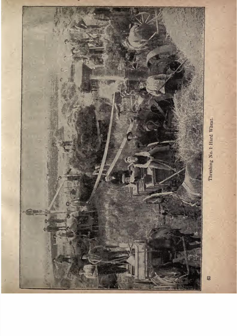
7/27/2019 Official Northern 00 Nort Rich
http://slidepdf.com/reader/full/official-northern-00-nort-rich 65/453
fcL
7/27/2019 Official Northern 00 Nort Rich
http://slidepdf.com/reader/full/official-northern-00-nort-rich 66/453
64 The Northern Pacific Railroad.
broad, flat valley. Hundreds of farmers have located their
buildings on these beach ridges as the most dry and sightly
spots on their land, affording opportunity for perfectly
drained cellars even in the most wetspring seasons, and
also yielding to wells dug through this sand and gravel,
better water than is usually obtainable in wells on the
adjacent clay areas. While each of these farmers, in fact
everyone living in the Red River valley, recognizes that it
is an old lake bed, few probably are aware that it has
become for this reason a district of special interest to
geologists, who have traced and mapped its upper shore
along a distance of about 800 miles.
Numerous explorers of this region, from Long and
Keating in 1823, to Gen. G. K. Warren in 1868 and Prof,
N. H. Winchell in 1872, recognized the lacustrine features
of the valley ;and the last named geologist first gave what
is now generally accepted as the true explanation of the
lake's existence; namely, that it was produced in the
closing stage of the glacial period by the dam of the conti
nental ice-sheet at the time of its final melting away. As
the border of the ice-sheet retreated northward along the
Red River valley, drainage from that area could not flow
as now, freely to the north through Lake Winnipeg and
into the ocean at Hudson bay, but was turned by the ice-
barrier to the south across the lowest place on the watershed dividing this basin from that of the Mississippi. This
lowest point is found at Brown's Valley on the western
boundary of Minnesota, where an ancient water course
about 125 feet deep and a mile or so in width extends from
Lake Traverse, at the head of the Bois des Sioux, a tribu
tary of the Red river, to Big Stone lake, through which
the head stream of the Minnesota river passes in its course
to the Mississippi and the Gulf of Mexico.
7/27/2019 Official Northern 00 Nort Rich
http://slidepdf.com/reader/full/official-northern-00-nort-rich 67/453
The Red River Valley. 65
Detailed exploration of the shore lines and area of this
lake was begun for the Minnesota geological survey in the
years 1879to iSSi
byWarren
Upham,under the direction
of Professor Winchell, the State geologist. In subsequent
years Mr. Upham was employed also in tracing the lake
shores through North Dakota for the United States geo
logical survey, and through Southern Manitoba to the
distance of a hundred miles north from the international
boundary to the Riding mountain, for the geological sur
veyof Canada. For the last named
survey, also,Mr.
J.B.
Tyrrell has extended the exploration of the shore lines
more or less completely for 200 miles farther north, along
the Riding and Duck mountains, and Porcupine and Pas-
quia hills, west of Lakes Manitoba and Winnipegosis, to
the Saskatchewan river.
This glacial lake was named by Upham in 1879 in honor
of Louis Agassiz, thefirst
prominent advocate of the theoryof the formation of the drift by the land ice; and the out
flowing river, whose channel is now occupied by Lakes
Traverse and Big Stone and Brown's Valley, was also
named by Upham in 1883 the River Warren, in commemo
ration -of General Warren's admirable work in the U. S.
engineering corps, in publishing maps and reports of the
Minnesota and Mississippi river surveys. Two special
reports of Mr, Upham's exploration of Lake Agassiz have
been already published, the first in 1887 by the geological
survey of the United States, and the second in 1890, bythat of Canada. From these we gather the following notes
and descriptions of the old lake area.
Several successive levels are recorded by distinct and
approximately parallel beaches, due to the gradual lowering of the outlet by the erosion of the channel at Brown's
Valley, and these are named principally from stations on

7/27/2019 Official Northern 00 Nort Rich
http://slidepdf.com/reader/full/official-northern-00-nort-rich 68/453
66 The Northern Pacific Railroad.
the Breckenridge and Wahpeton line of the Great North
ern railway in their descending order; the Herman, Nor-
cross, Tintah, Campbell and McCauleyville beaches, be
cause they pass through or near these stations and towns.
The highest, or Herman Beach, is traced in Minnesota
from the northern end of Lake Traverse eastward to Her
man, and thence northward, passing a few miles east of
Barnesville, through Muscoda, on the Northern Pacific
railroad, and around the west and north sides of Maple
lake, which lies about twenty miles southeast of Crookston,
beyond which it goes eastward to the south side of Red and
Rainy lakes. In North Dakota the Herman shore lies
about four miles west of Wheatland on the Northern Pacific
railroad, and the same distance west of Larimore on the
Pacific line of the Great Northern railway. On the inter
national boundary, in passing from North Dakota into
Manitoba, this shore coincides with the escarpment or
front of the Pembina Mountain plateau; and beyond
passes northwest to Brandon, on the Assiniboine, and
thence northeast to the Riding mountain.
Levelling along this highest beach shows that Lake
Agassiz, in its earliest and highest stage, was nearly 200
feet deep above Moorhead and Fargo ;a little more than
300 feet deep above Grand Forks and Crookston; about 450
feet abovePembina,
St. Vincent and Emerson, and about
500 and 600 feet, respectively, above Lakes Manitoba and
Winnipeg. The length of Lake Agassiz is estimated to
have been nearly 700 miles, and its area not less than
110,000 square miles, exceeding the combined areas of the
five great lakes tributary to the St. Lawrence.
When the ice-border was so far melted back as to give
outletsnortheastward
lower than the RiverWarren,
other
beaches marking these lower levels of the glacial lake
7/27/2019 Official Northern 00 Nort Rich
http://slidepdf.com/reader/full/official-northern-00-nort-rich 69/453
Moorhead. 67
were formed; and finally, by the full departure of the ice,
Lake Agassiz was drained away to its present representa
tive, Lake Winnipeg. The entire duration of Lake
Agassiz, estimated from the amount of its wave action in
erosion and in the accumulation of beach gravel and sand,
is estimated by Upham to have been only about 1,000
years, and the time of its existence is thought to have
been somewhere from 6,000 to 10,000 years ago.
Glyndon (241 miles from St. Paul; population, 450).
Glyndon is in Clay county and is the crossing point of one
of the lines of the Great Northern railroad. The Barnesand Tenney farm, 4,000 acres in extent, is one of the fea
tures of the locality, affording a specimen of the rich and
productive agricultural lands which surround the town.
Moorhead (250 miles from St. Paul; population, 4,000).
This well-built town, in lat. 46 51' N., long. 96 50'
W., and 840 feet above the level of the sea, is the last place
on the line of the Northern Pacific railroad in the State
of Minnesota, distant 251 miles from Duluth, on Lake
Superior, and was named in honor of W. G. Moorhead, of
Pennsylvania, formerly a .director of the Northern Pacific
road. It is the county seat of Clay county, advantageouslysituated on the east side of the Red river of the North,
immediately opposite the city of Fargo, North Dak., with
which it is in communication by means of bridges which
span the stream. Moorhead is the crossing point of two
trunk railroads, the Northern Pacific and the Great North
ern, and the diverging point of the Moorhead & Northern,
from Moorhead to Fisher's Landing, Minn. It is the seat
of one of the State Normal schools and of a Norwegian
college. The court house is a conspicuous building and
the Grand Pacific hotel is the largest hotel building in
Northwestern Minnesota.
7/27/2019 Official Northern 00 Nort Rich
http://slidepdf.com/reader/full/official-northern-00-nort-rich 70/453
68 The Northern Pacific Railroad.
The Red River of the North. After leaving the Moor-
head station the train crosses the Red river, which is pretty
sure to disappoint the tourist by its small size. Most of the
year it resembles a sluggish canal, but in the spring when thesnow melts it becomes a raging torrent. Although little
used by commerce in these days of railways it played a
great role in the development of the Northwest in early
times. The first steamboat that navigated its waters was
built largely in St. Paul and hauled in sections on wagonsacross the forests and prairies. This boat and others
which were built later ran from Fort Abercrombie, above
Fargo, to Winnipeg, carrying supplies to the Hudson Bay
company's trading posts and bringing back furs. The
goods were taken up the Mississippi to St. Cloud and
thence hauled to the Red river in ox carts and the return
cargo of furs took the same slow route. The Red river of
the North is named to distinguish it from the Red river of
Louisiana. It has two branches which meet at Wahpeton,the Boisde Sioux rising in Lake Traverse,and the Otter Tail
rising in numerous lakes in Northern Minnesota (lat. 46);flows due north a distance of more than 200 miles, entering
Lake Winnipeg in the northern part of the Province of
Manitoba. The Red river marks the boundary between
Minnesota and Dakota. Its elevation above the sea level
at Moorhead and" Fargo is 807 feet. The whole valley is
well watered by nature, there being a large numer of small
rivers tributary to the Red, on either side, which perform
the double office of supplyingwater and draining the land.
The most important of these streams on the Minnesota
side are, the Buffalo, Wild Rice, Marsh, Sand Hill, Red
lake, Middle, Tamarac, Two Rivers and Red Grass.
From the west there are several rivers of considerable size,
the principal being the Sheyenne, Goose, Turtle, Forest,
7/27/2019 Official Northern 00 Nort Rich
http://slidepdf.com/reader/full/official-northern-00-nort-rich 71/453
The Red River of the North. 69
Park, Tongue and Pembina. All of these have branches,
which penetrate the level prairie in every direction, afford
ing an abundance of excellent pure water. The rivers are,
for the most part, skirted with a good growth of oak, elm,
soft maple, basswood, ash and box elder, which is amplefor fuel purposes. Extensive pine lands are about the
headwaters of most of the rivers on the Minnesota side.
7/27/2019 Official Northern 00 Nort Rich
http://slidepdf.com/reader/full/official-northern-00-nort-rich 72/453
ACROSS NORTH DAKOTA.
EV.
SMALLEY writes as follows in the Northwest
. Magazine: North Dakota is essentially a prairie
State. In the extreme northern part there is a region of
low hills covered with a light growth of timber, and in
the extreme western part are the Bad Lands with their
picturesquebuttes and deep ravines; with the exception
of these two regions and the bold bluffs which everywhere
skirt the Missouri river, the whole area of the State may
be described as prairie. In the east the surface is almost
level; just undulating enough to carry the drainage off in
small streams flowing into the Red river of the North.
Further west in the country drained by the Sheyenne and
James rivers, the prairies lie in long, rolling stretches like
the swells of a quiet sea, with here and there a hill domi
nating the landscape. Still further west we come to the
region known as the Coteaux, the full name of which, on
the early maps, was Plateau du Coteaux du Missouri.
Here there are no streams, and the country may be
described as hilly prairie with small lakes and ponds in
the depressions which receive the drainage. The crests of
the hills are covered with boulders, but their sides and the
valleys among them furnish excellent plow land.
West of the Missouri river the country is broken by
ranges of hills and buttes crowned with sandstone, and is
drained by a number of small rivers flowing into the
7/27/2019 Official Northern 00 Nort Rich
http://slidepdf.com/reader/full/official-northern-00-nort-rich 73/453
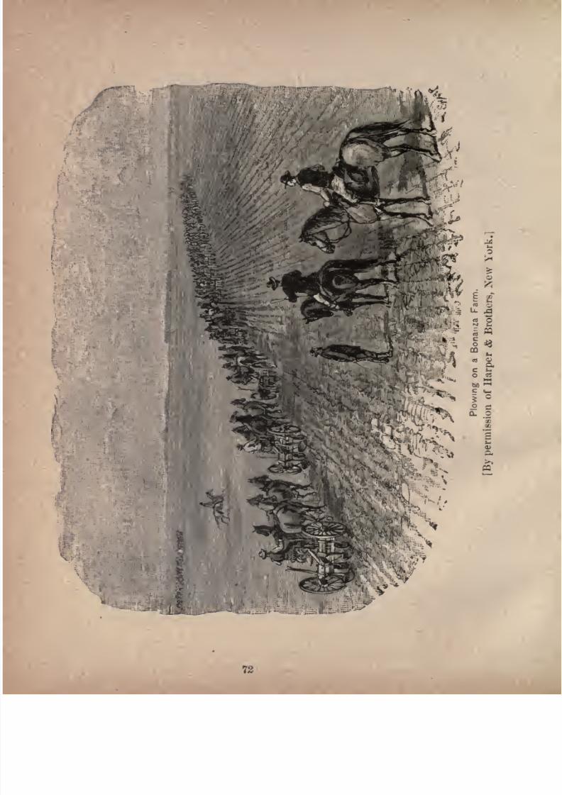
7/27/2019 Official Northern 00 Nort Rich
http://slidepdf.com/reader/full/official-northern-00-nort-rich 74/453
7/27/2019 Official Northern 00 Nort Rich
http://slidepdf.com/reader/full/official-northern-00-nort-rich 75/453
Across North Dakota. 73
counties where wheat farming has been steadily pursued
with success for ten, twelve or fifteen years, he must
expect
to
paya fair
price
for land,ranging
from $6 to 810
an acre for wild land up to $20 or $30 for cultivated farms.
The further west you go, the cheaper you find the land to
be, because the country is newer and settlement is sparser,
and for a further reason, that the rainfall diminishes as
you go west. Crossing the State from east to west, you
pass through a strictly agricultural region with abundant
rainfall for
general farming;then
youcome into a coun
try where farming combined with stock-raising pays best,
for the reason that a large wheat yield is not as certain as
in the Red River valley. In the extreme western part of
the State the country is a cattle and sheep country. But
even there wheat farming has been carried on successfully
by men who thoroughly understand the business. For
example,at
Taylor, ninety-fourmiles west of
Bismarck, is
a farm which has been cultivated for eight years, and
which has averaged during that period fourteen bushels of
wheat to the acre a better average than Minnesota or
Wisconsin can show for the same period. So also in the
Coteaux country, which is especially adapted for sheepand cattle, there are long valleys and broad depressions in
the general level where the record for wheat crops for thepast ten years is almost as good as that of the Red river
counties. It is, therefore, not possible to divide the State
into strictly defined belts or districts and to say that in
one grain-growing is the proper industry, in another
mixed farming, and in a third stock-raising. There will
be exceptions in each of such districts not only of individ
ual farms, but of whole townships and of still larger areas.The main fact to be kept in view in any effort to under
stand the condition of North Dakota, is that there is

7/27/2019 Official Northern 00 Nort Rich
http://slidepdf.com/reader/full/official-northern-00-nort-rich 76/453
74 The Northern Pacific Railroad.
scarcely any waste land in the State, and further that
there is a great deal of excellent land not ve t tilled, and
open to settlement on advantageous terms and under cir
cumstances of climate and facility of rail communication
to near markets that ensure theprosperity of the prac
tical farmer and stockman.
In looking at the condition of the North Dakota population to-day a thoughtful man will wonder that so great a
degree of comfort has been achieved in a little more than a
decade by people who for the most part brought nothingwith them. The cities, towns, villages, farms, public
institutions, school houses and churches in fact the whole
apparatus of civilized life have been created out of the
dormant wealth-producing capacity of what was a few
years ago a bare prairie. When men go into new mining
districts or new lumber districts they take large capital with
them to buy machinery and employ labor; but the settlers
in new prairie regions take hardly anything beside their
teams and plows, their wives and babies. They have a
hard struggle with nature for a time, but if the soil and
climate are favorable and there are outlets to market for
their products they win the fight in the end. It is not an
exaggeration to say that at least nine out of ten of the
North Dakota farmers, who today own comfortable homes,
broad acres, implements and stock, came into the country
with no capital but their muscles and their habits of patient
industry. Others can follow them with only a small part
of the effort and privation they had to go through when
the country was new.
Now what about the North Dakota climate ? The writer
has known it well in all seasons for ten years. Let us begin
with the winter, which is popularly supposed in the East
to be bleak and frigid. Winter in North Dakota lasts four
7/27/2019 Official Northern 00 Nort Rich
http://slidepdf.com/reader/full/official-northern-00-nort-rich 77/453
Across North Dakota. 75
months, commencing about the middle of November, upto which time the weather is bright and agreeable. The
snow fall is not as heavy as in Wisconsin or Northern NewYork. There is a good deal of solid, cold weather with a
below-zero temperature, and with bright skies and still
air. A blizzard is simply a snow storm with a wind blow
ing. It has no dangers save in unsettled regions
where it may be difficult to reach shelter. As the
country fills up with settlers one hears less and
less of blizzards. There is good sleighing all winter
and farmers are not tied up at home by bad roads
or bad weather nearly as much as in Illinois or Iowa.
When the snow melts in the early spring the roads dry upin two or three days under the prairie breezes and become
in excellent condition for travel. There is absolutely no
season of mud, .either in spring or fall. Farmers in the
old prairie States and in such clay regions as Ohio and
Indiana will appreciate how much this condition adds to
the comfort of life and to the actual money earning
'capacity of men and teams. The spring is a brief season
of rains and sunshine and of springing grass and flowers,
settling down into the long, sunny summer, about the end
of May. In summer there are two or three spells of high
temperature, with the thermometer marking well up into
the nineties, but this heat is felt much less than a like
temperature in the moist climate of the Pacific coast; and,
besides, the breezes, which blow constantly, make it less
serious and the nights are cool. One of these hot spells
usually comes in June, one in July and one in either
August or September, but rarely in both those months.
The autumn is the delightful season of the year, with its
cool days, its wealth of blue and yellow flowers, its gar
nered grain, and with the hum of the threshing machines
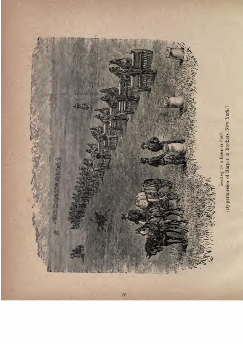
7/27/2019 Official Northern 00 Nort Rich
http://slidepdf.com/reader/full/official-northern-00-nort-rich 78/453
7/27/2019 Official Northern 00 Nort Rich
http://slidepdf.com/reader/full/official-northern-00-nort-rich 79/453
Across Xortli Dakota. 77
sounding all through the land. Usually the clear, exhil
arating weather is prolonged almost to the first of Decem
ber, interrupted only by. a slight dash of snow in late
October orearly
November. To sumup,
North Dakota
has a good, healthful climate all the year round a climate
favorable for labor, and for plant and animal growth.
North Dakota is the best wheat country of all the prairie
States, for the reason that the soil and climate are favor
able to the rapid growth and perfection of the best quality
of wheat known the so-called No. i Hard. You can't
raise this
kingof
wheat muchsouth of the
southernboundary of North Dakota. Indeed, the hard wheat
region is practically limited to Northern Minnesota, North
Dakota and Manitoba. North Dakota is also a good
country for barley, rye, flax and potatoes, and Indian corn
of varieties that mature early is successfully grown. It is
a superb stock country, on account of the abundance of
nutritious native grasses, the dryness of the winter atmosphere and the almost entire absence of cold, wet, chilling
storms. The conditions for wool growing are as favorable
as for raising cattle and sheep for the markets of the Twin
Cities and of Chicago. It is a peculiarly healthful country,
because of the stimulating quality of its air and the entire
absence of malarial influences. Thousands of the most
successful citizens migrated to the State on account ofbroken constitutions, feeble health or lingering disease and
have regained more than their old energy and vitality.
PargO. (25 1 miles from St. Paul; population, 10,000.)
This city, the county seat of Cass county, North Dakota,
242 miles west of Lake Superior, is situated on the western
bank of the Red river, which, though a very tortuous
stream, is the constituted boundary line between the Statesof Minnesota and North Dakota. This is the largest
7/27/2019 Official Northern 00 Nort Rich
http://slidepdf.com/reader/full/official-northern-00-nort-rich 80/453
78 The Northern Pacific Railroad.
city in North Dakota, and is often called the metropolis of
the Red River valley. The importance of Fargo is largely
due to the railroad system of which it is a central point.
The arrivals and departures of passenger trains number
twenty-six daily. There is a rail connection east, west and
southwest by the Northern Pacific line, another northwest
and southeast by the lines of the Great Northern, and
south by the Fargo Southern, operated by the Chicago,
Milwaukee & St. Paul Company, while the Moorehead &
Northern affords a northerly route on the eastern bank of
the Red river. The steam navigation of the river is not as
important a feature in the traffic movement of the town as
it was a few years ago, but is still of considerable value,
furnishing cheap transportation to the farmers in the imme
diate vicinity of the river banks. The growth of Fargo
began when the Northern Pacific reached the Red river,
late in 1871; but it was very slow until the large wheat
farms in the vicinity, opened as a rather hazardous experi
ment by Oliver Dalrymple, had demonstrated the remark
able fertility and great agricultural value of the Red River
valley. Fargo is a lively type of a new Western town,
with all the modern improvements, such as daily newspa
pers, waterworks and electric lights. It suffered a severe
disaster in the summer of 1893, when almost the entire
business district and hundreds of
dwellingswere
destroyedby fire,
but it was rapidly rebuilt and few traces of the
calamity can now be seen. Broadway, the chief business
-street, presents an attractive array of new business blocks
of uniform height. Fargo is an important center of higher
education, having the State agricultural college, and a
growing Congregational college. The court house and
high school are conspicuousedifices.
A gooddeal of
flour milling is done and the Northern Pacific divisional
7/27/2019 Official Northern 00 Nort Rich
http://slidepdf.com/reader/full/official-northern-00-nort-rich 81/453
Across North Dakota. 79
shops employ many mechanics. The wheat fields come
close up to the western suburbs of the town.
Bonanza Wheat Farms. Greene and Dalrvmple,
small stations west of
Fargo,and
Casselton,a little
further on, are in the midst of the so-called bonan
za farm district. A peculiarity of wheat -
growing
in North Dakota is the grand scale upon which it is fre
quently conducted. Prior to 1875 it was declared, upon
high army authority,that beyond the Red river the country
was not susceptible of cultivation;in going west from
that stream to theJames,
there was some fair
land,but
much that was useless ; and thence to the Missouri there
was little or no available area, except the narrow valleys
of the small streams; in fine with the exceptions named,
that the country was practically worthless. This sweeping
statement gained wide publicity, and caused much hesita
tion with respect to undertaking the cultivation of the
Dakota prairies. But Messrs. Geo. W. Cass and Benjamin P. Cheney, both heavy capitalists, and directors in the
railroad company, having faith in the fertility of the land
determined to test its capacity for wheat production.
They first bought, near the site of the present town of
Casselton, 7,680 acres of land from the railroad company,and then secured the intervening Government sections with
Indian scrip, thus obtaining compact farming grounds of
enormous area. Mr. Oliver Dalrymple, an experiencedwheat farmer, was engaged to manage the property ;
and
in June, 1875, he turned his first furrow, plowing 1,280
acres, and harvested his first crop in 1876. The acreage
was increased in each succeeding year, until in 1882 there
were not less than 27,000 acres under cultivation. This
immense farm does not lie in one body. One part of it,
known as the Grandin farm, is situated in Traill county,
7/27/2019 Official Northern 00 Nort Rich
http://slidepdf.com/reader/full/official-northern-00-nort-rich 82/453

7/27/2019 Official Northern 00 Nort Rich
http://slidepdf.com/reader/full/official-northern-00-nort-rich 83/453
Across North Dakota. 81
thirty miles north ot Casselton, The entire area embraced
by the three tracts is 75,000 acres. Farming operations
conducted on so gigantic a scale seem almost incredible
to persons who are only familiar with the methods of the
older and more settled States. In managing the affairs of
a" bonanza farm
"the most rigorous system is employed,
and the cost of cultivation averages about $i per acre less
than on smaller estates. The plan adopted by Mr. Dal-
rymple and all the other" bonanza
"men is to divide the
land into tracts of 6,000 acres each, and these are sub
divided into farms of 2,000 acres each. Over each 6,000
acres a superintendent is placed, with a bookkeeper, head
quarters building, and a storehouse for supplies. Each
subdivision of 2,000 acres is under the charge of a foreman,
and is provided with its own set of buildings, comprising
boardinghouses for the hands,stables,a granary,a machinery
hall and a blacksmith'sshop,
all connected with thesuperin
tendent's office by telephone. Supplies of every descrip
tion are issued only upon requisition to the several
divisions. Tools and machinery are bought by the car
load from manufacturers; farm animals are procured atSt-
Louis and other principal markets; stores of every descrip
tion for feeding the army of laborers, are purchased at
wholesale; and the result of the thorough system andintelligent economy in every department is found in the
fact that wheat is raised and delivered at the railroad at a
cost varying little from thirty-five cents per bushel.
The net profit on a bushel of wheat is seldom less that ten
cents, and the average yield per acre may safely be put at
fifteen bushels, although it often exceeds that quantity.
On this great farm, or, rather, combination of farmsthe 20,000 acre tract at Casselton 400 men are employed
in harvesting, and 500 to 600 inthreshing. Two hundred
7/27/2019 Official Northern 00 Nort Rich
http://slidepdf.com/reader/full/official-northern-00-nort-rich 84/453
82 The Northern Pacific Railroad.
and fifty pairs of horses or mules are used, 200 gang plows,
115 self-binding reapers, and twenty steam threshers.
Aboutthe ist of
Augustthe harvester is heard
throughoutthe length and breadth of the land, and those who have
witnessed the operation of securing the golden grain will
never forget the scene. The sight of the immense wheat
fields, stretching away farther than the eye can reach, in
one unbroken sea with gplden waves, is in itself a grand
one. One writer describes the long^procession of reaping
machines as moving like batteries of artillery, formed enechelon against the thick-set ranks of grain. Each machine
is drawn by three mules or horses, and with each gang there
is a superintendent, who rides along on horseback, and
directs the operations of the drivers. There are also
mounted repairers, who carry with them the tools for re
pairing any break or disarrangement of the machinery.
When a machine fails to work, one of the repairers is
instantly beside it, and, dismounting, remedies the defect in
a trice, unless it prove to be serious. Thus the reaping
goes on with the utmost order and the best effect. Travel
ing in line together, these 115 reaping machines would cut a
swath one-fifth a mile in width, and lay low twenty miles
of grain in a swath of that great size in the course of a
single day. "Carleton," a correspondent of the Chicago
Tribune, described the reaping scene thus :
"Just think of a sea of wheat containing twenty square
miles, 13,000 acres, rich, ripe, golden-the winds rippling
over it. As far as the eye can see there is the same
golden russet hue. Far away on the horizon you behold
an army sweeping along in grand procession. Riding on
to meet it, you see a major general on horseback, the
superintendent; two brigadiers on horseback repairers.
No swords flash in the sunlight, but their weapons are
7/27/2019 Official Northern 00 Nort Rich
http://slidepdf.com/reader/full/official-northern-00-nort-rich 85/453
Across North Dakota. 83
monkey-wrenches and hammers. No brass band, no drum
beat or shrill note of the fife; but the army moves on a
solid phalanx of twenty-four self-binding reapers to the
music of its own machinery. At one swath, in a twinkling
a path of 192 feet has been cut and bound the reapers
tossing the bundles almost disdainfully into the air each
binder doing the work of six men."
Casselton (271 miles from St% Paul; population, 1,500),
is a thriving town, the situation of which is very advan
tageous, being in the midst of one of the finest wheat rais
ing districts in the Dakotas. Tourists who wish to visit
some of the bonanza farms will find this the most conven
ient stopping place. The hotel accommodations are
good and teams can be had to drive to the farms.
Wheatland (277 miles from St. Paul; population, 500).
This town is established upon the
dividing ridge
that
separates the magnificent black soil of the Red River valley
from the undulating prairie beyond toward the Sheyenne,
and is supplied with general stores, hotels, etc. It is the
trading point for numerous small farmers, and also the
headquarters for several large bonanza-farm interests in
the vicinity.
Buffalo(287
miles from St. Paul;population, 500).
Buffalo is an incorporated village, and the trading point
for farmers in its vicinity, the exports being principally
wheat, oats and potatoes. It has an altitude of 575 feet
above the level of Fargo. The surrounding country is an
even prairie as far as the eye can reach. The first settler
came to Buffalo in 1878. In the vicinity of the town are
three bonanza farms.
Tower (293 miles from St. Paul; population, 800).
This town, named in honor of Charlemagne Tower, of
a former director of the Pa-
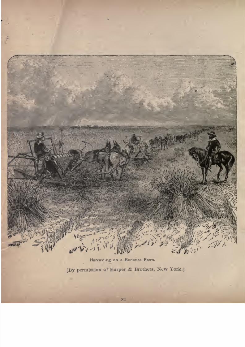
7/27/2019 Official Northern 00 Nort Rich
http://slidepdf.com/reader/full/official-northern-00-nort-rich 86/453
Harvesting on a Bonanza Farm.
[By permission o f Harper & Brothers, York.j
7/27/2019 Official Northern 00 Nort Rich
http://slidepdf.com/reader/full/official-northern-00-nort-rich 87/453
Across North Dakota. 85
cific rain'oad, is on the western edge of Cass county. It
was laid out in April, 1879. A school called Tower Uni
versity is controlled by the Baptist denomination. The
Northern Pacific railroad, in boring a well at Tower,
struck a vein of water at a depth of 670 feet. The water
is soft, not very cold, sweet and pleasant to the taste, and
its medicinal properties are said to besimilar to those of the
springs at Saratoga. Many persons who use the water say
that it works on the stomach and kidneys in a beneficial
manner, and tones up the entire system.
- Valley City (308 miles from St. Paul; population 2,000),
is the county seat of Barnes county. It lies in a deep val
ley surrounded by an amphitheatre of hills, which rise to a
height of 125 feet or more on every side of it. Circling
round the valley is the beautiful Sheyenne river, a stream
at this point fully seventy-five feet in width, running over
gravelly beds, and fringed with sturdy oaks, elms and other
woods. The Northern Pacific railroad enters the town
on its eastern side by a winding passage through the bluffs
for a distance of several miles, and emerges on the steep
est part of the line between Fargo and the Missouri river.
The town is furnished with a fine water-power by a fall of
ten feet in the river within the limits of the city proper.
TheSheyenne
river, to which the town owes much of its
prosperity, is one of the few important rivers in North Da
kota. It rises in the northern part of the Territory, in the
vicinity of Devil's Lake, and describes a tortuous course of
nearly 100 miles before it reaches Valley City. Its waters
are generally clear, and abound with fish, and its banks are
skirted with timber. Along its shores in former years
roamed thesavage Sioux,
andmany
abloody
conflict has
taken place between warrior tribes within sight of its
wooded slopes. One of the North Dakota Normal schools
7/27/2019 Official Northern 00 Nort Rich
http://slidepdf.com/reader/full/official-northern-00-nort-rich 88/453
8G The Northern Pacific Railroad.
is located at Valley City and occupies a handsome building
in a natural park south of the river. The " Soo"road, a.
Canadian Pacific line, running from the Sault Ste. Marie,
Mich., to Pasqua, Assiniboia, crosses the Northern Pacificnear Valley City.
Prairie Farming.-The cultivation of the soil in a prairie
country is,in some of its processes, very different from the
methods pursued elsewhere, and has given rise to at least
two technical termsi which are known as "breaking"
and "backsetting." Premising that the prairie soil is free
from roots, vines or other obstructions, and that the virgin
sod is turned from the mould-board like a roll of ribbon
from one end of the field to the other, a fact is presented
which farmers who are accustomed to plow among stones,
stumps and roots, can scarcely grasp. But the sod thus
turned is so knit together by the sturdy rootlets of the rank
prairie grass that a clod of large size will not fall apart
even though it be suspended in mid-air. To "break" or
plow this mat, therefore, it is necessary to cutit, not only
at the width of the furrow it is desired to turn, but under
neath the sod at any thickness or depth as well. An ordi
nary plow could not endure the strain of breaking prairie
soil, so plows called breakers have been constructed to do
this special work.
Usually, three horses abreast are employed, with a thin
steel, circular coulter, commonly called a "rolling coulter,"
to distinguish it from the old-fashioned stationary coulter,
beveled and sharpened for a few inches above the point of
the plow to which it is attached. A furrow is broken six
teen inches wide and three inches thick, and the sod, as a
rule, is completely reversed or turned over. Each team is
expected to break sixteen miles of sod, sixteen inches wide
and three inches thick, for a day's task. By cutting the sod
7/27/2019 Official Northern 00 Nort Rich
http://slidepdf.com/reader/full/official-northern-00-nort-rich 89/453
Across North Dakota. 87
only three inches thick, the roots of the grasses, under the
action of heat and moisture, rapidly decay. The breaking
season begins about the ist of May, and ends about the ist
of July. The wages of men employed at this kind of work
are $20 per month and board . The estimated cost of break
ing is $2.75 per acre, which includes a proportionate outlay
for implements, labor and supplies. But the ground once
broken is ready for continued cultivation, and is regarded
as having added the cost of the work to its permanent
value. The ''broken" land is now with propriety termed a
farm.
"Backsetting" begins about the ist of July, just after
breaking is finished, or immediately after the grass be
comes too high, or the sod too dry, to continue breaking
with profit. This process consists in following the furrows
of the breaking, and turning the sod back, with about
three inches of the soil. In
doingthis
work,it is usual to
begin where the breaking was begun, and when the sod
has become disintegrated, and the vegetation practically
decomposed. Each plow, worked by two horses or mules,
will "backset" about two and a half acres per day, turning
furrows the width of the sod. The plows have a rolling
coulter, in order that the furrows may be uniform and
clean, whetherthe sods
have grown togetherat their
edges or not. The "backsetting" having been done,
there only remains one other operation to fit the new
ground for the next season's crop. This is cross-plowing
(plowing crosswise, or across the breaking or backsetting),
or so-called fall plowing, which is entered upon as soon
as the threshing is over, or -on damp days during the
threshing season. A team of two mules will accomplishas much cross-plowing in a day as was done in backsetting
two and a half acres. The wages for backsetting and fall
7/27/2019 Official Northern 00 Nort Rich
http://slidepdf.com/reader/full/official-northern-00-nort-rich 90/453
88 The Northern Pacific Railroad.
plowing are also $20 per month and board, or $1.50 per
acre to hire the work done.
The virgin soil having been broken, backset and cross-
plowed, is now ready for seeding. This, ordinarily, beginsfrom about the middle of March to the ist of April, and is
often not finished until the ist of May. Instead of the old
style of hand sowing, a broadcast seeder is used, one of
which machines will sow twelve acres a day. Fifty-two
quarts of clean Scotch Fife seed wheat are used to the
acre. The cost of sowing the ground is seventy-five cents
per acre, and the average cost of the seed wheat, upon the
larger farms, has been $1.50 per acre. Seeding having
been carefully attended to, the harrowing or covering
process demands close attention. The grain must be
evenly covered, at a uniform depth, to insure a good stand,
healthy growth, and even maturity. On the so-called
bonanza and systematically conducted farms, one pair of
harrows usually follows each seeder, going over the groundfrom one to five times, according to the condition of the
soil, until it is well pulverized, the seed evenly covered,
and the surface reasonably smooth.
Harvesting on the large farms begins about the ist of
August. Self-binding harvesters, one to every 160 acres,
are employed, and one driver and two shockers are
required to each machine. The wages during the harvest
season are $1.50 to $2 per day and board.
The work on a wheat farm only occupies a few weeks in
the year, and the business is attractive on that account,
apart from the profits. After the plowing and seeding
are finished, the farmer can -look on, and see Nature growand ripen his crop, until the harvest time comes. By the
end of August the year's work is practically done. Expensive farm buildings are not required; for the grain may be
7/27/2019 Official Northern 00 Nort Rich
http://slidepdf.com/reader/full/official-northern-00-nort-rich 91/453
Across North Dakota. 89
threshed in the fields, and hauled immediately to the
nearest railroad station. Very little fencing is needed on
a wheat farm. Frequently the cultivated portion is left
unenclosed, and a barbed wire fence is put around the
pasture lot to secure the cattle.
Sanborn (320 miles from St. Paul; population, 500).
This is the diverging point for a branch road which runs
to Cooperstown, thirty-six miles distant. There are a
number of alkaline lakes near the town, which are great
resorts of wild ducks. In a low range of hills about five
miles south of the place ancient pottery has been exca
vated, showing that this region was once the home of a
race less savage than the wild red men, who knew nothing
of the fashioning and burning of clay.
Lake Eckelson. The railroad crosses a large, shallow
alkaline lake 323 miles from St. Paul. This lake is seven
miles
long
andthree-quarters
of a mile wide and is a
favorite resort for duck hunters.
Jamestown (343 miles from St. Paul; population, 3,000).
This is an active town, and is the commercial centre of
an extensive region of country. It is the county seat of
Stutsman county, and is situated in the midst of a rich
agricultural region which is equally well adapted to
wheat-raisingand
stock-growing.The town stands on a
dry plateau on the east bank of the James, and is sur
rounded by ranges of sloping hills. The drainage is
excellent, and the health conditions are remarkably good.
Jamestown is the junction of the Jamestown & Northern
Railway, extending north to Leeds, 108 miles, where it
reaches the main line of the Great Northern railroad. The
James River Valley railroad runs to Oakes, sixty-nine milessouth of Jamestown.
The North Dakota Insane hospital, a public institution

7/27/2019 Official Northern 00 Nort Rich
http://slidepdf.com/reader/full/official-northern-00-nort-rich 92/453
90 The NorthernJ>acifcjlailroad.
costing over $100,000, stands on the hill about a mile
south of the town. The two principal public school
houses cost respectively $14,000 and $15,000. The James
town college, established by the Presbyterians, is a handsome brick edifice standing on the bluffe overlooking the
town. There is a reading room and a circulating library.
Jamestown is the headquarters of the Dakota division of
the Northern Pacific railroad. The railway buildings
here, including the round-house and machine shops, cost
about $100,000.
The North Dakota Insane Hospital. This institu-
tition ranks with the best and most progressive of its class
in the country. The system is one of patient kindness
coupled with only as much restraint as is absolutely nec
essary, The hospital is a home and not a prison for the
demented. In either of the wards the visitor might well
suppose himself to be in some first-class family hotel,
so pleasant are the rooms, with their numerous pictures
and their pretty furniture, so neat the halls and so quiet
the behavior of the inmates. Many of the patients have
the free range of the grounds and are employed in light
labors about the farm and house. There are many forms
of agreeable evening entertainments devised, including
concerts and dances, to relieve the tedium of asylum life.
Books and magazines are plentiful; some of the women
inmates have house plants and birds, and some of the men
carry on little mechanical employments for which they have
a fondness. There is no effort to apply iron-bound rules
and methods to all the inmates. Each case is studied sep
arately, its history carefully looked up and a plan of treat
ment followed whichpromises
a
permanentcure. It is
surprising how many cases of pronounced dementia yield
speedily to a regimen in which good and sufficient food,
7/27/2019 Official Northern 00 Nort Rich
http://slidepdf.com/reader/full/official-northern-00-nort-rich 93/453
7/27/2019 Official Northern 00 Nort Rich
http://slidepdf.com/reader/full/official-northern-00-nort-rich 94/453
92 The Northern Pacific Railroad.
into lakes and ponds. Most of the soil is deep and
rich, and farming is successfully carried on. The region is
also admirably adapted for stock-raising and wool-grow
ing, pasturage being excellent, and the numerous naturalmeadows in the valleys and around the lakes and ponds
furnishing an abundant supply of hay. From the western
margin of the plateau, where it begins to dip toward the
valley of the Missouri itself, the country is generally known
as the Missouri slope.
Dawson and Steele. These places, distant from St.
Paul 394 and 402 miles, are the chief towns of the Coteaux
country, and have a population of about 500 each, and are
active centers of local trade. Steele is on the highest land
on the line between the Red and the Missouri rivers.
There are a number of lakes north and south of these
towns which are visited in the fall by sportsmen from Chi
cago, St. Paul and Minneapolis. Wild geese resort to
these lakes in great numbers on their annual migratory
flights from the far North to the South. In fact, this is
the best goose-hunting region in North Dakota.
. Bismarck (444 miles from St. Paul; population, 2,500).
This is the capital of North Dakota, and the county seat
of Burleigh county, on the east side of the Missouri.
There is something fine and commanding in the
situation of Bismarck, standing, as it does, on hills that
overlook the course of the great river of the Northwest
the Missouri. .Twenty or thirty miles of the tawny stream,
with its bordering belts of cottonwood forest, can be seen
from almost any street crossing in the town, and from the
crests of the hills the great steel railroad bridge shows
the only railway crossing on the Missouri between Sioux
City and Great Falls, a distance, following the bends of
the stream, of fully two thousand miles. The group of
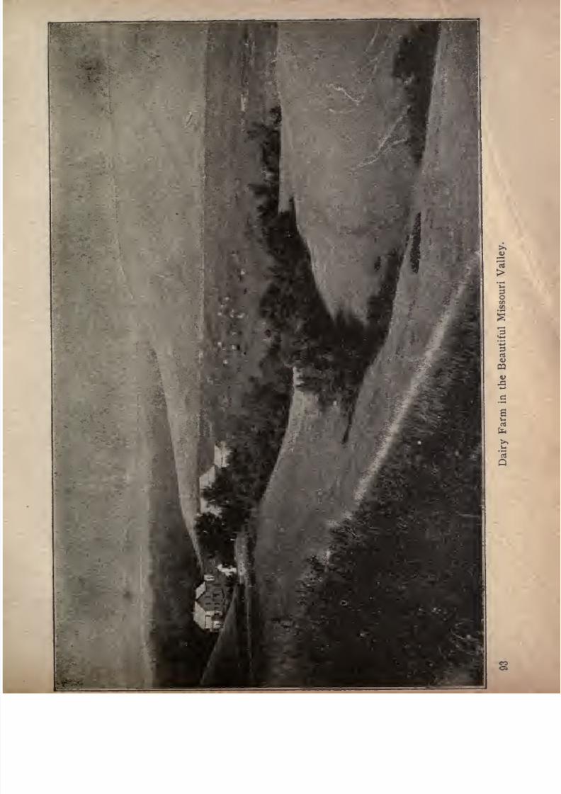
7/27/2019 Official Northern 00 Nort Rich
http://slidepdf.com/reader/full/official-northern-00-nort-rich 95/453
1
7/27/2019 Official Northern 00 Nort Rich
http://slidepdf.com/reader/full/official-northern-00-nort-rich 96/453
04 The Northern Pacific Railroad.
buildings, scarcely seen in the distance beyond the bridge,
is 'the town of Mandan. That white speck on the bluffs
far down the river is Fort AbrahamLincoln,
aspot
of sad
memories, for it was from this post that the gallant Custer
set forth with his cavalry on the ill-fated expedition that
ended in the annihilation of his regiment.
When you enter Bismarck by rail from the east the
first noble structure that you see is the State penitentiary,
a solid red brick edifice surrounded by a very tall, white
board fence, on which little sentry boxes are perched.Then you notice, on a brown hill slope far out beyond the
limits of suburban growth, an enormous object of uncouth
shape, looking like an exaggerated brick pile. This is the
unfinished capitol building, and its peculiar appearance
comes from the fact that it presents to the town the dead
wall of the central structure, which is to be joined in the
future, according to the architect's plan, to the wings of an
imposing dome-surmounted edifice. Go up to the front of
the building and you find that the wing built by the sub
scriptions of the people of Bismarck and presented by them
to the old Territory, is of itself a structure of liberal pro
portions, and a visit to its interior will show that it is large
enough for all the present needs of the economical govern
ment of a young State.
The business streets of Bismarck stand on the "second
bench"above the Missouri, but the river is a long way off
across a stretch of nearly two miles of hay bottoms and
cottonwood groves. Following the railroad westward to
the bridge, also about two miles away, you will notice that
the stream here runs at the foot of the bluffs, and that the
bottoms are on the other side. Here is the steamboat
landing from which boats leave for the upper river, fol
lowing its sinuous course as far as Fort Benton. This was
7/27/2019 Official Northern 00 Nort Rich
http://slidepdf.com/reader/full/official-northern-00-nort-rich 97/453
Across North Dakota. 95
the only highway of travel to the mines of the Northern
Rockies until the railroad was built. Its importance as a
channel of commerce has greatly diminished in late years,
but it is still the only avenueof
communication with a
great deal of pastoral country lying along both sides of
the stream, and the river traffic is still a valuable feature
in the trade of Bismarck. With a fuller development of
the river country the business of steamboating will con
siderably increase, and Bismarck has a right to look upon
the broad, muddy river as one of her sure resources for
future growth. The residence streets of the town climb
gentle slopes from this level" second bench
"back to the
summits of the hills, and there are few dwellings so situ
ated as to miss the superb outlook over the river and the
valley which is the special pride of Bismarck people.
The business streets exhibit an unusual number of
substantial three-story brick blocks for a town of 2,500
inhabitants, and the size of the stores and the stocks they
carry show that the trade of the place is not wholly a local
one. It reaches far out, in fact, going away up the river
as far as the steamboats run, and down the river to farming
settlements and stock ranches, and back into the country
east of the river for a long distance.
The United States land office for the western part of
North Dakota is located at Bismarck, and here settlers
can get full information as to the tracts still open to home
stead entry. The town is an interesting place for the
Eastern tourist to visit. He should take time to talk with
the old settlers about its romantic early history, and to
drive out over the hard, elastic prairie roads to see the
farms and stock ranches. The country is all attractive,
and it is a very big, broad country, with plenty of room in
it for new people.
7/27/2019 Official Northern 00 Nort Rich
http://slidepdf.com/reader/full/official-northern-00-nort-rich 98/453
96 The Northern Pacific Railroad.
Fort Abraham Lincoln. From Capitol hill, in Bis
marck, can be plainly seen the white walls of Fort Abraham
Lincoln. This military station lies five miles distant by
the road, on the high bluffs on the west side of the Mis
souri, and not far from Mandan. It was attacked on five
different occasions during the years 1872-73, by the Sioux,
with an aggregate loss of eight killed and twelve wounded
on the side of the troops ;but the repulsed Indians suffered
more severely. The gallant and ill-fated Gen. Geo. A.
Ousterpassed
Ihe last twoyears
of his life at this
post,and it was from this post that he set out with his regiment
in 1876 on the expedition which resulted in the massacre
of his entire command. One of the friends of the deceased
general, in describing the incidents of Custer's busy life,
gives a glimpse of his room at the old fort in the following
words :
"It was pervaded by an air of luxury and good
taste, althoughthe furniture was of the
plainest,and much
of it old and worn. But over every old chair or sofa,
covering all deficiencies, were beautiful furs and skins that
money could hardly purchase, the spoils of Custer's rifle;
and all around the walls hung grand heads of buffalo/'
The Great Bridge Over the Missouri River. This
superb bridge was opened for traffic with appropriate cere
monies on the ist of October, 1882. Prior to that time theriver was crossed by means of a large transfer steamer,
specially constructed for the purpose of carrying trains of
cars. Owing to the strong current and constantly shifting
sand-bars in the channel, the ferriage by steamboat was
always tedious, and the Northern Pacific Railroad com
pany never intended that so slow a transfer of its trains
should be anything but a temporary arrangement.The bridge proper consists of three through spans, each
measuring 400 feet between centers of end pins, and two
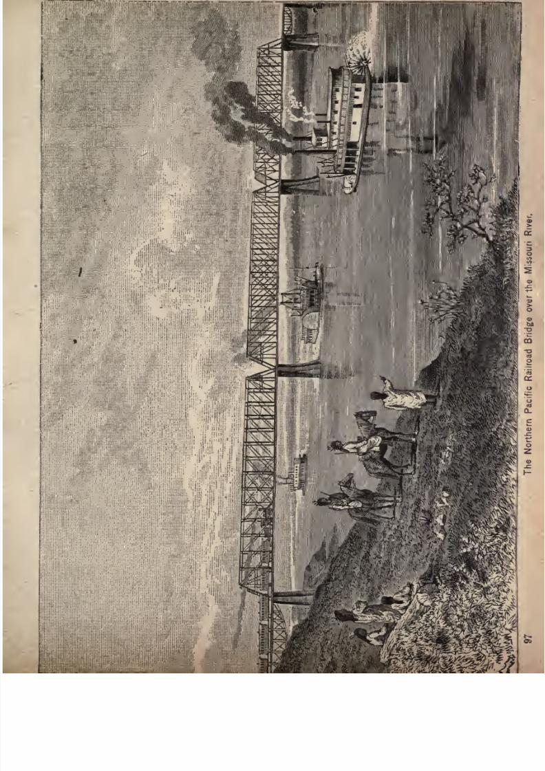
7/27/2019 Official Northern 00 Nort Rich
http://slidepdf.com/reader/full/official-northern-00-nort-rich 99/453
7/27/2019 Official Northern 00 Nort Rich
http://slidepdf.com/reader/full/official-northern-00-nort-rich 100/453
98 The Northern Pacific Railroad.
approach spans, each 113 feet. It is a high bridge, the bot
tom chord of the three main spans being placed fifty feet
above the level of the highest summer flood, thus giving
room for steamboats to pass at all navigable stages of the
river, the bridge allowing practically four feet more room
than many of the bridges on the lower Missouri. The
variable channel and the high bluff on the east side were
sufficient reasons for adopting the high bridge plan in pre
ference to the low bridge with a draw, and the violent
action of the ice added to the force of these reasons. The
east end of the east approach span is supported by a small
abutment of granite masonry founded on the natural
ground of the bluff. The west end of the west approach
span is upheld by an iron bent, resting on two Gushing
cylinders, which are supported by piles driven into the
sand-bar. The three long spans are supported on four
granite piers, which are of unusual size, with long, raking
ice breakers, shod with steel. They are fashioned so as to
cut readily the large sheets of ice upon the breaking up of
the river in the spring, and to afford the least possible
obstruction to the moving mass of broken ice which fol
lows. Their stability far exceeds any force which the ice
can exert.
Each of the main channel spans measures 400 feet, divided
into sixteen panels of twenty-five feet each. The trusses
are fifty feet deep from center to center, and twenty-t,wo
feet apart. The pedestals, end posts, top chords, and ten
center panels of the bottom chord, and all the pins and
expansion rollers, are of steel. All other parts in the main
are of wrought iron, except the ornamental work, which is
of cast iron. Eachlong span
contains
600,950 poundsof
wrought iron, 348,797 pounds of steel, and 25,777 pounds
of cast iron, the total weight of each span being 975,524
7/27/2019 Official Northern 00 Nort Rich
http://slidepdf.com/reader/full/official-northern-00-nort-rich 101/453
Across North Dakota. 99
pounds. The steel used was manufactured under the
most rigid inspection, and subjected to extraordinary tests
before it was placed in position. The extreme height from
the bottom of th,e deepest foundation to the top chord of
the bridge is 170 feet. The floor of the structure is formed
of oak timbers, nine inches square and fifteen feet long,
with spaces of six inches between. On this floor are laid
the steel rails of the track.
The West Missouri Country, which is the region in
North Dakot^ bounded on the east and north by the Mis-
souri river, on the west by the Montana line, and on the
south by South Dakota, is the best watered region in the
two States of North and South Dakota. Within that region
are the Little Missouri, the Knife, the Heart, the Little
Heart, the Cannon Ball and the Grand rivers, to say noth
ing of many smaller streams tributary to those mentioned.
These streams are running all the year. They get their
waters from some hidden springs and do not. depend uponlocal rains. The water that feeds them comes from the
Rocky Mountains along strata that are shallow, Morton
county, of which Mandan is the county seat and only town
of any considerable size, extends some seventy-odd miles
by rail westward from the Missouri river, and averages
about fifty miles in width. There were over 400,000 bushels
of hard wheat raised in the
county
in
1891,
which would
give $100, if sold at market price, to every man, womanand child within, its borders.
Mandan (450 miles from St. Paul; population 2,000). It
lies on the west bank of the Missouri, nestled in the low
lands between that great stream and the Heart river, just
after the railroad bridge is passed. On three sides it is
inclosed
bylow
rangesof
hills,
and the fertile Heart River
valley here broadens into a wide, circular plain. Up to
7/27/2019 Official Northern 00 Nort Rich
http://slidepdf.com/reader/full/official-northern-00-nort-rich 102/453
100 The Northern Pacific Railroad.
1879, when the extension of the railroad west of the
Missouri river was begun, the sight of Mandan was
occupied by Indians, while buffaloes ranged on the neigh
boring hills. Even as late as the period named, the warlike Sioux had here a series of skirmishes, which cul
minated in a pitched battle with the Arickarees, or Rees, as
they are commonly termed, a branch of the Mandan tribe.
It is now a trading point for the Sioux on the great Stand
ing Rock Reservation, forty miles south, which is divided
by the boundary line between North and South Dakota,
and was the scene in the winter of 1890 of those bloody
battles between the vUnited States troops and the Indians
which the reader will recall.
The principal thoroughfare, Main street, which runs
parallel with the railroad, is divided from the track along
its entire length by a wide, open space that is set apart for
a city park. This being the terminus of the Dakota
division and the beginning of the Missouri division of the
railroad, there are, at Mandan, extensive machine shops,
round-house, freight buildings, and every other appliance
for the transaction of railroad business, a large. number of
workmen being employed.
Fuel is supplied in abundance both wood and coal
by the timber which skirts the rivers, and by the mines,
which are worked to great advantage, on the line of the
railroad westward. The coal is delivered by the car-load
at a low price. Much attention is given in Morton county
to stock and sheep raising, to which the country and
climate are well adapted.
Near Mandan are points of interest dating from prehis
toric times. A short distance south of thecity
are mounds
which have been formed by successive layers of camp
refuse, heaped together and burned by recurring prairie
7/27/2019 Official Northern 00 Nort Rich
http://slidepdf.com/reader/full/official-northern-00-nort-rich 103/453
Across North Dakota. 101
fires. In these stratifications are found stone weapons,
arrow-heads, household implements, pottery, trinkets, and
bones of men and animals. The Indians deny all knowl
edge of these mounds, the presence of which offers a fine
field for archaeological and ethnological research. The
Mandan Pioneer, describing some of the discoveries, said:
"Two miles from Mandan, on the bluffs near the junc
tion of the Heart and Missouri rivers, is an old cemetery of
fully 100 acres in extent, filled with bones of a giant race.
This vast city of the dead lies just east of the Fort Lincoln
road. We have just spent a half-day in exploring this
charnel house of a dead nation. The ground has the
appearance of having been filled with trenches piled full of
dead bodies, both man and beast, and covered with several
feet of earth. In many places mounds from eight to ten
feet high, and some of them 100 feet or more in length,
have been thrown up, and are filled with bones, broken
pottery, and vases of various bright-colored flints and
agates. The pottery is of a dark material, beautifully
decorated, delicate in finish, and as light as wood, showingthe work of a people skilled in the arts, and possessed of a
high state of civilization. Here is a grand field for the
student, who will be richly repaid for his labors by exca
vating and tunneling in these catacombs of the dead.
This has evidently been a grand battle field where thou
sands of men and horses have fallen. Nothing like a
systematic or intelligent exploration has been made, as
only little holes, two or three feet in depth, have been dugin some of the mounds; but many parts of the anatomy of
man and beast, and beautiful specimens of broken pottery
and other curiosities, have been found in these feeble
efforts at excavation. Who are they, and from whence
didthey come, dying, and leaving only these crumbling
7/27/2019 Official Northern 00 Nort Rich
http://slidepdf.com/reader/full/official-northern-00-nort-rich 104/453
102 The Northern Pacific Railroad.
bones and broken fragments of their works of art to mark
the resting place of a dead nation? Five miles above
Mandan, on the opposite side of the Missouri, is anothervast cemetery, as yet uexplored.
''How long have these bones and remains laid in this
cemetery, is a question which readily suggests itself.
The fact that there are no existing tribes on the plains
having any knowledge of pottery would indicate that the
mounds had existed for a very long time. And yet there
are found near the surface, and again down to a depth of
nine, ten or fifteen feet, well-preserved bones, which look
as if they had not been buried more than five or ten years.
Then, again, the fact must be borne in mind that there
are no tribes existing that will own to any knowledge of
these mounds. The Indians simply say they are spirit
mounds, concerning which they know nothing. It seems
strange that they should have been forgotten, even within
a period of 100 or 200 years, since the Indians have very
tenacious memories for traditional matters. The sexton
of this cemetery appeared to have a very peculiar way of
doing his work. It seems that human bodies were buried,
then an accumulation of grass and brush was thrown over
them and set on fire. This is proved by the fact that
above the bodies will be found from two to three inches of
ashes. Then it looks as if the living folks had remained
in the vicinity long enough to cover the dead remains
with broken pottery and bones of animals. The whole
would then be covered with layers of rubbish, such as
would be cleared away from the tents of the people as a
sanitary precaution, Broken pottery, and fragments of
bones and ashes in layers, go to make the funeral mounds
complete.
"Jn the ashes are found charred corn-cobs?burned bones.
7/27/2019 Official Northern 00 Nort Rich
http://slidepdf.com/reader/full/official-northern-00-nort-rich 105/453
Across North Dakota. 103
and charred meat. All the large bones that are found are
broken, with the exception of the human bones. Judging
from appearances, this was not only a great cemetery, but
agreat banqueting place
also."
Prairie Dogs. After leaving Mandan, the railroad
passes through the fertile valley of the Heart river, which
tortuous stream it crosses at frequent intervals, before
reaching Marmot, the next station, nine miles westward.
Marmot is situated on a high plateau near the confluence
of the Heart and the Sweet Briar rivers. The station
derives its name from the fact that a prairie dog villageexisted here before the railroad appeared. As the train
advances westward these curious little animals are more
abundant, their antics affording a great de'al of amuse
ment to passengers. Colonel Richard I. Dodge, in his
book, "The Plains of the Great West," writes that this
" well-known animal is badly named, having .no more of
the dog about him than an ordinary gray squirrel. He is
a species of marmot, and burrows in the ground, as do
wolves, foxes, raccoons, skunks, and all the smaller ani
mals on the treeless plains. He lives on grass and roots,
and is exceedingly prolific, each female bringing forth sev
eral sets of young each year. He is not excellent eating,
but the young are as good as the common squirrel, and
when other flesh meat is not to be had, they make no unwelcome addition to the bill of fare. I regard the prairie
dog as a machine designed by nature to convert grass into
flesh, and thus furnish proper food to the carnivora of the
plains, which would undoubtedly soon starve but for the
presence in such numbers of this little animal. He is
found in almost every section of the open prairie, though
he prefers dry and arid to moist and rich localities. He
requires no moisture and no variety of food. The scanty
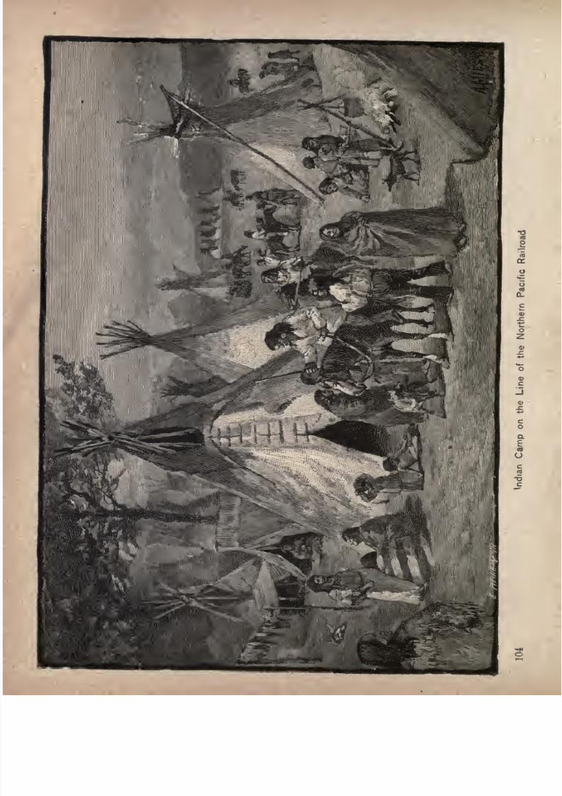
7/27/2019 Official Northern 00 Nort Rich
http://slidepdf.com/reader/full/official-northern-00-nort-rich 106/453
7/27/2019 Official Northern 00 Nort Rich
http://slidepdf.com/reader/full/official-northern-00-nort-rich 107/453
Across North Dakota. 105
grass of the barest prairie appears to furnish all that is
requisite for his com-fortable existence. Though not in a
strict sense gregarious, prairie dogs yet are fond of each
other's
company,and dig their holes in close
vicinity.Such a collection is called a town, and they sometimes
extend over immense areas. The numbers of inhabitants
are incalculable. Cougars, panthers, wildcats, w.olves,
foxes, skunks and rattlesnakes all prey upon them without
causing any perceptible diminution of their immense
numbers."
The west bound train makes a
steadyclimb of
twenty-eight miles after crossing the Missouri river, through a
rather rough country, and stops at New Salem, in the midst
of a rich grain and grazing region. The immediate out
look is not particularly inviting, the best lands being hid
den from view by broken ranges of low hills. These lands
are not remote, by any means, as might be imagined, but
lie chiefly within easy distance of the town. The cultivated sections are more or less scattered. Though a fairper-
centage of the lands are productive in one form or another,
the desirable spots are far from being generally occupied
by either crops or live stock. A colony of Germans from
Illinois settled down in the neighborhood in 1883 and '84,
made good farms of the virgin soil, and are now almost
without exception in comfortable circumstances. TheseGermans still form the largest portion of the inhabitants
of the region. Some Americans are located here and there
who have been equally prosperous, one season's crops
alone making them independent. Fine vegetables are
grown in the vicinity, and the extent of the dairy product
is something remarkable.
Sims (36 miles west of Mandan) was built principally
in 1883 by the N. P. Coal company, that developed that
7/27/2019 Official Northern 00 Nort Rich
http://slidepdf.com/reader/full/official-northern-00-nort-rich 108/453
106 The Northern Pacific Railroad.
year the coalmines opened in '78. Three companies have
opened mines, shipping, during the winter season, from
200 to 250 cars a month. The coal is a
superior qualityof
lignite, easily mined from veins seven feet in thickness.
It is shipped east to Mandan, Bismarck, Jamestown and
intermediate points, and to towns on the Jamestown &
Northern and the James River valley branch. It can be
delivered at those points so much more cheaply and
quickly than Eastern coal, that a steady demand exists for
it,and a
reliable, profitable marketis
found nearat
hand.This lignite burns steadily, makes an intense heat and
creates no soot.
A great stretch of country, admirably adapted for graz
ing, extends to the north and south of the Northern Pacific
railroad in Oliver and Morto.n counties, which should be
made productive. An abundance of Government and rail
road Jand is obtainable any where in the neighborhood of
Sims, which is well watered by three running streams,
emptying into the Little Muddy, which in turn delivers its
waters in the Heart river fifteen miles south. Almost any
number of sheep or cattle ranches could be located on these
lands and made highly profitable by careful management.The railroad lands are offered on terms which anybody
could comply with, and in many sections they would pro
duce grain.
Hebron is a settlement composed in great part of col
onists of the German Evangelical faith, from Illinois and
Wisconsin, and German-Russians, who migrated from the
Province of Besserabia in Russia to avoid military conscrip
tion, and to find homes in a free country. These people are
thrifty and industrious and make the best of the resources
of the country. Many of them build substantial houses
from the prairie turf, with good roofs thatched with straw,
7/27/2019 Official Northern 00 Nort Rich
http://slidepdf.com/reader/full/official-northern-00-nort-rich 109/453
Across North Dakota. 107
They understand the care of cattle and the raising of grain,
and although they arrived with very little money, they are,
as a rule, in comfortable circumstances. The road here
crosses a branch of the Big Knife river, which makes a
handsome and fertile valley.
Gladstone (549 miles from St. Paul; population 500).
This town was laid out in the spring of 1882 by a colony
from Ripon, Wisconsin, on the north bank of the Green
river, and named in honor of the great English statesman.
The situation of the town is pleasant, and the surrounding
country for many miles is settled. At Lehigh, betweenGladstone and Dickinson, are great fields of coal of a good
variety for heating and cooking purposes. This coal is
apparently of a recent formation, and emits no smoke or
disagreeable odor, but burns like wood and equally as fast.
It is shipped as far east as Fargo.
The farming community of the eastern portion of Stark
county, composed mostly of Russians, supply themselves
with the native coal, found either upon their own or
neighbors' farms, without any cost but that of digging it
from the side of the bank, build their own houses of native
stone or rubble plaster and fill in the chinks and cracks
with an excellent plaster, made from the clay and sand,
farm the little valleys, herd their stock on the range of
table lands, work hard and grow rich and contented. Anumber of Russians who live in this part of Stark county
have money on deposit in the bank, own their farms, cattle
and sheep, free from mortgage, to the value of thousands
of dollars. They were very poor, eight or ten years ago.
Dickinson (no miles west of the Missouri river and 560
miles from St. Paul; population, 1,000), is an active town in
the valley of the Heart river. The ground on the outskirts
of the towngradually slopes
to the south, givinga fine
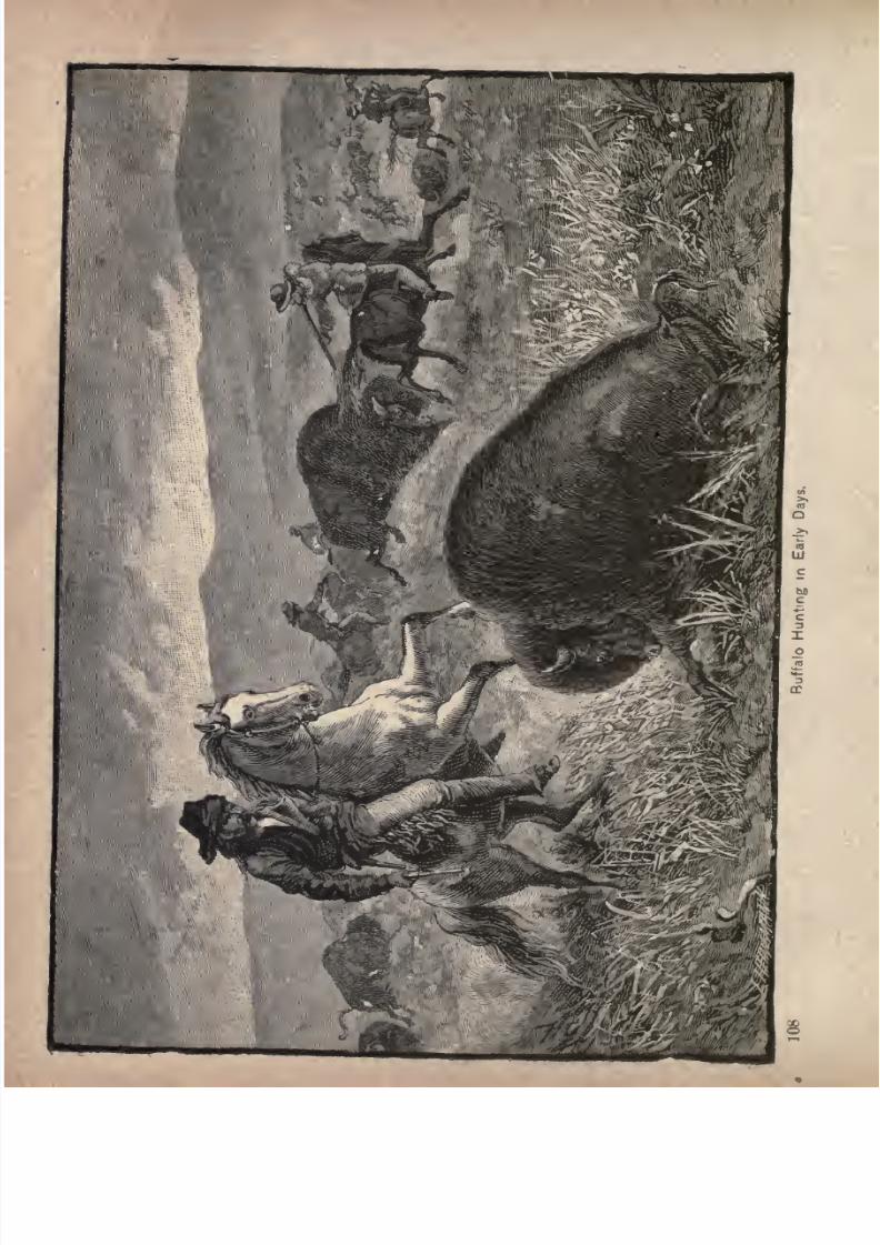
7/27/2019 Official Northern 00 Nort Rich
http://slidepdf.com/reader/full/official-northern-00-nort-rich 110/453
7/27/2019 Official Northern 00 Nort Rich
http://slidepdf.com/reader/full/official-northern-00-nort-rich 111/453
Across North Dakota. 100
opportunity for drainage. Being' the end of a freight
division of the N. P., there are railroad shops and a
roundhouse here. Dickinson is the county seat of Stark
county. The tributary country is well watered, and the
rainfall in spring and summer is sufficient to insure good
crops. Many thousands of acres are already under culti
vation, and there are excellent stock ranges within thirty
miles of the town. The coal beds in the immediate vicinity
produce a good quality of lignite, and a fine grade of clay
for brickmaking, and sandstone for building purposes is
found in the
neighboring
bluffs.
Between Stark' county's western boundary and Dickinson
is the limit, practically, of North Dakota's tillable soil.
But there is no limit to the grazing lands. Stock growers
thrive everywhere west of the Missouri river in the grain
sections of Morton and Stark counties, and in the Bad
Lands to the west. In the country round about Dickinson
onlya small
partof the land has been
cultivated,stock
raising having always been the chief occupation of the
residents. A few miles west of Dickinson may be said to
be the extreme western point where crops can be profitably
raised without irrigation until Eastern Washington is
reached.
The ''Bad Lands." At Fryburg the train suddenly
leavesthe beautiful
rolling prairies, and enters a long cuton a down grade, presently emerging upon a region, the
startling appearance of which will keep the vision alert
until the Little Missouri river is reached, fourteen miles
beyond. Here are the Bad Lands, sometimes called Pyramid Park, which show that the mighty forces of water
andfire, fiercely battling, have wrought a scene of strange
confusion. Buttes, from 50 to 150 feet in height, withrounded summits and steep sides, variegated by broad hori-
7/27/2019 Official Northern 00 Nort Rich
http://slidepdf.com/reader/full/official-northern-00-nort-rich 112/453
llo The Northern Pacific Railroad.
xontal bands of color, stand closely crowded together.
The black and brown stripes are due to veins of impure
lignites, from the burning of which are derived the shades
of red, while the raw clay varies from a dazzling white to
a dark gray. The mounds are in every conceivable form,
and are composed of different varieties of argillaceous
limestone, friable sandstone and lignite, lying in successive
strata. The coloring is very rich. Some of the buttes
have bases of yellow, intermediate girdles of pure white,
and tops of deepest red, while others are blue, brown and
gray. There are also many of these elevations which, in
the hazy distance, seem like ocean billows stiffened and at
. rest.
< Between these curiously shaped and van-colored mounds
there are sharp ravines and gulches, which are often the
beds of shallow streams. Here and there are broader
spaces, covered with rich grass, and flecked with -a growth
of ground juniper of delicious fragrance. No trees worthy
of the name are seen; but a fringe of gnarled and mis
shapen pines occasionally presents itself along the water
channels. In ages long ago, however, dense forests existed
in these Bad Lands. There is evidence of this primeval
growth in the abundant petrifactions of tree stumps, four
to eight feet in diameter, which are in portions translucent
as rock crystals, and susceptible of as high a polish. Fine
specimens of fossil leaves, of the Pliocene age, changed by
the heak of the burning lignite into a brilliant scarlet, but
retaining their reticulations perfect, are also found. The
coal, still burning, gives a plutonic aspect to the whole
region, one fiery mass not far from the railroad being
easily mistaken at night for an active volcano, the cliffs hav
ing close resemblance to volcanic scoria. Among the manyother fossil remains are oysters, clams and crustaceans.
7/27/2019 Official Northern 00 Nort Rich
http://slidepdf.com/reader/full/official-northern-00-nort-rich 113/453
In "The Bad Lands." Ill
The seeker for geological curiosities has here a fine field
in which to work.
The term Bad Lands, as applied to this region* is a
gross misnomer. It conveys the idea that the tract is
worthless for agricultural and stock-raising purposes.
Nothing could be wider from the truth. The fact is, the
soil possesses fertilizing properties in excess, and the lux
uriant grasses which here flourish, attract herbivorous
game animals in large numbers. The designation" Bad
Lands"
is derived from the times of the old French voya-
geurs, who, in their trapping and hunting -expeditions in
the service of the great fur companies, described the region
as"mouvaises terres pour traverser" meaning that it was a
difficult region to travel through with ponies and pack
animals. This French descriptive term was carelessly
translated and shortened into" bad lands," and thus has
resulted a wholly false impression of the agricultural value
of the country.
The entire region, geologists tell us, was once the bed
of a great lake, on the bottom of which were deposited,
for ages, the rich clays and loams which the rains carried
down into its waters. This deposit of soil was arrested
from time to time sufficiently long to allow the growth of
luxuriant vegetation, which subsequently decayed, and
was consolidated by the pressure of
succeeding deposits,transforming itself into those vast beds of lignite coal
which abundantly meet the need of the country for fuel.
The various strata thus deposited are all of recent origin,
and, being without cementing ingredients, remain soft,
and easily washed by the rains. When at last this vast
lake found an outlet in the Missouri, the wear and wash of
thesestrata,
under the action of rain andfrost-,
werevery
great. Hence the water-courses, especially the minor ones,

7/27/2019 Official Northern 00 Nort Rich
http://slidepdf.com/reader/full/official-northern-00-nort-rich 114/453
7/27/2019 Official Northern 00 Nort Rich
http://slidepdf.com/reader/full/official-northern-00-nort-rich 115/453
In" The Bad Lands." 113
where the wash has not had time enough to make broad
valleys, have precipitous banks, and high inclosing bluffs,
with curiously furrowed and corrugated sides usually bare
of vegetation, and showing only the naked edges of the
rich soils of which they are composed. The tops of these
bluffs and buttes are on the general level of the whole
country, and are equally as fertile. This is shown by the
hotel garden at the Little Missouri, where, in the very heart
of the "Bad Lands," and on the summit of the highest
bluff, a level spot was chosen and planted, which annually
yieldsheavy
crops of vegetables, the potatoes alone pro
ducing as many as 300 bushels to the acre. But these Bad
Lands, misnamed as they are, form a very small part of
the country, rthey are conspicuous from the fact that the
chaos of buttes is so curious and fantastic in for;n and
beautiful in varied color. From the railroad, which nat
urally follows the valleys between these strangely formed,
isolated mounds andhills,
the view of the
broad, opencountry which lies on a level with their tops, is shut off.
Prof. N. H. Winchell, of Minnesota, who accompanied
Gen. Custer as geologist on his Black Hills expedition in
the summer of 1874, thus describes the general formation
of this region :
"Although I call these bad lands (for so they are
generally known amongthe
men who have before crossedhere), they are not so bad as I had been led to expect from
descriptions that I have read. There is no great difficulty
in passing through them \\ith a train. There are a great
many bare clay and sand buttes, and deep, perpendicular
canons, cut by streams in rainy seasons;but there are also
a great many level and grassy, sometimes beautiful valleys,
with occasionally a few trees and shrubs. There is butlittle water in here, the most that we have found being due
7/27/2019 Official Northern 00 Nort Rich
http://slidepdf.com/reader/full/official-northern-00-nort-rich 116/453
114 The Northern Pacific Railroad.
to recent rains. The tops of a great many of the buttes
are red and often they are overstrevvn with what appears
like volcanic scoria. This, I am satisfied, arises from the
burning of the lignite, which occurs in nearly all these
lands, there being one large bed of it,, and somecimes two
distinct beds in the same slope. The lignite is ignited byfires that sometimes prevail over the plains, set by Indians,
and when fanned by the strong winds that sweep across
them, produce a very intense heat, fusing over the under
lying beds and mixing their materials in a confused slag,
which, although generally of a reddish color, is sometimes
of various colors. The clay makes a very hard, vitreous
or pottery-like slag, and is sometimes green or brown.
Iron stains the whole with some shade of red/'
James W. Foley, Jr., in a letter to the Northwest Magazine, gives the following description of "The Capital," a
decidedly novel feature of the Bad Lands:
"The original of the view of 'The Capital' stands, grimand imposing, in the center of a decidedly level tract of
land, like some huge monument upon its pedestal. As is
readily observed from a mere glance at the picture, the
diameter of the stump proper exceeds that of the pillar,
and, from its inclined position upon its support, the stumpwould seem
easily displaced.Nevertheless it remains
firmly imbedded in the soil underneath, and defies the ef
forts of winds of almost cyclonic force to dislodge it.
"Scattered here and there over its surface are masses of
crystalline formation, which sparkle and glisten beauti
fully in the sunshine, and which, in connection with its
othercurious characteristics, give to the whole formation the
appearance of some statue of a giant warrior, whose jewel-bedecked helmet flashes with the glints of refracted sun
shine.
7/27/2019 Official Northern 00 Nort Rich
http://slidepdf.com/reader/full/official-northern-00-nort-rich 117/453
/// "The Bad Lands." 115
"While there exist, scattered in reckless abundance,
throughout the length and breadth of the famous Bad
Lands,innumerable
stumps andtrunks of
petrified trees,such freaks of capricious nature as this are very rare;
and it is well worth the time of any one with an eye to
the artistic, to visit and satisfy himself as to the truth of
the existence of such a curiosity.
"The most plausible theory as to the slow change from
a once solid foundation to the present insecure support,
and the theory which is generally accepted by those whohave seen for themselves, is, that the tree, the stump of
which now remains, originally grew upon a conical eleva
tion. In the course of time, this elevation, being composedof but a sandy, clayey soil, has been eroded by the action
of the elements; and, of course, the lower part of the hill
having been more sensible to the action of water, was
washed away first, until the shape was changed from conical to cylindrical.
"If, on some summer evening, you stand upon some
neighboring hill-top and look down upon its statuesque
outline, you are seized with an indefinite feeling of awe;and the very fact of its curious position inspires you with
an indescribable respect for Nature and her wonderful
works."
Medora, situated in the midst of the Bad Lands, sur
rounded by high bluffs and appearing strangely out of
place in this land of solitude and freaks, is 600 miles from
St. Paul and 18 east of the Montana line. The town was
built primarily by the Marquis de Mores, a Frenchman of
considerable note and gigantic projects, great wealth and
enterprise, early in the '8os, for the accommodation of the
men employed in his big beef slaughter and packing
houses, which may be seen from the train. They have
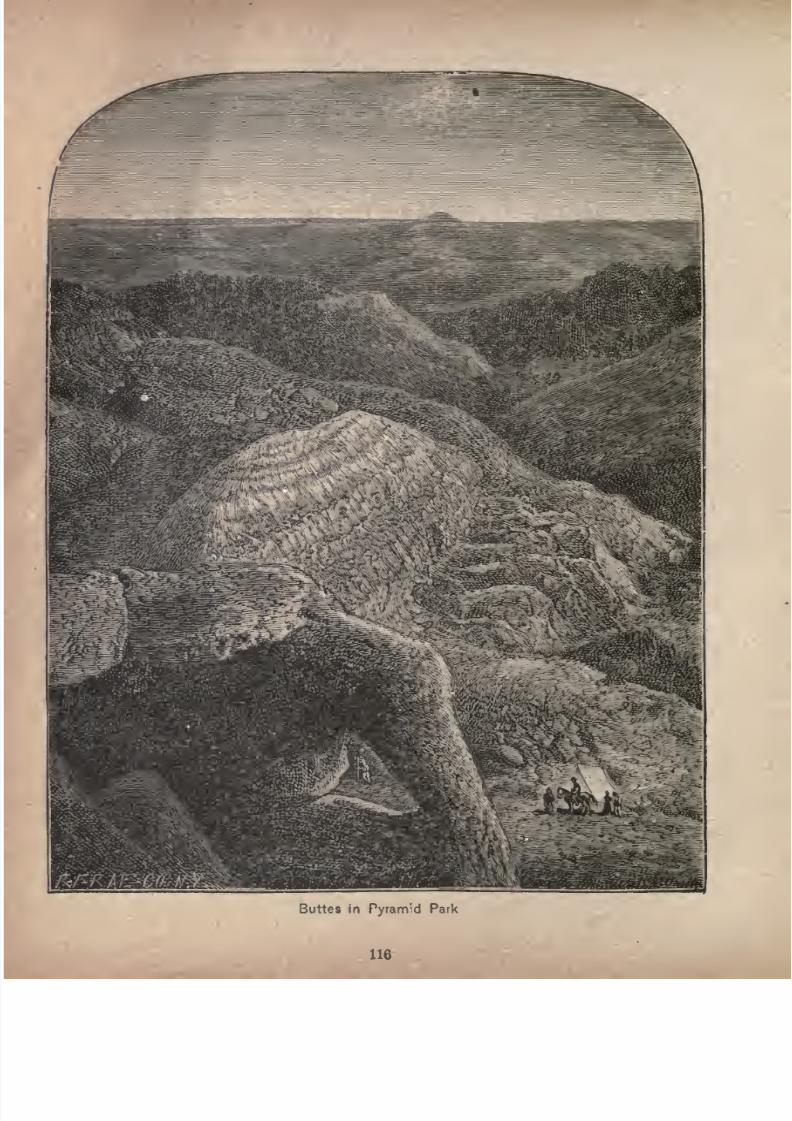
7/27/2019 Official Northern 00 Nort Rich
http://slidepdf.com/reader/full/official-northern-00-nort-rich 118/453
7/27/2019 Official Northern 00 Nort Rich
http://slidepdf.com/reader/full/official-northern-00-nort-rich 119/453
In "The Had Lands." 117
been unoccupied for several years, as have the few store
rooms and dwelling houses. There were at one time
nearly 500 people living in the town and on the Marquis'
adjoining cattle ranch. He spent several hundred thous
and dollars trying to establish a profitable business in the
supplying of dressed beef, shipped in his own refrigerator
cars,, to the Eastern markets, but was finally forced to
abandon the idea by the opposition of more powerful in
terests which were jeopardized by this enterprise.
Cattle Raising in the Bad Lands. Hon. Theodore
Roosevelt, of New York, who owns a cattle ranch near
Medora, in an article in the Bismarck Tribune, wrote as
follows on the subject of cattle raising in the Bad Lands:"Roughly speaking, the stretch of country known among
cattle men as the 'Dakota Bad Lands/ occupies the west
ern portion of North Dakota, from the Black Hills region
on the south, to the Missouri on the north; that is, it com
prises the country drained by the Little Missouri river,
and the waters running into it. This river runs in long
loops, which enclose fertile bottoms, through a nar
row valley, bounded on each side by a line of jagged
buttes, back of which stretches a mass of very rough and
broken hill country, rent and cleft in all directions by deep,
winding ravines, and narrow, canon-like valleys. Creeks
open into the river every few miles. At certain seasons
their beds hold foaming torrents, while during the rest of
the year they are either perfectly dry, or consist merely of
strings of small, shallow pools, with here and there a deep
spring hole. Some of the alluvial river bottoms are thickly
timbered with cottonwood, and in a few of the ravines
there is a growth of pine and cedar. The Bad Lands
proper extend back for from five to twenty miles, when we
come out on the level prairie, which gives the cattle fine
7/27/2019 Official Northern 00 Nort Rich
http://slidepdf.com/reader/full/official-northern-00-nort-rich 120/453
118 The Northern Pacific Railroad.
feed in summer, but offers them no shelter whatever from
the bitter winds of winter.
"The herds of the stockmen now graze fifty miles north,
and many times that distance south, of the railroad. The
cattlemen through the Bad Lands have formed themselves
into a stock association, and most of them, in addition,
have joined the great Montana stock association. Their
round-up takes in all the country along the Little Missouri,
from Box Aldercreek on the south to below the Big Beaver
creek on the north,including
the
ranges
of some fifteen
or twenty stock outfits along a river front of nearly two
hundred miles. Each such outfit may have from 500 to
10,000 head of stock, and from 10 to IO;D head of ponies
with which to herd them. There is plenty of timber for
building purposes; the home ranch of each outfit consists
of a log house, or shack, containing one or many rooms,
accordingto the
waythe inmates
appreciatecomfort and
the decencies of life; near by is a log stable and outbuild
ings, a strong, high, circular horse corral, with a snubbing
post in the center, and further off the larger cow corral, in
which the calves are branded, etc.
"The country is covered with a growth of short bunch
grass, which cures on the stalk into excellent hay for win
ter feed ; it is very nutritious, and upon it range cattle
become as fat as stall-fed oxen. Over most of the land
there is nothing but this grass, and the bitter, grayish
green sage brush; except for a few weeks in spring, when
the first growth forms a mantle of green, the whole land is
colored a monotonous, dull brown, which, joined to the
extraordinary shape and bizarre coloring of the water-worn
buttes, gives the landscape a look of grim and forbidding
desolation, although this very look of loneliness, sameness
and vastness, also gives it an intense attraction for some
7/27/2019 Official Northern 00 Nort Rich
http://slidepdf.com/reader/full/official-northern-00-nort-rich 121/453
In "The Bad Lands." 119
men, including myself. This forbidding aspect of the land,
however, completely belies its real character; the dull,
barren-looking country, clad with withered brown grass, in
reality" offers as fine grazing as can be found anywhere in the
West, while the cliffs and broken valleys offer almost perfect
shelter to the animals in the winter. The loss among cat
tle during the winter, no matter how severe the weather, is
surprisingly small, always excepting, of course, half-starved
'
pilgrims,' or cattle put on the range late in the fall, and
in
poorcondition. The rainfall is
slight,
and the snow
rarely covers the ground to any depth, The water supply
back of the river is scanty, and the country is wholly unfit
for agricultural purposes; recognizing which fact, the last
legislature very wisely repealed the herd law, in so far as it
affected the western tier of counties, and the cattle men
are now free from the fear of being sued by every unscru
pulousadventurer who
palmshimself off as a
granger,and
declines to fence in his few acres of grain or vegetables.
The scantiness of the water supply is no harm to thecattle
men, as in summer the beasts keep within a few miles of
the river, principal creeks or large water holes, and thus
leave a great stretch of back country over which they
have not grazed, and which affords them excellent winter
feed whenice
has closed up all the ponds and streams, andthey are obliged to slake their thirst by eating snow.
"Each ranchman puts up a certain amount of hay for
winter use for such horses as he constantly rides, to help
out any sick animals which he finds, etc. So far, all this
hay has been wild, and has been cut on the tops of the
great plateaus; but the time is rapidly approaching when
the ranchmen will be obliged to fence in large patches of
ground and raise a hay crop by preference, alfalfa, if on
further trial it proves that it will grow.
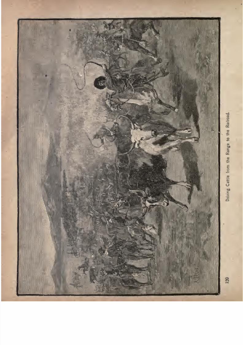
7/27/2019 Official Northern 00 Nort Rich
http://slidepdf.com/reader/full/official-northern-00-nort-rich 122/453
7/27/2019 Official Northern 00 Nort Rich
http://slidepdf.com/reader/full/official-northern-00-nort-rich 123/453
In "The Bad Lands." 121
" The excellence of the Bad Lands as a country for fatten
ing steers has been proved beyond all doubt; as yet it is
tooearly
to
say definitely
how it will turn out as a
regionfor raising stock. Last year the calf crop was very light;
but it is believed that this was mainly due to the very
insufficient number of bulls on the range, as a number of
the outfits have yet to learn that it is criminal folly to
expect to get along with the same proportionate quantity
of bulls loose on the range as would do on an Eastern
farm. There will
alwaysbe a lack of calves until the
supply of bulls is much more ample than at the present time.
Still, appearances indicate a mucji larger calf crop this
year than was the case last. Along the river, as a whole^
the steers greatly out-number the female stock. Horned
cattle, and also horses, do excellently; but all efforts at
sheep-raising have so far been flat failures, for which the
cattle men are sincerely grateful. The sheep havein
eachcase died by the score and the hundred, but a small per
centage surviving the first winter. Many of the ranchmen
and small stock owners have now brought out their wives,
and the country, which four years ago was an empty wil
derness, or with straggling bands of Indians and parties of
hunters, is now settled by a thriving and prosperous class
of men, and in many spots a most pleasant home life is
growing up. The ranchmen are hearty, open handed and
hospitable. The cow boys are a fearless, generous, good-
natured set of men, much misrepresented in some Eastern
papers. Of course, there are fools in all classes, and the
fool variety of cow boy likes to come into town and get
drunk, and go about yelling and shooting in the air, firing
at the car wheels of a passenger train, or perhaps shootingoff the hat of some well-dressed stranger who looks small
art*d timid. But, if a man keeps away from drinking
7/27/2019 Official Northern 00 Nort Rich
http://slidepdf.com/reader/full/official-northern-00-nort-rich 124/453
122 The Northern Pacific Railroad.
saloons, does not put on airs, and at the same time, shows
that he does not intend to stand any nonsense, he can
safely reckon upon first-class treatment in cow-boy land.'
Little Missouri is a small village just across the river
from Medora. There is a coal mine on the bluffs close at
hand. There is an abandoned military post a quarter of a
mile from the place. Soon after leaving the Little Missouri
river the country westward becomes less rough, although
the railroad passes through many cuts and ravines. Grad
ually, however, the feature of the landscape is that of broad,
rolling prairie, marked here and there by isolated buttes.
Sentinel Butte is a prominent object on the left hand,
not far from the track. The top of this eminence is visible
on clear days at a distance of thirty miles, but looks only
to be about three miles off, so deceptive is the luminous
atmosphere. This region abounds in moss agates, speci
mens of which are found near the foot of the buttes, of
great size and beauty. A well-known army officer, who
was at one time stationed here, secured a sufficient num
ber of these agates so large that they were converted into
dessert knife handles and served as a unique and hand
some present to a lady on her wedding day.
Sentinel Butte, in spite of its precipitous faces, as seen
from the railroad, is easy of access on the side remotest
from the track. On its summit there is half an acre of
level ground. Buffalo were very partial to this elevation,
and sometimes resorted to it in so large numbers that
many were crowded over the brink. The bones of these
animals lie in heaps at the foot of the precipice, whitened
by the weather. One mile west of Sentinel Butte station,
the
boundarybetween North Dakota and Montana is
crossed. The line is marked by a tall pole, upon which is
nailed a fine pair of antlers.
7/27/2019 Official Northern 00 Nort Rich
http://slidepdf.com/reader/full/official-northern-00-nort-rich 125/453
SEVEN HUNDRED MILES IN MONTANA.
The State of Montana. This beautiful State, named
on account of its mountainous character, is one of the
largest in the Union, being surpassed in area by Texasand California only. It averages 275 miles from north to
south, and 550 miles from east to west, stretching through
12 of longitude, and from 104 to 116 west of Greenwich,
and lies for the most part between the forty-fifth and
forty-ninth parallels of north latitude. Its southern
boundary is in about the latitude of St. Paul, Minn., and
its northern line joins the British possessions. TheNorthern Pacific railroad runs through the State from the
southeast corner almost to the northwest corner, a distance
of a little over 700 miles.
The mean height of Montana above the ocean level is
estimated at 3,900 feet, the greatest elevation among the
mountain peaks being 11,000 feet, and the lowest, on the
Missouri river, being about 2,000 feet. Of the 93,000,000
acres contained within the limits of the State, two-fifths are
mountainous and three-fifths valley or rolling plains. The
water-shed between the Atlantic and the Pacific oceans,
the main chain of the Rocky Mountains, traverses the
western portion of Montana in a course of a little west of
north*, leaving about one-fourth of the entire State on the
western slope and three fourths on the eastern. In the
central part of the State are the Bull, Belt, the Little
7/27/2019 Official Northern 00 Nort Rich
http://slidepdf.com/reader/full/official-northern-00-nort-rich 126/453
124 The Northern Pacific Railroad.
Rocky and other smaller mountain ranges, which, with
many lateral spurs and detached groups, give that great
diversity of rocky ridges, broad plateaus and pleasant
valleys which render the country extremely picturesque.
The highest summits are those of the Peaks of Gallatin,
about 100 miles south of Bozeman and plainly visible from
the car windows as the train runs down the Gallatin
valley west of that town. These peaks have an altitude of
over n,ooo feet. Next highest is the Lo Lo peak in the
Bitter Rootrange,
which can be seen from Missoula.
Montana is well supplied with rivers. Her great water
courses are Clark's Fork of the Columbia and the Missouri
river, the latter with many important tributaries. The
Clark's Fork drains 40,000 miles of the State, and flows
into the Columbia river; while the Missouri and its tribu
taries, the Milk, the Yellowstone, the Teton, the Marias,
theJudith,
theMusselshell,
theJefferson,
the Madison and
the Gallatin carry off the waters of double that area.
These rivers are navigated by steamboats a distance of
1.500 miles within the limits of the State. Montana has a
number of beautiful lakes, the largest of which is Flathead,
in Missoula county, ten by thirty miles in size. The
cataracts of the Missouri river between the town of Great
Falls and the town of Fort Benton are the most strikingscenic features in Northern Montana. There are three
principal falls, the Black Eagle, the Rainbow and the
Great Falls; and three minor falls are within a distance
of twenty miles. The height of the Great Falls is eighty
feet, that of the Rainbow fifty feet, and that of the Black
Eagle fifty feet.
The agricultural lands of Montana lie mainly in the
valleys of the large rivers and their affluents. These val
leys, usually old lake basins which have received the wash
7/27/2019 Official Northern 00 Nort Rich
http://slidepdf.com/reader/full/official-northern-00-nort-rich 127/453
Seven Hundred Miles in Montana. 125
from the surrounding mountains, have an alluvial soil
which has proved to be very fertile. The land has gener
ally a gentle and regular slope from the higher ground
which separates the valleys from the foot-hills, and this is
a fact of great importance in its bearing upon irrigation.
So uniform is the slope that, in almost every instance,wheri
water is conducted by means of a ditch from any stream it
may be made to flow over every foot of land in the valley
below. The uplands (or bench lands, as they are commonly
termed) are simply continuations of the valleys at a higher
elevation. They frequently look like artificial terraces of
enormous size, rising one above the other; and where the
quantity of water in the stream above admits the irrigation
of the bench lands, they are also found to-be very produc
tive. Beyond these terraces are the foot-hills, with rounded
tops and grassy slopes, and behind these loom up the
mountains, crowned with a
scanty growthof
pine
and fir,
although the slopes and valleys are always destitute of
these varieties of timber. There are no deciduous trees,
either, excepting groves of cottonwood and willows along
the water-courses, and occasional copses of quaking asp in
wet places on the sides of the mountains. Only in the
extreme northwestern part of the State is a very large bodyof
magnificent timber, coveringmountains and
plainsalike.
Eastern Montana, stretching from the base of the RockyMountains to the boundary of the Dakotas and embracingan area of 90,000 square miles, is divided into three belts of
nearly equal size by the Missouri and Yellowstone rivers.
On the west and south are mountains timbered with pine
andfir,
and from them issue many streams, which abun
dantlywater the
country.The
groundis covered with a
rich growth of bunch grass, which makes the region an
excellent stock range. But the large area of grassy rolling
7/27/2019 Official Northern 00 Nort Rich
http://slidepdf.com/reader/full/official-northern-00-nort-rich 128/453
126 The Northern Pacific Railroad.
table lands in the northeastern part of the State is pre-emi
nently the place for cattle-raising and sheep husbandry.
The resources of the entire State are varied and very valu
able. Millions of acres of good agricultural land are
awaiting development; but, owing to the light rainfall
irrigation is generally necessary. .
Mining has always been, and probably will continue to
be, the leading industry. The Drum Lummon mine, at
Marysville, near Helena, has probably produced more gold
than any other mine in the world. The Granite Mountain
mine, at Phillipsburg, in Western Montana, is the most
valuable silver mine in the world. The mines at Butte,
which furnish the ore for the great smelters and reduction
works at Anaconda, are the most productive copper mines
in the world, and yield a great deal of silver. Besides
these famous mines, there are many other rich deposits of
ore whichyield large
annual returns to the
companiesworking them. Considerable placer gold is still obtained
by hydraulic processes, and a good deal is taken out of the
old gulches by individual miners working with sluice boxes
and quicksilver. Montana's total annual yield of precious
metals is over $30,000,000.
The stock-raising interest of Montana ranks next in
the value ofits
annual product to the mining interest.
Cattle, sheep and horses are raised in great numbers on the
plains and oa the well-grassed foot-hills of. the mountain
ranges. The cattle and sheep are marketed chiefly in St.
Paul and Chicago. The wool goes mostly to Boston.
Montana horses have won a high reputation for speed and
endurance, and are shipped as far east as New York City.
Historical. The history of Montana has not been destitute of stirring incident. Before 1861 there were no set
tlements, and the only whites who had visited the region
7/27/2019 Official Northern 00 Nort Rich
http://slidepdf.com/reader/full/official-northern-00-nort-rich 129/453
Seven Hundred Miles in Montana.. 127
were trappers., missionaries and the members of various
military exploring parties. Public attention was first
directed to the Territory at about the period named by the
discovery of gold in paying quantities in Deer Lodge
county. The report brought an irruption of miners from
all the Western States, among whom were some of the
wildest and most reckless characters, whose names and
misdeeds figure in the early annals of 'the Territory. In
1862 the rich placers at Bannack were discovered. In the
following yeara
party, returningfrom an unsuccessful
attempt to reach the Big Horn Mountains by way of the
Gallatin river, whence they were driven back by the Crow
Indians, camped for dinner on Alder creek, near the site of
Virginia City. Here one of the number, William Fair-
weather by name, washed a few pans of gravel, and was
surprised to obtain about $2 worth of gold to the pan.
The news soon spread,and
numbersflocked to the
place,which has since yielded $60,000,000 of gold, half of which
was taken out during the first three years after the dis
covery. The next important placer diggings were found
in 1864, at Last Chance gulch, where Helena now stands,
and at Silver Bow and German gulches, at the head of the
Deer Lodge valley. Subsequently mines of great richness
were found at various other points, and the excitement
upon the subject ran high.
The fame of the diggings caused a large immigration,
and, with the honest and deserving gold hunters, there was
also a rush of the vilest desperadoes from the min ng
camps of the Western States and Territories. This ruf
fianly element served as a nucleus around which the evil-
disposed gathered, and soon was organized a band of outlaws which became the terror of the country. These ban
ditti included hotel keepers, express agents, and other
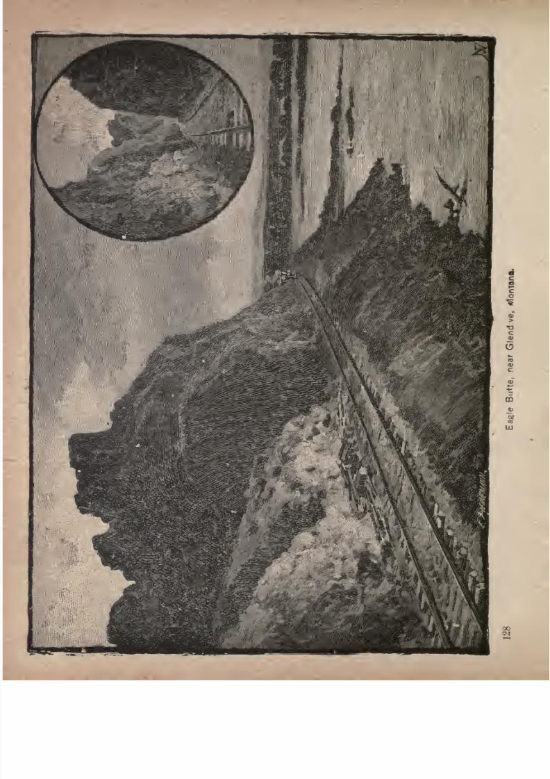
7/27/2019 Official Northern 00 Nort Rich
http://slidepdf.com/reader/full/official-northern-00-nort-rich 130/453
7/27/2019 Official Northern 00 Nort Rich
http://slidepdf.com/reader/full/official-northern-00-nort-rich 131/453
Seven Hundred Miles in Montana. 1^9
seemingly respectable people, Henry Plummer, the sheriff
of the principal county, being their leader. The roads of
the Territory were infested by the ruffians, and it was not
only unsafe, but almost certain death, to travel with moneyin one's possession. One writer affirms that ''the com
munity was in a state of blockade. No one supposed to
have money could get out of the Territory alive. It was
dangerous to cope with the gang; for it was very large and
well organized, and so ramified throughout society that no
one knew whether his
neighborwas or was not a member/'
The usual arms of a "road agent," writes Prof. Dimsdale,
in his history of ''The Vigilantes of Montana," "were a pair
of revolvers, a double-barreled shot-gun of large bore, with
the barrels cut down short, and to this was invariably
added a knife or dagger. Thus armed, mounted on fleet,
well-trained horses, and disguised with blankets and masks,
the robbers awaited theirprey
in ambush.When
near
enough, they sprang out on a keen run, with leveled shot
guns, and usually gave the word 'Halt ! throw up your
hands, you I' If this latter command were
not instantly obeyed, that was the last of the offender; but
in case he complied, as was usual, oneor two of the ruffians
sat on their horses, covered the party "with their guns,
which were loaded with buckshot, and one dismounting,disarmed the victims, and made them throw their purses
on the grass. This being done, a search for concealed
property followed, after which the robbers rode away, re
ported the capture, and divided the spoils."
At last the decent citizens organized a vigilance com
mittee in self-defense. The confession of two of the gang
put the lovers -of law and order in possession of the namesof the prominent ruffians, who were promptly arrested.
Twenty-two of the miscreants were hanged at various
7/27/2019 Official Northern 00 Nort Rich
http://slidepdf.com/reader/full/official-northern-00-nort-rich 132/453
130 The Northern Pacific Railroad.
places, after the form of a trial, between December 21,
1863, and January 25, 1864, five having been executed
together in Virginia City. This summary justice so
stunned the remainder of the band that they decamped.From the discovery of the bodies of the victims, the
confessions of the murderers before execution, and from
information sent to the vigilance committee, it was found
that certainly 102 people had been killed by the bandits in
various places, and it was believed that scores of unfor
tunates had been murdered and buried, whose remains
were never discovered. It was known that the missing
persons had set out for various places with greater or less
sums of money, and were never heard of again. After
this wholesome justice had been meted to the murderers,
law and order prevailed, the lawless element leaving the
Territory, and the honest and enterprising remained to
develop the mining and other natural resources. Con
gress provided for the admission of Montana as a State in
the act passed at the session in 1889, which also provided
for the admission of North Dakota, South Dakota and
Washington.
Beaver Creek Valley. Just west of the Bad Lands
the Northern Pacific enters Montana and soon reaches the
pretty valley of Beaver Creek, from which more cattle are
shipped to Eastern markets than from any other district in
the State. Mingusville, 635 miles from St. Paul, is the
shipping station for the valley, and is a typical cow-boy
town. Most of the buildings are drinking saloons and
small taverns.
Glendive Creek. -After leaving Beaver Creek valley
the road crosses a low divide and strikes Glendivecreek,
which it follows twenty miles, to the Yellowstone river.
On either side of a narrow valley are curious bluffs, with
7/27/2019 Official Northern 00 Nort Rich
http://slidepdf.com/reader/full/official-northern-00-nort-rich 133/453
Seven Hundred Miles in Montana. 131
seamed sides of dark and light brown earthy strata, and an
occasional vein of lignite, and grotesque, jagged summits.
Glendive (666 miles from St. Paul: population 1,500).
Glendive is the first place of any prominence in Montana
that is reached by the railroad. It is the county seat of
Dawson county, the largest county in Montana, and is the
terminus of the Missouri division and the beginning of
the Yellowstone division of the railroad. The town is in
latitude 47 3' N., and longitude 104 45' W., and lies 2,070
feet above the ocean level. Situated on the south bank of
the Yellowstone, ninety miles from the junction of that
stream with the Missouri at Fort Buford, N. D., Glendive
occupies a broad plain, which slopes gently toward the
river, and is sheltered by a range of curiously shaped clay
buttes, distant about half a mile from the stream, and
rising abruptly to a height of nearly 300 feet above its
level. These buttes are not unlike those seen at the Bad
Lands of the Little Missouri, only here the subterranean
fires have not burned so fiercely as further east, and the
river seems to have stopped the combustion, for across the
water there is a large expanse of excellent soil. The site
of the town was selected and laid out under the supervision
of Gen. Lewis Merrill, U. S. A., who adopted the name of
Glendive for hisprojected city,
in
remembranceof
Sir
George Gore, an eccentric Irish nobleman, who spent the
winter of 1856 in hunting buffalo in this vicinity, and who
originally applied the designation to the creek. Glendive
was founded in 1881. A little irrigated farming is done.in
the valley, but the place is almost wholly a cattle town, being
supported mainly by the trade of the stock ranchers. It is
a good point to stop and study the range cattle business.The scenery just beyond Glendive is imposing. The
railroad skirts the river, and bluffs tower several hundred
7/27/2019 Official Northern 00 Nort Rich
http://slidepdf.com/reader/full/official-northern-00-nort-rich 134/453
132 The Northern Pacific RailnhtJ.
feet above the track. Eagle Cliff is especially noticeable,
for its height, and the heavy engineering work which was
necessary in constructing the railroad at this point.
The Yellowstone Valley. The railroad follows up the
Yellowstone valley from Glendive to Livingston, a distance
of 340 miles. In its characteristics the Yellowstone river
more closely resembles the Ohio than any other American
stream. Its waters, unlike those of the Missouri, are bright
and clear, except when discolored by the freshets of its
lower tributaries. The stream runs over a bed of gravel
through permanent channels, and among thousands of
beautiful islands, covered with heavy timber. It is navi
gable during a good stage of water for more than 250 miles,
from its confluence with the Missouri at Ft. Buford to a
point above the mouth of the Big Horn river, by steam
boats of two or three hundred tons.
The Yellowstone has many tributaries along that part of
its course which is traversed by the railroad, especially on
its south bank.* After leaving Glendive, the first impor
tant stream coming in from the south is the Powder river,
so called by the Indians from its inky-black water, stained
by the long course it runs through the alluvial soil flanking
the Black Hills and Big Horn mountains. Here the valley
of the Yellowstone broadens, and the country behind the
bluffs is better and richer than before. On the north side
of the Yellowstone, between Powder and Tongue rivers,
several small streams come in which drain the divide be
tween the Yellowstone and the Missouri. The next river
of consequence on the south side is the Tongue, with a
good but narrow valley, already well settled by farmers
and herders. About thirty miles westward of the Tongueanother affluent of considerable volume is the Rosebud,
flowing from the south. Fifty-six miles beyond is the Big
7/27/2019 Official Northern 00 Nort Rich
http://slidepdf.com/reader/full/official-northern-00-nort-rich 135/453
Seven Hundred Miles in Montana. 133
Horn river, the largest tributary of the Yellowstone, drain
ing the whole eastern slope of the Rocky Mountains from
the Yellowstone southward to the Platte. The next important stream is the Clark's Fork of the Yellowstone,
which must not be confused with the other and more
important Clark's Fork of the Columbia.
The Yellowstone winds from side to side of the valley,
and along most of its course westward presents a very
picturesque appearance. Bluffs of what are called "Bad
Lands'" inclose it, showing their precipitous faces againstthe stream, first on one side then on the other, as the river
winds from bluff to bluff, leaving always opposite the bluffs
a considerable valley on either side of the stream. The
width of the Yellowstone valley throughout its entire
length scarcely exceeds three miles; sometimes it narrows
to-not more than two miles, and again it widens to seven.
At the heads of the lateral valleys are fine sites for stock
ranches or grazing farms, the same luxuriant grass covering
the- whole country. Clear, pure water is to be found every
few miles in running streams and springs, along which are
fringes of oak, ash, elm, box elder and cottonwood, with
occasional pines and cedars in the ravines. Before reach
ing the Big Horn the valley becomes somewhat broader,
and for many miles on the north side of the river, begin
ning at a point opposite Fort Keogh, are ranges of bluffs
which finally recede in height and gradually dissappear.
Along this part of the river the rough, broken water-shed
of the Musselshell, the Missouri and the Yellowstone,
called the Bull Mountains, is drained by three small
streams, which have considerable- valleys of fertile soil.
The streams are Frozen Creek and the Big and Little Por
cupine. The Yellowstone above the Big Horn runs
through a comparatively narrow valley, which broadens
7/27/2019 Official Northern 00 Nort Rich
http://slidepdf.com/reader/full/official-northern-00-nort-rich 136/453
134 The Northern Pacific Railroad.
only at a single point. The Clark's. Fork bottom lies in
this part of the valley, on the north side of the Yellowstone,
extending from the rocky bluffs east of the old settlement
at Coulson, near the site of Billings, to the hills which put
into the river from outlying spurs of the Rocky mountains,
some thirty-five miles westward.
The traveler, passing through the Yellowstone valley,
except during the months of May and June, when vegeta
tion is vividly green, is apt to rebel against the withered
look of thegrass.
Lowland andhighland
alike are clothed
with a russet garment, which the heat of summer has
spread over them. The mountains appear like colossal
hay-mows with the lush growth of bunch grass surging uptheir slopes, cured as it stands by the sun into the best of
hay, upon which herds fatten all the year round. The
valley has the same sere tone, and the fringe of dark pines
on thebrow of the hills does not relieve, but only serves to
emphasize, the prevailing tone of the landscape. To an
artist eye, however, the many shades of grey make the
landscape peculiarly attractive. A prominent Eastern
artist visiting the Yellowstone valley a few years ago,
explained his delight at the scenery by saying," Greens
are common everywhere, but where else can you find such
lovely greys!"
Iron Bluff (676 miles from St. Paul). Large quantities
of shell boulders are found in the vicinity. These consist
chiefly of shells, which are mixed with small quantities of
silica and alumina. The sides of the bluffs and the
ravines running back into them from the river are
remarkably rich in marine fossils. Entire fossilized fishes
have been found with the iridescence of the scales still
perfect, and every little hillock yields a quantity of per
fect shells.
7/27/2019 Official Northern 00 Nort Rich
http://slidepdf.com/reader/full/official-northern-00-nort-rich 137/453
Seven Hundred Miles in Montana. 135
Fallen (695 miles from St Paul) is at the mouth of
O'Fallon creek. It is the depot for the beautiful and
fertile
valley running100 miles
south,which has attracted
many ranchmen and stock-raisers.
Batchford (715 miles from St. Paul; population, 100)
is the depot for the Powde- River valley region. Ten
miles east of Ainslie, at the Powder river crossing, was
fought a battle between the Indians and United States
troops; and for several miles along the banks of the Yel
lowstone,the
gravesof the soldiers
whodied of their
wounds on their march up the river, can be seen.
Miles City (745 miles from St. Paul; population, 2,000)
is the only town on the Northern Pacific line between
Superior and the Rocky mountains which did not owe its
origin to the building of the road. It was a flourishing
frontier trading post three years before the Northern
Pacific reached the Yellowstone valley. Its business wasoriginally, to a large extent, with buffalo hunters; but,
after the extermination of the buffalo, the immense graz
ing country surrounding it was rapidly occupied by stock
men. There are over 700,000 cattle on the ranges tributary
to the town. Miles City is the county seat of Custer
county, and is a compact, well-built town. Nearly all the
business houses are constructed of brick. Groves of cot-
tonwood trees and thickets of wild rose bushes add much
to the attractiveness of the place. The town enjoys a
large trade from the surrounding cattle and sheep ranges
and has, besides, a rich irrigated valley right at its
doors, that of the Tongue river. Fort Keogh, an important military post two miles west, furnishes a good deal of
business to its merchants.
Explorations of the Yellowstone. The first recorded
exploration of the Yellowstone valley was that made by
7/27/2019 Official Northern 00 Nort Rich
http://slidepdf.com/reader/full/official-northern-00-nort-rich 138/453
136 The Northern 7>acijic Railroad.
Captain William Clark, U. S. A., who was associated with
Captain Meriwether Lewis, V. S. A., in the command of
the famous Lewis and Clark expedition, fitted out in 1804,
under authority of President Jefferson, to explore the
region west of the Mississippi river, and extending to the
Pacific coast. This vast territory known as"the Louisiana
purchase/' and subsequently as the Province of Louisiana,
was ceded to the United States by Napoleon Bonaparte in
1803, for the nominal sum of $15,000,000. The heroic band
of explorers numbering only thirty-two men set out from
St. Louis on the i4th of May, 1804, ascended the Missouri
river a distance of 2,858 miles from its mouth, and striking
across the Rocky mountains and other ranges westward,
reached the mouth of the Columbia river on the yth of
November, 1805. On the 2jd of March in the following
year, the dauntless explorers entered upon their return
journey, recrossing the Rocky Mountains on the 3d of
July. The expedition now resolved itself into three parties,
one of which followed the eastern base of the mountains
northward to the mouth of the Marias river, where it
united with the second party, commanded by Captain
Lewis, that had gone directly down the Missouri. The
third detachment under Captain Clark pushed eastward
until it struck the Yellowstone river, and then followed
this stream 400 miles to its confluence with the Missouri,
near which point the three parties again united. After an
absence of nearly two years and a half, the expedition
arrived at St. Louis on the 23d of September, 1806, having
lost only a single man by death. This was one of the most
brilliant and successful explorations ever made. By its
means 'a mass of accurate informationrespecting
the
country was gathered, the practical value of which has
continued to the present day. The result of the expedition
7/27/2019 Official Northern 00 Nort Rich
http://slidepdf.com/reader/full/official-northern-00-nort-rich 139/453
Seven Hundred Miles in Montana. 137
was at once to open up the newly acquired territory tothe^
enterprise of the great fur companies, who established
trading posts
with the Indians at
manypoints. Aside
from the trappers, however, no whites settled in Montana
until the breaking out of the gold excitement in 1862,
Then, and even for many years afterward, the settlements
were confined to the extreme western portions of the Terri
tory, which were the most accessible, the eastern half long
remaining a wilderness, in absolute possession of the
Indians.
Onlysince the
year 1853,at which time the Govern
ment sent out an expedition under command of the late Gen
eral I. I. Stevens, to explore the region lying between the
forty-seventh and forty-ninth parallels, with a view of
reporting upon the feasibility of the northern route for a
railroad from Lake Superior to Puget Sound, has the Yel
lowstone valley been brought to public attention. Since
the date named a number of expeditions, both Governmentand private,' have passed through the valley from time to
time, and their records of experience and adventure are of
the highest interest. But it is not within the plan of this
book even to outline the more important features of any of
these exploring expeditions. The space at command will
only admit of the narration of a few of the more important
facts connected with the various conflicts between the Indians and the United States troops, of which this valley
was the scene between the years 1873 and 1877.
During the period in question the aborigines strove hard
to keep possession of their favorite country. But civiliza
tion, repeating the history which has marked its progress
in every land, was not to be kept back, and the fierce
struggle for supremacy between the white race and the red
man, resulted in the final disappearance of the latter from
the Yellowstone valley.
7/27/2019 Official Northern 00 Nort Rich
http://slidepdf.com/reader/full/official-northern-00-nort-rich 140/453
138 The Northern Pacific Railroad.
The railroad was finished to the Missouri river toward
the close of 1872; but the actual surveys and locations for
the roadway had been made as far west as the Powder
river, 250 miles beyond. An escort of troops always
accompanied the surveying parties, and minor engagementsbetween these small detachments and the Indians were of
common occurrence. During 1873 these attacks became
so bold and frequent that it was necessary to transfer an
additional regiment of cavalry from the Military Department of the South for the
purposeof
holdingthe hostile
red men in check, and a supply depot was established on
Glendive creek, where that stream empties into the Yellow
stone.
A Fight with Indians at Tongue River. In the
summer of 1873 an army expedition, consisting of about
1,700 men, under the command of Major General D. S.
Stanley, was sent out from Fort Rice, on the Missouririver, to explore the Yellowstone valley in the interest of
the railroad. In due time the expedition reached the
Yellowstone river, and marched for several days up that
stream. The country eventually proved so rough and
broken that in many places serious delays were encoun
tered in finding a practicable route for the long and heavily
laden wagon trains. These serious embarrassments were
only overcome by sending out each morning, some dis
tance in advance of the main column, two companies of
the Seventh cavalry, under command of the late General
Custer, whose duty it was to seek and prepare a practicable
road. In carrying out the plan which already had been for
some days followed successfully, Gen. Custer left camp on
the 4th of August, with a force of ninety-one men, guided
by Bloody Knife, a young Arickaree warrior. At a
point nearly opposite the mouth of Tongue river, plainly in
7/27/2019 Official Northern 00 Nort Rich
http://slidepdf.com/reader/full/official-northern-00-nort-rich 141/453
Seven Hundred Miles in Montana. 139
sight of the railroad, Gen. Custer encountered a force of
Sioux outnumbering his own command over five to one.
After a hard fight the Indians were driven off the field. Fora week afterward, as the exploring party pursued its march,
it entered upon a series of sharp skirmishes with the large
force of Indians, who, however, were invariably repulsed,
although the troops did not escape many severe casu-
ualties.
In 1874 and 1875 the Yellowstone valley enjoyed com
parative quiet, although there were hostile bands of Siouxroaming over the valleys of the Big Horn and Powder
rivers, and the entire Western frontier was ravaged by
them. In June, 1875, a steamboat expedition, consisting
of seven officers and 100 men, commanded by Col. Forsyth,
of Lieut-Gen. Sheridan's staff, ascended the Yellowstone a
distance of 430 miles, selecting sites for military posts at
the mouth of the Tongue and Big Horn rivers, in order to
better deal with the Indians. This expedition returned
without encountering any hostile red men.
On February 21, 1876, an expedition left Fort Ellis,
near Bozeman, under command of Major Brisbin, num
bering 221 officers and men for the succor of a party of
citizens, who were besieged by Indians at Fort Pease, near
the confluence of the Big Horn with the Yellowstone.
The original party consisted of forty-six men, who de
fended themselves desperately in a stockade until the
relief column of troops arrived. Six persons were killed,
eight wounded, and thirteen escaped during the night,
leaving only nineteen in the stockade, who were rescued
by the troops.
Later, 1876, the Government was compelled to send out
a force against certain wild and hostile bands of Indians
who were roaming about Dakota and Montana, not only

7/27/2019 Official Northern 00 Nort Rich
http://slidepdf.com/reader/full/official-northern-00-nort-rich 142/453
140 The Northern Pacific Railroad.
attacking' settlers and immigrants, but also making war
upon the Mandans and Arickarees, who were friendly to
the whites. To this class belonged the notorious Sitting
Bull, who was not a chief, but only a ''head man," and
whose immediate followers did not exceed thirty or forty
lodges. Another disaffected chief was Crazy Horse, an
Ogallala Sioux, who properly belonged to the Red Cloud
agency, and whose band comprised, perhaps, 120 lodges,
numbering about 200 warriors. These bands had never
accepted the agency system, and would not recognize the
authority of the Government. They had been notified,
however, by the Department of the Interior, that they
must, before the 3ist of January, 1876, retire to the reser
vations to which they were assigned, or take the alterna
tive of being brought to subjection by the military power.
Every effort, meanwhile, to pacify these bands, proved
unsuccessful.They
refused to come into theagencies,
settle down and be peaceable. A strong force of troops
was, therefore, set in motion to subdue them. On the ist
of March, Col. J. J. Reynolds, with a force of 883 men,
moved out from Fort Fetterman, on the North Platte
river, in search of the hostiles, and, after marching through
deep snow and suffering great hardship, reached the mouth
of the Little Powder river on March i6th, at which pointhe attacked and defeated a large village of Sioux and
Northern Cheyennes, under Crazy Horse, destroying 105
lodges and a great amount of ammunition and supplies,
and capturing a large herd of animals. The troops, how
ever, had suffered so much from the severity of the weather,
that they were compelled to return to Fort Fetterman to
recuperate.
Operations were resumed by this force toward the end
of the following May. On the 2pth of that month, a col-

7/27/2019 Official Northern 00 Nort Rich
http://slidepdf.com/reader/full/official-northern-00-nort-rich 143/453
Seven Hundred Miles in Montana. 141
umn of 1,000 men, under the command of Gen. Crook,
again left Fort Fetterman, and on the i3th and lyth of
June, the Indians were discovered in large numbers on the
Rosebud. Here a desperate fight took place, lasting sev
eral hours, resulting in the flight of the Indians, after
heavy losses. The casualties to the troops in this engagement were nine killed and twenty-one wounded. From the
strength of the hostiles who attacked Gen. Crook's col
umn, it now became apparent that not only Crazy Horse
and his small band had to be fought, but also a large num-
of Indians who had re-enforced them from the agencies
along the Missouri, and from the Red Cloud and
Spotted Tail agencies, near the boundary line between
Dakota and Nebraska. Under these circumstances Gen.
Crook deemed it best to await re-enforcements and sup
plies before proceeding further.
The Massacre of Custer's Command. Simulta
neously with Gen. Crook's operations, Gen. Terry had con
centrated 400 infantry and 600 of the Seventh Cavalry, the
latter under Gen. George A. Custer, at Fort Lincoln.
With this force he left the fort on the iyth of May, and
reached the mouth of the Powder river on the yth of June,
where a supply camp was established. From this point
six troops of cavalry, under
MajorReno, scouted
upthe
Powder river to its forks, and across the country to the
Rosebud, following1 down the last named stream 'to its
mouth, definitely locating the Indians in the vicinity of the
Little Big Horn river. During Maj. Reno's scout the force
under Gen. Terry moved up the south bank of the Yellow
stone, and formed a junction with a column consisting of
six
companiesof
infantryand four
troopsof
cavalry,unde"r
Col. Gibbon, which had marched from Fort Ellis eastward,
along the north bank of the Yellowstone to a ooint oppo-
7/27/2019 Official Northern 00 Nort Rich
http://slidepdf.com/reader/full/official-northern-00-nort-rich 144/453
142 The Northern Pacific Railroad.
site the Rosebud. On June 2 ist, after a conference with
Cols. Gibbon and Custer, Gen. Terry, who was in
supreme command, communicated the following plan
of operations: Gibbon's column was to cross the Yel
lowstone near the mouth of the Big Horn, march upthis stream to the junction with the Little Big
Horn, and thence up the latter, with the understandingthat it would arrive at the last-named point on June
26th. Custer, with the whole of the Seventh cavalry,
should proceed up the Rosebud until the direction of the
Indian trail found by Reno should be ascertained. If this
led to the Little Big Horn, it should not be followed; but
Custer should keep still further south before turning to
ward that river, in order to intercept the Indians should
they attempt to slip between him and the mountains, and
also in order, by a longer march, to give time for Col.
Gibbon's column to come up. On the afternoon of June
22d, Custer's column set out on its fatal march up the
Rosebud, and on the morning of the 25th he and his imme
diate command were overwhelmed and pitilessly slaugh
tered by the Indians, who were concentrated in the valley
of the Little Big Horn, to the number of over 2,500 fighting
men. The harrowing details of the massacre are mainly a
matter of conjecture. No officer or soldier who rode with
their gallant leader into the valley of the Little Big Horn
was spared to tell the tale of the disaster The testimony
of the field where the mutilated remains were'
found
showed that a stubborn resistance had been offered by the
troops, and that they had been beset by overpowering
numbers. The bodies of 204 of the slain were buried on
the battle
ground.
The battle
ground
has been markedbya monument by the United States Government. It is about
thirty miles south of the railway station of Custer, near the
7/27/2019 Official Northern 00 Nort Rich
http://slidepdf.com/reader/full/official-northern-00-nort-rich 145/453
Seven Hundred Miles in Montana. 143
mouth of the Big Horn river. The important military post
of Fort Custer was established near the battle-field not
long after the massacre occurred.
The Brilliant Work of Gen. Miles. After this
calamity had befallen the expedition, additional troops
were sent to the scene of operations as rapidly as they
could be gathered from distant posts, but too late to be of
immediate use. The exultant Indians had already broken
up their organization, and scattered far and wide as bands
of marauders, placing themselves beyond the reach of
punishment in a body. In the autumn most of the troops
were withdrawn from. Montana, leaving only a strong
garrison, under the command of Gen. Nelson A. Miles,
who was then colonel of the Fifth infantry, to occupya cantonment at the mouth of the Tongue river (nowFort Keogh). Through the energy and bravery of this
command, the Yellowstone valley was soon entirely rid
of the Indians. On October loth a train of ninety-four
wagons, with supplies, left Glendive for the cantonment at
at the mouth of the Tongue river, arid was beset the same
night by Indians, seven or eight hundred strong, under
Sitting Bull, who so crippled it that it was forced to turn
back to Glendive for re-enforcements. These obtained, it
resumed its journey, the escort
numberingeleven officers
and 185 men, in the hope of getting the much-needed
supplies to the garrison. On the i5th the Indians attacked
once more, but were driven back at the point of the
bayonet, while the wagons slowly advanced. In this waythe train proceeded until the point was reached from
which the return had been previously made. Here the
Indians became moredetermined, firing
theprairie,
and
compelling the wagons to advance through the flames.
On the i6th of October an Indian runner brought in the
7/27/2019 Official Northern 00 Nort Rich
http://slidepdf.com/reader/full/official-northern-00-nort-rich 146/453
144 The Northern Pacific Railroad.
following communication from Sitting Bull to Col. Otis,
commanding the escort:
"YELLOWSTON K.
"I -want to know what you are doing traveling on this
foad. You scare all the buffaloes away. I want to hunt
in this place. I want you to turn back from here. If youdon't, I will fight you again. I want you to leave what
you have got here, and turn back from here. I am yourfriend, "SITTING BULL."
"I mean all the rations you have got and some powder.Wish you would write as soon as you can."
Col. Otis replied to this cool request that he intended
to take the train through, and would accommodate the
Indians with a right at any time. The train moved on,
the Indians surrounding it, and keeping up firing at long
range. Presently a flag of truce was sent in by Sitting
Bull, who said that his men were hungry, tired of war.
anxious for peace, and wished Col. Otis to meet him in
council outside the lines of the escort. This invitation
was declined; but the colonel said he would be glad to
meet Sitting Bull inside the lines. The wary savage was
afraid to do this, but sent three chiefs to represent him.
Col. Otis told them he had no authority to treat with them
but that they could go to Tongue river and make their
wishes known. After
giving
them a
present
of hard bread
and bacon, they were dismissed, and soon the entire body
disappeared, leaving the train to pass on unmolested.
On the night of the iSth, Col. Otis met Col. Miles with
his entire regiment, who had advanced to meet the train,
being alarmed for its safety. Learning that Sitting Bull
was in the vicinity, Col. Miles at once pursued him, and
overtook him at Cedar creek. Here anunsatisfactory
parley took place, Sitting Bull refusing peace except uponterms of his own making. The council broke up, the
7/27/2019 Official Northern 00 Nort Rich
http://slidepdf.com/reader/full/official-northern-00-nort-rich 147/453
Seven Hundred Miles in Montana. 145
Indians taking position immediately for a fight. An
engagement followed, the Indians being driven from the
field, and pursued forty-two miles to the south side of the
Yellowstone. In their retreat they abandoned tons of
dried meat, quantities of lodge poles, camp equipage and
broken-down cavalry horses. Five dead warriors were
left on the field, besides those they were seen to carry
away. The force of Col. Miles numbered 398 rifles, against
opponents estimated at over 1,000. On October 2yth
over four hundred lodges, numbering about 2,000 men,
women and children, surrendered to Col. Miles, and Sit
ting Bull, with his own small band, escaped northward.
He was vigorously pursued; but the trail was obliterated
by the snow, and the troops returned to the cantonment.
Again, in December, a portion of the command, under
Lieut. Baldwin, left their quarters in search of Sitting
Bull, who was found and driven south of the Missouri,
retreating to the Bad Lands. Less than two weeks after
ward the same command surprised Sitting Bull on the
Redwater, capturing the camp and its contents, the Indians
escaping with little besides what they had upon their per
sons, and scattering southward across the Yellowstone.
Meanwhile, Col. Miles, with his main command, number
ing 436officers and
men,had moved
againstthe Sioux and
Cheyennes under Crazy Horse, in the valley of the
Tongue river; and, after repeated engagements, lasting
from the ist of January to the 8th of the same month,
over fields covered with ice and snow to the depth of
from one to three feet, completely vanquished the hostiles,
and required them to surrender at the agencies. After the
surrender ofCrazy Horse,
theband
ofSitting Bull,
in
order to escape further pursuit, retreated beyond the
northern boundary, and took refuge upon British soil,
7/27/2019 Official Northern 00 Nort Rich
http://slidepdf.com/reader/full/official-northern-00-nort-rich 148/453
14(5 The Northern Pacific Railroad.
where this troublesome Indian remained until the spring
of 1883, at which time he returned to the United States
and was assigned to the Standing Rock Indian agency
in Dakota. In May, 1877., Col. Miles led an expedition
against a band of renegade Indians, under Lame Deer,
that had broken away from those who had surrendered at
Tongue river. This band was surprised near the Rose
bud; and while negotiations for a surrender were in pro
gress, the Indians, either meditating or fearing treachery,
began firing, and ended the parley. The fight was
resumed, and the Indians were driven eight miles, four
teen having been killed, including the chiefs Lame Deer
and Iron Star, and 450 horses and mules, and the entire
camp -equipage fell into the hands of the troops. This
band was afterward pursued so hotly that it eventually
surrendered at the Red Cloud and Spotted Tail agencies.
On the i8th of
September,1877, Col. Miles,
havinglearned that the hostile Nez Percys, from Idaho, under
Chief Joseph, pursued by Gens. Howard and Sturgis, were
likely to reach the frontier before they could be overtaken,
started out from his cantonment to intercept them. By a
series of rapid marches on the flank of the hostiles, after
traversing a distance of 267 miles, Col. Miles came up with
theNez
Perccamp
on the
morningof
September 3othat
the Bear !Paw mountains, and compelled its surrender after
a desperate resistance, with severe losses on both sides.
The troops under the command of Col. Miles, in their
operations during the years 1876 and 1877, marched no less
than 4,000 miles, captured 1,600 horses, ponies and
mules, destroyed a large amount of camp equipage belong
ing to the hostiles, caused the surrender of numerous bands,and cleared the country of upward of seven thousand
Indians. By this series of brilliant successes not less than
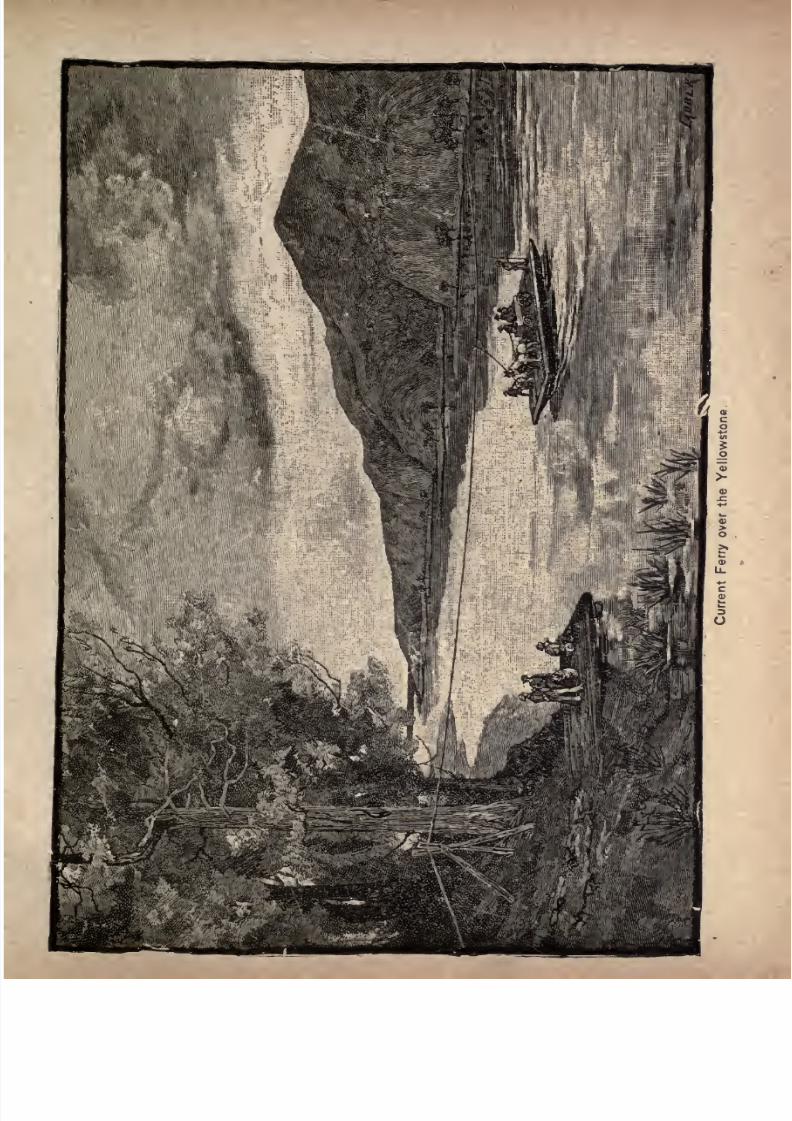
7/27/2019 Official Northern 00 Nort Rich
http://slidepdf.com/reader/full/official-northern-00-nort-rich 149/453
7/27/2019 Official Northern 00 Nort Rich
http://slidepdf.com/reader/full/official-northern-00-nort-rich 150/453
148 The Northern Pacific Railroad. ,
400 miles of the Yellowstone valley were opened to
settlement.
Current Ferries. On the Yellowstone river, as well as
on many other Western streams, a method of ferrying is in
vogue which presents some peculiarities to Eastern eyes.
The swift current is used as a motor for swinging a flat-
bottomed ferryboat over the river. An elevated wire
cable is stretched from shore to shore. Pulleys, attached
by stout ropes to either end of the boat, are geared to the
cable. The craft is shoved off from the brink at an angle
oblique to the current, and starts languidly, the pulleys
moving spasmodically at first. Presently the full force of
the tide is felt, and the pulleys spin along the cable, carry
ing the boat across at fine speed. Then reaching the
slacker water near the opposite shore, the pulleys resume
the jerky progress on their cable track, and the boat grates
uponthe beach or
putsher broad nose
gently uponthe
strand precisely where it is wanted. The steering is done
by means of wheel, or rather, windlass, used to tighten or
slacken the pulley ropes, and so get the proper angle of
resistance to the current. These ferryboats scorn any sug
gestion of an ordinary rudder in the water. They are
guided by the guy-ropes only. The ferry-men usually
charge a dollartoll
upon each hprse andeach
wagon,which seems good pay for little labor. They lament, how
ever, that the good old times are gone when five dollars
was the ordinary tax for this service.
Fort Keogh (747 miles from St. Payl) is situated a
mile and a'half west of the Tongue river, and two miles
from Miles City, in a beautiful and fertile portion of the
Yellowstone valley. The fort was built in 1877 by Gen. N.A. Miles, and is the most important post in the Northwest,
having a large garrison of infantry and cavalry, the num-
7/27/2019 Official Northern 00 Nort Rich
http://slidepdf.com/reader/full/official-northern-00-nort-rich 151/453
Seven Hundred J\files in Montana. 149
bers varying with the demands of other military stations
on the frontier. . Fort Keogh consists of a number of com
modious barracks, hospital, school, chapels and other build
ings, besides sixteen attractive cottage residences for offi
cers and their families. The fort draws its supply of water
from the Yellowstone, and feeds a pretty fountain in the
square, about which the residences are arranged.
Rosebud (777 miles from St. Paul; population, 150)
is situated at the mouth of the Rosebud river. The exten
sive
valley
of this stream is admirablyadapted
to cattle-
raising and its plains are dotted with settlements.
Forsythe (790 miles from St. Paul; population 500).
The place is named in honor of Gen. James W. Forsythe?
who was the first officer, to land by steamer at the present
site of the town, and for a long time it was known as For-
sythe's landing. It is situated in a delightful valley imme
diatelyon the banks of the Yellowstone
river,and is sur
rounded by trees and immense bluffs rising abruptly on the
south and west. Forsythe is the end of a freight train divis
ion, and the supply point for the settlers of the Rosebud bot
tom, on the south side, and the Big and Little Porcupine
rivers on the north side of the Yellowstone.
Big Horn (832 miles from St. Paul, at the mouth of
the Big Horn river)is
the diverging point for a countrywell adapted to stock-raising. The valley of the Big Horn
is fertile, and its enclosing hills are covered with excellent
grazing. The railroad crosses the turbulent waters of the
Big Horn river about- two miles from the mouth of that
stream, by a bridge 600 feet in length. Passing over the
narrow intervening valley, it presently penetrates the bluffs
which hem in the Yellowstone river, by means of a tunnel1,100 feet long, and emerges into the comparatively small
Yellowstone valley beyond.
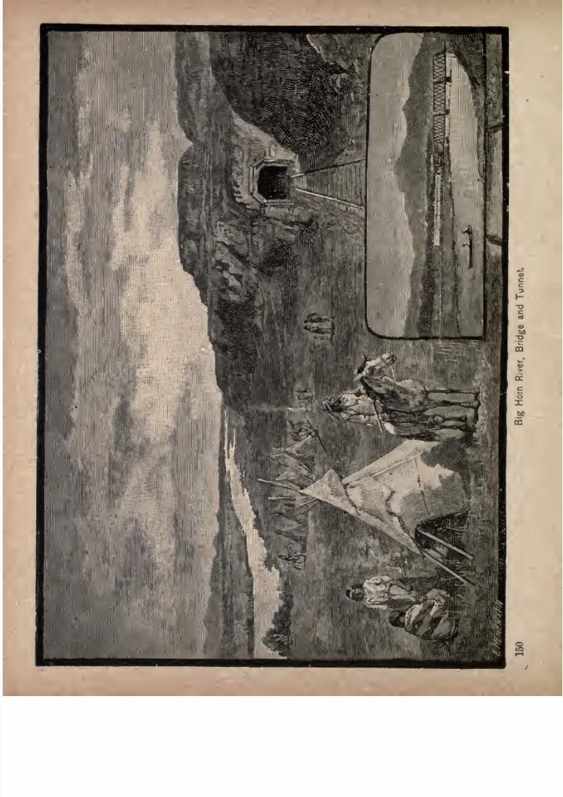
7/27/2019 Official Northern 00 Nort Rich
http://slidepdf.com/reader/full/official-northern-00-nort-rich 152/453
7/27/2019 Official Northern 00 Nort Rich
http://slidepdf.com/reader/full/official-northern-00-nort-rich 153/453
Seven Hundred Miles in Montana. 151
Custer (838 miles from St. Paul). The station is on the
Crow Indian reservation; the town is on the opposite side
of the Yellowstone, and is called Junction City. It has a
population of about 200. Custer is the station for Fort
Custer, thirty miles distant, one of the largest military
posts in the West, and situated near the scene of the Custer
massacre. The large buildings at the station were erected
by the Quartermaster's department for storing army sup
plies. A daily stage runs from the station to the fort.
Pompey's Pillar (863 miles from St. Paul) is a mass of
yellow sandstone, rising abruptly to a height of 400 feet, its
base covering nearly an acre of ground. About half way
up on the north side is an inscription, of which the follow
ing is a miniature fac-simile
carved deeply in the rock by the explorer himself on his
return journey across the continent. This inscription
covers a space three feet long and eighteen inches high,
and is surrounded by a border. It appears that Captain
Clark and his party were coming down the Yellowstone
river in aboat,
whenthey
were overtaken
bya storm
which suddenly burst upon them. After it had cleared,
they landed to examine a very remarkable rock, situated
7/27/2019 Official Northern 00 Nort Rich
http://slidepdf.com/reader/full/official-northern-00-nort-rich 154/453
152 The Northern Pacific Railroad.
in an extensive bottom on the right, a short distance from
the shore. "This rock/' wrote the explorer,"
is nearly 200
paces in circumference, and about 200 feet high, accessible
from the southeast only, the other sides consisting of per
pendicular cliffs of a light-colored, gritty stone. The soil
on the summit is five or sioc feet deep, of a good quality,
and covered with a short grass. The Indians have carved
the figures of animals and other objects on the sides of
the rock. From this height the eye ranges over a wide
extent of variegated country. On the southwest are the
Rocky mountains, covered with snow. There is a low
mountain about fifty miles distant, in a northwest direc
tion, and at the distance of thirty-five miles the southern
extremity of what are called the Little Wolf mountains.
The low grounds of the river extend nearly six miles to
the southward, when they rise into plains reaching to the
mountains, and are watered
by
a large creek, while at some
distance below, a range of highlands covered with pine,
stretches on both sides of the river in a direction north
and south. The north side of the river for some distance
is surrounded by jutty, romantic cliffs, succeeded by rug
ged hills, beyond which the plains are again open and
extensive, and the whole country is enlivened by herds of
buffalo,elk and wolves." After
enjoyingthe
prospectfrom this rock, to which Captain Clark gave the name of
Pompey's Pillar, and carving his name and the date of his
visit upon the stone, the explorer continued on his route.
For the better protection of Captain Clark's name against
vandals, who have already tried to cut their own insigni
ficant designations within the border containing that of
the heroic explorer, the railroad company has caused ascreen to be placed over the relic for its protection.
7/27/2019 Official Northern 00 Nort Rich
http://slidepdf.com/reader/full/official-northern-00-nort-rich 155/453
7/27/2019 Official Northern 00 Nort Rich
http://slidepdf.com/reader/full/official-northern-00-nort-rich 156/453
154 The Northern Pacific Railroad.
The Crow Indian Reservation. The entire southern
shore of the Yellowstone river, from a point not far from
Forsythe westward to the "Big Boulder creek, and extend
ing south to Wyoming, was set apart by Congress, in i86&,
as a reservation for the Crow Indians. This is one of the
most fertile and best watered areas in Montana, including
the valleys of all the large streams which flow into the
Yellowstone above the Rosebud river. The reservation
originally stretched along the Yellowstone for 250 miles,
and had an average width of about 75 miles, but it has
twice been cut down at its western end by arrangement
with the Indians and is now only about half its original
size. Upon this territory live about 3,000 Indians. Theyown 40,000 ponies, and are a very rich tribe from every
point of view. The Crows have long been friendly to the
whites; but they are far inferior to their old enemies, the
Sioux, in intelligence, handicraft and bravery. Of late
they have made some small beginnings in agriculture upon
irrigated lands. Most of Eastern Montana was originally
claimed by the Crows, who at one time were a great and
powerful nation. That the country was highly appreciated
by these Indians is evidenced by the words of Arrapooish,
a Crow chief, to the fur trader, Robert Campbell, as told in
"Captain Bonneville's Adventures," by Washington Irving.
"The Crow country is a good country. The Great
Spirit has put it exactly in the right place. When you are
init, you fare well; whenever you go out of it, whichever
way you travel, you fare worse. If you go to the south,
you have to wander over great barren plains; the water is
warm and bad, and you meet the fever and ague. To the
north it is
cold;winters are
longand
bitter,
with no
grass; you cannot keep horses there, but must travel with
dogs. On the Columbia they are poor and dirty, paddle
7/27/2019 Official Northern 00 Nort Rich
http://slidepdf.com/reader/full/official-northern-00-nort-rich 157/453
Seven Hundred Miles in Montana. 155
about in canoes, and eat fish. Their teeth are worn out;
they are always taking fish-bones out of their mouths.
To the east they live well; but they drink the muddywaters of the Missouri. A Crow's dog would not drink
such water. About the forks of the Missouri is a fine
country good water, good grass and plenty of buffalo.
In summer it is almost as good as the Crow country; but
in winter it is cold, the grass is gone, and there is no salt
weed for the horses. The Crow country is exactly in the
right place. It has snowy mountains and sunny plains, all
kinds of climate, and good things for every season. When
the summer heats scorch the prairies, you can draw upunder the mountains, where the air is sweet and cool,
the grass fresh, and the bright streams come tumbling out
of the snowbanks. There you can hunt the elk, the deer
and the antelope when their skins are fit for dressing;
there
youwill find
plenty
of black bear and mountain
sheep. In the autumn, when your horses are fat and
strong from the mountain pastures, you can go down into
the plains and hunt buffalo or trap beaver on the streams.
And when winter comes on, you can take shelter in the
woody bottoms along the rivers; there you will find buf
falo meat for yourself, and cottonwood bark for your
horses. Oryou may
winter in the Wind Rivervalley,
where there is salt weed in abundance. The Crow coun
try is exactly in the right place. Everything good is to
be found there."
The Legend of Skull Butte. The high and rugged
elevation across the river to the left "of the railroad, just
before reaching Billings, is named Skull Butte. Tradition
says that about seventy years ago several hundred lodgesof Indians, belonging to the powerful Crow nation, were
encamped on the river bottom, when small-pox broke out,

7/27/2019 Official Northern 00 Nort Rich
http://slidepdf.com/reader/full/official-northern-00-nort-rich 158/453
156 The Northern Pacific Railroad.
and the ravages of the disease were so fearful that in a
short time the tribe was decimated. To appease the angerof the Great Spirit it was determined by the chief medicine
man that forty young warriors should offer themselves as
a sacrifice. Volunteers for this purpose were called for,
and soon the allotted number of braves, who had recently
passed through the ordeal of the "sun dance,"and assumed
the status of warriors, presented themselves. With much
ceremony the preparation for the sacrifice was conducted,
and, after all the rites had been performed, the heroic
band mounted their ponies, forded the river, ascended the
steep heights opposite, and made themselves ready for their
fate. It was determined that they and their ponies should
be blindfolded, and, rushing at full speed to the steep edge
of the cliff, should plunge to the rocky strand hundreds of
feet below. The word was given, and the forty braves,
with tremendous shouts, urged their steeds to the brink of
the cliff, and all went down to their destruction. Foryears
afterwards, bleaching skulls and bones of men and horses
were found around the base of Skull Butte.
The railroad crosses to the north side of the Yellow
stone upon a substantial truss bridge, near the old settle
ment of Coulson, at the foot of Skull Butte.
Billings (892miles from St.
Paul; population,, 2,500)is
named in honor of the late Hon. Frederick Billings, once
president of the Northern Pacific Railroad company. It is
situated at the foot of Clark's Fork bottom, on a beautiful
plain, sloping down to the Yellowstone river, in the heart
of a fertile and picturesque valley, and is the county seat
of the new county of Yellowstone. The town wasfounded
inthe spring of 1882. Among the noticeable buildings are
the handsome brick church edifice, thegift of Mrs. Billings;
a targe bank building, constructed inpart of stone quar-
7/27/2019 Official Northern 00 Nort Rich
http://slidepdf.com/reader/full/official-northern-00-nort-rich 159/453
Seven Hundred Miles in Montana. 157
ried in the neighboring cliffs, and a number of substantial
brick business blocks. This is the terminus of the Yellow
stone division, and the beginning of the Montana division,
of the railroad. The company has built a substantial
round-house, shops, etc., for the purpose of a division ter
minus. The Clark's Fork Bottom ditch, thirty-nine miles
long, terminates at Billings, and is the longest of six canals
which irrigate in the valley above the town, and have
converted what was practically a desert in 1882, into a
beautiful farming region. Billings is a supply and trading .
post for a large extent of farming and grazing country within
a radius of over 100 miles. It also receives the trade of
the Stinking Water district, Wyoming Territory, a large
and prosperous tract of country. The town possesses exten
sive cattle yards, and is one of the principal cattle-shipping
points in Montana, great numbers of cattle being driven
here for shipment from the Musselshell and Judith ranges.
The Yellowstone river affords a fine water power. Large
shipments of wool are made from here, and a good wool
market is established.
Montana Stock and Sheep Raising. Abundance of
nutritious grasses, mildness of climate and markets easy of
access, are a combination of advantages which render
Montana famous as a catt'e-raising region. Montana steers
command the highest prices in the Chicago cattle mart,
and the Northern Pacific railroad, with over 700 miles of
track within the Territory, affords ready transportation
from the grazing fields to the East. All the better varieties
of grass do as well in Montana as elsewhere;but the most
valuable of the native grasses is the bunch grass. This
growsmost
luxuriantly uponthe
high, rolling plains,
of
which a large part of the surface of the Territory consists.
It begins to renew itself in the early spring, before the
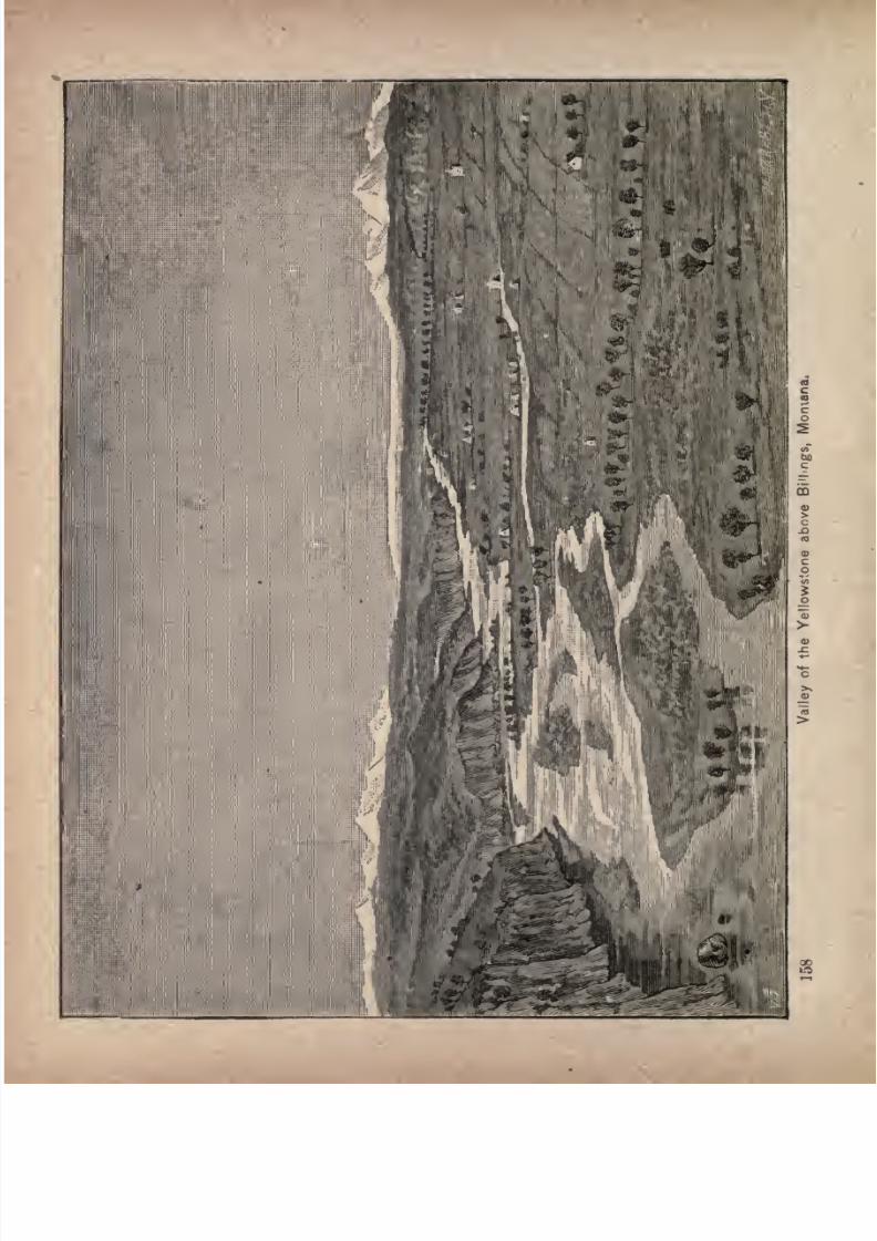
7/27/2019 Official Northern 00 Nort Rich
http://slidepdf.com/reader/full/official-northern-00-nort-rich 160/453
7/27/2019 Official Northern 00 Nort Rich
http://slidepdf.com/reader/full/official-northern-00-nort-rich 161/453
Seven Hundred Miles in Montana. 159
ground is yet free from frost, rapidly attains its growth, is
early cured, and stands as hay through the remainder of
the year until the succeeding spring. Throughout the
winter months it perfectly retains its sweet and nutritious
qualities. The manner of its growth is similar to that of
the short, curly and quickly cured buffalo grass of the
plains. It stands in detached clusters or bunches, between
which are visible interstices of bare ground. Its clusters,
however, are finer, denser, of much taller growth, and
cover the ground more closely and compactly than the
tufts of buffalo grass. A single acre of bunch grass is fully
equal to three acres of average buffalo grass in the quan
tity it furnishes of actual sustenance for cattle. Itis,
moreover, a stronger nutriment than ordinary plains vege
tation, being unexcelled by the. best cultivated grasses,
timothy hay or clover.
The railroad,except
where the main line crosses the
mountain ranges, follows a system of valleys unsurpassed
in their broad, beautiful and fertile surfaces, and extending
across the Territory from east to west. These valleys are
free to all for pasturage purposes. Over these great natu
ral ranges the herds roam at will, being separated, or
"rounded up"by their owners only twice a year in the
springto brand the
calves,and in the fall to choose the
fat steers for market. The principal cattle ranges of the
Territory, aside from the great valley of the Yellowstone,
are on the headwaters of the Little Missouri, in the south
east; the valleys of the Powder, the Tongue, the Rosebud,
the Big Horn (stillin possession of the Crow tribe of In
dians), and the Clark's Fork, which meet the Yellowstone
region from the south; the great valleyof the
Sun river,the broad basin of the Judith, the magnificent valley of the
Musselshell, all situated northward of the Yellowstone and
7/27/2019 Official Northern 00 Nort Rich
http://slidepdf.com/reader/full/official-northern-00-nort-rich 162/453
100 The Northern Pacific Railroad.
intermediate between the Bull, Belt, Big Snowy "and Little
Rocky ranges; the valleys of the East and West Gallatin,
Madison and Jefferson rivers, adjacent to the eastern bases
of the Rocky mountains; and the intramontane country ofthe Clark's Fork of the Columbia, westward.
The customary way of managing a band of cattle in
Montana is simply to brand them and turn them out uponthe prairie. Under this careless management some steers
are lost, which stray away or are stolen. A more careful
system is to employ herders, one man for every 1,500 or
2,000 head of cattle, whose duty it is to ride about the outskirts of the range, follow any trails leading away, and
drive the cattle back, seeking through neighboring herds,
if there are any, for cattle that may have mistaken their
companionship. At the spring round up a few extra
men have to.be employed for several weeks. No human
being dare go among the cattle on foot. If he did he
would be gored or trampled to death at once. The ani
mals are only accustomed to horsemen, of whom they
are in wholesome terror; but the sight of a person on foot
instantly causes a rush toward the strange appearance,
and death is certain to him who fails to find a place of
refuge. In starting a new herd, cows, bulls and yearlings
are bought; but calves under one year old running with
the herd are not counted.
The average cost of raising a steer, not counting inter
est or capital invested, is from sixty cents to one dollar a
year, so that a four-year-old steer raised from a calf and
ready for market costs about $4. A herd consisting of
yearlings, cows and bulls, will have no steers ready for the
market in less than two or three years. Taking into account
the loss of interest on capital invested before returns are
received, besides all expenses and ordinary losses, the
7/27/2019 Official Northern 00 Nort Rich
http://slidepdf.com/reader/full/official-northern-00-nort-rich 163/453
Seven Hundred Miles in Montana. 161
average profit of stock-raising in Montana during the last
few years, has been at least thirty per cent, per annum.
Some well-informed cattlemen estimate it at from thirty
to forty per cent. A flock of sheep containing 1,000 head and
upward, in good condition and free from disease, are procur
able in Western Montana for from $2 to $3 per head. Theymust be herded summer and winter in separate flocks of not
more than 2,000 or 3,000 each, must be corraled every night,
and guarded against the depredations of dogs and wild
animals.
Haymust be
providedto feed them while
the ground is covered with snow, and sheds must be
erected to prevent them from severe storms. They must,
however, be raised by themselves. Cattle and sheep do
not live together on the same range. The latter not only
eat down the grass so closely that nothing is left for the
cattle, but they also leave an odor that is very offensive to
the othersfor at least
twoseasons
afterward. But, notwithstanding that the cost of managing sheep is greater
than that of handling cattle, the returns from sheep-raising
are quicker and larger. While a herd of young cattle
begin to yield an income only at the expiration of three
years, sheep yield a crop of wool the first summer after
they are driven upon a range, and the increase of the band
is much greater than that of cattle, being from seventy-five to 100 per cent, each year. The wool is of good qual
ity, free from burs, and brings a good price on the ranch,
agents of Eastern houses being always on hand eager to
buy it. The profits of sheep-raising are generally esti
mated at a higher figure than those of cattle-raising. The
lowest calculation is based upon a net profit of from
twenty-five to thirty^five per cent, on the whole invest
ment, although occasionally larger returns reward the for
tunate stockman.
7/27/2019 Official Northern 00 Nort Rich
http://slidepdf.com/reader/full/official-northern-00-nort-rich 164/453
162 The Northern Pacific Railroad.
There are few large bands of horses in Montana; but
breeding these animals is beginning to receive attention.
Breeders estimate that fifty brood mares and a draught
stallion, costing in all $2,500, placed upon astock^
ranch
where the proprietor does his own herding, will in the
course of five years be worth $10,000. Horses are more
hardy than sheep or cattle, being better able to endure
cold weather, and to"rustle," or paw through the snow
that covers their pasturage. But they are so much more
valuable than other species of stock that most owners
prefer to have their bands either fenced in or carefully
herded. The best horse farms are those in small valleys,
ten or twelve miles long, on whose sides the foot-hills
extend up to high mountains. By fencing across the ends
of such a valley the horses are prevented from straying.
The Cow Boys. As the train passes through the 'Yel
lowstonevalley,
it is no uncommonsight
to see herds of
sleek cattle contentedly grazing on the russet hills. Some
times, also, droves of one or two thousand are noticed
slowly advancing in a broad column from the direction of
the distant mountains on their way to the railroad ship
ping stations. Such a drove is kept well in hand by a
number of herders, picturesquely garbed in sombreros,
grayshirts
andleather breeches called
"chapps," eachman being armed with revolver, bowie knife and a raw
hide whip, and well mounted. If the drove of cattle has
made a march of several hundred miles from the range, it
will be pioneered by a large band of ponies, carrying
camp equipage and supplies, and serving as remounts for
the cow boys. These latter are usually brawny, clear-eyed
fellows, civil enough to answer questions in spite of thefact that every fibre of both man and horse seems strained
to its utmost tension in keeping the wilder ancl straying

7/27/2019 Official Northern 00 Nort Rich
http://slidepdf.com/reader/full/official-northern-00-nort-rich 165/453
Seven Hundred Miles in Motifami. 163
members of the drove within the bounds of the horned
column.
Grand Mountain Views. In passing up, the valley,
westward of Billings, there is a prospect from the car win
dows which combines more striking features of beauty and
grandeur than could hardly be found elsewhere nearer
than Switzerland. Beyond the smiling valley and the
winding, glistening river, to the westward and southward,
rise 'white, gigantic masses of mountains. These snowy
ranges are so lofty, and, in some conditions of the
atmosphere, so ethereal, that the surprise of an Eastern
tourist, who had never seen high mountains before, was
quite natural. Standing on the platform of a Pullman
car, his eye caught the white, gleaming bulwark on the
western horizon."Conductor, those clouds look very
much like mountains," he said."Clouds; what clouds ?"
replied
the conductor,looking
around the clear bluesky."Out there; just ahead of us." "Those are not clouds;
they are the mountains at the head of the valley/' "Good
gracious!" exclaimed the traveler, who had got his con
ception of mountains from the Alleghanies or the Adiron-
dacks. "Those white things way up in the sky mountains!
Well, well, this is worth coming all the way from NewYork to see."
Laurel (908 miles from St. Paul, 13 miles west of Bill
ings) is the junction point of the Rocky Fork and Cooke
City railroad, which runs to the important coal miningtown of Red Lodge, 44 miles distant at the foot of the
mountains seen on the southern horizon.
Park City (914 miles west of St. Paul; population,
250),at
the head of the Clark's Fork bottom,is
the centreof a large tract of agricultural land, the very last worthy
of mention before the rough approaches to the Rocky
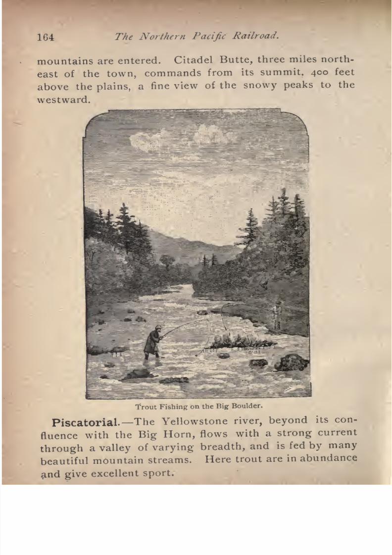
7/27/2019 Official Northern 00 Nort Rich
http://slidepdf.com/reader/full/official-northern-00-nort-rich 166/453
164 The Northern Pacific Railroad.
mountains are entered. Citadel Butte, three miles north
east of the town, commands from its summit, 400 feet
above the plains, a fine view of the snowy peaks to the
westward.
Trout Fishing on the Big Boulder.
Piscatorial. The Yellowstone river, beyond its con
fluence with the Big Horn,flows with a
strong
current
through a valley of varying breadth, and is fed by many
beautiful mountain streams. Here trout are in abundance
7/27/2019 Official Northern 00 Nort Rich
http://slidepdf.com/reader/full/official-northern-00-nort-rich 167/453
Seven Hundred Miles in Montana. 165
Stillwater (932 miles from St. Paul). This is
an old trading post for Indians and hunters. The
old Crow Indian Agency buildings are situated about
twelve miles south of Stillwater. The agency has recently
been removed to the Little Big Horn river, near FortCus-
ter. At this point the railroad crosses to the south side of
the Yellowstone river, the bridge being known as the
second crossing.
Big Timber (973 miles from St. Paul; population, 700).
This town is located near the mouth of Big Boulder
creek, which flows into the Yellowstone from the south,
and facing the mouth of Big Timber creek, which enters
the river from the north. An extensive grazing country
in the valleys of the Big Boulder, the Yellowstone and the
Big Timber, is tributary to this point, and the town is one
of the most important wool shipping stations in Montana.
It is also the supply point for a gold mining district lying
on the flanks- of the Snow mountains at the head of
Boulder creek.
Springdale (988 miles from St. Paul) is the station
for Hunter's Hot Springs, about two miles distant across
the Yellowstone.
Hunters' Springs. These celebrated hot springs are
situated eighteen miles east of Livingston, at the foot of
the Crazy mountains, on the north bank of the Yellowstone,
one mile and three-quarters from the stream. They were
noted for their wonderful healing virtues years before
they became accessible by railroad, and, in fact, if the tra
ditionary reports of the aborigines may be credited, have
been famous among all the Northern tribes from time
immemorial. All the Indians in friendly relations with
the Crows within whose country the springs were situated
until their reservation lines were fixed by the Government
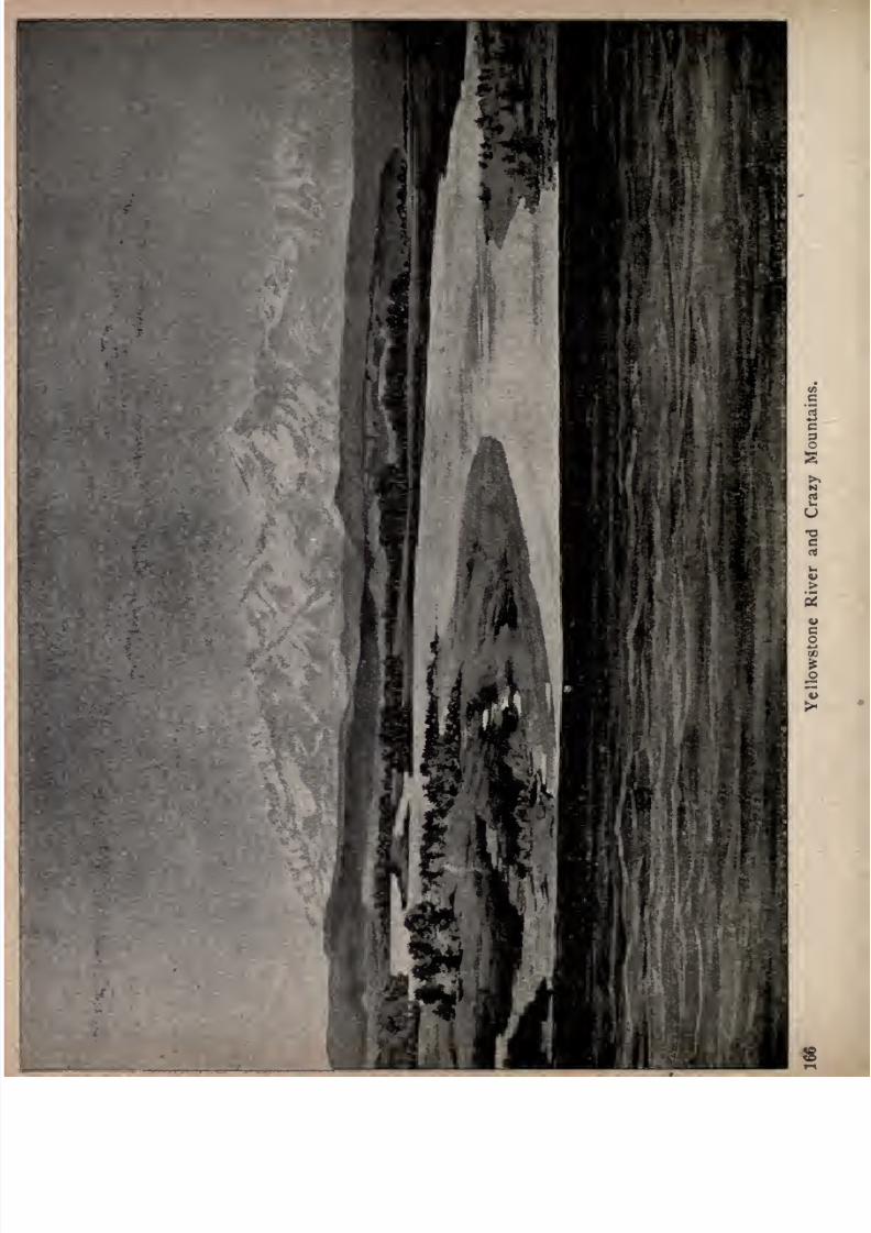
7/27/2019 Official Northern 00 Nort Rich
http://slidepdf.com/reader/full/official-northern-00-nort-rich 168/453
7/27/2019 Official Northern 00 Nort Rich
http://slidepdf.com/reader/full/official-northern-00-nort-rich 169/453
Seven Hundred Miles in Montana. 167
had for generations made pilgrimages to this natural
sanitarium with their invalids, pitching their tepees around
the fountains for the relief of their sick, while their sore-
backed ponies were healed by washing them in the healing
waters below. Of course, the curative properties of the
springs were the last hope for those at a great distance,
whose afflictions had baffled the skill of their ablest
"medicine men." No better proof than this of the heal
ing properties of the water could be afforded, as the
savage tribes acquire all their knowledge of the treatment
of diseases from the experience of ages handed down from
father to son. But there is abundant testimony, also, on
the part of numbers of white men who have been restored
to health by drinking and bathing in the water of these
springs, that there was no superstition in the red man's
faith in their remarkable curative powers. They are
named Hunter'sSprings
in
recognition
of the fact that Dr.
H. A. Hunter was the first white man to visit them and
discover their medicinal qualities. The doctor being in
advance of the train with which he was traveling, and a
mile north of its direct course his object in making the
detour being to capture an antelope or deer for dinner
was attracted to the springs by the cluster of Indian
tepeeswhich had been
pitchedaround them.
Eightor
ten different tribes were represented in the concourse. He
boldly rode into the promiscuous camp, and his friendly
salutations were responded to in a spirit of equal friendli
ness. Being a physician, he perceived, by the bright iron-
stains upon the rocks, the strong sulphur fumes of the
ascending vapors, and the whit^soda and magnesia coat
ing of the vegetation growing out of the sedimentarydeposits, the medicinal value of the waters. He reached
the spot in the early part of July, 1864, his train being one
7/27/2019 Official Northern 00 Nort Rich
http://slidepdf.com/reader/full/official-northern-00-nort-rich 170/453
168 The Northern Pacific Railroad
of the first that entered the then newly discovered goldmines of Montana by way of the Big Horn valley. Whoever may visit the now famous springs, and feast his
eyes upon the beauties of the surrounding scenery,
will not wonder that Dr. Hunter at once relinquished
his bright hopes of winning fortune in the gold mines,
and resolved, that, if any white man during his lifetime
should become possessed of these healing fountains, he
himself should be that man. The clay all around the
springs is a blue, adhesive, argillaceous formation, thickly
studded with pyritic iron, some of the cubes shining with
a gold-like luster; and in close proximity to the hot water
fountains there are copious springs, from which flow
streams of pure water as cold in the hottest weather as
ordinary ice water.
Hunter's Springsare from 3,000 to 4,000 feet above the
sea-level, and from 50 to 100 above the Yellowstone river.
Their temperature ranges from 148 to 168 Fahrenheit,
and they discharge at least 2,000 gallons a minute suffi
cient to accommodate all visitors, without the necessity of
pumping. The water, hot or cold, is palatable, many who
had used it while under treatment being regularly supplied
with it by express, ordering it by the cask. The surround
ing geologicalformations indicate that the
springshave
been flowing for many centuries. A chemical analysis
shows sulphur to be the predominating constituent; but
the water also contains magnesia, arsenic, iodine and lime.
The soil near Hunter's Springs is highly productice,
under irrigation, being enriched with gypsum and other
strong mineral fertilizers. Everything is produced in the
gardensof this section
thatis
cultivatedin
the Statesof
Ohio, Indiana and Illinois. It'is one of the best grazing
localities in the Yellowstone valley, the whole face of the
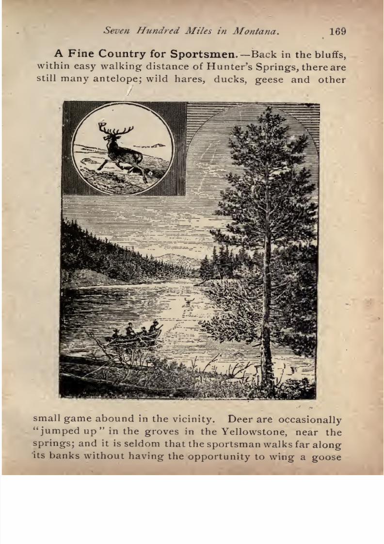
7/27/2019 Official Northern 00 Nort Rich
http://slidepdf.com/reader/full/official-northern-00-nort-rich 171/453
Seven Hundred Miles in Montana. 169
A Fine Country for Sportsmen. Back in the bluffs,
within easy walking distance of Hunter's Springs, there are
still many antelope; wild hares,ducks, geese
and other
small game abound in the vicinity. Deer are occasionally
" jumped up" in the groves in the Yellowstone, near the
springs; and it is seldom that the sportsman walks far alongits banks without having the opportunity to wing a goose
7/27/2019 Official Northern 00 Nort Rich
http://slidepdf.com/reader/full/official-northern-00-nort-rich 172/453
170 The Northern Pacific Railroad.
or duck. Elk are numerous in the mountains a few miles
out. Few rivers are more thronged with trout than the
Yellowstone. The angler must.be unskillful indeed who
fails to capture a handsome *'
string" in a couple of hours'
fishing. The largest trout will weigh fully three pounds.
Good coal has been found within two miles of Hunter's
Springs, but the adjacent country has been only superfi
cially prospected for minerals. Springdale station is about
three miles from this place, and there is telephonic com
munication between the twopoints.
Mails arrive and de
part daily. Hacks are at the station on the arrival of every
train to take tourists and invalids to the springs. There
are distinct bath houses for the well and the sick, for male
and female, and some of the tubs or tanks are large and
deep enough for plunging and swimming. Visitors who pre
fer vapor baths are also accommodated; the medicated va
pors coming up freshlyfrom the
steaming waters,are
regulated to any degree of temperature by cold-air jets.
Livingston (1,007 rniles from St. Paul; population,
2,000). This place is an important passenger division and
branch railroad terminus. It was founded in 1882. Here
the main line makes its third and last crossing of the Yel
lowstone river, leaving the valley, along which it has run a
distance of 340 miles westward from Glendive, and pass
ing through the Bozeman tunnel, in the Belt range of
mountains, to the Gallatin valley beyond. The river at
this point makes an abrupt turn, flowing from its sources
in the mountains far to the southward, through the world
renowned region 'of the Yellowstone National Park. Three
miles from Livingston the high mountains of the Yellow
stone or Snow range open their portals just wide enoughto allow the river an outlet, and through the canon thus
cut by the stream the branch railroad to the Yellowstone
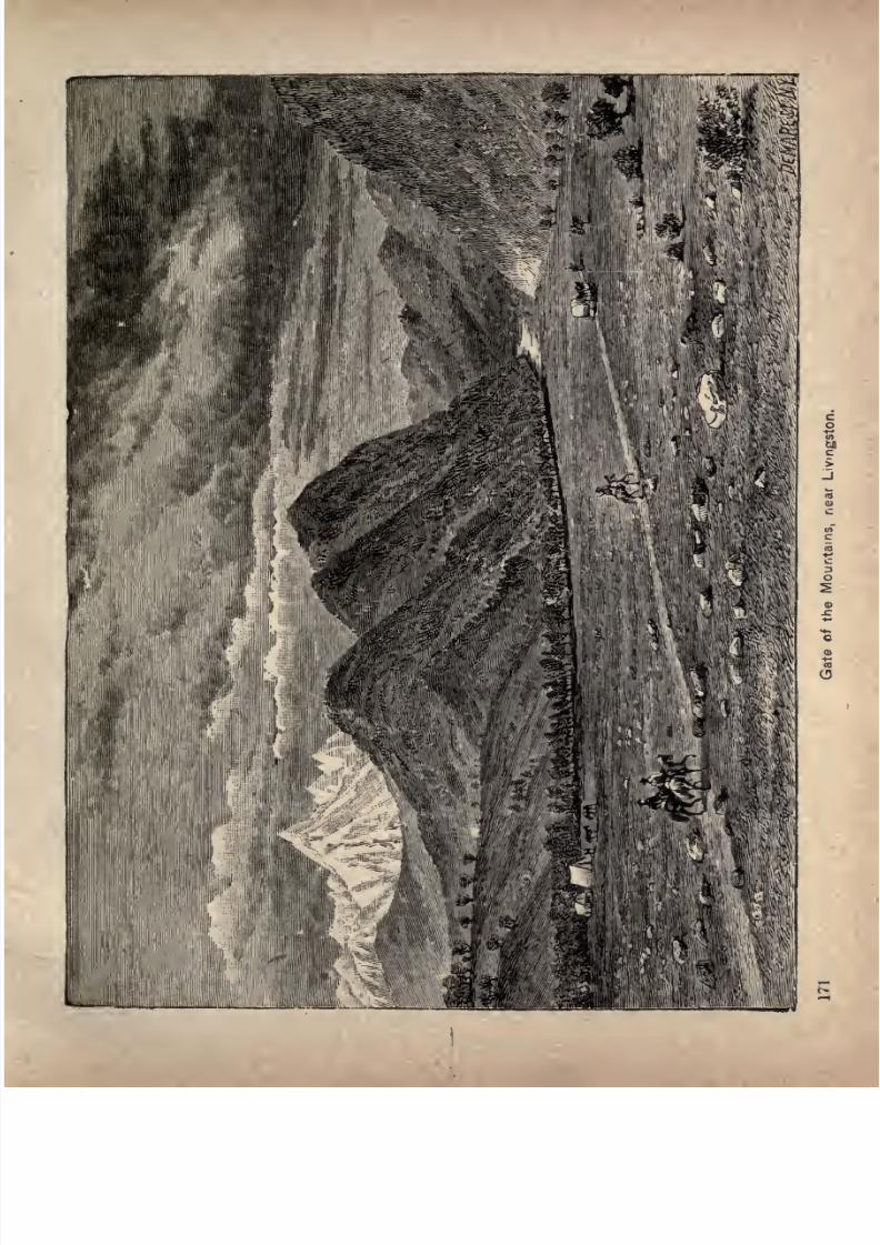
7/27/2019 Official Northern 00 Nort Rich
http://slidepdf.com/reader/full/official-northern-00-nort-rich 173/453
7/27/2019 Official Northern 00 Nort Rich
http://slidepdf.com/reader/full/official-northern-00-nort-rich 174/453
1?2 The Northern Pacific Railroad.
National Park is laid. Livingston is situated on a broad,
sloping plateau on the left bank of the Yellowstone river,
directly
at the foot of the Beltrange. Large engine
houses, machine and repairing shops, and otherbuildings
for the use of the railroad are situated here, on a scale only
second in magnitude to those at Brainerd. Veins of fine
bituminous coal have been opened eight miles distant,
from which coke is made for the smelters at Helena and
Butte, and ledges of good limestone are in the immediate
neighborhood. The Clark's Fork silver mineslie
directlysouth, and the surrounding hills are occupied by cattle
ranches. There is also much valuable mining territory on
the Yellowstone river between Livingston and the northern
boundary of the National Park. Travel to the Yellowstone
National Park passes through Livingston, and a large
business is done in furnishing supplies to tourists. Liv
ingston is one of the most convenient places from which toleave for the Crazy mountains and the country adjoining
them, which are the favorite breeding grounds of the elk.
There is fine trout fishing in the vicinity of the town. The
lofty mountain peak in prominent view south of the town
is called Old Baldy, and is about 9,000 feet high.
Yellowstone National Park. It does not come within
the plan of this volume to describe the remarkable fea
tures of the Yellowstone National Park. It is believed
that the convenience of the tourist has been best regarded
by setting forth in detail the chief attractions of the park
in a separate book.
Daily trains leave Livingston for Cannabar, on the
northern boundary of the park, fifty-one miles distant.
From Cannabar, tourists are taken in coaches to the Mammoth Hot Springs, which is the distributing point for
travel through the park.
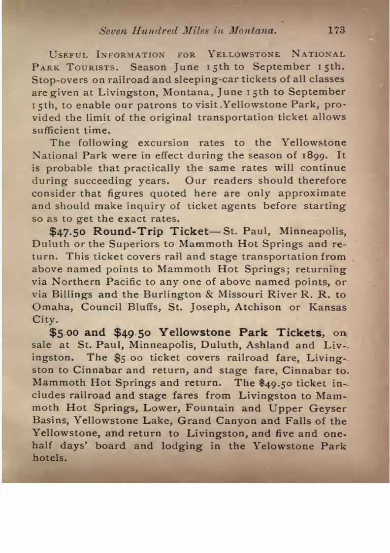
7/27/2019 Official Northern 00 Nort Rich
http://slidepdf.com/reader/full/official-northern-00-nort-rich 175/453
Seven Hundred Miles in Montana. 173
USEFUL INFORMATION FOR YELLOWSTONE NATIONAL
PARK TOURISTS. Season June 1 5th to September I5th.
Stop-overs on railroad and sleeping-car tickets of all classes
are given at Livingston, Montana, June I5th to September
i 5th, to enable our patrons to visit .Yellowstone Park, pro
vided the limit of the original transportation ticket allows
sufficient time.
The following excursion rates to the Yellowstone
National Park were in effect during the season of 1899. It
is
probablethat
practically
the same rates will continue
during succeeding years. Our readers should therefore
consider that figures quoted here are only approximate
and should make inquiry of ticket agents before starting
so as to get the exact rates.
$47.50 Round-Trip Ticket St. Paul, Minneapolis,
Duluth or the Superiors to Mammoth Hot Springs and re
turn. This ticket covers rail andstage transportation
from
above named points to Mammoth Hot Springs; returning
via Northern Pacific to any one of above named points, or
via Billings and the Burlington & Missouri River R. R. to
Omaha, Council Bluffs, St. Joseph, Atchison or Kansas
City.
$5 oo and $49.50 Yellowstone Park Tickets, orx
sale at St.
Paul, Minneapolis, Duluth,Ashland
andLiv-,
ingston. The $5 oo ticket covers railroad fare, Living-,
ston to Cinnabar and return, and stage fare, Cinnabar to.
Mammoth Hot Springs and return. The $49.50 ticket in
cludes railroad and stage fares from Livingston to Mammoth Hot Springs, Lower, Fountain and Upper Geyser
Basins, Yellowstone Lake, Grand Canyon and Falls of the
Yellowstone, and return to Livingston, and five and one-half days' board and lodging in the Yelowstone Park
hotels.

7/27/2019 Official Northern 00 Nort Rich
http://slidepdf.com/reader/full/official-northern-00-nort-rich 176/453
174 The Northern Pacific Railroad.
$92.00 from St. Paul, Minneapolis or Duluth for
tour of Park including all expenses south of Cinnabar.
By purchasing one of the $47.50 tickets to Mammoth Hot
Springs and return and one of the $44.50 tickets, which
are on sale at Mammoth Hot Springs, for the tour of the
Park, a rate of $92.00 can be secured covering all rail and
stage fares, also accommodations in the hotels of the
Yellowstone Park Association for five and one-half (5%)
days.
$105.00 Round-TripTicket St. Paul, Minneapolis,
Duluth or the Superiors through the Park, returning via
Monida, to the Missouri River Terminals, including hotel
accommodations in the Park. This ticket covers rail trans
portation from St. Paul, Minneapolis, Duluih or the
Superiors to Cinnabar, stage transportation Cinnabar to
Mammoth Hot Springs, Lower Fountain and Upper
Geyser Basins, Yellowstone Lake, Grand Canyon, Falls of
the Yellowstone and Monida, six and one-quarter days'
board and lodging between Cinnabar and Monida, andrail transportation from Monida via Oregon Short Line
R. R. and Union Pacific to Missouri River Points, or via
O. S. L. R. R., to Ogden, any line Ogden to Denver, thence
via either the B. & M. R. R. R.; Union Pacific; A. T. &S. F. Ry., or Mo. Pac. Ry., to Missouri River terminals.
$85 00 Round-Trip Ticket St. Paul, Minneapolis,Duluth or the Superiors through the Park, returning via
Monida to Missouri River Terminals, excluding HotelAccommodations. This ticket covers rail and stage trans-
poitation only, no meals or lodging being included therein;
except in this regard covers the same tour as the $105.00
ticket. Limits, selling dates and other conditions, except
as noted, are the same as covered by the $105.00 rate.
Over the Belt Range. The Belt range runs parallel
to the Main Divide of the Rocky mountains for about 150miles and at an
average
distance from that divide of about
forty miles. It is a bold and handsome range, wooded on
its flanks with pine and lifting bare rocky ridges and peaksto an altitude of about 8,000 feet. The road begins to
7/27/2019 Official Northern 00 Nort Rich
http://slidepdf.com/reader/full/official-northern-00-nort-rich 177/453
Seven Hundred Miles in Montana. 175
climb by a uniform grade of 116 feet to the mile soon after
it leaves Livingston, and in an ascent of twelve miles
reaches the west portal of the Bozeman tunnel, which is
the highest point reached by the track between the Missis
sippi valley and the Pacific coast. The tunnel pierces
the mountains a distance of 3,500 feet at an elevation
of 5,572 feet above the ocean. The train runs
down the western slope in the wild defile of Rock
canon, passing out into the broad, fertile valley of
the West Gallatin at Elliston, near the military post
of Fort Ellis, twenty-two miles from Livingston. The
scenery in Rock canon is remarkably grand and impres-
sive. Enormous precipices of gray rock with castellated
seams rise high above the dark forests which clothe the
sides of the narrow ravine. The rocks have been worn bythe action of the weather into many singular and fantastic
shapes. At several places massive walls run up the moun
tain sides, so regular in their appearance that they seem
to have been built by human hands.
TimberlinCj, just west of the tunnel, is a shipping sta
tion for coal mines which furnish a good quality of bitum
inous coal, not as rich in carbon as Ohio or Indiana coal,
but a good locomotive and domes-tic fuel.
Bozeman (1,032 miles from St. Paul; population, 4,500),
the county seat of Gallatin county, is situated* near the
end of the Gallatin valley, at its narrowest point. North
of the city the mountains are about three miles distant;
but the range suddenly diverges in the same direction, and
afterward the valley becomes twenty miles in width. Boze
man is the oldest established town on the line of the
Northern Pacific railroad in
Montana,the townsite hav-
Tourists are recommended to obtain a"Manual," for ?a'e <~n the trains,
descriptive of the Yellowstone National Park, profusely illustrated.
7/27/2019 Official Northern 00 Nort Rich
http://slidepdf.com/reader/full/official-northern-00-nort-rich 178/453
176 The Northern Pacific Railroad.
ing been laid out in July, 1864. In August of that year
a well-known frontiersman, John Bozeman, reached the
place in charge of a party of emigrants, who were so
impressed with the beauty and fertile soil of the valley
that they determined to go no further. The town was
named in honor of this pioneer, who was murdered three
years afterward by Indians in the Yellowstone valley. In
1865 a mill was put in operation, and two years afterward
Fort Ellis, situated two and a half miles east of the town,
was established, and garrisoned by three companies of the
United States troops. The post was abandoned in 1887.
The gradual increase of population in the Gallatin valley
was soon evident, settlers coming in from the surround
ing country, and making Bozeman their trading centre.
The city presents a very attractive appearance with us
many substantial brick structures, among which are busi
ness blocks,a four-story hotel, churches, graded schools, and
a court-house, while on every side appear handsome resi
dences and neat cottages.
Bozeman is the best stopping place for the traveler who
wishes to see what can be done in Montana in irrigation on
small farms. Well cultivated farms, supplied with water
from mountain streams, extend up and down the valley for
thirty miles. Here wheat ordinarily yields from 35 to 50
bushels to the acre, and oats from 60 to 100 bushels. There
is never a failure of crops. The farmers are as a rule in
independent circumstances. The scenery surrounding
Bozeman is very picturesque. Thermal Springs, said to
contain medicinal properties, are within an hour's drive.
Matthews' Hot Springs, with a hotel and bath house, are
seven miles distant.
Mystic Lake,twelve miles from the
town, covers about eighty acres, and is a beautiful sheet of
water. On the mountains around Mystic Lake, and in the
7/27/2019 Official Northern 00 Nort Rich
http://slidepdf.com/reader/full/official-northern-00-nort-rich 179/453
Seven Hundred Miles in Montana. 177
vicinity of Bozeman, are forests of stately pines. Bozeman
has remarkable advantages as a summer resort. The air
is cool andinvigorating.
Themercury
seldomgoes up
as
high as 85, and the nights are always cool. There are
numerous pleasant drives in the vicinity, and interesting
excursions are made to the wild canons of the Bridger and
Gallatin mountains.
The Montana Agricultural College and Experiment
Station is located at Bozeman.
Mountain and Valley Views.After
leavingBoze
man, the railroad traverses the broad, level valleys
watered by t-he East and West Gallatin rivers. Farmingis carried on by irrigation, the gentle slope of the valley
being very favorable for the construction and managementof ditches. The mountains on the east are the Belts, and
the two high peaks on the near horizon are Mount Bridge-
man and Mount Blackmore. On the south are the peaks of
Gallatin, and on the west the Main Divide of the Rockies
bounds the view.
A Big Barley Farm. Manhattan (1,051 miles from
St. Paul), is in the center of the largest barley farm in the
world. The farm, which is seven miles long and five miles
wide, is the property of a company of New York City
brewers and othercapitalists, who bought part
ofthe land
from the Northern Pacific company and the rest from
settlers, and who have brought the greater part of it under
ditches and are raising barley for making malt. This com
pany owns the 150,coo-bushel elevator and the large malt
house at the station, and nearly all the other buildings
in the villages. The farming operations are carried on
scientifically, and have produced favorable financial results.Some of the plowing is done by steam, the gang-plow
being hauled across the fields by a traction engine. In
7/27/2019 Official Northern 00 Nort Rich
http://slidepdf.com/reader/full/official-northern-00-nort-rich 180/453
178 The Northern Pacific Railroad.
the early summer the growing barley, of different shades
of green, gives a beautiful appearance to the landscape.
Logan (1,051 miles from St. Paul) is the diverging point
for the line, by way of Butte, which rejoins the main
line at Garrison, 125 miles distant. This is called the.
Northern Pacific and Montana branch, and is described
under that head. Travelers holding through tickets have
their choice of the two routes, via Helena or via Butte, the
trains over the two lines joining and consolidating at Gar
rison. Each line has special scenic beauties and special
interests in towns and mining industries.
The Three Forks of the Missouri. Gallatin is the
station for old Gallatin City, at the three forks of
the Missouri, and for the new town of Three Forks. Gal
latin City was formerly a commercial town of some impor
tance, but is now merely a decayed hamlet of half a dozen
buildings.Within a few hundred
yardsof this
place
there
is a rocky elevation from which may be seen the meeting
of the waters which form the Missouri river. The Madi
son and Jefferson unite about half a mile south of this
promontory, and are joined by the Gallatin a short dis
tance north of the rock. When^Lewis and Clarke ascended
the Missouri on their exploring expedition in 1806 they
were unable to determine whichof
thethree streams
should be regarded as the Missouri, and therefore con
cluded to give a separate name to each. Later explora
tions showed that the Jefferson was in reality the main
river, being considerably longer than either of the other
two streams, and carrying a larger volume of water. Lewis
and Clarke, therefore, robbed the Missouri of over 300 miles
of its length, by confining its name to its course below the
junction of the three streams which form it.
After leaving Gallatin the railroad enters a savage gorge
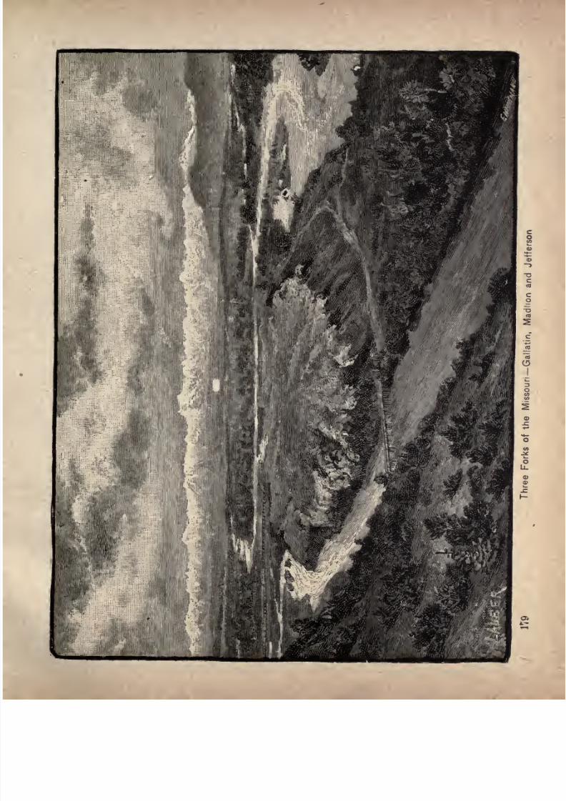
7/27/2019 Official Northern 00 Nort Rich
http://slidepdf.com/reader/full/official-northern-00-nort-rich 181/453
7/27/2019 Official Northern 00 Nort Rich
http://slidepdf.com/reader/full/official-northern-00-nort-rich 182/453
180 The Northern Piicifii Railroad.
of weather-worn rocks shovving stains of iron and copper,
and rising to the height of several hundred feet above the
track. On one side of the road runs the swift, clear cur
rent of the Missouri, and on the other tower enormous
precipices. The scenery in this canon is among the finest
on the whole line of the road.
Toston (1,086 from St. Paul, population 200) is a town
at the head of what is known as the Missouri valley. This
name is locally applied to a stretch of rich bottom lands,
about thirty miles long, and from three to. five in width.
There is a smelter at Toston which uses the ores found a
few miles distant on the opposite of the Missouri river in
combination with ores brought from the Cceur d'Alene
mining district in Northern Idaho.
Townsend (1,097 miles from St. Paul) has a good situ
ation near the centre of the Missouri valley, and is a place
of considerable trade, Theupper
and middleportions
of
the valley are irrigated from small streams running out
of the defiles in the Belt mountains, and the lower portion
gets water from a ditch taken out of the Missouri. The
town was established in 1883. There is a daily stage line
at White Sulphur Springs, the county seat of Meagher
County, forty miles distant, on the other side of the Belt
mountains. White Sulphur Springshas a
populationof
about 500, and is an important trading point for a large
district of grazing country. The springs are renowned in
Montana for their curative properties, and are much visited
by invalids. Good hotel accommodations can be had. The
Castle silver mines are also reached by stage from Towns-
end, a distance of sixty miles.
Gorges and Canyons. Across the Missouri valleyfrom Townsend, in a northeasterly direction, a series of deep
gorges, or canyons, have been cut by the waters in the faces
7/27/2019 Official Northern 00 Nort Rich
http://slidepdf.com/reader/full/official-northern-00-nort-rich 183/453
Seven Hundred Miles in Montana. 181
of the precipitous mountains. Crowning the summits of
the first range skirting the valley is a gigantic ledge of
lime rock. This ledge has been thrown up in places to a
great height with almost vertical sides, which are partly
smooth, partly seamed and gashed by ages of storms, and
sometimes cut through from top to bottom by the streams,
forming narrow gorges of fantastic shapes. Avalanche
Canyon is of great note from its wild beauty and extensive
and rich placer mines. This canyon received its name from
the frequency of avalanches, or snow slides, which rushdown its almost perpendicular sides in winter, sometimes
completely filling the gorge. Hell Gate canyon, about two
miles westward, while having a peculiarly suggestive name,
amply merits the appellation. Perhaps in no other acces
sible spot in Montana is there as much rugged beauty in so
small a space. The canyon forms the tortuous passage of a
silvery stream through a series of gates cut in very highwalls. These gates are so narrow that a man can span their
width with extended arms. The walls are only a few feet in
thickness, but of a surprising height. On each side of the
main gorge are smooth fissures, called Devil's Slides, and
every nook is filled with bright mosses and lichens.
Bedford (1,100 miles from St.
Paul)
is an old
miningtown, with a small hotel and a few business houses. Some
placer mining is carried on in the neighboring gulch. In
the early days of mining in Montana, there were two placer
camps near Bedford, with the singular names of "Hog'em"and "Cheat'em."
Prickly Pear Junction (1,126 miles from St. Paul) is
the point of divergence of the Helena & Jefferson Countyrailroad, which runs to the important mining district of
Wickes, on the eastern slope of the Rocky mountains,
7/27/2019 Official Northern 00 Nort Rich
http://slidepdf.com/reader/full/official-northern-00-nort-rich 184/453
183 The Northern Pacific Railroad.
twenty miles distant, to Boulder; the county seat of Jeffer
son county, and the center of a productive silver-mining
district, and also to Elkhorn, where there is one of the
most productive quartz mines in the State. A large smelt
ing plant is located at Prickly Pear Junction and is owned
by Helena capitalists. Ores are brought by rail to these
works from nearly all the mining districts of Central and
Western Montana.
Helena (1,130 miles from St. Paul; population, 14,000).
Helena,the
capitalof
Montana,is
pleasantlysituated at
the eastern foot of the main chain of the Rocky mountains,
in latitude 46 30'
N., and longitude 112 4' west of Green
wich, on both sides of the famous Last Chance Gulch,
from which at least ten millions of dollars' worth of nug
gets and gold dust have been taken, and which still yields
annually a considerable amount of the precious metal. So
large was the influx of miners at this point in 1864, that theUnited States Government felt compelled to establish a
postoffice for their accommodation. Until then the camphad been known as "Crab Town"; but a meeting was called
for the purpose of selecting a better name, and the major
ity of those assembled decided upon christening it after
Helen of Troy. It contains a handsome court house,
built of Rocky mountain granite and sandstone,an auditorium for public gatherings, built by the city,
a United States assay office, a college and a theater. It
has electric street railways, water-works, large public
school buildings, daily newspapers and many imposing
structures used for banking and general business. There
are a number of costly and handsome private residences.
The leading hotels are the Helena, the Merchants and the
Grand Central. The business center is about two miles
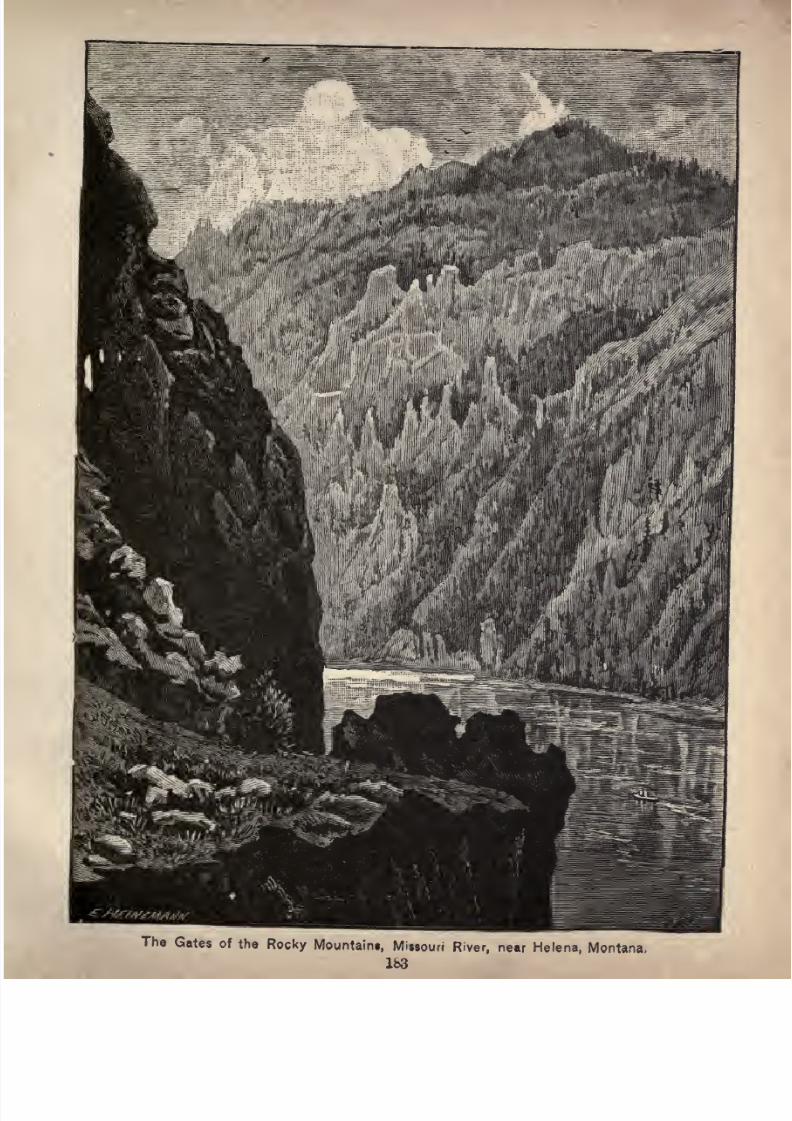
7/27/2019 Official Northern 00 Nort Rich
http://slidepdf.com/reader/full/official-northern-00-nort-rich 185/453The Gates of the Rocky Mountain*, Missouri River, near Helena, Montana,
7/27/2019 Official Northern 00 Nort Rich
http://slidepdf.com/reader/full/official-northern-00-nort-rich 186/453
184 TJie Northern Pacific Railroad.
from the railway station and is conveniently reached byelectric cars. The traveler can get no adequate idea of the
size or beauty of the city by what can be seen fromthe depot platform or the windows of the passing train.
The Montana Central railroad, from Great Falls to
Butte, runs through Helena, and the city is the diverging
point of three branches of the Northern Pacific system,
running to mining towns.
Helena is surrounded by mountains, rising one above
the other until the more distant are lost among the clouds,
forming a view of striking beauty and grandeur, which is
visible from every part of the city. To the south and west
these mountains recede in long, picturesque, timbered
ridges, to the main range of the continental divide. The
Missouri river is only twelve miles distant, and eighteen
miles north of thecity begins
the famouscanyon
of the Mis
souri river, named by Lewis and Clark's expedition in 1805
"The Gates of the Rocky Mountains." Here the river
has forced its way through a spur of the Belt mountains,
forming cliffs, frequently vertical, from 500 to 1,500 feet
high, which rise from the water's edge for a distance of
twelve miles. A monumental column rising high above
thegeneral
level of the walls of thecanyon
andplainly
visible from Helena, is called the Bear's Tooth." Sapphires
and precious garnets are mined on the gravel beaches
along the Missouri just above the canyon.
The Broadwater Hot Springs. About three
miles from Helena and reached by two lines of electric
railroad, is one of the finest natatoriums in the country,
established by the liberality of the late Colonel Broad-
water, a Helena millionaire. This immense oriental struc
ture is 300 feet long by 100 feet wide. Comfortable dress-
7/27/2019 Official Northern 00 Nort Rich
http://slidepdf.com/reader/full/official-northern-00-nort-rich 187/453
Seven Hundred Miles in Montana. 185
ing rooms surround the bath. The water flows over an
artificial structure of rock work in two cascades, one of
hot and one of cold
water,
which unite
midwayof the
descent and form a single fall. The temperature of the
hot water cascade varies from no to 140 degrees Fahren
heit. Around the Natatorium the grounds are prettily
ornamented with fountains, flower beds, shrubbery and
walks.
Across the Main Divide About twenty-one miles
from Helena the main range of the Rocky Mountains is
crossed by the railroad at the Mullan Pass, so named after
Lieut. John Mullan, U. S. A., who in 1867 built a wagonroad from Fort Benton, Mont., to Fort Walla Walla, Wash.,
thus bringing these distant military posts into direct com
munication. Here there is a tunnel 3,850 feet in length,
and 5,547 feet above the level of the ocean, lower by more
than 2,500 feet than the highest elevation of the Union
Pacific railroad, and 2,200 feet below the highest elevation
on the line of the Central Pacific. The route from Helena
to the Mullan Pass is through the charming valley of the
Prickly Pear, across Ten-Mile creek, and up, past heavy
growths of pine and spruce, and masses of broken boulders,
the narrow basin of Seven-Mile, creek, to the eastern portal
of the tunnel. The scene from above reveals one of the
most picturesque regions in Montana, in which mountain
and valley, forest and stream, are conspicuous features.
Describing this region, E. V. Smalley wrote :
"Approached from the east, the Rocky Mountains seem
.well to deserve their name. Gigantic cliffs and buttresses
of granite appear to bar the way and to forbid the traveler's
further progress. There are depressions in the range, how
ever, where ravines run up the slopes, and torrents come
7/27/2019 Official Northern 00 Nort Rich
http://slidepdf.com/reader/full/official-northern-00-nort-rich 188/453
186 Tli G Northern Pacific Railroad.
leaping down, fed by melting snows. Over one of these
depressions Lieut. John Mullan built a wagon road a score
of years ago, to serve the needs of army transportationbetween the head of navigation at the Great Falls of the
Missouri and the posts in Oregon. Mullan's wisdom in
selecting the pass, which bears his name, was indorsed
when the railroad engineers found it to be the most favor
able on the Northern Pacific line. The road is carried upravines and across the face of foot-hills to a steep wall,
where it dives into the mountain side, runs under the crestof the divide through a tunnel three-quarters of a mile
long, and comes out upon smiling green and flowery
meadows to follow a clear trout stream down to a river
whose waters seek the mighty Columbia. The contrast
between the western and eastern sides of the Main Divide
of the Rockies is remarkable. On the eastern slope the
landscapes are magnificently savage and sombre ; on the
western slope, they have a pleasant pastoral beauty, and
one might think himself in the hill country of western
Pennsylvania, instead of high up on the side of the great
water-shed of the continent. The forest tracts look like
groves planted by a landscape gardener in some stately
park, and the grassy slopes and valleys, covered with blue
and yellow flowers, and traversed by swift, clear brooks,
add to the pleasure-ground appearance of the country.
What a glorious place this would be for summer camping,
trout fishing, and shooting, is the thought of every traveler
as he descends from the summit, with his hands full of
flowers picked close to a snow-bank. Snow Shoe Mountain
rises just in front, across a lovely, verdant valley. Powell's
Peak, a massive white pyramid, cuts the clear sky with its
sharp outlines on the further horizon, and a cool breeze
blows straight from the Pacific Ocean/'
7/27/2019 Official Northern 00 Nort Rich
http://slidepdf.com/reader/full/official-northern-00-nort-rich 189/453
Seven Hundred Miles in Montana. 187
Passing down the western slope the descent is made to
the valley of the Little Blackfoot river. This valley is open
and wellgrassed,
with cottonwood on the stream andpine
on the slopes of the hills. The river received its name
from the Blackfeet Indians, who often passed down the
valley in early days to make their raids upon the Flathead
Indians. There is good ruffed grouse shooting in the val
ley, and also a great many blue grouse in the neighboring
canons. In October black-tailed deer are plentiful, and
elkare
alsofound
inthe mountains.
.
Bear black, grizzlyand cinnamon can be found.
The stations on the Little Blackfoot are Elliston and
Avon, small towns which supply neighboring mines and
ranches.
Garrison (miles from St. Paul; population, 200), in the
valley of the Deer Lodge river, is the junction of the
Montana Union railroad with the Northern Pacific. Garrison was named in honor of William Lloyd Garrison, the
eminent leader of the anti-slavery movement in the days
before the civil war. It derives its importance from the
transfer of freights and other railroad business. The
Montana Union railroad, owned jointly by the Northern
and Union Pacific companies, runs up the Deer Lodge
valley from Garrison to Deer Lodge, Anaconda and Butte.
Down the Hell Gate River. After leaving Garrison,
there are fine views of mountain scenery, especially on the
left hand, where the snow-mantled peaks of Mount Powell
appear.
Below the mouth of the Little Blackfoot, Deer Lodgeriver changes its name to Hell Gate river. The valley here
rather abruptly narrows, its breadth for seven or eight
miles scarcely exceeding a single mile, with mountains on
the right hand and bold bluffs on the left; but it again be-
7/27/2019 Official Northern 00 Nort Rich
http://slidepdf.com/reader/full/official-northern-00-nort-rich 190/453
188 The Northern Pacific Railroad.
comes broader where the waters of Flint creek flow from
the south and swell the volume of the river.
Gold Creek (1,190 miles from St. Paul) is the station
for the old mining town of Pioneer, about three miles dis
tant. On Gold creek the first discovery of gold within the
present limits of Montana was made in 1862. At the mouth
of the stream there are enormous bars of gravel and bould
ers produced by the hydraulic and sluice washings in the
region above. There is still some placer mining done on
this creek.
Near Gold Creek station the ends of the track of the
Northern Pacific railroad, advancing from the east and the
west, were joined in September, 1883. The event was made
the occasion of a remarkable celebration, which was at
tended by many distinguished guests of the railroad com
pany from England, Germany, and from the principal cit
ies of theEast, and
alsofrom the Pacific
coast.
The eastern guests arrived in four immense trains, and were joined
by a fifth train loaded with guests from Portland and othec
towns on the Pacific coast. This opening excursion of the
Northern Pacific was the most extensive and liberal affair
of the kind known in railway annals. The first iron spike
driven in the construction of the Northern Pacific railroad
was used as the last spike, and was driven by Henry Vil-
lard, at that time president of the railroad company.
Drummond (1,202 miles from St. Paul; population 300)
is the junction of the Drummond & Philipsburg railroad.
Considerable sluice and hydraulic mining is done in the
neighborhood, and the valley of Flint creek, which joines
the river opposite the town, contains many well cultivated
farms.
Through Hell Gate Canyon. A short distance below
Bearmouth the Hell Gate canyon is entered. This is, how-

7/27/2019 Official Northern 00 Nort Rich
http://slidepdf.com/reader/full/official-northern-00-nort-rich 191/453
Seren Hundred Miles in Montana. 189
ever, no narrow mountain pass, as its name would indicate,
but, rather,a valley from two to three miles in width, extend
inga distance of
fortymiles to the
junctionof the Hell
Gate river with the Big Blackfoot, after which it widens
to unite with the valley of the Bitter Root, whereon Mis-
soula stands. The scenery along the Hell Gate canyon is
very fine often grand. Rock-ribbed mountains rise on
either hand, their slopes black with noble specimens of
yellow pine, and flecked in autumn with the bright gold
of giant tamaracks. The streamitself is
deep and swift,
quite clear also, except where it receives the miirky water
of its many tributaries, which latter in summer are always
coffee-colored from the labors of the gold washers in the
mountains. Many islands covered with cottonwood and
other deciduous growths, lie in the crooked channel, add
ing to the general picturesqueness. Two-thirds of the
way down the canyon, Stony creek, a fine, bold mountainstream, enters from the southwest, after flowing eighty
miles through the range between the Deer Lodge and Bitter
Root valleys. The water teems with trout. The Big
Blackfoot, Hell Gate's largest tributary, comes in from
the east, with a valley eighty miles long and varying from
half a mile to twelve miles in width, considered one of the
finest grazing and agricultural sections in Montana.Many good quartz and galena-leads have been discovered
in the mountains, and the Wallace district, near Baker
station, is especially promising.
There are several large saw-mills in the Hell Gate
canyon, which obtain their logs from the canyon itself and,
from the neighboring mountains. The principal market
for the lumber is in Butte, where it is in demand, not
only for building purposes, but in large quantities for sup
ports to roofs of the mines.

7/27/2019 Official Northern 00 Nort Rich
http://slidepdf.com/reader/full/official-northern-00-nort-rich 192/453
190 The Northern Pacific Railroad.
Bonner (1,248 miles from St. Paul; population, 150) is
a saw-mill village near the crossing of the Big Blackfoot
river. The mills at this place are the most important in
Western Montana. Logs are floated down the Big Black-
foot river from the slopes of the main divide of the Rockymountains.
Beaver Hill A Legend. In traveling between Deer
Lodge and Missoula, twenty-eight miles from the latter
place, at Kramer's Ranch, a remarkable ridge or tongue of
land is seen stretching across the valley of the Hell Gate
river from the east side, almost in the form of a beaver
couchant. It is known as Beaver Hill, and it projects so
near to the mountains on the west side of the valley as to
nearly dam up the river, which is here compressed into a
narrow,, rocky channel. There is a legend connected
with this hill, which is about as follows:
A great
manyyears
ago,
before the country was inhab
ited by men, the valleys along the whole length of the
river and its branches were occupied by vast numbers of
beavers. There was a great king of all the beavers,
named Skookum (which in Indian means "good"), who
lived in a splendid winter palace up at the Big Warm
Spring mound, whereon the State insane asylum is now
situated. Oneday
theking
received word that his sub
jects down the river had refused to obey his authority, and
were going to set up an independent government. In
great haste he collected a large army of beavers, detach
ments joining him from every tributary on the way down.
On arriving at the great plain now crossed by Beaver
Hill, he halted his army, and demanded of the rebels that
they pay their accustomed tribute and renew their alle
giance. This they insultingly refused to do, saying they
owned the river below to the sea, that it was larger and
7/27/2019 Official Northern 00 Nort Rich
http://slidepdf.com/reader/full/official-northern-00-nort-rich 193/453
Seven Hundred Miles in Montana. 191
longer than that above; and, as they were more numerous,
they would pay tribute to no one. The old king was
able and wily, and immediately sent for every beaver under
his jurisdiction. When all had arrived he held a council
of war, and said, that, as he owned the sources of the great
river, he would dam it at that point, and turn the channel
across to the Missouri. This would bring the rebels to terms
below, because they could not live without water. He so
disposed his army that in one night they scooped out the
great gulch that now comes in on the north side of Beaver
Hill, and with the earth taken out the hill was formed in
a night, and so completely dammed up the river that not
a drop of water could get through. When the rebellious
beavers below saw the water run by and the river bed dry
up, they hastened to make peace, paid their tribute (internal
revenue tax, perhaps) and renewed their former allegiance.
So
KingSkookum had the west end of the dam removed,
and ever since that time the river has run "unvexed to the
sea." To commemorate the event, he had the earth piled
up on the top of the hill to resemble a beaver in form, and
it can be seen either up or down the river a long way.
The Indians who first settled up the valley got this legend
from the beavers, their cousins, more than a thousand
years ago;for in those ancient times
theycould converse
together, and did hold communication until some youngand treacherous Indians made war on the beavers for their
furs, when the beavers solemnly resolved never to converse
with them again, and have steadfastly kept their word.
Missoula (1,255 miles from St. Paul; population 5,000)
is the county seat of Missoula county and the junction of
the BitterRoot Valley railroad and the De Smet and
Cceur d'Alene railroad. It is beautifully situated at the
western gateway of the Rocky mountains, on a broad pla-
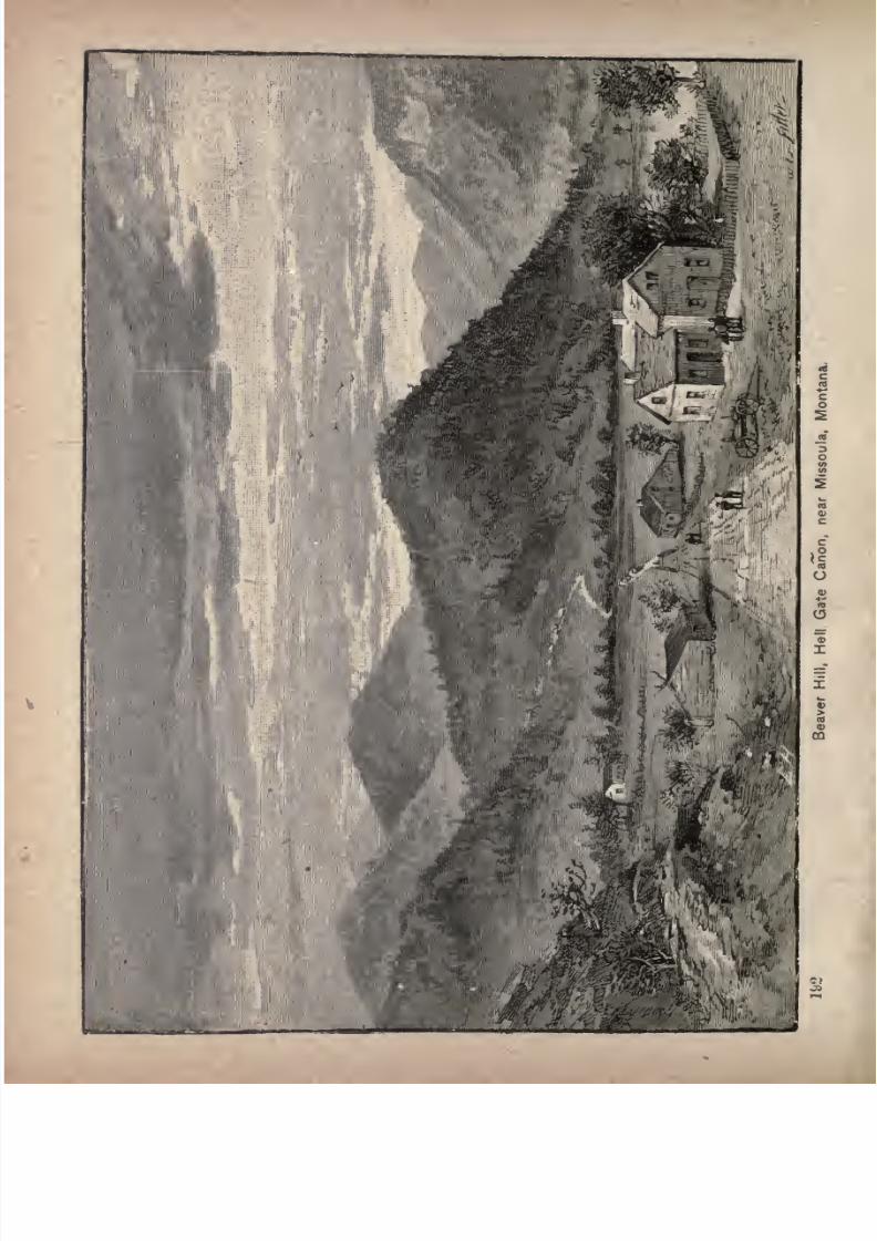
7/27/2019 Official Northern 00 Nort Rich
http://slidepdf.com/reader/full/official-northern-00-nort-rich 194/453

7/27/2019 Official Northern 00 Nort Rich
http://slidepdf.com/reader/full/official-northern-00-nort-rich 195/453
Seven Hundred Miles in Montana. 193
teau on the north side of the Missoula river, near its junc
tion with the Bitter Root and the Hell Gate, and commands
a
lovely
view of the
valley
and the
surrounding
mountain
ranges, that stretch away as far as the eye can see. This
town used to be as isolated and remote a frontier post as
could be found in the Northwest; but the railroad has
converted it into a stirring place. It contains an opera
house, well appointed hotels, railroad repair shops, hand
some public school buildings, a female seminary, conducted
bythe Sisters of
Charity,ahospital,
also under the
chargeof the same sisterhood, and also a sanitarium of the West
ern division of the Northern Pacific railroad, conducted
on the same plan as the sanitarium at Brainerd, Minn.,
which takes charge of sick and injured employes'on the
Eastern division of the road. It has many attractive and
substantial business blocks and residences. There are also
a flouring mill and saw-mills.The fertile lands of the plain near by and the large and
rich valley of the Bitter Root, already well settled, over
eighty miles long, with an average width of about seven
miles, besides other agricultural districts to the northward,
all make a lively trade. The altitude of this region is
about 3,000 feet. The climate is not as cold as in a
similar latitude east of the Rocky mountains, and the soil
produces readily a great variety of cereals, fruits and veg
etables.
In clear weather a fine view of the Bitter Root range of
mountains, including the highest summit of the range,
Lo Lo peak, may be had from the train as it runs down the
valley after leaving Missoula.
The country surrounding Missoula has been the sceneof many fierce conflicts between the Indians. Before the
whites inhabited the territory, the Black-feet Indians am-
7/27/2019 Official Northern 00 Nort Rich
http://slidepdf.com/reader/full/official-northern-00-nort-rich 196/453
194 The Northern Pacific Railroad.
bushed Chief Coriacan, of the Flatheads, in a defile four
teen miles north of the city, with a portion of his tribe,
and massacred nearly every man. A few years later the
Flatheads avenged their chief's death by killing a like
number of Blackfeet in the same defile, which now bears
Coriacan's name.
Missoula county embraces the large and fertile valleys of
the Missoula, the Bitter Root and the Jocko. The county is
heavily timbered and is rich in mineral and grazing lands. It
contains also
manybeautiful lakes,well stocked with fish and
frequented by water fowl. Good trout fishing, as well as
various other kinds, is obtained in the Missoula, the Bitter
Root, Jocko, Lo-Lo, Flathead, Big Blackfoot and Pend d'
Oreille rivers, and in numerous mountain creeks. The
mountain goat is in abundance, and can be found in the
vicinity. Fort Missoula, a garrison of the U. S. troops, is
pleasantlysituated about half an hour's drive from the
town, in the Bitter Root valley.
To the Coeur d'Alene Mines. Travelers who wish to
go by the shortest route to the Cceur d'Alene mining towns
should leave the main N. P. line at Missoula and take the
De Smet and Cceur d'Alene branch, which crosses the Bitter
Root range and runs to Mullan, Wallace and Wardner,
Idaho, in the silver mining district. A description of this
route will be found in the latter part of this volume.
The Coriacan Defile. Leaving Missoula, the railroad
passes westward across the northern edge of the plain,
over a low and well-timbered divide, which separates the
waters of the Missoula river (the continuation of the Hell
Gate) from those which drain into the Flathead. Fourteen
miles from Missoula the road enters the Coriacan defile,
and crosses the Marent gulch by means of an iron bridge
866 feet in length and 226 feet in height. The Coriacan
7/27/2019 Official Northern 00 Nort Rich
http://slidepdf.com/reader/full/official-northern-00-nort-rich 197/453
Seven Hundred Miles in Montana. 195
defile is surmounted by a grade of 116 feet to the mile,
the whole length of the heavy grade being thirteen miles,
ascending and descending. The track follows no valley,but proceeds along the faces of hills, which are covered
with fir, pine and tamarack, down into the valley of the
Jocko river, where the agency of the Flathead Indians is
established.
Arlee (1,282 miles from St. Paul), named in honor of
the chief of the Flatheads, is the station for the Flathead
Indian agency. The agency buildings are in sight, aboutfive miles distant, at the foot of the Mission mountains.
The Flathead Indian Reservation. This reservation
extends along the Jocko and Pend d'Oreille rivers a distance
of sixty miles. It contains about 1,500,000 acres, which, if
divided among the 1,200 Flathead, Pend d'Oreille and half-
breed Indians who hold the tract, would give 5,000 acres to
each family of four persons. A large part of the reservation
consists of a mountainous area, with a growth of valuable
timber;but there is also a fair quantity of fine grazing
land, as well as many well-sheltered, arable valleys. E. V.
Smalley visited the reservation in the summer of 1882, and
gave the result of his observations in the Century Magazine
for October of that year as follows :
"The Flathead agency is under the control of the Catholic church, which supports a Jesuit mission upon it, andhas converted all of the inhabitants to at least a nominaladhesion to its faith. At the missions are excellent schools
for girls and boys, a church, a convent, and a printing of
fice which has turned out, among other works, a verycreditable dictionary of the Kalispel or Flathead language.The agent, Major Ronan, has been in office over five years,
and, with theaid
of the Jesuit fathers, has been remarkably successful in educating the Indians up to the point of
living in log houses, fencing fields, cultivating little patchesof grain and potatoes, and keeping cattle and horses. The
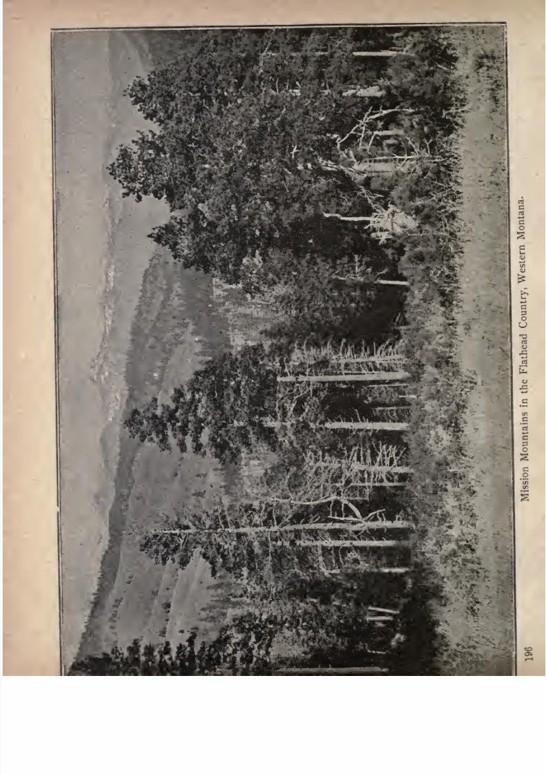
7/27/2019 Official Northern 00 Nort Rich
http://slidepdf.com/reader/full/official-northern-00-nort-rich 198/453
I
:
7/27/2019 Official Northern 00 Nort Rich
http://slidepdf.com/reader/full/official-northern-00-nort-rich 199/453
Seven Hundred Miles in Montana. 197
Government supplies plows and wagons, and runs a saw
mill, grist-mill, blacksmith shop and threshing machine
for their free use. There is noregular
issue of food or
clothing; but the old and the sick receive blankets, sugarand flour. Probably nine-tenths of these Indians are self-
sustaining. Some persist in leading a vagabond life,
wandering about the country; but these manage to pick upa living by hunting, fishing and digging roots, and sell
ponies enough to buy blankets, tobacco and powder. But
even the best civilized, who own comfortable little houses,
with plank doors and porcelain door-knobs, got from the
Government, like to keep their canvas lodges pitched, and
prefer to sleep in them in summer time: Farming is lim
ited to a few acres for each family; but herding is carried
on rather extensively. Thousands of sleek cattle and fine
horses feed upon the bunch pastures along the Jocko and
the Pend d'Oreille, on the Big Camas prairie, and bythe shores of Flathead lake. *
Probablythere is no better example of a tribe being brought out
of savagery in one generation than is afforded by theFlatheads and their cousins, the Pend d'Oreilles. Much of
the credit for this achievement is, no doubt, due the Jesuit
fathers, who, like all the Catholic religious orders, show a
faculty for gaining an ascendancy over the minds of sav
ages, partly by winning their confidence by devoting them
selves to their interests, and partly, it may be, by offeringthem a religion that appeals strongly to the senses and
superstitions. These Indians boast that their tribe never
killed a white man. They are an inoffensive, child-like
people, and are easily kept in order by the agent, aided bya few native policemen. Life and property are as secure
among them as in most civilized communities. With them
the agency system amounts only to a paternal supervision,
providing implements and machinery for husbandry, and
giving aid only when urgently needed. It does not, as
upon many reservations, undertake the support of the tribe
by issuing rations and clothing. Instead of surroundingthe agency with a horde of lazy beggars, it distributes the
Indians over the reservation, and encourages them to labor.
It ought to result in citizenship and separate ownership of

7/27/2019 Official Northern 00 Nort Rich
http://slidepdf.com/reader/full/official-northern-00-nort-rich 200/453
198 The Northern Pacific Railroad.
the land for the Indians. Many of them would now like
deeds to the farms they occupy, but they cannot get them
without legislation from Congress changing the presentIndian policy. Practically, they control their farms andherds as individual property; but they have no sense of
secure ownership, and no legal rights as against their
agent or the chief. Some of them complain of the tyrannyof the native police, and of the practice of cruelly whippingwomen when accused by their husbands of a breach of
marriage vows a practice established, it is charged, by the
Jesuits; but in the main they seem to be contented and
fairly prosperous. Among them are many half-breeds whotrace their ancestry on one side to Hudson's Bay Companyservants or French Canadians fine-looking men and hand
some women these, as a rule. They are proud of the white
blood in their veins, and appear to be respected in the tribe
on account ofit; or perhaps it is their superior intelligence
which gains for them the influence they evidently enjoy.
Shiftless white men, drifting about the country, frequently
attemptto settle in the
reservationand
getafooting
there
by marrying squaws; but they are not allowed to remain.
The Indians do not object to their company so much as the
agent."
Selish (1,292 miles from St. Paul) is the station for the
Saint Ignatius mission. It was formerly named Ravalli, in
honor of Father Ravalli, an eminent philanthropic mis
sionary who labored among the Flatheads and their allied
tribes for about forty years, and died in 1884. The Saint
Ignatius mission, six miles from the station is, with the
exception of the Saint Mary's of the Bitter Root valley, the
oldest Catholic mission in the Northern Rocky Mountain
region. It was established in 1854. It consists of a church,
a school for girls, a school for boys, a dwelling for the
missionary fathers, and numerous shops and mills.
Mission valley is one of the loveliest in Montana, and
is well worthy the attention of tourists. The Mission
mountains, which bound it on the east, are unsurpassed
7/27/2019 Official Northern 00 Nort Rich
http://slidepdf.com/reader/full/official-northern-00-nort-rich 201/453
Seven Hundred Miles in Montana. 19
for grandeur of scenery in the entire Rocky mountain
chain. They contain numerous canyons and waterfalls.
Flathead lake is
easilyreached from the mission
bya
drive of about thirty miles over a good road.
The railroad follows the beautiful valley of the Jocko
river to its confluence with the Flathead, forty-four miles
from Missoula. The Flathead for the next twenty-five
miles, until its waters are united with those of the Missouri,
is now called the Pend d'Oreille river. Keeping along the
leftor southern bank of this stream for seventeen miles,
the road sweeps around a grand curve, and crosses to the
right bank over a fine truss bridge, which, with its ap
proaches, is about 800 feet long. Eight miles beyond the
crossing, the muddy waters of the Missouri, pouring in
from the south, mix with the bright flood of the Pend
d'Oreille, and the united streams now take the designation
Clark's Fork of the Columbia. This name is retained,
except where the river widens out into Lake Pend d'Oreille,
100 miles westward, until the waters mingle with those of
the Columbia river, in the British possessions, northward.
Paradise Valley and Horse Plains. Two small and
charming valleys soon appear to vary the fine mountain
views. They are Paradise valley and Horse plains, both
celebrated among the Indians as wintering places for their
ponies. Paradise valley is seven miles westward of the
junction of the rivers. It is two by four miles in extent,
and well deserves its name. Six miles beyond is Horse
plains, a circular prairie, six miles across, containing a
township of fertile land, situated in the midst of very wild
scenery. High mountains stand around, and lend the
warmth of spring, while their own sides are white with
snows. These valleys are the only spots on the immediate
line of the railroad for over a hundred and fifty miles that
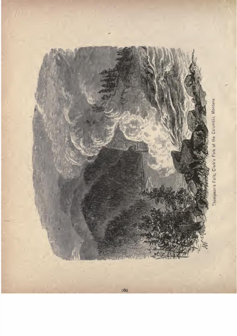
7/27/2019 Official Northern 00 Nort Rich
http://slidepdf.com/reader/full/official-northern-00-nort-rich 202/453
7/27/2019 Official Northern 00 Nort Rich
http://slidepdf.com/reader/full/official-northern-00-nort-rich 203/453
Seven Hundred Miles in Montana. 201
invite cultivation. The land of Horse plains produces
everything desirable in a northern latitude, under irri
gation; but in some seasons irrigation is not needed. At
Horse plains there is a prosperous community of farmers
and stock men.
Leaving Horse Plains, and crossing Clark's creek, with
Lynches buttes visible to the right, the railroad con
tinues westward along the right bank of the river through
an unbroken mountain region which affords magnificent
views at every turn. The mountains tower on either side.
There is no bench land, much less any fertile bottoms,
though sometimes level spots of a few acres are heavily
timbered. Room is not always found for the track, which
is often blasted out from the points of the hills.
Thompson's Falls (1,357 miles from St. Paul; popula
tion 300) is beautifully located at the falls of the Clark's
Fork river, has hotels, livery stables and a number of mer
cantile houses. The river furnishes a remarkable water-
power, which has not yet been utilized.
Grand Scenery. Every where along the Clark's Fork
of the Columbia there is magnificent scenery. Cotton-
wood grows close to the river, and firs and pines clothe the
benches and mountain-sides, except where the latter are so
nearly
vertical that the forest cannot grow. Magnificent
vistas are presented as the train moves along, changing
and wearing new forms at every turn. The mountains are
conical, and sometimes vertical, as where the river has cut
through them with tremendous force. The constant suc
cession of towering hills, grouped in wild array, is never
wearying, and is sometimes startling in effect, as when some
tributaryfrom the north or south tears its
wayto the
greater stream, and offers a vista, reaching far through the
deep-worn canon or ravine, along which the heights are
7/27/2019 Official Northern 00 Nort Rich
http://slidepdf.com/reader/full/official-northern-00-nort-rich 204/453
The Northern Pacific Railroad.
ranged as far as eye can see. One of the most striking of
these side effects is where Thompson's river comes in from
the north, and you look up the long and sharp ravine to
catch a momentary glimpse, from the tressle bridge, of the
foaming waterfall and the heights that wall it in.
Views qn the Clark's Fork. Reaching the second
crossing of the Clark's Fork, there is seen a navigable
stretch of water that was utilized by placing a small
steamer on it at the time the railroad was under construc
tion. East of the secondcrossing,
the mountains close in
upon the view, often abruptly. West of it the valley
widens. There is no land to style it a valley; but the
gorge is wider and the river less turbulent. The scenery has
the same features, but in rather quieter lines, as the heights
do not crowd the river so much. The road is now on the
south side of the stream. West of Second Crossing, about
tenmiles, the track follows a high bench, and a view
is
shown of the river where its waters have cut a deep chan
nel far below. Mountains on the north stand imminent,
and make a striking picture.
Good Hunting and Fishing Another feature of this
mountain region, which is likely to attract the attention
of lovers of sport, that abundance of game is found among
all the ranges. There is no other region that can surpassit for the presence of wild and game animals, as well as
birds and fish. Bears are very common; elk, caribou or
rnoose haunt these mountains, and deer of various kinds
abound. There are many of the fur-bearing animals, such
otter, beaver and mink; while grouse, pheasants, ducks,
geese and other fowl are plentiful in their season. The
waters abound in the finest trout of several varieties, fromthe little speckled beauties of the mountain rills to the
great salmon trout found in the larger streams and lakes.
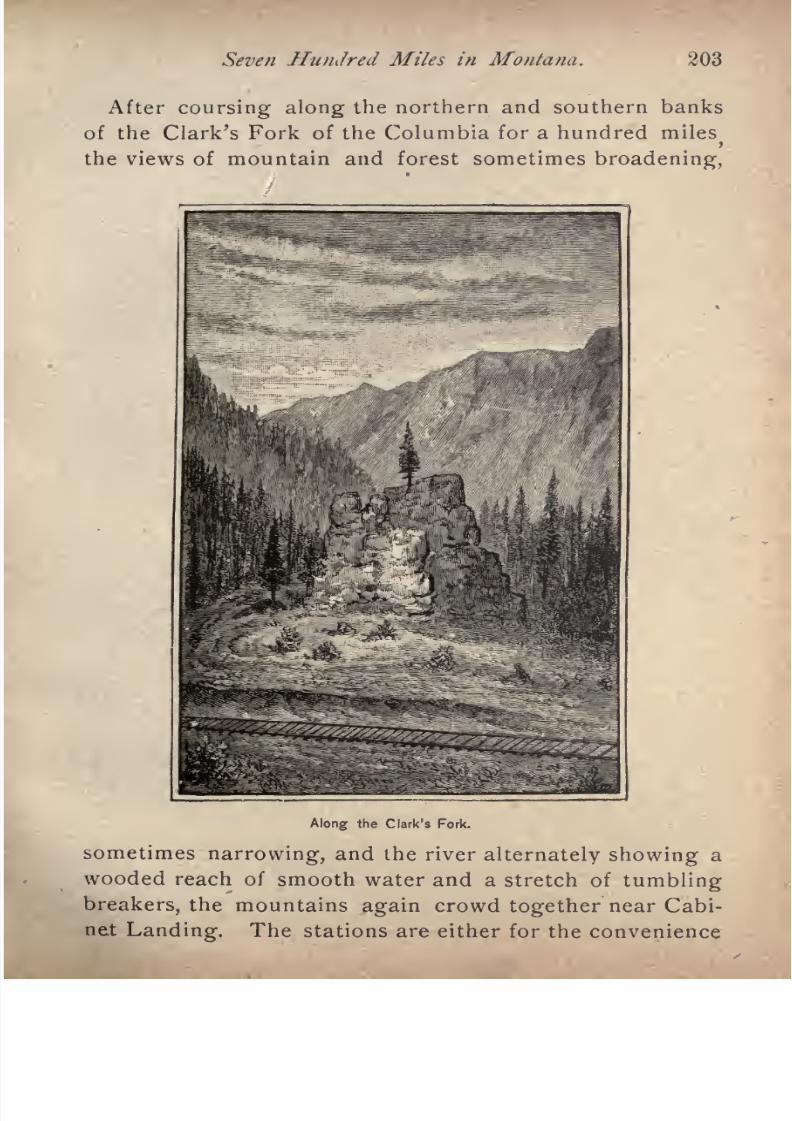
7/27/2019 Official Northern 00 Nort Rich
http://slidepdf.com/reader/full/official-northern-00-nort-rich 205/453
Seven HunJred Miles in Montana. 203
After coursing along the northern and southern banks
of the Clark's Fork of the Columbia for a hundred miles>
the views of mountain and forest sometimes broadening,
Along the Clark's Fork.
sometimes narrowing, and the river alternately showing a
wooded reach of smooth water and a stretch of tumblingbreakers, the mountains again crowd together near Cabi
net Landing. The stations are either for the convenience
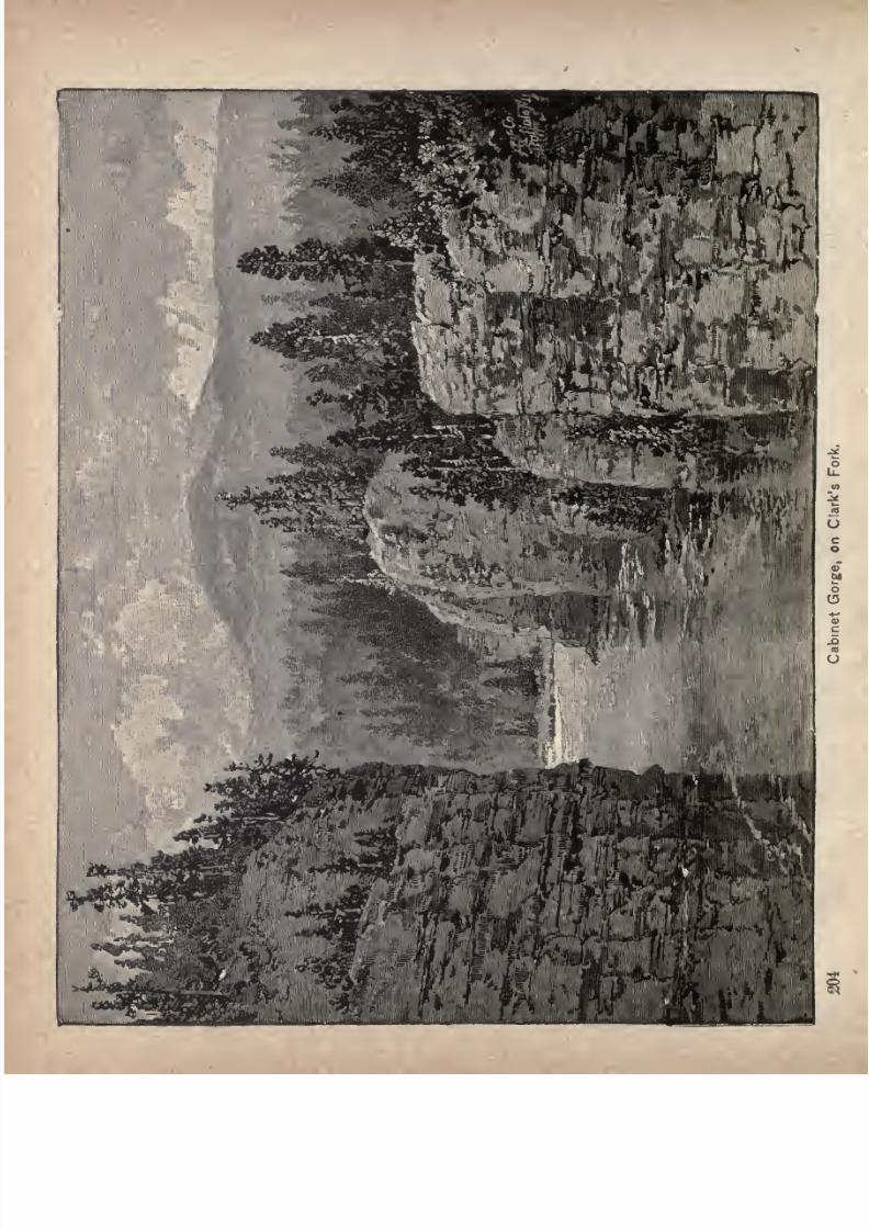
7/27/2019 Official Northern 00 Nort Rich
http://slidepdf.com/reader/full/official-northern-00-nort-rich 206/453
r

7/27/2019 Official Northern 00 Nort Rich
http://slidepdf.com/reader/full/official-northern-00-nort-rich 207/453
The Rivers of Idaho. 205
of railroad employes or for the shipment of lumber, and
in every other aspect are at present of not sufficient impor
tance to be described. At several
pointson the line the
track is carried across lateral streams by massive trestle
bridges, the one over the deep gorge of Beaver creek being
especially noticeable from its height and graceful curve.
These frequent bridges, as well as many deep cuttings
through the spurs of the mountains, attest the difficulties
which the engineers were required to surmount in con
structingthe line.
South of this mountain range, stretching nearly across
the State, is the Snake River plain, the surface of which is
either level or gently undulating. Still further south is an
elevated plateau, which merges in the southwest into an
alkaline desert. Idaho is, on the whole, well watered. Its
principal stream is the Snake or Lewis Fork of the Colum
bia, which, with its many affluents, drains about five-sixthsof the State. This stream, generally confined within
high walls of basalt, pursues a tortuous and tumultuous
course, from its sources in Wyoming, of about 1,000 miles,
interrupted by many falls of considerable height. It is
only navigable from a short distance above Lewiston, near
which city it leaves the State, to its junction with the
Columbia river, at Ainsworth, less than 100 miles distant.The principal tributaries of the Snake river are the Salmon,
the Boise, the Owyhee and the Clearwater, the Salmon
river draining the central part of the State.
The arable lands of Idaho are estimated at ten per cent,
of its area. There is a fine plateau in the northern part of
the State, just north of the Snake and Clearwater rivers,
which is an excellent grain country and a good fruit
country. In the south there are good valleys which are
cultivated by irrigation. The grazing lands of Idaho
7/27/2019 Official Northern 00 Nort Rich
http://slidepdf.com/reader/full/official-northern-00-nort-rich 208/453
206 The Northern Pacific Railroad.
cover a great area, especially in the southern part of the
State. All the level country of the Snake river plains
is valuable for pasturage, as well as the mountain ranges
to the south and southeast, which are covered with bunch
grass.
The Territory was organized in 1863, having been cut
off from Oregon, although a part of it was subsequently
given to Montana, and the State was admitted to the Union.
Its population by the census of 1890 was only 85,000 ex
clusive of the Indians, who number about 5,000. These
Indians consist of the Nez Perces, Bannacks and Shoshones.
The former, numbering 2,807, have a reservation ot 1,344,-
ooo acres on the Clearwater, near Lewiston, toward the
northern part of the State. The latter two tribes, num
bering 1,500, jointly occupy a reservation of 18,000 acres
in the southeastern part of the State, on the Snake and
Portneuf rivers. There is also a reservation near Lemhi,
in the Salmon River mountains, where 677 Indians are re
ported as having their homes.
In Northern Idaho lie the Cceur d'Alene gold and silver
mines, reached by Northern Pacific lines from both Mis-
soula and Spokane. These mines are among the most pro
ductive in the United States. Precious metals are also
mined at variouspoints
in the central and southernparts
of the State.
7/27/2019 Official Northern 00 Nort Rich
http://slidepdf.com/reader/full/official-northern-00-nort-rich 209/453
ACROSS THE PAN HANDLE OF IDAHO.
The State of Idaho, The Northern Pacific railroad
passes over a very narrow strip of Northern Idaho
scarcely a degree of longitude between the eastern end of
Lake Pend d'Oreille and a point near Spokane, Washington. It is a forest country all the way, timbered with
Rocky mountain pine, commonly known as bull pine, until
the eastern edge of the Spokane plain is reached, beyond
Rathdrum, and near the Washington boundary. This
part of Idaho is called the Pan Handle, but a better name
would be the Shank, for the shape of the State closely
resembles that of a leg of mutton, of which the shank is
the northern part, extending to the British Columbia line.
Idaho is bounded on the east and northeast by Montana
and Wyoming, from which it is separated by the winding
chain of the Bitter Root or Cceur d'Alene mountains. On
the south it follows the forty-second parallel along the line
of Utah and Nevada. On the west lie Oregon and Wash
ington, and on the north the British possessions. Idaho
is embraced between the forty-second and forty-ninth par
allels of latitude, and between the mth and nyth merid
ians of longitude, west of Greenwich. Its area is 86,294
square miles, or 55,228,160 acres. The northern part of
the State is quite mountainous, some of the highest alti
tudes reaching 10,000 feet. Mountain and valley alike are
covered with a dense growth of coniferae. The principal
207

7/27/2019 Official Northern 00 Nort Rich
http://slidepdf.com/reader/full/official-northern-00-nort-rich 210/453
208 The Northern Pacific Railroad.
ranges are the Bitter Root and the Salmon mountains, the
latter traversing the central portion of the State.
Cabinet Landing. At this point the Clark's Fork is
confined in a rocky gorge, through which it dashes at tre
mendous speed. The columnar rocks that hem in the
torrent are from 100 to 150 feet in height, their brows
crowned with pines, and the romantic wildness of the
gorge is of surpassing beauty. The bold fluted pillars of
rock are not unlike those of the"Giant's Causeway" in
Ireland. Cabinet
Landing
derives its name, in part at
least, from the fact that here the Hudson's Bay company,
in carrying up goods by boat from the foot of Lake
Pend d'Oreille to Horse plains, was "compelled to make a
portage. From Cabinet Landing the train runs through
solid rock cuttings, the walls of which tower far above the
rushing, tumbling stream below. Clark's Fork, a station
near thelong
railroadbridge
over the Clark'sFork,
affords
some fine river views, and ten miles further the pleasant
town of Hope, on the strand of Lake Pend d'Oreille, is
reached.
Lake Pend d'Oreille. This beautiful lake may be lik
ened to a broad and winding valley among the mountains,
filled to the brim with gathered waters. Reaching the lake,
the railroad crosses the mouth of Pack river on a trestle
one mile and a half in length, and skirts the northern shore
for upward of twenty miles. The shores are mountains,
but, wherever there is a bit of beach, it is covered with
dense forest. The view of the lake from the car windows,
with its beautiful islands and its arms reaching into the
surrounding ranges, is superb. The waters stretch out
south, and fill a mountain cove to the southwest beforethose of the Clark's Fork meet them. From this point
the river makes the lake its channel, and passes out at the
7/27/2019 Official Northern 00 Nort Rich
http://slidepdf.com/reader/full/official-northern-00-nort-rich 211/453
Across the Pan-Handle of Idaho. 209
western end on its flow northward to meet the Columbia,
just over the boundary line in British Columbia. The
whole length of the lake, following its curves and Wind-
Skirting the Clark's Fork.
ings, must be nearly sixty miles. In places it is fifteen
miles wide, and in others narrows to three miles.
The circuit of the lake shore is full of surprises. The
mountains are grouped with fine effect, and never become
7/27/2019 Official Northern 00 Nort Rich
http://slidepdf.com/reader/full/official-northern-00-nort-rich 212/453Lake Pend d'Oreiile, Idaho.
7/27/2019 Official Northern 00 Nort Rich
http://slidepdf.com/reader/full/official-northern-00-nort-rich 213/453
Across the Pan-Handle of Idaho. 211
monotonous. Along the lake the most prominent features
of civilization are the saw-mills, which supplied material
for railroad construction, and are nowemployed
manu
facturing lumber for shipment. The forest is interminable;
but, where the mountains are abrupt, the trees do not grow
large enough and clear enough to make good lumber.
The benches and levels along the streams are generally
thickly studded with giant pines or firs, and these trees
also tower in the ravines. These spots of good timber were
selected as sites forsaw-mills,
and thecarrying
of lumber
is now an important branch of traffic. The Northern
Pacific road reaches its farthest northern limit at Pend
d'Oreille, and thence turns south and west.
Hope, Idaho (1,428 miles from St. Paul; population,
500) is beautifully located on high ground on the northern
shore of Lake Pend d'Oreille. It was formerly only a fish
ing and hunting resort, with a small hotel for sportsmen;but the removal of the Northern Pacific division terminus
from Heron in 1888, and the discovery of mines of silver ore
on the south shore of the lake, have caused considerable
growth. Steamers cross the lake to the new mines, called
Chloride and Weber. The landing for the mines is at the
mouth of Gold creek, about thirty miles by water from
Hope. The principal street of Hope is built on a narrowshelf on the mountain side overlooking the railroad and
the lake.
Pack River (1,439 miles from St. Paul). Near this
station the Pack river enters Lake Pend d'Oreille, and
from here an old fur-trading and mining trail leads to the
Kootenai river, a distance of about thirty miles. The
Kootenai is an eccentric stream, running first south, andmaking a long bend, and afterward flowing due north far
into British territory. The Kootenai is navigable for 150
7/27/2019 Official Northern 00 Nort Rich
http://slidepdf.com/reader/full/official-northern-00-nort-rich 214/453
212 The Northern Pacific Railroad.
miles, for 100 miles of which it expands into a deep, nar
row lake. Numerous large veins of galena silver ore are
found along the shores of Kootenai lake and river, andare the basis of several important mining enterprises. A
small steamer runs upon the Kootenai.
Sand Point (1,444 miles from St. Paul), on the shore of
Lake Pend d'Oreille, is a place of importance on account
of its being the point of junction with the Great Northern
road, which gives access to the Kootenai valley and the
Flathead valley on the east, and which runs down the
Clark's Fork from the lake for about fifty miles before
turning westward to Spokane.
Cocolalla (i ? 457 miles frcm St. Paul). This station
derives its euphonious Indian name from the bright sheet
of water which lies near the track. The lake is several
miles long, but not wide. On approaching it, a charming
view of wave, wood and mountain will be caught. But we
are passing out of Wonderland. Mountains no longer
seem to overtop us. The train sweeps on toward the
southwest, following a natural pass between the ranges,
presently entering a valley a few miles wide.
Rathdrum (1,485 miles from St. Paul) is a small town
situated on the northeastern verge of the great Spokane
plain, has a population of 300. There is considerable good
farming land near by, much valuable timber, and some
excellent range for stock.
Hauser Junction (1,492 miles from St. Paul) is the
point of the divergence of the Spokane Falls & Idaho rail
road, which runs to Cceur d'Alene City on the lake of the
samename,
sixteen milesdistant,
there
connectingwith
steamers on the lake and river to Mission, from whence
there is a railroad to the Cceur d'Alene mining towns.
views of the Cceur d'Alene mountains which sur-
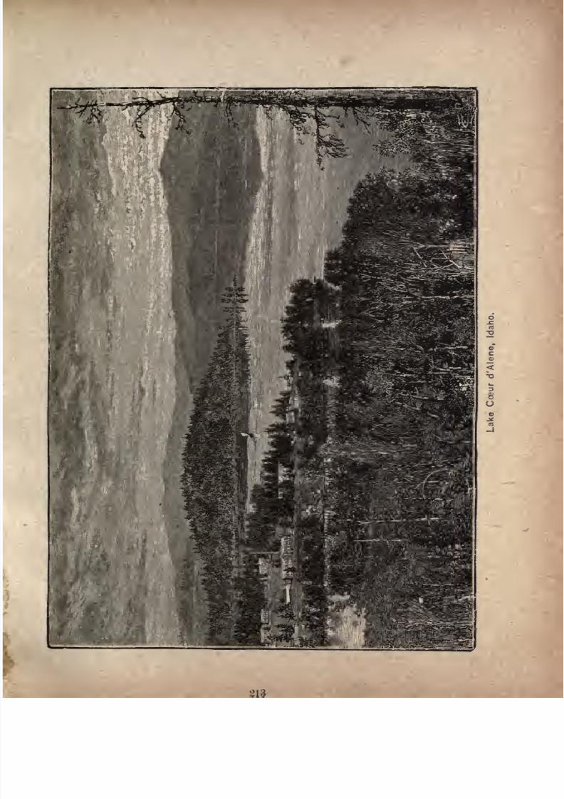
7/27/2019 Official Northern 00 Nort Rich
http://slidepdf.com/reader/full/official-northern-00-nort-rich 215/453
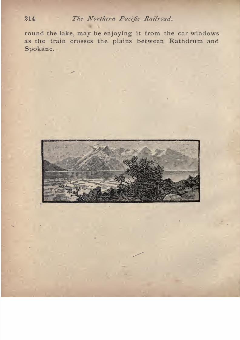
7/27/2019 Official Northern 00 Nort Rich
http://slidepdf.com/reader/full/official-northern-00-nort-rich 216/453
214 The Northern Pacific Railroad.
round the lake, may be enjoying it from the car windows
as the train crosses the plains between Rathdrum and
Spokane.
7/27/2019 Official Northern 00 Nort Rich
http://slidepdf.com/reader/full/official-northern-00-nort-rich 217/453
FIVE HUNDRED AND TWENTY-FIVE
MILES THROUGH WASHINGTON.
The Evergreen State. The main line of the Northern
Pacific runs for 525 miles in the State of Washington,
entering it on the Spokane plain, near the crossing of the
Spokane river, and leaving it at Kalama, where the trains
are ferried over the Columbia river on their way to Port
land, Oregon.
Washington is called the"Evergreen State" from its
extensive forests of evergreen trees, and also from the fact
that in the western part the winters are so mild that the
grass remains green throughout the year. In situation it
is the most northwestern of the States of the Union, being
bounded by British Columbia on the north and the Pacific
ocean on the west, while its southern line rests upon Oregon
and its eastern line upon Idaho. Its length from east to
west is about 360 miles and its width from north to south
240 miles. Its area is 69,994 square miles, of which 3,114
are water, leaving 66,880 square miles of land or 42,803,200
acres, about equal to the area of Ohio and Indiana com
bined. Washington Territory was organized in 1853, and
at that time included much that is now Idaho. Its admis
sion to the Union was provided for by the act of Congress
passed in the winter of 1889. Its present population is not
less than =500,000.
7/27/2019 Official Northern 00 Nort Rich
http://slidepdf.com/reader/full/official-northern-00-nort-rich 218/453
216 The Northern Pacific Railroad.
The Cascade mountains, a broad volcanic plateau, with
many lofty, snow-clad peaks, rising high above the general
level, divide both Washington and
Oregoninto two un
equal parts, which differ widely in surface, climate and
vegetation. Westward of this mountain chain, from forty
to seventy miles, is still another and lower range, lying
along the ocean shore, known as the Coast mountains in
Oregon and the Olympic range in Washington.
Between these two mountain ranges spreads out the
basin of
Puget Sound,and the
valleysof the
Cowlitz,Chehalis, and other rivers. The entire region west of the
Cascade mountains, including the slopes of these eleva
tions, is covered with dense forests, mainly of coniferae,
which constitute a large source of wealth.
The climate of this section is mild and equable, with
slight ranges of temperature, showing a mean deviation of
only 28 during the year, the summer averaging 70, andthe winter 38. There is an abundant rainfall, and the
wet and dry seasons are well marked. The rains are more
copious in December, January and March than at any
other time. But the rain falls in showers rather than con
tinuously, with many intervals of bright, agreeable
weather, which often last for days together. Snow rarely
falls in great quantities, and it soon disappears under the
influence of the humid atmosphere. During the dry sea
son the weather is delightful. There are showers from
time to time; but the face of the country is kept fresh and
verdant by the dews at night, and occasional fogs in the
morning. The soil of the valleys of Western Washington
is generally a dark loam, with clay subsoil, and in the
bottom lands near the water-courses are rich deposits of
alluvium. These soils are of wonderful productive .capa
city, yielding large crops of hay, hops, grain, fruits and
7/27/2019 Official Northern 00 Nort Rich
http://slidepdf.com/reader/full/official-northern-00-nort-rich 219/453
Through Washington. 217
The area east of the Cascade mountains, by far the larger
portion of Washington, presents features in marked con
trast to those which have beenalready
outlined. This is
not only true of the climate, but also of the soil and topog
raphy, fully warranting the popular division of the
country into two sections, known as the coast region
and the inland region which are essentially dissimilar in
aspect.
The area east of the Cascade mountains extends to the
bases of the Blue and Bitter Rootranges.
A broadstrip
on
the north is mountainous and covered with forest; but the
greater portion embraces the immense plains and undulat
ing prairies, 250 miles wide and nearly 500 miles long,
which constitute the great basin of the Columbia river.
Within the limits of this basin are a score of valleys, manya one of which is larger than some European principali
ties,all
of which are well watered, and clothed withnutritious grass.
In the eastern section the temperature is decidedly
higher in summer and lower in winter than in the western
section the average indicating respectively 85 and 30.
The.rainfall is only half as heavy; but it has proved suffi
cient for cereal crops. From June to September there is
no rain, the weather being perfect for harvesting. Theheat is great, but not nearly so oppressive as a much lower
grade would be in the Eastern States, and the nights are
invariably cool. The winters are short, but occasionally
severe. Snow seldom falls before Christmas, and some
times lies from four to six weeks, but usually disappears
in a few days. The so-called"Chinook," a warm wind
which blows periodically through the mountain passes, is
of great. benefit to the country. It comes from the south
west across the great thermal stream known as the Japan
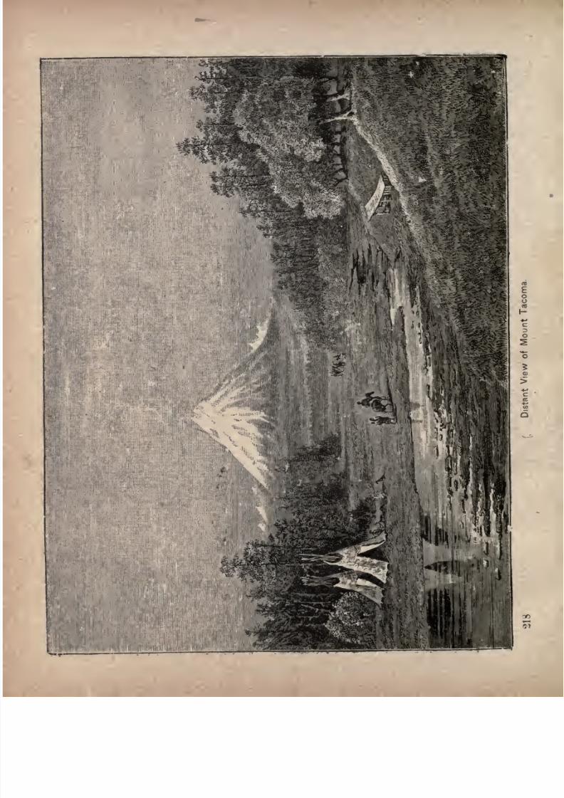
7/27/2019 Official Northern 00 Nort Rich
http://slidepdf.com/reader/full/official-northern-00-nort-rich 220/453
7/27/2019 Official Northern 00 Nort Rich
http://slidepdf.com/reader/full/official-northern-00-nort-rich 221/453
Through Washington. 219
current, and the warm, moist atmosphere melts the
deepest snow in the course of a few hours.
The soil is a dark loam, of great depth, composed of
alluvial deposits and decomposed lava overlying a clay
subsoil. The constituents of this soil adapt the land
peculiarly to the production of wheat.-
Agriculture is the leading industry, and wheat is the
principal product of the entire country. Its superior
quality and great weight have made it famous in the grain
markets of the world. The entire surplus of the wheat
crop is exported by sea to Liverpool and other European
markets, from the shipping ports of Tacoma and Portland.
Oats and barley also yield heavily. Hops are a very
important product, and widely cultivated in the Puyallup
and White River valleys on Puget Sound, and in Yakima
county, east of the Cascade mountains. Vegetables of
every variety, and of the finest quality, are produced.
Fruits of many descriptions, all of delicious aroma and
flavor, grow to a remarkable size. Among them are
apples, pears, apricots, quinces, plums, prunes, peaches,
cherries and grapes. Strawberries, raspberries, black
berries, gooseberries and currents are also abundant.
An important industry is the raising of cattle, sheepand
horses. This is only second to agriculture, and is pursued
in all parts of the Pacific Northwest. The horses are of
excellent race, and excel in speed. Sheep husbandry has
proved very profitable, especially among the Blue mountain
ranges.
It would scarcely be possible to exaggerate the extent
and value of the forests. East and west of the Cascade
mountains there are
large
tracts of timber lands. The Blue
mountains and eastern slopes of the Cascades are thickly
clothed with pine timber, and west of the Cascade moun-
7/27/2019 Official Northern 00 Nort Rich
http://slidepdf.com/reader/full/official-northern-00-nort-rich 222/453
220 The Northern Pacific Railroad.
tains there is an inexhaustible supply. Perhaps the finest
body of timber in the world is embraced in the Puget
Sound district. The principal growths are fir, pine, spruce,cedar, larch and hemlock, although white oak, maple,
cottonwood, ash, alder and other varieties are found in con
siderable quantities.
The mineral wealth of Washington is large and diversi
fied. Coal takes a foremost rank among the mineral
resources of the country. Immense beds of semi-bitumin
ous and lignite coal are found west of the Cascade mountains, and also east af those mountains, in the UpperYakima valley. This mineral exists in Oregon in different
localities; but the coal fields of Washington are far more
extensive. The principal mines are on the Puyallup, Car
bon and other rivers flowing into Puget Sound, near
Tacoma, Seattle and Whatcom, and also at the head of the
Yakima valley, at Roslyn. Iron ores bog, hematite and
magnetic exist in great masses, and are found in both
Oregon and Washington.
Silver ore is successfully mined in -the Colville valley,
about 100 miles north of Spokane, and also at various
points in the Okanogan valley and on the western slope of
the Cascade mountains. Gold is obtained by washing
auriferous earth on the Swauk and Te-anaway, small
streams which flow into the Upper Yakima. Gold quartz
is mined at Palmer mountain in the Okanogan valley.
Copper has been found in the Peshastin range of moun
tains north of Ellensburgh. There are also extensive iron
ledges in those mountains.
The waters of all the rivers of Washington flow into the
Pacific ocean, the largest of which, the Columbia, is navi
gable for a distance of 725 miles. The Snake river comes
next in importance, and there are many other streams nav

7/27/2019 Official Northern 00 Nort Rich
http://slidepdf.com/reader/full/official-northern-00-nort-rich 223/453
Through Washington. 221
Puget Sound is a beautiful archipelago, covering an
area of over 2,000 square miles. Its waters are everywere
deep and free from shoals, its anchorage secure, and it of
fers every facility that a great commerce demands.
There are several commodious harbors for vessels on
the coast line, exclusive of those found at the mouths of the
several rivers. At these places a thriving trade is carried
on in lumbering, coal mining, fishing, oystering, dairying
and agricultural products.
These waters abound in fish, of which many varieties
are of great commercial value. Particularly is this the fact
with regard to salmon. Extensive establishments for can
ning are carried On at several places on the Columbia river,
where the business of salmon packing is the principal in
dustry. The far famed reputation which the Columbia
river fish has acquired secures it a large market in the East
ern States, and it is sold extensively in Australia, England
and other European countries.
The remarkable variety of resources offered by this
great new State, its peculiarly agreeable and healthful cli
mate, its strikingly beautiful landscapes of snow-capped
mountains, noble rivers, great estuaries of the sea, magnifi
cent forests, charming lakes and fertile prairies, combine
to make it aregion particularly
attractive to all who seek
new homes in the great Northwest. The State is well sup
plied with railway facilities by four transcontinental lines
the Northern Pacific, Union Pacific, Great Northern and
Canadian Pacific.
Spokane (1,512 miles from St. Paul), formerly called
Spokane Falls, is the commercial capital of all of Eastern
Washington and Northern Idaho, its trade territory ex
tending from the western ranges of the Rockies on theeast to the Cascade mountains on the west. It is a
remarkable city on account of its rapid growth, the
7/27/2019 Official Northern 00 Nort Rich
http://slidepdf.com/reader/full/official-northern-00-nort-rich 224/453
222 The Northern Pacific Railroad.
solidity of its construction and the picturesque features of
its cataracts and river gorge, its mountainous surroundings
and its handsomely improved streets. The entire business
district was burned in 1890, but the immediate result was
its rebuilding in a style of beauty and solidity not attained
by old Eastern cities in a century of growth. The stately
business blocks of brick and granite would do credit to a
city ten times the size of Spokane.
Spokane was named for the river and the falls, and
they bear the name of a tribe of Indians, the Spokanes,
which formerly inhabited this region. The first settlement
was made in the seventies by four men who took up claims
that cornered at the falls. All of them became millionaires
by the enormous appreciation of their property. When
the Northern Pacific reached the place in 1880, building
from the west, it contained about 300 people. Its present
populationis more than
35,000.Flour
millingand lumber
sawing were the first industries, based on the admirable
water power of the numerous falls. As the agricultural
lands of the south and west attracted population the town
became a center of mercantile trade, which was greatly
extended after the discovery of precious metals in the
mountains on the east and north. The building of branch
roads anda
second transcontinentalline confirmed and
strengthened its position for general business and the
further improvement of the water power attracted numerous
manufacturing enterprises. The railway facilities comprise
the main line of the Northern Pacific, three branches of the
Northern Pacific running east to the Cceur d'Alene country,
south through the rich Palouse farming country to Lewis-
ton, at the junction of the Snake and Clearvvater rivers, andwest to the farming regions of the Big Bend country ;
the
main line of the Great Northern, one of the branches of the
7/27/2019 Official Northern 00 Nort Rich
http://slidepdf.com/reader/full/official-northern-00-nort-rich 225/453
Through Washington. 323
Oregon Railroad and Navigation Company, and the line
of the Spokane and Northern. These various roads make
of Spokane.much the most important railway center in the
Pacific Northwest.
Spokane has numerous electric roads climbing the steep
hills south of the town. It has a Methodist college, a Catho
lic college and an excellent public school system, with a
high school building of conspicuous dimensions and hand
some architecture. The electric lights and electric cars are
run with power generated at the falls. The leading hotel
is "The Spokane," Four bridges span the river. The
surroundings of the city are exceedingly picturesque, and
there are many beautiful drives along the banks of the
Spokane river and Hangman's creek, and across the beau
tiful flowery prairies north and east of the city.
The falls, seen when melting snows swell the flow and
the banks are brimming with the hurrying flood, are a
sight never to be forgotten. Basaltic islands divide the
broad river, and the waters rush in swift rapids to meet
these obstructions. A public bridge crosses from island
to island. The width of the river is nearly half a mile.
There are three great streams curving toward each other,
and pouring their floods into a common basin. Reunited,
the waters foam and toss for a few hundred yards in
whirling rapids, and then make another plunge into the
canyon beyond. Standing on the rocky ledge below the
second waterfall, and looking up the stream, a fine view
is obtained o the wonderful display of force. All things
are weak and trivial compared with the tremendous tor
rent that heaves and plunges below, and the grand cas
cades that foam and toss above. Eternal mist rises from
the boiling abyss, and sunshine reveals a bow of promise
spanning the chasm.
7/27/2019 Official Northern 00 Nort Rich
http://slidepdf.com/reader/full/official-northern-00-nort-rich 226/453
224 The Northern Pacific Railroad.
Spokane Valley and Lake Cceur d'Alene. One of
the most singular districts of this country is the
Spokane valley. It is thirty miles long, and three to six
miles in width, surrounded by the western ranges of the
lower Coeur d'Alene or Bitter Root mountains. The
river rises in Coeur d'Alene lake, close under the timbered
mountains, in Idaho, about ten miles south of the railroad.
The lake extends south at least forty miles and has
long arms reaching in among the mountains. A rich agri
cultural region lies close to it on the west. The rivers
that drain the western water-shed of the Cceur d'Alene
mountains pour immense volumes into the lake;but the
Spokane river, the lake's only outlet, is comparatively
small in size, with no tributaries of importance. Still,
thirty miles below the lake, this stream becomes a great
roaring cataract at the city of Spokane. The theory is
advanced that the
region
around the lake and all the
upper Spokane valley consists of a deep gravel deposit.
Time has made for the lake a water-tight bottom, and a
well, dug within a rod of its shores, will not furnish water,
and no well can be dug in all the Spokane valley. The
water furnished by the mountains soaks through this
immense bed of gravel, making Spokane river, in its upper
reaches,so
punya stream.
Eightmiles below the lake
are the Post Falls, where the river flows between rocks
very close together. Thirty miles below the gravel deposit
ends and basaltic shores close in upon the stream. Grad
ually, as the lower valley is reached, the river is increased
in volume as the flow is forced to the surface, and, at the
falls, it is all gathered well in hand, and makes a tremen
dous leap, with a force far greater than would be believedafter seeing Post Falls.
7/27/2019 Official Northern 00 Nort Rich
http://slidepdf.com/reader/full/official-northern-00-nort-rich 227/453
Through Washington. 225
The Palouse Country, Tourists and others who
wish to see one of the best farming regions in the world
should leave the main line at Spokane and take a train on
the Spokane & Palouse road through the Palouse country,
stopping at Palouse, Pullman and Moscow. Nothing can
be seen of this region from the main line, and the traveler
who does not visit it will get a very inadequate idea of the
agricultural resources of Washington.
The name Palouse country is applied to the region
drained by the Palouse river and its feeders. It begins
about ten miles south of Spokane and stretches southward
to the Snake river, which runs through a deep canon and
receives no drainage to mention from the country north of
it. In fact, the Palouse drains the rolling, high plateau
almost up to the brink of the precipice at the bottom of
which flows the mighty Snake. The Palouse heads in the
Coeur d'Alene mountains, and so do all the creeks that feed
it. It has a course of about 150 miles. Its two main
branches join at Colfax. Soon after it has collected all its
waters it leaves the fertile country and comes out into the
hot, dry, bunch grass plains. Then it tumbles down three
hundred feet by a sheer descent into a crevice in the vol
canic rock and soon after joins the Snake. The Palouse
country means the fertile belt between the mountains on
the east and the arid plains on the west, and between the
forests that envelope the Spokane plain on the north and
the canon of Snake river on the south. Using round numbers we may outline it as one hundred miles long and thirty
miles wide. There is no perceptible line of demarkation
between the fertile country and the desert. One merges
graduallyinto the other. The nearer the mountains the
more rainfall; the further from the mountains the less rain
fall, is the rule. As you go westward you descend steadily
7/27/2019 Official Northern 00 Nort Rich
http://slidepdf.com/reader/full/official-northern-00-nort-rich 228/453
226 The Northern Pacific Railroad.
from an altitude of 2,800 feet, and as you descend the sum
mer heats increase and the precipitation diminishes. The
heads of grain are smaller and the stalks more slender and
sparse. Finally the farms give way to stock ranches.
Before you reach the falls of the Palouse you are in the
great hot, dry basin that lies between the Columbia and the
Snake.
The suface of the Palouse country is a succession of
hills and ridges, covered with grass and wild sunflowers and
lupins. The soil is a decomposed basalt, very rich in the
ingredients that go to the making of all the small grains.
Curiously enough, the hill slopes and summits have not
been washed of their fertility for the benefit of the valleys.
On the contrary they are just as rich as the depressions be
tween them. The region is very young, geologically speak
ing, which may account for this circumstance. The granite
has been overflowed by successive'floods of lava, and the
different layers of basalt thus formed can be clearly distin
guished from each other in the outcroppings along the
valleys of the streams and in the canons of the Snake and
Palouse. There is no timber except a few scattering pines
on the hill slopes along the creeks, until you get back to
the foot-hills of the mountains, which are covered with
Rockymountain pine, fir and tamarack.
The climate is as agreeable and healthful, taking the
year round, as can be found anywhere in the United States.
A short winter with moderate snowfall is followed by an
early spring, beginning usually in February. In March
the flowers are blooming and the plows going. There are
usually three or four short hot spells in summer, but in
thosespells
thenights
are cool
enoughto make blankets
requisite and the rest of the summer is breezy and comfort
able. In the hottest days you do not feel the heat if you

7/27/2019 Official Northern 00 Nort Rich
http://slidepdf.com/reader/full/official-northern-00-nort-rich 229/453
Through Washington. 227
are in the shade. It appears that only the sun's rays are
hot and that the air does notget
heated
upafter the cool
ness of the night.
The melting snows and the June rains make the crops.
After June no rain is expected until October. The farmer
threshes his grain at his leisure and leaves the sacks in the
field until he is ready to haul them to the railroad. Then,
wfien the shipping season is at its height, the warehouses
will not hold half thegrain,
and the sacks arepiled high
on the open platforms around the stations. In September
and October, columns of dust arising from the roads show
where the four and six-horse teams are on their way to the
stations with their loads ot grain. The dust is the only
drawback to this wonderful farming country. But as it
necessarily goes with a rich and easily tilled soil, the people
put up withit
without grumbling. The autumns*are thecrown of the year cool, perfect days and nights, with a
touch of frost. Much might be written about the remark
able grain crops of this region, but the story would repeat
itself over and over again in accounts of reported yields
of wheat, barley and oats, on the same lands, year after
year, with never less than twenty-five bushels of wheat to
the acre, and frequent crops of forty, fifty and even sixty
bushels. If the land is allowed to lie idle after harvest it
volunteers a crop the second year that would make Min
nesota farmer rejoice. Volunteer crops of twenty bushels
to the acre are not remarkable. A favorite wheat is the
"Little Club," which has a stout stalk of moderate length,
and ashort, chubby
head. Its
growthis so
eventhat the
header is the popular reaping machine. Its knives are set
to correspond with the growth of the grain in the field
7/27/2019 Official Northern 00 Nort Rich
http://slidepdf.com/reader/full/official-northern-00-nort-rich 230/453
2-28 The XnrtJiern Pacific
clips off the heads and deposits them in the bin of a wagon
following beside it. Binders are growing in favor, but
probably three-fourths of the farmers prefer the header,
because it will cut a great deal more in a day and puts them
to no expense for twine.
Marshall (1,522 miles from St. Paul) is the diverging
point of the road to the Palouse country, but the trains
are made up in Spokane. The fertile region begins about
five miles distant, beyond the forest belt through which
the main line runs.
Cheney (1,529 miles from St. Paul; population, 1,500).
This is an important wheat-shipping point, in the
midst of a rich farming country, and is the station where
the Cerftral Washington branch diverges, which runs west
ward through the Big Bend country to Coulee City, 108
miles. The agricultural country tributary to Cheney con
sists of rolling and hilly plains, with a rich soil, highly pro
ductive of wheat, oats, barley, rye and potatoes. In its
natural condition the surface of this region is covered with
a flourishing growth of bunch grass, which affords excel
lent pasturage for stock. Cheney has an attractive situa
tion in the midst of a grove of pine trees and on the bor
ders of the prairie country. From the high ground north
of the town there is a superb view southward over more
thanfifty miles of rolling prairie country to Steptoe butte,
a
conspicuouselevation on the southern horizon.
Sprague (1,554 miles from St. Paul; population, 1,000)
is the county seat of Lincoln county.
7/27/2019 Official Northern 00 Nort Rich
http://slidepdf.com/reader/full/official-northern-00-nort-rich 231/453
Through Washington. 229
the railroad for hundreds of miles either way follows
banks of rivers or the dry beds of old water-courses.
traveler does not see any good, arable land as he jour
through it. At Sprague, looking eastward, there is a
of purple hills a few mi\es distant that are the west
boundary of the fertile Palouse country. The level
between these heights and the railroad is rocky, with
ponds, and Lake Colville?
two miles west of
lies atong the road for eight miles.
The old water- courses are called coulees. The road fol
them, from the time it leaves Spokane until it
the Columbia river at Pasco, for 100 miles. Tim
is abundant east of Sprague, but not a tree is afterward
before the Columbia river is sighted, over 100 miles
The coulees are rocky and desolate. There are
all along, every few miles, and the company has
shade trees at each of them, to show that, desert as
region appears, it only needs water and care to make
land productive.
Ritzville (i,577 miles from St. Paul; population, 700)
the county seat of Adams county, and a point of departure
the agricultural and stock-raising country of Crab creek,
of the railroad, and in the Big Bend of the Columbia.
has a newspaper, two hotels, and a number of stores.Ritzville the country traversed by the railroad is
too dry for agriculture, but is covered with bunch-
and is valuable for stock-raising.
Connell (1,623 miles from St. Paul) is in the midst of a
unsettled country, and is important only as the junc
of the Columbia & Palouse railroad running eastward,
miles, to Colfax, the county seat of Whitmanwhence it diverges into two branches, one running
Moscow, Idaho, and the other to Farmington, Washing
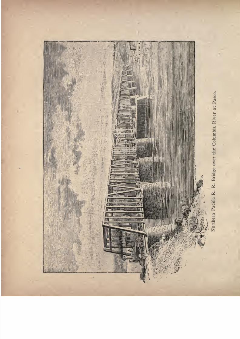
7/27/2019 Official Northern 00 Nort Rich
http://slidepdf.com/reader/full/official-northern-00-nort-rich 232/453
7/27/2019 Official Northern 00 Nort Rich
http://slidepdf.com/reader/full/official-northern-00-nort-rich 233/453
Through Washington. 231
Pasco (1,658 miles from St. Paul; population 500) was
so named from the fact that the Northern Pacific passes
over the Columbia river about two miles from the town, the
word having been ingeniously coined by the engineers whoconstructed the line westward. Pasco is an important
junction point for travel to and from the Walla Walla
country, and to points on the Columbia river. The
Northern Pacific has a branch crossing the Snake river on
a huge steel bridge and running on to Wallula, 17 miles
distant, where it connects with a line of the Union Pacific
running west down the river to Portland and east to the
numerous towns in the Walla Walla country. An independ
ent road called the Washington & Columbia River rail
way connects at Pasco and runs trains to Pendleton on one
line, and to Walla Walla, Dayton, Waitsburg, and other
points in the fertile country south of Snake river by another.
West of the Columbia. The Cascade division of
the Northern Pacific is the most recently constructed of all
the divisions of the main line. It was mainly built in the
years 1885, 1886 and 1887, and the great tunnel under the
Cascade mountains was completed in June, 1888. The
road crosses the Columbia river between Pasco and Ken-
newick on a combination iron and wood bridge, which
spans the broad, blue flood of this mighty stream just
about the mouth of its principal affluent, the Snake river,
and follows the valley of the Yakima river, which empties
into the Columbia a few miles above Kennewick, all the way
up to the source of the former stream in the Cascade moun
tains. Along the lower Yakima the country is dry and
covered with sage-brush where not cultivated, but the soil
is fertile andirrigating-ditch enterprises
are fast
convertingthe entire region into a thickly settled farming country.
The beneficial effects of irrigation are seen as soon as the
7/27/2019 Official Northern 00 Nort Rich
http://slidepdf.com/reader/full/official-northern-00-nort-rich 234/453
232 The Northern Pacific Railroad.
western bank of the Columbia is reached, and may be
observed at almost every mile of progress up the Yakima
valley to the foothills of the Cascade mountains.
For about thirty miles the road runs through the Simcoe
Indian reservation, which is well settled and contains many
irrigated farms and large stretches of verdant pasture land.
Mt. Adams, one of the highest snow peaks of the Cascade
range, is in plain sight from the train while passing across
the Simcoe reservation. This mountain is over 9,000 feet
high and its base is about fifty miles distant from the near
est point on the railroad. Passing Union Gap through a
low mountain range the road enters a well-cultivated basin,
where the Natchess and other tributaries of the Yakima
furnish abundant water for irrigation. Continuing north
westward, the road winds for many miles through the pro
found and picturesque defiles of the Yakima canon, and
then
emerges
into the Kittitas valley, which is watered
bythe Yakima and numerous tributary streams, and is well
settled by farmers engaged in raising grain and stock.
Considerable placer mining is done on the headwaters of
the Tenaway and the Swauk, two large creeks which rise
in the Peshastin mountains. These mountains run aoross
the head of the Kittitas valley and present a magnificent
spectacleof
lofty rocky peakscrowned with
snow,which
can be enjoyed from many points on the railroad. The
highest of these peaks is Mt. Stuart, which has an altitude
of over 12,000 feet. The Peshastin range is a granite form
ation, entirely different in its geological character from the
Cascade mountains, which are basaltic, and of which it
seems to form a spur. Near the base of the Peshastin
mountains lies an extensive coal field. The ascent of theCascade mountains is made by the Northern Pacific road
up remarkably light grades, the heaviest of which does
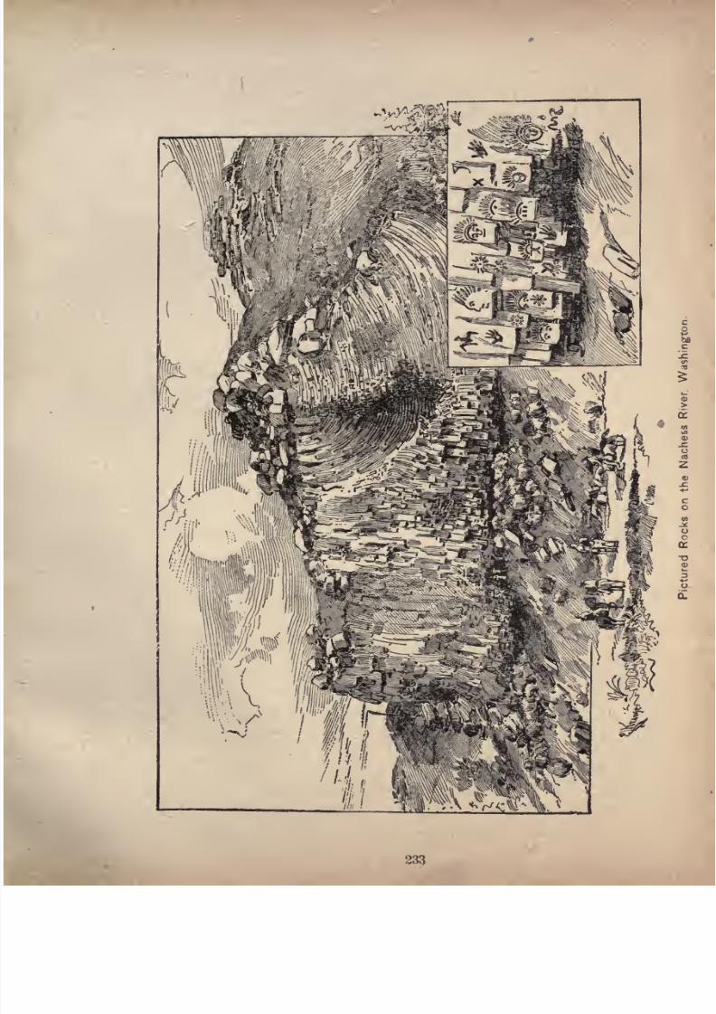
7/27/2019 Official Northern 00 Nort Rich
http://slidepdf.com/reader/full/official-northern-00-nort-rich 235/453
233
7/27/2019 Official Northern 00 Nort Rich
http://slidepdf.com/reader/full/official-northern-00-nort-rich 236/453
234 The Northern Pacific Railroad.
not exceed two feet to the hundred, or 116 feet to the
mile.
Kennewick (1,621 miles from St. Paul) is the first station
west of the river and is situated on a broad, fertile plateau,
recently irrigated by a canal brought from the Yakima at
a point about twenty-five miles distant. The town is be
coming a center of small farming and fruit raising. The
summers are long and warm, with a great deal of sunshine
and hardly any rain, and the mellow soil is quickly respon
sive to water brought upon it by ditches, and produces
extraordinarily rapid and perfect growths of fruits, vege
tables, alfalfa, grass and small grains.
Prosser (1,698 miles from St. Paul) is a promising town
at the falls of the Yakima river. These falls afford good
w^aterpower for mills. The most important irrigating canal
in the valley terminates on the north side of the river not
far from the town, and another important canal has its
intake gate on the river below the town. Prosser is the
point of departure from the railroad to an extensive graz
ing and farming region, called "The Horse Heaven coun
try," which lies just south of the low range of grassy
mountains that rise immediately back of the town.
The Sunnyside Irrigated Lands. After leaving
Mabton, westward bound, a heavy belt of forest to the
northward outlines the course of the Yakima river. Beyond
and extending along the river for thirty miles is the rich
"Sunnyside
"
country recently brought under cultivation
by the Northern Pacific, Yakima & Kittitas Irrigation
company, the largest completed enterprise of its kind in
the State of Washington. This canal is so mammoth in
its
proportionsthat a small steamboat could
navigate
its
waters, which have reclaimed the plain, and are turning it
into a richly cultivated and densely settled community;
for here the of are so certain and
7/27/2019 Official Northern 00 Nort Rich
http://slidepdf.com/reader/full/official-northern-00-nort-rich 237/453
Through Washington. 235
that twenty acres is a large farm and "ten acres is
enough." Thus, the isolation incidental to large Eastern
farms is obviated and the entire 64,000 acres watered by
the canal is already becoming a vast village of prosperous,
progressive farmers, who, while securing the benefits of a
new country, will enjoy all the advantages of schools,
societies, etc., incidental to the more densely settled com
munities of the Eastern States, The apparently sterile
sage-brush plain, tenanted by roving bands of cattle, is
now changed by water's magic wand into a grand oasis of
hop, fruit and grain fields interspersed with slfalfa, timothy
and clover meadows. The soil and climate are found
especially congenial to the hop industry, many farmers
already having from five to twenty acres in hop yards
which yield from one thousand to two thousand five hun
dred pounds per acre, depending upon the age of the yard.
The season of picking, drying and baling profitably em
ploys hundreds of men, women and children, who make a
holiday of the task. No failure has been known, and the
product shipped to London and New York brings a price
which nets a profit of from $75 to $200 per acre to the
fortunate owner. The soil, a decomposed basalt, is free
from stones and so uniformly rich in quality for a depth
of from fifty-five to eighty-five feet, that it is conjectured
by scientists to be the sediment deposited by a lake which
in prehistoric times covered the entire Columbia basin.
This rich, mellow loam is suited to fruit raising quite as
well as for the hop. The upper and older part of the
"Sunnyside" is already occupied by prune, peach, apple
and pear orchards amounting in the aggregate to several
thousand acres now in full bearing, while in the newer
sections, recently brought under the canal, the numerous
young orchards set out within the year have made a

7/27/2019 Official Northern 00 Nort Rich
http://slidepdf.com/reader/full/official-northern-00-nort-rich 238/453
236 The Northern Pacific Railroad.
growth of from five to eight feet, so long and congenial
are the summers for plant growth. Here the farmer is
his own rainmaker, and the certainty, variety and produc
tiveness of the crops grown are in strong contrast to
Eastern farming conditions.
Zillah, a thriving village recently started, is three miles
from Toppenish, the nearest station on the railroad, on
the northern bank of the Yakima river, which here culmi
nates in majestic bluffs eighty-five feet in height. The
headquarters of the canal company are at this place, and,
in order to view the fruit and hop lands, which, though so
near the railway, are not in sight, the stage should be
taken from Toppenish to Zillah, and from thence the trans
formation from the range to thickly settled garden, fruit
and hop lands can be observed. Another point, Mayhew,fifteen miles east of Zillah, is divided into fruit lots of one,
two and five-acre lots, with wide streets, down which flow
streams of clear water from the main canal between the side
walks and roadway. An area of land four times as large as
at Pasadena surrounds Mayhew, which, in consequence, will
become an important fruit producing point. Mayhew is
seven miles from Mabton, the nearest railroad station.
Here the main canal courses along the slopes of a low
range of mountains covered with bunch-grass to their sum
mits and furrowed by ravines down which course streams
of spring water. Settlement is rapid here, and many of
the ten and twenty-acre farms are already in a high state
of cultivation.
The Yakima Basin. This is a highly fertile region,
enclosedby
lowranges
of mountains which are covered
with bunch-grass to their summits. It is watered by the
Yakima and by its tributaries, the Nachess, Cowycheeand the Attanum. The three smaller streams are fed bv
7/27/2019 Official Northern 00 Nort Rich
http://slidepdf.com/reader/full/official-northern-00-nort-rich 239/453
Through Washington. 237
springs and melting snows in the Cascade mountains, and
carry the largest volume of water during the hot season.
They furnish abundant water for irrigation purposes to
the lands along their banks. West of the Yakima river
the basin extends for a distance of about twenty miles,
and a large part of it is irrigated by a big ditch taken
from the Yakima. This district is known as the" Moxee
Country/' The Yakima basin, like the lower Yakima
valley, greatly resembles many of the California valleys.
The winters are short and mild, and the summers long
and sunny. The soil produces, under an inexpensive
system of irrigation, very heavy yields of hops, wheat,
oats, barley, Indian corn, millet, clover, timothy and
vegetables of all kinds, and all fruits of the temperate
zone grow to perfection. Grapes are beginning to be
culivated for wine-making purposes, and it is believed
that thevalley
will in time rival some of the best wine
districts of California. Tobacco culture has been success
fully tried in recent years, and a good grade of tobacco
is raised for the manufacture of cigars. The land was
originally occupied in large farms, but is now being cut
up into small farms of from ten to forty acres each for the
cultivation of fruits, vegetables, hops, tobacco, etc. On
theneighboring
foothillsand mountain ranges
there is a
luxuriant growth of bunch-grass, and the raising of cattle,
sheep, and horses is a profitable industry. During open
winters stock feed upon the ranges without any care, but
prudent farmers put up a small quantity of timothy or
alfalfa hay for feed in case of severe snow storms.
North Yakima (1,747 miles from St. Paul; population,
2,500) is the county seat of Yakima county and the tradecenter for all the valleys embraced in the Yakima basin. It
is an attractive and handsome town with good brick busi-
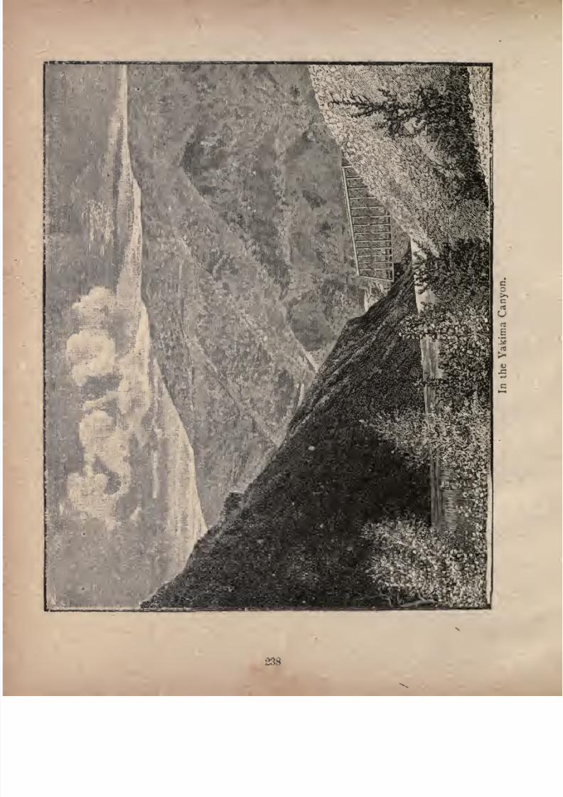
7/27/2019 Official Northern 00 Nort Rich
http://slidepdf.com/reader/full/official-northern-00-nort-rich 240/453
238

7/27/2019 Official Northern 00 Nort Rich
http://slidepdf.com/reader/full/official-northern-00-nort-rich 241/453
Through Washington. 239
ness blocks and well-shaded streets. In each street, be
tween the sidewalks and the roadways, run streams of clear
water from which little ditches lead to the lawns andgar
dens. Travelers who desire to see irrigation farming on
a large scale, are advised to visit the Moxee farm, just west
of the Yakima river, about four miles distant from the
town. This farm embraces about 2,000 acres under ditch
and cultivation, and with an extensive stock range of
many thousand acres. It is owned by a company in which
Gardner Hubbard,of the Bell
Telephone company,is
theprincipal stockholder. Irrigation is carried on by both the
flooding and small-ditch systems. Tobacco, hops, wheat,
oats, corn, barley- are the principal crops.
The Yakima Canyon. After leaving North Yakima
the railroad runs through a gap in a low mountain range,
passes the outlet of the Wenass valley, another strip of
agricultural lands along the Wenass river, and then entersthe Yakima canyon, a profound gorge in the Umptanummountains. The scenery in this canyon is peculiar and im
pressive. Some washing for gold is done by Chinamen
along the banks of the river. The railroad emerges from
the canyon into the great Kittitas basin.
The Kittitas Basin. This is the largest in extent of
the fertile valleys traversed by the Yakima river. It is
about 20 miles long, with an average width of ten miles, and
can all be seen from the railway platform at Ellensburg. It
is bounded on the west by the Cascade mountains, above
whose green heads can be seen the white top of the great
snow peak, Mt. Tacoma. On the north' the basin is
bounded by the Peshastin and Wenatchee mountains. The
former range is a mass of rock and snow, and its highest
peak, Mt. Stuart, has an elevation of io,cop feet above the
sea, and resembles somewhat the famous Matterhorn of the
7/27/2019 Official Northern 00 Nort Rich
http://slidepdf.com/reader/full/official-northern-00-nort-rich 242/453
240 The Northern Pacific Railroad.
Swiss Alps. This region is rich in mineral wealth, con
taining coal, iron, copper, gold and silver. The Wenat-
chee mountains are timbered to their summits and
reach to the Columbia river. The Umptanum moun
tains, which shut in the basin on the south, are about
3,000 feet high and are covered with bunch-grass. The
Kittitas basin has an altitude about 800 feet greater than
the Yakima basin, and the climate has more of a moun
tain character, the nights being cool and the summer days
not as warm. Thefarming
lands in the basin areirrigated
by ditches taken from creeks running into the Yakima.
They have a rich alluvial soil and produce heavy crops of
small grains and vegetables. The raising of horses and
cattle is the chief industry, and much attention is paid to
blooded and grade stock. Cattle are shipped to the mar
kets of the cities on Puget Sound and in British Columbia.
Ellensburg (1,784 miles from St. Paul; population2,500) is the county seat of Kittitas county, and the head
quarters of the Cascade division of the Northern Pacific
railroad. Ellensburg is the trade center for the entire
valley, and for the coal mining region at the head of the
valley. The business streets were entirely burned over a
few years ago, but were immediately rebuilt with substan
tial brick structures, all of a uniform height of two stories,
which gives the town a remarkably handsome appearance.
Clealum (1,809 miles from St. Paul; population 300) is
the junction of the short branch road which runs to the
Roslyn coal mines.
Roslyn (1,813 miles from St. Paul and 4 from Clealum)
is the terminus of the Roslyn branch, and has a population
of about i, 600. It is the most important coal-mining point
on the entire line of the Northern Pacific. The coal is a
superior hard, black lignite, and is used for locomotive fuel

7/27/2019 Official Northern 00 Nort Rich
http://slidepdf.com/reader/full/official-northern-00-nort-rich 243/453
Through Washington. 241
and also for domestic fuel in all the towns of Eastern Wash
ington. About 500 tons a day are mined.
Hasten (1,822miles from St.
Paul),on the eastern side
of the Cascade mountains, is a small railroad town at the
commencement of the mountain grade.
The Great Tunnel. The mountains are crossed at
Stampede Pass, through the sharp comb of which a tunnel
almost two miles long has been excavated. This tunnel is
with one exception the longest in America, being surpassed
only bythe
Hoosactunnel in
Massachusetts, whichis
three miles in length. The Hoosac tunnel was excavated
from both ends and from a central shaft, but the mountain
over the Cascade tunnel was too high to admit of a shaft,
and the whole of the excavation was done at the ends. In
view of this fact, and also of the wildness of thecountry,
and the distance from sources of supplies, the Cascade
tunnel may fairly be regarded as a greater work of engineering than the famous tunnel under the Hoosac moun
tains. During the progress of the work on the tunnel a
switch back line was built over the summit of the Stampede
Pass, with maximum grades of 290 feet to the mile, and
was successfully operated for over a year, trains being
hauled over the mountains by decapods or ten-wheeled
engines, the heaviest ever built in America.Weston (1,840 miles from St. Paul) is a small railroad
town in the dense forests on the western slope of the Cas
cade mountains, at the foot of the mountain grade.
Along Green River. After emerging from the tunnel
the railroad descends by grades no steeper than those on
the east side of the mountains into the valley of the Green
river, in the midst of superb mountain scenery. Greenriver is a beautiful mountain stream, well stocked with
trout, and flowing through dense forests offir, cedar and
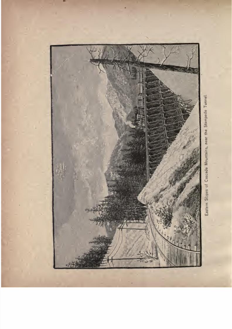
7/27/2019 Official Northern 00 Nort Rich
http://slidepdf.com/reader/full/official-northern-00-nort-rich 244/453

7/27/2019 Official Northern 00 Nort Rich
http://slidepdf.com/reader/full/official-northern-00-nort-rich 245/453
Western Portal of Stampede Tunnel.
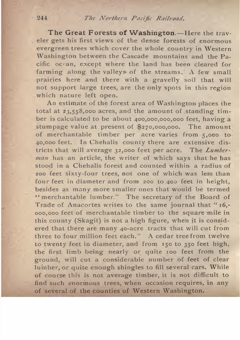
7/27/2019 Official Northern 00 Nort Rich
http://slidepdf.com/reader/full/official-northern-00-nort-rich 246/453
244 The Northern Pacific Railroad.
The Great Forests of Washington. Here the trav
eler gets his first views of the dense forests of enormous
evergreen trees which cover the whole country in Western
Washington between the Cascade mountains and the Pa
cific oc^an, except where the land has been cleared for
farming along the valleys of the streams.' A few small
prairies here and there with a gravelly soil that will
not support large trees, are the only spots in this region
which nature left open.
An estimate of the forest area of
Washington placesthe
total at 23,558,000 acres, and the amount of standing tim
ber is calculated to be about 400,000,000,000 feet, having a
stumpage value at present of $270,000,000. The amount
of merchantable timber per acre varies from 5,000 to
40,000 feet. In Chehalis county there are extensive dis
tricts that will average 32,000 feet per acre. The Lumber
man has anarticle,
the writer of whichsays
that he has
stood in a Chehalis forest and counted within a radius of
200 feet sixty-four trees, not one of which was less than
four feet in diameter and from 200 to 400 feet in height,
besides as many more smaller ones that would be termed
"merchantable lumber." The secretary of the Board of
Trade of Anacortes writes to the same journal that"
16,-
000,000 feet of merchantable timber to the square mile in
this county (Skagit) is not a high figure, when it is consid
ered that there are many 4o-acre tracts that will cut from
three to four million feet each." A cedar tree from twelve
to twenty feet in diameter, and from 150 to 350 feet high,
the first limb being nearly or quite 100 feet from the
ground, will cut a considerable number of feet of clear
lumber, or quite enough shingles to fill several cars. Whileof course this is not average timber, it is not difficult to
find such enormous trees, when occasion requires, in any
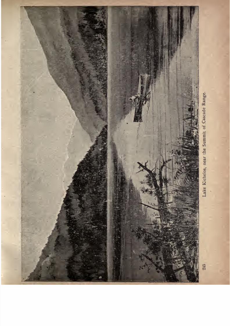
7/27/2019 Official Northern 00 Nort Rich
http://slidepdf.com/reader/full/official-northern-00-nort-rich 247/453
7/27/2019 Official Northern 00 Nort Rich
http://slidepdf.com/reader/full/official-northern-00-nort-rich 248/453
246 The Northern Pacific Railroad.
This forest region is beyond any question more heavily
timbered than any other in the world. The stupendous
growth of trees which covers it is accounted for by scien
tists by the great amount of rainfall, the absence of low
winter temperatures, and the cool summers. All condi.
tions are favorable to the development of vegetable life.
Amid the gigantic trunks of the firs, cedars and spruces,
there flourishes such a rank undergrowth that travelers
who have penetrated the tropical forests along the Amazon
say that the difficulties they encountered were not so great
as those which must be overcome in going through these
Washington woods.
Felling a Giant Fir. Louise Herrick Wall, of Aber
deen, Wash., writes as follows in the Atlantic Monthly:
As we stood in the broad sunshine of the roadway the
stillness took a far rhythmic pulse. It was the choppers
once more at workupon
a
standingtree. We followed the
sound, keeping to the fork of the skid road that led into
the deeper forest, passed beyond the main group of log
gers and the deep-breathing team, until we could hear the
voices of the choppers.
As we came up the two men paused, and one said good-
humoredly, "That's right! Come to see us fall this tree?"
Thenthe axes
swung again.Each
manstood lifted
up ona springboard, who^e end was slipped into a notch cut in
the base of the tree four or five feet from the ground.
They always work above the ground this way, in order to
escape the increased work of cutting through the great
swell at the base. Standing with feet apart upon the
springy perches, they were "under-cutting"the tree on the
side toward which they wanted it to fall. The axes senttheir pleasant reverberation up the straight, limbless trunk,
communicating only a quiver to the plumed limbs two

7/27/2019 Official Northern 00 Nort Rich
http://slidepdf.com/reader/full/official-northern-00-nort-rich 249/453
Through Washington* 24?
hundred feet above. Clean white chips were cleared out
from the H^ shaped cleft of the undercut, and after a little
measuring and squinting along the tree the men dropped
down, and shifted their boards to notches in the oppositeside of the tree from the under-cut. Then the long saw
with handle at each end came into use. The men started
carefully, holding the saw quite true that later it might not
wedge. They drew it back and forth cautiously at first*
until it penetrated the rough bark evenly and the teeth
caught on the wood. A thin shower of pale sawdust
floated down from either side, as the saw grated in and outand the loggers swayed slightly from hip to hip, their red-
shirted arms moving with the iron regularity of piston-
rods. Back and forth, back and forth, went the handle of
the saw. It seemed an endless business for those two men
to drive that edge of steel through twelve feet of solid,
flawless wood. There is the dull monotony of machine-
work in the sawing, different from the spirited rise and fall
of the axes, and the sharp cracking away, beneath the tell
ing blows, of great white chips, and our eyes wandered
beyond the workers to the green stillness. Little clearing
had been done at this point. The whole upper growth was
of evergreens, and so dense that no speck of sky could be
seen beyond their exalted tops so dense that in this vir
gin forest the running elk throws his antlered head backward and from side to side to pass through the close
phalanx of trees, and is sometimes wedged between their
bodies and slowly perishes. Beneath the lofty canopy,
supported upon its close, shaftlike columns, grew a matted
tangle of underbrush and man-high elk fern, the pale green
of the small-leafed huckleberry and salmonberry making a
delicious note of freshness beneath the sombre grandeurof the dull green vault above. So dense is the overshadow-
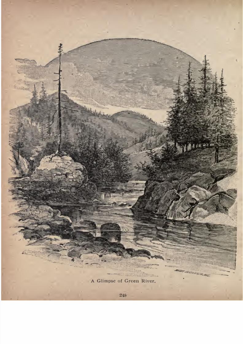
7/27/2019 Official Northern 00 Nort Rich
http://slidepdf.com/reader/full/official-northern-00-nort-rich 250/453
A Glimpse of Green River.
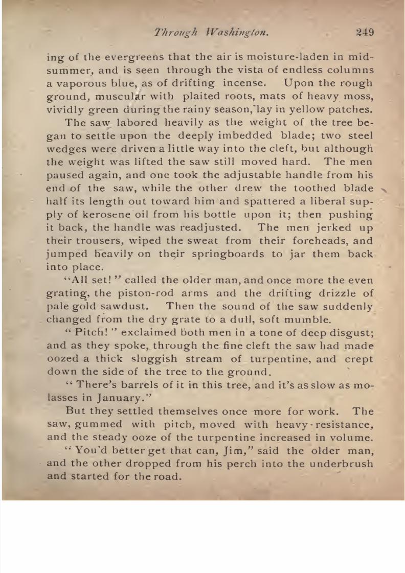
7/27/2019 Official Northern 00 Nort Rich
http://slidepdf.com/reader/full/official-northern-00-nort-rich 251/453
Through Washington. 249
ing of the evergreens that the air is moisture-laden in mid
summer, and is seen through the vista of endless columns
a
vaporousblue, as of drifting incense.
Uponthe
roughground, muscular with plaited roots, mats of heavy moss,
vividly green during the rainy season,lay in yellow patches.
The saw labored heavily as the weight of the tree be
gan to settle upon the deeply imbedded blade; two steel
wedges were driven a little way into the cleft, but although
the weight was lifted the saw still moved hard. The men
paused again,and one took the
adjustablehandle from his
end of the saw, while the other drew the toothed blade
half its length out toward him and spattered a liberal sup
ply of kerosene oil from his bottle upon it; then pushing
it back, the handle was readjusted. The men jerked up
their trousers, wiped the sweat from their foreheads, and
jumped heavily on their springboards to jar them back
intoplace.
'"All set!"called the older man, and once more the even
grating, the piston-rod arms and the drifting drizzle of
pale gold sawdust. Then the sound of the saw suddenly
changed from the dry grate to a dull, soft mumble."Pitch!
"exclaimed both men in a tone of deep disgust;
and as they spoke, through the fine cleft the saw had made
oozed a thick sluggish stream of turpentine, and creptdown the side of the tree to the ground.
"There's barrels of it in this tree, and it's as slow as mo
lasses in January."
But they settled themselves once more for work. The
saw, gummed with pitch, moved with heavy resistance,
and the steady ooze of the turpentine increased in volume.
'You'd better get that can, Jim," said the older man,and the other dropped from his perch into the underbrush
and started for the road.
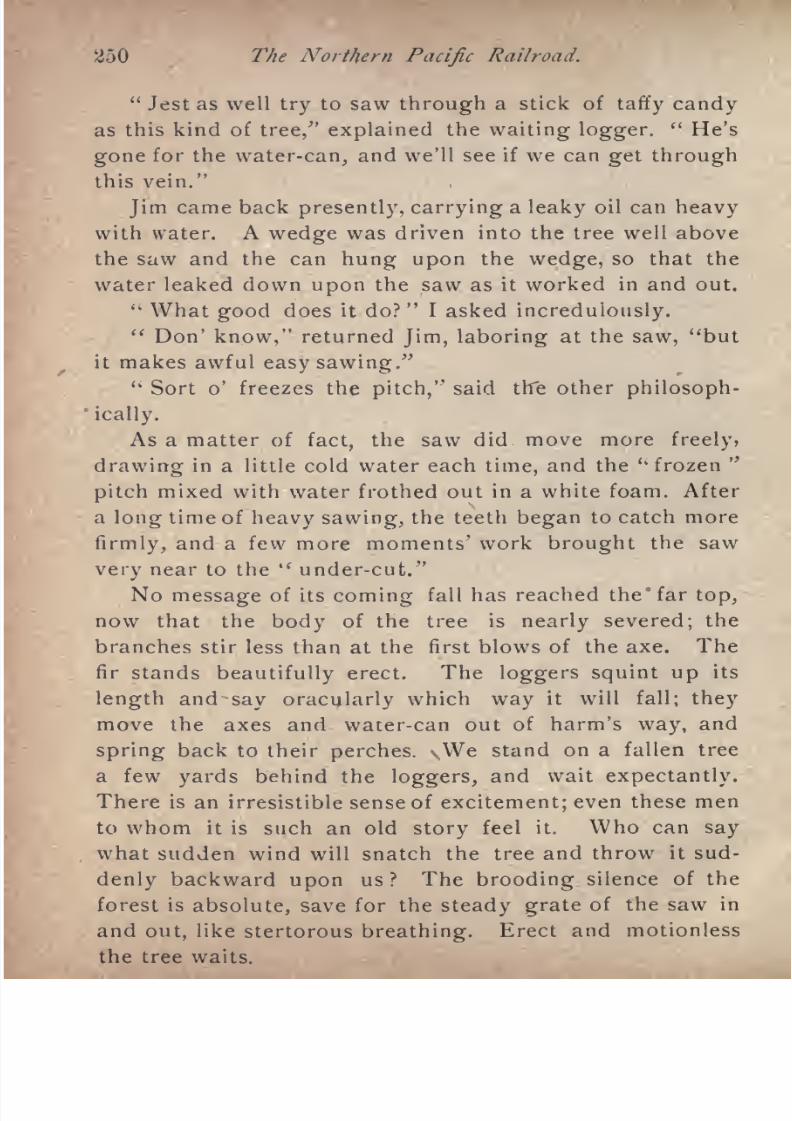
7/27/2019 Official Northern 00 Nort Rich
http://slidepdf.com/reader/full/official-northern-00-nort-rich 252/453
250 The Northern Pacific Railroad.
"Jest as well try to saw through a stick of taffy candy
as this kind of tree/' explained the waiting logger."He's
gone for the water-can, and we'll see if we can get through
this vein."
Jim came back presently, carrying a leaky oil can heavy
with water. A wedge was driven into the tree well above
the saw and the can hung upon the wedge, so that the
water leaked down upon the saw as it worked in and out.
" What good does it do?"
I asked incredulously." Don' know," returned Jim, laboring at the saw, "but
it makes awful easy sawing."uSort o' freezes the pitch," said the other philosoph
ically.
As a matter of fact, the saw did move more freely,
drawing in a little cold water each time, and the '"frozen"
pitch mixed with water frothed out in a white foam. After
a long time of
heavy sawing,
the teeth
began
to catch more
firmly, and a few more moments' work brought the saw
very near to the " under-cut."
No message of its coming fall has reached the* far top,
now that the body of the tree is nearly severed; the
branches stir less than at the first blows of the axe. The
fir stands beautifully erect. The loggers squint up its
lengthand
say oracularlywhich
wayit will fall;
theymove the axes and water-can out of harm's way, and
spring back to their perches. vWe stand on a fallen tree
a few yards behind the loggers, and wait expectantly.
There is an irresistible sense of excitement; even these men
to whom it is such an old story feel it. Who can say
what sudden wind will snatch the tree and throw it sud
denly backward upon us? The brooding silence ofthe
forest is absolute, save for the steady grate of the saw in
and out, like stertorous breathing. Erect and motionless

7/27/2019 Official Northern 00 Nort Rich
http://slidepdf.com/reader/full/official-northern-00-nort-rich 253/453
1
Three Bridges ard Tunnel, on Green River,
251
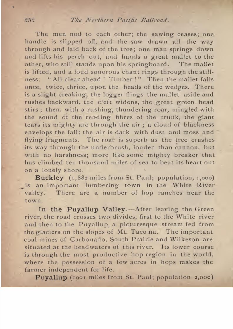
7/27/2019 Official Northern 00 Nort Rich
http://slidepdf.com/reader/full/official-northern-00-nort-rich 254/453
252 The Northern Pacific Railroad.
The men nod to each other; the sawing ceases; one
handle is slipped off, and the saw drawn all the way
through andlaid
back of the tree; one man springs downand lifts his perch out, and hands a great mallet to the
other, who still stands upon his springboard. The mallet
is lifted, and a loud sonorous chant rings through the still
ness:' k
All clear ahead ! Timber !
" Then the mailet falls
once, twice, thrice, upon the heads of the wedges. There
is a slight creaking, the logger flings the mallet aside and
rushes backward, the deft widens, the great green headstirs; then, with a rushing, thundering roar, mingled with
the sound of the rending fibres of the trunk, the giant
tears its mighty arc through the air;a cloud of blackness
envelops the fall; the air is dark with dust and moss and
flying fragments. The roar is superb as the tree crashes
its way through the underbrush, louder than cannon, but
with no harshness; more like some mighty breaker that
has climbed ten thousand miles of sea to beat its heart out
on a lonely shore.
Buckley (1,882 miles from St. Paul; population, 1,000)
Js an important lumbering town in the White River
valley. There are a number of hop ranches near the
town.
In the Puyallup Valley. After leaving the Green
river, the road crosses two divides, first to the White river
and then to the Puyallup, a picturesque stream fed from
the glaciers on the slopes of Mt. Tacona. The important
coal mines of Carbonado, South Prairie and Wilkeson are
situated at the headwaters of this river. Its lower course
is through the most productive hop region in the world,
where the possession of a few acres in hops makes the
farmer independent for life.
Puyallup (1901 miles from St. Paul; population 2,000)
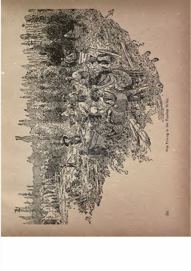
7/27/2019 Official Northern 00 Nort Rich
http://slidepdf.com/reader/full/official-northern-00-nort-rich 255/453
7/27/2019 Official Northern 00 Nort Rich
http://slidepdf.com/reader/full/official-northern-00-nort-rich 256/453
254 The Northern Pacific Railroad.
is essentially a hop town, being -the trading point for alt
the hop-raising country in the valley of the Puyallup,.
Stuck and White rivers. The hop fields extend up to the
very do.oryards in the village, and the drying houses on
the near hop farms are among the most conspicuous objects
in the landscape. The tourist who has time to spare is
advised to stop a day in Puyallup and investigate the very
interesting industry which has created the town. The soil
in this hop-growing valley seems to be inexhaustible.
Wild land valuable for
hopculture near Puyallup is worth
from $75 to $roo per acre, and costs about $100 more per
acre to clear. It is said that, taking an average of a period
of years, every acre cultivated in hops will yield a net
profit of at least $100. The price of hops varies widely
from year to year, and is mainly dependent on the German
crop. Some years it is claimed that there is no profit at
all in
hopsraised in
Washington,but in the
longrun the
hop farmers all become comfortably well off. There are
few forms of agricultural industry where so much moneycan be made from an acre of ground.
After leaving Puyallup the railroad traverses for about
eight miles the Puyallup Indian reservation. These Indians-
own their land in severalty, and are, as a rule, industrious
farmers. Their children are educated in the agency school,and the good order of the reservation is enforced by a
justice of the peace and constables elected by the Indians
themselves.
Tacoma (1,912 miles from St. Paul; population, 50,-
oo) is the official western terminus of the Northern Pacific
railroad and the point where it meets the commerce of
the Pacific ocean. The road extends 100 miles further
west, however, by a branch line that reaches the Pacific
ocean at Ocosta and Hoquiam, on Gray's harbor. It has
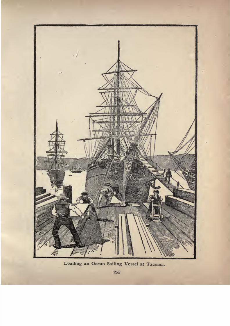
7/27/2019 Official Northern 00 Nort Rich
http://slidepdf.com/reader/full/official-northern-00-nort-rich 257/453
Loading an Ocean Sailing Vessel at Tacoma.
255
7/27/2019 Official Northern 00 Nort Rich
http://slidepdf.com/reader/full/official-northern-00-nort-rich 258/453
"256 The Northern Pacific Railroad.
also a second ocean terminus at South Bend, on Willapa
harbor. From Tacoma the main line runs southward to
Portland, and a branch turns northward to Seattle, where it
connects with other lines controlled by the Northern Pacific
that run as far as far as Vancouver, in British Columbia.
Tacoma is situated upon the tide water of the Pacific
near the head of Puget sound, and occupies a command
ing position both as a seaport and a railroad center. The
arm of the sound upon which the city fronts is called Com
mencement bay, and furnishes an excellent harbor, wheretha largest sailing vessels and ocean steamers lie at anchor
or receive their cargoes of coal, lumber, wheat and other
products of the region, at the spacious wharves, coal
bunkers and warehouses.
Tacoma has had an extraordinarily rapid growth.
When selected in 1872 as the Pacific coast terminus of the
Northern Pacific railroad, the site was covered with a denseforest. The population in 1875 was only 300, in 1880 it
was 760, in 1886 it was 6, 907, in 1887 9,000, in 1888, 15,000,
in 1889 25,000, in 1890, 30,000, and in 1898, about 50,000.
The city is built upon a succession of benches or plateaus
beginning at the head of Commencement bay, and sloping
gradually upward to an elevation of about 300 feet, at
the point where the bay joins the broader water of
Puget sound. The landscapes an'd water views are
superb. The Cascade range can be seen for nearly a hun
dred miles from north to south, and Mt. Rainier, one
of the loftiest snow peaks in the United States, rises to a
height of 14,532 feet, 10,000 feet of which are covered with
snow fields and glaciers. This superb mountain,
which has no rival in the world for beauty and
grandeur, is in plain view from all the terraces of the new
city. Tacoma is, next to San Francisco, the most impor-
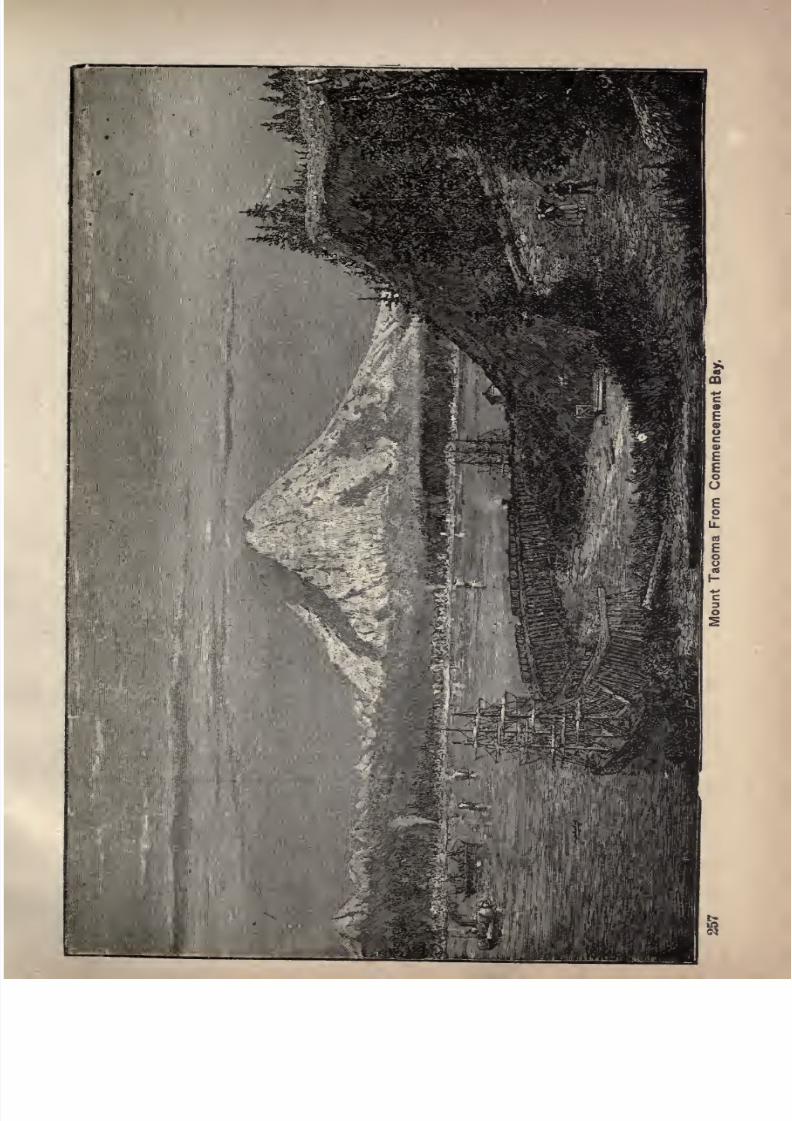
7/27/2019 Official Northern 00 Nort Rich
http://slidepdf.com/reader/full/official-northern-00-nort-rich 259/453
7/27/2019 Official Northern 00 Nort Rich
http://slidepdf.com/reader/full/official-northern-00-nort-rich 260/453
' The Xortltern Pacific Railroad.
tant wheat-shipping port on the Pacific coast. It also
ships more lumber and more coal than any other port on
thatcoast.
The wheat goes around Cape Horn to Liverpool. The lumber goes to Calfornia, Mexico, South
America, China, and Australia, and the coal is chiefly con
sumed in San Francisco. Lumber is manfactured at
three large mills, one of which is the largest on Puget
sound. The coal is brought in by rail from mines about
thirty miles distant in the foot hills of the Cascade moun
tains. The principal mining towns are Carbonado, Wilke-son and Spring Prairie. It is also brought from Bucoda,
south of Tacoma, on the Pacific division of the N. P. R. R.
Wheat is received from all parts of the great wheat-pro-
dncing region east of the Cascade mountains, and is
stored and handled in enormous warehouses. Tacoma is
the distributing point for emigration coming from the
East and from California, and destined to all parts of
Washington. It is also an attractive point for tourists.
It has one of the largest and best equipped hotels on
the Pacific coast north of San Francisco, "The Tacoma/'
which stands on a high plateau overlooking Commence
ment bay, and a full view of the enormous snow peak of
Mount Rainier. There are several handsome public school
buildings, two colleges, and an Episcopal seminary for
girls, called the "Anna Wright" seminary, in honor of the
deceased daughter of Charles B. Wright of Philadelphia,
ex-president of the Northern Pacific railroad, who has
liberally endowed the institution. The Episcopal church
is a beautiful stone structure, erected by Mr. Wright as a
monument to the memory of his wife. Tacoma is the head
quarters of the Western division of the Northern Pacific
railroad, and has extensive car and repair shops. Pacific
avenue, the principal business street, is a broad thoroug'i-
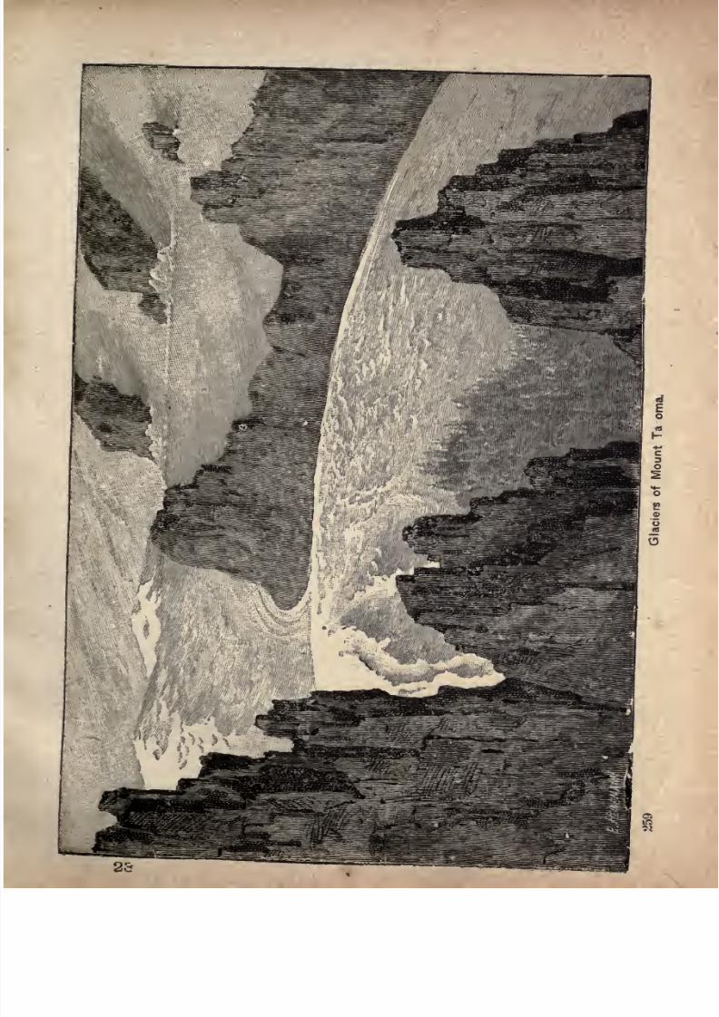
7/27/2019 Official Northern 00 Nort Rich
http://slidepdf.com/reader/full/official-northern-00-nort-rich 261/453
7/27/2019 Official Northern 00 Nort Rich
http://slidepdf.com/reader/full/official-northern-00-nort-rich 262/453
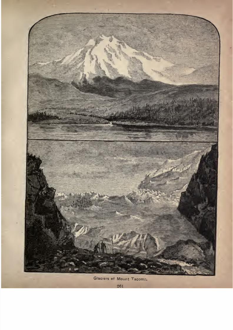
7/27/2019 Official Northern 00 Nort Rich
http://slidepdf.com/reader/full/official-northern-00-nort-rich 263/453
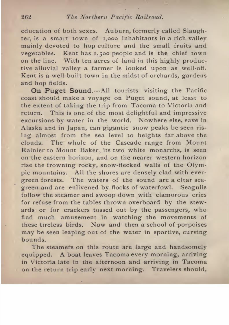
7/27/2019 Official Northern 00 Nort Rich
http://slidepdf.com/reader/full/official-northern-00-nort-rich 264/453
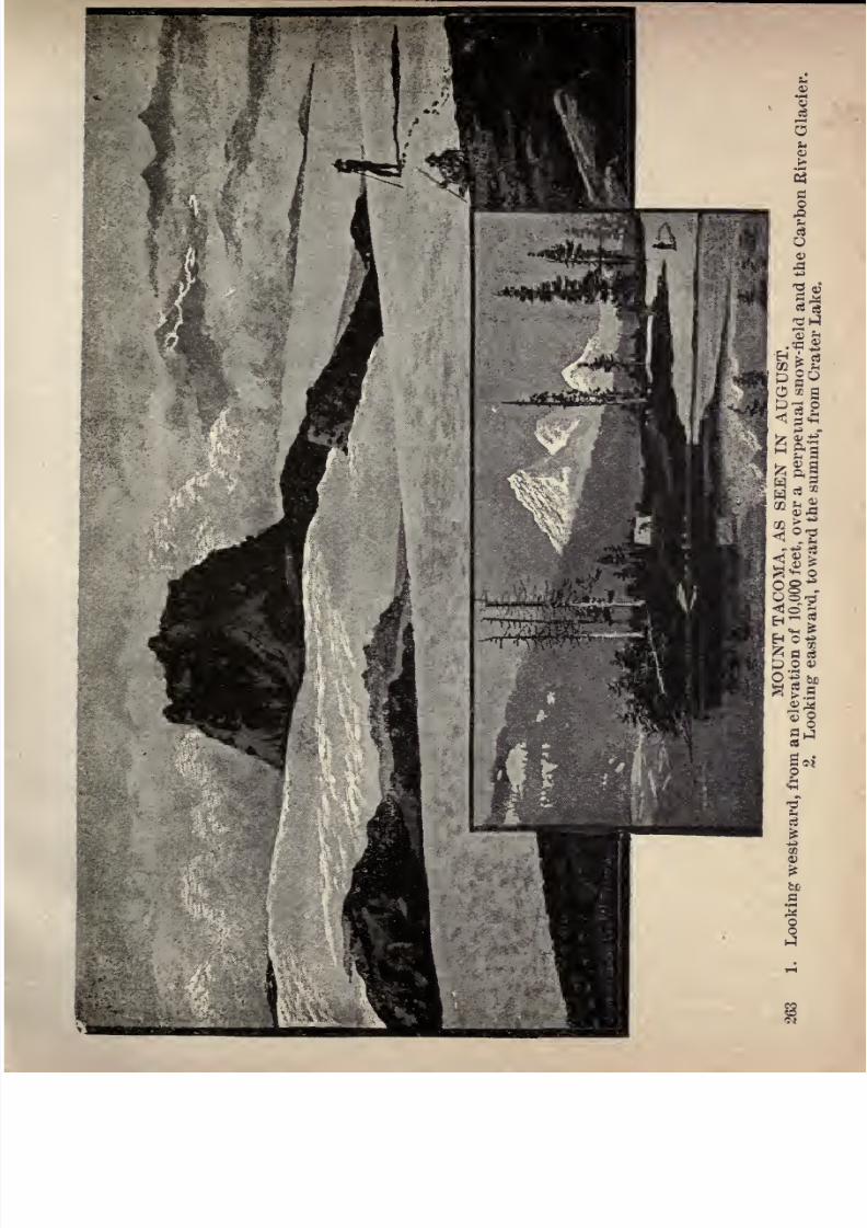
7/27/2019 Official Northern 00 Nort Rich
http://slidepdf.com/reader/full/official-northern-00-nort-rich 265/453
li
o a
i
ill^
gn
|*i
7/27/2019 Official Northern 00 Nort Rich
http://slidepdf.com/reader/full/official-northern-00-nort-rich 266/453
264 The Northern Pacific Railroad.
however, arrange to spend a day in Victoria. The Sound
is divided in its lower length by the large island of
Whidby, which is thirty miles long. The Victoria boats
take the western side of this island and call at Port Town-
send. Another line of boats run east of the island as far
as New Whatcom, calling at Everett, Anacortes and Fair-
haven. Both lines touch at Seattle, which is the emporium of the middle Sound.
Seattle (41 miles from Tacoma by rail, and 27 miles by
water, and 1,933 miles from St. Paul via the Cascade di
vision; population, 80,000). This handsome and prosperous
city is one of the oldest places on Puget sound, and was
an important center of trade before Tacoma was founded.
Its steady growth has not been checked by the rapid rise
of the new city on Commencement bay. It is charmingly
situated on a succession of high terraces which rise from
the shores of Elliot bay. The city is laid out for a dis
tance of three miles from the bay to the shores of Lake
Washington, a fine body of fresh water, twenty miles long
by about three miles wide. A similar lake, called Lake
Union, connects with Lake Washington, and also with the
Sound, and the suburbs of the city in a northeast direc
tion advance to its shores. Seattle is the center of a
remarkably complete system of steam navigation, which
embraces all the towns and lumbering camps on the
Sound, and also the navigable rivers of the region. A fleet
of twenty-five steamboats is engaged in the kcal trade of
the Sound, running to Tacoma, Olympia, Hood's Canal,
Port Townsend, La Conner, Whatcom, and many minor
points, and also
up
the White, Snohomish, Skagit, and
Snoqualmie rivers. Ocean steamers run regularly to San
Francisco, and the Alaska and Japan steamers touch here.
Educational facilities are provided by the State univer-
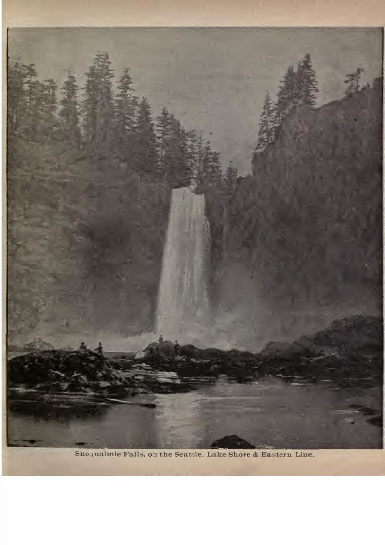
7/27/2019 Official Northern 00 Nort Rich
http://slidepdf.com/reader/full/official-northern-00-nort-rich 267/453Sno.iualinie Falls, 0:1 the Seattle, Lake Shore & Eastern Line.
7/27/2019 Official Northern 00 Nort Rich
http://slidepdf.com/reader/full/official-northern-00-nort-rich 268/453
206 The Northern Pacific Railroad.
sity, by the public schools, which occupy large and costly
buildings, the Yesler college, an institution for boys, an
academy for young ladies, a business college, and several
private and denominational schools. There are 100 or more
manufacturing concerns in the city, most of which are
engaged in industries connected with the lumber trade.
There is an excellent system of electric and cable roads.
An excursion that can be heartily recommended to visitors
is to take a cable car to LakeWashington,
where there are
attractive lakeside resorts with facilities for yachting and
rowing. Another pleasant cable trip is to the northern
suburb of Queen Anne town, on the shore of Elliot bay-
From the highest ground in the city, crossed by the lines
of cable road running to Lake Washington, there is a
superb view of the great mountain which is called Rainier
inSeattle, and Tacoma
in
Tacoma.
In the summer of 1889, the entire business district of
Seattle was totally destroyed by fire, including most of the
wharves. The rebuilding of the city went on with a
rapidity that was phenomenal and the new structures were
all of brick and stone and far surpassed the old ones in
theirstyle
and cost. The disaster resulted in
makingSeattle one of the handsomest and most solid cities in its
architecture to be found anywhere in the country. All
travelers are impressed by the beauty of the place and by
the energy and progressive spirit of its people. The
neighboring coal fields are one of the chief elements which
contribute to the prosperity of Seattle. The mines now
worked are chiefly in the vicinity of Renton and Newcas
tle, and are reached by a narrow-gauge railroad, twenty
miles long. There are extensive coal fields, which have

7/27/2019 Official Northern 00 Nort Rich
http://slidepdf.com/reader/full/official-northern-00-nort-rich 269/453
Through Washington. 267
been explored, and are being developed, lying on the
Green and Cedar rivers, near the base of the Cascade
mountains. Coal is brought to the wharves in Seattle,
and shipped by a line of steam colliers to San Francisco.
Both the mining and shipping operations, as well as nar
row-gauge railroad, are in the hands of the Oregon
Improvement company; There is considerable agricul
tural land tributary to Seattle in the valleys of White,
Green and Snoqualmie rivers.
Port Townsend is sometimes called the "Gate Cityof the Sound.
"It is situated at the entrance of Admiralty
Inlet, on the Strait of Juan de Fuca, and is the port of
entry for the entire Sound district. It has about 3,000
inhabitants, and its principal trade is in supplying the
ships which enter and clear at its custom house. An iron
furnace in the vicinity manufactures pig iron from hema
tite ore. There is a military post about three miles dis
tant. The harbor at Port Townsend is an excellent one,
being well sheltered from the north and west winds. The
town is built upon two benches, the stores almost on a
level with the water and the residences on a plateau about
100 feet high. Vehicles ascend by a gentle grade and
pedestrians take a short cut by way of a long flight of
stairs. The most conspicuous building is the United
States custom house.
Victoria (117 miles from Tacoma) has a population of
about 24,000, and is the seat of government for the Pro
vince of British Columbia. It is situated on the southern
extremity of Vancouver's Island, on a small, landlocked
bay which puts in from the waters of the broad strait of
Juan de Fuca. Esquimault bay, three miles distant, is a
7/27/2019 Official Northern 00 Nort Rich
http://slidepdf.com/reader/full/official-northern-00-nort-rich 270/453
268 The Northern Pacific Railroad.
station for the British navy, and has a large and extensive
dry dock, constructed by the British government. The
climate of Victoria is mild in winter and cold in summer,and the place is a favorite resort for tourists. Excellent
roads lead into the country in every direction, and the
scenery, especially along the shores of the strait, from
whence the lofty and rugged range of the Olympianmountains is seen, is strikingly picturesque. Steamers
leaving Tacoma in the evening arrive at Victoria the next
morning. From Victoria, there is a steamboat connection
with San Francisco, and also with Sitka, Alaska, and
steamboats run across the Gulf of Georgia to Vancouver
and New Westminster, on the main land.
The principal hotel is the Driard. The Parliament
buildings are worth visiting. The two best drives are
that to
Esquimaultand one which leads
throughthe
parkout along the shore of the strait to the residence of the
Lieutenant-Governor, who is the chief executive and rep
resentative of the Queen in the Province.
The following towns are on the eastern route, taken by
the Sound steamboats that ply between Tacoma and Seat
tle and Whatcom.
Everett. At the mouth of the Snohomish river, 30
miles from Seattle, is a new manufacturing town of 3,000
people, facing on both the river and the Sound and occu
pying the peninsula between the salt water and the deep,
navigable stream. Here are located the ship-yards of the
Pacific Coast Steel Barge company, which builds and re
pairs vessels of the new "whaleback" type. One of the
largest paper mills in the world is also located at Everett,
and a third important industry is the manufacture of steel
wire nails. Lumbering, and farming on the tide

7/27/2019 Official Northern 00 Nort Rich
http://slidepdf.com/reader/full/official-northern-00-nort-rich 271/453
7/27/2019 Official Northern 00 Nort Rich
http://slidepdf.com/reader/full/official-northern-00-nort-rich 272/453
270 The Northern Pacific Railroad.
flats are additional industries. The shore line of the Great
Northern road is joined at Everett by the main line east
ward across the mountains. There is also a connection
with the Northern Pacific system by rail to Snohomish,
six miles distant, by way of the Everett and Monte Cristo
railroad, which runs to the Monte Cristo mining district
at the base of the Cascade mountains.
Anacortes is a sea-port on Fidalgo island, facing
Ship harbor. It has a fine land-locked harbor, to which
ships can sail directly up the strait of Juan de Fuca from
the Pacific ocean. Population, 1,500. River connection
is had with the Great Northern and Northern Pacific sys
tems by a road owned by the Oregon Improvement com
pany.
Fairhaven is a town of about 3,000 people on a beauti
ful bay. It is on one of the lines of the Great Northern.
On the north it touches elbows with the larger town,
New Whatcom, population 6,000, formed by a con-
solidation^of the old towns of Whatcom and Sehome. This
place is buih on the crescent shaped shore of Bellingham
bay. Its industries are lumber and coal, and it has a
large farming country back of it up the valley of the Nook-
sack river. Its railroads are the Great Northern and the
Canadian Pacific, the latter running through sleepers to
St. Paul. The voyage from New Whatcom to Tacoma oc
cupies about twelve hours and is of constant scenic in
terest.
From Tacoma to Portland. The distance from Ta
coma to Portland is 144 miles and the latter city is the
furtherest point from St. Paul to which the unbroken
through trains of the Northern Pacific run. The road
changes its direction at Tacoma, and runs nearly due
south to the Columbia river, crossing first a number of
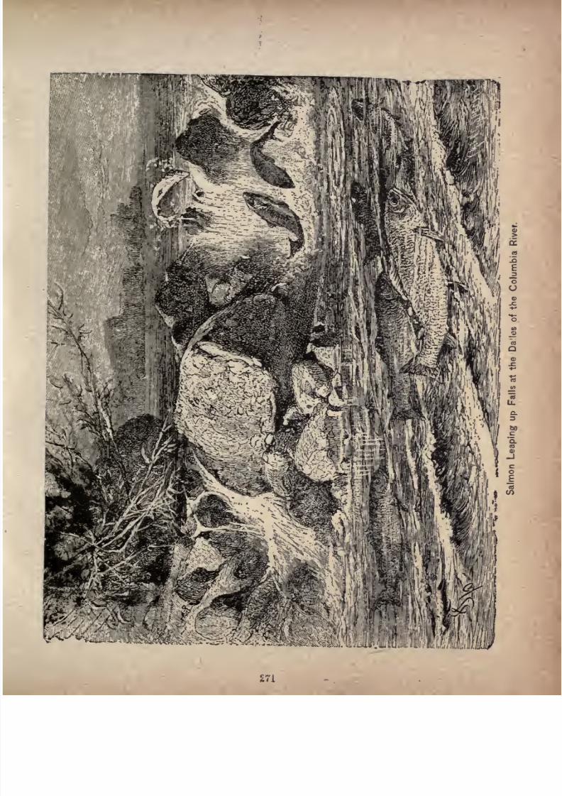
7/27/2019 Official Northern 00 Nort Rich
http://slidepdf.com/reader/full/official-northern-00-nort-rich 273/453
271
7/27/2019 Official Northern 00 Nort Rich
http://slidepdf.com/reader/full/official-northern-00-nort-rich 274/453
272 The Northern Pacific Railroad.
gravelly prairies and several small streams flowing to
Puget sound, following for a few miles the valley of the
Chehalis, which flows into Gray's harbor, and then strik
ing into the valley of the Cowlitz, a glacier-fed river of
considerable size, which it follows down to the Columbia.
The Cowlitz is navigable for about fifty miles for small
steamboats. A good deal of fine farming, grazing and
fruit country is seen on this journey in the valleys of the
Chehalis and the Cowlitz. The train is ferried across
the Columbia on an enormous transfer boat which takes
engines and cars over at a single trip. At the crossing
point the river is nearly two miles wide. Once on the
southern bank the train runs up the river, keeping close
to the shore, to the mouth of the Willamette, and then
follows that stream to Portland. The attention of tourists
is called to the superb views of Mount St. Helens and
Mount Hood, which may be seen from the car windows,
and to the beauties of the river scenery.
There are two lines for a part of the way between Ta-
coma and the Columbia. They diverge at Lake View and
come together at Centralia. One of the through passen
ger trains follows one line and one the other. The route
of most interest to tourists is that
by w^yof
Olympia,the
capital of Washington.
Olympia (1,944 miles from St. Paul, population 4,000)
is the capital of Washington, and is the oldest town in the
country west of the Cascade mountains. It is beautifully
situated at the head of the crescent-shaped body of water
which was originally named Puget sound by an English
explorer named Vancouver. The nameis
now generallyapplied to the whole body of water from the straits
of Juan de Fuca to Olympia. Vancouver called the
7/27/2019 Official Northern 00 Nort Rich
http://slidepdf.com/reader/full/official-northern-00-nort-rich 275/453
Through Washington.
the smaller inlets, bays and channels. Olympia is an
attractive place, with broad and well-shaded streets, and
anabundance
of fruit trees and flowers.
The court house is a remarkably handsome structure
built of native sandstone. A State capitol costing $1,000,-
ooo is to be constructed. A good hotel, with broad piaz
zas, commands fine views of the town and Sound. Oyster
fishing is an important industry. Electric cars run to
Tumwater, three miles distant, where there is a water
power that is used by several mills. Steamboats run dailyto Tacoma and Seattle. There is also steamboat connec
tion with the saw mill towns and lumbering camps on
Hood's canal.
Puget Sound Clams. An old settler writes thus to
the Olympian- Tribune relative to the Olympia clams: "These
mammoth clams, that live only in deep water and are only
obtainable at the lowest tides, have a large, round openingat one end of the shell, through which they expand them
selves, and I have seen them draw out through this open
ing, each one reaching the full diameter of an ordinary
wash tub; and as to the "steaks" that may be cut from the
neck of one big clam, dipped in egg and crumbs and fried,
they would make a delicious breakfast for a family of four
or five, equal to chicken's breast so served. In fact, these
clams used to be called Puget sound chickens. We have
not so many Indians hereabouts in these days to gather
the big clams and bring them to our doors, but probablyin the neighborhood of Butler's Cove they may still be
found at lowest tide/'
Centralia (1,961 miles from St. Paul; population 2,500)
is an active trading town, doing business with the farmersin the Chehalis country. The neighboring valley lands
produce large crops of all the small grains, Indian corn

7/27/2019 Official Northern 00 Nort Rich
http://slidepdf.com/reader/full/official-northern-00-nort-rich 276/453
The Northern Pacific Railroad.
and potatoes. Apples, plums and pears, and the smaller
fruits flourish. Several saw-mills are engaged in manu
facturing cedar, spruce and pine lumber, and there are a
number of shingle mills making cedar shingles. A
branch of the Northern Pacific runs eastward down the
valley of the Chehalis to Montesano and' Aberdeen on
that river, and ends at Oscosta, on Gray's harbor. A
local railroad used mainly for logging runs eastward
towards the Cascade mountains.
Chehalis (1,965 miles from St. Paul; population 2,500).
This is a thriving town, supported by the fine agricultural
country of the Chehalis valley. It is the county seat of
Lewis county, and the seat of the State reform school. A
Northern Pacific branch, described elsewhere, runs from
Chehalis eastward to South Bend, a Pacific seaport town,
on Willapa harbor. Chehalis makes furniture, lumber,
shingles and flour.
Winlock, Castle Rock and Kelso are prosperous
small towns in the Cowlitz valley, engaged in lumber man
ufacturing and in trade with the farmers in the valley.
Old orchards show that this region has been settled many
years. In fact, the pioneers went in from Portland before
the State of
Washingtonwas set off from
Oregon.Kalama (2,016 miles from St. Paul and 40 miles from
Portland), on the north bank of the river, is the county
seat of Cowlitz county, and has 300 inhabitants. At one
time this place had the ambition to become the commer
cial metropolis of the Columbia valley, and town lots were
sold in the forests at high prices. Steamboats plying be
tween Portland and Astoria call at Kalama.
After the train leaves the huge transfer boat on the
south bank of the Columbia river it runs through a tim
bered all the to with occa-
7/27/2019 Official Northern 00 Nort Rich
http://slidepdf.com/reader/full/official-northern-00-nort-rich 277/453
Through Washington. 275
sional clearings and farm settlements. In clear weather
supurb views may be enjoyed from the train windows of
Mount St. Helens and Mount Hood. St. Helens has aform like a sugar loaf and is about 9,000 feet high. Hood,
more distant, has a sharp pyramidal peak and an elevation
of about 11,000 feet. These gigantic mountains are cov
ered with snow during the entire year.
By way of Tenino In case the traveler goes from
Tacoma to Portland by the other or westernmost line of
the railroad, he will enjoy at Yelm Prairie, twenty-five
miles from Tacoma, a revelation of unsurpassed grandeur,
provided the sky be cloudless, in the view of Mount Ta
coma, the loftiest of all the snow mountains. As the train
rushes onward, occasional breaks in the forest allow the
sight of this snow-clad peak to a great advantage. It is
about forty miles distant, although its vast bulk is so dis
tinct that it seems much nearer than that.
A view from Mount Adams, away to the eastward on
the further side of the Cascade range, is to be obtained at
several points as the train goes southward. It is seen
across the wooded valley of the Nisqually, its white mass
in bold relief against the sky, its sides seamed in summer
withoutcropping
rockridges,
the hollowsbeing
rilled
with never-melting snow.
Tenino (1,950 miles from St. Paul). The Olympia &
Chehalis Valley railroad, a narrow-gauge line fifteen
miles long, owned by an independent corporation, con
nects Olympia, the capital of Washington and the county
seat of Thurston county, with the track of the Northern
Pacific railroad at Tenino. Here are quarries of excellent
gray sandstone.
Bocoda (1,954 miles from St. Paul) is a coal mining
7/27/2019 Official Northern 00 Nort Rich
http://slidepdf.com/reader/full/official-northern-00-nort-rich 278/453
276 The Northern Pacific Railroad.
town With a population of about 500. The coal is bitumi
nous and is used for locomotive and domestic fuel.
Portland (2,056 miles from St. Paul; population, 90,-
ooo) is the oldest commercial metropolis and railroad cen
ter of the Northern Pacific, and is the largest city of the
Pacific Coast next to San Francisco. It is a beautiful city,
well built in both its business and residence districts, and
standing upon a gentle slope stretching from the bank of
the Willamette river westward, fora distance of about two
miles, to a range of steep, wooded hills. The city extends
for about the same distance up and down the river. Its
residence streets are shaded with maples and ash, elms,
horse-chestnuts and other shade trees, and most of the
houses front upon lawns and flower gardens. Indeed,
Portland is a city of flowers and foliage, the mildness of
the climate and moisture of the
atmosphere causing vegetation to flourish. The winter climate is so mild that
roses usually bloom until the first of January.
The situation of Portland was determined by the fact
that the Willamette valley was the first settled portion of
Oregon, and the commercial city of the state naturally
sprang up at the point nearest to the wheat fields of Will
amettevalley
to whichsea-going ships
couldget
access.
This point was not on the Columbia river, but as far up
the Willamette as vessels of deep draught could go. Two
lines of railroad belonging to the Southern Pacific system
terminating here penetrate the Willamette valley, draining
the country on both sides of the Willamette. One of
these lines extend southward to the California boundary
and thence to San Francisco. A system of narrow-gaugerailroad devised to furnish transportation facilities to por
tions of the valley not reached by the other roads, also ter
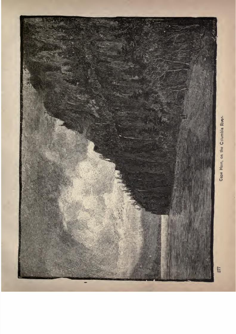
7/27/2019 Official Northern 00 Nort Rich
http://slidepdf.com/reader/full/official-northern-00-nort-rich 279/453
7/27/2019 Official Northern 00 Nort Rich
http://slidepdf.com/reader/full/official-northern-00-nort-rich 280/453
278 The Northern Pacific Railroad.
road and Navigation Company extends eastward via the
Union Pacific to Omaha, and by means of numerous
branchesreaches
nearlyall the
productive countryof East
ern Oregon, and a large portion of Eastern Washington.
Westward from Portland the Northern Pacific main line
reaches down the Columbia forty miles, and thence north
ward to Puget sound. Ocean steamships ply regularly
between Portland and San Francisco, and river steamboats
run on the Columbia and Willamette. Portland is thus a
focus of the transportion system of the Pacific Northwest.It is also an important post for ocean commerce, and a
large part of the wheat surplus of Oregon and Washington
goes from the wharves of Portland by sailing vessels to
Liverpool and other European ports.
Portland has many handsome business blocks which
would be creditable to any city in the East. It exports
about nineteen million bushels of wheat annually. Port
land has a good electric and cable street-car system, water,
gas and electric light works, a public library, daily news
papers, great wharves and warehouses, numerous hand
some churches, and many spacious public school edifices,
the largest of which, the High School building, is the
handsomest public school structure on the Pacific coast..
The exhibition building is a conspicuous structure.
The principal hotel is "The Portland," which occupies
an entire city block and is built in the form of a letter Hso that every room looks out on a street. It is unsurpassed
in its appointments by any hotel on the Pacific coast. A
fine view of the city can be had from the tower of the Ore-
gonian building. Tourists are recommended to take the
cable road to Portland Heights. It ascends an inclined
plane of rather alarming steepness to a lofty residence
7/27/2019 Official Northern 00 Nort Rich
http://slidepdf.com/reader/full/official-northern-00-nort-rich 281/453
In Oregon. 279
suburb from which a landscape of wonderful extent and
beauty can be seen, embracing both the Willamette and
Columbia rivers and the snow peaks of Mount Hood and
Mount St. Helens. Tourists will find much of interest in
the life of the Chinese quarter and should visit the Chinese
stores, the Joss house and the theatre. There are about
20,000 Chinese in Portland. An agreeable excursion can
be made by electric car across the Willamette to Albina.
The following is from a recent description of Portland in
The Northwest
Magazine:"There is always a natural capital to every geographi
cal division of the country to which each feature points
with index finger, and in which is typified the supporting
territory. The commercial and social center of these fer
tile valleys of the Cascade mountains is Portland, a cityas
marked in its appearance as is the country itself. It lies
alongthe crescent of the
river,nestles
uponthe sides of
the encircling hills and spreads over the tableland on the
opposite banks. Its business streets, its wharves, its resi
dences all tell, in a language which any thinker may read,
its past, its present and its future. To the traveler from
the East whose eyes have been dimmed by the heat radia
ting from sandy mesas on which the sparse sage-brush
serves only to emphasize the dreariness and desolation, thevalleys leading to Portland seem like the vales of Tempeand the city appears at first sight like some municipality
transported intact from New England. Closer investiga
tion shows that this similarity has many exceptions, and,
with all fairness, the differences are in favor of this young
giant of the Cascades. There is more coloring in the West
ern city, more of the picturesque while nothing is lackingin the staunch qualities for which the Atlantic coast cities
are famous. Life is brighter, fresher and more vigorous
7/27/2019 Official Northern 00 Nort Rich
http://slidepdf.com/reader/full/official-northern-00-nort-rich 282/453
280 The Northern Pacific Railroad.
on the Western coast, and this fact is everywhere apparent.
The somber blocks of residences are here noticeable by
their absence. Each residence has about it an individuality
which is as surprising as delightful. In the dooryards are
rosebushes whose blooms would shame the choicest flowers
of Eastern hot-houses. Vines clamber over gates and hide
the fronts or sides of many homes in a veil of dark ivy or
of the lighter Virginia creeper. Verandas tell the story of
an atmosphere like velvet, whose caressing touch is sought
in outdoor hours. Bright colored awnings add their vari
ety to the scene and hammocks are found everywhere.
Now and then palms are discovered with their great fronds
lending a tropical trait to the picture which is well nigh
deceptive unless reflection comes to the rescue. The great
hills back of the city, with their rugged fronts and coatings
of rough fir, bring back the imagination and emphasize the
fact that here the natural surroundings act as a tonic and
a comfort, not as a narcotic. The miles of wharves and
warehouses, above which tower the slender masts of ocean
vessels, the great elevators, the shipyard, the noise of
heavy laden trucks, the screeching of switch engines, the
rumble of trains, all corroborate the same impression.
The site of a city is as susceptible of analysis as is the
campof an
army.The battalions of trade
maymake a
temporary bivouac anywhere, but when they form a perma
nent base of supplies they do so for strategic reasons,
whether consciously or unconsciously acknowledged.
Generals have made mistakes and so have pioneers, but
Portland is not one of them. Whether its location was an
accident or a judgment, its prestige is certain and its
future can be read in its
surroundings.Ages ago the elements began to carve out the future lo
cation and territory of Portland from the earth itself.
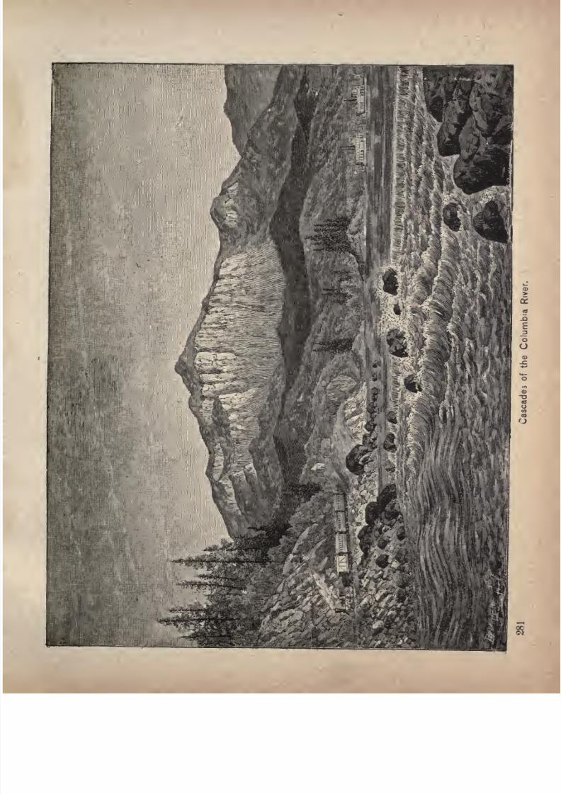
7/27/2019 Official Northern 00 Nort Rich
http://slidepdf.com/reader/full/official-northern-00-nort-rich 283/453
7/27/2019 Official Northern 00 Nort Rich
http://slidepdf.com/reader/full/official-northern-00-nort-rich 284/453
The Northern Pacific Railroad.
Within the arms of the Blue mountains was a great sea.
As the waters sought an outlet to the greater ocean, they
burst
through
the
hemmingbarrier in a mighty stream,
which even to-day is famous for its size the Columbia.
From all the arms of that sea, reaching into what are now
magnificent valleys, came other streams which cut through
the silted strata of the old sea bed and joined the outlet.
Thus by the hand of nature were the different territories
connected, pointing clearly to a common center. As if the
invention of man had been foreseen andprovided for,
the
coming of the railroads did not affect geographical values.
Engineers found that erosion had done more for them than
thousands of navies could have accomplished in scores of
years and they wisely followed the construction forces of
ages past. The iron bound track crept through the passes
of the mountains along tlje banks of the river, and the con
ditions which pointed to Portland as a commercial centerwere only doubled in strength, and nature and science
have riveted to the city the wonderfully fertile districts of
the mountains by furnishing natural and artificial highways
to her marts.
The origin of Portland is in the main prosaic. In the
earlier days when vessels depended more upon chance and
barter, a venturesome captain turned inquisitively up the
broad Columbia to dispose of his goods. The ocean-
traveling hull found ample welcome in the river which it
traversed until it reached its practical level of navigation.
Here it reached its great tributary, the Willamette, which
it followed until a trading station was begun, the stock
being the cargo which had thus been brought nearer the
consumer. This point naturally became the center of dis
tribution for the country. .Vessels came in greater num
bers with each succeeding year. Wagon roads were built

7/27/2019 Official Northern 00 Nort Rich
http://slidepdf.com/reader/full/official-northern-00-nort-rich 285/453
Multnonruh Falls, Columbia River,
7/27/2019 Official Northern 00 Nort Rich
http://slidepdf.com/reader/full/official-northern-00-nort-rich 286/453
284 The Northern Pacific Railroad.
to make the post accessible, and steamer lines were estab
lished. Trade increased, population multiplied, and addi
tional buildings were erected until the little commercial
sapling showed many concentric rings of growth and the
trading station had become a city thoroughly metropolitan
in character.
Subsequent events proved the wisdom of a choice of site
which is so advantageous it might well be characterized as
inspired. The Columbia rushes seaward with a velocity
of twelve to fifteen miles anhour,
and the
heavystream
would nearly sweep vessels from their fastening at wharves
along its banks. In spring, too, ice would hurt the refuge
and would be a source of infinite trouble to shipping. All
such annoyance is avoided by turning into the broad avenue
of the Willamette. Here is depth, a gentler flow, and, in
times of high water, the river instead of becoming a
torrentis
transformed into a great lake as far as thefalls
at Oregon ity above Portland. Thus is Portland located
on a navigable cul de sac connected by a magnificent watery
highway with the Pacific.
River Excursions from Portland. A number of very
attractive steamboat excursions may be made from Port
land. One is up the Willamette to the falls at Oregon City.
Here the river makes a perpendicular leap of about fifty
feet, forming one of the most magnificent cataracts in the
world. The Government has constructed a canal around
the falls, with locks cut in the solid rock. A very curious
sight may be seen when the salmon are running up the
river. Thousands of these brilliant-scaled fish attempt to
jump up the falls at points where there are projections of
rock. A few succeed but many fall back wounded into the
whirlpools below.
Anotherinteresting trip
is to go down the Willamette and
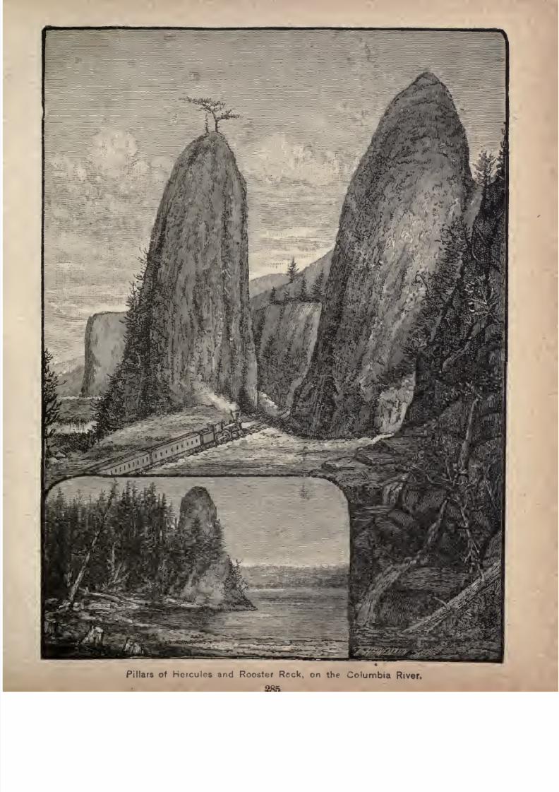
7/27/2019 Official Northern 00 Nort Rich
http://slidepdf.com/reader/full/official-northern-00-nort-rich 287/453
Pillars of Hercules and Rooster Reck, on the Columbia River.
7/27/2019 Official Northern 00 Nort Rich
http://slidepdf.com/reader/full/official-northern-00-nort-rich 288/453
286 The Northern Pacific Railroad.
up the Columbia as far as the Cascades, where the Govern
ment has been engaged for nearly a lifetime in slowly exca
vating a ship canal in the rocky south bank of the river.
A stretch of the grandest scenery of the Columbia is
passed. On the south, mountain summits stand like a
wall, grouped at times like an amphitheatre, at other times
assuming romantic shapes, and frequently affording views
of falling waters that are very beautiful. Here is Oneonta
Fall, 800 feet of sheet silver, a ribbon of mist waving in the
wind. Multnomah Fall is double. The water plunges sev
eral hundred feet, gathers itself together, and plunges
again, about 800 feet in all. There are several other cas
cades of less note that never fail, and in early spring the
face of the cliffs is threaded with them. A few miles west
ward are the Pillars of Hercules, two columns of rock sev
eral hundred feet in height, between which the train
passes, as through a colossal portal, to the more open lands
beyond. Near by is Rooster rock, rising out of the river,
and pointing upward like a mighty index finger.
The Cascades are in about the center of the Cascade
mountain range. The river, that has flowed placidly all
the way from The Dalles, has become wider, and spreads
out in unbroken stillness, no motion being apparent. It
is
gatheringitself for the
plungeover
theCascades. In a
moment it changes from a placid lake to swift rapids, and
soon becomes a foaming torrent as the fall increases and
the waters encounter boulders in the stream.
Immediately at the Cascades the scenery is very fine.
The mountains are grand, standing on the south like walls
of adamant, and lifted to towering heights, their sides cleft
open at intervals by deep ravines, the rock ledges of whichare hidden by firs. Some of the rocky pinnacles and tur
rets along the heights are of strange, stern architecture.
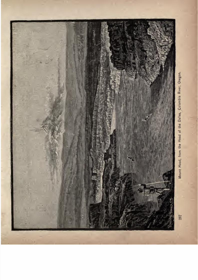
7/27/2019 Official Northern 00 Nort Rich
http://slidepdf.com/reader/full/official-northern-00-nort-rich 289/453

7/27/2019 Official Northern 00 Nort Rich
http://slidepdf.com/reader/full/official-northern-00-nort-rich 290/453
288 The Northern Pacific Railroad.
On the north the mountains recede, and pyramidal forms
contrast with tremendous frowning outlines, that stand like
some Titanic fortress. There is a fine view of the Cas
cades from the train, and of the mountains on the north.
At railroad speed the Lower Cascades are soon passed,
and Bonneville, the point at which the steamboats on the
lower river make their landing, is reached.
Near the Upper Cascades on the Washington side of the
river, on a point of land that juts out so as to make a gooddefensive position, there is still standingan old block house,
built forty years ago, when the Indians were more numerous than peaceable. War broke out all along the coast,
from British Columbia to California, in 1855. The Indians
had some sort of a unison, and outbreaks were almost
simultaneous for that distance of 800 miles, though some
of the more powerful tribes refused to join the alliance,
and gave notice of danger. At that time the Cascades
were already important as the portage where all things
bound up the river had to make a transit. Suddenly the
outbreak came. The blockhouse became the refuge of all
settlers, who were defended by the male population, and
by a handful of soldiers, stationed there at the time under
command of a young lieutenant named Sheridan. So the
legend of the Indian and the wonders of nature are supple
mented by a bit of history that has for its heroic character
the famous Gen. Phil. Sheridan, who afterward became
one of the most conspicuous figures in the great civil war.
The Indians have a tradition that once the great snow
mountains, Hood and Adams, stood close to the river at the
Cascades, with a natural arch of stone bridging one to the
other. The mountainsquarreled,
threw outstones,
ashes
and fire, and, in their anger with each other, demolished
the arch. Before that time, the Indians say, their fathers
7/27/2019 Official Northern 00 Nort Rich
http://slidepdf.com/reader/full/official-northern-00-nort-rich 291/453
7/27/2019 Official Northern 00 Nort Rich
http://slidepdf.com/reader/full/official-northern-00-nort-rich 292/453
290 The Northern Pacific Railroad.
with a substratum of sandstone, pitching toward the river.
As the river wears away under the basalt, the rock masses
move towardit. It is
very possible that at some remoteperiod, when the river had worn out a gorge, and precipices
lined the shore, the waters undermined this wall and aided
its descent on the incline of sandstone and conglomerate,
so as to produce the effect which is seen, and confined to a
short distance the fall that previously covered fifteen miles.
Still another enjoyable river trip is to Astoria, at the
mouth of the Columbia, a distance of a little less than ahundred miles from Portland. The Columbia, on its lower
course, is a mighty flood, widening as it nears the ocean.
Its banks are covered with sombre fir forests and rise abrupt
ly to low mountain ridges. Astoria is the principal center of
the salmon fisheries and is also an important lumber man
ufacturing place. The level ground at the foot of the
steep hills that border the river is of such scanty width that
the business streets are mainly built over the water on
piles, the roadways being of stout plank. Under the
streets and buildings may be heard the swash of the rising
and falling tide. Many of the fishermen save the cost of
building sites by living in house-boats which they moor on
vacant water lots. Sea-going ships, carrying wheat, often
take a part of their cargo here from lighters, in order to
have a less draft coming down the river from Portland
than they require when fully loaded. The canning of sal
mon is carried on at numerous establishments along the
river front. Fishing is done out on the bar in small boats
manned by men from almost every maritime nation of the
world. Astoria has a population of about 8,000. The forts
at the mouth of the river and the enormous jetty three
miles long, built out into the ocean to deepen the entrance,
are well worth visiting.
7/27/2019 Official Northern 00 Nort Rich
http://slidepdf.com/reader/full/official-northern-00-nort-rich 293/453
LAKE SUPERIOR DIVISION.
ASHLAND, Wis., TO STAPLES, MINN., 206 MILES CONNECT
ING AT STAPLES WITH MAIN LINE TRAINS.
This line runs through a pine forest country for its en
tire length. It skirts the shore of Lake Superior from
Ashland to Duluth, 76 miles, then follows the course of the
St. Louis river for about 20 miles, and afterwards runs
across the plateau of Northern Minnesota. At Aitkin it
strikes the Mississippi river, and at Brainerd it crosses
that stream.
Ashland, Wis., (population 15,000) is the county seat
of Ashland county. Ashland is also the extreme eastern
terminus of the Northern Pacific railroad system. It is
an important shipping and manufacturing point. This
prosperous town has a beautiful location on the pictur
esque Bay of Chequamegon, facing the Apostle islands. It
has an excellent harbor and considerable lake commerce.
It is the northern terminus of the Wisconsin Central rail
road, running to Milwaukee and lo many important towns
in the center of the State. The Milwaukee, Lake Shore &Western line of the Chicago & Northwestern system also
terminates here. The Chicago, St, Paul, Minneapolis &Omaha system has a line extending from St. Paul to Wash-
burn, a few miles distant, across the bay, with a branch to
7/27/2019 Official Northern 00 Nort Rich
http://slidepdf.com/reader/full/official-northern-00-nort-rich 294/453
292 The Northern Pacific Railroad.
in the United States. The ore is brought from the mines on
the Gogebic range, about 30 miles distant, by two lines of
railroad, the Wisconsin Central, and the Milwaukee, LakeShore & Western; and is shipped by steam and sailing ves
sels from three immense ore docks, one of which belongs
to the former railroad company, and two to the latter.
These docks handle over 1,000,000 tons of ore annually,
affording cargoes to nearly 800 vessels, the greater part of
which are bound for Cleveland, O, The docks and ap
proaches are over 3,000 feet long, and the docks properare 1,405 feet long. On each side are 117 pockets holding
120 tons each. The capacity of each dock is 28,000 tons,
and each required over 5,000,000 feet of timber for its
construction. Ashland manufactures a great deal of lum
ber and makes charcoal, and iron and steel from the ore
of the Gogebic range. A blast furnace makes charcoal
iron. Ashland has a great reputation as a summer resort.
It has a number of hotels; the Chequamegon house is one
of the best summer hotels in the country, and is filled with
guests during the warm season. The cool breezes from
Lake Superior make the summer climate always agreeable
and the opportunities for yachting, rowing and fishing
upon the beautiful water, and for drives through the pine
forests, render Ashland a delightful place in which to
spend the summer months. Steamers, with excellent pas
senger accommodations run to Duluth and to all lower
lake ports as far as Buffalo.
Trout Streams. Between Ashland and Superior the
Northern Pacific road runs through a picturesque forest
region, traversed by many small trout streams which flow
into Lake Superior. The most frequented trout stream on
this road is Brule river, which is much visited during the
fishing season by sportsmen from St. Paul and Minneapolis.
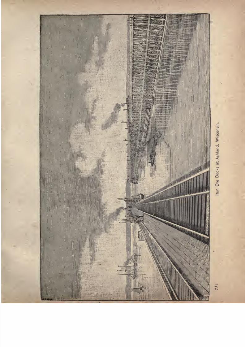
7/27/2019 Official Northern 00 Nort Rich
http://slidepdf.com/reader/full/official-northern-00-nort-rich 295/453
7/27/2019 Official Northern 00 Nort Rich
http://slidepdf.com/reader/full/official-northern-00-nort-rich 296/453
294 The Northern Pacific Railroad.
A St. Paul club has erected a rude, but comfortable, log
house for the use of its members. Boats and Indian guides
can be procured there.
Superior, Wis. (Population 30,000.) The present
city of Superior was formed a few years ago by the con
solidation of two municipalities Superior, commonlycalled Old Superior, which dates back to the fifties and
occupied the plateau facing the entrance to the Bay of
Superior, and West Superior, a new town started in 1884
on the Bay of St. Louis facing Duluth. These two places
grew together, and having common interests naturally
united their local governments. The consolidated city
occupies a harbor frontage on the three bays of Allouez,
Superior and St. Louis, of over ten miles in length, and
has become one of the most important commercial, milling
and manufacturing points in the Northwest. In some
respects Duluth and Superior form a single city. The
wheat stored in the elevators of one is bought and sold in
the grain exchange of the other. Vessels may take part of
their cargo at one place and the rest at the other. The
great coal companies which furnish from Ohio and Penn
sylvania mines the fuel of the entire Northwest have docks
on both sides of the harbor. There is a constant flow of
people
back and forth between the two towns, bent on
errands of business or pleasure. Yet no future union is
possible by reason of the barrier of the State boundary
line, -and each place, seeks earnestly its own growth and
advantage and is jealous of the success of its neighbor
across the water. Duluth has at present about 50,000
inhabitants and Superior about 30,000. Each has grownwith marvelous
rapidity,but the conversion of
Superiorfrom a dead village into a city did not begin until after
Duluth had secured its docks, its elevators, its railroads
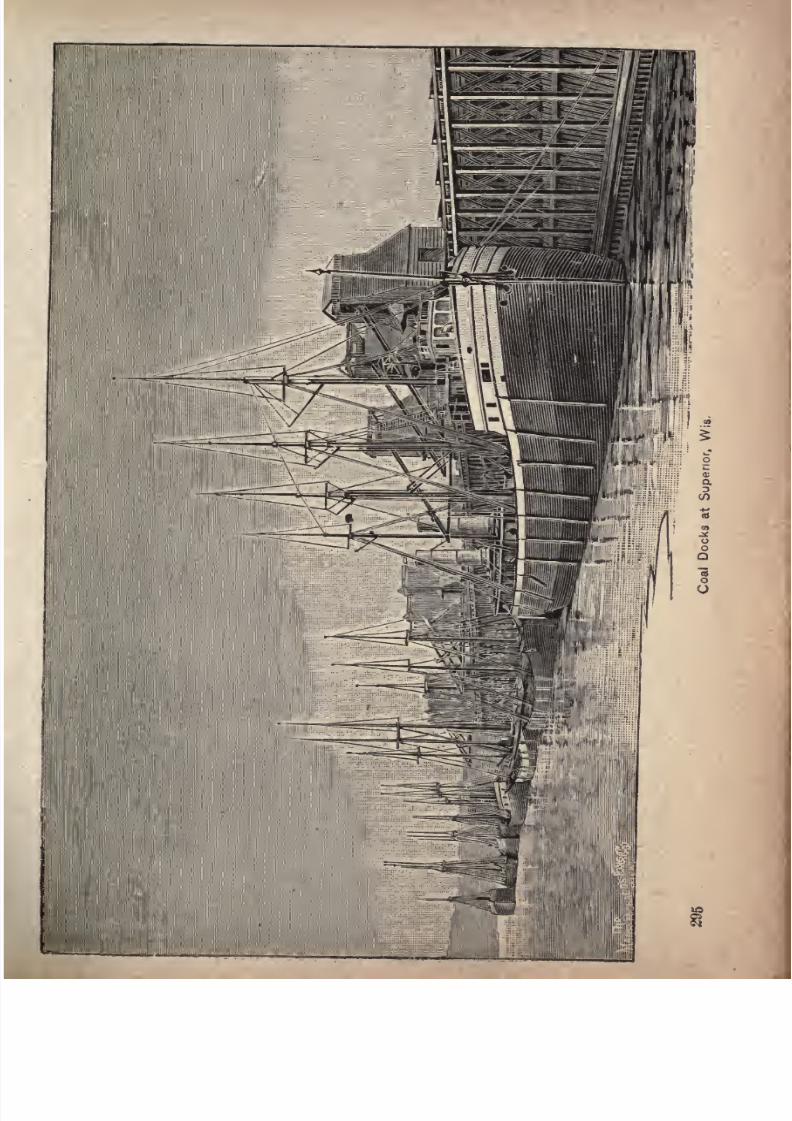
7/27/2019 Official Northern 00 Nort Rich
http://slidepdf.com/reader/full/official-northern-00-nort-rich 297/453
7/27/2019 Official Northern 00 Nort Rich
http://slidepdf.com/reader/full/official-northern-00-nort-rich 298/453
296 The Northern Pacific Railroad.
and its shipping movement; and when it did begin it took
hold of a tract of forest and changed it in a few years to a
well-built town, with handsome streets, big factories,
towering elevators and enormous docks.
The site of Superior is remarkably favorable for city
building, and this fact has been a strong factor in its
growth. It is a plateau sloping just enough to the water
for good drainage, and traversed here and there by shallow
ravines or coulees which serve as aids to the drainage
system. On two sides of the broad triangle of land which
the city occupies there is deep navigable water, and reach
ing nearly a mile inland is a long arm or inlet known as
Howard's Pocket, on which is located the great steel barge
plant. A shorter inlet called Tower Slip affords water
frontage for the new flouring mills at the West End.
Along the Bay of St. Louis are the five grain elevators,
the
hugecoal docks, the oil docks and the merchandise
clocks, and there is ample room for the further march of
commerce along the shore line up the bay towards the
steel works. The'sawmills and lumber yards occupy both
the water fronts of Conner's Point. On the Bay of
Superior side of the city there is a great deal of unoc
cupied water front for future docks and factories between
the Point and the
new flouringmills at
the East End.The level ground of the plateau gives the numerous rail
ways ample space for their tracks, yards and freight ware
houses, and their spur tracks run out upon the docks and
alongside the mills and factories. The great, notable and
unique advantage of the site of Superior for the develop
ment of manufacturing and commercial movement lies in
the fact that every sort of concern requiring good shippingfacilities can build its plant where the lake steamers can
load and unload on one side and the freight cars on the
7/27/2019 Official Northern 00 Nort Rich
http://slidepdf.com/reader/full/official-northern-00-nort-rich 299/453
7/27/2019 Official Northern 00 Nort Rich
http://slidepdf.com/reader/full/official-northern-00-nort-rich 300/453
298 The Northern Pacific Railroad.
other. It is this fact, supplemented by liberal and ener
getic management of town site interests, that has produced
the surprising growth of the past few years.
Two manufacturing plants of very great importance
were located in West Superior at an early date in the
history of the place. The first was Capt. McDougall's
shipyard for the building of his peculiar craft known as
the whaleback, and the second was the steel plant where
the ribs, beams and plates of these vessels are made. These
concerns alone employ workmen enough to make, with
their families, a considerable town. The grain elevators,
the coal docks and the saw mills came about the same time
to employ another army of people, so that the new town
sprang as if by miracle, under the magic touch of enter
prise, into vigorous life. As an economical carrier the
whaleback has made for itself a place in the face of all
conservative scepticism and opposition. It is capacious,
fast andseaworthy. Ugly
in
appearanceand devoid of
all attempts at ornament and beauty, it represents in
marine architecture the materialistic spirit of modern times.
It is, in fact, a huge, cigar-like steel tank, with machinery in
its stern, and cabins perched above for the housing of its
crew. Its shape offers the least possible resistance to winds
and waves. No opposing force of air or water strikes it at
a right angle. Everywhere thereis
a curved surface presented to ward off the blows. All the whalebacks are
exclusive freight boats except the Christopher Columbus,
which has a cabin for passengers extending over its whole
length and supported on steel turrets. This craft found
its first use in carrying passengers back and forth between
Chicago and the World's Fair grounds. Both the build
ing and running of these novel craft are under the personal
supervision of their inventor, Capt. McDougall.
7/27/2019 Official Northern 00 Nort Rich
http://slidepdf.com/reader/full/official-northern-00-nort-rich 301/453
. Lalce Superior Division. 299
A new industry came to Superior in 1891 and 1892, the
future influence of which in promoting the growth of the
city
canhardly
be foretold. Ageneral
conviction that the
head of Lake Superior is the best point for flour milling in
the United States has been gaining ground in milling
circles for some years, and all at once it ripened into
action. The success of the big Imperial mill at Duluth
confirmed the theory. During the years named, three
large, first-class mills were erected or started at West
'Superiorand three more at the East End. The new West
End mills are the Freeman, the Grand Republic and the
Minkota, with a combined grinding capacity of 5,300
barrels daily. At the East End the new mills are the
Lake Superior, the Listman and the Anchor, whose com
bined capacity is 6,500 barrels. Add the old Gill & Wright
mill at the West End, capacity 600 barrels, and we have a
grinding capacityof the
new millingcenter of
12,400barrels a day. Add to this the capacity of the two mills at
Duluth,6,5oobarrels,and it appears that the head of the lake
now has a capacity of 18,500 barrels a day, or very nearly
half the capacity of the mills of Minneapolis, which are rated
at 40,000 barrels. This is a surprising development. Yet
it is a natural and inevitable result of the settlement of the
great wheat belt of the Northwest and the building ofrailroads to the point where the deep-water navigation of
the great lakes penetrate farthest into the continent.
Superior is an important railroad center,and ranks amongthe leading shipping ports on the upper lakes. It has twelve
large grain elevators with an aggregate capacity of 15,000,000
bushels,seven immense coal docks, and a merchandise dock.
As a manufacturing town, it is already one of the foremost in the Northwest. An iron and steel plant was
erected in 1888 with a capital of two millions of dollars.
7/27/2019 Official Northern 00 Nort Rich
http://slidepdf.com/reader/full/official-northern-00-nort-rich 302/453
300 The Northern Pacific n
There are two large lumber mills which make an annual
cut of about 75,000,000 feet. An extensive wagon factory
is located at South Superior and there are several barrel
factories. The coal receipts are over a million tons a year.
Coke ovens, owned by the Lehigh company, make coke
from Pennsylvania and Ohio coal, A handsome hotel, of
large dimensions, called "The West Superior," was com
pleted in 1889. The railway terminal facilities are very
extensive, and are used by the Northern Pacific, the St.
Paul & Duluth, the Eastern Minnesota, the Chicago, St.
Paul, Minneapolis & Omaha, and the Duluth,South Shore &Atlantic roads. Communication is had with Duluth by two
lines of railway and by steam ferries. A recent commercial
development of much importance was the building of an
enormous iron ore dock on the Bay of Allouez for the
shipment of ore from the Mesaba range and the building
of a railroad from Superior to the range.
Duluth, Minn, (population 60,000), is the third city in
Minnesota, and is one of the most important wheat markets
and wheat shipping points in the world. The city is built
upon high ground overlooking Lake Superior and the
bays of Superior and St. Louis, and is over seven miles
long from the extreme eastern suburbs on the shore of the
lake to its western limits on the Bay of St. Louis. Its
harbor is capacious and entirely landlocked, being entered
by an artificial channel, cut across a long, narrow sandy
peninsula, known as "Minnesota Point." The grain ele
vators, which are the most conspicuous structures in the
commercial district, have an aggregate capacity of about
21,000,000 bushels. The neighboring elevators in West
Superior are operated in close connection with the Duluth
elevators, and the wheat stored and handled in both places
is represented in the operations of the Duluth Board of
7/27/2019 Official Northern 00 Nort Rich
http://slidepdf.com/reader/full/official-northern-00-nort-rich 303/453
Lake Superior Division. 301
Trade. The grain is shipped in steam and sailing vessels
of heavy tonnage; a steam propeller usually taking two or
three sailing craft in tow. Most of the wheat shipments are
to New York by way of Buffalo and the Erie canal. A large
grain steamer, with a capacity of 90,000 bushels, equivalent
to 180 car loads, can be loaded at Duluth in half a day.
It has often happened that such a steamer, arriving at the
elevators at 7 o'clock in the morning, has been outside of
the harbor with her cargo aboard before noon of the same
day.
Duluth has become in recent
years
a moreimportant
wheat-shipping port than Chicago, and in the volume of
grain annually dispatched to the East it now leads all
Western cities. Next to wheat, the most important article
of commerce is coal, the receipts of which are nearly
2,000,000 tons annually. Iron ore is shipped from the
Mesaba range. The manufactures of the city consist of
lumber, flour,iron and
steel,and
railwaycars.
Therail
ways centering in the place are the Northern Pacific, the
St. Paul & Duluth, the Chicago, St. Paul, Minneapolis &
Omaha, the Eastern Minnesota, the Duluth, South Shore
& Atlantic, the Duluth, Missabe & Northern, the Duluth &
Winnipeg, and the Duluth & Iron Range. The latter road
runs northward to the great iron mines in the Vermillion
range. The fisheries of Duluth are an important industry.White fish and trout are caught in large quantities and
shipped to St. Paul and Minneapolis, and to all the towns
in Minnesota, the Dakotas and Montana. Duluth has a
large, first-class hotel, "The Spaulding," and a number of
smaller establishments.
The city with its suburbs is of ribbon-like shape, extend
ing for over ten miles along the shore of Lake Superior,of the Bay of Superior, the Bay of St. Louis and the St.
Louis river, and having but a narrow width between the
7/27/2019 Official Northern 00 Nort Rich
http://slidepdf.com/reader/full/official-northern-00-nort-rich 304/453
302 The Northern Pacific Railroad.
water and the precipitous hillsides. Electric and steam
roads afford rapid transit from end to end of the place and
an inclined plane road runs
up
the
high
bluffs from the heart
of the business district. A boulevard drive along the side
of the bluffs affords admirable views of the lake and bays and
of all the commercial activities of the city. Tourists should
visit the Board of Trade, where the wheat trade is carried
on. The Government fish hatchery, at the eastern end of
the city, is well worth seeing.
Avoyage
on LakeSuperior
on one of thelarge passen
ger steamers which leave Duluth daily during the season
of navigation for the Saulte Ste. Marie and for all ports on
the lower lakes is one of the most healthful and agreeable
journeys imaginable. There is rarely any rough weather
to produce sea sickness. Th air is singularly pure and
exhilarating. The steamers following the south shore
route call at Ashland, Bay field, the copper-mining townsof Houghton and Hancock and the iron-shipping port of
Marquette, and at the'* Soo
"are locked through the great
canal. The north shore boats call at the Canadian city of
Port Arthur.
The upper part of Lake Superior is one of the most
interesting points to the geologist on the North American
continent. It is on good grounds considered the oldest
region in the world. The theory is that the formation of
the lake is due to some great volcanic action, long prior to
the ice period ; perhaps that the lake itself was the mouth
of a great volcano. Duluth is built on the rim of this
lake basin, upon foundations of trap and conglomerates of
every conceivable description, with seams of quartz and
veins of iron, copper and silver often cropping out at the
surface. The ancient lake bed extends some twenty miles
above Duluth, over Grassy Point, Spirit Lake, and the
7/27/2019 Official Northern 00 Nort Rich
http://slidepdf.com/reader/full/official-northern-00-nort-rich 305/453
Westward from Lake Superior. 303
bed of the St. Louis river, as far as Fond du Lac, around
which the lake rim curves, inclosing a region of striking
beauty.The chain of hills is here cut
through bythe St.
Louis river, causing that wonderful series of rapids which,
in a distance of twelve miles, have a fall of 500 feet through
masses of slate, trap, granite and sandstone, and are cele
brated as the picturesque regions of the Dalles of the St.
Louis.
The mean temperature of Duluth, during the summer,
is as follows:June, 57 9'; July,
619'; August, 63
6';
September, 58 5'. Summer visitors 1ind here every con
venience for fishing, hunting and sailing parties. Tourists
and scientists usually have an abundance of time at their
disposal, and are able at leisure to find out the most
desirable localities. But there are many who come by
lake, and have only a day to spare, or the brief period that
a boat is waiting. To the latter class a trip to the Dallesof the St. Louis, via the Northern Pacific railroad, is one
of the most profitable ways of spending the time.
The Gooseberry river is considered the best trout
stream on the north shore, then Split Rock, and Stewart
and Knife rivers, in the order named. Among the fine
bays and islands most popular with tourists are Knife
island and Stony Point, Agate, Burlington and Floodbays. Agate Bay, especially, is visited, and the name is
very appropriate. Its shores are lined with agates, amongan endless variety of other variegated and curiously
colored conglomerates, all specimen chips from the neigh
boring rocks and hills, but worn more or less smooth bythe perpetual friction and grinding of the wave-washed
beach. The north shore is very precipitous, and aboundsin fine scenery. Cascades and rapids are to be found on
nearly all the streams.
7/27/2019 Official Northern 00 Nort Rich
http://slidepdf.com/reader/full/official-northern-00-nort-rich 306/453
304 The Northern Pacific Railroad.
Carlton (23 miles from Duluth and 131 miles from St.
Paul; population, 1,000). This is the junction of the St.
Paul & Duluth and the Northern Pacific railroads, and a
branch of the St. Paul & Duluth railroad, known as the
Knife Falls branch, which runs six miles north to Knife
Falls and Cloquet, where large quantities of lumber are
manufactured.
Aitkin (87 miles west of Duluth; population, 1,000).
This is a lumbering town on the Mississippi river, which is
navigable for about TOO miles above the place to Grand
Rapids. Small steafnboats carry supplies to lumbering
camps along the river.' Red Cedar Lake, with its fifty miles
of shore, and five other lakes of good size, situated four
miles west of Aitkin, are excellent places for hunting and
fishing. Crystal Lake is distant two and a half miles south.
Lake Mille Lac, twelve miles in the same direction, is noted
for its beauty; and all are well worth a visit.
The country around the lakes is surpassed by none in
point of attractiveness to the eye, being undulating and
park-like. The glades and meadows are spangled with
wild flowers in great variety, and the pebbly shores of the
lakes, and azure, transparent waters, present a scene which
impresses the beholder by its rare beauty. The hunting
here is excellent. Elk
maybe found within
seventy-fiveto one hundred miles north of this point, and in the imme
diate vicinity of Aitkin are deer, bear, geese, ducks, pheas
ants, grouse and woodcock.
Visitors to this portion of Minnesota desiring to see the
red man in his wild way of living, may have their wishes
gratified by driving out to the great and beautiful Mille
Laclake
and Chippeway Indian reservation, about twelvemiles from Aitkin. Cedar Lake, 92 miles west of Duluth,
is only a side track.
7/27/2019 Official Northern 00 Nort Rich
http://slidepdf.com/reader/full/official-northern-00-nort-rich 307/453
Westward from Lake Superior. 305
Deerwood (97 miles west of Duluth; population, 50) is
a favorite retreat for the hunter, and one of the wildest,
least known and most beautiful points on the Northern
Pacific railroad. An unbounded forest stretches in every
direction, in which deer and bear tempt the adventurous
sportsman to share with the Indians the excitement of the
hunt. The small streams, and clear lakes of unknown
depth, invite the lover of the rod to make his camp here.
The invalid who craves repose, yet does not care to be too
far away from the post-office or telegrams, finds here his
Mecca. A small hotel has been built, and accommodation
may also be found among the farmers at this point; or, if
camping out is preferred, it is easy to obtain milk, eggs,
ice, fresh vegetables and berries from the same source.
In a radius of three miles, there are over twenty known
lakes, whose waters fairly teem with muscalonge, pike,
black bass, whitefish, pickerel, croppies, wall-eyedpike,
sunfish, rock bass, catfish, bullheads and suckers. It is
not uncommon to take pike weighing upward of twenty
pounds, and black bass six pounds, with a trolling spoon,
while at the mouths of streams bass weighing from half a
pound to two and a half pounds can be caught with the
fly. The lakes vary in size from little gems a few hundred
feefacross to
largerones of several miles in
diameter, manycontaining islands. Some of them have high, rocky shores
pebbly beaches, and deep blue waters; others, fringed
with a growth of wild rice, are the feeding and hatching
grounds of numbers of wild fowl. The more distant lakes
can be reached by pony and buckboard, or by birch canoes,
the latter carried over portages.
Brainerd (138miles from St.
Paul,and
114miles
fromDuluth; population, 7,000). Brainerd, City of the Pines,
js situated on the east bank of tjie Mississippi river, on the
7/27/2019 Official Northern 00 Nort Rich
http://slidepdf.com/reader/full/official-northern-00-nort-rich 308/453
306 The Northern Pacific Railroad.
main line of the Northern Pacific railroad, at an elevation
of i,600 feet above the sea. It is one of the most
important, picturesque and attractive towns on the line of
the railroad, north of Minneapolis and west of the great
lakes, in Minnesota. Approaching the town from the south
and east, the eye is attracted by the lofty smoke-stack
(no feet high) of the railroad company's shops, which here
cover an area of about twenty acres, and consist of a
round-house, containing forty-four stalls; machine shop,
with capacity for handling twenty-two locomotives at once;
boiler shop, copper shop, blacksmith forges, foundry andnumerous other accessories of the headquarters of the motive
power of a great railroad. Passing by this busy hive of
industry, going west, the traveler is at once ushered into
the business portion of the city, which stretches along
parallel to the track on the south side for a distance of
nearly half a mile. On the north side of the track are
obtained glimpses, through the timber, of picturesque
residences, churches, Gregory park, inclosing ten acres of
stately pines, and the court house and jail. A strong dam
was built across the Mississippi river about two miles
above the business centre of the city in 1888 by a water-
power company, which furnishes power for mills and
factories. The dam created a back-water lake, which is
one of the most capacious storage reservoirs for logs to be
found on the Mississippi river. The principal manufactur
ing industries of Brainerd are making lumber and brick.
The railroad company has, on the western bank of the
river, a large and handsome sanitarium which is supported
by a small monthly contribution from all the employes of
the company engaged upon the eastern divisions of the
road. These employes have the right to surgical and
medical treatment and board, free of charge, when sick or
7/27/2019 Official Northern 00 Nort Rich
http://slidepdf.com/reader/full/official-northern-00-nort-rich 309/453
Westward from Lake Superior. 307
injured. The hospital stands in the midst f a grove of
pines, and has an excellent record for successful work.
Brainerd is the gateway to the vast lumber region north
and east to the sources of the Mississippi. A hundredlakes, at varying distances of three to twenty-five miles
from Brainerd, and of easy access, are stocked with black
bass, wall-eyed pike, pickerel, muscalonge and other
varieties of fish, all of exquisite flavor; numerous rice lakes
afford breeding places for myriads of water fowl, while the
forest is full of game and fur-bearing animals. Red deer
and pheasants may be taken by the sportsman, within easy
strolling distance of the town; and a black bear, wolf or
wolverine often adds piquancy to the hunter's quest. There
is a hotel at Gull lake, twelve miles distant northwest,
with accommodations for twenty guests, and at Serpent
lake, sixteen miles northeast, there are accommodations
for perhaps an equal number. Mille Lac lake, twenty-two
miles southeast, is the second largest and perhaps the most
charming, of all the Minnesota lakes. Embowered in a
magnificent forest of butternut, ash, sugar maple and
other hard woods, its solitude has rarely been disturbed
by the sound of the woodman's axe. It has an area of
nearly 400 square miles, and a gravelly beach skirts its
shores for nearly loo^niles. This lake is the source of the
Rum river; its waters.teem with fish, many of which are of
marvelous size; black bass of ten and twelve pounds each
are often hooked. Its shores abound with game, attracted
hither in the fall by the immense crops of mast in the
forest and wild rice in the thousand lakes. Openings in
the forest, bits of prairie and meadow, produce wild straw
berries, blueberries, raspberries and cranberries, hundreds
of bushels of which are annually shipped from this station;
the undergrowth is rich with ferns and flowers and flower-
ins shrubs of exquisite beauty.
7/27/2019 Official Northern 00 Nort Rich
http://slidepdf.com/reader/full/official-northern-00-nort-rich 310/453
308 The Northern Pacifc Railroad.
Gull River (121 miles from Duluth and 143 miles from
St. Paul; population, 500). Gull River, so called from the
river which runs through the town, is a lumbering point
from which great quantities of lumber are shipped for
building purposes. One of the largest saw-mills in the
State is situated here; also a sash and door factory, and a
planing mill. Gull lake lies four miles north of the town.
This is another of Minnesota's beautiful lakes, abounding
with fish of all kinds. There is a steamboat on its waters
which carries the tourist from eighty to one hundred miles
around its shores. Two miles west of Gull River is
Sylvan Lake, also a very pleasant resort in summer.
There are a great many deer, and some moose, in the
neighborhood of these lakes. A moose was recently killed
that weighed, when dressed, 800 pounds. Wolves and
bears are also to be found. In the spring and autumn the
rivers and lakes are alive with ducks and other water fowl.
Years ago, one of the greatest battles between the Chip-
peway and Sioux Indians was fought here."Hole-in-the-
day/' one of the Chippeway chiefs, was shot in this vicinity.
"Bad Boy," so called by the Indians because he saved
many of the white settlers' lives at the time of the Indian
massacre in 1862, lives here.
Staples (143 miles from Duluth and 167 from St. Paul)
is the junction point of the Lake Superior line of the
Northern Pacific with the main line from St. Paul to the
west.
7/27/2019 Official Northern 00 Nort Rich
http://slidepdf.com/reader/full/official-northern-00-nort-rich 311/453
LITTLE FALLS AND DAKOTA BRANCH.
LITTLE FALLS TO MORRIS, MINN., 88 MILES.
This branch runs in a course slightly south of west,
traversing first the wooded country which skirts the western
bank of the Mississippi and then coming out into a fine
rolling prairie country, dotted with numerous lakes.
Owing to the diversified character of the country, the ride
is an exceedingly interesting one from Little Falls to
Morris, and it gives the traveler possibly a better idea of
Minnesota's varied landscape than any other trip of equal
length.
Grey Eagle is the first point of importance. It has a
population of about 300, and is something of a summer
resort, as it is delightfully situated in the midst of four
noted lakes, which are visited every year by many fisher
men from the cities. There is a hotel at Birch lake, built
some years ago for their accommodation.
Sauk Centre, 37 miles from Little Falls, is the largest
town on this branch, having a population of 2,200. It is
a thrifty-looking, prosperous place, located on Sauk river,
at the outlet of Sauk Lake, which is twelve miles long. It
forms the natural geographical and business centre and
outlet of an extensive area of rich agricultural country,
well supplied with timber and water, and finely adapted to
raising grain and stock, as well as to dairy purposes.
7/27/2019 Official Northern 00 Nort Rich
http://slidepdf.com/reader/full/official-northern-00-nort-rich 312/453
310 The Northern Pacific Railroad.
There are two large flouring mills, machine shops and
manufactories, a fine waterpower, banks, newspapers, etc.
The St. Paul and St. Vincent line of the Great Northern
passes through here, and a short branch of that road runs
north from this point. There is excellent hunting and
fishing in the neighborhood, thousands of ducks and geese
inhabiting the marshes west of the town at certain seasons.
Villard, sixteen miles west, is pleasantly situated near
a chain of four lakes, between two of which the railroad
track runs. The locality is famous for its fishing and
hunting.
Glenwood, sixty miles west of Little Falls, is a pictur
esque town, situated in a circular valley at the east end of
Lake Minnewaska, a most beautful body of water ten
miles in length, occasional glimpses of which may be had
from the train, 200 feet above. It is two to three miles
wide and is surrounded by rolling country, well adapted
to stock ranches. A number of springs of varied chemical
analyses gush from the hill slopes on the north shore near
the town, that are highly recommended for their medicinal
qualities. A group of these are used to supply the town
by means of pipes, and afford ample fire protection. The
Northwestern Institute of the Y. M. C, associations of the
Northwest is located on a twenty-acre tract bordering the
lake, donated by the town, and here they take their sum
mer outing. Glenwood is also a favorite summer resort
for hundreds of others who come out from the cities of
Minnesota and other States to the south and east. It is
the county seat of Pope county. Population, 1,000.
Morris,
the western terminus of the L. F. & D. branch,
is the county seat of Stevens county, and has a population
of about 2,000. It is the market for an extensive -area of
and farming country, and is on the St. Paul
7/27/2019 Official Northern 00 Nort Rich
http://slidepdf.com/reader/full/official-northern-00-nort-rich 313/453
Little Falls and Dakota Branch. 311
and Fargo line of the Great Northern railway. Wheat,
barley and corn are the principal farm products. There
are numerous small lakes in thevicinity,
where
gameand
fish abound.
LITTLE FALLS TO BRAINERD, 30 MILES.
Belle Prairie (112 miles from St. Paul; population 800).
This town, in Morrison county, four and a half miles
north of Little Falls, on the east bank of the Mississippi,
derives its name from the beautiful, level strip of prairie,
about twelve miles long, and varying from two to four miles
in width, upon the edge of which it is situated. The soil of
Belle Prairie is a rich, black sand, and well adapted to all
kinds of agricultural products, especially wheat, potatoes
and garden vegetables. The population of the country
contributary to Belle Prairie is 1,000, the majority being
French Canadians, who are mostly engaged in agricultural
pursuits and lumbering. This town is one of the oldest
settlements of Northern Minnesota. Mr. Frederick Ayer,
the missionary, settled here in 1848, and erected a com
modious school-house for the education of Indian children.
Fort Ripley (121 miles from St. Paul; population,
500).
This station derives its name from the now unoccu
pied fort, distant one mile, on the west bank of the Mis
sissippi river, which, in the time when Minnesota was
occupied in a great part by the Sioux Indians, was an im
portant frontier military station. The old block house and
barracks are still standing.
7/27/2019 Official Northern 00 Nort Rich
http://slidepdf.com/reader/full/official-northern-00-nort-rich 314/453
NORTHERN PACIFIC, FERGUS & BLACK
HILLS BRANCH.
WADENA, MINN.,TO
MILNOR,N.
D., 119MILES.
This branch of the Northern Pacific system runs in a
general southwesterly direction from Wadena to Fergus
Falls, thence nearly due west, crossing both branches of the
Red river, the Otter Tail and Bois de Sioux, at Wahpeton,
and terminating at Milnor, 119 miles from Wadena. Thecountry traversed between Wadena and Fergus Falls
belongs to the beautiful and picturesque lake and park
region, which is a combination of prairie and wooded
knolls, interspersed with numerous lakes. West of Fergus
Falls the road descends into the level valley of the Red
river, which it traverses for the remainder of its length.
At Henning, 18 miles southwest of Wadena, the
Mississippi river and the Red river of the North almost
interlock. Forty rods east of tlie village site runs Leaf
river, which empties into the Mississippi, and the same
distance west the streams flow into the Red river of the
North. Two miles south of the village are the Leaf
mountains, or Painted hills, rising about 200 feet above
the plains, making an elevation of about 1,700 feet abovethe level of the ocean. From these eminences a beautiful
view is presented of the surrounding country. The town
7/27/2019 Official Northern 00 Nort Rich
http://slidepdf.com/reader/full/official-northern-00-nort-rich 315/453
Through the Park Region. 313
Occupies a central location to three of the finest lakes in
the park-like region ; viz., Inman lake, on the east,
with its crystal waters and heavily wooded shores;East
Battle lake, on the west, with its islands, bays, rocks and
headlands, embowered amid the shades of the primeval
forest;and Leaf lake, on the north, with its deep, clear
waters, and its shore line of twenty-five or thirty miles
bordered by thick woods. There are several other charm
ing lakes, such as Round lake, and its white, gravelly
beaches;
McDonald,Buchanan and Otter Tail
lakes,
the
latter the largest of all, being ten miles long by three miles
wide. These lakes all abound in many kinds of excellent
fish, such as whitefish, pickerel, pike, catfish, and black
and rock bass. This region has always been the resort
and breeding ground of large numbers of water fowl, and
no less than seventy varieties of birds have been found
here.
Clitherall (29 miles from Wadena) is situated near
three of the finest and largest lakes in the Minnesota park
region Clitherall lake and the two noted Battle lakes,
west and east, respectively. Clitherall lake is a beautiful
sheet of water, somewhat in the shape of the capital letter
Y, extending from northeast to southwest, about four miles
in length, with an average depth of 60 feet. It teemswith every species of fish known to the Western lakes,
from the monstrous buffalo of forty and fifty pounds
advoirdupois, or the shy pickerel of twenty pounds,
down to the beautiful perch of a couple of ounces.
The lake is also haunted by water fowl in great numbers,
from the pelican and goose to every species of duck. On
its shores there is a small Mormon settlement, the oldestin Otter Tail county, the people having made their homes
here as early as 1865. They are followers of Joseph Smith,
7/27/2019 Official Northern 00 Nort Rich
http://slidepdf.com/reader/full/official-northern-00-nort-rich 316/453
314 The Northern Pacific Railroad.
and bitter denouncers of polygamy and their cousins at
Salt Lake. Their settlement is one mile and a half from
thestation,
and is
finelysituated in a beautiful
groveof
oaks on the north shore of the lake. They have about five
hundred acres under cultivation, and the railroad runs
through their fields in sight of the settlement.
South of Clitherall, for ten miles, stretches a grand
prairie, and he must indeed be a poor shot who cannot here
bag as many grouse as he wants. The Leaf mountains are
the favorite haunts of deer, which are killed by hunters in
great numbers every autumn. The Indians say that these
mountains have been visited every year by them, in pur
suit of deer, as far back as their oldest people can remember.
Not even the presence of the' white man and the railroad
can drive the Indian from his"hunting grounds/' Even
now, at all seasons of the year, the tourist can see here and
there a wigwam on the north shore of the lake, and the
eyes of a shy pappoose peeping at him from behind a bush-
Battle Lake. Ere beautiful Lake Clitherall is lost to
view, as the train speeds along through pleasant groves and
picturesque scenery, it rounds a high bluff, and another
picturesque sheet of water is seen, covering an area of four
by nine miles. This is the well-known Battle'lake. The
town of Battle lake lies at the west end of the lake, and a
large amount of wheat is marketed here. A lookout has
been erected by the Northern' Pacific railroad, the view
from which is magnificent. Seventeen beautiful lakes can
be seen within a radius of five miles, all of which are well
stocked with fish. Besides these there are many ponds
where, during spring, summer and autumn, aquatic fowl
are abundant. There are two Battle lakes, West Battle
lake and East Battle lake. West Battle lake, the queen
of Otter Tail county lakes, lies one mile north of the station,
7/27/2019 Official Northern 00 Nort Rich
http://slidepdf.com/reader/full/official-northern-00-nort-rich 317/453
Through the Park Region. 315
and is the largest of the three lakes named. It is a favorite
resort for fishing parties/and the finny tribe seems inex
haustible. This lake has an average depth of seventy-five
feet. A steamer, sail-boats and numbers of row-boats ply
its waters. East Battle lake is hidden among the islands
and woodland hills, and is renowned for its romantic
scenery. The lake is quite irregular in form, its shores
being broken by grottoes, dells, lovely little coves and bays.
It is about four miles long atid from half a mile to two
miles wide, containing three large islands. Wild ducks
congregate here in the spring and autumn in countless
numbers.
The Battle lakes take their name from the famous and
bloody conflict which war, fought on the neck of land that
divides their waters, between the Chippeway and Sioux
Indians, in which the former won a dearly bought victory*
killing every one of their enemies, but losing 500 of their
own warriors. The battle ground is only a mile and a half
from Clitherall, where the fortifications, breastworks, rifle-
pits, and even the mounds over the graves, still remain as
a record of the bloody and fatal strife between the savages
for the possession of this most coveted hunting ground.
On the north side of the lakes is still another earth fortifi
cation, where at some time another terrible battle was
fought between the Indians. A breastwork, in circular
form, incloses about an acre of ground, and inside the circle
are a number of rifle-pits. Arrow-heads, shells and other
relics have been found in this place.
Fergus Falls has a population of over 4,000, and is the
county seat of Otter Tail county, the largest well-settled
county in Minnesota. The city is three miles square, and
is built up more or less for nearly two miles up and down
the Red river, and over a mile in breadth north and south.
7/27/2019 Official Northern 00 Nort Rich
http://slidepdf.com/reader/full/official-northern-00-nort-rich 318/453
316 The Northern Pacific ,Railroad.
To the north, overlooking and protecting the valley, are
groves of timber, through which stretch narrow strips of
prairie. South of the river the land is for the most part
prairie, on which are several planted groves of rapidly
growing trees. The principal street, Lincoln avenue, is
built up compactly on both sides for half a mile, and
business overflows thence up and down the cross streets.
Within an area of two miles north and south, by three
miles east and west, are six distinct water-powers, with
overeighty
feet fall. The red river at this
pointleaves a
high upland region, and descends a distance of over 200
feet in a few miles to the level of the Red river plain,'
furnishing 10,000 horse-power, which is used for milling
and manufacturing purposes. The favorable situation of
Fergus Falls at the southern end of the celebrated Red
river valley, surrounded by a rich, well-developed agri
cultural and stock-raising country, and in the midst of thefamed park region of Minnesota, gives the place a front
rank among the thriving towns of the Golden Northwest.
Fergus Falls is on one of the main lines of the Great
Northern railway, and a branch line of the same road
runs northward to Pelican Rapids, twenty-two miles
distant. One of the three insane asylums of the State is here.
Breckenridge, 77 miles from Wadena, has a populationof 900, is the county seat of Wilkin county, Minn., and is sit
uated on the eastern bank of the Red river, at its junction
with the Bois de Sioux river. It is one of the oldest settle
ments in Northern Minnesota, and was an Indian trading
post as long ago as 1857. The town was burned during
the great Sioux Indian outbreak in 1862, and eight of its
inhabitants were killed. A battle was subsequently fought
between eighty soldiers fortified in a stockade and a large
force of Indians. The savages were finally driven off after

7/27/2019 Official Northern 00 Nort Rich
http://slidepdf.com/reader/full/official-northern-00-nort-rich 319/453
Down the Red River Valley. 317
two days' futile effort to capture the stockade. Brecken-
ridge was not rebuilt until ten years later. In 1873 the
St. Paul & Pacific railroad, now the Great Northern, was
completed to the place, and the surrounding countrybegan to be occupied by farmers. Just across the river,
one mile distant in North Dakota, is
Wahpeton, with a population of 2,000. This town,
situated on the Bois de Sioux, just above its confluence
with the Red or Otter Tail, is the county seat of Richland
county, one of the best agricultural counties in North
Dakota. It is forty-six miles south of Fargo, and at thehead of navigation of the Red river of the North. Wah
peton has a water-power, formed by the Otter Tail, with a
fall of sixteen feet, furnishing a steady and reliable volume
of water. In 1869 the first claim hut was put up on what
is now the town site. In 1873 a trading house was estab
lished, and traffic was carried on with the Indians, who
occupied nearly the entire country from Big Stone Laketo the British dominion for miles on both sides of the
river. The town is now in the midst of an agricultural
country of superior fertility, and ranks, as a commercial
center, among the first in North Dakota.
The Dwight Farm, which comprises some 7,000 acres
and has the reputation of being oneof the most scientifically
managed large farms in the Northwest, lies immediatelynorth of Farmington, the first station west of Wahpeton.
Milnor, the present terminus of the road, is 120 miles
from Wadena. It was founded in 1883, and rapidly
became an important business point. The surrounding
country consists of rolling prairie, and is all fertile to a
high degree, there being scarcely any waste land. Milnor
is the county seat of Sargent county, and has 500 inhabi
tants, Fort Sisseton Indian agency is thirty mileS south,

7/27/2019 Official Northern 00 Nort Rich
http://slidepdf.com/reader/full/official-northern-00-nort-rich 320/453
THE MANITOBA DIVISION.
WINNIPEG JUNCTION, MINN., TO PORTAGE LA PRAIRIE,
MANITOBA, 306 MILES.
This division includes the Duluth & Manitoba, which
extends to the Canadian boundary line at Pembina, 189
miles, 94 miles of which is through one of the most pro
ductive wheat regions in Minnesota. Crossing the Red
river at East Grand Forks into North Dakota, the road
runs almost due north for 70 miles, through the lower
Red river valley, a
regionscarcely surpassed
anywhereon the globe for natural fertility, and now producing a
larger average yield of wheat per acre than any section in
the United States with the exception of the Pacific coast.
At the international boundary, two miles north of Pem
bina, the Duluth & Manitoba connects with the Northern
Pacific & Manitoba railroad, which runs down the Red
rivervalley
to thecity
of
Winnipeg.A branch of this
latter road runs from Morris, thirty miles north of Pem
bina, into Southwestern Manitoba, and another line, owned
by the same corporation, runs from Winnipeg to Portage la
Prairie. The Northern Pacific & Manitoba road was
originally chartered by the Manitoba Provincial govern
ment to build a system of roads in the Province to com
pete with the Canadian Pacific. The charter was subsequently Confirmed by the Dominion government.
318
7/27/2019 Official Northern 00 Nort Rich
http://slidepdf.com/reader/full/official-northern-00-nort-rich 321/453
Down the Red River Valley. 319
Fertile (45 miles from Winnipeg Junction) is the first
point reached of any importance. It has a population of
about 500, and is an important local trading point. A
branch continues due north from here to Red Lake Falls,
thence to a junction with the main line again at a point a
few miles east of the Red river.
Red Lake Falls, the only place of any consequence
on that branch, is a manufacturing and milling town at
the junction of the Clearwater and Red Lake rivers, with
a population of 1,000. There are no less than thirteen
valuable
waterpowers
on these two rivers, in and near the
town, and just below the junction of the rivers is a very
large power which has been improved by a stock company.
Red Lake Falls has two flouring mills and two saw-mills.
Crookston, the county seat of Polk, the largest county
in Western Minnesota, is an interesting, pleasant-looking
town of 5,000 people that has been steadily gaining in popula
tion and wealth thepast
fewyears.
There are nowfine, large
business blocks, elegant modern residences, and everything
else that indicates advanced social conditions and com
mercial thrift. Nature has favored Crookston. There are
two splendid water-powers, one of which is developed and
furnishes 75,000 horse-power, and is used to run the flour
ing mills, pump water for the city for fire and domestic
purposes, andrun the
machinery which furnishes the electric
light with which the streets, business houses and residences
are lighted. There is a decided lack of capital for manu
facturing and larger mercantile enterprises. .The water-
power that is in use demonstrates what might be done with
a strong financial backing. The valley of the Red Lake
river extends seventy-five miles to the north and east of
Crookston. It is all fertile, and a well watered agricultural
region with a rich, deep, black loam, the valley being from
7/27/2019 Official Northern 00 Nort Rich
http://slidepdf.com/reader/full/official-northern-00-nort-rich 322/453
320 The Northern Pacific Railroad.
five to fifteen miles wide. There is no waste land. Beyondthis valley is the heavy timber of the reservation. On the
river is a saw-mill that cut in one season 21,000,000 feet of
lumber andmany
thousands of lath andshingles.
Crooks-
ton is most advantageously situated for the manufacturing
of lumber from the Red Lake reservation, being near, and
a good distributing point.
Polk county has seventy-five townships, an assessed
valuation of $7,000,000, over a million and a half acres, of
which 250,000 are under cultivation, and a population of
33,000. The Northern Pacific and Great Northern operatesix lines of railroad in the county, reaching into the best
portions and helping the development in the most effective
way. A large per cent of the population is made up of
Norwegians, who have used the lands to the best advan
tage. There are many French Canadians, also, a few of the
townships being populated almost wholly by them. Here
and there are Germans and Bohemians. The wheat yield of
the county in 1891 was estimated at from six to seven
million bushels.
The Red Lake Reservation is a large tract of land in
Northern Minnesota, nearly a parallelogram in form, run
ning northeast and southwest, with an extreme length of
about 150 miles and a nearly constant breadth of about
eighty miles. The soil and timber vary greatly in the
different portions. The northern half, which is low and
often swampy, is covered by immense tracts of white cedar
of excellent quality, tamarack and arbor vitae.
The southern half of the reservation is much the more
fertile, consisting of rolling land with innumerable little
lakes and streams, and contains nearly all the pine timber.
In its midst is Red lake, the largest in the State, con
sisting really of two lakes united by a narrow, shallow
7/27/2019 Official Northern 00 Nort Rich
http://slidepdf.com/reader/full/official-northern-00-nort-rich 323/453
Down the Red River Valley. 321
strait, altogether making a body in shape something like a
gigantic dumb-bell. The greatest length of the two lakes
is about sixty miles and the breadth twenty-five miles.
Alongthe southern
edgethe shore is bordered with
high bluffs, generally covered with hardwood timber,
extending also up the eastern coast. Numerous streams
cut through these highlands and empty in the lakes.
White Earth reservation, on which are nearly 100,000
acres of pine land, is mentioned elsewhere in this book*
with some interesting features of its aboriginal inhabitants.
These lands are wellsituated in a
compact body,but
do not abut on any considerable stream, so that they will
depend on future railroad facilities for development.
The Northern Minnesota Wilderness is so-called from
the fact that it a vast area of undeveloped country, the
chief resources of which are pine and hardwood and iron
ore an almost unbroken forest frgm its eastern boundary
on Lake Superior to the Red river. It is not, by any means,uninhabited. Indians, lumbermen, fishermen, and miners
give it a population that is much scattered, but sufficient
to relieve it of the term "wilderness." Its southern border
might in a roug'h way be located by a line drawn from
Duluth to a point 50 miles east of Crookston, at the south
west corner of the Red lake reservation. The great Mesaba
iron range, the Rainy lake mining region, on the northern
boundary, and the vast forests of pine are being brought
into touch with the world by the railroads.
East Grand Forks, 105 miles from Winnipeg Junction,
has a population of 1,200, and is situated on the Minnesota
side of the Red river of the North. The railroad shops
are located here, and there are two grain elevators and a
number of stores. It is one of the liveliest towns in Western Minnesota, and is connected by both railroad and
highway bridges with
7/27/2019 Official Northern 00 Nort Rich
http://slidepdf.com/reader/full/official-northern-00-nort-rich 324/453
322 The Northern Pacific Railroad.
Grand Forks, North Dakota, which is claimed by its
enterprising people and many Western travelers to be the
handsomest town of its size and age in the Northwest. It
certainly has good grounds on which to claim this distinc
tion. It has a population of about 8,500, half of which
has been acquired since 1890. A well-known magazine
writer says:
The striking feature about Grand Forks, which is sure
to impress the stranger most at first view and to occasion
interest and inquiry, is the number of tall, solid, city-like
buildings on the main business street. These structures,
four and five stories- in height, are of the latest styles of
architecture, and are finished in the costly and tasteful
way now popular in the cities. They have passenger
elevators, tiled hall-ways, polished hardwood interior
work and are prodigal in the use of ornamental iron and
brass. There are no such buildings in any other North
Dakota town, and none, so far as I am aware, in any townin the West of the population of Grand Forks. They
represent the accumulated wealth of less than twenty
years' occupancy of this fertile Red River country. The
question will be asked at the outset, I imagine, why Grand
Forks is able to make such an exceptionally fine showingof stately business blocks ? The answer will be evident to
any one who will take a half-hour's stroll from end to end
of the town, following the course of the river. Grand
Forks does not 'depend wholly on handling grain and on
the trade that comes from selling goods and machinery to
a farming country. It has another important resource-
that of manufacturing, and it is this, added to the business
of trading with a highly productive agricultural district,
that has given it an altogether exceptional degree of pros
perity. Manufacturing enterprise was not forced at the
7/27/2019 Official Northern 00 Nort Rich
http://slidepdf.com/reader/full/official-northern-00-nort-rich 325/453
Down the Red River Valley. 323
start for the purpose of town booming, but came about
naturally from the situation of the place at the junction of
the Red Lake river with the Red. The former river is
the outlet of Red lake, the largest body of water lying
wholly in the State of Minnesota, and with its tributary,
the Clearwater, it drains the best pineries in that State.
Logs are floated down to Grand Forks, and the railroads
centering here and running out across the prairies north,
south and west made this an excellent point for the manu
facture and distribution of lumber. The mill ownedby
T.
B. Walker saws 15,000,000 feet a year and it is all wanted
for local consumption in North Dakota.
Grand Forks is the headquarters of the North Dakota
Milling Association, controlling the output of a dozen first-
class flouring mills in various parts of the State, which is
about 5,000 barrels daily. There are several splendidly
equipped, well-managedhotels here that entertain trav
elers of luxurious tastes in a manner that has given the
town a great reputation. The Great Northern railway
has two lines here one reaching to the Pacific coast and
the other to Manitoba.
Grafton, with a population of 3,000, is county seat of
Walsh county, one of the great wheat-producing counties
of North Dakota. The land in this county, as in all thelower Red Lake valley on the Dakota side, is rolling
prairie, with occasional strips of timber following the
course of the streams which run into the Red river of the
North. The yield of hard spring wheat has seldom fallen
below twenty bushels, and often averages as high as thirty
bushels. The North Dakota and Manitoba line of the
Great Northern passes through Grafton, making it animportant shipping point. It is a thrifty, progressive town
made up of Americans, Germans and Scandinavians. A
7/27/2019 Official Northern 00 Nort Rich
http://slidepdf.com/reader/full/official-northern-00-nort-rich 326/453
324 The Northern Pacific Railroad.
small colony of Icelanders are settled just beyond the
eastern corporate limits. They also are thrifty in their
way, but mix very little with other nationalities. The
Northern Pacific runs for a dozen miles to the northeast,
touching the Red river again at the pretty little town of
Drayton, in the extreme southe-ast corner of Pembina
county, whose northern line is the international boundary.
The town has about 700 people, 'representing the best type
of those enterprising Canadians who settled on choice
spots along our northern border in the days when the Red
River country was " frontier." Drayton is said to be the
wealthiest town, in proportion to its population, in the
Northwest. It draws trade from the broad prairies to the
west and from an extensive area of country across the
river, in Minnesota.
Pembina, the seat of the county of that name, is two
miles south of the Canadian. line, and has a
population
of
1,000. It is 189 miles from Winnipeg Junction, 414 from St.
Paul, and 68 from Winnipeg. Pembina is the oldest town
in the West, having been settled by the Earl of Selkirk's
colonists as long ago as 1801. Pembina has a beautiful
situation at the junction of the Pembina river with the
Red river of the North. It was for many years one of the
postsof the
Hudson Bay company. Fromafur-trading
post, frequented by Indians and half-breeds, its character
has been changed in recent years to that of a prosperous
market-town for a rich farming country. About a mile
above the town stands Fort Pembina, Just across the
Red river of the North, in Minnesota, is the town of
St. Vincent, and immediately north of the international
boundary line is the important town of Emerson, with a
population of 2,000. Pembina and St. Vincent are con
nected by ferry across the Red river. Pembina county
7/27/2019 Official Northern 00 Nort Rich
http://slidepdf.com/reader/full/official-northern-00-nort-rich 327/453
Down the Red River Valley. 325
is largely settled by Canadians, French-Canadians, and
Icelanders, with a considerable native American element.
A trip to Pembina can be highly recommended to the
tourist who wishes to see something of the rich wheat
country of the lower Red River valley, and at the same
time to visit a town which has an interesting frontier
history, reaching back to the beginning of the present
century.
West Lynne, Manitoba, is the first town on British
territory.
It is a suburb of thelarge
town of
Emerson,which is situated on the opposite side of the river. The
two places are connected by a fine iron bridge. Emerson
has many substantial brick blocks, and is a place of con
siderable trade.
Morris is the junctional point whence runs west a
branch 146 miles to Brandon, a prosperous wheat-shipping
station and a centre for considerablecountry
trade. Near
Morris is a large colony of Mennonites, who speak the
German language, although they, or" their ancestors,
migrated from Russia. They live in small villages, and
are an exceedingly plain and thrifty people in their habits
of life. They are industrious, and have a reputation for
strict honesty in their business transactions; Many curious
articles of domestic furniture, brought from Russia, can beseen in their houses. The most conspicuous features of
these dwellings is always an enormous stove or furnace, con
structed of -bricks or stone, which occupies the center of
the living room.
7/27/2019 Official Northern 00 Nort Rich
http://slidepdf.com/reader/full/official-northern-00-nort-rich 328/453
THE MORRIS AND BRANDON LINE.
FROM MORRIS TO BRANDON, MANITOBA, 146 MILES.
This branch of the Northern Pacific & Manitoba systemleaves the main line at Morris, in the Red River valley,
and running in a general course a little north of west ends
at the flourishing town of Brandon, the second place in
population in the province. It traverses a fine prairie
country for its entire distance, well occupied by farmers.
This is the best wheat region of Manitoba. The average
yield is high, and nearly the whole crop grades " numberi hard." At Wawanessa the Souris river is crossed, and
at Brandon the road enters the valley of the Assiniboine.
The country is level for about twenty miles west of Morris,
and further on it becomes more and more rolling. There
are occasional groves of timber.
Brandon is in point of population (about 4,000) and im
portance only second to Winnipeg, the capital of the Prov
ince of Manitoba. Situated on the south bank of the As
siniboine river, it enjoys many natural beauties and attrac
tions as well as solid advantages. Its elevation affords a
pleasing variety when compared with the average prairie
city, while the hygienic conditions with which it is favored
can scarcely be surpassed. Twelve years ago its present
site was chosen and in that length of time a beautiful and
well-built city has been erected that gives every assurance
of increased prosperity and influence.
7/27/2019 Official Northern 00 Nort Rich
http://slidepdf.com/reader/full/official-northern-00-nort-rich 329/453
7/27/2019 Official Northern 00 Nort Rich
http://slidepdf.com/reader/full/official-northern-00-nort-rich 330/453
328 The Northern Pacific Kail-road.
suburb south of the Assiniboine called Fort Rouge, and a
more important suburb across the Red river called St.
Boniface. Winnipeg is a well built and prosperous city,
with trade relations extending throughout the Canadian
Northwest. It was originally a Hudson Bay company
trading post, protected by the military garrison at Fort
Garry, and was first settled by fur traders in the early
part ofthe present century. A long and interesting frontier
history is associated with the place. Nothing now remains
of old Fort Garry but its stone portal. The Hudson Bay
company is still the most important mercantile concern
in the city, conducting large wholesale and retail stores
and a depot for furs. All the operations which this vener
able corporation carries on in Manitoba, Assiniboia-
Alberta, and the unorganized territories of the Canadian
northwest are directed by a chief commissioner in Winni
peg. Among the points of interest to tourists in the city
may be mentioned the old Episcopal church, built by the
Hudson Bay company, on the walls of which are manymural tablets in memory of the deceased officers of the
company and the members of their families;the Parlia
ment House, which is the capitol of the Province;the
residence of the Lieutenant-Governor;the Royal Infantry
school and barracks;
the cathedral and schools of St.
Boniface : the Carleton, St. Johns and Manitoba colleges ;
and the stores of the Hudson Bay company. The main
street of the city is of unusual width, and is substantially
built up for a greater part of its length of two miles with
handsome buildings of yellow and red brick. One of the
finest edifices in the city is the Dominion post-office
building. Another is the "The Manitoba," a magnificent
American hotel and depot built in 1890 by the Northern
Pacific Railroad Co. The City Hall is also a very beauti-
7/27/2019 Official Northern 00 Nort Rich
http://slidepdf.com/reader/full/official-northern-00-nort-rich 331/453
In Manitoba. 329
ful building, in front of which is a tall, graceful monument
dedicated to the soldiers who were slain in the Kiel rebel
lion. Winnipeg is on the main line of the Canadian
Pacific railroad,and three branches of that road center there.
It manufactures flour, lumber, beer, furniture, machinery
and many other articles, and has an extensive jobbing
trade. It is a genuine social, commercial and political
capital, and keeps pace in its growth with the developmentof the Canadian Northwest.
An enthusiastic writer in
describingthe
city, says:"What does Winnipeg possess? Well, among other thingsworth mentioning, she has branches of all the leadingCanadian banks, branches of all the great Canadian and
English loan ^nd land companies, agencies of leadingCanadian, British and American life and fire .insurance
companies; an active Board of Trade, and grain and produce exchanges; ably-edited daily and weekly newspapers;excellent telephone, telegraph and messenger service.
Two electric light and one gas company; street car lines onall principal thoroughfares; many miles of water mains;an excellent sewerage and drainage system; a splendid
police force and fire brigade, and unexcelled fire-alarm
system; eighty-three miles of graded streets, ten miles of
paved streets and 150 miles of plank sidewalks; five col
leges, normal school, fifteen public school buildings and
twenty-one churches. Besides this, it has a world-wide
fame, its name being familiar all over the civilized globe;it has a prosperous present and a bright future, never so
bright as at the present; it has a continually increasing
population, a gradually-growing commercial importance;it has energetic, public-spirited citizens, who are contentedwith their pfesent lot and hopeful for the future."
Portage la Prairie, the northern terminus of the
Northern Pacific & Manitoba railroad, is situated in the
very centre of Manitoba, near the Assiniboine river on the
Canadian Pacific's main line, 49 miles west of the city of
Winnipeg, 531 miles from St. Paul, and has a population
7/27/2019 Official Northern 00 Nort Rich
http://slidepdf.com/reader/full/official-northern-00-nort-rich 332/453
330 The Northern Pacific Railroad.
of 3,000." It is also the southeastern terminus of the Mani
toba & Northwestern railway, which runs northwesterly
througha fertile
regionof Manitoba and Northwest Terri
tory a distance of about 225 miles, its object being to
reach Prince Albert, a growing town on the Saskatchewan
river 500 miles distant, and its ultimate destination being
probably a terminus on the Pacific ocean, thereby forming
the most northern route across the Rockies. Another
railway the Lake Manitoba canal and railway has been
charted by the Government of Canada, and has a landgrant of 6,400 acres of Government land per mile. It is
projected to run northerly from Portage la Prairie to the
southwestern shore of Lake Manitoba, thence northerly
about 100 miles to the newly opened Lake Dauphin region,
in which there are thousands of the choicest homesteads
to be found anywhere in the Northwest, and which aie
being rapidly taken up by settlers.
Portage la Prairie is situated in one of the oldest settle
ments in Manitoba. Settlers as early as 1860 began to
come in and settle on the beautiful prairies to the north,
east and west of it. These prairies, called the"Portage
Plains/' soon became known far and wide as the very
garden of Manitoba, whose fertility and freedom from
drought, flooding and frost made it a farmer's Eden. As a
result of these beneficent qualities of soil andclimate, no por
tion of Manitoba is so thickly settled as the Portage Plains.
The Central school building is a large, fine, solid two-
story brick structure, capable of accommodating 800 chil
dren. The Home for Incurables is a recently erected
Government institution, and is the most beautiful building
in the place. It is of solid brick, with a double tier of
verandas, and presents a fine appearance as seen from the
windows of passing railway trains.
7/27/2019 Official Northern 00 Nort Rich
http://slidepdf.com/reader/full/official-northern-00-nort-rich 333/453
FARGO & SOUTHWESTERN BRANCH.
FARGO TO EDGELEY, NORTH DAKOTA. 109 MILES.
This important branch of the Northern Pacific runs
through one of the finest agricultural regions in N. Dakota.
The road extends to Edgeley, twenty-one miles west of
the James river. The country traversed is for the first
forty miles )evel prairie, then becomes slightly rolling, and
the uneven character of the ground increases after the
Sheyenne river is crossed at Lisbon. Between Lisbon and
La Moure the drainage for the most part is into numerous
small lakes and ponds. The whole country rs of almost
uniform fertility. The settlement has been rapid all
along the line since it was opened a few years ago, and
several thrifty, substantial towns show that the country
has been prosperous.
Sheldon is an important trading and wheat-shipping
point, there being five elevators in the place. It is a thrifty
community of some five hundred people, forty-one miles
from Fargo. Sheldon has a reputation for fine draft
horses, which are raised near here and shipped East.
Lisbon and Ransom County. Among all the North
Dakota counties there is none that possesses more natural
beauty than Ransom, and very few that can equal its
record of steady progress and unbroken prosperity. Its
special beauty comes chiefly from the Sheyenne river,
which, entering the county in its most northwestern town-
7/27/2019 Official Northern 00 Nort Rich
http://slidepdf.com/reader/full/official-northern-00-nort-rich 334/453
7/27/2019 Official Northern 00 Nort Rich
http://slidepdf.com/reader/full/official-northern-00-nort-rich 335/453
Farming in La Moure County. 333
the middle James River valley, of which La Moure is the
commercial center, is peculiarly suitable for the growth of
all cereal and root crops. The No. i hard wheat grown
here has made itself famous in the markets of the world,
and has been shown, by the official analysis of the Agri
cultural Department in Washington, to surpass all the
wheats grown in any other part of the United States in
weight, nutritive qualities, etc.
Edgeley, 109 miles from Fargo, is the present termi
nus of the Fargo & Southwestern railroad, and is the
northern terminus of one of the Dakota divisions of the
Chicago, Milwaukee & St. Paul road. It was established
in 1887, and has a population of about 500. The Surround
ing country is well settled with a thrifty population of
farmers engaged in the raising of grain and stock. Stagesrun from Edgeley to Napoleon, the county seat of Logan
county, about forty miles west.
7/27/2019 Official Northern 00 Nort Rich
http://slidepdf.com/reader/full/official-northern-00-nort-rich 336/453
7/27/2019 Official Northern 00 Nort Rich
http://slidepdf.com/reader/full/official-northern-00-nort-rich 337/453
The Cooperstown Branch. 335
and having on its banks numerous groves of timber, which
are of great value in giving the farmers cheap fuel. The
lands of the Cooper Brothers, who are among the largest
land-owners in North Dakota, are mostly all in Griggs
county.
7/27/2019 Official Northern 00 Nort Rich
http://slidepdf.com/reader/full/official-northern-00-nort-rich 338/453
JAMES RIVER VALLEY RAILROAD.
JAMESTOWN TO CAKES, NORTH DAKOTA, 69 MILES.
This line begins at Jamestown, and following the course
of the James river, runs southward to Oakes, where it
connects with one of the lines of the Chicago & North
western system, and also with a line of the Minneapolis,
St. Paul & Sault Ste. Marie Ry. It furnishes the connec
ting link between the railroad system of North and South
Dakota. The road traverses agood agricultural country.
The valley proper of the James rivef is a narrow one, the
bottom lands having a width of from one to three miles
between the rolling uplands on either side. Occasional
groves of cottonwood are found near the stream. The
valley has a light black-loam soil, and for general fertility
and adaptability to both small and large farming is unsur
passed.Grand Rapids, 41 miles from Jamestown, has a popu
lation of about 300, and is situated in the midst of fine
farming country.
La Moure, the next and larger town, is mentioned in
the Fargo & Southwestern description, which branch
extends to Edgeley, twenty-one miles west.
At Glover, the second station below La Moure, is the
big farm of Samuel Glover, containing several thousand
acres, finely equipped and well managed, on 2,700 acres
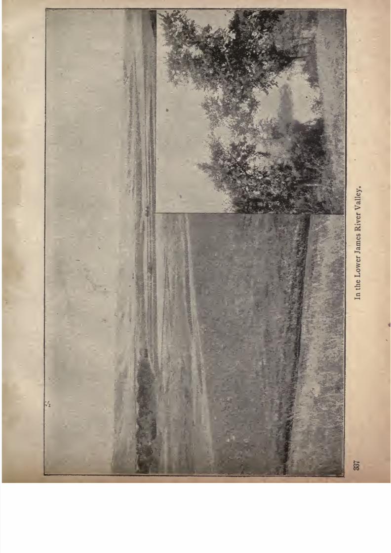
7/27/2019 Official Northern 00 Nort Rich
http://slidepdf.com/reader/full/official-northern-00-nort-rich 339/453
1
1
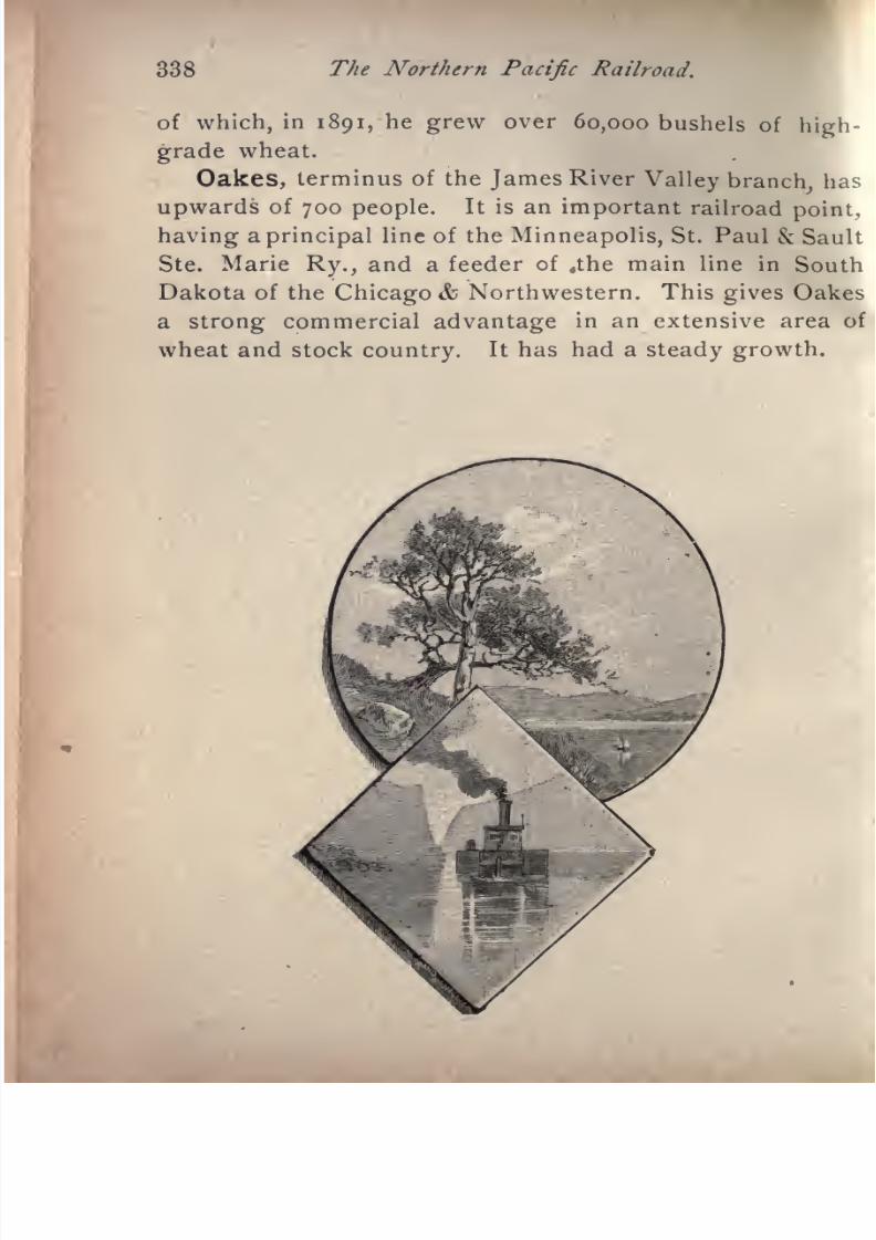
7/27/2019 Official Northern 00 Nort Rich
http://slidepdf.com/reader/full/official-northern-00-nort-rich 340/453
338 The Northern Pacific Railroad.
of which, in 1891, he grew over 60,000 bushels of high
grade wheat.
Oakes, terminus of the James River
Valley branch,has
upwards of 700 people. It is an important railroad point,
having a principal line of the Minneapolis, St. Paul & Sault
Ste. Marie Ry., and a feeder of ,the main line in South
Dakota of the Chicago & Northwestern. This gives Oakes
a strong commercial advantage in an extensive area of
wheat and stock country. It has had a steady growth.
7/27/2019 Official Northern 00 Nort Rich
http://slidepdf.com/reader/full/official-northern-00-nort-rich 341/453
JAMESTOWN AND NORTHERNRAILROAD.
JAMESTOWN TO LEEDS, N. DAKOTA, 108 MILES.
This important branch of the Northern Pacific system,
leaving the main line at Jamestown, follows the valley of
the Pipestone river for a distance of about thirty miles,
the general direction being northwest; then turning north,
crosses the James and Sheyenne rivers, and terminates at
Leeds, on the Great Northern's main line, northwest of
Devil's Lake. With the exception of a range of gravelly
hills between the James and the Sheyenne, the whole
region traversed by the road is a rich prairie, more or less
rolling, and taking a leading rank among the best agricul
tural sections of North Dakota.
Carrington (43 miles from Jamestown; population,
500) was established in 1883, by the Carrington & Casey
Land company, a corporation owning large tracts of land
in the vicinity of the place. It has two hotels, two news
papers, two elevators and numerous stores and shops, and
is an important grain-shipping point. It is the county seat
of Foster county, settled largely by Americans who came
here from Eastern States with little else than energy and
a practical knowledge of farming. They met with many
reverses, but one or two good crops placed them on a firm
footing, and they are fixtures in the country. These stout

7/27/2019 Official Northern 00 Nort Rich
http://slidepdf.com/reader/full/official-northern-00-nort-rich 342/453
340 The Northern Pacific Railroad.
hearted pioneers now live more at ease, and work more
with their heads than with their hands. It is the history
of Eastern and Middle States repeated. At Carrington is
the junction of the
Mouse River Branch, which leaves the Jamestown
& Northern R. R. and runs due west to Sykeston, a dis
tance of thirteen miles. From Sykeston it will be continued
in a northwestern direction to some point in the valley of the
Mouse river, a further distance of about seventy-five miles,
traversing for its entire length a rolling prairie country
having the general characteristics, as to fertility, of the
country between Jamestown and Carrington.
Sykeston (thirteen miles from Carrington and fifty-six
miles from Jamestown, population 300) is the county seat
of Wells county, and is situated near the source of the
Pipestone river, and a short distance from the bold eleva
tion known as the" Hawk's Nest," which is a sort of abut
ment of the coteaux, and is a conspicuous object in the
landscape for many miles around. Sykeston is a town
created by the real estate and farming operations of the
English company of Sykes & Hughes. This companyowns and farms large tracts of land in the vicinity, and
makes active efforts to attract American emigrants to this
portion of the Northern Pacific. The town has a news
paper, two elevators, a school, and a number of stores and
shops.
New Rockford (fifty-nine miles from Jamestown; popu
lation, 700) is the county seat of Eddy county, and is situ
ated on a prairie sloping to the west of the James river.
It has two elevators, two newspapers, and numerous
mercantileestablishments,
and is surrounded on all sides
by stretches of fertile prairie, extending as far as the eye
can reach. The railroad here crosses the James river, a
small stream at this The source of the is
7/27/2019 Official Northern 00 Nort Rich
http://slidepdf.com/reader/full/official-northern-00-nort-rich 343/453
The Jamestown 6 Northern. 341
about thirty miles west of New Rockford. At Sheyenne
(seventy miles from Jamestown) the Sheyenne river is
crossed. It has a volume of water at this
pointnot
greaterthan that of the James, but becomes on its lower course an
important river.
Fort Totten. This military post is situated on the
southern shore of Devil's lake, about midway between its
eastern and western extremities and ten miles from the
Northern Pacific. The buildings are substantial brick
structures,and the fort has a
more permanent appearancethan is usual with frontier military stations. There are
two small hotels at the fort which accommodate tourists
and sportsmen. A steamboat runs to Minnewaukan, and
also to Devil's Lake, a town of about 2,000 inhabi
tants at the head of a deep bay on the northern shore of
the lake.
Minnewaukan (90miles
from Jamestown) was- established in 1884. It is the county seat of Benson county and
has a population of about 500. It is a favorite summer
resort for tourists who wish to enjoy the scenery of Devil's
lake and its facilities for fishing and shooting. Minne
waukan is the trade center for a large extent of country.
It has a newspaper, a bank, a grain elevator, a flour mill
and numerousmercantile
establishments. A steamboatruns during the season of navigation between Minnewau
kan and Fort Totten and Devil's Lake.
Devil's Lake. This remarkable body of water is
about 50 miles in length, and has a width varying from
one to five miles. It has no outlet, and its waters are
strongly saline. It receives no important streams, and in
consequence appearsto be
slowly diminishingin volume
byevaporation.
Well-marked former beaches show that the
level of its waters was at one time about twenty feet higher
A considerable of the shore line
7/27/2019 Official Northern 00 Nort Rich
http://slidepdf.com/reader/full/official-northern-00-nort-rich 344/453
342 The Northern Pacific Railroad.
of the lake is heavily timbered with large oak trees. These
forests add greatly to the attractiveness of the lake in an
open prairie country like North Dakota. The waters of
the lake are of a beautiful sea-green color, and are said to
have possessed valuable curative properties. The lake
abounds in pickerel, and is the resort of myriads of wild
fowl; geese, brant, and different species of wild ducks fre
quent its waters, and make it a favorite resort for sportsmen.
The Indian name is Minnewaukan, which means "spirit
waters." The lake was believed
bythe Indians to be
haunted; and there is a legend which relates that a party
of Sioux Indians once attempted to cross it in boats, in
spite of the warnings of the medicine men, and that their
canoes were seized in the middle of the lake by some mysterious power and dragged to the bottom, so that neither
boats nor voyagers wereever seen again. Since that time the
Indians never ventured upon the lake in any sort of craft.
A large portion of the southern side of the lake is occu
pied by the reservation of the Cut-head Sioux Indians, who
number about 2,000 souls, and are peaceable and tolerably
industrious, cultivating small spots of grain and potatoes,
and keeping cattle and horses. They are mainly Catholics
in religion, and there is a mission for the reservation under
the management of the"
Gray Nuns," where the Indianchildren are educated.
Leeds is a station on the main lineof the Great North
ern railroad, and the terminus of the Jamestown and
Northern branch of the Northern Pacific. Besides enjoy
ing the benefits of railroad competition, Leeds lies in the
centre of a fine country.
7/27/2019 Official Northern 00 Nort Rich
http://slidepdf.com/reader/full/official-northern-00-nort-rich 345/453
ROCKY FORK AND COOKE CITY
RAILROAD.
LAUREL TO RED LODGE, MONTANA, 50 MILES.
This road was built in 1888 and 1889 for the purpose of
reaching the remarkable coal deposits on the Rocky Fork,
south of the Yellowstone, and also, by a future extension
from that place, to afford railroad transportation to the
silver mining camp of Cooke City, near the eastern borders
of the National Park. The road was open for traffic in the
spring of 1889 as far as the new town of Red Lodge, created
by the coal mining operations. It crosses the Yellowstone
runs through a picturesque grazing country, reaching its
present terminus by gradients of from 26 to no feet per
mile.
THE ROCKY FORK COAL. This coal is bituminous in its
character and is so rich in combustible matter that pieces
of it can be lighted with a match. The veins are from six
to thirty feet in thickness and the out-croppings are on the
sides of the hills, situated so that they can be economically
worked by means of levels. The coal is mined in large
quantitiesfor railway consumptio'n and is shipped for do
mestic fuel to all the Montana towns.
Red Lodge (50 miles from Laurel, population 1,000.)
This active mining town was laid out in March, 1889,
and developed with a rapidity rarely seen except in the
343

7/27/2019 Official Northern 00 Nort Rich
http://slidepdf.com/reader/full/official-northern-00-nort-rich 346/453
344 The Northern Pacific Railroad.
mining camps where placer gold is found. The re
sources of the place, in its inexhaustible coal mines, its
abundant and easily utilized water-power, and in the graz
ingand
farming regions surroundingit, make it one of the
most important towns in Montana. It has considerable
trade with mines and cattle ranches as far south as Wyoming.
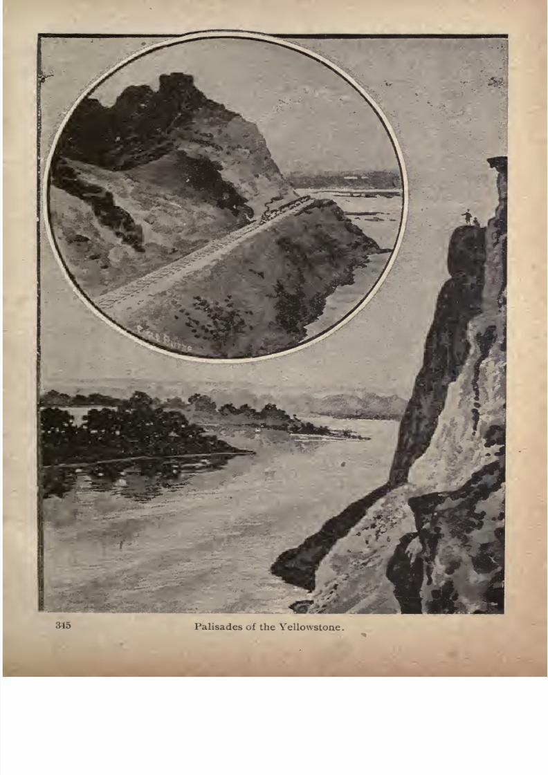
7/27/2019 Official Northern 00 Nort Rich
http://slidepdf.com/reader/full/official-northern-00-nort-rich 347/453
Palisades of the Yellowstone
7/27/2019 Official Northern 00 Nort Rich
http://slidepdf.com/reader/full/official-northern-00-nort-rich 348/453
ROCKY MOUNTAIN RAILROAD OFMONTANA YELLOWSTONE
PARK LINE.
LIVINGSTON TO CINNABAR, MONTANA, 51 MILES.
This branch of the Northern Pacific system was built
for the purpose of facilitating tourist travel to the National
Park. After leaving Livingston it runs through the lower
canyon of the Yellowstone, and then through a narrow but
fertile valley, and terminates at Cinnabar, just north of
the northern boundary of the park. The scenery along
the road is among the most picturesque and beautiful to
be found in the entire Rocky Mountain region. The
mountain peaks on the eastern side of the valley are
singularly bold and impressive. Their summits are crowned
with beetling crags of massive rock and are covered with
snow the greater part of the year.
Horr, two miles from the terminus of this branch, is a
lively coal-mining village, where thirty-six coke ovens are
in operation, making coke equal in quality to the famous
product of Connellsville, Pennsylvania.
Cinnabar, the terminus of the Park branch, derives its
importance from its railway business? and from the team
ing to the Cooke City silver mining district. Stages leave
Cinnabar, connecting with each arriving train, for the
Mammoth Hot Springs hotel, which is the rendezvous and
distributing point for all the tourist travel in the National
Park.
34G
7/27/2019 Official Northern 00 Nort Rich
http://slidepdf.com/reader/full/official-northern-00-nort-rich 349/453
NORTHERN PACIFIC AND MONTANA
BRANCH.
LOGAN TO GARRISON, MONT., BY WAY OF BUTTE, 123 MILES.
Trains on the road are made up at Bozeman and follow
the mail line twenty-four miles before diverging at Logan.The road runs up the valley of the Jefferson river, one of
the three forks of the Missouri, and through the Jefferson
canyon, a savage gorge in one of the outlying ranges of
the Rockies. The scenery is bold and fantastic. The Main
Divide of the Rockies is crossed at Pipestone Pass at an
altitude of about 6,000 feet, the road winding like a serpent
along the flanks of the range and gaining over one hundred feet of elevation in every mile. Numerous high tres
tle bridges spanning ravines are crossed. There is a small
tunnel at the summit. On the western side the road
descends rapidly to the valley of Silver Bow creek. Here
the mountain views are particularly impressive. Suddenlythe smoky city of Butte lies in front of the train as the line
makes a curve, its whole bulk of closely built streets of
smelters, reduction works and mines being distinctly vis
ible on the near slope of a mountain side.
Butte City, 1,232 miles from St Paul, population, 50,-
ooo, is situated near the head of Silver Bow Valley, and
about fifteen miles west of the Pipestone Pass of the main
range of the Rocky mountains, on ground sloping to the
south. Its altitude is 6,701 feet. It is the county seat of
347
7/27/2019 Official Northern 00 Nort Rich
http://slidepdf.com/reader/full/official-northern-00-nort-rich 350/453
348 The Northern Pacific Railroad.
Silver Bow county, and is famous for its quartz mines,
which are so largely developed as to make Butte the most
important mining center in the world.
In 1875 the first mill was constructed for working the
silver ores of the camp, and the population did not exceed
200. To-day Butte counts its inhabitants by the thou
sands. The veins are true fissures, yielding largely of
copper and silver, and assaying well. It is estimated that
there are over 300 miles of veins in the district, varying in
width from thirty to fifty feet, and developed to a depth
of from 400 to 1,500 feet. Butte has daily newspapers, an
opera house, a handsome court house, built of brick and
stone, a street railroad system, electric, steam motor and
cable, gas and electric light, and is, in short, a brisk and
busy city. The great silver mines and mills are on the
immediate outskirts of the city, and each is the center of
a populous village of workmen and their families. Rail
way facilities are furnished by the Northern Pacific, the
Union Pacific and the Butte, Anaconda and Pacific, the
latter being a line to Anaconda. The following descrip
tion of Butte appeared in the Northwest Magazine.
There is only one Butte. This city of mines, perched
on the backbone of the continent, is unique. There is no
place like it on the face of the globe. True, it has resem
blances with Virginia City and Leadville, as those places
were in their palmy days, but Butte, with all the pictur
esque phases of mining life which they exhibited, has a
dignity and solidity that comes from the possession of
great
and
permanent
wealth. Besides. Butte flourishes
all the time. She has no ups and downs. The fluctua
tions in the price of silver only make her more or less
7/27/2019 Official Northern 00 Nort Rich
http://slidepdf.com/reader/full/official-northern-00-nort-rich 351/453
The World's Greatest Mining Town. 349
rich in her steady increase, but she is never poor
never depressed. Within a radius of two miles from her
court house ores of silver and copper of the enormous
aggregate value of twenty-five millions of dollars are
annually dug out of the earth. Nowhere else on the surface
of the globe does so small an area of territory yield from
the storehouse of nature such a vast sum of wealth. A
very large share of this great annual revenue which Butte
extracts from the rocks goes to labor. It follows that labor
is nowhere more independent or better paid. Being a
wealthy place Butte is naturally luxurious, but luxury
here does not take the form of handsome houses and stately
business blocks, or of costly public improvements. All
these will come in time, but thus far the traditions of a
mining camp are dominant. The richest man in Butte
died lately, leaving an estate of seven millions. His home
was a one-story brick cottage of five or six rooms. Two-
story dwellings are common in the newer points of the
city, but they are noticeable exceptions to the rule of the
little cottage of wood or brick. You can't judge of a man's
means by the exterior of the house he lives in. A friend
took me to see the "little three-room cottage" he was build
ing. It had, in fact, but three rooms and a kitchen, but
the rooms were large and furnished in fine woods, and thef
'cottage" will cost him seven or eight thousand dollars.
I have sought for a solid explanation of this predilection
of Butte people for living on the ground floor. One old
resident accounted forit in this way : "You see, the miners
first lived in tents;then they built shanties, and when they
were rich enough to build houses they didn't put in anystairs or upper stories, because they were not used to such
things." Another man said that the women did not like
to climb stairs in the thin atmosphere of this high altitude.
7/27/2019 Official Northern 00 Nort Rich
http://slidepdf.com/reader/full/official-northern-00-nort-rich 352/453
TJie Northern Pacific Railroad. 350
The same fondness for hugging the ground from which
the wealth of the city comes is shown in the business
structures. Until very recently there was not a three-story
structure on the main street. Many of the wealthiest
merchants carry on their trade in one-story buildings.
The banks are very rich one of them ranks third in the
United States but they are housed in insignificant edifices.
How, then, is Butte luxurious ? In daily expenditures for
living. The city is an enormons consumer for her popula
tion of 50,000. Nothing is too good to eat, or to drink or
to wear. The finest of California fruits are brought in bythe car-load
;fish come from the Atlantic, from Lake
Superior, from the Pacific and from the trout streams of
the mountains, and early vegetables from Salt Lake City ;
beef comes 1,500 miles from Kansas City and Omaha;beer
by the train load from Milwaukee and St. Louis;more
champagne is drank than in any Eastern city of a hundred
thousand inhabitants. There is also marked extravagance
in clothing, in jewelry and in furniture. Irf the little one-
story cottages you will often find rich furnishings, silver
ware, porcelain and costly pictures. In amusements, too,
there is much lavish use of money. The best actors and
singers come to the opera-house. Lavish expenditure is
shown in the support of innumerable bar-rooms and other
resorts, which are always conspicuous in mining towns, in
the many hack carriages to be seen on the streets at all
hours of the twenty-four, in the charges for small things
and small services the barber charges a quarter for a
shave and the boot-black from fifteen cents to a quarter
for a shine. In the dry-goods houses you will find the
costliest fabrics and latest fancies of Eastern fashion;
in the jewelry stores diamonds that can scarcely be matched
for cost this side of Chicago ;in the grocery stores every
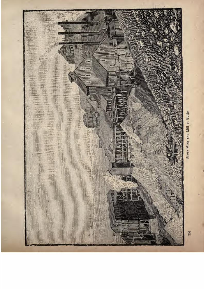
7/27/2019 Official Northern 00 Nort Rich
http://slidepdf.com/reader/full/official-northern-00-nort-rich 353/453

7/27/2019 Official Northern 00 Nort Rich
http://slidepdf.com/reader/full/official-northern-00-nort-rich 354/453
352 The Northern Pacific Railroad.
delicacy to tempt the palate that a world's commerce
affords. The daily newspapers contain full telegraphic
news, dispatches which only a liberal patronage could
enable them to take. For street conveyance there is a cable
road, a steam motor road and an electric road. If the
visitor is diposed to criticise the lack of noticeable business
blocks and the streets of one-story cottages, he should
reflect that the costly construction work of Butte is under
ground in shafts piercing the mountain side to a depthin some places of 1,400 feet and in miles and miles of
galleries, cut out of the solid rock and the hard ores.
Millions of money have gone into these subterranean streets
and chambers, and many .more millions have been taken
out. A network of ore veins enwraps and underlies the
city. A map of Butte showing by diverse colors the various
mining claims looks like a crazy quilt.
Let menow
resume in aparagraph
ortwo
a few lead
ing facts concerning the situation and appearance of Butte.
The city begins in the valley of Silver Bow creek, where
are the railway yards and the Parrot smelter, and climbs
by a grade not steep for a mountain town one of the foot
hills of the Rockies. On the crest of the hill the shaft
houses, concentrators and rock piles of the chief mines
the Anaconda, the Mountain View, the Parrot, the Lexington, the Moulton and the Alice stand out boldly against
the sky-line. Main street runs from the valley to the hill
top and thence on to the suburb of Walkerville, and is an
exceedingly lively and picturesque thoroughfare. A very
good way to get a comprehension of the physical geogra
phy of Butte is to take the" cable road on this street to its
terminus and return by the same route. On the downtrip you enjoy a view of remarkable interest and grandeur.
The city is right at your feet, densely built and teeming

7/27/2019 Official Northern 00 Nort Rich
http://slidepdf.com/reader/full/official-northern-00-nort-rich 355/453
The World's Greatest Mining Town. 353
with activity; beyond are the black smelters in the brown
valley flaunting their banners of smoke and steam in the
frosty air. Yonder is a long ore train on its way to Ana
conda, and around to the left a passenger train that has
come all the way from Puget sound is climbing the grade
on the pine-clad slope of the Main Divide, on its way to
St. Paul and Chicago. To the right, and close to the
town, rises the bare, cone-shaped butte, which gave a name
to the early placer diggings near its base, and later to the
quartz camp that became a village, and from a village
developed into the richest mining city in the world. Be
yond the valley are piled range on range and peak on peak
of the Rockies, forming a superb amphitheatre of black
and white black with the pine forests and white with
snow walling the far horizon on every side.
About midway up the hill slope are four parallel busi
ness streets, crossing Main street, each with peculiarities
of its own. First comes Mercury street, the favorite resort
of the nether world, rather dull by day, but very lively by
night a noisy, jolly, irresponsible street, always shown to
strangers as a curiosity. Next comes Park street, the chief
avenue for small retail commerce and for the merchandise
trades; further up is Broadway, on which stand the leading
hotels and the opera house and then, on the upper confines
of the business district, is Granite street, with its stately
court house and with office buildings occupied by lawyers
and real estate agents. The best sites for business build
ings on ground not already occupied are on Broadway and
Granite and these two streets are plainly destined to rapid
improvement. The best residence district is west of Main
street,
runningout for half a mile on
nearly
level
ground, then dipping down into a gulch and rising on a
sightly hill-side where there is ample room for expansion.
7/27/2019 Official Northern 00 Nort Rich
http://slidepdf.com/reader/full/official-northern-00-nort-rich 356/453
354 The Northern Pacific Railroad.
An electric road runs from the railway stations across town
to the verge of the new residence suburb and a steam
motor line goes from the business center through South
Butte to Meaderville, three miles distant.
The Mines of Butte. Butte City is to-day the largest
and most prosperous mining camp on the face of the earth,
its title to the honor being undisputed by any mining man
who has ever set foot within its confines and examined the
wonderful mineral resources with which it is surrounded.
The first mining done about Butte was along the bed-rock of
Silver Bow creek, which flows from east to west not more
than three hundred yards south of the city limits. This was
late in the fall of 1863, when placer-mining for gold was
being carried on so successfully in Alder Gulch and other
parts of Montana. At that time Silver Bow creek was
worked for the gold it contained, but after the coarser
metal had been washed from the gravel
manyof the miners
began to cast about for the source from which the gold
came, while others drifted off in search of other diggings.
During the early spring of 1864, those who stuck to the
diggings erected crude cabins on the present townsite, and
christened the place Butte, after a large bald hill that
stands just west of the city limits. As near as can be
learned the first
quartzlocation was made north of the
cityon August 14, 1864, since which time the number of loca
tions has increased to about 4,000. During the early days
of Butte little value was placed on the quartz properties,
because there were no facilities at hand for treating
the ores and no immediate prospects of such a
desirable state of affairs being brought about on
account of the isolated condition of the camp.Valuable
prospects sold for a mere song, the Lexington, which is
now one of the greatest gold and silver producers in the
7/27/2019 Official Northern 00 Nort Rich
http://slidepdf.com/reader/full/official-northern-00-nort-rich 357/453
The World's Greatest Mining Town. 355
camp, being purchased by the late millionaire, A. J.
Davis, for a twenty-dollar horse and afterwards sold by
him to a French company for $1,000,000. This sale is a
sample of many others made in those days. The claims
were undeveloped, and no one then knew or suspected that
only a few feet below the surface large and rich bodies of
gold, silver and copper ore awaited the arrival of capital
and backbone to be uncovered, reduced and added to the
world's metal. As time progressed hundreds of claims
that cannot now be
purchasedfor millions of dollars
passedfrom the possession of the original locators to the hands of
others, because of the yearly assessment work not being
performed thereon by the former owners. This is the
history of every mining camp where the native metal does
not protrude from the ores as an incentive for the pro
prietor to hold on, do his assessment work and sell his
propertyfor what it is worth.
Duringthe last fifteen
years mining men with capital to back them have bought
up many of these properties and developed them to an
extent that their value is now estimated in the millions of
dollars. Smelters for the treatment of base ores, found
all the way from a depth of from 100 to 1,000 feet in depth,
have been erected, while mills for crushing the oxidized or
free-milling ores, found from the surface to the depth of500 feet, have also been put up.
Down a Butte Mine. Mr. Hall first conducted us
over the smelter which is built on the slope of the moun
tain, writes a correspondent of the St. Paul Pioneer Press.
At the top are great heaps of ore brought from below, and
others of rock salt dumped there by the railroad. The
latter is added, ten per cent, to the ore, arid both areshoveled into great hoppers which break the ore into
small chunks. These pass down into the"dryer," which
7/27/2019 Official Northern 00 Nort Rich
http://slidepdf.com/reader/full/official-northern-00-nort-rich 358/453
356 The Northern Pacific Railroad.
has a great fire at the end. The mass then goes under
the"stamps," which weigh 1,000 pounds each. That's
whatsixty-stamp
smelter means, for instance, that it has
a capacity of that number of great hammers. These crush
the ore into powder. Fourth, it goes lower into the roast
ing cylinders, where the heat changes the sulphide into
chloride by means of the afore-mentioned salt. Sulphur
is the miner's great enemy, you know. It and the arsenic
now go off in smoke. Fifth, this black flour-like earth is
cooled for half aday,
and then it is mixed with300 pounds
of quicksilver to 4,000 pounds of pulp and goes to the
amalgamating pans, then to the"settlers," lastly to the
"retorts," furthest down the mountain, and lastly we saw
the great bars of bullion ready to ship.
All this was very interesting. Machines always seem to
me like people. Some of them worked with an intelligence
of their own, though controlled by the master spirit ;
others, like the stamps, doggedly worked along like great
stolid, stupid laborers of muscle, not even rejoicing in their
power; but the propelling engine, gleaming, intricate,
nervous, was like the man of brain whose mind impels and
compels such others. We went into the changing room
where miners' clothes hung about a fire to dry, and, before
descending the shaft, went into the great engine roomwhere sat a man, his eye fixed upon an indicator, his ear
strained to going signals, the mistaking of which might in
an instant flick out the life-flames of dozens of men. He it
is who brings up and lowers"the cage
"in the shaft.
" He's
a cool fellow/' said Mr. Hall,"the best we've ever had.
Men simply won't run this machine. The terrible and
continued responsibility unmans them. We have put
good, tried engineers here, and after half an hour they
would have to be removed. They'd be drenched with
7/27/2019 Official Northern 00 Nort Rich
http://slidepdf.com/reader/full/official-northern-00-nort-rich 359/453
Down a Butie Mine. 357
sweat and fairly crying under the strain." While talking
Mr. Hall had fitted me out for my trip in gossamer, rub
bers, and an old cap, and we all stepped into the cage, a
sort of fenced-in freight elevator, while the miners gath
ered around to see if we were frightened. To balance the
weight of the rods and shaft are four "bobs" containing
fourteen tons of scrap iron.
Going down a mine is like being shot from a catapult
down a well. One hasn't much time to realize what the
sensation is for his
progressis i ,000 feet in
eighteenseconds.
My remembrance is that it was exciting, cool, black, upside down and exulting. We staggered out at the 1,300-
foot level, each lighted a candle some of the mines are
lighted by electricity, but not the "Alice" and began our
subterranean walk. At every hundred feet long passages
lead off under the town. These galleries are roofed in
with timbers to
prevent caving in, thoughthere's no such
danger with this granite ore as there is in coal mines.
These passages are pitchy, damp, and sometimes cellary to
foulness, though usually ventillated from a great shaft.
There are twenty-eight miles of them in the "Alice." Wewalked about four.
Two hundred men work below here; only a short time
atonce, though. At the end of every lead you will see two
men, their candles stuck into the rock only intensifying
their weirdness and the surrounding darkness, directing a
power drill which is worked by the compressed air machine above the mountain. This drill makes a hideous
noise in the quiet gallery. When it has bored a sufficient
hole a charge of dynamite is put into it, and the miners
decamp. Every minute or so we could hear the sullenroar of this somewhere. This ore is afterward loaded into
iron carts, and run over tracks to the shaft and elevated

7/27/2019 Official Northern 00 Nort Rich
http://slidepdf.com/reader/full/official-northern-00-nort-rich 360/453
358 The Northern Pacific Railroad.
in the cages. There is only one thing of beauty in a mine,
the wonderfully beautiful fungus growth that drapes the
gallerieseverywhere,
in someplaces
so that one must
brush an entrance. It hangs like huge powder-puffs by a
tiny thread, and feels like damp swansdown. It is like the
description of an angel's raiment, shining and white. It
is like the purer and unselfish deed of a criminal, but as
evanescent, for it shrivels into an odious, malodorious,
yellowish leathery mass as soon as it comes into the day
lightabove.
I enjoyed the experience, but was glad to come up into
the sun and bustle of the over-world, and while bathing
my face in distilled water, like the Princess of Wales in-so-
far, to hear Mr. Hall tell about their "Alice hospital and
reading room" for miners, of which association he is pres
ident, the fire brigade, and the great smelters at Ana
conda.
Silver Bow (7 miles from Butte) is the junction point
of the Montana Union with the Utah Northern branch of
the Union Pacific which runs south to Ogden, Utah, and
has a population of about looo, chiefly engaged in railroad
work.
Anaconda (population 10,000526 miles from Butte ona short spur leaving the road at Stuart). The town is
picturesquely situated at the head of a small mountain
valley in the midst of magnificent scenery. It is well
built, having a number of brick blocks. The great
smelting and reduction works of the Anaconda companyare the life of the place. These works were established at
this point on account of convenience for procuring fuel,
the slight expense for which ores could be run down grade
from the mines in Butte, the abundance of pure water, and
7/27/2019 Official Northern 00 Nort Rich
http://slidepdf.com/reader/full/official-northern-00-nort-rich 361/453
Deer Lodge Valley.' 359
the excellent location for a town. The annualautput
of
copper matte is greater than at any other point in the
world. Two groups of enormous structured a^out two
miles apart constitute the works that employ about 300
men. The fiuel used is coke, coal and pine wood, the
wood being brought from the mountain gulches down a
long flume into which a stream has been diverted, the
flowing water performing the work of transporting the
sticks of wood.
Warm Springs is principally important as the site of
the Montana Insane asylum, which occupies a number of
buildings surrounding the copious spring of warm sulphur
water. The mineral water is used beneficially in the
treatment of insane patients. The valley narrows in a
short distance above Warm Springs. The debris of old
placer mining can be seen at many places along the river.
Deer Lodge (1,272 miles from St. Paul and forty miles
from Butte; population 1,500) derived its name from the
abundance of deer that roamed over its broad open prairie,
and from a mound which, on a winter's morning, bore a
resemblance to an Indian lodge when the steam issued
from the hot spring on its summit. Deer Lodge is the
seat of Deer Lodge county, and appears quite attractive,
nestled midway in the valley, 4,546 feet above the sea.
The town is well laid out, and, with its public square,
large public buildings, court house, jail, churches and
educational establishments, makes a good impression.
There is a Presbyterian college of Montana for both sexes
located here. There is also a Catholic school for the
education of girls, conducted by the Sisters of Charity; and
a hospital, under the charge of the same sisterhood. The
Montana penitentiary, located at Deer Lodge, is con
structed with two wings, containing eighty-four cells.
7/27/2019 Official Northern 00 Nort Rich
http://slidepdf.com/reader/full/official-northern-00-nort-rich 362/453
360 The Northern Pacific Railroad.
The town is a general supply and distributing point for
several fertile valleys and the surrounding mining dis
tricts. Deer Lodge valley extends fifty miles southward,
and is composed of farming and grazing lands. Thelatter rest on the foot-hills and mountains, while the
former are lower down, adjacent to the mouths of the
streams. There are remarkable boiling springs in the
valley. Many bright mountain trout streams course
through its broad expanse, some having their sources
eastward in the Gold Creek mountains, and others com
ing from the west through the low, rolling, open country
between the Deer Lodge and Flint Creek valleys. Deer
Lodge county is noted for the number, extent and richness
of its placer mines, and for years it has led the production
in placer gold. Among the surrounding mountains,
Powell's Peak, twenty miles west of Deer Lodge City,
and 10,000 feet in height, is prominent. There are manysmall lakes in the mountains, which are full of trout, and
large game also abounds.
7/27/2019 Official Northern 00 Nort Rich
http://slidepdf.com/reader/full/official-northern-00-nort-rich 363/453
HELENA & JEFFERSON COUNTY, ANDHELENA, BOULDER VALLEY &
BUTTE RAILROADS.
FROM HELENA TO ELKHORN, MONT.,, 58 MILES, WITH A
BRANCH FROM JEFFERSON TO WICKES, 5 MILES.
This branch leaves the main line at Prickly Pear Junc
tion, five miles south of Helena, and extends twenty miles
in a western direction, along the valley of the Prickly Pear
creek, up into the heart of the Rocky mountains. It crosses
a mountain spur by a high-grade line, showing some verybold and successful engineering work. It then descends
into the Boulder valley to the town of
Boulder (37 miles from Helena), the county seat of
Jefferson county, which has a population of about 1,200.
It is situated in a fine agricultural valley and is the central
trading town for a number of productive silver mines.
Four miles distant are the Boulder Hot Springs, wherethere is a good hotel and a bathing establishment, with a
large plunge bath. Good accommodations for tourists and
invalids. The waters are much used in cases of rheu
matism.
Elkhorn (58 miles from Helena; population, 500).
The road leaves the valley of the Boulder and climbs a
mountain by a three per cent grade to the mining camp of
Elkhorn, where there is ore of the richest and most sue-
cessfuTquartz mines in Montana.

7/27/2019 Official Northern 00 Nort Rich
http://slidepdf.com/reader/full/official-northern-00-nort-rich 364/453
362 The Northern Pacific Railroad.
Wickes (25 miles from Helena, population, 800). At
Jefferson a branch diverges and keeps on up Prickly Pear
creek, five miles to the smelting town of Wickes, where
ores are roasted, chloridized and converted into ingots.
The ingots are shipped to separating works in Baltimore,
Md., where the gold and silver are separated from such
lead and copper as they may be combined with.

7/27/2019 Official Northern 00 Nort Rich
http://slidepdf.com/reader/full/official-northern-00-nort-rich 365/453
HELENA & RED MOUNTAIN AND HEL-
ENA & NORTHERN RAILROADS.
HELENA TORIMINI, MONT., 17
MILES.
This branch of the Northern Pacific system is a mining
road, which leaves the main line at Helena, and terminates
at Rimini, on the eastern slope of the main divide of the
Rocky mountains. Rimini is a central transportation point
for the ores of the important group of mines.
HELENA TO MARYSVILLE, MONT., 20 MILES.
This line runs in a northerly direction from Helena at
the base of the Rocky mountains, and ascends to the min
ing village of Marysville, population 1,100. There are
many important mines near Marysville, the most produc
tive of which is the famous DrumLummon,
which in 1887
yielded over $2,000,000 of gold and silver.

7/27/2019 Official Northern 00 Nort Rich
http://slidepdf.com/reader/full/official-northern-00-nort-rich 366/453
DRUMMOND & PHILIPSBURG RAIL
ROAD.
DRUMMOND TO RUMSEY, MONT. 31.4 MILES.
This branch of the Northern Pacific system was con
structed in 1887 to afford an outlet for the productive
mining district of Philipsburg and Granite mountain. It
follows the valley of Flint creek to Philipsburg, and then
by higher grades reaches the terminal station of Rumsey,in the immediate vicinity of the Granite Mountain and
other mines.
Philipsburg (25 miles from Drummond ; population,
1,000) is one of the oldest mining towns in Montana. The
first silver mill in Montana was established at this place in
1866. The mill and mine are still owned by the original
company, called "The Hope Silver Mining Company,"and is still in successful operation. Beside the trade of
the surrounding mines there is considerable ranch country
tributary to the town,
Granite Mountain (population, 500 ;near Rumsey
station, 31 miles from Drummond). This is a mining vil
lage created by the prosperous activity of the great
Granite Mountain mine, and of several other mines in the
immediate vicinity. It is reached by a good but steep road
fromPhilipsburg
at the foot of the
mountain,and is a
unique little town, built among the huge granite boulders
and rocks on the mountain side, partly hiding in the
364

7/27/2019 Official Northern 00 Nort Rich
http://slidepdf.com/reader/full/official-northern-00-nort-rich 367/453
The Granite Mountain Mine. 365
crevices, partly clinging to the precipitous wall where
there is only room for one side of a street. Most of the
inhabitants work under
ground
in the mines, or in the
huge silver mill near by. The scenery is superb. The
savage peaks of the main divide of the Rocky mountains
with their snowy summits look almost as grand as the
famous Swiss Alps, and the bright green valleys below
make a pleasing contrast with the rugged slopes of the
mountains. The Granite Mountain mine is the most valu
able silver mine in the world. Tt was discovered in
1872,but was first profitably developed in 1883. It has since
paid to its stockholders over $3,500,000 in dividends. The
ore is base, containing silver, antimony, arsenic, zinc, and
copper as sulphides, and native silver in considerable
quantity. The average assay value of the ore is 145
ounces of silver to the ton.
7/27/2019 Official Northern 00 Nort Rich
http://slidepdf.com/reader/full/official-northern-00-nort-rich 368/453
BITTER ROOT VALLEY RAILROAD.
MISSOULA TO GRANTSDALE, MONT., 50 MILES.
This branch was built in 1887, from Missoula, on theNorthern Pacific main line, up the picturesque and fertile
valley of the Bitter Root river, as far as the new town of
Grantsdale, 36 miles. The Bitter Root is in some respects
the best agricultural valley in Montana. It is lower by nearly
1,000 feet than the valleys near Helena, and has a much
warmer climate. Apples and small fruits are successfully
grown. There are some valuable mining properties in the
mountain range on the western side of the valley. The
streams abound in trout, and the mountains in large game,
such as Rocky mountain goats, elk and bear.
Tyler (28 miles from Missoula) is the station for
Stevensville on the opposite side of the river, a prosperous
agricultural town, with a population of 300. Close to the
town is the St. Mary's Mission, the oldest of the Jesuit
missions in Montana. It was established by Italian priests
nearly twenty years before there were any white settlers
in the region. The old church, mill, and mission house
are still standing.
Victor (36 miles from Missoula) is anew town created
by the railroad, and has a population of 500. Silver mines
and a fine agricultural country promise to make of it an
important place.
Grantsdale (50 miles from Missoula) is a new town,
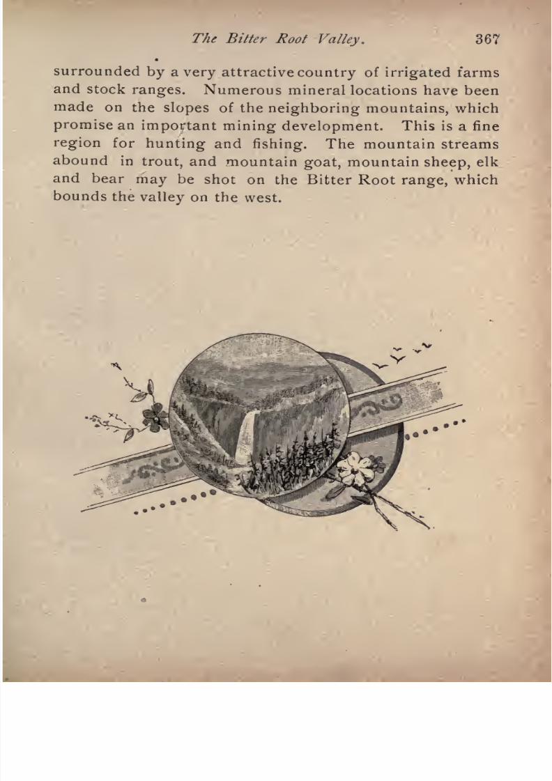
7/27/2019 Official Northern 00 Nort Rich
http://slidepdf.com/reader/full/official-northern-00-nort-rich 369/453
The Bitter Root Valley. 367
surrounded by a very attractive country of irrigated farms
and stock ranges. Numerous mineral locations have been
made on the slopes of the neighboring mountains, which
promise an important mining development. This is a fine
region for hunting and fishing. The mountain streams
abound in trout, and mountain goat, mountain sheep, elk
and bear may be shot on the Bitter Root range, which
bounds the valley on the west.
7/27/2019 Official Northern 00 Nort Rich
http://slidepdf.com/reader/full/official-northern-00-nort-rich 370/453
DESMET AND CCEUR D'ALENE BRANCH.
FROM MISSOULA, MONT., TO MISSION, IDAHO, 159 MILES, CON
NECTING AT MISSION WITH STEAMERS FOR CCEUR
D'ALENE CITY, FROM WHENCE THEREis
RAIL CONNECTION FOR SPOKANE.
The trains on this road start from Missoula and keepon the main line six miles to DeSmet. There they diverge
and run down the irrigated agricultural valley to the Mis
soula, past the old settlement of Frenchtown, a FrenchCatholic community. After crossing the river the farming
valley soon changes to a narrow mountain gorge, through
which the road runs on benches high above the dark green
waters of the stream. A number of mining camps are
seen on the opposite side of the stream. At St. Regis
the road turns up the narrow valley of the St. Regis de
Borgia creek, following the route of the old Mullan wagon
road, which was built by the army in 1861 and 1862, from
Fort Benton to Walla Walla, to serve as a military route
and to open the way for emigrants to reach Oregon. The
Bitter Root mountains are climbed on grades too steep
for the hauling of more than six loaded cars in one train,
and the line descends into the valley of the South Fork of
the Cceur d'Alene river, the great silver-mining district of
Northern Idaho.
Mullan (128 miles from Missoula and 118 miles from
7/27/2019 Official Northern 00 Nort Rich
http://slidepdf.com/reader/full/official-northern-00-nort-rich 371/453
In the Cour D'Alene Country. 369
Spokane, population 500) is the town for the Hunter groupof mines, of which the Morning mine is the best developed.
The town has water works and electric lights.
Wallace (134 miles from Missoula and 112 miles from
Spokane) is the busiest center of a number of mining
gulches, and the point of division of the branch road which
runs up a narrow valley to Burke, eight miles distant. It
is a compactly built town with water works and electric
lights. Stages run across two mountain ranges to Mur
ray, the center of the gold placer district of Pritchard
creek.
Murray is an active business town of 1,000 inhabitants,
surrounded by huge gravel piles from the placer diggings.
It is built on gold, literally as well as figuratively, for not
only does it depend solely on the gold mining for existence,
but the whole gulch where its buildings stand is valuable
placerground.
Besides theplacer diggings
where the
earth and gravel is washed in sluices to separate the nug
gets and gold dust, there are three quartz mills for crush
ing and pulverizing the gold-bearing quartz. Murray is
the county seat of Kootenai county. Placer gold was dis
covered in 1883 on Pritchard creek, a tributary of the
Cceur d'Alene river. Early in 1884, there was a remarkable
movement of
miners,tradesmen and
adventurers,to this
hitherto wilderness region. What is called in mining
camps a "stampede" took place. From two to three thou
sand people made their way through the depths of the forest
during February and March to the valley of the Cceur
d'Alene and its tributaries, dragging their supplies with
them on toboggan sleds. A number of camps were
speedily established, and the development of the regionbegan; but, owing to the fact that the gold was found in
soil from six to twelve feet deep, with gravel and boulders,
7/27/2019 Official Northern 00 Nort Rich
http://slidepdf.com/reader/full/official-northern-00-nort-rich 372/453
370 The Northern Pacific Railroad.
the development was slow. Many of the first comers were
forced to leave for want of means to open claims. The
districthas, however, made steady progress,
and now
yields a large and constantly increasing amount of gold.
W^ardner is an important mining town of 1,000 inhabi
tants, situated in a narrow gulch shut in by high moun
tains, four miles from Wardner Junction, on the railroad,
and 149 miles from Missoula. On the slopes of these
mountains in the immediate vicinity of the town are
several important silver mines. The most productive of
these are the Sullivan and Bunker Hill. The ores from
these mines are concentrated before shipment to Montana
and Eastern reduction works. The town is picturesquely
built in a narrow gulch, where there is only room for one
street.
Mission (159 miles from Missoula, and ninety-seven from
Spokane) is the point of transfer from the trains to steam
boats, which run down the river and lake sixty miles to
Cceur d'Alene City. The old Jesuit church at the Mission,
built in 1847, is an interesting building to visit.
The trip by steamer on Lake Cceur d'Alene and the
river is hardly equaled for beauty and natural scenery by
any water journey of equal length in the United States,
unless it be on the Hudson river.
Cceur d'Alene City (219 miles from Missoula and 32
miles from Spokane; population 500) is beautifully
located in the pine forests at the foot of the lake of the
same name, and in the immediate vicinity of Fort Sherman,
one of the most attractive military posts in the United
States. Lake Cceur d'Alene is one of the most beautiful
mountain lakes to be found anywhere in the world. It is
surrounded by the spurs and foot-hills of the Bitter Root
and Cceur d'Alene mountains, and its shores are covered
7/27/2019 Official Northern 00 Nort Rich
http://slidepdf.com/reader/full/official-northern-00-nort-rich 373/453
In the Cour^D'Alene Country. 371
with open and park-like forests. Its length is about thirty
miles, and it receives two navigable streams, the St. Joseph
river and the Coeur d'Alene river.
From Coeur d'Alene to Spokane is a run of a little over
an hour, the main line being reached at Hauser Junction,
The only town on the way is Post Falls, on the Spokane
river, a lumber manufacturing place of about 500 inhabi
tants, with an excellent water-power.
7/27/2019 Official Northern 00 Nort Rich
http://slidepdf.com/reader/full/official-northern-00-nort-rich 374/453
SPOKANE PALOUSE RAILROAD.
FROM SPOKANE, WASH., TO JULIAETTA, IDAHO, 121 MILES,
WITH A BRANCH FROM PULLMAN TO
GENESEE, 29 MILES.
The traveler who desires to form anything like an ade
quate conception of the agricultural wealth of the State of
Washington, should not fail to leave the main line of the
Northern Pacific at Spokane and make a journey
over this branch through the wonderfully fertile Palouse
country, which stretches at the foot of the mountains, in a
belt about fifty miles wide, as far south as the Snake
river. From the deep canyon of the Snake, a region of like
fertility and general characteristics, generally known as
the Walla Walla country, extends over 100 miles further,
following the trend of the Bitter Root and Blue Mountain
ranges. The Palouse country is upheaved ingeatle grassy
hills with rounded tops, and every acre is highly fertile, the
summits of the hills being fully as valuable for grain fields
as the slopes in the valleys which lie between. Wheat
yields from twenty-five to fifty bushels to the acre, and oats,
barley and rye do proportionately well. The whole country
in its natural state Ms covered with a luxuriant growth of
bunch grass, on which cattle and horses pasture the year
round. The winters are mild and the snowfall light. The
Spokane Falls and Palouse branch diverges from the main

7/27/2019 Official Northern 00 Nort Rich
http://slidepdf.com/reader/full/official-northern-00-nort-rich 375/453
The Palouse Country. 373
line at Marshall Junction, a small town 9 miles from
Spokane.
Spangle (20 miles from Spokane) is an active trading
point with a population of about 500.
Oakesdale (46 miles from Spokane ; population, [,200)
is the crossing point of the Union Pacific line from Spo
kane to Portland.
From Belmont, 51 miles from Spokane, a short branch
road runs to Farmington, an agricultural village with 400
inhabitants, near the Idaho line.
Garfield (58 miles from Spokane ; population, 700)
is the point where the Spokane and Palouse crosses the
Farmington branch of the Union Pacific.
Palouse City (68 miles from Spokane Falls) is the
oldest town in the Palouse country, and has a population
of 1,500. Logs are floated down the Palouse river to this
place from the slopes of the neighboring mountains.
Considerable placer gold is mined on the waters of the
Palouse, The country around Palouse City is exceedingly
fertile and picturesque.
Pullman (84 miles from Spokane ; population, 1,500)
is the point where the Spokane & Palouse road crosses
the Moscow branch of the Union Pacific, and is a well-
built
town,
central to an extensiveregion
of excellent
farming country. The Washington Agricultural college
is located here. Artesian wells supply the town, with water.
Moscow, Idaho (population, 3,500, 94 miles from Spo
kane) is a handsome town situated in a rolling prairie
country and surrounded by well improved farms. It is
the trade center of a large part of the rich grain-growing
countryof Northern Idaho. The State
Agricultural collegeoccupies a commanding brick structure. There are excel
lent hotels and large department mercantile stores. Opals
7/27/2019 Official Northern 00 Nort Rich
http://slidepdf.com/reader/full/official-northern-00-nort-rich 376/453
374 The Northern Pacific Railroad.
are mined at a point six miles north of the town, being
found in the basaltic rock, which everywhere underlies the
region.
East of Moscow the road strikes one pf the tributaries
of the Potlatch river and descends rapidly through forest-
clad ravines to the deep, narrow valley of that stream.
Kendrick and Juliaetta are the two towns of the Potlatch
country, and each have a population of about 500. At
Juliaetta there is an inclined plane railroad running from
the valley near the town up a steep ascent to the level of
the plateau, and used for getting wheat down and mer-
chand.ise up.
The Potlatch Country is a high plain, deeply seamed
by a number of gorges through which flow swift streams.
The divisions made by these gorges are called ridges, and
each has its local name. On the plateau the land is very
rich andproduces heavy crops
of
grain.Fruit
thrives,and there is no better country for apples, prunes, plums,
pears and berries west of the Rockies. The region is
heavily grassed and is excellent for stock. Its climate is
even milder than that of the neighboring Palouse country,
a mountain spur shielding it from north winds.
The Genesee Country. South of Pullman lies the
Genesee country, whichis
an extension of the Palouseplains and reaches southward to the great canyon of the
Snake river. The chief towns are Uniontown, Colton and
Genesee, each a thriving center of farming trade, with a
population of about 500. The farming country is every
where attractive and raises great crops of wheat, oats and
flax. Most of the farms have flourishing orchards.
Lewiston, Idaho (about 15 miles from Genesee) is anold and prosperous town, situated at the junction of the
Snake and Clearwater rivers. The Spokane & Palouse
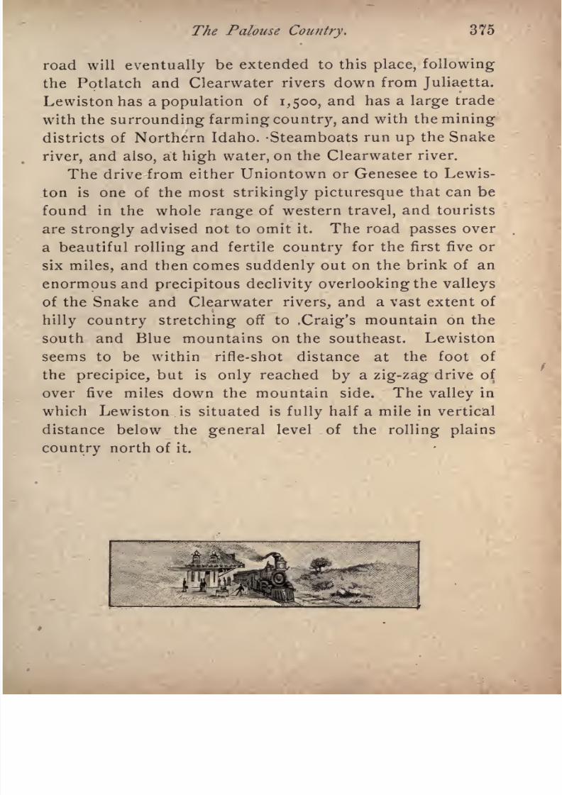
7/27/2019 Official Northern 00 Nort Rich
http://slidepdf.com/reader/full/official-northern-00-nort-rich 377/453
The Palouse Country. 375
road will eventually be extended to this place, following
the Potlatch and Clearwater rivers down from Juliaetta.
Lewiston has a population of 1,500, and has a large trade
with the surrounding farming country, and with the miningdistricts of Northern Idaho. -Steamboats run up the Snake
river, and also, at high water, on the Clearwater river.
The drive from either Uniontown or Genesee to Lewis-
ton is one of the most strikingly picturesque that can be
found in the whole range of western travel, and tourists
are strongly advised not to omit it. The road passes over
a beautiful rolling and fertile country for the first five orsix miles, and then comes suddenly out on the brink of an
enormous and precipitous declivity overlooking the valleys
of the Snake and Clearwater rivers, and a vast extent of
hilly country stretching off to .Craig's mountain on the
south and Blue mountains on the southeast. Lewiston
seems to be within rifle-shot distance at the foot of
the precipice, but is only reached by a zig-zag drive of
over five miles down the mountain side. The valley in
which Lewiston is situated is fully half a mile in vertical
distance below the general level of the rolling plains
country north of it.

7/27/2019 Official Northern 00 Nort Rich
http://slidepdf.com/reader/full/official-northern-00-nort-rich 378/453
SOUTH OF SNAKE RIVER.
An extensive, fertile and beautiful agricultural country
lies south of the Snake river in Washington and laps over
on the west into Oregon. It extends from the Snake and
the Clearwater southward to the Bluemountains,
and has
an average width of about fifty miles. Its length from the
bend of the Snake river at Lewiston to its western limits
is about 150 miles. It is one of the most productive
grain-growing regions in the world. The average yield of
wheat, taking one year with another, is about thirty
bushels to the acre, and crops of forty to fifty bushels to
the acre are by no means extraordinary. The regionis
rolling or hilly, and slopes southward up to the forest line
on the Blue mountains. It is penetrated by the lines of
the Washington & Columbia River railroad, which con
nects with the Northern Pacific at Pasco, and also by lines
of the Union Pacific system. The aspect of the country
improves gradually as the distance from the river in
creases, and before reaching Walla Walla the country hasbecome very fertile. The Walla Walla river is a small
stream that pours into the Columbia merely a channel
cut through sand and sage brush, although further up
there is an occasional fringe of willows.
Whitman (5miles from Walla Walla), is merely a side
track. It, however, marks the scene of a deplorable tragedy.
In 1836 Dr. Marcus Whitman, a physician, who was also a
clergyman, was sent out from the East as a missionary to
the Cayuse and Umatilla Indians. Even at that early day

7/27/2019 Official Northern 00 Nort Rich
http://slidepdf.com/reader/full/official-northern-00-nort-rich 379/453
7/27/2019 Official Northern 00 Nort Rich
http://slidepdf.com/reader/full/official-northern-00-nort-rich 380/453
378 The Northern Pacific Railroad.
\Valla \Valla (56 miles from Pasco) is beautifully
situated upon an open plain that is watered by the divided
flow of the Walla Walla river. Beyond it the Blue
mountains stand like a wall, and among the foot-hills is
the richest agricultural district known. The city has 6,coo
inhabitants and a handsome business street, with substan
tial blocks of stores, some very fine ones. Though no
forest trees are native to the plain, the streets are lined
with shade trees, usually poplar, and the gardens are filled
with orchards and vineyards. The private residences are
often beautiful. Near town is the military station of FortWalla Walla, and the presence of troops adds something
to the business as well as to the attractions of the city.
Walla Walla has ten churches, a public library, a
remarkably handsome court-house, which is one of the
finest public buildings in Washington; two opera houses
and a city hall;St. Mary's Hospital, conducted by the
Catholic order of the Sisters of Mercy. Whitman College
is an institution for the higher education of both sexes,
having complete classical and scientific courses. St. Paul's
School for girls is an institution for boarding and day
scholars. The Catholics have two schools. St. Vincent's
Academy for girls occupies a large brick building in the
midst of pleasant groves, and St. Patrick's School is a day
school for boys.
The agricultural country tributary to Walla Walla along
the slopes of the Blue mountains and the adjacent plains
is of remarkable fertility, the soil being adapted in an
especial degree to the production of wheat, and a yield of
forty bushels to the acre is not at all unusual. This is
also a fruit country, the apple, pear, plum and cherry,
grapes and all the berries being raised in profusion and
perfection. Fifteen miles beyond Walla_Walla_the railroad

7/27/2019 Official Northern 00 Nort Rich
http://slidepdf.com/reader/full/official-northern-00-nort-rich 381/453
South of Snake River. 379
comes down from the hills into the valley of the Touchet
river, and follows up that stream to Palouse Junction,
whence the main line runs northward to Riparia, on the
Snake river, and a branch continues up the Touchet, thir
teen miles further, to Dayton. Prescott (51 miles from
Wallula Junction, and 20 miles from Walla Walla) is a small
town with a flouring mill. Bolles' Junction (56 miles from
Wallula) is an unimportant station. The principal towns
south of Snake river beside Walla Walla are the following:
Waitsburg" (80 miles from Pasco; population 900.)
This is the oldest town in the Touchet valley, and wassettled in 1870. It is a place of considerable business im
portance, as a milling and wheat-shipping point, and a
country trade centre.
Dayton (90 miles from Pasco; population, 3,000) is,
next to Walla Walla, the oldest town in Washington south
of Snake river. It stands at the junction of the Touchet
river and Petit creek, in the midst of a beautiful and ex
ceedingly fertile and agricultural country. The Touchet
furnishes good waterpower, which is utilized for several
sawmills and factories. It is the county seat of Columbia
county, and was named in honor of Jesse Day, the pioneer
settler. The surrounding country is upheaved into high
hills with rounded tops; the summits and slopes of these
hills are as fertile as the bottom lands in the narrow val
leys between them; in fact, the farmers prefer the hill tops
for wheat fields.
Pomeroy, county seat of Garfield county, has a population of 1,500, and is the market town for a large and pro
ductive farming country. It is the terminus of a branch
railroad.
Athena, Oregon, has a population of 650, and is an
important wheat-shipping town.
7/27/2019 Official Northern 00 Nort Rich
http://slidepdf.com/reader/full/official-northern-00-nort-rich 382/453
380 T/ie Northern Pacific Railroad.
Pendleton, Oregon (43 miles from Pasco) is situated
near the base of the Blue mountains on the Umatilla river,
and is the county seat of Umatilla county. It is a large,
active, commercial town, with a population of 4,000. Its
shipments are wheat, stock, wool, barley, rye, oats, fruits,
etc. The country surrounding the town resembles in its
appearance and general character .that around Walla
Walla, and is finely adapted to farming and stock raising.
Snake River flows deep down in an immense Canyon,
whose cliffs are a thousand feet or more in height. Gener
ally, the points are rock-ribbed ; for the strata show on
every bluff. To ascend these cliffs is impossible, except
some ravine is followed to its source, or a roadway is
graded carefully winding up the face of the acclivities.
The shipment of grain would be attended with difficulty if
the farmer had to haul his load down such tremendous
hills, and spend hours returning to the plain above with
his empty wagon. The evil is remedied by the construc
tion of shutes leading for thousands of feet from the sum
mit, down which the grain is poured to the warehouse on
the river. There is communication between the various
shipping points by means of a telephone, and the business
is transacted with dispatch. The farmer simply delivers
his wheat on the hill, and goes home rejoicing. The land
ing places are merely warehouses, with perhaps a store.
The canyon of Snake river looks like an inferno;but the
traveler who judges the country by this river scenery is
entirely out of his reckoning. For example, to climb the
grade opposite Lewiston is two hours' hard work, over two
miles of distance; but, when foot is placed on the surface of
the rim rock, a rolling prairie region of excellent farmingland is spread out as far as the eye can reach. This is the
case generally on the Columbia and Snake rivers. The
7/27/2019 Official Northern 00 Nort Rich
http://slidepdf.com/reader/full/official-northern-00-nort-rich 383/453
South of Snake River. 381
bars lying at the foot of the high bluffs along the river
have proved to be especially favorable for peach culture,
and the yield is large and the crop has never failed.
7/27/2019 Official Northern 00 Nort Rich
http://slidepdf.com/reader/full/official-northern-00-nort-rich 384/453
7/27/2019 Official Northern 00 Nort Rich
http://slidepdf.com/reader/full/official-northern-00-nort-rich 385/453
CENTRAL WASHINGTON RAILROAD.
FROM CHENEY TO COULEE CITY, 108 MILES.
This road wasbuilt as
a feederto
the NorthernPacific
as far as Davenport in 1888, 1889, and 1890. It traverses,
for the entire distance, a fertile rolling prairie country,
diversified with occasional small groves of pine timber, and
yielding large crops of all the small grains. This region is
generally known as" The Big Bend Country," from the
fact that it is surrounded on the north and east by the big
bend in the Columbia river. It has a mild, agreeableclimate, and is well adapted for general fanning, the raising
of cattle, horses and sheep, and also for fruit culture. The
trains on this branch start from Spokane.
Medical Lake (26 miles from Spokane) is situated in
the midst of a group of small lakes, three of which having
great depth, are very strongly impregnated with alkaline
salts, and their water has remarkable curative properties.
One in particular attracts hundreds of invalids, especially
persons affected by rheumatism, skin diseases, and nervous
complaints. Many undoubted cures of a remarkable nature
are recorded. This medical lake, par excellence, has a
medium strength of salts, while another has a very strong
impregnation, and the third is very weak. The region is
delightful, and can be made a very pleasant resort. Thecountry people come and pitch their tents and take their
baths as they choose.

7/27/2019 Official Northern 00 Nort Rich
http://slidepdf.com/reader/full/official-northern-00-nort-rich 386/453
384 The Northern Pacific Railroad.
The early history of this lake is this. A Frenchman,
named Lefevre, who was sorely afflicted with rheumatism,
wastending sheep
around the shores of the lake. He
found that after washing the sheep in the lake water that
his rheumatism was less painful, so he began to bathe his
shrunken limbs, for one arm was wasted away and carried
in a sling. The result was a perfect cure of the rheuma
tism, and restoration of the wasted arm to its natural size.
Lefevre still lives at Medical Lake in perfect health, no
longera
poor shepherd,for the increase in value of lands
from the discovery of the medical properties of the water
has made him independent.
The town of Medical Lake is situated on the eastern
shore of this lake; it has three hotels, a soap-making es
tablishment, which uses the waters of the lake, and an
establishment for evaporating the waters and producing a
salt which is sold for medical purposes. Medical Lakeis
much resorted to by invalids, and is a favorite camping
ground and excursion place for the country people in the
vicinity.
Deep Creek (315 miles from Spokane) is an active
country trading town, surrounded by a well-settled farm
ing district, and having a small but valuable water-power
from the creek for which it is named.
Davenport (57 miles from Spokane; population, 600)
is the central town of the Big Bend country, and was estab
lished in 1883, long before a railroad was projected through
this region. It is the diverging point of numerous stage
and mail routes. Fort Spokane, 25 miles north of Daven
port, at the junction of the Spokane and Columbia rivers,
is a United States military post, garrisoned by two com
panies of infantry. The soldiers are stationed at thistpoint
to keep an eye on the Indians on the neighboring reserva-
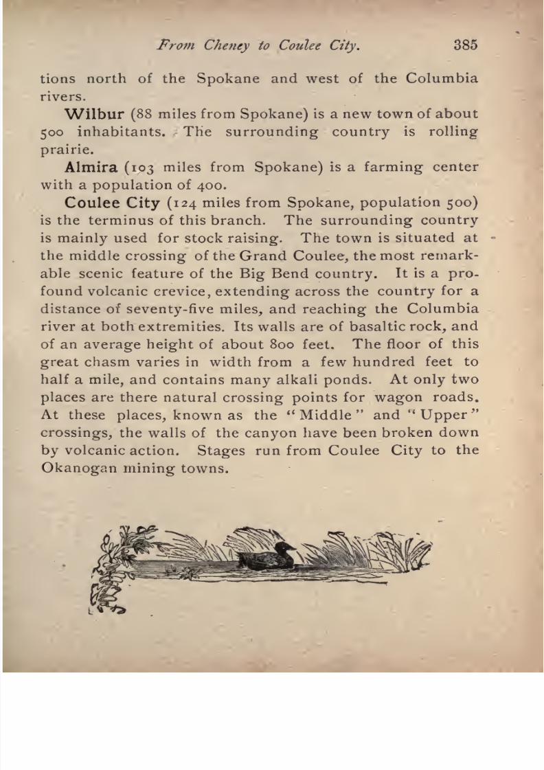
7/27/2019 Official Northern 00 Nort Rich
http://slidepdf.com/reader/full/official-northern-00-nort-rich 387/453
Prom Cheney to Coulee City. 385
tions north of the Spokane and west of the Columbia
rivers.
Wilbur (88miles from
Spokane)is a new town of about
500 inhabitants. The surrounding country is rolling
prairie.
Almira (103 miles from Spokane) is a farming center
with a population of 400.
Coulee City (124 miles from Spokane, population 500)
is the terminus of this branch. The surrounding country
is mainly used for stock raising. The town is situated atthe middle crossing of the Grand Coulee, the most remark
able scenic feature of the Big Bend country. It is a pro
found volcanic crevice, extending across the country for a
distance of seventy-five miles, and reaching the Columbia
river at both extremities. Its walls are of basaltic rock, and
of an average height of about 800 feet. The floor of this
great chasm varies in width from a few hundred feet to
half a mile, and contains many alkali ponds. At only two
places are there natural crossing points for wagon roads.
At these places, known as the" Middle
"and
"Upper
"
crossings, the walls of the canyon have been broken down
by volcanic action. Stages run from Coulee City to the
Okanogan mining towns.
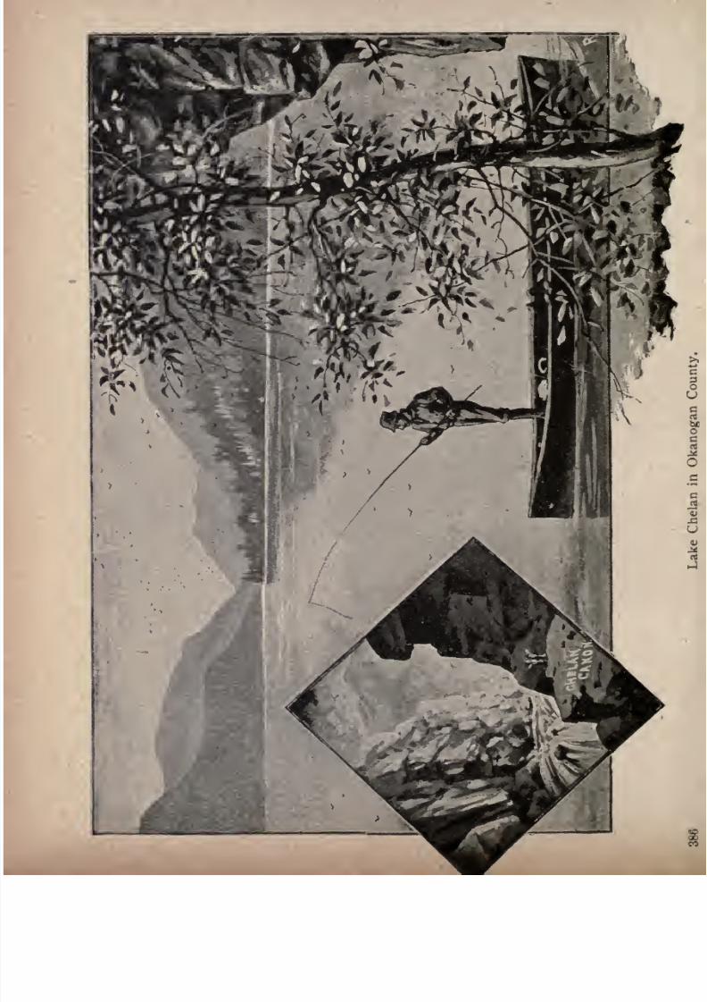
7/27/2019 Official Northern 00 Nort Rich
http://slidepdf.com/reader/full/official-northern-00-nort-rich 388/453

7/27/2019 Official Northern 00 Nort Rich
http://slidepdf.com/reader/full/official-northern-00-nort-rich 389/453
NORTHERN PACIFIC AND CASCADE
BRANCH.
This branch leaves the main line at Crocker, Washing
ton, at the head of the Puyallup valley, and sends out spursto the coal mining towns of Douty, Burnett, Wilkeson and
Carbonado. Of these the largest is Carbonado, which has
1,000 inhabitants and is built on a mountain bench high
above the brawling waters of the stream. Mining operations
have been carried on here for many years. The mines are
owned by the Southern Pacific railroad company, and the
coal is shipped to San Francisco, by ocean vessels loading
at the coal bunkers in Tacoma. At Wilkeson, Burnett and
Douty are valuable mines which ship to all points along
the Pacific coast and also supply the local market of
Tacoma. The~coal found in this field is of different quali
ties, but may all be classed as bituminous. One mine fur
nishes a coking coal, another a gas coal, and others coal
particularly adapted for locomotive and steamship use.
387
7/27/2019 Official Northern 00 Nort Rich
http://slidepdf.com/reader/full/official-northern-00-nort-rich 390/453
UNITED RAILROADS OP WASHINGTON.
TACOMA AND OCOSTA LINE, FROM LAKE VIEW JUNCTION,
9 MILES FROM TACOMA, TO OCOSTA
100 MILES.
This branch of the Northern Pacific is a direct line from
Tacoma and Seattle to the lower Chehalis valley, and to
the sea-port towns of Gray's harbor. It traverses much
rich alluvial country, where farming is successfully carried
on along the valleys of the Black river and the Chehalis,
andgives
access to thevalleys
of the streamsflowing
into
Gray's harbor from the north, and into the Pacific from
the western slopes of the Olympic mountains.
Gate City (52 miles from Tacoma)- the junction point
of the road from Centralia on the N. P. main line, is a
new agricultural and lumbering town of 500 inhabitants.
Elma (63 miles from Tacoma) on the Chehalis, popu
lation 500, was an established town beforethe
railroad wasbuilt and is supported by farming.
Montesano, (73 miles from Tacoma), county seat of
Chehalis county, is a handsome town of 2,000 inhabitants,
situated on the Chehalis at the head of regular navigation
at all stages of water. It has saw-mills and a large coun
try trade, and ocean steamers come up to its wharf from
Portland and from San Francisco.
Cosmopolis (88 miles from Tacoma) is a saw-mill town
of 500 people, eight miles down the river from Montesano,
7/27/2019 Official Northern 00 Nort Rich
http://slidepdf.com/reader/full/official-northern-00-nort-rich 391/453
The Tacoma and Ocosta Line. 389
Aberdeen (87 miles from Tacoma, population 2,500), is
built on level ground on the Chehalis, at the mouth of the
Wiskah, and is an active lumber manufacturing town. It
has a salmon cannery and a shipyard where coasting ves
sels are built of the stout fir timber which abounds in this
region.
Hoquiam, three miles below Aberdeen, stands on a
delta where the Chehalis and the Hoquiam rivers join and
the waters of both flow into the head of Gray's harbor.
Population 1,500.
The chief
industry
is lumber manu
facturing. Hoquiam has an opera house and one of the
largest hotels in the State, a handsome structure facing
the salt water and surrounded by attractive grounds.
Ocosta (100 miles from Tacoma), terminus of the rail
road, is a lumbering and shipping town of 500 people,
situated at the lower end of Gray's harbor in a deep cove?
sheltered from the winds and waves of the Pacific
byPeterson's point.
Westport, on Peterson's point, is an attractive sum
mer resort, with three hotels and some lumbering industry.
The pine forests reach to the surf of the Pacific. Stages
run along the hard beach to North Cove, on Wiilapa
harbor, there connecting with steamboats for South Bend.
This trip is exceedingly novel and picturesque. Touristsmaking it can return to the main line of the Northern
Pacific by a branch from South Bend to Chehalis.
CHEHALIS AND SOUTH BEND LINE, 56 MILES.
This line diverges from the Pacific division of the
N.P. at
Chehalis, and crossingthe low
rangeof
woodedhills known as the Boisfort mountains, reaches the agri
cultural valley of the Wiilapa river, and follows that
7/27/2019 Official Northern 00 Nort Rich
http://slidepdf.com/reader/full/official-northern-00-nort-rich 392/453
390 The Northern Pacific Railroad.
stream down to South Bend. The only town of importance before the terminus is reached is
Willapa City, a pretty village in the midst of orchards
and grain fields, to which steam boats run from points on
the bay and river.
South Bend, on the Willapa, five miles above its mouth
in the bay of the same name, is on deep wa,ter and is reached
by large steam and sailing vessels from the Pacific Ocean.
Willapa bay is one of the best and most capacious harbors
on the Pacific coast,
having
a
deep
and safe entrance and
land locked waters spacious enough for hundreds of ves
sels to lie at anchor. South Bend has important lumber
industries, and with the completion of the new railroad
will soon become a wheat and coal shipping port. Salmon
canning is an established business, and oysters are shipped
from the flats on the bay to San Francisco and Portland,
and to the
Soundcities.
Oceansteamers run to
SanFran
cisco and Portland. Steamboats run to Sealand, North
Cove and Willapa City. Population of South Bend, 2,500.
7/27/2019 Official Northern 00 Nort Rich
http://slidepdf.com/reader/full/official-northern-00-nort-rich 393/453
SEATTLE, LAKE SHORE AND EASTERNRAILWAY.
FROM SEATTLE TO SUMAS, 125 MILES, WITH A BRANCH FROM
WOODINVILLE JUNCTION TO NORTH BEND, 35 MILES.
The Seattle, Lake Shore & Eastern railroad was origi
nally a local Seattle enterprise which started to build a
line from that city across the Cascade mountains as far
east as Spokane, where it was expected that it would head
off the Great Northern and become the west end of that
road. The road was built by the local company fifty-nine
miles eastward from Seattle to the base of the mountains,
and about forty miles were constructed westward from
Spokane. A line was also built northward from Woodin-
ville Junction, twenty-four miles out of Seattle, nearly due
northward to Sumas, on the British Columbia boundary.
Sumas is 125 miles from Seattle, and the primary object of
this line was to give the Canadian Pacific entrance to
Seattle. The company became involved in financial diffi
culties and a few years ago it sold out its lines to the
Northern Pacific, turning over its stock on condition that
its debts should be assumed by the purchasing corpora
tion. Thus the S., L. S. & E. became a division of the
Northern Pacific
system.
All
plans
of
building
across the
mountains were abandoned before the transfer of owner-
391
7/27/2019 Official Northern 00 Nort Rich
http://slidepdf.com/reader/full/official-northern-00-nort-rich 394/453
392 The Northern Pacific Railroad.
ship occurred, and the line to Sumas has become the main
line, and that from Woodinville up to the coal mines at
Oilman, to the superb cataract of the Snoqualmie river, and
to the hop-fields of North Bend, is run as a branch. TheSumas line connects at that place with a branch of the
Canadian Pacific, running to Mission, on the main line of
that road, and also with the Bellingham Bay and British
Columbia railroad, which runs to Whatcom, twenty-three
miles from Sumas.
An independent line, built under a Canadian charter,
runs from Sumas to Vancouver, by way of New West
minister, and is operated as an extension of the S., L. S. &
E., forming a through line from Tacoma and Seattle to the
two chief cities on the main land of British Columbia. The
Lake Shore & Eastern, on the other hand, has penetrated
a region that was for the most part a wilderness before it
was constructed. It crosses the valleys of all the rivers
that run into the Sound from the east, and crosses them
at points about midway between the foothills of the moun
tains and the tidewater of the Sound. The road is inter
esting to intending settlers who may wish to make
homes in the Puget Sound country by reason of the fact
that it makes accessible a great deal of good land along the
valleys of the Snohomish, the Stillaguamish, the Ska-
git and the Nooksack rivers, that when tilled can be made
very productive of hops, oats, hay, fruits and vegetables,
and that can be cleared at moderate expense. In the
lower parts of all those valleys farmers have been estab
lished for many years, sending their products out on small
steamboats. They prospered even before the era of rail
waysand cities on the Sound.
Snoqualmie Falls (52 miles from Seattle) is one of the
most superb cataracts in the world, and is not surpassed
7/27/2019 Official Northern 00 Nort Rich
http://slidepdf.com/reader/full/official-northern-00-nort-rich 395/453
Snoqualmie Falls. 393
for beauty and grandeur by any of the famous waterfalls
in Switzerland. It is reached by three hours' rail journey
from Seattle, and the railroad runs to the brink of the
chasm into which the Snoqualmie river plunges over a sheer
precipice 300 feet high. The waters of the river are of a
deep blue color, the walls of the gorge are covered with a
luxuriant growth of trees, vines and shrubs, and the sun
light forms vivid rainbows on the mist clouds that rise
from the depths of the chasm . The color effects of this won
derful scene are of a rare and surprising beauty. Tourists
can leave Seattle in the morning, pass three hours at the
falls and return in the afternoon. The following descrip
tion of the falls is from the Northwest Magazine :
A river of like name begins life in the glaciers of
Mount Si, one of the front rank peaks of the solid battle
line of the giant Cascades. Peacefully and contentedly,
yet with an occasional stir of harmless activity^this clear
and shallow green river flows onward for several miles, ap
parently innocent of its own approaching tragedy. A few
feet above the falls it plays around a group of stones,
flashing now and then a spray of white as flint occasionally
gives evidence of pent-up fire. The seeming mirth of rock
and stream recall Browning's "Old Brown Earth," who
"
sets his bonesTo bask i' the sun, and thrusts out knees and feet
For the ripple to run over in its mirth
Listening the while, where on the heap of stones
The white breast of the sea lark twitters sweet."
A dull boulder audaciously obstructs the stream's hap
py course, perhaps to warn it of the peril that lies beyond.
Heedless,the river flows
on,and
dividing, encompassesthe
stony obstacle. Immediately the crisis is at hand and with
one bold leap the stream becomes a cataract, falling over

7/27/2019 Official Northern 00 Nort Rich
http://slidepdf.com/reader/full/official-northern-00-nort-rich 396/453
394 The Northern Pacific Railroad.
the precipice nearly three hundred feet into a gloomychasm. It leaps it aches! Do streams, like
"hearts,
after leaps, ache ?"
A moment ago the water was wont to go warbling so
softly and well, and now its serenity has been interrupted;
it is no longer a river but a boundless, turbulent and
never-ceasing overflow; a liquid avalanche, a tragedy of
water.
Were it not for the ugly rock that darkly protrudes
itself at the top of the fall, much of the graceful move
ment, resulting from the division of the stream, would be
lost. From below it falls the wavy white spray, and in
fancy an unseen mermaid sits upon the rock, her long
sea-hair blown outward to the sun.
The entire fall, as seen from above and opposite, does
not drop directly, but rather assumes a graceful curve as it
glides continuously through the air, downward yet onward,
like some huge gull that delays and yet delays his descent
to earth. An equally attractive view of the waterfall is seen
from the bottom of the chasm, which is reached by descend
ing a long flight of steps, nearly three hundred in number.
At the foot of the cliff in the lower river, large logs which
have been precipitated over the abrupt declivity are often
seen tossing about in their wrath.
The chief characteristics of Snoqualmie falls are color,
grace and volume. The water is a study in color, as beau
tiful and subdued in tone as a marine pastel. The river
itself is a dark, cool green, but as it curves over the preci
pice the volume of water changes to a pure aqua marine
tint. This fresh contrasting color is soon lost as the fall
breaks forth into
joyousfoam, undefined and uncon
strained. Changing again, its snowy substance turns to
pearly smoke, and, moving, groups itself into hundreds of
7/27/2019 Official Northern 00 Nort Rich
http://slidepdf.com/reader/full/official-northern-00-nort-rich 397/453
Snoqualmie Falls. 395
graceful points which resemble the last triumphal shoots
of sky-rockets, that inverted point below to their own fate.
The fairy pinions form ever and again, and as one waits ex
pectantly for them to burst, they are lost in mist and
spray, which rise like incense from the boiling cauldron
where the river has been poured. These graceful forma
tions give a feathery and floating appearance to the fall,
and comprise its most beautiful feature. On a cloudy or
rainy day snow white and sea green are the distinctive
shades, softened by tints of pearl. A faint heliotrope rose
hue enters, having no more definite location than the first
dim hint of sunrise color that mysteriously steals into the
gray of dawn. When the sun is out it plays all day with kal
eidoscope brilliancy about the water, implanting in the spray
a perfect rainbow, which rises higher and higher as the
great golden charioteer draws darkness into light.
To a person devoid of the sense of hearing, a gigantic
waterfall must seem as tame as its painting in oils, for in
sound is its volume and force given full utterance. It is
one of the grand orchestral climaxes of nature's music,
whose sounds range from the first faint, sweet note of the
spring time song-bird and the the soft undulating vibration
of the running stream, to the majestic melody of the moun
tain's thunderous avalanches and the distant artillery of
the opposing clouds. The noise of a fall holds as distinct
a position in the world of sound as do the separate instru
ments of an orchestra that blend together in a harmonious
whole. Analytically, however, the sounds of this mass of
falling water are two-fold, and, strangely enough, their
different sources are discoverable. From where the river
dashestumultuously
to the foot of theprecipice,
comes
the thunderous tone of distant canyon, deep, melodious and
mighty. The continual thud falls upon the ear like a rich

7/27/2019 Official Northern 00 Nort Rich
http://slidepdf.com/reader/full/official-northern-00-nort-rich 398/453
396 The Northern Pacific Railroad.
musical chord from a base viol. Outside, the softer yet
more searching sound of the foamy spray arises, resem
bling, at a distance, the moans of forests sighing for sun
shine and their lost birds. Together the two sounds com
prise the one distinct noise of a great fall. Either alone
could not compose its music which, like the tones of an
organ, is two fold in its melody.
While standing on a little piazza slightly overhangingthe canyon, it is impossible to avert the eyes from the
magnetic sight. The beauty, volume and grace of the
falls of the Snoqualmie fascinate and electrify until, like
a"long draught of soul wine," they enter the spirit, bring
ing satisfaction and perfect rest. The fall is emblematic
of eternity, for as long as sun shines and rain falls, the
ceaseless activity of this masterpiece of nature must go on
forever and forever.
The eye is turned away, and beyond and below lies a
clear, shallow, green river, slowly winding its tranquil way
through miles of forest to a homeless sea.
Snohomish (37 miles from Seattle), county seat of the
county of the same name, is a pleasant place of orchards
and flower gardens, of pretty homes, of busy business
streets, of mills where fragrant cedar shingles are split out
of sections of
hugetree trunks, of railway activity and of
steamboat wharves, whence little brown, puffing boats
depart for Everett, -at the mouth of the river, and for farms
and villages up streams. The population is not far from
3,500. It is not a raw, new town, ttke so many in this new
State, but can show in its central district evidences of a
respectable age in the old warehouses that overhang the
river,andin
many-gabledstructures that
evidentlydate from
another architectural epoch. In fact, the pioneer settler
came to the place as long ago as 1860. The new Everett &
7/27/2019 Official Northern 00 Nort Rich
http://slidepdf.com/reader/full/official-northern-00-nort-rich 399/453
Toward British Columbia..
39 1
Monte Cristo road runs a number of local trains daily for
passenger travel to and from Everett. This road makes use
of the main line of the S., L. S. & E. road from Snohomish
northward toGetchell, thirty miles, before turning eastward
to reach the mines at the foot of the Cascade mountains.
The main line of the Great Northern road, leaving the
Sound at Everett, runs through Snohomish and follows
the course of the Skykomish river up to the mountains at
Stevens Pass. A large business is done in the manufacture
of cedar shingles by five mills located in or near the town.
There are no large towns on this road north of Snoho
mish. Lumbering and the manufacture of cedar shingles
are the chief industries of all the settlements, and all do
some trade with farmers who cultivate the bottom lands
along the rivers. Arlington and McMurray are smart vil
lages with about 500 people each. Sedro and Woolleyare
practically
one place,though
under separatemunicipal
governments. They are on the Skagit river, a broad and
powerful stream, fed by mountain torrents. Here the
Seattle & Northern road crosses, running west to Anacor-
tes, on the Sound, and east to Hamilton, where there are coal
and iron fields. The Fairhaven & Southern line, from
Fairhaven, on the Sound, to coal mines six miles east,
also crosses here. It
belongsto the Great Northern com
pany, Nooksack is an attractive place in the valley of the
river of the same name.
Sumas (125 miles from Seattle, population 500) is an
important railway junction point and does some business
in lumber and shingle manufacturing. It is built close to
the international boundary line, on a small prairie. Be
sides the Northern Pacific line to Seattle, Sumas has alocal road to New Whatcom, a branch of the Canadian
Pacific, and also the Burrard Inlet and Fraser Valley road
7/27/2019 Official Northern 00 Nort Rich
http://slidepdf.com/reader/full/official-northern-00-nort-rich 400/453
398 The Northern Pacific Railroad.
New Westminster, B. C., is an old, handsome town
of 8,000 inhabitants, dating back to 1853. It rises in
terraces from the shore of a noble river, the Fraser. From
the highest points you can look over the broad delta west
ward for sixteen miles to the river's mouth in the Gulf of
Georgia. All the residence lots have a frontage of sixty-
six feet, and four of them make an acre. Thus every
household can have front trees, roses and lilacs, and a
kitchen garden, and few houses are so situated as to be
deprived of a share in the views up and down the Fraser.
Sawing lumber and canning salmon are the chief industries,
and there is a good deal of trade with farmers along the
rich bottom-lands. A branch of the Canadian Pacific
reaches the town, and a branch of the Great Northern
comes to the opposite bank of the river and its passengers
are ferried across. The Northern Pacific connecting line
crosses the Fraser on a bridge which cost $250,000.
Vancouver, B. C, is the western terminus of the
Canadian Pacific railway, since the completion of that road
to the tidewater of the Pacific in 1886. Its population is
about 15,000. It has a remarkably advantageous site on a
peninsula between the deep waters of Burrard Inlet and
the shallow tidal flow of False creek. The inlet is a minia
ture
Puget Sound, deep,
land-locked and mountain rimmed.
It puts up into the land from the Gulf of Georgia for over
twenty miles, and the largest ships that float can enter the
narrow entrance, less than half a mile wide, and lie at
anchor anywhere on this beautiful fiord, or can go up either
of its two branches to lumber mills and camps in the heart
of tremendous mountain fastnesses. False creek, too,
has a commercialvalue,
for rafts oflogs are towed up to
sawmills on its banks at high tide. Between the inlet and
the creek the ground on which the city is built swells up
7/27/2019 Official Northern 00 Nort Rich
http://slidepdf.com/reader/full/official-northern-00-nort-rich 401/453
Vancouver, B. C. 399
like a turtle's back, giving perfect drainage in one direction
or the other and offering no steep ascents to worry teams
and put pedestrians out of breath. The business district
runs along the back and the neck of the turtle, and on
what we might call its head there is a well built-district of
both residences and stores. Across False creek is a popu
lous suburb connected with the city by three bridges.
The mountain panorama north of the inlet is so strik
ing that it holds the eye for a time from any close inspec
tion of the city at our feet. Gigantic peaks, dark, for
bidding and cloud-swept, rise from the water's edge to
altitudes of five and six thousand feet. Only in a few
places do their frowning walls recede a little from the tide
to allow a little room for human occupancy an Indian
village with its church spire opposite the town and a saw
mill settlement further up. Gloomy defiles reach far back
into the heart of the
mountains,
and on the crests of the
tallest peaks are scarfs and hoods of snow, making the
dark foliage of the firs appear black by contrast. The
waters of the inlet, where tall ships ride at anchor and
sail boats glide about, look very peaceful and inviting
by contrast with these rugged giants of the Coast Rangethat thrust their feet into the tide flowing in from the
Pacific Ocean. Now look seaward.Beyond
the throat
of the inlet lies English bay, and in the far west gleam
the waters of the Gulf of Georgia, which separates
the British Columbia mainland from Vancouver Island.
Ships coming in from sea bound to Vancouver city sail up
the Strait of Fuca,round the south end of Vancouver Island
and turn north up the Gulf of Georgia to Burrard Inlet.
From the open sea beyond Cape Flatteryto the inlet the
distance is about 150 miles.
Now let your eye follow the long expanse of the

7/27/2019 Official Northern 00 Nort Rich
http://slidepdf.com/reader/full/official-northern-00-nort-rich 402/453
400 The Northern Pacific Railroad.
young city. Note the handsome granite buildings of the
Dominion post-office, and the banks, the many solid busi
ness blocks, the long stretch of Cordova street, where
trade most concentrates, the parallel length of Hastings
street and the cross street called Granville, up which trade
is steadily marching from the water-side to the Hotel
Vancouver and the pretty opera house, both owned by the
Canadian Pacific railway. The volumes of smoke here and
there along both water fronts come from mills engaged in
sawing fir and cedar lumber for shipment by rail to the
eastern provinces of Canada, and by sea to Australia
and South America. That brick factory with the monu
mental chimney in the extreme eastern end of the town is
a sugar refinery, getting its raw material from the Sand
wich Islands, and the cluster of smoky buildings near byfrom a big foundry and machine shops where steamships,
engines, and sawmill machinery are built and repaired.
That cluster of masts belong to sailing ships that are
taking on cargoes of lumber for foreign ports. If we are
lucky enough in our day of observation we shall see one
of the huge, white China steamers starting on her long
voyage across the Pacific.
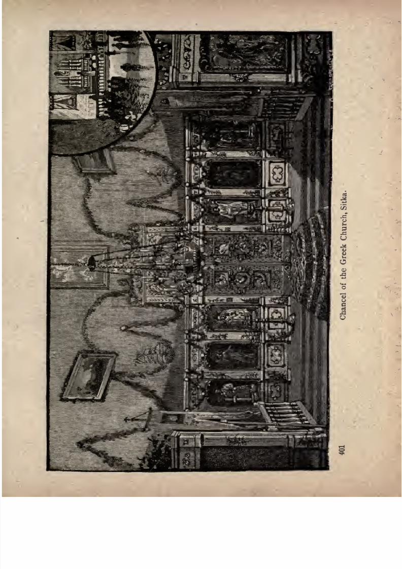
7/27/2019 Official Northern 00 Nort Rich
http://slidepdf.com/reader/full/official-northern-00-nort-rich 403/453
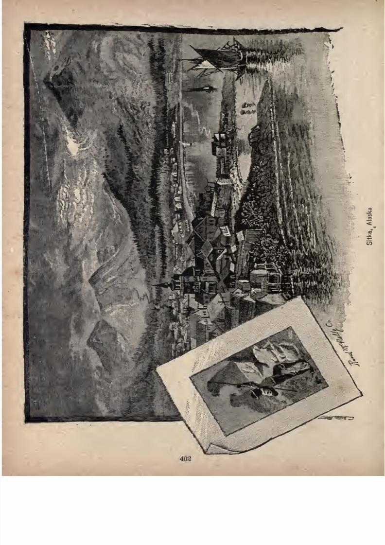
7/27/2019 Official Northern 00 Nort Rich
http://slidepdf.com/reader/full/official-northern-00-nort-rich 404/453
7/27/2019 Official Northern 00 Nort Rich
http://slidepdf.com/reader/full/official-northern-00-nort-rich 405/453
A TRIP TO ALASKA.
Alaska extends from a point six hundred miles north of the
dividing line between the United States proper and the British
possessions to the shores of the Polar Sea, and as far west of
San Francisco as the coast of Maine lies to the east.
There is so much of romance associated with the idea of a
trip to this far and mysterious Northland, so much that appeals
to the imagination of even the most phlegmatic and sober-
minded among us, that could it be brought home to the
American people, with the force and vividness of some great
and sudden event in contemporary history, that it is possible
to make comfortably and inexpensively, within the narrow
compass of fourteen days, a voyage extending to within a few
degrees of the Arctic circle and embracing many of the great
est wonders of that land of icebergs and glaciers, not all the
ships that sail American waters would be adequate for the con
veyance of the rush of travel that would at once ensue.
So erroneous, however, are the prevailing ideas with regard
to our distant possession, and so liable to become the founda
tions of utterly wrong inferences are even those actual facts
regarding the country,xwhich have, by slow degrees, found
entrance into the public mind, that such statements as that a
temperature of zero is rarely ever known at Sitka, that often
an entire winter will pass without ice being formed thicker
than a knife blade, and that there is not a day in the year
(483)
7/27/2019 Official Northern 00 Nort Rich
http://slidepdf.com/reader/full/official-northern-00-nort-rich 406/453
404 The Northern Pacific Railroad.
when vessels may not load and unload in the harbor of the
capital city, are received with more or less incredulity, and
regarded as utterly inconsistent with the fact that perpetual
snow is found within three thousand feet of the sea-level, and
that rivers of ice, 1,000 feet deep, run down to the sea from
far in the interior of the country. Visions, too. are conjured
up of cramped and greasy little whale boats, making tedious
voyages, at irregular intervals, through rough seas that in so
great a distance cannot fail to be tempestuous.
That large and well-appointed steamships are engaged in a
regular service, and that the long voyage they make is never
productive of more than a transient squeamishness, however
susceptible be the traveler, are almost incredible pieces of
news to those who hear them for the first time; and yet, while
such erroneous notions as have been cited are current, one
venturesome traveler after another, to the surprise, and not
unfrequently against the advice and remonstrance of his
friends,
ventures forth to
putthe claims and
pretensionsof the
railroad and steamship companies to the test, and return to be
the hero of the social circle in which he moves. But if this is
the condition of things to-day, it will be but a short time before
the Alaska excursion will no longer be the subject of these
various misconceptions, but will have taken the place to which
it is entitled in popular estimation.
Tacomais the
starting pointfor the Alaska
excursion, andit is there that our company, drawn from every part of the
country and even from abroad, will gather in the spacious halls
of its great hotel, within twenty-four hours of the advertised
time of sailing. During the season of 1888, that hour was 4.00
A. M., and passengers went aboard the previous evening, to
look out in the early morning through the windows of thc-ir
staterooms upon the city of Seattle, beautifully situated on aseries of terraces rising from the east shore of Elliott Bay.
7/27/2019 Official Northern 00 Nort Rich
http://slidepdf.com/reader/full/official-northern-00-nort-rich 407/453
A Trip to Alaska. 405
Seattle is the oldest American city on the Sound, and has
long been a place of considerable importance. The enterprise
of its people and their unbounded faith in its future, even
after Tacoma was selected as the western terminus of the great
transcontinental line over which the traveler has journeyed,
need no setting-forth in these pages; neither do the great and
varied resources of the rich country tributary toit, for have
they not been advertised through the length and breadth of
the land ? On the outward voyage, the tourist has to content
himself with surveying the city from the deck of the steamer,
deferring until his return that more careful inspection of which
the city and its environs are so well worthy.
A delightful three hours' sail on the broad waters of the
Sound, the Mediterranean of the Northwest, twith its fir-lined
shores, and the glorious, snow-crowned peaks of Tacoma and
Baker looming up against the sky in regal majesty, and the
steamer runs alongside the wharf at Port Townsend, the port
of entry for the Puget Sound district. This town, not inaptly
called the Gate City of the Sound, possesses an excellent
harbor, with both good anchorage and adequate shelter. It
takes but a short time for compliance with the requirements of
the Customs as they affect an outward-bound steamer, and off
we go again, this time right across the Strait to San Juan de
Fuca, an outlet to the open sea. As the kingly forai of Mount
Tacoma recedes into the distance, that of Mount Baker
increases in distinctness, while we have also a fine view of the
Olympic Mountains on our left, and the lofty ranges of Van
couver Island, for whose beautiful capital we are now steering,
right before us.
So exceedingly picturesque and generally attractive is* the
appearance presented by the City of Victoria to an approach
ing steamer, that it is with no little satisfaction that the
traveler learns that a stop of several hours will be made in its
7/27/2019 Official Northern 00 Nort Rich
http://slidepdf.com/reader/full/official-northern-00-nort-rich 408/453
406 The Northern Pacific Railroad.
harbor. While there is no lack of American cities that have
attained, within a period corresponding to that of the growth
of Victoria, far greater magnitude and commercial importance,
the beautiful capital of British Columbia is fashioned after so
very different a pattern, and presents, if not to old-world eyes.
at least to most Americans, so quaint an appearance, with its
ivy-covered houses, its admirable roads and its fortifications,
that it is hard to believe that it is really the young city it is.
It is, however, but little more than forty years since the United
States ship Vincennes, entering the Sound through the Straits
of Fuca, found what is now its site a most forbidding picture
of savage life. It was the Caribou mining excitement of 1868,
that first brought any considerable population and that a
mere transient one around the post established here, a few
years before, by the Hudson's Bay Company. In 1870,
although it had in the meantime been made the capital of the
Province, Victoria contained but 3,270 inhabitants. Its present
population is about 15,000, and there is probably no more self-
contained city of its size in the world, for it has its own
orchards and pastures, forests and coal fields, while its manu
factories are as varied as those of many cities ten times its
size.
It is not, however, with these things that the transient vis
itor is chiefly concerned, nor even with the exceptionally fine
climate it enjoys, except in so far as the clear skies and balmy
air he is almost certain to find there may contribute to the
sum total of his enjoyment. It is rather with its superb situa
tion, with the sea on three sides, bordered by picturesque
shores and grassy hills. These will assuredly delight him, as
will*also and possibly still more a drive through its glorious
woods, with their lovely undergrowth of almost tropical
luxuriance, to the neighboring village of Esquimalt, with its fine
harbor, its immense dry dock, its naval arsenal, and the ships of
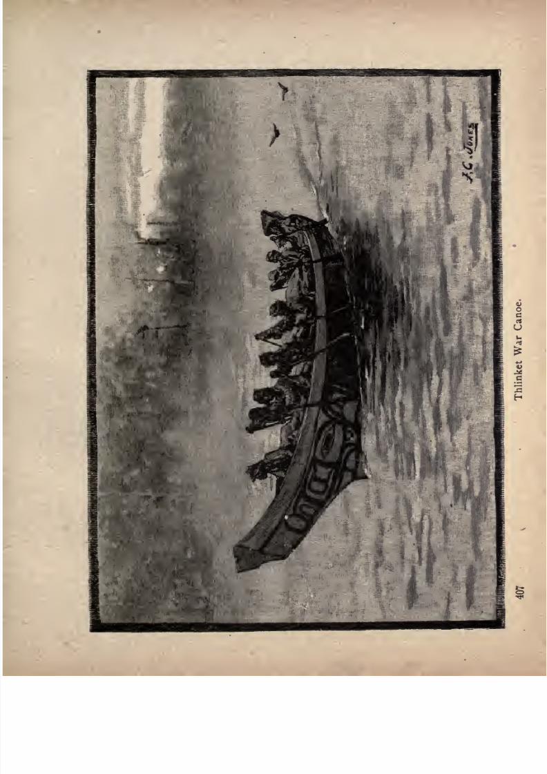
7/27/2019 Official Northern 00 Nort Rich
http://slidepdf.com/reader/full/official-northern-00-nort-rich 409/453
7/27/2019 Official Northern 00 Nort Rich
http://slidepdf.com/reader/full/official-northern-00-nort-rich 410/453
408 The Northern Pacific Railroad.
the British Naval Squadron of the Pacific, of which it is the
rendezvous. Returning to the city, he may stroll into one of
its old curiosity shops, filled with a tempting display of those
various artistic products in which the native races of the
northwest coast so greatly excel. On his way back to the
steamer, he will not fail to admire the striking picture pre
sented by the almost land-locked inner harbor with its ship
ping, its Indian canoes, its narrow rocky entrance, and its
white lighthouse, standing out against the dark foliage of the
adjacent woods; nor the glistening peaks of the Olympic
Mountains, over in the State of Washington, nor yet the trim
and tasteful, but unpretentious, government buildings overlook
ing James Bay.
While, among the thousands of tourists who visit this city
annually, there may be one or two who will give it a bad name,
because they have had to pay for some trifling article a few
cents more than they had been accustomed to, or rushing into
the post-office just as the mail was being made up were sur
prised to learn that postage stamps were obtainable only at the
stationery stores, ninety-nine out of every hundred leave this
beautiful and interesting little city with regret, and carry
away with them only the pleasantest recollections of their brief
visit.
When the steamer once more gets under way, we feel as
though our voyage had at last begun in good earnest, and
maps, guide books and glasses make their appearance, in
numbers almost sufficient to start a bookseller and optician in
business. One will have provided himself with "Alaska and
its Resources," by Mr. W. H. Dall, of the Smithsonian Institu
tion, a work which, although twenty years old or nearly, is
still the only comprehensive and trustworthy description of
theTerritory,
as a
whole;
another will have the Alaska volume
of Mr. H. H. Bancroft's"History of the Pacific States ;"
7/27/2019 Official Northern 00 Nort Rich
http://slidepdf.com/reader/full/official-northern-00-nort-rich 411/453
A Trip to Alaska. 409
while a third will produce from his baggage Dr. Sheldon Jack
son on " Alaska and Missions," an excellent work founded on
extensive observation during several years' residence, and
dealing especiallywith the labors of the various Christian
missionaries in this great field. Others, desirous of seeing the
impression produced upon transient visitors like themselves,
will be conning the pages of Miss Scidmore's "Journeys in
Alaska," or those of" Our New Alaska," by Mr. Chas. Hal-
lock; while probably some English tourist, with the love of
mountain climbing and adventure characteristic of his race,
will follow the wanderings of Mr. Whymper or Mr. Seton-
Karr, in the respective works "Travels in Alaska
"and " The
Shores and Alps of Alaska."
Before reaching any broad expanse of open water, the
steamer passes through a picturesque archipelago, which faint
ly foreshadows in beauty the island-studded waters through
which will lie so large a part of our voyage. A momentary
interest is here excited by our passing on the right the island
of San Juan, the possession of which, as every reader will re
member, was awarded to the United States, in 1872, by the
Emperor of Germany, then King of Prussia, to whom had been
referred the interpretation of a treaty of somewhat ambiguous
phraseology.
Almost uniformly smooth as is the navigation of the Inland
Passage, the arrival and departure of the steamer at or from
particular points can not be predicted many hours in advance,
so much depends upon the state of the tide. Even in this
high latitude night comes at last, and the first question in the
morning, from almost every passenger is/'Where are we now?"
If, therefore, it were possible to relieve the ship's officers of the
endless string of questions with which they are plied, as to
the whereabouts of the steamer at particular times, it would bea grateful task to do so, but all that is practicable is to point
7/27/2019 Official Northern 00 Nort Rich
http://slidepdf.com/reader/full/official-northern-00-nort-rich 412/453
410 The Northern Pacific Railroad.
out the principal landmarks and the chief points of interest, so
that these more or less troublesome inquiries may be reduced
to a minimum.
Forfully
a
dayand a half after
leaving Victoria, we haveon our left the great island of Vancouver, 300 miles in length,
and by far the largest island on the Pacific Coast. Having
passed through the archipelago, to which reference has already
been made, and which occupies the extreme southern portion
of the Strait, or Gulf, of Georgia, as it is variously designated,
we come to the greatest expanse of water to be met with on
our entire trip, save those occasional points where we are able,
for a brief period, to look out upon the open sea. Before
long, however, we have the large island of Taxada on our
right. This island, which is largely in the hands of specula
tors, among whom is at least one American company, contains
an immense deposit of iron ore, rendered especially valuable
by its exceptionally low percentage of phosphorus.
Another unbroken expanse of water, and we enter the first
of those wonderful river-like channels through whose pictur
esque sinuosities three-fourths of our voyage will lie. This, is
Discovery Passage. It lies between the western side of
Valdes Island and the northeastern shore of Vancouver Island.
The southern extremity of the former island, known as Cape
Mudge, is a peculiar headland about 250 feet high, flat and
wooded on its summit. As the steamer approaches this point,
every passenger on deck expects it to continue on its course
through the broad open waters to the right. Instead of that,
however, it leaves the headland to the right, and enters the
narrow passage, not more than a mile in breadth, lying to the
west of it. For 23 miles it follows this picturesque waterway,
overshadowed by noble mountains rising from both shores.
From an expansion of the Passage, caused by an indentation
on the Vancouver shore, known as Menzies Bay, we pass into
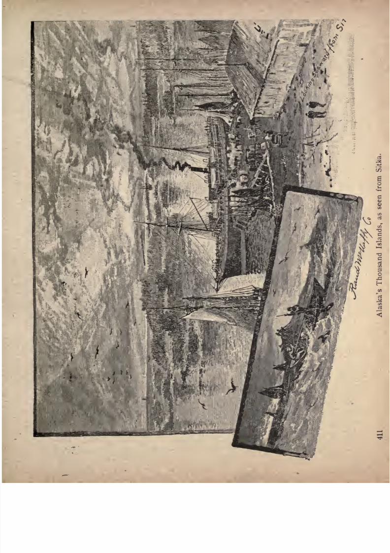
7/27/2019 Official Northern 00 Nort Rich
http://slidepdf.com/reader/full/official-northern-00-nort-rich 413/453
7/27/2019 Official Northern 00 Nort Rich
http://slidepdf.com/reader/full/official-northern-00-nort-rich 414/453
412 The Northern Pacific Railroad.
the famous Seymour Narrows, a gorge two miles In length, and
less than one-half mile in breadth. Through this contracted
channel, the tides rush with great velocity, sometimes running
nine knots an hour. The steamer is
usuallytimed to reach
this point at low water, but it rarely happens that the waters
are not seen in a state of tumult sufficient to constitute their
passage a decidedly interesting feature of the voyage.
At Chatham Point, a low, rocky promontory on the Van
couver Island shore, we take the more westerly of two ap
parently practicable channels, and enter Johnstone Strait, 55
miles in length. For some distance, this channel is verysimilar to Discovery Passage, though it subsequently broadens
out to a width of from one and one-half to three miles. The
magnificent range that rises from the Vancouver Island shore
is the Prince of Wales range, the highest point of which, Mount
Albert Edward, rises 6,968 feet above the waterway that washes
its base. It is never entirely free from snow, traces of which,
indeed, extend down the dark sides of the mountain to within
2,000 or 3,000 feet of the sea level. A noble snow-covered
peak is about this time a prominent object on the right, while
nearer at hand many beautiful inlets engage the traveler's
attention. For some miles northward Trom the entrance
to Johnstone Strait, the land on the right is Thurlow Island.
This is succeeded by Hardwick Island, from which it" is
separated by Chancellor Channel, connecting with the broad
water way which seemed to the traveler the more likely course for
the steamer to take when, a few hours before, she entered the
narrow Discovery Passage. Another channel intervening, and
we have the mainland of British Columbia forming the eastern
shore of the strait. It is much indented by bays and inlets,
and many fine lofty peaks tower up beyond it,while on the
opposite or Vancouver Island shore, Mount Palmerston pre
sents an exceedingly fine appearance. The islands which have
7/27/2019 Official Northern 00 Nort Rich
http://slidepdf.com/reader/full/official-northern-00-nort-rich 415/453
A Trip to Alaska. 413
been mentioned are only those larger bodies of land separated
from the mainland by narrow channels, and for the most part
so mountainous that they would be mistaken for the mainland
in the absence of any statement to the contrary. The thousands of islands, from mere rocky points, a few square feet in
extent, to those larger summits of submerged mountains which
may sometime become the sites of delightful summer homes,
it is impossible to particularize; and it need only be said that
in their multitude and variety each having some beauty
peculiar to itself they form, with the bold shores of the strait
and the distant snow-covered peaks, a series of pictures of
which the traveler never wearies and which he can never forget.
The northern entrance to Johnstone Strait is occupied by a
beautiful archipelago, the two largest islands of which are Han
son Island and Cormorant Island. On the latter, between
which and Vancouver Island we continue our course northwest
through Broughton Strait, is Alert Bay, with a large salmon
cannery, an Indian village and a Mission. The remarkable
conical peak long visible on Vancouver Island is Mount
Holdsworth.
From Broughton Strait, fifteen miles in length, we suddenly
emerge into the broad Queen Charlotte Sound, a magnificent
expanse of water, twelve to eighteen miles from shore to shore.
The extensive views here obtained present a striking contrast
to the scenery of the narrow passage through which for some
hours the steamer's course has lain. An interesting point on
the west shore is Fort Rupert, a post of the Hudson's Bay
Company, with a large Indian village adjoining it. Continuing
on its course, within a short distance of the Vancouver Island
shore, our good ship next enters Goletas Channel, where we
have Galiano and Hope Islands, together with some hundreds
of smaller islands, on our right, and picturesque mountains of
considerable elevation on both right and left.
7/27/2019 Official Northern 00 Nort Rich
http://slidepdf.com/reader/full/official-northern-00-nort-rich 416/453
414 The Northern Pacific Railroad.
We have now to bid farewell to the great Vancouver Island,
whose most northerly point. Gape Commerell, we leave to
the left. Emerging from the channel, which affords us, at
its western entrance, an exceedingly fine retrospective view in
which Mount Lemon is a prominent object, we look westward
over the broad expanse of the Pacific Ocean. Here, if any
where on our entire voyage, we are sensible for a short time,
of a gentle swell. Those, however, whom the mere mention
of the open sea would be sufficient to drive to the seclusion of
their cabins, may take comfort in the assurance that the
steamer hadscarcely begun
toyield
to its influence when it
passes under the lee of the great Calvert Island, and enters the
land-locked channel of Fitzhugh Sound. Here, again, we
have superb scenery on either side, the mountains of Calvert
Island culminating in an exceedingly sharp peak, known as
Mount Buxton (3,430 feet),the retrospective view of which is
very fine. The scenery on the mainland and the islands en
our rightis similar in
character. The soundings here indicate
very deep water, although there is excellent anchorage in
many of those beautiful bays which are formed by the indented
shores. As we approach the northern extremity of the Sound,
where Burke Canal opens out on the right (opposite the great
Hunter Islands, the most northerly of the three large islands
which, with a number of smaller ones, form the west shore of
the Sound), the scenery increases in grandeur, the lesser andnearer hills being clothed to their summits with coniferous
trees, while the more distant ones, overtopping them, are cov
ered with snow. Here a surprise awaits the traveler in the
sudden turning-about of the steamer, whose helm is put hard-
a-starboard with the result that, instead of continuing its
course through the broad and exceedingly attractive Fisher
Channel, it turns sharply to the left, through the narrow LamaPassage, which, midway between its two extremities, itself
makes a sharp turn northward.
7/27/2019 Official Northern 00 Nort Rich
http://slidepdf.com/reader/full/official-northern-00-nort-rich 417/453
A Trip to Alaska. 416
On the shore of Campbell Island, we pass the trim native
village of Bella Bella, with its little church. On the opposite
shore are a number of graves, some of them with totem poles,
one of the domestic peculiarities of this region, of which morewill be said in its proper place.
The northern entrance to Lama Passage, through which we
emerge into the broad Seaforth Channel, with its multitude of
picturesque islands, is extremely narrow, but entirely free from
concealed dangers. Just before turning westward into Sea
forth Channel, we have the finest scenery we have so far gazed
upon, the grouping of the mountains being grand in theextreme. If it be afternoon, its exquisite beauty will be greatly
enhanced by atmospheric effects utterly unlike anything that
ninety-nine out of every hundred of our fellow passengers
have ever before seen. The sunset, too, is almost certain to
be of such indescribable grandeur that pen and brush will be
thrown down by the despairing author and artist, who will
alike resign themselves to the ravishing beauty and splendorof the scene.
Another turn in our remarkable devious course, and we are
steaming northward through Milbank Sound, through whose
broad entrance we look out to the open sea. Islands succeed
islands, and mountains, mountains; and the traveler is almost
as much impressed with the mere geographical features of this
extraordinary region as with the beauty of its scenery. Herewe see, for the first time, glacier paths on the mountain sides,
the lofty pyramidal Stripe Mountain, so called from the white
streak on the southern flank, being an -especially prominent
object. Leaving Point Jorkins, the southern extremity of the
great Princess Royal Island, on our left, we continue our course
almost directly northward through the long and narrow Finlay-
son Channel, some 24 miles long, with an average width of
two miles. The bold shores of this fine channel are densely
7/27/2019 Official Northern 00 Nort Rich
http://slidepdf.com/reader/full/official-northern-00-nort-rich 418/453
416 The Northern Pacific Railroad.
wooded to a height of 1,500 feet or more; precipitous peaks,
rising to a height of nearly 3,000 feet, occurring at intervals,
with still higher mountains, whose dark masses are relieved
with patches of snow, rising behind them. Waterfalls of
remarkable height here add a new element of beauty to the
incomparable series of pictures revealed to us with the contin
ued progress of the steamer. A^ contraction of the channel
known, for twenty miles, by the name of Graham Reach, and,
for the next ten miles, as Fraser Reach, brings us to the north
point of Princess Royal Island, where we turn westward
through McKay Reach into Wright Sound. There is nothing
here calling for special notice, although it must not be under
stood that the scenery is, on that account, any the less pictur
esque. It is worth while studying these successive channels upon
the charts of the United States "Pacific Coast Pilot,"so singular
is the appearance they present. Grenville Channel, which we
enter from Wright Sound and which lies between Pitt
Island and the mainland, is, for fully fifty miles, as straight
as any canal in the world. Its scenery, on both sides, is
exceptionally fine, the mountainsgrouping
themselves with
magnificent effect. Those near at hand are clothed with dark
foliage, others more remote, assume a purple hue, while many
are seen to be seamed with the paths of glaciers and avalanches,
the higher peaks being in every case covered with snow.
Many beautiful islands start up in mid-channel, uniformly cov
ered with a dense growth of fir,to the very edge of the water.
The channel, too, is, at places, exceedingly narrow, and the
precipitous mountains which rise from its shores attain a height
varying from 1,500 to 3,500 feet. From an expansion of this
channel, we pass through a narrow strait known as Arthur
Passage, which has Kennedy Island on the right, and the large
Porcher Island, with many fine mountain peaks, on the left.
If the frequent recurrence of geographical designations
7/27/2019 Official Northern 00 Nort Rich
http://slidepdf.com/reader/full/official-northern-00-nort-rich 419/453
A Trip to Alaska. 417
render this brief description of the Alaska trip less interesting
to the general reader than it otherwise would be, there will be
a counterbalancing advantage gained by the actual traveler,
who will find none of the more entertaining works that have
been written on the subject of any great value to him as prac
tical guide books.
Continuing our actual course, we emerge from the channel
last-named into the great Chatham Sound, abroad expanse of
water from whose distant shores rise imposing mountains. The
eastern shore is here formed by the remarkable Chim-sy-an
Peninsula, which, though forty miles long and from five to
fifteen miles in breadth, is connected with the mainland only
by a narrow isthmus.
Continuing our course northward through the broad Chatham
Sound, with Dundas Island on our left and a range of snowy
mountains, presenting a magnificent appearance, on our right,
(Mount McNeill, the highest of its peaks, rising 4,500 feet
above the sea, and having the appearance of being much higher
by reason of our seeing its entire height from the ocean level),
we soon cross, in latitude 54 40', -the boundary line between
British Columbia and the United States Territory of Alaska.
Here, we shall do well to acquaint ourselves with such facts
relative to the extent, physical conditions, ethnological features
and natural resources of the "district" (to give it the ill-chosen
name by which it is known to the United States Govern
ment) as will, at least, give us a comprehensive and, in the
main, correct idea of the great territory we are about to visit.
As to its history, little need be said, for its Russian occupa
tion is of no practical concern to us, while on the other hand,
every reader will remember the circumstances of its transfer
to the United States Government in 1868, for the sum of
$7,200,000. Its extent is probably not nearly so well known,
or, if the numerals which represent it have been learned by
7/27/2019 Official Northern 00 Nort Rich
http://slidepdf.com/reader/full/official-northern-00-nort-rich 420/453
418 The Northern Pacific Railroad.
heart, it is still doubtful whether they have created in the
mind any adequate conception of the vast extent of the
province. Availing ourselves, therefore, of the figures and
comparisons that we find ready to our hand in the Reports ofGovernor Swineford and Dr. Sheldon Jackson, we may remark
that its extreme breadth from north to south is 1,400 miles,
or as far as from Maine to Florida, and that from its eastern
boundary to the western end of the Aleutian Islands is 2,200
miles; so that the Governor, sitting in his office at Sitka, is
very little farther from Eastport, Me., than from the extreme
western limit of his own jurisdiction, measuring, of course, in a
straight line. Its coast line of 18,211 miles is nearly twice
as great as the combined Atlantic and Pacific coast lines of
the United States proper, and its most westerly point extends
beyond the most easterly point of Asia a distance of nearly
1,000 miles. In actual extent it is as large as all the New
England and Middle States, together with Ohio, Indiana, Illi
nois, Wisconsin, Michigan, Kentucky and Tennessee combined,
or as all that portion of the United States lying east of the.
Mississippi River and north of Georgia and the Carolinas. A
country so vast as this must be a poor one indeed, if the paltry
$7,200,000 paid for it does not turn out to bear little more
than the same proportion to its value that was borne by the
pepper-corn rent in so many old English legal conveyances to
the valuable estates for whose holding it was the nominal
annual consideration.
With regard to its physical conditions, it is sufficient for our
present purpose to say that a large part of it is still passing
through the glacial period; that it contains in Mount St. Elias
the highest mountain on the North American Continent, and in
Mount Cook, Mount Crillon and Mount Fairweather peaks ex
ceeded in height only by Mount Popocatepetl and Mount
Orizaba, in Mexico; that its great river, the Yukon, computed
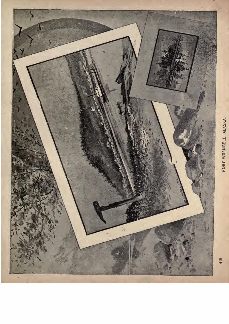
7/27/2019 Official Northern 00 Nort Rich
http://slidepdf.com/reader/full/official-northern-00-nort-rich 421/453
7/27/2019 Official Northern 00 Nort Rich
http://slidepdf.com/reader/full/official-northern-00-nort-rich 422/453
420 The Northern Pacific Railroad.
to be not less than 3,000 miles long, is navigable for a distance
of 2,000 miles, is from one mile to five miles in breadth for no
less than 1,000 miles of its course, and is seventy miles wide
across its five mouths and the intervening deltas; and that,
while the climate of the interior is Arctic in the severity of its
winter and tropical in the heat of its summer, that of the im
mense southern coast, with its thousands of islands, is one of
the most equable in the world, by reason of the Kuro-siwo, or
Japan current, a thermal stream which renders the entire
North Pacific Coast, even in this high latitude, warm and
humid. Only four times in forty-five years has the tempera
ture at Sitka fallen to zero, while only seven summers in that
same period have been marked by a higher temperature than
80 Fah. The influence of moisture in regulating temperature
is too well known to call for any further remarks under this
head, and the facts above given are stated only that they may
help to dispel from the non-scientific mind the erroneous no
tions relative to the climate of this great territory, that so
largely prevail.
With the exception of the Tinneh, a tribe which has forced
its way to the coast from the interior, the natives of Alaska are
not Indians. Their traditions, manners, customs and other
race characteristics prove them to belong to the Mongolian
branch of the great human family. Between their racial and
tribal designations, the visitor, who hears of Thlinkets, Hydahs,
Chilkats, Auks, Sitkans and many others, is liable to get some
what confused. It may, therefore, be not only interesting but
otherwise of advantage to him to know beforehand that the
native population of the Territory, estimated to number 31,240
at the United States census of 1880, is divided into five races:
(i) the Innuit, or Esquimaux, numbering 17,617, who occupy
almost the entire coast line of the mainland; (2) the Aleuts,
numbering 2,145., inhabiting the Aleutian Islands; (3)the
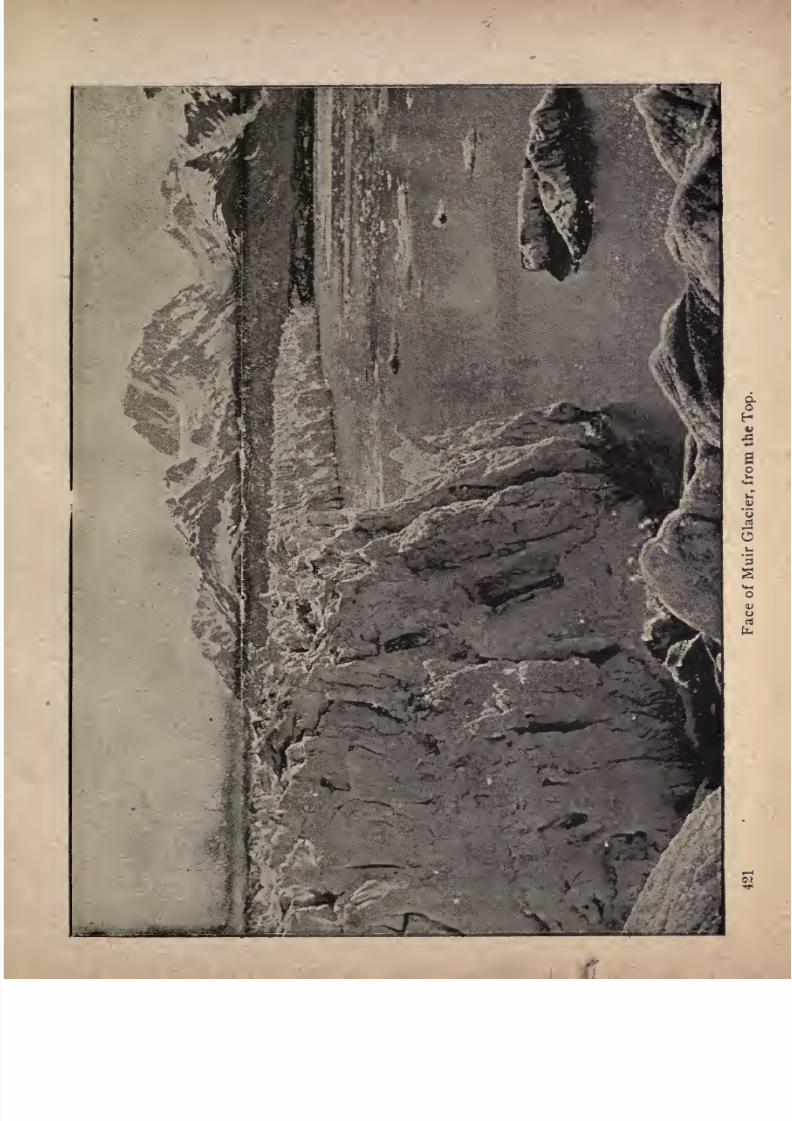
7/27/2019 Official Northern 00 Nort Rich
http://slidepdf.com/reader/full/official-northern-00-nort-rich 423/453
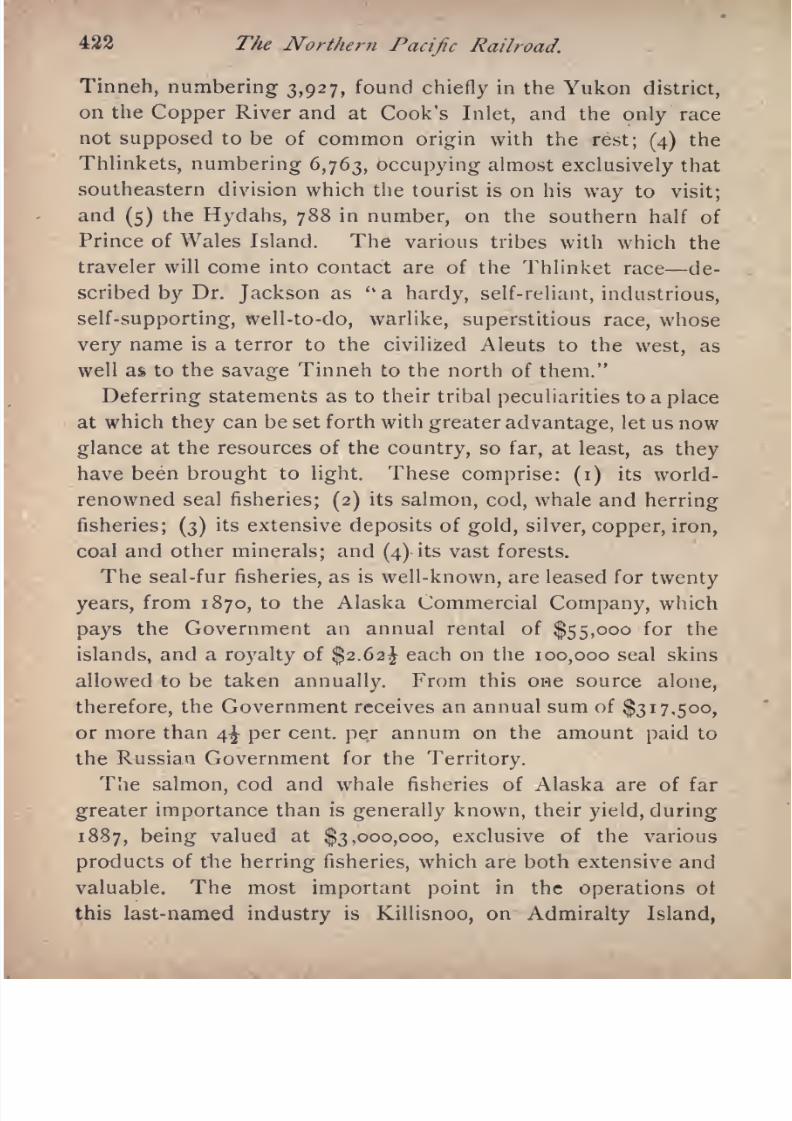
7/27/2019 Official Northern 00 Nort Rich
http://slidepdf.com/reader/full/official-northern-00-nort-rich 424/453
422 The Northern Pacific Railroad.
Tinneh, numbering 3,927, found chiefly in the Yukon district,
on the Copper River and at Cook's Inlet, and the only race
not supposed to be of common origin with the rest; (4)the
Thlinkets,numbering 6,763, occupying
almostexclusively
that
southeastern division which the tourist is on his way to visit;
and (5) the Hydahs, 788 in number, on the southern half of
Prince of Wales Island. The various tribes with which the
traveler will come into contact are of the Thlinket race de
scribed by Dr. Jackson as"a hardy, self-reliant, industrious,
self-supporting, well-to-do, warlike, superstitious race, whose
veryname is a terror to the civilized Aleuts to the
west, aswell as to the savage Tinneh to the north of them."
Deferring statements as to their tribal peculiarities to a place
at which they can be set forth with greater advantage, let us now
glance at the resources of the country, so far, at least, as they
have been brought to light. These comprise: (i) its world-
renowned seal fisheries; (2)its salmon, cod, whale and herring
fisheries; (3) its extensive deposits of gold, silver, copper, iron,
coal and other minerals; and (4)its vast forests.
The seal-fur fisheries, as is well-known, are leased for twenty
years, from 1870, to the Alaska Commercial Company, which
pays the Government an annual rental of $55,000 for the
islands, and a royalty of $2.62^ each on the 100,000 seal skins
allowed to be taken annually. From this one source alone,
therefore, the Government receives an annual sum of $317,500,
or more than 4^ per cent, per annum on the amount paid to
the Russian Government for the Territory.
The salmon, cod and whale fisheries of Alaska are of far
greater importance than is generally known, their yield, during
1887, being valued at $3,000,000, exclusive of the various
products of the herring fisheries, which are both extensive and
valuable. The most important point in the operations ot
this last-named industry is Killisnoo, on Admiralty Island,
7/27/2019 Official Northern 00 Nort Rich
http://slidepdf.com/reader/full/official-northern-00-nort-rich 425/453
A Trip }o Alaska. 423
where as many as 138,000 barrels of oil have been put up in a
single month.
Men are so liable to be carried away by excitement upon
finding even the smallest traces of the precious metals, that
the outside world, hearing or reading of their discoveries, at a
distance, usually pays but little attention to them. While, how
ever, the claims of Alaska to untold wealth in silver and copper
must be admitted, if admitted at all, on mere hearsay, except
so far as the reports of explorers are borne out by the geologi
cal formation of the country, every tourist has an opportunity
of visiting, under the most advantageous and pleasurable cir
cumstances, the greatest gold mine in the world, namely, the
Treadwell Mine, on Douglas Island, of which more will be said
in its proper place.
It will be but a few years before the lumbering operations
now going on in the forest belt of the "new State of Washington
extend to this far northern region. The whole of southeastern
Alaska is covered with a dense growth of spruce, hemlock and
yellow cedar, fiequently containing timber of from thirty to
forty feet in diameter at the base, and growing to a height of
thirty to forty feet before branching. The yellow cedar is said
to be the most valuable timber on the Pacific coast, being
highly prized, both by the cabinet-maker and ship-builder.
With regard to agriculture, it will be sufficient to refer to the
admirable report of the Governor of Alaska, for 1886, in which
he combats the rash statements of various transient visitors,
whose prominence obtains for their assertions a credence of
which they are not always worthy; and, fortifying his state
ment with the authority of Mr. W. H. Dall, of the Smithsonian
Institution, who has devoted more time and made more thorough
researches into the natural resources of Alaska than any other
person, declares that there are considerable areas of arable
land, with a soil of sufficient depth and fertility to insure the
7/27/2019 Official Northern 00 Nort Rich
http://slidepdf.com/reader/full/official-northern-00-nort-rich 426/453
424 The Northern Pacific Railroad.
growth of the very best crops, and that the experiments which
have been made in the past two or three years have proved
most conclusively that all the cereals, as well as the tubers, can
be grown to perfection in Alaskan soil and climate. It is im
possible in these pages to pursue this interesting and impor
tant subject further, but it may be stated that the Governor
does not content himself with mere assertion, but that, in ad
dition to giving the results of the various experiments that
have been made, he deals at some length with the subject of
the native grasses of the Territory, all going to prove that the
country is not nearly so worthless for agricultural purposes as
interested detractors or careless and superficial observers would
have us believe.
Having thus acquainted himself with a few of the more im
portant facts concerning this great Territory, the tourist is now
prepared to resume his voyage. Crossing the broad expanse
of Dixon Entrance, where, looking westward, we see the open
sea, we enter Clarence Strait, over one hundred miles
longand
nowhere less than four miles in width. We are now within
the remarkable geographical area known as Alexander
Archipelago, a congeries of straits, inlands, inlets, rocks, and
passages extending through nearly five degrees of latitude and
seven of longitude. The islands of this archipelago definitely
placed on the charts number 1,100, and we have the authority
of the United States Coast and GeodeticSurvey
for the state
ment that, if all the existing rocks and islands were enumer
ated, the number stated would have to be very considerably
increased.
Throughout the whole of Clarence Strait, we have on our left
the great Prince of Wales Island, the home of the Hydahs,
with whose marvelous skill in carving, the tourist doubtless
became familiar during his brief stay at Victoria. Their miniature totems, cut in dark slate-stone, are greatly sought after
7/27/2019 Official Northern 00 Nort Rich
http://slidepdf.com/reader/full/official-northern-00-nort-rich 427/453
A Trip to Alaska. 426
by tourists and command a somewhat high price. The artistic
skill of this famous tribe has, however, been better exemplified
in its spoons, carved out of the horn of the mountain goat; but
these havenearly
all
goneto enrich the collections of eastern
visitors during the last two or three seasons, and during his
visit to the Territory, in the summer of 1887, the present writer
found but a single specimen in many hundreds of carved goat's
horn spoons, that sustained the reputation of the Hydahs for
that delicacy of workmanship in which they well-nigh rival the
ivory workers of Japan.
It
may be mentionedin this
connectionthat
the recentlyformed Alaskan Society of Natural History and Ethnology,
whose headquarters are at Sitka, has already gathered together
an exceedingly interesting and valuable collection of specimens
of native handiwork; and visitors are invited to contribute
to a fund which is being raised for the purchase and preserva
tion of Alaskan curiosities of every description, especially
those made by the natives before the influx of tourists foundthem the ready market they now possess, and led them, as it
unfortunately did, to think more of the quantity than the
quality of their work.
The islands on our right as we continue our voyage are the
Gravina Group, Revilla Gigedo and, after a promontory of
the mainland, Etolin Island, round whose northern coast we
steer northeastward to Fort Wrangell, usually the first calling
place of the steamer, during the tourist season. The Gravina
Islands contain a fine range of mountains, the higher peaks of
which have their dark masses relieved by patches of snow.
Revilla Gigedo Island likewise is mountainous its nearer
summits clothed with pine, its more distant ones crowned with
everlasting snow. On Prince of Wales Island, the mountains
rising before us are enveloped, for the most part, in a delicious
purple haze. As we approach them, their rocky, precipitous,
7/27/2019 Official Northern 00 Nort Rich
http://slidepdf.com/reader/full/official-northern-00-nort-rich 428/453
426 The Northern Pacific Railroad.
and deeply fissured sides (the last the result of glacial action,
which is plainly visible) afford a striking- diversity of outline
and color, which, -added to the beauties of light and shade lent
chem by passing clouds, have a very fine effect. Clarence
Straitis, indeed, a magnificent sheet of water, well worthy of
its place in that remarkable series of devious water-ways
through which our voyage lies.
Fort Wrangell, although formerly a place of some impor
tance as the port of the Cassiar mines, away in the interior
beyond the international boundary, is, of all the settlements at
which the steamer calls, the least attractive in
every respectsave that it. is here that the tourist will find the largest assem
blage of totem poles that he will have an opportunity of seeing,
as well as several old graves of singularly striking appearance.
The village, which occupies a beautiful site, is given up
almost entirely to the Stikine tribe of the Thlinket race, and,
within a few minutes after the arrival of the steamer at the
wharf,the interior ot almost
everyhouse
presentsan animated
appearance, curio-hunting passengers thronging them to the
doors, and bargaining with their inmates for the various objects
ot interest they see around them.
The ship's officers, Government officials and other persons
supposed to be well informed are frequently asked which of
the various stopping places is the best for the purchase of
curiosities. In anticipation of this inquiry,it
may be statedthat there is little to choose between Fort Wrangell, Juneau
and Sitka, except that in the fine store of Messrs. Koehler &
James, at Juneau, the visitor will find a larger collection of
the more desirable and costly specimens of native handiwork,
as well as of valuable furs, than at either of the other two
places. At any one of them, however, and at any moment, he
may run across something that could not be duplicated in the
entire Territory, although each recurring season renders this
less and less probable.

7/27/2019 Official Northern 00 Nort Rich
http://slidepdf.com/reader/full/official-northern-00-nort-rich 429/453
iflALASKAN GRAVE AND TOTEM POLES AT FORT WRANGELL.
427
7/27/2019 Official Northern 00 Nort Rich
http://slidepdf.com/reader/full/official-northern-00-nort-rich 430/453
428 The Northern Pacific Railroad. .
A strongly marked trait in the character of the Thlinkets Is
their respect for their ancestors. Independently of their
tribal distinctions, which are little more than local, they are
divided into four totems or clans, each of which is known by a
badge or emblem used much in the same way as is the crest or
coat of arms among the old families of Europe. These,
according to Mr. W. H. Dall, are the Raven, the Wolf, the
Whale and the Kagle; and these emblems are carved on their
houses, household utensils, paddles and frequently on amulets
of native copper, which they preserve with scrupulous care and
consider to be of the
greatest
value. In front of
manyof their
houses, and also at their burial places, are posts varying from
twenty to sixty feet in height and from two to five feet in
diameter, carved to represent successive ancestral totems and
usually stained black, red and blue. As already stated, several
of these totem poles, as they are called, are to be seen at P'ort
Wrangell, as well as two remarkable graves, one surmounted by
arudely carved whale, and
the otherby
ahuge figure
of a
wolf.
Resuming our voyage, we leave this curious old Stikine
town, and after steaming westward to the southern entrance to
Wrangell Strait, turn northward and follow that narrow pas
sage into the broader Dry Strait, where we have the magnificent Patterson Glacier on our right and find considerable
floating ice. Following the north shore of Kupreanoff Island,
we enter Frederick Sound; but quickly resume our almost
directly northward course by entering Stephens Passage;
where we have Admiralty Island on our left, said, by the way,
to be swarming with bear, and the mainland on our right. On
Stockade Point, a comparatively low peninsula from which the
land rises rapidly to snow-capped mountains, is a ruined block
house and stockade, built by the Hudson's Bay Company, andon the other side of a small inlet is Grave Point, a native
7/27/2019 Official Northern 00 Nort Rich
http://slidepdf.com/reader/full/official-northern-00-nort-rich 431/453
A Trip to Alaska. 429
burial ground. Leaving to the right Taku Inlet, we enter the
narrow and picturesque Gastineau Channel, between the main
land and the now famous Douglas Island. Here, on a narrow
strip of land, at the foot of a deep ravine between two pre
cipitous mountains, stands Juneati, a cluster of detached white
houses, relieved here and there by the unpainted frame-work
of others in process of building. The mountain rising behind
it,as you approach it from the south, is deeply fissured, and
seamed with snow, and the town itself is built mainly upon a
huge land-slide. Not a few of the houses have apparently
been built by white sett'lers attracted to the spot by the fabu
lously rich mineral deposits of the district. These have been
followed by general traders, who in addition to supplying the
resident population with the necessaries of life, reap a rich
harvest, during the tourist season, from the sale of sundry
products of native handiwork and the skins of the various fur-
bearing animals.
An excellent weekly newspaper, called the Alaska Free
Press, is published at Juneau. The visitor need not turn to its
pages for any later news from the outside world than he is
already in possession of, for Alaska has not, as yet, the advan
tage of telegraphic communication with the rest of the world.
He will find, however, much interesting reading relative to the
mining resources of the district and the Territory generally; a
column or two of spicy local items and, possibly, the report of
some recently returned explorer; while the business advertise
ments of this thriving settlement of the Far North will be by no
means devoid of interest.
Juneau itself, however, as a point of interest to the tourist,
is soon exhausted, and his thoughts turn to the great Treadwell
mine,
The Richest Gold Mine in the World, which lies
across the channel on Douglas Island, whither the steamer
7/27/2019 Official Northern 00 Nort Rich
http://slidepdf.com/reader/full/official-northern-00-nort-rich 432/453
430 The Northern Pacific Railroad.
will proceed after a brief stay at Juneau. It is by no means
an easy task to determine which of the many extraordinary
statements relative to this valuable property that one hears
from time to time are worthy of credence and which are not;
and even when the truth has been approximately ascertained,
there remains the difficulty of determining how much may
properly be made public, and how much should be regarded as
only the individual and private concern of the owners of the
mine. In view, however, of the fact that the mill has, for some
time, had in operation a larger number of stamps than any other
mill in the world; that by the time this pamphlet leaves the
press, the works will contain more ore-crushing machinery
than the five largest mines in Butte City, all combined, and that
the Governor of the Territory himself places the output of the
mine for 1887 at $100,000 per month, it is surely not incredible
that the company should have refused $16,000,000 for its
property, or that it pays a dividend of 100 per cent, per month,
all the year round; t>r yet, at least to those who have seenit,
that the ore actually in sight is worth about five times the
amount paid to the Russian Government for the entire Terri
tory, and that, even at the present enormous rate of produc
tion, it can not be exhausted in less than a century.
Although it can not but interfere to some extent with the
operations of the mine, visitors are, with great courtesy, shown
everything that is likely to prove of interest to them. They
see the natives earning $2.50 per day each in the mine, and
learn to their surprise that they are better workmen than the
whites; they see the ore in every stage from blasting to final
separation, and though they may leave with a tinge of regret that
it has not been their own luck to have made so valuable a dis
covery, they will none the less congratulate the owners on their
magnificent possession. It will have been inferred, from what
has already been said, that it is not a mere vein of gold, of
7/27/2019 Official Northern 00 Nort Rich
http://slidepdf.com/reader/full/official-northern-00-nort-rich 433/453
A Trip to Alaska. 43 J
varying richness and uncertain direction, that is here being
worked. So far from that, the entire island is nothing less
than a mountain of ore, sufficient, according to ex-Governor
Stoneman of California, to pay off the whole of the national
debt.
Gastineau Channel not having been thoroughly explored, we
retrace our course to its southern entrance, where, turning
northward, we follow the wider channel that lies to the west of
the island. This brings us to that remarkable and*never-to-be-
forgotten body of water, the Lynn Canal, where not only have
we scenery surpassing in wildness and grandeur all that has
preceded it,but also many glaciers, while we reach, just under
the parallel of 60, the most northerly point we shall attain on
our trip. Soon after entering the canal, and when rounding
Point Retreat, we see the great Eagle Glacier to the northeast,
coming down from the high mountains that rise in the back
ground. A couple of hours' sail, however, brings us to a point
at which we can observe much more closely the still larger
Davidson Glacier, on the opposite shore. But even here we
do not go ashore, for the far-famed Muir Glacier, which we
shall reach within the next twenty-four hours, has the advan
tage of being as much more easily accessible than its sister
glaciers as it exceeds them in magnitude, beauty and general
interest.
How unimpressionable soever the tourist may be, a mysterious
sense of awe is almost sure to take possession of him when the
steamer is exploring the two inlets of Chilkat and Chilkoot, in
which the Lynn Canal terminates. Not, perhaps, until vegeta
tion has almost entirely disappeared, will he have noticed its
increasing scantiness, but it will not be long before he realizes
the fact that in the forbidding mountains, the bare rocks and
the nineteen great ice cataracts that here discharge themselves
into the sea, he sees a picture more closely resembling the
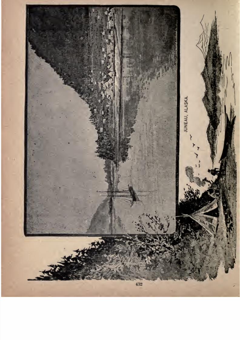
7/27/2019 Official Northern 00 Nort Rich
http://slidepdf.com/reader/full/official-northern-00-nort-rich 434/453
ft'
m.\
7/27/2019 Official Northern 00 Nort Rich
http://slidepdf.com/reader/full/official-northern-00-nort-rich 435/453
A Trip to Alaska. 433
scenes of the now not distant Arctic world than, probably, he
will ever again have an opportunity of gazing upon.
The natives of this region are that famous tribe, the Chilkats,
whosedexterously
wovendancing
blankets are so
much soughtafter by all visitors to Alaska who desire to take home with
them the finest examples of Alaskan handiwork, regaidless of
cost. They are made from the wool of the white mountain
goat, out of whose black horns are carved the spoons and
ladles already referred to. The white wool is hung from an
upright frame, and into it nimble fingers weave, by means of
ivory shuttles, curious and beautiful patterns from yarn dyedwith a variety of brilliant colors.
We have now to retrace our course some sixty-five miles to
Point Retreat, where, instead of taking the easterly channel
and returning to Juneau,we continue almost directly southward
to the point at which the waters of Lynn Canal mingle with
those of Icy Strait. Here, our good ship's course is once more
directed northward, and after a brief sail, we enter the island-
studded Glacier Bay, where innumerable icebergs proclaim our
approach to that crowning glory of this veritable Wonderland,the famous Muir Glacier, undoubtedly the
Greatest Glacier in the World, outside of the Polar seas.
It is hard to say which has the greater advantage the traveler
who sees it first from afar; sees it as a vast river of ice flowing
down from between the mountains, with many tributaries bothon the right and left, and to whom its beauties are gradually
unfolded with the nearer approach of the steamer; or he who,
awakened from his slumber by the thunderous roar which
announces the birth of some huge iceberg, hurries on deck to
aze upon a picture without parallel in the known world a
perpendicular wall of ice, towering to five times the height of
mast-head, and glowing in the sunlight like a mountain of
mother-of-pearl. A recent visitor to this indescribable scene

7/27/2019 Official Northern 00 Nort Rich
http://slidepdf.com/reader/full/official-northern-00-nort-rich 436/453
434 The Northern Pacific Railroad.
himself possessing descriptive powers of no mean order
declares that in the narrative of his Alaska trip he would pre
fer to insert a series of asterisks where his description of the
Muir Glacier should come; and certainly we need a new
vocabulary to set forth its wondrous beauty with any degree
of fidelity. While, as will be inferred from what has already
been stated, its dimensions are such as to constitute it one of
the physical wonders of the world, its proportions are so
admirable that the traveler is less impressed with its immensity
than with its utter novelty and incomparable beauty; and it is
as much a revelation to those who have seen the glaciers of
Switzerland or familiarized themselves with the voyages of
Arctic and Antarctic explorers, as it is to those whose ideas of
a glacier were of the most indefinite and inadequate character.
The breadth of the glacier at its snout is fully a mile, and
when, almost under its shadow, the second officer heaves the
lead and sings out:" One hundred and five fathoms, and no
bottom, Sir," the wonderment of the traveler is
heightened byan immediate realization of the fact that this enormous ice-flow
extends at least twice as far below the surface of the water as
it rises above it, and that it is accordingly not less than 1,000
feet deep. But its vast dimensions and its marvelous grada
tions of color, from pure white to deepest indigo, do not alone
make up that unapproachable tout ensemble which is the wonder
anddelight
ofevery
visitor. Tospeak
of it as aperpendicular
wall of ice almost necessarily conveys the idea of comparative
regularity, as though it were a suddenly congealed cataract.
Instead of that, however, the face of the glacier is composed
of crystal blocks of every conceivable size and shape, many of
them having angular projections or rising cliff-like from its
brink, until, with a roar like that of the distant discharge of
heavy ordnance it comes their turn to fall off into the sea.
The disintegration of these immense masses, some of them
7/27/2019 Official Northern 00 Nort Rich
http://slidepdf.com/reader/full/official-northern-00-nort-rich 437/453
A Trip to Alaska. 435
weighing thousands of tons, suggests the interesting question:
How fast does the glacier move forward? Professor G. Frederick
Wright, of Oberlin, Ohio, in an exceedingly interesting article
in the American Journal of Science, for January, 1887, declares,
as the result of careful observation extending over several
weeks that its progressive daily movement during the month
of August is seventy feet at the centre and ten feet at the
margin, or an average of forty feet per day. Its general move
ment being entirely imperceptible it is only seven-twelfths of
an inch per minute where it is greatest Professor Wright's
assertion has somewhat rashly been disputed -by visitors whohave not been at the trouble to make observations for them
selves. But there is surely nothing incredible in a forward
movement averaging, at most, forty feet per day, in view
of the continual falling off of such immense masses,
especially when it is remembered that Professor J. D. Forbes
found the Mer de Glace to move forward at the rate of from
15 to 17.5 inches per day, at a much less angle, with an
infinitely smaller volume of ice behind it,and diminishing at
its termination, only by the slow process of liquefaction.
The steamer usually remains in front of the glacier an entire
day, and passengers are landed on a dry and solid moraine,
from which a larger area of the glacier than they will care to
explore is within comparatively easy reach. Everyone should
climb up on to the great ice-field
" A crystal pavement by the breath of Heaven
Cemented firm;"
look down into its profound crevasses, and view also the
magnificent panorama of Arctic scenery that it commands,
including Mount Crillon, raising its snowy, crest against the sky
to a height of 15,900 feet.
However indulgent be the Captain, this red-letter day in the
7/27/2019 Official Northern 00 Nort Rich
http://slidepdf.com/reader/full/official-northern-00-nort-rich 438/453
436 The Northern Pacific Railroad.
experience of the visitor a veritable epoch in his life comes
to an end at last. The whistle is sounded, and slowly and
cautiously the steamer threads her way through the floating
ice, and is headed for Sitka. This stage of the trip might be
considerably shortened by the steamer putting out to sea
through Cross Sound, and it is only to avoid the disagreeable
experience to her passengers that would attend the outside
passage, that she takes a less direct course.
Proceeding southeastward through Icy Strait, we enter
Chatham Strait, one of the most extensive and remarkable of
the inlandhighways
of the AlexanderArchipelago.
From this
broad sheet of water we go westward through Peril Straits, a
designation that might excite some little apprehension were we
not told that it was bestowed upon the channel through which
we pass, not because of any difficulty or danger attending its
navigation, but on account of the death there, in 1799, of a
large number of Aleuts who had partaken of poisonous
mussels. For two-thirds of the distance traversed by the
steamer, the straits are several miles wide, but they ultimately
narrow to a width of less than half a mile, to form, with Neva
and Olga Straits, a succession of beautiful channels, studded
with charming islands, and presenting a striking contrast to
the desolate-looking shores of Glacier Bay.
There is no trip in the world of corresponding duration that
is less monotonous than this two weeks' excursion to Alaska.
The tourist is continually being greeted by scenes utterly
unlike any he has ever before gazed upon, while the contrasts
presented by successive days' experiences are, themselves, as
delightful as they are surprising. Should the steamer, for
example, come to an anchorage in Sitka Sound during the night
or in the early morning, the traveler will be almost startled by
the novel, picturesque and altogether pleasing appearance of
the scene that will greet him when he goes on deck to take his
7/27/2019 Official Northern 00 Nort Rich
http://slidepdf.com/reader/full/official-northern-00-nort-rich 439/453
A Trip to Alaska. 437
first view of the Capital city. On the one hand are the
glistening waters of the bay, studded with innumerable rocky,
moss-covered islands, affording a scanty foothold for under
sized firs and spruce; with that extraordinary-looking peak,
Mount Edgecumbe, rising beyond, an almost perfect cone,
save that its apex has been cut off so sharply as to leave it
with a perfectly flat top, in which is a crater said to be 2,000
feet in diameter and about 200 feet deep. On the other hand,
from a cluster of more or less quaint-looking buildings, rises
Baranoff Castle, the former residence of a long succession of
stern Muscovite governors, and the emerald green cupola and
dome of the Russo-Greek church, with lofty mountains, in.
eluding the frowning Vostovia, in the background.
It is with an already formed favorable impression of the place
that the passenger steps ashore, to visit the two remarkable
buildings above mentioned, of which, probably, he has often
heard and read; to saunter through the curious streets of the
town, and to pick up in its stores and in the houses of the
natives additional specimens of Alaskan handiwork and other
curiosities; to visit the Training School and Mission, where
native boys and girls are being educated, Christianized, and
taught useful trades; and, possibly, to pay his respects to
some member of that admirable body of United States officials,
now administering the affairs of the Territory with so much
success.
Baranoff Castle is not a grim, ivy-covered, and decaying
stronghold, with turrets, battlements and keep, but a plain,
square, substantial, yellow frame building, surmounted by a
little look-out tower, upon which might have been seen until
recently the revolving anemometer of the United States Signal
Service,
whose station here has beengiven
up, presumably
in view of 'ihe fact that observations having been carefully
made and recorded for no less than half a century, first by the

7/27/2019 Official Northern 00 Nort Rich
http://slidepdf.com/reader/full/official-northern-00-nort-rich 440/453
r..

7/27/2019 Official Northern 00 Nort Rich
http://slidepdf.com/reader/full/official-northern-00-nort-rich 441/453
A Trip to Alaska. 439
Russians and afterward by the Americans, there remains no
necessity for its further continuance. The interest that at
taches to the castle is almost entirely either historical or
traditional. Among the memories that haunt its great ball
room is that of the beautiful niece of Baron Romanoff, one of
its Muscovite, governors, said to have been fatally stabbed
on her wedding night by her own lover, in whose enforced
absence she had been compelled by her uncle to marry a pre
viously rejected suitor of nobler birth.
The most interesting object in the city, however, is the
Russo-Greek church, not so much for what it is in itself, as
for the paintings, vestments, and other art treasures it con
tains. Among these is an exquisite painting of the Madonna
and Child, copied from a celebrated picture at Moscow, and
so largely covered with gold and silver after the manner of
the Greek Church that but little of the picture is to be seen
except the faces. Another of its treasures is a bishop's
crown, supposed to be several hundred years old, and almost
covered with emeralds, sapphires and pearls.
Steamer day is a great day at Sitka, and the scanty Ameri
can population together with prominent members of the
Russo-American community, like Mr. George Kostrometinoff,
the Government interpreter give themselves up almost
entirely to showing civilities to the visitors who throng the
chief places of interest. They are naturally wishful that
tourists should take away a favorable impression of Alaska
generally and Sitka in particular, and Dr. Sheldon Jackson,
general agent of education in Alaska, under the United
States Government, usually affords the visitor an opportunity
of judging of the excellence of the work that is being carried
on among the natives, not forgetting, at the same time, to urge
the utter inadequacy of the miserable pittance annually doled
out by Congress for educational purposes in this vast Ter-
7/27/2019 Official Northern 00 Nort Rich
http://slidepdf.com/reader/full/official-northern-00-nort-rich 442/453
440 The Northern Pacific Railroad.
ritory. In this connection it may also be stated that the
Russian inhabitants themselves complain bitterly of the faith
lessness of our Government to the pledges given to Russia at
the time of the purchase, with regard to the provision of
educational facilities and other rights of citizenship.
Having visited the Training School, the tourist should con
tinue his walk to Indian River, along the right bank of which
a well-marked trail will conduct him to a woodland scene that
will form one of the most delightful reminiscences of his visit
to Sitka.
Returning to the town, he may have the curiosity to inquire
the price of some of the principal articles of food, when he will
find that he can buy fresh salmon at from one cent to a cent
and a half per pound, halibut and black bass at one-half cent
per pound, venison at from six to eight cents per pound, teal
ducks at twenty cents per pair, and other varieties of game-
food at correspondingly low prices.
When, falling in with some intelligent resident, he learns
how many attractive and interesting places there are within
easy reach of the town; when he is told of the sublime scenery
at the head of Silver Bay, including Sarabinokoff Cataract,
with its fall of 500 feet; of the rich mines in its vicinity, with
ores assaying from $4,000 to $6,000 per ton; when he hears of
the comparative facility with which Mount Edgecumbe can be
ascended and assuming him to be a sportsman of the
abundance of game on the slopes of Mount Vostovia, as well
as in other equally accessible localities, the traveler can not
help regretting that his visit to so attractive a region must so
soon come to an end.
Only a brief reference has thus far been made to the almost
nightless daythat
prevails
in this northern latitude at midsum
mer, and it may therefore be stated that, while, at Sitka, the
period between sunrise and sunset at the summer solstice is
7/27/2019 Official Northern 00 Nort Rich
http://slidepdf.com/reader/full/official-northern-00-nort-rich 443/453
A Trip to Alaska. 441
only two and one-quarter hours longer than it is at New York
or Boston, the twilight is of such long duration that it can
scarcely be said ever to get dark, the last glow hardly dying
out in the northwest before the first flush of dawn appears in
the northeast.
It is scarcely too much to say that no tourist ever visited
even this southeastern strip of Alaska who did not ever after
ward feel a profound interest in whatever concerned the wel
fare of this distant portion of our great country, and labor to
remove the various misconceptions so long current with re
gard to it. Readers of these pages, therefore, desirous of
keeping thoroughly au courant with the affairs of the Territory;
of knowing, from time to time, how rapidly, and in what new
directions, the development of its vast wealth-producing capa
bilities is proceeding; what scientists are saying with regard
to its glaciers and its other remarkable natural features; what
success is attending the efforts that are being made, both by
educational and religious agencies, to civilize the still half-
savage native races of the country, and what light is being
thrown on hitherto perplexing questions in ethnology and
kindred sciences by the labors of the society recently formed
at Sitka for their investigation, will not consider the present
writer to have gone needlessly out of his way if he refers them
to the interesting columns of The Alaskan, a well-conducted
weekly journal published at Sitka, in which everything of
public interest relating to the Territory finds a place commen
surate with its importance.
Sitka is usually the last calling-place of the Alaska excursion,
although it occasionally happens that some other point, already
dealt with in these pages, is reserved for the steamer's home
ward voyage. Should, however, the good ship's return trip be
marked by no strikingly novel experiences, and have no break
until she is once more moored alongside the wharf at Victoria,
7/27/2019 Official Northern 00 Nort Rich
http://slidepdf.com/reader/full/official-northern-00-nort-rich 444/453
442 The Northern Pacific Railroad.
the matchless scenery of that long succession of land-locked
channels she will traverse, observed from new points of view
and under new physical conditions, will, with agreeable
companionship and other social pleasures, render the home
ward voyage possibly even more truly enjoyable than were
those first few days before the barriers of reserve were broken
down, and when the rapid succession of one sublime and
unlooked-for spectacle after another kept the mind in a state
of perpetual tension.

7/27/2019 Official Northern 00 Nort Rich
http://slidepdf.com/reader/full/official-northern-00-nort-rich 445/453

7/27/2019 Official Northern 00 Nort Rich
http://slidepdf.com/reader/full/official-northern-00-nort-rich 446/453

7/27/2019 Official Northern 00 Nort Rich
http://slidepdf.com/reader/full/official-northern-00-nort-rich 447/453

7/27/2019 Official Northern 00 Nort Rich
http://slidepdf.com/reader/full/official-northern-00-nort-rich 448/453

7/27/2019 Official Northern 00 Nort Rich
http://slidepdf.com/reader/full/official-northern-00-nort-rich 449/453

7/27/2019 Official Northern 00 Nort Rich
http://slidepdf.com/reader/full/official-northern-00-nort-rich 450/453

7/27/2019 Official Northern 00 Nort Rich
http://slidepdf.com/reader/full/official-northern-00-nort-rich 451/453
7/27/2019 Official Northern 00 Nort Rich
http://slidepdf.com/reader/full/official-northern-00-nort-rich 452/453
7/27/2019 Official Northern 00 Nort Rich
http://slidepdf.com/reader/full/official-northern-00-nort-rich 453/453


![[Kathryn Hinds] Early Germans Peoples of the Nort(BookFi.org)](https://static.fdocuments.in/doc/165x107/577cc0961a28aba711909866/kathryn-hinds-early-germans-peoples-of-the-nortbookfiorg.jpg)


