October 16, 2009 SKYHALL of Intec Building, … · October 16, 2009 SKYHALL of Intec Building,...
34
October 16, 2009 October 16, 2009 October 16, 2009 October 16, 2009 SKYHALL of Intec Building, Toyama, Japan SKYHALL of Intec Building, Toyama, Japan SKYHALL of Intec Building, Toyama, Japan SKYHALL of Intec Building, Toyama, Japan Steering Committee of International Sabo Forum Steering Committee of International Sabo Forum Steering Committee of International Sabo Forum Steering Committee of International Sabo Forum ꜳꜳꜳ ꜳꜳꜳ ꜳꜳꜳ ꜳꜳꜳ Cꜳꜳ Cꜳꜳ Cꜳꜳ Cꜳꜳ Lꜳ Mꝏ ꝏff Gꜳ Jꜳꜳ Dꜳ Pꝏ S Lꜳ Mꝏ ꝏff Gꜳ Jꜳꜳ Dꜳ Pꝏ S Lꜳ Mꝏ ꝏff Gꜳ Jꜳꜳ Dꜳ Pꝏ S Lꜳ Mꝏ ꝏff Gꜳ Jꜳꜳ Dꜳ Pꝏ S -ꜳꜳꜳ ꜳꜳꜳ ꜳꜳꜳ ꜳꜳꜳ Sꜳꝏ Sꜳꝏ Sꜳꝏ Sꜳꝏ-
Transcript of October 16, 2009 SKYHALL of Intec Building, … · October 16, 2009 SKYHALL of Intec Building,...

October 16, 2009October 16, 2009October 16, 2009October 16, 2009
SKYHALL of Intec Building, Toyama, JapanSKYHALL of Intec Building, Toyama, JapanSKYHALL of Intec Building, Toyama, JapanSKYHALL of Intec Building, Toyama, Japan
Steering Committee of International Sabo ForumSteering Committee of International Sabo ForumSteering Committee of International Sabo ForumSteering Committee of International Sabo Forum
TateyamaTateyamaTateyamaTateyama CalderaCalderaCalderaCaldera
Leading Model of Great Japanese Disaster Prevention System Leading Model of Great Japanese Disaster Prevention System Leading Model of Great Japanese Disaster Prevention System Leading Model of Great Japanese Disaster Prevention System ----TateyamaTateyamaTateyamaTateyama SaboSaboSaboSabo----

○ Objectives・The Japanese Government designated Shiraiwa Sabo facilities to the Important Cultural Property. On this occasion, we introduce the cultural value of Tateyama Sabo and that Toyama is the birth place of modern Sabotechnology spread to the world.・We acquire the knowledge about international contribution of Sabo technology which has been spread from Japan to the world and contributedto the disaster prevention in each country.
開 催 要 領
○ DateOctober 16, 2009
○ VenueSKYHALL of Intec Building, Toyama
○ SupportJapan Sabo Association, Japan Society of Erosion Control Engineering, The Japan Landslide Society,Association of Japan Heritage of Modern Era, Toyama Sabo Association, Tateyama branch of Japan Sabo Association, Toyama branch of Japan Association for Slope Disaster Management,Toyama Construction Industry Association, Tateyama Sabo Ladies Salon, Tateyama Caldera Sabo Museum, Tateyama Sabo Special Engineer, Toyama Sabo Volunteer Association,
Tateyama-Kurobe Dream Club, Association of Tateyama-Kurobe for Preservation of the Environment and International Sightseeing Promotion
Outline of the Forum
○ SponsorSteering Committee of International Sabo Forum
●
Tateyama Sabo
Technical Cooperation of SABO
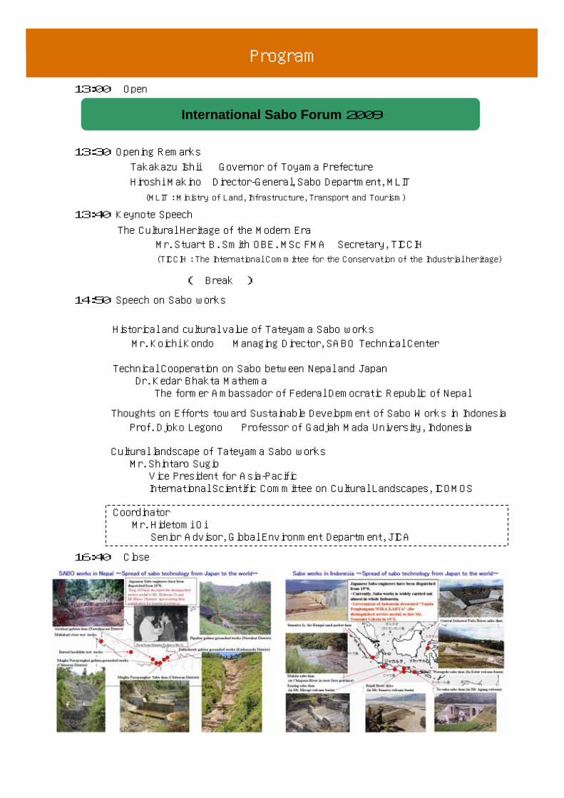
プ ロ グ ラ ム
13:00 Open
International Sabo Forum 2009
13:30 Opening Remarks
Takakazu Ishii Governor of Toyama Prefecture
Hiroshi Makino Director-General, Sabo Department, MLIT
(MLIT : Ministry of Land, Infrastructure, Transport and Tourism)
13:40 Keynote Speech
14:50 Speech on Sabo works
CoordinatorMr. Hidetomi OiSenior Advisor, Global Environment Department, JICA
16:40 Close
The Cultural Heritage of the Modern EraMr. Stuart B. Smith OBE. MSc FMA Secretary, TICCIH(TICCIH : The International Committee for the Conservation of the Industrial heritage)
Historical and cultural value of Tateyama Sabo works Mr. Koichi Kondo Managing Director, SABO Technical Center
Technical Cooperation on Sabo between Nepal and Japan Dr. Kedar Bhakta MathemaThe former Ambassador of Federal Democratic Republic of Nepal
Thoughts on Efforts toward Sustainable Development of Sabo Works in IndonesiaProf. Djoko Legono Professor of Gadjah Mada University, Indonesia
Cultural landscape of Tateyama Sabo works Mr. Shintaro SugioVice President for Asia-Pacific International Scientific Committee on Cultural Landscapes, ICOMOS
Program
( Break )

Dr. Kedar Bhakta Mathema (Nepal)Founder/Head teacher at Gyanodaya Adult High School1975 Senior Program Officer of World Bank Resident Mission in Kathmandu1991 Vice-chancellor of Tribhuwan University1996-2003 Ambassador to Japan, South Korea, Australia and New Zealand2003 Member of High Level Task Force to review Nepal’s foreign policyNowadays, Member of Senate (National Academy of Medical Science) etc
Introduction of The Speeker
Prof. Djoko Legono (Indonesia) 1983 Degree of Doctor of Philosophy, Water Engineering, The City Univ. London1994 Secretary to the Head of Civil Engineering Department, Gadjah Mada Univ.1999 Head of the Master Programme in Water Resources Management, Gadjah
Mada Univ.2001 Head of the Master Programme in Natural Disaster, Gadjah Mada Univ.Nowadays, Reserch Coordinator of Worlds Class Research University Program, Gadjah Mada Univ.
Mr. Stuart B. Smith OBE. MSc FMA (United Kingdom)1982 Fellow of the Museum Association1984 Freeman of the City of London1986 Secretary of The International Committee for the Conservation of
the Industry Heritage (TICCIH)2004 Order of The British EmpireNowadays, Secretary of TICCIH and Committee member of ICOMOS UK
Mr. Koichi Kondo (Japan)1972 Ministry of Construction (MOC) (Renamed to MLIT)1988 HEAD of Tajimi Construction Office (MOC)1993 Director of Sediment Control (Sabo) Division, Toyama Prefecture 1999 Director of Land Conservation Division, Sabo Department, MLIT2003 Director-General of Sabo Department, MLIT2006 Managing Director, SABO Technical Center
Mr. Shintaro Sugio (Japan)Ministry of the Environment (Nature Conservation Bureau)Foundation/President of PREC Institute Inc.Lecturer of Musasino Art Univ, Nagaoka Formative Univ, Kokusikann Univ.Vice President of International Federation of Land-scape Architects Nowadays, Vice President of International Committee on CulturalLandscapes ICOMOS-IFLA
Mr. Hidetomi Oi (Japan)1962 Ministry of Construction Mainly responsibility are disaster
prevention and water resources development1973 Ministry of Foreign Affairs (Economic Cooperation Department)1977 ESCAP Typhoon Committee (Manila)1981 Office of United Nations Disaster Relief Coordinator 1990 Senior Advisor, Global Environment Department, JICA
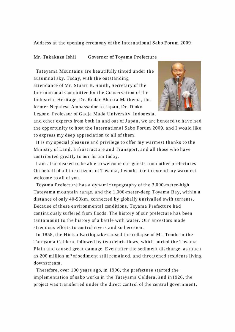
Address at the opening ceremony of the International Sabo Forum 2009
Mr. Takakazu Ishii Governor of Toyama Prefecture
Tateyama Mountains are beautifully tinted under the autumnal sky. Today, with the outstanding attendance of Mr. Stuart B. Smith, Secretary of the International Committee for the Conservation of the Industrial Heritage, Dr. Kedar Bhakta Mathema, the former Nepalese Ambassador to Japan, Dr. Djoko Legono, Professor of Gadja Mada University, Indonesia, and other experts from both in and out of Japan, we are honored to have had the opportunity to host the International Sabo Forum 2009, and I would like to express my deep appreciation to all of them. It is my special pleasure and privilege to offer my warmest thanks to the
Ministry of Land, Infrastructure and Transport, and all those who have contributed greatly to our forum today. I am also pleased to be able to welcome our guests from other prefectures.
On behalf of all the citizens of Toyama, I would like to extend my warmest welcome to all of you. Toyama Prefecture has a dynamic topography of the 3,000-meter-high
Tateyama mountain range, and the 1,000-meter-deep Toyama Bay, within a distance of only 40-50km, connected by globally unrivalled swift torrents. Because of these environmental conditions, Toyama Prefecture had continuously suffered from floods. The history of our prefecture has been tantamount to the history of a battle with water. Our ancestors made strenuous efforts to control rivers and soil erosion. In 1858, the Hietsu Earthquake caused the collapse of Mt. Tombi in the
Tateyama Caldera, followed by two debris flows, which buried the Toyama Plain and caused great damage. Even after the sediment discharge, as much as 200 million m3
3 of sediment still remained, and threatened residents living downstream. Therefore, over 100 years ago, in 1906, the prefecture started the
implementation of sabo works in the Tateyama Caldera, and in1926, the project was transferred under the direct control of the central government.
Combining the wisdom and efforts of our ancestors, one of the Japan’s largest sabo facilities were built. Today, sabo technologies, which developed from Tateyama, have been
highly evaluated worldwide. The term “sabo,” which came to be used in the meetings of the International Association of Hydrological Sciences in Belgium, has now become an international word, and sabo technologies have contributed greatly to disaster prevention all over the world through the dispatch of engineers. In October last year, the Congress of the International Association of
Hydrogeologists (IAH) was held in Toyama for the first time in Japan. The Toyama Declaration was issued then, and Toyama increased its world appeal as the birthplace of sabo technologies which have now spread worldwide. It is also worthy to mention that the historical values of the Shiraiwa sabo
dam, were highly evaluated, and in June of this year it became Japan's first sabo facility to be designated as an important cultural property. At this time, in order to widely introduce the historical and cultural values
of Tateyama sabo, and also to verify that the technologies of Tateyama Sabo are contributing to the world, we have decided to host this forum. The sabo projects lasting over a century are superb cultural landscapes
worthy to be called “a model of Japan’s disaster prevention.” Our prefectural government, in cooperation with municipalities concerned, is currently promoting the inscription of the region on the list of the World Cultural Heritage Sites. We hope that this forum will contribute to taking such efforts a step further. In today’s forum, we have invited a keynote speaker, Mr. Stuart B Smith,
Secretary of TICCIH, and other leading experts from in and outside Japan. It is our hope that everyone present today will further deepen their
understanding of the importance of Tateyama sabo and its universal values, and we wish to request your continued support and cooperation in our endeavor toward the inscription on the World Cultural Heritage Sites. We also hope that on this occasion, those present from outside Toyama will
realize the various charms of our prefecture, such as its beautiful natural environment, colorful history and culture, and fresh delicacies from the sea and the countryside. I shall close my greetings with the wish that this forum will be fruitful, and
by wishing everyone present good health, happiness, and success.

Address at the opening ceremony of the International Sabo Forum 2009
Mr. Hiroshi Makino
Director-General, Sabo Department, MLIT*
(*Ministry of Land, Infrastructure, Transport and Tourism)
It is a great honor for me to be here. It is also a great pleasure to
hold the international Sabo symposium here in Toyama. I really appreciate the efforts of
all the participants and all the staff working for this Symposium.
Sabo has a long history in Japan. It dates
back more than one thousand three hundred
years, to when Japan emerged as a nation. At
that time, the central authority enacted laws
for protecting mountains and rivers and
regulated the cutting down of trees in forests.
These laws strongly suggest that
communities in Japan had themselves
already been regulating the cutting down of trees since ancient times.
In the seventeenth and eighteenth centuries, Japanese people built Sabo dams to
prevent debris flows. Even now, you can see such dams in Fukuyama City, Hiroshima
Prefecture. Well preserved because well maintained, they are still in service, performing
the same role as they did in the past. In those days, it was important to cultivate new
land for rice and other crops in order to feed a growing population. However, debris
flows from uplands would run into rivers causing the riverbeds to rise. Once a riverbank
broke, the resulting floodwaters would wreak havoc. Therefore controlling the flow of
debris from higher levels became a necessary disaster-prevention measure. To prevent
flows of debris, the inhabitants constructed Sabo works, similar to the Sabo works on
the Joganji River here at Tateyama in Toyama, though smaller in scale.
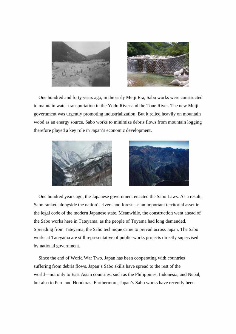
One hundred and forty years ago, in the early Meiji Era, Sabo works were constructed
to maintain water transportation in the Yodo River and the Tone River. The new Meiji
government was urgently promoting industrialization. But it relied heavily on mountain
wood as an energy source. Sabo works to minimize debris flows from mountain logging
therefore played a key role in Japan’s economic development.
One hundred years ago, the Japanese government enacted the Sabo Laws. As a result,
Sabo ranked alongside the nation’s rivers and forests as an important territorial asset in
the legal code of the modern Japanese state. Meanwhile, the construction went ahead of
the Sabo works here in Tateyama, as the people of Toyama had long demanded.
Spreading from Tateyama, the Sabo technique came to prevail across Japan. The Sabo
works at Tateyama are still representative of public-works projects directly supervised
by national government.
Since the end of World War Two, Japan has been cooperating with countries
suffering from debris flows. Japan’s Sabo skills have spread to the rest of the
world—not only to East Asian countries, such as the Philippines, Indonesia, and Nepal,
but also to Peru and Honduras. Furthermore, Japan’s Sabo works have recently been

introduced to European countries through InterPrevent, and Japan is conducting joint
studies and research into Sabo works with Romania and Italy.
Any who pause to consider the history of Sabo in Japan will realize what an
important role Tateyama Sabo has played in it, and what role it should play in the future.
I believe Sabo is a way for human beings to work with nature, using limited land and
resources well to secure a safer and more abundant life. Sabo seeks neither to subjugate
nature nor merely to worship it. Sabo is one of the great cultural achievements of Japan;
nurtured by working with a tough yet rich and varied natural environment through more
than two thousand years of Japanese history.
In the twentieth century, states seeking large territories to exploit competed for
hegemony. It is nonetheless obvious now, some four decades after the Apollo moon
landings took place, that human beings will have to live in harmony with each other and
with the natural environment, here, in the confines of their common home the Earth,
with its finite resources.
Much concern now exists in the world over the major disasters that will result from
climate change. I believe that Japan’s Sabo culture, including that of Tateyama, will be
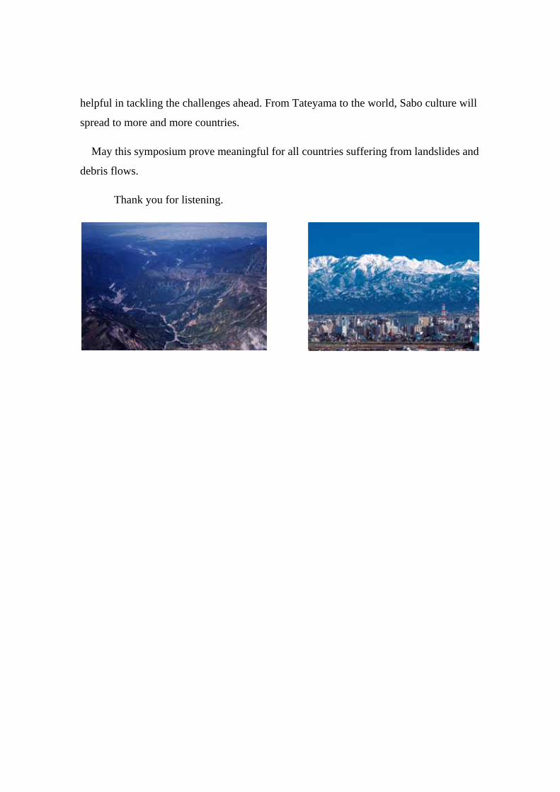
helpful in tackling the challenges ahead. From Tateyama to the world, Sabo culture will
spread to more and more countries.
May this symposium prove meaningful for all countries suffering from landslides and
debris flows.
Thank you for listening.
Keynote Speech
The Cultural Heritage of the Modern Era Mr. Stuart B. Smith OBE. MSc FMA
Secretary of TICCIH*
(*The International Committee for the Conservation of the Industrial Heritage )
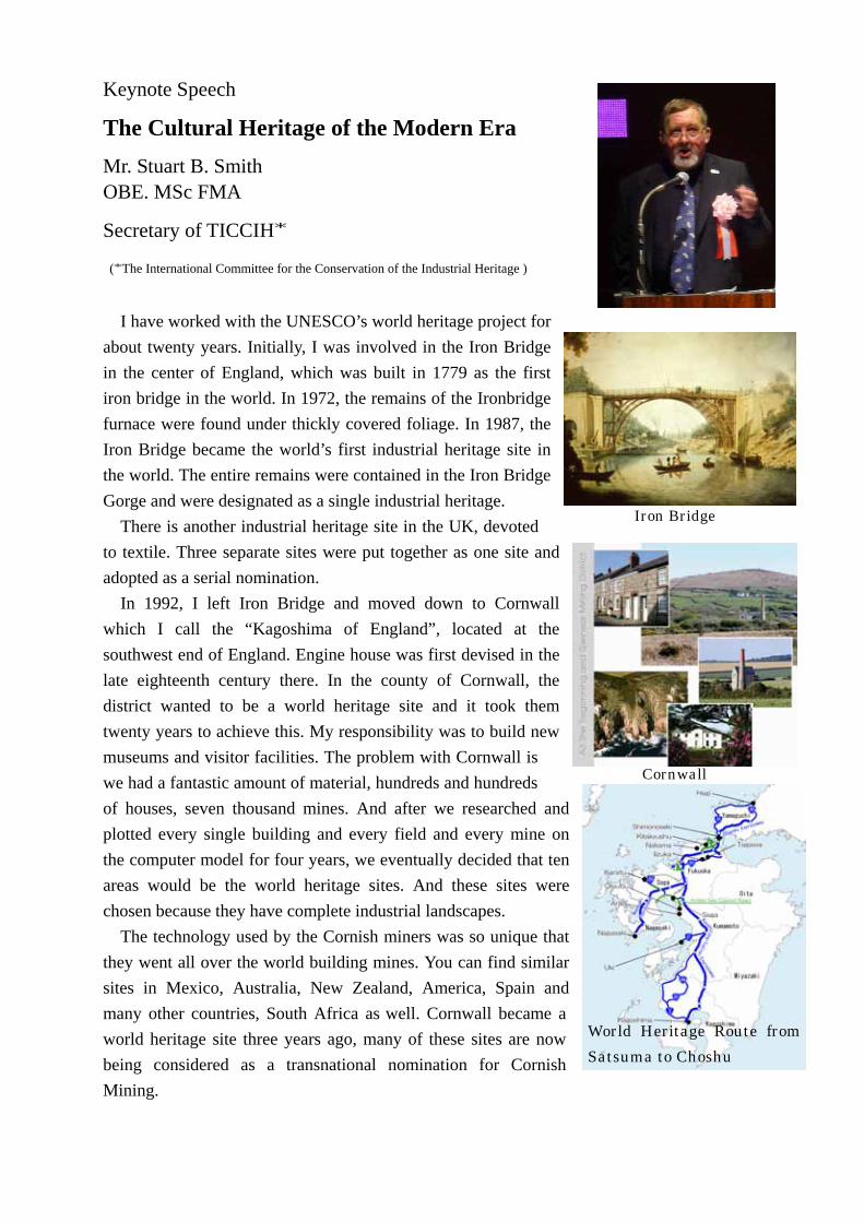
I have worked with the UNESCO’s world heritage project for about twenty years. Initially, I was involved in the Iron Bridge in the center of England, which was built in 1779 as the first iron bridge in the world. In 1972, the remains of the Ironbridge furnace were found under thickly covered foliage. In 1987, the Iron Bridge became the world’s first industrial heritage site in the world. The entire remains were contained in the Iron Bridge Gorge and were designated as a single industrial heritage.
There is another industrial heritage site in the UK, devoted to textile. Three separate sites were put together as one site and adopted as a serial nomination.
In 1992, I left Iron Bridge and moved down to Cornwall which I call the “Kagoshima of England”, located at the southwest end of England. Engine house was first devised in the late eighteenth century there. In the county of Cornwall, the district wanted to be a world heritage site and it took them twenty years to achieve this. My responsibility was to build new museums and visitor facilities. The problem with Cornwall is we had a fantastic amount of material, hundreds and hundreds of houses, seven thousand mines. And after we researched and plotted every single building and every field and every mine on the computer model for four years, we eventually decided that ten areas would be the world heritage sites. And these sites were chosen because they have complete industrial landscapes.
The technology used by the Cornish miners was so unique that they went all over the world building mines. You can find similar sites in Mexico, Australia, New Zealand, America, Spain and many other countries, South Africa as well. Cornwall became a world heritage site three years ago, many of these sites are now being considered as a transnational nomination for Cornish Mining.
Iron Bridge
Cornwall
World Heritage Route from Satsuma to Choshu

A similar campaign has been launched in Japan involving a serial heritage nomination of industrial sites in Kyushu. The beginning of the story actually goes back about fifteen years, when Kagoshima became very excited about the possibility of world heritage. We have spent a lot of time looking at places in all these areas to find out a big serial nomination for Kyushu and Yamaguchi. We are trying to tell the story of the modernization of Japan on many different sites. Not just industrial because there’ll be battlefields as well, but they are part of the story of Japan’s modernization.
One question that has been put to me is, “Are SABO facilities okay to be put forward because they are quite modern?” My reply is, I think the Tateyama Sabo facilities should be put forward for the designation as a modern heritage site. In Norway, a hydro power station which was built during the same period as the first Tateyama facility, together with transport systems and factories were on the Norwegian World Heritage site tentative list collectively as a single industrial heritage site. This is the picture of a hydro power station which is now being museum.
Another sight, in which I have been involved, is in Sweden. This is the Grimeton radio station. This was part of an international system to send beam radio, directed radio from Sweden to America. Even though this is from the 1920s, it is the only one that survives in the world – and the only one, which is still working. This is the picture of Grimeton radio station. The fact that this industrial heritage is still operating is very significant. Here we have modern sites, in our terms; this is already on the world heritage list. So there is no problem about the date of your sites here.
If your government decides to put your sites forward for world heritage, the procedure is as follows. As this is a man-made sight, the application will be referred to ICOMOS who look after man-made sites. And we have an arrangement with ICOMOS that anything, which is industrial, will come to my organization TICCIH to be looked at. And we will recommend people who can look at the sight in terms of its world importance, do this as a desk study. And eventually, if it passes that test, of course, it’s seen to be of world significance, and then another expert goes to look at the boundary, the preservation of it and all the practical details, which have to be approved, as well.
Hydro power station (Norwey)
Grimeton radio station
Tateyama & Kurobe Model of Japan which is superpower of
Disaster prevention
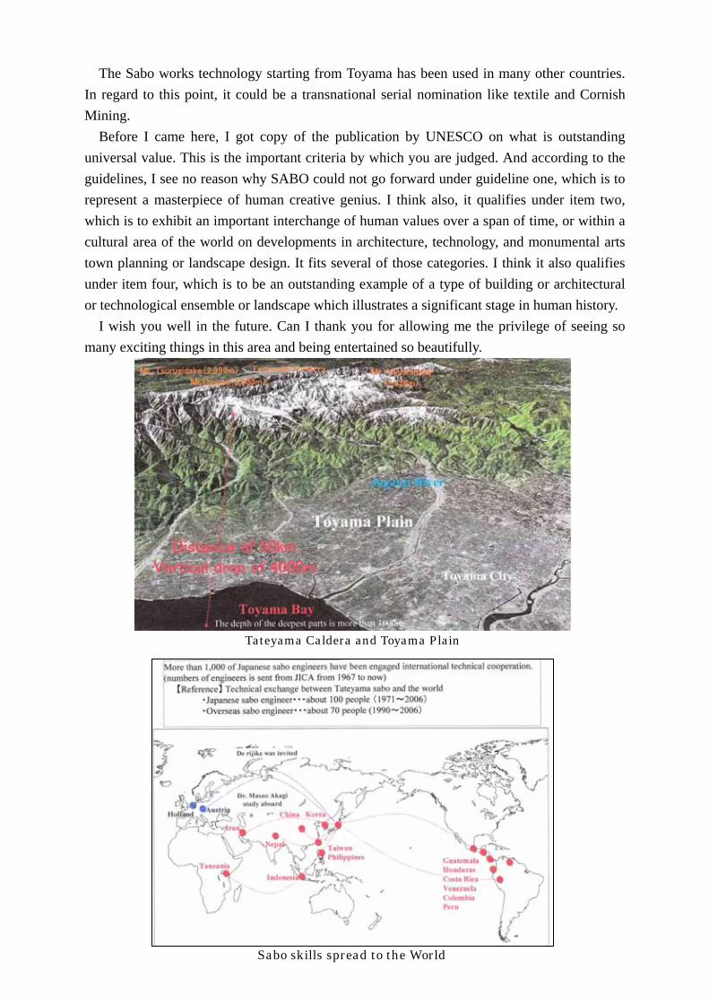
The Sabo works technology starting from Toyama has been used in many other countries. In regard to this point, it could be a transnational serial nomination like textile and Cornish Mining.
Before I came here, I got copy of the publication by UNESCO on what is outstanding universal value. This is the important criteria by which you are judged. And according to the guidelines, I see no reason why SABO could not go forward under guideline one, which is to represent a masterpiece of human creative genius. I think also, it qualifies under item two, which is to exhibit an important interchange of human values over a span of time, or within a cultural area of the world on developments in architecture, technology, and monumental arts town planning or landscape design. It fits several of those categories. I think it also qualifies under item four, which is to be an outstanding example of a type of building or architectural or technological ensemble or landscape which illustrates a significant stage in human history.
I wish you well in the future. Can I thank you for allowing me the privilege of seeing so many exciting things in this area and being entertained so beautifully.
立山黒部~防災大国日本のモデル
-信仰・砂防・発電-~
Sabo skills spread to the World
Tateyama Caldera and Toyama Plain

Thoughts on Efforts toward Sustainable Development of Sabo Works in Indonesia
Prof. Djoko Legono Research Coordinator of Worlds Class Research University Program, Gadjah Mada Univ.
Abstract: In line with the dynamics of volcanic activities in Indonesia, the development of sabo technology which was started 1970’s, has been facing various challenges which may affect its acceptability. The terminology of sabo, which in general term is known as ‘sand prevention’, still dominates the understanding of sabo works to control the sediment migration at torrential rivers. The long term role and function of sabo to control the dynamics of sediment migration may require a proper sediment management, not only during excessive supply but also during the normal condition where the supply is considerably small. Problems may become more complex when the natural migration is interrupted by human activities in the form of sand withdrawal from the rivers for various purposes (e.g. construction material, stone handicraft, kitchen ware, etc). This paper deals with the problems and countermeasures during the last decade of sabo development in Indonesia. Factors affecting the problems such as economic crisis (1997), country reforms (1998), autonomy system (2002), new government law on water resources (2004), and new government law on disaster (2004), are presented and reviewed, and their possible thoughts for future sustainable sabo development are discussed. Several practices on sediment management in Mt. Merapi area related to the acceptability of sabo works in Indonesia are also presented to illustrate the complex nature of the sabo development in the country. Furthermore, related future researches and developments toward the sustainable development of sabo works in Indonesia are promoted, toward the sustainable development of sabo work Keywords: sustainable development, sabo technology, volcanic area, sediment management, new approach 1. Introduction
Since the earthquake and tsunami which hit Aceh and North Sumatra of Indonesia in December 2004 with more than 125,000 casualties, there have been several disaster occurrences in some parts of the country with significant number of casualties. Some of them are the earthquake of Nias Island (March 2005, approximately 600 casualties), Banjarnegara landslide (January 2006, approximately 70 casualties), Mid-Java earthquake (May 2006, approximately 7,000 casualties), Mt. Merapi debris flow and pyroclastic cloud (June 2006, 2 casualties), Bengawan Solo river flood (December 2007, approximately 70 casualties), Karanganyar landslide (December 2007, approximately 65 casualties), Situ Gintung dam failure (March 2009, 89 casualties), and just recently, Tasikmalaya earthquake (September 2009, approximately 40 casualties) and Padang-Jambi earthquake (September 2009, where the emergency response is currently ongoing). Indonesia with the total area of 1,919,440 km2 and consisting of more than 13,000 islands, 54,716 km length of
coastline, lies between approximately 7°N and 11°S latitude, and between the 95°E and 140°E longitude. The population at the beginning of 2004 was estimated to be 238,452,952. As a tropical country, there are two main seasons dominating the islands, i.e. the dry season (between April and September) and wet season (between October and March). However, some islands experience wet season all year long (North Sulawesi), and some only have wet season for 3 months (Flores, Timor, and Sumba). There are two tectonic plates (see Figure 1); passing through the islands that make 80% of the country prone to natural disaster (YEC, 2002).
▲
Mt. Merapi, laid at Central Java Province and Yogyakarta Special Province, is one of some active volcanoes in the world, with the high population at its surrounding.

Indo-Australia Plate
Eurasia Plate
Philippine Plate
Pacific Plate
Figure 1 Tectonic plates around Indonesia (YEC, 2002)
Among many disasters experienced by the country are earthquake, volcanic eruption (e.g.: pyroclastic flow and debris flow), landslide, flood, drought, river bank erosion, river/reservoir sedimentation, etc. Such disasters may be natural; however, some of them are human triggered ones. The capacity of the country to cope with such a large number of disaster occurrences (both frequency and intensity) may of course be limited, but the valuation for putting priority to mitigate the impact is often complex and requires continuous socialization on the understanding of the role and function of related infrastructures such as sabo works. Unfortunately, there is no clear cut between a natural disaster and the human-interfered one. Apart from the complexity in determining the disaster type, sediment-related disasters such as debris flows, landslides, rockslides, etc. are of great consequence disaster that needs to be dealt with seriously. The presence of sabo works that is highly related to the mitigation of the above disasters need to be appreciated.
2. Autonomy Paradigm and Other Related Government Law’s The idea of the autonomy system is basically providing more initiatives to the local governments, (i.e.
district/city governments rather than the provincial governments) to develop and utilize the natural resources in order to avail better social welfare of the community. The central government is supposed to supervise and provide technical recommendations when necessary, so that the sustainable development can be achieved. In the case where the local government has very limited capacities, particularly those related with the budget, central government should assist based on a certain mechanism. The economic crisis in the country in 1997 that was probably experienced throughout the regional countries has made the country suffered from other crisis, such as political, social, national leadership, etc., which finally became a multidimensional crisis. Since then, the country has been facing many unstable situations; one of these was a significant increase of unemployment. Human activities increase considerably, pressure on lands, such as land cultivations for food crops and settlements, increases intensively. This in turn also causes degradation of environmental quality including an increase on runoff coefficient and soil erosion. Many attempts have been made to anticipate the above complex nature where related projects to alleviate the poverty, to secure the food, and to improve the environment quality, have been emphasized more. The issuance of several new government laws to accelerate the country reform often meet significant constraints due to the lack of preparation for their socialization. It was found that the sand mining activity at volcanic rivers may create job opportunities which at some extend improve life quality of the community. However, at the long term view point, this may invite another serious problem in term of sustainability of the sediment control structures such as sabo facilities along the rivers.

3. Sediment Control at Mt. Merapi, Yogyakarta Special Province, Indonesia
3.1. Mt. Merapi Activity
The sediment resource from the upstream part of a river is highly affected by both natural and human interference mechanisms. Natural sediment product may consist of direct supply from active volcanoes, land erosions, bank erosions, hill landslides, etc. The presence of rainfall in some extent may also trigger the phenomena. Human interference may consist of activities which give “pressure” on land such as cutting trees, cultivating land, or others for individual or collective purposes. Depending upon the sediment product at the upstream of the river, the sediment controls such as sabo works are built with a particular purpose to minimize destructive power due to excessive sediment flow. Followings are some experiences in the development of sabo for special case of controlling sediment of rivers originated from Mt. Merapi, Indonesia.
It is obvious that one particular sabo structure (e.g. a slit check dam) may contribute to a specific debris flow control so that destructive power downstream of the check dam is avoided. However, this may be occurred only in very little frequency, say once every five years. In order to put more reliable appreciation on the presence of the sabo works, a systematic lesson learn on some evidence that sabo structure may take role in controlling sediment disaster should be introduced. This may involve in the development of good monitoring technique on the debris flow occurrence so that various debris flow conditions over the sabo structures are identified. Figure 2 is a good example to illustrate how serious the sediment flow disaster may affect the infrastructures.
a). Before debris flow occurrence b). After debris flow occurrence Figure 2 Debris flow occurrence at Kali Boyong, Mt. Merapi, on 1994 eruption
Debris flow occurrence at Kali Boyong, Mt. Merapi, on 2006 eruption
▲
Before collapse of hot lava dome on 14-06-2008
After collapse of hot lava dome on 14-06-2008
a). Before debris flow occurrence b). After debris flow occurrence
3.2. Sediment Volume
The sand mining activity has been fluctuated yearly depending on many factors. Main factors are the sand availability and the market need. Other factors such as government project (river normalization) and opening of new private quarry sites may also contribute to small fluctuation. The average of sediment production yearly within the period of 2007 through 2012 is estimated at 2 million m3. The rapidly decline of sand mining volume from 2001 until 2006 suggests that sand stock around Mt. Merapi was reducing due to mining activities whereas no eruption occurred. It is obvious that the availability of sand at surrounding Mt. Merapi is the primary limitation to sand mining activity. The balance between input (pyroclastic material) and output (sand mining production) is important to prevent environment degradation. Since 1997 the average sand mining volume has been relatively high (3.55 million m3). Practically, the maximum sand mining volume should be equal to the average pyroclastic sediment from Merapi eruption yearly. To avoid river bed degradations due to excessive withdrawal of sand, thus to avoid the damage of sabo facilities, a value of allowable yearly sand mining volume at 2 million m3 was then proposed. The other problem is how to control the sand mining location and its allowable volume.
3.3. Acceptability of Sabo dam
A single purpose sabo dam is more like a life insurance where the benefit will only be experienced after debris-related disaster occurs. When nothing happens, the dam looks like a giant infrastructure having no benefit to the community, just like the money invested in the insurance company. Such situation may raise a question which supports the idea that the dam is unnecessary, inefficient or promotes an unwanted environment. This type of view toward sabo dam should be avoided whenever possible. Hence, multipurpose sabo dam is more desirable. Such typical sabo dam may give benefits to the community shortly after its construction even if no debris flow is experienced. The existing multipurpose sabo dams that are well accepted by the community are those that also function as bridges, weirs, increasing groundwater tables and river bank/land stabilizations. There are many other benefits of sabo dam infrastructures that have to be explained clearly to the community to improve acceptability. High acceptability may also assure the sustainability of the dam structure. It can be seen that the acceptability of sabo dam infrastructure depends largely on the purpose of the infrastructure, the benefit to the upstream and downstream communities, and the effectiveness of the community consultation to explain the need and the purpose of the sabo dam to the community.
4. Indonesian Sabo Development through Japan Technical Cooperation
The sabo development in Indonesia has already started since 1969, in line with the establishment of volcanic mountain projects such as Mt. Merapi, Mt. Kelud, and Mt. Agung Projecst (1969), Mt. Semeru Project (1977), Mt. Galunggung Project (1982). Nowadays, Mt. Galunggung and Mt. Agung are no longer active and the projects were closed in 1999. The first Japanese expert who has been introducing the sabo technology was Mr. Tomoaki Yokota, which passed away in 1972 in Indonesia due to malaria disease. To honour and commemorate his remarkable contribution, his name was then used for the library, i.e. Yokota Library in Sabo Technical Center office in Yogyakarta. Through the technical cooperation with JICA of Japan, the Volcanic Sabo Technical Center (VSTC) was established in 1982, with the special objective of building capacity to Indonesian Ministry of Public Works officials to be experts on sabo technology. Since the mentioned technology is not only supposed to encounter the sediment-related disaster from volcanic activity, but also those from other non-volcanic areas, the VSTC was then changed into Sabo Tehnical Center (STC) in 1992. During the above period, it was gradually realized that sabo technology was not only aimed at protecting human lives and properties, but also to increase human welfare. Therefore, in 2001, a Record of Discussion (R/D) was signed to run the “Integrated Sediment Disaster Management (ISDM)” Project which was implemented by STC for the following 5 (fiver years) until 2005, and then being extended for the following 2 (two) years until 2007. One promising scheme of the ISDM was the establishment of Master Programme in Disaster Management (MPBA) in 2001 which aimed at availing human resources from various government agencies to have capability in managing the disasters. Five Ph.D students graduated from various best universities in Japan have been resulted, and more then one hundred M.Sc. students have been graduated from MPBA, Further efforts on maintaining sustainability of sabo facilities
may be conducted through long-term action research through cooperation among various stakeholders such (Public Works Sector, Local Government Agencies, MPBA, etc), and it is really demanded for the further development of sabo in Indonesia. Currently, the technical cooperation related to sabo development under the JBIC (2007 – 2011) is also another big effort to maintain sabo facilities remain sustainable; one component called “Study on the Institution and Community Development at Mt. Merapi Area” is included. Indeed, ones may underline that in order to maintain the sabo facilities remain sustainable, continuous development of both institutions and communities should be carried out.
5. Conclusions
In line with the rapid growth of population and increase in various disaster intensities, sabo infrastructures in Indonesia which has been developed for almost forty years need to be sustained. Factors affecting the problem of maintaining the sustainability of sabo works may comprise the followings; 1). Sediment control by means of sabo facilities should consider various aspects of both structural and
non-structural measures. Therefore, future development of sabo works (numbers, types, sizes, and locations) should be carefully planned through a long-term process of socialization, considering not only sediment volume availability and the intensity of possible sediment flow disaster, but also future anticipation of sediment mining activity.
2). The presence of new government laws should be accommodated which in turn come to the establishment of tasks and demarcations among related institutions responsible for integrated sediment mining management. Autonomy system should be meant as an alternative to accelerate community welfare without causing significant environmental degradation.
3). Participatory approach involving various stakeholders including village communities should be adopted and systemized towards the sustainable development of sabo works. These may require consistency in continuous monitoring and evaluation that should be carried out by each stakeholder, based on the task demarcations confirmed among the related stakeholders.
Acknowledgements The authors express sincere thanks and appreciations to Mr. Hisaji Inami, Chairman of the Steering
Committee of the International Sabo Forum 2009, for providing the opportunity to the authors on sharing thoughts toward sustainable sabo development. Special thanks are forwarded to Mr. Masayuki Hayashi of Toyama Prefecture for provision of arrangement upon my participation in such valuable scientific meeting, and to Mr. Ueno Toshiyasu, JICA Expert on Sabo Policy, for the encouragement of exchanging views of sabo developments in Indonesia.

1
The Historical and Cultural Value of Tateyama Sabo Tateyama Sabo, a Symbol of Japan as a State Founded on Disaster Prevention
Mr. Koichi Kondo Managing Director, SABO Technical Center
A land with abundant nature and a land where nature is harsh Mountain ranges run along the center of the Japanese archipelago, with 70% of the
land being mountain and forest. The mountainous areas are blessed with abundant rainfall
and meltwater. Myriads of clear streams and rivers flowing down from them nurture life
and create the scenery of the changing seasons.
However,
・ The steep terrain in mountainous areas means that there is
only so much flat land. Its geological features are fragile,
and have a complex composition and distribution
・ The archipelago is segmented by many geotectonic lines,
for example the Median Tectonic Line and the
Itoigawa-Shizuoka Tectonic Line. These tectonic lines
create fault fracture zones of fragile ground.
・ The Japanese archipelago is formed at a location where
four tectonic plates, including the Eurasian Plate and the
Pacific Plate, collide, making it a region with frequent
earthquakes and volcanic activity (Roughly 20% of
earthquakes with a magnitude of 6 or higher occur in Japan.
7% of the world’s active volcanoes are concentrated in
Japan.)
・ The rainy season, and being in a region prone to
typhoons means that there are frequent localized
downpours
・ Almost all the rivers are torrential rivers so rainwater
pours down en masse from mountainous areas forming
rapids, washing down large amounts of sediment and
causing floods and sediment disasters
The struggle against natural disasters From olden times Japan has been faced with the harshness of nature, sometimes encountering disasters, and the
A country in the typhoon belt
(A map of typhoons and their paths in 2004)
Tectonic plates in the vicinity of Japan
2
Japanese treat nature with a feeling of respect. Documents from 1,200 years ago record prohibitions on the felling
of forests, and the concept of water conservation is apparent.(An imperial edict from 806, and an official
document from 821)
In 1666 and 1684 the Edo Shogunate promulgated laws concerning mountains and rivers throughout the
whole country, ordered the reforesting of denuded mountains etc, and took measures to prevent sediment
discharge.
Under its national policies of industrial development, the Meiji administration launched work on the social
infrastructure of railroads, harbors, flood control and electric power generation, inviting civil engineers from such
countries as Germany, Britain and the Netherlands in order to acquire modern technology from Europe. Flood
control engineers were invited from the Netherlands. The civil engineer who achieved the most was Johannis de
Rijke, who stayed in Japan for 30 years.
De Rijke’s first task upon his arrival in Japan was the improvement of the Yodo River. The main objective in
those days was to maintain a low water channel in order to secure a passage for boats. Since there was a
considerable amount of sediment runoff and deposits from upstream, Johannis de Rijke did a survey of the upper
river basin and came to the conclusion that erosion control and afforestation were of prime importance. The
method adopted by Johannis de Rijke combined the planting of vegetation traditionally done in Japan with the
building of many dams on mountain streams aimed at stabilizing their flow, and was similar to ancient Japanese
construction methods.
Frequent flood damage occurred from the latter half of the Meiji Era and there was a policy shift in the
improvement of major rivers: continuous dykes were planned and constructed along them to concentrate flood flow
within the dykes and channel it swiftly to the sea. This policy was to protect the major cities and industrial and
agricultural areas spread across the alluvial plains and thus enhance the productivity of the alluvial plains. The
River Law was enacted in 1896, followed by the Erosion Control Law in 1897, and measures taken against
floods and sediment disasters were based on the law.
Thus, the issue of river basin and land management is one that Japan is fated to deal with, since without
disaster prevention the state cannot develop and prosper. The project which symbolizes Japan as a state
founded on disaster prevention is that of the Joganji River and Tateyama Sabo.
The Joganji River: a typical example of a river that often overflows its banks
The Joganji, the foremost rapid wild river in Japan, has its source in the 3,000m-high Tateyama mountain range
from which it pours down into a large alluvial fan and flows into Toyama Bay.
From ancient times, due to its characteristics as an alluvial river, the Joganji frequently changed its flow, had no
fixed channel, and repeatedly caused flooding.
The cause of the Joganji’s sudden transformation into an ultra-wild river was the huge collapse in the inner
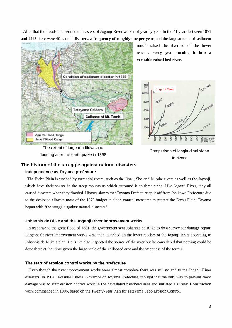
wall of the Tateyama Caldera caused by the Ansei Earthquake (1858). The 400 million m3 or so of soil from the
collapse formed a number of natural dams which began to be destroyed by collapsed sediment about two weeks
later and large mudflows were formed, causing an unprecedented sediment disaster in which the Toyama Plain was
covered three times.
3
After that the floods and sediment disasters of Joganji River worsened year by year. In the 41 years between 1871
and 1912 there were 40 natural disasters, a frequency of roughly one per year, and the large amount of sediment
runoff raised the riverbed of the lower
reaches every year turning it into a
veritable raised bed river.
The history of the struggle against natural disasters Independence as Toyama prefecture The Etchu Plain is washed by torrential rivers, such as the Jinzu, Sho and Kurobe rivers as well as the Joganji,
which have their source in the steep mountains which surround it on three sides. Like Joganji River, they all
caused disasters when they flooded. History shows that Toyama Prefecture split off from Ishikawa Prefecture due
to the desire to allocate most of the 1873 budget to flood control measures to protect the Etchu Plain. Toyama
began with “the struggle against natural disasters”.
Johannis de Rijke and the Joganji River improvement works In response to the great flood of 1881, the government sent Johannis de Rijke to do a survey for damage repair.
Large-scale river improvement works were then launched on the lower reaches of the Joganji River according to
Johannis de Rijke’s plan. De Rijke also inspected the source of the river but he considered that nothing could be
done there at that time given the large scale of the collapsed area and the steepness of the terrain.
The start of erosion control works by the prefecture Even though the river improvement works were almost complete there was still no end to the Joganji River
disasters. In 1904 Takasuke Rinoie, Governor of Toyama Prefecture, thought that the only way to prevent flood
damage was to start erosion control work in the devastated riverhead area and initiated a survey. Construction
work commenced in 1906, based on the Twenty-Year Plan for Tateyama Sabo Erosion Control.
The extent of large mudflows and
flooding after the earthquake in 1858 Comparison of longitudinal slope
in rivers
Joganji River

4
Flood disasters on the Joganji River
Sabo works put under direct governmental control The Toyama prefectural sabo erosion control works faced various difficulties but kept on steadily building sabo
constructions. However, a series of big floods occurred during the Taisho years, of particular note being the great
flood of July 1922 in which most of the sabo constructions that had been built were destroyed by mudflow.
The frequent disasters inflicted enormous construction costs on the prefecture-run works and a strong appeal
was made to the central government to put them under direct control.
In 1924 the government revised the Erosion Control Law to allow erosion control projects under central
government control to also be carried out on rivers such as the Joganji which run through a single prefecture.
The following year Masao Akagi, an engineer from the Home Ministry, surveyed the riverhead in great detail
and drew up a state-run erosion control plan that incorporated the Shiraiwa Base Dam Plan and the Dorodani
Dams Plan.
The dawn of modern sabo works In 1926 the Tateyama Sabo Works Office was set up at the Tateyama hot spring resort at the riverhead with
Masao Akagi appointed as its first chief. Akagi had studied in Austria about measures taken against Alpine
torrents and he put this experience to good use in the planning and execution of Tateyama Sabo. Tateyama is
where modern sabo works began.
Contemporary sabo works and the river basin Completion of the Shiraiwa Sabo Dam effectively blocked collapsed sediment from the caldera, after which the
completion of groups of sabo constructions and the Hongu Sabo Dam reduced sediment flow, and the frequent
major disasters seen in the Meiji and Taisho Eras have become a thing of the past.
The riverhead has gradually been restored with vegetation returning to the devastated area and in recent
years channels in the lower reaches remain in a state of calm. We are seeing the results of the lengthy
erosion and flood control initiatives for the river basin.
The historical and cultural value of the flood and erosion control techniques still found on Joganji River ・ A consideration of the measures taken hroughout the river basin
Erosion control measures or “sabo” are essential in
the mountainous upper reaches of rivers that include
mountain areas in their basin. When there is insufficient erosion control or none at
all, sediment deposits build up on theriverbed on the
plain and the danger of flooding is increased.
In the case of the Joganji River a notion of river basin
management was established by which the experience
of disaster was put to good use: in the upper reaches

5
sediment was blocked in the Tateyama Caldera sediment yield area; in the middle reaches sediment flow was
further reduced by constructing sabo dams (such as the Hongu Dam which boasts the biggest sediment trap
capacity in Japan) to regulate and store sediment; and in the lower reaches floodwater with a reduced sediment
level was prevented from overflowing by dykes and so on.
・The base sabo dam: the Shiraiwa Sabo Dam, an Important Cultural Property Control of unstable sediment from a major collapse, in other words construction of a base sabo dam at the vent
from the Tateyama Caldera, made it possible to control the discharge of sediment which is the main cause of
disasters as well as to prevent worsening of the collapse.
The Shiraiwa Sabo Dam is a large-scale sabo dam with a total head of 108m; construction started in 1929 and
took 10 years to complete. In June 2009 the Shiraiwa Sabo Dam became the first erosion control construction to
be designated by the state as an Important Cultural Property on the grounds that “It has a high historical value as a
national land conservation facility which has continued to protect the Toyama Plain from sediment-related
disasters. In addition, it is a complex erosion control facility made up of a group of large structures built by
making use of large machinery, and is important as a demonstration of the technical attainments of modern sabo
facilities”.
・Facing the continual challenge of harsh natural conditions Steep terrain, continually collapsing slopes, harsh weather conditions such as heavy snowfall: it was such
near-impossible construction conditions that spawned efforts and ingenuity to build strong structures, bring in
a steady supply of materials and guarantee safety during construction work.
The use of trolleys continues today with transportation safety standards maintained and safety measures for
the steep slopes beside the tracks being continually improved.
One of the trollies which have ferried
people and materials during the 80
years since construction started in 1927
The Shiraiwa Sabo Dam, an Important Cultural
Property which protects the Tateyama Caldera

6
The Mizutani Branch Office has been set up inside the caldera as the foremost base and many staff
members and construction workers continue the struggle in this remote outpost.
・Restoration of Greenery
Thanks to the use of sabo dams and so on to stabilize mountain stream beds and spurs of colluvial soil, vegetation
is returning to the denuded landslide scars and greenery is being restored to the whole of the riverhead area.
Dorodani, where the progress of sound erosion control foundation
work has restored greenery to landslide scars
Panoramas of the Tateyama Caldera and its renascent vegetation
Before Construction (1919) After Construction (1933) Present
7
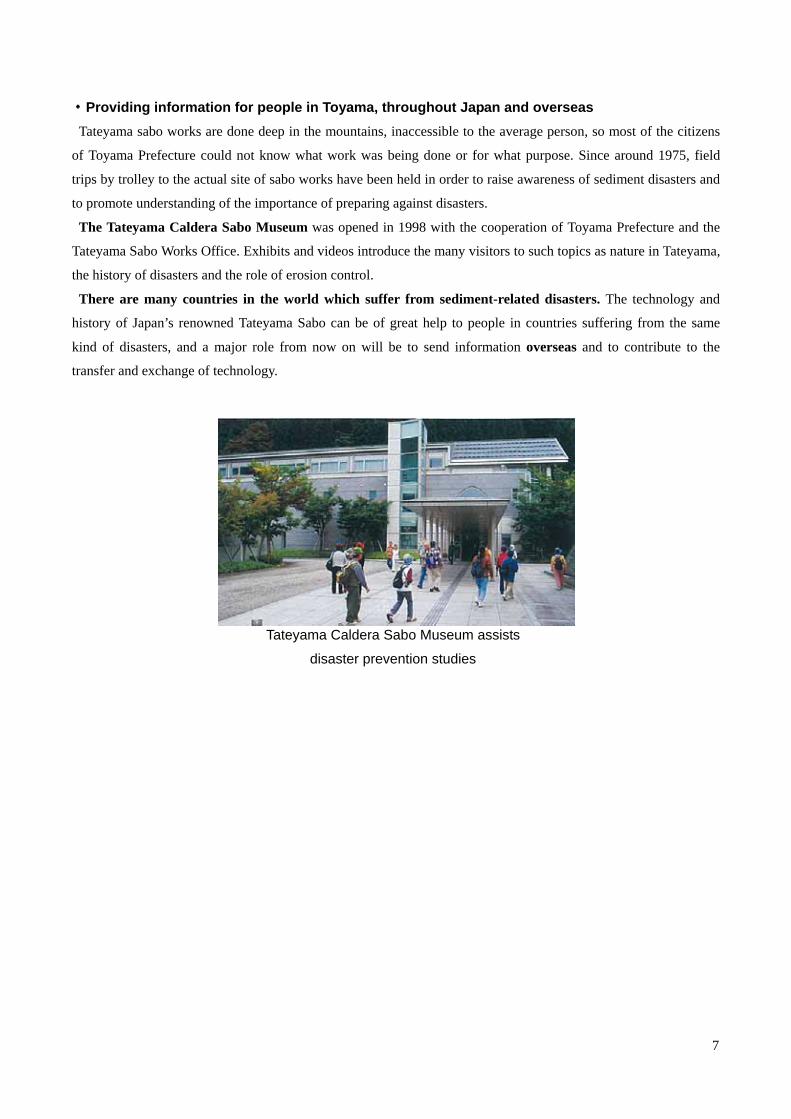
・Providing information for people in Toyama, throughout Japan and overseas Tateyama sabo works are done deep in the mountains, inaccessible to the average person, so most of the citizens
of Toyama Prefecture could not know what work was being done or for what purpose. Since around 1975, field
trips by trolley to the actual site of sabo works have been held in order to raise awareness of sediment disasters and
to promote understanding of the importance of preparing against disasters.
The Tateyama Caldera Sabo Museum was opened in 1998 with the cooperation of Toyama Prefecture and the
Tateyama Sabo Works Office. Exhibits and videos introduce the many visitors to such topics as nature in Tateyama,
the history of disasters and the role of erosion control.
There are many countries in the world which suffer from sediment-related disasters. The technology and
history of Japan’s renowned Tateyama Sabo can be of great help to people in countries suffering from the same
kind of disasters, and a major role from now on will be to send information overseas and to contribute to the
transfer and exchange of technology.
Tateyama Caldera Sabo Museum assists
disaster prevention studies
Technical Cooperation on Sabo between Nepal and Japan
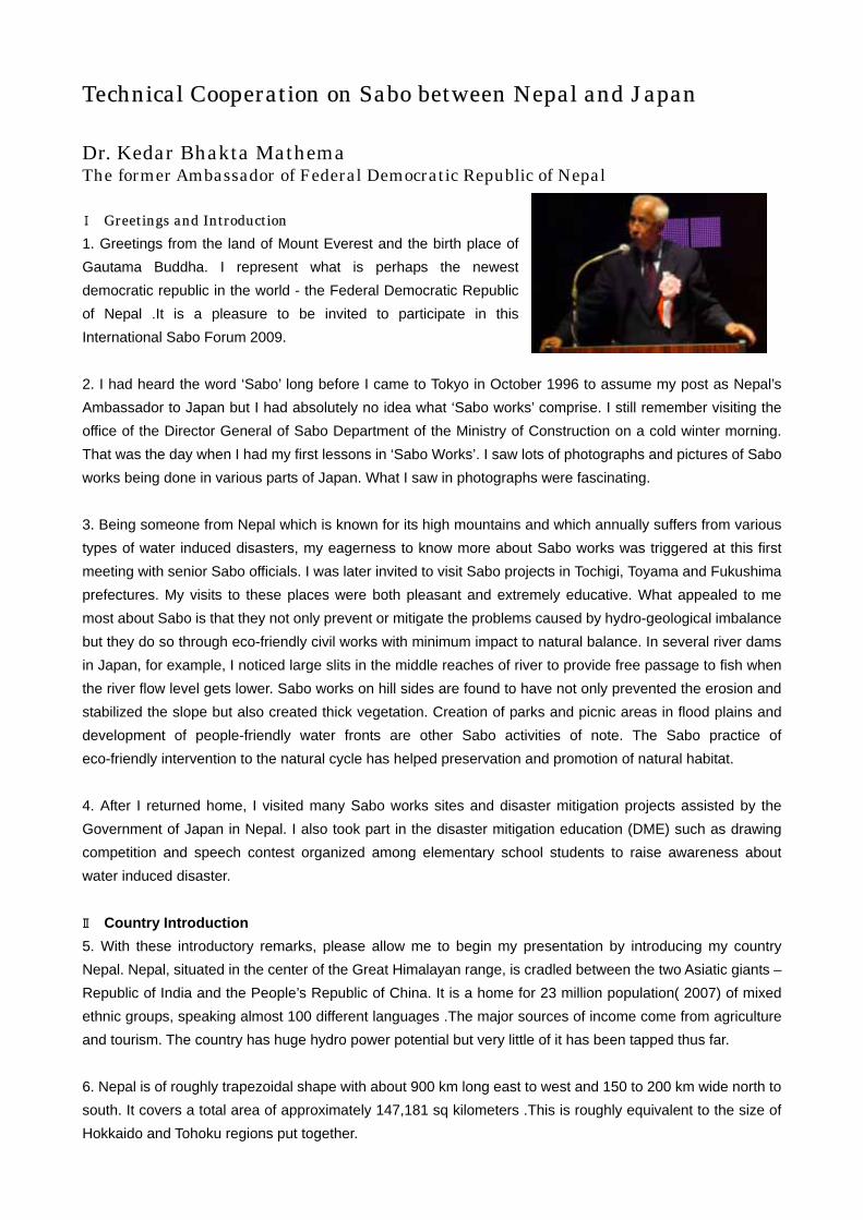
Dr. Kedar Bhakta Mathema The former Ambassador of Federal Democratic Republic of Nepal
Ⅰ Greetings and Introduction 1. Greetings from the land of Mount Everest and the birth place of Gautama Buddha. I represent what is perhaps the newest democratic republic in the world - the Federal Democratic Republic of Nepal .It is a pleasure to be invited to participate in this International Sabo Forum 2009. 2. I had heard the word ‘Sabo’ long before I came to Tokyo in October 1996 to assume my post as Nepal’s Ambassador to Japan but I had absolutely no idea what ‘Sabo works’ comprise. I still remember visiting the office of the Director General of Sabo Department of the Ministry of Construction on a cold winter morning. That was the day when I had my first lessons in ‘Sabo Works’. I saw lots of photographs and pictures of Sabo works being done in various parts of Japan. What I saw in photographs were fascinating. 3. Being someone from Nepal which is known for its high mountains and which annually suffers from various types of water induced disasters, my eagerness to know more about Sabo works was triggered at this first meeting with senior Sabo officials. I was later invited to visit Sabo projects in Tochigi, Toyama and Fukushima prefectures. My visits to these places were both pleasant and extremely educative. What appealed to me most about Sabo is that they not only prevent or mitigate the problems caused by hydro-geological imbalance but they do so through eco-friendly civil works with minimum impact to natural balance. In several river dams in Japan, for example, I noticed large slits in the middle reaches of river to provide free passage to fish when the river flow level gets lower. Sabo works on hill sides are found to have not only prevented the erosion and stabilized the slope but also created thick vegetation. Creation of parks and picnic areas in flood plains and development of people-friendly water fronts are other Sabo activities of note. The Sabo practice of eco-friendly intervention to the natural cycle has helped preservation and promotion of natural habitat. 4. After I returned home, I visited many Sabo works sites and disaster mitigation projects assisted by the Government of Japan in Nepal. I also took part in the disaster mitigation education (DME) such as drawing competition and speech contest organized among elementary school students to raise awareness about water induced disaster. Ⅱ Country Introduction 5. With these introductory remarks, please allow me to begin my presentation by introducing my country Nepal. Nepal, situated in the center of the Great Himalayan range, is cradled between the two Asiatic giants – Republic of India and the People’s Republic of China. It is a home for 23 million population( 2007) of mixed ethnic groups, speaking almost 100 different languages .The major sources of income come from agriculture and tourism. The country has huge hydro power potential but very little of it has been tapped thus far. 6. Nepal is of roughly trapezoidal shape with about 900 km long east to west and 150 to 200 km wide north to south. It covers a total area of approximately 147,181 sq kilometers .This is roughly equivalent to the size of Hokkaido and Tohoku regions put together.
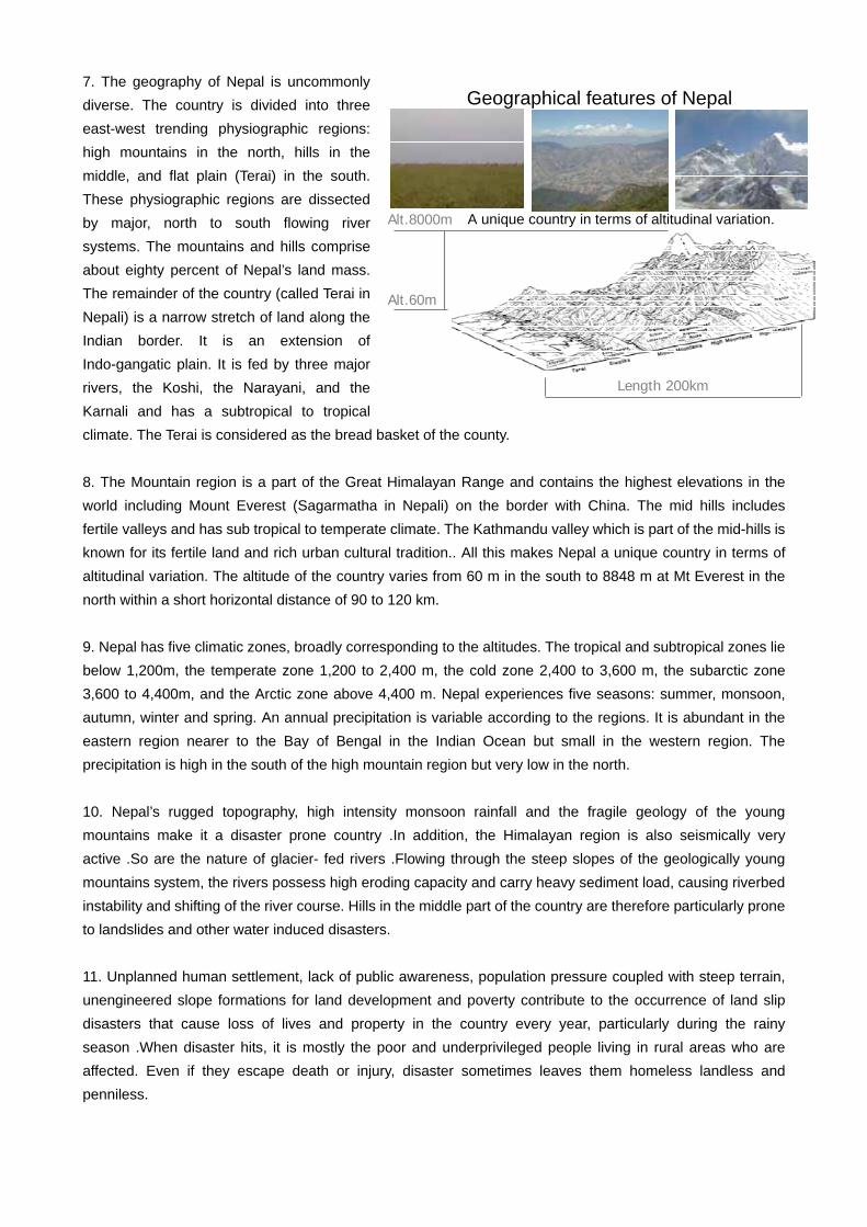
7. The geography of Nepal is uncommonly diverse. The country is divided into three east-west trending physiographic regions: high mountains in the north, hills in the middle, and flat plain (Terai) in the south. These physiographic regions are dissected by major, north to south flowing river systems. The mountains and hills comprise about eighty percent of Nepal’s land mass. The remainder of the country (called Terai in Nepali) is a narrow stretch of land along the Indian border. It is an extension of Indo-gangatic plain. It is fed by three major rivers, the Koshi, the Narayani, and the Karnali and has a subtropical to tropical climate. The Terai is considered as the bread basket of the county. 8. The Mountain region is a part of the Great Himalayan Range and contains the highest elevations in the world including Mount Everest (Sagarmatha in Nepali) on the border with China. The mid hills includes fertile valleys and has sub tropical to temperate climate. The Kathmandu valley which is part of the mid-hills is known for its fertile land and rich urban cultural tradition.. All this makes Nepal a unique country in terms of altitudinal variation. The altitude of the country varies from 60 m in the south to 8848 m at Mt Everest in the north within a short horizontal distance of 90 to 120 km. 9. Nepal has five climatic zones, broadly corresponding to the altitudes. The tropical and subtropical zones lie below 1,200m, the temperate zone 1,200 to 2,400 m, the cold zone 2,400 to 3,600 m, the subarctic zone 3,600 to 4,400m, and the Arctic zone above 4,400 m. Nepal experiences five seasons: summer, monsoon, autumn, winter and spring. An annual precipitation is variable according to the regions. It is abundant in the eastern region nearer to the Bay of Bengal in the Indian Ocean but small in the western region. The precipitation is high in the south of the high mountain region but very low in the north. 10. Nepal’s rugged topography, high intensity monsoon rainfall and the fragile geology of the young mountains make it a disaster prone country .In addition, the Himalayan region is also seismically very active .So are the nature of glacier- fed rivers .Flowing through the steep slopes of the geologically young mountains system, the rivers possess high eroding capacity and carry heavy sediment load, causing riverbed instability and shifting of the river course. Hills in the middle part of the country are therefore particularly prone to landslides and other water induced disasters. 11. Unplanned human settlement, lack of public awareness, population pressure coupled with steep terrain, unengineered slope formations for land development and poverty contribute to the occurrence of land slip disasters that cause loss of lives and property in the country every year, particularly during the rainy season .When disaster hits, it is mostly the poor and underprivileged people living in rural areas who are affected. Even if they escape death or injury, disaster sometimes leaves them homeless landless and penniless.
Geographical features of Nepal
Alt.60m
Alt.8000m
Length 200km
A unique country in terms of altitudinal variation.
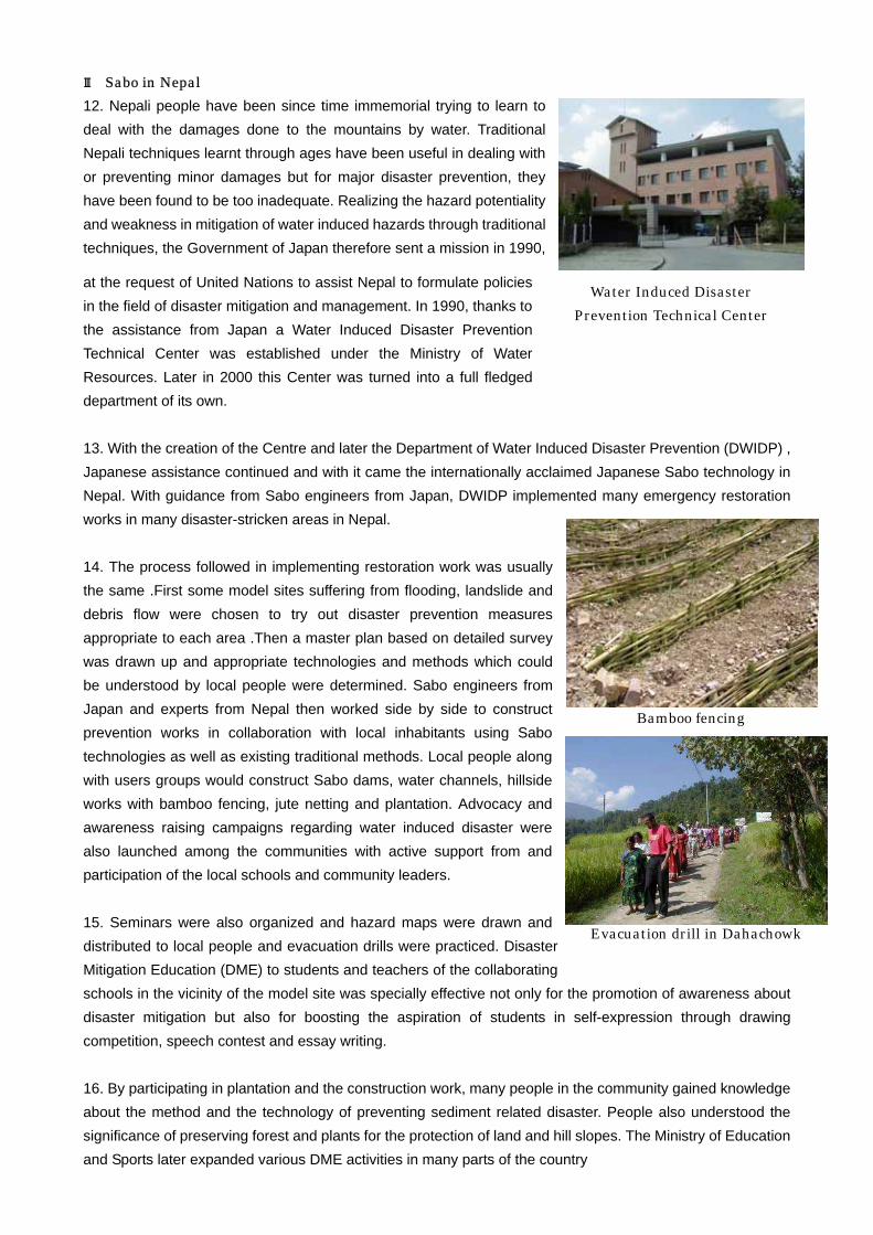
Ⅲ Sabo in Nepal 12. Nepali people have been since time immemorial trying to learn to deal with the damages done to the mountains by water. Traditional Nepali techniques learnt through ages have been useful in dealing with or preventing minor damages but for major disaster prevention, they have been found to be too inadequate. Realizing the hazard potentiality and weakness in mitigation of water induced hazards through traditional techniques, the Government of Japan therefore sent a mission in 1990,
at the request of United Nations to assist Nepal to formulate policies in the field of disaster mitigation and management. In 1990, thanks to the assistance from Japan a Water Induced Disaster Prevention Technical Center was established under the Ministry of Water Resources. Later in 2000 this Center was turned into a full fledged department of its own. 13. With the creation of the Centre and later the Department of Water Induced Disaster Prevention (DWIDP) , Japanese assistance continued and with it came the internationally acclaimed Japanese Sabo technology in Nepal. With guidance from Sabo engineers from Japan, DWIDP implemented many emergency restoration works in many disaster-stricken areas in Nepal. 14. The process followed in implementing restoration work was usually the same .First some model sites suffering from flooding, landslide and debris flow were chosen to try out disaster prevention measures appropriate to each area .Then a master plan based on detailed survey was drawn up and appropriate technologies and methods which could be understood by local people were determined. Sabo engineers from Japan and experts from Nepal then worked side by side to construct prevention works in collaboration with local inhabitants using Sabo technologies as well as existing traditional methods. Local people along with users groups would construct Sabo dams, water channels, hillside works with bamboo fencing, jute netting and plantation. Advocacy and awareness raising campaigns regarding water induced disaster were also launched among the communities with active support from and participation of the local schools and community leaders. 15. Seminars were also organized and hazard maps were drawn and distributed to local people and evacuation drills were practiced. Disaster Mitigation Education (DME) to students and teachers of the collaborating schools in the vicinity of the model site was specially effective not only for the promotion of awareness about disaster mitigation but also for boosting the aspiration of students in self-expression through drawing competition, speech contest and essay writing. 16. By participating in plantation and the construction work, many people in the community gained knowledge about the method and the technology of preventing sediment related disaster. People also understood the significance of preserving forest and plants for the protection of land and hill slopes. The Ministry of Education and Sports later expanded various DME activities in many parts of the country
Water Induced Disaster Prevention Technical Center
Bamboo fencing
Evacuation drill in Dahachowk
Ⅳ Benefits from Sabo 17. Sabo technology wherever it has reached has made the lives of the common people living in rural Nepal much safer .It has also helped us to protect our infrastructures such as public buildings and roads and bridges ,thereby contributing to our development and the wellbeing of the people Sabo technology was used in cost effectively stabilizing slopes formed along Banepa –Sindhuli highway constructed with Japanese assistance .This highway serves as a model for other mountain roads to be constructed in future in the application of Sabo technology. The technology was used to safeguard the road from possible soil erosion and slope failures. Sabo has also contributed to lessening of sediments deposits in some of our canals, hydroelectric reservoirs and river banks, thus helping in the smooth operation of our irrigation and hydro power projects .Considering Nepal’s rugged topography and the fragile state of our hills and mountains and the unpredictable nature of our rivers, Sabo technology has significant application in the physical development in our hills and mountains. The possibility of bursting of glacial lakes in Nepal (due to global warming) needs serious attention from the world community and this is where Sabo engineers could play a major role. Ⅴ Sabo-Japan’s contribution to World engineering 18. Sabo is one of Japan’s major contributions to the world of engineering. It is because of the hard-work and dedication of several generations of Sabo engineers that Japan has been able to develop what is now considered as one of the well-tested and dependable methods of preventing or mitigating water induced disasters. What started in 1926 as a work to prevent discharge of unstable sediment in the Tateyama caldera to decrease flooding in the lower reaches has now become a world wide phenomenon with an internationally recognized eco-friendly engineering technique practiced world wide- from Costa Rica to Africa to the foot of the Himalayas. We have seen from our visit of Tateyama caldera how Sabo has helped the Tateyama –Kurobe areas through the stabilization of unstable sediments and thus helping the regeneration of vegetation in the region. Thanks to Sabo works done to stabilize unstable sediments, this region has now become one of nature’s beauty spots with lush forest and vegetation .Let me offer my best wishes for the grand success of Toyama Prefecture’s bid for due recognition of Tateyama –Kurobe region as a World Cultural Heritage Site for the contributions it has made in enriching human knowledge in the field of disaster prevention and conservation of natural resources and contributing to human happiness and well being. Ⅵ Conclusion 19. Few last words before I stop .During my several encounters and interaction with Sabo engineers, technicians and administrators, I learnt that they have one thing in common. They have strong fascination for the mountains. It is perhaps because of this fascination, many Sabo engineers that I have met are very fond of my country .This is evident through the work of “Nepal Japan Friendship Association for Water Induced Disaster Prevention”, an NPO registered in Tokyo in 1993, and actively involved in voluntary partnership with Nepali engineers in combating the problems of soil erosion, landslides, slope failures and bank erosion. It this NPO which keeps me in touch with Japan and encourage me to continue to work for the promotion of Nepal-Japan friendship.
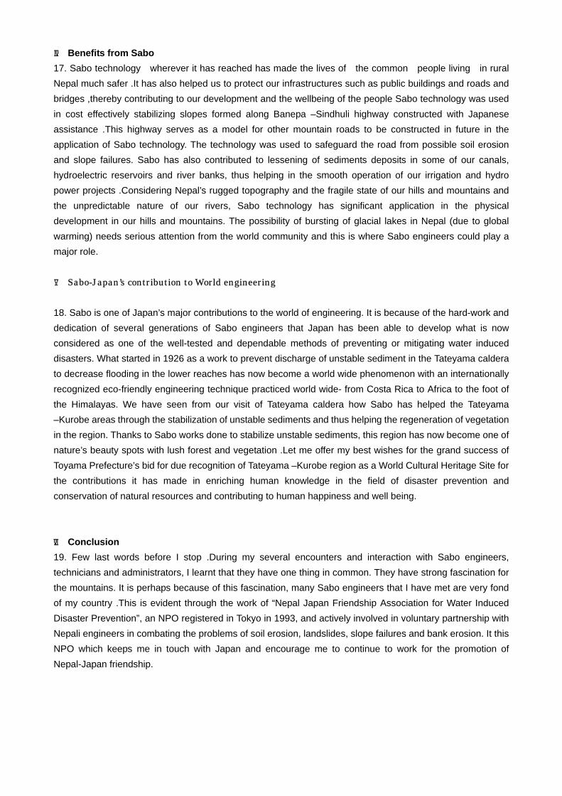
Tateyama Sabo from the Perspective of the Cultural Landscape
Mr. Shintaro Sugio Vice-Chairman, JAPAN ICOMOS National Committee Vice-Chairman, ICOMOS International Scientific
Committee on Cultural Landscapes President, PREC Institute Inc.
I think that the first time I climbed Tateyama was in August 1955. I was staying at my aunt’s home in Takaoka and, with that as my base, climbed from Awasuno to the Shomyo Falls and Hachirozaka, turning back at Midagahara so as to be back before nightfall. The next time I climbed Tateyama was three years later, as practical training in the Forestry Department at university. The main subject of that particular field trip was Tateyama Sabo so we got a ride on the aerial ropeway used to transport tracks and raw materials, and I seem to recall that we only dipped our feet in the hot spring before leaving for Ichinokoshi via Zara Pass. Since then I have been lucky enough to have many opportunities to come as far as Murodo.
Today I would like to first of all explain about the theme of the international academic commission of which I am a member: cultural landscapes. These can be defined as follows. Leaving aside the general meaning, if we assume a World Heritage objective, cultural landscapes can be defined thus. Cultural Landscapes From the guidelines for inscription in the World Heritage list related to special assets
6. Definition Cultural landscapes are cultural assets and represent “the combined works of nature and of man”. They are illustrative of the evolution of human society and settlement over time, under the influence of the physical constraints presented by their natural environment and of successive social, economic and cultural forces, both external and internal.
In addition, it says with regard to selection:
7. The selection should be made based on outstanding universal value and how representative it is of a zonal cultural area, as well as which the ability to express fundamental yet characteristic cultural elements should be taken into consideration.
What is more,
8. The term “cultural landscapes” includes the form of frequent interactions between man and the natural environment.

With regard to why cultural landscapes are protected it says:
9. Cultural landscapes reflect specific skills for sustainable land use that take into account the properties and restriction of the natural environment in established surroundings, and often reflect special emotional connections with nature. The protection of cultural landscapes contributes to modern technologies in sustainable land use, and leads to the preservation and improvement of the natural value in the scenery. The continued existence of traditional forms of land use supports biodiversity in many regions of the world.
Thus, it may be said that the protection of traditional cultural landscapes is helpful in preserving biodiversity.
10. Cultural landscapes are classified into three general categories. These are as follows.
(i) The most easily identified category is landscapes that have been planned and created by clearly defined people. This category often includes park or garden landscapes created along with religious structures, large buildings and so on for aesthetic reasons. (ii) The second category is landscapes that have evolved organically. The original impetus that produced
these landscapes was social, economic, political and/or religious but their present form has been molded by interaction with their natural environment. Such landscapes reflect this evolutionary process in their form and component features. They can also be divided into two sub-categories.
- Relic landscapes are ones where the evolutionary process halted at some time in the past, either abruptly or over a period of time. However, their main distinctive component features may still be seen in their physical form.
- Continuing landscapes retain a living social role in contemporary society that is closely associated with a traditional way of life, and the evolutionary process is still in progress for these landscapes. At the same time, they form important evidence revealing the evolutionary process that has unfolded so far.
(iii) The final category is cultural landscapes formed by association. Such landscapes warrant inclusion on
the World Heritage List when their natural components possess strong religious, artistic or cultural associations, and it is possible for evidence of their cultural value to not only be unimportant but even nonexistent.
※ 6-10 are provisional translations by the Agency for Cultural Affairs
I will skip over the other points but it is important that there be thorough conservation and management of the
cultural and natural value and that the work to recommend the cultural landscape’s registration be performed in cooperation with the local community, in addition to which proper forethought is essential.

The role of the International Scientific Committee on Cultural Landscapes in World Heritage registration is as follows. [The Process for Registration on the World Heritage List]
As is shown in the diagram, countries that have ratified the Convention draw up a provisional list of heritage sites they would like to register and submit it to the UNESCO World Heritage Centre; each country recommends to the World Heritage Centre sites on the list which meet the necessary conditions. The World Heritage Centre commissions on-site inspections and paperwork from NGOs such as IUCN (International Union for Conservation of Nature and Natural Resources) and ICOMOS according to their respective areas of specialization. These are then summarized at the Centre and submitted to the World Heritage Committee where they are deliberated and their registration decided. If you are in charge of the academic investigation at that time, you have to consider the possibility of unnecessarily harsh evaluations from people who do not know the actual site. It is thus of prime importance to get many specialists to come and look at the actual site and reach an understanding of it.
The International Scientific Committee on Cultural Landscapes (abbreviated as the ICOMOS/IFLA Committee) is one of the scientific committees which cover 28 specialized areas. Its first title was Historical Gardens, then it became Historical Gardens and Cultural Landscapes, but its name was changed at the Verbania Conference on Italy’s Lake Maggiore in October 2006 to the International Scientific Committee on Cultural Landscapes. Historical Background
At the 16th session of the World Heritage Committee in Santa Fe, America in 1992 it was decided to include the concept of cultural landscapes; at the same time the ICOMO and IUCN affiliation, the addition of working guidelines for the drawing up of provisional lists of cultural landscapes in each country and for the implementation of the Convention for the Protection of the World Cultural and Natural Heritage, and the

decision to have international committees of experts do research according to themes such as the classification and evaluation of cultural landscapes were adopted. After that a committee of experts on canals as heritage sites was convened, as were expert committees on roads and terraced rice-fields, as well as which measures have been taken to resolve pending issues in each field along the lines of the 1994 expert committee on authenticity in Nara. A committee of experts on the cultural landscape of sacred mountains was also convened in Wakayama in 2001, as was one on Pure Land gardens in 2006 and 2009. Establishment of the ICOMO/IFLA Committee
IFLA (the International Federation of Landscape Architects) was formally established in 1949 as a group under the UNESCO aegis, and Japan became a member in 1954.
In 1958 the Belgian René Pechère launched a group to study landscapes, historical gardens and ruins. ICOMOS started its activities in 1965, due to the conclusion of the Venice Charter of 1964, so IFLA has a
longer history. The Florence Charter
The Convention Concerning the Protection of the World Cultural and Natural Heritage was adopted in November 1972 and the World Heritage Committee set up for that purpose had working guidelines drawn up so that it could proceed with investigations and surveys on recommendations to and deletions from the World Heritage List in collaboration with ICOMOS, IUCN and so on. Furthermore, thanks to the efforts of René Pechère, the IFLA’s (the International Federation of Landscape Architects) Belgian representative, the Florence Charter, an addendum to the Venice Charter, was decided in May 1981 by the International Committee for Historic Gardens established by ICOMO and IFLA in 1978. The distinctive feature of this charter is the preservation of the distinctive features of historic gardens, which are seen as being a compound of architectural structures and plants. One might say that the Venice Charter alone was not enough, since the historic garden is “a living monument”. Up until then there had been a tendency to not give proper forethought to the cultural value intrinsic to the landscape, but with this Charter all landscape gardeners came to clearly recognize that the artistic features of a garden are no more than one area of the cultural conditions to be found in the landscape, and that the cultural landscape including the surrounding environment is important. Cultural Landscapes in Japan
In 2004 the Law for the Protection of Cultural Properties established cultural landscapes as a new branch of cultural assets in Japan.
According to the Law for the Protection of Cultural Properties, cultural landscapes are scenic locations formed by the daily lives or occupations of the people in a region, as well as by the particular regional topography, and are indispensable for an understanding of the lives and occupations of the people of Japan.
In this context, the designation of the Shiraiwa Sabo Dam by the state as an important cultural asset may be seen as a valid step on the way to becoming a World Heritage for the sabo works throughout the entire Tateyama Caldera with this cultural asset at their heart, as the designation identifies the landscapes connected with farming, fishing and forestry up to the present day and the disaster prevention landscapes, which should be seen as going one step beyond village landscapes, as cultural landscapes.
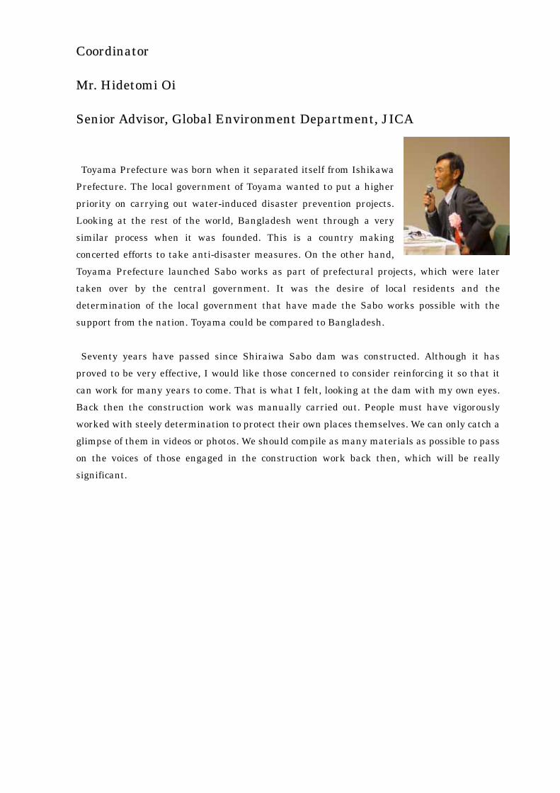
Coordinator Mr. Hidetomi Oi
Senior Advisor, Global Environment Department, JICA
Toyama Prefecture was born when it separated itself from Ishikawa
Prefecture. The local government of Toyama wanted to put a higher priority on carrying out water-induced disaster prevention projects. Looking at the rest of the world, Bangladesh went through a very similar process when it was founded. This is a country making concerted efforts to take anti-disaster measures. On the other hand, Toyama Prefecture launched Sabo works as part of prefectural projects, which were later taken over by the central government. It was the desire of local residents and the determination of the local government that have made the Sabo works possible with the support from the nation. Toyama could be compared to Bangladesh. Seventy years have passed since Shiraiwa Sabo dam was constructed. Although it has
proved to be very effective, I would like those concerned to consider reinforcing it so that it can work for many years to come. That is what I felt, looking at the dam with my own eyes. Back then the construction work was manually carried out. People must have vigorously worked with steely determination to protect their own places themselves. We can only catch a glimpse of them in videos or photos. We should compile as many materials as possible to pass on the voices of those engaged in the construction work back then, which will be really significant.