Nuneaton North Chord Environmental Statement Non … · Nuneaton North Chord Environmental...
15
Nuneaton North Chord Environmental Statement Non-Technical Summary July 2009 Notice This report was produced by Atkins for Network Rail for the specific purpose of compiling a Non-Technical Summary of the Environmental Statement prepared to support the TWA submission for the construction and operation of the Nuneaton North Chord. This report may not be used by any person other than Network Rail without Network Rail’s express permission. In any event, Atkins accepts no liability for any costs, liabilities or losses arising as a result of the use of or reliance upon the contents of this report by any person other than Network Rail. Document History JOB NUMBER: 5062720 DOCUMENT REF: 5062720/ENV/REP/517 1 Final S.Ricks P.Collins C.Leafe S.Worton 20/07/09 0 Draft for comment S.Ricks P.Collins C.Leafe S.Worton 10/07/09 Revision Purpose Description Originated Checked Reviewed Authorised Date 5062720_ENV_REP_517Rev1.doc
Transcript of Nuneaton North Chord Environmental Statement Non … · Nuneaton North Chord Environmental...
Nuneaton North Chord
Environmental Statement Non-Technical Summary
July 2009 Notice This report was produced by Atkins for Network Rail for the specific purpose of compiling a Non-Technical Summary of the Environmental Statement prepared to support the TWA submission for the construction and operation of the Nuneaton North Chord.
This report may not be used by any person other than Network Rail without Network Rail’s express permission. In any event, Atkins accepts no liability for any costs, liabilities or losses arising as a result of the use of or reliance upon the contents of this report by any person other than Network Rail.
Document History
JOB NUMBER: 5062720 DOCUMENT REF: 5062720/ENV/REP/517
1 Final S.Ricks P.Collins C.Leafe S.Worton 20/07/09
0 Draft for comment S.Ricks P.Collins C.Leafe S.Worton 10/07/09
Revision Purpose Description Originated Checked Reviewed Authorised Date
5062720_ENV_REP_517Rev1.doc
Nuneaton North Chord
Environmental Statement Non-Technical Summary
This Page has been left intentionally blank
5062720_ENV_REP_517Rev1.doc 2
Nuneaton North Chord
Environmental Statement Non-Technical Summary
Introduction
to maximise the efficiency of the railway in transporting freight along these routes. This non-technical summary of the Environmental
Statement has been prepared by Atkins for Network Rail to accompany an application under the Transport and Works Act. The application is being made to authorise the construction and operation of a new railway, referred to as the Nuneaton North Chord (NNC).
The NNC aligns with Government policy to promote a shift of freight transport from road to rail.
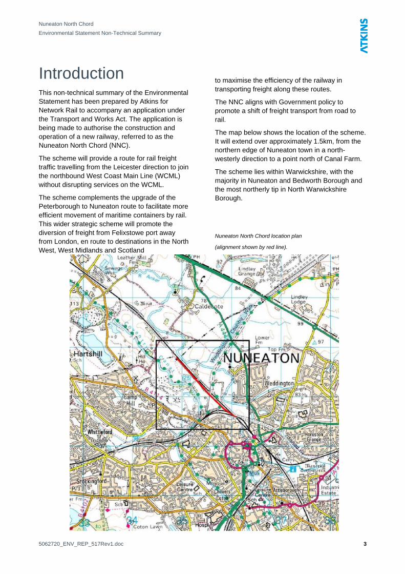
The map below shows the location of the scheme. It will extend over approximately 1.5km, from the northern edge of Nuneaton town in a north-westerly direction to a point north of Canal Farm. The scheme will provide a route for rail freight
traffic travelling from the Leicester direction to join the northbound West Coast Main Line (WCML) without disrupting services on the WCML.
The scheme lies within Warwickshire, with the majority in Nuneaton and Bedworth Borough and the most northerly tip in North Warwickshire Borough. The scheme complements the upgrade of the
Peterborough to Nuneaton route to facilitate more efficient movement of maritime containers by rail. This wider strategic scheme will promote the diversion of freight from Felixstowe port away from London, en route to destinations in the North West, West Midlands and Scotland
Nuneaton North Chord location plan
(alignment shown by red line).
5062720_ENV_REP_517Rev1.doc 3
Nuneaton North Chord
Environmental Statement Non-Technical Summary
Consultation The Environmental Statement and design of the scheme has been informed through consultation with the following bodies:
• Warwickshire County Council
• Nuneaton and Bedworth County Council
• North Warwickshire Borough Council
• Environment Agency
• Natural England
Summary of Findings The NNC is not expected to have significant impacts on the environment once mitigation measures have been implemented except for some short term effects on landscape and visual amenity during construction, and due to particular aspects of construction noise and vibration.
Background and Need for the Scheme The NNC scheme is part of a national strategic project to allow more efficient transport of rail freight from UK ports and to facilitate the transport of the larger 9’6” containers increasingly used by deep sea shipping companies, around the country.
Ports such as Felixstowe are of national importance for freight distribution and require efficient transport networks in order to remain competitive. The proposed construction of the NNC will help the rail network to increase its capability to deal with larger quantities of 9’6” shipping containers.
The scheme will enable supply of rail freight services to meet demand and will also divert traffic away from the North London Line, allowing growth in passenger service provision, providing social, environmental and economic benefits by potentially reducing road traffic and improving journey time reliability.
Reduction of Lorry Movements It is estimated that by facilitating a greater capacity and more efficient movement of freight by rail, the wider strategic scheme, of which the NNC is one part, will reduce the need for 225,000 road vehicle movements a year, reducing pressure on the road network and pollution created by these road movements.
The Proposed Scheme A drawing showing key aspects of the scheme is included as an appendix. The NNC will connect to the Arley Line on the north side of Rocker Bridge; over the Birmingham Lines on a new bridge and earth embankment; via a new bridge over Stoney Road. It will then run on embankment adjacent to the existing WCML and connect to it approximately 300m north of the Canal Farm accommodation bridge. The NNC will not be electrified on first opening but has provision for future electrification.
A permanent, single lane haul road with passing places will also be constructed, running parallel to the western and eastern edges of the proposed railway. This will allow access during construction and for operational maintenance. This road will have a tarmac surface, except where it is temporarily built within the floodplain of the River Anker, where it will be constructed of compacted hardcore.
A temporary access road will also be required for construction. Much of this road is already in a suitable condition but parts of it will require improvement works. This will run from the entrance to Judkins Quarry and pass over the existing bridge over the Coventry Canal. Some strengthening works may be required to this bridge. The road will then follow a disused railway towards the NNC and meet the permanent haul road.
Stoney Road will be used for limited access during the construction of the NNC, as will the access road to the Network Rail depot to the south of the Birmingham and Arley lines. The vast majority of traffic will enter via Judkins Quarry. This access will be controlled through a traffic
5062720_ENV_REP_517Rev1.doc 4
Nuneaton North Chord
Environmental Statement Non-Technical Summary
management plan – one of a number of mandatory environmental controls that will be implemented for the scheme as part of Network Rail’s contractual requirements.
Operation of the Scheme During the day, it is predicted that the NNC will facilitate the movement of an additional maximum of 14 freight trains.
At night, the additional maximum is predicted to be 4 freight trains.
Road traffic will be minimal, with vehicles occasionally gaining access to the NNC for inspection and maintenance purposes.
Site and Surroundings The NNC extends from the northwest fringe of Nuneaton, approximately 600m to the north west of Nuneaton railway station at grid reference SP 345 935. The scheme is approximately 1.5km long and runs through an area of landscape that is predominantly flat and agricultural and includes a network of hedgerows, mature trees and woodland blocks. Existing rail infrastructure includes the Birmingham and Arley Lines and the WCML
A drawing showing the scheme can be found in the appendix at the end of this report.
A former granite quarry, recycling centre and landfill are situated to the west and south west of the scheme. The Coventry Canal runs parallel to the scheme to the southwest and the River Anker mirrors its orientation to the northwest, with the northern end of the NNC entering the secondary floodplain of the River Anker.
There are a number of residential properties in the vicinity of the NNC:
• To the south of the Arley Lines on Jodrell Street, Ashton Road and St Mary’s Road.
• Residential properties 200m east of the NNC on Cleaver Gardens and Shawe Avenue in Weddington.
• Lingfield is approximately 220m to the east of the NNC.
• Canal Farm is located immediately to the east of the WCML.
• Isolated residential properties are also located adjacent to the Coventry Canal, including Canal Cottage 150m west of the NNC.
There are industrial and commercial buildings to the south and west of the site. To the west, buildings associated with Judkins Quarry; and to the south of the Arley Lines, an industrial estate.
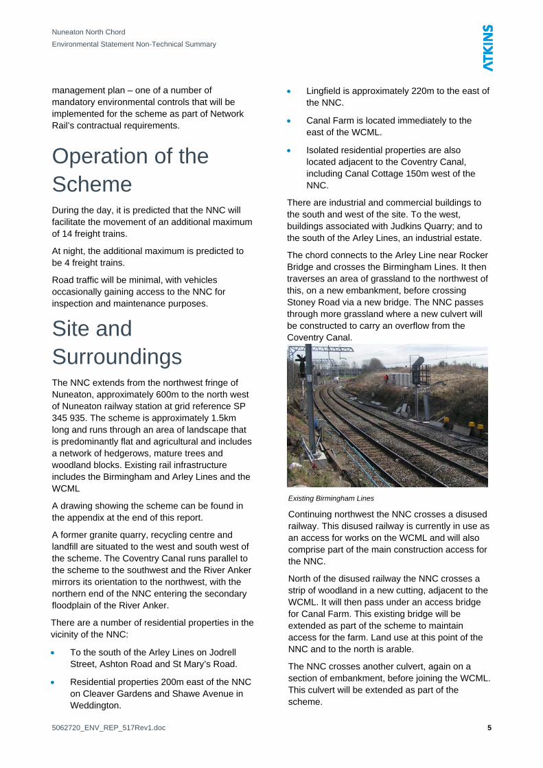
The chord connects to the Arley Line near Rocker Bridge and crosses the Birmingham Lines. It then traverses an area of grassland to the northwest of this, on a new embankment, before crossing Stoney Road via a new bridge. The NNC passes through more grassland where a new culvert will be constructed to carry an overflow from the Coventry Canal.
Existing Birmingham Lines
Continuing northwest the NNC crosses a disused railway. This disused railway is currently in use as an access for works on the WCML and will also comprise part of the main construction access for the NNC.
North of the disused railway the NNC crosses a strip of woodland in a new cutting, adjacent to the WCML. It will then pass under an access bridge for Canal Farm. This existing bridge will be extended as part of the scheme to maintain access for the farm. Land use at this point of the NNC and to the north is arable.
The NNC crosses another culvert, again on a section of embankment, before joining the WCML. This culvert will be extended as part of the scheme.
5062720_ENV_REP_517Rev1.doc 5
Nuneaton North Chord
Environmental Statement Non-Technical Summary
The main temporary construction compound for the NNC lies within an area of a former block factory. Access is gained over an existing bridge over the Coventry Canal, and through Judkins Quarry, from Midland Road/Tuttle Hill. This area is bounded to the west by the Coventry Canal, to the north by an area of woodland and a canal overflow and to the east by the disused railway. The area to the south of the compound largely comprises areas of hard-standing, bare, compacted earth, rubble and scrub.
Another smaller compound will be situated near Canal Farm on arable farmland for the extension of the Canal Farm access bridge.
Alternatives Considered There are no alternative locations that can be considered for the NNC. The chord is required to connect the Arley Lines to the WCML, passing over the Birmingham Lines, so the location of the NNC is fixed. However, a number of different engineering designs have been explored in order to achieve the scheme objectives.
Two options were considered for crossing the WCML – one using the existing Rocker Bridge and another constructing a new bridge. Consideration was also given to whether the new line would be carried on a viaduct or on an embankment. It was determined that the most cost effective and least disruptive option to existing rail infrastructure was to use the existing bridge and an earth embankment.
Formerly, scheme design incorporated an extra section of railway line allowing trains to turn round. This no longer constitutes part of the scheme and the result is a scheme with a smaller land-take, requiring less material to build. This has additional environmental benefits due to a reduced number of Heavy Goods Vehicle (HGV) deliveries required to deliver materials to site.
A number of temporary access routes and options for construction compounds were also considered for the construction phase of the scheme. The chosen options minimise land-take on unmade ground and minimise crossings of the Coventry Canal and its overflows.
Environmental Design Aspects of environmental mitigation have been engineered into the design of the scheme. The land-take of the scheme within the secondary floodplain of the River Anker has been minimised through design and a flood compensation swale (or ditch) will be provided in order to compensate for the remaining land take within the floodplain (further information in the Water section). This swale and associated drainage ditches will be seeded with a wet meadow grass/ herb seed mix and planted with aquatic plants in order to promote a quality wetland habitat.
An area of rough grassland towards the southern end of the NNC will be improved and planted with particular plants to provide a quality habitat for insects and reptiles.
Newly constructed slopes (embankments and cuttings) will be seeded and planted appropriately to provide suitable reptile and insect habitat.
A new, native, species-rich hedgerow will be planted for the length of the NNC. The hedgerow will include food-rich species such as hazel and bird cherry.
Mitigation of Environmental Impacts Network Rail is committed to ensuring that the environmental impact of their work is minimised by identifying potential issues during the design stage and ensuring actions are taken to mitigate these issues throughout the lifecycle of the project. The Environmental Statement contains details of mitigation that will be implemented during the construction stage of the NNC. These requirements will form part of the contractual obligations for the successful contractor, chosen to build the scheme. The environmental performance of the contractor will be monitored throughout the works by Network Rail, who will audit the contractor’s performance against site specific criteria and targets.
5062720_ENV_REP_517Rev1.doc 6
Nuneaton North Chord
Environmental Statement Non-Technical Summary
The following section of the report describes the assessment of the environmental impacts of the scheme.
Agricultural Land Use
Noise and Vibration The noise and vibration assessment considered the potential impacts that the proposed NNC might have on existing noise levels in the area.
Construction Noise and Vibration The calculated construction noise levels when combined with the existing ambient noise levels are shown to generally result in perceptible to substantial increases. The main impacts are expected at Lingfield due to the existing noise levels being very low and the high activity noise levels associated with demolition of Bridge 49. Although the impact upon Lingfield is substantial, the demolition will be spread across two days, and so the duration of the impact is minimal.
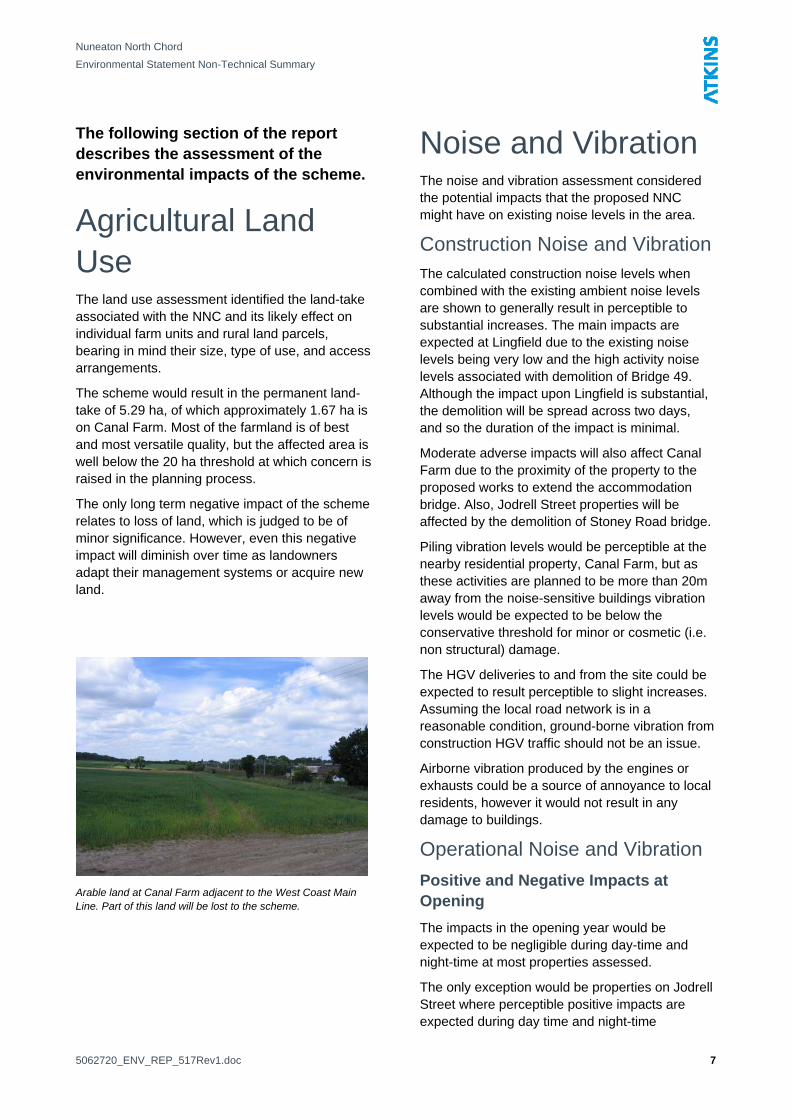
The land use assessment identified the land-take associated with the NNC and its likely effect on individual farm units and rural land parcels, bearing in mind their size, type of use, and access arrangements.
The scheme would result in the permanent land-take of 5.29 ha, of which approximately 1.67 ha is on Canal Farm. Most of the farmland is of best and most versatile quality, but the affected area is well below the 20 ha threshold at which concern is raised in the planning process.
Moderate adverse impacts will also affect Canal Farm due to the proximity of the property to the proposed works to extend the accommodation bridge. Also, Jodrell Street properties will be affected by the demolition of Stoney Road bridge.
The only long term negative impact of the scheme relates to loss of land, which is judged to be of minor significance. However, even this negative impact will diminish over time as landowners adapt their management systems or acquire new land.
Piling vibration levels would be perceptible at the nearby residential property, Canal Farm, but as these activities are planned to be more than 20m away from the noise-sensitive buildings vibration levels would be expected to be below the conservative threshold for minor or cosmetic (i.e. non structural) damage.
The HGV deliveries to and from the site could be expected to result perceptible to slight increases. Assuming the local road network is in a reasonable condition, ground-borne vibration from construction HGV traffic should not be an issue.
Airborne vibration produced by the engines or exhausts could be a source of annoyance to local residents, however it would not result in any damage to buildings.
Operational Noise and Vibration Positive and Negative Impacts at
Opening Arable land at Canal Farm adjacent to the West Coast Main Line. Part of this land will be lost to the scheme.
The impacts in the opening year would be expected to be negligible during day-time and night-time at most properties assessed.
The only exception would be properties on Jodrell Street where perceptible positive impacts are expected during day time and night-time
5062720_ENV_REP_517Rev1.doc 7
Nuneaton North Chord
Environmental Statement Non-Technical Summary
respectively due to a decrease in noise. This noise reduction would be due to the proposed NNC embankment screening the properties from noise originating from parts of the WCML.
Future Impacts The future year assessment is based on an estimated number of maximum freight movements expected 15 years after the scheme and represents a ‘worst case’ scenario. Operational noise and vibration impacts will not be significant and no mitigation has been proposed.
During day-time, the long term impacts at most properties would be negligible. There would be perceptible positive beneficial impacts at Jodrell Street properties. At night, there would be a perceptible increase at most properties assessed. There would be perceptible beneficial impacts at Jodrell Street properties.
No negative scheme impacts would be expected in the opening year and the long term impacts could be an increase in noise at the onset of perceptibility. Similar impacts could be expected outside of the study area.
The assessment showed that the existing day-time and night-time vibration levels and those expected in the future year, both without and with the scheme, are well below levels requiring mitigation.
Air Quality The air quality assessment for the NNC considered the impacts with the greatest potential significance; namely:
• Dust emissions during demolition and construction; and
• Road traffic emissions during construction on ambient air quality in relation to health-based environmental criteria.
Operation of the NNC would be unlikely to result in any significant impacts on local air quality and therefore railway effects were addressed qualitatively.
Construction Dust The assessment of construction dust identified 178 potentially sensitive receptors within 100 metres of the NNC. A total of 1245 properties were identified between 100 and 500 metres of the site boundary; these are mostly considered to be receptors of lower sensitivity being urban residential areas further from the site, business units and commercial areas. By employing Network Rail’s standard construction practices and best practicable means, the risk of dust emissions effects will be minimised.
Local Air Quality Air quality monitoring data for the area around the NNC was reviewed. The monitoring data indicated that the pollutant concentrations in the immediate vicinity of the NNC will meet all relevant Air Quality Standard (AQS) objectives. An assessment of the effect of additional traffic likely to be generated by the construction of the NNC in 2010 was undertaken. Pollution levels are expected to be below the AQS objectives at properties on Tuttle Hill, both with and without the NNC during peak construction operations.
The qualitative assessment of NNC operation indicated that emissions from rail locomotives are likely to have a negligible impact. Operation of the NNC is unlikely to result in impacts on local air quality in the long term.
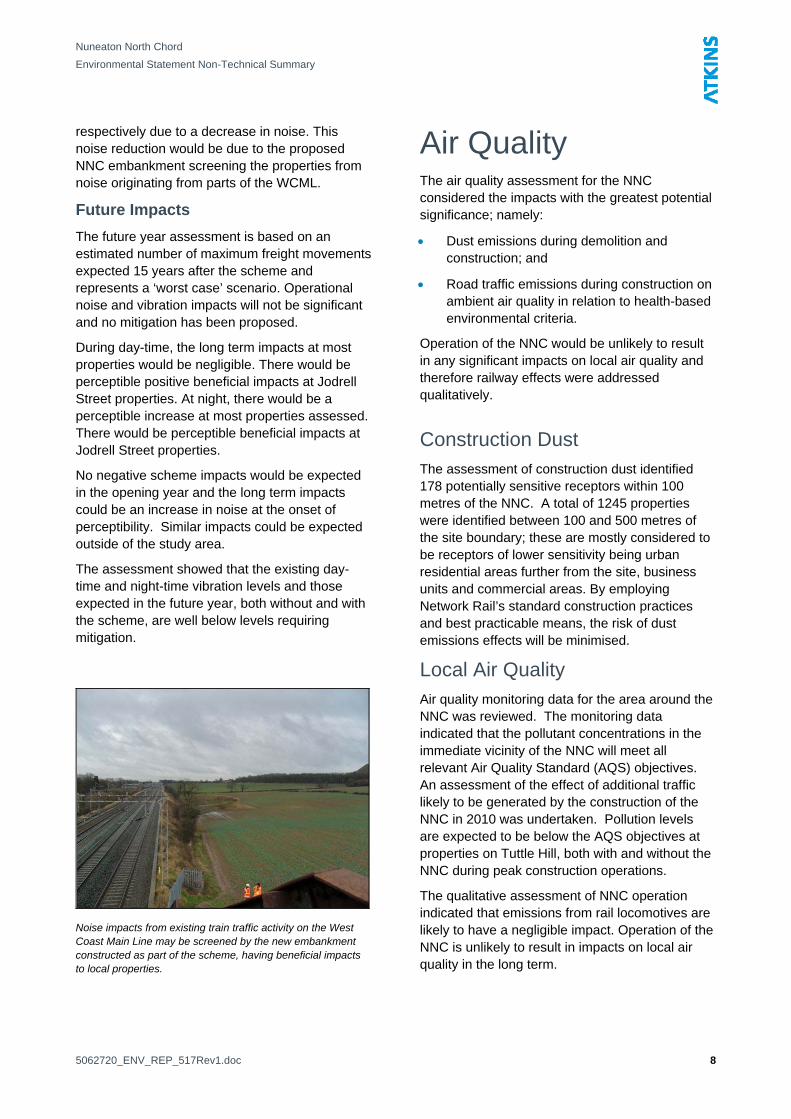
Noise impacts from existing train traffic activity on the West Coast Main Line may be screened by the new embankment constructed as part of the scheme, having beneficial impacts to local properties.
5062720_ENV_REP_517Rev1.doc 8
Nuneaton North Chord
Environmental Statement Non-Technical Summary
Landscape and Visual Assessment The effect of the proposals on the landscape character and visual amenity of the study area has been assessed. Landscape character is the distinct and recognisable pattern of elements that occurs consistently in a particular type of landscape, and how these are perceived by people. It reflects particular combinations of landform, soils, vegetation, land use and human settlement. It creates the particular sense of place for different areas of the landscape.
Visual receptors are single or groups of elements whose visual amenity would be affected by a proposal. The nature of visual receptors varies according to the location, type, activity of viewer and the importance of the view.
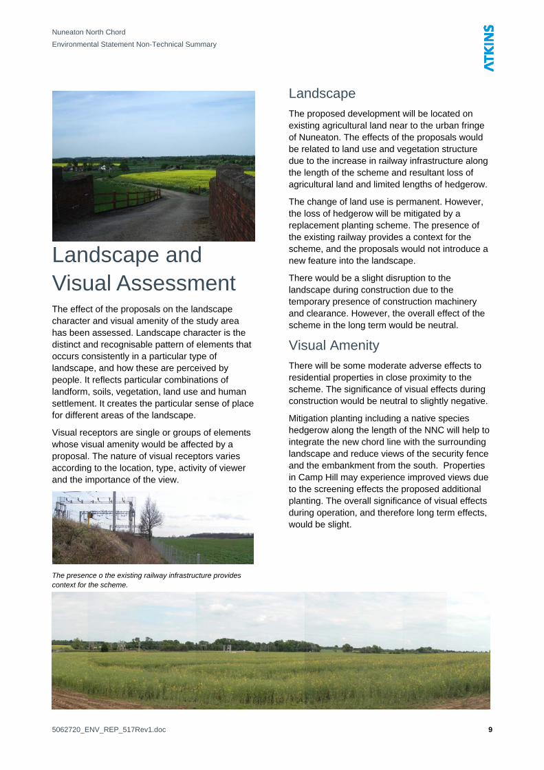
The presence o the existing railway infrastructure provides context for the scheme.
Landscape The proposed development will be located on existing agricultural land near to the urban fringe of Nuneaton. The effects of the proposals would be related to land use and vegetation structure due to the increase in railway infrastructure along the length of the scheme and resultant loss of agricultural land and limited lengths of hedgerow.
The change of land use is permanent. However, the loss of hedgerow will be mitigated by a replacement planting scheme. The presence of the existing railway provides a context for the scheme, and the proposals would not introduce a new feature into the landscape.
There would be a slight disruption to the landscape during construction due to the temporary presence of construction machinery and clearance. However, the overall effect of the scheme in the long term would be neutral.
Visual Amenity There will be some moderate adverse effects to residential properties in close proximity to the scheme. The significance of visual effects during construction would be neutral to slightly negative.
Mitigation planting including a native species hedgerow along the length of the NNC will help to integrate the new chord line with the surrounding landscape and reduce views of the security fence and the embankment from the south. Properties in Camp Hill may experience improved views due to the screening effects the proposed additional planting. The overall significance of visual effects during operation, and therefore long term effects, would be slight.
5062720_ENV_REP_517Rev1.doc 9
Nuneaton North Chord
Environmental Statement Non-Technical Summary
Biodiversity The effects of the construction and operation of NNC on species and habitats (both those that are statutorily protected and others of value) were assessed.
A desk study to identify statutorily protected sites (such as Sites of Special Scientific Interest), non-statutory sites (such as pSINCs (proposed Site of Importance for Nature Conservation)), and records of protected and notable species was undertaken.
Site surveys were also conducted to identify protected and valuable species (including great crested newts, bats, badgers, birds, otters, water voles, white-clawed crayfish) and habitats on site.
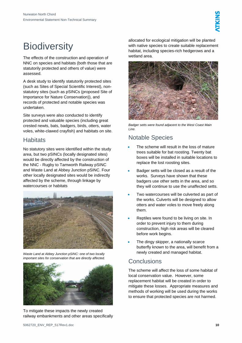
Habitats No statutory sites were identified within the study area, but two pSINCs (locally designated sites) would be directly affected by the construction of the NNC - Rugby to Tamworth Railway pSINC and Waste Land at Abbey Junction pSINC. Four other locally designated sites would be indirectly affected by the scheme, through linkage by watercourses or habitats
Waste Land at Abbey Junction pSINC: one of two locally important sites for conservation that are directly affected.
To mitigate these impacts the newly created railway embankments and other areas specifically
allocated for ecological mitigation will be planted with native species to create suitable replacement habitat, including species-rich hedgerows and a wetland area.
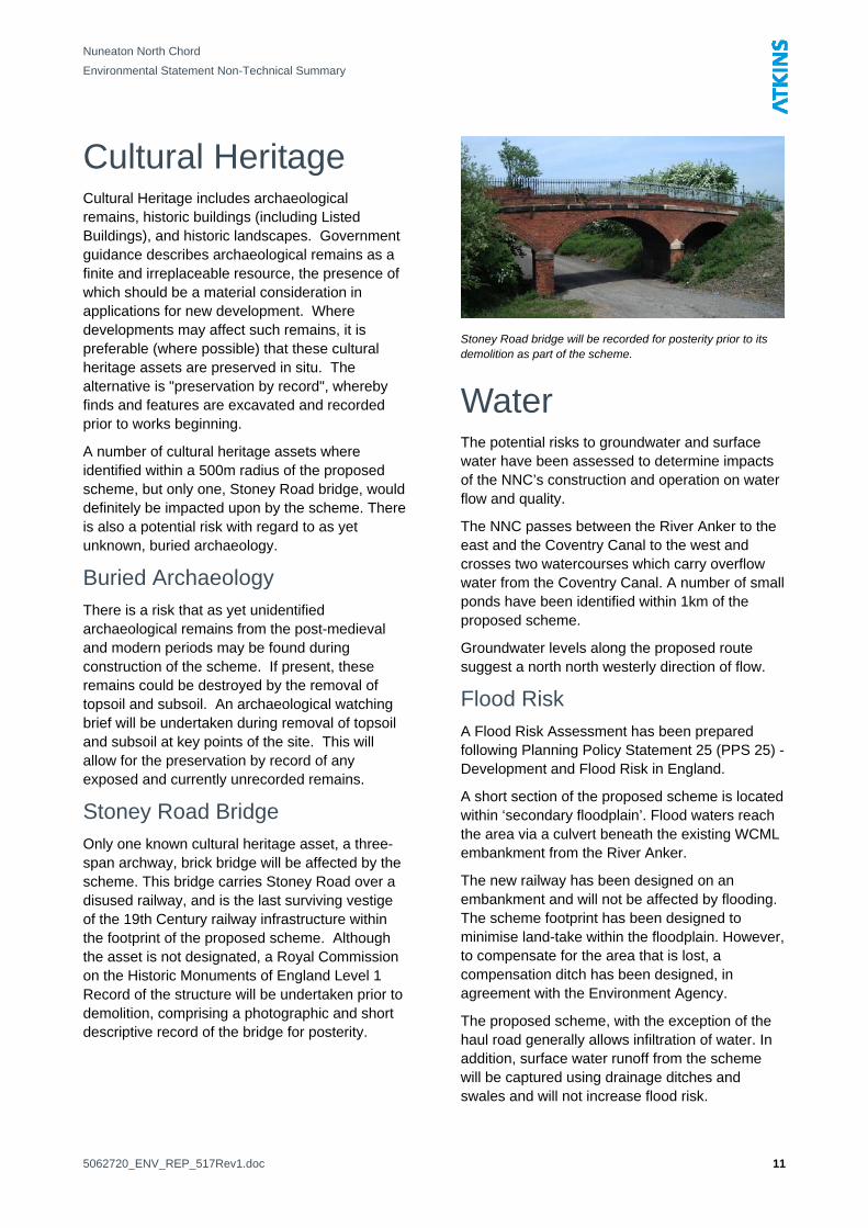
Badger setts were found adjacent to the West Coast Main Line.
Notable Species • The scheme will result in the loss of mature
trees suitable for bat roosting. Twenty bat boxes will be installed in suitable locations to replace the lost roosting sites.
• Badger setts will be closed as a result of the works. Surveys have shown that these badgers use other setts in the area, and so they will continue to use the unaffected setts.
• Two watercourses will be culverted as part of the works. Culverts will be designed to allow otters and water voles to move freely along them.
• Reptiles were found to be living on site. In order to prevent injury to them during construction, high risk areas will be cleared before work begins.
• The dingy skipper, a nationally scarce butterfly known to the area, will benefit from a newly created and managed habitat.
Conclusions The scheme will affect the loss of some habitat of local conservation value. However, some replacement habitat will be created in order to mitigate these losses. Appropriate measures and methods of working will be used during the works to ensure that protected species are not harmed.
5062720_ENV_REP_517Rev1.doc 10
Nuneaton North Chord
Environmental Statement Non-Technical Summary
Cultural Heritage
Cultural Heritage includes archaeological remains, historic buildings (including Listed Buildings), and historic landscapes. Government guidance describes archaeological remains as a finite and irreplaceable resource, the presence of which should be a material consideration in applications for new development. Where developments may affect such remains, it is preferable (where possible) that these cultural heritage assets are preserved in situ. The alternative is "preservation by record", whereby finds and features are excavated and recorded prior to works beginning.
A number of cultural heritage assets where identified within a 500m radius of the proposed scheme, but only one, Stoney Road bridge, would definitely be impacted upon by the scheme. There is also a potential risk with regard to as yet unknown, buried archaeology.
Buried Archaeology There is a risk that as yet unidentified archaeological remains from the post-medieval and modern periods may be found during construction of the scheme. If present, these remains could be destroyed by the removal of topsoil and subsoil. An archaeological watching brief will be undertaken during removal of topsoil and subsoil at key points of the site. This will allow for the preservation by record of any exposed and currently unrecorded remains.
Stoney Road Bridge Only one known cultural heritage asset, a three-span archway, brick bridge will be affected by the scheme. This bridge carries Stoney Road over a disused railway, and is the last surviving vestige of the 19th Century railway infrastructure within the footprint of the proposed scheme. Although the asset is not designated, a Royal Commission on the Historic Monuments of England Level 1 Record of the structure will be undertaken prior to demolition, comprising a photographic and short descriptive record of the bridge for posterity.
Stoney Road bridge will be recorded for posterity prior to its demolition as part of the scheme.
Water The potential risks to groundwater and surface water have been assessed to determine impacts of the NNC’s construction and operation on water flow and quality.
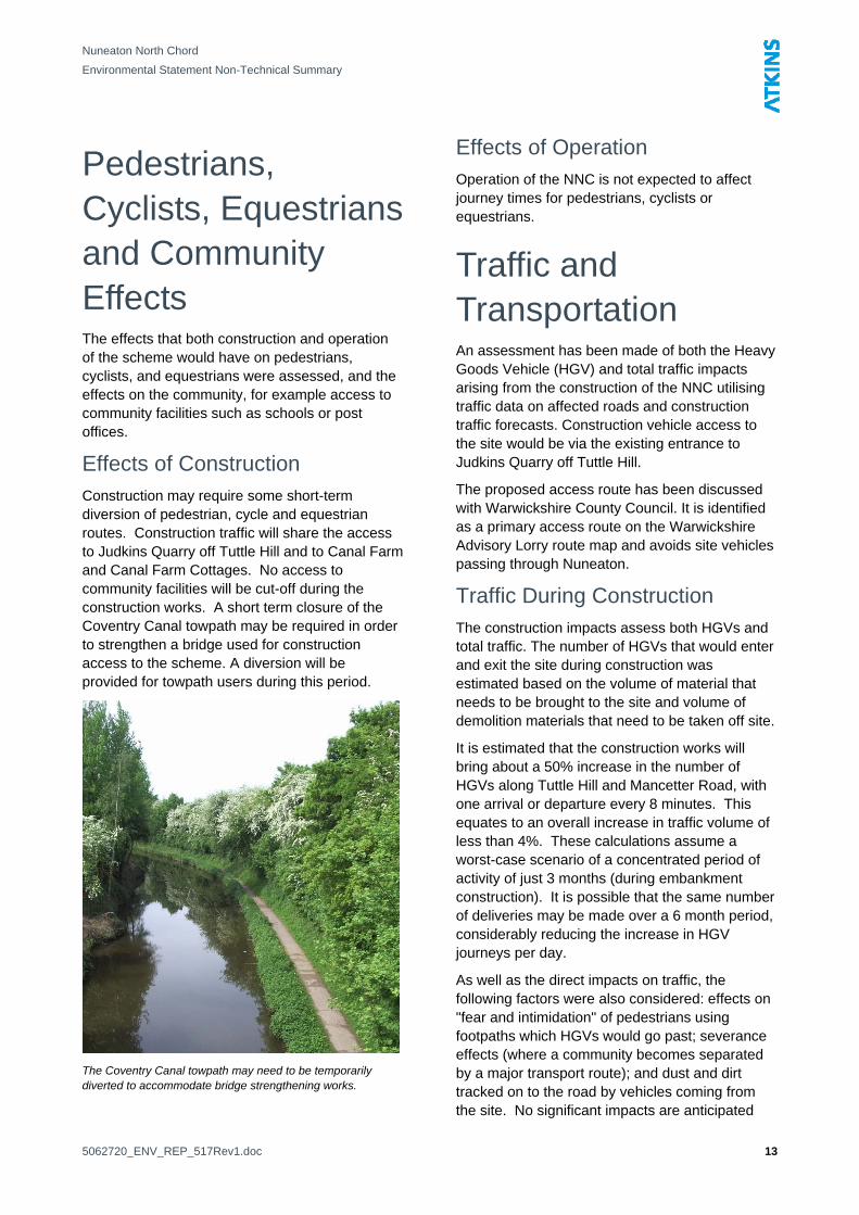
The NNC passes between the River Anker to the east and the Coventry Canal to the west and crosses two watercourses which carry overflow water from the Coventry Canal. A number of small ponds have been identified within 1km of the proposed scheme.
Groundwater levels along the proposed route suggest a north north westerly direction of flow.
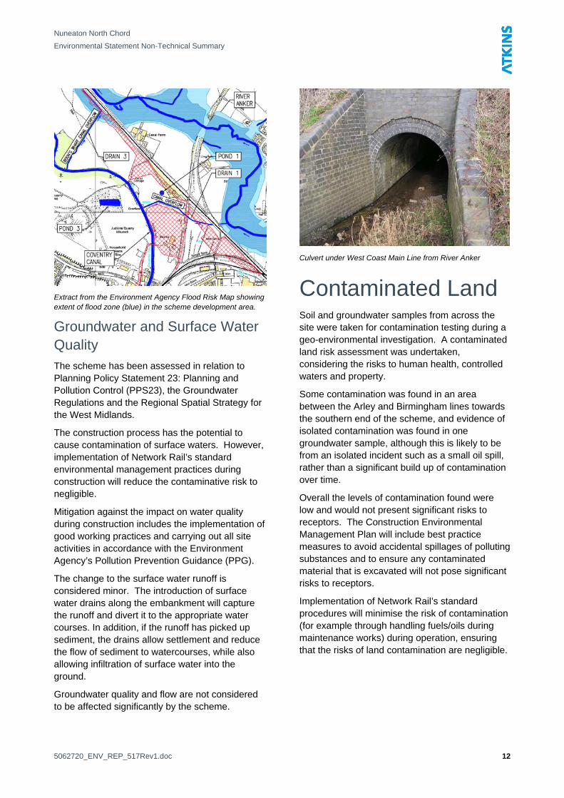
Flood Risk A Flood Risk Assessment has been prepared following Planning Policy Statement 25 (PPS 25) - Development and Flood Risk in England.
A short section of the proposed scheme is located within ‘secondary floodplain’. Flood waters reach the area via a culvert beneath the existing WCML embankment from the River Anker.
The new railway has been designed on an embankment and will not be affected by flooding. The scheme footprint has been designed to minimise land-take within the floodplain. However, to compensate for the area that is lost, a compensation ditch has been designed, in agreement with the Environment Agency.
The proposed scheme, with the exception of the haul road generally allows infiltration of water. In addition, surface water runoff from the scheme will be captured using drainage ditches and swales and will not increase flood risk.
5062720_ENV_REP_517Rev1.doc 11
Nuneaton North Chord
Environmental Statement Non-Technical Summary
Extract from the Environment Agency Flood Risk Map showing extent of flood zone (blue) in the scheme development area.
Groundwater and Surface Water Quality The scheme has been assessed in relation to Planning Policy Statement 23: Planning and Pollution Control (PPS23), the Groundwater Regulations and the Regional Spatial Strategy for the West Midlands.
The construction process has the potential to cause contamination of surface waters. However, implementation of Network Rail’s standard environmental management practices during construction will reduce the contaminative risk to negligible.
Mitigation against the impact on water quality during construction includes the implementation of good working practices and carrying out all site activities in accordance with the Environment Agency’s Pollution Prevention Guidance (PPG).
The change to the surface water runoff is considered minor. The introduction of surface water drains along the embankment will capture the runoff and divert it to the appropriate water courses. In addition, if the runoff has picked up sediment, the drains allow settlement and reduce the flow of sediment to watercourses, while also allowing infiltration of surface water into the ground.
Groundwater quality and flow are not considered to be affected significantly by the scheme.
Culvert under West Coast Main Line from River Anker
Contaminated Land Soil and groundwater samples from across the site were taken for contamination testing during a geo-environmental investigation. A contaminated land risk assessment was undertaken, considering the risks to human health, controlled waters and property.
Some contamination was found in an area between the Arley and Birmingham lines towards the southern end of the scheme, and evidence of isolated contamination was found in one groundwater sample, although this is likely to be from an isolated incident such as a small oil spill, rather than a significant build up of contamination over time.
Overall the levels of contamination found were low and would not present significant risks to receptors. The Construction Environmental Management Plan will include best practice measures to avoid accidental spillages of polluting substances and to ensure any contaminated material that is excavated will not pose significant risks to receptors.
Implementation of Network Rail’s standard procedures will minimise the risk of contamination (for example through handling fuels/oils during maintenance works) during operation, ensuring that the risks of land contamination are negligible.
5062720_ENV_REP_517Rev1.doc 12
Nuneaton North Chord
Environmental Statement Non-Technical Summary
Pedestrians, Cyclists, Equestrians and Community Effects The effects that both construction and operation of the scheme would have on pedestrians, cyclists, and equestrians were assessed, and the effects on the community, for example access to community facilities such as schools or post offices.
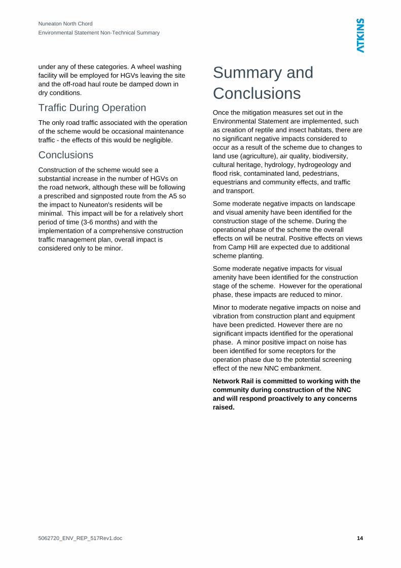
Effects of Construction Construction may require some short-term diversion of pedestrian, cycle and equestrian routes. Construction traffic will share the access to Judkins Quarry off Tuttle Hill and to Canal Farm and Canal Farm Cottages. No access to community facilities will be cut-off during the construction works. A short term closure of the Coventry Canal towpath may be required in order to strengthen a bridge used for construction access to the scheme. A diversion will be provided for towpath users during this period.
The Coventry Canal towpath may need to be temporarily diverted to accommodate bridge strengthening works.
Effects of Operation Operation of the NNC is not expected to affect journey times for pedestrians, cyclists or equestrians.
Traffic and Transportation An assessment has been made of both the Heavy Goods Vehicle (HGV) and total traffic impacts arising from the construction of the NNC utilising traffic data on affected roads and construction traffic forecasts. Construction vehicle access to the site would be via the existing entrance to Judkins Quarry off Tuttle Hill.
The proposed access route has been discussed with Warwickshire County Council. It is identified as a primary access route on the Warwickshire Advisory Lorry route map and avoids site vehicles passing through Nuneaton.
Traffic During Construction The construction impacts assess both HGVs and total traffic. The number of HGVs that would enter and exit the site during construction was estimated based on the volume of material that needs to be brought to the site and volume of demolition materials that need to be taken off site.
It is estimated that the construction works will bring about a 50% increase in the number of HGVs along Tuttle Hill and Mancetter Road, with one arrival or departure every 8 minutes. This equates to an overall increase in traffic volume of less than 4%. These calculations assume a worst-case scenario of a concentrated period of activity of just 3 months (during embankment construction). It is possible that the same number of deliveries may be made over a 6 month period, considerably reducing the increase in HGV journeys per day.
As well as the direct impacts on traffic, the following factors were also considered: effects on "fear and intimidation" of pedestrians using footpaths which HGVs would go past; severance effects (where a community becomes separated by a major transport route); and dust and dirt tracked on to the road by vehicles coming from the site. No significant impacts are anticipated
5062720_ENV_REP_517Rev1.doc 13
Nuneaton North Chord
Environmental Statement Non-Technical Summary
under any of these categories. A wheel washing facility will be employed for HGVs leaving the site and the off-road haul route be damped down in dry conditions.
Traffic During Operation The only road traffic associated with the operation of the scheme would be occasional maintenance traffic - the effects of this would be negligible.
Conclusions Construction of the scheme would see a substantial increase in the number of HGVs on the road network, although these will be following a prescribed and signposted route from the A5 so the impact to Nuneaton's residents will be minimal. This impact will be for a relatively short period of time (3-6 months) and with the implementation of a comprehensive construction traffic management plan, overall impact is considered only to be minor.
Summary and Conclusions Once the mitigation measures set out in the Environmental Statement are implemented, such as creation of reptile and insect habitats, there are no significant negative impacts considered to occur as a result of the scheme due to changes to land use (agriculture), air quality, biodiversity, cultural heritage, hydrology, hydrogeology and flood risk, contaminated land, pedestrians, equestrians and community effects, and traffic and transport.
Some moderate negative impacts on landscape and visual amenity have been identified for the construction stage of the scheme. During the operational phase of the scheme the overall effects on will be neutral. Positive effects on views from Camp Hill are expected due to additional scheme planting.
Some moderate negative impacts for visual amenity have been identified for the construction stage of the scheme. However for the operational phase, these impacts are reduced to minor.
Minor to moderate negative impacts on noise and vibration from construction plant and equipment have been predicted. However there are no significant impacts identified for the operational phase. A minor positive impact on noise has been identified for some receptors for the operation phase due to the potential screening effect of the new NNC embankment.
Network Rail is committed to working with the community during construction of the NNC and will respond proactively to any concerns raised.
5062720_ENV_REP_517Rev1.doc 14
Nuneaton North Chord
Environmental Statement Non-Technical Summary
Appendix
Drawing Showing Scheme Design
5062720_ENV_REP_517Rev1.doc 15