North Okotoks Area Structure Plan - The Town of Okotoks · · 2016-11-22The purpose of the North...
52
November 2016 North Okotoks Area Structure Plan Town of Okotoks Adopted November 14, 2016
Transcript of North Okotoks Area Structure Plan - The Town of Okotoks · · 2016-11-22The purpose of the North...

November 2016
North Okotoks Area Structure PlanTown of Okotoks
Adopted November 14, 2016

North Okotoks Area Structure PlanTown of Okotoks
1.0 Introduction ..................................................................Page 5
2.0 The Plan Area .............................................................Page 9
Map 1. Location and Regional Context ...............................Page 10Map 2. Plan Area Constraints .................................................Page 11
3.0 Vision and Guiding Principles ................ Page 13
Map 3. Land Use Concept .......................................................Page 15
4.0 Community Framework ................................ Page 17
Map 4. Biophysical Features ....................................................Page 22Map 5. Open Space Plan ........................................................Page 23
5.0 Interfaces ....................................................................... Page 27
Map 6. Corridor Study Areas ....................................................Page 29
TABLE OF
CONTENTS

6.0 Mobility ............................................................................ Page 31
Map 7. Street Network ..............................................................Page 34
7.0 Utility Infrastructure & Servicing ........... Page 35
Map 8. Water Services ..............................................................Page 37Map 9. Sanitary Services ..........................................................Page 39Map 10. Stormwater Management ........................................Page 40
8.0 Implementation ...................................................... Page 41
Map 11. Phasing Plan ...............................................................Page 43
9.0 Glossary ........................................................................... Page 46
10.0 Appendices ............................................................. Page 49
A-References ..........................................................................Page 50

1.1 Purpose1.2 Planning Policy Framework1.3 Interpretation
1.0 Introduction

6 | North Okotoks Area Structure Plan (NOASP)
The purpose of the North Okotoks Area Structure Plan (hereinafter referred to as ‘NOASP’) is to provide a land use and servicing framework and set of policies to guide future development within the Plan Area as identified in Map 1: Location and Regional Context (see page 10). This long-term policy document provides direction for more detailed planning stages. To ensure it remains a living document that accounts for policy changes adopted by Town Council, it should be reviewed and updated as necessary following its adoption and until the Approving Authority considers the Plan Area fully built-out. An Area Structure Plan (ASP), as defined in section 633 of the Municipal Government Act (MGA):
“(a) must describe:
(i) the sequence of development proposed for the area,
(ii) the land uses proposed for the area, either generally or with respect to specific parts of the area,
(iii) the density of population proposed for the area either generally or with respect to specific parts of the area, and
(iv) the general location of major transportation routes and public utilities,
(b) may contain any other matters the council considers necessary.”
1.1 PurposeThe NOASP shall be read in conjunction with the Town of Okotoks Municipal Development Plan (MDP) and other relevant Town of Okotoks policy and planning documents. In certain instances, the MDP will provide a greater level of policy direction for a specific topic than what is provided for in this ASP. While in other cases, this ASP will provide a greater level of detail than in the MDP. In addition to the MDP, other Town, provincial, and regional planning documents that provided direction for the NOASP and should be accounted for in the future planning and development of these lands include, but are not limited to:
1.2 Planning Policy Framework• South Saskatchewan Regional Plan
(2014)
• Calgary Metropolitan Plan (2014)
• Town of Okotoks / M.D. of Foothills Intermunicipal Development Plan (2016)
• Okotoks Community Visioning 2014 (approved by Council in Jan. 2015)
• Town of Okotoks Water Conservation, Efficiency and Productivity Plan (2014)
• Okotoks Active Transportation Strategy (2015)
• Okotoks Community Sustainability Plan (2016)

November 2016 | 7
In this Plan, and any amendments made hereto, unless the context otherwise requires, the interpretation set out below shall be used.
1.3.1 Interpretation The following interpretations shall be used when interpreting policies provided for in the Plan:
1. Where an intent statement accompanies a policy, it is provided only to illustrate the purpose of and enhance the understanding of a policy. Should an inconsistency arise between the intent and a policy, the policy will take precedence.
1.3.2 Map InterpretationThe following guidelines shall be used when interpreting maps provided in the plan:
1. Unless otherwise specified in this ASP, the boundaries or locations of any symbols or areas shown on a map or figure are approximate only, not absolute, and will be interpreted as such. They are not intended to define exact locations except where they
1.3 Interpretation2. Most policies are written in the active tense, as deliberate statements or plans indicative of the direction that the Town is proposing for future development or desired outcomes. In certain ASP policies, the word ‘should’ is explicitly used to clarify the directional nature of the statement. ASP policies that use the active tense or ‘should’ will be applied to all situations, unless it can be clearly identified to the satisfaction of the Approving Authority that the policy is not reasonable, practical or feasible in a given situation. Proposed alternatives must be to the satisfaction of the Approving Authority.
3. In some cases, ASP policies are written to apply to all situations, without exception, usually in relation to a statement of action, legislative direction or situations where a desired result is required. The words ‘require,’ ‘must,’ ‘will,’ or ‘shall’ are used within these policy statements and will be applied to all situations.
4. Where ‘may’ is used in an ASP policy, it indicates that a choice can be made, and some discretion by the Approving Authority can be used in decision-making.
coincide with clearly recognizable physical features or fixed boundaries such as property lines or road or utility rights-of-way. The precise location of these boundaries, for the purpose of evaluating development proposals, will be determined by the Town at the time of application.
2. No measurements of distances or areas shall be taken from the maps or figures in this ASP.
3. All proposed Land Use Areas, neighbourhood boundaries, intersections and road alignments may be subject to further study and will be further delineated at the Outline Plan/Land Use Amendment stage. No amendment to this ASP will be required as long as the intent of the applicable policies is maintained.

8 | North Okotoks Area Structure Plan (NOASP)

2.1 Location & Plan Boundaries2.2 Existing Uses2.3 Topography2.4 Municipal Boundaries and Growth2.5 Water2.6 Biophysical Overview2.7 Oil & Gas Assessment2.8 Historical Resources2.9 Phase 1 Environmental Site Assessment2.10 Drainage Constraints
2.0 The Plan Area

10 | North Okotoks Area Structure Plan (NOASP)
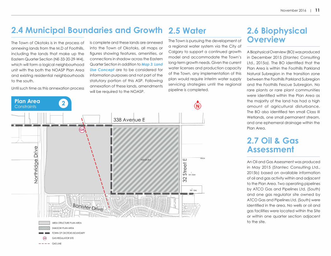
The Plan Area consists of approximately 62.43 ha (154.28 ac) and is located at the northeast municipal boundary of the Town of Okotoks as illustrated in Map 1: Location and Regional Context. The lands that make up the Plan Area are legally described as NW-33-20-29-W4. The following features bound the Plan Area:
• The quarter section legally described as NE-33-20-29-W4 in the M.D. of Foothills to the east (hereinafter referred to as the ‘Eastern Quarter Section’);
• Existing communities of Tower Hill, Suntree and Crystal Shores to the south;
• Northridge Drive (Highway #2A) and future residential to the west; and
• 338th Avenue and rural residential properties in the M.D. of Foothills to the north.
Although the Eastern Quarter Section, consisting of approximately 63.90 ha (157.90 ac), is currently located within the M.D. of Foothills and dependent on future annexation, the NOASP does account for it conceptually in a shadow plan as part of Map 3: Land Use Concept.
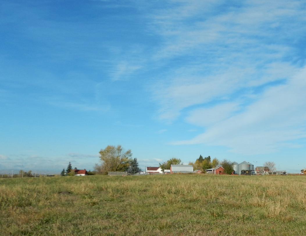
Lands within the Plan Area are predominantly used as pasture with a rural farmstead consisting of two houses and series of associated outbuildings occupying the southwest corner.
The Plan Area has two operating pipelines by ATCO Gas and Pipelines Ltd. (South) that cut across the eastern half of the Plan Area. There is also one gas regulator site that occupies a relatively small site of 0.19 ha (0.7 ac) in the north portion of the Plan Area, directly south of 338th Avenue along the western edge of the two operating pipelines. These existing oil and gas land uses have implications for future development as each pipeline will be subject to setback provisions of the Okotoks Land Use Bylaw (LUB) and Alberta Energy Regular requirements. Map 2: Plan Area Constraints illustrates these features that constrain development.
2.1 Location & Plan Boundaries 2.2 Existing Uses
Lands within the Plan Area slope from the northeast corner and gradually towards the southwest. This gradual change in elevation allows for views of the Rocky Mountains.
2.3 Topography
V:\1165\active\116509909\north_okotoks\pla\200_planning\116500274_asp\05_design\02_community\plan_copy-rename\01_current\02_figures\noasp\noasp-map-context.dwg
Location and Regional Context 1
November 2016 | 11
is complete and these lands are annexed into the Town of Okotoks, all maps or figures showing features, amenities, or connections in shadow across the Eastern Quarter Section in addition to Map 3: Land Use Concept are to be considered for information purposes and not part of the statutory portion of this ASP. Following annexation of these lands, amendments will be required to the NOASP.
2.4 Municipal Boundaries and Growth 2.5 Water
V:\1165\active\116509909\north_okotoks\pla\200_planning\116500274_asp\05_design\02_community\plan_copy-rename\01_current\02_figures\noasp\noasp-map2_constraints.dwg
Plan AreaConstraints 2
A Biophysical Overview (BO) was produced in December 2015 (Stantec Consulting Ltd., 2015a). The BO identified that the Plan Area is within the Foothills Parkland Natural Subregion in the transition zone between the Foothills Parkland Subregion and the Foothills Fescue Subregion. No rare plants or rare plant communities were identified within the Plan Area as the majority of the land has had a high amount of agricultural disturbance. The BO also identified ten small Class III Wetlands, one small permanent stream, and one ephemeral drainage within the Plan Area.
2.6 Biophysical OverviewThe Town of Okotoks is in the process of
annexing lands from the M.D of Foothills, including the lands that make up the Eastern Quarter Section (NE-33-20-29-W4), which will form a logical neighbourhood unit with the both the NOASP Plan Area and existing residential neighbourhoods to the south.
Until such time as this annexation process
The Town is pursuing the development of a regional water system via the City of Calgary to support a continued growth model and accommodate the Town’s long-term growth needs. Given the current water licenses and production capacity of the Town, any implementation of this plan would require interim water supply servicing strategies until the regional pipeline is completed.
2.7 Oil & Gas AssessmentAn Oil and Gas Assessment was produced in May 2015 (Stantec Consulting Ltd., 2015b) based on available information of oil and gas activity within and adjacent to the Plan Area. Two operating pipelines by ATCO Gas and Pipelines Ltd. (South) and one gas regulator site owned by ATCO Gas and Pipelines Ltd. (South) were identified in the area. No wells or oil and gas facilities were located within the Site or within one quarter section adjacent to the site.
12 | North Okotoks Area Structure Plan (NOASP)
A Historical Resources Impact Assessment was undertaken in October 2014 (Stantec Consulting Ltd., 2014) and confirmed that the Plan Area contains no recorded historical resources.
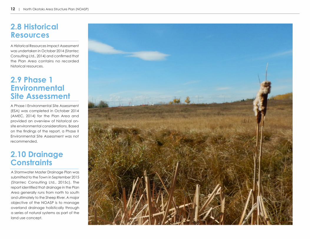
A Stormwater Master Drainage Plan was submitted to the Town in September 2015 (Stantec Consulting Ltd., 2015c). The report identified that drainage in the Plan Area generally runs from north to south and ultimately to the Sheep River. A major objective of the NOASP is to manage overland drainage holistically through a series of natural systems as part of the land use concept.
A Phase I Environmental Site Assessment (ESA) was completed in October 2014 (AMEC, 2014) for the Plan Area and provided an overview of historical on-site environmental considerations. Based on the findings of the report, a Phase II Environmental Site Assessment was not recommended.
2.10 Drainage Constraints
2.9 Phase 1 Environmental Site Assessment
2.8 Historical Resources

3.1 Vision Statement3.2 Guiding Principles3.3 Land use Concept
3.0 Vison and Guiding Principles

14 | North Okotoks Area Structure Plan (NOASP)
The Plan Area will offer a mix of housing and employment options in a dynamic multi-generational community, where residents and citizens can enjoy an exceptional quality of life and sense of community. The range of land uses and amenities will be integrated with a diversity of open spaces and pathways, enabling residents to connect with each other and the great outdoors and the Town’s existing open space system. Residents will be able to move actively and comfortably throughout the Plan Area and into adjacent neighbourhoods with direct, safe and attractive connections via a mobility network incorporated into the design and layout of the community.
Ultimately, by focusing on establishing a livable and inclusive community, the Plan Area, guided by the policies presented in the NOASP, will mature into a unique community within Okotoks and the region at large.
3.1 Vision Statement
The guiding principles for the NOASP are grounded in and support the overall vision of the Okotoks Community Visioning 2014, approved by Town Council in January 2015.
“The Town of Okotoks is resilient, where people, businesses, ideas and sense of community thrive. Grounded by the Sheep River valley and supported by thoughtful planning and design, a strong local economy and a vibrant civic culture, Okotoks offers exceptional quality of life at every stage of life. Respect for each other and the natural environment makes Okotoks home.” Town of Okotoks Okotoks Community Visioning 2014
3.2 Guiding Principles3.2.1 Places to Live and WorkThrough a diversity of housing types, provision of focal points and community destinations, and an appropriate mix of land uses, residents will live and thrive in a complete and inclusive neighbourhood area.
3.2.2 Places to ConnectBy providing for a range of parks and pathways, community amenities, open spaces, prominent viewscapes and natural connections, residents will create lasting bonds with their neighbours and the surrounding environment.
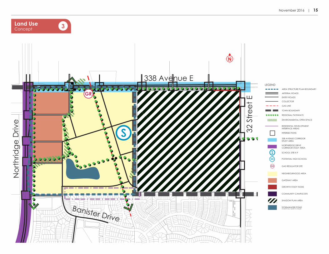
The Land Use Concept is shown on Map 3: Land Use Concept and illustrates the general location of proposed land uses, major streets and environmentally sensitive areas throughout the Plan Area. It also identifies in shadow and at a strategic-level, the Eastern Quarter Section to highlight how the NOASP will integrate the lands to the east in future. Intersections identified in the land use concept are not all intended to be all-turns. As such, the scale and type will be established through more detailed transportation planning.
3.3 Land Use Concept
3.2.3 Places to DiscoverThe thoughtful planning and design of the NOASP as well as the places and the spaces in between will reflect the local context, animate and anchor neighbourhoods, and establish a unique sense of character.
3.2.4 Places to MoveBy integrating regional and local pathway connections, future transit networks, safe school routes, active transportation infrastructure, and prioritizing safety, quality, comfort and complete active transportation networks, residents will enjoy an active lifestyle unique to Okotoks.
November 2016 | 15
FIGURE 1.0 | OKOTOKS
COMBINED NORTHWEST OKOTOKS AMENDED ASP & NORTH OKOTOKS PRELIMINARY ASPV:\1165\active\116509909\north_okotoks\pla\200_planning\116500274_wedderburn\05_design\02_community\outline_plan\01_current
CONCEPT ONLY: THIS DRAWING IS AN ARTISTIC REPRESENTATION OF DESIGNS PREPARED BY STANTEC CONSULTING LTD. IT IS CONCEPTUAL IN NATURE AND SUBJECT TO CHANGE. COPYRIGHT RESERVED.
Note: Information provided for the D’Arcy Lands are
SS
HS
338 Avenue E
Banister Drive
Nor
thrid
ge D
rive
32 S
treet
E
GR
SCHOOL SITE K-9
GAS REGULATOR SITE
POTENTIAL HIGH SCHOOL
NEIGHBOURHOOD AREA
GROWTH STUDY NODE
GATEWAY AREA
338 AVENUE CORRIDOR STUDY AREA
ENTRY ROADS
COLLECTOR
ARTERIAL ROADS
AREA STRUCTURE PLAN BOUNDARY
GAS LINE
TOWN BOUNDARY
REGIONAL PATHWAYS
ENVIRONMENTAL OPEN SPACE
RESIDENTIAL DEVELOPMENT INTERFACE AREAS
LEGEND
INTERSECTIONS
COMMUNITY CAMPUS SITE
NORTHRIDGE DRIVE CORRIDOR STUDY AREA
GR
SHADOW PLAN AREA
STORMWATER POND*CONCEPT ONLY. SUBJECT TO CHANGE.
SHS
Land Use Concept 3


4.1 General Development4.2 Neighbourhood Area4.3 Gateway Area4.4 Environmental Open Space System4.5 Parks & Pathway System 4.6 School Sites4.7 Spaces in Between4.8 Sense of Place & Identity
4.0 Community Framework

18 | North Okotoks Area Structure Plan (NOASP)
4.1.1 IntentThe intent of this section is to set out policies that will provide direction on neighbourhood-level design features, encourage a high standard of development, and promote development that aligns with the recent Okotoks Community Visioning 2014.
4.1.2 Policies1. The Plan Area shall achieve a minimum density of eight units per gross residential acre (±20 units per gross residential hectare) upon full build-out.
2. The Plan Area should be designed to encourage a high degree of access and connectivity for residents using active modes of transportation.
3. Landscaping concepts within the Plan Area should consider drought resistant design and water conservation techniques in accordance with the Town of Okotoks Water Conservation, Efficiency, and Productivity Plan (2014).
4. Decisions relating to neighbourhood design, regional and local pathways, public open spaces, access, street networks, the pipeline right-of-way, and the general built environment should use Crime Prevention through Environmental Design (CPTED) to create a safe and secure community.
5. Dark sky principles, particularly designing all fixtures to direct light downwards, should be considered in the planning of lighting in the Plan Area.
6. All public spaces and pathways within the Plan Area should be designed to encourage a diversity of activities and active modes of transportation during all four seasons.
7. All residential developments shall have a minimum setback of 15 m from the centre line of the existing high pressure pipelines operating in excess of 690 KPA in accordance with the Okotoks LUB.
8. Pathways and other recreational uses may be permitted on pipeline rights-of-way at the discretion of the Approving Authority and utility owners.
4.1 General Development
4.2.1 IntentThe intent of this section is to set out policies to facilitate the design of a complete and inclusive neighbourhood area with a diversity of housing types, and an adequate population base to support schools, parks, focal points, community amenities and future transit.
4.2.2 Policies 1. The Neighbourhood Area shall be designed with a series of focal points and community destinations to support community activity and is identified in Map 3: Land Use Concept.
4.2 Neighbourhood Area
2. The Neighbourhood Area should accommodate a diversity of housing types to meet the needs of residents of all ages, income levels and lifestyles throughout the Plan Area.
3. The layout and design of the Neighbourhood Area should seek to integrate significant environmental features and prominent viewscapes.
4. Mu l t i - fami ly res ident ia l developments should be located throughout the Plan Area and are encouraged to:
i. Be adjacent or in close proximity to major roadways
ii. Be integrated into the active transportation network; and
iii. Be adjacent to a public open space, pathway network, public amenities and/or commercial development
5. Mu l t i - fami ly res ident ia l developments should be integrated with appropriate transitions to ensure compatible interfaces with surrounding neighbourhoods.
6. Alternative housing forms (e.g. studio suites, live-work units) should be allowed within the Neighbourhood Area at the discretion of the Approving Authority.
7. Connectivity and mobility throughout the Neighbourhood Area shall be facilitated through the development of permeable street and active transportation networks.
8. Civic uses, institutional uses and neighbourhood scale commercial and/or services may be provided in the Neighbourhood Area.

November 2016 | 19
4.3 Gateway Area4.3.1 Intent The Gateway Area (GA) will be planned as a transit supported development and accommodate a range of uses to support Okotoks as a distinct, walkable and complete community within the Calgary Region. The area is intended to intensify over time, offering a range of retail and service commercial, employment, as well as other land uses that horizontally and vertically integrate with adjacent medium and higher multi-family residential uses. Appropriately scaled and positioned open spaces will be designed into the GA to support future intensification. The diversity of uses in the GA will intensify overtime and grow into a vibrant and livable area.
The intent of the GA is to form a high-quality village-like pattern of development within the larger Plan Area with this area acting as a distinct, cohesive and visually related centre and focal point for residents.
4.3.2 Policies1. The GA will be located generally as shown on Map 3: Land Use Concept. The exact boundary and location of this district may be refined further at the Outline Plan / Land Use Amendment stage.
2. The GA will comprise a minimum of 11 net hectares (27.18 net ac) in accordance with the MDP targets.
3. Within the GA, a minimum of 27,000 m2 of gross commercial floor space shall be planned for and achieved overtime, based on an FAR of 0.25 at full build-out.
4. The GA will endeavour to intensify over time through redevelopment to achieve an intensity of 140 people and jobs per gross developable hectare to accommodate local employment opportunities and support the long-term direction of the Town.
5. The specific gross commercial floor space target in the GA shall be achieved through non-residential employment generating uses, including, but not limited to retail and service commercial, offices,cultural, institutional or employment uses.
6. The GA will be designed to function over time as a highly connected and permeable transit oriented development.
7. Desired build-out of the GA should be comprised of a mix of land uses to facilitate retail and services, employment, and medium and high density multi-family development.
8. Medium and high density multi-family developments must account for and contribute to the diversity of public plazas and gathering spaces within the larger Plan Area through thoughtful planning and design considerations.
9. In addition to retail and service commercial, employment and multi-family residential developments, the GA may include a range of compatible neighbourhood-oriented uses such as, but not limited to secondary and/or post-secondary schools, day care facilities, community facilities (e.g. seniors’ housing and/or assisted living complexes), civic uses, institutional uses, as well as cultural uses as deemed appropriate by the Approving Authority. This will be accomplished through the utilization of a range of land uses.
10. Development in the GA should be designed in a manner that supports intensification and an increase in diversity and range of uses over time. Opportunities to mix uses vertically and/ or horizontally should be explored at the detailed planning stage.

20 | North Okotoks Area Structure Plan (NOASP)
4.3 Gateway Area
11. The GA should provide for a permeable grid-like pattern street layout and position buildings and infrastructure, such as pipes and roadways, to accommodate future intensification and a higher intensity of land uses at full build-out. The signing of infrastructure is to be determined at the Outline Plan/ Land Use Amendment stage to support future intensification on our time.
12. Interim uses while the GA intensifies over time may include, but are not limited to, landscaped surface parking lots, public plazas, gathering spaces and open spaces.
13. The GA will support direct and easily accessible active transportation connections to 338th
Avenue through use of a range of design considerations and strategies to be determined conceptually at the Outline Plan/Land Use Amendment stage. Further, the design and layout of the GA should account for at-grade active transportation connections across Northridge Drive West to the D’Arcy Gateway Area (DGA) within the Northwest Okotoks Area Structure Plan (NWOASP).
14. The conceptual layout and potential mix of land uses of the GA shall be determined during the Outline Plan/Land Use Amendment
stage through the submission of a Development Concept Plan.
15. The Development Concept Plan shall demonstrate the following:
i. Land use concepts;
ii. Internal street network;
iii.Public plazas and gathering spaces location and concepts;
iv.The integration of the GA to the larger open space network;
v. Future transit routes and centrally located and easily accessible stops for residents walking to and from the surrounding neighbourhood;
vi.Proposed urban design features that contribute to the distinct, cohesive, and visually related identity of the area;
vii. Internal and external integration of the larger Plan Area’s active transportation network through design considerations and strategies; and,
viii. A phasing and intensification strategy to maximize employment uses over time and enhance the diversity of uses.
16. At the discretion of the Approving Authority, the GA may be developed with reduced road carriageways or with relaxed LUB standards (setbacks,
lot width, height, etc.) in order to achieve a more efficient and distinct development form, consistent with sound planning principles and placemaking objectives.
17. Loading and storage facilities as well as delivery areas for commercial developments should be located away from public streets. Where possible, they should be visibly screened with natural landscape buffers.
November 2016 | 21
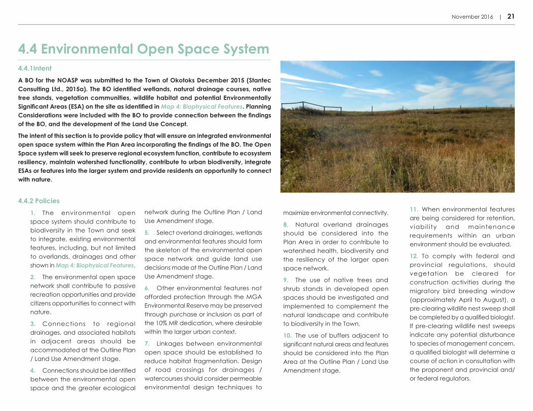
4.4.1IntentA BO for the NOASP was submitted to the Town of Okotoks December 2015 (Stantec Consulting Ltd., 2015a). The BO identified wetlands, natural drainage courses, native tree stands, vegetation communities, wildlife habitat and potential Environmentally Significant Areas (ESA) on the site as identified in Map 4: Biophysical Features. Planning Considerations were included with the BO to provide connection between the findings of the BO, and the development of the Land Use Concept.
The intent of this section is to provide policy that will ensure an integrated environmental open space system within the Plan Area incorporating the findings of the BO. The Open Space system will seek to preserve regional ecosystem function, contribute to ecosystem resiliency, maintain watershed functionality, contribute to urban biodiversity, integrate ESAs or features into the larger system and provide residents an opportunity to connect with nature.
4.4 Environmental Open Space System
4.4.2 Policies1. The environmental open space system should contribute to biodiversity in the Town and seek to integrate, existing environmental features, including, but not limited to overlands, drainages and other shown in Map 4: Biophysical Features.
2. The environmental open space network shall contribute to passive recreation opportunities and provide citizens opportunities to connect with nature.
3. Connections to regional drainages, and associated habitats in adjacent areas should be accommodated at the Outline Plan / Land Use Amendment stage.
4. Connections should be identified between the environmental open space and the greater ecological
network during the Outline Plan / Land Use Amendment stage.
5. Select overland drainages, wetlands and environmental features should form the skeleton of the environmental open space network and guide land use decisions made at the Outline Plan / Land Use Amendment stage.
6. Other environmental features not afforded protection through the MGA Environmental Reserve may be preserved through purchase or inclusion as part of the 10% MR dedication, where desirable within the larger urban context.
7. Linkages between environmental open space should be established to reduce habitat fragmentation. Design of road crossings for drainages / watercourses should consider permeable environmental design techniques to
maximize environmental connectivity.
8. Natural overland drainages should be considered into the Plan Area in order to contribute to watershed health, biodiversity and the resiliency of the larger open space network.
9. The use of native trees and shrub stands in developed open spaces should be investigated and implemented to complement the natural landscape and contribute to biodiversity in the Town.
10. The use of buffers adjacent to significant natural areas and features should be considered into the Plan Area at the Outline Plan / Land Use Amendment stage.
11. When environmental features are being considered for retention, viabi l i ty and maintenance requirements within an urban environment should be evaluated.
12. To comply with federal and provincial regulations, should vegetation be cleared for construction activities during the migratory bird breeding window (approximately April to August), a pre-clearing wildlife nest sweep shall be completed by a qualified biologist. If pre-clearing wildlife nest sweeps indicate any potential disturbance to species of management concern, a qualified biologist will determine a course of action in consultation with the proponent and provincial and/or federal regulators.

22 | North Okotoks Area Structure Plan (NOASP)
BiophysicalFeatures 4
V:\1165\active\116509909\north_okotoks\pla\200_planning\116500274_asp\05_design\02_community\plan_copy-rename\01_current\02_figures\noasp\noasp-map-os_system.dwg
N
V:\1165\active\116509909\north_okotoks\pla\200_planning\116500274_asp\05_design\02_community\plan_copy-rename\01_current\02_figures\noasp\noasp-map-os_system.dwg
N

November 2016 | 23
Open SpacePlan 5
SS
HS
338 Avenue E
Banister Drive
Nor
thrid
ge D
rive
32 S
treet
E
SCHOOL SITE K-9
POTENTIAL HIGH SCHOOL
AREA STRUCTURE PLAN AREA
NOASP SCHOOL SITE OPEN SPACE
SHADOW PLAN AREA
TOWN BOUNDARY
PRIMARY REGIONAL PATHWAYS
ENVIRONMENTAL OPEN SPACE
LEGEND
STORMWATER POND*CONCEPT ONLY. SUBJECT TO CHANGE.
SHS
COMMUNITY CAMPUS SITE
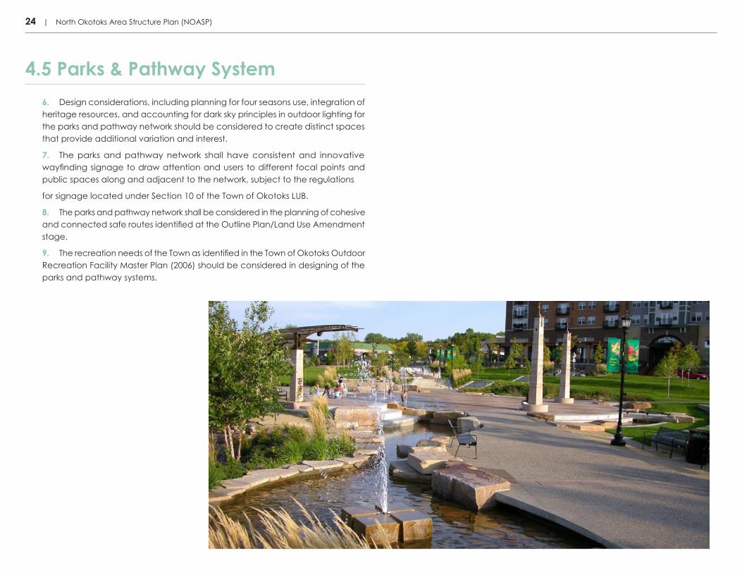
4.5 Parks & Pathway System4.5.1 Intent The intent of this section is to set out policies that support the establishment of a parks and pathway system that promotes healthy active lifestyles, accommodates a range of high quality recreational amenities and activities, and entices residents to utilize active transportation modes for functional and recreational based trips.
4.5.2 Policies1. Regional pathways and environmental open spaces as part of the parks and pathway system shall connect people to the surrounding environment and neighbourhoods, and community destinations, as shown conceptually in Map 5: Open Space Plan. Alignment of the regional pathways may be refined at the Outline Plan/Land Use Amendment stage.
2. The parks and pathway system will be composed of a clear hierarchy and diversity of open spaces with differing roles and functions designed to be multi-generational community focal points. The conceptual details of this system shall be determined at the Outline Plan/Land Use Amendment stage.
3. Regional pathways shall be provided to ensure the Plan Area is connected to surrounding neighbourhoods and other areas of greater Okotoks.
4. In addition to regional pathways and sidewalk connections, connections that link residential areas to community destinations shall be provided. Connections may include, but are not limited to, multi-purpose trails, local trails, internal pathways, on-street bike paths and greenways.
5. Native species and natural landscaping should be encouraged throughout the parks and pathway system.
REGIONAL PATHWAYS
24 | North Okotoks Area Structure Plan (NOASP)
4.5 Parks & Pathway System6. Design considerations, including planning for four seasons use, integration of heritage resources, and accounting for dark sky principles in outdoor lighting for the parks and pathway network should be considered to create distinct spaces that provide additional variation and interest.
7. The parks and pathway network shall have consistent and innovative wayfinding signage to draw attention and users to different focal points and public spaces along and adjacent to the network, subject to the regulations
for signage located under Section 10 of the Town of Okotoks LUB.
8. The parks and pathway network shall be considered in the planning of cohesive and connected safe routes identified at the Outline Plan/Land Use Amendment stage.
9. The recreation needs of the Town as identified in the Town of Okotoks Outdoor Recreation Facility Master Plan (2006) should be considered in designing of the parks and pathway systems.

November 2016 | 25
4.6 School Sites4.6.1 IntentThe intent of this section is to provide policies that will guide the appropriate location and integration of school sites within the Plan Area’s residential fabric to promote an efficient use of reserve land and ensure that future schools evolve into accessible neighbourhood focal points. Additional school sites may be provided for on the Eastern Quarter Section, but these lands are currently beyond the boundary of the Town and the Plan Area of the NOASP.
4.6.2 Policies1. The general location of school sites is illustrated in Map 3: Land Use Concept and may be subject to further refinement during the Outline Plan/Land Use Amendment stage. Any changes to the location will not require amendments to the NOASP. Any changes to the type or number of schools within the Plan Area would require an amendment to the NOASP. School sites identified within the Shadow Plan Area are primarily meant for illustration purposes and will be subject to further refinement depending on the future direction taken on the Eastern Quarter Section by the Town.
2. School sites shall be identified at the Outline Plan / Land Use Amendment stage and dedicated at the subdivision stage. The size of school sites should be in accordance with any agreement between the Town of Okotoks and the applicable school divisions.
3. School buildings should be designed and encouraged to integrate a variety of uses that
benefit the community and reinforce the role of the school as the social, educational and activity centre for surrounding residents.
4. School buildings are encouraged to be multi-storey to reduce the amount of land required for the school site and to allow for Municipal Reserve lands to be equitably distributed across the Plan Area.
5. School buildings shall be located adjacent to a collector street and should be integrated along the active transportation network with a set of accessible and direct safe routes to encourage active transportation amongst all students.
6. School sites are encouraged to be co-located and/or integrated with other institutional, civic or recreational uses in the Plan Area, resulting in a shared site, at the Outline Plan/Land Use Amendment stage.
7. Opportunities for school sites to be integrated with the environmental open space system including, but not limited to overland drainage are encouraged to be explored.

26 | North Okotoks Area Structure Plan (NOASP)
4.7 Spaces in Between4.7.1 Intent ‘Spaces in between’ refer to the spaces within the public realm along streets within a neighbourhood that contribute to the liveability and identity of the place. The intent of this section is to set out policies that will support a diversity of public gathering spaces, and an active public realm along streets in the Plan Area. Focusing on the ‘Spaces in between‘ throughout the design and planning of the NOASP neighbourhoods will ensure that the Plan Area contributes a walkable and pedestrian-friendly community and by extension a vibrant and liveable Okotoks.
4.7.2 Policies1. A diversity of public gathering spaces should be considered in the design and planning of neighbourhoods at the Outline Plan/Land Use Amendment stage in order to ensure a diversity of focal points and community destinations or places that can be identified by residents.
2. Engaging lighting, vibrant colours, and the use of passive solar design are encouraged in public spaces and other community destinations, including, but not limited to, parks, educational and community facilities, commercial nodes, and future transit stops.
3. Strategic lighting to activate the spaces in between while minimizing misdirected light is encouraged.
4. Buildings along streets should explore opportunities for smaller setbacks, street orientation, and active frontages to create a pedestrian-friendly built environment and promote a human scale and enhanced public realm.
5. Where appropriate, buildings should be located and oriented so that they define and reinforce public spaces and other community destinations, including, but not limited to, parks, educational and community facilities, commercial nodes, and future transit stops.
4.8.1 Intent The intent of this section is to set out policies that will achieve a distinct sense of place and identity within the Plan Area.
4.8.2 Policies1. Street names and innovative wayfinding signage should draw on the Plan Area’s historical context, geographical or topographical layout, and/or the Town’s heritage and reinforce the identity of the community. Naming is subject to Council Approval.
2. Streetscapes should be enhanced through complimentory design elements including, but not limited to innovative lighting, wayfinding, paving, street furniture and street trees along entry roads, collectors and other major streets.
3. A high quality of architecture and urban design is encouraged to create an attractive public realm
4.8 Sense of Place & Identityand distinct streetscapes unique to Okotoks.
4. Architectural Controls for the Neighbourhood Area shall be prepared by the Applicant and accepted at the Tentative Plan stage to ensure a unified and attractive sense of place and interfaces between the streetscapes and built form.
5. Public buildings should be located in prominent locations within the neighbourhood to create landmarks.
6. Public art is encouraged in focal points and community destinations in the Plan Area.
7. Natural areas, such as overland drainage should be considered as feature elements defining the sense of place within the Plan Area.

5.1 Northridge Drive Corridor Study Area5.2 338th Avenue Corridor Study Area5.3 Residential Development Interface Areas
5.0 Interfaces
28 | North Okotoks Area Structure Plan (NOASP)
5.1.1 IntentWith the future build-out of the Plan Area likely to occur in phases and concurrently to the westerly D’Arcy Ranch Lands Plan Area within the NWOASP, it is important that details ranging from intersections to land uses in the Northridge Drive Corridor Study Area are grounded in strong planning principles and establish a cohesive identity. It is also vital that future residents on the east and west sides of Northridge Drive have enhanced and easily accessible opportunities to move between communities and across Northridge from east to west. The intent of this section is to identify policies that will facilitate direct connections between the Plan Area and future communities to the west of Northridge Drive and facilitate compatible and complementary land uses.
5.1 Northridge Drive Corridor Study Area
5.2.1 IntentThe intent of this section is to identify policies that will facilitate direct access into the Plan Area from the 338th Avenue Corridor Study Area as well as multi-modal movement along the corridor.
5.2.2 Policies1. The general location of the 338th Avenue Corridor Study Area is located as shown in Map 6: Corridor
5.2 338th Avenue Corridor Study Area
5.1.2 Policies1. The general location of the Northridge Drive Corridor Study Area is located as shown on Map 6: Corridor Study Areas, along the western edge of the Plan Area. The northern boundary of the North Okotoks Corridor Study Area shall be the 338th Avenue intersection and the southern boundary shall be the Sandstone Gate intersection.
2. Land uses within the Northridge Drive Corridor Study Area and along each side of Northridge Drive are encouraged to be similar in their character and general scale as well as orientation.
3. The number and general location of intersections should be as illustrated in Map 6: Corridor Study Areas. The nature and specific location of these intersections is subject to further refinement and study through a supporting Transportation Impact Assessment (TIA) at the Outline Plan/Land Use Amendment stage. Modifications to the location of these intersections would not constitute an amendment to the NOASP.
4. Appropriate and well-defined at-grade crossings should be provided across Northridge Drive to minimize conflicts between vehicular traffic and other modes of travel and enhance
permeability between communities on either side of Northridge Drive.
5. Regional pathway connections should not terminate at the boundaries of the Plan Area, but should extend across to other communities through use of marked and well-defined crossings and connections. Regional pathways should also be generally located along both sides of Northridge Drive, as illustrated in Map 6: Corridor Study Areas to allow residents from southerly and easterly neighbourhoods to be able to connect and move through the Plan Area.
6. Any Outline Plan / Land Use
Amendment applications that border Northridge Drive should include a preliminary Concept Plan showing the full width of Northridge Drive.
7. As part of the Outline Plan / Land Use Amendment application process the applicant is required to submit design drawings to the Town, cross-sections and plan views showing the design of Northridge Drive and related features.
Study Areas, along the northern edge of the Plan Area.
2. The number and general location of intersections along 338th Avenue should be as illustrated in Map 6: Corridor Study Areas. The nature and specific location of these intersections is subject to further refinement and study through a supporting TIA at the Outline Plan/Land Use Amendment stage. Modifications to
the location of these intersections would not constitute an amendment to the NOASP.
3. The intent of the 338th Avenue Corridor Study Area is to be a multi-modal corridor that will equitably accommodate vehicular traffic, future transit service, and active modes of transportation.
4. Any Outline Plan / Land Use Amendment applications that border
338th Avenue should include a preliminary Concept Plan showing the full width of 338th Avenue.
5. As part of the Outline Plan / Land Use Amendment application process the applicant is required to submit design drawings, cross-sections and plan views showing the design of 338 Avenue and related features.

November 2016 | 29
338 Ave E
Banister Drive
Nor
thrid
ge D
rive
32 S
treet
E
AREA STRUCTURE PLAN AREA
SHADOW PLAN AREA
ENTRY ROADS
COLLECTOR
ARTERIAL ROADS
TOWN BOUNDARY
LEGEND
INTERSECTIONS
338 AVENUE CORRIDOR STUDY AREA
NORTHRIDGE DRIVE CORRIDOR STUDY AREA
338 Ave E
Banister Drive
Nor
thrid
ge D
rive
32 S
treet
E
AREA STRUCTURE PLAN AREA
SHADOW PLAN AREA
ENTRY ROADS
COLLECTOR
ARTERIAL ROADS
TOWN BOUNDARY
LEGEND
INTERSECTIONS
338 AVENUE CORRIDOR STUDY AREA
NORTHRIDGE DRIVE CORRIDOR STUDY AREA
CorridorStudy Areas 6
30 | North Okotoks Area Structure Plan (NOASP)
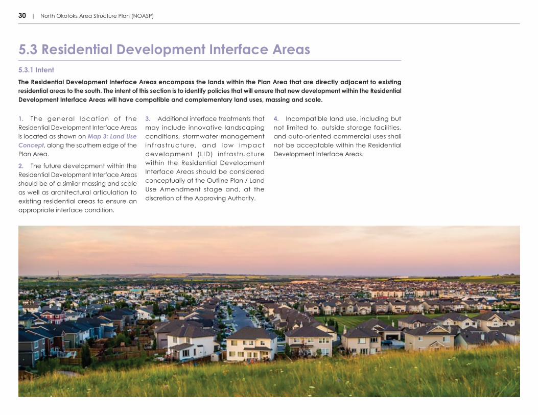
5.3.1 IntentThe Residential Development Interface Areas encompass the lands within the Plan Area that are directly adjacent to existing residential areas to the south. The intent of this section is to identify policies that will ensure that new development within the Residential Development Interface Areas will have compatible and complementary land uses, massing and scale.
5.3 Residential Development Interface Areas
1. The general location of the Residential Development Interface Areas is located as shown on Map 3: Land Use Concept, along the southern edge of the Plan Area.
2. The future development within the Residential Development Interface Areas should be of a similar massing and scale as well as architectural articulation to existing residential areas to ensure an appropriate interface condition.
3. Additional interface treatments that may include innovative landscaping conditions, stormwater management in f rast ructure, and low impact development (LID) infrastructure within the Residential Development Interface Areas should be considered conceptually at the Outline Plan / Land Use Amendment stage and, at the discretion of the Approving Authority.
4. Incompatible land use, including but not limited to, outside storage facilities, and auto-oriented commercial uses shall not be acceptable within the Residential Development Interface Areas.

6.1 Active Transportation Network6.2 Safe Routes6.3 Transit Service6.4 Street Network
6.0 Mobility

32 | North Okotoks Area Structure Plan (NOASP)
6.1.1 IntentThe Active Transportation Network is vital to health and wellbeing of future residents of the Plan Area as everyone, regardless of age or ability, should have the opportunity to use active modes of transportation comfortably and safely within the larger community. The intent of this section is to identify policies that will provide an integrated Active Transportation Network that allows for direct and convenient circulation for all active modes. Emphasis will be placed on safety, quality, comfort and completing the network in the implementation of the Active Transportation Network.
6.1 Active Transportation Network
6.2.1 IntentWith a greater awareness in recent years of the value of active transportation use for daily trips of school aged children, the NOASP provides strong policies to support the development and implementation of Safe Routes in subsequent Outline Plans. As noted in the Okotoks 2015 Active Transportation Strategy, a Safe Route “is an established, defined route that is designed to allow children to safely use active transportation to get to major facilities and to get to and from school daily”.
6.2 Safe Routes
6.1.2 Policies1. Active transportation modes are encouraged throughout the Plan Area and should be supported by a complete and connected Active Transportation Network. This network is to be identified at the Outline Plan/ Land Use Amendment stage.
2. The Active Transportation Network should provide connections to community destinations, including, but not limited to, major parks, educational and community facilities, commercial nodes, and future transit stops throughout the Plan Area.
3. Community destinations within the Plan Area should provide appropriate bike storage facilities to encourage greater use of the Active Transportation Network for functional based trips.
4. The Active Transportation Network should establish direct connections through and between the Plan Area and surrounding neighbourhoods to enhance the community’s permeability and promote opportunities for future residents to easily use active modes.
5. The Active Transportation Network may utilize on-street and off-street corridors, including the Regional Pathway
Network, in order to establish a high-quality permeable and attractive network for all active modes. Emphasis should be placed on achieving a safe, comfortable, and connected network.
6. Slow Design Principles to manage vehicular speeds are encouraged to be integrated into the design of communities at the Outline Plan/Land Use Amendment stage to ensure an environment that is safe, secure and comfortable for active modes. Measures may include, but are not limited to, consideration of roundabouts, raised crosswalks, raised medians, traffic buttons, diagonal diverters, chicanes and narrow streets.
In conceptual planning and design of Safe Routes, the following should be considered as core features:
i. Routes should be as direct as possible between facilities and schools;
ii. The number of street crossings should be minimized in the identification of Safe Routes conceptually; however, if crossings are required on collectors they should be marked and use design elements to ensure high visibility and sightlines of the crossing;
iii. Where routes are located along collector roads, sidewalks on both sides should be considered. Routes should be visible and accessible in their location within the residential neighbourhood;
iv. Innovative lighting and signage should be integrated along Safe Routes
as a means to clearly delineate their location in the community; and
v. Routes are encouraged not to be located on streets with front drive garages on both sides to minimize potential pedestrian-vehicle conflicts through driveways.
November 2016 | 33
6.4.1 Intent The intent of this section is to provide policies that will ensure the development of a comprehensive street network that ensures multiple routes and connections. This network balances the need for motor vehicle movement and parking with the needs of active modes of travel.
6.4 Street Network
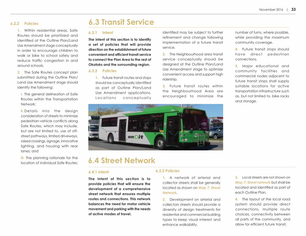
6.3.1 IntentThe intent of this section is to identify a set of policies that will provide direction on the establishment of future convenient and efficient transit service to connect the Plan Area to the rest of Okotoks and the surrounding region.
6.3.2 Policies1. Future transit routes and stops should be conceptually identified as part of Outline Plan/Land Use Amendment applications. Locat ions conceptua l l y
6.3 Transit Service6.2.2 Policies1. Within residential areas, Safe Routes should be prioritized and identified at the Outline Plan/Land Use Amendment stage conceptually in order to encourage children to walk or bike to school safely and reduce traffic congestion in and around schools.
2. The Safe Routes concept plan submitted during the Outline Plan/ Land Use Amendment stage should identify the following:
i. The general delineation of Safe Routes within the Transportation Network;
ii. Details into the design consideration of streets to minimize pedestrian-vehicle conflicts along Safe Routes, which may include, but are not limited to, use of off-street pathways, limited driveways, raised crossings, signage, innovative lighting, and housing with rear lanes; and
iii. The planning rationale for the location of individual Safe Routes;
identified may be subject to further refinement and change following implementation of a future transit service.
2. The Neighbourhood area transit service conceptually should be designed at the Outline Plan/Land Use Amendment stage to optimize convenient access and support high ridership.
3. Future transit routes within the Neighbourhood Area are encouraged to minimize the
number of turns, where possible, while providing the maximum community coverage.
4. Future transit stops should have direct pedestr ian connections.
5. Major educational and community facil it ies and commercial nodes adjacent to future transit stops shall supply suitable locations for active transportation infrastructure such as, but not limited to, bike racks and storage.
6.3.2 Policies1. A network of arterial and collector streets shall be generally located as shown on Map 7: Street Network.
2. Development on arterial and collectors streets should provide a diversity of design treatments for residential and commercial building types to keep visual interest and enhance walkability.
3. Local streets are not shown on Map 7: Street network but shall be located and identified as part of each Outline Plan.
4. The layout of the local road system should provide direct connections, multiple route choices, connectivity between all parts of the community, and allow for efficient future transit.

34 | North Okotoks Area Structure Plan (NOASP)
338 Ave E
Banister Drive
Nor
thrid
ge D
rive
32 S
treet
E
AREA STRUCTURE PLAN AREA
SHADOW PLAN AREA
ENTRY ROADS
COLLECTOR
ARTERIAL ROADS
TOWN BOUNDARY
LEGEND
INTERSECTIONS
338 Ave E
Banister Drive
Nor
thrid
ge D
rive
32 S
treet
E
AREA STRUCTURE PLAN AREA
SHADOW PLAN AREA
ENTRY ROADS
COLLECTOR
ARTERIAL ROADS
TOWN BOUNDARY
LEGEND
INTERSECTIONS
StreetNetwork 7

338 Ave E
Banister Drive
Nor
thrid
ge D
rive
32 S
treet
E
AREA STRUCTURE PLAN AREA
SHADOW PLAN AREA
ENTRY ROADS
COLLECTOR
ARTERIAL ROADS
TOWN BOUNDARY
LEGEND
INTERSECTIONS
7.1 Utilities7.2 Water Services7.3 Sanitary Services7.4 Stormwater Management7.5 Oil and Gas Infrastructure
7.0 Utility Infrastructure & Servicing

36 | North Okotoks Area Structure Plan (NOASP)
7.1 Shallow Utilities7.1.1 Intent The intent of this section is to identify a set of policies that will ensure adequate shallow utility infrastructure is provided and ideally aligned to serve the future development and intensification of the Plan Area.
7.1.2 Policies 1. The location of proposed utility rights-of-way must be identified at the Outline Plan/Land Use Amendment stage.
2. Utilities should be aligned to avoid existing environmental features within the Plan Area unless otherwise permitted by the Approving Authority due to unique circumstances.
3. The planning of utility servicing and associated infrastructure of the GA should account for future intensification of the subarea over time.
7.2.1 IntentThe intent of this section is to ensure that water servicing utilities are provided at a standard acceptable to the Town. With the Plan Area at higher elevation than the south in existing zone 3N pump station can service. Further upgrades will be required as well as the establishment of a new pressure zone. Further, with the Town currently reviewing the water servicing strategies for the Plan Area, these policies may be revised during subsequent Outline Plan / Land Use Amendment stages.
7.2.2 Policies1. The new 4N pressure zone will be created by way of upgrades to the existing reservoir and pump station in Tower Hill. Two new feeder mains will be extended from this pump station north to the Plan Area through existing reserve parcels, existing lanes and walkways.
2. The proposed upgrades will create pressure zone 4N and this new pressure zone will service the entire Plan Area as tentatively shown in Map 8: Water Services. However, the exact boundaries for pressure zone 4N will be confirmed by Town Administration and may service additional lands.
3. To ensure fire protection and looping water requirements for zone 4N, two distribution mains leaving the upgraded reservoir will be required.
4. Two connection locations to pressure zone 3N should be determined prior to development. Two possible locations are the existing water main in Bannister Drive and the existing water main in Milligan Drive by way of a looped system through the D’Arcy Lands. These details are to be confirmed by Town Administration.
5. With the Town currently in the process of reviewing the pump capacity at the zone 3N reservoir and potential reservoir/distribution upgrades, alternative and more cost-effective alignments and locations may be considered at the Outline Plan/ Land Use Amendment stage to service the Plan Area and would not constitute an amendment to the NOASP.
7. Pressure Control Valve (PCV) and network design should consider the future servicing scenario of a new reservoir being built north of the Plan Area, likely post build-out of the NOASP.
7.2 Water Services

November 2016 | 37
WaterServices 8
V:\1165\active\116509909\north_okotoks\pla\200_planning\116500274_asp\05_design\02_community\asp\01_current\02_figures\noasp\noasp-map-serv-watr.dwg

38 | North Okotoks Area Structure Plan (NOASP)
7.3 Sanitary Services7.3.1 IntentThe intent of this section is to ensure an appropriate and efficient sanitary system is provided to serve the Plan Area at full build-out.
3. Outline Plan submissions shall identify the location of proposed infrastructure utility rights-of-way.
4. Sanitary servicing utility alignment should minimize adverse impacts to ESAs.
5. Alternative and more cost efficient alignments of the sanitary sewer system and associated infrastructure may be considered at the Outline Plan / Land Use Amendment stage.
7.3.2 Policies1. Wastewater from the Plan Area will be accommodated by the existing sanitary system located in the lane directly north of Crystal Shores Grove as shown in Map 9: Sanitary Services.
2. Offsite upgrades necessary to service the Plan Area and their exact implementation timeframe will be determined by the Town as part of the update to the Town of Okotoks Sanitary Master Plan currently underway. As such, further refinement of the sanitary servicing strategy may be required during the Outline Plan / Land Use Amendment stage and does not require an ASP Amendment.
7.4 Stormwater Management7.4.1 Intent The intent of this section is to provide an appropriate and efficient stormwater management system to serve the Plan Area at full build-out. The stormwater drainage strategy should be designed in a manner that serves the Plan Area, in accordance with Alberta Environment and Parks as well as Town of Okotoks Standards, while maintaining watershed features where possible, including but not limited to existing topography and overland drainage patterns.
7.4.2 Policies1. The Master Drainage Plan for the Plan Area must be approved prior to the approval of Outline Plan/ Land Use Amendments with the NOASP Plan Area.
2. Land use decisions made at the Outline Plan / Land Use Amendment stage should minimize adverse impacts on watershed health and functionality. Accordingly, integrated stormwater management concepts, including naturalized stormwater retention pond, should be implemented to:
i. Maintain predevelopment hydrology
ii. Protect water quality
iii. Manage water quantity
iv. Minimize erosion potential
v. Contribute to urban biodiversity
3. Stormwater management systems should be planned at the Outline Plan / Land Use Amendment stage in an integrated manner in order to contribute to and complement environmental open space.
4. The general location of a naturalized stormwater retention pond to service the future community of the Plan Area should be generally located as identified on Map 10: Stormwater Management.
5. Overland drainage patterns and watercourses should be maintained and integrated into post-development plans, as identified in the approved Master Drainage Plan.
6. The use of LID and innovative measures to stormwater management will be explored during the Outline
Plan and detailed design stages, and may be included if deemed suitable and agreeable to the applicant and Engineering Services.

November 2016 | 39
V:\1165\active\116509909\north_okotoks\pla\200_planning\116500274_asp\05_design\02_community\asp\01_current\02_figures\noasp\noasp-map-serv-sswr.dwg
SanitaryServices 9

40 | North Okotoks Area Structure Plan (NOASP)
StormwaterManagement 10
OFFSITEEXISTING
DRAINAGE
POTENTIALLOCATION OFREGIONALSTORM POND
TO NWOASPPLAN AREA
V:\1165\active\116509909\north_okotoks\pla\200_planning\116500274_asp\05_design\02_community\asp\01_current\02_figures\noasp\noasp-map-serv-strm.dwg
8.1 Plan Adoption8.2 Plan Implementation8.3 Phasing8.4 Intermunicipal Coordination8.5 Plan Amendment
8.0 Implementation

42 | North Okotoks Area Structure Plan (NOASP)
The NOASP, passed in accordance with Part 7 of the Municipal Government Act, shall become a statutory planning document of the Town of Okotoks.
8.1 Plan Adoption
8.2.1 Intent
8.2.2 Policies1. A detailed Concept Plan for the GA in accordance with 4.3.2(15) is to be prepared and approved prior or concurrent with Outline Plan approval.
2. Architectural Controls for the Neighbourhood Area shall be prepared and accepted at the Tentative Plan stage.
3. An Outline Plan and Land Use Amendment application shall be approved for a specific land area prior to subdivision and development of the land.
4. All subdivision and development shall conform to the Town of Okotoks MDP, LUB, and approved Outline Plan(s).
8.2 Plan Implementation
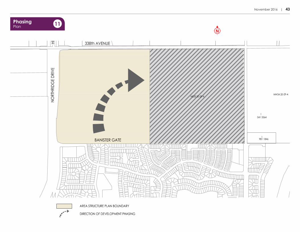
8.3.1 IntentThe intent of this section is to provide a set of policies that will enable the Plan Area to develop in a logical manner to ensure servicing efficiencies. 8.3.2 Policies
1. Phasing of residential development within the Plan Area should be implemented in an efficient and logical manner to ensure a contiguous urban form and servicing efficiencies.
2. Any discrepancies between the anticipated general direction of development staging or location as illustrated in Map 10: Phasing Plan and the actual planning and development of the Plan Area shall be addressed at the Outline Plan / Land Use stage and would not constitute an amendment to the NOASP.
3. Phasing will be consistent with the current Water Allocation Systems for Planning Approvals Policy with respect to allocation of water service capacity and be consistent with the direction of future development outlined in Map 11: Phasing Plan.
4. The minimum density target of eight units per gross residential acre (±20 units per gross residential hectare) shall be achieved upon full build-out of the Plan Area.
8.3 Phasing
5. All subdivision and development permit applications are to be consistent in intent with the GA Concept Plan, or shall be required to apply for an amendment to the Concept Plan. Amendments to the Concept Plan are at the discretion of the Development Authority.
This section is intended to ensure that future development in the Plan Area conforms with strategic-level Town of Okotoks planning documents.
November 2016 | 43
V:\1165\active\116509909\north_okotoks\pla\200_planning\116500274_asp\05_design\02_community\plan_copy-rename\01_current\02_figures\noasp\noasp-map-phase.dwg
PhasingPlan 11

44 | North Okotoks Area Structure Plan (NOASP)
8.5 Plan Amendment8.5.1 Application-Based Plan AmendmentsAny changes to the text or maps within the NOASP may require an amendment unless otherwise state or deemed necessary by the Approving Authority. Applicants shall submit all necessary supporting information to evaluate and justify the potential amendment.
8.5.2 Plan Limitations With an evolving planning policy context in the Town of Okotoks, this ASP may be amended from time to time in order to remain current and up-to-date. Any significant changes to the Town of Okotoks Municipal Development Plan as well as other statutory Town planning document that hold implications for the future of the Plan Area should be accounted for in future amendments. When proposing amendments, priority should be given to the most strategic-level plans in the Town’s respective planning hierarchy.
8.4.1 IntentThe intent of this section is to ensure circulation to the M.D. of Foothills and enable mutually beneficial collaboration between both municipalities as identified in the Town of Okotoks / M .D. of Foothills Intermunicipal Development Plan (IDP).
8.4 Intermunicipal Coordination
8.4.2 Policies1. To address Intermunicipal interests, the Town of Okotoks shall work with the M.D. of Foothills to coordinate planning processes and ensure continued and effective communication between both entities.
2. The Town of Okotoks and M.D. of Foothills shall collaborate to ensure the adjacent municipality and their residents are aware of the subsequent planning applications within and adjacent to the Plan Area.
3. The Town of Okotoks will endeavour to inform and consult the M.D. of Foothills on major matters that may arise within the Plan Area, including but not limited to planning and transportation, which are Intermunicipal in nature to support long-term mutually beneficial relations and outcomes.
4. All proposed amendment applications to this ASP and Outline Plan / Land Use Amendment applications within the Plan Area shall be circulated to the M.D. of Foothills in accordance with the Town of Okotoks / M.D. of Foothills IDP.
5. Unless otherwise agreed to by the Administration of both entities, the M.D. of Foothills shall have thirty (30) days to reply to Intermunicipal circulations in accordance with the Town of Okotoks / M.D. of Foothills IDP. If no response is received within the identified timeframe, it will be demmed no comment or objection to the proposed amendment to the ASP.


TASP Area Structure PlanBO Biophysical OverviewCPTED Crime Prevention through Environmental DesignDGA D’Arcy Gateway AreaEOS Environmental Open SpaceER Environmental ReserveGA Gateway AreaIDP Intermunicipal Development PlanLID Low Impact DevelopmentLUB Land Use BylawMDP Municipal Development PlanMGA Municipal Government ActMR Municipal ReserveNWOASP Northwest Okotoks Area Structure PlanPCV Pressure Control ValueTIA Transportation Impact Assessment
9.1 Abbreviations

9.0 Glossary
9.2 Definitions The following definitions apply for terms used in this ASP. Definitions for other terms can be found in the Town of Okotoks Municipal Development Plan (MDP). In any case where a definition differs with the Okotoks Land Use Bylaw (LUB) (Bylaw 40-98; consolidated version July 2015), the LUB shall prevail.
“Active Transportation” means any form of human-powered transportation, including but not limited to walking and cycling.
“Biophysical Overview” means a report outlining the biophysical features and resources present within the Study Area, including terrain,
soils, vegetation, water features and wildlife.
“Community Destination” means a focal point of community activity and interest within the Plan Area.
“Council” means the Council of the Town of Okotoks.“Community Destinations” means a focal point of community activity and interest within the Plan Area.
“Development Concept Plan” means a plan for a cohesive development concept for multiple land holdings or a logical development area that is intended to establish more detailed development guidelines – such as the layout, building design styles and compatibility, parking, and access– of the area. Such a plan is used to evaluate future development and subdivision applications within the Plan Area.
Development Concept Plans are referred to the Okotoks Municipal Planning Commission (MPC) for consideration.
“Gross Residential Area” means the total developable area planned for general residential development. It is also used as a base measurement for density.
“Land Use Amendment” means the amendment of the Okotoks Land Use Bylaw, as amended, to support urban development by redesignation or textual amendment.
“Low Impact Development” means an approach to land development that uses various innovative land planning and design practices
to conserve and protect natural resource systems while reducing infrastructure costs.
“Outline Plan” means an intermediate plan between an Area Structure Plan and a Tentative Plan. Such a plan should provide information
regarding the allocation of Reserves and the mix of land uses proposed throughout the Outline Plan Area. An Outline Plan should also show the entire road system proposed within the Plan Area including sidewalks and pathways, information regarding servicing, proposed
Land Use Bylaw Districts and all proposed Reserve parcels. Outline Plans are referred to the Okotoks MPC for consideration.
"The Town" means the Town of Okotoks.


10.0 Appendices

REFERENCESAAppendix
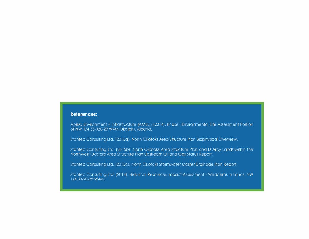
References:
AMEC Environment + Infrastructure (AMEC) (2014). Phase I Environmental Site Assessment Portion of NW 1/4 33-020-29 W4M Okotoks, Alberta.
Stantec Consulting Ltd. (2015a). North Okotoks Area Structure Plan Biophysical Overview.
Stantec Consulting Ltd. (2015b). North Okotoks Area Structure Plan and D’Arcy Lands within the Northwest Okotoks Area Structure Plan Upstream Oil and Gas Status Report.
Stantec Consulting Ltd. (2015c). North Okotoks Stormwater Master Drainage Plan Report.
Stantec Consulting Ltd. (2014). Historical Resources Impact Assessment - Wedderburn Lands, NW 1/4 33-20-29 W4M.

November 2016
North Okotoks Area Structure Plan
Town of Okotoks