NOR TH AT L ANTIC OCEAN
20
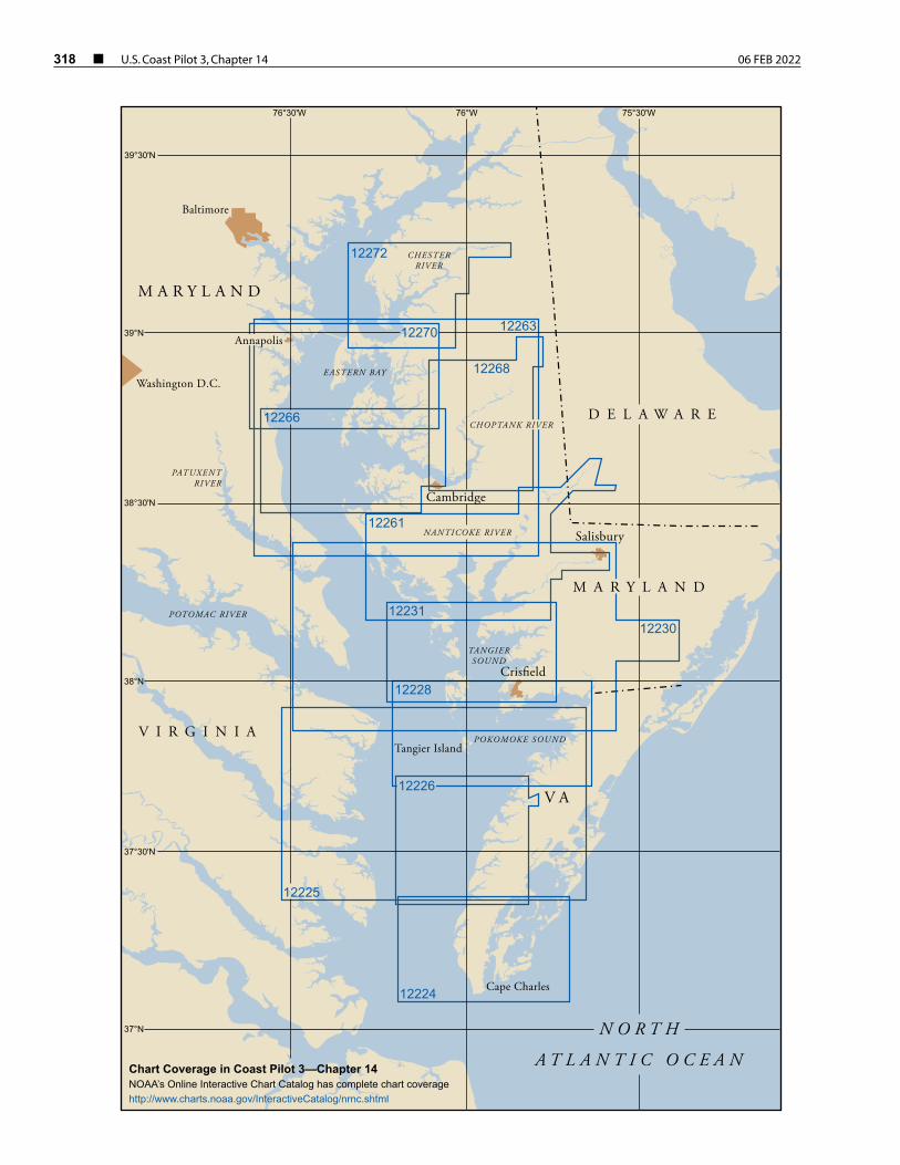
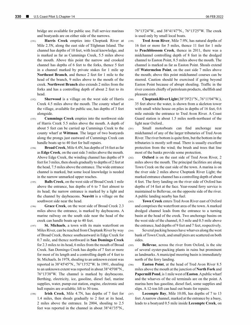
318 ¢ U.S. Coast Pilot 3, Chapter 14 06 FEB 2022 39°N 38°N 37°N POKOMOKE SOUND POTOMAC RIVER 12272 12224 12226 12231 12228 12261 12268 12263 12230 12225 12270 12266 Crisfield Salisbury Cambridge Cape Charles Tangier Island Baltimore Annapolis Washington D.C. TANGIER SOUND NANTICOKE RIVER CHOPTANK RIVER EASTERN BAY CHESTER RIVER PATUXENT RIVER 76°30'W 75°30'W 76°W 39°30'N 38°30'N 37°30'N DELAWARE MARYLAND VIRGINIA VA MARYLAND NORTH ATLANTIC OCEAN Chart Coverage in Coast Pilot 3—Chapter 14 NOAA’s Online Interactive Chart Catalog has complete chart coverage http://www.charts.noaa.gov/InteractiveCatalog/nrnc.shtml
Transcript of NOR TH AT L ANTIC OCEAN
318 ¢ U.S. Coast Pilot 3, Chapter 14 06 FEB 2022
39°N
38°N
37°N
POKOMOKE SOUND
POTOMAC RIVER
12272
12224
12226
12231
12228
12261
12268
12263
12230
12225
12270
12266
Cris� eld
Salisbury
Cambridge
Cape Charles
Tangier Island
Baltimore
Annapolis
Washington D.C.
TANGIERSOUND
NANTICOKE RIVER
CHOPTANK RIVER
EASTERN BAY
CHESTERRIVER
PATUXENTRIVER
76°30'W 75°30'W76°W
39°30'N
38°30'N
37°30'N
D E L A W A R E
M A R Y L A N D
V I R G I N I A
V A
M A R Y L A N D
N O R T H
A T L A N T I C O C E A NChart Coverage in Coast Pilot 3—Chapter 14NOAA’s Online Interactive Chart Catalog has complete chart coveragehttp://www.charts.noaa.gov/InteractiveCatalog/nrnc.shtml
06 FEB 2022 U.S. Coast Pilot 3, Chapter 14 ¢ 319
Chesapeake Bay, Eastern Shore
(1) This chapter describes the Eastern Shore of Chesapeake Bay from Cape Charles to Swan Point, about 6 miles northward of the entrance to Chester River, and several bodies of water and their tributaries that empty into this part of the bay. Included are Pocomoke Sound, Pocomoke River, Tangier Sound, Wicomico River, Nanticoke River, Little Choptank River, Choptank River, Eastern Bay and Chester River and the off-lying islands of Tangier, Smith, Hooper and Tilghman.
(2) Also described are the ports of Cape Charles, Pocomoke City, Tangier, Crisfield, Salisbury, Easton, Cambridge, St. Michaels and several smaller ports and landings.
(3) COLREGS Demarcation Lines
(4) The lines established for Chesapeake Bay are described in 33 CFR 80.510, chapter 2.
(5) ENCs - US4VA12M, US4VA1AM, US4VA40M, US4MD20M, US4MD80M, US4MD81M, US4MD82M Charts - 12221, 12225, 12230, 12263, 12273
(6) The Eastern Shore of Chesapeake Bay, from Cape Charles to Chester River, is mostly low and has few prominent natural features. The mainland and the islands are subject to erosion, and many of the islands and points have completely washed away. Fishtrap limits are shown on the charts and usually are marked by black and white horizontal-banded buoys. Mariners should use caution and be aware some traps are temporary and not charted and may be submerged or awash. In the tributaries of Pocomoke Sound, ice sufficient to interfere with the navigation of small vessels may be encountered at any time from January through March. The ice from Pocomoke Sound does not interfere with the larger vessels in the bay, but the smaller oyster and fishing boats frequently are held up and sometimes require assistance, especially in Kedges and Hooper Straits.
(7) ENC - US5VA14M Charts - 12224
(8) Wise Point (37°07.0'N., 75°58.3'W.), the mainland tip of Cape Charles, is included in chapter 9, which also describes Fishermans Island, Cape Charles Light on Smith Island and the Atlantic entrance to Chesapeake Bay.
(9) Kiptopeke Beach, 3.2 miles northward of Wise Point, is the site of a former ferry terminal. The offshore breakwaters are obsolete ships filled with sand and sunk end-to-end. The Virginia State Park at Kiptopeke Beach includes a public fishing pear, launching ramp and supplies. Butlers Bluff, which has steep bare faces conspicuous from the bay.
(10) Old Plantation Creek, 7 miles northward of Wise Point, has depths of about a foot. Many of the bars and middle grounds are marked by discolored water, and the channel usually is marked by bush stakes, but it is narrow and difficult to navigate without local knowledge. The opening in the thick woods at the mouth is visible from outside. No supplies are available along the creek.
(11) Cape Charles Harbor, 9 miles northward of Wise Point, is a dredged basin on the south side of the town of Cape Charles. A well-marked dredged channel leads to the harbor between sand flats on the south and a stone jetty on the north. Two small dredged basins are eastward of the main harbor basin. The northerly basin is known as the Harbor of Refuge and the southerly basin as Mud Creek Basin. (See Notice to Mariners and latest edition of charts for controlling depths.)
(12) Cape Charles Coast Guard Station is on the spit between Mud Creek and the Harbor of Refuge.
(13) The mean range of tide is 2.4 feet at Cape Charles. The tidal currents set across the entrance to and across the southwest section of the dredged channel, but farther north they follow the general direction of the axis. See the Tidal Current prediction service at tidesandcurrents.noaa.gov for specific information about times, directions, and velocities of the current at numerous locations throughout the area. Links to a user guide for this service can be found in chapter 1 of this book.The channel is exposed to westerly winds but is partially protected by the flats to the westward and seldom is too rough for motorboats. However, during severe west weather, heavy surges may occur in the harbor. Ice may hinder navigation in the harbor during severe winters.
(14) Due to the limited maneuvering room in the channel and the harbor, larger vessels and tows are sometimes a hazard to small craft. The larger commercial vessels and tugs that handle the floats barges, monitor VHF-FM channels 13 and 16.
(15) There is public access to the bulkheads and slips at the eastern end of the harbor. Anchoring is forbidden in any part of the harbor or the basins. A “no-wake”speed limit is enforced. A harbormaster enforces harbor regulations, and a dockmaster supervises docking at the municipal facilities. Gasoline, diesel fuel and water
320 ¢ U.S. Coast Pilot 3, Chapter 14 06 FEB 2022
are available. Some marine supplies may be obtained in town. A yacht center adjacent to the Coast Guard Station at the head of Mud Creek has dry storage and a 75-ton travel lift; hull, engine and other repair services available.
(16) Cherrystone Channel is a passage inside Old Plantation Flats that leads from deep water 2 miles south-southeastward of Old Plantation Flats Light northward to Kings Creek and Cherrystone Inlet. The route follows part of the dredged channel to Cape Charles Harbor for about 1 mile. That part of Cherrystone Channel southward of the dredged channel to Cape Charles Harbor is unmarked and little used. Cherrystone Channel above Cape Charles Harbor is marked by lights and daybeacons to the vicinity of Sandy Island. This part of the channel has depths of about 10 feet but is narrow in places, and local knowledge is required to carry the best water. The recommended southerly approach to Kings Creek and Cherrystone Inlet is via the marked dredged channel to Cape Charles Harbor, which was discussed earlier in this chapter.
(17) Kings Creek, about 1 mile northward of Cape Charles Harbor and eastward of Sandy Island, has depths of 3.5 feet for 1 mile upstream. The shoal that extends out from the north side of the entrance bares at low water. The entrance into the creek is marked by lights and daybeacons. The creek is used extensively by fishermen and pleasure craft. Gasoline, diesel fuel, berths and marine supplies are available at a marina just inside the entrance.
(18) Cherrystone Inlet, which extends northeastward from Sandy Island, has depths of 5 feet for 2 miles, thence 4 to 2 feet to the upper end. The channel in the inlet sometimes is marked by bush stakes, but it is narrow and difficult to navigate without local knowledge.
(19) Boats bound for Kings Creek or Cherrystone Inlet can leave the Cape Charles Harbor channel west of the jetty on the north side of the harbor entrance and proceed northward in marked Cherrystone Channel. Depths of 2 to 4 feet over the flats that extend southward for 2 miles along the west side of Cherrystone Channel from Sandy Island limit the draft that can be carried over that area from westward and northwestward. The area between Sandy Island and Wescoat Point, 0.3 mile to the northward, bares at low water.
(20) A fish haven, marked by private buoys, is about 1.8 miles northwest of Wescoat Point.
(21) ENC - US5VA10M Chart - 12226
(22) Hungars Creek and Mattawoman Creek have a common outlet (37°23.7'N., 75°59.4'W.) to the bay 8 miles northward of Cape Charles Harbor. Hungars Creek is marked by lights, lighted buoys, daybeacons and bush stakes and Mattawoman Creek by bush stakes. Both creeks are difficult to follow without local knowledge.
(23) Hungars Creek extends about 4 miles in a northeasterly direction to Bridgetown. Depths of 3 feet
are available in the narrow entrance channel, thence decreasing to 1 foot to Bridgetown.
(24) Mattawoman Creek extends about 2 miles in a southeasterly direction and has several branches at its head. The best approach is to follow the lights at the entrance of Hungars Creek to the light off Wilsonia Neck, then follow the bush stakes southeastward and southward along the shore. The controlling depth is about a foot to the head of navigation. The overhead power cables near the head of the creek have a minimum clearance of 33 feet.
(25) A danger zone for naval firing begins about 12 miles north-northwestward of Cape Charles Harbor and extends northward to Tangier Sound Light, just south of Tangier Island. (See 33 CFR 334.220, chapter 2, for limits and regulations.)
(26) Nassawadox Creek, 13 miles northward of Cape Charles Harbor and about 5 miles northward of the entrance to Hungars Creek and Mattawoman Creek, extends about 5 miles to the northeast. The controlling depth across the bar is about 1 foot, thence 4 feet for 4 miles upstream. The channel is marked by daybeacons for about 1.6 miles, but local knowledge is necessary to carry the best water. An overhead power cable with a clearance of 38 feet crosses the creek about 3 miles above the mouth. The flats on either side of the entrance are nearly bare at low water, are covered by marsh grass in the summer and are usually well defined. Bayford, on the southeast side of the creek 1.5 miles above the mouth, has a wharf. The several creeks that branch off from Nassawadox Creek have depths of 3 feet or less. A marine railway at The Saltworks, on the north side of the creek, can handle boats up to 35 feet for hull and engine repairs.
(27) Occohannock Creek (37°33.0'N., 75°56.3'W.) flows into Chesapeake Bay from eastward 18 miles northward of Cape Charles Harbor; a fixed bridge 5.4 miles above the entrance is the head of navigation. Inside the creek, depths of about 5 feet can be carried to Morley Wharf, on the south side 4 miles above the entrance, with lesser depths to the fixed bridge. The bridge has a horizontal clearance of 30 feet and vertical clearance of 4 feet.
(28) The channel over the bar of Occohannock Creek is marked by lights and daybeacons, but it is narrow and tortuous and difficult to navigate without local knowledge. The channel within the creek also is narrow, but the ends of the shoals are marked by daybeacons all the way to Morley Wharf. A public pier and boat ramp are at Morley Wharf. Gasoline, hull and engine repairs, a 25-ton travel lift and limited marine supplies are available at Davis Wharf, on the north side of the creek.
(29) Nandua Creek, 23 miles northward of Cape Charles Harbor and about 5 miles northward of Occohannock Creek, is entered through a channel marked by lights, buoys and daybeacons, which leads across the bar to the mouth of the creek. The bar channel is narrow and shifting; local knowledge is required to carry the best water. The
06 FEB 2022 U.S. Coast Pilot 3, Chapter 14 ¢ 321
shoals at the entrance usually can be distinguished by the difference in water color, except in rough weather when the water is clouded. Buoys and daybeacons mark the critical parts of the channel to Nandua.
(30) Back Creek, on the north side of Nandua Creek, 1 mile above the mouth, has depths of 3 feet to the village of Hacksneck.
(31) Pungoteague Creek, 3 miles northeastward of Nandua Creek, has depths of 8 feet to the pier at Harborton, 2 miles above the mouth, and thence 4 feet to the ruins of Boggs Wharf, 3 miles above the mouth. Above this point the creek shoals rapidly. The entrance and inside channel are marked as far as Harborton. Barges load pulpwood at Harborton for delivery to West Point on York River.
(32) ENC - US5VA16M Chart - 12228
(33) Onancock Creek (37°43’24”'N., 75°51’06”W.), 38 miles north of Cape Charles, has traffic in petroleum products, sand and gravel. A marked dredged channel leads across the entrance bar and up the creek to an anchorage basin off the town of Onancock, about 4.3 miles above the mouth, thence to channels in the North Branch and Central Branch at the head of the creek.
(34) Water and electricity are available at the public dock at Onancock. Gasoline is available at the oil wharf opposite the town dock. Diesel fuel is available by truck. The harbormaster makes berthing assignments and monitors VHF-FM channel 16.
(35) Chesconessex Creek is 2 miles northward of Onancock Creek. In 1976, shoaling to an unknown extent was reported in the approach to the creek between Chesconessex Buoy 1 and Light 2. Above Light 2, depths are about 8 feet for 1 mile above the mouth to the middle of Tobacco Island, thence in 1997, favoring the south side of the channel, 6 feet to Chesconessex, about 2 miles above the mouth of the creek; thence in 2001, depths of about 1 to 3 feet could be carried to about 0.4 mile above the town. The creek is used by small local boats.
(36) The approach to Chesconessex Creek from eastward of Watts Island Rocks Warning Light is marked by lights and a buoy; the channel above the entrance is marked by daybeacons and sometimes bush stakes.
(37) The southern and main entrance to Pocomoke Sound, between the southern end of Watts Island and Pocomoke Sound Light 6 (37°47'49"N., 75°50'19"W.), is 40 miles northward of Cape Charles. Extensive flats occupy most of the sound. A channel, wide and deep at the entrance but comparatively shallow in its most northerly part, leads to Pocomoke River, the most important tributary.
(38) The shores of Pocomoke Sound are low and without prominent natural landmarks. The critical points along the main channel between the entrance and the mouth of Pocomoke River are marked by lights and buoys. The
Virginia-Maryland boundary line is marked by diamond-shaped white daybeacons with orange reflective borders.
(39) The sound is used by many local oyster and fishing boats and by some tugs and barges. Small boats can enter from northwestward in Tangier Sound by way of Broad Creek, which is discussed later.
(40) A large area of shallow water separates the lower part of Pocomoke Sound from Tangier Sound on the westward. Watts Island, at the southernmost end of the area, is marshy and wooded. Watts Island Rocks Warning Light is 0.6 mile south-southwestward of the island.
(41) Great Fox Island, 6 miles northward of the entrance to Pocomoke Sound, consists of a group of low islands, the northeasternmost of which is marked by a large building.
(42) Just north of Pocomoke Sound Light 6, a marked crooked tributary channel with depths of 8 feet or more leads between shallow flats for 5 miles into a dredged channel in Deep Creek.The channel, marked by lights and daybeacons, leads for 2¼ miles to a turning basin at the town of Deep Creek. Gasoline, diesel fuel, marine supplies and a 25-ton travel lift are available at a boatyard in Deep Creek.
(43) Deep Creek is used only by small local boats, many of which enter from Hunting Creek on the eastward by way of The Notch, a passage behind the 1.5-mile chain of islands that separates the outer parts of the two creeks; the controlling depth in The Notch is about 2 feet; the channel is marked by bush stakes.
(44) Another tributary channel, 3.5 miles northeastward of Pocomoke Sound Light 6, leads to Hunting Creek along the south side of Guilford Flats and southward through The Thorofare to the wharf at Hopkins on the east side of Hunting Creek, 2.5 miles above the mouth. The marked channel has depths of 7 feet or more to within 0.7 mile of Hopkins, thence 2.5 feet to the wharf.
(45) Guilford Creek is 2.5 miles northeastward of Hunting Creek, with which it has a common approach from the main channel as far as the light on the southwest end of Guilford Flats. The channel to Guilford Creek continues eastward along the flats, then turns northeastward and rounds a light off the mouth of the creek; the total distance from the main channel is about 8 miles. In 2016, the controlling depth was 2.4 feet to the turning basin, thence 4.0 feet in the basin.
(46) Messongo Creek empties into the east side of Pocomoke Sound 8 miles northeast of Pocomoke Sound Light 6. The unmarked approach to Messongo Creek is from west-southwestward. In 2009, depths had shoaled to less than 2 feet at the mouth of the creek to about 1 foot at the village of Marsh Market, 2.5 miles above; extreme caution is advised. The creek is used only by small local boats.
(47) Starling Creek is on the southeast side of Pocomoke Sound, 9 miles northeast of Pocomoke Sound Light 6. A dredged channel, marked by lights and daybeacons, leads from the sound to a harbor basin on the north side of the creek. Saxis, on the northeast side of the creek, is
322 ¢ U.S. Coast Pilot 3, Chapter 14 06 FEB 2022
the center of a considerable shellfish industry. Gasoline and diesel fuel can be obtained at the bulkhead, and some groceries are available in the town.
(48) ENCs - US5VA16M, US4MD20M Charts - 12228, 12230
(49) Pocomoke River flows into the northeast end of the Pocomoke Sound 15.5 miles above Pocomoke Sound Light 6. The river has traffic in sand and gravel, pulpwood and some fish products. The marked approach through Pocomoke Sound has natural depths of 7 feet or more for 12.5 miles above the southern entrance, then the route passes through a marked dredged cut to the mouth of Pocomoke River. In 2010, the midchannel controlling depth in the dredged section was 2.8 feet. The cut is subject to continual shoaling, and lesser depths may be found, particularly on the southerly side of the channel.
(50) Pocomoke River has depths of 7 feet or more from the mouth for 14 miles to Pocomoke City, thence 5 feet or more for 12 miles to Snow Hill. Navigation is easy for 20 miles, but the remainder of the channel to Snow Hill is narrow and requires local knowledge to carry the best water. Freshets cause a rise of 1 to 5 feet at Snow Hill but are not dangerous. The water is fresh above Rehobeth, 7.5 miles above the mouth.
(51) Shelltown is a village on the west bank of Pocomoke River 1 mile above the mouth. Gasoline, diesel fuel and some supplies can be obtained in the village. Marine railways at Shelltown can handle craft up to 40 feet long.
(52) Pocomoke City, on the east bank 14 miles above the mouth, has bus and rail communication and all kinds of supplies. There are public landings at the highway bascule bridge. Electricity, water and pumpout facilities are available.
(53) Structures across Pocomoke River
Clearances (feet)
Name Type Location Horizontal Vertical*
Overhead cable power 38°04'09"N., 75°34'44"W.
82
Pocomoke City Railroad bridge See Notes 1 and 2
swing 38°04'18"N., 75°34'28"W.
60 4
Pocomoke City Highway bridge See Note 1
bascule 38°04'36"N., 75°34'14"W.
65 3
U.S. Route 13 fixed 38°04'43"N., 75°34'15"W.
55 35
Overhead cable power 38°05'09"N., 75°33'30"W.
56
Overhead cable power 38°06'28"N., 75°30'53"W.
57
Overhead cables power 38°10'43"N., 75°23'40"W.
48
State Route 12See Note 1
bascule 38°10'43"N., 75°23'40"W.
40 2
Structures across Pocomoke River
Clearances (feet)
Name Type Location Horizontal Vertical*
* Clearances are referenced to Mean High WaterNote 1 – See 33 CFR 117.1 through 117.59 and 117.569, chapter 2, for drawbridge regulations.Note 2 – The best water is in the western opening.
(54) A dredged channel about 22 miles above the mouth of Pocomoke River leads southerly from the river to Shad Landing State Park;a marina and turning basin are at the head of the channel. The channel is marked by a light and a daybeacon. Gasoline and some supplies are available.
(55) Snow Hill, the town on the east bank 26 miles above the mouth, has rail freight service. The river is navigable for 2 miles above the bridge. Gasoline and some supplies are available in the town.
(56) A line of marshy islands and flats, with Tangier Island at the south end, separates Tangier Sound from Chesapeake Bay to the westward; the principal thorofares between the islands are Kedges and Hooper Straits.
(57) The danger zone of a naval missile target area is centered about 3.5 miles west-southwest of Tangier Island. (See 33 CFR 334.210, chapter 2, for limits and regulations.) Sunken ships and other obstructions are within the area.
(58) Tangier Island is low, sparsely wooded in the middle and bare on the north and south ends. Tangier is the village midway along the eastern side of the island; a church spire and two television towers are prominent. Oystering, crabbing and fishing are the principal industries. The island has telephone and motorboat communication with Crisfield.
(59) Tangier Sound Light (37°47'17"N., 75°58'24"W.), 45 feet above the water, is shown from a white square tower with a black and white diamond-shaped daymark on piles, in depths of 5 feet. The light is 53.3 miles above the Virginia Capes.
(60) Tangier Sound, its main entrance 1 mile northeastward of Tangier Sound Light, affords a broad and deep channel extending the 28-mile length of the sound. Extensive flats border the sound, but the critical points are marked by lights and buoys.
(61) The town of Tangier can be reached from either Chesapeake Bay or Tangier Sound through well-marked dredged channels. A federal project provides for a 7-foot depth from the Chesapeake Bay to an anchorage basin with 7 feet in the basin and 8 feet from the anchorage basin to Tangier Sound. (See Notice to Mariners and latest edition of chart for controlling depths.)
(62) (Note that the numbering system of marking the aids to navigation in the channel from Chesapeake Bay to Tangier Sound and from Tangier Sound to Chesapeake Bay is not continuous but changes in about 37°49'54"N., 75°59'49"W.)
(63) Gasoline, diesel fuel and some marine supplies are available at Tangier; a marine railway here can handle craft up to 50 feet for hull and engine repairs.
06 FEB 2022 U.S. Coast Pilot 3, Chapter 14 ¢ 323
(64) The flats between Tangier Island and Smith Island, on the north, are shallow and can be navigated only by very small boats at high water.
(65) ENC - US5VA21M Chart - 12231
(66) Smith Island consists of a large group of marshy islands separated by narrow thorofares; travel from place to place is mostly by boat. Tylerton, Ewell and Rhodes Point are small villages along the interior channels; crabbing, oystering and fishing are the principal industries. Gasoline and diesel fuel are available at Ewell and only diesel fuel at Rhodes Point; some supplies can be obtained at the villages. The island has telephone and motorboat communication with Crisfield. A marine railway at Rhodes Point can haul out boats up to 40 feet for hull repairs.
(67) A well-marked 5-mile channel with several dredged sections extends from Tangier Sound through Big Thorofare to Ewell, thence northwestward in Levering Creek and again through Big Thorofare to Chesapeake Bay.
(68) A marked channel leads southward from Big Thorofare through Tyler Ditch to Tylerton, about 1.7 miles above the entrance.
(69) Another marked dredged channel leads from Tylerton to Rhodes Point. Local fishermen in shallow-draft boats sometimes approach Tylerton from southward at high water, leaving the main channel in Tangier Sound 7 miles north of Tangier Sound Light and following the deeper water northward into Tyler Creek. The depth in the southern approach is about 4 feet.
(70) Sheep Pen Gut is the approach to Rhodes Point from the west. A dredged channel marked by daybeacons leads from Chesapeake Bay through the gut. Several other thorofares lead westward from the interior of Smith Island to Chesapeake Bay. Navigation of these channels requires local knowledge.
(71) Kedges Straits, between Smith Island on the south and uninhabited South Marsh Island on the north, is used by vessels bound from northward in Chesapeake Bay to points southward of Manokin River in Tangier Sound. The inner approach to the straits is about 16 miles north of Tangier Sound Light. A depth of 10 feet can be carried through the marked straits.
(72) Holland Island Bar Light (38°04'07"N., 76°05'45"W.), 37 feet above the water, is shown from a skeleton tower with a black and white diamond-shaped daymark on piles in depths of 9 feet on the north side of the bay approach to Kedges Straits. The light is 6.3 miles due east of a point on the bay ship channel 72.6 miles above the Virginia Capes.
(73) Solomons Lump Light (38°02'53"N., 76°00'54"W.), 47 feet above the water, is shown from a brown octagonal dwelling, with a white square tower, on a brown
cylindrical base, in depths of 7 feet on the Smith Island side of Kedges Straits.
(74) Easterly winds raise the water and northwesterly winds lower it sometimes as much as 2 feet below the normal level. In severe winters, floating ice makes navigation of the straits dangerous.
(75) Holland Straits, on the north side of Kedges Straits between South Marsh Island on the south and Bloodsworth Island and other smaller uninhabited low marshy islands on the north, is generally shallow and should not be used without local knowledge. Sandbars obstruct the Chesapeake Bay side and patches of eel grass uncover in the Tangier Sound entrance on the lower tides. Bloodsworth Island is within a danger zone for naval firing and bombing. A prohibited area, within the danger zone and with a radius of 0.5 mile, is close off the western side of the island. (See 33 CFR 334.190, chapter 2, for limits and regulations of the danger zone and prohibited area.)
(76) Okahanikan Point Light (38°11'42"N., 76°05'35"W.), 25 feet above the water, is shown from an concrete pile off the northwest side of Bloodsworth Island about 1.5 miles south of the bay entrance to Hooper Strait.
(77) Hooper Strait, between Bloodsworth Island on the south and Hooper Islands and Bishops Head on the north, is the most northerly direct passage from Chesapeake Bay into Tangier Sound and is used by vessels bound from northward in the bay to tributaries at the north end of the sound. The inner approach to the strait is 27 miles north of Tangier Sound Light.
(78) The channel through Hooper Strait is narrow, crooked and well marked; strangers should have little difficulty if close attention is given to the chart. Hooper Strait Light (38°13'36"N., 76°04'32"W.), 41 feet above the water, is shown from a skeleton tower with a black and white diamond-shaped daymark in depths of 9 feet midway along the north side of the channel.
(79) Sharkfin Shoal Light (38°12'08"N., 75°59'12"W.), 44 feet above the water, is shown from a skeleton tower with a black and white diamond-shaped daymark in depths of 7 feet on the south side of the approach from the main channel in Tangier Sound.
(80) Fall and winter continual northerly winds may lower the water as much as 2 feet below normal level. The current velocity is about 1.5 knots; the current floods eastward through Hooper Strait. In the winter vessels navigating Hooper Strait are in danger from running ice.
(81) ENCs - US5VA21M, US5VA16M Charts - 12231, 12228
(82) Little Annemessex River (37°58'00”N., 75°53’48”W.), the approach to the town of Crisfield, empties into Tangier Sound 10 miles north of Tangier Sound Light. The entrance to the river is 0.8 mile wide between Great Point on the south and Island Point, the
324 ¢ U.S. Coast Pilot 3, Chapter 14 06 FEB 2022
southwest end of Janes Island, on the north. The current velocity in Little Annemessex River is 0.9 knot.
(83) A fish haven is about 1.3 miles west-southwestward of Great Point.
(84) The main entrance to Crisfield is through the well-marked dredged channel of Little Annemessex River. (See Notice to Mariners and latest edition of the chart for controlling depths.) The southerly approach to Crisfield from Pocomoke Sound, used extensively by oyster boats, is through crooked Broad Creek. The northerly approach from Big Annemessex River is through marked Daugherty Creek and Daugherty Creek Canal. The tidal current floods northward in the canal and ebbs southward; the velocity is reported to be about 1.3 knots. See the Tidal Current prediction service at tidesandcurrents.noaa.gov for specific information about times, directions, and velocities of the current at numerous locations throughout the area. Links to a user guide for this service can be found in chapter 1 of this book.
(85) Jenkins Creek, which enters Little Annemessex River close northeastward of Broad Creek, is used by fishermen and crabbers. Depths of 3 feet can be carried 0.5 mile above the mouth of the creek, thence 2 feet for 0.5 mile farther to the highway bridge with a 16-foot fixed span and a clearance of 6 feet; small boats pass through the bridge to piers on the north shore. The creek is marked by private daybeacons.
(86) Crisfield, on the east side of Little Annemessex River 2 miles above the mouth, is a fish and seafood processing and tourist center. Waterborne commerce consists chiefly of seafood and petroleum products. The harbor is used by many oyster, fish and crab boats with drafts of 2 to 6 feet. Small freight and passenger boats operate daily to Tangier and Smith Islands.
(87) The Crisfield waterfront is largely built up with bulkhead wharves and timber piers, most of which are privately owned but open to the public on equal terms. Some of the terminals have mechanical freight-handling equipment, but most of the freight is transferred by hand.
(88) Somers Cove is a well-protected basin on the south side of Crisfield. A state-owned full-service marina is on the north side of the cove. A Coast Guard station is on the south side of the cove.
(89) Marine supplies, gasoline and diesel fuel are available at Crisfield. Mobile lifts to 50 tons are also available.
(90) ENC - US5VA21M Chart - 12231
(91) Big Annemessex River (38°02'54”N. 75°52'18”W.) joins Tangier Sound 15 miles north of Tangier Sound Light. The river has depths of 8 feet for 4 miles, thence 5 feet for 1 mile, and thence 3 feet for 1 mile. The channel is marked as far as Colbourn Creek.
(92) Daugherty Creek, already described, enters the south side of Big Annemessex River 1.3 miles above the
mouth. Jones Creek, close eastward of the canal, has depths of 2 feet for about 1.5 miles above the mouth. The channel is narrow and crooked; private daybeacons and a buoy mark the channel.
(93) Colbourn Creek, on the south side of Big Annemessex River 3.5 miles above the mouth, has depths of 4 feet for about 0.7 mile, thence 2 feet for 0.5 mile. Excellent storm anchorage with good holding ground is available in depths of 5 feet in midstream 0.3 mile above the entrance.
(94) Manokin River, on the east side of Tangier Sound 16 miles north of Tangier Sound Light, is directly across the sound from Kedges Straits, described earlier. The entrance to the river is 3.5 miles wide between Hazard Point on the southeast and low Little Deal Island on the northwest but is obstructed by numerous shoals.
(95) The main channel of Manokin River is narrow and crooked and favors the southeast shore. The channel has depths of about 9 feet to abeam of St. Pierre Island, on the north side 4 miles above the mouth, thence 6 feet to within 0.5 mile of Locust Point, on the northwest side 7 miles above the mouth, and thence 1 foot to Princess Anne, 15 miles upstream.
(96) The channel is marked to a point about 6 miles above the mouth. The lower of the two fixed highway bridges, 14 miles above the mouth, has a clearance of 3 feet. Most of the piers and wharves along the river are in poor condition.
(97) Goose Creek, on the south side of Manokin River 1.3 miles above Hazard Point, is used by local fishermen and pleasure craft. A channel, marked by lighted buoys and daybeacons, leads to the village of Rumbley on the northeast side of the creek. Goose Creek has considerable traffic in crabs and oysters. Berths, gasoline, diesel fuel and marine supplies are available. Hull and engine repairs can be made; a 15-ton mobile lift is available.
(98) St. Peters Creek, used mostly by fishing boats, is on the north side of Manokin River 5.5 miles above the mouth. A marked dredged channel leads to a basin and public wharf 1 mile above the entrance.
(99) A marked dredged channel, 21 miles north of Tangier Sound Light, leads through Lower Thorofare between Little Deal Island and Deal Island to a mooring basin with bulkhead and several small piers at the fishing village of Wenona. Gasoline, diesel fuel and some supplies can be obtained at the village.
(100) Another marked dredged channel, 25 miles north of Tangier Sound Light, leads through the west end of Upper Thorofare to an anchorage basin at the north end of Deal Island. A highway bridge crosses the thorofare and has a fixed span with a clearance of 25 feet. A boatyard just east of the bridges has a mobile lift that can handle boats up to 15 tons for repairs. Gasoline, diesel fuel, berths and some supplies are available. Beyond the bridge, least depths are about 1 foot southeastward for 2.5 miles to Manokin River.
06 FEB 2022 U.S. Coast Pilot 3, Chapter 14 ¢ 325
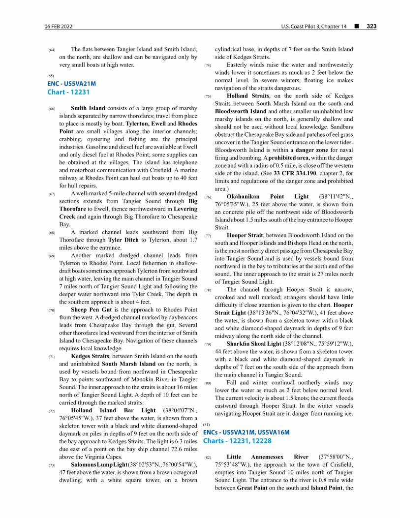
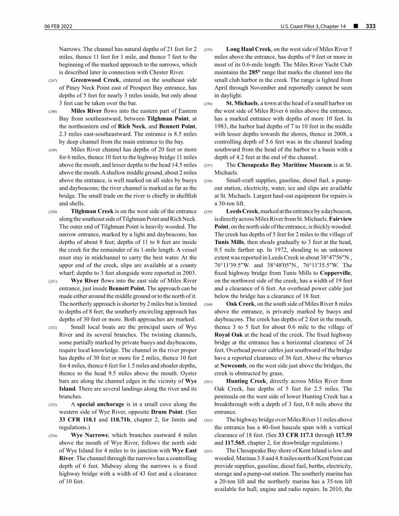
(101) ENC - US5MD23M Chart - 12261
(102) Wicomico River flows into the north end of Tangier Sound eastward of the inner approach to Hooper Strait, described earlier, and 26 miles north of Tangier Sound Light. The entrance to Wicomico River is 1.5 miles wide between Long Point on the south and Nanticoke Point on the north. Waterborne commerce is largely in fish, shellfish and fish byproducts.
(103) Great Shoals Light (38°12'52"N., 75°52'46"W.), 37 feet above the water, is shown from a white skeleton tower with a black and white diamond-shaped daymark on piles in depths of 4 feet on the north side of the channel, 0.5 mile above the mouth.
(104) Current
(105) Strong tidal currents set across the main channel off Monie Bay; the current velocity in the entrance to the river is 0.6 knot on the flood and 0.9 knot on the ebb. See the Tidal Current prediction service at tidesandcurrents.noaa.gov for specific information about times, directions, and velocities of the current at numerous locations throughout the area. Links to a user guide for this service can be found in chapter 1 of this book.
(106) Ice
(107) Ice usually forms on the river as far down as Whitehaven; in ordinary winters the channel usually is open to navigation, but in severe winters it is often closed for extended periods.
(108) Monie Bay is a large cove on the southeast side close within the mouth of Wicomico River. The bay has depths of 4 feet to the head but is used only by small local boats.
(109) Webster Cove is on the south side of the Wicomico River, 3.5 miles from the mouth. A dredged channel leads southeast to a public wharf inside. The channel is marked by a buoy and daybeacon.
(110) Whitehaven, on the north bank 6.5 miles above the entrance, has some supplies. Most of the docks are in poor condition. A marine railway can haul out boats up to 150 feet.
(111) A cable ferry crosses the river at Whitehaven. The ferry operates only during daylight hours. The cable is picked up as the ferry moves from bank to bank and is dropped to the bottom when the ferry is not operating. The crossing is unmarked. Caution should be exercised while navigating in the area. DO NOT ATTEMPT TO PASS A MOVING CABLE FERRY.
(112) Wicomico Creek, on the south side of Wicomico River 8.5 miles above the mouth, is navigable for small craft for several miles. The marked entrance channel has a controlling depth of about 4 feet with deeper water inside. A small yacht club on the north side of the entrance has gasoline and diesel fuel. A marina about 2.3 miles above
the entrance has gasoline, diesel fuel, berths and marine supplies. Hull and engine repairs can be made; a mobile lift is available.
(113) An overhead power cable about 14 miles above the mouth of Wicomico River has a clearance of 75 feet.
(114) A cable ferry crosses the Wicomico River at Upper Ferry, 15 miles above the mouth. The ferry operates only during daylight hours. The cable, held taut by winches ashore, is suspended at or near the water’s surface at all times during daylight hours but dropped to the bottom during nondaylight hours. The signal for lowering the cable is one blast on the whistle by a transiting vessel. The ferry slips are marked as a ferry crossing and warning signs are posted up and downstream of the crossing. Caution should be exercised when navigating in the area. DO NOT ATTEMPT TO PASS A MOVING CABLE FERRY.
(115) Fishing boats use the large wharf on the south bank, 16.5 miles above the mouth; water is available. An overhead power cable, 17.7 miles above the mouth, has a clearance of 75 feet.
(116) Shad Point is 18 miles above the mouth on the southeast side.
(117) Salisbury, the head of navigation 20 miles above the mouth, is a major trading center of the Eastern Shore. Wicomico River forks at the city; the North Prong, in 1976–1977, had a controlling depth of 7.5 feet or 10 feet at midchannel to the fixed bridge 0.4 mile upstream, but South Prong is rarely used. The Main Street highway bridge and the U.S. 50 highway bridge over the entrance to North Prong have 40-foot-wide bascule spans with a minimum clearance of 1 foot. The bridgetenders monitor VHF-FM channel 16 and work on channels 13 and 68; call signs KZA-869 and KYU-697, respectively. (See 33 CFR 117.1 through 117.59 and 117.579, chapter 2, for drawbridge regulations.)
(118) Salisbury is a customs station. (119) Most of the commercial wharves are below the fork,
but there are some in North Prong. Traffic to Salisbury consists of petroleum, aggregates, grain and fertilizer.
(120) Weather
(121) Salisbury is in a region about midway between the rigorous climates of the north and the mild climates of the south and located on the Delmarva Peninsula immediately south of Delaware.
(122) Rainfall distribution throughout the year is rather uniform with the spread between the wettest month (August) and the driest month (October) being only 2.07 inches (52.6 mm). The average annual precipitation for Salisbury is 44.87 inches (1140 mm). The greatest 24-hour rainfall occurred in October 1980 when 4.93 inches (125.2 mm) fell. The average annual snowfall for Salisbury is 11.4 inches (289.6 mm), of which most falls in January and February. Snow has fallen in each month October through April, and the greatest 24-hour snowfall was 11.7 inches (297.2 mm) in February 1996.
326 ¢ U.S. Coast Pilot 3, Chapter 14 06 FEB 2022
(123) In summer, the area is under the influence of the large semipermanent high-pressure system commonly known as the Bermuda High. Based on climatology, it is usually centered over the Atlantic Ocean near latitude 30°N. This high-pressure system brings a circulation of warm, humid air masses over the area from the deep south. The proximity of large water areas and the inflow of southerly winds contribute to high relative humilities during much of the year.
(124) January is the coolest month, and July, the warmest. The average annual temperature at Salisbury is 56.4°F (13.6°C) with an average high of 66.3°F (19.1°C) and an average low of 45.9 (7.7°C). The warmest temperature on record at Salisbury is 102°F (38.9°C), last recorded in July 1993. The coldest temperature on record is -6°F (-21.1°C). last recorded in January 1987. Each month October through May has recorded temperatures below freezing (0°C), while only June and July have seen temperatures in excess of 100°F (37.8°C).
(125) Nanticoke River flows into the north end of Tangier Sound 29 miles north of Tangier Sound Light. Waterborne commerce is mostly in petroleum products, but there is also sizable traffic in fertilizers, corn, soybeans, pulpwood, shellfish and shells.
(126) Mileages on Nanticoke River, such as Mile 11W, 19.6E, etc., are the nautical miles above the entrance that is between Nanticoke Point on the east side and Clay Island on the west. The letters N, S, E or W following the numerals indicate the side of the river by compass direction where each feature is located.
(127) A depth of about 10.1 feet can be carried to Sharptown; local knowledge is advised. From the mouth to Wetipquin Creek, the river is more than 1 mile wide and is obstructed by extensive shoals, most of which are marked. The deepest water is usually near the points rather than in the bends.
(128) Current
(129) The current velocity in Nanticoke River is 1.2 knots in the entrance. The water is fresh above Vienna. Ice forms on the river in winter, but ordinarily there is enough traffic to keep the channel open. Spring freshets do not interfere with navigation.
(130) Nanticoke, Mile 2.5E, has two packing plants. A dredged channel, marked by a buoy and lights, leads to a small boat harbor, protected by jetties, at the village.
(131) Bivalve is at Mile 5.4E. A marked dredged channel leads to a municipal small-boat basin, 0.4 mile northeastward of the village. The basin is protected by jetties. Gasoline, diesel fuel, berths and limited marine supplies are available.
(132) Wetipquin Creek, Mile 7.0E, is entered through an unmarked dredged channel to the wharf at Tyaskin on the south side of the creek just inside the entrance. A surfaced launching ramp is available.
(133) Vienna, Mile 19.6W, has a public bulkhead wharf. A launching ramp is 100 yards below the bridge. Gasoline and some supplies can be obtained nearby.
(134) The overhead power cables crossing the river at the electric power plant at Mile 19.6 have a clearance of 135 feet. The highway bridge at Mile 20.1 in Vienna has a fixed span with a clearance of 50 feet.
(135) Marshyhope Creek, Mile 24.1W, has depths of 5 feet to the Harrison Ferry bridge, 9 miles above the entrance, above which point the creek is obstructed by snags and debris. The highway bridge at Brookview, 5 miles above the entrance, is kept in the closed position with a clearance of 11 feet. (See 33 CFR 117.1 through 117.59 and 117.563, chapter 2, for drawbridge regulations.)
(136) Sharptown, Mile 26.1E, has a bulkhead wharf but little waterborne commerce. Pulpwood is loaded at the south end of town for West Point on York River. The highway bridge over the river at the town has a fixed span with a clearance of 50 feet.
(137) The Maryland-Delaware boundary line on Nanticoke River is at about Mile 27.5.
(138) Broad Creek, DE, Mile 29.0E, is marked with daybeacons from the entrance to about 0.5 mile above Bethel. The fixed highway bridge at Bethel, 3.5 miles above the entrance, has a clearance of 30 feet. The overhead power cables close eastward of the bridge have a least clearance of 50 feet. Laurel, 6 miles above the entrance, has a fertilizer plant and several mills. The railroad bridge at Laurel has a swing span with the north opening obstructed; the south opening has a width of 40 feet and a clearance of 14 feet. Between this bridge and the dam, 0.3 mile upstream, are two drawbridges and a fixed bridge which have a minimum that of 37 feet and clearance of 2 feet. (See 33 CFR 117.1 through 117.59 and 117.233, chapter 2, for drawbridge regulations.) There are several power cables and a telephone cable crossing the creek near the bridges at Laurel, which have a minimum clearance of 20 feet.
(139) The vehicular cable ferry over Nanticoke River at Woodland, Mile 31.3W, operates during daylight hours only. The cable held tight by a winch ashore is suspended at or near the water surface at all times during ferry crossings and dropped when loading or unloading cars at the slips and during non-daylight hours. The ferry slips are marked, and warning lights and signs are posted facing up and downstream. Caution should be exercised while navigating in the area. DO NOT ATTEMPT TO PASS A MOVING CABLE FERRY.
(140) A power cable crossing at Mile 33.7 has a clearance of 75 feet.
(141) Seaford, DE, Mile 34.7N, has several mills and factories. Gasoline, diesel fuel and some supplies are available in town. The Norfolk Southern Railway Bridge at Mile 34.4 has a swing span with a width of 47 feet in the southeast opening and no vertical clearance. (See 33 CFR 117.1 through 117.59 and 117.243, chapter 2, for drawbridge regulations.)
06 FEB 2022 U.S. Coast Pilot 3, Chapter 14 ¢ 327
(142) Fishing Bay is at the north end of Tangier Sound 28 miles north of Tangier Sound Light. The entrance to the bay is 3 miles wide between Clay Island on the east and Bishops Head Point on the west. The partially marked channel in Fishing Bay has depths of 9 feet for 2 miles, thence 13 to 30 feet for 4 miles, and thence 4 to 3 feet to the head, 9 miles above the mouth.
(143) Tedious Creek, on the west side of the bay 2 miles above Bishops Head Point, has depths of 4 feet for 0.5 mile from the mouth, then for 0.7 mile shoals gradually to 1 foot at the head. The entrance is marked by a light. The cove at Crocheron, a village on the south side of the creek just inside the entrance, has a county wharf and ramp.
(144) Goose Creek, on the west side of Fishing Bay 3 miles above the entrance, has a marked dredged channel to the wharves just inside; gasoline is available. McCreadys Creek, on the east side of Fishing Bay 4 miles above the entrance, has a marked dredged channel which, in 2007, had a controlling depth of 3.9 feet to the head of the project. Gasoline and some supplies are available at the village of Elliott, 0.6 mile inland.
(145) Farm Creek, on the west side of Fishing Bay 5 miles above the entrance, has a marked dredged channel.
(146) Honga River extends northwestward from the western part of Hooper Strait for 14 miles between the mainland on the northeast and the Hooper Islands on the southwest; the river is more than 1 mile wide for most of its length. Honga River has sizable traffic in shellfish and shellfish products.
(147) The southern and main entrance to Honga River is between Hooper Strait Light on the east and Honga River Light 1H on the west. The narrow crooked channel in the river has depths of 13 to 55 feet as far as Wroten Island, on the east side 8.5 miles above the southern entrance, and thence 8 feet for 1.5 miles to the improved channel, described later, leading northwestward and westward to Fishing Creek. Depths northward of the Fishing Creek channel are 4 to 5 feet, shoaling gradually to 2 feet at the head. The river is marked as far as Fishing Creek.
(148) Fox Creek is on the northeast side of Honga River 2.5 miles above the entrance. A light marks the east side of the creek entrance, and a daybeacon marks the point of a shoal that extends southeastward from Paul Point. The creek has depths of 8 feet to a line from Paul Point to Wingate Point, on the east side 2 miles above the entrance, then shoals gradually to 1 foot at the head, 1 mile farther up.
(149) Duck Point Cove, on the east side just inside the entrance of Fox Creek, has general depths of 1 to 5 feet. A dredged channel leads northeastward into Hearns Cove to a basin at the town of Wingate. The oyster-packing plants here have small wharves for the oyster boats. Gasoline is available in town.
(150) A 2-foot channel marked by private stakes leads to a boat ramp in Insley Cove, known locally as Kirwins Wharf, at the northeastern end of Fox Creek. The
concrete ramp is 26 feet wide; parking and restrooms are nearby.
(151) The three Hooper Islands divide Honga River from Chesapeake Bay and Tar Bay. Middle and Upper Hooper Islands are connected with each other and with the mainland by bridges. Hoopersville is a village with general stores and packing plants on Middle Hooper Island, 3.5 miles above the southern entrance of Honga River. A dredged channel in Muddy Hook Cove, marked by daybeacons, leads to a fish company-owned wharf at the village. In 2011, the controlling depth was 3 feet in the channel with 1 to 3 feet in the basin. A charted wreck just north of the channel covers at high water and is hazardous to navigation. Gasoline and diesel fuel are available at the wharves.
(152) The highway bridge over the passage between Middle Hooper Island and Upper Hooper Island, at Ferry Point, has a fixed span with a clearance of 35 feet. The marked passage through the bridge from Honga River to Chesapeake Bay has a controlling depth of about 2 feet, but greater depths can be carried with local knowledge.
(153) Back Creek, midway along the inner side of Upper Hooper Island 8.8 miles above the river mouth, has a marked dredged channel that leads to a basin at its head. Oysterhouses and a marine railway are along the creek; boats up to 45 feet can be hauled out for repairs. A boat yard in Back Creek has gasoline, diesel fuel, water, ice, a pump-out facility, hull and engine repairs and lifts up to 60 tons.
(154) Wallace Creek empties into the eastern side of Honga River 12 miles above the mouth. A privately dredged channel, marked by daybeacons, leads from Honga River to a public landing and a marina at Crossroads, 1.9 miles above the entrance. In 1988, the reported controlling depth was 2.5 feet. Berths, gasoline, diesel fuel and some supplies are available.
(155) ENCs - US5MD21M, US5MD23M Charts - 12264, 12261
(156) A 4-mile dredged channel connects the upper part of Honga River and the Chesapeake Bay via Fishing Creek and Tar Bay. The channel is marked by a light at the entrance from the Chesapeake Bay side and by daybeacons.
(157) Fishing Creek lies between Upper Hooper Island and Meekins Neck. The highway bridge over the creek has a fixed span with a clearance of 24 feet. The overhead power cable just west of the bridge has a clearance of 65 feet.
(158) Current
(159) The current velocity in Little Choptank River is estimated to be 3 knots.
(160) A public wharf and several private wharves are along the creek.

328 ¢ U.S. Coast Pilot 3, Chapter 14 06 FEB 2022
(161) A dredged channel in Tyler Creek, just west of the bridge and on the north side of Fishing Creek, leads to an anchorage basin in Tyler Cove. The channel to the basin is marked by daybeacons. The largest marine railway can handle boats up to 45 feet for repairs; some supplies can be obtained at Honga, on the south side at the bridge. A marina 0.3 mile west of the bridge has gasoline, diesel fuel and berths; the narrow entrance channel, marked by bush stakes, has depths of about 3 feet.
(162) Tar Bay, west of Meekins Neck and Upper Hooper Island, is separated from Chesapeake Bay by Barren Island and a smaller island to the northward. The bay is shallow and unimportant except for the channel that leads through it from Honga River to Chesapeake Bay.
(163) ENCs - US5MD1AM, US5MD16M Chart - 12266
(164) A group of rocks at about 38°37.0'N., 76°21.8'W., sometimes awash at low tide, is all that remains of Sharps Island. Submerged pilings are about 0.2 mile southward of the rocks.
(165) Fish havens with an authorized minimum depth of 15 feet are about 4 miles south-southwestward of Sharps Island.
(166) Little Choptank River joins the eastern side of Chesapeake Bay 6 miles south-southeastward of Sharps Island. Although obstructed by shoals, the river has depths of 11 feet in a crooked channel for 7 miles and the tributaries have depths of 5 feet for considerable distances. The river is marked as far as Fishing Creek, above which it is difficult to carry more than 7 feet without local knowledge. The tributary channels are usually marked by bush stakes, but navigation is difficult without some local information.
(167) Tide and currents
(168) The current velocity is about 0.3 knot. The river carries some commercial traffic in shellfish and shells.
(169) The entrance to Little Choptank River is between James Island on the southwest and Hills Point on the northeast. James Island is subject to rapid erosion. Good anchorage is available in depths of 12 to 18 feet in the bight between James Island and Hooper Point, which is on the west side of the entrance to Slaughter Creek.
(170) Slaughter Creek, on the south side of Little Choptank River 4 miles above the mouth, has depths of 3.7 feet over the bar, thence 6 feet to the bridge at the village of Taylors Island, 2 miles above the entrance. The creek is marked by lights, buoys and daybeacons; a daybeacon on the west side of the entrance marks a submerged pile. The creek is used by oyster tongers and crab fishermen. A marina on the east side of the creek just north of the bridge has gasoline, diesel fuel, some supplies and berths; a 25-ton mobile hoist is available for repairs.
(171) Brooks Creek, on the north side of Little Choptank River 5 miles above the mouth, has depths of 10 to 4 feet in a narrow channel for 2 miles then depths decrease to 2 feet at the head. The narrow entrance is marked, but local knowledge is required to carry the best water. There are small-craft facilities on the west side of the creek along Hills Point Neck. A marine railway can handle boats up to 40 feet for repairs.
(172) Hudson Creek, on the north side of Little Choptank River 6 miles above the mouth, has depths of 5 feet for 3.2 miles to just below Hudson, a village at the head. The entrance is marked, and the upper reaches usually are bush-staked. The wharves at Hudson are in poor condition.
(173) Madison Bay, on the south side of the river opposite Hudson Creek, has depths of 1 to 9 feet. The entrance to the bay is marked by a light. A dredged channel, marked by daybeacons, leads through the upper part of the bay to a turning basin. The east end of the turning basin is connected to an anchorage basin at Madison, a village at the head of the bay. Gasoline, diesel fuel and some supplies are available at the wharf at Madison.
(174) Fishing Creek, on the southeast side 7 miles above the river mouth, has a controlling depth of 5 feet for 4 miles to the forks at the head. The channel is narrow and crooked and difficult to navigate without local knowledge. There are several small piers along the creek, which is used extensively by boats bound for Church Creek, the principal tributary. The entrance is marked by daybeacons, and the upper reaches usually are marked by bush stakes. Northeast Branch and Southeast Branch have depths of 3 feet.
(175) Church Creek, on the south side of Fishing Creek 2.5 miles above the latter’s mouth, has depths of 6 feet for 0.8 mile, thence 4 feet for 0.8 mile, and thence 1 to 3 feet for 0.3 mile to Church Creek,a village near the head.
(176) Other tributaries of Little Choptank River have depths of 2 to 5 feet and are used by small local boats.
(177) Choptank River flows into the Chesapeake Bay 2 miles northeastward of Sharps Island and is navigable for 53.4 miles to the town of Greensboro. Traffic on the river consists chiefly of petroleum products, shells, grain, soybeans, fertilizer, fish and shellfish.
(178) Mileages on Choptank River, such as Mile 8N, 13S, etc., are the nautical miles above the entrance between Blackwalnut Point on the north and Hills Point on the south. The letters N, S, E or W following the numerals indicate by compass direction the place where each feature is located.
(179) The southern approach to Choptank River is through a buoyed channel leading south of Sharps Island; the controlling depth is about 25 feet. The northern approach, between designated fishtrap areas, has a least depth of 10 feet.
(180) The Choptank River main channel has depths of 19 to 25 feet to Cambridge, 15 miles above the mouth, thence in 1975, a controlling depth of 5 feet to Denton and a centerline controlling depth of 2 feet to the fixed

06 FEB 2022 U.S. Coast Pilot 3, Chapter 14 ¢ 329
bridge at Greensboro. The channel is marked by lights, daybeacons and lighted and unlighted buoys from the entrance to Cambridge; thence by lights, daybeacons and buoys to Warwick River, 4.5 miles above Cambridge. Above Warwick River, the river channel is marked by lights and daybeacons to Denton, and above Denton, private buoys mark the channel.
(181) Current
(182) The river water is fresh above the town of Choptank. The current velocity is about 0.7 knot in the entrance off Cook Point. In Choptank and Tred Avon Rivers the current velocity is less than 1.0 knot.
(183) Caution–It has been reported that during the winter many of the buoys marking the main river channel from the entrance to Cambridge may be moved off station due to ice conditions. It has been further reported that several vessels have grounded on the charted 12-foot shoal close westward of the main river channel in (38°37'37"N., 76°08'15"W.), about 0.2 mile southward of Lighted Buoy 18; mariners are advised to give this area a good berth.
(184) Two miles above Hills Point, on the south side of the entrance, is shallow Trippe Bay, which is little used except by small oyster and fishing boats.
(185) Tilghman Island, north of the entrance to Choptank River, has a substantial crabbing, oystering and fishing industry. The island, 3 miles long in a north-south direction, is subject to rapid erosion on its western side.
(186) Blackwalnut Cove, at the south end of Tilghman Island, is well sheltered except from the south and is used extensively by small boats. A marked dredged channel leads to a basin at the upper end of the cove. A public pier at the south end of Fairbank has depths of 3 feet at the outer end. In 2021, obstructions were reported with a least depth of 3 feet about 0.5 mile southeast of the cove entrance; caution is advised.
(187) Dogwood Harbor is on the eastern side of Tilghman Island, 0.7 mile south of Knapps Narrows. A dredged channel in the upper part of Dogwood Harbor leads northwestward to an anchorage basin at Tilghman; no services are available in the harbor. The channel is marked by a light at the entrance, daybeacons and a lighted buoy to the basin.
(188) Knapps Narrows, between the mainland and the northern end of Tilghman Island, affords passage from Choptank River to Cheasapake Bay. The 42-foot highway bridge over the narrows has a bascule span with a clearance of 12 feet. The bridgetender monitors VHF-FM channel 16 and works on channels 13 and 68; call sign KZA-868. The current at the bridge is reported to be 2 knots. The channel through the narrows is marked, proceeding from each entrance, and reverses at the bridge.
(190) The village of Tilghman is on the south side of Knapps Narrows. The bulkheaded sides of the turning basin on the west side of the southerly abutment of the
Knapps Narrows and Tilghman, MarylandImage courtesy of NOAA / John Doroba (2019)
N
Tilghman Tilghman Island
(189)
330 ¢ U.S. Coast Pilot 3, Chapter 14 06 FEB 2022
bridge are available for public use. Full service marinas and boatyards are on either side of the narrows.
(191) Harris Creek empties into Choptank River at Mile 2.3N, along the east side of Tilghman Island. The channel has depths of 10 feet, with local knowledge, and is marked as far as Cummings Creek, 5.5 miles above the mouth. Above this point the narrow and crooked channel has depths of 6 feet to the forks, thence 5 feet in a channel marked by private stakes for 1 mile up Northeast Branch, and thence 2 feet for 1 mile to the head of the branch, 9 miles above to the mouth of the creek. Northwest Branch also extends 2 miles from the forks and has a controlling depth of about 2 feet to its head.
(192) Sherwood is a village on the west side of Harris Creek 4.5 miles above the mouth. The county wharf at the village, available for public use, has depths of 3 feet alongside.
(193) Cummings Creek empties into the northwest side of Harris Creek 5.5 miles above the mouth. A depth of about 5 feet can be carried up Cummings Creek to the county wharf at Wittman. The larger of two boatyards along the prongs just eastward of Cummings Creek can handle boats up to 40 feet for hull repairs.
(194) Broad Creek, Mile 4.4N, has depths of 16 feet as far as Edge Creek, on the east side 3 miles above the mouth. Above Edge Creek, the winding channel has depths of 9 feet for 3 miles, then shoals gradually to depths of 2 feet at the head, 7.5 miles above the entrance. The wide entrance channel is marked, but some local knowledge is needed in the narrow unmarked upper reaches.
(195) Balls Creek, on the west side of Broad Creek 1 mile above the entrance, has depths of 6 to 7 feet almost to its head; the narrow entrance is marked by a light and the channel by daybeacons. Neavitt is a village on the southwest side near the head.
(196) Grace Creek, on the west side of Broad Creek 2.3 miles above the entrance, is marked by daybeacons. A marine railway on the south side near the head of the creek can handle boats up to 40 feet.
(197) St. Michaels, a town with its main waterfront on Miles River, can be reached from Choptank River by way of Broad Creek, thence southeastward in Edge Creek for 0.7 mile, and thence northward in San Domingo Creek for 2.3 miles to its head, 6 miles from the mouth of Broad Creek. San Domingo Creek has depths of 7 feet or more for most of its length and a controlling depth of 4 feet to St. Michaels. In 1978, shoaling to an unknown extent was reported in 38°45'45"N., 76°13'52"W. In 1991, shoaling to an unknown extent was reported in about 38°45'08"N., 76°13'38"W. The channel is marked by daybeacons. Berthing, electricity, ice, gasoline, diesel fuel, marine supplies, water, pump-out station, engine, electronic and hull repairs are available; lift to 30 tons.
(198) Irish Creek, Mile 4.7N, has depths of 7 feet for 1.4 miles, then shoals gradually to 2 feet at its head, 2 miles above the entrance. In 2004, shoaling to 2.5 feet was reported in the channel in about 38°41'35"N.,
76°13'24"W., and 38°41'47"N., 76°13'25"W. The creek is used only by small local boats.
(199) Tred Avon River, Mile 7.9N, has natural depths of 16 feet or more for 5 miles, thence 11 feet for 1 mile to Peachblossom Creek, thence in 2011, there was a midchannel controlling depth of 8 feet in the dredged channel to Easton Point, 8.5 miles above the mouth. The channel is marked as far as Easton Point. Shoals extend off Watermelon Point, on the east side 7 miles above the mouth; above this point midchannel courses can be steered. Caution should be exercised if going beyond Easton Point because of abrupt shoaling. Traffic in the river consists chiefly of petroleum products, shellfish and pleasure craft.
(200) Choptank River Light (38°39'21"N., 76°11'04"W.), 35 feet above the water, is shown from a skeleton tower with small white house on piles in depths of 16 feet, 0.6 mile outside the entrance to Tred Avon River. A Coast Guard station is about 1.5 miles north-northeast of the light near Oxford..
(201) Small motorboats can find anchorage near midchannel of any of the larger tributaries of Tred Avon River. The river bottom is quite firm, but the bottom in the tributaries is mostly soft mud. There is usually excellent protection from the wind; the brush and trees that line most of the banks provide some protection.
(202) Oxford is on the east side of Tred Avon River, 2 miles above the mouth. The principal facilities are along Town Creek on the east side of the town. A marina is on the river side 2 miles above Choptank River Light; the marked entrance channel has a controlling depth of about 4 feet. The ferry landing on the river side of Oxford has depths of 14 feet at the face. Year-round ferry service is maintained to Bellevue, on the opposite side of the river. A public landing nearby has fuel.
(203) Town Creek enters Tred Avon River east of Oxford and comprises the waterfront area of the town. A marked dredged channel leads from the entrance to a turning basin at the head of the creek. Two anchorage basins on the west side of the channel, 0.3 mile and 0.5 mile above the entrance, had depths of 9 feet and 7 feet, respectively.
(204) Several packing houses have wharves along the west bank of Town Creek, and small piers are scattered on both sides.
(205) Bellevue, across the river from Oxford, is the site of several oyster-packing plants in ruins but prominent as landmarks. A municipal mooring basin is immediately north of the ferry landing.
(206) Easton Point, at the head of Tred Avon River 8.5 miles above the mouth at the junction of North Fork and Papermill Pond, is 1 mile west of Easton. A public wharf and the wharves of the oil terminals are on the point. A marina here has gasoline, diesel fuel, some supplies and slips. A 12-ton lift can haul out boats for repairs.
(207) Lecompte Bay, Mile 10.0S, has depths of 7 to 13 feet. A narrow channel, marked at the entrance by a buoy, leads to a boatyard 0.5 mile inside Lecompte Creek, on
06 FEB 2022 U.S. Coast Pilot 3, Chapter 14 ¢ 331
the west side of the bay. A marine railway can haul out boats up to 50 feet for repairs.
(208) La Trappe Creek, Mile 10.6N, has depths of 10 feet for 0.5 mile, thence 5 feet to the bulkhead at Trappe Landing, 3 miles above the mouth. The entrance is marked.
(209) Cambridge, Mile 15.2S, is the center of a large agricultural area with related industries serving the Delmarva Peninsula. It is the second deepest port in Maryland and has an extensive maritime history. The town has services and facilities for both commercial and recreational mariners. Taxi, bus, truck and air services are available.
(210) A dredged entrance channel leads from deep water in the Choptank River to a turning basin at the mouth of Cambridge Creek. Another dredged channel continues from the west corner of the turning basin through Cambridge Creek for about 0.7 mile to a turning basin at the head of the project. Anchorage basins are on each side of the channel about 0.2 mile inside the entrance.
(211) Most of the waterfront facilities inside the creek have depths of 8 to 12 feet alongside. The Market Street Bridge, 0.3 mile above the harbor entrance, has a bascule span with a clearance of 8 feet. The bridgetender monitors VHF-FM channel 16 and works on channels 13 and 68; call sign KZA-695; telephone 410-228-8311. (See 33 CFR 117.1 through 117.59 and 117.549, chapter 2, for drawbridge regulations.)
(212) Marine repairs, services and supplies are available at two boatyards on Cambridge Creek. Dockage is available at the municipal boat basin and along the public bulkhead on the creek below the drawbridge, with anchorage permitted in the basin at the head of the project. Marine railways capable of handling vessels up to 100 feet and travel lifts up to 60 tons are also available. Fuel can be delivered by truck at the public wharf on the north side of the municipal boat basin.
(213) ENC - US5MD19M Chart - 12268
(214) The highway bridge over Choptank River at Mile 15.5 has a fixed span over the main channel with a vertical clearance of 50 feet. The approaches of the former swing bridge, just to the southeast, have been retained as recreational fishing piers. A hotel marina about 1.1 miles southeast of the bridge and on the south side of the river has gasoline, diesel fuel, berths, electricity, pump-out station, marine supplies and electrical repairs available.
(215) Warwick River, Mile 20.4E, is entered through a marked dredged channel which leads to the bulkhead wharves at Secretary, 1 mile above the entrance. A marine railway on the south side of the entrance to the river can haul out boats up to 60 feet for repairs; gasoline is available.
(216) Cabin Creek, Mile 22.6E, has depths of 3 feet to the fixed highway bridge, 1 mile above the entrance, thence 2 feet for 0.5 mile nearly to the head. The bridge has a horizontal clearance of 17 feet and vertical clearance of 7 feet.
(217) Hunting Creek at Mile 25.2E has depths of 3 feet for 3 miles. A fixed highway bridge, 0.4 mile above the mouth, has a horizontal clearance of 17 feet and vertical clearance of 7 feet.
(218) Choptank is a village at Mile 25.6N. The small yacht harbor at Choptank has depths of 2 to 3 feet behind its wooden bulkheads. A 6 mph, no-wake speed limit is enforced. Gasoline is available.
(219) The overhead power cable at Mile 30.7 has a clearance of 139 feet.
(220) Dover Bridge, Mile 33.0, has a swing span with a vertical clearance of 10 feet. (See 33 CFR 117.1 through 117.49, and 117.553, chapter 2, for drawbridge regulations.) The bridge is under construction (2016).
(221) Tuckahoe Creek is at Mile 39.5N. The channel in the creek has depths of 8 feet for 2.7 miles, thence 5 feet for 6 miles, thence less than a foot to the fixed highway bridge from Hillsboro to Queen Anne, at the head of navigation 11 miles above the entrance. The channel is unmarked, crooked and difficult to navigate in places without local knowledge. The flats are covered with tuckahoes or marsh grass in the summer. The creek is used only by small fishing and pleasure boats. Tuckahoe Bridge, 7 miles above the entrance, has a fixed span with a vertical clearance of 20 feet. Overhead power and telephone cables just north of the bridge have a clearance of 25 feet. The overhead power cable across the creek about 6 miles above the mouth has a clearance of 32 feet.
(222) Williston is a small settlement with a bulkhead landing at Mile 42.0E.
(223) Choptank River is constricted by Pealiquor Shoal at Mile 44.3. A dredged channel has been cut through the shoal area.
(224) Denton is a town at Mile 46.6E. The highway bridge over the river here has a fixed span with a vertical clearance of 25 feet. The railroad bridge 0.4 mile above the highway bridge has a swing span with a vertical clearance of 6 feet. The fixed bridge 0.4 mile above the railroad bridge has a vertical clearance of 25 feet. (See 33 CFR 117.1 through 117.59 and 117.553, chapter 2, for drawbridge regulations.) The least clearance of the overhead power cables crossing Choptank River at Denton and above is 47 feet.
(225) Greensboro is a town at the head of navigation at Mile 53.4W. A dredged channel is in the river between Chapel Branch and Forge Branch. The fixed highway bridge at Greensboro has a width of 37 feet and a clearance of 10 feet. Gasoline and some marine supplies can be obtained in town.
332 ¢ U.S. Coast Pilot 3, Chapter 14 06 FEB 2022
(226) ENCs - US5MD13M, US5MD17M Chart - 12270
(227) Eastern Bay, the approach to Claiborne, St. Michaels, Miles River and other tributaries, is entered between the southerly tip of Kent Island and the northerly end of Poplar Island, 2.2 miles southward.
(228) The shores are low and have few prominent marks. Light-draft vessels also can enter from southward through Poplar Island Narrows and from Chester River on the north by way of Kent Island Narrows.
(229) Bloody Point Bar Light (38°50'02"N., 76°23'30"W.), 54 feet above the water, is shown from a brown tower on a cylindrical foundation about 1 mile westward of the south end of Kent Island. The light is about 1 mile east of a point on the main ship channel 120.2 miles above the Virginia Capes.
(230) The bay is used extensively by oystermen and fishing craft, as well as by increasing numbers of pleasure craft. The channel is wide and deep; within the bay are large shoal areas, but depths of 25 feet can be taken without difficulty to the mouths of most of the tributaries.
(231) Current
(232) East of Poplar Island the current velocity is 1.0 knot on the flood and 0.6 knot on the ebb. Throughout Eastern Bay the current velocity is less than 1.0 knot.
(233) Poplar Island, on the south side of the main entrance to Eastern Bay, is a dredged material placement site. The dredged material is contained within the site by rock dikes which surround the current footprint of the island. Expansion of the site is underway on the north end. Mariners are cautioned to stay clear of this area and remain vigilant when navigating near the site. The dredged access channels on the north and south sides of the the island are to be used for construction purpose only. Jefferson Island, east of Poplar Island, and Coaches Island, east of the southern end, once were part of the original island.
(234) Poplar Island Narrows has a least width of 1 mile between Coaches Island and the mainland to the eastward. A marked channel leads through the narrows. A mooring field, consisting of several private lighted mooring buoys, is on the west side of the narrows—mariners are urged to use caution when navigation this area.
(235) Ferry Cove, on the mainland side of Poplar Island Narrows, is entered through a channel that leads to a turning basin on the south side of Lowes Wharf at the head. The channel is marked by a light and daybeacon. A marina at the wharf provides water, ice, a pump-out station, berths with electricity, gasoline, diesel fuel, wet storage, a launching ramp and some supplies.
(236) Claiborne is a village on the southeast side of Eastern Bay 5 miles by deep channel from the main entrance. A combination pier and jetty extends 0.2 mile west-southwestward from the Claiborne waterfront.
The former ferry landing is south of the pier. In 2017, the channel to Claiborne, marked by a light and private buoys, had a controlling depth of 2 feet in the channel to the basin.
(237) Kent Point, the northerly entrance point of Eastern Bay, is the southernmost extremity of Kent Island, which has a north-south length of 12.5 miles and a greatest width of 5.5 miles.
(238) Cox Creek flows southward from the interior of Kent Island into Eastern Bay between Long Point, 2 miles northeast of Kent Point, and Turkey Point, 3 miles farther to the northeastward. The channel has depths of 22 feet for 1.5 miles, thence 11 feet for 2 miles, thence 7 feet for 2 more miles, and then shoals gradually to 2 feet at the head of navigation, a fixed highway bridge 6.5 miles above the mouth.
(239) A landing at Romancoke, 1.5 miles northward of Long Point, has depths of about 4 feet off its end but is in poor condition. Above Romancoke, Cox Creek has no villages on its shores and is used mostly by oyster boats. The channel is very narrow in places, and shallow water is close to the edges. The shoals are unmarked, and local knowledge is needed to avoid them.
(240) Crab Alley Bay joins Eastern Bay between Bodkin Island, 0.8 mile east-southeastward of Turkey Point, and Parson Island, 2 miles eastward of Turkey Point. Bodkin Island is very small with sparse vegetation and is protected by a bulkhead. Larger Parson Island is sparsely wooded and has a ragged appearance.
(241) Crab Alley Bay is 8 miles by deep channel from the Eastern Bay main entrance. The principal channel in Crab Alley Bay is marked and has depths of 8 feet for 2.5 miles to Crab Alley Creek, in the northwestern part of the bay.
(242) The mouth of Crab Alley Creek, between Cox Neck on the west and Johnson Island on the east, is partly obstructed by very shallow areas that extend out from both sides. The channel within the creek has depths of 6 feet for 1 mile, then shoals gradually to 1 foot at the head. In 1978, shoaling to an unknown extent was reported on the west side of Johnson Island in about 38°55.8'N., 76°17.6'W.
(243) Little Creek, northeast of Johnson Island, is entered through a marked dredged channel that leads to a basin about halfway up the creek. In 2011, the midchannel controlling depth was 6 feet in the channel and basin.
(244) Small-craft facilities are on the east side of Crab Alley Creek and in Little Creek and can provide transient berths, electricity, water, marine supplies, storage, pump-out and a launching ramp. Lifts to 25 tons are available for hull, engine and electricity repairs and a marine railway can haul out boats up to 45 feet.
(245) Prospect Bay, in the northeastern part of Eastern Bay, is entered between Parson Island and Piney Neck Point, 2 miles to the east-southeastward. The entrance is 9 miles by deep channel from the main Eastern Bay entrance.
(246) Prospect Bay extends northward for 5 miles to the U.S. Route 50/301 highway bridge over Kent Island
06 FEB 2022 U.S. Coast Pilot 3, Chapter 14 ¢ 333
Narrows. The channel has natural depths of 21 feet for 2 miles, thence 11 feet for 1 mile, and thence 7 feet to the beginning of the marked approach to the narrows, which is described later in connection with Chester River.
(247) Greenwood Creek, entered on the southeast side of Piney Neck Point east of Prospect Bay entrance, has depths of 5 feet for nearly 3 miles inside, but only about 3 feet can be taken over the bar.
(248) Miles River flows into the eastern part of Eastern Bay from southeastward, between Tilghman Point, at the northeastern end of Rich Neck, and Bennett Point, 2.3 miles east-southeastward. The entrance is 8.5 miles by deep channel from the main entrance to the bay.
(249) Miles River channel has depths of 20 feet or more for 6 miles, thence 10 feet to the highway bridge 11 miles above the mouth, and lesser depths to the head 14.5 miles above the mouth. A shallow middle ground, about 2 miles above the entrance, is well marked on all sides by buoys and daybeacons; the river channel is marked as far as the bridge. The small trade on the river is chiefly in shellfish and shells.
(250) Tilghman Creek is on the west side of the entrance along the southeast side of Tilghman Point and Rich Neck. The outer end of Tilghman Point is heavily wooded. The narrow entrance, marked by a light and daybeacons, has depths of about 8 feet; depths of 11 to 8 feet are inside the creek for the remainder of its 1-mile length. A vessel must stay in midchannel to carry the best water. At the upper end of the creek, slips are available at a county wharf; depths to 3 feet alongside were reported in 2003.
(251) Wye River flows into the east side of Miles River entrance, just inside Bennett Point. The approach can be made either around the middle ground or to the north of it. The northerly approach is shorter by 2 miles but is limited to depths of 8 feet; the southerly encircling approach has depths of 30 feet or more. Both approaches are marked.
(252) Small local boats are the principal users of Wye River and its several branches. The twisting channels, some partially marked by private buoys and daybeacons, require local knowledge. The channel in the river proper has depths of 30 feet or more for 2 miles, thence 10 feet for 4 miles, thence 6 feet for 1.5 miles and shoaler depths, thence to the head 9.5 miles above the mouth. Oyster bars are along the channel edges in the vicinity of Wye Island. There are several landings along the river and its branches.
(253) A special anchorage is in a small cove along the western side of Wye River, opposite Drum Point. (See 33 CFR 110.1 and 110.71b, chapter 2, for limits and regulations.)
(254) Wye Narrows; which branches eastward 4 miles above the mouth of Wye River, follows the north side of Wye Island for 4 miles to its junction with Wye East River. The channel through the narrows has a controlling depth of 6 feet. Midway along the narrows is a fixed highway bridge with a width of 43 feet and a clearance of 10 feet.
(255) Long Haul Creek, on the west side of Miles River 5 miles above the entrance, has depths of 9 feet or more in most of its 0.6-mile length. The Miles River Yacht Club maintains the 285° range that marks the channel into the small club harbor in the creek. The range is lighted from April through November and reportedly cannot be seen in daylight.
(256) St. Michaels, a town at the head of a small harbor on the west side of Miles River 6 miles above the entrance, has a marked entrance with depths of more 10 feet. In 1983, the harbor had depths of 7 to 10 feet in the middle with lesser depths towards the shores, thence in 2008, a controlling depth of 5.6 feet was in the channel leading southward from the head of the harbor to a basin with a depth of 4.2 feet at the end of the channel.
(257) The Chesapeake Bay Maritime Museum is at St. Michaels.
(258) Small-craft supplies, gasoline, diesel fuel, a pump-out station, electricity, water, ice and slips are available at St. Michaels. Largest haul-out equipment for repairs is a 30-ton lift.
(259) Leeds Creek, marked at the entrance by a daybeacon, is directly across Miles River from St. Michaels. Fairview Point, on the north side of the entrance, is thickly wooded. The creek has depths of 5 feet for 2 miles to the village of Tunis Mills, then shoals gradually to 3 feet at the head, 0.5 mile farther up. In 1972, shoaling to an unknown extent was reported in Leeds Creek in about 38°47'56"N., 76°11'39.5"W. and 38°48'05"N., 76°11'35.5"W. The fixed highway bridge from Tunis Mills to Copperville, on the northwest side of the creek, has a width of 19 feet and a clearance of 6 feet. An overhead power cable just below the bridge has a clearance of 18 feet.
(260) Oak Creek, on the south side of Miles River 8 miles above the entrance, is privately marked by buoys and daybeacons. The creek has depths of 2 feet in the mouth, thence 3 to 5 feet for about 0.6 mile to the village of Royal Oak at the head of the creek. The fixed highway bridge at the entrance has a horizontal clearance of 24 feet. Overhead power cables just southward of the bridge have a reported clearance of 36 feet. Above the wharves at Newcomb, on the west side just above the bridges, the creek is obstructed by grass.
(261) Hunting Creek, directly across Miles River from Oak Creek, has depths of 5 feet for 2.5 miles. The peninsula on the west side of lower Hunting Creek has a breakthrough with a depth of 3 feet, 0.8 mile above the entrance.
(262) The highway bridge over Miles River 11 miles above the entrance has a 40-foot bascule span with a vertical clearance of 18 feet. (See 33 CFR 117.1 through 117.59 and 117.565, chapter 2, for drawbridge regulations.)
(263) The Chesapeake Bay shore of Kent Island is low and wooded. Marinas 3.8 and 4.8 miles north of Kent Point can provide supplies, gasoline, diesel fuel, berths, electricity, storage and a pump-out station. The southerly marina has a 20-ton lift and the northerly marina has a 35-ton lift available for hull, engine and radio repairs. In 2010, the
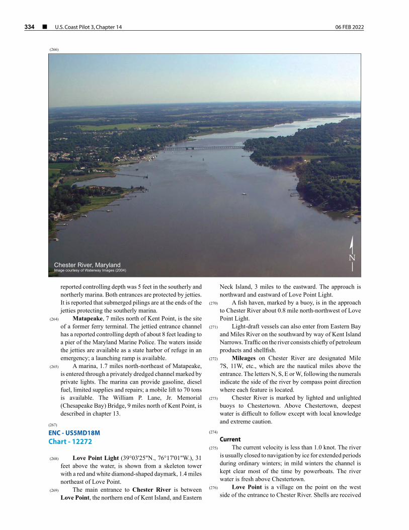
334 ¢ U.S. Coast Pilot 3, Chapter 14 06 FEB 2022
reported controlling depth was 5 feet in the southerly and northerly marina. Both entrances are protected by jetties. It is reported that submerged pilings are at the ends of the jetties protecting the southerly marina.
(264) Matapeake, 7 miles north of Kent Point, is the site of a former ferry terminal. The jettied entrance channel has a reported controlling depth of about 8 feet leading to a pier of the Maryland Marine Police. The waters inside the jetties are available as a state harbor of refuge in an emergency; a launching ramp is available.
(265) A marina, 1.7 miles north-northeast of Matapeake, is entered through a privately dredged channel marked by private lights. The marina can provide gasoline, diesel fuel, limited supplies and repairs; a mobile lift to 70 tons is available. The William P. Lane, Jr. Memorial (Chesapeake Bay) Bridge, 9 miles north of Kent Point, is described in chapter 13.
(267) ENC - US5MD18M Chart - 12272
(268) Love Point Light (39°03'25"N., 76°17'01"W.), 31 feet above the water, is shown from a skeleton tower with a red and white diamond-shaped daymark, 1.4 miles northeast of Love Point.
(269) The main entrance to Chester River is between Love Point, the northern end of Kent Island, and Eastern
Neck Island, 3 miles to the eastward. The approach is northward and eastward of Love Point Light.
(270) A fish haven, marked by a buoy, is in the approach to Chester River about 0.8 mile north-northwest of Love Point Light.
(271) Light-draft vessels can also enter from Eastern Bay and Miles River on the southward by way of Kent Island Narrows. Traffic on the river consists chiefly of petroleum products and shellfish.
(272) Mileages on Chester River are designated Mile 7S, 11W, etc., which are the nautical miles above the entrance. The letters N, S, E or W, following the numerals indicate the side of the river by compass point direction where each feature is located.
(273) Chester River is marked by lighted and unlighted buoys to Chestertown. Above Chestertown, deepest water is difficult to follow except with local knowledge and extreme caution.
(274) Current
(275) The current velocity is less than 1.0 knot. The river is usually closed to navigation by ice for extended periods during ordinary winters; in mild winters the channel is kept clear most of the time by powerboats. The river water is fresh above Chestertown.
(276) Love Point is a village on the point on the west side of the entrance to Chester River. Shells are received
Chester River, MarylandImage courtesy of Waterway Images (2004)
N
(266)
06 FEB 2022 U.S. Coast Pilot 3, Chapter 14 ¢ 335
by barge at the old railroad pier on the river side of the village.
(277) Eastern Neck Island, on the east side of the entrance, is about 3 miles long in a northwest-southeast direction. The island is sparsely wooded with extensive grassy flats along the south shore. It is connected with the mainland over Eastern Neck Narrows by a fixed highway bridge with a horizontal clearance of 23 feet and vertical clearance of 6 feet. Eastern Neck Narrows is narrow and little used.
(278) At Mile 2.7S, a privately marked channel leads to a basin with a marina on its south side. In 2004, 8 feet was reported in the approach and 6 feet alongside. Gasoline, diesel fuel, berths, electricity, water, ice, some marine supplies and a pump-out station are available.
(279) Kent Island Narrows entrance is at Mile 4.0S. A marked channel leads from Chester River to Prospect Bay. Very heavy traffic can be expected through the channel during the summer months, especially on weekends.
(280) The State Route 50/301 highway bridge over the narrows has a fixed span with a vertical clearance of 65 feet. Immediately south of the fixed highway bridge is the State Route 18 (old State Route 50/301) bascule bridge with a 48-foot span and a vertical clearance of 18 feet. The bridgetender monitors VHF-FM channel 16 and works on channels 13 and 68; call sign KXE-254. (See 33 CFR 117.1 through 117.59 and 117.561, chapter 2, for drawbridge regulations.) The nearby overhead power cable has a clearance of 85 feet. Temporary mooring areas for vessels awaiting bridge openings have been established by the State of Maryland on the west side of the channel about 50 yards north of the bridge and 100 yards and 650 yards south of the bridge.
(281) The current velocity of Kent Island Narrows is 1.0 knot on the flood and 0.9 knot on the ebb at the bridge.
(282) Two detached nearly parallel breakwaters, 700 and 1,500 feet long in a northwest-southeast direction, are about 0.3 mile southward of the highway bridge crossing the narrows and about 0.1 mile southwestward of the channel entrance to Wells Cove.
(283) Wells Cove, on the east side of the narrows 0.4 mile southeast of the bridge, has general depths of 1 to 5 feet. A marked dredged channel leads to a basin in the cove.
(284) Jackson Creek, Mile 5S, has depths of 2 to 7 feet at the entrance and is used as an anchorage by oyster boats; the channel is marked. The bottom is covered with grass.
(285) Queenstown Creek, Mile 6.1E, is entered through a marked channel that leads to a turning basin at Queenstown, on the southeast side of Little Queenstown Creek. The entrance channel is bordered by very shallow grassy flats.
(286) Grays Inn Creek, Mile 10.7W, has depths of 8 feet for 2.3 miles to a small settlement on the west side, then shoals gradually to 1 foot. About 1.8 miles above the mouth, a marina on Skinners Neck has a marine railway that can haul out craft up to 45 feet for repairs; gasoline is available.
(287) Langford Creek, Mile 11.3N., has depths of 12 feet over the bar and deeper water inside to the forks 1.7 miles above the mouth; the channel is buoyed to Drum Point. An unmarked shoal extends southwestward from small Cacaway Island toward the junction of the two fork channels; above the shoal the unmarked forks are clear in midchannel. East Fork has depths of 10 feet for 3 miles, thence 7 feet for 1 mile to within 1 mile of the head. West Fork has depths of 8 feet for about 3 miles, thence 6 feet for 0.7 mile.
(288) Long Cove, on the west side of Langford Creek 0.7 mile above the mouth, has depths of 4 feet to the head; the entrance to the cove is marked by daybeacons. The largest marine railway in the cove can haul out boats up to 50 feet for repairs; the largest lift is 70 tons. Gasoline, diesel fuel, launching ramp, a pump-out station and some supplies are available.
(289) Davis Creek, on the west side of Langford Creek 1.5 miles above the mouth, has depths of 9 feet to a marina on the south side near the entrance. A private daybeacon marks the entrance to the creek. Gasoline, diesel fuel, berths with electricity, a pump-out station, water and ice are available. Repairs can be made; a 40-ton lift is available.
(290) The common entrance to Reed Creek and Grove Creek at Mile 10.7E is marked by two buoys. The channel to the fork 0.3 mile above the common mouth has a depth of 6 feet. In 1984, a shoal was reported encroaching the channel from eastward about midway between Buoys 1 and 2. Reed Creek extends southeastward and has depths of 7 feet for about 0.6 mile above the fork, then shoals gradually to 1 foot 1 mile farther up. The channel in Grove Creek is only about 60 feet wide 0.3 mile above the fork but has depths of 3 feet through the narrows and 5 feet for a mile above that.
(291) Corsica River is at Mile 11.9E. The channel in the upper part of the river has been dredged to the public wharf at Centerville Landing, 5 miles above the mouth. The lower part of the river is marked, but it is difficult to stay in the upper channel without local knowledge. Some supplies and gasoline can be obtained at Centreville, 0.5 mile inland of the landing. The main wharf at the landing is in poor condition, but a smaller wharf is available.
(292) Southeast Creek, Mile 19.8S has depths of 4 feet for 1.8 miles, then shoals to 1 foot at the head of navigation 0.4 mile farther up. Island Creek, which empties into the south side of Southeast Creek, 0.5 mile above the mouth, has depths of 3.5 feet in the entrance and 4 feet or more for 2 miles to a fixed highway bridge. Both creeks are marked by bush stakes in the difficult reaches. Gasoline, berths with electricity, water and some supplies are available at Kennersley Wharf; a 30-ton lift can handle boats for repairs.
(293) A marina is at Rolphs, Mile 20.7E. Some supplies, gasoline, diesel fuel, water, ice, a pump-out station, a 7-ton lift and berths with electricity are available. Small engine repairs are available.
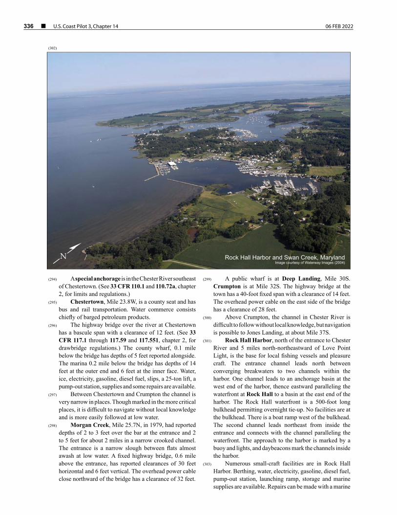
336 ¢ U.S. Coast Pilot 3, Chapter 14 06 FEB 2022
(294) A special anchorage is in the Chester River southeast of Chestertown. (See 33 CFR 110.1 and 110.72a, chapter 2, for limits and regulations.)
(295) Chestertown, Mile 23.8W, is a county seat and has bus and rail transportation. Water commerce consists chiefly of barged petroleum products.
(296) The highway bridge over the river at Chestertown has a bascule span with a clearance of 12 feet. (See 33 CFR 117.1 through 117.59 and 117.551, chapter 2, for drawbridge regulations.) The county wharf, 0.1 mile below the bridge has depths of 5 feet reported alongside. The marina 0.2 mile below the bridge has depths of 14 feet at the outer end and 6 feet at the inner face. Water, ice, electricity, gasoline, diesel fuel, slips, a 25-ton lift, a pump-out station, supplies and some repairs are available.
(297) Between Chestertown and Crumpton the channel is very narrow in places. Though marked in the more critical places, it is difficult to navigate without local knowledge and is more easily followed at low water.
(298) Morgan Creek, Mile 25.7N, in 1979, had reported depths of 2 to 3 feet over the bar at the entrance and 2 to 5 feet for about 2 miles in a narrow crooked channel. The entrance is a narrow slough between flats almost awash at low water. A fixed highway bridge, 0.6 mile above the entrance, has reported clearances of 30 feet horizontal and 6 feet vertical. The overhead power cable close northward of the bridge has a clearance of 32 feet.
(299) A public wharf is at Deep Landing, Mile 30S. Crumpton is at Mile 32S. The highway bridge at the town has a 40-foot fixed span with a clearance of 14 feet. The overhead power cable on the east side of the bridge has a clearance of 28 feet.
(300) Above Crumpton, the channel in Chester River is difficult to follow without local knowledge, but navigation is possible to Jones Landing, at about Mile 37S.
(301) Rock Hall Harbor, north of the entrance to Chester River and 5 miles north-northeastward of Love Point Light, is the base for local fishing vessels and pleasure craft. The entrance channel leads north between converging breakwaters to two channels within the harbor. One channel leads to an anchorage basin at the west end of the harbor, thence eastward paralleling the waterfront at Rock Hall to a basin at the east end of the harbor. The Rock Hall waterfront is a 500-foot long bulkhead permitting overnight tie-up. No facilities are at the bulkhead. There is a boat ramp west of the bulkhead. The second channel leads northeast from inside the entrance and connects with the channel paralleling the waterfront. The approach to the harbor is marked by a buoy and lights, and daybeacons mark the channels inside the harbor.
(303) Numerous small-craft facilities are in Rock Hall Harbor. Berthing, water, electricity, gasoline, diesel fuel, pump-out station, launching ramp, storage and marine supplies are available. Repairs can be made with a marine
Rock Hall Harbor and Swan Creek, MarylandImage courtesy of Waterway Images (2004)
N
(302)
06 FEB 2022 U.S. Coast Pilot 3, Chapter 14 ¢ 337
railway that can haul out craft up to 50 feet and lifts to 30 tons.
(304) Swan Creek is 1 mile northwestward of Rock Hall Harbor and 0.7 mile southeastward of Swan Point, which is 139 miles above the Virginia Capes. The entrance channel is marked by lighted and unlighted buoys and a light, northward to Deep Landing. Inside the creek, the channel is privately marked by buoys and a daybeacon, eastward, to The Haven. Mariners should use caution when passing Little Neck Island, west of the entrance channel, as it reportedly is visible only at extreme low water. Mariners are advised to pass close to the private moorings on the south side of the channel as the water shoals quickly to the northwest.
(305) The shallow flats that extend 0.4 mile south-southeastward from Little Neck Island are marked by a buoy.
(306) Several small-craft facilities are at Gratitude, 0.5 mile above the entrance to Swan Creek. Transient berths, electricity, water, ice, gasoline, diesel fuel, pump-out station, storage, limited marine supplies and lifts to 40 tons for marine repairs are available.
(307) The area in Swan Creek just north of Deep Landing and in The Haven provides a good small-boat refuge in heavy weather.
(308) The eastern shore of Chesapeake Bay above Swan Point is described in chapter 15.