NOAA Use of Submersible Pressure Tide Gauge Technology in Alaska Recent Activities and Proof of...
17
NOAA Use of Submersible Pressure Tide Gauge Technology in Alaska Recent Activities and Proof of Concept CO-OPS October 2012
-
Upload
hector-jennings -
Category
Documents
-
view
214 -
download
0
Transcript of NOAA Use of Submersible Pressure Tide Gauge Technology in Alaska Recent Activities and Proof of...
NOAA Use of Submersible Pressure Tide Gauge Technology in Alaska
Recent Activities and Proof of ConceptCO-OPS
October 2012
NOAA Use of Submersible Pressure Tide Gauge Technology in Alaska
• Used for offshore deployments for tidal zoning• Used where combination of high range of tide, shallow
bathymetry and lack of infrastructure limit use of acoustic, MWWL, and bubbler pressure gauge sensors.
• Used for measuring tides under the ice• Requires ancillary measurements of water density and
barometric pressure to convert pressure data to water level
• Nearshore deployments use “staff shot to the waters edge” procedure to transfer gauge readings to the tidal bench marks.
NOAA Use of Submersible Pressure Tide Gauge Technology in Alaska
• CO-OPS experience with offshore submersible pressure gauges dates back to 1970’s
• Recent experience includes successful use in AK contract hydrographic surveys
• Long-term deployment completed offshore Barrow, AK results in 2-year continuous time series.
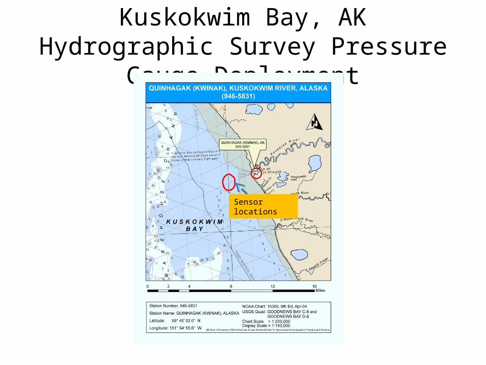
Kuskokwim Bay, AK Hydrographic Survey Pressure Gauge Deployment
Sensor locations
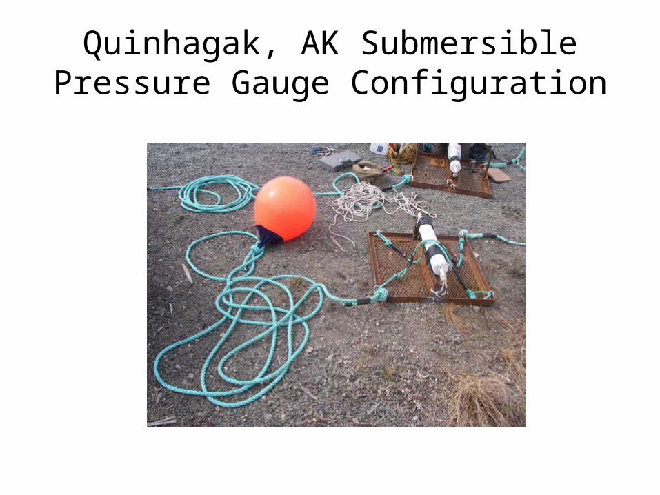
Quinhagak, AK Submersible Pressure Gauge Configuration
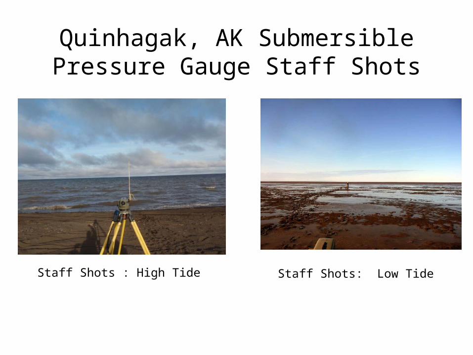
Quinhagak, AK Submersible Pressure Gauge Staff Shots
Staff Shots : High Tide Staff Shots: Low Tide
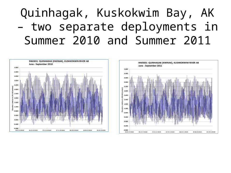
Quinhagak, Kuskokwim Bay, AK – two separate deployments in Summer 2010
and Summer 2011
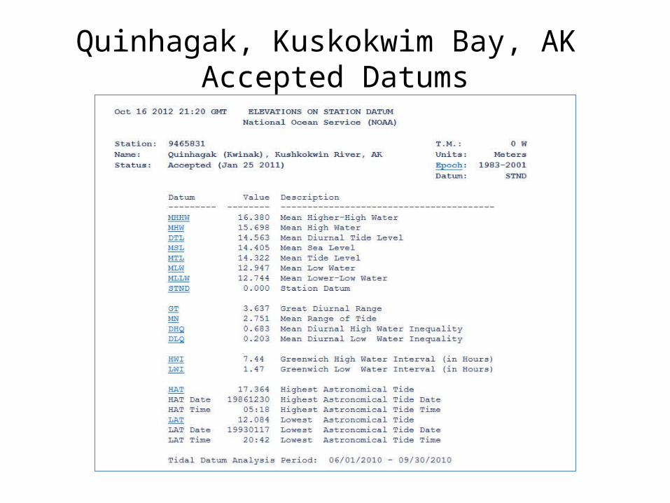
Quinhagak, Kuskokwim Bay, AK Accepted Datums
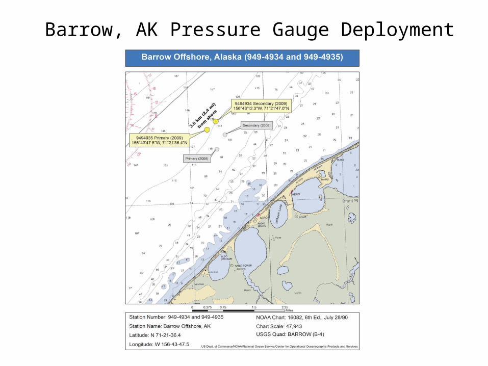
Barrow, AK Pressure Gauge Deployment
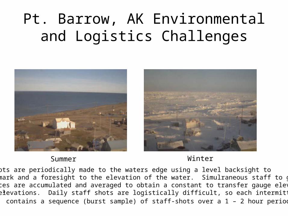
Pt. Barrow, AK Environmental and Logistics Challenges
Summer WinterStaff shots are periodically made to the waters edge using a level backsight toa bench mark and a foresight to the elevation of the water. Simulraneous staff to gaugedifferences are accumulated and averaged to obtain a constant to transfer gauge elevations to land elevations. Daily staff shots are logistically difficult, so each intermittent “session” contains a sequence (burst sample) of staff-shots over a 1 – 2 hour period.
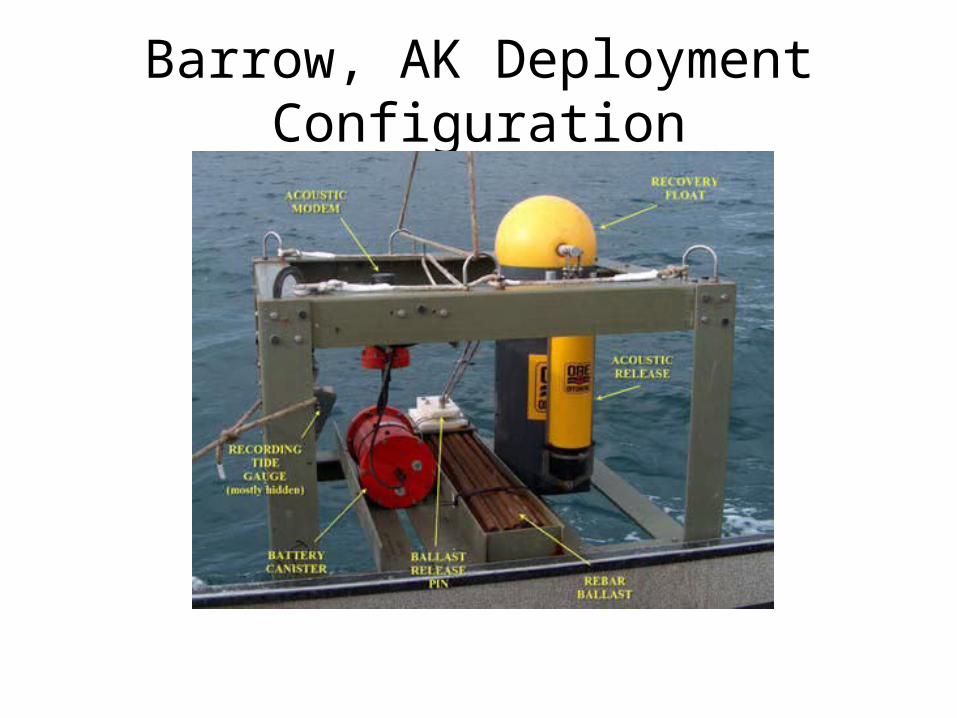
Barrow, AK Deployment Configuration
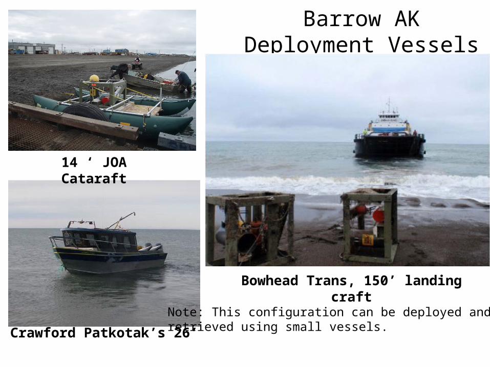
Barrow AK Deployment Vessels
14 ‘ JOA Cataraft
Crawford Patkotak’s 26’
Bowhead Trans, 150’ landing craft
Note: This configuration can be deployed and retrieved using small vessels.

Staff Shots used with Submersible Pressure Gauges – Leveling to the Waters Edge
Staff shots are periodically made to the waters edge using a level backsight toa bench mark and a foresight to the elevation of the water. Simultaneous staff to gaugeDifferences are accumulated and averaged to obtain a constant to transfer gauge elevations to land elevations. Daily staff shots are logistically difficult, so each intermittent “session” contains a sequence (burst sample) of staff-shots over a 1 – 2 hour period.
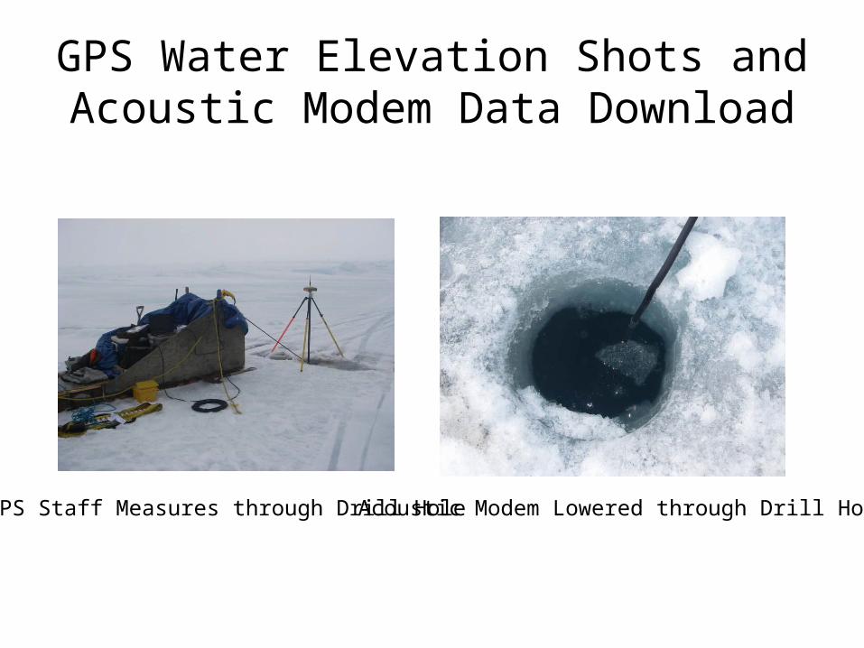
GPS Water Elevation Shots and Acoustic Modem Data Download
GPS Staff Measures through Drill Hole Acoustic Modem Lowered through Drill Hole
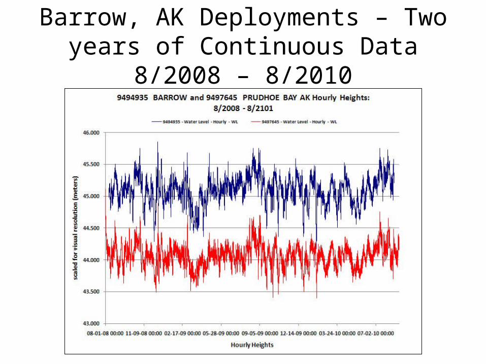
Barrow, AK Deployments – Two years of Continuous Data 8/2008 – 8/2010
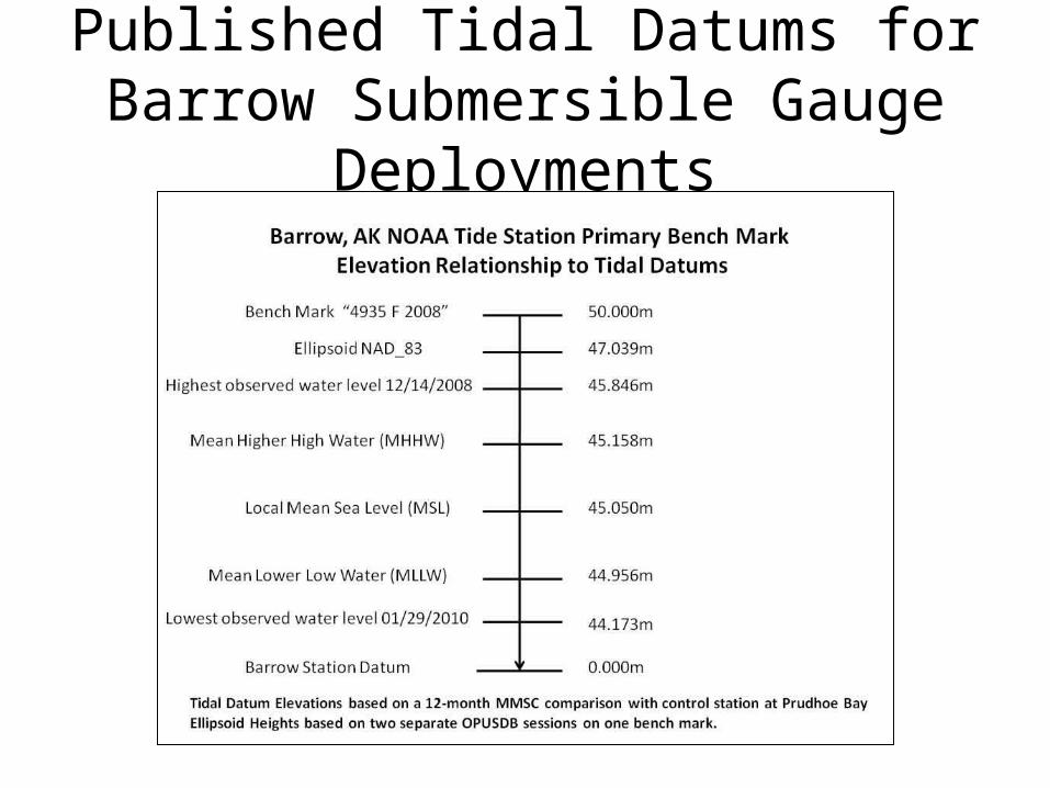
Published Tidal Datums for Barrow Submersible Gauge Deployments
NOAA Use of Submersible Pressure Tide Gauge Technology in Alaska
• Proof of concept has been successful• Successful deployments have been completed both
for hydrographic survey short-term deployments and long-term NWLON applications
• Accepted tidal data, tidal datums, and published tidal bench mark elevations have been issued for both