NILES FERRY INDUSTRIAL PARK Vonore, Monroe … FERRY INDUSTRIAL PARK Vonore, Monroe County,...
8
Transcript of NILES FERRY INDUSTRIAL PARK Vonore, Monroe … FERRY INDUSTRIAL PARK Vonore, Monroe County,...

TN ECD - 6/2009
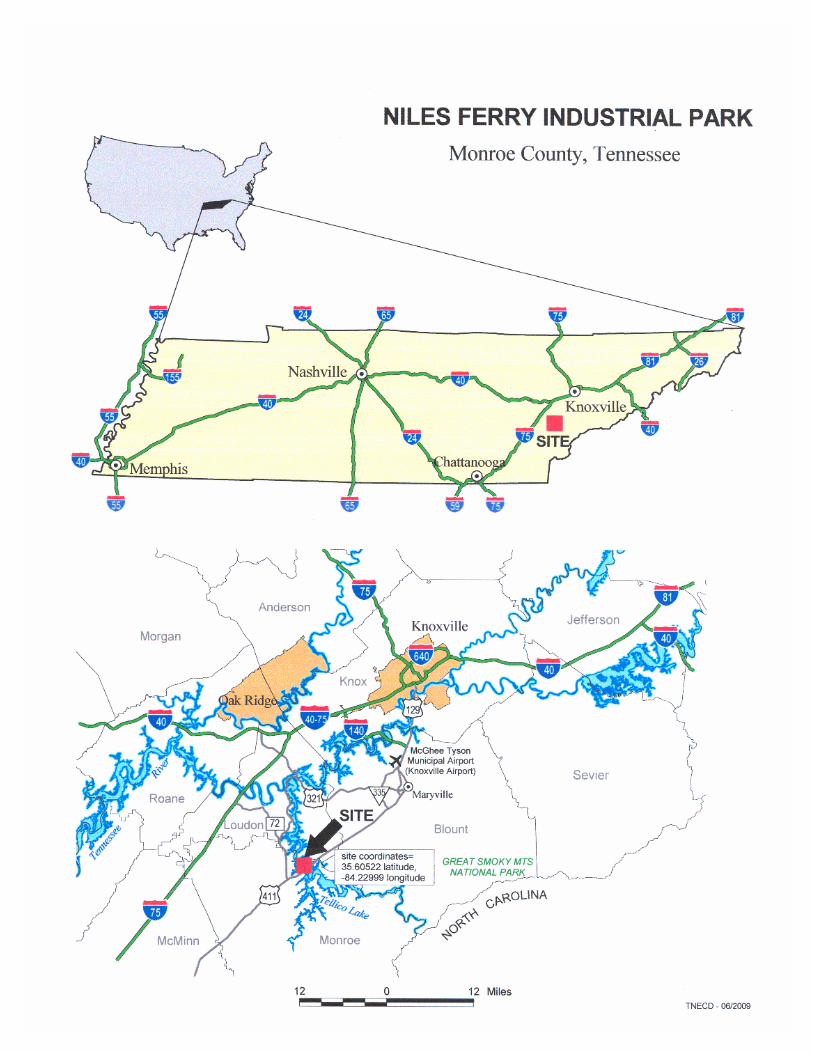
NILES FERRY INDUSTRIAL PARK Vonore, Monroe County, Tennessee
A. GENERAL
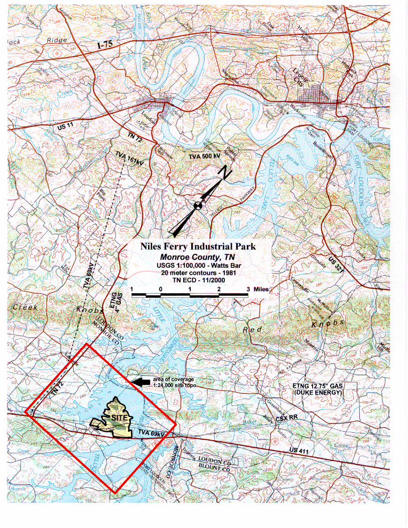
• Located on Tellico Reservoir one mile northeast of Vonore, 12 miles northeast of Madisonville and 36 miles southwest of Knoxville;
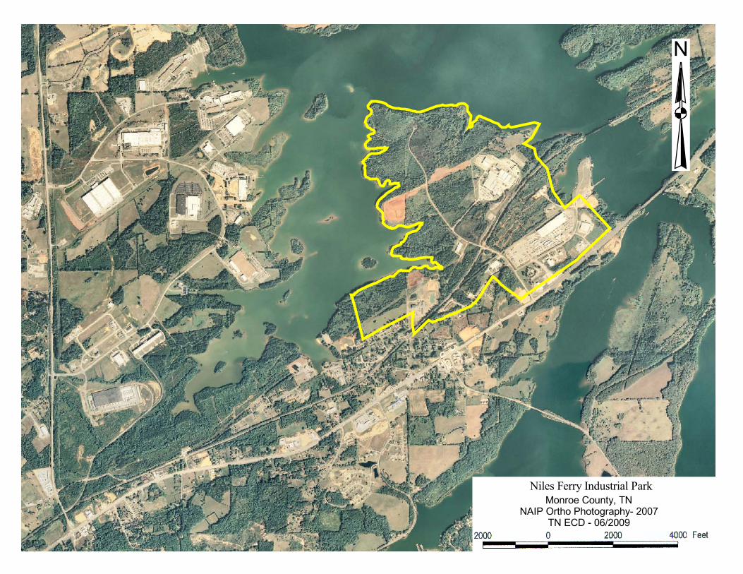
• Total park comprises 676 acres; 307 acres remain available in tracts from four to a combined 209 acres;
• Owned by Monroe County; use covenants in place to protect industrial usage; • Outside of city limits; • 2008 estimated population of Monroe and four contiguous Tennessee counties = 281,786;
adjacent six county Knoxville MSA (does not include Monroe County) = 775,987 (2008 est.); • Within a 40 mile radius are located four colleges and universities, five two year institutions and
three state technology centers. B. LAND USE FACTORS
• Easements and rights of way: On-site roads and CSX railroad, Utility easements along roads,
TVA 69 KV power line, TVA Tellico Reservoir structure profile easement to elevation 820 feet;
• Tellico Reservoir normal pool elevation is 813 feet and 100 year flood elevation is 817 feet; no on-site 100 year flood areas;
• Park elevations vary from 820 to 920 feet; two foot contour mapping available; • Soils are generally silt loams over Knox dolomite and Conasauga shale; depths to rock are six
feet or more; area shows karst activity; depth to groundwater runs more than six feet and can vary with rainfall and lake elevations in the lower areas; extensive industrial construction has taken place on site and immediately to the west in similar soils.
• Seismic rating 2 (American National Standard Map); • June 2000 final EIS for the Tellico Reservoir Land Management Plan recommends industrial use
of the property; site protected under use covenants administered by Monroe County; • No known contamination of the site found by regulatory agency file checks in October of 2000; • Regionally identified state and federally listed threatened and endangered species in Tellico
Reservoir Land Management Plan EIS (June 2000) did not preclude recommendation of the site for industrial use;
• Only possible wetlands are associated with shoreline areas within TVA easement; • No historical sites; archaeological sites previously studied and cleared by TVA; • Monroe County is classified “attainment” for all air quality parameters; nearest PSD Class I area
is Great Smokey Mountains National Park 14 miles east. C. TRANSPORTATION
Roads • I-75 16 miles northwest via US 411 and TN 72; US 11 14 miles northwest via US 411 and TN 72;
US 411 adjacent; TN 72 three miles southwest; • Over two miles of internal roads presently in place;

TN ECD - 6/2009
C. TRANSPORTATION (continued)
Rail • CSX mainline and spur on site;
Air • Monroe County Airport (3,500 foot runway) is 14 road miles southwest; • McGhee Tyson Airport (Knoxville) is 23 road miles northeast via US 411 and US 129 - all four
lane highway;
Barge • Harbortown Marine, operates the Port of Tellico, a public owned port facility, on the Little
Tennessee River at LTRM 18.8 L; and located immediately east of the park. D. UTILITIES & SERVICES Water
• Tellico Area Services System (TASS) operates a 7.0 MGD water treatment plant which presently pumps 3.0 MGD;
• The TASS system has 6 MG in elevated storage with the closest tank being 1.0 MG 13,000 feet southwest via 16 inch lines and at an overflow elevation of 1095 feet;
• Twelve inch lines are available within the park with 100 psi; • Tellico Reservoir water is available for a surface supply if needed;
Wastewater • Monroe County owns and TASS operates a 300,000 GPD wastewater treatment plant on site
which presently treats about 280,000 GPD; There are plans to expand capacity to 1.5 MGD; • Collection lines from 8 to 18 inches in diameter are on site; • Tellico Reservoir potentially available for treated direct discharges;
Electrical • Local service by Fort Loudoun Electric Cooperative which has a substation in the central part of
the site; • Fort Loudoun has a 69 KV line on site; • The 69 KV line is scheduled to be replaced by a 161 KV line in 2010 which can be accelerated if
necessary. TVA will supply this power line;
Natural Gas • Loudon Utilities maintains four inch gas lines on site; • Loudon Utilities is supplied by ETNG (Duke Power) which has a 12 ¾ inch transmission line less
than one mile north of the park;
Telecommunications • Local telephone service providers- TDS Telecom and eight other companies; The nearest central
office is downtown Loudon and ISDN is available; • Long distance service providers- AT&T, Sprint, MCI Worldcom, and eight other companies; • Wireless/cellular/mobile service providers- AT&T, Verizon Communications, and US Cellular; • Internet service providers- Earthlink and four other companies; Fast, broadband service lines are
available.

���������������� �������������������������
����������������
��������������� ���������
�