NGfL CYMRU GCaD Video Photographs reproduced with the permission of Clwyd-Powys Archaeological...
10
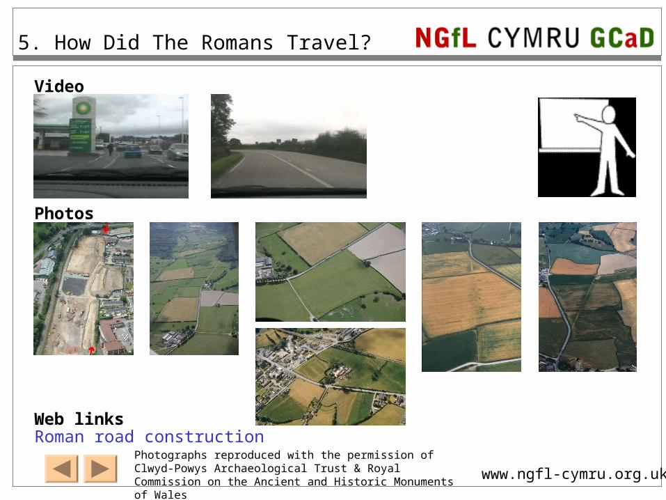
NGfL CYMRU GCaD www.ngfl-cymru.org.uk Video Photographs reproduced with the permission of Clwyd-Powys Archaeological Trust & Royal Commission on the Ancient and Historic Monuments of Wales Photos Web links 5. How Did The Romans Travel? Roman road construction
-
Upload
lydia-henderson -
Category
Documents
-
view
238 -
download
1
Transcript of NGfL CYMRU GCaD Video Photographs reproduced with the permission of Clwyd-Powys Archaeological...
NGfL CYMRU GCaD
www.ngfl-cymru.org.uk
Video
Photographs reproduced with the permission of Clwyd-Powys Archaeological Trust & Royal Commission on the Ancient and Historic Monuments of Wales
Photos
Web links
5. How Did The Romans Travel?
Roman road construction

NGfL CYMRU GCaD
www.ngfl-cymru.org.uk
5. How Did The Romans Travel?
`

NGfL CYMRU GCaD
www.ngfl-cymru.org.uk
5. How Did The Romans Travel?

NGfL CYMRU GCaD
www.ngfl-cymru.org.uk
5. How Did The Romans Travel?
Photograph © Clwyd Powys Archaeological Trust
Find out more
The road was built at about the same time as the fort at Caersws.
It is part of a Roman road that goes from Caersws to the fort at Forden Gaer.
This Roman road was found when they started to build the new Tesco in Newtown.

NGfL CYMRU GCaD
www.ngfl-cymru.org.uk
5. How Did The Romans Travel?
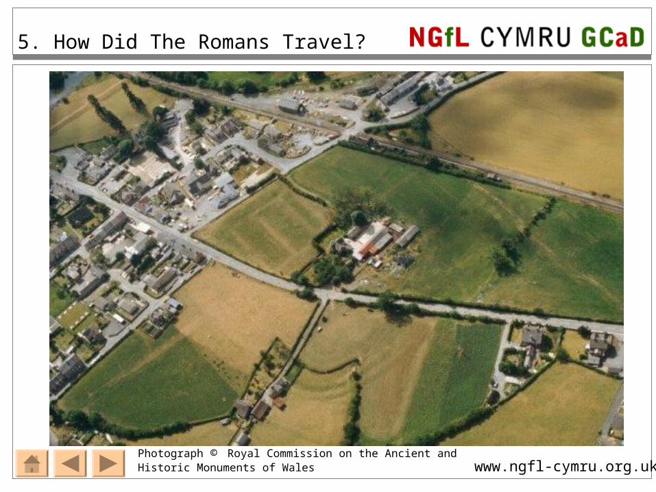
Photograph © Royal Commission on the Ancient and Historic Monuments of Wales
This is the valley between Caersws and Newtown.
What can you see?

NGfL CYMRU GCaD
www.ngfl-cymru.org.uk
5. How Did The Romans Travel?
Photograph © Royal Commission on the Ancient and Historic Monuments of Wales
What can you see?
NGfL CYMRU GCaD
www.ngfl-cymru.org.uk
5. How Did The Romans Travel?
Photograph © Royal Commission on the Ancient and Historic Monuments of Wales

NGfL CYMRU GCaD
www.ngfl-cymru.org.uk
5. How Did The Romans Travel?
This is the valley between Caersws and Trefeglwys.
What can you see?
Click on the map.
Can you follow the sections of Roman road East (right) back to the fort at Caersws?Photograph © Royal Commission on the Ancient and Historic Monuments of Wales
NGfL CYMRU GCaD
www.ngfl-cymru.org.uk
5. How Did The Romans Travel?
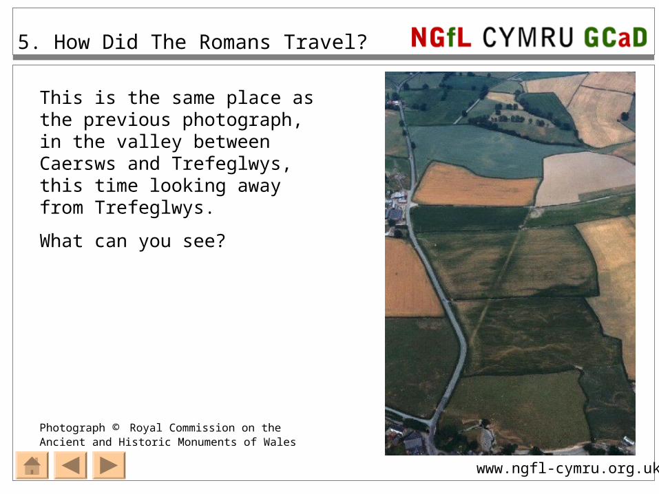
Photograph © Royal Commission on the Ancient and Historic Monuments of Wales
This is the same place as the previous photograph, in the valley between Caersws and Trefeglwys, this time looking away from Trefeglwys.
What can you see?

NGfL CYMRU GCaD
www.ngfl-cymru.org.uk
5. How Did The Romans Travel?
Teacher’s notes
http://www.cpat.org.uk/projects/longer/histland/caersws/swstra.htm gives details of courses of the four roads that leave Caersws fort.
Follow the Roman roads on a map –zoom to 1:50,000 and move outward. The road from the S gate is v. difficult to track
Slide 2 Newtown video: Starting at Cefn Carnedd hillfort and arriving at Tesco, Newtown. When the red truck comes towards you, you are passing Red House Farm on the right.
Slide 3 Red House Farm video: Travelling towards Caersws from Newtown, the short section of modern road outside the farm is on the course of the Roman road, I point the camera at the hedge where the modern road bends left and leaves the Roman course. See slides 5 and 6 for an aerial view.
Slide 4 The Roman road discovered during the excavations for the new Tesco. This is one of the longest lengths of Roman road ever uncovered in Wales. The ‘Find out more’ link is interesting but will need interpreting for the pupils.
Slide 5 Red House Farm: The railway sweeps across the top of the photo, the Caersws level crossing is in the top right corner. The fort is just off the picture in the top right. Can they see the crop mark leaving the course of the road (bottom left) at Red House Farm and pointing straight towards the fort?
Slide 6 Red House Farm 2: The same crop mark but from slightly closer so it’s more obvious, the hedge in the next field follows the course of the road - 1989 photo.
Slide 7 Caersws fort: Look for crop marks. Some buildings inside the fort are visible, as is the road leaving the fort towards the bottom left corner.
Slide 8 Roman road from the fort, just outside Trefeglwys. There is a crop mark visible. The series of green spots alongside road indicate deeper soil – possibly pits.
Slide 9 The same spot, looking in the opposite direction, back towards Caersws.