Next Blueprint Intergovernmental Agency Northeast Gateway ...
2
Traffic Modeling Information Session Northeast Gateway: Welaunee Boulevard Project Development & Environment Study Leon County, Florida Tuesday, December 3, 2019 5:30 p.m. – 7:30 p.m. EST Montford Middle School 789 Pimlico Drive Tallahassee, Florida Blueprint Intergovernmental Agency Board Meeting December 12 th , 2019 Tallahassee City Commission Chambers 300 S. Adams Street (Second Floor) 3:00 p.m. Objective: To present the traffic modeling findings to the Board and receive further direction. Stakeholder Focus Group Sessions Winter 2020 Public Hearing Fall 2020 Other Informal Meetings & Briefings Ongoing Alternatives Public Meeting Summer 2020 Future Community Engagement Opportunities Community Outreach Events Spring 2020 Next Steps Dan Scheer, P.E. Project Manager Blueprint Intergovernmental Agency 315 S. Calhoun Street Tallahassee, Florida 32301 (850) 219-1060 [email protected] Susan Emmanuel Public Information Officer Blueprint Intergovernmental Agency 315 S. Calhoun Street Tallahassee, Florida 32301 (850) 219-1060 [email protected] Stay engaged! Visit the project website for project updates and community engagement opportunities. Public participation is solicited without regard to race, color, national origin, age, sex, religion, disability, or family status. For questions or concerns, please contact Susan Emmanuel at the contact information listed above. For more information regarding the project, please contact:
Transcript of Next Blueprint Intergovernmental Agency Northeast Gateway ...
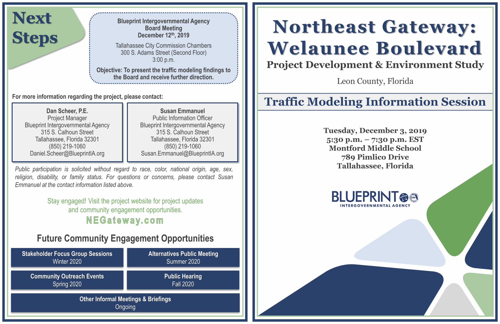
Traffic Modeling Information Session
Northeast Gateway: Welaunee BoulevardProject Development & Environment Study
Leon County, Florida
Tuesday, December 3, 20195:30 p.m. – 7:30 p.m. ESTMontford Middle School
789 Pimlico DriveTallahassee, Florida
Blueprint Intergovernmental AgencyBoard Meeting
December 12th, 2019
Tallahassee City Commission Chambers300 S. Adams Street (Second Floor)
3:00 p.m.
Objective: To present the traffic modeling findings to the Board and receive further direction.
Stakeholder Focus Group Sessions
Winter 2020
Public Hearing
Fall 2020
Other Informal Meetings & Briefings
Ongoing
Alternatives Public Meeting
Summer 2020
Future Community Engagement Opportunities
Community Outreach Events
Spring 2020
Next Steps
Dan Scheer, P.E.Project Manager
Blueprint Intergovernmental Agency315 S. Calhoun Street
Tallahassee, Florida 32301(850) 219-1060
Susan EmmanuelPublic Information Officer
Blueprint Intergovernmental Agency315 S. Calhoun Street
Tallahassee, Florida 32301(850) 219-1060
Stay engaged! Visit the project website for project updates
and community engagement opportunities.
Public participation is solicited without regard to race, color, national origin, age, sex,
religion, disability, or family status. For questions or concerns, please contact Susan
Emmanuel at the contact information listed above.
For more information regarding the project, please contact:
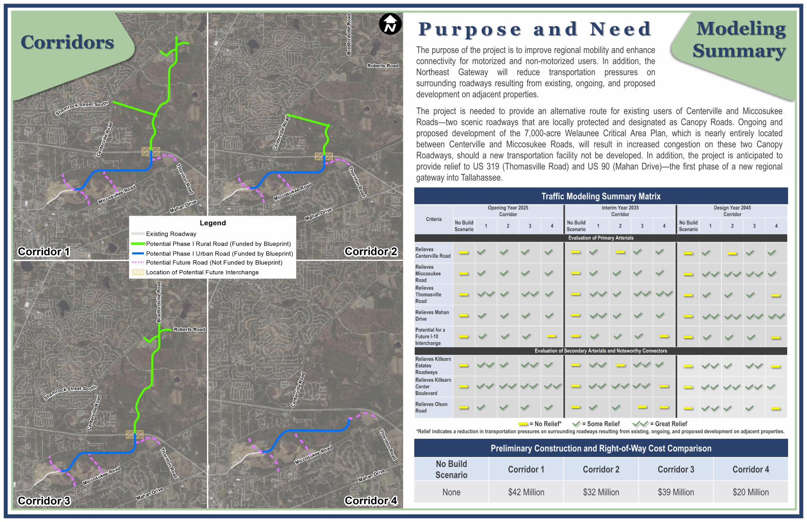
ModelingSummaryCorridors
The purpose of the project is to improve regional mobility and enhance
connectivity for motorized and non-motorized users. In addition, the
Northeast Gateway will reduce transportation pressures on
surrounding roadways resulting from existing, ongoing, and proposed
development on adjacent properties.
The project is needed to provide an alternative route for existing users of Centerville and Miccosukee
Roads—two scenic roadways that are locally protected and designated as Canopy Roads. Ongoing and
proposed development of the 7,000-acre Welaunee Critical Area Plan, which is nearly entirely located
between Centerville and Miccosukee Roads, will result in increased congestion on these two Canopy
Roadways, should a new transportation facility not be developed. In addition, the project is anticipated to
provide relief to US 319 (Thomasville Road) and US 90 (Mahan Drive)—the first phase of a new regional
gateway into Tallahassee.
P u r p o s e a n d N e e d
Preliminary Construction and Right-of-Way Cost Comparison
No Build
ScenarioCorridor 1 Corridor 2 Corridor 3 Corridor 4
None $42 Million $32 Million $39 Million $20 Million
Traffic Modeling Summary Matrix
= No Relief* = Some Relief = Great Relief*Relief indicates a reduction in transportation pressures on surrounding roadways resulting from existing, ongoing, and proposed development on adjacent properties.