NATS 101-06 Lecture 17 Air Masses. Supplemental References for Today’s Lecture Lutgens, F. K. and...
44
NATS 101-06 Lecture 17 Air Masses
-
date post
20-Dec-2015 -
Category
Documents
-
view
220 -
download
0
Transcript of NATS 101-06 Lecture 17 Air Masses. Supplemental References for Today’s Lecture Lutgens, F. K. and...
NATS 101-06Lecture 17Air Masses

Supplemental References for Today’s Lecture
Lutgens, F. K. and E. J. Tarbuck, 2001: The Atmosphere, An Introduction to the Atmosphere, 8th Ed. 484 pp. Prentice Hall. (ISBN 0-13-087957-6)

Ocean Currents of World
Ahrens Fig. 7.24

Upwelling from Alongshore Winds
Ahrens Fig 7.25
Wind pushes surface water southward. Coriolis force deflects water to the right. Cold water from below rises to surface. Fog persists over the cold water.
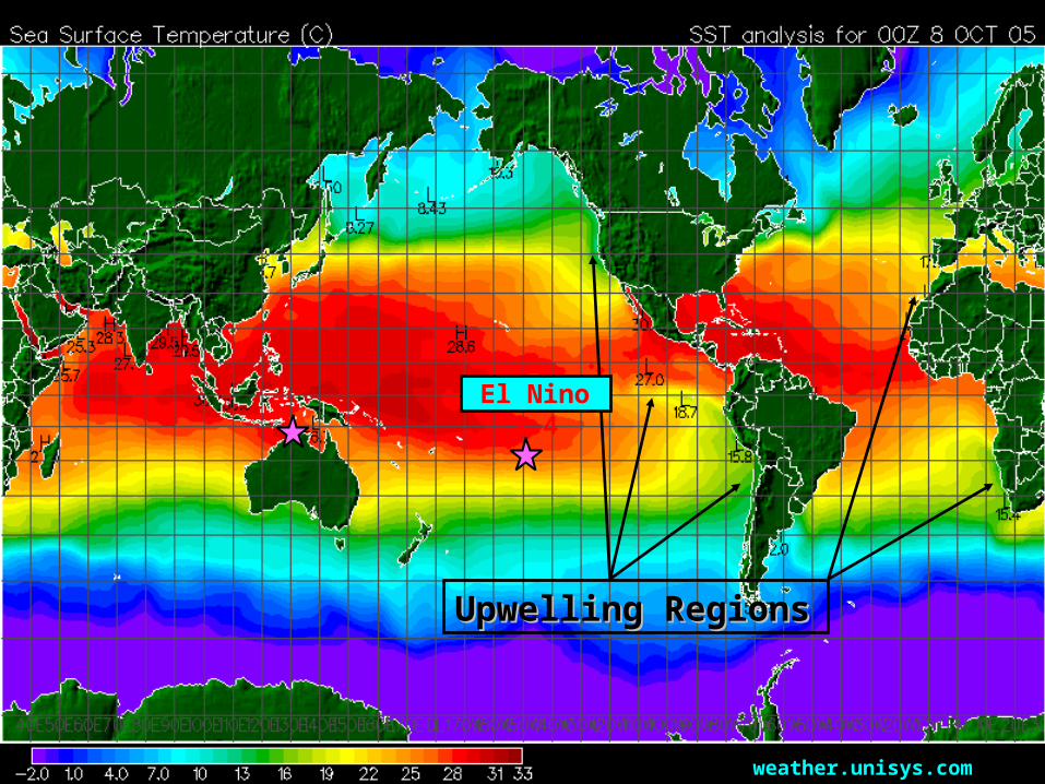
weather.unisys.com
Upwelling RegionsUpwelling Regions
El Nino 3.4
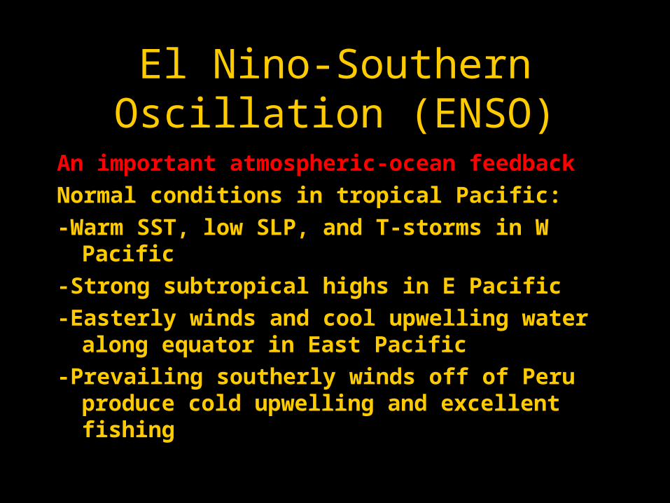
El Nino-Southern Oscillation (ENSO)
An important atmospheric-ocean feedback
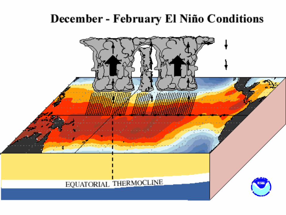
Normal conditions in tropical Pacific:
-Warm SST, low SLP, and T-storms in W Pacific
-Strong subtropical highs in E Pacific
-Easterly winds and cool upwelling water along equator in East Pacific
-Prevailing southerly winds off of Peru produce cold upwelling and excellent fishing

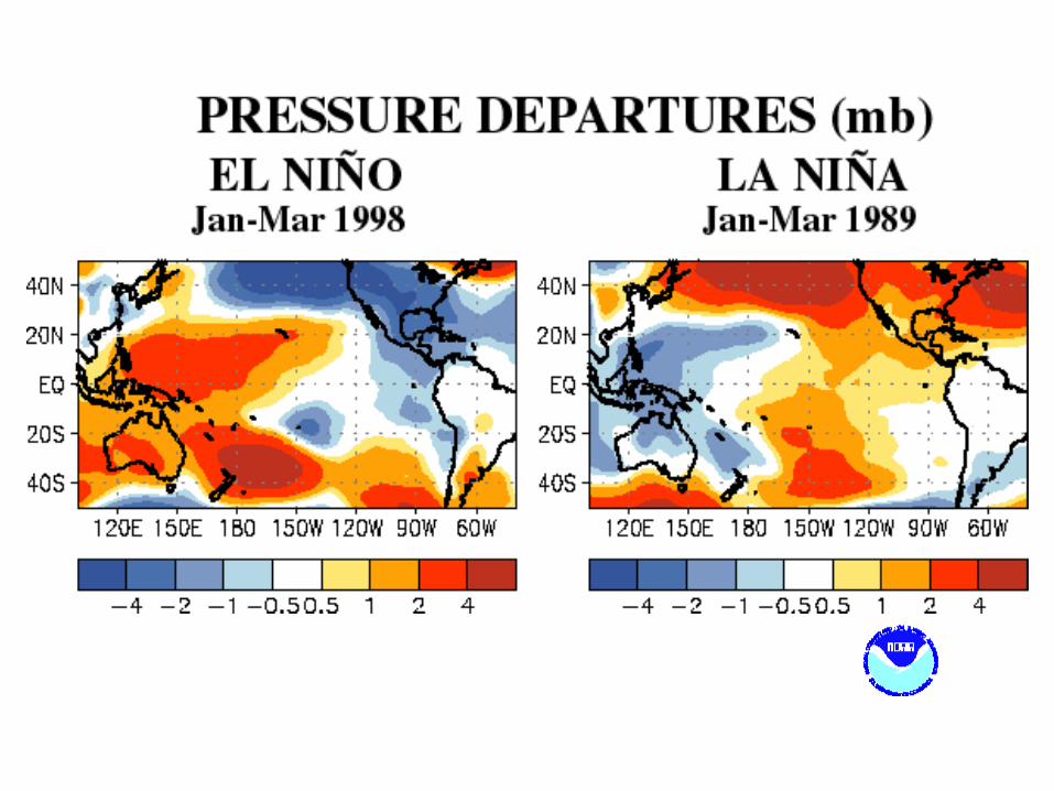
El Niño-Southern Oscillation (ENSO)
Every few years (4-5 years):
-Equatorial Central Pacific warms
-Low SLP, T-storms shift to Central and East Pacific (the Southern Oscillation)
-Trades and southerly winds off Peru weaken
-Upwelling ceases off Peru, warming leads to massive kill off of fish. Typically occurs around Christmas (an El Niño event)
Alters global patterns of wind, temp and rain

Walker Circulation
Pushes water westward
DarwinDarwin TahitiTahiti
Walker Circulation oscillates with a quasi-period of every few years. Oscillation is very evident in SLP records for Darwin and Tahiti.
Aguado & Burt, p230

Southern Oscillation Index (SOI)
SLPSLP
SSTSST

See current conditions
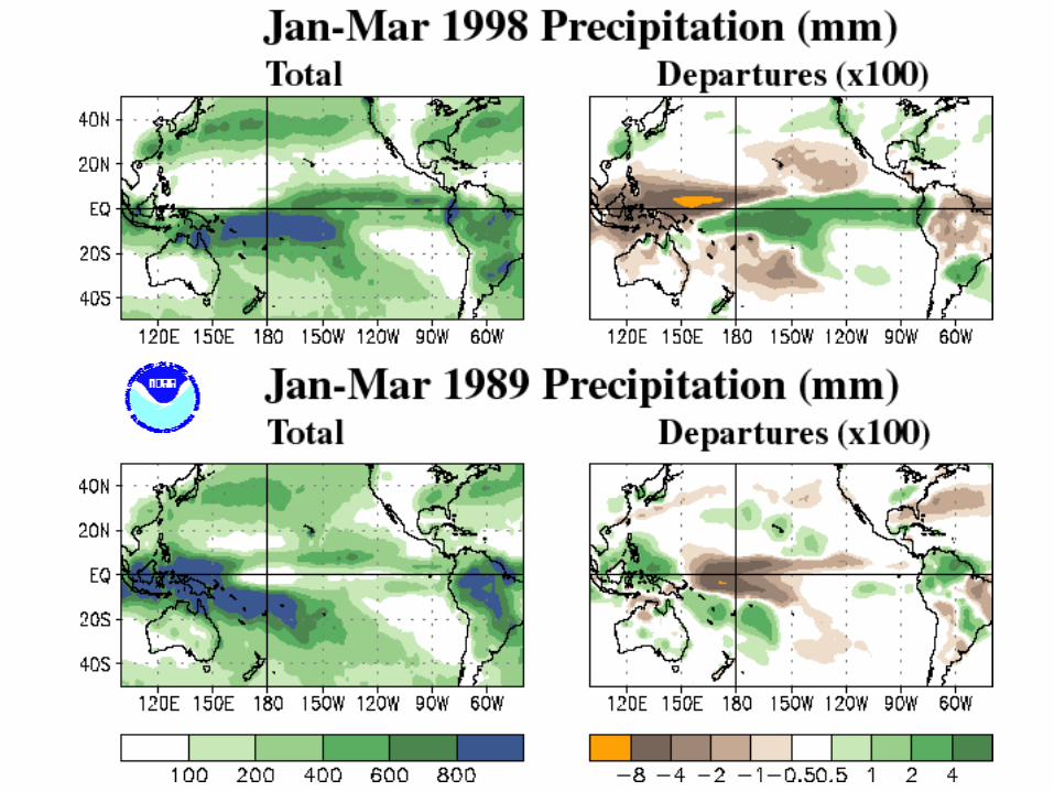


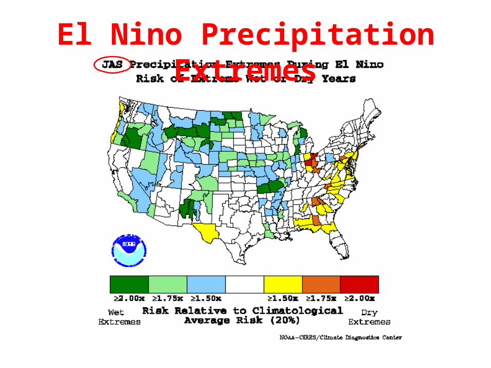
El Nino Precipitation Extremes

La Nina Precipitation Extremes
El Nino Precipitation Extremes

La Nina Precipitation Extremes
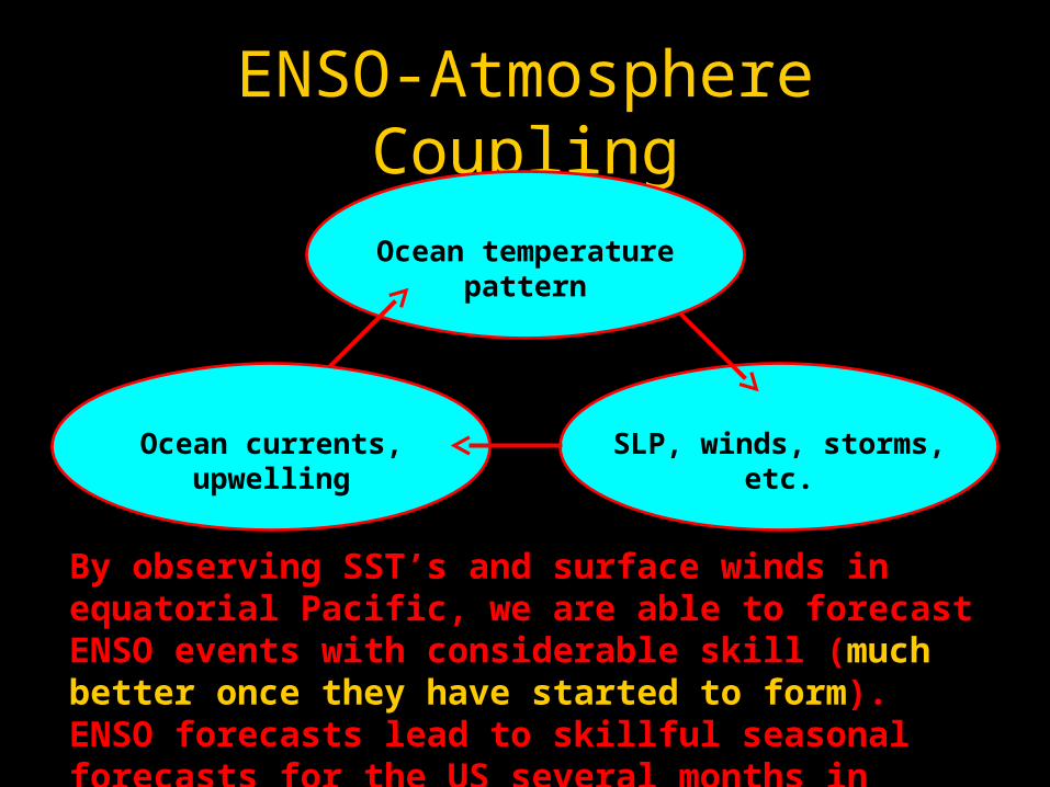
ENSO-Atmosphere Coupling
Ocean temperature pattern
SLP, winds, storms, etc.Ocean currents, upwelling
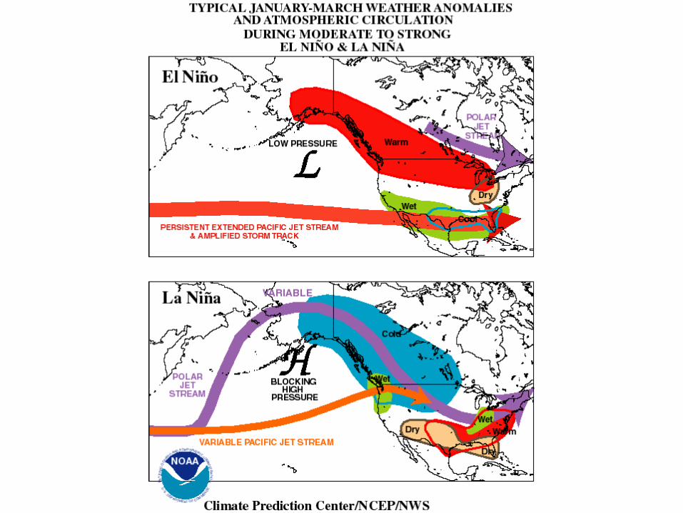
By observing SST’s and surface winds in equatorial Pacific, we are able to forecast ENSO events with considerable skill (much better once they have started to form). ENSO forecasts lead to skillful seasonal forecasts for the US several months in advance (e.g. 1997-1998 winter).
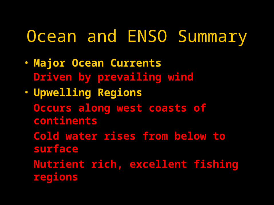
Ocean and ENSO Summary
• Major Ocean CurrentsDriven by prevailing wind
• Upwelling Regions
Occurs along west coasts of continents
Cold water rises from below to surface
Nutrient rich, excellent fishing regions

Summary
• El Nino-Southern OscillationOccurs every few yearsCentral equatorial Pacific warmsLow SLP, T-storms move with warm waterUpwelling weakens along Peru coastCan be predicted up to one-year in advanceModulates global patterns of wind, temp, rain

What is an Air Mass?
• Air Mass
Large area (>1600 km by 1600 km) of air that contains relatively uniform, horizontal distributions of temperature and moisture.

How Air Masses Form
• If surface air resides in a region for a few days, it acquires the thermal and moisture characteristics of the underlying surface.
• Source regions for Air Masses are:
Big in area [ >>(1600 km)2 ]
Dominated by persistent high pressure and light winds

Air Mass Source Regions
• Contrasting source regions are
Continents versus Oceans
Tropics versus Poles
• An Air Mass is designated in terms of its Source Region
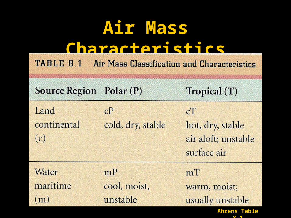
Air Mass Characteristics
Ahrens Table 8.1
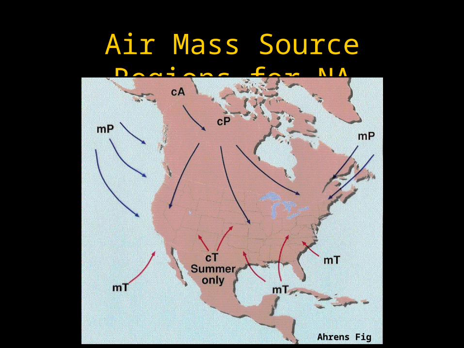
Air Mass Source Regions for NA
Ahrens Fig 8.2

Creation of cP Air Mass
Williams p22

Creation of cP Air Mass
Williams p23
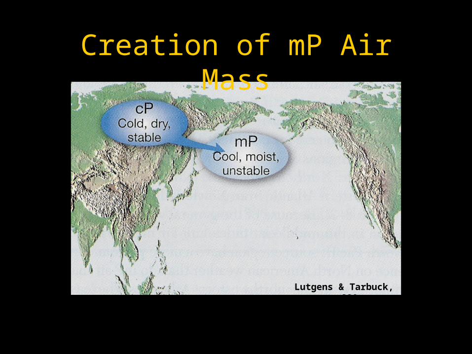
Creation of mP Air Mass
Lutgens & Tarbuck, p 230
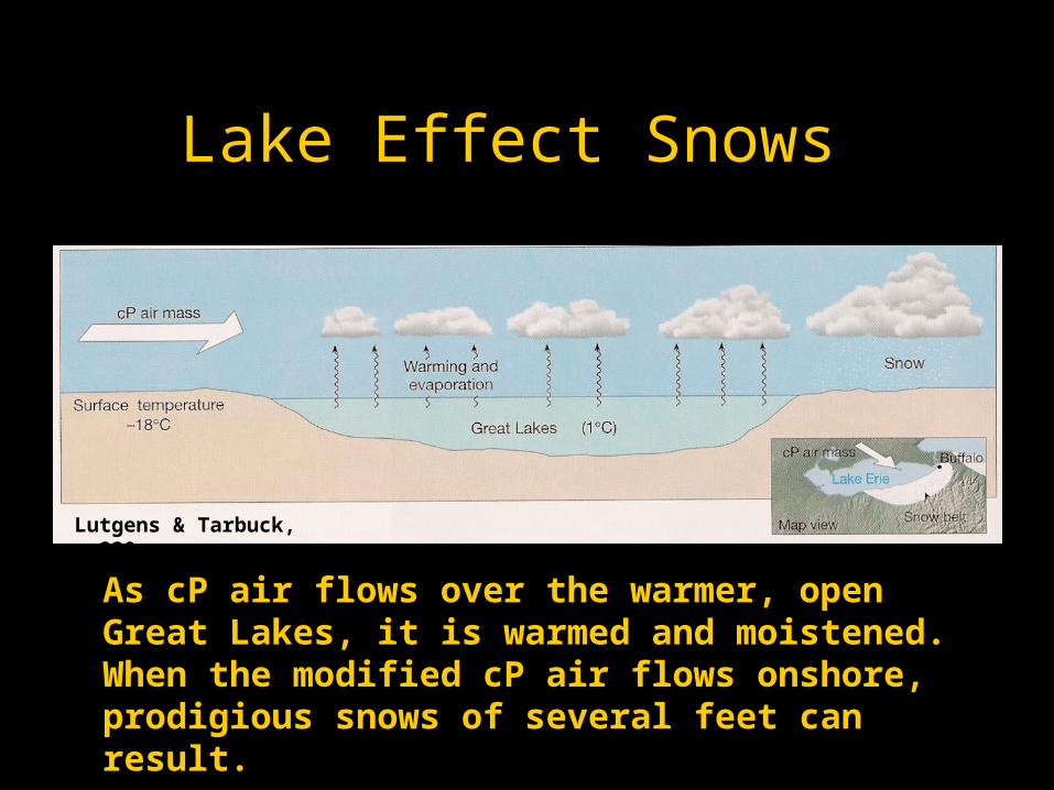
Lake Effect Snows
As cP air flows over the warmer, open Great Lakes, it is warmed and moistened. When the modified cP air flows onshore, prodigious snows of several feet can result.
Lutgens & Tarbuck, p 230
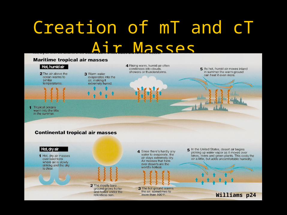
Creation of mT and cT Air Masses
Williams p24
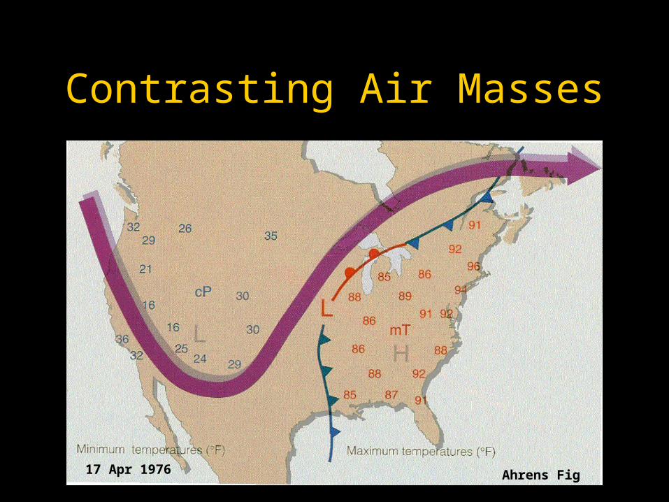
Contrasting Air Masses
Ahrens Fig 8.917 Apr 1976
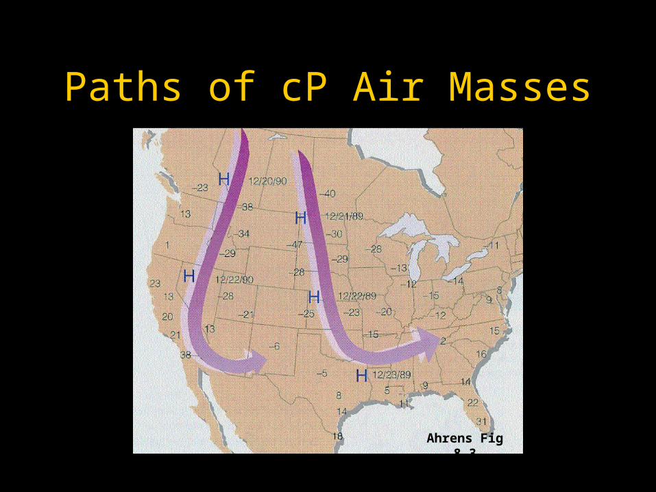
Paths of cP Air Masses
Ahrens Fig 8.3
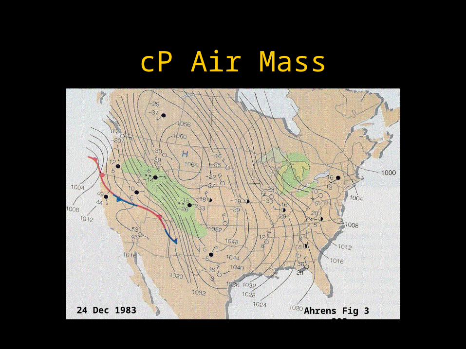
cP Air Mass
Ahrens Fig 3 p20324 Dec 1983

Modification of cP Air Mass
Ahrens Fig 8.4Ahrens Fig 8.4
cPcP
cPcP
mPmP
mPmP
warm oceanwarm ocean
warm oceanwarm ocean
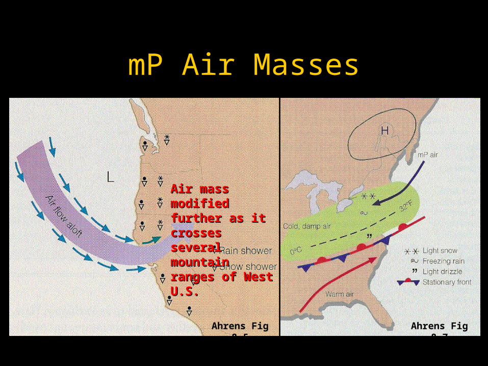
mP Air Masses
Ahrens Fig 8.7Ahrens Fig 8.5
Air mass modified Air mass modified further as it crosses further as it crosses several mountain several mountain ranges of West U.S.ranges of West U.S.
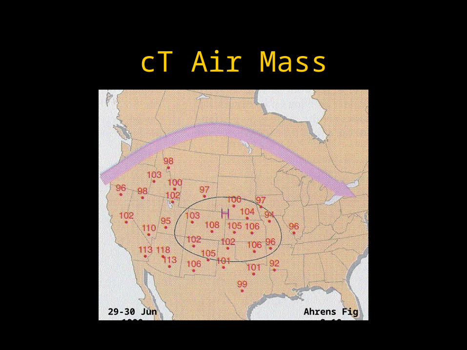
cT Air Mass
Ahrens Fig 8.1029-30 Jun 1990
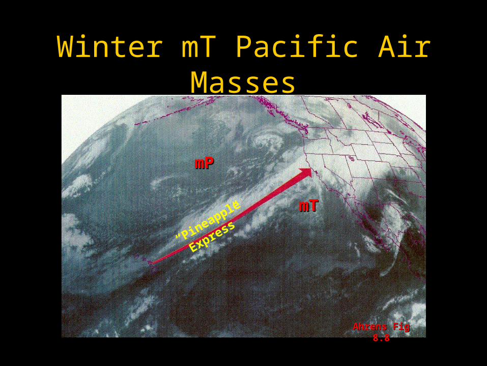
Winter mT Pacific Air Masses
mTmT
mPmP
Ahrens Fig 8.8Ahrens Fig 8.8
“Pineapple Express”

Weather Map with Air Masses
Ahrens Fig 8.11

Due Today
• Turn in 4” by 6” card, include
Comments on Lecture
SID
NAME
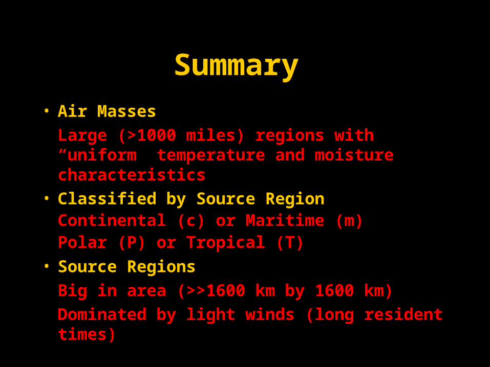
Summary
• Air Masses
Large (>1000 miles) regions with “uniform” temperature and moisture characteristics
• Classified by Source Region Continental (c) or Maritime (m)Polar (P) or Tropical (T)
• Source Regions
Big in area (>>1600 km by 1600 km)
Dominated by light winds (long resident times)

Assignment for Next Lecture
• Topic - Fronts • Reading - Ahrens pg 212-219• Problems - 8.12, 8.13