NATIONAL SCIENCE FOUNDATION Directorate for Education...
27
Page 1 NATIONAL SCIENCE FOUNDATION Directorate for Education and Human Resources (EHR) Division of Undergraduate Education (DUE) Advanced Technological Education (ATE) Annual Report For: GeoTech—The National Geospatial Technology Center of Excellence March 2011
Transcript of NATIONAL SCIENCE FOUNDATION Directorate for Education...
Page 1
NATIONAL SCIENCE FOUNDATION Directorate for Education and Human Resources (EHR)
Division of Undergraduate Education (DUE) Advanced Technological Education (ATE)
Annual Report For: GeoTech—The National Geospatial Technology Center of Excellence
March 2011
Page 2
Table of Contents
EXECUTIVE SUMMARY Pg. 3 PARTICIPANTS
People Pg. 7
Organizations Pg. 4-12
ACTIVITIES AND FINDINGS
Activities/Findings Pg. 12-15
Project Training Development Pg. 16-17
Outreach Activities Pg. 17-21
PRODUCTS
Journal Pg. 21
Books Pg. 23
Internet Dissemination Pg. 23
Other specific products Pg. 24
CONTRIBUTIONS
Within Discipline Pg. 25
Human Resources Development Pg. 25
Research and Education Pg. 25-26
BUDGET HIGHLIGHTS
Figure 6: Year 1 (2009) Goal and Expenditure Alignment Pg. 27
Figure 7: Year 2 (2010) Goal and Expenditure Alignment Pg. 27
Page 3
EXECUTIVE SUMMARY
This report details the accomplishments of the NSF DUE ATE (0801893) funded National Geospatial Technology Center of Excellence (GeoTech) during its third year of operation (Sept. 1, 2010—August 31, 2011). The major successes of the third year of operation are based on the carefully crafted recommendations of the National Visiting Committee, under the leadership of Deidre Sullivan, PI and Director of the MATE Center.
Geospatial Technology Competency Model (GTCM)
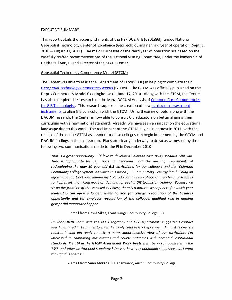
The Center was able to assist the Department of Labor (DOL) in helping to complete their Geospatial Technology Competency Model (GTCM). The GTCM was officially published on the Dept’s Competency Model Clearinghouse on June 17, 2010. Along with the GTCM, the Center has also completed its research on the Meta-DACUM Analysis of Common Core Competencies for GIS Technologist. This research supports the creation of new curriculum assessment instruments to align GIS curriculum with the GTCM. Using these new tools, along with the DACUM research, the Center is now able to consult GIS educators on better aligning their curriculum with a new national standard. Already, we have seen an impact on the educational landscape due to this work. The real impact of the GTCM begins in earnest in 2011, with the release of the online GTCM assessment tool, so colleges can begin implementing the GTCM and DACUM findings in their classroom. Plans are clearly underway to do so as witnessed by the following two communications made to the PI in December 2010:
That is a great opportunity. I’d love to develop a Colorado case study scenario with you. Time is appropriate for us, since I’m headlong into the opening movements of redeveloping the now 10 year old GIS curriculums for our college ( and the Colorado Community College System on which it is based ). I am putting energy into building an informal support network among my Colorado community college GIS teaching colleagues to help meet the rising wave of demand for quality GIS technician training. Because we sit on the frontline of the so called GIS Alley, there is a natural synergy here for which your leadership can open a longer, wider horizon for college recognition of the business opportunity and for employer recognition of the college’s qualified role in making geospatial manpower happen
--email from David Sikes, Front Range Community College, CO
Dr. Mary Beth Booth with the ACC Geography and GIS Departments suggested I contact you. I was hired last summer to chair the newly created GIS Department. I'm a little over six months in and am ready to take a more comprehensive view of our curriculum. I'm interested in comparing our courses and course outcomes with accepted institutional standards. If I utilize the GTCM Assessment Worksheets will I be in compliance with the TSSB and other institutional standards? Do you have any additional suggestions as I work through this process?
--email from Sean Moran GIS Department, Austin Community College

Page 4
Technology Leadership
The Center has been successful in spreading the adoption of remote desktop access (RDA) and virtualization technology to allow learners and teachers in remote schools and colleges to access server-based GIS application software. For example, Del Mar College recently installed and configured its own remote desktop application (RDA) server to provide both its own campus students, online students, as well as secondary students in both Corpus Christi and Phoenix AZ with access to the latest in GIS software technology across the Internet. This new method of serving geospatial technology into schools and colleges were it was formerly unavailable allows learners in underserved areas to access the latest in GIS. It greatly simplifies the administration, and therefore adoption rate, of GIS technology for colleges and schools.
The Center has also led in the development of new web-based mapping technologies, such as Adobe FLEX and Microsoft Silverlight APIs to enable educators to publish their GIS maps on the Internet in a user-friendly manner. We provided several training webinars and presentations on this leading edge GIS technology for Internet and mobile-computing.
We continue to expand our promotion of alternative GIS software, such as Open Source, to better serve colleges and businesses unable to afford expensive proprietary solutions. We are partnering with the OpenGeo Foundation to provide access to free and open source GIS software (FOSS4G) and curriculum and training in order to introduce the two year college geospatial community to the world of FOSS4G. We are planning to sponsor a workshop at the forthcoming FOSS4G Conference in Denver in September 2011.
Professional Development
One of the top issues facing two year geospatial educators in their professional practice is the dearth of money and time to participate in meaningful professional development activities. In a rapidly emerging technology field, such as GIS and remote sensing, this is a real detriment to America’s technology workforce in a global competition. The Center met this dire need in several important ways in 2010. First, we provided monthly webinars on technology and pedagogy in geospatial education, leveraging our own expertise and guest lectures. All of these are archived on our website for future reference.
Second, our national network of partners, including Southwestern College (CA) & San Diego State University, Central Piedmont Community College (NC), Jefferson Technical College (KY), Lake Land College (IL), Bismark State College (ND), Gainesville State College (GA), and Del Mar College (TX) offered on site technology workshops to college and secondary educators throughout 2010. Workshops ranged from half day awareness seminars to full two week summer institutes. Central Piedmont Community College provided a semester-long class specifically for secondary school teachers using GIS and geospatial technology during the spring 2010 semester. Full evaluation results and impact reports are found here (login required).
Page 5
Third, in addition to our own workshops, the Center provided financial support to the 30 participants of the annual Esri Teachers Teaching Teachers (T3G) following their summer institute to continue their dissemination activities throughout the remainder of 2010. Each participant was provided a $500 stipend for completion of a contract and activities and report. The T3G activities ranged from secondary teachers sharing their experience with other teachers back on their home campus to GIS Day activities to college educators engaging their students in environmental projects related to their T3G training. A full report of the T3G activities is available on the website .
Broader Impact
In January 2010, the Center joined the NSF ATE Synergy Project, led by BATEC, and 14 other ATE Centers to develop our capacity to assist our GIS educator community to use best practices to scale-up their innovative ideas and projects. Our Center selected the RDA project, mentioned early, to develop our own Logic Model for scaling. We also continued our sponsorship of the ATE High Impact Technology Interchange Conference (HiTech) in Orlando in July 2010 and will do so again in San Francisco in July 2011, with workshops, presentations and poster sessions. We also currently serve on the executive organizing committee for HiTech. We extended the reach of the Center’s impact overseas in September 2010 when the Director and Associate Director attended both the FOSS4G International Conference in Barcelona, and the European Union GIS Educators Symposium (EUGISES) in Serres, Greece. Two results from these visits include a possible EU Research Experiences for Undergraduates project (pending January 2011), where ten US two year college students and two GIS educators will spend two weeks in the Netherlands working on environmental technology projects, as well as the Director being elected to the UK Open Source Foundation board of directors. The Center was able to secure an additional $150,000 HP Global Technology Grant to join the HP Global Collaboratory Consortium, along with two secondary schools in Corpus Christi and Phoenix AZ.
Another impact of GeoTech research of national impact is our work with the GIS Certification Institute (GISCI) regarding the GISP professional certification. The GISP is the most popular professional certification in the nation (> 5000). The most glaring weakness in the current GISP, however, is that it is strictly a portfolio-based certification, with no examination requirement. Many in the geospatial industry feel this lack of examination makes the GISP a “paper” tiger in terms of qualification and have expressed a need to strengthen the GISP with a proper examination. The need for such an exam became readily apparent in December 2010 when Esri announced they would be adopting a series of 8 new Esri product certifications. Immediately the debate began raging on Facebook and Linkedin GIS pages about the merits of such exam-based certificates versus a portfolio-only GISP. Many GISP-certified professional feel the need to increase the professionalism of the certification with such an exam.
One major barrier to an exam has been a lack of national standard for exactly what constitutes a GIS professional. No longer, since the new GTCM and Meta-DACUM both provide precisely the framework for such an examination. In order to move the GISP forward and assist the GISCI,
Page 6
the GeoTech Center CoPI David DiBiase served as GISCI Board President for 2010. While on the board, David ushered through a motion, later adopted by the full board, to appoint a working group to study the addition of a test component to the GISP. To help with this task, another GeoTech partner, Rodney Jackson, volunteered for the working group. After 6 months of intensive surveying and comment period from the nation’s 5000 GISPs, the GISCI board of directors voted in December 2010 to modify the GISP to include an examination. No doubt the GTCM and Meta-DACUM documents will both provide the framework for such an exam in the future. To further encourage the adoption of the GTCM as the basis of such an exam, the Center is offering the first-ever National Geospatial Technology Competency Student Competition beginning in January 2011. This high profile event will culminate with a lively competition between six regional finalists at the Esri International Users Conference in July 2011 in San Diego. This conference, attended by 15,000 participants will provide an excellent venue for highlighting the GTCM and our examination we’ve created based on the GTCM. The end-goal is to encourage the GISCI to adopt a rigorous examination for the GISP to increase its relevance in today’s workplace.
The Center conducts a comprehensive survey of two and four year college geospatial educators annually in order to assess their needs. We use this information to modify our Center’s Operational Plan each summer to fine-tune our services to our educator constituents. One consistent finding over the past three surveys is the need for better articulation between colleges and universities. Two year college educators express their desire for closer collaboration with universities in matters of research and articulation. To foster closer collaboration on a national scale, the Center made application to join the University Consortium of GIS programs (UCGIS) in 2009. After a full year of lobbying efforts on the Center’s part with the executive committee of UCGIS, the Center was voted in as an Associate Member in February 2010. We will have two permanent delegates to the UCGIS winter and summer meetings. Membership in this organization will allow us to influence university policies and practices relative to their relationship with two year college educators and students. We anticipate our UCGIS membership will help two year colleges as they seek to build stronger relationships with their transfer university GIS programs to allow better articulation and acceptance of two year college student course credits and degrees. No doubt the new GTCM will also provide the broad overarching framework necessary to build complimentary college and university GIS curriculums that share a common definition provided on a national level. With the creation of the forthcoming GTCM assessment and advisement website at http://geotechcenter.org, educators, students, counselors, and administrators at all levels of secondary, college, and university level will be able to directly compare and measure the degree of similarity between their academic programs for matters of articulation and course transfer and career pathways for geospatial technology students.

Page 7
People
• Phillip Davis—Principle Investigator (PI). Professor Computer Science, Del Mar College, Corpus Christi TX.
• Vincent A. DiNoto—CoPI, Dean of College and Systemic Initiatives Professor of Physics and Astronomy. Jefferson Community and Technical College, Louisville KY.
• Mike Rudibaugh—CoPI. Geography/GIS Instructor, Lake Land Community College, Matoon IL.
• Chris Semerjian—CoPI. Assistant Director, Lewis F. Rogers Institute for Environmental & Spatial Analysis, Gainesville State College, Gainesville GA.
• Ken Yanow—CoPI. Ken Yanow Professor of Geographical Sciences, Southwestern College, San Diego CA.
• Ann Johnson—CoPI. Outreach Manager GeoTech Center, Del Mar College, Beatty NV.
• David DiBiase—CoPI. David DiBiase, Director John A. Dutton e-Education Institute College of Earth and Mineral Sciences, The Pennsylvania State University
• Ming-Hsiang Tsou—Senior personnel, Associate Professor Geography Department, San Diego State University, San Diego CA.
• Christine Lewis—Senior personnel.
• Amy Ballard—Senior personnel. CMS Instructor, GIT/Geomatics Applied Technologies Dept. Chair Central New Mexico Community College, Albuquerque NM.
• Amy Work—Senior personnel. GIS Analyst & Education Coordinator Institute for the Application of Geospatial Technology, Cayuga Community College, Auburn NY.
• Rodney Jackson—Senior personnel. Program Chair, Geospatial Technology Geomatics & Sustainability Division, Central Piedmont Community College, Charlotte NC.
• John Johnson—Senior personnel.
• Angie Milakovic—Senior personnel. Assistant Professor of Geographic Information Systems Bismarck State College, Bismarck ND
Organizations
The Penn State University. CoPI David DiBiase of the Dutton e-Learning Institute @ Penn State University is our lead researcher on the effort to establish a Common Core Competency model within the well-established GIS&T Body of Knowledge work. David is working with the Department of Labor, Employment Training Administration, Business Relations Group and the GIS Certification Institute (GISCI) to create entire new Standard Occupation Guidelines to precisely define the entry level GIS Technician standard. Through a series of DACUM workshops, meta-analysis of previous geospatial workforce studies, and extensive vetting with professional organizations and societies, like GISCI, the GeoTech Center will establish national standards of GIS Technician Common Core Competencies that will form the basis of national articulation and certification models.
Central New Mexico Community College. Senior personnel Amy Ballard provides summer workshops for geospatial educators in the New Mexico region on behalf of the Center. Amy
Page 8
works closely with surveyors and other geospatial employers in the Albuquerque area to secure meaningful internships and work experience for your GIS students and graduates. She is an active member of the New Mexico Geographic Alliance and well-known throughout the area as a stellar geo-educator, supporting mapping projects throughout her are. She is also an active member of the ASPRS, Rio Grande Chapter.
Institute for the Application of Geospatial Technology (IAGT). Senior personnel Amy Work provides leadership in the areas of K-12 teacher education and development as well as our international program. She is responsible for the development of international research opportunities for college faculty and undergraduate students.
Environmental Systems Research Institute, Inc. (ESRI) is our major industry partner and provides unlimited access to its software, online training, campus facilities nationwide, and personnel to assist the GeoTech Center in training learners and educators about GIS application software.
Central Piedmont Community College. Senior personnel Rodney Jackson provides year-round training to workforce, K-12 educators, and learners on behalf of the Center. He also provides access to distance learning modules and courses that will become part of our professional development offering through the resource repository.
Lake Land College. CoPI Mike Rudibaugh is responsible for the creation of our national geospatial educator's map which will document the precise location and information of all existing community college geospatial programs. This map will serve as the foundation of our marketing, research, and dissemination efforts for our public-facing website.
Kentucky Community & Technical College System (KCTCS). CoPI Vince DiNoto leads the technology component of the GeoTech Center in our effort to demonstrate the use of desktop virtualization of GIS application software. Under Vince's leadership, the Center will create an online ArcGIS web service whereby we can demonstrate the use of virtualization to allow colleges and secondary schools to participate in GIS application software without the need for complex local installation, maintenance and support. All these services will be provided by the Center in a 'Software as a Service' (SaaS) demonstration mode. Vince also works with CoPI Mike Rudibaugh of Lake Land College to assist Dr. Arlen Gullickson on our effort to provide GIS advising services to the Evalua|t|e Center.
Southwestern Community College. CoPI Kenneth Yanow leads our female recruitment and retention initiative for the GeoTech Center. Kenneth is creating a white paper series on best practices for the retention and recruitment of minorities and females into geospatial programs. Ken works closely with researcher Ming-Hsiang Tsou of San Diego State University on college-to-university seamless articulation through the innovation of geospatial general education courses. One of the single largest barriers to expanding the geospatial programs of two year colleges is the lack of sufficient numbers of students in our introductory geospatial courses. Kenneth and Ming have perfected the method of offering GIS as a General Education course to: 1) increase the number of students in introductory geospatial courses and 2) improve the seamless transfer
Page 9
of courses from college to universities. Kenneth is performing national research on other methods of implementing GIS as a Gen-Ed course.
Gainesville State College. CoPI Chris Semerjian leads our efforts at recruitment and retention among the HBCU populations of the Southeastern US. He also provides critical support in our DACUM efforts by organizing regional DACUM workshops. He works with researcher Rodney Jackson of Central Piedmont Community College (NC) to develop DoL and NSF grants with HBCU institutions in their area. Chris is active in promoting professional development activities in the Southeastern US, including Metro Atlanta, through the URISA, Georgia Chapter.
San Diego State University. Senior personnel Ming-Hsiang Tsou leads our effort to promote two year college to university articulation methods and research. Ming works directly with CoPI Kenneth Yanow of Southwestern Community College across town in San Diego to articulate Southwestern College into the SDSU program. Ming is also our lead researcher on the use of Web 2.0 technology in recruitment activities. He is a leader in the use of iPhone, YouTube, and other technologies to engage the millennium generation.
Geospatial Infrastructure Technology Association (GITA). GITA is the professional association and leading advocate for anyone using geospatial technology to help operate, maintain, and protect the infrastructure, which includes organizations such as utilities, telecommunication companies, and the public sector. Through industry leading conferences—along with research initiatives, chapters, membership, and other programs—GITA provides education and professional best practices. GITA provides their executive director, Bob Samborski, to serve on the Center's National Advisory Board. They also provide venues, such as the GITA power panel, at their national conferences to disseminate Center deliverables.
Evalua|t|e Center. The Center is working Dr. Arlen Gullickson, to promote the integration of GIS mapping into ATE evaluation and reporting functions. CoPI Mike Rudibaugh is creating a national GIS map of all ATE Centers and Projects that will be published electronically by CoPI Vince DiNoto in the summer of 2009. GeoTech is creating a series of map layers which will display geospatial information specific to ATE researchers, such as the location of project and centers are geographical location, along with a number of research-specific criteria, such as the amount of funding, target audience, participant demographic, evaluation methodologies, etc. The Center is currently working with Dr. Gullickson to disseminate awareness of the collaboration to other Center and Project PIs through a series of webinars, hosted by GeoTech and led by Evalua|t|e, to demonstrate the technology as a tool for research.
Lake Land College. CoPI Mike Rudibaugh of has been working extensively with the Illinois GIS Association presenting workshops to their members to develop professional development opportunities to under-served GIS professionals in the rural areas of Illinois. The Illinois Statewide GIS Initiative will provide the vision for GIS leadership, coordination and services to public and private entities that serve the citizens of Illinois.
Page 10
New Mexico Geographic Information Council. Senior personnel Amy Ballard has made several presentations to increase the professional development opportunities for professionals in the New Mexico state area. She also seeks internship opportunities for her students and jobs for her graduates among the members of the Council. The New Mexico Geographic Information Council, Inc. (NMGIC), a non-profit dedicated to things geospatial: education, information sharing, technology advancement, and collaboration in the state of New Mexico.
Georgia Institute of Technology (Georgia Tech). CoPI Chris Semerjian works in collaboration with the Georgia Tech in Atlanta to provide physical facilities for the GeoTech Center use. We conducted a two day DACUM workshop for Atlanta area technicians at the Georgia-Tech Conference and Hotel Center in January 2009. Along with this collaboration, Gainesville College and Georgia-Tech are working together to develop the Georgia chapter of URISA to provide professional development opportunities for both college faculty and working geospatial professions in the state of Georgia.
Urban and Regional Information Systems Association (URISA). URISA provides professional development opportunities for geospatial educators and practicing professionals. URISA is a non-profit professional and educational association that promotes the effective and ethical use of spatial information and information technologies for the understanding and management of urban and regional systems. It is a multidisciplinary association where professionals from all parts of the spatial data community can come together and share concerns and ideas.
Middle Georgia College. CoPI Chris Semerjian of Gainesville State College is meeting with Middle Georgia College to discuss articulation between MGC's surveying program and GSC's GIS program. Middle Georgia College will submit an Academic Partner Agreement to GeoTech. Two instructors from MGC will attend summer training at Gainesville State College in the summer of 2009. This partnership can provide a model of programs throughout the Southeastern US between high schools and colleges.
Corpus Christi Independent School District (CCISD). GeoTech Center GIS specialist, John J. Nelson, is working weekly with the Collegiate High School of campus of CCISD to infuse GIS and GPS throughout their high school curriculum. He has provided a series of presentations to their 4H club, demonstrating the use of GIS and GPS for community service project, such as mapping city parks and recreational areas.
Front Range Community College (Bolder, CO). PI Phillip Davis serves as an advisor, along with Associate Director Ann Johnson, to assist Front Range in realigning their GIS curriculum with the new Geospatial Technology Competency Model (GTCM). This effort may have a much broader impact since the Front Range curriculum is expected to serve as a statewide model in Colorado in 2011. The Colorado Higher Education Board requires statewide technical programs to be updated each decade and Front Range is proposing their curriculum, based on the national GTCM, be the basis for Colorado’s 2011-2021 GIS standard.
Page 11
Austin Community College (Austin, TX). PI Phillip Davis serves as a curriculum advisor to the Austin Community College (ACC) GIS program. The ACC GIS program is seeking to obtain Texas Skill Standards Board (TSSB) recognition of their curriculum in 2011. The GeoTech Center and Del Mar College established the TSSB GIS skill standards in 2007. The Center will assist ACC is achieving TSSB recognition and plans to utilize our forthcoming GTCM assessment instruments in the process. Along with the Front Range Community College Colorado curriculum realignment, these two will provide the first statewide test-cases for the new national GTCM standard for wide spread adoption.
OpenGeo Foundation (New York, NY). PI Phillip Davis is negotiating with the OpenGeo Foundation to secure a memorandum of understanding (MOU) that will create a partnership with the OpenGeo group in order to bring free and open source GIS software (FOSS4G) to two year college educators and students. OpenGeo provides the first US-based GIS software package that allows end-users to create and serve a complete GIS solution, from data creation to web-enabled GIS services on the Internet. With the first-ever US hosted FOSS4G International Conference scheduled for Denver CO in September 2011, it is expected that OpenGeo products will be in increasing demand from the US-based geospatial industry end-users, like colleges, universities, and state and local governments who are experiencing severe IT budget cuts, and seek alternatives to expensive proprietary software.
OsGeo, UK. PI Phillip Davis has been elected to the board of directors of the OsGEO Foundation in the United Kingdom. OsGeo is the EU equivalent of the OpenGeo Foundation mentioned previously. As a member of the board, the GeoTech Center will have influence on the development of free and open source GIS software in the UK and EU, which will influence the parallel development of FOSS4G on both sides of the Atlantic. The OsGeo and Center for Geospatial Science, the UK equivalent of GeoTech, recently signed a MOU which serves as a model for the MOU we are developing with OpenGeo mentioned previously.
American Society for Photogrammetry and Remote Sensing (ASPRS). CoPI Ann Johnson is working as the Center's national business and nonprofit liaison to establish a professional relationship with the ASPRS in order to create professional development opportunities for geospatial educators and practicing professionals. Ann is working with the Education Committee of ASPRS to recognized GeoTech Center as the voice for two year college educators and provides an outlet for our participation in the Societies conferences and workshops.
American Association of Geographers (AAG). CoPI Ann Johnson, along with senior researchers Amy Ballard, Amy Work, and Christine Lewis are working with the AAG to promote collaboration with the AAG and GeoTech to encourage and promote professional development opportunities for geospatial educators and professionals. The AAG is one of the largest professional organizations in American for geospatial technology and can provide events nationwide relevant to the education and professional needs of two year college educators.
Page 12
GIS Certification Institute (GISCI). PI Phillip Davis and CoPIs David DiBiase and Ann Johnson are collaborating with the GISCI to develop and vet nationwide, a set of common core competencies for the GIS Technician level job description. The GIS Certification Institute (GISCI) is a 501(c) nonprofit organization established to provide professional standards for GIS professionals on a national level. GISCI provides the world's most recognized professional certification, the GISP, exam. GISCI has developed a working group, hosted by the GeoTech Center, to work collaboratively with education and professional groups in the creation of industry-driven job descriptions for the GISCI and Dept. of Labor.
University Consortium of Geographic Information Science Programs (UCGIS). CoPI David DiBiase from Penn State is leading our effort to work with UCGIS to create career pathways through the UCGIS sponsored GIS&T Body of Knowledge. This research effort will provide well-defined pathways for occupation-specific sets of knowledge, skills and abilities (KSA) that can be used by both industry and academic organizations to evaluate performance and articulation. CoPI Ann Johnson is also working with the UCGIS Education Committee to get two year colleges recognized as legitimate partners with UCGIS.
UK Open Source Foundation. Director, and Principle Investigator, Phillip Davis was appointed to the Board of Directors for the Open Source Foundation in the United Kingdom. He will begin his service in June 2011, with our first board meeting. It is anticipated this service may lead to a MOU with the UK Open Source Foundation and possible long-term research experience projects with UK-based research universities as a result.
ACTIVITIES AND FINDINGS
Activities/Findings
In year three, the Center completed several noteworthy research initiatives which should provide a solid foundation for further work. These initiatives were directly attached to specific recommendations from last year’s NVC annual. These completed initiatives include:
1. Department of Labor’s Geospatial Technology Competency Model (GTCM) 2. Meta-DACUM Analysis of the GIS Technologist Core Competencies (Meta-DACUM) 3. Remote Desktop Access to Virtual GIS Applications (RDA) 4. GIS as a General Education Elective (GISGenEd) 5. Web Map of Community College Geospatial Academic Programs through Adobe FLEX
(FLEXaMap)
Each of these five major initiatives is briefly described below.
GTCM—the Department of Labor’s Geospatial Technology Competency Model (GTCM) initiative started in March 2009 with an initial meeting between GeoTech Center CoPIs (Davis/DiBiase/Johnson). From this a series of meeting with the DOL was held through July 2009. A protocol to complete the GTCM was proposed by David DiBiase. This methodology was
Page 13
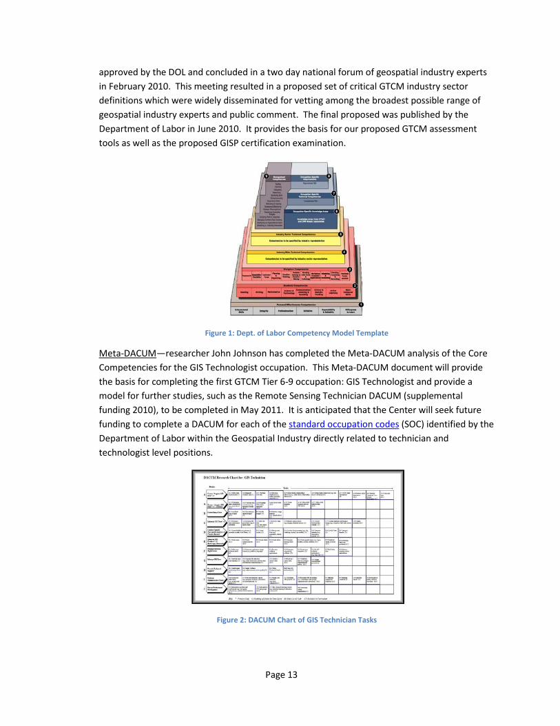
approved by the DOL and concluded in a two day national forum of geospatial industry experts in February 2010. This meeting resulted in a proposed set of critical GTCM industry sector definitions which were widely disseminated for vetting among the broadest possible range of geospatial industry experts and public comment. The final proposed was published by the Department of Labor in June 2010. It provides the basis for our proposed GTCM assessment tools as well as the proposed GISP certification examination.
Figure 1: Dept. of Labor Competency Model Template
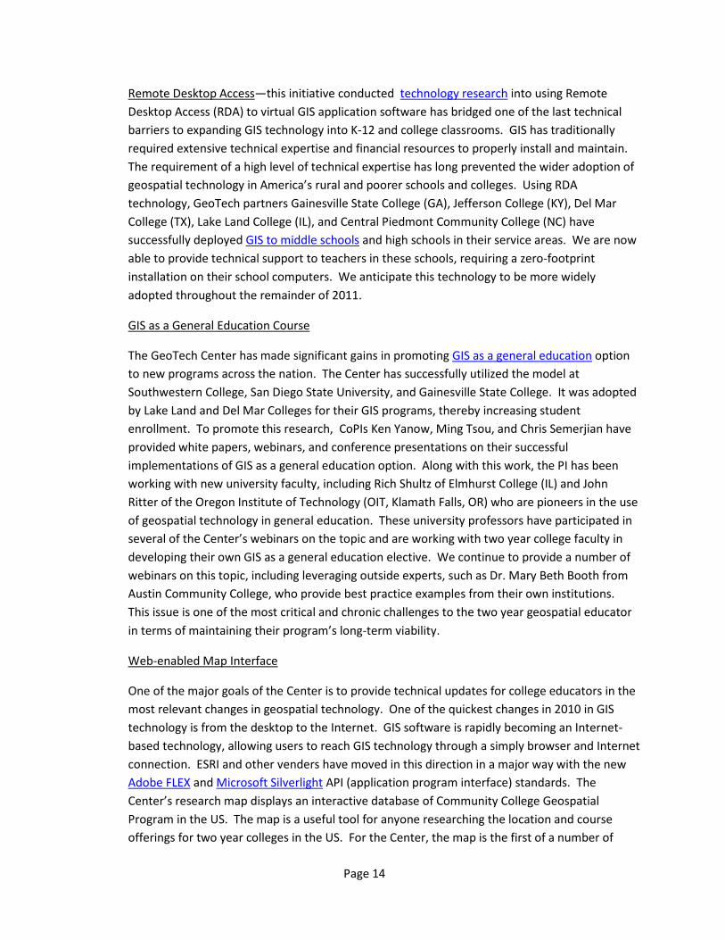
Meta-DACUM—researcher John Johnson has completed the Meta-DACUM analysis of the Core Competencies for the GIS Technologist occupation. This Meta-DACUM document will provide the basis for completing the first GTCM Tier 6-9 occupation: GIS Technologist and provide a model for further studies, such as the Remote Sensing Technician DACUM (supplemental funding 2010), to be completed in May 2011. It is anticipated that the Center will seek future funding to complete a DACUM for each of the standard occupation codes (SOC) identified by the Department of Labor within the Geospatial Industry directly related to technician and technologist level positions.
Figure 2: DACUM Chart of GIS Technician Tasks
Page 14
Remote Desktop Access—this initiative conducted technology research into using Remote Desktop Access (RDA) to virtual GIS application software has bridged one of the last technical barriers to expanding GIS technology into K-12 and college classrooms. GIS has traditionally required extensive technical expertise and financial resources to properly install and maintain. The requirement of a high level of technical expertise has long prevented the wider adoption of geospatial technology in America’s rural and poorer schools and colleges. Using RDA technology, GeoTech partners Gainesville State College (GA), Jefferson College (KY), Del Mar College (TX), Lake Land College (IL), and Central Piedmont Community College (NC) have successfully deployed GIS to middle schools and high schools in their service areas. We are now able to provide technical support to teachers in these schools, requiring a zero-footprint installation on their school computers. We anticipate this technology to be more widely adopted throughout the remainder of 2011.
GIS as a General Education Course
The GeoTech Center has made significant gains in promoting GIS as a general education option to new programs across the nation. The Center has successfully utilized the model at Southwestern College, San Diego State University, and Gainesville State College. It was adopted by Lake Land and Del Mar Colleges for their GIS programs, thereby increasing student enrollment. To promote this research, CoPIs Ken Yanow, Ming Tsou, and Chris Semerjian have provided white papers, webinars, and conference presentations on their successful implementations of GIS as a general education option. Along with this work, the PI has been working with new university faculty, including Rich Shultz of Elmhurst College (IL) and John Ritter of the Oregon Institute of Technology (OIT, Klamath Falls, OR) who are pioneers in the use of geospatial technology in general education. These university professors have participated in several of the Center’s webinars on the topic and are working with two year college faculty in developing their own GIS as a general education elective. We continue to provide a number of webinars on this topic, including leveraging outside experts, such as Dr. Mary Beth Booth from Austin Community College, who provide best practice examples from their own institutions. This issue is one of the most critical and chronic challenges to the two year geospatial educator in terms of maintaining their program’s long-term viability.
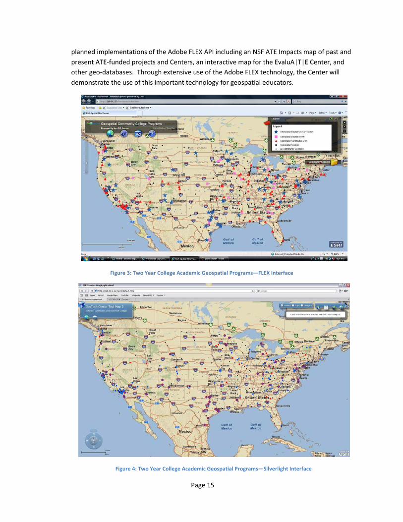
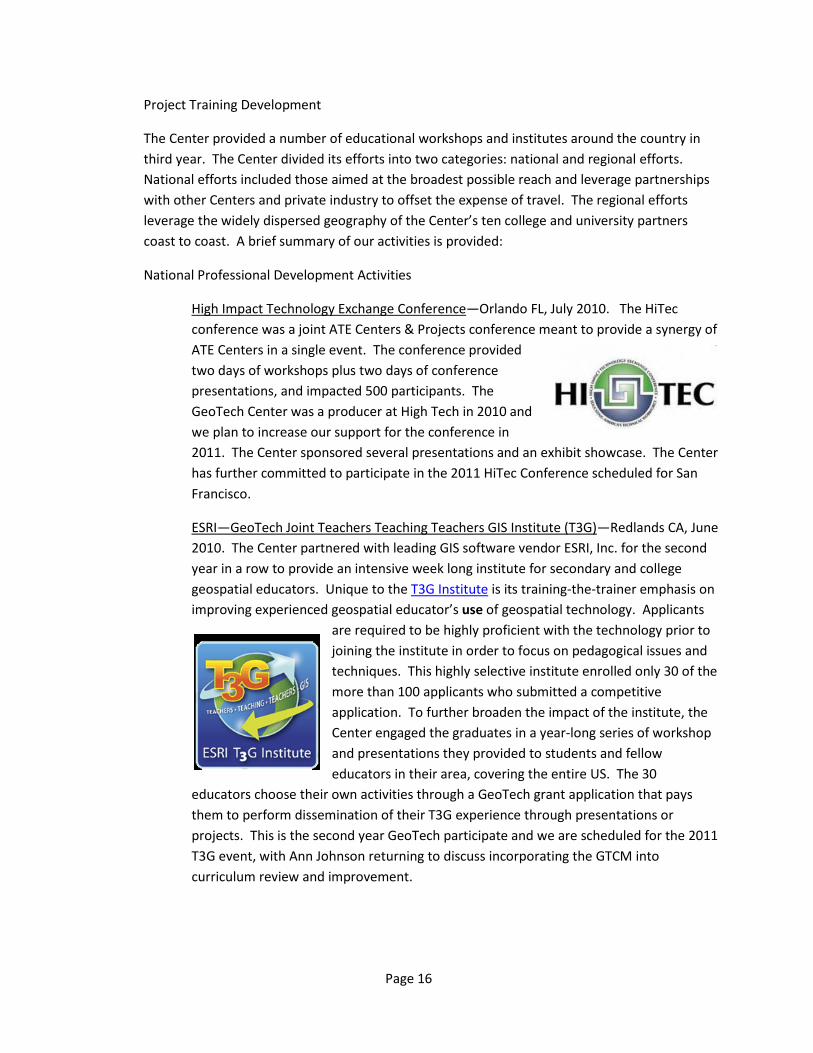
Web-enabled Map Interface
One of the major goals of the Center is to provide technical updates for college educators in the most relevant changes in geospatial technology. One of the quickest changes in 2010 in GIS technology is from the desktop to the Internet. GIS software is rapidly becoming an Internet-based technology, allowing users to reach GIS technology through a simply browser and Internet connection. ESRI and other venders have moved in this direction in a major way with the new Adobe FLEX and Microsoft Silverlight API (application program interface) standards. The Center’s research map displays an interactive database of Community College Geospatial Program in the US. The map is a useful tool for anyone researching the location and course offerings for two year colleges in the US. For the Center, the map is the first of a number of
Page 15
planned implementations of the Adobe FLEX API including an NSF ATE Impacts map of past and present ATE-funded projects and Centers, an interactive map for the EvaluA|T|E Center, and other geo-databases. Through extensive use of the Adobe FLEX technology, the Center will demonstrate the use of this important technology for geospatial educators.
Figure 3: Two Year College Academic Geospatial Programs—FLEX Interface
Figure 4: Two Year College Academic Geospatial Programs—Silverlight Interface
Page 16
Project Training Development
The Center provided a number of educational workshops and institutes around the country in third year. The Center divided its efforts into two categories: national and regional efforts. National efforts included those aimed at the broadest possible reach and leverage partnerships with other Centers and private industry to offset the expense of travel. The regional efforts leverage the widely dispersed geography of the Center’s ten college and university partners coast to coast. A brief summary of our activities is provided:
National Professional Development Activities
High Impact Technology Exchange Conference—Orlando FL, July 2010. The HiTec conference was a joint ATE Centers & Projects conference meant to provide a synergy of ATE Centers in a single event. The conference provided two days of workshops plus two days of conference presentations, and impacted 500 participants. The GeoTech Center was a producer at High Tech in 2010 and we plan to increase our support for the conference in 2011. The Center sponsored several presentations and an exhibit showcase. The Center has further committed to participate in the 2011 HiTec Conference scheduled for San Francisco.
ESRI—GeoTech Joint Teachers Teaching Teachers GIS Institute (T3G)—Redlands CA, June 2010. The Center partnered with leading GIS software vendor ESRI, Inc. for the second year in a row to provide an intensive week long institute for secondary and college geospatial educators. Unique to the T3G Institute is its training-the-trainer emphasis on improving experienced geospatial educator’s use of geospatial technology. Applicants
are required to be highly proficient with the technology prior to joining the institute in order to focus on pedagogical issues and techniques. This highly selective institute enrolled only 30 of the more than 100 applicants who submitted a competitive application. To further broaden the impact of the institute, the Center engaged the graduates in a year-long series of workshop and presentations they provided to students and fellow educators in their area, covering the entire US. The 30
educators choose their own activities through a GeoTech grant application that pays them to perform dissemination of their T3G experience through presentations or projects. This is the second year GeoTech participate and we are scheduled for the 2011 T3G event, with Ann Johnson returning to discuss incorporating the GTCM into curriculum review and improvement.
Page 17
Regional Training Activities
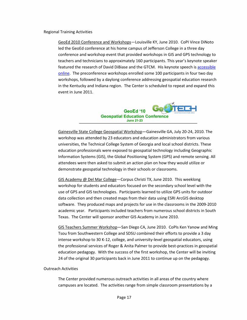
GeoEd 2010 Conference and Workshops—Louisville KY, June 2010. CoPI Vince DiNoto led the GeoEd conference at his home campus of Jefferson College in a three day conference and workshop event that provided workshops in GIS and GPS technology to teachers and technicians to approximately 160 participants. This year’s keynote speaker featured the research of David DiBiase and the GTCM. His keynote speech is accessible online. The preconference workshops enrolled some 100 participants in four two day workshops, followed by a daylong conference addressing geospatial education research in the Kentucky and Indiana region. The Center is scheduled to repeat and expand this event in June 2011.
Gainesville State College Geospatial Workshop—Gainesville GA, July 20-24, 2010. The workshop was attended by 23 educators and education administrators from various universities, the Technical College System of Georgia and local school districts. These education professionals were exposed to geospatial technology including Geographic Information Systems (GIS), the Global Positioning System (GPS) and remote sensing. All attendees were then asked to submit an action plan on how they would utilize or demonstrate geospatial technology in their schools or classrooms.
GIS Academy @ Del Mar College—Corpus Christi TX, June 2010. This weeklong workshop for students and educators focused on the secondary school level with the use of GPS and GIS technologies. Participants learned to utilize GPS units for outdoor data collection and then created maps from their data using ESRI ArcGIS desktop software. They produced maps and projects for use in the classrooms in the 2009-2010 academic year. Participants included teachers from numerous school districts in South Texas. The Center will sponsor another GIS Academy in June 2010.
GIS Teachers Summer Workshop—San Diego CA, June 2010. CoPIs Ken Yanow and Ming Tsou from Southwestern College and SDSU combined their efforts to provide a 3 day intense workshop to 30 K-12, college, and university-level geospatial educators, using the professional services of Roger & Anita Palmer to provide best-practices in geospatial education pedagogy. With the success of the first workshop, the Center will be inviting 24 of the original 30 participants back in June 2011 to continue up on the pedagogy.
Outreach Activities
The Center provided numerous outreach activities in all areas of the country where campuses are located. The activities range from simple classroom presentations by a
Page 18
single faculty member to full-day GIS Day Events, involving dozens of presenters and hundreds of participants, usually secondary school students. Events in year two included:
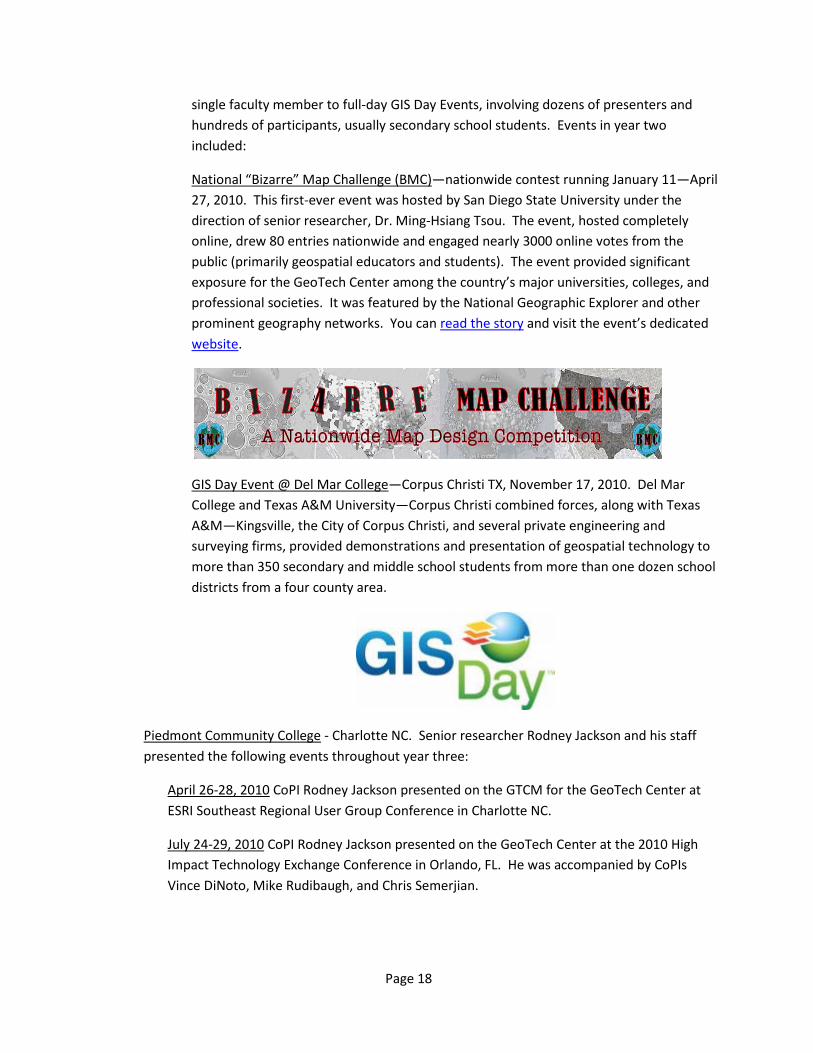
National “Bizarre” Map Challenge (BMC)—nationwide contest running January 11—April 27, 2010. This first-ever event was hosted by San Diego State University under the direction of senior researcher, Dr. Ming-Hsiang Tsou. The event, hosted completely online, drew 80 entries nationwide and engaged nearly 3000 online votes from the public (primarily geospatial educators and students). The event provided significant exposure for the GeoTech Center among the country’s major universities, colleges, and professional societies. It was featured by the National Geographic Explorer and other prominent geography networks. You can read the story and visit the event’s dedicated website.
GIS Day Event @ Del Mar College—Corpus Christi TX, November 17, 2010. Del Mar College and Texas A&M University—Corpus Christi combined forces, along with Texas A&M—Kingsville, the City of Corpus Christi, and several private engineering and surveying firms, provided demonstrations and presentation of geospatial technology to more than 350 secondary and middle school students from more than one dozen school districts from a four county area.
Piedmont Community College - Charlotte NC. Senior researcher Rodney Jackson and his staff presented the following events throughout year three:
April 26-28, 2010 CoPI Rodney Jackson presented on the GTCM for the GeoTech Center at ESRI Southeast Regional User Group Conference in Charlotte NC.
July 24-29, 2010 CoPI Rodney Jackson presented on the GeoTech Center at the 2010 High Impact Technology Exchange Conference in Orlando, FL. He was accompanied by CoPIs Vince DiNoto, Mike Rudibaugh, and Chris Semerjian.
Page 19
San Diego State University
January 2010 graduate assistant, Justin Shepard, completed the first revision of the Project website has completed in January. Since the site is actively used by students and school faculty it was important to keep the look and feel of the site the same. To ensure consistency across the site and reduce time spent on updates the new pages utilize a dwt template. There are a few remaining issues that we would like to continue refining, however the new site is up and running. Some of the issues include the menu displaying differently in Internet Explorer and Mozilla and we would like to add captions to the videos in order to make the pages more accessible to all users. As web accessibility concerns continue to grow and more users weigh in it may be necessary to refine the website.
Central New Mexico Community College—Amy Ballard
February, 10 2010 New Mexico Professional Surveyors Association: Amy Ballard presented on the impact of her land surveying technician program on the workforce for Northern New Mexico.
February 27, 2010 School to Work Career Fair: Amy Ballard worked a booth to demonstrate to 90 high school students GIS as a career option.
Cayuga Community –Amy Work
April 14, 2010 American Association of Geographers: conducted paper presentation to 15 educators on the professional development activities of IAGT in New York for geospatial educators.
April 28, 2010 GIS in Schools Grant: conducted outreach workshop for 5 educators on GIS curriculum as a mentor.
June 28 – July 2, 2010 TwiST Workshop for Educators at Cayuga Community College: one week GIS training workshop, partially supported by GeoTech Center, for 45 secondary and college GIS educators in New York area.
Ongoing Year Two Activities: Environmental Protection Technology 173 course, Water Quality Working with instructor to integrate GIS and GPS into her existing course. This will include field activities and classroom-based mapping. The goal is to evolve this effort into a regular course in the curriculum, as well as to use it as an example of successful integration of GIS into another program at the College.
Conference and other events
January 2010 Metropolitan Area (ESRI) Users Group in Denton TX: Senior staff member John Nelson attended the first annual MAUG Conference and Workshops and exhibit for the GeoTech Center to the nearly 150 D/FW area GIS professionals in attendance.

Page 20
February 2010 University Consortium of Geographic Information Science Annual Winter Meeting in Washington DC: CoPI David DiBiase presented the GeoTech Center work on the GTCM before the UCGIS Board of Directors as evidence of our research agenda and worthiness to be considered for associate membership in this prestigious university research consortium.
March 2010 Synergy Project Thought Leaders and Innovation Coaches Workshop in Baltimore MD: CoPIs Phillip Davis and Ann Johnson attended the second in the series of three Synergy Project workshops and presented an update on the Center’s project to ramp-up our Remote Desktop Access technology project nationwide in the third half of 2010.
March 2010 League of Innovations Conference in Baltimore MD: Senior staff member John Nelson exhibited with the Joint ATE Centers exhibit at this three day event.
March 2010 Association for Supervision and Curriculum Development (ASCD) Annual Conference in San Antonio TX: Barbara Duke, Curriculum Integration and GIS in Education Consulting, presented “Transforming Curriculum Using Geospatial Technologies” for teachers, administrators and curriculum support personnel.
April 2010 American Associate of Geographers Annual Conference in Washington DC: CoPI Ann Johnson attended the AAG meeting and presented on two workshops related to GeoTech Center research and activities.
April 2010 American Association of Community Colleges Annual Conference in Seattle WA: PI Phillip Davis attended the annual conference meeting and exhibited in the Joint ATE Center’s booth for three days.
April 2010 ASPRS Workshops and Conference in San Diego CA: CoPI Ann Johnson and senior researcher Ming Tsou attended the ASPRS workshops and presented on their research with the GeoTech Center.
April 2010 Geospatial Infrastructure Technology Association Annual Conference in Phoenix AZ: PI Phillip Davis and senior staffer John Johnson exhibited during this four day conference to more than 800 geospatial educators and industry professionals.
April 17 2010 at Salem Middle School, in Virginia Beach, Virginia: Exploring Your World with GIS, a six –hour, hands-on workshop was held Saturday by Georgeanne C. Hribar, “Graduate “2009 T3 Summer Institute at ESRI. The 22 workshop participants included: 1 museum professional, 1 high school teacher, 1 middle school administrator, 2 pre-service teachers, and 17 middle school teachers. Three school divisions were represented: 5 participants from Suffolk, 1 teacher from Chesapeake, and 13 social studies and science teachers from Virginia Beach City Public Schools. In addition, there was a museum educator from Nauticus and the 2 pre-service teachers from Christopher Newport University.
Page 21
April 2010 ASPRS Annual Conference and Workshop: CoPI Ann Johnson presented a half day workshop on GIS software to approximately 20 secondary school educators.
July 2010 ESRI Users Conference in San Diego CA: a team of 6 CoPIs attend the annual event and present a series of papers on the Center’s initiatives. The Center sponsors an all day expo at the Educator’s sub-conference and a half-day booth at the Academic Fair. A total of more than 300 college and university geospatial educators are directly impacted over a period of 4 days.
July 2010 HiTech ATE NSF Conference in Scottsdale AZ: a team of 7 CoPIs attends this first-ever annual event as executive producers. We provide a full day workshop to 25 educators and workforce professionals, conduct three presentations, and exhibit at the two day expo over a period of four days. More than 500 attendees are impacted.
September 2010 USRIA Annual Conference in Orlando, FL: CoPI David DiBiase and senior researcher John Johnson provide two presentations on the GTCM And Meta-DACUM results to 40 participants from the geospatial industry.
October 2010 Geological Society of America in Denver CO: CoPI Ann Johnson exhibited at the GSA in front of more than 800 attendees for nationwide.
October 2010 National Science Foundation Annual ATE PIs Conference in Washington DC: The Center, represented by a team of four CoPIs, hosted a Birds of a Feather session for Geospatial Technology which was attended by nearly 40 participants, mostly two year college GIS faculty. The Center demonstrated the new RDA technology, the GTCM research, along with the Meta-DACUM results at the time.
December 2010 National Academy of Sciences Geosciences Advisory Board Meeting in Washington DC: CoPI David DiBiase presented the forthcoming GTCM initiative to the members of the board in order to disseminate the research to the highest levels of the professional and solicit feedback.
PRODUCTS
Journals
Johnson, A. B. and D. Sullivan. “Geospatial Education at U.S. Community Colleges: Background, Challenges, and Opportunities.” URISA Journal 22.2 (2010): 5-11. Print.
Turki, Sami Yassine. “What Education in GIS for Town Planners? A Tunisian Experience.” URISA
Journal 22.2 (2010): 15-18. Print. Wikle, T.A. “Planning Considerations for Online Certificates and Degrees in GIS.” URISA Journal
22.2 (2010): 21-27. Print.
Page 22
Johnson, J. “What GIS Technicians Do: A Synthesis of DACUM Job Analyses.” URISA Journal 22.2 (2010): 31-39. Print.
Ferguson, B. and M. Rudibaugh. “Mapping Geospatial Education at U.S. Community and
Technical Colleges.” URISA Journal 22.2 (2010): 41-44. Print. Tsou, M.-H. and K. Yanow. “Enhancing General Education with Geographic Information Science
and Spatial Literacy.” URISA Journal 22.2 (2010): 45-53. Print. DiBiase, D., Corbin, T., Fox, T., Francica, J., Green,K., Jackson, J., …, Van Sickle, J. “The New
Geospatial Technology Competency Model: Bringing Workforce Needs into Focus.” URISA Journal 22.2 (2010): 55-71. Print.
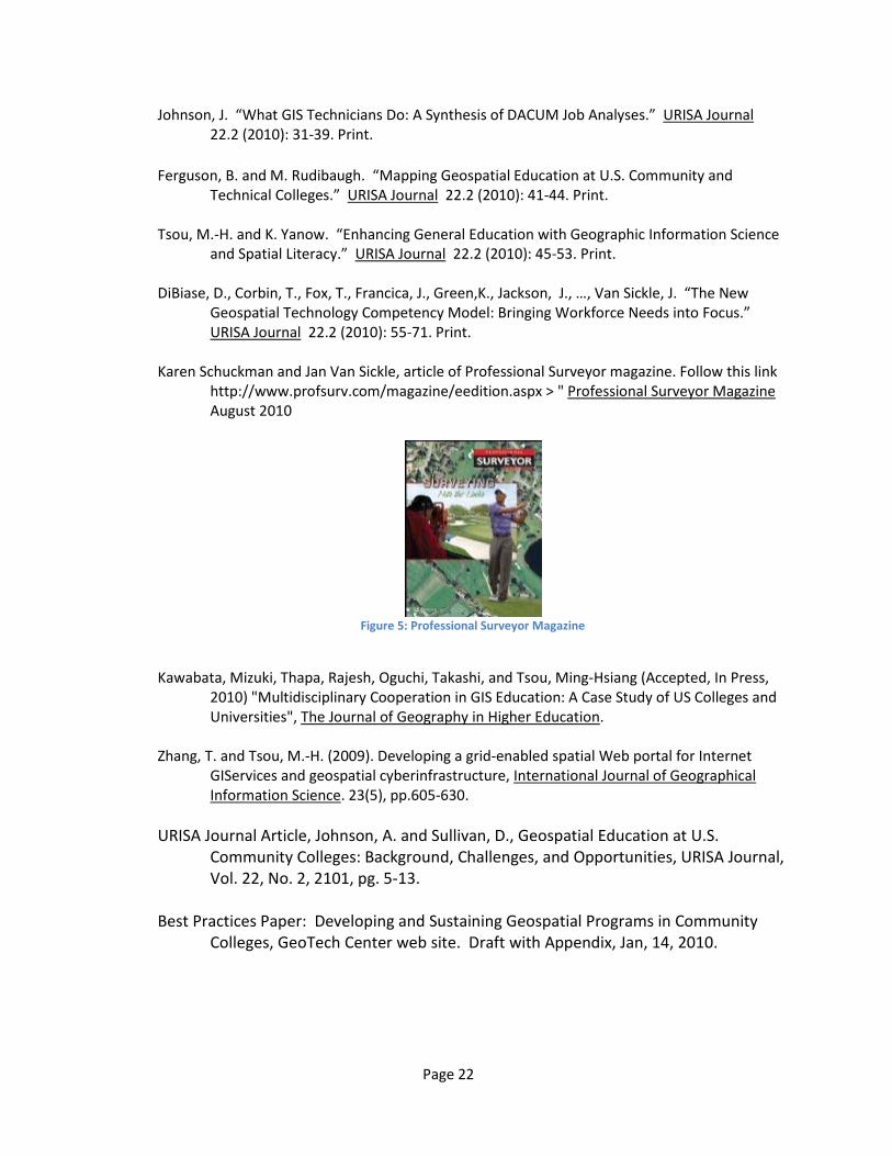
Karen Schuckman and Jan Van Sickle, article of Professional Surveyor magazine. Follow this link
http://www.profsurv.com/magazine/eedition.aspx > " Professional Surveyor Magazine August 2010
Figure 5: Professional Surveyor Magazine
Kawabata, Mizuki, Thapa, Rajesh, Oguchi, Takashi, and Tsou, Ming-Hsiang (Accepted, In Press,
2010) "Multidisciplinary Cooperation in GIS Education: A Case Study of US Colleges and Universities", The Journal of Geography in Higher Education.
Zhang, T. and Tsou, M.-H. (2009). Developing a grid-enabled spatial Web portal for Internet
GIServices and geospatial cyberinfrastructure, International Journal of Geographical Information Science. 23(5), pp.605-630.
URISA Journal Article, Johnson, A. and Sullivan, D., Geospatial Education at U.S.
Community Colleges: Background, Challenges, and Opportunities, URISA Journal, Vol. 22, No. 2, 2101, pg. 5-13.
Best Practices Paper: Developing and Sustaining Geospatial Programs in Community
Colleges, GeoTech Center web site. Draft with Appendix, Jan, 14, 2010.

Page 23
Books
Tsou, Ming-Hsiang (2009). Chapter 48: The Integration of Internet GIS and Wireless Mobile GIS. In Manual of Geographic Information Systems, edited by Marguerite Madden, published by the American Society for Photogrammetry and Remote Sensing (ASPRS), pp. 923-933.
Johnson, A. In press. Geospatial education at U.S. two-year institutions. In D. Unwin, K.
Foote, N. Tate, and D. DiBiase, Eds., Teaching GIS&T in higher education. London: Wiley.
Internet Dissemination—GeoTech Center Professional Development Webinar 2010 Series
1. Results of the national Meta-DACUM Analysis of GIS Technician Core Competencies. John Johnson, GISWS, Inc., recorded January 26, 2010.
2. Using Web 2.0 Social Media in Geospatial Technology Courses. Dr. Ming-Hsiang Tsou, San Diego State University, recorded February 17, 2010.
3. Perfect Grant Proposal and Better Project Management using Logic Models. Ann Johnson, Bare Mountain Consulting, recorded April 22, 2010.
4. GIS as a General Education Course. Ken Yanow, Southwestern Community College, recorded February 19, 2010.
5. GIS Integration Across the Curriculum. Amy Work, Institute for the Application of Geospatial Technology, recorded May 7, 2010.
6. Virtual Desktop GIS for K-12. Chris Semerjian and Lance Hundt, Gainesville State College, recorded May 28, 2010.
7. Integrating GIS Across the K12 Disciplines. Steve Brantling, Lewiston-Clark School District, recorded July 16, 2010.
8. Impact of the GTCM on the GISCI GISP Certification. Rodney Jackson of Central Piedmont Community College, recorded August 20, 2010.
9. Voyage Onboard the Joint Resolution Research Vessel for K12 Educators. Amy Work of Cayuga Community College, recorded September 16, 2010.
10. Expanding Two Year Geospatial Programs: A Three Campus Story. Mike Rudibaugh, Vince DiNoto, and Ken Yanow of the GeoTech Center, recorded October 7, 2010.
11. Multi-Tiered Intership Model. Irina Kopteva of Pikes Peak Community College, recorded November 10, 2010.
12. K12 Modules for GIS. Eileen Goff of San Diego Mesa Community College, recorded November 12, 2010.
13. Free and Open Source Software for GIS (FOSS4G). Kurt Menke & Amy Ballard of Central New Mexico Community College, recorded November 20, 2010.
14. ePortfolios for Geospatial Students and Faculty. Adam Dastrup of Salt Lake Community College, recorded January 14, 2011.
Page 24
Other specific products
The Center made several significant contributions to the geospatial field in year two including:
Geospatial Technology Competency Model—the GTCM is the foundational document used by the Dept. of Labor’s Employment & Training Administration to define the scope and occupations that comprise the geospatial technology industry. This comprehensive document was develop through collaboration with industry and professional societies representing the broadest possible range of groups within the geospatial industry. Once this document is complete in early June 2010, it will provide the nation with a definitive description of the industry and serve as the basis for future work to define each emerging occupation, such as GIS Technologist, within the industry. Schools and colleges may use the GTCM to guide their curriculum development, articulation agreements, and other educational activities. Professional accrediting agencies, such as the GIS Certification Institute or American Society of Photogrammetrists and Remote Sensing (ASPRS), may use the GTCM to perfect existing credentials, such as the GISP, or create new ones.
Meta-DACUM of Common Core Competencies for GIS Technologists—this document is the result of research conducted in year two that produced three DACUM workshops combined with an exhaustive review of previous DACUM dating back 10 years. The unique feature of this document is that is identifies every possible task performed by a GIS Technologists in every segment of the industry and in every region of the country. From this comprehensive list, a rank-order list of tasks, based on frequency and rank by experts, identified a common core set of competencies that should be considered essential for any GIS technologists to possess. With this document, we can now for the first time, provide a list of items that are essential knowledge in this occupation, which may become the basis for future certification, testing, and curriculum guidelines for community college geospatial educators.
Community College Geospatial Academic Program Mapping Portal—the Center has created an ArcGIS spatial database of all known GIS and geospatial academic programs at America’s 1134 community colleges. This database is presently linked with an ArcGIS Webserver that provides online access to the database through a browser and Internet connection. The server utilizes the latest in Adobe FLEX API technology to provide the end-user with an easy to navigate interface. The direct purpose of the database is to provide students, parents, educators, and the public with knowledge about America’s two college geospatial programs. Its secondary purpose is to demonstrate the latest in server-based technology to encourage two year college educators to adopt the technology into their academic programs. This site is accessible by clicking on the map on the Center’s website: http://geotechcenter.org.
Page 25
CONTRIBUTIONS
Within Discipline—the Center has made the following contributions:
Year One (2008)
Year Two (2009)
1. Geospatial Technology Competency Model (GTCM) for the Dept. of Labor—David DiBiase.
2. Meta-DACUM Analysis of Common Core Competency for GIS Technologists—John Johnson.
3. Technology Plan for Remote Desktop Access for Virtual Access to GIS Application Software—Vince DiNoto, Chris Semerjian, Ken Yanow.
Year Three (2010)
1. A Methodology for Normalizing Multi-year DACUM Results into a Unified Result—John Johnson.
Human Resources Development
The Center sponsored several of its own staff for training at various partner colleges in order to better prepare them to support the advanced technology we are engaging in to better serve our role as leading edge in geospatial technology. In year two this included:
Del Mar College—GIS Analyst John J. Nelson was provided week-long workshop at ESRI in Redlands, CA. to learn the new Esri ArcGIS 10 technology to build and maintain Del Mar College’s ArcGIS Web server.
Del Mar College—GeoTech Center Coordinator Minerva Borger has completed an advanced Excel workshop to improve her skills for accounting and record keeping.
Lake Land College—GIS Technician Brooke Ferguson completed an ESRI online course on ArcGIS 10 to assist her in creating the Community College Academic Geospatial Programs geo-database.
Del Mar College—GIS Technician John Nelson has completed the entire sequence of Esri Virtual Campus courses to update his skill-set for the latest in ArcGIS 10 technology to support students and faculty associated with the GeoTech Center.
Research and Education
The Center conducted fundamental educational research into the best practices for building and sustaining two year college academic geospatial technology programs including:
Page 26
CoPI Ann Johnson—developed a Logic Model for the GeoTech Center that demonstrates best practices for scaling up innovative projects and ideas into regional or national in scope. She is a member of the NSF ATE funded Synergy Project as an innovation coach.
CoPI Rodney Jackson—worked with the GIS Certification Institute (GISCI) to develop guidelines and recommendations to the GISCI Board of Directors to adopt a competency-based examination component to the GISP professional certification.
CoPI David DiBiase—conducted several workshops and forums on the development of the Dept. of Labor’s Geospatial Technology Competency Model (GTCM). This research will result in updating the GTCM with the latest definition of the geospatial industry as a whole as well as define the various industry sectors, such as GIS, Surveying, etc, as well as the occupation definitions at the upper tiers of the GTCM model.
CoPI Kenneth Yanow—produced a white paper on best practices for recruitment and retention of minorities and women into geospatial technology fields. This white paper provides the basis for his webinars on the topic.
CoPI Vince DiNoto—produced a white paper on Remote Desktop Access to Virtual GIS Application software that provides a technology roadmap for educators wishing to adopt this solution to providing access to GIS technology to students in remote locations.
CoPI Ann Johnson—produced a chapter on the development and history of geospatial higher education in the US. The chapter describes the historical and technology drivers in the development of two year community college academic geospatial programs in America’s 1150 two year colleges.
Page 27
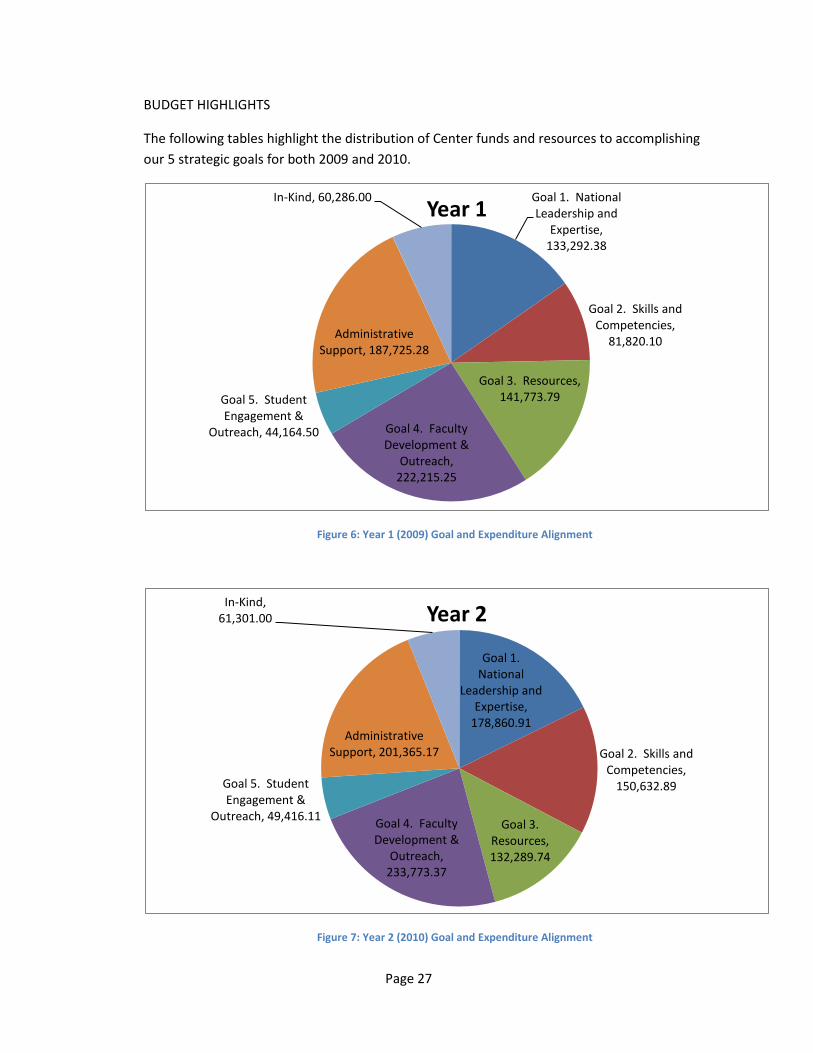
BUDGET HIGHLIGHTS
The following tables highlight the distribution of Center funds and resources to accomplishing our 5 strategic goals for both 2009 and 2010.
Figure 6: Year 1 (2009) Goal and Expenditure Alignment
Figure 7: Year 2 (2010) Goal and Expenditure Alignment
Goal 1. National Leadership and
Expertise, 133,292.38
Goal 2. Skills and Competencies,
81,820.10
Goal 3. Resources, 141,773.79
Goal 4. Faculty Development &
Outreach, 222,215.25
Goal 5. Student Engagement &
Outreach, 44,164.50
Administrative Support, 187,725.28
In-Kind, 60,286.00Year 1
Goal 1. National
Leadership and Expertise,
178,860.91
Goal 2. Skills and Competencies,
150,632.89
Goal 3. Resources, 132,289.74
Goal 4. Faculty Development &
Outreach, 233,773.37
Goal 5. Student Engagement &
Outreach, 49,416.11
Administrative Support, 201,365.17
In-Kind, 61,301.00 Year 2