National Parks & Wildlife Service - NSW Environment & Heritage · In 2005 a cooperative project...
24
Environment, Climate Change & Wate r National Parks & Wildlife Service
Transcript of National Parks & Wildlife Service - NSW Environment & Heritage · In 2005 a cooperative project...

Environment,Climate Change & WaterNational Parks & Wildlife Service


Acknowledgements
In 2005 a cooperative project managed by the National Parks and Wildlife Service and combining the resources of the then Department of Environment and Conservation, the Metropolitan Local Aboriginal Land Council (MLALC), the Sydney Harbour Federation Trust (SHFT) and Mosman Council undertook an Aboriginal heritage study of the Mosman Local Government Area. The Australian Museum Business Services (AMBS) and the MLALC carried out the study.
This work is a simplification of the AMBS 2005 Final Report, Aboriginal Heritage Study of the Mosman Local Government Area, Volume 4 (public access volume).
Illustrations and images
The photos used are sourced from the Department of Environment, Climate Change and Water photo library, Mosman Council and Aboriginal Heritage Office.
© 2010 State of NSW and Department of Environment, Climate Change and Water NSW
The State of NSW and Department of Environment, Climate Change and Water NSW are pleased to allow this material to be reproduced in whole or in part, provided the meaning is unchanged and its source, publisher and authorship are acknowledged.
Published by:
Department of Environment, Climate Change and Water NSW 59 Goulburn Street, Sydney PO Box A290, Sydney South 1232 Phone: (02) 9995 5000 (switchboard) Phone: 131 555 (environment information and publications requests) Phone: 1300 361 967 (national parks information and publications requests) Fax: (02) 9995 5999 TTY: (02) 9211 4723 Email: [email protected] Website: www.environment.nsw.gov.au
ISBN 978 1 74232 852 2 DECCW 2010/589 December 2010

ContentsForewordIntroduction .............................................................................................................. 1Geology and topography......................................................................................... 3Flora and fauna ........................................................................................................ 4 Use of the landscape ............................................................................................... 5Bungaree’s Farm........................................................................................................ 7
Indigenous people of Mosman ............................................................................... 7Language groupings .................................................................................................. 7
Material culture......................................................................................................... 8Archaeological sites ................................................................................................ 8Types of sites ............................................................................................................. 9
Middens...................................................................................................................... 9
Archaeological deposits ........................................................................................... 10
Engravings ............................................................................................................... 11
Pigment art............................................................................................................... 12
Burials ...................................................................................................................... 12
Grinding grooves...................................................................................................... 13
Patterns of site distribution in the Sydney region and Mosman ....................... 13Middens.................................................................................................................... 13
Rock art.................................................................................................................... 14
Pigment art............................................................................................................... 14
Engravings ............................................................................................................... 14
Cultural landscape ................................................................................................. 15Movements............................................................................................................... 15
Ceremonial............................................................................................................... 16
Conclusion.............................................................................................................. 16References.............................................................................................................. 17More information.................................................................................................... 17

ForewordMosman has a rich Aboriginal heritage with over one hundred recorded sites. Evidence of Aboriginal occupation can be found in all landforms across the municipality. The rock art contains an impressive range of engraved and painted figures, including hand stencils, whales, fish, kangaroos and ancestral beings and shell middens line the foreshore providing glimpses into the past.
It is hoped that this book will give local residents and others an insight into and appreciation of the rich Aboriginal heritage of the Mosman area.
Engraving of an eel, Beauty Point Public School

Aboriginal Heritage of Mosman
1
Introduction The Sydney region has one of the richest suites of archaeological sites of any major city in the world. These sites contain a wealth of different artefacts and materials which provide invaluable and essential data for any research into the life and customs of the original inhabitants of the region (Attenbrow 2002).
People have lived in the Sydney area for a long time.
When did humans first arrive in Australia? There is no firm answer to this although most academics agree that it lies somewhere between 40,000 and 60,000 years ago. A potential date for the Sydney region of 40,000 years was taken from Cranebrook Terrace on the Nepean River. However most samples dated by geochronology are much more recent being less than 15,000 years old and concentrated in the last 2500 years. The nature of this human occupation has changed through time according to the environmental conditions and the type of society that existed.
Prior to European arrival in 1788, the Indigenous culture and society was rich and complex with many languages and customs and strong links to the land. Sadly much of that heritage was lost in the disruption and destruction that accompanied the arrival of the British. With the occupation of their country, loss of traditional hunting lands and the introduction of new diseases, the Indigenous population was decimated. Smallpox had a particularly devastating effect with as much as half the population perishing. Much of our knowledge about this time comes from records kept by the early British settlers which are fragmented, often confusing and sometimes conflicting. This is not to suggest, however, that the Indigenous culture has disappeared or the original inhabitants of Sydney are now extinct.
This book is intended to provide a guide to the Aboriginal heritage of the Mosman area of Sydney. It aims to describe the wealth of archaeological material that existed before the arrival of Europeans, and remains in the landscape today.
The archaeology tells us something of where people lived, what they ate, the sorts of equipment they possessed and the links between groups, while the engravings and pigment art offer a tantalising glimpse of Indigenous social activity and belief systems.
This heritage is important to us all, not just the Indigenous people who still live in the area and hold the stories handed down to them. Through this heritage we can begin to understand how those peoples of earlier times lived in harmony with nature and their environment – ways which we could well heed today.
We are lucky that there is still much that remains, but we must also take responsibility to ensure that further damage is avoided. Mosman is fortunate in that a generous portion of its area comprises reserves, particularly along the foreshore, where the chance of preservation is higher. The origin of these reserves relates to the defence of the harbour against a series of perceived threats from foreign powers through the nineteenth and twentieth centuries. These reserves preserve more of the natural landscape, biotic and cultural features than areas which became suburban.
Sadly, the traditional cultural heritage is far less well known.

Aboriginal Heritage of Mosman
2
Engraving of a fish at Middle Head, Sydney Harbour National Park

Aboriginal Heritage of Mosman
3
Geology and topography The story begins with the underpinnings of the landscape: its geology.
The geology of the Sydney region is dominated by the flat-lying sediments of the Sydney Basin which were deposited long ago during the Permian and Triassic periods. In Sydney the sequence of sediments from oldest (deepest) to youngest (shallowest) is divided into: the Narrabeen Group Sandstones and Shales, the Hawkesbury Sandstone and Wianamatta Group shales. The Hawkesbury Sandstone forms spectacular outcroppings along the headlands of much of the harbour foreshore.
Geographically, Mosman forms the end of a broad tongue of land bounded by the water bodies of Middle Harbour to the north and Port Jackson to the south. The area has three distinct peninsulas or heads extending beyond the embayed central area: the Spit and Bradleys Head projecting to north and south and Middle Head to the east. The eastern end of Middle Head faces the entrance to Sydney Harbour and is thus that part of the harbour most influenced by the ocean.
It must be remembered that the current arrangement of land and sea is only relatively recent. Sea levels stabilised around 6000 years ago when the last of the ice melt caused adjustment to the sea levels on the continental shelves. Around 18,000 years ago when the Ice Age was at its height, sea level was 130 metres lower than today and Sydney Harbour was a series of narrow river valleys draining to a coastline 15 kilometres to the east. The terrain would have been similar to the Blue Mountains of today.
Mosman itself forms the end of a peninsula between Port Jackson and Middle Harbour that is mostly composed of Hawkesbury Sandstone. The ridge rises to 80 m above sea level. A spur runs northward to The Spit which forms the narrowest part of Middle Harbour while to the south-east a plateau lies in an arc between the projections of Bradleys and Georges Heads. Wianamatta Shale caps the Hawkesbury Sandstone in this area. The coastline is irregular with many indentations.
Soils tend to be thin and sandy over the Hawkesbury Sandstone and there are numerous rocky outcrops. The small area of Wianamatta Shale produces a more nutrient-rich soil which supports a different vegetation community.
The geology of this region was one of the resources that the Indigenous people relied upon. The sandstone bedrock provided overhangs and rock shelters where people could live, protected from the worst of the elements. Sandstone lying at the surface provided opportunities to engrave significant motifs and sharpen tools. Rock holes in the surface stored water.
Apart from the sandstone and shale described above, the only other rock found in the Mosman area is a volcanic dyke which runs north-south between Cobblers Beach and Obelisk Beach. Evidence is not clear whether this was used as a source of stone for tools and/or weapons.
There are other rock types present in the greater Sydney area. Small volcanic intrusions are scattered across the region: in outcrops they tend to be very weathered with limited exposure of rock suitable for ground-edged tools. There are also several silcrete deposits. One major source of useful stone is the gravels of the Hawkesbury–Nepean Rivers.
Aboriginal Heritage of Mosman
4
Gravels are already sorted by size and hardness and gathered from a large source area so that selection of a potential blank for a tool is much easier than trying to extract the native stone from an already well-weathered outcrop. The Hawkesbury Sandstone is quite coarse-grained in places and contains conglomerate lenses which offered another source of pebbles for making stone tools.
The water in the harbour becomes less saline away from Sydney Heads as increasing amounts of freshwater intermingles. Middle Harbour and the southern branch of Port Jackson can be subdivided into estuarine and ocean-influenced portions. The Spit and Bradleys Head mark the boundaries between estuarine to the west and ocean-influenced to the east. As the sorts of aquatic fauna differ between these environments, the archaeological record of the east and west show this variation.
Flora and fauna The vegetation of Mosman prior to British impact included the sandstone community types called heath, woodland and forest. On the central ridge and the more sandy soil extending down to the harbourside slopes there would have been eucalypt woodland with bangalay (Eucalyptus botryoides), Sydney peppermint (E. piperata)and the smooth-barked apple (Angophora costata). Areas with shallow sandy soils would have been woodland with scribbly gum (E. haemastoma), red bloodwood (E.gummifera) and Banksia serrata.
The Bradley Bushland Reserve (formerly part of Rawson Park) preserves a remnant of the heath vegetation which was once common on the exposed sandstone ridges around Sydney. Here large scrubby heath species like heath-leaved banksia (Banksia ericifolia), tick bush (Kunzea ambigua) and Allocasuarina distyla dominate.
The harbourside features a variety of acacia, banksia and leptospermum species. Today much of the wetter areas are heavily invaded by introduced species such as lantana and privet.
We do not know exactly how much the vegetation was modified by Indigenous management of the landscape other than to say it was definitely partly shaped by human activity.
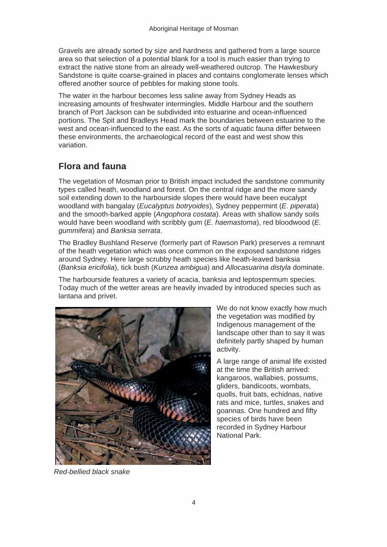
A large range of animal life existed at the time the British arrived: kangaroos, wallabies, possums,gliders, bandicoots, wombats, quolls, fruit bats, echidnas, native rats and mice, turtles, snakes and goannas. One hundred and fifty species of birds have been recorded in Sydney Harbour National Park.
Red-bellied black snake
Aboriginal Heritage of Mosman
5
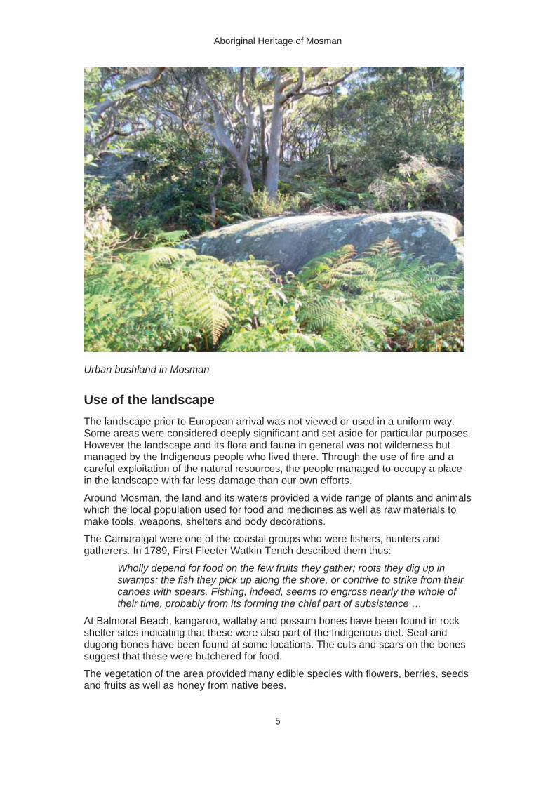
Urban bushland in Mosman
Use of the landscape The landscape prior to European arrival was not viewed or used in a uniform way. Some areas were considered deeply significant and set aside for particular purposes. However the landscape and its flora and fauna in general was not wilderness but managed by the Indigenous people who lived there. Through the use of fire and a careful exploitation of the natural resources, the people managed to occupy a place in the landscape with far less damage than our own efforts.
Around Mosman, the land and its waters provided a wide range of plants and animals which the local population used for food and medicines as well as raw materials to make tools, weapons, shelters and body decorations.
The Camaraigal were one of the coastal groups who were fishers, hunters and gatherers. In 1789, First Fleeter Watkin Tench described them thus:
Wholly depend for food on the few fruits they gather; roots they dig up in swamps; the fish they pick up along the shore, or contrive to strike from their canoes with spears. Fishing, indeed, seems to engross nearly the whole of their time, probably from its forming the chief part of subsistence …
At Balmoral Beach, kangaroo, wallaby and possum bones have been found in rock shelter sites indicating that these were also part of the Indigenous diet. Seal and dugong bones have been found at some locations. The cuts and scars on the bones suggest that these were butchered for food.
The vegetation of the area provided many edible species with flowers, berries, seeds and fruits as well as honey from native bees.

Aboriginal Heritage of Mosman
6
Sydney Harbour contains a diverse range of environments from which to gather food. The harbour ranges from freshwater through estuarine to marine along the various channels, allowing a greater number of habitats for aquatic life. The landscape was also diverse with plateaus, steep slopes, narrow forested valleys and inland river valleys.
Woodland and forest animals hunted by Indigenous people included kangaroos, wallabies, possums, gliders, echidnas, bandicoots and fruit bats as well as birds, snakes, goannas and other lizards. Birds’ eggs were also eaten.
On the foreshore and from the sea, fish, eels, seals, turtles, beached whales, crustacea (crabs and crayfish) and shellfish would have been collected. Shellfish were collected along the shoreline and in freshwater environments. Shellfish are more common and diverse in salty water compared with freshwater.
Fish were abundant and formed a significant component of the diet – often being described as the main food source. The further from the coast the more land species would dominate the meat component of the diet.
A site on Balmoral Beach was excavated and produced a diverse range of bones that provide a clue to the diet of the local inhabitants. Fish included morwong, jackass fish, shark, luderick, eastern blue groper, parrotfish, leatherjacket, weed whiting, flathead, dusky flatheads, eastern wirrah, rock cod, bream, snapper and tarwhine.
Mammals used for food included dingo, marsupial mouse, euro, swamp wallaby, kangaroo, rat/mouse, bandicoot, possums, potoroo and the introduced cow, sheep, pig and house mouse. Lizards included goanna and blue-tongue skink. Birds and frogs were also eaten.
There are over two hundred species of plants that possess edible components such as fruit, seeds, tuber/root/rhizomes, leaves, flowers and nectar. Mosman and indeed the rest of Sydney was rich in such food resources which would have contributed to the diet of the people living there.
The Europeans did not observe the harvesting of plant resources to the same extent as the more obvious activities of fishing and shellfish gathering along the foreshoreareas. Plants were also used as sources of material to manufacture tools and equipment, for example wood and grass tree stems for digging sticks and spear shafts; bark for blankets and canoes; gum for glues; and grass stems and similar to make cord for baskets.
Indigenous people camped in areas that provided shelter and were near to food andwater. They may have taken advantage of existing shelter such as overhangs, constructed their own out of bark, branches and leaves, or slept out in the open. A campsite may have been occupied for a single night or for some weeks depending on why they were in the area. The British noted that these camps were often located along the foreshore and that rock overhangs were commonly occupied as shelters.

Aboriginal Heritage of Mosman
7
They take up their lodgings for a day or two in a miserable wigwam, which they make of the bark of a tree …
On the sea-coast the huts were larger, formed of pieces of bark from several trees put together in the form of an oven with an entrance, and large enough to hold six or eight people. Their fire is always at the mouth of the hut, rather than without … Besides these bark huts, they made use of the excavations in the rock … (Watkin Tench 1793)
Bungaree’s Farm
With the arrival of Europeans, the landscape changed significantly. Parts of Mosman were used for the whaling industry. Farming also started with the establishment in 1815 of a farm by Governor Macquarie on Middle Head for Indigenous families with an Aboriginal named Bungaree in charge.
As well as his fame for circumnavigating Australia with Flinders, Bungaree also acted as an effective intermediary between the colonists and Aborigines. The aim of the farm was to ‘acculturate’ a group of 16 families while allowing them access to their traditional way of life. Although Bungaree did spend some time there, most of the families quickly abandoned the scheme and moved elsewhere.
Indigenous people of Mosman The Indigenous people of Australia were not, and are not, culturally uniform or monolingual. There were hundreds of languages and many ways of living and complex social interactions between groups across the country – for comparison just think of the diversity of language and culture in Europe and Asia. Trade in particular items like ochre and greenstone ground-edged hatchet heads was carried out across hundreds of kilometres along particular routes. Early Europeans found it hard to grasp the complexity of the social systems they encountered.
The size of the Indigenous population around Mosman in 1788 is not known but is thought to number a few thousand. However the smallpox epidemic of 1789 is believed to have decimated at least half of this.
For a community that traditionally passed down information orally this loss of population was like losing libraries, schools and universities. Such a calamity destroyed the existing social structure and made resistance to what was perceived as an invasion increasingly difficult. A landscape in places now largely void of human life also added to the newcomers’ perceptions of a land ripe for colonisation.
Language groupings As with European and Asian races, Aboriginal people are defined by their language groupings. It seems there were two dominant languages spoken in the Sydney region: Darug and Tharawal (or Dharawal). Guringal was considered to be a third language, covering northern Sydney, but is now thought more likely to be a coastal Darug tongue. Darug was spoken in two main dialects: one along the coast and another in the hinterland (west of present-day Parramatta). Coastal Darug or Guringal covered the Sydney peninsula to the north of Botany Bay and north of Port Jackson, possibly as far as Broken Bay. Tharawal was spoken south of Botany Bay to the Shoalhaven River.

Aboriginal Heritage of Mosman
8
So who lived in the area we now know as Mosman? The answer is not clear. People belonged to small groups (territorial clans) which related them spiritually to specific tracts of land. The inhabitants of a particular place were called the same name with the addition of a suffix ‘–gal’. Today’s Mosman area included the country of Cammeray which was where the Camaraigal (alternatively Cam-mer-ray-gal or Gamaragal) lived. This area is variously and vaguely defined as the north shore of Port Jackson, the north-west part of the harbour, the bay of Cameera.
To the west, on the north side of the Parramatta River, lived the Wallumedegal people, again with a number of spelling variants.
The Borogegal, another group, were apparently located east of the Camaraigal but also on the north side of Port Jackson and the western side of Middle Harbour. It seems probable that the Borogegal were associated with Booragy/Burogy (which is now called Bradleys Head) although this land has also been referred to as being part of the country of the Camaraigal. Perhaps the Camaraigal land did not extend as far east as Bradleys Head.
Material culture Indigenous inhabitants used a wide range of specialised tools in their day-to-day activities. Fishing was undertaken with spears, shell hooks and lines and fish traps. On land, hunters used spears, clubs, traps and snares. Foods were gathered using wooden digging sticks and carried in net bags or bark baskets.
Spears were thrown with the aid of spear-throwers and differed according to the particular activity. Tools often combined different materials: for example hardwoodspears might also have points or barbs made of bone or shell.
The fish-gigs and spears are commonly (but not universally) made of the long spiral shoot, which arises from the top of the yellow gum-tree, and bears the flower: the former have several prongs, barbed with the bone of kangaroo …(Watkin Tench 1793)
As many of the tools of the Indigenous people were made of wood, none or very few of these survive years of exposure and burial. However bone, shell and stone artefacts are often unearthed.
Stone tools form a significant part of the archaeological record. These include both flaked and ground-edge forms although ethnographic accounts only record use of the latter (as hatchet heads). Much of the material dug up comprises the stone waste fragments produced when working with stone to make a tool.
Archaeological sites Over 100 Aboriginal sites are recorded in the Mosman area, a reflection of the strong interaction between Indigenous people and their natural world. It is not possible to comprehend the significance purely through archaeological remains. Information about societies and day-to-day activities has been gleaned through a combination of early contact accounts and intergenerational knowledge of Indigenous people still living in the area.

Aboriginal Heritage of Mosman
9
Artefacts found in the Mosman area
Types of sites Archaeological sites are localities where some form of material remains can be associated with past human activity. They can be a deposit built up over time or a scarred tree that represents a short-term event. Archaeological sites are either open or closed. Open sites are those in exposed locations. Closed sites are found in some form of natural shelter such as an overhang or boulder. By their nature they often preserve materials for a longer period and are less likely to be damaged by development than open sites. Closed sites also preserve a wider range of materials, including pigment art.
An archaeological site might have one or more distinctive form of remains, as explained in the following brief description of the various types of sites.
MiddensMiddens are essentially old rubbish heaps where discarded materials were thrown, building up into some form of deposit that survives into the present. Shell, animal bone, ochre, stone artefacts, charcoal and even human remains may be present in midden deposits.
The predominant type of midden in the Sydney area is the shell midden. A shell midden is mostly an accumulation of discarded shells along with a smaller proportion of whatever other material was disposed of at the time the midden was in use. Middens vary widely in size and can be just a few shells collected together in an area. A midden may represent a single meal or an accumulation over a long period of time involving many different activities. Middens are thus very helpful records of materials that were used and things eaten.

Aboriginal Heritage of Mosman
10
Shell middens can be found in the open such as on sandstone rock surfaces or within a rock shelter. Such middens tend to be found close to the shore and near estuarine or ocean-influenced waters rather than freshwater. This is because the edible shell fauna is greater and more diverse in such waters and once collected the shells were quickly stripped of flesh and discarded rather than being carried long distances. Shell middens today mostly survive on public lands where development has not destroyed them.
Shell middens in open areas can be covered by undergrowth and hard to spot. As shells will gradually break down when exposed to the elements, a shell midden has a finite lifespan. If there is significant erosion, such as on a slope, the midden may be quickly dispersed. You should not walk on or dig into a midden as these actions will speed up this process of destruction.
A midden site in Mosman
Archaeological deposits Archaeological deposits are any sediments that contain material related to human activity, such as stone artefacts, charcoal, ash, ochre, animal bones, and human and plant remains. Where shell is the dominant material, it is considered to be a shell midden (see above).
Archaeological deposits are found both in open and closed shelter sites. As with shell middens these deposits can vary greatly between contexts. In open sites they may be artefact scatters consisting of a few to thousands of individual artefacts. Open sites are subject to erosion over time and so a collection of artefacts may represent a long period of accumulation and yet have artefacts of different ages close to one another. Closed sites do not usually suffer erosion and so preserve a complex stratigraphic history. Yet the horizontal extent is limited by the size of the shelter.

Aboriginal Heritage of Mosman
11
EngravingsAn engraving is some form of image which has been pecked or carved into a rock surface.
The Sydney region is well represented due in part to the excellent surface provided by Hawkesbury Sandstone. Aboriginal engravings vary in the size and nature of the image represented. They can be figures representing animals or small abstract geometric forms.
The location of engravings is usually quite selective in terms of topography and geology. In the Sydney region engravingstend to be located on the tops of Hawkesbury Sandstone ridges where vistas occur.
The location of an engraving seems to affect what sort of engraving was made: those in higher positions are more formal in style than those in lower areas. Formality can be described as how similar and consistent the
artwork is. It is suggested that this formality reflects ceremonial activity while the less formal style relates to domestic use.
On parts of North Head in the same location as Aboriginal engravings, there are now many more recent engravings made by the crews of vessels stranded under quarantine. In some cases an Aboriginal motif lies right beside a newer record of a ship or crew member.
An engraving at Middle Head, Sydney Harbour National Park

Aboriginal Heritage of Mosman
12
Pigment art Unlike engravings, pigment art is the application of material to a stone or similar hard surface to leave a distinct impression. The materials used had to be accessible, provide a good visual appearance and have reasonable lasting properties. The materials may be wet or dry when used and can be applied by painting, drawing, stencils and printing. Ochre, charcoal and pipeclay are common pigments.
It is worth remembering that such pigments were also used to decorate human skin and timber objects but no archaeological record of this activity is preserved. The pigment art in the Sydney region is now mostly found in shelter sites and may have only a single motif such as a hand stencil or hundreds of different coloured and sized motifs.
In general it seems that pigment art is found more often in areas associated with the gathering of food and camping.
Pigment art in a cave in Mosman
BurialsBurials are locations where human skeletal remains are present. Like shell material, bones survive best where the surrounding deposit is alkaline, so middens and parts of the sandy foreshore potentially could preserve human bone. There are three recorded burials in the Mosman area.
Burials are highly significant to human society. As with our society today the ground in the area of the burial is given special status. Following the ignorant and insensitive practice of collection in the past, many skeletons were excavated and deposited in museums around the world. A process of repatriation is ongoing between museums and the Indigenous communities concerned.

Aboriginal Heritage of Mosman
13
Grinding grooves Grinding grooves are cut into the sandstone bedrock by the repeated grinding action of some material against the stone. In the Sydney district this usually involved working with stone tools rather than food processing. The grooves differ in width, depending on what material was being ground. No grinding grooves have been found in the Mosman area and this is consistent with the general lack of such grooves in the coastal parts of Sydney.
Patterns of site distribution in the Sydney region and Mosman From the nature of the archaeological record we can look at the patterns in the distribution of the sites and learn what these patterns tell us about the society and culture of the people who lived here.
MiddensPrevious studies indicate that middens are found in association with estuarine or ocean-influenced waters, mostly on Hawkesbury Sandstone and in areas of undeveloped bushland. Mosman foreshore areas possess all of these features and middens are the most common archaeological type associated with over 60% of sites. We can compare the locations of middens in the whole Port Jackson catchment area with those in Mosman and find a close match:
Over half of all middens in the Port Jackson catchment and two-thirds of those in Mosman are located in rock shelters.
Over half of all middens in the Port Jackson catchment and more than two-thirds of those in Mosman are located within 10 m of the foreshore.
Less than a quarter of all middens in the Port Jackson catchment and a somewhat greater proportion in Mosman occur on ridge sides.
Only a few middens in the Port Jackson catchment and a somewhat greater proportion in Mosman are found on ridge tops.
Middens in Mosman show the least degree of variability of archaeological sites. Activities associated with middens are more uniform and strongly relate to the environment in which they occur. The types of shellfish in the midden relate to the salinity of the water. Middens are most commonly found along the foreshore although more are now being discovered on the slopes above. Some of the open middens are large. The size and number of these reflect the importance of shellfish collection to the local people.
The present-day distribution of middens seems to fairly closely resemble the pattern of camping recorded in the historical literature and not just what survived urban development. It is now thought that development is not as big a modifying factor as previously estimated.
In certain places there are concentrations of shell middens. Such places would have been the camping sites for a number of families.

Aboriginal Heritage of Mosman
14
Rock art The style of rock art in the Sydney region, both engraving and pigment, is described as simple figurative. Most of the images present are plain silhouettes of animal or human models. This style of art is typical of the last 3000 years in the region and is associated also with the development of shell middens.
What is distinctive about the Sydney region is that the engravings and pigment art were done at the same time whereas elsewhere in Australia there is a time difference. While the style of the two forms of rock art is similar, the objects selected are quite distinctive. In Mosman we find clear differences in the types of motif found compared with the broader Sydney area.
Pigment art In the Sydney region hand stencils form half the examples of pigment art recorded and over 80% of the Mosman pigment art. Regionally, macropods and humanoid figures are the next most common forms while only macropods are recorded in Mosman. Around the rest of Sydney, motifs rarely included marine animals and material objects such as boomerangs. However in Mosman there are more motifs which fall into this category due
to its coastal location. More than two-thirds of pigment art is found on hill slopes where large rock shelters occur and in Mosman this proportion is even higher.
Like middens, the location of pigment art sites is linked to the local environment. There is a pattern to their placement in the landscape. The archaeological deposit associated with the art also reflects the local environment. For example, shells within the deposit match the salinity of the water in the vicinity. On the other hand, the particular motifs present at a given site and across the sites do not show any pattern. Rather, the motifs seem to reflect individual acts without any organisation.
EngravingsOne-third of regional engravings in the Sydney area are bird or animal tracks while only one example of this type is recorded in Mosman. The next most common regional engraving (one-fifth) is of marine animals whereas in Mosman two-thirds are marine animals.
The pattern of distribution of engravings is affected by the environment in a different way from middens. Middens closely reflect the local environmental resources while engravings are tied more to the visual position in the landscape of the place rather than any particular resource.
A second difference is that engraving sites differ from one another. Engravings on horizontal surfaces are distinct from those made on vertical

Aboriginal Heritage of Mosman
15
surfaces. While the action of making an engraving is the same, the behaviour associated with the action seems to vary.
The choice of image can be divided between those found at lower elevations in the landscape (which are also mostly vertical) and those at higher elevations. The lower engravings are more varied compared with the higher. This variation seems to reflect different behaviour: individual and thus mixed versus more communal and integrated.
Mosman has four main areas of engraving (north-west, south-east, east and inland) each of which is different. The north-west (Quakers Hat Bay area) and south-east (Bradleys and Chowder Heads) dominate and indicate a dual focus for engraving activity. This duality may reflect the historical accounts of two possible Indigenous clans present in the area – the Camaraigal and Borogegal.
The collection of eastern engraving sites centred on Middle Head is the most distinctive in the Mosman area. The images are all aquatic, located in a particularlydramatic setting, and are not associated with any other type of archaeological site. Other work suggests that such a combination is linked with ceremonial behaviour.
Middle Head is a dramatic place lying at the very eastern end of the peninsula between Middle Harbour and Port Jackson. It should also be remembered that Middle Head is the most ocean-exposed headland within the inner harbour and hence a distinctive geographical place.
Cultural landscape By looking at the archaeology preserved in Mosman we can learn something of the way that the Indigenous people moved across and lived within the landscape.
MovementsThere are archaeological sites to be found everywhere across the landscape. However, the distribution is not random and shows a greater preference for the foreshore area and less for the interconnecting ridge tops.
The location of middens reflects where people spent their time, so the focus of the daily activity of the Indigenous people in Mosman was related to the foreshore resources. People seem to have spent a considerable amount of their time around the pleasant and fruitful foreshore environment. Evidence of cultural activity is less frequent on the upper slopes and ridge tops.
The sparse occupation of ridge tops indicates these areas were probably used as transit sites or for the exploitation of particular resources. People moving to and from and within Mosman used the most convenient and direct routes along the pathways along the ridge tops. Such routes would eventually become the obvious choice for roads constructed by the Europeans. Canoes were also used for transport along the shore and across stretches of water.
The main ridgelines are also dividing lines between different areas of the landscape. They run along the watersheds of the individual catchments and these watersheds also marked social boundaries between Indigenous groups.
The distribution of sites indicates two key areas of Indigenous occupation: north-west and south-east. The difference is visible in the nature of engravings found in the two areas: location in the landscape, selected types of motif and the colour of hand stencil.

Aboriginal Heritage of Mosman
16
This division seems to support the idea that there were possibly two clans in the Mosman area – Camaraigal and Borogegal – as described in the section on Indigenous people.
Ceremonial The Indigenous people hold a sacred concept of land. Places where ceremonies occurred were central in importance to their society. In an archaeological sense such ceremonial places are hard to locate. There is little that is specific in terms of artefacts: instead it is the context that is important. No ceremonial places have been identified by archaeological research alone. The sites we know are those freely shown by the Indigenous people themselves.
ConclusionThe story is not over. These archaeological sites are not permanent features of the landscape and will deteriorate through natural processes. Shells in the middens will break down and become increasingly scattered along with other material like bone. Pigment art will flake or fade from the shelter walls until they can no longer be seen. The stone around the engravings will erode until the figure is no longer visible. Even the rock shelters will be lost as eventually the overhanging rocks collapse.
This process can take thousands of years in normal circumstances but human behaviour may greatly speed up the loss of this cultural heritage through deliberate or accidental acts. So we all need to do what we can to protect these irreplaceable places for future generations.
All Aboriginal sites are protected under state and federal legislation and it is illegal to destroy, damage or remove Aboriginal heritage items. This does not, however, mean if an Aboriginal site is on your property that it will be subject to a land claim, as some rumours would suggest.
Aboriginal communities are working with residents across Sydney to protect sites within properties to make them a feature of the residence. On lands managed by Mosman Council, the National Parks and Wildlife Service and Sydney Harbour Trust, the managers are also working with the Aboriginal community to implement the recommendations of the heritage study and to protect this priceless heritage.
As the local government authority, Mosman Council plays a major role in protection of Aboriginal heritage in Mosman by:
maintaining a comprehensive mapping and information base on sites in conjunction with the Department of Environment, Climate Change and Water
regularly checking the condition of sites under its control and undertaking work to protect sites where necessary
advising land owners and assessing development applications to ensure the protection of sites on private land
in consultation with the Metropolitan Local Aboriginal Land Council and where appropriate, providing marked walking tracks through council reserves with interpretive signs to provide opportunities for residents and visitors to experience and learn about Aboriginal heritage
providing resources on local history and Aboriginal studies for individual and school use through Mosman Library

Aboriginal Heritage of Mosman
17
undertaking community education activities to promote appreciation, respect and protection of Aboriginal heritage
facilitating local events and activities to celebrate Aboriginal heritage and culture through the Northern Sydney Guringal Festival
supporting Mosman Reconciliation which is promoting reconciliation and social justice for Indigenous Australians
working with other councils in northern Sydney to improve social outcomes for Aboriginal people through the Northern Sydney Aboriginal Social Plan
liaising with the National Parks and Wildlife Service, Sydney Harbour Federation Trust, Taronga Zoo Trust and the Metropolitan Local Aboriginal Land Council to ensure a coordinated approach to the protection of Aboriginal heritage in consultation with Aboriginal communities.
The Camaraigal knew this land very well. For them it was home but also the supermarket, the workplace, the school, the university, the church and temple, the cemetery. The intimate knowledge which Indigenous people have of their local area is something that all Australians should value.
Many of us are unaware that so many incredible sites still survive so close to our homes. The Aboriginal heritage of Mosman need not remain a mystery and it is up to all of us to work together to learn more about the land that we call home. If we are to survive on this continent for even another 1000 years, deeply rooted local knowledge may be the critical factor.
The sites of Mosman are not the remains of a long lost culture but the evidence of survival and the signposts showing us how to learn more about our local environment.
ReferencesAMBS 2005, Aboriginal Heritage Study of the Mosman Local Government Area: Final report, Australian Museum Business Services (4 volumes)
Attenbrow, Val 2002, Sydney’s Aboriginal Past: Investigating the archaeology and historical records, UNSW Press, Sydney
More information Aboriginal Heritage Office 39/137 Sailors Bay Road Northbridge NSW 2063 [email protected]
Aboriginal Support Group, Manly–Warringah, Pittwater PO Box 129Narrabeen NSW 2101 Ph: 9913-7940 [email protected]
Aboriginal Heritage of Mosman
18
Australian Museum 6 College Street Sydney NSW 2000 Ph: 9320-6000
Department of Environment, Climate Change and Water NSW (National Parks and Wildlife Service) 59 Goulburn Street Sydney NSW 2000Ph: 9995-5000 [email protected]
Metropolitan Local Aboriginal Land Council 36-38 George Street Redfern NSW 2016 Ph: 8394-9666 [email protected]
Mosman Council 573 Military Road Mosman NSW 2088PO Box 211Spit Junction NSW 2088Ph: 9978-4000 [email protected]
Mosman Library 605 Military Road Mosman NSW 2088 Ph: 9978-4091 [email protected]
Mosman Reconciliation PO Box 211Spit Junction NSW 2088Ph: [email protected]
Sydney Harbour National Park – Harbour North Area Office, Mosman Governors Road Middle Head NSW 2088 Ph: 9960-6266


![[Chap6607]CHAPTER 66:07 NATIONAL PARKS AND WILDLIFE ...](https://static.fdocuments.in/doc/165x107/61af86e186bb3d2b3066142d/chap6607chapter-6607-national-parks-and-wildlife-.jpg)