N 2401/N 2402 New Work Item Proposal - Observation and Sampling schema Simon Cox Research Scientist...
58
N 2401/N 2402 New Work Item Proposal - Observation and Sampling schema Simon Cox Research Scientist 28 May 2008
-
Upload
dominic-berry -
Category
Documents
-
view
217 -
download
2
Transcript of N 2401/N 2402 New Work Item Proposal - Observation and Sampling schema Simon Cox Research Scientist...

N 2401/N 2402 New Work Item Proposal - Observation and Sampling schema
Simon Cox
Research Scientist
28 May 2008
ISO/TC 211 Copenhagen 2008 CSIRO
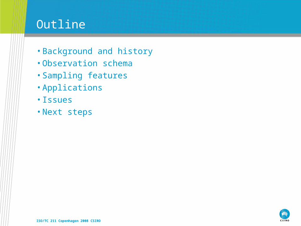
Outline
• Background and history• Observation schema• Sampling features• Applications• Issues• Next steps

ISO/TC 211 Copenhagen 2008 CSIRO
Background & history
ISO/TC 211 Copenhagen 2008 CSIRO
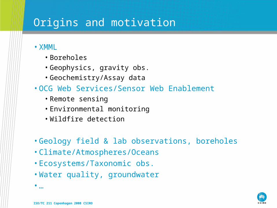
Origins and motivation
• XMML• Boreholes
• Geophysics, gravity obs.
• Geochemistry/Assay data
• OCG Web Services/Sensor Web Enablement• Remote sensing
• Environmental monitoring
• Wildfire detection
• Geology field & lab observations, boreholes• Climate/Atmospheres/Oceans• Ecosystems/Taxonomic obs.• Water quality, groundwater• …

ISO/TC 211 Copenhagen 2008 CSIRO
Motivation for developing a common model
• Cross-domain data discovery and fusion• Re-usable service interfaces

ISO/TC 211 Copenhagen 2008 CSIRO
OGC Sensor Web Enablement
• OGC Web Services testbeds• OWS-1 2001 – OWS-5 2007
• Core elements of OGC SWE suite• SensorML – provider-centric information viewpoint
• O&M – consumer-centric information viewpoint
• SOS, SAS – http interface to observations
• SPS – tasking interface
• sweCommon – data-types & encodings, including coverage encoding
• TML – low-level sensor streams
ISO/TC 211 Copenhagen 2008 CSIRO
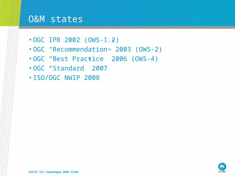
O&M states
• OGC IPR 2002 (OWS-1.2)• OGC “Recommendation” 2003 (OWS-2)• OGC “Best Practice” 2006 (OWS-4)• OGC “Standard” 2007 • ISO/OGC NWIP 2008

ISO/TC 211 Copenhagen 2008 CSIRO
Acknowledgements
• XMML Consortium• OGC testbed sponsors• Geoscience Australia• eWater CRC• CSIRO

ISO/TC 211 Copenhagen 2008 CSIRO
Observation schema

ISO/TC 211 Copenhagen 2008 CSIRO
Science relies on observations
• Provides evidence & validation• Involves sampling

ISO/TC 211 Copenhagen 2008 CSIRO
What is “an Observation”
• Observation act involves a procedure applied at a specific time (Fowler & Odell, 1997ish)
• The result of an observation is an estimate of some property• The observation domain is a feature of interest at or over some
time

ISO/TC 211 Copenhagen 2008 CSIRO
Examples
• The 7th banana weighed 270gm on the kitchen scales this morning
• The attitude of the foliation at outcrop 321 of the Leederville Formation was 63/085, measured using a Brunton on 2006-08-08
• Specimen H69 was identified on 1999-01-14 by Amy Bachrach as Eucalyptus Caesia
• The image of Camp Iota was obtained by Aster in 2003
• Sample WMC997t collected at Empire Dam on 1996-03-30 was found to have 5.6 g/T Au as measured by ICPMS at ABC Labs on 1996-05-31
• The X-Z Geobarometer determined that the ore-body was at depth 3.5 km at 1.75 Ga
• The simulation run on 2004-09-09 indicated that the pressure in the hanging-wall at 618 Ma was reduced 4 MPa

ISO/TC 211 Copenhagen 2008 CSIRO
In “pictures”
ISO/TC 211 Copenhagen 2008 CSIRO
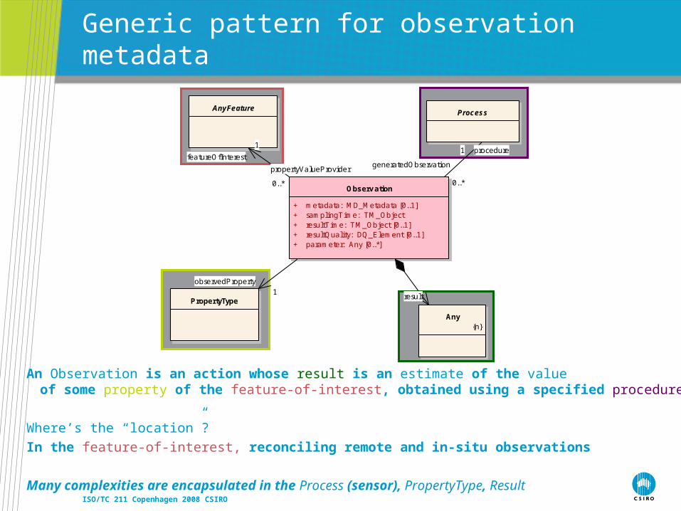
Generic pattern for observation metadata
An Observation is an action whose result is an estimate of the value of some property of the feature-of-interest, obtained using a specified procedure
Where’s the “location”?
In the feature-of-interest, reconciling remote and in-situ observations
Many complexities are encapsulated in the Process (sensor), PropertyType, Result
Observ ation
+ metadata: MD_Metadata [0..1]+ samplingTime: TM_Object+ resultTime: TM_Object [0..1]+ resultQuality: DQ_Element [0..1]+ parameter: Any [0..*]
ProcessAnyFeature
Any{n}
PropertyType
generatedObservation
0..*
procedure1
propertyValueProvider
0..*
featureOfInterest
1
result
observedProperty1
ISO/TC 211 Copenhagen 2008 CSIRO
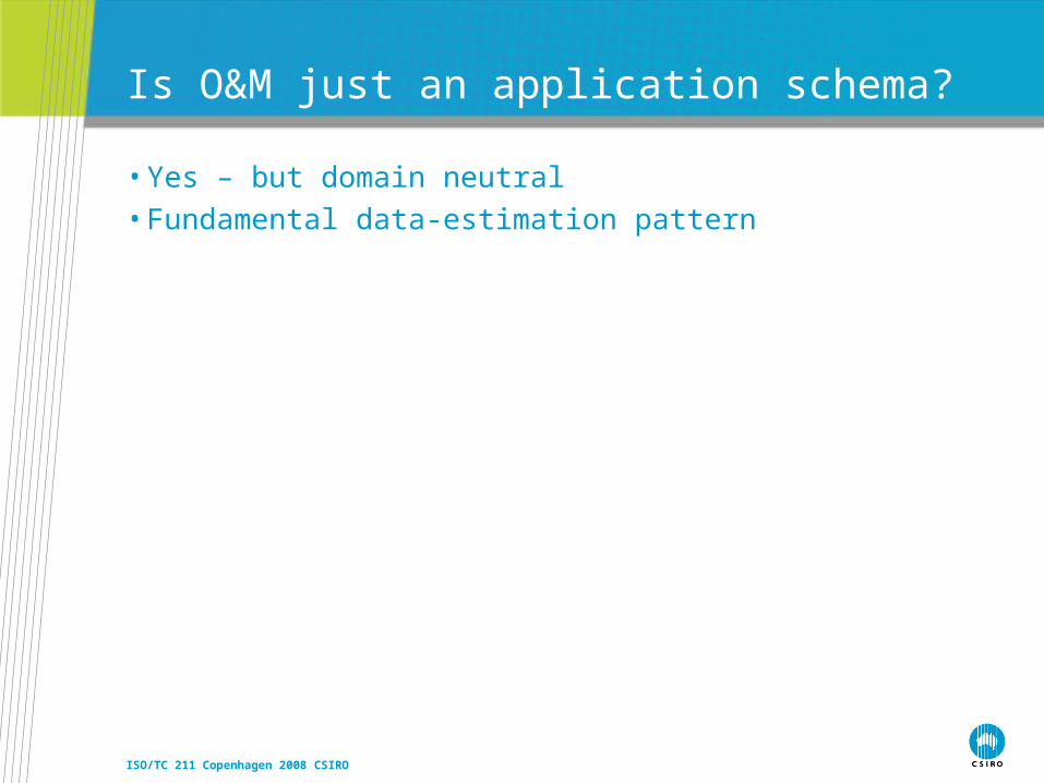
Is O&M just an application schema?
• Yes – but domain neutral• Fundamental data-estimation pattern

ISO/TC 211 Copenhagen 2008 CSIRO
«FeatureType»Observation
+ metadata: MD_Metadata [0..1]+ samplingTime: TM_Object+ resultTime: TM_Object [0..1]+ resultQuality: DQ_Element [0..1]+ parameter: Any [0..*]
constraints{observedProperty must be member or component of member of featureOfInterest}{procedure must be suitable for observedProperty}{result type must be suitable for observedProperty}
«FeatureType»Process
«FeatureType»AnyFeature
«type»Any
{n}
PropertyType
«metaclass»GF_FeatureType
{n}
+ definition: CharacterString+ isAbstract: Boolean = false+ typeName: LocalName [0..1]
«metaclass»GF_PropertyType
{n}
+ definition: CharacterString+ memberName: LocalName
«FeatureType»ObservationCollection
member
1..*
generatedObservation
0..*
procedure1
propertyValueProvider
0..*
featureOfInterest1
result
observedProperty
1
«instanceOf»
1
carrierOfCharacteristics 0..*
«instanceOf»
Observation model is corollary of GFM
Observation role wrt target is propertyValueProvider
result type (and encoding) must be consistent with PropertyType
observedProperty is bound to target type

ISO/TC 211 Copenhagen 2008 CSIRO
Procedure vs. observedProperty
• observedProperty supports discovery by observation users• “show me all the observations of temperature and wind-speed”
• procedure provides strict definition• “how was that value obtained?”
• …or provider-centric discovery• “show me all the data collected by instrument X”

ISO/TC 211 Copenhagen 2008 CSIRO
Some properties vary within a feature
• colour of a Scene or Swath varies with position• shape of a Glacier varies with time• temperature at a Station varies with time• rock density varies along a Borehole
• Variable values may be described as a Function on some axis of the feature
• Corresponding Observation/result is a Function • If domain is spatio-temporal, also known as coverage or map

ISO/TC 211 Copenhagen 2008 CSIRO
Variable property coverage valued result
«FeatureType»PointCov erageObserv ation
«FeatureType»Observ ation
«FeatureType»DiscreteCov erageObserv ation
CV_DiscreteElementCov erage
«FeatureType»ElementCov erageObserv ation
CV_DiscreteTimeInstantCov erageCV_DiscretePointCov erage{n}
CV_Coverage
CV_DiscreteCov erage{n}
«FeatureType»TimeSeriesObserv ation
result
result result result

ISO/TC 211 Copenhagen 2008 CSIRO
Other specializations by result-type
«FeatureType»Observ ation
«FeatureType»Measurement
«FeatureType»CategoryObserv ation
«FeatureType»CountObserv ation
«FeatureType»TruthObserv ation
«FeatureType»ComplexObserv ation
GenericName
«type»ScopedName
{n}
«type»Record
Number
«type»Integer
{n}
«enumeratio...Boolean
{n}
Measure{n}
Type
«type»RecordType
{n}
«FeatureType»GeometryObserv ation
«FeatureType»TemporalObserv ation
«type»GM_Object
{n}
TM_Object{n}
result
record 0..*
recordType 0..1
result
result
result
result
result
result
ISO/TC 211 Copenhagen 2008 CSIRO
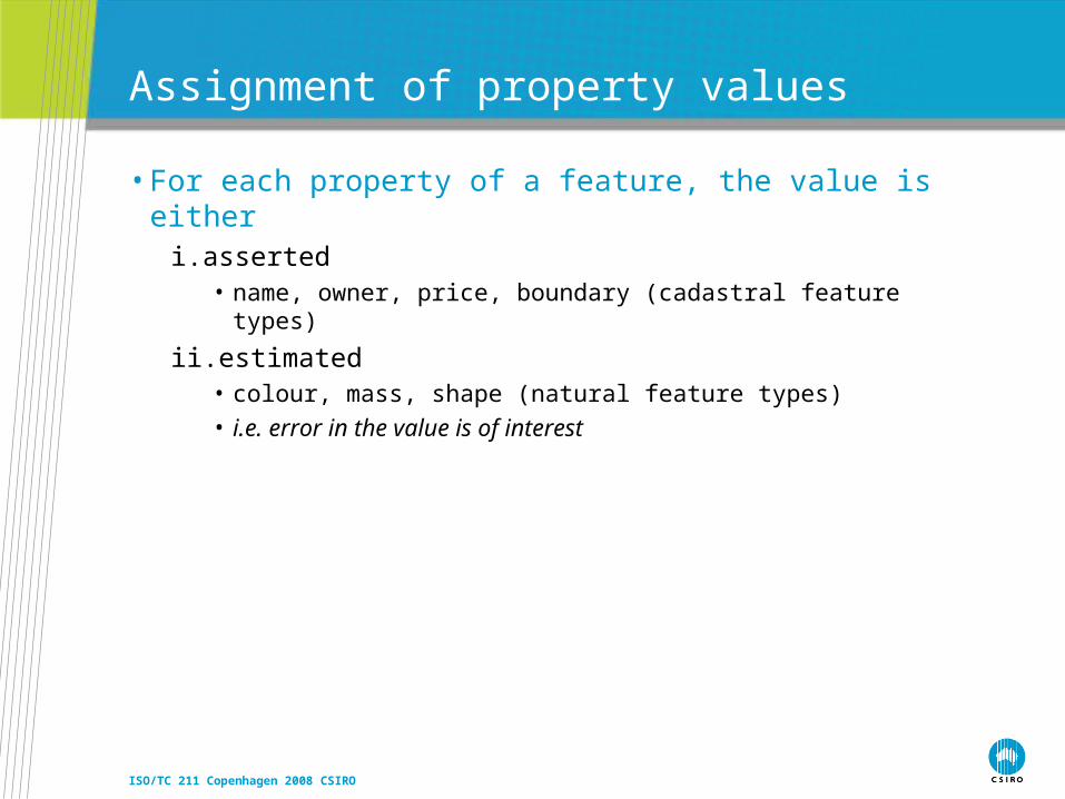
Assignment of property values
• For each property of a feature, the value is eitheri. asserted
• name, owner, price, boundary (cadastral feature types)
ii.estimated• colour, mass, shape (natural feature types) • i.e. error in the value is of interest

ISO/TC 211 Copenhagen 2008 CSIRO
When is the Observation viewpoint interesting?
• If the data-acquisition metadata is of concern

ISO/TC 211 Copenhagen 2008 CSIRO
Sampling features
ISO/TC 211 Copenhagen 2008 CSIRO
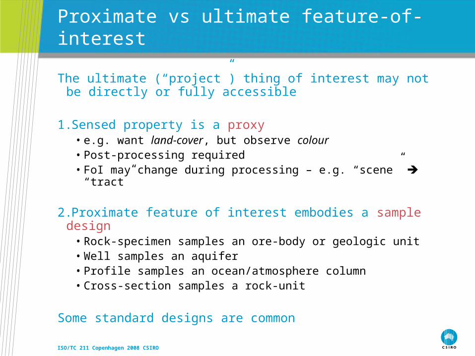
Proximate vs ultimate feature-of-interest
The ultimate (“project”) thing of interest may not be directly or fully accessible
1.Sensed property is a proxy• e.g. want land-cover, but observe colour• Post-processing required• FoI may change during processing – e.g. “scene” “tract”
2.Proximate feature of interest embodies a sample design• Rock-specimen samples an ore-body or geologic unit• Well samples an aquifer• Profile samples an ocean/atmosphere column• Cross-section samples a rock-unit
Some standard designs are common

ISO/TC 211 Copenhagen 2008 CSIRO
«FeatureType»SamplingPoint
+ position: GM_Point
«FeatureTyp...SamplingFeature
«FeatureTyp...Trav erse
«FeatureType»SamplingCurv e
+ length: Measure [0..1]+ shape: GM_Curve
«FeatureType»SamplingSurface
+ area: Measure [0..1]+ shape: GM_Surface
«FeatureTyp...Interv al
«FeatureType»SamplingSolid
+ volume: Measure [0..1]+ shape: GM_Solid
«FeatureTyp...Swath
«FeatureTyp...Section
«FeatureTyp...LidarCloud
«FeatureTyp...Scene
«FeatureTyp...Observ ationWell
«FeatureTyp...Flightline
«FeatureTyp...Station
«FeatureTyp...Trajectory
«FeatureTyp...ShipsTrack
«FeatureType»SpatiallyExtensiveSamplingFeature
«FeatureTyp...Profile
«FeatureTyp...MapSurface
«FeatureTyp...Flitch
Name:Package:Version:Author:
SamplingManifoldpedagogy1.0Simon CoxSampling Manifolds
• N.B. SF provide bounds-for sub-sampling, but not details of their spatial decomposition

ISO/TC 211 Copenhagen 2008 CSIRO
Basic sampling features
SamplingPoint
+ position: GM_Point
SamplingFeature
SamplingCurv e
+ length: Measure [0..1]+ shape: GM_Curve
SamplingSurface
+ area: Measure [0..1]+ shape: GM_Surface
SamplingSolid
+ volume: Measure [0..1]+ shape: GM_Solid
SpatiallyExtensiveSamplingFeature
Observ ation
AnyFeature
Spec imen
SamplingFeatureRelation
relatedOb servation
0..*
Inten tion
sampledFeature
1. .*
relatedSamp lingFeature 0..*
source
0..*
target
Nam e:Package:Version:Author:
Summary diagram: External classes«Leaf» Sampling Features1.0Simon Cox
Domain feature type
ISO/TC 211 Copenhagen 2008 CSIRO
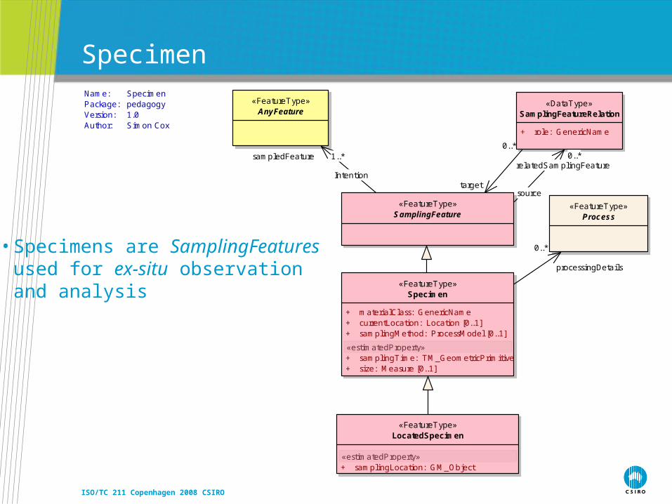
«FeatureType»Specimen
+ materialClass: GenericName+ currentLocation: Location [0..1]+ samplingMethod: ProcessModel [0..1]
«estimatedProperty»+ samplingTime: TM_GeometricPrimitive+ size: Measure [0..1]
«FeatureType»SamplingFeature
«FeatureType»LocatedSpecimen
«estimatedProperty»+ samplingLocation: GM_Object
«FeatureType»Process
«DataType»SamplingFeatureRelation
+ role: GenericName
«FeatureType»AnyFeature
processingDetails
0..*
0..*
target
relatedSamplingFeature0..*
source
Intention
sampledFeature 1..*
Name:Package:Version:Author:
Specimenpedagogy1.0Simon Cox
Specimen
• Specimens are SamplingFeatures used for ex-situ observation and analysis
ISO/TC 211 Copenhagen 2008 CSIRO
Applications

ISO/TC 211 Copenhagen 2008 CSIRO
Boreholes and logs
CV_Coverage
CV_DiscreteCov erage{n}
SpatiallyExtensiveSamplingFeature
Observ ation
SamplingFeature
SamplingCurv e
+ length: Measure [0..1]+ shape: GM_Curve
DiscreteCov era geObserv ation
Bore hole
relatedOb servation
0..*
result
Nam e:Package:Version:Author:
Borehole and logExternally governed packages1.0Simon Cox
ISO/TC 211 Copenhagen 2008 CSIRO
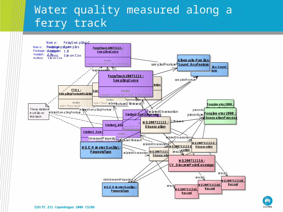
Water quality measured along a ferry track
FerryTrack 20071113 :SamplingCurv e
notesshape=Curve987:GM_LineString
WQ200711113-1 :Observ ation
WQ/C-9 (Water Quality) :PropertyType
Albemarle-Pamlico Sound :AnyFeature
Fooglemeter 2000 :Observ ationProcess
WQ20071113/r1 :Rec ord
WQ200711113-2 :Observ ation
WQ20071113/r2 :Rec ord
WQ200711113-3 :Observ ation
WQ20071113/r3 :Rec ord
Station1 :Sa mplingPoint
notesposition=Point1:GM_Point
Station2 :Sa mplingPoint
notesposition=Point2:GM_Point
Station3 :Sa mplingPoint
notesposition=Point3:GM_Point
FT/S1 :SamplingFeatureRelation
notesrole="host track"
FT/S2 :SamplingFeatureRelation
notesrole="host track"
FT/S3 :SamplingFeatureRelation
notesrole="host track"
These stationsmust l ie on this track
relatedOb servation
target
sampledFeature
target
sampledFeature
featureOfInterest
relatedSamp lingFeature
target
observedProperty
featureOfInterest
proce dure
result
result
relatedOb servation
sampledFeature
relatedSamp lingFeature
sampledFeature
featureOfInterest
proce dure
observedProperty
result
proce dure
observedProperty
relatedSamp lingFeature
relatedOb servation
Nam e:Package:Version:Author:
FerrySam pling-PExamples1.0Simon Cox
FerryTrack 20071113 :SamplingCurv e
notesshape=Curve987:GM_LineString
WQ/C-9 (Water Quality) :PropertyType
Albemarle -Pamlico Sound :AnyFeature
Fooglemeter 2000 :Observ ationProcess
WQ200711113 :Observ ation
WQ20071113/r :CV_DiscretePointCov erage
sampledFeature
relatedOb servationproce dure
featureOfInterest
result
observedProperty
Nam e:Package:Version:Author:
FerrySam pling-CExamples1.0Simon Cox

ISO/TC 211 Copenhagen 2008 CSIRO
Water quality of aquifers observed in wells
Ev ertsWell
Leederv illeFormation
CottesloeWedge
GnangaraMound
Interv a lEW2 :SamplingCurv e
WQ3/1 :Observ ation
WQ2/1 :Observ ation
WQ2/2 :Observ ation
WQ3/1 :Observ ation
EW/EW1 :SamplingFeatureRelation
notesrole="intervalHost"
EW/EW2 :SamplingFeatureRelation
notesrole="intervalHost"
Fooglemeter 2000 :Observ ationProcess
Farkleme ter XP :Observ ationProcess
NWC200 7/WQ :Observ ationCollection
RobsWe ll
Interv a lEW1 :SamplingCurv e
WQ3/1/r :CV_DiscreteTime InstantCov erage
WaterQuality :PropertyType
sampledFeature
relatedSamp lingFeature
sampledFeature
featureOfInterest
relatedOb servation
target
target
proce dure
observedPropertyobservedProperty
proce dure
observedProperty
proce dure
observedProperty
featureOfInterestrelatedOb servation
result
member
relatedOb servation
relatedOb servation
sampledFeature
relatedOb servation
sampledFeature
featureOfInterest
relatedOb servation
sampledFeature
relatedSamp lingFeature
featureOfInterestrelatedOb servationmember
member
memberproce dure
Nam e:Package:Version:Author:
Well&IntervalsExamples1.0Simon Cox

ISO/TC 211 Copenhagen 2008 CSIRO
Specimens and “outcrops”

ISO/TC 211 Copenhagen 2008 CSIRO
Specimen processing chains

ISO/TC 211 Copenhagen 2008 CSIRO
Domain profile
• feature of interest
• Feature-type is taken from a domain-model(e.g. Geology)
«FeatureType»Observ ation
+ procedureParameter: TypedValue [0..*]+ procedureTime: TM_Object [0..1]+ quality: DQ_Element [0..1]+ observationMetadata: MD_Metadata [0..1]+ resultDefinition: CharacterString [0..1]+ samplingTime: TM_Object
«FeatureType»Process
«FeatureType»AnyFeature
«type»Any
{n}
PropertyType
result
propertyValueProvider
0..*
featureOfInterest
1
generatedObservation
0..*
procedure1
observedProperty
1
• observed property
• Belongs to feature-of-interest-type
• procedure
• Standard procedures, suitable for the property-type

ISO/TC 211 Copenhagen 2008 CSIRO
In GeoSciML
SamplingPoint
+ position: GM_Point
SpatiallyExtensiveSamplingFeature
Spec imen
SamplingFeature
SamplingCurv e
+ length: Measure [0..1]+ shape: GM_Curve
Bore hole Outc rop
AnyIdentifiableObject
AnyFeature Observ ation
Inten tionsampledFeature 1. .* relatedOb servation 0..*
Nam e:Package:Version:Author:
Borehole a nd outcropExternally governed packages1.0Simon Cox

ISO/TC 211 Copenhagen 2008 CSIRO
Deployments
• GeoSciML (IUGS Testbed)• Climate Science Markup Language v2 (UK Research Councils)• Water Observations Markup Language (Australia/US)• Various database schemas have been designed to match
• GA, NVCL

ISO/TC 211 Copenhagen 2008 CSIRO
Issues
ISO/TC 211 Copenhagen 2008 CSIRO
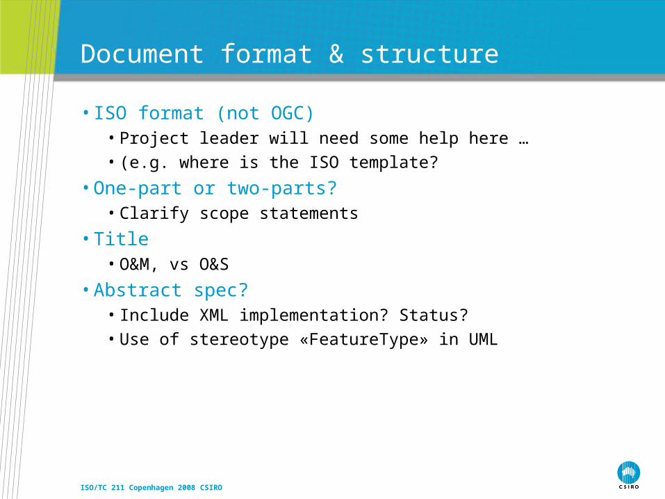
Document format & structure
• ISO format (not OGC)• Project leader will need some help here …
• (e.g. where is the ISO template?
• One-part or two-parts?• Clarify scope statements
• Title• O&M, vs O&S
• Abstract spec?• Include XML implementation? Status?
• Use of stereotype «FeatureType» in UML
ISO/TC 211 Copenhagen 2008 CSIRO
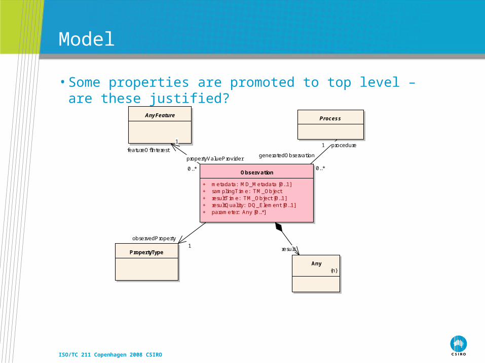
Model
• Some properties are promoted to top level – are these justified?
Observ ation
+ metadata: MD_Metadata [0..1]+ samplingTime: TM_Object+ resultTime: TM_Object [0..1]+ resultQuality: DQ_Element [0..1]+ parameter: Any [0..*]
ProcessAnyFeature
Any{n}
PropertyType
generatedObservation
0..*
procedure1
propertyValueProvider
0..*
featureOfInterest
1
result
observedProperty1
ISO/TC 211 Copenhagen 2008 CSIRO
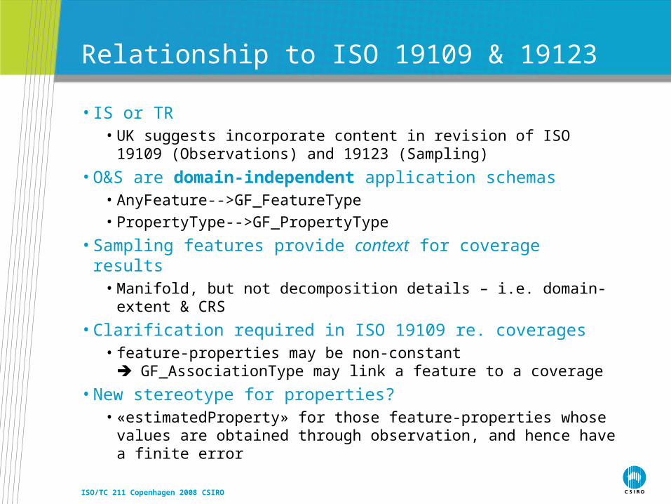
Relationship to ISO 19109 & 19123
• IS or TR• UK suggests incorporate content in revision of ISO 19109
(Observations) and 19123 (Sampling)
• O&S are domain-independent application schemas• AnyFeature-->GF_FeatureType
• PropertyType-->GF_PropertyType
• Sampling features provide context for coverage results• Manifold, but not decomposition details – i.e. domain-extent & CRS
• Clarification required in ISO 19109 re. coverages• feature-properties may be non-constant
GF_AssociationType may link a feature to a coverage
• New stereotype for properties?• «estimatedProperty» for those feature-properties whose values are
obtained through observation, and hence have a finite error
ISO/TC 211 Copenhagen 2008 CSIRO
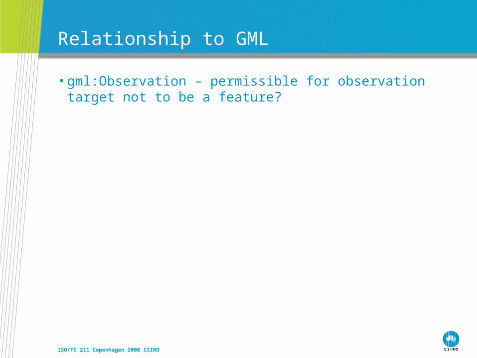
Relationship to GML
• gml:Observation – permissible for observation target not to be a feature?
ISO/TC 211 Copenhagen 2008 CSIRO
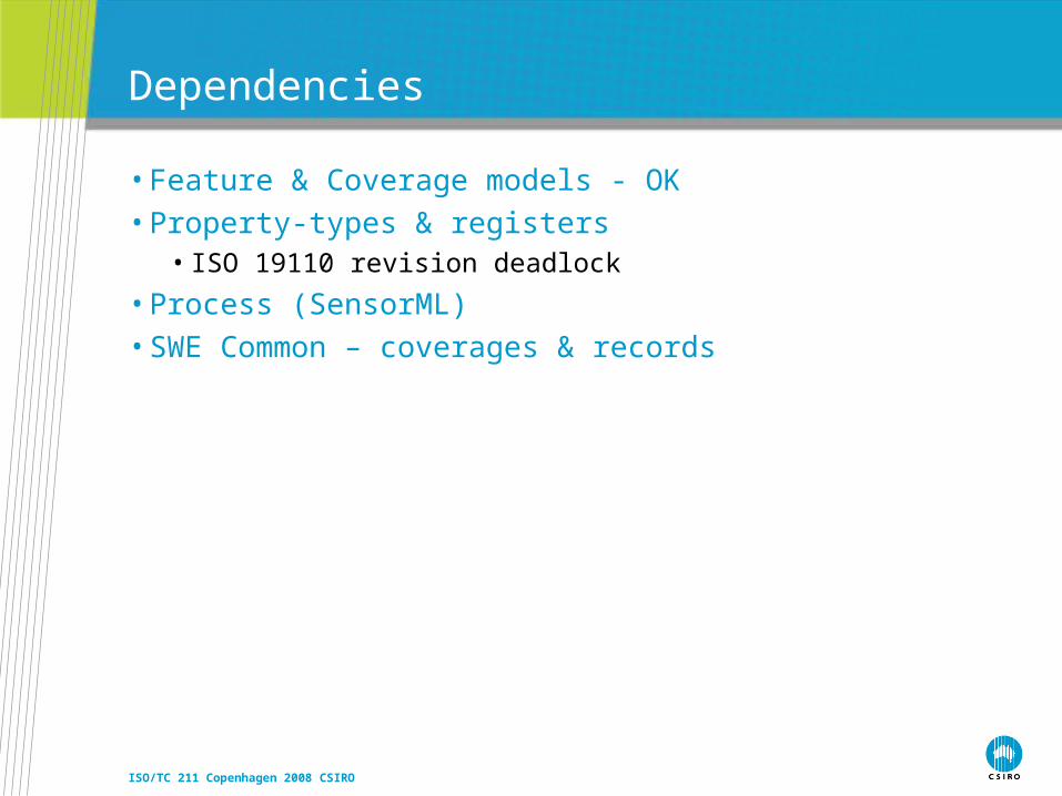
Dependencies
• Feature & Coverage models - OK• Property-types & registers
• ISO 19110 revision deadlock
• Process (SensorML)• SWE Common – coverages & records

ISO/TC 211 Copenhagen 2008 CSIRO
Next Steps?

Thank you
Exploration & MiningSimon CoxResearch Scientist
Phone: +61 8 6436 8639Email: [email protected]: www.csiro.au/em
Contact UsPhone: 1300 363 400 or +61 3 9545 2176
Email: [email protected] Web: www.csiro.au
ISO/TC 211 Copenhagen 2008 CSIRO
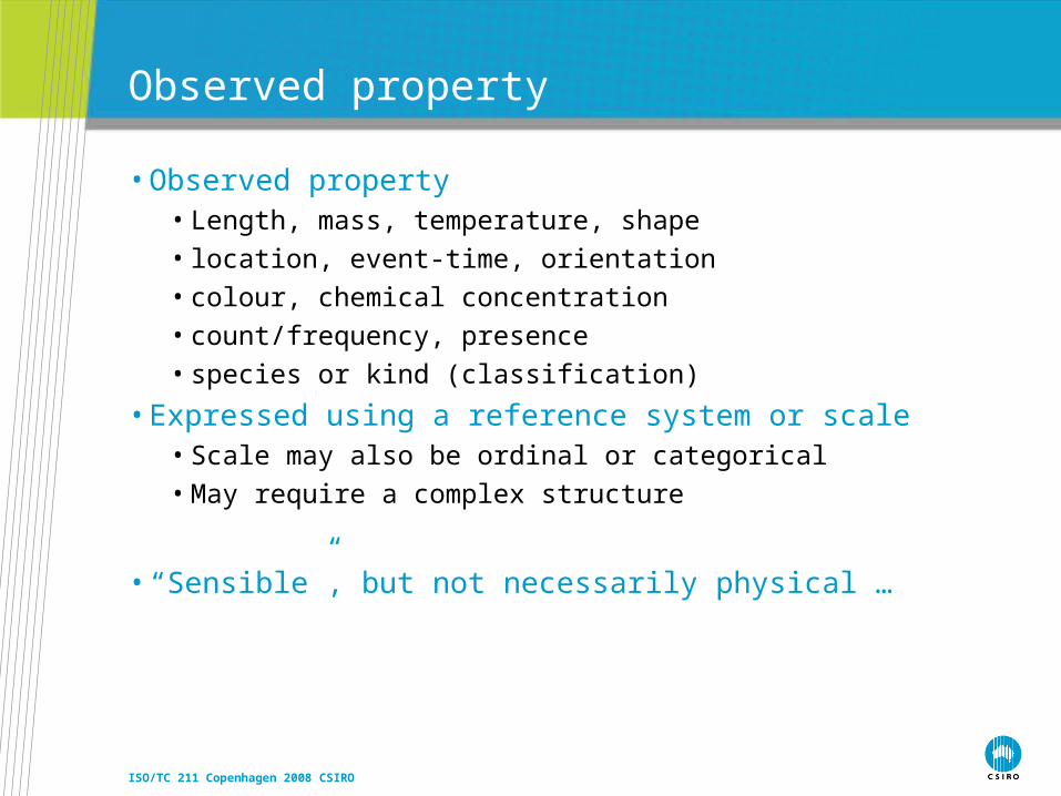
Observed property
• Observed property• Length, mass, temperature, shape
• location, event-time, orientation
• colour, chemical concentration
• count/frequency, presence
• species or kind (classification)
• Expressed using a reference system or scale• Scale may also be ordinal or categorical
• May require a complex structure
• “Sensible”, but not necessarily physical …

ISO/TC 211 Copenhagen 2008 CSIRO
Feature-of-interest
• The observed property is associated with something• Location does not have properties,
the substance or object at a location does
• Observed property must be logically consistent with the feature-of-interest
• E.g. rock-density, pixel-colour, city-population, ocean-surface-temperature
• … i.e. the Observation “target”
ISO/TC 211 Copenhagen 2008 CSIRO
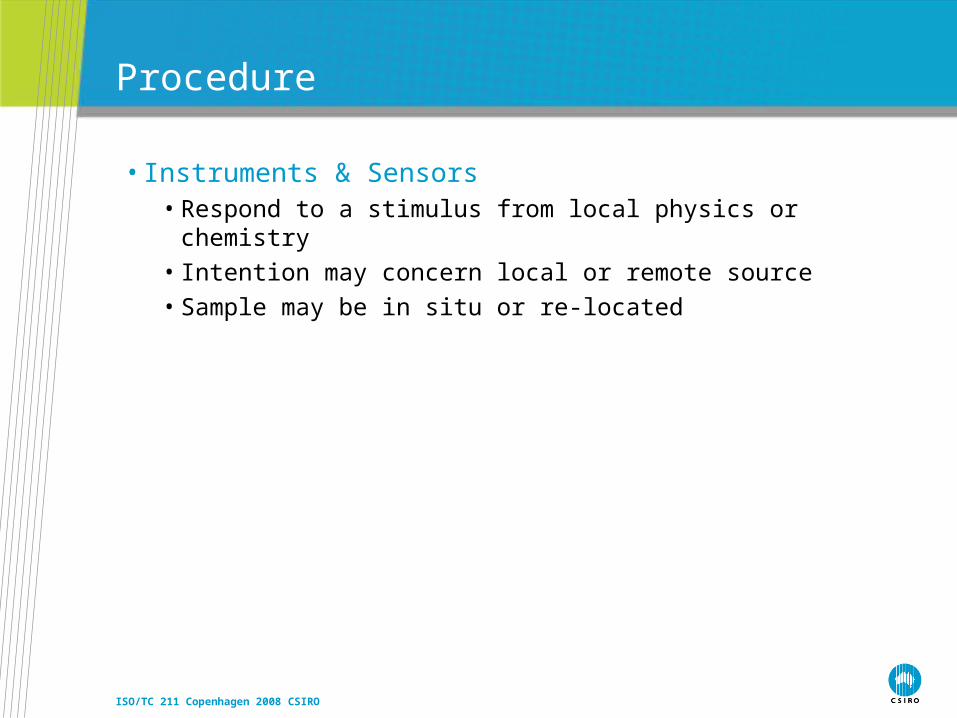
Procedure
• Instruments & Sensors • Respond to a stimulus from local physics or chemistry
• Intention may concern local or remote source
• Sample may be in situ or re-located

ISO/TC 211 Copenhagen 2008 CSIRO
Procedures are usually process chains
• Procedure often includes data processing, to transform “raw” data to semantically meaningful values
• Voltage orientation
• count radiance NDVI
• Position + orientation scene-location
• Mercury meniscus level temperature
• Shape/colour/behaviour species assignment
• This requires consideration of “sensor”-models and calibrations
ISO/TC 211 Copenhagen 2008 CSIRO
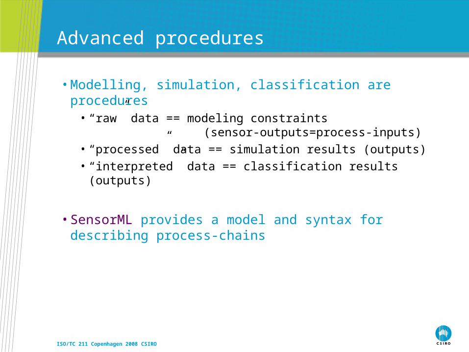
Advanced procedures
• Modelling, simulation, classification are procedures• “raw” data == modeling constraints
(sensor-outputs=process-inputs)
• “processed” data == simulation results (outputs)
• “interpreted” data == classification results (outputs)
• SensorML provides a model and syntax for describing process-chains

ISO/TC 211 Copenhagen 2008 CSIRO
RockSample-A :Specimen
DensityItA :Observ ation
Density :Phenomenon
Densitometry :Observ ationProcedure
2610 kg/T :Measure
2006-11-23 :TM_Instant
Leederv ille, WA :Location
RockSample-B :Specimen
DensityItB :Observ ation
2580 kg/T :Measure
2005-12-23 :TM_Instant
West Leederv ille, WA :Location
+time+result
+procedure+observedProperty
+featureOfInterest
+sampl ingLocation
+density
+sampl ingLocation
+time
+procedure+observedProperty
+featureOfInterest
+result
+density
ProbeItA :Observ ation
Material :Phenomenon
Microprobe :Observ ationProcedure
MineralDistribution :CV_Cov erage
2006-11-24/2006-11-26 :TM_Period
RockSample-A :Specimen
Leederv ille, WA :Location
+observedProperty +procedure
+result+time
+material
+featureOfInterest
+sampl ingLocation RockSample-A :Specimen
2610 kg/T :Measure
Leederv ille, WA :Location
+density
+sampl ingLocation RockSample-A :Specimen
DensityItA :Observ ation
Density :Phenomenon
Densitometry :Observ ationProcedure
2610 kg/T :Measure
2006-11-23 :TM_Instant
Leederv ille, WA :Location
+featureOfInterest
+observedProperty +procedure
+result
+density
+time
+sampl ingLocation RockSample-A :Specimen
2610 kg/T :Measure
Leederv ille, WA :Location
RockSample-B :Specimen
2580 kg/T :Measure
West Leederv ille, WA :Location
+density
+sampl ingLocation
+density
+sampl ingLocation
ProbeItA :Observ ation
Material :Phenomenon
Microprobe :Observ ationProcedure
MineralDistribution :CV_Cov erage
2006-11-24/2006-11-26 :TM_Period
RockSample-A :Specimen
DensityItA :Observ ation
Density :Phenomenon
Densitometry :Observ ationProcedure
2610 kg/T :Measure
2006-11-23 :TM_Instant
Leederv ille, WA :Location
+procedure+observedProperty
+result+time
+featureOfInterest
+material
+featureOfInterest
+observedProperty +procedure
+result
+density
+time
+sampl ingLocation
MineralDistribution :CV_Cov erage
RockSample-A :Specimen
2610 kg/T :Measure
Leederv ille, WA :Location
+material
+density
+sampl ingLocation
Observations, features and coverages
Feature summary
Property-valueevidence
Multiple observations one feature, different properties:feature summary evidence
A property-valuemay be a coverage
Same property onmultiple samplesis a another kindof coverage
Multiple observations different features, one property:coverage evidence
ISO/TC 211 Copenhagen 2008 CSIRO
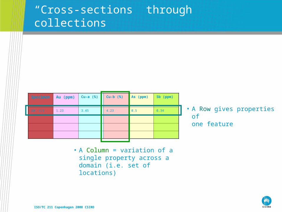
“Cross-sections” through collections
Specimen Au (ppm) Cu-a (%) Cu-b (%) As (ppm) Sb (ppm)
ABC-123 1.23 3.45 4.23 0.5 0.34 • A Row gives properties of one feature
• A Column = variation of a single property across a domain (i.e. set of locations)
ISO/TC 211 Copenhagen 2008 CSIRO
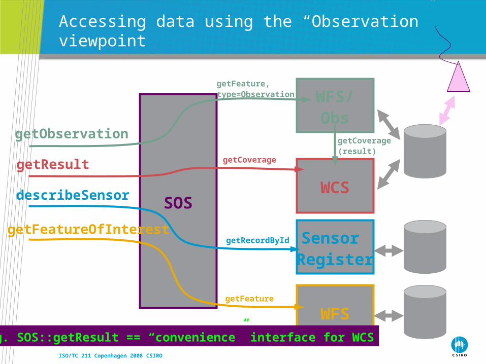
SOS
getObservation
getResult
describeSensor
getFeatureOfInterest
Accessing data using the “Observation” viewpoint
WFS/Obs
getFeature, type=Observation
WCS
getCoverage
getCoverage(result)
Sensor Register
getRecordById
WFSgetFeature
e.g. SOS::getResult == “convenience” interface for WCS

ISO/TC 211 Copenhagen 2008 CSIRO
WFS/SFS
Accessing data using the “Sampling Feature Service” viewpoint
WFSgetFeature
WCSgetCoverage
getCoverage(property value)
SOSgetObservation
Commondata
source
getFeature(sampling Feature)
getFeature(coverage property value)
getFeature(relatedObservation)
getCoverage(result)
SensorRegister
getRecordById (procedure)
getFeature(featureOfInterest)
getObservation(relatedObs)
getResult(property value)

ISO/TC 211 Copenhagen 2008 CSIRO
WFS
Accessing data using the “Domain Feature” viewpoint
WCSgetCoverage(property value)
getFeatureSOS
getResult(property value)
The “George Percivall preferred™” viewpoint #1– observations are property-value-providers for features
??
ISO/TC 211 Copenhagen 2008 CSIRO
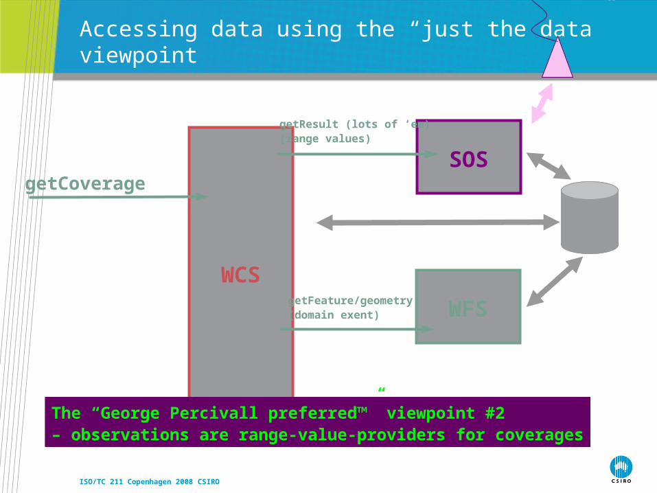
WCS
Accessing data using the “just the data” viewpoint
WFSgetFeature/geometry(domain exent)
getCoverageSOS
getResult (lots of ‘em)(range values)
The “George Percivall preferred™” viewpoint #2 – observations are range-value-providers for coverages
ISO/TC 211 Copenhagen 2008 CSIRO
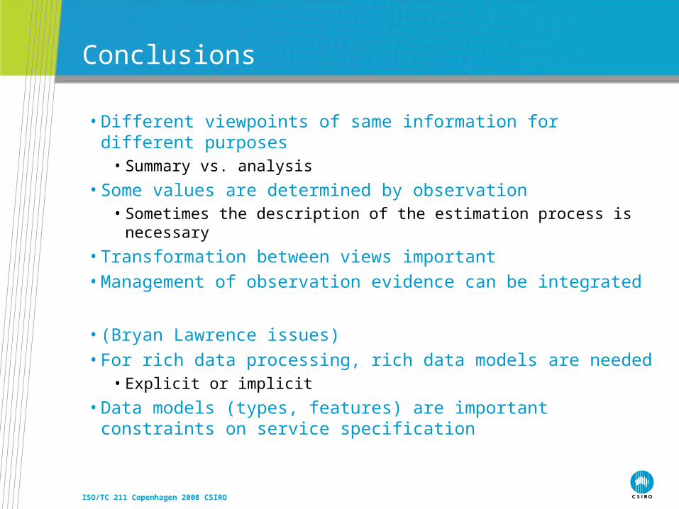
Conclusions
• Different viewpoints of same information for different purposes• Summary vs. analysis
• Some values are determined by observation• Sometimes the description of the estimation process is necessary
• Transformation between views important• Management of observation evidence can be integrated
• (Bryan Lawrence issues) • For rich data processing, rich data models are needed
• Explicit or implicit
• Data models (types, features) are important constraints on service specification
ISO/TC 211 Copenhagen 2008 CSIRO
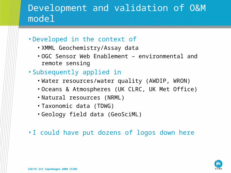
Development and validation of O&M model
• Developed in the context of • XMML Geochemistry/Assay data
• OGC Sensor Web Enablement – environmental and remote sensing
• Subsequently applied in• Water resources/water quality (AWDIP, WRON)
• Oceans & Atmospheres (UK CLRC, UK Met Office)
• Natural resources (NRML)
• Taxonomic data (TDWG)
• Geology field data (GeoSciML)
• I could have put dozens of logos down here

ISO/TC 211 Copenhagen 2008 CSIRO
O&M Status
• OGC Standard December 2007
• ISO/TC 211 New Work Item June 2008
• Core piece of OGC Sensor Web Enablement suite• See also: SensorML, Sensor Observation Service, SAS, SPS
• Basis for Water Observations ML• Key aspect of GeoSciML