Multiple hazard zones (MHZ) : California & Philippines
72
Date: 12 Mar 2022 AS Unit 1 Topic 1 Multiple hazard zones (MHZ) : California & Philippines
-
Upload
quintessa-knox -
Category
Documents
-
view
185 -
download
22
description
Multiple hazard zones (MHZ) : California & Philippines. Aims To identify and define hazard hotspots. To understand the issues regarding managing MHZs. To look at the hazards in California, their effects and how they are being managed. - PowerPoint PPT Presentation
Transcript of Multiple hazard zones (MHZ) : California & Philippines
Date: 20 Apr 2023 AS Unit 1 Topic 1
Multiple hazard zones (MHZ) :California & Philippines
Date: 20 Apr 2023 AS Unit 1 Topic 1
Aims
To identify and define hazard hotspots.
To understand the issues regarding managing MHZs.
To look at the hazards in California, their effects and how they are being managed.
To consider the hazards affecting the Philippines, their effects and management.
To look at the links between the two case studies
Date: 20 Apr 2023 AS Unit 1 Topic 1
Multiple Hazard Zones or Multiple Hazard Zones or ‘Hotspots’ – a greater ‘Hotspots’ – a greater
challenge?challenge?
What are multiple hazard zones or What are multiple hazard zones or hotspots?hotspots?
• Traditionally multiple hazard zones Traditionally multiple hazard zones (MHZs) are considered to be regions or (MHZs) are considered to be regions or parts of the world that are exposed to a parts of the world that are exposed to a range of hazards (often a combination of range of hazards (often a combination of meteorological, climatic and geomorphic meteorological, climatic and geomorphic impacts). impacts).
• These are not only at the country level, These are not only at the country level, but also within a country. but also within a country.
Date: 20 Apr 2023 AS Unit 1 Topic 1
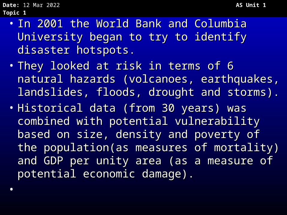
• In 2001 the World Bank and Columbia In 2001 the World Bank and Columbia University began to try to identify disaster University began to try to identify disaster hotspots. hotspots.
• They looked at risk in terms of 6 natural They looked at risk in terms of 6 natural hazards (volcanoes, earthquakes, hazards (volcanoes, earthquakes, landslides, floods, drought and storms).landslides, floods, drought and storms).
• Historical data (from 30 years) was Historical data (from 30 years) was combined with potential vulnerability based combined with potential vulnerability based on size, density and poverty of the on size, density and poverty of the population(as measures of mortality) and population(as measures of mortality) and GDP per unity area (as a measure of GDP per unity area (as a measure of potential economic damage). potential economic damage).
•
Date: 20 Apr 2023 AS Unit 1 Topic 1
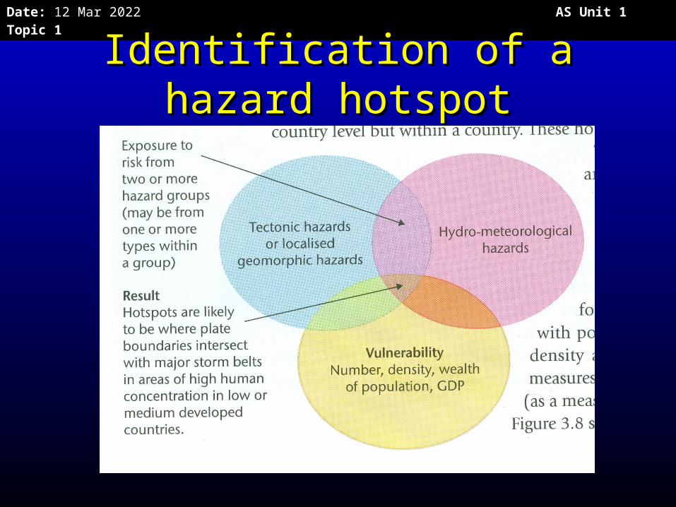
Identification of a hazard Identification of a hazard hotspothotspot
Date: 20 Apr 2023 AS Unit 1 Topic 1
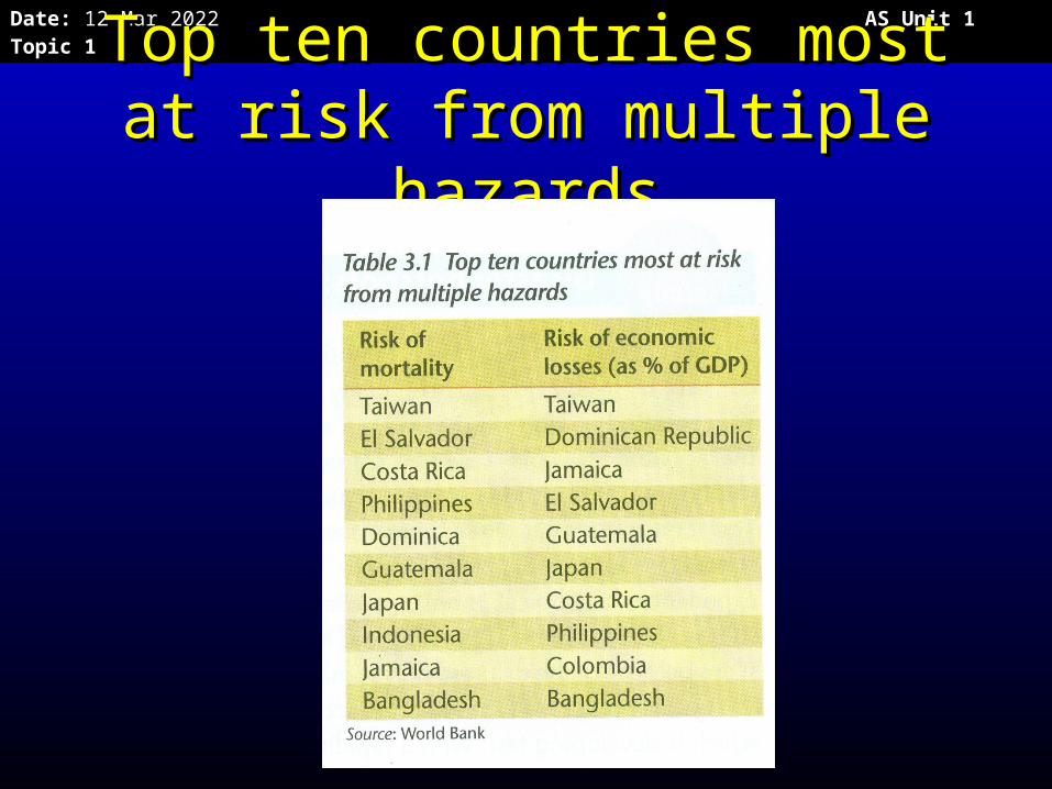
Top ten countries most at Top ten countries most at risk from multiple hazardsrisk from multiple hazards
Date: 20 Apr 2023 AS Unit 1 Topic 1
Date: 20 Apr 2023 AS Unit 1 Topic 1
• Identifying the hotspots has huge Identifying the hotspots has huge implications for the development, implications for the development, investment planning, disaster preparation investment planning, disaster preparation and loss prevention.and loss prevention.
• However many countries that are hazard However many countries that are hazard prone have priorities that come before risk prone have priorities that come before risk management, such as poverty management management, such as poverty management and fighting HIV/AIDS. They may not be and fighting HIV/AIDS. They may not be able to afford the technology to cope with able to afford the technology to cope with multiple hazards.multiple hazards.
• We will consider in detail: California and the We will consider in detail: California and the Philippines. Philippines.
Date: 20 Apr 2023 AS Unit 1 Topic 1
Compulsory Case Study 1 – The Compulsory Case Study 1 – The Californian CoastCalifornian Coast
• The state of California has approx. 40 The state of California has approx. 40 million people and has an economy the million people and has an economy the size of a high income country!size of a high income country!
• 25 Californian counties have per capita 25 Californian counties have per capita incomes of US$ 65,000 pa – so it is one incomes of US$ 65,000 pa – so it is one of the world’s wealthiest places!of the world’s wealthiest places!
• But this means that a disaster may But this means that a disaster may comprise high financial losses.comprise high financial losses.
• It is home to the megacities of Los It is home to the megacities of Los Angeles, San Diego and San Francisco.Angeles, San Diego and San Francisco.
Date: 20 Apr 2023 AS Unit 1 Topic 1
• Only sophisticated management prevents Only sophisticated management prevents California from becoming a disaster zone (in California from becoming a disaster zone (in terms of mortality). terms of mortality).
• NB prediction of earthquake activity is not NB prediction of earthquake activity is not possible even with technology. possible even with technology.
• Parts of the population are vulnerable - around Parts of the population are vulnerable - around 20% of the residents in Los Angeles live below 20% of the residents in Los Angeles live below the official poverty line. These people have the the official poverty line. These people have the lowest capacity to cope when affected by a lowest capacity to cope when affected by a hazard.California also has 3.5 million people hazard.California also has 3.5 million people (many semi-legal migrants) who live in (many semi-legal migrants) who live in hazardous locations. hazardous locations.

Date: 20 Apr 2023 AS Unit 1 Topic 1
Date: 20 Apr 2023 AS Unit 1 Topic 1
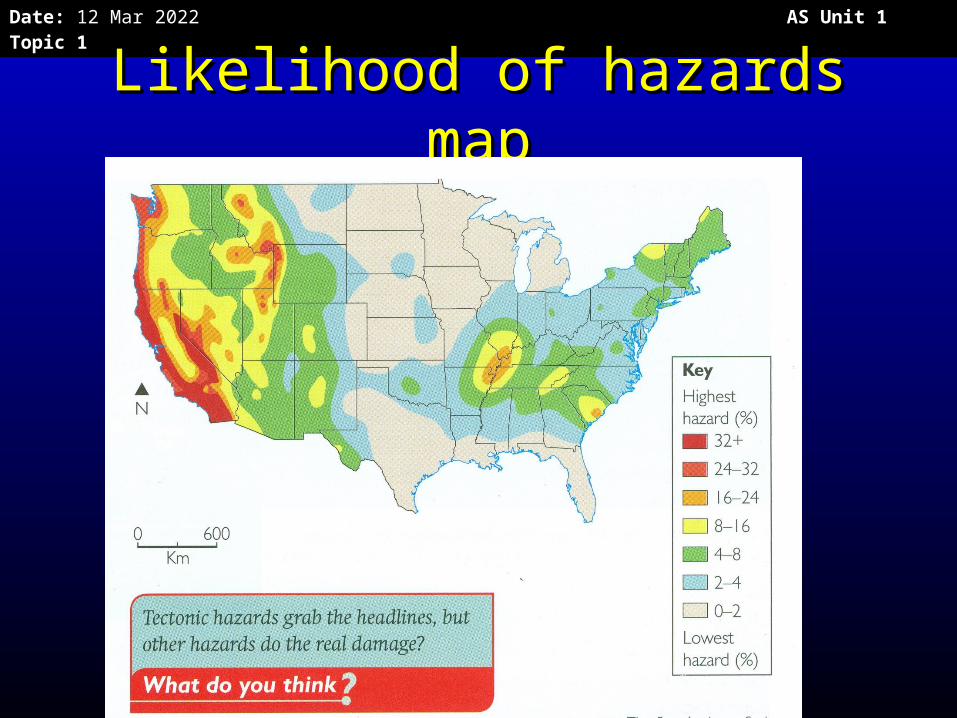
Likelihood of hazards mapLikelihood of hazards map
Date: 20 Apr 2023 AS Unit 1 Topic 1
Date: 20 Apr 2023 AS Unit 1 Topic 1
Date: 20 Apr 2023 AS Unit 1 Topic 1
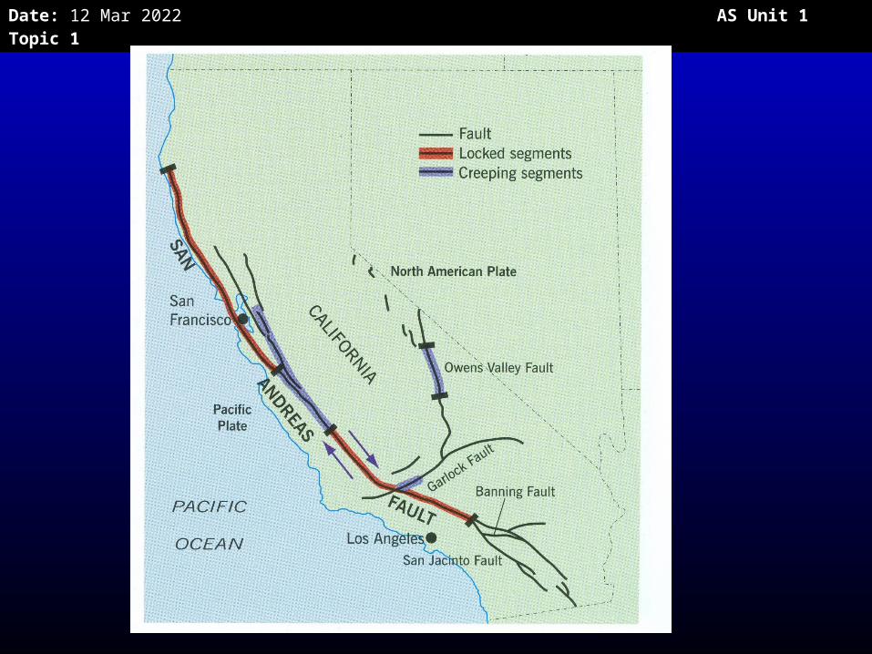
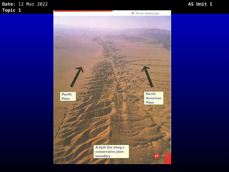
Geophysical hazardsGeophysical hazards: Earthquakes: Earthquakes• The San Andreas fault (part of a broader fault zone) The San Andreas fault (part of a broader fault zone)
marks a conservative plate boundary where two marks a conservative plate boundary where two coastal plates slide past each other, parallel to the coastal plates slide past each other, parallel to the plate margin at differential speeds. plate margin at differential speeds.
• More than 70% of California’s population live within More than 70% of California’s population live within 50km of a fault line.50km of a fault line.
• An earthquake of Richter Scale 7 or above would An earthquake of Richter Scale 7 or above would have massive impacts. have massive impacts.
• The soft basin sediments in LA lead to rapid shaking The soft basin sediments in LA lead to rapid shaking with 5 major earthquakes being recorded in the last with 5 major earthquakes being recorded in the last 100 years. 100 years.
• Earthquakes are shallow and so more destructive.Earthquakes are shallow and so more destructive.• San Francisco Bay has experience several large San Francisco Bay has experience several large
earthquakes too. earthquakes too.
Date: 20 Apr 2023 AS Unit 1 Topic 1
• There is a lot of building on unstable land – There is a lot of building on unstable land – this can lead to soil liquefaction during this can lead to soil liquefaction during earthquakes (where the ground can earthquakes (where the ground can become more like a liquid), which become more like a liquid), which damages buildings and increases the risk damages buildings and increases the risk of landslides. of landslides.
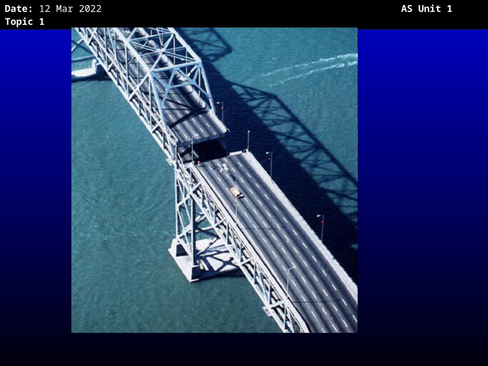
• This was a major problem during the Loma This was a major problem during the Loma Prieta earthquake in 1989.Prieta earthquake in 1989.
Date: 20 Apr 2023 AS Unit 1 Topic 1
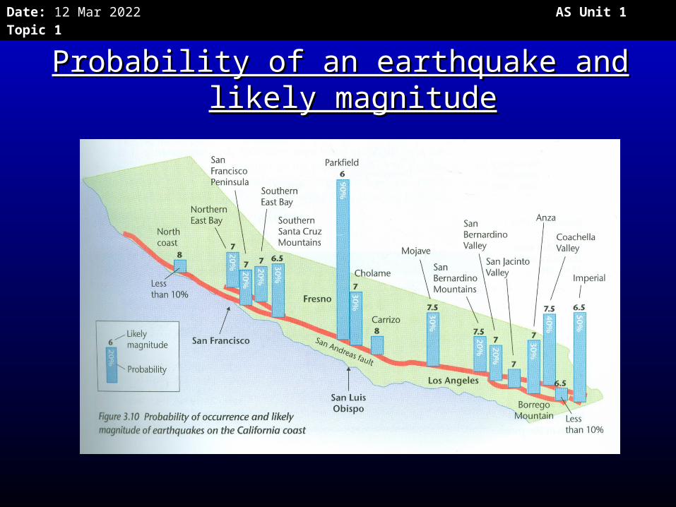
Probability of an earthquake and likely Probability of an earthquake and likely magnitudemagnitude
Date: 20 Apr 2023 AS Unit 1 Topic 1
• Studies of their frequency and Studies of their frequency and magnitude of past earthquakes show magnitude of past earthquakes show that there is a good chance of an that there is a good chance of an earthquake of magnitude 7.0+ earthquake of magnitude 7.0+ hitting the San Francisco Bay area hitting the San Francisco Bay area before 2025. before 2025.
Date: 20 Apr 2023 AS Unit 1 Topic 1
Date: 20 Apr 2023 AS Unit 1 Topic 1
California EarthquakesCalifornia Earthquakes
P 28 photocopy OxfordP 28 photocopy Oxford• The 1989 Loma Prieta earthquake in San The 1989 Loma Prieta earthquake in San
FranciscoFrancisco• The 1994 Northridge earthquake in LAThe 1994 Northridge earthquake in LA
• A)What were the causes of these earthquakes?A)What were the causes of these earthquakes?• B)What were the effects of these earthquakes?B)What were the effects of these earthquakes?• C)How are the people of California dealing with C)How are the people of California dealing with
the threat of earthquakes? the threat of earthquakes?
Date: 20 Apr 2023 AS Unit 1 Topic 1
VolcanoesVolcanoes
• There hasn’t been a volcanic There hasn’t been a volcanic eruption in California since 1915 eruption in California since 1915 (Lassen Peak) (Lassen Peak)
• But there are volcanoes being But there are volcanoes being monitored for potential eruptions, monitored for potential eruptions, e.g. Lassen Peak, Mount Shasta, and e.g. Lassen Peak, Mount Shasta, and the volcanoes around Mammoth the volcanoes around Mammoth Lakes. Lakes.

Date: 20 Apr 2023 AS Unit 1 Topic 1
Date: 20 Apr 2023 AS Unit 1 Topic 1
TsunamisTsunamis
• A tsunami is a series of large waves that can A tsunami is a series of large waves that can flood coastal areas and they can be caused flood coastal areas and they can be caused by earthquakes on the sea bed, or landslides by earthquakes on the sea bed, or landslides into the sea. into the sea.
• Earthquakes under the Pacific Ocean could Earthquakes under the Pacific Ocean could cause a tsunami along the California cause a tsunami along the California coastline. coastline.
• An earthquake off the coast of Alaska in 1964 An earthquake off the coast of Alaska in 1964 caused a tsunami to strike the coast of caused a tsunami to strike the coast of northern California, killing 12 people in northern California, killing 12 people in Crescent City. Crescent City.
Date: 20 Apr 2023 AS Unit 1 Topic 1
Hydro-meteorological Hydro-meteorological hazards in California hazards in California
River floodingRiver flooding• El Niño La Niña oscillation: winter storms, El Niño La Niña oscillation: winter storms,
especially during El Nino years lead toespecially during El Nino years lead to
floods in the Los Angeles and San floods in the Los Angeles and San Gabriel rivers (with deforested hill sides). Gabriel rivers (with deforested hill sides).
• Even though rivers are now heavily Even though rivers are now heavily channelised floods can still take place channelised floods can still take place (mainly between October and January)(mainly between October and January)
Date: 20 Apr 2023 AS Unit 1 Topic 1
Coastal floodingCoastal flooding
• Risk of erosion along coast near Risk of erosion along coast near Malibu and Santa Monica .Malibu and Santa Monica .
• Also the area around Long Beach is Also the area around Long Beach is subsiding and sometimes floods in subsiding and sometimes floods in heavy storms.heavy storms.
• The impacts are likely to worsen as The impacts are likely to worsen as sea levels rise in the future. sea levels rise in the future.
Date: 20 Apr 2023 AS Unit 1 Topic 1
DroughtDrought• Summer drought is a potential problem in a Summer drought is a potential problem in a
Mediterranean climate, especially in Southern Mediterranean climate, especially in Southern California. California.
• Droughts in California can be caused by Droughts in California can be caused by anticyclones (long-lasting periods of high air anticyclones (long-lasting periods of high air pressure with sinking, dry air. Dry, sinking air pressure with sinking, dry air. Dry, sinking air means no rain means no rain
• Drought can also be caused by La Nina events Drought can also be caused by La Nina events (periods when the surface water in the (periods when the surface water in the eastern Pacific Ocean is cooler). This means eastern Pacific Ocean is cooler). This means less evaporation, so there is less precipitation. less evaporation, so there is less precipitation.

Date: 20 Apr 2023 AS Unit 1 Topic 1
• Another cause of drought is increased Another cause of drought is increased wind blowing westward from the desert wind blowing westward from the desert areas that are east of California, e.g. areas that are east of California, e.g. Arizona. The dry air has no moisture to Arizona. The dry air has no moisture to cause precipitation. cause precipitation.
• The problem is exacerbated as the The problem is exacerbated as the population of LA is increasing so rapidly population of LA is increasing so rapidly and there is a lack of water supply. and there is a lack of water supply.
Date: 20 Apr 2023 AS Unit 1 Topic 1
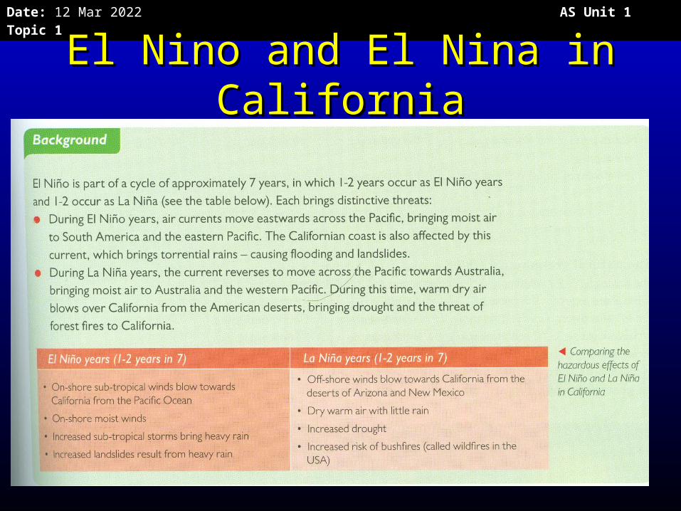
El Nino and El Nina in El Nino and El Nina in CaliforniaCalifornia
Date: 20 Apr 2023 AS Unit 1 Topic 1
Wild fires/Bush firesWild fires/Bush fires
• The most devastating effect of drought The most devastating effect of drought in California is wildfires – dry in California is wildfires – dry vegetation is extremely flammable, so vegetation is extremely flammable, so fires spread quickly over wide areas fires spread quickly over wide areas
• In the dry Santa Ana wind period there In the dry Santa Ana wind period there are more fires. are more fires.
• The wildfires in Southern California in The wildfires in Southern California in October 2007 killed 22 people and October 2007 killed 22 people and destroyed 1300 homes. destroyed 1300 homes.
Date: 20 Apr 2023 AS Unit 1 Topic 1
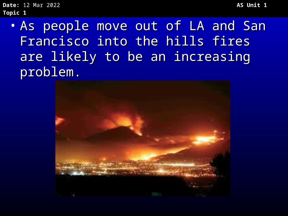
• As people move out of LA and San As people move out of LA and San Francisco into the hills fires are likely Francisco into the hills fires are likely to be an increasing problem. to be an increasing problem.
Date: 20 Apr 2023 AS Unit 1 Topic 1
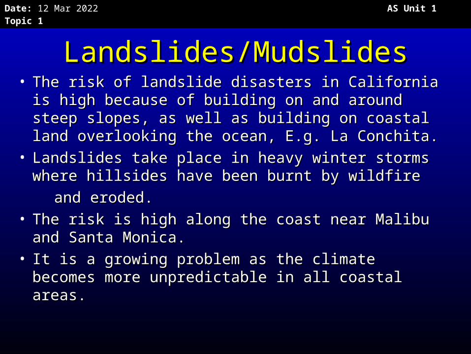
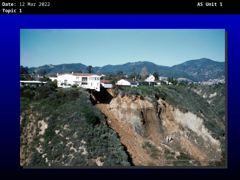
Landslides/MudslidesLandslides/Mudslides• The risk of landslide disasters in California is The risk of landslide disasters in California is
high because of building on and around steep high because of building on and around steep slopes, as well as building on coastal land slopes, as well as building on coastal land overlooking the ocean, E.g. La Conchita. overlooking the ocean, E.g. La Conchita.
• Landslides take place in heavy winter storms Landslides take place in heavy winter storms where hillsides have been burnt by wildfirewhere hillsides have been burnt by wildfire
and eroded.and eroded.• The risk is high along the coast near Malibu The risk is high along the coast near Malibu
and Santa Monica.and Santa Monica.• It is a growing problem as the climate becomes It is a growing problem as the climate becomes
more unpredictable in all coastal areas. more unpredictable in all coastal areas.
Date: 20 Apr 2023 AS Unit 1 Topic 1
Date: 20 Apr 2023 AS Unit 1 Topic 1
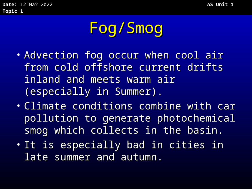
Fog/SmogFog/Smog
• Advection fog occur when cool air Advection fog occur when cool air from cold offshore current drifts from cold offshore current drifts inland and meets warm air inland and meets warm air (especially in Summer). (especially in Summer).
• Climate conditions combine with car Climate conditions combine with car pollution to generate photochemical pollution to generate photochemical smog which collects in the basin.smog which collects in the basin.
• It is especially bad in cities in late It is especially bad in cities in late summer and autumn.summer and autumn.
Date: 20 Apr 2023 AS Unit 1 Topic 1
Exam Question
Explain why California is considered a disaster hotspot. (15 marks).
Date: 20 Apr 2023 AS Unit 1 Topic 1
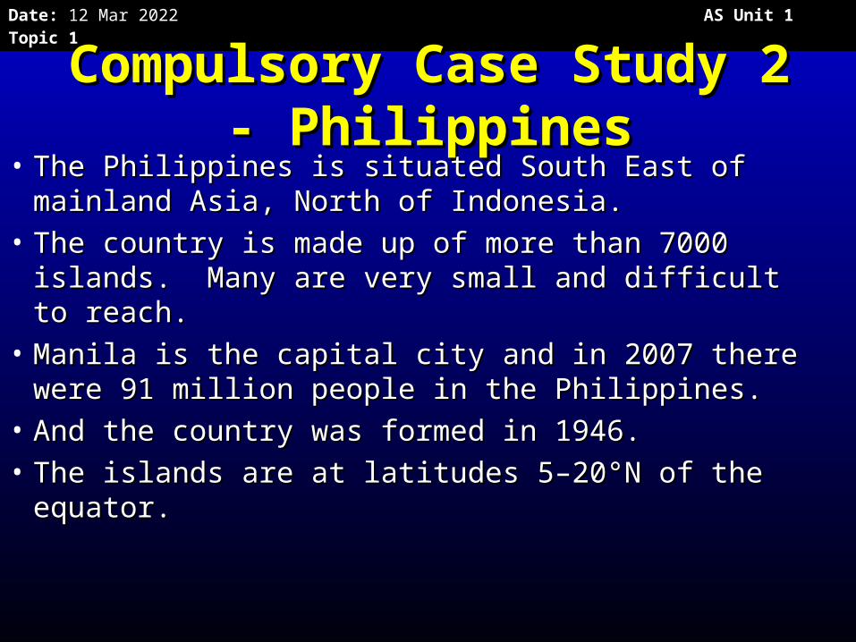
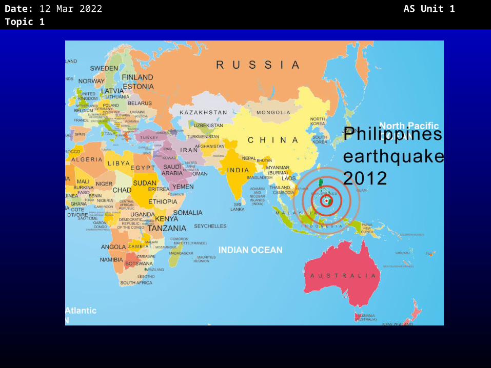
Compulsory Case Study 2 Compulsory Case Study 2 - Philippines- Philippines
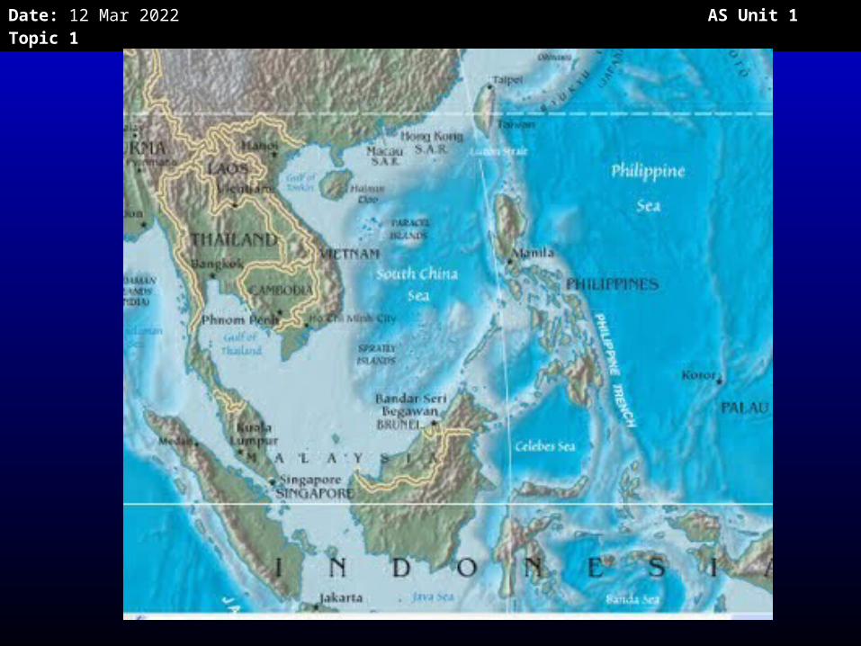
• The Philippines is situated South East of The Philippines is situated South East of mainland Asia, North of Indonesia. mainland Asia, North of Indonesia.
• The country is made up of more than 7000 The country is made up of more than 7000 islands. Many are very small and difficult to islands. Many are very small and difficult to reach.reach.
• Manila is the capital city and in 2007 there Manila is the capital city and in 2007 there were 91 million people in the Philippines.were 91 million people in the Philippines.
• And the country was formed in 1946. And the country was formed in 1946. • The islands are at latitudes 5–20°N of the The islands are at latitudes 5–20°N of the
equator. equator.
Date: 20 Apr 2023 AS Unit 1 Topic 1
Date: 20 Apr 2023 AS Unit 1 Topic 1
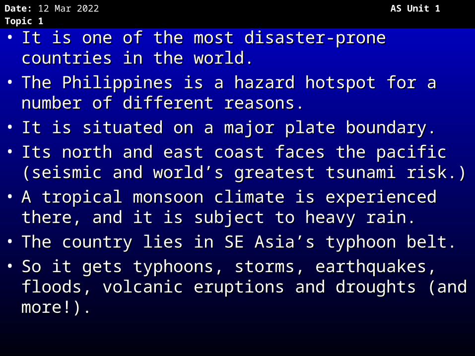
• It is one of the most disaster-prone countries in It is one of the most disaster-prone countries in the world. the world.
• The Philippines is a hazard hotspot for a number The Philippines is a hazard hotspot for a number of different reasons. of different reasons.
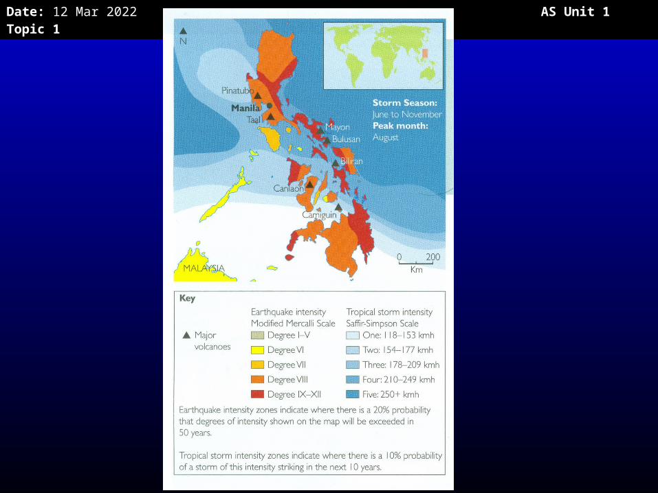
• It is situated on a major plate boundary.It is situated on a major plate boundary.• Its north and east coast faces the pacific Its north and east coast faces the pacific
(seismic and world’s greatest tsunami risk.) (seismic and world’s greatest tsunami risk.) • A tropical monsoon climate is experienced there, A tropical monsoon climate is experienced there,
and it is subject to heavy rain. and it is subject to heavy rain. • The country lies in SE Asia’s typhoon belt. The country lies in SE Asia’s typhoon belt. • So it gets typhoons, storms, earthquakes, floods, So it gets typhoons, storms, earthquakes, floods,
volcanic eruptions and droughts (and more!). volcanic eruptions and droughts (and more!).
Date: 20 Apr 2023 AS Unit 1 Topic 1
Date: 20 Apr 2023 AS Unit 1 Topic 1
• The Philippines is a lower middle The Philippines is a lower middle income country and it is developing income country and it is developing fast.fast.
• It has a rapidly increasing young It has a rapidly increasing young population.population.
• Average population densities across the Average population densities across the country are high with 240 people per sq country are high with 240 people per sq km.km.
• In Manila there are up to 2000 people In Manila there are up to 2000 people per sq km.per sq km.
• Many people are very poor and are Many people are very poor and are residents near the coast. residents near the coast.
Date: 20 Apr 2023 AS Unit 1 Topic 1
• http://www.emdat.be/country-profile• Check out up to date facts for the Check out up to date facts for the
PhilippinesPhilippines
Date: 20 Apr 2023 AS Unit 1 Topic 1
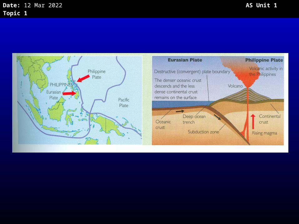
Tectonics of the PhilippinesTectonics of the Philippines
• The dense oceanic Philippines plate is The dense oceanic Philippines plate is being subducted beneath Eurasian plate at being subducted beneath Eurasian plate at a destructive plate boundary.a destructive plate boundary.
• Creating the Manila Ocean trench.Creating the Manila Ocean trench.• Both volcanoes and earthquakes are Both volcanoes and earthquakes are
occurring.occurring.
• Read p 25 OxfordRead p 25 Oxford
Date: 20 Apr 2023 AS Unit 1 Topic 1
Date: 20 Apr 2023 AS Unit 1 Topic 1
Date: 20 Apr 2023 AS Unit 1 Topic 1
Geophysical hazards: Geophysical hazards: Volcanic eruptionsVolcanic eruptions
1900-20121900-2012• 25 events25 events• 2,996 killed2,996 killed• 1,734,907 affected1,734,907 affected• Losses of US$ 232 millionLosses of US$ 232 million
EM-DAT (2012)EM-DAT (2012)
Date: 20 Apr 2023 AS Unit 1 Topic 1
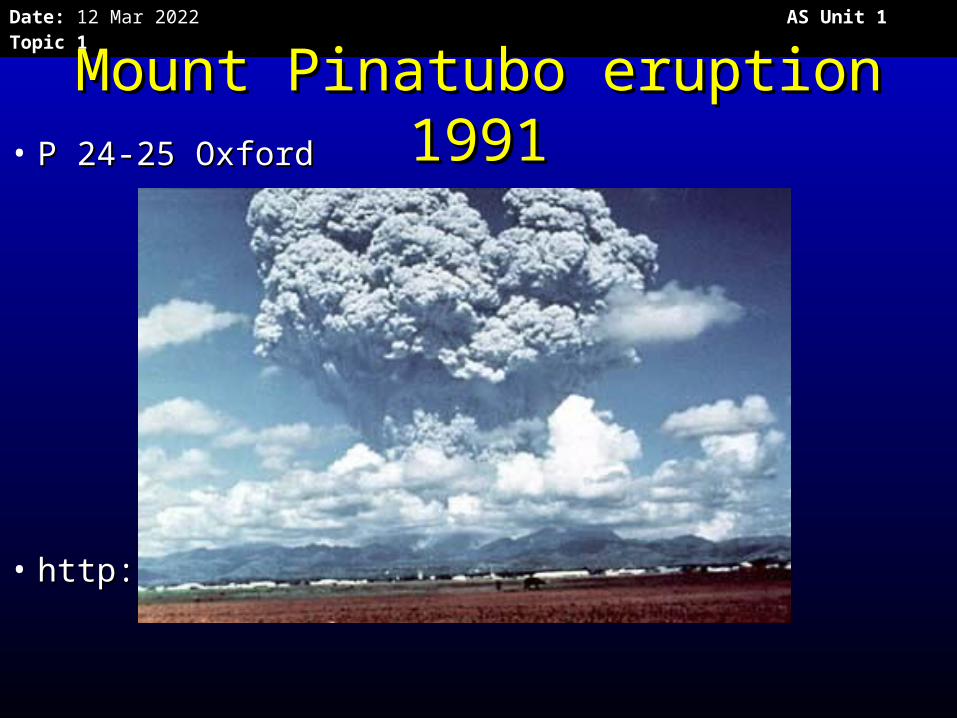
Mount Pinatubo eruption Mount Pinatubo eruption 19911991• P 24-25 OxfordP 24-25 Oxford
• http://pubs.usgs.gov/fs/1997/fs113-97/http://pubs.usgs.gov/fs/1997/fs113-97/
Date: 20 Apr 2023 AS Unit 1 Topic 1
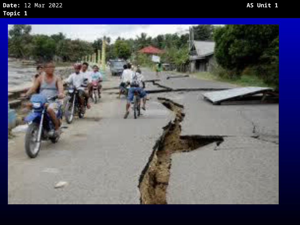
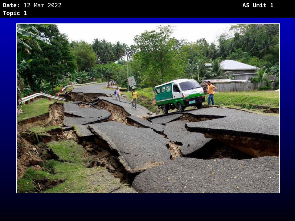
EarthquakesEarthquakes
1900-20121900-2012• Events Events 2424• Killed Killed 9,6939,693• Affected Affected 2,543,5742,543,574• US$ US$ 528528.5 million.5 million (EM-DAT)(EM-DAT)
• One earthquake in 2006 killed 15, injured 100 and One earthquake in 2006 killed 15, injured 100 and damaged 800 buildings. It generated a local tsunami damaged 800 buildings. It generated a local tsunami 3m high and triggered landslides of material from the 3m high and triggered landslides of material from the Parker volcano into the Maughan Lake making a flood Parker volcano into the Maughan Lake making a flood which washed away houses which washed away houses
Date: 20 Apr 2023 AS Unit 1 Topic 1
Date: 20 Apr 2023 AS Unit 1 Topic 1
Date: 20 Apr 2023 AS Unit 1 Topic 1
Date: 20 Apr 2023 AS Unit 1 Topic 1
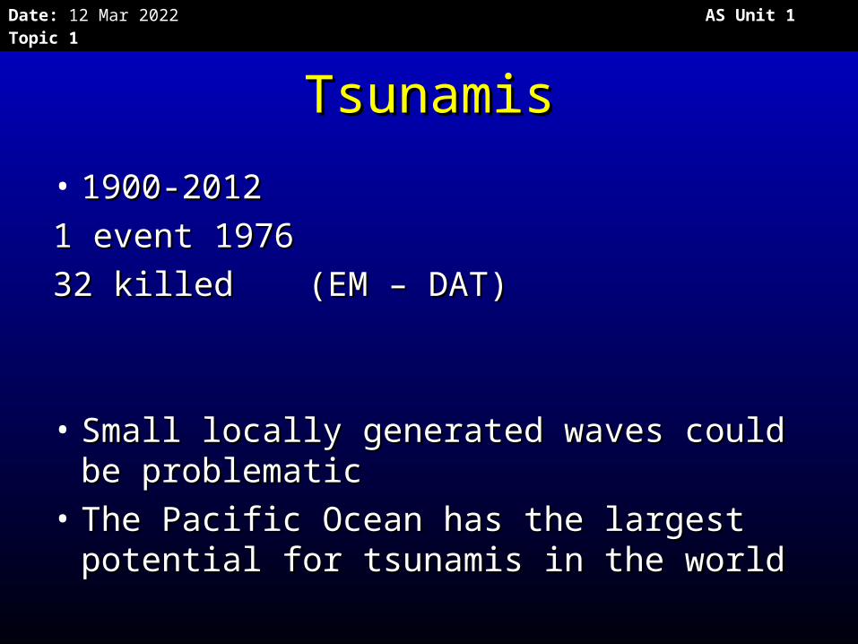
TsunamisTsunamis
• 1900-20121900-2012
11 event 1976 event 1976
3232 killed killed (EM – DAT)(EM – DAT)
• Small locally generated waves could be Small locally generated waves could be problematicproblematic
• The Pacific Ocean has the largest The Pacific Ocean has the largest potential for tsunamis in the world potential for tsunamis in the world
Date: 20 Apr 2023 AS Unit 1 Topic 1
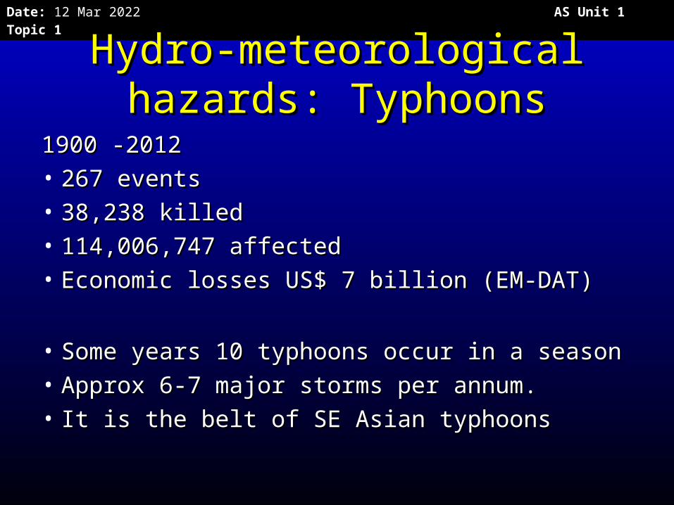
Hydro-meteorological Hydro-meteorological hazards: Typhoonshazards: Typhoons
1900 -20121900 -2012• 267 events267 events• 38,238 killed38,238 killed• 114,006,747 affected114,006,747 affected• Economic losses US$ 7 billion (EM-DAT)Economic losses US$ 7 billion (EM-DAT)
• Some years 10 typhoons occur in a seasonSome years 10 typhoons occur in a season• Approx 6-7 major storms per annum.Approx 6-7 major storms per annum.• It is the belt of SE Asian typhoonsIt is the belt of SE Asian typhoons
Date: 20 Apr 2023 AS Unit 1 Topic 1
Date: 20 Apr 2023 AS Unit 1 Topic 1
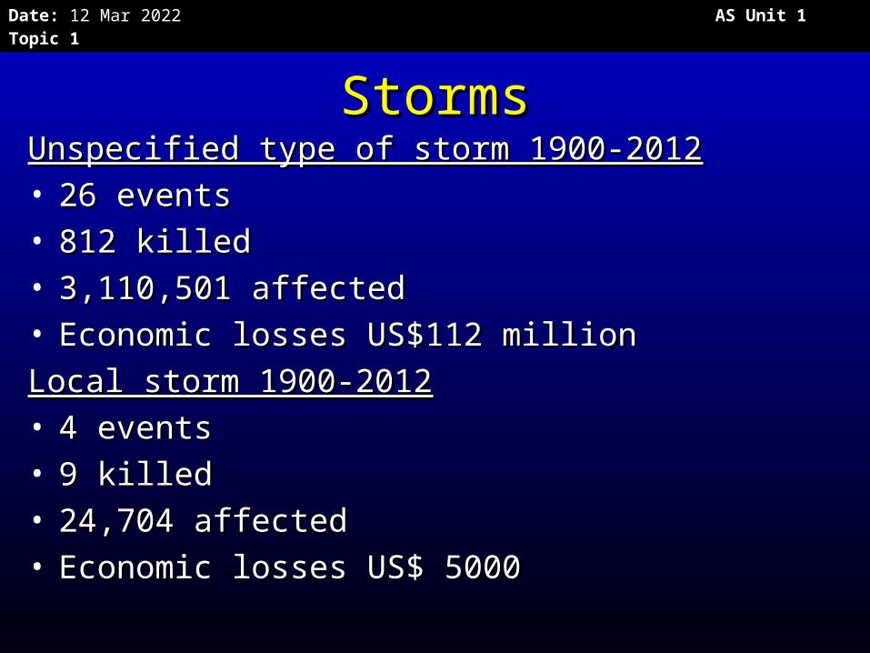
StormsStormsUnspecified type of storm 1900-2012Unspecified type of storm 1900-2012• 26 events 26 events • 812 killed812 killed• 3,110,501 affected3,110,501 affected• Economic losses US$112 millionEconomic losses US$112 million
Local storm 1900-2012Local storm 1900-2012• 4 events 4 events • 9 killed9 killed• 24,704 affected24,704 affected• Economic losses US$ 5000Economic losses US$ 5000
Date: 20 Apr 2023 AS Unit 1 Topic 1
Date: 20 Apr 2023 AS Unit 1 Topic 1
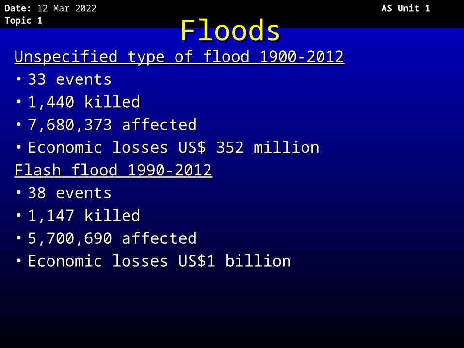
FloodsFloodsUnspecified type of flood 1900-2012Unspecified type of flood 1900-2012• 33 events33 events• 1,440 killed1,440 killed• 7,680,373 affected7,680,373 affected• Economic losses US$ 352 million Economic losses US$ 352 million
Flash flood 1990-2012Flash flood 1990-2012• 38 events38 events• 1,147 killed1,147 killed• 5,700,690 affected5,700,690 affected• Economic losses US$1 billion Economic losses US$1 billion
Date: 20 Apr 2023 AS Unit 1 Topic 1
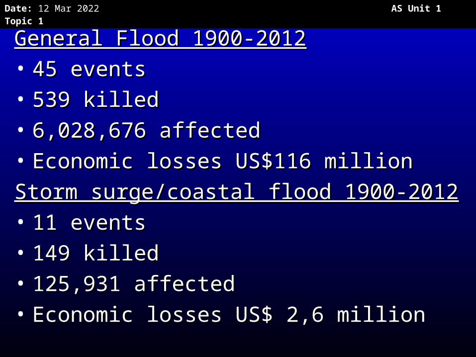
General Flood 1900-2012General Flood 1900-2012• 45 events45 events• 539 killed539 killed• 6,028,676 affected6,028,676 affected• Economic losses US$116 millionEconomic losses US$116 million
Storm surge/coastal flood 1900-2012Storm surge/coastal flood 1900-2012• 11 events11 events• 149 killed149 killed• 125,931 affected125,931 affected• Economic losses US$ 2,6 millionEconomic losses US$ 2,6 million
Date: 20 Apr 2023 AS Unit 1 Topic 1
Date: 20 Apr 2023 AS Unit 1 Topic 1
Land slidesLand slides
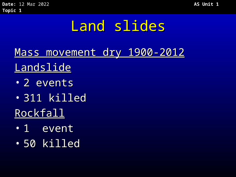
Mass movement dry 1900-2012Mass movement dry 1900-2012
LandslideLandslide• 2 events2 events• 311 killed311 killed
RockfallRockfall• 1 event1 event• 50 killed50 killed
Date: 20 Apr 2023 AS Unit 1 Topic 1
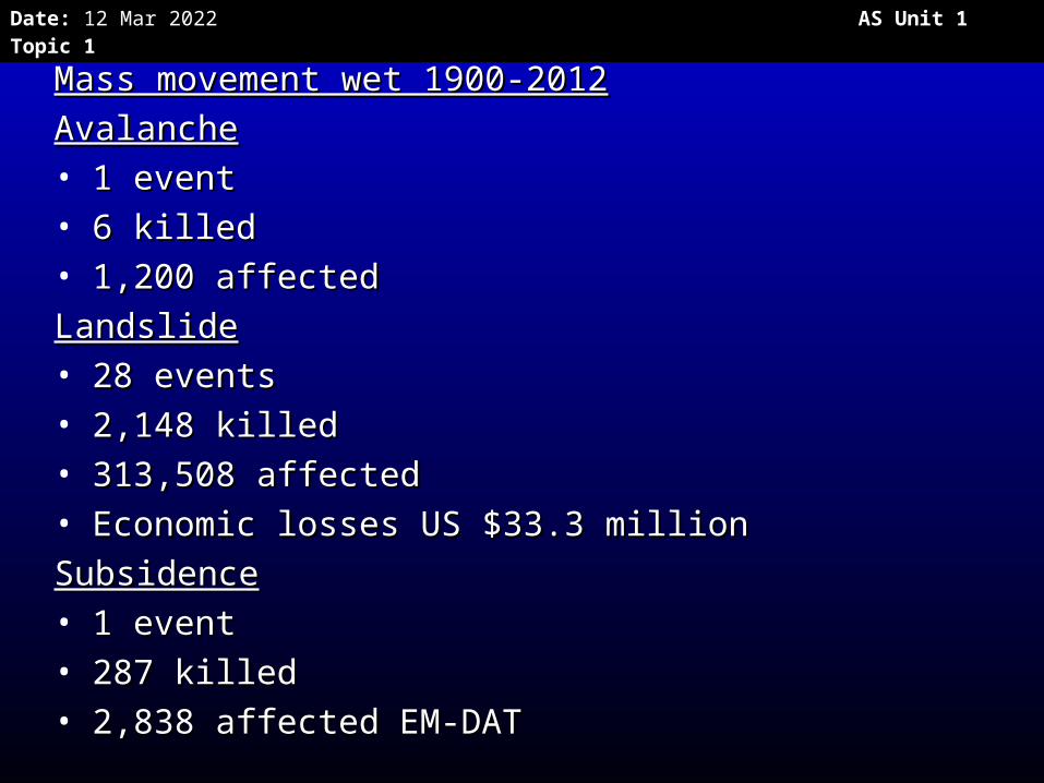
Mass movement wet 1900-2012Mass movement wet 1900-2012
AvalancheAvalanche• 1 event1 event• 6 killed6 killed• 1,200 affected1,200 affected
LandslideLandslide• 28 events28 events• 2,148 killed2,148 killed• 313,508 affected313,508 affected• Economic losses US $33.3 millionEconomic losses US $33.3 million
SubsidenceSubsidence• 1 event1 event• 287 killed287 killed• 2,838 affected2,838 affected EM-DATEM-DAT
Date: 20 Apr 2023 AS Unit 1 Topic 1
The Guinsaugon landslide The Guinsaugon landslide 20062006
• P 26 OxfordP 26 Oxford
Date: 20 Apr 2023 AS Unit 1 Topic 1
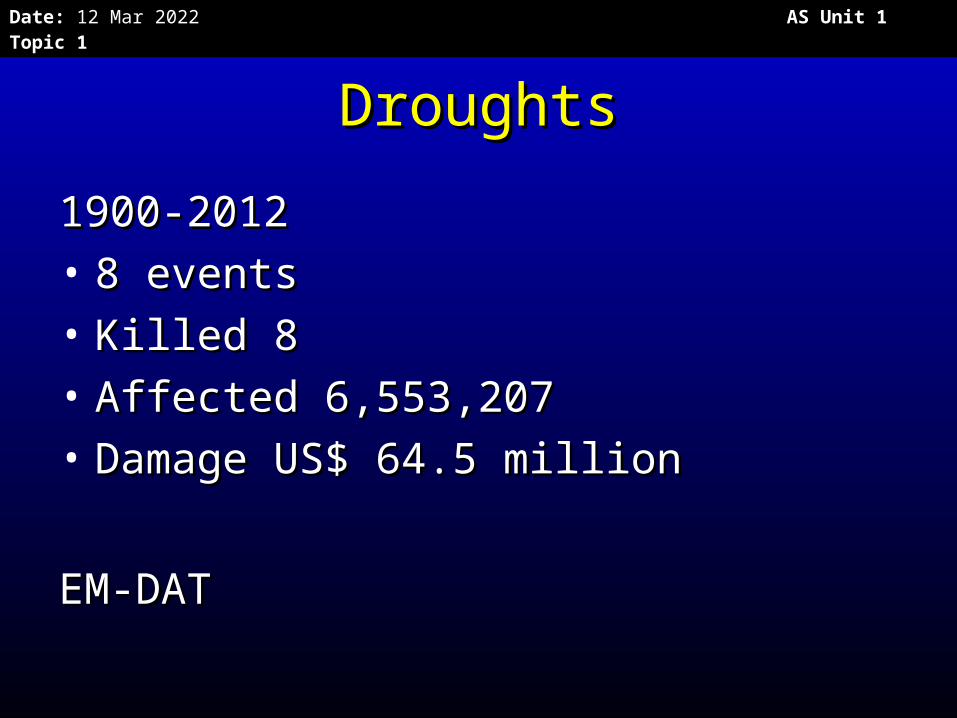
DroughtsDroughts
1900-20121900-2012• 8 events8 events• Killed 8 Killed 8 • Affected 6,553,207Affected 6,553,207• Damage US$ 64.5 millionDamage US$ 64.5 million
EM-DATEM-DAT
Date: 20 Apr 2023 AS Unit 1 Topic 1
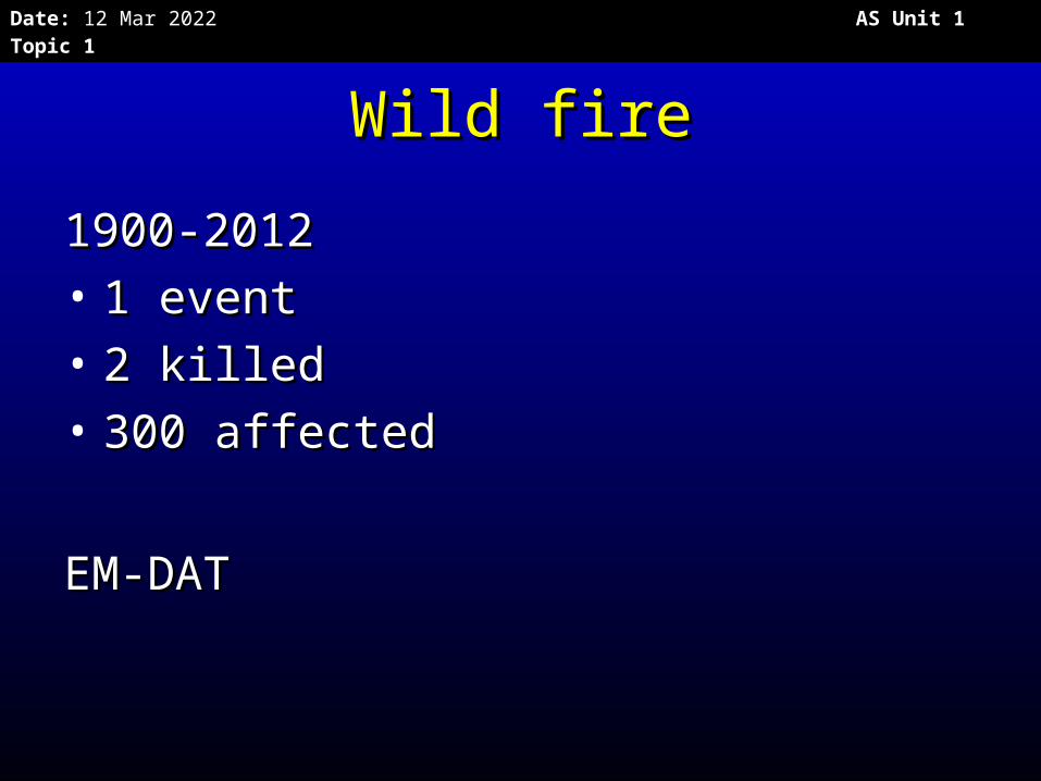
Wild fireWild fire
1900-20121900-2012• 1 event1 event• 2 killed2 killed• 300 affected300 affected
EM-DATEM-DAT
Date: 20 Apr 2023 AS Unit 1 Topic 1
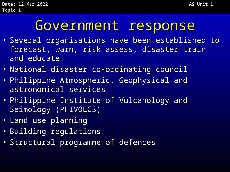
Government responseGovernment response• Several organisations have been established to Several organisations have been established to
forecast, warn, risk assess, disaster train and forecast, warn, risk assess, disaster train and educate:educate:
• National disaster co-ordinating councilNational disaster co-ordinating council• Philippine Atmospheric, Geophysical and astronomical Philippine Atmospheric, Geophysical and astronomical
servicesservices• Philippine Institute of Vulcanology and Seimology Philippine Institute of Vulcanology and Seimology
(PHIVOLCS)(PHIVOLCS)• Land use planningLand use planning• Building regulationsBuilding regulations• Structural programme of defences Structural programme of defences
Date: 20 Apr 2023 AS Unit 1 Topic 1
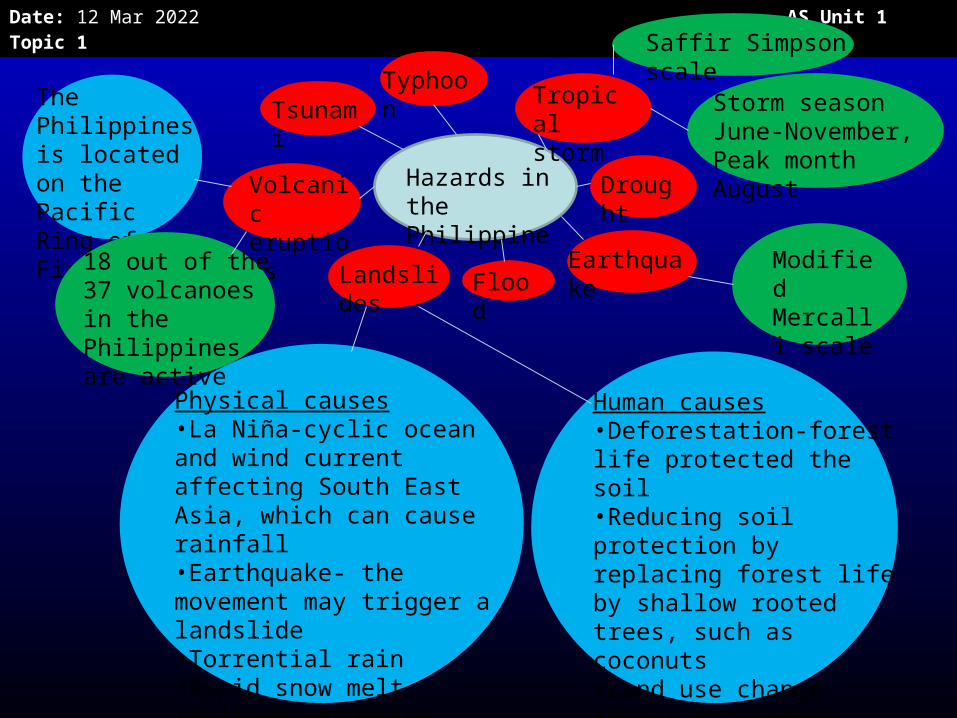
Hazards in the Philippines
TyphoonTsunami
Tropical storm
Drought
Earthquake Flood Landslide
s
Volcanic eruptions
Saffir Simpson scale
Storm season June-November, Peak month August
Modified Mercalli scale
The Philippines is located on the Pacific Ring of Fire
18 out of the 37 volcanoes in the Philippines are active
Physical causes•La Niña-cyclic ocean and wind current affecting South East Asia, which can cause rainfall•Earthquake- the movement may trigger a landslide•Torrential rain•Rapid snow melt•Volcanic eruption•Surface runoff
Human causes•Deforestation-forest life protected the soil•Reducing soil protection by replacing forest life by shallow rooted trees, such as coconuts•Land use change•Water management•Mining andQuarrying
Date: 20 Apr 2023 AS Unit 1 Topic 1
Food for thought!Food for thought!
• When thinking about the 2006 When thinking about the 2006 earthquake and the Guinsaugon earthquake and the Guinsaugon landslide, why is it difficult to classify landslide, why is it difficult to classify the causes and effects of hazards?the causes and effects of hazards?
• Is the damage done by hazards in Is the damage done by hazards in the Philippines mainly social or the Philippines mainly social or economic?economic?
Date: 20 Apr 2023 AS Unit 1 Topic 1
• Exam QuestionExam Question
• Explain why the Philippines is Explain why the Philippines is considered a disaster hotspot. (15 considered a disaster hotspot. (15 marks).marks).
Date: 20 Apr 2023 AS Unit 1 Topic 1
Comparing 2 casestudies Comparing 2 casestudies
Date: 20 Apr 2023 AS Unit 1 Topic 1
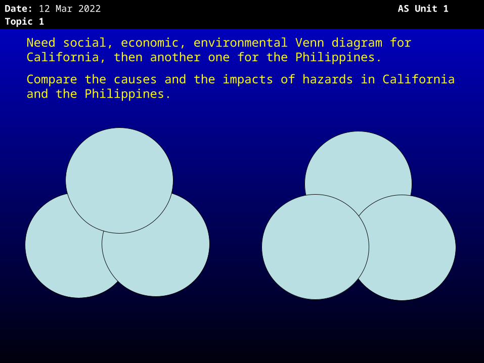
Need social, economic, environmental Venn diagram for California, then another one for the Philippines.
Compare the causes and the impacts of hazards in California and the Philippines.

Date: 20 Apr 2023 AS Unit 1 Topic 1
Bulb
Player 1 begins by playing “bulb” for 1 point
Bulb
Battery
Bulb Energy
Battery
Player 2 plays safe with “battery” no adjacent ideas, no linking ideas 1 point.
Player 1 places energy next to bulb and offers the link that bulbs give off energy as heat and light 2 points

Date: 20 Apr 2023 AS Unit 1 Topic 1
Bulb Energy
Metal
Battery
Player 2 goes for a big score with metal. Bulbs and batteries are partly made of metal; energy is needed to make metal 4 points
Bulb Energy
Metal
Copper
Battery
Bulb Energy
Heat
Metal
Copper
Battery
Player 1 plays copper. Links to metal 2 points.
Player 2 plays heat for 3 points.

Date: 20 Apr 2023 AS Unit 1 Topic 1
Hazards: risk, trends and hotspots
How could you annotate the risk equation with facts from both case studies?
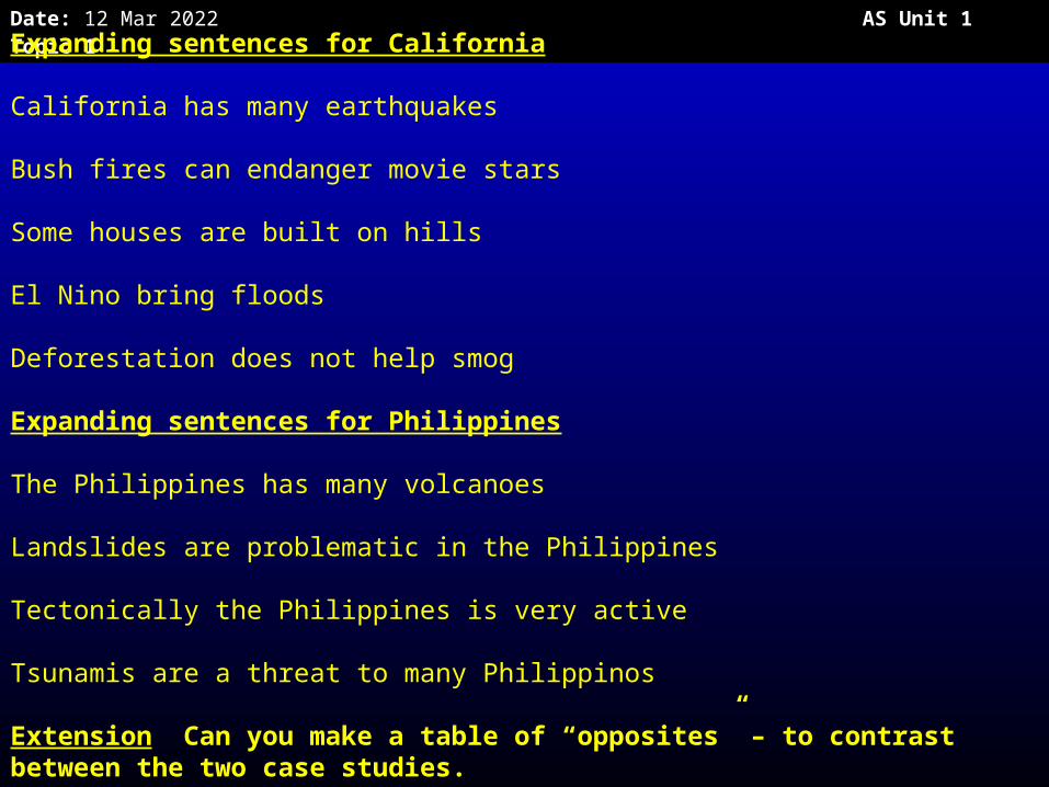
Date: 20 Apr 2023 AS Unit 1 Topic 1Expanding sentences for California
California has many earthquakes
Bush fires can endanger movie stars
Some houses are built on hills
El Nino bring floods
Deforestation does not help smog
Expanding sentences for Philippines
The Philippines has many volcanoes
Landslides are problematic in the Philippines
Tectonically the Philippines is very active
Tsunamis are a threat to many Philippinos
Extension Can you make a table of “opposites” – to contrast between the two case studies.