MT. OCHAROVATELNAIA AND MT. SINIAIA IN ALTAI: LEGENDS … · MT. OCHAROVATELNAIA AND MT. SINIAIA IN...
22
MT. OCHAROVATELNAIA AND MT. SINIAIA IN ALTAI: LEGENDS AND REALITY Leonid Marsadolov Abstract The article explores the relationship between oral narrative heritage and specific material monuments on the example of two actual objects situated near the Kolyvan settlement in Western Altai. The State Hermitage Muse- um’s archaeological fieldwork in the Saian-Altaic region was conducted in 1993 and 1996 on Mt. Ocharovatelnaia and Mt. Siniukha. There is a rock precipice of zoomorphic shape on Mt. Ocharovatelnaia that has been used as a sanctuary, but possibly also for astronomic observation by prehistoric people. In one observation site, the sun can be observed as setting in the mouth of the animal-shaped rock during vernal equinox – the animal as if swallows the sun. A Christian sanctuary was later erected on Mt. Siniukha, and a wooden cross stood there even in the early 20th century. On the foot of the mountain there was an Old-Believers’ nunnery. Mt. Ocharovatelnaia rises 670 m and Siniaia Sopka, the highest peak of the Kolyvan ridge south of Mt. Ocharovatelnaia 1,210 m above the sea level. It is a rule rather than a coincidence that the zoomorphic pagan sanctuary on Mt. Ocharovatelnaia in the north is located twice as low compared to the Chris- tian cross on the Siniaia mountaintop in the south. In the Christian tradi- tion the warmer South is more revered than the cold North. In several an- cient Russian geographic maps, south was situated above and north below. Th21e position of cultic objects on mountaintops situated opposite of each other appears to symbolise the triumph of Christianity over paganism in the 18th century. Keywords: rock sanctuary, Christianity, prehistoric astronomical observa- tion, paganism, paleoastronomy, animal swallowing the sun, equinoxes, sa- cred places, movement of luminaries. INTRODUCTION The association of oral narrative legend to specific physical monu- ments can be observed in two real objects situated in the vicinity of Kolyvan village in Western Altai. The area surrounding Kolyvan is famous not only for its pictur- esque scenery, but also for rich ore resources and gemstone de- posits. More than 90 first-rate stone products were sent to the Imperial Hermitage from the famous Kolyvan Lapidary Works. Interestingly enough, in Old Slavonic chronicles, the name Kolyvan was also used for Tallinn, the present capital of Estonia. http://www.folklore.ee/folklore/vol31/marsadolov.pdf
Transcript of MT. OCHAROVATELNAIA AND MT. SINIAIA IN ALTAI: LEGENDS … · MT. OCHAROVATELNAIA AND MT. SINIAIA IN...

57 www.folklore.ee/folklorewww.folklore.ee/folklorewww.folklore.ee/folklorewww.folklore.ee/folklorewww.folklore.ee/folklore
MT. OCHAROVATELNAIA AND MT. SINIAIAIN ALTAI: LEGENDS AND REALITY
Leonid Marsadolov
AbstractThe article explores the relationship between oral narrative heritage andspecific material monuments on the example of two actual objects situatednear the Kolyvan settlement in Western Altai. The State Hermitage Muse-um’s archaeological fieldwork in the Saian-Altaic region was conducted in1993 and 1996 on Mt. Ocharovatelnaia and Mt. Siniukha.There is a rock precipice of zoomorphic shape on Mt. Ocharovatelnaia thathas been used as a sanctuary, but possibly also for astronomic observation byprehistoric people. In one observation site, the sun can be observed as settingin the mouth of the animal-shaped rock during vernal equinox – the animalas if swallows the sun. A Christian sanctuary was later erected on Mt.Siniukha, and a wooden cross stood there even in the early 20th century. Onthe foot of the mountain there was an Old-Believers’ nunnery. Mt.Ocharovatelnaia rises 670 m and Siniaia Sopka, the highest peak of theKolyvan ridge south of Mt. Ocharovatelnaia 1,210 m above the sea level. It isa rule rather than a coincidence that the zoomorphic pagan sanctuary on Mt.Ocharovatelnaia in the north is located twice as low compared to the Chris-tian cross on the Siniaia mountaintop in the south. In the Christian tradi-tion the warmer South is more revered than the cold North. In several an-cient Russian geographic maps, south was situated above and north below.Th21e position of cultic objects on mountaintops situated opposite of eachother appears to symbolise the triumph of Christianity over paganism in the18th century.
Keywords: rock sanctuary, Christianity, prehistoric astronomical observa-tion, paganism, paleoastronomy, animal swallowing the sun, equinoxes, sa-cred places, movement of luminaries.
INTRODUCTION
The association of oral narrative legend to specific physical monu-ments can be observed in two real objects situated in the vicinityof Kolyvan village in Western Altai.
The area surrounding Kolyvan is famous not only for its pictur-esque scenery, but also for rich ore resources and gemstone de-posits. More than 90 first-rate stone products were sent to theImperial Hermitage from the famous Kolyvan Lapidary Works.Interestingly enough, in Old Slavonic chronicles, the name Kolyvanwas also used for Tallinn, the present capital of Estonia.
http://www.folklore.ee/folklore/vol31/marsadolov.pdf
diana
Text Box
doi:10.7592/FEJF2005.31.marsadolov
Folklore 31
58www.folklore.ee/folklorewww.folklore.ee/folklorewww.folklore.ee/folklorewww.folklore.ee/folklorewww.folklore.ee/folklore
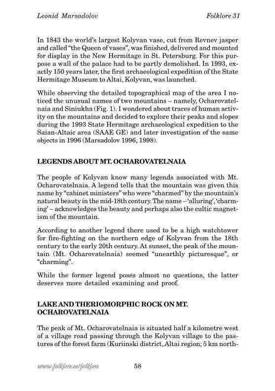
In 1843 the world’s largest Kolyvan vase, cut from Revnev jasperand called “the Queen of vases”, was finished, delivered and mountedfor display in the New Hermitage in St. Petersburg. For this pur-pose a wall of the palace had to be partly demolished. In 1993, ex-actly 150 years later, the first archaeological expedition of the StateHermitage Museum to Altai, Kolyvan, was launched.
While observing the detailed topographical map of the area I no-ticed the unusual names of two mountains – namely, Ocharovatel-naia and Siniukha (Fig. 1). I wondered about traces of human activ-ity on the mountains and decided to explore their peaks and slopesduring the 1993 State Hermitage archaeological expedition to theSaian-Altaic area (SAAE GE) and later investigation of the sameobjects in 1996 (Marsadolov 1996, 1998).
LEGENDS ABOUT MT. OCHAROVATELNAIA
The people of Kolyvan know many legends associated with Mt.Ocharovatelnaia. A legend tells that the mountain was given thisname by “cabinet ministers” who were “charmed” by the mountain’snatural beauty in the mid-18th century. The name – ‘alluring’, ‘charm-ing’ – acknowledges the beauty and perhaps also the cultic magnet-ism of the mountain.
According to another legend there used to be a high watchtowerfor fire-fighting on the northern edge of Kolyvan from the 18thcentury to the early 20th century. At sunset, the peak of the moun-tain (Mt. Ocharovatelnaia) seemed “unearthly picturesque”, or“charming”.
While the former legend poses almost no questions, the latterdeserves more detailed examining and proof.
LAKE AND THERIOMORPHIC ROCK ON MT.OCHAROVATELNAIA
The peak of Mt. Ocharovatelnaia is situated half a kilometre westof a village road passing through the Kolyvan village to the pas-tures of the forest farm (Kuriinski district, Altai region; 5 km north-
Leonid Marsadolov

59 www.folklore.ee/folklorewww.folklore.ee/folklorewww.folklore.ee/folklorewww.folklore.ee/folklorewww.folklore.ee/folklore
Beloe8 MARTA
KOLYVAN
KOLYVANSTROI
Mt. Siniukha
Mt. Ocharovatelnaia
Figure 1. Western Altai. Topographic outline of the Kolyvan settlement and Lake Beloearea. Archaeological monuments: 1 – site of the nunnery; 2 – Podsiniushka village;3 – group of kurgans on the shore of Lake Beloe; 4 – prehistoric sanctuary on Mt.Ocharovatelnaia.
Mt. Ocharovatelnaia and Mt. Siniaia

Folklore 31
60www.folklore.ee/folklorewww.folklore.ee/folklorewww.folklore.ee/folklorewww.folklore.ee/folklorewww.folklore.ee/folklore
northeast from Kolyvan, 6 km north-northwest from the 8. Marta(March 8) village – Fig. 1).
In the southern part of the peak of Ocharovatelnaia there lies anovergrown marshy lake of limpid ferruginous water (Fig. 2). Exceptfor this small lake of rain and melting water, there are no othersources of water on the peak of Ocharovatelnaia. The lake is ir-regularly oval and its southern shore is overgrown with birch trees.The rock bottom of the lake is covered with a thin layer of sapropel.Owing to the stepped slope the southeastern part of the lake iseasily accessible. A pit, 30 cm in diameter and 10–17 cm in depth,has been carved in the rock outcrop. It is possible that the edges ofthe pit have been polished by prehistoric people and the pit wasused to sacrifice to spirits of the lake. Vadim Borodaev has foundan anthropomorphic sculpture carved from wooden log, a uniquepagan idol, from the bottom of the lake. The lower part of the log isleft unfinished; the upper end is slightly pointed.
Figure 2. Outline of the upperpart (A) and cross-section (B)of Mt. Ocharovatelnaia.Objects: 1 – theriomorphic orichthyomorphic mainsanctuary; 2 – upperobservation site; 3 – lowerobservation site; 4 – lake.Dashed line marks the cross-section.
Leonid Marsadolov

61 www.folklore.ee/folklorewww.folklore.ee/folklorewww.folklore.ee/folklorewww.folklore.ee/folklorewww.folklore.ee/folklore
Mt. Ocharovatelnaia and Mt. Siniaia
Figure 3.Mt. Ocharovatelnaia.Main sanctuary:A – view from the east;B– therio-, ichthyo-, or-nithomorphic head;C – reconstruction of thesun setting through the“animal’s mouth” onvernal and autumnalequinox.
A
B
C

Folklore 31
62www.folklore.ee/folklorewww.folklore.ee/folklorewww.folklore.ee/folklorewww.folklore.ee/folklorewww.folklore.ee/folklore
Figure 4.Mt. Ocharovatelnaia.Centre of the mainsanctuary:1 – rock of the shapeof an agape “fish-animal mouth” (viewfrom the front);2 – depression on thelower level of the rock.
Leonid Marsadolov
The highest and the most massive rock outcrop of the peakOcharovatelnaia is located in the northern part of the lake (Figs. 2,3). This is a greyish brown layered granite rock with dark spots,and virtually all its slopes are steep. The peak is most easily acces-sible by the northeastern slope. From the east the northern upperpart of the rock resembles the head of a fish, animal or bird with anopen mouth or beak, and even has a protruding “eye” (Fig. 3). Theresemblance becomes even closer when looking at the creature’s“mouth” from the upper terrace of the northern part of the rock.This more than 5 metres high agape “mouth” has smooth inner walls(Figs. 3, 4) and a pointed upper end, which dilates into a lower “jaw”and through “mouth cavity and throat” into “an oesophagus”. Insidethe “jaws” there are two large stones, more than a metre in diam-

63 www.folklore.ee/folklorewww.folklore.ee/folklorewww.folklore.ee/folklorewww.folklore.ee/folklorewww.folklore.ee/folklore
Mt. Ocharovatelnaia and Mt. Siniaia
EQ
W
A
C
D
B
Figure 5. Mt. Ocharovatelnaia: 1 – view of the upper part of the mountainain from theeast (outline of the therio- or ichthyomorphic rock); 2 – view of the rock from the lowerobservation site (perspective from the northeast); setting of the sun on winter solstice (W)and on vernal and autumnal equinox (EQ); 3 – front of the rock (open “animal mouth”),view from the north. Symbols: A – altar, C – depression, D – hollow, “mouth”, arrowpointing to a fallen slab (B).

Folklore 31
64www.folklore.ee/folklorewww.folklore.ee/folklorewww.folklore.ee/folklorewww.folklore.ee/folklorewww.folklore.ee/folklore
Figure 6. Image of an animal or a mythological creature swallowing the sun: 1 –Shishkino; 2 – Arbi; 3 – Chernovaia VIII; 4–5 – Chinese (according to the material by A.P. Okladnikov (1), A. P. Okladnikov and A. I. Mazin (2), E. B. Vadetskaia, N. V. Leontev,G. A. Maksimenkov (3), G. J. Grum-Grzhimailo (4 and 5)).
Leonid Marsadolov
eter (Fig. 5.3). The stones have a fulcrum at the upper end, formingan upward acute angle. The stone to the east has probably brokenoff from the upper end of the rock. It is questionable how the stoneto the west, with polished edges, ended up in the “mouth”. It is pos-sible that prehistoric people placed the stone there, and it func-tioned as an “animal tongue” altar of a kind.
There is a small hole in the front inside the “mouth” (Fig. 4.2), whichresembles the hole on the lake shore. The hole inside the “mouth”appears to be man-made, as it has the darker rock surface removedfrom the edges, thus making the hole clearly discernible. This ap-pears to have been a central worship place in the animal, bird orfish-headed rock sanctuary.
OBSERVATION SITES
Two main observation sites were discovered north of the worshipcentre. The more important of the two, which the expedition teamreferred to as the upper observation site, is situated on the highest

65 www.folklore.ee/folklorewww.folklore.ee/folklorewww.folklore.ee/folklorewww.folklore.ee/folklorewww.folklore.ee/folklore
2
1 EQ
Steps
D1
A
A
B
B
Figure 7. Mt. Ocharovatelnaia. Upper observation site: A – outline of the rock openingfrom the east; B – outline of the upper level of the rock (1 – direction of sunrise onequinoxes; 2 – direction to the peak of Siniukha; streaked area – Depression 1; C –outline and profile of Depression 1.
point in the northern part of the summit of Mt. Ocharovatelnaia(Figs. 2, 8). The outcrop is a tapered, more than 15 metres high“tower”, which remains inaccessible from the south. From the eastthe southern part of the rock appears higher than the northern part.
Mt. Ocharovatelnaia and Mt. Siniaia

Folklore 31
66www.folklore.ee/folklorewww.folklore.ee/folklorewww.folklore.ee/folklorewww.folklore.ee/folklorewww.folklore.ee/folklore
The “tower” is easiest to reach from the northern side along terracesteps formed of projecting layers. The rock outcrop is 25 m wide ina northwest-southeast direction and 7.5 m in a west-east direction(Fig. 7).
There is a flat terrace on top of the “tower”, which has an appar-ently natural depression of 1.4 m in diameter and 0.6 m in depth,in its southern end. The upper part of the depression is round,with walls narrowing downward. The bottom of the depression isflat, approximately 0.8 m in diameter (Fig. 7).
A depression of this shape may have formed of a small hole,which filled with rainwater and alternately froze and melted,eventually making the surface to flake. The rock is of stratalstructure. The uneven density of the rock has been the cause ofvarious projections and cup-marks on the walls of the depres-sion as well as on the rock in general. The possibility that thewalls of the stone depression may have been altered by prehis-toric people cannot be ruled out either.
The functions of the depression may have been connected withits location on the topmost peak. It may have been an observa-tion site, as it gives a fine view to the surrounding area in atleast a 20–25 km radius, without any objects (rocks, trees, build-ings, etc.) obstructing the view. During longer observations the de-pression could easily hold one or two persons standing or sitting.
The depression may have also been used as a fixed point for astro-nomical observation. Astronomical information as well as the posi-tion of the sun, the moon and stars on important ritual holidays(vernal and autumnal equinoxes and summer and winter solstice,etc.) were of highest importance to prehistoric men.
The astronomical calculations by V. L. Gorshkov, scholar of thePulkovo Observatory and member of the expedition, were pub-lished in 1996 (Marsadolov & Gorshkov 1996). Since the periodduring which the depression might have been used for astro-nomical observation is not exactly known, the calculations aremade for three periods in history: 1 – division of eras (year 0); 2 –800 BC (beginning of the era of prehistoric Altaic nomads); 3 – 1800BC (middle of the Bronze Age). Calculations revealed that regard-
Leonid Marsadolov

67 www.folklore.ee/folklorewww.folklore.ee/folklorewww.folklore.ee/folklorewww.folklore.ee/folklorewww.folklore.ee/folklore
Figure 8. Mt. Ocharovatelnaia. Upper observation site: above - view to the rock openingfrom southeast; below – view to the top of the rock opening (the “tower”) from the northwest.
Mt. Ocharovatelnaia and Mt. Siniaia

Folklore 31
68www.folklore.ee/folklorewww.folklore.ee/folklorewww.folklore.ee/folklorewww.folklore.ee/folklorewww.folklore.ee/folklore
less of the passing of two millennia the movement of the sun andthe moon varies in the range of 1 degree.
Ancient observers linked the astronomically important rising of theSun and the moon to fixed benchmarks in the surrounding area,and most importantly, with the most prominent mountain summits.The same principles have been followed on Mt. Ocharovatelnaia.
Archaeological and ethnographical information indicate that thesouthern horizon, especially the astronomical point of the southwas particularly revered among the Saian-Altaic peoples. It is pos-sible that a large hole 2.5 m south of the edge of the depressionpoints to the peak of Mount Siniukha in the south (Fig. 7). In theeastern part of the opening, 1.5 m from Depression 1, four smallcup-marks were discovered, 20–30 cm in diameter and 5–10 cm indepth. The cup-marks may have served as additional benchmarksand pointed to important astronomical moments or the approachof these moments. It is possible that a small stone was placed in-side a cup-mark, and shifted from one cup-mark to another depend-ing on the approach of the important ritual holiday. The largest cup-mark is situated on the line which marks the point where the sunrises on vernal and autumnal equinox and the astronomical bench-mark of the east. Additional cup-marks are located north of the larg-est cup-mark and may serve as evidence that if these holes wereused for calculating the movement of the sun, and that these calcu-lations were made in summer (since the sun moves north only afterthe vernal equinox) and not in winter (otherwise the cup-marksshould have been situated more to the south, since after the autum-nal equinox the sun sets in south). Calculations indicate that otherimportant points of the rise and setting of the sun and the moonoften fall on the summits or slopes of mountains, though presentlythere is little evidence of their significance.
Another, lower observation site is located in the southern part ofMt. Ocharovatelnaia (Fig. 2). The rock outcrop is convex and oval inthe east and concave in the west. There is a flat terrace of the sizeof 12 m in the north-south direction and 6.5 m in the east-west di-rection on the rock. In the northernmost end of the terrace Depres-sion 2 has been carved in the surface. Two thirds of the depressionwas filled with soil, with a small pine tree growing inside. After thepine was transplanted the soil was removed from the depression
Leonid Marsadolov

69 www.folklore.ee/folklorewww.folklore.ee/folklorewww.folklore.ee/folklorewww.folklore.ee/folklorewww.folklore.ee/folklore
D2
Obs
NH
SNL
NH
S
NL
EQEQ
SHW
SL
SHW
SL
MT. SINIUKHA
Figure 9. Mt. Ocharovatelnaia. Panorama from the centre of Depression 2 in lowerobservation site. Symbols: Obs - upper observation site. ! - rise, " - setting, # - the sun:W - winter solstice; S - summer solstice; EQ - equinoxes (vernal and autumnal). Themoon: N - in the north; S - in the south; H - high; L - low. Example: NL - the moon is lowin the north.
"
!
and its walls were cleaned. The depression is oval: 2.1 m in the north-south direction, 1.9 m in the west-east direction, and 1 m in depth.Owing to the varying density of the rock the walls of the depres-sion are irregular. The bottom of the depression is flat and rounded,up to 1.2 m in diameter.
The mountain peak with Depression 2 may have functioned as anadditional observation site. In the northern part of the rock adja-cent to and south of Depression 2 there is a projection with a punc-tured hole. A stick or a rod can be fitted in the hole. While observ-
Mt. Ocharovatelnaia and Mt. Siniaia

Folklore 31
70www.folklore.ee/folklorewww.folklore.ee/folklorewww.folklore.ee/folklorewww.folklore.ee/folklorewww.folklore.ee/folklore
ing the vertical rod from the centre of Depression 2, the rod marksthe peak of Mount Siniukha. This sighting device also marks thesetting of the sun high in the south. Also, Depression 2 is a goodsight for observing the rise and setting of the sun on equinoxes andsolstices (Fig. 9). Some marks of sunset fall on the main sanctuary,located southwest of Depression 2. The lower point of winter sun-set falls on the “animal croup” (Fig. 5.2). After winter solstice (De-cember 22–23) the course of the setting sun gradually shifted north,higher up the “animal’s” body. On vernal equinox (March 22) the sunpassed through the “animal’s mouth”. The “fish” or the “animal” “swal-lowed” the sun and it gradually grew darker. In warmer spring daysand in summer the sun set behind the adjacent mountain furthernorth. After summer solstice (June 22) the course of the sun startedto move back south, and on autumnal equinox (September 2) thesun was, again, “swallowed” by the “animal”. The weather grew colder,and the sun moved lower on the “animal’s body” until it reached “itscroup” (on December 22). And the sun repeated its path like theyear before.
We cannot rule out the possibility that some rituals performed atthe main sanctuary may have been associated mainly with the move-ment of the moon and the sun, which often played an importantrole in the lives of prehistoric people. Possibly, it was a certain stagein the formation of religious and scientific conceptions about thesurrounding world, and the stage was connected with both mytho-logical as well as early natural scientific observations (i.e. the pe-riod when people could not yet explain where the sun sets, or phe-nomena like eclipse, etc.) In the oral, written and figurative tradi-tion of many Eurasian peoples (Fig. 6) the image of an animal, fishor a mythological creature who swallows the sun has been widelypopular since the Bronze Age; even folktales speak of a crocodilewho has swallowed the sun (Grum-Grzhimailo 1926: 200; Okladnikov1959: 98–100; Okladnikov & Mazin 1976: 181, Table 59, 1; Vadetskaia& Leontev & Maksimenkov 1980: 143, Table LII, 117; Leontev 1985:Figures 1, 2; Larichev 1991: 98–100; Studzitskaia 1997: 253–262;Devlet 1997: 12–15; Darkevich 2002: 91–92, etc.).
The sanctuary forms a polyfunctional complex of reciprocally re-lated objects (Fig. 2). Enticing and ritually important natural ob-jects – mountains, lakes, trees, rock ledges and holes – were
Leonid Marsadolov

71 www.folklore.ee/folklorewww.folklore.ee/folklorewww.folklore.ee/folklorewww.folklore.ee/folklorewww.folklore.ee/folklore
discovered and skilfully taken into use at rituals (holes, cup-marks,etc.) by prehistoric people. It is possible that regular sacrifice tospirits (water or earth spirits) was performed on the southeast-ern shore of the lake. In many religions water symbolises lifeand death and purification. Rituals dedicated to the worship ofspirits of the central and upper spheres were conducted in the“mouth of the fish, animal or bird” at the centre of the peak of MountOcharovatelnaia. Sites for observing stellar bodies in the northernand southern part of the peak enabled to determine and foretellthe beginning moment of the ritual. The upper and lower observa-tion site may have served different functions. The upper site wasmore favourable for observing the rise and setting of the sun andthe moon, while the lower site was more favourable for observingand also associating the setting of the sun with the most importantelement of the ritual, i.e. the swallowing of the sun by the “animal”.
Numerous inscriptions, carved or painted to the rock in moderntimes, suggest that the ledge of Mount Ocharovatelnaia has beenvisited repeatedly. One of the earliest inscriptions originates in 1912.Tourists from different parts of Russia, some even from as far asfrom Vladivostok, have carved their “signatures” in the rock. Thesurface of the rock, which is exposed to rainwater, winds, the sunand frost, is deteriorating, its upper layer is scaling. All these fac-tors may have added to the destruction of traces of prehistoric peo-ple – petroglyphs, cultic structures, ritual elements, etc.
SUNSETS AND REALITY
Here it is necessary to emphasise some facts. The peak of MountOcharovatelnaia cannot be observed in the settlement of Kolyvan,it can be seen only from the top of the mountain to its north. Thesun sets west of the settlement, while Mount Ocharovatelnaia re-mains northeast of the settlement. This explains why sunset overthe peak of Mount Ocharovatelnaia cannot be observed fromthe observation tower (only gleam of the sunset can be seen attimes). We cannot rule out the possibility that the survived legendabout sunset on Mount Ocharovatelnaia, which could be explainedin astronomical terms, reflects rituals which have become obsoleteby now.
Mt. Ocharovatelnaia and Mt. Siniaia

Folklore 31
72www.folklore.ee/folklorewww.folklore.ee/folklorewww.folklore.ee/folklorewww.folklore.ee/folklorewww.folklore.ee/folklore
Another sacred place in the vicinity of the sanctuary of MountOcharovatelnaia is Mountain Ak-Baur in Western Altai. This sitewas examined by the expedition team SAAE GE in 1997. Z. S.Samashev has studied petroglyphs discovered there (Samashev1992). There may have also been an astronomical observation siteon the foothill of Mountain Ak-Baur. The expedition discovered around hole about a metre in diameter in the ceiling of the cave.Images of a goat, carriage, crosses, geometrical symbols, etc. havebeen painted in red on the cave walls. The southwestern part of thehorizon, i.e. the sun’s position in winter and spring can be observedfrom inside the cave. During this period the constellation of Capri-corn, which is also the only animal representation on the cave walls,can be observed in this part of the sky. The goat and geometricalfigures have been painted in red sometime in the 2nd millenniumBC. Another goat figure has been carved directly under the entrancehole in the Early Scythian Age in the 8th–7th century BC(Marsadolov & Samashev 2000; Marsadolov 2002).
It should be noted that sanctuaries analogous to these on MountOcharovatelnaia and Mountain Ak-Baur have been discovered else-where in Southern Siberia but have not been investigated from thepalaeoastronomical perspective.
LEGENDS AND REALITY ABOUT SINIAIA SOPKA ANDBELOVODYE (WHITE WATERS)
Twelve km south of Mount Ocharovatelnaia the peak of Siniukha,formerly known as Siniaia Sopka is situated (Figs. 1, 11). We heardfrom the locals on more than one occasion that there used to be awooden cross and “baptismal bowls” on top of Mt. Siniukha even aslate as in the first quarter of the 20th century. Some people eventold us that the cross was gilded or made of gold.
In search of evidence to confirm this information, members of theexpedition decided to explore the peak, and climbed up the north-ern slope, but found no traces of a cross there. The wooden cross,mounted on a small opening on the highest top of Siniaia Sopka,however, has been described by French traveller E. Patren, who vis-ited Kolyvan in 1781 (Patren 1825).
Leonid Marsadolov

73 www.folklore.ee/folklorewww.folklore.ee/folklorewww.folklore.ee/folklorewww.folklore.ee/folklorewww.folklore.ee/folklore
It is possible that the cross remained there over one and a halfcentury and was then taken or thrown down around the 1920s–1930s. Depressions in the huge rocks may have been used as “bap-tismal bowls”. Rock projections on the top of the Siniukha are uniqueand quite picturesque (Fig. 11.3). In bluish fog the mountaintop re-veals a vista of the surrounding area, in clear weather the range ofsight covers tens of kilometres.
We learned from the inhabitants of Kolyvan and 8. Marta villagesthat there used to be a nunnery in the Siniukha area. Finding it,however, proved rather difficult. The first time we went to MountSiniukha we accidentally passed it. In summer 1993 we met a localwoman who had visited the nunnery in her childhood. She led us tothe site of the former nunnery and told us that it had been activefor quite a long time. In the 1930s the nunnery had been closed,some of its inhabitants moved to the neighbouring villages, andnothing is known about the others.
The ruins of the nunnery are situated on the northern slope of MountSiniukha, 2 km from its peak and 5 km south of the village of VosmogoMarta (Figs. 1, 10). The nunnery had been built in a clearing in thewoods and was surrounded by shrubbery, birch trees and conifer-ous trees from nearly all sides, particularly in the southwest (Fig.11). The area northeast of the ruins is marshy. A pathway from north-east to southwest crosses the site and coincides with a path lead-ing to the mountain top. The nunnery was built on a flat triangularsite, which one angle pointed to the mountain top. In the north theclearing stretches over 90 m (in the east-west direction) and alongthe pathway from northeast to southwest the clearing is around120 m wide. The small Siniushka River passes the site in the southand in the east, and two small streams flow past it in the north.Thick shrubbery in the east reveals passages leading to theriverbank.
The extent and speed of the nunnery falling into ruins over thepast 50–60 years has been astonishing. There are almost no rem-nants of the former structures left. After long search we were ableto find traces of buildings, holes, piles of stones and bricks, singlelogs, all overgrown with weed (Figs. 10, 11.2). Most of the hollowdepressions and perhaps also remnants of buildings were found inthe western part of the site. The largest of the nunnery buildings
Mt. Ocharovatelnaia and Mt. Siniaia

Folklore 31
74www.folklore.ee/folklorewww.folklore.ee/folklorewww.folklore.ee/folklorewww.folklore.ee/folklorewww.folklore.ee/folklore
Figure 10. Outline of the nunnery and the surrounding area on the foothill of Siniukha(1993). Symbols: 1 – (deciduous and coniferous) trees; 2 – shrubbery; 3 – marshland;4 – village path; 5 – remnants of buildings and excavations (marked with letters A-J);6 – logs; 7 – rocks; 8 – passages to the river.
Leonid Marsadolov
M. SINIUKHA

75 www.folklore.ee/folklorewww.folklore.ee/folklorewww.folklore.ee/folklorewww.folklore.ee/folklorewww.folklore.ee/folklore
(12 x 6 m) was positioned in the north-south direction and situatedin the northwestern part of the clearing (Fig. 10.A). It is also possi-ble that the nunnery also owned several buildings in the village ofPodsiniushka (Fig. 1). Thorough inspection of the site enabled todistinguish between remnants of at least three buildings. The mostconspicuous of these is a cellar, which walls have been meticulouslyconstructed of small stone slabs. The style of masonry indicates thatthe cellar may have been made in the 18th–19th century. The dateof the cellar construction can probably be more precisely estimatedby comparing the pattern of wall and ceiling masonry with the al-ready dated buildings in Kolyvan and Zmeinogorsk. The cellar wasrectangular with a vaulted ceiling, stone stairs and floor.
The nunnery on the foothill of Mt. Siniukha was most likely for thefollowers of the Old Believers’ (Staroverets’) faith.
Narratives about “the Land of White Waters and High Mountains” –a faraway land of freedom and wealth – is mentally and physicallyreflected in the toponyms of the area. Place names like Lake Beloe‘White Lake’, Siniaia Sopka ‘Blue Mountain’, stream Chernyi Kliuch‘Black Spring’, etc. are suggestive of settlers of Russian origin. Thesesettlers came from the border areas of Kazakhstan, Mongolia andChina, and discovered here a place where the centuries-long popu-lar dream of Belovodye ‘White Waters’ and Sinegoye ‘Blue Moun-tains’ had materialised.
CONCLUSION
Folklore motifs of an animal swallowing and battling with the sunand of the peaceful and happy life in the White Waters are contra-dictory in contents and orientation. Time and space divide thesemotifs as well as real physical objects on the peaks of Mt. Ocharo-vatelnaia and Siniukha.
Their position high above the landscape, clean air, picturesque rockprojections of various shapes, woodlands on mountain slopes andother factors appear to have favoured the choosing of the peaks ofMount Ocharovatelnaia and Siniukha as sanctuaries. Mt. Ocharo-vatelnaia rises 670 m above the sea level, and Siniaia Sopka rises1,210 m above the sea level. Siniaia Sopka is the highest and the
Mt. Ocharovatelnaia and Mt. Siniaia

Folklore 31
76www.folklore.ee/folklorewww.folklore.ee/folklorewww.folklore.ee/folklorewww.folklore.ee/folklorewww.folklore.ee/folklore
Figure 11.Mt. Siniukha:top – view to themountain from thenortheast;middle – view of theclearing, the former siteof the nunnery;bottom – rock outcropsin the top of Mt.Siniukha.
Leonid Marsadolov

77 www.folklore.ee/folklorewww.folklore.ee/folklorewww.folklore.ee/folklorewww.folklore.ee/folklorewww.folklore.ee/folklore
most picturesque peak in the Kolyvan mountain range, and remainssouth of Mt. Ocharovatelnaia on the same north-south direction,±1–3 (Figs. 1, 9).
It is a rule rather than an exception that the theriomorphic pagansanctuary on the top of the northern mountain (Mt. Ocharovatelnaia)is situated virtually two times lower than the Christian cross ontop of Mt. Siniukha. In Christian tradition the warmer south is morerevered than the cold north. On many ancient Russian maps, forexample, south was depicted in the upper part of the map. In sum,the existence of cultic objects on peaks of the two mountains in theKolyvan area appears to attest of the Christian triumph over pa-ganism in the 18th century in the region.
Acknowledgements
The work has been done with the financial support of grant RGNF Nr.03-01-00468a.
Translation into English from an Estonian translation (NikolaiKuznetsov).
References
Darkevich, Vladislav 2002. Drakon i solntse [Dragon and the Sun].Rodina, 6. Moscow, pp. 91-92.
Devlet, Marianna A. 1997. O soliarnykh znakakh “solntserogikh” i“solntsegolovykh” v naskalnom iskusstve [About Sun Signs “Sun-Head”and “Sun-Horns” in Rock Art]. Naskalnoe iskusstvo Azii. 2nd edition.Kemerovo, pp. 11-17.
Grum-Grzhimailo, Grigorii E. 1926. Puteshchestvie v Zapadnyi Kitai[Travels in Western China], II. Leningrad.
Laritsev, Vitalii E. 1991. Drakonicheski kalendar drevnekamennogoveka Sibiri [Draconic Calendar of Early Stone Age Period in Siberia].Maltinski zhezl. Preprint. Novosibirsk.
Leontev, N. V. 1985. Pisanitsy ustia reki Kantegir [Paintings at theMouth of River Kantegir]. Rerikhovskie chteniia. Novosibirsk.
Marsadolov, Leonid S. 1996. Drevnee sviatilishche na gore Ocharova-telnoi v Zapadnom Altae [Ancient Holy Site on Mt. Ochrovatelnyi inWestern Altai]. Arkheoastronomia: problemy stanovleniia. Tezisy dokladovmezhduranodnoi konferentsii (15–18 oktiabria 1996 g.). Moscow, pp. 91-95.
Mt. Ocharovatelnaia and Mt. Siniaia

Folklore 31
78www.folklore.ee/folklorewww.folklore.ee/folklorewww.folklore.ee/folklorewww.folklore.ee/folklorewww.folklore.ee/folklore
Marsadolov, Leonid S. 1998. Issledovania na Zapadnom Altae (okoloposelka Kolyvan) [Investigation of Western Altai (Near KolyvanSettlement)]. Materialy Saiano-Altaiskoi arkheologicheskoi ekspeditsiiGosudarstvennogo Ermitazha. 2nd edition. Sankt-Peterburg.
Marsadolov, Leonid 2002. Astronomicheski aspekt grota Akbaur naZapadnom Altae [Astronomical Aspect of Akbaur Grotto in Western Altai].Astronomia drevnykh obshchestv. Moscow, pp. 228-234.
Marsadolov, Leonid S. & Gorshkov, Viktor L. 1996. Astronomicheskieraschety dlia sviatilishcha na gore Ocharovatelnoi [AstronomicalCalculations for a Holy Site on Mt. Ocherovatelnyi]. Arkheoastronomiia:problemy stanovleniia. Tezisy dokladov mezhdunarodnoi konferentsii (15-18 oktiabria 1996 g.). Moscow, pp. 96-98.
Marsadolov, Leonid S. & Samashev, Zeinolla S. 2000. Izucheniearkheologicheskikh pamiatnikov Zapadnogo Altaia [Review ofArchaeological Monuments in Western Altai]. Materialy Saiano-Altaiskoiarkheologicheskoi ekspeditsii Gosudarstvennoi Ermitazha. 3rd edition.Sankt-Peterburg.
Okladnikov, Aleksei P. 1959. Shishkinskie pisanitsy [Paintings inShishkino]. Irkutsk.
Okladnikov, Aleksei P. & Mazin, Anatoli I. 1976. Pisanitsy reki Olekmyi Verkhnego Priamuria [Paintings by the Rivers Olekma and Upper AmurRegion]. Novosibirsk.
Samashev, Zeinolla S. 1992. Naskalnye izobrazhenia VerkhnegoPriirtyshia [Rock Art on the Borders of Upper Irtysh]. Alma-Ata.
Studzitskaia, Svetlana V. 1997. Tema kosmicheskoi okhoty i obrazfantasticheskogo zveria v izobrazitelnykh pamiatnikakh okunevskoikultury [The Topic of the Cosmic Hunt and Depiction of Fantastic Animalsin Artistic Monuments of Okun Culture]. Okunevski sbornik. Kultura.Iskusstvo. Antropologiia. Sankt Peterburg, pp. 251-262.
Vadetskaia, Elga B. & Leontev, Nikolai V. & Maksimenkov, Gleb A.1980. Pamiatniki okunevskoi kultury [Monuments of Okun Culture].Leningrad.
Leonid Marsadolov