MSU Extension Publication Archive · PDF fileMSU Extension Publication Archive ... A map of...
5
MSU Extension Publication Archive Archive copy of publication, do not use for current recommendations. Up-to-date information about many topics can be obtained from your local Extension office. Preparing Recreation Master Plans Michigan State University Cooperative Extension Service Gaylan A. Rasmussen, Extension Specialist Park and Recreation Resources February 1985 4 pages The PDF file was provided courtesy of the Michigan State University Library Scroll down to view the publication.
Transcript of MSU Extension Publication Archive · PDF fileMSU Extension Publication Archive ... A map of...

MSU Extension Publication Archive Archive copy of publication, do not use for current recommendations. Up-to-date information about many topics can be obtained from your local Extension office. Preparing Recreation Master Plans Michigan State University Cooperative Extension Service Gaylan A. Rasmussen, Extension Specialist Park and Recreation Resources February 1985 4 pages The PDF file was provided courtesy of the Michigan State University Library Scroll down to view the publication.
f Extei
(Joo Extension Bulletin E-1810 (New) February 1985 COOPERATIVE EXTENSION SERVICE MICHIGAN STATE UNIVERSITY J
ike qooa Lcrdis wiun more x>eo<p(e, Bid l\e aint ittaUn hto -more land"
Mlf&oaers
\
!
Preparing Recreation Master Plans By Gaylan A. Rasmussen, Extension Specialist, Department of Park and Recreation Resources
I
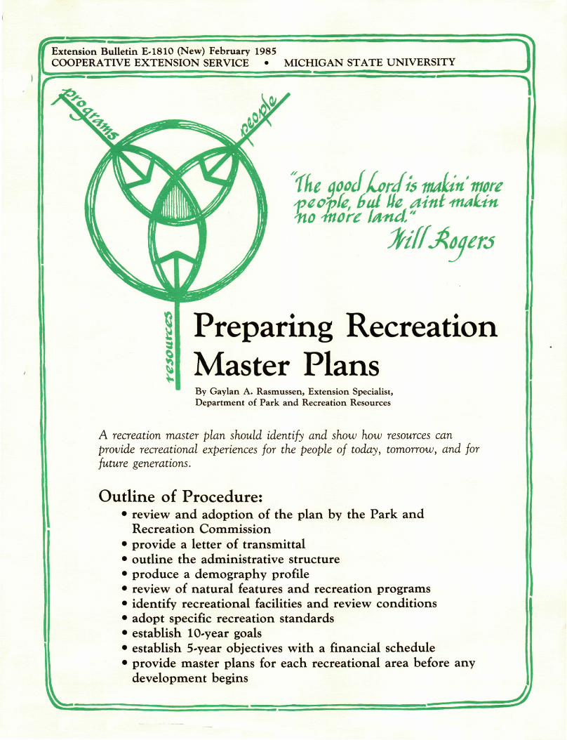
A recreation master plan should identify and show how resources can provide recreational experiences for the people of today, tomorrow, and for future generations.
Outline of Procedure: • review and adoption of the plan by the Park and
Recreation Commission • provide a letter of transmittal • outline the administrative structure • produce a demography profile • review of natural features and recreation programs • identify recreational facilities and review conditions • adopt specific recreation standards • establish 10-year goals • establish 5-year objectives with a financial schedule • provide master plans for each recreational area before any
development begins
J
/ / • R e v i e w and A d o p t i o n of I t h e \ Master P lan
The local governing body should pass a resolution indicating a review and adoption of the recreation plan by the Park and Recreation Commission or other responsible agency.
^
A Letter of Transmitta l
Administrat ive Structure Outline
C 1
HZD - C
k
Demography Profile
{ 11ft!
\
"0 Si $ 0 5
population pyramid
This letter establishes the direct line of communication between the local government unit and recreation committee. This establishes the responsibility for plan implementation. Using the local government letterhead, a letter signed by the commission chair is submitted with the plan to the local unit. This should be done in connection with public hearings. A copy may be sent to the Regional Planning Agency for approval. This is necessary if matching funds are sought from state or federal funding programs.
A brief history dealing with the enabling resolution or ordinance establishing a park and recreation division is appropriate.
Administrative flow-charts show responsibilities within the structure and succinctly describe positions and their relationships within the organization.
Past grants, methods of financing, method of operation and programming techniques may be included in this section.
A community description or map should be used to show land use, school and park locations, and the relationship between public and private recreation areas.
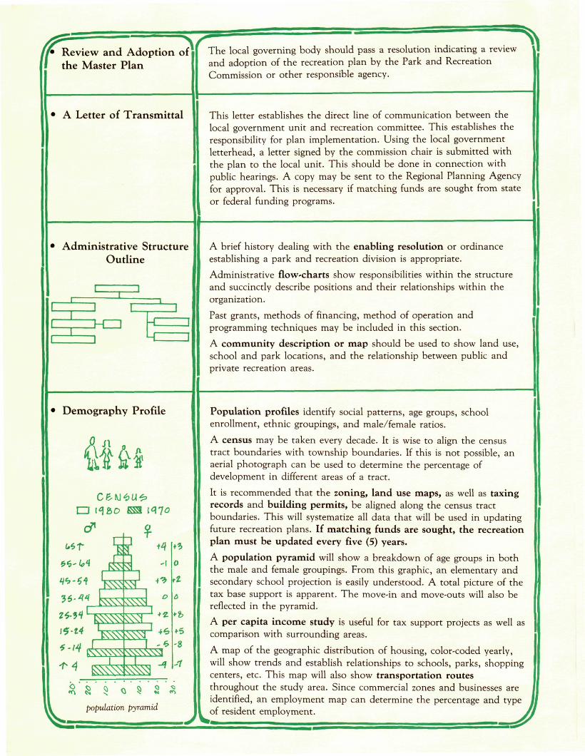
Population profiles identify social patterns, age groups, school enrollment, ethnic groupings, and male/female ratios.
A census may be taken every decade. It is wise to align the census tract boundaries with township boundaries. If this is not possible, an aerial photograph can be used to determine the percentage of development in different areas of a tract.
It is recommended that the zoning, land use maps, as well as taxing records and building permits, be aligned along the census tract boundaries. This will systematize all data that will be used in updating future recreation plans. If matching funds are sought, the recreation plan must be updated every five (5) years.
A population pyramid will show a breakdown of age groups in both the male and female groupings. From this graphic, an elementary and secondary school projection is easily understood. A total picture of the tax base support is apparent. The move-in and move-outs will also be reflected in the pyramid.
A per capita income study is useful for tax support projects as well as comparison with surrounding areas.
A map of the geographic distribution of housing, color-coded yearly, will show trends and establish relationships to schools, parks, shopping centers, etc. This map will also show transportation routes throughout the study area. Since commercial zones and businesses are identified, an employment map can determine the percentage and type of resident employment.
/ / • N a t i Natural Features
rain*nour \y u n & it 10 <? <i e. 7 /* j(
clear Jatfs „ , Ma i * ^ 4 ^ £, 7 g <? to // iz
loo
liiah/foti) ftfflP. •••••frtczwa
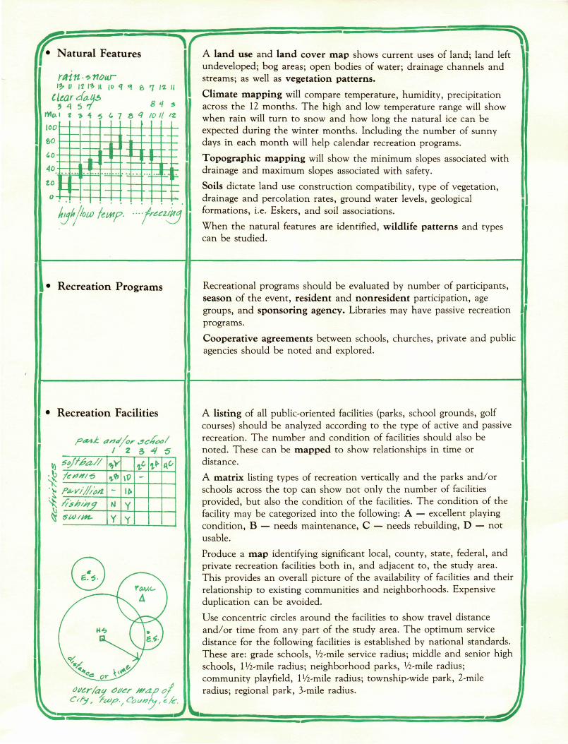
" \ A land use and land cover map shows current uses of land; land left undeveloped; bog areas; open bodies of water; drainage channels and streams; as well as vegetation patterns.
Climate mapping will compare temperature, humidity, precipitation across the 12 months. The high and low temperature range will show when rain will turn to snow and how long the natural ice can be expected during the winter months. Including the number of sunny days in each month will help calendar recreation programs.
Topographic mapping will show the minimum slopes associated with drainage and maximum slopes associated with safety.
Soils dictate land use construction compatibility, type of vegetation, drainage and percolation rates, ground water levels, geological formations, i.e. Eskers, and soil associations.
When the natural features are identified, wildlife patterns and types can be studied.
• Recreation Programs Recreational programs should be evaluated by number of participants, season of the event, resident and nonresident participation, age groups, and sponsoring agency. Libraries may have passive recreation programs.
Cooperative agreements between schools, churches, private and public agencies should be noted and explored.
• Recreation Facilities
pa^k aid/or Jc£<!>o/ I 2 3 4 S
jj so/Ma,// •J> /e*f#/'5
J P+ri///&i \ fob/sty ^ 5tA)/t*L
# 1* \P
Ifr
l> &
K.
A listing of all public-oriented facilities (parks, school grounds, golf courses) should be analyzed according to the type of active and passive recreation. The number and condition of facilities should also be noted. These can be mapped to show relationships in time or distance.
A matrix listing types of recreation vertically and the parks and/or schools across the top can show not only the number of facilities provided, but also the condition of the facilities. The condition of the facility may be categorized into the following: A — excellent playing condition, B — needs maintenance, C — needs rebuilding, D — not usable.
Produce a map identifying significant local, county, state, federal, and private recreation facilities both in, and adjacent to, the study area. This provides an overall picture of the availability of facilities and their relationship to existing communities and neighborhoods. Expensive duplication can be avoided.
Use concentric circles around the facilities to show travel distance and/or time from any part of the study area. The optimum service distance for the following facilities is established by national standards. These are: grade schools, !/2-mile service radius; middle and senior high schools, IVi-mile radius; neighborhood parks, Vz-mile radius; community playfield, 1 Vz-mile radius; township-wide park, 2-mile radius; regional park, 3-mile radius.
• Adopt Standards
two popular sources:
• National Recreation and Park Association (N.R.P.A.) Recreation, Park and Open Space Standards and Guidelines
3101 Park Center Drive
Alexandria, V A 22302
• Urban Land Institute The Denver Background
1200 10th St., N.W., Washington, D.C. 20013
1300 10th St., N.W., Washington, D.C. 20013
The re must be a m e t h o d to de te rmine t he balance be tween the
recreation facilities a n d popu la t ion . Th i s is d o n e by adopt ing a set
of "nat ional ly recognized" s tandards .
It is n o t impor t an t w h a t s tandards are adopted . It is impor t an t to use
the same s tandards in b o t h evaluat ion of t he faci l i ty/populat ion
balance and in t he design and p lann ing of new facilities.
Facility standards are usually based o n uni ts per 1,000 popula t ion , i.e.
ne ighbo rhood park: 1.5 acres/1,000 popula t ion
baseball: 1 field/1,000 popula t ion
basketball : 1 cour t /5 ,000 popula t ion
horseshoes: 1 set /2 ,000 popula t ion
golf course: 1 course/20,000 popula t ion
S tanda rds also give m i n i m u m acreage requirements for various
activities as well as school sites and types of parks .
A pallet of parks must be adopted by the governing body as
r ecommended by the Director of Parks. These parks will range from a
play lot 0/4 acre/1,000) t h r o u g h c o m m u n i t y playfield (1.5 acre/1,000) to
a regional pa rk (10 acres/1,000).
• 10-Year Goals
long range goals
Ten-year goals are in t he form of s ta tements , in general terms, t ha t
express t he communi ty ' s recreat ional desires. These goals will serve as a
guide for recreat ional facility a n d program development .
These represent a c o m m u n i t y ' s c o m m i t m e n t t o future recreat ion
needs.
Ik
5-Year Goals and
Financial Schedule
Five-year objectives or goals are achievable accomplishments t ha t make
10-year goals ob ta inab le .
These objectives represent tasks to be c o m p l e t e d . T h e y should be
derived from a master p lan used to de termine t he sequence of
deve lopment of each individual park in t he recreat ion system.
T h e f inancial p lan parallels these five-year goals. T h e financial suppor t
can be projected over t h e same five-year period.
Monies from local budgets , fees, private funds , federal funds , state funds , a n d other sources should add up to the established project
costs.
I
A master plan (drawing) should be completed for each park in the system. This will establish the best proximity of uses and determine the best circulation pattern. For a complete understanding of the "site development process," see Extension Bulletin E-1252.
If state or federal funding is considered, a detailed site drawing of the development is required. Pre-applications must be submitted. A follow-up visit of the determining officials will precede the approval for obtaining funding in a priority ranking system.
A private consultant should be used when complex comparisons and problems exist. Any development that combines research, program development, analysis,
synthesis, and preliminary design should be directed by someone with experience in the design process.
Since the "contract documents" are a combination of written specifications and control drawings, a qualified designer should be responsible for the completion of these documents.
References:
Recreation Services Division, D.N.R., P.O. Box 30028, Lansing, MI 48824
DeChara, Joseph, Lee Koppleman, Urban Planning and Design Criteria, Van Austin Reinholdt, 1975
N.R.P.A. Recreation Standards
MICHIGAN STATE UNIVERSITY MSU is an Affirmative Action/Equal Opportunity Institution. Cooperative Extension Service programs are open to all without regard to race, color, ^ Z ^ Z national origin, sex, or handicap. Issued in furtherance of cooperative extension work in agriculture and home economics, acts of May 8, and June ^ " ^ ^ 30,1914, in cooperation with the U.S. Department of Agriculture. Gordon E. Guyer, Director, Cooperative Extension Service, Michigan State Univer
sity, E. Lansing, Ml 48824. COOPERATIVE This information is for educational purposes only. Reference to commercial products or trade names does not imply endorsement by the Cooperative EXTENSION Extension Service or bias against those not mentioned. This bulletin becomes public property upon publication and may be reprinted verbatim SERVICE as a separate or within another publication with credit to MSU. Reprinting cannot be used to endorse or advertise a commercial product or company.
New 2-.85-2M, KMF-GP, Price 25<f, Single copy free to Michigan residents. FILE: 36.19