Montgomery County Road Orders 1777 - 1806 County Road Orders 1777 - 1806 ... and checking of the...
281
Historic Roads of Virginia Montgomery County Road Orders 1777 - 1806 Ann Brush Miller Senior Research Scientist Virginia Transportation Research Council Virginia Transportation Research Council by Betty E. Spillman and Shirley P. Thomas New River Historical Society and for the
Transcript of Montgomery County Road Orders 1777 - 1806 County Road Orders 1777 - 1806 ... and checking of the...

Historic Roads of Virginia
Montgomery County Road Orders
1777 - 1806
Ann Brush MillerSenior Research Scientist
Virginia Transportation Research Council
Virginia Transportation Research Council
by
Betty E. Spillman and Shirley P. Thomas
New River Historical Society
and
for the

Standard Title Page - Report on State Project Report No.
Report Date
No. Pages
Type Report: Final
Project No.: 86734
VTRC 08-R14 June 2008 279 Period Covered: July 2007 to May 2008
Contract No.
Title: Montgomery County Road Orders 1777-1806
Key Words: Virginia, Early Roads, Montgomery County, Southwest Virginia
Authors: Betty E. Spillman, Shirley P. Thomas, and Ann B. Miller
Performing Organization Name and Address: Virginia Transportation Research Council 530 Edgemont Road Charlottesville, VA 22903
Sponsoring Agencies’ Name and Address Virginia Department of Transportation 1401 E. Broad Street Richmond, VA 23219
Supplementary Notes
Abstract: The road history projects undertaken by the Virginia Transportation Research Council establish the feasibility of studies of early road networks and their use in the environmental review process. These projects, by gathering and publishing the early road orders of the vast parent counties, also lay the foundation for additional research by local groups over a broad area of Virginia. This volume marks the 26th entry in the Historic Roads of Virginia series, first initiated by the Virginia Transportation Research Council (then the Virginia Highway & Transportation Research Council) in 1973. Montgomery County Road Orders 1773-1776 is the second cooperative effort of the Virginia Transportation Research Council and the New River Historical Society (following Fincastle County Road Orders 1773-1776, which was published in 2007). This volume furthers the coverage of early western Virginia transportation records begun in the previously published Orange County Road Orders 1734-1749, Augusta County Road Orders 1745-1769, Botetourt County Road Orders 1770-1778, and Fincastle County Road Orders 1773-1776. This project covers the first three decades of Montgomery County’s existence, during which time the county covered much of present day southwest Virginia. This information will eliminate the need for further research into the early Montgomery County road order records. If questions arise about early roads once a VDOT road improvement project is already underway (or nearly underway), primary historical research of this nature can take 6 to 12 months to complete. Therefore, this study can be a source of potentially significant cost savings for VDOT, including the avoided costs of project delays and avoided consultant costs for cultural resource studies should questions arise.

MONTGOMERY COUNTY ROAD ORDERS 1777-1806
by
Betty E. Spillman
and
Shirley P. Thomas
New River Historical Society
and
Ann Brush Miller Senior Research Scientist
Virginia Transportation Research Council
Virginia Transportation Research Council (A partnership of the Virginia Department of Transportation
and the University of Virginia since 1948)
Charlottesville, Virginia
June 2008 VTRC 08-R14

ii
DISCLAIMER
The contents of this report reflect the views of the authors, who are responsible for the facts and the accuracy of the data presented herein. The contents do not necessarily reflect the official views or policies of the Virginia Department of Transportation, the Commonwealth Transportation Board, or the Federal Highway Administration. This report does not constitute a standard, specification, or regulation.
Copyright 2008 by the Commonwealth of Virginia.

iii
HISTORIC ROADS OF VIRGINIA Louisa County Road Orders 1742-1748, by Nathaniel Mason Pawlett Goochland County Road Orders 1728-1744, by Nathaniel Mason Pawlett Albemarle County Road Orders 1744-1748, by Nathaniel Mason Pawlett The Route of the Three Notch’d Road, by Nathaniel Mason Pawlett and Howard Newlon An Index to Roads in the Albemarle County Surveyor’s Books 1744-1853, by Nathaniel Mason
Pawlett A Brief History of the Staunton and James River Turnpike, by Douglas Young Albemarle County Road Orders 1783-1816, by Nathaniel Mason Pawlett A Brief History of Roads in Virginia 1607-1840, by Nathaniel Mason Pawlett A Guide to the Preparation of County Road Histories, by Nathaniel Mason Pawlett Early Road Location: Key to Discovering Historic Resources? by Nathaniel Mason Pawlett and
K. Edward Lay Albemarle County Roads 1725-1816, by Nathaniel Mason Pawlett “Backsights,” A Bibliography, by Nathaniel Mason Pawlett Orange County Road Orders 1734-1749, by Ann Brush Miller Spotsylvania County Road Orders 1722-1734, by Nathaniel Mason Pawlett Brunswick County Road Orders 1732-1749, by Nathaniel Mason Pawlett Orange County Road Orders 1750-1800, by Ann Brush Miller Lunenburg County Road Orders 1746-1764, by Nathaniel Mason Pawlett and Tyler Jefferson
Boyd Culpeper County Road Orders 1763-1764, by Ann Brush Miller Augusta County Road Orders 1745-1769, by Nathaniel Mason Pawlett, Ann Brush Miller,
Kenneth Madison Clark and Thomas Llewellyn Samuel, Jr.
iv
Amelia County Road Orders 1735-1753, by Nathaniel Mason Pawlett, Ann Brush Miller, and Kenneth Madison Clark
Fairfax County Road Orders 1749-1800, by Beth Mitchell New Kent County and Hanover County Road Orders 1706-1743, Transcribed from the Vestry Book of St. Paul’s Parish, by Ann Brush Miller Frederick County Road Orders 1743-1772, by Gene Luckman and Ann Brush Miller Botetourt County Road Orders 1770-1778, by Ann Brush Miller Fincastle County Road Orders 1773-1776, by Betty E. Spillman, Shirley P. Thomas, and Ann Brush Miller

v
FOREWORD
by
Ann Brush Miller Virginia Transportation Research Council
Montgomery County Road Orders 1777-1806 is a cooperative project between the New
River Historical Society and the Virginia Transportation Research Council. It is the seventh volume of road orders produced cooperatively between a private group and the Virginia Transportation Research Council. This volume and its companion volume, Fincastle County Road Orders 1773-1776 (which was the first volume sponsored by the New River Historical Society), follow similar projects with the Orange County Historical Society (which sponsored the production of Orange County Road Orders 1734-1749 and Orange County Road Orders 1750-1800), the Culpeper County Historical Society (which sponsored Culpeper County Road Orders 1763-1764), the Fairfax County History Commission (which sponsored Fairfax County Road Orders 1749-1800), and Shenandoah University (which sponsored Frederick County Road Orders 1743-1772).
The location, transcription, and checking of the Montgomery County road orders were
undertaken by Betty E. Spillman and Shirley P. Thomas of the New River Historical Society. Indexing was undertaken at the Virginia Transportation Research Council by Ann Brush Miller.
Particular appreciation is due to Mr. William T. Buchanan of Salem for his interest and
assistance in the preparation of this volume. In addition, three major regional histories, F. B. Kegley’s Kegley’s Virginia Frontier (Roanoke, Va., 1938), Mary B. Kegley and F. B. Kegley’s Early Adventurers on the Western Waters, Vol. 1 (Orange, Va., 1980), and Mary B. Kegley’s Early Adventurers on the Western Waters, Vol. 2 (Orange, Va., 1982), were extremely helpful in identifying the names of early settlers and places, particularly where the early records were difficult to read because of the vagaries of eighteenth and early nineteenth century spelling and handwriting. Special appreciation is also due to Ms. Mary B. Kegley of Wytheville, author of several of the above-cited works, for her interest in and encouragement of this project and for her kind assistance in further identifying various locations and individuals in the early county records.
Additional assistance, so to speak, was rendered by an earlier researcher, Lewis Preston
Summers, in Annals of Southwest Virginia (Abingdon, Va., 1929). This work included the early court minutes of Montgomery County, some of which contain information pertaining to court order books for which entries are now partly torn or deteriorated. In a number of cases, torn or illegible words in road orders were filled in from Summers’ text.
Montgomery County Road Orders 1777-1806 covers early transportation records for an
extensive portion of present-day southwestern Virginia. At its creation from Fincastle County in 1777, Montgomery County included within its territory the modern counties of Montgomery, Giles, Floyd, Pulaski, Carroll, Wythe, Bland, and Tazewell; parts of Craig, Smyth, and

vi
Buchanan; and most of Grayson. A part of present-day southern West Virginia was also within the original boundaries of Montgomery County.
This volume is the twenty-sixth entry in the Historic Roads of Virginia series, initiated by
the Virginia Transportation Research Council (then the Virginia Highway & Transportation Research Council) in 1973. Montgomery County Road Orders 1777-1806 is the sixth volume of published road orders to be concerned with the early transportation records of western and southwestern Virginia. It follows Fincastle County Road Orders 1773-1776, Botetourt County Road Orders 1770-1778, Frederick County Road Orders 1743-1772, Augusta County Road Orders 1745-1769, and Orange County Road Orders 1734-1749 (which included road orders for the period during which the territory west of the Blue Ridge Mountains was part of Orange County, prior to 1745).

vii
A NOTE ON THE METHODS, EDITING, AND DATING SYSTEM
by
Nathaniel Mason Pawlett (Faculty Research Historian, Virginia Transportation Research Council, 1973-1995)
The road and bridge orders contained in the order books of an early Virginia county are
the primary source of information for the study of its roads. When extracted, indexed, and published by the Virginia Transportation Research Council, they greatly facilitate this. All of the early county court order books are in manuscript, sometimes so damaged and faded as to be almost indecipherable. Usually rendered in the rather ornate script of the time, the phonetic spellings of this period often serve to complicate matters further for the researcher and recorder.
With these road orders available in an indexed and cross-indexed published form, it will be possible to produce chronological chains of road orders illustrating the development of many of the early roads of a vast area from the threshold of settlement through much of the eighteenth century. Immediate corroboration for these chains of road orders will usually be provided by other evidence such as deeds, plats, and the Confederate Engineers maps. Often, in fact, the principal roads will be found to survive in place under their early names.
With regard to the general editorial principles of the project, it has been our perception over the years as the road orders of Louisa, Hanover, Goochland, Albemarle, and other counties have been examined and recorded that road orders themselves are really a variety of “notes,” often cryptic, incomplete, or based on assumptions concerning the level of knowledge of the reader. As such, any further abstracting or compression of them would tend to produce “notes” taken from “notes,” making them even less comprehensible. The tendency has, therefore, been in the direction of restraint in editing, leaving any conclusions with regard to meaning up to the individual reader or researcher using these publications. In pursuing this course, we have attempted to present the reader with a typescript text that is as near a type facsimile of the manuscript itself as we can come.
Our objective is to produce a text that conveys as near the precise form of the original as we can, reproducing all the peculiarities of the eighteenth-century orthography. While some compromises have had to be made because of the modern keyboard, this was really not that difficult a task. Most of their symbols can be accommodated by modern typography, and most abbreviations are fairly clear as to meaning.
Punctuations may appear misleading at times, with unnecessary commas or commas
placed where periods should be located; appropriate terminal punctuation is often missing or else takes the form of a symbol such as a long dash, etc. The original capitalization has been retained insofar as it was possible to determine from the original manuscript whether capitals were intended. No capitals have been inserted in place of those originally omitted. The original spelling and syntax have been retained throughout, even including the obvious errors in various places, such as repetitions of words and simple clerical errors. Ampersands have been retained

viii
throughout to include such forms as “&c” for “etc.” Superscript letters have also been retained where used in ye, yt, sd. The thorn symbol (y), pronounced as “th,” has been retained in the aforesaid “ye,” pronounced “the,” and “yt” (that). The tailed “p” (resembling a capital “p” with the tail extended into a loop) has also been retained. This symbol has no counterpart in modern typography; given the limits of the modern keyboard, we have rendered it as a capital “p” (P). This should be taken to mean either “per” (by), “pre,” or “pro” (sometimes “par” as in “Pish” for parish) as the context by the order may demand. For damaged and missing portions of the manuscripts we have used square brackets to denote the [missing], [torn] or [illegible] portions. Because of the large number of ancient forms of spelling, grammar, and syntax, it has been deemed impracticable to insert the form [sic] after each one to indicate a literal rendering. Therefore, the reader must assume that apparent errors are merely the result of our literal transcription of the road orders, barring the introduction of typographical errors, of course. If, in any case, this appears to present insuperable problems, resort should be made to the original records.
As to dating, most historians and genealogists who have worked with early Virginian records will be aware of the English dating system in use down to 1752. Although there was an eleven-day difference from our calendar in the day of the month, the principal difference lay in the fact that the beginning of the year was dated from March 25 rather than January 1, as was the case from 1752 onward to the present. Thus, January, February, and March (to the 25th) were the last three months in a given year, and the new year came in only on March 25.
Early Virginian records usually follow this practice, though in some cases dates during these three months will be shown in the form 1732/3, showing both the English date and that in use on the Continent, where the year began January 1. For researchers using material with dates in the English style, it is important to remember that under this system (for instance) a man might die in January 1734 yet convey property or serve in public office in June 1734, since June came before January in a given year under this system.

ix
INTRODUCTION
by
Ann Brush Miller
The roads are under the government of the county courts, subject to be controuled by the general court. They order whenever they think them necessary. The inhabitants of the county are by them laid off into precincts, to each of which they allot a convenient portion of the public roads to be kept in repair. Such bridges as may be built without the assistance of artificers, they are to be built. If the stream be such as to require a bridge of regular workmanship, the court employs workmen to build it, at the expense of the whole county. If it be too great for the county, application is made to the general assembly, who authorize individuals to build it, and to take a fixed toll from all passengers, or give sanction to such other proposition as to them appears reasonable.
—Thomas Jefferson, Notes on the State of Virginia, 1781
The establishment and maintenance of public roads were among the most important functions of the county court during the colonial period in Virginia. Each road was opened and maintained by an Overseer of the Highways appointed by the Gentlemen Justices yearly. He was usually assigned all the “Labouring Male Titheables” living on or near the road for this purpose. These individuals then furnished all their own tools, wagons, and teams and were required to labor for six days each year on the roads.
Major projects, such as bridges over rivers, demanding considerable expenditure were executed by commissioners appointed by the court to select the site and to contract with workmen for the construction. Where bridges connected two counties, a commission was appointed by each and they cooperated in executing the work.
At its creation from Fincastle County in 1777, Montgomery County extended throughout a considerable portion of modern southwestern Virginia. Its original territory included the modern counties of Montgomery, Floyd, Giles, Pulaski, Carroll, Wythe, Bland, and Tazewell; portions of Craig, Buchanan, and Smyth; and most of Grayson. In addition, a portion of what is now southern West Virginia was within the original boundaries of Montgomery County.
The first major reduction to Montgomery County’s territory came with the creation of Wythe County from the western half of Montgomery County in 1790. In 1806 came a further significant loss of territory, when approximately two-thirds of the northwestern area of Montgomery and the northeastern portion of neighboring Wythe County were cut off to form Giles County. Final reductions to Montgomery County’s territory came in the 1830s: Floyd County was created from the southern half of Montgomery County’s remaining territory in 1831, and in 1839, Montgomery County reached its current boundaries when the western section of Montgomery County and the eastern section of Wythe County were cut off to form Pulaski County.

x
The road orders contained in this volume cover the period from 1777, when Montgomery County’s government became operational, to the establishment of Giles County in 1806. These road orders comprise the principal extant evidence concerning the early development of roads over a large area of southwestern Virginia, and adjoining regions, during and in the years after the American Revolution.

1
Montgomery County Road Orders 1777-1806 [Note: The early court orders in the Montgomery County Order Books, particularly in the first four order books, were entered in a somewhat unconventional fashion. Montgomery County Order Book (MCOB) 1, pp. 1-149, and MCOB 2, pp. 1-151, contain the court orders for Fincastle County, which became extinct upon the creation of Montgomery County and several other counties in 1777. The court orders for Montgomery County begin at MCOB 2, p. 152 (some of the same orders are recorded in MCOB 3), and then are continued in the last half of MCOB 1, and then in MCOB 4. Beginning with MCOB 4, the books and order entries are in standard order, except for some duplicate or similar orders in MCOB 6 and MCOB 7. Duplicate or similar orders are noted as they appear. In addition, some portions of the Montgomery County Order Books are torn or missing. In such cases, the word “torn” is inserted in brackets. Where the text is crossed out so heavily that it is not legible, the words “crossed out” are inserted in brackets. References citing “Summers” indicate that missing or torn words or phrases were filled in from Lewis Preston Summers’ Annals of Southwest Virginia (1929). Notes citing “Kegley and Kegley (1980)” or “Kegley (1982)” indicate material found in Mary B. Kegley and F. B. Kegley’s Early Adventurers on the Western Waters, Vol. 1 (1980), or Mary B. Kegley’s Early Adventurers on the Western Waters, Vol. 2 (1982). Montgomery County Order Book 2 and Montgomery County Order Book 3 [Note: There is considerable duplication of entries for the period between 1778 and 1780 in MCOB 2 and MCOB 3. The present copy of MCOB 3 in the Montgomery County Court House in Christiansburg is a photocopy of the original. Each page has a strike drawn from top to bottom probably indicating it had been copied into another book. Most of the MCOB 3 road orders also appear in MCOB 2. The entries here are presented chronologically; where MCOB 2 and MCOB 3 have entries that are the same or similar, both entries are presented, with the duplicate or similar entries from MCOB 3 and other entries from MCOB 3 given in italics. Most pages in MCOB 3 have two sets of page numbers; where this is the case, both numbers are given.] 8 January 1777, Montgomery County Order Book 2, p. 154 Ordered that John Heavin be appointed overseer of the road from Strubles Creek to the upper End of Michael Prices Field in the room of John Hill & that he with the usual hands keep the same in repair according to Law -- 6 May 1777, MCOB 2, p. 157 John Wylie appointed overseer of the Road from the Seven Mile Tree to Colo William Inglishes Ferry in the room of Henry Stafford and the [torn]ual [Summers, p. 680, “usual”] hands to work thereon 6 May 1777, MCOB 2, p. 157 [torn]ermon [Summers, p. 680, “Harmon”] [Note: The name appears to be “Herman.”] Cook appointed overseer of the road from sd County Line to the Seven Mile Tree [torn: Summers, p. 681, “and”] the usual hands to work thereon.

2
6 May 1777, MCOB 2, p. 158 James McCorkle Gent appointed overseer of the road from the lower Foord of R[torn: Summers, p. 681, “Reed”] Creek to McCauls Foarding in the room of James Simpson and that he with all [torn: Summers “the”] Tithables on this side of reed Creek and this side New River along by the Mines and [torn: Summers “up”] as farr as Wm Henleys on Cripple Creek and Cross from Wm Henleys to the Cove [torn: Summers “including”] all the hands below the Cove from John Boyds down to Peek Creek keep the same in repair and that John Crockett and James Newell do allot the list of hands to [torn: Summers “work”] said road Including George Ewing Samuel Ewing and Samuel Ewing Junr. Bart[torn: Summers “Bartlet”] Green and Jno Rutherford on Cripple Creek. 2 September 1777, MCOB 2, p. 159 Ordered that John Middleton who lives on Michael Doughertys Plantation be Summoned to appear at the next Court to Show Cause why he Turned the Road by said Doughertys house and Stoped up the main road. 4 March 1778, MCOB 2, p. 163 Charles Blakey appointed overseer of the road in the room of Alexr Wylie. 8 April 1778, MCOB 3, p. 3 Ordered that Henry Patton, Nathaniel Morgan & John Crook Wm [?] Baker being first sworn view and mark the nearest and best way from the where Mr Thompsons Path leaves the great Road to the Forks of the Paths leading to Capt Taylors & Mr Peppers & make return thereof to next Court [Note: There is no corresponding entry in MCOB 2.] 5 May 1778, MCOB 2, p. 168 On the Petition of Sundry Inhabitants of this County setting fourth the necessity of opening a Road from where the Carolina Road Crosses Poplar Camp Mountain and along by Samuel Ewings, and by John Maxwells, Captain Buchanans and into the County Road at William Davises. Ordered that James Newell Patrick Campbell, Captain Francis and Adam Dean be appointed to view the Conveniences and Inconveniencies attending the said road, and make return thereof to the next Court. 5 May 1778, MCOB 3, p. 6 [or at bottom p. 8] On the motion of sundry persons of this county [faded] said petitioning that there be a road Established [faded] from the Carolina road where it crosses Popular Camp Mountain to [faded] New River [faded] from thence by Jno Maxwells at [faded] to Capt Buchanan at the head of the middle fork of [faded] & into the Country road at Wm Davis’s Mill ordered that Jas Newell Patrick Campbell, Capt. Francis and Adam Dean be appointed to View the Conveniences & inconveniences attending in Establishing the road [faded] petitioned for make a report thereof to the next Court.

3
5 May 1778, MCOB 2, p. 168 On the motion of Joseph Gray and others Petitioning that the road may be opened, turning out the Main Road between James Alisons and Peek Creek and thence by Thomas Pattons down the hollow to Samuel Peppers Crossing the River at the said Peppers and thence into the road leading to Botetourt County It is ordered that the said Motion be put of untill the next Court, and that John Taylor be summoned to appear at the next Court to shew Cause why the said Road may not be Established. 5 May 1778, MCOB 3, p. 6 [or p. 8] On the motion of Joseph Grey & many others petitioning that the road may be opened turning out of the main road between James Allison & Peek Creek & thence by Thos Patterns down the hollow to Saml Peppers’ Crossing the river there into the road that leads down to Botetourt & report [torn] next Court that Mr Jno Taylor is Summoned to answer at the same time to show cause why the said road may not be Established. 5 May 1778, MCOB 2, p. 168 Ordered that the Road from the Lead Mines to John Newlands be Continued and that Adam Dean be appointed Overseer of the same from the said Mine to the Thorn branch George Ewing from the sd branch to Captain Francis’s David Miller from Capt Francis’s to John Maxwells, and James Douglas from Maxwells to John Newlands and that James Newell and Samuel Ewing Junr allot the hands to work on the lower part of the said Road and William Ewing and Robert Reaugh the same on the upper part and that they keep the same in repair according to Law. 5 May 1778, MCOB 3, p. 6 [or p. 8] [Note: Some names in this entry differ from those in MCOB 2, p. 168.] Ordered that the road be continued from the Mines to Jno Newlands & that Wm Dean be appointed overseer of the same from the Mines to the Thorn Branch & Geo Ewing from sd branch to Capt. Francis’s & Capt Francis David Miller from Capt. Francis to Jno Hayfelds & Jas Douglass from there to Jno Newland & that Wm Newell & Saml Ewing Junr allot the hands to work on the lower part of said road & Wm Ewing & Robt [illegible: “Reaugh” in MCOB 2, p. 168] the same in the upper part & that they keep the same in repair accd To Law. 4 August 1778, MCOB 2, p. 170 Charles Davereux appointed overseer of the Road from the Lead Mines to Evan Williams’s and Joseph Barren from Evan Williams’s to the fork of the road at Michael Dougherties new house and that they with the usual hands keep the same in repair. 4 August 1778, MCOB 3, p. 8 [or p. 10] Charles Deverix Gent appointed Overseer of the road from Lead mines to Evan Williams & Joseph Barron Sen. is appointed oversr of the road from Sd Williams’s to the fork of the road at Michl Daugherties new house & that they with the usual hands keep the Same in repair accd to Law
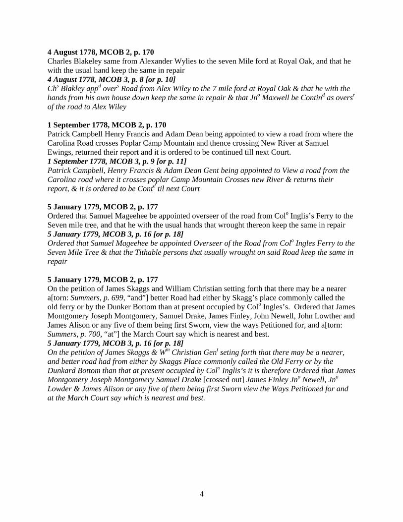
4
4 August 1778, MCOB 2, p. 170 Charles Blakeley same from Alexander Wylies to the seven Mile ford at Royal Oak, and that he with the usual hand keep the same in repair 4 August 1778, MCOB 3, p. 8 [or p. 10] Chs Blakley appd overs Road from Alex Wiley to the 7 mile ford at Royal Oak & that he with the hands from his own house down keep the same in repair & that Jno Maxwell be Contind as oversr
of the road to Alex Wiley 1 September 1778, MCOB 2, p. 170 Patrick Campbell Henry Francis and Adam Dean being appointed to view a road from where the Carolina Road crosses Poplar Camp Mountain and thence crossing New River at Samuel Ewings, returned their report and it is ordered to be continued till next Court. 1 September 1778, MCOB 3, p. 9 [or p. 11] Patrick Campbell, Henry Francis & Adam Dean Gent being appointed to View a road from the Carolina road where it crosses poplar Camp Mountain Crosses new River & returns their report, & it is ordered to be Contd til next Court 5 January 1779, MCOB 2, p. 177 Ordered that Samuel Mageehee be appointed overseer of the road from Colo Inglis’s Ferry to the Seven mile tree, and that he with the usual hands that wrought thereon keep the same in repair 5 January 1779, MCOB 3, p. 16 [or p. 18] Ordered that Samuel Mageehee be appointed Overseer of the Road from Colo Ingles Ferry to the Seven Mile Tree & that the Tithable persons that usually wrought on said Road keep the same in repair 5 January 1779, MCOB 2, p. 177 On the petition of James Skaggs and William Christian setting forth that there may be a nearer a[torn: Summers, p. 699, “and”] better Road had either by Skagg’s place commonly called the old ferry or by the Dunker Bottom than at present occupied by Colo Ingles’s. Ordered that James Montgomery Joseph Montgomery, Samuel Drake, James Finley, John Newell, John Lowther and James Alison or any five of them being first Sworn, view the ways Petitioned for, and a[torn: Summers, p. 700, “at”] the March Court say which is nearest and best. 5 January 1779, MCOB 3, p. 16 [or p. 18] On the petition of James Skaggs & Wm Christian Gent seting forth that there may be a nearer, and better road had from either by Skaggs Place commonly called the Old Ferry or by the Dunkard Bottom than that at present occupied by Colo Inglis’s it is therefore Ordered that James Montgomery Joseph Montgomery Samuel Drake [crossed out] James Finley Jno Newell, Jno Lowder & James Alison or any five of them being first Sworn view the Ways Petitioned for and at the March Court say which is nearest and best.

5
2 March 1779, MCOB 2, p. 180 Robert Davies appointed [torn: Summers, p. 703, and MCOB 3, p. 20 (or 22) “overseer of the road from Alexander Wylies to the South”] fork of Reed Creek, along with John M[torn: Summers and MCOB 3 “Maxwell”] and that William [torn: Summers and MCOB 3 “Davies”] and [torn: Summers and MCOB 3 “William”] Doak Gentlemen appoint the hands and lay off the bounds for each overseer 2 March 1779, MCOB 3, p. 20 [or p. 22] Robert Davies appointed overseer of the road from Alexr Wylies to the South Fork of reed Creek along with Jno Maxwell and that Wm Davies & Wm Doak Gent appoint the hands and the bounds for Each Overseer. 2 March 1779, MCOB 2, p. 180 Ordered that James Montgomery (Peek Creek) and Samuel Cecil be overseers of the Road from Peppers ferry to where Mr William Thompsons [“path joins the great” in MCOB 3, p. 23 (25)] Road according as the same may be marked and laid off by the viewers appointed for that purpose by this Court and that the said Overseers with the Tithables between said Road and the Mountain as low as Abraham Browns do open and keep the same in repair. 2 March 1779, MCOB 3, p. 23 [or p. 25] Ordered James Montgomery Peek Creek & Samuel Cecil be Overseer of the high way from Peppers Ferry to where Mr Wm Thompsons path joins the great Road according as the same may be marked and laid off by the Viewers appointed for that Purpose by this Court and that the sd Overseer with the Tithables between sd Road and the mountain as low as Abram Browns do open & keep the same in Repair. 2 March 1779, MCOB 2, p. 180 Ordered that John Havens be appointed Overseer of the Road from Peppers Ferry to the forks of the Road above Prices, and that with the usual Tithables he keep the same in good repair 2 March 1779, MCOB 3, p. 23 [or p. 25] Ordered that John Heavin be overseer of the Highway from Peppers Ferry to the Forks of the Road above Prices & that with the usual Tithables he keep the same in good Repair [Written in the left margin] copd 3 March 1779, MCOB 2, p. 180 It appearing to this Court that a Ferry across New River at Samuel Peppers is absolutely necessary for the safety of the great number of Travellers who are obliged to pass the river at the above place, they do therefore appoint a Ferry at Samuel Peppers across the River & do make the following rates to be observed by said Pepper, for man & horse 2/ for Carriages the same in proportion according to Law and the rates to be observed till next August Court 3 March 1779, MCOB 3, p. 24 [or p. 26] It appearing to the Court that a Ferry across New River at Samuel Peppers is absolutely necessary for the Safety & Conveniences of the great number Travellers who are obliged to pass the River at the above place they do appoint a Ferry at Saml Peppers across the River, & do make the following Rates to be observed by said Pepper for man & horse 2/ fer Carriages the same in Proportion according to Law & the rates be contd To next August Court. copy sent.

6
3 March 1779, MCOB 2, p. 181 An order being made at last Court to view the several ways Petitioned for by James Scaggs and Colo. Christian and no legal Report being returned Ordered that James Montgomery Senior John Lowder Samuel Drake John Newell, Joseph Cloyd Peter Wylie Henry Patton Frederick Edwards and Andrew Crockett or any five of them being first Sworn do me[torn: Summers, p. 705, and MCOB 3, p. 22 (or 24), “meet”] and view the Road by Colo. Inglis Ferry from the Sinking Spring on the west side new [torn: Summers and MCOB 3 “River”] to the Seven mile tree on the east side thereof: also the road by the old ferry [torn: Summers and MCOB 3 “where”] James Scaggs lives from said Spring to the Seven mile tree and make a report [torn: Summers and MCOB 3 “of the”] Conveniences and Inconveniences of each Road as also the difference in the [torn: Summers and MCOB 3 “distance”] of said Roads after measuring them exactly to the next Court. 2 March 1779, MCOB 3, p. 22 [or p. 24] On order being made at last Jany Court to view the several Roads in Dispute between James Skeggs & Colo Ingles & no legal Report being returned, ordered that James Montgomery Sr Jno Lowder Saml Drake, Jno Newell James Finly Joseph Cloyd, Peter Wiley, Henry Patton, Frederick Edwards. & Andw Crockett, or any five of them being first sworn do meet and View the Road by Colo Ingles Ferry from the Sinking Spring on the west side the River to the Seven Mile Tree on the east side thereof; also the road by the old Ferry where James Scaggs lives from S. Spring to the 7 Miles Tree and make report of the Conveniences and Inconveniences of Each Road an also the Difference in the Distances of sd Roads after measuring them exactly, to next Court. [Note: The numbering at the top of the page in MCOB 3 starts over at 1.] 7 April 1779, MCOB 2, p. 182 [torn: Summers, p. 706, and MCOB 3, p. 3 (or 34), “Ordered”] that Charles Blakeley be overseer of the Road from Alexander [torn: Summers and MCOB 3 “Wylies to”] the ford of Holston at Captain John Campbells, and that all [torn: Summers and MCOB 3 “tithables”] from his own house to the line between this and Washington [torn: Summers and MCOB 3 “County line work thereon.”] 7 April 1779, MCOB 3, p. 3 [or p. 34] Ordered that Charles Blakely be overseer of the road from Alexr Wylies to the foord at Capt Jno Campbells, and that all the Tithables from his own House, to the line between this and Washington County, work thereon. 2 June 1779, MCOB 2, p. 201 Ordered that Samuel Pepper be allowed to demand and receive for setting a man and horse across New River at his ferry the sum of four shillings from and after this untill the 3d day of August next. William Inglis and David Herbert same during same time and no more John Craig same and so in proportion according to Law. 2 June 1779, MCOB 3, p. 42 [or p. 73] Ordered that Samuel Pepper be allowed to demand & receive for seting a man & horse across New River at his Ferry the sum of four Shillings from and after this date until the 3rd day of Aug. next. William Inglish the same during sd time David Herbert Junr same for same time and nothing more and so in proportion for other things. Jno Craig Same.

7
2 June 1779, MCOB 2, p. 201 Ordered that John Miller be appointed overseer of the Road from the foord of Reed Creek at Doughertys to the ford of the same at Bells. 2 June 1779, MCOB 3, p. 42 [or p. 73] Ordered that Jno Miller be appointed overseer of the road from the foord of Reed Creek at Doughertys to the foord at George Bells. 4 August 1779, MCOB 2, p. 204 Ordered that John Miller be appointed Overseer of the road from the foord of Reed Creek to the foord of the same at Bells, and that Montgomery James Macgavock and James Montgomery Gentlemen appoint the hands to work thereon 4 August 1779, MCOB 3, p. 48 [or p. 79] Ordered that Jno Miller be appointed overseer of the Road from the foord of Reed Creek to the foord of the Same Creek at Bells and that Jno Montgomery Jas M Gavock and Jas Montgomery Gent do appoint the hands to work thereon. 4 August 1779, MCOB 2, p. 259 Ordered that the Several Ferries in this County over New River be rated as follows viz four Shillings for man and horse, and so in proportion for other things and that the sd Rates Continue till next Court and no longer. 4 August 1779, MCOB 3, p. 58 [or p. 89] Ordered that the Several Ferries in this County over New River be rated as follows viz four Shillings for man and horse and so in proportion for other things and that the sd rates continue until Next Court, and no longer. 6 October 1779, MCOB 2, p. 269 Ordered that Captain James Montgomery John Miller Robert Miller James and Joseph Montgomery Josiah Ramsey Francis Day, John Adams, and Frederick Edwards or any five of them being first sworn view a way from Samuel Ingrams by James Montgomeries to James Finleys and make report of the conveniences and Inconveniences to the next Court. [Note: There is no corresponding entry in MCOB 3.] 6 October 1779, MCOB 2, p. 269 Ordered that John Adams, James Finley, and James Dougherty being first being first Sworn view the nearest and best way from Dougherties house over Reed Creek to the potters and make report of the Conveniences and inconveniences to the next Court. 6 October 1779, MCOB 3, p. 79 [or p. 110] Ordered that Jno Adams James Finley and James Dougherty being first sworn view the nearest and best way from Doughertys house over Reed Creek to the potters and report the conveniences and inconveniences to the next Court

8
2 November 1779, MCOB 2, p. 269 Ordered that George Taylor Philip Barringer, Joseph Gray and Peter Stephens or any three of them view the road Cleared and opened by Herman Cook and report the Conveniences and inconveniences to the next court, also of the old road and also to see both roads measured by men on oath. 2 November 1779, MCOB 3, p. 80 [or p. 111] Ordered that George Taylor, Philip Barringer, Jos Gray and Peter Stevens view the Road Cleared and opened by Herman Cook or any three of them and report the Conveniences & Inconveniences to the next Court, also of the old Road. And also to see both Roads Measured -- by men on oath 2 November 1779, MCOB 2, p. 270 James Montgomery, John Adams, James and Joseph Montgomery and John Miller who were appointed last court to view a road from Samuel Ingrams to James Finleys returned their report that there may be a good Road had if it were properly Cleared, ordered that the sd report be continued 2 November 1779, MCOB 3, p. 80 [or p. 111] James Montgomery, Jno Adams, James & Jos Montgomery P.C. and Jno Miller who were appd last Court to view a Road from Samuel Ingrams to James Finleys retd report that there may be a good Road had if it were properly Cleared. Ordered that the sd rept be Continued [crossed out] 3 November 1779, MCOB 2, p. 285 Ordered that Joseph How, Wm Thompson, John Crockett, Frederick Edwards Samuel Drake, Samuel Montgomery, and John Hall, or any four of them being first Sworn do view the way from the Sinking Spring by way of James Montgomeries and Millers into the main road above fort Chiswell and that they report the Conveniences and inconveniences thereof as well as of the present great Road, that a pilot and Chain Carrier be employed by the viewers at the County expence the Chain Carriers to be sworn 3 November 1779, MCOB 3, p. 85 [or p. 116 or p. 101] Ordered that James Joseph How Wm Thompson Jno Crockett Fred Edwards Samuel Drake Samuel Montgomery John Hall, or any four of them being first Sworn do view the way from Sinking Spring by way of James Montgomerys and Millers into the main Road above Fort Chiswell and that they report the Conveniences and inconveniences thereof as well as of the present great Road that a pilot and chain Carriers be employed by the viewers at the County Expence the Chain Carriers to be sworn.

9
3 November 1779, MCOB 2, p. 285 Ordered that James Finley John Adams James Dougherty Josiah Ramsey and James Simpson or any three of them being first Sworn do view the several ways proposed for the road between the Potters and Munceys and report the Conveniences and Inconveniences of them as well as of the road at present used also where alterations may be made also that two men be employed at Public expense to measure the several ways so that the distances may be known likewise to report where the roads has been altered by different people and the conveniences and inconveniences as to the people & Publick 3 November 1779, MCOB 3, p. 85 [or p. 116 or p. 101] Ordered that James Finley Jno Adams James Dougherty Josiah Ramsey and James Simpson or any three of them being first Sworn do view the several ways proposed for the road betwixt the Potters and Munceys and report the conveniences and inconveniences of them as well as of the Road at present used where alterations may be proposed also that two men be employ’d at publick Expence to measure the Several ways so that the distance may be known Likewise to report where the roads has been turned by different People and the conveniences and inconveniences as to both People and Publick thereby 3 November 1779, MCOB 2, p. 286 Ordered that Colo William Christian have leave to keep a Ferry at the Dunkard Bottom and to Charge a dollar for man and horse and so in proportion for other things. 3 November 1779, MCOB 3, p. 85 [or p. 116 or p. 101] Ordered that Colo Christian have leave to keep a Ferry kept at the Dunkard Bottom & to Charge 1 Dollar for man and horse and so in proportion for other things 7 March 1780, MCOB 2, p. 286 Ordered that Andrew Hatfield be appointed overseer of the Road from the foot of Peters Mountain to the hollow of doe Creek. 7 March 1780, MCOB 3, p. 86 [or p. 117] Ordered that Andw Hatfield be appointed overseer of the road from the foot of Peters Creek Peters Creek Mountain to the hollow of Doe Creek 7 March 1780, MCOB 2, p. 286 Parker Atkinson from the hollow of Doe Creek to the Steep Bank of Sinking Creek. 7 March 1780, MCOB 3, p. 86 [or p. 117] Parker Atkins from the hollow of Doe Creek to the Steep Bank of Sinking Creek. 7 March 1780, MCOB 2, p. 286 George Fry Senr From the Steep Bank of Sinking Creek to Thoms Creek. 7 March 1780, MCOB 3, p. 86 [or p. 117] George Fry Senr From the Steep Bank of Sinking Creek to Thoms Creek [crossed out]

10
7 March 1780, MCOB 2, p. 286 An order being made at the last Court to view the Road from Hans Meadows by James Byrns; as also the Old Road: Returned their report, that the New Road is most Convenient for Travellers. Ordered that the sd new road be Established, and that John Harrison be appointed Overseer thereof from the County Line to the seven Mile Tree, and that Samuel Mogeehee be overseer from the Seven Mile tree to the River. 7 March 1780, MCOB 3, p. 87 [or p. 118] An order being made at the last Nov. Court to view the Roads from Hans meadow by James Byrns, as also the Old road returned their Report that the new road is the most convenient for Travellers. Ordered that the sd New road be Established, and that Jno Harrison be appointed overseer thereof from the County Line to the Seven mile tree and Samuel M.Geehee from the Seven Mile tree to the river 8 March 1780, MCOB 2, p. 289 Ordered that Joseph How, William Thompson, John Crockett, Frederick Edwards, Samuel Drake, Samuel Montgomery, and John Hall or any four of them being first Sworn, do view the way from the Sinking Spring by way of James Montgomerys, and Millers into the road above Fort Chiswell and make report of the Conveniences and Inconveniences thereof as well as the present great Road, and that a Pilot and Chain Carriers be employed by the viewers at the County expence the Chain Carriers to be sworn. [Note: There is no corresponding entry in MCOB 3.] 8 March 1780, MCOB 2, p. 290 Robert Buchanan appointed Overseer of the road in the room of John Maxwell with the usual hands that wrought thereon [Note: There is no corresponding entry in MCOB 3.] 8 March 1780, MCOB 2, p. 290 Christian Martin appointed overseer of the Road from Thoms Creek to the Glades, and it is ordered that he with the Tithables adjacent thereto open and keep the same in repair. [Note: There is no corresponding entry in MCOB 3.] 8 March 1780, MCOB 2, p. 291 Ordered that Peter Stiffey and Isaac Peterson be appointed overseers of the Road from the Glades to hans Meadows and that they with the usual Tithables keep the same in repair and that James Byrn Gent divide the hands between them [Note: There is no corresponding entry in MCOB 3.]

11
2 August 1780, MCOB 3, p. 101 [or p. 132] The petition of John Miller, Joseph Johnson, William Welt , James Johnson, John Pusey, Alexr Montgomery, Peter Harman, Thos Maxwell, James Maxwell, John Taylor, Thos Witton Jur Chrisly Hensley, John Perry Robt Moffett James Walhan William Wynn [or Wyms?], Peter Edwards, Berry Miller, Isaac Gray Robert Worsham. To the worshipful Court of Montgomery that a road is greatly wanted from
Where your Petitioners lives in the most Remote part of your County and no roads leading there but small paths contrary to the Interest of your Petitioners
Leave is granted them to clear a road from the head of Clinch to Mr William Thompsons on Back Creek and that the Tithables in each District where the road goeth may open and keep the same in Repair and that Thomas Whitton be overseer of the road from Wm Winns to the Rockey Gap on Wolf Creek. Alexander Sutter from the sd Gape to Wm Lockharts on Walkers Creek and the sd Wm Lockhart from his house to Wm Thompsons on back Creek. Capt Taylor and Capt Moffet to Divide the hands between the different overseers. [Note: There are no corresponding entries in Summers or in MCOB 2.] 2 August 1780, MCOB 3, p. 102 [or p. 133] Ordered that the viewers appointed at March Court to view the way from the Sinking Spring to the great road above fort Chiswell [torn] their report to the next Novr Court [Note: There are no corresponding entries in Summers or in MCOB 2.] [Note: This is the last road order entry in MCOB 3. The entries for 1780 resume in MCOB 2.] 9 November 1780, MCOB 2, p. 302 Ordered that Joseph Gray Gent be appointed overseer of the road from Peppers Ferry to the fork of the Road above the Prices field in the room of John Havin Deceased and that he with the usual Tithables open and keep the same in repair. 9 November 1780, MCOB 2, p. 302 Ordered that James Byrn Gent be appointed Overseer of the Highway in the room of [blank in book] Harrison and that he with the usual Tithables keep the same in repair. 7 February 1781, MCOB 2, p. 304 Ordered that James Byrn be appointed Overseer of the Road from the County line to the Seven Mile tree, and that he with the usual Tithables open and keep the same in repair. 7 February 1781, MCOB 2, p. 304 Abraham Trigg same from the Seven Mile tree to New River 7 February 1781, MCOB 2, p. 304 John Gryson & Wm Hall same from New River to Peek Creek and that Wm Christian Esqr divide the Hands and Bounds between them. 7 February 1781, MCOB 2, p. 304 Fred Edwards same from Peek Creek to Andw Crocketts Smith Shop and that Andrew Boyd & Thompson Sayers appoint the hands to work thereon.
12
7 February 1781, MCOB 2, p. 305 James Simpson, same from Andrew Crocketts Smith Shop to Reed Creek 7 February 1781, MCOB 2, p. 305 John Adams same from Reed Creek to the ford above George Bells and that he with all the Tithables in Capt. Montgomeries Company keep the same in repair. 7 February 1781, MCOB 2, p. 305 Capt Stephens from the ford above Bells to Kathrines House and that he with the usual Tithables keep the same in repair. 7 February 1781, MCOB 2, p. 305 William Ward same from Kathrines to Boyds. 7 February 1781, MCOB 2, p. 305 Robert Davies same from Boyds to Adkins 7 February 1781, MCOB 2, p. 305 William Patterson same from Adkins to the Ford of Holston at John Campbells 7 February 1781, MCOB 2, p. 305 Jarvis Smith same from Griffiths to the blue Spring and that William Love Gent lay off the Tithables to work thereon 7 February 1781, MCOB 2, p. 305 William Love from the blue Spring to Isam Harris’s 7 February 1781, MCOB 2, p. 305 James White Gent from Isam Harris’s to James Lapsleys Smith Shop and Wm Love Gent appoint the hands to work thereon. 7 February 1781, MCOB 2, p. 305 William Glaves from Lapsleys Shop to Michael Lee’s and that Samuel Ewing Gent appoint the hands to work thereon. 7 February 1781, MCOB 2, p. 305 Michael Lees from his House to the Lead Mines, and that Adam Dean Gent appoint the hands to work thereon. 7 February 1781, MCOB 2, p. 305 Stephen Saunders & James McCorkle from Simon Andersons to Herberts Ferry, and from Fort Chiswell to the Lead Mines and that James McGavock, and James Newell appoint the Tithables to work thereon.
13
7 February 1781, MCOB 2, p. 305 John Jinkins same from Herberts Ferry to Joseph Paxtons old place, and that James Newell Gent appoint the hands to work thereon. 7 February 1781, MCOB 2, p. 305 Flower Swift same from Paxtons old place to Crooked Creek beyond the Chesnut Ridge, and that he divide the hands between himself and Herman Cox. 7 February 1781, MCOB 2, p. 305 Herman Cox from the Creek on the other side of Chesnut Ridge to the Top of the mountain. 7 February 1781, MCOB 2, p. 305 Joseph Cloyd and Henry Patton same from Peppers Ferry to the great Road leading from Inglishes Ferry to Fort Chiswell, and with the Tithables who wrought with the former overseers they open and keep the same in repair they are to lay off the Districts themselves and Divide the Tithables between them. 7 February 1781, MCOB 2, p. 306 John Crockett and John Adams appointed Surveyors of the rode from the grate road above Fort Chiswell through the cove as far as the former order and that the Titheables in Captain Montgomerys Company work thereon. 7 February 1781, MCOB 2, p. 306 Michael Price Senr appointed in the room of Philip Barriger [or Barrigon?] from the upper end of his field to the County line & that with the usual Tiths he open and keep the same in repair 7 February 1781, MCOB 2, p. 306 Peter Stephens appointed overseer of the rode from Hands meadows to the glades in the room of Isaac Peterson & that with the usual Tiths he open and keep the same in Repair. 7 February 1781, MCOB 2, p. 306 Ordered that Jno Black be appd overseer of the Road as marked out by order of Court from the glades to the foot of Sinking Creek Mountain, that Wm Preston & James Byrn lay of the Tithables with which he is to open and keep the same the same in Repair 5 April 1781, MCOB 2, p. 309 Ordered that the Different Ferries on new river receive six Dollars for man and horse, and so in proportion for other things, and No More 6 February 1782, MCOB 2, p. 319 Ordered that the Different Ferry keepers on the New River receive the sum of six pence for the Ferrying a man and horse over the river and so in proportion for other things

14
6 March 1782, MCOB 2, p. 322 Ordered that Reuben Keith, Samuel Rentfroe, Wm Jemings & Joshua Richeson or any three of them being first sworn do view and mark the niest and best way from Thomas Flowers on little river to the flower Gap near the Poplar Camp and make return thereof to the next Court. 4 June 1782, MCOB 2, p. 339 Ordered that Thomas Shannon, Joseph Polley, John Henderson, Jno Hays & Willson Richardson or any four of them to view the nearest and best way for a waggon road from the top of the mountain near Colo Cloyds up Walkers Creek and through the Rich valley to the Washington line and make report thereof to the August Court and that Hays and Richardson view in the riach valley the rest on walkers Creek 2 July 1782, MCOB 2, p. 341 Ordered that John Montgomery Joseph Ramsey James McGavock and James McCorkel view a Road from fort Chis[torn: Summers, p. 777, “Chiswell”] to the lead mines and from the sd fort Chiswell to C[torn: Summers “Cripple”] Creek as high as the Mines Road and Make report thereof to the August Court. [Note: This is the last road order entry in MCOB 2. Court order entries continue in MCOB 1.] [Note: A note is penned in at the bottom of p. 345: “The minutes from this period until August 1783 are not in this office.” No date is attached.] Montgomery County Order Book 1 [Note: Road orders for 25 January 1785 through 1 July 1788 were found bound into MCOB 1; their dates place them here, chronologically.] 25 January 1785, MCOB 1, p. 150 Ordered that Byrd Smith be appointed overseer of the road from the Seven mile Tree to Ingles’s ferry in the room of Abraham Trigg and that the said Abraham divide the Tithables between the said Byrd and Richard Mynatt. 22 February 1785, MCOB 1, p. 150 Ordered that [torn: Summers, p. 780, “Samuel”] Cecil Samuel Pepper Samuel Cloyd and Robert Currin do view the [torn: Summers “three roads from”] the ford of Peak Creek to John Cloyds old place being first sworn [torn: Summers “and make report”] to the next Court of the nearest & best way

15
22 February 1785, MCOB 1, p. 151 An order being made at the November Court for a view of a road from the South side of Little Walkers Creek mountain to Browns Bottom by Joseph How James Hogg and Peter Dingus, they have reported accordingly and it is ordered that the same be Established and a ferry across New River at Scotts Land, and that Joseph How be appointed overseer of the same & that Daniel How & Joseph Cloyd Gent lay of the hands to work upon the same. 22 February 1785, MCOB 1, p. 153 Ordered that Andrew Duncan be appointed overseer of the Highway from the ford of Peak Creek to Andrew Boyds Gent in the room of Frederick Edwards, and that with the usual Tythables he Keep the same in Repair. 22 March 1785, MCOB 1, p. 168 Ordered that a waggon road be opened from the good spur to the Line of Washington County, and that James Wallen be appointed overseer of the said Road from the line of Washington to the upper end of the Ozburn Settlement and that Wills Ward be appointed the same from the said upper end of the Ozburn’s Settlement to Brush Creek and that George Ruors[?] be appd the same from Brush Creek to Meadow Creek also that Thomas Davis be appointed the same from Meadow Creek unto the said Good spur and that Captain John Cox Divide the Tythables to work upon said Road amongst the Different Overseers 23 March 1785, MCOB 1, p. 181 Ordered that Robert Davies, Charles Blakely, Robert Buchanan and [torn: Summers, p. 785, “Joseph”] Davis or any three of them being first Sworn, view the nearest and [torn: Summers “best way”] for a waggon Road, from the head of Walkers Creek to the Washin[torn: Summers “Washington”] Line, and make report to the next Court. 27 April 1785, MCOB 1, p. 187 Ordered that Adam Wall, Jacob Shufflebarriger and John Champ being first Sworn do view and measure the nearest and best way from Neck Creek where the Walkers Creek Road crosses the same to the Line of Botetourt and make report thereof to the next Court. 27 April 1785, MCOB 1, p. 190 Ordered that Major John Taylor, William McMullin and James Bane Junior proceed with the persons appointed by the Court of Botetourt to view the Road from Peppers Ferry to the Line of Botetourt County by Byrns old place and make report to this Court. 28 June 1785, MCOB 1, p. 190 An order being made at the March Court for viewing the three Roads from P. Creek to John Cloyds Old Place the report being made by Samuel Cecil, Samuel Cloyd & Robert Currin that the David Crouchs was best, the Same is Established, & that the Old Road by Ingrams remain open for the benefit of the Neighborhood traveling to his Mill.

16
28 June 1785, MCOB 1, p. 190 Robert Graham appointed overseer of the Road from Reed Creek to Mr. Boyds’ in Room of James Simpson -- 28 June 1785, MCOB 1, p. 191 Thomas Pickins appointed Overseer of the Road from the Little W. Creek Mountain to the crossing at John Scotts Land in the room of Joseph Howe. 28 June 1785, MCOB 1, p. 191 Ordered that Joseph Baker be appointed Overseer of the Road from the Lead Mines to Fort chizwell in the room of James McCorkle and Stephen Saunders and that James Newell & Robert Saunders lay off the Tithables for the same. 28 June 1785, MCOB 1, p. 192 Ordered that Francis Munsey and David Johnston Divide the Tithables to keep the Roads in repair between Robert Shannon Gent and Andrew Hatfield overseers. 26 July 1785, MCOB 1, p. 207 Ordered that James Crockett, James Finley, Andrew Duncan & Andrew Crockett or any three of them being first Sworn do view the two Roads Petitioned for by Samuel Ingram & David Crouch, and Make report to the Next Court of the nearest & best way. 26 July 1785, MCOB 1, p. 209 Ordered that William Thompson, William Cecill, John Greenup, William Davis & Thomas Peary or any three of them being first sworn do view the nearest and best way for a waggon Road from William Lockharts on Walkers Creek up the clear fork to the Washington County New Road and make return to the next Court. 26 July 1785, MCOB 1, p. 211 Ordered that Walker Baitey be appointed overseer of the Road from John Adams’s field to Samuel Thompsons in the room of Stophel Simmerman, and that he with the hands Keep the same in repair. 27 July 1785, MCOB 1, p. 213 Ordered that Robert Buchanan, Robert Davis, Jacob Toblar & Nicholas Snido or any three of them being first Sworn, do view the nearest and best way for a Waggon Road from the foot of Pattersons field to the County Line of Washington 23 August 1785, MCOB 1, p. 229 Agreeable to an order of the July Court Andrew Duncan Andrew Crockett and James Crockett having Viewed and measured the Roads Petitioned for by Samuel Ingram and David Crouch do report that Samuel Ingrams is Eleven poles Shorter than Crouchs & equally as good except one hill at the East end of said Ingrams Mill.

17
23 August 1785, MCOB 1, p. 229 Ordered that Joseph Baker and Robert Grimes with the Tithables that live below the Road leading from the flour Gap to Fort Chiswell as low down the River as to the Mouth of Boyds Branch including all South of Draper’s Mountain on the North side of the River and all on the South side that the overseers may think necessary to call upon Clear out and Keep the Road from the ford of Reed Creek to Branch at Mr Boyds in repair 23 August 1785, MCOB 1, p. 229 Ordered that Colo Stephens have aright to call upon all the tithables in the bounds of Capt
Findleys Company to work upon the Road in his District except those on the North Side of the Pine ridge above the Mouth of Stony Fork 23 August 1785, MCOB 1, p. 229 Ordered that Joseph Glassgow be appointed overseer of the Road in the room of William Ingledove and that he with the tithables in the bounds of Capt Adams Company except those North of the Cove Mountain clear out and keep the same in repair 23 August 1785, MCOB 1, p. 229 Ordered that Robert Davis, Joseph Attkins Robert Shannon and Robert Crow be appointed to review the nearest and best way from the Magazeene Spring a little above William Pattersons to the line of Washington County for a Waggon Road and that they make report to the next September Court thereof. 27 September 1785, MCOB 1, p. 231 Walter [or Walker?] Baity appointed overseer in the room of Stopha Symmerman from John Adams field to Capt Findleys and that he with usual hands Keep the same in repair. 27 September 1785, MCOB 1, p. 231 Ordered that Daniel & Mathias Harman William Wynne & Jacob Waggoner or any three of them being first Sworn, do view the nearest & best way for a Waggon Road from William Lockharts on Walkers Creek up the Clear fork to the Washington County new Road and make report thereof to the next Court. 27 September 1785, MCOB 1, p. 231 Ordered that James Charlton be appointed overseer of the road from the seven mile Tree to Ingles’ Ferry in the room of Byrd Smith & that Byrd Smith deliver him the list Tithables that usually work thereon, & that he with the same keep it in repair 27 September 1785, MCOB 1, p. 231 Ordered that John Grills Junr be appointed Overseer of the road from Inglis’s Ferry to the sinking Spring and that Samuel Cicell & William Hall lay of the Tith. to keep the same in repair. 27 September 1785, MCOB 1, p. 231 Ordered that William Love William King Peter Kinder & Samuel Doak or any three of them being first sworn do view the nearest & best way for a waggon road from the Magazine Spring to the County line of Washing & make report thereof to the next Court.

18
27 September 1785, MCOB 1, p. 231 Ordered that David Johnston be appointed overseer of the road in the room of Andrew Hatfield & that he with the usual hands keep the same in repair. 27 September 1785, MCOB 1, p. 231 Ordered that John Crockett Robert Brackenridge Geore Kinder & Lawrence Kettering do view the nearest & best way from John Adams’s new building up the No. side of the pine ridge into the main road above the west end of the said ridge & make report thereof to the next Court. 27 September 1785, MCOB 1, p. 232 Agreeable to an order of Court Directing George Paris & John Chapman to view a way for a road from the big crossing of Walkers Creek by Thomas Shannons & Francis Munseys to Capt Paris,s House the said viewers report as follows that there can be a good waggon Road found crossin Sugar run at Taylors waggon ford Land & from thence to Bailies Cabbins & to Capt. Paris,s ordered that the same be Established & Thomas Farler be appointed overseer of the said road from the big crossing to Sugar run & that Capt Paris be the same from thence to his House & that Thomas Shannon & John Chapman allot & divide the Tith. between the overseers to clear out & keep the same in repair & that all below Coxs House and munseys Mill on Walkers Creek work upon the same & that all below Carters narrows on New River on both Sides of said River do the same. 27 September 1785, MCOB 1, p. 232 Ordered that Christian Snido Capt Geore Paris & John Chapman do view the best way for a waggon road from the road leading down Sinking Creek to begin at the lower crossing of doe creek & thence by Capt Paris,s to the Green brier line & make report thereof to the next Court. 27 September 1785, MCOB 1, p. 233 Ordered that William Norton be appointed overseer of the road from the ford of Crocketts creek next his House to the flower gap & that the hands between the mountain and the pilate ridge keep the same in repair. 27 September 1785, MCOB 1, p. 233 Ordered that John Fieds be appointed overseer of the road from wolf Creek to the ford of crooked where William Norton begins & that he keep the same in repair & that James Cook divide the hands between the sd Fields & William Norton. 28 September 1785, MCOB 1, p. 234 Ordered that George Carter be appointed overseer of the road in the room of John Jinkins removed, & that he with the usual hands Keep the same in repair.

19
29 September 1785, MCOB 1, p. 236 Ordered that Samuel Ingrams, or rather that the old road be cond the publick Est[torn: Summers, p. 801, “Established”]ed road through this County and Joseph Baker be appointed Overseer of the said [torn: Summers “road”] from the ford of Peek Creek to the sinking spring & that he with the usual hands [torn: Summers “keep”] the same in repair & that said Ingram point out any alterations that are necessary and that the same be made if good. 29 September 1785, MCOB 1, p. 236 Ordered that Samuel Pepper be appointed Overseer of the road from his Ferry to cross road leading from Thompsons to New Dublin, and that he with the usual h[torn: Summers, p. 802, “hands”] keep the same in repair. 29 September 1785, MCOB 1, p. 236 Ordered that Wm [or Mr?] Baker Wm [or Mr?] Graham with all the Tith. that live between the Lead Mines down the river as low as the mouth of Boyds Creek, also all the Tith. on the south side of Drapers Mountain, as high as the ford of reed creek and as low down as the aforesd Creek open & keep the road from the ford of reed Creek to Mr. Boyds in repair. 25 October 1785, MCOB 1, p. 237 Agreeable the petition of a number people praying a road from James Crocketts to Nathaniel Buchanans on New River, ordered that James Crockett Manitree Jones Thompson Sayers & John Montgomery or any three of them being first sworn do view the nearest & best way from the sd Crocketts to the sd Buchanans and make report thereof to the next Court. 23 November 1785, MCOB 1, p. 242 Ordered that all the hands on the west side of the new Road leading from Philip Barigers low down as the Junction with Peppers road do keep up the said new Road & all those on the south east side of the said new road do work upon the old road & that Stophel be appointed an overseer upon the said new road from its Junction with the old road on this side of Samuel Thompsons down as low as Capt Adams new building and he with the usual hands keep the same in repair 23 November 1785, MCOB 1, p. 242 Ordered that William Ward have a right to make such alterations as he thinks proper in the main road from the Linen bridge on pasetens & a Road to John Boyds so as not to be to the disadvantage of any Person. 23 November 1785, MCOB 1, p. 242 Henry Helvey appointed overseer in the room Colo Stephens and that he with the usual hands keep the same in repair 23 November 1785, MCOB 1, p. 242 Ordered that Andrew Hatfield James Brumfield David Johnston Thomas Morteal John Chapman & John Hatfield John Certain Joel Certain Clear a bridle road from Andrew Hatfields to the top of Peters Mountain agreeable to this petition if they think proper.

20
23 November 1785, MCOB 1, p. 242 Ordered that a Waggon Road be opened from the road leading down Sinking Creek to begin at the lower crossing of Doe Creek thence by Capt Paris,s to the Green brier line & that Philip Snido be appointed overseer of the same from doe Creek To the River and Christian Snido be the same from said River to Capt Paris,s & that Michael Clay be the same from thence to the Green brier line & that John Chapman & Capt Paris lay of & divide the Tithables between the said overseers to clear out & keep the same in Repair. 24 January 1786, MCOB 1, p. 243 Ordered that Thomas Whitlock be appointed overseer of the road in the room of Benjamin Clemets, and that he with the usual hands keep the Same in repair 24 January 1786, MCOB 1, p. 243 Ordered that randolph Fugate be appointed overseer of the road in the place of Josiah Fugate & that he with the usual hands keep the same in repair 24 January 1786, MCOB 1, p. 244 ordered that Samuel Davis be appointed overseer of the road from Joseph Adkins to John Boyds in the room of Robert Davis & that he with the usual hands keep the same in repair. 24 January 1786, MCOB 1, p. 244 Ordered that Moses Lindesey be appointed overseer of the road in the room of Stophel Brown. 24 January 1786, MCOB 1, p. 244 Ordered that Wm Ingledove be appointed overseer of the road in the room of William Ward & that William Davis & Wm Ward divide the hands between the two overseers. 28 February 1786, MCOB 1, p. 246 Agreeable to an order of Septr Court 1785 Peter Kinder Samuel Doak & Wm King three of the Persons appd to view the nearest & best way for a waggon Road from the Magazine Spring to the County Line of Washington having return, from the said Spring thro. Pattersons lane to the river Thence along between the river & the fence to Caldwels old Shop thence down along the river bank to the School House Thence a straight course to the old ford of Holston above the Lorel spring thence across the same down to the Rowal[?] Spring & across the same at the old ford along the former old road to the ford at the County line in the best & nearest way ordered that the same same be Established. 28 February 1786, MCOB 1, p. 247 Ordered that Henry Puckrel be appointed overseer of the road from the great Spur to Taugequillins path James Coxs the same from Medow Creek to Little Benjamin Phipps sd one part of Capt Ozburns District William Anderson the other part to the top of the Iron Mountain. John Grifith from the top of the Iron Mountain to the Washington Line.
21
28 February 1786, MCOB 1, p. 247 Ordered that Reuben Kieth Joshua Richardson, Joseph Baker do view the newest & best way for a road from the End of a road which comes from Colo Callaways Iron Works alon by Griffey Dicksons Mill in Botetourt County to John Montgomeris near fort Chizwell & report the same to next Court. 28 February 1786, MCOB 1, p. 247 Ordered that a Ferry be granted Christain Snido about a Mile below the mouth of Walkers Creek across New River to the oposite shore. 28 February 1786, MCOB 1, p. 247 Ordered that a Ferry be granted to John Chapman on New River about a mile below the mouth of Walker Creek from the west side to the oposite shore. 28 February 1786, MCOB 1, p. 247 Ordered that David Johnston be dischargd from summoning the hands appointed to work on the highway from the lower crossing of doe run to big Stony creek and sd road be discontinued. 28 February 1786, MCOB l, p. 247 Ordered that a Ferry be granted George Paris on New River where the new road crosses on his land to the oposite shore. 28 February 1786, MCOB 1, p. 247 Ordered that John Champ, John Alsop, & George Peck do view the nearest and best way for a waggon road Neck Creek to Philip Barregers & report thereof. 28 March 1786, MCOB 1, p. 250 Ordered that the road agreeable to the review be Established from the end of a road that comes from Colo Calloways Iron Works by Griffey Dickersons Mill in Botetourt County by Jno Craigs & to John Montgomerys near Fort Chizwell & that Andrew Duncan be appointed overseer of said Road from John Mongomerys to John Craigs. David Culbertson from John Craigs to said Culbertsons on big Reed Island & Jonathan Isom from sd Culbertsons on big reed Island to Griffey Dickersons Mill. 28 March 1786, MCOB 1, p. 250 Ordered that John Montgomery & David Sayers lay of the Tithables to work on the road from John Montgomerys to John Craigs not to interfere with Capt Adams’s Company & that Capt
Bobbit & Thomas Huff divide the Tith. to work under the other overseers. 28 March 1786, MCOB 1, p. 251 Ordered that the petition for a bridle way from Capt Paris,s down the south side of the river to Cavanaughs ford have leave to Clear out & keep a bridle way from Paris,s down the Southside of the river to Cavanaughs ford but not to be exempted thereby from working the publick Road down the north side of the said River & that Mathew French be the overseer.
22
28 March 1786, MCOB 1, p. 251 Ordered that the overseer of the High way from the ford of reed Creek to Andrew Boyds Cut out a piece of road from below James Crocketts by Thompson Sayers Mill along gravely ridge as he the said Thompson shall direct into the main road below his plantation. 29 March 1786, MCOB 1, p. 253 Ordered that Ralph Stewert, Thos. Husenapper, Thomas Copelen Skidmore musey, John Chapman & John Crow divide the Tithables from the uper end of Wm Lockarts bounds on Walkers Creek down New River on the west side as low as Michel Clays bounds extends between the overseers of the same, also that Christain Snido & Hezekiah Philip’s divide the Tithables between Capt Burk & Philip Snido not to include any hands lower than Capt Burks Company extends. 23 May 1786, MCOB 1, p. 257 Ordered that William Patterson with the usual hands Clear out and the new road in repair from the Magazine Spring to County line 24 May 1786, MCOB 1, p. 261 Ordered that Michael Crigger be appointed Overseer of the road from the South fork of Reed Creek to Samuel Thompsons and that William & William Ward Gent Divide the Tithables between him and William Ingledove to keep the same in repair. 22 August 1786, MCOB 1, p. 262 Ordered that John Wisman be appointed overseer of the road in the room of Abraham Gooding & that he with the usual hands keep the same in repair 22 August 1786, MCOB 1, p. 262 Ordered that John Newland be appointed Overseer of the road in the room of William Ewing & that he with the usual hands keep the same in repair 23 August 1786, MCOB 1, p. 263 Ordered that Wm Love Stephen Saunders Wm King & Samuel Ewing do view the nearest & best way for a road from Michael Staffys to the Lead Mines & report the same to the next Court. 23 August 1786, MCOB 1, p. 265 Ordered that William Calfee be appointed overseer of the Highway from the halfway branch between Culbertson & Craigs to the river & that Calfee & Culbertson divide the hands allotted to keep the same in repair. 24 August 1786, MCOB 1, p. 267 Ordered that Thomas Whitton & Peter Piercefield do view the nearest & best way for a bridle road from said Whittons to Spanglers Mill & report the same to the next Court.
23
24 August 1786, MCOB 1, p. 267 Ordered that James Addair have leave to open a bridle way from peppers road opposite to his own house thence across the river at the said Addairs plantation thence by the office & from thence the nearest & best way into the road leading to Callaways Iron Works. 28 November 1786, MCOB 1, p. 272 Ordered that Wm Long be appointed overseer of the road from Bells ford of Reed Creek down to Waleavens. 28 November 1786, MCOB 1, p. 272 Robert Miller same from thence to the lower ford of the Creek & that John Montgomery Senr be appointed to divide the hands between the sd overseers. 28 November 1786, MCOB 1, p. 272 Ordered that Benjn Salace Cecil Thos Cicel & John Pruit view the Road the road leading from Peppers Ferry to fort Chizwell to Leave the old road at the head of the falling Spring & come in at Henry Trollingers the nearest & best way being first sworn & make report to the next Court. 29 November 1786, MCOB 1, p. 277 Ordered that John Preston be appointed overseer of the Highway from Drapers Glades to hands Meadows in the room of Frances Preston Esqr & that with the usual hands he keep the same in repair 29 November 1786, MCOB 1, p. 279 Ordered that Adam Wall, John Champ Wm Godby & John Sniavel[?] being first sworn view the nearest & best way for a bridle road through the House from between Michael Prices to the road on the West side of new River Called pepers road 29 November 1786, MCOB 1, p. 279 Same to the road leading from Walkers Creek by Brown Ferry. 29 November 1786, MCOB 1, p. 279 George Boyd be appointed overseer of the Highways from Adkins to Boyds & that Wm Davis & Wm Ward divide the road & hands between said Boyd & Samuel Davis 6 February 1787, MCOB 1, p. 279 Ordered that John Legett be appointed overseer of the road from the ford of Holstein at John Adkinsons to the line of Washing County in the room of Wm Patterson & that Wm Davis Gent lay of the Tith. to keep up the same. 6 February 1787, MCOB 1, p. 279 Ordered that Wm Calfee Jur Henry Christly Wm Brabsom Richard Randolp Wm Willson Wm Callfee & three Tiths John Fugate Evan Morgan Wm Morgan Henry Mitchell Jas Seaton Moses Seaton Benjm Seaton Henry Davis & his Tiths & James Ecley be exempted from Working on the main road.
24
6 February 1787, MCOB 1, p. 279 Ordered that overseers of the Different roads West of Walkers Mountain meet & divide the tiths to work upon the different roads amongst themselves. 6 March 1787, MCOB 1, p. 281 Ordered that John Hurt be appointed surveyor of the road from Peek Creek to Andrew Boyds in the room of George Carter & that he with the usual hands keep the same in repair. 6 March 1787, MCOB 1, p. 281 Ordered that Daniel How be appointed Surveyor of the road from the top of the little brushy Mountain to Jas Hoggs in the room of Thomas Pickins. Neely Brown the same from James Hoggs to the Ferry at Browns & that John Preston Joseph Cloyd & Thomas Pickins Divide the hands for the same 6 March 1787, MCOB 1, p. 281 Ordered that Thomas Copenhaver & Michael Cormeny do view the nearest & best way from the great road to Joshua Jones,s Iron Works & make report thereof to the next Court 6 March 1787, MCOB 1, p. 281 Ordered that Peter Stephens be appointed overseer of the road from the County Line to where the Waggon road joins Peppers Ferry Road. 4 April 1787, MCOB 1, p. 283 Ordered that Robert Saunders John Baxter Samuel Ewing John Montgomery Junr view the road agreeable to the Petition of David Love & others the nearest & best way & make report thereof to the next Court. 4 April 1787, MCOB 1, p. 285 Ordered that Robert Crow Senr be exempted from working on the road. Thomas Crow the same 5 April 1787, MCOB 1, p. 287 Ordered that Henry [Note: No other name is given.] be appointed Overseer of the road from Samuel T[torn]son to the ford of the Creek at McCauls Place & that the usual hands [torn] the same in repair. [Note: The name is probably Samuel Tompson or Thompson.] [Note: Beginning with the entries for 1 May 1787, the minutes transcribed by Summers include very few road orders.]

25
1 May 1787, MCOB 1, p. 289 Ordered that Capt Saunders James Douglass John Newland & Joseph Vanpelt or any three of being first sworn do view the road from the Iron Works to the mine road at the rye bottom then with the said road to the blue Springs thence [torn]ving the said road on George Martins or James [torn]es land & running the most direct Course to George Womlors on Reed Creek thence to the County road at or near the Elk Pond & make report to the next Cou[torn] 1 May 1787, MCOB 1, p. 289 Ordered that Majr Love Capt Saunders Wm King & Samuel Ewing or any three of them being first sworn do view a road from Michael Stis[torn] to Burbers old mill & make report to the next Court 1 May 1787, MCOB 1, p. 289 Leave is given to turn the road upon Capt Crows land [torn] his plantation & that Evans & Robt Adams be appointed [torn]veyors of the same & that Stephen [torn] overseer of the road in the room [torn] and with the usual hands keep [torn] [Note: Summers, p. 819, “Leave granted Capt. Evans to turn the road around his plantation.”] 6 June 1787, MCOB 1, p. 292 Ordered that Robt Davis Charles Blakley, Joseph Davis & Robt Buchanan do view the nearest & best way for a waggon road from where the County road of Washington intersect the Montgomery Line in the rich Valley to the head of Walkers Creek they being first sworn & make report thereof to next Court. 4 September 1787, MCOB 1, p. 294 Ordered that a Waggon Road be opened from Gofmans Glades to Razors Iron Works [torn] the Petitions Clear out & keep the same in repair & that George Wampler be appd ove[torn] of the same from the big road to Martin Millers Wm Litz the same from thence to G[torn] Scotts & Gabrial Scott to the Iron Works. 2 October 1787, MCOB 1, p. 298 Ordered that Jeremiah Payte be appd Surveyor of the road from the seven Mile Tree in the room of James Charlton 2 October 1787, MCOB 1, p. 298 Ordered that Francis Gardiner be appointed Surveyor of the road from the seven mile Tree to the County line in the Place of Richard Mynett 7 November 1787, MCOB 1, p. 302 Ordered that John Adams James Crockett Andrew Crockett & John Crockett or any three of them being first sworn do review the different Roads leading from Criple Creek to Richmond from where the [torn] of the sd Criple Creek road to Robt Grayhams on Reed Creek & make report to the next [torn] Conveniences & inconveniences that attend the same together with their opinion of the nearest [torn]
26
7 November 1787, MCOB 1, p. 303 Ordered that John Baxter George Forbus Francis Day & Michael Seast do view the nearest & [torn] Road from the Widow Smiths by the Lead mines & George Forbisses to Herberts Ferry they being first sworn & make report to the next Court 7 November 1787, MCOB 1, p. 303 Ordered that William Ross be appd overseer of the road from Herberts Ferry [torn: Summers, p. 821, “to”] James Cooks & that he with the usual hands keep the same in [torn] 5 February 1788, MCOB 1, p. 306 Ordered that Wm Bobbet be appointed overseer of the new Road passing by Craigs Ferry in the room of David Culbertson & that he with the usual hands keep the same in repair 5 March 1788, MCOB 1, p. 307 Ordered that James Maxwell Robt Whitley Saml Mairs & Thomas Whitton being sworn do view the nearest & best way for a Waggon road from Henry Harmons to Russell line on Clynch in the room in the room of the persons formerly nominated. Report of the next Court thereof 5 March 1788, MCOB 1, p. 307 Ordered that James Crockett be appointed overseer of the road from Reed Creek to Mr [torn Summers, p. 822, “Boyd’s”] in the room of Robt Grayham. 2 April 1788 ,MCOB 1, p. 309 Ordered that Edward Hail Richard baily Wm Toney & David McCommas or any three of them being first sworn do view the nearest & best way for a waggon Road from the mouth of East River to the uper Settlement of Blue Stone & make return to the next Court of the same 3 April 1788, MCOB 1, p. 311 Ordered that Henry Farler Geo. Frey Ths Copely & Geo. Williams or any three of them being first sworn do view the nearest & best way for a waggon road from the road near Capt Shannons or [on?] Walkers Creek Crossing new River to the Waggon road on Sinking & make report to the next Court. 6 May 1788, MCOB 1, p. 316 Ordered that all Tithables within three miles of a new Road that is ordered to be opened from Gofmans Glades to Razors Iron Works do work on the said road & the overseers divide the hands amonghst themselves. 6 May 1788, MCOB 1, p. 316 Ordered that Michael Stiffey Thomas Copenhaver John Stephens & Benjm Rogers Junr to view the nearest & best way for a Waggon Road from Michael Stiffies to Bevers Mill & make report to the next Court they being first sworn

27
6 May 1788, MCOB 1, p. 316 Ordered that Hugh McGavock be appointed overseer of the road from the ford of Reed Creek to the Potters & that he with the usual hands keep the same in Repair 3 June 1788, MCOB 1, p. 316 Ordered that Gasper Reeder be appointed overseer of the Cove road in the room of John Crockett. 3 June 1788, MCOB 1, p. 317 Ordered that Michael Stiffey Thomas Copenhaver Jehu Stephens & Benjn Rogers Junr do view the nearest & best way for a Waggon Road from Michael Stiffies to Bevers Mill & make report to the next Court they being first sworn. [Note: The pagination goes from p. 320 to p. 322 with no p. 321.] 1 July 1788, MCOB 1, p. 322 Ordered that Stephen Saunders [illegible] & Col. Stephens do view the [torn] roads from Coffmans Glades to James Scotts on the head[?] of Criple Creek [torn] said Scotts the Different ways to the County line & report the nearest and best way to the next Court they being first sworn [Note: The follow-up court report is found at MCOB 4, p. 78, 2 September 1789.] 1 July 1788, MCOB 1, p. 323 Ordered that William Ward James Newell Manitree Jones William Ewing & Michael Saast or any three of them being firs sworn do view the proposed Roads from the Hill above Stophel Sprickers to Junction of both roads below William Handleys & make report thereof to the next Court. 1 July 1788, MCOB 1, p. 323 Ordered that William Love Stephen Gore George Eller & John Stone or any three of them being first sworn do view the nearest & best way for a Waggon Road from the upper Settlements on Elk Creek to Criple Creek road & make report to the next Court Thereof. [Note: This is the last road order entry in MCOB 1.] Montgomery County Order Book 4 5 August 1788, MCOB 4, p. 4 Ordered that William Cecil be appointed in the room of Thomas Whitten Senr to view a new road from Clynch to the rich Valley with P. Piercefield 4 November 1788, MCOB 4, p. 25 Ordered that Martin Stailey appd overseer of the road from Joseph Adkins’s to the mile tree below muster ground in the room of Samuel Davies and that he with the usual hands keep the same in repair

28
4 November 1788, MCOB 4, p. 25 John Shaver the same in the room of William Long from potters to McCalls ford. 4 November 1788, MCOB 4, p. 25 Ordered that John Munsey be the same in the room of William Lockhart on Walkers Creek -- 4 November 1788, MCOB 4, p. 26 Ordered that John Lowther be appointed the same in the room of John Hurst from P. Creek to Andrew Boyds [Note: “P. Creek” probably indicates Peak/Peek Creek.] 5 November 1788, MCOB 4, p. 30 Thomas Whitten, Robert Whitley, Samuel Maires & James Maxwell agreeable to an Order of the March Court 1788 who were appointed to view a waggon road from Henry Harmons to the line of Russell county on Clynch having returned that in their opinion a passible road may be had, Ordered that the same be opened And that Joseph Dougherty be appointed overseer of the same from Hy Harmons to a sugar tree & Cucumber marked on both sides below the rocky Gap. John Compton Senr from said sugar tree & Cucumber to Staffords Cabbin on the Clear fork of Wolf Creek, George Peery from said cabbin to the ford of the Creek at Isaac Grays’ uper place. Samuel Maires from said ford to Jacob Waggoners on Clynch, Daniel Johnston Senr from said Waggoner’s to the line of Russell county and that William Thompson James Maxwell and George Peery divide the tithables between the said overseers. 5 November 1788, MCOB 4, p. 31 Ordered that James Crockett, Andrew Crockett, George Carter, James Montgomery & Robert Currin being first sworn do view the way petitioned for a wagon road from Daniel Collin’s Shop to the pine spur and make report of the conveniences and inconveniences of the Same to the March court. 5 November 1788, MCOB 4, p. 32 Ordered that James Hoge, Peter Dingus, James Charlton & Henry Carter or any three of them being first sworn do view the different ways leading from Philip Barigers to Peppers ferry, towit, the old road leading from Adam Walls, to the top of the Alleghany, the road leading from said Walls to the top of the Alleghany by way of Michael Prices and the new road leading from & Too the same places & make report of the nearest way by actual measurations if the contending parties will pay the Chain carriers & also of the conveniences and inconveniences of the same to the March Court. 2 December 1788, MCOB 4, p. 34 John Miller be appointed overseer of the road from said Millers to Drapers path in the room of John Alcorn and that he with the usual hands keep the same in repair. [Note: The following section, i.e., pages 35 through 54 in the order book, is inserted upside down and backwards in the order book.]

29
3 February 1789, MCOB 4, p. 36 Ordered that Francis Charlton be appointed overseer of the pine spur road from where it leaves the richmond road to the county line and that Bird Smith allot the tithables to keep the Same in repair. 3 February 1789, MCOB 4, p. 38 Ordered that Robert Evans be Appointed overseer from the red Banks to Capt Henry Harmons and that he with the usual hands keep the same in repair. 3 March 1789, MCOB 4, p. 39 Ordered that Geo. Jones, Timothy Roark, Richard Wright, Geo. Heath and David Cornute or any four of them being first sworn, do view the nearest & best way for a waggon road from the flower Gap to the Blue Springs and make report thereof to the next court 3 March 1789, MCOB 4, p. 39 Ordered that William Porter, Charles Nuckols, and Redmond McMahon do view the road from the Widow Ewings over the Iron Mountain to the Elk Creek road being first sworn and make report of the conveniences & Inconveniences of the Same to the next Court 3 March 1789, MCOB 4, p. 40 Ordered that a Waggon road be opened from Daniel Collins’s shop to the pine spur road and that Jeremiah Patrick be appointed surveyor of the same from said Collins’s shop to New River, William Grayson the same from New river to Little river, Jonathan Elswick the same from Little river to the pine spur road and that they with the hands allotted this day by the court open & keep the same in repair 3 March 1789, MCOB 4, p. 40 Ordered that Michael Creegar keep the road in repair from Samuel Thompsons Mill to the first ford of Reed Creek in addition to the road now under his care 3 March 1789, MCOB 4, p. 40 Ordered that Daniel Kiester, Henry Bean, John Plesty, & Daniel Wisely be added to the Tithables allotted Henry Helvie Overseer of the road 3 March 1789, MCOB 4, p. 40 Ordered that the report made by the viewers appointed to view the different roads leading from the vicinity of Browns and Peppers ferry’s be recommended & that Joseph Cloyd & Daniel Howe be added to them & that they with the viewers formerly appointed or any four of them do now view the nearest and best way for a waggon road from Adam Walls to the Top of the Alleganey where the road now crosses and also the nearest & best way from Browns ferry to the road leading to Hans Meadows, & make report thereof 3 March 1789, MCOB 4, p. 41 Ordered that Adam Wall, William Trigg, & Bryan McDonald or any two of them being first sworn do view the nearest & best way for a waggon road from Browns ferry to Peppers road leading to Botetourt.

30
8 April 1789, MCOB 4, p. 43 The persons appointed to review the ground proposed for altering the road from Adam Walls to the top of the Allegany returned their report which is Established 8 April 1789, MCOB 4, p. 43 Ordered that Bryan McDonald be appointed overseer of the road in the room of Adam Wall and that he with the usual Hands keep the same in repair 9 April 1789, MCOB 4, p. 44 Ordered that Peter Kinder, William King Thomas Copenhaver and Leonard Straw being first sworn do view the nearest & best way for a waggon road from Michael Stiffeys to Peter Pinkleys the north side of the Pine ridge & between the sd Ridge and the Brushy Mountain and make report thereof to the next Court 9 April 1789, MCOB 4, p. 45 Ordered that Robert Evans be appointed overseer of the road from the red Banks to Henry Harmons & that he with the usual hands put the same in repair 9 April 1789, MCOB 4, p. 45 The persons appointed to view the ground proposed for a waggon road from the Mouth of East river to the upper settlement of Blue Stone returned that a road may be had ordered that the Same be Established 9 April 1789, MCOB 4, p. 47 Ordered that William Toney be appointed overseer of the road from the mouth of East river up the river to where himself & David McComas shall agree to divide and that David McComas be appointed overseer from thence to the Blue Stone settlement and that the overseers divide the tithables to work on said road between themselves 10 April 1789, MCOB 4, p. 48 Ordered that Joseph Cloyd & John Taylor divide the Tithables between Howe & Brown overseers of the road 10 April 1789, MCOB 4, p. 48 Ordered that John McCommas & Edward Hale divide the hands amongst the different overseers and allot the Tithables to David McCommas & William Toney. 11 April 1789, MCOB 4, p. 50 Ordered that agreeable to the prayer of a number of petitioners, that Joseph Cloyd, Thomas Shannon, John Grills & William Hall or any three of them being first sworn do view the nearest & best way for a waggon road from the Gap of the mountain at Colo Cloyds to Samuel Peppers ferry & make report thereof to the next Court

31
11 April 1789, MCOB 4, p. 50 Ordered that Henry Stobaugh be appointed overseer of the road from the Sinking spring to Ingles’s ferry in the room of John Grills & that he keep the same in repair 11 April 1789, MCOB 4, p. 51 Ordered that William Ward, John Adams & William Davis arbitrate & settle the dispute between William King & Thomas Copenhaifer & George Wampler about the roads and that their award or opinion be the Judgt of the Court 11 April 1789, MCOB 4, p. 51 William Porter & Charles Nuchols being appointed overseers of the road from Burns road to James Newells have viewed the same & find it a good way 11 April 1789, MCOB 4, p. 51 Ordered that Nat Nuchols be overseer of said road from James Newells to Brush Creek & Charles Nuckols from brush Creek to Burns road, and that Jas Newell lay off the hands for such road, and that they open & keep the same in repair [Note: This is the end of the upside down section.] 11 April 1789, MCOB 4, p. 55 The persons appointed to review the ground proposed for a road from the Washington Line in the Rich Valley to the head of Walkers Creek, having returned their report the same is Established, upon which William Hayes on behalf of himself and others prayed an Appeal to the District Court 11 April 1789, MCOB 4, p. 55 The persons appointed to view the ground proposed for a road between the Brushy ridge & the piny mountain having retd their report the same is Established accordingly and it is also ordered that Nicholas Darter & George Kinder be appointed overseers of the same and that the stony fork divide their bounds & hands. 11 April 1789, MCOB 4, p. 55 The Viewers appointed to View the ground from the gap Mountain to Peppers ferry returned & rejected. 11 April 1789, MCOB 4, p. 55 Ordered that Thomas Sperry be appointed overseer of the road from the Top of the Allegany by way of Peter Stephens to Samuel Peppers ferry 11 April 1789, MCOB 4, p. 55 Ordered that Samuel Montgomery Robert Adams William King & Leonard Straw or any three of them being first Sworn do view the nearest and best way from the Boiling Spring to Benja John’s on the Holston road near the South fork and make report thereof to the next Court

32
11 April 1789, MCOB 4, p. 56 Ordered that John Black, James Bane Senr David Harless Joseph McDonald Senr & William McMullin or any three of them being first sworn do view the nearest & best way for the road from Brown ferry to Hans Meadows & make report of the Conveniences and Inconveniences of the same & that the overseer of that road be directed to postpone carrying the former order into Execution until this report Shall have been made 3 June 1789, MCOB 4, p. 59 Ordered that William Ingledove open the road from Frederick Moores to the said Ingledoves new house, and that he with the usual hands keep the same in repair 4 June 1789, MCOB 4, p. 60 Ordered that John Breckenridge be appointed overseer of the road from Capt John Adams to John Millers in the room of Robert Breckenridge. 4 June 1789, MCOB 4, p. 62 Ordered that Philip Barger be overseer of the road from Browns ferry to the forks of the road leading from Peppers ferry to Botetourt. 4 June 1789, MCOB 4, p. 63 Ordered that the persons appointed to view the ground proposed for opening a road from the Boiling Spring to a certain Johns’s on or near the south fork of Holston do at the same time view the different way that is already opened and may be proposed and Extend their said said View to Robert Grahams and make report of the Conveniences & Inconveniences as well as the nearest and best way in their opinions to the next Court 5 June 1789, MCOB 4, p. 68 Ordered that John Champ & Jacob Shufflebariger lay off the hands to work on the road under Philip Barger 7 July 1789, MCOB 4, p. 69 Ordered that Walter Crockett, John Crockett, John Adams & Jesse Evans do view the nearest & Best way for a wagon road to pass from William Findleys to the cove road toward Reeders Mill & make report to next Court (or any three of them being first Sworn) 7 July 1789, MCOB 4, p. 69 Ordered that William Bates & Peter Groseclose be appointed overseers of the rich valley road from the Washington line to the head of Walkers Creek and that Thomas Gillespie & Jacob Spangler divide the road & the tithables between the Said overseers 7 July 1789, MCOB 4, p. 69 Ordered that John Bryant, John Kmiver[?] they & John Williams Jur being first sworn do view the nearest & Best way for a waggon road from Dickeys Iron works to Fishers Gap and make report thereof

33
4 August 1789, MCOB 4, p. 71 The persons appointed to view the ground proposed for a road from William Findley’s into the Cove road having made their Report the same is Established. 4 August 1789, MCOB 4, p. 71 Ordered that Matthew French, James Fench [Note: There is a “James French” listed in the index of Kegley (1982).], Isaac French David French, John Carter, John French, Garland Burges, Henry Burges, Edward Burges Edward Hale, Able Cook, Zahariah Perdue, Ralph Stewart, Absalom Stewart, John Garrison, Richard Chapman, William Chapman, William Perdue, William Martin William Tracey, William Lacey, James Lacey, John Chapman, James Aldridge, Peter Blankenship Richard Blankenship Thomas Godfrey & John Miller clear out & keep in repair a waggon road from Capt Pearis’s down new river to the mouth of Wolf Creek & keep the same ten miles and that Matthew French be appointed Surveyor of the Same 4 August 1789, MCOB 4, p. 71 Ordered that Charles Hayes Senr Charles Hayes Junr Joseph Baker, Willim William Wyrich, George Pack, Lawrence Murry, Charles Hays Junr Absalom Stafford, Joseph Dougherty John Compton, Samuel Sallerds & Thomas Wylie, clear out & keep in repair a waggon road from where Matthew French Stops to the mouth of the Clear fork and that Charles Hayes Senr be appointed Surveyor of the Same and that the whole of these hands be Exempted from the East river Road 4 August 1789, MCOB 4, p. 72 Ordered that a road opened from the top of the Hill below the ford of Peek creek to David Crouch’s be Established and that Adam Hance be appointed overseer of the same & that Robert Currin & Joseph Montgomery allot the Tithables to keep the Same in repair and that they be Exempted from working on that part of the road that leads by Ingrams untill the road intersects again at Crouches. 2 September 1789, MCOB 4, p.78 The persons appointed to view the ground proposed for a road from Coffmans Glades to James Scotts on the head of cripple creek and from said Scotts to the County line, returned their report and the Same is Established accordingly and it is ordered that Colo Stephens, Capt Saunders, & Capt Finley do allot the tithables to open & keep the same in repair & it is further ordered that Thomas Copenhaifer, Peter Raizer & David Bustard be appointed overseers of the Said road 2 September 1789, MCOB 4, p. 79 The persons appointed to view the ground proposed for a road from Browns ferry to Hans Meadows returned their report & the same is Established and David Harles & John McDonald be appointed overseers of the Same 2 September 1789, MCOB 4, p. 80 Ordered that George Tabur, Jacob Kain & Robert Sayers do view the nearest and best way being first sworn from the ferry at the Lead Mines to William Ross’s and make report thereof

34
4 September 1789, MCOB 4, p. 88 The persons appointed to view the ground proposed for a road from Grahams to John’s having returned their Report the Same is rejected 6 October 1789, MCOB 4, p. 90 The persons appointed to View the ground proposed for a Road from the ferry at the Lead Mines to William Rossers having returned the report the same is Established and Ordered that Robert Saunders be Appointed Overseer of the same and that he with Rossers hands Keep the same in repair 6 October 1789, MCOB 4, p. 91 The persons appointed to view the ground proposed for a road from Dickeys Iron Works to Fishers Gap having returned their report the same is established and Ordered that John Bryant and Matthew Dickeys allot the tithables to the Different Overseers and also to Each Overseer the distance of road, and that Jacob Cummins and John Bryant be Overseers 6 October 1789, MCOB 4, p. 91 Ordered that William Ward, James Dean Stephan Saunders and Jehu Stephens being first Sworn do View the nearest and best Way for a Waggon Road from Stephen Gooses Senr to Adam Denners and make report thereof to the next Court 6 October 1789, MCOB 4, p. 92 Ordered that Charles Carter be appointed Overseer of the road from John Craigs to where it Intersects the great road and he with the usual Hands keep the same in repair 6 October 1789, MCOB 4, p. 92 Ordered that Richard Beason be appointed Overseer of the road from Reed Creek to Andrew Boyds in the room of James Crockett and that he with the usual hands Keep the Same in repair. 3 November 1789, MCOB 4, p. 94 Ordered that Fredrick Nester, Abam Goad and George Quesenbury being first Sworn do view the nearest and best Way for a Waggon Road from the Old Mine road across Greasy by the Mouth of Indian Creek the nearest Way to the pine Spur road 1 December 1789, MCOB 4, p. 98 Ordered that John Leady be appointed Overseer of the Road from Reeders Mill to the road above Peter Pinkleys and that he with the Hands Allotted keep the same in repair 1 December 1789, MCOB 4, p. 98 George Kinder Same from Readers Mill to Michael Staffeys 1 December 1789, MCOB 4, p. 98 And that William Ward and John Adams divide the Hands for the Above Road.
35
2 February 1790, MCOB 4, p. 101 Agreeable to a report made by William King, Robert Adams, and Samuel Montgomery the road is Established from William Busters by way of Hezk Chani’s [Note: There is a “Hezekiah Chaney” (also spelled Chiney/Cheney/Cheyne) listed in the index of Kegley and Kegley (1980) and the index of Kegley (1982).] and James Campbells to the Boiling Spring on Read Creek and thence to Robert Grahams on the Great Road and that Robert Sanders William Love John Stephens and James Newell Lay of the Hands and divide the road between Richard Beason John Henly, Stophell Gose, and Henry Vaught who are Appointed Surveyors of the same and that they with the Hands Allowed Open and Keep the same in repair 2 February 1790, MCOB 4, p. 101 Ordered that Michael Creagar be appointed Overseer of the road from the So. fork of Read Creek to the ford of Read Creek below Samuel Thompsons Mill and that he with the usual hands keep the same in repair 2 February 1790, MCOB 4, p. 102 Ordered that William McGuire David Walles, Solomon Strutton and Henry Cartwell or any three of them being first Sworn do view the nearest and best way for a road from Richard Baileys on Blue Stone to William Winns on Clynch and report the same to the next Court 2 March 1790, MCOB 4, p. 103 Ordered that there be a Road Established from Wards Gap to the Poplar Camp Mountain near Herberts Ferry and that William Richardson William Williams, William Bobbett be Overseers of the Same and that Nathaniel Pope with the Surveyors divide the road allot the Hands and that the Keep the said road in repair. 8 April 1790, MCOB 4, p. 107 Ordered that Michael Creegar be appointed Overseer of the Road from the So. Fork of Reed to the ford of the big Creek below Samuel Thompson and that he with the usual Hands keep the same in repair 9 April 1790, MCOB 4, p. 111 Ordered that a Waggon Road be Opened and Kept in repair from John Phillips’s to Leonard Straws on the Great Road Leading to Richmond and that Leonard Straw be appointed Overseer of the same and that he Together with the petitioners Open the same 9 April 1790, MCOB 4, p. 113 Ordered that Christian Snidow Thos Buchanan John McCommas be appointed to Divide the Hands between John Peters, Capt Pearis and William Toney 5 May 1790, MCOB 4, p. 116 Ordered that George Williams be appointed Overseer of the road from the Lower Crossing Creek to the steep Banks of Sinking Creek and that Thomas Buck and George Williams divide the Tithables between themselves and that the said George with the Hands Allotted keep the same in repair

36
5 May 1790, MCOB 4, p. 116 Ordered that the Tithables who live below the narrows of Wolf Creek only be allotted to William Toney as Overseer of the East river Road and that the tithables situated above the said Narrows be Allotted to John Peters, George Pearis, & Christian Snidow and they the said Overseers Apportion the Hands among themselves 5 May 1790, MCOB 4, p. 116 Ordered that Thomas Barnett be appointed Overseer of the road in the room of John Brooks and that Stephen Jett be appointed in the room of Rowland Madison and that they with the usual Hands keep the same in repair 5 May 1790, MCOB 4, p. 117 Ordered that Jacob Pickelsimer be appointed Overseer of the road formerly allotted him by the Court of Botetourt and that he with the usual hands Keep the same in repair 5 May 1790, MCOB 4, p. 117 Ordered that William Terry be appointed Overseer of the road in the room of John Peden and that he with the usual Hands Keep the same in repair and that Jas Rentfro be appointed in the room of Stephen Lee and that he with the usual hands Keep the Same in repair 5 May 1790, MCOB 4, p. 118 Ordered that John Lucoss be appointed Overseer of the road In the room of Capt Shanklin and Henry Watterson In the room of Capt Rayburn and that they with the usual Hands Keep the same in repair 5 May 1790, MCOB 4, p. 118 Ordered that William Davies Edward McDonald Philip Barrier[?] and John Black or any three of them being first sworn do view the nighest and Best way for a Waggon road from the Mile Branch where the Court House is fixed to the Waggon road Leading to Sinking Creek where it Crosses Toms Creek and make report thereof to next Court 5 May 1790, MCOB 4, p. 118 Ordered that William Grayson, Israel Lorton, Jonathan Elswick and Jacob Pate or any three of them being first sworn do view the easiest and best way for a Waggon road from the Mile Branch where the Court House is fixed to Elswicks Mill at the mouth of Indian Creek and make report to next Court 5 May 1790, MCOB 4, p. 119 Ordered that Francis Charlton, John Elswick William Terry, and James Charlton or any three of them being first Sworn do view the nighest and best Way from the Mile Branch to the Gap of the Pilate Mountain where the pine Spur Road runs through and make report of the same to the next Court 3 June 1790, MCOB 4, p. 133 Ordered that Thomas Ashley be appointed Overseer of the Road formerly laid off to him by the Court of Botetourt and that he with the usual hands keep the same in repair
37
3 June 1790, MCOB 4, p. 133 Ordered that Jasper Terry, Jonathan Givenes Christian Richards and Richard Becket, or any three of them first being sworn do view the nearest and best way for a Waggon Road from James Boils to Pickelsimers Mill and make report of the Conveniences & Inconveniences of the same to next Court 3 June 1790, MCOB 4, p. 133 Ordered that Jonathan Isom Jesse Spurlock, Thomas Ally and John Spurlock or any three of them being first sworn do view the nearest and best way for a Waggon road from Kent Meadows on Greasy Creek to Hanns Meadows and make report to the next Court. [Note: This is the last road order entry in MCOB 4.] Montgomery County Order Book 5 6 July 1790, MCOB 5, p. 3 Ordered that Abram How Senr Jesse Spurlock Benjamin Turman be appointed to view the nearest and best way for a road from Mayberries Gap to the Gap of Wills ridge and from thence to the Top of the pilate mountain also that Humphrey Reed, Carter Cox and William Terry Longman view the way from thence to the Court House and make report to Court. 6 July 1790, MCOB 5, p. 3 Ordered that Richard Wills be appointed Surveyor of the road from Matthews’s old place to William Terries on Brush Creek, in room of Samuel Eason. 6 July 1790, MCOB 5, p. 4 Elijah Dickason is appointed Surveyor of the road from James Loyds to the top of the ridge by Craftons. Ordered that the hands that usually worked on them continue 6 July 1790, MCOB 5, p. 4 Harkles Ogle is appointed Surveyor of the road from Loyds Creek to the Cross roads, and it is Ordered that the hands that usually worked the same continue 6 July 1790, MCOB 5, p. 4 Philip Huff is appointed Surveyor of the road from the Cross roads to the bent Mountain, and that the usual hands work on the same. 6 July 1790, MCOB 5, p. 4 Ordered that the Petition of Sundry of the Inhabitants of the Counties of Montgomery and Wythe praying that a road from the Gap of Walkers Mountain to the Court House is reasonable and that Bryant McDonald, John Champ, James Charlton, Henry Patton and William Brown be appointed to View the nearest and best way.

38
6 July 1790, MCOB 5, p. 4 Henry Harless is appointed Surveyor of the road from Michael Prices to Peppers Ferry in the room of Bryant McDonald 6 July 1790, MCOB 5, p. 5 Henry Price Junr is appointed Surveyor of the road from in room of John McDonald, Ordered that John Preston and Bryan McDaniel do apportion the hands for the said road. 6 July 1790, MCOB 5, p. 6 Ordered that Humphrey Brumfield demand and receive seven pence half penny at his ferry for man and Horse and so in proportion for other things until established by General Assembly. 1 August 1790, MCOB 5, p. 14 Ordered that Humphrey Smith be appointed Surveyor of the pine Spur road from Lycans’s branch to a branch between James Longs and Captain Terries and that the hands that usually worked under him continue. 8 September 1790, MCOB 5, p. 26 Ordered that Alexander Orr be appointed Surveyor of the road from said Orrs to the big Crossing of Walkers Creek in the room of John Munsey who has resignd said office and that he with the usual hands keep the same in repair. 8 September 1790, MCOB 5, p. 27 Ordered that William Brown be appointed Surveyor of the high way from the big crossing of Walkers Creek to the Top of the Brushey Mountain in the room of Thomas Shannon Esqr who has resignd said office and that he with the usual hands keep the same in repair. 10 September 1790, MCOB 5, p. 42 Ordered that Francis Gardner with the usual hands that worked on the main road leading from roan oak to New river clear out and keep in repair a road leading from Joseph Langdons to the seven mile tree and through the main street of the Town according to Law and that James Craig direct the course of the same. 5 October 1790, MCOB 5, p. 50 Ordered that Bird Smith be appointed Overseer of the road from Ingles’s ferry to the sinking spring and that he with the usual hands keep the same in repair. 5 October 1790, MCOB 5, p. 50 Ordered that John Robinson, Isaac Stiffey and John Lucus lay off the hands to work under Thomas Sperry Overseer of the road from John Robinsons to Peppers ferry 5 October 1790, MCOB 5, p. 51 Ordered that Robert Kent be appointed Overseer of the road from the ford of the River at the widow Madisons plantation to the flatt [Note: A correction to “Flat” was inserted later in blue ink.] Spring in the room of Stephen Jett and that he with the usual hands keep the same in repair.

39
5 October 1790, MCOB 5, p. 51 Ordered that the hands that formerly was in the bounds from the seven mile tree to Ingles’s ferry, who are on the north side of the road, from the pole bridge to James Smiths do work on the same again. 7 December 1790, MCOB 5, p. 72 Mark Likens is appointed overseer of the road in the room of Humphrey Smith and that he with the usual hands keep the same in repair 7 December 1790, MCOB 5, p. 72 Samuel Willson is appointed overseer of the road in the room of philip Holt and that he with the usual hands keep the same in repair -- 7 December 1790, MCOB 5, p. 73 Edward Billops is appointed overseer of the High Way in the room of Peter Dierly and that he with the usual hands keep the same in repair 7 December 1790, MCOB 5, p. 73 Ordered that Hugh Crockett John Brooks and James Robertson direct the Course of the road from the upper ford of Roan oak to the top of the Allegany mountain and divide the road and hands between Robert Kent and Thomas Barnett and that they with the hands allotted them keep the same in repair 7 December 1790, MCOB 5, p. 73 Ordered that John Robinson, James Reabourn and Robert Shanklin, View the nearest and best way from John Reabourns to Kiles Old place and that they make report to the next Court thereof. 7 December 1790, MCOB 5, p. 73 Ordered that Daniel Howe George Peck, Joseph Cloyd, Thomas Pickens and John Champ or any three of them do view the nearest and best way for a waggon Road from the County Lyne between Montgomery and Wythe, at James and Joseph Montgomeries to Browns Ferry and that they make report to the next Court thereof. 7 December 1790, MCOB 5, p. 73 Ordered that Edward Bane, David Harloss and Philip Harloss View the nearest and best way for a road from Browns Ferry to the Top of the mountain above Philip Barrigers and that they make report to the next Court thereof. 7 December 1790, MCOB 5, p. 75 Ordered that Paul Harmon, John Ritennour Senr and Michael Williams, divide the road and Tithables between Thomas Bush George Williams and David Price, Overseers of the road & that they with the said hands put and keep their respective parts of said road in repair.

40
1 March 1791, MCOB 5, p. 76 Ordered that the Road Viewed by Daniel Howe Geo Peck and Thomas Pickens from Joseph and James Montgomeries to Browns ferry be opened and kept in repair by the hands adjasent thereto and that Joseph Cloyd Henry Patton and Daniel Howe divide the hands to work on the same between Henry Patton and Cornelious Brown, who are appointed Overseers of the same and that they also divide the Road. [Note: There is no page numbered “77” in MCOB 5. The order on p. 76 continues on p. 78.] 1 March 1791, MCOB 5, p. 78 Ordered that Thomas Burk, Christian Snidow and John Robinson, view the nearest and best way for a road from Browns Ferry to the Top of the mountain by Philip Barrigers and make report thereof to the near Court. 1 March 1791, MCOB 5, p. 79 Ordered that a high way be established from the Waggon ford of Toms Creek, to the Court house, through the Improvement of Christian Martin, where the road was formerly viewed, thence along the Old Road through Barrigers lane, thence along a marked way by the uper end of John Blacks Improvement, thence along a marked way to Lucus’s path thence along the Old road opposite to George Thompsons, thence along a marked way to the Town, agreeable to a return made by Viewers appointed by this Court. 1 March 1791, MCOB 5, p. 79 Ordered that Edward McDonald be appointed Overseer of the High way from the Waggon ford of Toms Creek to Lucus’s path and that with Such hands as shall be laid off to him by Philip Barriger and John Black he cut out and keep the same in repair. 1 March 179l, MCOB 5, p. 80 William Davidson is appointed Overseer of the high way from Lucus’s path to the Town and that with Such hands as shall be laid off to him by James Craig and Thomas Sperry he cut out and keep the same in repair. 1 March 1791, MCOB 5, p. 80 Ordered that a Road be established from James Biles to Picklesimore’s Mill and that Richard Beckett and Isaac Rentfro be appointed Overseer of the Same and that Isaac Rentfro, Samuel Eason and Wm Goodson divide the Said Road and Tithables, between the said Overseer and that they cut out and keep the same in repair 7 June 1791, MCOB 5, p. 97 Ordered that Colo. Henry Patton John Mares, Alexr Mares & Samuel Hickman or any three of them being first Sworn do view the nearest and best way for a road from the Gap of Walkers Mountain to the Court House and make report to the next Court.
41
7 June 1791, MCOB 5, p. 98 Ordered that a Road be established from the top of Johns Creek mountain down the Clover bottom thence to the Gap Mountain Road and that the Petitioners who have prayed for the same do open and keep the same in repair. 7 June 1791, MCOB 5, p. 104 Ordered that the road from Matthews’s Old place to the ford of Little River be discontinued and that the road from said ford to Thomas Goodsons Junr be Established and that the Overseer of Matthews’s Old Road with the hands to him allotted keep the same in repair. 7 June 1791, MCOB 5, p. 106 Ordered that Cornelious Brown have leave to keep a ferry across new River opposite to where the said Brown lives for which he is to have as follows, Towit, for each Waggon and Team 5/ for man and Horse Seven pence half penny and so in proportion for other things. [Note: This is the last road order entry in MCOB 5.]
[Note: The next twelve months of orders do not exist in the Montgomery Court House in Christiansburg. The series resumes in June 1792 with MCOB 6.] Montgomery County Order Book 6 and Montgomery County Order Book 7 [Note: There is considerable duplication of entries in MCOB 6 and MCOB 7 for the period from mid-1792 to the end of 1793. The road orders in MCOB 7 also appear in MCOB 6. Entries for MCOB 6 and MCOB 7 are combined for comparison purposes where they contain much of the same material. The entries are presented chronologically; all MCOB 7 entries are given in italics.] 5 June 1792, MCOB 6, p. 5 Grand Jury Presentments William Brown overseer of the road from the top of the mountain through Shannons Gap 5 June 1792, MCOB 6, p. 6 Ordered that Daniel Howe be appointed in addition to Thomas Burke & Christian Snidow to View the nearest and best way for a waggon road from Browns ferry to pepers road on to the top of the Allegany Mountains by philip Bargers in the room of George Williams who refuses to act 7 June 1792, MCOB 6, p. 19 Ordered that Saml Scott be appointed overseer of the road from the Big Crossing of Walker Creek to the Top of the Brushy Mountain and that he with the hands below the sd crossing in Capt Shannons Company put & keep the same in repair.

42
7 June 1792, MCOB 6, p. 20 Ordered that William Brown be appointed overseer of the road from the big Crossing of Walkers Creek to the County Line & that he with the tithables above sd crossing in Capt Shannons Compy. put & keep the same in repair. 7 June 1792, MCOB 6, p. 20 Commonwealth vs William Brown on presentment for not keeping the road in repair on hearing the court are of the opinion that this prest be dismissed 7 August 1792, MCOB 6, p. 21 Ordered that Jonathan Elswick John Vancil Israel Lorton & Edmd Vancil or any three of them do View a road the nearest & best way from the court house up Indian Creek to the County line & make a report to Octr Court. 7 August 1792, MCOB 6, p. 22 Ordered that Phillip Huff, George Snuffer, John Huff & John Long being first Sworn do view the nearest & best way for a Road from Phillip Houghs Mill to Samuel Howards’ Mill and make report thereof to the next Court. 7 August 1792, MCOB 6, p. 22 Ordered that the Different Overseers on the Road from Jacob Picklesimore to Boilers on the Road Leading to Calloway’s Iron Works with the tithables in the Two Captain Goodson’s Company’s Jointly assist in opening out the said Road, & that Jacob Picklesimore with his Company do also assist, & that Saml Eason, William Goodson, Isaac Rentfro & Jasper Terry do allott the distance on the sd Road to each of these overseers. 7 August 1792, MCOB 6, p. 22 Ordered that Christian Snido Gent & John Burk do divide the Tithables between Thomas Burk & George Williams Overseers of the Road 7 August 1792, MCOB 6, p. 22 Ordered that Christian Snido be appointed overseer of the Road in the room of Phillip Snido dec’d & that he with the usual hands Keep the same in repair. 4 September 1792, MCOB 6, p. 24 Ordered that Saml Wilson be appointed overseer of the New road Leaving from the Indian river to the Court his own House and John Davis from Saml Willsons to the Courthouse and that George Rutledge & James Woods Gent allot the Hands between the sd Overseers & that they put & keep the same in repair 4 September 1792, MCOB 7, p. 1 Samuel Willson is appointed Overseer of the new road from the Indian run to his own House and John Davies from Said Willson to the Courthouse and it is ordered that George Rutledge & James Woods Gent do allot the hands between the said overseer & that he put & keep the same in repair --

43
4 September 1792, MCOB 6, p. 25 Viewers appointed to View the road from the Courthouse up indian Creek to the County Line report that a reasonable way may be had. Ordered that Edmond Vancil & Thomas pate be overseers of the Said road & that James Charlton & Jonathan Elswick allott the Hands and Lay of the bounds between the sd overseers & that they with the hands alloted them put & keep the same in repair 4 September 1792, MCOB 7, p. 1 The persons appointed to view the ground proposed for a road from the Courthouse up indian Creek to the county line report that a reasonable way may be had Ordered that Edmond Vancel & Thomas Pate be overseers of the same road and that James Charlton & Jonathan [torn: MCOB 6, p. 25, “Elswick”] Hands and Lay off the bounds between the said Overseers and that they do with the Hands alloted them put and keep Same in repair. 4 September 1792, MCOB 6, p. 25 Ordered that a ferry be Established on New River to begin on sd River at the mouth of Wolf Creek & cross [crossed out] to the appropriate shore and that Charles Walker & Ralph Stewart be entitled to demand & receive the same perquisitis which are Legally Demandable at pepers ferry until the end of the next Session of Assembly 4 September 1792, MCOB 7, p. 2 [Note: Torn words were filled in from the microfilm copy.] Ordered that a ferry be Established on new River to Begin [torn: microfilm “on Said”] river at the mouth of Wolf Creek and across to the opposite [torn: microfilm “shore”] and that Charles Walker & Ralph Stewart, be entitled [torn: microfilm “to demand”] & receive the same perquisites which are legally [torn: microfilm “demandable”] at peppers ferry untill the end of the next Ses-[torn: microfilm “Session of”] Assembly -- 2 October 1792, MCOB 6, p. 39 Ordered that John Barnett be appointed overseer of the High Way in the room of Colonel Hugh Crocket & that be with the Hands that formerly worked on sd road keep the same in repair 2 October 1792, MCOB 7, p. 37 Ordered that John Barnett be Appointed overseer of the High way in the room of Colonel Hugh Crockett and that he with the hands that formerly worked thereon keep the same in repair 8 November 1792, MCOB 6, p. 51 Ordered that the Joseph Cloyd & Henry Patton Gent divide the tithables to work on the road from Browns ferry to the County Line between Daniel Howe & Alexr Mairs the overseers of the sd
Roads 8 November 1792, MCOB 7, p. 62 Ordered that Joseph Cloyd & Henry Patton Gent divide and Lay off the tithable that is to work on the road from Browns ferry to the County Line Between Daniel Howe and Alexander Mairs the Overseers of the said Road -

44
8 November 1792, MCOB 6, p. 58 Ordered that John Wall be appointed overseer of the road in the room of Henry Harless & to have the usual hands 8 November 1792, MCOB 7, p. 81 Ordered that John Wall be appointed overseer of the road in the room of Henry Harless and that he with the usual hands keep the same in repair. 8 November 1792, MCOB 6, p. 58 Same Johnathan Grymes Junr in the Room of Elijah Dickensons. 8 November 1792, MCOB 7, p. 81 Ordered that Jonathan Grimes Junr be appointed overseer of the road in the room of Elijah Dickenson and that he with the usual Hands keep the same in repair. 4 December 1792, MCOB 6, p. 59 Ordered that George Peery be appointed overseer of the road in the room of Ephraim Willson, & that Ephm Willson & Saml Peery allot the Hands to work under sd overseer 4 December 1792, MCOB 7, p. 83 Ordered that George Peery be appointed overseer of the road in the room of Ephraim Willison and that Ephraim Willson and Samuel Peery do allot the hands to labour under Said Overseer. 4 December 1792, MCOB 6, p. 60 Ordered that John Lucas & William Daugherty in the room of James Woods and George Rutledge do allot the hands to work under the Overseer from the Court house into the Cataba road -- 4 December 1792, MCOB 7, p. 85 Ordered that John Lucas and William Dougherty in the room of James Woods & George Rutledge do allot the Hands to work under the overseers of the road from the Courthouse into the Cataba Road. 4 December 1792, MCOB 6, p. 62 Ordered that a road be established from Philip Huffs mill to Samuel Howards by the way of the Gap of the long ridge thence to the Bent road thence along the said Road to Richard Croxells thence to John Huffs place thence to Adam Soudars thence to Sam Howards mill. To which order James McCorkle Gent objected to the order because it does not appear to him that the Viewers were Sworn & prayed his disscontient to be entered -- 4 December 1792, MCOB 7, p. 92 Ordered that a road be Established from Philip Huffs Mill to Samuel Howards, by the way of the gap of the long ridge thence to the Bent road, thence along the said road to Richd Croxells thence to John Huffs place, thence to Adam Souders, Thence to Samuel Howards Mill. To which order James McCorkle Gent objected because it does not appear to him that the Viewers were Sworn and prayed his dissentient to be entered

45
4 December 1792, MCOB 6, p. 62 Ordered that William Aldridge be appointed Overseer of the road from Philip Huffs to Saml Howards -- and that Mark Likens Philip Huff & Sam Wilson Allot the hands to Labour on the said Road. 4 December 1792, MCOB 7, p. 92 Ordered that William Aldridge be appointed overseer of the road from Philip Huffs Mill to Samuel Howards and that Mark Likens Philip Huff & Samuel Willson allot the hands to Labor on the said road 4 December 1792, MCOB 6, p. 62 Ordered that James Smith be appointed overseer in the room of Edward Billipps & that he with the usual hands keep the same in repair 4 December 1792, MCOB 7, p. 92 Ordered that James Smith be appointed overseer of the Road in the Room of Edward Billups and that he with the usual hands keep the same in repair. 5 February 1793, MCOB 6, p. 71 Agreeable to a petition of a number of the Inhabitants of this county Ordered for a road Beginning about one mile below the Seven Mile tree & following the Old road by Lortons old muster ground and following the same to Lorton Mill & to cross Little river at the mouth and running with the pine Spur road about a mile East of James Cornutes on the head of the fall branch It is ordered that William Grayson Jonathan Elswick, Thomas Mallet & William Lawson or any three of them being first Sworn do view the ground proposed for a road agreeable to the aforementioned petition & make report thereof to Court -- 5 February 1793, MCOB 7, p. 112 Agreeable to a petition of a number of the Inhabitants of this county praying for a road Beginning about a mile below the Seven Mile Tree and following the old road by Lortons old Muster Ground thence along the same to Lortons Mill and to cross little river at the mouth of Meadows Creek runing unto the pine spur road about a mile east of James Cernutes on the head of the fall Branch. Ordered that William Grayson, Jonathan Elswick, Thomas Mallet and William Lawson or any three of them being first sworn do view the ground proposed for a road agreeable to the aforementioned Petition and make report thereof to Court. 5 February 1793, MCOB 6, p. 72 Ordered that George Rutledge, John Roberson Hugh Crockett, & John Lucus, or any three of them being first sworn to view and report the nearest & best way for a waggon road from the fording of Roanoke below Dyerly, to the place where Thomas Knox now lives -- 5 February 1793, MCOB 7, p. 112 Ordered that George Rutledge, John Robinson, Hugh Crockett and John Lucos or any three of them being first sworn do view and report the nearest and Best way for a Waggon road from the fording of Roanoke below Durly’s to the place where Thomas Knox now lives.

46
5 March 1793, MCOB 6, p. 75 Ordered that the nearest and best way be viewed from the great crossing on Walkers Creek to nighest part of Sinking Creek That Thomas Shannon George Pearis Christian Snidow & Thomas Burk be appointed viewers who or any three after being Sworn are to view the Same & report the conveniences & inconveniences of the Same 5 March 1793, MCOB 7, p. 120 Ordered that the nighest and best way be viewed from the great crossing on Walkers Creek to the nighest part of Sinking Creek, and that Thomas Shannon, George Pearis, Christian Snidow & Thomas Burk or any three of them after being first sworn do view the same and report the conveniences and inconveniences of the same to Court. 6 March 1793, MCOB 6, p.78 The Viewers appointed to view the ground proposed for a road from the top of Johns Creek Mountain to the gap Waggon road in the gap of the Mountain report that a good road may be had to pass by Boston Graves House thence through John Sharps Lane in the Clover Bottom and Down the same to Martin Harliss plantation thence through his field & Down the Clover Bottom Branch to the Mouth thence up Sinking Creek to David Prices Mill &thence by Said Prices house to the Waggon road where Roberts lives, Ordered that George Sharp be appointed Overseer of the Said road & that David Price John Sharp & John Miller allot the Hands to Labor under Said road Overseer & that he with the Hands to him allotted put &keep the Same in repair 6 March 1793, MCOB 7, p. 123 The persons appointed to view the ground proposed for a road from the top of Johns Creek Mountain to the waggon road in the gap of the mountain report that a good road may be had to pass by Boston Graves’s House thence through John Sharps lane in the clover Bottom & down the same to Martin Harless plantation, thence through his field and down the Clover Bottom branch to the mouth thence up Sinking Creek to David Prices Mill and thence by said Prices House to the waggon road where Roberts lives. Ordered that George Sharp be appointed overseer of the said road and that David Price, John Sharp and John Miller allot the hands to Labor under said Overseer who with the Hands to him alloted put and keep the Same in repair 3 April 1793, MCOB 6, p. 84 The Viewers appointed to view the ground proposed for a road from the Courthouse to the top of the pilate Mountain report that a good road may be had & it is Ordered that Stephen Jett be appointed Overseer of the Said road &that James Craig James Charlton & Wm Davidson allot the Hands to work on Said road. 3 April 1793, MCOB 7, p. 132 The persons appointed to view the ground proposed for a road from the courthouse to the top of the pilate Mountain report that a good way may be had. And it is Ordered that Stephen Jett be appointed overseer of the said road and that James Craig James Charlton, & William Davidson do allot the hands to Labor under said Overseer.

47
4 June 1793, MCOB 6, p. 97 Ordered that Francis Gardner with the usual Hands work on the road leading Through town as far down as where the new Road joins the Oald road at Vauses Hills 4 June 1793, MCOB 7, p. 164 Ordered that Francis Gardner with the usual Hands work on the Road Leading through Town as far down as where the New road joins the Old road at Vauses Hills 4 June 1793, MCOB 6, p. 97 Ordered that hands formerly allotted by Colo Lewis Colo Crockett & Colo Robertson do continue to work on the roads between the approved Overseers agreeable to their to their appointment 4 June 1793, MCOB 7, p. 164 Ordered that the Hands formerly allotted by Colo Lewis Colo Crockett Colo Robertson do continued to work on the road under the Different Overseers Agreeable to their Appointment 4 June 1793, MCOB 6, p. 98 Grand Jury Presentments David Price Overseer of the road from Mans [or Hows?] run to Tom’s Creek known by this Body David Harless Overseer of the road from Browns ferry to Michael Prices known by this Body. Joseph Baker overseer of the road from peek Creek to the Sinking Springs by the Information of Saml Ingram Senr John Henderson overseer of the road from John Vanlears to James Woods known by this body. 4 June 1793, MCOB 7, p. 165 Grand Jury Presentments David Price Overseer of the road from Mans run to Toms Creek known by this Body. David Harless Overseer of the road from Browns ferry to Michael Prices known by this Body. Joseph Baker Overseer of the Road from Peek Creek to the Sinking Springs. By the information of Samuel Ingram Senr John Henderson Overseer of the road from John Vanlears to James Woods known by this body. 6 June 1793, MCOB 6, p. 110 Ordered that Jacob Shell, Adam Wall & William Heavin or any two of them being first sworn do view the road from William Bowles’s to Chrismans Mill and to Enquire whether any nuisances have been raised in the Said road and by Whom and make report thereof to next Court. 6 June 1793, MCOB 7, p. 184 Ordered that Jacob Shell Adam Wall and William Heaven or any two of them being first Sworn do view the road from William Bowles to Chrismans Mill and to Enquire whither any nuisances have been raised in the said road and by whom, and make report there of to next Court. 2 July 1793, MCOB 6, p. 120 Reuben Roberts is appointed overseer of the road in the room of John Peters and that he with the usual hands keep the same in repair 2 July 1793, MCOB 7, p. 208 Ordered that Reuben Roberts be appointed Overseer of the road in the room of John Peters and that he with the usual hands keep the Same in repair.

48
2 July 1793, MCOB 6, p. 120 Ordered that Robert Christian be appointed Overseer of the road from Vauses Hills to the West end of the town [crossed out] & that Frances Gardener be contd Overseer from the West End of the town to the Seven Mile tree &that the divide hands between themselves 2 July 1793, MCOB 7, p. 208 Ordered that Robert Christian be appointed Overseer of the High way from Vauses Hills to the West End of the Town, Francis Gardener the Same from the West End of town to the Seven Mile tree and that the Said Overseers divide the Hands between them Selves. 2 July 1793, MCOB 6, p. 121 Ordered that Elijah Smith be appointed overseer of the road in the room of Joseph Reaburn Junr and that he with the usual hands keep the Same in repair 2 July 1793, MCOB 7, p. 210 Ordered that Elijah Smith be Appointed overseer of the road in the room of Joseph Reaburn Junr
and that he with the usual hands keep the Same in repair 2 July 1793, MCOB 6, p. 122 Ordered that Daniel Howe Thomas Shannon & Gordon Cloyd be appointed to view the nighest &best way for a waggon Road from Browns ferry into peppers ferry road Leading to Botetourt 2 July 1793, MCOB 7, p. 210 Ordered that Daniel Howe, Thomas Shannon, & Gordon Cloyd be appointed to view the nighest and best way for a waggon road from Browns ferry into Peppers ferry road leading to Botetourt and make report thereof. 6 August 1793, MCOB 6, p. 127 Ordered that Richard Heavin, be appointed overseer of the road from Brown ferry to Michael Henry Prices Senr in the room of David Harless &that Cornelius Brown & Michael Price Junr allot the Hands to work on Said road 6 August 1793, MCOB 7, p. 215 Ordered that Richard Heavin be appointed Overseer of the road from Browns ferry to Henry Prices Senr in the room of David Harless and that Cornelius Brown & Michael Price Junr the Hands to work on said road. 6 August 1793, MCOB 6, p. 127 Ordered that William Godbey be appointed overseer of the Little river road in the room of William Grayson &that he with the Usual hands keep the Same in repair. 6 August 1793, MCOB 7, p. 215 Ordered that William Godbey be appointed Overseer of the Little River road in the room of William Grayson and that he with the usual Hands keep the Same in repair.
49
6 August 1793, MCOB 6, p. 128 Ordered that Forest Farley be appointed overseer of the roads in the room of Samuel Scott &that he with the usual Hands keep the Same in repair 6 August 1793, MCOB 7, p. 215 Ordered that Forest Farley be appointed overseer of the road in the room of Samuel Scott and that he with the usual Hands keep the Same in repair. 6 August 1793, MCOB 6, p. 129 The persons appointed to view the ground proposed for a road from the Seven mile tree to the head of the fall Branch this day returned their report & the Same is Established 6 August 1793, MCOB 7, p. 220 The person appointed to view the grounds proposed for a road from the Seven Mile tree to the Head of the fall Branch this day made their report and the same is Established. 6 August 1793, MCOB 6, p. 129 Ordered that James Simpkins be appointed overseer of the road from the Seven mile tree to Little river below Lorton’s Mill, Thomas Mallet the Same from Thence to the Head of the fall Branch, & that William Grayson & Elisha Bowman do allot the tithables between the Said overseers & that they, with the Hands to them allotted put &keep the Same in repair. 6 August 1793, MCOB 7, p. 220 Ordered that James Simpkins be appointed Overseer of the road from the Seven Mile tree to Little river below Lortons Mill. Thomas Mallet the same from thence to the Head of the fall Branch, and that the said Overseers with the tithables to be allotted them by William Grayson & Elisha Bowman they put and deep their respective parts in repair 6 August 1793, MCOB 6, p. 129 Ordered that John Henderson be appointed overseer of the road from his own House to Joseph Reaburn Senr & that he with the former hands keep the Same in repair 6 August 1793, MCOB 7, p. 220 Ordered that John Henderson be appointed Overseer of the road from his own House to Joseph Reyburns Senr and that he with the usual hands keep the Same in repair. 6 August 1793, MCOB 6, p. 129 Ordered that John Henderson & John Vanlear be appointed overseers of that part of the town Road from the Indian Run to Doughertys run and that James Woods George Rutledge Gent
appoint the hands to open the Same & that after the Same Shall be opened Samuel Willson & the hands formerly allotted him by an Order of this Court keep the Same in repair 6 August 1793, MCOB 7, p. 220 Ordered that John Henderson & John VanLear be appointed Overseers of the road leading to town from the Indian Run to Doughertys run And that James Woods & George Rutledge Gent
appoint the Hands to open the Same; and that after the Same Shall be opened Samuel Willson and the Hands formerly allotted him by an Order of this Court he keep the Same in repair.

50
6 August 1793, MCOB 6, p. 133 Ordered that Gordon Cloyd be appointed Overseer of the road from the top of the Brushy Mountain to the Waggon ford on Back Creek below Shufflebarregars Mill in the room of Danl Howe. 6 August 1793, MCOB 7, p. 223 Ordered that Gordon Cloyd be appointed Overseer of the road from the top of Brushy Mountain to the Waggon ford on Back Creek Below Shufflebarregars Mill in the room of Daniel Howe. 6 August 1793, MCOB 6, p. 133 Danl Howe Same from thence to Brown’s Ferry. 6 August 1793, MCOB 7, p. 223 Ordered that Daniel Howe be appointed Overseer of the road from the ford of Back Creek below Shufflebargers Mill to Browns ferry. 6 August 1793, MCOB 6, p. 133 Cornelius Brown the Same from Browns Ferry to george pecks - 6 August 1793, MCOB 7, p. 224 Ordered that Cornelius Brown be appointed Overseer of the road from Browns ferry to George Pecks. 6 August 1793, MCOB 6, p.133 Saullus Cecill the same from George pecks to the Cross road leading from New Dublin to the Gap of the Brushy mountain -- 6 August 1793, MCOB 7, p. 224 Ordered that Sallus Cecil be appointed overseer of the road from George Pecks to the Cross road leading from New dublin to the Brushy mountain. 6 August 1793, MCOB 6, p. 133 Ordered that the Tythes between the Cross road leading from New Dublin to the Gap of the Brushy mountain and the River and the hands between the Holston road leading from Browns ferry & the mountain keep the Same in repair including Pecks and Browns hands, and that the Overseers divide the hands according to the distance, & quality of the sd roads 6 August 1793, MCOB 7, p. 224 Ordered that the tythes between the Cross road leading from new Dublin to the gap of the Brushy Mountain and the river, and the Tythes between the Holston road leading from Browns ferry and the mountain, keep the Same in repair including pecks & Browns hands And that the Overseer devide the Tythes according to the distances and quality of the Said Roads. 6 August 1793, MCOB 6, p. 134 Ordered that Jacob Strailey be appd overseer of the road from Sugar Run to Capt Shannons in the room of Thomas Farley Senr 6 August 1793, MCOB 7, p. 225 Ordered that Jacob Strailey be appointed Overseer of the road from Sugar Run to Thomas Shannons, Esqr in the room of Thomas Farley Senr.

51
6 August 1793, MCOB 6, p. 134 George Pearis Esqr Same from his own ferry to Chapmans ferry in the room of John McCommas. 6 August 1793, MCOB 7, p. 225 Ordered that George Pearis Gent be appointed Overseer of the road from his own ferry to Chapmans ferry in the room of John McCommas. 6 August 1793, MCOB 6, p. 134 Edward Hale Same from Sugar Run to where it joins the road leading from Majr Pearis to Chapmans ferry. 6 August 1793, MCOB 7, p. 225 Ordered that Edward Hale be appointed Overseer of the road from Sugar Run to where it joins the road leading from Pearis’s to Chapmans ferry’s 6 August 1793, MCOB 6, p. 134 Ordered that Thomas Shannon Christian Snidow & Thomas Burk do divide the tithables between the overseers above appointed also between Reuben Roberts & Forrest Farley said overseers with the hands to them allotted put & keep their respective parts in repair – 6 August 1793, MCOB 7, p. 225 Ordered that Christian Snidow, Thomas Shannon and Thomas Burk do devide the tithables between Jacob Strailey, George Pearis & Edward Hale this day appoint sd overseers of Roads, also between Reuben Roberts & Forrest Farley two other Overseers formerly appointed and they they with the Hands so allotted they put &keep the Same in repair. [Note: This is the last road order entry in MCOB 7. The entries for 1793 continue in MCOB 6.] 3 September 1793, MCOB 6, p. 137 Grand Jury Presentments Joseph Baker for not working on the road from Peeck Creek to the sinking springs by the information of Saml Ingram 5 September 1793, MCOB 6, p. 150 The persons appointed to view the nearest & best way for a waggon road from Browns ferry Into peppers ferry road leading to Botetourt this day returned their report that the nearest & best way is to go up Toms Creek through Philip Harlis’s lane, thence through David Harlis’s lane thence up a draft leading to Snavils into the ridge road and along the Same on the North Side of Prices Senr to Philip Bariger thence into peppers road on the Alleghany mountain & the same as Established 5 September 1793, MCOB 6, p. 151 Ordered that Henry Harlis Sr be appd overseer of the sd road from Browns ferry to the East End of Snevils field and that Bryan McDonald be the Same from thence to the top of the Mountain and that John Wolf & Cornelius Brown allot the Hands to the Said Overseers

52
1 October 1793, MCOB 6, p. 153 Benjamin Waddle is appointed overseer of the road in the room of Robert Poage and that he with the usual hands put & keep the Same in repair 1 October 1793, MCOB 6, p. 153 Frederick Smith is appd the Same in the room of Joseph Reburn[?] Junr & that he with the usual hands keep the Same in repair 1 October 1793, MCOB 6, p. 156 The persons appointed to view the ground proposed for a road from the Court house to James Smith this day returned their Report and the Same is established 1 October 1793, MCOB 6, p. 156 Ordered that George Brown be appd Surveyor of the Same from Capt Lucas’s to Robert Shanklins an an that Saml Shanklin the Same from thence to James Smiths and that they with the Hands to be allotted them by George James Reaburn Robt Shanklin & Philip Grey they put & keep their respective parts in repair 1 October 1793, MCOB 6, p. 156 Ordered that James Montgomery, Joseph Montgomery, Alexr Maires & Thomas Patton or any three of them being first sworn do view the neighest & best different ways from Peek Creek to David Crouch’s fence and make report of the nighest & best way to the next Court 1 October 1793, MCOB 6, p. 158 The petition of sundry Inhabitants was presented to Court praying the order of last Court so far as respects the establishment of a Road from Browns ferry to Philip Barrigers may be rescinded. The Court on consideration thereof are of opinion that the said order was improvidently made and do order that the Same be rescinded and in Stead thereof the Road be established from Browns ferry to the peppers ferry Road at Michl Prices which will answer the public Utility as well, and be no disadvantage to the said Price. 1 October 1793, MCOB 6, p. 158 Moses Johnston is appointed overseer of the Road in the room of John Davies and that he with the usual hands put &keep the Same in repair 3 December 1793, MCOB 6, p. 174 Jacob Pickelsimer is appd overseer of the road from the Courthouse to the pilate Mountain in the room of Stephen Jett and that he with the hands allotted to Jett he put &keep the Same in repair 3 December 1793, MCOB 6, p. 174 Ordered that Robert Currin be appointed overseer of the road from Ingles ferry to the Sinking Spring in the room of Bird smith & Henry Stobaugh &that he with the usual Hands keep the Same in repair.

53
3 December 1793, MCOB 6, p. 174 Ordered that James Charlton John Grills & Robt Currin do divide the hands between the Overseers that work the road from the Seven Mile tree to Ingles’s Ferry & the Overseers that work the pine Spur Road from Smiths ford to the pilate Mountain & that the Overseers with the hands so allotted keep the roads in repair [Note: This is the last road order entry in MCOB 6.] Montgomery County Order Book 8 7 January 1794, MCOB 8, p. 7 Ordered that Isaac West be appointed Overseer of the road in the room of Thos Ashly & that he with the usual hands keep the same in repair 7 January 1794, MCOB 8, p. 7 Saml Ingram Junr the same in the room [crossed out] of Robt Currin 4 February 1794, MCOB 8, p. 7 Ordered that David Crouch be appointed overseer of road from Peek Creek by way of Adam Hances to Henry Stobaughs in the Room of Said Hance & that he with the usual hands keep the same in repair. 4 February 1794, MCOB 8, p. 8 Ordered that Isaac Rentfro, Sam Langdon, Carter Cox & Humphrey Reid & Henry Carter be appointed to view the way proposed for a road from the Court house to a mill on the west fork of Little River formerly belonging to Joseph Rentfro andreport the Conveniences & Inconveniences to next Court thereof being first Sworn. 4 February 1794, MCOB 8, p. 8 Ordered that John Duncan be Appd overseer of the road in the Room of Edmd Vancill & that he with the usual Hand keep the Same in repair. 4 February 1794, MCOB 8, p. 9 Ordered that a waggon Road be Established from the mouth of Wolf Creek to the mouth of East river & that David McCommas be Appd overseer thereof who with the Hands to be allotted him by Majr Pearis & Capt Snidow put &keep the Same in repair 4 March 1794, MCOB 8, p. 15 Ordered that John Vancil be appd overseer of the Road from the mouth of Indian Creek to the County line in the room of John Duncan who is found incapable & that he with the usual Hands keep the Same in repair

54
4 March 1794, MCOB 8, p. 16 Ordered that Zachariah Estill be Appd Surveyor of the road in the room of William Davidson & that he with the usual hands keep the Same in repair. 4 March 1794, MCOB 8, p. 16 Ordered that David Stephens be appd overseer of the Old road leading from Hans Meadows to [crossed out] New River where the north fork road Intersects with the Same & that Saml Pepper & William Davidson allot the Hands to the said Overseer 4 March 1794, MCOB 8, p. 17 Ordered that James Woods Esqr be appointed overseer of the road in the room of John Henderson &that he with the usual hand keep the Same in repair 4 March 1794, MCOB 8, p. 17 Ordered that Joseph Cloyd James Hoge, George Peck, & Peter Helvie or any three of them being first sworn do view the different roads leading from the ford of Peek Creek to David Crouch’s & make report of the nighest & best way to the next court 4 March 1794, MCOB 8, p. 17 Ordered that a road be cut out of the pine Spur road where the road intersects that crosses at James Smiths to Bird Smiths Mill & that the Petitioners Cut it out, and keep the Same in repair 4 March 1794, MCOB 8, p. 17 Ordered that the above order be delayed 4 March 1794, MCOB 8, p. 18 Ordered that Matthew French Edward Hale, John Peters, and Charles Walker, or any three of them being first Sworn do view the way proposed for a road from the Mouth of Wolf Creek down New River to the mouth of East river & report the Conveniences & Inconveniences of the Same 4 March 1794, MCOB 8, p. 20 Ordered that James Bane, John Crow, William Brown & Low Brow or any three of them being first Sworn do view the nighest & Best way for a Waggon Road from the Gap of the mountain near Colo Cloyds to Hans Meadows & make report of the conveniences & Inconveniences thereof to court 3 April 1794, MCOB 8, p. 28 Ordered that when the road leading through George Hancocks Plantation on Roanoke, be put in good repair, the same shall be established as the publick road & that the overseer act accordingly 6 May 1794, MCOB 8, p. 32 Ordered that John Pedan be exempted from labouring on the highway on acct of his age & infirmities

55
6 May 1794, MCOB 8, p. 34 The persons appointed to view the Different wagon Roads from Peek Creek to David Crouches this day made their Report. It is ordered that the road [crossed out] leading by Adam Hances be Established as the public road and that Saml Ingram have leave to keep open a private way from the ford of peek Creek to the old road East of his house near Crouches field to run in Such manner as not to injure the Land of Adam Hance 6 May 1794, MCOB 8, p. 37 Ordered that Boston Wygal be appointed Overseer of the road from Ingles ferry to the Sinking Spring & that he with the usual Hands keep the Same in repair. 6 May 1794, MCOB 8, p. 37 Ordered that James Charlton John Charlton John Harrison & Francis Gardner or any three of them being first Sworn do view the nighest and Best Way for the Waggon road to pass from the Seven Mile tree to the Bridge on Connallys’ branch and make report thereof to the next Court 6 May 1794, MCOB 8, p. 38 Upon the petition of Jacob Handerson & others ordered that a Bridle road be opened by the said Petitioners from John Scotts to this Courthouse Crossing the river at James Adairs 4 June 1794, MCOB 8, p. 51 Ordered that the road Leading from the court house to James Smiths by way of John Lucos’s be held &Deemed a private way, and the Order allowing James Reyburn, Robert Shanklin &Philip Grey to allot the Hands is annulled 4 June 1794, MCOB 8, p. 51 Ordered that Davd Crouch, Henry Stobaugh, Josiah Baker, & Samuel Ingram Gent or any three of them being first duly Sworn, do view the grounds along which it is proposed to conduct a road leading from Samuel Ingram Junr to meet one Established by the Court of Wythe from James Montgomery’s to the Line of this County, and report truly & impartially the Conveniences & inconveniences that will result as well to individuals as the Public if Such way Shall be Opened. 4 June 1794, MCOB 8, p. 51 Ordered that Hugh Crockett, Isaac Rentfro, James Simpkins, & Thomas Hail or any three of them being first duly sworn do view the grounds along which it is proposed to conduct a road leading from Peppers ferry down the North fork of Roan Oak to James Smith’s and report the Conveniences & Inconveniences that will result as well to Individuals as to the public if Such way shall be Opened 4 June 1794, MCOB 8, p. 52 John Long is appd Overseer of the road in the room of James Rentfro, and that he with the usual Hands keep the Same in repair. 4 June 1794, MCOB 8, p. 52 John King the Same in the room of Saml Willson &the Same
56
5 August 1794, MCOB 8, p. 64 Ordered that the tithables that formerly worked on the Road under Adam Hance & Josiah Baker be allotted to David Crouch the present Overseer Except those that Live on the South East Side of New River. 5 August 1794, MCOB 8, p. 65 Ordered that Mitchel Clay Gent be appointed overseer of the road in the room of Reuben Roberts from Majr Pearis’s ferry to the Green brier Line and that he with the usual hands put &keep the Same in repair 5 August 1794, MCOB 8, p. 66 Ordered that David Crouch with the Hands this day allotted him by the Court keep the Road in repair from the Wythe line at David Love’s old Mill House to the Sinking Spring 5 August 1794, MCOB 8, p. 66 Ordered that Jonathan Isom, William Spurlock Thomas Goodson Jur & Griffith Dickenson or any three of them being first duly sworn do view the ground along which it is proposed to Conduct a road from Maberry’s Gap to the ford where the road leading from the Lead Mines to the Dug Spur crosses the West fork of Little River and make report of the Conveniences and Inconveniences thereof the Court 5 August 1794, MCOB 8, p. 67 The persons appd to view the grounds proposed for a road from the Gap of the mountain near Colo Cloyds to Hans Meadows, made their report that a good way may be had and the Same is Established. Ordered that Gordon Cloyd with the Hands under him Open the said road to David Loves Mill Dam, and that Samuel Pepper with remainder of the Hands that Open the Same from sd Mill dam to the waggon road on the Hill above sd Peppers ferry. 5 August 1794, MCOB 8, p. 68 Ordered that Jonathan Hubble be appointed Overseer of the road on the North Side of the Pilate Mountain in the room of Jacob Pickelsimer and that he with the usual Hands keep the Same in repair 5 August 1794, MCOB 8, p. 69 Ordered that a Waggon Road be Established from the ford of the West fork of Little River near Benja Turmans to the Pine Spur Road where the road crossing New River at James Smiths Intersects and that Humphry Reid be appd Overseer of the Same from the sd ford to Isaac Rentfros and sd Rentfro from thence to the Pine Spur Road and that the sd overseers with the Hands to be allotted them by Bird Smith & Saml Eason they put &keep their respective parts in repair

57
2 September 1794, MCOB 8, p. 76 Grand Jury Presentments John Vancel Surveyor of the Road for refusing to Cut out his prescinct The surveyor of the road from the Big Creek to the Little Creek on the Dug Spur Road for permitting the Same to be out of repair ordered that process issued 7 October 1794, MCOB 8, p. 91 Ordered that as Soon as Moses McCommas cuts out the Road round his plantation the Same be Established as the Public Road and that the overseer Govern himself accordingly 7 October 1794, MCOB 8, p. 91 Ordered that Thomas Burk John Burk & Jacob Snidow & John Lybrook or any three of them do view the way proposed for a road from the Lower Crossing of Doe Run to Andrew Hatfield on Big Stony Creek & make report thereof to Court 7 October 1794, MCOB 8, p. 93 Ordered that James Bane be appointed overseer of the Road in the Room of William Brown and that he with the usual Hands keep the Same in repair. 7 October 1794, MCOB 8, p. 94 Ordered Joseph Reaburn Junr & Jacob Hains do view the way proposed to alter the road round George McDonalds Mill Dam & make report thereof 7 October 1794, MCOB 8, p. 94 Ordered that Low Brown Thomas Farley Senr John Kirk & Thomas Copley Senr or any three of them being first Sworn do view the way proposed for a Waggon Road from Low Browns on Walkers Creek the nighest &Best way to Lybrooks Mill on New River and that Parker Lucos David Lucos John Philips & Jacob Albert do view from thence to the Waggon Road leading up Sinking Creek near Byers’s [crossed out] & from thence to view a Bridle way up Doe Run in a Direction towards Crawfords Iron Works to the Greenbrier line. 7 October 1794, MCOB 8, p. 97 Robert Hunter is appointed overseer of the Road in the room of David Price Ordered that he with the usual hands Keep the Same in repair 7 October 1794, MCOB 8, p. 98 Ordered that James Stafford Seth Caldwell Jacob Strayler & John Ely or any three of them being first Sworn Do view the way proposed for a Road from Thomas Farley Sen. through the Narrows on New River &crossing the Same to Brown’s ferry Road on Toms Creek & make report of the Conveniences & Inconveniences thereof to Court 4 November 1794, MCOB 8, p. 102 Ordered that Henry Wiser be appointed overseer of the High Way in the Room of Alexr Mairs &that he with the usual hands keep the Same in repair.

58
4 November 1794, MCOB 8, p. 102 Ordered that William Brown, Low Brown John Crow, Samuel Scott or any three of them being first duly Sworn do View the Nighest & Best way for a Waggon Road from Snidow’s ferry to Pearis’s ferry on New River and make report to next Court of the Conveniences & Inconveniences that will result as well to Individuals as the public should of Such Way Shall be Established 5 November 1794, MCOB 8, p. 110 Ordered that Andrew Lewis & Hugh Crockett be appointed to report to the next court the present state of the two roads passing through the Lands of George Hancock on Roanoke -- 2 December 1794, MCOB 8, p. 116 Ordered that Hugh Crockett, William Stapleton &William Terry being first Sworn do view the way along which it is proposed to conduct a road from Colo Andrew Lewis’s to [long cross out] Major Saml Easons and make report of the Conveniences & Inconveniences thereof to Court 2 December 1794, MCOB 8, p. 116 Ordered that John Ridenhour, Jacob Taylor Adam Taylor, & Paul Harmon or any three of them being first Sworn do view the nighest &best Way for a Road from John Webbs Spring branch to David Prices and make report thereof to Court. 2 December 1794, MCOB 8, p.117 It appears to the court that the road leading through George Hancocks plantation on Roan Oak is now in good repair, the Same is Established the public road. 2 December 1794, MCOB 8, p. 117 Ordered that Johathan Isom William Goodson & Thomas Goodson Gent be appointed after being first duly sworn do View the nighest &best way for a road from Maberrys Gap to Montgomery Court House and make report of the Conveniences & Inconveniences that will result as well to Individuals as the Public should such way be Established 2 December 1794, MCOB 8, p. 119 Ordered that David Spurlock be appd Overseer of the road from the Miery fork of Greasy Creek to the Grayson line and that Bird Smith & Edward Shoal Allot the Hands between Said Spurlock & Capt Isom 2 December 1794, MCOB 8, p. 119 The persons appointed to view the Roads from Pearis ferry to Chapmans ferry, report that the way lately Cut out is the nighest & Best and most Convenient for the Inhabitants down new river. The Same is accordingly Established. And it is Ordered that Moss & Jesse McCommas remove a fence which they have Built across the Said Road and put the same in repair as good repair as when the Said fence was Built. 2 December 1794, MCOB 8, p. 120 Ordered that John Lowther be appd overseer of the road from Peppers ferry to David Love’s Mill in the room of Saml Pepper

59
2 December 1794, MCOB 8, p. 121 Ordered that Richard Guthrie be appointed overseer of the road from David Loves Mill to the top of the Brushy Mountain in the room of Gordon Cloyd. 2 December 1794, MCOB 8, p. 121 Ordered that the Overseers of the two Roads from pepers ferry to Trollingers & to the Brushy Mountain & from Browns ferry to the Cross road leading from New Dublin to Colonel Cloyds & to the Brushy Mountain do meet & divide the tithables [crossed out] among themselves 2 December 1794, MCOB 8, p. 121 Ordered that Saml Mitchell be Appd overseer of the road from Peter Helvies plantation to the Cross road below Trollingers. 2 December 1794, MCOB 8, p. 122 Ordered that Luke Munsey be Appd Overseer of the road in the room of William Britt and that Hugh Crockett & James Robinson allot the Hands to the Said overseer. 3 December 1794, MCOB 8, p. 126 On the motion of James Charlton It is ordered that Israel Lorton Elisha Boman & Jonathan Elswick being first sworn do View the way proposed for altering the highway from the 7 mile tree to where a new road comes in near Renfros Cabbin & that they report to to the next Court the conveniences & inconveniences that will attend the Same 3 December 1794, MCOB 8, p. 126 Adam Pate surveyor of ye Highway vice Jonathan Elswick discharged 3 December 1794, MCOB 8, p. 126 The persons appointed to view the way from Stobucks Shop by Crouchs and Bakers to the Wythe Line report in favor thereof. Ordd Jos. Baker be summoned to next Court to shew cause if any he can [unreadable] the opening thereof. 6 January 1795, MCOB 8, p. 128 John Howerton Appd Overseer of the High Way in the Room of Thomas Pate and that he with the usual Hands put & keep the Same in repair 6 January 1795, MCOB 8, p, 128 Bird Smith Same in the room of Joshua Howard &Same 6 January 1795, MCOB 8, p. 133 The persons appd to View the way proposed for altering the High Way from the Seven Mile tree to near Renfro’s Cabbin Report in favor thereof and it is ordered that the Same be Established as the Public road and that the Overseers act accordingly

60
4 March 1795, MCOB 8, p. 141 The Persons appd to view the grounds prepared for a waggon Road from Low Browns on Walkers Creek the nighest &Best way to Lybrooks Mill on New River Report that a Sufficient Road may be had which will be of public utility and the Same is Established -- 4 March 1795, MCOB 8, p. 141 Ordered that Low Brown & Thomas Copley be appointed Overseers of the Road from Said Browns to Lybrooks Mill -- and that Thomas Shannon Thomas Burk & Christian Snidow do Divide the Road & allot the Hands between the said Overseers and that they with the Hands to them Allotted they put &keep their Respective parts in Repair. 5 May 1795, MCOB 8, p. 157 The persons appd to view the grounds proposed for altering the road by George McDonalds Mill Dam report the north Side of the Creek to be the nighest &best & the Same is Established 5 May 1795, MCOB 8, p. 158 The Persons appd to View the way proposed to conduct a Road from Thomas Farleys through the Narrows on New River & crossing the Same to Brown’s ferry road on Toms Creek report in favor therof And it is ordered that the Same be Established to be opened by the Petitioners & that John Kirk & John Eley be overseers of the Same. 5 May 1795, MCOB 8, p. 158 The Persons appd to view the nighest & best way for a Road from John Webbs Spring branch to David Prices this day made their Report & the Same is Established And it issued that John Ridenhour be Appd overseer of the Same And that he with the Tithables above David Prices Branch on Sinking Creek and between the Gap of the mountain and Sinking Creek Mountain he put & Keep the Same in Repair. 5 May 1795, MCOB 8, p. 159 Ordered that Ferdinand Harless be Appointed overseer of the road in the room of George Sharp discharged 5 May 1795, MCOB 8, p. 159 David Love the Same in the room of John Lowther Discharged 5 May 1795, MCOB 8, p. 159 Ordered that John Mann Jr Christian Smith Jeremiah Williams & Henry Ridenhour be appd after & being first Sworn do view the way along which it is proposed to conduct a Road from Lybrooks Mill to the Waggon Road leading up Sinking Creek near Byer’s & from thence to view a Bridle way up Doe Run in a Direction towards Crawfords Iron Works to the Greenbrier Line and make report of the cones & Inconves to Court 5 May 1795, MCOB 8, p. 162 Ordered that Joseph Cloyd, Daniel Howe, James Hoge & David Love or any three being first sworn do view the nearest & best way from [crossed out and the following written above it] John Cloyds Old place to David McCaw’s house &make report to the next Court
61
5 May 1795, MCOB 8, p. 165 Ordered that Sam Langdon be appointed overseer of the Road from the pine Spur road to the ford of Little River at John Lusters and that he with the Hands Allotted by Bird Smith & Saml Eason Gent on the North side of the Pilate Mountain he put &keep the Same in repair [Note: This is the last road order entry in MCOB 8.] Montgomery County Order Book 9 7 July 1795, MCOB 9, p. 23 On the motion of John Winters by his Attorney to have the Order of the January Court last Establishing the public Road from the Seven Mile tree to near Rentfros cabbin Reversed -- The Court are of opinion that the Said Order Shall not be reversed and that the Road as now Established be deemed the Public Road 4 August 1795, MCOB 9, p. 27 Ordered that William Pepper Jonathan Robbin & Thomas Sperry be appd (after being first Sworn) in addition to the persons formerly appointed to view the Road nighest & Best Way for a Waggon Road from Peppers ferry to James Smith’s on the South fork of Roan Oak and that they or any three of them view the Same & report the Conveniences & Inconveniences thereof to Court 4 August 1795, MCOB 9, p. 27 Ordered that William Toney be Appd Overseer of the Road from the Mouth of East river & keep the Same to the Wythe Line and that he with the tithables below East river Mountain he put & Keep the Same in Repair 4 August 1795 MCOB 9, p. 28 Upon the petition of Elias Shufflebarger & Others Ordered that the Sd petitioners have leave to Open & keep in repair a waggon road from near Henry Stobaughs on Ingles Road to Pepper’s Ferry 4 August 1795, MCOB 9, p. 29 Ordered that John Ross be appd Overseer of the road in the room of James Woods Gent Discharged 4 August 1795, MCOB 9, p. 35 Upon the petition of William Godby & others for a Waggon Road from the Wythe County line above John Graysons to Colo Henry Pattons plantation on New River crossing the same by Jonathan Ingrams old Cabbin from thence the nighest & Best Way to New Dublin It is ordered that Josiah Baker Wm Godbey Boston Wygal & James Sallus be Appd or any three of them after being first Sworn do view the Way petitioned for & report the Conveniences & Inconveniences therof to Court

62
4 August 1795, MCOB 9, p. 35 Ordered that William Robinson be appd Overseer of the Road in the Room of Robt Christian Discharged 6 October 1795, MCOB 9, p. 56 Ordered that George Leyburn be Appd Overseer of the road in the room of Thomas Patton, discharged & that He with the usual hands keep the Same in repair 6 October 1795, MCOB 9, p. 60 Ordered that John Bell be Appointed Overseer of the road in the room of Thomas Mallet and that he with the usual hands keep the Same in repair 6 October 1795, MCOB 9, p. 62 Upon the petition of Sundry inhabitants of this County praying that a road may be Established from Colo Cloyds to this Courthouse crossing new river at James Addairs ferry whereupon the Same is Established Accordingly and it is Ordered that James Addair be appd Overseer of the Same from Colo Cloyds to the Said ferry & John Charlton the Same from thence to the Courthouse And that the Said Overseer with the Hands to be Allotted by John Taylor, Daniel Howe & John Grills Gent they put & keep their respective parts in repair 6 October 1795, MCOB 9, p. 67 Ordered that Henry Harless Senr be Appd Overseer of the road from Browns ferry to [crossed out] Michael Prices in the room of Richd Heavin & c 6 October 1795, MCOB 9, p. 68 Ordered that John Toney be Appointed overseer of the road in the room of William Toney &that he with the usual Hands keep the Same in repair 6 October 1795, MCOB 9, p. 69 Jas Sallus & others appointed to view the ground proposed for opening a road from the Wythe Line to New Dublin made report wch is ordered to be continued till next Court. 3 November 1795, MCOB 9, p. 75 Ordered that John Patton be appointed Overseer of the Road in the room of George Leyburn discharged 3 November 1795, MCOB 9, p. 76 Grand Jury Presentments Adam Pate Surveyor of the Pine Spur road leading from Little river for not keeping the same in repair. 4 November 1795, MCOB 9, p. 79 Ordered that Edward Rutledge be appointed Overseer of the Road in the room of John Vanlear Discharged

63
4 November 1795, MCOB 9, p. 79 William Wallace is appointed the Same in the room of George Perry Discharged 4 November 1795, MCOB 9, p. 86 The report made by the persons appointed to view the way proposed for a waggon road from the Wythe County line Above John Graysons to Colo Henry Pattons plantation on new river & crossing the Same by Johathan Ingrams &from thence to New Dublin being returned to Court -- Whereupon it Seems to the court that the Road Applied for will be Convenient to the Public And it is ordered that Summonses Issuse to the proprietors of Lands through which it is proposed to conduct sd Road to appear &show Cause why such road should not be opened 1 December 1795, MCOB 9, p. 89 Ordered that Colo James Robertson & Colo Hugh Crockett do allot the Hands to work on the road from the top of the Allegany to the ford of Roan Oak at Britts under Thomas Barnett John Barnett & Luke Munsey the Overseers of Sd Road 1 December 1795, MCOB 9, p. 89 Ordered that Adam Souder be appd overseer of the road in the room of John Long, Discharged 1 December 1795, MCOB 9, p. 90 Ordered that John Crow be Appd overseer of the road in the room of Alexr Mairs, dischargd 1 December 1795, MCOB 9, p. 90 Ordered that An order being made at a former Court Establishing a road from Colo Cloyds to the Courthouse by James Addairs ferry and Said Addair Appd an Overseer thereof from the Said ferry to Colo Cloyds, The Said James Addair came into court & undertook to Keep that part of the Said road in repair with the Assistance of his sons who are Exempted from working on Any other Road 1 December 1795, MCOB 9, p. 90 Ordered that Jacob Bingamin & John Charlton be Appd Overseers of the road from James Addairs ferry to this Court house and that John Taylor James Charlton & John Grills Gent do allot the Hands & Divide the Bounds between the Sd Overseers 1 December 1795, MCOB 9, p. 91 Ordered that William Taylor be Appd overseer of the road in the room of James Barnett Gent, discharged. 1 December 1795, MCOB 9, p. 92 Ordered that Saml Vancil be Appd overseer of the road in the room of John Vancil Discharged 5 January 1796, MCOB 9, p. 98 Trueman Canter [or Carter?] Appd Overseer of the road in the room of Hercula Ogle discharged

64
5 January 1796, MCOB 9, p. 101 Ordered that Daniel Shelor & Peter Howard be appd Overseers of the road in the room of Richd Wells & that Thomas Goodson &Rich Wells divide the Hands &bounds between the Said Overseers 2 February 1796, MCOB 9, p. 108 Ordered that the Road from the Gap of the Mountain by Colo Cloyds to Browns ferry by way of Capt How be Discontinued 2 February 1796, MCOB 9, p. 109 Samuel Pepper appeared in court & Entered into & Acknowledged bond with David Love his Security in the Sum of Sixty Dollars conditioned as the Law directs for his duly keeping a ferry from his Lands at the Buffaloe Pond over New River opposite and that he keep one Hand & one boat always ready to perform the duties required by Law 2 February 1796, MCOB 9, p. 109 James Addair Same with Charles Tayler his Security &Same for keeping a ferry from his Lands over New River to the Lands of James Craig Esq. Opposite -- and the Same as above 2 February 1796, MCOB 9, p. 110 Ordered that the Tithables on back Creek & below Shufflebargers Mill to Browns Lands and from Loves Mill on Neck Creek to Browns Lands do Labor on the Road from Loves Mill to where it Joins Peppers ferry road 1 March 1796, MCOB 9, p. 120 Wm Daugherty Appd Overseer of the road in the room of Samuel Willson & that he with the usual Hands keep the Same in repair. 1 March 1796, MCOB 9, p. 125 Upon the petition of John Jones Nathanl Crandall and others It is ordered that James Simpkins Francis Gardner & Henry Carty Senr being first Sworn do View the way along which it is proposed to conduct a road from Jeremiah Pates on Little River to the Courthouse by way of Wm Howards Mill & John Winters, [crossed out] & report the Same to next court, -- 1 March 1796, MCOB 9, p. 125 Ordered that Christian Snidow Gent David Price Parker Lucos & George Williams or any three of them being first sworn do view the way proposed for Altering the Road from Charles Lucos’s to the top of the Gap mountain & make report thereof to next Court 3 May 1796, MCOB 9, p. 144 Cornelius Brown appeared in Court & Entered into Bond with Security according to Law for his duly keeping a ferry from his far Lands over New river opposite And it is ordered that the Said Cornelius Brown do keep one Hand & one Boat in constant readiness to perform the duties required by Law of said ferry

65
3 May 1796, MCOB 9, p. 146 Ordered that a Waggon road be established from Peppers ferry to James Smiths down the north fork of roan Oak be Established And that William Pepper be appd Overseer of the Same from Sd ferry to the forks of the road west of Thomas Sperrys -- Thomas Sperry the Same from thence to Wheelys old field -- William Heavin the Same from thence to George Browns -- George Brown the Same from thence to Robert Shanklins -- Samuel Shanklin the Same from thence to James Reyburn -- James Reaburn the Same from thence to James Smiths And that the Said Overseer together with the hands to be allotted them by James Robertson & James Wood they put & keep their respective parts in repair 3 May 1796, MCOB 9, p. 149 The persons appd to view the way proposed for altering the road from Charles Lucos’s to the top of the Gap Mountain report in favor thereof and the Same accordingly is Established and that the Overseer of the Same Act Accordingly 3 May 1796, MCOB 9, p. 151 Ordered that Adam Pate & Ezekiel Howard be appointed Overseers of the road leading [crossed out] from Little river to the Old pine Spur road and that Moses Winters Senr William Grayson & Jonathon Elswick Divide the Hands & Distance between the Said overseers -- 3 May 1796, MCOB 9, p. 155 The persons appd to View a way proposed for a road from Lybrooks Mill to the waggon road heading up Sinking Creek near Byers from thence to view a Bridle Way up Doe run in a direction towards Crawfords Iron works to the Greenbrier County line report in favor thereof and the Same is accordingly Established to be Open’d by the Petitioners praying for sd road 3 May 1796, MCOB 9, p. 155 Ordered that Henry Lybrook be appd overseer of the Above Road 9 June 1796, MCOB 9, p. 180 The persons Appd to view the way proposed for a road from Jeremiah Pates on Little river to this Courthouse returned their report and the Same is rejected 2 August 1796, MCOB 9, p. 199 Ordered that a road be Established from the Lower crossing of Doe run to Andrew Hatfields on Big Stony Creek agreeable to the report of Thomas Burk &al. and that Andrew Hatfield be Appd overseer thereof to be opened & Kept in repair by the petitioners praying for Road 2 August 1796, MCOB 9, p. 199 Ordered that Conrad Wall be Appd overseer of the road from the Bridge on Lick run to the Seven Mile tree & that Sd Wall & [crossed out] John Ingles divide the hands between themselves 3 August 1796, MCOB 9, p. 200 Ordered that Thomas Shannon, John Stafford Senr & John Kirk be appointed to Divide the Hands & bounds between Low Brown & Thomas Copley Overseers of the Road from said Browns to Lybrook’s Mill

66
4 October 1796, MCOB 9, p. 223 Ordered that John Kerr be Appointed overseer of the road from the Big Crossing on Walker Creek to a marked tree at the Head of a Hollow above William Browns; and that George Kerr be the Same from thence to the Wythe County line and that they Divide the Hands between themselves. 4 October 1796, MCOB 9, p. 224 Ordered that Alexander McPherson be appointed Overseer of the Road in the room of John Ritenhour and that he with the Usual Hands Keep the same in Repair. 4 October 1796, MCOB 9, p. 230 On the petition of Robert Johnson &al It is ordered that Jonathan Grimes Senr Jesper Terry, Dan Sheler & Robert Johnston or any three of them being first duly Sworn do view the Different ways proposed for altering the present road from Pine Creek to the Franklin County Line where the Dug Spur road crosses &make report of the Conveniences & Inconveniences thereof to Court 2 November 1796, MCOB 9, p. 245 Ordered that Abram Hane Senr be appointed Overseer of the Road in the room of David Spurlock &that he with the usual hands keep the same in repair. [Note: This is the last road order entry in MCOB 9.] Montgomery County Order Book 10 3 January 1797, MCOB 10, p. 2 Ordered that David Barnett be appd overseer of the road in the room of William Taylor (discharged) and that he with the Usual Hands keep the Same in repair 7 February 1797, MCOB 10, p. 14 Ordered that James Woods, John Henderson John Glenn & Elias Owens or any three of them being first duly Sworn do review [crossed out] the road from The Top of the Allegany Mountain to John Glenn’s and make report of the Conveniences & Inconveniences attending the Same and also of the Alterations & Obstructions made on Said road. 7 February 1797, MCOB 10, p. 16 Ordered that Samuel Vancil be appd Overseer of the road from the County Line to Jacob Nesters -- John Vancil Senr the Same from thence to the Mouth of Indian Creek -- Nathan Ratliff the Same from thence to where the Same Joins the main road leading to new river And that Jonathan Isom, Jonathan Elswick & Edmond Vancil do Allot the Hands to Labor under Said Overseers, and that they with Such hands put & keep the Same in repair 7 February 1797, MCOB 10, p. 18 Ordered that Obadiah White be appd overseer of the road from the county line to William Garrison’s -- William Garrison the Same from thence to the Muster Ground in the room of Bird Smith Gent And that Said Smith Allot the Hands to Labor under Said Overseers --

67
2 May 1797, MCOB 10, p. 47 Ordered that John Grayson Junr be appd Overseer of the Road from Smith ford on New River to the ford on Little river in the room of William Godbey discharged and that he with the usual hands keep the same in repair 2 May 1797, MCOB 10, p. 47 Jacob Kent Same from the Big Spring above Mrs Kents to the first Crossing of the Creek below her house in the room of John Barnett 2 May 1797, MCOB 10, p. 47 Ordered that Philip Hack be appointed Overseer of the Road in the room of Boston Wygal from the Sinking Spring to Ingles’s ferry and that he with the usual hands keep the same in repair 2 May 1797, MCOB 10, p. 50 Ordered that Northrup Fuller be Appd overseer of the Road from the Top of the Pilate mountain to the mile Branch above Wm Terrys in the room of Jacob Pickelseimer discharged & c 2 May 1797, MCOB 10, p. 51 Ordered that Wm Robins be appd Overseer of the road from this Courthouse to Saml Willsons in the room of Moses Johnston (discharged 4 July 1797, MCOB 10, p. 76 Ordered that Richd Peirce be appd Overseer of the road from in the room of Jonathan Hubble discharged and that he with the usual hands keep the Same in repair 4 July 1797, MCOB 10, p. 76 Ordered that James Smith be appd overseer of the road from the ford of New River at his house to the Wythe County Line and that the tithables that living between New River Peek Creek & the County line Labor under Said overseer and that he with Such tithables keep the Same in repair 1 August 1797, MCOB 10, p. 85 Ordered that Raswell Johnston be appointed Overseer of the Road from the first Bridge below Mrs Kents to the upper crossing of Roanoak in the room of Luke Munsy discharged & that he with the usual hands keep the same in repair 1 August 1797, MCOB 10, p. 85 Ordered that John Wall the be appointed overseer of the road from Peppers ferry to Michael Prices and that he continue the Said Road along the usual way and put & keep the Same in repair according to Law

68
1 August 1797, MCOB 10, p. 87 Ordered that a Road be established from John Glenns on the Catawba to the Top of the Allegany Mountain agreeably to a review made by James Wood John Henderson & John Glenn -- Ordered that Samuel Myers be appointed overseer of the Road from John Glenns to the Heads of Catawba & Roan Oak and that all the hands between Said places and the top of Craig’s Creek and Catawba Mountains be directed to work under the Said Overseer and keep the Said Road in repair. 1 August 1797, MCOB 10, p. 88 Ordered that Henry Myers be appointed overseer of the road from that Head of Catawba & Roan Oak to the Second ford of Roan Oak below Elijah Smiths and that he with the Hands between Said places and the top of Craigs Creek & Roan Oak Mountains put &keep the Said Road in Repair 1 August 1797, MCOB 10, p. 88 Ordered that Thomas Reaburn be appointed overseer of the road from the Second ford of Roan Oak below Elijah Smiths to Joseph Reaburn Senrs House and that he with all the Hands between Said places and the Top of Craigs Creek & Roan Oak Mountains put &keep the Same in repair. 1 August 1797, MCOB 10, p. 88 Ordered that John Reaburn be appointed overseer of the road from Joseph Reaburns Senr to John Hendersons and that he with the hands between the Said places and the Top of Craigs Creek & Roan Oak Mountains put and keep the Same in repair. 1 August 1797, MCOB 10, p. 89 Ordered that John Rutledge be appointed overseer of the road from John Hendersons to the Top of the Allegany Mountain & that he with all the Hands between the Said places the Top of the Brush & Roan Oak Mountains and as low down Roan Oak river as George Rutledges put & keep the Same in repair. 5 September 1797, MCOB 10, p. 101 Grand Jury Presentments “We present The overseers of the Catawba road for not being in repair from John Glenns to the forks of said Road and the fork that leads to peppers ferry And likewise that fork that leads to Montgomery Court house by the knowledge of two of our own body” 3 October 1797, MCOB 10, p. 129 On the petition of Joseph Davis & others It is orderd that Robert Rowland John Godbey, John Grills and Francis Gardner or any three of them being first duly sworn do review the way along which it is proposed to Conduct a road from Addairs Ferry into the Pine spur road and make report of the Conveniences & Inconveniences thereof to the next Court 7 November 1797, MCOB 10, p. 143 Ordered that Alexander Price be Appd Overseer of the road from Michael Prices to the top of the Alleghany mountain in the room of John Black Dischd

69
8 November 1797, MCOB 10, p. 156 Ordered that Robert Currin James Allen & Saml Mitchel be appd to Lay off the Hands to work on the road from Ingles Ferry to the Sinking Spring under Philip Hack the overseer of sd Road. 5 December 1797, MCOB 10, p. 160 On the motion of James Sallust It is Ordered that Francis Gardner Joseph Renfro George Taylor and Curtis Elliott or any three of them being first duly sworn do view the nearest and best way for a wagon Road from where John Johnston Lived near the seven mile tree to Ingles Ferry and make report thereof in next Court 2 January 1798, MCOB 10, p. 168 Ordered that Jonathan Isom Benja Weddle, John Vancill, & Peter Reid or any three of them being first duly sworn do view the nearest &Best way to conduct a Waggon Road from Mayberry’s Gap to its junction with the Indian Creek road at Jonathan Elswicks and make report of the Conveniences & Inconveniences thereof to the Next Court 2 January 1798, MCOB 10, p. 169 The persons appd at the last Court to view the way for a waggon road from where John Johnston lived near the Seven Mile tree to Ingles’s ferry, disagreeing in their report are discharged 2 January 1798, MCOB 10, p. 169 Ordered that Henry Cartey Senr, Jonathan Elswick, Thomas Lawrence & Adam Barringer or any three of them being first duly sworn do view the nearest & best way for conducting a waggon road from where John Johnston lived near the Seven Mile tree to Ingles’s Ferry and make report to the next Court the nighest & best way and the conveniences & Inconveniences attending the Same 6 February 1798, MCOB 10, p. 175 Ordered that James Allen be appointed Overseer of the road from the Sinking Spring to Ingles’s ferry in the room of Philip Hack and that he with the usual hands keep the same in repair. 6 February 1798, MCOB 10, p. 182 The persons appointed to View the nearest and best way to Conduct a waggon road from where John Johnston lived near the seven mile tree to Ingles Ferry report that the road now occupied as far as Stoboughs thence to the forks, thence the ridge to John Penners then the occupied road to John Havens and then with some amendments from there to the ferry is the best way by far that can be got for a waggon road and nearly as near and the same is Established 6 February 1798, MCOB 10, p. 183 On the petition of Sundry Inhabitants of Craigs Creek and Sinking Creek It is ordered that a road be opened from the Gap Mountain down craigs creek to Woodses Mill by the Inhabitants of Craigs creek and Sinking creek above David Prices Mill And that Enos Woods be appd Overseer of sd
Road 6 March 1798, MCOB 10, p. 186 Ordered that Jesse Dewees be Appd Overseer of the road in room of Adam Souder, Discharged, and that he with the usual hands keep the Same in repair
70
6 March 1798, MCOB 10, p. 188 On the petition of James Merrick Joshua Howell & others, It is ordered that Josiah Terry Richard Wells, Elijah Dickinson & Daniel Howell or any three of them being first duly sworn do view the way along which it is proposed to Conduct a Road from the upper end of Joshua Howells plantation to Josiah Terrys and make report of the Conveniences & Inconveniences thereof to Court 6 March 1798, MCOB 10, p. 189 Ordered that Danl Trigg, Robt Currin & Saml Mitchell be appointed to allot the hands to work on the road from the Sinking Spring to Ingles’s ferry, of which James Allen is Overseer, and that they return a List to Court. 1 May 1798, MCOB 10, p. 209 On the petition of Abslom Stewart & others It is ordered that George Pearis, Mitchel Clay Senr William Toney & Edward Hale or any three of them being first duly sworn do view the way along which it is proposed to conduct a wagon road from the Head of the Hollow leading to John Tonnys Mill on East river to Mitchel Clays old mill on black Lick Creek & make report of the conveniences and inconveniences that will attend the Same, to Court. 1 May 1798, MCOB 10, p. 210 Ordered that a road be Established from Maberry Gap to the Indian Creek road at the Top of Cottens ridge agreeably to a rept made by Jonathen Isom, Peter Reed & Benja Weddle -- 1 May 1798, MCOB 10, p. 210 Ordered that Benjamin Weddle be appd overseer of the above the entd road from Mayberry Gap to the ford of the West fork of Little river -- Bird Smith Same from thence to the first branch of Indian Creek on the north side of Wills ridge -- Carter Cox the Same from thence to the Top of Cottens ridge -- And that the Said Overseer with the Hands to be allotted them by Andw McHenry, David Barton Johathan Isom & Peter Reid (or any three of them) the put & keep their respective parts in repair -- 1 May 1798, MCOB 10, p. 211 Ordered that Andw McHenry David Barton Jonathan Isom & Peter Reid or any three of them, do allot the Hands to work on the road under the Different Overseers towit, William Garrison, Obadiah White, Jonathan Isom, Samuel Vancil & Peter Howard 1 May 1798, MCOB 10, p. 211 On the Application of Adam Hance, to have It is Ordered that Joseph Cloyd, David Howe Gardon Cloyd & Joseph Reaburn or any three of them being first duly swern, be appointed do View the place proposed for building a bridge across Peek Creek and report to the next Court the practicability and probable Expense attending the Same

71
1 May 1798, MCOB 10, p. 214 On the application of David Price It is Ordered that Christian Snidow, James Heavin George Williams Senr & George Williams Junr or any three of them being first duly sworn do view the way proposed to alter and amend the roads from David Priceis to the Botetourt County Line and at Pecks Mill and make report there of to Court 1 May 1798, MCOB 10, p. 214 Ordered that George Pearis, Edward Hale & Mitchel Clay Junr do meet and allot the Hands amongst themselves to work on the Several Roads of which they are Overseers 1 May 1798, MCOB 10, p. 217 Ordered that Edward Rutledge, John Henderson John Vanlear & Elijah Smith or any three of them being first duly sworn, do view the different ways proposed to conduct the Waggon Road from the Top of the Brush Mountain through Blacksburg to Lucos’s Path, and report to the next Court all the Conveniences & Inconveniences attending the said way 1 May 1798, MCOB 10, p. 218 Ordered that Edward Rutledge, John Henderson, John Vanlear & Elijah Smith, or any three of them being first duly Sworn, do view the different ways proposed to conduct the waggon road through Blacksburg, from the top of the Allegany Mountain through Blacksburg to Peppers ferry. And report to the next court all the Conveniences & Inconveniences attending the Said way 7 August 1798, MCOB 10, p. 263 Ordered that Samuel Pickelsimer be appd Overseer of the road from Likens’s old fields to the Dividing ridge in the room of Truman Canter [or Carter?] dischd 7 August 1798, MCOB 10, p. 265 Ordered that Joseph Baker George Helms and George Strawbler being first Sworn do view both the roads from David McCoys to David Crouchs field and make report to next court of the [crossed out] Comparative conveniences & Inconveniences attending each. 7 August 1798, MCOB 10, p. 270 Ordered that the road from the east river road at Peter Dingus’s to Mitchell Clays old Mill be established Agreeable to a review made by George Pearis Mitchel Clay William Toney Edward Hall [or Hale?] and that Edward Burgess be appointed Overseer of sd Road And that the tithes who live from the Wythe line on the Waters of Brush Creek, Laurel and Bluestone as low as the Bent Mountain open and keep the same in repair 7 August 1798, MCOB 10, p. 270 Ordered that a waggon road be opened from John Howes on Wolf Creek Down New river to Cavanaughs old place and that the tithes working under George Pearis Mitchell Clay and Edward Hall [or Hale?] do the Same.

72
7 August 1798, MCOB 10, p. 270 Ordered that John Shell be appointed Overseer of the road from Trolingers Old Place to the Wythe line in the room of John Patton about to remove and that he with the usual hands Keep the same in repair [Note: This is the last road order entry in MCOB 10.] Montgomery County Order Book 11 4 September 1798, MCOB 11, p. 3 On the motion of John Toney It is Ordered that a ferry be Constituted from his Lands to those of John Henderson decd [?] over New River to Correspond to that constituted by Act of Assembly from the lands of the said Henaeman to those of the said Toney, and with the same rates. 4 September 1798, MCOB 11, p. 4 Ordered that the public road from David McCoys to David Crouches field be Established by way of Saml Ingrams agreeably to the report of Josiah Baker, George Strouble & George Helms. 4 September 1798, MCOB 11, p. 4 Ordered that Aaron Ingram be appd overseer of the road from [crossed out] the line of Wythe County to the Sinking Spring and that he with the Hands to be allotted him by Josiah Baker and George Helm he put & keep the Same in repair 3 October 1798, MCOB 11, p. 35 The Persons appd to view the way along which it is proposed to Conduct a road from Addairs ferry to Greenheads Branch returned their report in favor thereof And the Court being of opinion that the said Road will be Convenient, It is ordered that a Summons issue to Peter Penner a proprietor of Lands through which the same is proposed to be Conducted requiring him to appear at the next monthly court to show cause why such road should not be Opened 6 November 1798, MCOB 11, p. 39 Grand Jury Presentments the overseer of the road leading from the Alegahny mountain to peppers ferry commonly called the Catawba road for not keeping the said road in repair “by the knowledge of two of our own body Viz Edward McDonald farmer and Adam Wall farmer” 6 November 1798, MCOB 11, p. 41 Ordered that Joseph Reaburn be appd overseer of the road from peppers ferry to sd Reaburns fulling mill and that he with the usual Hands keep the Same in repair

73
4 December 1798, MCOB 11, p. 54 On the petition of William Godbey & others It is Ordered that Francis Charlton, William Godbey, John Harrison & John Grayson or any three of them being first duly sworn do view the way along which it is proposed to conduct a Road from the Shop at the Seven Mile tree to the Wythe County Line near the mouth of Macks Creek, by way of Lortons Mill and crossing little river at the Mouth of Meadow Creek and make report of the conveniences and Inconveniences thereof to court 4 December 1798, MCOB 11, p. 55 On the petition of David Crouch and others It is ordered that Daniel Howe, Alexander Mairs, Robt Currin and John Shele [or Shell?] or any three of them being first duly sworn do view the way proposed to Conduct the [illegible] road out from John Trolinger on peppers Road by David Crouches on to Ingles’s Road and make report to court of the conveniences and Inconveniences that will attend the same if said Road is Established 5 February 1799, MCOB 11, p. 66 The viewers appd to view the way proposed for a road from John Trolingers to Ingles road making their report and it appearing to the court that the same will be of Public utility, It is ordered that summonses issue directed to the respective proprietors through whose lands said road is proposed to pass to show cause at the next Court why said road should not be opened 5 February 1799, MCOB 11, p. 66 Ordered that Philip Hevener be appointed overseer of the road in the room of James Allen 5 February 1799, MCOB 11, p. 70 Addair vs Penner (Ad quad damnum) The Inquest of the Jurrers being retd to Court, whereupon the court proceeded to consider whether the Road in the sd writ of ad quad mentd Should be opened [crossed out] It is therefore Ordered that the sd Road be opened & Established agreeably to the Report of the viewers in such manner as not to interfere [crossed out] with the Improvement & Inclosures of the said Penner. 5 March 1799, MCOB 11, p. 75 Ordered that Philip Huff John King [crossed out] and James Pedun do allot the hands to Jesse Deweese and Markus Likins Overseers of the road from the pine Spur to Lykins’s Branch 5 March 1799, MCOB 11, p. 75 Ordered that Josiah Terry be appointed overseer of the road in the room of Peter Howard and that he with the usual hands keep the same in repair 5 March 1799, MCOB 11, p. 75 On the petition of John Cook Leave is granted him to alter the road which leads from the Pine Spur to Smiths ford through his lands provided the road he makes is equally as good as the Present one

74
4 April 1799, MCOB 11, p. 108 Ordered that John Haven be appd overseer of the road in the room of Conrad Wall and that he with the usual hands keep the same in repair 7 May 1799, MCOB 11, p. 111 Ordered that Thomas Smith be appointed overseer of the road in the room of Richard Pearce and that he with the usual hands keep the same in repair 7 May 1799, MCOB 11, p. 116 Ordered that James French be appointed overseer of the road from Major Pearis’s down new river to the mouth of wolf creek and up the same to the county line in the room of Matthew French and that he with the tithables residing within the said bounds do put and keep the same in repair 7 May 1799, MCOB 11, p. 117 Ordered that the present road which leads from Prices to the top of the Allegany mountain, through James Prestons land as it at present runs be changed and that the former way by Drakes field be the Estab[torn] road 6 June 1799, MCOB 11, p. 141 Ordered that John Ditty be appointed overseer of the road from the bridge in Christiansburg to the top of the Allegany mountain and that he with the usual hands keep the same in repair 6 June 1799, MCOB 11, p. 141 Ordered that Henry Haines be appointed overseer of the road in the room of Henry Mayers 2 July 1799, MCOB 11, p. 143 Ordered that William Walker be appointed overseer of the road from Peter Dingus’s to the black Lick in the room of Edward Burgess and that he with the usual hands keep the same in repair 2 July 1799, MCOB 11, p. 145 Ordered that Henry Patton, Henry Wisar, Daniel Howe, & Alexander Mairs or any three of them being first sworn do view the way along which it is proposed to conduct a road from the gap in the Brushy Mountain (between Thomas Shannons and Joseph Cloyds) to the place where Meredeth Rains formerly lived on Ingles’s road and make report to court of the nighest and best way 2 July 1799, MCOB 11, p. 145 Ordered that Joseph Henderson be appointed overseer of the road [crossed out] in the room of John Reyburn and that he with the usual hands keep the same in repair 2 July 1799, MCOB 11, p. 146 Ordered that Thomas Turner be appointed overseer of the road from William peppers to Addairs Ferry in the room of Jacob Bingamin and that he with the usual hands put and keep the same in repair

75
2 July 1799, MCOB 11, p. 146 Ordered that Thomas Turner be appointed overseer of the road Established at the February Court Last from Greenheads Branch to Addairs ferry and that he with the hands who work the road from William Peppers & Addairs ferry under him put and keep the same in repair 2 July 1799, MCOB 11, p. 149 On the motion of Samuel Ingram by his attorney and for Reasons appearing to the Court, It is ordered that the Report made by Danl Howe, Alexr Mairs & John Shell [crossed out] formerly appd to view the way proposed for conducting a road from John Trollingers to Ingles’s Road and the proceeding thereof be quashed 6 August 1799, MCOB 11, p. 169 Ordered that Henry Vanover senr be appd overseer of the road from Robert Shanklins to James Smiths in the room of James Reyburn and Samuel Shanklin, and that he with the usual hands keep the same in repair 1 October 1799, MCOB 11, p. 217 Ordered that Robert Hutcheson Thomas Martin and John Smith being first sworn do view the way proposed for a waggon road from the Top of Johns Creek Mountain Down John’s Creek to the Botetourt Line and make report there of to Court 1 October 1799, MCOB 11, p. 217 Ordered that James Robinson be appd overseer of the Road in the room of Joseph Henderson and that he with the usual hands keep the same in Repair 1 October 1799, MCOB 11, p. 219 Ordered that Thomas Farley be appd overseer of the road in the room of Jacob Straely and that he with the usual hands keep the Same in repair 1 October 1799, MCOB 11, p. 223 Ordered that James Charlton, Francis Gardner James Simpkins and Robert Simpkins or any three of them being first sworn do view the Two Roads Leading from Levi Flanney out to John Penners and make report to court of the comparative, conveniences, and Inconveniences thereof to Court. 2 December 1799, MCOB 11, p. 245 Ordered that John Vancell be appd overseer of the road in the room of Obadiah Whell [or White?] and that he with the usual hands keep the same in repair 2 December 1799, MCOB 11, p. 245 William Griffy Same in the room of William Garrison 2 December 1799, MCOB 11, p. 249 Ordered that David Willis be appd overseer of the road from Christiansburg to Northrup Fullers and that he with the usual hands keep the Same in repair. [Note: This is the last road order entry in MCOB 11.]

76
Montgomery County Order Book 12 [Note: MCOB 12 has no dates or page numbers on the first six pages.] No date, MCOB 12, no page number Ordered that John Glenn, George McDonald and John Ross do review the road from the head of Catawba to the ford of Roan oak on George McDonalds Land, and make report to Court of the Comparative Conveniences & Inconveniences which will result as well to the Public as Individuals by the Alteration proposed. No date, MCOB 12, no page number Ordered that William Camptan be appointed Overseer of the road in the place of Enos Woods and that He with the usual hands keep the same in repair. 4 March 1800, MCOB 12, p. 17 Ordered that James Bane be appointed overseer of the Road in the room of George Kear and that he with the usual hands keep the same in repair 4 March 1800, MCOB 12, p. 17 Ordered that Gordon Cloyd, Henry Wisar, Alexr Mairs, Henry Pattan Senr, or any three of them being first sworn, do view the ground along which it is proposed to conduct a road from the foot of the Brushy mountain near Colo Cloyds, to the Waggon ford of Peek Creek and make report of the Conveniences & Inconveniences that will result, as well to Individuals as to the public if such way should be opened. 6 May 1800, MCOB 12, p. 48 Jacob Crider is appointed overseer of the road in the room of Thomas Reaburn – 6 May 1800, MCOB 12, p. 56 Ordd that Christian Price & William Compton be appointed Overseers of the road from the foot of the Gap Mountain to Comptons Mill and that David divides Price Hezekiah Adkins & Samuel Woods do divide the bounds & allott the hands between said Overseers and that they keep their respective parts in repair – 6 May 1800, MCOB 12, p. 56 George Patterson is appointed Overseer of the road in the room of Henry Haynes – 1 July 1800, MCOB 12, p. 86 Ordered that Leonard Dickinson Newman Prather Jonathan Hiatt & Abram Hozer or any three of them being first sworn do view the nearest and best way from the Rich Hollow to the line of Grayson County and make report of the Conveniences & inconveniences thereof to the next Court –

77
1 July 1800, MCOB 12, p. 92 Ordered that James Woods John Ross John Henderson & Robert King do lay off the road & Divide the Hands between George Patterson Jacob Crider & James Robinson 2 July 1800, MCOB 12, p. 94 Ordered that Asa Hall be appointed Overseer of the road in the room of George Brown 5 August 1800, MCOB 12, p. 103 Ordered that Wm Ingram be appointed Overseer of the road in the room of Aaron Ingram & that he with the usual Hands keep the same in repair – 5 August 1800, MCOB 12, p. 105 Ordered that Charles Lewis be appointed overseer of the road in the room of Roswell Johnson, & that he with the usual hands keep the same in repair 5 August 1800, MCOB 12, p. 105 Ordered that William Tayler be appointed overseer of the road in the room of David Barnett and that he with the usual hands keep the same in repair 5 August 1800, MCOB 12, p. 105 On the petition of Daingerfield Dobyns & others It is ordered that John Ditty, Henry Edmundson, John Black & James Mitchell being first sworn do view the nearest and best way from Blacksburg to Christiansburg and make report thereof to Court of the conveniences and Inconveniences thereof as well as the of the present way to court 5 August 1800, MCOB 12, p. 105 On the motion of Conrod Wall who proposes altering the road leading past his plantation it is Ordered that Francis Gardner, James Simpkins and James Charlton do view the ground along which it is proposed to be conducted and report the Conveniences and inconveniences thereof to Court and also of the present way to Court 6 August 1800, MCOB 12, p. 114 On the application of Boston Wigle It is ordd that Danl Trigg Gent. Thomas Patton Wm Godbey & Robert Currin or any three of them being first Sworn do view the way proposed by the said Wigle for altering the high way through his land Beginning on the east side of his plantation thence North of the old way to Join the Same at Jinneys Pond and repor that they do report to the Court truly and impartially the Conveniences and inconveniences which will result as well to individuals as to the Publick if such way shall be opened 2 September 1800, MCOB 12, p. 121 Ordered that Thomas Shannon be appointed Overseer of the road from the top of the Brushy Mountain to the big Crossing of Walkers Creek in the room of Forest Farley & that he with the usual hands keep the same in repair

78
3 September 1800, MCOB 12, p. 121 Thomas Patton Robert Currin & Wm Godby reported they being first sworn had viewed the way proposed by Boston Wygle for altering the high way and that the same will run upon good ground for a Solid Road, and to separate land which may be Cultivated from that unfit for Cultivation, and from which circumstance we are inclined to believe a considerable advantage might result to the said Boston Wigle, but the way proposed on measurement is found twenty two poles longer than the old road, that The way proposed leads something nearer a good Spring than the old road which might probably be some convenience and advantage to Travellers, whereupon it is the opinion of the Court that the proposed alteration is convenient and it appearing that it passes through no lands except those of the said Wigle the said alteration is allowed provided the said Wygle first open the proposed way at his own expence 7 October 1800, MCOB 12, p. 134 Ordered that Thomas Luttrel be appd Overseer of the road in the room of John King and that he with the usual hands keep the same in repair 7 October 1800, MCOB 12, p. 134 Ordered that Edmund Moody be appointed Overseer of the road in the room of Henry Vanover & that he with the usual hands keep the same in repair -- 8 October 1800, MCOB 12, p. 143 Ordered that Samuel Lucos be appointed Overseer of the road in the room of Wm Heavin &that he with the usual hands keep the same in repair – 8 October 1800, MCOB 12, p. 143 On the petition of James Kennedy & others, for a road to be opened from the County line of Wythe to this Courthouse whereupon the same is accordingly Established, to be Opened & kept in repair by the Petitioners, that Curtis Elliot & John Harrison be appointed overseers of the same and that they divide the distance and hands between themselves – 2 December 1800, MCOB 12, p. 161 On the motion of Thomas Barnett it is ordered that James Wood, Robert Elliott & Wm Britt do divide and allot the hands [crossed out] to work under him from Mrs. Kents Over the mountain to the forks of the road 3 February 1801, MCOB 12, p. 171 Ordered that Samuel Cecil be appointed Overseer of the road from John Louthains to the road crossing from New Doublin to Colo Cloyds in the room of Benjamin Sallust Cecil and that he with the usual hands keep the same in repair – 3 February 1801, MCOB 12, p. 171 Ordered that Henry Wiser be Appointed Overseer of the road from the road crossing from New Doublin to Colo Cloyds to the county line of Wythe in the room of Alexander Mears and that he with the usual hands keep the same in repair –

79
3 February 1801, MCOB 12, p. 173 Ordered that John Gibson be appointed Overseer of the road from Greenheads branch to Addairs ferry in the room of Thomas Turner 3 February 1801, MCOB 12, p. 173 William Heavins Same from Wm Peppers To Addairs Ferry in the room of Thos Turner 3 February 1801, MCOB 12, p. 173 Ordered that Saml Covey be appointed Overseer of the road in the room of John Grayson Junr and that he with the usual hands keep the same in repair 3 February 1801, MCOB 12, p. 174 Ordered that James Reaburn & Emund Moody be appointed Overseers of the road from Robert Shanklins to Isaac Taylors & that Robert Shanklin & Samuel Shanklin do divide the hands and the distance between said Overseers 3 March 1801, MCOB 12, p. 177 Ordered that Christopher Trinkle be appointed [crossed out] overseer of the road in the room of John Shell & that he with the usual hands keep the same in repair 3 March 1801, MCOB 12, p. 182 On the Petition of David Pate & others It is Ordered that Jeremiah Pate Senr John Cole John Cook & Jeremiah Pate Junr or any three of them being first sworn do view the way proposed for a road from the mouth of Indian Creek into the Pine Spur road at John Cooks and make Report of the Conveniences and inconveniences thereof to Court 3 March 1801, MCOB 12, p. 183 Ordered that Archillis Hilton be appointed Overseer of the road in the room of Obadiah White & that he with the usual hands keep the same in repair 3 March 1801, MCOB 12, p. 183 Wm Griffith same in the room of William Garrison & Same 4 March 1801, MCOB 12, p. 191 On the motion of Charles Tayler It is ordd that David Stephens George Thompson & Joseph Henderson being first sworn do view the way proposed for altering the road leading through his plantation, and that the[y] make report thereof to next Court 5 May 1801, MCOB 12, p. 209 Ordered that Henry Cheek be appointed Overseer of the road in the room of Charles Lewis & that he with the usual hands Keep the same in repair 5 May 1801, MCOB 12, p. 209 John Ross Same in the room of James Robinson & Same

80
5 May 1801, MCOB 12, p. 211 David Stevens & others who were appointed to review the way proposed by Charles Tayler for altering the road leading through his plantation, returned their report, which is accordingly Established and the Overseer thereof ordered Accordingly 5 May 1801, MCOB 12, p. 211 Ordered that James Kirby be appointed Overseer of the road in the room of William Roberts and that he with the usual hands keep the same in repair. 5 May 1801, MCOB 12, p. 212 Ordered that James Reaburn, Samuel Shanklin David Robinson & William Dougherty or any three of them being first duly sworn do view the different ways proposed for a road from John Ross’s Glenns to the top of a pond on the Alleghany mountain on Peppers ferry road and make report thereof to the next Court. 5 May 1801, MCOB 12, p. 212 Ordered that Abram Trigg be appointed overseer of the road from Browns ferry to the ford of Toms Creek and that all the Hands he with the tithables on the west side of sd Creek including George Surfas and between the river & the Brushy mountain keep the same in repair 5 May 1801, MCOB 12, p. 212 Ordered that John Preston be appd Overseer of the road from the ford of Toms Creek to Banes Path and that he with the tithables from George Surfas’s Eastward to said Path and between the Brushy Mountain and John Walls land on the river including the Horse shoe keep the same in repair. 5 May 1801, MCOB 12, p. 213 Ordered that John Furrow be appointed Overseer of the road in the room of Thomas Smith & that he with the usual hands keep the same in repair 5 May 1801, MCOB 12, p. 214 Ordered that David Willis and John Furrow Overseers of the road from Christiansburg to the top of the ridge at the head of Elliotts Creek do meet and divide the hands between themselves 5 May 1801, MCOB 12, p. 215 Ordered that John Carter be appointed overseer of the road in the room of William Walker and that he with the usual hands put & keep the same in repair 5 May 1801, MCOB 12, p. 216 Ordered that Edward Hale George Pearis & John Toney being first duly swern do view the way proposed for a road from Peter Dingus’s to Clays old Mill on black lick creek, and make report thereof to Court 5 May 1801, MCOB 12, p. 216 Ordered that John Toney & John Carter Overseers of the road, with the hands under them do clear out a road from Cavaughners old place to John Toney’s ferry.

81
7 July 1801, MCOB 12, p. 245 Ordered that George Fry Senr be appointed Overseer of the road from in the room of George Williams and that he with the usual hands keep the same in repair 7 July 1801, MCOB 12, p. 248 Ordered that James Woods John Henderson Robert King and Edward Rutledge do allott the hands to work on the road under George Patterson Jacob Crider & John Ross overseers thereof. 4 August 1801, MCOB 12, p. 254 Ordered that Thomas Lawrence be appointed overseer of the road in the room of John Heavin and that he with the usual hands keep the same in repair. 4 August 1801, MCOB 12, p. 255 Ordered that Christopher Champ, Jonathan Martin, Robert Hutcheson Junr and Thomas Patton Senr or any three of them being first duly sworn do view the nearest & best way for a Road from the county line on John’s Creek to Robert Hutchesons, and make report of the conveniences & Inconveniences thereof to Court [Note: This is the last road order entry in MCOB 12.] Montgomery County Order Book 13 1 September 1801, MCOB 13, p. 6 James Reaburn, Samuel Shanklin & David Robinson three of the persons appointed to “view the Different ways proposed for a road from John Glens to a Pond on the Aleghany Mountain on Peppers Ferry road” This day made their report, the same is accordingly established. And it is Ordered that the Overseers of the present road, with the usual Hands clear out where any alteration has been made, and put and keep their respective precinct in repair. [Written in the left margin] Viz This order reversed and Annulled May District Court 1804 6 October 1801, MCOB 13, p. 37 Ordered that Charles Taylor George Taylor & David Stephens be appointed to allott the hands to work on the road of which Thomas Sperry is Overseer 5 January 1802, MCOB 13, p. 60 Ordered that John Draper be appointed Overseer of the road in the room of Philip Hevener & that he with the usual hands keep the same in repair 5 January 1802, MCOB 13, p. 61 Ordered that John Glen Matthew Castillo & Samuel Willson do allot hands to work on the road of which James Kirby is Overseer

82
5 January1802, MCOB 13, p. 64 On the application of Samuel Trump to have the road leading from Aaron Silvers’s to the Courthouse altered, it is ordered that John Charlton William Pepper & George Taylor being first duly Sworn do view the ground along which such road is proposed to be Conducted together with the former road and report the Comparative Conveniences and inconveniences thereof to Court 2 February 1802, MCOB 13, p. 68 On the application of Adam Hance to have the “road leading from New Dublin to Fort Chisell” altered, Whereupon it is Ordered that Thomas Cloyd, John Crow, Henry Wisor, & John Hoge being first duly Sworn do view the ground along which said road is proposed to be Conducted together with the former road and report the Comparitive Conveniences and inconveniences thereof to Court – 2 February 1802, MCOB 13, p. 72 On the application of John Rutherford to have the road leading from Thomas Pattons to said Rutherfords altered whereupon it is ordered that John Shell, Alexr Marrs, John Crow & Samuel Hickman or any three of them being first duly Sworn do view the Ground along which Said road is proposed to be Conducted together with the former road and report the Comparitive Conveniences and inconveniences thereof to Court – 4 February 1802, MCOB 13, p. 72 On the application of James Mustard & others to have the road leading from the foot of the Brushy Mountain near where William Pelphrey lives up Walkers Creek to the County line near Joseph Oneys altered, whereupon it is Ordered that James Mustard William Brown, James Bane and Joseph Oney or any three of them being first duly Sworn do view the Ground along which said road is Proposed to be Conducted together with the former road and report the Comparitive Conveniences and inconveniences thereof to Court. 2 March 1802, MCOB 13, p. 79 Ordered that Thomas Watterson be appointed Overseer of the road in the room of Edmund Moody and that he with the usual hands keep the same in repair. 2 March 1802, MCOB 13, p. 79 William Bones Senr Same, in the room of James Reaburn, and same. 3 March 1802, MCOB 13, p. 87 John Crow, Henry Wysor, and John Hoge three of the persons appointed at the last Court to view the ground proposed by Adam Hance to alter the “road leading from New Dublin to Fort Chissell”, made a report to Court in the following words to wit, “Feb / 10th &c Whereupon William Ingram & James Devers By their consel Moved the court to quash the said Report which motion being agreed the court are of opinion that the same be overruled And do order that Boston Wygle Aaron Ingram Wm Ingram & James Devers the proprietors of the land thro wch the new Road is proposed to be conducted be summoned to appear at the next court to shew cause if any they have why the Said road Shall not be altered.

83
6 April 1802, MCOB 13, p. 91 Ordered that Asa Hale be appointed overseer of the road from Capt. Shanklins to George Browns in the Room of sd Brown and that he with the usual hands keep the same in repair 8 April 1802, MCOB 13, p. 102 Boston Wygal, Aaron Ingram, William Ingram and James Devors proprietors of the land through which the proposed alteration of the “road leading from New Dublin to Fort Chisell” (by Adam Hance) is to be Conducted, being summoned to appear here at this court to shew cause why the said road should not be altered agreeably to the resons of the viewers appointed in that case; The said Boston Wygall assents that the Said alteration may take place, and the said Aaron Ingram William Ingram and James Devers desiring that a writ in the nature of a writ of ad quad damnum shall issue, It is thereupon ordered that the clerk of this court do issue the said writ directed to the Sheriff commanding him to summon and Impannel twelve able and discreet freeholders of the vicinage no ways related to either party to meet at the house of Boston Wygal on the 23rd Instant of which notice shall be given, by the Sheriff to the said proprietors, or their agents and being charged impartially and to the best of their skill and Judgement to view the lands through which the said Road is proposed to be conducted, and say to what damages it will be to the several and respective proprietors. And that the said Jury return their Inquest under seal to the next court 4 May 1802, MCOB 13, p. 109 On the application of David Pate to have the road leading through his lands altered, It is ordered that John Winters, Thomas Lawrence and Curtis Elliott, being first duly sworn do view the ground along which it is proposed to alter the same, together with the former road and report the comparative conveniences and Inconveniences there of to court 4 May 1802, MCOB 13, p. 109 Ordered that John Reaburn be appointed overseer of the road in the room of William Bones Senr And that he with the usual Hands Keep the Same in repair 4 May 1802, MCOB 13, p. 110 Ordered that William Sarls be appd overseer of the road from Little river to the Pine Spur road leading to Smiths ford in the room of Curtis Elliott & John Bell and that he with the usual hands keep the Same in repair 6 July 1802, MCOB 13, p. 132 Ordered that Jonas McDonald Christian Martin Saml Hutcheson & Robert King Junr or any three being first duly sworn do view the different ways proposed for a Road from the Pond on the Allegany mountain Eastward of Blacksburg to Peppers Ferry on new River and make report to Court of the Conveniences and Inconveniences that will attend the Same and also the nighest & best way

84
6 July 1802, MCOB 13, p. 133 John Cole Jeremiah Pate & Jeremiah Pate Junr three of the persons appointed to view the way proposed for a Road from the mouth of Indian Creek into the Pine Spur Road at John Cooks This day made there report & the said Road is accordingly Established 6 July 1802, MCOB 13, p. 133 Ordered that Jeremiah Pate Junr be appointed Overseer of the Road from the mouth of Indian Creek to John Cooks and that he with the Hands to be allotted him by Thomas McHenry Jonathan Elswick & Cutis Elliott to put and Keep the same repair 6 July 1802, MCOB 13, p. 133 Ordered that David Barnett be appointed Overseer of the Road from Colo Barnetts to the ford of Roanoak at Mrs Madisons, and that he with the hands to be allotted by Colo Barnett & Colo
Robertson do put and keep the same in repair 6 July 1802, MCOB 13, p. 133 Ordered that Seth Duncan be appointed Overseer of the Road in the room of David Willis & that he with usual hands Keep the same in repair 3 August 1802, MCOB 13, p. 136 Ordered that Carter Cox be appointed overseer of the Road in the room of Jonathan Isom & that he with the usual hands Keep the same in repair 3 August 1802, MCOB 13, p. 137 Ordered that John Penner be appointed overseer of the road in the room of Thomas Lawrence and that he with the usual hands keep the same in repair 3 August 1802, MCOB 13, p. 137 On the application of David Price It is ordered that Christian Snidow, John Peck, Jacob Peck, & John Webb or any three of them being first duly sworn do view the way proposed to Alter and amend the road from David Prices to the Botetourt County line at Pecks Mill and make report thereof to Court 3 August 1802, MCOB 13, p. 138 On the application of James Brown It is ordered that Gasper Bariger John Bariger William Daugherty & William Britt or any three of them being first duly Sworn do view the way proposed for a road from Jacob Picklesimers to Blacksburgh and report truly and impartially the Conveniences and inconveniences thereof to next Court 3 August 1802, MCOB 13, 138 Hance petitioner vs Ingram &als Defendents (Ad quod…m) In this Case the petitioners Counsel moved the Court to quash the inquisition taken by the Jurors on the ground of excessiveness of Damages, and also offered to introduce evidence to Shew that the Jurors rendered their inquisitions upon improper principles, and that two of the Jurors who had participated in rendering the inquisition were not free holders, but any testimony on the subject was refused to be heard by the Court; to this opinion the Counsel for the petitioner objected and tendered a bill

85
of exception which is signed and sealed by the Court and ordered to be enrolled, whereupon the Court proceeded to consider whether all Circumstances weighed, it was better the said Road Ought be opened or not, and are of opinion that the said road Shall not be opened, wherefore it is Considered by the Court that the petitioner pay the Costs of the inquest aforesaid. From which decision the said Adam Hance prayed an appeal to the first day of the next District Court to be holden at the sweet Springs [crossed out] which is granted him he having entered into Bond with security According to Law 3 August 1802, MCOB 13, p. 140 Ordered that Jacob Pickelsimer be appointed overseer of the road in the room of Samuel Lucos and that he with the usual hands keep the same in repair 7 September 1802, MCOB 13, p. 146 Grand Jury Presentments Ordered that process issue on the prest of the Grand Jury of the Surveyor of the road from Shelors ford of Little river to Josiah Terries 5 October 1802, MCOB 13, p. 166 Orderd that John Deyerle be appointed overseer of the Road in the room of Peter Deyerlee and that he with the usual hands Keep the same in repair 5 October 1802, MCOB 13, p. 166 Ordered that Abraham Dyerle be appointed overseer of the Road in the Room of James Smith and that he with the usual hands do Keep the same in repair 5 October 1802, MCOB 13, p. 166 Martin [or Mastin?] Stegall Same in the room of Abraham Hosier & Same Jacob Tice same in the room of William Griffith & Same John Duncan Same in the room of John Vancill & Same 2 November 1802, MCOB 13, p. 172 Grand Jury Presentments “We of the Jury present George Patterson overseer of the road from the head of Catawba to Elijah Smiths for not keeping the same in repair by the Information of Elijah Smith farmer” 3 November 1802, MCOB 13, p. 176 On the application of Zachariah Cecil It is ordered that Samuel Mitchell Richard Guthrie Joseph Cloyd and John Draper or any three of them being first duly sworn do view the way proposed for opening a new road from Ingles Ferry to Colo Cloyd’s and report truly and impartially to the next Court the Conveniences and inconveniences which will result as well to Individuals as to the public if such way should be Opened

86
3 November 1802, MCOB 13, p. 177 On the application of Conrod Wall, to have the main Road altered from Levi Flanigans to John Penners, It is ordered that William Heaven John Heaven Robert Rowland & Robert Simpkins or any three of them being first sworn do go along the Ground proposed for the said alteration as also along the old Road and that they view the same and that they truly and impartially report the Comparitive Conveniences and inconveniences thereof 7 December 1802, MCOB 13, p. 185 On the application of James Cernutt, It is ordered, that Thomas McHenry Thomas Lawrence Ezekiel Howard & John Winters or any three of them being first sworn, do view the way proposed for opening a new Road from Jonathan Elswicks Mill to the pine spur Road near the head of the fall Branch, and report truly and impartially the Conveniences & inconveniences which will result as well to Individuals as to the public if such way Shall be opened 7 December 1802, MCOB 13, p. 185 On the application of Richard Wells It is Ordered that Thomas Goodson senr. Daniel Shelor Daniel Spangler & Joshua Howell or any three of them being first sworn, do view the way proposed for opening a new road, from Mayberrys Spur to Josiah Terrys and report truly and impartially the Conveniences & inconveniences which will result as well to Individuals as to their public if such way shall be opened 1 February 1803, MCOB 13, p. 196 On the application of William Ingram and James Devers to have the main Road altered from the south Corner of said Ingrams fence, to the house of James Devers, It is ordered that James Reed, William Currin, Josiah Baker and John Draper or any three of them being first sworn do go along the ground proposed for the said alteration, as also along the old Road, and that they view the same, and that they truly and impartially report the Comparitive Conveniences and inconveniences which will result as well to Individuals as to the public, if such way should be opened 1 February 1803, MCOB 13, p. 196 On the application of Thomas Shannon Esqr to have the main Road altered from Said Shannons to Big Sugar Run, It is ordered that Low Brown, William Levi, Edward Stafford, & John Marcum or any three of them being first sworn do go along the ground proposed for the said alteration as also along the old Road, and that they view the same and that they truly and impartially report the Comparitive Conveniences and Inconveniences which will result as well to Individuals as to the public if such way should be opened 1 February 1803, MCOB 13, p. 197 Ordered that Samuel Crockett be appointed overseer of the road in the room of Henry Cheek, and that he with the usual hands keep the same in repair.

87
2 March 1803, MCOB 13, p. 204 On the application of James McCampbell Gent. to have a new road opened from the head of the Laurel fork of Reed Island at Patrick County line, by spring Camp, to Grayson County line towards Burks fork, It is ordered that Andrew Breden, Thomas Robinson, and Joseph Hezier being first sworn do view the ground along which it is proposed to conduct the sd road, and report impartially the conveniences and inconveniences which will result as well to Individuals as the public if such way shall be opened 2 March 1803, MCOB 13, p. 208 Christian Snidow, John Peck & John Webb three of the persons appointed to View the way proposed to alter and amend the road from David Price’s to the Botetourt County line at Peck’s Mill, made report that they had viewed the way proposed and find that a good road can be made whereupon it is Ordered that the Same be Established. 2 March 1803, MCOB 13, p. 208 Ordered that David Towney [or Tawney?] be appointed Overseer of the road from David Price’s to the crossing of Sinking Creek at John Bean’s 2 March 1803, MCOB 13, p. 208 John Ecols Same from John Bean’s to John Webbs branch. 2 March 1803, MCOB 13, p. 208 John Webb, Same from Webbs branch to the Botetourt county line at Pecks Mill. 2 March 1803, MCOB 13, p. 209 Ordered that David Price, John Shepherd and Jacob Peck, do allot the tithables to work on the road under Daniel Towney [or Tawney?], John Ecols, and John Webb, and that they, with the tithables so allotted, they put and keep their respective precincts in repair. 2 March 1803, MCOB 13, p. 209 Ordered that James Currin be appointed overseer of the road in the room of John Draper and that he with the usual hands keep the same in repair. 3 May 1803, MCOB 13, p. 226 On the application of Curtis Elliott to have a new Road opened from John Cooks to New Dublin, It is ordered that Bird Smith, Coonrod Wall, James Sallus & Andrew Thompson or any three of them being first sworn do view the ground along which it is proposed to conduct the said Road, and report impartially the conveniences and Inconveniences which will result as well to Individuals as to the public if such way shall be opened 3 May 1803, MCOB 13, p. 226 Ordered that William Pepper be appointed overseer of the road from the Top of the pound Hill to the cross road leading from Bowler’s to Prices and that he, with the hands to be alloted to him by John Taylor & Samuel Pepper do put and Keep the same in repair
88
7 June 1803, MCOB 13, p. 232 Grand Jury Presentments Jacob Pickelhimer Overseer of the Road for not Keeping the same in repair John Toney Same for the same Samuel Myers Same for Same George Patterson Same for the Same Jacob Crider Same for the Same John Ross Same for the Same 9 June 1803, MCOB 13, p. 246 James McDonald Samuel Hutchison Robert King Jr. and Christian Martin, the persons appointed to view the different ways proposed for a Road from the pond on the Allegany Mountain east of Blacksburg to Peppers ferry returned their report into court, whereupon it is Ordered that the road agreeably to the said report be Established. 9 June 1803, MCOB 13, p. 246 Ordered that Samuel Black be appointed overseer of the Road from the pond on the Allegany mountain to the line of Jacob Prices Land – Alexander Price same from thence to Banes path, and that they with Tithables to be allotted them by John Black & Jonas McDonald they put and keep the same in repair 9 June 1803, MCOB 13, p. 246 On the application of William McDowell to have a new road opened from where the Cove road intersects this county line to the ford of Stroubles Creek, It is ordered that William McDowell, Gordon Cloyd Henry Wysor & John Lowthein or any three of them being first sworn do view the ground along which it is proposed to conduct the said road & report impartially the conveniences and inconveniences which will result as well to individuals as to the public if such way shall be opened. 5 July 1803, MCOB 13, p. 254 Ordered that John Glen be appointed overseer of the road from in the room of Zachariah Estell, and that he with the usual hands do put, and keep the same in repair. 5 July 1803, MCOB 13, p. 257 Ordered that Nimrod Brown be appointed overseer of the road in the room of James Kirby, and that he with the usual hands do put and Keep the same in repair 2 August 1803, MCOB 13, p. 268 On the application of Joseph King to have a new road opened from the ford of the west fork of Little river near Benjamin Turmans to the pine Spur road where the road crossing new river at James Smiths intersects It is ordered that Joshua Howell Joshua Barton, Ebenezar Watkins John Lester & Michael Peterman or any three of them being first sworn do view the ground along which it is proposed to conduct the sd road and report impartially the conveniences and inconveniences which will result as well to individuals as to the public if such way Shall be opened. [Written in the left margin] Not to be copied

89
2 August 1803, MCOB 13, p. 269 Ordered that Samuel Covey be appointed overseer of the road from the ford of Little river on the pine Spur road to Smith’s ford on New river and that he with the usual hands keep the Same in repair 2 August 1803, MCOB 13, p. 269 [Note: Torn words were filled in from the microfilm copy.] On the application of Abraham Stobaugh It is Ord[torn: microfilm “Ordd.”] that Jonathan Elswick, Samuel Mitchell & Pet[torn: microfilm “Peter”] Helvy be appointed Viewers in addition to those heretofore appointed to view the ground along which it is proposed to alter the main road from Levi Flanagans to John Penners 2 August 1803 MCOB 13, p. 271 [Note: Torn words were filled in from the microfilm copy.] On the application of Gordon Cloyd to have a [torn: microfilm “new”] road open’d from Ingles’s ferry to the gap of the mount-[torn: microfilm “mountain”] above Joseph Cloyds it is ordered that John Draper Z[torn: microfilm “Zacharias”] Cecil, Henry Wysor & Thomas Cloyd, or any three of them being first sworn do view the ground along which it is proposed to conduct the said road & report impartially the conveniences and inconveniences which will result as well to individuals as to the publick, if such way sha[torn: microfilm “shall”] be open’d 3 August 1803 MCOB 13, p. 274 Ordered that Charles Lewis be appointed overseer of the road from Browns ferry to the ford of Toms Creek and that he with the tithables on the west side of said Creek and between the river and the brushy mountain keep the Same in repair 3 August 1803 MCOB 13, p. 275 Ordered that Charles Lewis be Appointed overseer of the road from the ford of Roanoak to the East Side of Kents Bridge in the room of Samuel Crockett and that he with the usual hands keep the same in repair 3 August 1803 MCOB 13, p. 275 Ordered that the precinct of Jacob Kent overseer of the road, be from the East side of Kents bridge to the flat Spring, And that he with the tithables allotted to him keep the same in repair. 3 August 1803 MCOB 13, p. 276 On the application of Joseph King to have a new road opened from Christiansburg to the ford of the West fork of Little River near Benjamin Turmans, It is ordered that Joshua Howell Joshua Barton, Ebenezar Watkins John Lester and Michael Peterman or any three of them being first sworn, do view the grounds along which it is proposed to conduct the said road, and report impartially the conveniences and inconveniences that will result as well to individuals as to the public if such way shall be opened
90
3 August 1803 MCOB 13, p. 277 [Note: Torn words were filled in from the microfilm copy.] Ordered that Samuel Black be appointed overseer of the road from the pond on the Allegany mountain through Blacksburg to the west boundry of Henry Lincos’s land, and of the road from Toms Creek through Blacksburg to Lincos’s path, and that he with all the Tithables in the following bounds do put and keep the said road in repair, towit, to Begin at the South West corner of John Gardiners land and with the west boundary the[torn]of [microfilm: “thereof”] & the west boundaries of Henry Lincos’ Adam Wal[torn: microfilm “Wall’s”] Jonas McDonalds and Peter Kesters lands to the top of the Brush mountain and along the same eastwardly to a point north of Lewis Price’s east boundary and with the same and the east boundaries of Henry Prices and Peter Lower’s lands and along the top of the Allegany mountain to and including John Bariger’s land and then westwardly to and along the top of Prices mountain to a point sou[torn: microfilm “south”] of Gardiners lands and thence to the Beginning. 3 August 1803 MCOB 13, p. 277 [Note: Torn words were filled in from the microfilm copy.] Ordered that John Wall be appointed overseer of road from the west boundary of Henry Lincos’s [torn: microfilm “land”] to the ford of Stroubles Creek, and the road from the ford of Toms Creek to the Junction of Brown & Pepper’s ferry roads and that he with all [torn: microfilm “the”] tithables in the following bounds do put and keep the said road in repair, Towit, To begin at the mouth of Toms Creek and to extend along the Eastern boundry of Abram Triggs land and North to the top of Brush mountain and along the Same eastwardly to the west boundary of Peter Kester’s land and the west boundaries of Jonas McDonald’s, Adam Wall’s, Henry Lincos’s and John Gardiner’s lands to the top of Prices mountain and along the same westwardly to and down Stroubles creek to the mouth thereof and including John Prestons Land on the west side of new river called the Horse Shoe Bottom. 3 August 1803 MCOB 13, p. 278 Ordered that Jacob Shell be appointed overseer of the road from the ford of Stroubles creek to Peppers ferry and that he with the tithables in the following bounds do put and keep the Same in repair viz, Beginning at the mouth of Stroubles creek and extending up the east Side of the river to the mouth of Crab Creek and up the Same to include Henry Lower’s land and with it and Shells land to Stroubles Creek and down it to the mouth. [Note: This is the last road order entry in MCOB 13.] Montgomery County Order Book 14 6 December 1803, MCOB 14, p. 53 Ordered that Jesse Moore be appointed Overseer of the road in the room of Herculas Ogle and that he with the usual hands Keep the same in repair

91
6 December 1803, MCOB 14, p. 53 James Reed William Currin and John Draper three of the persons appointed to view the ground along which it was proposed to alter the main Road from the south Corner of Ingrams fence to the house of James Deavers, this day made their report, from which it appears that the proposed alteration will be Convenient, and William Ingram and James Deavers the proprietors of the land through which the proposed alteration is to be Conducted Consenting that the same be opened the same ordered to be opened and established 6 December 1803, MCOB 14, p. 55 Ordered that Samuel Huff be appointed Overseer of the road in the room of Northrup Fuller and that he with the usual hands keep the same in repair 6 December 1803, MCOB 14, p. 55 It appearing to the Court that the Order made at August Montgomery term 1802 in the case of Adam Hance against Aaron Ingram & al hath been set aside and reversed by the district Court and the same Ordered to be sent back to be proceeded on anew. On the application of Adam Hance it is Ordered that Thomas Shannon Gordon Cloyd William Havan & John Haven or any three of them being first sworn be appointed to view the grounds proposed by the same Hance for altering the road leading from New Dublin to Fort Chiswell and that they also view the road as it at present goes and report the comparative conveniences and inconveniences thereof to next Court; it is further ordered that they or any three of them being sworn as aforesaid, do report truly & impartially the conveniences & inconveniences which will result as well to individuals as to the public if the said road shall be altered 6 December 1803, MCOB 14, p. 56 Ordered that George Williams Junr. be appointed Overseer of the road in the room of George Fry and that he with the usual hands keep the same in repair 6 December 1803, MCOB 14, p. 57 On the petition of David Price and others to have a new road opened from the Corner of David Bruces fence where James Sheward is building, by Joel Adkins’s Christian Vaughts Alexander Rosses Paul Eplings Daniel Eplings Ambrose Theckers Solomon Row,s and James Row,s Crossing new River and up the Bear Spring and from thence into the main Road that leads from Browns ferry. It is ordered that Parker Lucos William Lucos & David Price being first sworn do view the ground along which it is proposed to conduct the said road and report impartially the conveniences and inconveniences which will result as well to individuals as to the public if such way shall be opened 7 February 1804, MCOB 14, p. 65 Bird Smith James Sallust and Conrod Wall three of the persons appointed to view the ground along which it is proposed to Conduct a road from “John Cooks to New Dublin”, This day made their report, upon which the Court are of opinion, that the road applied for will be Convenient, whereupon It is ordered, that summonses be Issued to John Cook, Rachel Grayson, Curtis Elliott, Thomas Cloyd, Robert Bell, Martha McCorkle Junr, Andrew Thompson, and James Reed, proprietors of the lands through which the said Road is proposed to be Conducted, requiring
92
them to appear here on the first day of the next Court, to shew Cause why the said Road should not be Opened. 7 February 1804, MCOB 14, p. 66 Ordered that William Reyburn be appointed Overseer of the road in the room of John Reyburn and that he with the usual hands keep the same in repair 6 March 1804, MCOB 14, p. 76 On the application of Daniel Howe Gent. to have a new Road Opened from the Gap of the Brushy Mountain to the Old Waggon ford of Peek Creek, It is Ordered that Henry Wyser, Henry Patton Junr. & George Vineyard, being first sworn before a Justice of the peace, do view the ground along which it is proposed to be conducted and report to Court truly and impartially the conveniences and inconveniences which will result as well to individuals as to the public if such way shall be opened. 4 April 1804, MCOB 14, p. 86 Robert Simpkins, William Heavin and Robert Rowland three of the persons appointed by this Court to view the ground proposed for the alteration of the road from Levi Flanagans to John Penners made report; on consideration whereof it is the opinion of the Court that the proposed alteration will be convenient, and it appearing to the satisfaction of the Court, that Conrod Wall is the sole proprietor of the land over which the same is proposed to be Conducted and he consenting thereto, it is ordered that the same be established. 5 April 1804, MCOB 14, p. 88 William McDowell Henry Wyser and John Lowthain three of the persons appointed to view the ground along which a Road is proposed to be conducted “from where the Cove road Intersects this County line to the ford of Stroubles Creek”, made their report, upon which the Court are of opinion, that the road applied for will be convenient, whereupon it is ordered, that Summones Issue to William McDowell, Frederick Reynard, Gordon Cloyd, Henry Wizer, Joseph Cloyd Richard Guthrey, Samuel Cecil, John Snively, John Lowthain Junr John Lowthain Senr, John Cecil, Thomas Cecil, Samuel Pepper, William Preston, William Heaven, John Heaven & Jacob Shell proprietors of the lands through which the same is proposed to be conducted, requiring them to appear here on the first day of the May Court next, to Shew Cause why the said Road should not be Opened. 1 May 1804, MCOB 14, p. 101 Ordered that George Lakeland and George Greenaway be appointed overseers of the road in the room of Christian Price & William Compton and that they with usual hands keep the same in repair 1 May 1804, MCOB 14, p. 103 On the application of Joseph King to have a new road opened from Christiansburg to Mayberrys gap, It is Ordered that Joshua Howell, Joshua Barton Ebenezer Watkins John Lester and Michael Peterman or any three of them being first sworn, do view the ground along which it is proposed to conduct the said Road and report impartially the conveniences and inconveniences which will result as well to individuals as to the public if such way shall be opened.

93
1 May 1804, MCOB 14, p. 104 Ordered that John Earhart be appointed Overseer of the road in the room of William Dougherty and that he with the usual hands keep the same in repair 1 May 1804, MCOB 14, p. 106 Ordered that Jacob Garmon be appointed overseer of the road in the room of George Patterson and that he with usual hands keep the same in repair 1 May 1804, MCOB 14, p. 106 Thomas Reaburn same in the room of Jacob Crider and same. 1 May 1804, MCOB 14, p. 107 On the application of James P. Preston Gent to have a new Road Opened from the Monroe County line to Robert Hutchesons on Johns Creek to where the road leading from David Prices is Opened. It is Ordered that Robert Hutcheson Junr. William Handley and Christopher Champ, being first sworn do view the ground along which it is proposed to conduct the said road, and report impartially the conveniences and inconveniences which will result as well to individuals as to the public if such way shall be opened. 5 June 1804, MCOB 14, p. 110 Grand Jury Presentments “John Glen Overseer of the Road Leading from the town of Christiansburg to Peter Stephens’s for not Keeping the same in repair” 3 July 1804, MCOB 14, p. 128 Ordered that James Sheward be appointed overseer of the road in the room of Robert Hunter, and that he with usual hands keep the same in repair 3 July 1804, MCOB 14, p. 128 George Williamson junr. same, in room of George Fry, & same 3 July 1804, MCOB 14, p. 128 Blanch Duncan same, in room of John Vancill and same 4 September 1804, MCOB 14, p. 146 Grand Jury Presentments John Glen for not Keeping a Sufficient bridge across the race of his mill dam over which a public road passes for ninety days now last past John Glen Surveyor of the road leading from Christiansburg to Blacksburg as far as Lucos’s road for that the same is now out of repair * * * The Surveyor of the road from the Seven Mile tree to the road leading from the Pine Spur road to Smiths ford on new river for not Keeping the same in repair John Wall for not Keeping up a sign post or Index at the fork of the road opposite Henry D. Prices

94
4 September 1804, MCOB 14, p. 147 On the application of Abraham Deyerle to have the Road Altered from the Top of the Big hill to Alexander Banes It is Ordered that James Robertson William Taylor and James Barnett Junr being first sworn before a Justice of the Peace, do view the ground along which such Road is proposed to be conducted, also the Present Road and report to this Court truly and impartially the comparative Conveniences and Inconveniences thereof 2 October 1804, MCOB 14, p. 168 Ordered that George Webb be appointed Overseer of the road in the room of John Eakles and that he with usual hands keep the same in repair 2 October 1804, MCOB 14, p. 168 Ordered that Samuel Shanklin be appointed Overseer of the road in the room of Thomas Watterson and that he with usual hands Keep the same in repair 2 October 1804, MCOB 14, p. 168 Adam Miller the same in room of Jacob Pickelsimer and same 2 October 1804, MCOB 14, p. 168 John Deyerle the same in room of Abraham Deyerle and the same 2 October 1804, MCOB 14, p. 169 Robert King in the room of John Ross and the same as next before 2 October 1804, MCOB 14, p. 169 William Eakin in the room of Samuel Myers and the same 2 October 1804, MCOB 14, p. 169 Ordered that John Trolinger be appointed Overseer of the road from Peter Helveys to his own house and that he with usual hands keep the same in repair 2 October 1804, MCOB 14, p. 169 Henry Patton Junr. same from John Trolingers to the Wythe line 2 October 1804, MCOB 14, p. 169 Low Brown John Marcume and Edward Stafford the persons appointed to view the ground along which a road is proposed to be conducted from Thomas Shannons to Sugar Run made their report, upon which the court are of Opinion, that the road appli’d for will be convenient, Whereupon it is Ordered, that summonses Issue to Noah Mallet[?] John Marcum and Gordon Cloyd proprietors of the lands through which the same is proposed to be conducted, requiring them to appear here on the first day of the next court to shew cause why the said road should not be opened.

95
2 October 1804, MCOB 14, p. 171 On the application of James Boucher to have the main Road from James Craigs to Jesse Edwards altered It is Ordered that James Craig, David Stephens & Clayburn Akers being first sworn do go along the ground proposed for the said Alteration as also along the old Road and that they view the same and that they truly and impartially report the Comparitive Conveniences and in conveniences which will result as well to Individuals as to the Public If such way shall be opened 6 November 1804, MCOB 14, p. 176 Ordered that William Wilson be appointed Overseer of the road in the room of Thomas Lutrell and that he with usual hands Keep the same in repair 6 November 1804, MCOB 14, p. 178 Grand Jury Presentments “John Harrison Overseer of the road leading from the main Road about half a mile this side the seven Mile tree to Little river at the mouth of Meadow Creek for failing to Keep the same in repair” “William Sarles overseer of the road from the ford of Little river to the pine Spur Road for failing to Keep the same in repair” “Adam Pate Overseer of the road from the ford of Little river at the Chinquepin ford to the ford of mill Creek near Samuel Crocketts for failing to Keep the same in repair” “Ezekiel Howard Overseer of the road from the ford of Mill Creek to the top of the Allegany for failing to Keep the same in repair” 6 November 1804, MCOB 14, p. 179 Grand Jury Presentments Ordered that summons Issue against the Diferent Overseers of roads this day presented by the Grand Jury Calling on them to answer the same 8 November 1804, MCOB 14, p. 189 It appearing to the Court that the summons awarded against the proprietors of the Lands through which it is proposed to conduct a Road from “John Cooks to New Dublin” has not been Executed on Thomas Cloyd Robert Bell and Andrew Thompson It is therefore Ordered that a new Summons be awarded against them requiring them to appear here on the first day of the next Court to shew cause why the said road should not be Opened 4 December 1804, MCOB 14, p. 194 On the application of Zachariah Cicel to have a new Road Opened from Colo Cloyds to Ingles Ferry It is Ordered that Gordon Cloyd Thomas Shannon James Hoge Senr. and James Sallust or any three of them being first sworn before a Justice of the peace do view the ground along which such road is proposed to be conducted, and report to this Court truly and impartially the Conveniences and inconveniences which will result as well to individuals as to the Public if such way shall be opened. 4 December 1804, MCOB 14, p. 194 Ordered that Boston Wygle be appointed overseer of the road from his house to Ingles ferry in the room of James Curren and that he with usual hands Keep the same in repair

96
4 December 1804, MCOB 14, p. 196 On the application of John Farley & others to have a new road opened from the ford of new river near the mouth of Bluestone to Berry Adkins’s mill It is Ordered that Robert Lilley Berry Adkins and Josiah Meadows being first sworn do view the ground along which such Road is proposed to be conducted and report to this Court truly and impartially the Conveniences and inconveniences which will result as well to Individuals as to the public if such way shall be opened. [blank in book] February 1805, MCOB 14, p. 200 On the application of Sampson Patton to have a new Road opened from Colo Cloyds to William Mullins Iron Works It is Ordered that Josiah Baker Boston Wygel Alexander Mears and Samuel Caddall or any three of them being first sworn before a Justice of the peace, do View the ground along which such road is proposed to be conducted, and report to this Court truly and impartially the conveniences and inconveniences which will result, as well to individuals as to the Public if such way shall be opened. [blank in book] February 1805, MCOB 14, p. 200 On the application of Boston Wygle to have the road altered from his “house door to his ridge field” It is Ordered that William Heavins, John Heavins Conrod Wall & James Sallust or any three of them being first sworn before a Justice of the peace do view the Ground along which such Road is proposed to be conducted also the present Road and report to this Court truly and impartially the comparative conveniences and inconveniences thereof [blank in book] February 1805, MCOB 14, p. 201 On the application of John Bariger to have a new Road Opened from where Jacob Pickelsimer lived on Roan Oak to Blacksburg, It is Ordered that John Black, William Black, William Britt, & William Daugherty or any three of them being first sworn before a Justice of the peace, do view the ground along which such Road is proposed to be conducted, and report to this Court truly and impartially the conveniences and Inconveniences which will result, as well to Individuals as to the Public if such way shall be Opened. 6 March 1805, MCOB 14, p. 211 John Draper Henry Wyser and Thomas Cloyd three of the persons appointed to view the Ground along which a Road is proposed to be conducted from Ingles,s ferry to the Gap of the mountain above Joseph Cloyds, made their report, upon which the court are of opinion that the road applied for will be convenient whereupon it is Ordered, that Summonses Issue to John Ingles Jane Hardman Zachariah Cecil Joseph Cloyd & Gordon Cloyd, proprietors of the Lands through which the same is proposed to be conducted, requiring them to appear here on the first day of the may Court next, to Shew cause why the said Road should not be opened. 6 March 1805, MCOB 14, p. 212 John Heaven and others the persons appointed to view the Ground along which it is proposed to alter the road from Boston Wygles house to his ridge field; made their report, upon which the Court are of opinion that the alteration applied for will be Convenient and it appearing to the satisfaction of the Court that Boston Wygle is the sold proprietor of the land over which the same is proposed to be conducted and he consenting thereto, It is ordered that he have leave to open the same agreeably to the review, and when he shall have put the Same in good repair according

97
to Law, the same shall thereafter be established as the public high way, and the former road shall be discontinued 6 March 1805, MCOB 14, p. 214 On the application of Sampson Patton to have a new Road opened from the Gap of the Mountain above Joseph Cloyd to intersect with the road leading from Ingles’s ferry to Reed Creek It is Ordered that Thomas Shannon, Joseph Reaburn, John Crow and Alexander Mare or any three of them being sworn before a Justice of the peace do view the Ground along which the several Ways are proposed for the road to be conducted, and report to this Court truly and impartially the conveniences and inconveniences of the said several ways, as well to Individuals as to the Public in case any of the said ways Should be opened. 3 April 1805, MCOB 14, p. 220 Grand Jury Presentments Jacob Tice the overseer of the Road from Benjamin Dodds to John Kittemans for not Keeping the same in repair The surveyor of the road from the Seven Mile Tree to John Havens for not Keeping the same in repair 3 April 1805, MCOB 14, p. 221 Grand Jury Presentments Ordered that Summons Issue against the Deferent Overseers of roads this day presented by the Grand Jury Calling on them to answer the same 7 May 1805, MCOB 14, p. 241 Ordered that Henry Vanover be appointed Overseer of the road in room of Jacob Garman and that he with usual hands keep the Same in repair [Note: This is the last road order entry in MCOB 14.] Montgomery County Order Book 15 2 July 1805, MCOB 15, p. 3 Ordered that Charles Turman be appointed Overseer of the road in room of Jacob Tice and that he with usual hands Keep the same in repair 2 July 1805, MCOB 15, p. 3 On the application of Philip Hogan to have the Main Road altered at the pine Spring It is Ordered that Ezekiel Howard Thomas Lawrence & William Lawrence being sworn before a Justice of the peace do view the ground along which such Road is proposed to be conducted also the present road and report to this Court truly and impartially the comparitive Conveniences and Inconveniences thereof.

98
2 July 1805, MCOB 15, p. 6 On the application of James Sallust to have the road altered from the top of the Hill South of Richard Whitts plantation to the ford of Meadow Creek It is Ordered that James Simpkins, Thomas Lawrence & William Lawrence being sworn before a Justice of the peace do view the ground along which such road is proposed to be conducted also the present road, and report to this Court truly and impartially the comparative conveniences and inconveniences thereof. 2 July 1805, MCOB 15, p. 7 On the application of Abram Trigg Gent. to have a new road Opened from Henry Price’s to Pepper’s ferry road at Charles Taylor’s, It is Ordered that Thomas Sperry, Henry Price, Alexander Price and Jonas McDonald, or any three of them being first sworn before a Justice of the peace do view the ground along which the said road is proposed to be conducted and report to this Court truly and impartially the Conveniences and inconveniences which will result, as well to individuals as to the Public, if such way shall be open’d 2 July 1805, MCOB 15, p. 8 John Black William Black and William Daugherty three of the persons appointed to view the ground along which a Road is proposed to be conducted from where Jacob Pickelsimer lived on Roan oak to Blacksburg made their report, upon which the Court are of opinion that the road applyed for will be convenient; whereupon It is Ordered, that summons’s Issue to David Robinson, James Robinson, John Bariger, William Black, James Roberts, Peter Songer and John Robinsons heirs, proprietors of the Land, through which the same is proposed to be conducted, requiring them to appear here, on the first day of the next Court, to shew cause why the said Road should not be Opened. 6 August 1805, MCOB 15, p. 13 Ordered that William Britt be appointed Overseer of the road in room of Thomas Barnett and that he with usual hands Keep the same in repair 6 August 1805, MCOB 15, p. 14 Ordered that George Chapman be appointed Overseer of the road from his ferry Landing to the intersection with the sugar run Road 6 August 1805, MCOB 15, p. 14 Ordered that David Summers be appointed Overseer of the road from Sugar Run to the intersection of Chapman’s ferry road 6 August 1805, MCOB 15, p. 14 Ordered that George Pearis be appointed overseer of the road from the intersection of the Sugar run & Chapman ferry Roads to his ferry Landing 6 August 1805, MCOB 15, p. 14 Ordered that Edward Hale be appointed Overseer of the road from the head of the lane below Colo Pearis’s Smith Shop to John Peter,s house below the mouth of Wolf Creek

99
6 August 1805, MCOB 15, p. 14 Ordered that John Peters be appointed Overseer of the road from his own house to Kavanaughs old place opposite his old Spring 6 August 1805, MCOB 15, p. 14 Ordered that John Toney be appointed Overseer of the road from the Old Spring on Kavanaughs old place to William Smiths on East river 6 August 1805, MCOB 15, p. 14 Ordered that Peter Dingess be appointed Overseer of the road from William Smiths on East river to to Tazewell County line 6 August 1805, MCOB 15, p. 15 Ordered that Christian Snidow David French Charles Clay and Isaac Chapman or any three of them do allot the Tithables to work on the several roads under George Chapman David Summers George Pearis Edward Hale John Toney John Peters and Peter Dingess including the tithables under Mitchel Clay 6 August 1805, MCOB 15, p. 15 Ordered that Charles G. Lucus and Thomas Mitchell divide the Tithables to work the road under Jacob Kent and William Britt 6 August 1805, MCOB 15, p. 15 On the application of Andrew Johnston to have a new road opened from The top of Peters Mountain at the County line at or near where the path crosses from Jacob Millers to Hatfields old place to intersect Snidows ferry road east of Jacob Snidows well; It is ordered that Isaac Chapman, Christian Snidow and John Sartain being first sworn before a Justice of the peace do view the ground along which such Road is proposed to be conducted and report to this court truly and impartially the the conveniences and in conveniences which will result as well to individuals as to the Public if such way shall be opened 6 August 1805, MCOB 15, p. 16 On the application of Curtis Elliott and others to have a new road opened from John Cooks to Jonathan Eswicks Mill It is ordered that James Simpkins, John Winters Northrup Fuller and Samuel Crockett or any three of them being Sworn before a Justice of the peace do view the ground along which such road is proposed to be conducted and report to this Court truly and impartially the conveniences and inconveniences which will result as well to individuals as to the public if such way shall be opened 6 August 1805, MCOB 15, p. 16 Ordered that Thomas Dobyns be appointed Surveyor of the road from Jonathan Elswicks mill to Northrup Fullers in the room of Nathan Ratliff and that he with usual hands Keep the same in repair

100
6 August 1805, MCOB 15, p. 17 On the application of James P. Preston and others to have the road Altered from the pond on the Top of the Allegany Mountain to the County line of Botetourt It is Ordered that James P. Preston Samuel Black George McDonald and Andrew Black or any three of them being sworn before a Justice of the peace do view the ground along which such road is proposed to be conducted, also the present road and report to this Court truly and impartially the comparative conveniences and inconveniences thereof. 6 August 1805, MCOB 15, p. 17 On the application of Cornelius Brown and others to have a new road Opened from Sebastian Wygles Crossing new river at Helveys Mill to John Heavin It is Ordered that John McC Taylor Daniel Howe Joseph Reaburn and William Currin or any three of them being sworn before a Justice of the peace do view the ground along which such road is proposed to be conducted & report to this court truly and impartially the conveniences and in conveniences which will result, as well to individuals as to the public is Such way shall be opened 6 August 1805, MCOB 15, p. 19 Ordered that James Bratton be appointed Overseer of the road in the room of John Ditty and that he with the usual hands Keep the same in repair 3 September 1805, MCOB 15, p. 22 James Simpkins Thomas Lawrence and William Lawrence the persons appointed to view the ground along which it is proposed to alter the road from the top of the Hill South of Richard Whitts plantation to the ford of Meadow Creek made their report on consideration whereof the Court are of opinion that the said alteration will be convenient and the proprietors of the Land through which the same is proposed to be conducted consenting thereto It is ordered that the same be established and that the Overseer of that precinct with the usual hands Keep the same in repair 3 September 1805, MCOB 15, p. 23 Grand Jury Presentments John Glen overseer of the road for not Keeping the same in repair 3 September 1805, MCOB 15, p. 25 Election Districts Ordered that the Election for Overseers of the Poor for the district north of the great road passing from Wythe Courthouse by Montgomery Courthouse to Salem in the County of Botetourt, be held pursuant to Law at Blacksburg . . . 3 September 1805, MCOB 15, p. 25 Election Districts Ordered that the Election for Overseers of the poor for the district South of the Great road passing from Wythe Courthouse by Montgomery Courthouse to Salem in the County of Botetourt, be held pursuant to Law at the house of George Thompson in Christiansburg . . .

101
5 September 1805, MCOB 15, p. 38 County Levy To Jacob Kent for the use of a Waggon & Team in repairing Bridges across the public road whereof he is Overseer . . . . £ 2. 12. 6 1 October 1805, MCOB 15, p. 49 Ordered that William Malcom be appointed Overseer of the road from the pine Spur to Lykins,s branch in the room of Jesse Dewees and that he with the usual hands Keep the same in repair. 1 October 1805, MCOB 15, p. 53 On the application of Peter Helvey to have new roads opened, from Sebastian Wygles, Crossing New river at said Helveys Mill, to John Heavin,s; and from Joseph Cloyds, to said Mill; It is ordered that Daniel Howe, John McC Taylor William Pepper & William Currin or any three of them being first sworn before a Justice of the peace do view the ground along which such roads are proposed to be conducted, and report to this Court truly and impartially the conveniences and in conveniences which will result as well to individuals as to the public if such ways shall be opened. 1 October 1805, MCOB 15, p. 54 James Burton Ebenezer Watkins Michael Peterman and Joshua Howell the persons appointed to view the ground along which a road is proposed to be conducted from “Christiansburg to Mayberrys gap” made their report, upon which the Court are of opinion that the road applied for will be convenient whereupon it is ordered that Summons Issue to Amos Combs, Joshua Howell, Ebenezer Watkins, Charles Simmons, John Willson, Richard Peirce and John Page proprietors of the Lands through which the same is proposed to be conducted requiring them to appear here on the first day of the December Court next to shew cause why the said road should not be opened 1 October 1805, MCOB 15, p. 54 Northrup Fuller John Winters James Simpkins & Samuel Crockett the persons appointed to view the ground along which a road is proposed to be conducted from John Cooks to Jonathan Elswicks Mill made their report upon which the Court are of opinion that the road applied for will be convenient, whereupon it is ordered that the same be established that John Cook be appointed overseer thereof and that he with the tithables to be alloted him by Thomas McHenry and Samuel Crockett he put and Keep the same in repair 8 November 1805, MCOB 15, p. 74 The Summons awarded against the proprietors of the Land through which a road is proposed to be Conducted from “where Jacob Pickelsimer lived on Roan Oak to Blacksburg” being returned Executed and the said proprietors having failed to Appear and Shew cause why the said road should not be opened whereupon On consideration of the Court all circumstances weighed It is ordered that the said Road shall be opened that John Bariger be appointed overseer thereof from Blacksburg to where the road leading from the north fork of Roan Oak to Christiansburg crosses and that David Robinson be appointed overseer thereof from there to where Pickelsimer lived

102
8 November 1805, MCOB 15, p. 74 Ordered that George Rutledge & William Black do allot the tithables to work on the road to be opened from Blacksburg to where Jacob Pickelsimer lived on Roan Oak under John Bariger & David Robinson appointed overseers thereof 8 November 1805, MCOB 15, p. 75 The Summons awarded against the proprietors of the Land through which a road is proposed to be conducted from “Ingles ferry to the gap of the mountain above Joseph Cloyds” being returned “Executed” and the said proprietors having failed to appear and shew cause why the said road should not be opened; whereupon on consideration of the Court all circumstances weighed It is Ordered that the said road shall be opened, that Gordon Cloyd be appointed overseer from Peppers ferry road to where it will intersect the present road leading from the gap of the mountain to Wythe, at the Lower end of Thompsons old place, and that Zachariah Cecil be appointed Overseer from Peppers ferry road to Ingles ferry 8 November 1805, MCOB 15, p. 75 Ordered that the several Overseers of the Highways on the west side of new river and south side of the Brushey mountain do allot the tithables to work under each Overseer 8 November 1805, MCOB 15, p. 80 Ordered that James Craig Henry Edmundson and Joseph King be appointed Commissioners to allot the tithables to work on the roads of which John Glen James Bratton & Nimrod Brown are overseers and that they return a List of the tithables allotted to each overseer to Court 7 January 1806, MCOB 15, p. 85 Ordered that Adam Groan be appointed Overseer of the road in the room of William Eakin and that he with the usual hands Keep the same in repair. 7 January 1806, MCOB 15, p. 85 Ordered that Jacob Hanes[?] be appointed Overseer of the road in the room of Thomas Reaburn and that he with the usual hands Keep the same in repair. 7 January 1806, MCOB 15, p. 88 Daniel Howe John McC Taylor & William Pepper the persons appointed to view the ground along which a road is proposed to be conducted from Colo Cloyds to Peter Helveys Mill made their report upon which the Court are of opinion that the road applied for will be convenient whereupon It is ordered that a Summons Issue to Joseph Cloyd proprietor of the Land through which the same is proposed to be conducted requiring him to Appear here on the first day of the Next Court to Shew Cause why the said road Should not be Opened
103
7 January 1806, MCOB 15, p. 89 Daniel Howe John McC Taylor & William Pepper the persons appointed to View the ground along which a road is proposed to be conducted from Sebastian Wygles to John Heavins, Crossing new River at Peter Helveys Mill, Made their report, upon which the court are of Opinion, that the road applied for will be convenient Whereupon It is ordered that Summons Issue to Zachariah Cecil George Rowland & John Heavin proprietors of the Lands through which the said road is proposed to be conducted requiring them to appear here on the first day of the Next Court to Shew Cause why the said road Should not be Opened 4 February 1806, MCOB 15, p. 92 Ordered that Alexander H. Robertson be appointed overseer of the road in the room of William Taylor and that he with the usual hands Keep the same in repair. 4 February 1806, MCOB 15, p. 94 On the application of Daniel Pate to have a review of the Different roads leading from “John Cooks to the mouth of Indian Creek” It is ordered that Thomas Lawrence Francis Charlton Thomas McHenry and Ezekiel Howard or any three of them being first sworn before a Justice of the peace do view the said different roads and report to this Court truly and impartially the comparitive conveniences and in conveniences thereof as also the nighest and best. 4 February 1806, MCOB 15, p. 94 On motion of Daniel Pate and it appearing to the Court that a new road has been established of which John Cook is appointed overseer running parrallel with the old road from the mouth of Indian Creek to John Cook’s former place of residence, on both which roads the tithables are compellable to labour by orders of this Court; It is therefore ordered that the said new road be suspended until the foregoing review be acted upon by the Court 4 February 1806, MCOB 15, p. 95 Ordered that Elijah Smith be appointed overseer of the road in the room of Henry Vanover Junr (removed) and that he with the usual hands Keep the same in repair. 4 February 1806, MCOB 15, p. 95 Ordered that Ebenezer Watkins be appointed overseer of the road in the room of Robert Johnston (removed) and that he with the usual hands Keep the same in repair 4 February 1806, MCOB 15, p. 95 Ordered that Adam Helm be appointed Overseer of the road in the room of Herculas Ogle, Deceased, and that he with the usual hands keep the same in repair. 4 February 1806, MCOB 15, p. 95 Ordered that John Wiseheart be appointed overseer of the road in the room of Samuel Pepper deceased and that he with the usual hands Keep the same in repair.

104
4 February 1806, MCOB 15, p. 95 On the application of Samuel Caddall to alter the road from Henry Pattons Junr to Rankins’s; It is ordered that Christopher Trinkle William McCoy Henry Patton Junr and Sampson Patton or any three of them being first duly sworn before a Justice of the peace do view the ground along which such road is proposed to be conducted, also the present road and report to this Court truly and impartially the comparative conveniences and Inconveniences thereof. 4 February 1806, MCOB 15, p. 95 On the application of John Pepper to have the road leading from Peppers ferry to Walkers Creek altered from the “fork on the top of the Hill near the ferry to the foot of the bigg ridge” It is ordered that Cornelius Brown John McC Taylor, Robert Rowland and James Addair Junr or any three of them being first sworn before a Justice of the peace do view the ground along which such road is proposed to be conducted also the present Road, and report to this Court truly and impartially the comparative conveniences and inconveniences thereof. 4 February 1806, MCOB 15, p. 96 Ordered that Henry Bishop be appointed overseer of the road in the room of Blanch Duncan and that he with the usual hands Keep the same in repair 4 February 1806, MCOB 15, p. 97 On the application of John Farley to have a new road opened from the “ford of new river near the mouth of Blue Stone to Berry Adkins,s Mill” It is ordered Josiah Meadow Thomas Lilley John Farley senr & Joab Meadow being first sworn before a Justice of the peace do view the ground along which such Road is proposed to be conducted and report to this Court truly and impartially the conveniences and in conveniences which will result as well to Individuals as to the public if such way shall be opened. 4 February 1806, MCOB 15, p. 98 On the petition of Jonas McDonald and others to have a new road opened from the “forks of Browns and Peppers ferry Roads at the head of Walls hollow to Montgomery Courthouse” It is ordered that Michael Kinzer, Jacob Price, George Surfus & Jonas McDonald or any three of them being first duly sworn, do view the ground along which such Road is proposed to be conducted, and report to this Court truly and impartially the conveniences and in conveniences which will result as well to Individuals as to the public if such way shall be opened 4 February 1806, MCOB 15, p. 98 Ezekiel Howard Thomas Lawrence and William Lawrence three of the persons appointed to view the ground along which the road is proposed to be altered “at the pine spring”, made their report upon which the Court are of opinion that the said alteration will be convenient, and it appearing to the Court that Philip Hogin is the proprietor of the Land through which the said Road will pass and he consenting thereto It is ordered that the same be established

105
4 February 1806, MCOB 15, p. 99 Zachariah Cecil a proprietor of the land through which a road is proposed to be conducted from Sebastian Wygles to John Heavins appeared on being Summoned, to shew cause why such road should not be opened; and he said Zachariah Cecil so desiring It is Ordered that a Writ of Adquod damnum issue to be directed to the Sheriff Commanding him to summon and empanel twelve able and discreet freeholders of the Vicinage no way related to either party, to meet at the House of the said Cecil, on Saturday next to View &c According to Law [Written in the left margin] fee pd 4 March 1806, MCOB 15, p. 101 Ordered that Moses Beavers be appointed Overseer of the road in the room of Asa Hall and that he with the usual hands Keep the same in repair 4 March 1806, MCOB 15, p. 102 Ordered that Thomas Sabins be appointed Overseer of the road in the room of John Harrison and that he with the usual hands Keep the same in repair 4 March 1806, MCOB 15, p. 102 Ordered that James Woods, Robert King & John Henderson be appointed to Allot the tithables to work on the Roads of which John Earhart, Adam Miller, and Moses Beavers are Overseers and that they return a List of the hands allotted to each person to Court 4 March 1806, MCOB 15, p. 103 On the motion of John Lowthein to have the road altered from his house to Keeplingers fence It is ordered that Joseph Reaburn Samuel Caddall & Jacob Peck, being sworn before a Justice of the peace, do view the ground along which such road is proposed to be conducted, also the present Road, and report to this Court truly and impartially the comparative conveniences and inconveniences thereof 4 March 1806, MCOB 15, p. 104 The report of John McC Taylor, Robert Rowland and James Addair jr. appointed to view the alteration proposed by John Pepper of the road “from the fork near Peppers Ferry to the foot of the Big ridge” was made to Court on consideration whereof the Court are of opinion that the proposed alteration will be convenient, and it appearing to the satisfaction of the Court that the owners of the Land over which the said road is to be conducted assents there to, It is ordered that the same be established pursuant to the said report and that the Surveyor of the former road open and Keep the same in repair 4 March 1806, MCOB 15, p. 104 The report of Christopher Trinkel William McCoy and Sampson Patton appointed to view the alteration proposed by Samuel Caddall of the road from “Henry Pattons Junrs to Rankins,s” was made to Court on consideration whereof the Court are of opinion that the proposed alteration will be convenient, and It is therefore Ordered that the same be established and that the said Samuel Caddall open the same in every respect equal to the former road, and from thenceforth the same is to be Kept in repair by the Overseer of the said former Road

106
4 March 1806, MCOB 15, p. 105 On the application of Zachariah Cecil to have a new Road opened from the “Top of the Hill above Elias Shufflebargers to the top of the hill east of Peter Helveys mill branch” It is ordered that John McC Taylor John Draper John pepper and William Currin or any three of them being sworn before a Justice of the peace do view the Ground along which such road is proposed to be conducted and report to this Court truly and impartially the conveniences and inconveniences which will result, as well to individuals as to the Public if such way shall be opened. 4 March 1806, MCOB 15, p. 107 Ordered that Thomas McHenry Thomas Lawrence and Samuel Crockett do allot the hands to work on the road of which Ezekiel Howard is overseer, and that they return a List thereof to Court 5 March 1806, MCOB 15, p. 108 Ordered that William Walters be appointed Surveyor of the road in the room of John Glen and that he with the usual hands keep the same in repair. 3 April 1806, MCOB 15, p. 117 Ordered that Thomas Beckett be Appointed Surveyor of the road from the House of Thomas Goodson Gent. to the Cross roads in the room of Thomas Ashley (removed) and that he with the usual hands keep the same in repair. 3 April 1806, MCOB 15, p. 121 Grand Jury Presentments William Malcom Surveyor of the road from James Iddings’s to the pine spur for not keeping the same in repair Zachariah Cecil “for Obstructing the road leading from Helveys Mill to Ingles’s road” James Sallust “for Obstructing the road leading from the Seven mile tree to Little river” 3 April 1806, MCOB 15, p. 121 Ordered that William Malcom be Summoned to Appear here on the first day of the June term next to Answer the presentment of the Grand Jury this day made against him 3 April 1806, MCOB 15, p. 121 Ordered that Zachariah Cecil be Summoned to Appear here on the first day of the June term next, to Shew Cause if any he can why an Information Shall not be filed against on the presentment of the Grand Jury this day made against him 3 April 1806, MCOB 15, p. 121 Ordered that James Sallust be Summoned to appear here on the first day of June term next, to Shew Cause if any he can why an Information Shall not be filed against him on the presentment of the Grand Jury this day made against him [Note: This was the last road order recorded before the creation of Giles County from Montgomery County (1 May 1806).]

107
INDEX
This index is arranged by subject: Bridges; Ferries and Fords; Land Features; Mills and Mill Dams; Miscellaneous Subjects; Personal Names; Rivers, Runs, Springs, Creeks, and Other Water Features; and Roads. [Note: Various spellings were often used for the same name; all potential spellings should be checked.] Bridges the bridge in Christiansburg, 74 the bridge on Connallys Branch, 55 Kent’s bridge, 89(2) Bridges across the public road whereof Jacob Kent is overseer, 101 the first bridge below Mrs. Kent’s, 67 the bridge on Lick Run, 65 the Linen bridge on Pasetens, 19 bridge across Peek Creek, 70 the Pole bridge, 39 Ferries and Fords Addair’s/James Addair’s ferry (on New River), 62, 63(2), 64, 68, 72, 74, 75, 79(2) the wagon ford on Back Creek below Shufflebarger’s/Shufflebarregar’s mill, 50(2) Bell’s ford of Reed Creek, 23 the ford above George Bell’s, 12(2) Brown ferry/Brown’s ferry/the ferry at Brown’s, 23, 24, 29(2), 32(2), 33, 39(2), 40(2), 41, 43, 47, 48(2), 50(3), 51(2), 52, 57, 59, 60, 62, 64, 80, 89, 90, 91, 104 Cornelious/Cornelius Brown’s ferry across New River (opposite to where he lives; from his far
lands), 41, 64 Humphrey Brumfield’s ferry, 38 Cavanaugh’s ford on the [New] river, 21 John Chapman’s ferry (across New River about a mile below the mouth of Walker Creek), 21 Chapman’s ferry, 51, 58, 98 George Chapman’s ferry, 98(3) (Colo William Christian’s) ferry at the Dunkard Bottom, 9 the ford of Crocketts Creek, 18 the ford of Crooked [Crocketts?] Creek, 18 the lower crossing of Doe Creek/Doe Run, 18, 20, 21, 57, 65 the ford of the Creek at Isaac Gray’s upper place, 28 Herbert’s ferry, 12, 13, 26, 35 the ford of Holstein, 23 the ford of Holston at Capt. John Campbell’s, 6, 12 the old ford of Holston above the Lorel spring, 20

108
(Col.) Ingles’s/Inglis’s/Inglish’s/Col. William Inglish’s ferry, 1, 4, 6, 13, 14, 17(2), 31, 38, 39, 52, 53, 55, 67, 69(6), 70, 85, 89, 95(2), 96, 97, 102 the first crossing of the Creek below Mrs. Kent’s house, 67 the ferry at the Lead Mines, 33, 34 the ford of Little River, 41, 67, 89, 95 the ford of Little River at the Chinquepin ford, 95 the ford of Little River at John Luster’s, 61 Shelor’s ford of Little River, 85 the ford of the west fork of Little River, 56, 70 the ford of the west fork of Little River near Benjamin Turman’s, 88, 89 the ford where the road from the Lead Mines to the Dug Spur crosses the west fork of Little
River, 56 McCall’s ford, 28 McCaul’s fording [on Reed Creek?], 2 the ford of the Creek at McCaul’s place, 24 the ford of the River at Widow Madison’s plantation, 38 the ford of Meadow Creek, 98, 100 the ford of Mill Creek near Samuel Crockett’s, 95 the several ferries over New River/ the different ferries on New River, 7, 13 the different ferry keepers on New River, 13 the ford of New River near the mouth of Blue Stone/Bluestone, 96, 104 the ford of Peak/Peek Creek, 14, 15, 19, 33, 54, 55 the wagon ford/old wagon ford of Peek Creek, 76, 92 George Paris’s ferry on New River/George Pearis’s/Maj. Pearis’s/Pearis’s ferry/Pearis’s ferry on New River, 21, 51, 56, 58(2), 98 Pepper’s ferry/ferry across New River at Samuel Pepper’s/ Samuel Pepper’s ferry (on New
River), 5(3), 6, 11, 13, 15, 19, 23, 24, 28, 30, 31(2), 32, 38(2), 43, 48, 51, 52, 55, 56, 58, 59, 61(2), 64(2), 65, 67, 68, 71, 72(2), 80, 81, 83, 88, 90(2), 98, 102, 104(2), 105
the ford of Reed Creek, 17, 19, 22, 27 the first ford of Reed Creek, 29 the lower ford of Reed Creek, 2 the lower ford of the [Reed?] Creek, 23 the ford of Reed Creek at George Bell’s, 7(2) the ford of Reed Creek at Dougherty’s, 7(2) the ford of Read Creek (the big creek) below Samuel Thompson’s/Samuel Thompson’s mill,
35(2) the ford of Roan Oak/Roanoak, 76, 89 the upper ford of Roan Oak, 39 the upper crossing of Roan Oak, 67 the ford of Roan Oak at Britt’s, 63 the fording of Roanoke below Dyerly’s/Durly’s, 45 ford of Roanoak at Mrs. Madison’s, 84 the second ford of Roan Oak below Elijah Smith’s, 68(2) the Seven Mile ford at Royal Oak, 4 Ferry/crossing across New River at (John) Scott’s land, 15, 16 the crossing of Sinking Creek at John Bean’s, 87

109
James Skaggs’s place called the Old Ferry/ the old ferry where James Scaggs lives, 4, 6 Smith ford/Smith’s ford/Smith’s ford on New River/the crossing/ford of New River at James
Smith’s house, 53, 56, 67(2), 73, 83, 88, 89, 93 Snidow’s ferry/Christian Snido’s ferry (across New River about a mile below the mouth of
Walkers Creek), 21, 58, 99 Ralph Stewart’s and Charles Walker’s ferry on New River, at the mouth of Wolf Creek to the opposite shore, 43 the ford of Stroubles Creek, 88, 90, 92 the ford/wagon ford of Toms Creek, 40(2), 80(2), 89, 90 John Toney’s ferry/John Toney’s ferry over New River (between the lands of John Toney and
John Henderson, dec.[?], 72, 80 the big crossing/ the great crossing of Walkers Creek, 18, 38(2), 41, 42, 46, 66, 77 Charles Walker’s and Ralph Stewart’s ferry on New River, at the mouth of Wolf Creek to the opposite shore, 43 Land Features the Alleghany/Allegany Mountain/the top of the Alleghany/Alleganey/Allegany/Allegany
Mountain, 28, 29, 30, 31, 39, 51, 63, 66, 68(3), 71, 72, 74(2), 80, 81, 83, 88(2), 90(2), 95, 100
the top of the (Alleghany) Mountain/Allegany Mountains above/by Philip Barriger’s/Barger’s, 39, 40, 41, 51
the Bent/the Bent Mountain, 37, 44, 71 the top of the Big Hill, 94 the Big Ridge, 104, 105 hollow above William Brown’s, 66 the Brushey/Brushy Mountain/the Brushy Ridge/the top of the Brush/Brushey/Brushy Mountain,
30, 31, 38, 41, 50, 59(2), 68, 71, 77, 80(2), 89, 90(2), 102 the foot of the Brushy Mountain/the foot of the Brushy Mountain near Col. Cloyd’s, 76, 82 the Gap in/of the Brushy Mountain, 50(2), 74, 92 Catawba Mountains, 68 the Chesnut Ridge, 13(2) Gap of the mountain at/by/near Col. Cloyd’s/ / [Note: See also Gap Mountain.], 30, 54, 56, 64 Gap of the mountain above Joseph Cloyd’s, 89, 96, 97, 102 the top of Cottens Ridge, 70(2) the Cove, 2, 13, 27, 32, 33, 88, 92 the Cove Mountain, 17 the top of the ridge by Crafton’s, 37 the Dividing ridge, 71 the hollow of Doe Creek, 9(2) Draper’s Mountain, 17, 19 the Dug Spur, 56, 57, 66 [Note: It is uncertain whether this refers to a land feature or a place
name (i.e., Miscellaneous Subject); it is indexed under both categories.] East River Mountain, 61 the top of the ridge at the head of Elliotts Creek, 80 Fisher’s Gap, 32, 34

110
the Flower Gap, 14, 18, 29 Flour Gap, 17 Gap Mountain/top of the Gap Mountain, 31, 41, 64, 65, 69, 76 [Note: See also Gap of the
mountain at Col. Cloyd’s.] the Good Spur, 15 the Great Spur, 20 Gravely ridge, 22 the top of the hill east of Peter Helvey’s mill branch, 106 the Iron Mountain, 29 the top of the Iron Mountain, 20 the top of Johns Creek Mountain, 41, 46, 75 the Gap of the Long ridge, 44 Maberry’s/Mayberrie’s/Mayberry’s Gap, 37, 56, 58, 69, 70, 92, 101 Mayberry’s Spur, 86 the mountain, 13, 18, 50, 78 the gap of the Mountain, 46, 60 the top of the mountain, 14, 41 the top of the hill below the ford of Peek Creek, 33 the top of the hill near Pepper’s ferry, 104 the foot of the big ridge (near Pepper’s ferry), 104, 105 the hill above Samuel Pepper’s ferry, 56 the foot of Peters Mountain, 9 the top of Peters Mountain, 19, 99 the Gap of the Pilate Mountain, 36 the Pilate Mountain/the top of the Pilate Mountain, 37, 46, 52, 53, 56, 61, 67 the Pilate ridge, 18 the Piny Mountain/Pine ridge, 17, 18, 30, 31 the Pine Spur, 28, 29(2), 34, 36, 45, 53, 54, 56, 61, 62, 65, 68, 73(2), 79, 83, 84, 86, 88, 89, 93,
95, 101, 106 Poplar Camp/Popular Camp Mountain, 2, 4, 35 the Flower Gap (near the Poplar Camp), 14 the top of the Pound Hill, 87 Prices Mountain/the top of Prices Mountain, 90(2) the Rich Hollow, 76 the Rich/Riach valley, 14, 25, 27, 31, 32 Roan Oak Mountains, 68(4) the Rocky Gap, 28 the Rockey Gap on Wolf Creek, 11 Shannon’s Gap, 41 the top of the hill above Elias Shufflebarger’s,106 the steep bank/banks of Sinking Creek, 9(2), 35 Sinking Creek Mountain, 60 the foot of Sinking Creek Mountain, 13 the hill above Stophel Spricker’s, 27 Walkers Mountain, 24 the Gap of Walkers Mountain, 37, 40

111
Little Walkers Creek Mountain, 15, 16 Walls Hollow, 104 Ward’s Gap, 35 the top of the hill south of Richard Whitt’s plantation, 98, 100 Wills Ridge, 70 the Gap of Wills ridge, 37 Mills and Mill Dams Berry Adkins’s mill, 96, 104 Bever’s mill, 26, 27 Burber’s old mill, 25 Chrisman’s mill, 47 Mitchel/Mitchell Clay’s old mill on Black Lick Creek, 70, 71, 80 Compton’s mill, 76 William Davis’s mill, 2 Griffey Dickson’s/ Dickerson’s mill in Botetourt County, 21(2) Elswick’s mill at the mouth of Indian Creek, 36 Jonathan Elswick’s mill, 86, 99(2), 101 John Glen’s mill dam, 93 Helvey’s/Peter Helvey’s mill, 100, 101, 102, 103, 106(2) Samuel Howard’s mill, 42, 44 Wm. Howard’s mill, 64 Phillip Huff’s/Hough’s mill, 42, 44 Ingram’s mill, 15 (Samuel) Ingram’s mill, 16 Lorton’s mill, 45, 49, 73 Love’s mill on Neck Creek, 64 David Love’s mill/mill dam, 56, 58, 59 David Love’s old mill house, 56 Lybrook’s mill on New River, 57, 60(2), 65(2) George McDonald’s mill dam, 57, 60 Munsey’s mill on Walkers Creek, 18 Peck’s mill (at the Botetourt County line), 71, 84, 87(2) Pickelsimer’s/Picklesimore’s mill, 37, 40 David Price’s mill, 46, 69 Joseph Reaburn’s fulling mill, 72 Reader’s/Reeder’s mill, 32, 34(2) mill on the west fork of Little River formerly belonging to Joseph Rentfro, 53 Thompson Sayers’s mill, 22 Shufflebarger’s/Shufflebarregar’s mill, 50(2), 64 Bird Smith’s mill, 54 Spangler’s mill, 22 Samuel Thompson’s mill, 29, 35 John Tonny’s mill on East River, 70 Woods’s mill, 69

112
Miscellaneous Subjects (Capt.) John Adams’s, 32 John Adams’s field, 16, 17 John Adams’s/Capt. Adams’s new building, 18, 19 James Adair’s/James Addair’s house/plantation, 23, 55 James Addair’s lands (on New River), 64 the office at/near James Addair’s plantation, 23 Adkins’s, 12(2), 23 Joel Adkins’s, 91 Joseph Adkins’s, 20, 27 John Adkinson’s, 23 James Alison’s/Allison’s, 3 Simon Anderson’s, 12 Richard Bailey’s on Blue Stone, 35 Bailie’s cabins, 18 Baker’s, 59 Alexander Bane’s, 94 John Bariger’s land, 90, 98 Philip Barger’s/Bariger’s/Barreger’s/Barriger’s, 19, 21, 28, 39, 40, 41, 51, 52 Col. Barnett’s, 84 John Bean’s, 87(2) George Bell’s, 12(2) George Bell’s (at the ford of Reed Creek), 7(2) Robert Bell’s, 91, 95 James Bile’s, 40 Blacksburg/Blacksburgh, 71(2), 77, 83, 84, 88, 90, 93, 96, 98, 100, 101, 102 John Black’s improvement, 40 William Black’s land, 98 Charles Blakeley/Blakey’s house, 4, 6 the upper settlement of Blue Stone, 26, 30(2) James Boil’s, 37 Boiler’s, 42 Botetourt County/the line of Botetourt County, 3, 15(2), 21(2), 29, 32, 48, 51, 71, 75, 84, 87(2),
100(3) the Court of Botetourt County, 15, 36(2) Bowler’s, 87 William Bowles’s, 47 Boyd’s, 12(2), 23 Andrew Boyd’s/Andrew Boyd’s Gent., 15, 22, 24, 28, 34 John Boyd’s, 2, 19, 20 Mr. Boyd’s, 16, 17, 19, 26 Britt’s, 63 Brown’s, 24 Brown’s Bottom, 15 Brown’s lands, 64 Abraham/Abram Brown’s, 5
113
place where Cornelious Brown lives on New River, 41 Cornelius Brown’s far lands by New River, 64 George Brown’s, 65, 83 Low Brown’s/Low Brown’s on Walkers Creek, 57, 60(2), 65 William Brown’s, 66 David Bruce’s fence, 91 Captain Buchanan’s, 2 Nathaniel Buchanan’s on New River, 19 William Buster’s, 35 Byer’s, 57, 60, 65 Byrn’s old place, 15 James Byrn’s, 10 Caldwel’s old shop, 20 Callaway’s/Calloway’s/Col. Callaway’s Iron Works, 21(2), 23, 42 James Campbell’s, 35 Capt. John Campbell’s (at the ford of Holston), 6, 12 Cavanaugh’s/Cavaughner’s old place, 71, 80 [Note: See also Kavanaugh’s.] John Cecil’s, 92 Samuel Cecil’s, 92 Thomas Cecil’s, 92 Zachariah Cecil’s house/land, 96, 103, 105 Hezk. Chani’s, 35 Christiansburg, 74, 75, 77, 80, 89, 92, 93(2), 100, 101(2) the Clover Bottom, 41, 46 Col. Cloyd’s, 14, 30, 54, 56, 59, 62, 63, 64, 76, 78(2), 85, 95, 96, 102 Gordon Cloyd’s land/Gordon Cloyd’s, 92, 94, 96 John Cloyd’s old place, 14, 15, 60 Joseph Cloyd’s land, 96, 101, 102 Thomas Cloyd’s, 91, 95 Joseph Cloyd’s, 74, 89, 92, 97 Coffman’s Glades, 27, 33 [Note: See also Gofman’s.] James Cook’s, 26 John Cook’s/John Cook’s lands, 73, 79, 84(2), 87, 91, 99, 101, 103 John Cook’s former place of residence, 103 Daniel Collins’s shop, 28, 29 Amos Combs’s land, 101 James Cornute’s/Cernute’s, 45 the County line/Montgomery County line, 1, 10, 11, 13, 22, 24, 25(2), 27, 29, 33, 39, 42(2), 43(2), 53, 55, 66(2), 67, 74, 81, 82, 88, 92, 99 the Court House/Montgomery Court House, 36(2), 37(2), 40(2), 42(2), 43, 44, 46, 52(2), 53,
55(2), 58, 62, 63(2), 64, 65, 67, 68, 78, 82, 100(2), 104 [Note: See also the Town.] Cox’s house, 18 Crafton’s, 37 Craig’s, 22 James Craig’s, 95 James Craig Esq.’s lands (on New River), 64

114
John Craig’s, 21(2), 34 Inhabitants of Craigs Creek and Sinking Creek, 69 Crawford’s Iron Works, 57, 60, 65 Andrew/Andw. Crockett’s smith shop, 11, 12 James Crockett’s, 19, 22 Samuel Crockett’s, 95 Crouch’s, 59 David Crouch’s/David Crouch’s fence/field, 15, 33, 52, 54, 55, 71, 72, 73 Capt. Crow’s land, 25 Richard/Richd. Croxell’s, 44 Culbertson[’s], 22 David Culbertson’s on Big Reed Island, 21 Adam Denner’s, 34 James Deavers/Devers’s house, 86, 91 James Deavers/Devers’s/Devors’s land, 82, 83, 91 Dickeys’s Iron Works, 32, 34 Peter Dingus’s, 71, 74, 80 District Court, 81, 85, 91 Benjamin Dodd’s, 97 Doughertie’s/Dougherty’s house (at the ford of Reed Creek), 7(3) Michael/Michl. Daughertie’s/Doughertie’s new house, 3 Michael Dougherty’s plantation, 2 Drake’s field, 74 Draper’s Glades, 23 the Dug Spur, 56, 57, 66 [Note: It is uncertain whether this refers to a land feature or a place
name (i.e., Miscellaneous Subjects); it is indexed under both categories.] the Dunkard/Dunker Bottom, 4, 9 Dyerly’s/Durly’s, 45 Maj. Samuel Eason’s, 58 Jesse Edwards’s, 95 Election Districts for Overseers of the Poor (north of the Great road and south of the Great road),
100(2) the upper settlements on Elk Creek, 27 Curtis Elliott’s, 91 Jonathan Elswick’s, 69 Daniel Epling’s, 91 Paul Epling’s, 91 Capt. Evans’s plantation, 25 Samuel Ewing’s, 2, 4 Widow Ewing’s, 29 Thomas Farley (Sr.)’s, 57, 60 Capt. Findley’s, 17 James Finley’s, 7, 8 William Findley’s, 32, 33 Levi Flanagan’s/Flanigan’s/Flanney’s, 75, 86, 89, 92 Thomas Flower’s on Little River, 14

115
George Forbisse’s/Forbus’s, 26 Fort Chiswell/Chizwell/Chisell, 8, 10, 11, 12, 13(2), 14, 16, 17, 21(2), 23, 82, 83, 91 Northrup Fuller’s, 75, 99 Capt. Francis’s, 3 Franklin County line, 66 John Gardiner’s land, 90(2) William Garrison’s, 66 the Glades, 10(2), 13(2) John Glen’s/John Glenn’s/John Glenn’s on the Catawba, 66, 68(2), 80, 81 Gofman’s Glades, 25, 26 [Note: See also Coffman’s.] Thomas Goodson, Gent.’s house, 106 Thomas Goodson, Jr.’s, 41 Stephen Gooses, Sr.’s, 34 Isaac Gray’s upper place, 28 (Robert) Graham’s, 32, 34 Robert Graham’s on the Great road, 35 Boston Graves’s house, 46 Robt. Grayham’s on Reed Creek, 25 John Grayson’s, 61, 63 Rachel Grayson’s, 91 the Grayson County line, 58, 76, 87 the Greenbrier County line, 18, 20, 56, 57, 60, 65 Griffith’s, 12 Richard Guthrey’s, 92 Adam Hance’s/the land of Adam Hance, 53, 55 Hans/Hanns/Hands Meadows, 10(2), 13, 23, 29, 32, 33, 37, 54(2), 56 George Hancock’s lands/plantation on Roanoke/Roan Oak, 54, 58(2) William Handley’s, 27 Jane Hardman’s land, 96 Martin Harliss’s plantation/field, 46 (Capt.) Henry Harmon’s, 26, 28, 29, 30 Isam Harris’s, 12(2) Hatfield’s old place, 99 Andrew Hatfield’s, 19 Andrew Hatfield’s on Big Stony Creek, 57, 65 John Haven’s/Heaven’s/Heavin’s, 69, 92, 97, 100, 101, 103, 105 Jno. Hayfeld’s, 3 William Heaven’s, 92 Peter Helvie’s/Helvey’s land/plantation, 59, 94 John Henderson, dec.[?]’s lands, 72 John Henderson’s/John Henderson’s house, 49, 68 Wm. Henley’s on Cripple Creek, 2 James Hogg’s, 24 Philip Hogin’s land, 104 John Wall’s land on the river including the Horse shoe, 80 the Horse Shoe Bottom (John Preston’s land on the west side of New River), 90

116
the House, 23 Capt. How’s, 64 Saml. Howard’s, 45 John Howe’s on Wolf Creek, 71 Joshua Howell’s land/plantation, 70, 101 John Huff’s place, 44 Philip Huff’s, 45 Robert Hutcheson’s, 81 Robert Hutcheson’s on Johns Creek, 93 James Iddings’s, 106 William Ingledove’s new house, 32 Col. Ingles’s, 4 John Ingles’s land, 96 Ingram’s, 15, 33 Aaron Ingram’s land, 82, 83 Jonathan Ingram’s/Jonathan Ingram’s old cabin, 61, 63 Samuel/Saml. Ingram’s, 7, 8, 72 Saml. Ingram’s house, 55 Samuel Ingram Jr.’s, 55 William/Wm. Ingram’s land/fence, 82, 83, 86, 91 the Iron Works, 25 (Benja.) John’s on the Holston road/on or near the south fork of Holston, 31, 32, 34 Place where John Johnston lived near the Seven Mile Tree, 69(4) Joshua Jones’s Iron Works, 24 Kathrine’s house, 12(2) Kavanaugh’s old place, 99(2) [Note: See also Cavanaugh’s.] Keeplinger’s fence, 105 Kent Meadows on Greasy Creek, 37 Mrs. Kent’s house/Mrs. Kent’s, 67(2), 78 Peter Kester’s land, 90(2) Kile’s old place, 39 John Kitteman’s, 97 the place where Thomas Knox now lives, 45 Joseph Langdon’s, 38 Lapsley’s/James Lapsley’s shop/smith shop, 12(2) the Lead Mines, 3(2), 12(2), 14, 16, 19, 22, 26, 33, 34, 56 Michael Lees’s/Michael Lees’s house, 12(2) Col. Andrew Lewis’s, 58 Likens’s old fields, 71 Henry Lincos’s land, 90(2) Wm. Lockhart’s on Walkers Creek, 11, 16, 17 James Long’s, 38 Lorton’s old muster ground, 45 John Louthain’s/Lowthein’s house/land, 78, 105 John Lowthain, Jr.’s, 92 John Lowthain, Sr.’s, 92

117
Henry Lower’s land, 90 Peter Lower’s lands, 90 James Loyd’s, 37 (Capt.) John Lucas’s/John Lucos’s, 52, 55 Charles Lucos’s, 64, 65 John Luster’s, 61 McCaul’s place, 24 David McCaw’s house, 60 Moses McCommas’s plantation, 57 Martha McCorkle, Jr.’s, 91 David McCoy’s, 71, 72 George McDonald’s land, 76 Jonas McDonald’s lands, 90(2) William McDowell’s, 92 Mrs. Madison’s, 84 Widow Madison’s plantation, 38 Noah Mallet’s[?], 94 John Marcum’s, 94 Christian Martin’s improvement, 40 George Martin’s land, 25 Matthews’s old place, 37, 41 John Maxwell’s, 2, 3 the mile tree below the muster ground, 27 Miller’s, 8, 10 Jacob Miller’s, 99 John Miller’s, 28, 32 Martin Miller’s, 25 the Mines, 2 Monroe County line, 93 Montgomery County, 37 Montgomery County line: See the County line. Montgomery Court House: See the Court House. James Montgomerie’s/Montgomery’s, 7, 8, 10, 55 James Montgomery at Peek Creek, 5 James and Joseph Montgomerie’s, 39, 40 John Montgomery’s near Fort Chiswell/Chizwell, 21(3) James and Joseph Montgomerie’s, 39, 40 Frederick Moore’s, 32 William Mullin’s Iron Works, 96 Muncey’s, 9 Francis Munsey’s, 18 the muster ground, 27, 66 Jacob Nester’s, 66 New Doublin/New Dublin, 19, 50(2), 59, 61, 62, 63, 78(2), 82, 83, 87, 91(2) James Newell’s, 31(2) John Newland’s, 3

118
William Norton’s house, 18 Joseph Oney’s, 82 Alexander Orr’s, 38 the Ozburn’s Settlement, 15 John Page’s land, 101 Capt. Paris’s/Capt. Paris’s house, 18(2), 20, 21 George Paris’s land on New River, 21 David Pate’s lands, 83 Jeremiah Pate’s on Little River, 64, 65 Thos. Pattern’s/Thomas Patton’s, 3, 82 Patterson’s field, 16 William Patterson’s, 17 the Patrick County line, 87 Col. Henry Patton’s plantation on New River, 61, 63 Henry Patton Jr.’s, 104, 105 Joseph Paxton’s old place, 13(2) Capt. Pearis’s, 33 Col. Pearis’s smith shop, 98 Maj. Pearis’s, 74 George Peck’s, 50(2) Richard Peirce’s land, 101 place where William Pelphrey lives, 82 John Penner’s, 69, 75, 86, 89, 92 Peter Penner’s lands, 72 Mr. Pepper’s, 2 Samuel Pepper’s, 92 Samuel Pepper’s/Samuel Pepper’s at the [New] River, 3, 5 Samuel Pepper’s lands (at the Buffaloe Pond, by New River), 64 William Pepper’s, 74, 75, 79 John Peters’s house below the mouth of Wolf Creek, 98, 99 John Phillips’s, 35 Jacob Picklesimer’s/Picklesimore’s, 42, 84 place where Jacob Pickelsimer lived on Roan Oak, 96, 98, 101, 102 Peter Pinkley’s, 30, 34 the Poplar Camp, 14 [Note: See also Poplar Camp Mountain.] the Potter’s, 7, 9, 27, 28 James Preston’s land, 74 John Preston’s land on the west side of New River called the Horse Shoe Bottom, 90 William Preston’s, 92 Price’s, 5, 74, 87 the Price’s field, 11 Price Sr.’s, 51 David Price’s/David Price’s house, 46, 58, 60, 71, 84, 87(2), 93 Henry Price’s/Henry Price’s land, 90, 98 Henry Price, Sr.’s, 48 Henry D. Price’s, 93

119
Jacob Price’s land, 88 Lewis Price’s land, 90 Michael/Michl. Price’s, 23, 28, 38, 47, 52, 62, 67, 68 Michael Price’s/ Michael Price Sr.’s field, 1, 13 place where Meredeth Rains formerly lived on Ingles’s road, 74 Rankins’s, 104, 105 Razor’s Iron Works, 25, 26 James Reaburn’s/Reyburn’s, 65 John Reabourn’s, 39 Joseph Reaburn/Reyburn Sr.’s, 49, 68(2) the Red Banks, 29, 30 James Reed’s, 91 Renfro’s/Rentfro’s cabin, 59(2), 61 Isaac Rentfro’s/Rentfrow’s, 56 Frederick Reynard’s, 92 Richmond, 25, 29, 35 the place where Roberts lives, 46 James Roberts’s land, 98 David Robinson’s land, 98 James Robinson’s land, 98 John Robinson’s, 38 John Robinson’s heirs’s land, 98 Alexander Ross’s, 91 William Ross’s/Rosser’s, 33, 34 James Row’s, 91 Solomon Row’s, 91 George Rowland’s land, 103 Royal Oak, 4 Russell County line, 26, 28 John Rutherford’s, 82 George Rutledge’s, 68 the Rye Bottom, 25 Salem (in Botetourt County), 100(2) Thompson Sayers’s plantation, 22 the School House, 20 G[torn] Scott’s, 25 James Scott’s on (the head of) Cripple Creek, 27, 33 John Scott’s/(John) Scott’s land, 15, 16, 55 Elias Shufflebarger’s, 106 the Seven Mile Tree, 1(2), 4, 6, 10, 11(2), 14, 17, 25(2), 38, 39, 45, 48, 49(2), 53, 55, 59(2), 61,
65, 69(4), 73, 93, 95, 97, 106 the Shop at the Seven Mile Tree, 73 Place where John Johnston lived near the Seven Mile Tree, 69(4) Capt. Shanklin’s, 83 Robert Shanklin’s, 52, 65, 75, 79 Capt. Shannon’s on[?] Walkers Creek, 26

120
(Capt.) Thomas Shannon’s/Thomas Shannon, Esq.’s, 18, 50, 74, 86, 94 Jacob Shell’s land, 90, 92 (corner of David Bruce’s fence) where James Sheward is building, 91 Aaron Silvers’s, 82 Charles Simmons’s land, 101 Inhabitants of Craigs Creek and Sinking Creek, 69 James Skaggs’s place called the Old Ferry/ the old ferry where James Scaggs lives, 4, 6 Elijah Smith’s, 68(2), 85 James Smith’s, 39, 52(2), 54, 55(2), 65, 75 James Smith’s on New River, 56, 67, 88 James Smith’s on the South fork of Roan Oak, 61 Widow Smith’s, 26 William Smith’s on East River, 99(2) Snavil’s/Snevil’s field, 51(2) Jacob Snidow’s well, 99 John Snively’s, 92 Peter Songer’s land, 98 Adam Soudar’s, 44 Thomas Sperry’s, 65 Stophel Spricker’s, 27 Spring Camp, 87 Stafford’s cabin on the Clear fork of Wolf Creek, 28 Michael Staffy’s, 22, 34 Peter Stephens’s, 31, 93 Michael Stiffey’s/Stiffie’s, 26, 27, 30 Michael Stis[torn], 25 Henry Stobaugh’s, 53, 61 Stobough’s, 69 Stobuck’s shop, 59 Leonard Straw’s on the Great road leading to Richmond, 35 George Surfas’s, 80 Charles Tayler’s plantation, 79, 80 Taylor’s land, 18 Capt. Taylor’s, 2 Charles Taylor’s, 98 Isaac Taylor’s, 79 Tazewell County line, 99 Captain Terrie’s, 38 Josiah Terrie’s/Terry’s, 70, 85, 86 William Terrie’s on Brush Creek, 37 Wm. Terry’s, 67 Ambrose Thecker’s, 91 Thompson’s, 19 Thompson’s old place, 102 Andrew Thompson’s, 91, 95 George Thompson’s, 40
121
George Thompson’s house in Christiansburg, 100 Samuel Thompson’s, 16, 19, 22, 35 Mr. William/Wm. Thompson’s on Back Creek, 11 John Toney’s lands, 72 the Town, 38, 40(2), 47, 48, 49 Abram Trigg’s land, 90 Trollinger’s, 59(2) Henry Trollinger’s, 23 Trolinger’s old place, 72 John Trolinger’s house/John Trolinger’s/Trollinger’s, 73(2), 75, 94(2) Benjamin/Benja. Turman’s, 56, 88 John Vanlear’s, 47 Christian Vaught’s, 91 Vauses Hills, 47, 48 Jacob Waggoner’s on Clynch, 28 Waleaven’s, 23 Adam Wall’s, 28, 29, 30, 90(2) Conrod Wall’s land/plantation, 77, 92 John Wall’s land on the river including the Horse shoe, 80 Washington County, 16, 17, 25 Washington (County) line/line of Washington County, 6, 14, 15(2), 16, 17(2), 20(2), 23, 31, 32 Ebenezer Watkins’s land, 101 Wheely’s old field, 65 Richard Whitt’s plantation, 98, 100 Thomas Whitton’s, 22 Boston Wigle’s/Wygal’s/Wygle’s house/house door/land/plantation/ridge field, 77, 82, 83, 95,
96(4) Alexander Wiley’s/Wylie’s house/land, 4, 5, 6 Evan Williams’s, 3 John Willson’s land, 101 Samuel/Saml. Wilson/Willson’s house, 42, 67 Wm. Winn’s, 11 William Winn’s on Clynch, 35 John Winters’s, 64 Henry Wizer’s/Wyser’s, 92 George Womlor’s on Reed Creek, 25 James Woods’s, 47 Sebastian Wygle’s, 100, 101, 103, 105 Wythe County, 37, 102 Wythe County line, 39, 56, 59, 61(2), 62, 63, 66, 67, 71, 72(2), 73, 78(2) Wythe County Court, 55 Wythe County Court House, 100(2)

122
Personal Names Adams, Capt., 17, 19, 21 Adams, John/Jno. (and Capt.), 7(2), 8, 9, 12, 13, 16, 17, 18, 25, 31, 32(2), 34 Adams, Robert/Robt., 25, 31, 35 Adair, James, 55 Addair, 68, 72, 73, 74, 75, 79(2) Addair, James, 23, 62, 63(2), 64 Addair, James, Jr., 104, 105 Addair’s (James) sons, 63 Adkins, 12(2), 23 Adkins, Berry, 96, 104 Adkins, Hezekiah, 76 Adkins, Joel, 91 Adkins, Joseph, 20, 27 Adkinson, John, 23 Akers, Clayburn, 95 Albert, Jacob, 57 Alcorn, John, 28 Aldridge, James, 33 Aldridge, William, 45 Alison, James, 3, 4 Allen, James, 69(2), 70, 73 Allison, James, 3 Ally, Thomas, 37 Alsop, John, 21 Anderson, Simon, 12 Anderson, William, 20 Ashley, Thomas, 36, 106 Ashly, Thos., 53 Atkins (Atkinson), Parker, 9 Attkins, Joseph, 17 Bailey, Richard, 35 Bailie, 18 Baily, Richard, 26 Baitey, Walker, 16 Baity, Walter [or Walker?], 17 Baker, 59 Baker, Joseph/Jos., 16, 17, 19, 21, 33, 47, 51, 59, 71 Baker, Josiah, 55, 56, 61, 72(2), 86, 96 Baker, Mr.[?], 19 Baker, Wm.[?], 2, 19 Bane, 80, 88 Bane, Alexander, 94 Bane, Edward, 39 Bane, James, 54, 57, 76, 82 Bane, James, Jr., 15

123
Bane, James, Sr., 32 Barnett, David, 77 Barger, Bariger: See also Barreger, Barrier, Barringer, etc. Barger, Philip, 32(2), 41 Bariger, Gasper, 84 Bariger, John, 84, 90, 96, 98, 101, 102 Bariger, Philip, 19, 28, 51 Barnett, Col., 84 Barnett, David, 66, 84 Barnett, James (and Gent.), 63 Barnett, James, Jr., 94 Barnett, John, 43, 63, 67 Barnett, Thomas, 36, 39, 63, 78, 98 Barreger, Barrier, Barringer, etc.: See also Barger, Bariger. Barreger, Philip, 21 Barren, Joseph, 3 [Note: See also Barron.] Barrier[?], Philip, 36 Barriger, 40 Barriger, Philip, 13, 39, 40(2), 52 Barringer, Adam, 69 Barringer, Philip, 8 Barrigon [or Barriger], Philip, 13 Barron, Joseph, Sr., 3 [Note: See also Barren.] Barton, David, 70(2) Barton, Joshua, 88, 89, 92 Bates, William, 32 Baxter, John, 24, 26 Bean, Henry, 29 Bean, John, 87(2) Beason, Richard, 34, 35 Beavers, Moses, 105(2) Becket, Richard, 37 Beckett, Richard, 40 Beckett, Thomas, 106 Bell, 23 Bell, George, 7(2), 12(2) Bell, John, 62, 83 Bell, Robert, 91, 95 Bever, 26, 27 Bile, James, 40 Billipps, Edward, 45 Billops, Edward, 39 Billups, Edward, 45 Bingamin, Jacob, 63, 74 Bishop, Henry, 104 Black, Andrew, 100
124
Black, John/Jno., 13, 32, 36, 40(2), 68, 77, 88, 96, 98 Black, Samuel, 88, 90, 100 Black, William, 96, 98, 102 Blakey, Charles, 2 Blakeley, Charles, 4, 6 Blakley, Charles/Chs., 4, 25 Blakely, Charles, 15 Blankenship, Peter, 33 Blankenship, Richard, 33 Bobbet, Wm., 26 Bobbett, William, 35 Bobbit, Capt., 21 Boil, James, 37 Boiler, 42 Boman, Elisha, 59 Bones, William, Sr., 82, 83 Boucher, James, 95 Bowler, 87 Bowles, William, 47 Bowman, Elisha, 49 Boyd, 12(2), 23 Boyd, Andrew (and Gent.), 11, 15, 22, 24, 28, 34 Boyd, George, 23 Boyd, John, 2, 19, 20 Boyd, Mr., 16, 17, 19, 26 Boyd, W. [or Mr.], 19 Brabsom, Wm., 23 Brackenridge, Robert, 18 Bratton, James, 100, 102 Breckenridge, John, 32 Breckenridge, Robert, 32 Breden, Andrew, 87 Britt, 63 Britt, William, 59, 78, 84, 96, 98, 99 Brooks, John, 36, 39 Brow, Low, 54 [Note: See also Brown.] Brown, 15, 23, 24, 29(2), 30, 32(2), 33, 39(2), 40(2), 41, 43, 47, 48(2), 50(3), 51(2), 52, 57, 59,
60, 62, 64(2), 80, 89, 90, 91, 104 Brown, Abraham/Abram, 5 Brown, Cornelious/Cornelius, 40, 41, 48, 50, 51, 64, 100, 104 Brown, George, 52, 65, 77, 83 Brown, James, 84 Brown, Low, 57, 58, 60(2), 65, 86, 94 [Note: See also Brow.] Brown, Neely, 24 Brown, Nimrod, 88, 102 Brown, Stophel, 20

125
Brown, William, 37, 38, 41, 42(2), 54, 57, 58, 66, 82 Bruce, David, 91 Brumfield, Humphrey, 38 Brumfield, James, 19 Bryant, John, 32, 34 Buchanan, Capt. 2 Buchanan, Nathaniel, 19 Buchanan, Robert/Robt., 10, 15, 16, 25 Buchanan, Thos., 35 Buck, Thomas, 35 Burber, 25 Burges, Edward, 33 Burgess, Edward, 71, 74 Burges, Garland, 33 Burges, Henry, 33 Burk, Capt., 22 Burk, John, 42, 57 Burk, Thomas, 40, 42, 46, 51, 57, 60, 65 Burke, Thomas, 41 Burn, 31 Burton, James, 101 Bush, Thomas, 39 Bustard, David, 33 Buster, William, 35 Byer, 57, 60, 65 Byrn, 15 Byrn, James (and Gent.), 10(2), 11(2), 13 Caddall, Samuel, 96, 104, 105(2) Caldwel, 20 Caldwell, Seth, 57 Calfee, William, 22 Calfee, Wm., Jr., 23 Callfee, Wm., 23 Callaway, 23 Callaway, Col., 21 Calloway, 42 Campbell, James, 35 Campbell, John (and Capt.), 6, 12 Campbell, Patrick, 2, 4 Camptan, William, 76 Canter [or Carter], Truman, 63, 71 Carter, 18 Carter, Charles, 34 Carter, George, 18, 24, 28 Carter, Henry, 28, 53 Carter, John, 33, 80(2)

126
Carter [or Canter], Truman, 63, 71 Cartey, Henry, Sr., 69 Cartwell, Henry, 35 Carty, Henry, Sr., 64 Castillo, Matthew, 81 Cavanaugh, 21, 71 Cavaughner, 80 Cecil, Cecill: See also Cicel, Cicell. Cecil, Benjn. Salace/ Benjamin Sallust, 23, 78 Cecil, John, 92 Cecil, Sallus, 50 Cecil, Samuel, 5, 14, 15, 78, 92 Cecil, Thomas, 92 Cecil, William, 27 Cecil, Zachariah/Zacharias, 85, 89, 96, 102, 103, 105, 106(3) Cecill, Saullus, 50 Cecill, William, 16 Cernute, James, 45 [Note: See also Cornute.] Cernutt, James, 86 Certain, Joel, 19 Certain, John, 19 Champ, Christopher, 81, 93 Champ, John, 15, 21, 23, 32, 37, 39 Chani, Hezk., 35 Chapman, 51, 58 Chapman, George, 98(3), 99 Chapman, Isaac, 99(2) Chapman, John, 18(2), 19, 20, 21, 22, 33 Chapman, Richard, 33 Chapman, William, 33 Charlton, Francis, 29, 36, 73, 103 Charlton, James, 17, 25, 28, 36, 37, 43, 46, 53, 55, 59, 63, 75, 77 Charlton, John, 55, 62, 63, 82 Cheek, Henry, 79, 86 Chrisman, 47 Christian, Robert/Robt., 48, 62 Christian, Col. [William], 6 Christian, William/Wm. (and Col., Esq., and Gent.), 4, 9, 11 Christly, Henry, 23 Cicel, Cicell: See also Cecil, Cecill. Cicel, Thos., 23 Cicel, Zachariah, 95 Cicell, Samuel, 17 Clay, 80 Clay, Charles, 99 Clay, Michael/Michel, 20, 22

127
Clay, Mitchell/Mitchel (and Gent.), 56, 70, 71(2), 99 Clay, Mitchel, Jr., 71 Clay, Mitchel, Sr., 70 Clemets, Benjamin, 20 Cloyd, Col. 14, 30, 56, 59, 62, 63, 64, 76, 78(2), 85, 95, 96, 102 Cloyd, Gardon/Gordon, 48, 50, 56, 59, 70, 76, 88, 89, 91, 92, 94, 95, 96, 102 Cloyd, John, 14, 15, 60 Cloyd, Joseph (and Gent.), 6, 13, 15, 24, 29, 30(2), 39, 40, 43, 54, 60, 70, 74, 85, 89, 92, 96, 97,
101, 102(2) Cloyd, Samuel, 14, 15 Cloyd, Thomas, 82, 89, 91, 95, 96 Coffman, 27, 33 [Note: See also Gofman.] Cole, John, 79, 84 Collins, Daniel, 28, 29 Combs, Amos, 101 Compton, 76 Compton, John, 33 Compton, John, Sr., 28 Compton, William, 76, 92 Cook, Able, 33 Cook, Harmon/Herman, 1, 8 Cook, James, 18, 26 Cook, John, 73, 79, 84(2), 87, 91, 99, 101, 103(2) Copelen, Thomas, 22 Copely, Ths., 26 Copley, Thomas, 60, 65 Copley, Thomas, Sr., 57 Copenhaifer, Thomas, 31, 33 Copenhaver, Thomas, 24, 26, 27, 30 Cormeny, Michael, 24 Cornute, David, 29 Cornute, James, 45 [Note: See also Cernute.] Covey, Samuel/Saml., 79, 89 Cox, 18 Cox, Carter, 37, 53, 70, 84 Cox, Herman, 13(2) Cox, John (and Capt.), 15 Coxs, James, 20 Crafton, 37 Craig, 22, 26 Craig, James (and Esq.), 38, 40, 46, 64, 95, 102 Craig, John/Jno., 6, 21(2), 34 Crandall, Nathanl., 64 Crawford, 57, 60, 65 Creagar, Michael, 35 Creegar, Michael, 29, 35

128
Crider, Jacob, 76, 77, 81, 88, 93 Crigger, Michael, 22 Crocket, Hugh (and Col.), 43 Crockett, Andrew/Andrw., 6, 11, 12, 16(2), 25, 28 Crockett, Col., 47 Crockett, Hugh (and Col.), 39, 43, 45, 55, 58(2), 59, 63 Crockett, James, 16(2), 19, 22, 25, 26, 28, 34 Crockett, John, 2, 8, 10, 13, 18, 25, 27, 32 Crockett, Samuel, 86, 89, 95, 99, 101, 106 Crockett, Walter, 32 Crook, John, 2 Crouch, 59 Crouch, David/Davd., 15, 16(2), 33, 52, 53, 54, 55(2), 56(2), 71, 72, 73 Croxell, Richard/Richd., 44 Crow, Capt., 25 Crow, John, 22, 54, 58, 63, 82(3), 97 Crow, Robert, 17 Crow, Robert, Sr., 24 Crow, Thomas, 24 Culbertson, 22 Culbertson, David, 21, 26 Cummins, Jacob, 34 Curren, James, 95 Currin, James, 87 Currin, Robert/Robt., 14, 15, 28, 33, 52, 53(2), 69, 70, 73, 77, 78 Currin, William, 86, 91, 100, 101, 106 Darter, Nicholas, 31 Daughertie, Daugherty: See also Doughertie, Dougherty. Daughertie, Michael, 3 Daugherty, William/Wm., 44, 64, 84, 96, 98 Davereux, Charles (and Gent.), 3 [Note: See also Deverix.] Davidson, William/Wm., 40, 46, 54(2) Davies, John, 42, 52 Davies, Robert, 5, 12, 15 Davies, Samuel, 27 Davies, William (and Gent.), 5, 36 Davis, Henry, 23 Davis, John, 42 Davis, Joseph, 15, 25, 68 Davis, Robert/Robt., 16, 17, 20, 25 Davis, Samuel, 20, 23 Davis, Thomas, 15 Davis, William/Wm. (and Gent.), 2, 16, 20, 23(2), 31 Day, Francis, 7, 26 Dean, Adam (and Gent.), 2, 3, 4, 12 Dean, James, 34

129
Dean, Wm., 3 Deavers, James, 91 Denner, Adam, 34 Deverix, Charles (and Gent.), 3 [Note: See also Davereux.] Devers, James, 82, 83, 86 Devors, James, 83 Dewees, Jesse, 69, 101 Deweese, Jesse, 73 Deyerle, Abraham, 94(2) Deyerle, John, 85, 94 Deyerlee, Peter, 85 Dickason, Elijah, 37 Dickenson, Elijah, 44 Dickerson, Griffey/Griffith, 21, 56 Dickeys, 32, 34 Dickeys, Matthew, 34 Dickinson, Elijah, 70 Dickinson, Leonard, 76 Dickson, Griffey, 21 Dierly, Peter, 39 Dingess, Peter, 99(2) Dingus, Peter, 15, 28, 71, 74, 80 Ditty, John, 74, 77, 100 Doak, Samuel, 17, 20 Doak, William (and Gent.), 5 Dobyns, Daingerfield, 77 Dobyns, Thomas, 99 Dodd, Benjamin, 97 Doughertie, Dougherty: See also Daughertie, Daugherty. Doughertie, 7 Doughertie, Michael, 3 Dougherty, 7(3) Dougherty, James, 7, 9 Dougherty, Joseph, 28, 33 Dougherty, Michael, 2 Dougherty, William, 44, 80, 93 Douglas(s), James/Jas., 3, 25 Drake, 74 Drake, Samuel/Saml., 4, 6, 8, 10 Draper, 17, 23, 28 Draper, John, 81, 85, 86, 87, 89, 91, 96, 106 Duncan, Andrew, 15, 16(2), 21 Duncan, Blanch, 93, 104 Duncan, John, 53(2), 85 Duncan, Seth, 84 Durly, 45
130
Dyerle, Abraham, 85 Dyerly, 45 Eakin, William, 94, 102 Eakles, John, 94 Earhart, John, 93, 105 Eason, Samuel/Saml. (and Maj.), 37, 40, 42, 56, 58, 61 Ecley, James, 23 Ecols, John, 87(2) Edmundson, Henry, 77, 102 Edwards, Jesse, 95 Edwards, Frederick/Fred, 6, 7, 8, 10, 11, 15 Edwards, Peter, 11 Eley, John, 60 [Note: See also Ely.] Eller, George, 27 Elliot, Curtis, 78 Elliott, Curtis/Cutis, 69, 83(2), 84, 87, 91, 99 Elliott, Robert, 78 Elswick, 36 Elswick, Jonathan/Jonathon, 29, 36, 42, 43, 45, 59(2), 65, 66, 69(2), 84, 86, 89, 99, 101 E[l]swick, Jonathan, 99 Elswick, John, 36 Ely, John, 57 [Note: See also Eley.] Epling, Daniel, 91 Epling, Paul, 91 Estell, Zachariah, 88 Estill, Zachariah, 54 Evans, Capt., 25 Evans, Jesse, 32 Evans, Robert, 29, 30 Ewing, George, 2, 3 Ewing, Samuel (and Gent.), 2(2), 4, 12, 22, 24, 25 Ewing, Samuel, Jr., 2, 3 Ewing, Widow, 29 Ewing, William, 3, 22, 27 Farler, Henry, 26 Farler, Thomas, 18 Farley, Forest/Forrest, 49, 51, 77 Farley, John, 96, 104 Farley, John, Sr., 104 Farley, Thomas, 60, 75 Farley, Thomas, Sr., 50, 57(2) Fench [French?], James, 33 Fie[l]ds, John, 18 Fin(d)ley, Capt., 17(2), 33 Findley, William, 32, 33 Finley, James, 4, 7(2), 8, 9, 16

131
Fisher, 32, 34 Flanagan, Levi, 89, 92 Flanigan, Levi, 86 Flanney, Levi, 75 Flower, 14 Flower, Thomas, 14 Forbisse, George, 26 Forbus, George, 26 Francis, Capt., 2, 3 Francis, Henry, 4 French, David, 33, 99 French, Isaac, 33 French, James, 74 [Note: See also Fench.] French, John, 33 French, Mathew/Matthew, 21, 33(2), 54, 74 Frey, Geo., 26 Fry, George, 91, 93 Fry, George, Sr., 9, 81 Fugate, John, 23 Fugate, Josiah, 20 Fugate, Randolph, 20 Fuller, Northrup, 67, 75, 91, 99(2), 101 Furrow, John, 80(2) Gardener, Frances, 48 Gardiner, Francis, 25 Gardiner, John, 90(2) Gardner, Francis, 38, 47, 55, 64, 68, 69, 75, 77 Garman, Jacob, 97 Garmon, Jacob, 93 Garrison, John, 33 Garrison, William, 66, 70, 75, 79 Gibson, John, 79 Gillespie, Thomas, 32 Givenes, Jonathan, 37 Glassgow, Joseph, 17 Glaves, William, 12 Glen, John, 81(2), 88, 93(2), 100, 102, 106 Glenn, John, 66, 68(2), 76, 80 Goad, Abam, 34 Godbey, William/Wm., 48, 61, 67, 68, 73, 77 Godby, William/Wm., 23, 61, 78 Godfrey, Thomas, 33 Gofman, 25, 26 [Note: See also Coffman.] Gooding, Abraham, 22 Goodson, Capt., 42 Goodson, Thomas (and Gent.), 58, 64, 106

132
Goodson, Thomas, Jr., 41, 56 Goodson, Thomas, Sr., 86 Goodson, William/Wm., 40, 42, 58 Gore, Stephen, 27 Gooses, Stephen, Sr., 34 Gose, Stophell, 35 Graham, 34 Graham, Mr. [Wm.?], 19 Graham, Robert, 16, 32, 35 Graham, Wm. [Mr.?], 19 Graves, Boston, 46 Gray, Isaac, 11, 28 Gray, Joseph/Jos. (and Gent.), 3, 8, 11 Grayson, John, 61, 63, 73 Grayson, John, Jr., 67, 79 Grayson, Rachel, 91 Grayson, William, 29, 36, 45, 48, 49, 65 Grayham, Robt., 25, 26 Green, Bartlet, 2 Greenaway, George, 92 Greenup, John, 16 Grey, Philip, 52, 55 Griffy, William, 75 Griffith, 12 Griffith, William/Wm., 79, 85 Grifith, John, 20 Grills, John (and Gent.), 30, 31, 53, 62, 63, 68 Grills, John, Jr., 17 Grimes, Jonathan, Jr., 44 Grimes, Jonathan, Sr., 66 Grimes, Robert, 17 Groan, Adam, 102 Groseclose, Peter, 32 Grymes, Johnathan, Jr., 44 Gryson, John, 11 Guthrie, Richard, 59, 85 Guthrey, Richard, 92 Hack, Philip, 67, 69 Hail, Edward, 26 Hail, Thomas, 55 Haines, Henry, 74 Hains, Jacob, 57 Hale, Asa, 83 Hale, Edward, 30, 33, 51(2), 54, 70, 71(3), 80, 98, 99 Hall, Asa, 77, 105 Hall [or Hale], Edward, 71(2)
133
Hall, John, 8, 10 Hall, William/Wm., 11, 17, 30 Han, Hance: See also Hand, Hann. Han, 10(2), 29, 32, 33, 54(2) Hance, 84 Hance, Adam, 33, 53, 55, 56, 70, 82(2), 83, 85, 91 Hancock, George, 54, 58(2) Hand, Hann: See also Han, Hance. Hand, 13, 23 Handerson, Jacob, 55 Handley, William, 27, 93 Hane, Abram, Sr., 66 Hanes[?], Jacob, 102 Hann, 37 Hardman, Jane, 96 Harles, David, 33 Harless, David, 32, 47, 48 Harless, Ferdinand, 60 Harless, Henry, 38, 44 Harless, Henry, Sr., 62 Harlis, David, 51 Harlis, Henry, Sr., 51 Harlis, Philip, 51 Harliss, Martin, 46 Harloss, David, 39 Harloss, Philip, 39 Harman, Daniel, 17 Harman, Mathias, 17 Harman, Peter, 11 Harmon, Henry (and Capt.), 26, 28, 29, 30 Harmon, Paul, 39, 58 Harris, Isam, 12(2) Harrison, _____ [probably John], 11 Harrison, John, 10, 55, 73, 78, 95, 105 Hatfield, 99 Hatfield, Andrew, 16, 18, 19, 57, 65 Hatfield, John, 19 Havan, Havens, etc.: See also Heaven, Heavin, etc. Havan, John, 91 Havan, William, 91 Haven, John, 69, 74, 97 Havens, John, 5 Havin, John, dec., 11 Hayfeld, Jno., 3 Hayes, Charles, Jr., 33 Hayes, Charles, Sr., 33

134
Hayes, William, 31 Haynes, Henry, 76 Hays, Jno., 14 Heath, Geo., 29 Heaven, Heavin, etc.: See also Havan, Havens, etc. Heaven, John, 86, 92, 96 Heaven, William, 47, 86, 92 Heavin, James, 71 Heavin, John, 1, 5, 81, 100, 101, 103, 105 Heavin, Richard/Richd., 48, 62 Heavin, William, 47, 65, 78, 92 Heavins, John, 96 Heavins, William, 79, 96 Helm, Adam, 103 Helm, George, 72 Helms, George, 71, 72 Helvie, Henry, 29 Helvie, Peter, 54, 59 Helvey, 100, 106 Helvey, Henry, 19 Helvey, Peter, 94, 101, 102, 103, 106 Helvy, Peter, 89 Henderson, John, 14, 47, 49(2), 54, 66, 68(2), 71(2), 77, 81, 105 Henderson, John, dec.[?], 72 Henderson, Joseph, 74, 75, 79 Henley, Wm., 2 Henly, John, 35 Hensley, Crisley, 11 Herbert, 12, 13, 26(2), 35 Herbert, David, Jr., 6 Hevener, Philip, 73, 81 Hezier, Joseph, 87 [Note: See also Hosier, Hozer.] Hiatt, Jonathan, 76 Hickman, Samuel, 40, 82 Hill, John, 1 Hilton, Archillis, 79 Hogan, Philip, 97 Hoge, James, 28, 54, 60 Hoge, John, 82(2) Hoge, James, Sr., 95 Hogg, James, 15, 24 Hogin, Philip, 104 Holt, Philip, 39 Hosier, Abraham, 85 [Note: See also Hezier, Hozer.] Hough, Phillip, 42 [Note: See also Huff.] How, Abram, Sr., 37

135
How, Capt., 64 How, Daniel, 15, 24 How, Joseph, 8, 10, 15 Howard, Ezekiel, 65, 86, 95, 97, 103, 104, 106 Howard, Joshua, 59 Howard, Peter, 64, 70, 73 Howard, Samuel/Saml./Sam, 42, 44, 45 Howard, Wm., 64 Howe, 30 Howe, Daniel/Danl. (and Gent.), 29, 39, 40, 41, 43, 48, 50(2), 60, 62, 73, 74, 75, 92, 100, 101,
102, 103 Howe, David, 70 Howe, John, 71 Howe, Joseph, 16 Howell, Daniel, 70 Howell, Joshua, 70, 86, 88, 89, 92, 101 Howerton, John, 59 Hozer, Abram, 76 [Note: See also Hezier, Hosier.] Hubble, Jonathan, 56, 67 Huff: See also Hough. Huff, John, 42, 44 Huff, Philip/Phillip, 37, 42, 44, 45, 73 Huff, Samuel, 91 Huff, Thomas, 21 Hunter, Robert, 57, 93 Hurt, John, 24 Hurst, John, 28 Husenapper, Thos., 22 Hutcheson, Robert, 75, 81, 93 Hutcheson, Robert, Jr., 81, 93 Hutcheson, Saml., 83 Hutchison, Samuel, 88 Iddings, James, 106 Ingledove, William/Wm., 17, 20, 22, 32 Ingles, 14, 17, 31, 38, 39, 52, 53, 55, 61, 67, 69(6), 70, 73(2), 74, 75, 85, 89, 95(2), 96, 97, 102,
106 Ingles, Col., 4, 6 Ingles, John, 65, 96 Inglis, 17 Inglis, Col., 4, 6 Inglis, William, 6 Inglish, 13 Inglish, William (and Col.), 1, 6 Ingram, 15, 33, 84 Ingram, Aaron, 72, 77, 82, 83, 91 Ingram, Jonathan/Johathan, 61, 63

136
Ingram, Samuel/Saml. (and Gent.), 7, 8, 16(2), 19, 51, 55(2), 72, 75 Ingram, Samuel/Saml., Jr., 53, 55 Ingram, Saml., Sr., 47 Ingram, William/Wm., 77, 82, 83, 86, 91 Isom, Capt., 58 Isom, Jonathan/Johathan/Jonathen, 21, 37, 56, 58, 66, 69, 70(3), 84 Jemings, Wm., 14 Jett, Stephen, 36, 38, 46, 52 Jinkins, John, 13, 18 John, Benja., 31 John(s), 32, 34 Johnson, James, 11 Johnson, Joseph, 11 Johnson, Robert, 66 Johnston, Andrew, 99 Johnston, Daniel, Sr., 28 Johnston, David, 16, 18, 19, 21 Johnston, John, 69(4) Johnston, Moses, 52, 67 Johnston, Raswell/Roswell, 67, 77 Johnston, Robert, 103 Jones, Geo., 29 Jones, John, 64 Jones, Joshua, 24 Jones, Manitree, 19, 27 Kain, Jacob, 33 Kathrine, 12(2) Kavanaugh, 99(2) Kear, George, 76 Keeplinger, 105 Keith, Reuben, 14 Kennedy, James, 78 Kent, 37, 89 Kent, Jacob, 67, 89, 99, 101 Kent, Mrs., 67(2), 78 Kent, Robert, 38, 39 Kerr, George, 66 Kerr, John, 66 Kester, Peter, 90(2) Kettering, Lawrence, 18 Kiester, Daniel, 29 Kieth, Reuben, 21 Kile, 39 Kinder, Geore/George, 18, 31, 34 Kinder, Peter, 17, 20, 30 King, John, 55, 73, 78

137
King, Joseph, 88, 89, 92, 102 King, Robert, 77, 81, 94, 105 King, Robert, Jr., 83, 88 King, William/Wm., 17, 20, 22, 25, 30, 31(2), 35 Kinzer, Michael, 104 Kirby, James, 80, 81, 88 Kirk, John, 57, 60, 65 Kitteman, John, 97 Kmiver[?], John, 32 Knox, Thomas, 45 Lacey, James, 33 Lacey, William, 33 Lakeland, George, 92 Langdon, Joseph, 38 Langdon, Sam, 53, 61 Lapsley, [James], 12 Lapsley, James, 12 Lawrence, Thomas, 69, 81, 83, 84, 86, 97, 98, 100, 103, 104, 106 Lawrence, William, 97, 98, 100, 104 Lawson, William, 45 Leady, John, 34 Lee, Stephen, 36 Lees, Michael, 12(2) Legett, John, 23 Lester, John, 88, 89, 92 Levi, William, 86 Lewis, Andrew (and Col.), 58(2) Lewis, Charles, 77, 79, 89(2) Lewis, Col., 47 Leyburn, George, 62(2) Likens, 71 Likens, Mark, 39, 45 Likins, Markus, 73 Lilley, Robert, 96 Lilley, Thomas, 104 Lincos, Henry, 90(2) Lindesey, Moses, 20 Litz, Wm., 25 Lockart, Wm., 22 Lockhart, William/Wm., 11, 16, 17, 28 Long, James, 38 Long, John, 42, 55, 63 Long, William/Wm., 23, 28 Longman, William Terry, 37 Lorton, 45, 49, 73 Lorton, Israel, 36, 42, 59

138
Louthain, John, 78 [Note: See also Lowthain, Lowthein.] Love, 64 Love, David, 24, 56(2), 58, 59, 60(2), 64 Love, Maj., 25 Love, William/Wm. (and Gent.), 12(3), 17, 22, 27, 35 Lowder, John/Jno., 4, 6 Lower, Henry, 90 Lower, Peter, 90 Lowthain, Lowthein: See also Louthain. Lowthain, John, 92 Lowthain, John, Jr., 92 Lowthain, John, Sr., 92 Lowthein, John, 88, 105 Lowther, John, 4, 28, 58, 60 Loyd, James, 37 Lucas, Capt., 52 Lucas, John, 44 Lucos, 71, 93 Lucos, Charles, 64, 65 Lucos, David, 57 Lucos, John, 45, 55 Lucos, Parker, 57, 64, 91 Lucos, Samuel, 78, 85 Lucos, William, 91 Lucoss, John, 36 Lucus, 40(3) Lucus, Charles G., 99 Lucus, John, 38, 45 Luster, John, 61 Lutrell, Thomas, 95 Luttrel, Thomas, 78 Lybrook, 57, 60(2), 65(3) Lybrook, Henry, 65 Lybrook, John, 57 Maberry, 56, 58, 70 [Note: See also Mayberrie, Mayberry.] McCall, 28 McCampbell, James, (and Gent.), 87 McCaul, 2, 24 McCaw, David, 60 McComas, David, 30 McCommas, David, 26, 30, 53 McCommas, Jesse, 58 McCommas, John, 30, 35, 51 McCommas, Moses/Moss, 57, 58 McCorkel/McCorkle, James (and Gent.), 2, 12, 14, 16, 44 McCorkle, Martha, Jr., 91

139
McCoy, David, 71, 72 McCoy, William, 104, 105 McDaniel, Bryan, 38 McDonald, Bryan/Bryant, 29, 30, 37, 38, 51 McDonald, Edward, 36, 40, 72 McDonald, George, 57, 60, 76, 100 McDonald, James, 88 McDonald, John, 33, 38 McDonald, Jonas, 83, 88, 90(2), 98, 104 McDonald, Joseph, Sr., 32 McDowell, William, 88, 92 McGavock, Hugh, 27 Macgavock/McGavock, James (and Gent.), 7, 12, 14 Mageehee (McGeehee), Samuel, 4, 10 McGuire, William, 35 McHenry, Andrw., 70(2) McHenry, Thomas, 84, 86, 101, 103, 106 McMahon, Redmond, 29 McMullin, William, 15, 32 McPherson, Alexander, 66 Madison, Rowland, 36 Madison, Mrs., 84 Madison, Widow, 38 Maires, Mairs: See also Mare, Mares, Marrs. Maires, Alexr., 52 Mairs, Alexander/Alexr., 43, 57, 63, 73, 74, 75, 76 Mairs, Saml., 26 Maires, Samuel, 28 Malcom, William, 101, 106(2) Mallet[?], Noah, 94 Mallet, Thomas, 45, 49, 62 Mann, John, Jr., 60 Marcum, John, 86, 94 Marcume, John, 94 Mare, Mares, Marrs: See also Maires, Mairs. Mare, Alexander, 97 Mares, Alexr., 40 Mares, John, 40 Marrs, Alexr., 82 Martin, Christian, 10, 40, 83, 88 Martin, George, 25 Martin, Jonathan, 81 Martin, Thomas, 75 Martin, William, 33 Mathews, 41 Matthews, 37

140
Maxwell, James, 11, 26, 28 Maxwell, John, 2, 3, 4, 5, 10 Maxwell, Thos., 11 Mayberrie, Mayberry: See also Maberry. Mayberrie, 37 Mayberry, 69, 86, 101 Mayers, Henry, 74 Meadow, Joab, 104 Meadow, Josiah, 104 Meadows, Josiah, 96 Mears, Alexander, 78, 96 Merrick, James, 70 Middleton, John, 2 Miller, 8, 10 Miller, Adam, 94, 105 Miller, Berry, 11 Miller, David (and Capt.), 3 Miller, Jacob, 99 Miller, John/Jno., 7(3), 8, 11, 28, 32, 33, 46 Miller, Martin, 25 Miller, Robert, 7, 23 Mitchel, Saml., 69 Mitchell, Henry, 23 Mitchell, James, 77 Mitchell, Samuel/Saml., 59, 70, 85, 89 Mitchell, Thomas, 99 Moffet, Capt., 11 Moffett, Robt., 11 Montgomerie, Capt., 12 Montgomerie, James, 7, 8, 39, 40 Montgomerie, Joseph, 39, 40 Montgomeri, John, 21 Montgomery, Alexr., 11 Montgomery, Capt., 13 Montgomery, James (and Capt. and Gent.), 4, 7(3), 8(2), 10, 28, 52, 55 Montgomery, James, Sr., 6 Montgomery, James (Peek Creek), 5 Montgomery, John (and Gent.), 7, 14, 19, 21(2) Montgomery, John, Sr., 23 Montgomery, John, Jr., 24 Montgomery, Joseph, 4, 7, 8, 33, 52 Montgomery, Samuel, 8, 10, 31, 35 Moody, Edmund/Emund, 78, 79, 82 Moore, Frederick, 32 Moore, Jese, 90 Morgan, Evan, 23

141
Morgan, Nathaniel, 2 Morgan, Wm., 23 Morteal, Thomas, 19 Mullin, William, 96 Muncey, 9 Munsey, Francis, 16, 18 Munsey, John, 28, 38 Munsey, Luke, 59, 63 Munsy, Luke, 67 Murry, Lawrence, 33 Musey, Skidmore, 22 Mustard, James, 82 Myers, Henry, 68 Myers, Samuel, 68, 88, 94 Mynatt, Richard, 14 Mynett, Richard, 25 Nester, Fredrick, 34 Nester, Jacob, 66 Newell, James (and Gent.), 2(2), 3, 12, 13, 16, 27, 31(2), 35 Newell, John, Jno., 4, 6 Newell, William/Wm., 3 Newland, John, 3, 22, 25 Norton, William, 18(2) Nuchols, Charles, 31 Nuchols, Nat, 31 Nuckols, Charles, 29, 31 Ogle, Harkles/Hercula/Herculas, 37, 63, 90 Ogle, Herculas, deceased, 103 Oney, Joseph, 82 Orr, Alexander, 38 Owens, Elias, 66 Ozburn, 15 Ozburn, Capt., 20 Pack, George, 33 Page, John, 101 Paris: See also Pearis. Paris, Capt., 18(2), 20, 21 Paris, Geore/George (and Capt.), 18(2), 21 Pate, Adam, 59, 62, 65, 95 Pate, Daniel, 103(2) Pate, David, 79, 83 Pate, Jacob, 36 Pate, Jeremiah, 64, 65, 84 Pate, Jeremiah, Jr., 79, 84(2) Pate, Jeremiah, Sr., 79 Pate, Thomas, 43, 59

142
Patrick, Jeremiah, 29 Pattan, Henry, Sr., 76 Pattern, Thos., 3 [Note: See also Patton.] Patterson, 16, 20 Patterson, George, 76, 77, 81, 85, 88, 93 Patterson, William/Wm., 12, 17, 22, 23 Patton, Henry (and Col. and Gent.), 2, 6, 13, 37, 40(2), 43, 61, 63, 74 Patton, Henry, Jr., 92, 94, 104, 105 Patton, John, 62, 72 Patton, Sampson, 96, 97, 104, 105 Patton, Thomas, 3, 52, 62, 77, 78, 82 [Note: See also Pattern.] Patton, Thomas, Sr., 81 Paxton, Joseph, 13(3) Payte, Jeremiah, 25 Pearce, Richard, 74 Pearis: See also Paris. Pearis, 51, 58(2) Pearis, Capt., 33, 35 Pearis, Col., 98 Pearis, George (and Esq.), 36, 46, 51(2), 70, 71(3), 80, 98, 99 Pearis, Maj., 51, 53, 56, 74 Peary, Thomas, 16 Peck, 50, 71, 84, 87(2) Peck, George/Geo., 21, 39, 40, 50(2), 54 Peck, Jacob, 84, 87, 105 Peck, John, 84, 87 Pedan, John, 54 Peden, John, 36 Pedun, James, 73 Peery, George, 28, 44 Peery, Samuel/Saml., 44 Peirce, Richard/Richd., 67, 101 Pelphrey, William, 82 Penner, 73 Penner, John, 69, 75, 84, 86, 89, 92 Penner, Peter, 72 Peper, 41, 43, 59 Pepper, 5, 11, 13, 15, 19, 23(3), 24, 28, 29, 31, 32, 38, 43, 48, 51, 52, 55, 58, 61(2), 64, 65, 67,
68, 71, 72(2), 73, 80, 81, 83, 88, 90, 98, 102, 104(2), 105 Pepper, John, 104, 105, 106 Pepper, Mr., 2 Pepper, Samuel/Saml., 3, 5, 6, 14, 19, 30, 31, 54, 56, 58, 64, 87, 92 Pepper, Samuel, deceased, 103 Pepper, William/Wm., 61, 65, 74, 75, 79, 82, 87, 101, 102, 103 Perdue, William, 33 Perdue, Zachariah, 33

143
Perry, George, 63 Perry, John, 11 Peterman, Michael, 88, 89, 92, 101 Peters, 99 Peters, John, 47, 98, 99(2) Peterson, Isaac, 10, 13 Peters, John, 35, 36, 54 Philips, Hezekiah, 22 Philips, John, 57 Phillips, John, 35 Phipps, Benjamin, 20 Pickelhimer, Jacob, 88 Pickelseimer, Jacob, 67 Pickelsimer, 37 Pickelsimer, Jacob, 36, 52, 56, 84, 85, 94, 96, 98, 101, 102 Pickelsimer, Samuel, 71 Picklesimore, 40 Picklesimore, Jacob, 42 Pickens, Thomas, 39, 40 Pickins, Thomas, 16, 24 Piercefield, P., 27 Piercefield, Peter, 22 Pinkley, Peter, 30, 34 Plesty, John, 29 Poage, Robert, 52 Polley, Joseph, 14 Pope, Nathaniel, 35 Porter, William, 29, 31 Prather, Newman, 76 Preston, Frances (and Esq.), 23 Preston, James, 74 Preston, James P. (and Gent.), 93, 100 Preston, John, 23, 24, 38, 80, 90 Preston, William/Wm., 13, 92 Price, 5, 11, 74, 87, 90(2) Price, Sr., 51 Price, Alexander, 68, 88, 98 Price, Christian, 76, 92 Price, David, 39, 46, 47, 57, 58, 60, 64, 69, 71, 76, 84, 87(3), 91, 93 Price, Henry, 90, 98 Price, Henry, Jr., 38 Price, Henry, Sr., 48 Price, Henry D., 93 Price, Jacob, 88, 104 Price, Lewis, 90 Price, Michael/Michl., 1, 23, 28, 38, 47, 52, 62, 67, 68
144
Price, Michael, Jr., 48 Price, Michael, Sr., 13 Pruit, John, 23 Puckrel, Henry, 20 Pusey, John, 11 Quesenbury, George, 34 Rains, Meredeth, 74 Raizer, Peter, 33 Randolp, Richard, 23 Ramsey, Joseph, 14 Ramsey, Josiah, 7, 9 Rankins, 104, 105 Ratliff, Nathan, 66, 99 Rayburn, Capt., 36 Razor, 25, 26 Reabourn, James, 39 Reaburn, James, 52, 65, 79, 80, 81, 82 Reaburn, John, 68, 83 Reaburn, Joseph, 70, 72, 97, 100, 105 Reaburn, Joseph, Jr., 48, 57 Reaburn, Joseph, Sr., 49, 68 Reaburn, Thomas, 68, 76, 93, 102 Reader, 34 Reaugh, Robert/Robt., 3 Reburn[?], Joseph, Jr., 52 Reed, Humphrey, 37 Reed, James, 86, 91(2) Reed, Peter, 70 Reeder, 32, 34 Reeder, Gasper, 27 Reid, Humphrey, 53, 56 Reid, Peter, 69, 70(2) Renfro, 59(2) Renfro, Joseph, 69 Rentfro, 61 Rentfro, Isaac, 40, 42, 53, 55, 56 Rentfro, James/Jas., 36, 55 Rentfro, Joseph, 53 Rentfroe, Samuel, 14 Rentfrow, Isaac, 56 Reyburn, James, 55, 65, 75 Reyburn, John, 74, 92 Reyburn, Joseph, Sr., 49 Reyburn, William, 92 Reynard, Frederick, 92 Richards, Christian, 37

145
Richardson, Joshua, 21 Richardson, William, 35 Richardson, Willson, 14 Richeson, Joshua, 14 Ridenhour, Henry, 60 Ridenhour, John, 58, 60 Ritenhour, John, 66 Ritennour, John, Sr., 39 Roark, Timothy, 29 Robbin, Jonathan, 61 Roberson, John, 45 Roberts, 46 Roberts, James, 98 Roberts, Reuben, 47, 51, 56 Roberts, William, 80 Robertson, Alexander H., 103 Robertson, Col., 47 Robertson, James (and Col.), 39, 63, 65, 94 Robins, Wm., 67 Robinson, David, 80, 81, 98, 102 Robinson, James, 59, 75, 77, 79, 98, 101 Robinson, John, 38, 39, 40, 45 Robinson, John’s heirs, 98 Robinson, Thomas, 87 Robinson, William, 62 Rogers, Benjm./Benjn., Jr., 26, 27 Ross, Alexander, 91 Ross, John, 61, 76, 77, 79, 81, 88, 94 Ross, William, 26, 33 Rosser, William, 34 Row, James, 91 Row, Solomon, 91 Rowland, George, 103 Rowland, Robert, 68, 86, 92, 104, 105 Ruors[?], George, 15 Rutherford, John, 82 Rutherford, Jno. (on Cripple Creek), 2 Rutledge, George, 102 Rutledge, Edward, 62, 71(2), 81 Rutledge, George (and Gent.), 42, 44, 45, 49, 68 Rutledge, John, 68 Saast, Michael, 27 Sabins, Thomas, 105 Sallerds, Samuel, 33 Sallus, James/Jas., 61, 62, 87 Sallust, James, 69, 91, 95, 96, 98, 106(2)

146
Sanders, Robert, 35 Sarles, William, 95 Sarls, William, 83 Sartain, John, 99 Saunders, Capt., 25(2), 33 Saunders, Robert, 16, 24, 34 Saunders, Stephan/Stephen, 12, 16, 22, 27, 34 Sayers, David, 21 Sayers, Robert, 33 Sayers, Thompson, 11, 19, 22 Scaggs, James, 6 [Note: See also Skaggs and Skeggs.] Scott, 15 Scott, G[torn], 25 Scott, Gabrial, 25 Scott, James, 27, 33 Scott, John, 16, 55 Scott, Samuel/Saml., 41, 49, 58 Seast, Michael, 26 Seaton, Benjm., 23 Seaton, Jas., 23 Seaton, Moses, 23 Shanklin, Capt., 36, 42, 83 Shanklin, Robert, 39, 52, 55, 65, 75, 79 Shanklin, Samuel/Saml., 52, 65, 75, 79, 80, 81, 94 Shannon, 41 Shannon, Capt., 26, 41 Shannon, Robert (and Gent.), 16, 17 Shannon, Thomas (and Capt. and Esq.), 14, 18, 30, 38, 46, 48, 50, 51, 60, 65, 74, 77, 86, 91,
94, 95, 97 Sharp, George, 46, 60 Sharp, John, 46 Shaver, John, 28 Shele [or Shell], John, 73 Sheler, Dan, 66 Shell, Jacob, 47, 90, 92 Shell, John, 72, 73, 75, 79, 82 Shelor, 85 Shelor, Daniel, 64, 86 Shepherd, John, 87 Sheward, James, 91, 93 Shoal, Edward, 58 Shufflebarger, 50, 64 Shufflebarger, Elias, 61, 106 Shufflebariger, Jacob, 32 Shufflebarregar, 50 Shufflebarriger, Jacob, 15

147
Silvers, Aaron, 82 Simpkins, James, 49, 75 Simpkins, Robert, 75, 86 Simmerman, Stophel, 16 [Note: See also Symmerman.] Simmons, Charles, 101 Simpkins, James, 55, 64, 77, 98, 99, 100, 101 Simpkins, Robert, 92 Simpson, James, 2, 9, 12, 16 Skaggs, Skeggs: See also Scaggs. Skaggs, James, 4 Skeggs, James, 6 Smith, 53, 67, 73, 83, 89, 93 Smith, Bird/Byrd (and Gent.), 14, 17, 29, 38, 52, 54, 56, 58, 59, 61, 66, 70, 87, 91 Smith, Christian, 60 Smith, Elijah, 48, 68(2), 71(2), 85, 103 Smith, Frederick, 52 Smith, Humphrey, 38, 39 Smith, James, 39, 45, 52(2), 54, 55(2), 56, 61, 65, 67, 75, 85, 88 Smith, Jarvis, 12 Smith, John, 75 Smith, Thomas, 74, 80 Smith, Widow, 26 Smith, William, 99(2) Snavil, 51 Snevil, 51 Sniavel[?], John, 23 Snido, Christain/Christian (and Gent.), 18, 20, 21, 22, 42(2) Snido, Nicholas, 16 Snido, Philip/Phillip, 20, 22, 42 Snidow, 58, 99 Snidow, Capt., 53 Snidow, Christian (and Gent.), 35, 36, 40, 41, 46, 51, 60, 64, 71, 84, 87, 99(2) Snidow, Jacob, 57, 99 Snively, John, 92 Snuffer, George, 42 Songer, Peter, 98 Soudar, Adam, 44 Souder, Adam, 63, 69 Spangler, 22 Spangler, Daniel, 86 Spangler, Jacob, 32 Sperry, Thomas, 31, 38, 40, 61, 65, 81, 98 Spurlock, David, 58, 66 Spurlock, Jesse, 37(2) Spurlock, John, 37 Spurlock, William, 56

148
Spricker, Stophel, 27 Stafford, 28 Stafford, Absalom, 33 Stafford, Edward, 86, 94 Stafford, Henry, 1 Stafford, James, 57 Stafford, John, Sr., 65 Staffy: See also Stiffey, Stiffie. Staffy, Michael, 22, 34 Stailey, Martin, 27 Stapleton, William, 58 Stegall, Martin [or Mastin], 85 Stephens, Capt., 12 Stephens, Col., 17, 19, 27, 33 Stephens, David, 54, 79, 81, 95 Stephens, Jehu, 27, 34 Stephens, John, 26, 35 Stephens, Peter, 8, 13, 24, 31, 93 Stevens, David, 80 Stevens, Peter, 8 Stewart, Absalom/Abslom, 33, 70 Stewart, Ralph, 33, 43 Stewert, Ralph, 22 Stiffey, Stiffie: See also Staffy. Stiffey, Isaac, 38 Stiffey, Michael, 26, 27, 30 Stiffey, Peter, 10 Stiffie, Michael, 26, 27 Stis[torn], Michael, 25 Stobaugh, Abraham, 89 Stobaugh, Henry, 31, 52, 53, 55, 61 Stobough, 69 Stobuck, 59 Stone, John, 27 Stophel, 19 Straely, Jacob, 75 Strailey, Jacob, 50, 51 Strawbler, George, 71 Straw, Leonard, 30, 31, 35 Strayler, Jacob, 57 Strouble, George, 72 Struble, 1 Strutton, Solomon, 35 Summers, David, 98, 99 Surfas, George, 80(2) Surfus, George, 104

149
Suter, Alexander, 11 Swift, Flower, 13 Symmerman, Stopha, 17 [Note: See also Simmerman.] Tabur, George, 33 Taugequillin, 20 Tawney [or Towney], David, 87(2) Tayler, Charles, 64, 79, 80 Tayler, William, 77 Taylor, 18 Taylor, Adam, 58 Taylor, Capt., 2, 11 Taylor, Charles, 81, 98 Taylor, George, 8, 69, 81, 82 Taylor, Isaac, 79 Taylor, Jacob, 58 Taylor, John (and Maj. and Mr.), 3, 11, 15, 30, 62, 63, 87 Taylor, John McC., 100, 101, 102, 103, 104, 105, 106 Taylor, William, 63, 66, 94, 103 Terrie, Capt., 38 Terrie, Josiah, 85 Terrie, William, 37 Terry, Jasper/Jesper, 37, 42, 66 Terry, Josiah, 70, 73, 86 Terry, William/Wm., 36(2), 58, 67 Thecker, Ambrose, 91 Thompson, 102 Thompson, Andrew, 87, 91, 95 Thompson, Mr., 2 Thompson, George, 40, 79, 100 Thompson, Samuel, 16, 19, 22, 29, 35(2) T____son [Thompson?], Samuel, 24 Thompson, William/Wm. (and Mr.), 5, 8, 10, 11, 16, 28 Tice, Jacob, 85, 97(2) Toblar, Jacob, 16 Toney, John, 62, 72, 80(2), 88, 99(2) Toney, William/Wm., 26, 30(2), 35, 36, 61, 62, 70, 71 Tonny, John, 70 Towney [or Tawney], David, 87(2) Tracey, William, 33 Trigg, Abraham/Abram (and Gent.), 11, 14, 80, 90, 98 Trigg, Danl. (and Gent.), 70, 77 Trigg, William, 29 Trinkel, Christopher, 105 Trinkle, Christopher, 79, 104 Trolinger, 72 Trolinger, John, 73(2), 94

150
Trollinger, 59(2) Trollinger, Henry, 23 Trollinger, John, 75 Trump, Samuel, 82 Turman, Benjamin/Benja., 37, 56, 88, 89 Turman, Charles, 97 Turner, Thomas/Thos., 74, 75, 79(2) Vancell, John, 75 Vancel, Edmond, 43 Vancel, John, 57 Vancil, Edmond/Edmd., 42, 43, 66 Vancil, John, 42, 53, 63 Vancil, John, Sr., 66 Vancil, Samuel/Saml., 63, 66, 70 Vancill, Edmd., 53 Vancill, John, 69, 85, 93 Vanlear/VanLear, John, 47, 49, 62, 71(2) Vanover, Henry, 78, 97 Vanover, Henry, Jr., 103 Vanover, Henry, Sr., 75 Vanpelt, Joseph, 25 Vaught, Christian, 91 Vaught, Henry, 35 Vause, 47, 48 Vineyard, George, 92 Waddle, Benjamin, 52 Waggoner, Jacob, 17, 28 Waleaven, 23 Walhan, James, 11 [Note: See also Wallen.] Walker, Charles, 43, 54 Walker, William, 74, 80 Wall, 104 Wall, Adam, 15, 23, 28, 29(2), 30(2), 47, 72, 90(2) Wall, Conrad/Conrod/Coonrod, 65, 74, 77, 86, 87, 91, 92, 96 Wall, John, 44, 67, 80, 90, 93 Wallace, William, 63 Wallen, James, 15 [Note: See also Walhan.] Walles, David, 35 Walters, William, 106 Wampler, George, 25, 31 Ward, 35 Ward, William/Wm. (and Gent.), 12, 19, 20, 22, 23, 27, 31, 34(2) Ward, Wills, 15 Watkins, Ebenezar/Ebenezer, 88, 89, 92, 101, 103 Watterson, Henry, 36 Watterson, Thomas, 82, 94

151
Webb, George, 94 Webb, John, 58, 60, 84, 87(4) Weddle, Benjamin/Benja., 69, 70(2) Wells, Richard/Richd./Rich, 64, 70, 86 Welt, William, 11 West, Isaac, 53 Wheely, 65 Whell [White?], Obadiah, 75 White, James (and Gent.), 12 White, Obadiah, 66, 70, 75, 79 Whitley, Robert/Robt., 26, 28 Whitlock, Thomas, 20 Whitt, Richard, 98, 100 Whitten, Whitton: See also Witton. Whitten, Thomas, Sr., 27, 28 Whitton, Thomas, 11, 22, 26 Wiley: See also Wylie. Wiley, Alex, 4 Wiley, Peter, 6 Wigle, Boston, 77, 78 [Note: See also Wygal, Wygle.] Will, 37 Williams, Evan, 3 Williams, George/Geo., 26, 35, 39, 41, 42, 64, 81 Williams, George Jr., 71, 91 Williams, George Sr., 71 Williams, Jeremiah, 60 Williams, John, Jr., 32 Williams, Michael, 39 Williams, William, 35 Williamson, George, Jr., 93 Willis, David, 75, 80, 84 Wills, Richard, 37 Willson, Ephraim/Ephm., 44 Willson, John, 101 Willson, Samuel/Saml., 39, 45, 49, 55, 64, 67, 81 Willson, Wm., 23 Wilson, Saml./Sam, 42, 45 Wilson, William, 95 Winn, William/Wm., 11, 35 Winters, John, 61, 64, 83, 86, 99, 101 Winters, Moses, Sr., 65 Wisar, Henry, 74, 76 Wiseheart, John, 103 Wisely, Daniel, 29 Wiser, Henry, 57, 78 Wisman, John, 22

152
Wisor, Henry, 82 Witton, Thos., Jr., 11 [Note: See also Whitten, Whitton.] Wizer, Henry, 92 Wolf, John, 51 Womlor, George, 25 Wood, James, 68, 77, 78 Woods, Enos, 69, 76 Woods, James (and Esq. and Gent.), 42, 44, 47, 49, 54, 61, 65, 66, 81, 105 Woods, Samuel, 76 Worsham, Robert, 11 Wright, Richard, 29 Wygal, Wygle: See also Wigle. Wygal, Boston, 55, 61, 67, 83, 96 Wygle, Boston, 78, 82, 95, 96 Wygle, Sebastian, 100, 101, 103, 105 Wylie: See also Wiley. Wylie, Alexander/Alexr., 2, 4, 5, 6 Wylie, John, 1 Wylie, Peter, 6 Wylie, Thomas, 33 Wyms [or Wynn], William, 11 Wynn [or Wyms], William, 11 Wynne, William, 17 Wyrich, William, 33 Wyser, Henry, 92(2), 96 Wysor, Henry, 82, 88, 89 Rivers, Runs, Springs, Creeks, and Other Water Features Pond on the Allegany/Alleghany Mountain, 80, 81, 83, 88(2), 90, 100 Back Creek, 11, 50, 64 the Bear Spring, 91 the Big Creek (below Samuel Thompson), 35(2) the Big Creek (on the Dug Spur road), 57 Big Reed Island, 21 Big Sugar Run, 86 Big Stony Creek, 21, 57, 65 the Black Lick, 74 Black Lick Creek, 70, 80 the Blue Spring/Blue Springs, 12(2), 25, 29 Blue Stone, 26, 30(2), 35 the mouth of Blue Stone/, 96, 104 the waters of Brush Creek, Laurel, and Bluestone, 71 the Boiling Spring/Boiling Spring on Read Creek, 31, 32, 35 the Branch at Mr. Boyd’s/Boyds Branch, 17 the mouth of Boyds Branch, 17

153
the mouth of Boyds Creek, 19 Brush Creek, 15, 31, 37 the waters of Brush Creek, Laurel, and Bluestone, 71 the Buffaloe Pond by New River, 64 Burks Fork, 87 Cataba/the Catawba, 44, 68(2), 72 the head of Catawba, 76, 85 the heads of Catawba and Roan Oak, 68(2) the Clear Fork, 16, 17 [Note: See also Wolf Creek.] Clynch [River], 26, 27, 28, 35 the head of Clinch [River], 11 Clover Bottom Branch, 46 Connallys Branch, 55 the mouth of Crab Creek, 90 Craigs Creek, 69 the top of Craigs Creek, 68(3) Cripple Creek/Criple Creek, 2, 14, 25, 27 the head of Criple/Cripple Creek), 27, 33 Crocketts Creek, 18 Crooked [Crocketts?] Creek, 18 Crooked Creek, 13(2) Doe Creek/Doe Run, 9(2), 18, 20, 21, 57(2), 60, 65(2) Doughertys Run, 49 East River, 33, 36, 70, 71, 99(2) the mouth of East River, 26, 30(2), 53, 54, 61 Elk Creek, 27, 29 the Elk Pond, 25 the head of Elliott’s Creek, 80 the head of the Fall Branch, 45, 49(2), 86 the head of the Falling Spring, 23 Flate/Flat Spring, 38, 89 the Creek (near Isaac Gray’s upper place), 28 Greasy [Creek], 34, 37
• the Miery Fork of Greasy Creek, 58 Greenheads Branch, 72, 75, 79 the Halfway branch between Culbertson and Craig’s, 22 Peter Helvey’s mill branch, 106 Holstein River/Holston River, 6, 12, 20, 23, 50
• the South Fork of Holston, 31, 32 Mans [or Hows?] Run, 47 Indian Creek, 42, 43, 69, 70 the first branch of Indian Creek, 70 the mouth of Indian Creek, 34, 36, 53, 66, 79, 84(2), 103(2) Indian Run/Indian River, 42, 49 Jinneys Pond, 77 Johns Creek, 75, 81, 93

154
Old spring on Kavanaugh’s old place, 99(2) the Big Spring above Mrs. Kent’s, 67 the waters of Brush Creek, Laurel, and Bluestone, 71 Lick Run, 65 the Little Creek (on the Dug Spur road), 57 Little [River?], 20 Little River, 14, 29, 41, 45, 48, 49, 61, 62, 64, 65(2), 67, 73, 83, 85, 95(3), 106
• the West Fork of Little River, 53, 56(2), 70, 88, 89 Branch between James Long’s and Captain Terrie’s, 38 the head of the Laurel Fork of Reed Island, 87 the Lorel Spring, 20 Loyds Creek, 37 Lycans/Lykins Branch, 38, 73, 101 the Creek at McCaul’s place, 24 the mouth of Macks Creek, 73 the Magazeene/Magazine Spring, 17(2), 20, 22 Mans [or Hows?] Run, 47 Meadow/Medow Creek, 15, 20, 98, 100 the mouth of Meadow/Meadows Creek, 45, 73, 95 the Mile Branch/Mile Branch where the Court House is fixed, 36(3), 67 Mill Creek, 95(2) Neck Creek, 15, 21, 64 New River, 2(2), 4, 5, 6, 7, 11(2), 13(2), 15, 18, 19, 21(3), 22, 23, 26, 29, 33, 38, 41, 43, 54(2), 56(2), 57, 58(2), 60, 61, 62, 63, 64, 66, 67(2), 71, 74, 83, 88, 89, 90, 91, 93, 96, 100, 101, 102, 103, 104
• Carter’s narrows on New River, 18 • the Narrows on New River, 57, 60
the [New] River, 10, 21, 80, 89, 90 the [New] River (at Samuel Pepper’s), 3 Pasetens[?], 19 Peak Creek/Peeck Creek/Peek Creek, 2, 3, 5, 11(2), 14, 15, 19, 24, 28, 33, 47, 51, 52, 53, 54, 55,
67, 70, 76, 92 Pine Creek, 66 the Pine Spring, 97, 104 David Price’s Branch, 60 Read/Reed Creek, 2, 7(3), 12(2), 16, 17, 19, 22, 23, 25(2), 26, 27, 29, 34, 35, 97
• the South Fork of Read/Reed Creek, 5, 22, 35(2) the [Reed?] Creek, 23 the head of the Laurel Fork of Reed Island, 87 the River, 17, 19, 20(2), 22, 23, 38, 50, 55 Roan Oak/Roanoak/Roanoke, 38, 39, 45, 54, 58(2), 63, 68(2), 84, 89, 96, 98, 101, 102
• the North Fork of Roan Oak, 55, 65, 101 • the South Fork of Roan Oak, 61
the heads of Catawba and Roan Oak, 68(2) the Rowal [?] Spring, 20 Sinking [Creek], 26

155
Sinking Creek, 9(2), 18, 20, 35, 36, 46(2), 57, 60(2), 65, 69, 87 (the) Sinking Spring/Sinking Springs, 6, 8, 10, 11, 17, 19, 31, 38, 47, 51, 52, 55, 56, 67, 69(2),
70, 72 the Stony Fork, 31 the mouth of Stony Fork, 17 Stroubles/Strubles Creek, 1, 88, 90(2), 92 the mouth of Stroubles Creek, 90(2) Sugar Run, 18, 50, 51, 94, 98(3) the Sweet Springs, 85 Branch between James Long’s and Captain Terrie’s, 38 the Thorn Branch, 3 Toms/Thoms Creek, 9, 10, 36, 40(2), 47, 51, 57, 60, 80(2), 89, 90(2) the mouth of Toms Creek, 90 Walkers Creek, 11, 14, 15, 16, 17, 18, 22, 23, 28, 38(2), 42, 46, 57, 60, 66, 77, 82, 104 the head of Walkers Creek, 15, 25, 26, 31, 32 the mouth of Walkers Creek, 21(2) Webbs/John Webbs Branch/John Webb’s Spring Branch, 58, 60, 87(2) Wolf Creek, 11, 18, 71 the mouth of Wolf Creek (on New River), 33, 43, 53, 54, 74, 98, 99 the Clear Fork of Wolf Creek, 28 the mouth of the Clear Fork [of Wolf Creek], 33 the narrows of Wolf Creek, 36

156
Roads [Note: Roads are cross-indexed to all locations and persons mentioned. Descriptions were standardized to simplify the preparation of this index. The key word for each entry is underlined.] (New) road leading from Philip Bariger’s (with junctions with Pepper’s road, the old road), 19 Section:
• from the new road’s junction with the old road near Samuel Thompson’s to Capt. Adams’s new building, 19
Road from John Adams’s field to Samuel Thompson’s, 16 Road from John Adams’s field to Capt. Findley’s, 17 Road from John Adams’s new building up the north side of the Pine Ridge into the Main road above the west end of the said ridge, 18 Road from Capt. John Adams’s to John Miller’s, 32 [Note: Entries for Adair and Addair are combined.] Bridle way from Pepper’s road opposite to James Addair’s house thence across the river at the said Addair’s plantation thence by the office and from thence into the road leading to Callaway’s Iron Works, 23 Bridle road from John Scott’s to the Court House crossing the river at James Adair’s, 55 Road from Col. Cloyd’s to the Court House (crossing New River at James Addair’s ferry), 62, 63 Sections:
• from Col. Cloyd’s to Addairs’s ferry, 62, 63 • from Addair’s ferry to the Court House, 62, 63
Road from Addair’s ferry into the Pine Spur road, 68 Road from Addair’s ferry to Greenheads Branch, 72, 75, 79 Related road: Road from William Pepper’s and Addair’s ferry, 75 Probably the same as: Road from William Pepper’s to Addair’s ferry, 74, 79 Road from Boyd’s to Adkins’s (road from Joseph Adkins’s to John Boyd’s; road from Adkins’s to Boyd’s), 12, 20, 23 Road from Adkins’s to the ford of Holston at John Campbell’s, 12 Possibly the same or related road: Road from the ford of Holstein at John Adkinson’s to the line of Washington County, 23

157
(New) road from the ford of New River near the mouth of Blue Stone/Bluestone to Berry Adkins’s mill, 96, 104 Road from Boyd’s to Adkins’s (road from Joseph Adkins’s to John Boyd’s; road from Adkins’s to Boyd’s), 12, 20, 23 Road from Joseph Adkins’s to the Mile Tree below the muster ground, 27 Road from Adkins’s to the ford of Holston at John Campbell’s, 12 Possibly the same or related road: Road from the ford of Holstein at John Adkinson’s to the line of Washington County, 23 [Note: Entries for all variations of Alleghany, and for Alleghany Mountain/Mountains, are combined.] the different ways leading from Philip Bariger’s to Pepper’s ferry, 28 These are apparently portions of the larger road:
• the old road leading from Adam Wall’s to the top of the Alleghany, 28 • the road leading from Adam Wall’s to the top of the Alleghany by way of Michael
Price’s, 28 • the new road leading from and to the same places [i.e., from Wall’s to the top of the
Alleghany], 28 See also: the different roads leading from the vicinity of Brown’s and Pepper’s ferries, 29 Related roads (to be viewed): Wagon road from Adam Wall’s to the top of the Allegany where the road now crosses, 29 and: Road from Brown’s ferry to the road leading to Hans Meadows (road from Brown’s ferry to Hans Meadows), 29, 32, 33 See also: (Alteration of) the road from Adam Wall’s to the top of the Allegany, 30 Wagon road from Brown’s ferry to Pepper’s road leading to Botetourt (road from Brown’s ferry to the forks of the road leading from Pepper’s ferry to Botetourt), 29, 32 Probable reworking: Wagon road from Brown’s ferry into Pepper’s ferry road leading to Botetourt (to go up Toms Creek through Philip Harlis’s lane, thence through David Harlis’s lane, thence up a draft leading to Snavil’s into the Ridge road and along the same on the north side of Price Sr.’s to Philip Bariger’s thence into Pepper’s road on the Alleghany Mountain); (road from Brown’s ferry to Philip Bariger’s); subsequently rescinded, 48, 51, 52 Sections:
• from Brown’s ferry to the east end of Snavil’s/Snevil’s field, 51 • from Snavil’s/Snevil’s field to the top of the (Alleghany) Mountain, 51
Replaced by: Road from Brown’s ferry to the Pepper’s ferry road at Michael Price’s, 52

158
See also: Road from Brown’s ferry to Michael Price’s, 47, 62 Road from the top of the Allegany by way of Peter Stephens’s to Samuel Pepper’s ferry, 31 Road from the upper ford of Roan Oak to the top of the Allegany Mountain, 39 Sections:
• divided between two overseers; divisions not specified, 39 May be the same as: Road from the top of the Allegany to the ford of Roan Oak at Britt’s, 63 Sections:
• three overseers appointed; divisions not specified, 63 Road from Brown’s ferry to the top of the Mountain above/by Philip Barriger’s (Wagon road from Brown’s ferry to Pep[p]er’s road onto the top of the Allegany Mountains by Philip Barger’s), 39, 40, 41 Road from John Glenn’s (on the Catawba) to the top of the Allegany Mountain, 66, 68 Sections:
• from John Glenn’s to the Heads of Catawba and Roan Oak, 68 • from Head of Catawba and Roan Oak to the second ford of Roan Oak below Elijah
Smith’s, 68, 85 • from the second ford of Roan Oak below Elijah Smith’s to Joseph Reaburn Sr.’s house,
68 • from Joseph Reaburn Sr.’s house to John Henderson’s, 68 • from John Henderson’s to the top of the Allegany Mountain, 68
See also: the Catawba road (including section from John Glenn’s to the forks of the road), 68 Forks:
• leading to Pepper’s ferry, 68 • leading to Montgomery Court House, 68
See also: Road leading from the Alleghany Mountain to Pepper’s ferry (the Catawba road), 72 Road from Michael Price’s to the top of the Alleghany Mountain, 68 Wagon road through Blacksburg, from the top of the Allegany Mountain through Blacksburg to Pepper’s ferry, 71
• different ways proposed, 71 (Present) road from Price’s to the top of the Allegany Mountain, through James Preston’s land, 74
• alteration (the former way by Drake’s field to be established), 74 Road from the bridge in Christiansburg to the top of the Allegany Mountain, 74

159
Road from John Glenn’s to a pond on the Alleghany Mountain on Pepper’s ferry road, 80, 81 • different ways proposed, 80, 81 • order subsequently reversed, 81
Road from the pond on the Allegany Mountain eastward of Blacksburg to Pepper’s ferry on New River, 83, 88
• different ways proposed, 83, 88 Sections:
• from the pond on the Allegany Mountain through Blacksburg to the west boundary of Henry Lincos’s land, 90
• from the west boundary of Henry Lincos’s land to the ford of Stroubles Creek, 90 • from the ford of Stroubles Creek to Pepper’s ferry, 90
Related road: Road from Toms Creek through Blacksburg to Lincos’s path, 90 and continuation: Road from the ford of Toms Creek to the junction of Brown’s and Pepper’s ferry roads, 90 [Road from the pond on the Allegany Mountain to Bane’s path] Sections:
• from the pond on the Allegany Mountain to the line of Jacob Price’s land, 88 • from Jacob Price’s to Bane’s path, 88
[Road from the ford of Little River to the top of the Allegany] Probable sections:
• from the ford of Little River at the Chinquepin ford to the ford of Mill Creek near Samuel Crockett’s, 95
• from the ford of Mill Creek to the top of the Allegany, 95 (Alteration of) road from the pond on the top of the Allegany Mountain to the County line of Botetourt, 100
• proposed alteration and present road to be viewed, 100 Road turning out the Main road between James Alison’s/Allison’s and Peek Creek and thence by Thomas Pattern’s/Patton’s down the hollow to Samuel Pepper’s, crossing the [New] River at Pepper’s and thence into the road leading to Botetourt County, 3 Road from Simon Anderson’s to Herbert’s ferry, 12 Related road: Road from Fort Chiswell to the Lead Mines, 12 See also: Road from Fort Chiswell to the Lead Mines and from Fort Chiswell to Cripple Creek as high as the Mines road, 14 Section:
• from the Lead Mines to Fort Chiswell/Chizwell, 16

160
Road from the head of Clinch to Mr. William Thompson’s on Back Creek, 11 Sections:
• from William Winn’s to the Rockey Gap on Wolf Creek, 11 • from the Rockey Gap to William Lockhart’s on Walkers Creek, 11 • from William Lockhart’s house to William Thompson’s on Back Creek, 11
Road from the top of the Brushy Mountain to the wagon ford on Back Creek below Shufflebarregar’s mill, 50 Road from the ford of Back Creek below Shufflebarger’s mill to Brown’s ferry, 50 [Note: Entries for all variations of Bailey are combined.] (Wagon) Road from the big crossing of Walkers Creek by Thomas Shannon’s and Francis Munsey’s to Capt. Paris’s house (to cross Sugar Run at Taylor’s land and thence to Bailie’s cabins and to Capt. Paris’s, 18 Road from Richard Bailey’s on Blue Stone to William Winn’s on Clynch, 35 Road from Stobuck’s shop by Crouch’s and Baker’s to the Wythe line, 59 Road from the ford of Toms Creek to Bane’s path, 80 [Road from the pond on the Allegany Mountain to Bane’s path] Sections:
• from the pond on the Allegany Mountain to the line of Jacob Price’s land, 88 • from Jacob Price’s to Bane’s path, 88
Road (proposed alteration) from the top of the Big Hill to Alexander Bane’s, 94
• proposed alteration and old road to be viewed, 94 [Note: Entries for all variations of Bariger are combined.] Road from the wagon ford of Toms Creek, to the Court House, through the improvement of Christian Martin (where the road was formerly viewed), thence along the old road through Barriger’s lane, thence by the upper end of John Black’s improvement, thence to Lucus’s path, thence along the old road opposite to George Thompson’s, thence to the Town, 40 Sections:
• from the wagon ford of Toms Creek to Lucus’s path, 40 • from Lucus’s path to the Town, 40
(New) road leading from Philip Bariger’s (with junctions with Pepper’s road, the old road), 19 Section:
• from the new road’s junction with the old road near Samuel Thompson’s to Capt. Adams’s new building, 19

161
Wagon road from Neck Creek to Philip Barreger’s, 21 the different ways leading from Philip Bariger’s to Pepper’s ferry, 28 These are apparently portions of the larger road:
• the old road leading from Adam Wall’s to the top of the Alleghany, 28 • the road leading from Adam Wall’s to the top of the Alleghany by way of Michael
Price’s, 28 • the new road leading from and to the same places [i.e., from Wall’s to the top of the
Alleghany], 28 See also: the different roads leading from the vicinity of Brown’s and Pepper’s ferries, 29 Related roads (to be viewed): Wagon road from Adam Wall’s to the top of the Allegany where the road now crosses, 29 and: Road from Brown’s ferry to the road leading to Hans Meadows (road from Brown’s ferry to Hans Meadows), 29, 32, 33 See also: (Alteration of) the road from Adam Wall’s to the top of the Allegany, 30 Wagon road from Brown’s ferry to Pepper’s road leading to Botetourt (road from Brown’s ferry to the forks of the road leading from Pepper’s ferry to Botetourt), 29, 32 Probable reworking: Wagon road from Brown’s ferry into Pepper’s ferry road leading to Botetourt (to go up Toms Creek through Philip Harlis’s lane, thence through David Harlis’s lane, thence up a draft leading to Snavil’s into the Ridge road and along the same on the north side of Price Sr.’s to Philip Bariger’s thence into Pepper’s road on the Alleghany Mountain); (road from Brown’s ferry to Philip Bariger’s); subsequently rescinded, 48, 51, 52 Sections:
• from Brown’s ferry to the east end of Snavil’s/Snevil’s field, 51 • from Snavil’s/Snevil’s field to the top of the (Alleghany) Mountain, 51
Replaced by: Road from Brown’s ferry to the Pepper’s ferry road at Michael Price’s, 52 See also: Road from Brown’s ferry to Michael Price’s, 47, 62 Road from Brown’s ferry to the top of the Mountain above/by Philip Barriger’s (Wagon road from Brown’s ferry to Pep[p]er’s road onto the top of the Allegany Mountains by Philip Barger’s), 39, 40, 41 Road from Col. Barnett’s to the ford of Roanoak at Mrs. Madison’s, 84 Road from David Price’s to the Botetourt County line at Peck’s mill, 71, 84, 87
• Proposed alteration, 71, 84, 87 Sections:
• from David Price’s to the crossing of Sinking Creek at John Bean’s, 87 • from John Bean’s to Webbs/John Webbs Branch, 87

162
• from Webbs Branch to the Botetourt County line at Peck’s mill, 87 (New) road from the corner of David Bruce’s fence where James Sheward is building, and to and crossing New River, and up the Bear Spring and from thence into the Main road that leads from Brown’s ferry, 91 Road from Bell’s ford of Reed Creek down to Waleavens, 23 Road from the ford of Reed Creek at Dougherty’s to the ford of Reed Creek at George Bell’s, 7(2) Road from Reed Creek to the ford above George Bell’s, 12 Road from the ford above [George] Bell’s to Kathrine’s house, 12 Road from the cross roads to the Bent Mountain, 37 Road from Philip Huff’s/Hough’s mill/ Philip Huff’s to Samuel Howard’s mill/Samuel Howard’s (to go by the way of the Gap of the Long Ridge thence to the Bent road and to Richard Croxell’s, John Huff’s place, Adam Soudar’s, and to Samuel Howard’s mill), 42, 44, 45 Wagon road from Michael Stiffey’s/Stiffie’s to Bever’s mill, 26, 27 Road from the South Fork of Reed Creek to Samuel Thompson’s, 22 Related road: Road from Samuel Thompson’s mill to the first ford of Reed Creek, 29 See also: Road from the South Fork of Read Creek to the ford of Read Creek below Samuel Thompson’s mill, 35 and: Road from the South Fork of Reed Creek to the ford of the Big Creek below Samuel Thompson), 35 the Dug Spur road, 57 Section:
• from the Big Creek to the Little Creek, 57 Road (proposed alteration) from the top of the Big Hill to Alexander Bane’s, 94
• proposed alteration and old road to be viewed, 94 Road leading from Pepper’s ferry to Walkers Creek, 104
• proposed alteration from the fork on the top of the hill near Pepper’s ferry to the foot of the Big Ridge, 104, 105
• present and proposed roads to the viewed, 104
163
(Wagon) road from Gofman’s Glades to Razor’s Iron Works, 25, 26 Sections:
• from the Big road to Martin Miller’s, 25 • from Martin Miller’s to G[torn] Scott’s, 25 • from Scott’s to the Iron Works, 25
[Note: The Big road is apparently the same as the Great road.] Bile: See Boil, etc. Road from the wagon ford of Toms Creek, to the Court House, through the improvement of Christian Martin (where the road was formerly viewed), thence along the old road through Barriger’s lane, thence by the upper end of John Black’s improvement, thence to Lucus’s path, thence along the old road opposite to George Thompson’s, thence to the Town, 40 Sections:
• from the wagon ford of Toms Creek to Lucus’s path, 40 • from Lucus’s path to the Town, 40
Wagon road from the head of the hollow leading to John Tonny’s mill on East River to Mitchel Clay’s old mill on Black Lick Creek (road from the East River road at Peter Dingus’s to Mitchell Clay’s old mill; road from Peter Dingus’s to the Black Lick; road from Peter Dingus’s to Clay’s old mill on Black Lick Creek), 70, 71, 74, 80
• review or possible alteration of the road[?], 80 [Note: Entries for all variations of Blacksburg are combined.] Wagon road from the top of the Brush Mountain through Blacksburg to Lucos’s path, 71
• different ways proposed, 71 Wagon road through Blacksburg, from the top of the Allegany Mountain through Blacksburg to Pepper’s ferry, 71
• different ways proposed, 71 Road from Blacksburg to Christiansburg, 77 Road from the pond on the Allegany Mountain eastward of Blacksburg to Pepper’s ferry on New River, 83, 88
• different ways proposed, 83, 88 Sections:
• from the pond on the Allegany Mountain through Blacksburg to the west boundary of Henry Lincos’s land, 90
• from the west boundary of Henry Lincos’s land to the ford of Stroubles Creek, 90 • from the ford of Stroubles Creek to Pepper’s ferry, 90
Related road: Road from Toms Creek through Blacksburg to Lincos’s path, 90 and continuation: Road from the ford of Toms Creek to the junction of Brown’s and Pepper’s ferry roads, 90

164
Road from Jacob Picklesimer’s to Blacksburgh, 84 Road leading from Christiansburg to Blacksburg as far as Lucos’s road, 93 (New) road/road from where Jacob Pickelsimer lived on Roan Oak to Blacksburg, 96, 98, 101, 102 Sections:
• from Blacksburg to where the road leading from the North Fork of Roan Oak to Christiansburg crosses, 101
• from the intersection with the road from the North Fork of Roan Oak to Christiansburg to the place where Pickelsimer lived, 101
Road from Griffith’s to the Blue Spring, 12 Road from the Blue Spring to Isam Harris’s, 12 Road from the Iron Works to the Mine road at the Rye Bottom, then with the said road to the Blue Springs thence via George Martin’s or James [torn]es land to George Womlor’s on Reed Creek thence to the County road at or near the Elk Pond, 25 Wagon road from the Flower Gap to the Blue Springs, 29 Wagon road from the mouth of East River to the upper settlement of Blue Stone, 26, 30(2) Sections:
• from the mouth of East River up the river, 30 • from thence to the Blue Stone settlement, 30
Road from Richard Bailey’s on Blue Stone to William Winn’s on Clynch, 35 (New) road from the ford of New River near the mouth of Blue Stone/Bluestone to Berry Adkins’s mill, 96, 104 [Note: The combined entry for Boil/Bile/Boiler follows.] Wagon road from James Boil’s to Pickelsimer’s mill (road from James Bile’s to Pickelsimer’s/Picklesimore’s mill; road from Jacob Picklesimore’s to Boiler’s on the road leading to Calloway’s Iron Works), 37, 40, 42 Sections:
• divided between two (or more?) overseers; divisions not specified, 40, 42 Road from the Boiling Spring to Benjamin John’s on the Holston road (on/near the South Fork of Holston), 31, 32
• the different way already opened to be viewed, and the view extended from John’s to Robert Graham’s, 32
• road from Graham’s to John’s rejected, 34

165
Road from William Buster’s by way of Hezekiah Chani’s and James Campbell’s to the Boiling Spring on Read Creek and thence to Robert Graham’s on the Great road, 35 Sections:
• divided among four overseers; divisions not specified, 35
Road turning out the Main road between James Alison’s/Allison’s and Peek Creek and thence by Thomas Pattern’s/Patton’s down the hollow to Samuel Pepper’s, crossing the [New] River at Pepper’s and thence into the road leading to Botetourt County, 3 Road from Neck Creek where the Walkers Creek road crosses the same to the line of Botetourt County, 15 Road from Pepper’s ferry to the line of Botetourt County by Byrn’s old place, 15 Road from the end of a road from Col. Callaway’s Iron Works by Griffey Dickson’s/ Dickerson’s mill in Botetourt County by John Craig’s and to John Montgomery’s near Fort Chizwell, 21(2) Sections:
• from John Montgomery’s to John Craig’s, 21(2) • from John Craig’s to David Culberston’s on Big Reed Island, 21 • from David Culberston’s on Big Reed Island to Griffey Dickerson’s mill, 21
Probable subsection: • from the Halfway Branch between Culbertson[’s] and Craig’s to the River,
22 Wagon road from Brown’s ferry to Pepper’s road leading to Botetourt (road from Brown’s ferry to the forks of the road leading from Pepper’s ferry to Botetourt), 29, 32 Probable reworking: Wagon road from Brown’s ferry into Pepper’s ferry road leading to Botetourt (to go up Toms Creek through Philip Harlis’s lane, thence through David Harlis’s lane, thence up a draft leading to Snavil’s into the Ridge road and along the same on the north side of Price Sr.’s to Philip Bariger’s thence into Pepper’s road on the Alleghany Mountain); (road from Brown’s ferry to Philip Bariger’s); subsequently rescinded, 48, 51, 52 Sections:
• from Brown’s ferry to the east end of Snavil’s/Snevil’s field, 51 from Snavil’s/Snevil’s field to the top of the (Alleghany) Mountain, 51
Replaced by: Road from Brown’s ferry to the Pepper’s ferry road at Michael Price’s, 52 See also: Road from Brown’s ferry to Michael Price’s, 47, 62 Road from David Price’s to the Botetourt County line at Peck’s mill, 71, 84, 87
• proposed alteration, 71, 84, 87 Sections:
• from David Price’s to the crossing of Sinking Creek at John Bean’s, 87 • from John Bean’s to Webbs/John Webbs Branch, 87

166
• from Webbs Branch to the Botetourt County line at Peck’s mill, 87 Wagon road from the top of Johns Creek Mountain down Johns Creek to the Botetourt line, 75 (Alteration of) road from the pond on the top of the Allegany Mountain to the County line of Botetourt, 100
• proposed alteration and present road to be viewed, 100 the Great road passing from Wythe Court House by Montgomery Court House to Salem (in the County of Botetourt), 100(2) Road from the top of the Pound Hill to the cross road leading from Bowler’s to Price’s, 87 Road from William Bowles’s to Chrisman’s mill, 47 Road from Kathrine’s house to Boyd’s, 12 Road from Boyd’s to Adkins’s (road from Joseph Adkins’s to John Boyd’s; road from Adkins’s to Boyd’s), 12, 20, 23 Road from Reed Creek/the ford of Reed Creek to Mr. Boyd’s/(the) Branch at Mr. Boyd’s/Andrew Boyd’s, 16, 17, 19, 22, 26, 34
• alteration: overseer to cut out a piece of road from below James Crockett’s by Thompson Sayers’s mill along Gravely Ridge as Thompson Sayers shall direct into the Main road below his plantation, 22
Road from Peek Creek/P. [i.e., Peak/Peek] Creek/the ford of Peak Creek to Andrew Boyd’s/Andrew Boyd’s Gent., 15, 24, 28 Road from Reed Creek/the ford of Reed Creek to Mr. Boyd’s/(the) Branch at Mr. Boyd’s/Andrew Boyd’s, 16, 17, 19, 22, 26, 34
• alteration: overseer to cut out a piece of road from below James Crockett’s by Thompson Sayers’s mill along Gravely Ridge as Thompson Sayers shall direct into the Main road below his plantation, 22
Road from Boyd’s to Adkins’s (road from Joseph Adkins’s to John Boyd’s; road from Adkins’s to Boyd’s), 12, 20, 23 Main road from the Linen bridge on Pasetens, 19 Related road: Road to John Boyd’s, 19 Road from the upper ford of Roan Oak to the top of the Allegany Mountain, 39 Sections:
• divided between two overseers; divisions not specified, 39

167
May be the same as: Road from the top of the Allegany to the ford of Roan Oak at Britt’s, 63 Sections:
• three overseers appointed; divisions not specified, 63 Road from the south side of Little Walkers Creek Mountain to Brown’s Bottom/the ferry across New River at John Scott’s land/the crossing at John Scott’s land, 15, 16 Road leading from Walkers Creek by Brown’s ferry, 23 Road from the top of the Little Brushy Mountain to James Hogg’s and thence to the ferry at Brown’s, 24 Sections:
• from the top of the Little Brushy Mountain to James Hogg’s, 24 • from James Hogg’s to the ferry at Brown’s, 24
the different ways leading from Philip Bariger’s to Pepper’s ferry, 28 These are apparently portions of the larger road:
• the old road leading from Adam Wall’s to the top of the Alleghany, 28 • the road leading from Adam Wall’s to the top of the Alleghany by way of Michael
Price’s, 28 • the new road leading from and to the same places [i.e., from Wall’s to the top of the
Alleghany], 28 See also: the different roads leading from the vicinity of Brown’s and Pepper’s ferries, 29 Related roads (to be viewed): Wagon road from Adam Wall’s to the top of the Allegany where the road now crosses, 29 and: Road from Brown’s ferry to the road leading to Hans Meadows (road from Brown’s ferry to Hans Meadows), 29, 32, 33 See also: (Alteration of) the road from Adam Wall’s to the top of the Allegany, 30 Wagon road from Brown’s ferry to Pepper’s road leading to Botetourt (road from Brown’s ferry to the forks of the road leading from Pepper’s ferry to Botetourt), 29, 32 Probable reworking: Wagon road from Brown’s ferry into Pepper’s ferry road leading to Botetourt (to go up Toms Creek through Philip Harlis’s lane, thence through David Harlis’s lane, thence up a draft leading to Snavil’s into the Ridge road and along the same on the north side of Price Sr.’s to Philip Bariger’s thence into Pepper’s road on the Alleghany Mountain); (road from Brown’s ferry to Philip Bariger’s); subsequently rescinded, 48, 51, 52 Sections:
• from Brown’s ferry to the east end of Snavil’s/Snevil’s field, 51 • from Snavil’s/Snevil’s field to the top of the (Alleghany) Mountain, 51
Replaced by: Road from Brown’s ferry to the Pepper’s ferry road at Michael Price’s, 52

168
See also: Road from Brown’s ferry to Michael Price’s, 47, 62 Wagon road from the County line between Montgomery and Wythe, at James and Joseph Montgomeries, to Brown’s ferry (road from James and Joseph Montgomeries to Brown’s ferry), 39, 40 Sections:
• divided between two overseers; divisions not specified, 40 May be the same as: Road from Brown’s ferry to the County line, 43 Road from Brown’s ferry to the top of the Mountain above/by Philip Barriger’s (Wagon road from Brown’s ferry to Pep[p]er’s road onto the top of the Allegany Mountains by Philip Barger’s), 39, 40, 41 Road from Brown’s ferry to Henry Price, Sr.’s, 48 Road from the ford of Back Creek below Shufflebarger’s mill to Brown’s ferry, 50 Road from Brown’s ferry to George Peck’s, 50 the Holston road leading from Brown’s ferry, 50 Road from Thomas Farley (Sr.)’s through the Narrows on New River and across the same to Brown’s ferry road on Toms Creek, 57, 60 Road from Pepper’s ferry to Trollinger’s and to the Brushy Mountain, 59 Related road: Road from Brown’s ferry to the cross road leading from New Dublin to Col. Cloyd’s and to the Brushy Mountain, 59 Road from the Gap of the Mountain by Col. Cloyd’s to Brown’s ferry by way of Capt. How’s (to be discontinued), 64 Road from Brown’s ferry to the ford of Toms Creek, 80, 89 Road from the pond on the Allegany Mountain eastward of Blacksburg to Pepper’s ferry on New River, 83, 88
• different ways proposed, 83, 88 Sections:
• from the pond on the Allegany Mountain through Blacksburg to the west boundary of Henry Lincos’s land, 90
• from the west boundary of Henry Lincos’s land to the ford of Stroubles Creek, 90 • from the ford of Stroubles Creek to Pepper’s ferry, 90
Related road: Road from Toms Creek through Blacksburg to Lincos’s path, 90

169
and continuation: Road from the ford of Toms Creek to the junction of Brown’s and Pepper’s ferry roads, 90 (New) road from the corner of David Bruce’s fence where James Sheward is building, and to and crossing New River, and up the Bear Spring and from thence into the Main road that leads from Brown’s ferry, 91 (New) road from the forks of Brown’s and Pepper’s ferry roads at the head of Walls Hollow to Montgomery Court House, 104 Wagon road from Pepper’s ferry down the North Fork of Roan Oak to James Smith’s, 55, 61, 65 Sections:
• from Pepper’s ferry to the forks of the road west of Thomas Sperry’s, 65 • from the forks of the road to Wheely’s old field, 65 • from Wheely’s old field to George Brown’s, 65 • from George Brown’s to Capt. Shanklin’s/Robert Shanklin’s, 65, 83 • from Robert Shanklin’s to James Reaburn/Reyburn’s, 65 • from James Reaburn/Reyburn’s to James Smith’s, 65
[Note: The sections from Shanklin’s to Reaburn’s and Reaburn’s to Smith’s were apparently later combined into:
• road from Robert Shanklin’s to James Smith’s, 75.] Wagon road from Low Brown’s on Walkers Creek to Lybrook’s mill on New River, and from thence to the wagon road leading up Sinking Creek near Byers’s and from thence a Bridle way up Doe Run towards Crawford’s Iron Works and to the Greenbrier line (road from New River to the Greenbrier line to be viewed separately), 57 Sections:
• wagon road from Low Brown’s on Walkers Creek to Lybrook’s mill on New River (later divided between two overseers; divisions not specified), 60(2), 65
• from Lybrook’s mill on New River to the wagon road leading up Sinking Creek near Byers’s and from thence a Bridle way up Doe Run towards Crawford’s Iron Works and to the Greenbrier line, 60, 65(2)
Road from the big crossing on Walkers Creek to a marked tree at the head of a hollow above William Brown’s and thence to the Wythe County line, 66 Sections:
• from the big crossing on Walkers Creek to a marked tree at the head of a hollow above William Brown’s, 66
• from the marked tree above William Brown’s to the Wythe County line, 66 (New) road from the corner of David Bruce’s fence where James Sheward is building, and to and crossing New River, and up the Bear Spring and from thence into the Main road that leads from Brown’s ferry, 91

170
Wagon road from the Good Spur to the line of Washington County, 15 Sections:
• from the line of Washington to the upper end of the Ozburn Settlement, 15 • from the upper end of the Ozburn’s Settlement to Brush Creek, 15 • from Brush Creek to Meadow Creek, 15 • from Meadow Creek to the Good Spur, 15
Road from Burn’s road to James Newell’s, 31(2) Sections:
• from James Newell’s to Brush Creek, 31 • from Brush Creek to Burn’s road, 31
Road from Matthews’s old place to William Terrie’s on Brush Creek, 37 Wagon road from the top of the Brush Mountain through Blacksburg to Lucos’s path, 71
• different ways proposed, 71 Road from the top of the Little Brushy Mountain to James Hogg’s and thence to the ferry at Brown’s, 24 Sections:
• from the top of the Little Brushy Mountain to James Hogg’s, 24 • from James Hogg’s to the ferry at Brown’s, 24
Wagon road from Michael Stiffey’s to Peter Pinkley’s the north side of the Pine Ridge and between the Pine Ridge and the Brushy Mountain (road between the Brushy Ridge and the Piny Mountain) 30, 31 Sections:
• from the Brushy Ridge to the Stony Fork, 31 • from the Stony Fork to the Piny Mountain, 31
Road from the big crossing of Walker/Walkers Creek to the top of the Brushey/Brushy Mountain, 38, 41, 77 Road from the top of the Brushy Mountain to the wagon ford on Back Creek below Shufflebarregar’s mill, 50 Road from George Peck’s to the Cross road leading from New Dublin to the Brushy Mountain/the Gap of the Brushy Mountain, 50 Section:
• the Cross road leading from New Dublin to the Gap of the Brushy Mountain, 50 Road from David Love’s mill to the top of the Brushy Mountain, 59

171
Road from Pepper’s ferry to Trollinger’s and to the Brushy Mountain, 59 Related road: Road from Brown’s ferry to the cross road leading from New Dublin to Col. Cloyd’s and to the Brushy Mountain, 59 Road from the Gap in the Brushy Mountain (between Thomas Shannon’s and Joseph Cloyd’s) to the place where Meredeth Rains formerly lived on Ingles’s road, 74 Road from the foot of the Brushy Mountain near Col. Cloyd’s, to the wagon ford of Peek Creek, 76 Road leading from the foot of the Brushy Mountain near where William Pelphrey lives up Walkers Creek to the County line near Joseph Oney’s, 82
• proposed alteration and former road to be viewed, 82 (New) road from the Gap of the Brushy Mountain to the old Wagon ford of Peek Creek, 92 Wagon road from Michael Stiffey’s to Peter Pinkley’s the north side of the Pine Ridge and between the Pine Ridge and the Brushy Mountain (road between the Brushy Ridge and the Piny Mountain), 30, 31 Sections:
• from the Brushy Ridge to the Stony Fork, 31 • from the Stony Fork to the Piny Mountain, 31
Road from where the Carolina road crosses Poplar/Popular Camp Mountain and thence crossing New River at Samuel Ewing’s, and to John Maxwell’s, Capt. Buchanan’s and into the County road at William Davis’s mill, 2, 4 Road from James Crockett’s to Nathaniel Buchanan’s on New River, 19 Road from Michael Stis[torn] to Burber’s old mill, 25 (New) road from the head of the Laurel Fork of Reed Island at Patrick County line, by Spring Camp, to Grayson County line towards Burks Fork, 87 Road from Burn’s road to James Newell’s, 31(2) Sections:
• from James Newell’s to Brush Creek, 31 • from Brush Creek to Burn’s road, 31
Road from William Buster’s by way of Hezekiah Chani’s and James Campbell’s to the Boiling Spring on Read Creek and thence to Robert Graham’s on the Great road, 35 Sections:
• divided among four overseers; divisions not specified, 35

172
Wagon road from Low Brown’s on Walkers Creek to Lybrook’s mill on New River, and from thence to the wagon road leading up Sinking Creek near Byers’s and from thence a Bridle way up Doe Run towards Crawford’s Iron Works and to the Greenbrier line (road from New River to the Greenbrier line to be viewed separately), 57 Sections:
• wagon road from Low Brown’s on Walkers Creek to Lybrook’s mill on New River (later divided between two overseers; divisions not specified), 60(2), 65
• from Lybrook’s mill on New River to the wagon road leading up Sinking Creek near Byers’s and from thence a Bridle way up Doe Run towards Crawford’s Iron Works and to the Greenbrier line, 60, 65(2)
Road from Pepper’s ferry to the line of Botetourt County by Byrn’s old place, 15 Road from the County line to the Seven Mile Tree, 1 See also: (New) road from Hans Meadows going by James Byrn’s, 10
• compared to the old road; new road to be established, 10 Sections:
• from the County line to the Seven Mile Tree, 10, 11, 25 • from the Seven Mile Tree to the [New] River, 10, 11
Wagon road from the foot of Patterson’s field to the County line of Washington, 16 See also: Wagon road from the Magazeene/Magazine Spring above William Patterson’s to the line of Washington County (wagon road from the Magazine Spring through Patterson’s lane to the river and between the river and the fence to Caldwel’s old shop, thence along the river bank to the School House and to the old ford of Holston above the Lorel Spring and across the same down to the Rowal[?] Spring and along the former old road to the ford at the County line; road from the Magazine Spring to County line), 17(2), 20, 22 Road from the end of a road from Col. Callaway’s Iron Works by Griffey Dickson’s/ Dickerson’s mill in Botetourt County by John Craig’s and to John Montgomery’s near Fort Chizwell, 21(2) Sections:
• from John Montgomery’s to John Craig’s, 21(2) • from John Craig’s to David Culberston’s on Big Reed Island, 21 • from David Culberston’s on Big Reed Island to Griffey Dickerson’s mill, 21
Probable subsection: • from the Halfway Branch between Culbertson[’s] and Craig’s to the River,
22 Bridle way from Pepper’s road opposite to James Addair’s house thence across the river at the said Addair’s plantation thence by the office and from thence into the road leading to Callaway’s Iron Works, 23

173
Wagon road from James Boil’s to Pickelsimer’s mill (road from James Bile’s to Pickelsimer’s/Picklesimore’s mill; road from Jacob Picklesimore’s to Boiler’s on the road leading to Calloway’s Iron Works), 37, 40, 42 Sections:
• divided between two (or more?) overseers; divisions not specified, 40, 42 Road from William Buster’s by way of Hezekiah Chani’s and James Campbell’s to the Boiling Spring on Read Creek and thence to Robert Graham’s on the Great road, 35 Sections:
• divided among four overseers; divisions not specified, 35 Road from Alexander Wylie’s to the ford of Holston at Capt. John Campbell’s, 6 Road from Adkins’s to the ford of Holston at John Campbell’s, 12 Possibly the same or related road: Road from the ford of Holstein at John Adkinson’s to the line of Washington County, 23 Road from where the Carolina road crosses Poplar/Popular Camp Mountain and thence crossing New River at Samuel Ewing’s, and to John Maxwell’s, Capt. Buchanan’s and into the County road at William Davis’s mill, 2, 4 [Note: Entries for all variations of Catawba are combined.] Road from the Court house into the Cataba road, 44 Road from John Glenn’s (on the Catawba) to the top of the Allegany Mountain, 66, 68 Sections:
• from John Glenn’s to the Heads of Catawba and Roan Oak, 68 • from Head of Catawba and Roan Oak to the second ford of Roan Oak below Elijah
Smith’s, 68, 85 • from the second ford of Roan Oak below Elijah Smith’s to Joseph Reaburn Sr.’s house,
68 • from Joseph Reaburn Sr.’s house to John Henderson’s, 68 • from John Henderson’s to the top of the Allegany Mountain, 68
See also: the Catawba road (including section from John Glenn’s to the forks of the road), 68 Forks:
• leading to Pepper’s ferry, 68 • leading to Montgomery Court House, 68
See also: Road leading from the Alleghany Mountain to Pepper’s ferry (the Catawba road), 72 Road from the head of Catawba to the ford of Roan Oak on George McDonald’s land, 76
174
Bridle way from Capt. Paris’s down the south side of the [New] River to Cavanaugh’s ford, 21 Related road: the public road down the north side of the said river, 21 Wagon road from John Howe’s on Wolf Creek down New River to Cavanaugh’s old place, 71 Road from Cavaughner’s (Cavanaugh’s) old place to John Toney’s ferry, 80 Sections:
• divided between two overseers; divisions not specified, 80 [Note: In addition to Cavanaugh, see Kavanaugh.] Cernute: See Cornute. Road from William Buster’s by way of Hezekiah Chani’s and James Campbell’s to the Boiling Spring on Read Creek and thence to Robert Graham’s on the Great road, 35 Sections:
• divided among four overseers; divisions not specified, 35 Road/roads from George Pearis’s ferry to Chapman’s ferry, 51, 58
• newest road to be established, and fence across road to be removed, 58 • road from Sugar Run to where it joins the road leading from Maj. Pearis’s (ferry) to
Chapman’s ferry, 51 • road from George Chapman’s ferry landing to the intersection with the Sugar Run
road, 98 • road from Sugar Run to the intersection of Chapman’s ferry road , 98 • road from the intersection of the Sugar Run and Chapman’s ferry roads to George
Pearis’s ferry landing, 98 Road from [Joseph] Paxton’s old place to Crooked Creek beyond the Chesnut Ridge, 13 Road from the [Crooked] Creek on the other side of Chesnut Ridge to the top of the mountain, 13 [Road from the ford of Little River to the top of the Allegany] Probable sections:
• from the ford of Little River at the Chinquepin ford to the ford of Mill Creek near Samuel Crockett’s, 95
• from the ford of Mill Creek to the top of the Allegany, 95 Road from William Bowles’s to Chrisman’s mill, 47 Road from the bridge in Christiansburg to the top of the Allegany Mountain, 74 Road from Christiansburg to Northrup Fuller’s, 75
175
Road from Blacksburg to Christiansburg, 77 Road from Christiansburg to the top of the ridge at the head of Elliotts Creek, 80 Sections:
• divided between two overseers; divisions not specified, 80 (New) road from Christiansburg to the ford of the West Fork of Little River near Benjamin Turman’s, 89 (New) road from Christiansburg to Mayberry’s Gap, 92, 101 Road leading from the town of Christiansburg to Peter Stephens’s, 93 Road leading from Christiansburg to Blacksburg as far as Lucos’s road, 93 (New) road/road from where Jacob Pickelsimer lived on Roan Oak to Blacksburg, 96, 98, 101, 102 Sections:
• from Blacksburg to where the road leading from the North Fork of Roan Oak to Christiansburg crosses, 101
• from the intersection with the road from the North Fork of Roan Oak to Christiansburg to the place where Pickelsimer lived, 101
Wagon road from the head of the hollow leading to John Tonny’s mill on East River to Mitchel Clay’s old mill on Black Lick Creek (road from the East River road at Peter Dingus’s to Mitchell Clay’s old mill; road from Peter Dingus’s to the Black Lick; road from Peter Dingus’s to Clay’s old mill on Black Lick Creek), 70, 71, 74, 80
• review or possible alteration of the road[?], 80 Wagon road from William Lockhart’s on Walkers Creek up the Clear Fork to the Washington County new road, 16, 17 Wagon road from Henry Harmon’s to the line of Russell County on Clynch, 26, 28 Sections:
• from Henry Harmon’s to a sugar tree and cucumber [tree] below the Rocky Gap, 28 • from the sugar tree and cucumber tree below the Rocky Gap to Stafford’s cabin on
the Clear Fork of Wolf Creek, 28 • from Stafford’s cabin to the ford of the Creek at Isaac Gray’s upper place, 28 • from the ford to Jacob Waggoner’s on Clynch, 28 • from Waggoner’s to the line of Russell County, 28
Wagon road from Capt. Pearis’s down New River to the mouth of Wolf Creek, and to the mouth of the Clear Fork, 33 Sections:
• from Capt. Pearis’s down New River to the mouth of Wolf Creek (ten miles), 33 • from thence to the mouth of the Clear Fork, 33

176
Associated/nearby road: the East River road, 33, 36 Sections:
• below the narrows of Wolf Creek, 36 • above the narrows of Wolf Creek (three sections), 36
[Note: Entries for Clinch and Clynch are combined.] Road from the head of Clinch to Mr. William Thompson’s on Back Creek, 11 Sections:
• from William Winn’s to the Rockey Gap on Wolf Creek, 11 • from the Rockey Gap to William Lockhart’s on Walkers Creek, 11 • from William Lockhart’s house to William Thompson’s on Back Creek, 11
Wagon road from Henry Harmon’s to the line of Russell County on Clynch, 26, 28 Sections:
• from Henry Harmon’s to a sugar tree and cucumber [tree] below the Rocky Gap, 28 • from the sugar tree and cucumber tree below the Rocky Gap to Stafford’s cabin on
the Clear Fork of Wolf Creek, 28 • from Stafford’s cabin to the ford of the Creek at Isaac Gray’s upper place, 28 • from the ford to Jacob Waggoner’s on Clynch, 28 • from Waggoner’s to the line of Russell County, 28
Road from Clynch to the Rich Valley, 27 Road from Richard Bailey’s on Blue Stone to William Winn’s on Clynch, 35 Road from the top of Johns Creek Mountain down the Clover Bottom thence to the Gap Mountain road (road from the top of Johns Creek Mountain to the wagon road in the Gap of the Mountain [to pass by Boston Graves’s house thence through John Sharp’s lane in the Clover Bottom and down the same to Martin Harliss’s plantation and through his field and down the Clover Bottom Branch to the mouth thence up Sinking Creek to David Price’s mill and by Price’s house to the wagon road where Roberts lives]), 41, 46 Wagon road from the top of the Mountain near Col. Cloyd’s up Walkers Creek and through the Rich Valley to the Washington County line, 14 Wagon road from the Gap of the Mountain at Col. Cloyd’s to Samuel Pepper’s ferry, 30 Probably the same as: Road from the Gap Mountain to Pepper’s ferry (road rejected), 31 (Wagon) road from the Gap of the Mountain near Col. Cloyd’s to Hans Meadows, 54, 56 Sections:
• to David Love’s mill dam, 56

177
• from David Love’s mill/mill dam to Samuel Pepper’s ferry/the wagon road on the hill above Samuel Pepper’s ferry (road from Love’s mill to where it joins Pepper’s ferry road), 56, 58, 64
Road from Pepper’s ferry to Trollinger’s and to the Brushy Mountain, 59 Related road: Road from Brown’s ferry to the cross road leading from New Dublin to Col. Cloyd’s and to the Brushy Mountain, 59 Road from Col. Cloyd’s to the Court House (crossing New River at James Addair’s ferry), 62, 63 Sections:
• from Col. Cloyd’s to Addairs’s ferry, 62, 63 • from Addair’s ferry to the Court House, 62, 63
Road from the Gap of the Mountain by Col. Cloyd’s to Brown’s ferry by way of Capt. How’s (to be discontinued), 64 Road from the foot of the Brushy Mountain near Col. Cloyd’s, to the wagon ford of Peek Creek, 76 Road from John Louthain’s to the road crossing from New Dublin to Col. Cloyd’s, 78 Road from the road crossing from New Dublin to Col. Cloyd’s to the County line of Wythe, 78 (New) road from Ingles’s ferry to Col. Cloyd’s, 85, 95 (New) road from Col. Cloyd’s to William Mullins’s Iron Works, 96 (New) road/road from Sebastian Wygle’s to John Heavin’s (crossing New River at Peter Helvey’s mill), 100, 101, 103, 105
• road contested by landowner, 105 Related road: (New) road from Col. Cloyd’s/Joseph Cloyd’s to Peter Helvey’s mill, 101, 102 The three roads from the ford of Peak Creek/P. [i.e., Peak/Peek] Creek to John Cloyd’s old place, 14, 15
• (road by) David Crouch’s determined the best (road from the top of the hill below the ford of Peek Creek to David Crouch’s, with part of the road leading by Ingram’s), 15, 33
• the old road by Ingram’s (to remain open to benefit those traveling to the mill), 15 Road from John Cloyd’s old place to David McCaw’s house, 60 Road from the Gap in the Brushy Mountain (between Thomas Shannon’s and Joseph Cloyd’s) to the place where Meredeth Rains formerly lived on Ingles’s road, 74

178
(New) road/road from Ingles’s ferry to the Gap of the Mountain above Joseph Cloyd’s, 89, 96, 102 Sections:
• from Pepper’s ferry road to where it will intersect the present road leading from the Gap of the Mountain to Wythe, at the lower end of Thompson’s old place, 102
• from Pepper’s ferry road to Ingles’s ferry, 102 (New) road opened from the Gap of the Mountain above Joseph Cloyd’s to intersect with the road leading from Ingles’s ferry to Reed Creek, 97 (New) road/road from Sebastian Wygle’s to John Heavin’s (crossing New River at Peter Helvey’s mill), 100, 101, 103, 105
• road contested by landowner, 105 Related road: (New) road from Col. Cloyd’s/Joseph Cloyd’s to Peter Helvey’s mill, 101, 102
Roads from Coffman’s Glades to James Scott’s on the head of Criple/Cripple Creek and from Scott’s to the County line, 27, 33 [Note: See also Gofman’s Glades.] Wagon road from Daniel Collins’s shop to the Pine Spur/Pine Spur road, 28, 29 Sections:
• from Daniel Collins’s shop to New River, 29 • from New River/Smith’s ford on New River to Little River/the ford of Little River
(the Little River road), 29, 48, 67, 83, 89 • from Little River/the ford of Little River to the Pine Spur road, 29, 62, 65, 95
Road from the foot of the Gap Mountain to Compton’s mill, 76 Sections:
• divided between two overseers; divisions not specified, 76 Wagon road from the Seven Mile Tree to the bridge on Connallys Branch, 55 Road opened by Herman Cook, 8
• new road and old road to be viewed, 8 Road from Herbert’s ferry to James Cook’s, 26 Road from the Pine Spur to Smith’s ford through John Cook’s lands, 73
• alteration, 73 Road from the mouth of Indian Creek into the Pine Spur road at John Cook’s (road from the mouth of Indian Creek to John Cook’s), 79, 84(2) See also: the different roads (old and new roads) leading from John Cook’s/ John Cook’s former residence to the mouth of Indian Creek, 103(2)

179
• both roads to be reviewed, 103 • new road suspended, 103
(New) road from John Cook’s to New Dublin, 87, 91, 95 (New) road from John Cook’s to Jonathan Elswick’s mill, 99, 101 Road beginning about one mile below the Seven Mile Tree and following the old road by Lorton’s old muster ground and along the same to Lorton’s mill and to cross Little River at the mouth of Meadows Creek and running into the Pine Spur road about a mile east of James Cornute’s/Cernute’s on the head of the Fall Branch (road from the Seven Mile Tree to the head of the Fall Branch), 45, 49 Sections:
• from the Seven Mile Tree to Little River below Lorton’s mill, 49 • from Little River below Lorton’s mill to the head of the Fall Branch, 49
Wagon road from Mayberry’s Gap to its junction with the Indian Creek road at Jonathan Elswick’s (road from Maberry/Mayberry Gap to the Indian Creek road at the top of Cottens Ridge), 69, 70 Sections:
• from Mayberry Gap to the ford of the West Fork of Little River, 70 • from the Little River to the first branch of Indian Creek on the north side of Wills
Ridge, 70 • from Wills Ridge to the top of Cottens Ridge, 70
Road from the County line to the Seven Mile Tree, 1 See also: (New) road from Hans Meadows going by James Byrn’s, 10
• compared to the old road; new road to be established, 10 Sections:
• from the County line to the Seven Mile Tree, 10, 11, 25 • from the Seven Mile Tree to the [New] River, 10, 11
Road from the upper end of Michael Price (Sr.)’s field to the County line, 13 Wagon road from the foot of Patterson’s field to the County line of Washington, 16 See also: Wagon road from the Magazeene/Magazine Spring above William Patterson’s to the line of Washington County (wagon road from the Magazine Spring through Patterson’s lane to the river and between the river and the fence to Caldwel’s old shop, thence along the river bank to the School House and to the old ford of Holston above the Lorel Spring and across the same down to the Rowal[?] Spring and along the former old road to the ford at the County line; road from the Magazine Spring to County line), 17(2), 20, 22 Road from the County line to where the Wagon road joins Pepper’s ferry road, 24

180
Roads from Coffman’s Glades to James Scott’s on the head of Criple/Cripple Creek and from Scott’s to the County line, 27, 33 the Pine Spur road from where it leaves the Richmond road to the County line, 29 Wagon road from the County line between Montgomery and Wythe, at James and Joseph Montgomeries, to Brown’s ferry (road from James and Joseph Montgomeries to Brown’s ferry), 39, 40 Sections:
• divided between two overseers; divisions not specified, 40 May be the same as: Road from Brown’s ferry to the County line, 43 Road from the big crossing of Walkers Creek to the County line, 42 Road from the Court House up Indian Creek to the County line, 42, 43 Sections:
• divided between two overseers; divisions not specified, 43 Probable section:
• from the mouth of Indian Creek to the County line, 53 Road leading from Samuel Ingram Jr.’s to meet one established by the Court of Wythe County from James Montgomery’s to the line of this County, 55 Road from the County line to the Main road leading to New River, 66 Sections:
• from the County line to Jacob Nester’s, 66 • from Nester’s to the Mouth of Indian Creek, 66 • from the Mouth of Indian Creek to the Main road leading to New River, 66
Road from the County line to William Garrison’s and thence to the muster ground, 66 Sections:
• from the County line to William Garrison’s, 66 • from William Garrison’s and to the muster ground, 66
Road from Maj. Pearis’s down New River to the mouth of Wolf Creek and up the same to the County line, 74 Road from the County line on Johns Creek to Robert Hutcheson’s, 81 See also: (New) road from the Monroe County line to Robert Hutcheson’s on Johns Creek and to where the road leading from David Price’s is opened, 93 Road leading from the foot of the Brushy Mountain near where William Pelphrey lives up Walkers Creek to the County line near Joseph Oney’s, 82
• proposed alteration and former road to be viewed, 82
181
(New) road from where the Cove road intersects the County line to the ford of Stroubles Creek, 88, 92 (New) road from the top of Peters Mountain at the County line at or near where the path crosses from Jacob Miller’s to Hatfield’s old place to intersect Snidow’s ferry road east of Jacob Snidow’s well, 99 [Note: See also county line entries under Botetourt, Franklin, Grayson, Monroe, Montgomery, Patrick, Tazewell, Russell, Washington, and Wythe.] Road from where the Carolina road crosses Poplar/Popular Camp Mountain and thence crossing New River at Samuel Ewing’s, and to John Maxwell’s, Capt. Buchanan’s and into the County road at William Davis’s mill, 2, 4 Road from the Iron Works to the Mine road at the Rye Bottom, then with the said road to the Blue Springs thence via George Martin’s or James [torn]es land to George Womlor’s on Reed Creek thence to the County road at or near the Elk Pond, 25 Wagon road from where the County road of Washington intersects the Montgomery line in the Rich Valley to the head of Walkers Creek (road from the Washington line in the Rich Valley to the head of Walkers Creek; Rich Valley road from the Washington line to the head of Walkers Creek), 25, 31, 32
• to be divided in two sections, 32 [Note: Entries for the Court House and Montgomery Court House are combined. See also the Town.] Wagon road from the Mile Branch where the Court House is fixed to the Wagon road leading to Sinking Creek where it crosses Toms Creek, 36 Wagon road from the Mile Branch where the Court House is fixed to Elswick’s mill at the mouth of Indian Creek, 36 Road from Mayberries Gap to the Gap of Wills Ridge and from thence to the top of the Pilate Mountain and from thence to the Court House (road from the top of the Pilate Mountain to the Court House to be viewed separately), 37 Section:
• from the Court House to (the top of) the Pilate Mountain, 46, 52 This is apparently the same as: • road on the north side of the Pilate Mountain, 56
Road from the Gap of Walkers Mountain to the Court House, 37, 40 Road from the wagon ford of Toms Creek, to the Court House, through the improvement of Christian Martin (where the road was formerly viewed), thence along the old road through Barriger’s lane, thence by the upper end of John Black’s improvement, thence to Lucus’s path,
182
thence along the old road opposite to George Thompson’s, thence to the Town, 40 Sections:
• from the wagon ford of Toms Creek to Lucus’s path, 40 • from Lucus’s path to the Town, 40
Road from the Court House up Indian Creek to the County line, 42, 43 Sections:
• divided between two overseers; divisions not specified, 43 Probable section:
• from the mouth of Indian Creek to the County line, 53 Road from the Indian Run/Indian River to Samuel Wilson/Willson’s house, and thence to the Court House, 42 Sections:
• from the Indian Run/Indian River to Samuel Wilson/Willson’s house, 42 • from Samuel Wilson/Willson’s house to the Court House, 42, 67
Road from the Court House into the Cataba road, 44 Road from the Court House to James Smith’s (by way of John Lucas’s/Lucos’s), 52(2), 55
• deemed a private way, previous order to allot tithables to work the road is annulled, 55
Sections: • from Capt. Lucas’s to Robert Shanklin’s, 52 • from Robert Shanklin’s to James Smith’s, 52
Road from the Court House to a mill on the West Fork of Little River formerly belonging to Joseph Rentfro, 53 Bridle road from John Scott’s to the Court House crossing the river at James Adair’s, 55 Road from Maberry’s Gap to Montgomery Court House, 58 Road from Col. Cloyd’s to the Court House (crossing New River at James Addair’s ferry), 62, 63 Sections:
• from Col. Cloyd’s to Addairs’s ferry, 62, 63 • from Addair’s ferry to the Court House, 62, 63
Road from Jeremiah Pate’s on Little River to the Court House (by way of William Howard’s mill and John Winters’s) 64, 65
• road rejected, 65 Road from John Glenn’s (on the Catawba) to the top of the Allegany Mountain, 66, 68 Sections:
• from John Glenn’s to the Heads of Catawba and Roan Oak, 68

183
• from Head of Catawba and Roan Oak to the second ford of Roan Oak below Elijah Smith’s, 68, 85
• from the second ford of Roan Oak below Elijah Smith’s to Joseph Reaburn Sr.’s house, 68
• from Joseph Reaburn Sr.’s house to John Henderson’s, 68 • from John Henderson’s to the top of the Allegany Mountain, 68
See also: the Catawba road (including section from John Glenn’s to the forks of the road), 68 Forks:
• leading to Pepper’s ferry, 68 • leading to Montgomery Court House, 68
See also: Road leading from the Alleghany Mountain to Pepper’s ferry (the Catawba road), 72 Road from the County line of Wythe to the Court House, 78 Sections:
• divided between two overseers; divisions not specified, 78 Road leading from Aaron Silvers’s to the Court House, 82
• proposed alteration and former road to be viewed, 82 Road leading from the Main road about half a mile this [Court House] side the Seven Mile Tree to Little River at the mouth of Meadow Creek, 95 the Great road passing from Wythe Court House by Montgomery Court House to Salem (in the County of Botetourt), 100(2) (New) road from the forks of Brown’s and Pepper’s ferry roads at the head of Walls Hollow to Montgomery Court House, 104 Road from the Great road above Fort Chiswell through the Cove, 13 the Cove road, 27 (Wagon) road from William Findley’s to the Cove road (toward Reeder’s mill), 32, 33 (New) road from where the Cove road intersects the County line to the ford of Stroubles Creek, 88, 92 Road [from?] James Loyd’s to the top of the ridge by Crafton’s, 37 Road from the Gap Mountain down Craigs Creek to Woods’s mill, 69 (New) road passing by Craig’s ferry, 26

184
Main road from James Craig’s to Jesse Edward’s, 95 • proposed alteration and old road to be viewed, 95
Road from the end of a road from Col. Callaway’s Iron Works by Griffey Dickson’s/ Dickerson’s mill in Botetourt County by John Craig’s and to John Montgomery’s near Fort Chizwell, 21(2) Sections:
• from John Montgomery’s to John Craig’s, 21(2) • from John Craig’s to David Culberston’s on Big Reed Island, 21 • from David Culberston’s on Big Reed Island to Griffey Dickerson’s mill, 21
Probable subsection: • from the Halfway Branch between Culbertson[’s] and Craig’s to the River,
22
Road from John Craig’s to where it intersects the Great road, 34 Wagon road from Low Brown’s on Walkers Creek to Lybrook’s mill on New River, and from thence to the wagon road leading up Sinking Creek near Byers’s and from thence a Bridle way up Doe Run towards Crawford’s Iron Works and to the Greenbrier line (road from New River to the Greenbrier line to be viewed separately), 57 Sections:
• wagon road from Low Brown’s on Walkers Creek to Lybrook’s mill on New River (later divided between two overseers; divisions not specified), 60(2), 65
• from Lybrook’s mill on New River to the wagon road leading up Sinking Creek near Byers’s and from thence a Bridle way up Doe Run towards Crawford’s Iron Works and to the Greenbrier line, 60, 65(2)
Road from Simon Anderson’s to Herbert’s ferry, 12 Related road: Road from Fort Chiswell to the Lead Mines, 12 See also: Road from Fort Chiswell to the Lead Mines and from Fort Chiswell to Cripple Creek as high as the Mines road, 14 Section:
• from the Lead Mines to Fort Chiswell/Chizwell, 16 The different roads leading from Crip[p]le Creek to Richmond (to be reviewed in the vicinity of the Crip[p]le Creek road to Robt. Grayham’s on Reed Creek), 25 Roads from Coffman’s Glades to James Scott’s on the head of Criple/Cripple Creek and from Scott’s to the County line, 27, 33 Wagon road from the upper settlements on Elk Creek to Crip[p]le Creek road, 27 Road from the ford of Crocketts Creek next to William Norton’s house to the Flower Gap, 18
185
Road from Wolf Creek to the ford of Crooked [Crocketts?] Creek, 18 Road from Peek Creek to Andrew Crockett’s smith shop, 11 Road from Andrew Crockett’s smith shop to Reed Creek, 12 Road from James Crockett’s to Nathaniel Buchanan’s on New River, 19 Road from Reed Creek/the ford of Reed Creek to Mr. Boyd’s/(the) Branch at Mr. Boyd’s/Andrew Boyd’s, 16, 17, 19, 22, 26, 34
• alteration: overseer to cut out a piece of road from below James Crockett’s by Thompson Sayers’s mill along Gravely Ridge as Thompson Sayers shall direct into the Main road below his plantation, 22
[Road from the ford of Little River to the top of the Allegany] Probable sections:
• from the ford of Little River at the Chinquepin ford to the ford of Mill Creek near Samuel Crockett’s, 95
• from the ford of Mill Creek to the top of the Allegany, 95 Road from [Joseph] Paxton’s old place to Crooked Creek beyond the Chesnut Ridge, 13 Road from the [Crooked] Creek on the other side of Chesnut Ridge to the top of the mountain, 13 Road from Wolf Creek to the ford of Crooked [Crocketts?] Creek, 18 Road from Stobuck’s shop by Crouch’s and Baker’s to the Wythe line, 59 The three roads from the ford of Peak Creek/P. [i.e., Peak/Peek] Creek to John Cloyd’s old place, 14, 15
• (road by) David Crouch’s determined the best (road from the top of the hill below the ford of Peek Creek to David Crouch’s, with part of the road leading by Ingram’s), 15, 33
• the old road by Ingram’s (to remain open to benefit those traveling to the mill), 15 the two roads petitioned for by Samuel Ingram and David Crouch (near Ingram’s mill), 16(2) The different ways/roads from Peek Creek/the ford of Peek Creek to David Crouch’s/David Crouch’s fence, 52, 54, 55
• the road leading by Adam Hance’s (to be established as the public road), 55 • (Samuel Ingram to have leave to keep open) a private way from the ford of Peek
Creek to the old road east of Samuel Ingram’s house near Crouch’s field, 55 (Both) roads from David McCoy’s to David Crouch’s field, 71, 72
• to be viewed, 71

186
• road from David McCoy’s to David Crouch’s field (by way of Samuel Ingram’s) to be established, 72
Road from John Trolinger’s on Pepper’s road by David Crouch’s to Ingles’s road (road from John Trolinger’s/Trollinger’s to Ingles’s road), 73(2), 75 Road to be turned on Capt. Crow’s/around Capt. Evans’s plantation, 25 Road from Philip Huff’s/Hough’s mill/ Philip Huff’s to Samuel Howard’s mill/Samuel Howard’s (to go by the way of the Gap of the Long Ridge thence to the Bent road and to Richard Croxell’s, John Huff’s place, Adam Soudar’s, and to Samuel Howard’s mill), 42, 44, 45 Road from the end of a road from Col. Callaway’s Iron Works by Griffey Dickson’s/ Dickerson’s mill in Botetourt County by John Craig’s and to John Montgomery’s near Fort Chizwell, 21(2) Sections:
• from John Montgomery’s to John Craig’s, 21(2) • from John Craig’s to David Culberston’s on Big Reed Island, 21 • from David Culberston’s on Big Reed Island to Griffey Dickerson’s mill, 21
Probable subsection: • from the Halfway Branch between Culbertson[’s] and Craig’s to the River,
22 Road from where the Carolina road crosses Poplar/Popular Camp Mountain and thence crossing New River at Samuel Ewing’s, and to John Maxwell’s, Capt. Buchanan’s and into the County road at William Davis’s mill, 2, 4 Wagon road from Stephen Gooses, Sr.’s to Adam Denner’s, 34 [Note: Entries for Deavers and Devers are combined.] Road leading from New Dublin to Fort Chiswell/Fort Chisell, 82(2), 83
• proposed alteration [proposed to go through the lands of Boston Wygle, Aaron Ingram, William Ingram, and James Devers] and former road to be viewed, 82(2), 91
• alteration contested by landowners, 82, 83, 84 Main road (proposed alteration from the south corner of William Ingram’s fence to James Deavers’s/Devers’s house), 86, 91
• proposed alteration and old road to be viewed, 86 Road from the end of a road from Col. Callaway’s Iron Works by Griffey Dickson’s/ Dickerson’s mill in Botetourt County by John Craig’s and to John Montgomery’s near Fort Chizwell, 21(2) Sections:
• from John Montgomery’s to John Craig’s, 21(2) • from John Craig’s to David Culberston’s on Big Reed Island, 21
187
• from David Culberston’s on Big Reed Island to Griffey Dickerson’s mill, 21 Probable subsection:
• from the Halfway Branch between Culbertson[’s] and Craig’s to the River, 22
Wagon road from Dickeys’s Iron Works to Fishers Gap, 32, 34 Wagon road from the head of the hollow leading to John Tonny’s mill on East River to Mitchel Clay’s old mill on Black Lick Creek (road from the East River road at Peter Dingus’s to Mitchell Clay’s old mill; road from Peter Dingus’s to the Black Lick; road from Peter Dingus’s to Clay’s old mill on Black Lick Creek), 70, 71, 74, 80
• review or possible alteration of the road[?], 80 Road from Likens’s old fields to the Dividing Ridge, 71 Road from Benjamin Dodd’s to John Kitteman’s, 97 Road from the foot of Peters Mountain to the hollow of Doe Creek, 9 Road from the hollow of Doe Creek to the steep bank of Sinking Creek, 9 Wagon road from the road leading down Sinking Creek, to begin at the lower crossing of Doe Creek and thence by Capt. Paris’s to the Greenbrier line, 18, 20 Sections:
• from Doe Creek to the River, 20 • from the River to Capt. Paris’s, 20 • from Capt. Paris’s to the Greenbrier line, 20
Road from the lower crossing of Doe Run to Big Stony Creek, 21
• road to be discontinued, 21 Road from the lower crossing of Doe Run to Andrew Hatfield’s on Big Stony Creek, 57, 65 Wagon road from Low Brown’s on Walkers Creek to Lybrook’s mill on New River, and from thence to the wagon road leading up Sinking Creek near Byers’s and from thence a Bridle way up Doe Run towards Crawford’s Iron Works and to the Greenbrier line (road from New River to the Greenbrier line to be viewed separately), 57 Sections:
• wagon road from Low Brown’s on Walkers Creek to Lybrook’s mill on New River (later divided between two overseers; divisions not specified), 60(2), 65
• from Lybrook’s mill on New River to the wagon road leading up Sinking Creek near Byers’s and from thence a Bridle way up Doe Run towards Crawford’s Iron Works and to the Greenbrier line, 60, 65(2)
[Note: Entries for all variations of Dougherty are combined.]
188
That part of the Town road from the Indian Run to Doughertys Run, 49 Road from the ford of Reed Creek at Dougherty’s to the ford of Reed Creek at George Bell’s, 7(2) Road from Doughertie’s/Dougherty’s house over Reed Creek to the Potter’s, 7 Main road near Michael Dougherty’s house (road turned and Main road stopped), 2 Road from the Lead Mines to Evan Williams’s and thence to the fork of the road at Michael Doughertie’s new house, 3 Sections:
• from the Lead Mines to Evan Williams’s, 3 • from Evan Williams’s to the fork of the road at Michael Doughertie’s new house, 3
(Present) road from Price’s to the top of the Allegany Mountain, through James Preston’s land, 74
• alteration (the former way by Drake’s field to be established), 74 Road from Draper’s Glades to Hands Meadows, 23 Road from John Miller’s to Draper’s path, 28 (Various) roads in dispute from the Sinking Spring, going by James Scagg’s/Skagg’s/Skegg’s house/place (called the Old Ferry), or by the Dunkard Bottom, or by Col. Ingles’s ferry, and to the Seven Mile Tree, 4, 6 Road from Maberry’s Gap to the ford where the road leading from the Lead Mines to the Dug Spur crosses the West Fork of Little River, 56 the Dug Spur road, 57 Section:
• from the Big Creek to the Little Creek, 57 Road from Pine Creek to the Franklin County line where the Dug Spur road crosses, 66
• different proposals for altering, 66 Wagon road from the fording of Roanoke below Dyerly’s/Durly’s, to the place where Thomas Knox now lives, 45 Road from Col. Andrew Lewis’s to Maj. Samuel Eason’s, 58 Wagon road from the mouth of East River to the upper settlement of Blue Stone, 26, 30(2) Sections:
• from the mouth of East River up the river, 30 • from thence to the Blue Stone settlement, 30

189
Wagon road from Capt. Pearis’s down New River to the mouth of Wolf Creek, and to the mouth of the Clear Fork, 33 Sections:
• from Capt. Pearis’s down New River to the mouth of Wolf Creek (ten miles), 33 • from thence to the mouth of the Clear Fork, 33
Associated/nearby road: the East River road, 33, 36 Sections:
• below the narrows of Wolf Creek, 36 • above the narrows of Wolf Creek (three sections), 36
Wagon road from the mouth of Wolf Creek to the mouth of East River, 53 This is apparently a different road than: Road from the mouth of Wolf Creek down New River to the mouth of East River, 54 Road from the mouth of East River to the Wythe County line, 61 Wagon road from the head of the hollow leading to John Tonny’s mill on East River to Mitchel Clay’s old mill on Black Lick Creek (road from the East River road at Peter Dingus’s to Mitchell Clay’s old mill; road from Peter Dingus’s to the Black Lick; road from Peter Dingus’s to Clay’s old mill on Black Lick Creek), 70, 71, 74, 80
• review or possible alteration of the road[?], 80 Road from the old spring on Kavanaugh’s old place to William Smith’s on East River, 99 Road from William Smith’s on East River to Tazewell County line, 99 Main road from James Craig’s to Jesse Edward’s, 95
• proposed alteration and old road to be viewed, 95 Wagon road from the upper settlements on Elk Creek to Crip[p]le Creek road, 27 Road from the Widow Ewing’s over the Iron Mountain to the Elk Creek road, 29 Road from the Iron Works to the Mine road at the Rye Bottom, then with the said road to the Blue Springs thence via George Martin’s or James [torn]es land to George Womlor’s on Reed Creek thence to the County road at or near the Elk Pond, 25 Road from Christiansburg to the top of the ridge at the head of Elliotts Creek, 80 Sections:
• divided between two overseers; divisions not specified, 80 Wagon road from the Mile Branch where the Court House is fixed to Elswick’s mill at the mouth of Indian Creek, 36

190
Wagon road from Mayberry’s Gap to its junction with the Indian Creek road at Jonathan Elswick’s (road from Maberry/Mayberry Gap to the Indian Creek road at the top of Cottens Ridge), 69, 70 Sections:
• from Mayberry Gap to the ford of the West Fork of Little River, 70 • from the Little River to the first branch of Indian Creek on the north side of Wills
Ridge, 70 • from Wills Ridge to the top of Cottens Ridge, 70
(New) road from Jonathan Elswick’s mill to the Pine Spur road near the head of the Fall Branch, 86 Road from Jonathan Elswick’s mill to Northrup Fuller’s, 99 (New) road from John Cook’s to Jonathan Elswick’s mill, 99, 101 Road to be turned on Capt. Crow’s/around Capt. Evans’s plantation, 25 Road from where the Carolina road crosses Poplar/Popular Camp Mountain and thence crossing New River at Samuel Ewing’s, and to John Maxwell’s, Capt. Buchanan’s and into the County road at William Davis’s mill, 2, 4 Road from the Widow Ewing’s over the Iron Mountain to the Elk Creek road, 29 Road beginning about one mile below the Seven Mile Tree and following the old road by Lorton’s old muster ground and along the same to Lorton’s mill and to cross Little River at the mouth of Meadows Creek and running into the Pine Spur road about a mile east of James Cornute’s/Cernute’s on the head of the Fall Branch (road from the Seven Mile Tree to the head of the Fall Branch), 45, 49 Sections:
• from the Seven Mile Tree to Little River below Lorton’s mill, 49 • from Little River below Lorton’s mill to the head of the Fall Branch, 49
(New) road from Jonathan Elswick’s mill to the Pine Spur road near the head of the Fall Branch, 86 Road leading from Pepper’s ferry to Fort Chizwell to leave the old road at the head of the Falling Spring and come in at Henry Trollinger’s, 23 Road from Thomas Farley (Sr.)’s through the Narrows on New River and across the same to Brown’s ferry road on Toms Creek, 57, 60 Road from John Adams’s field to Capt. Findley’s, 17 (Wagon) road from William Findley’s to the Cove road (toward Reeder’s mill), 32, 33 Road from Samuel Ingram’s (and going by James Montgomery’s) to James Finley’s, 7, 8

191
Wagon road from Dickeys’s Iron Works to Fishers Gap, 32, 34 [Note: Entries for all variations of Flanigan are combined.] (Two) roads leading from Levi Flanney’s out to John Penner’s, 75
• to be compared, 75 Main road (between Levi Flanigan’s and John Penner’s), 86
• proposed alteration and old road to be viewed, 86 • alteration of the main road from Levi Flanagan’s to John Penner’s, 89, 92
Road from the ford of the [Roanoak] River at the Widow Madison’s plantation to the Flatt/Flat Spring, 38 [Road from the ford of Roanoak to the Flat Spring] Sections:
• from the ford of Roanoak to the east side of Kents bridge, 89 • from the East side of Kents bridge to the Flat Spring, 89
[Note: Entries for Flower and Flour are combined.] Road from Thomas Flower’s on Little River to the Flower Gap near the Poplar Camp, 14 Road leading from the Flour Gap to Fort Chiswell, 17 Road from the ford of Crocketts Creek next to William Norton’s house to the Flower Gap, 18 Wagon road from the Flower Gap to the Blue Springs, 29 Road from Thomas Flower’s on Little River to the Flower Gap near the Poplar Camp, 14 Road from the Widow Smith’s by the Lead Mines and George Forbus’s/Forbisse’s to Herbert’s ferry, 26 [Note: Entries for all variations of Fort Chiswell are combined.] Road from the Sinking Spring by way of James Montgomerie’s/Montgomery’s and Miller’s into the Main road (Great road) above Fort Chiswell (road from the Sinking Spring to the Great road above Fort Chiswell), 8, 10, 11
• to be compared with the present Great road, 8, 10 Road from Simon Anderson’s to Herbert’s ferry, 12 Related road: Road from Fort Chiswell to the Lead Mines, 12

192
See also: Road from Fort Chiswell to the Lead Mines and from Fort Chiswell to Cripple Creek as high as the Mines road, 14 Section:
• from the Lead Mines to Fort Chiswell/Chizwell, 16 Road from Pepper’s ferry to the Great road leading from Inglish’s [Ingles’s] ferry to Fort Chiswell, 13 Road from the Great road above Fort Chiswell through the Cove, 13 Road leading from the Flour Gap to Fort Chiswell, 17 Road from the end of a road from Col. Callaway’s Iron Works by Griffey Dickson’s/ Dickerson’s mill in Botetourt County by John Craig’s and to John Montgomery’s near Fort Chizwell, 21(2) Sections:
• from John Montgomery’s to John Craig’s, 21(2) • from John Craig’s to David Culberston’s on Big Reed Island, 21 • from David Culberston’s on Big Reed Island to Griffey Dickerson’s mill, 21
Probable subsection: • from the Halfway Branch between Culbertson[’s] and Craig’s to the River,
22 Road leading from Pepper’s ferry to Fort Chizwell to leave the old road at the head of the Falling Spring and come in at Henry Trollinger’s, 23 Road leading from New Dublin to Fort Chiswell/Fort Chisell, 82(2), 83
• proposed alteration [proposed to go through the lands of Boston Wygle, Aaron Ingram, William Ingram, and James Devers] and former road to be viewed, 82(2), 91
• alteration contested by landowners, 82, 83, 84 Road from the Lead Mines to John Newland’s, 3 Sections:
• from the [Lead] Mines to the Thorn Branch, 3 • from the Thorn Branch to Capt. Francis’s, 3 • from Capt. Francis’s to John Maxwell’s/Jno. Hayfeld’s, 3 • from John Maxwell’s/Jno. Hayfeld’s to John Newland’s, 3
Road from Pine Creek to the Franklin County line where the Dug Spur road crosses, 66
• different proposals for altering, 66 Road from Christiansburg to Northrup Fuller’s, 75 Road from Jonathan Elswick’s mill to Northrup Fuller’s, 99

193
[Note: In addition to entries for Gap Mountain, see entries for Gap of the Mountain under “M.”] Wagon road from the Gap of the Mountain at Col. Cloyd’s to Samuel Pepper’s ferry, 30 Probably the same as: Road from the Gap Mountain to Pepper’s ferry (road rejected), 31 Road from the top of Johns Creek Mountain down the Clover Bottom thence to the Gap Mountain road (road from the top of Johns Creek Mountain to the wagon road in the Gap of the Mountain [to pass by Boston Graves’s house thence through John Sharp’s lane in the Clover Bottom and down the same to Martin Harliss’s plantation and through his field and down the Clover Bottom Branch to the mouth thence up Sinking Creek to David Price’s mill and by Price’s house to the wagon road where Roberts lives]), 41, 46 Road from Charles Lucos’s to the top of the Gap Mountain (alteration), 64, 65 Road from the Gap Mountain down Craigs Creek to Woods’s mill, 69 Road from the foot of the Gap Mountain to Compton’s mill, 76 Sections:
• divided between two overseers; divisions not specified, 76 Road from the County line to William Garrison’s and thence to the muster ground, 66 Sections:
• from the County line to William Garrison’s, 66 • from William Garrison’s and to the muster ground, 66
Road from Thoms Creek to the Glades, 10 Road from the Glades to Hans/Hands Meadows, 10, 13 Road (as marked out by order of Court) from the Glades to the foot of Sinking Creek Mountain, 13 [Note: See also Coffman’s Glades, Draper’s Glades, Gofman’s Glades.] Road from John Glenn’s (on the Catawba) to the top of the Allegany Mountain, 66, 68 Sections:
• from John Glenn’s to the Heads of Catawba and Roan Oak, 68 • from Head of Catawba and Roan Oak to the second ford of Roan Oak below Elijah
Smith’s, 68, 85 • from the second ford of Roan Oak below Elijah Smith’s to Joseph Reaburn Sr.’s house,
68 • from Joseph Reaburn Sr.’s house to John Henderson’s, 68 • from John Henderson’s to the top of the Allegany Mountain, 68
See also: the Catawba road (including section from John Glenn’s to the forks of the road), 68

194
Forks: • leading to Pepper’s ferry, 68 • leading to Montgomery Court House, 68
See also: Road leading from the Alleghany Mountain to Pepper’s ferry (the Catawba road), 72 Road from John Glenn’s to a pond on the Alleghany Mountain on Pepper’s ferry road, 80, 81
• different ways proposed, 80, 81 • order subsequently reversed, 81
(Wagon) road from Gofman’s Glades to Razor’s Iron Works, 25, 26 Sections:
• from the Big road to Martin Miller’s, 25 • from Martin Miller’s to G[torn] Scott’s, 25 • from Scott’s to the Iron Works, 25
[Note: See also Coffman’s Glades.] [Also note: The Big road is apparently the same as the Great road.] Wagon road from the Good Spur to the line of Washington County, 15 Sections:
• from the line of Washington to the upper end of the Ozburn Settlement, 15 • from the upper end of the Ozburn’s Settlement to Brush Creek, 15 • from Brush Creek to Meadow Creek, 15 • from Meadow Creek to the Good Spur, 15
Road from Matthews’s old place to the ford of Little River, 41
• road to be discontinued, 41 Related road: Road from the ford of Little River to Thomas Goodson, Jr.’s, 41
• road to be established instead of the road to Matthews’s old place, 41 Road from Thomas Goodson, Gent.’s house to the Cross roads, 106 Wagon road from Stephen Gooses, Sr.’s to Adam Denner’s, 34 [Note: Entries for Graham and Grayham are combined.] The different roads leading from Crip[p]le Creek to Richmond (to be reviewed in the vicinity of the Crip[p]le Creek road to Robt. Grayham’s on Reed Creek), 25 Road from the Boiling Spring to Benjamin John’s on the Holston road (on/near the South Fork of Holston), 31, 32
• the different way already opened to be viewed, and the view extended from John’s to Robert Graham’s, 32
• road from Graham’s to John’s rejected, 34

195
Road from William Buster’s by way of Hezekiah Chani’s and James Campbell’s to the Boiling Spring on Read Creek and thence to Robert Graham’s on the Great road, 35 Sections:
• divided among four overseers; divisions not specified, 35 Road from Reed Creek/the ford of Reed Creek to Mr. Boyd’s/(the) Branch at Mr. Boyd’s/Andrew Boyd’s, 16, 17, 19, 22, 26, 34
• alteration: overseer to cut out a piece of road from below James Crockett’s by Thompson Sayers’s mill along Gravely Ridge as Thompson Sayers shall direct into the Main road below his plantation, 22
Road from the top of Johns Creek Mountain down the Clover Bottom thence to the Gap Mountain road (road from the top of Johns Creek Mountain to the wagon road in the Gap of the Mountain [to pass by Boston Graves’s house thence through John Sharp’s lane in the Clover Bottom and down the same to Martin Harliss’s plantation and through his field and down the Clover Bottom Branch to the mouth thence up Sinking Creek to David Price’s mill and by Price’s house to the wagon road where Roberts lives]), 41, 46 Wagon road from Henry Harmon’s to the line of Russell County on Clynch, 26, 28 Sections:
• from Henry Harmon’s to a sugar tree and cucumber [tree] below the Rocky Gap, 28 • from the sugar tree and cucumber tree below the Rocky Gap to Stafford’s cabin on
the Clear Fork of Wolf Creek, 28 • from Stafford’s cabin to the ford of the Creek at Isaac Gray’s upper place, 28 • from the ford to Jacob Waggoner’s on Clynch, 28 • from Waggoner’s to the line of Russell County, 28
Grayham: See Graham. Road from the Miery Fork of Greasy Creek to the Grayson line, 58 Road from the Rich Hollow to the line of Grayson County, 76 (New) road from the head of the Laurel Fork of Reed Island at Patrick County line, by Spring Camp, to Grayson County line towards Burks Fork, 87 Wagon road from the Wythe County line above John Grayson’s to Col. Henry Patton’s plantation on New River, crossing the same by Jonathan Ingram’s old cabin and from thence to New Dublin (road from the Wythe line to New Dublin), 61, 62, 63 Wagon road from the old Mine road across Greasy [Creek] by the mouth of Indian Creek to the Pine Spur road, 34 Wagon road from Kent Meadows on Greasy Creek to Hanns Meadows, 37 Road from the Miery Fork of Greasy Creek to the Grayson line, 58

196
Road from where Mr. Thompson’s path leaves the Great road to the forks of the paths leading to Capt. Taylor’s and Mr. Pepper’s, 2 May be the same as: Road from Pepper’s ferry to where Mr. William Thompson’s path joins the Great road, 5 Road from the Sinking Spring by way of James Montgomerie’s/Montgomery’s and Miller’s into the Main road (Great road) above Fort Chiswell (road from the Sinking Spring to the Great road above Fort Chiswell), 8, 10, 11
• to be compared with the present Great road, 8, 10 Road from Pepper’s ferry to the Great road leading from Inglish’s [Ingles’s] ferry to Fort Chiswell, 13 Road from the Great road above Fort Chiswell through the Cove, 13 Road from the Great road to Joshua Jones’s Iron Works, 24 (Wagon) road from Gofman’s Glades to Razor’s Iron Works, 25, 26 Sections:
• from the Big road to Martin Miller’s, 25 • from Martin Miller’s to G[torn] Scott’s, 25 • from Scott’s to the Iron Works, 25
[Note: The Big road is apparently the same as the Great road.] Road from John Craig’s to where it intersects the Great road, 34 Road from William Buster’s by way of Hezekiah Chani’s and James Campbell’s to the Boiling Spring on Read Creek and thence to Robert Graham’s on the Great road, 35 Sections:
• divided among four overseers; divisions not specified, 35 Wagon road from John Phillips’s to Leonard Straw’s on the Great road leading to Richmond, 35 the Great road passing from Wythe Court House by Montgomery Court House to Salem (in the County of Botetourt), 100(2) Road from the Great Spur to the Washington County line, 20 Sections:
• from the Great Spur to Taugequillins path, 20 • from Me[a]dow Creek to Little [River?], 20 • through Capt. Ozburn’s district to the top of the Iron Mountain, 20 • from the top of the Iron Mountain to the Washington line, 20
Wagon road from the road leading down Sinking Creek, to begin at the lower crossing of Doe Creek and thence by Capt. Paris’s to the Greenbrier line, 18, 20

197
Sections: • from Doe Creek to the River, 20 • from the River to Capt. Paris’s, 20 • from Capt. Paris’s to the Greenbrier line, 20
Road from Maj. Pearis’s ferry to the Greenbrier line, 56 Wagon road from Low Brown’s on Walkers Creek to Lybrook’s mill on New River, and from thence to the wagon road leading up Sinking Creek near Byers’s and from thence a Bridle way up Doe Run towards Crawford’s Iron Works and to the Greenbrier line (road from New River to the Greenbrier line to be viewed separately), 57 Sections:
• wagon road from Low Brown’s on Walkers Creek to Lybrook’s mill on New River (later divided between two overseers; divisions not specified), 60(2), 65
• from Lybrook’s mill on New River to the wagon road leading up Sinking Creek near Byers’s and from thence a Bridle way up Doe Run towards Crawford’s Iron Works and to the Greenbrier line, 60, 65(2)
Road from Addair’s ferry to Greenheads Branch, 72, 75, 79 Related road: Road from William Pepper’s and Addair’s ferry, 75 Probably the same as: Road from William Pepper’s to Addair’s ferry, 74, 79 Road from Griffith’s to the Blue Spring, 12 Road from the end of a road from Col. Callaway’s Iron Works by Griffey Dickson’s/ Dickerson’s mill in Botetourt County by John Craig’s and to John Montgomery’s near Fort Chizwell, 21(2) Sections:
• from John Montgomery’s to John Craig’s, 21(2) • from John Craig’s to David Culberston’s on Big Reed Island, 21 • from David Culberston’s on Big Reed Island to Griffey Dickerson’s mill, 21
Probable subsection: • from the Halfway Branch between Culbertson[’s] and Craig’s to the River,
22 Road/roads leading through George Hancock’s plantation on Roanoke, 54, 58(2) (Proposed) roads from the hill above Stophel Spricker’s to junction of both roads below William Handley’s, 27 [Note: Entries for Hance, Hands, Hans, and Hanns are combined.]

198
Road from the County line to the Seven Mile Tree, 1 See also: (New) road from Hans Meadows going by James Byrn’s, 10
• compared to the old road; new road to be established, 10 Sections:
• from the County line to the Seven Mile Tree, 10, 11, 25 • from the Seven Mile Tree to the [New] River, 10, 11
Road from the Glades to Hans/Hands Meadows, 10, 13 Road from Draper’s Glades to Hands Meadows, 23 the different ways leading from Philip Bariger’s to Pepper’s ferry, 28 These are apparently portions of the larger road:
• the old road leading from Adam Wall’s to the top of the Alleghany, 28 • the road leading from Adam Wall’s to the top of the Alleghany by way of Michael
Price’s, 28 • the new road leading from and to the same places [i.e., from Wall’s to the top of the
Alleghany], 28 See also: the different roads leading from the vicinity of Brown’s and Pepper’s ferries, 29 Related roads (to be viewed): Wagon road from Adam Wall’s to the top of the Allegany where the road now crosses, 29 and: Road from Brown’s ferry to the road leading to Hans Meadows (road from Brown’s ferry to Hans Meadows), 29, 32, 33 See also: (Alteration of) the road from Adam Wall’s to the top of the Allegany, 30 Wagon road from Kent Meadows on Greasy Creek to Hanns Meadows, 37 Old road leading from Hans Meadows to New River where the North Fork road intersects with the same, 54 (Wagon) road from the Gap of the Mountain near Col. Cloyd’s to Hans Meadows, 54, 56 Sections:
• to David Love’s mill dam, 56 • from David Love’s mill/mill dam to Samuel Pepper’s ferry/the wagon road on the hill
above Samuel Pepper’s ferry (road from Love’s mill to where it joins Pepper’s ferry road), 56, 58, 64
The different ways/roads from Peek Creek/the ford of Peek Creek to David Crouch’s/David Crouch’s fence, 52, 54, 55
• the road leading by Adam Hance’s (to be established as the public road), 55 • (Samuel Ingram to have leave to keep open) a private way from the ford of Peek
Creek to the old road east of Samuel Ingram’s house near Crouch’s field, 55

199
Road from Peek Creek by way of Adam Hance’s to Henry Stobaugh’s, 53 [Note: Entries for Harlis and Harliss are combined.] Wagon road from Brown’s ferry to Pepper’s road leading to Botetourt (road from Brown’s ferry to the forks of the road leading from Pepper’s ferry to Botetourt), 29, 32 Probable reworking: Wagon road from Brown’s ferry into Pepper’s ferry road leading to Botetourt (to go up Toms Creek through Philip Harlis’s lane, thence through David Harlis’s lane, thence up a draft leading to Snavil’s into the Ridge road and along the same on the north side of Price Sr.’s to Philip Bariger’s thence into Pepper’s road on the Alleghany Mountain); (road from Brown’s ferry to Philip Bariger’s); subsequently rescinded, 48, 51, 52 Sections:
• from Brown’s ferry to the east end of Snavil’s/Snevil’s field, 51 • from Snavil’s/Snevil’s field to the top of the (Alleghany) Mountain, 51
Replaced by: Road from Brown’s ferry to the Pepper’s ferry road at Michael Price’s, 52 See also: Road from Brown’s ferry to Michael Price’s, 47, 62 Road from the top of Johns Creek Mountain down the Clover Bottom thence to the Gap Mountain road (road from the top of Johns Creek Mountain to the wagon road in the Gap of the Mountain [to pass by Boston Graves’s house thence through John Sharp’s lane in the Clover Bottom and down the same to Martin Harliss’s plantation and through his field and down the Clover Bottom Branch to the mouth thence up Sinking Creek to David Price’s mill and by Price’s house to the wagon road where Roberts lives]), 41, 46 Wagon road from Brown’s ferry to Pepper’s road leading to Botetourt (road from Brown’s ferry to the forks of the road leading from Pepper’s ferry to Botetourt), 29, 32 Probable reworking: Wagon road from Brown’s ferry into Pepper’s ferry road leading to Botetourt (to go up Toms Creek through Philip Harlis’s lane, thence through David Harlis’s lane, thence up a draft leading to Snavil’s into the Ridge road and along the same on the north side of Price Sr.’s to Philip Bariger’s thence into Pepper’s road on the Alleghany Mountain); (road from Brown’s ferry to Philip Bariger’s); subsequently rescinded, 48, 51, 52 Sections:
• from Brown’s ferry to the east end of Snavil’s/Snevil’s field, 51 • from Snavil’s/Snevil’s field to the top of the (Alleghany) Mountain, 51
Replaced by: Road from Brown’s ferry to the Pepper’s ferry road at Michael Price’s, 52 See also: Road from Brown’s ferry to Michael Price’s, 47, 62 Wagon road from Henry Harmon’s to the line of Russell County on Clynch, 26, 28 Sections:
• from Henry Harmon’s to a sugar tree and cucumber [tree] below the Rocky Gap, 28

200
• from the sugar tree and cucumber tree below the Rocky Gap to Stafford’s cabin on the Clear Fork of Wolf Creek, 28
• from Stafford’s cabin to the ford of the Creek at Isaac Gray’s upper place, 28 • from the ford to Jacob Waggoner’s on Clynch, 28 • from Waggoner’s to the line of Russell County, 28
Road from the Red Banks to Capt. Henry Harmon’s, 29, 30 Road from the Blue Spring to Isam Harris’s, 12 Road from Isam Harris’s to James Lapsley’s smith shop, 12 (New) road from the top of Peters Mountain at the County line at or near where the path crosses from Jacob Miller’s to Hatfield’s old place to intersect Snidow’s ferry road east of Jacob Snidow’s well, 99 (Bridle) road from Andrew Hatfield’s to the top of Peters Mountain, 19 Road from the lower crossing of Doe Run to Andrew Hatfield’s on Big Stony Creek, 57, 65 [Note: Entries for Haven and Heavin are combined.] Wagon road from where John Johnston lived near the Seven Mile Tree to Ingles’s ferry (to run on the road now occupied as far as Stobough’s, thence to the forks, thence the ridge to John Penner’s, then on the occupied road to John Haven’s, and then with some amendments from there to the ferry), 69(4) Road from the Seven Mile Tree to John Haven’s, 97 (New) road/road from Sebastian Wygle’s to John Heavin’s (crossing New River at Peter Helvey’s mill), 100, 101, 103, 105
• road contested by landowner, 105 Related road: (New) road from Col. Cloyd’s/Joseph Cloyd’s to Peter Helvey’s mill, 101, 102 Road from the Lead Mines to John Newland’s, 3 Sections:
• from the [Lead] Mines to the Thorn Branch, 3 • from the Thorn Branch to Capt. Francis’s, 3 • from Capt. Francis’s to John Maxwell’s/Jno. Hayfeld’s, 3 • from John Maxwell’s/Jno. Hayfeld’s to John Newland’s, 3
Heavin: See Haven. [Note: Entries for Helvey and Helvie are combined.]

201
Road from Peter Helvie’s plantation to the cross road below Trollinger’s, 59 May be the same as: Road from Peter Helvey’s to John Trolinger’s house, 94 See also: Road from John Trolinger’s to the Wythe line, 94 (New) road/road from Sebastian Wygle’s to John Heavin’s (crossing New River at Peter Helvey’s mill), 100, 101, 103, 105
• road contested by landowner, 105 Related road: (New) road from Col. Cloyd’s/Joseph Cloyd’s to Peter Helvey’s mill, 101, 102 (New) road from the top of the hill above Elias Shufflebarger’s to the top of the hill east of Peter Helvey’s mill branch, 106 Road leading from Helvey’s mill to Ingles’s road, 106 Road from John Henderson’s house to Joseph Reaburn/Reyburn Sr.’s, 49 Road from John Glenn’s (on the Catawba) to the top of the Allegany Mountain, 66, 68 Sections:
• from John Glenn’s to the Heads of Catawba and Roan Oak, 68 • from Head of Catawba and Roan Oak to the second ford of Roan Oak below Elijah
Smith’s, 68, 85 • from the second ford of Roan Oak below Elijah Smith’s to Joseph Reaburn Sr.’s house,
68 • from Joseph Reaburn Sr.’s house to John Henderson’s, 68 • from John Henderson’s to the top of the Allegany Mountain, 68
See also: the Catawba road (including section from John Glenn’s to the forks of the road), 68 Forks:
• leading to Pepper’s ferry, 68 • leading to Montgomery Court House, 68
See also: Road leading from the Alleghany Mountain to Pepper’s ferry (the Catawba road), 72 Road from Simon Anderson’s to Herbert’s ferry, 12 Related road: Road from Fort Chiswell to the Lead Mines, 12 See also: Road from Fort Chiswell to the Lead Mines and from Fort Chiswell to Cripple Creek as high as the Mines road, 14 Section:
• from the Lead Mines to Fort Chiswell/Chizwell, 16 Road from Herbert’s ferry to Joseph Paxton’s old place, 13
202
Road from the Widow Smith’s by the Lead Mines and George Forbus’s/Forbisse’s to Herbert’s ferry, 26 Road from Herbert’s ferry to James Cook’s, 26 Road from Ward’s Gap to the Poplar Camp Mountain near Herbert’s ferry, 35 Sections:
• divided among three overseers; divisions not specified, 35 Road from the top of the Little Brushy Mountain to James Hogg’s and thence to the ferry at Brown’s, 24 Sections:
• from the top of the Little Brushy Mountain to James Hogg’s, 24 • from James Hogg’s to the ferry at Brown’s, 24
[Note: Entries for all variations of Holston are combined.] Road from Alexander Wylie’s to the ford of Holston at Capt. John Campbell’s, 6 Road from Adkins’s to the ford of Holston at John Campbell’s, 12 Possibly the same or related road: Road from the ford of Holstein at John Adkinson’s to the line of Washington County, 23 Wagon road from the foot of Patterson’s field to the County line of Washington, 16 See also: Wagon road from the Magazeene/Magazine Spring above William Patterson’s to the line of Washington County (wagon road from the Magazine Spring through Patterson’s lane to the river and between the river and the fence to Caldwel’s old shop, thence along the river bank to the School House and to the old ford of Holston above the Lorel Spring and across the same down to the Rowal[?] Spring and along the former old road to the ford at the County line; road from the Magazine Spring to County line), 17(2), 20, 22 Road from the Boiling Spring to Benjamin John’s on the Holston road (on/near the South Fork of Holston), 31, 32
• the different way already opened to be viewed, and the view extended from John’s to Robert Graham’s, 32
• road from Graham’s to John’s rejected, 34 the Holston road leading from Brown’s ferry, 50 Hough: See Huff. Bridle road through the House from between Michael Price’s to the road on the west side of New River called Pepper’s road, 23 [Note: Entries for How and Howe are combined.]

203
Road from Mans [or Hows?] Run to Tom’s Creek, 47 Road from the Gap of the Mountain by Col. Cloyd’s to Brown’s ferry by way of Capt. How’s (to be discontinued) 64 Wagon road from John Howe’s on Wolf Creek down New River to Cavanaugh’s old place, 71 Road from Philip Huff’s/Hough’s mill/ Philip Huff’s to Samuel Howard’s mill/Samuel Howard’s (to go by the way of the Gap of the Long Ridge thence to the Bent road and to Richard Croxell’s, John Huff’s place, Adam Soudar’s, and to Samuel Howard’s mill), 42, 44, 45 Road from Jeremiah Pate’s on Little River to the Court House (by way of William Howard’s mill and John Winters’s) 64, 65
• road rejected, 65 Road from the upper end of Joshua Howell’s plantation to Josiah Terry’s, 70 Road from Philip Huff’s/Hough’s mill/ Philip Huff’s to Samuel Howard’s mill/Samuel Howard’s (to go by the way of the Gap of the Long Ridge thence to the Bent road and to Richard Croxell’s, John Huff’s place, Adam Soudar’s, and to Samuel Howard’s mill), 42, 44, 45 Road from the County line on Johns Creek to Robert Hutcheson’s, 81 See also: (New) road from the Monroe County line to Robert Hutcheson’s on Johns Creek and to where the road leading from David Price’s is opened, 93 Road from the Pine Spur to Lykins’s Branch, 73, 101 Sections:
• divided between two overseers; divisions not specified, 73 May be the same as: Road from James Iddings’s to the Pine Spur, 106 Wagon road from the old Mine road across Greasy [Creek] by the mouth of Indian Creek to the Pine Spur road, 34 Wagon road from the Mile Branch where the Court House is fixed to Elswick’s mill at the mouth of Indian Creek, 36 Road from the Court House up Indian Creek to the County line, 42, 43 Sections:
• divided between two overseers; divisions not specified, 43 Probable section:
• from the mouth of Indian Creek to the County line, 53

204
Road from the County line to the Main road leading to New River, 66 Sections:
• from the County line to Jacob Nester’s, 66 • from Nester’s to the Mouth of Indian Creek, 66 • from the Mouth of Indian Creek to the Main road leading to New River, 66
Wagon road from Mayberry’s Gap to its junction with the Indian Creek road at Jonathan Elswick’s (road from Maberry/Mayberry Gap to the Indian Creek road at the top of Cottens Ridge), 69, 70 Sections:
• from Mayberry Gap to the ford of the West Fork of Little River, 70 • from the Little River to the first branch of Indian Creek on the north side of Wills
Ridge, 70 • from Wills Ridge to the top of Cottens Ridge, 70
Road from the mouth of Indian Creek into the Pine Spur road at John Cook’s (road from the mouth of Indian Creek to John Cook’s), 79, 84(2) See also: the different roads (old and new roads) leading from John Cook’s/ John Cook’s former residence to the mouth of Indian Creek, 103(2)
• both roads to be reviewed, 103 • new road suspended, 103
Road from the Indian Run/Indian River to Samuel Wilson/Willson’s house, and thence to the Court House, 42 Sections:
• from the Indian Run/Indian River to Samuel Wilson/Willson’s house, 42 • from Samuel Wilson/Willson’s house to the Court House, 42, 67
That part of the Town road from the Indian Run to Doughertys Run, 49 Road from Frederick Moore’s to William Ingledove’s new house, 32 [Note: Entries for all variations of Ingles are combined.] Road from the Seven Mile Tree to Ingles’s/Col. Ingles’s/Inglis’s/Col. William Inglish’s ferry, 1, 4, 14, 17, 25, 39, 53 Sections:
• divided between two overseers; divisions not specified, 14 (Various) roads in dispute from the Sinking Spring, going by James Scagg’s/Skagg’s/Skegg’s house/place (called the Old Ferry), or by the Dunkard Bottom, or by Col. Ingles’s ferry, and to the Seven Mile Tree, 4, 6 Road from Pepper’s ferry to the Great road leading from Inglish’s [Ingles’s] ferry to Fort Chiswell, 13

205
Road from Ingles’s/Inglis’s ferry to the Sinking Spring, 17, 31, 38, 52, 55, 67, 69(2), 70 Wagon road from near Henry Stobaugh’s on Ingles’s road to Pepper’s ferry, 61 Wagon road from where John Johnston lived near the Seven Mile Tree to Ingles’s ferry (to run on the road now occupied as far as Stobough’s, thence to the forks, thence the ridge to John Penner’s, then on the occupied road to John Haven’s, and then with some amendments from there to the ferry), 69(4) Road from John Trolinger’s on Pepper’s road by David Crouch’s to Ingles’s road (road from John Trolinger’s/Trollinger’s to Ingles’s road), 73(2), 75 Road from the Gap in the Brushy Mountain (between Thomas Shannon’s and Joseph Cloyd’s) to the place where Meredeth Rains formerly lived on Ingles’s road, 74 (New) road from Ingles’s ferry to Col. Cloyd’s, 85, 95 (New) road/road from Ingles’s ferry to the Gap of the Mountain above Joseph Cloyd’s, 89, 96, 102 Sections:
• from Pepper’s ferry road to where it will intersect the present road leading from the Gap of the Mountain to Wythe, at the lower end of Thompson’s old place, 102
• from Pepper’s ferry road to Ingles’s ferry, 102 Road from Boston Wygle’s house to Ingles’s ferry, 95 (New) road opened from the Gap of the Mountain above Joseph Cloyd’s to intersect with the road leading from Ingles’s ferry to Reed Creek, 97 Road leading from Helvey’s mill to Ingles’s road, 106 The three roads from the ford of Peak Creek/P. [i.e., Peak/Peek] Creek to John Cloyd’s old place, 14, 15
• (road by) David Crouch’s determined the best (road from the top of the hill below the ford of Peek Creek to David Crouch’s, with part of the road leading by Ingram’s), 15, 33
• the old road by Ingram’s (to remain open to benefit those traveling to the mill), 15 Road leading from New Dublin to Fort Chiswell/Fort Chisell, 82(2), 83
• proposed alteration [proposed to go through the lands of Boston Wygle, Aaron Ingram, William Ingram, and James Devers] and former road to be viewed, 82(2), 91
• alteration contested by landowners, 82, 83, 84 Wagon road from the Wythe County line above John Grayson’s to Col. Henry Patton’s plantation on New River, crossing the same by Jonathan Ingram’s old cabin and from thence to New Dublin (road from the Wythe line to New Dublin), 61, 62, 63

206
Road from Samuel Ingram’s (and going by James Montgomery’s) to James Finley’s, 7, 8 the two roads petitioned for by Samuel Ingram and David Crouch (near Ingram’s mill), 16(2) (Samuel Ingram’s) old road from the ford of Peek Creek to the Sinking Spring, 19
• to be continued the public/established road, 19 Probably the same as: Road from Peek/Peeck Creek to the Sinking Springs, 47, 51 The different ways/roads from Peek Creek/the ford of Peek Creek to David Crouch’s/David Crouch’s fence, 52, 54, 55
• the road leading by Adam Hance’s (to be established as the public road), 55 • (Samuel Ingram to have leave to keep open) a private way from the ford of Peek
Creek to the old road east of Samuel Ingram’s house near Crouch’s field, 55 Road leading from Samuel Ingram Jr.’s to meet one established by the Court of Wythe County from James Montgomery’s to the line of this County, 55 (Both) roads from David McCoy’s to David Crouch’s field, 71, 72
• to be viewed, 71 • road from David McCoy’s to David Crouch’s field (by way of Samuel Ingram’s) to
be established, 72 Road leading from New Dublin to Fort Chiswell/Fort Chisell, 82(2), 83
• proposed alteration [proposed to go through the lands of Boston Wygle, Aaron Ingram, William Ingram, and James Devers] and former road to be viewed, 82(2), 91
• alteration contested by landowners, 82, 83, 84 Main road (proposed alteration from the south corner of William Ingram’s fence to James Deavers’s/Devers’s house), 86, 91
• proposed alteration and old road to be viewed, 86 Road from the Great Spur to the Washington County line, 20 Sections:
• from the Great Spur to Taugequillins path, 20 • from Me[a]dow Creek to Little [River?], 20 • through Capt. Ozburn’s district to the top of the Iron Mountain, 20 • from the top of the Iron Mountain to the Washington line, 20
Road from the Widow Ewing’s over the Iron Mountain to the Elk Creek road, 29 Road from the Iron Works to the Mine road at the Rye Bottom, then with the said road to the Blue Springs thence via George Martin’s or James [torn]es land to George Womlor’s on Reed Creek thence to the County road at or near the Elk Pond, 25

207
[Note: See also entries for iron works under the proprietor’s names: Callaway’s, Crawford’s, Dickey’s, Joshua Jones’s, William Mullins’s, and Razor’s.] Road through Boston Wigle’s/Wygle’s land, 77, 78
• proposed alteration, beginning on the east side of his plantation, thence north of the old way and rejoining the road at Jinneys Pond, 77, 78
Wagon road from the top of Johns Creek Mountain down Johns Creek to the Botetourt line, 75 Road from the County line on Johns Creek to Robert Hutcheson’s, 81 See also: (New) road from the Monroe County line to Robert Hutcheson’s on Johns Creek and to where the road leading from David Price’s is opened, 93 Road from the top of Johns Creek Mountain down the Clover Bottom thence to the Gap Mountain road (road from the top of Johns Creek Mountain to the wagon road in the Gap of the Mountain [to pass by Boston Graves’s house thence through John Sharp’s lane in the Clover Bottom and down the same to Martin Harliss’s plantation and through his field and down the Clover Bottom Branch to the mouth thence up Sinking Creek to David Price’s mill and by Price’s house to the wagon road where Roberts lives]), 41, 46 Wagon road from the top of Johns Creek Mountain down Johns Creek to the Botetourt line, 75 Road from the Boiling Spring to Benjamin John’s on the Holston road (on/near the South Fork of Holston), 31, 32
• the different way already opened to be viewed, and the view extended from John’s to Robert Graham’s, 32
• road from Graham’s to John’s rejected, 34 Wagon road from where John Johnston lived near the Seven Mile Tree to Ingles’s ferry (to run on the road now occupied as far as Stobough’s, thence to the forks, thence the ridge to John Penner’s, then on the occupied road to John Haven’s, and then with some amendments from there to the ferry), 69(4) Road from the Great road to Joshua Jones’s Iron Works, 24 Road from the ford above [George] Bell’s to Kathrine’s house, 12 Road from Kathrine’s house to Boyd’s, 12 Road from John Peters’s house (below the mouth of Wolf Creek) to the old spring on Kavanaugh’s old place, 99 Road from the old spring on Kavanaugh’s old place to William Smith’s on East River, 99 [Note: In addition to Kavanaugh, see Cavanaugh.]

208
Road from John Lowthein’s house to Keeplinger’s fence, 105 • proposed alteration and present road to be viewed, 105
[Road from the ford of Roanoak to the Flat Spring] Sections:
• from the ford of Roanoak to the east side of Kents bridge, 89 • from the East side of Kents bridge to the Flat Spring, 89
Wagon road from Kent Meadows on Greasy Creek to Hanns Meadows, 37 Road from the Big Spring above Mrs. Kent’s to the first crossing of the Creek below her house, 67 Road from the first bridge below Mrs. Kent’s to the upper crossing of Roanoak, 67 Road from Mrs. Kent’s over the mountain to the forks of the road, 78 Road from John Reabourn’s to Kile’s old place, 39 Road from Benjamin Dodd’s to John Kitteman’s, 97 Wagon road from the fording of Roanoke below Dyerly’s/Durly’s, to the place where Thomas Knox now lives, 45 Main road leading from Roan Oak to New River, 38 Related road: Road leading from Joseph Langdon’s to the Seven Mile Tree and through the main street of the Town, 38 Road from Isam Harris’s to James Lapsley’s smith shop, 12 Road from [James] Lapsley’s smith shop to Michael Lees’s, 12 (New) road from the head of the Laurel Fork of Reed Island at Patrick County line, by Spring Camp, to Grayson County line towards Burks Fork, 87 Road from the Lead Mines to John Newland’s, 3 Sections:
• from the [Lead] Mines to the Thorn Branch, 3 • from the Thorn Branch to Capt. Francis’s, 3 • from Capt. Francis’s to John Maxwell’s/Jno. Hayfeld’s, 3 • from John Maxwell’s/Jno. Hayfeld’s to John Newland’s, 3
Road from the Lead Mines to Evan Williams’s and thence to the fork of the road at Michael Doughertie’s new house, 3 Sections:
• from the Lead Mines to Evan Williams’s, 3

209
• from Evan Williams’s to the fork of the road at Michael Doughertie’s new house, 3 Road from Michael Lees’s house to the Lead Mines, 12 Road from Simon Anderson’s to Herbert’s ferry, 12 Related road: Road from Fort Chiswell to the Lead Mines, 12 See also: Road from Fort Chiswell to the Lead Mines and from Fort Chiswell to Cripple Creek as high as the Mines road, 14 Section:
• from the Lead Mines to Fort Chiswell/Chizwell, 16 Road from Michael Staffy’s to the Lead Mines, 22 Road from the Widow Smith’s by the Lead Mines and George Forbus’s/Forbisse’s to Herbert’s ferry, 26 Road from the ferry at the Lead Mines to William Ross’s/Rosser’s, 33, 34 Road from Maberry’s Gap to the ford where the road leading from the Lead Mines to the Dug Spur crosses the West Fork of Little River, 56 Road from [James] Lapsley’s smith shop to Michael Lees’s, 12 Road from Michael Lees’s house to the Lead Mines, 12 Road from Col. Andrew Lewis’s to Maj. Samuel Eason’s, 58 Road from the bridge on Lick Run to the Seven Mile Tree, 65 [Note: Entries for Liken, Lycan, and Lykin are combined.] Pine Spur road from Lycans Branch to a branch between James Long’s and Capt. Terrie’s, 38 Road from the Pine Spur to Lykins’s Branch, 73, 101 Sections:
• divided between two overseers; divisions not specified, 73 May be the same as: Road from James Iddings’s to the Pine Spur, 106 Road from Likens’s old fields to the Dividing Ridge, 71 Road from the pond on the Allegany Mountain eastward of Blacksburg to Pepper’s ferry on New River, 83, 88
• different ways proposed, 83, 88

210
Sections: • from the pond on the Allegany Mountain through Blacksburg to the west boundary
of Henry Lincos’s land, 90 • from the west boundary of Henry Lincos’s land to the ford of Stroubles Creek, 90 • from the ford of Stroubles Creek to Pepper’s ferry, 90
Related road: Road from Toms Creek through Blacksburg to Lincos’s path, 90 and continuation: Road from the ford of Toms Creek to the junction of Brown’s and Pepper’s ferry roads, 90 Main road from the Linen bridge on Pasetens, 19 Related road: Road to John Boyd’s, 19 the Dug Spur road, 57 Section:
• from the Big Creek to the Little Creek, 57 Road from Thomas Flower’s on Little River to the Flower Gap near the Poplar Camp, 14 Road from the Great Spur to the Washington County line, 20 Sections:
• from the Great Spur to Taugequillins path, 20 • from Me[a]dow Creek to Little [River?], 20 • through Capt. Ozburn’s district to the top of the Iron Mountain, 20 • from the top of the Iron Mountain to the Washington line, 20
Wagon road from Daniel Collins’s shop to the Pine Spur/Pine Spur road, 28, 29 Sections:
• from Daniel Collins’s shop to New River, 29 • from New River/Smith’s ford on New River to Little River/the ford of Little River
(the Little River road), 29, 48, 67, 83, 89 • from Little River/the ford of Little River to the Pine Spur road, 29, 62, 65, 95
Road from Matthews’s old place to the ford of Little River, 41
• road to be discontinued, 41 Related road: Road from the ford of Little River to Thomas Goodson, Jr.’s, 41
• road to be established instead of the road to Matthews’s old place, 41 Road beginning about one mile below the Seven Mile Tree and following the old road by Lorton’s old muster ground and along the same to Lorton’s mill and to cross Little River at the mouth of Meadows Creek and running into the Pine Spur road about a mile east of James Cornute’s/Cernute’s on the head of the Fall Branch (road from the Seven Mile Tree to the head of the Fall Branch), 45, 49

211
Sections: • from the Seven Mile Tree to Little River below Lorton’s mill, 49 • from Little River below Lorton’s mill to the head of the Fall Branch, 49
Road from the Court House to a mill on the West Fork of Little River formerly belonging to Joseph Rentfro, 53 Road from Maberry’s Gap to the ford where the road leading from the Lead Mines to the Dug Spur crosses the West Fork of Little River, 56 Wagon road from the ford of the West Fork of Little River near Benjamin Turman’s to the Pine Spur road where the road crossing New River at James Smith’s intersects, 56 Sections:
• from the ford to Isaac Rentfro’s, 56 • from Rentfro’s to the Pine Spur road, 56
See also: (New) road from the ford of the West Fork of Little River near Benjamin Turman’s to the Pine Spur road where the road crossing New River at James Smith’s intersects, 88 Road from the Pine Spur road to the ford of Little River at John Luster’s, 61 Road from Jeremiah Pate’s on Little River to the Court House (by way of William Howard’s mill and John Winters’s) 64, 65
• road rejected, 65 Wagon road from Mayberry’s Gap to its junction with the Indian Creek road at Jonathan Elswick’s (road from Maberry/Mayberry Gap to the Indian Creek road at the top of Cottens Ridge), 69, 70 Sections:
• from Mayberry Gap to the ford of the West Fork of Little River, 70 • from the Little River to the first branch of Indian Creek on the north side of Wills
Ridge, 70 • from Wills Ridge to the top of Cottens Ridge, 70
Road from the shop at the Seven Mile Tree to the Wythe County line near the mouth of Macks Creek, by way of Lorton’s mill and crossing Little River at the mouth of Meadow Creek, 73 Road from Shelor’s ford of Little River to Josiah Terrie’s, 85 (New) road from Christiansburg to the ford of the West Fork of Little River near Benjamin Turman’s, 89 Road leading from the Main road about half a mile this [Court House] side the Seven Mile Tree to Little River at the mouth of Meadow Creek, 95

212
[Road from the ford of Little River to the top of the Allegany] Probable sections:
• from the ford of Little River at the Chinquepin ford to the ford of Mill Creek near Samuel Crockett’s, 95
• from the ford of Mill Creek to the top of the Allegany, 95 Road from the Seven Mile Tree to Little River, 106 Road from the head of Clinch to Mr. William Thompson’s on Back Creek, 11 Sections:
• from William Winn’s to the Rockey Gap on Wolf Creek, 11 • from the Rockey Gap to William Lockhart’s on Walkers Creek, 11 • from William Lockhart’s house to William Thompson’s on Back Creek, 11
Wagon road from William Lockhart’s on Walkers Creek up the Clear Fork to the Washington County new road, 16, 17 Road from Philip Huff’s/Hough’s mill/ Philip Huff’s to Samuel Howard’s mill/Samuel Howard’s (to go by the way of the Gap of the Long Ridge thence to the Bent road and to Richard Croxell’s, John Huff’s place, Adam Soudar’s, and to Samuel Howard’s mill), 42, 44, 45 Pine Spur road from Lycans Branch to a branch between James Long’s and Capt. Terrie’s, 38 Wagon road from the foot of Patterson’s field to the County line of Washington, 16 See also: Wagon road from the Magazeene/Magazine Spring above William Patterson’s to the line of Washington County (wagon road from the Magazine Spring through Patterson’s lane to the river and between the river and the fence to Caldwel’s old shop, thence along the river bank to the School House and to the old ford of Holston above the Lorel Spring and across the same down to the Rowal[?] Spring and along the former old road to the ford at the County line; road from the Magazine Spring to County line), 17(2), 20, 22 Road beginning about one mile below the Seven Mile Tree and following the old road by Lorton’s old muster ground and along the same to Lorton’s mill and to cross Little River at the mouth of Meadows Creek and running into the Pine Spur road about a mile east of James Cornute’s/Cernute’s on the head of the Fall Branch (road from the Seven Mile Tree to the head of the Fall Branch), 45, 49 Sections:
• from the Seven Mile Tree to Little River below Lorton’s mill, 49 • from Little River below Lorton’s mill to the head of the Fall Branch, 49
Road from the shop at the Seven Mile Tree to the Wythe County line near the mouth of Macks Creek, by way of Lorton’s mill and crossing Little River at the mouth of Meadow Creek, 73 Louthain: See Lowthein.
213
(Wagon) road from the Gap of the Mountain near Col. Cloyd’s to Hans Meadows, 54, 56 Sections:
• to David Love’s mill dam, 56 • from David Love’s mill/mill dam to Samuel Pepper’s ferry/the wagon road on the hill
above Samuel Pepper’s ferry (road from Love’s mill to where it joins Pepper’s ferry road), 56, 58, 64
Road from the Wythe County line at David Love’s old mill house to the Sinking Spring, 56 Road from David Love’s mill to the top of the Brushy Mountain, 59 [Note: Entries for Louthain and Lowthein are combined.] Road from John Louthain’s to the road crossing from New Dublin to Col. Cloyd’s, 78 Road from John Lowthein’s house to Keeplinger’s fence, 105
• proposed alteration and present road to be viewed, 105 Road from Loyds Creek to the cross roads, 37 Road [from?] James Loyd’s to the top of the ridge by Crafton’s, 37 [Note: Entries for Lucas, Lucos, and Lucus are combined.] Road from the wagon ford of Toms Creek, to the Court House, through the improvement of Christian Martin (where the road was formerly viewed), thence along the old road through Barriger’s lane, thence by the upper end of John Black’s improvement, thence to Lucus’s path, thence along the old road opposite to George Thompson’s, thence to the Town, 40 Sections:
• from the wagon ford of Toms Creek to Lucus’s path, 40 • from Lucus’s path to the Town, 40
Wagon road from the top of the Brush Mountain through Blacksburg to Lucos’s path, 71
• different ways proposed, 71 Road leading from Christiansburg to Blacksburg as far as Lucos’s road, 93 Road from Charles Lucos’s to the top of the Gap Mountain (alteration), 64, 65 Road from the Court House to James Smith’s (by way of John Lucas’s/Lucos’s), 52(2), 55
• deemed a private way, previous order to allot tithables to work the road is annulled, 55
Sections: • from Capt. Lucas’s to Robert Shanklin’s, 52 • from Robert Shanklin’s to James Smith’s, 52

214
Road from the Pine Spur road to the ford of Little River at John Luster’s, 61 Wagon road from Low Brown’s on Walkers Creek to Lybrook’s mill on New River, and from thence to the wagon road leading up Sinking Creek near Byers’s and from thence a Bridle way up Doe Run towards Crawford’s Iron Works and to the Greenbrier line (road from New River to the Greenbrier line to be viewed separately), 57 Sections:
• wagon road from Low Brown’s on Walkers Creek to Lybrook’s mill on New River (later divided between two overseers; divisions not specified), 60(2), 65
• from Lybrook’s mill on New River to the wagon road leading up Sinking Creek near Byers’s and from thence a Bridle way up Doe Run towards Crawford’s Iron Works and to the Greenbrier line, 60, 65(2)
Lycan, Lykin: See Liken. [Note: Entries for all variations of Maberry, Mayberry, etc., are combined.] Road from Maberry’s Gap to the ford where the road leading from the Lead Mines to the Dug Spur crosses the West Fork of Little River, 56 Road from Mayberries Gap to the Gap of Wills Ridge and from thence to the top of the Pilate Mountain and from thence to the Court House (road from the top of the Pilate Mountain to the Court House to be viewed separately), 37 Section:
• from the Court House to (the top of) the Pilate Mountain, 46, 52 This is apparently the same as: • road on the north side of the Pilate Mountain, 56
Road from Maberry’s Gap to Montgomery Court House, 58 Wagon road from Mayberry’s Gap to its junction with the Indian Creek road at Jonathan Elswick’s (road from Maberry/Mayberry Gap to the Indian Creek road at the top of Cottens Ridge), 69, 70 Sections:
• from Mayberry Gap to the ford of the West Fork of Little River, 70 • from the Little River to the first branch of Indian Creek on the north side of Wills
Ridge, 70 • from Wills Ridge to the top of Cottens Ridge, 70
(New) road from Christiansburg to Mayberry’s Gap, 92, 101 (New) road from Mayberry’s Spur to Josiah Terry’s, 86 [Note: Entries for McCall and McCaul are combined.] Road from the lower ford of Reed Creek to McCaul’s fording, 2

215
Road from Samuel T___son [Thompson?] to the ford of the Creek at McCaul’s place, 24 Road from the Potter’s to McCall’s ford, 28 Road from John Cloyd’s old place to David McCaw’s house, 60 Road round Moses McCommas’s plantation, 57 (Both) roads from David McCoy’s to David Crouch’s field, 71, 72
• to be viewed, 71 • road from David McCoy’s to David Crouch’s field (by way of Samuel Ingram’s) to be
established, 72 Road around George McDonald’s mill dam, 57, 60
• to be altered, 57, 60 Road from the head of Catawba to the ford of Roan Oak on George McDonald’s land, 76 Road from the shop at the Seven Mile Tree to the Wythe County line near the mouth of Macks Creek, by way of Lorton’s mill and crossing Little River at the mouth of Meadow Creek, 73 Road from the ford of the [Roanoak] River at the Widow Madison’s plantation to the Flatt/Flat Spring, 38 Road from Col. Barnett’s to the ford of Roanoak at Mrs. Madison’s, 84 Wagon road from the foot of Patterson’s field to the County line of Washington, 16 See also: Wagon road from the Magazeene/Magazine Spring above William Patterson’s to the line of Washington County (wagon road from the Magazine Spring through Patterson’s lane to the river and between the river and the fence to Caldwel’s old shop, thence along the river bank to the School House and to the old ford of Holston above the Lorel Spring and across the same down to the Rowal[?] Spring and along the former old road to the ford at the County line; road from the Magazine Spring to County line), 17(2), 20, 22 Main road near Michael Dougherty’s house (road turned and Main road stopped), 2 Road turning out the Main road between James Alison’s/Allison’s and Peek Creek and thence by Thomas Pattern’s/Patton’s down the hollow to Samuel Pepper’s, crossing the [New] River at Pepper’s and thence into the road leading to Botetourt County, 3 Road from the Sinking Spring by way of James Montgomerie’s/Montgomery’s and Miller’s into the Main road (Great road) above Fort Chiswell (road from the Sinking Spring to the Great road above Fort Chiswell), 8, 10, 11
• to be compared with the present Great road, 8, 10

216
Road from John Adams’s new building up the north side of the Pine Ridge into the Main road above the west end of the said ridge, 18 Road from Reed Creek/the ford of Reed Creek to Mr. Boyd’s/(the) Branch at Mr. Boyd’s/Andrew Boyd’s, 16, 17, 19, 22, 26, 34
• alteration: overseer to cut out a piece of road from below James Crockett’s by Thompson Sayers’s mill along Gravely Ridge as Thompson Sayers shall direct into the Main road below his plantation, 22
the Main road, 23 Road from the County line to the Main road leading to New River, 66 Sections:
• from the County line to Jacob Nester’s, 66 • from Nester’s to the Mouth of Indian Creek, 66 • from the Mouth of Indian Creek to the Main road leading to New River, 66
(New) road from the corner of David Bruce’s fence where James Sheward is building, and to and crossing New River, and up the Bear Spring and from thence into the Main road that leads from Brown’s ferry, 91 Road leading from the Main road about half a mile this [Court House] side the Seven Mile Tree to Little River at the mouth of Meadow Creek, 95 Main road, 97
• road to be altered at the Pine Spring, 97, 104 Road from Mans [or Hows?] Run to Tom’s Creek, 47 Road from the wagon ford of Toms Creek, to the Court House, through the improvement of Christian Martin (where the road was formerly viewed), thence along the old road through Barriger’s lane, thence by the upper end of John Black’s improvement, thence to Lucus’s path, thence along the old road opposite to George Thompson’s, thence to the Town, 40 Sections:
• from the wagon ford of Toms Creek to Lucus’s path, 40 • from Lucus’s path to the Town, 40
Road from the Iron Works to the Mine road at the Rye Bottom, then with the said road to the Blue Springs thence via George Martin’s or James [torn]es land to George Womlor’s on Reed Creek thence to the County road at or near the Elk Pond, 25 Road from Matthews’s old place to William Terrie’s on Brush Creek, 37 Road from Matthews’s old place to the ford of Little River, 41
• road to be discontinued, 41

217
Related road: Road from the ford of Little River to Thomas Goodson, Jr.’s, 41
• road to be established instead of the road to Matthews’s old place, 41 Road from where the Carolina road crosses Poplar/Popular Camp Mountain and thence crossing New River at Samuel Ewing’s, and to John Maxwell’s, Capt. Buchanan’s and into the County road at William Davis’s mill, 2, 4 Road from the Lead Mines to John Newland’s, 3 Sections:
• from the [Lead] Mines to the Thorn Branch, 3 • from the Thorn Branch to Capt. Francis’s, 3 • from Capt. Francis’s to John Maxwell’s/Jno. Hayfeld’s, 3 • from John Maxwell’s/Jno. Hayfeld’s to John Newland’s, 3
Mayberry, etc.: See Maberry, etc. Wagon road from the Good Spur to the line of Washington County, 15 Sections:
• from the line of Washington to the upper end of the Ozburn Settlement, 15 • from the upper end of the Ozburn’s Settlement to Brush Creek, 15 • from Brush Creek to Meadow Creek, 15 • from Meadow Creek to the Good Spur, 15
Road from the Great Spur to the Washington County line, 20 Sections:
• from the Great Spur to Taugequillins path, 20 • from Me[a]dow Creek to Little [River?], 20 • through Capt. Ozburn’s district to the top of the Iron Mountain, 20 • from the top of the Iron Mountain to the Washington line, 20
Road beginning about one mile below the Seven Mile Tree and following the old road by Lorton’s old muster ground and along the same to Lorton’s mill and to cross Little River at the mouth of Meadows Creek and running into the Pine Spur road about a mile east of James Cornute’s/Cernute’s on the head of the Fall Branch (road from the Seven Mile Tree to the head of the Fall Branch), 45, 49 Sections:
• from the Seven Mile Tree to Little River below Lorton’s mill, 49 • from Little River below Lorton’s mill to the head of the Fall Branch, 49
Road from the shop at the Seven Mile Tree to the Wythe County line near the mouth of Macks Creek, by way of Lorton’s mill and crossing Little River at the mouth of Meadow Creek, 73 Road leading from the Main road about half a mile this [Court House] side the Seven Mile Tree to Little River at the mouth of Meadow Creek, 95

218
(Alteration of) road from the top of the hill south of Richard Whitt’s plantation to the ford of Meadow Creek, 98, 100
• proposed alteration and former road to be viewed, 98 Road from the Miery Fork of Greasy Creek to the Grayson line, 58 Wagon road from the Mile Branch where the Court House is fixed to the Wagon road leading to Sinking Creek where it crosses Toms Creek, 36 Wagon road from the Mile Branch where the Court House is fixed to Elswick’s mill at the mouth of Indian Creek, 36 Road from the Mile Branch to the Gap of the Pilate Mountain where the Pine Spur road runs through, 36 May be the same as: Road from the top of the Pilate Mountain to the Mile Branch above William Terry’s, 67 Road from Joseph Adkins’s to the Mile Tree below the muster ground, 27 [Road from the ford of Little River to the top of the Allegany] Probable sections:
• from the ford of Little River at the Chinquepin ford to the ford of Mill Creek near Samuel Crockett’s, 95
• from the ford of Mill Creek to the top of the Allegany, 95 Road from the Sinking Spring by way of James Montgomerie’s/Montgomery’s and Miller’s into the Main road (Great road) above Fort Chiswell (road from the Sinking Spring to the Great road above Fort Chiswell), 8, 10, 11
• to be compared with the present Great road, 8, 10 (New) road from the top of Peters Mountain at the County line at or near where the path crosses from Jacob Miller’s to Hatfield’s old place to intersect Snidow’s ferry road east of Jacob Snidow’s well, 99 Road from John Miller’s to Draper’s path, 28 Road from Capt. John Adams’s to John Miller’s, 32 (Wagon) road from Gofman’s Glades to Razor’s Iron Works, 25, 26 Sections:
• from the Big road to Martin Miller’s, 25 • from Martin Miller’s to G[torn] Scott’s, 25 • from Scott’s to the Iron Works, 25
[Note: The Big road is apparently the same as the Great road.]

219
Road from the Iron Works to the Mine road at the Rye Bottom, then with the said road to the Blue Springs thence via George Martin’s or James [torn]es land to George Womlor’s on Reed Creek thence to the County road at or near the Elk Pond, 25 Wagon road from the old Mine road across Greasy [Creek] by the mouth of Indian Creek to the Pine Spur road, 34 Road from the County line on Johns Creek to Robert Hutcheson’s, 81 See also: (New) road from the Monroe County line to Robert Hutcheson’s on Johns Creek and to where the road leading from David Price’s is opened, 93 Wagon road from where the County road of Washington intersects the Montgomery line in the Rich Valley to the head of Walkers Creek (road from the Washington line in the Rich Valley to the head of Walkers Creek; Rich Valley road from the Washington line to the head of Walkers Creek), 25, 31, 32
• to be divided in two sections, 32 Wagon road from the County line between Montgomery and Wythe, at James and Joseph Montgomeries, to Brown’s ferry (road from James and Joseph Montgomeries to Brown’s ferry), 39, 40 Sections:
• divided between two overseers; divisions not specified, 40 May be the same as: Road from Brown’s ferry to the County line, 43 [Note: Entries for Montgomerie and Montgomery are combined.] Road from Samuel Ingram’s (and going by James Montgomery’s) to James Finley’s, 7, 8 Road from the Sinking Spring by way of James Montgomerie’s/Montgomery’s and Miller’s into the Main road (Great road) above Fort Chiswell (road from the Sinking Spring to the Great road above Fort Chiswell), 8, 10, 11
• to be compared with the present Great road, 8, 10 Wagon road from the County line between Montgomery and Wythe, at James and Joseph Montgomeries, to Brown’s ferry (road from James and Joseph Montgomeries to Brown’s ferry), 39, 40 Sections:
• divided between two overseers; divisions not specified, 40 May be the same as: Road from Brown’s ferry to the County line, 43 Road leading from Samuel Ingram Jr.’s to meet one established by the Court of Wythe County from James Montgomery’s to the line of this County, 55

220
Road from the end of a road from Col. Callaway’s Iron Works by Griffey Dickson’s/ Dickerson’s mill in Botetourt County by John Craig’s and to John Montgomery’s near Fort Chizwell, 21(2) Sections:
• from John Montgomery’s to John Craig’s, 21(2) • from John Craig’s to David Culberston’s on Big Reed Island, 21 • from David Culberston’s on Big Reed Island to Griffey Dickerson’s mill, 21
Probable subsection: • from the Halfway Branch between Culbertson[’s] and Craig’s to the River,
22 Wagon road from the County line between Montgomery and Wythe, at James and Joseph Montgomeries, to Brown’s ferry (road from James and Joseph Montgomeries to Brown’s ferry), 39, 40 Sections:
• divided between two overseers; divisions not specified, 40 May be the same as: Road from Brown’s ferry to the County line, 43 Road from Frederick Moore’s to William Ingledove’s new house, 32 Road from the [Crooked] Creek on the other side of Chesnut Ridge to the top of the mountain, 13 Wagon road from the top of the Mountain near Col. Cloyd’s up Walkers Creek and through the Rich Valley to the Washington County line, 14 [Note: In addition to entries for Gap of the Mountain, see entries for Gap Mountain under “G.”] Wagon road from the Gap of the Mountain at Col. Cloyd’s to Samuel Pepper’s ferry, 30 Probably the same as: Road from the Gap Mountain to Pepper’s ferry (road rejected), 31 Road from Brown’s ferry to the top of the Mountain above/by Philip Barriger’s (Wagon road from Brown’s ferry to Pep[p]er’s road onto the top of the Allegany Mountains by Philip Barger’s), 39, 40, 41 Road from the top of Johns Creek Mountain down the Clover Bottom thence to the Gap Mountain road (road from the top of Johns Creek Mountain to the wagon road in the Gap of the Mountain [to pass by Boston Graves’s house thence through John Sharp’s lane in the Clover Bottom and down the same to Martin Harliss’s plantation and through his field and down the Clover Bottom Branch to the mouth thence up Sinking Creek to David Price’s mill and by Price’s house to the wagon road where Roberts lives]), 41, 46 Road from the top of the Mountain through Shannon’s Gap, 41
221
(Wagon) road from the Gap of the Mountain near Col. Cloyd’s to Hans Meadows, 54, 56 Sections:
• to David Love’s mill dam, 56 • from David Love’s mill/mill dam to Samuel Pepper’s ferry/the wagon road on the hill
above Samuel Pepper’s ferry (road from Love’s mill to where it joins Pepper’s ferry road), 56, 58, 64
Road from the Gap of the Mountain by Col. Cloyd’s to Brown’s ferry by way of Capt. How’s (to be discontinued), 64 (New) road/road from Ingles’s ferry to the Gap of the Mountain above Joseph Cloyd’s, 89, 96, 102 Sections:
• from Pepper’s ferry road to where it will intersect the present road leading from the Gap of the Mountain to Wythe, at the lower end of Thompson’s old place, 102
• from Pepper’s ferry road to Ingles’s ferry, 102 (New) road opened from the Gap of the Mountain above Joseph Cloyd’s to intersect with the road leading from Ingles’s ferry to Reed Creek, 97 (New) road from Col. Cloyd’s to William Mullins’s Iron Works, 96 [Note: Entries for Muncey and Munsey are combined.] Road between the Potter’s and Muncey’s, 9 (Wagon) Road from the big crossing of Walkers Creek by Thomas Shannon’s and Francis Munsey’s to Capt. Paris’s house (to cross Sugar Run at Taylor’s land and thence to Bailie’s cabins and to Capt. Paris’s, 18 Road from Joseph Adkins’s to the Mile Tree below the muster ground, 27 Road from the County line to William Garrison’s and thence to the muster ground, 66 Sections:
• from the County line to William Garrison’s, 66 • from William Garrison’s and to the muster ground, 66
Road from Neck Creek where the Walkers Creek road crosses the same to the line of Botetourt County, 15 Wagon road from Neck Creek to Philip Barreger’s, 21 Road from the County line to the Main road leading to New River, 66 Sections:
• from the County line to Jacob Nester’s, 66 • from Nester’s to the Mouth of Indian Creek, 66

222
• from the Mouth of Indian Creek to the Main road leading to New River, 66 Road from Samuel Pepper’s ferry to cross the road leading from Thompson’s to New Dublin, 19 Road from George Peck’s to the Cross road leading from New Dublin to the Brushy Mountain/the Gap of the Brushy Mountain, 50 Section:
• the Cross road leading from New Dublin to the Gap of the Brushy Mountain, 50 Road from Pepper’s ferry to Trollinger’s and to the Brushy Mountain, 59 Related road: Road from Brown’s ferry to the cross road leading from New Dublin to Col. Cloyd’s and to the Brushy Mountain, 59 Wagon road from the Wythe County line above John Grayson’s to Col. Henry Patton’s plantation on New River, crossing the same by Jonathan Ingram’s old cabin and from thence to New Dublin (road from the Wythe line to New Dublin), 61, 62, 63 Road from John Louthain’s to the road crossing from New Dublin to Col. Cloyd’s, 78 Road from the road crossing from New Dublin to Col. Cloyd’s to the County line of Wythe, 78 Road leading from New Dublin to Fort Chiswell/Fort Chisell, 82(2), 83
• proposed alteration [proposed to go through the lands of Boston Wygle, Aaron Ingram, William Ingram, and James Devers] and former road to be viewed, 82(2), 91
• alteration contested by landowners, 82, 83, 84 (New) road from John Cook’s to New Dublin, 87, 91, 95 Road from the County line to the Seven Mile Tree, 1 See also: (New) road from Hans Meadows going by James Byrn’s, 10
• compared to the old road; new road to be established, 10 Sections:
• from the County line to the Seven Mile Tree, 10, 11, 25 • from the Seven Mile Tree to the [New] River, 10, 11
Road from where the Carolina road crosses Poplar/Popular Camp Mountain and thence crossing New River at Samuel Ewing’s, and to John Maxwell’s, Capt. Buchanan’s and into the County road at William Davis’s mill, 2, 4 Road turning out the Main road between James Alison’s/Allison’s and Peek Creek and thence by Thomas Pattern’s/Patton’s down the hollow to Samuel Pepper’s, crossing the [New] River at Pepper’s and thence into the road leading to Botetourt County, 3 Road from New River to Peek Creek, 11

223
Road from the south side of Little Walkers Creek Mountain to Brown’s Bottom/the ferry across New River at John Scott’s land/the crossing at John Scott’s land, 15, 16 Road from James Crockett’s to Nathaniel Buchanan’s on New River, 19 (New) road crossing New River at George Paris’s land (site of Paris’s new ferry), 21 Bridle way from Capt. Paris’s down the south side of the [New] River to Cavanaugh’s ford, 21 Related road: the public road down the north side of the said river, 21 Bridle road through the House from between Michael Price’s to the road on the west side of New River called Pepper’s road, 23 Wagon road from the road near Capt. Shannon’s or [on?] Walkers Creek crossing New River to the Wagon road on Sinking [Creek], 26 Wagon road from Daniel Collins’s shop to the Pine Spur/Pine Spur road, 28, 29 Sections:
• from Daniel Collins’s shop to New River, 29 • from New River/Smith’s ford on New River to Little River/the ford of Little River
(the Little River road), 29, 48, 67, 83, 89 • from Little River/the ford of Little River to the Pine Spur road, 29, 62, 65, 95
Wagon road from Capt. Pearis’s down New River to the mouth of Wolf Creek, and to the mouth of the Clear Fork, 33 Sections:
• from Capt. Pearis’s down New River to the mouth of Wolf Creek (ten miles), 33 • from thence to the mouth of the Clear Fork, 33
Associated/nearby road: the East River road, 33, 36 Sections:
• below the narrows of Wolf Creek, 36 • above the narrows of Wolf Creek (three sections), 36
Main road leading from Roan Oak to New River, 38 Related road: Road leading from Joseph Langdon’s to the Seven Mile Tree and through the main street of the Town, 38 Wagon road from the mouth of Wolf Creek to the mouth of East River, 53 This is apparently a different road than: Road from the mouth of Wolf Creek down New River to the mouth of East River, 54 Old road leading from Hans Meadows to New River where the North Fork road intersects with the same, 54

224
Wagon road from the ford of the West Fork of Little River near Benjamin Turman’s to the Pine Spur road where the road crossing New River at James Smith’s intersects, 56 Sections:
• from the ford to Isaac Rentfro’s, 56 • from Rentfro’s to the Pine Spur road, 56
See also: (New) road from the ford of the West Fork of Little River near Benjamin Turman’s to the Pine Spur road where the road crossing New River at James Smith’s intersects, 88 Wagon road from Low Brown’s on Walkers Creek to Lybrook’s mill on New River, and from thence to the wagon road leading up Sinking Creek near Byers’s and from thence a Bridle way up Doe Run towards Crawford’s Iron Works and to the Greenbrier line (road from New River to the Greenbrier line to be viewed separately), 57 Sections:
• wagon road from Low Brown’s on Walkers Creek to Lybrook’s mill on New River (later divided between two overseers; divisions not specified), 60(2), 65
• from Lybrook’s mill on New River to the wagon road leading up Sinking Creek near Byers’s and from thence a Bridle way up Doe Run towards Crawford’s Iron Works and to the Greenbrier line, 60, 65(2)
Road from Thomas Farley (Sr.)’s through the Narrows on New River and across the same to Brown’s ferry road on Toms Creek, 57, 60 Wagon road from Snidow’s ferry to Pearis’s ferry on New River, 58 Wagon road from the Wythe County line above John Grayson’s to Col. Henry Patton’s plantation on New River, crossing the same by Jonathan Ingram’s old cabin and from thence to New Dublin (road from the Wythe line to New Dublin), 61, 62, 63 Road from Col. Cloyd’s to the Court House (crossing New River at James Addair’s ferry), 62, 63 Sections:
• from Col. Cloyd’s to Addairs’s ferry, 62, 63 • from Addair’s ferry to the Court House, 62, 63
Road from the County line to the Main road leading to New River, 66 Sections:
• from the County line to Jacob Nester’s, 66 • from Nester’s to the Mouth of Indian Creek, 66 • from the Mouth of Indian Creek to the Main road leading to New River, 66
Road from the ford of New River at James Smith’s house to the Wythe County line, 67 Wagon road from John Howe’s on Wolf Creek down New River to Cavanaugh’s old place, 71 Road from Maj. Pearis’s down New River to the mouth of Wolf Creek and up the same to the County line, 74

225
Road from the pond on the Allegany Mountain eastward of Blacksburg to Pepper’s ferry on New River, 83, 88
• different ways proposed, 83, 88 Sections:
• from the pond on the Allegany Mountain through Blacksburg to the west boundary of Henry Lincos’s land, 90
• from the west boundary of Henry Lincos’s land to the ford of Stroubles Creek, 90 • from the ford of Stroubles Creek to Pepper’s ferry, 90
Related road: Road from Toms Creek through Blacksburg to Lincos’s path, 90 and continuation: Road from the ford of Toms Creek to the junction of Brown’s and Pepper’s ferry roads, 90 (New) road from the corner of David Bruce’s fence where James Sheward is building, and to and crossing New River, and up the Bear Spring and from thence into the Main road that leads from Brown’s ferry, 91 Road from the Seven Mile Tree to the road leading from the Pine Spur road to Smith’s ford on New River, 93 (New) road from the ford of New River near the mouth of Blue Stone/Bluestone to Berry Adkins’s mill, 96, 104 (New) road/road from Sebastian Wygle’s to John Heavin’s (crossing New River at Peter Helvey’s mill), 100, 101, 103, 105
• road contested by landowner, 105 Related road: (New) road from Col. Cloyd’s/Joseph Cloyd’s to Peter Helvey’s mill, 101, 102 Road from Burn’s road to James Newell’s, 31(2) Sections:
• from James Newell’s to Brush Creek, 31 • from Brush Creek to Burn’s road, 31
Road from the Lead Mines to John Newland’s, 3 Sections:
• from the [Lead] Mines to the Thorn Branch, 3 • from the Thorn Branch to Capt. Francis’s, 3 • from Capt. Francis’s to John Maxwell’s/Jno. Hayfeld’s, 3 • from John Maxwell’s/Jno. Hayfeld’s to John Newland’s, 3
Old road leading from Hans Meadows to New River where the North Fork road intersects with the same, 54 Road from the ford of Crocketts Creek next to William Norton’s house to the Flower Gap, 18
226
(Various) roads in dispute from the Sinking Spring, going by James Scagg’s/Skagg’s/Skegg’s house/place (called the Old Ferry), or by the Dunkard Bottom, or by Col. Ingles’s ferry, and to the Seven Mile Tree, 4, 6 Road leading from the foot of the Brushy Mountain near where William Pelphrey lives up Walkers Creek to the County line near Joseph Oney’s, 82
• proposed alteration and former road to be viewed, 82 Road from Alexander Orr’s to the big crossing of Walkers Creek, 38 Wagon road from the Good Spur to the line of Washington County, 15 Sections:
• from the line of Washington to the upper end of the Ozburn Settlement, 15 • from the upper end of the Ozburn’s Settlement to Brush Creek, 15 • from Brush Creek to Meadow Creek, 15 • from Meadow Creek to the Good Spur, 15
Road from the Great Spur to the Washington County line, 20 Sections:
• from the Great Spur to Taugequillins path, 20 • from Me[a]dow Creek to Little [River?], 20 • through Capt. Ozburn’s district to the top of the Iron Mountain, 20 • from the top of the Iron Mountain to the Washington line, 20
Paris: See Pearis. Main road from the Linen bridge on Pasetens, 19 Related road: Road to John Boyd’s, 19 Road leading through David Pate’s lands, 83
• proposed alteration and former road to be viewed, 83 Road from Jeremiah Pate’s on Little River to the Court House (by way of William Howard’s mill and John Winters’s) 64, 65
• road rejected, 65 (New) road from the head of the Laurel Fork of Reed Island at Patrick County line, by Spring Camp, to Grayson County line towards Burks Fork, 87 Wagon road from the foot of Patterson’s field to the County line of Washington, 16 See also: Wagon road from the Magazeene/Magazine Spring above William Patterson’s to the line of Washington County (wagon road from the Magazine Spring through Patterson’s lane to the river and between the river and the fence to Caldwel’s old shop, thence along the river bank to the School House and to the old ford of Holston above the Lorel Spring and across the same down to

227
the Rowal[?] Spring and along the former old road to the ford at the County line; road from the Magazine Spring to County line), 17(2), 20, 22 Wagon road from the Wythe County line above John Grayson’s to Col. Henry Patton’s plantation on New River, crossing the same by Jonathan Ingram’s old cabin and from thence to New Dublin (road from the Wythe line to New Dublin), 61, 62, 63 (Alteration of) the road from Henry Patton Jr.’s to Rankins’s, 104, 105
• present and proposed roads to the viewed, 104 Road turning out the Main road between James Alison’s/Allison’s and Peek Creek and thence by Thomas Pattern’s/Patton’s down the hollow to Samuel Pepper’s, crossing the [New] River at Pepper’s and thence into the road leading to Botetourt County, 3 Road leading from Thomas Patton’s to John Rutherford’s, 82
• proposed alteration and former road to be viewed, 82 Road from Herbert’s ferry to Joseph Paxton’s old place, 13 Road from [Joseph] Paxton’s old place to Crooked Creek beyond the Chesnut Ridge, 13 Peak Creek: See Peek Creek. [Note: Entries for Paris and Pearis are combined.] [Also note: Since references to Paris’s/Pearis’s ferry and Capt./George/Maj. Paris’s/Pearis’s ferry are used interchangeably, these entries are combined.] (Wagon) Road from the big crossing of Walkers Creek by Thomas Shannon’s and Francis Munsey’s to Capt. Paris’s house (to cross Sugar Run at Taylor’s land and thence to Bailie’s cabins and to Capt. Paris’s, 18 Wagon road from the road leading down Sinking Creek, to begin at the lower crossing of Doe Creek and thence by Capt. Paris’s to the Greenbrier line, 18, 20 Sections:
• from Doe Creek to the River, 20 • from the River to Capt. Paris’s, 20 • from Capt. Paris’s to the Greenbrier line, 20
Bridle way from Capt. Paris’s down the south side of the [New] River to Cavanaugh’s ford, 21 Related road: the public road down the north side of the said river, 21 (New) road crossing New River at George Paris’s land (site of Paris’s new ferry), 21 Wagon road from Capt. Pearis’s down New River to the mouth of Wolf Creek, and to the mouth of the Clear Fork, 33

228
Sections: • from Capt. Pearis’s down New River to the mouth of Wolf Creek (ten miles), 33 • from thence to the mouth of the Clear Fork, 33
Associated/nearby road: the East River road, 33, 36 Sections:
• below the narrows of Wolf Creek, 36 • above the narrows of Wolf Creek (three sections), 36
Road/roads from George Pearis’s ferry to Chapman’s ferry, 51, 58
• newest road to be established, and fence across road to be removed, 58 • road from Sugar Run to where it joins the road leading from Maj. Pearis’s (ferry) to
Chapman’s ferry, 51 • road from George Chapman’s ferry landing to the intersection with the Sugar Run
road, 98 • road from Sugar Run to the intersection of Chapman’s ferry road , 98 • road from the intersection of the Sugar Run and Chapman’s ferry roads to George
Pearis’s ferry landing, 98 Road from Maj. Pearis’s ferry to the Greenbrier line, 56 Wagon road from Snidow’s ferry to Pearis’s ferry on New River, 58 Road from the head of the lane below Col. Pearis’s Smith Shop to John Peters’s house below the mouth of Wolf Creek, 98 Road from Maj. Pearis’s down New River to the mouth of Wolf Creek and up the same to the County line, 74 Road from David Price’s to the Botetourt County line at Peck’s mill, 71, 84, 87
• proposed alteration, 71, 84, 87 Sections:
• from David Price’s to the crossing of Sinking Creek at John Bean’s, 87 • from John Bean’s to Webbs/John Webbs Branch, 87 • from Webbs Branch to the Botetourt County line at Peck’s mill, 87
Road from Brown’s ferry to George Peck’s, 50 Road from George Peck’s to the Cross road leading from New Dublin to the Brushy Mountain/the Gap of the Brushy Mountain, 50 Section:
• the Cross road leading from New Dublin to the Gap of the Brushy Mountain, 50 [Note: Entries for all variations of Peek Creek/Peak Creek are combined.]

229
Road turning out the Main road between James Alison’s/Allison’s and Peek Creek and thence by Thomas Pattern’s/Patton’s down the hollow to Samuel Pepper’s, crossing the [New] River at Pepper’s and thence into the road leading to Botetourt County, 3 Road from New River to Peek Creek, 11 Road from Peek Creek to Andrew Crockett’s smith shop, 11 The three roads from the ford of Peak Creek/P. [i.e., Peak/Peek] Creek to John Cloyd’s old place, 14, 15
• (road by) David Crouch’s determined the best (road from the top of the hill below the ford of Peek Creek to David Crouch’s, with part of the road leading by Ingram’s), 15, 33
• the old road by Ingram’s (to remain open to benefit those traveling to the mill), 15 Road from Peek Creek/P. [i.e., Peak/Peek] Creek/the ford of Peak Creek to Andrew Boyd’s/Andrew Boyd’s Gent., 15, 24, 28 (Samuel Ingram’s) old road from the ford of Peek Creek to the Sinking Spring, 19
• to be continued the public/established road, 19 Probably the same as: Road from Peek/Peeck Creek to the Sinking Springs, 47, 51 The different ways/roads from Peek Creek/the ford of Peek Creek to David Crouch’s/David Crouch’s fence, 52, 54, 55
• the road leading by Adam Hance’s (to be established as the public road), 55 • (Samuel Ingram to have leave to keep open) a private way from the ford of Peek
Creek to the old road east of Samuel Ingram’s house near Crouch’s field, 55 Road from Peek Creek by way of Adam Hance’s to Henry Stobaugh’s, 53 Road from the foot of the Brushy Mountain near Col. Cloyd’s, to the wagon ford of Peek Creek, 76 (New) road from the Gap of the Brushy Mountain to the old Wagon ford of Peek Creek, 92 Road leading from the foot of the Brushy Mountain near where William Pelphrey lives up Walkers Creek to the County line near Joseph Oney’s, 82
• proposed alteration and former road to be viewed, 82 Wagon road from where John Johnston lived near the Seven Mile Tree to Ingles’s ferry (to run on the road now occupied as far as Stobough’s, thence to the forks, thence the ridge to John Penner’s, then on the occupied road to John Haven’s, and then with some amendments from there to the ferry), 69(4)

230
(Two) roads leading from Levi Flanney’s out to John Penner’s, 75 • to be compared, 75
Main road (between Levi Flanigan’s and John Penner’s), 86
• proposed alteration and old road to be viewed, 86 • alteration of the main road from Levi Flanagan’s to John Penner’s, 89, 92
[Note: Since references to Pepper’s ferry and Samuel Pepper’s ferry are used interchangeably, these entries are combined.] Road from where Mr. Thompson’s path leaves the Great road to the forks of the paths leading to Capt. Taylor’s and Mr. Pepper’s, 2 May be the same as: Road from Pepper’s ferry to where Mr. William Thompson’s path joins the Great road, 5 Road turning out the Main road between James Alison’s/Allison’s and Peek Creek and thence by Thomas Pattern’s/Patton’s down the hollow to Samuel Pepper’s, crossing the [New] River at Pepper’s and thence into the road leading to Botetourt County, 3 Road from Pepper’s ferry to the forks of the road above Price’s/ Price’s field, 5, 11 Road from Pepper’s ferry to the Great road leading from Inglish’s [Ingles’s] ferry to Fort Chiswell, 13 Road from Pepper’s ferry to the line of Botetourt County by Byrn’s old place, 15 Road from Samuel Pepper’s ferry to cross the road leading from Thompson’s to New Dublin, 19 (New) road leading from Philip Bariger’s (with junctions with Pepper’s road, the old road), 19 Section:
• from the new road’s junction with the old road near Samuel Thompson’s to Capt. Adams’s new building, 19
Bridle way from Pepper’s road opposite to James Addair’s house thence across the river at the said Addair’s plantation thence by the office and from thence into the road leading to Callaway’s Iron Works, 23 Road leading from Pepper’s ferry to Fort Chizwell to leave the old road at the head of the Falling Spring and come in at Henry Trollinger’s, 23 Bridle road through the House from between Michael Price’s to the road on the west side of New River called Pepper’s road, 23 Road from the County line to where the Wagon road joins Pepper’s ferry road, 24 the different ways leading from Philip Bariger’s to Pepper’s ferry, 28

231
These are apparently portions of the larger road: • the old road leading from Adam Wall’s to the top of the Alleghany, 28 • the road leading from Adam Wall’s to the top of the Alleghany by way of Michael
Price’s, 28 • the new road leading from and to the same places [i.e., from Wall’s to the top of the
Alleghany], 28 See also: the different roads leading from the vicinity of Brown’s and Pepper’s ferries, 29 Related roads (to be viewed): Wagon road from Adam Wall’s to the top of the Allegany where the road now crosses, 29 and: Road from Brown’s ferry to the road leading to Hans Meadows (road from Brown’s ferry to Hans Meadows), 29, 32, 33 See also: (Alteration of) the road from Adam Wall’s to the top of the Allegany, 30 Wagon road from Brown’s ferry to Pepper’s road leading to Botetourt (road from Brown’s ferry to the forks of the road leading from Pepper’s ferry to Botetourt), 29, 32 Probable reworking: Wagon road from Brown’s ferry into Pepper’s ferry road leading to Botetourt (to go up Toms Creek through Philip Harlis’s lane, thence through David Harlis’s lane, thence up a draft leading to Snavil’s into the Ridge road and along the same on the north side of Price Sr.’s to Philip Bariger’s thence into Pepper’s road on the Alleghany Mountain); (road from Brown’s ferry to Philip Bariger’s); subsequently rescinded, 48, 51, 52 Sections:
• from Brown’s ferry to the east end of Snavil’s/Snevil’s field, 51 • from Snavil’s/Snevil’s field to the top of the (Alleghany) Mountain, 51
Replaced by: Road from Brown’s ferry to the Pepper’s ferry road at Michael Price’s, 52 See also: Road from Brown’s ferry to Michael Price’s, 47, 62 Wagon road from the Gap of the Mountain at Col. Cloyd’s to Samuel Pepper’s ferry, 30 Probably the same as: Road from the Gap Mountain to Pepper’s ferry (road rejected), 31 Road from the top of the Allegany by way of Peter Stephens’s to Samuel Pepper’s ferry, 31 Road from Michael Price’s to Pepper’s ferry, 38, 67 Road from John Robinson’s to Pepper’s ferry, 38 Road from Brown’s ferry to the top of the Mountain above/by Philip Barriger’s (Wagon road from Brown’s ferry to Pep[p]er’s road onto the top of the Allegany Mountains by Philip Barger’s), 39, 40, 41

232
(Wagon) road from the Gap of the Mountain near Col. Cloyd’s to Hans Meadows, 54, 56 Sections:
• to David Love’s mill dam, 56 • from David Love’s mill/mill dam to Samuel Pepper’s ferry/the wagon road on the hill
above Samuel Pepper’s ferry (road from Love’s mill to where it joins Pepper’s ferry road), 56, 58, 64
Wagon road from Pepper’s ferry down the North Fork of Roan Oak to James Smith’s, 55, 61, 65 Sections:
• from Pepper’s ferry to the forks of the road west of Thomas Sperry’s, 65 • from the forks of the road to Wheely’s old field, 65 • from Wheely’s old field to George Brown’s, 65 • from George Brown’s to Capt. Shanklin’s/Robert Shanklin’s, 65, 83 • from Robert Shanklin’s to James Reaburn/Reyburn’s, 65 • from James Reaburn/Reyburn’s to James Smith’s, 65
[Note: The sections from Shanklin’s to Reaburn’s and Reaburn’s to Smith’s were apparently later combined into:
• road from Robert Shanklin’s to James Smith’s, 75.] Road from Pepper’s ferry to Trollinger’s and to the Brushy Mountain, 59 Related road: Road from Brown’s ferry to the cross road leading from New Dublin to Col. Cloyd’s and to the Brushy Mountain, 59 Wagon road from near Henry Stobaugh’s on Ingles’s road to Pepper’s ferry, 61 Road from John Glenn’s (on the Catawba) to the top of the Allegany Mountain, 66, 68 Sections:
• from John Glenn’s to the Heads of Catawba and Roan Oak, 68 • from Head of Catawba and Roan Oak to the second ford of Roan Oak below Elijah
Smith’s, 68, 85 • from the second ford of Roan Oak below Elijah Smith’s to Joseph Reaburn Sr.’s
house, 68 • from Joseph Reaburn Sr.’s house to John Henderson’s, 68 • from John Henderson’s to the top of the Allegany Mountain, 68
See also: the Catawba road (including section from John Glenn’s to the forks of the road), 68 Forks:
• leading to Pepper’s ferry, 68 • leading to Montgomery Court House, 68
See also: Road leading from the Alleghany Mountain to Pepper’s ferry (the Catawba road), 72 Wagon road through Blacksburg, from the top of the Allegany Mountain through Blacksburg to Pepper’s ferry, 71

233
• different ways proposed, 71 Road from Pepper’s ferry to Joseph Reaburn’s fulling mill, 72 Road from John Trolinger’s on Pepper’s road by David Crouch’s to Ingles’s road (road from John Trolinger’s/Trollinger’s to Ingles’s road), 73(2), 75 Road from John Glenn’s to a pond on the Alleghany Mountain on Pepper’s ferry road, 80, 81
• different ways proposed, 80, 81 • order subsequently reversed, 81
Road from the pond on the Allegany Mountain eastward of Blacksburg to Pepper’s ferry on New River, 83, 88
• different ways proposed, 83, 88 Sections:
• from the pond on the Allegany Mountain through Blacksburg to the west boundary of Henry Lincos’s land, 90
• from the west boundary of Henry Lincos’s land to the ford of Stroubles Creek, 90 • from the ford of Stroubles Creek to Pepper’s ferry, 90
Related road: Road from Toms Creek through Blacksburg to Lincos’s path, 90 and continuation: Road from the ford of Toms Creek to the junction of Brown’s and Pepper’s ferry roads, 90 (New) road/road from Ingles’s ferry to the Gap of the Mountain above Joseph Cloyd’s, 89, 96, 102 Sections:
• from Pepper’s ferry road to where it will intersect the present road leading from the Gap of the Mountain to Wythe, at the lower end of Thompson’s old place, 102
• from Pepper’s ferry road to Ingles’s ferry, 102 (New) road from Henry Price’s to Pepper’s ferry road at Charles Taylor’s, 98 Road leading from Pepper’s ferry to Walkers Creek, 104
• proposed alteration from the fork on the top of the hill near Pepper’s ferry to the foot of the Big Ridge, 104, 105
• present and proposed roads to the viewed, 104 (New) road from the forks of Brown’s and Pepper’s ferry roads at the head of Walls Hollow to Montgomery Court House, 104 Road from Addair’s ferry to Greenheads Branch, 72, 75, 79 Related road: Road from William Pepper’s and Addair’s ferry, 75 Probably the same as: Road from William Pepper’s to Addair’s ferry, 74, 79

234
Road from the foot of Peters Mountain to the hollow of Doe Creek, 9 (Bridle) road from Andrew Hatfield’s to the top of Peters Mountain, 19 (New) road from the top of Peters Mountain at the County line at or near where the path crosses from Jacob Miller’s to Hatfield’s old place to intersect Snidow’s ferry road east of Jacob Snidow’s well, 99 Road from the head of the lane below Col. Pearis’s Smith Shop to John Peters’s house below the mouth of Wolf Creek, 98 Road from John Peters’s house (below the mouth of Wolf Creek) to the old spring on Kavanaugh’s old place, 99 Wagon road from John Phillips’s to Leonard Straw’s on the Great road leading to Richmond, 35 [Note: Entries for Pickelsimer and variations are combined.] Wagon road from James Boil’s to Pickelsimer’s mill (road from James Bile’s to Pickelsimer’s/Picklesimore’s mill; road from Jacob Picklesimore’s to Boiler’s on the road leading to Calloway’s Iron Works), 37, 40, 42 Sections:
• divided between two (or more?) overseers; divisions not specified, 40, 42 Road from Jacob Picklesimer’s to Blacksburgh, 84 (New) road/road from where Jacob Pickelsimer lived on Roan Oak to Blacksburg, 96, 98, 101, 102 Sections:
• from Blacksburg to where the road leading from the North Fork of Roan Oak to Christiansburg crosses, 101
• from the intersection with the road from the North Fork of Roan Oak to Christiansburg to the place where Pickelsimer lived, 101
Road from the Mile Branch to the Gap of the Pilate Mountain where the Pine Spur road runs through, 36 May be the same as: Road from the top of the Pilate Mountain to the Mile Branch above William Terry’s, 67 Road from Mayberries Gap to the Gap of Wills Ridge and from thence to the top of the Pilate Mountain and from thence to the Court House (road from the top of the Pilate Mountain to the Court House to be viewed separately), 37 Section:
• from the Court House to (the top of) the Pilate Mountain, 46, 52 This is apparently the same as: • road on the north side of the Pilate Mountain, 56

235
the Pine Spur road from Smith’s ford to the Pilate Mountain, 53 Road from Pine Creek to the Franklin County line where the Dug Spur road crosses, 66
• different proposals for altering, 66 Road from John Adams’s new building up the north side of the Pine Ridge into the Main road above the west end of the said ridge, 18 Wagon road from Michael Stiffey’s to Peter Pinkley’s the north side of the Pine Ridge and between the Pine Ridge and the Brushy Mountain (road between the Brushy Ridge and the Piny Mountain), 30, 31 Sections:
• from the Brushy Ridge to the Stony Fork, 31 • from the Stony Fork to the Piny Mountain, 31
Main road, 97
• road to be altered at the Pine Spring, 97, 104 Wagon road from Daniel Collins’s shop to the Pine Spur/Pine Spur road, 28, 29 Sections:
• from Daniel Collins’s shop to New River, 29 • from New River/Smith’s ford on New River to Little River/the ford of Little River
(the Little River road), 29, 48, 67, 83, 89 • from Little River/the ford of Little River to the Pine Spur road, 29, 62, 65, 95
the Pine Spur road from where it leaves the Richmond road to the County line, 29 Wagon road from the old Mine road across Greasy [Creek] by the mouth of Indian Creek to the Pine Spur road, 34 Road from the Mile Branch to the Gap of the Pilate Mountain where the Pine Spur road runs through, 36 May be the same as: Road from the top of the Pilate Mountain to the Mile Branch above William Terry’s, 67 Pine Spur road from Lycans Branch to a branch between James Long’s and Capt. Terrie’s, 38 Road beginning about one mile below the Seven Mile Tree and following the old road by Lorton’s old muster ground and along the same to Lorton’s mill and to cross Little River at the mouth of Meadows Creek and running into the Pine Spur road about a mile east of James Cornute’s/Cernute’s on the head of the Fall Branch (road from the Seven Mile Tree to the head of the Fall Branch), 45, 49 Sections:
• from the Seven Mile Tree to Little River below Lorton’s mill, 49 • from Little River below Lorton’s mill to the head of the Fall Branch, 49

236
the Pine Spur road from Smith’s ford to the Pilate Mountain, 53 Road to be cut out of the Pine Spur road where the road intersects that crosses at James Smith’s to Bird Smith’s mill, 54
• ordered delayed, 54
Wagon road from the ford of the West Fork of Little River near Benjamin Turman’s to the Pine Spur road where the road crossing New River at James Smith’s intersects, 56 Sections:
• from the ford to Isaac Rentfro’s, 56 • from Rentfro’s to the Pine Spur road, 56
See also: (New) road from the ford of the West Fork of Little River near Benjamin Turman’s to the Pine Spur road where the road crossing New River at James Smith’s intersects, 88 Road from the Pine Spur road to the ford of Little River at John Luster’s, 61 Road from Addair’s ferry into the Pine Spur road, 68 Road from the Pine Spur to Lykins’s Branch, 73, 101 Sections:
• divided between two overseers; divisions not specified, 73 May be the same as: Road from James Iddings’s to the Pine Spur, 106 Road from the Pine Spur to Smith’s ford through John Cook’s lands, 73
• alteration, 73 Road from the mouth of Indian Creek into the Pine Spur road at John Cook’s (road from the mouth of Indian Creek to John Cook’s), 79, 84(2) See also: the different roads (old and new roads) leading from John Cook’s/ John Cook’s former residence to the mouth of Indian Creek, 103(2)
• both roads to be reviewed, 103 • new road suspended, 103
(New) road from Jonathan Elswick’s mill to the Pine Spur road near the head of the Fall Branch, 86 Road from the Seven Mile Tree to the road leading from the Pine Spur road to Smith’s ford on New River, 93 Wagon road from Michael Stiffey’s to Peter Pinkley’s the north side of the Pine Ridge and between the Pine Ridge and the Brushy Mountain (road between the Brushy Ridge and the Piny Mountain), 30, 31

237
Sections: • from the Brushy Ridge to the Stony Fork, 31 • from the Stony Fork to the Piny Mountain, 31
Road from Reeder’s mill to the road above Peter Pinkley’s, 34 Wagon road from Michael Stiffey’s to Peter Pinkley’s the north side of the Pine Ridge and between the Pine Ridge and the Brushy Mountain (road between the Brushy Ridge and the Piny Mountain), 30, 31 Sections:
• from the Brushy Ridge to the Stony Fork, 31 • from the Stony Fork to the Piny Mountain, 31
Road from where the Carolina road crosses Poplar/Popular Camp Mountain and thence crossing New River at Samuel Ewing’s, and to John Maxwell’s, Capt. Buchanan’s and into the County road at William Davis’s mill, 2, 4 Road from Thomas Flower’s on Little River to the Flower Gap near the Poplar Camp, 14 Road from Ward’s Gap to the Poplar Camp Mountain near Herbert’s ferry, 35 Sections:
• divided among three overseers; divisions not specified, 35 Road from Doughertie’s/Dougherty’s house over Reed Creek to the Potter’s, 7 Road between the Potter’s and Muncey’s, 9 Road from the ford of Reed Creek to the Potter’s, 27 Road from the Potter’s to McCall’s ford, 28 (Present) road from Price’s to the top of the Allegany Mountain, through James Preston’s land, 74
• alteration (the former way by Drake’s field to be established), 74 Road from the top of the Pound Hill to the cross road leading from Bowler’s to Price’s, 87 Road from Pepper’s ferry to the forks of the road above Price’s field/Price’s, 5, 11 (Present) road from Price’s to the top of the Allegany Mountain, through James Preston’s land, 74
• alteration (the former way by Drake’s field to be established), 74 Road from the top of the Pound Hill to the cross road leading from Bowler’s to Price’s, 87

238
Road from the top of Johns Creek Mountain down the Clover Bottom thence to the Gap Mountain road (road from the top of Johns Creek Mountain to the wagon road in the Gap of the Mountain [to pass by Boston Graves’s house thence through John Sharp’s lane in the Clover Bottom and down the same to Martin Harliss’s plantation and through his field and down the Clover Bottom Branch to the mouth thence up Sinking Creek to David Price’s mill and by Price’s house to the wagon road where Roberts lives]), 41, 46 Road from John Webb’s Spring Branch to David Price’s, 58, 60 Road from David Price’s to the Botetourt County line at Peck’s mill, 71, 84, 87
• proposed alteration, 71, 84, 87 Sections:
• from David Price’s to the crossing of Sinking Creek at John Bean’s, 87 • from John Bean’s to Webbs/John Webbs Branch, 87 • from Webbs Branch to the Botetourt County line at Peck’s mill, 87
Road from the County line on Johns Creek to Robert Hutcheson’s, 81 See also: (New) road from the Monroe County line to Robert Hutcheson’s on Johns Creek and to where the road leading from David Price’s is opened, 93 Road from Brown’s ferry to Henry Price, Sr.’s, 48 (New) road from Henry Price’s to Pepper’s ferry road at Charles Taylor’s, 98 (Fork of the) road opposite Henry D. Price’s, 93 [Road from the pond on the Allegany Mountain to Bane’s path] Sections:
• from the pond on the Allegany Mountain to the line of Jacob Price’s land, 88 • from Jacob Price’s to Bane’s path, 88
Road from Strubles Creek to the upper end of Michael Price’s field, 1 Road from the upper end of Michael Price (Sr.)’s field to the County line, 13 Bridle road through the House from between Michael Price’s to the road on the west side of New River called Pepper’s road, 23 the different ways leading from Philip Bariger’s to Pepper’s ferry, 28 These are apparently portions of the larger road:
• the old road leading from Adam Wall’s to the top of the Alleghany, 28 • the road leading from Adam Wall’s to the top of the Alleghany by way of Michael
Price’s, 28 • the new road leading from and to the same places [i.e., from Wall’s to the top of the
Alleghany], 28

239
See also: the different roads leading from the vicinity of Brown’s and Pepper’s ferries, 29 Related roads (to be viewed): Wagon road from Adam Wall’s to the top of the Allegany where the road now crosses, 29 and: Road from Brown’s ferry to the road leading to Hans Meadows (road from Brown’s ferry to Hans Meadows), 29, 32, 33 See also: (Alteration of) the road from Adam Wall’s to the top of the Allegany, 30 Wagon road from Brown’s ferry to Pepper’s road leading to Botetourt (road from Brown’s ferry to the forks of the road leading from Pepper’s ferry to Botetourt), 29, 32 Probable reworking: Wagon road from Brown’s ferry into Pepper’s ferry road leading to Botetourt (to go up Toms Creek through Philip Harlis’s lane, thence through David Harlis’s lane, thence up a draft leading to Snavil’s into the Ridge road and along the same on the north side of Price Sr.’s to Philip Bariger’s thence into Pepper’s road on the Alleghany Mountain); (road from Brown’s ferry to Philip Bariger’s); subsequently rescinded, 48, 51, 52 Sections:
• from Brown’s ferry to the east end of Snavil’s/Snevil’s field, 51 • from Snavil’s/Snevil’s field to the top of the (Alleghany) Mountain, 51
Replaced by: Road from Brown’s ferry to the Pepper’s ferry road at Michael Price’s, 52 See also: Road from Brown’s ferry to Michael Price’s, 47, 62 Road from Michael Price’s to Pepper’s ferry, 38, 67 Road from Michael Price’s to the top of the Alleghany Mountain, 68 Road from the Gap in the Brushy Mountain (between Thomas Shannon’s and Joseph Cloyd’s) to the place where Meredeth Rains formerly lived on Ingles’s road, 74 (Alteration of) the road from Henry Patton Jr.’s to Rankins’s, 104, 105
• present and proposed roads to the viewed, 104 (Wagon) road from Gofman’s Glades to Razor’s Iron Works, 25, 26 Sections:
• from the Big road to Martin Miller’s, 25 • from Martin Miller’s to G[torn] Scott’s, 25 • from Scott’s to the Iron Works, 25
[Note: The Big road is apparently the same as the Great road.] [Note: All variations of Reaburn are combined.] Wagon road from Pepper’s ferry down the North Fork of Roan Oak to James Smith’s, 55, 61, 65

240
Sections: • from Pepper’s ferry to the forks of the road west of Thomas Sperry’s, 65 • from the forks of the road to Wheely’s old field, 65 • from Wheely’s old field to George Brown’s, 65 • from George Brown’s to Capt. Shanklin’s/Robert Shanklin’s, 65, 83 • from Robert Shanklin’s to James Reaburn/Reyburn’s, 65 • from James Reaburn/Reyburn’s to James Smith’s, 65
[Note: The sections from Shanklin’s to Reaburn’s and Reaburn’s to Smith’s were apparently later combined into:
• road from Robert Shanklin’s to James Smith’s, 75.] Road from John Reabourn’s to Kile’s old place, 39 Road from John Henderson’s house to Joseph Reaburn/Reyburn Sr.’s, 49 Road from John Glenn’s (on the Catawba) to the top of the Allegany Mountain, 66, 68 Sections:
• from John Glenn’s to the Heads of Catawba and Roan Oak, 68 • from Head of Catawba and Roan Oak to the second ford of Roan Oak below Elijah
Smith’s, 68, 85 • from the second ford of Roan Oak below Elijah Smith’s to Joseph Reaburn Sr.’s house,
68 • from Joseph Reaburn Sr.’s house to John Henderson’s, 68 • from John Henderson’s to the top of the Allegany Mountain, 68
See also: the Catawba road (including section from John Glenn’s to the forks of the road), 68 Forks:
• leading to Pepper’s ferry, 68 • leading to Montgomery Court House, 68
See also: Road leading from the Alleghany Mountain to Pepper’s ferry (the Catawba road), 72 Road from Pepper’s ferry to Joseph Reaburn’s fulling mill, 72 Read Creek: See Reed Creek. Reader’s mill: See Reeder’s mill. Road from the Red Banks to Capt. Henry Harmon’s, 29, 30 [Note: Entries for Reed Creek/Read Creek are combined.] Road from the lower ford of Reed Creek to McCaul’s fording, 2 Road from Alexander Wylie’s to the South Fork of Reed Creek, 5

241
Road from the ford of Reed Creek at Dougherty’s to the ford of Reed Creek at George Bell’s, 7(2) Road from Doughertie’s/Dougherty’s house over Reed Creek to the Potter’s, 7 Road from Reed Creek to the ford above George Bell’s, 12 Road from Andrew Crockett’s smith shop to Reed Creek, 12 Road from Reed Creek/the ford of Reed Creek to Mr. Boyd’s/(the) Branch at Mr. Boyd’s/Andrew Boyd’s, 16, 17, 19, 22, 26, 34
• alteration: overseer to cut out a piece of road from below James Crockett’s by Thompson Sayers’s mill along Gravely Ridge as Thompson Sayers shall direct into the Main road below his plantation, 22
Road from the South Fork of Reed Creek to Samuel Thompson’s, 22 Related road: Road from Samuel Thompson’s mill to the first ford of Reed Creek, 29 See also: Road from the South Fork of Read Creek to the ford of Read Creek below Samuel Thompson’s mill, 35 and: Road from the South Fork of Reed Creek to the ford of the Big Creek below Samuel Thompson), 35 Road from Bell’s ford of Reed Creek down to Waleavens, 23 Road from [Waleavens] to the lower ford of the [Reed?] Creek, 23 Road from the Iron Works to the Mine road at the Rye Bottom, then with the said road to the Blue Springs thence via George Martin’s or James [torn]es land to George Womlor’s on Reed Creek thence to the County road at or near the Elk Pond, 25 The different roads leading from Crip[p]le Creek to Richmond (to be reviewed in the vicinity of the Crip[p]le Creek road to Robt. Grayham’s on Reed Creek), 25 Road from the ford of Reed Creek to the Potter’s, 27 Road from William Buster’s by way of Hezekiah Chani’s and James Campbell’s to the Boiling Spring on Read Creek and thence to Robert Graham’s on the Great road, 35 Sections:
• divided among four overseers; divisions not specified, 35 (New) road opened from the Gap of the Mountain above Joseph Cloyd’s to intersect with the road leading from Ingles’s ferry to Reed Creek, 97

242
(New) road from the head of the Laurel Fork of Reed Island at Patrick County line, by Spring Camp, to Grayson County line towards Burks Fork, 87 [Note: Entries for Reeder’s mill and Reader’s mill are combined.] (Wagon) road from William Findley’s to the Cove road (toward Reeder’s mill), 32, 33 Road from Reeder’s mill to the road above Peter Pinkley’s, 34 Road from Reader’s mill to Michael Staffey’s, 34 Road from the Seven Mile Tree to where a new road comes in near Renfro’s/Rentfro’s cabin (alteration), 59(2), 61 Wagon road from the ford of the West Fork of Little River near Benjamin Turman’s to the Pine Spur road where the road crossing New River at James Smith’s intersects, 56 Sections:
• from the ford to Isaac Rentfro’s, 56 • from Rentfro’s to the Pine Spur road, 56
See also: (New) road from the ford of the West Fork of Little River near Benjamin Turman’s to the Pine Spur road where the road crossing New River at James Smith’s intersects, 88 Road from the Court House to a mill on the West Fork of Little River formerly belonging to Joseph Rentfro, 53 Road from the Rich Hollow to the line of Grayson County, 76 Wagon road from the top of the Mountain near Col. Cloyd’s up Walkers Creek and through the Rich Valley to the Washington County line, 14 Wagon road from where the County road of Washington intersects the Montgomery line in the Rich Valley to the head of Walkers Creek (road from the Washington line in the Rich Valley to the head of Walkers Creek; Rich Valley road from the Washington line to the head of Walkers Creek), 25, 31, 32
• to be divided in two sections, 32 Road from Clynch to the Rich Valley, 27 The different roads leading from Crip[p]le Creek to Richmond (to be reviewed in the vicinity of the Crip[p]le Creek road to Robt. Grayham’s on Reed Creek), 25 the Pine Spur road from where it leaves the Richmond road to the County line, 29 Wagon road from John Phillips’s to Leonard Straw’s on the Great road leading to Richmond, 35

243
Wagon road from the road leading down Sinking Creek, to begin at the lower crossing of Doe Creek and thence by Capt. Paris’s to the Greenbrier line, 18, 20 Sections:
• from Doe Creek to the River, 20 • from the River to Capt. Paris’s, 20 • from Capt. Paris’s to the Greenbrier line, 20
Road from the end of a road from Col. Callaway’s Iron Works by Griffey Dickson’s/ Dickerson’s mill in Botetourt County by John Craig’s and to John Montgomery’s near Fort Chizwell, 21(2) Sections:
• from John Montgomery’s to John Craig’s, 21(2) • from John Craig’s to David Culberston’s on Big Reed Island, 21 • from David Culberston’s on Big Reed Island to Griffey Dickerson’s mill, 21
Probable subsection: • from the Halfway Branch between Culbertson[’s] and Craig’s to the River,
22 [Note: Entries for all variations of Roanoke are combined.] Main road leading from Roan Oak to New River, 38 Related road: Road leading from Joseph Langdon’s to the Seven Mile Tree and through the main street of the Town, 38 Road from the ford of the [Roanoak] River at the Widow Madison’s plantation to the Flatt/Flat Spring, 38 Road from the upper ford of Roan Oak to the top of the Allegany Mountain, 39 Sections:
• divided between two overseers; divisions not specified, 39 May be the same as: Road from the top of the Allegany to the ford of Roan Oak at Britt’s, 63 Sections:
• three overseers appointed; divisions not specified, 63 Wagon road from the fording of Roanoke below Dyerly’s/Durly’s, to the place where Thomas Knox now lives, 45 Road/roads leading through George Hancock’s plantation on Roanoke, 54, 58(2) Wagon road from Pepper’s ferry down the North Fork of Roan Oak to James Smith’s, 55, 61, 65 Sections:
• from Pepper’s ferry to the forks of the road west of Thomas Sperry’s, 65 • from the forks of the road to Wheely’s old field, 65 • from Wheely’s old field to George Brown’s, 65

244
• from George Brown’s to Capt. Shanklin’s/Robert Shanklin’s, 65, 83 • from Robert Shanklin’s to James Reaburn/Reyburn’s, 65 • from James Reaburn/Reyburn’s to James Smith’s, 65
[Note: The sections from Shanklin’s to Reaburn’s and Reaburn’s to Smith’s were apparently later combined into:
• road from Robert Shanklin’s to James Smith’s, 75.] Road from John Glenn’s (on the Catawba) to the top of the Allegany Mountain, 66, 68 Sections:
• from John Glenn’s to the Heads of Catawba and Roan Oak, 68 • from Head of Catawba and Roan Oak to the second ford of Roan Oak below Elijah
Smith’s, 68, 85 • from the second ford of Roan Oak below Elijah Smith’s to Joseph Reaburn Sr.’s house,
68 • from Joseph Reaburn Sr.’s house to John Henderson’s, 68 • from John Henderson’s to the top of the Allegany Mountain, 68
See also: the Catawba road (including section from John Glenn’s to the forks of the road), 68 Forks:
• leading to Pepper’s ferry, 68 • leading to Montgomery Court House, 68
See also: Road leading from the Alleghany Mountain to Pepper’s ferry (the Catawba road), 72 Road from the first bridge below Mrs. Kent’s to the upper crossing of Roanoak, 67 Road from the head of Catawba to the ford of Roan Oak on George McDonald’s land, 76 Road from Col. Barnett’s to the ford of Roanoak at Mrs. Madison’s, 84 [Road from the ford of Roanoak to the Flat Spring] Sections:
• from the ford of Roanoak to the east side of Kents bridge, 89 • from the East side of Kents bridge to the Flat Spring, 89
(New) road/road from where Jacob Pickelsimer lived on Roan Oak to Blacksburg, 96, 98, 101, 102 Sections:
• from Blacksburg to where the road leading from the North Fork of Roan Oak to Christiansburg crosses, 101
• from the intersection with the road from the North Fork of Roan Oak to Christiansburg to the place where Pickelsimer lived, 101
Road from the top of Johns Creek Mountain down the Clover Bottom thence to the Gap Mountain road (road from the top of Johns Creek Mountain to the wagon road in the Gap of the Mountain [to pass by Boston Graves’s house thence through John Sharp’s lane in the Clover

245
Bottom and down the same to Martin Harliss’s plantation and through his field and down the Clover Bottom Branch to the mouth thence up Sinking Creek to David Price’s mill and by Price’s house to the wagon road where Roberts lives]), 41, 46 Road from John Robinson’s to Pepper’s ferry, 38 Road from the head of Clinch to Mr. William Thompson’s on Back Creek, 11 Sections:
• from William Winn’s to the Rockey Gap on Wolf Creek, 11 • from the Rockey Gap to William Lockhart’s on Walkers Creek, 11 • from William Lockhart’s house to William Thompson’s on Back Creek, 11
Wagon road from Henry Harmon’s to the line of Russell County on Clynch, 26, 28 Sections:
• from Henry Harmon’s to a sugar tree and cucumber [tree] below the Rocky Gap, 28 • from the sugar tree and cucumber tree below the Rocky Gap to Stafford’s cabin on
the Clear Fork of Wolf Creek, 28 • from Stafford’s cabin to the ford of the Creek at Isaac Gray’s upper place, 28 • from the ford to Jacob Waggoner’s on Clynch, 28 • from Waggoner’s to the line of Russell County, 28
Road from the ferry at the Lead Mines to William Ross’s/Rosser’s, 33, 34 Wagon road from the foot of Patterson’s field to the County line of Washington, 16 See also: Wagon road from the Magazeene/Magazine Spring above William Patterson’s to the line of Washington County (wagon road from the Magazine Spring through Patterson’s lane to the river and between the river and the fence to Caldwel’s old shop, thence along the river bank to the School House and to the old ford of Holston above the Lorel Spring and across the same down to the Rowal[?] Spring and along the former old road to the ford at the County line; road from the Magazine Spring to County line), 17(2), 20, 22 Road to Alexander Wiley’s/Wylie’s and from Alexander Wiley’s/Wylie’s to the Seven Mile ford at Royal Oak, 4 Sections:
• to Alexander Wiley’s/Wylie’s, 4 • from Alexander Wiley’s/Wylie’s to the Seven Mile ford at Royal Oak, 4
Wagon road from Henry Harmon’s to the line of Russell County on Clynch, 26, 28 Sections:
• from Henry Harmon’s to a sugar tree and cucumber [tree] below the Rocky Gap, 28 • from the sugar tree and cucumber tree below the Rocky Gap to Stafford’s cabin on
the Clear Fork of Wolf Creek, 28 • from Stafford’s cabin to the ford of the Creek at Isaac Gray’s upper place, 28 • from the ford to Jacob Waggoner’s on Clynch, 28 • from Waggoner’s to the line of Russell County, 28

246
Road leading from Thomas Patton’s to John Rutherford’s, 82 • proposed alteration and former road to be viewed, 82
Road from the Iron Works to the Mine road at the Rye Bottom, then with the said road to the Blue Springs thence via George Martin’s or James [torn]es land to George Womlor’s on Reed Creek thence to the County road at or near the Elk Pond, 25 the Great road passing from Wythe Court House by Montgomery Court House to Salem (in the County of Botetourt), 100(2) Road from Reed Creek/the ford of Reed Creek to Mr. Boyd’s/(the) Branch at Mr. Boyd’s/Andrew Boyd’s, 16, 17, 19, 22, 26, 34
• alteration: overseer to cut out a piece of road from below James Crockett’s by Thompson Sayers’s mill along Gravely Ridge as Thompson Sayers shall direct into the Main road below his plantation, 22
(Various) roads in dispute from the Sinking Spring, going by James Scagg’s/Skagg’s/Skegg’s house/place (called the Old Ferry), or by the Dunkard Bottom, or by Col. Ingles’s ferry, and to the Seven Mile Tree, 4, 6 Wagon road from the foot of Patterson’s field to the County line of Washington, 16 See also: Wagon road from the Magazeene/Magazine Spring above William Patterson’s to the line of Washington County (wagon road from the Magazine Spring through Patterson’s lane to the river and between the river and the fence to Caldwel’s old shop, thence along the river bank to the School House and to the old ford of Holston above the Lorel Spring and across the same down to the Rowal[?] Spring and along the former old road to the ford at the County line; road from the Magazine Spring to County line), 17(2), 20, 22 (Wagon) road from Gofman’s Glades to Razor’s Iron Works, 25, 26 Sections:
• from the Big road to Martin Miller’s, 25 • from Martin Miller’s to G[torn] Scott’s, 25 • from Scott’s to the Iron Works, 25
[Note: The Big road is apparently the same as the Great road.] Roads from Coffman’s Glades to James Scott’s on the head of Criple/Cripple Creek and from Scott’s to the County line, 27, 33 Road from the south side of Little Walkers Creek Mountain to Brown’s Bottom/the ferry across New River at John Scott’s land/the crossing at John Scott’s land, 15, 16 Bridle road from John Scott’s to the Court House crossing the river at James Adair’s, 55 Road to Alexander Wiley’s/Wylie’s and from Alexander Wiley’s/Wylie’s to the Seven Mile ford at Royal Oak, 4

247
Sections: • to Alexander Wiley’s/Wylie’s, 4 • from Alexander Wiley’s/Wylie’s to the Seven Mile ford at Royal Oak, 4
Road from the Seven Mile Tree to Ingles’s ferry/Col. Ingles’s ferry/Inglis’s ferry/Col. William Inglish’s ferry, 1, 4, 14, 17, 25, 39, 53 Sections:
• divided between two overseers; divisions not specified, 14 Road from the County line to the Seven Mile Tree, 1 See also: (New) road from Hans Meadows going by James Byrn’s, 10
• compared to the old road; new road to be established, 10 Sections:
• from the County line to the Seven Mile Tree, 10, 11, 25 • from the Seven Mile Tree to the [New] River, 10, 11
(Various) roads in dispute from the Sinking Spring, going by James Scagg’s/Skagg’s/Skegg’s house/place (called the Old Ferry), or by the Dunkard Bottom, or by Col. Ingles’s ferry, and to the Seven Mile Tree, 4, 6 Main road leading from Roan Oak to New River, 38 Related road: Road leading from Joseph Langdon’s to the Seven Mile Tree and through the main street of the Town, 38 Road beginning about one mile below the Seven Mile Tree and following the old road by Lorton’s old muster ground and along the same to Lorton’s mill and to cross Little River at the mouth of Meadows Creek and running into the Pine Spur road about a mile east of James Cornute’s/Cernute’s on the head of the Fall Branch (road from the Seven Mile Tree to the head of the Fall Branch), 45, 49 Sections:
• from the Seven Mile Tree to Little River below Lorton’s mill, 49 • from Little River below Lorton’s mill to the head of the Fall Branch, 49
Road from Vauses Hills through the Town and to the Seven Mile Tree, 48 Sections:
• from Vauses Hills to the west end of the Town, 48 • from the west end of the Town to the Seven Mile Tree, 48
Wagon road from the Seven Mile Tree to the bridge on Connallys Branch, 55 Road from the Seven Mile Tree to where a new road comes in near Renfro’s/Rentfro’s cabin (alteration), 59(2), 61 Road from the bridge on Lick Run to the Seven Mile Tree, 65

248
Wagon road from where John Johnston lived near the Seven Mile Tree to Ingles’s ferry (to run on the road now occupied as far as Stobough’s, thence to the forks, thence the ridge to John Penner’s, then on the occupied road to John Haven’s, and then with some amendments from there to the ferry), 69(4) Road from the shop at the Seven Mile Tree to the Wythe County line near the mouth of Macks Creek, by way of Lorton’s mill and crossing Little River at the mouth of Meadow Creek, 73 Road from the Seven Mile Tree to the road leading from the Pine Spur road to Smith’s ford on New River, 93 Road leading from the Main road about half a mile this [Court House] side the Seven Mile Tree to Little River at the mouth of Meadow Creek, 95 Road from the Seven Mile Tree to John Haven’s, 97 Road from the Seven Mile Tree to Little River, 106 Road from the Court House to James Smith’s (by way of John Lucas’s/Lucos’s), 52(2), 55
• deemed a private way, previous order to allot tithables to work the road is annulled, 55
Sections: • from Capt. Lucas’s to Robert Shanklin’s, 52 • from Robert Shanklin’s to James Smith’s, 52
Wagon road from Pepper’s ferry down the North Fork of Roan Oak to James Smith’s, 55, 61, 65 Sections:
• from Pepper’s ferry to the forks of the road west of Thomas Sperry’s, 65 • from the forks of the road to Wheely’s old field, 65 • from Wheely’s old field to George Brown’s, 65 • from George Brown’s to Capt. Shanklin’s/Robert Shanklin’s, 65, 83 • from Robert Shanklin’s to James Reaburn/Reyburn’s, 65 • from James Reaburn/Reyburn’s to James Smith’s, 65
[Note: The sections from Shanklin’s to Reaburn’s and Reaburn’s to Smith’s were apparently later combined into:
• road from Robert Shanklin’s to James Smith’s, 75.] Road from Robert Shanklin’s to Isaac Taylor’s, 79 Sections:
• divided between two overseers; divisions not specified, 79 Road from the top of the Mountain through Shannon’s Gap, 41 Wagon road from the road near Capt. Shannon’s or [on?] Walkers Creek crossing New River to the Wagon road on Sinking [Creek], 26

249
(Wagon) Road from the big crossing of Walkers Creek by Thomas Shannon’s and Francis Munsey’s to Capt. Paris’s house (to cross Sugar Run at Taylor’s land and thence to Bailie’s cabins and to Capt. Paris’s, 18 Road from Sugar Run to Capt. Thomas Shannon’s/Thomas Shannon, Esq.’s, 50 See also: Main road (alteration from Thomas Shannon Esqr.’s to Big Sugar Run/Sugar Run), 86, 94
• Proposed alteration and old road to be viewed, 86 Road from the Gap in the Brushy Mountain (between Thomas Shannon’s and Joseph Cloyd’s) to the place where Meredeth Rains formerly lived on Ingles’s road, 74 Road from the top of Johns Creek Mountain down the Clover Bottom thence to the Gap Mountain road (road from the top of Johns Creek Mountain to the wagon road in the Gap of the Mountain [to pass by Boston Graves’s house thence through John Sharp’s lane in the Clover Bottom and down the same to Martin Harliss’s plantation and through his field and down the Clover Bottom Branch to the mouth thence up Sinking Creek to David Price’s mill and by Price’s house to the wagon road where Roberts lives]), 41, 46 Road from Shelor’s ford of Little River to Josiah Terrie’s, 85 (New) road from the corner of David Bruce’s fence where James Sheward is building, and to and crossing New River, and up the Bear Spring and from thence into the Main road that leads from Brown’s ferry, 91 [Note: Entries for all variations of Shufflebarger are combined.] Road from the top of the Brushy Mountain to the wagon ford on Back Creek below Shufflebarregar’s mill, 50 Road from the ford of Back Creek below Shufflebarger’s mill to Brown’s ferry, 50 (New) road from the top of the hill above Elias Shufflebarger’s to the top of the hill east of Peter Helvey’s mill branch, 106 Road leading from Aaron Silvers’s to the Court House, 82
• proposed alteration and former road to be viewed, 82 Road from the hollow of Doe Creek to the steep bank of Sinking Creek, 9 Road from the steep bank of Sinking Creek to Thoms Creek, 9 Wagon road from the road leading down Sinking Creek, to begin at the lower crossing of Doe Creek and thence by Capt. Paris’s to the Greenbrier line, 18, 20 Sections:
• from Doe Creek to the River, 20

250
• from the River to Capt. Paris’s, 20 • from Capt. Paris’s to the Greenbrier line, 20
Wagon road from the road near Capt. Shannon’s or [on?] Walkers Creek crossing New River to the Wagon road on Sinking [Creek], 26 Road from the lower crossing of ______ Creek to the steep banks of Sinking Creek, 35 Wagon road from the Mile Branch where the Court House is fixed to the Wagon road leading to Sinking Creek where it crosses Toms Creek, 36 Road from the top of Johns Creek Mountain down the Clover Bottom thence to the Gap Mountain road (road from the top of Johns Creek Mountain to the wagon road in the Gap of the Mountain [to pass by Boston Graves’s house thence through John Sharp’s lane in the Clover Bottom and down the same to Martin Harliss’s plantation and through his field and down the Clover Bottom Branch to the mouth thence up Sinking Creek to David Price’s mill and by Price’s house to the wagon road where Roberts lives]), 41, 46 Road from the great crossing on Walkers Creek to nighest part of Sinking Creek, 46 Wagon road from Low Brown’s on Walkers Creek to Lybrook’s mill on New River, and from thence to the wagon road leading up Sinking Creek near Byers’s and from thence a Bridle way up Doe Run towards Crawford’s Iron Works and to the Greenbrier line (road from New River to the Greenbrier line to be viewed separately), 57 Sections:
• wagon road from Low Brown’s on Walkers Creek to Lybrook’s mill on New River (later divided between two overseers; divisions not specified), 60(2), 65
• from Lybrook’s mill on New River to the wagon road leading up Sinking Creek near Byers’s and from thence a Bridle way up Doe Run towards Crawford’s Iron Works and to the Greenbrier line, 60, 65(2)
Road from David Price’s to the Botetourt County line at Peck’s mill, 71, 84, 87
• proposed alteration, 71, 84, 87 Sections:
• from David Price’s to the crossing of Sinking Creek at John Bean’s, 87 • from John Bean’s to Webbs/John Webbs Branch, 87 • from Webbs Branch to the Botetourt County line at Peck’s mill, 87
Road (as marked out by order of Court) from the Glades to the foot of Sinking Creek Mountain, 13 (Various) roads in dispute from the Sinking Spring, going by James Scagg’s/Skagg’s/Skegg’s house/place (called the Old Ferry), or by the Dunkard Bottom, or by Col. Ingles’s ferry, and to the Seven Mile Tree, 4, 6
251
Road from the Sinking Spring by way of James Montgomerie’s/Montgomery’s and Miller’s into the Main road (Great road) above Fort Chiswell (road from the Sinking Spring to the Great road above Fort Chiswell), 8, 10, 11
• to be compared with the present Great road, 8, 10 Road from Ingles’s/Inglis’s ferry to the Sinking Spring, 17, 31, 38, 52, 55, 67, 69(2), 70 (Samuel Ingram’s) old road from the ford of Peek Creek to the Sinking Spring, 19
• to be continued the public/established road, 19 Probably the same as: Road from Peek/Peeck Creek to the Sinking Springs, 47, 51 Road from the Wythe County line at David Love’s old mill house to the Sinking Spring, 56 Road from the line of Wythe County to the Sinking Spring, 72 Skagg, Skegg: See Scagg. the Pine Spur road from Smith’s ford to the Pilate Mountain, 53 Road from the Pine Spur to Smith’s ford through John Cook’s lands, 73
• alteration, 73 Road from the Seven Mile Tree to the road leading from the Pine Spur road to Smith’s ford on New River, 93 Road to be cut out of the Pine Spur road where the road intersects that crosses at James Smith’s to Bird Smith’s mill, 54
• ordered delayed, 54 Road from John Glenn’s (on the Catawba) to the top of the Allegany Mountain, 66, 68 Sections:
• from John Glenn’s to the Heads of Catawba and Roan Oak, 68 • from Head of Catawba and Roan Oak to the second ford of Roan Oak below Elijah
Smith’s, 68, 85 • from the second ford of Roan Oak below Elijah Smith’s to Joseph Reaburn Sr.’s house,
68 • from Joseph Reaburn Sr.’s house to John Henderson’s, 68 • from John Henderson’s to the top of the Allegany Mountain, 68
See also: the Catawba road (including section from John Glenn’s to the forks of the road), 68 Forks:
• leading to Pepper’s ferry, 68 • leading to Montgomery Court House, 68
See also: Road leading from the Alleghany Mountain to Pepper’s ferry (the Catawba road), 72

252
Road from the Court House to James Smith’s (by way of John Lucas’s/Lucos’s), 52(2), 55 • deemed a private way, previous order to allot tithables to work the road is annulled,
55 Sections:
• from Capt. Lucas’s to Robert Shanklin’s, 52 • from Robert Shanklin’s to James Smith’s, 52
Road to be cut out of the Pine Spur road where the road intersects that crosses at James Smith’s to Bird Smith’s mill, 54
• ordered delayed, 54 Wagon road from Pepper’s ferry down the North Fork of Roan Oak to James Smith’s, 55, 61, 65 Sections:
• from Pepper’s ferry to the forks of the road west of Thomas Sperry’s, 65 • from the forks of the road to Wheely’s old field, 65 • from Wheely’s old field to George Brown’s, 65 • from George Brown’s to Capt. Shanklin’s/Robert Shanklin’s, 65, 83 • from Robert Shanklin’s to James Reaburn/Reyburn’s, 65 • from James Reaburn/Reyburn’s to James Smith’s, 65
[Note: The sections from Shanklin’s to Reaburn’s and Reaburn’s to Smith’s were apparently later combined into:
• road from Robert Shanklin’s to James Smith’s, 75.] Wagon road from the ford of the West Fork of Little River near Benjamin Turman’s to the Pine Spur road where the road crossing New River at James Smith’s intersects, 56 Sections:
• from the ford to Isaac Rentfro’s, 56 • from Rentfro’s to the Pine Spur road, 56
See also: (New) road from the ford of the West Fork of Little River near Benjamin Turman’s to the Pine Spur road where the road crossing New River at James Smith’s intersects, 88 Road from the ford of New River at James Smith’s house to the Wythe County line, 67 Road from the Widow Smith’s by the Lead Mines and George Forbus’s/Forbisse’s to Herbert’s ferry, 26 Road from the old spring on Kavanaugh’s old place to William Smith’s on East River, 99 Road from William Smith’s on East River to Tazewell County line, 99 Wagon road from Brown’s ferry to Pepper’s road leading to Botetourt (road from Brown’s ferry to the forks of the road leading from Pepper’s ferry to Botetourt), 29, 32 Probable reworking: Wagon road from Brown’s ferry into Pepper’s ferry road leading to Botetourt (to go up Toms Creek through Philip Harlis’s lane, thence through David Harlis’s lane, thence up a draft leading

253
to Snavil’s into the Ridge road and along the same on the north side of Price Sr.’s to Philip Bariger’s thence into Pepper’s road on the Alleghany Mountain); (road from Brown’s ferry to Philip Bariger’s); subsequently rescinded, 48, 51, 52 Sections:
• from Brown’s ferry to the east end of Snavil’s/Snevil’s field, 51 • from Snavil’s/Snevil’s field to the top of the (Alleghany) Mountain, 51
Replaced by: Road from Brown’s ferry to the Pepper’s ferry road at Michael Price’s, 52 See also: Road from Brown’s ferry to Michael Price’s, 47, 62 Wagon road from Snidow’s ferry to Pearis’s ferry on New River, 58 (New) road from the top of Peters Mountain at the County line at or near where the path crosses from Jacob Miller’s to Hatfield’s old place to intersect Snidow’s ferry road east of Jacob Snidow’s well, 99 Road from Philip Huff’s/Hough’s mill/ Philip Huff’s to Samuel Howard’s mill/Samuel Howard’s (to go by the way of the Gap of the Long Ridge thence to the Bent road and to Richard Croxell’s, John Huff’s place, Adam Soudar’s, and to Samuel Howard’s mill), 42, 44, 45 Bridle road from Thomas Whitton’s to Spangler’s mill, 22 Wagon road from Pepper’s ferry down the North Fork of Roan Oak to James Smith’s, 55, 61, 65 Sections:
• from Pepper’s ferry to the forks of the road west of Thomas Sperry’s, 65 • from the forks of the road to Wheely’s old field, 65 • from Wheely’s old field to George Brown’s, 65 • from George Brown’s to Capt. Shanklin’s/Robert Shanklin’s, 65, 83 • from Robert Shanklin’s to James Reaburn/Reyburn’s, 65 • from James Reaburn/Reyburn’s to James Smith’s, 65
[Note: The sections from Shanklin’s to Reaburn’s and Reaburn’s to Smith’s were apparently later combined into:
• road from Robert Shanklin’s to James Smith’s, 75.] (Proposed) roads from the hill above Stophel Spricker’s to junction of both roads below William Handley’s, 27 (New) road from the head of the Laurel Fork of Reed Island at Patrick County line, by Spring Camp, to Grayson County line towards Burks Fork, 87 Wagon road from Henry Harmon’s to the line of Russell County on Clynch, 26, 28 Sections:
• from Henry Harmon’s to a sugar tree and cucumber [tree] below the Rocky Gap, 28 • from the sugar tree and cucumber tree below the Rocky Gap to Stafford’s cabin on
the Clear Fork of Wolf Creek, 28

254
• from Stafford’s cabin to the ford of the Creek at Isaac Gray’s upper place, 28 • from the ford to Jacob Waggoner’s on Clynch, 28 • from Waggoner’s to the line of Russell County, 28
[Note: Entries for Staffy, Stiffey, and Stiffie are combined.] Road from Michael Staffy’s to the Lead Mines, 22 Wagon road from Michael Stiffey’s/Stiffie’s to Bever’s mill, 26, 27 Wagon road from Michael Stiffey’s to Peter Pinkley’s the north side of the Pine Ridge and between the Pine Ridge and the Brushy Mountain (road between the Brushy Ridge and the Piny Mountain), 30, 31 Sections:
• from the Brushy Ridge to the Stony Fork, 31 • from the Stony Fork to the Piny Mountain, 31
Road from Reader’s mill to Michael Staffey’s, 34 Road from the top of the Allegany by way of Peter Stephens’s to Samuel Pepper’s ferry, 31 Road leading from the town of Christiansburg to Peter Stephens’s, 93 Stiffey, Stiffie: See Staffy. Road from Michael Stis[torn] to Burber’s old mill, 25 [Note: Entries for all variations of Stobaugh are combined.] Road from Stobuck’s shop by Crouch’s and Baker’s to the Wythe line, 59 Wagon road from where John Johnston lived near the Seven Mile Tree to Ingles’s ferry (to run on the road now occupied as far as Stobough’s, thence to the forks, thence the ridge to John Penner’s, then on the occupied road to John Haven’s, and then with some amendments from there to the ferry), 69(4) Road from Peek Creek by way of Adam Hance’s to Henry Stobaugh’s, 53 Wagon road from near Henry Stobaugh’s on Ingles’s road to Pepper’s ferry, 61 Road from the lower crossing of Doe Run to Big Stony Creek, 21
• road to be discontinued, 21
Road from the lower crossing of Doe Run to Andrew Hatfield’s on Big Stony Creek, 57, 65

255
Wagon road from Michael Stiffey’s to Peter Pinkley’s the north side of the Pine Ridge and between the Pine Ridge and the Brushy Mountain (road between the Brushy Ridge and the Piny Mountain), 30, 31 Sections:
• from the Brushy Ridge to the Stony Fork, 31 • from the Stony Fork to the Piny Mountain, 31
Wagon road from John Phillips’s to Leonard Straw’s on the Great road leading to Richmond, 35 [Note: Entries for all variations of Stroubles Creek are combined.] Road from Strubles Creek to the upper end of Michael Price’s field, 1 Road from the pond on the Allegany Mountain eastward of Blacksburg to Pepper’s ferry on New River, 83, 88
• different ways proposed, 83, 88 Sections:
• from the pond on the Allegany Mountain through Blacksburg to the west boundary of Henry Lincos’s land, 90
• from the west boundary of Henry Lincos’s land to the ford of Stroubles Creek, 90 • from the ford of Stroubles Creek to Pepper’s ferry, 90
Related road: Road from Toms Creek through Blacksburg to Lincos’s path, 90 and continuation: Road from the ford of Toms Creek to the junction of Brown’s and Pepper’s ferry roads, 90 (New) road from where the Cove road intersects the County line to the ford of Stroubles Creek, 88, 92 (Wagon) Road from the big crossing of Walkers Creek by Thomas Shannon’s and Francis Munsey’s to Capt. Paris’s house (to cross Sugar Run at Taylor’s land and thence to Bailie’s cabins and to Capt. Paris’s, 18 Road from Sugar Run to Capt. Thomas Shannon’s/Thomas Shannon, Esq.’s, 50 See also: Main road (alteration from Thomas Shannon Esqr.’s to Big Sugar Run/Sugar Run), 86, 94
• proposed alteration and old road to be viewed, 86 Road/roads from George Pearis’s ferry to Chapman’s ferry, 51, 58
• newest road to be established, and fence across road to be removed, 58 • road from Sugar Run to where it joins the road leading from Maj. Pearis’s (ferry) to
Chapman’s ferry, 51 • road from George Chapman’s ferry landing to the intersection with the Sugar Run
road, 98 • road from Sugar Run to the intersection of Chapman’s ferry road , 98

256
• road from the intersection of the Sugar Run and Chapman’s ferry roads to George Pearis’s ferry landing, 98
Road from the Great Spur to the Washington County line, 20 Sections:
• from the Great Spur to Taugequillins path, 20 • from Me[a]dow Creek to Little [River?], 20 • through Capt. Ozburn’s district to the top of the Iron Mountain, 20 • from the top of the Iron Mountain to the Washington line, 20
[Note: Entries for Tayler and Taylor are combined.] (Wagon) Road from the big crossing of Walkers Creek by Thomas Shannon’s and Francis Munsey’s to Capt. Paris’s house (to cross Sugar Run at Taylor’s land and thence to Bailie’s cabins and to Capt. Paris’s, 18 Road from where Mr. Thompson’s path leaves the Great road to the forks of the paths leading to Capt. Taylor’s and Mr. Pepper’s, 2 May be the same as: Road from Pepper’s ferry to where Mr. William Thompson’s path joins the Great road, 5 Road leading through Charles Tayler’s plantation, 79, 80
• proposed alteration, 79, 80 (New) road from Henry Price’s to Pepper’s ferry road at Charles Taylor’s, 98 Road from Robert Shanklin’s to Isaac Taylor’s, 79 Sections:
• divided between two overseers; divisions not specified, 79 Road from William Smith’s on East River to Tazewell County line, 99 [Note: Entries for Terrie and Terry are combined.] Pine Spur road from Lycans Branch to a branch between James Long’s and Capt. Terrie’s, 38 Road from the upper end of Joshua Howell’s plantation to Josiah Terry’s, 70 Road from Shelor’s ford of Little River to Josiah Terrie’s, 85 (New) road from Mayberry’s Spur to Josiah Terry’s, 86 Road from the Mile Branch to the Gap of the Pilate Mountain where the Pine Spur road runs through, 36 May be the same as: Road from the top of the Pilate Mountain to the Mile Branch above William Terry’s, 67

257
Road from Matthews’s old place to William Terrie’s on Brush Creek, 37 Road from Samuel Pepper’s ferry to cross the road leading from Thompson’s to New Dublin, 19 (New) road/road from Ingles’s ferry to the Gap of the Mountain above Joseph Cloyd’s, 89, 96, 102 Sections:
• from Pepper’s ferry road to where it will intersect the present road leading from the Gap of the Mountain to Wythe, at the lower end of Thompson’s old place, 102
• from Pepper’s ferry road to Ingles’s ferry, 102 Road from the wagon ford of Toms Creek, to the Court House, through the improvement of Christian Martin (where the road was formerly viewed), thence along the old road through Barriger’s lane, thence by the upper end of John Black’s improvement, thence to Lucus’s path, thence along the old road opposite to George Thompson’s, thence to the Town, 40 Sections:
• from the wagon ford of Toms Creek to Lucus’s path, 40 • from Lucus’s path to the Town, 40
Road from John Adams’s field to Samuel Thompson’s, 16 (New) road leading from Philip Bariger’s (with junctions with Pepper’s road, the old road), 19 Section:
• from the new road’s junction with the old road near Samuel Thompson’s to Capt. Adams’s new building, 19
Road from the South Fork of Reed Creek to Samuel Thompson’s, 22 Related road: Road from Samuel Thompson’s mill to the first ford of Reed Creek, 29 See also: Road from the South Fork of Read Creek to the ford of Read Creek below Samuel Thompson’s mill, 35 and: Road from the South Fork of Reed Creek to the ford of the Big Creek below Samuel Thompson), 35 Road from Samuel T___son [Thompson?] to the ford of the Creek at McCaul’s place, 24 Road from where Mr. Thompson’s path leaves the Great road to the forks of the paths leading to Capt. Taylor’s and Mr. Pepper’s, 2 May be the same as: Road from Pepper’s ferry to where Mr. William Thompson’s path joins the Great road, 5 Road from the head of Clinch to Mr. William Thompson’s on Back Creek, 11 Sections:
• from William Winn’s to the Rockey Gap on Wolf Creek, 11

258
• from the Rockey Gap to William Lockhart’s on Walkers Creek, 11 • from William Lockhart’s house to William Thompson’s on Back Creek, 11
Thoms Creek: See Toms Creek. Road from the Lead Mines to John Newland’s, 3 Sections:
• from the [Lead] Mines to the Thorn Branch, 3 • from the Thorn Branch to Capt. Francis’s, 3 • from Capt. Francis’s to John Maxwell’s/Jno. Hayfeld’s, 3 • from John Maxwell’s/Jno. Hayfeld’s to John Newland’s, 3
[Note: Entries for Thoms Creek and Toms Creek are combined.] Road from the steep bank of Sinking Creek to Thoms Creek, 9 Road from Thoms Creek to the Glades, 10 Wagon road from Brown’s ferry to Pepper’s road leading to Botetourt (road from Brown’s ferry to the forks of the road leading from Pepper’s ferry to Botetourt), 29, 32 Probable reworking: Wagon road from Brown’s ferry into Pepper’s ferry road leading to Botetourt (to go up Toms Creek through Philip Harlis’s lane, thence through David Harlis’s lane, thence up a draft leading to Snavil’s into the Ridge road and along the same on the north side of Price Sr.’s to Philip Bariger’s thence into Pepper’s road on the Alleghany Mountain); (road from Brown’s ferry to Philip Bariger’s); subsequently rescinded, 48, 51, 52 Sections:
• from Brown’s ferry to the east end of Snavil’s/Snevil’s field, 51 • from Snavil’s/Snevil’s field to the top of the (Alleghany) Mountain, 51
Replaced by: Road from Brown’s ferry to the Pepper’s ferry road at Michael Price’s, 52 See also: Road from Brown’s ferry to Michael Price’s, 47, 62 Wagon road from the Mile Branch where the Court House is fixed to the Wagon road leading to Sinking Creek where it crosses Toms Creek, 36 Road from the wagon ford of Toms Creek, to the Court House, through the improvement of Christian Martin (where the road was formerly viewed), thence along the old road through Barriger’s lane, thence by the upper end of John Black’s improvement, thence to Lucus’s path, thence along the old road opposite to George Thompson’s, thence to the Town, 40 Sections:
• from the wagon ford of Toms Creek to Lucus’s path, 40 • from Lucus’s path to the Town, 40
Road from Mans [or Hows?] Run to Tom’s Creek, 47

259
Road from Thomas Farley (Sr.)’s through the Narrows on New River and across the same to Brown’s ferry road on Toms Creek, 57, 60 Road from Brown’s ferry to the ford of Toms Creek, 80, 89 Road from the ford of Toms Creek to Bane’s path, 80 Road from the pond on the Allegany Mountain eastward of Blacksburg to Pepper’s ferry on New River, 83, 88
• different ways proposed, 83, 88 Sections:
• from the pond on the Allegany Mountain through Blacksburg to the west boundary of Henry Lincos’s land, 90
• from the west boundary of Henry Lincos’s land to the ford of Stroubles Creek, 90 • from the ford of Stroubles Creek to Pepper’s ferry, 90
Related road: Road from Toms Creek through Blacksburg to Lincos’s path, 90 and continuation: Road from the ford of Toms Creek to the junction of Brown’s and Pepper’s ferry roads, 90 [Note: Entries for Toney and Tonney are combined.] Wagon road from the head of the hollow leading to John Tonny’s mill on East River to Mitchel Clay’s old mill on Black Lick Creek (road from the East River road at Peter Dingus’s to Mitchell Clay’s old mill; road from Peter Dingus’s to the Black Lick; road from Peter Dingus’s to Clay’s old mill on Black Lick Creek), 70, 71, 74, 80
• review or possible alteration of the road[?], 80 Road from Cavaughner’s (Cavanaugh’s) old place to John Toney’s ferry, 80 Sections:
• divided between two overseers; divisions not specified, 80 Main road leading from Roan Oak to New River, 38 Related road: Road leading from Joseph Langdon’s to the Seven Mile Tree and through the main street of the Town, 38 Road from the wagon ford of Toms Creek, to the Court House, through the improvement of Christian Martin (where the road was formerly viewed), thence along the old road through Barriger’s lane, thence by the upper end of John Black’s improvement, thence to Lucus’s path, thence along the old road opposite to George Thompson’s, thence to the Town, 40 Sections:
• from the wagon ford of Toms Creek to Lucus’s path, 40 • from Lucus’s path to the Town, 40

260
Road leading through Town as far down as where the new road joins the old road at Vauses Hills, 47 Road from Vauses Hills through the Town and to the Seven Mile Tree, 48 Sections:
• from Vauses Hills to the west end of the Town, 48 • from the west end of the Town to the Seven Mile Tree, 48
That part of the Town road from the Indian Run to Doughertys Run, 49 [Note: Entries for Trolinger and Trollinger are combined.] Road from Pepper’s ferry to Trollinger’s and to the Brushy Mountain, 59 Related road: Road from Brown’s ferry to the cross road leading from New Dublin to Col. Cloyd’s and to the Brushy Mountain, 59 Road from Trolinger’s old place to the Wythe line, 72 Road leading from Pepper’s ferry to Fort Chizwell to leave the old road at the head of the Falling Spring and come in at Henry Trollinger’s, 23 Road from Peter Helvie’s plantation to the cross road below Trollinger’s, 59 May be the same as: Road from Peter Helvey’s to John Trolinger’s house, 94 See also: Road from John Trolinger’s to the Wythe line, 94 Road from John Trolinger’s on Pepper’s road by David Crouch’s to Ingles’s road (road from John Trolinger’s/Trollinger’s to Ingles’s road), 73(2), 75 Wagon road from the ford of the West Fork of Little River near Benjamin Turman’s to the Pine Spur road where the road crossing New River at James Smith’s intersects, 56 Sections:
• from the ford to Isaac Rentfro’s, 56 • from Rentfro’s to the Pine Spur road, 56
See also: (New) road from the ford of the West Fork of Little River near Benjamin Turman’s to the Pine Spur road where the road crossing New River at James Smith’s intersects, 88 (New) road from Christiansburg to the ford of the West Fork of Little River near Benjamin Turman’s, 89 Road from John Vanlear’s to James Wood’s, 47
261
Road leading through Town as far down as where the new road joins the old road at Vauses Hills, 47 Road from Vauses Hills through the Town and to the Seven Mile Tree, 48 Sections:
• from Vauses Hills to the west end of the Town, 48 • from the west end of the Town to the Seven Mile Tree, 48
Wagon road from Henry Harmon’s to the line of Russell County on Clynch, 26, 28 Sections:
• from Henry Harmon’s to a sugar tree and cucumber [tree] below the Rocky Gap, 28 • from the sugar tree and cucumber tree below the Rocky Gap to Stafford’s cabin on
the Clear Fork of Wolf Creek, 28 • from Stafford’s cabin to the ford of the Creek at Isaac Gray’s upper place, 28 • from the ford to Jacob Waggoner’s on Clynch, 28 • from Waggoner’s to the line of Russell County, 28
Road from Bell’s ford of Reed Creek down to Waleaven’s, 23 Road from [Waleaven’s] to the lower ford of the [Reed?] Creek, 23 Road from the head of Clinch to Mr. William Thompson’s on Back Creek, 11 Sections:
• from William Winn’s to the Rockey Gap on Wolf Creek, 11 • from the Rockey Gap to William Lockhart’s on Walkers Creek, 11 • from William Lockhart’s house to William Thompson’s on Back Creek, 11
Wagon road from the top of the Mountain near Col. Cloyd’s up Walkers Creek and through the Rich Valley to the Washington County line, 14 Wagon road from the head of Walkers Creek to the Washington County line, 15 Road from Neck Creek where the Walkers Creek road crosses the same to the line of Botetourt County, 15 Wagon road from William Lockhart’s on Walkers Creek up the Clear Fork to the Washington County new road, 16, 17 (Wagon) Road from the big crossing of Walkers Creek by Thomas Shannon’s and Francis Munsey’s to Capt. Paris’s house (to cross Sugar Run at Taylor’s land and thence to Bailie’s cabins and to Capt. Paris’s, 18 Road leading from Walkers Creek by Brown’s ferry, 23 Wagon road from where the County road of Washington intersects the Montgomery line in the Rich Valley to the head of Walkers Creek (road from the Washington line in the Rich Valley to

262
the head of Walkers Creek; Rich Valley road from the Washington line to the head of Walkers Creek), 25, 31, 32
• to be divided in two sections, 32 Wagon road from the road near Capt. Shannon’s or [on?] Walkers Creek crossing New River to the Wagon road on Sinking [Creek], 26 Road from Alexander Orr’s to the big crossing of Walkers Creek, 38 Road from the big crossing of Walker/Walkers Creek to the top of the Brushey/Brushy Mountain, 38, 41, 77 Road from the big crossing of Walkers Creek to the County line, 42 Road from the great crossing on Walkers Creek to nighest part of Sinking Creek, 46 Wagon road from Low Brown’s on Walkers Creek to Lybrook’s mill on New River, and from thence to the wagon road leading up Sinking Creek near Byers’s and from thence a Bridle way up Doe Run towards Crawford’s Iron Works and to the Greenbrier line (road from New River to the Greenbrier line to be viewed separately), 57 Sections:
• wagon road from Low Brown’s on Walkers Creek to Lybrook’s mill on New River (later divided between two overseers; divisions not specified), 60(2), 65
• from Lybrook’s mill on New River to the wagon road leading up Sinking Creek near Byers’s and from thence a Bridle way up Doe Run towards Crawford’s Iron Works and to the Greenbrier line, 60, 65(2)
Road from the big crossing on Walkers Creek to a marked tree at the head of a hollow above William Brown’s and thence to the Wythe County line, 66 Sections:
• from the big crossing on Walkers Creek to a marked tree at the head of a hollow above William Brown’s, 66
• from the marked tree above William Brown’s to the Wythe County line, 66 Road leading from the foot of the Brushy Mountain near where William Pelphrey lives up Walkers Creek to the County line near Joseph Oney’s, 82
• proposed alteration and former road to be viewed, 82 Road leading from Pepper’s ferry to Walkers Creek, 104
• proposed alteration from the fork on the top of the hill near Pepper’s ferry to the foot of the Big Ridge, 104, 105
• present and proposed roads to the viewed, 104 Road from the south side of Little Walkers Creek Mountain to Brown’s Bottom/the ferry across New River at John Scott’s land/the crossing at John Scott’s land, 15, 16

263
the different roads west of Walkers Mountain, 24 Road from the Gap of Walkers Mountain to the Court House, 37, 40 (New) road from the forks of Brown’s and Pepper’s ferry roads at the head of Walls Hollow to Montgomery Court House, 104 the different ways leading from Philip Bariger’s to Pepper’s ferry, 28 These are apparently portions of the larger road:
• the old road leading from Adam Wall’s to the top of the Alleghany, 28 • the road leading from Adam Wall’s to the top of the Alleghany by way of Michael
Price’s, 28 • the new road leading from and to the same places [i.e., from Wall’s to the top of the
Alleghany], 28 See also: the different roads leading from the vicinity of Brown’s and Pepper’s ferries, 29 Related roads (to be viewed): Wagon road from Adam Wall’s to the top of the Allegany where the road now crosses, 29 and: Road from Brown’s ferry to the road leading to Hans Meadows (road from Brown’s ferry to Hans Meadows), 29, 32, 33 See also: (Alteration of) the road from Adam Wall’s to the top of the Allegany, 30 Road leading past Conrod Wall’s plantation, 77
• proposed alteration, 77 Road from Ward’s Gap to the Poplar Camp Mountain near Herbert’s ferry, 35 Sections:
• divided among three overseers; divisions not specified, 35 Road from Adkins’s to the ford of Holston at John Campbell’s, 12 Possibly the same or related road: Road from the ford of Holstein at John Adkinson’s to the line of Washington County, 23 Wagon road from the top of the Mountain near Col. Cloyd’s up Walkers Creek and through the Rich Valley to the Washington County line, 14 Wagon road from the head of Walkers Creek to the Washington County line, 15 Wagon road from the Good Spur to the line of Washington County, 15 Sections:
• from the line of Washington to the upper end of the Ozburn Settlement, 15 • from the upper end of the Ozburn’s Settlement to Brush Creek, 15 • from Brush Creek to Meadow Creek, 15 • from Meadow Creek to the Good Spur, 15
264
Wagon road from the foot of Patterson’s field to the county line of Washington, 16 See also: Wagon road from the Magazeene/Magazine Spring above William Patterson’s to the line of Washington County (wagon road from the Magazine Spring through Patterson’s lane to the river and between the river and the fence to Caldwel’s old shop, thence along the river bank to the School House and to the old ford of Holston above the Lorel Spring and across the same down to the Rowal[?] Spring and along the former old road to the ford at the County line; road from the Magazine Spring to County line), 17(2), 20, 22 Road from the Great Spur to the Washington County line, 20 Sections:
• from the Great Spur to Taugequillins path, 20 • from Me[a]dow Creek to Little [River?], 20 • through Capt. Ozburn’s district to the top of the Iron Mountain, 20 • from the top of the Iron Mountain to the Washington line, 20
Wagon road from where the County road of Washington intersects the Montgomery line in the Rich Valley to the head of Walkers Creek (road from the Washington line in the Rich Valley to the head of Walkers Creek; Rich Valley road from the Washington line to the head of Walkers Creek), 25, 31, 32
• to be divided in two sections, 32 Wagon road from William Lockhart’s on Walkers Creek up the Clear Fork to the Washington County new road, 16, 17 Wagon road from where the County road of Washington intersects the Montgomery line in the Rich Valley to the head of Walkers Creek (road from the Washington line in the Rich Valley to the head of Walkers Creek; Rich Valley road from the Washington line to the head of Walkers Creek), 25, 31, 32
• to be divided in two sections, 32 Road from John Webb’s Spring Branch to David Price’s, 58, 60 Road from David Price’s to the Botetourt County line at Peck’s mill, 71, 84, 87
• proposed alteration, 71, 84, 87 Sections:
• from David Price’s to the crossing of Sinking Creek at John Bean’s, 87 • from John Bean’s to Webbs/John Webbs Branch, 87 • from Webbs Branch to the Botetourt County line at Peck’s mill, 87
Wagon road from Pepper’s ferry down the North Fork of Roan Oak to James Smith’s, 55, 61, 65 Sections:
• from Pepper’s ferry to the forks of the road west of Thomas Sperry’s, 65 • from the forks of the road to Wheely’s old field, 65 • from Wheely’s old field to George Brown’s, 65 • from George Brown’s to Capt. Shanklin’s/Robert Shanklin’s, 65, 83

265
• from Robert Shanklin’s to James Reaburn/Reyburn’s, 65 • from James Reaburn/Reyburn’s to James Smith’s, 65
[Note: The sections from Shanklin’s to Reaburn’s and Reaburn’s to Smith’s were apparently later combined into:
• road from Robert Shanklin’s to James Smith’s, 75.] (Alteration of) road from the top of the hill south of Richard Whitt’s plantation to the ford of Meadow Creek, 98, 100
• proposed alteration and former road to be viewed, 98 Bridle road from Thomas Whitton’s to Spangler’s mill, 22 Wigle: See Wygle. Wiley: See Wylie. Road from the Lead Mines to Evan Williams’s and thence to the fork of the road at Michael Doughertie’s new house, 3 Sections:
• from the Lead Mines to Evan Williams’s, 3 • from Evan Williams’s to the fork of the road at Michael Doughertie’s new house, 3
Road from the Indian Run/Indian River to Samuel Wilson/Willson’s house, and thence to the Court House, 42 Sections:
• from the Indian Run/Indian River to Samuel Wilson/Willson’s house, 42 • from Samuel Wilson/Willson’s house to the Court House, 42, 67
Road from Mayberries Gap to the Gap of Wills Ridge and from thence to the top of the Pilate Mountain and from thence to the Court House (road from the top of the Pilate Mountain to the Court House to be viewed separately), 37 Section:
• from the Court House to (the top of) the Pilate Mountain, 46, 52 This is apparently the same as:
• road on the north side of the Pilate Mountain, 56 Wagon road from Mayberry’s Gap to its junction with the Indian Creek road at Jonathan Elswick’s (road from Maberry/Mayberry Gap to the Indian Creek road at the top of Cottens Ridge), 69, 70 Sections:
• from Mayberry Gap to the ford of the West Fork of Little River, 70 • from the Little River to the first branch of Indian Creek on the north side of Wills
Ridge, 70 • from Wills Ridge to the top of Cottens Ridge, 70
Road from the head of Clinch to Mr. William Thompson’s on Back Creek, 11 Sections:

266
• from William Winn’s to the Rockey Gap on Wolf Creek, 11 • from the Rockey Gap to William Lockhart’s on Walkers Creek, 11 • from William Lockhart’s house to William Thompson’s on Back Creek, 11
Road from Richard Bailey’s on Blue Stone to William Winn’s on Clynch, 35 Road from Jeremiah Pate’s on Little River to the Court House (by way of William Howard’s mill and John Winters’s) 64, 65
• road rejected, 65 Road from the head of Clinch to Mr. William Thompson’s on Back Creek, 11 Sections:
• from William Winn’s to the Rockey Gap on Wolf Creek, 11 • from the Rockey Gap to William Lockhart’s on Walkers Creek, 11 • from William Lockhart’s house to William Thompson’s on Back Creek, 11
Road from Wolf Creek to the ford of Crooked [Crocketts?] Creek, 18 Wagon road from Henry Harmon’s to the line of Russell County on Clynch, 26, 28 Sections:
• from Henry Harmon’s to a sugar tree and cucumber [tree] below the Rocky Gap, 28 • from the sugar tree and cucumber tree below the Rocky Gap to Stafford’s cabin on
the Clear Fork of Wolf Creek, 28 • from Stafford’s cabin to the ford of the Creek at Isaac Gray’s upper place, 28 • from the ford to Jacob Waggoner’s on Clynch, 28 • from Waggoner’s to the line of Russell County, 28
Wagon road from Capt. Pearis’s down New River to the mouth of Wolf Creek, and to the mouth of the Clear Fork, 33 Sections:
• from Capt. Pearis’s down New River to the mouth of Wolf Creek (ten miles), 33 • from thence to the mouth of the Clear Fork, 33
Associated/nearby road: the East River road, 33, 36 Sections:
• below the narrows of Wolf Creek, 36 • above the narrows of Wolf Creek (three sections), 36
Wagon road from the mouth of Wolf Creek to the mouth of East River, 53 This is apparently a different road than: Road from the mouth of Wolf Creek down New River to the mouth of East River, 54 Wagon road from John Howe’s on Wolf Creek down New River to Cavanaugh’s old place, 71

267
Road from Maj. Pearis’s down New River to the mouth of Wolf Creek and up the same to the County line, 74 Road from the head of the lane below Col. Pearis’s Smith Shop to John Peters’s house below the mouth of Wolf Creek, 98 Road from John Peters’s house (below the mouth of Wolf Creek) to the old spring on Kavanaugh’s old place, 99 Road from the Iron Works to the Mine road at the Rye Bottom, then with the said road to the Blue Springs thence via George Martin’s or James [torn]es land to George Womlor’s on Reed Creek thence to the County road at or near the Elk Pond, 25 Road from the Gap Mountain down Craigs Creek to Woods’s mill, 69 Road from John Vanlear’s to James Wood’s, 47 [Note: Entries for all variations of Wigle/Wygle are combined.] Road through Boston Wigle’s/Wygle’s land, 77, 78
• proposed alteration, beginning on the east side of his plantation, thence north of the old way and rejoining the road at Jinneys Pond, 77, 78
Road leading from New Dublin to Fort Chiswell/Fort Chisell, 82(2), 83
• proposed alteration [proposed to go through the lands of Boston Wygle, Aaron Ingram, William Ingram, and James Devers] and former road to be viewed, 82(2), 91
• alteration contested by landowners, 82, 83, 84 Road from Boston Wygle’s house to Ingles’s ferry, 95 (Alteration of) the road from Boston Wygle’s house door to his ridge field, 96(2)
• proposed alteration and present road to be viewed, 96 (New) road/road from Sebastian Wygle’s to John Heavin’s (crossing New River at Peter Helvey’s mill), 100, 101, 103, 105
• road contested by landowner, 105 Related road: (New) road from Col. Cloyd’s/Joseph Cloyd’s to Peter Helvey’s mill, 101, 102 [Note: Entries for all variations of Wiley/Wylie are combined.] Road to Alexander Wiley’s/Wylie’s and from Alexander Wiley’s/Wylie’s to the Seven Mile ford at Royal Oak, 4 Sections:
• to Alexander Wiley’s/Wylie’s, 4 • from Alexander Wiley’s/Wylie’s to the Seven Mile ford at Royal Oak, 4

268
Road from Alexander Wylie’s to the South Fork of Reed Creek, 5 Road from Alexander Wylie’s to the ford of Holston at Capt. John Campbell’s, 6 Wagon road from the County line between Montgomery and Wythe, at James and Joseph Montgomeries, to Brown’s ferry (road from James and Joseph Montgomeries to Brown’s ferry), 39, 40 Sections:
• divided between two overseers; divisions not specified, 40 May be the same as: Road from Brown’s ferry to the County line, 43 Road leading from Samuel Ingram Jr.’s to meet one established by the Court of Wythe County from James Montgomery’s to the line of this County, 55 Road from the Wythe County line at David Love’s old mill house to the Sinking Spring, 56 Road from Peter Helvie’s plantation to the cross road below Trollinger’s, 59 May be the same as: Road from Peter Helvey’s to John Trolinger’s house, 94 See also: Road from John Trolinger’s to the Wythe line, 94 Road from Stobuck’s shop by Crouch’s and Baker’s to the Wythe line, 59 Road from the mouth of East River to the Wythe County line, 61 Wagon road from the Wythe County line above John Grayson’s to Col. Henry Patton’s plantation on New River, crossing the same by Jonathan Ingram’s old cabin and from thence to New Dublin (road from the Wythe line to New Dublin), 61, 62, 63 Road from the big crossing on Walkers Creek to a marked tree at the head of a hollow above William Brown’s and thence to the Wythe County line, 66 Sections:
• from the big crossing on Walkers Creek to a marked tree at the head of a hollow above William Brown’s, 66
• from the marked tree above William Brown’s to the Wythe County line, 66 Road from the ford of New River at James Smith’s house to the Wythe County line, 67 Road from Trolinger’s old place to the Wythe line, 72 Road from the line of Wythe County to the Sinking Spring, 72 Road from the shop at the Seven Mile Tree to the Wythe County line near the mouth of Macks Creek, by way of Lorton’s mill and crossing Little River at the mouth of Meadow Creek, 73

269
Road from the County line of Wythe to the Court House, 78 Sections:
• divided between two overseers; divisions not specified, 78 Road from the road crossing from New Dublin to Col. Cloyd’s to the County line of Wythe, 78 (New) road/road from Ingles’s ferry to the Gap of the Mountain above Joseph Cloyd’s, 89, 96, 102 Sections:
• from Pepper’s ferry road to where it will intersect the present road leading from the Gap of the Mountain to Wythe, at the lower end of Thompson’s old place, 102
• from Pepper’s ferry road to Ingles’s ferry, 102 the Great road passing from Wythe Court House by Montgomery Court House to Salem (in the County of Botetourt), 100(2)