Montanaʹs Growth Resource Book€¦ · 3 FOREWORD This publication, Montanaʹs Growth Policy...
86
Montanaʹs Growth Policy Resource Book STATE OF MONTANA Governor Brian Schweitzer MONTANA DEPARTMENT OF COMMERCE Anthony J. Preite, Director April 2009
Transcript of Montanaʹs Growth Resource Book€¦ · 3 FOREWORD This publication, Montanaʹs Growth Policy...

Montanaʹs Growth Policy Resource Book
STATE OF MONTANA Governor Brian Schweitzer
MONTANA DEPARTMENT OF COMMERCE
Anthony J. Preite, Director
April 2009

2
MONTANA’S GROWTH POLICY RESOURCE BOOK
Montana Department of Commerce Community Development Division
Anthony J. Preite, Director Montana Department of Commerce Dave Cole, Administrator Community Development Division
Jerry Grebenc, Program Manager Community Technical Assistance Program Kelly A. Casillas, Legal Counsel Community Technical Assistance Program
301 S. Park P.O. Box 200523
Helena, Montana 59620‐0523 Phone: (406) 841‐2770 Fax: (406) 841‐2771
Website: http://comdev.mt.gov/
April, 2009
3
FOREWORD This publication, Montanaʹs Growth Policy Resource Book, is intended to assist people involved with county and municipal planning in Montana. This publication describes and interprets the requirements of 76‐1‐601, MCA, Montanaʹs Growth Policy statute originally enacted by the 1999 legislature. The publication includes updates that cover all statutory changes through the 2007 legislative session. The best approach for preparing a community growth policy is a topic that can spark debate among professional planners and citizen planning board members. Ultimately, each community will have to decide on the approach that works best for them. The Growth Policy Resource Book was revised and updated by a team consisting of:
• Dave Cole, Administrator of Community Development Division; • Gus Byrom, Manager of the Community Development Block Grant Program (Housing and
Public Facilities); • Jim Edgcomb, Manager of the Treasure State Endowment Program, and • Doris Fischer, former Planning Director for Madison County • Jerry Grebenc, Manager of the Community Technical Assistance Program; • Kelly Casillas, Legal Counsel for the Community Technical Assistance Program;
We always view this publication as “a work in progress” and invite your comments or suggestions for how it can be improved and made more useful for Montana local governments. The preparation of this publication was funded, in part, with technical assistance funds provided by the Community Development Block Grant (CDBG) Program, U.S. Department of Housing and Urban Development (HUD). The Montana CDBG program provides matching grants to local governments for the preparation of Growth Policies. For more information contact:
CDBG Program ‐ Housing and Public Facilities MDOC/Community Development Division
301 South Park Avenue – P.O. Box 200523 Helena, MT 59620‐0523 Phone: (406) 841‐2791 TDD: (406) 841‐2702 FAX: (406) 841‐2771
Website: http://comdev.mt.gov/CDD_cdbg.asp Upon request, the information provided in this publication will be made available in an alternative accessible format.

4
CONTENTS
FOREWORD ......................................................................................................................................................................... 3 PREFACE ............................................................................................................................................................................... 6 CHAPTER 1 – INTRODUCTION TO GROWTH POLICIES .................................................................................... 10 Montana’s Planning Statute ......................................................................................................................................... 10 Growth Policy Overview .............................................................................................................................................. 13 Preparing A Growth Policy .......................................................................................................................................... 15
CHAPTER 2 ‐ DEVELOPMENT OF GOALS AND OBJECTIVES............................................................................ 18 Goals and Objectives..................................................................................................................................................... 18 Goals and Objectives Statements................................................................................................................................ 20
CHAPTER 3 – PUBLIC PARTICIPATION.................................................................................................................... 22 CHAPTER 4 – COMMUNITY INVENTORY & TRENDS.......................................................................................... 24 Maps.................................................................................................................................................................................. 24 Land Use........................................................................................................................................................................... 25 Transportation................................................................................................................................................................. 29 Population........................................................................................................................................................................ 29 Housing Needs................................................................................................................................................................ 30 Economic Conditions..................................................................................................................................................... 31 Local Facilities and Services......................................................................................................................................... 31 Public Facilities............................................................................................................................................................... 32 Natural Resources........................................................................................................................................................... 33 Sand and Gravel Resources .......................................................................................................................................... 33 Other Elements of the Growth Policy......................................................................................................................... 33 Projected Trends............................................................................................................................................................. 35
CHAPTER 5 ‐ OTHER GROWTH POLICY REQUIREMENTS................................................................................. 37 Implementation Tools ................................................................................................................................................... 37 Strategy for Public Infrastructure................................................................................................................................ 37 Growth Policy Implementation Strategy ................................................................................................................... 38 Statement of Inter‐jurisdictional Cooperation.......................................................................................................... 38 Subdivision Review Statement.................................................................................................................................... 38 Public Hearing Statement ............................................................................................................................................. 39 Evaluation of Potential for Wildland Fire.................................................................................................................. 39 Adoption of the Growth Policy ................................................................................................................................... 42
CHAPTER 6 ‐ IMPLEMENTATION OF THE GROWTH POLICY .......................................................................... 43 General ............................................................................................................................................................................. 43 Relationship of Growth Policy to Land Use Regulations....................................................................................... 43 Subdivision Regulations:.............................................................................................................................................. 44 Zoning Regulations........................................................................................................................................................ 45 Development Permit Regulations ............................................................................................................................... 49 Floodplain Regulations ................................................................................................................................................. 50

5
Lakeshore Regulations .................................................................................................................................................. 51 Conservation Easements ............................................................................................................................................... 51 Capital Improvements Plan.......................................................................................................................................... 51 Special Plans.................................................................................................................................................................... 53 Community Improvement Projects............................................................................................................................. 54 Other Potential Implementation Tools ...................................................................................................................... 55
Chapter 7 – EVALUATION OF THE GROWTH POLICY.......................................................................................... 56 APPENDIX A: Urban and Rural Growth in Montana................................................................................................. 57 APPENDIX B: GROWTH POLICY STATUTE (76‐1‐601, MCA) ............................................................................... 65 APPENDIX C: POSSIBLE DEFINITIONS FOR 76‐3‐608(3)(A), MCA ..................................................................... 69 APPENDIX D: INTERNET RESOURCES...................................................................................................................... 70 APPENDIX E: GROWTH POLICY CHECKLIST ......................................................................................................... 73 APPENDIX F: INFORMATION SOURCES.................................................................................................................. 76

6
PREFACE
“The only constant is change, continuing change, inevitable change; that is the dominant
factor in society today. No sensible decision can be made any longer without taking into
account, not only the world as it is, but the world as it will be.” ‐ Isaac Asimov
There were approximately 240,000 people living in Montana in 1900. By 2000, the state had 902,195 residents, an increase of 662,195 people. By 2006, Montana’s population was 944,632. Some areas of Montana saw significant increases in population during the 1990ʹs. While Montanaʹs population grew by about 10 percent between 1990 and 1999, several counties saw increases of 20 percent or more during this time period including:
Increase 1990 to 1999 Increase 2000 to 2006 Broadwater County 21.0% 4.3% Gallatin County 24.0% 19.3% Jefferson County 27.0% 12.0% Lake County 22.0% 7.9% Ravalli County 41.0% 12.5% Stillwater County 24.0% 5.5%
At the same time, several Montana counties lost people during the 1990ʹs. The counties that had the greatest loss of population are all located in eastern Montana:
Decrease 1990 to 1999 Decrease 2000 to 2006 Daniel County 12.0% 12.0% Garfield County 12.0% 2.7% McCone County 14.0% 11.0% Powder River County 13.0% 5.5% Sheridan County 13.3% 16.0% Wibaux County 10.3% 14.9%
According to Larry Swanson, Associate Director of the O’Connor Center for the Rocky Mountain West at the University of Montana, rather than thinking of Montana as Eastern and Western, we should really look at Montana as three regions:
� west of the Continental Divide; � east of the Continental Divide, but relatively close to the Rocky Mountain Front; and � the balance of the state encompassing the eastern plains counties.
From 1990 to 2000, in the 21 western counties, the growth rate averaged 17.8 percent. In the 14 eastern front counties, the growth rate was 6.2 percent. In the eastern plains counties, the population

7
declined an average of 8.1 percent over the decade. According to Swanson, this is a pattern that is occurring, not just in Montana, but also all along the Rocky Mountains, from Texas to the Canadian border. The growth is driven by people with above average income who want to live closer to the mountains and who can afford to. Most of the growth is occurring on private land that is adjacent to public land. Likewise, the decline of the Great Plains agricultural economy is also taking place in all of the Great Plains states. According to Swanson, some of the people moving to Montana are older with adequate savings and retirement income. More and more retirees are skipping the warmer, but increasingly crowded, Sunbelt states and choosing the northern Rockies states like Montana. The Census Bureau says the population of persons 65 and older will increase faster in the West than any other area of the country. Increasing numbers are middle‐aged people with at least part of their income based on retirement income, investment earnings, or savings. Many of them do not have to work full‐time to live in Montana or have outside sources of income to supplement a Montana job. Others have sold homes in “hot” real estate markets and purchased replacement homes in Montana at substantially lower cost, giving them instant cash and retirement savings to draw upon. With access to the Internet, many of these immigrants possess skills in the “knowledge” industries such as consulting, investments, research, and writing that allow them to live anywhere and “telecommute”. One study said that retirees who migrate tend to be healthier, wealthier, and better educated. A lot of these people want to be located in small towns. While quality of life is part of the attraction, lower cost housing is also a major draw. Some of these “immigrant retirees” are actually native Montanans who spent their working careers elsewhere and who now have the time and resources to be able to return to Montana. One organization, “The Come Home Montana Project” has organized a statewide effort to encourage former Montanans to return and, hopefully, to bring their businesses and jobs with them. If people are not from Montana, but would enjoy Montana’s lifestyle, they are encouraged to come, too. The group is working to get all Montana communities to participate. (Website: http://www.comehomemontana.org/>) Demographers tell us that this trend is likely to surge even more, beginning in 2008, when the first of the “baby boomers” become eligible for early Social Security retirement. Some 77 million “baby boomers” were born between 1946 and 1964. Since the peak of the “boomers” are still in their mid‐fifties, this trend is likely to continue, nationwide, for twenty some years. It also appears that this growth is principally impacting county governments, rather than cities and towns. A 2001 study by the Department of Commerce indicated that for the fifteen fastest growing counties, the majority of growth has occurred in unincorporated areas. The study is included in Appendix A, Urban and Rural Growth in Montana. Some communities* may view these demographic trends as a threat, others as a potential opportunity. In a round about way, this brings us to why community planning is important. Some communities may be concerned about how rapid growth will change their community. Other communities may be concerned about how the lack of growth or actual decline in population will hurt their community. Montanans are not complacent; they care very much about how their communities look and the quality of life in them. Community planning is a critical tool to help them

8
manage this change. Whether growing or declining, many Montana communities are working to create a vision for their future and developing growth policies under Montana’s updated planning statute to accomplish that vision. For communities that are declining in population or growing slowly, the term ʺgrowth policyʺ may not seem appropriate; it is their option if they choose to refer to the document using the more traditional term “comprehensive plan”. The Montana Environmental Quality Council report, Planning for Growth in Montana, identified several benefits of community planning: � Reduces increases in taxes and fees through more efficient provision of services. * In this publication, the term “community” or “communities” will be used broadly to include all of Montana’s general‐purpose local governments: towns, cities, and counties. � Fosters wise and thoughtful investments in major public facilities, such as roads, water and sewer systems,
solid waste, and fire protection. � Makes communities safer and healthier by encouraging well‐designed streets, protecting water
quality, and deterring development in unsuitable areas such as floodplains, wetlands, fault zones, and unstable slopes.
� Helps to make a community more attractive to investment by businesses and industries. � Protects special community values, such as historic, cultural, scenic and natural features, or rural,
agricultural character. � Builds public consensus and greater understanding of issues within the community. � Promotes affordable housing. � Identifies growth patterns that minimize the cost to provide local services and infrastructure. � Maintains property values for residential, commercial, and industrial properties by preventing nearby
incompatible or degrading uses. � Ensures that adequate amounts of suitable land are available for residential, commercial, and industrial
growth. A growth policy can also be a valuable tool for the development community. First, it provides important resource information regarding which areas are most suitable for development and which should be avoided because of building constraints such as poor soils or high groundwater. Second, the growth policy also offers developers and prospective homeowners predictability in terms of the areas the community has selected for future growth and extension of infrastructure. Through tools such as the neighborhood plan, it can also give existing property owners a voice in the type of growth and development that may occur in their neighborhoods in the future. Most of these benefits apply to all communities, whether they are experiencing rapid growth, are stable, or have a gradually declining population. A statement in the Great Falls City‐County Comprehensive Plan sums up why any community ‐‐ growing or declining – should plan for its future.

9
Planning allows the community to envision its future and proactively work to achieve it, instead of just reacting and moving from one short‐range, quick‐fix solution to another, as events occur.
ʺComprehensive Plan,ʺ ʺMaster Plan,ʺ and ʺGrowth Policyʺ are terms often used in the planning field to describe essentially the same thing. The 1999 Montana Legislature passed a new planning statute Senate Bill 97 (76‐1‐601 through 76‐1‐606, MCA) that changed the terms ʺmaster pIanʺ and ʺcomprehensive planʺ to ʺgrowth policy.ʺ With the passage of Senate Bill 97, the terms are now synonymous under Montana statute. The Act also established minimum requirements for growth policies, although local governments still have the option of deciding whether to prepare and adopt growth policies for their jurisdictions. The purpose of this publication is to help local officials and Montana citizens understand how they can work to manage change and preserve the quality of life in their communities through the tools provided by Montana’s planning statute. The intent of this publication is also to provide local governments with some useful resources and guidance in creating growth policies under the new statute. Please refer to Appendix B of this guide for a copy of the growth policy statute (76‐1‐601, MCA) in its entirety or refer to the Montana Code Annotated website: http://data.opi.state.mt.us/bills/mca_toc/index.htm to search for other related planning or land use regulation statutes.

10
CHAPTER 1 – INTRODUCTION TO GROWTH POLICIES Montana’s Planning Statute The 1999 Montana Legislature renovated an old tool for community development and land use planning ‐‐ the comprehensive plan or master plan. Montana’s cities and towns have been authorized to adopt master plans or comprehensive plans since 1957 and counties since 1971. Senate Bill (SB) 97 was introduced at the request of the Legislature’s Environmental Quality Council (EQC) as the result of an interim study of growth issues, Planning for Growth in Montana. The bill was approved by the Legislature (Chapter 582, Statutes of 1999) and became law on October 1, 1999. Montana’s previous planning statute allowed local governments to adopt master (comprehensive) plans and provided a long list of elements that could be included in a plan. The actual contents of the plan were left up to the local government. Under the revised statute, master plans or comprehensive plans are now called ʺgrowth policiesʺ, and must meet certain minimum requirements that are oriented toward the future and taking actions to implement the growth policy. The rationale for setting minimum requirements for the content of a local growth policy is that if it is to be used as the basis for regulating the development or use of private property through subdivision regulations or zoning, the underlying growth policy should meet certain minimum standards. The EQC also believed that the changes to the planning statute would “provide a framework for implementation activities, including capital improvements planning and subdivision regulation.” Communities that have existing comprehensive or master plans will find that the new requirements are not a significant departure from the topics typically addressed by local plans in the past. On September 26, 2002, Montana Attorney General Mike McGrath issued a legal opinion regarding the new growth policy statute that held the following:
• A comprehensive plan adopted prior to October 1, 1999, has no legal effect as the basis for new
local zoning or subdivision regulations unless it meets the requirements of a growth policy pursuant to Mont. Code Ann. § 76‐1‐601.
• Zoning regulations lawfully adopted pursuant to master plans, comprehensive plans and comprehensive development plans prior to October 1, 2001, are valid and enforceable. However, after October 1, 2006,, county and municipal zoning regulations authorized by Title 76, chapter 2, parts 2 and 3, may not be adopted or substantively revised unless a growth policy (which meets the statutory requirements) is adopted.
• A growth policy must cover the entire planning board jurisdiction for zoning decisions to
proceed.
• A municipal governing body may not extend municipal boundaries, pursuant to the Planned Community Development Act of 1973, without conforming to a growth policy.

11
• The expedited review provisions of the Subdivision and Platting Act may not be utilized without a compliant growth policy.
• If a city or county has not developed a growth policy, interim zoning regulations may be implemented only when: there is an exigent circumstance related to public health, safety and welfare; the zoning measure reasonably relates to the exigency; and more formal planning processes are underway as required by statute. Failure to adopt a growth policy is not, in and of itself, an exigency that permits adoption of emergency interim zoning.
In the 2003, Montana Legislature amended the 1999 growth policy statute through SB 326. The amended statute:
• Provides that a growth policy may cover all or part of the jurisdictional area; • Revises the definition of ʺgrowth policyʺ to include a plan adopted under Title 76, Chapter 1
before SB 97 (1999) became effective on October 1, 1999; • Establishes a deadline of October 1, 2006 by which time a growth policy must include the
required elements listed in 76‐1‐601(3). The deadline applies to all growth policies, regardless of when they were adopted;
• Clarifies that the extent to which a growth policy addresses the required elements is at the full
discretion of the governing body; • Clarifies that the preparation and adoption of a growth policy is optional; • Provides that a planning board is required to prepare a growth policy, if requested by the
governing body; • Authorizes the planning board to recommend that a growth policy be adopted or not adopted
or recommend that the governing body take some other action related to preparation of a growth policy after the public hearing; (Under the previous statute, the planning board was only authorized to recommend the proposed growth policy, regardless of the comments received at the public hearing.)
• Authorizes a governing body to revise an adopted growth policy following the procedures for
adoption of a proposed growth policy; • Authorizes a governing body to repeal a growth policy by resolution; • Clarifies that a petition for initiative or referendum to adopt, revise, or repeal a growth policy
must contain the signatures of 15% of the qualified electors of the area covered by the growth policy;
• Requires the governing body to assign staff to the planning board and eliminates the authority

12
of the planning board to appoint staff; • Authorizes the governing body to contract for services; • Clarifies that a growth policy is not a regulatory document and does not confer any authority
to regulate that is not specifically authorized by statute or regulations adopted pursuant to the statute;
• Provides that a governing body may not withhold, deny, or impose conditions on any land
use approval or other authority to act (e.g., building permit) based solely on compliance with a growth policy; and
• Conforms the provisions in zoning and subdivision statutes to the provision that authorizes
the growth policy to cover part of a jurisdictional area (see 76‐2‐201, 76‐2‐310, 76‐3‐210, 76‐3‐505, 76‐4‐122, 76‐4‐127).
SB 326 did not change provisions in the existing statute that require that:
• the governing body be guided by and give consideration to the general policy and pattern of development set out in the growth policy in the adoption of zoning ordinances or resolutions or with respect to development or abandonment of public ways, public places, public structures, or public utilities (76‐1‐605, MCA); and
• subdivision regulations be made in accordance with a growth policy, if a growth policy has
been approved (76‐1‐606, MCA). The development of a growth policy is optional. A jurisdiction that did not want to revise an old master plan to address the required statutory elements by October 1, 2006 may repeal the old master plan by resolution. There is no penalty if local governments do not have a compliant growth policy by October 1, 2006; however, failure to comply with the statute can have impacts on the ability to adopt or amend zoning regulations, as the Attorney General’s opinion makes clear. Subsequently, the 2007 Montana Legislature amended the statute through SB 51 and SB 201. SB 51 requires that a growth policy include an evaluation of the potential for fire and wildland fires. The bill requires that a determination be made whether or not the following items are needed for the jurisdiction:
• Delineation of the wildland‐urban interface; and • Adoption of regulations that require:
o defensible space for structures; o ingress and egress to facilitate fire suppression; and o adequate water supplies for fire protection.

13
SB 201 provided the option for a growth policy to include infrastructure planning for cities and along the urban fringe of cities. If the jurisdiction completes and adopts an infrastructure plan that is compliant with the growth policy statute and the area covered by the plan is zoned, subdivisions proposed in the subject area would be exempt from the following:
• providing an environmental assessment; • public hearings; and • from the review under the criteria set forth in 76‐3‐608(3)(a), MCA, commonly known
as the primary subdivision review criteria. The 2009 Legislature made a simple, but likely significant amendment to the statute through the passage of HB 486. This legislation requires that sand and gravel resources be included in a growth policy’s inventory of characteristics and features for a jurisdiction. The bill also requires an assessment of how any planning done under the provisions of SB 201 would impact sand and gravel resources. Please refer to Appendix B of this guide for a copy of the growth policy statute (76‐1‐601, MCA) in its entirety or refer to the Montana Code Annotated website: http://data.opi.state.mt.us/bills/mca_toc/index.htm to search for other related planning or land use regulation statutes. Growth Policy Overview Long‐range planning activities are very broad and inclusive efforts. These efforts take into account the effects and interrelations of as many relevant physical, social, and economic conditions and trends as possible. ʺComprehensive planningʺ, as practiced in this country for more than 75 years, is a holistic attempt at understanding a community’s past and present, and to influence future social, physical, and economic trends to that communityʹs benefit. A growth policy is an official public document adopted and used by a local government as a general guide for decisions regarding the community’s physical development. It is not a regulation; rather, it is an official statement of public policy to guide growth and manage change for the betterment of the community. Section 76‐1‐601, MCA identifies several elements that must be addressed as part one of the growth policy. The statute does not define the extent to which each element must be described. The required elements are:
• Community goals and objectives;
• Maps and text that describe the existing characteristics and features of the jurisdictional area (including information on land uses, population, housing needs, economic conditions, local services, public facilities, natural resources, and other characteristics);
• Projected trends for each of the above listed elements for the life of the growth policy (except
public facilities);

14
• A description of the policies, regulations, and other tools to be implemented in order to achieve the goals and objectives of the growth policy;
• a strategy for development, maintenance, and replacement of public infrastructure, including
drinking water systems, wastewater treatment facilities, sewer systems, solid waste facilities, fire protection facilities, roads, and bridges;
• an implementation strategy that includes:
o a timetable for implementing the growth policy; o a list of conditions that will lead to a revision of the growth policy; o a timetable for reviewing the growth policy at least once every 5 years and revising the
policy if necessary;
• an explanation of how the governing body will coordinate and cooperate with other jurisdictions (i.e., cities with surrounding counties and vice versa); and
• an explanation of how the governing body will evaluate and make decisions regarding
proposed subdivisions with respect to the ʺpublic interestʺ criteria established in section 76‐3‐608 (3)(a), MCA. The public interest criteria are agriculture, agricultural water user facilities, local services, the natural environment, wildlife and wildlife habitat, and public health and safety;
• a statement explaining how public hearings regarding proposed subdivisions will be
conducted.
• an evaluation of the potential for fire and wildland fire in the jurisdictional area that includes:
o Delineation of the wildland‐urban interface; and
o Adoption of regulations that require: defensible space for structures; ingress and egress to facilitate fire suppression; and adequate water supplies for fire protection.
The Subdivision and Platting Act requires the governing body to evaluate proposed subdivisions with respect to the effect on the “public interest” criteria described above. The EQC hopes the statute will encourage communities to address these issues “up front” through their growth policies. The growth policy can now describe how they will define the public interest criteria and how they will evaluate proposed subdivisions under these criteria. If the governing body adopts zoning regulations that address the public interest criteria for designated areas, it may waive consideration of the criteria during the subdivision review process. The EQC recommended this change in order to provide an incentive for local governments to deal with these issues one time through their growth policy, rather than one subdivision at a time. One person who commented during the EQC study stated the problem succinctly:

15
Many communities find that their land use policies are written after the fact as a consequence of subdivision review, rather than in advance through a thoughtful process of community planning.
The EQC report “concluded that more emphasis must be placed on planning and implementation measures rather than relying on subdivision review alone to address growth.”
The statute provides some additional options for local governments, including the ability to develop neighborhood plans and an infrastructure plan. Neighborhood planning has been successful in several Montana counties and the EQC hoped to encourage the use of neighborhood plans. The statute specifically authorizes the adoption of neighborhood plans, as long as a growth policy has been adopted for the entire jurisdictional area and the neighborhood plan is consistent with the growth policy. The statute also requires the establishment of criteria to define the jurisdictional area of a neighborhood plan. An example could be that 100‐acres would be the minimum size for a neighborhood plan. The infrastructure planning portion of the growth policy statue is intended to provide jurisdictions with the tools and incentives necessary to encourage growth toward cities and the urban fringe of cities. In order to encourage development within cities or on the urban fringe, the statute permits jurisdictions to exempt subdivision from certain review requirements if detailed infrastructure planning is completed and zoning exists that addressed the primary subdivision review criteria found in 76‐3‐608(3)(a). The growth policy can also include additional elements to address other relevant issues or concerns identified by the community. Preparing A Growth Policy Under Montana statute, planning boards are the only public entities authorized to prepare growth policies. Creating a growth policy takes considerable time and effort by the planning board and its planning staff or consultant. The more thorough the process is, the more time will be necessary for completing the plan, developing the implementation tools, and carrying out the policy. This activity can be broken down into major tasks:
• Plan to plan
o What is the community’s intent for the Growth Policy? o What process will the community follow to develop the Growth Policy?
• Structure, Schedule and Budget the Process o Will the Planning Board have Assistance
Planning staff? Consultant?
o When will the process start?

16
o How will the Board generate public interest in the process? o When do you want to complete the process? o How much money do you want to spend on the document?
• Decide How Residents Will be Involved
o Public meetings? o Open houses? o Surveys? o Mailings?
• Gather and Analyze Data and Create Land Use Maps
o Land uses o Population o Housing needs o Economic conditions o Local services o Public facilities o Natural resources o Other characteristics and features
• What are the projected long‐term trends for the topics identified above?
• Identify Opportunities, Problems and Concerns
o An important part of the public participation process
• Develop Plan Goals and Objectives o The most important part of the public participation process
• Decide How the Growth Policy will be Implemented
o Subdivision Regulations? o Zoning? o Capital Infrastructure Plans? o Other plans or regulations?
• Set an Implementation Schedule
o When will the goals and objective be completed? o How will the goals and objectives be achieved?
Zoning Subdivision Regulations Etc.
• Generate and Evaluate Growth Policy Alternatives
o Public participation is essential for creating alternatives. o Alternatives provide the public and the planning board with the ability to better
compare competing visions and directions.
17
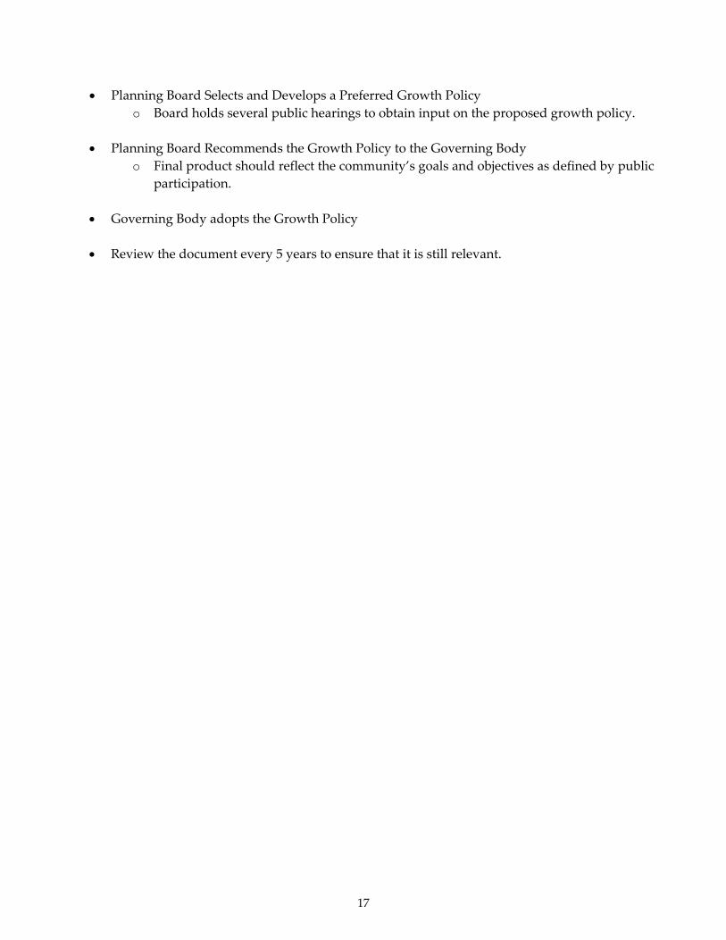
• Planning Board Selects and Develops a Preferred Growth Policy
o Board holds several public hearings to obtain input on the proposed growth policy.
• Planning Board Recommends the Growth Policy to the Governing Body o Final product should reflect the community’s goals and objectives as defined by public
participation.
• Governing Body adopts the Growth Policy • Review the document every 5 years to ensure that it is still relevant.

18
CHAPTER 2 ‐ DEVELOPMENT OF GOALS AND OBJECTIVES One of the most important phases of the development of a growth policy is the articulation of community goals and objectives. The development of goals and objectives provides the philosophical framework for the growth policy. Goals and Objectives The growth policy goals and objectives are statements describing the way the community wants to develop socially, economically, and physically. They are intended to guide the growth and development of the city, town, county, or other planning area covered by the growth policy. The EQC report, Planning for Growth in Montana, encourages a “community visioning process” as a preliminary step in defining goals and objectives. “Community visioning” is defined as “a process through which a community imagines the future it most desires and then plans to achieve it.” According to the EQC report, an advantage of this approach is that it results in a positive statement and emphasizes areas of agreement. A legitimate criticism of the “community needs assessment” concept is that it tends to focus primarily on the negative aspects of the community’s situation: “What’s wrong with our community and what can we do about it?” According to the Heartland Center for Leadership Development, “too often, communities are encouraged to focus first on their deficiencies, such as needs, issues, or problems, rather than on their assets, those tangible and intangible resources that can be built upon to strengthen the community over time.” Increasingly community development professionals are encouraging communities to also consider and inventory the positive aspects of their community:
Planning community initiatives from the perspective of “solving problems” or “meeting needs” casts a negative tone on what should be an exciting capacity‐building venture. The alternative is to identify the community’s assets and develop plans that build on them. All communities do have a substantial number of assets: the skills and entrepreneurial ideas of local residents, neighborhood businesses, churches, and other community institutions, sports and social clubs. Even things you do not control directly (hospitals, vacant land, schools, libraries) can become your assets if you plan and partner as needed to take advantage of them. Moreover, the act of jointly inventorying assets is itself a powerful community‐organizing device that, by evidencing opportunities to change things, motivates collaboration and commitment to action. Community Building: Coming of Age, The Urban Institute
In essence, communities should think about what makes their glass “half full” instead of “half empty.” The goal setting process can be an excellent opportunity to ask “what’s good about our community and how can we make it better?” Address the negatives, yes; but also identify the positive aspects of your community and develop a strategy for building upon them to make the community an even better place to live.

19
As an example, the EQC report, Planning for Growth in Montana, cites the four questions asked in the “Oregon Model” of community visioning:
1. Where are we now? ‐‐ Develop a profile of the community in its current state, defining current issues and concerns, and articulating shared community values.
2. Where are we going? ‐‐ Determine the community’s future – based on demographic, economic,
environmental and social trends – if it continues on its current course with no major changes in direction.
3. Where do we want to be? ‐‐ Develop of a preferred scenario showing what the community could look like in the future if it chooses to respond to identified trends and emerging issues in a manner that is consistent with its core values. A formal vision statement is developed.
4. How do we get there? ‐‐ Identify short‐term strategies and actions, assigning parties to be
responsible for implementing them, and setting timetables and benchmarks for monitoring progress.
The community of Darby, Montana went through a similar process. A group of over 100 citizens formed the Darby Civic Group in the spring of 1992 to improve the quality of life for Darby area residents and to identify positive ways for the Town to prosper. Darby successfully applied for a U.S. Forest Service grant in 1992 to prepare a Community Action Plan (CAP). With the support of the Town Council, the Civic Group formed a subcommittee, the Community Action Team, to develop and implement the CAP. The Action Team considered the state of the community and identified both problems and opportunities. Input gathered from 200 area residents through a telephone survey, and approximately 70 town meeting participants was incorporated into the final CAP that was adopted in September 1993. The Town Council adopted the CAP, which includes goals and strategies to improve Darby. In 1998, the Darby Lumber Mill shut down, leaving nearly 100 people out of work. A new 20‐member Community Action Team was formed to update the five‐year‐old CAP and address different areas of need. The Action Team conducted another community survey to update the 1994 CAP. Additionally, fifty people turned out for a town meeting to discuss the Plan’s priorities for the town. The purpose of the plan “is to boost the town in the eyes of potential donors and grant givers with a structured, cohesive plan that the majority of residents agree on.” Darby’s prioritized list of projects fell into one of the following five categories: Education and Youth Services; Business, Industry and Tourism; Community and Health Services; Cultural, Quality of Life and Environment; and Infrastructure. Some of the Town’s priorities included creating a community investment foundation, improved transportation services for seniors, town landscaping, and developing a Darby Webpage. Specific people were assigned to accomplish specific projects and a timeline was set. Replacing the Darby Fire Station emerged as the top priority in the Infrastructure category. In 1999, in its second attempt, Darby successfully applied for CDBG funding for a new fire hall. Some communities may have already conducted similar goal setting processes that can be used by the
20
planning board to help them develop goals and objectives for the growth policy: • Several counties and multi‐county areas have prepared a ʺComprehensive Economic
Development Strategyʺ (CEDS) with funding from the U.S. Economic Development Administration (EDA). The CEDS is a prerequisite for receiving financial assistance from several EDA programs.
• A number of communities have prepared “Resource Team Assessments” in conjunction with the
Montana Department of Commerce or Montana Economic Developers Association. • Some Montana communities have developed “Community Action Plans” with grants from the
U.S. Forest Service. • Other Montana communities have prepared “Needs Assessments,” “Strategic Plans” or
“Community Vision Plans,” many with assistance from the community development staff from Montana State University’s Cooperative Extension Service.
Goals and Objectives Statements “Goals” are general policy statements that explain what you want to achieve in your community. Goals tend to be broad vision statements, such as what you want your community to be like in 20 years. They are usually long‐term and represent overall visions such as “protect public health and safety.” They can be organized according to each of the growth policy elements, such as for land use, housing, transportation, and capital improvements. “Objectives” define strategies or implementation steps to attain the identified goals. Unlike goals, objective statements are specific, measurable, and often have a defined completion date that can be used to determine if you have met a goal. They are more specific and outline the “who, what, when, where, and how” of reaching the goals. Objectives are usually more specific statements relating to growth policy implementation, such as the proposed adoption of a zoning ordinance, a parks and open space plan, or a capital improvements plan, or other implementation steps. For a planning board beginning to prepare goals and objectives, it can appear difficult to get started at first. That blank sheet of paper can seem intimidating. It can sometimes be helpful to review the goals and objectives that other communities have developed to give you ideas and help get you started. After all, from region to region in Montana, communities may have somewhat similar concerns. However, it is very important that each community adopts only those goals and objectives that truly are a good fit for them and not just copy those prepared by another community. A growth policy based on clear and appropriate goals and objectives is more likely to be acceptable to local citizens and to succeed in meeting the community’s needs. Objectives must also be realistic and achievable. Achievement of established objectives provides positive reinforcement. Setting realistic objectives depends on carefully assessing the needs and capabilities of the community. Typically, each goal may have several objectives stated as a means of accomplishing that goal. The objectives can be both short and long‐term. Over time, as the growth

21
policy is updated there will hopefully be new objectives developed as previous ones are achieved. Setting suitable objectives requires careful thought and consideration of all the background information regarding community characteristics, features, and trends generated so far in the process. This will assure that the goals and objectives are based on reality and fact, not just what we may believe to be true. It is only through extensive discussion that a set of realistic and appropriate goals and objectives can be established for the community. Goals and objectives have varying “useful livesʺ. A growth policyʹs broad, overall goals are normally long range, geared to developments and changes for the next 10 to 20 years. Goals relating to the various elements of the growth policy (land use, transportation, etc.) may range from 5 to 10 years. Finally, the specific objectives relating to implementation tools (zoning ordinance, subdivision regulations. etc.) are normally more short range, and reviewed and revised within a three to five year span. In actual practice, these times vary greatly as community change can sometimes occur with bewildering speed. Even so, it is reasonable to assume that the growth policy provide guidance for a long‐range period. Objectives relating to implementation tools provide guidance for shorter‐range periods and are intended to help ensure that long‐range goals and objectives are achieved. It should be noted that sections 76‐1‐601(2)(f)(ii) and (iii), MCA require the local government to include as part of the growth policy ʺa list of conditions that will lead to a revision of the growth policy; and a timetable for reviewing the growth policy at least once every 5 years and revising the policy, if necessary.ʺ It is during this review that a community should determine if the existing goals and objectives are still appropriate or if they need to be updated..

22
CHAPTER 3 – PUBLIC PARTICIPATION Since the goals and objectives are the foundation for the growth policy, broad public participation in the formation of those goals and objectives is crucial to assure the success in developing the growth policy and implementing it. Public participation in local decision making is fundamental to our democratic process of government. Public participation cannot be ignored, or poorly planned and carried out. While successful citizen participation is a crucial element in developing a growth policy, it is also possibly the greatest challenge in the process. Good public participation can highlight concerns and issues not always apparent to the local planners or officials. It can provide a voice for diverse interests and helps a community “buy into” the reasons for a growth policy. If the public has been part of the process then they will have “ownership” of the final document. An additional benefit of public participation is that when properly documented, it gives significant legal support to the growth policy when it is officially adopted by local government. Growth policies that reflect the vision of a community through citizen participation and that comply with Montana’s statutory requirements will generally withstand most legal challenges According to the EQC report, Planning for Growth in Montana:
…even with the best citizen involvement programs, controversy may not go away. However, good communication and meaningful involvement of citizens is critical to successful planning and zoning. Educating citizens about planning and zoning and how to participate in the process is an essential aspect of citizen involvement.
There are many methods that can be used to encourage public participation. Informal neighborhood and town meetings, citizen surveys and questionnaires, media coverage, open houses, distribution of printed materials, presentations to civic groups, and public hearings are just a few options. The Montana Department of Commerce, Community Development Block Grant (CDBG) Program, has published a booklet entitled The Community Needs Assessment Process, which describes several different methods for encouraging public involvement and obtaining public input. This publication also includes examples of some of the creative ways in which Montana communities have involved the public in the process of identifying community needs and goals and objectives. (See website: http://comdev.mt.gov/) Local officials are well aware that formal public hearings are sometimes a very ineffective means of getting people involved or encouraging meaningful dialogue or discussion. A common problem with the conventional public hearing format is that the citizens who are most agitated about an issue or proposal will be very vocal and dominate the public comment period. Frequently, persons with more moderate views or who just have questions will be less inclined to speak up in an emotionally charged environment. For this reason, informal meetings that encourage person‐to‐person dialogue such as open houses are becoming increasingly popular. Typically, an open house involves providing a meeting area where visual displays related to an issue can be put up for public viewing. Staff and members of the planning board can be posted by the

23
displays to explain the information. For example, for a community planning effort, displays can be provided relating to various community issues such as housing conditions, land use, development constraints such as floodplains or high fire hazard areas, public facilities, parks and recreation, plans for improvements to local water or sewer facilities, a new public building, or the growth policy, in general. Forms can be provided for people to make written comments or the persons stationed at the displays can take down comments. Open houses can be scheduled at times when it would be convenient for people to stop by after work, if they have other commitments. Open houses can also be held prior to a public hearing or a facilitated community forum using a group process so that people can get more information before any public discussion begins. There is no one best method of obtaining public input. It may be advisable to try a combination of two or more of the methods described in the CDBG booklet, The Community Needs Assessment Process. In all cases, the methods for obtaining public input should be tailored to the community involved and what typically works for your area. One example is the process used by Lewis and Clark County for developing its growth policy. The county commissioners appointed a citizen advisory group (CAG) to prepare a new growth policy to replace their ten‐year‐old comprehensive plan and bring it into compliance with Senate Bill 97 passed in 1999. The advisory group members were selected to represent a cross‐section of local interests including the chamber of commerce, the city‐county planning board, fire districts, a homebuilders’ organization, a pro‐planning advocacy group, a property owners group, a sportsman’s association, realtors, as well as the unincorporated communities in the county. Each CAG member used a standard series of questions to interview several other knowledgeable persons to gather additional perspectives on issues of concern to citizens. The CAG also held an annual series of area meetings around the county over a two‐year period to invite additional public comment as the growth policy was developed. At these meetings, CAG members were stationed at tables organized by issues and recorded citizen comments and concerns regarding the topic. At the end of the meeting, general public discussion and comments were invited. The public comments were used to prepare a draft growth policy that was presented to the public through six hearings held across the county before it was adopted by the county commissioners.

24
CHAPTER 4 – COMMUNITY INVENTORY & TRENDS Montana’s growth policy statute requires that a community “inventory its existing characteristics and features” through the use of maps and text, which includes information on land uses, population, housing needs, economic conditions, local services, public facilities, natural resources, and other characteristics and features proposed by the planning board and adopted by the governing body. In addition to the actual inventory, the growth policy must describe the projected long‐term trends for each of the inventory items and other elements proposed by the planning board and adopted by the governing body. Public facilities should be excluded from these trend projections as the statue requires a specific section of the growth policy be devoted to developing a strategy for the development, maintenance and replacement of public infrastructure.
(Note: Typically, the inventory of community characteristics and features and the projection of trends are combined and dealt with on a topic‐by‐topic basis, rather than addressed in separate sections of the growth policy.) Please refer to Appendix B of this guide for a copy of the growth policy statute (76‐1‐601, MCA) in its entirety or refer to the Montana Code Annotated website:http://data.opi.state.mt.us/bills/mca_toc/index.htm.and then select Title 76, Chapter 1.
Maps Before a community proceeds with its community planning process, an adequate base map should be obtained. A base map shows basic information about the community including the full boundaries of the planning area, platted streets, railroads, rivers, lakes, public properties, and blocks. The scale of the base map varies with the size of the area to be mapped. (For most small and medium sized communities, a scale of 1 inch equals 100 feet up to 1‐inch equals 500 feet, provides a fairly clear view of each lot. For counties, scale ranges of 1‐inch equals 200 feet up to 1‐inch equals 1000 feet are more appropriate.) Aerial photographs are sometimes used as a beginning base map. It sometimes is advisable to have a large‐sized map for wall mounting and other maps reduced in size for fieldwork. Some planning agencies keep a base map up to date as changes occur. In others, a new map is periodically prepared. Technologies such as GIS (geographic information systems) mapping can provide communities with detailed maps that can show themes that run the gambit from infrastructure (roads, water, sewer) to the natural environment (topography, floodplains, vegetation). The CDBG Program at the Department of Commerce provides matching grants to eligible applicants for planning activities related to growth policies, including those that would prepare base maps for a community.

25
Land Use A land use study is basic to effective land use planning and to the use of implementation tools as zoning or subdivision regulations. A land use study analyzes the way in which community lands are being used: (residential, commercial, industrial, agriculture, public, transportation). Some times information may be easier to analyze in tables or charts. However, maps depicting information are likely to be more easily understood by the general public. Therefore, most land use studies use maps show various information (e.g. topography, vegetation, parcel density, road networks), supported by descriptive, analytical narrative and documentation. One of the best ways to begin a land use study is by creating base maps. These are maps that visually show you the inventory of your community: roads, parcels, public facilities, lakes, streams, rivers, vegetation, wildlife, floodplains etc. Base maps are also essential to the larger task of generating a land use map. The purpose of land use maps is to visually show existing land‐use patterns, constraints and opportunities and to provide direction for future development. Such maps also help meet the statutory requirements that a growth policy must contain maps and text describing existing and projected land uses. For municipalities, mapping should include all of the community, plus the areas surrounding the jurisdiction, since no city or town exists in isolation and will most likely expand geographically over time. Preparing a land use map requires extensive time and fieldwork. Land use maps can be prepared by a variety of people: planners, GIS mapping staff, private consultants, or planning board members. Other people who may be helpful in preparing such maps are city drafting staff, city or county engineers, building inspectors, city or county clerks, and high school and college students. No matter how a community creates maps, it is very important to establish uniform procedures for gathering and recording land use data. This will yield more accurate maps and information. The information should be quickly acquired, coded, and mapped in order to reflect the most current situation. Base maps can be prepared in a number of ways. One of the most common methods used in Montana is to identify the constraints that exist for development. Generally speaking this means identifying in map layers the inventory that has been compiled: floodplains, high fire hazard areas, wetlands, steep slopes, shallow depth to groundwater, important wildlife habitat, distance to services such as (fire, police, water, sewer, schools etc.). Once this is done each inventoried item can be overlaid to identify those areas best suited for development based upon cost of services, public health and safety, and environmental constraints. Depending upon the constraints existing in a community, the type of land use map derived from this process can be very useful and simple in guiding where a community should grow or not grow. The following map is an example of a constraints map for the Helena Valley found in the current Lewis & Clark County Growth Policy.
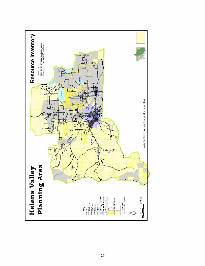
26
27
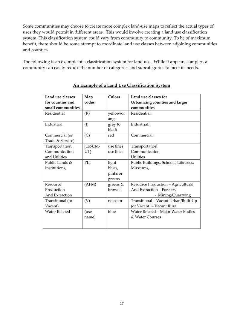
Some communities may choose to create more complex land‐use maps to reflect the actual types of uses they would permit in different areas. This would involve creating a land use classification system. This classification system could vary from community to community. To be of maximum benefit, there should be some attempt to coordinate land use classes between adjoining communities and counties. The following is an example of a classification system for land use. While it appears complex, a community can easily reduce the number of categories and subcategories to meet its needs.
An Example of a Land Use Classification System
Land use classes for counties and small communities
Map codes
Colors Land use classes for Urbanizing counties and larger communities
Residential (R) yellow/orange
Residential:
Industrial (I) grey to black
Industrial:
Commercial (or Trade & Service)
(C) red Commercial:
Transportation, Communication and Utilities
(TR‐CM‐UT)
use lines use lines
Transportation Communication Utilities
Public Lands & Institutions,
PLI
light blues, pinks or greens
Public Buildings, Schools, Libraries, Museums,
Resource Production And Extraction
(AFM) greens & browns
Resource Production – Agricultural And Extraction – Forestry ‐ Mining/Quarrying
Transitional (or Vacant)
(V) no color Transitional – Vacant Urban/Built‐Up (or Vacant) – Vacant Rura
Water Related (use name)
blue Water Related – Major Water Bodies & Water Courses

28
The intent and purpose of the categories is for coding, understanding and displaying land use information. They are recommended for their comparability and compatibility with other information sources that the local community or county planning staff will probably use. The following map is an example of a future land use map for the City of Choteau which is found in the City’s 2008 Growth Policy.
Data collection is probably one of the most important aspects of creating a land use study. The planning board must also decide what method to use in order to obtain information for the land use study. Data collection can run the gambit from using GPS (global positioning systems) to collect map layers to the old fashion way of marking up photo‐reduced base maps with colors representing land use or other inventory items. Another commonly used method is to obtain current aerial photographs of the area, and then mark the land use features and information on the photographs. As an element of the growth policy, the land use plan emerges by integrating the goals and objectives with population and economic projections and background studies regarding physical development constraints or limitations. With public input, the planning board must make a series of evaluations identifying alternative future land development scenarios and narrowing these alternatives down to those that the community finds are most desirable, given the suitability of different areas for development. Various future land use alternatives may be eliminated through detailed analysis and comparison of background studies, environmental constraints, community revenues and expenditures, and social and private costs and benefits, in light of development goals and objectives.
29
The final future alternative is then a ʺbest fitʺ design of probable and desired land development patterns showing areas most desirable and appropriate for specific land uses.
Transportation Closely related to projected land use is the topic of access and transportation. The physical layout and spatial arrangement of the land uses have to be logically related to a transportation network that provides efficient movement of people and goods. The transportation element of a growth policy is usually developed as a series of ʺalternativesʺ starting from the goals and objectives. The basic inputs are population forecasts and economic projections for the planning area, combined with the results of field studies (such as traffic counts and level of services studies) and technical analysis (physical condition of streets and roads). Level of service studies are generally conducted by professional engineers and are used to determine whether a street or road is handling existing traffic volumes at an acceptable level. Pedestrian and bike paths (especially routes to schools) should be considered in addition to vehicular routes. Larger Montana cities are now planning for bus transit, where such systems are economically viable. In many cases, professional assistance from a transportation engineer is required for preparation of the transportation element, depending upon the complexity of a communities transportation network. Sources for transportation information include city street or county road departments, county commissioners, the Montana Department of Transportation, and the Institute of Transportation Engineers. Information may also be obtained by interviews with city or county public works and road department staff. In some jurisdictions, traffic counts and level of service studies may be essential for determining the transportation needs of a community. Combined with an analysis of the physical condition of streets and roads, traffic counts and level of service studies can tell a community where it is preferable to encourage development and where limited resources should be spent to maintain or upgrade streets and roads. Accident records may provide a coarse indication of problem interchanges and traffic bottlenecks, which the plan would correct or mitigate. Trip Generation, published by the Institute of Transportation Engineers in Washington, D.C., is a standard reference book used for automobile trip analysis. Potential sources for land use maps and transportation information can be found in Appendix F.
Population Population projections are fundamental to community planning since they are the basis for estimating all other future needs in the community. Population projections help local government officials estimate the type and quantity of public facilities and services that will be required for the future. Projections also help businesses conduct market analyses for improvement of existing facilities or business expansion. Population projections are only estimates and need periodic adjustment and revision if major economic or demographic changes occur in the community over time. In addition to the numbers of people, characteristics such as age, income distribution, ethnic groups, and population density should be analyzed and understood. This information can help a community

30
prepare for issues that can arise from events such as increased school enrollments or an increase in the elderly population. In larger communities, such population characteristics are often mapped by using symbols to represent density. Such mapping can aid in visualizing cultural relationships with income, employment, housing or other subjects. Graphs and charts can be an effective way to portray otherwise complicated demographic and economic trends. The Montana Department of Commerce Census and Economic Information Center (CEIC) is an important source for population, economic, and housing data. This center is the official source of U.S. Census data for Montana, and keeps records on economics and demographics throughout the state, as well. CEIC is the designated state agency to provide user access to electronic data from the Census Bureau and to receive, reproduce, and distribute maps produced by the Bureau. CEIC also compiles and updates the Montana County Statistical Reports, which are a collection of demographic and socioeconomic data for each of the stateʹs 56 counties. Potential sources regarding population can be found in Appendix F.
Housing Needs The topic of housing is fundamental to the concept of ʺcommunity.ʺ Housing studies attempt to determine the type, size, location, quantity and quality of housing in the community. These studies also include information on rural housing such as farms, ranches, and vacation homes in the planning area. This information is supplemented by U.S. Census data or survey information on the occupants of all housing units, including economic and social characteristics. The housing element of a growth policy discusses the need for different housing types such as single‐family dwellings, duplexes, apartments, and manufactured housing. Lack of affordable housing for low and moderate income families has been a serious problem in many communities. Housing studies usually trace the trends in mortgage financing, market conditions, housing quantity and housing quality (deterioration, blight, need for building codes, etc.). This information is then related to land use, transportation facilities, employment, health, recreation, and public facilities in order to produce an implementation plan for meeting local housing needs. The element may suggest geographic areas in the community that appear most suitable for housing rehabilitation and neighborhood renewal, or new housing development based on background studies, market analysis, availability of capital improvements, and other factors. The Montana Department of Commerce Community Development Block Grant (CDBG) Program has published a manual entitled Designing and Initiating a Small Community Housing Program. This book includes information on conducting a housing needs assessment, and an easy step‐by‐step process for assembling a housing plan. Sample housing plans for the City of Red Lodge and the City of Miles City are also included. Although the Montana Growth Policy statute does not require a full‐fledged housing plan, the information in the above‐listed booklet may be helpful. See the CDBG website at http://comdev.mt.gov/CDD_cdbg.asp. Potential sources for housing related information can be found in Appendix F.

31
Economic Conditions Local economic studies can be used to analyze income and employment information about manufacturing, wholesale and retail trades, transportation, mining, agriculture, professional services, government, construction, etc. When properly analyzed, the income and employment information should reflect the community’s current economic situation and can form the basis for forecasting future employment and income trends. These trends can help influence decisions about the land area needed for new businesses, transportation networks, infrastructure (water & sewer) and residential development. Employment is often classified as two basic types: ʺPrimary or Basic Employment,ʺ which provides services or the production of goods principally for persons living outside the local economy; and ʺSecondary or Derivative Employment,ʺ which provides necessary services, goods, and facilities principally for the residents of the local economy. Economic analyses usually focus on the relationship between the two employment types, such as the history of employment in each type and their changing relationship due to industrial and commercial changes, population shifts, etc. As jobs are created in new or expanded primary employment there is usually a corresponding change in secondary employment. Therefore, ʺtrendsʺ and ʺpotentialsʺ for employment are estimated and give some insight into future community needs and expectations for community growth or decline. By looking at income and employment trends, economic studies try to identify future growth trends and the potential for economic development. Elements such as how fast primary jobs are being created or lost in response to export markets can figure heavily in the analysis of the local economy. “Per capita income” and “median household income” are used as a measure of the average citizen’s and family’s well‐being in comparison with other communities, the state, as well as the region or the nation. The data used in economic analyses have to be kept current and tabulated in usable forms to be of value. They should present a clear, current picture of the local economy. Graphs and charts can be an effective way to portray otherwise complicated demographic and economic trends. It must be kept in mind that economic development plans affect both public and private sectors of local economies. The preservation and expansion of the local economic base is usually the prime objective in trying to assure that a community will be viable. Potential sources of information regarding economic conditions in your community can be found in Appendix F.
Local Facilities and Services Local facilities and services are a vital component of a community’s infrastructure. These services generally include: fire protection, law enforcement; water and sewer service, public health; education; library; social services; parks and recreation, utilities including corridors and easements; and other governmental or non‐governmental services considered of value to the community, but which are not identified as physical public infrastructure under 76‐1‐601 (2)(e), MCA. The existing level of services for each of these should be quantified. With regards to community facilities and services, levels of service (LOS) are usually quantifiable measures of the amount of public
32
facilities that are provided to the community. Levels of service can also measure the quality of some public facilities. Levels of service are generally expressed as ratios of facility capacity to demand (i.e., actual or potential users). When combined with data on the local population, housing and economic conditions and trends, an inventory of community services will provide the framework for identifying the goals and objectives to improve local facilities and services. Since an inventory of local services is community‐specific, local agencies should be the primary contact when gathering information for the growth policy. Following is a list of agencies that may be able to provide assistance. Some of these sources may be able to provide information on typical standards or desired levels of service for each major community service. For example, this may include norms such as the ratio of police, fire fighters or doctors per population size. Potential sources of information regarding local facilities and services can be found in Appendix F.
Public Facilities The pattern of future land development is greatly affected by the location and adequacy of physical infrastructure such as water and sewer systems, streets, bridges, parks, solid waste management systems, and so forth. Adequate public facilities are crucial for protecting public health and safety, supporting local growth and development, and enhancing the quality of life. The construction and proper maintenance and operation of public facilities is one of the greatest financial responsibilities placed upon Montana’s municipalities and counties due to the limited resources and funding that most jurisdictions face. The public facilities or capital improvements element of the growth policy usually identifies, in general terms, the capital improvement needs, goals, and policies of the community. Montana statute at 76‐1‐601 (2)(e) requires that the growth policy include a strategy for the development, maintenance, and replacement of public infrastructure. This requirement will be discussed further under ʺStrategy for Public Infrastructureʺ. Planning boards should incorporate an inventory of the existing public facilities into the growth policy. MDOC has published technical guides that may be useful to local officials who are working on public facility problems, including:
• Planning and Financing Community Water and Sewer Systems in Montana
• CAPITAL IMPROVEMENTS PLANNING: A Strategic Tool for Planning and Financing Public
Infrastructure
The Water, Wastewater and Solid Waste Action Coordinating Team (W2ASACT), has prepared two videos which can be loaned to communities on planning and financing community water and wastewater systems: • “Water and Waste Water: Funding Montana’s Infrastructure Challenge” (presents examples of
projects and how they were funded)
33
• “You Don’t Miss Your Water Till Your Well Runs Dry” (describes the entire process of planning, financing, designing and constructing a project, with an emphasis on the amount of time it takes from beginning to end)
Further information regarding W2ASACT can be found at the following website: http://dnrc.mt.gov/cardd/ResDevBureau/wasact/ Potential sources of information regarding public facilities can be found in Appendix F.
Natural Resources Along with the land use study, the physical and environmental characteristics and constraints of a community must be assessed within the geographic limits of the planning area. Physical and environmental characteristics and constraints are some of the most important factors in determining which areas are most appropriate for development. In this element of the growth policy, information on topography, slope, geology, soils, vegetation, hydrology, wildlife, climate, flood and earthquake hazards, and other topics are presented. The interrelationships between different physical and environmental characteristics and suitability for development, human activities, and land uses should be considered. It is especially important that environmental constraints for different types of land development activities and land use activities be identified. Key natural (i.e. prime agricultural lands, big game winter range, wetlands, floodplains) and historical or archaeological resources that may need additional protection or accommodation should also be identified. Maps, map overlays, photographs and illustrations are helpful in understanding how the many complex ecological factors interrelate with land use and land development. Information on the physical characteristics of the land should be compiled in both written and map form. Physical features and limitations are used to determine health and safety requirements for the construction of buildings, streets, utility and drainage improvements, and various other land development activities. Potential sources of information regarding natural resources can be found in Appendix F.
Sand and Gravel Resources HB 486 was passed by the 2009 Legislature and requires that a community provide an inventory of the sand and gravel resources within their jurisdiction. The rationale for this legislation is that local governments will then obtain the information necessary to create regulations for the separation of incompatible uses such as residential housing and gravel pits, while ensuring an economically viable source of gravel to facilitate future development. Existing geologic and soils mapping would be the primary sources for identifying and inventorying sand and gravel resources.
Other Elements of the Growth Policy
The content of a community growth policy does not have to be limited to only those topics specified in state statute nor should it be. The statute allows local governments to include any additional elements in their growth policies as long as those elements are related to the broad purpose of the Local Planning Enabling Act. The growth policy statute states (76‐1‐601 (4), MCA) ʺthe planning board may propose and the governing bodies may adopt additional elements of a growth policy in order to fulfill the

34
purpose of this chapter.ʺ Additional issues may be addressed that are unique to the community and incorporated in the growth policy. Each community can and should tailor their growth policy to reflect their unique character or issues that are a priority for their community. Special studies or sections for the growth policy can be useful since each community or local government jurisdiction probably has some unique qualities or conditions that it feels justify greater attention. For example, Montana statute (76‐1‐601(3)(a) and (b), MCA) allows neighborhood plans that are consistent with the growth policy to be included as part of the policy itself. A neighborhood may be defined geographically or by political boundaries, as long as they are easily identifiable by the residents of the neighborhood. Additional elements may address other characteristics or issues such as:
prime agricultural lands preservation plans, historic, archeological, and paleontological resources, central business district or Main Street redevelopment or urban renewal plans, shoreline or riparian development, recreation facilities and services, cultural facilities and services, unique governmental functions (economic development districts, taxation, regional or multi‐jurisdictional cooperation and sharing), etc.,
community blight or neighborhood renewal plans, reclamation of “brownfield” sites, parks, trails, or open space plans, and mining impact plans.
A historical overview, as an introduction to the growth policy, may describe how the community developed and evolved over time. Any implications for the growth policy and future development should be noted. For example, the analysis may include information on the area’s important historical sites and archeological or paleontological resources. Opportunities to preserve or enhance historical or unique natural sites may be identified which could even help support the local tourism industry. Recently, several communities have highlighted their area’s association with the Lewis and Clark Expedition for the Bicentennial. (Website: http://www.mt.gov/tourism/lewis_clark.asp) Other communities are promoting their paleontological resources through the “Montana Dinosaur Trail” (website: http://mtdinotrail.org/). For resource‐dependent communities (i.e. mining, agriculture, timber), it may be important to consider opportunities for economic diversification. Other communities may be facing potential impacts from coal or hard rock mining or electrical generating plant construction. These communities may wish to include elements in their growth policies that describe potential impacts and how the community plans to respond to them. Montana’s Community Development Block Grant (CDBG) Program, administered by the Montana Department of Commerce, requires that each local government that applies for a CDBG Public Facilities or Housing project must conduct a planning process that considers and describes:

35
• The applicantʹs overall community development and housing needs, including the needs of
low and moderate income persons; and • The activities it plans to meet the identified needs.
The requirement is based on a federal statute that requires that each CDBG recipient “identify its community development and housing needs, including the needs of low and moderate income persons, and the activities to be undertaken to meet such needs.” Communities may choose to include an element in their city or county growth policy that describes the particular needs of lower income residents for employment, housing, or particular public facilities or services, such as daycare, Head Start, senior centers, or mental health clinics. This element could include a description of:
• any geographic areas within the planning jurisdiction where low and moderate income persons are concentrated and any housing or community development needs which particularly affect those areas;
• the needs of particular groups of persons who generally fall within the low and moderate income category, such as the elderly, single heads of households, homeless persons, or abused or neglected children residing in shelters or group homes, for public services or facilities; and
• any projects the local government is considering to assist lower income residents. By including an element that describes the particular needs of low and moderate‐income persons, communities would be able to use their growth policy to fulfill this CDBG application requirement. This could also make the community’s application for CDBG funding more competitive. Potential sources for environmental, historic, resource extraction information can be found in Appendix F. Projected Trends 76‐1‐601(2)(c), MCA requires ʺprojected trends for the life of the growth policy for each of the following elements: land use; population; housing needs; economic conditions; local services; natural resources; and other elements proposed by the planning board and adopted by the governing bodiesʺ be included as part of the growth policy. (Note that the only topic described in the data‐gathering section above that is not included here is public facilities. That is because the statute specifically requires the development of “a strategy for development, maintenance, and replacement of public infrastructure, including drinking water systems, wastewater treatment facilities, sewer systems, solid waste facilities, fire protection facilities, roads, and bridges.”) At the planning board’s discretion, the growth policy may be formatted such that the projected trends are described after the initial presentation of each topic, or the projected trends may be dealt with in a completely separate section of the growth policy. (Most often, the inventory of characteristics and features and the projection of trends discussion are combined and dealt with topic‐by‐topic, rather than addressed separately.) The projection of trends is fundamental to the usefulness of a growth policy. This element identifies whether the community is growing, stable, or declining, and provides a foundation for establishing community goals and objectives. The ʹprojected trendsʹ element documents where and how a

36
community is changing (demographic or economic growth or decline). It can also describe, which specific geographic areas of the town or county or which economic sectors are growing or declining. The growth policy may include multiple projections or scenarios based on different population and economic assumptions. The results of economic base studies, business surveys, and other information about the condition of the local economy and how it is changing should be presented. The communityʹs economic strengths, weaknesses, and opportunities should also be described. Summary A variety of background information and studies are undertaken to produce a greater understanding of the community, and as preparation for guiding growth. Such broad topics as economics, population, land use, transportation, physical land characteristics, public facilities, public services and housing are examined in varying detail, related to each other. Information sources include published and unpublished documents, private citizens in the local communities, and local, state, and federal public agencies or non‐profit organizations. Those characteristics and items capable of being mapped are graphically displayed on base maps of the planning area. Visually depicting such information through maps, charts, or graphs helps the public to discern physical relationships and the public and local officials to draw conclusions and develop action plans. A summary of any related background or special studies should be made available for public review in an easily understandable format.

37
CHAPTER 5 ‐ OTHER GROWTH POLICY REQUIREMENTS In addition to the requirement regarding goals and objectives, community characteristics, features, and projected trends described in the previous chapters, Montana’s new growth policy statute requires that the following additional elements be included as part of the local governmentʹs growth policy. Implementation Tools The 1999 Environmental Quality Council (EQC) report, Planning for Growth in Montana, concluded that “more emphasis must be place on planning and implementation measures rather than relying on subdivision review alone to address growth.” Montana statute at 76‐1‐601(2)(d), MCA requires that the growth policy must have ʺa description of policies, regulations, and other measures to be implemented in order to achieve the goals and objectives established pursuant to [this planning process].ʺ The implementation tools may either be discussed in a “conclusions and recommendations” section of the growth policy, or it may be included as a separate “implementation options” element. Regardless of the format used, a thorough discussion of the implementation of the growth policy is critical. Generally, this element includes information on the intended practical uses of the growth policy, and the relationship of the implementation tools to the policy. Various options, alternatives, and recommendations for implementing the plan may be discussed. Detailed information on specific provisions of implementation tools such as zoning or subdivision regulations, building codes, and capital improvements plans should not be included in the growth policy. However, detailed information can be included in separate publications or reports for each of the individual recommended implementation tools and can be referenced in the growth policy. Chapter 5, ʺIMPLEMENTATION OF THE GROWTH POLICYʺ, describes some of the tools that are available for carrying out the community’s goals and objectives that have been articulated in the growth policy. Strategy for Public Infrastructure The EQC report concluded that “Planning for and paying for development of infrastructure is a key element of encouraging development in and around urban areas.” Per the growth policy statute 76‐1‐601(2)(e), MCA, this element must include at a minimum: ʺa strategy for development, maintenance, and replacement of public infrastructure, including drinking water systems, wastewater treatment facilities, sewer systems, solid waste facilities, fire protection facilities, roads, and bridges.” This statement does not mean that a fully developed capital improvements plan must be included in the growth policy. The public facilities element in the growth policy is intended to be more general and can include a summary of past completed public facility projects and the projects that will be needed in the future. Because of the many complex engineering and financing issues associated with capital improvements, a much more detailed capital improvements plan (CIP) and capital budget are usually prepared as a means to implement the growth policyʹs public facilities element. For additional discussion regarding the the CIP and the growth policy see the Department of Commerce publication,

38
“CAPITAL IMPROVEMENTS PLANNING: A Strategic Tool For Planning And Financing Public Infrastructure” (website: http://comdev.mt.gov/). In addition, the website for the Water, Wastewater and Solid Waste Action Coordinating Team (W2ASACT) has information on potential funding sources for capital improvements: http://dnrc.mt.gov/cardd/ResDevBureau/wasact/default.asp The ʺstrategy for public infrastructureʺ required in the growth policy statute provides an important rationale for where growth should be directed. A key focus of this element is to relate and integrate goals for capital improvements with other community goals expressed in the growth policy, as well as the knowledge gained about constraints for development. For example, if a community wants to promote job creation by building an industrial park for new businesses, capital improvements such as water and sewer line extensions and street improvements will usually be necessary to serve the area adequately. Growth Policy Implementation Strategy Section 76‐1‐601 (2)(t), MCA, requires that the growth policy include the following: ʺA timetable for implementing the growth policy; a list of conditions that will lead to a revision of the growth policy; and a timetable for reviewing the growth policy at least once every 5 years and revising as necessary.ʺ The growth policy is intended to be a flexible, useful document for local governments to guide present and future development, but this means that it must be periodically updated to reflect new developments and trends. This section of state statute requires that local governments evaluate their growth policies at least every five years once adopted. Rewriting or changing the growth policy completely would probably not be necessary; this depends on whether the policy still accurately reflects the communityʹs situation, needs, and goals. The availability of new census information may trigger the need to re‐evaluate the previous analysis of the community’s demographic and economic trends. At a minimum, it must be revised to reflect current conditions and community goals. For faster growing communities, a more extensive revision may be necessary. The statute does require a list of conditions that would lead to a revision of the documents. Examples of such conditions could be a dramatic population increase, or the proposal of a large industrial or mining complex in the community. Statement of Inter‐jurisdictional Cooperation Section 76‐1‐601(2)(g), MCA requires that a growth policy must include ʺa statement of how the governing bodies will coordinate and cooperate with other jurisdictions that explains: if a governing body is a city or town, how the governing body will coordinate and cooperate with the county in which the city or town is located on matters related to the growth policy; if a governing body is a county, how the governing body will coordinate and cooperate with cities and towns located within the countyʹs boundaries on matters related to the growth policy.ʺ Simply stated, this section of Montana statute requires local government jurisdictions that have adopted growth policies to coordinate with their neighboring jurisdictions on planning issues and the regulation of development adjacent to their jurisdictional boundaries. Subdivision Review Statement The statute requires that a growth policy must include ʺa statement explaining how the governing bodies will: define the criteria in 76‐3‐608(3)(a) [MCA]; and evaluate and make decisions regarding proposed

39
subdivisions with respect to the criteria in 76‐3‐608(3)(a) [MCA].ʺ Section 76‐3‐608(3)(a), MCA noted in the above sentence is often referred to as the primary subdivision review criteria and require local governments to review a proposed subdivisionʹs effect on ʺagriculture, agricultural water user facilities, local services, the natural environment, wildlife and wildlife habitat, and public health and safety.ʺ Appendix C for provides possible definitions of these terms for use in reviewing subdivisions. An optional provision of the growth policy statute 76‐1‐601(4)(c), MCA permits local governments to create a “streamlined” subdivision review process if they establish an infrastructure plan that complies with the statute and zoning exists in the area proposed for subdivision. If a compliant infrastructure plan is created and zoning exists, the local government may exempt subdivisions from the requirements of providing an environmental assessment, any public hearings and from the “primary” review criteria found in 76‐3‐608(3)(a), MCA. The requirements for the preparation of an environmental assessment, holding a public hearing and the review of subdivision based upon the criteria listed in 76‐3‐608(3)(a) do not apply to pursuant to 76‐3‐616, MCA, when all of the following criteria have been met: i. The proposed subdivision is entirely within an area or adjacent to an incorporated city or
town where the governing body has adopted a growth policy that includes provisions of 76‐1‐601(4)(c);
ii. The proposed subdivision is entirely within an area subject to zoning adopted pursuant to 76‐
2‐203, MCA (county zoning) or 76‐2‐304, MCA (municipal zoning) that avoids, significantly reduces, or mitigates adverse impacts identified in the (jurisdiction’s name) growth policy.
Again, the local government must have adopted zoning regulations that cover the area identified in the plan in order to provide these exemptions to subdivisions. Public Hearing Statement The statute also requires that the growth policy must include ʺa statement explaining how public hearings regarding proposed subdivisions will be conducted.ʺ (76‐1‐601(2)(i), MCA) Public hearings for subdivision review are governed by 76‐3‐605, MCA (except in the case of summary review for qualified minor subdivisions, in which case the subdivision is exempted from the public hearing requirement under 76‐3‐505, MCA). This element of the growth policy should include a discussion of the procedures that will be used for public hearings, and the time limits that will be placed on those hearings. Recent state court decisions have held that public meetings that extend late into the evening cannot reasonably be considered “accessible” to the general public. Therefore, it is better to place time limits on public hearings in the planning board’s by‐statutes and details the procedures by which a public hearing will be continued. Evaluation of Potential for Wildland Fire As mentioned earlier in Chapter 1, the 2007 Montana Legislature amended the growth policy statute to require an evaluation of the potential for wildland fire in communities that have adopted growth policies or are contemplating the development of one. The specific language is found in the statue at

40
76‐1‐601(3)(j), MCA. The evaluation created by a community must determine whether or not there is a need for the following in the jurisdiction:
• Identification of the wildland‐urban interface. (The Wildland‐Urban Interface (WUI) is “the area where structures and other human developments meet or intermingle with undeveloped wildland,”
• Regulations that require:
o Defensible space around structures (space around a structure that has been landscaped
to reduce fire danger). o Safe access to and from structures and developments that is adequate to assist fire
protection agencies in carrying out fire suppression activities. o Water supplies sufficient to aid any fire suppression activities.
The first step in the evaluation is for a community to determine whether or not they have any Wildland‐Urban Interface areas. Most places in Montana are prone to some sort of wildfire whether it is in timbered areas or areas vegetated with shrubs or grass, so it may be the rare instance where a community does not have an identifiable wildland‐urban interface area. One of the best places for information regarding the identification of the WUI is the Montana Department of Natural Resources and Conservation (DNRC) Forestry Division. DNRC is currently working with counties statewide to develop “Community Wildfire Protection Plans” for every county jurisdiction. Many counties have completed plans, while others are still being drafted. One of the most important parts of these plans are the maps that identify fire prone areas or that rate the fire risk hazard. The map on following page shows the fire prone areas for Judith Basin County, from the (Judith Basin County, Montana, Wildland‐Urban Interface Wildfire Mitigation Plan). Such maps can assist communities with identification of the WUI in their jurisdictions. A jurisdiction should contact DNRC to find what the status of the Community Wildfire Protection Plan is for the applicable county. If a jurisdiction follows the proper procedures for identifying a WUI area, then it can determine whether or not it needs regulations to protect homes and other structures from wildfire. Such regulations would need to be adopted under Montana’s zoning statutes, since they could be applicable to existing homes, as well new ones. If zoning regulations are adopted they must include the requirement for defensible space around homes, safe access to and from homes and structures, and water supplies that will aid fire fighters. Potential sources of information regarding wildland fire can be found in Appendix F

41

42
Adoption of the Growth Policy Montana statute in 76‐1‐602, MCA through 76‐1‐604, MCA sets out the basic process that a local government must use to officially adopt the growth policy. Legal notice must be given and public hearings on the policy must be held. Adequate time must be taken to consider and incorporate the publicʹ s ideas and suggestions into the proposed growth policy. Making changes to the growth policy that have been suggested by the public will likely both improve the final document and increase public support for it. Prior to holding the legally required hearings, it is advisable to hold a series of more informal and informational public meetings in order to solicit public input on the proposed growth policy. The Montana Department of Commerce booklet entitled The Community Needs Assessment Process, describes several different methods for involving the public and provides examples of some of the creative ways in which Montana communities have encouraged citizen participation in their community planning programs. (See website: http://comdev.mt.gov/) The final adopted growth policy may be published as a single document including the maps, drawings, photographs, tables and charts. The proposed land use map showing desired future development patterns is sometimes included as a folded map inside the front or back cover. A convenient size for the final document is 8 1/2 x 11 inches, bound in a loose‐leaf binder or other form that makes it easy to insert updates or changes. The publication should not be so expensively produced that it prevents its availability and practical usefulness. More and more communities are making their growth policies, as well as subdivision and zoning regulations, available electronically through the local government’s Internet website as Adobe PDF or Microsoft Word documents. Appendix E is a checklist that can be used by communities as a final check to make sure that all the required contents for a growth policy have been addressed.

43
CHAPTER 6 ‐ IMPLEMENTATION OF THE GROWTH POLICY General One of the findings of the 1999 Environmental Quality Council (EQC) report, Planning for Growth in Montana, stated:
Planning (including capital improvements planning), zoning, and subdivision review are tools that complement each other and that should be used together. More emphasis should be placed on planning and implementing regulations. Some Montana urban communities and a few rural areas have successfully addressed growth through planning and zoning.”
Regulatory and non‐regulatory tools are available to help implement a growth policy. Common regulatory means for implementing growth policies include building codes, subdivision regulations, or zoning. In order for a growth policy to be truly effective, the planning jurisdiction may need to use different types of regulations. Local government should use the identified goals and objectives of the growth policy to determine what types of regulations are appropriate to implement the growth policy. For example, if the community wants to protect lakes, streams and riparian areas then the local government might consider development permit regulations that govern setbacks from water‐bodies, floodplain regulations, and lakeshore regulations. Implementation tools are that are non‐regulatory including capital improvements planning, conservation easements, open space bonds to acquire land for parks or trails, or sponsoring applications for community improvement projects for state or federal grant programs. Planning, scheduling and financing the construction of water and sewer extensions, streets, and other public facilities can significantly save tax dollars, and can influence the location and timing of new development. A community can address problems related to affordable housing or neighborhood blight and deterioration by securing funding to provide assistance for rehabilitation of existing housing, construction of new housing, or demolition of vacant, abandoned buildings. Conservation easements can be encouraged to reduce the development of productive agricultural lands, prime wildlife habitat, riparian corridors or other critical natural areas. These and other tools will be discussed in more detail below. Relationship of Growth Policy to Land Use Regulations As mentioned in Chapter 1, the growth policy is a non‐binding, non‐regulatory document that is developed through a public process that identifies land use issues and gives direction for addressing those issues. Regulations, in contrast, carry out the direction and policy of the plan by describing in specific language any requirements that govern the use and/or development of land. Montana statute requires that zoning and development permit regulations conform to an adopted growth policy. In the case of Little v. Flathead County, the Montana Supreme Court ruled that land use regulations must closely conform to the master plan (growth policy). In fact, before amendments to a zoning ordinance may be made, the plan may have to be amended to ensure that the zoning amendments will be consistent with the plan or growth policy. The purpose of this requirement is to

44
ensure that land use regulations are drafted and enforced consistently and within the context of a broad, carefully considered, public purpose. The plan is the publicʹs expression of its long‐term vision for how their community should develop. Regulations adopted through a comprehensive planning process are less likely to be arbitrary than those adopted in a hurried fashion or on an ad hoc basis. When considering zoning as an option for implementing the growth policy, a community must remember that based upon the September 26, 2002, attorney general’s opinion, zoning regulations adopted pursuant to master plans, comprehensive plans and comprehensive development plans prior to October 1, 2001, are valid and enforceable. However, after October 1, 2006, county and municipal zoning regulations authorized by Title 76, chapter 2, parts 2 and 3, may not be adopted or substantively revised unless a growth policy (which complies with state law) is adopted. Adoption of a growth policy is not a prerequisite for a local government to adopt subdivision regulations. In fact, state statute requires all units of local government to adopt and enforce subdivision regulations, regardless of whether they have a growth policy. However, local governments that have adopted growth policies can draft more effective subdivision regulations. The Montana Local Planning Enabling Act (76‐1‐606, MCA) requires that subdivision regulations be in accordance with any adopted growth policy. The Montana Subdivision and Platting Act (76‐3‐608, MCA) outlines criteria for local government subdivision review. The planning statute (76‐1‐601, MCA) provides that the growth policy may address these subdivision review criteria and “evaluate the effect of subdivision on the criteria”. Subdivision Regulations: Subdivision regulations (76‐3‐501 et seq., MCA) are the primary means by which local governments in Montana to facilitate new development while protecting public health and safety, taxpayers, lot buyers, and the environment. Subdivision regulations are mandatory for all local governments under state statute, while other land use regulations, such as zoning, are optional. Although each community is unique, similar opportunities and problems are encountered wherever land is divided. Local officials know that properly regulated land divisions can substantially benefit the community. Much of the form and character of a community is determined by the design of subdivisions and the standards to which they are built. When cities or counties cannot, or do not, exert proper control over the division of land, the result can be poor quality or substandard development, excessive or premature development of land, or partial or inadequate infrastructure development. Many of the most frustrating problems that Montana communities face today are the result of haphazard and poorly designed subdivision development. Subdivision regulations essentially regulate the process of dividing land into lots and providing public infrastructure and facilities (e.g., roads, water, sewer, and storm drainage) to those lots. Effective review of proposed land divisions in conjunction with comprehensive planning is vital to:
1. Prevent or minimize adverse impacts on public health and safety, the natural environment, and wildlife;

45
2. Ensure desirable future land use patterns; and
3. Allow cost‐effective provisions of public facilities and services, thereby reducing tax expenditures and assuring a more efficient delivery of public services.
Understanding this, each county and community in the State has a legitimate interest in the location, design and development of a new subdivision. The most important benefit of subdivision regulation is the protection of public health, safety and welfare, including that of potential purchasers of lots. The manner in which the subdivision is located, designed and built directly affects the safety and health of the residents and the community at large. These elements also determine the permanent character of an area or community. The process should ultimately ensure that new subdivisions are served by adequate infrastructure and services including:
o Properly designed and constructed roads or streets o Adequate road/street easements or rights‐of‐ways providing legal access; o Integrated street and road networks; o Safe drinking water supplies and wastewater treatment; o Fire and police protection; o Parks or open space; o Provision of utility easements and essential utilities such as electrical service, telephone service
and if available natural gas; and o Safe walking routes between homes and schools.
The Montana Department of Commerce’s Community Technical Assistance Program (CTAP) is responsible for developing and maintaining a set of “model” subdivision regulations for the State. The model subdivision regulations are intended to serve as an example and reference for local governments throughout Montana who are revising their own subdivision regulations. The document is an advisory publication that reflects best management practices and the statutory changes made to the Montana Subdivision and Platting Act during the State’s legislative sessions. Contact CTAP at 406‐841‐2598 for more information. Zoning Regulations Traditional zoning is the legal method by which local governments protect the public health, safety and welfare by dividing jurisdictions into use districts (zones), restricting various uses to certain zones, and imposing requirements that the permitted uses must meet. Zoning is not a radical idea and it’s not new. As early as the 1800ʹs, city governments in America were preventing slaughterhouses from locating in residential neighborhoods to prevent odor and noise problems, and requiring adequate separation space between buildings to prevent the spread of fire. These early restrictions on land uses benefited both the general public and private property owners. Modern zoning regulations still focus on preventing problems by separating incompatible uses and by requiring uses to meet standards that protect both public and private property owners.

46
New York City adopted the first modern zoning ordinance in 1916. Zoning is now considered the basic means of implementing land use plans all across the country. It has been thoroughly reviewed by state and federal courts and the legal precedents are well established. The basic premise of zoning is that property owners, in return for accepting limitations on the type of development allowed on their property, gain predictability about the types of development that can occur around them and the opportunity to comment on the potential impact of proposed adjacent development before it occurs. Zoning was strongly promoted in the 1920’s by the U.S. Department of Commerce under Commerce Secretary Herbert Hoover (and later President), during the Calvin Coolidge Administration in order to support local economic development. Zoning was viewed as a means for communities to reserve adequate and appropriate land with access to transportation for commercial and industrial development and to separate these activities from residential development. It was thought that allowing residential development in industrial areas would make it more difficult to assemble land for industrial development and might also lead to complaints regarding smell, noise, or smoke that would discourage industrial development. Another rationale for zoning was to encourage better‐planned and more visually attractive communities in order to encourage business investment and growth. The Standard State Zoning Enabling Act of 1922 published under Secretary Hoover became the model that most states adopted as enabling legislation for municipal zoning. Montana adopted its municipal zoning enabling statute, based on the Commerce model, in 1929 One basic objective of zoning is to separate incompatible uses to prevent the adverse or undesirable effects they can have on one another. Another objective of zoning is to achieve a quality and character of development that ensures attractive, safe and healthy communities. Zoning is the only way to regulate density, construction standards, and land uses. The subdivision review process cannot stop changes in neighborhood land use. The issues of density and intrusion of incompatible uses into residential areas are what zoning is designed to address. Separating incompatible uses through zoning often may be the most direct and least costly means of protecting property values, maintaining a viable business district or a pleasant and safe residential neighborhood, or assuring functional and safe industrial and commercial areas. Thus, zoning can provide very real benefits to citizens and communities. In order for zoning to be effective (and legal), the zoning regulations must be consistent with the goals and objectives identified in the growth policy. Because zoning regulates the location of various uses, the zoning map, showing the precise boundaries of each use zone, is one essential part of the zoning regulations. The other essential component is clear, unambiguous text that specifies the required standards, necessary procedures, circumstances for requesting appeals, and enforcement and administrative requirements. Despite what some critics say, zoning does provide for strong protection of property rights, including due process guarantees such as an appeals process to a board of adjustment and provisions for court review of zoning decisions. When the issue of property rights is raised in opposition to local planning efforts, it is often in the context of the right of an owner of undeveloped land to develop it as he or she sees fit. There is seldom much discussion about the rights of existing homeowners or other property owners to have some protection against adjacent incompatible development that could substantially reduce the value or enjoyment of their property.
47
For most people, the purchase of a home is the most significant investment they make. The basic appeal of zoning has always been based on the predictability and protection it can provide to property owners, and in particular, homeowners, regarding the type of development that may occur near them. In unzoned areas, property owners have virtually no way to effectively influence the development occurring around them. Some subdivisions have covenants but these do not regulate land uses in the area outside the subdivision itself. Covenants also have the drawback of requiring property owners or a homeowners association to pursue litigation to assure enforcement. Many developers also support zoning and for good reason. Zoning offers predictability and protection for real estate developers and agricultural landowners. The loneliest person around is the subdivider or landowner proposing development in an undeveloped, unzoned area. Rarely does anyone living in the area come forward in support of a new subdivision. The virtue of zoning is that it is proactive: the appropriate types of land use and density for an area are discussed and agreed upon, in advance, outside the emotional debate involving any particular development. For both existing property owners and the subdivider, there is predictability about the basic types of development that are acceptable in a particular area. Within zoned areas, the question of land use and density has already been subjected to public debate and a decision made. Without zoning, each subdivision proposal is on its own, and typically generates complaints about density, traffic, intrusion of incompatible land uses, changes in the area lifestyle, and so on. Zoning is a very flexible tool. Communities can tailor their zoning regulations to fit their goals and their needs, from use of detailed municipal codes to very simplified regulations for low density, rural areas. One Montana County has adopted a development permit system that does not designate land uses at all. Instead it sets minimum development standards for access to county roads, road grades, setbacks from water bodies and roads, lighting, and water supply and sewage treatment. Ineffective zoning regulation can result from faulty drafting, or weak or inconsistent enforcement of individual zoning ordinances. Lack of explicit development policies, indiscriminate granting of variances, and lack of public support have rendered some zoning regulations ineffective. The reasons zoning may fail to be effective may include that citizens and local officials are not aware of how zoning can solve specific problems; local officials are not committed to proper enforcement; citizens really do not want effective regulations; or the regulations are unreasonable or do not reflect thoughtful planning before adoption. Zoning can be an effective tool if the public understands the benefits of zoning and supports it and if the regulations are properly drafted and consistently and fairly enforced. Many Montana cities and towns have effectively enforced zoning regulations for years. In counties experiencing rapid growth, there is increasing interest in grass roots neighborhood planning efforts and, at the choice of residents in the planning area, zoning to regulate land use. More rural areas in Montana are interested in zoning for the same reasons that zoning is so common all across the country: it appeals to the basic self‐interest of most property owners while providing significant benefits for the community as a whole. In Montana, three different statutes authorize local governments to enact zoning regulations:
48
1. Cities and towns may adopt and enforce zoning ordinances under the Municipal Zoning
Enabling Act (76‐2‐301, MCA); 2. The second zoning enabling statute, the County Planning and Zoning Commission Act (76‐2‐
101, MCA), allows a county to enact land use regulations for an area within the county where at least 60 percent of the property owners sign a petition requesting formation of a district and adoption of regulations. (This alternative for county zoning is often referred to as “Part One Zoning” because of it location in the MCA.)
3. Counties may enact zoning under the County Zoning Enabling Act (76‐2‐201, MCA). (This
alternative for county zoning is often referred to as “Part Two Zoning” because of it location in the MCA.)
Relationship of the Growth Policy to Zoning Regulations: Both the Municipal Zoning Enabling Act and the County Zoning Enabling Act require that the local government have an adopted growth policy for the jurisdiction, and that the zoning regulations “be made in accordance with” the policy. The statute authorizing zoning by petition (Part One Zoning) does not require the county to have an adopted growth policy, but the planning and zoning commission must prepare a ʺdevelopment pattern along with accompanying maps, plats, charts, and descriptive matter” for the district that identifies the desired location or requirements for future development. Under the new statute, new zoning districts cannot be created without a compliant growth policy after October 1, 2006. Board of Adjustment: Under any of the three zoning enabling statutes, local zoning regulations must provide a process for hearing and deciding appeals. For municipal and county zoning, the governing body is required to appoint a board of adjustment to make special exceptions, grant variances, and hear appeals of decisions by the zoning administrator. The purpose of the appeal process is to allow the developer, or any affected person to appeal a zoning decision without having to go directly to court. A property owner also may appeal for relief from zoning requirements if, because of the shape, configuration, topography or other circumstance of his particular property, requiring him to comply with the requirements would create real difficulty or hardship. Other persons may appeal if they feel that granting a zoning permit will cause them harm. Interim Zoning Regulations: Municipalities and counties are authorized to adopt interim land use regulations while a growth policy is being prepared and adopted. The purpose of interim zoning is to protect the integrity of the prospective policy from incompatible development during the time the policy is being prepared and adopted. Protest of Proposed County Zoning: Under the County Zoning Enabling Act, when 40 percent or more of the property owners protest a proposed zoning regulation, the county commissioners may not proceed with adoption of the proposed zoning for at least one year. Additionally, under the same statute, if 50 percent of the property owners whose property is taxed for agricultural or forest purposes protest proposed zoning regulations, the county commissioners may not proceed with adoption of any proposed zoning for at least one year.
49
The state enabling statutes impose very few requirements for the substantive content of the regulations. As long as they satisfy reasonableness and due process requirements, local officials have broad discretion to draft and adopt regulations that suit their communityʹs needs and satisfy the desires and expectations of the local citizens. Extraterritorial Provisions: The Municipal Zoning Enabling Act allows a city or town to adopt extraterritorial zoning ‐‐ regulating land use in the unincorporated area contiguous to the city limits. (First class cities can extend their zoning up to three miles, second‐class cities up to two miles, and third class cities or towns up to one mile beyond the city or town limits.) The rationale for this extraterritorial zoning authority is to allow a municipality to ensure that adjacent growth will be well designed and compatible with the land use patterns in the city, given the likelihood that the area may eventually be annexed into the city at some time in the future. Development Permit Regulations Many planners and local officials in Montana have expressed interest in more flexible alternatives to traditional zoning as a means to regulate land use. One alternative that can be enacted under existing state enabling statutes is a system referred to by several different terms: permit system, performance zoning, performance standards, and development standards. In this handbook, the term ʺdevelopment permit regulationsʺ is used to include all of the various land use permit systems. Development permit regulations are a form of zoning. Development permit regulations focus primarily on the character or quality of new development, with less concern regarding the location of the development. Development permit regulations may be adopted under any of the three zoning enabling statutes and under the same procedures set forth for zoning. As with conventional zoning, the regulations must provide for an appeals process. Because development permit regulations implement development policy for not only subdivisions, but individual homes and businesses, the growth policy should be written so that there is a rational connection between the identified planning issues or concerns, the goals and objectives, and the statements about development policy. Specific regulations should be tied to explicit policies; policies should be tied to clear goals. If clear goals and explicit policies have been adopted, appropriate regulations should readily emerge. Documenting the concerns of citizens and governing officials, about the land use issues in the community, will also help suggest what types of regulations and what degree of restriction on development is appropriate. 1. Development Standards Development permit regulations that simply state the standards or requirements new development must meet are the easiest form of land use regulation to draft and enforce. If the growth policy includes clear and explicit policy statements, it will be far easier to draft development standards to implement the policies. Development standards do not restrict the types of development allowed in specific geographic areas. Instead, they are an attempt to mitigate potential adverse aspects that development might create for the the surrounding environment or neighborhoods.

50
Development standards are commonly drafted to regulate: • Traffic: street widths and grades, street drainage, access points, circulation networks. • Off‐street parking and loading area: number of spaces, access, circulation. • Access by emergency vehicles: street and cul‐de‐sac widths, road grades and curves. • Unsuitable areas: bedrock, flood hazard, high fire hazard, steep slopes, high groundwater, lake
and stream shores, unstable soils, and wetlands. • Effects on agriculture: protect irrigation systems, livestock, and water supplies. • Buffering or screening of adjacent uses: height, location, and materials. • Signs: size, height, location, materials, and lighting. • Setbacks: from streets, lot lines, surface waters. • Lighting: residential and commercial. Floodplain Regulations Floodplain regulations are developed and administered to prevent loss of life and excessive property damage; and reduce public tax expenditures for emergency evacuation and restoration of personal property. In addition to preventing property loss and human injury, floodplain regulations can indirectly protect wetlands, riparian areas, and natural stream banks. If the Montana Department of Natural Resources and Conservation (DNRC) has delineated 100‐year floodplains within a local governmentʹs jurisdiction, then that local government is required by statute to administer regulations for development in those floodplains. Both federal and state agencies have set minimum standards regarding types of development allowed in delineated (identified) 100‐year floodplains. Delineated 100‐year floodplains are those lands bordering a stream that are inundated by a flood event equaled or exceeded, on average, once every 100 years. This means that in any year, there is a one percent chance that a 100‐year flood will occur. The DNRC officially delineates 100‐year floodplains, using detailed hydrological models, as well as topographic and historic data. A floodplain comprises two zones:
• the ʺfloodwayʺ is generally the “main” channel of any floodplain and carries deeper, faster moving flood waters;
• the ʺflood fringeʺ consists of the backwater areas of low water depths and slower water velocities.
In the floodway, prohibited uses include: residential, commercial and industrial structures. Prohibited uses in both the floodway and flood fringe include: land fills, septic systems, and storage of toxic, flammable, or explosive materials. For more information on floodplain regulations, contact the county floodplain administrator, or the Montana DNRC Water Resources Division, 1424 9th Avenue, Helena, MT 59620‐1601, Floodplain Management Manager at (406) 444‐6654; website: http://dnrc.mt.gov/wrd/water_op/floodplain/default.asp

51
Lakeshore Regulations Montana statute (75‐7‐201 et seq., MCA) authorizes local governments to adopt lakeshore regulations to protect the shore or bank of natural lakes and man‐made reservoirs. Lakeshore regulations apply to any construction or shoreline alteration within an identified lakeshore protection zone the land within 20 horizontal feet of the mean annual high‐water mark. Lakeshore regulations also can be adopted under zoning statutes. Conservation Easements A conservation easement (76‐6‐101 et seq., MCA) is a voluntary legal agreement that a landowner can enter into to restrict the type and amount of development that may occur on his or her property. Such an easement ensures that the resource values of the land will be protected according to the terms of the contract. Easements may be granted either in perpetuity, or for a minimum of 15 years with an option to renew. A landowner may grant an easement to a public agency or to a qualified private tax‐exempt organization. If the conservation easement meets federal requirements, property owners may be entitled to reductions in income and estate taxes. Each easement is different, and must be tailored to the specific needs of the landowner, while assuring that legitimate conservation objectives are met. Conservation easements may prevent subdivision development; construction of new residential, commercial and industrial structures; activities resulting in soil erosion or water pollution; mining; and degradation of fish and wildlife habitat. Local governments can work with tax‐exempt organizations and property owners to promote and facilitate preservation of productive agricultural lands, or other lands that contribute to the values and assets of the community. Under Montana statute, the local planning authority is required to review and comment on all proposed conservation easements within the jurisdiction(76‐6‐206, MCA). Capital Improvements Plan Among the findings of the 1999 EQC report, Planning for Growth in Montana were the following: • “Development in areas where services already exist is usually more cost‐effective than random development.
Development in and around urban areas should be encouraged.” • “Planning for and paying for development of infrastructure is a key element of encouraging development in
and around urban areas.” Also, State law requires that the growth policy include “a strategy for development, maintenance, and replacement of public infrastructure, including drinking water systems, wastewater treatment facilities, sewer systems, solid waste facilities, fire protection facilities, roads, and bridges.” An important tool for implementing growth policy goals and objectives is the use of a community capital improvements plan and corresponding capital budget. Capital improvements are major, high cost public facilities or public works that have a life of two years or more and that cannot be funded

52
from one yearʹs operating budget. Capital improvements include local government infrastructure such as public water systems, wastewater systems, storm drainage facilities, streets, roads, bridges, law enforcement facilities, parks, and so on. While the growth policy infrastructure strategy discusses the needed capital improvements in general terms a “Capital Improvements Plan” (CIP) is a detailed document that helps communities identify their public facility needs, establish project priorities, and create a long‐range program for the scheduling and funding of construction or repair projects. The CIP should be prepared, updated, and reviewed annually in conjunction with the local government’s annual budget process and used to prioritize budgetary needs. The adoption of a CIP is simply good business for local governments. It can help your community, or county, anticipate upcoming capital expenditures, and more effectively manage construction, maintenance, and repair costs related to public facilities. To appropriate money to pay for the projects that are scheduled in the CIP, the local governing body needs to adopt a capital budget as part of its annual budget. The objective of the CIP is to match needed improvement projects with revenue and financing sources to ensure that public facilities will be repaired, expanded, or constructed as to support future growth, public health and safety, or other community needs. State and federal grants and loans are often used to supplement funding for some of the projects in a communityʹs CIP. It is important to remember that how, when, and where public facilities are provided greatly affects the pattern of land development and the public cost of providing these facilities. There are many benefits to preparing and implementing a CIP. The CIP can further a growth policyʹs goals and objectives by encouraging development to locate where adequate facilities (such as community public water and sewer systems) are available. This generally reduces the cost of new development for local governments, developers, and residents. A CIP can be used to encourage land development where and when a community wants it, and to also reduce land development pressures in areas where a community considers certain types of development inappropriate. Developers and business persons benefit from a CIP because they will have a better idea as to where and when capital improvements are planned by the local government. Another benefit of a CIP is that it can help local governments obtain grant funds from state and federal agencies for construction of public facilities. The local government usually sets up a committee to develop a CIP and which advises the governing body on the capital budget. A CIP should contain specific information in order to be useful and effective including the following information:
1. An inventory of existing facilities and their general condition (This information should be general and will typically be obtained from the persons responsible for managing and operating the system. It is not expected that a detailed engineering analysis be performed to obtain this information);
2. Population projections and their impact on existing facilities;
3. Identification and prioritization of needs or projects;

53
4. Estimate of the year projects are scheduled to be accomplished;
5. Estimated cost for each of the projects;
6. Identification of the amount and potential sources of funding for each of the projects; and
7. Identification of the timing and any other specific requirements associated with obtaining
funding for the projects. For more information, see the Department of Commerce publication, “CAPITAL IMPROVEMENTS PLANNING: A Strategic Tool For Planning And Financing Public Infrastructure” (website: http://comdev.mt.gov/). In addition, the website for the Water, Wastewater and Solid Waste Action Coordinating Team (W2ASACT) has information on potential funding sources for capital improvements: http://dnrc.mt.gov/cardd/ResDevBureau/wasact/default.asp. Special Plans Special plans should be prepared for activities that are either beyond the required content of the growth policy, or that warrant specific attention. These plans should be incorporated into the growth policy and should generate additional specific goals and objectives. For example, in order to implement downtown redevelopment or historic district preservation programs, urban or neighborhood renewal plans need to be formulated that focus in detail on a specific geographic area, and on policies and recommendations dealing with redevelopment or historic preservation. Section 76‐1‐601(3)(a) and (b), MCA authorizes local governments to include one or more neighborhood plans in the growth policy.
Housing Plans To effectively address local needs for affordable housing, a local government should prepare a housing plan. The housing plan will help local government officials to fully understand their housing needs and identify steps to improve local housing quality and affordability. Housing plans can also help the jurisdiction to be more competitive for state or federal housing grant programs. Housing plans quantify the number and type of existing housing units, units owned by low and moderate‐income families, units in need of rehabilitation, and the additional units needed including price and rental ranges. The Department of Commerce, Housing and Community Development Divisions, have available publications that provide guidance on the topics of housing rehabilitation and housing plans. The Community Development Block Grant (CDBG) Program has published a manual entitled Designing and Initiating a Small Community Housing Program. This book includes information on conducting a housing needs assessment, and an easy step‐by‐step process for assembling a housing plan. Sample housing plans for the City of Red Lodge and the City of Miles City are also included. Although the Montana Growth Policy statute does not require a full‐fledged housing plan, the information in the above‐listed booklet may be helpful. Websites: http://housing.mt.gov/ and http://comdev.mt.gov/CDD_cdbg.asp.

54
Economic Development Plans Economic development plans focus on opportunities to retain and expand employment, and on minimizing constraints to economic growth. Comprehensive Economic Development Strategies (CEDS) can help communities qualify for economic development funding through the U.S. Economic Development Administration and the Montana Department of Commerce. A CEDS document is used by the United States Economic Development Administration to assess the economic health of the district and to help determine the allocation of its funding for economic development projects. Other examples of special plans are: parks and recreation plans, agricultural plans, open space plans, transportation plans, neighborhood plans, pedestrian trail plans, urban renewal plan, and plans to address specific impacts, such as from coal or hard rock mining or energy development. Community Improvement Projects Another non‐regulatory implementation tool can be securing state or federal grants to fund a community improvement project. Many Montana communities have addressed problems related to affordable housing or neighborhood blight and deterioration by securing funding to provide assistance for rehabilitation of existing housing, construction of new housing, or demolition of vacant, abandoned buildings. Recently, the communities of Ekalaka, Medicine Lake, and Stanford have applied successfully for Community Development Block Grants to demolish abandoned, vacant buildings in order to improve the appearance of the community and encourage reinvestment. In addition, they have rehabilitated substandard, deteriorated homes to improve living conditions for lower income households while creating a strong visual impact on their communities. Ekalaka, alone, has demolished 43 vacant properties and rehabilitated 23 homes, resulting in a dramatic transformation of the community’s appearance. Several communities have organized similar “bootstrap” demolition and community clean up efforts using local resources alone such as involving volunteer fire departments and civic groups to combat neighborhood decay. When dilapidated buildings are removed, it can change the whole appearance of a neighborhood or community and the attitude of the residents, as well. Other communities have organized improvements to parks and playgrounds, baseball fields, sidewalks, or street lighting or conducted annual “paint up, fix up” campaigns to make their community more attractive and appealing. Many communities have used the Community Transportation Enhancement Program (CTEP) administered by the Montana Department of Transportation (Website: http://www.mdt.mt.gov/business/ctep/) to fund a variety of community improvement projects. CTEP‐eligible projects include:
1. Facilities for pedestrians and bicycles such as benches, bicycle racks, lanes, paths, shoulders, sidewalks, walkways, shelters, and parking facilities.
2. Provision of safety and educational activities for pedestrians and bicyclists:
3. Acquisition of scenic easements and scenic or historic sites, acquisition of property for vehicle
55
pullouts at a scenic location or historic site.
4. Scenic or historic highways programs, including provision of tourist and welcome center facilities, or informational signing along historic trails, such as the Lewis and Clark Trail or the Bozeman Trail.
5. Landscaping and other scenic beautification including landscaping or other scenic beautification methods such as period lighting or sprinkler systems.
6. Historic preservation.
7. Rehabilitation of historic transportation buildings, structures, or facilities including historic railroad facilities and the restoration or preservation of ʺpublicly ownedʺ railroad depots, locomotives, antique automobile museums and displays, etc.
8. Preservation of abandoned railway corridors including conversion for pedestrian or bicycle trails and placement of informational signage.
9. Control and removal of outdoor advertising.
10. Archaeological planning and research that has a direct relationship to the transportation system such as the Lewis and Clark Trail or the Bozeman Trail.
11. Environmental mitigation to address water pollution due to highway runoff or reduce vehicle‐caused wildlife mortality while maintaining habitat connectivity.
12. Establishment of transportation museums.
Other Potential Implementation Tools
• Special improvement districts (SID) and rural improvement districts (RID) • Park districts • Water quality districts • Annexation • Development impact fees • Sewer and water connection policies/adequate public facilities ordinance • Development design guidelines • Historic preservation plans and programs • Downtown revitalization – Main Street Program • Open space bond • Neighborhood councils

56
Chapter 7 – EVALUATION OF THE GROWTH POLICY Changes will occur over time within every community. New issues will arise or issues that were previously not so important may become serious concerns. Local planning and economic development programs need to address changes that occur within the community by regularly evaluating community needs and priorities, and the tools used to respond to them. Evaluation is a key step in community planning. In fact, sections 76‐1‐601 (2)(t)(ii) and (iii), MCA require local governments to include as part of a growth policy ʺa list of conditions that will lead to a revision of the growth policy; and a timetable for reviewing the growth policy at least once every 5 years and revising the policy if necessary.ʺ For stable communities five years is probably sufficient to review a growth policy. For others that are facing rapid growth or decline it may need to be done on a shorter cycle. Evaluation encourages the community to monitor and improve the planning process and planning products. Periodic evaluation provides an opportunity to adjust the goals and objectives as issues, circumstances, or needs change. The planning board, staff, and governing body should meet and evaluate the plan and the tools used to implement it. The board will want to review the previous yearʹs work. Specific evaluation criteria can, be developed, such as:
• Are the communityʹs goals and objectives current and valid? • Have circumstances, information, assumptions, needs, priorities, or legal framework changed? • Does additional public input suggest the need to make changes? • Is the community planning process and the related implementation tools ʺworkingʺ? • Where have problems occurred? • What specific modifications would improve our communityʹs planning process? • How can this plan better serve the expressed desires of the public and community needs?
It is helpful to evaluate both the planning process (such as on‐going public participation) as well as specific implementation tools (such as the local governmentʹs subdivision regulations or capital improvements plan). While evaluation can be ongoing, it is also helpful to set evaluation ʺbenchmarksʺ based on specific work tasks. Benchmarks will provide a community with tangible evidence that it is achieving the goals and objectives of the growth policy. If one of the goals in the growth policy is increasing the economic vitality of a town, then an example of a benchmark may be the number of new businesses attracted to the downtown area on an annual basis. This could be further refined to discuss the number of new jobs created in the downtown on annual basis. For further assistance on related to growth policies, please contact the Montana Department of Commerce, Community Development Division at: phone: (406) 841‐2770; fax: (406) 841‐2771; e‐mail: [email protected] or check our website: http://comdev.mt.gov/. In addition, Appendix D lists a number of Internet websites that may provide useful background information for preparing or revising a local growth policy.

57
APPENDIX A: Urban and Rural Growth in Montana
MONTANA DEPARTMENT OF COMMERCE
Updated January, 2007 Urban and Rural Growth in Montana Incorporated Versus Unincorporated Areas ‐ An Update

58
In May 2001, the Community Development Division of the Montana Department of Commerce evaluated population trends within Montana’s incorporated cities and towns, compared to unincorporated areas, from 1970 to 2000. The report specifically analyzed patterns of population growth in Montana’s fifteen fastest growing counties.1 According to Census 2000 data from the U.S. Census Bureau, Montana’s population increased approximately 30 percent from 694,409 in 1970 to 902,195 by the year 2000. During this thirty year period, several counties experienced a surge of new residents. For example, Ravalli County increased 150 percent in population; Gallatin County increased 109 percent; Jefferson County increased 92 percent; and Flathead County increased 89 percent. Census data also indicated that the population growth was unevenly distributed between incorporated and unincorporated areas. During the period from 1970 to 2000, overall population growth within Montana’s incorporated cities and towns increased only 20 percent while growth in unincorporated areas jumped 44 percent. In fast growing Ravalli County, the incorporated communities of Darby, Hamilton, Pinesdale, and Stevensville grew 74 percent between 1970 and 2000. However, in contrast, unincorporated areas within Ravalli County grew 179 percent during the same time period. In Gallatin County, the incorporated communities of Belgrade, Bozeman, Manhattan, Three Forks, and West Yellowstone grew 65 percent, while unincorporated areas grew 210 percent. According to the U.S. Census Bureau’s estimate for 2005, the state’s population was 935,670 944, 632– up almost four five percent from 2000. Of particular interest, in contrast with trends set during the previous thirty years, these latest estimates show a greater proportion of population growth occurring within incorporated areas of the state as opposed to unincorporated areas. The Census and Economic Information Center (CEIC) of the Montana Department of Commerce recently compiled a population table which shows Montana’s incorporated cities and towns increased 6.2 20.0 percent in population from 2000 to 2006, while unincorporated areas only increased by 0.8 9.0 percent. The higher increase in growth within the boundaries of incorporated communities is likely due to the increased rate of annexation of adjoining unincorporated areas. The accompanying data map created by CEIC’s GIS Coordinator, illustrates the percentage of growth which occurred in incorporated communities versus unincorporated areas from 2000 to 2005 for the fifteen fastest growing Montana counties. As the map legend explains, the left hand columns note the percent of change in unincorporated areas from 2000 to 2005. The right hand columns illustrate the percent of change in incorporated areas during this same time period. Note that in every instance, growth in the incorporated areas either met or surpassed the rate of growth of unincorporated areas, indicating a reversal of the trend demonstrated during the period from 1970 to 2000. A “Snapshot” Look at Five Fast Growing Counties
In the period from 1970 to 2000, Montana’s five fastest growing counties were Ravalli, Gallatin, Jefferson, Flathead, and Lake Counties (in this order). All areas of these counties experienced gradual growth from 1970 to 2000, but population growth in the unincorporated areas far outpaced the incorporated areas. 1 Montana’s Growth Policy Resource Book, Montana Department of Commerce, Community Development Division, http://comdev.mt.gov.

59
The data from 2000 to 2005 show a different trend for incorporated cities and towns in these same five counties. (See Chart 1: Net Growth of Five Fast Growing Counties – Unincorporated vs. Incorporated Areas.) Note that in the five‐year period from 2000 to 2005, the net increase in growth for these counties was greater in incorporated areas as compared to unincorporated areas. In the preceding decades (1970 to 1980, 1980 to 1990, and 1990 to 2000), growth was always considerably greater in the unincorporated areas.
05000
100001500020000250003000035000
1970-1980 1980-1990 1990-2000 2000-2005
UnincorporatedIncorporated
Conclusion
These trends have important implications for Montana local governments. All new growth will require public services and infrastructure in some form or another. As the trend of accelerating growth in incorporated areas continues, Montana’s cities and towns are facing increased demands to extend municipal water and sewer services to accommodate additional annexations of developing areas. This places tremendous pressure on cities to create equitable and affordable means to finance this new growth. Similarly, counties continue to face growing demands to provide more services where development occurs in unincorporated areas.
To help meet these rising costs, local governments seek low interest loans and grants from federal and state infrastructure funding programs. In Montana, many local governments rely on the state‐funded Treasure State Endowment Program (TSEP) or the federally‐funded Community Development Block Grant program (CDBG) to provide grants to help keep their infrastructure improvements affordable. However, these programs have not been able to keep up with the demand for funds.
During the spring of 2006, the TSEP program received 57 applications from Montana local governments for infrastructure assistance – the largest number of applications ever received ‐ mostly for water and wastewater improvements. However, with approximately $17 million available for the 2006‐2007 biennium, it appears that TSEP will only be able to fund about 30 applications, or about half of the requests.
Similarly, the Montana CDBG program, with $2.8 million estimated to be available for Federal Fiscal Year 2007, received seventeen local government applications for infrastructure and related public facility improvements: the largest number of applications in ten years. CDBG will probably be able to assist only about one third of the projects.
It is hoped that this population trend analysis will be useful to Montana’s local elected officials and
Chart 1: Net Growth of Five Fast Growing Counties Ravalli, Gallatin, Jefferson, Flathead, and Lake Counties
Unincorporated vs. Incorporated Areas
Net
Pop
ulat
ion
Incr
ease

60
staff as they develop land use and capital improvements plans in response to Montana’s continuing population growth. The full incorporated vs. unincorporated Excel file with all years and geographic areas is available on CEIC’s web site at http://ceic.mt.gov/HistoricalPopData.asp.
By: Gus Byrom, Community Development Block Grant (CDBG) Program Manager – Housing and Public Facilities
Kathryn Brenden, Community Development Block Grant (CDBG) Program Specialist
Community Development Division, Montana Department of Commerce, Helena

61

62

63

64

65
APPENDIX B: GROWTH POLICY STATUTE (76‐1‐601, MCA)
TITLE 76. LAND RESOURCES AND USE CHAPTER 1. PLANNING BOARDS
Part 6. Growth Policy 76‐1‐601. Growth policy ‐‐ contents. 76‐1‐602. Public hearing on proposed growth policy. 76‐1‐603. Adoption of growth policy by planning board. 76‐1‐604. Adoption, revision, or rejection of growth policy. 76‐1‐605. Use of adopted growth policy. 76‐1‐606. Effect of growth policy on subdivision regulations. 76‐1‐601. Growth policy ‐‐ contents. (1) A growth policy may cover all or part of the jurisdictional area. (2) The extent to which a growth policy addresses the elements listed in subsection (3) is at the full discretion of the governing body. (3) A growth policy must include: (a) community goals and objectives; (b) maps and text describing an inventory of the existing characteristics and features of the jurisdictional area, including: (i) land uses; (ii) population; (iii) housing needs; (iv) economic conditions; (v) local services; (vi) public facilities; (vii) natural resources; (viii) sand and gravel resources; and (ix) other characteristics and features proposed by the planning board and adopted by the governing bodies; (c) projected trends for the life of the growth policy for each of the following elements: (i) land use; (ii) population; (iii) housing needs; (iv) economic conditions; (v) local services; (vi) natural resources; and (vii) other elements proposed by the planning board and adopted by the governing bodies; (d) a description of policies, regulations, and other measures to be implemented in order to achieve the goals and objectives established pursuant to subsection (3)(a); (e) a strategy for development, maintenance, and replacement of public infrastructure, including drinking water systems, wastewater treatment facilities, sewer systems, solid waste facilities, fire protection facilities, roads, and bridges; (f) an implementation strategy that includes: (i) a timetable for implementing the growth policy; (ii) a list of conditions that will lead to a revision of the growth policy; and (iii) a timetable for reviewing the growth policy at least once every 5 years and revising the policy if
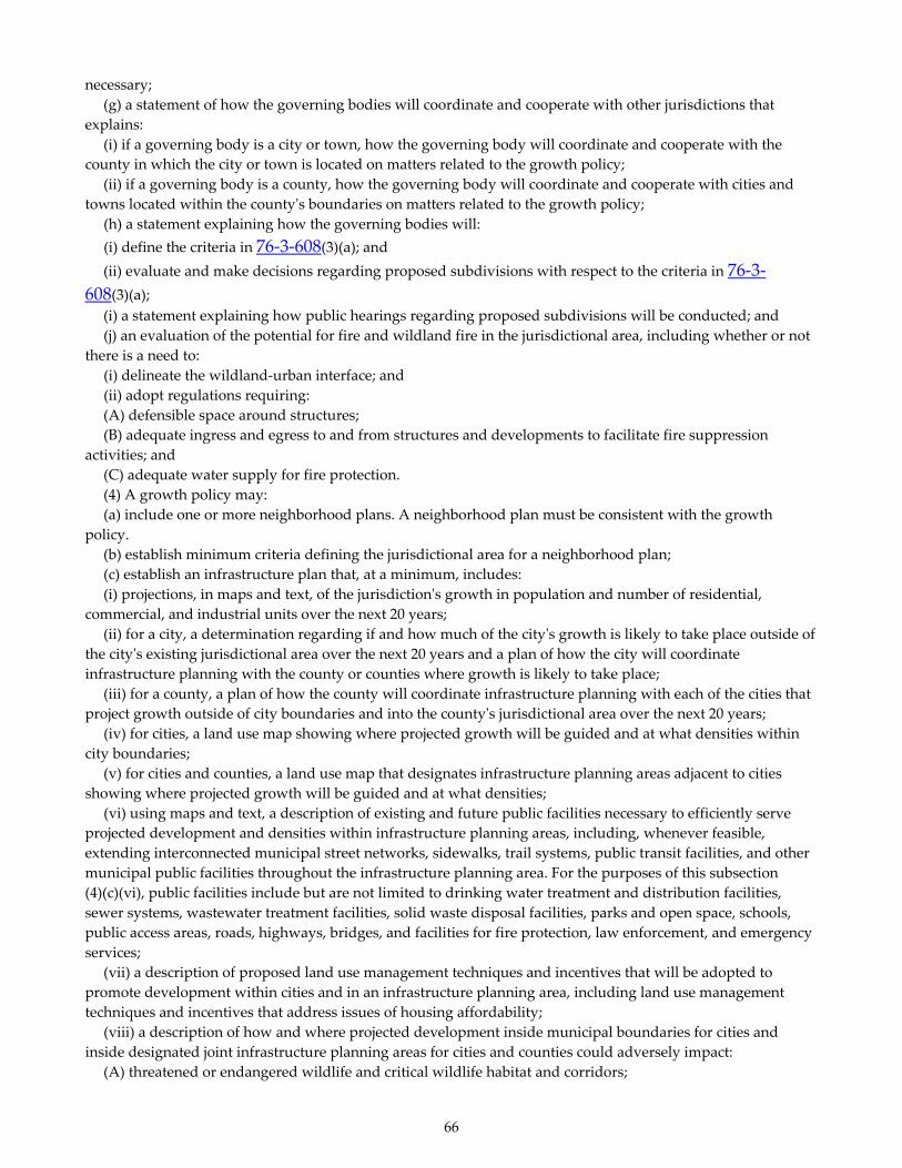
66
necessary; (g) a statement of how the governing bodies will coordinate and cooperate with other jurisdictions that explains: (i) if a governing body is a city or town, how the governing body will coordinate and cooperate with the county in which the city or town is located on matters related to the growth policy; (ii) if a governing body is a county, how the governing body will coordinate and cooperate with cities and towns located within the countyʹs boundaries on matters related to the growth policy; (h) a statement explaining how the governing bodies will: (i) define the criteria in 76‐3‐608(3)(a); and (ii) evaluate and make decisions regarding proposed subdivisions with respect to the criteria in 76‐3‐608(3)(a); (i) a statement explaining how public hearings regarding proposed subdivisions will be conducted; and (j) an evaluation of the potential for fire and wildland fire in the jurisdictional area, including whether or not there is a need to: (i) delineate the wildland‐urban interface; and (ii) adopt regulations requiring: (A) defensible space around structures; (B) adequate ingress and egress to and from structures and developments to facilitate fire suppression activities; and (C) adequate water supply for fire protection. (4) A growth policy may: (a) include one or more neighborhood plans. A neighborhood plan must be consistent with the growth policy. (b) establish minimum criteria defining the jurisdictional area for a neighborhood plan; (c) establish an infrastructure plan that, at a minimum, includes: (i) projections, in maps and text, of the jurisdictionʹs growth in population and number of residential, commercial, and industrial units over the next 20 years; (ii) for a city, a determination regarding if and how much of the cityʹs growth is likely to take place outside of the cityʹs existing jurisdictional area over the next 20 years and a plan of how the city will coordinate infrastructure planning with the county or counties where growth is likely to take place; (iii) for a county, a plan of how the county will coordinate infrastructure planning with each of the cities that project growth outside of city boundaries and into the countyʹs jurisdictional area over the next 20 years; (iv) for cities, a land use map showing where projected growth will be guided and at what densities within city boundaries; (v) for cities and counties, a land use map that designates infrastructure planning areas adjacent to cities showing where projected growth will be guided and at what densities; (vi) using maps and text, a description of existing and future public facilities necessary to efficiently serve projected development and densities within infrastructure planning areas, including, whenever feasible, extending interconnected municipal street networks, sidewalks, trail systems, public transit facilities, and other municipal public facilities throughout the infrastructure planning area. For the purposes of this subsection (4)(c)(vi), public facilities include but are not limited to drinking water treatment and distribution facilities, sewer systems, wastewater treatment facilities, solid waste disposal facilities, parks and open space, schools, public access areas, roads, highways, bridges, and facilities for fire protection, law enforcement, and emergency services; (vii) a description of proposed land use management techniques and incentives that will be adopted to promote development within cities and in an infrastructure planning area, including land use management techniques and incentives that address issues of housing affordability; (viii) a description of how and where projected development inside municipal boundaries for cities and inside designated joint infrastructure planning areas for cities and counties could adversely impact: (A) threatened or endangered wildlife and critical wildlife habitat and corridors;

67
(B) water available to agricultural water users and facilities; (C) the ability of public facilities, including schools, to safely and efficiently service current residents and future growth; (D) a local governmentʹs ability to provide adequate local services, including but not limited to emergency, fire, and police protection; (E) the safety of people and property due to threats to public health and safety, including but not limited to wildfire, flooding, erosion, water pollution, hazardous wildlife interactions, and traffic hazards; (F) natural resources, including but not limited to forest lands, mineral resources, sand and gravel resources, streams, rivers, lakes, wetlands, and ground water; and (G) agricultural lands and agricultural production; and (ix) a description of measures, including land use management techniques and incentives, that will be adopted to avoid, significantly reduce, or mitigate the adverse impacts identified under subsection (4)(c)(viii). (5) The planning board may propose and the governing bodies may adopt additional elements of a growth policy in order to fulfill the purpose of this chapter.
76‐1‐602. Public hearing on proposed growth policy. (1) Prior to the submission of the proposed growth policy to the governing bodies, the board shall give notice and hold a public hearing on the growth policy. (2) At least 10 days prior to the date set for hearing, the board shall publish in a newspaper of general circulation in the jurisdictional area a notice of the time and place of the hearing.
76‐1‐603. Adoption of growth policy by planning board. After consideration of the recommendations and suggestions elicited at the public hearing, the planning board shall by resolution: (1) recommend the proposed growth policy and any proposed ordinances and resolutions for its implementation to the governing bodies of the governmental units represented on the planning board; (2) recommend that a growth policy not be adopted; or (3) recommend that the governing body take some other action related to preparation of a growth policy.
76‐1‐604. Adoption, revision, or rejection of growth policy. (1) The governing body shall adopt a resolution of intention to adopt, adopt with revisions, or reject the proposed growth policy. (2) If the governing body adopts a resolution of intention to adopt a growth policy, the governing body may submit to the qualified electors of the area covered by the growth policy proposed by the governing body at the next primary or general election or at a special election the referendum question of whether or not the growth policy should be adopted. A special election must be held in conjunction with a regular or primary election. (3) A governing body may: (a) revise an adopted growth policy following the procedures in this chapter for adoption of a proposed growth policy; or (b) repeal a growth policy by resolution. (4) The qualified electors of the area covered by the growth policy may by initiative or referendum adopt, revise, or repeal a growth policy under this section. A petition for

68
initiative or referendum must contain the signatures of 15% of the qualified electors of the area covered by the growth policy. (5) A master plan adopted pursuant to this chapter before October 1, 1999, may be repealed following the procedures in this section for repeal of a growth policy. (6) Until October 1, 2006, a master plan that was adopted pursuant to this chapter before October 1, 1999, may be revised following the procedures in this chapter for revision of a growth policy. (7) Except as otherwise provided in this section, the provisions of Title 7, chapter 5, part 1, apply to an initiative or referendum under this section.
76‐1‐605. Use of adopted growth policy. (1) Subject to subsection (2), after adoption of a growth policy, the governing body within the area covered by the growth policy pursuant to 76‐1‐601 must be guided by and give consideration to the general policy and pattern of development set out in the growth policy in the: (a) authorization, construction, alteration, or abandonment of public ways, public places, public structures, or public utilities; (b) authorization, acceptance, or construction of water mains, sewers, connections, facilities, or utilities; and (c) adoption of zoning ordinances or resolutions. (2) (a) A growth policy is not a regulatory document and does not confer any authority to regulate that is not otherwise specifically authorized by statute or regulations adopted pursuant to the statute. (b) A governing body may not withhold, deny, or impose conditions on any land use approval or other authority to act based solely on compliance with a growth policy adopted pursuant to this chapter.
76‐1‐606. Effect of growth policy on subdivision regulations. When a growth policy has been approved, the subdivision regulations adopted pursuant to chapter 3 of this title must be made in accordance with the growth policy.
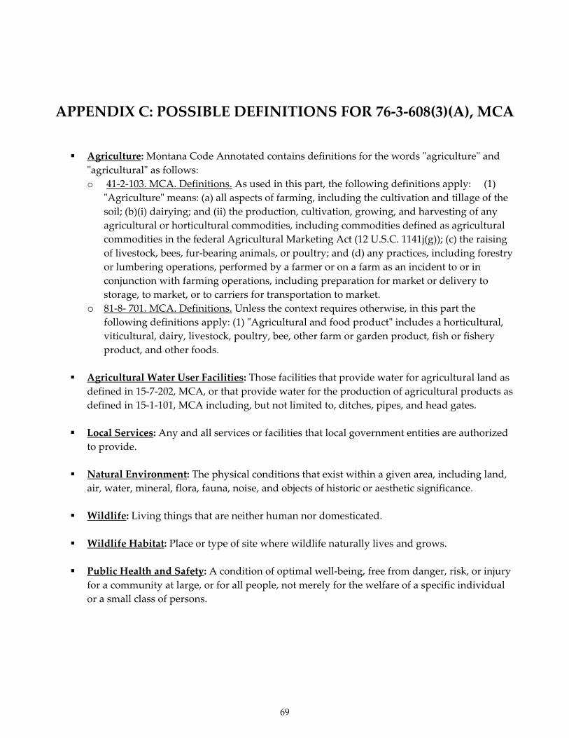
69
APPENDIX C: POSSIBLE DEFINITIONS FOR 76‐3‐608(3)(A), MCA
Agriculture: Montana Code Annotated contains definitions for the words ʺagricultureʺ and ʺagriculturalʺ as follows: o 41‐2‐103. MCA. Definitions. As used in this part, the following definitions apply: (1)
ʺAgricultureʺ means: (a) all aspects of farming, including the cultivation and tillage of the soil; (b)(i) dairying; and (ii) the production, cultivation, growing, and harvesting of any agricultural or horticultural commodities, including commodities defined as agricultural commodities in the federal Agricultural Marketing Act (12 U.S.C. 1141j(g)); (c) the raising of livestock, bees, fur‐bearing animals, or poultry; and (d) any practices, including forestry or lumbering operations, performed by a farmer or on a farm as an incident to or in conjunction with farming operations, including preparation for market or delivery to storage, to market, or to carriers for transportation to market.
o 81‐8‐ 701. MCA. Definitions. Unless the context requires otherwise, in this part the following definitions apply: (1) ʺAgricultural and food productʺ includes a horticultural, viticultural, dairy, livestock, poultry, bee, other farm or garden product, fish or fishery product, and other foods.
Agricultural Water User Facilities: Those facilities that provide water for agricultural land as
defined in 15‐7‐202, MCA, or that provide water for the production of agricultural products as defined in 15‐1‐101, MCA including, but not limited to, ditches, pipes, and head gates.
Local Services: Any and all services or facilities that local government entities are authorized
to provide.
Natural Environment: The physical conditions that exist within a given area, including land, air, water, mineral, flora, fauna, noise, and objects of historic or aesthetic significance.
Wildlife: Living things that are neither human nor domesticated.
Wildlife Habitat: Place or type of site where wildlife naturally lives and grows.
Public Health and Safety: A condition of optimal well‐being, free from danger, risk, or injury
for a community at large, or for all people, not merely for the welfare of a specific individual or a small class of persons.

70
APPENDIX D: INTERNET RESOURCES
GENERAL American FactFinder; http://www.factfinder.census.gov/home/saff/main.html?_lang=en American Planning Association; http://www.planning.org/
Environmental Design Library; University of California at Berkeley, a directory of Internet Planning Resources, and a source for a variety of planning and community indices, books, and organizations; http://www.lib.berkeley.edu/ENVI/cityweb.html Land Use Clinic; University of Montana School of Statute; Professor John Horwich, Director http://www.umt.edu/statute/clinics/land_use.htm; 406‐243‐2366; [email protected] Mapquest; http://www.mapquest.com/ Montana Association of Counties (MACo); http://maco.cog.mt.us/ Montana Association of Planners; http://www.montanaplanners.org/ Montana League of Cities and Towns; http://www.mlct.org/
Montana Local Government GIS Coalition; http://suol.giac.montana.edu/mlggc.html Montana Smart Growth Coalition; http://www.mtsmartgrowth.org/ Online Planner Forum; http://www.plannersweb.com/ Smart Growth America; http://www.smartgrowthamerica.org/openspace.html Sustainable Communities Network; http://www.sustainable.org Urban Land Institute; http://www.uli.org//AM/Template.cfm?Section=Home Western Planner; Western Planning Resources, Inc. (WPR); http://www.westernplanner.org/ STATE CONTACTS Coal Board Impact Grants – MT Dept. of Commerce; http://comdev.mt.gov/CDD_CB.asp
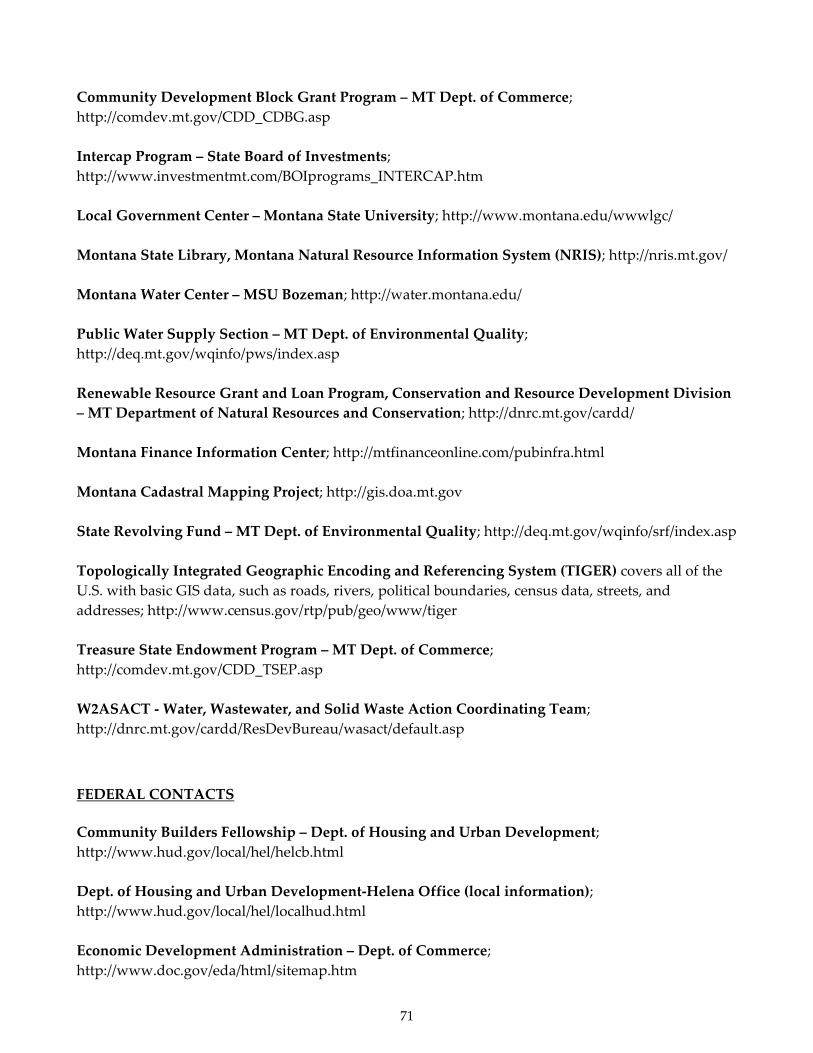
71
Community Development Block Grant Program – MT Dept. of Commerce; http://comdev.mt.gov/CDD_CDBG.asp Intercap Program – State Board of Investments; http://www.investmentmt.com/BOIprograms_INTERCAP.htm Local Government Center – Montana State University; http://www.montana.edu/wwwlgc/ Montana State Library, Montana Natural Resource Information System (NRIS); http://nris.mt.gov/ Montana Water Center – MSU Bozeman; http://water.montana.edu/ Public Water Supply Section – MT Dept. of Environmental Quality; http://deq.mt.gov/wqinfo/pws/index.asp Renewable Resource Grant and Loan Program, Conservation and Resource Development Division – MT Department of Natural Resources and Conservation; http://dnrc.mt.gov/cardd/ Montana Finance Information Center; http://mtfinanceonline.com/pubinfra.html Montana Cadastral Mapping Project; http://gis.doa.mt.gov State Revolving Fund – MT Dept. of Environmental Quality; http://deq.mt.gov/wqinfo/srf/index.asp Topologically Integrated Geographic Encoding and Referencing System (TIGER) covers all of the U.S. with basic GIS data, such as roads, rivers, political boundaries, census data, streets, and addresses; http://www.census.gov/rtp/pub/geo/www/tiger Treasure State Endowment Program – MT Dept. of Commerce; http://comdev.mt.gov/CDD_TSEP.asp W2ASACT ‐ Water, Wastewater, and Solid Waste Action Coordinating Team; http://dnrc.mt.gov/cardd/ResDevBureau/wasact/default.asp
FEDERAL CONTACTS Community Builders Fellowship – Dept. of Housing and Urban Development; http://www.hud.gov/local/hel/helcb.html Dept. of Housing and Urban Development‐Helena Office (local information); http://www.hud.gov/local/hel/localhud.html Economic Development Administration – Dept. of Commerce; http://www.doc.gov/eda/html/sitemap.htm

72
Environmental Protection Agency – Dynamic Chloropleth Mapping; http://www.turboperl.com/dcmaps.html EPA Water Funding; http://www.epa.gov/ow/funding.html EPA Region 8; http://www.epa.gov/region8/ EPA Drinking Water; http://www.epa.gov/ogwdw/ Rural Development – Dept of Agriculture; http://www.rurdev.usda.gov/mt/index.htm
PRIVATE OR NON‐PROFIT CONTACTS Midwest Assistance Program; http://www.map‐inc.org/Index.htm Montana Association of Counties; http://www.mt.gov/maco/MACoHOME.htm Montana League of Cities and Towns; http://www.mlct.org/ Montana Rural Development Partners; http://www.mtrdp.org/ Montana Rural Water Systems; http://www.mrws.org/

73
APPENDIX E: GROWTH POLICY CHECKLIST
At a minimum, the following elements must be included in a growth policy: ____ 1. Goals and Objectives: The growth policy must state the community’s long‐term goals
and the objectives to be met in the pursuit of those goals. ____ 2. Maps and Text: These must describe an inventory of the existing characteristics and
features of the jurisdictional area. The following topics must be addressed: ____ A. Land uses ____ B. Population ____ C. Housing needs ____ D. Economic conditions ____ E. Local services ____ F. Public facilities ____ G. Natural resources ____ H. Other unique characteristics and features proposed by the planning board and
adopted by the governing bodies (such as a historic overview of the community or area)
(Note: Typically, the presentation of characteristics and features, and the projection of trends, are combined and dealt with topic‐by‐topic, rather than addressed in separate sections of the growth policy.)
____ 3. Projected Trends: The growth policy must identify trends for the following topics. Trends must be projected through the life of the growth policy. ____ A. Land use ____ B. Population ____ C. Housing needs
____ D. Economic conditions

74
____ E. Local services ____ F. Natural resources
____ G. Sand and Gravel Resources ____ H. Other elements proposed by the planning board and adopted by the governing
bodies
____ 4. Implementation tools: The growth policy must include a description of the policies, regulations, and other measures to be implemented in order to achieve the identified goals and objectives.
____ 5. Public infrastructure strategy: The growth policy must include a strategy for the
development, maintenance, and replacement of the jurisdiction’s public infrastructure, including the following (as appropriate):
____ A. Drinking water systems
____ B. Wastewater treatment facilities
____ C. Sewer systems
____ D. Solid waste facilities
____ E. Fire and police protection facilities
____ F. Roads
____ G. Bridges
____ 6. Implementation strategy: The growth policy must include the following:
____ A. A timetable for implementing the growth policy
____ B. A list of conditions that will lead to a revision of the growth policy
____ C. A timetable for reviewing the growth policy at least once every 5 years and revising the policy if necessary
____ 7. Coordination statement: The growth policy must include a statement explaining how the
governing bodies will coordinate and cooperate with each other. ____ 8. Subdivision review criteria: The growth policy must include a statement explaining how
governing bodies will define the criteria in 76‐3‐608(3)(a), MCA, which address a proposed
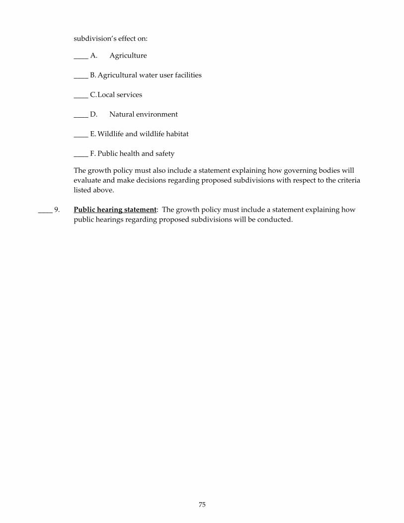
75
subdivision’s effect on:
____ A. Agriculture
____ B. Agricultural water user facilities
____ C. Local services
____ D. Natural environment
____ E. Wildlife and wildlife habitat
____ F. Public health and safety
The growth policy must also include a statement explaining how governing bodies will evaluate and make decisions regarding proposed subdivisions with respect to the criteria listed above.
____ 9. Public hearing statement: The growth policy must include a statement explaining how
public hearings regarding proposed subdivisions will be conducted.

76
APPENDIX F: INFORMATION SOURCES
Potential Sources for Land Use Maps and Transportation Information
• Montana Association of County Road Supervisors; website: http://www.coe.montana.edu/ltap/pages/MACRS.htm; c/o Montana Local Technical Assistance Program (LTAP), College of Engineering, PO Box 173910 Faculty Court Unit 22, Montana State University, Bozeman, MT 59717‐3910; Tel: (800) 541‐6671; Fax: (406) 994‐5333; [email protected]
• Montana Department of Administration, Information Services Division, Geographic Information Systems Services (GIS), Weinstein Building, 101 N. Rodney; P.O. Box 200113, Helena, MT 59620‐0113; (406) 444‐90I3; website: http://itsd.mt.gov/techmt/gis.asp
• Montana Department of Revenue, Information Services Division, Geographic Information
Systems Services (GIS), Weinstein Building, 101 N. Rodney; P.O. Box 200113, Helena, MT 59620‐0113; (406) 444‐90I3; website: http://itsd.mt.gov/techmt/gis.asp
• Montana Department of Revenue, Montana Information Technology Services Division,
Geographic Information Systems Services (GIS), GIS Bureau, Montana Cadastral Mapping Project, Computer Assisted Mass Appraisal System (CAMA), PO Box 200113, Helena, MT 59620‐0113; 406‐444‐9013 or 406‐444‐1255; website: http://gis.mt.gov/ (CAMA is a database of all taxable (and some tax‐exempt) lands in the State of Montana.)
• Community Transportation Enhancement Program (CTEP) administered by the Montana
Department of Transportation Rail, Transit and Planning Division; P.O. Box 20100I, Helena, MT 59620‐1001; (406) 444‐9209; website: http://www.mdt.mt.gov/business/ctep/
• Montana Department of Transportation; Rail, Transit and Planning Division; P.O. Box 20100I,
Helena; MT 59620‐1001; (406) 444‐3423; website: http://www.mdt.mt.gov/mdt/organization/railtran.shtml
• Montana Department of Transportation, Montana Maps – Distance Information;
http://www.mdt.mt.gov/travinfo/maps/ • Montana State Library, Natural Resource Information System; P.O. Box 201800; Helena, MT
59620‐1800; (406) 444‐5354; website: http://nris.mt.gov/ • TerraServer‐USA; website: http://terraserver.microsoft.com/default.aspx (aerial photos) • U.S. Geological Survey, Rocky Mountain Mapping Center, Box 25286, Denver, CO 80225; (888)
275‐8747; website: http://rockyweb.cr.usgs.gov
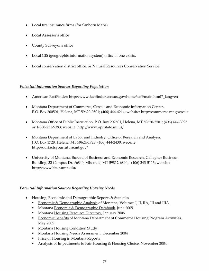
77
• Local fire insurance firms (for Sanborn Maps)
• Local Assessorʹs office
• County Surveyorʹs office
• Local GIS (geographic information system) office, if one exists. • Local conservation district office, or Natural Resources Conservation Service
Potential Information Sources Regarding Population
• American FactFinder; http://www.factfinder.census.gov/home/saff/main.html?_lang=en • Montana Department of Commerce, Census and Economic Information Center,
P.O. Box 200501, Helena, MT 59620‐0501; (406) 444‐4214; website: http://commerce.mt.gov/ceic • Montana Office of Public Instruction, P.O. Box 202501, Helena, MT 59620‐2501; (406) 444‐3095
or 1‐888‐231‐9393; website: http://www.opi.state.mt.us/ • Montana Department of Labor and Industry, Office of Research and Analysis,
P.O. Box 1728, Helena, MT 59624‐1728; (406) 444‐2430; website: http://ourfactsyourfuture.mt.gov/
• University of Montana, Bureau of Business and Economic Research, Gallagher Business
Building, 32 Campus Dr. #6840, Missoula, MT 59812‐6840; (406) 243‐5113; website: http://www.bber.umt.edu/
Potential Information Sources Regarding Housing Needs
• Housing, Economic and Demographic Reports & Statistics Economic & Demographic Analysis of Montana, Volumes I, II, IIA, III and IIIA Montana Economic & Demographic Databook, June 2005 Montana Housing Resource Directory, January 2006 Economic Benefits of Montana Department of Commerce Housing Program Activities,
May 2005 Montana Housing Condition Study Montana Housing Needs Assessment, December 2004 Price of Housing in Montana Reports Analysis of Impediments to Fair Housing & Housing Choice, November 2004

78
Links to reports prepared by the MDOC, see website: http://housing.mt.gov/Hous_CP_HsgEconDemRptsStats.asp
• Montana Consolidated Plan; Montana Department of Commerce; Housing Division;
http://housing.mt.gov/Hous_CP.asp • Montana Department of Commerce, Census and Economic Information Center (website:
http://ceic.mt.gov/) • Montana Department of Commerce, Community Development Block Grant (CDBG) Program,
P.O. Box 200523, Helena, MT 59620‐0523; (406) 841‐2791; website: http://comdev.mt.gov/CDD_cdbg.asp
• Montana Department of Commerce, Home Investment Partnership Program (HOME), P.O.
Box 200528, Helena, MT 59620‐0528; (406) 841‐2820; website: http://housing.mt.gov/Hous_HM.asp
• Montana Department of Commerce, Montana Board of Housing, P.O. Box 200528, Helena, MT
59620‐0528; (406) 841‐2849; website: http://housing.mt.gov/Hous_BOH.asp
• Montana Department of Labor and Industry, Building Codes Bureau, P.O. Box 200517, Helena, MT 59620‐0517; (406) 841‐2300; website: http://www.mt.gov/dli/bsd/bc/index.asp
• Montana Department of Revenue, P.O. Box 5805, Helena, MT 59604‐5805; (406) 444‐6900;
website: http://mt.gov/revenue/default.asp/
• U.S. Department of Agriculture, Rural Development (RD), P.O. Box 850, Bozeman, MT 59771; (406) 585‐2515; website: http://www.rurdev.usda.gov/mt/RHS/rhs.htm
• Local bankers, building contractors, developers, and real estate agents should be consulted.
Potential Information Sources Regarding Economic Conditions
• American FactFinder; web site: http://www.factfinder.census.gov/home/saff/main.html?_lang=en
• Federal Reserve Bank of Minneapolis; website: http://minneapolisfed.org/ • Montana Department of Commerce, Census and Economic Information Center, P.O. Box
200505, Helena, MT 59620‐0505; (406) 841‐2740; website: http://ceic.mt.gov/ • Montana Department of Commerce, Business Resources Division, P.O. Box 200505, Helena,
MT 59620‐0505; (406) 841‐2730; website: http://commerce.mt.gov/busresources.asp

79
• Montana Department of Labor and Industry, Office of Research and Analysis, P.O. Box 1728, Helena, MT 59624‐1728; (406) 444‐2430; website: http://ourfactsyourfuture.mt.gov/
• Montana Department of Labor and Industry, P.O. Box 1728, Helena, MT 59624‐1728; (406) 444‐
9091; website: http://dli.mt.gov/ • Montana Department of Revenue, P.O. Box 5805, Helena, MT 59604‐5805; (406) 444‐2460;
website: http://mt.gov/revenue/default.asp • Northwest Income Indicators Project (NIIP); web page: http://niip.wsu.edu
• University of Montana, Bureau of Business and Economic Research, Gallagher Business
Building, Ste. 231, 32 Campus Dr. #6840, Missoula, MT 59812‐6840; (406) 243‐5113; website: http://www.bber.umt.edu/
• U .S. Department of Commerce, Economic Development Administration, Federal Building
Room 196, 301 S. Park Avenue, Drawer 10074, Helena, MT 59626; (406) 441‐1175
• Local Chambers of Commerce, economic development corporations, Resource Conservation and Development organizations, retail trade associations, banks, and savings and loans institutions should also be consulted.
Potential Information Sources Regarding Local Facilities and Services
Fire protection/suppression:
• Firewise Communities/USA; website: http://www.firewise.org/usa/ • Montana Department of Justice, State Fire Marshal Office,
P.O. Box 201415, Helena, MT 59620‐1415; (406) 444‐2050; website: http://www.doj.mt.gov/enforcement/fireprevention.asp
• Municipal and rural fire district offices should also be consulted.
Law enforcement/emergency communications:
• Montana Department of Justice, Highway Patrol Division, 2550 Prospect Ave., Helena, MT 59620‐1419; (406) 444‐7000; website: http://doj.mt.gov/enforcement/highwaypatrol.asp
• Municipal police departments and county sheriffs offices should be consulted. • • Local disaster and emergency services or emergency management offices.
Public health:
80
• Montana Department of Public Health & Human Services, P.O. Box 4210, Helena, MT 59604; (406) 444‐9530; website: http://www.dphhs.mt.gov/index.shtml
• Local hospitals and county health departments should be consulted.
• Local sewer and water districts
• Local emergency medical services (ambulance service and quick response units)
Education:
• Montana Office of Public Instruction, P.O. Box 202501, Helena, MT 59620‐2501; (406) 444‐3095 or 1‐888‐231‐9393; website: http://www.opi.state.mt.us/
• Local school district boards should also be consulted.
Library:
• Montana State Library, P.O. Box 201800, Helena, MT 59620‐1800; (406) 444‐3115; website: http://msl.mt.gov/
• Local libraries should also be consulted.
Social services:
• Montana Department of Public Health & Human Services, P.O. Box 4210, Helena, MT 59604; (406) 444‐9530; website: http://www.dphhs.mt.gov/index.shtml
• Local long‐term care facilities, nursing homes, day care providers, etc., should also be
consulted. • Local Office of Public Assistance (MT Dept of Public Health & Human Services)
• Montana Human Resource Development Councils (see the following list of agencies)
Agency Name Counties Served
Action for Eastern Montana 2030 North Merrill Glendive, MT 59330 Phone 406‐377‐3564 or 1‐800‐227‐0703 Fax 406‐377‐3570
Carter, Custer, Daniels, Dawson, Fallon, Garfield, McCone, Phillips, Powder River, Prairie, Richland, Roosevelt, Rosebud, Sheridan, Treasure, Valley, Wibaux
Opportunities Incorporated 905 First Avenue North PO Box 2289 Great Falls, MT 59403‐2270 Phone 406‐761‐0310 or 1‐800‐927‐2270
Cascade, Chouteau, Glacier, Pondera, Teton, Toole
81
Fax 406‐761‐0363 District VI HRDC Suite 203 Centennial Plaza 300 1st Ave North Lewistown, MT 59459 Phone 406‐538‐7488 or 1‐800‐766‐3018 Fax 406‐538‐2843 E‐mail [email protected]
Fergus, Golden Valley, Judith Basin, Musselshell, Petroleum, Wheatland
District VII HRDC 7 N 31st Street PO Box 2016 Billings, MT 59103 Phone 406‐247‐4732 or 1‐800‐433‐1411 Fax 406‐248‐2943 E‐mail [email protected]
Big horn, Carbon, Stillwater, Sweet Grass, Yellowstone
Rocky Mountain Development Council Neighborhood Center 201 S. Last Chance Gulch PO Box 1717 Helena, MT 59624‐1717 Phone 406‐447‐1680 or 1‐800‐356‐6544 Fax 406‐447‐1629 E‐mail [email protected]
Broadwater, Jefferson, Lewis & Clark
District IX HRDC 321 East Main, Suite 300 Bozeman, MT 59715 Phone 406‐587‐4486 Fax 406‐585‐3538 E‐mail [email protected]
Gallatin, Meagher, Park
Northwest Montana Human Resource 214 Main Street PO Box 8300 Kalispell, MT 59904‐1300 Phone 406‐758‐5433 or 1‐800‐344‐5979 Fax 406‐752‐6582
Flathead, Lake, Lincoln, Sanders
District XI HRC 1801 South Higgins Missoula, MT 59801 Phone 406‐728‐3710
Mineral, Missoula, Ravalli

82
Fax 406‐728‐7680 District XII HRC 700 Casey Street PO Box 3486 Butte, MT 59702 Phone 406‐496‐4975 or 1‐800‐382‐1325 Fax 406‐782‐0318
Beaverhead, Deer Lodge, Granite, Madison, Powell, Silver Bow
Potential Information Sources Regarding Public Facilities
Bridges:
• Montana Department of Commerce, Treasure State Endowment Program (TSEP), P.O. Box 200501, Helena, MT 59620‐0501; (406) 841‐2770; website: http://comdev.mt.gov/CDD_TSEP.asp
• Montana Department of Transportation, Bridge Bureau, P.O. Box 201001, Helena, MT 59620‐
1001; (406) 444‐6259; website: http://www.mdt.state.mt.us/ • County and municipal road and street departments should be consulted.
Fire protection/suppression:
• Fire Wise Communities; National Wildland/Urban Interface Fire Program; web site:
http://www.firewise.org/communities/2003/navbar.htm • Montana Department of Justice, State Fire Marshal Office, P.O. Box 201415, Helena, MT 59620‐
1415; (406) 444‐2050; website: http://www.doj.mt.gov/enforcement/fireprevention.asp
• Municipal and rural fire district offices should always be consulted.
Parks:
• Montana Department of Fish, Wildlife, and Parks (FWP), P.O. Box 200701, Helena, MT 59620‐0701; (406) 444‐3750; website: http://fwp.mt.gov/parks/default.html. See also regional FWP offices.
• Local parks and recreation departments should be consulted.
Roads/streets:
• Montana Association of County Road Supervisors; website:
http://www.coe.montana.edu/ltap/pages/MACRS.htm; c/o Montana Local Technical

83
Assistance Program (LTAP), College of Engineering, PO Box 173910 Faculty Court Unit 22, Montana State University, Bozeman, MT 59717‐3910; Tel: (800) 541‐6671; Fax: (406) 994‐5333; web site: [email protected]
• County and municipal road and street departments should be consulted.
Solid waste:
• Planning, Prevention, & Assistance Division; Montana Department of Environmental Quality, P.O. Box 200901, Helena, MT 59620‐0901; (406) 444‐4400; website: http://www.deq.mt.gov/ppa/index.asp
• Montana Rural Water Systems; (406) 454‐1151; website: http://www.mrws.org/; email:
[email protected] • County or regional land fills, sanitation departments, and solid waste districts should be
consulted.
Utilities:
• Local electricity and natural gas providers, telephone companies and cable companies should be consulted.
Water and sewer systems:
• Local Government Center, Montana State University, Department of Political Science, Wilson
Hall, Montana State University; Bozeman, Bozeman, MT 59717; (406) 994‐6694; website: http://www.montana.edu/wwwlgc/
• Midwest Assistance Program; (800) 822‐2981; website: http://www.map‐inc.org • Montana Board of Investments, INTERCAP Program, P.O. Box 200126, Helena, MT 59620‐
0126; (406) 444‐0001; website: http://www.investmentmt.com/Programs/Intercap/default.asp
• Montana Department of Commerce, Community Development Block Grant Program (CDBG); website: http://comdev.mt.gov/CDD_CDBG.asp and Treasure State Endowment Program (TSEP), P.O. Box 200501, Helena, MT 59620‐0501; (406) 841‐2770; website: http://comdev.mt.gov/CDD_TSEP.asp
• Montana Department of Environmental Quality, State Revolving Fund Loan Programs (SRF),
P.O. Box 200901, Helena, MT 59620‐0901; (406) 444‐5322; website: http://www.deq.mt.gov/wqinfo/srf/index.asp
• Montana Department of Natural Resources and Conservation, Renewable Resource Grant and
Loan Program (RRGL), P.O. Box 201601, Helena, MT 59620‐1601; (406) 444‐6668; website: http://dnrc.mt.gov/cardd/ResDevBureau/renewable_grant_program.asp

84
• Montana Rural Water Systems; (406) 454‐1151; website: http://www.mrws.org/; email:
• Montana Water Center, Montana State University, Bozeman, MT 59717; website: http://water.montana.edu/
• U.S. Department of Agriculture, Rural Development (RD), P.O. Box 850, Bozeman, MT 59771;
(406) 585‐2520; website: http://www.rurdev.usda.gov/mt/aboutus.htm
• Water, Wastewater and Solid Waste Action Coordinating Team (W2ASACT), Montana Department of Natural Resources and Conservation, P.O. Box 201601, Helena, MT 59620‐1601; (406) 444‐6668; http://dnrc.mt.gov/cardd/ResDevBureau/wasact/default.asp
Local water and sewer district officials or the public works department should also be consulted. Potential Information Sources Regarding Natural Resources
• Bureau of Land Management, U.S. Department of the Interior, Montana State Office, 5001 Southgate Dr., Billings, Montana 59101; (406) 896‐5000; website: http://www.mt.blm.gov/
• Clean Water Act Information Center (CWAIC); web site:
http://deq.mt.gov/CWAIC/default.aspx (The Center conveys information about the quality of Montanaʹs rivers, streams, lakes and wetlands in relation to Montanaʹs Water Quality Standards.)
• Ground‐Water Information Center, Montana College of Technology, Bureau of Mines and
Geology, 1300 West Park Street, Main Hall 314, Butte, MT 59701‐8997; (406) 496‐4167; website: http://mbmggwic.mtech.edu/
• Montana Code Annotated; website: http://data.opi.mt.gov/bills/mca/76/1/76‐1‐601.htm
• Montana Department of Agriculture, P.O. Box 200201, Helena, MT 59620‐0201; (406) 444‐3144;
website: http://agr.mt.gov/ • Montana Department of Environmental Quality, P.O. Box 200901, Helena, MT 59620‐0901;
(406) 444‐6697; website: http://www.deq.mt.gov/index.asp • Montana Department of Fish, Wildlife, & Parks, P.O. Box 200701, Helena, MT 59620‐0701;
(406) 444‐2535; website: http://fwp.mt.gov/default.html • Montana Department of Military Affairs, Disaster and Emergency Services Division; P.O. Box
4789, Helena, MT 59604‐4789; (406) 841‐3964; website: http://dma.mt.gov/des/

85
• Montana Department of Natural Resources and Conservation, P.O. Box 201601, Helena, MT 59620‐1601; (406) 444‐2074; website: http://www.dnrc.mt.gov/
• Montana State Library, Natural Resource Information System; P.O. Box 201800; Helena, MT
59620‐1800; (406) 444‐5354; website: http://nris.mt.gov/ • Montana Wetlands Council, Lynda Saul, President, MDEQ, P.O. Box 200901, Helena, MT
59620‐0901; (406) 444‐6652; website: http://nris.mt.gov/wis/wetcouncilmain.html • U.S. Department of Agriculture, Forest Service, Northern Region, P.O. Box 7669, Missoula, MT
59807; (406) 329‐3511; website: http://www.fs.fed.us/r1/ • U.S. Department of the Army, Corps of Engineers, Helena Regulatory Office, 10 West 15th
Street, Suite 2200. Helena, Montana 59626; (406) 441‐1375; website: www.nwo.usace.army.mil/html/od‐rmt
• U.S. Fish and Wildlife Service, 100 North Park, Suite 320, Helena, MT 59601; (406) 449‐5225;
website: website: http://mountain‐prairie.fws.gov/es/Montana/index.htm • U.S. Environmental Protection Agency, Region VIlI, Montana Office, PO Box 200901 Helena,
MT 59620‐0901 (406) 444‐2467; website: yosemite.epa.gov/oswer/ceppoweb.nsf‐ • USGS Montana Water Science Center, USGS, 3162 Bozeman Avenue, Helena, MT 59601;
website: http://mt.water.usgs.gov/index.html • Local Disaster and Emergency Services offices • Local Floodplain Management Office
Potential Historic and Archeological Resources Information Sources
• Environmental Quality Council, Montana State Legislature, Legislative Environmental Policy Office; Room 171, State Capitol, PO Box 201704, Helena, MT, 59620‐1704, (406) 444‐3742; website: http://leg.mt.gov/css/lepo/2005_2006/default.asp
• Montana State Historic Preservation Office, 1410 8th Avenue, P.O. Box 201202, Helena, MT
59620‐1202; (406) 444‐7715; website: http://www.his.state.mt.us/shpo/
• Coal Board Impact Grants – MT Dept. of Commerce; website: http://comdev.mt.gov/CDD_CB.asp
• Community Development Block Grant Program – MT Dept. of Commerce; website:
http://comdev.mt.gov/CDD_CDBG.asp
• Hard Rock Mining Impact Board – MT Dept. of Commerce: website:

86
http://comdev.mt.gov/CDD_HR.asp