Module1 Introduction Relating to Storm Drainage … to the Rules Relating to Storm Drainage...
133
WORKSHOP OUTLINE WORKSHOP OUTLINE Module 1 Introduction Module 2 Rules Relating to Storm Drainage Standards Module 3 Electronic Resource Library Module 4 Examples Module 4 Examples 2
Transcript of Module1 Introduction Relating to Storm Drainage … to the Rules Relating to Storm Drainage...
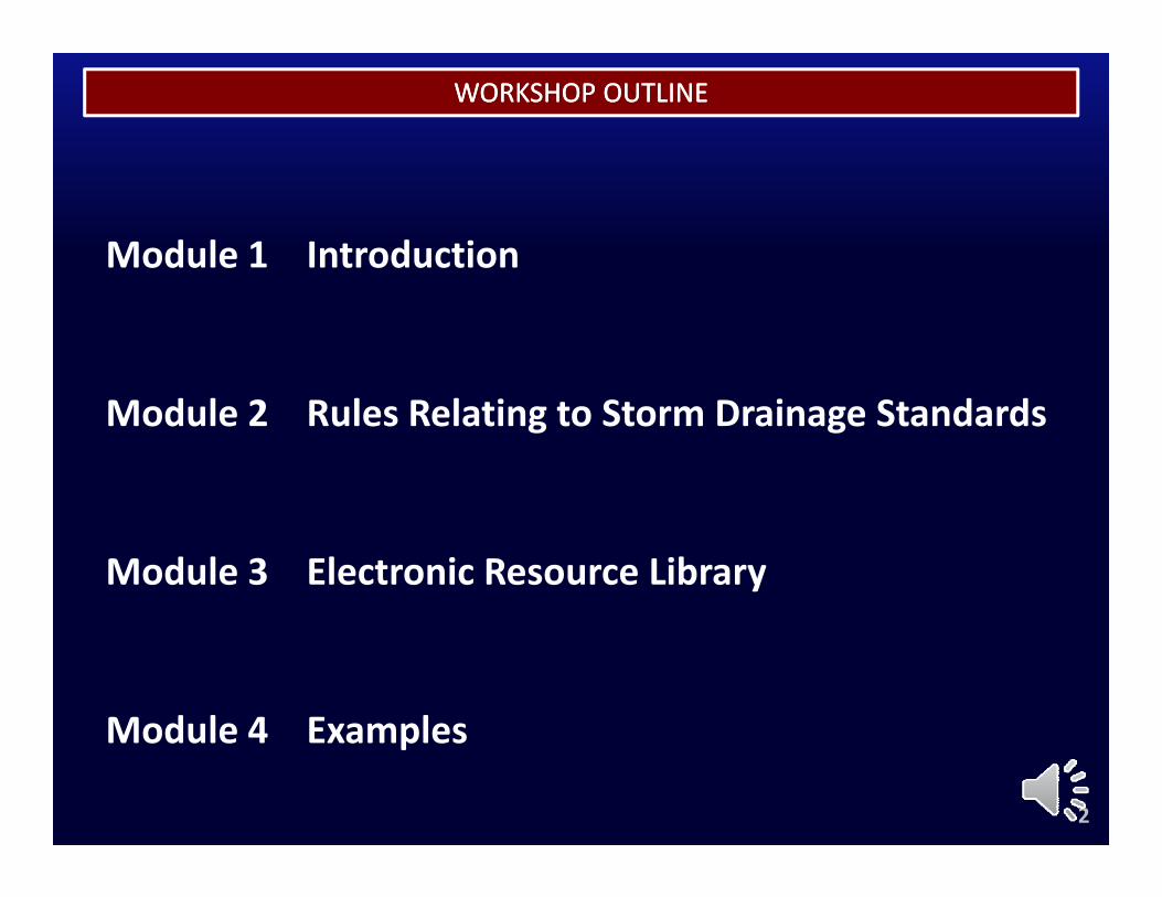
WORKSHOP OUTLINEWORKSHOP OUTLINE
Module 1 Introduction
Module 2 Rules Relating to Storm Drainage Standards
Module 3 Electronic Resource Library
Module 4 ExamplesModule 4 Examples
2
MODULE 1MODULE 1
INTRODUCTIONINTRODUCTIONINTRODUCTIONINTRODUCTION
3
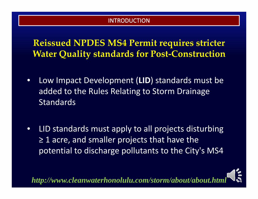
INTRODUCTIONINTRODUCTION
Reissued NPDES MS4 Permit requires stricter Water Quality standards for Post‐Construction
• Low Impact Development (LID) standards must be added to the Rules Relating to Storm Drainage Standards
• LID standards must apply to all projects disturbing ≥ 1 d ll j t th t h th≥ 1 acre, and smaller projects that have the potential to discharge pollutants to the City's MS4
4http://www.cleanwaterhonolulu.com/storm/about/about.html
INTRODUCTIONINTRODUCTION
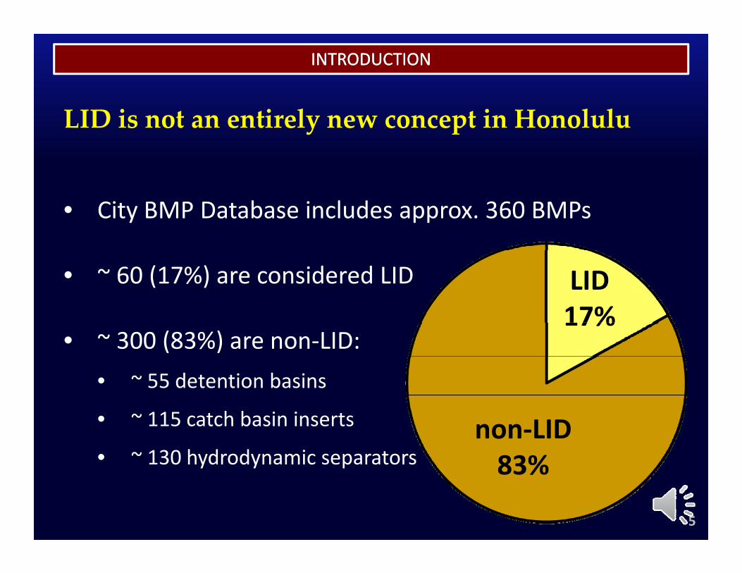
LID is not an entirely new concept in Honolulu
• City BMP Database includes approx. 360 BMPs
• ~ 60 (17%) are considered LID LID17%
• ~ 300 (83%) are non‐LID:• ~ 55 detention basins
17%
• ~ 115 catch basin inserts
• ~ 130 hydrodynamic separatorsnon‐LID83%y y p 83%
5
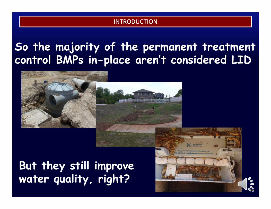
INTRODUCTIONINTRODUCTION
So the majority of the permanent treatment control BMPs in-place aren’t considered LIDp
But they still improve y pwater quality, right?
6
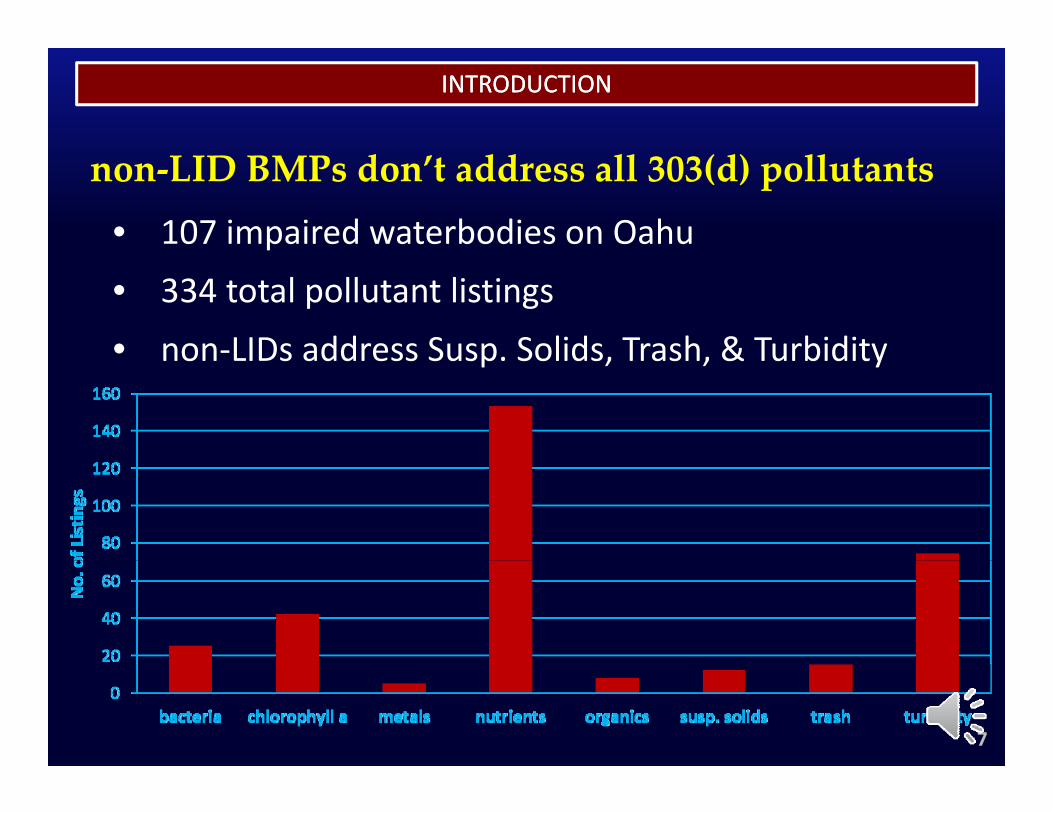
INTRODUCTIONINTRODUCTION
non‐LID BMPs don’t address all 303(d) pollutants• 107 impaired waterbodies on Oahu
• 334 total pollutant listings
• non‐LIDs address Susp Solids Trash & Turbiditynon LIDs address Susp. Solids, Trash, & Turbidity
7
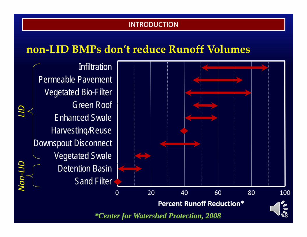
INTRODUCTIONINTRODUCTION
non‐LID BMPs don’t reduce Runoff VolumesInfiltration
Permeable PavementVegetated Bio-Filter
Green RoofGreen RoofEnhanced Swale
Harvesting/Reuse
LID
a es g/ euseDownspout Disconnect
Vegetated Swale
D Detention BasinSand Filter
20 40 60 80 1000Non
‐LID
*Center for Watershed Protection, 2008*Center for Watershed Protection, 2008
20 40 60 80 100
Percent Runoff Reduction*Percent Runoff Reduction*0
8
INTRODUCTIONINTRODUCTION
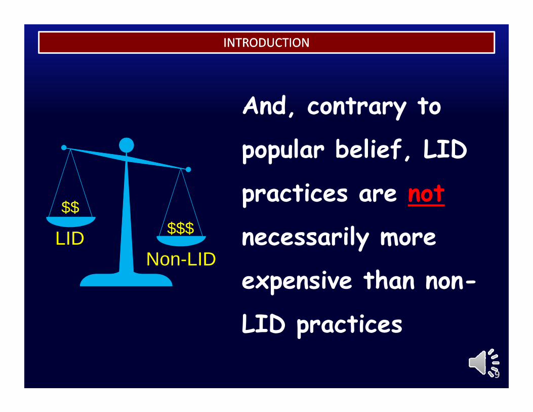
And, contrary to
popular belief, LID
practices are not
n il m LID $$$$$
necessarily more
expensive than non-
LIDNon-LID
$$$
expensive than non
LID practicesp
9
INTRODUCTIONINTRODUCTION
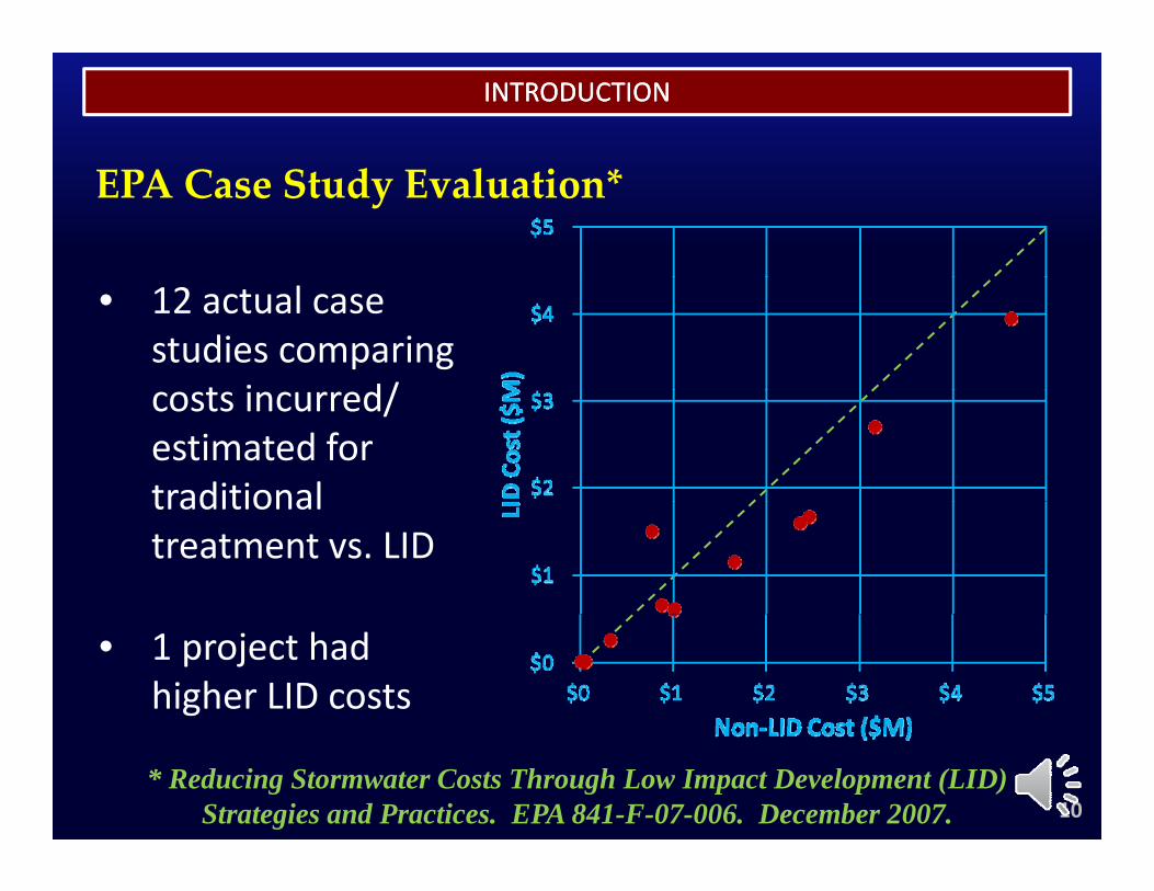
EPA Case Study Evaluation*
• 12 actual case studies comparing
t i d/costs incurred/ estimated for traditionaltraditional treatment vs. LID
• 1 project had higher LID costs
* Reducing Stormwater Costs Through Low Impact Development (LID) Strategies and Practices. EPA 841-F-07-006. December 2007. 10

INTRODUCTIONINTRODUCTION
American Society of Landscape Architect’s (ASLA) Green Infrastructure Survey*
• 479 case studies from 43 states, D.C., and Canada Increased , ,
• Over 300 ASLA members Reduced Costs
c easedCosts24.5%
and other practitioners were asked “Did use of
i f t t
44.1%No
Influence31 4%green infrastructure
increase costs?”31.4%
* Banking on Green: A Look at How Green Infrastructure Can Save Municipalities Money and Provide Economic Benefits Community-wide, A Joint Report by American Rivers, WEF, ASLA, and ECONorthwest, 2012 11
INTRODUCTIONINTRODUCTION
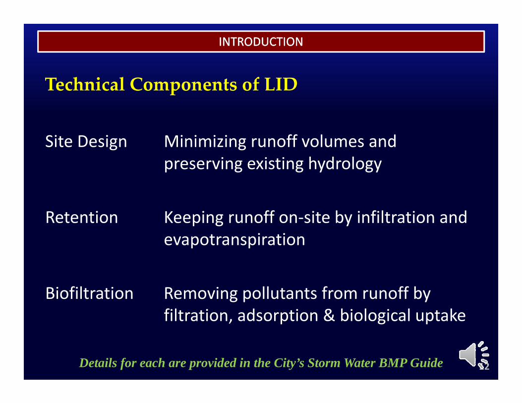
Technical Components of LID
Site Design Minimizing runoff volumes and preserving existing hydrology
Retention Keeping runoff on‐site by infiltration and evapotranspiration
Biofiltration Removing pollutants from runoff by filtration, adsorption & biological uptake
12Details for each are provided in the City’s Storm Water BMP Guide
INTRODUCTIONINTRODUCTION
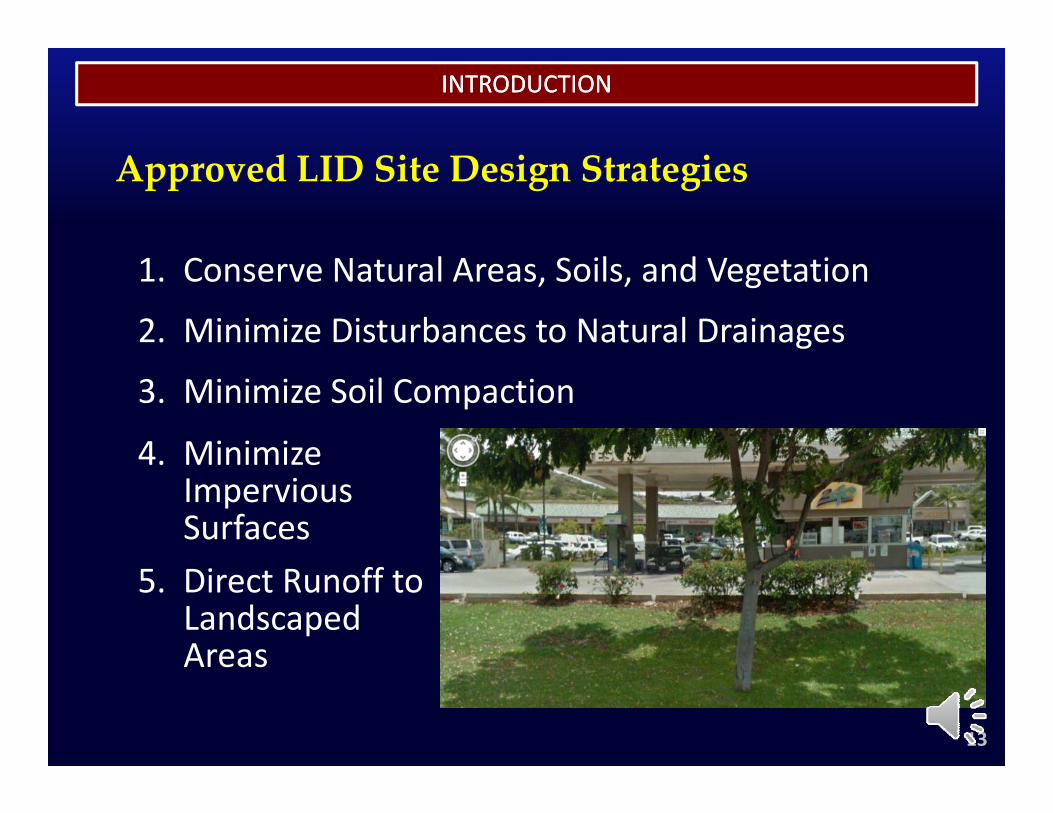
Approved LID Site Design Strategies
1. Conserve Natural Areas, Soils, and Vegetation
2. Minimize Disturbances to Natural Drainages
3. Minimize Soil Compaction
4 Minimize4. Minimize Impervious Surfaces
5. Direct Runoff to Landscaped Areas
13
Areas
INTRODUCTIONINTRODUCTION
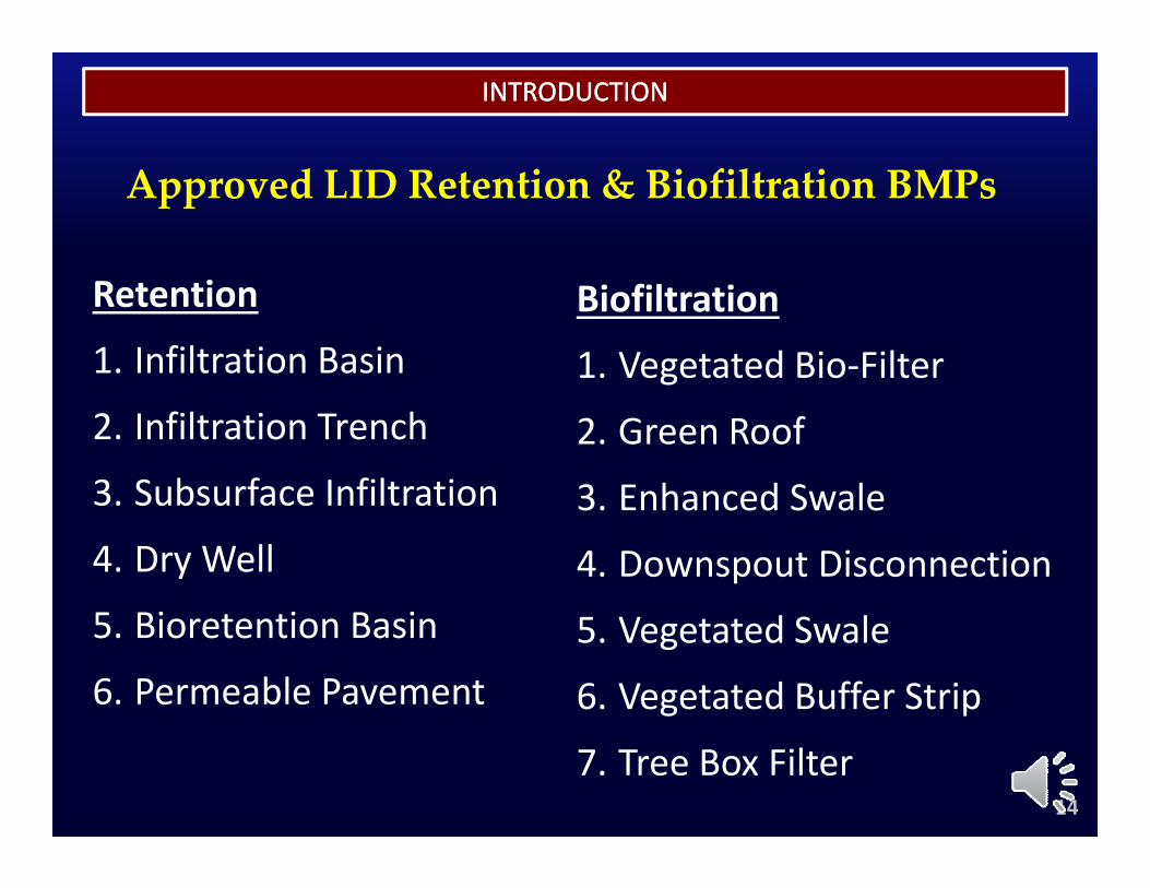
Approved LID Retention & Biofiltration BMPs
Retention
1. Infiltration BasinBiofiltration
1. Vegetated Bio‐Filter2. Infiltration Trench
3 Subsurface Infiltration2. Green Roof
3 Enhanced Swale3. Subsurface Infiltration
4. Dry Well
5 Bi i B i
3. Enhanced Swale
4. Downspout Disconnection5. Bioretention Basin
6. Permeable Pavement5. Vegetated Swale
6. Vegetated Buffer Strip
14
7. Tree Box Filter
INTRODUCTIONINTRODUCTION
Module Summaryy
15
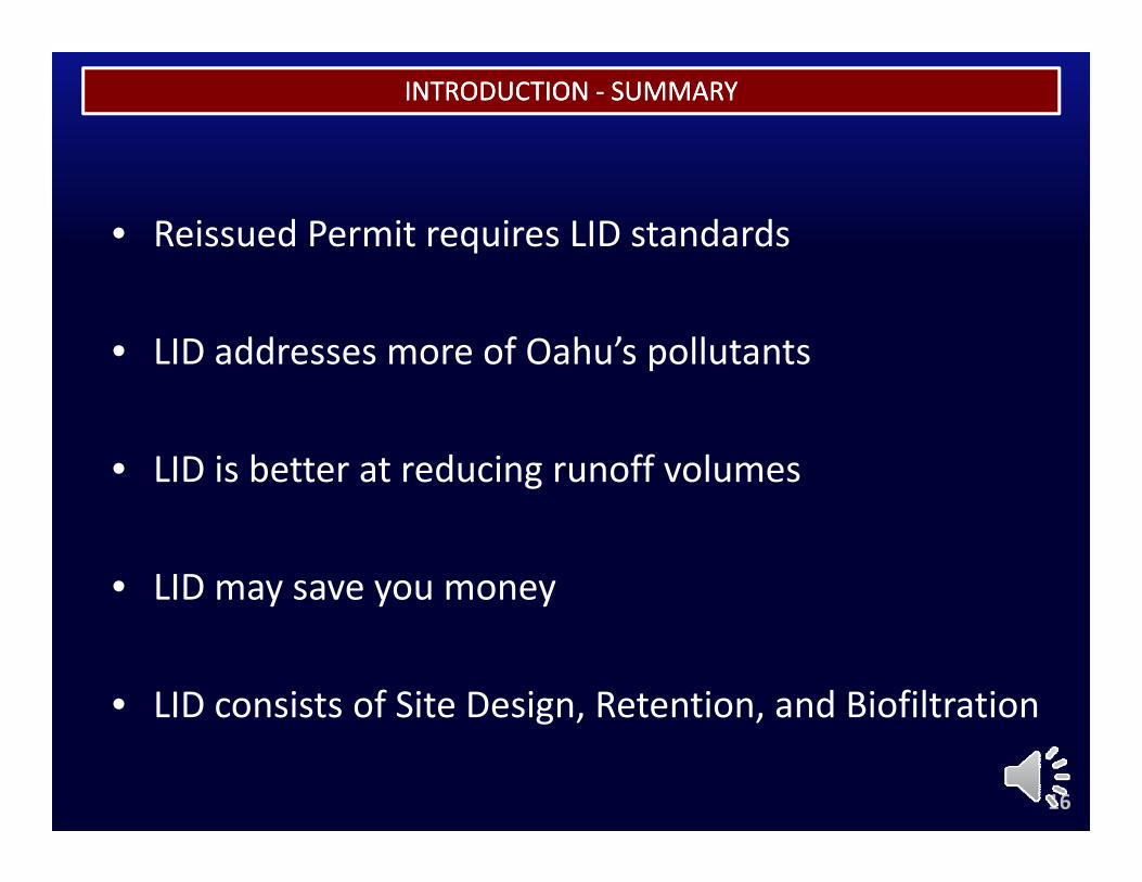
INTRODUCTION INTRODUCTION ‐‐ SUMMARYSUMMARY
• Reissued Permit requires LID standards
• LID addresses more of Oahu’s pollutants
• LID is better at reducing runoff volumes
• LID may save you money
• LID consists of Site Design, Retention, and Biofiltrationg , ,
16
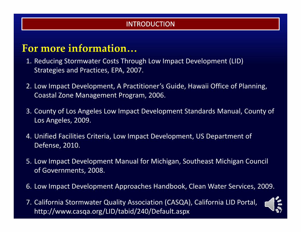
INTRODUCTIONINTRODUCTION
1. Reducing Stormwater Costs Through Low Impact Development (LID) Strategies and Practices, EPA, 2007.
For more information…
Strategies and Practices, EPA, 2007.
2. Low Impact Development, A Practitioner’s Guide, Hawaii Office of Planning, Coastal Zone Management Program, 2006.
3. County of Los Angeles Low Impact Development Standards Manual, County of Los Angeles, 2009.
4. Unified Facilities Criteria, Low Impact Development, US Department of Defense, 2010.
5 Lo Impact De elopment Man al for Michigan So theast Michigan Co ncil5. Low Impact Development Manual for Michigan, Southeast Michigan Council of Governments, 2008.
6. Low Impact Development Approaches Handbook, Clean Water Services, 2009.p p pp , ,
7. California Stormwater Quality Association (CASQA), California LID Portal, http://www.casqa.org/LID/tabid/240/Default.aspx 17

INTRODUCTIONINTRODUCTION
End of Module 1
18
MODULE 2
RULES RELATING TO STORM RULES RELATING TO STORM DRAINAGE STANDARDSDRAINAGE STANDARDS
MODULE 2
RULES RELATING TO STORM RULES RELATING TO STORM DRAINAGE STANDARDSDRAINAGE STANDARDS
1
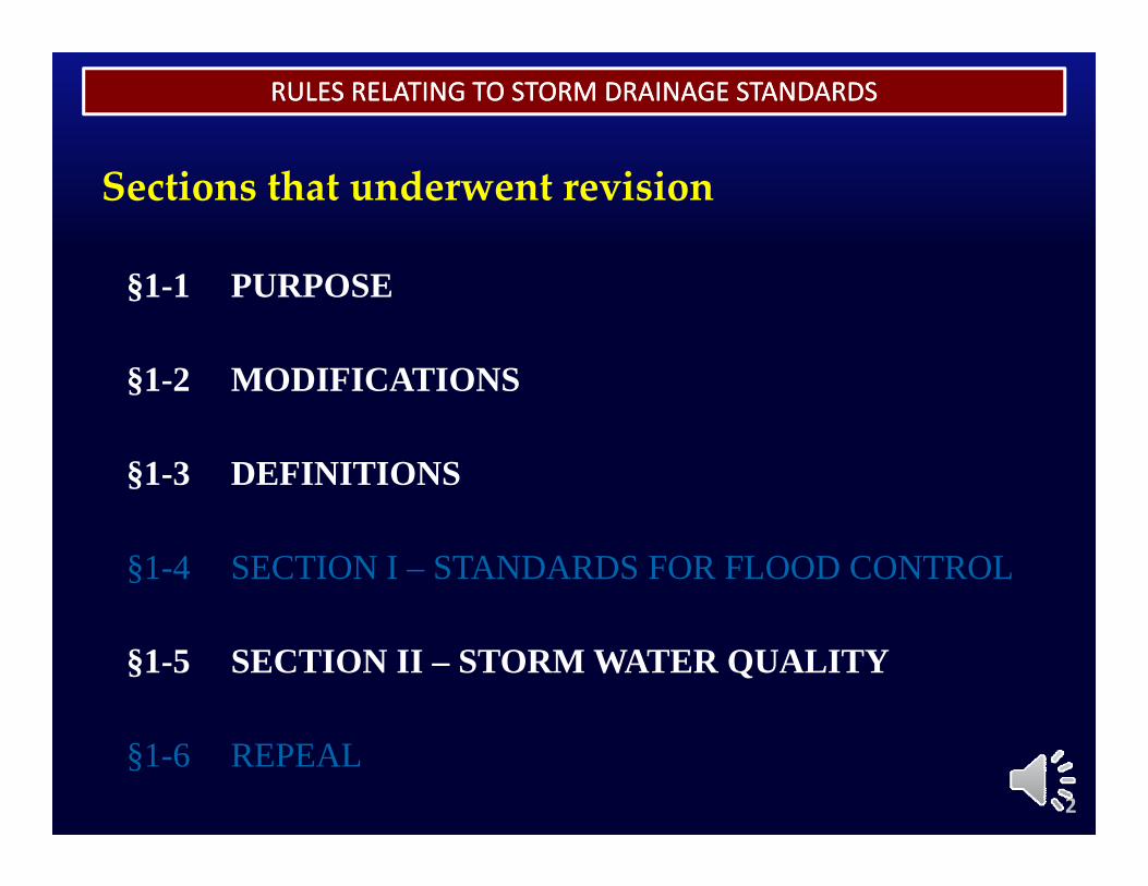
RULES RELATING TO STORM DRAINAGE STANDARDSRULES RELATING TO STORM DRAINAGE STANDARDS
§1 1 PURPOSE
Sections that underwent revision
§1-1 PURPOSE
§1-2 MODIFICATIONS§1 2 MODIFICATIONS
§1-3 DEFINITIONS
§1-4 SECTION I – STANDARDS FOR FLOOD CONTROL
§1-5 SECTION II – STORM WATER QUALITY
2
§1-6 REPEAL
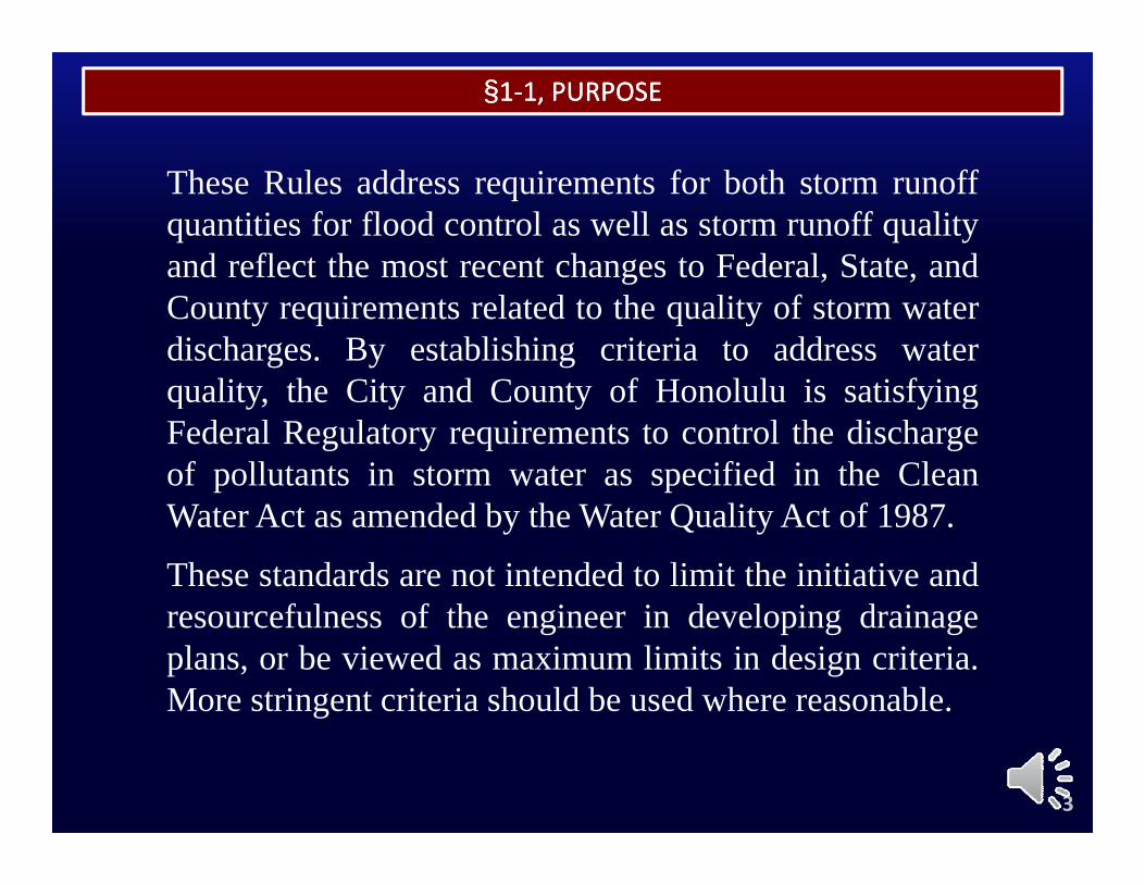
§§11‐‐1, PURPOSE1, PURPOSE
These Rules address requirements for both storm runoffquantities for flood control as well as storm runoff qualityand reflect the most recent changes to Federal, State, andand reflect the most recent changes to Federal, State, andCounty requirements related to the quality of storm waterdischarges. By establishing criteria to address waterq alit the Cit and Co nt of Honol l is satisf ingquality, the City and County of Honolulu is satisfyingFederal Regulatory requirements to control the dischargeof pollutants in storm water as specified in the CleanWater Act as amended by the Water Quality Act of 1987.
These standards are not intended to limit the initiative andf l f th i i d l i d iresourcefulness of the engineer in developing drainage
plans, or be viewed as maximum limits in design criteria.More stringent criteria should be used where reasonable.
3
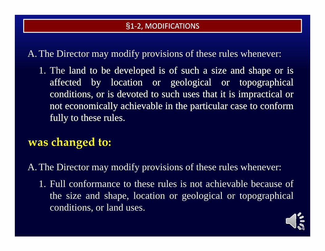
§§11‐‐2, MODIFICATIONS2, MODIFICATIONS
A. The Director may modify provisions of these rules whenever:
1. The landland toto bebe developeddeveloped isis ofof suchsuch aa sizesize andand shapeshape oror isisaffectedaffected byby locationlocation oror geologicalgeological oror topographicaltopographicalconditions,conditions, oror isis devoteddevoted toto suchsuch usesuses thatthat itit isis impracticalimpractical orornotnot economicallyeconomically achievableachievable inin thethe particularparticular casecase toto conformconformyy ppfullyfully toto thesethese rulesrules..
was changed to:
A. The Director may modify provisions of these rules whenever:
was changed to:
1. Full conformance to these rules is not achievable because ofthe size and shape, location or geological or topographical
di i l d
4
conditions, or land uses.
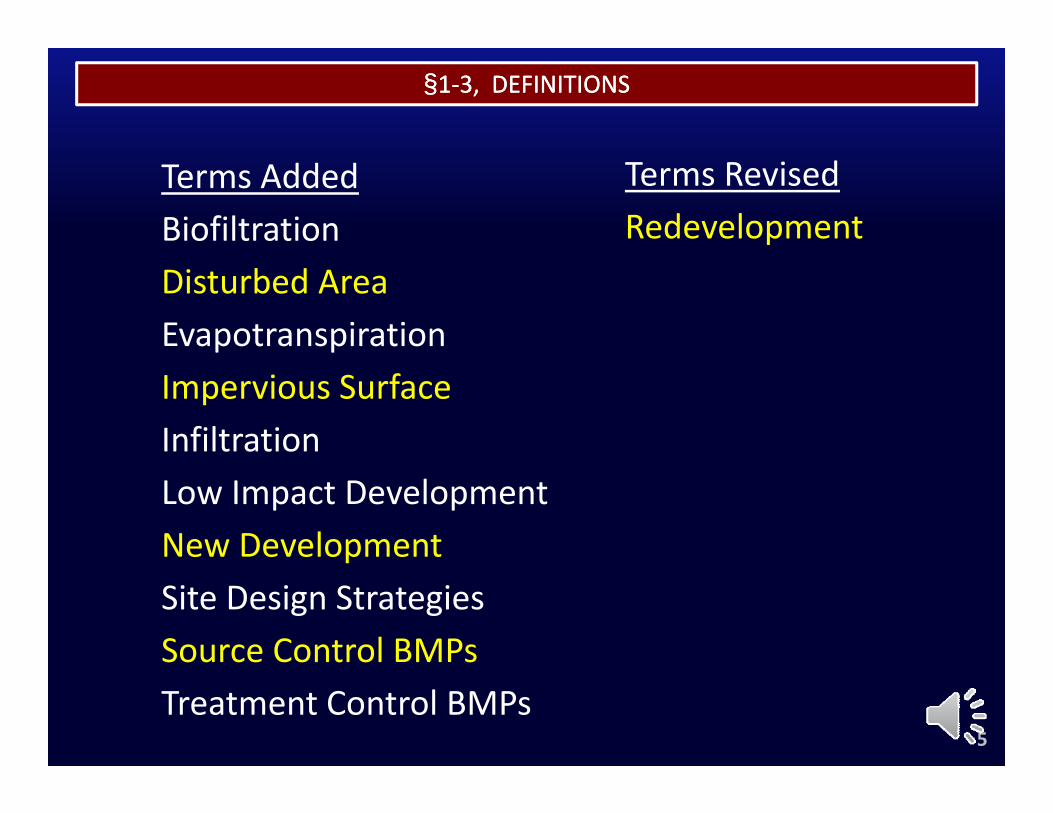
§§11‐‐3, DEFINITIONS3, DEFINITIONS
Terms AddedBiofiltration
Terms RevisedRedevelopment
Disturbed AreaEvapotranspirationImpervious SurfaceInfiltrationLow Impact DevelopmentNew DevelopmentpSite Design StrategiesSource Control BMPsTreatment Control BMPs
5
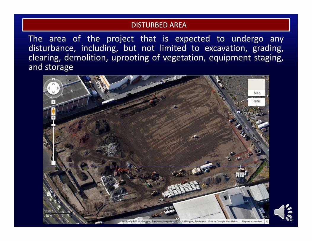
The area of the project that is expected to undergo anyd b l d b l d d
DISTURBED AREADISTURBED AREA
disturbance, including, but not limited to excavation, grading,clearing, demolition, uprooting of vegetation, equipment staging,and storage
6
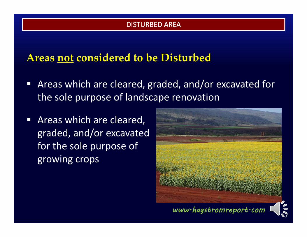
DISTURBED AREADISTURBED AREA
Areas not considered to be Disturbed
Areas which are cleared, graded, and/or excavated for the sole purpose of landscape renovation
Areas which are cleared, graded and/or excavatedgraded, and/or excavated for the sole purpose of growing cropsg g p
7www.hagstromreport.com
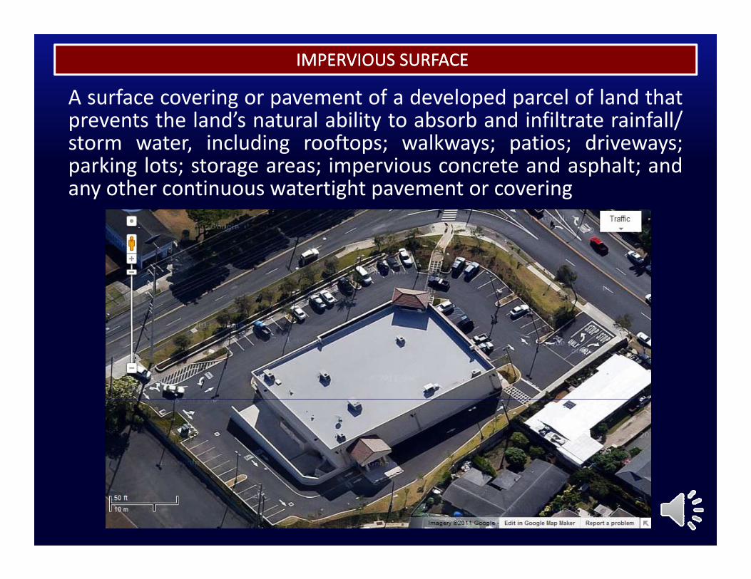
A surface covering or pavement of a developed parcel of land that
IMPERVIOUS SURFACEIMPERVIOUS SURFACE
g p p pprevents the land’s natural ability to absorb and infiltrate rainfall/storm water, including rooftops; walkways; patios; driveways;parking lots; storage areas; impervious concrete and asphalt; and
h hany other continuous watertight pavement or covering
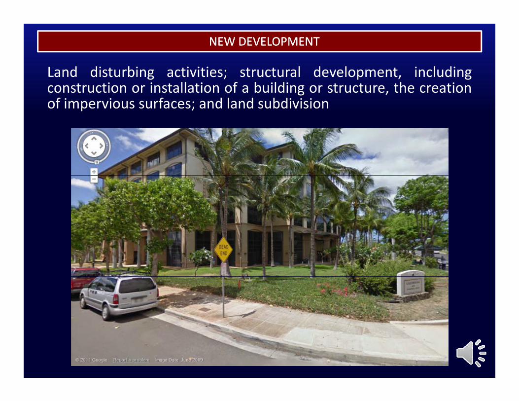
Land disturbing activities; structural development including
NEW DEVELOPMENTNEW DEVELOPMENT
Land disturbing activities; structural development, includingconstruction or installation of a building or structure, the creationof impervious surfaces; and land subdivision
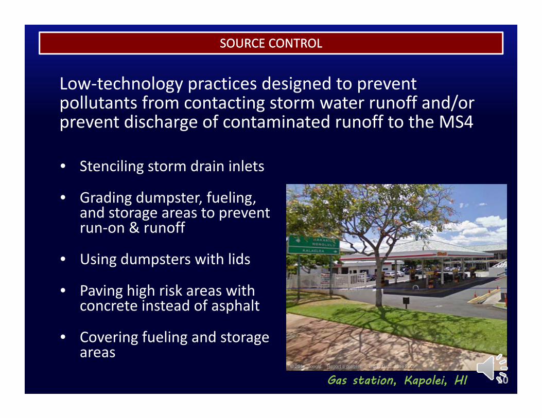
SOURCE CONTROLSOURCE CONTROL
L h l i d i dLow‐technology practices designed to prevent pollutants from contacting storm water runoff and/or prevent discharge of contaminated runoff to the MS4p g
• Stenciling storm drain inlets
• Grading dumpster, fueling, and storage areas to prevent run‐on & runoff
• Using dumpsters with lids
• Paving high risk areas with• Paving high risk areas with concrete instead of asphalt
• Covering fueling and storageCovering fueling and storage areas
Gas station, Kapolei, HI 10
SOURCE CONTROLSOURCE CONTROL
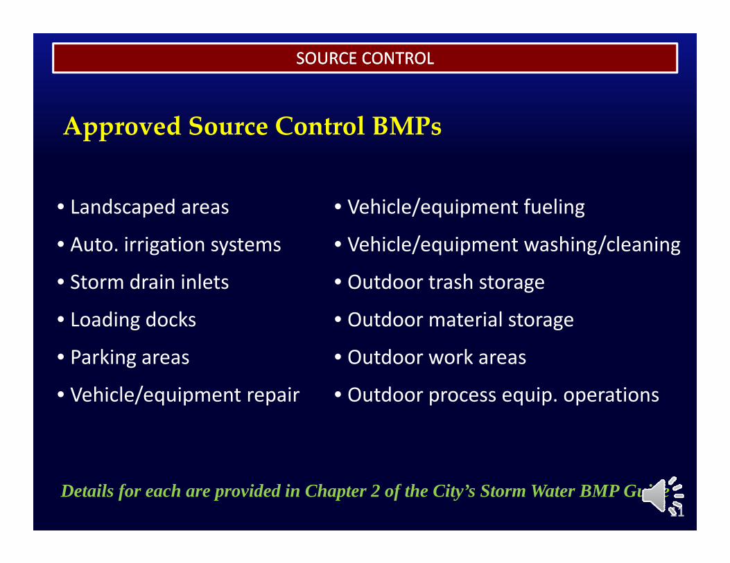
Approved Source Control BMPs
• Landscaped areas
• Auto irrigation systems
• Vehicle/equipment fueling
• Vehicle/equipment washing/cleaning• Auto. irrigation systems
• Storm drain inlets
• Loading docks
• Vehicle/equipment washing/cleaning
• Outdoor trash storage
• Outdoor material storage• Loading docks
• Parking areas
V hi l / i i
• Outdoor material storage
• Outdoor work areas
O d i i• Vehicle/equipment repair • Outdoor process equip. operations
11Details for each are provided in Chapter 2 of the City’s Storm Water BMP Guide
SOURCE CONTROLSOURCE CONTROL
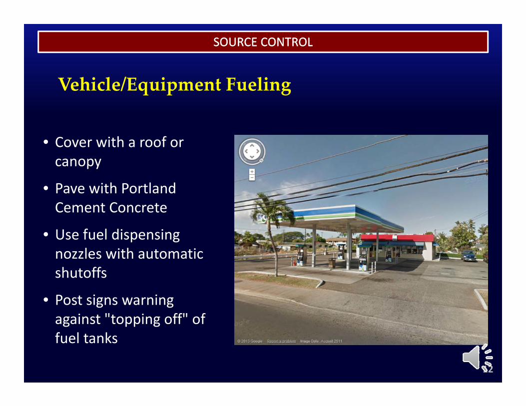
Vehicle/Equipment Fueling
• Cover with a roof or canopy
• Pave with Portland Cement Concrete
f l d• Use fuel dispensing nozzles with automatic shutoffs
• Post signs warning against "topping off" of
12
fuel tanks
SOURCE CONTROLSOURCE CONTROL
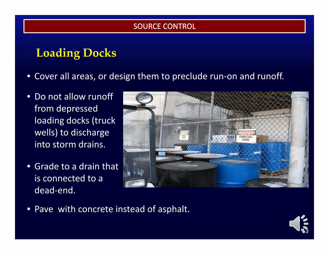
Loading Docks
• Cover all areas, or design them to preclude run‐on and runoff.
• Do not allow runoff from depressed
Cover all areas, or design them to preclude run on and runoff.
from depressed loading docks (truck wells) to discharge into storm drainsinto storm drains.
• Grade to a drain that i dis connected to a dead‐end.
P ith t i t d f h lt
13
• Pave with concrete instead of asphalt.
SOURCE CONTROLSOURCE CONTROL
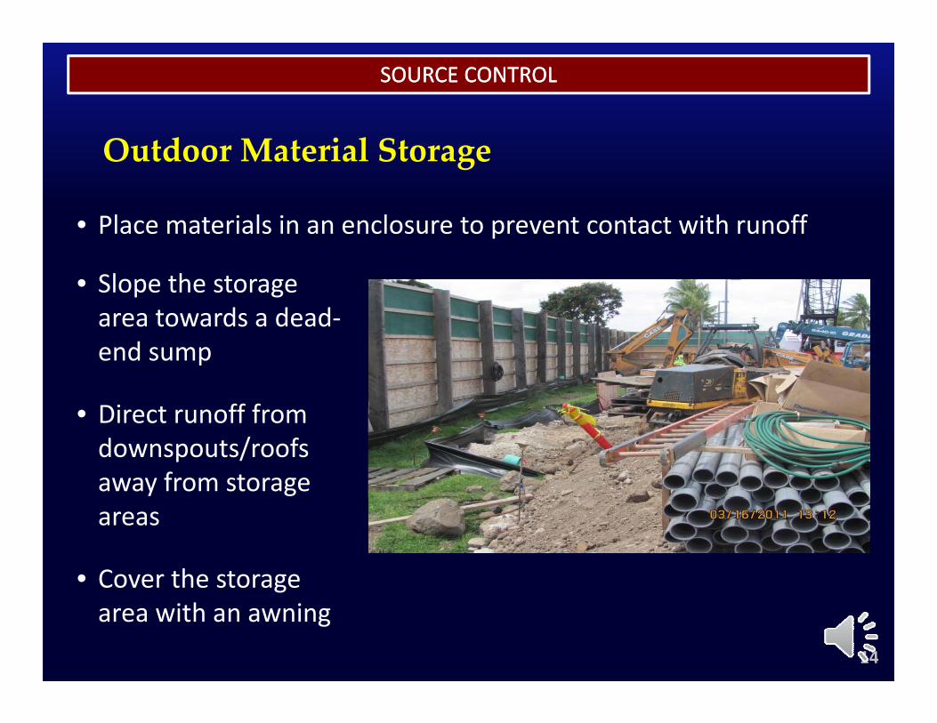
Outdoor Material Storage
• Place materials in an enclosure to prevent contact with runoff
• Slope the storage area towards a dead
• Place materials in an enclosure to prevent contact with runoff
area towards a dead‐end sump
Di t ff f• Direct runoff from downspouts/roofs away from storage areas
• Cover the storage
14
garea with an awning
SOURCE CONTROLSOURCE CONTROL
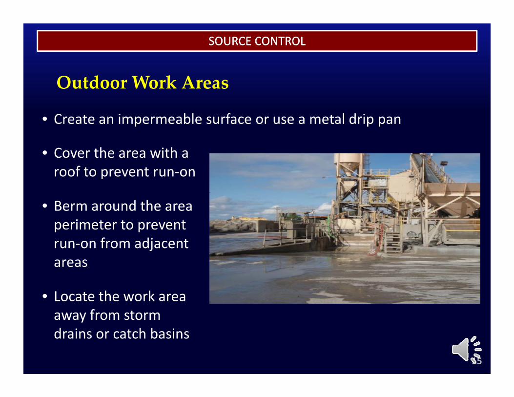
Outdoor Work Areas
• Create an impermeable surface or use a metal drip pan
• Cover the area with a roof to prevent run‐on
Create an impermeable surface or use a metal drip pan
roof to prevent run on
• Berm around the area perimeter to preventperimeter to prevent run‐on from adjacent areas
• Locate the work area away from storm
15
drains or catch basins
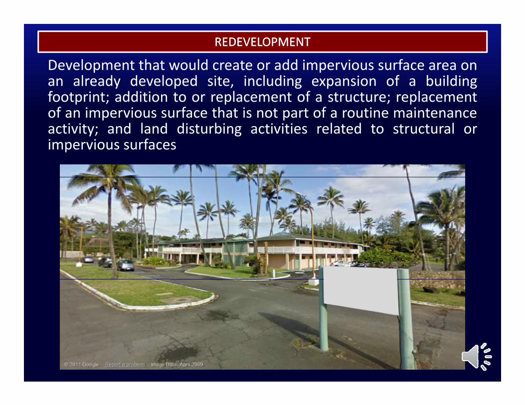
Development that would create or add impervious surface area onREDEVELOPMENTREDEVELOPMENT
an already developed site, including expansion of a buildingfootprint; addition to or replacement of a structure; replacementof an impervious surface that is not part of a routine maintenanceti it d l d di t bi ti iti l t d t t t lactivity; and land disturbing activities related to structural or
impervious surfaces
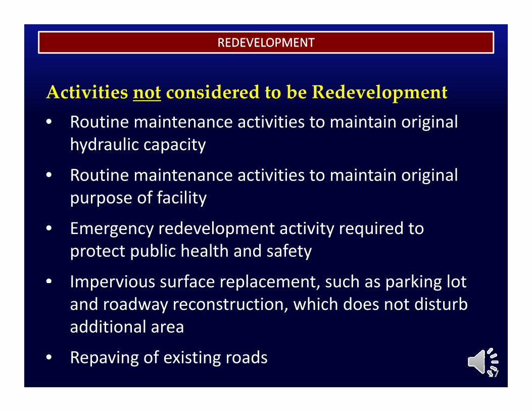
REDEVELOPMENTREDEVELOPMENT
Activities not considered to be Redevelopment• Routine maintenance activities to maintain original g
hydraulic capacity
• Routine maintenance activities to maintain originalRoutine maintenance activities to maintain original purpose of facility
• Emergency redevelopment activity required toEmergency redevelopment activity required to protect public health and safety
• Impervious surface replacement such as parking lotImpervious surface replacement, such as parking lot and roadway reconstruction, which does not disturb additional area
• Repaving of existing roads17
R i d S b ti
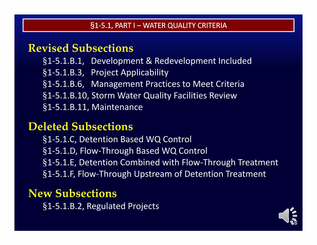
§§11‐‐5.1, PART I 5.1, PART I –– WATER QUALITY CRITERIAWATER QUALITY CRITERIA
Revised Subsections§1‐5.1.B.1, Development & Redevelopment Included§1‐5.1.B.3, Project Applicability§ , j pp y§1‐5.1.B.6, Management Practices to Meet Criteria§1‐5.1.B.10, Storm Water Quality Facilities Review§1 5 1 B 11 Maintenance§1‐5.1.B.11, Maintenance
Deleted Subsections§1 5 1 C Detention Based WQ Control§1‐5.1.C, Detention Based WQ Control§1‐5.1.D, Flow‐Through Based WQ Control§1‐5.1.E, Detention Combined with Flow‐Through Treatment§1‐5.1.F, Flow‐Through Upstream of Detention Treatment
New Subsections§1‐5.1.B.2, Regulated Projects
18
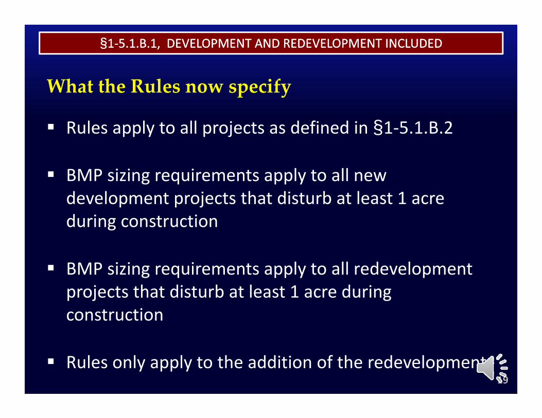
§§11‐‐5.1.B.1, DEVELOPMENT AND REDEVELOPMENT INCLUDED5.1.B.1, DEVELOPMENT AND REDEVELOPMENT INCLUDED
What the Rules now specify
Rules apply to all projects as defined in §1‐5 1 B 2Rules apply to all projects as defined in §1 5.1.B.2
BMP sizing requirements apply to all new g q pp ydevelopment projects that disturb at least 1 acre during construction
BMP sizing requirements apply to all redevelopment j t th t di t b t l t 1 d iprojects that disturb at least 1 acre during
construction
Rules only apply to the addition of the redevelopment19
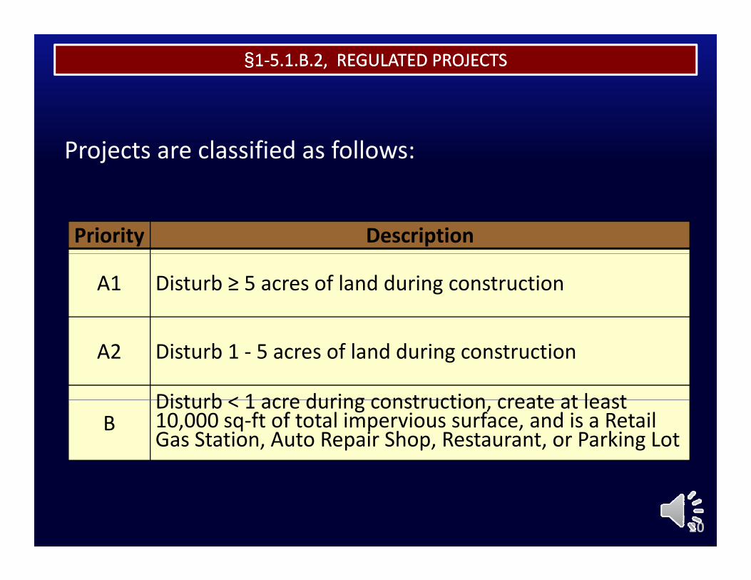
§§11‐‐5.1.B.2, REGULATED PROJECTS5.1.B.2, REGULATED PROJECTS
Projects are classified as follows:
Priority Description
A1 Disturb ≥ 5 acres of land during construction
A2 Disturb 1 ‐ 5 acres of land during construction
Disturb < 1 acre during construction create at leastB
Disturb < 1 acre during construction, create at least 10,000 sq‐ft of total impervious surface, and is a Retail Gas Station, Auto Repair Shop, Restaurant, or Parking Lot
20
§§11‐‐5.1.B.3, PROJECT APPLICABILITY5.1.B.3, PROJECT APPLICABILITY
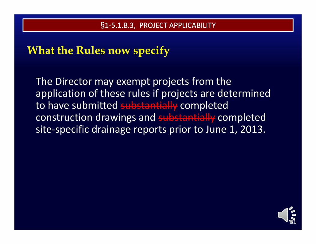
What the Rules now specify
The Director may exempt projects from the application of these rules if projects are determined to have submitted substantially completedto have submitted substantially completed construction drawings and substantially completed site‐specific drainage reports prior to June 1, 2013.
21
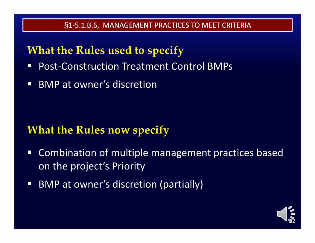
§§11‐‐5.1.B.6, MANAGEMENT PRACTICES TO MEET CRITERIA5.1.B.6, MANAGEMENT PRACTICES TO MEET CRITERIA
What the Rules used to specify Post‐Construction Treatment Control BMPs
BMP at owner’s discretion
What the Rules now specify
Combination of multiple management practices based on the project’s Priorityon the project s Priority
BMP at owner’s discretion (partially)
22
§§11‐‐5.1.B.6, MANAGEMENT PRACTICES TO MEET CRITERIA5.1.B.6, MANAGEMENT PRACTICES TO MEET CRITERIA
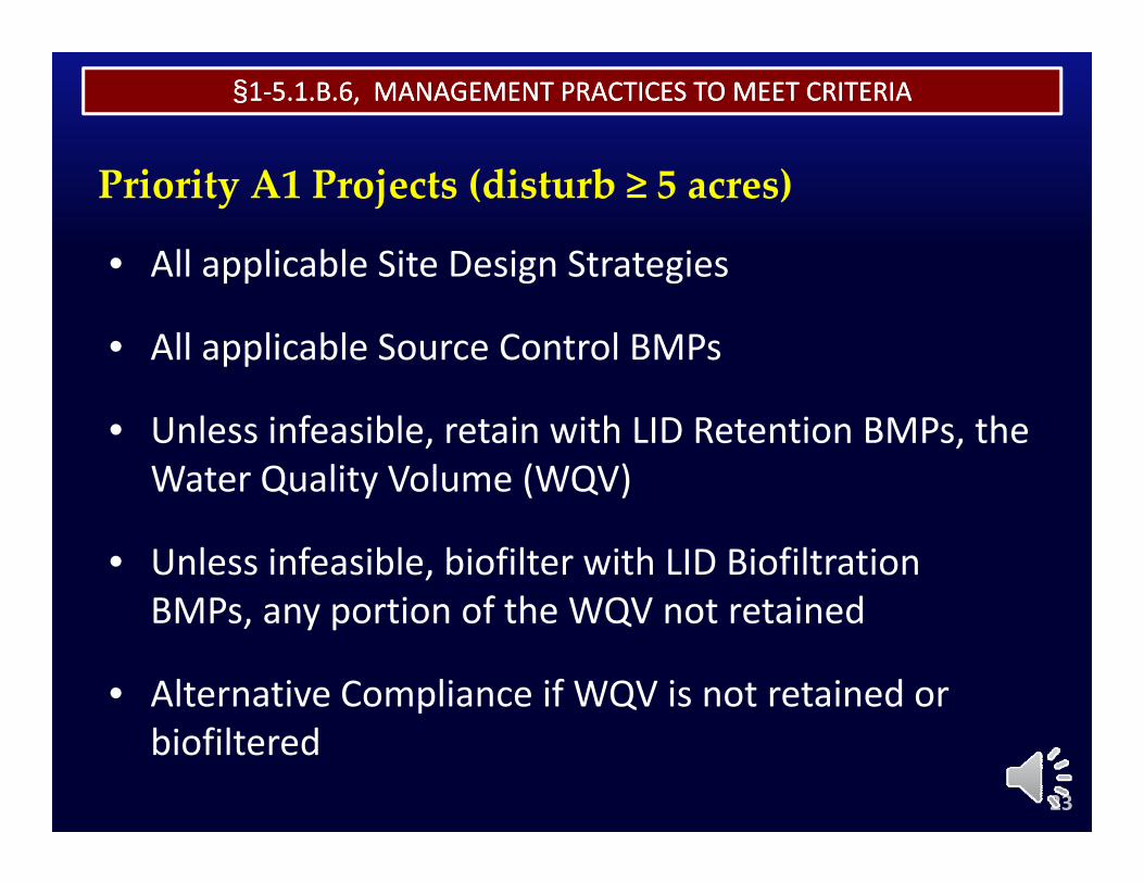
Priority A1 Projects (disturb ≥ 5 acres)
• All applicable Site Design StrategiesAll applicable Site Design Strategies
• All applicable Source Control BMPs
• Unless infeasible, retain with LID Retention BMPs, the Water Quality Volume (WQV)y ( )
• Unless infeasible, biofilter with LID Biofiltration BMPs any portion of the WQV not retainedBMPs, any portion of the WQV not retained
• Alternative Compliance if WQV is not retained or biofiltered
23
§§11‐‐5.1.B.6, MANAGEMENT PRACTICES TO MEET CRITERIA5.1.B.6, MANAGEMENT PRACTICES TO MEET CRITERIA
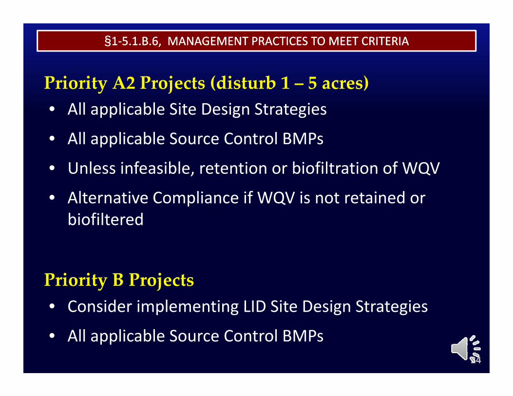
Priority A2 Projects (disturb 1 – 5 acres)• All applicable Site Design Strategies
• All applicable Source Control BMPs
• Unless infeasible, retention or biofiltration of WQVUnless infeasible, retention or biofiltration of WQV
• Alternative Compliance if WQV is not retained or biofilteredbiofiltered
i i j• Consider implementing LID Site Design StrategiesPriority B Projects
24
• All applicable Source Control BMPs
§§11‐‐5.1.B.6, MANAGEMENT PRACTICES TO MEET CRITERIA5.1.B.6, MANAGEMENT PRACTICES TO MEET CRITERIA
§1‐5.1.B.6 references some other new terms:
• Water Quality Volume
I f ibl• Infeasible
• Alternative Compliance• Alternative Compliance
25
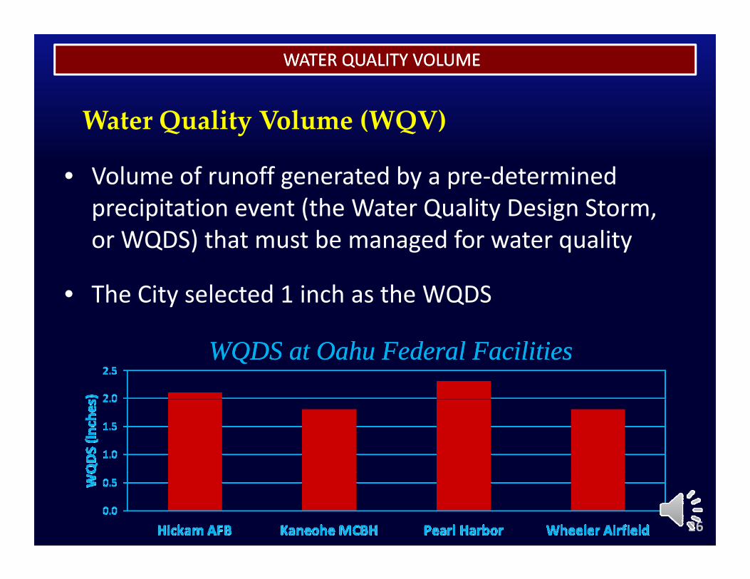
WATER QUALITY VOLUMEWATER QUALITY VOLUME
• Volume of runoff generated by a pre‐determined
Water Quality Volume (WQV)
Volume of runoff generated by a pre determined precipitation event (the Water Quality Design Storm, or WQDS) that must be managed for water quality
• The City selected 1 inch as the WQDS
WQDS at Oahu Federal FacilitiesWQDS at Oahu Federal Facilities
26
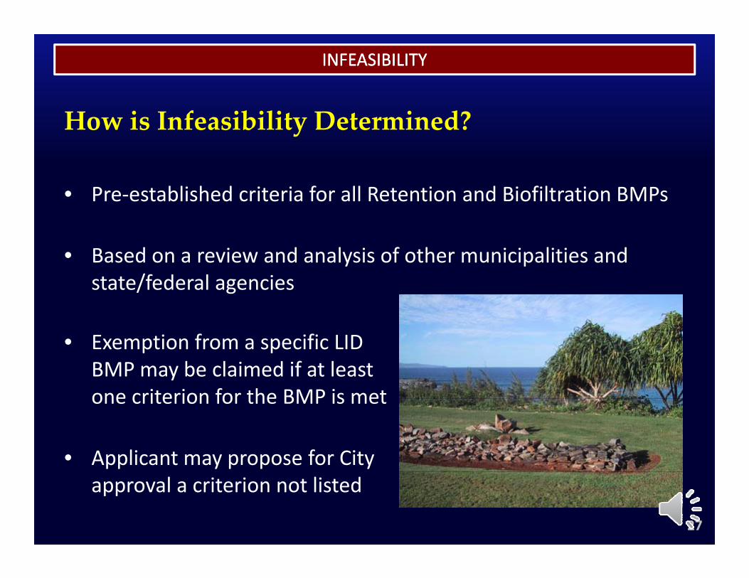
INFEASIBILITYINFEASIBILITY
How is Infeasibility Determined?
• Pre‐established criteria for all Retention and Biofiltration BMPs
• Based on a review and analysis of other municipalities and• Based on a review and analysis of other municipalities and state/federal agencies
• Exemption from a specific LID BMP may be claimed if at least one criterion for the BMP is metone criterion for the BMP is met
• Applicant may propose for City approval a criterion not listed
27
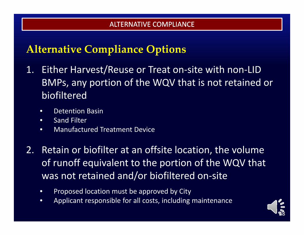
ALTERNATIVE COMPLIANCEALTERNATIVE COMPLIANCE
1. Either Harvest/Reuse or Treat on‐site with non‐LID
Alternative Compliance Options
/BMPs, any portion of the WQV that is not retained or biofiltered• Detention Basin• Sand Filter• Manufactured Treatment Device
2. Retain or biofilter at an offsite location, the volume of runoff equivalent to the portion of the WQV thatof runoff equivalent to the portion of the WQV that was not retained and/or biofiltered on‐site• Proposed location must be approved by City• Proposed location must be approved by City• Applicant responsible for all costs, including maintenance
28
§§11‐‐5.1.B.10, STORM WATER QUALITY FACILITIES REVIEW5.1.B.10, STORM WATER QUALITY FACILITIES REVIEW
What the Rules now specify
• SWQR (Storm Water Quality Report) required forSWQR (Storm Water Quality Report) required for Priority A1 Projects• A SWQR presents a project’s storm water quality issuespresents a project’s storm water quality issuesA SWQR presents a project s storm water quality issues presents a project s storm water quality issues
and storm water quality management strategy, in a and storm water quality management strategy, in a standard report formatstandard report format
• SWQC (Storm Water Quality Checklist) required for Priority A2 & Priority B ProjectsPriority A2 & Priority B Projects• A SWQC presents a project’s storm water quality
management strategy, in a simple checklist formatg gy, p
29
§§11‐‐5.1.B.10, STORM WATER QUALITY FACILITIES REVIEW5.1.B.10, STORM WATER QUALITY FACILITIES REVIEW
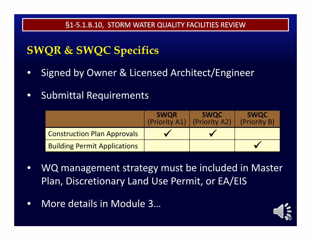
• Signed by Owner & Licensed Architect/Engineer
SWQR & SWQC Specifics
Signed by Owner & Licensed Architect/Engineer
• Submittal Requirements
SWQR (Priority A1)
SWQC (Priority A2)
SWQC (Priority B)
Construction Plan Approvals
WQ t t t t b i l d d i M t
Construction Plan ApprovalsBuilding Permit Applications
• WQ management strategy must be included in Master Plan, Discretionary Land Use Permit, or EA/EIS
• More details in Module 3…30
§§11‐‐5.1.B.11, MAINTENANCE5.1.B.11, MAINTENANCE
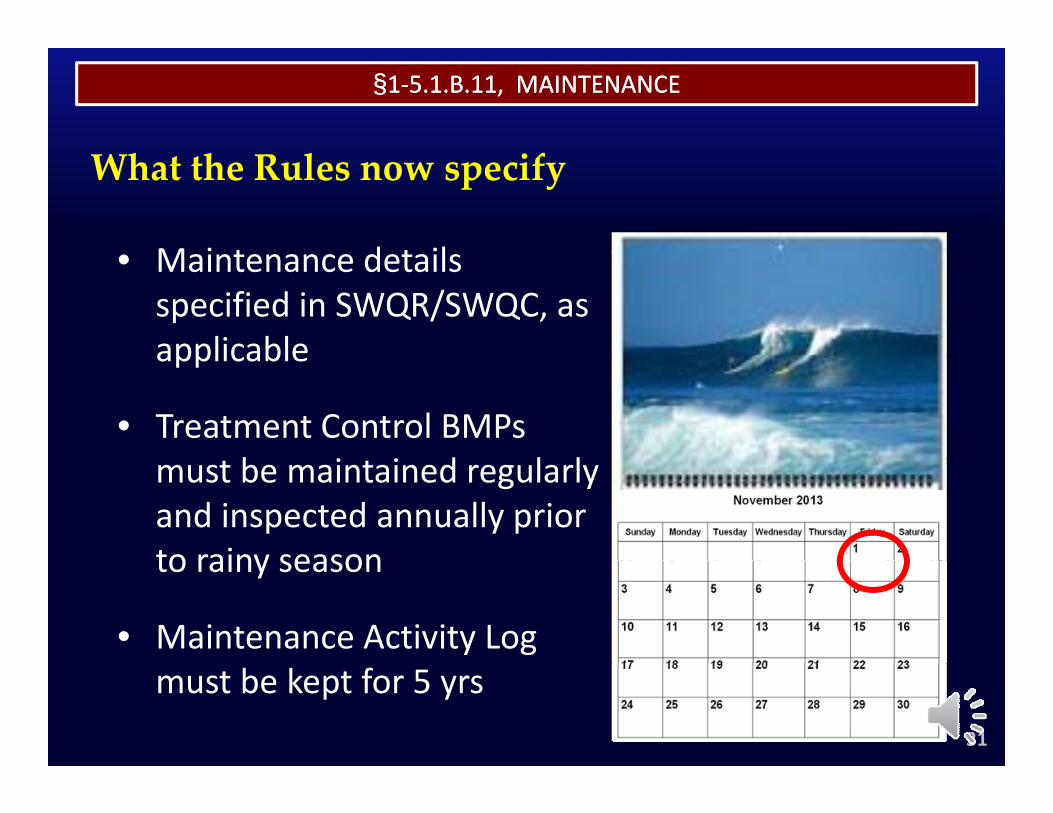
What the Rules now specify
M i t d t il• Maintenance details specified in SWQR/SWQC, as applicableapplicable
• Treatment Control BMPs b d l lmust be maintained regularly
and inspected annually prior to rainy seasonto rainy season
• Maintenance Activity Log must be kept for 5 yrs
31
§§11‐‐5.2, PART II5.2, PART II–– WATER QUALITY DESIGN STANDARDSWATER QUALITY DESIGN STANDARDS
§ 2 l d S Q li l ili i
Subsections A‐D replaced in their entirety with:
§1‐5.2.A Volume Based Storm Water Quality Control Facilities
§1‐5.2.B Flow Based Storm Water Quality Control Facilities§ y
§1‐5.2.C Area Based Storm Water Quality Control Facilities
§1‐5.2.D Demand Based Storm Water Quality Control Facilities
32
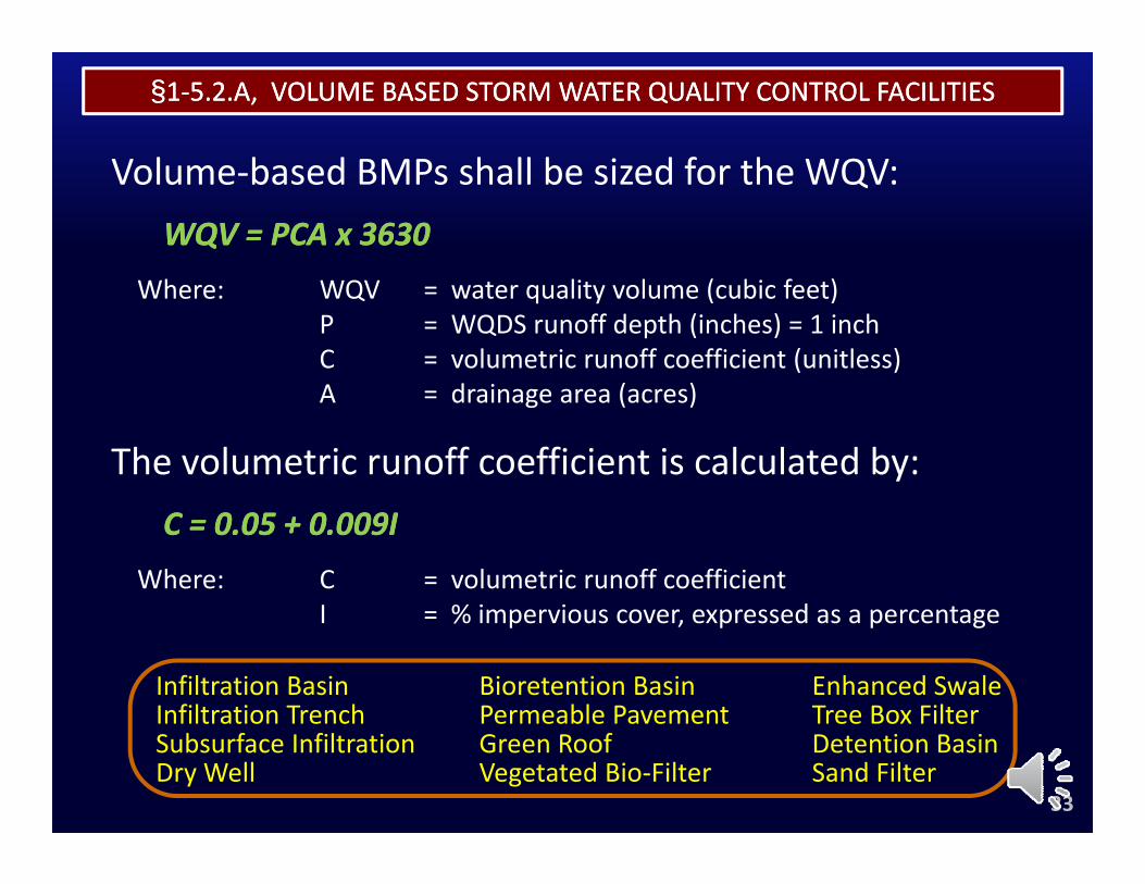
§§11‐‐5.2.A, VOLUME BASED STORM WATER QUALITY CONTROL FACILITIES5.2.A, VOLUME BASED STORM WATER QUALITY CONTROL FACILITIES
V l b d BMP h ll b i d f th WQVVolume‐based BMPs shall be sized for the WQV:WQV = PCA x 3630WQV = PCA x 3630
Where: WQV = water quality volume (cubic feet)P = WQDS runoff depth (inches) = 1 inchC = volumetric runoff coefficient (unitless)A d i ( )A = drainage area (acres)
The volumetric runoff coefficient is calculated by:C = 0.05 + 0.009IC = 0.05 + 0.009I
Where: C = volumetric runoff coefficientI % imper io s co er e pressed as a percentageI = % impervious cover, expressed as a percentage
Infiltration BasinInfiltration Trench
Enhanced SwaleTree Box Filter
Bioretention BasinPermeable Pavement
33
Infiltration TrenchSubsurface InfiltrationDry Well
Tree Box FilterDetention BasinSand Filter
Permeable PavementGreen RoofVegetated Bio‐Filter
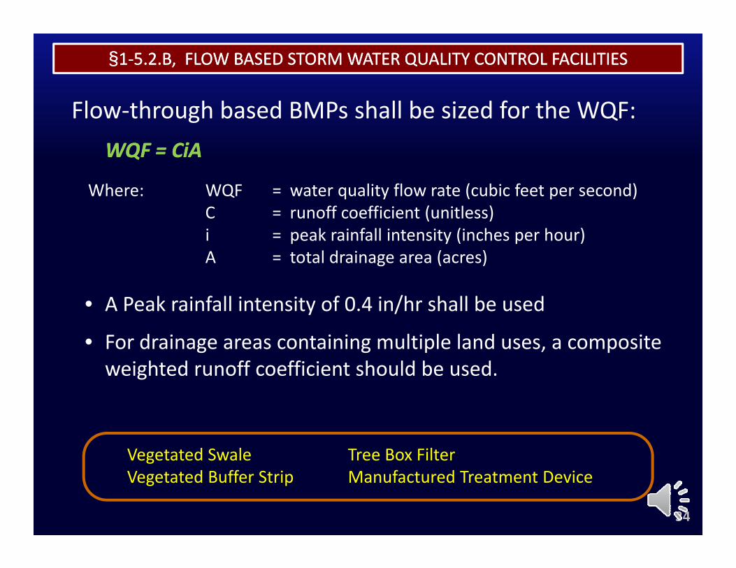
§§11‐‐5.2.B, FLOW BASED STORM WATER QUALITY CONTROL FACILITIES5.2.B, FLOW BASED STORM WATER QUALITY CONTROL FACILITIES
Fl th h b d BMP h ll b i d f th WQFFlow‐through based BMPs shall be sized for the WQF:WQF = WQF = CiACiA
Where: WQF = water quality flow rate (cubic feet per second)C = runoff coefficient (unitless)i = peak rainfall intensity (inches per hour)A = total drainage area (acres)
• A Peak rainfall intensity of 0.4 in/hr shall be used
• For drainage areas containing multiple land uses, a composite weighted runoff coefficient should be used.
Vegetated Swale Tree Box Filter
34
gVegetated Buffer Strip Manufactured Treatment Device
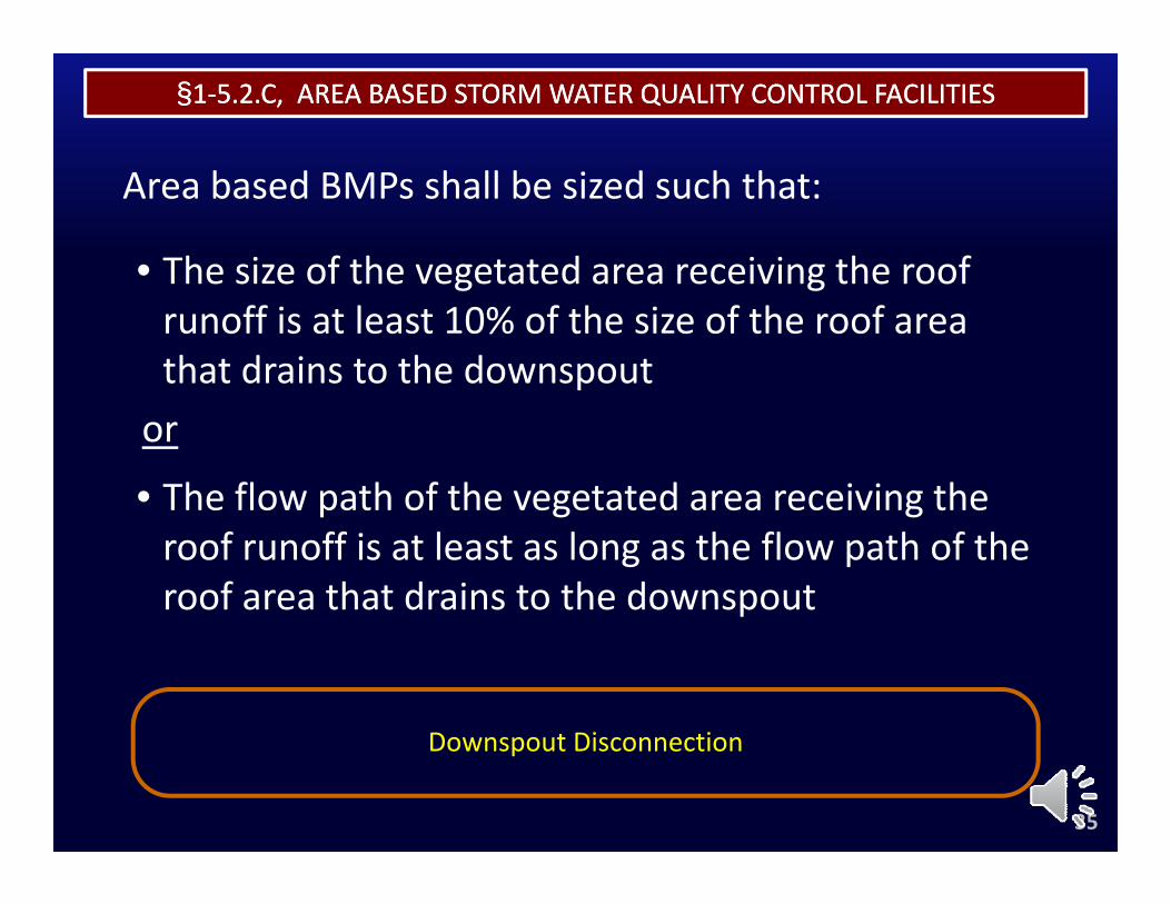
§§11‐‐5.2.C, AREA BASED STORM WATER QUALITY CONTROL FACILITIES5.2.C, AREA BASED STORM WATER QUALITY CONTROL FACILITIES
Area based BMPs shall be sized such that:
• The size of the vegetated area receiving the roofThe size of the vegetated area receiving the roof runoff is at least 10% of the size of the roof area that drains to the downspoutor
• The flow path of the vegetated area receiving theThe flow path of the vegetated area receiving the roof runoff is at least as long as the flow path of the roof area that drains to the downspout
Downspout Disconnection
35
Downspout Disconnection
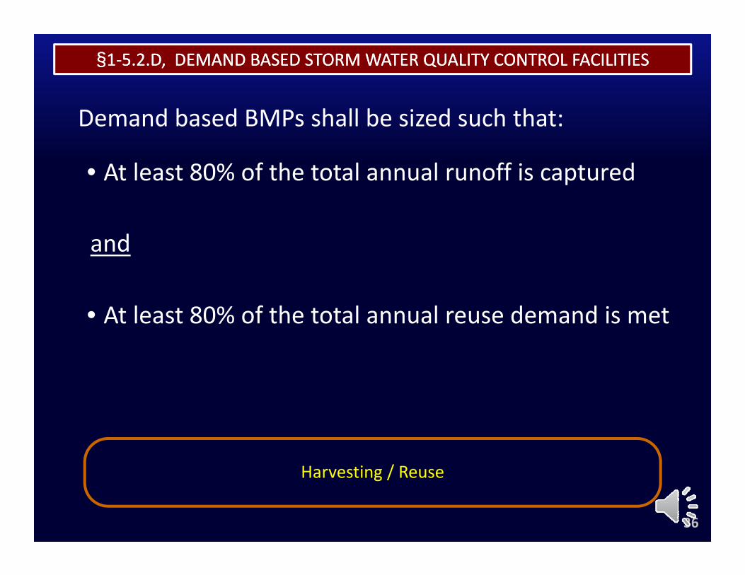
§§11‐‐5.2.D, DEMAND BASED STORM WATER QUALITY CONTROL FACILITIES5.2.D, DEMAND BASED STORM WATER QUALITY CONTROL FACILITIES
Demand based BMPs shall be sized such that:
• At least 80% of the total annual runoff is capturedAt least 80% of the total annual runoff is captured
andand
• At least 80% of the total annual reuse demand is met
Harvesting / Reuse
36
Harvesting / Reuse

RULES RELATING TO STORM DRAINAGE STANDARDSRULES RELATING TO STORM DRAINAGE STANDARDS
Module Summaryy
37
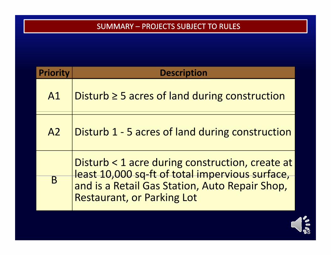
SUMMARY SUMMARY –– PROJECTS SUBJECT TO RULESPROJECTS SUBJECT TO RULES
Priority Description
A1 Disturb ≥ 5 acres of land during construction
A2 Disturb 1 ‐ 5 acres of land during construction
Disturb < 1 acre during construction, create at least 10 000 sq‐ft of total impervious surfaceB least 10,000 sq ft of total impervious surface, and is a Retail Gas Station, Auto Repair Shop, Restaurant, or Parking Lot
38
SUMMARY SUMMARY –– STORM WATER MANAGEMENT REQUIREMENTSSTORM WATER MANAGEMENT REQUIREMENTS
Priority A1 Priority A2
SOURCE CONTROL
LID SITE DESIGN
Priority A1 Priority A2
SOURCE CONTROL
LID SITE DESIGN
Is WQV YES DONE
RETENTION
Is WQVretained on‐site?
NO
Is it infeasible to retain WQV?
YES DONE
NO
retain WQV?
BIOFILTRATIONYES
RETENTION/BIOFILTRATION
Is WQV retained or biofiltered?
YES DONE
NO
is it infeasible to retainNO
Is WQV retained or biofiltered?
YES DONE
NO
is it infeasible to retainNO
39ALTERNATIVE COMPLIANCEYES
is it infeasible to retainor biofilter WQV?
ALTERNATIVE COMPLIANCEYES
is it infeasible to retainor biofilter WQV?
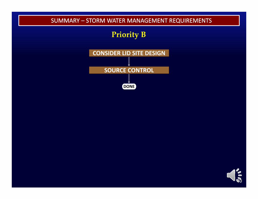
SUMMARY SUMMARY –– STORM WATER MANAGEMENT REQUIREMENTSSTORM WATER MANAGEMENT REQUIREMENTS
Priority BPriority B
CONSIDER LID SITE DESIGN
DONE
SOURCE CONTROL
DONE
40
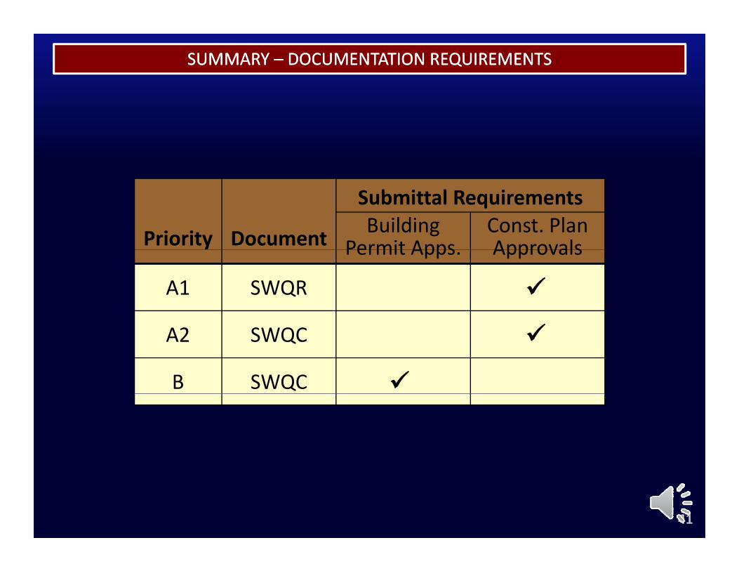
SUMMARY SUMMARY –– DOCUMENTATION REQUIREMENTSDOCUMENTATION REQUIREMENTS
Submittal Requirements
Priority Document Building Permit Apps
Const. Plan ApprovalsPermit Apps. Approvals
A1 SWQR
A2 SWQC
B SWQC
41
SUMMARY SUMMARY –– MAINTENANCE REQUIREMENTSMAINTENANCE REQUIREMENTS
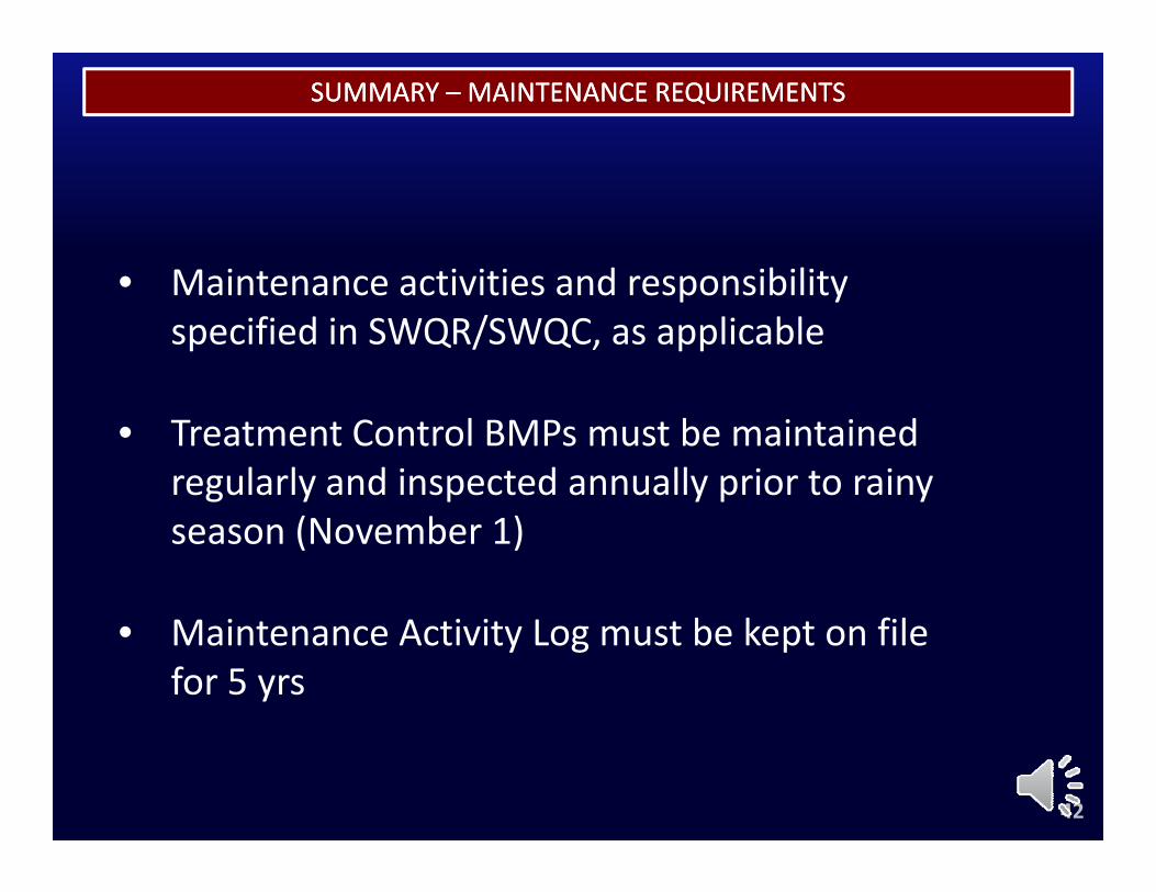
• Maintenance activities and responsibility• Maintenance activities and responsibility specified in SWQR/SWQC, as applicable
• Treatment Control BMPs must be maintained regularly and inspected annually prior to rainy season (November 1)
• Maintenance Activity Log must be kept on file for 5 yrs
42
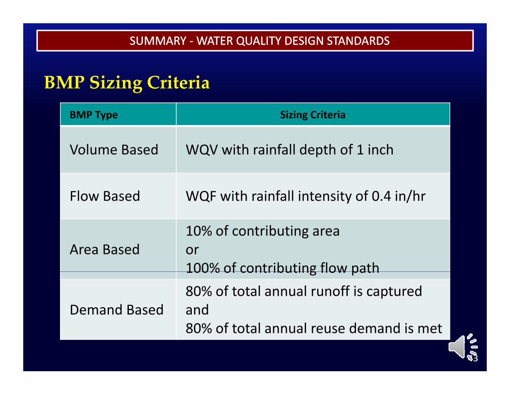
SUMMARY SUMMARY ‐‐WATER QUALITY DESIGN STANDARDSWATER QUALITY DESIGN STANDARDS
BMP Type Sizing Criteria
BMP Sizing Criteria
Volume Based WQV with rainfall depth of 1 inch
Flow Based WQF with rainfall intensity of 0.4 in/hr
Area Based10% of contributing areaor100% of contributing flow path100% of contributing flow path
Demand Based80% of total annual runoff is capturedand80% of total annual reuse demand is met
43
RULES RELATING TO STORM DRAINAGE STANDARDSRULES RELATING TO STORM DRAINAGE STANDARDS
End of Module 2
44
MODULE 3
ELECTRONIC RESOURCE LIBRARYELECTRONIC RESOURCE LIBRARYELECTRONIC RESOURCE LIBRARYELECTRONIC RESOURCE LIBRARY
www.honoluludpp.org/ReportsNotices/StormWaterQualityPage.aspx
MODULE 3
ELECTRONIC RESOURCE LIBRARYELECTRONIC RESOURCE LIBRARYELECTRONIC RESOURCE LIBRARYELECTRONIC RESOURCE LIBRARY
1www.honoluludpp.org/ReportsNotices/StormWaterQualityPage.aspx
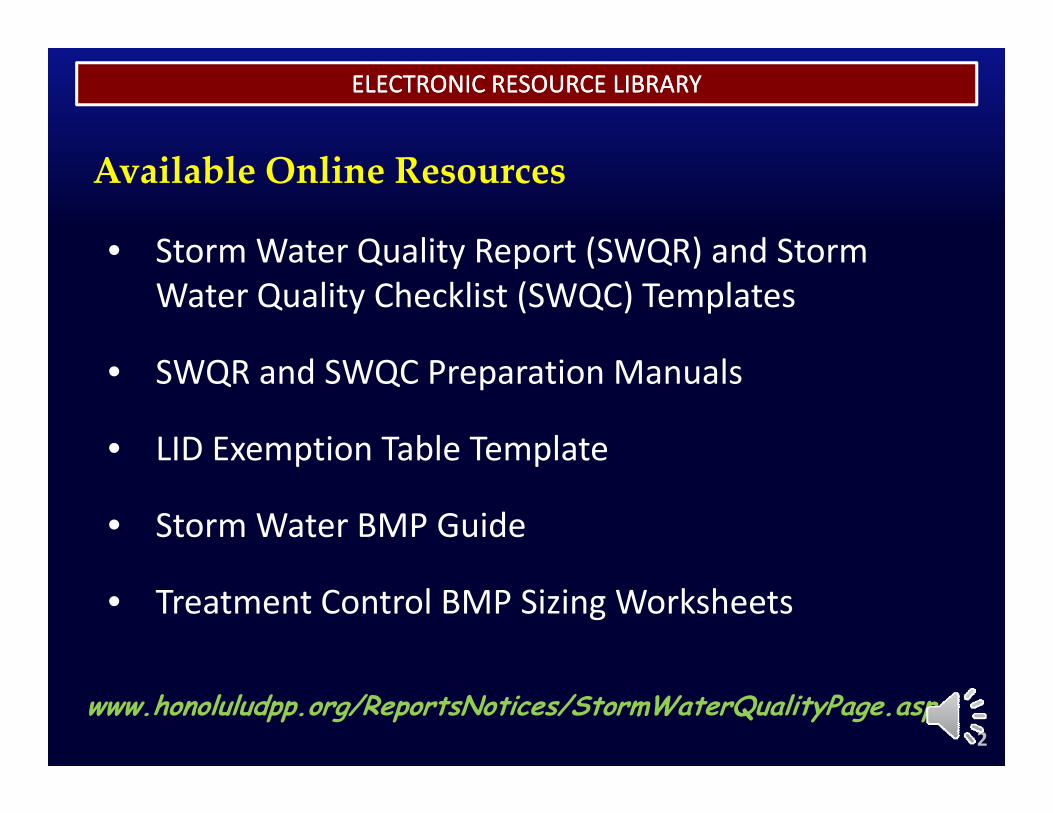
ELECTRONIC RESOURCE LIBRARYELECTRONIC RESOURCE LIBRARY
Available Online Resources
• Storm Water Quality Report (SWQR) and Storm• Storm Water Quality Report (SWQR) and Storm Water Quality Checklist (SWQC) Templates
• SWQR and SWQC Preparation Manuals
• LID Exemption Table TemplateLID Exemption Table Template
• Storm Water BMP Guide
• Treatment Control BMP Sizing Worksheets
2www.honoluludpp.org/ReportsNotices/StormWaterQualityPage.aspx
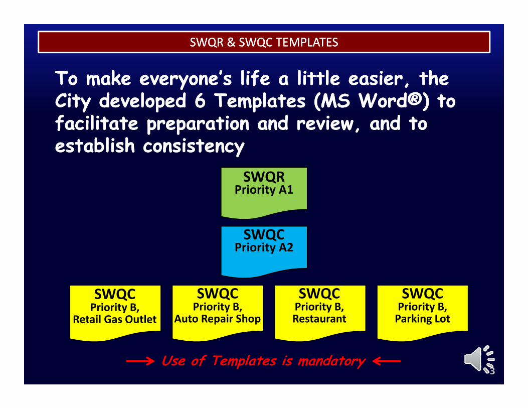
SWQR & SWQC TEMPLATESSWQR & SWQC TEMPLATES
To make everyone’s life a little easier the To make everyone’s life a little easier the To make everyone s life a little easier, the To make everyone s life a little easier, the City developed 6 Templates (MS Word®) to City developed 6 Templates (MS Word®) to facilitate preparation and review and to facilitate preparation and review and to facilitate preparation and review, and to facilitate preparation and review, and to establish consistencyestablish consistency
SWQRSWQRPriority A1
SWQCSWQCPriority A2
SWQCPriority B,
Retail Gas Outlet
SWQCPriority B,
Auto Repair Shop
SWQCPriority B, Restaurant
SWQCPriority B, Parking Lot
3Use of Templates is mandatory
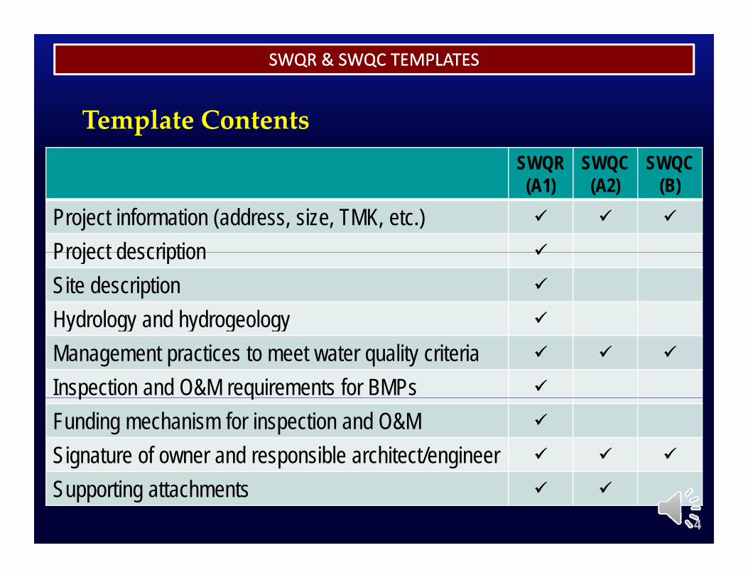
SWQR & SWQC TEMPLATESSWQR & SWQC TEMPLATES
Template ContentsSWQR(A1)
SWQC(A2)
SWQC(B)(A1) (A2) (B)
Project information (address, size, TMK, etc.)
Project description Project description
Site description
Hydrology and hydrogeology Hydrology and hydrogeologyManagement practices to meet water quality criteria
Inspection and O&M requirements for BMPs p qFunding mechanism for inspection and O&M
Signature of owner and responsible architect/engineer
Supporting attachments
4
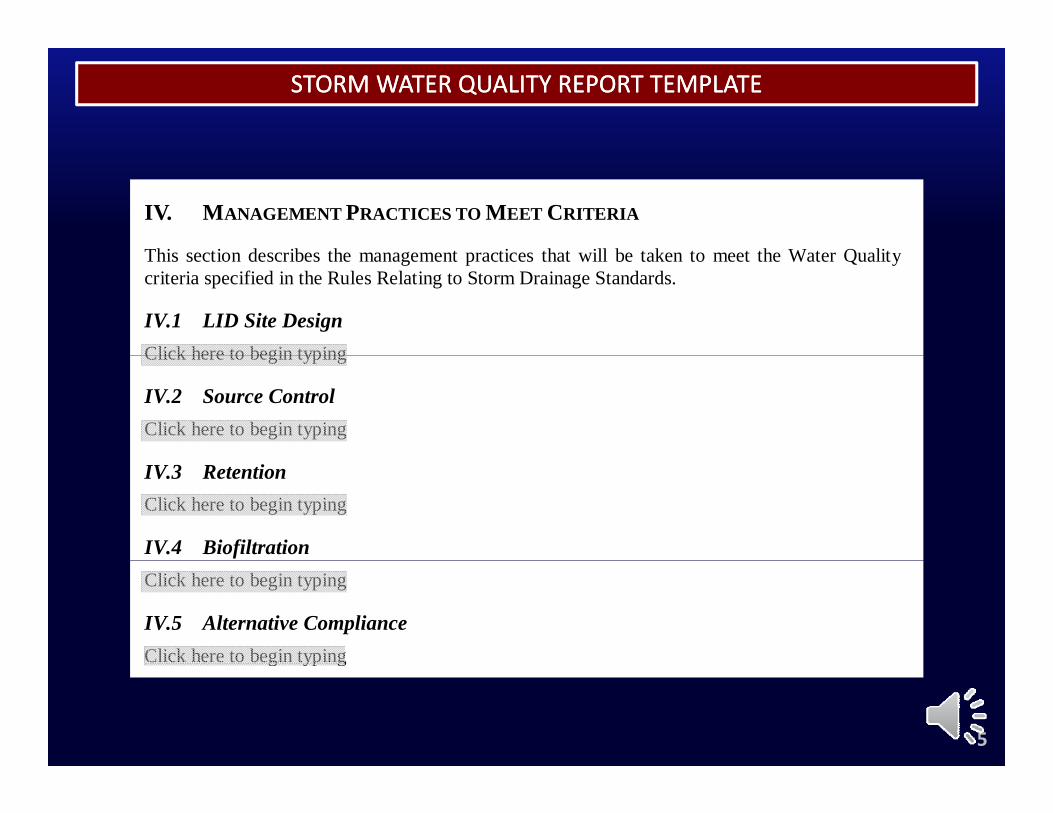
STORM WATER QUALITY REPORT TEMPLATESTORM WATER QUALITY REPORT TEMPLATE
IV. MANAGEMENT PRACTICES TO MEET CRITERIA
This section describes the management practices that ill be taken to meet the Water Q alitThis section describes the management practices that will be taken to meet the Water Qualitycriteria specified in the Rules Relating to Storm Drainage Standards.
IV.1 LID Site Design Click here to begin typingClick here to begin typing
IV.2 Source Control Click here to begin typing
IV.3 Retention Click here to begin typing
IV.4 Biofiltration Click here to begin typing
IV.5 Alternative Compliance Click here to begin typingg yp g
5
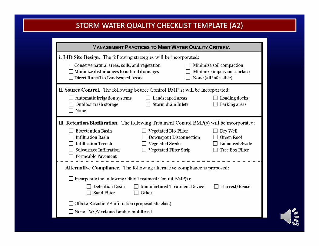
STORM WATER QUALITY CHECKLIST TEMPLATE (A2)STORM WATER QUALITY CHECKLIST TEMPLATE (A2)
6
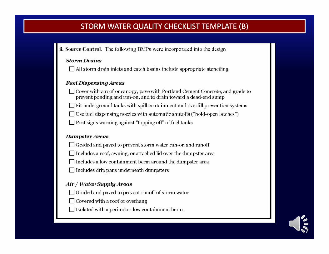
STORM WATER QUALITY CHECKLIST TEMPLATE (B)STORM WATER QUALITY CHECKLIST TEMPLATE (B)
7
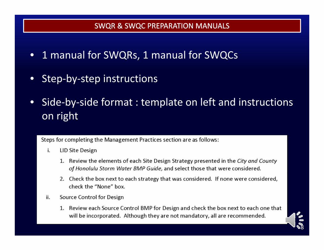
SWQR & SWQC PREPARATION MANUALSSWQR & SWQC PREPARATION MANUALS
• 1 manual for SWQRs, 1 manual for SWQCs
• Step by step instructions• Step‐by‐step instructions
• Side‐by‐side format : template on left and instructions on right
8
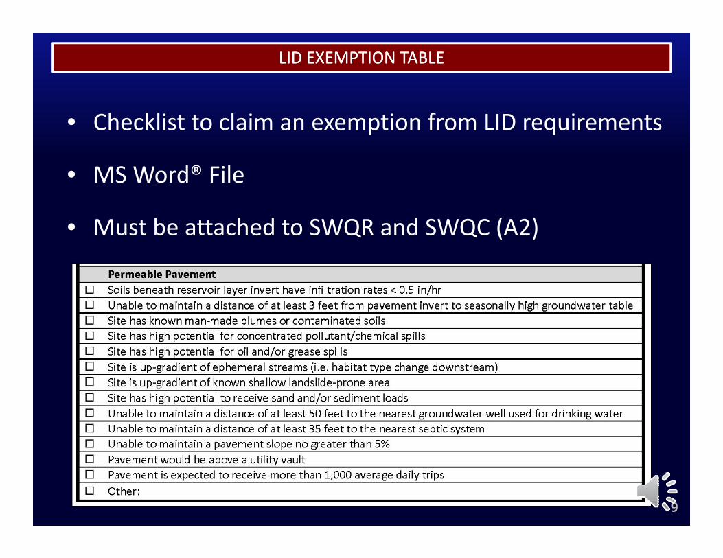
LID EXEMPTION TABLELID EXEMPTION TABLE
• Checklist to claim an exemption from LID requirements
• MSWord® File• MS Word® File
• Must be attached to SWQR and SWQC (A2)
9
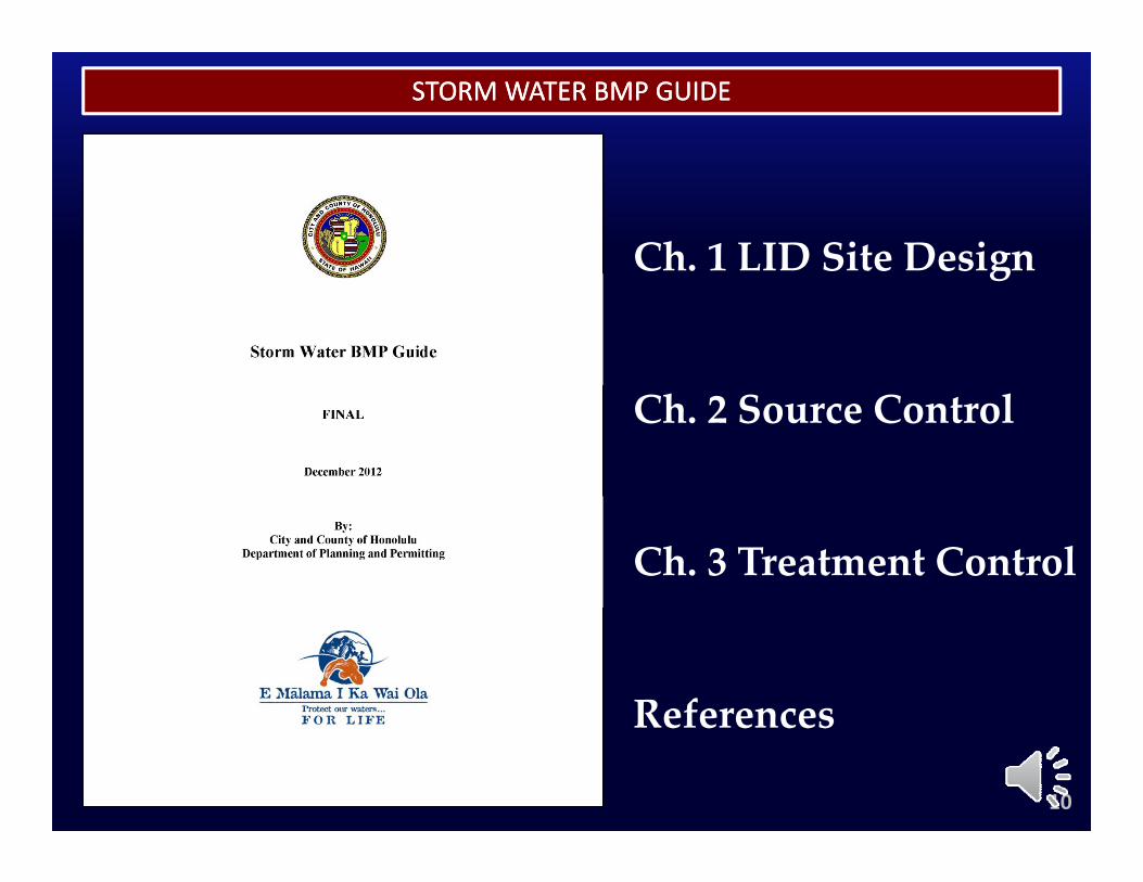
STORM WATER BMP GUIDESTORM WATER BMP GUIDE
Ch. 1 LID Site Designg
Ch. 2 Source Control
Ch. 3 Treatment Control
ReferencesReferences
10
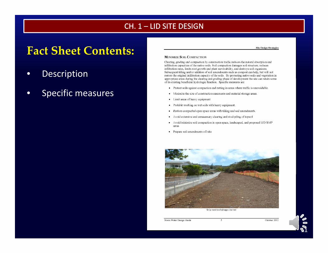
CH. 1 CH. 1 –– LID SITE DESIGNLID SITE DESIGN
F Sh CFact Sheet Contents:
• Description
• Specific measures
11

CH. 2 CH. 2 –– SOURCE CONTROLSOURCE CONTROL
F Sh CFact Sheet Contents:
• Description/Approach
• Design Guidelines
O&M R d ti• O&M Recommendations
12
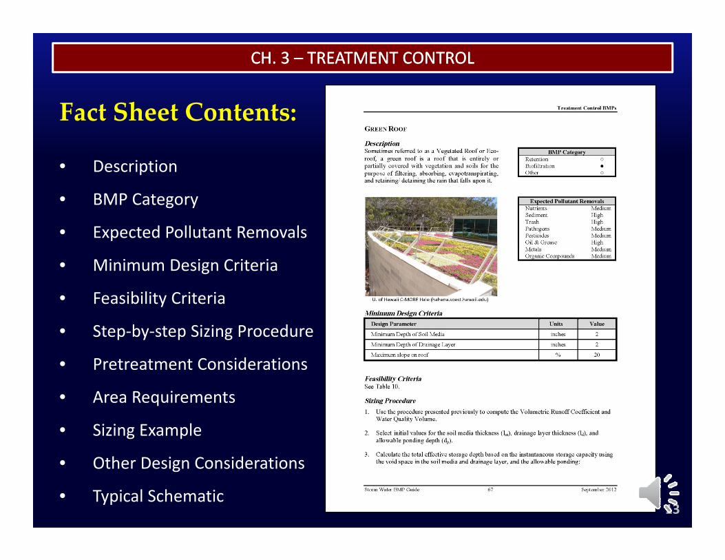
CH. 3 CH. 3 –– TREATMENT CONTROLTREATMENT CONTROL
F Sh CFact Sheet Contents:
• Descriptionp
• BMP Category
• Expected Pollutant Removals
• Minimum Design Criteria
• Feasibility Criteria
• Step‐by‐step Sizing Procedure
• Pretreatment Considerations
• Area Requirements
• Sizing Example
h d
13
• Other Design Considerations
• Typical Schematic
CH. 3 CH. 3 –– TREATMENT CONTROLTREATMENT CONTROL
Ch. 3 also includes requirements and
recommendations for LID Retention recommendations for LID Retention
BMPs to ensure long-term performance
(i.e., to prevent an infiltration basin
from becoming a wet pond)
14
CH. 3 CH. 3 –– TREATMENT CONTROLTREATMENT CONTROL
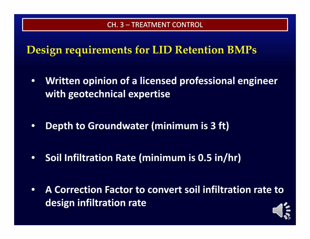
Design requirements for LID Retention BMPs
• Written opinion of a licensed professional engineer with geotechnical expertise
• Depth to Groundwater (minimum is 3 ft)
• Soil Infiltration Rate (minimum is 0.5 in/hr)
• A Correction Factor to convert soil infiltration rate to
15
design infiltration rate
CH. 3 CH. 3 –– TREATMENT CONTROLTREATMENT CONTROL
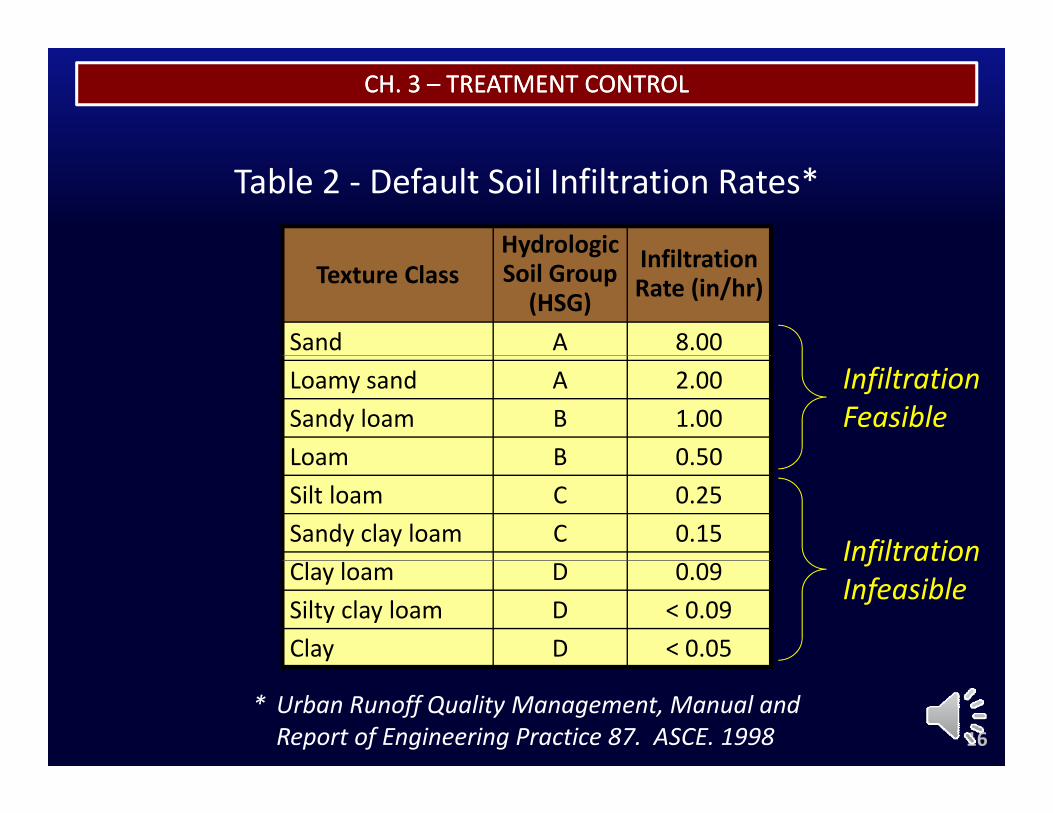
Hydrologic I filt ti
Table 2 ‐ Default Soil Infiltration Rates*
Texture Classy g
Soil Group (HSG)
Infiltration Rate (in/hr)
Sand A 8.00Loamy sand A 2.00Sandy loam B 1.00Loam B 0 50
Infiltration Feasible
Loam B 0.50Silt loam C 0.25Sandy clay loam C 0.15 InfiltrationClay loam D 0.09Silty clay loam D < 0.09Clay D < 0.05
Infiltration Infeasible
16* Urban Runoff Quality Management, Manual and Report of Engineering Practice 87. ASCE. 1998
CH. 3 CH. 3 –– TREATMENT CONTROLTREATMENT CONTROL
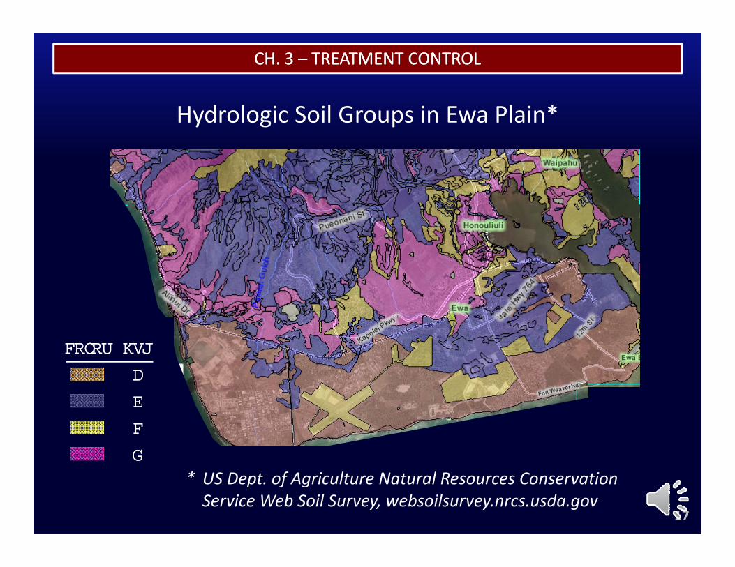
*Hydrologic Soil Groups in Ewa Plain*
HSGHSG
AA
COLORCOLOR
BB
CC
DD
17
* US Dept. of Agriculture Natural Resources Conservation Service Web Soil Survey, websoilsurvey.nrcs.usda.gov
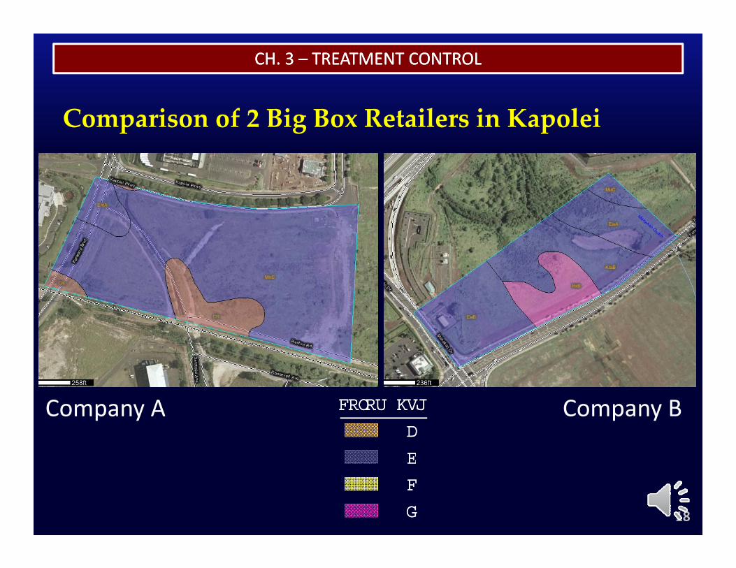
CH. 3 CH. 3 –– TREATMENT CONTROLTREATMENT CONTROL
Comparison of 2 Big Box Retailers in Kapolei
HSGHSG
AA
BB
COLORCOLORCompany A Company B
18
BB
CC
DD
CH. 3 CH. 3 –– TREATMENT CONTROLTREATMENT CONTROL
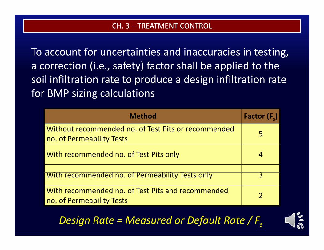
To account for uncertainties and inaccuracies in testing, a correction (i.e., safety) factor shall be applied to the soil infiltration rate to produce a design infiltration ratesoil infiltration rate to produce a design infiltration rate for BMP sizing calculations
Method Factor (Fs)Without recommended no. of Test Pits or recommended no. of Permeability Tests 5no. of Permeability Tests
With recommended no. of Test Pits only 4
Wi h d d f P bili T l 3With recommended no. of Permeability Tests only 3
With recommended no. of Test Pits and recommended no. of Permeability Tests 2
19
y
Design Rate = Measured or Default Rate / Fs
CH. 3 CH. 3 –– TREATMENT CONTROLTREATMENT CONTROL
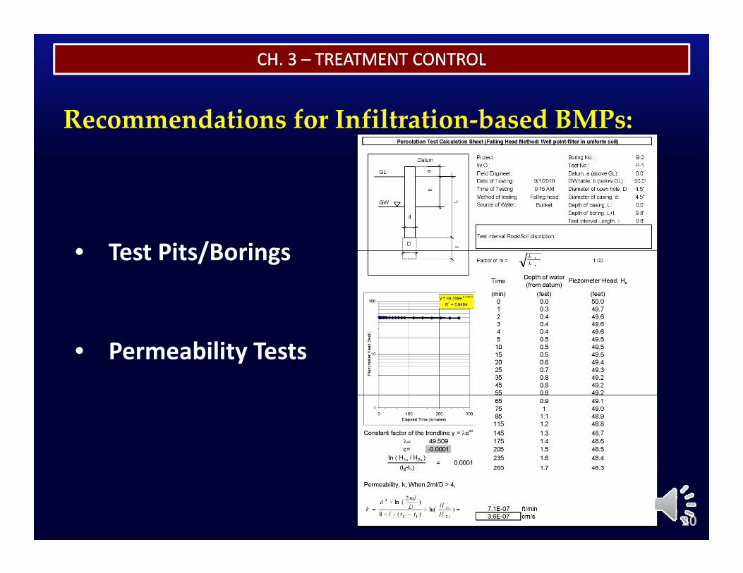
Recommendations for Infiltration‐based BMPs:
• Test Pits/Borings• Test Pits/Borings
• Permeability Tests
20
CH. 3 CH. 3 –– TREATMENT CONTROLTREATMENT CONTROL
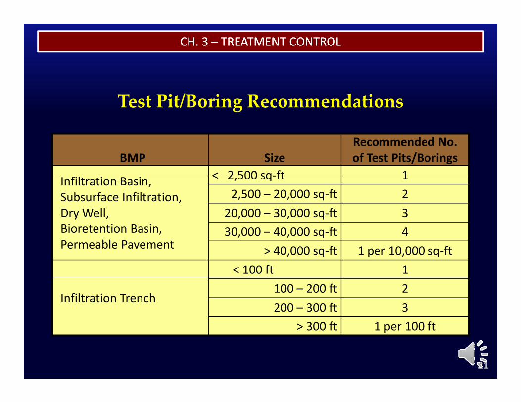
Test Pit/Boring Recommendations
BMP SizeRecommended No.of Test Pits/Borings
< 2 500 sq‐ft 1Infiltration Basin,Subsurface Infiltration,Dry Well,Bi t ti B i
< 2,500 sq‐ft 12,500 – 20,000 sq‐ft 2
20,000 – 30,000 sq‐ft 3Bioretention Basin,Permeable Pavement
30,000 – 40,000 sq‐ft 4> 40,000 sq‐ft 1 per 10,000 sq‐ft
< 100 ft 1
Infiltration Trench100 – 200 ft 2200 – 300 ft 3
> 300 ft 1 per 100 ft
21
> 300 ft 1 per 100 ft
CH. 3 CH. 3 –– TREATMENT CONTROLTREATMENT CONTROL
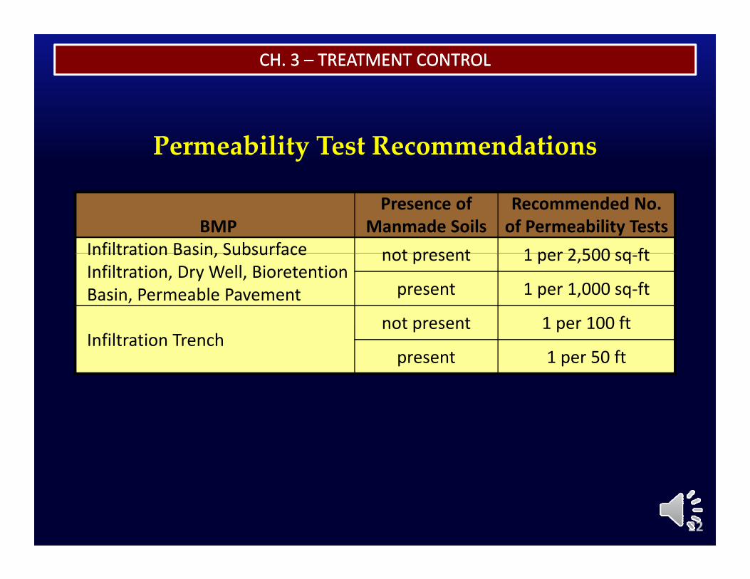
Permeability Test Recommendations
BMPPresence of
Manmade SoilsRecommended No. of Permeability Tests
Infiltration Basin, Subsurface not present 1 per 2 500 sq ftInfiltration Basin, Subsurface Infiltration, Dry Well, Bioretention Basin, Permeable Pavement
not present 1 per 2,500 sq‐ft
present 1 per 1,000 sq‐ft
not present 1 per 100 ftInfiltration Trench
not present 1 per 100 ft
present 1 per 50 ft
22
CH. 3 CH. 3 –– TREATMENT CONTROLTREATMENT CONTROL
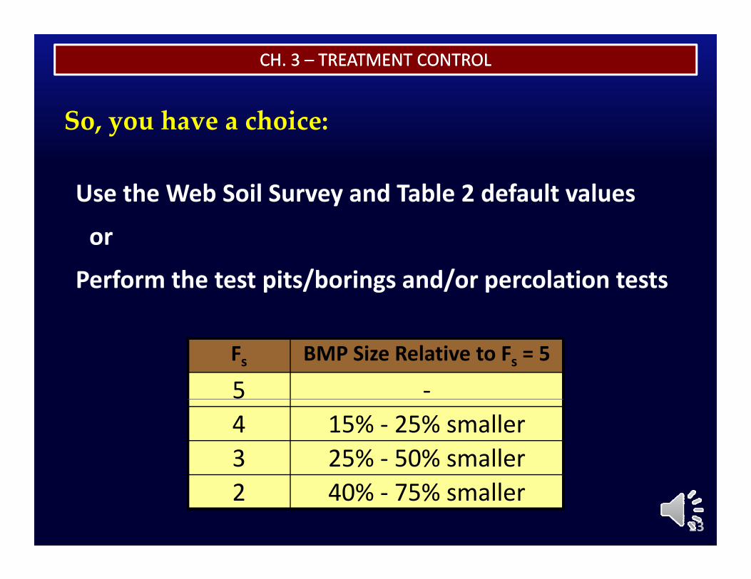
So, you have a choice:
Use the Web Soil Survey and Table 2 default values
or
Perform the test pits/borings and/or percolation tests
Fs BMP Size Relative to Fs = 5
5 ‐4 15% ‐ 25% smaller3 25% ‐ 50% smaller
23
2 40% ‐ 75% smaller
TREATMENT CONTROL BMP SIZING WORKSHEETSTREATMENT CONTROL BMP SIZING WORKSHEETS
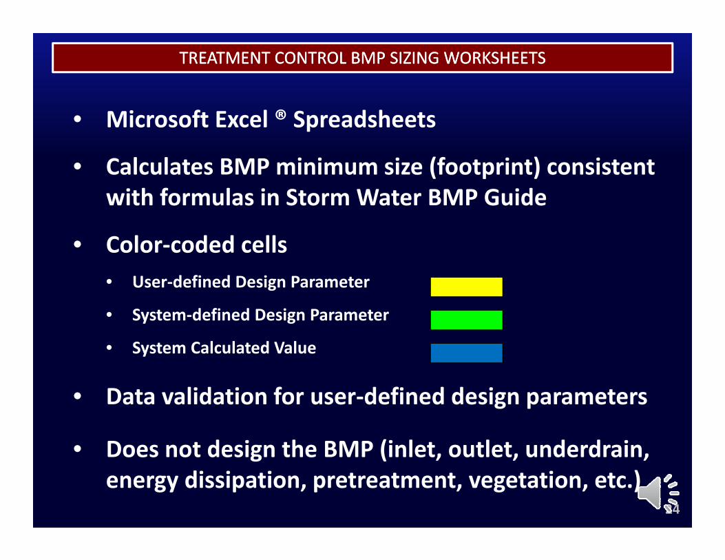
• Microsoft Excel ® Spreadsheets
• Calculates BMP minimum size (footprint) consistentCalculates BMP minimum size (footprint) consistent with formulas in Storm Water BMP Guide
• Color coded cells• Color‐coded cells• User‐defined Design Parameter
• System‐defined Design ParameterYELLOW
GREEN• System‐defined Design Parameter
• System Calculated ValueGREEN
BLUE
• Data validation for user‐defined design parameters
• Does not design the BMP (inlet, outlet, underdrain,
24
Does not design the BMP (inlet, outlet, underdrain, energy dissipation, pretreatment, vegetation, etc.)
TREATMENT CONTROL BMP SIZING WORKSHEETSTREATMENT CONTROL BMP SIZING WORKSHEETS
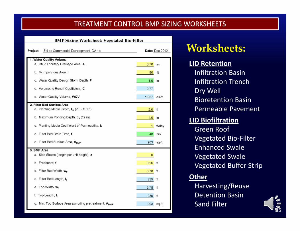
Worksheets:LID RetentionInfiltration BasinInfiltration BasinInfiltration TrenchDry WellBioretention BasinBioretention BasinPermeable Pavement
LID BiofiltrationGreen RoofGreen RoofVegetated Bio‐FilterEnhanced SwaleVegetated SwalegVegetated Buffer Strip
OtherHarvesting/Reuse
25
g/Detention BasinSand Filter

ELECTRONIC RESOURCE LIBRARYELECTRONIC RESOURCE LIBRARY
Module Summaryy
26
ELECTRONIC RESOURCE LIBRARYELECTRONIC RESOURCE LIBRARY
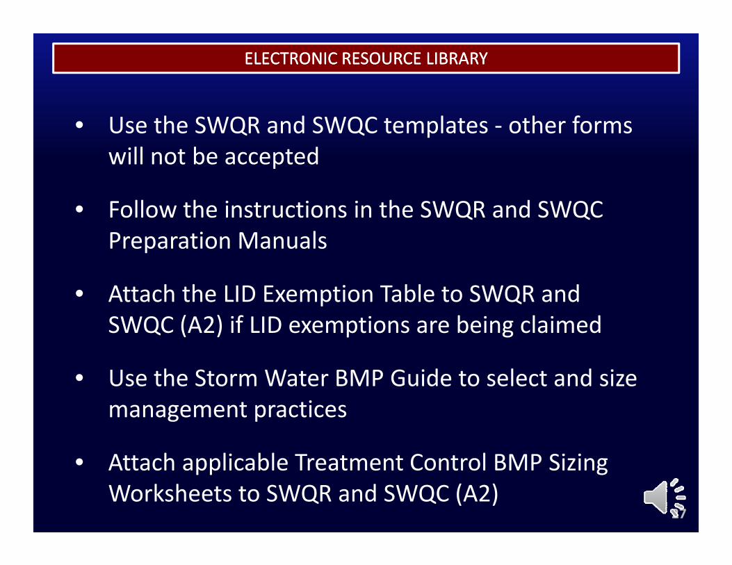
• Use the SWQR and SWQC templates ‐ other forms will not be accepted
• Follow the instructions in the SWQR and SWQC Preparation ManualsPreparation Manuals
• Attach the LID Exemption Table to SWQR and SWQC (A2) if LID ti b i l i dSWQC (A2) if LID exemptions are being claimed
• Use the Storm Water BMP Guide to select and size management practices
• Attach applicable Treatment Control BMP Sizing
27
• Attach applicable Treatment Control BMP Sizing Worksheets to SWQR and SWQC (A2)
ELECTRONIC RESOURCE LIBRARYELECTRONIC RESOURCE LIBRARY
End of Module 3
28
MODULE 4
EXAMPLESEXAMPLESEXAMPLESEXAMPLES
MODULE 4
EXAMPLESEXAMPLESEXAMPLESEXAMPLES
1
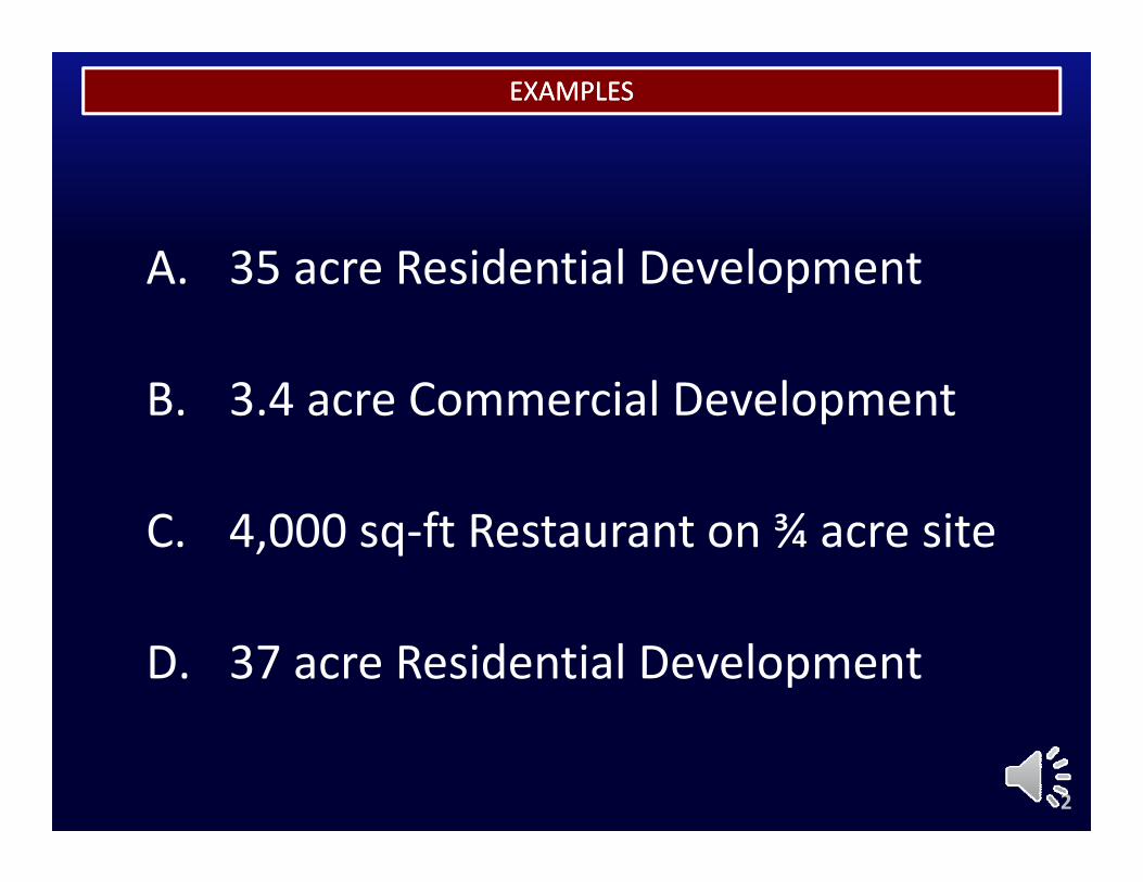
EXAMPLESEXAMPLES
A 35 acre Residential DevelopmentA. 35 acre Residential Development
B 3 4 C i l D l tB. 3.4 acre Commercial Development
C. 4,000 sq‐ft Restaurant on ¾ acre site
D. 37 acre Residential Development
2
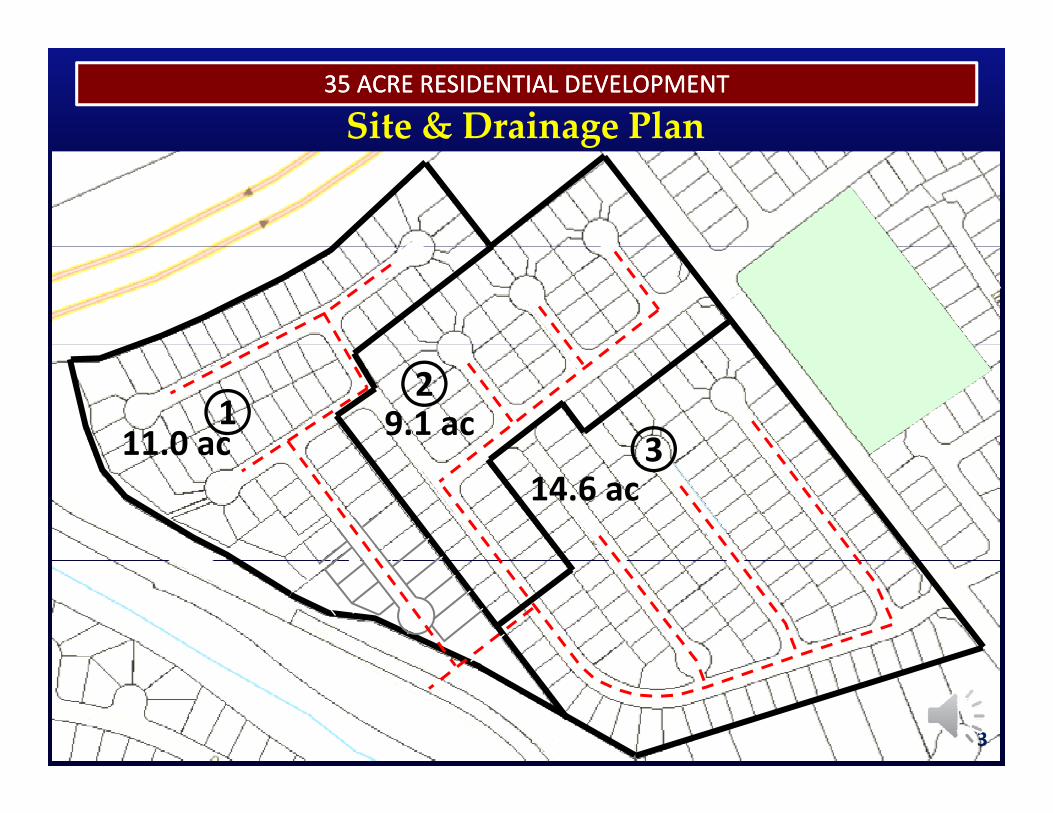
35 ACRE RESIDENTIAL DEVELOPMENT35 ACRE RESIDENTIAL DEVELOPMENT
Site & Drainage Plan
11.0 ac1 9.1 ac
2
314.6 ac
3
3
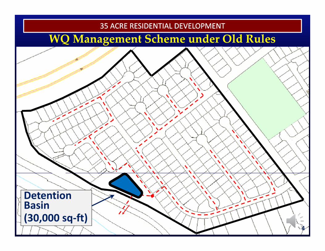
35 ACRE RESIDENTIAL DEVELOPMENT35 ACRE RESIDENTIAL DEVELOPMENT
WQ Management Scheme under Old Rules
Detention BasinBasin(30,000 sq‐ft)
4

THE RENAISSANCETHE RENAISSANCE35 ACRE RESIDENTIAL DEVELOPMENT35 ACRE RESIDENTIAL DEVELOPMENT
Does this WQ Management Scheme Does this WQ Management Scheme Does this WQ Management Scheme Does this WQ Management Scheme comply with the Retention & Biofiltration comply with the Retention & Biofiltration requirements specified in the new Rules?requirements specified in the new Rules?requirements specified in the new Rules?requirements specified in the new Rules?
○○ YesYes○○ NoNo○○ MaybeMaybe○○ I Don’t KnowI Don’t Know
55
○○ I Don t KnowI Don t Know

THE RENAISSANCETHE RENAISSANCE35 ACRE RESIDENTIAL DEVELOPMENT35 ACRE RESIDENTIAL DEVELOPMENT
f f l h
It depends…
If any Retention BMPs are feasible, then it doesn’t comply.
If all Retention BMPS are infeasible, and ,any Biofiltration BMPs are feasible, then it doesn’t comply.p y
If all Retention and Biofiltration BMPs
66
If all Retention and Biofiltration BMPs are infeasible, then it complies.
THE RENAISSANCETHE RENAISSANCE35 ACRE RESIDENTIAL DEVELOPMENT35 ACRE RESIDENTIAL DEVELOPMENT
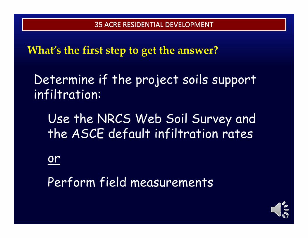
f h l
What’s the first step to get the answer?
Determine if the project soils support infiltration:
Use the NRCS Web Soil Survey and the ASCE default infiltration ratesthe ASCE default infiltration rates
or
Perform field measurements
77
35 ACRE RESIDENTIAL DEVELOPMENT35 ACRE RESIDENTIAL DEVELOPMENT
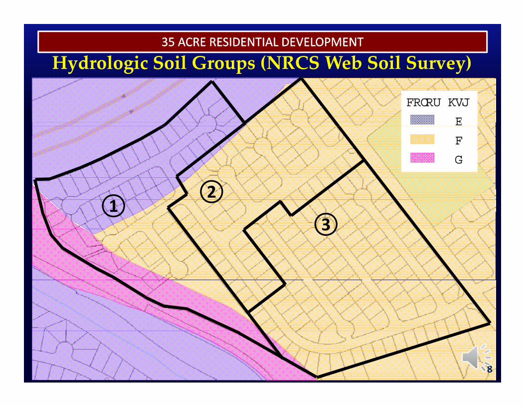
Hydrologic Soil Groups (NRCS Web Soil Survey)
HSG
B
COLOR
C
D
12
33
8
THE RENAISSANCETHE RENAISSANCE35 ACRE RESIDENTIAL DEVELOPMENT35 ACRE RESIDENTIAL DEVELOPMENT
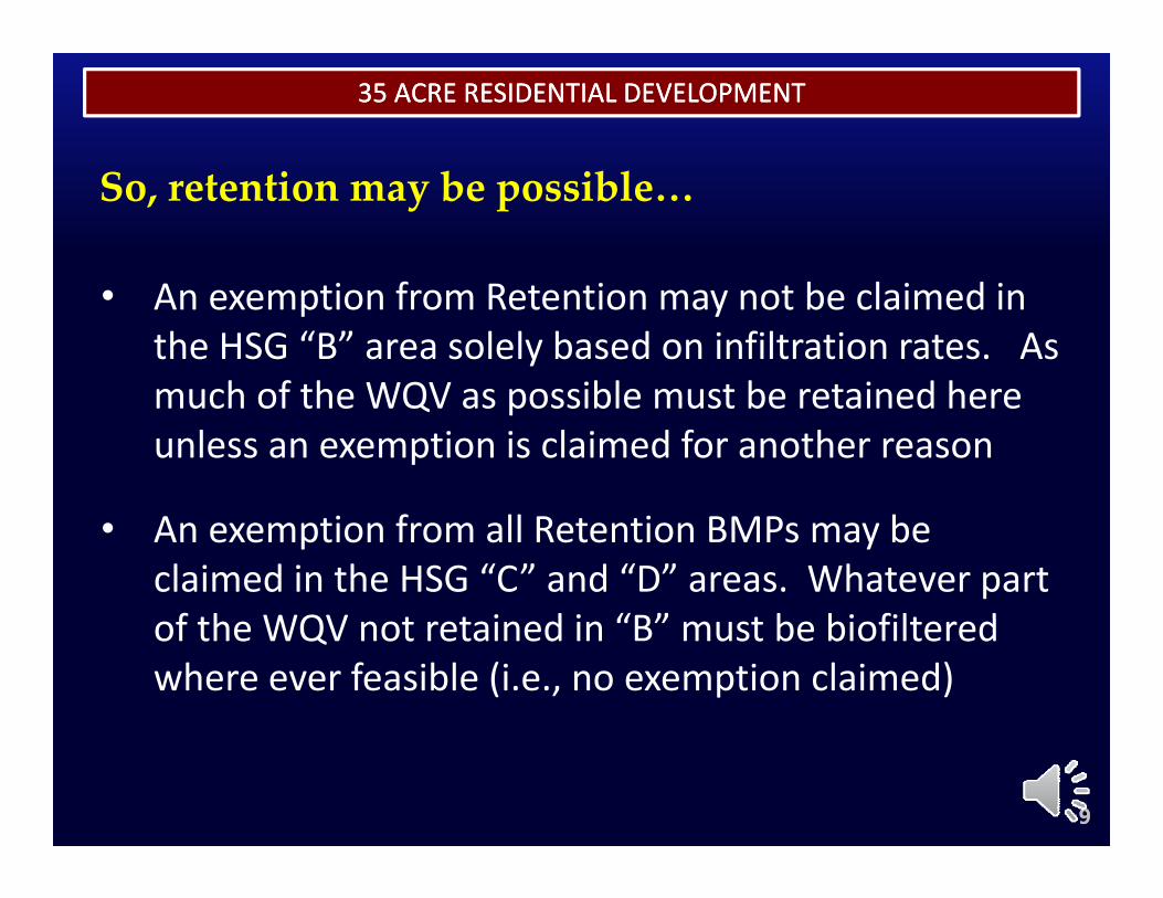
So, retention may be possible…
• An exemption from Retention may not be claimed in the HSG “B” area solely based on infiltration rates. As much of the WQV as possible must be retained heremuch of the WQV as possible must be retained here unless an exemption is claimed for another reason
• An exemption from all Retention BMPs may be claimed in the HSG “C” and “D” areas. Whatever part f th WQV t t i d i “B” t b bi filt dof the WQV not retained in “B” must be biofiltered
where ever feasible (i.e., no exemption claimed)
99
35 ACRE RESIDENTIAL DEVELOPMENT35 ACRE RESIDENTIAL DEVELOPMENT
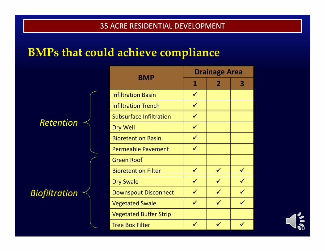
BMPs that could achieve compliance
BMPDrainage Area
BMP1 2 3
Infiltration Basin
Infiltration Trench
Subsurface Infiltration
Dry Well
Bioretention Basin
Retention
Permeable Pavement
Green Roof
Bioretention Filter
Dry Swale
Downspout Disconnect
Vegetated Swale
Biofiltration
10
Vegetated Swale
Vegetated Buffer Strip
Tree Box Filter
35 ACRE RESIDENTIAL DEVELOPMENT35 ACRE RESIDENTIAL DEVELOPMENT
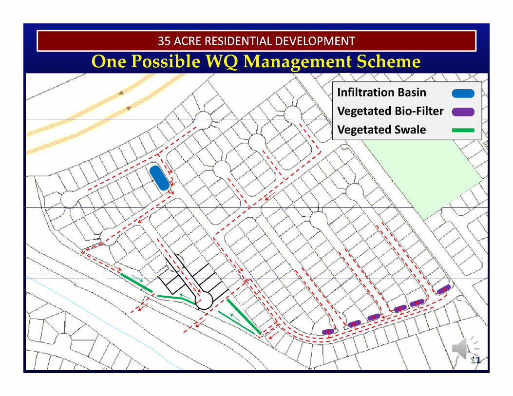
One Possible WQ Management SchemeInfiltration BasinVegetated Bio‐FilterVegetated Swale
11
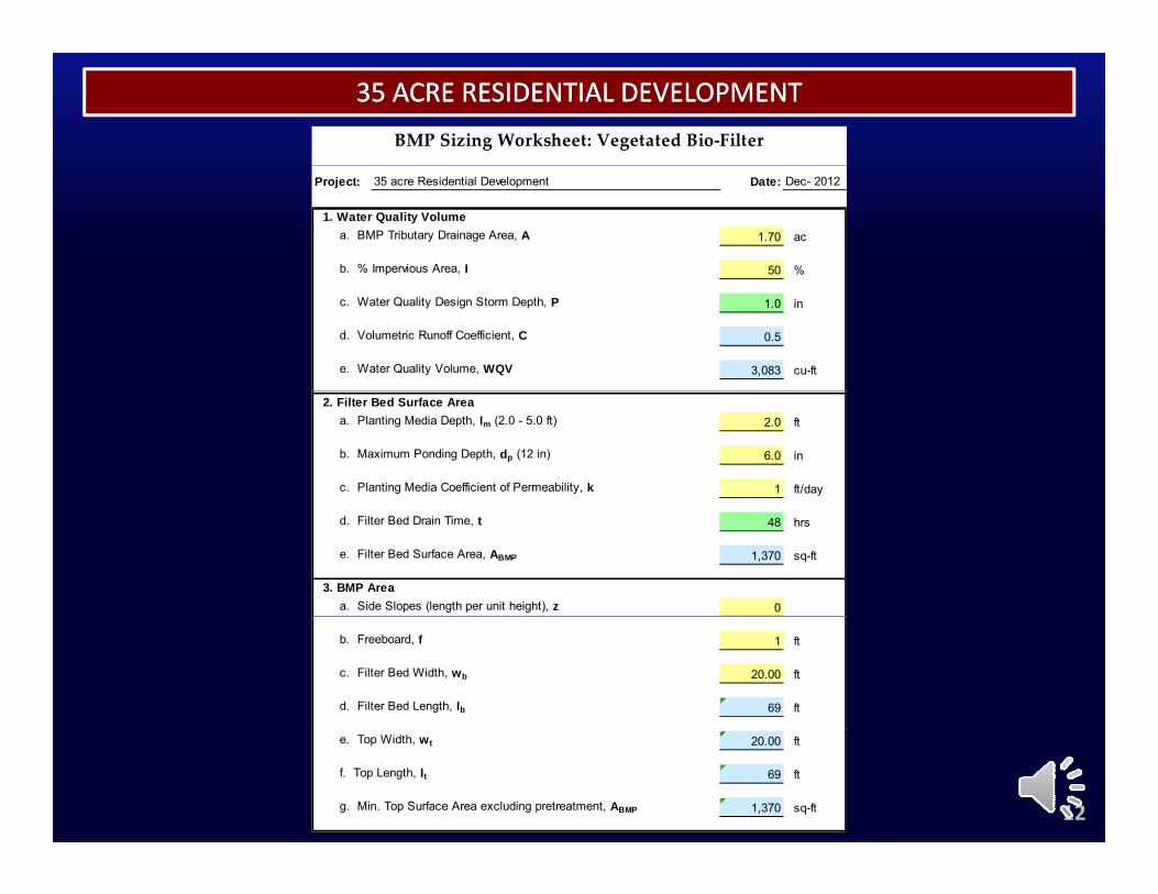
35 ACRE RESIDENTIAL DEVELOPMENT35 ACRE RESIDENTIAL DEVELOPMENTBMP Sizing Worksheet: Vegetated Bio‐Filter
Project: 35 acre Residential Development Date: Dec- 2012
1. Water Quality Volumea. BMP Tributary Drainage Area, A 1.70 ac
b. % Impervious Area, I 50 %
c. Water Quality Design Storm Depth, P 1.0 in
d. Volumetric Runoff Coefficient, C 0.5
e. Water Quality Volume, WQV 3,083 cu-ft
2. Filter Bed Surface Areaa. Planting Media Depth, lm (2.0 - 5.0 ft) 2.0 ft
b. Maximum Ponding Depth, dp (12 in) 6.0 in
c. Planting Media Coefficient of Permeability, k 1 ft/day
d. Filter Bed Drain Time, t 48 hrs
e. Filter Bed Surface Area, ABMP 1,370 sq-ft
3. BMP Areaa. Side Slopes (length per unit height), z 0
b. Freeboard, f 1 ft
c. Filter Bed Width, wb 20.00 ft
d. Filter Bed Length, lb 69 ft
12
e. Top Width, wt 20.00 ft
f. Top Length, lt 69 ft
g. Min. Top Surface Area excluding pretreatment, ABMP 1,370 sq-ft
35 ACRE RESIDENTIAL DEVELOPMENT35 ACRE RESIDENTIAL DEVELOPMENT
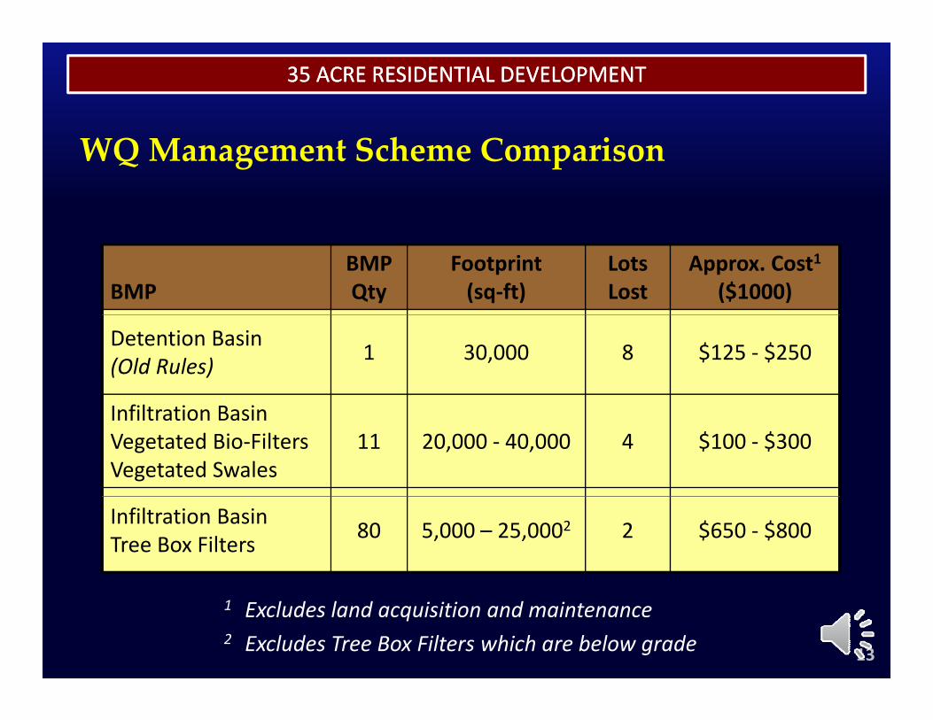
WQ Management Scheme Comparison
BMPBMPQty
Footprint(sq‐ft)
Lots Lost
Approx. Cost1($1000)
Detention Basin(Old Rules) 1 30,000 8 $125 ‐ $250
I fil i B iInfiltration BasinVegetated Bio‐FiltersVegetated Swales
11 20,000 ‐ 40,000 4 $100 ‐ $300
Infiltration BasinTree Box Filters 80 5,000 – 25,0002 2 $650 ‐ $800
13
1 Excludes land acquisition and maintenance2 Excludes Tree Box Filters which are below grade
3.4 ACRE COMMERCIAL DEVELOPMENT3.4 ACRE COMMERCIAL DEVELOPMENT
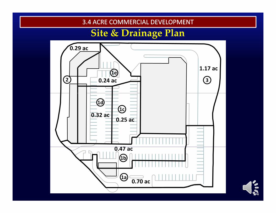
Site & Drainage Plan0.29 ac
0.24 ac
1.17 ac
21e
3
0.32 ac0 25 ac
1d1c
0 47
0.25 ac
0.47 ac1b
14
0.70 ac1a
3.4 ACRE COMMERCIAL DEVELOPMENT3.4 ACRE COMMERCIAL DEVELOPMENT
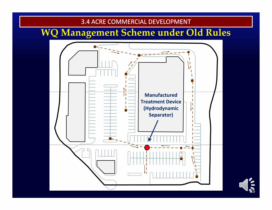
WQ Management Scheme under Old Rules
Manufactured Treatment Device(Hydrodynamic Separator)
15
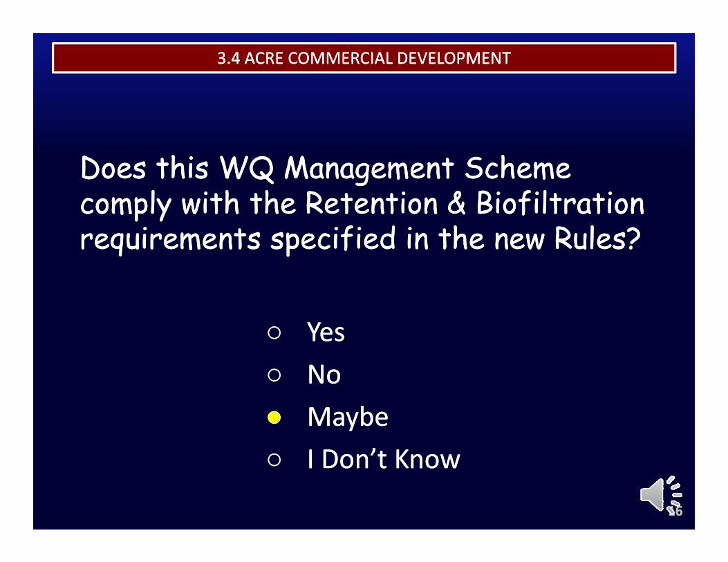
THE RENAISSANCETHE RENAISSANCE3.4 ACRE COMMERCIAL DEVELOPMENT3.4 ACRE COMMERCIAL DEVELOPMENT
Does this WQ Management Scheme Does this WQ Management Scheme Does this WQ Management Scheme Does this WQ Management Scheme comply with the Retention & Biofiltration comply with the Retention & Biofiltration requirements specified in the new Rules?requirements specified in the new Rules?requirements specified in the new Rules?requirements specified in the new Rules?
○○ YesYes○○ NoNo○○ MaybeMaybe○○ I Don’t KnowI Don’t Know
1616
○○ I Don t KnowI Don t Know
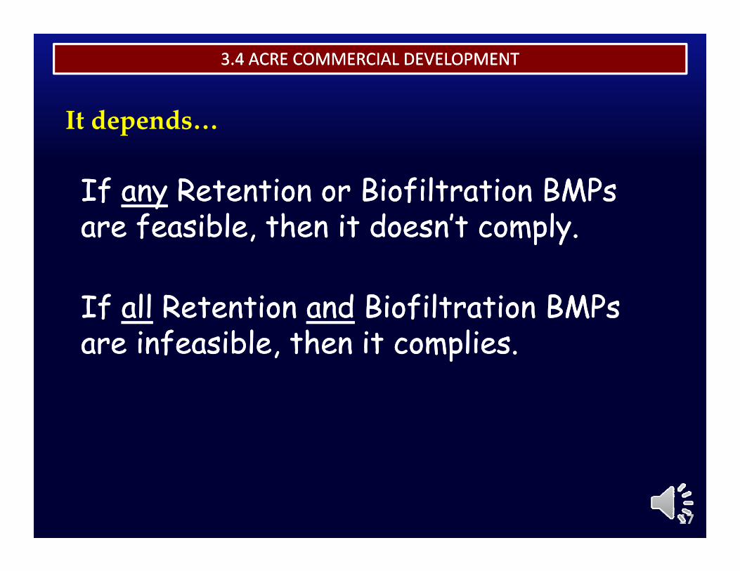
THE RENAISSANCETHE RENAISSANCE3.4 ACRE COMMERCIAL DEVELOPMENT3.4 ACRE COMMERCIAL DEVELOPMENT
f f f l f l
It depends…
If If anyany Retention or Biofiltration BMPs Retention or Biofiltration BMPs are feasible, then it doesn’t comply.are feasible, then it doesn’t comply.
If If allall Retention Retention andand Biofiltration BMPs Biofiltration BMPs are infeasible, then it complies.are infeasible, then it complies.
1717
3.4 ACRE COMMERCIAL DEVELOPMENT3.4 ACRE COMMERCIAL DEVELOPMENT
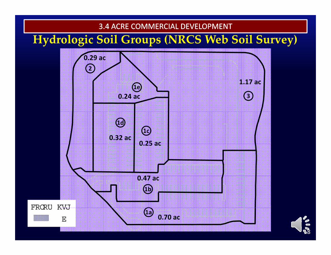
Hydrologic Soil Groups (NRCS Web Soil Survey)0.29 ac2
0.24 ac
1.17 ac1e
3
0.32 ac0 25 ac
1d1c
0 47
0.25 ac
0.47 ac1b
HSGCOLOR
18
0.70 ac1a
HSG
B
COLOR
THE RENAISSANCETHE RENAISSANCE3.4 ACRE COMMERCIAL DEVELOPMENT3.4 ACRE COMMERCIAL DEVELOPMENT
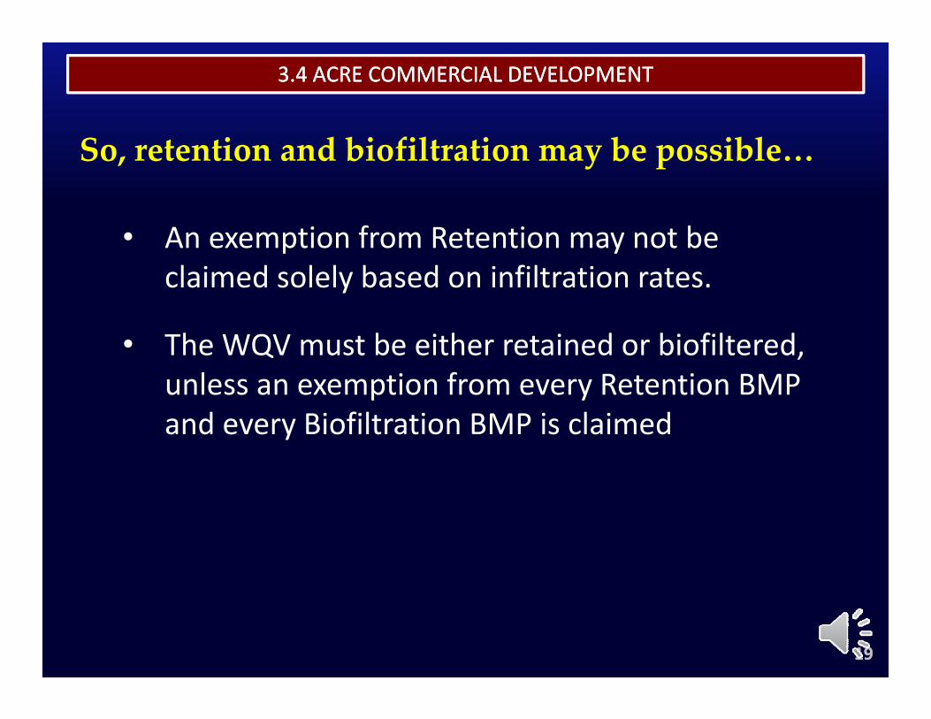
So, retention and biofiltration may be possible…
• An exemption from Retention may not be claimed solely based on infiltration rates.
• The WQV must be either retained or biofiltered, unless an exemption from every Retention BMP and every Biofiltration BMP is claimed
1919
3.4 ACRE COMMERCIAL DEVELOPMENT3.4 ACRE COMMERCIAL DEVELOPMENT
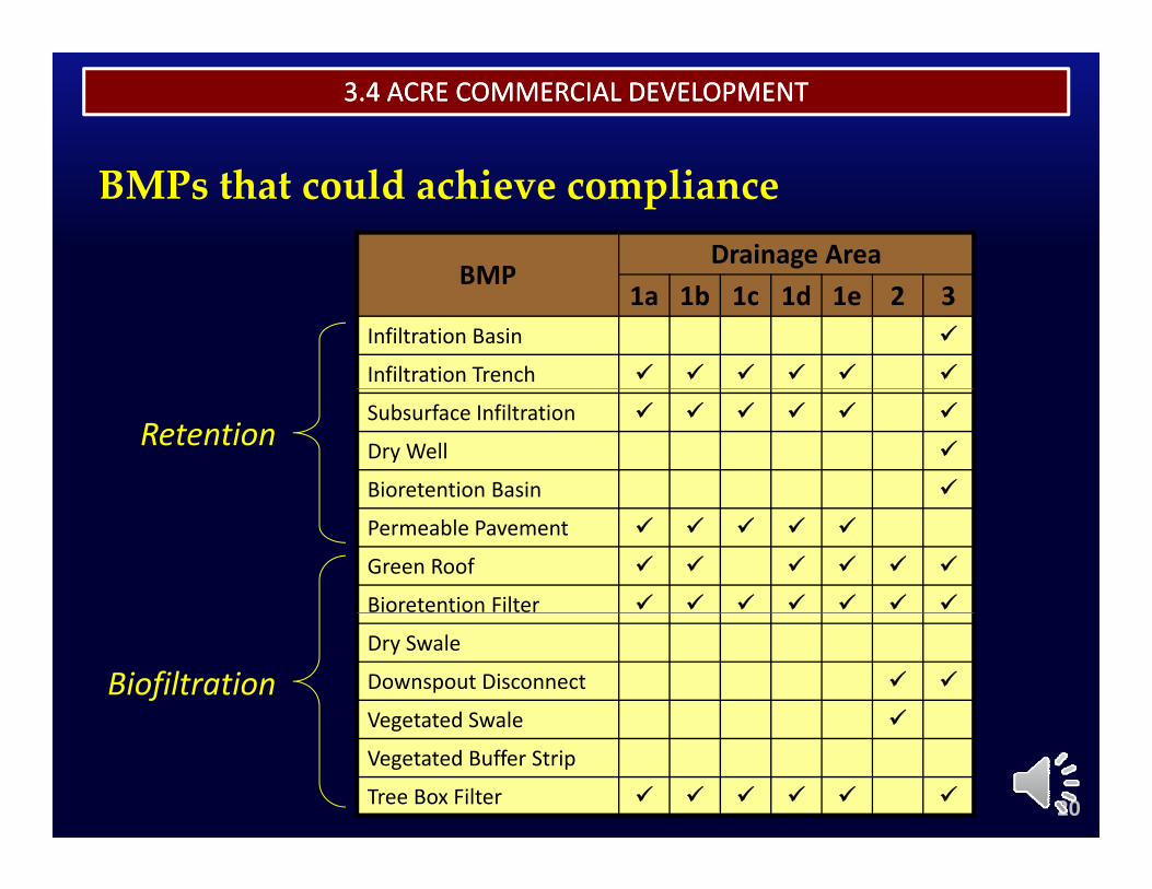
BMPs that could achieve compliance
BMPDrainage Area
BMP1a 1b 1c 1d 1e 2 3
Infiltration Basin
Infiltration Trench
Subsurface Infiltration
Dry Well
Bioretention Basin
Retention
Permeable Pavement
Green Roof
Bioretention Filter
Dry Swale
Downspout Disconnect
Vegetated Swale
Biofiltration
20
Vegetated Swale
Vegetated Buffer Strip
Tree Box Filter
3.4 ACRE COMMERCIAL DEVELOPMENT3.4 ACRE COMMERCIAL DEVELOPMENT
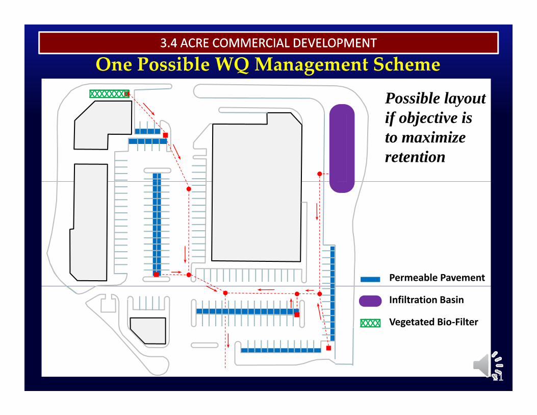
One Possible WQ Management Scheme
Possible layout if objective is to maximize retention
Permeable Pavement
Infiltration Basin
Vegetated Bio‐Filter
21
3.4 ACRE COMMERCIAL DEVELOPMENT3.4 ACRE COMMERCIAL DEVELOPMENT
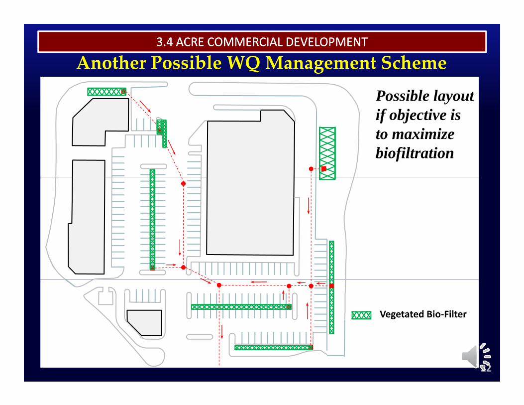
Another Possible WQ Management Scheme
Possible layout if objective is to maximize biofiltration
Vegetated Bio‐Filter
22
BMP Sizing Worksheet: Permeable Pavement
3.4 ACRE COMMERCIAL DEVELOPMENT3.4 ACRE COMMERCIAL DEVELOPMENT
BMP Sizing Worksheet: Vegetated Bio‐Filter
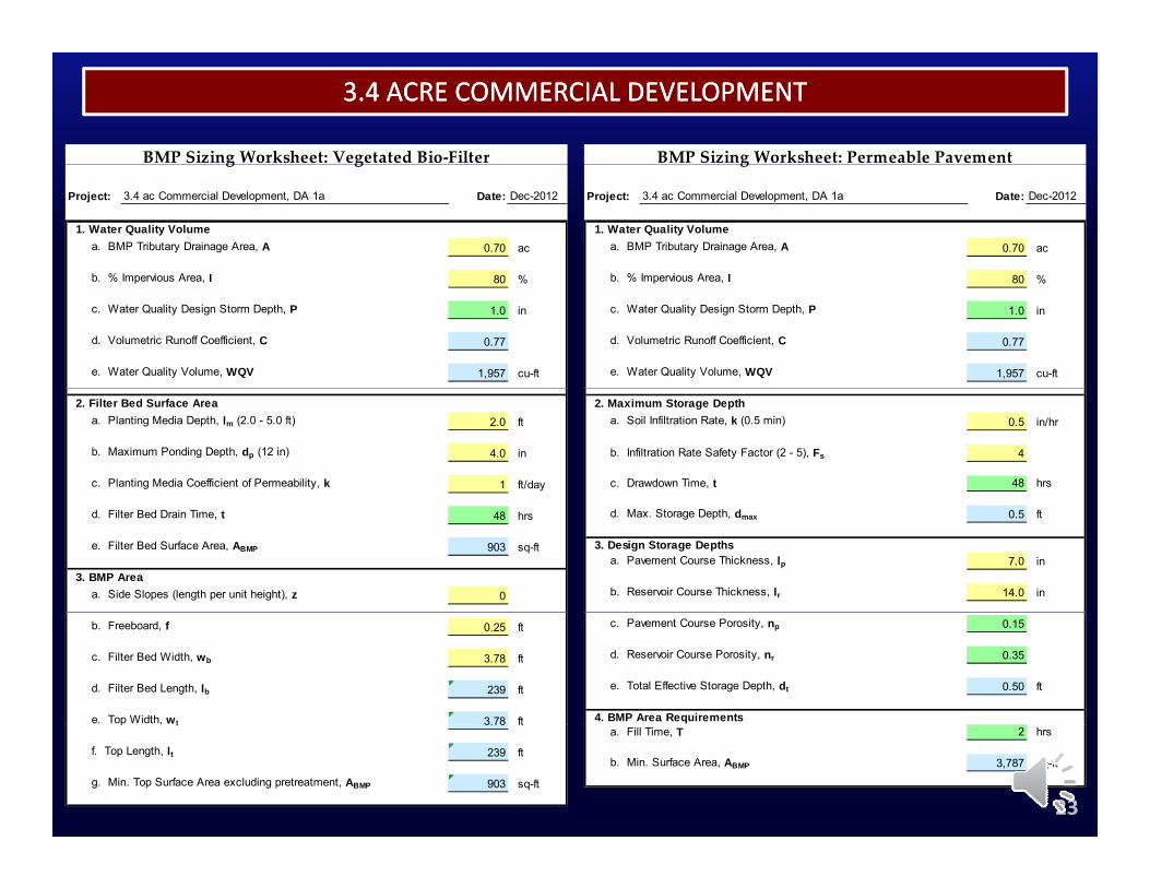
Project: 3.4 ac Commercial Development, DA 1a Date: Dec-2012
1. Water Quality Volumea. BMP Tributary Drainage Area, A 0.70 ac
b % Impervious Area I 80 %
g
Project: 3.4 ac Commercial Development, DA 1a Date: Dec-2012
1. Water Quality Volumea. BMP Tributary Drainage Area, A 0.70 ac
b % Impervious Area I 80 %
g g
b. % Impervious Area, I 80 %
c. Water Quality Design Storm Depth, P 1.0 in
d. Volumetric Runoff Coefficient, C 0.77
e. Water Quality Volume, WQV 1,957 cu-ft
b. % Impervious Area, I 80 %
c. Water Quality Design Storm Depth, P 1.0 in
d. Volumetric Runoff Coefficient, C 0.77
e. Water Quality Volume, WQV 1,957 cu-ft
2. Maximum Storage Deptha. Soil Infiltration Rate, k (0.5 min) 0.5 in/hr
b. Infiltration Rate Safety Factor (2 - 5), Fs 4
c. Drawdown Time, t 48 hrs
2. Filter Bed Surface Areaa. Planting Media Depth, lm (2.0 - 5.0 ft) 2.0 ft
b. Maximum Ponding Depth, dp (12 in) 4.0 in
c. Planting Media Coefficient of Permeability, k 1 ft/day
d. Max. Storage Depth, dmax 0.5 ft
3. Design Storage Depthsa. Pavement Course Thickness, lp 7.0 in
b. Reservoir Course Thickness, lr 14.0 in
d. Filter Bed Drain Time, t 48 hrs
e. Filter Bed Surface Area, ABMP 903 sq-ft
3. BMP Areaa. Side Slopes (length per unit height), z 0
c. Pavement Course Porosity, np 0.15
d. Reservoir Course Porosity, nr 0.35
e. Total Effective Storage Depth, dt 0.50 ft
4. BMP Area Requirements
b. Freeboard, f 0.25 ft
c. Filter Bed Width, wb 3.78 ft
d. Filter Bed Length, lb 239 ft
e. Top Width, wt 3.78 fta. Fill Time, T 2 hrs
b. Min. Surface Area, ABMP 3,787 sq-ft
23
p , t 3.78 ft
f. Top Length, lt 239 ft
g. Min. Top Surface Area excluding pretreatment, ABMP 903 sq-ft
3.4 ACRE COMMERCIAL DEVELOPMENT3.4 ACRE COMMERCIAL DEVELOPMENT
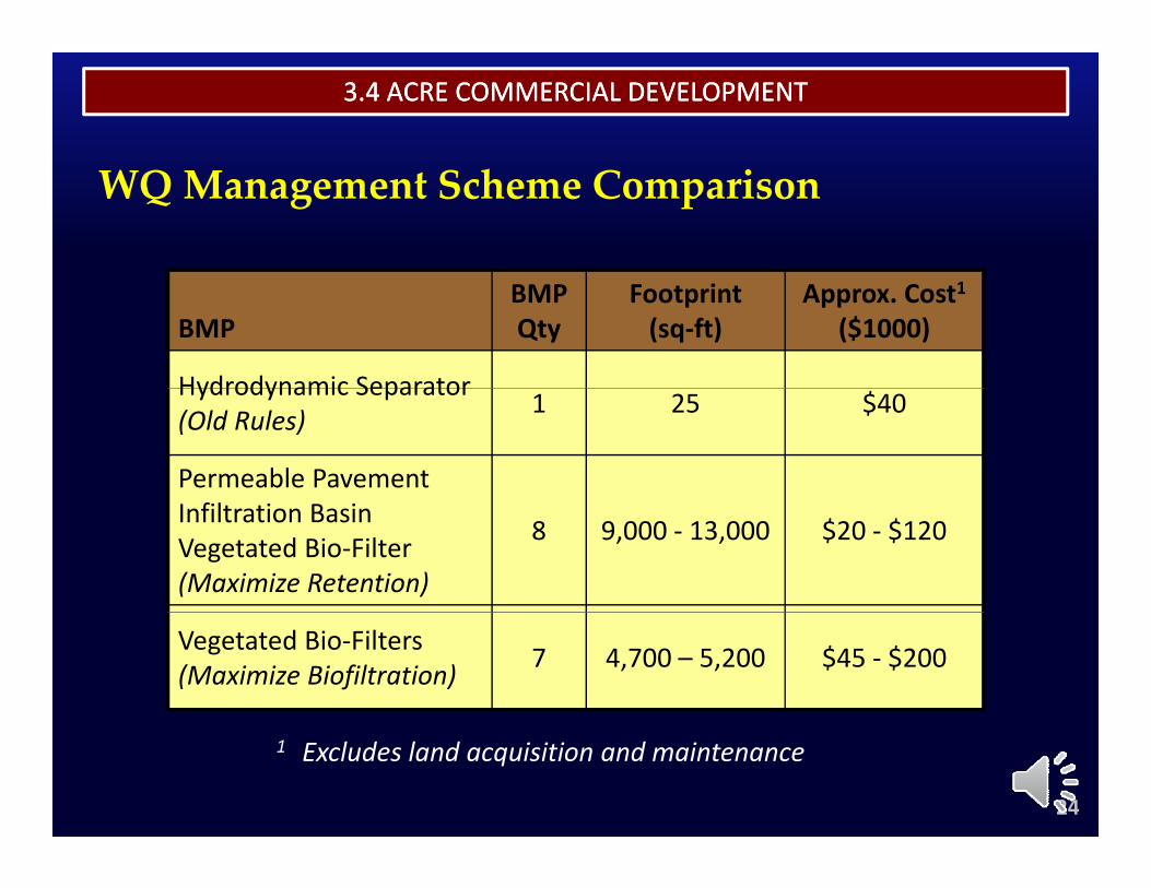
WQ Management Scheme Comparison
BMPBMPQty
Footprint(sq‐ft)
Approx. Cost1($1000)
Hydrodynamic SeparatorHydrodynamic Separator(Old Rules) 1 25 $40
Permeable PavementInfiltration BasinVegetated Bio‐Filter(Maximize Retention)
8 9,000 ‐ 13,000 $20 ‐ $120
Vegetated Bio‐Filters(Maximize Biofiltration) 7 4,700 – 5,200 $45 ‐ $200
24
1 Excludes land acquisition and maintenance
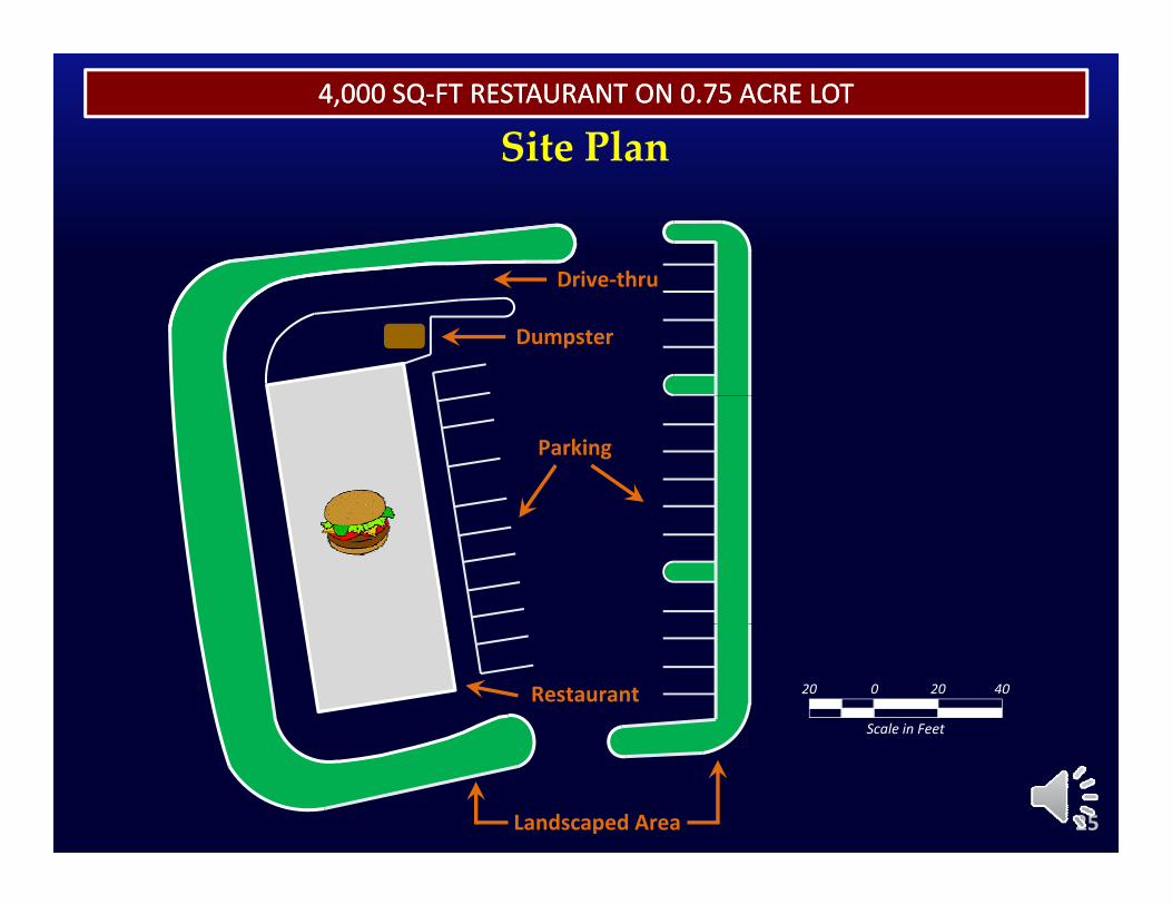
4,000 SQ4,000 SQ‐‐FT RESTAURANT ON 0.75 ACRE LOTFT RESTAURANT ON 0.75 ACRE LOT
Site Plan
Drive‐thruDrive‐thru
Dumpster
Parking
Scale in Feet
0 20 4020Restaurant
25Landscaped Area
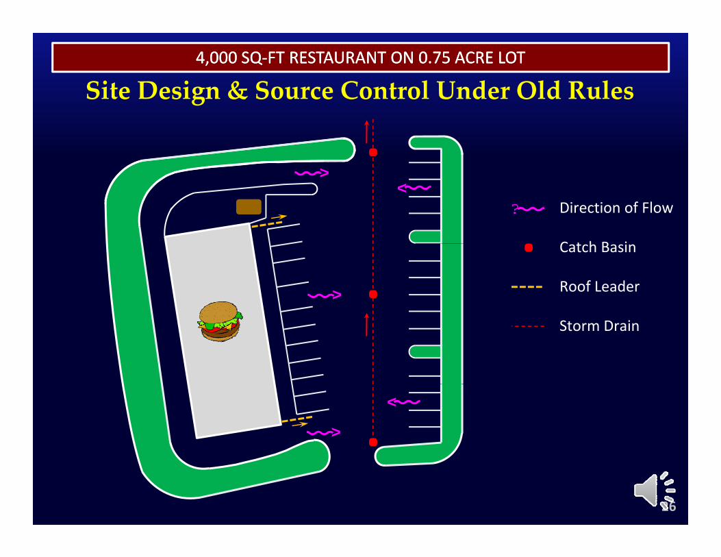
4,000 SQ4,000 SQ‐‐FT RESTAURANT ON 0.75 ACRE LOTFT RESTAURANT ON 0.75 ACRE LOT
Site Design & Source Control Under Old Rulesg
<
<
<
< Direction of Flow
C t h B i<
Catch Basin
Roof Leader
Storm Drain
<
<
26
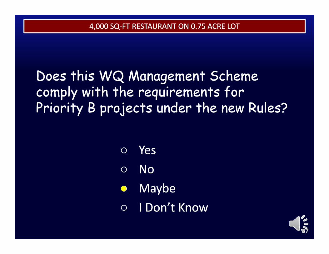
THE RENAISSANCETHE RENAISSANCE4,000 SQ4,000 SQ‐‐FT RESTAURANT ON 0.75 ACRE LOTFT RESTAURANT ON 0.75 ACRE LOT
Does this WQ Management Scheme Does this WQ Management Scheme Does this WQ Management Scheme Does this WQ Management Scheme comply with the requirements for comply with the requirements for Priority B projects under the new Rules?Priority B projects under the new Rules?Priority B projects under the new Rules?Priority B projects under the new Rules?
○○ YesYes○○ NoNo○○ MaybeMaybe○○ I Don’t KnowI Don’t Know
2727
○○ I Don t KnowI Don t Know
THE RENAISSANCETHE RENAISSANCE4,000 SQ4,000 SQ‐‐FT RESTAURANT ON 0.75 ACRE LOTFT RESTAURANT ON 0.75 ACRE LOT
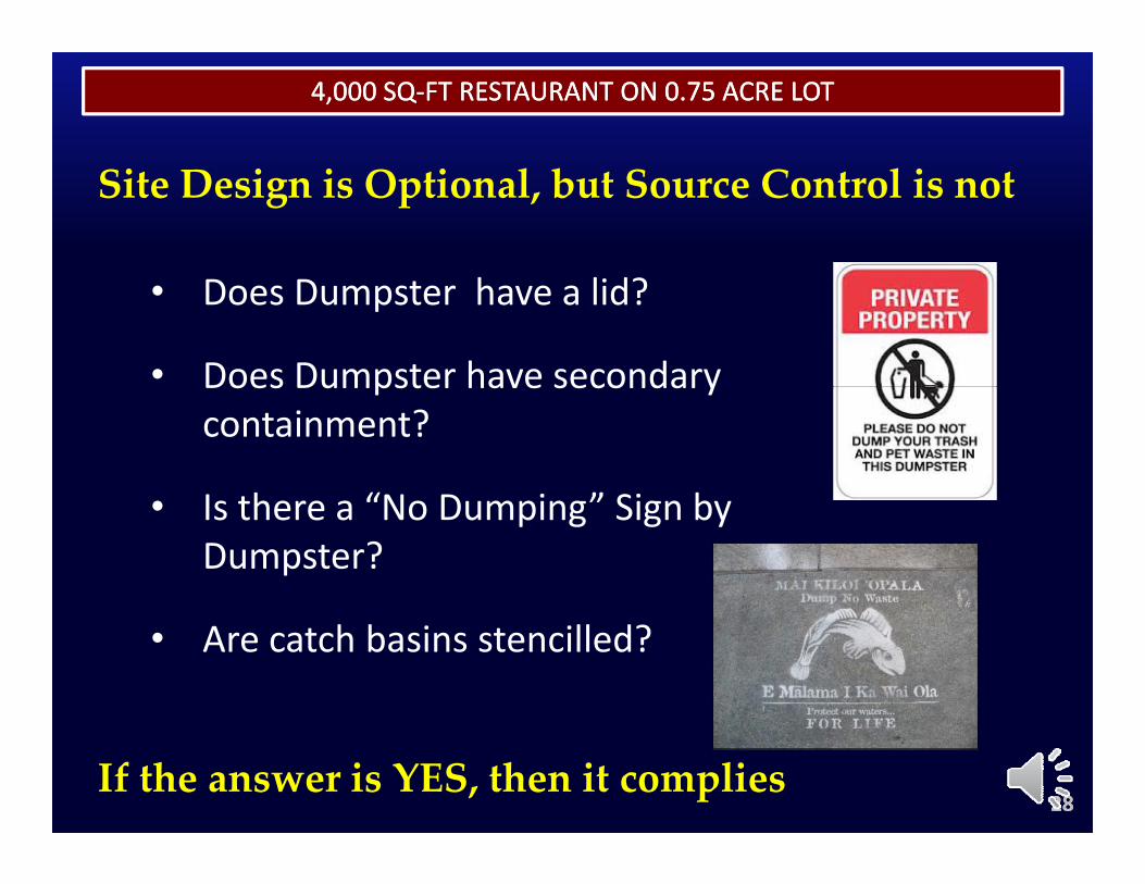
Site Design is Optional, but Source Control is not
• Does Dumpster have a lid?
• Does Dumpster have secondaryDoes Dumpster have secondary containment?
I th “N D i ” Si b• Is there a “No Dumping” Sign by Dumpster?
• Are catch basins stencilled?
2828If the answer is YES, then it complies
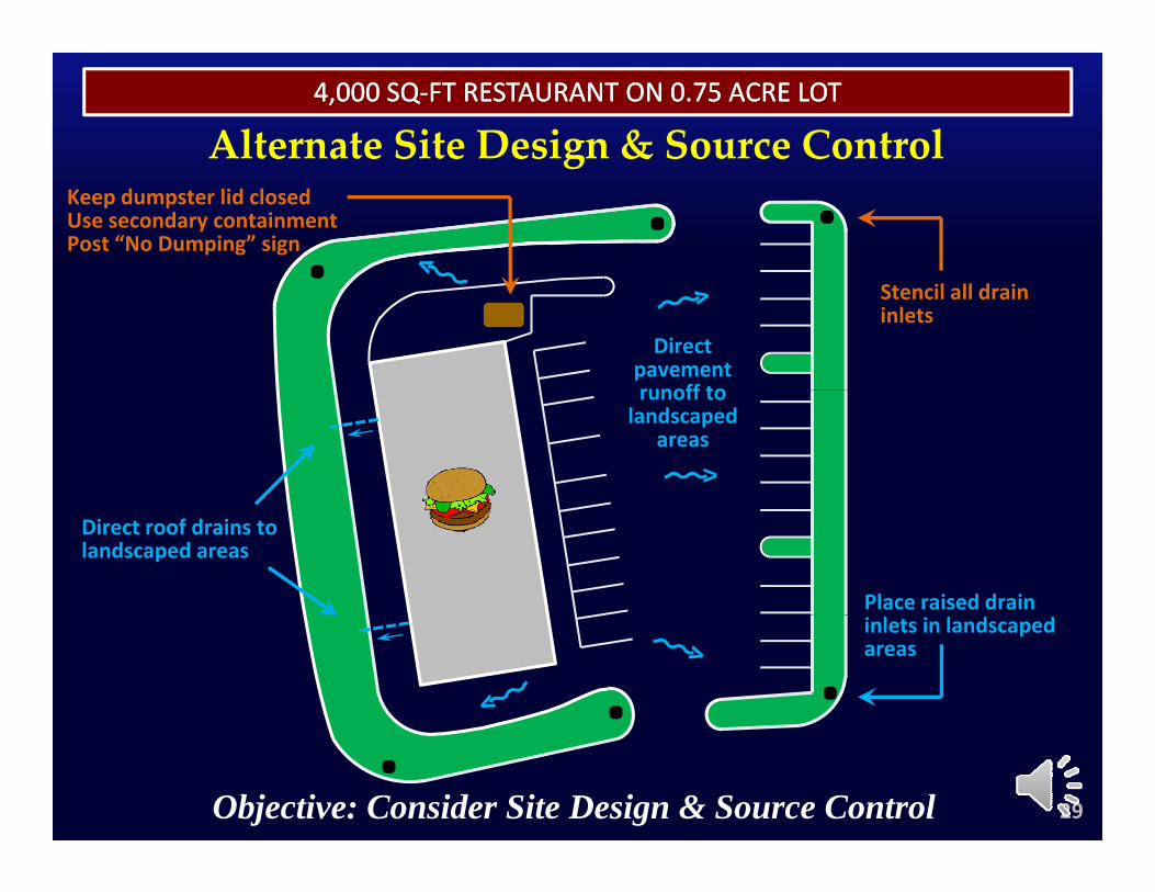
4,000 SQ4,000 SQ‐‐FT RESTAURANT ON 0.75 ACRE LOTFT RESTAURANT ON 0.75 ACRE LOT
Alternate Site Design & Source ControlKeep dumpster lid closedUse secondary containmentPost “No Dumping” sign
g
Directpavementrunoff to
Stencil all drain inlets
runoff to landscaped
areas<
Direct roof drains to landscaped areas
Place raised drain inlets in landscaped areas
29Objective: Consider Site Design & Source Control
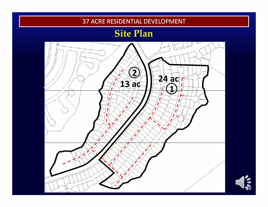
Site Plan37 ACRE RESIDENTIAL DEVELOPMENT37 ACRE RESIDENTIAL DEVELOPMENT
24 ac13 ac2
11
30
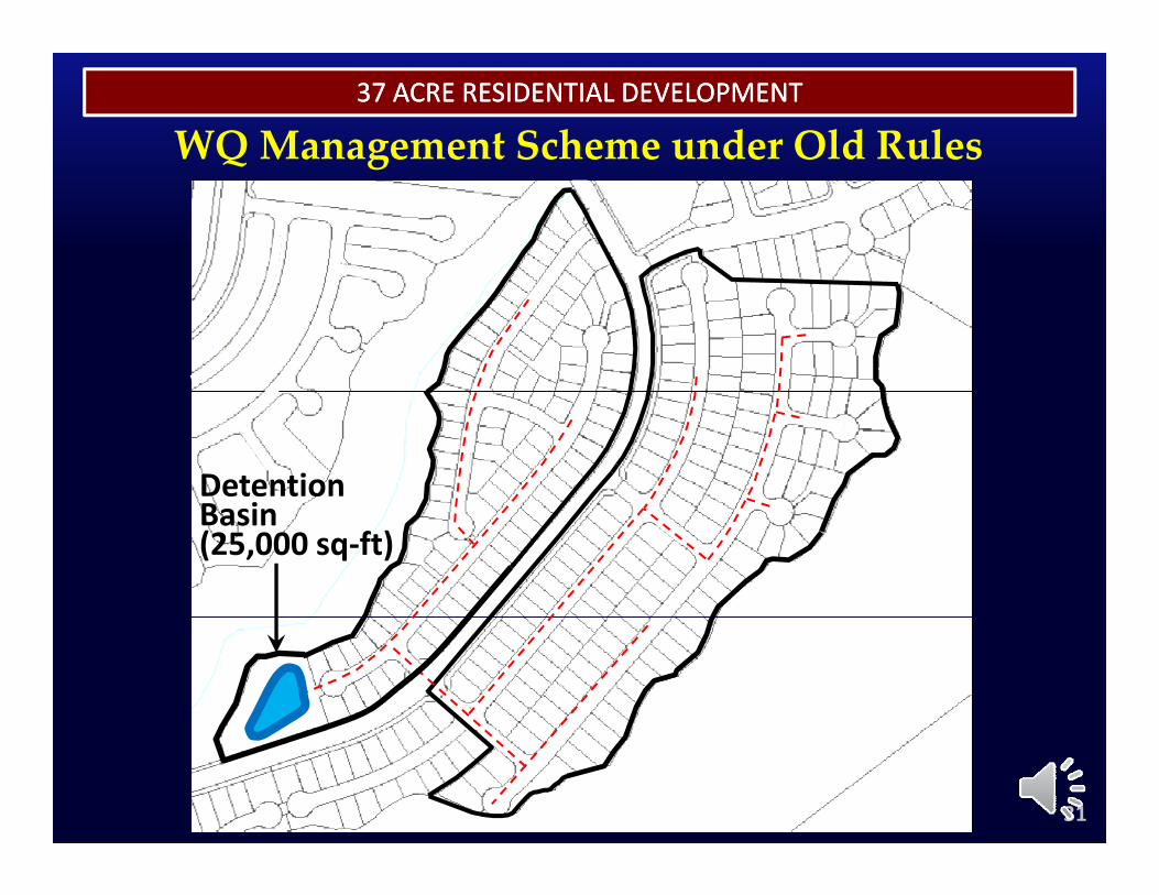
37 ACRE RESIDENTIAL DEVELOPMENT37 ACRE RESIDENTIAL DEVELOPMENT
WQ Management Scheme under Old RulesQ g
Detention B iBasin(25,000 sq‐ft)
31
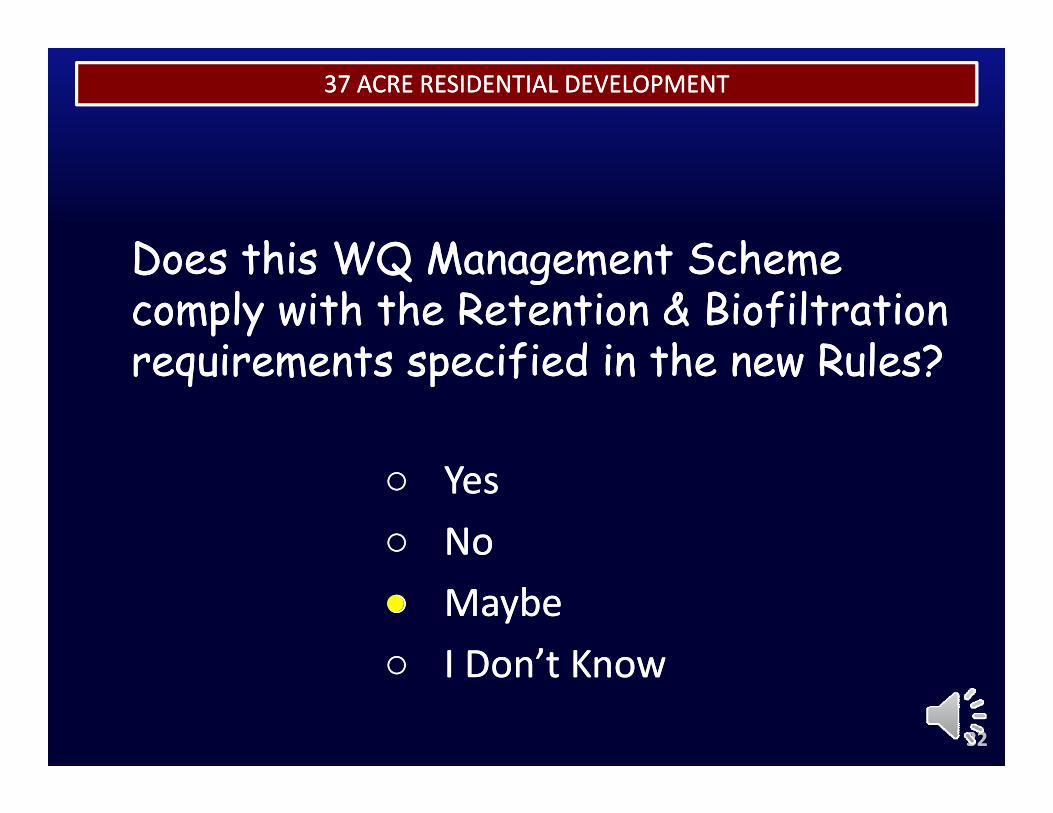
THE RENAISSANCETHE RENAISSANCE37 ACRE RESIDENTIAL DEVELOPMENT37 ACRE RESIDENTIAL DEVELOPMENT
Does this WQ Management Scheme Does this WQ Management Scheme Does this WQ Management Scheme Does this WQ Management Scheme comply with the Retention & Biofiltration comply with the Retention & Biofiltration requirements specified in the new Rules?requirements specified in the new Rules?requirements specified in the new Rules?requirements specified in the new Rules?
○○ YesYes○○ NoNo○○ MaybeMaybe○○ I Don’t KnowI Don’t Know
3232
○○ I Don t KnowI Don t Know
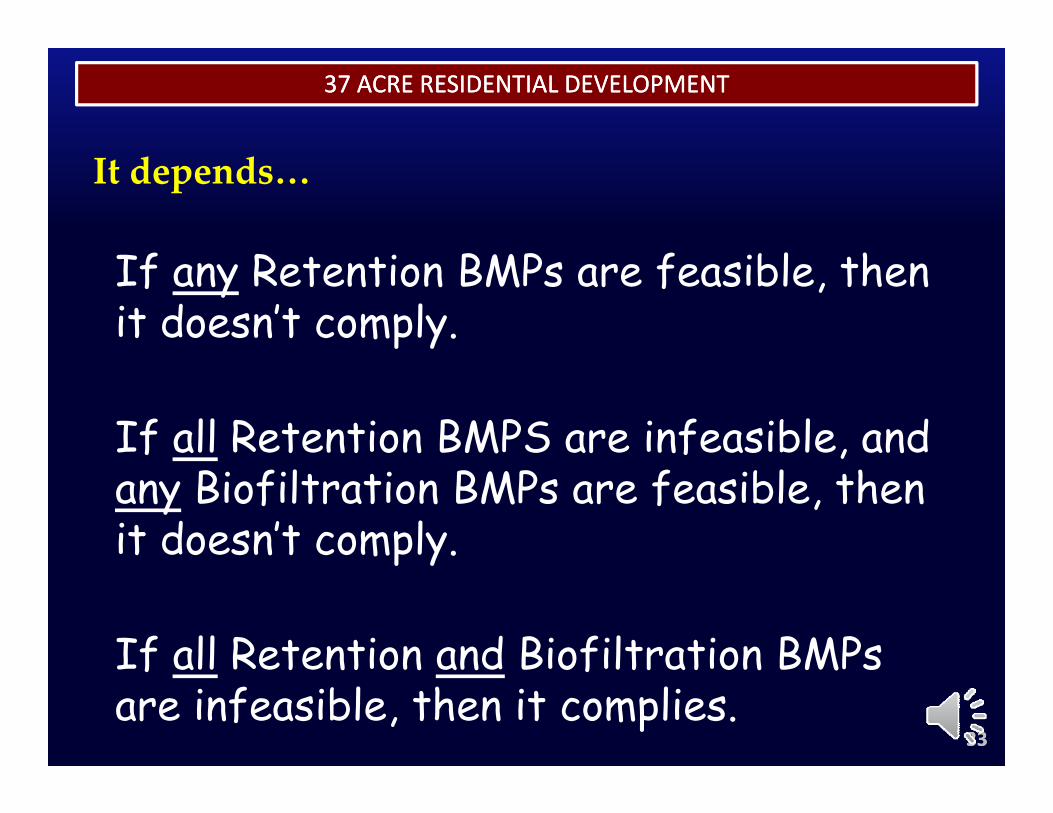
THE RENAISSANCETHE RENAISSANCE37 ACRE RESIDENTIAL DEVELOPMENT37 ACRE RESIDENTIAL DEVELOPMENT
f f l h
It depends…
If any Retention BMPs are feasible, then it doesn’t comply.
If all Retention BMPS are infeasible, and ,any Biofiltration BMPs are feasible, then it doesn’t comply.p y
If all Retention and Biofiltration BMPs
3333
If all Retention and Biofiltration BMPs are infeasible, then it complies.
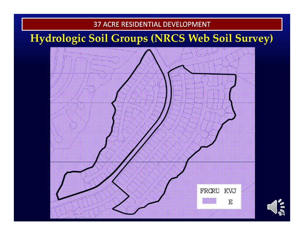
37 ACRE RESIDENTIAL DEVELOPMENT37 ACRE RESIDENTIAL DEVELOPMENT
Hydrologic Soil Groups (NRCS Web Soil Survey)y g p y
HSGCOLOR
34
HSG
B
COLOR
THE RENAISSANCETHE RENAISSANCE37 ACRE RESIDENTIAL DEVELOPMENT37 ACRE RESIDENTIAL DEVELOPMENT
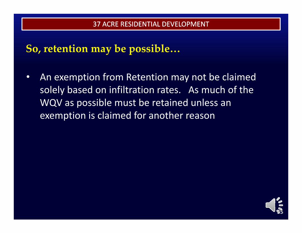
So, retention may be possible…
• An exemption from Retention may not be claimed solely based on infiltration rates. As much of the WQV as possible must be retained unless anWQV as possible must be retained unless an exemption is claimed for another reason
3535

37 ACRE RESIDENTIAL DEVELOPMENT37 ACRE RESIDENTIAL DEVELOPMENT
One Possible WQ Management SchemeQ g
Infiltration B iBasin(30,000 sq‐ft)
36
37 ACRE RESIDENTIAL DEVELOPMENT37 ACRE RESIDENTIAL DEVELOPMENT
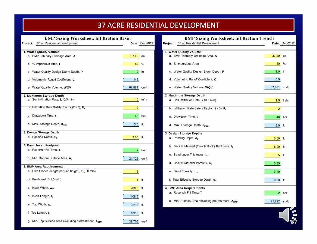
Project: 37 ac Residential Development Date: Dec-2012BMP Sizing Worksheet: Infiltration Basin
Project: 37 ac Residential Development Date: Dec-2012BMP Sizing Worksheet: Infiltration Trench
1. Water Quality Volumea. BMP Tributary Drainage Area, A 37.40 ac
b. % Impervious Area, I 50 %
c. Water Quality Design Storm Depth, P 1.0 in
1. Water Quality Volumea. BMP Tributary Drainage Area, A 37.40 ac
b. % Impervious Area, I 50 %
c. Water Quality Design Storm Depth, P 1.0 in
d. Volumetric Runoff Coefficient, C 0.5
e. Water Quality Volume, WQV 67,881 cu-ft
2. Maximum Storage Deptha. Soil Infiltration Rate, k (0.5 min) 1.5 in/hr
b I filt ti R t S f t F t (2 5) F 2
d. Volumetric Runoff Coefficient, C 0.5
e. Water Quality Volume, WQV 67,881 cu-ft
2. Maximum Storage Deptha. Soil Infiltration Rate, k (0.5 min) 1.5 in/hr
b. Infiltration Rate Safety Factor (2 - 5), Fs 2
c. Drawdown Time, t 48 hrs
d. Max. Storage Depth, dmax 3.0 ft
3. Design Storage Deptha Ponding Depth dp 3 00 ft
b. Infiltration Rate Safety Factor (2 - 5), Fs 2
c. Drawdown Time, t 48 hrs
d. Max. Storage Depth, dmax 3.0 ft
3. Design Storage Depthsa Ponding Depth d 0 00 fta. Ponding Depth, dp 3.00 ft
4. Basin Invert Footprintb. Reservoir Fill Time, T 2 hrs
c. Min. Bottom Surface Area, Ab 21,722 sq-ft
5. BMP Area Requirements
a. Ponding Depth, dp 0.00 ft
b. Backfill Material (Trench Rock) Thickness, lb 8.00 ft
c. Sand Layer Thickness, ls 0.5 ft
d. Backfill Material Porosity, nb 0.35
a. Side Slopes (length per unit height), z (3.0 min) 3
b. Freeboard, f (1.0 min) 1 ft
c. Invert Width, wb 200.0 ft
d. Invert Length, lb 108.6 ft
e. Sand Porosity, ns 0.40
f. Total Effective Storage Depth, dt 3.00 ft
4. BMP Area Requirementsa. Reservoir Fill Time, T 2 hrs
37
e. Top Width, wt 224.0 ft
f. Top Length, lt 132.6 ft
g. Min. Top Surface Area excluding pretreatment, ABMP 29,705 sq-ft
b. Min. Surface Area excluding pretreatment, ABMP 21,722 sq-ft
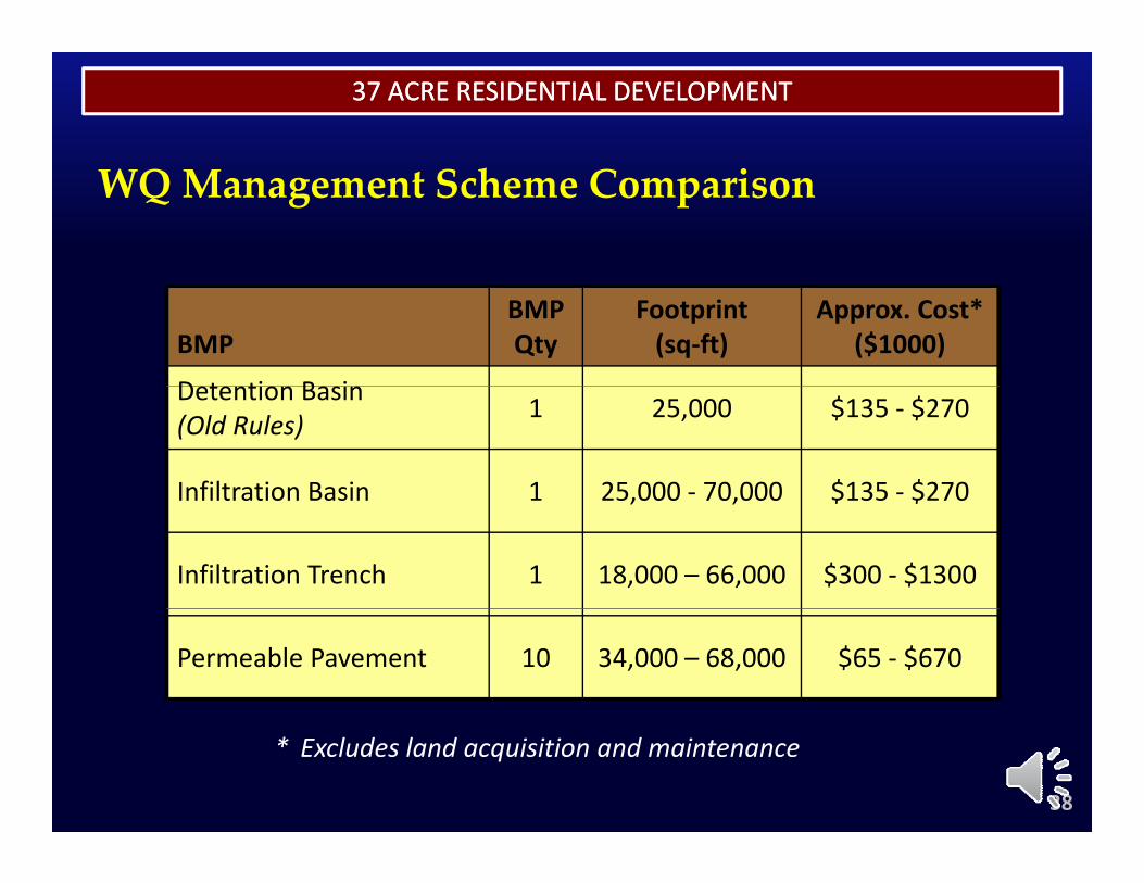
37 ACRE RESIDENTIAL DEVELOPMENT37 ACRE RESIDENTIAL DEVELOPMENT
WQ Management Scheme Comparison
BMPBMPQty
Footprint(sq‐ft)
Approx. Cost* ($1000)
D t ti B iDetention Basin(Old Rules) 1 25,000 $135 ‐ $270
Infiltration Basin 1 25,000 ‐ 70,000 $135 ‐ $270Infiltration Basin 1 25,000 70,000 $135 $270
Infiltration Trench 1 18,000 – 66,000 $300 ‐ $1300
Permeable Pavement 10 34,000 – 68,000 $65 ‐ $670
38
* Excludes land acquisition and maintenance
EXAMPLESEXAMPLES
Module Summaryy
39
EXAMPLESEXAMPLES
• Don’t wait until Layout is done to incorporate t lit t hwater quality management scheme
l h• LID is not always more expensive than non‐LID
• More than one LID Retention or LID Biofiltration scheme may work – compare options
• Using the Web Soil Survey is perfectly acceptable, b ill l i l R i BMP
40
but will result in larger Retention BMPs
EXAMPLESEXAMPLES
End of Module 4
41