Mobile Technology and Forestry - Extension Florence County · External battery and lightning cable....
27
Mobile Technology and Forestry Finding a Tool to Meet your Business Needs 15 TH ANNUAL SUSTAINABLE FORESTRY CONFERENCE PRESENTED BY: FORREST M. GIBEAULT - [email protected] ANALYSIS AND TECHNOLOGY SOLUTIONS OPERATIONS DIRECTOR, STEIGERWALDT LAND SERVICES JOHN WRIGHT – [email protected] FIELD TECHNOLOGY SUPPORT COORDINATOR – DIVISION OF FORESTRY WISCONSIN DEPARTMENT OF NATURAL RESOURCES April 4, 2019
Transcript of Mobile Technology and Forestry - Extension Florence County · External battery and lightning cable....

Mobile Technology and ForestryFinding a Tool to Meet your Business Needs
1 5 T H A N N U A L S U S TA I N A B L E F O R E S T R Y C O N F E R E N C E
P R E S E N T E D B Y:F O R R E S T M . G I B EAU LT - F O R R E S T. G I B E A U LT @ S T E I G E R WA L D T. C O MA N A LY S I S A N D T E C H N O LO G Y S O L U T I O N S O P E R AT I O N S D I R E C TO R , S T E I G E R WA L D T L A N D S E R V I C E S
J O H N W R I G H T – J O H N .W R I G H T @ W I S C O N S I N . G O VF I E L D T E C H N O LO G Y S U P P O R T C O O R D I N ATO R – D I V I S I O N O F F O R E S T R Y W I S C O N S I N D E PA R T M E N T O F N AT U R A L R E S O U R C E S
April 4, 2019

Progression of Field Computers and Technology
• Significant change in technology over the past 30 years• From adapting available tools …to… ruggedized field computers

What are your Business Needs?
• GIS or GPS technology integration• What tasks will you do?

What are your Business Needs?
• GPS Accuracy
5-6 meters with satellite triangulation
Standard Smart phone
2-3 meter accuracy (GNSS)
Smart phone with extensions Submeter GPS device
Best case, <30 cm accuracy (can connect via Bluetooth to virtually any device

Where do you Work?
• Cellular signal?• Internal GPS? Is that good enough?
Plan for connectivity issues and match system to your work environment

Where do you Work?

Finding the right mapping option
Avenza Maps

Mapping Options
Systems and CustomizationArcGIS App SuiteCollector, Navigator, Survey123
Trimble Terrain Navigator Pro
Fulcrum

Mapping Options
Everyday GIS
GIS Kit and GIS PROAvenza MapIt GIS GPS Fields Area Measure

Be flexible
• Building a flexible system• Hardware/software combinations
• Adapting
Android iOS

What about Timber Inventory?
• Internal vs. External uses• May need customization, be ready for
added costs
TALLTIMBER 3.5www.ttimber.com
• Tree volumetrics can differ greatly, make sure you understand how timber volume is estimated
SILVIATERRA

Choosing a Mobile System
• Old perspective – driven by hardware• New perspective – software options have improved
• May want to consider software/applications first
• Operating Systems• iOS – Apple• Android• Windows Mobile
• Old Windows CE• Windows desktop
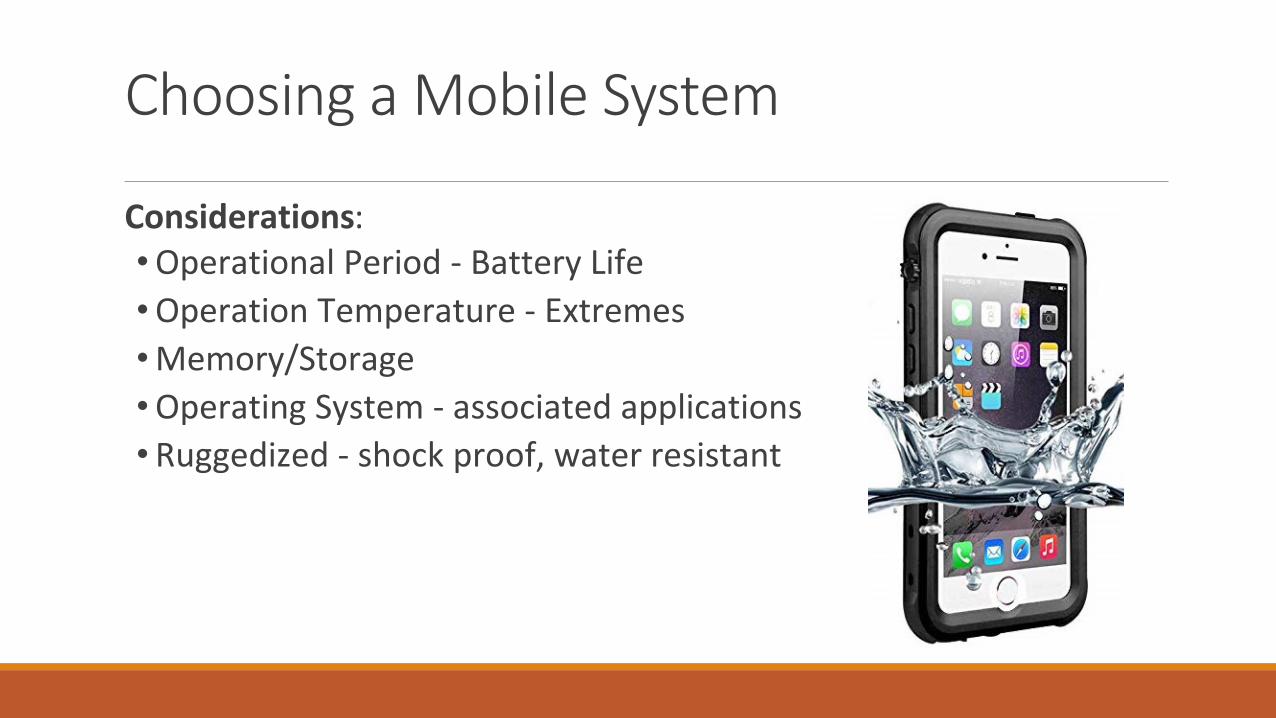
Considerations:• Operational Period - Battery Life• Operation Temperature - Extremes• Memory/Storage• Operating System - associated applications
Choosing a Mobile System
• Ruggedized - shock proof, water resistant

Considerations:
• Display size / resolution• full daylight use
• Keyboard?• Communication ports
Choosing a Mobile System
• GPS options• Integrated• Blue Tooth• Cellular triangulation

Choosing a Mobile System
Considerations:
• Support after purchase• Training

Apple iPad mini 4• iOS operating system• Screen size – 8” diagonal• Front and rear facing cameras• 128 Gigabyte memory• Bluetooth and Wi-Fi connectivity• Data enabled• AirDrop – Short range Wi-Fi• GPS integrated (AGPS / GLONASS)
WDNR Division of Forestry - Example
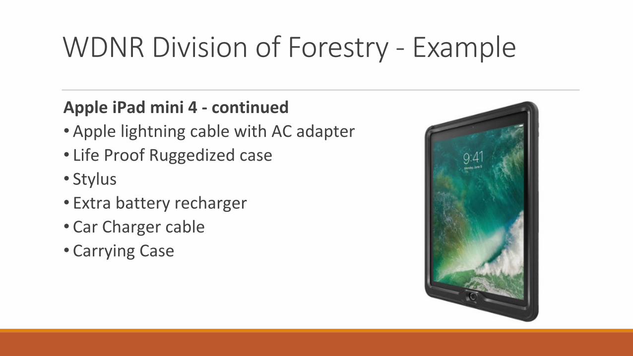
WDNR Division of Forestry - Example
Apple iPad mini 4 - continued• Apple lightning cable with AC adapter• Life Proof Ruggedized case• Stylus• Extra battery recharger• Car Charger cable• Carrying Case
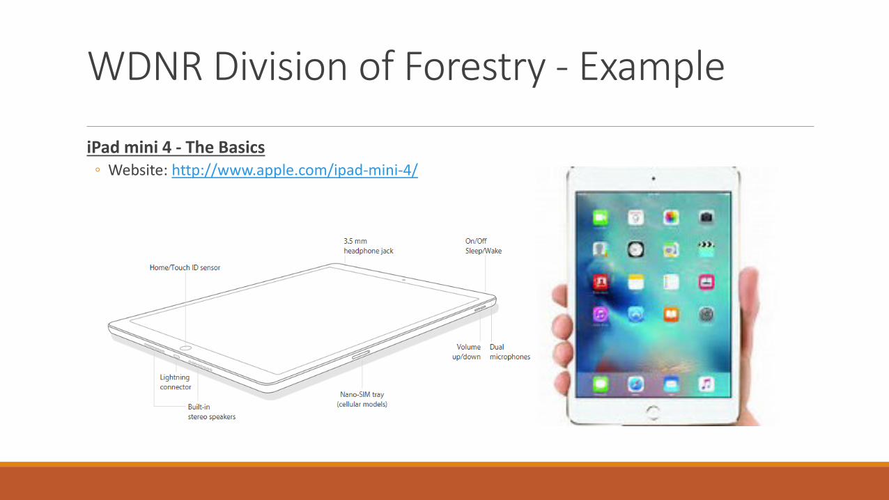
iPad mini 4 - The Basics◦ Website: http://www.apple.com/ipad-mini-4/
WDNR Division of Forestry - Example

•Forest Metrix Website: http://forestmetrix.com/wp2
•Lizardtech GeoViewerWebsite: https://www.lizardtech.com/geoviewer-pro/overview
•Avenza PDF MapsWebsite: http://www.avenza.com/avenza-maps
•Garafa GIS ProWebsite: http://garafa.com/wordpress/all-apps/gis-pro
WDNR Division of Forestry - Applications
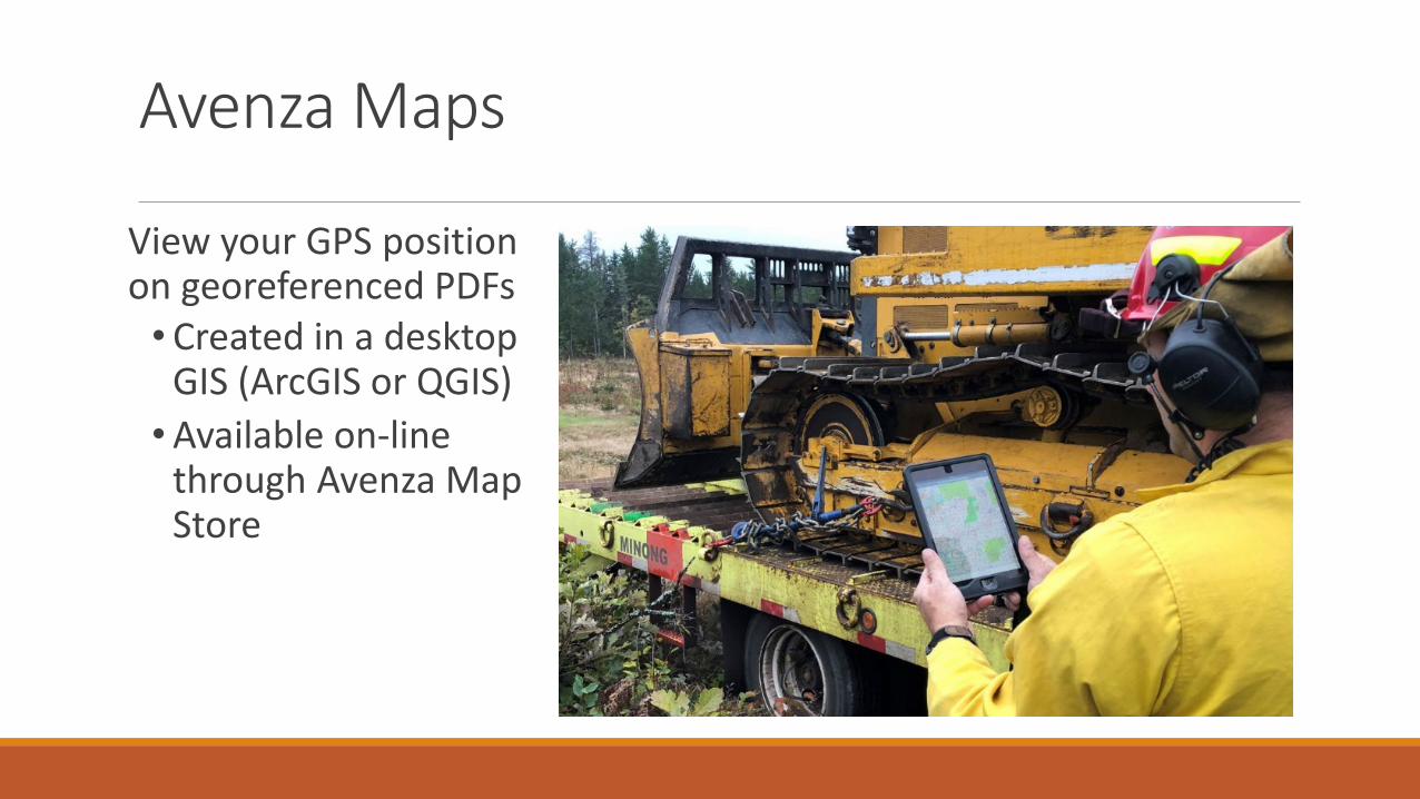
View your GPS position on georeferenced PDFs
• Created in a desktop GIS (ArcGIS or QGIS)
• Available on-line through Avenza Map Store
Avenza Maps
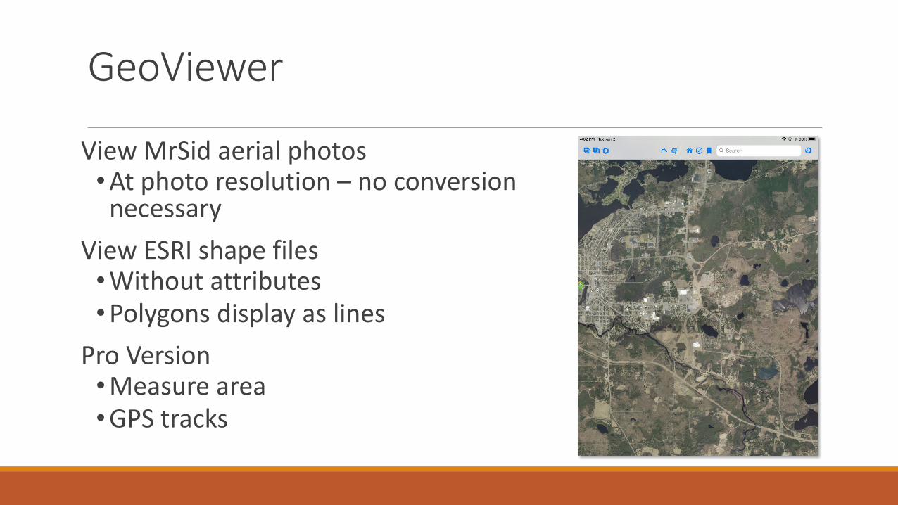
View MrSid aerial photos• At photo resolution – no conversion
necessaryView ESRI shape files• Without attributes• Polygons display as lines
Pro Version• Measure area• GPS tracks
GeoViewer

GIS Pro
ESRI Shape files• View and edit topology• View and edit attributes
Limited projections• State aerial photos can’t be
used (see GeoViewer)• Shape files projected to
Lat./Long.Cached background maps
• Data plan or Wi-Fi

Forest Metrix
Runs through Apple’s File Maker Go (iOS only - free app)
• Plot level data capture• Stand/Tract level summaries• Simple analysis in the field• On board reporting - PDFs
Desktop report engine• Further analysis in the office• Macro enabled excel spread sheet

165 devices – Field Deployed 2 ½ Years 3 units warranteed• 1 – malfunctioning Bluetooth
antenna
WDNR Division of Forestry – Lessons Learned
• 1 – User left rugged case port open in heavy rain
• 1 – User fell with unit and scratched screen

iPad charging• Not all chargers are created equal• 110AC wall plug that comes with the iPad - full 2.1 A• 110AC wall plug that comes with an iPhone – 1.1 A – charge iPad
½ as fast
WDNR Division of Forestry – Lessons Learned
USB PC/Laptop charging• Not all USB ports are created equal• USB 2.0 or 3.0 charging port
supports up to 1.5 A, will charge when laptop is offIntegrated GPS vs Cellular Triangulation

Battery mitigation• Location data services• Airplane Mode• Display• On/off• Brightness
External battery and lightning cable
WDNR Division of Forestry – Lessons Learned
All data transferred using iTunes• Except photos on Windows PC
Plan field work disconnected
Bring compass, paper and pencil !

Questions?