Milton Keynes Landscape Character Assessment MK... · participatory workshop held at the draft...
72
Milton Keynes Landscape Character Assessment June 2016 FINAL
Transcript of Milton Keynes Landscape Character Assessment MK... · participatory workshop held at the draft...

Milton KeynesLandscape Character Assessment
June 2016
FINAL

Milton Keynes Landscape Character AssessmentFinal ReportPrepared by Gillespies LLPJune 2016
1 St John’s SquareLondon, EC1M 4DH
T: +44 (0)207 253 2929F: +44 (0)207 253 3900
www.gillespies.co.uk

1 Introduction2 Methodology3 The Landscape Character of Milton Keynes Clay Plateau Farmland River Valley Clay Plateau Farmland with Tributaries Clay Lowland Farmland Undulating Clay Farmland Greensand Ridge
459111931394555
01 Study Area02 National Character Areas03 Landscape Character Types in Adjoining Administrative Areas04 Local Context05 Topography06 Landscape Character Types and Landscape Character Areas07 Areas of Landscape Interest and Landscape Designations08 Local Plan Designations
Contents
Acknowledgements
Gillespies LLP prepared this report on behalf of Milton Keynes District. We are grateful for the guidance provided by the Council and information provided by local stakeholders through a participatory workshop held at the draft stage of the report. We also acknowledge that the format and structure of the character area and landscape type descriptions reflects that set out by the Landscape Partnership for the Draft Milton Landscape Character Assessment produced in 2007.
A Field Survey SheetB Summary of Public Consultation C Reference Documents
Figures (see separate document)
Appendices
606271
Milton Keynes Landscape Character Assessment
METHODOLOGY
4
1. Introduction
Landscape Character Assessment
Landscape character may be defined as:
’...a distinct and recognisable pattern of elements or of characteristics in the landscape that make one landscape different from another, rather than better or worse’1.
Landscape Character Assessment is the process of identifying and describing variation in the character of the landscape. It seeks to identify and explain the unique combination of elements and features (characteristics) that make landscape distinctive. Landscape Character Assessment not only helps us to understand our landscapes, it also assists in informing judgements and decisions concerning the management of change.
Purpose of the Report
The Milton Keynes Landscape Character Assessment (MKLCA) has been prepared by Gillespies on behalf of Milton Keynes Council. This assessment provides a detailed review of the landscape character of the rural areas of Milton Keynes Borough (the Borough). The study area for this assessment is set out in Figure 01.
The MK LCA was commissioned to provide a greater understanding of the landscape character of the Borough. It will form part of the evidence base that will be used by Milton Keynes Council to inform the preparation of the new Local Plan ‘Plan:MK’ and associated Development Plan Documents. Milton Keynes Council recently undertook consultation with the public on the main policy issues as part of the preparation of the local plan.
A previous landscape character assessment of the Borough was undertaken by The Landscape Partnership. The Draft Landscape Character Assessment of Milton Keynes was published in 2007 (2007 Draft Assessment). The MK LCA builds on the work undertaken for the draft assessment.
Structure of the Report
The remainder of this report is structured as follows:
� Section 2: Methodology: Summarises the context and approach for undertaking the assessment.
� Section 3: The Landscape Character of Milton Keynes: Provides an overview of the landscape character of the Borough and describes and evaluates Landscape Character Types (LCTs) and Landscape Character Areas (LCAs) within the Borough.
A separate landscape sensitivity and capacity study (An Assessment of the Landscape Sensitivity to Onshore Wind Turbine and Field-Scale Photovoltaic Development in Milton Keynes 2015)was produced to assess the sensitivity of each LCT within the Borough to wind turbine and solar PV development and identifies where particular areas may have greater or less capacity to accommodate such development.
1Tudor,Christine, Natural England, (2014) An Approach to Landscape Character Assessment Page 8
INTRODUCTION

METHODOLOGY
Milton Keynes Landscape Character Assessment 5
Policy and Guidance
This assessment follows the accepted method for landscape character assessment as set out in An Approach to Landscape Character Assessment published by Natural England in 2014.2 The European Landscape Convention (ELC) defines ‘landscape’ as:
…’an area, as perceived by people, whose character is the result of the action and interaction of natural and/or human factors.’
The ELC is important in that it recognises that all landscapes matter, be they outstanding, ordinary or degraded. It puts emphasis on the whole landscape and all its value. Guidelines on the implementation of the ELC in the Planning Practice Guidance (PPG) encourage the use of Landscape Character Assessment as a tool to promote understanding of the landscape and to form the basis for policies and plans which apply to the whole landscape. PPG/Natural Environment/Landscape/ID-8 Landscape Para 001 states:
‘One of the core principles in the National Planning Policy Framework is that planning should recognise the intrinsic character and beauty of the countryside. Local plans should include strategic policies for the conservation and enhancement of the natural environment, including landscape. This includes designated landscapes but also the wider countryside.
Where appropriate, landscape character assessments should be prepared to complement Natural England’s National Character Area profiles. Landscape Character Assessment is a tool to help understand the character and local distinctiveness of the landscape and identify the features that give it a sense of place. It can help to inform, plan and manage change and may be undertaken at a scale appropriate to local and neighbourhood plan-making. Natural England provides guidance on undertaking these assessments.’
This local landscape character assessment has been prepared within the overarching framework of the Natural England National Character Areas (NCAs). NCAs divide England into 159 distinct natural areas. Each is defined by a unique combination of landscape, biodiversity, geodiversity, history, cultural and economic activity. Their boundaries follow natural lines in the landscape rather than administrative boundaries. The Borough of Milton Keynes includes parts of the three following NCAs (see Figure 02):
� Area 88 Bedfordshire and Cambridgeshire Claylands
� Area 90 Bedfordshire Greensand Ridge
� Area 91 Yardley-Whittlewood Ridge
The NCA profiles which describe each of the NCAs can be viewed electronically on the Natural England website.
Landscape does not stop at administrative boundaries. This assessment is undertaken with reference to published Landscape Character Assessments undertaken for the Local Authorities surrounding Milton Keynes. The landscape of these surrounding areas have an indirect effect on the landscape character of the Borough. This can be seen most clearly around the Salcey Forest and Yardley Chase LCA in Northamptonshire, which forms a backdrop to the landscape of the Yardley Clay Plateau Farmlands LCA. The MK LCA considers the following assessments:
� The Aylesbury Vale Landscape Character Assessment (2008)
� Bedford Borough Landscape Character Assessment (2014)
� Central Bedfordshire Landscape Character Assessment (2015)
� Northamptonshire County Council Current Landscape Character Assessment (2006)
The LCTs and LCAs defined in these studies and their boundaries have been reviewed as part of this assessment to ensure that where possible there is cross authority consistency and are shown in Figure 03.
Reference was also made to the Buckinghamshire & Milton Keynes Historic Landscape Characterisation (2006) which provides an overview of the historic changes in landcover and field pattern.
2Tudor, Christine, Natural England (2014) An Approach to Landscape Character Assessment
2. Methodology

Milton Keynes Landscape Character Assessment
METHODOLOGY
6
Approach
The hierarchy of landscape classification set out in ‘An Approach to Landscape Character Assessment’ was used to classify and describe the landscape in terms of Landscape Character Types (LCTs) and Landscape Character Areas (LCAs);
� ‘Landscape Character Types (LCTs) are distinct types of landscapes that are relatively homogeneous in character. They are generic in nature in that they may occur in different areas in different parts of the country, but wherever they occur they share broadly similar combinations of geology, topography, drainage patterns, vegetation, historical land use and settlement pattern. LCT may or may not be contiguous.’
� ‘Landscape Character Areas (LCAs) are single unique areas which are the discrete geographical areas of a particular LCT. Each has its own individual character and identity, even though it shares the same generic characteristics with other types’3.
Assessment
The methodology used in this report aims to be transparent, objective and robust. Geographic Information Systems (GIS) was used throughout the assessment as the tool for collating, manipulating and presenting data.
The assessment has involved the following stages:
� Desk Study: This stage involved the collation and mapping of a wide range of existing information on the characteristics of Milton Keynes which was used to review the 2007 Draft Assessment. Appendix C includes a list of documents and mapping used.
� Field survey: A field survey was undertaken to review the boundaries of the LCTs and LCAs. The field survey tested the findings of the desk study, recorded key sensitivities and noted particular enhancement opportunities. Information was recorded on Field Survey Sheets (see Appendix A). Landscape character rarely changes abruptly and the boundaries in the MK LCA sometimes represent zones of transition in character rather than marked changes on the ground. Boundaries have either been drawn to follow contours or features on the ground such as, roads, or field boundaries.
Presentation of Results
A detailed description of the landscape characteristics of each LCT is provided. This is followed by a brief description of each landscape character areas within the type.
Information is presented as follows:
Category Characteristic
NATURAL
CULTURAL AND SOCIAL
PERCEPTUAL AND AESTHETIC
GEOLOGY AND SOILS
LANDFORM
HYDROLOGY
LANDCOVER AND LAND USE`
CULTURAL ASSOCIATIONS, TRANQUILLITY ETC.
RECREATIONAL LAND USE
SETTLEMENT
INFRASTRUCTURE AND TRANSPORT
ENCLOSURE
HERITAGE
Further information is provided for each LCT as follows:
� Landscape Condition and Change: the condition of the landscape and how strongly key characteristics are conveyed.
� Landscape Guidelines: actions required in order to ensure that the distinctive character of the LCT is maintained.
3 Tudor, Christine, Natural England, (2014) An Approach to Landscape Character Assessment page 54
Milton Keynes Landscape Character Assessment 7
METHODOLOGY
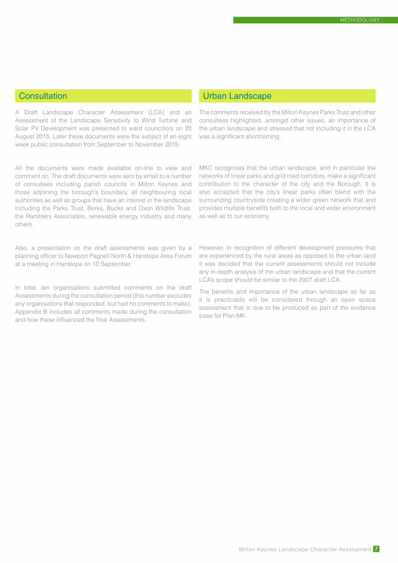
Consultation
A Draft Landscape Character Assessment (LCA) and an Assessment of the Landscape Sensitivity to Wind Turbine and Solar PV Development was presented to ward councillors on 20 August 2015. Later these documents were the subject of an eight week public consultation from September to November 2015.
All the documents were made available on-line to view and comment on. The draft documents were sent by email to a number of consultees including parish councils in Milton Keynes and those adjoining the borough’s boundary, all neighbouring local authorities as well as groups that have an interest in the landscape including the Parks Trust, Berks, Bucks and Oxon Wildlife Trust, the Ramblers Association, renewable energy industry and many others.
Also, a presentation on the draft assessments was given by a planning officer to Newport Pagnell North & Hanslope Area Forum at a meeting in Hanslope on 10 September.
In total, ten organisations submitted comments on the draft Assessments during the consultation period (this number excludes any organisations that responded, but had no comments to make). Appendix B includes all comments made during the consultation and how these influenced the final Assessments.
Urban Landscape
The comments received by the Milton Keynes Parks Trust and other consultees highlighted, amongst other issues, an importance of the urban landscape and stressed that not including it in the LCA was a significant shortcoming.
MKC recognises that the urban landscape, and in particular the networks of linear parks and grid road corridors, make a significant contribution to the character of the city and the Borough. It is also accepted that the city’s linear parks often blend with the surrounding countryside creating a wider green network that and provides multiple benefits both to the local and wider environment as well as to our economy.
However, in recognition of different development pressures that are experienced by the rural areas as opposed to the urban land it was decided that the current assessments should not include any in-depth analysis of the urban landscape and that the current LCA’s scope should be similar to the 2007 draft LCA.
The benefits and importance of the urban landscape as far as it is practicable will be considered through an open space assessment that is due to be produced as part of the evidence base for Plan:MK.

Milton Keynes Landscape Character Assessment8
METHODOLOGY
This pageIntentionally
left blank

THE LANDSCAPE CHARACTER OF MILTON KEYNES
Milton Keynes Landscape Character Assessment 9
3. The Landscape Character of Milton Keynes
Landscape Overview
The Borough of Milton Keynes is a unitary authority that lies to the south west of Buckinghamshire County. It adjoins Aylesbury Vale District (Buckinghamshire) to the south west, Bedford Borough and Central Bedfordshire to the south and east and Northamptonshire County to the north (see Figure 04).
The urban area of Milton Keynes makes up a high percentage of the Borough, with less than 15% of the population of the Borough living in the surrounding rural areas. This assessment provides a detailed review of the landscape character of the rural areas of the Borough, and does not assess areas within the development boundary of Milton Keynes. Since its designation as a new town in 1967, Milton Keynes has grown into a regionally important town with a population of 255,700 (2013) with projections for its continued expansion, making it one of the most rapidly expanding urban areas in Western Europe. A significant portion of that expansion will be concentrated in the designated Expansion Areas and the Strategic Land Allocation around Milton Keynes. However, areas close to the fringes of Milton Keynes and the key settlements, mainly Newport Pagnell and Olney are under new development pressure for further expansion which is likely to have a continuing impact on the character of the adjacent rural areas. The urban areas of the Borough together with major infrastructure developments including the M1 and other principal roads, have had a major influence on local landscape character.
The landscape of the Borough is the result of both natural and man-made processes. The underlying geology has determined landform and influenced land cover through soil composition (see Figure 05). The landform continues to be shaped by erosion and deposition. The landscape has evolved further through centuries of human interaction. Ongoing change driven by social, economic and natural factors will continue to shape the landscape in the future. Landscape Character Assessment can only offer a point-in-time picture of the landscape but sets a baseline against which future change can be managed.
The landscape of the Borough is predominantly characterised by an undulating clayland plateau which is divided by the shallow river valleys of the Ouse and Ouzel. To the fringes of the authority are two contrasting landscape types; a steep greensand ridge to the south and a limestone plateau on the northern boundary of the Borough. The Natural England NCAs that cover the Borough broadly reflect these variations (see Figure 02).
Away from the urban areas, the Borough’s landscape has a predominantly rural character despite the rapid expansion of Milton Keynes. The landscape is dominated by agricultural land use with dispersed villages and farmsteads. Pasture is more common in the river valleys with arable cultivation dominating the plateaus. The valley floor of the Ouse comprises a number of important flood meadows which still support traditional grazing however in many areas the ground is cultivated up to the river. The Ouse Valley includes a number of restored and active mineral extraction sites many of which have been restored for wildlife and recreational uses. The poorer soils of the limestone plateau to the north and the greensand ridge to the south support a high proportion of woodland.
Buckinghamshire & Milton Keynes Historic Landscape Characterisation (2006) provides an overview of historic changes in landcover and field pattern. Although there are many areas that are dominated by larger modern field patterns, older field patterns can still be found, most of which are ‘Pre 18th Century Irregular Enclosure’ or more regular ‘Parliamentary Enclosure’.
Settlement in the rural areas of Milton Keynes is often historic, ranging from picturesque villages to the individual houses, churches with prominent spires, and a number of historic parklands and estates. The range of building materials found within the area reflects the natural geology, making an important contribution to local architectural character and sense of place. Warm coloured limestone buildings characterise the Ouse Valley, while the distinctive local greensand is used in older buildings on the Brickhills. On the upland plateaus east of the River Ouse, local building materials comprise red brick and some timber frame. Many of the more prominent buildings in the Borough are built from imported stone, such as the churches at Olney and Gayhurst and fine houses such as Tyringham.
The elements and features that are present in the Borough combine to create a variety of landscapes, each displaying distinctive patterns of landform, vegetation and landscape elements.

Milton Keynes Landscape Character Assessment
THE LANDSCAPE CHARACTER OF MILTON KEYNES
10
Landscape Classification
The landscape of the Borough has been classified into the following LCTs and LCAs (see Figure 06):
Landscape Character Type (LCT)
Landscape Character Type (LCT)
Landscape Character Area (LCA)
Landscape Character Area (LCA)
NCA 91 YARDLEY-WHITTLEWOOD RIDGE
NCA 88 BEDFORDSHIRE AND CAMBRIDGESHIRE CLAYLANDS
2 RIVER VALLEY
2a TOVE RURAL RIVER VALLEY
2b OUSE RURAL RIVER VALLEY
2c OUSE URBAN RIVER VALLEY
2d OUZEL NORTH URBAN RIVER VALLEY
2e OUZEL SOUTH URBAN RIVER VALLEY
3 CLAY PLATEAU FARMLAND WITH TRIBUTARIES3a NORTH CRAWLEY CLAY PLATEAU FARMLAND WITH TRIBUTARIES
3b WEALD CLAY PLATEAU FARMLAND WITH TRIBUTARIES
4 CLAY LOWLAND FARMLAND4a BROUGHTON TO TICKFORD CLAY LOWLAND FARMLAND
4b WAVENDON CLAY LOWLAND FARMLAND
5 UNDULATING CLAY FARMLAND5a OUSE NORTH UNDULATING CLAY FARMLAND
5b OUSE SOUTH UNDULATING CLAY FARMLAND
5c TOVE UNDULATING CLAY LOWLAND FARMLAND
1 CLAY PLATEAU FARMLAND 1a YARDLEY CLAY PLATEAU FARMLAND
1b HANSLOPE CLAY PLATEAU FARMLAND
Landscape Character Type (LCT) Landscape Character Area (LCT)
NCA 90 BEDFORDSHIRE GREENSAND RIDGE
6 GREENSAND RIDGE 6a BRICKHILL GREENSAND RIDGE

LCT 1 CLAY PLATEAU FARMLAND
Milton Keynes Landscape Character Assessment 11
1b
1a
LCT 1 Clay Plateau Farmland
Character AreasLCA 1a YARDLEY CLAY PLATEAU FARMLAND
LCA 1b HANSLOPE CLAY PLATEAU FARMLAND
Key Characteristics
� Gently undulating plateau landscape
� Large to medium scale mixed woodlands, linking with the extensive woods of Yardley Chase and Salcey Forest in Northamptonshire. More isolated woodlands within Hanslope Clay Plateau Farmland LCA 1b
� Extensive areas of woodland in Northamptonshire form a backdrop to this LCT
� Medium to large arable fields with clipped hedges
� Areas of pasture and smaller fields closer to the settlements
� Sparsely settled rural landscape crossed by minor roads (with the exception of the M1 in LCA 1b)
� Extensive views over neighbouring valleys

Milton Keynes Landscape Character Assessment
LCT 1 CLAY PLATEAU FARMLAND
12
Location and Introduction
This LCT comprises the southern extension of the Yardley Whittlewood Ridge National Character Area (NCA 91) that largely lies in neighbouring Northamptonshire and runs along the northern boundary of the Borough. The Clay Plateau Farmland LCT represents the southern edge of NCA 91 which is a low and gently undulating plateau referred to locally as the Ridge. It runs in a south west to north east direction between Northampton and Milton Keynes.
Two character areas have been identified. These represent separate and distinct areas of the plateau. The more northerly character area, the Yardley Clay Plateau Farmland LCA 1a, is a narrow strip of land on the northern edge of the Borough. It forms an apron of land and foreground to the heavily wooded Yardley Chase and Salcey Forest LCA to the north in Northamptonshire. This is a marked plateau landscape with Salcey Forest and Yardley Chase providing the impression of continuous woodland cover on the skyline.
By contrast, the Hanslope Clay Plateau Farmland LCA 1b is a wider and more open undulating landscape. It contains a number of large but generally disconnected woods. LCA 1b lies in part within NCA 88 Bedfordshire and Cambridgeshire Claylands, which contributes to its distinctiveness within the LCT. Although sharing many characteristics with the Yardley Clay Plateau Farmland LCA 1a to the north a thick mantle of boulder clay has created a softer, more undulating landscape where the influence of the underlying solid geology has been obscured. The rural landscape of LCA 1b is centred on the village of Hanslope.
Natural
GEOLOGY AND SOILS
The underlying geology of this area of Jurassic Oolitic limestone has helped to create the distinctive plateau present today. This limestone is more porous than some of the surrounding geology and aquifers can be found under parts of the ridgeline. Glacial activity subsequently eroded and smoothed out the original limestone and left behind substantial, irregular deposits of boulder clay on top of the base rock. These deposits are most substantial over the Hanslope Clay Plateau Farmland LCA 1b. The soils that overlay this geology can be variable but most have a high clay content. In parts of both LCAs, these clayey soils can be slowly permeable and subject to seasonal waterlogging, with a higher calcareous content on some of the slopes. Within much of the Hanslope Clay Plateau Farmland LCA 1b, soils tend to be more calcareous clayey soils with some risk of water erosion. Woodland clearance has been less than elsewhere within the Borough as a result of the relatively poor soils combined with the topography outlined below.
LANDFORM
The LCT comprises a simple, gently undulating plateau on the edge of a much larger and more prominent plateau that continues over the Borough boundary into Northamptonshire which runs in a south-west, north-east direction. Within the Yardley Clay Plateau Farmland LCA 1a the slopes fall south towards the Ouse Valley at an average of around 1 in 30 with localised steeper slopes. The Hanslope Clay Plateau Farmland LCA 1b has gentler slopes of around 1 in 50, falling from its centre towards its eastern, western and southern edges. There are more localised slopes of around 1 in 15 or steeper, particularly around streams and springs.
HYDROLOGY
The area forms part of a major watershed between the River Great Ouse to the south and the River Nene, to the north, which lies outside the Borough boundary, in Northamptonshire. Many streams and springs have their source at or close to the edge of the LCT and flow down to the River Great Ouse to the south and east and to the River Tove to the west. Throughout the area there are many ponds and a number of small agricultural reservoirs.
LAND COVER AND LAND USE
The majority of the land use is arable with both large to medium fields. There are smaller areas of pasture often near settlements or on remnant ridge and furrow, such as Park Farm, Tathall End.
The woodland cover within the LCT is an important characteristic. Within the Yardley Clay Plateau Farmland LCA 1a the woodlands link with extensive woodlands to the north. The resulting seemingly continuous wooded horizon is distinctive when viewed from the surrounding lowlands. On the Hanslope Clay Plateau Farmland LCA 1b there is limited connection between the woodlands.
The woods are mainly ancient/semi-natural in origin, for example Great Wood, Little Linford Wood, Gayhurst Wood and Stokepark Wood. However there are also a number of areas of replanted conifers. Yardley Chase, predominantly in Northamptonshire, is designated as a SSSI for its wide variety of semi-natural habitats. Within the Yardley Clay Plateau Farmland LCA 1a the poorer calcareous soils support a number of species-rich hedges including a high proportion of Viburnum lantana.

LCT 1 CLAY PLATEAU FARMLAND
Milton Keynes Landscape Character Assessment 13
Cultural and Social
RECREATIONAL LAND USE
There are relatively few Public Rights of Way (PRoW) within the Yardley Clay Plateau Farmland LCA 1a and none which cross into the Yardley Chase woodlands in Northamptonshire. Within the Hanslope Clay Plateau Farmland LCA 1b there are a far greater number of PRoW with many local connections around Hanslope village. Several promoted routes, Milton Keynes Boundary Walk, Swan’s Way, the Midshires Way and the Hanslope Circular Ride all cross the area providing panoramic views across the Ouse and Tove Valleys. Many of these long distance routes pass through Little Linford Woods, a local nature reserve. Salcey Forest including the Tree Top Trail in Northamptonshire is a local attraction for local residents and visitors to the area. Most recreation is informal including walking, cycling and horse riding with stabling provided in a few locations.
SETTLEMENT
Settlement within Yardley Clay Plateau Farmland LCA 1a is sparse and consists of a few isolated traditional farms. This pattern is similar over much of the Hanslope Plateau Farmland LCA 1b with the exception of Hanslope village and the linked hamlet of Long Street. This large village has a mixed character with an attractive village core including a number of vernacular buildings, but also a number of 20th century residential estates which detract from the local character. St James Parish church (Grade 1 listed) has a prominent tower and the tallest spire in Buckinghamshire, which creates a prominent landmark throughout the character area and beyond. The small hamlet of Tathall End, to the south east of Hanslope, includes a number of attractive limestone cottages. Bridges cross a contained stream to the front of the cottages that flows south to the River Great Ouse.
INFRASTRUCTURE AND TRANSPORT
There are few roads in the Yardley Clay Plateau Farmland LCA 1a. It is crossed by the A428 between Northampton and Bedford, the A509 running north from Milton Keynes and the B5388 from Olney.
The Hanslope Clay Plateau Farmland LCA 1b is dissected by the M1 which creates a locally prominent visual and audible feature. Elsewhere the landscape is characterised by a network of minor sinuous lanes. The disused railway between Northampton and Bedford crosses the area running south east from Great Wood.
ENCLOSURE
The pattern of remnant woodlands and irregular field boundaries in this LCT is a result of assarting, the conversion of areas of woodland to arable fields that took place between the 15th and 17th centuries which are particularly evident in the Hanslope Clay Plateau Farmland LCA 1a. There are also strong patterns of irregular pre-18th century enclosure, for example north of Ravenstone in LCA 1b. Around Hanslope, within LCA 1b there is an intact pattern of 18th and 19th century parliamentary enclosures although elsewhere 20th century amalgamations have created some larger fields.
There are a number of large mature field oaks close to Yardley Chase and hedgerow oaks around Hanslope village. Hedges are variable being evident and in good condition along the minor roads but typically in poorer condition within field boundaries.
HERITAGE
Yardley Chase in neighbouring Northamptonshire was once part of a much more extensive medieval royal hunting forest when the woodland cover would have been more extensive over the whole plateau. The Domesday Book and archaeological excavations have shown that pig grazing for panage (eating acorns) was common in the area in the medieval period. A Royal Hunting Lodge was located at Grafton Regis in Northamptonshire.
Hanslope Park, the only notable parkland in the area, was visited by Humphry Repton in 1791. Plans and sketches for the park were produced in one of his ‘Red Books’ in 1792 for the owner Edward Watts although it is debatable how many of these ideas were implemented. The Park is now occupied by the Foreign & Commonwealth Office (Technical Security Department of the Secret Intelligence Service). As a result, there are a number of ancillary office buildings, radio masts and security fencing. Although vestiges of the historic parkland remain it is not on the Register of Historic Parks and Gardens.

Milton Keynes Landscape Character Assessment
LCT 1 CLAY PLATEAU FARMLAND
14
Perceptual and Aesthetic
Much of this LCT is tranquil, accessed only by a number of minor roads and lanes. There are few public rights of way, although the Milton Keynes Boundary Walk passes through the area. The Yardley Clay Plateau Farmland LCA 1a has a remote character emphasized by the restricted public access and the distinct horizon of woodland. The M1 occupies a central swathe of the Hanslope Clay Plateau Farmland LCA 1b, bringing local visual, noise and light intrusion. Recent and continuing built development at Hanslope Park is locally intrusive in the otherwise open landscape and the lighting of this development causes some visual intrusion at night.
From LCA 1a there are panoramic views to the south over the Ouse Valley. From LCA 1b there are extensive views to the south towards the built edge of Milton Keynes and to the east and west over the rural valley of the Ouse and to the Tove.

LCT 1 CLAY PLATEAU FARMLAND
Milton Keynes Landscape Character Assessment 15
N
Km
0 1 20.5
LCT 1 Character Areas
LCA 1a YARDLEY CLAY PLATEAU FARMLAND
The Yardley Clay Plateau Farmland LCA is the smaller of the two landscape character areas. It occurs on the northern edge of the authority extending between the B526 and Salcey Forest to the west, and Lavendon Wood to the east. It forms a narrow strip of land on the edge of a larger plateau which extends north into Northamptonshire. The plateau which maintain a height between
90-115m AOD, forms the watershed between the Rivers Great Ouse to the south and River Nene to the north and within the LCA it falls south towards the Ouse Valley. There is a relatively high proportion of woodland within the area which links with the extensive woodlands to the north and together provide the impression of continuous woodland cover on the skyline. The majority of the land use is arable with smaller areas of pasture near farmsteads. The landscape is very rural with only a few scattered farms. This is a relatively tranquil remote area accessed by few roads although there are extensive views to the south towards Milton Keynes.

Milton Keynes Landscape Character Assessment
LCT 1 CLAY PLATEAU FARMLAND
16
Km
N
0 0.8 1.60.4
LCT 1 Character Areas
LCA 1b HANSLOPE CLAY PLATEAU FARMLAND
This is a wider and more open plateau landscape containing a number of large but generally disconnected woods. The Hanslope Clay Plateau Farmland LCA 1b forms the watershed between the River Great Ouse and the River Tove. The LCA has gentle slopes falling from its centre towards its eastern, western and southern edges. It ranges from approximately 90m AOD to a high point of
approximately 122m AOD near Long Street. There are a number of ancient semi-natural woodlands but with limited connections between them. In addition there are small areas of recent woodland planting that appear to be used for game-cover. The majority of the land use is arable with smaller areas of pasture. Settlement is limited except for the large village of Hanslope with its prominent church spire. This is a remote area accessed only by a number of minor roads but crossed by the M1. There are some open views to the west across the rural Tove valley landscape. Hanslope Park is the only notable parkland in the area.

LCT 1 CLAY PLATEAU FARMLAND
Milton Keynes Landscape Character Assessment 17
Landscape Condition and Change
The Clay Plateau Farmland LCT retains a productive rural character, but it is also of scenic interest due to its distinctive landform and pattern of ancient woodlands and historic field boundaries that have developed over the centuries. On the whole, it is well maintained and appears intensively managed and generally retains a strong character.
Many of the remaining areas of coppice are falling into neglect. There has been no replacement with other forms of woodland management. Other woodlands have been replanted with conifers, which reduces their visual appeal and nature conservation value.
Beyond the woodlands, areas of unimproved grassland and small natural field ponds have been lost through improvement and cultivation, hedgerow removal is also a significant factor. These are important as they contribute to local character through the field patterns they create. They also provide green links between areas of woodland.
LCA 1a YARDLEY CLAY PLATEAU FARMLAND
The landscape is considered to be in a good condition. There is a little impact from built development which results in the area as a whole being considered to be visually unified. Field pattern and hedgerow field boundaries are largely intact and woodland and tree cover is extensive. The extent of semi-natural habitat survival (in particular woodland) is widespread with a mixed age structure.
Landscape change in this area has been minimal and where change has taken place it is the result of agricultural development and changes in land management practices.
LCA 1b HANSLOPE CLAY PLATEAU FARMLAND
The landscape is considered to be in a moderate condition. The impact of built development is localised, with development evident around Hanslope and Hanslope Park and along the M1 corridor. This has resulted in fragmentation to the key landscape characteristics locally. There is a fragmentation of field pattern across the LCA. The extent of semi-natural woodland survival is scattered. Species within the woodlands are varied and the age structure is mixed.
Guidelines
LANDSCAPE MANAGEMENT
Manage and protect existing woodland and promote their extension
� Encourage progressive conversion of conifer plantations within existing woodlands to indigenous native broadleaved tree and shrub species using local provenance stock, particularly in semi natural ancient woodland of Great Wood, Little Linford Wood, Gayhurst Wood and Stokepark Wood.
� Manage existing broadleaved woodland to maximise diversity and continuity through a range of measures including high forest, coppice, with standards and wood pasture.
� Protect and seek to extend the network of medium to large scale woodlands in the arable landscape providing enhanced links between ancient woodland habitats utilising historic hedge and field boundaries to locate the most appropriate location for wood restoration and expansion. New woods should also frame important views and emphasise landform patterns.
Protect, restore and enhance the network of existing hedgerows
� Encourage the protection and restoration of boundary hedges by coppicing, laying and gapping up to improve the network of linkages between habitats.
� Promote the introduction of new hedges following either roads, PRoW, historic boundaries and/or routes that visually emphasise the character of the landscape.
� Encourage the planting of individual hedgerow trees to provide replacement for mature and over mature stock.
Promote enhancements for wildlife through habitat improvements
� Promote both the creation of new ponds and the retention / enhancement for wildlife of existing ponds.
� Encourage the provision of uncropped or grass field margins to link areas of wildlife importance and/or existing and proposed PRoW.
� Identify locations on more marginal arable land where reversion from arable to species rich grassland can be encouraged particularly where adjacent to similar existing habitats.
Milton Keynes Landscape Character Assessment
LCT 1 CLAY PLATEAU FARMLAND
18
Management of recreation in the area
� Promote the continued use of the area for quiet informal recreation.
� Support initiatives by agencies in neighbouring Northamptonshire that will have a positive impact on the conservation of landscape character e.g. River Nene Regional Park for the enhanced management and access to Yardley Chase and Salcey Forest.
� Extend interpretation of the historic heritage of the area including Roman remains and medieval hunting forests.
� Identify and retain key viewpoints from slopes into adjacent landscapes and protect from the impact of adverse development on these views.
LCA 1a Yardley Clay Plateau Farmland
� Identify improved public access arrangements by foot and horse to enable enhanced links and circular routes through the area and across into Northamptonshire. Ensure the routes provide a range of experiences including vistas, viewpoints and enclosure.
LCA 1b Hanslope Clay Plateau Farmland
� Develop a strategy to visually integrate Hanslope Park into the plateau landscape. To include proposals for the conservation and restoration of the historic parkland in conjunction with and related to additional screening of the modern buildings and boundary features.
� Develop a strategy to visually mitigate the M1 into the landscape through additional woodland planting offsite and the management of the onsite highway planting.
� Retain the identity of Hanslope and its vernacular character. Promote sympathetic improvement to the village entrance and fringe. Respect views to local landmarks, in particular Hanslope Church spire.
DEVELOPMENT CONSIDERATIONS
� Generally restrict built development in the area retaining the primary use for agriculture and informal recreational.
� Protect the historic setting and structure of the villages including views to the villages and the retained open spaces within them.
� Where built development or restoration of buildings is considered appropriate local materials should be used to maintain and enhance the character of both existing villages and individual farms and properties.
� Prevent development that could detract from local landmarks, such as the Hanslope church spire.
� Where built development is considered appropriate, consider the visual relationship with the wooded skyline in Northamptonshire.

LCT 2 RIVER VALLEY
Milton Keynes Landscape Character Assessment 19
Character Areas
RURAL RIVER VALLEY
LCA 2a Tove Rural River Valley
LCA 2b Ouse Rural River Valley
URBAN RIVER VALLEY
LCA 2c Ouse Urban River Valley
LCA 2d Ouzel North Urban River Valley
LCA 2e Ouzel South Urban River Valley
Key Characteristics
RURAL RIVER VALLEY
� Slow flowing meandering river in sinuous valley floor
� Areas of pasture close to the river
� Open field patterns with ditches and wire fences
� Weirs and historic mills
� Historic parklands
� Limited access to the river in rural areas and few crossing points
� The river is inconspicuous within the landscape, marked only by scattered trees
� Tranquil character
URBAN RIVER VALLEY
� Slow flowing meandering river in sinuous valley floor
� Valley floor widens in urban areas with extensive areas of open water due to mineral extraction
� Wide accessibility due to large scale landscape restoration of mineral extraction sites and creation of linear parks
2c
2d
2e
2a
2b
LCT 2 River Valley

Milton Keynes Landscape Character Assessment
LCT 2 RIVER VALLEY
20
Location and Introduction
This LCT comprises the river valley floodplains of the River Great Ouse, and its main tributaries including the River Ouzel, and the River Tove. The meandering river channels are intrinsic to the character of this LCT. For the majority of their course, the rivers appear to be slow flowing, with a variable depth and height of surrounding banks.
The Great Ouse runs across the Borough from the Northamptonshire boundary at Passenham along the northern urban boundary of Milton Keynes, north to Olney and across to the Bedfordshire border at Turvey. The Ouzel flows north running parallel with the Grand Union Canal from the south of the Borough through Milton Keynes to join the Great Ouse at Newport Pagnell, resulting in two LCAs along this stretch of the Ouzel, separated by the urban area of Milton Keynes. The Tove runs parallel with the Grand Union Canal along the Borough’s western boundary.
Natural
GEOLOGY AND SOILS
The geology of the river floodplain is formed on river alluvium with the overlying soils being stoneless clays and in places calcareous in nature with seasonally high groundwater.
LANDFORM
The valley floor and flood meadows are relatively flat with little fall along the length of the river. The river valley floodplains vary in width, with wider sections evident in the valleys of the Great Ouse, whilst the valley floor of the Tove and Ouzel remain narrow either side of the main river channel.
The Great Ouse falls from approximately 63m AOD north-west of Milton Keynes to below 45m AOD on the eastern boundary of the Borough. The Tove falls from 73m AOD on the north western boundary to 63m AOD shortly before its confluence with the Great Ouse.
HYDROLOGY
Seasonal flooding within the floodplain is a frequent feature of the landscape in winter and spring.
There are sluice gates at Newport Pagnell, Olney and Lavendon Mill and weirs at Stony Stratford and Haversham Mill along the Great Ouse which are used to control downstream flooding of the river. There are a number of streams and springs that rise up near the top of the valley slopes and run down to join the main river channel. Sand and gravel extraction has occurred along much of the river, but particularly in the section north of Milton Keynes and more locally at Emberton, south of Olney. This has resulted
in the creation of numerous large lakes within the valley bottom, some of which are now nature reserves and wildfowl centres, while others are used as recreational facilities for fishing and sailing. Along these sections the river is a less unifying feature visually but is locally marked by mature and pollarded willows and riparian vegetation.
The Tove is a tributary of the Great Ouse and its course is narrow and meandering. There are a number of manmade features along this section of it, including weirs and leats serving the now disused Castlethorpe Mill and the site of the former Cosgrove Mill across the boundary in Northamptonshire.
The Ouzel meanders along the south eastern boundary of Milton Keynes in the Ouzel South River Valley LCA 2e. The tributary then passes north through the urban landscape of Milton Keynes in a corridor of open space which includes the manmade lakes at Caldecotte and Willen, before passing under the M1 just to the north west of junction 14. It then passes through the flood meadows of the Ouzel North River Valley LCA 2d before joining the Great Ouse at Newport Pagnell. The two LCAs covering the valley of the Ouzel are therefore separated by the urban areas of Milton Keynes. The Ouzel is particularly prone to flooding at Newport Pagnell and in the vicinity of Fenny Stratford, in south east Milton Keynes.
LAND COVER AND LAND USE
Land cover across this LCT varies between the river valleys in rural areas and areas along the urban edge.
In rural areas pasture tends to dominate on the river valley floor, with sheep and cattle on irregular small to medium sized open fields divided by drainage ditches, post and wire fences and isolated over mature hawthorn hedges. In some areas, such as the Great Ouse valley around Olney, and around the village of Passenham, a strong pattern of river meadow systems is apparent with pollarded willows. The section of the Tove valley within the Borough contains a relatively high proportion of pasture, such as the meadows leading to Castlethorpe Mill on the Tove.
Where river valleys are in close proximity to urban areas, they have frequently been affected by former mineral extraction but now recreational uses dominate. These areas on the urban fringes of Milton Keynes are characterised by linear parks, such as the Linford Lakes area to the north of the town containing lakes, scrapes, wetlands and a range of scrub and plantation planting.
Some of the floodplain contains National Priority Biodiversity Action Plan (BAP) habitats e.g. floodplain grazing marsh. Vegetation along the river corridor includes a number of fine willows and black poplars which mark the course of the river and a few plantations of cricket bat willow such as at Newton Blossomville. Flocks of over wintering wildfowl including increasing numbers of swans are a feature of the floodplain. Kingfishers are also a feature of the Great Ouse around Olney. These restored mineral sites have increased

LCT 2 RIVER VALLEY
Milton Keynes Landscape Character Assessment 21
wildlife value and there are also an increase in number of birds of prey including Red Kite, Raven and Buzzard, which is related to the adjacent wooded areas to the north. Hawthorn, willows and ash are frequent species occurring along the riverbank, and in some areas provide the only means of identifying the river in the landscape.
Cultural and Social
RECREATIONAL LAND USE
The River Valley LCT provides important opportunities for informal recreation such as walking and cycling. The Ouse Valley Way long distance footpath follows the river valley although in places it leaves the river corridor, for example between Olney and Tyringham and from New Bradwell. The riverside PRoW at Olney and the linking PRoW to Clifton Reynes is a popular recreational route. The Three Shires Way also passes through the area. Along the Tove there are routes along the valley floor.
Parks alongside the rivers in both rural and urban areas provide opportunities for recreation, such as Stanton Low Park, a new linear park created in conjunction with residential development to the north of Milton Keynes, Emberton Country Park, close to Olney which was originally a gravel works and which provides opportunities for sailing, fishing, bird watching and mobile and static camping facilities. Cosgrove Leisure Park (partially within Northamptonshire) is a private site with permanent and temporary caravans and holiday homes. The Linear Park associated with the Ouzel provides major recreational opportunities including a mix of canal boats, cycling, walking and associated allotments and playing fields with PRoW links to Caldecotte Lake. The section of the Ouzel floodplain near Newport Pagnell includes Newport Pagnell Football Club which has a number of pitches. There are a number of sites that are significant for wildlife, including Linford Lakes , one of the premier wildfowl and wetland bird sites in Buckinghamshire and the new floodplain forest and wetlands at Manor Farm Old Wolverton.
The Ouse Valley Way long distance footpath superseded the Ouse Valley Walk that ran between Buckingham and Milton Keynes, meeting the northern end of the North Bucks Way at the Iron Trunk Aqueduct near Wolverton. There is some remnant way-marking of this on sections to the west of Stony Stratford. The Ouse Valley Way runs from the River’s source at Syresham to the sea near King’s Lynn. Sections through the Milton Keynes area, east of the M1, and past Cold Brayfield in the direction of Bedford tend to be well away from the river itself. In the wider Milton Keynes area the route is not well marked with Ouse Valley Way way-marking. There are some good walking routes for its length from Stony Stratford to New Bradwell.
SETTLEMENT
Settlement is limited and is often found at bridging points along the course of the rivers with occasional isolated farmhouse or mill. The majority of villages are located in the adjacent LCT on higher land beyond the floodplain. There are limited crossing points and access to the river is restricted in rural areas except in designated country parks such as at Emberton and Cosgrove.
The urban edge of Milton Keynes is immediately adjacent to and is visible from the floodplain landscape.
INFRASTRUCTURE AND TRANSPORT
Although the river valleys are relatively tranquil, they are crossed by a number of major roads, including the M1 and A5 which cross both the Great Ouse and the Ouzel. Pylons run in a broadly north south direction crossing the Great Ouse near Lavendon Mill.
By contrast the valley of the Tove is crossed by only small country roads. The West Coast mainline railway crosses the Great Ouse at Wolverton on an impressive brick viaduct. The ‘Iron Trunk’ aqueduct which crosses the Ouse between Old Wolverton and Cosgrove is of similar significance.
ENCLOSURE
Fields across the River Valley LCT vary considerably in size and historic field pattern. In a rural areas, the field pattern is strongly influenced by the watercourses and pastoral fields range in size from small to small-medium. There is a mix of pre-18th century regular enclosure and later parliamentary enclosure. There are also a number of enclosed meadows that follow the line of the Great Ouse, such as Bury Field at Newport Pagnell which has been common land since the Middle Ages.
In urban areas, the fields which historically would have been used as riverside pasture, still retain much of their original landscape structure. Much of this landscape continues to be used grazing at the same time as functioning as linear parks.
HERITAGE
Parkland landscapes extend into the river valley floodplain, such as Tyringham Hall and Park with its historic bridge and Gayhurst House and Park which are situated on either side the Great Ouse and are distinctive features on the floodplain north of Newport Pagnell.

Milton Keynes Landscape Character Assessment
LCT 2 RIVER VALLEY
22
Several historic mills are located along the rivers. Historic bridges exist at Tyringham, Turney and Newport Pagnell. Tickford Bridge in Newport Pagnell over the River Ouzel was built in 1810 and is the only iron bridge in Britain that still carries main road traffic. Remnant ridge and furrow often encroach onto the floodplain landscapes. The Grand Union Canal is a significant landscape feature. It runs parallel to the River Ouzel through Milton Keynes and then crosses the River Great Ouse before running parallel to the River Tove.
The Ouzel Valley is dotted with the remains of medieval villages and their associated fish ponds. Some of these villages may have been wiped out by the great plague in 1686 but most were simply abandoned as people moved further from the river to avoid flooding and as increased trade reduced their reliance on fish for food. There is also ridge and furrow in this location demonstrating that the riverside fields were used for medieval agriculture.
Perceptual and Aesthetic
The rural river valley landscapes have a strong integrity. The Tove Rural River Valley LCA 2a is relatively remote with a tranquil character, being distant from main roads. There are views across the valley to the Grand Union Canal with its narrow-boats which traverse the southern slopes. The movement of boats introduces visual interest in the valley setting.
The landscape of the Ouse Rural River Valley LCA 2b is unified by the sinuous and meandering course of the river. Close to the river there are a number of locations where there are elevated views from local escarpments over the floodplain, such as from Clifton Reynes, east of Olney.
There are strong associations in the Ouse valley with the 18th century poet William Cowper who lived at Olney and Weston. His poems included frequent references to the local landscape, and highlight the importance of the river as a place for people to enjoy as far back as the 18th century. He wrote in The Poplar Field;
‘The poplars are felled, farewell to the shade And the whispering sound of the cool colonnade: The winds play no longer and sing in the leaves, Nor Ouse on his bosom their image receives’.
Cowper also wrote about Digby’s Walk in Gayhurst;
‘Sweet Digby’s Walk, cool shade in summer-time. Leads through an archway to the peaceful Ouse, Where boat and fishing rod supply the taste Of those who seek the meditative charms To memory dear of sylvan river scene.’
Where the river valleys of the Great Ouse and Ouzel are located on the fringe of the existing urban areas of Milton Keynes, there are direct visual impacts from the adjacent urban areas including a number of large commercial buildings and areas of residential development. The Ouzel North River Valley LCA 2d lacks access, separated from the main urban areas by the M1 and from rural areas by the A509 to the east and the A422 to the north.

LCT 2 RIVER VALLEY
Milton Keynes Landscape Character Assessment 23
N
Km
0 0.6 1.20.3
LCT 2 Character Areas
LCA 2a TOVE RURAL RIVER VALLEY
This LCA is a shallow and poorly defined valley that follows the River Tove on the north west corner of the Borough adjacent to the Northamptonshire border. The valley floor and flood meadows are relatively flat with little fall along their length.
The course of the Tove is narrow and meandering and there are a number of manmade features along this section of it, including weirs and leats. The river is inconspicuous within the landscape, marked only by scattered trees. There are few vehicular crossing points and access to the river by road is limited except at Cosgrove Leisure Park. A network of PRoWs give access to the river south of Castlethorpe and further west near Castlethorpe Mill.
Along the river corridor there are areas of permanent pasture on the narrow floodplain which include areas of ridge and furrow such as the meadows leading to Castlethorpe Mill.

Milton Keynes Landscape Character Assessment
LCT 2 RIVER VALLEY
24
N
Km
0 1 20.5
LCT 2 Character Areas
LCA 2b OUSE RURAL RIVER VALLEY
This LCA consists of the sinuous valley floor of the River Great Ouse from Newport Pagnell in the south to Turvey in Bedfordshire in the north.
Within the meandering floodplain much of the land is pasture supporting sheep and cattle on irregular small to medium sized open fields divided by drainage ditches, post and wire fences and isolated over-mature hawthorn hedges. There are areas of remnant ridge and furrow pasture associated with areas of
permanent pasture. However there are some locations where the arable cultivation reaches down to the riverbank and other where there are recreational uses such as playing fields at Olney.
The parkland at Tyringham and Gayhurst, located on either side of the river, extend into the floodplain. Parkland landscapes, such as Tyringham Park with its historic bridge and Gayhurst Park, located on either side the river are distinctive features on the lower slopes of the valley sides north of Newport Pagnell.
This is a relatively undisturbed tranquil stretch of the river containing a number of floodplain meadows along its course. Settlement is limited and crossing points restricted to Tyringham, Olney and Turvey.

LCT 2 RIVER VALLEY
Milton Keynes Landscape Character Assessment 25
N
Km
0 0.95 1.90.475
LCT 2 Character Areas
LCA 2c OUSE URBAN RIVER VALLEY
The River Great Ouse enters the Borough at Passenham to the north west of the Milton Keynes and then skirts the northern urban edge of the town towards the M1 and Newport Pagnell. The LCA extends to the bridges over River Great Ouse at Newport Pagnell.
The floodplain to the north of Milton Keynes was significantly affected by extensive mineral extraction. Great Linford gravel and sand pits were opened in the 1940s and used for the construction of the M1 Motorway and then used in the building of Milton Keynes. However over the past 25 years, a restored landscape has been established, including lakes and semi natural vegetation which have important wildlife and recreational uses. There are a number
of riverside walks in this LCA which is unusual within the LCT. The LCA includes Bury Field at Newport Pagnell, a large area of open common land which sits just above the floodplain. Bury Field was first recorded as a common in 1276. Land uses comprise a relatively complex mosaic of small to medium scale mixed land types. These include pasture, parkland and various restored mineral workings containing lakes, scrapes, wetlands and a range of scrub and plantation planting, for example at Stony Stratford and Linford Lakes. There are a number of industrial archaeological features of interest. These include the ‘Iron Trunk’ north of Old Wolverton which is a canal aqueduct that carries the Grand Union Canal over the Great Ouse and the viaduct for the West Coast Main Line. There are small parklands on the shoulders of higher ground to the south including Manor Farm and Wolverton House where specimen oak, lime and wellingtonias contribute to the local character.

Milton Keynes Landscape Character Assessment
LCT 2 RIVER VALLEY
26
N
Km
0 0.4 0.80.2
LCT 2 Character Areas
LCA 2d OUZEL NORTH URBAN RIVER VALLEY
This LCA consists of a triangle of land between the A509, M1 and Newport Pagnell centred on the River Ouzel floodplain which is mostly within the Ouse Valley Linear Park. The area is dominated by major roads including the M1, the A422 dual carriageway and the A509. Due to the M1 there is fragmented access despite its proximity to urban areas. Distinctive features include Caldecote
Mill and the deserted medieval village and moated site at Caldecote Farm. The area between Willen Road and the M1 is identified in the Minerals Local Plan and is currently in use as a sand and gravel extraction site.

LCT 2 RIVER VALLEY
Milton Keynes Landscape Character Assessment 27
N
Km
0 0.5 10.25
LCT 2 Character Areas
LCA 2e OUZEL SOUTH URBAN RIVER VALLEY
A narrow river corridor that runs parallel to the Grand Union Canal and adjacent to the edge of Bletchley on the south east of Milton Keynes. The area includes a linear park, Waterhall Park, to the south, extensive playing fields and allotments to the north. Distinctive features include the canal bridges and mills, and Lombardy poplars following the canal.

Milton Keynes Landscape Character Assessment
LCT 2 RIVER VALLEY
28
Landscape condition and change
The condition of the landscape varies within this LCT and is influenced by the extent and nature of development, including current gravel extraction within the valley floodplains and the extent and type of restoration of workings.
In the rural river valley, where the river and floodplain remains largely ‘unspoilt’, a tranquil riparian landscape of high scenic quality prevails and condition is moderate to good.
Within the urban river valley, condition is dependent on the nature of the adjacent urban development within the Milton Keynes Extension Areas. Where urban development is extensive, the condition of the landscape can be regarded as moderate to poor. Linear parks in these areas are an important recreational resource.
LCA 2a TOVE RURAL RIVER VALLEY
The condition of the landscape is moderate. Field pattern is interrupted due to the fragmentation of hedgerows and field boundaries. Trees in the area tend to be over mature and the management of semi-natural habitats in this narrow LCA is considered poor. However Northamptonshire River Valley Floodplain LCT adjacent to this LCA contains a SSSI. The River Tove provides some visual unity although the valley landform is not particularly apparent.
There has been a lack of land cover change and no built development in the LCA. However, the character of the area will be influenced by development in the Tove valley in Northamptonshire.
LCA 2b OUSE RURAL RIVER VALLEY
The condition of the landscape is good due to the low impact of built development on the tranquil river corridor. The mixed age structure of tree cover and the extent of semi-natural habitat survival contribute to the good condition of the river corridor landscape. There is only localised change in land cover, and a local interruption of the landscape pattern. The LCA has coherent visual unity.
LCA 2c OUSE URBAN RIVER VALLEY
The condition of the landscape is moderate due to the impact of urban development and the wide spread change in land cover as a result of gravel extraction. As a result there is only relic remains of the historic field patterns.
The extent of semi-natural habitat cover and its active management has increased as a result of the restoration of gravel workings and the creation of the Ouse Valley Park along the river corridor. The area is still used as grazing land but use of the area for informal recreation has been encouraged by surfacing pre-existing paths to enable public access. Cricket bat willows, with a mixed age structure, form a strong element of the riverside landscape, and are still harvested for cricket bat production. Historic field patterns remain between the A5 and the Grand Union Canal and east of the Iron Trunk around Manor Farm at Old Wolverton and are still used for livestock grazing.
LCA 2d OUZEL NORTH URBAN RIVER VALLEY
The condition of the landscape is moderate as a result of widespread land cover change due to the presence of development on the edge of Milton Keynes and major roads (M1, A422 and A509) that has disrupted the valley landscape. As the majority of the area is in floodplain there is little built development in the area which is bounded by the M1 to the southwest, Newport Pagnell to the north and the A509 to the east effectively disconnecting it from the surrounding landscape.
LCA 2e OUZEL SOUTH URBAN RIVER VALLEY
The condition of the landscape is moderate due to development along on the southern edge of Milton Keynes and the busy road network to the north of the area. Waterhall Park which runs between the River Ouzel and the Grand Union Canal to the south of the area is managed as unimproved grassland. Tranquillity is retained within the park which has limited visual connection with the settlement edge to the west.

LCT 2 RIVER VALLEY
Milton Keynes Landscape Character Assessment 29
Guidelines
LANDSCAPE MANAGEMENT
Manage and enhancement of flood meadows and riverside pastures
� Protect existing flood meadows from ploughing, grassland improvement or further mineral extraction. Draw on the advice of the Floodplain Meadows Partnership on the management of floodplain meadows.
� Where mineral extraction is necessary ensure a comprehensive restoration plan is in place to restore habitats and land cover pattern.
� Encourage continued management of flood meadows by grazing and promote the floodplain as a target location for incentive payments.
� Continue to apply best practice in the management of old meadows and pastures by ceasing fertiliser and herbicide application and introducing sensitive grassland management such as late hay cutting or low density livestock grazing.
� Promote improvements to the river, water edge and pond habitats to encourage increased biodiversity value through marginal planting and localised bank profiling and sympathetic maintenance of drainage ditches. For example by carrying out river bank revetment using soft engineering techniques.
� Encourage reversion of arable to pasture within floodplain.
� Promote the use of ditches and hedges in place of post and wire as a means of stock enclosure.
� Promote the management of riparian vegetation including floodplain pollards, new specimens including Black Poplar and where appropriate more extensive areas of wet woodland.
Promote recreational opportunities
� Encourage the increased use of the river for appropriate recreation that respects landscape character.
� Improve right of way signage including long distance routes so it is clear but appropriate to the location, using local materials where possible.
� Promote the creation of a cycle path along the Great Ouse from Milton Keynes to Bedfordshire. If a continuous riverside route is not possible or practical due to residential or commercial properties extending to the river bank then consideration should be given to an alternative suitable route which could link riverside paths.
� Improve PRoW connections from urban and rural settlements to the right of way network promoting new links where absent.
� Promote and improve the interpretation of the Ouse Valley Way and increase access links.
� Maintain access to the Linear Parks around Milton Keynes from the existing urban areas. When development opportunities arise consider providing new or improved access when appropriate.
� Maximise opportunities from the restoration of mineral extraction sites for recreation, PRoW and biodiversity
� Promote the creation of additional public bridging points across the rivers, for example linking Ravenstone Mill to Filgrave across the Ouse.
Promote visual enclosure
� Maintain and strengthen the distinction between the valley slopes and the central floodplain.
� Consider if there is further scope to minimise the visual impact of the main transport corridors including the M1 and A5 by introducing additional planting.
LCA 2c Ouse Urban River Valley
� Promote continued management of planting within restored mineral sites to develop a diverse mixed age woodland community that retains a balance between screening recreation, wildlife and public safety.
� Identify and support improved visitor facilities for recreation sites.
� Promote the development of the Ouse Valley Linear Park, extending the Ouse Valley Park eastwards to Newport Pagnell.
LCAs 2d & e Ouzel South and North Urban River Valley
� Promote the continued management and enhancement of the River Ouzel corridor and access from the adjacent urban areas.
� Promote the development of the Ouzel Valley Linear Park, extending the Ouzel Valley Park northwards between Willen and Newport Pagnell.
DEVELOPMENT CONSIDERATIONS
� Prevent built development in the floodplain.
� Where mineral extraction is essential support the creation of wet woodland for restoration in appropriate locations, to provide a mosaic of habitats. For example, a section of the Ouse Valley Park at Old Wolverton is undergoing a scheme to create an area of ‘floodplain forest’ habitat following gravel extraction. The Parks Trust will manage the 48 hectare site as a nature reserve accessible to the public.

Milton Keynes Landscape Character Assessment
LCT 3 CLAY PLATEAU FARMLAND WITH TRIBUTARIES
30
This pageIntentionally
left blank

LCT 3 CLAY PLATEAU FARMLAND WITH TRIBUTARIES
Milton Keynes Landscape Character Assessment 31
3a
3b
LCT 3 Clay Plateau Farmland with Tributaries
Character Areas
LCA 3a North Crawley Clay Plateau Farmland with Tributaries
LCA 3b Weald Clay Plateau Farmland with Tributaries
Key Characteristics
� Elevated clay plateau
� Incised by small tributaries creating rolling landform
� Elevation ranges from approximately 80m to 108m AOD
� Large fields predominate in LCA 3a with a higher proportion of small fields in LCA 3b
� Predominantly arable with some pasture
� Small pockets of isolated broadleaved woodlands and mature hedgerow trees
� Sparsely settled with small villages and isolated farms
� Long distance and panoramic views across open areas
� Tranquil agricultural landscape

Milton Keynes Landscape Character Assessment
LCT 3 CLAY PLATEAU FARMLAND WITH TRIBUTARIES
32
Location and Introduction
The Clay Plateau Farmland with Tributaries LCT accords with the extensive Bedfordshire and Cambridgeshire Claylands National Character Area (NCA) which is a broad, gently undulating, lowland plateau dissected by shallow river valleys that stretches from Buckingham in the west towards the Fens NCA in the east. This is a distinctly rural LCT even in areas in close proximity to Milton Keynes. The elevated agricultural landscape is sparsely settled and settlement is generally limited to small villages and isolated farmsteads scattered across the undulating topography.
Two landscape character areas have been identified. These represent distinct areas of the Clay Plateau Farmland with Tributaries LCT to the west and to the east of Milton Keynes. The more extensive eastern character area around North Crawley (LCA 3a) occupies the plateau between the Ouse valley to the north and west, the M1 to the south and the Bedfordshire border to the east. The smaller area to the west, LCA 3b, comprises the last undeveloped rural part of the authority to the west of Milton Keynes, beyond the area allocated as the Western Expansion Area (WEA). It is an isolated plateau, which extends west into the Aylesbury Vale in Buckinghamshire.
Natural
GEOLOGY AND SOILS
This LCT is predominantly formed on clay. The soils are calcareous clayey soils that are slowly permeable and seasonally waterlogged over an underlying chalky till. Pockets of land also occur that are based on a Jurassic or Cretaceous Clay geology, usually in the vicinity of rivers or streams and the soils also tend to be calcareous clayey soils, although there may also be a loam or silt content. Around the tributary that flows through the Weald, the soils are similar, although there may be some silty loams as well, but the underlying geology has higher clay content from the Jurassic or Cretaceous period and there may be occasional landslips.
LANDFORM
The LCT is a gently undulating plateau, which is elevated above much of the surrounding landscape and generally sits above 80m AOD. The plateau surface is bisected by a number of small watercourses flowing through the area and these have created the shallow ridges and valleys, which make the undulation in the landscape more pronounced. These localised tributary valleys provide areas of enclosure, for example near Calverton and around the Chicheley Brook.
The undulating plateau sometimes rises gently to ridges that offer panoramic views across the landscape such as ‘Shenley Ridge’ west of Milton Keynes and along the boundary with Bedfordshire, near Cranfield University. The plateau, elevated above the surrounding landscape, provide a rural backdrop to Milton Keynes.
HYDROLOGY
The plateau surface is bisected by a number of small watercourses flowing through the area including tributaries of the River Great Ouse and smaller streams and brooks that rise up from the top of the plateau and flow into the tributaries.
LAND COVER AND LAND USE
The area comprises mixed agriculture with both arable and pasture. To the east of Milton Keynes the majority of the landscape is under arable cropping producing a combination of wheat barley and oil seed rape with some beans. There is a higher proportion of pasture found on the claylands to the west of Milton Keynes where sheep grazing is the main pastoral land use. There is a scattered pattern of small woodlands and copses across the LCT with little connectivity.
Cultural and Social
RECREATIONAL LAND USE
There is generally a good network of PRoW. The area is used by equestrians, walkers and cyclists however the heavy clays restrict access in the winter months. Long distance walks include the North Buckinghamshire Way and the Milton Keynes Boundary Walk.
SETTLEMENT
There are few villages and hamlets within this LCT, the largest being North Crawley to the east of Milton Keynes and Calverton to the west. Further settlement is confined to individual farms and isolated properties a number of which are architecturally undistinguished. There is limited 20th century development in the area.
There are number of fine buildings in the villages. The location on the clay plateau means that much of the local vernacular comprises brick and timber frame rather than the limestone more common in the Ouse valley. However, Lower Weald, which is the largest of the hamlets in the Weald Clay Plateau Farmland with Tributaries LCA 3b, contains a number of traditional limestone buildings with thatch and tile roofing.

LCT 3 CLAY PLATEAU FARMLAND WITH TRIBUTARIES
Milton Keynes Landscape Character Assessment 33
INFRASTRUCTURE AND TRANSPORT
The LCT is generally served by a number of minor lanes which are mainly quiet. However the busy A422 and A509 pass through the area to the east of Milton Keynes. Pylons run in a broadly north south direction across the eastern side of the LCT.
ENCLOSURE
Field amalgamation in the 20th century in the North Crawley Clay Plateau Farmland with Tributaries LCA 3a, particularly around Hardmead and Hurst End, has led to a locally degraded landscape of extensive fields and intermittent hedges.
By contrast, in the Weald Clay Plateau Farmland with Tributaries LCA 3b, 18th and 19th century parliamentary enclosure dominate, although some of these fields were subsequently sub divided providing rectilinear field patterns. To the south around Shenley Dens Farm there is a stronger pattern of organic pre 18th century enclosure. The earlier enclosures have created a hedgerow structure with taller hedges and large hedgerow trees including hawthorn and elm with some mature tree rows including oak and ash.
HERITAGE
The North Crawley Clay Plateau Farmland with Tributaries LCA 3a contains a number of moated sites on the heavy clays some of which are still occupied such as Moat Farm at North Crawley. The area contains three major estates namely; Chicheley Estate, North Crawley and Moulsoe. The Grade 1 listed Chicheley Hall is an early 18th Baroque country house set within a 100 acre park.
The towered village churches across the LCT are a locally distinctive feature and include Moulsoe, Astwood, Hardmead, Chicheley and Calverton.
Within the Weald Clay Plateau Farmland with Tributaries LCA 3b a number of listed building sit within the Calverton Conservation Area including Calverton House, a Grade II listed Georgian country house within a parkland, and Calverton Manor House (Grade II*). The Grade II listed Shenley Dens Farm, on the ridge north of Oakhill Wood, is now derelict. It is of interest as part of the historic Whaddon Estate, and has a strong visual relationship with Whaddon Hall. It is part of the historic landscape to the west of Milton Keynes centred on Whaddon Chase.
Perceptual and Aesthetic
Despite the relatively close proximity to Milton Keynes this is generally a quiet and peaceful rural landscape with few visual detractors. The elevation of the plateau results in extensive views from ridges within the LCT to the surrounding areas. The plateaus, elevated above Milton Keynes to the west and the east, provide a rural backdrop to the urban areas.
LCA 3a, to the east of Milton Keynes, is an empty landscape with limited settlement. HV power cables are prominent in some locations close to the boundary with Bedfordshire. Away from the main roads it is a quiet area, except for intermittent noise from Cranfield airfield and the audible intrusion of the M1 from the western edge of the plateau.
LCA 3b, to the west of Milton Keynes, still retains a strong sense of separation from the built edge of Milton Keynes despite recent development in the WEA. The intimate setting of Calverton and its associated pasture is a distinctive feature. From higher ground, there are extensive views to the west across to Aylesbury Vale. The noise of the A5 is intrusive.

Milton Keynes Landscape Character Assessment
LCT 3 CLAY PLATEAU FARMLAND WITH TRIBUTARIES
34
LCT 3 Character Areas
LCA 3a NORTH CRAWLEY CLAY PLATEAU FARMLAND WITH TRIBUTARIES
North Crawley Clay Plateau Farmland with Tributaries LCA 3a is a large undulating plateau bisected by small watercourses which create enclosed valleys. Most the LCA consists of large scale arable fields creating a remote empty feeling. It is a relatively isolated area, elevated above the surrounding landscape but sloping gently towards the west. Ridges offer panoramic views to the north over the Ouse Valley, west over Milton Keynes and south to the Greensand Ridge. The top of the plateau has slopes that vary between 1 in 40 and 1 in 80. The highest point at 108m AOD occurs at Wharley End close to the Bedfordshire boundary. Chicheley Brook, a tributary of the River Great Ouse is the main watercourse and flows from Cranfield towards North Crawley.
The loss of substantial numbers of elm trees from local hedgerows in the 1970s had a major impact on the landscape. Replanting has been on a modest scale, and includes plantations of poplars seen from the A422 and cricket bat willow on the Chicheley estate.
There are few villages, the largest being North Crawley. The village church at Moulsoe is a prominent landmark on the plateau. In addition there are a few ‘Ends’, such as Petsoe End and Little End, a settlement pattern more typical of north Bedfordshire. The largest house is Chicheley Hall (1720-25) which has early 18th century formal gardens (Grade II*).
Contrasting field patterns in the area reflect the differing dates of enclosure of the three major estates, Chicheley, North Crawley and Moulsoe. The 17th century enclosure around Chicheley has resulted in more organic and species rich hedgerows than subsequent enclosure around North Crawley. There are some remnant areas of ridge and furrow for example at Newfield Spinney.
N
Km
0 0.9 1.80.45

LCT 3 CLAY PLATEAU FARMLAND WITH TRIBUTARIES
Milton Keynes Landscape Character Assessment 35
N
Km
0 0.6 1.20.3
LCT 3 Character Areas
LCA 3b WEALD CLAY PLATEAU FARMLAND WITH TRIBUTARIES
The Weald is a relatively level plateau adjacent to the western edge of Milton Keynes. The land rises gently from the built edge of Milton Keynes to the ‘Shenley Ridge’ at 119m AOD and offers panoramic views to the west over Aylesbury Vale. A small tributary of the Great Ouse, Calverton Brook, has created a steep sided valley with an intimate character. Settlement is confined to the hamlets of Lower, Middle and Upper Weald (collectively known as Calverton) which nestle on the eastern side of this tributary valley. Lower Weald is the largest with a number of traditional buildings. Manor Farm in Calverton is notable and includes a number of distinctive tithe barns and stone walls.
To the east of the Calverton Brook, the plateau area is relatively flat with average slopes of 1 in 30. The slopes become steeper to the south west and can be as great as 1 in 15.
The area contains a mix of arable and pasture, but sheep grazing is the main land use. The valley slopes include prominent examples of ridge and furrow. Woodland cover is mainly concentrated at Oakhill Wood, which once formed part of the wider medieval royal hunting ground of Whaddon Chase, but is now predominantly a coniferous plantation with some beech. There are smaller coverts on the boundary with Aylesbury Vale.
The area is served by a few minor roads connecting the hamlets and leading back to Stony Stratford, the A5 and Whaddon village

Milton Keynes Landscape Character Assessment
LCT 3 CLAY PLATEAU FARMLAND WITH TRIBUTARIES
36
Landscape Condition and Change
The Clay Plateau Farmland with Tributaries LCT retains its agricultural character with a mix of arable and grassland land cover. The semi natural habitats in the area comprise mainly woodland and they are scattered with little or no connectivity. Hedgerow field boundaries vary in condition and fields have become amalgamated to form larger arable fields.
Woodland and tree cover in the area is scattered. In some areas of the LCA there appears to be little woodland management, although the woodland in Oakhill Woods in the east of the LCA has been restored to its previous ancient woodland mix.
LCA 3a NORTH CRAWLEY CLAY PLATEAU FARMLAND WITH TRIBUTARIES
The condition of the landscape is moderate as a result of localised land cover change and the fragmentation of some hedgerow field boundaries resulting in the interruption of landscape pattern. There is little built development and few roads in the area and as a result the tranquillity of the area is retained. Semi natural habitats in the LCA are scattered and the management of habitats is not obvious.
The lack of built development has resulted in little overall change in the LCA and any changes are largely the result of changes to land management practices and agricultural development.
LCA 3b WEALD CLAY PLATEAU FARMLAND WITH TRIBUTARIES
The condition of the landscape is moderate as a result of localised land cover change and ongoing development on the western edge of Milton Keynes which has reduced the extent of the rural setting of Milton Keynes. Tree cover tends to be over mature. Semi natural habitats are considered well linked although there is little obvious management. Tranquillity is disrupted by the urban edge.
Guidelines
LANDSCAPE MANAGEMENT
Promote recreational opportunities
� Promote the extended use of the area for informal recreation.
� Promote increased informal recreation activities using minor roads and PRoW including circular routes from the urban areas.
� Ensure right of way signage is clear but appropriate to the location using local materials where possible.
Manage and protect existing woodland and promote their extension
� Promote indigenous plant species and use of species of local provenance wherever possible.
� Protect and seek to extend the network of small to medium scale woodlands in the arable landscape providing enhanced linkage of woodland habitats.
� Promote the creation of new woodland blocks and copses throughout the area to strengthen the character of the area providing visual relief from extensive arable fields and delivering increased environmental, social and economic benefits.
� Encourage progressive conversion of conifer or beech plantations within existing woodlands to indigenous native broadleaved tree and shrub species and local provenance stock.
Protect and restore existing hedge and promote new hedges
� Promote hedgerow restoration and improvements throughout the area to provide visual and ecological links between existing and proposed woodland.
� Encourage progressive removal of conifer hedgerows and shelter belts and where appropriate and/or necessary for screening, replace with native species.
LCT 3 CLAY PLATEAU FARMLAND WITH TRIBUTARIES
Milton Keynes Landscape Character Assessment 37
Promote enhancements for wildlife through habitat improvements
� Encourage appropriate management of all drainage ditches to improve wildlife value, by improving water quality and establishing grass ‘verges’.
� Encourage the provision of uncropped or grass field margins to link areas of wildlife importance and/or existing and proposed PRoW.
LCA 3a North Crawley Clay Plateau Farmland with Tributaries
� Retain key views to local landmarks such as Moulsoe Church
LCA 3b Weald Clay Plateau Farmland with Tributaries
� Retain key views to local landmarks such as Calverton Church and Manor Farm.
� Ensure a strong landscape structure to the parkland edge areas within the WEA in order to provide a landscape buffer and soften the impact of residential areas on the adjacent rural landscapes.
� Seek additional PRoW connections to enhance linkages within the allocated development in the Milton Keynes Western Expansion Area and outwards to the rural areas.
� Conserve and enhance the intimate character of the hamlets of Lower, Middle and Upper Weald.
DEVELOPMENT CONSIDERATIONS
� Generally restrict built development in the area retaining the primary use for agriculture and informal recreational.
� Protect and enhance the historic setting and structure of villages and hamlets including views to the villages and the retained open spaces within them, particularly where there is pressure from the expansion area development of Milton Keynes.
� Where built development or restoration of buildings is considered appropriate, indigenous materials should be used to maintain and enhance the character of both existing villages and individual farms and properties.
� Where mineral extraction is proven to be essential ensure restoration benefits biodiversity targets appropriate to the character area.
� Prevent development that could detract from local landmarks including village churches such as Moulsoe.
� The WEA Framework ensures a strong parkland edge to residential development particularly on the western edge of the expansion area in order to reduce the visual impact of this development on the surrounding countryside. These landscape areas and other areas of parkland will be managed by the Parks Trust to provide a strong natural buffer between the new urban areas and the retained rural areas.

Milton Keynes Landscape Character Assessment
LCT 3 CLAY PLATEAU FARMLAND WITH TRIBUTARIES
38
LCT 3 CLAY PLATEAU FARMLAND WITH TRIBUTARIES
This pageIntentionally
left blank

LCT 4 CLAY LOWLAND FARMLAND
Milton Keynes Landscape Character Assessment 39
4a
4b
Character Areas
LCA 4a Broughton to Tickford Clay Lowland Farmland
LCA 4b Wavendon Clay Lowland Farmland
Key Characteristics
� Low lying and generally flat landscape on the urban edge of Milton Keynes
� Mixed arable, pasture and recreational land uses
� Large scale arable fields with overgrown hedges and smaller areas of pasture for horses and stabling
� Wide range of urban fringe activities and uses including garden centres, allotments, individual industrial premises to the south east of Milton Keynes
� Limited woodland cover
� Conifer shelterbelts
� Few field trees except in the vicinity of Wavendon House
� Dominated by major transport routes
� Scattered villages with a mix of characters
� On-going residential and commercial development adjacent to this LCT
� Locally more intact historic landscape to the east of Wavendon
� Gravel, sand and clay workings and restoration
� Extensive and open views to the clay plateau, wooded Greensand Ridge and towards Milton Keynes
� The open agricultural landscape of LCA 4b provides a visually important setting for the Greensand Ridge.
LCT 4 Clay Lowland Farmland

Milton Keynes Landscape Character Assessment
LCT 4 CLAY LOWLAND FARMLAND
40
Location and Introduction
The LCT comprises a sweep of relatively low lying land that wraps around the eastern and south east edge of Milton Keynes. The boundary with Bedfordshire lies to the east and the boundary with Aylesbury Vale District lies to the south and east. This is an open arable landscape but visually influenced by the urban edge of Milton Keynes. Formerly this LCT was continuous but development of the Eastern Expansion Area of Milton Keynes has severed the LCT and created two separate landscape character areas.
Natural
GEOLOGY AND SOILS
The geology to the east and south east of Milton Keynes is predominantly clay based. The majority of the area is slowly permeable and seasonally waterlogged, with loamy soils over clay and overlying river terrace drift or clay shale. To the east, between Milton Keynes and the M1, soils tend to be calcareous clayey soils over chalky till or Jurassic and Cretaceous clay. Along the rivers or streams running through the area, the geology has been formed on river alluvium with the overlying soils being stoneless clays and in places calcareous in nature with seasonally high groundwater.
LANDFORM
This LCT comprises relatively low-lying land that slopes gently down towards Milton Keynes.
In Wavendon Clay Lowland Farmland LCA 4b the land at the base of the Brickhill Greensand Ridge lies at approximately 90m AOD. The landform has an average fall of approximately 1 in 40 and becomes increasingly flat toward the built up area of Milton Keynes.
Broughton to Tickford Clay Lowland Farmland LCA 4a lies below 80m AOD and slopes gently to 60m AOD.
HYDROLOGY
A small number of streams cross the LCT. The Chicheley Brook, a tributary of the River Great Ouse, runs across the Broughton to Tickford Clay Lowland Farmland LCA 4a. Tributaries of the Ouzel run from the Brickhill Greensand Ridge into the Wavendon Clay Lowland Farmland LCA 4b.
LAND COVER AND LAND USE
The Clay Lowland Farmland LCT contains a range of land uses in addition to agriculture reflecting its location on the urban edge of Milton Keynes. It is an open agricultural landscape, the majority of which is under arable cropping but the Wavendon Clay Lowland Farmland LCA 4b also includes horticulture, garden centres and allotments in proximity to the villages of Bow Brickhill, Wavendon and Woburn Sands. Hedgerow cover is variable but generally good, although there are few hedgerow trees, apart from around Wavendon. There are a number of smaller woods and copses but there is generally limited connectivity between the woodlands.
Cultural and Social
RECREATIONAL LAND USE
A number of recreational activities take place within this LCT. Within Wavendon Clay Lowland Farmland LCA 4b there are a number of equestrian centres and stables along with Wavendon golf course which is largely set within the parkland of Wavendon House. The Milton Keynes Boundary Walk passes through the area.
SETTLEMENT
The urban edge of Milton Keynes influences the character of the LCT particularly to the south where the edge of the urban area is visually prominent. The main settlements include the town of Woburn Sands and the villages of Wavendon and Bow Brickhill, all of which are located within the Wavendon Clay Lowland Farmland LCA 4b to the south east of Milton Keynes. In the Broughton to Tickford Clay Lowland Farmland LCA 4a to the east of Milton Keynes there are only isolated farms, the main villages being located on the clay plateau to the east.
INFRASTRUCTURE AND TRANSPORT
This is a LCT dominated by major transport routes and roads linking Milton Keynes to the adjacent villages.
The M1 corridor runs to the east of Milton Keynes, forming the southern boundary of the Broughton to Tickford Clay Lowland Farmland LCA 4a. The A5, a busy dual carriageway crosses the Wavendon Clay Lowland Farmland LCA 4b. The Bedford to Bletchley railway (formerly the Oxford to Cambridge route) which opened in 1846, separates the Wavendon Clay Lowland Farmland LCA 4b from the urban edge of Milton Keynes.

LCT 4 CLAY LOWLAND FARMLAND
Milton Keynes Landscape Character Assessment 41
The LCT is divided into two by development in the Eastern Expansion Areas, which includes large scale warehouses/distribution centres that are visually intrusive. Further residential development on land to the north of Wavendon (Strategic Land Allocation) will expand the urban edge of Milton Keynes still further.
ENCLOSURE
Within the Wavendon Clay Lowland Farmland LCA 4b the main historic field pattern is late 18th century parliamentary enclosures (land around Bow Brickhill was enclosed in 1790) with some localised 20th century fields. Areas of ridge and furrow from a prior medieval field system survive on the pastures between the railway and Bow Brickhill village. Around Wavendon there are remnant areas of pre 18th century organic and regular enclosures.
Since 1950 a considerable number of 20th century large fields have been created in the Broughton to Tickford Clay Lowland Farmland LCA 4a.
HERITAGE
Watling Street is a focus for archaeological interest which includes the Roman settlement of Magiovinium near the current Dobbie’s Garden Centre. There is also evidence of Roman activity around Wavendon. The local area around Cross End and Wavendon House has a more intact historic character including parkland, mature tree lined hedges and sinuous narrow lanes.
Perceptual and Aesthetic
There are a number of direct visual impacts from the adjacent urban area of Milton Keynes including large commercial buildings (Kingston, Tilbrook) and areas of residential development (Broughton, Browns Wood and Water Eaton). On-going development will increase this impact on the LCT.
The M1 corridor is a major detractor, due to the presence of constant noise and movement on the motorway and at Junction 14 and the visual intrusion of night time lighting. The motorway marks the current development boundary of Milton Keynes in this location and cuts it off from its rural setting. A significant but lesser impact is also caused by the A5 corridor.
The Brickhill Greensand Ridge LCA 6a to the south is a prominent feature that can be seen from Milton Keynes. The open agricultural landscape of the Wavendon Clay Lowland Farmland LCA 4b provides an important foreground to the densely wooded slopes of the ridge.

Milton Keynes Landscape Character Assessment
LCT 4 CLAY LOWLAND FARMLAND
42
N
Km
0 0.9 1.80.45
LCT 4 Character Areas
LCA 4a BROUGHTON TO TICKFORD CLAY LOWLAND FARMLAND
The Broughton to Tickford Clay Lowland Farmland LCA 4a lies to the east of Milton Keynes north of the M1 and forms the lower slopes of the Clay Plateau Farmland with Tributaries LCT 3a to the east. This narrow LCA contains large arable fields and small
isolated woodland copses. The M1 corridor runs along its southern boundary beyond which is the on-going development within the Eastern Expansion Area of Milton Keynes. The LCA has extensive views to the clay plateau to the east. Settlement is limited to isolated farms.

LCT 4 CLAY LOWLAND FARMLAND
Milton Keynes Landscape Character Assessment 43
LCT 4 Character Areas
LCA 4b WAVENDON CLAY LOWLAND FARMLAND
Wavendon Clay Lowland Farmland LCA 4b to the south of Milton Keynes is a narrow LCA lying between the Bedford to Bletchley railway line and the Brickhill Greensand Ridge LCA 6a to the south. It is an area of open arable fields with some remnant historic field patterns but also containing a mix of urban fringe uses. There is a more historically intact area around Wavendon. There are prominent conifer hedges and shelter belts around Wavendon and Bow Brickhill.
The main settlement within the LCA is Woburn Sands. The development of Woburn Sands as a spa resort in the 19th century was assisted by the opening of the railway and the settlement contains a number of fine Victorian and Edwardian villas. The landscape east of Wavendon is of a smaller scale. The historic pattern, which includes Wavendon House parkland and the hamlet of Cross End, is more intact. New development around Wavendon will extend the urban edge of Milton Keynes.
Elsewhere settlement is mainly confined to isolated properties including mills and farms some of which have been converted to a range of alternative uses such as offices, schools and hotels. A number of other farm buildings are in poor condition or derelict.
N
Km
0 0.6 1.20.3

Milton Keynes Landscape Character Assessment
LCT 5 UNDULATING CLAY FARMLAND
44
Landscape Condition and Change
The Clay Lowlands Farmland LCT is influenced by urban fringe development, particularly to the south.
LCA 4a BROUGHTON TO TICKFORD CLAY LOWLAND FARMLAND
The condition of the landscape is moderate due to the influence of the M1 to the south, and a field pattern that has fragmented as a result of amalgamation. Woodland and tree cover is sparse and age structure is generally restricted to mature or young trees. There are few semi-natural habitats in the area.
The M1 appears to provide a boundary to built development in the south and as a result there is little new built development in the area.
LCA 4b WAVENDON CLAY LOWLAND FARMLAND
The condition of the landscape is poor due to the presence of busy ‘A’ roads, large scale distribution centres and on-going development on the urban edge of Milton Keynes. There is a lack of visual cohesiveness in this urban fringe landscape due to the variety in built form. Landscape pattern is fragmented. Conifer hedges and shelter belts have replaced native hedgerows around the villages and are a prominent feature.
The area is under pressure from urban fringe development and incremental changes will result in further erosion of the key characteristics of the area which provide the landscape setting for the urban edge of Milton Keynes.
Guidelines
LANDSCAPE MANAGEMENT
Promote recreational opportunities
� Promote the extended use of the area for informal recreation.
� Ensure right of way access and signage from urban areas into the rural areas is clear and well maintained.
Promote enhancements for wildlife through habitat improvements
� Promote indigenous plant species and use of species of local provenance wherever possible.
� Encourage multi-functionality of rural land adjacent to urban areas through increased access arrangements and improved biodiversity.
� Encourage appropriate management of all drainage ditches to improve wildlife value, by improving water quality and establishing grass ‘verges’.
� Encourage the provision of uncropped or grass field margins to link areas of wildlife importance and/or existing and proposed PRoW
Promote the creation of new woodland and the restoration of hedgerows
� Promote the creation of new woodland blocks and copses throughout the area to strengthen the character of the area providing visual relief from extensive arable fields and providing additional screening of existing and proposed development at Milton Keynes.
� Promote hedgerow restoration and improvements throughout the area to provide visual and ecological links between existing and proposed woodland.
� Promote traditional methods of hedgerow management including coppicing, laying and gapping up.
� Encourage progressive removal of conifer hedgerows and shelter belts where appropriate and replacement with native species.
LCA 4a Broughton to Tickford Clay Lowland Farmland
� Develop a strategy to screen the M1 through additional offsite woodland planting and management of the onsite highway planting.
LCA 4b Wavendon Clay Lowland Farmland
� Ensure that open views across the landscape character area to the Brickhill Greensand Ridge are retained.
� Protect and enhance the historic areas around Wavendon including Wavendon Park and Cross End.
DEVELOPMENT CONSIDERATIONS
� Ensure that open views across the Clay Lowland Farmland to the Brickhill Greensand Ridge are retained.
� Ensure earthworks adjacent to the M1 corridor are designed and planted to effectively screen residential properties but also ensure that the profiles are shaped and planted to harmonise with the local landscape character as seen from within city and from the rural areas east of the M1, and ensure that the M1 Ridge (noise bund) matures into a strong, tree-covered landscape feature.
LCT 4 CLAY LOWLAND FARMLAND

LCT 5 UNDULATING CLAY FARMLAND
45Milton Keynes Landscape Character Assessment
5a
5b
5c
Character Areas
LCA 5a Ouse North Undulating Clay Farmland
LCA 5b Ouse South Undulating Clay Farmland
LCA 5c Tove Undulating Clay Farmland
Key Characteristics
� Undulating lowland landscape which slopes down towards the river valley floor
� Secondary valleys provide local enclosure
� Large scale arable fields with unclipped hedges
� Pasture on lower slopes and near settlements
� Occasional stone walls to fields boundaries and limestone in fields
� Paddocks in association with village margins
� Low proportion of woodland and hedgerow trees
� Limited impact from built urban development
� Historic limestone villages
� Landmark church towers/spires
� Historic parkland
� Panoramic views over meandering valley floor
� Tranquil and remote
� General absence of visual detractors except for wind turbines and pylons to the east side of the LCT and railway line to the west
LCT 5 Undulating Clay Farmland

Milton Keynes Landscape Character Assessment
LCT 5 UNDULATING CLAY FARMLAND
46
Location and Introduction
This LCT comprises the undulating upper valley landscape of the River Great Ouse and the River Tove. The valley slopes are open and gently sloping. This is generally a quiet and picturesque rural landscape with limited impact from urban development except where it is in proximity with the urban edge of Milton Keynes.
The broad river valley of the River Great Ouse runs from the Northamptonshire boundary near Stony Stratford in the west, north-eastwards past Wolverton and Olney and up to the Bedfordshire border at Turvey. This extensive largely open arable landscape is punctuated with traditional limestone villages and has fine panoramic views. The heavily wooded skyline of the Yardley Clay Plateau Farmland LCA 1a sits to the north.
The Tove valley lies to the north-west corner of the Borough adjacent to the Northamptonshire border. This is a more remote area than the Ouse valley with only isolated settlement apart from the village of Castlethorpe. It is a mixed farmland landscape with arable fields on higher land, pasture nearer the floodplain and small areas of remnant woodland. The Tove valley forms part of a broader character area that extends westwards beyond the Borough boundary into Northamptonshire.
Natural
GEOLOGY AND SOILS
The geology of the valley slopes are varied. The majority consist of calcareous clayey or loamy soils that are well drained but can be shallow or fragmented, overlying Jurassic limestone or clay. However, there can be differences between the tops and base of the slopes. Towards the tops of the slopes soils can also be slowly permeable and seasonally waterlogged, but tend to be calcareous clayey soils over chalky till or Jurassic and Cretaceous clay. Towards the base of the slopes, there can be slowly permeable and seasonally waterlogged loamy soils over clay and overlying river terrace drift or clay shale.
LANDFORM
The undulating landform around the Ouse and the Tove comprises gentle sloping valleys which allow extensive views. The Ouse is a wider valley, while the Tove is shallower and less sharply defined. In general, the Ouse valley slopes have an average slope of approximately 1 in 50 or less, and along the Tove they are marginally stepper, approximately 1 in 45.
There are localised steeper escarpments or ‘bluffs’ close to the valley floor of the Great Ouse, west of Clifton Reynes and Weston Road, and in Olney which provide some dramatic elevated views across and along the floodplain. There are also some locally steeper slopes in the secondary tributary valleys that join the main valley. In these locations the slopes can be 1 in 6 or steeper.
HYDROLOGY
This LCT lies above the slow flowing and meandering River Great Ouse and its tributary the Tove. There are also a variety of streams and springs that rise up near the top of the valley slopes and run down to join the main river channel. Many of the farms on the valley slopes have ponds associated with them.
LAND COVER AND LAND USE
Land use is predominantly arable in large regular fields. The arable landscape is generally exposed and in some areas the hedgerow structure is in poor condition with only clipped and gappy hedges and few field trees dividing field units, for example west of the M1 above Little Linford. The hedgerow structure is better along the minor lanes where a number are species rich.
There are smaller areas of grazing, some on remnant ridge and furrow. Pasture is typically nearer the settlements and on the lower slopes. In the Ouse valley there are a few equestrian centres which support paddocks.
Woodland cover in this LCT is limited to small isolated woods and copses. The woods are often associated with parklands and settlements. For example at Tyringham Hall and Gayhurst Hall, on the slopes either side of the River Great Ouse, there are parkland trees as well as woodland associated with the parkland. There are a few larger isolated woods, such as Hollington Wood, near Emberton and Newton Wood at Clifton Spinney. Some of the woodlands are ancient such as Hollington, which is known for its fine display of bluebells in May. Most of the other woods probably have their origin as coverts. Quarry Hall Farm, in Lathbury, boasts a petrified tree that is of particular note.
Woodland cover is more limited in the Tove Undulating Clay Farmland LCA 5c with only a few mature copses, shelterbelts and tree rows which, where present, often follow streams and ditches that flow into the Tove. There are some young plantations closer to the river.

LCT 5 UNDULATING CLAY FARMLAND
47Milton Keynes Landscape Character Assessment
Cultural and Social
RECREATIONAL LAND USE
This LCT provides important opportunities for recreation as there is a good network of PRoWs and it is popular for cycling, walking and horse riding. A number of the PRoWs follow the valley slopes from where there are expansive views.
The Ouse Valley Way is a long distance footpath that broadly follows the path of the river, although it leaves the river corridor for much of its length in this LCT. The Three Shires Way and the Milton Keynes Boundary Walk also pass through the area.
SETTLEMENT
The picturesque qualities of the Ouse Undulating Clay Farmland LCAs (LCA 5a & 5b) are emphasised by the limestone villages located on both sides of the river, most of which have Conservation Areas. The warm limestone is the predominant building material with the buildings roofed in thatch, slates or red tiles. Notable examples are Ravenstone, Weston Underwood, Newton Blossomville and Clifton Reynes. Weston Underwood contains a number of fine stone houses and distinctive stone piers at the village entrance. Clock towers at Emberton and Filgrave also create local landmarks. A number of the villages have good examples of sympathetic conversions and new-build using local materials and styling. Away from the villages, settlement is generally limited to the occasional isolated farmhouse or mill.
The small market town of Olney is distinguished by its wide High Street lined by fine town houses. The parish church of St Peter and St Paul’s marks the end of the settlement and is a notable landmark within the Ouse valley. The second half of the 20th century has resulted in considerable areas of residential and commercial development in Olney which has an adverse visual impact on the adjacent rural areas.
Castlethorpe is the only settlement in the Tove Undulating Clay Farmland LCA (LCA 5c). It combines a mix of traditional limestone and brick buildings at the centre of the village grouped around the earthworks of Castlethorpe Castle (SAM) and some modest late 20th century estates. There are a few isolated properties and farms accessed off tracks or narrow twisting lanes, for example at Higham Cross.
INFRASTRUCTURE AND TRANSPORT
The LCT is relatively tranquil, crossed by narrow, hedged and winding country roads. A number of the minor roads follow the valleys slopes from where there are some of the best views.
The West Coast Main Line passes through the Tove valley creating a strong linear built element through the landscape. A short section of the M1 crosses the LCT near Little Linford but does not have a
significant effect on the character of the landscape. East of Milton Keynes the LCT is crossed by busier roads including the A509 at Olney, A428 at Turvey and the B526 at Stoke Goldington.
There is one crossing point of the River Tove at Castlethorpe by a bridge and causeway. There are also historic bridges over the River Great Ouse at Olney and west of Turvey. The disused railway between Northampton and Bedford crosses the valley north of Olney.
A seven turbine wind farm is located at Petsoe Manor Farm in Petsoe End, east of Emberton and is visually prominent across the valley landscape. In addition a solar farm is currently under construction east of Emberton. Pylons run in a broadly north south direction across the Ouse Valley.
ENCLOSURE
The Ouse valley between Newport Pagnell and Olney contains pre 18th century enclosure fields together with some larger 20th century fields. East of Olney there is also 18th and 19th century parliamentary enclosure with straighter boundaries. There are also areas of assarted enclosure on the higher ground east of Hollington Wood indicating a more wooded character in the past. Some of the field boundaries are locally marked by limestone walls however they are not generally in good condition. Pockets of ridge and furrow are found within the area. It is considered that some of these features could have been created by steam plough rather than traditional ox-drawn plough since the furrows are relatively straight and the inventor of one type of steam plough, William Smith, came from Woolstone.
The landscape around Sherington has fields dating from medieval times to the 20th century and have been mapped in detail.
The Tove valley contains a range of historic field patterns including areas of both organic and regular pre 18th century enclosure together with 18th and 19th century parliamentary enclosure with straighter boundaries. There are areas of assarted enclosure on the higher ground near Higham Cross and some larger 20th century fields particularly to the south of Castlethorpe overlooking Wolverton. Woodland cover is minimal.
HERITAGE
The River Great Ouse marked the boundary between Danelaw and Wessex, with Olney being included within Danelaw. Many of the parish boundaries, which date from Saxon times, were drawn to include a mix of higher land, valley slopes and a section of floodplain meadows to enabling seasonal grazing and a river frontage. The Ouse Valley contains evidence of Bronze Age activity including a number of barrow cemeteries at Tyringham.
Parkland landscapes, such as Tyringham Hall and Park with its historic bridge and Gayhurst House and Park, are situated on either side the Great Ouse and are distinctive features on the lower slopes of the valley sides north of Newport Pagnell.

Milton Keynes Landscape Character Assessment
LCT 5 UNDULATING CLAY FARMLAND
48
Perceptual and Aesthetic
This LCT has a remote and tranquil character with few visual detractors. The consistently high quality of the villages with their landmark churches and historic parklands such as Tyringham and Gayhurst all combine to make this an attractive landscape.
There are uninterrupted panoramic views across and along the valleys from a number of locations. Within the Ouse valley this includes Chicheley Hill, on the Filgrave Road near A509 and from B5388 approaching Olney. There are also frequent views up to the adjacent plateau areas including the wooded ridge of Yardley Chase and more intimate views such as from Cowpers Alcove towards Emberton. There are a number of locations where there are elevated views from local escarpments over the floodplain, from example from Clifton Reynes.
From the southern edge of the Tove Undulating Clay Farmland LCA, there are some distant views to Wolverton. There are additional views across the valley to the Grand Union Canal with its narrow boats which traverses the lower southern slopes in Northamptonshire. Here the movement of boats at a higher level introduces visual interest in the valley setting.
There are few visual detractors in the landscape and these are mainly found in proximity to urban areas, such as the industrial units at Olney and the area west of M1, between Little Linford and Haversham, which has a less remote character due its proximity of the urban edge of Milton Keynes and the major transport routes that cross the LCT here. The West Coast Main Line brings intermittent noise intrusion in the Tove Valley.
The HV electricity pylons which cross the Ouse valley near Lavendon have an adverse visual impact on the rural character of this LCT, as do the introduction of wind turbines at Petsoe Manor Farm near Emberton. The wind farm which is located on the upper slopes is visually prominent within the Ouse Valley and from neighbouring areas and also from the centre of Milton Keynes, particularly the upper levels of Campbell Park.

LCT 5 UNDULATING CLAY FARMLAND
49Milton Keynes Landscape Character Assessment
This pageIntentionally
left blank

Milton Keynes Landscape Character Assessment
LCT 5 UNDULATING CLAY FARMLAND
50
LCT 5 Character Areas
LCA 5a & b OUSE UNDULATING CLAY FARMLAND
The LCA lies north and south of the meandering River Great Ouse. The broad river valley comprises an extensive undulating arable landscape with fine panoramic views. The valley slopes rise from around 45m to 100m with the southern slopes being slightly higher than the northern slopes. There is a mixed field pattern
with enclosure fields and larger 20th century fields, enclosed with hedgerows or limestone walls. Woodland cover is generally limited. The heavily wooded skyline of Yardley Chase lies to the north.
The landscape is punctuated with traditional limestone villages and towns, with landmark church spires or towers, such as the historic market town of Olney, and the villages of Emberton, Weston Underwood and Ravenstone. The spire of the 14th century church of St Peter and St Paul which stands on the banks of the Ouse dominates the southern approach to Olney.

LCT 5 UNDULATING CLAY FARMLAND
51Milton Keynes Landscape Character Assessment
Historic houses and parklands are distinctive features of this LCA. Gayhurst Court (Grade I) is an Elizabethan house with grounds which include the parish church. Humphry Repton made alterations to the grounds in around 1793 which include the tree lined ‘Sweet Digby’s Walk’ which leads under the road via a gothic subway down to the Ouse. Tyringham Park (Grade II*) was designed by Sir John Soane and occupies a position partially within the floodplain. The parkland is generally attributed to Repton and includes an impressive bridge over the Great Ouse. Weston Park is a 16th-century landscape park west of Olney.
The ‘Wilderness’ was a parkland at Weston Underwood but only a few elements remain such as Cowper’s Alcove, an 18th century folly associated with the poet William Cowper.
At Lavendon there are extensive earthworks relating to the 12th century abbey and fishponds that once stood there.

Milton Keynes Landscape Character Assessment
LCT 5 UNDULATING CLAY FARMLAND
52
N
Km
0 0.9 1.80.45
LCT 5 Character Areas
LCA 5c TOVE UNDULATING CLAY FARMLAND
The LCA lies to the east of the narrow River Tove, a tributary of the River Great Ouse which flows through a shallow valley and forms the Borough boundary with Northamptonshire. The valley floor sits at around 65m AOD, then rises gently to the edge of the adjacent LCA 1b, Hanslope Clay Plateau Farmland, at around 110m AOD. This is a tranquil farmland area with few roads and isolated farms.
The West Coast Main Line passes through the area with the cuttings, gantries and bridges creating a strong linear built element through the landscape. Land cover is mostly arable with pasture on the lower slopes. The historic field pattern is varied, with areas of ridge and furrow. Woodland cover is minimal.
Historically the Tove Valley related more to Towcester to the north with links to the wool industry which is still reflected today in the extent of sheep pasture. Castlethorpe contains a motte and bailey castle dating back to the mid-12th century. The Anglo-Saxon place name of Castlethorpe means “the farm or the secondary settlement of the castle”.

LCT 5 UNDULATING CLAY FARMLAND
53Milton Keynes Landscape Character Assessment
Landscape Condition and Change
The landscape of the Undulating Clay Farmland LCT retains a productive rural character, but it is also of scenic interest due to its distinctive undulating landform. The area retains characteristics and features of historic interest including historic parkland.
The undulating nature of the landform and the lack of tree cover results in extensive panoramic views across the valley landscape and historic features such as church towers/spires can be viewed across the landscape.
Landscape change has been limited in the area. Where change has taken place it is generally the result of agricultural development and changes in land management practices, with the exception of recent wind turbine and solar PV development.
LCA 5a & 5b OUSE NORTH/SOUTH UNDULATING CLAY FARMLAND
The condition of the landscape is moderate due to the fragmentation of the historic field pattern and the fragmentation of woodland. In addition the presence of pylons to the east and the visual prominence of the wind farm lowers landscape condition. Semi natural habitat in the area is scattered and woodland and tree cover is generally low with limited connectivity. Uncharacteristic built development on the edge of villages in the LCA has affected the setting of villages in the landscape.
LCA 5c TOVE UNDULATING CLAY FARMLAND
The condition of the landscape is moderate due to the fragmentation of hedgerow field boundaries and the loss of historic field pattern in places. The presence of the railway line corridor also disrupts the landscape pattern of the area. Tree cover is limited and there is little connectivity between semi natural habitats.
Guidelines
LANDSCAPE MANAGEMENT
Promote recreational opportunities
� Promote the continued and extended use of the area for quiet recreation.
� Identify, retain and manage key viewpoints to appreciate the valley setting and its component parts.
� Improve right of way signage including long distance routes so it is clear but appropriate to the location, using local materials where possible.
� Improve PRoW connections from urban and rural settlements to the right of way network promoting new links where absent.
� Promote and improve the interpretation of the Ouse Valley Way.
Protect and restore existing hedgerows and woodlands
� Promote traditional methods of hedgerow management including coppicing, laying and gapping up.
� Promote retention, restoration and planting of hedges and the addition of hedgerow trees within the open landscape to provide additional structure while still retaining vistas across the valley. Pattern to follow historic field boundaries where possible.
� Promote the removal of inappropriate coniferous species in woodlands and hedges and replacement with native broadleaves.
Promote enhancements for wildlife through habitat improvements
� Promote extension of uncropped or grass field margins to enhance biodiversity linkage following existing and proposed PRoW where possible.
� Promote the creation of new ponds and the retention/enhancement for wildlife of existing ponds.
Promote the restoration of historic landscapes
� Conserve, enhance and promote the restoration of the historic parklands having particular concern for protecting their immediate and wider settings.

Milton Keynes Landscape Character Assessment
LCT 5 UNDULATING CLAY FARMLAND
54
Conserve and enhance distinctive landscapes
� Maintain and strengthen the distinction between the valley slopes and the central floodplain.
� Protect the open character and panoramic views from visually intrusive development in the countryside and in adjacent urban areas.
� Conserve, enhance and promote the restoration of the historic parklands having particular concern for protecting their immediate and wider settings.
� Identify and promote planting to mitigate existing visually intrusive development on the edge of settlement.
LCAs 5a & 5b Ouse North & South Undulating Clay Farmland
� Promote the creation of new ponds and the retention/enhancement for wildlife of existing ponds.
� Promote organic farming and availability of crops for local uses.
LCA 5c Tove Undulating Clay Farmland
� Promote additional planting of hedges and woods to the south of the area to reduce the impact of Wolverton and Milton Keynes.
� Promote and support grazing and sheep farming as a distinctive feature in the landscape.
DEVELOPMENT CONSIDERATIONS
� Restrict built development in the area retaining the primary role for agriculture and recreation.
� Protect the historic setting and structure of the villages including views to the villages and the retained open spaces within them.
� Where built development or restoration is considered appropriate indigenous building materials or equally visually acceptable alternatives should be used to maintain and enhance the character of the existing villages.
� Prevent development that could detract from local landmarks including village churches and views from historic locations such as Cowper’s Alcove.
� Proposed development within or adjacent to the Ouse Valley should be accompanied by a landscape and visual assessment as part of any planning application, and that the design and heights of new developments take fuller account of their wider landscape setting.
LCT 5 UNDULATING CLAY FARMLAND

Milton Keynes Landscape Character Assessment
LCT 6 GREENSAND RIDGE
Milton Keynes Landscape Character Assessment 55
6a
Character Areas
LCA 6a Brickhill Greensand Ridge
Key Characteristics
� High proportion of woodland cover including areas of both deciduous and conifer plantations
� Patchwork of pasture fields to the lower slopes and open land on the slopes with over mature hedges
� Small areas of original existing heath habitat on the plateau with parcels of pasture
� Sandy nature of the ground aids year round access
� Extensive recreational uses including walking, cycling, riding, golf courses and shooting
� Settlement mainly limited to vernacular buildings in small villages on the slopes with only isolated vernacular buildings on the plateau.
� Presence of greensand ‘sandstone’ in local buildings
� Panoramic views to Milton Keynes to north from the slopes and the A5
� Relatively peaceful away from the A5 and Bow Brickhill Road
LCT 6 Greensand Ridge

Milton Keynes Landscape Character Assessment
LCT 6 GREENSAND RIDGE
56
Location and Introduction
The Greensand Ridge LCT is part of a larger character area recognised at a national level as NCA 90 Bedfordshire Greensand Ridge and extends into neighbouring Bedfordshire and Buckinghamshire. This LCT is represented by one character area: 6a Brickhill Greensand Ridge which lies close to the southern boundary of the Borough straddling the A5.
The LCT is distinctive and significantly different to the remainder of the rural areas in the Borough. The elevated landform of the ridge is a major topographical landmark and can be seen from many parts of the Borough including from within Milton Keynes. The prominent escarpment slopes rise sharply from the Clay Lowland Farmland LCT below. Most of the area is owned by the Woburn Estate who are the predominant influence on the current management of the area. There is a mix of deciduous and coniferous woodland with pockets of pasture on the lower slopes. The lighter sandy soils of the plateau support coniferous plantations and recreational uses including a golf course.
Natural
GEOLOGY AND SOILS
The geology within this LCT is markedly different to the underlying geology in the rest of the Borough. The Greensand Ridge LCT is located on the edge of a band of the Lower Greensand geological formation. The greensand known locally as ‘sandstone’ was locally quarried and some of the disused pits remain, such as one in a former car park off Church Road. The soils in this LCT are well drained and sandy with high iron content, particularly on the slopes of the ridge. As the ridge plateaus out, the soils become loamier but still well drained. There are also areas on the boundary of the authority that have an underlying chalky till with more clayey and seasonally waterlogged soils.
LANDFORM
The Greensand Ridge LCT is a prominent ridgeline with a plateau along its crest, which continues over the Borough boundary into Bedfordshire and Buckinghamshire running in a south-west, north-east direction. The north-west face of the ridge which overlooks Milton Keynes has a steep scarp slope and a number of secondary folds. The dip slope to the south east which has a gentler slope is predominantly located in the adjacent authorities.
The slopes of the Greensand Ridge LCT can be as steep as 1 in 6.5, although in some locations they are only 1 in 10. The plateau area on the top of the ridge has average slopes of approximately 1 in 40. The steeper slopes of the Greensand Ridge rise from 100m AOD to a maximum height of 165m AOD. The plateau area beyond this reaches a maximum height of 171m at Bow Brickhill Park, which is marked by an Ordnance Survey triangulation pillar.
HYDROLOGY
The underlying Greensand geology of the area is naturally porous and is an important aquifer. Water stored in this aquifer is used as a water source for the surrounding area, and has been used as such for a long time. Evidence of this can be found in the village of Bow Brickhill where the Blue Spring pump located at the top of Church Road was the original water source for the houses in this location. A natural spring line occurs where the greensand meets the clay and this creates some localised waterlogging, and its course is constantlly changing.
LAND COVER AND LAND USE
The slopes are heavily wooded with a mix of both ancient deciduous woodland and coniferous plantations. To the fringes of the woodland on the lower slopes there are areas of small to medium scale permanent pastures which are ecologically locally valuable.
There is a distinctive pattern of vegetation on the ridge. This includes extensive commercial Scots Pine plantations dating from the 19th century located on the lighter sandy soils, together with ancient oak woodland with sweet chestnut, beech and holly under-storey on some of the heavier clay soils on the slopes. Much of the woodland replaced the naturally occurring heathland vegetation that was found on the ridge. There are a number of important acidic mires which contain species scarce in south east England.
Woburn Golf Course takes up a significant portion of the plateau area in the LCT and includes manicured fairways and greens along with car parking and a club house.
Cultural and Social
RECREATIONAL LAND USE
This LCT is a significant focus for recreational activity for the whole of the Borough and further afield. The area, together with the adjacent parts of the Greensand Ridge within Bedfordshire and Buckinghamshire, are well used by the local population. Activities include cycling, walking, running, golf and riding.
Much of the LCT is owned by the Woburn Estate and historically public access was restricted although access increased with the creation of golf courses in the 1970s. A large part of the area is now under an access management agreement facilitated by the Greensand Trust. The pressure of increasing usage, particularly by cyclists is causing some problems of erosion and there are limited facilities for visitors to the area.

Milton Keynes Landscape Character Assessment
LCT 6 GREENSAND RIDGE
Milton Keynes Landscape Character Assessment 57
SETTLEMENT
There are two villages within the LCT. Little Brickhill developed along Watling Street where a market was established in 1228 and the County Assize Courts were held until 1638. The presence of the main turnpike through the village led to the development of a number of fine houses including many from the Georgian period. Bow Brickhill straddles the boundary with the Clay Lowland Farmland LCT to the north and includes a number of picturesque old cottages lining Church Road which rises steeply out of the village up the escarpment. All Saints Church stands isolated on the edge of the plateau contained in the woodland and is built from local greensand.
INFRASTRUCTURE AND TRANSPORT
The main feature of the transport network is the A5 which sweeps up the escarpment on a dual carriageway constructed in the early 1990s. Before this time the route followed the alignment of Watling Street which passes through Little Brickhill. Away from the busy A5 the road network consists of a number of narrow lanes. Those which run through the Woburn Estate are marked by picket fences, mature oaks or mixed box and holly hedges.
ENCLOSURE
Much of the landscape was historically open heath on light unproductive soils and much of the land was common land. There are a few ancient woodlands which were extended by the creation of secondary woodland in the 18th to 19th century and thereafter more extensive coniferous plantations. Smaller strips of organic pre 18th century enclosure relate to the pasture on the lower slopes of the ridge. Many of these fields have tall and gappy hedged enclosure. There is also evidence of ridge and furrow fields behind Downs View Road.
HERITAGE
Danesborough Hill Fort can be found in the woods to the west of Aspley Heath. It dates from the Iron Age and could have been a base for the tribes who were resisting the Roman advance. The 8.5 acre site is enclosed by the remains of a ditch and ramparts which would originally have been up to 20ft in height. Evidence of kilns near the camp has been identified and there are also a number of medieval brick and tile kilns near Little Brickhill.
The Bow Brickhill church stands apart from the rest of the village, on the side of a steep hill. The church probably dates from the 12th century but heavy remodelling in the 15th century.
Local paintings of the area include Thomas Webster’s painting ‘A village choir’ 1847, and Stanley Roy Badmin’s 1940 painting of Bow Brickhill which formed part of the “Recording Britain” project. Both paintings are held by the Victoria & Albert Museum.
Perceptual and Aesthetic
The wooded environment on the slopes and plateau offers an opportunity for tranquillity close to the urban area. There are also some fine panoramic views from the ridge over the Clay Lowland Farmland LCT and to Milton Keynes to the north. The urban fabric of Milton Keynes can be seen within the context of the generous landscaping which is an integral feature of the city. These views are restricted in the summer months when the deciduous trees are in leaf and the woodland can create a contained feel. Views towards the ridge from the north are equally if not more significant as they provide the backdrop and natural context to much of Milton Keynes. In addition the lower slopes of the ridge and the adjacent fields within the adjacent Clay Lowland Farmland LCT provide an important area of open land from which the ridge can be appreciated.
The A5 dual carriageway represents a major impact on the local landscape with visual and noise intrusion. However the route also provides fine panoramic views over Milton Keynes and to the wooded ridge. The main aerial mast on the ridge is another significant visual detractor.
“ The view is magnificent beyond words; reaching for miles. The village stands partly on the hillside and partly on the flat beyond. The country further on as far as the eye can reach is divided into squares (fields) enclosed with hawthorn and blackthorn hedges with large trees; oaks, elm, ash or willow here and there at intervals.”
Henry Mundy recollections of view from Bow Brickhill c. 1840-44

Milton Keynes Landscape Character Assessment
LCT 6 GREENSAND RIDGE
58
N
Km
0 0.9 1.80.45
LCT 6 Character Areas
LCA 6a BRICKHILL GREENSAND RIDGE
The Brickhill Greensand Ridge LCA is the only area associated with the Greensand Ridge LCT within the Borough. The descriptions above therefore apply to this single LCA.
APPENDIX A
Milton Keynes Landscape Character Assessment 59
Landscape Condition and Change
Landscape change in the area has largely been the result of managing the area for forestry and recreational purposes. The presence of a golf course which takes up part of the Greensand plateau above the scarp slope has impacted on the historic fabric of the landscape and forestry has resulted in the loss of heathland habitats.
The villages on Bow Brickhill and Little Brickhill contain some uncharacteristic development but this is limited. The A5 is a detractor through the area.
The condition of the landscape is moderate to good due to the extent and intactness of woodland cover and the management of semi natural habitats. The presence of a golf course has impacted on woodland cover and historic pattern but is in keeping with the recreational use of the area. The area has visual unity particularly on the scarp slopes where woodland cover and landform combine to create a unique feature.
Guidelines
LANDSCAPE MANAGEMENT
Retain distinct local character
� Support the Greensand Trust in the management of the area and adjacent authorities in conjunction with the Woburn Estate.
� Ensure the management of local roads and lanes retains the distinctive character and avoids any over engineered or urbanising influences.
Manage and promote recreational opportunities to conserve landscape character
� Support a co-ordinated approach to recreational management to balance diverse pressures from a range of uses including informal recreation, golf and shooting and to address increased usage, lack of facilities, car parking and funding.
� Improve waymarking within the woods utilising local materials and sympathetic detailing for signage.
� Seek ways of further enhancing the public access throughout the area.
� Promote the historic and cultural history of the area through interpretation and education.
� Identify and promote the retention of key views from the ridge. This could include creating localised clearing for look-outs.
Manage and protect existing woodland and hedgerows
� Promote the retention of a balanced woodland community including areas of native broadleaves with a balanced profiles alongside areas of indigenous native conifers.
� Promote the laying and gapping up of hedges to strengthen the small pasture fields and reverse the decline and move towards post and wire enclosure.
Promote enhancements for wildlife through habitat improvements
� Protect and enhance the ecologically valuable acidic wetland communities.
� Protect and enhance the areas of permanent pasture ensuring that management encourages species diversify.
� Promote localised reversion from woodland to areas of traditional heath habitat.
DEVELOPMENT CONSIDERATIONS
� Retain the visually important setting of the ridge in the context of Milton Keynes including the pasture within the Brickhill Greensand Ridge LCA and the adjacent arable and pasture fields in the Clay Lowland Farmland LCT.
� Restrict built development in the area retaining the primary use for forestry, agriculture and informal recreational.
� Protect the historic setting and structure of the villages including views to the villages and the retained open spaces within them.
� Where built development or restoration of buildings is considered appropriate, indigenous materials should be used to maintain and enhance the character of both existing villages and individual properties.
� Prevent development that could detract from local landmarks including village churches.
� Protect the plateau from development that would impinge on or disrupt the existing wooded skyline as seen from within or outside the area.
� Restrict further masts or aerials on the skyline and promote the removal of existing masts where possible.
LCT 6 GREENSAND RIDGE

Milton Keynes Landscape Character Assessment
APPENDIX A
60
Appendix A
Viewpoint number Date:
Grid reference: Elevation
Character Area: Weather:
Location description:
Landform Gorge Narrow valley Broad valley Hollow Flat Plateau Sloping Undulating Rolling Outcrops Hummocky Scarp Steep ridge Vertical hills Mountains Terrace Glen Notes:
Landcover Peat bog Marsh Moor Scrub rough grass semi improved improved cereals root crops forestry Notes:
Woodland cover Deciduous % Coniferous % Mixed % Individual trees % Notes
Plantation Plantation Plantation deciduous Wood Wood Wood coniferous Shelterbelt Shelterbelt Shelterbelt boundary clumps clumps clumps scattered
Land use and designed space Arable Pasture intensive extensive Car park public park private park play area Caravans camping Notes:
Field size small medium large very large Notes:
Recreation walking Cycling Fishing Horse riding shooting water sport organised sport off roading climbing Notes:
Buildings and heritage
farm buildings old residential new residential industrial commercial
local shops business park retail park barns church
castle country house monument coppice prehistoric
Notes:
Features
Footpath track lane minor road major road
street lamps telegraph poles pylons masts quarries
Notes:
Boundaries
walls walls with fences Hedges Hedges with trees Post and rail fences Post and wire fences Notes:
Settlement
Farmstead individual houses Hamlet Village Town Notes:
Hydrology
Dry valley drainage ditch stream River Pond Lake reservoir bridge dam ford Notes:
SUBJECTIVE ASSESSMENT
SCALE intimate small moderate large vast ENCLOSURE confined enclosed semi enclosed open exposed DIVERSITY uniform simple diverse complex COLOUR monochrome muted colourful garish BALANCE harmonious balanced discordant chaotic ACCESSIBILITY Wild Remote Easy access PATTERN Random organised Regular Formal VISUAL DYNAMIC Extensive Dispersed channelled MANAGEMENT derelict neglected tended manicured QUALITY OF LIGHT bright shades dark STIMULUS Pleasant interesting attractive beautiful invigorating stunning
Notes:
Detractors
Pollution intrusive lighting traffic noise industrial noise masts telegraph poles Notes:
Additional comments
Field Survey Sheet
APPENDIX A

APPENDIX B
Milton Keynes Landscape Character Assessment 61
Viewpoint number Date:
Grid reference: Elevation
Character Area: Weather:
Location description:
Landform Gorge Narrow valley Broad valley Hollow Flat Plateau Sloping Undulating Rolling Outcrops Hummocky Scarp Steep ridge Vertical hills Mountains Terrace Glen Notes:
Landcover Peat bog Marsh Moor Scrub rough grass semi improved improved cereals root crops forestry Notes:
Woodland cover Deciduous % Coniferous % Mixed % Individual trees % Notes
Plantation Plantation Plantation deciduous Wood Wood Wood coniferous Shelterbelt Shelterbelt Shelterbelt boundary clumps clumps clumps scattered
Land use and designed space Arable Pasture intensive extensive Car park public park private park play area Caravans camping Notes:
Field size small medium large very large Notes:
Recreation walking Cycling Fishing Horse riding shooting water sport organised sport off roading climbing Notes:
Buildings and heritage
farm buildings old residential new residential industrial commercial
local shops business park retail park barns church
castle country house monument coppice prehistoric
Notes:
Features
Footpath track lane minor road major road
street lamps telegraph poles pylons masts quarries
Notes:
Boundaries
walls walls with fences Hedges Hedges with trees Post and rail fences Post and wire fences Notes:
Settlement
Farmstead individual houses Hamlet Village Town Notes:
Hydrology
Dry valley drainage ditch stream River Pond Lake reservoir bridge dam ford Notes:
SUBJECTIVE ASSESSMENT
SCALE intimate small moderate large vast ENCLOSURE confined enclosed semi enclosed open exposed DIVERSITY uniform simple diverse complex COLOUR monochrome muted colourful garish BALANCE harmonious balanced discordant chaotic ACCESSIBILITY Wild Remote Easy access PATTERN Random organised Regular Formal VISUAL DYNAMIC Extensive Dispersed channelled MANAGEMENT derelict neglected tended manicured QUALITY OF LIGHT bright shades dark STIMULUS Pleasant interesting attractive beautiful invigorating stunning
Notes:
Detractors
Pollution intrusive lighting traffic noise industrial noise masts telegraph poles Notes:
Additional comments
APPENDIX A

Milton Keynes Landscape Character Assessment
APPENDIX C
62
Appendix B
Summary of Public Consultation
APPENDIX BAPPENDIX B
CONSULTEE COMMENTS OFFICER & CONSULTANTS RESPONSE
Parish and Town Councils
Bow Brickhill Parish Council
LCT6 (Greensand Ridge)
Geology & Solis - the documents states that evidence of a pit remains such as one that is now used as a car park off Church Road. Please note that the evidence of a pit is still there but the car park was closed off several years ago by Bedford Estates
Noted and amended
Landform - Please note that in other documentation, the trig point, physically marked with a pillar is given as being in Bow Brickhill Park.
Noted and amended
Hydrology - The document notes a natural spring line occurs where the greensand meets the clay. Please note that this spring line is forever changing.
Noted and amended
Land Cover & Land Use (1) It is noted that the slopes are heavily wooded with a mix of ancient deciduous and coniferous plantations. Please note that there are also a lot of beech trees. (2) It is noted the LCT is home to a variety of wildlife including roe and Muntjac deer. Please note that Firecrests, Buzzards, Red Kites and Great rested Newts should also be added to the list.
1. Noted and amended
2. It was decided that this list of local fauna were ecological considerations and so outside the scope of the LCA and have been removed from the text.
Settlement - The information notes Church Lane - Please note this should be Church ROAD
Noted and amended
Enclosure - Mention is made of the pasture enclosed on the lower slopes. Please note no reference is made to the two large and distinct fields of Ridge & Furrow behind Down View, locally notable because they were part of the Cleeve land scam.
Noted and amended
Stoke Goldington Parish Council
Stoke Goldington Parish Council has reviewed the documents and concluded that there was nothing controversial to raise. Councillors would like to draw your attention to the apparent omission of any reference to flood-risk evaluation which can apply to areas other than the larger river valleys as we know to our cost here. However we are unsure as to whether this omission is deliberate (i.e. covered elsewhere) or accidental.
Flood risk evaluations are outside the scope of the LCA

Milton Keynes Landscape Character Assessment 63
CONSULTEE COMMENTS OFFICER & CONSULTANTS RESPONSE
Olney Town Council Olney Town Council generally supports in principle the draft Landscape Character Assessment and Landscape Sensitivity to Wind and Solar PV Development.
Noted
CMK TC Whilst noting that the consultation primarily focuses on rural areas within Milton Keynes, we would just like clarification whether the hedge and ditch row that marks Common Lane as it runs through CMK should belong in the consultation document.
Currently it is not referred to and we would just like clarification that this should have been the case.
This is outside the scope of the LCA.
Bearing in mind that the CMK Business and Neighbourhood Plan has specific references to Common Lane and seeks its protection on the basis of its heritage importance there will be an expectation for specific studies e.g. development briefs to look at the remnants of Common Lane.
Neighbouring LPAs
Aylesbury Vale District Council
We note the study includes ‘development considerations’ as well as landscape guidelines for these character areas outside the built up area. These are useful as they includes coverage of the Milton Keynes Council portion of the Eaton Leys development site (our reference 15/02201/AOP Land West Of A4146, South Of Watling Street) and p.40-42 sets out the following:
Noted
“The area is under pressure from urban fringe development and incremental changes will result in further erosion of the key characteristics of the area which provide the landscape setting for the urban edge of Milton Keynes.”
“Ensure that open views across the Clay Lowland Farmland to the Brickhill Greensand Ridge are retained.”
This highlights in the context of NPPF para 109 the local value of this landscape and maintaining clear views across the site and down to the Greensand Ridge in the south.
I assume the draft LCA will be a consideration for Milton Keynes Council on the northern part of the Eaton Leys planning application site being considered in the Milton Keynes Council area.
Renewable Energy Industry
Ecotricity The draft appears to follow latest best practice guidance and contain a reasonable description of local character using landscape character types (LCT) and landscape character areas (LCA) as the basic units
Noted
APPENDIX B

Milton Keynes Landscape Character Assessment64
APPENDIX B
CONSULTEE COMMENTS OFFICER & CONSULTANTS RESPONSE
Organisations
Care4Castlethorpe The report’s title and opening terms of reference define it as being concerned with profiling the character of the landscape and prioritises largely by geological criteria.
The LCA has been prepared following the accepted method for landscape character assessment as set out in An Approach to Landscape Character Assessment (2014). Geological data is an important influence on landscape character and it is common practice to use the geological basis used by National Character Area profiles as the basis for defining Landscape Character Types.
Heritage issues are relevant to landscape character assessment mostly where they relate to landscape.
This report downplays the importance of Heritage Assets in the area of Hanslope, Castlethorpe and the Tove Valley areas. A summary of the very large population of these is shown below as item 3. There is a strong interplay between our type of predominantly flat and undulating landscape and Heritage Assets. This is not given sufficient prominence.
The report in general shows a lack of detailed knowledge of the local situation as evidenced by the comments above on WSA Figure 04 for the first report. An example for this report is that LCT 2a says that access to the river Tove is limited, except at Cosgrove Leisure Park. In fact public footpaths give easy access to the Tove south of Castlethorpe and further west near Castlethorpe Mill.
Access to the River Tove is noted and the text of this section of the LCA amended.
The report in general shows a lack of detailed knowledge of the local situation as evidenced by the comments above on WSA Figure 04 for the first report. An example for this report is that LCT 2a says that access to the river Tove is limited, except at Cosgrove Leisure Park. In fact public footpaths give easy access to the Tove south of Castlethorpe and further west near Castlethorpe Mill.
Many of these heritage assets are mentioned within the text of the LCA but heritage issues are relevant to landscape character assessment mostly where they relate to landscape.
Milton Keynes Landscape Character Assessment 65
CONSULTEE COMMENTS OFFICER & CONSULTANTS RESPONSE
Local Heritage Assets Summary – Castlethorpe Area
The area surrounding the Castlethorpe area is heavily populated with Heritage Assets. These include:
CASTLETHORPE
o Conservation Area
o Grade 1 Listed Church
o Eighteen Grade II Listed Buildings
o One Grade II Listed Mill, on Tove river
COSGROVE
o Conservation Area
o One Grade 1 Listed Church
o Thirteen Grade 11 Listed Buildings
o One Grade II* Listed Canal Bridge
o One Grade II Listed Canal Bridge
o One Grade II Listed Canal Tunnel
HAVERSHAM
o One Grade 1 Listed Church
o One Grade II* Listed Church
o One Grade II* Listed Building
o Seven Grade II Listed Buildings
HANSLOPE
o Conservation Area
o One Grade 1 Listed Church
o Thirty Grade II Listed Buildings
GRAFTON REGIS
o Conservation Area
o One Grade II* listed Church
o One Grade II* Listed Building
o Twelve Grade II Listed Buildings
Planning decisions will depend on a wide range of different factors that will be considered in addition to landscape character and its sensitivity. These, amongst other things, are likely to include sustainability, residential visual amenity, biodiversity, agricultural land quality and historic environment as well as local policy.
The LCA does not follow administrative boundaries, but boundaries based on landscape factors. These villages are not all included within the same LCA and Cosgrove is not within the MK boundary.
APPENDIX B

Milton Keynes Landscape Character Assessment66
APPENDIX B
CONSULTEE COMMENTS OFFICER & CONSULTANTS RESPONSE
The Parks Trust The Parks Trust made detailed comments on the LCA. Those specific comments that were related to factual inaccuracies have been amended within the text. Those comments that related to a questions of judgement are listed below.
Main Issues 1. Areas covered by the Assessment
The Trust are concerned that the draft LCA does not adequately address significant landscape areas that are within the Milton Keynes urban area, which have been explicitly excluded from the study. We feel separating the borough into ‘urban’ and ‘rural’ areas in this way is too crude and approach and is a significant shortcoming in that the LCA it fails to recognise that the urban area has a number of distinct and significant landscape character areas and features, many of which are continuations of the landscape character types identified and assessed in the areas outside of the defined urban boundary. We urge that the LCA is extended to cover these currently omitted areas.
It was the decision of MK Borough Council to exclude urban areas from the scope of the LCA. It is recognised that the urban landscape, and in particular the networks of linear parks and grid road corridors, make a significant contribution to the character of the city and the Borough.
However, in recognition of different development pressures that are experienced by the rural areas as opposed to the urban land it was decided that the current assessments should not include any in-depth analysis of the urban landscape and that the current LCA’s scope should be similar to the 2007 draft LCA.
The benefits and importance of the urban landscape as far as it is practicable will be considered through an open space assessment that is due to be produced as part of the evidence base for Plan:MK.
2. Future Linear Parks: The Trust welcomes the LCA’s acknowledgement of potential future extensions of linear parkland but says that the LCA makes no specific mention of support for extension of the Ouzel Valley Park
Linear parkland is acknowledged as an important element of the settlement edge landscape of Milton Keynes.
3. Linkages: The Trust suggests that there are significant landscape gaps in some locations that need new landscape links and the LCA should include guidelines for these.
These landscapes mentioned are outside the scope of the present LCA.

Milton Keynes Landscape Character Assessment 67
CONSULTEE COMMENTS OFFICER & CONSULTANTS RESPONSE
4. Ouse Valley Way: The Trust made comments about Ouse Valley Walk noting that it ran between Buckingham and Milton Keynes, meeting the northern end of the North Bucks Way at the Iron Trunk Aqueduct near Wolverton. The Trust noted that there is some remnant way-marking of this on sections to the west of Stony Stratford. The Ouse Valley Way supersedes this and runs from the River’s source at Syresham to the sea near King’s Lynn. Sections through the Milton Keynes area, east of the M1, and past Cold Brayfield in the direction of Bedford tend to be well away from the river itself. In the MK area more widely the route is not well marked with Ouse Valley Way way-marking. There are good walking routes for its length from Stony Stratford to New Bradwell.
Noted and amended.
Specific Responses LCT 2 RIVER VALLEY p19. Cultural and Social: Recreational Land Use. Linford Lakes is a nature reserve not parkland for general recreation, and is one of the premier wildfowl and wetland bird sites in Buckinghamshire. Even more significant for wildlife is the new floodplain forest and wetlands site at Manor Farm Old Wolverton. The Stanton Low area is new linear parkland with no current plans to designate it as a Country Park: it is to be known as Stanton Low Park.
Noted and amended.
LCT 2 RIVER VALLEY p19. Cultural and Social: Enclosure. The statement that “In urban areas the fields which historically would have been used as riverside pasture are now predominantly a mosaic of recreational activities” gives a misleading impression, as most of these pastures continue to be used for cattle and sheep grazing at the same time as functioning as linear parkland for public access and still retain much of the hedgerow and field tree landscape structure.
p19. Cultural and Social: Heritage. The Grand Union Canal crosses the River Great Ouse before running parallel to the Tove and this is a significant feature worth mentioning as it frames and contains landscape views to either side.
Noted and amended.
LCT 2 RIVER VALLEY p23. LCA 2c Ouse Urban River Valley. There was extensive mineral extraction here well before the building of Milton Keynes New Town. Great Linford gravel and sand pits (more recently known as Linford Lakes) were opened at the end of the 1940s and were used extensively for construction of the M1 Motorway well before development of the New Town. These gravel extraction areas were restored over 25 years ago and at Linford Lakes Nature Reserve floodplain woodland around lakes is well-established. The nearby fishing lakes north and south of the river are also well-established landscape features.
Noted and amended.
LCT 2 RIVER VALLEY p25. LCA 2e Ouzel South Urban River Valley. “The area includes a linear park and allotments”. It also includes extensive playing fields.
Noted and amended.
APPENDIX B
Milton Keynes Landscape Character Assessment68
APPENDIX B
CONSULTEE COMMENTS OFFICER & CONSULTANTS RESPONSE
LCT 2 RIVER VALLEY p26. Landscape condition and change. It is not clear how the conclusion has been reached that “Where urban development is extensive and insensitive to the landscape character, the condition of the landscape can be regarded as moderate to poor”.
Text amended to “Where urban development is extensive, the condition of the landscape can be regarded as moderate to poor”.
p.26 LCA 2e Ouzel South Urban River Valley. It would be difficult to justify this statement for the majority of LCA 2e, as urban development is hardly evident at all for much of the length of Waterhall Linear Park or from the canal running parallel to it. Perhaps this comment is intended to refer only to the northern end, in which case it would be clearer if it said that.
The text now makes a distinction in LCA 2e between Waterhall Linear Park to the south and the recreational grounds to the north.
LCT 2 RIVER VALLEY LCA 2c Ouse Urban River Valley p26. The suggestion that there has been a “… widespread change in land cover as a result of gravel extraction and changes from grazed fields to informal recreation” is less than half right. This does not amount to a change from one use to another but the coexistence of farmland used for grazing with informal public access. This is much the same as in the wider countryside where there is public access through grazing land.
The text has been amended to take account of the coexistence of grazing and public access, however this landscape is still influenced by it’s proximity to the urban edge.
LCT 2 RIVER VALLEY Guidelines: LANDSCAPE MANAGEMENT
The Trust have made a number of comments concerning the current landscape management and promotion of recreational opportunities in areas within the TPT’s control.
The guidelines have been amended to take account of the Trust’s suggestions and comments regarding current landscape management practices.
LCT 3 CLAY PLATEAU FARMLAND WITH TRIBUTARIES
p34. Landscape Condition and change. The statement that “… there appears to be little woodland and tree management.” may apply to some areas of LCA 3b, but the easternmost 50 metres or so of Oakhill Woods is owned by The Parks Trust which has removed most of the conifers and is restoring that side of the woodland to its previous ancient woodland mix, primarily of Oak and Ash with other species in the understorey. In 2014-2015 the owners of the rest of Oakhill Wood carried out extensive thinning and woodland management to the main areas of the Wood.
Text amended to make mention of recent improvements to Oakhill Woods.
p34. Guidelines: Landscape Management: Manage and protect existing woodland and promote their extension. The use of landscaping as mere “screening” – as proposed in relation to Cranfield and Milton Keynes – is an outdated concept…
References to screening have been removed and replaced with the promotion of the creation of woodland blocks and copses.
LCT 3 CLAY PLATEAU FARMLAND WITH TRIBUTARIES p35. Guidelines: LCA 3b Weald Clay Plateau Farmland with Tributaries. The “… rural character of the landscape to the west of ‘Shenley Ridge’ ” has already been changed from the former formal parkland of Whaddon Park to intensive farming and has lost significant elements of its former character, other than a few isolated veteran trees.
The area west of Shenley Ridge is still rural in character (though it may be intensively farmed).
The text has been amended to include mention of parkland edge within the WEA

Milton Keynes Landscape Character Assessment 69
CONSULTEE COMMENTS OFFICER & CONSULTANTS RESPONSE
LCT 3 CLAY PLATEAU FARMLAND WITH TRIBUTARIES p35. Guidelines: Development considerations. This section should be made more specific.
Text for this section has been amended and mention made of the WEA Framework which identifies a strong parkland edge to act as a buffer between residential development and adjacent countryside.
LCT 4 CLAY LOWLAND FARMLAND
p42. Development considerations. The shape of the new noise barrier landform and landscape feature of the M1 Ridge, extending from the Coachway to Magna Park along the motorway’s western side, was determined by developers and Milton Keynes Council and much of it has already been constructed. It has been and is being extensively planted with trees and shrubs and will form a strong, wooded landscape feature. The Parks Trust is managing it as publicly accessible space and as a wooded landscape feature.
Noted and amended.
LCT 5 UNDULATING CLAY FARMLAND
p52. Development considerations.…. consider the potential for new landscapes closer to the northern edge of Wolverton and Milton Keynes. The other is to ensure that the design and heights of new developments take fuller account of their wider landscape setting.
Noted and amended.
LCT 6 GREENSAND RIDGE
LCA 6a Brickhill Greensand Ridge
• p53. “Panoramic views to Milton Keynes to the north from the slopes of the A5”. What is surprising from viewpoints such as Bow Brickhill church tower is how little can be seen of the built environment of Milton Keynes, because landscape dominates most of the urban form.
Milton Keynes can be seen from the areas surrounding Bow Brickhill. However, the text has been amended to mention the context of the urban fabric within it landscape setting which softens the visual impact.
APPENDIX B

Milton Keynes Landscape Character Assessment
APPENDIX C
70
This pageIntentionally
left blank

Assessment of Landscape Sensitivity: Solar PV Development
Landscape Sensitivity to Wind Turbine and Solar PV in Milton Keynes 71
Reference Documents
Appendix C
� Landscape Institute and IEMA, (2013) Guidelines for Landscape and Visual Impact Assessment (GLVIA), Third Edition
� Tudor, Christine, Natural England, (2014) An Approach to Landscape Character Assessment
� The Landscape Partnership, (2007) The Draft Landscape Character Assessment of Milton Keynes
� Natural England, National Character Areas
� Jacobs, (2008) The Aylesbury Vale Landscape Character Assessment
� LDA Design, (2008) Northamptonshire County Council Current Landscape Character Assessment Strategic Framework Study
� County Archaeological Service, (2006) Buckinghamshire & Milton Keynes Historic Landscape Characterisation
� Land Use Consultants, (2015) Central Bedfordshire Landscape Character Assessment Draft
� Land Use Consultants, (2014) Bedford Borough Landscape Character Assessment
APPENDIX C