
Meeting the Challenges of the new Edexcel GSCEs the Challenges of the New Edexcel GCSEs 1:20-2:40pm...
65
Meeting the Challenges of the New Edexcel GCSEs 1:20-2:40pm Andrea Wood Geography Subject Specialist
Transcript of Meeting the Challenges of the new Edexcel GSCEs the Challenges of the New Edexcel GCSEs 1:20-2:40pm...

Meeting the Challenges of the New Edexcel GCSEs
1:20-2:40pm
Andrea WoodGeography Subject Specialist

Geography for all
Our new GCSE qualifications support success in geography with:
• clear specifications you can teach with confidence
• a meaningful and clearly structured approach to fieldwork
• targeted and practical support to help students think geographically
• assessments that give every student the chance to succeed
• expert support every step of the way.
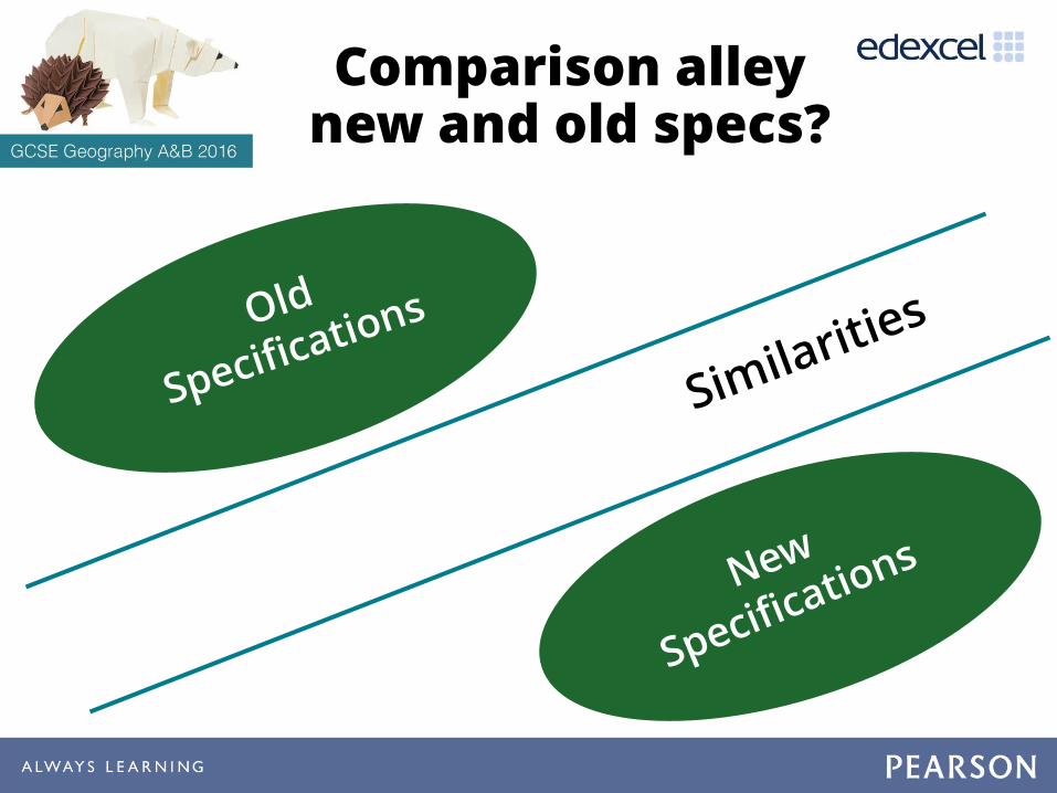
Comparison alley new and old specs?

Comparison alley new and old specs?
Similarities
CoastsEcosystem
RiversEnquiry
SPaGClimate changeUrban
challenges
Development issues

Overview of GCSE Geography A
Geography A: Geographical Themes and Challenges
The Physical Environment The Human Environment Geographical Investigations
Content overview Changing landscapes of the UK
• Choice of 2 studies from: coastal, river or glacial
Weather hazards and climate change
• Tropical cyclones• Drought
Ecosystems, biodiversity and management
• Tropical rainforests • Deciduous woodlands
Changing cities
• Case study of a major UK city • Case study of a megacity in a
developing or emerging country
Global development
• Case study of a developing oremerging country
Resource management
• Choice of 1 study from: energy or water
Fieldwork
• Physical: rivers or coasts• Human: urban or rural
UK Challenges
A synoptic study relating to 4 key challenges facing the UK:
1. Resource consumption2. Settlement, population
and the economy3. Conservation and flood
risk4. Climate change
Assessment overview
37.5%; 94 marks1 hour 30 minutes exam
37.5%; 94 marks1 hour 30 minutes exam
25%; 64 marks1 hour 30 minutes exam
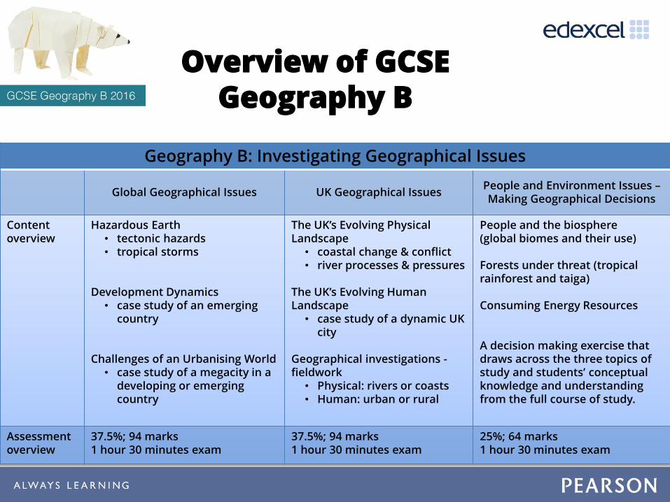
Geography B: Investigating Geographical Issues
Global Geographical Issues UK Geographical IssuesPeople and Environment Issues –Making Geographical Decisions
Content overview
Hazardous Earth• tectonic hazards• tropical storms
Development Dynamics• case study of an emerging
country
Challenges of an Urbanising World• case study of a megacity in a
developing or emerging country
The UK’s Evolving Physical Landscape
• coastal change & conflict• river processes & pressures
The UK’s Evolving Human Landscape
• case study of a dynamic UK city
Geographical investigations -fieldwork
• Physical: rivers or coasts• Human: urban or rural
People and the biosphere(global biomes and their use)
Forests under threat (tropicalrainforest and taiga)
Consuming Energy Resources
A decision making exercise that draws across the three topics of study and students’ conceptual knowledge and understanding from the full course of study.
Assessment overview
37.5%; 94 marks1 hour 30 minutes exam
37.5%; 94 marks1 hour 30 minutes exam
25%; 64 marks1 hour 30 minutes exam
Overview of GCSE Geography B

Two specifications –a comparison
Same Different
• Three components
• A UK paper
• Fieldwork in one paper
• Integrated geographical skills
• Assessment weighting, marks and exam time
• Fieldwork environments
• Spec A specification organised by domain; Spec B by scale
• Spec B integrated fieldwork questions
• Spec B with a synoptic DME; Spec A with a mini UK synoptic
• Content: Glaciated landscapes in Spec A, Tectonics in Spec B

Assessment at a glance
ContentTotal marks
Time (mins) Max. mark tariff
PAPER 1: The Physical Environment
Section A: Changing landscapes of the UK 30 30 2 x 8 marks
Section B: Weather hazards and climate change 30 30 1 x 8 marks
Section C: Ecosystems, biodiversity and management 34 30 1 x 8 marks (+ 4 marks SPaG)
PAPER 2: The Human Environment
Section A: Changing cities 30 30 1 x 8 marks (+ 4 marks SPaG)
Section B: Global development 30 30 1 x 8 marks
Section C: Resource management 34 30 1 x 8 marks
PAPER 3: Fieldwork and UK Challenges
Section A: Geographical Investigations – physical 18 20 1 x 8 marks
Section B: Geographical Investigations – human 18 20 1 x 8 marks
Section C: UK Challenges 28 35 (+ 15mins. reading)
1 x 12 marks (+ 4 marks SPaG)

ContentTotal
marks Time (mins) Max mark tariff
PAPER 1: Global Geographical Issues
Section A: Hazardous Earth 30 30 1 x 8 marks
Section B: Development dynamics 34 30 1 x 8 marks (+ 4 SPAG)
Section C: Challenges of an urbanising world 30 30 1 x 8 marks
PAPER 2: UK Geographical Issues
Section A: The UK’s evolving physical landscape 31 25 1 x 8 marks (+ 4 SPAG)
Section B: The UK’s evolving human landscape 27 25 1 x 8 marks
Section C1: Fieldwork in a physical environment 18 20 1 x 8 marks
Section C2: Fieldwork in a human environment 18 20 1 x 8 marks
PAPER 3: People and Environment Issues – Making Geographical Decisions
DME: Sections A (biosphere), B (forests), C (energy) and D (decision)
6460 + 30 mins reading
1 x 12 marks (+ 4 SPAG)
Geography B –Assessment overview

Main challenges of the new DfE subject
criteria
× No foundation paper
× 2 days of fieldwork and changes to how fieldwork is assessed
× Increased application of skills, especially maths and statistics
× Increase demand for extended writing
× Change to grading system (9-1)
× New content

How we have responded to these
challenges?
Exams papers with ramped demand
Prescribed fieldwork tasks
Maths for Geographers Guide
Literacy Guide with student exemplars and examiner commentaries
Ongoing professional development events, including free GRTT events
Detailed spec content & consistent use of common command words and mark schemes
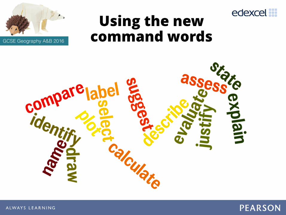
Using the new command words

Command words: ‘point marked’
Command Word Definition
Identify/ State/Name Recall or select one or more pieces of information.
Define State the meaning of a term.
Calculate Produce a numerical answer, showing relevant working.
Label Add a label/labels to a given resource, graphic or image.
Draw/plot Create a graphical representation of geographical information.
DescribeGive an account of the main characteristics of something or the steps in a process. Statements in the response should be developed but do not need to include a justification or reason.
CompareFind the similarities and differences of two elements given in a question. Each response must relate to both elements, and must include a statement of their similarity/difference.
ExplainProvide a reasoned explanation of how or why something occurs. An explanation requires a justification/exemplification of a point. Some questions will require the use of annotated diagrams to support explanation.
SuggestApply understanding to provide a reasoned explanation of how or why something may occur. A suggested explanation requires a justification/exemplification of a point.

Command words: ‘levels marked’
AssessUse evidence to determine the relative significance of something. Give consideration to all factors and identify which are the most important.
Examine
Break something down into individual components/processes and say how each one individually contributes to the question theme/topic and how the components/processes work together and interrelate.
Evaluate
Measure the value or success of something and ultimately provide a substantiated judgement/conclusion. Review information and then bring it together to form a conclusion, drawing on evidence such as strengths, weaknesses, alternatives and relevant data.
DiscussExplore the strengths and weaknesses of different sides of an issue/question. Investigate the issue by reasoning or argument.
Select and…
Justify
Select one option from those given and justify the choice, drawing across the resources provided and knowledge/understanding. The justification should include consideration of the alternative options in order to provide a supported argument in favour of the chosen option.

Command words by mark tariff
1 2 3 4 8 12
Identify/State/Name *Define *Calculate * *Label * *Draw/plot * *Describe * *Compare *Explain * * *
Suggest * * *Assess *Examine (Spec A only) *Evaluate *Discuss (Spec A only) *Justify (Spec B only) *

Ofqual assessment objectives
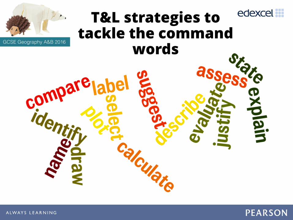
T&L strategies to tackle the command
words

AO1 - Demonstrating
knowledge
• Identify
• State
• Name
• Define

FAN-N-PICKTeammates play a card game
to respond to questions. Roles rotate with each new question.
Each team receives a set of question cards
1. Student no.1 holds question cards in a fan and says “pick a card, any card”
2. Student no.2 picks a card, reads the question aloud, and allows five seconds of think time.
3. Student no.3 answers the question
4. Student no.4 responds to the question
5. Students no.1 checks and coaches the answer
6. Students rotate roles, one person clockwise for each new round.

Identify/state/name
Recall or select one or more pieces of information
Q State one example of a sedimentary rock. (1)
(Spec A SAMs, p.7)
T&L strategyTABOO – students are given a key word and they have to describe that word without using the word itself or key words associated with it…
Define
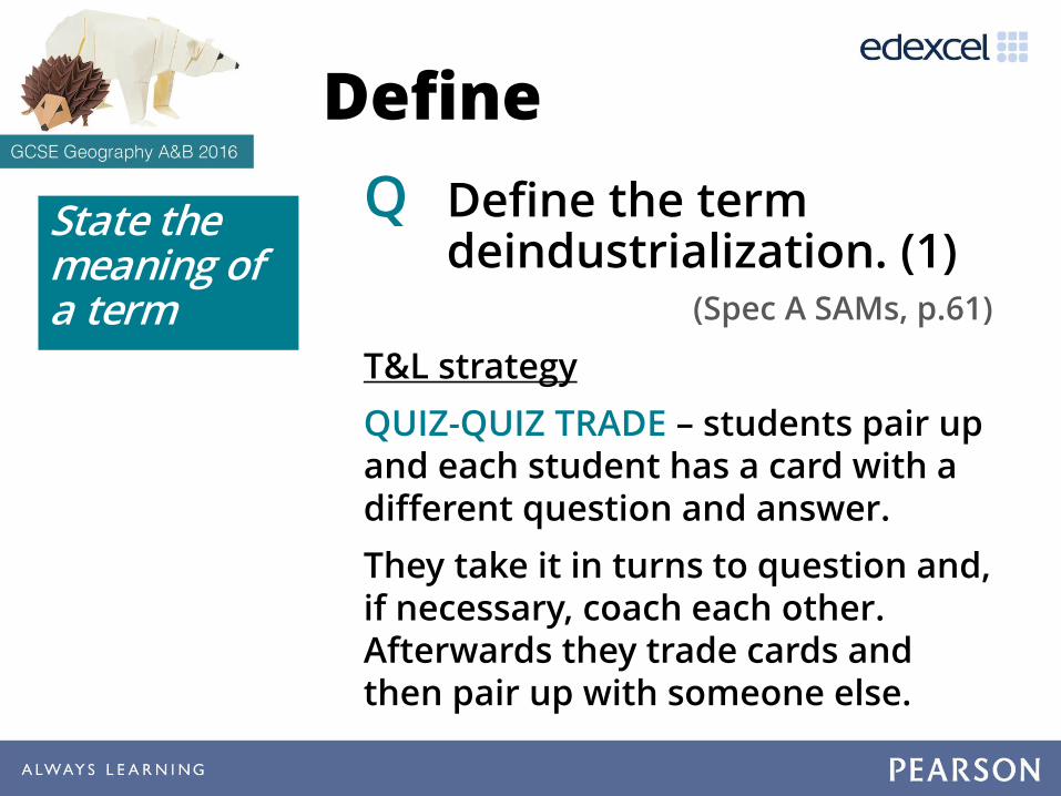
Q Define the term deindustrialization. (1)
(Spec A SAMs, p.61)
T&L strategy
QUIZ-QUIZ TRADE – students pair up and each student has a card with a different question and answer.
They take it in turns to question and, if necessary, coach each other. Afterwards they trade cards and then pair up with someone else.
State the meaning of a term

AO4 – Select, adapt and
use a variety of skills and techniques
• Calculate
• Label
• Draw
• Plot

Calculate
Produce a numerical answer, showing relevant working
Q Calculate the range of average temperatures for the four locations in Fig. 7. (1)
(Spec A SAMs, p.15)
Temperature (extracted from Fig. 7 -Map showing rainfall and other climatic
variables for locations in the UK)
Ben Nevis 0.5°C
Hull 13.5°C
Norwich 14.0°C
Newquay 10.1°C
T&L strategies
• Rally Coach
• Match Mine

RALLY COACH
1. In pairs, determine who is A and who is B. 2. Present a problem with only one correct answer. 3. Partner A attempts to solve the problem while
Partner B coaches, checks the accuracy of the answer and provides positive feedback.
4. If the answer is incorrect, B coaches A to the correct answer.
5. Present a new one-answer-only problem. 6. Now B attempts to solve the problem while A
coaches, checks the accuracy of the answer and provides positive feedback. And so on…

Draw/plot or Label
Create a graphical representation of geographical information
Q Plot the data for Cambodia and Mozambique given in the table below on Figure A (2)
Q Draw a best fit line. (1)
(Spec A SAMs, p.69)
T&L strategy
•Match mine
Add a label/labels to a given resource, graphic or image

Figure A
Life expectancy and access to safe drinking water in selected countries

MATCH MINEPartners on opposite sides of a
barrier try to communicate with precision so that they are able to match each other’s arrangement.
1. Partners sit on opposite sides of a barrier. One is designated the ‘sender’, the other the ‘receiver’.
2. Sender sets up their arrangement.
3. Sender gives the receiver directions so that they can try to match the sender’s arrangement.
3. When they are finished, partners set their boards side by side to check for accuracy.
4. Sender gives receiver feedback.
5. Roles are switched and they try again.

AO2 - demonstrate geographical
understanding
• Describe
• Compare
• Explain
• Suggest
T&L strategy
• Back-to-Back Drawing

Describe
Q Describe the projected trends in air pollution levels between 2010 and 2050 for India and Indonesia. (2)
(Spec B SAMs, p.16)
T&L strategies
•Memory Maps
• Back-to-back drawing
Give an account of the main characteristics of something or the steps in a process. Statements in the response should be developed but do not need to include a justification or reason.


MAP FROM MEMORY
1. The teacher has an information sheet on an empty desk. Students given a blank version (can be differentiated depending on each groups’ ability).
2. Students numbered (1 4. Depends on group size but a max. of 4 is advised) .
3. The teacher calls up students (no.1 first, etc.) to memorise the information sheet for 30 secs. They return to their group and try to recreate the information on their blank sheet… Here is the catch! They only verbally communicate the information to their group whereas the other members of the group are allowed to write.
4. After 2 mins of writing, call up no.2 and the process is repeated until all students have seen the information.
HALF TIME: Students try to develop a strategy to interpret and remember the information. e.g. Groups allocate specific info to be collected by each member or split the map into sections. Developing and reflecting on the best strategies allows students to plan, work together and learn a good revision strategy.
5. 2nd half begins and process repeated.
6. The whole exercise should last no more than 30 mins. Afterwards, a short test or a miniature blank version of the map/graph is used to test individual learning/progression.


Compare
e.g. The comparison of the old and new specifications at the beginning of this session
T&L strategy
• Comparison Alley
Find the similarities and differences of two elements given in a question.
Each response must relate to both elements, and must include a statement of their similarity / difference.

Explain
Q Explain one weakness of using the choropleth map, Figure 10, to show urban deprivation. (2)
(Spec B SAMs, p.71)
T&L strategy
• PEEL
Provide a reasoned explanation of how or why something occurs. An explanation requires a justification / exemplification of a point. Some questions will require the use of annotated diagrams to support explanation.

• A student at the school shown in Figure 10 investigated how and why the quality of life varied within the inner city residential locations in Sunderland.
• They developed this by carrying out research using the 2010 Index of Multiple Deprivation.
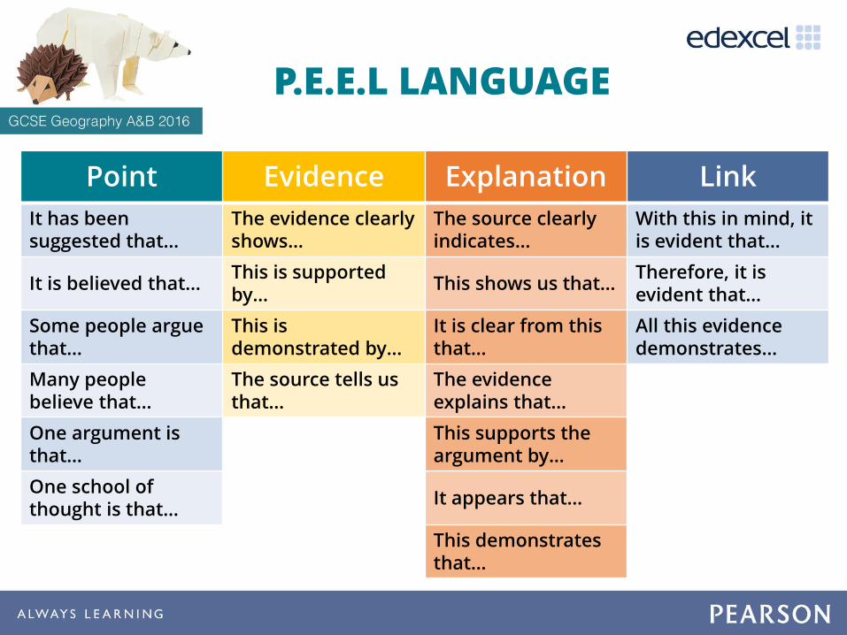
P.E.E.L LANGUAGE
Point Evidence Explanation Link
It has been suggested that…
The evidence clearly shows…
The source clearly indicates…
With this in mind, it is evident that…
It is believed that…This is supported by…
This shows us that…Therefore, it is evident that…
Some people argue that…
This is demonstrated by…
It is clear from this that…
All this evidence demonstrates…
Many people believe that…
The source tells us that…
The evidence explains that…
One argument is that…
This supports the argument by…
One school of thought is that…
It appears that…
This demonstrates that…

Suggest
Q Suggest one impact of drought for people living in a developing country. (3)
(Spec A SAMs, p.17)
T&L strategy
• Silent Debate
Apply understanding to provide a reasoned explanation of how or why something may occur. A suggested explanation requires a justification / exemplification of a point.

SILENT DEBATE
Suggest the impacts of drought for
people living in a developing country
Students are grouped, and each student has a different coloured pen and writes their suggestions… SILENTLY. They can read each others’ suggestions and respond or develop.
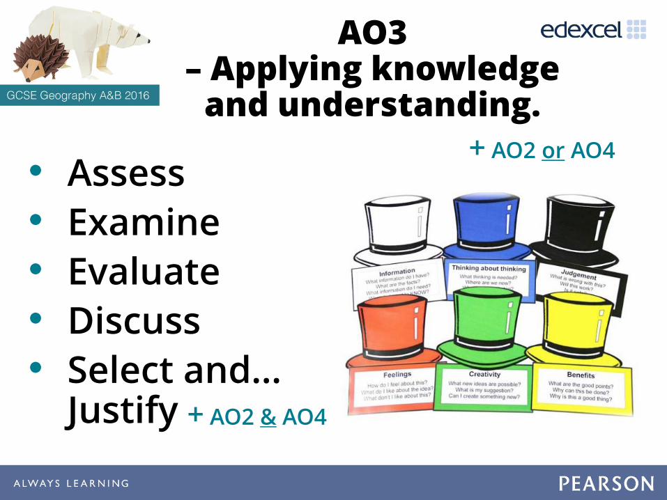
AO3 – Applying knowledge
and understanding.
• Assess
• Examine
• Evaluate
• Discuss
• Select and… Justify
+ AO2 or AO4
+ AO2 & AO4

THINKING HATS
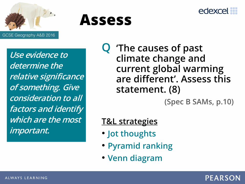
Assess
Q ‘The causes of past climate change and current global warming are different’. Assess this statement. (8)
(Spec B SAMs, p.10)
T&L strategies
• Jot thoughts
• Pyramid ranking
• Venn diagram
Use evidence to determine the relative significance of something. Give consideration to all factors and identify which are the most important.

Q. What are the all the different causes of climate change?
On post-its students write as many ideas as they can in the time allowed, one idea per slip of paper.
Each slip of paper is then placed on the table and students attempt to cover the entire table.
JOT THOUGHTS

Examine
Q Examine how physical processes work together in the formation of the spit shown in Figure 2. (8)
(Spec A SAMs, p.10)
Break something down into individual components / processes and say how each one individually contributes to the question theme/topic and how the components / processes work together and interrelate
T&L strategy
• Pyramid ranking Figure 2 – A diagram showing formation of a spit

PYRAMID RANKING
Q. What are the most significant processes involved in forming a spit?
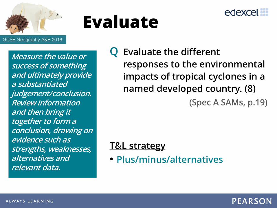
Evaluate
Q Evaluate the different
responses to the environmental
impacts of tropical cyclones in a
named developed country. (8)
(Spec A SAMs, p.19)
T&L strategy
• Plus/minus/alternatives
Measure the value or success of something and ultimately provide a substantiated judgement/conclusion. Review information and then bring it together to form a conclusion, drawing on evidence such as strengths, weaknesses, alternatives and relevant data.

Re
spo
nse
sIndividuals
Construct makeshift flood defenses to protect their land from flooding
Local government
Ensure education is provided and messages are given to locals to warn residents aboutpotential hazards such as flooding and contaminated drinking water
National government
Ensure relevant monitoring bodies produce the necessary information in predicting / forecasting the weather and mobilise military / emergency aid resources to prepare flood defenses / respond to contamination / protect crops and wildlife.
Positives
Negatives
Alternatives
PLUS/MINUS/ALTERNATIVE

Select and... Justify
Q Select the option that you think
would be the best long-term
plan for the development of the
Peruvian rainforest. Justify your
choice. (12 + 4 SPaG)
(Spec B SAMs, p.115)
T&L strategy
• Thinking hats
Select one option from those given and justify the choice, drawing across the resources provided and knowledge / understanding. The justification should include consideration of the alternative options in order to provide a supported argument in favour of the chosen option.

Q Is it landlocked, with no access to the sea?
Q What’s the climate likely to be like?
Q Climate also affects biome type, and possibly water supply
Developed Emerging Developing
Income / wealthRich; per person incomes of over $20,000 per year
Middling; probably lots of inequality i.e. rich people
but also many poor
Poverty; many people surviving on a few
dollars a day
Population?Stable; ageing, possibly even
declining
Growing but slowing down
Expanding; youthful ; more mouths to feed
each year
Economic sectors? Services / tertiaryManufacturing /
secondaryFarming / primary
Government?
Strong; provides for peoples needs
(health, education etc)
Might do some things well e.g. infrastructure but less good on crime,
social services etc
Poor – possible issues like corruption;
dependent on aid; few services for people
Asking basic questions

‘Making a case’
• Try to remember how to ‘make a geographical case’ for a decision.
• Often the best place to start is with economic, social and environmental factors:
Economic Jobs, employment, higher incomes Higher skilled, higher paid jobs Increase in GDP Making an area more attractive to investment
Social Improving peoples lives and quality of life Better housing, reducing crime Improved health and education Greater cultural understanding
Environmental Improving air and water quality Reducing pollution levels Protecting / conserving wildlife / biodiversity Improving the built environment
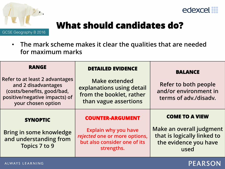
What should candidates do?
• The mark scheme makes it clear the qualities that are needed for maximum marks
RANGE
Refer to at least 2 advantages and 2 disadvantages
(costs/benefits, good/bad, positive/negative impacts) of
your chosen option
DETAILED EVIDENCE
Make extended explanations using detail from the booklet, rather
than vague assertions
BALANCE
Refer to both people and/or environment in terms of adv./disadv.
SYNOPTIC
Bring in some knowledge and understanding from
Topics 7 to 9
COUNTER-ARGUMENT
Explain why you have rejected one or more options,but also consider one of its
strengths.
COME TO A VIEW
Make an overall judgment that is logically linked to the evidence you have
used
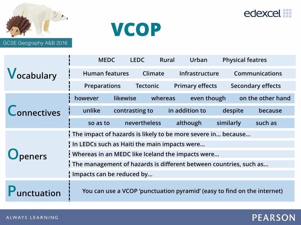
Vocabulary
MEDC LEDC Rural Urban Physical featres
Human features Climate Infrastructure Communications
Preparations Tectonic Primary effects Secondary effects
Connectives
however likewise whereas even though on the other hand
unlike contrasting to in addition to despite because
so as to nevertheless although similarly such as
Openers
The impact of hazards is likely to be more severe in… because…
In LEDCs such as Haiti the main impacts were…
Whereas in an MEDC like Iceland the impacts were…
The management of hazards is different between countries, such as…
Impacts can be reduced by…
Punctuation You can use a VCOP ‘punctuation pyramid’ (easy to find on the internet)
VCOP

Point
Evidence
Explanation
Key words
Stage 1 - Planning Extended Writing Task: ________________________________
Introduction
Paragraph 2
Paragraph 3
Paragraph 4
Conclusion
Stage 2 - Organisation Stage 3 – During…
• I think that…
• I believe that…
• Some people think…
• One important issue is...
• One important consequence…
• There is evidence that…
• An example of this…
• This is shown by…
• This demonstrates…
• Therefore…
• As a result…
• This means…
• You could argue…
• The point being…
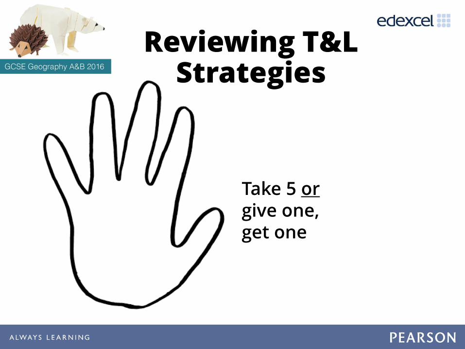
Reviewing T&L Strategies
Take 5 orgive one, get one

Supporting great
geography teaching
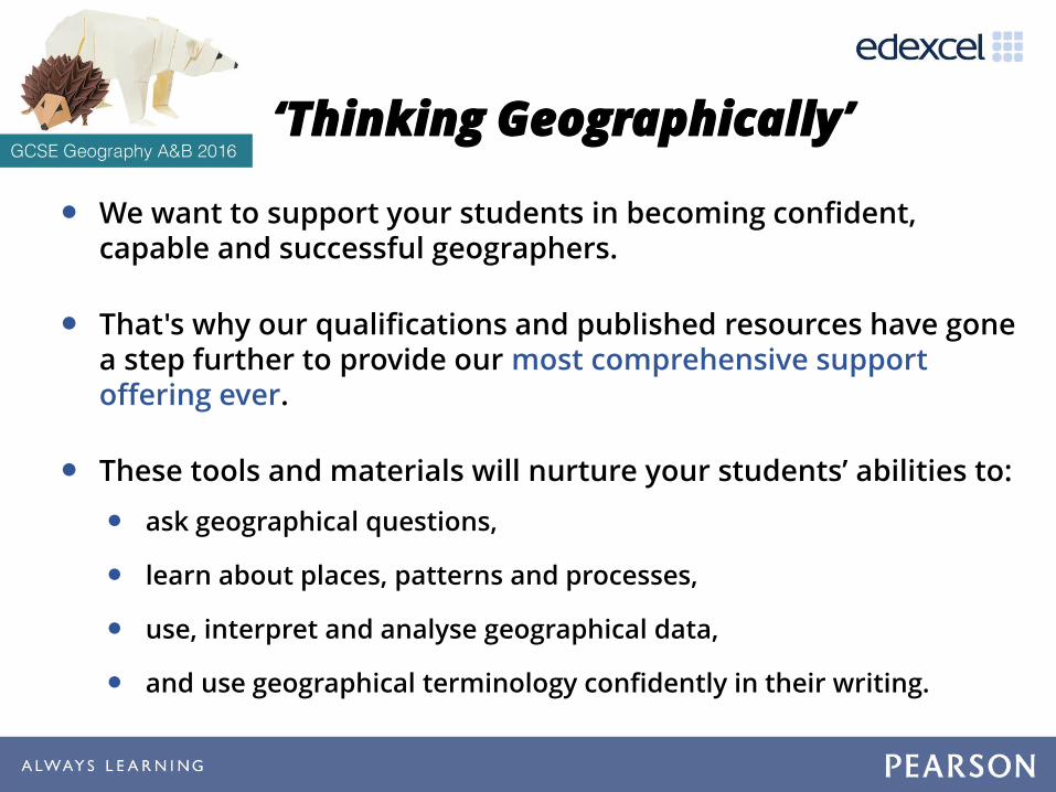
‘Thinking Geographically’
• We want to support your students in becoming confident, capable and successful geographers.
• That's why our qualifications and published resources have gone a step further to provide our most comprehensive support offering ever.
• These tools and materials will nurture your students’ abilities to:
• ask geographical questions,
• learn about places, patterns and processes,
• use, interpret and analyse geographical data,
• and use geographical terminology confidently in their writing.
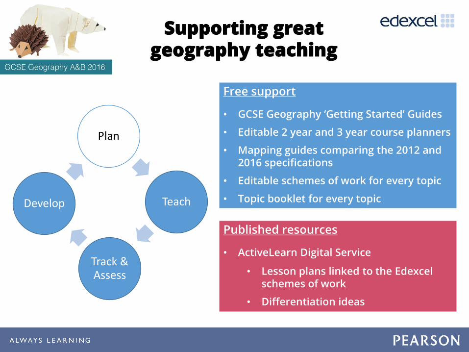
Supporting great geography teaching
Plan
Teach
Track & Assess
Develop
Free support
• GCSE Geography ‘Getting Started’ Guides
• Editable 2 year and 3 year course planners
• Mapping guides comparing the 2012 and 2016 specifications
• Editable schemes of work for every topic
• Topic booklet for every topic
Published resources
• ActiveLearn Digital Service
• Lesson plans linked to the Edexcelschemes of work
• Differentiation ideas

Supporting great geography teaching
Plan
Teach
Track & Assess
Develop
Free support
• Field-trip and data skills worksheets
• Case studies of good fieldwork practice
• Maths for Geographers guide
• GIS lesson plans and worksheets
Published resources
• Student Book designed for the new spec (available as Kindle editions)
• ActiveLearn Digital Service
• Front-of-class Student Books
• Worksheets
• End-of-unit assessments

Thinking Geographically: Maths and statistics
• Based on the proven approach of Pearson Maths
• A teacher guide clearly detailing what is learnt in their Maths lessons and linking this to their geographical skills
• Ensuring terminology and approach is consistent with Maths, so students can make links between the subjects.
• Worksheets building confidence and fluency to master problem-solving and reasoning activities that model maths and statistical concepts in a geographical context
• Supporting students in strengthening, checking and testing their skills through the Pearson ‘Progression Scale’

Supporting great geography teaching
Plan
Teach
Track & Assess
Develop
Free support
• Additional specimen papers
• Student exemplars, exam commentaries, guidance on common literacy issues
• .esultsPlus
• examWIzard
Published resources
• ActiveLearn Digital Service
• Lesson plans linked to the Edexcelschemes of work
• Differentiation ideas
• Worksheets

Thinking Geographically: Literacy
• Based on the proven approach of ‘Grammar for Writing’ (Pearson English)
• Working with Exeter University, our approach will help teachers support literacy in geography
• Exeter University will analyse student exam scripts, including sample exam questions sat by centres this year, and provide guidance on common literacy issues at all ability levels
• This evidence will underpin our literacy approach throughout so that students can be confident in their extended writing and make progress.

Pearson Progression Services 11-16
Progression Scale
Progression Maps
Assessments Markbooks
A 12-step scale* designed to support learner progress throughout Key Stage 3 and Key Stage 4
Detailed, editable maps which include progress descriptors, prerequisites and boosters at a sub-topic level mapped to the Progression Scale
Assessments** to test learners’ understanding at key points in the learning cycle, underpinned by the Progression Scale
Excel markbooks to record learners’ performance across each assessment, underpinned by the Progression Scale
** We provide the following assessments for free: Key Stage 3 baseline; Edexcel GSCE baseline; Edexcel GCSE end of year. We also provide a number of additional assessments (e.g. end of topic, end of term, problem-solving, fluency) which are paid-for resources
* A scale of 12 has been used to grade content and skills, and is calibrated to provide a simple measurement system where theexpectation is that a student will achieve development of skills spanning one step of progress in an academic year. (Note: MFL differs here.)

Supporting great geography teaching
Plan
Teach
Track & Assess
Develop
When it comes to Professional Development, we’re planning events & workshops to support first teaching and beyond, in response to your feedback:
• ‘Fieldwork and data skills’ in collaboration with the RGS
• Synoptic thinking skills and extended writing
• Progression tracking and intervention strategies
If you would like support in other areas, then please let us know on the Evaluation Form in your delegate packs
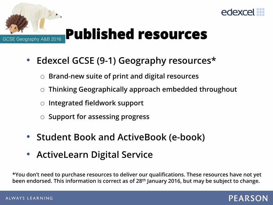
Published resources
• Edexcel GCSE (9-1) Geography resources*
o Brand-new suite of print and digital resources
o Thinking Geographically approach embedded throughout
o Integrated fieldwork support
o Support for assessing progress
• Student Book and ActiveBook (e-book)
• ActiveLearn Digital Service
*You don’t need to purchase resources to deliver our qualifications. These resources have not yet been endorsed. This information is correct as of 28th January 2016, but may be subject to change.

We are working with a range of publishers who are looking towards getting their resources* endorsed:
• Hodder Education
• Oxford University Press
• Pumpkin Interactive
• ZigZag Education.
*You don’t need to purchase resources to deliver our qualifications. These resources have not yet been endorsed. This information is correct as of 13th Feb 2016, but may be subject to change.
Other published resources

More support…
• Join us at Stands 12 and 13 to find out more!
• Sign up to Jon Wolton’s updates: email [email protected].
• Visit the website for support materials: www.edexcel.com/geography.


![Grade Boundaries Jan 2013 [Edexcel]Jan 2013 [EDEXCEL](https://static.fdocuments.in/doc/165x107/55cf97e2550346d033942e17/grade-boundaries-jan-2013-edexceljan-2013-edexcel.jpg)