Mary Ingles and the Escape from Big Bone...
33
Transcript of Mary Ingles and the Escape from Big Bone...


2
Mary Ingles and the Escape from Big Bone Lick
James Duvall, M. A. Boone County Public Library
Mary Ingles in her old age was a lively and energetic lady. Stories are told
of her independence and determination. She still worked with her spinning wheel
when she was over eighty years old. Once it needed repair, and she could not get
her son John to attend to it, she ordered her servants to saddle her favorite horse,
Bonny, carried the wheel eight miles to a craftsman, and brought it home by
herself. Another story recounted how she stepped on a large black snake in her
vegetable garden, which instantly coiled itself around her leg. She held its head in
place with her foot, and called for her cook to bring a butcher knife by which she
freed herself. This is how her descendants remembered her, and the kind of stories
they liked to tell about her. Her children and grandchildren remembered the stories
she told many times of her own life, but the one they heard most often was that of
her escape from the Shawnee at Big Bone Lick. Mary’s son, Col. John Ingles,
wrote a narrative of his family’s history about a decade after her death in 1815.
Most of what is known about her comes from this account. Since Mary probably
could not write, this Narrative may be regarded as her account of what happened.
Draper’s Meadows, 1755
Mary Draper was eighteen years old when she married William Ingles in
1750. They settled near their parents in a place called Draper’s Meadows. This was
in Augusta County, Virginia, organized in 1745. It was the largest county ever
formed in America. The Virginians were aware that it was home to a large number
of Indian tribes, but it was valuable territory for settlement and trade. They were not
content to leave it to the French, who also claimed the entire area.

3
Augusta County, Virginia. The largest county ever formed in America.
When the English traders began to explore the area the French decided to
expel them. They began to build a line of strategically placed forts throughout the
Ohio Valley in an attempt to secure the area, and establish a monopoly on trade.
The Indians wished to trade with both the French and the English. The English
offered better goods, in most cases, for much better prices. A few of the tribes,
especially those of the north, decided to trade only with the French, but the
Shawnee, in particular, were determined to maintain independence. When the
Ingles and Drapers came to Augusta County relations with the Indians seemed to
be good. The small community lived in peace, but this was soon to change.
The Shawnee and the Americans
John Ingles says of this sudden change on the part of the Indians:
. . . there had been several parties of the northern Indians, to wit, the Shawnees, passed by where my
Grandfather lived, on their way to the south, and would commit depredations on the Catawba Indians, but
was still friendly to the whites at that time. However, this happy state of things did not last long. The
Indians found out that they could gratify their heathen thirst for bloodshed and plunder much nearer home,
and at length commenced a warfare on the frontier settlements.

4
The explanation doesn’t make sense. The truth is that it signaled a change in Indian
frontier policy. During one of the raids against the Catawba, six Shawnee warriors
were captured and imprisoned by the government of South Carolina. The Colony
was on terms of peace with the Shawnee, and the government of Pennsylvania tried
to mediate the affair, but to no avail. Five of the warriors escaped from the prison
in Charles Town, and returned home after many months; but the Shawnee never
forgot the insult, vowing eternal war upon the English. People living on the frontier
may not have known the real reason for this sudden change, but this incident, turned
the Shawnee against the English, and allied them more closely with the French.
The details of this affair and its effect on the Shawnee have been covered in detail
by Prof. Ian K. Steele. According to him, this act of violence by a colonial
government was responsible for much of the bloodshed that took place on the
colonial frontier and in the subsequent settlement of Kentucky and the other early
western states.
As often happens, the insult was avenged, not in the area where it happened,
but against those who happened to be closest; that is, on the frontiers of
Pennsylvania and Virginia. A deliberate policy of warfare, with the strategic aim of
halting and turning back colonial expansion, was begun by the Shawnee and other
tribes at this time. After the catastrophic defeat of Gen. Braddock and his troops by
the French and Indians, on 9 July 1755, Indian raids into Colonial territory became
more intense, some reaching as far east as the outskirts of Philadelphia.
Shawnee Raid and Capture
On the 30th
of July, 1755, during the wheat harvest, the Shawnee raided
Draper’s Meadows. It has been called a massacre, but it was hardly that: A few
people were killed, a few wounded, and the rest — well under a dozen — were
captured. A count compiled some time after the event reads:
1755, . . . . July 30th, Col. James Patton, at North River, killed; Casper
Barrier, at North River, killed; Mrs. Draper and one child, at North River,
killed; James Cull, at North River, wounded; Mrs. English and Her
children, at North River, prisoners escaped; Mrs. Draper, Jr., at North
River, prisoner escaped; Henry Leonard, at North River, prisoner escaped.

5
We have only a few details of the capture of the Ingles family, supplied by the
Manuscript of John Ingles. The prisoners included Mary Ingles (here called
English), her two children Thomas and George, and her sister-in-law, Bettie.
Mary’s mother, who was living with her, was killed. Bettie Draper’s arm was
broken by a gunshot while she was attempting to escape. The Ingles Narrative
states that William, coming back from the harvest attempted to intervene. He was
chased by two warriors who nearly captured him. While he was being pursued he
jumped over a log and fell. He rolled under the log and remained there unseen.
The Shawnee had soon accomplished their intention, and moved down the
river towards the Ohio, but due to forest and undergrowth did so very slowly.
They crossed the New River by canoe about fifty miles north of where the capture
took place.
Mary Ingles at Sonnontio
Sonnontio, or Sonhioto, known also as Lower Town, was usually called
Lower Shawnee Town by the English traders. It is the site of many ancient
earthworks, which occur on both sides of the Ohio River. The town was built
about 1738, and was part of a large network of Shawnee villages in the Ohio
valley. The village had a mixed population, mostly Shawnee and Delaware. A
trader reported about 1750 that there were 300 men, that is, warriors, which
indicates that the population of the town may have been as much as 1,500 people.
There were about 100 houses north of the river, and forty on the Kentucky side.
The council house was a great birch-bark lodge about 90 Feet long with a covering
of bark. The French had a trading post in the area as early as 1740.
It has often been claimed that Mary Ingles was the first white woman in the
Ohio Valley, but this is not the case. In 1744 twelve year old Catherine Gougar
(1732-1801) was a captive among the Shawnee. She was captured in Berks
County, Pennsylvania, and lived among them on the Scioto for five years, near
present-day Chillicothe. Dr. Frank Warner writes of her: “Just eleven years before
Mary Ingles was led captive to our Ohio soil, Catherine Gouger was living upon
the fertile banks of the Scioto.” It is likely that there were many white women in

6
the area before Mary Ingles. The earliest white woman living captive in the Ohio
Valley that can be documented is Mary Harris, captured at Deerfield,
Massachusetts, at the age of twelve, in 1704. When she was about eighteen she
married an Indian and had several sons. There may have been other white women
in the town when Mary arrived.
There were also French traders in the town. They sold cloth and other goods
to the Indians, and Mary spent much of the time she was there sewing French
goods into shirts for the Indians. She stayed at the town for several weeks before
she was taken to Big Bone Lick, 158 miles down the river, to help boil salt.
Big Bone Lick
Big Bone Lick is a legendary place. The place was frequented by many
different tribes from early times, and it had religious and magical associations. It
was a vast swamp, which meant it was associated with Underworld in the Indian
mind, and there were many bones and tusks of large animals scattered over the
ground. The salt springs, or licks, attracted both animals and men. The Big Bone
Lick is situated about two miles from the Ohio River and lies in a large valley
descending from Beaver Lick. Near Big Bone the creek turns south, and flows into
the Ohio River, about four miles away. The closest access to the river is at Little
Gunpowder Creek. The area around the Lick has changed drastically over the last
two hundred years, the destruction of the huge trees in the valley has caused the
ground to dry up, but 250 years ago the springs were still surrounded by a huge
swamp.
This was a place to get salt. Salt making parties probably camped for
several weeks at a time. Salt-making was hard, dirty work. Carrying wood, and
boiling kettles of brackish water in mid-summer, was not calculated to make
captives comfortable with their lot.
About the middle of October Mary decided to try to escape. A reasonable
date would be about the 19th
, but this cannot be established with certainty. John
Ingles, who heard the story often from his mother, gives the following reason for
her decision:
7
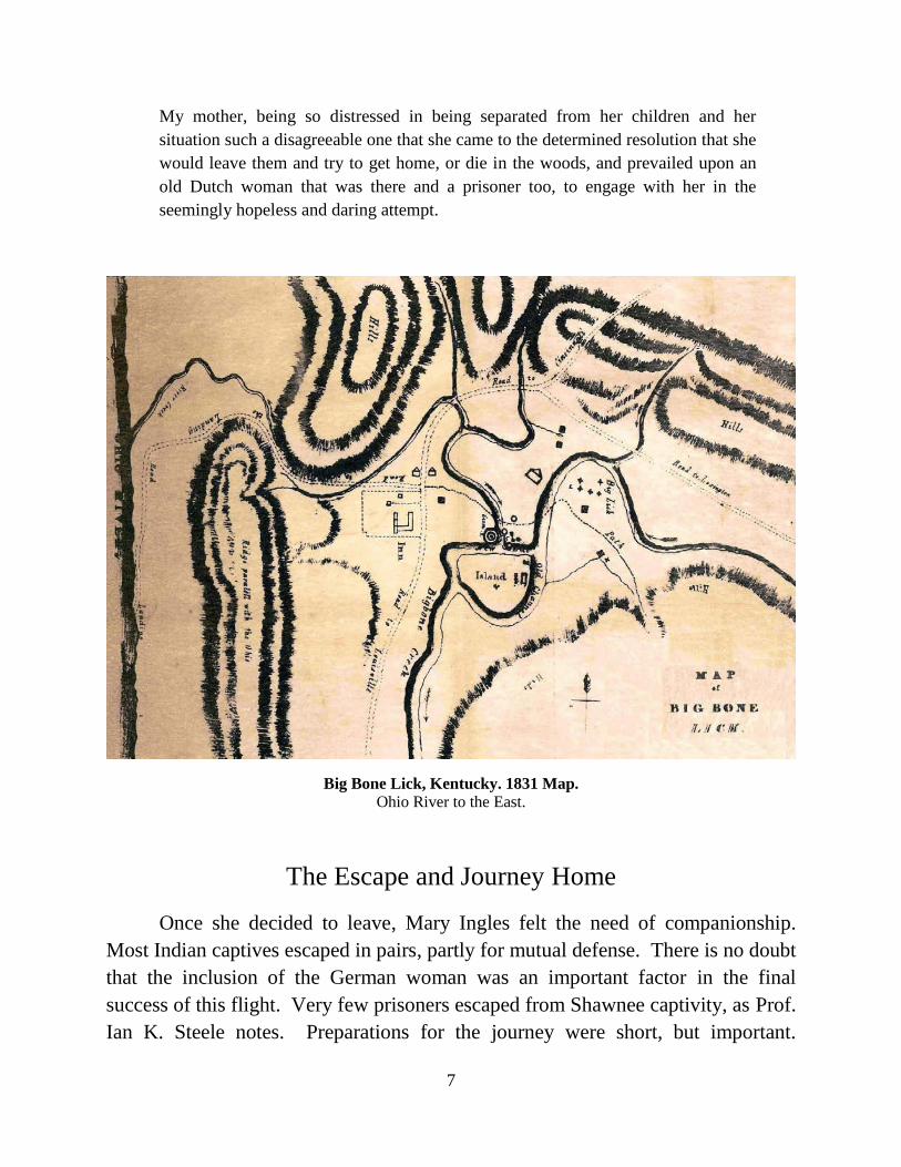
My mother, being so distressed in being separated from her children and her
situation such a disagreeable one that she came to the determined resolution that she
would leave them and try to get home, or die in the woods, and prevailed upon an
old Dutch woman that was there and a prisoner too, to engage with her in the
seemingly hopeless and daring attempt.
Big Bone Lick, Kentucky. 1831 Map.
Ohio River to the East.
The Escape and Journey Home
Once she decided to leave, Mary Ingles felt the need of companionship.
Most Indian captives escaped in pairs, partly for mutual defense. There is no doubt
that the inclusion of the German woman was an important factor in the final
success of this flight. Very few prisoners escaped from Shawnee captivity, as Prof.
Ian K. Steele notes. Preparations for the journey were short, but important.
8
According to the narrative, they had between them a blanket and tomahawk each,
“and perhaps a knife”. John notes that they started in the after part of the day. An
interesting incident is that of the three Frenchmen sitting on a bone cracking
walnuts. The French, though not a major presence in the area, were free to come
and go as they pleased. The bone on which they sat was apparently one of the
large vertebrae of a mammoth or mastodon. Travelers to the Lick used the bones
for all kinds of purposes, including camp stools.
Mary and the German woman made the excuse that they were going to
gather nuts and grapes. They might need a sharp tomahawk, and one of the
Frenchmen (who would not need a sharp one merely to crack nuts), willingly
exchanged his for Mary’s, which tells us that the French were on good terms with
the captives. The area was considered very secure, and there was no direct
surveillance of the captives at Big Bone Lick. Apparently the flight of captives
from this location was considered impossible, or so unlikely, that no captive would
even attempt to flee. No precautions were taken, and this is what made the escape
possible.
Since the captives could roam at will, at least when not otherwise employed,
there was no need for them to conceal their departure from the camp, and they left
in the most natural manner possible. Their immediate destination was the Ohio
River, which they were to follow for 250 miles upstream. We must consider
whether they headed directly for the river, or began to go in another direction, to
throw pursuers off the trail. North of the Lick are steep hills, and these would
hinder access the river, and delay them. If they had first gone east they would have
had to backtrack to get to the river, which would have involved returning close to
the camp later, and losing time, with the risk of being discovered.
They might have gone south along Big Bone Creek, and then moved off
west towards the river. If they took this route, it is almost certain they did not go
as far as Big Bone Landing, as that would take them some miles out of their way,
with the potential of meeting another party as they came back up the river from the
mouth of Big Bone Creek. There are large hills between Big Bone Creek and the
river, including legendary Indian Hill, which rises 300 feet above the surrounding
area, and is the place from which one of the great animals of the Lick, “bounded
over the Ohio”, according to Indian legend, then “over the Wabash, the Illinois,

9
and finally over the great lakes, where he is living at this day.” This range of hills
would increase the difficulty and time. There can be no doubt that they wanted to
increase the distance between themselves and their captors quickly, and by as great
a margin as possible. For this reason, and since they were not trying to hide at that
point, it seems most likely that they went directly for the mouth of Little
Gunpowder, or Landing Creek.
It is about two miles from Big Bone Lick to the mouth of Little Gunpowder
Creek, the closest access from there to the river. This creek, now usually called
Landing Creek, is flooded most of the year because of the Markland dam, several
miles downstream, and considered, like many other creeks, backwaters of the
Ohio. This stream, the first of the 145 creeks and rivers they would have to cross
before getting to the mouth of the Kanawha, about 250 miles away, was not of
great difficulty to cross. The Ingles Narrative says that the water was lower at this
time of year than normal for October, which helped them, making the journey
possible.
At this point their journey was fairly underway, and they began walking
upriver through Lower East Bend Bottom, along the bank of the river. A mile
from Little Gunpowder is Big Gunpowder Creek. Many of the creeks and rivers of
the Ohio are companion streams. Though they have different sources the streams,
not far apart, were considered as pairs when they were named. Big and Little,
distinguishes them by size; sometimes the term “Indian” is used also, especially if
the stream was in Indian territory (that is, on the other side of the river), to
differentiate them. For example, there is the Kentucky River, the Little Kentucky
River, further downstream, and the Indian Kentucky River, which is in Indiana.
Big Gunpowder is much larger, and presented considerably more difficulty
than its little sister. It is the longest creek in the area now called Boone County,
and drains over 55 square miles of land. There was almost certainly a fairly large
volume of water in this creek; they would have had to walk up this stream,
possibly as much as two miles, before they could find a place to cross.

10
Collot’s Map (1805) detail.
As they continued the journey they would have found wide and smooth
bottom land all along this stretch of the river. The walking here was probably as
easy as any on their entire journey, and they probably made considerable progress.
In 1755 the bottoms were covered with huge trees, which probably extended to the
shoreline; because of the height of the forest cover, it is unlikely that there was
much undergrowth in the forest. Only in the few open spaces would there be
tangles of weeds and briars that would make walking difficult.
A mile and a half from the mouth of Gunpowder lies Lick Creek, which is
very small. From there it was almost four and a half miles to Big Ranty Creek, and
three tenths more to Little Ranty; small streams, but they had to be crossed.
Walking just over a mile further they would be in a place now called Rabbit Hash,
at Parks Branch, a small stream which runs just behind the present general store,
built about 1930. Whether they crossed close to the river, or a little higher up, is
not a question of much moment.
By this time it should have been about dusk, and the Indians would be
beginning to wonder where they were. No doubt they were anxious about being
trailed, and continued on that night as far as they possibly could. They crossed

11
over several streamlets so small they are not on the river charts, these were of little
consequence to them, but after leaving the wide bottoms of East Bend the terrain
becomes much steeper; the heavily wooded banks go down to the river at
something approaching a 45-degree angle. On the other side of this ridge, running
parallel with the river, is Lick Creek, draining an area of about eight square miles,
which they had crossed earlier.
Middle Creek, about a mile and a half beyond Parks Branch, is a stream of
some magnitude. This stream is large enough to power water mills, and there was
at least one, Garnett’s Mill, by 1810. The watershed of this creek is just over 11
square miles. Its name comes from the fact that it is located somewhere about the
middle of the river’s path around Boone County. The land becomes much flatter
once the creek is crossed.
Perhaps it is somewhere in this area that they stopped to sleep the first night.
It is about twelve miles from the Lick to the mouth of Middle Creek; if they went
two miles up Gunpowder, which would mean two miles back, that is a total of
sixteen miles. They had started late in the evening, and had probably spent a large
part of the day in boiling salt, and other difficult tasks. Sixteen miles is a long
walk for anyone not used to such travel. They would have rolled their blankets on
the ground, without a fire, and there was probably nothing to eat.
When the two women did not return, the Indians began to think they were
lost. It appears they never suspected they had run away, or the outcome of their
journey might have been different. In some cases the punishment for attempting to
escape was death. Christopher Gist, a guide to George Washington, was in Lower
Shawnee Town, just five years before the capture of Mary Ingles. Gist recorded in
his Journal for Wed 26 Dec 1750:
This Day a Woman, who had been a long Time a Prisoner, and had deserted, & been
retaken, and brought into the Town on Christmass Eve (sic), was put to Death in the
following manner: They carried her without the Town, & let her loose, and when she
attempted to run away, the Persons appointed for that Purpose pursued her, & struck Her
on the Ear, on the right Side of her Head, which beat her flat on her Face on the Ground ;
they then stuck her several Times, thro the Back with a Dart, to the Heart, scalped Her, &
threw the Scalp in the Air, and another cut off her Head: There the dismal Spectacle lay
till the Evening, & then Barny Curran desired Leave to bury Her, which He, and his Men,
and some of the Indians did just at Dark.

12
Whether this would have been the fate of Mary and the German woman we cannot
be certain, but the consequences could be quite severe.
There was a full moon on 19th of October of that year, and they could have
walked longer into the evening. This would allay the fears of the Indians for their
safety, since they could see to return later than usual. The Indians did not suspect
them of trying to escape, even after their disappearance, and concluded that they
had been killed by wild beasts. This the Shawnee told Thomas Ingles years later,
after the Battle of Point Pleasant in 1774. Wolves, which were the greatest danger,
abounded in the area.
Feet in the forest that leave no mark —
Eyes that can see in the dark!
There are records of many bounties paid for wolf heads paid from the earliest days
of the Commonwealth, until about 1820. There were panthers, bears, and other
dangerous beasts that roamed these forests. It was natural for the Indians to
assume that two women, armed with nothing but tomahawks, and perhaps a knife,
would be unable to defend themselves against attack.
Middle Creek descends from the high ground of the interior, and sweeps
south less than a mile from the river, dividing the high ground from the river
bottom until it reaches the river. This should have been smooth walking. It was
forest, not huge fields of corn and other crops. This and the Lower East Bend
Bottom are huge farms today, but probably all of it was then covered with thick,
heavy forest, including trees of massive size.
Mary and the German woman crossed tiny Willoughby Creek a couple of
miles farther on. Just beyond the creek they would have seen an island called
Laughery’s Island, probably then at least a mile long; it is much smaller today due
to erosion, and the raising of the water level by the dam.
A little further on, less than two miles from Willoughby Creek, they crossed
Steep Gut Creek. This little creek is rightly named, and has a long history, the first
map of it is a survey dated 1780 made for the heirs of John Hawkins. The two
women may have had a good deal of trouble crossing this little creek, even if it was
dry, since the approaches on both sides are quite steep. This was probably some of
the most difficult they had walking so far, but it was for only about a mile. They
approached Kirby Rock, which guards the mouth of Woolper Creek. The atlas of

13
1883 shows a large Indian mound in the area, but it may have been several hundred
years since anyone had lived here.
Survey of Steep Gut Creek. 1780.
Middle Creek, shown further from the River,
flows south.
Survey of Woolpers Creek Area. 1776.
This survey was purchased jointly in 1791,
and settled by John Taylor and John Tanner.
Woolpers Creek, less than a mile further on, drains one of the three major
watersheds in Boone County. Even if the weather had been particularly dry, there
was probably some depth of water in this stream. This area has long historical
associations, and was the first place in Northern Kentucky to be settled. It is
named for John David Woolpert, a Philadelphia merchant who never saw it. John
Taylor and his financial partner John Tanner, both Baptist preachers, purchased
2000 acres of land here from the merchant in 1788, for £750 in gold and silver.
Split Rock is a huge formation that has long attracted the attention of
geologists. It is on the north side of Woolpers Creek just at the river’s edge. As
the name implies this gigantic rock, on the banks of the Ohio, is split open. It was
a noted tourist attraction, and the steamboats once stopped there. The stone
appears to have dropped out of nowhere, which demands a geological theory. The
terrain is very rugged, and walking is difficult. Perhaps it was fairly early in their
second day when Mary and her companion crossed the creek, and we can be
certain they had difficulty passing along the river here.

14
Split Rock in 1938.
Courtesy of the Peel Collection.
Boone County Public Library
Less than a mile further is Peaks Branch, a tiny stream shown in the 1883
atlas, which does not appear on the river charts; not much is known about it, in the
atlas a place called Nobley, with five houses, is shown at the mouth.
It should have been fairly easy walking in the large, flat river bottom, in the
northwestern section of Boone County, that begins here. This rich alluvial land
was attractive to white settlers from Virginia. The banks of this bend of the river
are now primarily used for gravel mining. Across the river a large stream known
as Hogan Creek empties into the river, with the present town of Aurora, Indiana, at
its mouth.
Just north of Peaks Branch, a town to be called Bullittsburg was proposed
and surveyed in 1773 by Col. Thomas Bullitt. Bullitt and his men were on the way
to survey at the Falls of Ohio, but spent several days here making surveys. The
town, which never existed, was to be very near the mouth of Taylors Creek. A
fort, called Tanner’s Station, was built nearby. It was the first settlement in
northern Kentucky, and was built by the Tanner family about 1790. It was near the
present town of Petersburg, established in 1818.

15
Taylors Creek is six miles from Woolpers. A stretch of about five miles,
once they crossed Peak’s Branch, and is the longest distance along the Ohio in
Boone County without a creek to cross. The creek is named for the pioneer Baptist
preacher, John Taylor, associated with the Bullittsburg Baptist Church, which was
founded in 1796. He cleared land and farmed in this area. In his book, A History
of Ten Churches, published in Frankfort in 1820, he tells us that he was in a “new
heavy forest”, and that he and his black “servants”, as he refers to them, cleared
enough land the first year to “make” a sizeable crop. Probably this creek did not
present great difficulty in crossing, especially when the water was low. Some
distance up Taylors Creek, at the forks, is a spring called White Oak Lick; it is first
shown on a map dated 1804.
Second Creek, also known as Ferry Creek, was the home of two ferries in
1807. Boone County Court Orders show that Vance’s Ferry operated across the
Ohio on the northern side of Second Creek, and Tousey’s Ferry on the lower side,
indicating that it was a stream of some size.
The Big Miami, called also Rock River, from its smooth stone bed, flows
into the Ohio on the Indiana side, two and a half miles above Taylors Creek. This
was not particularly significant to them, as they did not have to cross it, but it was a
highway for the Indians going north by water, and they would have taken care not
to be seen from any canoes in that direction. This river is twenty-five and a half
miles from Big Bone Lick, and they may have stopped near this area to rest for the
night. It is about thirteen and a half miles from Middle Creek, where they may
have rested the previous night, followed by the difficult walk around Steep Gut
Creek. According to the Ingles Narrative it took four or five days to get to the
Indian Town opposite the Licking River, which is a distance of forty-six miles
from Big Bone Lick. If they stopped here there would be more than two days to
make the distance of about 21 miles to the Licking, so this is a reasonable
conjecture.
Garrison Run is three miles above Taylors Creek. About half way between
the two is a tiny creek, not appearing on the river charts. This may be Wicked
Creek, a name mentioned in several old deeds and court records. It flows over
level ground, and presented little difficulty in crossing; but much of the bank in
this three mile stretch is steep enough to make walking difficult if there was no

16
trail to follow. Garrison Run is a modest stream, but large enough to power a grist
mill. The mill stood about half a mile from the river between it and the present site
of the Bullittsburg Baptist Church. A spring called Double Lick is shown on the
map of 1804. It is between Garrison Run and one of the forks of Woolpers Creek.
Two very small streams lie between Garrison and Sand Run, which is almost
two and a half miles from Garrison Run. By this time they were in the southwest
corner of North Bend Bottoms, and the walking should have been considerably
easier. This heavily forested region must have been a hunter’s paradise, and they
were probably on the watch for small hunting parties from the Indian town across
from the Licking and villages up the Miami and White Water rivers to the north.
Sand Run, or Sand Lick Creek, is the largest creek in North Bend Bottoms.
A little way back from the river there are steep bluffs on both sides. Not far from
the river is Sand Run Lick, a spring which may have been frequented by hunters,
but did not produce enough salt to be productive. It is not quite two miles further
to Potato Creek, This beautiful, fertile bottom, perhaps a mile wide, and nearly
level, is the northernmost point in the Commonwealth of Kentucky. To the south
is a range of steep hills, some of them 300 feet above the present level of the river.
About two and a half miles beyond Potato Creek is Bushes Creek, named for John
Bush, an early Justice of the Peace, who became Sheriff of Boone County in 1806.
He operated a ferry here before 1799. It is mentioned by his name in deeds
recorded as late as 1911, but it is now usually called Loders Creek, after Julia
Loder, a local landowner who died in 1893.
Elijah Creek, called Stony Creek in the earliest county records, is about four
and a half miles from Potato Creek. Here the level ground narrows considerably.
Just southeast of the mouth is the town of Taylorsport, established by Gen. James
Taylor in 1815. After walking couple of more miles they would cross a small,
unnamed stream, probably Pond Gut, which drains some marshy land, and, a little
further on, Wilsons Creek. There is a spring close to the creek, and an Indian
mound on the opposite side. Fox Branch is not a mile beyond, and close by is the
hamlet of Stringtown. Worlds Creek is less than a mile away, and about half a
mile further on is the mouth of Dry Run. These are not large streams. There are
hills fairly close to the river here, some of them more than 850 feet above sea level,
but the area should not have been too much difficulty for travelers.

17
Just beyond Dry Run is the town of Constance, and between it and the
county line, less than a mile further on, is Anderson’s Ferry, which has been in
continuous operation since 1817. A short distance from the ferry is the line
between Boone and Kenton Counties. From Dry Run to the Licking River it is
about seven and a half miles. The only creek of any size in that distance is
Pleasant Run, which is about three miles from the Licking; tiny Willow Run is a
mile from the Licking. There may have been a few other small streams, now
obliterated by the sprawling encroachments of the city of Covington.
I have detailed the route of the journey thus far for two particular reasons:
First, I want to give the reader some idea of the physical obstacles with which they
had to contend. Second, this is the only section of the journey of which we have an
idea of the time they took to travel. The Ingles Narrative says it took them four or
five days to get opposite an Indian Town, which was on the other side of the Ohio
River, but before they arrived at the Licking. This was somewhere along the
present day riverfront in Cincinnati. The Narrative indicates that it may have been
just east of the Licking River. Since we have a fairly good idea of how long the
journey took to this point we can use it to help gauge the time it took them to make
the rest of the journey.
The distance from Little Gunpowder Creek to the mouth of the Licking is
44.4 miles by river. The additional two miles from the Lick means they would
have travelled about forty-six and a half miles — if there had been no obstacles to
circumvent. They probably had to travel up Big Gunpowder, which might add four
miles or more, bringing the total to somewhere around fifty miles. It is uncertain if
they had to go much out of their way near the Split Rock, though it slowed them
down in any case. If they reached the Licking in four days they travelled an
average of twelve and a half miles a day, or if five days, at ten miles a day.
Because they left late in the first day, they probably travelled an average of just
over eleven miles a day.
It is difficult to divide this out and decide where they might have stayed each
night. The night before they reached the Licking may have been spent somewhere
around Elijah Creek, a distance a little short of twelve miles, which would be
consistent with the average. Their stay at the Licking River was probably the first
18
time they had a decent night’s sleep, without fear of being eaten by animals, since
they left Big Bone. According to the Narrative:
They lay in the cabin all night, and there was in the cabin some corn. They ate of it, and
in the morning, when they were about starting, there happened to be a horse beast in the
lot adjoining the cabin. They concluded to take it, and pack on it what corn they could to
help them along. They did so and then started in again, with the beast and corn, and
steering on up the river, and in sight of the Indian town; and what was very extraordinary,
they saw several Indian hunters that day, and they so secreted themselves that they never
discovered them.
The presence of a cabin at that time in the area that is now Covington has interesting
implications. This was built by white men, and the evidence indicates that it was
built to establish an early land claim, though possibly abandoned. The corn patch
was a legal requirement, necessary to establish the claim. The horse is more
problematic. Its presence, and the fact that it wore a bell, indicates that the claim, if
abandoned, had not been so for long. Perhaps the cabin belonged to a trader who
was on good terms with the Shawnee in the village across the river, but was away
for a while.
If they left Big Bone Lick on the evening of the 19th of October, they would
have arrived at the Licking on the 23rd
or 24th
, with about thirty-eight more days to
go. At this point the magnitude of the journey might have appeared daunting, but
they had never seen the journey plotted on a map; and, having eaten a supper and
breakfast of corn (probably chewing it raw with a little river water), and a night of
sleep in the cabin, the prospects may have seemed good.
A little further on they came to the Licking River, and faced the greatest
difficulty they had met so far. The water was low, but the Licking River was still
too deep and wide to cross. It is virtually certain that neither woman could swim.
Many people at that time never learned to swim, and women were less likely to
learn than men. Note that later, when Mary crossed the New River, trying to get
away from the German woman, she went in the canoe the Indians left there when
she crossed with her captors on their way to Sonnontio. When the German woman
saw her the next morning she asked Mary to come back and get her. This is good
evidence that neither woman could swim. Their only chance of crossing deep
water, like the Licking, was to go upstream until they came to a place shallow

19
enough to cross. The length of this river is about 320 miles, and today its average
width below Falmouth, about fifty miles upstream, is between 190 and 220 feet.
Because we do not know where they crossed the river it is difficult to
estimate the rate at which they travelled. We can only guess the distance upriver
from the amount of time it took to get back to the Ohio. In the Narrative John
Ingles says that they travelled up the Licking “three or four days”, then he wrote
over these figures, altering the text to “two or three days”.
Detail of the Narrative. A Change in the MS: 3 becomes 2, and 4 becomes 3.
This is of interest because it indicates the writer is trying to be accurate. The three
or four days would be the total time they took to get back to the mouth of the river,
on the other side. This means they only spent half that time going up the river.
Since they had been travelling about eleven miles a day, in two days they would
have come to a place on the Licking called Dutchmans Ripple (mile 22.8 from the
mouth). The fact that it is called a Ripple indicates it was fairly shallow. They
would have passed Three Mile Ripple and Six Mile Ripple, but the time indicated
by the Narrative implies they went much further.
They may not have gone the 23 miles to Dutchmans Ripple. They may have
crossed before they got to it. The Narrative says that they came to a place where
the Freshes, an old word meaning floods, had washed up a large amount of timber;
here they could cross in safety, but not with the horse. The German woman
decided she could get the horse across, but it got stuck over a log, and they could
not get it to move any further, and so they abandoned it to its fate. They managed
to salvage some of the corn they had loaded on it. The loss of the horse was a
disappointment, but it may have saved them from being detected later by Indians;
their trail would have attracted more attention as if they were leading a horse. The
horse may also have betrayed them when they hid from Indian hunters a few days
later.
If they left the Lick on the 19th October, and took eight days to get to the
other side of the Licking, that would mean they started upriver again on about the
28th of October. This side trip took about the same amount of time as it took them
to get to the Licking River. If we assume they left the Licking after nine and a half
20
days (28 Oct) and got to Kanawha about halfway through the forty-two and a half
days the entire journey took, that would leave them twelve and a quarter days to
finish the first part of the journey. They would have been travelling an average of
just over twenty-one miles a day. This is the rate they would have had to average
for the entire journey if they travelled nine hundred miles, as some writers claim.
About twenty-one miles a day appears to be about the right average for this
leg of the journey, and they may have been able to travel even faster while the days
were longer, and because they still had a fair degree of strength. They could have
gotten to the Mouth of Kanawha in about ten days, if they were able to go at this
rate. It would taken a total of nineteen and a half days from Big Bone Lick to the
mouth of Kanawha, which would leave twenty-three days for the rest of the trip.
From the Lick to the Licking they crossed twenty-four creeks. Most of these did
not present great difficulty. Probably all of them hindered progress to some
degree. We have some knowledge of their progress until they got to the Licking,
but after that we do not know how far out of their way they had to go. The
Narrative says that they had to go up several streams, as they did at the Licking,
since it was the only way they could cross the larger streams:
And thus was the course they had to pursue at every stream of water that came in their
way of any size, and which there was several; and they could never have surmounted that
difficulty had it not been at a season of the year when the water courses was very low,
and more so than common at the season; even in this case was obliged to travel several
days journey at several of them before they could wade them, and then down again to the
Ohio, which was their only guide.
Each stream is an unknown quantity. How many creeks would they have crossed
between Licking and Kanawha that would have required a journey of several days
to cross? The water was low, but what was the shoreline like? Was it smooth, or
did the trees come right down to the water? There is no reason to detail all of the
creeks they crossed between the Licking and the Kanawha, which is about two
hundred and fifty miles from the Lick. It is about two hundred miles from the
Licking to Kanawha. Big Beasley Creek is about a hundred miles from the Lick,
Conoconnique Creek, about 150 miles, and the Big Sandy about 200 miles, with
about fifty more on to the Kanawha. There are 145 creeks and rivers between the
Lick and the Kanawha. They had crossed twenty-five, which means there were
120 more.
The only yardstick we have by which to measure the rest of the journey is
the accurate distance, and fairly well-known time, of their progress through Boone
County on their way to the Licking. There is another, probably minor, factor to be
considered when we try to calculate the total distance travelled. The Narrative

21
says that after they crossed the ridges along bends of the river, they would slide
down the other side, to save distance. Whether this activity caused more exertion
than it was worth in distance is hard to tell, but apparently they thought it helped
their progress. How much distance they saved is a question that is hard to answer,
but we should bear it in mind.
Only a few of the creeks they crossed on their journey are very large. It was
their number rather than their size that presented the greatest difficulty. I will give
an estimate of the distance they might have covered daily, mentioning only a few
of the largest creeks, and other possible obstacles. A few of the streams they had
yet to meet appear to be large enough to spend several days crossing. The Big
Sandy River, the Little Sandy, the Guyondot, and probably the Tyger River and
Conoconnique Creek.
Food for the Journey
The most pressing difficulty facing Mary and the German woman, other than
the difficulties encountered in walking, was food. The corn they saved when the horse
was lost probably lasted a week or two. They may have eaten it quickly to keep from
having to carry it. The Narrative says they ate “black walnuts, grapes, pawpaws, etc.”,
adding that often they were “so pushed with hunger that they would dig up roots and
eat that they knew nothing of ”. Since they were walking up to twenty miles a day, or
more, this was not much to sustain such activity.
Vitis labrusca.
A major source of food on the journey.

22
Their pretext for leaving the Lick was to go hunt for wild grapes. According to
Thoreau’s classic Wild Fruits, the wild grape (Vitis labrusca), begins to ripen in early
September, but are in their greatest abundance in the twenty days from about 8th to 28
th
of September. He notes in 1857 that he found “an abundance of those small, densely
clustered grapes (not the smallest quite) still quite fresh and full on green stems, and
leaves crisp but not all fallen” on the 18th of October. On the 28
th he says of these
grapes: “The last mentioned are now as ripe as ever they will be. They are sweet and
shrivelled, but on the whole poor. They ripen then the latter part of October.” He
noted that on the 31st they were “shriveled, and therefore ripe”, but very acid and
inedible. Thoreau recorded that where he was staying in New Jersey, in November of
1856, there were
long bunches of very small dark-purple or black grapes fallen on the dry leaves in the
ravine east of my host’s house. Quite a large mass of clusters remained hanging on the
leafless vine thirty feet overhead there, even till I left (the twenty-fourth of November).
These grapes were much shrivelled, but they had a very agreeable spicy, acid taste,
evidently not acquired till after the frosts. I thought them quite a discovery and ate many
from day to day, swallowing the skins and stones, and recommended them to my host,
who had never noticed them.
The grape season where Thoreau lived was generally finished earlier than in
Kentucky, further south; they might have been able to find at least a few grapes,
perhaps wrinkled and sour, during most of their journey.
In Kentucky the season for pawpaws is from late August to the middle of
October; in a dry year this might be later. The pawpaw (Asimina triloba), is the
largest edible fruit native to the United States, and is very nutritious. Pawpaws
contain high amounts of magnesium, iron, copper, manganese, and vitamin C.
They are a good source of potassium and several essential amino acids, and have
significant amounts of riboflavin, niacin, calcium, phosphorus, and zinc,
containing as much or more of these vitamins and minerals as apples, bananas, or
oranges of similar size. These would have been a valuable addition to their diet,
though they were probably not available along the entire trail.
Black walnuts, once cured can last for years, if they are kept dry, since they
have a hard shell. They are edible when still green, but do not taste good. Thoreau
notes: “November 12, 1853. Tasted today a black walnut, a spherical and
corrugated nut with a large meat, but of a strong oily taste.” If there were old
walnuts left by the squirrels and other gatherers, the women could have cracked
them with their tomahawks; but they would have gladly eaten those with the strong

23
oily taste also. We can only guess at some of the roots they might have eaten, but
obviously none of them were deadly. It was long after berry season, so no kind of
berries would have been available.
A short news account of their journey, written in Philadelphia in December
of 1755 mentions that they lived all that time on grapes and nuts. A longer account
published in the New York Mercury in February 1756 says that as they were
travelling:
. . . they to their Surprize, found themselves got very near an Indian before they saw
him, but as he was busy in skinning a Deer, he did not see them, till they hid
themselves behind a Log, towards which the Indian’s Dog kept a continual barking,
which frightened the Indian as well as the Women, and having dispatch’d the
skinning of his Deer, with as much speed as possible, he made off, leaving the
Carcase behind him, which afterwards afforded an agreeable Repast to the starving
Travellers, and after having satiated their Hunger, took as much of the Meat along as
they could carry, and pursued their Journey, making the River their Guide, and
feeding on Grapes and Nuts for their Support.
It is stated that this occurred on New River, which probably included the Kanawha.
It would be helpful if we knew more about the source of this information, but what
evidence we have indicates it was true, as it was related by a traveler who had been
on the New River about that time. At this stage of their journey the meat would
have been a welcome addition to their diet.
They were always near a stream, either the river or a creek, and so had a constant
supply of water, for drinking, bathing, and soaking sore feet; certainly a great
benefit.
“The Ohio was their only Guide”
As the two women worked their way up the Ohio there were many creeks to
cross. There is much about this part of the Journey that is unknown. A manuscript
map, now in the Library of Congress, drawn in 1753, called the Trader’s Map,
shows only two streams between Salt Lick Creek, an early name for the Licking,
and White Foul Creek, which is shown with four branches. This probably
corresponds with the Big Sandy. On Evans’s map, published in 1755, it appears as

24
“Totteroy, or Big Sandy Creek”; “Little Totteroy”, probably the Little Sandy, is
shown some distance downstream. The two streams on the map are shown on
either side of the Scioto River, at the mouth of which was Sonnontio, or Lower
Shawnee Town. As they got closer to this town there was greater danger of
discovery, but they had to stay close to the river, as the Ohio was their guide.
The eleven creeks may be the larger or more important ones, but it was
probably intended to indicate that along this shore there were many creeks. The
creek shown to the west of Scioto is probably Salt Lick Run (not the same as Salt
Lick Creek, which is the Licking), near Vanceburg. This is shown on Collot’s Map
as a stream of some significance. The map also shows a salt works located on its
downstream bank, near the mouth. The more eastern stream is very likely the Little
Sandy River, a stream that is about ninety miles in length.
However, there are also two other possibilities: Closer to the Scioto, about
equidistant, upstream and down, from it, are Conoconnique Creek and Tyger
River. Both are fair sized streams. In Collot’s map the first appears as Kennekena
River, with an island, called Willow Island by the first settlers, shown close to the
bank on the other side. Today, it and the island are called Kinniconnick on the
navigation charts, but the local people call the stream Old Kinney, and the area
near the mouth Kinney Bottoms. The area has long historical associations.
Tyger River is called today Tygert Creek (sometimes Tygart). It is about
ninety miles long. Nathaniel Holmes Bishop recorded his journey down the river
in 1875. He records that he put up in the mouth of this stream for a night, and tied
up to “an ancient sycamore whose trunk rose out of the water twelve feet from
shore.” That tree was certainly there when Mary Ingles and the German woman
passed by. Bishop relates an interesting encounter that tells us something about the
size of the stream:
On Monday, December 13, the violent wind storm continuing, I remained all day in my
box, writing letters and watching the scuds flying over the tops of high trees. At noon a
party of hunters, with a small pack of hounds, came abruptly upon my camp. Though
boys only, they carried shot-guns, and expectorated enough tobacco-juice to pass for the
type of western manhood. They chatted pleasantly round my boat . . . I asked them the
name of the creek, when one replied, “Why, boss, you don't call this a CREEK, do you?
Why, there is twenty foot of water in it. It's the Tiger River, and comes a heap of a long
way off.”

25
Map of 1753 similar to the “Trader’s Map”.
Sonnontio is at the mouth of the Scioto (Siotha) River. The Map Shows Eleven Creeks between Licking and Big Sandy (White Fowl Creek).
Twenty feet of water is deep for women who cannot swim. Whether the Tyger and
Conoconnique are the streams on the map is uncertain. They are paired so evenly
that we cannot rule them out. At each of these four streams it is likely they had to
travel, probably at least a day, or more, to get across. Collot shows a “Great sand
bank” just west of Limestone (now Maysville), which was likely an effort for them
to surmount. There is no way for us to discover every geographical feature that

26
may have been an obstacle to them, because of the vast changes that have taken
place in the terrain since 1755.
We do not know exactly how their journey progressed, but it may be helpful
to estimate where they might have been on the various days of the journey. Based
on an average walk of twenty-one miles a day, and the likely assumption that they
began the journey on 19th October, with eight days to cross the Licking, the
following is possible. The figure after the date is the approximate number of
creeks crossed. I also suggest a place they may have camped each night:
Day 9 29th
Oct 11 about Herringers Run (Campbell County)
Day 10 30th
Oct 19 near Big Turtle Creek (Augusta, Bracken County)
Day 11 31st Oct 17 Sleepy Hollow Creek (Mason County)
Day 12 1st Nov 13 between Ruggles Run and Pond Run
Day 13 2nd
Nov 16 Rock Creek (Lewis County)
Day 14 3rd
Nov 13 Hoods Creek (Boyd County)
Day 16 5th
Nov 9 Three Mile Creek (West Virginia)
Day 17 6th
Nov 10 between Sixteen Mile and Flatfoot Creeks
Day 18 7th
Nov 8 Mouth of Kanawha River
Note that the twelfth day includes both Salt Lick Run and Conoconnique Creek.
The next day includes Tyger Creek, besides the other fifteen. Day fourteen
includes the Big Sandy River. Day fifteen includes the Guyondot River, in West
Virginia. These streams should probably be allowed less mileage (or more time)
than the other days, but the chart may give some idea of how far they would have
had to travel each day, and how many creeks this might involve. If this is correct
there were only a few days when they crossed less than ten streams, and several
days there were almost twenty.
Somewhere in this area, perhaps after they had crossed the Big Sandy River,
there occurred an incident that has caused much comment. They were pushing
hard to cover so much territory that human nature reached its breaking point. The
narrative states, in what appears to be an objective account:
And in all this extremity the Old Dutch woman, getting disheartened and
discouraged, got very ill natured to my mother, and made some attempts to kill
her, blaming my mother for persuading her away, and that they would die in the
woods. And as she was a good deal stouter and stronger than my mother, she
used every means to try to please the old woman, and keep her in a good humor;
and at length got to the mouth of the great Kanawha, and then had performed but
very little more than one half of their journey.

27
Mary was anxious to make the most of the shortening days. It has often been
assumed that the German woman attacked Mary to eat her, but there is no hint of
cannibalistic intent in the Narrative. This was the assumption of those who told the
tale from an early period, but what would have followed, had the German woman
killed Mary, can only be surmised.
Calculating the distance from Landing Creek to the Mouth of the Kanawha
from the Navigation Charts gives a distance very close to 250 miles. A military
chart published in 1765, just a decade after Mary’s journey, calculated the distance
from Fort Pitt “to the Big Bones” as 504 miles; subtracting 269 miles, the distance
given “to the mouth of big Canhawa or new river”, indicates a distance of 235
miles. Thomas Hutchins published a similar chart in 1778, but his figures were
less accurate: he gives the distance as 300½ miles.
The chronology of the journey from the mouth of the Kanawha is quite
problematic, as there is no indication of time in the Narrative:
However, they persevered on up the Kanawha in the same manner as they did the
Ohio, until they got within forty or fifty miles of where my mother was taken
prisoner from. And the old woman became more ill natured, and made another
attempt to kill my mother; and she thinks would have affected it had she not, by
accident, got loose from the old woman and, — being somewhat more active —
and out run her.
All we are told is that they made it to within about fifty miles of home before the
German woman tried to kill Mary for the second time. If we can rely on the
approximate figures given in the Narrative, we can decrease the unknown. The
second attack is said to have occurred 40 to 50 miles from home, and to have taken
place some four to five days before they arrived at Adam Harman’s on New River.
That means Mary traveled about 185 miles upstream from the Ohio before she and
the German woman parted company.
The Kanawha River is 97 miles long. I have counted 46 streams they would
have crossed before reaching the Falls of the Great Kanawha, just two miles below
the junction of Gauley and New River. The New River, which begins in North
Carolina, is at least 320 miles long, and it is only political and historical
considerations that have prevented the New and Kanawha from being recognized
as a single river, with a total length of more than 417 miles. The journey up the
28
New River to Mary’s home was about 131 miles. (I have not been able to locate
any accurate charts of New River.) If the 40 to 50 miles, mentioned in the
Narrative, is subtracted, we have a figure of approximately 85 to 90 miles that the
two women traveled this river together. This would mean the second struggle
between the two women took place on day 37 of the journey, an approximate date
of 26th of November, if they began 19
th of October; in which case the arrival would
be about 1st Dec. This would indicate that they traveled together from the Ohio
about 185 miles.
In the first part of the journey they travelled 97 miles (the length of the
Kanawha) in eight or nine days. This was only ten miles or so beyond the Licking.
If they arrived at the mouth of Kanawha on day 18 (7th November), then, they
might have made it to the mouth of New River in nine days, or 16th November (day
27). This would leave fifteen days for the rest of the journey.
The terrain, once they passed the river bottoms of the lower Kanawha,
became progressively more difficult. The estimated timetable, if correct, would
require they progress an average of less than ten miles a day. As they weakened
their progress would have naturally slowed, and the terrain, and increasingly cold
weather would have also hindered them. It also made Mary want to push forward
with as much haste as possible, to get home before they perished in freezing
weather.
Several of the tributaries of the Kanawha would have been crossed by going
upstream until they could be forded. Dr. Hale, a great-grandson of Mary, and a
lifetime resident of Charleston, West Virginia, on the Kanawha, was familiar with
the river. He notes: “They had to go up Coal river until they could wade it, as they
had done with Licking, Little Sandy, Big Sandy, Guyandotte, Twelve Pole, and
other streams.” He remarks that above the Falls of Kanawha is the beginning of
New River Gorge, and asks: “How did they ever get through it?” Today the New
and Gauley Rivers, which join to form Kanawha, are home to some of the wildest
whitewater rafting in the United States. Hale states that the hardest and most
difficult part of their journey was from Gauley Bridge to the mouth of Greenbriar
River.
29
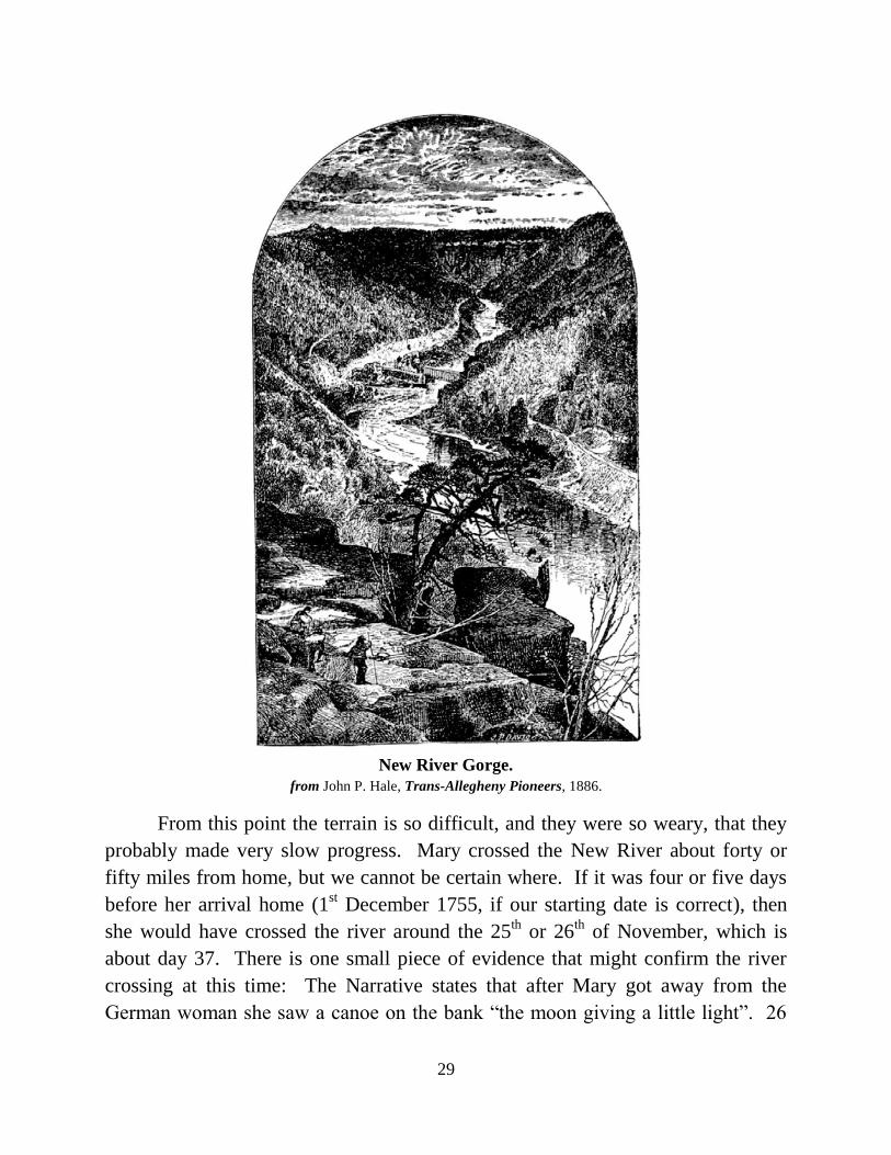
New River Gorge.
from John P. Hale, Trans-Allegheny Pioneers, 1886.
From this point the terrain is so difficult, and they were so weary, that they
probably made very slow progress. Mary crossed the New River about forty or
fifty miles from home, but we cannot be certain where. If it was four or five days
before her arrival home (1st December 1755, if our starting date is correct), then
she would have crossed the river around the 25th or 26
th of November, which is
about day 37. There is one small piece of evidence that might confirm the river
crossing at this time: The Narrative states that after Mary got away from the
German woman she saw a canoe on the bank “the moon giving a little light”. 26

30
November 1755 was a Thursday, and the beginning of the fourth quarter of the
moon — the full moon occurred on the 18th
— and this sliver of moon would have
come up, giving a little light.
The crossing, according to John P. Hale, was near the mouth of the East
River, which flows into the New River. The fact that a canoe was left at that place
signifies that it was a regular Indian crossing. The Narrative states that Mary had
never paddled a canoe before, but it didn’t take her long to learn. On the other side
of the river she found a cabin, and, early the next morning she searched the small
overgrown garden, and found a few little turnips. The German woman on other
side of the water saw her, and called her to come get her in the canoe, but Mary
decided not to place herself in further danger.
There were hunters in the area who had built small cabins. The German
woman found a cabin, plenty of food, and some necessary clothing. She found a
horse, which would have told her that people were not far away. Mary continued
down the river and arrived at the home of Adam Harmon on the banks of New
River. It is said in the Narrative that he took great care of Mary, feeding her a little
at a time; however, the German woman apparently ate her fill immediately, and
suffered no ill effects.
Both women made it back to their homes. According to her son John’s
narrative it took Mary 42½ days to return home, and the German woman was
found shortly afterwards. This very remarkable circumstance, was reported in the
papers at the time. These notices from the newspapers, though meager, are the
earliest reports we have of the remarkable story of Mary Ingles’s journey.
After her return, the Ingles family lived for a short time at Vauses Fort, but
then she insisted on moving east of the Blue Ridge Mountains, and thus avoided
being captured again when that Fort was taken, 25th
June 1756. John Ingles wrote
in his Narrative of the Ingles Family:
My father and mother continued at the Dunkert Bottom until the next spring. And
as the settlers in this country was likely to be harassed by the Indians again that
season my mother became very restless and uneasy, and could not be reconciled
to stay there. My Father, to gratify her, moved her about twenty miles to another
fort, called Vauses Fort, on the Head of Roanoke, where their was more families
collected, and a much stronger fort; and more men to guard it. But as the Indians
was making depredations on the frontiers, she still could not rest reconciled the

31
stay there. My father then moved her down into Bedford County, below the Blue
Ridge, and in the course of that Fall there was a strong party of French and
Indians came on to Vauses fort, attacked it, and finally took the fort, and killed
and captured all the families that was there. And, had it not been through the
direction of a kind Providence that my mother had gone from this fort, she would
have fallen into their savage hands again, and would have been killed or taken
prisoner the second time.
Mary appears in the 1810 census living with her son John, but she was always
independent, and maintained her own separate cabin. The incidents her
descendants told of her old age show she still had plenty of spirit. Mary died in
1815, at the age of 83 or 84.
The Significance of Mary’s Life
Against what background can we view the life of Mary Ingles. What is the
significance of this single event that people should continue to discuss it after so
long a time? I think it can best be understood in the light of the great intellectual
tradition that culminated in what is often referred to as the Judeo-Christian, or
Biblical wisdom literature.
The significance of a single life in the worldview of the wisdom tradition
can best be grasped, according to Prof. James Kugel of Harvard University, by
comparing that life to the canvas of an artist. Each of us gets to paint a canvas; just
one, then it is ours forever. Not everyone will produce a masterpiece.
It is difficult to evaluate a painting — or a life — while it is in progress.
What was potential becomes actual as the process continues, but many other
possibilities are ruled out as the canvas fills up. At last it is filled up completely.
It is only then that we can step back and see its significance: The past is present
there on the canvas.
It is not the subject that counts. All those brushstrokes, and everyday events,
were creating a stark reality, not shades of gray, but in black and white, standing
aloof from the variegated intricacies of life — for neither money, ability, position, or
intelligence, is what counts in the end. What counts in this view of the world is what
Prof. Kugel calls “the sharp contrast of moral opposites and all-or-nothing choices”.
With one bold stroke Mary marked her canvas forever. This event eclipses

32
everything else in her life. It is the main thing we see when we see her canvas. It is
not the journey itself that stands out; it is the spirit in which she did it. Her
travelling companion made the same journey, but what tends to stand out there, for
most viewers, is the “moral opposite” — even her name has been forgotten. We
must not only do a thing, we must do it surpassingly well against all odds to produce
a masterpiece.
The Song of Moses (Psalm 90), as Prof. Kugel says, stands as a kind of
culmination of the wisdom tradition: The Psalmist reminds us that if, by reason of
strength, we reach the age of fourscore years, still we are soon cut off and fly
away: so teach us to number our days, and apply our hearts unto wisdom. Then
the song continues, showing us the significance and value of life: Let Thy work
appear unto Thy servants, and Thy glory unto their children, and let the beauty
of the Lord our God be upon us. It is this stark beauty that rests upon the life of
such as Mary Ingles. The “all-or-nothing” choice was Mary’s, but both Mary and
her son, John, attributed the accomplishment of it to the work of divine
Providence. Her inspiring deed has enriched us by example, becoming part of the
texture of our life and history. It teaches us to value the beauty possible in each
individual life, for some of her beauty has come to rest upon us.
Note
It is intended that complete notes and documentation for this work will be published in a
companion paper. The manuscript of the Ingles Narrative which relates the story of Mary’s
capture and escape, is available on the Boone County Public Library Website, courtesy of the
University of Virginia Library. Scanned copies of the first thirteen pages of the original, along
with my transcription, and some additional documentary materials, may be accessed at:
http://www.bcpl.org/lhg/ingles

33
Acknowledgements
I would like to thank the following for their help and encouragement in the research and
writing of this paper: Lucinda Brown, Director, Boone County Public Library; Bridget Striker,
Local History Librarian, Boone County Public Library; Patty Hons, a descendant of Mary
Ingles, of Lawrenceburg, Indiana; Heather Riser, Special Collections Librarian, University of
Virginia, for her assistance in providing scanned copies of the original Ingles Manuscript; Karl
Lietzenmayer, editor of the Northern Kentucky Heritage Magazine, for many editorial
suggestions that improved the style of the paper; Becky Kempf, Director of Public Relations,
Boone County Public Library, for her assistance in the publication of the book; my aunt,
Margie Patterson, who encouraged me to research and write about Mary Ingles; my father
James R. Duvall, of Union, Kentucky, an editor of many historical documents, who has
encouraged my historical work; and for the assistance of my wife, Nicole Duvall, who came to
Big Bone from her home at Beauty Mountain, on the New River Gorge.
20 March 2009.
James Duvall, M. A.
James Duvall was born in Lexington, Kentucky. He graduated from Clay County High
School in Manchester, Kentucky, in 1976, and earned his B. A. in Bible and Ancient
Languages at the Lexington Baptist College in 1980. He graduated from the Austin Peay
State University with a M. A. in History. His thesis, Principia Historia; or, R. G.
Collingwood and the Logic of History, was accepted, and the degree granted, in 1988.
He has done doctoral work at Hebrew Union College, in Cincinnati, completing all
course work for the degree in Ancient Near Eastern Studies; instead of writing a
dissertation he took an M. A. in Bible and Cognate Studies, graduating in 2000.
James is the Local History Research Specialist for the Boone County Public Library, and
is compiling the Annals of Boone County. He is writing a history of Big Bone in his
spare time. He and his wife, Nicole, and their six children, live in a cabin on Big Bone
Creek, near the Ohio River, in Boone County, Kentucky.
Boone County Public Library
1786 Burlington Pike
Burlington, Kentucky 41005 859-342-BOOK (2665)
www.bcpl.org