Maritime Risk Assessment in the U.S. Army Corps of Engineers
14
Maritime Risk Assessment in the U.S. Army Corps of Engineers Operational Practice and Research Advancements Marine Board, 9 November 2016 Julie Dean Rosati US Army Corps of Engineers Coastal & Hydraulics Laboratory Engineer Research & Development Center
Transcript of Maritime Risk Assessment in the U.S. Army Corps of Engineers
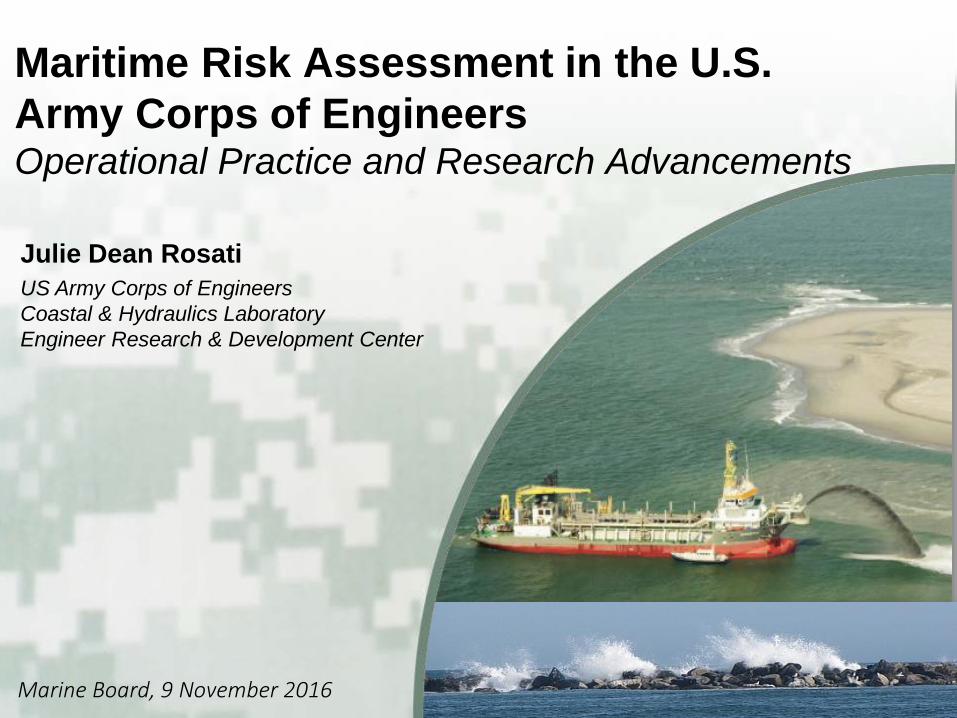
Maritime Risk Assessment in the U.S. Army Corps of Engineers Operational Practice and Research Advancements
Marine Board, 9 November 2016
Julie Dean Rosati US Army Corps of Engineers Coastal & Hydraulics Laboratory Engineer Research & Development Center
BUILDING STRONG®
2/14
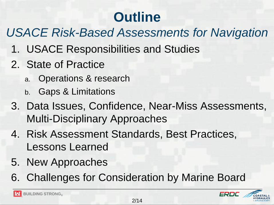
Outline USACE Risk-Based Assessments for Navigation 1. USACE Responsibilities and Studies 2. State of Practice
a. Operations & research b. Gaps & Limitations
3. Data Issues, Confidence, Near-Miss Assessments, Multi-Disciplinary Approaches
4. Risk Assessment Standards, Best Practices, Lessons Learned
5. New Approaches 6. Challenges for Consideration by Marine Board

BUILDING STRONG®
3/14
1. USACE Missions & Scope of Studies Maritime Activities Involve Three USACE Missions: Navigation, Environmental, and Flood Risk Management
Navigation 200 Mill cu yd/year
Environmental
Flood Risk Mgt
• 25,000 miles of federally authorized inland and coastal navigation channels
• 200 Mill cu yd/year of dredged sediments • 926 coastal, Great Lakes and inland harbors • 30,000s+ acres wetlands restored* annually
Scope of Maritime Studies: • Planning – 3x3x3 - Rapid; 2-18 mos • Engineering Design – Detailed & rigorous;
multiple months to several years • Operations & Maintenance
• Dredging & placement • Rehabilitation of infrastructure • Scope of analyses varies
*Or created, enhanced, preserved

BUILDING STRONG®
4/14
2a. USACE Risk-Based Practice – Ocean to Nearshore (1 of 3)
Environmental Forcing ► CHS: Pre-calculated database for
1000s storms ► WIS: hindcast & observed data ► Tools: simple estimators to numerical
models Vessel Operations
► Cadet: numerical model for underkeel clearance
► AIS data – analysis of vessel patterns ► Ship simulator ► Boussinesq numerical models
CHS: Coastal Hazards System POCs: Massey, Melby
> 100 Mill CPU hr; 3,450 storms; ~19K save points: https://chs.erdc.dren.mil
WIS: Wave Information Studies POCs: Jensen, Hesser

BUILDING STRONG®
5/14
2a. USACE Risk-Based Practice – Coastal & Inland Infrastructure (2 of 3)
Travel Time Analysis via AIS – implications of lock closures
* Beaches & dunes - Beach-fx; Coastal regions - G2CRM, 2nd Generation Coastal Risk Model; POC: M. Gravens
Infrastructure Condition & Availability ► Probability based models* for flooding & erosion to
beaches, dunes, and infrastructure; economic implications ► Asset Management: capacity to achieve intended purpose
StormSim – life-cycle & reliability tool for coastal structures (POC: J. Melby)
Cumulative delays due to Lock Closures in 2014, Ohio River (POC: P. DiJoseph)
BUILDING STRONG®
6/14
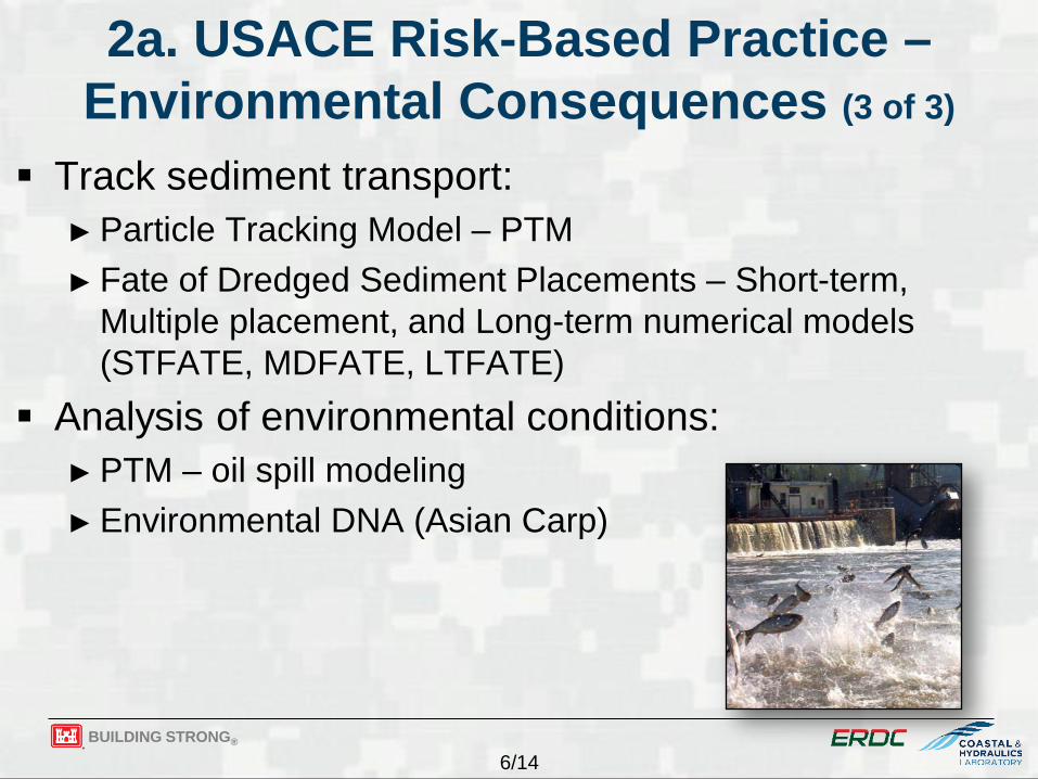
2a. USACE Risk-Based Practice – Environmental Consequences (3 of 3)
Track sediment transport: ► Particle Tracking Model – PTM ► Fate of Dredged Sediment Placements – Short-term,
Multiple placement, and Long-term numerical models (STFATE, MDFATE, LTFATE)
Analysis of environmental conditions: ► PTM – oil spill modeling ► Environmental DNA (Asian Carp)

BUILDING STRONG®
7/14
2b. Gaps & Limitations in Risk-Based Maritime Assessments
Need risk-based design guidance; majority deterministic ► Research studies bring risk-based analysis to practice for
some applications Planning studies require rapid pre-calculated data Many assessments are project-centric (local); need
planning-level watershed-scale tools (regional) Uncertainty in data, forcing, and state-of-knowledge
affect long-term (decadal-century) forecasting Some model applications are not seamless Models must be validated and certified for USACE

BUILDING STRONG®
8/14
3. Data Issues, Confidence, Near-Misses, Multi-Disciplinary Approaches
Data Issues & Confidence: Forecasting Future ► Lack of historical data; uncertainty in measurements ► Uncertainty in future environmental forcing ► State-of-knowledge for long-term morphologic change ► Discovering and accessing authoritative data challenging
(formats, metadata, uncertainties)
Ship Domain Violations via AIS Analysis, Boston Harbor; POC: M. Schultz
Ship-Tow Simulator
http://www.erdc.usace.army.mil/Media/Fact-Sheets/Fact-Sheet-Article-View/Article/476712/erdc-shiptow-simulator/
Near-Miss Assessments & Multi-Disciplinary Approaches
► AIS analyses ► Ship-Tow Simulator
BUILDING STRONG®
9/14
4. Risk Assessment Standards, Best Practices, Lessons Learned
Projects are justified based on economic benefit to cost ratios ► Risk is incorporated in probabilistic life-cycle approach
Best practices and guidance are documented in engineering guidance, certified models and tools
Lessons learned and research needs communicated through Communities of Practice
BUILDING STRONG®
10/14
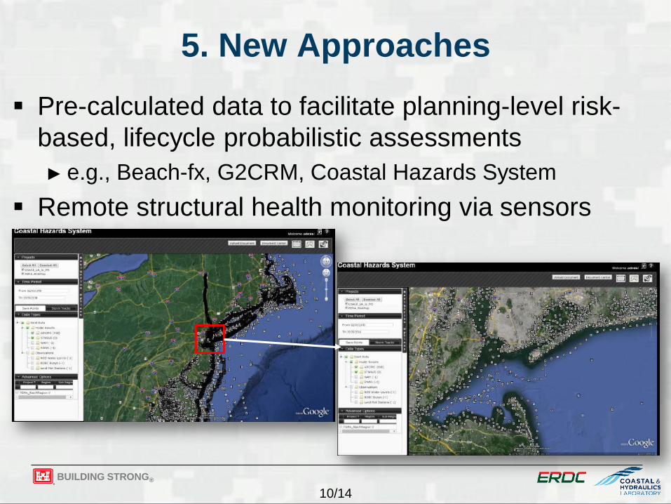
5. New Approaches Pre-calculated data to facilitate planning-level risk-
based, lifecycle probabilistic assessments ► e.g., Beach-fx, G2CRM, Coastal Hazards System
Remote structural health monitoring via sensors
BUILDING STRONG®
11/14
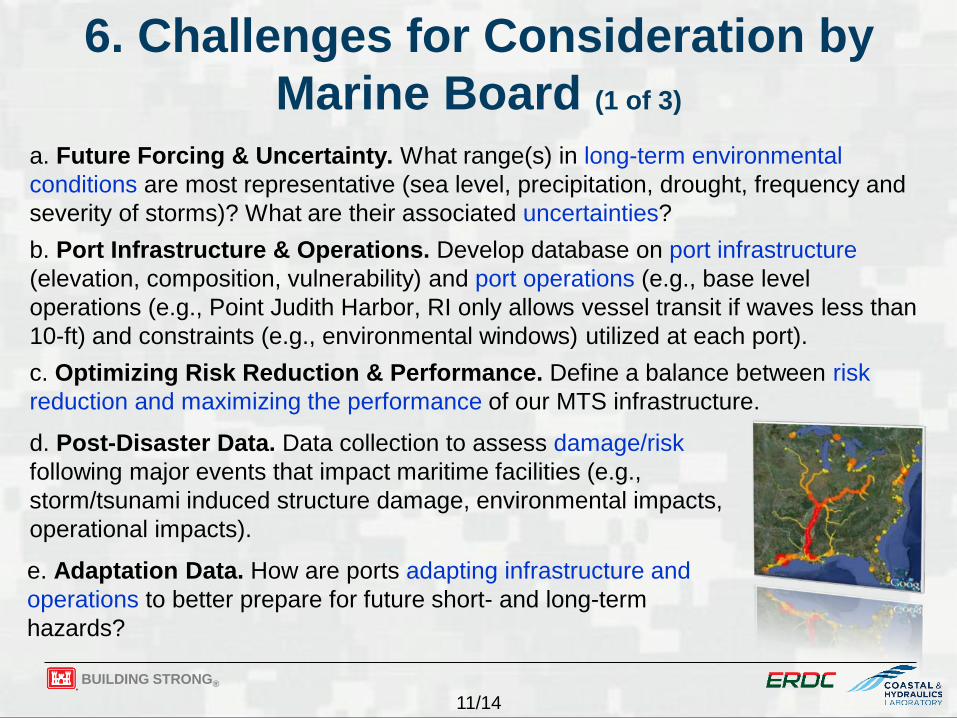
6. Challenges for Consideration by Marine Board (1 of 3)
a. Future Forcing & Uncertainty. What range(s) in long-term environmental conditions are most representative (sea level, precipitation, drought, frequency and severity of storms)? What are their associated uncertainties? b. Port Infrastructure & Operations. Develop database on port infrastructure (elevation, composition, vulnerability) and port operations (e.g., base level operations (e.g., Point Judith Harbor, RI only allows vessel transit if waves less than 10-ft) and constraints (e.g., environmental windows) utilized at each port). c. Optimizing Risk Reduction & Performance. Define a balance between risk reduction and maximizing the performance of our MTS infrastructure. d. Post-Disaster Data. Data collection to assess damage/risk following major events that impact maritime facilities (e.g., storm/tsunami induced structure damage, environmental impacts, operational impacts). e. Adaptation Data. How are ports adapting infrastructure and operations to better prepare for future short- and long-term hazards?
BUILDING STRONG®
12/14
6. Challenges for Consideration by Marine Board (2 of 3)
f. Coordinate Long-Term Environmental Monitoring of MTS. Coordinate field studies across academia, government, private sector to assess impacts of navigation channels (dredging, ship wakes) on coastal and estuarine processes (beach/shore erosion, salinity intrusion, constituent transport, channel and estuary currents, real-time navigable depth, long waves in harbors and ports, etc.). g. Assessment of Climate Change Impacts on Maritime Activities. Evaluate long-term impacts of climate change (sea level rise, storm tracks, storm intensities) on maritime activities (navigation, ports, and environmental quality).
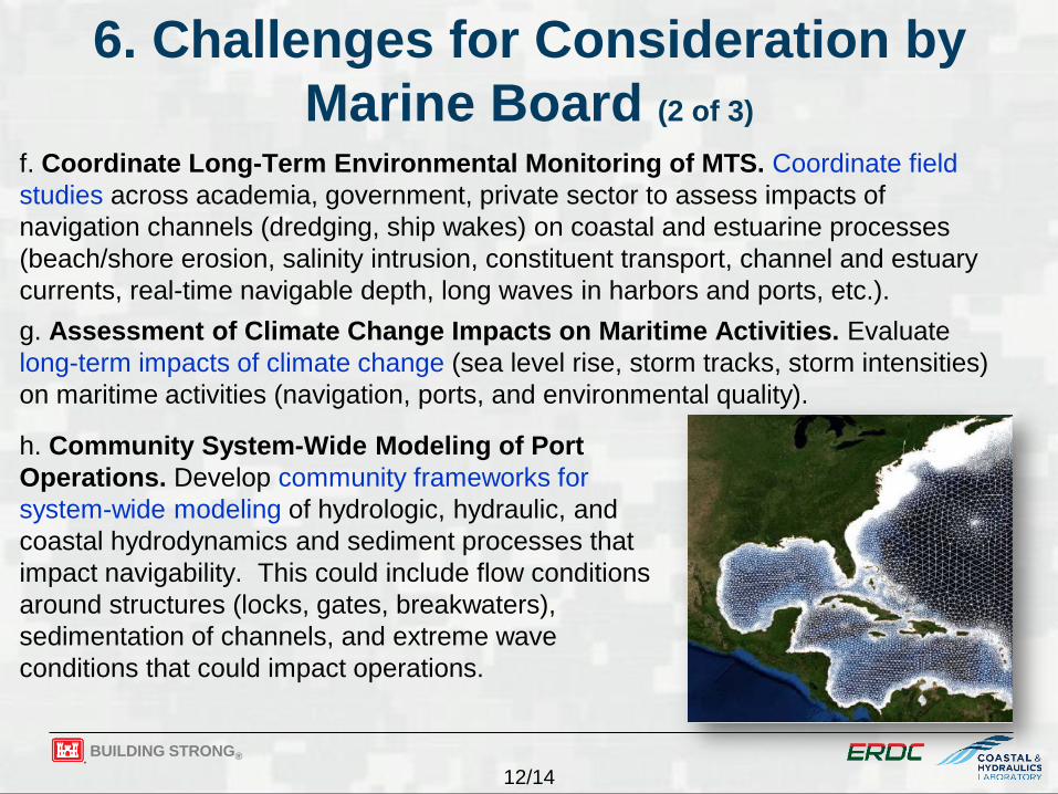
h. Community System-Wide Modeling of Port Operations. Develop community frameworks for system-wide modeling of hydrologic, hydraulic, and coastal hydrodynamics and sediment processes that impact navigability. This could include flow conditions around structures (locks, gates, breakwaters), sedimentation of channels, and extreme wave conditions that could impact operations.
BUILDING STRONG®
13/14
6. Challenges for Consideration by Marine Board (3 of 3)
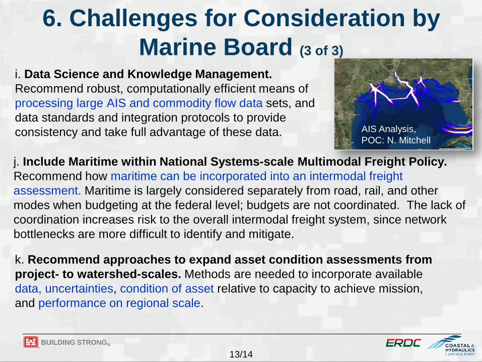
i. Data Science and Knowledge Management. Recommend robust, computationally efficient means of processing large AIS and commodity flow data sets, and data standards and integration protocols to provide consistency and take full advantage of these data.
k. Recommend approaches to expand asset condition assessments from project- to watershed-scales. Methods are needed to incorporate available data, uncertainties, condition of asset relative to capacity to achieve mission, and performance on regional scale.
j. Include Maritime within National Systems-scale Multimodal Freight Policy. Recommend how maritime can be incorporated into an intermodal freight assessment. Maritime is largely considered separately from road, rail, and other modes when budgeting at the federal level; budgets are not coordinated. The lack of coordination increases risk to the overall intermodal freight system, since network bottlenecks are more difficult to identify and mitigate.
AIS Analysis, POC: N. Mitchell

BUILDING STRONG®
14/14
Conclusions: USACE Maritime Risk Assessments support
► Navigation, Flood Risk Management, and Environmental Missions+ ► Planning, Operations, Maintenance & Engineering studies
Research studies have incorporated risk assessments in a probabilistic life-cycle approach; guidance is deterministic
Challenges include ► Designing with National Economic Development benefits and sufficient
risk reduction ► Rigorous assessments for planning-level studies ► Utilizing pertinent data with uncertainties ► Representing project performance on regional scales ► Considering decadal-to-century forcing ► Developing risk-based guidance
Contributors: ► Mary Cialone ► Patty DiJoseph ► Jeff Lillycrop
► Chris Massey ► Jeff Melby ► K. Ned Mitchell
► Jane Smith ► Matthew Smith ► Martin Schultz