March Town Referendum E-doc
44
REFERENDUM DOCUMENT MARCH NEIGHBOURHOOD PLAN - Produced by March Town Council March Town Plan by March Town People
Transcript of March Town Referendum E-doc

REFERENDUMDOCUMENT
MARCH NEIGHBOURHOOD PLAN���� - ����
Produced by March Town Council
March Town Plan by March Town People


Submission Plan - Foreword Page 1
Foreword
March Town Council, as a qualifying body has prepared a Neighbourhood Plan, which is a statutory land use planning document, carrying significant material weight in the planning process. We are aware that many residents and businesses in the town have concerns about planning and in response to this we have prepared this Plan to ensure that the views of local people are given sufficient weight in the planning process on matters that are important to them.
The making of this Plan has been community led from the outset and is the product of considerable community engagement work, which started with the town wide survey in November 2013, followed by an issues and options consultation in May 2014, a vision, aims and objectives consultation in October 2014, and a Pre-Submission draft Plan consultation in March 2015, all of which provided a good platform to identify the most important planning issues to you, which in turn has helped to shape the eventual scope and content of the Plan.
The Plan has taken longer to prepare than anticipated and this has been due to the volume of comments we received at the various stages of consultation, which have taken time to carefully consider and find the right solutions. However, the March Neighbourhood Plan proudly carries the brand "March Town Plan by March Town People" and this only serves to reinforce the lengths March Town Council has gone to ensure that March residents and businesses are at the heart of the Plan. As it is not the aim of the Plan to replicate material already addressed in the Government’s National Planning Policy Framework or Fenland District Council’s adopted Local Plan, the proposed policies are limited to those areas where it is felt that more clarity is required in order to ensure the vision, aims and objectives of the Plan are met. The final version of the Plan is fully in accordance with both of these key planning documents, which is essential in meeting the basic conditions of Neighbourhood Plan preparation.
The Plan does not address planning issues that do not have broad consensus or issues that are not related to land use planning or matters that fall within the remit of other statutory bodies and providers.
I would like to thank the members of March Town Council who worked on the preparation of the Plan, with notable contributions from Cllr Jan French, Cllr Robert Skoulding and the Town Clerk, Clive Lemmon, and with a very special thanks to Cllr Kit Owen, who presided over the majority of the Plan making stages outlined above and who drove the Plan forward. It is my pleasure to present this plan to you, which we believe will have a positive impact on the quality of people’s lives in March.
Cllr Kim FrenchMarch Town Mayor
Submission Plan - Foreword Page 1
ForewordForewordForeword

Submission Plan - How the Plan is organised Page 2
ForewordHow the Plan is Organised
The Plan is divided into 4 sectionswhich include the following:
This section sets out the policies to support the vision, aims and objectives, including the justification for each policy.
Section 3 Neighbourhood Plan Policies
This section highlights any deviation from the Fenland Local Plan, identifies the arrangements for the monitoring and review of the Plan, sets out the legal framework for the justification for the Plan, including the evidence base used, and acknowledges the contribution of members of March Town Council.
Section 4 Supporting Information
This section sets out the overall vision for March in future years and identifies the key aims and objectives that will help deliver the vision.
Section 2 �e vision for March
This section considers how the Plan fits into the planning system and provides an overview of the stages of consultation carried out and in particular, how this has influenced the development of the Plan.
Section 1 Introduction

Submission Plan - Contents Page 3
ForewordContents
Section 1 – Introduction
01 The Plan Boundary. . . . . . . . . . . . . . . . . . . . . . . . . . . . . . . . . . . . . . . . . . . . . . . .p5 02 How the Neighbourhood Plan fits into the Planning System.. . . . . . . . . . . . . . . . . . . . . . . . . . . . . . . . . . . . . . . . . . . . . . . . .p6 03 What the Neighbourhood Plan covers. . . . . . . . . . . . . . . . . . . .p7 04 Community Engagement. . . . . . . . . . . . . . . . . . . . . . . . . . . . . . . . . . . . . . .p7 05 Sustainability Appraisal. . . . . . . . . . . . . . . . . . . . . . . . . . . . . . . . . . . . . . . .p9 Section 2 – The Vision for March
01 Summary of key issues. . . . . . . . . . . . . . . . . . . . . . . . . . . . . . . . . . . . . . . . . .p10 02 The vision, aims and objectives. . . . . . . . . . . . . . . . . . . . . . . . . . . . .p13
Section 3 – Neighbourhood Plan Policies
Housing Policies:
H1 – Large Development Sites. . . . . . . . . . . . . . . . . . . . . . . . . . . . . . . . . . .p15 H2 – Windfall Development. . . . . . . . . . . . . . . . . . . . . . . . . . . . . . . . . . . . . . .p19 H3 – Local Housing Need. . . . . . . . . . . . . . . . . . . . . . . . . . . . . . . . . . . . . . . . . . .p21 Town Centre Policies:
TC1 – Primary Shopping Frontages. . . . . . . . . . . . . . . . . . . . . . . . . . . . .p22 TC2 – Town Centre Regeneration Sites. . . . . . . . . . . . . . . . . . . . . . . .p26 Open Space Policy:
OS1 – Protection of Open Space. . . . . . . . . . . . . . . . . . . . . . . . . . . . . . . . .p35
Section 4 - Supporting Information
01 Relationship to Fenland Local Plan. . . . . . . . . . . . . . . . . . . . . . .p37 02 Monitoring and Review.. . . . . . . . . . . . . . . . . . . . . . . . . . . . . . . . . . . . . . . .p38 03 Reference Documents. . . . . . . . . . . . . . . . . . . . . . . . . . . . . . . . . . . . . . . . . . .p38 04 Acknowledgements. . . . . . . . . . . . . . . . . . . . . . . . . . . . . . . . . . . . . . . . . . . . . .p39

This Plan has been produced by March Town Council in consultation with the community. The
March Neighbourhood Plan is a new type of planning document that will help guide
development in March in key areas in the period up to 2030. It is part of the Government’s
new approach to planning, which aims to give local people more say about what goes on in
their area. This is set out in the Localism Act that came into force in April 2012.
The Plan provides a vision for the future of the community and sets out clear policies to help
realise this vision. These policies must accord with higher level planning policy, as required
by the Localism Act. This includes the Government’s National Planning Policy Framework
(NPPF) and Fenland District Council’s adopted Local Plan (FLP). The Plan therefore does not
attempt to replicate these strategic documents but simply to support them by providing more
clarity in a number of areas that the community considers to be important and necessary.
The Plan therefore reflects the key desires of the community, which are to provide local
people with more certainty about the development of land for housing and, in particular, to
ensure adequate infrastructure is provided and that important community assets are not lost
or damaged in the process. It also attempts to help make the town centre a more attractive
place to shop by protecting the primary shopping frontages and identifying opportunities for
the improvement of the built environment.
Submission Plan - The Plan Boundary Page 4
ForewordSection 1 - Introduction
1.1
1.2
1.3

The whole parish of March was formally designated a Neighbourhood Area under the
Neighbourhood Planning Regulations 2012 (Part 2, Section 6) on 11 December 2013.
ForewordSection 1 - Introduction
1.4
Submission Plan - Boundary Plan Page 5
01 The Plan Boundary
LegendMarch Neighbourhood Area Boundary (Also March Parish Boundary)
Submission Plan - Section 1 - Fitting into the Planning System Page 6
02 How the Neighbourhood Plan fits into the Planning System
Although the Government’s intention is for local people to have a greater say on what goes
on in their towns, the Localism Act sets out some important laws. One of these is that a
Neighbourhood Plan must comply with higher level planning policy. This means that
Neighbourhood Plans must be in line with European Union Regulations on Strategic
Environmental Assessment (SEA) and habitats, the National Planning Policy Framework
(NPPF) and local policy, in particular, Fenland District Council’s Local Plan (FLP).
As part of the development plan for Fenland District, the Neighbourhood Plan, together with
the NPPF and the FLP (or any subsequent plan for Fenland District) will be the starting point
for determining planning applications within March parish. The Neighbourhood Plan follows
the strategic policies of the FLP by being in force until 2030. The policies in the
Neighbourhood Plan are to be considered as a whole together with the strategic policies of
the FLP.
The FLP (Policy LP4 – Housing) requires March to provide at least 4,200 homes in the period
2011 to 2030. Policy LP9 – March allocates the majority of this in three locations, which
include two strategic allocations: South East March (around 600 dwellings) and West March
(around 2000 dwellings), and a broad location for growth referred to as South-West March
(around 500 dwellings and some business development). Although the Localism Act does not
allow Neighbourhood Plans to provide less than this strategic allocation, it does not prevent
them from introducing measures to ensure that these large strategic sites and opportunities
from other sources, such as windfall development are delivered in a coordinated and
transparent manner for the benefit of the residents of March.
1.5
1.6
1.7
ForewordSection 1 - Introduction
Submission Plan - Section 1 - What the Plan Covers Page 7
Whilst planning applications are still determined by Fenland District Council, the production
of a Neighbourhood Plan for March will give local people a bigger say in how the town
evolves by providing a policy framework in tune to local need for Fenland District Council to
make decisions on behalf of the people of March.
03 What the Neighbourhood Plan covers
The form and content of Neighbourhood Plans varies greatly. Some Neighbourhood Plans are
extremely ambitious and set out from the beginning to contain lots of policies covering many
subjects, including making specific allocations; whilst some are very narrow in focus.
The scope and content of the March Neighbourhood Plan has been shaped entirely by the
community, in which there is broad consensus for stronger and/or clearer advice in relation
to a limited range of issues in order to more effectively support some of the policies of the
FLP.
04 Community Engagement
The March Neighbourhood Plan belongs to the people of March. The Plan has been
developed from the views of local people building on the work of a number of successive
consultation and engagement events, which can be summarised on the following pages.
1.8
1.9
1.10
1.11
ForewordSection 1 - Introduction
Submission Plan - Section 1 - Community Engagement Page 8
1.11.3 - Vision, Aims and Objectives Consultation
On the 11 October 2014 March Town Council launched a Vision, Aims and Objectives
Consultation exercise with a public exhibition at The Oliver Cromwell Hotel, which
attracted 130 visitors. The consultation event ran for 6 weeks during which a total of 150
comments forms were received. This work also included a number of workshops with
different aged school children.
1.11.1 - Town Wide Survey
On the 12 November 2013, March Town Council carried out a town wide survey in the form
of a detailed questionnaire delivered to every household and the majority of businesses in
the Plan area. The purpose of the survey was to help identify key issues, challenges,
opportunities and priorities relating to the development and use of land. A total of 617
questionnaires were returned by the 16 December 2013 deadline. This exercise was
supplemented by a number of engagement workshops with the youth and business
community in April 2014. The results of the survey and supplementary work revealed a
number of issues that needed to be looked at, which formed the basis for developing the
Issues and Options work.
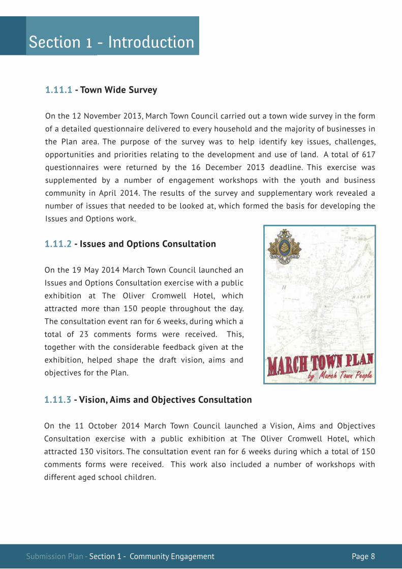
1.11.2 - Issues and Options Consultation
On the 19 May 2014 March Town Council launched an
Issues and Options Consultation exercise with a public
exhibition at The Oliver Cromwell Hotel, which
attracted more than 150 people throughout the day.
The consultation event ran for 6 weeks, during which a
total of 23 comments forms were received. This,
together with the considerable feedback given at the
exhibition, helped shape the draft vision, aims and
objectives for the Plan.
ForewordSection 1 - Introduction
Submission Plan - Section 1 - Sustainability Appraisal Page 9
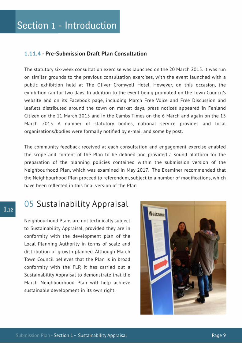
1.11.4 - Pre-Submission Draft Plan Consultation
The statutory six-week consultation exercise was launched on the 20 March 2015. It was run
on similar grounds to the previous consultation exercises, with the event launched with a
public exhibition held at The Oliver Cromwell Hotel. However, on this occasion, the
exhibition ran for two days. In addition to the event being promoted on the Town Council’s
website and on its Facebook page, including March Free Voice and Free Discussion and
leaflets distributed around the town on market days, press notices appeared in Fenland
Citizen on the 11 March 2015 and in the Cambs Times on the 6 March and again on the 13
March 2015. A number of statutory bodies, national service provides and local
organisations/bodies were formally notified by e-mail and some by post.
The community feedback received at each consultation and engagement exercise enabled
the scope and content of the Plan to be defined and provided a sound platform for the
preparation of the planning policies contained within the submission version of the
Neighbourhood Plan, which was examined in May 2017. The Examiner recommended that
the Neighbourhood Plan proceed to referendum, subject to a number of modifications, which
have been reflected in this final version of the Plan.
05 Sustainability Appraisal
Neighbourhood Plans are not technically subject
to Sustainability Appraisal, provided they are in
conformity with the development plan of the
Local Planning Authority in terms of scale and
distribution of growth planned. Although March
Town Council believes that the Plan is in broad
conformity with the FLP, it has carried out a
Sustainability Appraisal to demonstrate that the
March Neighbourhood Plan will help achieve
sustainable development in its own right.
1.12
ForewordSection 1 - Introduction
Submission Plan - Section 2 - Key Issues Page 10
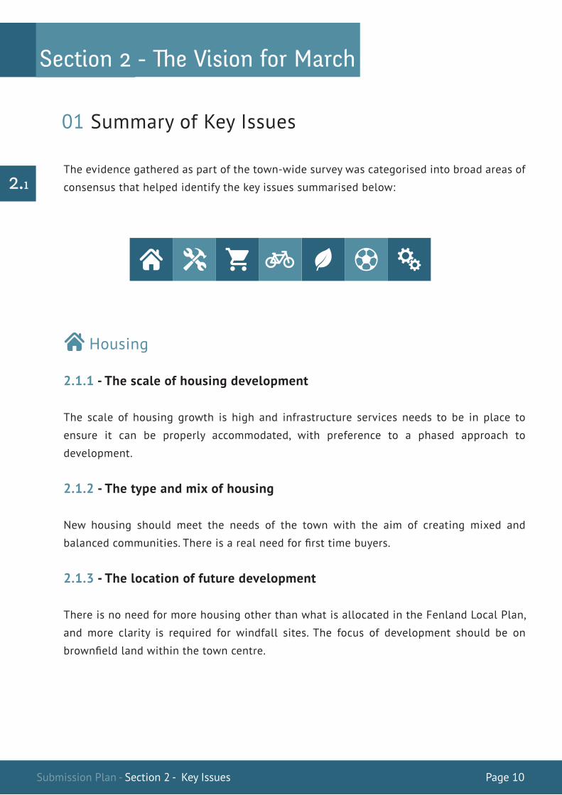
The evidence gathered as part of the town-wide survey was categorised into broad areas of
consensus that helped identify the key issues summarised below: 2.1
ForewordSection 2 - �e Vision for March
01 Summary of Key Issues
Housing
2.1.1 - The scale of housing development
The scale of housing growth is high and infrastructure services needs to be in place to
ensure it can be properly accommodated, with preference to a phased approach to
development.
2.1.2 - The type and mix of housing
New housing should meet the needs of the town with the aim of creating mixed and
balanced communities. There is a real need for first time buyers.
2.1.3 - The location of future development
There is no need for more housing other than what is allocated in the Fenland Local Plan,
and more clarity is required for windfall sites. The focus of development should be on
brownfield land within the town centre.

Submission Plan - Section 2 - Key Issues Page 11
ForewordSection 2 - �e Vision for March
Employment
2.1.4 - The focus of employment
The town centre should be the focus for business with industry on the outskirts of the town.
Jobs should be provided with housing.
Town Centre & Retail
2.1.5 - Achieving the right balance of town centre uses
The retail function of the town should be revitalised. A large part of the town centre has
derelict and underused backland that could be used to regenerate the town centre with
space for a large supermarket. Traffic congestion should be tackled with more parking
provision.
Traffic & Transport
2.1.6 - Reducing the need for the car
Public transport must be improved with more dedicated segregated cycleways and
footpaths. More parking enforcement is also needed.
Environment
2.1.7 - Ensuring appropriate levels of open space provision
There is a desperate shortage of accessible open space in the town. Estover playing field
should be safeguarded.
Submission Plan - Section 2 - Key Issues Page 12
ForewordSection 2 - �e Vision for March
2.1.8 - Maximising the use of renewable energy
New development should incorporate renewable forms of energy, but large-scale wind and
solar farms, including Fracking should be resisted.
2.1.9 - Protecting and enhancing wildlife
There is a shortage of wildlife areas in the town. Access to wildlife sites should be
encouraged.
2.1.10 - Reduce the risk of flooding
All homes should be protected from flooding. Development should not be permitted in
areas of high flood risk. Drains should be better maintained.
Sport & Active Leisure
2.1.11 - Improving leisure facilities through new development
More leisure facilities are required in the town. The existing leisure centre and swimming
pool is substandard. More smaller play areas for children are needed. Access to school
facilities should be encouraged.
Infrastructure
2.1.12 - Ensuring appropriate infrastructure to meet growth
The correct level of infrastructure and services must be provided to meet planned growth,
and should attempt to meet current deficit in provision.
The majority of the feedback from those attending the exhibitions and who submitted
comments forms was that the issues identified accurately reflected the main community
concerns which, if appropriate and necessary, the Neighbourhood Plan should tackle.
2.2
Submission Plan - Section 2 - Vision, Aims & Objectives Page 13
ForewordSection 2 - �e Vision for March
2.3The vision, aims and objectives are based on the key issues summarised above. They have
been adapted by March Town Council to form the basis of the Plan for March. .
VISION
To improve the quality of life for people who live and/or work in March, including those who
visit and depend on its services and facilities.
AIMS
a. That growth within the town is accommodated sustainably.
b. That new housing creates and maintains healthy mixed communities.
c. That March Town Centre becomes a shopping destination of choice for residents,
businesses and visitors.
d. That the quality of the built and natural environment is improved.
e. That the level of provision and quality of recreational land facilities is increased and
improved.
02 The Vision, Aims and Objectives

Submission Plan - Section 2 - Vision, Aims & Objectives Page 14
ForewordSection 2 - �e Vision for March
2.4The level of support expressed for the vision, aims and objectives from those who commented
as part of the Vision, Aims and Objectives consultation exercise can be summarised as follows:
Vision 96%
Aims 93%
Objectives 89%
It is considered that this level of support demonstrates that the community is satisfied with
the Plan’s vision, aims and objectives.
OBJECTIVES
a. Provide more certainty about the sequence of development across the town and the
delivery of infrastructure.
b. Secure an appropriate mix of new housing informed by housing need.
c. Secure the appropriate regeneration of the town centre, tackling long-standing issues
around traffic, parking, retail offer and environment.
d. Secure high quality development in all new schemes.
e. Safeguard and improve all land and facilities of community importance and secure the
provision of new land and facilities.
Submission Plan - Section 3 - Policy H1 Page 15
ForewordSection 3 - Neighbourhood Plan Policies
Policy H1 – Large Development Sites
This Neighbourhood Plan supports the major allocations on the edge of March, as set out
in the Fenland Local Plan (2014), namely:
a) Strategic Allocations
1. South East March (around 600 dwellings)
2. West March (around 2000 dwellings)
b) Broad Locations for Growth
1. South West March (around 500 dwellings)
2. March Trading Estate (business use)
This Neighbourhood Plan does not allocate any additional major development sites on
the outskirts of March.
Development within the above allocated sites must accord with the policies in the
Fenland Local Plan (especially LP7 and LP9), but the following additional requirements
should be met:
The Broad Concept Plan (BCP), which is
required by Policy LP7 – Urban Extensions
of the Fenland Local Plan, should be
prepared with extensive, on-going,
meaningful and cooperative engagement
with the landowners, stakeholders and the
community. This should include genuine
opportunities for these bodies to shape the
proposals, understand the key
opportunities and constraints, and
contribute their thoughts.
Along side the final BCP, the applicant
should demonstrate how the engagement
with the community took place and how
such views and aspirations of the
community have been taken on board in
shaping the proposals, together with, if
applicable, an explanation as to why some
suggestions and comments have not been
taken on board.
1. 2.

Submission Plan - Section 3 - Policy H1 Page 16
The BCP should include a Phasing Plan
with indicative timeframes.
Each BCP will ensure that all of the following matters are addressed where relevant:
a) For the strategic allocations, the development area will be restricted to the allocated
area as defined on the Key Diagram for March as set out in the Fenland Local Plan;
b) For the broad locations for growth, the development area will make efficient use
of land with regard to accommodating the approximate numbers identified or
meeting the intended use, and with specific regard to meeting other criteria in this
policy;
c) It will identify where the primary and secondary access points in and out of each site
will be located.
d) It will identify the broad distribution of roads within each site and highlight the
general movement of traffic within the site and onto the surrounding road network.
e) It will identify the different uses of land within each site (residential, employment,
retail, open space etc.), and provide an indicative area in hectares for each use,
ensuring an appropriate balance and sustainable use of land is achieved;
f) It will identify strategic landscaping belts to define the new outer edge of
development and provide a green buffer to surrounding countryside;
An infrastructure Schedule should be
provided with the BCP, indicating what on
and off-site infrastructure is necessary to
fully support the development, identifying
broadly where it will be located and in
which phase it will be provided.
3. 4.
5.
ForewordSection 3 - Neighbourhood Plan Policies
Submission Plan - Section 3 - Policy H1 Page 17
g) It will identify the broad design principles that will be applied with the aim of
showing how local vernacular styles, patterns of development and materials will
be reflected within the development;
h) It will identify the areas at risk of flooding, including problems associated
with surface water run-off both on and off-site and the measures to be employed
to manage any identified risk.
The BCP should be formally considered by March Town Council, and its views recorded,
prior to it being submitted to Fenland District Council for consideration.
ForewordSection 3 - Neighbourhood Plan Policies

Submission Plan - Section 3 - Policy H1 Page 18
3.1
3.2
3.3
3.4
3.5
Justification
The Fenland Local Plan (FLP) covers the period 2011 to 2031, during which a total of 11,000 new homes are planned for the entire District. Policy LP4-Housing (Part A - Housing Targets) allocates this across the District, with 4,200 new homes (38%) allocated in March as the largest and most sustainable settlement in the District. These are predominantly accommodated within three locations, which include two strategic allocations at South East March and West March, and a Broad Location for Growth at South West March. The FLP refers to these areas as Urban Extensions.
Feedback from local residents and businesses as part of the March Town-Wide Survey identified a number of concerns in relation to the Town’s ability to accommodate this scale of growth, particularly in relation to infrastructure. Proposed changes to the use of Section 106 monies, which took effect in April 2015, places restrictions on the pooling of resources towards infrastructure from different applications, and with the lack of any alternative approach such as the Community Infrastructure Levy (CIL), these concerns have been exacerbated. The provision of adequate infrastructure with these large schemes and transparency around this is therefore of paramount importance to the community.
Policy LP7-Urban Extensions of the FLP attempts to provide some context for how these sites should be developed and refers to the need for these urban extensions to be developed in accordance with “overarching broad concept plans” and provides some criteria to guide developers in the preparation of planning applications. However, March Town Council (MTC) does not feel that Policy LP7 provides sufficient clarity and assurances to the community that these Urban Extensions will be developed sustainably.
The March Neighbourhood Plan (MNP) attempts to address this by supplementing the overarching broad concept plan approach with additional requirements, including ensuring full engagement with the community.
The criteria set out in the Policy are largely based on feedback from the community, (further shaped by the Examiner) which cover important material planning considerations where it is felt this is not made clear in other Policies contained within the FLP. It is vitally important that these Urban Extensions are developed sustainably and that the community have a better understanding of how this will happen. It is considered that Policy H1 of the MNP will help achieve this.
ForewordSection 3 - Neighbourhood Plan Policies

Submission Plan - Section 3 - Policy H2 Page 19
Policy H2 – Windfall Development
Proposals for residential development will be supported where they meet the
provisions of the Fenland Local Plan and where the following additional criteria are
met:
a) The proposal will not result in unacceptable impact on levels of light, privacy
and private amenity space for the occupants of the proposed dwellings. The
impact of proposals on existing neighbouring properties will be assessed
against Policy LP16 of the FLP;
b) The proposal will not result in the net loss of formal or informal open space;
[See Policy OS1]
c) The site is at a low risk of flooding (i.e. not within land designated Flood Zone
2 or 3 by the Environment Agency) and will not create flooding problems on or
off-site, including problems associated with surface water run-off.
Development within flood zones 2 and 3 will only be considered where
appropriate sequential and exception tests have been met;
d) The proposal includes a safe vehicular access and will not result in severe
impacts on the road network taking account of any mitigation proposed.
e) The proposal provides any on or off-site infrastructure required to make the
development acceptable;
f) The proposal is of a high standard of design; and
g) The proposal will not result in the loss of community facilities or services
unless the separate tests set out in Policy LP6 of the Fenland Local Plan are
met.
ForewordSection 3 - Neighbourhood Plan Policies

Submission Plan - Section 3 - Policy H2 Page 20
Applicants should carry out appropriate and proportionate pre-application
community consultation on schemes of 10 dwellings or more. The applicant should
demonstrate the engagement with the community which took place and how
such views and aspirations of the community have been taken on board in
shaping the proposals, together with, if applicable, an explanation as to why some
suggestions have not been taken on board.
Justification
Windfall development usually relates to housing proposals that come forward on both
brown field and green field sites that have not been specifically identified or allocated
for development purposes in the Local Plan or this Neighbourhood Plan. It is accepted
that there will be windfall development opportunities over the life of the Plan, with the
FLP recognising that as many as 600 homes could come from this source in March alone
over the life of the Plan.
Whilst it is recognised that such development could make a positive contribution
towards improving the supply and choice of new homes in the town, and in some cases,
improve the quality of life for existing residents; proposals will nevertheless be
required to meet all of the criteria set out in Policy H2 in order to demonstrate its
acceptability.
It is expected that the main growth within the town will take place on the strategic
allocations and broad locations for growth, where it can be sustainably accommodated.
However, it is recognised that some windfall opportunities may present themselves in
other locations, which may be acceptable in planning terms. Such proposal will be
assessed against the same criteria, with the additional requirement that the necessary
amount of on and off-site infrastructure is provided.
3.6
3.7
3.8
ForewordSection 3 - Neighbourhood Plan Policies
00m 17 54
00m 18 54
541700m
541800m
00m68
29
00m69
29
29 6800m
296900m
OS M
asterMap 1250/2500/10000
scale07 M
arch 2015, ID: C
M-00408108
ww
w.centrem
apslive.co.uk
1:1250 scale print at A4, Centre:
541734 E, 296818 N
©C
rown C
opyright Ordnance
Survey. Licence no. 100019980
0 5 10 15 20 25 30 35 40 45 50
m

Submission Plan - Section 3 - Policy H3 Page 21
For proposals of 10 dwellings or more, applicants should demonstrate that they have
carried out appropriate and proportionate community consultation at pre-
application stage and show how feedback has been carried forward into their
proposals and if applicable, justify why any feedback cannot be incorporated into
the design.
Policy H3 – Local Housing Need
All housing proposals will be required to contribute towards meeting local housing
need, which includes starter homes, family homes, executive homes and self build
homes; and mixed tenure that will result in a diverse community, where this is
reasonably achievable.
For proposals of more than 10 dwellings (new build and conversions), a minimum of
25% of dwellings (rounded to the nearest whole dwelling) must be affordable. The
exception to this will be where the applicant can demonstrate on the basis of an
accurate viability assessment using a recognised assessment model, that meeting the
full 25% is unviable. In such cases, a lesser negotiated amount will be acceptable.
If a proposal for less than 11 dwellings is followed by an obviously linked second
proposal that would take the cumulative number of dwellings above the affordable
housing threshold while the original approval remains extant, or within 5 years of the
completion of the original proposal, a 25% contribution towards affordable housing
will be required based on the cumulative total of dwellings from both schemes.
All affordable housing shall be provided on site unless there are exceptional
circumstances that necessitate provision on another site. Where off-site provision can
be justified, Policy H2 will apply. Payments of financial contributions in lieu of direct
provision will only be acceptable where it can be demonstrated that off-site provision
is not viable. In such circumstances, any contributions will be used on meeting a need
in March as a first option where this is deliverable.
3.9
ForewordSection 3 - Neighbourhood Plan Policies
00m 17 54
00m 18 54
541700m
541800m
00m68
29
00m69
29
29 6800m
296900m
OS M
asterMap 1250/2500/10000
scale07 M
arch 2015, ID: C
M-00408108
ww
w.centrem
apslive.co.uk
1:1250 scale print at A4, Centre:
541734 E, 296818 N
©C
rown C
opyright Ordnance
Survey. Licence no. 100019980
0 5 10 15 20 25 30 35 40 45 50
m

Submission Plan - Section 3 - Policy TC1 Page 22
Justification
It is recognised that the provision of affordable housing is a key aim of the Fenland Local
Plan. March Town Council believes that sustainable development will only be achieved if
all sectors of the community are catered for. In addition to affordable housing, this
includes providing opportunities for the young to gain access to the housing market and
meeting needs such as executive homes, self build homes and the elderly.
Where developers are required to meet an identified level of affordable housing, lesser
amounts should only be accepted where viability evidence has been robustly scrutinised.
Attempts to bring forward developments under affordable housing thresholds
incrementally as a way of avoiding making contributions must also be controlled. On-site
provision is the preferred approach, followed by off-site provision in exceptional
circumstances. Where this is not possible, any financial contributions in lieu of direct
provision will be used to meet a need in March where this is deliverable.
Policy TC1 – Primary Shopping FrontagesIn the Primary Shopping Frontages, as show in the plan below and where planning
permission is required, change of use from retail (Class A1) to other uses (such as Class
A2, A3, A4 and A5) will not be permitted where:
a) it would result in non-retail frontages exceeding 40% of the Primary Shopping
Frontage of the town centre as a whole;
b) it would introduce uses that do not complement the shopping function of the
town centre;
c) it would create a concentration of 5 non-retail uses that would have a
harmful effect on the primary shopping function of the town centre; or
d) It would have a harmful effect on residential amenity by way of noise, smells and
late night disturbance.
3.11
3.10
ForewordSection 3 - Neighbourhood Plan Policies
00m 17 54
00m 18 54
541700m
541800m
00m68
29
00m69
29
29 6800m
296900m
OS M
asterMap 1250/2500/10000
scale07 M
arch 2015, ID: C
M-00408108
ww
w.centrem
apslive.co.uk
1:1250 scale print at A4, Centre:
541734 E, 296818 N
©C
rown C
opyright Ordnance
Survey. Licence no. 100019980
0 5 10 15 20 25 30 35 40 45 50
m

Submission Plan - Section 3 - Policy TC1 Page 23
An exception to Criteria a) will be permitted where:
New retail development located outside of the Town Centre boundary (as defined in the
Fenland Local Plan Policies Map – Inset Map: March South), in excess of 500sq m gross floor
space, and the expansion of existing shopping areas where the new floor space would
exceed 500sq m gross will not be permitted unless it can be demonstrated by way of an
impact assessment (as defined in the NPPF) that it will not harm the vitality and viability of
the Town Centre.
it would secure the re-use of an
existing unit that has been
vacant for at least 12 months
and/or has been neglected to
the extent that it is having a
harmful effect on the quality of
the built environment; and/or.
it relates to the development of the areas identified
under Policy TC2 (where these include Primary
Shopping Frontages) where proposals would secure
significant improvements to the quality of the
environment and make March Town Centre a more
attractive place to shop and visit.
1. 2.
Post
Posts
ROAD
B 1099
LANE
B 1101
STATION
MILL VIEW
ACRE ROAD
BROAD STREET
ROBINGOODFELLOW'S
GRAYS LANE
DARTHILL ROAD
Fenland Walk
PRINCE'S WALK
Posts
MILL VIEW
BROOKS ROAD
ForewordSection 3 - Neighbourhood Plan Policies
Plan Key
PrimaryShoppingFrontages
© Crown Copyright and databaserights 2016 Ordnance Survey 10023778
Created on: 20/07/2016
Submission Plan - Section 3 - Policy TC1 Page 24
Justification
March Town Centre has traditionally been the focus for shopping and for community,
cultural and entertainment activities, and whilst it recognised that the role of town centres
are changing, March Town Council wishes to ensure the future viability of the town centre,
recognising the importance of providing local residents with shops and associated facilities
as an important contribution towards sustainable development objectives.
The Fenland Local Plan (FLP) identifies both a Primary Shopping Area, and within this,
Primary Shopping Frontages, which are referred to in Policy LP6-Employment, Tourism,
Community Facilities and Retail, and identified on the March South Inset Map. March Town
Council carried out a Primary Shopping Frontage survey in February 2015, which revealed
that there are currently 103 units within the FLP defined Primary Shopping Frontages with
a combined frontage of 860 metres. Of this, the predominant use was A1 retail (61%),
followed by A2, financial and professional services (19.4%), with food and drink (A3, A4 and
A5) accounting for approximately 15%. With an almost negligible vacancy rate, the survey
revealed that the town centre has a healthy retail function within its Primary Shopping
Frontages.
The survey also provided an opportunity to review the extent of the Primary Retail
Frontages. As part of this exercise it was considered that there were a number of areas that
should be included within the Primary Shopping Frontages and also a number of areas that
should be removed. The March Neighbourhood Plan has addressed this by excluding
approximately 47 metres of designated Primary Shopping Frontage and including 86 metres
of new Shopping Frontage. The Examiner also recommeneded a further 28m of frontage be
included, which overall has provided a net gain of 67 metres of Primary Shopping Frontage.
3.12
3.13
3.14
ForewordSection 3 - Neighbourhood Plan Policies

Submission Plan - Section 3 - Policy TC2 Page 25
On this basis it is felt that allowing a maximum of 40% non-A1 retail frontages within
the Primary Retail Frontages is an achievable sustainable objective. This target builds
in some flexibility to allow more non-retail uses (A2, A3, A4 and A5), which generate
high levels of pedestrian activity at a scale that will be complementary to its retail
function. However, the level of vacancy within the Primary Shopping Frontages will be
monitored and if it is felt that the policy is having a negative effect in terms of
increases in vacant units, the policy will be reviewed.
Whilst it is recognised that there is a need for some retail activity outside of the town
centre, Policy TC1 will ensure that this will not have a harmful effect on the vitality
and viability of the town centre.
Regeneration of Town Centre Sites
There are a number of areas within and close to the town centre in which it is felt that
the quality of the built environment is having a harmful effect on its attractiveness as
a place to shop and visit and that this is a disincentive for major retail chains to invest
in the area. The quality of the environment and the lack of retail choice from brand
shops was highlighted as a significant concern by the community.
Three key areas have been identified in which the need for improvement is considered
to be the greatest. The March Neighbourhood Plan is seeking to encourage
investment within these areas by identifying them as opportunities for development
with the key aims of improving the quality of the built environment and increasing the
attractiveness of March Town centre as a place to shop and visit.
The March Neighbourhood Plan provides some objectives to assist developers in
coming forward with schemes in all three locations, which it is felt will provide an
incentive for potential investment.
3.15
3.16
3.17
3.18
3.19
ForewordSection 3 - Neighbourhood Plan Policies
Submission Plan - Section 3 - Site 1 Page 26
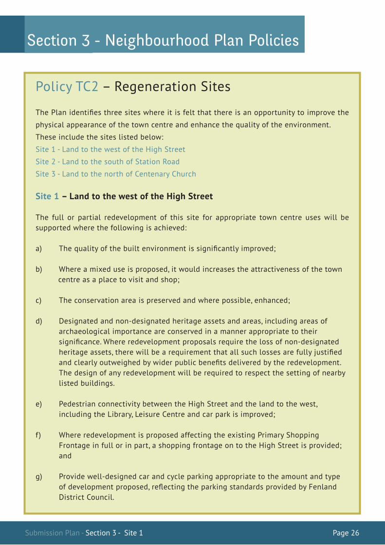
Policy TC2 – Regeneration Sites
The Plan identifies three sites where it is felt that there is an opportunity to improve the
physical appearance of the town centre and enhance the quality of the environment.
These include the sites listed below:
Site 1 - Land to the west of the High Street
Site 2 - Land to the south of Station Road
Site 3 - Land to the north of Centenary Church
Site 1 – Land to the west of the High Street
The full or partial redevelopment of this site for appropriate town centre uses will be supported where the following is achieved:
a) The quality of the built environment is significantly improved;
b) Where a mixed use is proposed, it would increases the attractiveness of the town centre as a place to visit and shop;
c) The conservation area is preserved and where possible, enhanced;
d) Designated and non-designated heritage assets and areas, including areas of archaeological importance are conserved in a manner appropriate to their significance. Where redevelopment proposals require the loss of non-designated heritage assets, there will be a requirement that all such losses are fully justified and clearly outweighed by wider public benefits delivered by the redevelopment. The design of any redevelopment will be required to respect the setting of nearby listed buildings.
e) Pedestrian connectivity between the High Street and the land to the west, including the Library, Leisure Centre and car park is improved;
f) Where redevelopment is proposed affecting the existing Primary Shopping Frontage in full or in part, a shopping frontage on to the High Street is provided; and
g) Provide well-designed car and cycle parking appropriate to the amount and type of development proposed, reflecting the parking standards provided by Fenland District Council.
ForewordSection 3 - Neighbourhood Plan Policies

Submission Plan - Section 3 - Site 1 Plan Page 27
ForewordSection 3 - Neighbourhood Plan Policies
Area of Site Buildings of Local Interest
Area of Archaeological Interest
Listed Buildings
00m16
54
00m17
54
541600m
54 1700m
00m6629
00m6729
296600m
296700m
OS MasterMap 1250/2500/10000 scale15 January 2015, ID: CM-00392168 www.centremapslive.co.uk
1:1250 scale print at A4, Centre: 541610 E, 296628 N
©Crown Copyright Ordnance Survey. Licence no.100019980
0 5 10 15 20 25 30 35 40 45 50
m
Plan Key
Site 1 – Land to the west of the High Street
Submission Plan - Section 3 - Site 1 Justification Page 28
Justification
Site 1 – Land to the west of the High Street
This site comprises a substantial area of land and buildings that extend to approximately
1.5 hectares in area. The site includes the land to the west of the High Street between the
River Nene in the north to George Street in the south. It extends westward up to the District
Council car park in the south, encompassing land adjacent to the sub-station and the
Leisure Centre car park and Library foreground in the north.
Many of the commercial properties fronting the High Street have a run down appearance,
with some in significant state of disrepair. These properties have long back yards that
connect with a number of narrow access roads that continue from George Street, City Road
and Acre Road. There are a number of small buildings located within this area, which
include the Masonic Hall, and a variety of lock ups.
A significant proportion is derelict and abandoned, including the site of the former Ogden’s
Indoor Market off Acre Road (which has approval for demolition), with a number of older
properties in a significant state of disrepair. It also includes the grounds of the Young
People of March. Land to the west is more open and unkempt in appearance. There are no
Listed Buildings on the site but there are a number of Buildings of Local Interest that front
on to the High Street. The majority of the site falls within the March Conservation Area.
There is an area of archaeological interest to the west of the site. Any development within
the associated 20m wide maintenance access strip along the Old River Nene will require
written consent from the Middle Level Commissioners.
It is recognised that the land is in multiple ownership and that this could prove problematic
in terms of land assembly. Notwithstanding this, it is felt that this area needs to be
identified as a location for improvement and that there is potential for a scheme to come
forward in part, if not in totality, to address a number of issues that will help regenerate the
Town Centre and therein address many of the concerns of the community.
3.20
3.21
3.22
3.23
ForewordSection 3 - Neighbourhood Plan Policies

Submission Plan - Section 3 - Site 2 Page 29
Site 2 – Land to the south of Station Road
The redevelopment of this site for town centre uses will be supported where the following
is achieved:
a) Where a shopping use is proposed, the length of frontage is maximised;
b) The quality of the built environment is improved;
c) The pedestrian links to the east and west are maintained;
d) The design will complement the character and appearance of the adjacent
conservation area;
e) Provide well-designed car and cycle parking appropriate to the amount and type of
development proposed, reflecting the parking standards provided by Fenland District
Council; and
f) Vehicular access is from the rear.
ForewordSection 3 - Neighbourhood Plan Policies
00m 17 54
00m 18 54
541700m
541800m
00m68
29
00m69
29
29 6800m
296900m
OS M
asterMap 1250/2500/10000
scale07 M
arch 2015, ID: C
M-00408108
ww
w.centrem
apslive.co.uk
1:1250 scale print at A4, Centre:
541734 E, 296818 N
©C
rown C
opyright Ordnance
Survey. Licence no. 100019980
0 5 10 15 20 25 30 35 40 45 50
m
Submission Plan - Section 3 - Site 2 Plan Page 30
ForewordSection 3 - Neighbourhood Plan Policies
00m 17 54
00m 18 54
541700m
541800m
00m68
29
00m69
29
29 6800m
296900m
OS M
asterMap 1250/2500/10000
scale07 M
arch 2015, ID: C
M-00408108
ww
w.centrem
apslive.co.uk
1:1250 scale print at A4, Centre:
541734 E, 296818 N
©C
rown C
opyright Ordnance
Survey. Licence no. 100019980
0 5 10 15 20 25 30 35 40 45 50
m
Area of Site
Plan Key
©Crown Copyright OrdnanceSurvey. Licence no. 100019980
Site 2 – Land to the south of Station Road
Submission Plan - Section 3 - Site 2 Justification Page 31
ForewordSection 3 - Neighbourhood Plan Policies
00m 17 54
00m 18 54
541700m
541800m
00m68
29
00m69
29
29 6800m
296900m
OS M
asterMap 1250/2500/10000
scale07 M
arch 2015, ID: C
M-00408108
ww
w.centrem
apslive.co.uk
1:1250 scale print at A4, Centre:
541734 E, 296818 N
©C
rown C
opyright Ordnance
Survey. Licence no. 100019980
0 5 10 15 20 25 30 35 40 45 50
m
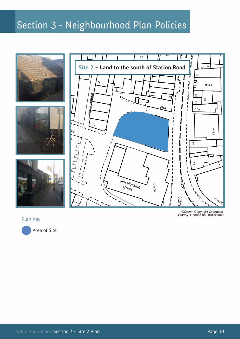
3.24
3.25
Justification
Site 2 – Land to the south of Station Road
This a relatively small site, which includes a building that has been removed from the
Primary Shopping Frontages as defined in the Fenland Local Plan. The building is in a
significant state of disrepair with blacked out frontages and severe structural damage to
the roof, which has started to collapse. The site is in effect in a gateway location on the
northern approach to the Town Centre, which comes into view as the bend in the road opens
up. It also has well used public footpaths along its eastern and western sides that lead onto
Mill View, which compound the harm. The land to the rear is used informally for parking.
Previous attempts to redevelop the site have been resisted due to the potential loss of A1
retail frontage. Whilst Policy TC1 provides exception criteria for the loss of A1 retail
frontage in situations where the unit has been vacant long term and/or is harming the
environment, the situation here is such that the site merits special attention as a
regeneration site in its own right.

Submission Plan - Section 3 - Site 3 Page 32
Site 3 – Land to the north of Centenary Church
The redevelopment of this site for town centre uses will be supported where the following
is achieved:
a) The quality of the built environment is improved;
b) Designated and non-designated heritage assets and areas, including areas of
archaeological importance are conserved in a manner appropriate to their
significance;
c) Any shopping uses have a continuous frontage with the High Street;
d) Vehicular access is from Chapel Street; and
e) Provide well-designed car and cycle parking appropriate to the amount and type of
development proposed, reflecting the parking standards provided by Fenland District
Council.
ForewordSection 3 - Neighbourhood Plan Policies
00m 16 54
00m 17 54
541600m
541700m
00m63
29
00m64
29
29 6300m
296400m
OS M
asterMap 1250/2500/10000
scale07 M
arch 2015, ID: C
M-00408109
ww
w.centrem
apslive.co.uk
1:1250 scale print at A4, Centre:
541663 E, 296386 N
©C
rown C
opyright Ordnance
Survey. Licence no. 100019980
0 5 10 15 20 25 30 35 40 45 50
m
Submission Plan - Section 3 - Site 3 Plan Page 33
ForewordSection 3 - Neighbourhood Plan Policies
Area of Site Building of Local Interest
Listed Building
00m 16 54
00m 17 54
541600m
541700m
00m63
29
00m64
29
29 6300m
296400m
OS M
asterMap 1250/2500/10000
scale07 M
arch 2015, ID: C
M-00408109
ww
w.centrem
apslive.co.uk
1:1250 scale print at A4, Centre:
541663 E, 296386 N
©C
rown C
opyright Ordnance
Survey. Licence no. 100019980
0 5 10 15 20 25 30 35 40 45 50
m
Plan Key
©Crown Copyright OrdnanceSurvey. Licence no. 100019980
Site 3 – Land to the north of Centenary Church

Submission Plan - Section 3 - Site Justifications Page 34
Justification
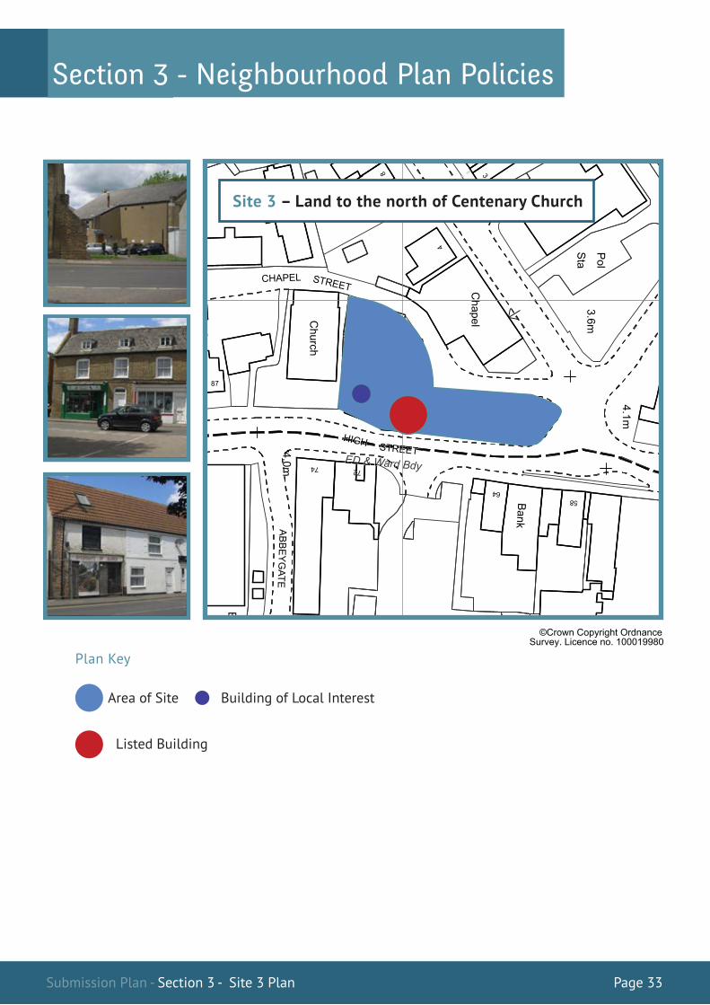
Site 3 – Land to the north of Centenary Church
This site includes the land between High Street and Chapel Street from Centenary Church
up to Burrowmoor Road, which comprises a mixture of shopping, commercial and
residential uses.
Although all of the site falls within the March Conservation Area and there are both
designated and non-designated heritage assets on site, overall the site has an unattractive
appearance, with some buildings in a significant state of disrepair, which is having a
harmful effect on the quality of the local environment in what is considered to be a gateway
location to the town centre.
ForewordSection 3 - Neighbourhood Plan Policies
00m 16 54
00m 17 54
541600m
541700m
00m63
29
00m64
29
29 6300m
296400m
OS M
asterMap 1250/2500/10000
scale07 M
arch 2015, ID: C
M-00408109
ww
w.centrem
apslive.co.uk
1:1250 scale print at A4, Centre:
541663 E, 296386 N
©C
rown C
opyright Ordnance
Survey. Licence no. 100019980
0 5 10 15 20 25 30 35 40 45 50
m
3.26
3.27
Submission Plan - Section 3 - Site Justifications Page 35
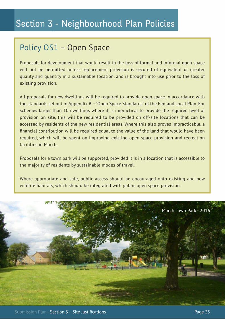
Policy OS1 – Open Space
Proposals for development that would result in the loss of formal and informal open space will not be permitted unless replacement provision is secured of equivalent or greater quality and quantity in a sustainable location, and is brought into use prior to the loss of existing provision.
All proposals for new dwellings will be required to provide open space in accordance with the standards set out in Appendix B – “Open Space Standards” of the Fenland Local Plan. For schemes larger than 10 dwellings where it is impractical to provide the required level of provision on site, this will be required to be provided on off-site locations that can be accessed by residents of the new residential areas. Where this also proves impracticable, a financial contribution will be required equal to the value of the land that would have been required, which will be spent on improving existing open space provision and recreation facilities in March.
Proposals for a town park will be supported, provided it is in a location that is accessible to the majority of residents by sustainable modes of travel.
Where appropriate and safe, public access should be encouraged onto existing and new wildlife habitats, which should be integrated with public open space provision.
March Town Park - 2016
ForewordSection 3 - Neighbourhood Plan Policies
Submission Plan - Section 3 - OS1 Page 36
Justification
It is acknowledged that there is a significant under provision of accessible open space in
March. In 2003, The Fenland District Wide Local Plan Play Space Provision Supplementary
Planning Guidance (SPG) identified an overall shortage of 2.11 Hectares in provision based
on the standards set by the National Playing Fields Association (NPFA). In 2006 Fenland
District Council carried out an open space audit of the District, which revealed that the
overall shortage had increased to 4.23 Hectares. The study revealed that at that time there
was a deficit in outdoor sports provision of 19.61 Hectares and a surplus of 15.38 Hectares
in children’s play provision. It also predicted that the situation would worsen by 2021 with
the deficit in outdoor sport provision increasing to 26.60 Hectares with a reduction in the
surplus of children’s play provision to 12.50 Hectares. These figures were predicated on an
anticipated population increase of 4,400 in the period 2006-2021. However, as the Fenland
Local Plan identifies a housing land requirement in March of 4,200 dwellings in the period
2011-2031, these projections are conservative at best.
The community recognise the extent of the problem and have highlighted this as one of its
main concerns in early engagement work, with current open space provision being regarded
as one of its most precious assets. It is therefore vital that both formal and informal open
space is safeguarded from development pressure, and in particular, land in use or which has
been used for outdoor sports.
March Town Council is supportive of the District Council’s desire to allocate land as a town
park, provided it is in a location that can be accesses sustainably by residents and will
contribute towards the current deficit in outdoor sports.
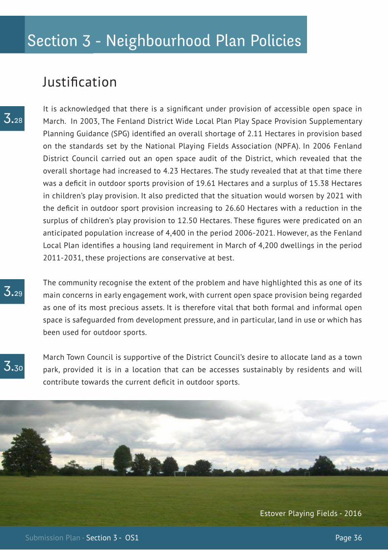
3.28
3.29
3.30
Estover Playing Fields - 2016
ForewordSection 3 - Neighbourhood Plan Policies

Submission Plan - Section 3 - OS1 Justification Page 37
The policies in this Plan support the strategic policies of the Fenland Local Plan (FLP).
However, a number of polices and supporting information introduce some differences,
which are highlighted below:
Policy H1 Policy H1 requires more information to be provided as part of the Broads Concept Plans as
specified in Policy LP7 of the FLP and reinforced the need for inclusive community
consultation and the involvement of March Town Council in the making of such Plans.
Policy H2This policy seeks to involve the community in development proposals. Schemes of more
than 10 dwellings should be the subject of pre-application community consultation.
Policy H3This amends the threshold for which a contribution towards affordable housing is required
and does not seek contributions on schemes of less than 11 dwellings in line with
Government advice. It also requires in lieu contributions to be spent on schemes in March
where this would be deliverable.
Policy TC1 This policy adjusts the area of Primary Shopping Frontages, with a net overall gain.
However, it sets a maximum threshold for the loss of non-retail frontages of 40%, which is
higher than the threshold set in FLP Policy LP6.
Policy OS1This policy restricts the further loss of open space. It also requires in lieu financial
contributions from new schemes where open space cannot be provided on or off site to be
spent on improving existing facilities in March.
4.2
4.3
4.4
4.5
4.6
4.1
01 Relationship to the Fenland Local Plan
ForewordSection 3 - Neighbourhood Plan Policies
Submission Plan - Section 4 - Relationship to the Fenland Local Plan Page 38
ForewordSection 4 – Supporting Information
March Town Council is committed to monitoring the effectiveness of the policies of the Plan
over the Plan period. Where indicators show that the policies are not delivering the
intended outcomes, then a review of the Plan will be considered. Details of all monitoring
and review work will be made available on the Town Council’s website.
03 Reference Documents
The following documentation was used in preparing this Plan:
Fenland Local Plan 2014 Localism Act 2011 Neighbourhood Planning Regulations 2012 National Planning Policy Framework 2012 Town & Country Planning Act 1990 March Conservation Area Appraisal 2008
The following documentation was also used and is available to view on the Town Council website under the title Neighbourhood Plan Evidence Basewww.marchtowncouncil.gov.uk
Application to designate a Neighbourhood Area (09/13) Preliminary Town-Wide Survey Results (02/14) Summary Analysis of Town-Wide Survey Results Issues & Options Summary Comments Schedule (09/14) Key Messages from Issues & Options Consultation Draft Vision, Aims & Objectives Vision, Aims & Objectives: Summary Comments Schedule Vision, Aims & Objectives: Analysis of Feedback Sustainability Assessment – Stage 1 Town Centre Primary Retail Frontage Survey (02/15) Regulation 18 Draft Plan Consultation (03/15) A Report to Fenland District Council on the Examination of the March Neighbourhood Plan 2015-2030 (19/05/2017)
4.7
4.8
02 Monitoring and Review of the Plan
00m 17 54
00m 18 54
541700m
541800m
00m68
29
00m69
29
29 6800m
296900m
OS M
asterMap 1250/2500/10000
scale07 M
arch 2015, ID: C
M-00408108
ww
w.centrem
apslive.co.uk
1:1250 scale print at A4, Centre:
541734 E, 296818 N
©C
rown C
opyright Ordnance
Survey. Licence no. 100019980
0 5 10 15 20 25 30 35 40 45 50
m

Submission Plan - Section 4 - Acknowledgements Page 39
ForewordSection 4 – Supporting Information
04 Acknowledgements
Acknowledgement and thanks are due to the following members of March Town Council
who played a part in delivering this Plan4.9
March North Councillors
March East Councillors
March West Councillors
Cllr Kim French Cllr Malcolm George Cllr Stephen Court Cllr John Gowing
Cllr Nigel Harris Cllr Andrew Pugh Cllr Martin Field Cllr Mark Purser
Cllr Andrew Donnelly Cllr Kit Owen Cllr Jan French Cllr Rob Skoulding
00m 17 54
00m 18 54
541700m
541800m
00m68
29
00m69
29
29 6800m
296900m
OS M
asterMap 1250/2500/10000
scale07 M
arch 2015, ID: C
M-00408108
ww
w.centrem
apslive.co.uk
1:1250 scale print at A4, Centre:
541734 E, 296818 N
©C
rown C
opyright Ordnance
Survey. Licence no. 100019980
0 5 10 15 20 25 30 35 40 45 50
m

00m 16 54
00m 17 54
541600m
541700m
00m63
29
00m64
29
29 6300m
296400m
OS M
asterMap 1250/2500/10000
scale07 M
arch 2015, ID: C
M-00408109
ww
w.centrem
apslive.co.uk
1:1250 scale print at A4, Centre:
541663 E, 296386 N
©C
rown C
opyright Ordnance
Survey. Licence no. 100019980
0 5 10 15 20 25 30 35 40 45 50
m
With Thanks to Derek McKenzie of MTP McKenzie Town Planning Ltd
for all of his help and support in the making of this plan
MTP McKenzie Town Planning LtdSuite 29 Evolution Business Centre,
County Business Park, Darlington Road,
Northallerton, North Yorkshire,
DL6 2NQ
Tel: 01609 751650 | Email: [email protected]

00m 16 54
00m 17 54
541600m
541700m
00m63
29
00m64
29
29 6300m
296400m
OS M
asterMap 1250/2500/10000
scale07 M
arch 2015, ID: C
M-00408109
ww
w.centrem
apslive.co.uk
1:1250 scale print at A4, Centre:
541663 E, 296386 N
©C
rown C
opyright Ordnance
Survey. Licence no. 100019980
0 5 10 15 20 25 30 35 40 45 50
m