The Political Blogosphere and the 2004 U.S. Election: Divided They ...
Upload
beverly-nortonCategory
view
214download
0
MapsMapsMr. Goldsack’s
Social Studies 8 Class

Political Maps Political maps show how people have
divided places on the Earth into countries, states, cities and other units for the purpose of governing them.
Each province/territoryIs labelledAnd alsoshaded a Different Colour.
Find a politicalMap in your
Atlas!

Physical Maps Physical maps show what the surface of
the Earth looks like.
Different colours showDifferent elevations onThis relief map.
Find a physicalMap in your
Atlas!
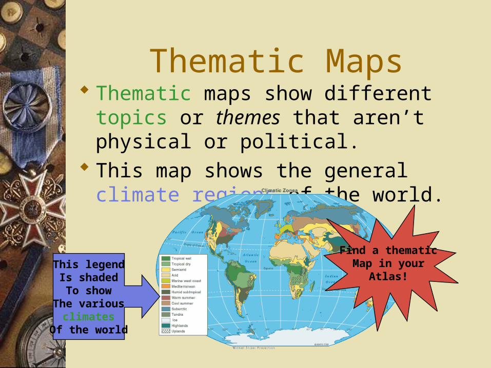
Thematic Maps Thematic maps show different topics or themes that aren’t physical or political.
This map shows the general climate regions of the world.
This legendIs shadedTo show
The variousclimates
Of the world
Find a thematicMap in your
Atlas!

Thematic Maps ctd… This map shows how different religious
beliefs are distributed around the world.
Note howmanyReligions areRepresentedIn this Thematic map
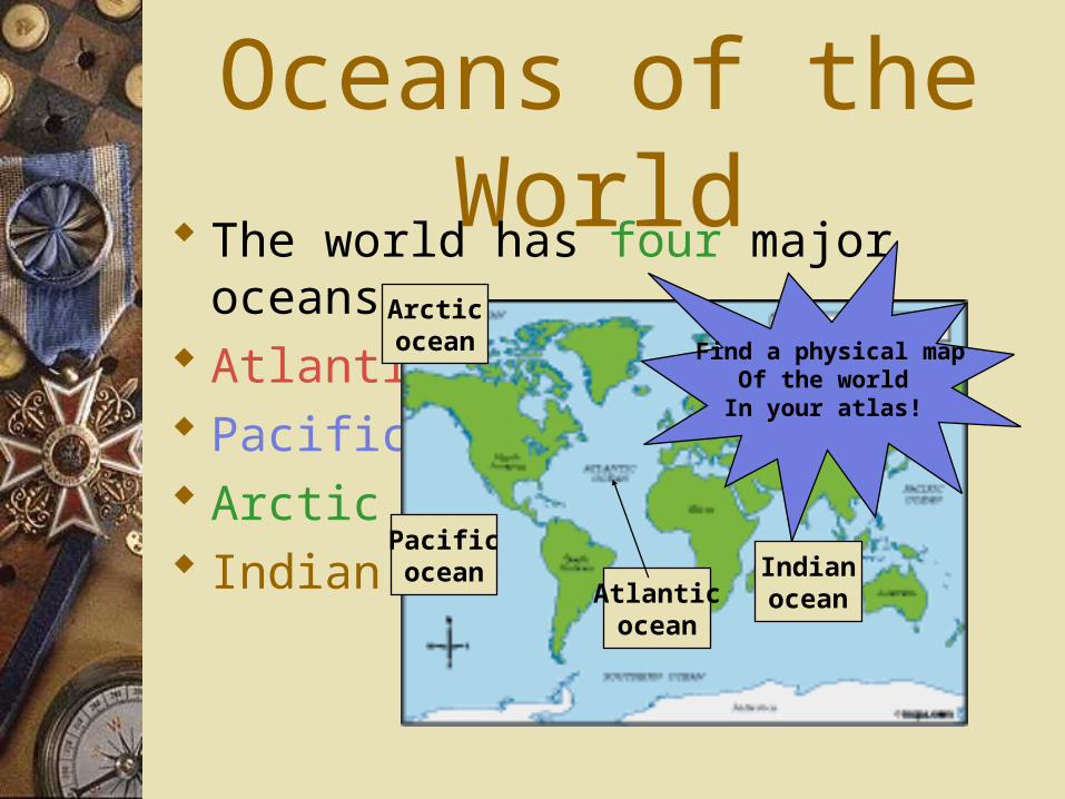
Oceans of the World The world has four major oceans. Atlantic Pacific Arctic Indian
Pacificocean
Atlanticocean
Arcticocean
Indianocean
Find a physical mapOf the worldIn your atlas!
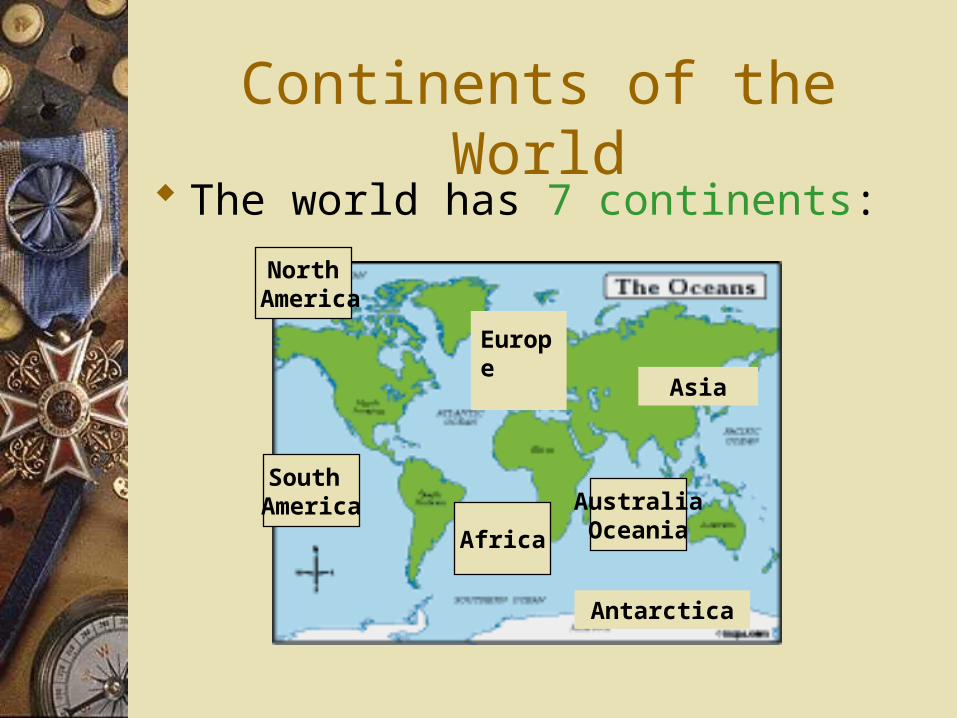
Continents of the World The world has 7 continents:
South America
Africa
North America
AustraliaOceania
Europe
Asia
Antarctica

Map Review What is the purpose of a political map?
Answer: To show borders of countries, states, cities, and regions.

Map Review What is the purpose of a physical map?
Answer: physical maps show what the
surface of the world looks like
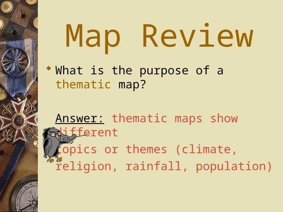
Map Review What is the purpose of a thematic map?
Answer: thematic maps show different
topics or themes (climate,
religion, rainfall, population)

Map Review What are the four major oceans of the
world?
Answer: Atlantic,Pacific,Arctic,Indian

Map Review What are the seven continents of the
world?
Answer: North America, South America,
Europe, Asia, Australia/Oceania,
Antarctica.

Map Activity
On the blank world map provided, neatly and accurately label, then shade:
1. The seven continents (green )
2. The four major oceans (blue)
3. The prime meridian, in degrees (red ink)
4. The equator, in degrees (red ink)
5. The tropic of Cancer & Capricorn,
in degrees (red ink)