Magnetic gradiometer survey in granitic and sedimentary ... · Sanggul Batu Maung T.Bahang Tg....
6
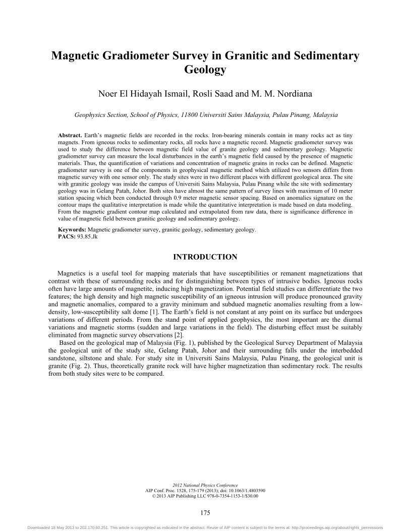
Magnetic gradiometer survey in granitic and sedimentary geology Noer El Hidayah Ismail, Rosli Saad, and M. M. Nordiana Citation: AIP Conf. Proc. 1528, 175 (2013); doi: 10.1063/1.4803590 View online: http://dx.doi.org/10.1063/1.4803590 View Table of Contents: http://proceedings.aip.org/dbt/dbt.jsp?KEY=APCPCS&Volume=1528&Issue=1 Published by the American Institute of Physics. Additional information on AIP Conf. Proc. Journal Homepage: http://proceedings.aip.org/ Journal Information: http://proceedings.aip.org/about/about_the_proceedings Top downloads: http://proceedings.aip.org/dbt/most_downloaded.jsp?KEY=APCPCS Information for Authors: http://proceedings.aip.org/authors/information_for_authors Downloaded 18 May 2013 to 202.170.60.251. This article is copyrighted as indicated in the abstract. Reuse of AIP content is subject to the terms at: http://proceedings.aip.org/about/rights_permissions
Transcript of Magnetic gradiometer survey in granitic and sedimentary ... · Sanggul Batu Maung T.Bahang Tg....

Magnetic gradiometer survey in granitic and sedimentary geologyNoer El Hidayah Ismail, Rosli Saad, and M. M. Nordiana Citation: AIP Conf. Proc. 1528, 175 (2013); doi: 10.1063/1.4803590 View online: http://dx.doi.org/10.1063/1.4803590 View Table of Contents: http://proceedings.aip.org/dbt/dbt.jsp?KEY=APCPCS&Volume=1528&Issue=1 Published by the American Institute of Physics. Additional information on AIP Conf. Proc.Journal Homepage: http://proceedings.aip.org/ Journal Information: http://proceedings.aip.org/about/about_the_proceedings Top downloads: http://proceedings.aip.org/dbt/most_downloaded.jsp?KEY=APCPCS Information for Authors: http://proceedings.aip.org/authors/information_for_authors
Downloaded 18 May 2013 to 202.170.60.251. This article is copyrighted as indicated in the abstract. Reuse of AIP content is subject to the terms at: http://proceedings.aip.org/about/rights_permissions
Magnetic Gradiometer Survey in Granitic and Sedimentary Geology
Noer El Hidayah Ismail, Rosli Saad and M. M. Nordiana
Geophysics Section, School of Physics, 11800 Universiti Sains Malaysia, Pulau Pinang, Malaysia
Abstract. Earth’s magnetic fields are recorded in the rocks. Iron-bearing minerals contain in many rocks act as tiny magnets. From igneous rocks to sedimentary rocks, all rocks have a magnetic record. Magnetic gradiometer survey was used to study the difference between magnetic field value of granite geology and sedimentary geology. Magnetic gradiometer survey can measure the local disturbances in the earth’s magnetic field caused by the presence of magnetic materials. Thus, the quantification of variations and concentration of magnetic grains in rocks can be defined. Magnetic gradiometer survey is one of the components in geophysical magnetic method which utilized two sensors differs from magnetic survey with one sensor only. The study sites were in two different places with different geological area. The site with granitic geology was inside the campus of Universiti Sains Malaysia, Pulau Pinang while the site with sedimentary geology was in Gelang Patah, Johor. Both sites have almost the same pattern of survey lines with maximum of 10 meter station spacing which been conducted through 0.9 meter magnetic sensor spacing. Based on anomalies signature on the contour maps the qualitative interpretation is made while the quantitative interpretation is made based on data modeling. From the magnetic gradient contour map calculated and extrapolated from raw data, there is significance difference in value of magnetic field between granitic geology and sedimentary geology.
Keywords: Magnetic gradiometer survey, granitic geology, sedimentary geology. PACS: 93.85.Jk
INTRODUCTION
Magnetics is a useful tool for mapping materials that have susceptibilities or remanent magnetizations that contrast with these of surrounding rocks and for distinguishing between types of intrusive bodies. Igneous rocks often have large amounts of magnetite, inducing high magnetization. Potential field studies can differentiate the two features; the high density and high magnetic susceptibility of an igneous intrusion will produce pronounced gravity and magnetic anomalies, compared to a gravity minimum and subdued magnetic anomalies resulting from a low-density, low-susceptibility salt dome [1]. The Earth’s field is not constant at any point on its surface but undergoes variations of different periods. From the stand point of applied geophysics, the most important are the diurnal variations and magnetic storms (sudden and large variations in the field). The disturbing effect must be suitably eliminated from magnetic survey observations [2].
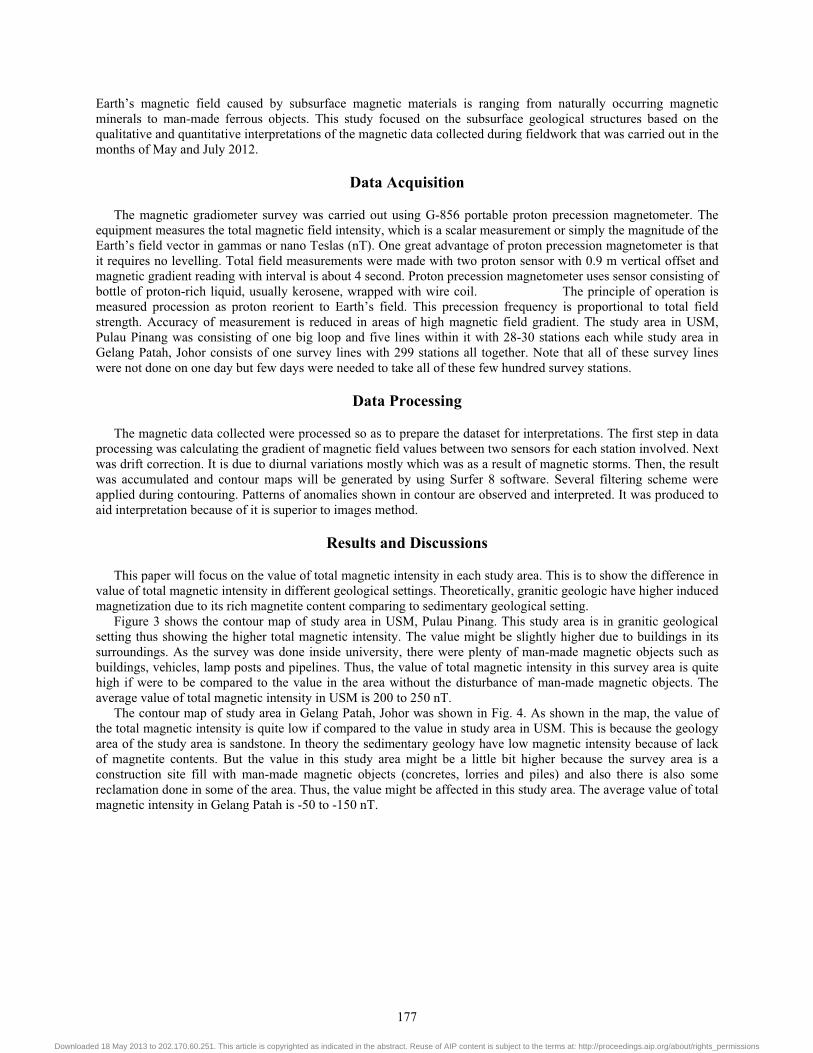
Based on the geological map of Malaysia (Fig. 1), published by the Geological Survey Department of Malaysia the geological unit of the study site, Gelang Patah, Johor and their surrounding falls under the interbedded sandstone, siltstone and shale. For study site in Universiti Sains Malaysia, Pulau Pinang, the geological unit is granite (Fig. 2). Thus, theoretically granite rock will have higher magnetization than sedimentary rock. The results from both study sites were to be compared.
2012 National Physics ConferenceAIP Conf. Proc. 1528, 175-179 (2013); doi: 10.1063/1.4803590
© 2013 AIP Publishing LLC 978-0-7354-1153-1/$30.00
175
Downloaded 18 May 2013 to 202.170.60.251. This article is copyrighted as indicated in the abstract. Reuse of AIP content is subject to the terms at: http://proceedings.aip.org/about/rights_permissions
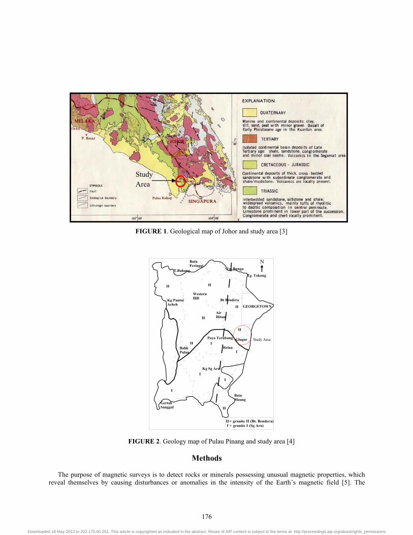
FIGURE 1. Geological map of Johor and study area [3]
BatuFeringgi
Kg PantaiAcheh
WesternHill
AirHitam
Bt Bendera
Balik Pulau
Paya Terubung Glugur
Relau
Kg Sg Ara
GertakSanggul
BatuMaung
T.BahangTg. Tokong
Tg. Bunga
GEORGETOWN
II
II
IIII
II
II
I
I
I
I
I
II
N
II granite II (Bt. Bendera)I granite I (Sg Ara)==
Study Area
FIGURE 2. Geology map of Pulau Pinang and study area [4]
Methods
The purpose of magnetic surveys is to detect rocks or minerals possessing unusual magnetic properties, which reveal themselves by causing disturbances or anomalies in the intensity of the Earth’s magnetic field [5]. The
Study Area
176
Downloaded 18 May 2013 to 202.170.60.251. This article is copyrighted as indicated in the abstract. Reuse of AIP content is subject to the terms at: http://proceedings.aip.org/about/rights_permissions
Earth’s magnetic field caused by subsurface magnetic materials is ranging from naturally occurring magnetic minerals to man-made ferrous objects. This study focused on the subsurface geological structures based on the qualitative and quantitative interpretations of the magnetic data collected during fieldwork that was carried out in the months of May and July 2012.
Data Acquisition
The magnetic gradiometer survey was carried out using G-856 portable proton precession magnetometer. The equipment measures the total magnetic field intensity, which is a scalar measurement or simply the magnitude of the Earth’s field vector in gammas or nano Teslas (nT). One great advantage of proton precession magnetometer is that it requires no levelling. Total field measurements were made with two proton sensor with 0.9 m vertical offset and magnetic gradient reading with interval is about 4 second. Proton precession magnetometer uses sensor consisting of bottle of proton-rich liquid, usually kerosene, wrapped with wire coil. The principle of operation is measured procession as proton reorient to Earth’s field. This precession frequency is proportional to total field strength. Accuracy of measurement is reduced in areas of high magnetic field gradient. The study area in USM, Pulau Pinang was consisting of one big loop and five lines within it with 28-30 stations each while study area in Gelang Patah, Johor consists of one survey lines with 299 stations all together. Note that all of these survey lines were not done on one day but few days were needed to take all of these few hundred survey stations.
Data Processing
The magnetic data collected were processed so as to prepare the dataset for interpretations. The first step in data processing was calculating the gradient of magnetic field values between two sensors for each station involved. Next was drift correction. It is due to diurnal variations mostly which was as a result of magnetic storms. Then, the result was accumulated and contour maps will be generated by using Surfer 8 software. Several filtering scheme were applied during contouring. Patterns of anomalies shown in contour are observed and interpreted. It was produced to aid interpretation because of it is superior to images method.
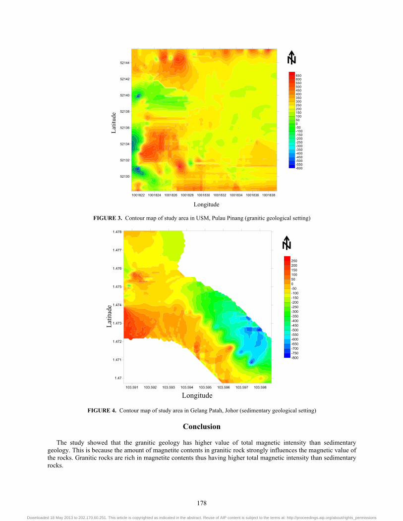
Results and Discussions
This paper will focus on the value of total magnetic intensity in each study area. This is to show the difference in value of total magnetic intensity in different geological settings. Theoretically, granitic geologic have higher induced magnetization due to its rich magnetite content comparing to sedimentary geological setting.
Figure 3 shows the contour map of study area in USM, Pulau Pinang. This study area is in granitic geological setting thus showing the higher total magnetic intensity. The value might be slightly higher due to buildings in its surroundings. As the survey was done inside university, there were plenty of man-made magnetic objects such as buildings, vehicles, lamp posts and pipelines. Thus, the value of total magnetic intensity in this survey area is quite high if were to be compared to the value in the area without the disturbance of man-made magnetic objects. The average value of total magnetic intensity in USM is 200 to 250 nT.
The contour map of study area in Gelang Patah, Johor was shown in Fig. 4. As shown in the map, the value of the total magnetic intensity is quite low if compared to the value in study area in USM. This is because the geology area of the study area is sandstone. In theory the sedimentary geology have low magnetic intensity because of lack of magnetite contents. But the value in this study area might be a little bit higher because the survey area is a construction site fill with man-made magnetic objects (concretes, lorries and piles) and also there is also some reclamation done in some of the area. Thus, the value might be affected in this study area. The average value of total magnetic intensity in Gelang Patah is -50 to -150 nT.
177
Downloaded 18 May 2013 to 202.170.60.251. This article is copyrighted as indicated in the abstract. Reuse of AIP content is subject to the terms at: http://proceedings.aip.org/about/rights_permissions
1001822 1001824 1001826 1001828 1001830 1001832 1001834 1001836 1001838
52130
52132
52134
52136
52138
52140
52142
52144
-600-550-500-450-400-350-300-250-200-150-100-50050100150200250300350400450500550600650
Longitude
Latit
ude
FIGURE 3. Contour map of study area in USM, Pulau Pinang (granitic geological setting)
-800-750-700-650-600-550-500-450-400-350-300-250-200-150-100-50050100150200250
103.591 103.592 103.593 103.594 103.595 103.596 103.597 103.598
1.47
1.471
1.472
1.473
1.474
1.475
1.476
1.477
1.478
Longitude
Latit
ude
FIGURE 4. Contour map of study area in Gelang Patah, Johor (sedimentary geological setting)
Conclusion
The study showed that the granitic geology has higher value of total magnetic intensity than sedimentary geology. This is because the amount of magnetite contents in granitic rock strongly influences the magnetic value of the rocks. Granitic rocks are rich in magnetite contents thus having higher total magnetic intensity than sedimentary rocks.
178
Downloaded 18 May 2013 to 202.170.60.251. This article is copyrighted as indicated in the abstract. Reuse of AIP content is subject to the terms at: http://proceedings.aip.org/about/rights_permissions

Magnetic surveys are also sensitive to man-made magnetic objects such as buildings, vehicles and pipelines. This sensitivity is important for applications such as finding abandoned wells and buried drums, locating and mapping waste dumps and hunting for unexploded metallic ordinance.
ACKNOWLEDGMENTS
The authors wish to thank the efforts of post graduate students of Geophysics of USM and also would like to thank Geophysics laboratory staff from School of Physics, USM.
REFERENCES
1. J. L. Robert, “Magnetic Interpretation” in Whole Earth Geophysics. An Introductory Textbook for Geologists and Geophysicists, New Jersey: Prentice-Hall, Inc, 1999, pp. 296.
2. D. S. Parasnis, “Magnetic Methods” in Principles of Applied Geophysics Fifth Edition, United Kingdom: Chapman & Hall, 1997, pp. 12
3. Geological Map of Malaysia, Geological Survey Department of Malaysia, 1985. 4. T. B. Kong, Bulletin of the Geological Society of Malaysia. No35, 69-77 (1994). 5. F. S. Grant and G. F. West, Interpretation Theory in Applied Geophysics, USA: McGraw – Hill, Inc, 1965, pp. 205-306.
�
�
�
�
179
Downloaded 18 May 2013 to 202.170.60.251. This article is copyrighted as indicated in the abstract. Reuse of AIP content is subject to the terms at: http://proceedings.aip.org/about/rights_permissions