Long-term Monitoring Impact Assessment of Mining Activity ......Long-term Monitoring Impact...
106
1 Long-term Monitoring Impact Assessment of Mining Activity in Panama by Courtney Quinn and Jeanne Pouliot
Transcript of Long-term Monitoring Impact Assessment of Mining Activity ......Long-term Monitoring Impact...

1
Long-term Monitoring
Impact Assessment of Mining
Activity in Panama
by Courtney Quinn
and Jeanne Pouliot

2
Table of Contents
Executive Summary/Resumen Ejecutivo 5
Project Work Hours 9
Introduction-Literature Review 9
In Context: Developing a Long-Term Monitoring of Mining in Coclesito 24
Institutional Context 25
Coclesito and its Surroundings: Our Study Site 27
Santa Fe: Background and Context for our Study 28
Objective 29
Scoping and Stakeholder Consultation 30
Ethical Considerations 31
Methodology and Results 31
The Three Themes for Our Methodology 31
Water
Importance of Water Assessment 32
Water Assessment Methodology 33
Water Results and Discussion 35
Socio-Economic
Importance of Socio-Economic Assessment 36
Socio-Economic Methodology 37
Socio-Economic Results and Discussion 38
Land
Importance of Human Ecology and Territory 41
Human Ecology and Territory Methodology 42
Human Ecology and Territory Results and Discussion 45
General Project Recommendations
Integrating the Three Themes 47
Time and Logistics 48

3
Santa Fe as a Control Site 49
Transferring Knowledge 50
Looking Forwards 52
Acknowledgments 52
Bibliography 53
Appendices
-Appendix A: Water Assessment Final Report 55
-Appendix B: Socio-Economic 63
Group Report 63
Preliminary Survey 66
Reviewed Survey 84
-Appendix C: Human Ecology and Territory Final Report 100

4
Institution Contact Information: McGill University Panama Field Studies Semester McGill
Department of Biology 1205 Doctor Penfield Montreal, Quebec, Canada H3A 1B1
Smithsonian Tropical Research Institute (STRI) Dr. Ana Spalding
Email: [email protected]
Phone: 212-8281
Panamá, Rep. de Panamá.

5
Executive Summary
With the recent mining boom in Panama, the issue of social and environmental impacts
of large-scale mining has come to be a matter of concern for both Panamanians, as hosts of this
activity, and Canadians, as citizens of the country that has become the base of the majority of the
world’s mining companies. The development of new open pit mine projects has driven the
development of regulation and monitoring of this activity. Citizens, mining companies and
government institutions hope to minimize the negative environmental impacts associated with
mining at this scale and to expand the benefits to the communities that now live in new mining
areas.
To support these efforts, the Foro y Observatorio de Sostenibilidad - a joint initiative between the
Universities Santa María la Antigua (USMA) and McGill (Canada) with the research institution
INDICASAT and the Smithsonian Tropical Research Institute (STRI) - proposed to develop a
program that would monitor the socio-environmental impacts of mining. The goal is to establish
an independent assessment whose results and observations will be disseminated to all sectors of
the Panamanian society with interests in mining issues (communities, companies, organizations,
and governmental institutions). An accurate and precise monitoring can also help improve the
Environmental and Social Impact Assessments (ESIA) that are used to project impacts and
model mitigation methods.
The program aims to cover the different phases of the mining cycle, from the exploration to its
post-closure. It will be a long-term program, projected over a course of decades. To ensure its
sustainability, the program has the support of the Panama Field Studies Semester of McGill
University, which will provide the participation of its students once a year. During this module
the PFSS and a group of researchers will assemble data on [1] the state of the watershed; [2] the
socio-economic changes in the communities adjacent to the mining projects, and [3] changes in
human ecology and land use. The monitoring program will apply a comparative methodology to
follow these parameters in various mining projects in the country, with a “control” area where
there is no mining activity. The proposed mining projects are Molejón (Petaquilla Gold), Cobre
Panama (Minera Panama - First Quantum Minerals), and Cerro Burning (Pershimco Resources).
Santa Fe, Veraguas and the Calovebora Valley are referred to as control areas.
This year of 2014 was dedicated to the design phase of the program to take after a process of
consultation with various stakeholders including community members, mining companies,
scientists, and NGOs. Community involvement is particularly important to ensure the
maintenance of the program over the long term. We consulted with them on the most appropriate
methodologies to use, their concerns, and on the best ways to disseminate the results of the
program to the population.
To test our preliminary design study, we underwent a 1-week (3 days in Coclesito, and 3 days in
Santa Fe) assessment week in April with the 2014 PFSS students. We divided our methodology
into three themes: aquatic ecosystems, social and economic aspects, and human ecology and
territory. For our assessment week in the field, this meant dividing the researchers into three
groups each with different objectives, questions, and methods. For aquatic systems, water
samples were taken from affected and non-affected streams and bioindicator species from these

6
streams were analyzed to help shed light on stream quality. The socio-economic group used a 70
question survey covering topics such as employment, water and energy, health, and family
activities to establish a baseline for both sites. The human ecology and territory group looked for
indicators of change in land-use testing multiple methodologies. All groups surveyed near the
town center, in smaller surrounding communities and in adjacent indigenous communities to
obtain a more diverse sampling.
As this was a scoping year to test and improve upon the methodology that we hope to use in the
future, our objective in outlining our results was to assess the quality and effectiveness of our
methodology. The water group concluded that in the future, more time and consideration needs
to be taken into account in stream-site selection. From qualitative water surveys, it was made
clear that people were preoccupied with whether their water was potable or not. This may need
to be more directly assessed by water sampling in the future. For the socio-economic group, the
survey generally provided a good baseline, but many small changes were made dealing with
phrasing and relevancy. Adding a community-level survey was proposed to better account for
community - organization interactions. The convenience sampling method used needs to be
revised as it did not provide a representative sampling of the community. Not having a
previously established methodology before assessment week, the human ecology and territory
group’s main goal was to outline different methodologies to assess their effectiveness for future
use. These approaches consisted of interviews with set questions and semi structured interviews,
concept maps, detailed farm surveys, finca sketches, a road transect with panoramic view,
promontory points with panoramic view, remote sensing validation, and interviews with
institutions and experts. Some proved to be more successful than others in obtaining a small-
scale, medium-scale, and large-scale view of land-use change.
On a broad scale, the overall results of the assessment week were positive. Multiple stakeholders
approved the proposed program and no major issues detrimental to the project arose. However,
many recommendations for next year were proposed. A question that consistently came up
during the mining assessment week was how and to what extent our three outlined themes should
be integrated. Logistically in the field, communication between the groups is essential to ensure
that we do not create respondent fatigue by over-burdening specific areas. Overall, there are
multiple areas in which the three groups have the potential to collaborate and overlap and further
discussion needs to go into this topic. In addition, more time needs to be devoted to train the
students in doing what they will be assigned to do. To ensure academic validity of our study,
there needs to be an appropriate control site. After observing both sites, it is questionable
whether Santa Fe can be a seen as a good control site as there are currently mining concessions
in the area. Despite these recommendations, we strongly suggest that this project should move
forward in the future.
Resumen Executivo
Con el reciente auge de la minería en Panamá, el tema de los impactos sociales y ambientales de
la minería a gran escala ha llegado a ser un asunto de preocupación tanto para los panameños,
como anfitriones de esta actividad, y los canadienses, como ciudadanos del país que se ha
convertido en la base de la mayoría de las empresas mineras del mundo. El avance de varios

7
proyectos de mina a tajo abierto ha impulsado un desarrollo de la reglamentación y seguimiento
de esta actividad. Tanto los ciudadanos como las empresas mineras y las instituciones
gubernamentales esperan lograr una minimización de los impactos negativos ambientales y la
ampliación de los beneficios potenciales para las comunidades asentadas en las nuevas zonas
mineras.
Para respaldar estos esfuerzos, el Foro y Observatorio de Sostenibilidad - una iniciativa conjunta
entre las Universidades Santa María la Antigua (USMA) y McGill (Canadá) así que las
instituciones de investigación INDICASAT y Smithsonian Tropical Research Institute (STRI) -
propone un programa de monitoreo de los impactos socio-ambientales de la minería. La meta es
establecer un espacio de evaluación independiente cuyos resultados y observaciones serán
difundidos a todos los sectores de la sociedad Panameña con interés en la problemática minera
(comunidades, empresas, organizaciones, e instituciones gubernamentales). Un monitoreo
acertado y preciso puede también contribuir al mejoramiento de las Evaluaciones de Impactos
Sociales y ambientales (ESIA) que son utilizados para proyectar los impactos y las formas de
mitigación.
El programa pretende abarcar las distintas fases del ciclo minero, desde la exploración hacía el
pos-cierre. Así que será un programa a largo plazo, proyectado en un transcurso de décadas. Para
asegurar su perennidad, el programa cuenta con el respaldo del Panama Field Studies Semester
de la Universidad McGill, que brindara la participación de sus estudiantes una vez por año.
Durante este módulo el PFSS y un grupo de investigadores sacaran una muestra de datos sobre:
[1] el estado de las cuencas hidrográficas; [2] los cambios socio-económicos en la comunidades
avecinadas a los proyectos mineros, y [3] los cambios en la ecología humana y utilización del
territorio. El programa de monitoreo aplicara una metodología comparativa que seguirá estos
parámetros en distintos proyectos mineros del país, con una zona 'control' adonde no hay
actividad minera. Están previstos los proyectos mineros Molejón (Petaquilla Gold), Cobre
Panamá (Minera Panama - First Quantum Minerals), y Cerro Quema (Pershimco Resources). Las
zonas de Santa Fe, Veraguas y el Valle de Calovebora están contempladas como áreas de
control.
En este año de 2014 estuvimos en la fase de diseño del programa que se llevara tras un proceso
de consultación con las distintas partes interesadas. La participación de las comunidades en
particular fue de suma importancia para asegurar el mantenimiento del programa sobre el largo
plazo. Así que estuvimos consultando con ellas sobre las metodologías más apropiadas, sus
preocupaciones, y la manera más adecuada de difundir los resultados del programa a nivel de la
población. También iniciamos diálogos con distintas instancias del gobierno, empresas del sector
minero, y las organizaciones no gubernamentales.
Para probar nuestro diseño de estudio preliminar, nos sometimos a 1 semana (3 días en
Coclesito, y 3 días en Santa Fe) de evaluación en el mes de abril de 2014 con los estudiantes de
PFSS. Al decidir la forma de evaluar los impactos de la minería en una forma integral, hemos
dividido nuestra metodología en tres temas: los ecosistemas acuáticos, los aspectos sociales y
económicos, y la ecología humana y territorial. Para nuestra semana de evaluación en el campo,
se dividió a los investigadores en tres grupos, cada uno con diferentes objetivos, preguntas y
métodos. Para los sistemas acuáticos, las muestras de agua fueron tomadas de los arroyos

8
afectados y no afectados, se analizaron los indicadores de calidad del agua para ayudar a la
evaluación general de su estado. El grupo socioeconómico utilizó una encuesta de 70 preguntas
que abarca temas como el empleo, el agua y la energía, la salud, y las actividades de la familia
para establecer una línea de base para ambos sitios. El grupo de la ecología humana y territorio
buscó indicadores del cambio en el uso del suelo usando varias metodologías. Siempre que sea
posible, todos los grupos investigaron, cerca del centro de la ciudad, en las comunidades
circundantes más pequeñas y en las comunidades indígenas adyacentes para obtener una muestra
más diversa.
Como se trataba de un ejercicio de alcance para poner a prueba y mejorar la metodología que
esperamos utilizar en el futuro, nuestro objetivo al esbozar nuestros resultados fue evaluar la
calidad y eficacia de nuestra metodología. El grupo del agua llegó a la conclusión de que, en el
futuro, más tiempo y consideración deben ser tenidos en cuenta en la selección de los sitios de
estudio en los ríos. De las encuestas cualitativas, se dejó en claro que las personas estaban
preocupadas por si el agua era potable o no. Esto puede necesitar ser evaluado de forma más
directa por muestreo de agua en el futuro. Para el grupo socio-económico, la encuesta
proporciona generalmente una buena base, pero se hicieron muchos cambios pequeños tratando
el fraseo y la relevancia. Agregar una encuesta a nivel comunitario se propuso para mejorar la
atención a las interacciones entre la comunidad y la organización. El método de muestreo de
conveniencia utilizado debe ser revisado, ya que no proporcionó una muestra representativa de la
comunidad. No teniendo una metodología previamente establecida antes de la semana de
evaluación, el objetivo principal del grupo de la ecología humana y territorio fue esbozar
diferentes metodologías para evaluar su eficacia para su uso futuro. Estos enfoques consistían en
entrevistas con preguntas fijas y entrevistas semi estructuradas, mapas conceptuales, estudios
detallados de granja, dibujos de fincas, un transecto de carretera con vistas panorámicas, puntos
promontorios con vistas panorámicas, la validación de la teledetección, y entrevistas con
instituciones y expertos. Algunos resultaron ser más exitosos que otros en la obtención de una
pequeña escala, media escala, y vista a gran escala del uso de la tierra.
En una escala más amplia, los resultados globales de la semana de evaluación fueron positivos.
Varias partes interesadas aprobaron el proyecto y no surgieron problemas importantes
perjudiciales para el mismo. Sin embargo, se han propuesto muchas recomendaciones para el
próximo año. Una pregunta que surgió constantemente durante la semana de evaluación era
cómo y en qué medida nuestros tres temas esbozados deben integrarse. Logísticamente en el
campo, la comunicación entre los grupos es esencial para asegurarse de que no creamos la fatiga
del encuestado sobrecargando áreas específicas. En general, existen varias áreas en las que los
tres grupos tienen la posibilidad de colaborar y se superponen y mayor discusión tiene que entrar
en este tema. Además, más tiempo debe ser dedicado a formar a los estudiantes en hacer lo que
se les asignará. Para asegurar la validez académica de nuestro estudio, es necesario que haya un
sitio de control apropiado. Después de observar los dos sitios, es dudoso que Santa Fe puede ser
una un buen sitio de control, ya que hay actualmente concesiones mineras en la zona. A pesar de
estas recomendaciones, se sugiere firmemente que este proyecto debe seguir adelante en el
futuro.

9
Project Work Hours
Works Days in Panama City- 35
Days in Coclesito-9
Days in Santa Fe-8
This paper is broken up into two main sections, a literature review on how to conduct
long-term monitoring research, and secondly, a summary of the goals, objectives, methodology,
results, and discussions specific to our long-term monitoring project. The purpose of the
literature review is to describe the difficulties, and yet the necessity, of conducting longitudinal
studies on the broad effects of mining. The latter section describes our project in detail and how
we have applied lessons learned from the literature review to try, organize, and initiate a long-
term monitoring program as well as the results and recommendations from our first attempt.
Literature Review
Ten years ago, Panama’s mining industry was relatively inactive compared to today. This
lack of activity can be attributed mainly to low international metal prices, civil society
opposition, and a less attractive set of laws governing mining concession and permitting process
(MAC, 2005). Recently, the country has seen a revival of its mining sector as part of a
government attempt to increase foreign direct investment (FDI) within its borders.
Modifications to the mining code and free-trade agreements also have promoted the development
of mines in Panama (MAC, 2005).
Within its 75,420 km2, Panama has two of the largest underdeveloped copper deposits in
the world. Its other mineral resources include gold, silver, manganese, lead, and molybdenum
(Infomine). Canadian companies direct most, if not all, mining projects. The vast majority of
which occur in rural areas. Two of these projects, Cobre Panama, owned by First Quantum
Minerals Ltd., and the Molejon Mine, owned by the gold producer Petaquilla Minerals, will be
the focus of this paper as the sites to set up a long-term monitoring project on the impacts of
mining. Cobre Panama is a large open-pit copper development located 120 km west of Panama
City and 20 km from the Caribbean coast, in the town of Coclesito in Colón province (First

10
Quantum Minerals Ltd.). The Molejon gold mine, also open-pit, is adjacent to First Quantum
Minerals Cobre Panama copper project (Petaquilla Minerals Ltd.). According to First Quantum,
the Minera Panama project is considered to be the biggest new copper project being built in the
world. Although the Petaquilla mine is much smaller, gold mining produces significantly more
money relative to size
The nature of mining processes can negatively impact the environment, surrounding
communities, as well as local and regional economies. Given the large scale of these projects,
their effects are likely to be widely felt. However, it is difficult to predict the ways in which the
effects of these projects will be manifested. The difficulty of these predictions has led most of
the world’s nations to adopt regulatory policies with the intention of mitigating the negative
effects of mining operations.
The Limitations of EIAs
Environmental impact assessments (EIAs) are one such policy that aim to better account
for the social and environmental impacts of mining. In fact, most countries require an
environmental impact assessment before authorizing any mining project. An EIA establishes a
baseline to determine the ways in which the mine will affect various environmental, economic,
and social factors, and outlines strategies for mitigation. An EIA is only as reliable as its
established baseline, and it is important that the EIA program incorporates a range of results of
mining activity, including the positive effects that mining can cause in areas of employment,
infrastructure and economic growth, both locally and regionally (Dipper et al. 1998). If done
well, EIAs can provide a valuable opportunity for citizens to participate in decisions about
mines. However, it is questionable the extent to which this participatory component of EIAs
provides any sort of space for real change. Indeed, some scholars argue that EIAs serve as a

11
means for the mining company and host government to justify that they have obtained public
consent from the community for the development of the mine despite some acknowledged and
unmitigated negative consequences (Ivanova et al., 2007).
Although the EIA remains an important process for the assessment of new projects, it is
only a partial view of the social and economic impacts of mining on regional communities. The
standard EIA process may hence be considered an unreliable and ineffective tool in the long-run.
One deficiency of the EIA is the fact that economic and social impacts are rarely assessed after
the approval stage. In fact, Ivanoa et al. (2007) mention that under the actual regulatory
framework there is no requirement for the industry or the government to assess such impacts
after the project has been approved.
Secondly, the impacts of changes in the scale of operations, such as the effects of
commodity cycles, are rarely assessed in an EIA (Ivanoa et al., 2007). In addition, Li (2009)
contends that the form of the documents written for the EIA (e.g. their required components, as
established in legal framework), and the process of making them public (participatory meetings
and public forums) can overshadow the actual content. For example, the natural resources and
land use section of the Environmental and Social Impact Assessment Project Mina de Cobre
Panama (Mineria Panama, 2010) states that “effects to water quality are expected to be minimal
as any water discharged from the mine site will be treated as to meet the applicable guidelines”.
The mining company is the one to define the terms and quantities, meaning what is described as
“minimal” is up to their definition along with their interpretation of what “quality” means.
Additionally, the risks that are diagnosed in the EIA are the ones that the mining company
believes to be technically manageable, based on the solutions that the company is able to
provide.

12
Unfortunately, post-EIA auditing is rarely carried out in practice, due to the widespread
absence of mandatory EIA follow-up requirements in legislation, and due to a lack of perception
of the real benefits that may be accrued from adopting a more long-term approach to the current
EIA framework (Dipper et al., 1998).
Because few, if any independent long-term mining studies have been conducted, the
present paper reviews both past longitudinal studies and short-term mining impact assessments
for the establishment of a basis for successful long-term monitoring of the effects of mining.
Specifically, this review hopes to aid in creating a third party long-term monitoring program to
assess the actual environmental (hydrology), social, and economic impacts of mining activities
with local and regional communities during the creation, extraction, and closing of both mines.
In other words, post-auditing or assessing the accuracy of the predictions of the EIA.
Long-term Monitoring
A long-term monitoring program can be seen as a form of environmental impact
assessment follow-up. Noble (2006) introduces the three components that constitute the follow-
up of an EIA: monitoring, auditing, and post evaluation. The process of monitoring involves
identifying the nature and cause of change through data collection via repetitive observation and
measurements, and recordings over a period of time. The purpose of monitoring is to detect
whether change in a particular variable took place and to estimate its magnitude. Auditing
consists of an objective analysis or comparison of observations with predetermined standards or
expectations. It also includes reporting the results. Auditing can be periodic or constitute a single
activity (Noble, 2006). The last component of the EIA follow-up, post evaluation, refers to the
collection, structuring, analysis, and assessment of information concerning project impacts, as
well as proposing alternatives and communicating the results of this process.

13
There are several reasons why a post-EIA assessment should be conducted. The main
purpose of post-auditing is to provide feedback on the EIA, and to offer the essential opportunity
to learn from past experience and apply the lessons learned to future operations. To this idea, we
can add three more motives: monitoring for compliance, monitoring progress, and monitoring for
understanding (Noble, 2006). Monitoring for compliance (as a control function) implies
verifying that the company adheres to regulations, mitigation commitments, agreements, or
legislation to make sure that a project is operating within specified guidelines. Monitoring
progress (as a watchdog function) serves to confirm anticipated outcomes and to alert managers
to unanticipated outcomes. Monitoring for understanding (as a learning function) seeks to
provide a better understanding of the complex relationships between human actions and socio-
environmental systems, and their impacts, through research methodologies.
Lastly, independent monitoring of social, economic, and environmental aspects can
provide an alternative source of information to inform decision-makers of environmental policy
and to inform local communities of the impacts that are occurring from the mine.
To date, the majority of the ongoing long-term monitoring programs have been
concentrated in areas of ecology and environmental science. Such programs have long been
recognized as essential to the management of natural resources and complex ecological systems
(Parr et al, 2003). They have also become a key component of climate change science as
exemplified by Keeling’s famous monitoring of atmospheric carbon dioxide. His measurements,
taken since 1958, represented a key turning point in convincing skeptics of the anthropogenic
links to the rise in atmospheric carbon dioxide levels (Lovett et al, 2007). This is one of many
such examples of the importance of long-term monitoring projects. Multiple authors suggest that
such longitudinal studies have significant potential to be applied to larger and more varied

14
development projects (Lindenmayer and Likens, 2009). Redman, Groove and Kuby (2004) cite
the National Science Foundation’s call for scientists to engage in more interdisciplinary
collaborations with social scientists, in order to holistically understand the interactions and
impacts of human and ecological systems.
Mining projects represent one such domain in which long-term monitoring projects are
both applicable and necessary. As discussed above, current EIA assessments do not always
accurately account for many of the long-term impacts of mining activities. For example, in 2004,
the Centre for Social Responsibility at Mining of Queensland University conducted a case study
with support from Anglo Coal company. Their report indicated a need to enhance monitoring of
community impacts from mines (CSRM, 2004).
Long-term studies, although invaluable sources of information, are complicated and
subject to more inefficiencies and failures than short-term studies. Despite the risks associated
with long-term monitoring projects, scientists and researchers have identified ways to avoiding
and prepare for some issues. We review these recommendations and measures for quality
assurance in program design and realization, as they are useful to implement a long-term
monitoring mining project.
Ensuring Long-term Participation
Participant retention is a notable concern as mines can be in operation for over thirty
years, it can be difficult to establish a program that oversees community impacts before, during,
and after mining activities. Because retaining sample size in a study is important for statistical
analysis and unbiased results. Participants who drop out of a study can potentially bias the
sample as there may be a similarities among those who choose to leave (Hanna et al, 2014;
Cotter et al, 2005). As little or no literature has been published on long-term studies involving

15
human participants regarding the impacts of mines, other areas of academia involving humans
must be reviewed to guide this long-term study. The most comprehensive research of this nature
has been in long-term psychological and health-care studies, which will be utilized in this
review. Even Redman et al’s (2004) review of integrating long-term social and ecological
research draws on extant practices in sociology meaning there is limited literature on long-term
studies outside of the topics mentioned above.
One physiological study conducted by Cotter et al. (2005) weighed the cost and benefits
of attempting to retain difficult and unresponsive participants in a study tracking deviance among
emerging young adults. This was conducted by recording the number of contact attempts for
each participant each year of the study. Seventeen years into their study, significant conclusions
could be drawn from their experience. They found that on average, if they halted contact
attempts after ten tries, thirty-two percent of their participants would be lost; after twenty
attempts twelve percent more would be lost (Cotter et al, 2005). Furthermore, the study
determined that roughly seventy percent of participants who missed one year were retained for
the following year. After setting monetary values to each contact effort, the study found that
relative to costs of the study as a whole, allowing an unlimited number of contact attempts was
worth the cost. This was especially true after concluding that if they had lost the participants who
required the most contact effort, it would have significantly altered their data due to selective
attrition (where loss of participants is not random). Although statistical procedures exist to
address subject loss especially where selective attrition is involved (where loss of participants is
not random), these are not always reliable (Cotter et al, 2005). This cost-benefit analysis by
Cotter et al (2005) provides useful information for researchers conducting long-term studies by
demonstrating that retaining participants requires significant time and resources, that refusal by

16
participants one year may not be indicative of their refusal for the following year, and finally that
costs associated with retaining participants are offset by the maintenance of the statistical
relevance of the study.
However, as indicated by Cotter et al. (2005), participant retention is often difficult in
longitudinal studies. Thus, strategies suggested by various authors can prove helpful. In Hanna et
al’s (2014) review of retaining participants, key points identified emphasized contacting
participants between study times with holiday cards and newsletters, keeping logs with detailed
contact information at every survey point, and trying to be as flexible as possible for each person.
Robinson et al (2007) suggests trying to preliminarily weed out those unlikely to remain in the
study. This option, however, requires researchers to have sufficient numbers to be able to turn
away potential participants. Coday et al. (2005) identified in order of importance the themes of
flexibility, incentives, benefits, and persistence as most relevant for retaining participants. In
Robinson et al’s (2007) review of retention strategies across twenty one different studies to
assess those most effective and applicable, she agreed with many of Coday et al’s (2005)
identified themes, but divergently she found community involvement to be the most crucial
factor for continued participation. The idea of community involvement encompasses both the
incorporation of community members in study design and identifying prominent figures and or
institutions such as the church to help maintain involvement and support (Robinson et al, 2007).
Building on the idea of community involvement, Robinson et al (2007) explains the idea of
creating a study identity, for example through an easily identifiable logo. This could help further
facilitate community awareness of the study and thus lead to higher retention rates of
participants. This may be especially helpful in studies where there are multiple and varied
researchers from one year to the next, as with the proposed Cobre Panama long-term monitoring

17
project. Despite all of the useful recommendations put forth by various authors, all agree that the
studies most successful in retaining participants were those that employed multiple strategies
(Robinson et al, 2007; Hanna et al, 2014; Cotter et al, 2004).
Differences among Stakeholders
Retaining participants is further complicated in long-term studies when diverse and
divisive stakeholders are involved, which is almost always the case in large-scale mining
projects. For the assessment to be effective and reliable, data must be collected and interviews
must be conducted with all the stakeholders to obtain their views on the impacts of mining. In
their article, Parr et al. (2003) discuss perspectives on long-term research and monitoring in the
21st century, and they highlight the importance of involving various stakeholders in monitoring
environmental change at the local level. In his paper, Glasson (2005) draws on a comprehensive
longitudinal research monitoring study to identify the local socio-economic impacts of
constructing the Sizewell B nuclear power station in Great Britain. The author attempted to
engage with a range of stakeholders, specifying that “monitoring and mitigating should be a joint
agency/proponent/community responsibility, and both activities should occur on an interactive
basis throughout the project lifecycle” (Glasson, 2005). Glasson (2005) asserts that ongoing
monitoring, involving key stakeholders, can help better manage the implementation of the
project in the community. Thus, longitudinal studies can help track and mitigate tensions
between stakeholders throughout the different stages of mining activities. Beyond conflicts
between the local community and the mining company, the CSRM (2004) and Ivanova (2007)
assessments of mining impacts cited recurring tensions between mining and non-mining families
within the communities. In his analysis of the Sizewell B project, Glasson (2005) also reflects on
on how the presence of a large immigrant workforce was a particularly sensitive subject among

18
those interviewed in their survey. Glasson (2005) emphasizes that another important reason for
longitudinal studies on the impacts on large-scale projects is that they can better track and
manage problems among key stakeholders over different stages of mining activities. A long-term
monitoring program can also contribute to mitigating these tensions and provide information
about maximizing local employment and expenditure impact, and including support for
unemployed people (Glasson, 2005). In its study, the Centre for Social Responsibility in Mining
(2004) also highlights the importance of involving several different stakeholders. The
organization conducted 28 interviews, covering several sectors and organizations in the
community: near neighbors, regulators, MineWatch (a local community advocacy organization),
indigenous organizations, local government representatives, local business, education (secondary
and TAFE), health, community development and other land users (wine, dairy, cattle, equine)
(CSRM, 2004). Engaging with numerous, and sometimes discordant stakeholders on a long-term
basis can be a complex process but it is essential for the success and credibility of impact
monitoring projects.
Maintaining good community relations
Trust between academic researchers and community members is essential for the success
of a long-term sociological and economical impact assessment project. In her paper, Christopher
(2008) explains how community-based participatory research (CBPR) approaches contribute to
building trust between community members and researchers, which then leads to improved
research experiences, which leads to better results. The CBPR concept consists of having
community members working in partnership with researchers, contributing expertise and sharing
ownership and decision-making. In other words, the community participates fully in all aspects
of the project. Christopher (2008) gives advice to gain a level of trust with the community,

19
including “being upfront about expectations and intentions”. This statement means that
community partners want university partners who are sincere and honest about their intentions,
and they want to understand the researcher’s expectations. In communities where the population
is divided into groups, the researcher must make sure that meetings are held in each of the groups
as we want everyone to have the opportunity to be included (Christopher, 2008). However, this
participatory approach should not be taken for granted. There are cases where community actors
may not be willing to collaborate with participatory assessments, and they may be hesitant to
share their knowledge and information (Hermans et al., 2012). Hermans et al. (2012) suggest that
a general awareness of the risks involved, building trust, inclusion of marginalized groups, and
an early agreement on the importance of these principles may help in the success of the project.
Finally, trust is important in developing mutually beneficial relationships between researchers
and community partners. Long-term partnership combined with the use of CBPR is expected to
lead to increased trust.
Study Design and Data Analysis
All long-term monitoring projects will inevitably face obstacles throughout their
duration. However, the degree to which these affect the integrity of the data can be mitigated by
good study design and foresight. Studies conducted assessing the effectiveness of longitudinal
projects have compiled lists outlining what researchers must consider when setting out to design
a long-term study. One point noted by many authors was the need for researchers to clearly
identify the main question the study is trying to answer (Lindenmayer and Likens, 2009;
Caughlan and Oakley 2001; Lovett et al, 2007). According to Caughlan and Oakley (2001) many
long-term monitoring programs tend to have ill-defined objectives. Lindenmayer and Likens
(2009) indicate that this vagueness in setting research goals is often due to disagreement among
20
stakeholders and project initiators. This is problematic as it can waste time and financial
resources. In terms of considerations for appropriate study design for the monitoring of mines,
Kitula (2006) explains in his assessment of the social and economic impacts of a mine in
Tanzania that the impacts of mining can vary significantly along the construction, duration, and
closing of the mine and need to be taken into account.
Caughlan and Oakley (2001) also indicate the importance for allocating time and
resources for efficient data storage. For the most reliable data storage Lovett et al. (2007)
recommends additional data storage with a research group of an institute or university.
According to Lovett et al. (2007) this allows for outside entities and professionals to easily
access and utilize data. Although this may only apply to issues of water quality in long-term
monitoring of mines, Lovett et al. (2007) also suggests storing actual data samples where
possible. Finally, Glasson (2005) also recommends that data and summaries of findings be made
available on an annual basis to all stakeholders involved.
According to Caughlan and Oakley (2001), insufficient funds are allocated to data
archiving and analysis. For example, in examining three Australian longitudinal studies,
Caughlan and Oakley (2001) found less than one percent of budgets were spent on data analysis.
According to Caughlan and Oakley (2001) translating raw data into easily accessible and useful
information is how long-term monitoring projects impact policy, and ignoring this fact can
undermine the work of researchers. Caughlan and Oakley (2001) further imply from their
research comparing long-term studies that the cost allocated to managing data should be 25-30%
of the project budget. To help plan for variations in funding across the lifetime of a longitudinal
study, Caughlan and Oakley (2001) suggest outlining three tiers for finance allocations of the
project. The middle tier is reflective of the funding received at the onset of the project which will

21
be used if funding remains consistent throughout the long-term study. The first and third tiers
represent contingency plans if finances are worse or better respectively than anticipated. With
this three tier plan, project coordinators already have a detailed and prioritized budget plan
outlined in case of changes in funding.
Adaptability and Flexibility
The need for programs to be adaptable and flexible is a recurring trend in recent literature
discussing the efficacy of long-term monitoring (Lovett et al, 2007; Lindenmayer and Likens,
2009; Levine et al, 2003; Hermans et al, 2012). This indicates the likelihood that a multitude of
changes may occur throughout the life course of a long-term study. However, historically
researchers have been hesitant to make necessary changes to their monitoring program for fear of
distorting data (Levine et al, 2013). Additionally, Levine et al. (2013) point out that researchers
are wary of scaling back their projects because this may limit the potential use and application of
their research. As discussed above, this is a direct problem of projects with poorly defined goals
and research questions. In Lovett et al’s assessment of successful long-term monitoring
programs, he outlines seven characteristics of effective monitoring programs. One important
habit includes periodic review, feedback, and adaptation of design. This has the dual impact of
creating more relevant study questions and catching errors in methodology and data collection
(Lovett et al, 2007). He emphasizes that researchers should constantly assess whether or not the
questions they are asking are relevant to the objectives of the study (Lovett et al, 2007). Upon
analyzing the reason for failure among long-term monitoring studies, Lindenmayer and Likens
(2009) focused their entire paper on the concept of adaptive monitoring. They proposed utilizing
an iterative type of project design that involves developing a prototype that is constantly
redefined and analyzed to make slight changes. Another often cited reason for increased

22
adaptability in programs is the rapid pace of innovations in technology (Lovett et al, 2007;
Lindenmayer and Likens, 2009). Changes in technology may open up more efficient methods for
data collection or may drastically change other aspects of one’s long-term study (Lovett et al
2007; Levine et al 2013). New technology could make data collection more efficient and cost-
effective. Regardless, it is imperative that long-term monitoring programs consider the
implications of technological change for their study.
From a social perspective, one can expand upon the ideas presented in Redman et al’s
(2004) paper on integrating social and ecological considerations in long-term research to
emphasize the need for flexible programs when dealing with human participants. For example,
technological innovations can alter how humans use and interact with the resources around them.
Changes in demography can alter population distribution and dynamics, especially pertinent to
mining which brings in a large influx of newcomers to the community. Political and social
institutions, along with cultural beliefs and values that characterize community attitudes and way
of life can and will change dramatically over a few decades (Redman et al, 2004). Thus,
questions relevant to stakeholders may change significantly over time. For example, open-ended
questions, while harder to quantify and record over time, offer a chance to identify new concerns
or questions that may come up among participants in the study(Redman et al, 2004).
The inherent caveat of adaptability and flexibility in a long-term monitoring program is
that these can take away from the integrity, statistical accuracy, and reliability of the overall
study (Levine et al 2013; Lovett et al, 2007; Lindenmayer and Likens, 2009). Unfortunately, few
authors offer exact recommendations in this regards, but insist in balancing these two notions is
up to the researcher. In terms of monitoring mines in the long-term, this may necessitate adding
additional survey questions to the study that were not originally relevant.

23
Consistency
Rarely do project coordinators and field researchers remain constant over the lifetime
long-term studies. This high turnover rate leads to the question: “How can we experience
consistency throughout the research project given that researchers leave and new ones join the
project every year?” Researcher turnover is challenging because researchers’ implicit or
institutional knowledge may be lost when they retire or move on from a project (Shantz, 2012).
Implicit knowledge includes subject matter expertise, knowledge of existing unpublished
research (which may help the next researcher to avoid replicating this existing research),
knowledge of existing reports and their location, and the loss of relationships (Shantz, 2012).
According to Caughlan and Oakley (2001), changes in the personnel collecting the data can lead
to meaningful shifts in the mean level of a measurement, no matter the method of collection
used. To minimize this shift, many researchers stress that “full collaboration and honest
communication with end users” at the beginning of the project is essential to its overall success
(Shantz, 2012). Caughlan and Oakley (2001) suggests that if a study will likely experience heavy
research turnover, funding and time should be allowed to train for reduce differences among
observers (Caughlan and Oakley, 2001). They further suggest that if high turnover is anticipated,
then methodologies dependent on researcher observations should be limited (Caughlan and
Oakley, 2001). In terms of consistency with the recording of data throughout the project, Lovett
et al. (2007) suggest researchers record everything they are doing and use widely accepted
methods. Maintaining the quality of data is also imperative in a long-term study. When the
investigator plans on changing methodologies, he or she may have a few trial periods in which
both methods are used in order to compare and explain why the change (Lovett et al, 2007).
Spatial and temporal consistency in data collection are two more aspects to consider for overall
consistency in research. Noble (2006) suggests establishing control sites as reference monitoring

24
locations to compare with the treatment, or the project-affected location. This approach assumes
that if there is a “well-defined, localized source of impact” (e.g. pollution), than effects can be
monitored at increasing distances from the source of origin (Noble, 2006).
Relevancy
An additional aspect for the success of a long-term monitoring program is the relevance
of one’s study. This includes areas of relevance for statistical analysis and in aiding policy
formation and addressing future problems (Lovett et al, 2007). In terms of statistical relevancy, it
is important to assess which methods you plan to use in analyzing your data so that your sample
size is large enough to account for change (Lovett et al 2007; Lindenmayer and Likens, 2009).
Long-term studies are advantageous in this sense in that statistically speaking, smaller sample
sizes can be utilized because the number of years each sample set will be collected will be
higher. In terms of relevancy and reliability, Lindenmayer and Likens (2009) in their review of
ecological monitoring programs suggest basing studies off current conceptual models in order to
facilitate the creation of more relevant questions on what the impacts may be. Even though there
is limited literature on long-term monitoring impacts of mining projects, this suggests that
independent short-term impact assessments and traditional EIAs may provide useful models for
determining potential future impacts of the Cobre Panama and the Petaquilla Gold mine. Some
of these models will be explored later in the paper in our discussion of decisions regarding our
chosen methodologies.
In Context - Developing a Long-term Monitoring of Mining in Coclesito
Establishing a long-term monitoring program is clearly a complex and on-going process.
This is most likely why such a project has not been undertaken in the field of mining despite an

25
acknowledgement in the literature that such a project would be useful. Environmental Impact
Assessments were created to address, identify, and create a plan for mitigation of these impacts
and were meant to be a tool to consult and inform multiple stakeholders of the implications
involved in mining activities. However, there appear to be significant shortcomings within these
assessments, especially in tracking longitudinal impacts during and after the closure of a mine.
This paper hopes that a long-term monitoring project will be able to more effectively inform
mining policy in the future so that the totality of long-term social, economic, and environmental
impacts are better understood, considered and mitigated.
Our review of the literature on long-term monitoring programs is helpful to further
understand the complexities of establishing a longitudinal study on mining and to provide
recommendations and practical tools to apply to setting up such a program in Panama. The initial
idea to establish a longitudinal study in Coclesito, Panama came out of a combination of the
problems with current monitoring of mines described above, the work of local NGOs CIAM and
ANCON, who drew attention to the impacts of mining in Panama and the need for independent
monitoring of water quality in the Coclesito area, and from the work of Daviken Studnicki-
Gizbert.
Institutional context: Behind the creation and idea for a long-term monitoring project on
mining activities
Daviken Studnicki-Gizbert is a history professor specializing in colonial and
environmental history in Latin America at McGill University in Montreal, Canada. Much of his
research in the past has been focusing on mining activities in Latin America with extensive work
in Mexico and as coordinator of the McGill Research Group Investigating Canadian Mining in
Latin America (MICLA). He first became interested in the local impacts of the Cobre Panama
26
and Petaquilla Gold mining projects of Coclesito, in Panama, during his first visit there in 2009.
After further meetings with members of the community, it became clear that the people of
Coclesito lacked the necessary information and scientifically supported data to effectively
contest or understand the intricacies of impacts from the mining activities in their community.
Furthermore, the people of Coclesito were unable to have their concerns seriously addressed in
public and political discussions regarding the mines. The concerns of the people of Coclesito
combined with the lack of long-term applicability of EIAs explained in the literature review, and
the current absence of accountability of mining companies by the Panamanian government led to
the idea to establish an independent and longitudinal study of the impacts of the two mines in the
Coclesito area. However, as outlined in the literature review, the fruition of this idea would be
difficult. As the project matured, Franque Grimard, an economics professor at McGill
University, and Luis Fernando de León, an evolutionary biologist working at INDICASAT, a
Panamanian science and advanced technology research lab, joined as additional coordinators.
The addition of Dr. Grimard with expertise in conducting social and economic household
surveys and Dr. de León with expertise in assessment of aquatic ecosystems, helped to bolster
and design what was to become the three areas of analysis: land-use change, social and economic
impacts, and water quality assessment. The key trigger in transforming this project into reality
was Dr. Catherine Potvin, who created the Foro y Observatorio de Sostenibilidad and brought
mining observation under its wings. This provided an institutional setting for the project and seed
funding to get the project off the ground that led to the mining scoping week in April, 2014.
Coclesito and its Surroundings: Our Study Site

27
Coclesito is a small town that was first settled in the 1960s. The town has a population of
roughly 1,200 and is surrounded by smaller communities, which compose the corregimiento of
San José del General with a total population of just under 3,000, located in the district of Doñoso
in the province of Colón. The landscape depicts a beautiful rainforest characterized by a
mountainous terrain with steep slopes.
Today, the corregimiento San José del General includes an elementary school through
ninth grade, a high school, the student center IFARHU, which is an agency of the Institute for
Training and Development of Human Resources that issues vocational courses, and a health
center. The village also counts a number of local institutions such as the Asociación de Padres de
Familia de Coclesito, Nutre Hogar, Cooperativa Compansore, la Fundación Alternativa, and
Centro Rural Materno Infantil de Coclesito. The town was initially privy to a wealth of
development initiatives under Torrijos in the early 1970s, however after his death many of these
projects remained unravelled and were abandoned. Despite this early period of state-led
development and growth, the community today still lacks essential infrastructure. There is no
phone service and electricity is available only during specific times of the day. Additionally,
most communication in the area travels via word of mouth, making rapid organization difficult
within the community and with outlying households .
This remote area, which is part of Panama’s Atlantic tropical rainforest region, is the site
of open-pit copper and gold mining activities of Cobre Panama and Petaquilla Minerals.
Petaquilla Minerals has been working their mine (Molejon) since 2007; Minera Panama has been
developing the Cobre Panama project in earnest since the EIA was approved. The plans of
Minera Panama include not only a series of open pit mines and all the related infrastructure, but a

28
transportation corridor to the Caribbean coast and port facilities in one of the remaining parts of
the coast that does not have commercial access (Mineria Panama, 2010).
The 13,600 hectare mining concession for Cobre Panama is in the heart of the
Mesoamerican Biological Corridor, an area of great biodiversity stretching from Mexico to the
Darien in Panama – a twenty-million-hectare chain of rain and cloud forests, coastal mangroves,
and mountain ranges, encompassing forty percent of the combined national territories
(Miningwatch, 2009).
Santa Fe: Background and Context for Our Study
As part of our long-term monitoring study, a control site needed to be selected that had
some similarity both geographically and historically to Coclesito. The town of Santa Fe was
selected to parallel Coclesito. Located in the province of Veraguas about two hours north of
Santiago, the corregimiento of Santa Fe has 12,900 inhabitants with around 2,800 of those living
in the town of Santa Fe and the rest living in smaller hamlets and towns around the area with
varying degrees of accessibility (Personal communication). Geographically Santa Fe is located at
a higher altitude than Coclesito, but is similarly characterized by a hilly terrain. Santa Fe is also
situated near a sizable indigenous community of Ngäbé and Buglé, which allows for cross-
analysis of both latino and indigenous communities. This is an important characteristic as the
impacts of mining may affect indigenous communities differently than campesino ones due to
the unique social and land-use structure of their communities
The distinct development history of Santa Fe is essential to understanding why it was
chosen as a control site. In the 1960s, a young Liberation Theology priest from Colombia, Father
Héctor Gallego, provided the ideological fuel that started a radical movement in Santa Fe.

29
Although Gallego disappeared in 1971 under mysterious circumstances, he was able to help
organize producers into a small co-op that is now known under the umbrella of the Fundación
Héctor Gallego (Vierba, 2009). This small cooperative was able to more equitably reorganize the
local economy away from the power of a few wealthy families and has since flourished as an
innovative organization (Vierba, 2009). According to the foundation’s website, they currently
focus on capacity-building of their members and emphasize environmentalism in their projects
and initiatives (Fundación Héctor Gallego, 2011).
The legacy left by Gallego and the evolution of the cooperative movement in Santa Fe
since, makes the town relatively well-off and organized. According to interviews conducted last
year by a student from McGill University regarding people’s view of mining development,
almost everyone in the community was adamantly opposed to such a project, which the author
noted as being unusual compared to other sites interviewed (Phipps, 2013). So far development
of an actual mine in Santa Fe has not occurred, although exploratory concessions have been
given by the Panamanian government to more than one mining company. However, the current
status and legality of these concessions is unknown as many of them overlap with Santa Fe
national park, which according to many is illegal under Panamanian law (Phipps, 2013).
However, we hope that Santa Fe will also be insightful in observing the different development
trajectories of government-promoted large-scale mining projects and alternative grassroots
models of development.
OBJECTIVE
The objective of this project was to design a long-term monitoring program that will
assess the social, economical and environmental impacts of large-scale mining in Panama.

30
We worked towards establishing the foundations of this project that will allow one day to build
and commence a formal long-term monitoring system. This was carried out through preliminary
liaison and data inventorying in the communities of Coclesito, Coclé, and Santa Fe de Veraguas.
Coclesito is the community affected by the two mines. Santa Fe is not affected by the presence of
mining activity and thus, will serve as the control.
Stakeholder Consultation
The first step in being able to establish a long-term monitoring program was consultation
of community groups and leaders as well as other important stakeholders. This was important
due to the length and contentious topic of the study. Furthermore, stakeholder consultation at all
levels was an integral part of upholding the project’s desire to be transparent and independent.
Meetings were held with various community leaders and organizations in both Coclesito and
Santa Fe with positive responses. In Santa Fe we were able to conduct a meeting with leaders of
the Fundación Héctor Gallego, the Alcade of the municipio, the Corregidor and the president of
the consejo de desarollo territorial, and other cooperatives. Additionally, we hoped to conduct
formal meetings with authorities of indigenous communities in both locations, but were only able
to consult the Bügle community in El Guabal near Santa Fe as the leadership of the Ngäbe
communities north of Coclesito had a last-minute emergency and was not able to receive us.
Furthermore, a meeting at USMA in Panama City on April 10th in which a variety of
stakeholders were invited including mining companies, scientists, and conservation activists
where the project was presented followed by an open questionnaire period. 80 people attended
the meeting and it was subsequently broadcast on TeleUSMA.

31
Scoping
One of the most important aspects in the design of a long-term study such as this one is
scoping. Scoping involves conducting an assessment of study sites and possible project design,
usually through monitoring, consultations, and discussions. In our case, it consisted of visiting a
sample of households and organizations in both communities, testing preliminary surveys,
questions, and discussing how this data will be housed, analyzed and disseminated in the future.
Potential locations and zones for finer-grained observation and long-term tracking within each
community were visited. Additionally, this scoping exercise included conferring with
interviewees whether there were other elements that should be surveyed, and whether this form
of information-gathering and monitoring would be useful for them and how. Although there is
still much work to be done to set-up and finalize a long-term monitoring program, our scoping
week helped us to better determine the validity of our methodology and indicate areas for
improvement.
Ethical Considerations
Because aspects of our methodology necessitated surveying human subjects, we worked
diligently to see that the Code of Ethics of McGill University was respected. Before starting our
interviews, we made sure to state the purpose and objectives of our internship project. We asked
for interviewees' consent to use the information they gave us, as well as to quote them or publish
their name in our final report. If information wished to be given anonymously, we made sure to
follow this request as well.
METHODOLOGY and RESULTS
32
The Three Themes for our Methodology
In deciding how to best evaluate the impacts of mining in a holistic manner, we divided
our methodology into three themes: aquatic ecosystems, social and economic aspects, and human
ecology and territory. For our scoping week in the field, this meant dividing the researchers into
three groups each with different objectives, questions, and methods. Each of these three themes
were selected based on research conducted on the impacts of past mines, and will be described in
more detail below.
WATER
Importance of Water Assessment
Kitula (2006), who conducted a study on the impacts of mining in Tanzania, found water
pollution to be the highest ranked perceived impact of mining. In Dorgu et al.’s (2008)
assessment of water quality impacts from a Romanian mine, high levels of pollution and metal
contamination were reported during and after mine closure. Throughout the literature conducted
on the impacts of mines, concerns over water contamination remains constant. When we first
visited Coclesito before solidifying our methodology, water was mentioned numerous times as
being a primary concern for residents, especially inhabitants of Los Molejones who lived
adjacent to the stream that comes from the Petaquilla gold mine. Few studies have attempted to
understand the long-term consequences of anthropogenic disturbances such as mining. This is
particularly important in the Neotropics, where there is a high species diversity, of which a large
portion is virtually unknown. Thus water quality assessment was determined to be a crucial part
of our methodology.The goal of this section of the project was to understand how mining
activities affect overall water quality. To answer this question, we looked at freshwater

33
biodiversity, which is one indicator of water quality. We compared community structure and
functional diversity of fish and benthic macroinvertebrates in disturbed versus undisturbed sites
surrounding two mining projects in Coclesito and around a control site in Santa Fe. We decided
to focus on fish and benthic macroinvertebrates because they play a central role in freshwater
ecosystems and because they are often used as bioindicators to assess habitat quality. This is
relevant as these bioindicators can serve as useful proxies to assess changes in levels of
contamination and pollution in the streams, which can often be a side effect of nearby mining
activities. Understanding how anthropogenic disturbances impact freshwater biodiversity is
crucial for the development of management programs and mitigation strategies.
Water Assessment Methodology
All of the rivers and streams were sampled at the end of the dry season (Mid April),
2014. Within each site, we selected either one or two 100 m transects that included the major
stream habitats such as pools and riffles to sample.
Stream habitat evaluation
Within each 100 m transect 5 sampling points were selected, one every 20 m. The GPS
coordinates were taken at each point and the following environmental measurements were taken:
canopy cover, pH, temperature and water flow. Physical habitat was also evaluated following the
California Stream Bioassessment Protocol to come up with a habitat integrity index for each
stream.
Biodiversity survey
D-Frame Dip-nets were used to collect invertebrate samples at each sampling point.
These samples were collected using a standard kick netting protocol, which involves kicking

34
motion encompassing 1 m2 quadrat. This required two sets of kicking to cover the area of each
quadrat. We also did 10 minutes of manual sampling by turning over rocks and leaves in the 1
m2 quadrats at each sampling point where necessarily (e.g. riffles). The kicking was done by the
same individual at all sampling points as was the manual sampling to maintain consistency.
Samples were placed in a tray and all invertebrates were removed from debris and put into vials
with 95% ethanol.
Although we could not do the following steps within the time constraints of the scoping
week, these steps will be followed in the near future.
Data Analysis
We will use a dissecting microscope to identify organisms to the lowest taxonomic level
possible (family) and according functional groups (e.g., predators, scrapers, shredders, etc). This
will allow us to get a better understanding of community structure and species diversity. For data
analysis we will first estimate species richness and abundance within and among sampling sites
by applying commonly used diversity indices (e.g. Shannons, Simpsons). Second, we will apply
general linear models and multivariate analyses to test how different environmental factors, and
site history (disturbed vs. undisturbed) influence the diversity and structure of freshwater
communities. Concrete results for this section will hopefully be obtained in the future once data
analysis has been conducted.
In addition to the water sampling approach, one person conducted qualitative water
assessment interviews with households living nearby each river that was sampled. The aim of
this task was to obtain people’s impression and opinion on the quality of the water they depend
on. In the area of Coclesito, a number of households noticed changes in the rivers’ water levels
and the occurrence of several fish kills. One woman reported that she and her family developed a

35
rash after bathing in San Juan, and her daughter developed a severe lung infection. Generally, the
people that were interviewed were much more concerned to know if and how their water was
contaminated, and what this pollution meant for their families. This suggests that more surveys
on water quality would be useful in the future as it is a very important topic for the households
who are vulnerable. For more details on the choice and description of the study sites, and on the
water qualitative assessment interviews conducted with households located near the rivers, see
appendix A.
Water Results and Discussion
As mentioned previously, the identification and data analysis steps could not be
completed due to time and financial reasons, and thus cannot be discussed in detail at this point.
However, recommendations for the water assessment section of the project are outlined below.
This was the first exercise of water sampling and although the process went generally
well, there are aspects to improve and/or change for the next exercise. In the first place, it will be
essential for the relevance of the study to consult experts to ensure that the control river will
certainly remain unimpacted and that the affected site is in the position to become impacted.
Secondly, it is important to notice that the rivers of this exercise were chosen for their convenient
access. However, between each river, sampling sites differed in their physical characteristics
such as altitude, width, temperature, rainfall, canopy cover, etc. In the future, much more time
should be taken to select sites that are consistent in these traits between rivers. Also, water
sampling is an aspect of the mining project that can readily involve the help of local community
members. These people can help in site selection as well as collecting macroinvertebrates and
physical data. A training day will be very important in order to be efficient in the field and
collect quality data. In addition, the data collected here takes extensive processing time,

36
particularly macroinvertebrate identification, and cannot be accomplished within the scope of the
mining assessment week. Therefore it would be beneficial to create a hired position (internship,
volunteers, summer NSERC, etc.) in order to accomplish this.
Lastly, the inclusion of a group of students assigned to ask specifically about the water
quality and quantity of the sampling areas would be a valuable source of information for the
long-term monitoring project. Once the sampling sites have been firmly established, this group
could compile local knowledge on long-term trends in the watershed to better understand the
hydrology, how it has changed, and potential reasons for these changes. This information can be
included and compared in the analysis of the results of the water quality sampling.
SOCIO-ECONOMIC
Importance of Socio-Economic Assessment
The mining industry makes a key contribution to Panama’s economy annually, however
the degree to which this contribution similarly benefits local communities is debated in the
literature. Petrova and Marinova (2013), who conducted a short-term independent social and
economic impact assessment on an Australian mine, emphasized that the social impacts of
mining are not simply negative or positive; they are always interrelated, mutually dependent,
cumulative and synergistic. Many one-time independent studies have been conducted to evaluate
the social and economic impacts of mining, with contradicting results (For some example, see:
Ivanova et al., 2007; Kitula, 2006; Petrova and Marinova, 2013). The complex nature of these
impacts makes long-term monitoring of them important to better understand the effects of these
impacts. This is especially important to assess carefully through the life cycle of mining
operations as impacts can differ at various stages of the mining process, which one-time impact

37
studies would not accurately pick up on (Ivanova et al., 2007). Understanding the positive
impacts from mining can help determine how to better broaden and enhance these benefits to a
large proportion of the community. Finally, creating a better picture of the complexities of these
impacts can also serve to help avoid or mitigate the worst effects of the mine.
Socio-Economic Methodology
For the purpose of the first year of scoping on how to best capture the changes in the
socio-economic status of the community, the socio-economic survey conducted by Golder and
Associates in Cobre Panama’s EIA was used (Cobre Panama EIA). The survey included the
following themes: education, occupation, water and energy sources, agriculture, health, and
family activities. The final section of the survey included a more open-ended question that
allowed the participants to voice their opinions regarding mining projects and the development
of their communities. For further details on the survey, see appendix B. The Golder survey was
chosen because it was a relatively basic socio-economic survey that had been made specifically
for Coclesito, and sought a similar goal as us, which was to obtain an overall baseline of the
socio-economic status of the community. However, even before beginning, we knew that this
survey was not perfect for our particular study and that this scoping year would help to make
appropriate changes for future years.
Overall, a total of 70 households were interviewed (36 in Coclesito and 34 in Sante Fe,
respectively). This was achieved over a four-day period in which five groups of two students
each sampled households in the Coclesito and Santa Fe area. The first day at each site was
allocated to sampling houses within the core area of the community whereas the second day most
teams were dedicated to sampling communities in the outskirts of town (Molejones, Villa Del

38
Carmen and San Juan del Turbe for the Coclesito area and Las Trancas and El Pantano for the
Santa Fe area). The reason for sampling both the core community and the outskirt communities
was to get a better spatial range of socio-economic levels, livelihoods types, and to address the
nuances found across groups who lived closer or further away from the impacts of the mine. The
selection of the smaller communities around our study sites was based on accessibility and
previous consultation with community members. All communities were at least within a 30-
minute driving distance from the center of either Coclesito or Santa Fe. Convenience sampling
was the method of choice, where students interviewed community members based on their
availability. They would approach houses if there was sign of people in the house and/or if the
door was open. Androids were also utilized by some groups to plot the households visited, and to
access the potential for incorporating them as part of the survey methodology in the future.
Socio-Economic Results and Discussion
As this was a scoping year to test and improve upon the methodology that we hope to use
in the future, our objective for this year was to assess the quality and effectiveness of the survey.
Thus, for the purpose of this paper, the responses of the survey will not be discussed in detail,
but more focus will be put on how our survey experience has led to recommendations for
changes to the survey itself and the general survey methodology.
Improvements to the Survey
The 70 question interview tended to last anywhere from 20 minutes to two hours with an
average around 45 minutes. Overall the survey provided a good baseline for assessing the socio-
economic status of households within the communities. Over the course of the four interview
days, different groups sometimes tested out new questions, or phrased questions differently to

39
assess if it seemed like a good adjustment to make permanently. Firstly, as the original survey
was used in 2008, we felt some things were out of date and needed to be updated. For example,
this included adding additional categories to the response lists, such as adding “car” to the
household items’ list. Question phrasing was also a concern in some parts of the survey: too
formal phrasing such as “who are you indebted to?” made people uncomfortable and so we tried
other ways of asking the question. Another issue that came up had to do with the agriculture or
“agropecuaria” section of the survey. Most respondents were only able to give vague
descriptions of their land-use in hectares and the quantity of various goods they produced.
Additionally,the survey did not go into detail on other livelihood types such as cattle ranching,
wage-based employment such as working at the mine, or self-employed jobs such as working in
transport. The final question of the survey asking whether the respondent had any more
comments to make on mining in Coclesito was also something that we experimented with over
the four days. In considering what to ask we were also interested in understanding recent
development within the community, asking people’s opinions of mining, and also trying to leave
the question open enough to allow a space for people to discuss any other concerns or issues they
may have. For example, while conducting surveys in Las Trancas, widespread concern over a
hydroelectric project came up by multiple respondents. Although this is not directly related to
mining it is important to be aware of and could have huge potential impacts on that particular set
of respondents. Overall many of the questions in the survey were altered either minimally or
completely; to see both the original and altered survey, and an explanation of the changes made,
refer to appendix B.
Community-level Survey

40
An aspect that we felt was missing from our survey was community – organization
interactions. This would be especially important in Coclesito where the mining company claims
to be implementing multiple development programs that benefit the town. We need to first
identify which programs are being funded or organized by the mining company and then assess
who’s benefiting from these programs. One proposed idea was to create a community-level focus
group to accompany the household level socio-economic survey.
Sampling Method
Although convenience sampling was sufficient for the objectives of our scoping year, to
really gain a random sampling of households another method needs to be developed. This year
we tended to pick houses that appeared inviting, with people lounging outside of their house that
had open doors and windows leading to a biased sample. Household selection was also hindered
by the overall lack of knowledge about the sites and the number of houses located in each.
Interviewer overlap could be aided in the future by having more accurate maps with households
and key landmarks of the town.
Interviewer Training
Throughout the course of our four scoping days it also became clear that interviewers
lacked necessary training. Interviewers felt that they did not understand the cultural context of
what they were asking and did not know how to deal with certain unwanted situations. For
example, a man who was very passionately against mining verbally harassed a group of
interviewers on the street while they were interviewing another respondent. The interviewers
were a little shaken and expressed that they did not feel properly prepared to deal with the
situation. Making interviewers aware of these types of scenarios and giving them tools to deal
with them needs to be part of a broader training program. It was also suggested that we go over

41
the survey with community members as part of the training program so that students could better
understand the cultural context and weight of the questions.
LAND
Importance of Human Ecology and Territory
This line of monitoring assessed how large-scale mining impacts human use of the local
environment and consequently how mining affects human-landscape dynamics. In their study,
Petrova and Marinova (2013) explained that mining projects include multiple trade-offs; for
example, with agriculture mining can often take away land for agriculture but influx of mine
workers can also increase the demand for food. These present interesting trade-offs for the
community that could potentially alter the land-based livelihoods of the people located in mining
towns. In Panama, large-scale mining is being developed in settings where community
livelihoods are primarily obtained through subsistence agriculture, small-scale livestock raising,
artisanal mining, and the collection of timber, plants and game from local forests. These
livelihoods have a tight relationship with local ecologies, simultaneously modifying them and
depending upon them. Thus the question of how mining influences this relationship is critical for
any assessment of how local communities and ecologies will fare.
Environmental governance
Another key aspect of our land-use and territory assessment is the idea of environmental
governance, which refers to the way that people regulate society-environment relations. It
organizes the use and access of land, water, forests, minerals, and on what terms. Governance in
this sense covers a wide range of forms: from laws and state policies, to more informal,
"customary", rules of use. These are not necessarily coherent, they are applied to different

42
degrees, and they also often come into conflict with one another. Bebbington (2007) highlights
the importance of social movements in shaping the possibility of more environmentally and
socially sustainable resource governance. Yet, the transformations of the landscape in mining
regions of Latin America are shaped by the institutions that govern rights to and access to natural
resources, the importance that transnationalization has given to global actors in local changes,
the mobilization of new forms of collective actions, and the disintegration of solidarity ties
among area residents as the uncertainty and vulnerability of livelihoods increase (Taylor, 2011).
Part of the task of this year’s scoping week was to translate this concept into clearly
understandable tasks in order to obtain thoughtful and well-fleshed out responses. As such, we
strove to survey a broad range of institutions, organizations, formal and informal, government,
community-based, and mining company governance structure etc. that bear upon environmental
governance in target areas. In Coclesito these include community members, local authorities,
representatives of farmer and cattle-raising organizations as well as the mining company
community relations personnel.
Human Ecology and Territory Methodology
For this section the objectives and methods were not as clearly defined as the two other
groups. Hence, we used the mining assessment week to test different methodologies with the
goal of identifying indicators of change in the use of territory and in the organization and work
of environmental governance in each region. In order to do so, we identified different forms of
land use to look at in our methodology. Observing variations in each of these forms of land use
through time will enable us to identify how the mine affects the local environment and human
landscape dynamics. These factors include forest cover, agriculture and livestock production,

43
roads, forest regeneration, land tenure-prices-access, urban and infrastructure development. Each
of these components can be affected and affect other elements in multiple ways.
Forest and Forest Regeneration
The direct impact that mining activity has on forests can be seen through the deforestation of the
actual site of the mine as well as through the reforestation efforts of the company. Forest cover is
important to look at as it is an indicator for access to ecosystem services such as hunting,
gathering, timber and construction materials, microclimate regulation, and carbon storage. Also,
changes in forest cover can influence the watershed and its management. Forests directly impact
land geomorphology (erosion), ecology (land fragmentation, biodiversity, etc.), and water
quantity and quality. In addition, when local campesinos are employed by the mining company,
they have less time for farming, which then increases farmland abandonment and affects forest
cover. The lack of agricultural labor can increase the fallow period time. This then affects soil
and water quality and supply, as well as the amount of burning in slash and burn agriculture.
Agriculture and livestock production
Mining can have positive and negative impacts on local agriculture. The workers of the mine
arriving in the region and the new roads being built generate a market for agricultural products.
However, locals employed by the mine may have less time available for cultivating the land.
Agriculture and livestock production is the main form of livelihood, therefore if food production
changes it may affect food security. Conflict may also arise between agriculture and mining over
access to water resources. Concerns relate to both the total amount of water used, especially in
areas with limited freshwater resources, and changes in water quality due to mining activities.
Roads

44
When mines build roads, they open up new areas which were previously inaccessible, and thus
have multiple impacts on the local environment. Roads influence landscape fragmentation and
forest cover change. They can also lead to sedimentation of rivers. Employment to build the
roads is connected to labor supply for other livelihood activities (e.g. agriculture). Increased
traffic to and from the mine may have an impact on households living nearby. In addition, as
mentioned previously, the road provides market access to local producers. Likewise, locals get
access to services such as education and health.
Land tenure/prices/access
A mine establishing in a region leads to an increase in population and in demand for land and
housing. The incoming population may affect land tenure and price. In addition, a mine may lead
to the displacement of communities and households. Land near the mine can drop in value due to
contamination. It may also affect land distribution patterns such as land size. The privatization of
the mining company can create conflicts over common resource access and customary uses of
space (trail networks, etc.).
Urban and infrastructure development
Incoming workers of the mine need houses as well as basic services. This construction boom
poses multiple questions for the potential impact on the local community. Will the mine bring
electricity and/or communication services to mining communities? What are the local effects of
getting electricity for the first time? What are the effects of the resettlement of communities and
households?
During the scoping assessment, we looked at these forms of land use on three different
scale levels: small scale, medium scale, and large scale. These approaches consist of interviews
with set questions and semi structured interviews, concept maps, detailed farm surveys, finca

45
sketches, a road transect with panoramic view, promontory points with panoramic view, remote
sensing validation, and interviews with institutions and experts.
Human Ecology and Territory Results and Discussion
After the scoping week concluded, each methodology was analyzed according to their
advantages and disadvantages, and their products obtained. Some methods have been more
successful than others and will thus be retained for the next step of this project.
Small scale
Interviews with semi-structured and structured questionnaires were conducted with
landowners and campesinos. These conversations were useful in providing detailed data on land
use at small scale because of their consistency and the high number of questions asked. These
interviews were easy to administer, and the results were easily analyzable and quantifiable.
Producing a concept map with community members was a method used for the purpose
of obtaining community participation and opinions about land use. We questioned farmers on
how they would react to different drivers of change and how they perceive the importance of
various farm elements. It was useful as it provided a framework for interviews. However, it can
be too conceptual to get a precise answer, it requires training for the interviewer, and the results
can be difficult to analyze in that it requires qualitative analysis. It is uncertain if this method
should be replicated.
Detailed farm surveys were also tested as well to obtain small scale land use data, but the
information collected is often not accurate and difficult to analyze. This method will not be
replicated for future assessments.

46
Finca sketches were also made with the same purpose as the previous methods.
Unfortunately, no real product was be obtained, it is inconsistent from one finca to another, and
it is time consuming. Thus, we decided not to retain this method.
Medium scale
A road transect with panoramic view has been done in Coclesito in order to obtain a
qualitative description of land use at medium scale. On the new road linking Los Molejones and
Coclesito, a panoramic picture, coordinates, and a description of the land use have been taken at
every 300m point. This method can be easily replicated and the visualizations obtained can be
readily interpreted. Also, the deliverables consist of non-textual information that can be easily
shared. Moreover, this method can tell the researcher how the road impacts land use over time.
The road transect will thus be repeated for further assessments.
Promontory points with panoramic view is another medium scale mean of collecting data
about land use. Our method consisted of taking the GPS coordinates of each promontory point, a
panoramic picture of the view as well as a brief description of the land use that could be
observed from the point. It is useful in that it provides a broad scale view of land use and it is
non-textual information that can be easily shared. We agreed to reproduce this methodology in
the future.
Large scale
Remote sensing validation is the only large scale method that was used to obtain land use
data and will surely be used for future assessments. It consists of walking along a trail and
observing different terrains. The researcher then records the GPS points on every different terrain
type. A photo of the person taking the GPS points has to be taken to see the terrain type and the
exact GPS location. A brief description of the terrain type is also needed. This method was used

47
with the objective of verifying remote sensing points in future years. It also allows us to see
acute land-use images.
Finally, we conducted interviews with institutions and experts in connection with land
use. These included government agencies, prominent environmental NGOs, and real estate
agencies. The goal was to obtain relevant information on local environmental governance. It is a
successful initiative as it creates alliances with the institutions and it provides credible data. It is
also an efficient way to get a large amount of information. This method will definitely be
repeated in for future assessments.
To have more specific information on what to improve and/or change with regards to
each method, see appendix C.
For the next scoping exercise, it will be useful to have updated topographic maps to have
a better idea of the places and points targeted before going to the field in order to be more
efficient with our time. One next step would be to determining how the data collected
(panoramic pictures, observed changes in land use) will be disseminated to the different
stakeholders.
GENERAL PROJECT RECOMMENDATIONS
Integrating the Three Themes
So far in this paper, we have discussed in detail the different objectives, methodologies,
and results from each of the three different themes: water assessment, socio-economic, and
human ecology and territory. However, a question that consistently came up during the mining
assessment week was how and to what extent these three groups should be integrated.
Logistically in the field, communication between the groups is essential to ensure that we do not
create respondent fatigue by over-burdening specific areas. For example, in Los Molejones, both

48
the socio-economic and human ecology and territory groups started to do interviews in the
community. As Los Molejones consists of roughly 25 households, we had to stop and plan which
houses each group would go to otherwise overlap would have been inevitable. More importantly,
further discussion needs to go into how different methodologies have the potential to be
integrated. The socio-economic survey currently has questions on both water quality and land-
use for agriculture. However, the water assessment group also included one person designated to
informally interview people living around the streams we took samples from. Similarly, as part
of the human ecology and territory group’s methodology, some members conducted detailed
interviews with various households on their land use and if applicable their agricultural practices.
Although both of these two questionnaires were more detailed than what was asked in the socio-
economic survey, this indicates a need to look more closely at where these surveys overlap, if
our target respondents are the same, and how to most efficiently and effectively obtain the level
of information desired. The water group also indicated that it would be helpful to have the
territory group to do an assessment of land-use around their sampling sites instead of them
conducting a rapid land-use appraisal as they did this year. Overall, there are multiple areas in
which the three groups have the potential to collaborate and overlap, and further discussion
needs to go into this topic.
Time and Logistics
The amount of time allotted to the assessment week this year was not sufficient. More time needs
to be devoted to train the students in their assigned tasks. We suggest that, prior to the next
mining assessment week in which the entire PFSS group will take part of, it will be essential to
do a preparatory session to provide the students with specific knowledge on the components of
the project and the work that will be carried out (e.g. giving more information about the situation

49
of the towns, taking the time to go over the survey more in depth, etc.). Moreover, the people in
charge of the logistics may want to consider giving more training on the androids if they want to
incorporate them in the project. In addition, when it comes to forming the teams for each theme
(water, socio-economic, and land-use), we suggest giving the students a description of what the
different tasks will consist of and asking them what their preferences. Also, the field work week
needs to be considered in the context of the PFSS program in terms of scheduling as it may
create conflicts with other students’ internship times. In the future, it may be a good idea to split
the work in Santa Fe and Coclesito instead of doing them one right after the other.
The Panama Field Study Semester is only a four month program. Thus, in order to ensure
the continuity of the mining assessment project throughout the year, it would be helpful and
pertinent to have a broader inclusion of both USMA students and local participants especially in
what they have an interest in (e.g. participating in water sampling). However, the members of the
communities are should not survey with the socio-economic group as it goes against the principle
of confidentiality. Community involvement would represent more legitimacy in the eyes of the
town.
Santa Fe as a Control site
During our out time in Santa Fe as we began to gain a better understanding of the social
and ecological dynamics of the town, concern was raised over the reliability of using it as a
control site.
Geographically, Santa Fe and Coclesito are located on the different sides of the
cordillera, meaning that they experience very different temperatures and levels of rainfall. This
makes it more difficult to compare across sites especially for the human ecology and territory
50
and water assessment group as Santa Fe and Coclesito have different ecologies and ecosystems.
The history of Santa Fe’s grassroots cooperative movement starting in the 1960s and 1970s has
led to a very unique community structure in the town. The numerous groups, associations, and
cooperatives that exist in Santa Fe make the town much more unified as a whole than Coclesito.
This community dynamic was originally perceived as being beneficial as it would theoretically
make it harder for a mining project to be approved against a strong level of community
resistance. However, the threat of mining in Santa Fe appears to be higher than we had originally
perceived. Firstly, the current development trajectory of the Panamanian government appears to
emphasize mining as a lucrative form of economic development. This suggests that even a strong
degree of community resistance may not be enough to stop a mining concession from being
approved. Even some of the people interviewed during the socio-economic survey were already
very preoccupied with the possibility of a mine in their region. Additionally, the community
dynamic of Santa Fe may actually be too divergent from the community structure in Coclesito,
one very organized with a unique grassroots development history and the other without, making
it hard to compare the two sites. For its own sake, we believe that Santa Fe presents and
interesting case-study in comparing two different development models over-time: large-scale
mining and grassroots socially and ecologically responsible cooperative movements. However,
as a strict control to Coclesito, we are unsure the degree to which the Santa Fe is the right choice.
In the future, further investigation will be needed to determine reliability of using Santa Fe as a
control site or to try and find alternative options. This is a very important issue to consider to
ensure that this study can be held valid among academics and government officials in the future.
Transferring Knowledge

51
The internship program dedicated to this long-term mining monitoring assessment is
expected to be repeated with a new pair of interns from the Panama Field Study Semester group
every year for the duration of the project. This implies a type of knowledge-transfer needs to
occur every year. All the information (documents, data, photos) that we have processed during
the four months of internship will have to be transferred to the next team of students. It is
important to organize all the data in a coherent and logical manner for the transfer to be efficient
and avoid ambiguity and data loss.
Along with an internal program of knowledge-transfer, there needs to be knowledge
dissemination on an annual basis to a wide variety of stakeholders. This includes organizing
results in multiple forms for several different audiences. This year we used one “official”
Spanish summary of the project, however especially in Coclesito where many people only have a
6th-grade reading level or less, the language used in the document was not readily accessible to
the people. Organizing information and results into multiple mediums may be time consuming,
but it is the only way in which the knowledge obtained from this study will be able to be
effectively applied to policy at a local and national level. On an academic level, this may
manifest into attempts made to publish a paper on the project or host or attend conferences on
related topics. The meeting held on April 10th in Panama City that was attended by
representatives from mining companies, the town of Coclesito, NGOs, research institutes, and
other organizations was an important first step in allowing a space for information dissemination
and stakeholder feedback. At the community level, a meeting was held this year in Santa Fe after
surveying work had been completed. We were thus able to provide a brief synthesis of the work
we did and present preliminary results obtained. In future years, meetings should be held in both

52
study sites and should also try to encourage participation of a broad range of community
members.
Looking forward
In conclusion, the idea of undertaking a long-term monitoring program on the impacts of
large scale open-pit mining in Panama has been welcomed and approved by the different
stakeholders with interest in these issues. Both mining companies and government institutions
hope to minimize the negative environmental impacts and to expand the potential benefits to the
communities living in new mining areas. However, the actual methodology needs to be reviewed
and improved before year-one of this long-term monitoring program can begin. It is important to
develop the most efficient ways of assessing those impacts. In addition, one big obstacle in
initiating an extensive and complex project such as this one is the acquisition of funding. It is not
an easy task to involve stakeholders financially at the beginning of a research. Finally,
maintaining good relationships with all the participants directly or indirectly involved in the
project will be essential for its success.
Acknowledgments
First we would like to thank our supervisors Daviken Studnicki-Gizbert and Franque
Grimard for believing that such an ambitious project could be done. Additionally, we would like
to thank all those who supported the project idea in Coclesito. Especially to Carmelo for his
knowledge and support and to Pamela for her enthusiasm and unbelievable logistical support. To
Milton Solano for providing us with maps of Coclesito and Santa Fe. To Luis Fernando de León
for his expertise and help with the water assessment group. To the Foro y Observatorio de
Sostenibilidad for organizing the stakeholder meeting in Panama City.

53
Bibliography
Bebbington, A. (2007) Minería, movimientos sociales y respuestas campesinas. Una ecología
política de transformaciones territoriales. IEP-cEPES, Lima, 349 p.
Caughlan, L., Oakley, K. (2001). Cost considerations for long-term ecological monitoring.
Ecological Indicators. Vol. 1, Issue 2, Pages 123-134.
Doi: http://dx.doi.org/10.1016/S1470-160X(01)00015-2
Christopher, S., Watts V., F., McCormick, Alma Knows His Gun, McCormick A. F., Young, S.
(2007). Building and maintaining trust in a community-based participatory research
partnership. Retrieved from http://www.ncbi.nlm.nih.gov/pubmed/18556605
Coday M, Boutin-Foster C, Goldman Sher T, Tennant J, Greaney ML, Saunders SD, et al. (2005)
Strategies for retaining study participants in behavioral intervention trials: retention experiences
of the NIH behavior change consortium. Ann Behav Med. Vol 29, Issue 2, Pages 55-65.
Cotter, R. B., Burke, J. D., Stouthamer-Loeber, M., Loeber, R. (2005). Contacting participants
for follow-up: how much effort is required to retain participants in longitudinal studies?
Evaluation and Program Planning. Vol. 28, Issue 1, Pages 15-21.
Doi: http://dx.doi.org/10.1016/j.evalprogplan.2004.10.002
CSRM (2004). Monitoring the impact of mining on local communities: A Hunter Valley case
study.
Dipper, B., Jones, C., Wood, C. (1998). Monitoring and post-auditing in environmental impact
assessment: A review. Journal of Environmental Planning and Management. Vol. 41,
Issue 6. Pages 731-747.
Dogaru, D., Zobrist, J., Balteanu, D., Popescu, C., Sima, M., Amini, M., & Yang, H. (2009).
Community perception of water quality in a mining-affected area: A case study for the Certej
catchment in the Apuseni mountains in Romania. Environmental management, 43(6), 1131-
1145. DOI: 10.1007/s00267-008-9245-9
Glasson, J. (2005). Better monitoring for better impact management: the local socio-economic
impacts of constructing Sizewell B nuclear power station. Impact Assessment and
Project Appraisal. Vol. 23, Issue 3, Pages 215-226. Doi: 10.3152/147154605781765535
First Quantum Minerals Ltd. Cobre Panama.
http://www.first-quantum.com/Our-Business/Development-Projects/Cobre-
Panama/default.aspx
Ford, J. D., Pearce, T. (2012). Climate change vulnerability and adaptation research focusing on
the Inuit subsistence sector in Canada: Directions for future research. The Canadian Geographer
/ Le Géographe canadien. Vol. 56, Issue 2, Pages 275-287. Doi: 10.1111/j.1541-

54
0064.2012.00418.x
Foro y Observatorio de Sostenabilidad. (2012). Retrieved from:
http://www.cich.org/publicaciones/STRI-INDICASAT-2012-Foro-de-Sostenibilidad.pdf
Hanna, K. M., Scott L. F., Schmidt, Karen K., Schmidt, K. K. (2013). Retention strategies in
longitudinal studies with emerging adults. Retrieved from www.cns-journal.com
Hermans, L. M., Naber, A. C., Enserink, B. (2012). An approach to design long-term monitoring
and evaluation frameworks in multi-actor systems—A case in water management. Evaluation
and Program Planning. Vol. 35, Issue 4, Pages 427-438.
Doi: http://dx.doi.org/10.1016/j.evalprogplan.2012.01.006
Ivanova, G., Rolfe, J., Lockie, S., Timmer, V. (2007). Assessing social and economic impact
associated with changes in the coal mining industry in the Bowen Basin, Queensland,
Australia. Management of Environmental Quality. Vol. 18, Issue 2, Pages 211-228
Doi: http://dx.doi.org/10.1108/14777830710725867
Kitula, A. G. N. (2006). The environmental and socio-economic impacts of mining on local
livelihoods in Tanzania: A case study of Geita District. Journal of Cleaner Production. Vol. 14,
Issue 3-4, Pages 405-414. Doi: http://dx.doi.org/10.1016/j.jclepro.2004.01.012
Li, F. (2009). Documenting Accountability: Environmental Impact Assessment in a Peruvian
Mining Project. Polar. Vol 32. No. 2. Pages 218-236.
Lindenmayer, David B., Likens, Gene E. (2009). Adaptive monitoring: a new paradigm for
long-term research and monitoring. Trends in Ecology & Evolution. Vol. 24, Issue 9,
Pages 482-486. Doi: http://dx.doi.org/10.1016/j.tree.2009.03.005
Lovett, G., Burns, D., Driscoll, C., Jenkins, J., Mitchell, M., Rustad, L., Shanley, J., Likens, G.,
and Haeuber, R. (2007). Who needs environmental monitoring?Frontiers in Ecology and the
Environment 5:5, 253-260. Doi: 10.1890/1540-9295(2007)5[253:WNEM]2.0.CO;2
MAC (2005). Panama - Renewal Of Mining Activities
http://www.minesandcommunities.org/article.php?a=3579
Minera Panama, (2010). Environmental and Social Impact Assessment Project Mina de Cobre
Panamá.
Mining in Panama http://www.infomine.com/countries/panama.asp
This webpage provides up-to-date information and news about mining activity and industry in
Panama.
Noble, B.F. 2006. Introduction to Environmental Impact Assessment: Guide to Principles and

55
Practice. Toronto: Oxford University Press.
Parr, T. W., Sier, A. R. J., Battarbee, R. W., Mackay, A., Burgess, J. (2003). Detecting
environmental change: science and society—perspectives on long-term research and monitoring
in the 21st century. Science of The Total Environment. Vol. 310, Issue 1-3. Pages 1-8. Doi:
http://dx.doi.org/10.1016/S0048-9697(03)00257-2
Petaquilla Minerals Ltd. Molejon Gold Mine. Rerieved from:
http://www.petaquilla.com/projects.aspx
Petrova, S., Marinova, D. (2013) Social impacts of mining: Changes within the local social
landscape. Rural Society, Vol. 22, No. 2, Pages 153-165.
http://search.informit.com.au/documentSummary;dn=454143964490984;res=IELHSS
Phipps, Sean. (2013). Alternative Development as an Ecological Defense against Mining
Development: The Case of Santa Fe. McGill University - STRI (Smithsonian Tropical Research
Institute). Retrieved from:
https://www.mcgill.ca/pfss/sites/mcgill.ca.pfss/files/alternative_development_as_an_ecological_
defense_against_mining_development-_the_case_of_santa_fe.pdf
Qui nes somos?. (2011). Retrieved from:
http://fundaciongallego.wordpress.com/acerca/
Redman, Charles L. Grove, J. Morgan, Kuby, Lauren H. (2004). Integrating Social Science into
the Long-Term Ecological Research (LTER) Network: Social Dimensions of Ecological
Change and Ecological Dimensions of Social Change. Ecosystems. Vol. 7, Issue 2, Pages 161-
171. Doi: 10.2307/3658606
Robinson, A., Dennison, R., Wayman, M., Pronovost, J., Needham, M. (2007). Systematic
review identifies number of strategies important for retaining study participants. Journal of
Clinical Epidemiology. Vol. 60, Issue 8, Pages 757.e1-757.e19.
Doi: http://dx.doi.org/10.1016/j.jclinepi.2006.11.023
Shantz, E. (2012). Knowledge Translation Challenges and solutions described by researchers.
Retrieved from www.cwn-rce.ca
Taylor, L. (2011). Development, Knowledge, Partnership, and Change: In Search of
Collaborative Approaches to Environmental Governance. Latin America Research Review. Vol.
46, No. 3, Pages 262-271.
Appendices.
Appendix A
Water Assessment Final Report
Understanding the impacts of mining on freshwater stream ecosystems in Panama

56
Coordinators
Dr. Luis Fernando De Leon
Catherine Turner Connor Miles
Marisol Valverde Karling Roberts
Angela Schneider Meagan Deviaene
Project Goals and Objectives
Aquatic ecosystems are constantly affected by human disturbances; however, few studies have
attempted to understand the long-term consequences of these disturbances. This is particularly important
in the Neotropics, where we find high species diversity, of which a large portion is virtually unknown.
The goal of this project is to understand how anthropogenic disturbances affect neotropical freshwater
diversity. Specifically, we will be looking at the effects of mining in freshwater streams and how these
effects might alter community structure and functional diversity. To answer this question we will compare
community structure and functional diversity of fish and benthic macro invertebrates in disturbed versus
undisturbed sites surrounding mining projects in Central Panama (Coclecito and Santa Fe). We have
decided to focus on fish and benthic macro-invertebrates because they play a central role in freshwater
ecosystems and because they are often used as bioindicators to assess habitat quality.
This project is important for the following reasons. First, this is an extremely unique opportunity
to assess the state of ecological communities prior to the onset of an anthropogenic disturbance and to
then follow changes over time as the activities come into play. Second, although there is an extensive
body of literature looking at the effects of mining on stream ecosystems, few studies have focused on its
long-term effects on functional diversity. Third, there is limited knowledge about the effect of mining on
Neotropical freshwater ecosystems – particularly in Panama. This is relevant given the increase of large-
scale mining projects in the country. Fourth, understanding how anthropogenic disturbances impact
freshwater biodiversity is crucial for the development of management programs and mitigation strategies.
This study will also allow us to gain knowledge about how diverse communities respond to anthropogenic
disturbances.
Furthermore, for members of the communities, water quality is of utmost importance. There is
great concern as to its current state and how it may be threatened in the future from mining and other
activities. This project, through the use of macroinvertebrate bioindicators will be able to provide insight
as to the quality of the water in these freshwater environments to address this concern. The state of these
environments are further of importance to local communities as freshwater streams provide a wide range
of essential ecosystem services. Maintaining their functioning is thus directly related to standards of
living within the region.
Methods
We sampled all our rivers and streams at the end of the dry season (Mid April), 2014.

57
Within each site, we selected either one or two 100 m transects that included the major stream habitats
such as pools and riffles to sample.
STREAM HABITAT EVALUATION
Within each 100 m transect we selected 5 sampling points, one every 20 m. The GPS coordinates were
taken at each point and the following environmental measurements were taken: canopy cover, pH,
temperature and water flow. Physical habitat was also evaluated following the California Stream
Bioassessment Protocol to come up with a habitat integrity index for each stream.
BIODIVERSITY SURVEY
D-Frame Dip-nets were used to collect invertebrate samples at each sampling point. These samples were
collected using a standard kick netting protocol, which involves kicking motion encompassing 1 m2
quadrat. This required two sets of kicking to cover the area of each quadrat. We also did 10 minutes of
manual sampling by turning over rocks and leaves in the 1 m2 quadrats at each sampling point where
necessarily (e.g. riffles). The kicking was done by the same individual at all sampling points as was the
manual sampling. Samples were placed in a tray and all invertebrates were removed from debris and put
into vials with 95% ethanol.
Although we could not do the following steps, this will need to be completed in the future.
IDENTIFICATION
We will use a dissecting microscope to identify organisms to the lowest taxonomic level possible (family)
and according functional groups (e.g., predators, scrapers, shredders, etc). This will allow us to get a
better understanding of community structure and species diversity.
DATA ANALYSIS
We will first estimate species richness and abundance within and among sampling sites by applying
commonly used diversity indices (e.g. Shannons, Simpsons). Second, we will apply general linear models
and multivariate analyses to test how different environmental factors, and site history (disturbed vs.
undisturbed) influence the diversity and structure of freshwater communities.
Study Sites
In Coclesito, two rivers were sampled. The first was Río Botija. This river was chosen as the
treatment stream as its location in the watershed puts it at risk from future activities of the mine. A 10
minute drive and 40 minute hike was required to reach the sampling site. The second river, Río San Juan,
was selected as the control. Its location in the watershed will protect it from impacts of future mining
activities. It was important to sample rio San Juan upstream of where it joins with Rio Turbe, which
mixes with Rio Molejon (impacted by Petaquilla Gold). A 15 minute drive and a 15 minute walk was
required to reach the sampling site.
In Santa Fe, three rivers were sampled. The first was Rio Santa Maria, whose head water is
located in Santa Fé National Park, surrounded by primary forest, and thus is protected. A 30 minute drive
was required to reach the sampling site. (Four wheel drive necessary). The second river, Las Lajas, is a

58
river affected by agricultural activities in the area. a 10 minute drive is required to reach the sampling site.
The third river chosen in the Santa Fé area was Caleabobera which is located in the Ngobe-Bugle
Comarca. This river was chosen due to a different landscape than the other two rivers in Santa Fé with the
potential to be used as a control for the rivers assessed in Coclesito. An hour drive from Santa Fe is
required to reach the sampling site.
Water Qualitative Assessment Interviews
Rio Botija and lower Rio San Juan, Coclesito
Community uses rivers for fishing, bathing, washing, and kids play in the water. Water levels have been
dropping for the last 5-10 years. Fish numbers have also dropped significantly, to the point that they are
no longer an important food source. Many people are skeptical of the water quality, they are afraid of
eating fish from the river or bathing in case of contamination from the mine. Reports of fish kills in San
Juan, the last one occurring in January, and of water turning grey after heavy rains. One woman reported
that she and her family developed a rash after bathing in San Juan, and her daughter developed a severe
lung infection.
Rio Molejon and Rio Turbe, Coclesito
People are very worried about the health effects of contact with water from Rio Molejon. Fish kills have
occurred many times in both rivers, but more commonly in Molejon. Last report was of a shrimp kill a
week before the interview in Rio Turbe. Parents warn their children not to play in the river, but children
are hard to control when out of sight and play in the river anyway. Some people still eat fish from the
rivers, but are worried that the fish are contaminated. The water level in both rivers has gone down since
around the time the mine arrived, ~8-10 years.
Rio San Juan at confluence with Rio Turbe, Coclesito
River levels have dropped in last 5-10 years. People used to use outboard motors to travel, no longer
possible. General belief that water in Rio San Juan above the confluence is in good condition and water
originating from Rio Turbe is contaminated. Reports of fish kills, water becoming yellow-brown, bad
smells, and sediment accumulation in Rio Turbe and lower San Juan. Some reports of ‘chemicals’ in the
Rio Turbe, but unclear on what they might be. Most people believe that fish coming from Rio Turbe or
lower San Juan are hazardous to eat due to contamination, but still eat fish from Rio San Juan above the
confluence. Some people suggested that agricultural chemicals may be contaminating the upper San Juan
due to increasing population, and one woman reported seeing an oil slick above the confluence with Rio
Turbe.
Rio Santa Maria, Santa Fe
People use the river to bathe, fish for sardines, tourism, drinking, and enjoyment. The water level has
dropped in the last ~5 years, but the water quality is very high. No one seemed worried about the state of
the river. The only issue reported was migration of indigenous settlers into the headwaters who cut down

59
trees, affecting the water quality and water levels. Some people noted concern over the possibility of a
dam.
Rio Las Lajas, Santa Fe
The water levels have dropped significantly. The fish population is severely reduced or gone. Fish used
to be an important food source, but now depend on other food sources. The water in the river itself is
contaminated from agricultural runoff, agrochemicals. Weather patterns are changing, most notably less
rain. For the second year in a row the aqueduct servicing houses above our study site has run dry. People
believe the migration of campesinos into the headwaters has severely compromised the water retention of
the area due to deforestation and burning.
Rio Caleabebora, Santa Fe
The water quality is reportedly high, though the water levels have dropped in the last 10 years. People
can no longer use the river for transportation.
Recommendations
1. Treatment and control rivers were chosen based on their positions relative to the future mining
sites. However experts should be consulted to ensure the hydrology of the region is such that
the control will certainly remain un-impacted and the treatment is in the position to become
impacted.
2. Within each river, sample a 200m stretch but within each stretch only sample at 5 sites, one every
40m as opposed to 10 sites, one every 20m. This will shorten the amount of time allocated to
each river and thus will allow more rivers to be sampled within each region. 200m is superior
to 100m to allow better representation of rivers to be sampled.
3. The rivers chosen here were appropriate for treatment versus control however the sites within
each river were chosen for their convenient access. However, between each river, sampling
sites differed in their physical characteristics such as altitude, width, temperature, rainfall,
canopy cover etc… In the future, much more time should be taken to select sites that are
consistent in these traits between rivers. Furthermore, it appeared to us that the Caribbean
side in Santa Fé (Rio Caleabobera) may be the most appropriate control to compare to
Coclesito sites however this should be investigated further.
*This should be done before the mining assessment as this task could take a substantial
amount of time and needs to be done for both Santa Fé and Coclesito.
4. It would be greatly beneficial to be able to measure more physical variables such as turbidity,
dissolved organic carbon and particulate organic carbon. These variables have been found to
influence community dynamics and habitat integrity as well and it would be useful to be able
to take these factors into account. Observing how mining impacts these physical variables
may be useful in order to better understand the disturbances created by mining.
5. Thus far we are only able to use insect communities as a proxy to assess water quality. However
it would be invaluable to have access to equipment to test this directly, to detect levels of

60
various compounds in the water. This is particularly important in order to make suggestions
about the drinkability of the water. This could include a portable kit to test water quality.
6. This is a great aspect of the mining project that can involve the help of local people. They can
help in site selection as well as collecting macroinvertebrates and physical data. Already this
was incorporated into our sampling with great success. People are really interested and eager
to help.
7. The data collected here takes extensive processing time, particularly macroinvertebrate
identification, and cannot be accomplished within the scope of the mining assessment week.
Therefore it would be beneficial to create a hired position (internship, volunteers, summer
NSERC, etc.) in order to accomplish this.
8. A proposal could be written with this preliminary data in order to apply for funding for this
project. It has a lot of potential for very important and interesting findings, but much of this
requires time and money. See (very rough) proposed budget below.
9. Connection to land use change group - panoramic photos in the streams at sampling points
(assess changes in how stream looks and riparian zone).
10. Underwater photos - underwater photos taken at each sample site could demonstrate changes to
ecosystem in addition to changes in invertebrate communities and water quality.
11. Connection to socioeconomic group - perform socioeconomic questionnaire in areas near where
water sampling is occurring. Possibility to combine water survey with socio-economic
survey. More water surveys would be useful as this is a very important topic for people
therefore combining water questions into socio-economic survey could be very useful.
12. Sampling drinking water in addition to river water.
13. Measurements of QUANTITY of water in addition to quality. This may involve many
measurements each year (local people).
14. A training day will be very important in order to be efficient in the field and collect quality data.
Before going into the field students should be instructed on:
a. How to set up transect and pick out appropriate quadrat sites - equal numbers of pools
(slow flow) and riffles (fast flow)
b. How to measure flow, canopy cover, turbidity, pH, and temperature,
c. How to use the California Stream Bioassessment Protocol to come up with a habitat
integrity index for each stream
d. How to use the GPS, panoramic camera, and underwater camera
e. How to use the Kicknet, sieves, and pick bugs
f. How to label samples and store them
Perhaps this could be done with a trip to Soberania while other groups are instructed on how to
conduct interviews, collect land use data, etc.
15. Students should be given roles, and these roles should be maintained throughout the sampling
process. For example:
Student A: Helps set up transect when arrive at new site. Uses kicknet to collect
sediment and invertebrates. Measures flow, pH, temperature, performs California Stream
Bioassessment Protocol.
Student B: In charge of labelling and ordering tubes. Takes sediment and invertebrates from kick
1 and picks out invertebrates.

61
Student C: In charge of equipment check list (ensures all equipment is in the truck before leaving
to go to a site, and before leaving a site). Takes sediment and invertebrates from kick 2 and picks out
invertebrates.
Student D: In charge of taking GPS points, panoramic photos, and underwater photos. Perform 10
minutes of manual sampling in quadrats with large rocks and leaves (pools).
Student E: Helps set up transect once arrive at a site. Holds 1m stick to outline quadrat while
Student A kicks. Helps measure depth and width at sample site. Helps pick out bugs.
Proposed Fund Allocation
ITEM ESTIMATED PRICE NOTES
Water Quality Test Kit $800 To test levels of various
compounds in the water. Not
necessary if laboratory
equipment were repaired.
Repairs to Laboratory Water
Quality Instruments
$6000
Hired help to identify insects,
run water samples, analyze
data
Summer intern: $5000 Could maybe get McGill
undergraduates to volunteer
to do this work but to ensure
it is completed and work is
consistent and of quality,
hiring one person would be
better.
Field trips (locate appropriate
sites, collect samples)
gas: $250
Local Assistants: $15-30/day
Housing: $5-15/night
Food: $10/day
Funding Necessary every
year
Non-Reusable Sampling
Equipment
Ethanol, tubes, trays, rite-in-
the-rain etc.
$530
Funding necessary every year
Water-proof camera $300 For taking panoramas in
streams and underwater
photos. Possible to get one
with GPS function as well. A
onetime cost (if well taken
care of)
Water Qualitative Assessment Report- Connor Miles

62
The two most important issues regarding the water monitoring program are the lack of ability to detect
heavy metals and pollutants in the river directly, and the large differences in the physical characteristics
of the rivers we sampled. Investing in a way in which we can report direct indicators of pollution rather
than relying on indirect indicators i.e. the bug sampling. The people I spoke with were much more
concerned to know if and how their water was contaminated, and what this pollution meant for their
families. Considering the second point, we chose the river sites that we sampled as best we could at the
time with the aim of including pristine environments, agricultural environments, and mining-affected
environments for comparison. After visiting the sites, it is clear that the legitimacy of our study design
could be thrown into question by someone who pointed out the physical heterogeneity of our sites and
corresponding confounding variables. Major differences we noticed were in size, discharge, slope, canopy
cover, watershed size, and climate. I think an internship could be designed in which two students would
select more similar sampling sites prior to the assessment week using GIS and ground surveying. I still
believe we selected appropriate rivers, but we also chose to sample the most accessible sites on these
which were not always comparable in terms of physical characteristics. Rio Botija was selected because it
drains the site of one of the open pits of Cobre Panama as well as one of the waste rock heaps, and we
expect we can use Botija to demonstrate the changes a river will experience when located under an open-
pit mine. It is also a relatively small river, and our control river of Rio San Juan is much larger at our
sampling site. By following the local roads farther up into the San Juan watershed could provide a more
comparable and less agriculturally affected control, but less accessible. Rio Molejon is also important to
study as it is currently very affected by Petaquilla Gold. If time is not enough to sample insects in
Molejon, water samples should still be taken regardless so that we can report our findings of metal
contamination to the community at Las Molejones.
In terms of Santa Fe, Santa Maria is a good example of a pristine watershed since it runs from the national
park. Our sampling site is, however, much higher in altitude, steeper, colder, and wider than both Molejon
and Botija. If another control can be found which controls for these aspects it should be used. The climate
and environment of La Playita on the north side of the cordillera seemed to be more similar to Coclesito
than did the climate in Santa Fe, and I would suggest a control be found in this area. The site at Las Lajas
appeared to be fairly similar in terms of physical characteristics if not climate, but more investigation is
needed. This site would be interesting to sample as we heard of ongoing water problems, mostly with
quantity, from the surrounding agriculture.
I think the inclusion of a group of students assigned to ask specifically about the water quality and
quantity of the sampling areas would be a valuable source of information for the long-term monitoring
project. Once the sampling sites have been firmly established, this group could compile local knowledge
on long-term trends in the watershed to better understand the hydrology, how it has changed, and
potential reasons for these changes. This information can be included and compared in our analysis of the
results of the water quality sampling.
Questions asked to households:
-Where does your domestic water come from?
-How do you/your community use the river(s)? Ex. Fishing, bathing, washing, tourism,
irrigation, drinking, transportation, livestock etc.
-Have you noticed any changes in the river? Short and long-term changes. Do you know why these
changes occurred?
-Do you think the water is good/clean/healthy? Both for rivers and domestic water.

63
-Do you fish? Is this an important food source for you?
-Have you ever seen contamination? What kind? Where? When? How many times? Was it resolved?
How?
-Have you ever heard of problems in other communities? Where? What was the problem?
-Do you have preoccupations about the quantity or quality of water in the river? For your domestic use?
-Is there anything which limits your water use? Ex. Drought, contamination etc.
Appendix B
Socio-Economic Group Report:
Goals and Objectives
We conducted a socio-economic scoping study, researching the impacts of mining on households in
Coclesitó, Panama and the control site of Sante Fe, Panama. The mining assessment project encompasses
studying the impacts on water and ecology, land use, indigenous peoples as well as socio-economic
factors of the population. We conducted formal surveys in both locations that will potentially give insight
to a multitude of socio-economic factors that could be affected by the presence of a mine.
Canadian mining presence in Panama is known to have impacts at both the community and household
levels. This monitoring project aims to be a long-term study of 30 years in order to capture the changes
that can occur from the presence of mining, especially those that take many years to reveal themselves.
Even though there is no mining in Santa Fe, other changes and development projects are present that the
project will examine over the long-run. A control site is not stagnant, but rather is running on a potentially
different trajectory than that of an area with mining.
As this is a scoping year, we hope to have gained a better understanding of both the quality and
effectiveness of these surveys while conducting interviews, in order to create a better methodology for
when the long-term project begins. Moreover, we experimented and made changes to our survey and
sampling methods while out in the field, in order to help us determine which questions can be improved
and which ones are irrelevant or ineffective for gathering useful data.
Methods
Coclesitó was chosen as a treatment site due to its proximity to both the recently closed Petaquilla Gold
Mine in Molejón and the current Cobre Panama mining project. The copper deposit lies under a dense
rainforest and is located in an area of high precipitation levels. These open pit-mining projects along with
their tailings pond and gold processing activities are assumed to affect Coclesitó both environmentally
and socially. On the other hand, Santa Fe was chosen as the control site as this area is not impacted by a
current mining project.
In order to assess the impacts of the mining activities a survey was designed in such a way that it would
capture the main socioeconomic factors. The survey focused on the following themes: education,
occupation, water and energy sources, agriculture, health and family activities. The final section of the
survey allowed the participant to voice their opinions regarding mining projects and the development of
their communities.
Throughout a four-day period, five groups of two students sampled the Coclesitó and Santa Fe area.
Community members in Coclesitó were interviewed on a Saturday and Sunday whereas Santa Fe was on
a Monday and Tuesday. The first day at each site was allocated to sampling houses within the core area of
the community whereas the second day most teams were dedicated to sampling areas in the outskirts of
town (Molejones, Villa Del Carmen and San Juan del Turbe for the Coclesitó area and Las Trancas and
Las Patanos for the Santa Fe area).
Convenience sampling was the method of choice, where students interviewed community members based
on their availability. They would approach houses if there was sign of people in the house and/or if the

64
door was open. Overall, a total of 70 households were interviewed (36 in Coclesitó and 34 in Sante Fe,
respectively).
Limitations
As this was the first time that this survey was conducted (a scoping year), we found many
limitations that we would like to focus on improving in future years.
First, our group did not receive any training on surveying methods or ethics, which meant that it was
unclear on how we should react in situations in which individuals interviewed responded in very
emotional or aggressive ways to particular questions or the survey more generally. We also did not
previously discuss a systematic method for addressing questions, which is necessary for a homogeneous
survey. This was the case, for example, in the question regarding finances and debts (Is it too intrusive or
insensitive to ask about financial struggles?) or the final open ended question regarding mining and
development.
Furthermore, our group was not familiar with the locations before arriving, which made the
familiarization process more time consuming than if someone had previously scoped the locations. We
also had a limited access to maps of the areas, which would have helped to better our approach for
sampling methods and spatial organization. Another limitation we faced in our research came with the
difference between surveying on weekends vs. weekdays. Indeed, we visited Coclesitó on a weekend, and
Santa Fe on Monday and Tuesday, which meant that we interviewed mostly retirees and women in Santa
Fe while men were gone at work. Additionally, many people in the communities attend Church on
Sundays, meaning that many were not home for half of the day, and one person commented on the
impoliteness of doing surveys on a Sunday. Finally, we only conducted a general meeting with the
community of Santa Fe, which was attended solely by community leaders that were members of the
Coopertiva La Esperanza de los Campesinos. It would be important in the future to prioritize having
meetings in both locations, and reaching out to diverse members of the communities.
Discussion
As discussed, the maps available were not very clear. A lot of the time, interview teams would bump into
each other even though they began in separate directions. And, on multiple occasions, interviewers would
end up at the same house. With access to better maps, the group could preplan the areas each group will
focus on with a better understanding of the area as a whole.
For the scoping year, we did not have a standardized sampling method. The households interviewed this
year cannot be easily found in the years to come because the GPS function of the tablet was not
constantly utilized. As such, it is not possible to knowingly return to the houses interviewed this year in
the future. It would be interesting in the upcoming years to see whether students want to choose a sample
to return to from the batch of the previous year.
The android tablets have the potential to make the analysis of the data exponentially faster. However, as
mentioned, students need to be properly trained in the Open Data Kit (ODK) program. If we use the tablet
to fill in the survey, the interviewers should have a notebook and try and ensure that there is an ‘author’s
note’ option on the digital survey after each question (necessary, as an example: some people seemed
uncertain about the amount of hectares on their land or confused in general and it would be important to
attach that information to the survey in the moment).
As students studying in Canada, it was interesting to see the reactions of the people when discussing
mines. Often people would say “you do know the mines are Canadian, right?” As such, we think it is
important to ensure people know who were are and what we represent. Granted, we explain that we are
not affiliated with the mining company, but we should also consider explaining that we are independent
of our government and companies. We are students aiming to understand the decisions made by our
government and big companies, in the hopes to create understanding and help those who feel
marginalized. It could be beneficial to have the communities know about our arrival and have our goals
explained beforehand.
Recommendations:

65
1. More Training
1. Tablets
i. It is important to find a program for all students to use in order to mark
waypoints. It would be preferable to find a program that can merge all separate
waypoints and compile them on one map.
ii. One suggestion made by the group was to invest in more rugged tablets, or
more realistically invest in cases.
1. Going over the survey in depth (possibly with someone from the community) to
understand the weight of issues that students are exploring.
i. It would be a good idea to have an intern promote the motives of the
project.
1. Understand more about the places we are visiting and the different development projects
going on there
i. A main example is the hydro-electric project going on in Las Trancas near
Santa Fe).
1. Understanding the education system in Panama for the first part of the survey (i.e. año vs.
grado).
2. How to deal with difficult situations, through proper interview techniques and group
discussions.
2. Need for better maps with identified households and census data.
3. More concrete sampling method to ensure random household selection with appropriate skip
methods.
4. Possibility for community level survey to also accompany household level surveys. The
household level survey did not account for the influence of community groups and organizations.
1. In Coclesitó this would be important to be able to track to what extent people benefit
from the program.
5. Happy interviewers make happy interviewees: Help incentivize group members. This can include
scheduling in breaks to the river or waterfall. This could also be aided by asking people which
working group they would like to be a part of.
6. Incorporate Panamanians. Specifically USMA students, when we went to the meeting at the
university they seemed dismayed about their lack of current involvement, and they seemed eager
to take on different tasks in future years.
7. One group of students who interviewed in Las Trancas, near Santa Fe felt it is worthwhile to look
into the hydro-electric and examine the impacts it has socio-economically.
8. Ensure the summary of the project handout is revised and shortened. It would be beneficial and
necessary to include a section about the four different groups involved.
9. When doing the interview, ensure the participants are only counting their own land (not their parents
land).
Preliminary Survey:

66
Encuesta Social
Programa de Monitoreo Minería
Familia número:_________________ (marcar el número de familia en todas las paginas del cuestionario)
Nombres del encuestadores: __________________
Fecha: ________________________
Verificado por ________________________
Fecha _________________________
Ingreso de datos por _________________________
Fecha _________________________
PREÁMBULO
La siguiente será prestado a los respondientes:
“Hola, mi nombre es X and trabajo con un equipo de investigadores canadienses.
Nosotros estamos empezando un proyecto de monitoreo a largo plazo de los impactos socio-económicos. Le meta es
de establecer un espacio de evaluación independiente cuyos resultados serán difundidos a todos los sectores de la
sociedad Panameña con interés en la problemáticas minería como las comunidades, las empresas, y las
organizaciones y instituciones gubernamentales. Quisiéramos hacerle algunas preguntas para aprender acerca de
cómo su familia se ha ganado la vida aquí en ______________ (nombre de la comunidad) en el último año. La
entrevista durará aproximadamente una hora si decide continuar. Le solicitamos respetuosamente responder estas
preguntas de la mejor manera posible. Toda la información se tratará de manera confidencial. Los investigadores
que tendrán acceso a su información son los Dres. Franque Grimard, Daviken Studnick-Gizbert y Catherine Potvin,
su información de contacto está en esta hoja, que voy a salir con usted o con su Tte. Gobernador. La información
que recogemos de usted y otras familias en los demás comunidades que estamos visitando se utilizará para preparar
la creación de un programa de monitoreo sobre los impactos socio-económicos y ambientales de la minería. Sírvase
nota que no es probable que se beneficien directamente de participar en este estudio, pero la información que usted
proporciona puede ayudar a mejorar los programas de política de diseño y desarrollo en esta área. "
Consentimiento:
“ Entiende lo que he dicho? Tiene alguna pregunta? Está de acuerdo para participar en este estudio y ser
entrevistado
Comunidad:________________________
Nombre del jefe de familia: ______________________________________
Nombre de la persona que responde (en caso der ser distinto) __________________________
Participará usted en la encuesta? Sí ______________ No_________________

67
(En caso negativo) Puede explicar por qué no desea participar en la encuesta?
_____________________________________________________________________________________________
_____________________________________________________________
Podemos regresar y conversar con alguien más?
Si _________ No _________
La firma de este documento significa que la investigación del caso, incluyendo la
información que se encuentra arriba, le ha sido oralmente descrita y que accede a
participar voluntariamente.
_________________________________________ ______________________
Firma del participante Fecha
_________________________________________ ______________________
Firma del testigo Fecha
Información de contacto:
Si tiene alguna pregunta acerca de sus derechos como sujeto participante en una investigación o acerca de qué hacer si sufre
algún daño, puede comunicarse con McGill University Ethics Manager at 001-514-398-6831 o [email protected]. Por más
información sobre el proyecto o su participación, también puede comunicarse con: Su participación en esta investigación es
voluntaria y no será penalizado o perderá
1. Professor Franque Grimard, Department of Economics McGill University, Montreal, Canada (email:
2. Professor Daviken Studnicki-Gizbert, Department of History, McGill University, Montreal, Canada ,email: daviken.studnicki-
3. Professor Catherine Potvin, Department of Biological Sciences, McGill University, Montreal, Canada, email:
A. Demografía, Educación y Trabajo
24. Hay indígenas que viven en la comunidad?
1) Si______ 2) No ________
26. De qué grupo étnico? ____________________________________
25. (En caso afirmativo) Hay indígenas en la casa?
1) Si______ 2) No ________
23. Religión (marcar una)
1) Protestante _______
2) Católica _______
3) Cristiana evangélica (especificar) ____________________________
4) Otra (especificar)__________________________________________

68
5) Ninguna______
27. Algunos miembros de este hogar viven en algún otro lugar temporalmente? (marcar uno)
1) Si______ 2) No ________
28. (En cas afirmativo) Cuantos miembros viven en otro lugar? (cantidad)
1) Por qué viven en otro lugar? Por estudios? (cantidad)? __________
2) Por qué viven en otro lugar? Por trabajo? (cantidad)? ___________
3) Por qué viven en otro lugar? Por motive de salud? (cantidad)? _____________
4) Por qué viven en otro lugar? Por otro motivo? (especificar motivo e indicar cantidad)
_________________________________________
29. Por cuánto tiempo esta familia ha vivido en esta comunidad? (indicar numero)
______meses
______años
______todo la vida
30. (Para las familias que llegaron en los últimos deis años) De dónde se mudaron? (marcar uno)
1) De la misma comunidad _________________________________
2) De otro comunidad en Donosos o La Pintada _____________________________
3) De otro lugar en Panamá (especificar) ______________________
4) De otro lugar (especificar) ______________________
5) No aplica _____________
Parte 2 - Agua y Energía
31. De dónde obtiene esta familia toda o la mayor parte del agua para uso doméstico? (marcar uno)
1) Río o quebrada ________
2) Pozo tradicional (brocal) _______
3) Pozo mecánico ______
4) Acueducto ________
5) Ojo de agua _______
6) Otros (especificar) ________
NEW QUESITON: Este agua es potable?
1) Si______ 2) No ________ 3) No sabe ________
NEW QUESITON: Si no es potable, de dónde obtiene esta familia todo o la mayor parte del agua para tomar?
1) Río o quebrada ________
2) Pozo tradicional (brocal) _______
3) Pozo mecánico ______
4) Acueducto ________
5) Ojo de agua _______
6) La compra
7) Uso un filtro (especificar que tipo) _________________________
8) Otros (especificar) ________

69
31a. Si no cuenta servicio de acueducto hasta vivienda, cuánto tiempo le toma caminar hasta esa fuente de agua?
(indicar cantidad) ___________minutos
32. Qué usa este hogar como combustible para cocinar todos o una mayoría de los alimentos? (marcar el principal y
soló uno)
1) Carbón _____
2) Leña ______
3) Gas______
4) Otros (especificar) ____________________________
33. (De emplearse leña) Cuánta leña se usa semanalmente? (marcar cantidad y unidad)
________________ (unidad es haz/bulto)
________________no aplica
34. De dónde procede la leña? (marcar uno)
1) De su finca ______
2) Del bosque ______
3) La compra _______
4) Otra procedencia (especificar) ______________________________
35. Cuánto tiempo le toma llegar al lugar donde consigue la leña?
_________________(minutos u horas)
_________________ no aplica
35a. Este hogar tiene electricidad?
1) Si _____
i. Batería ______
ii. Panel solar _______
iii. Generador ______
iv. Tendido eléctrico ______
2) No_____
NEW QUESTION: (En caso afirmativa) Por cuántos horas cada día tiene electricidad? _________horas
36. Esta familia obtiene recursos del bosque silvestre?
1) Si______ 2) No ________
37. (En caso afirmativo) Qué recursos naturales son importantes para el sustento familiar? (llenar en el siguiente
tabla, considerar solo los dos tipos mas importantes de cada recurso)

70
Recursos
del
Bosque
Con qué frecuencia cosecha lo utiliza?
Anualmente Mensualm
ente
Semanalm
ente
Diariame
nte
Leña
Cría de
abejas
Frutos/plan
tas para
comer
(especifica
r)
Cacería
(especifica
r)
Medicinas
(especifica
r)
Pesca
(especifica
r)
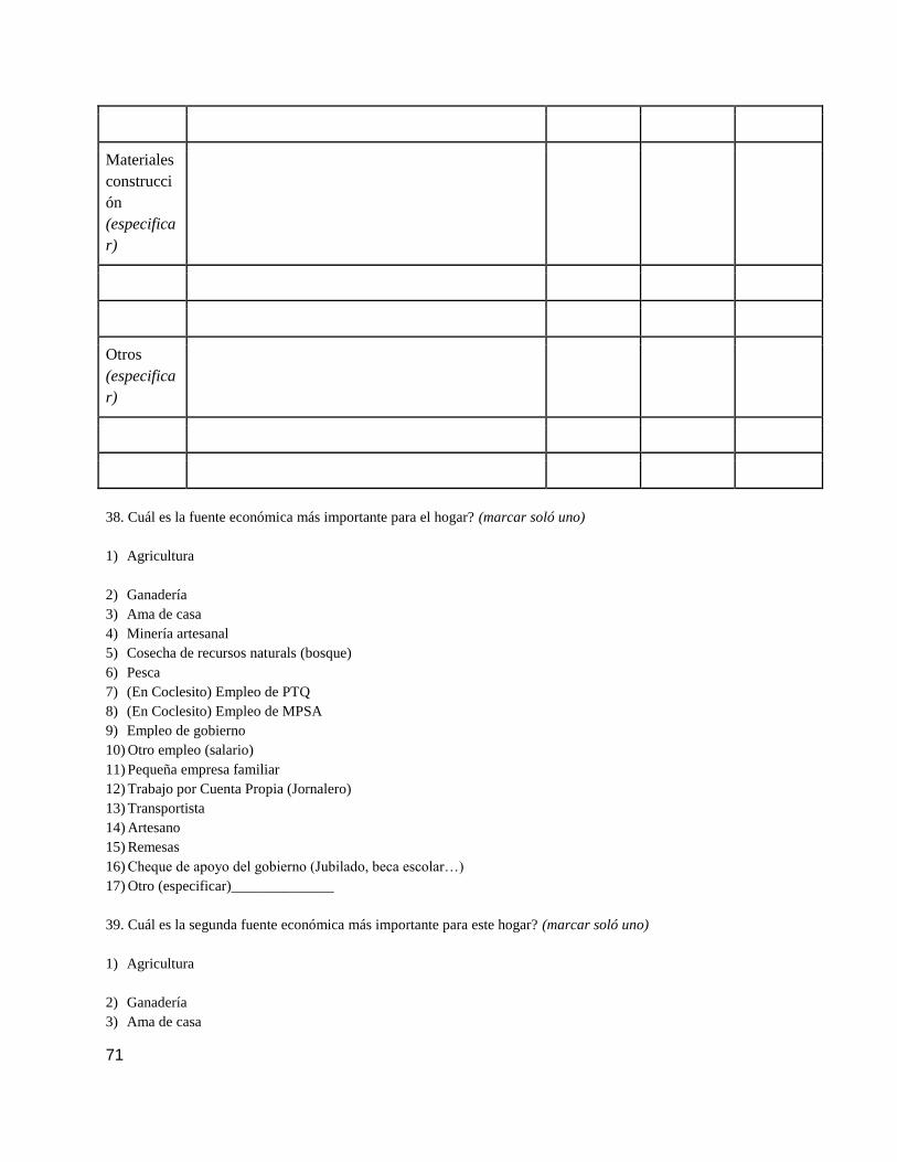
71
Materiales
construcci
ón
(especifica
r)
Otros
(especifica
r)
38. Cuál es la fuente económica más importante para el hogar? (marcar soló uno)
1) Agricultura
2) Ganadería
3) Ama de casa
4) Minería artesanal
5) Cosecha de recursos naturals (bosque)
6) Pesca
7) (En Coclesito) Empleo de PTQ
8) (En Coclesito) Empleo de MPSA
9) Empleo de gobierno
10) Otro empleo (salario)
11) Pequeña empresa familiar
12) Trabajo por Cuenta Propia (Jornalero)
13) Transportista
14) Artesano
15) Remesas
16) Cheque de apoyo del gobierno (Jubilado, beca escolar…)
17) Otro (especificar)______________
39. Cuál es la segunda fuente económica más importante para este hogar? (marcar soló uno)
1) Agricultura
2) Ganadería
3) Ama de casa

72
4) Minería artesanal
5) Cosecha de recursos naturals (bosque)
6) Pesca
7) (En Coclesito) Empleo de PTQ
8) (En Coclesito) Empleo de MPSA
9) Empleo de gobierno
10) Otro empleo (salario)
11) Pequeña empresa familiar
12) Trabajo por Cuenta Propia (Jornalero)
13) Transportista
14) Artesano
15) Remesas
16) Cheque de apoyo del gobierno (Jubilado, beca escolar…)
17) Otro (especificar)_____________
40. Cuál es la tercera fuente económica más importante para el hogar? (marcar soló uno)
1) Agricultura
2) Ganadería
3) Ama de casa
4) Minería artesanal
5) Cosecha de recursos naturals (bosque)
6) Pesca
7) (En Coclesito) Empleo de PTQ
8) (En Coclesito) Empleo de MPSA
9) Empleo de gobierno
10) Otro empleo (salario)
11) Pequeña empresa familiar
12) Trabajo por Cuenta Propia (Jornalero)
13) Transportista
14) Artesano
15) Remesas
16) Cheque de apoyo del gobierno (Jubilado, beca escolar…)
17) Otro (especificar)_____________
41. Esta familia ha ganado algo dinero en efectivo en el mes pasado? marcar uno)
1) Si ____________ 2) No _____________
(En caso afirmativo, llenar la siguiente tabla)
Tipo de actividad que genera el
ingreso
Cuánto se recibió durante el
mes pasado (B./)
Es una fuente de ingreso
regular o eventual?
(R o E)
Venta de cultivo

73
Venta de productos agricoles
procesados
Venta de ganado
Venta de productos ganaderos
Venta de pescado
Venta de recursos naturales (miel,
madera, etc.)
Venta de productos artesanales
Ganancias de pequeñas empresas
Ingreso del empleo
Pagos de renta (casas, potrero,
tierra, etc.
Remesas
Otros (especificar)
42. Lo que ganó el mes pasado es lo que ganó normalmente durante un mes?
1) Es más o menos igual _____
2) Mucho más bajo ______
3) Mucho más alto ______
4) Varia mucho por mes _______
43. Hay algún momento en el año en que la familia no tiene suficiente alimentos para comer?
1) Si ____________ 2) No _____________
(En caso afirmativo, llenar la siguiente tabla)
Mes Escasez
(S o N)
Enero
Febrero
Marzo

74
Abril
Mayo
Junio
Julio
Agosto
Septiembre
Octubre
Noviembre
Diciembre
44. (En caso afirmativo) Cuál es la razón más importante de la escasez de alimentos? (marcar una) (no insinuar la
re)
1) Mala calidad de la tierra (del suelo) ______
2) Terreno insuficiente _______
3) Sin tierra _____
4) Falta de agua para los cultivo/ganado ______
5) Falta de insumos como fertilizante, herramientas, equipos _______
6) Falta de crédito ________
7) Falta de mercados _________
8) No hay suficiente cantidad de mano de obra en la familia
9) Falta de instrucción y capacitación
10) Poca salud _______
11) Falta de empleo _______
12) Mala suerte /hechicería ______
13) Plagas y enfermedades en cultivos y animales______
14) Factores climáticos extremos______
15) Otros (especificar) _____
16) No aplica ______
Parte 4 – Agropecuario
Uso Cantidad
Vivienda (predio familiar)
Negocio o pequeña empresa

75
Cultivos agrícolas
Fincas de frutales
Potreros
Tierra agrícola en descanso/barbecho/rastrojo
Bosque no cultivado/ plantaciones forestales
Alquilado/prestado a terceros para uso
No usado (tierra sin valor para el dueño)
Total (debe coincidir con la pregunta anterior)
45. Con cuánto terreno cuenta la familia para su uso? (marcar cantidad en hectáreas)
__________hectáreas
(Llenar la siguiente tabla)
46. (Llenar la siguiente tabla) (Indique cantidad POR AÑO)
Rubro o
cultivo
Producción
(cantidad y unidad)
Cantidad de
terreno (cantidad y
unidad)
%
Vendid
o
Cultivo
intercalado
Cantidad Unidad Cantidad Unidad si no
Arroz
Maíz
Yuca
Guineo
Plátano
Café
Otros
Otros
Otros

76
47. Cuál es el estatus legal de su tierra? (marcar uno)
1) Derecho posesorio _______
2) Título de propiedad _______
3) Alquilada ________
4) Prestada ______
5) Otro (especificar) ____________________
48. En caso de necesitar más tierra para la agricultura o la ganadería, qué hace usted?
1) Comprar _____
2) Tumbar montaña de su propiedad ______
3) Tumbar montaña ______
4) Alquilar _______
5) Pedirla prestada _______
49. Cómo prepara su terreno de cultivo? (marcar uno)
1) ______No prepara (0 labranza)
2) ______Con máchate (manualmente)
3) ______Tracción animal
4) ______Tracción mecánica
5) ______no aplica
50. Usa abone químico? (marcar uno)
1) Si __________ 2) No ___________ 3) No aplica __________
51. Usa abono orgánico?
1) Si __________ 2) No ___________ 3) No aplica __________
52. Compra semillas alguna vez? (marcar uno)
1) Annualmente _______ 2) A veces ___________ 3) No _______ 3) No aplica ______
53. Contrata personal (jornaleros) para trabajar en la finca?
1) Si __________ 2) No ___________ 3) No aplica __________
54. Cuántos de cada uno de los siguientes tipos de animales cría? (marcar e indicar número)
1) Vacas _________
2) Cabras ________
3) Cerdos ________
4) Pollos/Gallinas _________
5) Caballos ________
6) Patos _______

77
7) Gansos ______
8) Otros (especificar) _____________________________________
9) Ninguna
Parte 5 – Salud
55. Cuál es la enfermedad más común en este hogar? (marcar uno)
1) Diarrea ______
2) Otra enfermedad gastrointestinal _________
3) Infección ocular________
4) Enfermedad respiratoria/resfrío/influenza _______
5) Erupción cutánea ________
6) Leishmaniosis (“bayano”) _______
7) Dengue ________
8) Malaria ________
9) Presión arterial _______
10) Diabetes ________
11) Otras (especificar) _______
56. Hay alguna persona discapacitada en la familia? (indicar cantidad)
1) Hombres _____
2) Mujeres _______
3) Menores de 15 años ______
4) No aplica _______
57. Qué enfermedades tuvieron las personas en esta familiar el mes pasado? (verificar las que se apliquen y poner
LA CANTIDAD de hombres, mujeres, niños)
Enfermedad Hombres Mujeres Niños
(14 y menos)
Tratado por
(ver código
abajo)
Diarrea
Gastrointestinal
Infección ocular
Respiratoria/resfrío/influenza
Erupción cutánea
Leishmaniosis
Dengue
Malaria

78
Presión arterial
Diabetes
Otros (especificar)
Códigos:
1) Remedio casero
2) Curandero tradicional
3) Puesto o centro de salud (comunidad cercana)
4) Hospital/clínica en Coclesito/Cocle del Norte/La Pintata/Penonomé
5) Hospital/clínica en Santa Fe
6) Otros hospitales
58. Cuánto tiempo ha transcurrido desde que alguien en esta familia, menor de 50 años, estuvo demasiado enfermo
para trabajar? (marcar número)
______ días
______semanas
______meses
______años
______no ha sucedido
______no aplica
60. Cuánto tiempo ha transcurrido desde que un estudiante en esta familia estuvo muy enfermo para ir al colegio?
(marcar número)
______días
______semanas
______meses
______años
______no ha sucedido
______no aplica
61. Cuánto tiempo ha transcurrido desde que alguien en esta familia visitó a un curandero? (marcar número)
______días
______semanas
______meses
______años
______no lo usan
62. Cuál fue la razón de esta visita al curandero? (marcar uno)
1) Para curar una enfermedad _____

79
2) Para evitar un problema de salud _______
3) Para ambas cosas _______
4) Alguna otra razón (especificar) ________
5) No lo usan ______
6) No aplica _______
63. Cuánto tiempo ha transcurrido desde que alguien en esta familia visitó a un puesto de salud, un centro de salud,
un hospital (cualquier facilidad de salud pública o privada)? (marcar número)
______días
______semanas
______meses
______años
______no ha sucedido
64. Cuál fue la razón de esta visita? (marcar uno)
1) Curar una enfermedad _____
2) Evitar un problema de salud _______
3) Ambos _______
4) Otro ____________________________________
5) No fueron______
6) No aplica _______
65. El nacer de su ultimo hijo de esta familiar fue (aplicable si hay hijos menores de 15 años) (Llenar le siguiente
tabla)
Antes del
nacimiento
Durante el
nacimiento
Inmediatamente
después del
nacimiento
Sin asistencia
Asistido por en
miembro o amigo de la
familiar
Atendido por un
asistente de salud
Asistado por una
enfermera o doctor
Atendido por una
partera
No aplica

80
66. Es esta familia se usa algún tipo de planificación familiar?
1) Si __________ 2) No ___________ 3) No aplica __________
Parte 6 – Social
67. Participan los miembros de esta familia como miembro de? (marcar lo que sea aplicable)
1) Junta comunal o local _______
2) Grupo de agricultura/ganadería ______
3) Cooperativas o asociaciones ______
4) Grupos conservacionistas _______
5) Comité de salud _______
6) Grupos religiosos _______
7) Asociación de Padres de Familia ______
8) Clubes deportivos
9) Club de amas de casa
10) Otros (especificar) _________
11) Ninguna ________
68. Esta familia depende de otras familia cercanas para? (marcar lo que sea aplicable)
1) Cultivar campos (ejemplo juntas de trabajo – paga peón) ______
2) Cosechar recursos naturales (minería, pesca, caza) ______
3) Intercambiar (trueque) bienes y servicios _______
4) Compartir equipos/herramientas/transporte, etc. ______
5) Cuidar a los niños o ancianos ______
6) Encontrar trabajos _______
7) Pedir dinero prestado ______
8) Otros _____________________________
9) Ninguna _______
Parte 7 – Activos
69. Esta familia tiene? (marcar lo que sea aplicable, indicar cantidad de cada cosa)
1) Radio cantidad ________
2) Televisión cantidad ________
3) Refrigeradora cantidad ________
4) Bicicleta cantidad ________
5) Estufa de gas cantidad ________
6) Teléfono celular cantidad ________
7) Motor fuera de borda cantidad ________
8) Bote o canoa cantidad ________
9) Computadora cantidad ________

81
10) Coche cantidad ________
11) Servicio higiénico Si______ No______
12) Techo de zinc Si______ No______
13) Piso de cemento Si______ No______
14) Otra casa cantidad ________
70. (En caos afirmativo) Tiene un préstamo con alguien?
1) Miembro familiar _____
2) Amigo _____
3) Empleador ______
4) Prestamista _______
5) Grupo u organización local informal ______
6) Institución formal (cooperativa, caja rural, etc.) _______
7) Ninguna ______
71. Esta familia tiene ahorros?
1) Si __________ 2) No ___________
Parte 8 – Otros
72. Tiene algún comentario que desee hacer sobre el Proyecto de Cobre de MPSA? (Para los encuestados
de Santa Fe, piden hipotéticamente cómo se sentirían acerca de un proyecto minero)
1) Si __________ 2) No ___________
Comentarios:
_____________________________________________________________________________________________
_____________________________________________________________________________________________
_____________________________________________________________________________________________
_____________________________________________________________________________________________
_____________________________________________________________________________________________
_____________________________________________________________________________________________
_____________________________________________________________________________________________
_____________________________________________________________________________________________
______
73. (El encuestador marcará si hay comentarios)
1) Comentarios positivos _______
2) Comentarios negativos _______
3) Comentarios positivos y negativos ________
4) Sólo preguntas _______
Comentarios del examinador:

82
_____________________________________________________________________________________________
_____________________________________________________________________________________________
_____________________________________________________________________________________________
_____________________________________________________________________________________________
_____________________________________________________________________________________________
_____________________________________________________________________________________________
_____________________________________________________________________________________________
_____________________________________________________________________________________________
___
CIERRE
Este estudio se realiza para obtener información sobre la población que vive cerca del sitio de la mina cobre de
MPSA propuesto y también el sitio de control de Santa Fe. Sirbase firmar para confirmar haber comprendido esto.
Nombre de la persona que responde ____________________________________________
Firma de la persona que responde _________________________________________________
(Agradecer a la persona que responde)
Instructions for Reviewed Survey
Instructions for interviewers:
Updated April 17, 2014
Additional Instructions:
***this survey should be reviewed specially for Indigenous groups
***skipping pattern only refer to specific instructions on the questions otherwise ask the question regardless is
respondent has previously given the answer elsewhere in the survey
Before Preamble
● First introduce yourself and say that you are students conducting an interview on social-economic changes
in the household and wonder if they would be interested in being a part of an interview that lasts 30-40
minutes. Then once you are sitting down with the respondent explain that you have to read a formal
description of the project and proceed with the preamble.
● After you read preamble obtain consent again to proceed with the survey
Rooster Q1-22:
● Need to clearly define household that is clear across all interviewers. We defined household with whoever
lived in the household, it worked but was not perfect in all cases.
● Schooling section – we need to be trained on specific schooling system
● May be better to rearrange the roster
● Could be better to print entire rooster on legal paper so do not have to rewrite names
● Go through each question with each person in the family
Q11-14 (post-secundario):
● Redefine questions, people did not know what “Afino de obtencion” means
● Redefine post-secundario section, look into system

83
Q23: moved to after Indigenous questions to make a better transition
Q24-26: Indigneous
● Note that people in Santa Fe and Coclesito did not seem to know much about the indigenous people around
them
● Awkward questions but don’t know where else to put it
● Switched 25 and 26
Q27:
● Sometimes respondents bring up kids that have moved out, clarify if they have their own families. If yes,
then they should not be included in the household
Q29:
● Added a response to include if they were born there “todo la vida”
Q31:
● This question did not account for the different types of acueductos – need to revise
Q32:
● Even if someone does use some Lena, only complete 33 and 34 if it is their primary source of fuel
Q33:
● People were almost never able to answer this question and give a quantity, needs to be revised.
Q36:
● People often cited taking things from their finca so we clarified this to bosque Silvestre instead of just
bosque.
Q37:
● This table was a bit weird to fill out as it is hard to get people to give a specific response, but we could not
think of how to change it.
Q38:
● We had a lot of debate over the placing and difference between fuente economica and the question
regarding actividad principal. To us the first implies an activity that brings income to the family and can
include remasas while the latter could include ama de casa, jubilado, and estudiante.
● We decided to keep Ama de casa as a possible fuente economica because one respondent said that if his
wife was not an ama de casa he would have to pay someone else a lot
● Question of whether subsistence farming is a fuente economica and need to clarify this
● Added cheque de apoyo del gobierno to include things like retiree checks, scholarships for school, and
money given to single mothers
Q41:
● Original phrasing was confusing and poorly understood by people so altered it a bit.
● Need to go through each box carefully because people known not to report their salaries from jobs
previously mentioned.
Q42:
● Original phrasing also confusing and was changed. 4th
option added to include people whose income varies
a lot from one month to the next.
Q44:
● Many people answered the changing of seasons, but in reality this would be no method to store or not
enough cash to buy food. This needs to be altered or if not, provide specific instructions to read all the
answers off before respondent answers.
Q45 and 46 Agropecuaria:
● Responses varied and people often did not know actually quantities. We aren’t sure in the future if these
questions should be part of this survey or be taken out and done in more detail by the land-use group.
● Maybe it would be good to specify if people have a small house garden or if they actually have a finca

84
● For 46 if we keep this question, then we recommend that you only ask more basic question about cantidad
and % vendido
● What about questions about Ganadaria if we are asking about Agriculture?
Q48-52:
● All of these questions are good, but goes into larger discussion of if want to include these questions in the
Q52:
● Added changed responses to be more specific.
Q54:
● Specified pollos/gallinas instead of just pollos as many people responded with gallinas instead of pollos.
Q55:
● Make sure interviewers know that refrio (common response in Santa Fe) is included in the list in
Enfermedad respiratoria because some of the interviewers missed that it was there.
Q59:
● Deleted question asking if people go to school before question 60 as it was not necessary, as we already
knew if they had people in the household who went to school.
Q67:
● IT would be a good idea to include more groups specific to Santa Fe and Coclesito such as Nutre Hogar.
Also it would be a good idea to try and ask questions about groups specifically CSR funded by the mine to
see how effective the actually are.
Q68:
● Often people answered no to this. It may be good to rephrase this or to also ask specifically if they live near
their family and get food or help from them, differentiating family from neighbors.
Q69:
● Added computer and car to the list to ask people
Q70:
● Changed phrasing of this question
Q71:
● Might be something to consider asking people more specifically if they keep money in case of an
emergency, as some people may think of ahorros as money in a bank.
Q72:
● Need to add questions to ask specifically about the mine
● Need to decide if these questions should be the same or different for Santa Fe and Coclesito
● Have the same questions in both communites
● 1. How do you perceive the evolution of the community
● 2. What do you think about mining
● ---still leave room for open-endedness, as it is the last questions of the survey
Reviewed Survey
Encuesta Social
Programa de Monitoreo Minería
Familia número:_________________ (marcar el número de familia en todas las paginas del cuestionario)
Nombres del encuestadores: __________________
Fecha: ________________________

85
Verificado por ________________________
Fecha _________________________
Ingreso de datos por _________________________
Fecha _________________________
PREÁMBULO
La siguiente será prestado a los respondientes:
“Hola, mi nombre es X and trabajo con un equipo de investigadores canadienses.
Nosotros estamos empezando un proyecto de monitoreo a largo plazo de los impactos socio-económicos. Le meta es
de establecer un espacio de evaluación independiente cuyos resultados serán difundidos a todos los sectores de la
sociedad Panameña con interés en la problemáticas minería como las comunidades, las empresas, y las
organizaciones y instituciones gubernamentales. Quisiéramos hacerle algunas preguntas para aprender acerca de
cómo su familia se ha ganado la vida aquí en ______________ (nombre de la comunidad) en el último año. La
entrevista durará aproximadamente una hora si decide continuar. Le solicitamos respetuosamente responder estas
preguntas de la mejor manera posible. Toda la información se tratará de manera confidencial. Los investigadores
que tendrán acceso a su información son los Dres. Franque Grimard, Daviken Studnick-Gizbert y Catherine Potvin,
su información de contacto está en esta hoja, que voy a salir con usted o con su Tte. Gobernador. La información
que recogemos de usted y otras familias en los demás comunidades que estamos visitando se utilizará para preparar
la creación de un programa de monitoreo sobre los impactos socio-económicos y ambientales de la minería. Sírvase
nota que no es probable que se beneficien directamente de participar en este estudio, pero la información que usted
proporciona puede ayudar a mejorar los programas de política de diseño y desarrollo en esta área. "
***Please add
-describe that this is part of a larger long-term Project measuring land-use change and wáter quality
Consentimiento:
“ Entiende lo que he dicho? Tiene alguna pregunta? Está de acuerdo para participar en este estudio y ser
entrevistado
Comunidad:________________________
Nombre del jefe de familia: ______________________________________
Nombre de la persona que responde (en caso der ser distinto) __________________________
Participará usted en la encuesta? Sí ______________ No_________________
(En caso negativo) Puede explicar por qué no desea participar en la encuesta?
_____________________________________________________________________________________________
_____________________________________________________________
Podemos regresar y conversar con alguien más?
Si _________ No _________
La firma de este documento significa que la investigación del caso, incluyendo la
información que se encuentra arriba, le ha sido oralmente descrita y que accede a
participar voluntariamente.
_________________________________________ ______________________
Firma del participante Fecha
_________________________________________ ______________________
Firma del testigo Fecha

86
Información de contacto:
Si tiene alguna pregunta acerca de sus derechos como sujeto participante en una investigación o acerca de qué hacer si sufre
algún daño, puede comunicarse con McGill University Ethics Manager at 001-514-398-6831 o [email protected]. Por más
información sobre el proyecto o su participación, también puede comunicarse con: Su participación en esta investigación es
voluntaria y no será penalizado o perderá
1. Professor Franque Grimard, Department of Economics McGill University, Montreal, Canada (email:
2. Professor Daviken Studnicki-Gizbert, Department of History, McGill University, Montreal, Canada ,email: daviken.studnicki-
3. Professor Catherine Potvin, Department of Biological Sciences, McGill University, Montreal, Canada, email:
A. Demografía, Educación y Trabajo
24. Hay indígenas que viven en la comunidad?
1) Si______ 2) No ________
26. De qué grupo étnico? ____________________________________
25. (En caso afirmativo) Hay indígenas en la casa?
1) Si______ 2) No ________
23. Religión (marcar una)
1) Protestante _______
2) Católica _______
3) Cristiana evangélica (especificar) ____________________________
4) Otra (especificar)__________________________________________
5) Ninguna______
27. Algunos miembros de este hogar viven en algún otro lugar temporalmente? (marcar uno)
1) Si______ 2) No ________
28. (En cas afirmativo) Cuantos miembros viven en otro lugar? (cantidad)
1) Por qué viven en otro lugar? Por estudios? (cantidad)? __________
2) Por qué viven en otro lugar? Por trabajo? (cantidad)? ___________
3) Por qué viven en otro lugar? Por motive de salud? (cantidad)? _____________
4) Por qué viven en otro lugar? Por otro motivo? (especificar motivo e indicar cantidad)
_________________________________________
29. Por cuánto tiempo esta familia ha vivido en esta comunidad? (indicar numero)
______meses
______años
______todo la vida

87
30. (Para las familias que llegaron en los últimos deis años) De dónde se mudaron? (marcar uno)
1) De la misma comunidad _________________________________
2) De otro comunidad en Donosos o La Pintada _____________________________
3) De otro lugar en Panamá (especificar) ______________________
4) De otro lugar (especificar) ______________________
5) No aplica _____________
Parte 2 - Agua y Energía
31. De dónde obtiene esta familia toda o la mayor parte del agua para uso doméstico? (marcar uno)
1) Río o quebrada ________
2) Pozo tradicional (brocal) _______
3) Pozo mecánico ______
4) Acueducto ________
5) Ojo de agua _______
6) Otros (especificar) ________
NEW QUESITON: Este agua es potable?
1) Si______ 2) No ________ 3) No sabe ________
NEW QUESITON: Si no es potable, de dónde obtiene esta familia todo o la mayor parte del agua para tomar?
1) Río o quebrada ________
2) Pozo tradicional (brocal) _______
3) Pozo mecánico ______
4) Acueducto ________
5) Ojo de agua _______
6) La compra
7) Uso un filtro (especificar que tipo) _________________________
8) Otros (especificar) ________
31a. Si no cuenta servicio de acueducto hasta vivienda, cuánto tiempo le toma caminar hasta esa fuente de agua?
(indicar cantidad) ___________minutos
32. Qué usa este hogar como combustible para cocinar todos o una mayoría de los alimentos? (marcar el principal y
soló uno)
1) Carbón _____
2) Leña ______
3) Gas______
4) Otros (especificar) ____________________________
33. (De emplearse leña) Cuánta leña se usa semanalmente? (marcar cantidad y unidad)
________________ (unidad es haz/bulto)
________________no aplica
34. De dónde procede la leña? (marcar uno)

88
1) De su finca ______
2) Del bosque ______
3) La compra _______
4) Otra procedencia (especificar) ______________________________
35. Cuánto tiempo le toma llegar al lugar donde consigue la leña?
_________________(minutos u horas)
_________________ no aplica
35a. Este hogar tiene electricidad?
1) Si _____
i. Batería ______
ii. Panel solar _______
iii. Generador ______
iv. Tendido eléctrico ______
2) No_____
NEW QUESTION: (En caso afirmativa) Por cuántos horas cada día tiene electricidad? _________horas
36. Esta familia obtiene recursos del bosque silvestre?
1) Si______ 2) No ________
37. (En caso afirmativo) Qué recursos naturales son importantes para el sustento familiar? (llenar en el siguiente
tabla, considerar solo los dos tipos mas importantes de cada recurso)
Recursos
del Bosque
Con qué frecuencia cosecha lo utiliza?
Anualmente Mensualme
nte
Semanalme
nte
Diariamen
te
Leña
Cría de
abejas
Frutos/plan
tas para
comer
(especifica
r)

89
Cacería
(especifica
r)
Medicinas
(especifica
r)
Pesca
(especifica
r)
Materiales
construcció
n
(especifica
r)
Otros
(especifica
r)
38. Cuál es la fuente económica más importante para el hogar? (marcar soló uno)

90
1) Agricultura
2) Ganadería
3) Ama de casa
4) Minería artesanal
5) Cosecha de recursos naturals (bosque)
6) Pesca
7) (En Coclesito) Empleo de PTQ
8) (En Coclesito) Empleo de MPSA
9) Empleo de gobierno
10) Otro empleo (salario)
11) Pequeña empresa familiar
12) Trabajo por Cuenta Propia (Jornalero)
13) Transportista
14) Artesano
15) Remesas
16) Cheque de apoyo del gobierno (Jubilado, beca escolar…)
17) Otro (especificar)______________
39. Cuál es la segunda fuente económica más importante para este hogar? (marcar soló uno)
1) Agricultura
2) Ganadería
3) Ama de casa
4) Minería artesanal
5) Cosecha de recursos naturals (bosque)
6) Pesca
7) (En Coclesito) Empleo de PTQ
8) (En Coclesito) Empleo de MPSA
9) Empleo de gobierno
10) Otro empleo (salario)
11) Pequeña empresa familiar
12) Trabajo por Cuenta Propia (Jornalero)
13) Transportista
14) Artesano
15) Remesas
16) Cheque de apoyo del gobierno (Jubilado, beca escolar…)
17) Otro (especificar)_____________
40. Cuál es la tercera fuente económica más importante para el hogar? (marcar soló uno)
1) Agricultura
2) Ganadería

91
3) Ama de casa
4) Minería artesanal
5) Cosecha de recursos naturals (bosque)
6) Pesca
7) (En Coclesito) Empleo de PTQ
8) (En Coclesito) Empleo de MPSA
9) Empleo de gobierno
10) Otro empleo (salario)
11) Pequeña empresa familiar
12) Trabajo por Cuenta Propia (Jornalero)
13) Transportista
14) Artesano
15) Remesas
16) Cheque de apoyo del gobierno (Jubilado, beca escolar…)
17) Otro (especificar)_____________
41. Esta familia ha ganado algo dinero en efectivo en el mes pasado? marcar uno)
1) Si ____________ 2) No _____________
(En caso afirmativo, llenar la siguiente tabla)
Tipo de actividad que genera el
ingreso
Cuánto se recibió durante el
mes pasado (B./)
Es una fuente de ingreso
regular o eventual?
(R o E)
Venta de cultivo
Venta de productos agricoles
procesados
Venta de ganado
Venta de productos ganaderos
Venta de pescado
Venta de recursos naturales (miel,
madera, etc.)
Venta de productos artesanales
Ganancias de pequeñas empresas
Ingreso del empleo
Pagos de renta (casas, potrero, tierra,
etc.

92
Remesas
Otros (especificar)
42. Lo que ganó el mes pasado es lo que ganó normalmente durante un mes?
1) Es más o menos igual _____
2) Mucho más bajo ______
3) Mucho más alto ______
4) Varia mucho por mes _______
43. Hay algún momento en el año en que la familia no tiene suficiente alimentos para comer?
1) Si ____________ 2) No _____________
(En caso afirmativo, llenar la siguiente tabla)
Mes Escasez
(S o N)
Enero
Febrero
Marzo
Abril
Mayo
Junio
Julio
Agosto
Septiembre
Octubre
Noviembre
Diciembre
44. (En caso afirmativo) Cuál es la razón más importante de la escasez de alimentos? (marcar una) (no insinuar la
re)

93
1) Mala calidad de la tierra (del suelo) ______
2) Terreno insuficiente _______
3) Sin tierra _____
4) Falta de agua para los cultivo/ganado ______
5) Falta de insumos como fertilizante, herramientas, equipos _______
6) Falta de crédito ________
7) Falta de mercados _________
8) No hay suficiente cantidad de mano de obra en la familia
9) Falta de instrucción y capacitación
10) Poca salud _______
11) Falta de empleo _______
12) Mala suerte /hechicería ______
13) Plagas y enfermedades en cultivos y animales______
14) Factores climáticos extremos______
15) Otros (especificar) _____
16) No aplica ______
Parte 4 – Agropecuario
Uso Cantidad
Vivienda (predio familiar)
Negocio o pequeña empresa
Cultivos agrícolas
Fincas de frutales
Potreros
Tierra agrícola en descanso/barbecho/rastrojo
Bosque no cultivado/ plantaciones forestales
Alquilado/prestado a terceros para uso
No usado (tierra sin valor para el dueño)
Total (debe coincidir con la pregunta anterior)
45. Con cuánto terreno cuenta la familia para su uso? (marcar cantidad en hectáreas)
__________hectáreas
(Llenar la siguiente tabla)

94
46. (Llenar la siguiente tabla) (Indique cantidad POR AÑO)
Rubro o
cultivo
Producción
(cantidad y unidad)
Cantidad de
terreno (cantidad y
unidad)
%
Vendid
o
Cultivo
intercalado
Cantidad Unidad Cantidad Unidad si no
Arroz
Maíz
Yuca
Guineo
Plátano
Café
Otros
Otros
Otros
47. Cuál es el estatus legal de su tierra? (marcar uno)
1) Derecho posesorio _______
2) Título de propiedad _______
3) Alquilada ________
4) Prestada ______
5) Otro (especificar) ____________________
48. En caso de necesitar más tierra para la agricultura o la ganadería, qué hace usted?
1) Comprar _____
2) Tumbar montaña de su propiedad ______
3) Tumbar montaña ______
4) Alquilar _______
5) Pedirla prestada _______
49. Cómo prepara su terreno de cultivo? (marcar uno)
1) ______No prepara (0 labranza)
2) ______Con máchate (manualmente)

95
3) ______Tracción animal
4) ______Tracción mecánica
5) ______no aplica
50. Usa abone químico? (marcar uno)
1) Si __________ 2) No ___________ 3) No aplica __________
51. Usa abono orgánico?
1) Si __________ 2) No ___________ 3) No aplica __________
52. Compra semillas alguna vez? (marcar uno)
1) Annualmente _______ 2) A veces ___________ 3) No _______ 3) No aplica ______
53. Contrata personal (jornaleros) para trabajar en la finca?
1) Si __________ 2) No ___________ 3) No aplica __________
54. Cuántos de cada uno de los siguientes tipos de animales cría? (marcar e indicar número)
1) Vacas _________
2) Cabras ________
3) Cerdos ________
4) Pollos/Gallinas _________
5) Caballos ________
6) Patos _______
7) Gansos ______
8) Otros (especificar) _____________________________________
9) Ninguna
Parte 5 – Salud
55. Cuál es la enfermedad más común en este hogar? (marcar uno)
1) Diarrea ______
2) Otra enfermedad gastrointestinal _________
3) Infección ocular________
4) Enfermedad respiratoria/resfrío/influenza _______
5) Erupción cutánea ________
6) Leishmaniosis (“bayano”) _______
7) Dengue ________
8) Malaria ________
9) Presión arterial _______
10) Diabetes ________
11) Otras (especificar) _______
56. Hay alguna persona discapacitada en la familia? (indicar cantidad)

96
1) Hombres _____
2) Mujeres _______
3) Menores de 15 años ______
4) No aplica _______
57. Qué enfermedades tuvieron las personas en esta familiar el mes pasado? (verificar las que se apliquen y poner
LA CANTIDAD de hombres, mujeres, niños)
Enfermedad Hombres Mujeres Niños
(14 y menos)
Tratado por
(ver código
abajo)
Diarrea
Gastrointestinal
Infección ocular
Respiratoria/resfrío/influenza
Erupción cutánea
Leishmaniosis
Dengue
Malaria
Presión arterial
Diabetes
Otros (especificar)
Códigos:
1) Remedio casero
2) Curandero tradicional
3) Puesto o centro de salud (comunidad cercana)
4) Hospital/clínica en Coclesito/Cocle del Norte/La Pintata/Penonomé
5) Hospital/clínica en Santa Fe
6) Otros hospitales
58. Cuánto tiempo ha transcurrido desde que alguien en esta familia, menor de 50 años, estuvo demasiado enfermo
para trabajar? (marcar número)
______ días

97
______semanas
______meses
______años
______no ha sucedido
______no aplica
60. Cuánto tiempo ha transcurrido desde que un estudiante en esta familia estuvo muy enfermo para ir al colegio?
(marcar número)
______días
______semanas
______meses
______años
______no ha sucedido
______no aplica
61. Cuánto tiempo ha transcurrido desde que alguien en esta familia visitó a un curandero? (marcar número)
______días
______semanas
______meses
______años
______no lo usan
62. Cuál fue la razón de esta visita al curandero? (marcar uno)
1) Para curar una enfermedad _____
2) Para evitar un problema de salud _______
3) Para ambas cosas _______
4) Alguna otra razón (especificar) ________
5) No lo usan ______
6) No aplica _______
63. Cuánto tiempo ha transcurrido desde que alguien en esta familia visitó a un puesto de salud, un centro de salud,
un hospital (cualquier facilidad de salud pública o privada)? (marcar número)
______días
______semanas
______meses
______años
______no ha sucedido
64. Cuál fue la razón de esta visita? (marcar uno)
1) Curar una enfermedad _____
2) Evitar un problema de salud _______
3) Ambos _______
4) Otro ____________________________________

98
5) No fueron______
6) No aplica _______
65. El nacer de su ultimo hijo de esta familiar fue (aplicable si hay hijos menores de 15 años) (Llenar le siguiente
tabla)
Antes del
nacimiento
Durante el
nacimiento
Inmediatamente
después del
nacimiento
Sin asistencia
Asistido por en
miembro o amigo de la
familiar
Atendido por un
asistente de salud
Asistado por una
enfermera o doctor
Atendido por una
partera
No aplica
66. Es esta familia se usa algún tipo de planificación familiar?
1) Si __________ 2) No ___________ 3) No aplica __________
Parte 6 – Social 67. Participan los miembros de esta familia como miembro de? (marcar lo que sea aplicable)
1) Junta comunal o local _______
2) Grupo de agricultura/ganadería ______
3) Cooperativas o asociaciones ______
4) Grupos conservacionistas _______
5) Comité de salud _______
6) Grupos religiosos _______
7) Asociación de Padres de Familia ______
8) Clubes deportivos
9) Club de amas de casa
10) Otros (especificar) _________
11) Ninguna ________
68. Esta familia depende de otras familia cercanas para? (marcar lo que sea aplicable)

99
1) Cultivar campos (ejemplo juntas de trabajo – paga peón) ______
2) Cosechar recursos naturales (minería, pesca, caza) ______
3) Intercambiar (trueque) bienes y servicios _______
4) Compartir equipos/herramientas/transporte, etc. ______
5) Cuidar a los niños o ancianos ______
6) Encontrar trabajos _______
7) Pedir dinero prestado ______
8) Otros _____________________________
9) Ninguna _______
Parte 7 – Activos
69. Esta familia tiene? (marcar lo que sea aplicable, indicar cantidad de cada cosa)
1) Radio cantidad ________
2) Televisión cantidad ________
3) Refrigeradora cantidad ________
4) Bicicleta cantidad ________
5) Estufa de gas cantidad ________
6) Teléfono celular cantidad ________
7) Motor fuera de borda cantidad ________
8) Bote o canoa cantidad ________
9) Computadora cantidad ________
10) Coche cantidad ________
11) Servicio higiénico Si______ No______
12) Techo de zinc Si______ No______
13) Piso de cemento Si______ No______
14) Otra casa cantidad ________
70. (En caos afirmativo) Tiene un préstamo con alguien?
1) Miembro familiar _____
2) Amigo _____
3) Empleador ______
4) Prestamista _______
5) Grupo u organización local informal ______
6) Institución formal (cooperativa, caja rural, etc.) _______
7) Ninguna ______
71. Esta familia tiene ahorros?
1) Si __________ 2) No ___________
Parte 8 – Otros
72. Tiene algún comentario que desee hacer sobre el Proyecto de Cobre de MPSA? (Para los encuestados de Santa
Fe, piden hipotéticamente cómo se sentirían acerca de un proyecto minero)

100
1) Si __________ 2) No ___________
Comentarios:
_____________________________________________________________________________________________
_____________________________________________________________________________________________
_____________________________________________________________________________________________
_____________________________________________________________________________________________
_____________________________________________________________________________________________
_____________________________________________________________________________________________
_____________________________________________________________________________________________
_____________________________________________________________________________________________
______
73. (El encuestador marcará si hay comentarios)
1) Comentarios positivos _______
2) Comentarios negativos _______
3) Comentarios positivos y negativos ________
4) Sólo preguntas _______
Comentarios del examinador:
_____________________________________________________________________________________________
_____________________________________________________________________________________________
_____________________________________________________________________________________________
_____________________________________________________________________________________________
_____________________________________________________________________________________________
_____________________________________________________________________________________________
_____________________________________________________________________________________________
_____________________________________________________________________________________________
______
CIERRE
Este estudio se realiza para obtener información sobre la población que vive cerca del sitio de la mina cobre de
MPSA propuesto y también el sitio de control de Santa Fe. Sirbase firmar para confirmar haber comprendido esto.
Nombre de la persona que responde ____________________________________________
Firma de la persona que responde _________________________________________________
(Agradecer a la persona que responde)
Appendix C
Human Ecology and Territory Final Report
REPORT: LAND-USE GROUP

101
This report is divided into 3 main parts: the key issues and themes associated, description of
methodology, and critique of methodology.
PART A) Key issues / themes: Questions we were asking about land-use and land-use change – What is
relevant when asking about the effects of the mine?
1) Forest cover
a. Forest cover is an indicator for access to ecosystem services (i.e. hunting, gathering,
timber and construction materials, microclimate regulation, carbon storage).
b. The direct impact from the mine on forests can be seen through deforestation for the
actual site and reforestation efforts of the mine (compensation).
c. Changes in forest cover can influence the watershed and its management
Includes geomorphology (erosion), ecology (fragmentation/biodiversity), water
quantity and quality
2) Agriculture and livestock
a. The main form of livelihood is agricultural production
b. If food production changes, it may affect food security
c. The expansion or abandonment of farming affects forest cover
d. The mine workers, as well as roads, generate a market for agricultural products
e. Employment in the mine may affect the availability of labor time for agriculture, or it
may increase capital supply to run farms
i. May affect amount of agrochemicals used
f. Agriculture and livestock require a lot of water so would be affected by water
shortages/contamination, and may affect water quality through agrochemicals, etc.
3) Land use and roads
a. Mines build roads, opening up areas which were previously inaccessible
b. Roads influence landscape fragmentation and forest cover change
c. Employment to build the roads is connected to labor supply for other livelihood activities
d. What are the effects of high or increased traffic to/from the mine
e. Roads can lead to sedimentation of rivers
f. Roads provide market access
i. Both consumption and marketing
g. Roads affect local land markets
h. People can get to services (education, health, banks)
4) Forest regeneration (rastrojo)
a. Lack of agricultural labor availability could increase farmland abandonment which
affects forest cover
b. Lack of agricultural labor availability could increase fallow period time
i. Affects soil and water quality/supply
ii. Affects the amount of burning
5) Land tenure/prices/access
a. Mine increases population and demand for land and housing
b. Incoming population may affect tenure and price

102
c. Contamination and proximity to land may decrease value of surrounding land
d. Affects land distribution patterns such as land size
e. Mine may lead to displacement of communities and households
f. Privatization of ownership may affect common resource access and customary uses of
space (trail networks, etc.)
6) Environmental governance
a. Will the mine’s privatization of environmental governance shift the balance of power
away from local grassroots and governmental bodies? Or will it motivate them to develop
their capacity to manage the local environment and resource access?
b. Will the mine affect the capacity of local organizations to plan territorial and resource
management (water juntas, etc.)?
7) Urban and infrastructure development
a. Incoming population needs houses to be built, as well as basic services – what are the
effects of the construction boom?
b. Increasing population may lead to the construction of services (health center, school,
water treatment, sewage and garbage, etc.)
c. Will the mine bring electricity? What are the local effects of getting electricity for the
first time?
d. What are the effects of the resettlement of communities and households
e. Will the mine bring communications services?
PART B) Methodology description and short justification
a. Scientific research method
b. Logistics included (time, people, resources)
c. Products included (Notebooks identified by “Land-use #1…4”)
Method Justification Research method Logistics Deliverables
Interviews with
set questions –
Semi-structured
interviews
· More detailed
information on finca-
scale
· Semi-structured
(most questions
asked, some left-out
depending on
interviewee) · 20-25 relevant
questions targeted to
farmers · Asked for
permission prior to
beginning
· About 2 persons /
1 farm / 1-2 hours · Equipment
needed: Journals
and Pens · * Might be useful
in future years to
GPS houses that
were interviewed
· All recorded
in notebooks
with names of
farmers ( · Left page for
notes, right
page for
summary and
synthesis
Road transect
with panoramic
view
· Visual idea of land-
use at medium scale · Can indicate how
road influences land-
use · Useful non-textual
info, easily shared
· Only performed in
Coclesito; should
also be done in
Santa Fe (new road
construction) · Starting from Los
Molejones to
Coclesito · Every 300 m, take
· 1-2 persons /
afternoon (4-5
hours) / Los
Molejones to
Coclesito · Equipment
needed: Appropriate
camera, notebook,
GPS
· Pictures with
coordinates
and
descriptions
in notebooks (

103
panoramic photo,
GPS · With backs to
Molejones, describe
left side, then right
side in categorical
terms of land-use
(ex: Shrub,
secondary forest,
pasture); special
notes are also taken · Terms such as
drop and wall used
to describe photos
that are difficult to
identify (Wall =
land face)
Remote sensing
validation · Verifying remote
sensing points · Able to see acute
land-use changes
· Walk along road
or path and observe
different terrains
(i.e. pasture, gravel
lots, etc.) · Take GPS point on
each different
terrain type · Take photo of
person taking the
GPS point to see
terrain type and
exact GPS point
location · Make general
observations of
terrain type
· 2 persons for one
afternoon (c. 5
hours) · Equipment:
Notebook, camera,
GPS
· Pictures of
terrain types ·
Correspondin
g GPS points · Description
of land type
Detailed farm
survey · Farm scale
understanding of land
use · Understanding farm
drivers helps predict
future land use
changes (Note- this is
somewhat beyond the
scope of the project)
· Visited Ergberto’s
farm in mountains
(chosen b/c he is
member of the
cooperative, uses
intensive and
diversified farming
methods and knows
Daviken) · Used semi-
structured
questioning · Gathered specific
info on production,
techniques, income,
etc.
· 2 persons · Half day · Steep hike in to
farm (c. 2 hours) · Notebook
· Overview of
farm
functioning
recorded in
notebooks
Finca sketch · Understand farm
scale and general
layout
· Visit farms with
local member of the
community (could
· 2 persons, full day/
5 farms · GPS
· Rough finca
sketches · GPS

104
· Experimental
testing of method-
evolved from idea of
participatory mapping
be done without the
guide) · Observed farm
workings and
informal
conversation with
farmer · GPS points (note-
this did not work
but should be done
in subsequent years)
· Notebook · Ariel transported
them between farms
(bus)
coordinates
Promontory
points,
panoramic
photos
· General overview of
landscape · Broad scale view of
land use · Non-textual
information
· Survey area for
highest accessible
points (topographic
maps, asking
community
members, hiking/
driving around) · On promontory
point take GPS
coordinate,
panorama picture
(start at North and
move clockwise),
take notes on
general landscape
(i.e. forest cover,
number of houses,
roads, etc.) · On topographic
map draw
approximate radius
of view
· 2 persons/ full day · GPS · Notebook · Best to be
transported by
vehicle (easier to
find high
viewpoints) · Compass · Topographic map · Camera with 360
or panoramic
capacity
· Panoramic
pictures of
area · GPS points · General land
description
Interviews with
institutions/expe
rts
· Accessible and
relevant information · Educated/
specialized interview
subjects
· Collaborated with
someone who
knows the area to
choose institutions · Spoke with
government
agencies, prominent
environmental
NGO, and real
estate agencies
· Set up
appointment and
allocate people
based on
availabilities · Half day · One person/
interview · Good Spanish
level
· Notes on
interviews · Any
products
given by
institutions
Concept map · Reveals community
members’ perspective
and perceived
importance of
different farm
elements
· Collaborated with
community
members to create
conceptual map of
farm · Questioned how
farmers would deal
with different
drivers of change
· 1 person/ half day
for 2 farms · Notebook · Good level of
Spanish
· Concept
maps · Community
perspective
and
involvement
in project

105
· Semi structured
format
PART C) Methodology Feedback and Critique
Method Pros Cons Comments In/ou
t?
Interviews with
set questions · Consistency · # of questions (high n) · Easy to administer · Easy to analyze the
results · Easy to quantify the
results · Streamline data entry
· Limited scope/too
static · Interviewee and
interviewer fatigue · Non participatory
· Requires rigorous
sampling methods · Requires a relatively
high level of Spanish
In
Road transect · Easily replicable · Easily interpreted
visualization · Permanence of the sites · Large persuasive power · Non textual · Provides qualitative
description of land use
· Requires media
support · Weather dependent · Requires photo
editing
· Think about the
sample size · Think about the
location of points · Bring an umbrella · Think about how the
final product will be
visually presented · Need a camera that
has a relatively high
resolution (not a tablet
or smart-phone) · How do we
quantitatively analyze
the qualitative data?
In
Remote sensing
validation · See attached document
(Mathis) In
Detailed farm
survey · Very detailed · Requires a lot of
sample points · Each sample
requires a lot of time · Non accurate data · Difficult to analyze
· Possible to do only
every X number of
years? (every 3 or 5
years)
Out
Finca sketch · Useful for the team to
figure things out · Brings up elements
about land use history
· No real product out
of it · Irrelevant to the
study · Redundant with the
detailed farm survey · Not always doable
(layers, size of the
parcel, etc) · Time consuming
Out
Promontory
points, panoramic
photos
· Cultural and historic
importance · Non textual
· Weather dependent · Ask people the
relevant study points · Requires updated
In

106
· Large persuasive power · Allows to find more
land use data than the
road transect
maps · Make sure that the
camera has panoramic
capabilities · Requires a
compass/GPS to
associate match with
the pictures · Have a camera with
a tripod/bubble-level
for more accuracy · Requires hiking
Interviews with
institutions/expert
s
· Creates alliances with
institutions · Provides credible data · Efficient way to get a
large amount of
information ·
· Need to coordinate
logistically · Might require to
travel
· Set up meeting times
in advance · May be better to be
handled by an intern
during the semester · Requires a relatively
good level of Spanish
In
Concept map · Creates a framework for
interviews · Participatory · Might reveal
information
· Too conceptual to
get a precise answer · Requires training of
the interviewer · Difficult to analyze
because requires
qualitative analysis · Intimidating for
interviewees · Time consuming
· Requires a relatively
good level of Spanish Out