Location Systems for Ubiquitous Computing Jeffrey Hightower and Gaetano Borriello.
20
Location Systems for Ubiquitous Computing Jeffrey Hightower and Gaetano Borriello
-
date post
21-Dec-2015 -
Category
Documents
-
view
217 -
download
0
Transcript of Location Systems for Ubiquitous Computing Jeffrey Hightower and Gaetano Borriello.

Location Systems for Ubiquitous Computing
Jeffrey Hightower and Gaetano Borriello

Intro Ubiquitous computing
a person wanting to know where he was when he did a particular task
Help rescue teams
Customize environment based on location of user
devices have already been developed what they sense and how they go about achieving it
• physical attribute used • size• power usage• type of results obtained
Physical Position and Symbolic Location
Physical• GPS - 47°39´17’’ N by 122°18´23’’ W
Symbolic• Abstract , relative to the position of a known object• Provide coarse grained location information• Derived from Physical-positioning systems
Linking real-time train positions to the reservation and ticketing database can locate a person on a train

Absolute versus Relative positioning
Absolute location systems – GPS uses a universal reference grid
• Two GPS receivers at the same position will show the same reading
In Relative Systems, each receiver has its own frame of reference
• Devices that use a particular transmitter form a grid relative to that transmitter
Absolute position can be transformed to a relative one – relative to another reference point
Localized Location Computation
Object we are interested in computes its own location
• Ensures privacy
• Does not require the object to transmit information for external systems to locate it
Burden on the object increases so it is better left to the external system

Accuracy and Precision
Depend on the distribution of error and the density of elements
• Overlapping levels of positioning systems to obtain fine grained location information
• Coping dynamically with failures
• Suitability for application at hand
Scale
Coverage of system, the number of objects the system can locate per unit area per unit time
Communication bandwidth is important
Increasing infrastructure

Recognition
Recognition of located objects to carry out some action, like controlling the located device over the internet
Assigning unique IDs to the located objects
Combine contextual information

Limitations
GPS does not work indoors
Interference
Characteristics of underlying technologies

Active Badge
Active Bat
Cricket
RADAR
Motionstar Magnetic Tracker
Easy Living
Smart Floor
Enhanced 911
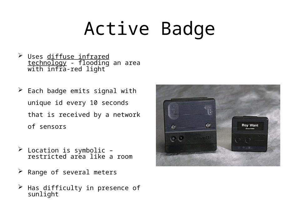
Active Badge Uses diffuse infrared technology -
flooding an area with infra-red light
Each badge emits signal with
unique id every 10 seconds that is
received by a network of sensors
Location is symbolic – restricted area like a room
Range of several meters Has difficulty in presence of
sunlight
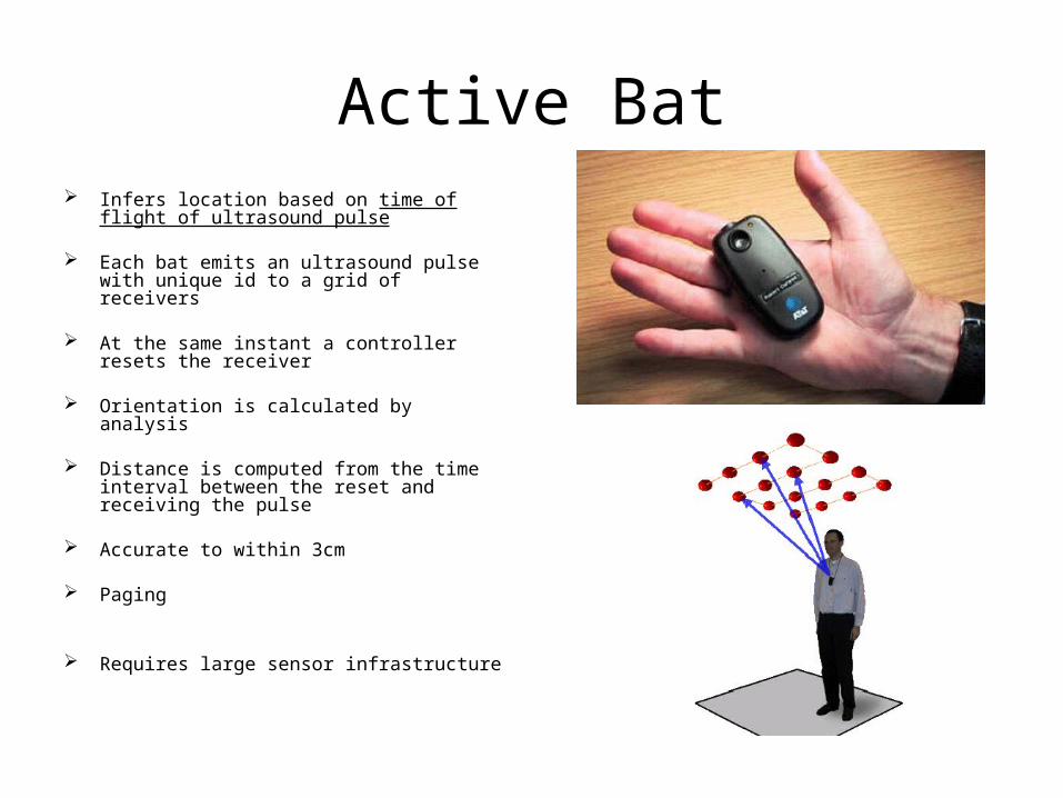
Active Bat Infers location based on time of flight of
ultrasound pulse
Each bat emits an ultrasound pulse with unique id to a grid of receivers
At the same instant a controller resets the receiver
Orientation is calculated by analysis
Distance is computed from the time interval between the reset and receiving the pulse
Accurate to within 3cm
Paging
Requires large sensor infrastructure

Cricket fixed ultrasound emitters and mobile
receivers
time gap to receive the signal is also
set in the pulse to prevent reflected
beams
computation takes place at receiver
decentralized architecture
few centimeters of accuracy
computational and power burden

RADAR Based purely in software, building on standard RF wireless LAN technology
Uses signal strength and signal to noise ratio from wireless devices
Employs multiple base stations with overlapping coverage
Requires wireless LAN support on objects being tracked
Generalization to multifloored buildings is a problem
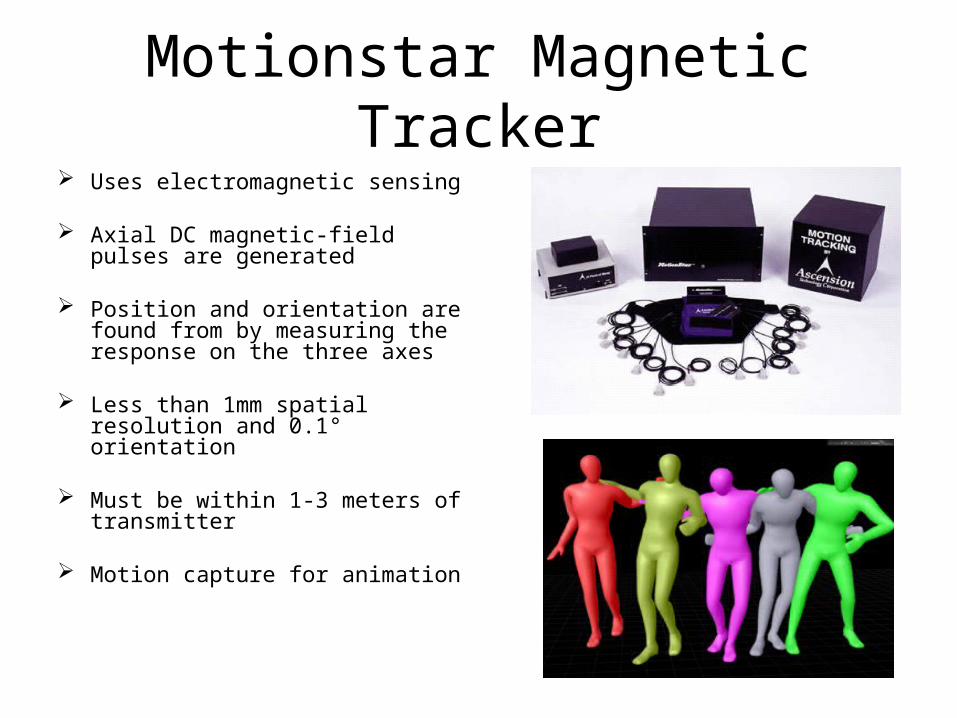
Motionstar Magnetic Tracker Uses electromagnetic sensing
Axial DC magnetic-field pulses are generated
Position and orientation are found from by measuring the response on the three axes
Less than 1mm spatial resolution and 0.1° orientation
Must be within 1-3 meters of transmitter
Motion capture for animation

Easy Living System to keep track of a room's
occupants and devices
Uses real-time 3D cameras to provide vision positioning
measures location to roughly 10 cm on the ground plane, and it maintains the identity of people based on color histograms
Difficult to maintain accuracy
Aimed for a home environment

Smart Floor System for identifying people based on their footstep force profiles
Does not need device or tag
93% overall user recognition
High cost factor
Enhanced 911 Locates any phone that makes a 911 call
reported in most instances with an accuracy of 100 meters or less
Can be enhanced for use by cell phone users
Identifying areas of traffic congestion
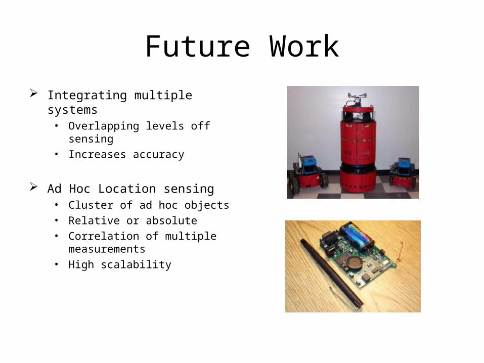
Future Work Integrating multiple systems
• Overlapping levels off sensing • Increases accuracy
Ad Hoc Location sensing• Cluster of ad hoc objects• Relative or absolute• Correlation of multiple
measurements• High scalability

Choosing a System Accuracy based comparison
Representing error distributions
Evaluation
Density of elements
Prototyping using a simulator
Quake iii