LOC Magazine (Vol 5 No 5 Sept-Oct 2016) - Library of Congress · PDF fileMaking of the Modern...
17
MAKING OF THE MODERN MAP INSIDE A New Librarian of Congress Mapping the Imaginary PLUS Modern Cartography Maps Large & Small National Book Festival App LOC.GOV SEPTEMBER/OCTOBER 2016 LIBRARY OF CONGRESS MAGAZINE
Transcript of LOC Magazine (Vol 5 No 5 Sept-Oct 2016) - Library of Congress · PDF fileMaking of the Modern...
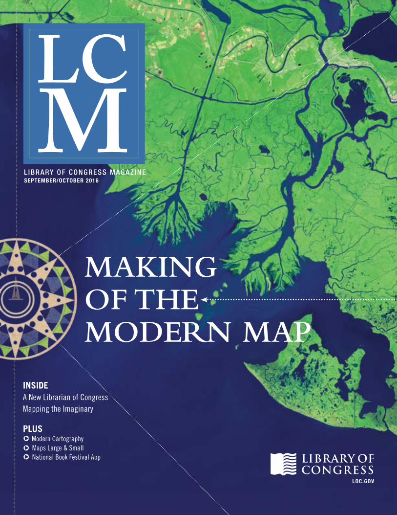
MAKING OF THE MODERN MAP
INSIDE A New Librarian of CongressMapping the Imaginary
PLUS Modern Cartography Maps Large & Small National Book Festival App
LOC.GOV
SEPTEMBER/OCTOBER 2016L IBRARY OF CONGRESS MAGAZ IN E

In This Issue SEPTEMBER/OCTOBER 2016
FEATURES
DEPARTMENTS
Mapping the ImaginaryFrom the rings of Hell to the core of Middle-earth, maps of fictional places in life and literature fuel our imaginations.
Mapping the New WorldTwo rare Renaissance maps in the Library’s collections reveal a view of the world at the beginning of the 16th century.
Making of the Modern MapAdvances in technology and the way we use maps continue to transform the ancient art and science of cartography.
8
10
14
02 First Word04 Page From the Past05 First Drafts06 How Do I?07 Going to Extremes19 Expert’s Corner20 Online Offerings21 My Job at the Library
22 Technology at the Library23 Favorite Places24 Around the Library25 News Briefs26 Shop the Library27 Support the Library28 Last Word
CONNECT ON
L IBRARY OF CONGRESS MAGAZ INE
From left: Globes in the Library’s Geography and Map Division include Bruce Heezen and Marie Tharp’s “Globe of the Ocean Floor” (1957), the first lunar globe to show the back side of the moon (U.S.S.R., 1963) and a lunar globe based on orbital photographs (U.S., 1965). Abby Brack Lewis
Mission of the Library of CongressThe Library’s central mission is to provide Congress, the federal government, and the American people with a rich, diverse, and enduring source of knowledge that can be relied upon to inform, inspire, and engage them, and support their intellectual and creative endeavors.
Library of Congress Magazine is issued bimonthly by the Office of Communications of the Library of Congress and distributed free of charge to publicly supported libraries and research institutions, donors, academic libraries, learned societies and allied organizations in the United States. Research institutions and educational organizations in other countries may arrange to receive Library of Congress Magazine on an exchange basis by applying in writing to the Library’s Director for Acquisitions and Bibliographic Access, 101 Independence Ave. S.E., Washington DC 20540-4100. LCM is available on the web at loc.gov/lcm/. All other correspondence should be addressed to the Office of Communications, Library of Congress, 101 Independence Ave. S.E., Washington DC 20540-1610.
[email protected] loc.gov/lcm ISSN 2169-0855 (print) ISSN 2169-0863 (online)
David S. Mao Acting Librarian of Congress
Gayle Osterberg Executive Editor
Audrey Fischer Editor
John H. Sayers Managing Editor
Ashley Jones Designer
Shawn Miller Photo Editor
Contributing Writers Michael Buscher Ralph Ehrenberg Fenella France John Hessler Ryan Moore Douglas Richardson Tim St. Onge Hannah Stahl
Library of Congress MagazineVol. 5 No. 5: September/October 2016
ON THE COVER: This false-color satellite image of Louisiana’s Atchafalaya Bay was acquired by sensors aboard NASA’s Landsat satellites on Oct 25, 2014. Geography and Map Division
7
20
22Special delivery
Insurance maps
Miniature globe
Twitter: @librarycongressYoutube: youtube.com/libraryofcongressFacebook: facebook.com/libraryofcongressFlickr: flickr.com/photos/library_of_congress/
Pinterest: pinterest.com/LibraryCongress/Instagram: @librarycongressLibrary of Congress blogs: blogs.loc.govLCM online: loc.gov/lcm
September/OctOber 2016 | lOc.gOv/lcm 1

firstWORD
The 14th of CongressCARLA HAYDEN DISCUSSES HER DECISION TO BECOME A LIBRARIAN AND HER PLANS AS THE NEW LIBRARIAN OF CONGRESS.
You are about to be sworn in as the 14th Librarian of Congress. How does that feel?
It’s such an honor to be nominated by the president and sworn in as the 14th Librarian of Congress. As a career librarian it’s really almost a dream come true. The confirmation process was really an eye-opener for me in so many ways, because I got to meet legislators that are committed to not only the nation’s history, but making information available. So many of the legislators were historians. There were a few that were actually musicians and that really had an interest in the Library of Congress. It was just a wonderful thing that made me very pleased that I was confirmed, and that I’ll have an opportunity to work with people who understand the importance of the Library of Congress.
When did you decide to become a librarian?
Librarianship really has been an adventure for me. To find out that there was a profession that was dedicated to making books, reading and knowledge available to people, that just seemed ideal. When I discovered that librarianship was a profession, I was coming out of undergraduate studies and thinking about what I was going to do next. I saw a colleague who had just graduated and they said, “They’re hiring people at the Chicago Public Library.” So I went and became a library associate. Within a week I was assigned to a small storefront library on the south side of Chicago, working with a young lady who was going to graduate school. She was on the floor, in jeans, having story time with children with autism. I thought, “Wait a minute. This is a different type of profession. You’re bringing things right to people.” I was hooked. Seeing what libraries could do in communities and how they could help people just opened my eyes.
So, at this point in my career, to be part of an institution like the Library of Congress is the ultimate in terms of what started with getting hooked on the profession back then.
How do you think your perspective will be reflected in the institution during your tenure?
As the first woman and the first African American to hold the position of Librarian of Congress, I think my perspective will be part of a continuum of the past librarians who came from different professions and backgrounds. There have
been lawyers. There have been librarians. There have been publishers and authors and historians and scholars. So I think that I will be adding on to their different perspectives. While being a caretaker, I’ll be someone who is carrying the torch, too.
What do you see as the biggest challenges for the library?
The biggest opportunity for the Library is to make its wonderful treasures available to people in various formats using technology as a tool. So many collections are already digitized and available online. The opportunity to work with potential donors and those who are interested in seeing these treasures made available to everyone will be a wonderful adventure.
We also must make sure that while this is happening we’re taking care of the basic responsibilities of the Library as well—serving Congress, maintaining a robust Copyright Office that makes sure that creators and the users of content are served effectively and making sure that everyone has access to the Library’s collections.
What is your vision for the nation’s library under your stewardship?
My vision for the Library of Congress is to make people aware that it is part of their national heritage and that everyone can find something in the Library of Congress—or produced by the Library—that relates to them, their classroom curriculum or where they want to go in life.
“Librarians are,” as the t-shirt slogan says, “the original search engines.” Library of Congress staff members are considered to be the ultimate in terms of professional librarianship. So I’m really excited about getting their input and taking advantage of their experience as we work together to chart a course to the future.
What I hope to accomplish with the dedicated staff of the Library in the next 10 years of my appointment is to make more of the collections accessible in various formats. If we can make an increasing number of collections available digitally—especially those that are heavily used or tied in with school curriculums around the country— I think would be quite an accomplishment.
Photos by Shawn Miller
September/OctOber 2016 | lOc.gOv/lcm 3LCM | Library of Congress Magazine 2

FROM THE PASTpage first DRAFTS
THOMAS JEFFERSON INSTRUCTS MERIWETHER LEWISFollowing the dramatic purchase of the Louisiana Territory on April 30, 1803, President Thomas Jefferson sent out five expeditions to map its extent and boundaries. On June 20, Jefferson initiated the first of these treks by issuing orders to his secretary, Meriwether Lewis, “to explore the Missouri river, & such principal stream (sic) of it as by it’s (sic) course and communication with the waters of the Pacific ocean,” and to record the “geography of the country through which you will pass.”
Jefferson’s letter (pictured) instructs Lewis with detailed directions on the basic elements of surveying and mapping—from determining the geographic coordinates of latitude and longitude with a sextant to recording directions by compass bearings adjusted for compass variation and measuring distances on rivers and over land by log-lines and time.
In addition, Jefferson informed Lewis that he was to note the region’s vegetation; look for rare mineral deposits, particularly metals, limestone, coal, and salt; record weather conditions; identify wildlife, especially animals believed to be rare or thought to be extinct; and befriend Indian tribes, documenting their languages, customs, traditions, occupations, strength, and militancy.
The Library holds the papers of Thomas Jefferson (1743-1826), which comprise some 27,000 items, making it the largest collection of original Jefferson documents in the world. The Thomas Jefferson Papers consist mainly of his correspondence, but also include his drafts of the Declaration of Independence, drafts of Virginia laws and his fragmentary autobiography. Among these papers are materials relating to the purchase of Louisiana and the expedition of Lewis and Clark (1804-1806), including 55 letters associated with Lewis and 17 pertaining to Clark.
—Ralph Ehrenberg is chief of the Library’s Geography and Map Division.
MORE INFORMATION
Lewis and Clark exhibition loc.gov/exhibits/lewisandclark/
Thomas Jefferson Papers loc.gov/collections/thomas-jefferson-papers/
NICHOLAS KING’S 1803 PRE-EXPEDITION MAP“The Indians say they Sleep 8 Nights before they get to the sea,” is one of the many notes on this untitled manuscript map (pictured) that guided explorers Meriwether Lewis and William Clark during the first leg of their epic expedition across North America.
Prepared by President Thomas Jefferson’s mapmaker Nicholas King in 1803, it depicts the known and presumed lakes and rivers of North America west of the Mississippi River. While much of King’s information was based on existing British maps and charts, the map’s interior details were derived from mountain men and Native American mapmakers. It is believed that Lewis and Clark carried this map on their journey, at least as far as the Mandan-Hidatsa villages on the Missouri River. Annotations in brown ink by Lewis reflect Jefferson’s request for data about French trading routes, which was acquired at Fort Mandan, the explorer’s first winter camp near present Bismarck, North Dakota.
Now one of the major treasures of the Library’s Geography and Map Division, this unique planning map was initially “discovered” by a clerk in the U. S. Bureau of Indian Affairs as he sorted through miscellaneous vouchers stored in the basement of the U. S. Treasury’s Pension Building. It was
found among a roll of 12 maps presumably deposited with the Bureau by William Clark, who served as Superintendent of Indian Affairs in St. Louis from 1813 1838. This collection, identified on its wrapper as “Retained Central Superiny [sic] Maps &c of Indian Country,” was transferred to the Library of Congress in early 1925.
Recent analysis by the Library’s Preservation Research and Testing Division reveals that the map is printed on paper carrying a “Delaware” watermark with an American eagle motif, which was produced at the Delaware Paper Mills on Brandywine Creek southeast of Philadelphia. Established in 1793, the mill provided paper to the Federal government for revenue stamps, bonds and certificates. Jefferson also used “Delaware” paper for his private correspondence.
—Ralph Ehrenberg is chief of the Library’s Geography and Map Division.
MORE INFORMATION
Mapping the West with Lewis and Clark loc.gov/today/cyberlc/feature_wdesc.php?rec=7234
Man
uscr
ipt
Div
isio
n
Geography and Map Division
September/OctOber 2016 | lOc.gOv/lcmLCM | Library of Congress Magazine 4 5
goingTO EXTREMEShowDO I?
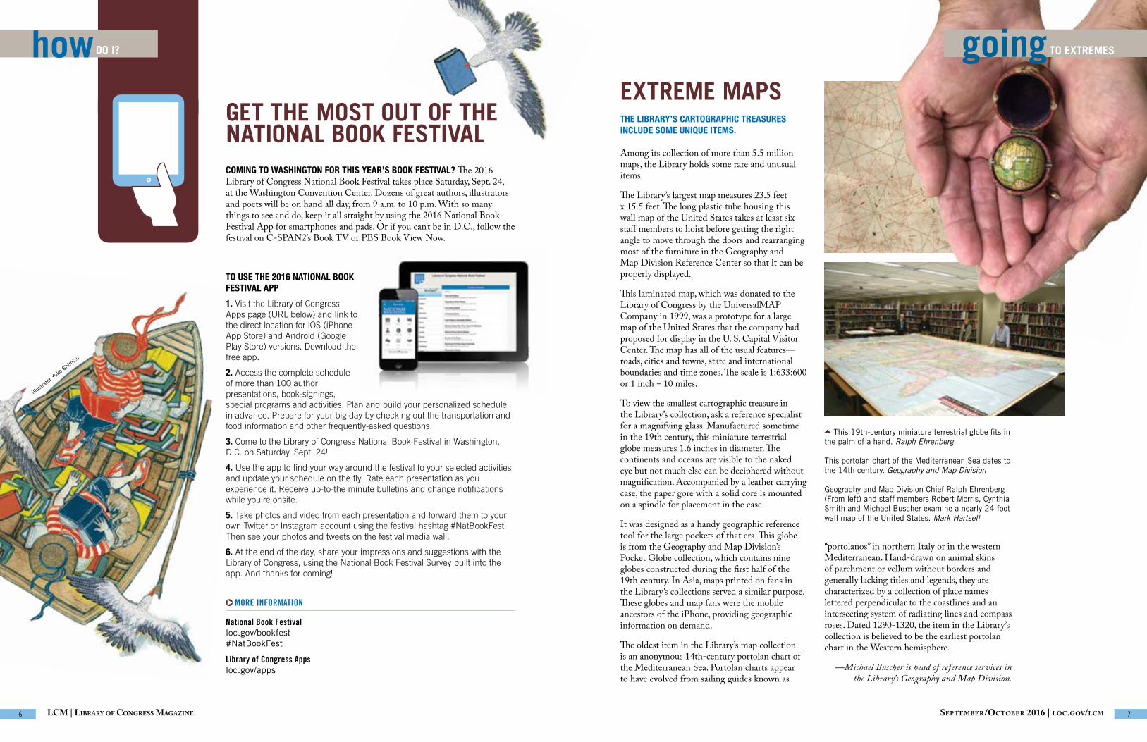
GET THE MOST OUT OF THE NATIONAL BOOK FESTIVALCOMING TO WASHINGTON FOR THIS YEAR’S BOOK FESTIVAL? The 2016 Library of Congress National Book Festival takes place Saturday, Sept. 24, at the Washington Convention Center. Dozens of great authors, illustrators and poets will be on hand all day, from 9 a.m. to 10 p.m. With so many things to see and do, keep it all straight by using the 2016 National Book Festival App for smartphones and pads. Or if you can’t be in D.C., follow the festival on C-SPAN2’s Book TV or PBS Book View Now.
TO USE THE 2016 NATIONAL BOOK FESTIVAL APP
1. Visit the Library of Congress Apps page (URL below) and link to the direct location for iOS (iPhone App Store) and Android (Google Play Store) versions. Download the free app.
2. Access the complete schedule of more than 100 author presentations, book-signings, special programs and activities. Plan and build your personalized schedule in advance. Prepare for your big day by checking out the transportation and food information and other frequently-asked questions.
3. Come to the Library of Congress National Book Festival in Washington, D.C. on Saturday, Sept. 24!
4. Use the app to find your way around the festival to your selected activities and update your schedule on the fly. Rate each presentation as you experience it. Receive up-to-the minute bulletins and change notifications while you’re onsite.
5. Take photos and video from each presentation and forward them to your own Twitter or Instagram account using the festival hashtag #NatBookFest. Then see your photos and tweets on the festival media wall.
6. At the end of the day, share your impressions and suggestions with the Library of Congress, using the National Book Festival Survey built into the app. And thanks for coming!
MORE INFORMATION
National Book Festival loc.gov/bookfest#NatBookFest
Library of Congress Apps loc.gov/apps
illustr
ator Y
uko S
himizu
EXTREME MAPSTHE LIBRARY’S CARTOGRAPHIC TREASURES INCLUDE SOME UNIQUE ITEMS.
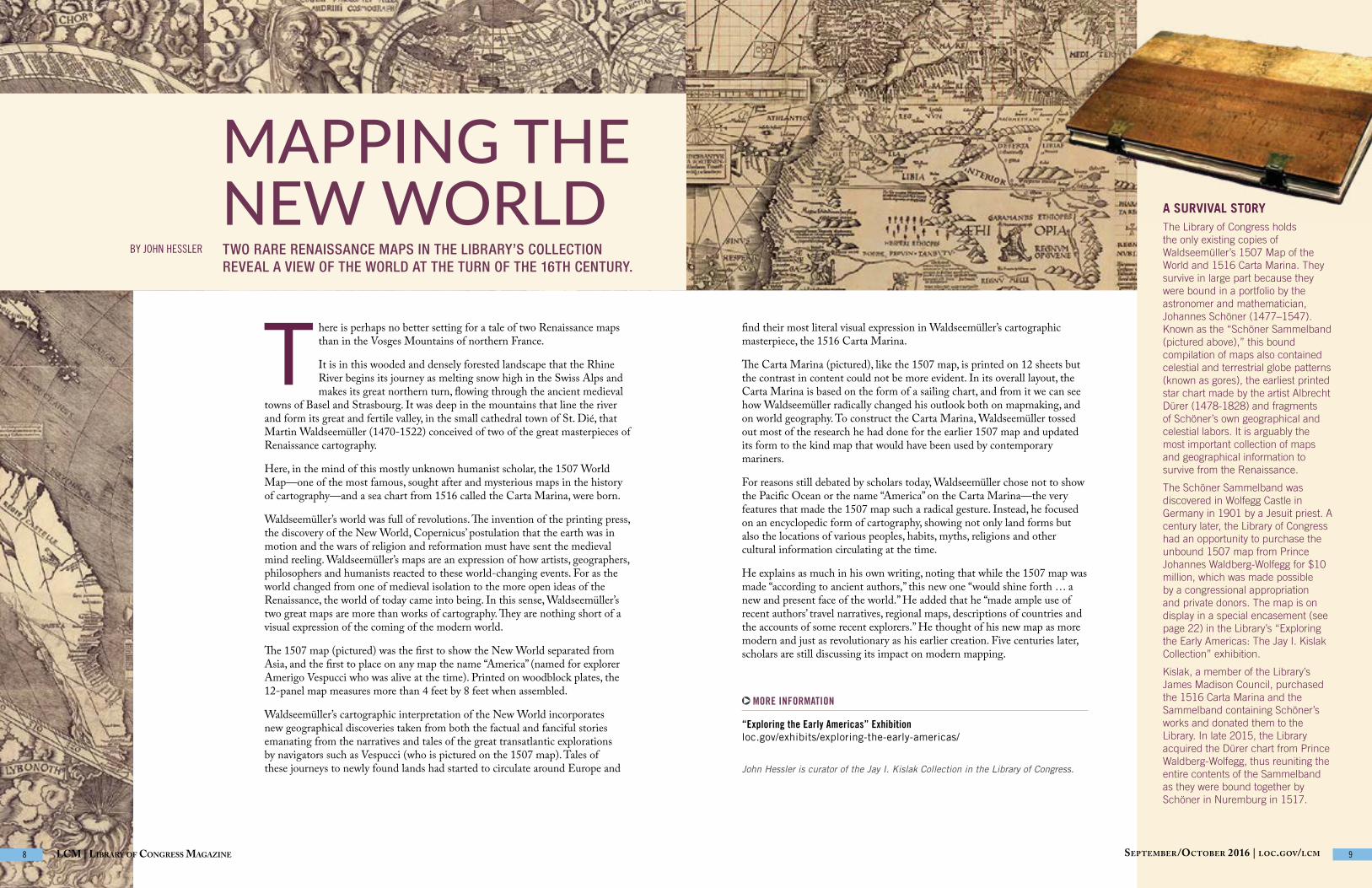
Among its collection of more than 5.5 million maps, the Library holds some rare and unusual items.
The Library’s largest map measures 23.5 feet x 15.5 feet. The long plastic tube housing this wall map of the United States takes at least six staff members to hoist before getting the right angle to move through the doors and rearranging most of the furniture in the Geography and Map Division Reference Center so that it can be properly displayed.
This laminated map, which was donated to the Library of Congress by the UniversalMAP Company in 1999, was a prototype for a large map of the United States that the company had proposed for display in the U. S. Capital Visitor Center. The map has all of the usual features—roads, cities and towns, state and international boundaries and time zones. The scale is 1:633:600 or 1 inch = 10 miles.
To view the smallest cartographic treasure in the Library’s collection, ask a reference specialist for a magnifying glass. Manufactured sometime in the 19th century, this miniature terrestrial globe measures 1.6 inches in diameter. The continents and oceans are visible to the naked eye but not much else can be deciphered without magnification. Accompanied by a leather carrying case, the paper gore with a solid core is mounted on a spindle for placement in the case.
It was designed as a handy geographic reference tool for the large pockets of that era. This globe is from the Geography and Map Division’s Pocket Globe collection, which contains nine globes constructed during the first half of the 19th century. In Asia, maps printed on fans in the Library’s collections served a similar purpose. These globes and map fans were the mobile ancestors of the iPhone, providing geographic information on demand.
The oldest item in the Library’s map collection is an anonymous 14th-century portolan chart of the Mediterranean Sea. Portolan charts appear to have evolved from sailing guides known as
“portolanos” in northern Italy or in the western Mediterranean. Hand-drawn on animal skins of parchment or vellum without borders and generally lacking titles and legends, they are characterized by a collection of place names lettered perpendicular to the coastlines and an intersecting system of radiating lines and compass roses. Dated 1290-1320, the item in the Library’s collection is believed to be the earliest portolan chart in the Western hemisphere.
—Michael Buscher is head of reference services in the Library’s Geography and Map Division.
This 19th-century miniature terrestrial globe fits in the palm of a hand. Ralph Ehrenberg
This portolan chart of the Mediterranean Sea dates to the 14th century. Geography and Map Division
Geography and Map Division Chief Ralph Ehrenberg (From left) and staff members Robert Morris, Cynthia Smith and Michael Buscher examine a nearly 24-foot wall map of the United States. Mark Hartsell
September/OctOber 2016 | lOc.gOv/lcmLCM | Library of Congress Magazine 6 7
T here is perhaps no better setting for a tale of two Renaissance maps than in the Vosges Mountains of northern France.
It is in this wooded and densely forested landscape that the Rhine River begins its journey as melting snow high in the Swiss Alps and makes its great northern turn, flowing through the ancient medieval
towns of Basel and Strasbourg. It was deep in the mountains that line the river and form its great and fertile valley, in the small cathedral town of St. Dié, that Martin Waldseemüller (1470-1522) conceived of two of the great masterpieces of Renaissance cartography.
Here, in the mind of this mostly unknown humanist scholar, the 1507 World Map—one of the most famous, sought after and mysterious maps in the history of cartography—and a sea chart from 1516 called the Carta Marina, were born.
Waldseemüller’s world was full of revolutions. The invention of the printing press, the discovery of the New World, Copernicus’ postulation that the earth was in motion and the wars of religion and reformation must have sent the medieval mind reeling. Waldseemüller’s maps are an expression of how artists, geographers, philosophers and humanists reacted to these world-changing events. For as the world changed from one of medieval isolation to the more open ideas of the Renaissance, the world of today came into being. In this sense, Waldseemüller’s two great maps are more than works of cartography. They are nothing short of a visual expression of the coming of the modern world.
The 1507 map (pictured) was the first to show the New World separated from Asia, and the first to place on any map the name “America” (named for explorer Amerigo Vespucci who was alive at the time). Printed on woodblock plates, the 12-panel map measures more than 4 feet by 8 feet when assembled.
Waldseemüller’s cartographic interpretation of the New World incorporates new geographical discoveries taken from both the factual and fanciful stories emanating from the narratives and tales of the great transatlantic explorations by navigators such as Vespucci (who is pictured on the 1507 map). Tales of these journeys to newly found lands had started to circulate around Europe and
MORE INFORMATION
“Exploring the Early Americas” Exhibition loc.gov/exhibits/exploring-the-early-americas/
MAPPING THE NEW WORLD A SURVIVAL STORY
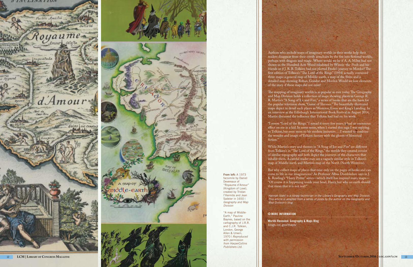
The Library of Congress holds the only existing copies of Waldseemüller’s 1507 Map of the World and 1516 Carta Marina. They survive in large part because they were bound in a portfolio by the astronomer and mathematician, Johannes Schöner (1477–1547). Known as the “Schöner Sammelband (pictured above),” this bound compilation of maps also contained celestial and terrestrial globe patterns (known as gores), the earliest printed star chart made by the artist Albrecht Dürer (1478-1828) and fragments of Schöner’s own geographical and celestial labors. It is arguably the most important collection of maps and geographical information to survive from the Renaissance.
The Schöner Sammelband was discovered in Wolfegg Castle in Germany in 1901 by a Jesuit priest. A century later, the Library of Congress had an opportunity to purchase the unbound 1507 map from Prince Johannes Waldberg-Wolfegg for $10 million, which was made possible by a congressional appropriation and private donors. The map is on display in a special encasement (see page 22) in the Library’s “Exploring the Early Americas: The Jay I. Kislak Collection” exhibition.
Kislak, a member of the Library’s James Madison Council, purchased the 1516 Carta Marina and the Sammelband containing Schöner’s works and donated them to the Library. In late 2015, the Library acquired the Dürer chart from Prince Waldberg-Wolfegg, thus reuniting the entire contents of the Sammelband as they were bound together by Schöner in Nuremburg in 1517.
BY JOHN HESSLER
John Hessler is curator of the Jay I. Kislak Collection in the Library of Congress.
TWO RARE RENAISSANCE MAPS IN THE LIBRARY’S COLLECTION REVEAL A VIEW OF THE WORLD AT THE TURN OF THE 16TH CENTURY.
find their most literal visual expression in Waldseemüller’s cartographic masterpiece, the 1516 Carta Marina.
The Carta Marina (pictured), like the 1507 map, is printed on 12 sheets but the contrast in content could not be more evident. In its overall layout, the Carta Marina is based on the form of a sailing chart, and from it we can see how Waldseemüller radically changed his outlook both on mapmaking, and on world geography. To construct the Carta Marina, Waldseemüller tossed out most of the research he had done for the earlier 1507 map and updated its form to the kind map that would have been used by contemporary mariners.
For reasons still debated by scholars today, Waldseemüller chose not to show the Pacific Ocean or the name “America” on the Carta Marina—the very features that made the 1507 map such a radical gesture. Instead, he focused on an encyclopedic form of cartography, showing not only land forms but also the locations of various peoples, habits, myths, religions and other cultural information circulating at the time.
He explains as much in his own writing, noting that while the 1507 map was made “according to ancient authors,” this new one “would shine forth … a new and present face of the world.” He added that he “made ample use of recent authors’ travel narratives, regional maps, descriptions of countries and the accounts of some recent explorers.” He thought of his new map as more modern and just as revolutionary as his earlier creation. Five centuries later, scholars are still discussing its impact on modern mapping.
September/OctOber 2016 | lOc.gOv/lcmLCM | Library of Congress Magazine 8 9

Among the road maps, topographic maps and country maps in the Library’s Geography and Map Division are maps of intangible places that will set the hearts of fiction and fantasy lovers aflutter.
The practice of mapping imaginary worlds started as early as the Middle Ages and continued to be popular during the Renaissance. Readers of Dante’s “Inferno,” written in the 14th century, have mapped the nine circles of Hell through which Dante traveled. Another 14th-century work, Chaucer’s “Canterbury Tales,” has inspired maps showing the pilgrimage from London to Canterbury.
Some of the most famous maps of imaginary places created during the Renaissance also depict imaginary journeys. One such map is the “Royaume d’Amour/Kingdom of Love,” created by Tristan l’Hermite and Jean Sadeler, and published in 1650. This map, which shows the journey of love, depicts the real island of Kythira (Cythera) in Greece. The mythical Aphrodite, goddess of love, was said to have lived there, making the island a perfect place for the Royaume d’Amour. It includes fictional place names such as “Grande Plaine d’Indifference” (the Great Plain of Indifference)—places that lovers who travel in the Royaume d’Amour would eventually reach on their journey.
Many fictional stories take place in the real world, as in Jane Austen’s “Pride and Prejudice” (1813), which inspired one reader to create “ ” to show important places in her novels. Similarly, readers have depicted Huckleberry Finn’s journey down the Mississippi River as told by Mark Twain.
MAPPING THE IMAGINARYBY HANNAH STAHL
Maps of fictional places in life and literature help fuel our imaginations.
“What happens, then, when we come
across maps of unfamiliar places, whether
full of blank spots or dense with names?
We explore, we imagine, we give play to our
fantasies and desires.”
—Ricardo Padrón, “Mapping Imaginary Worlds”
From top: Based on the novel by Mark Twain, this pictorial map by Everett Henry shows Huckleberry Finn’s adventures on the Mississippi River. Cleveland, Ohio: Harris-Intertype Corp., 1959. Geography and Map Division
This map, based on a fictional journey in “The Canterbury Tales,” appears in John George Bartholomew’s “A Literary and Historical Atlas of Europe,” J.M. Dent & Sons, Ltd.; New York, E.P. Dutton & Co., 1910. Geography and Map Division
A photographic reproduction from a 15th-century Florentine engraving shows the Inferno according to Dante. Prints and Photographs Division
September/OctOber 2016 | lOc.gOv/lcm 11lcm | library Of cOngreSS magazine 10
Authors who include maps of imaginary worlds in their works help their readers disappear from their comfy armchairs by the fire into fictional worlds, perhaps with dragons and magic. Where would we be if A. A. Milne had not shown us the Hundred Acre Wood inhabited by Winnie-the-Pooh and his friends or if J. R. R. Tolkien had not plotted Frodo’s journey to Mordor? The first edition of Tolkien’s “The Lord of the Rings” (1954) actually contained three maps: a general map of Middle-earth, a map of the Shire and a detailed map showing Rohan, Gondor and Mordor. Would we lose elements of the story if these maps did not exist?
The mapping of imaginary worlds is as popular as ever today. The Geography and Map Division holds a collection of maps showing places in George R. R. Martin’s “A Song of Ice and Fire,” a series of books that are the basis for the popular television show, “Game of Thrones.” The beautifully illustrated maps depict in detail such places as Westeros, Essos and King’s Landing. In an interview at the Edinburgh International Book Festival in August 2014, Martin discussed the influence that Tolkien had had on his work:
“I revere “Lord of the Rings.” I reread it every few years; it had an enormous effect on me as a kid. In some sense, when I started this saga I was replying to Tolkien, but even more to his modern imitators … I wanted to combine the wonder and image of Tolkien fantasy with the gloom of historical fiction.”
While Martin’s story and themes in “A Song of Ice and Fire” are different from Tolkien’s in “The Lord of the Rings,” the worlds they created consist of similar topography and both depict the journeys of the characters that inhabit them. A careful reader may see a vaguely similar style in Tolkien’s map of Middle-earth and Martin’s map of the North (North Westeros).
But why collect maps of places that exist only on the pages of books and can come to life in our imaginations? As Professor Albus Dumbledore says in J. K. Rowling’s “Harry Potter” series—which itself has inspired many maps—“Of course it is happening inside your head, Harry, but why on earth should that mean that it is not real?”
MORE INFORMATION
Worlds Revealed: Geography & Maps Blog blogs.loc.gov/maps/
Hannah Stahl is a library technician in the Library’s Geography and Map Division. This article is adapted from a series of posts by the author on the Geography and Map Division’s blog
From left: A 1973 facsimile by Daniel Devereaux of “Royaume d’Amour” (Kingdom of Love), created by Tristan l’Hermite and Jean Sadeler in 1650 | Geography and Map Division
“A map of Middle-Earth,” Pauline Baynes, based on the cartography of J.R.R. and C.J.R. Tolkien, London, George Allen & Unwin, 1970 | Reproduced with permission from HarperCollins Publishers Ltd.
LCM | Library of Congress Magazine 12 September/OctOber 2016 | lOc.gOv/lcm 13

In today’s interconnected world of communications and social networking, maps are more relevant and important than ever. Whether searching for the closest convenience store, navigating a mountain trail or planning a foreign adventure, up-to-date, detailed interactive maps of every place on the Earth are immediately available through mobile devices. Over a billion maps, for example, are viewed monthly through Google and Apple Maps’ apps and platforms. Web use is even higher, with some 3.2 billion people online—one-half of the world’s population. And many of those users are seeking geographic information at their fingertips.
But how did the practice of mapmaking evolve, from the Middle Ages to our modern day?
Human beings have always sought to make sense of the world around them. Throughout history, advances in mapmaking have been closely associated with new developments in scientific and technical tools. The “groma,” or surveyor’s cross—a simple line-of-sight instrument used by ancient Roman land surveyors to plot straight property lines and mark out building foundations—led to the first roadmaps of the Roman Empire.
The magnetic compass, invented in China and perfected in medieval Italy, gave rise to portolan charts and, later, accurate terrestrial maps. Coastal charts drawn on animal skin, known as portolan charts, guided the first Mediterranean mariners. Christopher Columbus, Meriwether Lewis and William Clark, and Charles Lindbergh used maps to navigate by compass bearings.
BY RALPH EHRENBERG ADVANCES IN TECHNOLOGY CONTINUE TO TRANSFORM THE ANCIENT ART AND SCIENCE OF MAPMAKING
Top: This 1977 manuscript painting by Heinrich C. Berann is based on the “World Ocean Floor” map by Bruce Heezen and Marie Tharp, 1977. Geography and Map Division
Bottom: Claudius Ptolemy’s “World Map” from his “Geographia,” 1482 | Geography and Map Division
MAKING OF THE MODERN MAP
September/OctOber 2016 | lOc.gOv/lcmLCM | Library of Congress Magazine 14 15

The look of the modern map—with its lines of latitude and longitude—can be traced to the once-revolutionary concept of a spherical earth, introduced by early Greek scholars along with a series of new instruments for locating and predicting the positions of celestial bodies. In the second century, A.D., the Greco-Egyptian geographer and astronomer Claudius Ptolemy provided detailed instructions for mathematical mapmaking in “Geographia,” his treatise on cartography. He described the construction of map projections using latitude and longitude as the basic geographical frame of reference and the preparation of the first universal world map.
Tools such as the astrolabe and cross-staff, which measured the angles and elevation of the sun, moon and stars, date from classical antiquity. But it was not until seafarers ventured far beyond the Mediterranean Sea and the coast of Europe that new devices for measuring angles and distances between visible objects—such as octants, quadrants, sextants and later, chronometers—greatly improved map accuracy.
Advances in technology not only had an impact on mapmaking, but on cartographic data gathering. Most dramatic was the development of aerial photography, made possible by advancements in aviation during the first few decades of the 20th century. No longer was it necessary to send large numbers of surveyors and mapmakers into the countryside to prepare basic maps. The use of aerial photography in the mapping process expanded greatly during World War I and World War II, providing the foundation for NASA’s mapping satellites, first launched in 1984.
BUILDING A MAP COLLECTIONMaps have been part of the Library’s collecting policy since its first order to a London book dealer in 1800 that included three maps of the Americas and an atlas. From this small beginning, the Library’s cartographic collection has grown to more than 5.5 million maps, 80,000 atlases, 3,500 raised relief maps, 500 globes and 40,000 geospatial data sets dating from about 1320 to the present in about 180 different languages.
The mandatory Copyright Act of 1870 was a major factor in this growth, particularly the Library’s acquisition of copyright deposits of panoramic views of American cities, county maps and more than 700,000 Sanborn fire insurance maps.
During the 19th and 20th centuries, official mapping agencies transferred to the Library of some 1.5 million large-scale multi-sheet map sets, including large numbers of maps of Europe, the Middle East, and East Asia captured by Allied forces during World War II. During the past several years, about 30,000–50,000 cartographic materials have been added annually to the Library’s holdings through deposits by official mapping agencies, transfers of superseded maps from Federal libraries, copyright deposits, domestic and international exchanges and purchases.
Public and private partnerships have made it possible for the Library to purchase such rare cartographic treasures as Waldseemüller 1507 World Map, known as “America’s Birth Certificate” for its inclusion of the land mass he named “America.” Since the 1990s, members of the Library’s James Madison Council private sector advisory group and the Library’s Philips Lee Phillips Map Society have donated rare and unique items and collections.
In addition, the Library has acquired the private papers of prominent geographers and cartographers. These include pioneer oceanographer Marie Tharp and computer graphics trailblazers Nickolas Chrisman and Roger Tomlinson. The Library recently acquired the papers of the Association of American Geographers.
Other instruments made it possible to acquire previously unobtainable mappable data. Data for geologists Alvara Espinosa and Wilbur Rinehart’s 1981 world map of earthquakes, for example, were obtained from seismic monitoring stations. Oceanographer Marie Tharp’s base map of the ocean floor, which confirmed the theory of plate tectonic, was derived from data obtained by echo-sounding devices developed for submarines during World War II.
Cartography has been transformed during the past half-century with the advent of computer-assisted design, followed by the development and widespread adoption of geographic information systems (GIS), global positioning systems (GPS) and satellite sensing devices.
GIS is a software platform used to capture, manage, analyze, store and present layers of geospatial data that allows better understanding of geo-referenced patterns and relationships. For example, data about gender pay equity inequality in specific regions of the country can be displayed geographically.
GPS provides surveyors and mapmakers with precise geographic coordinates for the Earth’s surface features through a worldwide network of orbiting satellites and receiving units. It has become the primary tool for land and field surveying, and has been adopted for navigation in aircraft, boats, cars and on mobile devices. GPS technology has also made possible the popular Pokémon Go app, which tracks players’ physical locations on their smartphones and superimposes digital Pokémon characters into their real-world environments. MORE INFORMATION
Geography and Map Reading Room loc.gov/rr/geogmap/
From left: Maj. J.N. Reynolds, a pilot in the 91st. Aero Squadron, lifts an aerial camera into his bi-plane with help from a bystander, 1917-1918. U.S. Signal Corps photo, Prints and Photographs Division
A natural-color mosaic image of section of Afghanistan created from Landsat Enhanced Thematic Mapper, 2006 | U. S. Geological Survey, Geography and Map Division
This artist concept depicts how the Multi-angle Imaging SpectroRadiometer (MISR) instrument aboard NASA’s Terra satellite gathers information about Earth’s atmosphere. Geography and Map Division
September/OctOber 2016 | lOc.gOv/lcm 17LCM | Library of Congress Magazine 16

expert’s CORNER
Satellites have increased the speed at which data can be collected and have dramatically expanded the range of mappable information. What once took months or years to survey can now be done in hours or minutes. The surface of the Earth is now mapped continuously by numerous remote-sensing satellites, producing vast archives of mappable data that are received, analyzed and maintained by cartographers, scientists, and technicians worldwide. NASA’s Terra satellite’s five environmental mapping sensors alone collect nearly 620 terabytes of data quarterly. The millions of satellite images that have been acquired and archived since the introduction of remote- sensing satellites have been used to produce millions of maps, featuring topics ranging from agriculture and forestry to the earth sciences, global change and regional planning.
The Library of Congress holds many examples of maps produced using both ancient and modern technologies. Advances in digital scanning technology have made it possible for the Library of Congress to make an increasing amount of its cartographic holdings globally accessible online.
TIM ST. ONGE, A CARTOGRAPHER IN THE GEOGRAPHY AND MAP DIVISION, DISCUSSES THE LIBRARY’S USE OF GEOSPATIAL DATA.
In the midst of dramatic shifts in how people around the world create, use and share geographic information, the Library’s Geography and Map Division is working to preserve the nation’s past and modern cartographic heritage and support geospatial research on Capitol Hill and beyond.
Whether we realize it or not, geospatial data is ubiquitous in our everyday lives. From precise urban planning and utilities management to sophisticated weather forecasting and turn-by-turn driving directions, it is difficult to understate the importance of geospatial technologies in our modern society. The widespread use of geospatial data across industries and academic disciplines poses significant challenges for the Geography and Map Division in determining how to preserve geographic knowledge in digital formats.
Geospatial data refers to digital information that identifies the geographic location of physical features on Earth. This data can be mapped and analyzed in a software environment known as a “geographic information system,” or GIS. Geospatial data comes in a wide variety of structures and formats, which makes its long-term preservation a challenging endeavor. Nevertheless, the Library’s Geography and Map Division works to collect and preserve geospatial data that supports the research needs of Congress and the Congressional Research Service and documents important historical or geographical events.
Geospatial data is also actively used at the Library of Congress to create new maps. The Library’s Congressional Cartography Program performs spatial data analyses and produces maps for congressional staff and researchers within the Library of Congress. The resulting maps have been used in congressional committee reports, internal research and elsewhere to help inform policy debates and communicate important information about current events.
Another major component of the Library’s engagement with GIS technologies is the Geospatial Hosting Environment (GHE). The GHE is an ongoing Library of Congress initiative to provide coordinated resources for geospatial analysis and web mapping to Congress,
the Congressional Research Service and other researchers in the Library. GHE technologies will facilitate the seamless sharing of geospatial data across offices on Capitol Hill and allow for individuals without formal GIS training to make interactive web-based maps of their own to meet their research needs. As the program develops, the GHE will allow members of the public to explore geospatial data in Library of Congress reading rooms and view online web map applications showcasing the work and collections of the Library.
The GHE initiative reflects the changes happening more broadly in the global GIS community. The barriers of technical literacy and access to geospatial data are rapidly coming down, allowing more people than ever to create their own maps and harness the power of digital geographic information. The growth of free and open-source GIS software is allowing more people from all walks of life to view geospatial data and create maps in standard web browsers and even mobile devices. As the tools of GIS become more accessible, so, too, will the data used to create map visualizations. Projects such as OpenStreetMap have democratized the mapmaking process, turning data consumers into data creators.
MORE INFORMATION
Online Map Collections loc.gov/maps/collections/
Worlds Revealed: Geography & Maps Blog blogs.loc.gov/maps/
Ralph Ehrenberg is chief of the Library’s Geography and Map Division.
From left: Compiled from 1860 census data and produced by the U.S. Coast Survey Drafting Division, this map shows the distribution of the slave population of the southern United States. Published by Henry S. Graham, 1861. Geography and Map Division
“Gender Earnings Ratio by Congressional District (114th Congress)” | Tim St. Onge, Library of Congress Congressional Cartography Program, 2015
Sha
wn
Mill
er
September/OctOber 2016 | lOc.gOv/lcm 19LCM | Library of Congress Magazine 18
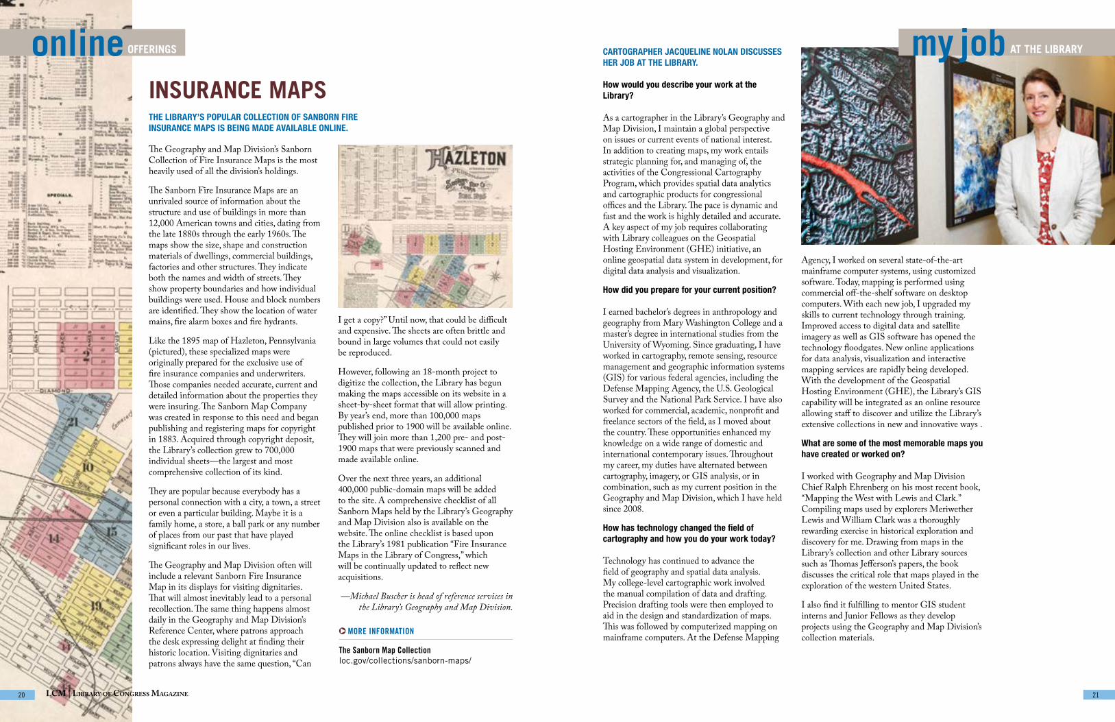
my job AT THE LIBRARYonline OFFERINGS CARTOGRAPHER JACQUELINE NOLAN DISCUSSES HER JOB AT THE LIBRARY.
How would you describe your work at the Library?
As a cartographer in the Library’s Geography and Map Division, I maintain a global perspective on issues or current events of national interest. In addition to creating maps, my work entails strategic planning for, and managing of, the activities of the Congressional Cartography Program, which provides spatial data analytics and cartographic products for congressional offices and the Library. The pace is dynamic and fast and the work is highly detailed and accurate. A key aspect of my job requires collaborating with Library colleagues on the Geospatial Hosting Environment (GHE) initiative, an online geospatial data system in development, for digital data analysis and visualization.
How did you prepare for your current position?
I earned bachelor’s degrees in anthropology and geography from Mary Washington College and a master’s degree in international studies from the University of Wyoming. Since graduating, I have worked in cartography, remote sensing, resource management and geographic information systems (GIS) for various federal agencies, including the Defense Mapping Agency, the U.S. Geological Survey and the National Park Service. I have also worked for commercial, academic, nonprofit and freelance sectors of the field, as I moved about the country. These opportunities enhanced my knowledge on a wide range of domestic and international contemporary issues. Throughout my career, my duties have alternated between cartography, imagery, or GIS analysis, or in combination, such as my current position in the Geography and Map Division, which I have held since 2008.
How has technology changed the field of cartography and how you do your work today?
Technology has continued to advance the field of geography and spatial data analysis. My college-level cartographic work involved the manual compilation of data and drafting. Precision drafting tools were then employed to aid in the design and standardization of maps. This was followed by computerized mapping on mainframe computers. At the Defense Mapping
Agency, I worked on several state-of-the-art mainframe computer systems, using customized software. Today, mapping is performed using commercial off-the-shelf software on desktop computers. With each new job, I upgraded my skills to current technology through training. Improved access to digital data and satellite imagery as well as GIS software has opened the technology floodgates. New online applications for data analysis, visualization and interactive mapping services are rapidly being developed. With the development of the Geospatial Hosting Environment (GHE), the Library’s GIS capability will be integrated as an online resource allowing staff to discover and utilize the Library’s extensive collections in new and innovative ways .
What are some of the most memorable maps you have created or worked on?
I worked with Geography and Map Division Chief Ralph Ehrenberg on his most recent book, “Mapping the West with Lewis and Clark.” Compiling maps used by explorers Meriwether Lewis and William Clark was a thoroughly rewarding exercise in historical exploration and discovery for me. Drawing from maps in the Library’s collection and other Library sources such as Thomas Jefferson’s papers, the book discusses the critical role that maps played in the exploration of the western United States.
I also find it fulfilling to mentor GIS student interns and Junior Fellows as they develop projects using the Geography and Map Division’s collection materials.
INSURANCE MAPSTHE LIBRARY’S POPULAR COLLECTION OF SANBORN FIRE INSURANCE MAPS IS BEING MADE AVAILABLE ONLINE.
The Geography and Map Division’s Sanborn Collection of Fire Insurance Maps is the most heavily used of all the division’s holdings.
The Sanborn Fire Insurance Maps are an unrivaled source of information about the structure and use of buildings in more than 12,000 American towns and cities, dating from the late 1880s through the early 1960s. The maps show the size, shape and construction materials of dwellings, commercial buildings, factories and other structures. They indicate both the names and width of streets. They show property boundaries and how individual buildings were used. House and block numbers are identified. They show the location of water mains, fire alarm boxes and fire hydrants.
Like the 1895 map of Hazleton, Pennsylvania (pictured), these specialized maps were originally prepared for the exclusive use of fire insurance companies and underwriters. Those companies needed accurate, current and detailed information about the properties they were insuring. The Sanborn Map Company was created in response to this need and began publishing and registering maps for copyright in 1883. Acquired through copyright deposit, the Library’s collection grew to 700,000 individual sheets—the largest and most comprehensive collection of its kind.
They are popular because everybody has a personal connection with a city, a town, a street or even a particular building. Maybe it is a family home, a store, a ball park or any number of places from our past that have played significant roles in our lives.
The Geography and Map Division often will include a relevant Sanborn Fire Insurance Map in its displays for visiting dignitaries. That will almost inevitably lead to a personal recollection. The same thing happens almost daily in the Geography and Map Division’s Reference Center, where patrons approach the desk expressing delight at finding their historic location. Visiting dignitaries and patrons always have the same question, “Can
MORE INFORMATION
The Sanborn Map Collection loc.gov/collections/sanborn-maps/
I get a copy?” Until now, that could be difficult and expensive. The sheets are often brittle and bound in large volumes that could not easily be reproduced.
However, following an 18-month project to digitize the collection, the Library has begun making the maps accessible on its website in a sheet-by-sheet format that will allow printing. By year’s end, more than 100,000 maps published prior to 1900 will be available online. They will join more than 1,200 pre- and post-1900 maps that were previously scanned and made available online.
Over the next three years, an additional 400,000 public-domain maps will be added to the site. A comprehensive checklist of all Sanborn Maps held by the Library’s Geography and Map Division also is available on the website. The online checklist is based upon the Library’s 1981 publication “Fire Insurance Maps in the Library of Congress,” which will be continually updated to reflect new acquisitions.
—Michael Buscher is head of reference services in the Library’s Geography and Map Division.
Sha
wn
Mill
er
September/OctOber 2016 | lOc.gOv/lcm 21LCM | Library of Congress Magazine 20

favorite PLACEStechnologyAT THE LIBRARY
MORE INFORMATION:
Location
Thomas Jefferson BuildingNorth Gallery, First Floor10 First Street S.E.Washington, D.C. 20540
Hours
Ongoing exhibitionMonday through Saturday8:30 a.m. to 4:30 p.m.
View “Mapping a New Nation” online
loc.gov/exhibits/mapping-a-new-nation/S
haw
n M
iller
ABEL BUELL’S 1784 MAP OF THE U.S. is the first map of the newly independent nation that was compiled, printed and published in America by an American. The Buell map also was the first map to be copyrighted in the United States. Seven copies of the map are known to exist. Philanthropist David M. Rubenstein has generously placed his
copy of Buell’s “New and Correct Map of the United States of North America” on display in the Library’s Thomas Jefferson Building as part of an ongoing exhibition, “Mapping a New Nation.” A specially designed, climate-controlled, oxygen-free encasement prevents damage to the map while it’s on long-term display.
DISPLAY BY DESIGNTECHNOLOGICAL ADVANCEMENTS HAVE MADE IT POSSIBLE FOR THE LIBRARY TO PUT SEVERAL RARE MAPS ON LONG-TERM DISPLAY.
Preserving and making the Library’s vast collection accessible to researchers is a challenge. Even more challenging is putting rare and unique items on display. Lighting, temperature and even air itself pose a threat.
The Library, in collaboration with National Institute of Standards and Technology (NIST), has designed, constructed and installed anoxic (oxygen-free), hermetically sealed encasements to mitigate the potentially damaging effects of long-term display.
Oxygen promotes the deterioration of materials such as paper, parchment, and organic-based media including inks and other colorants. This deterioration is often visible as yellowing, embrittlement and color-fading.
Anoxic encasements are created by displacing oxygen with an inert gas, such as nitrogen or argon. A good seal that can maintain interior case conditions requires advanced case construction, materials and design.
In addition to allowing oxygen-free display, the encasements have to meet preservation needs for long-term display of historic materials; allow monitoring of the maps by measuring environmental changes; integrate with the Library’s electronic and security infrastructure monitoring and be movable.
The Library first began using the special encasement in 2007 to display Martin
Waldseemüller’s 1507 world map—the earliest known map to name the land mass of “America.”
More recently, the Library worked with NIST in 2013 to design, construct and install another anoxic encasement to display Abel Buell’s 1784 map—the first map of the newly independent United States that was compiled, printed and published in America by an American.
One challenge in the design of the Buell map encasement was to replace an oxygen sensor used for the previous encasement monitoring that was no longer commercially available. A prototype of the sensor was built, calibrated and tested, and is currently in use for the monitoring of the interior conditions of the Buell case.
The encasement, tooled from a single block of aluminum and covered with hurricane-proof glass, allows tight control of the map’s environment, reducing its potential degradation by oxygen and moisture. Performance testing of cases and sensors is an ongoing program in the Library’s Preservation Research and Testing Division.
—Fenella France is chief of the Library’s Preservation, Research and Testing Division.
Physicist Charles Tilford attaches an apparatus that replaces air in the encasement with inert argon gas to help preserve the 1507 Waldemüller map. Photo courtesy of the National Institute of Standards and Technology
A crane hoists a specially designed map encasement into the Library’s Thomas Jefferson Building. Dianne van der Reyden
September/OctOber 2016 | lOc.gOv/lcmLCM | Library of Congress Magazine 22 23
SMOKEY ROBINSON TO RECEIVE LIBRARY’S GERSHWIN PRIZERhythm and blues icon Smokey Robinson will receive the Library of Congress Gershwin Prize for Popular Song in Washington, D.C., in November. During his 50-year career, the Grammy Award winner has released dozens of Top-40 hits and added more than 4,000 songs to his legacy songbook. As a singer, songwriter, producer and record executive, Robinson helped lead a musical revolution called the Motown sound. Born in Detroit in 1940, Robinson founded the Matadors in 1954 when he was in high school. Three years later the group added a female voice and became The Miracles. Record producer Berry Gordy’s first vocal group, The Miracles released the single “Shop Around” in 1960, which became Motown’s first million-selling hit.
MORE: loc.gov/today/pr/2016/16-106.html
LIBRARY ACQUIRES ARCHIVES OF THE AMERICAN ASSOCIATION OF GEOGRAPHERSThe American Association of Geographers (AAG)—a nonprofit scientific and educational society founded in 1904—has donated its archives to the Library of Congress. The acquisition is housed in the Library’s Geography and Map Division, which holds the largest map and geography collection in the world.
For more than 100 years, AAG has contributed to the advancement of geography by promoting discussion among its members and with scholars in related fields. They share their interests in the theory, methods and practice of geography through collaborative groups, an annual meeting, scholarly journals and the online AAG newsletter. The AAG archives includes books, booklets, articles authored by AAG geographers, correspondence involving the AAG executive directors and the AAG board of directors, conference programs and proceedings, and more. It joins the 380 hours of AAG’s “Geographers on Film” series of videos, which were donated by AAG to the Library several years ago.
MORE: loc.gov/today/pr/2016/16-114.html
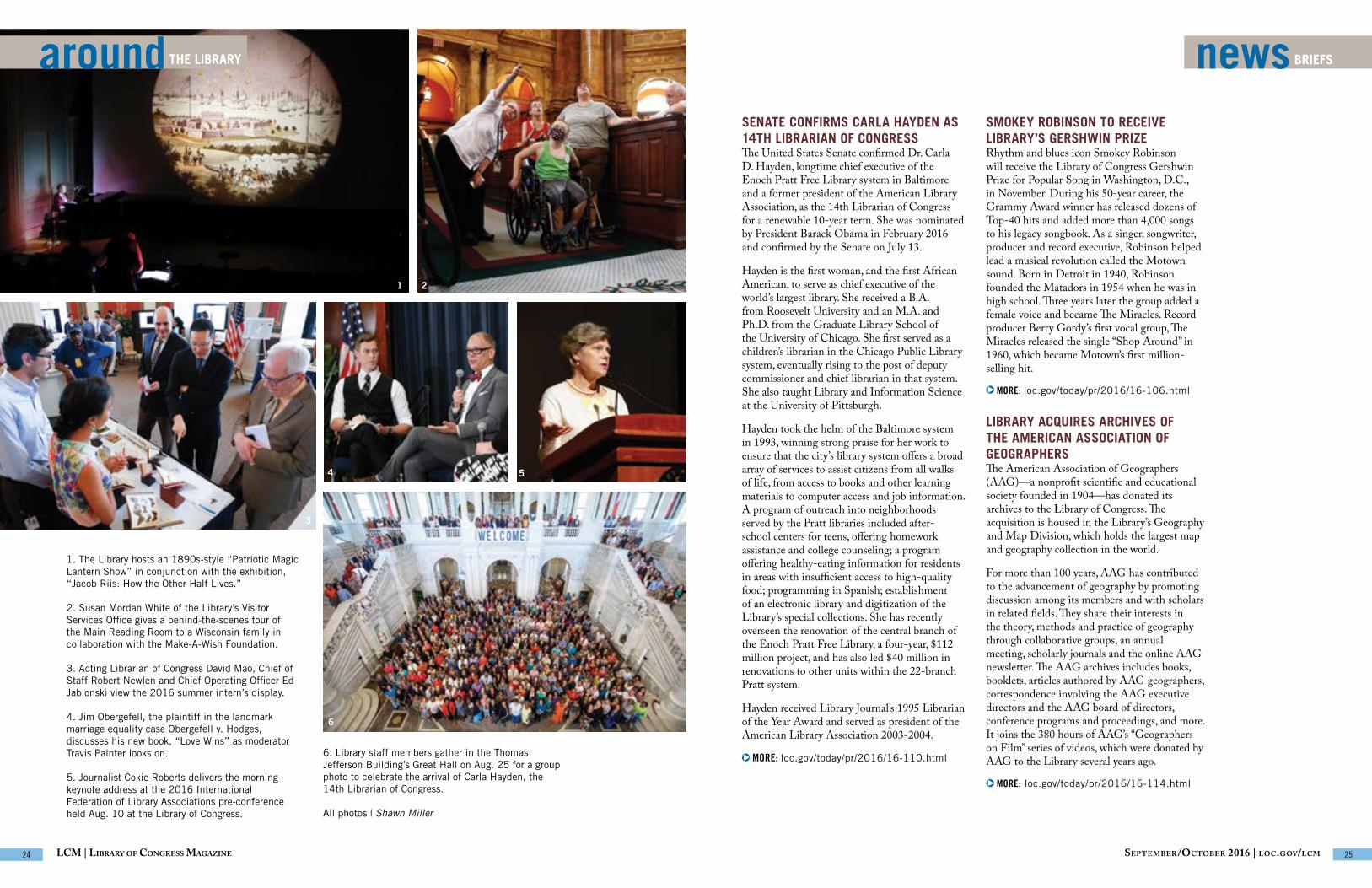
SENATE CONFIRMS CARLA HAYDEN AS 14TH LIBRARIAN OF CONGRESSThe United States Senate confirmed Dr. Carla D. Hayden, longtime chief executive of the Enoch Pratt Free Library system in Baltimore and a former president of the American Library Association, as the 14th Librarian of Congress for a renewable 10-year term. She was nominated by President Barack Obama in February 2016 and confirmed by the Senate on July 13.
Hayden is the first woman, and the first African American, to serve as chief executive of the world’s largest library. She received a B.A. from Roosevelt University and an M.A. and Ph.D. from the Graduate Library School of the University of Chicago. She first served as a children’s librarian in the Chicago Public Library system, eventually rising to the post of deputy commissioner and chief librarian in that system. She also taught Library and Information Science at the University of Pittsburgh.
Hayden took the helm of the Baltimore system in 1993, winning strong praise for her work to ensure that the city’s library system offers a broad array of services to assist citizens from all walks of life, from access to books and other learning materials to computer access and job information. A program of outreach into neighborhoods served by the Pratt libraries included after-school centers for teens, offering homework assistance and college counseling; a program offering healthy-eating information for residents in areas with insufficient access to high-quality food; programming in Spanish; establishment of an electronic library and digitization of the Library’s special collections. She has recently overseen the renovation of the central branch of the Enoch Pratt Free Library, a four-year, $112 million project, and has also led $40 million in renovations to other units within the 22-branch Pratt system.
Hayden received Library Journal’s 1995 Librarian of the Year Award and served as president of the American Library Association 2003-2004.
MORE: loc.gov/today/pr/2016/16-110.html
newsBRIEFSaroundTHE LIBRARY
1 2
3
4 5
6
1. The Library hosts an 1890s-style “Patriotic Magic Lantern Show” in conjunction with the exhibition, “Jacob Riis: How the Other Half Lives.”
2. Susan Mordan White of the Library’s Visitor Services Office gives a behind-the-scenes tour of the Main Reading Room to a Wisconsin family in collaboration with the Make-A-Wish Foundation.
3. Acting Librarian of Congress David Mao, Chief of Staff Robert Newlen and Chief Operating Officer Ed Jablonski view the 2016 summer intern’s display.
4. Jim Obergefell, the plaintiff in the landmark marriage equality case Obergefell v. Hodges, discusses his new book, “Love Wins” as moderator Travis Painter looks on.
5. Journalist Cokie Roberts delivers the morning keynote address at the 2016 International Federation of Library Associations pre-conference held Aug. 10 at the Library of Congress.
6. Library staff members gather in the Thomas Jefferson Building’s Great Hall on Aug. 25 for a group photo to celebrate the arrival of Carla Hayden, the 14th Librarian of Congress.
All photos | Shawn Miller
September/OctOber 2016 | lOc.gOv/lcmLCM | Library of Congress Magazine 24 25

Washington D.C. Map TieProduct # 21304113 Red/Blue; 21304055 Blue/GoldPrice: $55
“Mapping the West with Lewis & Clark”Product #21107093Price: $99
Naming of AmericaProduct # 21107027Price: $24.95
Cartographia: Mapping CivilizationsProduct # 21107014Price: $60
Waldseemuller GlobeProduct # 21508258Price: $45
Waldseemuller Map Print 8x10, 11x14, 16x20Product # 216040121, 216040122, 216040123Price: $20, $30, $40
Your favorite cartographer or history buff will appreciate this silk tie.
This 120-page hardcover limited edition sheds new light on the expedition’s cartographic discoveries. (Phone orders only)
The fascinating story of the first map ever to display the name “America” is told in this volume.
This desk globe honors Martin Waldseemüller’s 1507 world map.
Own a print of Martin Waldseemüller’s 1507 world map—the first to display the name “America.”
This richly illustrated volume celebrates the work of those who have mapped the world from the dawn of civilization to the present.
support THE LIBRARYshop THE LIBRARY
| Order online: loc.gov/shop | Order by phone: 888.682.3557 MORE INFORMATION
THE PHILIP LEE PHILLIPS MAP SOCIETYGENEROUS SUPPORT FROM PRIVATE DONORS ENHANCES THE LIBRARY’S CARTOGRAPHIC RESOURCES.
MORE INFORMATION
The Philip Lee Phillips Map Society loc.gov/phillips/
Make a Gift to the Library 202.707.2777loc.gov/donate
THE LIBRARY OF CONGRESS SHOP offers many items drawn from the Library’s rich map collections.
The Library’s cartographic collection of more than 5.5 million items is the largest in the world. Acquired through the Copyright Office deposit system and appropriated funds, the collection also boasts rare and unique items from private donors.
A private-sector group known as the Philip Lee Phillips Map Society of the Library of Congress supports the Library’s Geography and Map Division through acquisitions, conferences and publications. The Society is named in honor of the division’s first chief, who was appointed in 1897 and served 30 years, developing what has become the nation’s premiere map and atlas collection. This group, with more than 400 members, has donated more than a million dollars since its inception in 1995.
Conferences and Lectures
With a keen interest in learning about cartography and its history, the Society sponsors conferences and lectures that are free and open to the public. Often, following events, the public may view related materials up close and pose questions to the division’s specialists.
Past conferences have focused on the mapping of Washington, D.C., and rare maps by Martin Waldseemüller, whose 1507 map was the first to label the new world “America.” The focus of the most recent talks concern changes in cartographic methods and their relationship to current events, such as polar mapping and the crowd-sourced mapping of North Korea.
Occasional Papers and Newsletter
The Society publishes a journal known as “The Occasional Papers” with the goal of explaining in detail the importance of a given map or collection of maps held by the Library of Congress. The journal seeks to stimulate cartographic research. Ten papers have been issued to date. Among them are studies of the Napoleonic war in the Dutch East Indies, the maps of World War I and images of cannibals on early maps, to name a few.
The Society also circulates a quarterly newsletter that highlights acquisitions funded by the group and the work of its members. Society members receive the journal and the newsletter, as well as special cartographic publications.
Acquisitions
Gifts from Phillips Map Society members have supported the Library’s acquisition of rare cartographic items such as the James Merrill Safford Collection of 55 geological maps of Tennessee. William Wooldridge of the Phillips Map Society, along with the Norfolk Southern Foundation, made it possible for the Library to acquire Herman Boye’s 1827 map of Virginia. Several members of the Phillips Map Society are also members of the James Madison Council, the Library’s leading private-sector advisory group. Both groups, with support from Phillips Map Society Steering Committee member J. Thomas Touchton, purchased for the Library a 1752 map of Philadelphia by Nicholas Scull.
To support the work of the Philip Lee Phillips Map Society, visit loc.gov/donate. All donations to the Library are tax-deductible.
—Ryan Moore is a specialist in the Geography and Map Division and executive secretary of the Philip
Lee Phillips Map Society. He is the editor of the Society’s journal and newsletter.
September/OctOber 2016 | lOc.gOv/lcmLCM | Library of Congress Magazine 26 27

Sha
wn
Mill
er
lastWORD
Cherubs representing “America” and “Africa” appear on the Jefferson Building’s grand staircase sculpted by Philip Martiny. Carol M. Highsmith Archive, Prints and Photographs Division
DOUGLAS RICHARDSON, EXECUTIVE DIRECTOR OF THE AMERICAN ASSOCIATION OF GEOGRAPHERS, MAPS OUT HIS CAREER IN GEOGRAPHY.
Geographers regard the Library of Congress as “Geography’s Treasure Chest.” The Library’s Geography and Map Division holds our crown jewels—the world’s largest and most comprehensive collection of maps and atlases—many of which are rare and unique documents that illuminate our history. It’s important to note that these treasures are not cloistered in dusty bins, accessible only to a few select scholars. They come to life as the Library continues an ambitious digitization program to make more of them accessible, online and interactively.
I have always been fascinated with, and passionate about, maps and geography. I have worked as a geographer for my whole career, mostly in research, which is what drives me. My own circuitous journey in the field of geography reveals my attempts to find pathways that integrate my values and research interests. Fortunately, the complexity and breadth of the discipline of geography creates interstices that can accommodate a bit of a maverick like me. I have been able to navigate the cutting edges of geography within those interstices, and on my own terms.
After college, I began working as a resource geographer for American Indian tribes. For four years, I focused on accomplishing what they wanted, not what others wanted for, or from, them. It was a richly textured time of my life, living and working first with the Northern Cheyenne Tribe and then working with 25 tribes nationally. The tribes made some real and important gains during that time.
To continue to pursue research and projects that I cared about socially and intellectually, I founded a private-sector geographic research firm, GeoResearch, Inc., which conducted environmental, geographic information science (GIScience) and international policy research. The firm developed and patented the first real-time, space-time interactive tool, which has transformed the ways in which geographic information is now collected, experienced, mapped and used within the field of geography, and in society at large.
After selling my company and its patents in 1998, my friend Ron Abler talked me into succeeding him as the executive director of the American Association of Geographers (AAG). From that perch, I can interact with geography across its full breadth—which I enjoy enormously. Founded more than a century ago, the AAG continues to be a dynamic, inclusive and growing organization. During my tenure, I have helped develop a strong research capacity within the AAG, which ranges from GIScience to the intersection of geography and the humanities (GeoHumanities).
Geography’s new technologies and social theories are transforming not only the field of geography and how maps are made, but also how institutions like the Library of Congress can make their treasures accessible around the world. Web GIS and real-time geographies now allow sophisticated data collection, analysis and visualization techniques that can help the Library of Congress respond more quickly to requests from Congress for geographic information. Armed with this information, the nation’s legislators can better understand and tackle major challenges facing our world.
With these developments in mind, I am proud to announce that the AAG Archives will now be housed at the Library of Congress—available for all to access from far and near. I congratulate and thank the Library’s Geography and Map Division, for not only preserving our past, but also for helping to map the future.
lcm | library Of cOngreSS magazine 28
PRESORTED STANDARD POSTAGE & FEES PAID
LIBRARY OF CONGRESS WASHINGTON, DC PERMIT No. G-103
OFFICE OF COMMUNICATIONS 101 INDEPENDENCE AVE. S.E.
WASHINGTON, DC 20540-1610
DATED MATERIAL
OFFICIAL BUSINESS PENALTY FOR PRIVATE USE
$300
LOC.GOV
exhibitionsAT THE LIBRARY
#Opera Before Instagram: Portraits, 1890 –1955ThroughJan. 8, 2017
America ReadsThrough Dec. 31, 2016
World War I: American Artists View the Great War Through May 6, 2017
MORE INFORMATION: loc.gov/exhibits/