Lincolnshire Wolds Area of Outstanding Management Plan 2013-2018
88
Lincolnshire Wolds Area of Outstanding Natural Beauty Management Plan 2013-2018
Transcript of Lincolnshire Wolds Area of Outstanding Management Plan 2013-2018

Lincolnshire Wolds Area of Outstanding
Natural Beauty
Management Plan 2013-2018
Lincolnshire Wolds Area of O
utstanding Natural Beauty
Managem
ent Plan 2013-2018
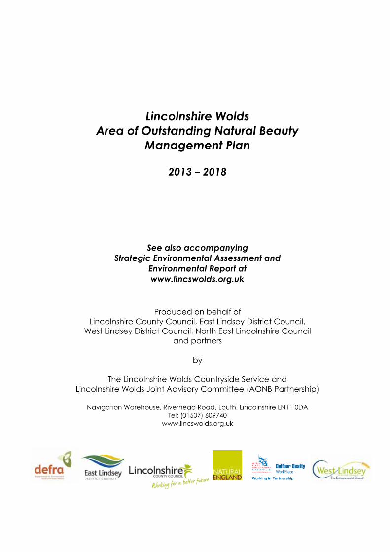
Lincolnshire Wolds Area of Outstanding Natural Beauty
Management Plan
2013 – 2018
See also accompanying Strategic Environmental Assessment and
Environmental Report at www.lincswolds.org.uk
Produced on behalf of Lincolnshire County Council, East Lindsey District Council,
West Lindsey District Council, North East Lincolnshire Council and partners
by
The Lincolnshire Wolds Countryside Service and Lincolnshire Wolds Joint Advisory Committee (AONB Partnership)
Navigation Warehouse, Riverhead Road, Louth, Lincolnshire LN11 0DATel: (01507) 609740
www.lincswolds.org.uk
3

Introductions
Welcome to the Lincolnshire Wolds Area of Outstanding Natural Beauty (AONB) Management Plan which sets out the updated Strategy and Action Plan for the period 2013-2018. The Lincolnshire Wolds was designated as an AONB in 1973, recognising it as one of the country’s finest landscapes, a designation on a par with our National Parks.
The Lincolnshire Wolds is a hidden jewel of the English countryside and one of only two nationally protected landscapes in the East Midlands region, the other being the Peak District National Park. During the 40 years since its designation as an AONB, the continued modernisation of farming, demands of modern living and development of new technologies have imposed continued pressures on the landscape. However these are both threats and opportunities. Our overarching goal is to ensure that the Wolds retains its unique landscape and undeniablespecial character, whilst maintaining and supporting its communities.
We are keen to thank the many organisations, local groups and individuals that have been involved in the development of this document. The Plan builds on the knowledge base established via the ‘Celebrating the Past, Planning for the Future’ consultations exercise conducted during 2004-09. The two conferences that we have organised over the life of the previous Plan proved very popular reaching out to an audience of over 300 people. They provided a good opportunity for the Lincolnshire Wolds Joint Advisory Committee to listen and debate a wide range of local concerns and issues under the two related themes of ‘Living and Working in the Wolds’ and ‘Living and Working in the Wolds - A Farmer’s Perspective’. Both conferences demonstrated the importance that we all place on the AONB landscape and the need for us all to work together to address some of the very real challenges facing the area.
A formal twelve week public consultation of the Revised Management Plan took place during the autumn of 2011 with extensive coverage in the local press. We received detailed responses from a wide range of interested individuals, organisations, local businesses and parish councils. A summary of these responses can be found in Appendix 6 and have been invaluable in helping the AONB partnership with the development of this Plan. The Strategy and Action Plan seeks to continue to build on our original shared vision for the future of the Lincolnshire Wolds AONB with a continuing emphasis on balancing environmental, social and economic interests. Change is an intrinsic characteristic of the Wolds, but the type, scale and pace of change does need to be carefully managed. The challenge has however never been greater, with pressures on the global economy, food production, energy use and climate change becoming increasingly evident.
The Plan is not just a document for use by the Lincolnshire Wolds Countryside Service, or the Lincolnshire Wolds Joint Advisory Committee, but rather a Plan for everyone. It is a Plan built on partnerships, and this is vital if we are to continue to move towards our shared vision for the Lincolnshire Wolds. The supporting evidence, aspirations, policies and targets set out in this document will provide a very important tool to help inform and guide future development management as delivered through the emerging Local Development Frameworks. There is still a lot of work to be done and the success of the Plan will ultimately depend on achieving positive actions and outcomes. It is however important that we recognise and celebrate the successes of the previous Plan which has been instrumental in taking forward a number of important partnership initiatives. These are well documented in the suite of Annual Reviews published since 2004-05. We will endeavour to ensure that the new Plan provides the continuing catalyst for protecting and enhancing our unique asset – the Lincolnshire Wolds. We look forward to working with you to this end. To view or download a full version of the final published AONB Management Plan (2013-18) and its Environmental Report visit the Lincolnshire Wolds partnership website: www.lincswolds.org.uk. An Executive Summary has also been produced to provide a concise guide to our shared Vision and Strategy for continuing to protect and enhance this nationally important landscape.
Councillor Lewis Strange Chairman, Lincolnshire Wolds Area of Outstanding Natural BeautyJoint Advisory Committee
4

Ministerial Foreword for AONB Management Plans 2013
Areas of Outstanding Natural Beauty (AONBs) are some of our finest landscapes. They are cherished by residents and visitors alike and allow millions of people from all walks of life to understand and connect with nature.
I am pleased to see that this management plan demonstrates how AONB Partnerships can continue to protect these precious environments despite the significant challenges they face. With a changing climate, the increasing demands of a growing population and in difficult economic times, I believe AONBs represent just the sort of community driven, collaborative approach needed to ensure our natural environment is maintained for generations to come.
AONB Partnerships have been the architects of a landscape-scale approach to land management. This approach is a key feature of the Government’s Natural Environment White Paper and emphasises the need to manage ecosystems in an integrated fashion, linking goals on wildlife, water, soil and landscape, and working at a scale that respects natural systems.
This management plan also makes the important connection between people and nature. I am pleased to hear that local communities have been central to the development of the plan, and will be at the heart of its delivery. From volunteers on nature conservation projects, to businesses working to promote sustainable tourism, it’s great to hear of the enthusiasm and commitment of the local people who hold their AONBs so dear.
AONBs are, and will continue to be, landscapes of change. Management plans such as this are vital in ensuring these changes are for the better. I would like to thank all those who were involved in bringing this plan together and I wish you every success in bringing it to fruition.
Richard Benyon, MPMinister for the Natural Environment & Fisheries
5

How to read and use the Management Plan
Section 1 (pages 11 – 17) sets the scene for the Plan, providing an overview of the statutory background to AONB designation and summary of the legal requirements to produce and review Management Plans through the Countryside and Rights of Way Act 2000 (CRoW Act).
Section 2 (pages 18 – 36) describes the Lincolnshire Wolds and highlights the reasons for its designation as an AONB. Tables 1 - 2 and Appendix 3 complement this section, identifying the special qualities of the area, and the resulting threats/pressures and opportunities.
Section 3 (pages 37 – 40) sets out the vision, aims and guiding influences for the Lincolnshire Wolds AONB and identifies five overarching themes: Protecting the Wolds; Living and Working in the Wolds; Discovering the Wolds; Developing the Wolds and Partnerships in the Wolds. These themes provide the overall structure for the document.
Sections 4 – 8 (pages 41 – 88) provide the Strategy for future management of the AONB detailing a series of objectives, policies and management statements across the five themes: Protecting the Wolds; Living and Working in the Wolds; Discovering the Wolds; Developing the Wolds; and Partnerships in the Wolds. These themes have been utilised to help group individual topics. Each topic is tackled succinctly with an introduction and overview of the current threats/pressures or management issues. Each of these sections and individual topics are not mutually exclusive and in many cases there is both overlap and interdependence between them. This reflects the complex nature of AONB management in respect of the need to balance environmental, social and economic factors – all the major influences of landscape change in the AONB.
The objectives set out the overarching goals of the Plan, with policies providing clear specific and measurable areas of management for delivering the Strategy. Management statements have been endorsed for both the Wolds’ landscape and partnerships as these are seen as integral to the overall delivery of the vision.
Section 9 (pages 89 - 125) contains the AONB Action Plan (Table 4) identifying what needs to be done, by whom and when, to help implement the overarching objectives and policies. It is clearly an ambitious and challenging programme, even more so in the current financial climate, and its successful implementation will depend on everyone’s continued hard work. Monitoring progress on the Action Plan and the condition of the AONB is included in Section 9, with Table 5setting out a range of monitoring indicators.
Appendices and maps (pages 126 - 198) are included at the end of the document and provide a wide range of supporting information including additional baseline data, an index of key related plans and strategies, and a bibliography including useful website addresses. There is also a detailed glossary of technical terms and acronyms to aid the reader, when required.
Finally, there are two separate documents, an Executive Summary and Environmental Report to help summarise the main Management Plan and its Strategic Environmental Assessment (SEA). All documents are available on request, or as downloads from www.lincswolds.org.uk
How was the Plan and accompanying SEA produced?
This revised statutory Lincolnshire Wolds AONB Management Plan (2013-18) has been produced by the Lincolnshire Wolds Countryside Service (LWCS), in partnership and close consultation with the relevant local authorities, Natural England, other members of the Lincolnshire Wolds Joint Advisory Committee (JAC) and many other organisations and interest groups. The JAC, on behalf of the relevant local authorities, advised the LWCS of the need to conduct a light review to minimise public cost and avoid undermining the extensive consultation undertaken to help inform the 2004-09 Management Plan.
The LWCS was tasked with preparing a revised Draft Plan in consultation with the relevant statutory agencies, local authorities and other relevant organisations. The Strategic Environmental Assessment (SEA) was completed via the host authority (Lincolnshire County
6

Council) agreement with Mouchel consultancy who prepared the SEA following the development and six week consultation of the initial Scoping Report document. The scoping exercise helped ascertain a suitable environmental baseline for the AONB, outlining relevant legislation, plans and policies, and establishing an appropriate list of SEA objectives for scrutinising both the original 2004-09 Plan and its proposed amendments. The SEA Baseline and Environmental Report sets out in some detail the current condition of the key components of the Lincolnshire Wolds AONB and summarises the key environmental issues facing the designated area and its wider setting.
A consultation Plan was subsequently prepared and circulated in September 2011 for wider public comment. All observations received during the twelve week period helped to guide the final content of our shared Strategy and the direction for future action (Table 4 - Action Plan).We are indebted to all who have contributed to the revised Plan and its accompanying Environmental Report.
Copyright Conditions
This publication or any section of it may be reproduced free of charge in any format provided it is reproduced accurately and not used in a misleading context. The source of the material must be acknowledged. Photographs are the property of the LWCS, Derrick Furlong and Natural England unless otherwise stated.
Further Information
For further information on this Plan, the SEA Report or the Lincolnshire Wolds in general, please contact:
The Lincolnshire Wolds Countryside ServiceNavigation WarehouseRiverhead RoadLouthLincolnshire LN11 0DA
Tel: (01507) 609740 [email protected]
If you would like this document in an alternative format please contact the Lincolnshire Wolds Countryside Service on 01507 609740.
7
Contents
1. Setting the Scene 11
1.1 What is an Area of Outstanding Natural Beauty? 111.2 Why have AONBs? 111.3 What are the obligations for managing AONBs? 131.4 What is an AONB Management Plan and why is it needed? 131.5 The Management Plan in context 141.6 Status of the Lincolnshire Wolds AONB Management Plan? 161.7 Who looks after the Lincolnshire Wolds AONB? 161.8 How is the Lincolnshire Wolds AONB partnership funded? 17
2. The Lincolnshire Wolds - A Special Landscape 18
2.1 The Lincolnshire Wolds – Introduction 182.2 The Wolds’ General Character 182.3 Why is the Lincolnshire Wolds an AONB? 19
2.3.1 Outstanding Qualities 192.3.2 National Landscape Character Assessments 192.3.3 The Regional Landscape Character Assessment 202.3.4 District Landscape Character Assessments 202.3.5 The Lincolnshire Wolds AONB Character Assessment 202.3.6 Local Landscape Character Areas 21
2.4 Special qualities – current condition of the AONB 21Table 1 - Special Qualities 22
2.5 Threats/Issues/Pressures on the Wolds’ Natural Beauty 32Table 2 - Forces for Change 33
3. The Vision and Guiding Influences 37
3.1 The Vision 373.2 The Aims 383.3 Cross-cutting influences 38
3.3.1 Natural Beauty 383.3.2 Local Distinctiveness – sense of place 383.3.3 Economic and social well-being 383.3.4 Sustainability and the increasing influence of climate change 393.3.5 Partnerships 39
3.4 Delivery themes 40
4. Protecting the Wolds - Theme 1 41
4.1 Landscape Conservation and Enhancement 414.2 Natural Heritage – Biodiversity
4.2.1 Introduction 43Table 3 – Species Records 44
4.2.2 Meadow, Pasture and Wet Grassland 474.2.3 Grass Verges and Green Lanes 494.2.4 Woodlands, Beech Clumps and Traditional Orchards 504.2.5 Hedgerows and Landmark Trees 534.2.6 Rivers, Streams and Ponds 554.2.7 Arable Farmland 57
4.3 Earth Heritage4.3.1 Geodiversity 594.3.2 Soils 61
4.4 Cultural Heritage – Historic Landscapes4.4.1 Archaeology 634.4.2 Built Heritage 66
8
5. Living and Working in the Wolds - Theme 2 68
5.1 Farming and Field Sports in the Wolds 685.2 Thriving Communities 71
6. Discovering the Wolds - Theme 3 74(Interpretation, Access, Recreation and Tourism)
6.1 Introduction 746.2 Interpretation – Awareness Raising 756.3 Access, Recreation and Tourism 76
7. Developing the Wolds - Theme 4 79
7.1 Planning and Development Management 797.2 Transport in the Wolds 827.3 Climate Change and Energy 85
8. Partnerships in the Wolds - Theme 5 87
9. Making it Happen – Implementation, Monitoring and Review 89
9.1 Implementation 899.1.1 Table 4 – AONB 5 Year Action Plan 90
9.2 Monitoring9.2.1 Condition Monitoring 1249.2.2 Performance Monitoring 1249.2.3 Table 5 - State of the AONB Indicators 122
9.3 Management Plan Review 125
Appendices
Appendix 1 Lincolnshire Wolds Joint Advisory Committee (JAC) Membership 126
Appendix 2 Role of the Joint Advisory Committee and Lincolnshire Wolds 127Countryside Service and sub-groups
Appendix 3 Local Landscape Character Areas 128
Appendix 4 Questionnaire Results (Summary) – 2003 131
Appendix 5 Community Consultation (Executive Summary) – 2003 133
Appendix 6a Public Consultation Proforma – 2011 137
Appendix 6b Summary of Written Responses to Public Consultation – 2011 139
Appendix 7a Glossary for Acronyms 185
Appendix 7b Technical Terms 187
Appendix 8 Key Related Plans, Strategies and Initiatives 189
Appendix 9 Bibliography/Further Information 191
Appendix 10 Acknowledgements 192
9

Maps
Map 1 National Map of AONBs 194
Map 2 Local Authority Boundary Map 195
Map 3 County Map of the AONB 196
Map 4 AONB/Character Area Map 197
Map 5 Local Landscape Character Map 198
10

1. Setting the Scene
1.1 What is an Area of Outstanding Natural Beauty?
The Lincolnshire Wolds is a nationally important and cherished landscape most of which was designated as an Area of Outstanding Natural Beauty (AONB) in 1973 on account of its high scenic beauty. AONBs, together with National Parks, make up the finest landscapes in Englandand Wales. The AONBs are a national asset containing a wide variety of attractive landscapes including wolds, downlands, woodlands, moorlands and heaths, rivers and streams, estuaries and marshes, and coast (Map 1). Like National Parks, our AONBs are very much living and working landscapes that have been, and continue to be, shaped by nature and human activity.
1.2 Why have AONBs?
European and Global contexts:
AONBs are one of a group of globally protected landscapes. They fall within a worldwide category of Protected Landscapes, established by the International Union for Conservation of Nature and Natural Resources (IUCN) where they are classed as ‘Category V – Protected Landscapes’. The Lincolnshire Wolds AONB partnership is a full member of the Europarc Federation which aims to exchange knowledge, information and experience with colleagues from across Europe for the benefit of European protected areas.
The European Landscape Convention, the ELC (2000), has been ratified by the United Kingdomand came into effect in March 2007. It sets out a comprehensive strategic agreement for the consideration of landscape matters within all relevant decision making across the European Community. The nationally protected landscapes of the UK, both AONBs and National Parks, can play an important role in the recognition, monitoring and successful management of future landscape change.
National context:
The National Parks and Access to the Countryside Act 1949 (NPAC Act) established powers to create AONBs, with the overriding objective of conserving and enhancing their natural beauty. ‘Natural beauty’ is not just the look of the landscape, but includes landform and geology, plants and animals, landscape features and the rich history of human settlement over the centuries (Countryside Agency – now Natural England, CA24, 2001). Whilst the original reasons for protection still hold true today, with the landscape quality of overriding importance, there has been increasing realisation of the need to address wider social and economic issues. This will ensure the designation has a relevance to those communities dependent upon these areas for living and working purposes.
The Lincolnshire Wolds is one of a family of 46 designated AONBs in England, Wales and Northern Ireland that work closely through the shared aims, objectives and work programme of the National Association for Areas of Outstanding Natural Beauty (NAAONB). The NAAONB is an incorporated controlled company limited by guarantee, formed in 1998, acting on behalf of Areas of Outstanding Natural Beauty with its membership made up AONB partnerships and some local authorities. Through the guidance of its Management Board and wider membership, the NAAONB aims to sustain and enhance the funding arrangements, management and public awareness for all AONBs. In addition to the clear links with other AONBs the Lincolnshire Wolds is part of a wider national protected landscape family that includes the UK’s National Parks and Heritage Coasts.
The close working relationship with our family of AONBs and sister group of protected landscapes remains vital to help share expertise, good practice and encourage innovation. To this end the National Association for AONBs revised its Strategy and Business Plan in 2011,
11

reaffirming the shared objectives and aims for AONBs under the branding of Landscapes for Lifewith the following aspirations:
NAAONB Vision: ‘The natural beauty of our Areas of Outstanding Natural Beauty is valued and secure, the communities within and adjacent to them are thriving, and the relationship between people and these nationally important places is understood and supported at all levels’.NAAONB Mission Statement: ‘Everything we do is inspired by our mission to support the AONB Family in the conservation and enhancement of natural beauty’.
The NAAONB Business Plan (2012-15) details the shared work programme across the following four themes:
Advocacy and Policy Communications and Training Collaborative Working Securing and Managing Resources.
Over the past 14 years, the NAAONB has established itself as the collective voice of AONB partnerships in England, Wales and Northern Ireland and, in doing so, represents those involved in the planning and management of over 8,000 square miles of the UK’s finest landscapes.
(visit www.landscapesforlife.org.uk - for further details on the Strategy, Business Plan and wider work of the NAAONB).
12

1.3 What are the obligations for managing AONBs?
In 1991 the Countryside Commission (now Natural England) published a policy statement about AONBs (CCP 356) which sets out the following obligations for their management:
The primary purpose of AONB designation is to conserve and enhance natural beauty.
In pursuing the primary purpose account should be taken of the needs of agriculture, forestry, other rural industries and of economic and social needs of local communities. Particular regard should be made to promoting sustainable forms of social and economic development that in themselves conserve and enhance the environment.
Recreation is not an objective of designation, but the demand for recreation should be met so far as this is consistent with the conservation of natural beauty and the needs of agriculture, forestry and other uses.
Part IV of the Countryside and Rights of Way Act 2000 (CRoW Act) introduced significant measures to improve the protection and management of AONBs. As summarised by the Countryside Agency (CA 23, 2001), the CRoW Act:
Consolidates the provisions regarding the designation and purposes of AONBs previously contained in the National Parks and Access to the Countryside Act 1949 (NPAC Act) as modified by subsequent legislation. (Section 82, CRoW Act)
Confirms the powers of local authorities to take appropriate action to conserve and enhance the natural beauty of AONBs. (Section 84, CRoW Act)
Places a duty on ‘relevant authorities’ when exercising or performing any functions in relation to, or so as to affect, land in an AONB, to have regard to the purpose of conserving and enhancing the natural beauty of the AONB. (Section 85, CRoW Act)
Provides for the creation of conservation boards for selected individual AONBs by means of an establishment order made by the Secretary of State. (Section 86, CRoW Act)
Requires the preparation and publication of a Management Plan and its periodic review by the appropriate local authorities, or by an AONB conservation board where one is established. (Section 89, CRoW Act)
1.4 What is an AONB Management Plan and why is it needed?
Most importantly, Section 89 of CRoW Act created a statutory duty for local authorities with responsibilities for an AONB to produce and regularly review a Management Plan which sets out their, and partners’, policies and objectives for managing the AONB. The original Countryside Agency publication CA 23 is the principal guide to assist AONB staff, local authorities and partners in their production and subsequent review of AONB Management Plans. It highlights that an AONB Management Plan is a document which:
Identifies the special qualities and the enduring significance of the AONB, and the importance of its different features.
Presents an integrated vision for the future of the AONB as a whole in the light of national, regional and local priorities.
Sets out agreed policies incorporating specific objectives to help secure the vision – the Management Strategy.
Identifies what needs to be done, by whom and when, in order to achieve these outcomes – the Action Plan.
States how the condition of the AONB and the effectiveness of its management will be monitored.
13

The goal of AONB Management Plans is to ensure continuity and consistency of management over time, conserving nationally important landscapes for the use and enjoyment of future generations. The first strategic Lincolnshire Wolds Management Plan was produced in 1999 and was followed by the second comprehensive Management Plan (2004-09), which was published and adopted in April 2004 in-line with statutory guidance under the CRoW Act. The production and implementation of the second five year Management Plan provided the key overarching framework to deliver integrated action to help conserve and enhance the area through sustainable forms of environmental, social and economic development.
CA 221 ‘Guidance for Review of AONB Management Plans’ was published in 2006 to help AONB partnerships with the statutory review of their respective Management Plans. The report highlighted the need for the reviews to focus on the primary purpose of the designation. Subsidiary issues, such as the rural economy and communities, should be addressed in the context of their role in conserving and enhancing the AONB environment.
As highlighted in the foreword, one major change since the last Plan was published is that all AONB Management Plans must now be reviewed alongside an accompanying Strategic Environmental Assessment (SEA). The details of the SEA process are outlined more fully in the accompanying draft SEA which details the key stages as recommended in the Office of the Deputy Prime Minister (ODPM) publication ‘A Practical Guide to the Strategic Environmental Assessment Directive’ (2005).
The production of this Revised Plan has provided an opportunity for everyone with an interest in the AONB to help look again at the issues, objectives and priorities for conserving and enhancing the area in the longer term. This includes local authorities and agencies with statutory duties for the AONB, other organisations, local communities, visitors to the Wolds and other groups and organisations with an interest in the area. This Plan is intended to build on the extensive community consultation process that was undertaken during 2003-04. The Lincolnshire Wolds Joint Advisory Committee (JAC) has advised of the need for a generally light and pragmatic approach to the review, although the SEA requirements have placed additional and challenging demands on the process.
1.5 The Management Plan in Context
The total area of the Lincolnshire Wolds AONB is 558 km² (55,800 hectares): Map 2 shows a breakdown of the administrative areas which includes East Lindsey District Council (397 km²); West Lindsey District Council (119.5 km²); North East Lincolnshire Council (41.5 km²); with 516.5 km² within Lincolnshire County Council.
The planning framework for the Lincolnshire Wolds AONB is currently provided by the two District Local Plans (East Lindsey and West Lindsey) and North East Lincolnshire Local Plan and also the additional Lincolnshire County Council and North East Lincolnshire Council plans for highways, minerals and waste matters. All of the Local Plans recognise the importance of the AONB and include specific planning policies to guide the use of land in the area and in particular protect its natural beauty. All of these documents are now being revised under the changes resulting from the Planning and Compulsory Purchase Act (2004) with the relevant local authorities now engaged in producing alternative Local Development Frameworks (LDFs) and Supplementary Planning Documents (SPDs). A significant change since the production of the last Plan has been the creation of the Central Lincolnshire Joint Planning Unit and development towards a new Joint LDF to cover the areas of West Lindsey, North Kesteven and the City of Lincoln. This has included an important Green Infrastructure audit, study and developing strategy, with an accompanying Biodiversity Opportunity Map for Central Lincolnshire that extends into the area of the AONB within West Lindsey. All future LDF documents for East Lindsey and the Central Lincolnshire Joint Area will need to carefully consider and take account of national guidance on AONB protected landscapes and wherever relevant, the aspirations detailed within the Management Plan.
There have been significant changes to the planning system and accompanying government guidance through both the Localism Act (2011) and the National Planning Policy Framework (2012).
14

The Localism Act has placed an increased emphasis on local decision making, seeking to shift power away from central government and into the hands of individuals, communities and local councils. Included in the Act is: greater provision for neighbourhood planning; increased community rights; greater freedoms for local authorities and local areas including with housing provision. The revised AONB Management Plan accords well with the spirit of the Localism Actwith the review process one of local engagement and public consultation. The resulting Strategy and Action Plan is very much a partnership plan and heavily dependent upon continuing local engagement for its success.
The National Planning Policy Framework (NPPF) revoked and replaced over 1000 pages of previous planning policy and guidance into little over 50 pages, setting out the Government’s new planning policies for England and how these are expected to be applied. The NPPF seeks to aid local people and their accountable councils with the development of their own distinctive local and neighbourhood plans, reflecting the needs and priorities of their communities. Its central principle is the general presumption in favour of sustainable development whereby economic, social and environmental gains are sought jointly and simultaneously through the planning system, the so called golden thread running through both plan-making and decision-taking.
The National Association for AONBs, relevant government agencies and local authorities have welcomed the NPPF’s support for conserving and enhancing both i) the natural and ii) the historic environment, as two of the 12 core land-use planning principles underpinning plan-making and decision taking. There is reaffirmation of the need to give great weight to conserving the landscape and scenic beauty across all of England’s AONBs and National Parks (NPPF Paragraphs 115 and 116). There is clarification in the NPFF that these areas have the highest status of protection in relation to landscape and scenic beauty with conservation of wildlife and cultural heritage of particular importance.
Very much like the Localism Act, the revised AONB Management Plan accords well with the overarching NPPF by seeking to protect and enhance the protected landscape through encouraging appropriate sustainable development. The revised Plan is wide ranging in scope, dealing with the many environmental, social and economic issues impacting upon this deeply rural and highly scenic area.
Further significant external drivers relate to the need to secure a step-change in the protection and enhancement of our biodiversity assets as recognised through the EU 2020 Biodiversity Strategy, the England Biodiversity Strategy, the Lawton report Making Space for Nature, Natural Environment White Paper – The Natural Choice, the UK National Ecosystem Assessment and the Water Framework Directive. These strategies are detailed more fully in Section 4 – Protecting the Wolds but will have wider implications on other areas of this Plan. This includes a renewed onus to work closely with all farmers and land managers in a bid to help secure greater landscape scale connectivity for biodiversity with improved ecosystem services across and beyond the AONB. The JAC partnership will clearly need to review and enlist the support of a wide range of new partners but especially those from the business, health and research sectors. The emerging Lincolnshire Nature Partnership will be an important strategic network to help assist this process.
The Management Plan has an important role in helping to deliver the aspirations of the European Landscape Convention (ELC) which was signed by the UK government in 2006. The ELC is the first international convention to focus specifically on landscape and was created by the Council for Europe in order to help promote landscape protection, management and planning. It applies to all landscapes, towns and villages, coast, sea and inland areas as well as our nationally protected landscapes including the Lincolnshire Wolds.
A large number of other plans and strategies currently affect the AONB often providing both pressures and opportunities for the environment, economy and community (Appendix 8). Sub-regional Strategic Partnerships (SSPs) and Local Strategic Partnerships (LSPs) were influential during the life of the last Plan and the emerging Local Enterprise Partnership focusing on ‘prosperity through growth’ for the area of Greater Lincolnshire is likely to become increasingly important. Both Lincolnshire County Council and North East Lincolnshire Council also operate as the Highway Authorities for their respective areas of the Wolds and have a key statutory role in the management of public roads, roadside verges and the public rights of way network
15

(footpaths, bridleways and byways) including strategic planning through the Local Transport Plans and Rights of Way Improvement Plans.
The Management Plan will work to complement existing plans and strategies through developing and implementing a set of objectives and policies with the primary purpose of conserving and enhancing the natural beauty of the AONB; whilst also providing opportunities for sustainable social and economic development that accord with this purpose and wider government aspirations for increasing the powers of localism through ever greater community and partnership engagement.
1.6 Status of the Lincolnshire Wolds AONB Management Plan
In accordance with Section 89 of the Countryside and Rights of Way Act 2000 (CRoW Act) and DETR Circular 04/2001 the revised draft Lincolnshire Wolds Area of Outstanding Natural Beauty Management Plan (2013-18) was forwarded to Natural England for final observations prior to its publication and adoption by Lincolnshire County Council, East Lindsey District Council, West Lindsey District Council and North East Lincolnshire Council. An accompanying Post Adoption SEA Statement will also be published in accordance with obligations under the European Directive 2001/42/EC.
As indicated, the Lincolnshire Wolds Countryside Service (LWCS), the staffing unit for the AONB, has been the lead in preparing the revised Plan under the direction of the Lincolnshire Wolds Joint Advisory Committee (JAC – see Section 1.7) and its Joint Management Group (JMG). The final AONB Plan provides a strategic document and Action Plan for the management of the area, operating alongside the policy of the constituent local authorities towards protecting and enhancing the AONB. The JAC has been keen to ensure that the Plan complements a wide range of policy and action programmes including the Local Strategic Partnerships, Local and Structure Plans, emerging Local Development Frameworks, Local Enterprise Partnership and Neighbourhood Plans.
1.7 Who looks after the Lincolnshire Wolds AONB?
The care of the AONB has been entrusted to the local authorities, organisations, community groups and those who live and work in the area. Much of the area is in private ownership, with few publicly owned and managed sites. Private landowners, particularly farmers, have a crucial role to play in continuing to safeguard this unique landscape.
The Lincolnshire Wolds AONB has an established Joint Advisory Committee (JAC - Appendices 1 & 2): a partnership of public, private and voluntary organisations and representatives who have a special interest or working knowledge of the area. The JAC acts as a forum to advise and guide activity on a wide range of issues across the Wolds and will be instrumental in developing, implementing and monitoring the AONB Management Plan.
The LWCS (Appendix 2) currently implements a varied work programme on behalf of the JAC and its core funders, who meet quarterly as part of the Lincolnshire Wolds Joint Management Group (JMG - Appendix 1 & 2). The LWCS works alongside a wide range of organisations, local landowners, community groups and volunteers advising on policy and undertaking activity that furthers the interests of the AONB and wider Wolds Character Area. The LWCS will help to coordinate both the delivery and future statutory review of the Plan and will play a key role in identifying and pursuing funding opportunities that can aid its implementation. The success of the Plan will ultimately depend on integrated stakeholder action involving all organisations, landowners and communities with an influence and/or interest in the Lincolnshire Wolds AONB.
16

1.8 How is the Lincolnshire Wolds AONB partnership funded?
The LWCS provides the dedicated staff unit for the AONB and is hosted by Lincolnshire County Council (LCC) on behalf of the JAC. The current (2013) national government has pledged its continuing financial commitment to AONBs; with a 75% core grant supplied direct from Defra (previously through Natural England) as part of a formal funding arrangement (Memorandum of Agreement) with all relevant local authorities including LCC, East Lindsey District Council, West Lindsey District Council and North East Lincolnshire Council – whom together cover the additional 25% core and selected project funding. There is a wide range of available grant programmes for assisting landowners, local communities and businesses to protect and enhance the Lincolnshire Wolds. Natural England’s Entry Level Stewardship (ELS) and Higher Level Stewardship (HLS) schemes (replacing the previous Countryside Stewardship Scheme), together with the Rural Development Programme for England (RDPE), provide major funding support to the area’s landowners and rural businesses. The RDPE includes the Lindsey Action Zone, a large proportion of which is within the AONB.
Future public finances and the need to reduce both central and local authority budgets will continue to have a direct impact upon future partnership work activity and grant programmes, creating challenging but fresh opportunities over the lifetime of the Plan. The JAC wishes to build on the many successes enjoyed by those living, working and visiting the Wolds: continuing to liaise with all to help achieve ‘more with less’ via the prudent management of resources and the exploration and implementation of fresh ideas.
17

2. The Lincolnshire Wolds - A Special Landscape
2.1 The Lincolnshire Wolds - Introduction
The Lincolnshire Wolds lie in the north-eastern quarter of the county of Lincolnshire (Map 3), mid-way between Lincoln and the coast, surrounded by the relatively flat fens, coastal marsh and the Lincoln Clay Vale. As detailed, the AONB comprises an area of 558 km² (216 miles²), while the wider Lincolnshire Wolds Character/Natural Area incorporates the two neighbouring areas of the ‘Spilsby Crescent’ to the south and the remaining chalk uplands to the north (Map 4).
2.2 The Wolds’ General Character
The Wolds has a strong unity of visual character, characterised by open plateau hilltops, sweeping views, strong escarpments, wide grass verges and ridge-top routeways, dramatic wooded slopes and valleys, beech clumps, attractive villages often nestled in hill folds and natural and historic features of great interest including visual remnants of ancient tumuli and deserted/shrunken medieval villages.
The Landscape Character Assessment for the Wolds undertaken by the Countryside Commission (CCP 414, 1993), recognises the landscape as strikingly different from most other chalk and limestone landscapes in the extent of arable cultivation, made possible by the area’s fertile chalk and drift soils. The ‘typical’ chalk downland features of calcareous grassland and sheep walk were probably never widespread in the Wolds due to the thinness of the chalk and the fact that much of the area is covered by glacial till. The area subsequently has a long association with cultivated farming practices. The writings of William Cobbett in his Rural Rides of 1830 and J. A. Clarke in the Journal of the Royal Agriculture Society in 1852 speak of a transformation of the Wolds in the 18th and 19th centuries: previous pasture, and ridge and furrow farmed landscapes were systematically converted to more intensive rotation cropping, originally encouraged through the Enclosures Act. Both arable and livestock production increased with the growing importance of farm mechanisation via the Victorian farmsteads. The surviving areas of semi-natural habitats, including grassland and ancient woodland, are very limited in extent, but are nonetheless of particular importance, and are supported by more recent introductions of hunting and shooting plantations and hedgerows indicative of an Enclosure Landscape.
In addition to the distinctive and widely nucleated villages and hamlets within the Wolds, the surrounding market towns of Alford, Caistor, Horncastle, Louth, Market Rasen and Spilsby have long associations with the area. The Wolds remains relatively sparsely populated and the roles of the market towns are very important in providing social and economic services for the wider community. In turn they provide important gateways to the Wolds’ countryside. The area remains a relatively tranquil place for residents and visitors alike and the aim of the Management Plan is to promote and manage the conservation and enhancement of its special qualities.
18
2.3 Why is the Lincolnshire Wolds an AONB?
2.3.1 Outstanding Qualities
The Lincolnshire Wolds was designated an AONB in 1973 following a period of considerable local campaigning. This recognised the area’s unique landscape and distinctive ‘sense of place’. The Landscape Character Assessment (CCP414, 1993), acknowledged the following outstanding qualities as detailed in support of our current vision statement (see Section 3):
A unique physiography (geology and topography) – The physical geography of the Lincolnshire Wolds is unusual and fascinating. The Wolds is the highest upland landscape in eastern England between Yorkshire and Kent and has a complex geology; nowhere else in Britain has a chalk landscape been so extensively modified by glaciations. These have given rise to some of its most striking features including numerous steep-sided and open-ended combes.
A scenic, working landscape – The high scenic quality of the Wolds depends almost entirely upon the area’s use for agriculture. Much of its charm is derived from the seasonally changing field and cropping patterns; the rural scenes of farming activity; and the traditional villages and farmsteads in brick and pantile. Overall approximately 70% of the AONB is in arable cultivation, with 14% as pasture or rough grazing and 4.5% woodland cover (Defra Agricultural Census & Forestry Commission stats, 2010). It is widely recognised that much of the attractiveness of the Wolds today is a result of the activities of generations of landowners and farmers.
A major archaeological resource – The Wolds has a rich legacy of prehistoric sites and a wealth of historic landscape features. Most of Lincolnshire’s long barrows are in the Wolds, with a high concentration of round barrows, together with many important ancient trackways including the ridge top routes of the Bluestone Heath Road and the Caistor High Street. The Wolds also has one of the largest densities of deserted and shrunken medieval villages (DMVs & SMVs) in the country.
A valued cultural landscape – The Wolds’ landscape has been a source of cultural inspiration. The Tennyson family has a strong association with the area. Alfred, Lord Tennyson - the Poet Laureate - spent much of his formative years in the Wolds and it is featured in many of his works including ‘The Brook’. The landscape has offered inspiration to many artists and writers over the years including the mid-19th century landscape painter Peter de Wint and more recently the author A. S. Byatt in the Booker Prize-winning novel ‘Possession’.
2.3.2 National Landscape Character Assessments
The Lincolnshire Wolds AONB is part of the more extensive Lincolnshire Wolds National Character Area (NCA Number 43) as mapped originally by the Countryside Agency, now Natural England. The national Countryside Quality Counts project has helped to collate landscape trends for all of the NCAs and provides useful historic data for the wider Wolds area. This project has recently been updated by the Character and Quality of England’s Landscapes initiative, also known as CQuEL. This programme aims to provide a series of integrated datasets focusing on place-based evidence for the character and function of landscapes, and the provision of relevant ecosystem services.
Natural England (NE) is leading a national programme to update, expand and strengthen the suite of England’s 159 NCA profiles. This work will encompass the recommendations of the Government’s White Paper on the Natural Environment. NE will be working with local partners to develop and test a Strategic set of Statements of Environmental Opportunities (SEOs) for each area. Complementary to this work, the Lincolnshire Wolds AONB was (2011-12) one of four areas to pilot a new monitoring framework for protected landscapes, helping to develop a set of national and local measures to monitor and inform future land management in both AONBs and National Parks (see also Section 9.2 Monitoring).
19

2.3.3 The Regional Landscape Character Assessment
The East Midlands Regional Landscape Scoping Study (2008) commissioned by the East Midlands Regional Assembly and Natural England highlighted that only 9% of the region’s land is included in nationally designated landscapes which has led to a tendency to undervalue the area’s wider landscapes. The subsequent East Midlands Regional Landscape Assessment (2010)undertaken by LDA Design Consulting LLP recognised the national importance of the Lincolnshire Wolds AONB mapping the area in two broad zones; the Chalk Wolds and Wolds Scarp and Ridges. The assessment was undertaken under the direction of a partnership group, and in response to the increasing recognition of the importance of landscapes in regional spatial planning terms following the UK’s ratification of the European Landscape Convention,(see also Section 1.5 The Management Plan in Context). The regional context is important in terms of utilising the resources of the AONB and those of the Peak District National Park, as a means of highlighting and disseminating good practice for future landscape management for all landscape and not just nationally designated landscapes. The regional work also provides a consistent and comprehensive framework which provides useful context for guiding and informing the undertaking of more detailed local landscape character assessments.
2.3.4 District Landscape Character Assessments
Finer-grained landscape character studies have been undertaken via the West Lindsey Landscape Character Assessment (1999) and East Lindsey Landscape Character Assessment (2009). The West Lindsey study recognised two distinct sub-areas the ‘North West Wolds Escarpment’ and ‘Lincolnshire Wolds’ within the AONB. The East Lindsey study highlighted three sub-areas, two directly in the AONB: ‘G1-Binbrook to Tetford Wolds Farmland’ and ‘G2-Little Cawthorpe to Skendleby’ and a third ‘G3 Hainton to Toyton All Saints Wolds Farmland’extending south-eastwards beyond the AONB boundary. A further landscape character assessment is considering the north-east corner of the Wolds as part of the wider North East Lincolnshire Council landscape character assessment. Alongside the Historic Landscape Characterisation (HLC) study for the old county area of Lincolnshire these studies help to illustrate the highly regarded and distinctive qualities of the Wolds’ landscape and its relationship with neighbouring areas.
2.3.5 The Lincolnshire Wolds AONB Landscape Character Assessment
The Lincolnshire Wolds Landscape Character Assessment (CCP414, 1993) identified and described the key features that make the area special and contribute to its overall ‘sense of place’. These features are:
A rolling upland landscape of strongly cohesive identity.
A pronounced scarp edge to the west comprising rough pasture and scrub, affording fine panoramic views to the Central Lincolnshire Vale.
A combination of elevated plateau and deep-sided valleys.
Large rectilinear fields with wide hedgerows from the late enclosure.
Archaeologically rich, with ancient trackways, deserted villages and burial mounds.
Sparse settlements of small-nucleated villages, often in sheltered valleys and associated with modest country houses and small parklands. The diverse geology gives rise to a variety of building materials.
Broad verges to some roads and tracks providing valuable flower-rich habitats.
Occasional shelterbelts concentrated on steeper-sided valley and scarp slopes emphasising landform.
Broader south-west valleys of the Rivers Lymn and Bain. Associated alder carr woodland and tree lined watercourses.
20
2.3.6 Local Landscape Character Areas
There are clear variations in scenic character across the Wolds with topography and geology appearing to be the most dominant factors. The Lincolnshire Wolds Landscape CharacterAssessment (CCP414, 1993) recognised four Landscape Character Areas within the AONB (Map 5) identified by their distinct group of special features (Appendix 3):
The north-west scarp The chalk wolds The ridges and valleys of the south-west The south-eastern claylands
The Management Plan uses the local landscape classification as the most practical tool within the AONB, with the other district and national classifications providing useful information at the relevant mapping layer.
2.4 Special qualities – current condition of the AONB
Table 1 summarises the special landscape features that typify the Lincolnshire Wolds ‘natural beauty’ and ‘sense of place’. These include features relating to landscape, farmland, geology, topography, biodiversity, archaeology, built heritage and culture. Appendix 3 provides an additional summary of the special qualities of each of the four Landscape Character Areas.
The table includes estimates of the extent or coverage of any feature and where possible an indication of its condition. This information is by no means comprehensive and has identified areas for further survey work (e.g. habitats in the wider countryside including woodland and grassland sites). The table provides useful baseline data essential for monitoring future change in the AONB and measuring the success of the Management Plan (see Section 9.2). The source organisation is abbreviated in the left hand column. Table 1 complements Table 2 in highlighting specific threats and management options that relate to the individual qualities of the AONB.
21

Tab
le 1
: The
Sp
ec
ial Q
ualit
ies
of t
he L
inc
oln
shire
Wo
lds
AO
NB
Spe
cia
l Qua
lity
(Im
po
rta
nce
to
natu
ral b
ea
uty)
Loc
al L
and
sca
pe
Cha
rac
ter A
rea
–Q
ualit
y &
Ext
ent
Co
nditi
on
Pre
ssur
es
and
tre
nds
Ma
nag
em
ent
o
ptio
ns
Land
sca
pe
Cha
rac
ter
No
rth-
we
st
sca
rpC
halk
w
old
s
Sout
h-w
est
rid
ge
s a
nd
valle
ys
Sout
h-e
ast
ern
c
layl
and
sTo
tal e
xte
nt
with
in A
ON
B
Sce
nic
be
au
ty &
ru
ral c
ha
rmG
en
era
l co
mp
on
en
t (a
rolli
ng
up
lan
d la
nd
sca
pe
of
stro
ng
ly c
oh
esi
ve id
en
tity
with
fa
rmin
g a
s a
n
un
de
rlyin
g c
om
po
ne
nt)
.
Mo
st o
f A
ON
BG
oo
d,
bu
t n
ee
ds
qu
an
tita
tive
su
rve
y (s
ee
m
on
itorin
g
sec
tion
)
Ch
an
ge
s in
lan
d m
an
ag
em
en
t a
nd
th
e f
utu
re u
se o
f fa
rm b
uild
ing
s; C
AP
refo
rms;
qu
arr
yin
g;
tele
co
mm
un
ica
tion
ma
sts;
win
d
farm
de
velo
pm
en
ts in
clu
din
g
pe
riph
ery
of
AO
NB;
oil
exp
lora
tion
; lig
ht
po
llutio
n; s
ola
r, a
na
ero
bic
an
d
oth
er a
ltern
ativ
e e
ne
rgy
sch
em
es.
Pla
nn
ing
an
d
de
velo
pm
en
t m
an
ag
em
en
t;
inte
rpre
tatio
n &
e
du
ca
tion
; lia
iso
n
with
co
mm
un
ity &
vi
sito
rs; n
atio
na
l an
d
loc
al f
un
din
g
op
po
rtu
niti
es
thro
ug
h a
gri-
en
viro
nm
en
t sc
he
me
s, L
ott
ery
fu
nd
ing
etc
.Ex
pa
nsi
ve, s
we
ep
ing
vi
ew
sG
en
era
l co
mp
on
en
t (v
iew
s fr
om
sc
arp
ed
ge
, Hig
h
Stre
et
an
d B
lue
sto
ne
He
ath
roa
d a
re p
art
icu
larly
d
ram
atic
).
Mo
st o
f A
ON
BG
oo
d, a
s a
bo
veA
s a
bo
ve, b
ut
pa
rtic
ula
rly p
ote
ntia
l fo
r in
tru
sion
fro
m h
illto
p o
r sky
line
d
eve
lop
me
nts
inc
lud
ing
ove
rhe
ad
p
ow
erli
ne
s.
Pla
nn
ing
an
d
de
velo
pm
en
t m
an
ag
em
en
t; h
igh
q
ua
lity
de
sig
n a
nd
b
uild
; la
nd
sca
pin
g.
Un
de
rgro
un
din
g
ove
rhe
ad
wire
s in
itia
tive
. Pe
ac
e &
tra
nq
uill
ityG
en
era
l co
mp
on
en
t (o
nc
e a
wa
y fr
om
th
e m
ain
ro
ad
s th
ere
is a
wid
e s
en
se o
f re
mo
ten
ess
an
d ru
ral
iso
latio
n a
cc
en
tua
ted
by
the
co
mb
ina
tion
of
ele
vate
d p
late
au
an
d s
he
ltere
d c
oo
mb
es)
.
Mo
st o
f A
ON
BG
oo
d, a
wa
y fr
om
ma
in ro
ad
s su
ch
as
A16
, A18
a
nd
Hig
h S
tre
et.
Co
ntin
ue
d in
cre
ase
in ro
ad
fre
igh
t &
p
oss
ible
inc
rea
se in
air
tra
ffic
(vi
a
Hu
mb
ers
ide
Airp
ort
an
d a
rme
d
serv
ice
s); l
igh
t p
ollu
tion
; u
nm
an
ag
ed
vis
itor p
ress
ure
.
Inte
gra
ted
pu
blic
tr
an
spo
rt in
itia
tive
s.
22

Farm
ed
La
nd(s
ce
nic
qu
alit
y,
bio
div
ers
ity, s
oc
io-
ec
on
om
ic)
(EN
)
Prim
ary
lan
d-u
se c
om
po
ne
nt
of
the
AO
NB
lan
dsc
ap
e.
Alm
ost
70%
of
the
AO
NB
is in
reg
ula
r cu
ltiva
tion
, in
clu
din
g 4
5% f
or c
ere
als.
A f
urt
he
r 14.
6 %
of
the
A
ON
B is
in g
rass
lan
d –
a fi
gu
re w
hic
h h
as
inc
rea
sed
in
rec
en
t ye
ars
th
rou
gh
ag
ri-e
nvi
ron
me
nt
targ
etin
g
of
Co
un
trys
ide
Ste
wa
rdsh
ip, a
nd
mo
re re
ce
ntly
En
try
an
d H
igh
er L
eve
l Ste
wa
rdsh
ip S
ch
em
es.
Mo
st o
f A
ON
BV
arie
d, b
ut
ess
en
tial e
lem
en
t o
f th
e A
ON
B c
ha
rac
ter (
see
c
om
po
ne
nt
fea
ture
s b
elo
w).
Ne
w c
rop
pin
g re
gim
es;
ch
an
ge
s to
n
atio
na
l/EU
fa
rm p
olic
y vi
a C
AP
re
form
; de
ma
nd
s fo
r eve
r la
rge
r fa
rm s
he
ds,
ou
tsid
e s
tore
s, g
rain
si
los;
clim
ate
ch
an
ge
.
Re
-dire
ctin
g n
ew
fu
nd
ing
str
ea
ms
for
lan
dsc
ap
e,
bio
div
ers
ity, a
cc
ess
a
nd
rec
rea
tion
. O
pp
ort
un
itie
s vi
a
ga
me
co
nse
rva
tion
. H
igh
qu
alit
y d
esi
gn
fo
r fa
rme
d b
uild
ing
s vi
a la
nd
ag
en
ts,
de
sig
n g
uid
es
an
d
LPA
s g
oo
d p
rac
tice
.
23

Spe
cia
l Qua
lity
(Im
po
rta
nce
to
natu
ral b
ea
uty)
Land
sca
pe
Cha
rac
ter A
rea
–Q
ualit
y &
Ext
ent
Co
nditi
on
Pre
ssur
es
and
tre
nds
Ma
nag
em
ent
o
ptio
ns
Eart
h H
erit
ag
eN
ort
h-w
est
sc
arp
Cha
lk
wo
lds
Sout
h-w
est
rid
ge
s a
nd
valle
ys
Sout
h-e
ast
ern
c
layl
and
sTo
tal e
xte
nt
with
in A
ON
BC
ha
lk u
pla
nd
–p
late
au
& v
alle
y la
nd
sca
pe
(RIG
S G
rou
p)
Ge
ne
ral c
om
po
ne
nt
(se
ries
of
san
dst
on
es,
iro
nst
on
es
an
d c
lay
un
de
rlie
th
e c
ha
lk c
ap
pin
g
an
d f
orm
th
e e
sse
ntia
l ch
ara
cte
r of
the
Wo
lds.
Th
e
are
a h
as
be
en
sh
ap
ed
by
at
lea
st t
wo
pe
riod
s o
f g
lac
iatio
n).
Mo
st o
f A
ON
BV
arie
dM
od
ern
de
velo
pm
en
t (v
isu
al
intr
usio
n e
.g. t
ele
co
m m
ast
s a
nd
w
ind
tu
rbin
es
bo
th w
ithin
an
d
ad
jac
en
t to
th
e A
ON
B); f
arm
in
fra
stru
ctu
re d
eve
lop
me
nts
(a
s a
bo
ve);
ch
alk
qu
arr
yin
g.
Pla
nn
ing
an
d
de
velo
pm
en
t m
an
ag
em
en
t;
inte
rpre
tatio
n &
e
du
ca
tion
.
Gla
cia
l/p
erig
lac
ial
fea
ture
s in
clu
din
g
rem
na
nt
lake
s/sp
illw
ays
(RIG
S G
rou
p)
Key
fea
ture
1 SS
SI4
RIG
S1
LWT
Re
serv
e
2 R
IGS
Key
fea
ture
1 R
IGS
7 R
IGS
1 SS
SI
Va
ried
SSSI
in f
avo
ura
ble
c
on
diti
on
Ch
an
ge
in la
nd
use
e.g
. tre
e
pla
ntin
g.
Imp
rove
d a
cc
ess
,in
terp
reta
tion
&
ed
uc
atio
n;
lan
do
wn
er l
iais
on
; re
sto
ratio
n s
ch
em
es.
Ge
olo
gic
al q
ua
litie
s
(RIG
S G
rou
p)
1 SS
SI1
RIG
S2
RIG
S
Key
fea
ture
3 SS
SI9
RIG
S2
RIG
S14
RIG
S4
SSS
I
Va
ried
, so
me
sm
all
pits
o
verg
row
n o
r in
fille
d.
2 SS
SIs
in
favo
ura
ble
c
on
diti
on
Ch
an
ge
in la
nd
use
; la
ck
of
aw
are
ne
ss; e
rosi
on
; se
co
nd
ary
a
ctiv
ity in
clu
din
g la
nd
fill;
ille
ga
l a
ctiv
itie
s.
Imp
rove
d a
cc
ess
,in
terp
reta
tion
&
ed
uc
atio
n;
lan
do
wn
erl
iais
on
; re
sto
ratio
n s
ch
em
es.
24

Spe
cia
l Qua
lity
(Im
po
rta
nce
to
natu
ral b
ea
uty)
Loc
al L
and
sca
pe
Cha
rac
ter A
rea
–Q
ualit
y &
Ext
ent
Co
nditi
on
Pre
ssur
es
and
tre
nds
Ma
nag
em
ent
o
ptio
ns
Bio
div
ers
ityN
ort
h-w
est
sc
arp
Cha
lk w
old
sSo
uth-
we
st
ridg
es
and
va
lleys
Sout
h-e
ast
ern
c
layl
and
sTo
tal e
xte
nt w
ithin
A
ON
BC
alc
are
ou
s,
me
ad
ow
, pa
stu
re &
w
et
gra
ssla
nd
s
(EN
, LW
T &
LW
CS)
Key
fea
ture
Ne
ttle
ton
V
alle
y a
nd
w
est
ern
sc
arp
fa
ce
.
Loc
al f
ea
ture
w
ithin
th
e
ch
alk
va
lleys
.
1 SS
SI (
ba
ts in
d
isu
sed
ra
ilwa
y tu
nn
els)
Key
fea
ture
4 SS
SI2
LWT
Re
serv
es
Loc
al
fea
ture
5 SS
SI3
LWT
Re
serv
es
Estim
ate
d 1
3% o
f A
ON
B -
Ove
r 80
site
s w
ith
gra
ssla
nd
inte
rest
h
ave
be
en
p
rop
ose
d a
s Lo
ca
l Wild
life
Si
tes.
10 S
SSI
54%
de
clin
e in
g
rass
lan
ds
be
twe
en
19
75 a
nd
199
4 (E
N
sta
ts. f
rom
MA
FF
ag
ricu
lture
an
nu
al
ce
nsu
s).
Situ
atio
n
no
w im
pro
vin
g w
ith
ag
ri-e
nvi
ron
me
nt
sup
po
rt.
7 SS
SI in
favo
ura
ble
c
on
diti
on
.
Thre
at
to li
vest
oc
k fa
rmin
g; i
nte
nsiv
e
ag
ricu
ltura
l pra
ctic
es
inc
lud
ing
lan
d
dra
ina
ge
; p
ote
ntia
l co
nfli
ct
with
w
oo
dla
nd
pla
ntin
g;
loss
via
w
oo
dla
nd
/sc
rub
e
nc
roa
ch
me
nt.
Gra
zin
g s
up
po
rt
sch
em
es;
sh
ifts
in
na
tion
al/
EU
po
licy
favo
urin
g
en
viro
nm
en
tal
farm
ing
sc
he
me
s;
lan
do
wn
er
liais
on
.
Bee
ch
clu
mp
s (B
eC
)
(LW
CS)
Key
fea
ture
28 B
eC
Loc
al f
ea
ture
12 B
eC
Loc
al
fea
ture
8 Be
C
Imp
ort
an
t la
nd
sca
pe
fe
atu
re.
Ma
ny
of
simila
r ag
e
& s
tru
ctu
re.
The
LW
CS
Bee
ch
Clu
mp
p
roje
ct
ha
s h
elp
ed
to
cre
ate
/re
sto
re 3
8 c
lum
ps
sin
ce
200
4,w
ith t
he
pla
ntin
g o
f o
ver 6
,630
tre
es
&sh
rub
s.
Wid
e n
eg
lec
t &
lac
k o
f m
an
ag
em
en
t,
clim
ate
ch
an
ge
.
AO
NB
spe
cifi
c
gra
nts
& a
dvi
ce
.La
nd
ow
ne
r lia
iso
n.
Tre
e P
rese
rva
tion
O
rde
rs (
TPO
s).
Wo
od
lan
ds
(larg
ely
18
th-
19th
ce
ntu
ry
pla
ntin
gs)
(FC
)
Loc
al
fea
ture
Key
fea
ture
Key
fea
ture
Key
fea
ture
2,25
2 h
a, 4
.06%
of
AO
NB
44%
bro
ad
lea
ved
17%
co
nife
rou
s32
% m
ixe
d
wo
od
lan
d.
27%
is b
elie
ved
to
be
in
su
sta
ina
ble
m
an
ag
em
en
t (F
C,
2001
/02)
.
Re
ma
inin
g 7
3%
un
kno
wn
.
Furt
he
r de
clin
e in
m
an
ag
em
en
t; la
ck
of
po
ten
tial m
ark
ets
a
ltho
ug
h im
pro
vin
g
with
inc
rea
sing
d
em
an
d f
or l
oc
al
wo
od
fu
els;
co
nife
r p
lan
ting
; fra
gili
ty
ow
ing
to
sm
all
size
; c
lima
te c
ha
ng
e; f
ly
tipp
ing
.
Furt
he
r su
rve
ys;
targ
ete
d p
lan
ting
&
wo
od
lan
d
rest
ora
tion
sc
he
me
s;
de
velo
pm
en
t o
f w
oo
dla
nd
m
ark
ets
;TP
Os.
An
cie
nt
wo
od
lan
ds
(NE,
LW
T, C
A &
LW
CS)
Oa
k &
ash
Ha
zel,
ash
&
wyc
h e
lmA
lde
r ca
rr
2 SS
SI
Oa
k &
ash
2 SS
SI1
LWT
Re
serv
e
609.
8 h
a, 1
.10%
of
AO
NB
Loc
alis
ed
, bu
t h
igh
ly v
isib
le
fea
ture
.4
SSSI
2 SS
SI in
favo
ura
ble
c
on
diti
on
.
As
ab
ove
; with
is
ola
tion
of
the
w
oo
dla
nd
of
pa
rtic
ula
r co
nc
ern
.
As
ab
ove
.
25

Spe
cia
l Qua
lity
(Im
po
rta
nce
to
natu
ral b
ea
uty)
Loc
al L
and
sca
pe
Cha
rac
ter A
rea
–Q
ualit
y &
Ext
ent
Co
nditi
on
Pre
ssur
es
and
tre
nds
Ma
nag
em
ent
o
ptio
ns
Bio
div
ers
ity(c
ont
inue
d)
No
rth-
we
st
sca
rpC
halk
wo
lds
Sout
h-w
est
rid
ge
s a
nd
valle
ys
Sout
h-e
ast
ern
c
layl
and
sTo
tal e
xte
nt w
ithin
A
ON
BR
ive
r, st
rea
ms
an
d
po
nd
s
(EA
& L
WC
S)
Key
fea
ture
Loc
al
fea
ture
Key
fea
ture
Key
fea
ture
1 LW
T
Re
serv
e
9 p
rinc
ipa
l riv
er
syst
em
s m
an
y a
re
SNC
I. T
ota
l e
stim
ate
d le
ng
th
= 2
58 k
m’s
.
Pon
ds
un
kno
wn
Poo
r –
go
od
Ap
pro
xim
ate
ly
10km
’s o
f c
ha
lk
stre
am
rest
ora
tion
a
ch
ieve
d s
inc
e 2
004.
Low
flo
w is
sue
s; p
oo
r w
ate
r qu
alit
y in
clu
din
g
sed
ime
nta
tion
; re
stric
ted
or
ina
pp
rop
riate
rive
rsid
e
ha
bita
ts; i
nva
sive
alie
n
spa
ce
s.
Lin
co
lnsh
ire C
ha
lk
Stre
am
s Pr
oje
ct;
C
atc
hm
en
t R
est
ora
tion
Fu
nd
; C
atc
hm
en
t C
ha
rac
teris
atio
n
Stu
die
s; R
ive
r Ba
sin
M
an
ag
em
en
t Pl
an
s u
nd
er t
he
n
ew
WFD
. A
ng
lian
Wa
ter’
s R
eso
urc
es
Ma
na
ge
me
nt
Pla
n.
He
dg
ero
ws
(LC
C; S
tate
of
the
En
viro
nm
en
t R
ep
ort
)
Loc
al
fea
ture
Key
fea
ture
Key
fea
ture
Loc
al
fea
ture
Un
kno
wn
Ma
inly
en
clo
sure
h
ed
ge
s, s
ma
ll a
rea
s o
f p
re-
en
clo
sure
(s
pe
cie
s ric
h)
he
dg
ero
ws
surv
ive
in
po
cke
ts.
Un
kno
wn
.
Betw
ee
n 1
970s
an
d
1990
s o
ver 1
000m
p
er k
m s
qu
are
b
elie
ved
to
ha
ve
be
en
lost
in t
he
W
old
s. S
itua
tion
im
pro
vin
g e
spe
cia
lly
with
gra
nt
sup
po
rt
for n
ew
/re
sto
red
h
ed
ge
s.
De
clin
e in
gra
nt
sup
po
rt f
or h
ed
ge
row
re
sto
ratio
n.
Loss
of
tra
diti
on
al
pra
ctic
es;
po
or m
an
ag
em
en
t;
spra
y d
rift.
Furt
he
r su
rve
ys;
lan
do
wn
er
liais
on
, ad
vic
e
an
d s
pe
cifi
c
gra
nt
aid
; lin
ks t
o
oth
er h
ab
itats
; d
eve
lop
me
nt
co
ntr
ol (
pla
nn
ing
c
on
diti
on
s) a
nd
H
ed
ge
row
R
eg
ula
tion
s.
Ro
ad
sid
e v
erg
es
an
d g
ree
n la
ne
s
(LW
CS
& L
WT)
Ro
ad
sid
e N
atu
re
Re
serv
es
(RN
R)
Loc
al
fea
ture
Loc
al f
ea
ture
2 R
NR
s
Key
fea
ture
6 R
NR
s
Key
fea
ture
7 R
NR
s
Ove
rall
key
co
mp
on
en
t o
f a
rea
.
15 R
NR
s w
ithin
th
e A
ON
B
Va
riab
le.
20 v
erg
es
pro
po
sed
a
s Lo
ca
l Wild
life
Site
s
Loss
of
tra
diti
on
al
ma
na
ge
me
nt,
e.g
. g
razi
ng
& h
ay
ma
kin
g;
ina
pp
rop
riate
use
; ro
ad
run
off
& v
eh
icle
e
nc
roa
ch
me
nt;
fly
tip
pin
g.
Inc
rea
sed
vo
lun
tee
r e
ng
ag
em
en
t vi
a
Life
on
th
e V
erg
e
pro
jec
t; s
uita
ble
fu
ture
m
an
ag
em
en
t;in
terc
on
ne
cte
dn
etw
ork
of
site
s.
26

Spe
cia
l Qua
lity
(Im
po
rta
nce
to
natu
ral b
ea
uty)
Loc
al L
and
sca
pe
Cha
rac
ter A
rea
–Q
ualit
y &
Ext
ent
Co
nditi
on
Pre
ssur
es
and
tre
nds
Ma
nag
em
ent
o
ptio
ns
Arc
hae
olo
gy
No
rth-
we
st
sca
rpC
halk
wo
lds
Sout
h-w
est
rid
ge
s a
nd
valle
ys
Sout
h-e
ast
ern
c
layl
and
sTo
tal e
xte
nt w
ithin
A
ON
BA
nc
ien
t ro
ute
-wa
ys
(LW
CS)
Key
fea
ture
Ca
isto
r Hig
h
Stre
et
Key
fea
ture
Bart
on
Str
ee
t
Key
fea
ture
Blu
est
on
e
He
ath
Ro
ad
Key
fea
ture
Bart
on
St
ree
t
Ro
ma
n ro
ad
s a
nd
sa
lter r
ou
tes,
m
an
y a
s b
ywa
ys
etc
.
Ge
ne
rally
de
gra
de
d,
esp
. on
byw
ays
.Lo
ss o
f c
ha
rac
ter
thro
ug
h ro
ad
w
ide
nin
g; m
od
ern
si
gn
ag
e; i
nc
rea
sed
tr
aff
ic fl
ow
s; la
ck
of
ap
pro
pria
te
ma
na
ge
me
nt
(e.g
. b
ywa
ys);
inc
rea
sed
tr
aff
ic fl
ow
s.
Sym
pa
the
tic/
tra
diti
on
al
sig
na
ge
; e
du
ca
tion
&
aw
are
ne
ss.
Sch
ed
ule
d
Mo
nu
me
nts
(SM
s)
(LC
C -
Ma
pIn
fo)
(EH
)
Loc
al
fea
ture
13 b
arr
ow
si
tes
Key
fea
ture
48 s
ites.
16 D
MV
s/
sett
lem
en
ts;
3 st
ruc
ture
s; 3
m
oa
ted
site
s; 1
h
illfo
rt;
25
ba
rro
ws
Key
fea
ture
26 s
ites
2 D
MV
s/
sett
lem
en
ts;
2 m
oa
ted
si
te; 1
6 b
arr
ow
s; 6
st
ruc
ture
s
Loc
al
fea
ture
10 s
ites
1 D
MV
; 9
ba
rro
ws
97 S
Ms
with
in
AO
NB
37 S
Ms
at
hig
h ri
sk
fro
m c
ulti
vatio
n (
EH,
2011
) -
a d
ow
nw
ard
tr
en
d f
rom
47
in
2004
.
Ch
an
ge
of
lan
d u
se o
r m
an
ag
em
en
t; f
arm
ing
o
pe
ratio
ns.
De
velo
pm
en
t c
on
tro
l; la
nd
ow
ne
r lia
iso
n
& a
dvi
ce
; in
cre
ase
d a
cc
ess
in
terp
reta
tion
&
ed
uc
atio
n.
Buria
l mo
un
ds
&
mo
nu
me
nts
(LC
C -
Ma
pIn
fo)
Loc
al
fea
ture
Lon
g
ba
rro
ws
an
d
rou
nd
b
arr
ow
s.
2 A
ng
lo-
Saxo
n
ce
me
terie
s
Loc
al f
ea
ture
Lon
g b
arr
ow
s a
nd
rou
nd
b
arr
ow
s.
3 A
ng
lo-S
axo
n
ce
me
terie
s
Loc
al
fea
ture
Lon
g
ba
rro
ws
an
d
rou
nd
b
arr
ow
s.
7 A
ng
lo-
Saxo
n
ce
me
terie
s
Loc
al
fea
ture
Lon
g
ba
rro
ws
an
d
rou
nd
b
arr
ow
s.
1 A
ng
lo-
Saxo
n
ce
me
tery
Vis
ible
on
ch
alk
to
ps
& a
djo
inin
g
rou
tew
ays
56 lo
ng
ba
rro
w &
u
p t
o 3
50 ro
un
d
ba
rro
ws
site
s
rec
ord
ed
for t
he
W
old
s.13
An
glo
-Sa
xon
c
em
ete
ries
Vu
lne
rab
le f
ea
ture
. M
an
y n
ow
on
ly
visi
ble
as
cro
p &
so
il m
ark
s.
Seve
ral i
mp
ort
an
t ke
y si
tes
rem
ain
e.g
. G
ian
ts’
Hill
lon
g
ba
rro
w.
Farm
ing
op
era
tion
s;
de
velo
pm
en
t p
ress
ure
s.
Pla
nn
ing
an
d
de
velo
pm
en
t m
an
ag
em
en
t;
lan
do
wn
er
liais
on
.
De
sert
ed
me
die
val
villa
ge
s (D
MV
s) &
sh
run
ken
me
die
val
villa
ge
s (S
MV
s)
Key
fea
ture
Aro
un
d N
ort
h
Orm
sby,
C
alc
eth
orp
e,
With
ca
ll &
M
altb
y
Key
fea
ture
Aro
un
d
Wyk
eh
am
, Bi
sca
tho
rpe
a
nd
C
alc
eb
y
Hig
h d
en
sity
of
DM
Vs
on
pla
tea
u
& s
prin
glin
e
loc
atio
ns
(Ap
pro
x 80
DM
Vs.
)
Vu
lne
rab
le f
ea
ture
.Fa
rmin
g o
pe
ratio
ns;
d
eve
lop
me
nt
pre
ssu
res.
Pla
nn
ing
an
d
de
velo
pm
en
t m
an
ag
em
en
t;
lan
do
wn
er l
iais
on
&
ad
vic
e;
inc
rea
sed
ac
ce
ssin
terp
reta
tion
&
ed
uc
atio
n.
27

Spe
cia
l Qua
lity
(Im
po
rta
nce
to
natu
ral b
ea
uty)
Loc
al L
and
sca
pe
Cha
rac
ter A
rea
–Q
ualit
y &
Ext
ent
Co
nditi
on
Pre
ssur
es
and
tre
nds
Ma
nag
em
ent
o
ptio
ns
Arc
hae
olo
gy
(co
ntin
ued
)N
ort
h-w
est
sc
arp
Cha
lk w
old
sSo
uth-
we
st
ridg
es
and
va
lleys
Sout
h-e
ast
ern
c
layl
and
sTo
tal e
xte
nt w
ithin
A
ON
BR
om
an
vill
as
an
d
sett
lem
en
ts
(LC
C -
Ma
pIn
fo)
5 sit
es
Loc
al f
ea
ture
12 s
ites
3 sit
es
1 sit
e21
kn
ow
n
Va
riab
le c
on
diti
on
, (b
ut
no
da
ta f
or a
ll).
Vu
lne
rab
le f
ea
ture
s.
Ma
ny
are
on
ly v
isib
le
as
cro
p m
ark
s.
Ch
an
ge
of
lan
d u
se;
farm
ing
op
era
tion
s;d
eve
lop
me
nt
pre
ssu
res.
Pla
nn
ing
an
d
de
velo
pm
en
t m
an
ag
em
en
t;
lan
do
wn
er l
iais
on
&
ad
vic
e;
inc
rea
sed
a
cc
ess
, in
terp
reta
tion
&
ed
uc
atio
n; a
gri-
en
viro
nm
en
t sc
he
me
s.
28

Spe
cia
l Qua
lity
(Im
po
rta
nce
to
natu
ral b
ea
uty)
Loc
al L
and
sca
pe
Cha
rac
ter A
rea
–Q
ualit
y &
Ext
ent
Co
nditi
on
Pre
ssur
es
and
tre
nds
Ma
nag
em
ent
o
ptio
ns
Cul
tura
la
sso
cia
tions
(co
mm
unity
valu
e)
No
rth-
we
st
sca
rpC
halk
w
old
sSo
uth-
we
st ri
dg
es
and
va
lleys
Sout
h-e
ast
ern
c
layl
and
s
Tota
l ext
ent
w
ithin
AO
NB
Lite
rary
/art
istic
(CC
P414
pg
24-
26)
Ge
ne
ral c
om
po
ne
nt,
esp
ec
ially
Ch
alk
Wo
lds
& S
ou
th-W
est
rid
ge
s a
nd
va
lleys
Loc
al a
nd
AO
NB-
wid
e c
ultu
ral a
sso
cia
tion
sLo
ca
l an
d v
ern
ac
ula
r id
iom
/dia
lec
t.
Mo
st o
f A
ON
BSt
ron
g.
Alfr
ed
, Lo
rd
Ten
nys
on
, Po
et
Lau
rea
te;
Pete
r de
Win
t,
lan
dsc
ap
e p
ain
ter;
A.S
. Bya
tt, B
oo
ker
Priz
e-w
inn
er n
ove
list
Ch
an
ge
in o
wn
ers
hip
; lo
ss o
f re
co
rds
or
info
rma
tion
;la
ck
of i
nte
rest
or
aw
are
ne
ss.
Inte
rpre
tatio
n &
e
du
ca
tion
; im
pro
ved
ac
ce
ss
to c
ultu
ral s
ites;
la
nd
ow
ne
r lia
iso
n; s
up
po
rt
spe
cia
list
inte
rest
g
rou
ps.
29

Spe
cia
l Qua
lity
(Im
po
rta
nce
to
natu
ral b
ea
uty)
Loc
al L
and
sca
pe
Cha
rac
ter A
rea
–Q
ualit
y &
Ext
ent
Co
nditi
on
Pre
ssur
es
and
tr
end
s M
ana
ge
me
nt
op
tions
His
toric
La
ndsc
ap
es
&
Build
ing
s
No
rth-
we
st
sca
rpC
halk
wo
lds
Sout
h-w
est
rid
ge
s a
nd
valle
ys
Sout
h-e
ast
ern
c
layl
and
sTo
tal e
xte
nt
with
in A
ON
B
Vill
ag
e c
ha
rac
ter,
inc
lud
ing
ch
urc
he
s
(LW
CS)
Co
nse
rva
tion
are
as
(LC
C -
Ma
pIn
fo)
Key
fea
ture
Loc
al
iron
sto
ne
&
lime
sto
ne
b
uild
ing
s.
Co
nse
rva
tion
a
rea
in 2
vi
llag
es.
Key
fea
ture
Vill
ag
es
hid
de
n fr
om
vi
ew
.
Co
nse
rva
tion
a
rea
in 1
vi
llag
e;
co
nse
rva
tion
a
rea
of
pa
rt
of
1 to
wn
.
Key
fea
ture
Loc
al
san
dst
on
e
bu
ildin
gs,
with
re
cta
ng
ula
r p
lan
vill
ag
es.
Co
nse
rva
tion
a
rea
of
pa
rt
of
1 vi
llag
e.
Key
fea
ture
Lin
ea
r vi
llag
es
72vi
llag
es
with
d
istin
ctiv
e
ch
urc
he
s.
16 v
illa
ge
s w
itho
ut
a
ch
urc
h.
Ma
ny
ho
use
s o
f b
rick
an
d
pa
ntil
e.
Va
riab
le
Tota
l of
343
bu
ildin
g &
h
erit
ag
e f
ea
ture
s lis
ted
a
t g
rad
e I,
II*
& II
.3
List
ed
bu
ildin
gs
with
in
the
Hig
h R
isk
ca
teg
ory
in
AO
NB
Inse
nsit
ive
de
velo
pm
en
t in
clu
din
g in
fill;
ch
an
ge
of u
se;
visi
tor p
ress
ure
.
Pla
nn
ing
an
d
de
velo
pm
en
t m
an
ag
em
en
t, e
.g.
De
sig
n G
uid
es
as
SPG
; in
terp
reta
tion
&
ed
uc
atio
n.
Tra
diti
on
al
farm
b
uild
ing
s
(LW
CS)
Loc
al f
ea
ture
Built
of l
oc
al
sto
ne
, ma
ny
still
ho
use
liv
est
oc
k.
9
Key
fea
ture
Vic
toria
n
pla
nn
ed
farm
ste
ad
s m
ain
ly b
uilt
of
bric
k.
11
Key
fea
ture
Vic
toria
n
pla
nn
ed
fa
rmst
ea
ds,
m
ain
ly b
uilt
of
bric
k a
nd
h
ou
sing
liv
est
oc
k.
323
A f
ea
ture
of
the
a
rea
, esp
ec
ially
th
e p
lan
ne
d
Vic
toria
n
farm
ste
ad
s e
.g.
Turn
or b
uild
ing
s a
t Ki
rmo
nd
le
Mire
.
55 k
no
wn
(u
pd
ate
d t
o
ove
r 300
fa
rmst
ea
ds
fro
m
the
HLC
).
Va
riab
leC
ha
ng
e o
f a
gric
ultu
ral
pra
ctic
es
an
d
leg
isla
tion
d
em
an
d la
rge
r b
uild
ing
s fo
r liv
est
oc
k a
nd
m
ac
hin
ery
;in
sen
sitiv
e
de
velo
pm
en
ts.
Pla
nn
ing
an
d
de
velo
pm
en
t m
an
ag
em
en
t e
.g.
De
sig
n G
uid
es
as
SPG
; la
nd
ow
ne
r lia
iso
n &
a
dvi
ce
; in
cre
ase
d
ac
ce
ss,
inte
rpre
tatio
n &
e
du
ca
tion
.
Ind
ust
rial h
erit
ag
e,
airf
ield
s, ra
ilwa
ysm
ine
wo
rkin
gs
Loc
al f
ea
ture
Iron
sto
ne
m
inin
g.
Loc
al f
ea
ture
.
3 fo
rme
r RA
F a
irfie
lds,
old
ra
ilwa
y lin
e
an
d b
uild
ing
s.
Loc
al f
ea
ture
Old
railw
ay
line
.Ke
y fe
atu
re -
Ste
nig
ot
Ma
st.
Sma
ll p
oc
kets
of
inte
rest
th
rou
gh
ou
t in
clu
din
g 9
h
isto
ric m
ilita
ry
site
s; 1
0 c
utt
ing
s &
em
ba
nkm
en
ts.
Airf
ield
he
rita
ge
in
de
clin
ing
co
nd
itio
n,
alth
ou
gh
me
mo
rials
we
ll m
ain
tain
ed
.
Ge
ne
ral n
eg
lec
t;
lac
k o
f a
wa
ren
ess
.
Lan
do
wn
er l
iais
on
;im
pro
ved
ac
ce
ss,
inte
rpre
tatio
n &
e
du
ca
tion
.
30

His
toric
La
ndsc
ap
es
&
Build
ing
s(c
ont
inue
d)
No
rth-
we
st
sca
rpC
halk
wo
lds
Sout
h-w
est
rid
ge
s a
nd
valle
ys
Sout
h-e
ast
ern
c
layl
and
sTo
tal e
xte
nt
with
in A
ON
B
Ma
no
rs a
nd
p
ark
lan
d
(LW
CS)
Loc
al f
ea
ture
Key
fea
ture
Iso
late
d
fea
ture
Oft
en
of
mo
de
st T
ud
or &
G
eo
rgia
n s
tyle
.81
his
toric
p
ark
lan
d
fea
ture
s in
clu
din
g 2
2 c
ou
nty
ho
use
s,
23 e
sta
te
bu
ildin
gs,
7
form
al o
r ki
tch
en
g
ard
en
s a
nd
29
lan
dsc
ap
e
pa
rks.
Va
riab
le -
pa
rkla
nd
tr
ee
s o
f a
sim
ilar a
ge
a
nd
str
uc
ture
.
Ch
an
ge
in
ow
ne
rsh
ip/l
an
d
ma
na
ge
me
nt.
Lan
do
wn
er l
iais
on
; a
dvi
ce
/su
pp
ort
fo
r p
ark
lan
d re
sto
ratio
n
via
ag
ri-e
nvi
ron
me
nt
sch
em
es
(imp
rove
d
ac
ce
ss,
inte
rpre
tatio
n a
nd
e
du
ca
tion
wh
ere
re
sou
rce
s a
llow
).
Mo
ate
d s
ites
(LW
CS)
1
Key
fea
ture
45
kno
wn
Vu
lne
rab
le f
ea
ture
Farm
ing
o
pe
ratio
ns;
de
velo
pm
en
t p
ress
ure
s.
De
velo
pm
en
t c
on
tro
l; la
nd
ow
ne
r lia
iso
n; i
mp
rove
d
ac
ce
ss,
inte
rpre
tatio
n &
e
du
ca
tion
.W
ate
rmill
s &
W
ind
mill
s
(LW
CS)
Loc
al f
ea
ture
Pap
er m
aki
ng
in
du
stry
at
Tea
lby
util
ise
d
wa
term
ills
7
Loc
al f
ea
ture
Tho
resw
ay
an
d B
inb
roo
k w
ate
rmill
s re
ma
in
11
Loc
al f
ea
ture
Sto
ckw
ith M
ill
is b
est
re
ma
inin
g in
W
old
s. K
ets
by
Mill
ha
s p
ote
ntia
l6
Loc
al f
ea
ture
Win
dm
ills
at
Ha
gw
ort
hin
g-
ha
m a
nd
G
reb
by
A lo
ca
lise
d
fea
ture
with
in
the
Wo
lds,
m
an
y h
ave
no
su
rviv
ing
re
ma
ins
(all
rec
ord
s fo
un
d
ha
ve b
ee
n
co
un
ted
).24
kn
ow
n
On
ly h
alf
(12)
ha
ve
bric
ks/e
vid
en
ce
on
th
e g
rou
nd
of
the
si
te.
Ma
ny
no
w lo
st
thro
ug
h c
ha
ng
es
into
priv
ate
re
side
nc
e w
ith
wa
terc
ou
rse
s o
fte
n d
ive
rte
d;
n
eg
lec
ted
fe
atu
re u
nd
er
thre
at.
De
velo
pm
en
t c
on
tro
l; la
nd
ow
ne
r lia
iso
n &
ad
vic
e;
imp
rove
d a
cc
ess
, in
terp
reta
tion
&
ed
uc
atio
n.
Dry
sto
ne
wa
lls
(LW
CS)
Key
fea
ture
Lim
ited
to
th
e
no
rth
-we
st
sca
rp.
Va
riab
le c
on
diti
on
b
ut
imp
rovi
ng
in
pla
ce
s e
.g. T
ea
lby
ch
urc
h w
all.
Ne
gle
cte
d
fea
ture
;la
ck
of
bu
ildin
g
ma
teria
l.
Furt
he
r su
rve
ys;
lan
do
wn
er l
iais
on
AO
NB
spe
cifi
c
gra
nts
/ad
vic
e
inc
lud
ing
ag
ri-e
nvi
ron
me
nt
sch
em
es.
31

2.5 Threats/Issues/Pressures on the Wolds' Natural Beauty
Table 2 complements Table 1 in providing an overview of the threats and pressures on the Wolds and future opportunities that may exist for minimising any potential impact on the natural beauty of the AONB. The opportunities also provide a basis for developing much needed positive action to improve the Wolds’ landscape quality and biodiversity. Appendix 3 provides an additional summary of the threats/pressures for each of the four Landscape Character Areas.
The landscape of the Wolds continues to be heavily influenced by agriculture, traditionally an important contributor to the rural economy both in the AONB and much of rural Lincolnshire. However recent changes in farming through the rise in global markets, the wide decline of livestock farming and the ongoing reform of the Common Agriculture Policy (CAP) have created great uncertainty for farming and its associated industries - the farming community remain concerned that the CAP reform could have a significant impact upon future subsidies and farm product selection. As described earlier, much of the Wolds is farmland and many future changes on the landscape are likely to be as a result of changing farming practices. Any decrease or change in farming activity must be carefully managed to avoid a neglected landscape. However there remains an opportunity to initiate positive action to enhance biodiversity and natural beauty through the uptake of agri-environment stewardship schemes and support for whole farm plans to deliver sustainable farming. These are highlighted in subsequent sections of the Plan.
Since its designation in 1973 there have been increasing pressures on the AONB leading to significant landscape impacts, for example the continued intensification of farming and telecommunication developments. The escarpment, ridge and plateau-tops are highly visible and in many cases are the most sensitive to visual change. The role of small businesses within the AONB, especially those directly related to agriculture, forestry and land management arehighly dependent on an accessible countryside. Local services within the settlements are also heavily reliant on the local community, whilst public houses also need to attract passing trade from visitors and tourists. Community consultations in 2003-04 helped to highlight issues of most concern for those living, working and visiting the area (Appendices 4 & 5) and these findings were reaffirmed through AONB conferences as detailed previously.
There is also much action by local authorities, landowners and others to control, influence and encourage positive landscape management. A wide range of partnership achievements are documented in the Lincolnshire Wolds AONB’s Annual Reviews which have been published since 2005. These reports show the success of the partnership in encouraging and supporting a wide range of projects, very often inspired by local communities, and delivering environmental and socio-economic benefits for the area.
There may be a number of continuing threats to the landscape, but there are also many opportunities for conservation and enhancement of the AONB. The task for everyone is toensure that efforts can be coordinated in the best interest of the Wolds’ landscape whilst meeting the needs of those living, working or visiting the AONB. The Management Plan provides a framework and stimulus for such integrated action.
32

Table 2: Forces for Change on the Lincolnshire Wolds AONB
Land Management Pressures/ Threats: Opportunities:
Agriculture(also economic section)
Uncertainties within agriculture linked to CAP reforms. Extreme weather events, locally &globally, increasing volatility in market prices. Intensification in farm practices, although less of an issue in recent years. Demand for larger working/storage facilities to maintain profitability & meet EU standards. Continued decline in livestock farming & implications on the Wolds’ landscape & biodiversity.
Ongoing CAP reform is a significant factor.Grazing support projects. Lincolnshire Forum for Agriculture & Horticulture.Quality assurance schemes & Lincolnshire branding schemes, e.g. Tastes of Lincolnshire. Opportunities via the Greater Lincolnshire Local Enterprise Partnership & Greater Lincolnshire Nature Partnership for increased collaborative working.
Forestry(also economic section)
Continued decline in management & isolation of woodland. Inappropriate location/species mix. Traditionally a lack of markets for local timber, although trends reversing.Climate change impacts, including emergence of new pests & diseases.
Woodland surveys & audits.Farm woodland plans.Woodland support schemes.Woodland fuel products.Promoting/supporting appropriate management practices.
Recreation(also economic section)
Private ownership often restricts public access.Need to manage any potential increase in recreation & ensure it is sustainable.Need to balance the various user group requirements.Declining access payments available through agri-environment schemes will significantly impact upon future levels of permissive access.
RoWIP, Mid-Lincolnshire Local Access Forum. Viking Way regional footpath.Increased number of promoted circular walks.Continued potential for cycling &promoted cycle routes.Access for all & multi-access opportunities e.g. the Lindsey Trail.Raise awareness of the wider benefits of recreation & countryside tourism; including to the local economy, environment, public health & wellbeing.
33

Land Management(continued)
Pressures/ Threats: Opportunities:
Climate Change Increasing demands for rural products to be produced from sustainable sources & demonstrate ‘green credentials’. Implications for species and habitats e.g. woodland species mix may change.Increased fluctuations in water flows & possible increase in flooding, drought & soil erosion.Temperature changes for ground & surface water & impact upon chalk stream species.
Potential for new crops.New species & habitats may become viable.EU Water Framework Directive & CAMs.
Pollution Air quality – elevated levels of SO and NO pollutants from the power stations along the Trent.Agro-chemical pollution exacerbated by low flows – water abstractions. Increasing light & noise pollution impacts upon dark night skies &tranquillity respectively.
Legislation, technical advances and alternative sustainable energies should improve air quality. Water quality protection via Water Framework Directive & Anglian Water’s AMP5 targets.Technological improvements in farm spraying applications & LERAP regulations. Agri-environment & catchment sensitive farming schemes. Energy efficient lighting design.
34

Economic Pressures/ Threats: Opportunities:
Agriculture/ Forestry Industries
Wolds’ economy historically heavily reliant upon farming.Pronounced period of uncertainty. Fewer people employed directly in farming than at any other period.Livestock farming particularly vulnerable along with infrastructure & skills to support a local livestock industry.
Lincolnshire Forum for Agriculture & Horticulture.Local branding schemes – Tastes of Lincolnshire & Select Lincolnshire.Farm diversification initiatives including links with tourism & conservation.RDPE schemes; new funding streams.Opportunities via the Greater Lincolnshire Local Enterprise Partnership & Greater Lincolnshire Nature Partnership.
Tourism Industry Developing tourism is currently restricted by a weak infrastructure (e.g. limited accommodation, attractions).Threat to peace & solitude of the Wolds caused by visitor pressure especially to honey-pot villages.
Need for improved and well managed range of accommodation & visitorattractions appropriate to the Wolds AONB. Scope to further develop the green tourism product. Ongoing innovation of the Lincolnshire Wolds Walking Festival.
Mineral Extraction A number of chalk quarries and sand/gravel pits are actively worked within the Wolds. Secondary uses e.g. land fill.Oil exploration is ongoing.
Reclamation schemes for landscape, wildlife, access, interpretation & education.
Radio, Telecommunications Masts & Powerlines
Proliferation of skyline masts including new 4th generation masts. Visual impact of medium and low voltage powerlines.
Improved technology/design.Increased sharing of masts & sites by operators.Removal of redundant masts.Increased use of underground powerlines especially with OFGEM financial incentives.
Alternative Energies Wind energy seen as both a threat and an opportunity.Several wind farm scheme applications are being determined for areas adjacent to the AONB.Potential solar farms and anaerobic digestion plants within and close to the AONB needcareful planning & design.
Bio-fuels, including miscanthus &willow coppice, could aid farm diversification &woodland management. Potential for appropriate small scale wind turbines, appropriate on-farm composting schemes &increased use of photovoltaics &other emerging renewable energy technologies.
New Businesses Expansion of IT resources is increasing business mobility.Impact on social fabric of Wolds.Landscape threats due to new IT installations.
Secondary income to farm businesses & increased opportunities for local employment. Reuse of redundant/derelict buildings including farm buildings & former military installations.
35

Economic(continued)
Pressures/ Threats: Opportunities:
Transport Visual impact of road signage.Heavy goods vehicles impact on road verges. Salt runoff, road development. Out of character road developments in village settlements following urban planning guidelines.
Local Transport Plans and integrated initiatives.Every Street Matters.Village Design Statements.
Social Pressures/ Threats: Opportunities:
Local Services Local services are under threat owing to the general rural isolation of many of the communities within the Wolds.Public transport service variable, often poor with weekend services particularly limited.
Local Transport Plans. Community strategies including neighbourhood plans.Community-run facilities such as village shops and multi-use centres.
Local Housing General lack of affordable housing, with the Wolds securing a premium for high quality larger homes. National building corporations using standard building designs.
Village Design Statements.Local Development Frameworks and accompanying Housing Strategies.
Social Fabric Continued rural isolation, loss of local services, small size of many settlements & influx of both commuters and retired people is impacting upon traditional rural communities.
The rural communities have suffered from economic deprivation aggravated by a decline in agriculture and the defence industry.
Some parts of the AONB currently have no mobile phone and/or broadband coverage.
Community Strategies & resulting community development schemes, rural support networks etc.
Market town initiatives & links with the AONB as physical and information gateways to the Wolds.
New enterprise possibilities via recreation, tourism & other specialist industries.
Broadband & other IT improvements, especially with opportunities via the OnLincolnshire Broadband Project, UK wide Rural Broadband Partnership and future development of Wi-Fi technologies.
36

3. The Vision and Guiding Influences
3.1 The Vision
The Lincolnshire Wolds should not be preserved in aspic and is continually evolving in response to the many human and natural forces that are placed upon it and it is evident that the pressures on the AONB are set to continue to increase further. However, these pressures can be offset by new opportunities to manage the process, and the production of this Plan has served to highlight that there is a continuing pressing need for everyone to work in partnership to positively influence the Wolds through appropriate future development and land management, recognising the vital contributions from local landowners, and the community living, working and visiting the area.
The starting point to establish the future direction for managing the AONB was the development of a collective vision for the Wolds. The extensive public consultations undertaken in developing the first post CRoW Act Management Plan (2004-09) were invaluable in highlighting what people felt was special about the area and how they would like to see it in the future. This helped to formulate our original shared aspirations for the Lincolnshire Wolds AONB over the twenty-five year period 2004-29, developed as part of an extensive consultation process.
The review process has provided a timely opportunity for us to look again at the vision. Building on the public and peer discussions at the Lincolnshire Wolds conferences held in 2006 and 2008 the Lincolnshire Wolds Joint Advisory Committee presented an amended vision statement for further public consultation and comment and the resulting vision for the period 2013-38 has been endorsed:
The Lincolnshire Wolds will continue to be a vibrant living and working landscape through the primary influence of sustainable agriculture, forestry and land management. It will retain its unique and nationally important sense of place: an area of open rolling hills, dramatic views, farmed fields changing with the seasons, tranquil valleys, woodland, pasture, streams and attractive villages.
The Wolds natural and cultural heritage will be well known, enjoyed and widely respected by both residents and visitors. It will continue to provide a place of tranquillity and inspiration for those fortunate enough to visit the area, whilst meeting the economic, social and environmental needs of those who live and work there.
A sustainable approach to ongoing and future planned management activity will be normal practice with an emphasis on integrated farming and land management providing a wide range of innovative solutions to tackling the issues of climate change mitigation and adaptation, carbon storage, food production, water quality and supply, recreation provision, and energy demands. Greater connectivity between landscapes and green infrastructure will help to provide and cater for an increasingly dynamic environment and help to contribute to a good quality of life for all.
Most of the changes to the vision statement relate to the need to start thinking and planning for the future impacts likely to result from climate change, greater demands for food and timber production, alternative energy generation, increased recreation and tourism requirements and the aspiration for delivering truly sustainable economic development. These factors, closely interrelated to landscape/biodiversity protection, have been termed as ‘ecosystem services’ in the Lawton review (Making Space for Nature, 2010) and subsequent Natural Environment White Paper (The Natural Choice: securing the value of nature, 2011). The vision acknowledges the challenge of securing social, economic and environmental progress that can protect and enhance the special and intrinsic qualities that define the Lincolnshire Wolds AONB (as introduced in Section 2). The Plan sets out a framework of objectives, policies and actions that collectively strive towards achieving this vision through local partnership action.
37

3.2 Aims
The five key aims of the Management Plan are to sustain and enhance:
the Lincolnshire Wolds’ natural beauty and its landscape character
farming and land management in the Wolds as the primary activities in maintaining its character, landscape and biodiversity
recreational, tourism and interpretive activities and opportunities appropriate to the area
the economic and social base of the Wolds including the development and diversification of enterprises appropriate to the area
partnerships between organisations, the local community, landowners and others with an interest in the Wolds.
3.3 Cross-cutting influences
Five influences have been instrumental in helping to determine the overall aims and resulting Strategy of the Management Plan. These are:
3.3.1 Natural Beauty
The primary purpose of the AONB designation (see sections 1.2 & 1.3) is to safeguard its natural beauty and is the overriding objective of the Plan. Natural beauty includes those special features that contribute to the high scenic quality of the Wolds - its wildlife (biodiversity), geology, topography, historical and cultural features. The Plan aims to offset both current and potential pressures and threats to the Wolds’ beauty, particularly those that can be addressed through direct action. The Plan also seeks to identify opportunities to initiate action to enhance the area’s attractiveness. The concept of natural beauty as applied through the current (2012)legislation for AONBs accords well with the national government approaches for applying ‘ecosystems services’ and ‘green infrastructure’ planning to land management recognising both multiple and holistic benefits.
3.3.2 Local Distinctiveness – sense of place
Variety and distinctiveness are amongst the prized attributes of both our towns and countryside. Although hard to quantify, the Lincolnshire Wolds has a unique sense of place. It is a landscape that has inspired many artists and writers through the generations. Everyone either living in or visiting the Wolds has their own interpretation and perception of the Wolds’ landscape. It is deeply rural in character, with high levels of tranquillity and highly regarded views, both within and beyond the Wolds. Local consultations have demonstrated that people have a strong affinity with the area, which is well loved and cherished in its own right. The Plan aims to ensure that the local diversity and distinctiveness of the Wolds character are maintained.
3.3.3 Economic and social well-being
The Wolds is very much a living and working landscape that has been heavily influenced by generations of human activity, most notably farming and subsidiary rural industries. Although not included as a primary aim of AONB designation, there is wide recognition of the need to safeguard the economic and social well-being of communities based in and around the Wolds. In this respect the AONB designation should assist those dependent upon the area for their livelihoods and provide the context within which the health and recreational needs of all who live in and visit the Wolds can be addressed. Many of the small to medium businesses based in and around the area have an important role to play, especially in aiding diversification for a deeply rural economy that has traditionally been heavily dependent upon a low wageagricultural sector. The AONB partnership is keen to explore and encourage further opportunities for local involvement and community action, recognising clear synergies that can accord with the recent localism and Big Society aspirations (http://sd.defra.gov.uk). An example would be assistance with Parish and Neighbourhood Plans that can protect and
38

enhance core values of the AONB designation through support local distinctiveness and informing any future development needs.
3.3.4 Sustainability and the increasing influence of climate change
The statutory designation of AONBs (defined in 1.3) is itself very close to the principle of sustainability in terms of protecting and enhancing natural beauty whilst meeting the social and economic needs of local communities. AONBs are high quality landscapes that can be used to good effect to bring future economic and social benefits.
The UK’s Sustainable Development Strategy defined four objectives for sustainable development across local, regional, national and global levels:
Social progress that meets everyone’s needs Effective protection of the environment Prudent use of natural resources Maintenance of high and stable levels of economic growth and employment
Sustainability in the context of managing the Lincolnshire Wolds AONB means ensuring that social, economic and environmental needs can be met whilst protecting and safeguarding the beauty and landscape character of the area. Since the production of the last Plan there has been an increasing recognition of the growing influence of climate change. Government strategy now recognises the need to prepare and develop both mitigation and adaptation strategies for the future. In addition to proposing a new policy area on climate change, the Lincolnshire Wolds AONB Plan will be ‘climate change proofed’ via the SEA process.
3.3.5 Partnerships
The continuing success of the AONB Management Plan is heavily dependent upon close working between all public bodies, organisations, community groups, landowners and individuals with an active interest in the Lincolnshire Wolds AONB. The existing Joint Advisory Committee (Appendices 1 & 2) will play an important role in seeking consensus and coordinating the management of the many different functions and activities across the AONB. Joint working provides the best opportunity for protecting and enhancing the strategic interests of the area through sharing expertise, pooling resources, establishing synergies and developing long term commitment. The increasing demands upon the landscape and the diverse range of changes in the AONB will continue to require input from all sectors of the community and will involve working at local, county, district, regional, national and international levels.
39

3.4 Delivery Themes
Considering both the aims and cross-cutting influences, five themes have been identified to help deliver the vision for the Wolds. These are:
Theme 1. Protecting the Wolds Theme 2. Living and Working in the WoldsTheme 3. Discovering the WoldsTheme 4. Developing the WoldsTheme 5. Partnerships in the Wolds
These themes provide the overall structure for the document. The sections are not mutually exclusive and in many cases there is both overlap and interdependence between themes. This reflects the complex nature of AONB management in respect of the need to harmonise environmental, social and economic forces, which are the major drivers for landscape change in the AONB. A set of objectives, policies and actions have been developed on a topic by topic basis within these themes, acknowledging both threats and opportunities.
Section 1.8 explains in more detail the resourcing of the wider AONB partnership. There is general recognition of the challenging financial climate which is continuingly likely to impact upon all sectors of the national and local economy, especially public and third sector organisations. This places an ever greater need for prudent and effective partnership working, increasingly utilising the services of willing landowners, volunteers, and local communities to help aid project delivery. The Strategy and Action Plan is ambitious, but the relevant local authorities and wider AONB partnership strongly believe that the document will serve as a catalyst for future innovative delivery.
40

4. Protecting the Wolds - Theme 1
4.1 Landscape Conservation and Enhancement
As detailed previously, the Wolds Landscape Character Assessment identified four landscape character areas within the AONB and highlighted the important landscape qualities of the Lincolnshire Wolds. Table 1 and Appendix 3 have been collated for this Plan, and together outline the special qualities of the AONB, where possible listing their current extent and condition. These are the principal elements of the natural beauty and landscape character of the Wolds.
The Wolds scenery is subtle and complex, but has a clear identity resulting from physical and human influences over many generations. It has a very open character with extensive outward views both eastwards to the coast and westwards across the Lincolnshire Clay Vale. The views within the AONB are equally dramatic and are shaped by the open rolling hills, hidden valleys and continually changing patterns of farming. The ridge-top locations provided by the Bluestone Heath Road, the Caistor High Street and the west-east drovers roads provide some of the area’s best known and most frequented viewing points.
Threats/Pressures
There are many threats and pressures that have affected, and are likely to continue to impact upon the fine landscape character of the AONB. These are detailed in Tables 1, 2 and Appendix 3. The key landscape/character issues include:
Impact of changing farming practices through any decline or switch in future agri-environment subsidies, especially as a result of the Common Agricultural Policy (CAP) reform and from pressures on future EU and UK budgets for farming/environmental support.
Inappropriate or insensitive development both within and adjacent to the AONB including potential pressures from quarrying activity, wind farms, telecommunication infrastructure, new overhead electrical wires.
Safeguarding the dramatic escarpment and ridge top views. Meeting the needs of the local community for new economic development and service
provision whilst protecting the natural beauty and landscape character. Strongly linked to above, the need to maintain the area’s special qualities and unique
tranquillity whilst supporting/promoting development of appropriate types and levels of access, recreation and tourism.
Impact upon views within, from and to the AONB, including cumulative impacts from neighbouring developments.
Assessing future impacts from climate change including effects upon the area’s ecosystem goods and services – including future agriculture, biodiversity, heritage and water assets.
The expansive views make the area particularly sensitive to landscape changes. Escarpment, ridge and plateau-top locations are especially vulnerable to inappropriate land-use or development. Similarly, the peaceful and highly attractive valleys that can be found throughout the Wolds are a key component of landscape character and are sensitive to change.
Sir John Lawton’s report ‘Making Space for Nature’ 2010) makes the case for ‘more, bigger, better and joined’ habitats to help ensure ecological recovery for our terrestrial wildlife sites, arguing that we must:
improve the quality of current wildlife sites by better habitat management; increase the size of existing wildlife sites enhance connections between sites, either through physical corridors or through
‘stepping stones’ create new sites
41

reduce the pressure on wildlife by improving the wider environment.
The report highlights that National Parks and AONBs should be exemplars of coherent and resilient ecological networks. The adoption of a landscape scale approach to land management provides an important mechanism for achieving such delivery, recognising the links between economic, social and natural forces.
The Lawton report recommendations, together with the UK National Ecosystem Assessment (UK NEA, 2011) have helped to inform the Government’s Natural Environment White Paper – ‘The Natural Choice: securing the value of nature’ launched in June 2011. The White Paper recognises the importance of landscapes and local nature partnerships for protecting and improving our natural environment and highlights the value of working together at a strategic level. The AONB partnership is well placed to lead on such initiatives in the future to help deliver the multiple benefits (goods and services) received from exemplary land management.
Landscape Management Statement:
The many partners supporting the Lincolnshire Wolds AONB will, through aiding and delivering the objectives, policies and resulting actions in this Management Plan, ensure that the natural beauty and special landscape character of the Wolds are protected and enhanced for the benefit of future generations.
(Note: This landscape management statement is an overall statement of intent for all partners and is delivered by the objectives, policies and resulting actions throughout this Plan.)
42

4.2 Natural Heritage - Biodiversity
4.2.1 Introduction
The value and importance of biodiversity has been reaffirmed at a global level through the agreements reached at the Convention on Biological Diversity held in Nagoya, Japan in October 2010. This helped to inspire the launch of Biodiversity 2020: A strategy for England’s wildlife and ecosystem services, which aims to halt the loss of England’s habitats and species. The new strategy has a close accord to Lawton’s recommendations including ambitious goals for: creating better habitats; bigger and better wildlife sites; adapting to climate change; and a joined up approach. The Lincolnshire Wolds AONB partnership is well placed to deliver beneficial outcomes for biodiversity through continuing to develop and encourage effective and integrated management to help enhance ecological networks across the protected landscape.
Wildlife is a key element of the natural beauty of the Lincolnshire Wolds AONB as identified in Table 1 and Appendix 3. The Lincolnshire Biodiversity Action Plan 3rd Edition (2011) and Lincolnshire Wolds Character Area profile recognise farmland, grassland, roadside verges, woodland, beech clumps, rivers and streams, and hedgerows as important habitat types within the AONB. The importance of protecting and enhancing wildlife has been highlighted with the clear ‘biodiversity duty’ placed upon relevant authorities through the Natural Environment and Rural Communities Act 2006 (NERC Act). There is a requirement for all local authorities to address National Indicator 160 - Local Nature Conservation/Biodiversity, for the purposes of reporting and encouraging the proportion of Local Sites in positive management.
There are a fairly small number of nationally protected sites in the AONB, with 14 Sites of Special Scientific Interest (SSSIs) designated on account of their wildlife interest. These are usually located on the steeper slopes of the Wolds or within the valley bottoms, and include nine SSSIs of alkaline – acidic grassland/marshland, four SSSIs of ancient and semi-natural woodland and one nationally important bat colony. Six of these SSSIs are currently in a favourable condition, four are unfavourable but recovering, three are unfavourable with no change and one is classed as unfavourable and declining (Natural England, 2012). Commonly inadequate grazing regimes have impacted upon the quality of the grassland swards, with widespread encroachment of scrub and more aggressive species. Natural England and other partners are working closely with landowners to review and improve the status of these nationally designated sites including specialist advice and targeted support.
Since the last Management Plan there have been substantial changes to the system of local designations supported by the Lincolnshire Biodiversity Partnership (LBP), now reconstituted as the Great Lincolnshire Nature Partnership (GLNP) and including the Lincolnshire Environmental Records Centre (LERC). Through a process of professional review, the previously designated Sites of Nature Conservation Importance (SNCIs) are being updated and added to - becoming proposed Local Wildlife Sites (LWSs) when meeting the new, and more robust, criteria assessment. The LWS system has been rolled out across the historic county of Lincolnshire and is subject to landowner consultation and endorsement from the LBP. Proposed LWSs must undergo further consultation via the local authority strategic planning process for the emerging Local Development Frameworks.
As part of a Phase 1 mapping exercise a fundamental review of the existing SNCIs (previously 127 sites were recognised within the AONB) was undertaken in 2005 with assistance from the Lincolnshire Wildlife Trust. A series of detailed site surveys resulted in the initial recommendation for 104 LWSs within the AONB, including 43 new sites and 44 that were previously SNCIs. Although a significant number of previous SNCIs have not reached the required LWS status, a large number of new sites have been identified. Subsequent surveys during 2006-10 resulted in a further series of LWSs recommended by the LBP Panel, bringing the total to 165 sites (over 1,600 hectares) by the end of 2010. All LWS sites endorsed by the LBP Panel are subject to formal adoption via the relevant Local Development Framework process with ELDC, NELC and WLDC.
43

Table 3 below summarises in more detail the current official records of flagship species across the Lincolnshire Wolds AONB for three categorisations: the UK’s Biodiversity Action Plan, the UK’s Red List and the Lincolnshire Biodiversity Action Plan (BAP). These records have recently been compiled by the LERC and will provide a useful monitoring tool for the future.
Table 3: Species records for the Lincolnshire Wolds Area of Outstanding Natural Beauty
Wildlife group UK BAP Species
Red List Species
Lincolnshire BAPSpecies
Flora - plants
Flowering plants 10 40 -Lichens - 2 -
Fauna - animals
Mammals 11 1 17Birds 14 6 36Butterflies 11 12 -Moths 58 9 -Other insects 6 16 -Amphibians 2 1 1Reptiles 4 - -Fish with backbone 1 - -Crustaceans 1 1 -
Oldest known record 1884 1908 1969Most recent record 2009 2009 2009
Based on data registered with the Lincolnshire Environmental Records Centre (2012).
Threats/Pressures
There are many threats and pressures that affect the wildlife of the Wolds AONB. These are described in detail in Tables 1 and 2. There are only a limited number of protected wildlife sites within the AONB - often these are small, isolated and surrounded by large expanses of arable land. It is vital that every effort is taken to protect and enhance the wildlife interest of these remaining sites. The development of a landscape approach, through whole farm or estate plans for example, will be important in providing opportunities to create new habitats (appropriate to the local area) and connect/buffer isolated sites. The following Strategy and Action Plan for protecting and enhancing the wildlife in the AONB is closely linked with targets in the Lincolnshire Biodiversity Action Plan. It also accords with the Natural Environment White Paper and the National Association for AONBs joint partnership response statement - ‘Think Big: Ecological Recovery’ seeking a step-change in biodiversity resource protection, with an increasing focus on securing climate change resilience through increased habitat connectivity.
Key issues for the future wildlife management of the Lincolnshire Wolds AONB include:
Continuing loss of biodiversity exacerbated by isolation and small size of priority wildlife habitats.
Wide neglect and absence of traditional management especially of woodland, hedgerow, grassland and grass verge habitats.
Lack of comprehensive up-to-date information, especially for remaining SNCIs that were not surveyed in 2005.
Future trends in farming, including continued threat to livestock farming and subsequent loss in pasture, increasing pressure for intensification and new crops, and the ongoing EU
44

review of the Common Agriculture Policy (CAP) with possible implications on farm subsidies.
Need to develop and promote ‘good practice land management’ in the wider countryside to assist landowners in protecting and enhancing wildlife.
Conflicts between sites for new woodland planting and increasingly energy crops versus the retention of grassland/wetland habitats.
Inappropriate or insensitive developments especially farmstead and barn conversions which may impact upon bats, barn owls, swifts, swallows and house martins.
Water resource issues, including threat of diffuse pollution, sedimentation and low flow rates.
Wider issues and trends including global warming and the threat from existing and invasive species. Common concerns include the spread of himalyan balsam, signal crayfish, mink, ragwort and other exotics, with increasing pressures from badger and deer populations an issue for some landowners.
Objective:
B0 To protect, enhance and where appropriate restore, the biodiversity of the Lincolnshire Wolds AONB, aiding the development and relevant delivery of the Lincolnshire & UK Biodiversity Action Plans.
Policies:
BP1 To survey and monitor key habitats and species within the AONB in line with Lincolnshire and UK Biodiversity Action Plan targets and other nationaland international aspirations.
BP2 To develop and promote a landscape-scale approach to habitat conservation, restoration and creation, helping habitats and species to develop resilience to future climate change through increased habitat linkages and providing for enhanced ecosystem service networks.
BP3 To support and encourage agricultural guidance and good practices that protect, enhance and restore wildlife habitats across the AONB.
BP4 To develop and promote general awareness and appreciation of the wildlife of the AONB and maximise the benefits with wider socio-economic gains.
Actions: See BA1-6 in Table 4
This over-arching biodiversity section and policy is also delivered through: Meadow, Pasture and Wet Grassland (4.2.2); Grass Verges and Green Lanes (4.2.3); Woodlands, Beech Clumps and Traditional Orchards (4.2.4); Hedgerows and Landmark Trees (4.2.5); Rivers, Streams and Ponds (4.2.6); and Arable Farmland (4.2.7).
Key Related Plans and Strategies (Landscape and Biodiversity)
An invitation to shape the Nature of England – Discussion Document (July 2010)Biodiversity Strategy (2011)Biodiversity 2020: A Strategy for England’s wildlife and ecosystem services East Midlands Regional Landscape Character Assessment (2009) Environmental Stewardship Targeting Statement – Lincolnshire Wolds (Ref. EM07, 2008)Lincolnshire Biodiversity Action Plan 3rd Edition (2011)Lincolnshire Wolds National Character Area 43Local Development Frameworks & Core Strategies (emerging)
45

Local Development Plans – Saved PoliciesMaking Space for Nature: A Review of England’s Wildlife Sites and Ecological Network (The Lawton
Report, 2010)National Planning Policy Framework (2012)Protected Landscapes in the East Midlands: Joint Statement of Intent (2003)Steeping, Great Eau and Long Eau Catchment Abstraction Management Strategy (2008)Structure and Local Plans – Saved Policies and Emerging Local Plans/Supplementary GuidanceThe Anglian and Humber River Basin Management Plan (2009)The European Landscape Convention (ratified by the UK in 2006)The Grimsby, Ancholme and Louth Catchment Abstraction Management Strategy (2009)The Grimsby and Ancholme Catchment Flood Management Plans (2009)The Local Wildlife Sites: Guidelines for the Identification and Selection in the Historic County of
Lincolnshire 2nd Edition (2008)The Natural Choice: Securing the Value of Nature (2011)The Strategy for England’s Trees, Woods and Forests (2007)The Witham and Louth Coastal Catchment Flood Management Plans (2009)The Witham Catchment Abstraction Management Strategy (2004)Think Big: Ecological Recovery - National Association for AONBs joint partnership statement (2011)‘Think Farming and Food’, Action Plan for Sustainable Farming and Food in the East Midlands (2003)
(See Appendix 8)
46

4.2.2 Meadow, Pasture and Wet Grassland
Although much of the Wolds has long been under the plough, grassland habitats remain a very important landscape and wildlife resource. The majority of the Wolds’ grasslands and rough pastures are found on the steep slopes (where soils are thin and the ground hard to cultivate), in the valley bottoms as lush pastures and wet flushes, and in disused quarries.
Unfortunately, unimproved grassland has been very scarce in the AONB. The 2005 Phase 1 surveys, have suggested however that the previous 1995 estimate for 45 hectares (Smith, AE (Ed) 1996) has under recorded the chalk grassland habitat present both within the AONB and surrounding Lincolnshire Wolds Character Area. The 2005 survey for example recorded at least 84 hectares of unimproved grassland for just over 60% of the AONB, identifying some 34 hectares of calcareous chalk grassland, 46 hectares of neutral grassland, and a very small component (< 4 hectares) of acidic grassland.
A number of the most flower-rich grasslands are protected as Lincolnshire Wildlife Trust Reserves, Sites of Special Scientific Interest (SSSIs) and previously as Sites of Nature Conservation Importance (SNCIs). Over 55% of Local Wildlife Sites have an important grassland component. The 2005 Phase 1 surveys highlighted particular concentrations of wildlife-rich pasture and rough grazing including the following notable areas: 1. extensive grasslands along the western escarpment and valleys between Nettleton to Normanby le Wold; 2. a large area of botanically-diverse grassland within the River Bain catchment to the west of Donnington on Bain; 3. Further botanically rich grasslands including Greetham Valley, Kirmond Valley Marsh, and well-managed fens at Welsdale Bottom and Dodd’s Wood Marsh both of which support the now very scarce marsh arrow-grass plant.
Threats/Pressures
Although the Wolds has long been cultivated, there has been a dramatic loss of traditionally managed grassland in the last 40 years, not only through the plough, but also as a result of fertiliser applications and general agriculture improvements. Natural England estimates that between 1975 and 1994 the area of grassland in the Wolds declined from 25% to 13% coverage.This period was mirrored by a reduction in livestock units although the position today is a more stable one with the 2010 Defra farm census recording 19 mixed farming units and 39 grazing holdings across the AONB. The headage numbers for the same period include: 16,914 sheep;8,819 cattle; and 6,757 pigs. Livestock farming has undoubtedly been assisted by agri-environment grants which have in recent years been made available to encourage landowners to both maintain existing areas of grassland and convert arable to grassland. The Countryside Stewardship Scheme (CSS) was successful in protecting and improving grassland habitats through supporting various grazing options. Since 2005, Entry Level and Higher Level Stewardship Schemes have brought new opportunities to help landowners to protect and enhance the important grassland resource of the area. Significant progress has been made with the HLS supporting nearly 615 hectares of semi-natural grassland restoration and over 200 hectares of enhanced grassland maintenance (Natural England, 2012). These schemes are continuing, subject to further CAP reform, but will become increasingly competitive. Grassland restoration and management projects delivering multiple benefits and enhanced habitat linkages will be a key aspiration for future projects in the AONB. There is an increasing awareness of the wider ‘ecosystem services’ contribution played by areas of permanent grassland including benefits from pollination, carbon sequestration, soil protection and increased flood protection.
Key issues for the future grassland management include:
Loss of local livestock and the infrastructure and expertise to support a thriving local livestock industry.
Resulting loss of traditional grazing management and threat to unimproved pastures, especially a decline in biodiversity from the encroachment of invasive species (e.g. ragwort, competitive grasses and scrub).
Continued pressures of intensive farming practices.
47

Potential conflict with other habitat types, e.g. new woodland planting schemes. Landowner concerns with EIA Regulations and mapping of Open Access. The need for identifying and encouraging appropriate grassland restoration. Possible increase in miscanthus planting at the expense of wet grassland and grazing
marsh. More limited opportunities for Higher Level Stewardship scheme options in the future.
Objective:
GO To increase the extent and quality of wildlife-friendly grasslands across the AONB, targeting areas close to Local Wildlife Sites, watercourses, important road verges, archaeological sites, historic parkland and settlements.
Policies:
GP1 To help maintain, enhance and where appropriate, restore, extend or connect grasslands of high wildlife, historic and landscape value.
GP2 To raise community awareness of the rich natural and cultural heritage of the Wolds’ grassland. (See also Section 6.2 Interpretation)
GP3 To support initiatives to encourage grazing of less productive grasslands, including calcareous grassland.
GP4 To promote to land managers the additional benefits of good grassland management including carbon sink, climate change and flood alleviation impacts.
Actions: See GA1-6 in Table 4
48
4.2.3 Grass Verges and Green Lanes
Grassed roadside verges and the wider network of green lanes are a distinctive landscape feature of the Lincolnshire Wolds with some as wide as 20 metres. Those found alongside the drovers roads and other ancient routeways commonly provide the most flower-rich verges and are thought to form remnants of pre-enclosure pastures. The first protected roadside verge (PRV) in the country was established in the Wolds in 1960 on account of its botanical interest; these have recently been reclassified as Roadside Nature Reserves (RNRs) with currently 15 in the AONB, totalling approximately 15.5 kilometres. During the Phase 1 mapping exercise in 2005 all roadside verges in the area were reviewed and surveyed and a total of 20 verges have been recommended as Local Wildlife Sites.
In the past the verges were evidently used for grazing flocks of sheep that were en route to the coastal grazing marshes. Today some of the wide verges in the Wolds are still cut and baled by farmers, providing a useful source of ‘long acre’ hay. They also provide an important additional grassland habitat, often acting as linear corridors for birds, small mammals and insects and connecting pockets of isolated grassland. As indicated in the previous habitat section for grasslands – grass verges and green lanes, especially those of a permanent semi-natural status, will often provide a wide range of benefits from wider ecosystem services (e.g. pollination, carbon sequestration, soil erosion control and flood risk prevention).
The highway authorities and private landowners have obligations for maintaining roadside verges, particularly in relation to maintaining safe sightlines for traffic; this is one of several current management issues. There are future opportunities to engage with local communities and landowners through a partnership initiative ‘Life on the Verge’, with the Lincolnshire Wildlife Trust as the lead partner. This project facilitates training events and volunteer surveys to improve our understanding of the biodiversity of roadside verges across the Wolds, raising awareness amongst both landowners, the highway authority teams and general public, and in doing soaiding future management.
Threats/Pressures
Key issues for grass verge management include:
Loss of traditional grazing and hay-cutting practises with a trend toward inappropriate mechanical cutting (over-cutting or poor timing), although often in response to road safety or amenity pressures.
General neglect and/or poor management including inappropriate tree planting, scrub encroachment and introductions of other non-native plants, especially garden bulbs.
Road run-off, particularly salt wash, resulting in long term damage to neighbouring plant communities.
Illegal uses including litter and fly-tipping direct onto the verges and vehicle encroachments.
Objective:
VLO To retain, restore and encourage, positive management of the distinctive grass verges along the AONB’s roadsides and green lanes. (See also Section 5.1 Farming in the Wolds)
Policies:
VLP1 To help maintain, enhance and where appropriate restore, extend or connect, grass verges for their wildlife and landscape value.
VLP2 To raise awareness and local engagement in the natural and cultural heritage of grass verges and their contribution to green infrastructure and climate change adaptation.
Actions: See VLA1-8 in Table 4
49

4.2.4 Woodlands, Beech Clumps and Traditional Orchards
The woodland cover of the Wolds AONB is low (under 4.5% coverage), but is nevertheless an important habitat and landscape component. The area was substantially cleared of woodland by the 11th century to provide for mixed arable and grazing landscapes of the early medieval period. Much of the present day woodland was planted during the period of parliamentary enclosures from late 18th and early 19th centuries, often to provide a mixture of small coverts to support traditional field sports, together with parkland, tree belts and avenues for their wider amenity value. Small plantations and clumps of predominantly beech, with some ash, sycamore and pine are still evident across the Wolds today and are one of its most dramatic landscape features. Unfortunately mature specimens of the once common elm are generally absent on account of wide spread Dutch elm disease, although more resistant elm are returning slowly.
Woodland remains prominent on valley sides that have been traditionally hard to cultivate. The area contains the nationally important alder carr woods of the Bain and Lymn valleys that continue south beyond the AONB into the Spilsby Crescent Character Area. Some of the largest blocks of woodland in the Wolds are in the South-East Claylands Character Area, including many of the woods that extend from the glacially modified valleys and spillways into the neighbouring Lincolnshire coastal marshes. The 2005 Phase 1 surveys highlighted the particular importance of the concentration of woodland between Well, Willoughby and Welton le Marsh which includes both semi-natural woodland and actively managed plantations, both supporting an abundance of flora and fauna.
Natural England estimates that 610 hectares, or 1.1% of the AONB, is ancient woodland. Four woodlands are nationally recognised as Sites of Special Scientific Interest (SSSIs), and are viewed as representative of the wider woodland resource. These include: Tetford Wood, a rare example of an ancient wood on chalk; New England Valley, Salmonby, a fine example of a wet valley alderwood; and the semi-natural woodlands of Hoplands and Willoughby Woods, comprising impressive compartments of ancient oak, ash and hazel.
In addition to their important wildlife and landscape value, the woodlands provide the opportunity to bring socio-economic benefits to the Wolds’ communities (e.g. field sports, timber products, business skills and local employment) and enhanced potential for wider access, recreation and tourism. In so doing they provide an important link for developing multi-functional green infrastructure within and beyond the AONB. The growth in new markets, especially through use of wood fuel as a renewable energy source, is likely to provide opportunities to support local timber enterprises, encouraging sustainable woodland management through stimulating additional replanting and coppicing programmes.
Threats/Pressures
Key issues for future woodland management include:
Lack of current data on the woodlands (especially those under 2 hectares). General neglect and lack of woodland management with many of the smaller
plantations, typically the overly mature ‘beech clumps’, with few trees of an age to replace them - although the situation is now improving with more recent planting.
Often general isolation of small and ancient/semi-natural woodland. Inappropriate planting schemes including species mix and locations. Illegal fly-tipping in some areas. Climate change and impacts upon the future viability of some native species potentially
resulting from both more extreme/unpredictable weather patterns and new pests and diseases.
50
Shared Priorities Statement
Through the Joint Accord, the Lincolnshire Wolds AONB and the Forestry Commission (FC) East Midlands Region will continue to work together to enhance the contribution that trees and woodlands can make within this special landscape. The CRoW Act and the FC Regional Forestry Framework (RFF) provide the opportunity to enhance future co-operation to ensure that our finest countryside is managed in an integrated way. Most of the woodland within the Wolds is in private ownership, and working closely with landowners will continue to be a key driver for success. As evidenced below, positive partnership activity has increased significantly since the signing of this accord.
Partner aims for woodland management in the AONB are:
Securing an attractive and sustainable landscape. Protection of existing woodlands, including small woods and ‘beech clumps’. Reversing the fragmentation of ancient and semi-natural woodlands through connective
planting schemes, improving resilience to climate change pressures. Promoting appropriate management practices, including sensitive management of
game shoots which can contribute positive enhancements to woodland and field edge species and habitats.
Gaining public support and confidence. Encouraging multi-use of our woodland resource, including supporting locally sourced
timber as a carbon neutral energy source.
Some good progress has been made over the life of the last Management Plan (2004-09) particularly through the establishment and development of the Beech Clump Project which has been promoted alongside the LWCS Landscape Grant Scheme. With support from seven landowners 30 beech clumps have been created, and eight enhanced through under planting. Crucially the Beech Clump initiative has also focused on supporting a regular programme of maintenance for any newly restored plantings and this has ensured good establishment rates across the schemes.
Continuing support via the English Woodland Grant Scheme and future parkland creation and restoration projects under Natural England’s Higher Level Stewardship scheme will provide future opportunities to encourage private landowners to safeguard trees and woodland across the AONB (see also Section 4.2.5 Hedgerows and Landmark Trees). The English Woodland Grant Scheme is being developed to include additional incentives for creating and managing wet woodland – an important resource especially in the southern Wolds (see also Section 4.2.6 Rivers, Streams and Ponds).
There has been an increasing recognition of the importance of traditional orchards as part of the historic landscape. In addition to typically providing some of our rarest fruit trees, they often provide niche opportunities for a wide range of plants, birds, mammals and insects – with the latter including specialist species often associated with the dead wood of veteran fruit trees. Basic mapping using 2003-2005 aerial photographs has identified a relic source of some 48 traditional orchards within the AONB (A. Burrough – People’s Trust for Endangered Species, 2009). Further work is required to ascertain the accuracy and quality of this resource and extent of local varieties.
51

Objective:
WBO To protect, enhance and where appropriate extend, the woodland and tree cover within the AONB, maximising their contribution to the AONB by integrating landscape, biodiversity and socio-economic benefits.
Policies:
WBP1 To reinforce the existing pattern of woodland, seeking to increase the area of native broadleaved woodland (including wet woodland), accepting limited non-native planting for climate change adaptability.
WBP2 To re-establish complementary habitats adjacent to woodlands. (See also Sections 4.2.2 Meadow, Pasture and Wet Grassland and 4.2.5 Hedgerows and Landmark Trees)
WBP3 To record the extent and location of small ancient woodlands as part of an integrated digital resource database for the Lincolnshire Wolds woodlands.
WBP4 To encourage and support woodland business schemes, of an appropriate scale, within the AONB.
WBP5 To establish the extent and quality of traditional orchards and encourage suitable restoration, creation and management.
Actions: See WBA1-8 in Table 4
52
4.2.5 Hedgerows and Landmark Trees
The majority of the hedgerows in the Wolds today were planted during the 18th and 19th
centuries to enclose the previously open fields and commons. Many of the predominantlyhawthorn hedges found in the area date from this period and are a key landscape characteristic of the Lincolnshire Wolds. Where species rich hedgerows do occur they often indicate older pre-enclosure or parish boundary hedges, often containing relics of ancient woodland vegetation and are a priority for protection and enhancement. It has been estimated that between the 1970s and 1990s an average of over 1,000 metres of hedgerow were lost for every square kilometre of farmland (Lincolnshire State of the Environment Report, 1995). However, hedgerows remain an important landscape and wildlife feature of the Wolds and the Environmental Stewardship Schemes and LWCS Grant Schemes have helped to support hedge creation and restoration schemes to redress the balance. Like many of the verges of the Wolds, the hedgerows not only provide habitat in their own right but also serve as important corridors for birds, small mammals and insects, often connecting more isolated areas of habitat such as small copses and pockets of grassland.
Despite the widespread loss of elm, the traditional English hedgerow tree, many of the Wolds’ landmark trees – valued community and/or prominent specimens (as detailed below in Trees of Our Time) – are located within the hedgerows and alongside the drovers roads and green lanes. Some of the old estates and manors have interesting gardens and parks, often with fine tree specimens. With limited parkland landscapes remaining intact today, remnants of these important landmark trees are often located within arable, grassland and plantation woodland settings. The trees are often of a similar mature age, and like their historic parkland settings can invariably be vulnerable to further degradation. Many of the landmark trees provide important wildlife habitats in their own right, often including niches for mosses, lichens, specialist insects, birds and bats. There is a need to manage both existing and new tree stock sensitively, especially where there may be potential conflicts of interest – typically with other farming demands and other sensitive site specific features (e.g. archaeological or geodiversity assets).
Since the production of the last AONB Management Plan there has been an increasing pressure for landowners to survey and remove any dead and dying trees that are adjacent to the roadside and public rights of way. This follows a wider national pattern of well publicised legal cases which have resulted in negligence claims. The Plan recommends a proactive approach to managing a trees decline focusing on support and advice to landowners across the AONB and encouraging wherever possible, a programme of regular surveying, monitoring, and active management. This is likely to be a growing issue as the general tree stock across the Wolds includes a large proportion of overly mature specimens.
The local communities continue to have a high regard on the importance and value of trees and woodland across the Wolds. This was highlighted to the AONB partnership through the ‘Trees of Our Time’ project that was undertaken in 2006-2007. The initiative enabled close engagement with a number of local primary schools and through wider volunteer involvement created a data base recognising over 100 trees that were of special value to those living, working or visiting the area. These trees were commonly selected for a wide range of reasons, typically relating to their local importance for visual, cultural and/or biodiversity reasons.
Threats/Pressures
Lack of collated hedgerows surveys and limited information on landmark trees. Previously loss of traditional management techniques, for example hedge laying and
rotational cutting, although situation has been improving via assistance from agri-environment schemes.
Previously poor maintenance, particularly inappropriate timing and over frequency of cuts, however situation also improving via assistance from agri-environment schemes.
The pressure on landowners to remove roadside trees on health and safety grounds. Balancing tree planting and maintenance needs with heritage and geodiversity
protection.
53

Objective:
HTO To protect, manage, enhance and where appropriate increase, the hedgerows and landmark trees in the AONB.
Policies:
HTP1 To help record, maintain, and where appropriate restore all species rich and ancient hedgerows, encouraging planting and management of hedgerows and trees to benefit landscape and habitat connectivity. (See also Section 4.2.4 Woodlands, Beech Clumps and Traditional Orchards)
HTP2 To raise awareness of the importance of hedgerows and landmark trees for wildlife, landscape and cultural values and encourage future community engagement.
Actions: See HTA1-6 in Table 4
54

4.2.6 Rivers, Streams and Ponds
There are nine principal river systems within the AONB including Nettleton Beck, River Bain, River Lud, River Lymn, River Rase, River Waring, Great Eau and Long Eau. These provide the bulk of the fresh water habitats ranging from the alkaline chalk streams in the north (e.g. Waithe Beck) to the more acidic waters of the Bain and Lymn. The Environment Agency class their water quality from poor to good. The ‘mixed geology’ chalk streams, which extend over some 258 kilometres across the AONB, are of special interest and support at least eight species of national conservation importance (brown trout, brook lamprey, grayling, river lamprey, spined loach, eel, water vole and otter). Priorities for freshwater habitat and species conservation include the Bain, Lymn, Waithe, and upper Eau corridors, the alder carr woodland stream corridors and the network of smaller streams draining westwards from the Walesby-Nettleton escarpment.
There is an important network of minor streams, calcareous marshes and spring-line flushes which form important wetland components of the wider river catchments. Many of the springs support a wide range of locally and nationally rare invertebrates. There is limited knowledge of the pond habitats, which most often occur in the spring-line areas of the north-west scarp and eastern edge of the Wolds.
The EU Water Framework Directive, places an increasing requirement on Anglian Water, the Environment Agency, relevant Internal Drainage Boards and local authorities to apply a strategic, catchment-scale approach to water resource management across the Wolds and wider afield. The area provides a major aquifer for industrial and public water consumption, in addition to providing an important resource for farming and other commercial and sporting interests including a network of small fishing lakes and neighbouring aquatic and watercress farms. All these interests need to be carefully balanced along with increasing concerns relating to climate change and flooding; notably the reducing average rainfall and flow with impacts upon biodiversity, landscape, and water quality, together with a likely increase in localised high intensity rain events.
The Lincolnshire Chalk Streams Project was established in 2004 and works with the farming community, statutory bodies and residents of the Wolds to address some of the main riparian issues including the need for more naturalised bank-sides, increased fish spawning sites, and reduced siltation. The Project works closely with landowners to encourage innovative solutions and good practice to ensure the continued viability of the chalk stream resource. To date the Project has directly enhanced over ten kilometres of stream within the AONB with a further 41kilometres of adjacent land in positive management agreements via Higher Level Stewardship options - typically including work to neighbouring ditches and buffer strips. Despite expected budgetary pressures across the partnership, the Project continues to provide an excellent opportunity to develop innovative river restoration, applied through a catchment scale approach with continuing landowner and community support. This extends to ongoing advice and support to landowners via the Catchment Sensitive Farming project to help protect water quality.
Threats/Pressures
Current issues include:
Low water table and flow rates primarily through abstraction, but also anticipated future variability in rainfall through climate change.
Diffuse pollution - arable runoff of nitrate, phosphates, organic effluent and silts. Loss of riverside and other marginal habitats through intensive farming practices and
development. Increasing water demands from agriculture, industrial/commercial and residential usage. Flooding and prevention measures including flood alleviation schemes, and active bank
maintenance. Non-native and invasive species especially influx of signal crayfish, mink, farmed fish and
himalayan balsam.
55

Objective:
RSPO To improve, where appropriate, the function and natural environment of the river and stream catchments and their associated landscape character and wetland habitats.
Policies:
RSPP1 To maximise the extent of low-input land management adjacent to all rivers and streams and utilise floodplains to minimise impact of flooding in residential areas. (See also Section 4.2.7 Arable Farmland)
RSPP2 To rehabilitate streams and rivers to enhance their biodiversity where appropriate and consistent with flood defence and flood risk requirements.
RSPP3 To raise community awareness and where possible, community involvement of the rich diversity of water habitats within the Wolds and how their actions impact upon this resource. (See also Section 5.2 Thriving Communities)
RSPP4 To establish current number, extent and condition of ponds, lakes and reservoirs.
RSPP5 To encourage the enhancement of existing ponds, lakes and wetlands forbiodiversity, landscape and wider socio-economic gains.
RSPP6 Influence any future water storage schemes to encourage multiple benefits for landscape, flood prevention and wider ecosystem goods and services.
RSPP7 To seek to maintain groundwater levels and their seasonal fluctuations wherever possible to safeguard rivers, streams, springs and blow-wells sufficient to retain characteristic wildlife communities.
Actions: See RSPA1-15 in Table 4
Additional Key Related Plans and Strategies (Rivers, Streams and Ponds)
Anglian River Basin Management Plan (2009) Anglian Water Resources Management Plan (2010)Anglian Water Asset Management Plan (2010-15)Catchment Abstraction Management Strategies (CAMS): The Witham CAMS (2004)
Grimsby, Ancholme and Louth CAMS (2006)Steeping, Great Eau and Long Eau CAMS (2008)
Future Water (2008) DefraHumber River Basin Management Plan (2009)Making Space for Water (2005): HA6 Catchment Scale Land-Use Management & HA7 Land
Management PracticesNatural Environment White Paper (2011)National Planning Policy Framework (2012)The European Water Framework Directive (2000)The Water Environment (England & Wales) Regulations (2003)Water Resources Strategy for the Anglian Region (2009)Water Resources Management Plan (Anglian Water, 2010)Water White Paper; Water for Life (2011)
(See Appendix 8)
56

4.2.7 Arable farmland
Arable farmland creates much of the characteristic open cropped land of the Lincolnshire Wolds and is a dominating influence on wildlife in the area. In 2010 over 69% of the AONB was either cropped or fallow, 44.6% of which was under cereal production (Defra Agricultural Census). It is widely recognised that the trend towards high input farming has had a negative impact on biodiversity often limiting the variety of flowers, birds, insects and mammals traditionally associated with such land. Many traditional farmland birds once common in the Wolds including corn bunting, lapwing and yellow hammer have declined in numbers. However the picture has changed positively in recent years especially with the increasing availability of a wide range of environmental grants – for example to increase hedgerow planting, and provide field-edge and in-field enhancements to support insect and bird populations alongside a commercially grown crop.
Arable land was first introduced as a landscape type in the Countryside Stewardship Scheme (CSS) with arable options available for land that was eligible under the original Arable Area Payments Scheme. The common targets for conservation management of cultivated land wereto encourage over-wintering stubbles, followed by low input spring cereals or spring/summer fallow to support characteristic farmland birds and the use of margins/conservation headlands to support populations of arable plants.
There has been a substantial overhaul of farm subsidies since the writing of the last Management Plan with a major decoupling exercise, providing farmers with increased freedom to respond to market conditions through the Single Payment Scheme (SPS). Cross Compliance has been established to ensure that all claimants meet a new baseline standard for agriculture and the environment. In 2005 the CSS was replaced by the Environmental Stewardship scheme comprising Entry Level Stewardship (ELS), Organic Entry Level Stewardship (OELS) and Higher Level Stewardship (HLS). Some 75% of the AONB is currently included within the HLS Target Area Statement (EM07) for the Wolds which includes biodiversity targets along with landscape, historic environment and resource protection objectives. Environmental Stewardship commitments to landowners in the AONB totalled £1.96 million in 2011, including £1.26 million for those Entry Level Stewardship schemes with additional HLS options (supplied direct by Natural England, 2011).
The AONB partnership recognises the contribution of farming to landscape and biodiversity. One collaborative initiative, with the LWCS taking the lead, was support for the Wolds Farmland Bird Project in 2005-07 to help raise awareness and encourage practical steps on the farm. The project encouraged practical steps to enhance habitats and cropping techniques for key species including grey partridge, lapwing, turtle dove, skylark, tree sparrow, linnet, yellowhammer and corn bunting. The partnership is aware of and supportive of game cover crop planting in the management of game birds - primarily for wintering birds and the wider benefits this can bring for wildlife (assisting delivery on the Lincolnshire Biodiversity Action Plan for example) and other ecosystem goods and services including soil and water resource protection.Specialist knowledge on game cover options including the sensitive siting and crops grown is important to avoid harmful impacts to wider landscape, farming and wildlife interests. Typical game cover crops utilised in the Wolds include canary grass, kale, mustard, sunflowers, sweetcorn, turnip and quinoa.
The EA, NFU, CLA and Farmers Union of Wales developed a national Environmental Management System for Farms (EMSF) to reduce the environmental impact of farming. This programme works alongside the England Catchment Sensitive Farming (CSF) Initiative which includes priority catchments in the AONB with a key focus on proactive approaches to diffuse pollution. The Campaign for the Farmed Environment encourages farmers to adopt measures that replicate the benefits previously provided by the set-a-side scheme which closed in 2007. This industry-led initiative has demonstrated the success of a voluntary approach in supporting farm businesses whilst securing wildlife and resource protection gains. The Government’s strategy ‘The Future of our Farming’ (Defra, 2009) provides an overarching framework for food production – recognising the challenges that the industry must face for ensuring food security whilst responding to climate change, and other environmental and socio-economic demands.The AONB partnership will continue to work closely with the landowner and farming communities of the Wolds to encourage new opportunities to tackle the issues highlighted below so that commercial farming and wildlife can go hand-in-hand: the continuation of agri-environmental
57

subsidies will continue to be very important for both local delivery and our wider food and environmental security.
Threats/Pressures
Increasing pressure for intensification to maintain economies of scale in production. The ongoing EU review of the Common Agriculture Policy (CAP) with possible
implications on farm subsidies for future agri-environment options. Continuing applications of pesticides and fertilisers reducing opportunities for arable
wildlife, although reviewing and enhancing good practice can help to minimise undesirable impacts and maximise economic returns.
Impact of removal of set-a-side and roll out of ‘eligible land’ under cross compliance. New influences (positive and negative) on biodiversity through emerging field crops e.g.
flax, borage, sunflowers and miscanthus.
Objective:
AFO To improve the abundance and diversity of characteristic farmland wildlife within the commercially farmed landscape. (See also Section 5.1 Farming in the Wolds)
Policies:
AFP1 To encourage maximum take-up of agri-environment scheme options that provide enhanced conditions for arable farmland wildlife.
AFP2 To improve awareness of commercial farming’s ‘good practices’ that bring additional wildlife and landscape benefits.
AFP3 To encourage surveys to improve information on distinctive arable wildlife.
Actions: See AFA1-5 in Table 4
58
4.3 Earth Heritage
4.3.1 Geodiversity
The Lincolnshire Wolds has a complex geology and geomorphology that has been shaped by glacial and periglacial activity. Chalk from the Cretaceous period (140 million – 65 million years old) forms the dominant bedrock for the area and is part of the strata that extends from the Chilterns to the Yorkshire Wolds. The geology is complex as the chalk is less than 50 metres thick in places with glacial deposits overlaying much of the area. Lower Cretaceous and Upper Jurassic beds (Spilsby Sandstone, Tealby Clays, Limestone and Kimmeridge Clay) are also frequently exposed on the steeper slopes of the scarp slope and in the numerous dry and river valleys.
The Wolds’ topography is one of the outstanding qualities of the area with a unique physiography on account of a period of extensive glacial and periglacial modification – rare for the chalk uplands in Britain. Ancient coastal cliffs, glacial spillways, ponded-lake systems and glacial tills and gravels are all in evidence in the current landscape of the Wolds. The combination of rolling plateau and contrasting steep valleys are one of its most distinctive features.
Now sometimes forgotten, Nettleton was once at the centre of an active ironstone mining industry for nearly 40 years, with Top Mine operating from 1934-59 and Bottom Mine from 1957-68. Across the Wolds over 150 open-pits, large and small, have been dug since Roman times. As well as providing stone for much needed local building materials, (see also Section 4.4.2 Built Heritage) clay was widely dug for bricks and cement; chalk for building, hardcore and agricultural burnt lime and cement; sand and gravels for aggregate. Many of these open-pits were subsequently filled in but many that remain provide important sites for geodiversity, heritage and wildlife interest.
The previous Plan highlighted five Earth Science SSSIs and 23 Regionally Important Geological/Geomorphological Sites (RIGS) in the AONB; 7 of the RIGS have recently been reassessed and recommended as Local Geological Sites (LGSs), with other sites likely to follow.These protected sites highlight the notable geomorphological and geological interest in the area. The chalk wolds, exposures of glacial deposits and their associated Arctic fossil fauna and the exposures of the Lower Cretaceous deposits are of special importance. Welton le Wold Old Gravel Pits are key sites for studying the history of ice advance sequences in eastern England. (See also Section 4.4.1 Archaeology).
There is currently one remaining active chalk quarry site in the AONB at Highfield Quarry (near Candlesby), with Mansgate Quarry (Nettleton) adjacent to the north-east boundary and South Thoresby Quarry adjacent to the south-east boundary no longer in operation. There are a large number of disused quarries and gravel pits which have been recently reclaimed following landfill operations. As market conditions change there could still be pressure on extending current quarrying operations, for example to meet future demand for high quality stone. However there is a general presumption against the development or extension of quarries in the AONB unless exceptional circumstances can be demonstrated.
This Plan endorses the need for an integrated approach to conserving and enhancing the geodiversity resource across the AONB working closely and sympathetically with relevant site owners. Central to this task is the continuing review and assessment of sites under the Local Geological Sites (updating the previous RIGS guidelines and criteria) and development of linkages with the wider Local Geodiversity Action Plan for Lincolnshire. Geodiversity and geoconservation is fundamental to our understanding of past, present and future processes on the Wolds’ landscape.
59

Threats/Pressures
Key issues for managing the Wolds’ geodiversity include:
Threats to geological sites from disuse, neglect or fly-tipping. Continued quarrying/mineral extraction and secondary development pressures (e.g.
landfill, recycling of aggregates etc.). Possible threat to important localities from fossil collecting. Restricted or poor access to many of the RIGS/LGS sites. General lack of awareness and understanding. Unauthorised use for recreation (e.g. from quad bikes, motorcycles and other vehicles).
Objective:
GDO To protect and enhance the geological and geomorphological features of the AONB for enjoyment, education and research.
Policies:
GDP1 To work with partners and landowners to safeguard and improve the intrinsic interest of geological and geomorphological sites, including improved access. (See also Section 6.3 Access, Recreation and Tourism)
GDP2 To increase awareness and understanding of the geological and geomorphological interest through general and site specific interpretation. (See also Section 6.2 Interpretation)
Actions: See GDA1-6 in Table 4
Key Related Plans & Strategies (Geodiversity)
Earth Heritage Conservation in England: A Natural Areas Perspective (1996)Lincolnshire Minerals Local Plan (1991)Lincolnshire Wolds Natural Area Profile (1997)National Planning Policy Framework (2012)Natural Foundations: Geodiversity for People, Places and Nature (2006)Protected Landscapes in the East Midlands: Joint Statement of Intent (2003)RIGS Handbook - UK RIGS (1999 onwards)Structure and Local Plans – Saved Policies and Emerging Local Plans/Supplementary GuidanceUK Geodiversity Action Plan (UKGAP) – A Framework for Action (2009)Local Geological Sites: Guidelines for their Identification & Selection in the Historic County of
Lincolnshire (2009)Local Geodiversity Action Plan for the Historic County of Lincolnshire (2010)
(See Appendix 8)
60

4.3.2 Soils
The Lincolnshire Wolds soils form the interface between the underlying geology and human interaction through agriculture and land management. The soils and land-use patterns of the Lincolnshire Wolds are a close reflection of the areas complex bedrock and superficial geology, varying in depth from a few centimetres to over a metre in response to the underlying geology, topography, land-use and agricultural practices.
Over 20 individual soil types have been identified across the AONB. The plateau-tops are dominated by light chalky soils, whilst the valley sides may show striking variations in colour and texture. In the south-east, the glacial tills give rise to heavy, seasonally waterlogged soils, but in the Lymn Valley the Spilsby Sandstone provides the base material for well-drained sandy loams. On the floor of the Bain Valley, glacial sands and gravels produce deep, coarse permeable loams, however the impermeable Kimmeridge Clay, which lies below, can give rise to areas with a high water table.
The careful management of soils can greatly assist flood management and erosion by slowing surface run-off, reducing nutrient leaching to prevent water contamination and providing buffers between farmland and neighbouring wildlife habitats and water courses. The latter is especially important as a means of minimising any risk from agricultural spraying practices.
The vast majority of the Lincolnshire Wolds is high grade agricultural land, especially on the plateau-tops where productivity is high, although constrained by the thin, drought prone chalk soils. Most of these areas are in permanent arable use whilst the valley floors, with their heavy and sometimes waterlogged soils, are often under woodland or pasture. The low grade agricultural land, mainly along the face of the north-west escarpment, is under rough pasture and scrub. Overall, more than 70% of the Wolds is in arable cultivation, the main crops being winter wheat, winter barley, oil seed rape, beans and linseed.
The Management Plan proposes to raise awareness of the soil resource across the Wolds and its fundamental importance in providing a wide range of goods and services, for food and wider environmental and climate change benefits. Supporting all landowners in good practice for soil management will help to address some of the issues (detailed below) facing this resource, including minimising the potential impacts to neighbouring watercourses via diffuse pollution and siltation.
Threats/Pressures
Key issues for managing the Wolds’ soils include:
Erosion from wind and water run-off. Appropriate land management practices to prevent the risk of erosion and subsequent
diffuse pollution. Maintaining good soil structure and nutrient content. The reinstatement of grassland or use of winter cover crops or stubble to conserve the
resource.
61
Objective:
SO To protect and enhance the soil resource for water protection, flood management, agricultural management and carbon storage.
Policies:
SP1 To work with partners and landowners to safeguard and improve the soil resource, anticipating future pressures from climate change
SP2 To increase awareness and understanding amongst landowners, land managersand other practitioners of the different soil types and their relationship to thewider landscape and other environmental and socio-economic issues and services.
Actions: See SPA1-5 in Table 4
Key Related Plans and Strategies (Soils)
The First Soil Action Plan for England (2004)Soil Strategy for England (2009)Soils Report Lincolnshire Wolds AONB (2009)Local Geodiversity Action Plan for the Historic County of Lincolnshire (2010)
(See Appendix 8)
62

4.4 Cultural Heritage - Historic Landscapes
The Lincolnshire Wolds has a rich cultural heritage. Some of the oldest human remains in Britain have been found here and every period of subsequent human habitation has left its mark on the landscape. A great variety of cultural features can be traced throughout the area, from the burial mounds to the distinctive stone churches and from the enclosure hedgerows to the wartime airfields. There is evidence of many small parklands and a number of smaller estates, which often include gracious but modest Tudor or Georgian country houses, with both Georgian and Victorian farmsteads and farm workers cottages a particular feature of the area.
The landscape has inspired many artists and writers, the most famous being Alfred, Lord Tennyson (1809-1892). Born in Somersby and educated in Louth, he left the Wolds in 1837, but its landscape provided a source for many of his poems including 'In Memorium AHH', 'Maud' and 'The Brook'. At the time of the enclosures, the well-known painter Peter de Wint (1784 -1849) produced a number of highly regarded canvases of the Wolds. In the late 20th century, the area again provided a setting for literature in A.S. Byatt's Booker Prize-winning novel 'Possession' and continues to provide inspiration for local artists, craftsmen and writers.
4.4.1 Archaeology
The Wolds has a wealth of archaeological and historic landscape features. There are over 2000 archaeological sites, of which 97 are classed as Scheduled Monuments (SMs) on account of their national interest. There is a longevity of settlement which makes the Wolds a premier archaeological landscape (CCP414, 1993) and during early Medieval times it was one of the most densely populated parts of England with a thriving wool trade.
The oldest remains date from the Palaeolithic period, with an important and well researched stratified site at Welton le Wold (see also Section 4.3.1 Earth Heritage). The southern Wolds has significant Mesolithic remains, particularly in the Lymn valley and by the Neolithic period the Wolds had become a cultural focal point. The Wolds has an exceptional ritual landscape including the densest distribution of long barrows in the country and an important grouping of round barrows. Significant settlement and burial landscapes can be traced through the Bronze and Iron Ages and analysis of prehistoric and Roman remains shows that many Iron Age centres were superseded as Roman settlements. The Caistor High Street, the Bluestone Heath Road and Barton Street provided an important network of ancient trackways. The line of a Roman road between Lincoln Eastgate and Burgh le Marsh can still be traced through Tetford and north of Skendleby.
A large number of Anglo-Saxon cemeteries, such as the one at South Elkington, show the continued importance of the area for ritual purposes. The Wolds was important in the formative years of Christianity in the county with a very early monastery at Partney. Substantial numbers of remains date from the Medieval period, with numerous monasteries and nunneries and one of the highest concentrations of deserted and shrunken medieval villages in England.
The Wolds archaeology is an important resource in need of protection and enhancement. In 2004 English Heritage identified 47 (51%) of the SMs at high risk and a further nine at medium risk. However by 2011 the number of sites at high risk was reduced to 33 (34%) with nine still remaining at medium risk (see pie charts below). A Joint Accord between EH and the NAAONB is in place and recognises the need for future integrated action to help safeguard, manage and raise awareness of the heritage assets widely evident in all of England’s AONBs. A partnership approach between local landowners and respective organisations is essential for the future protection and enhancement of the archaeological assets across the Wolds. The Plan seeks to encourage increased opportunities for voluntary input and community engagement, which very much aligns to the proposed changes to heritage protection as detailed in the Heritage White Paper (2007).
63

Lincolnshire Wolds AONB - Scheduled Monuments at Risk 2004
Low42%
Medium9%
High49% Low
MediumHigh
Lincolnshire Wolds AONB - Scheduled Monuments at Risk 2009
Low57%
Medium9%
High34%
LowMediumHigh
Lincolnshire Wolds AONB - Scheduled Monuments at Risk 2011
Low59%
Medium8%
High33%
Low
MediumHigh
64

Threats/Pressures
Change of land use especially conversion of pasture to arable - although the increasing use of ‘min-till’ (minimum tillage) and ‘no-till’ techniques will help to minimise future disturbances from deep ploughing which has previously been a concern.
Potential for damage through neglected woodland management and inappropriate planting – tree root and wind-throw damage.
General lack of awareness and understanding. Future impacts from climate change.
Objective:
AO To protect, appropriately manage and enhance archaeological and historic features within the AONB, preventing further loss or damage.
Policies:
AP1 To encourage and support research projects to help increase understanding of the Wolds’ heritage, identifying sites of key importance and promoting better undertstanding of the complexity of risk, particularly from climate change.
AP2 To raise awareness of archaeological heritage in the Wolds, working with farmers, landowners, land managers, utility companies and relevant contract workers to support positive management. (See also Sections 5.1 Farming in the Wolds and 6.2 Interpretation)
AP3 To increase and enhance appropriate public access to sites of archaeological and historic interest, in consultation with landowners. (See also Sections 5.1 Farming in the Wolds, 5.2 Thriving Communities, 6.2 Interpretationand 6.3 Access, Recreation and Tourism)
Actions: See AA1-12 in Table 4
65

4.4.2 Built Heritage
The Wolds AONB has a number of attractive farmsteads, country houses, hamlets and nucleated villages that contribute to its special character and ‘sense of place’. The variety of historic buildings reflects the varied geology of the area and there is no one unified pattern of building materials or styles. The Landscape Character Assessment recognised that ‘although the area as a whole may not be of outstanding architectural interest, there is a great deal of good domestic architecture and many buildings are listed’, (CCP414, 1993). There are currently 343 buildings and heritage features listed at grade I, II* and II status across the AONB. Although many are not listed, there are also in excess of 300 farmsteads across the Wolds, a high number of which remain as isolated farms or manor houses.
A range of building materials were used, but commonly incorporating local stone, which was of variable quality. In the north-west local quarries on the escarpment provided Claxby ironstone (a handsome building material) and Tealby limestone. The ironstone, with its distinctive rich ochre is still evident in Nettleton, and the paler limestone at Tealby and Walesby. Spilsby sandstone, a form of greensand rarely used elsewhere, is evident in church and other public buildings in the southern Wolds and has a distinctive dark brown/green colour. Chalk, particularly from the stronger Totternhoe Beds, was used for a number of churches, farms and cottages.
Brick was seldom used in the Wolds during the 16th and 17th centuries, but became more evident as a vernacular building material with the development of local brick pits from the 18th century. It was occasionally used for prestigious buildings such as Somersby Grange, a grade I Listed Building in addition to a number of farmsteads and their accompanying crew-yards. Many of the original buildings had predominantly thatched roofs until the 17th century when clay pantiles first came into use. Other important buildings in the Wolds include the unique ‘mud and stud’ cottages within the southern Wolds, watermills and both Georgian and Victorian farmstead buildings and cottages. Many of the buildings can provide important roost opportunities for protected species such as barn owls and bats and need to be managed accordingly.
The countywide Heritage at Risk project provides opportunities to help raise awareness of the importance of the Wolds’ heritage and landscape features within the AONB. Local volunteering and community engagement in the recording of key features will help to inform and enhance future heritage management. Maintaining the historic character and fabric of the Wolds’village farmsteads, conservation areas, vernacular buildings and surrounding market towns is integral to the wider socio-economic development of the area, especially in continuing to ensure a high quality landscape and tourism offer. This is to be pursued with the emphasis on encouragement and supporting good practice, but also with need for a pragmatic approach in respect of building specifications and the use of local materials. Sensitive repair, refurbishment and re-use of redundant buildings may provide good opportunities for small enterprise and new business development in the future, helping to diversify and strengthen the economy of the Wolds.
Threats/Pressures
Abandonment/dereliction of farm, cottage and watermill buildings – although the situation is improving through more recent renovation opportunities.
Previously poorly planned and constructed development/renovation/conversion, especially within some of the Wolds’ villages, leading to loss of local distinctiveness – the situation is improving through local planning authorities increased attention to quality of design.
Limited sources for local materials. Loss of traditional building expertise.
66

Objective:
BHO To protect and enhance the historic and locally distinctive character of rural settlements, buildings and features within the AONB. (See also Section 7.1 Planning)
Policies:
BHP1 To work with property owners, residents, owner occupiers and developers to encourage sympathetic design and management of buildings in keeping with local character.
BHP2 To raise awareness of the built heritage in the Wolds and increase understanding of its contribution to the AONB.
BHP3 To encourage and support sympathetic repair and sustainable re-use of redundant buildings for uses directly supportive of the local economy, encouraging use of local materials. (see also Section 5.2 Thriving Communities)
BHP4 To encourage and support innovative new construction that uses local material/design and takes inspiration from local distinctiveness and character.
BHP5 To embrace appropriate technologies that lessen energy dependence on fossil fuels in a way that does not compromise the special landscape character of the AONB.
Actions: See BHA1-11 in Table 4
Key Related Plans & Strategies (Archaeology and Built Heritage)
Conservation Principles, Policies and Guidance for Sustainable Management of the Historic Environment (2008)
English Heritage National Heritage Protection Plan (Version 1: May 2011)Every Street Matters (2006)Heritage Counts (2007 onwards)Heritage at Risk (2008 onwards)Heritage White Paper – Heritage Protection for the 21st Century (2007)Joint Statement on the Historic Environment in Areas of Outstanding Natural Beauty: English
Heritage, CADW and National Association for AONBs (2004) Lincolnshire Design Guide for Residential Areas (1996)Local Development Frameworks & Core Strategies (emerging)Local Development Plans – Saved PoliciesNational Planning Policy Framework (2012)Planning Policy Statement 5: Planning and the Historic Environment (2010)Power of Place: The Future of the Historic Environment (2000)Protected Landscapes in the East Midlands: Joint Statement of Intent Streets for All (2005)Structure and Local Plans – Saved Policies and Emerging Local Plans/Supplementary GuidanceThe Historic Environment: A Force for Our Future (2010)The Place of Choice: A Cultural Strategy for the East Midlands (2006-2010)Viewpoints on the Historic Environment of the East Midlands (2002)
(See Appendix 8)
67

5. Living and Working in the Wolds - Theme 2
The Lincolnshire Wolds is sparsely populated with small villages and scattered settlements, surrounded by a number of small market towns. The area has the finest landscapes in Lincolnshire, but some communities still suffer from economic deprivation and rural isolation, previously aggravated by a decline in agriculture employment and the defence industry (most notably the closure of RAF Binbrook). Limited public transport connections beyond the primary main roads means many individuals are heavily dependent upon personal transport to access wider employment and service hubs. It is important that there are sufficient local employment opportunities to enable people not only to continue living in the Wolds but also to have the opportunity of working close to home.
5.1 Farming and Field Sports in the Wolds
The character of the Lincolnshire Wolds remains heavily shaped by farming. Over 69% of the area is cultivated, reflecting the workable soils that can be found across much of the higher ground. Whilst the number of people employed in farming in recent years has declined, it still forms an important part of the local economy and has an overriding influence on the landscape. The 2010 agricultural census records 231 holdings across the AONB, directlysupporting a total of 734 farm employees (including part-time and casual). Over 50% of holdings are chiefly concerned with cereal production. However general cropping, lowland grazing, specialist poultry and mixed farming are also widely evident.
The field sizes and cropping patterns often help to reinforce local landscape types (Appendix 3) and have been recognised in their own right as intrinsic landscape features of the Wolds. Huge open cereal fields with sparse hedgerows dominate the plateau tops and highlight the rolling and open nature of the chalk wolds. Conversely, the smaller field patterns and associated hedgerows are common in the valley landscapes where the soils are heavier. Livestock farming can still be found in these areas along with other land-uses. The 2008 agricultural census indicates that over 20% of holdings are involved to varying degrees with mixed, livestock, and poultry farming.
Traditionally the Lincolnshire Wolds has been the setting for some of the finest wild and reared game shooting in the country, reaching its peak for wild partridge in the 1950s and 60s. The current wooded landscape of the Wolds owes much of its existence to field sports. Woodlands, hedgerows and covers are actively managed to create better habitats for all wildlife, not just game species.
Many large estates and small farms continue to undertake land management activities for the benefit of both driven and rough shooting for pheasant and partridge. The prestigious annual Jas. Martin & Co. Lincolnshire Grey Partridge Trophy is awarded in recognition of the estate, farm or shooting syndicate that has achieved the very highest standards in conserving and managing grey partridge.
There can be some potential issues from shooting interests that do require careful land management including minimising conflict with other recreational users of the countryside, sensitively siting and managing release pens, the diligent use of supplementary feeding stationsand the need to sympathetically consider the location of any new or modified access provision.
The AONB partnership recognises that field sports interests in the Wolds, for hunting, shooting and fishing can generate significant local income and employment: permanent game-keeper/huntsman/groom positions and seasonal winter employment for many others involved in all field sports on the day. Field sports also support a much wider economy base including accommodation, public houses and related businesses. Syndicate fishing across the Wolds, for both coarse and fly fishing, is growing in importance and has provided an added incentive for landowners to enhance their chalk stream and pond habitats.
68

Threats/Pressures
The majority of farmland in the Wolds is used for agricultural purposes and any market changes have the potential for wide reaching impact upon the landscape and character of the Wolds. Key issues in relation to farming and its future impact upon the AONB include:
Continuing pressure for higher yields and increasing economies of scale through intensification to compete in the global market and resist declining incomes, although farm sizes predicted to stay fairly static.
Potentially significant impacts from the ongoing Common Agriculture Policy (CAP) reformincluding possible implications on farm subsidies for future agri-environment options.
Continuing decline in livestock farming and associated infrastructure with its likely degradation of landscape character.
Changing cropping patterns in response to climate change issues and market forces.
Although there are uncertainties in the future of farming, there are also opportunities including those linked with the ongoing review of the CAP. There has been a redirection of funds away from direct subsidies towards environmental and rural development schemes with good take-up across the Wolds. The Lincolnshire Forum for Agriculture and Horticulture remains a vital local partnership between the public sector and the farming, horticulture, food and drink sectors across greater Lincolnshire. The Forum focuses on the future sustainability of farming and horticulture (key industries in Lincolnshire) striving to develop a modern, diverse and adaptable industry. The network will continue to provide support and inspiration for agricultural interests in the AONB. This will include opportunities to link with Select Lincolnshire, which aims to showcase the range and quality of Lincolnshire produce and Tastes of Lincolnshire, which promotes local food via various retailing outlets; shops, restaurants and visitor accommodation. Wide ranging future micro farm diversification will continue to be supported to help maintain socio-economic progress and business viability, but there will be an emphasis on encouraging schemes of a type, scale and quality conducive to the special character of the AONB as directed by the relevant planning Local Development Framework.
Understanding and raising awareness of carbon and energy management across the farming sector remains a major challenge in the years ahead and is increasingly being seen as an important issue for suppliers when sourcing their products. The Country Land and Business Association (CLA) has developed a useful tool via the Carbon Accounting for Land Managers programme (CALM) which contributes significantly to the understanding of carbon emissions from agriculture (the CALM calculator can be accessed at www.calm.cla.org.uk). Local measures for minimising carbon emissions in the context of land holdings in the AONB need to be explored more fully but wider benefits for other environmental goods and services would be likely e.g. protecting and enhancing soils, water quality and water conservation.
Objective:
FW0 To acknowledge and promote sustainable farming as a key activity in maintaining the Wolds’ landscape character and other natural and heritage assets.
Policies:
FWP1 To develop and promote agricultural good practice to conserve and enhance the natural beauty and landscape character of the Wolds.
FWP2 To monitor and influence changes in regional, national and EU agriculture policy to bring benefits to farmers in the Wolds.
FWP3 To encourage and support initiatives to sustain livestock farming in the AONB. (See also Section 4.2.2 Meadow, Pasture and Wet Grassland)
69

FWP4 To support farm diversification schemes appropriate to the AONB and which accord with planning policy. (See also Section 7.1 Planning)
FWP5 To seek to maintain traditional rural activities that can protect,appropriately manage and enhance the landscape. (See also Section 5.2 Thriving Communities)
FWP6 To recognise and support the contribution of well managed field sport activities for the benefits of wildlife, rural character and the local economy.
FWP7 To raise awareness within the farming community of the growing issues of climate change, sustainable energy and carbon management.
Actions: See FWA1-14 in Table 4
Key Related Plans & Strategies (Farming in the Wolds)
An invitation to shape the Nature of England – Discussion Document (2010)A Strategy for Sustainable Land Management in England (2003)EC Rural Development Regulations (2007 onwards) England Rural Development Programme Environmental Stewardship Targeting Statement – Lincolnshire Wolds (Ref. EM07, 2008)Lincolnshire Charter for Agriculture and Horticulture Implementation Plan (2003)Lincolnshire Forum for Agriculture and Horticulture – Strategy and Implementation Plan (2010)National Planning Policy Framework - NPPF (2012)Our Countryside: The Future – A Fair Deal for Rural England (2005)Protected Landscapes in the East Midlands: Joint Statement of Intent (2003)Regional Economic Strategy (2008)Strategy for Sustainable Farming and Food – Facing the Future (2002)Structure and Local Development Plans Supplementary Planning Guidance The Lincolnshire Agenda (2003)The Strategy for England’s Trees, Woods and Forests (2007)The Future of our Farming (2009)Think Farming and Food – Action Plan for Sustainable Farming and Food in the East Midlands (2003)
(See Appendix 8)
70
5.2 Thriving Communities
The Lincolnshire Wolds AONB is a sparsely populated area of scattered villages, with a number of important market towns surrounding and serving the designated area. The 2001 population estimate of the AONB was 10,253, with a further 33,436 living in Alford, Caistor, Horncastle, Louth, Market Rasen and Spilsby. There are 94 administrative parishes within the AONB but only 84 of these have all or part of the main settlement within the area. Some parishes have less than one hundred residents and in some cases no residents at all within the AONB.
The population is aging within the Wolds. Agriculture, the traditional employment sector in the area, has declined, increasingly being replaced by public services and the tourism and hospitality trades. Traditionally the area is a low wage economy however the promotion of unobtrusive local industry, new uses for old facilities, development of cottage industries and selective recreation and tourism provides opportunities to broaden the local economy in the future.
As highlighted in the Lincolnshire Wolds Interpretation Strategy (2001), the development of appropriate ‘green’ recreation and tourism has much potential. A business survey commissioned in July 2000 identified 185 businesses (attractions and accommodation) that were dependent on tourism in and around the Wolds. An estimated further 600+ businesses (public houses, shops, restaurants, garden centres etc.) benefit from visitor spending.
The Lincolnshire Wolds has a highly regarded field sports sector, comprising well established hunting, shooting and fishing interests. These can provide additional opportunities for local landowners to supplement their incomes as well as helping to support the wider business community. All these businesses provide a significant economic multiplier effect for an economy traditionally reliant upon agriculture and carefully planned, are likely to provide opportunities for future business development and farm diversification. (See also Section 6 Discovering the Wolds).
The Wolds’ communities are deeply rural and their connections with the surrounding market towns and larger villages (e.g. Binbrook and Tetford) remain essential to maintain the socio-economic vibrancy of the area. Equally important are the role of the many local facilities across both the AONB villages and wider countryside. An LWCS facilitated audit in 2010 highlighted the following: 41 public houses; 15 post offices; 18 local stores; 12 tea rooms; and 11 fishing lakes. There has also been growing interest in the provision of safe sports and play equipment with anumber of community-driven initiatives, (supported through the Lincolnshire Wolds SDF – see below), helping to provide new facilities at Brookenby, Claxby, Hagworthingham, Ludford and Tealby.
Community issues:
Residents’ and visitors’ views on the AONB were originally collected from 460 responses to a questionnaire survey in Wolds News April 2003 (Appendix 4) in order to help develop a collective twenty-five year vision for the area. An independent community consultant assisted the LWCS in facilitating a series of evening meetings and events held across the AONB during July 2003 under the banner ‘Celebrating the Past, Planning for the Future’. This provided local residents with a further opportunity to express their likes, dislikes, fears and future aspirations for the Lincolnshire Wolds AONB.
Much information was gathered during the consultations, providing a picture of life in the Wolds in 2003. There were many recurring themes, with planning issues and social concerns featuring prominently (Appendix 5). The community consultations provided a welcome insight into the views, concerns and aspirations of those living in the Lincolnshire Wolds. Pertinent issues were diverse, covering political, economic, social, technological and environmental fields. Encouragingly, there was wide acknowledgement of the positive aspects of living in the Wolds -the tranquillity and beauty of the villages and landscape, the skies, the wildlife, the sense of community and almost universal support for its protection. There was also concern for the social and economic future of the area.
71

Common issues expressed during the consultation included:
A sense of unease over the future of many rural services and facilities, typically the post office and village shop.
A generally poor public transport system because of the sparse settlement pattern. Concern over the decline in the rural economy and the need to sustain local
employment. The increasing housing difficulties for the young. The limited access to public open space.
Over the life of the last Plan the LWCS hosted two very successful conferences on behalf of the Lincolnshire Wolds Joint Advisory Committee at Market Rasen Racecourse. The first in July 2006 was under the theme ‘Living and Working in the Lincolnshire Wolds’ and attended by over 230 delegates. The second, in 2008, ‘Living and Working in the Lincolnshire Wolds: A Farming Perspective’ attracted over 100 participants. Representatives from landowners, local businesses, villages, surrounding market towns, parish councils, local authorities and specialist interest groups attended. The feedback received and generated during lively discussions was widely positive, with a common focus on themes surrounding the challenges of fostering a vibrant and diverse rural economy with the needs of protecting the intrinsic character of the AONB.
Local Action:
A number of local parish plans and village design statements have been produced since the millennium including: Goulceby and Asterby Character Assessment (2002); Belchford and Fulletby Parish Plan (2004); Tealby Village Design Statement (2004); Hagworthingham Parish Plan (2007); Binbrook Parish Plan (2008-09) and Swallow and Cuxwold Parish Plan (2010). These publications commonly highlight key local issues across a broad range of environmental, social and economic topics, often acknowledging the special value and contribution of the Lincolnshire Wolds. The AONB partnership is keen to encourage and support the development of further local plans across the area to help inform the AONB Management Plan, and relevant Local Planning Development Frameworks, including future assistance with emerging Neighbourhood Plans and development orders.
The Lincolnshire Wolds Sustainable Development Fund (SDF), administered by LWCS staff, was launched in 2004-05 with support from East Midlands Development Agency, Lincolnshire Enterprise, Lincolnshire County Council, Natural England and Defra. To date the SDF has successfully awarded over £550,000, supporting 92 local projects across the Wolds and helping to bring in well over £1 million in match-funding. The programme has been instrumental in supporting a diverse range of community, business and environmental projects across the Wolds, providing modest grants of up to £15,000. Just some of the innovative projects supported have included: a new village hall with state of the art ground source heating system; rainwater recycling schemes for both local sports facilities and a local school; photovoltaics, wood chip boilers and sheep’s wool insulation schemes for a range of local community buildings; education events and study packs featuring both the churchyard (God’s Acre Project) and the nationally important chalk stream resource.
The Rural Development Programme for England and Lindsey Action Zone Strategic Partnership (LEADER approach) supported nine schemes across the AONB in 2010, allocating almost £1.2 million to a wide range of projects, including local farm diversification, tourism and infrastructure enhancements. A further 14 schemes within the wider Wolds hinterland were also receiving financial assistance - totalling a further £2.6 million RDPE allocation.
The future challenge remains for enhancing the socio-economic base of the Wolds through encouraging and supporting existing and new business activity of the appropriate type, scale and location for those living and visiting the area. Continuing farm diversification, community multi-use provision and greater opportunities through new technologies, such as improved IT and broadband provision, have significant roles to play for the local economy, including encouragement for professional sector jobs and wider rural service networks.
72

Objective
TCO To support and promote partnership activity to help safeguard and enhance the prosperity and well-being (quality of life) of communities within the Wolds AONB, ensuring the Wolds remain a place to live, work, invest in, and visit, whilst meeting the needs of this unique landscape. (See also Section 7 Developing the Wolds)
Policies:
TCP1 To foster safe, vibrant and inclusive communities, working with relevant agencies to support local businesses and communities, encouraging both innovation and wider good practice. (See also Sections 4.2.4 Woodlands,Beech Clumps and Traditional Orchards and 5.1 Farming in the Wolds)
TCP2 To encourage measures to reverse the declines in rural services and facilities and promote healthier lifestyles.
TCP3 To encourage existing and new businesses to have a high regard for environmental sustainability especially in the context of the AONB.
TCP4 To sensitively utilise the Wolds as a recreational resource, in particular promoting accessible ‘green infrastructure’ close to communities within and adjacent to the AONB. (See also Sections 4.2.2 Meadow, Pasture and Wet Grassland, 4.2.4 Woodlands, Beech Clumps and Traditional Orchards and 6 Discovering the Wolds)
Actions: See TCA1-12 in Table 4
Key Related Plans and Strategies (Thriving Communities)
Big County, Big Skies, Big Future – Sustainable Community Strategy for Lincolnshire (2009)Engaging East Lindsey – Community Plan for East Lindsey (2007)Lincolnshire – A Changing and Challenging Landscape (2008)National Planning Policy Framework (2012)Protected Landscapes in the East Midlands: Joint Statement of Intent (2003)Regional Economic StrategyStructure and Local Plans – Saved Policies and Emerging Local Plans/Supplementary GuidanceSustainable Communities Strategy – Lincolnshire Assembly (2009-2030)Sustainable Community Strategy – North East Lincolnshire Council (2010)The Lincolnshire Agenda (2003)The Strategy for England’s Trees, Woods and Forests (2007)The West Lindsey Community Strategy (2010)Protected Landscapes in the East Midlands: Joint Statement of Intent (2003)
(See Appendix 8)
73

6. Discovering the Wolds - Theme 3(Interpretation, Access, Recreation and Tourism)
6.1 Introduction
The superb scenery, attractive villages, fine views and the natural and cultural heritage should make the Lincolnshire Wolds a popular tourist destination. The area’s extensive network of quiet lanes and public rights of way provide some of the most attractive and tranquil walking, riding and cycling routes in eastern England. However, with the exception of the villages associated with the Tennyson family (e.g. Somersby, Tetford and Tealby), and the draw of Cadwell Park Motor Racing Circuit, the area has a generally low profile outside the county. The Lincolnshire Wolds Walking Festival, Wolds Words Festival, Walkers are Welcome initiative, Lindsey Trail and Open Farm Sundays have helped to redress this balance in recent years.
A concern often expressed is that one of the key assets of the Lincolnshire Wolds - ‘its ambience of rural remoteness and isolation’ - could be harmed irreparably if the area is heavily promoted and a flood of new visitors come into the area. There is a strong contrary argument that there is ample capacity and with careful management, the area could and should, be more widely publicised to help sustain its viability.
Sustainable recreation and tourism initiatives within the area could provide a much-needed boost to the local economy, including opportunities for farm diversification projects and the careful re-use of redundant buildings. An enhanced image and greater recognition of the value and interest of the AONB could have wider benefits for the surrounding market towns and coastal resorts, increasing their attraction as places to visit, to locate businesses and to live.
Key issues for the managing interpretation, access, recreation and tourism:
Raising the profile of the Lincolnshire Wolds - its unique landscape and natural/heritage/cultural assets - as a place to visit, enjoy and appreciate.
Balancing an increase in visitors with the Wolds sense of tranquillity and isolation. Developing an appropriate access, recreation and tourism infrastructure, including
suitable facilities for specialist interests. Exploring opportunities to develop links with the surrounding market towns and
neighbouring tourist venues. Enhancing partnership working to aid the promotion and interpretation of the Wolds. Promoting walking, cycling, horse riding and carriage driving. Promoting access for all and the principle of least restrictive access. Promoting appropriate specialist leisure interests, exploring further opportunities for field
sports activity, ‘energetic/high adrenalin’ pursuits and other emerging markets.
74

6.2 Interpretation – Awareness raising
Interpretation has an important role in raising the profile of the AONB. It can enhance residents’ and visitors’ enjoyment of the area, whilst well-informed visitors are more likely to respect and appreciate the area it is visiting.
In 2001/02 the Lincolnshire Wolds Interpretation Strategy was developed for both the AONB and the wider Wolds Character Area with the aims of:
Providing a framework of objectives and purposes for the interpretation of the Lincolnshire Wolds.
Stimulating interest in providing high quality and well planned interpretation facilities and services in the area.
Identifying the desired target audiences (markets) for new interpretation facilities and services.
Suggesting a number of specific interpretation projects that could be developed and implemented in the future.
Identifying a role for the different stakeholders in the area in providing, promoting and maintaining interpretation facilities and services.
The Strategy was subsequently incorporated within the AONB Management Plan and is currently supported by a wide range of partnership activity – coordinating interpretation and promotional work across the area. Since 2004 the LWCS has engaged directly with over 10,000 people to promote and raise awareness of the AONB through its events programme.
Working closely with partners and local community groups a wide range of interpretative material is available including ‘The Lincolnshire Wolds’ book, a suite of leaflets including Wonders of the Wolds series, Enjoy the Lincolnshire Wolds, over 45 walking and cycling leaflets and the regular Wolds News publication, the latter with an annual circulation of over 20,000 copies. Engaging with the many local enthusiasts and community groups (e.g. Brinkhill and Partney) has led to the delivery of a wide range of high quality interpretation via site panels, leaflets and other media including the arts. Community support and engagement will remain pivotal to the research and production of further interpretive material on the area.
Objective:
IO To raise the profile of the AONB through increasing visitors’ and residents’ enjoyment and understanding of its special qualities. (See also Sections 5.2Thriving Communities, 6.3 Access, Recreation and Tourism and 7.2 Transport in the Wolds)
Policy:
IP1 To provide visitors and residents with a greater understanding and appreciation of what makes the Lincolnshire Wolds a special place,encouraging interpretation facilities and services that can be utilised by all.
IP2 To strengthen the profile of the AONB by highlighting the area’s unique landscape character and sense of place to the general public.
IP3 To encourage residents to become actively involved in the interpretation and promotion of their area for visitors.
Actions: See IPA1-12 in Table 4
75
6.3 Access, Recreation and Tourism
The Wolds AONB has an extensive network of public rights of way including the long distance footpath the Viking Way, National Cycle Route and other promoted trails including the Silver Lincs Way and the Wanderlust Way. These provide residents and visitors with some of the best opportunities to discover the numerous hidden delights provided by this nationally important and protected landscape. Many of the footpaths, bridleways and country lanes appear to be seldom visited and contribute to the Wolds undoubted rural isolation and tranquillity - arguably one of the area’s biggest appeals.
Access to the wider Wolds is fairly restricted as unlike other chalk upland areas in the country much of the area is cultivated and in private ownership. Red Hill Nature Reserve, Hubbard’s Hills, and South Thoresby Warren Local Nature Reserve do provide opportunities for wider access in the AONB. A number of additional sites with public access are close by and include Gunby Hall, Rigsby Wood Nature Reserve, Snipe Dales Country Park and Willingham Woods. The lack of public open space, especially for village communities, did feature as a concern in the original community consultations and is an ongoing issue. Existing Countryside Stewardship and Higher Level Stewardship agreements have helped increase provision through both permissive and educational access arrangement but opportunities through CRoW Act (2000) have been limited.
The establishment of the Mid-Lincolnshire Local Access Forum and development of the County’s and North East Lincolnshire’s Public Rights of Way Improvement Plans have enabled further consultation to raise awareness of both landowner and public interests including those of various user groups e.g. walkers, horse riders, cyclists, mountain bikers and recreational vehicle users.The aspiration for the Plans are to encourage access for all, however depending on both the legal and site specific constraints opportunities to secure new access will vary across the user groups. A future challenge is the likely reduction in current permissive access arrangements as the Higher Level Stewardship scheme can no longer pay for any new access options – although ongoing agreements will be honoured and projects for specialist educational access opportunities may be provided.
Shooting, hunting and fishing, often associated with the larger estates in the Wolds, provides important local and visitor recreation opportunities and helps boost the rural economy. The large country shows like Brocklesby and Revesby, local fairs such as the Tathwell Art Fair and other unique curiosities like the Tetford Scarecrow Festival, Biscathorpe Duck Race and Belchford Downhill Challenge (gravity cart racing) also prove popular.
The tourism sector is estimated to have contributed £970 million to the Lincolnshire economy in 2009. (Visit Lincolnshire, 2010). Limited research has been undertaken on the number and profile of people using the AONB for access, recreation and tourism although the Lincolnshire Tourism Model 1999 survey provided some insights into the levels of usage of the Wolds. The study estimates total visitor numbers for the wider Wolds area as 281,291 and includes the surrounding market town attractions. The survey estimated that 156,000 tourist trips were taken to the Wolds area in 1999, providing an estimated 600,000 total overnight stays. A later study (Cambridge Tourism Report) provided much higher estimates of 1.1 million visitors to the wider Wolds area in 2003, over 1 million as day trippers and approximately 61,000 overnight visitors, 8% of which were from overseas. The Report suggested a total tourism spend of £38 million for the Wolds, approximately £30 million from day trippers and a further £8.1 million from visitors staying overnight.
Section 6.1 highlighted the main issues for managing access, recreation and tourism in the Wolds. There is wide agreement that the existing infrastructure for recreation and tourism is under-developed across the area, although the situation is improving. The neighbouring market towns provide an important link to additional services and attractions, including a wide range of independent food, drink and retail outlets. Cadwell Park Motor Racing Circuit, Market Rasen Racecourse, Willingham Woods, Gunby Hall, Lincolnshire’s rural shows, historic Lincoln and the popular coastline provide further opportunities for raising awareness of the Wolds as a tourist/recreation destination. Access, recreation and tourism can make an important contribution to the local economy, helping to support jobs and services but will need to be carefully managed if it is to develop successfully and in keeping with the needs of the AONB.
76
Since 2004-05 the LWCS has worked with a wide range of partners to help enhance the Wolds visitor and tourism offer, focussing on trying to encourage access for all:
Over 45 self-guided walking and cycling routes and maps have been produced by LWCS, Lincolnshire County Council and East Lindsey District Council for routes in and around the Wolds AONB. This includes the Gateway Walk Series from Louth, Market Rasen and Horncastle and the highly acclaimed Lincolnshire Wolds Cycle Routes.
Wider promotion of the Wolds developing public transport bus walk leaflets (InterConnect Bus Walks Series) and promoting recreational events utilising public transport links.
Helped by direct funding from the Lindsey Action Zone (Rural Development Programmefor England), the Lincolnshire Wolds Walking Festival has gone from strength to strength with over 22,000 attending eight annual Festivals.
The very popular Open Farm Sunday, has been running since 2006 and has attracted over 5,000 people to just one farm in the Wolds. The Wolds SDF has also provided direct support to successfully encourage attendance from new audiences, including lower income families from Grimsby and other urban areas.
Promoting cultural events including Wolds Words, a ‘boutique’ festival (based in and around Louth) of reading, writing and performance that has attracted over 3,000 peoplesince 2007.
It is intended that the above activities will provide incentives for further projects in the years ahead. The future emphasis is likely to be on expanding the links with the tourism/recreational sector to help widen, enhance and sustain the visitor offer across the Wolds. An exciting partnership project in 2012 has been the opening of the Lindsey Trail – a 69 mile circular multi-user route extending from Willingham Woods to an area south of Hagworthingham and Aswardby parishes. The Trail was designed for horse-drawn carriages and it is hoped will provide local businesses with the opportunity to develop appropriately linked equine recreational/tourism facilities in the future.
Other potential initiatives could include the expansion of accredited accommodation and high quality food/drink outlets utilising local produce (linking with Tastes of Lincolnshire), and other sustainable/green tourism initiatives, some of which may be themed to AONB specific interpretation. The integral connections between the Wolds and surrounding market towns will remain pivotal; however there may also be opportunities to explore wider promotional links to neighbouring points of interest including the coast, grazing marshes and the nationally important Lincolnshire Limewoods.
Objective:
ARTO To develop, promote and seek implementation of a wide range of sustainable access, recreation and tourism initiatives appropriate to the Lincolnshire Wolds AONB.
Policies:
ARTP1 To maximise access opportunities for all visitors and residents of the AONB, improving provision for quiet recreation. (See also Sections 4.2.2 Meadow, Pasture and Wet Grassland, 4.2.4 Woodlands, Beech Clumps and Traditional Orchards, 5.1 Farming in the Wolds and 5.2 Thriving Communities)
ARTP2 To provide coordinated, accurate and up-to-date information on the access, recreation and tourism opportunities within the Wolds AONB. (See also Section 6.2 Interpretation)
77

ARTP3 To develop joint promotion and marketing initiatives to raise the profile of the Lincolnshire Wolds AONB, including utilising the surrounding market towns as gateways to the Lincolnshire Wolds. (See also Sections 5.1 Farming in the Wolds and 6.2 Interpretation)
ARTP4 To identify gaps in current access, recreation and tourism provision and support new measures and good practice to improve the infrastructure where compatible with the AONB. (See also Section 7 Developing the Wolds)
Actions: See ARTA1-20 in Table 4
Key Related Plans and Strategies (Interpretation, Access, Recreation and Tourism)
A Sustainable Community Strategy for Lincolnshire (2006-2016)Big County, Big Skies, Big Future - Sustainable Communities Strategy (2009-2030)Countryside Access and Rights of Way Improvement Plan - Lincolnshire (2012)Destination East Midlands – East Midlands Tourism Strategy (2003-2010)Good Practice Guide on Planning for Tourism (2006)Lincolnshire Tourism - A Sharper Focus (2003)Lincolnshire Wolds Interpretation Strategy (2001)Local Authorities Tourism Strategies (various)Protected Landscapes in the East Midlands: Joint Statement of Intent (2003)Regional Economic StrategyStructure and Local Plans – Saved Policies and Emerging Local Plans/Supplementary GuidanceTastes of Lincolnshire Initiative (2002)The Lincolnshire Agenda (2003)The Place of Choice: A Cultural Strategy for the East Midlands (2006-2010)The Strategy for England’s Trees, Woods and Forests (2007)Think Farming and Food – Action Plan for Sustainable Farming and Food in the East Midlands (2003)Townscape Heritage Initiative (1997)Viewpoints on the Historic Environment of the East Midlands (2002)Walkers are Welcome Network (2006)Working for the Countryside – A Strategy for Rural Tourism in England (2001-2005)
(See Appendix 8)
78

7. Developing the Wolds - Theme 4
There is general consensus that the Lincolnshire Wolds is a living and working landscape that should not be preserved in aspic. Equally, there is wide acknowledgement for the need to ensure that any development is not detrimental to the landscape and character of the AONB, which is of national importance. The strong rural character of the Wolds, the extensive open views and dark night skies are particularly vulnerable to inappropriate development.
7.1 Planning and Development Management
Local authorities perform a key role in protecting and enhancing the natural beauty of the Lincolnshire Wolds AONB through their strategic planning and development management powers. As described in Section 1.6 all Structure, Local, Minerals/Waste plans and emerging Local Development Frameworks include specific policies on development in the AONB. Planning policies include a general presumption against development in the open countryside unless it is either small scale and supportive of the local economy (e.g. renovation of farm buildings), or there is a proven national interest and a lack of alternative sites (e.g. quarrying and telecommunications development).
Where new development is proposed there is a requirement for it to be carefully sited, thoughtfully planned and well-constructed, so that it complements and adds to local distinctiveness within the AONB. It is important to ensure that the best use is made of existing buildings within the area. Village/Parish Design Statements and Parish Plans and other best practice guides provide opportunities to assist developers and construction companies in understanding and meeting AONB requirements.
The planning issues referred to below were a recurring theme of the original public consultations in 2003 (see Appendix 5) which highlighted an apparent lack of public confidence in the planning process, matched by real frustration and concern that planning procedures are becoming less fair, open and understandable. Key issues highlighted included:
Proliferation of often unsightly telecommunication masts and their associated infrastructure (similarly with overhead powerlines).
Poor design and build of some developments, including village infilling and farm and cottage renovations.
Growing impact of light pollution. Negative view of planning restrictions which are seen to be limiting socio-economic
development. Lack of affordable housing for local people and key workers. Renovation/development of redundant farm buildings. Potential impact of development and land use change on sites adjacent to the AONB. Wind farms – pros and cons. House builders/developers utilising formulaic national designs.
Excluding mineral and waste developments, most planning applications approved within the AONB since 2005 have been of a small/modest scale. Typical developments include a mixture of new farm buildings, associated rural diversification schemes (often to support small rural businesses), occasional new residential housing or modifications. New housing has typically been on previously allocated settlement land within the larger service villages, or occasionally on brownfield sites. The number of new telecommunication schemes has declined since 2010 as most of the commercially viable infrastructure coverage is in place.
In 2004 the Government highlighted that the Office of Gas and Electricity Markets (OFGEM) and the electricity companies must demonstrate extra care in their work in order to help conserve and enhance the natural beauty, wildlife, and cultural heritage of the National Parks and AONBs. OFGEM subsequently provided an allowance for electricity companies to claim additional expenditure when putting overhead wires underground for visual reasons in AONBs and National Parks. The LWCS has worked closely with the two District Network Operators (DNOs), Western Power Distribution (formerly Central Networks) and Northern Powergrid –Yorkshire (formerly CE Yorkshire Electric), consulting with local parish councils within the AONB to
79

help submit potential schemes. To date over 4.5 kilometres of visually intrusive overhead wires have been undergrounded across the Wolds, including village schemes at Nettleton, Irby upon Humber and Goulceby. OFGEM and our relevant DNOs are continuing the scheme until at 2015least so more projects will be delivered over the life of this Plan.
There has been an increase in planning applications for wind turbines both within and adjacent to the Lincolnshire Wolds AONB. A Renewable Energy Seminar was hosted by the Lincolnshire Wolds Joint Advisory Committee in November 2011 reviewing some of the options for futurecarbon management and energy generation appropriate to the special needs of the AONB. As a result of these discussions and comments from the public consultation, the Plan includes anew policy with regard to wind energy development (listed below as PP7) which is being seen as a major issue for future landscape change (see also Climate Change & Energy section 7.3). The Plan recognises that the Lincolnshire Wolds AONB is especially vulnerable to cumulative impacts from medium-large scale developments that lie in close proximity to the boundary, and therefore have the potential to impact upon the panoramic views both from and to the Lincolnshire Wolds from the neighbouring Lincolnshire Coast and Marshes (to the east) and the Central Lincolnshire Vale (to the west).
This Plan incorporates an additional policy on seeking to minimise light and noise pollution due to the deeply rural nature of the Wolds and the high levels of tranquillity, as mapped by the Campaign to Protect Rural England (CPRE). Also included is a new general policy in respect of waste management, with a focus on waste reduction and sympathetic recycling schemes that take account of the wider interests of the AONB.
There will be further demands for information and communications technology (ICT) upgrades and sensitive schemes appropriate to the AONB should be supported to help improve communication and internet connectivity - including access to basic and advanced broadband coverage. This will help to support local businesses and potentially help to reduce both commuting and rural isolation.
Planning pressures remain, including the possibility of future infrastructure schemes, both within or in close proximity to the AONB, for electricity, gas and water distribution. Future proposals will need to be assessed on a case by case basis by the relevant Local Planning Authority (LPA). It is expected that where appropriate comments from both Natural England and the LWCS will be sought. This will particularly be the case for any schemes requiring specialist landscape observations or wider assessment in terms of impacts (positive and negative) upon the AONB designation.
As highlighted in Section 1.5, both the Localism Bill and the National Planning Policy Framework(NPPF) have radically overhauled the previous planning system. Nearly all previous planning guidance has been revoked in the government’s drive for a more succinct and locally accountable system. As detailed previously, the NPPF shifts the direction of planning towards a general presumption in favour of development, but only where this is deemed sustainable in the context of economic, social and environmental parameters. There is a wide spread recognition of the value and importance of conserving and enhancing both the natural and historic environment, Paragraphs 115-116 of the NPPF detail more specific planning obligations in respect of achieving sustainable development for all nationally protected landscapes including AONBs. Importantly there is a requirement to give great weight to conserving landscape and scenic beauty in these areas, which provides a fitting and very timely context for the revised AONB Management Plan.
Objective:
PO To seek to ensure that development plans and planning guidance consistently recognise and uphold the primary purpose of the Lincolnshire Wolds AONB designation – the protection and enhancement of its natural beauty and special character. (See also Sections 4.4.2 Built Heritage and 5 Living and Working in the Wolds)
80

Policies:
PP1 To protect and enhance local character and distinctiveness through the highest quality design in new development and re-development.
PP2 To encourage and support the sensitive conversion of traditional buildings to new viable uses to support the local economy and community.
PP3 To support the development of local needs/affordable housing provision which is appropriate to local character and consistent with AONB objectivesand LA planning policies.
PP4 To minimise damage to the AONB landscape as a result of mineral working and associated activity.
PP5 To promote awareness and encourage consideration of the impact of adjacent development on the views to and from the AONB.
PP6 To recognise and protect the AONB night skies and general tranquillity through ensuring future development minimises impact upon light and noise levels.
PP7 To ensure a general presumption against wind energy schemes in any location which could cause significant and demonstrably detrimental effects upon the natural beauty and intrinsic characteristics of the AONB.
PP8 To support general waste reduction measures and recycling initiatives that are in accordance with the special requirements of the AONB.
PP9 To ensure that where larger scale development must proceed within or adjacent to the AONB, because of other national interests, the highest regard is placed on minimising any impacts upon the primary purpose of the designation – the area’s natural beauty.
PP10 To develop a comprehensive assessment approach to securing opportunities for renewable energy provision across the AONB and its wider setting.
Actions: See PA1-16 in Table 4
Key Related Plans and Strategies (Planning)
A New Vernacular for the Countryside (2004)East Midlands Planning Charter (2000)EC Rural Development Regulations (2007 onwards)Lincolnshire Design Guide for Residential Areas (1996)Lincolnshire Charter for Agriculture and Horticulture Implementation Plan (2003)National Planning Policy Framework (2012)Planning Policy Statement 5: Planning for the Historic Environment (2010)Structure and Local Plans – Saved Policies and Emerging Local Plans/Supplementary GuidanceThe Localism Act (2011)The Planning and Compulsory Purchase Act (2004)
(See Appendix 8)
81

7.2 Transport in the Wolds
A good transport network is essential to the future well-being of those living in the AONB to enable continued appropriate growth and development of the farming sector and promotion of the area for tourism, recreation and other rural businesses. The settlement pattern across the Wolds is dispersed, with numerous small hamlets/villages, isolated dwellings and an absence of any large towns making the running of public transport services inherently demanding due to the complexity of the routes involved and increasingly their financial viability.
Links to the surrounding market towns are very important for those living in the AONB. There is an extensive network of roads, but many are narrow and rural in nature. Traffic counts in 2010 for principal intersecting and boundary roads recorded an annual average daily traffic (AADT) flow ranging from 3,170 to 7,670 vehicles on A roads and 1,340 to 4,320 vehicles on B roads, with commercial vehicles making up on average 7.7 % of journeys.
The public transport service is limited, and is variable in frequency. Three InterConnect bus services operate in and around the Wolds including IC3 - Lincoln to Grimsby, IC6 - Lincoln to Skegness and IC51 - Louth to Grimsby. The invaluable CallConnect service operates across much of the Wolds, providing a pre-booked ‘dial-a-ride’ minibus to link with the wider InterConnect routes, but also providing an additional service to key pick-up/set-down points at designated village locations. The InterConnect/CallConnect network provides an invaluable service for elderly and non-car families making travel by bus easier, quicker and more efficient. There is one train station close to the AONB, in Market Rasen. Unfortunately this is a limited frequency service, linking Grimsby and Lincoln to Newark and Doncaster.
Community consultations highlight time and again the importance of rural transport issues.Continuing key issues for both residents and visitors include:
Limited transport infrastructure. Sparse public transport links, especially in the northern half of the AONB. Lack of integrated public transport network. Increasing loss of rural character through proliferation of urban style road development. Road safety issues, particularly dangerous driving. Increase in commuting from the Wolds.
There is strong anecdotal evidence that traffic in the countryside can be both a deterrent and a hazard to recreational users, especially for walkers, cyclists and horse riders. Those who are inexperienced or less confident can easily be discouraged from using the highway network. There is an increasing move towards wider integrated traffic management solutions, including training and awareness raising via the work of the Lincolnshire Road Safety Partnership.
The increase in roads signs on the edge of the highway has been a recent issue, and partnershipactivity will continue to assess and seek to rationalise any unnecessary signage. The Lincolnshire wide Every Street Matters initiative is working to address this and other road signage issues and has continued to evolve since publishing the Streetscape Design Manual in 2009.
The Traditional Roadsigns in Lincolnshire (TRiL) project has been instrumental since 2004 in restoring and replacing almost 70 traditional roadsigns across the AONB. Many are more than 60 years old, and typically the style within the AONB comprise concrete post, usually painted black and white, supporting wooden directional arms with raised cast iron lettering. The project has been very well received locally and has been promoted nationally as an example of good practice.
The AONB partnership has sought to encourage local transport solutions and has supported a number of community-led initiatives including the Wolds Community Bus, Renew and the Louth and District Hospice vans. The Wolds SDF supported a pilot project to help enable a local bus operator to convert a diesel coach to run on vegetable oil, generating much publicity. The SDF has also supported the development and promotion of the InterConnect 3 Bus Walks providing a series of recreational routes starting and finishing from various bus stops using the regular bus services between Lincoln, Market Rasen, Caistor and Grimsby. This project built on the success of the
82

original InterConnect 6 Bus Walks using the Lincoln, Wragby, Horncastle, Spilsby and Skegness service.
Future emphasis is on partnership action, working closely with the Highway Authorities of Lincolnshire County Council and North East Lincolnshire Council to help encourage and support local transport solutions, commensurate with the AONB designation, for addressing the key issues as outlined above. The focus remains on achieving an integrated sustainable transport network, maximising public transport, and seeking to minimise reliance upon car journeys. This remains a challenge in deeply rural communities, and needs to be carefully balanced against the need to manage future tourism/recreation visits. Increasing provision and enhancements to IT/broadband services (e.g. aiding home working) and local multi-use centres (e.g. with food, health, library services etc.) may help to reduce car reliance for residents in the Wolds.
Objective:
TWO To encourage and support the development and promotion of a sustainable and fully integrated transport network which respects the AONB landscape and character and addresses local community and visitor needs.
Policies:
TWP1 To encourage integrated public and community-based transport schemes that can help to improve the links between communities within the AONB and the surrounding market towns. (See also Sections 5.2 Thriving Communities and 6.2 Interpretation)
TWP2 To support and encourage traffic management that will promote safe and attractive walking, cycling and riding in the AONB.
TWP3 To encourage transport infrastructure improvements to support appropriate tourism development, ensuring schemes are sympathetic to the landscape and character of the AONB.
TWP4 To encourage a consistent approach to the use of road signage, furniture and maintenance to promote and respect the character of the AONB.
TWP5 To support and encourage the development of an integrated and well maintained public rights of way network, maximising the opportunities for achieving access for all.
TWP6 To encourage the Highway Authorities to adopt traffic management measures and schemes commensurate with AONB designation and rural environments.
Actions: See TWA1-15 in Table 4
83

Key Related Plans and Strategies (Transport in the Wolds)
Community StrategiesCountryside Access and Rights of Way Improvement Plan - Lincolnshire (2012)East Midlands Planning Charter (2000)Every Street Matters (2006)Lincolnshire Local Transport Plan 3 (2011)Lincolnshire Local Transport Plan 4 - Draft (2012)Lincolnshire Rural Transport Partnership (1999)Lincolnshire Streetscape Design Manual (2012)Local Transport Act (2008)National Planning Policy Framework (2012)North East Lincolnshire Local Transport Plan (2011)Structure and Local Plans – Saved Policies and Emerging Local Plans/Supplementary GuidanceSupplementary Planning Guidance
(See Appendix 8)
84

7.3 Climate Change and Energy
The climate has undoubtedly been fluctuating throughout the passage of time, however it is the recent rate of change that is increasingly of concern at global, national and local levels. Despite differing viewpoints on the causes and likely impacts of global warming it is evident that weather patterns are changing markedly at home and abroad. Climate change is now widely recognised as posing one of the most serious long-term threats to the UK’s natural environment because of both direct and indirect impacts upon our landscapes, wildlife and habitats and the services they provide, including water, food, and recreation.
Current (2013) government thinking puts an onus on the need for everyone to minimise the effects of climate change by reducing our emissions of carbon dioxide and other greenhouse gases, a process called mitigation. There is also a need to anticipate and plan for the likely effects of future climate change on both the human and natural environment, a process known as adaptation. Central to reducing the rate of climate change is the need to move to a low carbon economy with minimal impacts on the natural environment and wider society. This requires the need to minimise our future energy demands, achieve greater efficiencies in energy transfer and use, including an increasing shift to renewable and clean energy for electricity, heat, production and transport. (Note: The UK currently has a binding commitment through the European Union to meet a renewable energy target of 15% of total energy supply by 2020).
The implications of climate change for the Lincolnshire Wolds will reflect those in many other areas of the East Midlands and the wider protected landscapes family. Continuing research and modelling scenarios will continue to inform and refine future predictions on the rate of climate change and the many challenges that lie ahead. Current estimates of the size and speed of change suggest that the 21st century is likely to see major impacts. Scenarios for Eastern England currently suggest the need to plan for: hotter and drier summers; drier springs and autumns; wetter and warmer winters; and more intense rainfall lasting for shorter periods. Such weather patterns are expected to generate more regular and extreme flood events.
Key issues will be:
Predicting and managing the increasing burdens on our natural and built resources, including impacts upon our water, food, biodiversity, housing and recreation interests.
Securing energy conservation measures and reducing reliance upon fossil fuels. Ensuring that future sustainable energy technologies minimise their impact upon the Wolds’
landscape and other environmental assets. Water availability and quality issues, including lower river flows, temperature changes,
reduced water tables and expected increased demand for flood alleviation and water storage areas.
Changes to future cropping patterns and impacts (positive and negative) upon local distinctiveness.
Wildlife migration pressures and the mobility of habitats and species through adaptation. Likely emergence of new pests, diseases and invasive species. Increasingly integrating solutions to climate change through applying a landscape scale
and ecosystems approach to land management including the provision of breathing spaces for nature.
Encouraging sustainable forms of recreation and tourism to help enhance the local environment and economy.
Defra launched its Total Environment pilot project in 2010. It may provide opportunities for testing future innovative land management that can deliver on a wide range of ‘goods and services’ in the AONB. The Lincolnshire-wide pilot is focusing specifically on the multiple benefits of flood prevention. Local flood alleviation/water storage schemes, for example on the River Lud or River Bain, have the potential to utilise the expertise of the Total Environment partnership network, in addition to other new initiatives including biodiversity offsets.
85

The Stern Review in 2006 highlighted that relatively modest investments now could prevent far more costly economic damage in the future. The climate is changing and this will have both physical and socio-economic impacts on the AONB. Partnership activity will be essential to secure effective local action to minimise climate change and will involve multiple delivery across the Plan as well as more specific actions that link directly with the objective and policies:
Objective:
CCO To seek to develop and implement a long-term climate change strategy to help safeguard the Lincolnshire Wolds AONB, recognising and responding to the key local pressures through effective adaptation and mitigation.
Policies:
CCP1 To establish, monitor and review key indices for monitoring the possible effects of climate change.
CCP2 To develop practices that promote a sustainable landscape approach to tackle and respond to climate change pressures through a range of mitigation and adaptation measures.
CCP3 To support and develop practices that promote healthy, well-connected and managed landscapes and ecosystems resilient and flexible to the effects of climate change.
CCP4 To encourage and promote innovative low carbon energy reduction/generation schemes that are conducive to the requirements of the AONB designation and complement local landscape character.
Actions: See CCA1-9 in Table 4
Key Related Plans and Strategies (Climate Change and Energy)
Community StrategiesClimate Change and Sustainable Energy Act (HMSO, 2006)Climate Change – The UK Programme (Defra, 2006)Energy White Paper – Meeting the Energy Challenge (DBERR, 2007)Energy White Paper: Our Energy Future – Creating a Low Carbon Economy (2003)National Planning Policy Framework (2012)Structure and Local Plans – Saved Policies and Emerging Local Plans/Supplementary GuidanceThe Economics of Climate Change – The Stern Review (2006)The Kyoto Protocol – United Nations Framework Convention on Climate Change (1992 & 1998)The UK Government Sustainable Development Strategy – Securing the Future (Defra, 2005)
(See Appendix 8)
86

8. Partnerships in the Wolds - Theme 5
Consultation and collaboration with the Wolds’ communities, landowners and wider public has been a vital step in the production of the original Plan and ongoing review. Its future success is reliant upon close working between all public bodies, organisations, community groups, landowners and individuals with an active interest in the Lincolnshire Wolds AONB. The increasing demands upon the landscape and the diverse range of changes in the area call for an increasing input from all sectors of the community.
The JAC (Appendix 1) will play a key role in continuing to seek consensus and coordinate the management of the many different functions and activities across the AONB. Joint working provides the best opportunity for successfully protecting and enhancing the strategic interests of the AONB through sharing expertise, pooling resources, establishing synergies and developing long-term commitment. The review of this Plan serves to identify existing and future areas of joint working between local authorities (including the Highway Authorities), and leading national agencies/bodies including Defra, Natural England, Environment Agency, English Heritage,Forestry Commission, the National Association for AONBs (NAAONB) and also the English National Park Authorities Association (ENPAA).
It is important that the Plan complements other key related plans, strategies and initiatives (Appendix 8) and wherever possible objectives and policies have sought to complement these. Protected Landscapes in the East Midlands: Joint Statement of Intent has helped to raise the profile of the Lincolnshire Wolds both regionally and nationally and served to highlight the socio-economic needs of the area. The Local Strategic Partnerships, the Lindsey Action Zone, Select Lincolnshire, Campaign for the Farmed Environment, Lincolnshire Forum for Agriculture and Horticulture, Tastes of Lincolnshire initiative, Heritage at Risk, Life on the Verge project, Greater Lincolnshire Local Enterprise Partnership and Greater Lincolnshire Nature Partnership, all provide many exciting avenues for future shared activity. Focused work groups such as the Lincolnshire Chalk Streams Project, Wolds Heritage Working Group and Traditional Roadsigns in Lincolnshire project will continue to support and strengthen the activities of the JAC partnership.
The unprecedented pressures on current and future public finances will undoubtedly result in some tough choices ahead for all relevant local authorities, public bodies and charitable organisations with an active interest in the Lincolnshire Wolds AONB. The NAAONB has been in regular dialogue with the government and has helped to secure a fresh commitment to future funding for AONB partnerships until at least 2014. With ongoing support from the relevant local authorities, this will enable the continuation of a dedicated AONB unit for the Lincolnshire Wolds (currently a role undertaken by the Lincolnshire Wolds Countryside Service, hosted within Lincolnshire County Council’s Environmental Services under the terms of a jointly signed Memorandum of Agreement).
The continued success of managing the AONB will depend on continuing to achieve real action and positive outcomes on the ground, increasingly through a landscape scale approach, as directed by the Natural Environment White Paper. Change is inevitable, considering the dynamic living and working nature of the landscape and the growing uncertainties through climate change. However, partnerships of local farmers, land managers, communities, the wider public and organisations represented on the Lincolnshire Wolds JAC will be crucial to successfully balancing environmental, social and economic progress with our collective duty to safeguard and enhance the unique natural beauty of the Lincolnshire Wolds for generations to come as expressed in our shared vision.
87

Partnership Management Aspiration:
All agencies, organisations, communities, landowners/managers and local businesses will work in partnership to protect and enhance the Lincolnshire Wolds AONB.
(Note: This partnership management aspiration is an overall statement of intent for all partners involved in the ongoing delivery of the objectives, policies and resulting actions of this Plan.)
88

9. Making it Happen – Implementation, Monitoring and Review
9.1 Implementation
It is intended that the objectives and policies set out in the revised Management Plan will be embraced and acted upon by all those organisations and individuals that have a role to play in the management of the Lincolnshire Wolds AONB – in short, everyone. This includes landowners, voluntary organisations and interest groups, local authorities, parish councils, statutory agencies, regional bodies and government agencies.
The fundamental purpose of the Plan is to encourage integrated action by all who have an active interest in the management of the area. The subsequent Action Plan sets out a detailed five year programme of work activity to help in the delivery of our policies and overriding objectives across five themes:
1. Protecting the Wolds 2. Living and Working in the Wolds 3. Discovering the Wolds 4. Developing the Wolds5. Partnerships in the Wolds
The Lincolnshire Wolds JAC has a key role to play in conjunction with the LWCS and the relevant local authorities in overseeing the promotion and implementation of the Plan and the Action Plan (Table 4). The monitoring procedures will enable us to measure the success of the Plan where it matters most – on the ground. Lead partners will help support the JAC, LWCS and the local authorities with the co-ordination of the Action Plan. The Action Plan details a comprehensive suite of tasks relevant to the strategic policies and the wider objectives of the Plan. As far as possible these are intended to be specific, measurable, achievable, realistic and time-bound in order to deliver a set of clear outcomes. They will be the subject of a regular annual review to help prioritise and target actions as resources and wider partnerships allow.
89