LIMITED SCOPE CONCEPT DEVELOPMENT REPORT · LIMITED SCOPE CONCEPT DEVELOPMENT REPORT ... A field...
29
LIMITED SCOPE CONCEPT DEVELOPMENT REPORT Bridge Deck Replacement Democrat Road (CR 673 [milepost 4.41]) over I-295 [milepost 16.42] Structure #: 0821-160 Greenwich Township, Gloucester County NEW JERSEY DEPARTMENT OF TRANSPORTATION DIVISION OF CAPITAL PROJECT MANAGEMENT February 2015
Transcript of LIMITED SCOPE CONCEPT DEVELOPMENT REPORT · LIMITED SCOPE CONCEPT DEVELOPMENT REPORT ... A field...
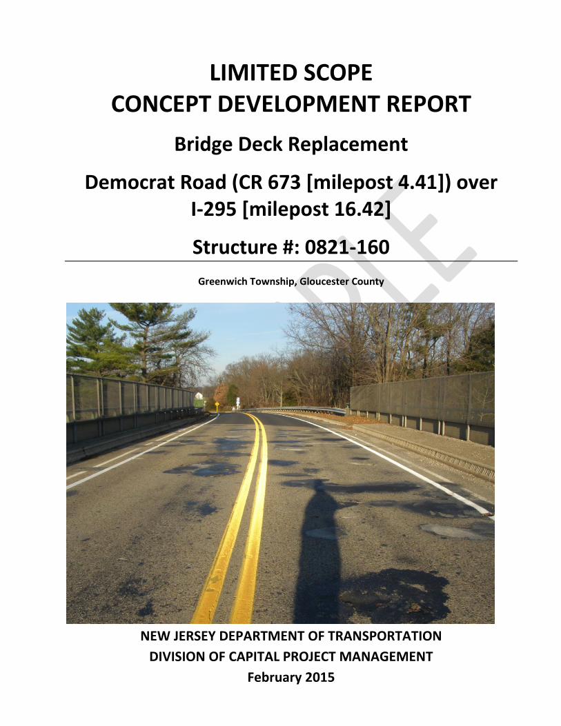
LIMITED SCOPE CONCEPT DEVELOPMENT REPORT
Bridge Deck Replacement
Democrat Road (CR 673 [milepost 4.41]) over I-295 [milepost 16.42]
Structure #: 0821-160
Greenwich Township, Gloucester County
NEW JERSEY DEPARTMENT OF TRANSPORTATION
DIVISION OF CAPITAL PROJECT MANAGEMENT
February 2015
LIMITED SCOPE CONCEPT DEVELOPMENT REPORT Bridge Deck Replacement
Democrat Road (CR 673 [milepost 4.41]) over I-295 [milepost 16.42]
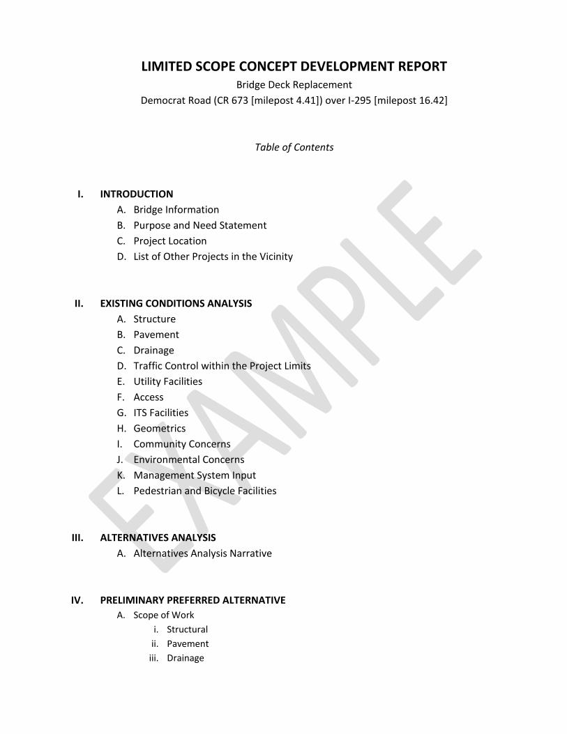
Table of Contents
I. INTRODUCTION
A. Bridge Information
B. Purpose and Need Statement
C. Project Location
D. List of Other Projects in the Vicinity
II. EXISTING CONDITIONS ANALYSIS
A. Structure
B. Pavement
C. Drainage
D. Traffic Control within the Project Limits
E. Utility Facilities
F. Access
G. ITS Facilities
H. Geometrics
I. Community Concerns
J. Environmental Concerns
K. Management System Input
L. Pedestrian and Bicycle Facilities
III. ALTERNATIVES ANALYSIS
A. Alternatives Analysis Narrative
IV. PRELIMINARY PREFERRED ALTERNATIVE
A. Scope of Work
i. Structural
ii. Pavement
iii. Drainage

PRELIMINARY PREFERRED ALTERNATIVE - continued
B. Anticipated Impacts to Existing Facilities
i. Utility
ii. Access
iii. ITS
C. Maintenance of Traffic During Construction
D. Controlling Substandard Design Elements to be addressed in a Design Exception Report.
E. Community Concerns
F. Environmental Document Summary
G. Pedestrian and Bicycle Facilities
List of Appendices
I. Appendix ‘A’ Concept Development Checklist
II. Appendix ‘B’ Structural SI&A Sheet
III. Appendix ‘C’ Location Map & Straight Line Diagram
IV. Appendix ‘D’ Photos
V. Appendix ‘E’ Detour Plan / Staging Plan
VI. Appendix ‘F’ Crash Data/Analysis
VII. Appendix ‘G’ Environmental Screening Report
VIII. Appendix ‘H’ As-Built Plans
IX. Appendix ‘I’ Final Design Scope Statement

I. INTRODUCTION
A. Bridge Information
The Democrat Road (CR 673) over I-295 structure was constructed in 1953. The structure is a two
span simply support structure comprised of composite riveted plate steel stringers. The out-to-
out width of the bridge is 41’, with a curb-to-curb width of 30’. The overall length of the bridge is
187’.
The bridge carries two lanes, one in each direction. A 6’ wide side walk exists on the westbound
side of the structure, while a 3’ safety walk exists on the eastbound side. A 3’ minimum shoulder
is provided on both sides.
B. Purpose and Need Statement
Purpose
The purpose is to rehabilitate the bridge deck to improve the service life of the structure.
Need
The Democrat Road (CR 673) over I-295 structure has been identified by the Bridge Management
System [BMS] and Structural Evaluation as being in need of rehabilitation.
Based on the Bridge Re-Evaluation Survey Report – Cycle 16, dated May 27, 2009, the overall
condition of the structure is satisfactory due to the substructure.
Since the previous inspection (Cycle 15 – 2007), the condition of the deck has been downgraded
from fair (5) to poor (4) due to numerous spalls and excessive scaling. The approach pavement
has also been downgraded from good to fair condition due to excessive alligator cracking of the
asphalt overlay.
Since the previous inspection, all other structural components have remained the same;
superstructure (good – 7) and substructure (satisfactory – 6).
Goals and Objectives
The structure is functionally obsolete due to the inadequate minimum vertical underclearance.
The deck is also structurally deficient due to large amounts of spalls and severe scaling.
Therefore, based on the structural deficiency and poor rating of the deck, the Bridge
Management System has recommended the replacement of the deck.
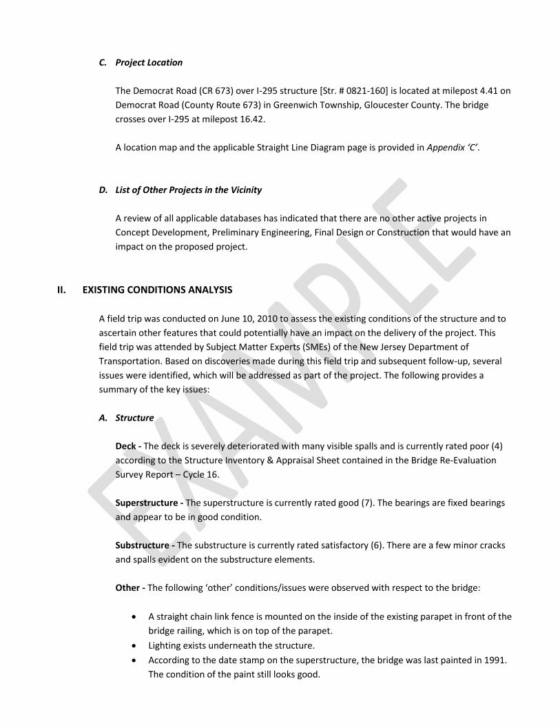
C. Project Location
The Democrat Road (CR 673) over I-295 structure [Str. # 0821-160] is located at milepost 4.41 on
Democrat Road (County Route 673) in Greenwich Township, Gloucester County. The bridge
crosses over I-295 at milepost 16.42.
A location map and the applicable Straight Line Diagram page is provided in Appendix ‘C’.
D. List of Other Projects in the Vicinity
A review of all applicable databases has indicated that there are no other active projects in
Concept Development, Preliminary Engineering, Final Design or Construction that would have an
impact on the proposed project.
II. EXISTING CONDITIONS ANALYSIS
A field trip was conducted on June 10, 2010 to assess the existing conditions of the structure and to
ascertain other features that could potentially have an impact on the delivery of the project. This
field trip was attended by Subject Matter Experts (SMEs) of the New Jersey Department of
Transportation. Based on discoveries made during this field trip and subsequent follow-up, several
issues were identified, which will be addressed as part of the project. The following provides a
summary of the key issues:
A. Structure
Deck - The deck is severely deteriorated with many visible spalls and is currently rated poor (4)
according to the Structure Inventory & Appraisal Sheet contained in the Bridge Re-Evaluation
Survey Report – Cycle 16.
Superstructure - The superstructure is currently rated good (7). The bearings are fixed bearings
and appear to be in good condition.
Substructure - The substructure is currently rated satisfactory (6). There are a few minor cracks
and spalls evident on the substructure elements.
Other - The following ‘other’ conditions/issues were observed with respect to the bridge:
A straight chain link fence is mounted on the inside of the existing parapet in front of the
bridge railing, which is on top of the parapet.
Lighting exists underneath the structure.
According to the date stamp on the superstructure, the bridge was last painted in 1991.
The condition of the paint still looks good.

Guide rail exists and is attached to the existing parapet in all four quadrants of the
structure.
A sign is posted on the structure indicating a vertical underclearance of 14’-2”.
A 6’ wide sidewalk exists on the westbound side of the structure. A 3’ wide safety walk
exists on the eastbound side. Both sidewalks are carried across the full length of the
structure, however, are not continued along the roadway.
B. Pavement
The existing structure consists of an 8-½” thick reinforced concrete deck. The deck has not been
overlaid.
The approach roadway pavement consists of a bituminous concrete riding surface. The condition
of the approach roadway pavement has been downgraded from good to fair condition due to
excessive alligator cracking. The existing pavement box consists of the following:
Bituminous Concrete, 2” thick
Bituminous Stabilized Base Course, 4” thick
Quarry Processed Stone Subbase, 6” thick
Subbase, 8” thick
This structure does not have approach or transition slabs.
C. Drainage
The approach roadway is curbed with inlets providing drainage. There are no inlets on scuppers
on the structure, nor did there appear to be a need for either as the profile of the roadway
provided positive drainage off of the structure to the inlets on the approaches.
D. Traffic Control within the Project Limits
There are no signalized intersections/ramps within the limits of the project. The existing on/off
ramps to I-295 are controlled with stop signs.
E. Utility Facilities
There are no aerial facilities within the limits of the project. In addition, there are no utility
facilities supported by the deck/superstructure that cross I-295.
F. Access
There are no driveways present within the limits of the project. Driveways do exist outside of the
on/off ramps to I-295 on both approaches.

G. ITS Facilities
ITS conduit does exist on I-295, however, there are no ITS components (above ground) within the
I-295/Democrat Road interchange.
ITS conduit/components do not exist on Democrat Road.
H. Geometrics
The vertical underclearance is posted as 14’-2”. Therefore, a Design Exception will be required for
this controlling substandard design element.
The existing superelevation rate for the horizontal curve on Democrat Road is substandard.
Therefore, a Design Exception will be required for this controlling substandard design element.
The existing stopping sight distance on Democrat road is substandard. Therefore, a Design
Exception will be required for this controlling substandard design element.
I. Community Concerns
There are very few residents within or close to the project limits. The concerns of the community
should be limited to work hours (noise), lane closures and detours during construction
(inconvenience)
J. Environmental Concerns
Based on the environmental screening, there does not appear to be any environmental issues
present at the project site.
K. Management System Input
In addition to the Bridge Management System, the following Management Systems have been
cross referenced:
Safety Management System - no issues within the limits of the project
Congestion Management System - no issues within the limits of the project
Drainage Management System - no issues within the limits of the project
L. Pedestrian and Bicycle Facilities
There are no sidewalks, other than on the westbound side of the structure, within the limits of
the project. As such, there are no pedestrian crosswalks within the limits of the project.
The existing shoulder, 3’ minimum and variable throughout the limits of the project, provides
sufficient width for bicycle use.

III. ALTERNATIVES ANALYSIS
A. Alternatives Analysis Narrative
The Democrat Road (CR 673) over I-295 structure has been identified by the Bridge Management
System [BMS] and Structural Evaluation as being in need of rehabilitation. The ratings of the
various elements of the structure, deck - poor (4), superstructure - good (7) and substructure -
satisfactory (6), indicates a limited ‘deck replacement’ scope of work as the overall riding purpose
of this project.
Based on the rating of the superstructure, ‘superstructure replacement’ option was not
considered. Likewise, based on the ratings of the superstructure and the substructure, a ‘full
replacement’ option was not considered.
In addition, based on the low volume of traffic on Democrat Road and the presence of feasible
detours for through traffic, the alternative of replacing the superstructure utilizing pre-cast
elements to minimize the impacts has been eliminated from consideration.
Therefore, the preferred alternative selected for advancement is a ‘deck replacement’ utilizing
traditional cast-in-place construction.
IV. PRELIMINARY PREFERRED ALTERNATIVE
A. Scope of Work
i. Structural - Replacement of the existing bridge deck is recommended. Further, it is
recommended that replacement be completed utilizing standard construction methods
(i.e., cast-in-place construction). This is feasible due to the low volume of traffic on
Democrat Road and the availability of an acceptable detour route.
The superstructure was last painted in 1991 and still appears in good condition. Painting
of the structure will not be a part of the scope of work for this project.
The superstructure is currently rated good (7) and does not require any repair work.
The substructure is currently rated satisfactory (6) and exhibits some minor cracking. It is
recommended that the minor cracks be repaired.
ii. Pavement – Democrat Road will be milled and paved on both approaches. The limits of
the milling and paving will be the gore of the on/off ramps from I-295 on both sides of
the structure, running approximately 360’ on both approaches. This will be a mill ‘x’, pave
‘x’ transition from the new deck.

iii. Drainage – No new drainage will be added within the limits of the project. All existing
drainage will be maintained at the same elevations.
B. Anticipated Impacts to Existing Facilities
i. Utility – There are no anticipated utility impacts. There are no aerial facilities within the
limits of the project. In addition, there are no utility facilities supported by the
deck/superstructure that cross I-295.
ii. Access – There are no anticipated access impacts. There are no driveways, residential or
commercial, within the limits of the project. There are driveways immediately outside of
the limits of the project. These driveways are to be maintained at all times during the
duration of the project.
iii. ITS – There are no anticipated ITS impacts.
C. Maintenance of Traffic During Construction (see Appendix ‘E’)
Democrat Road (County Route 673) will be closed to traffic at the project site. A detour has been
developed and has been approved in concept by Traffic Operations. The detour will need to be
further developed during the Final Design phase of work and will be submitted to Traffic
Operations for final approval.
In addition, Traffic Operations has provided approved lane closure hours for I-295.
D. Controlling Substandard Design Elements (CSDE’s) to be Addressed in a Design Exception
Report
The following Controlling Substandard Design Elements exist within the limits of the project and
will need to be addressed by a Design Exception:
i. Vertical Clearance – structure is currently posted for a minimum vertical clearance of 14’-
2”.
ii. Superelevation
iii. Horizontal Sight Distance
The existing crash history has been analyzed for the three most recent years available based on
the above three CSDE’s. The Crash Analysis Summary is included in Appendix ‘F’.
Reasonable Assurance that a Design Exception Report will be approved has been obtained based
on the above referenced CSDE’s and the provided Crash Analysis.

E. Community Concerns
The proposed improvements were presented to local officials and received a favorable response.
The proposed detour plan, utilizing State roadways (I-295), was also favorably received. The
community, local officials and property owners will be further consulted and apprised of the
proposed work as Final Design progresses.
F. Environmental Document Summary
The project is classified as a Categorical Exclusion (CE) and does not have any significant
environmental impacts.
G. Pedestrian and Bicycle Facilities
The existing pedestrian facility on the structure, 6’ sidewalk on the westbound side, will be
maintained on the new structure. There are no new pedestrian or bicycle facilities planned within
the limits of the project.

Appendix ‘A’
Concept Development
Checklist

Concept Development Checklist
Bridge Deck/Superstructure Replacement Project
Project Name: Democrat Road (CR 673) over I-295
Structure Number(s): 0821-160
Milepost 4.41+ (Democrat Road) and/or 16.42+ (I-295)
UPC Number: xxxxxx
Municipality(ies): Greenwich Township
County: Gloucester County
Project Manager: Xxxxxx Xxxx
CD Designer: Xxxxxx Xxxx
Notes:
All item checked “Y” or “N” shall be briefly discussed in the ‘Comments’ section below the checklist items.
NFI: Needs Further Investigation in Final Design (explain below).
Concept Development Checklist
A. Structural Scope Of Work
Y N N/A NFI
X
1. Is a Deck Replacement needed and warranted by the Deck Rating contained in the SI&A Sheet of the most recent Structural Evaluation and/or Bridge Inspection report? (provide the rating in the ‘Comments’ section below)
X
2. Is a Superstructure Replacement needed and warranted by the Superstructure Rating contained in the SI&A Sheet of the most recent Structural Evaluation? (provide the rating in the ‘Comments’ section below)
X 3. Are additional Structural Repairs required? (list required
repairs in the ‘Comments ’ section below)
X 4. Is the structure in need of painting? (list below in the
‘Comments’ section the year the structure was last painted)
X 5. Does the structure require the construction/installation

of seismic retrofit measures?
X 6. Is the structure considered ‘Scour Critical’?
X 7. Does the existing under-clearance meet design
standards? (list below in the ‘Comments’ section, the existing vertical clearance)
X 8. If the structure has a substandard under-clearance, has
reasonable assurance been obtained that a Design Exception can be obtained? **
X 9. Are approach/transition slabs present at the structures?
X 10. Do the existing approach/transition slabs require
rehabilitation/replacement?
X
11. For partial depth deck replacements, do the existing traffic barriers [parapets and bridge railings] meet design standards? (provide the SI&A rating in the ‘Comments’ section below)
Comments: 1. A replacement of the deck is warranted based on a deck rating of poor
‘4’.
2. A superstructure replacement is not warranted since the superstructure
is currently rated good ‘7’.
3. Based on the Bridge Re-Evaluation Survey Report – Cycle 16, and on
visual inspection, there are minor cracks in the existing abutments that
should be repaired.
4. Painting is not warranted. The structure was last painted in June 1991
and is still in good condition.
5. No seismic retrofit measures are required, however, it is recommended
that the two (2) span deck be made continuous.
6. The structure is not over water, therefore, not ‘scour critical’.
7. The existing under-clearance in the southbound right lane is posted at
14’-2”, below the minimum Federal Standard of 16’.
8. Reasonable assurance has been obtained from Value Management that a
Design Exception is warranted and could be obtained.
9. There are no approach or transition slabs on this structure.
10. Not applicable.
11. Not applicable.
** Coordination with the Department of Defense MUST be conducted on ALL Interstate
Structures where the existing/proposed vertical under-clearance is substandard. The
coordination is required if the resulting vertical under-clearance remains
substandard; whether the under-clearance is reduced, maintained, or improved.

B. Replacement Method Recommendation
Y N N/A NFI
X 1. Are traditional Cast-In-Place construction methods
recommended?
X 2. Is a Pre-Cast Deck replacement option recommended?
X 3. Is a Pre-Cast Superstructure replacement option
recommended?
Comments: 1. Due to the low volume of vehicular traffic on this roadway, traditional
cast-in-place construction is recommended
2. Due to the low volume of vehicular traffic on this roadway, and the added
cost of pre-cast construction, a pre-cast option is not recommended for
this project.
3. N/A – This is a deck replacement project and the replacement of the
superstructure is not warranted to accelerate construction as a traffic
mitigation option.
C. Traffic Management Recommendations
Y N N/A NFI
X 1. Staged Construction - Is it necessary and/or feasible?
Has conceptual approval been received from Traffic Operations?
X 2. Detour – Is it necessary and/or feasible? Has conceptual
approval been received from Traffic Operations?
X 3. Have Lane Closure Hours been obtained from Traffic
Operations? (approval from the Director of Traffic Operations is required)
X 4. Is there a need for a Temporary Bridge to maintain
vehicular traffic during construction?
X 5. Is there a need for a Temporary Bridge to maintain
pedestrian traffic during construction?
Comments: 1. Stage construction is feasible; however, only one-way alternating traffic
could be maintained during construction. This would significantly increase
the cost of construction. Therefore, staged construction, while feasible, is
not recommended.

2. A detour is a feasible option. All detoured traffic can be managed through
the I-295 interchanges to the north and south of the Democrat Road
interchange.
3. Lane Closure Hours have been obtained and are included in Appendix ‘E’
4. No – A detour will be used to maintain traffic during construction
5. No – While there is a sidewalk on the structure, there are no sidewalks on
either approach nor is there any evidence (worn paths) indicating
pedestrian traffic ever uses this structure. Additionally, there are very few
residences near the project.
D. Utility Facilities
Y N N/A NFI
X
1. Are there Aerial Facilities within the limits of the project? (provide a list of identified Aerial Facilities in the ‘Comments’ section below. Also, provide photos of existing facilities in an Appendix of the CD Report)
X
2. Are there existing facilities under the deck? (provide a list of identified Aerial Facilities in the ‘Comments’ section below. Also, provide photos of existing facilities in an Appendix of the CD Report)
X 3. Are there anticipated impacts to existing facilities as a
result of the proposed deck/superstructure replacement and related work activities?
Comments: 1. There are no aerial facilities within the limits of the project.
2. There are no utility facilities hanging from the deck or supported by the
superstructure.
3. No impacts are expected as a result of the proposed work.
E. ITS
Y N N/A NFI
X 1. Are there existing ITS facilities within the limits of the
project?
X 2. Are any new ITS components required within the limits
of the project?
Comments: 1. ITS facilities (conduit only) exist on I-295 within the limits of the project.
Since there will be no subsurface work on I-295, there will be NO impacts
to the existing conduit.
2. No new ITS facilities are required within the limits of the project.
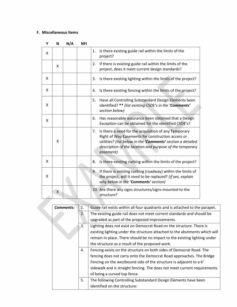
F. Miscellaneous Items
Y N N/A NFI
X 1. Is there existing guide rail within the limits of the
project?
X 2. If there is existing guide rail within the limits of the
project, does it meet current design standards?
X 3. Is there existing lighting within the limits of the project?
X 4. Is there existing fencing within the limits of the project?
X 5. Have all Controlling Substandard Design Elements been
identified? ** (list existing CSDE’s in the ‘Comments’ section below)
X 6. Has reasonable assurance been obtained that a Design
Exception can be obtained for the identified CSDE’s?
X
7. Is there a need for the acquisition of any Temporary Right of Way Easements for construction access or utilities? (list below in the ‘Comments’ section a detailed description of the location and purpose of the temporary easement)
X 8. Is there existing curbing within the limits of the project?
X 9. If there is existing curbing (roadway) within the limits of
the project, will it need to be replaced? (if yes, explain why below in the ‘Comments’ section)
X 10. Are there any signs structures/signs mounted to the
structure?
Comments: 1. Guide rail exists within all four quadrants and is attached to the parapet.
2. The existing guide rail does not meet current standards and should be
upgraded as part of the proposed improvements.
3. Lighting does not exist on Democrat Road on the structure. There is
existing lighting under the structure attached to the abutments which will
remain in place. There should be no impact to the existing lighting under
the structure as a result of the proposed work.
4. Fencing exists on the structure on both sides of Democrat Road. The
fencing does not carry onto the Democrat Road approaches. The Bridge
Fencing on the westbound side of the structure is adjacent to a 6’
sidewalk and is straight fencing. The does not meet current requirements
of being a curved top fence.
5. The following Controlling Substandard Design Elements have been
identified on the structure:
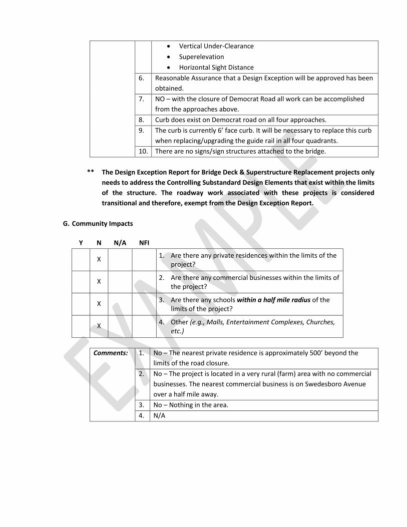
Vertical Under-Clearance
Superelevation
Horizontal Sight Distance
6. Reasonable Assurance that a Design Exception will be approved has been
obtained.
7. NO – with the closure of Democrat Road all work can be accomplished
from the approaches above.
8. Curb does exist on Democrat road on all four approaches.
9. The curb is currently 6’ face curb. It will be necessary to replace this curb
when replacing/upgrading the guide rail in all four quadrants.
10. There are no signs/sign structures attached to the bridge.
** The Design Exception Report for Bridge Deck & Superstructure Replacement projects only
needs to address the Controlling Substandard Design Elements that exist within the limits
of the structure. The roadway work associated with these projects is considered
transitional and therefore, exempt from the Design Exception Report.
G. Community Impacts
Y N N/A NFI
X 1. Are there any private residences within the limits of the
project?
X 2. Are there any commercial businesses within the limits of
the project?
X 3. Are there any schools within a half mile radius of the
limits of the project?
X 4. Other (e.g., Malls, Entertainment Complexes, Churches,
etc.)
Comments: 1. No – The nearest private residence is approximately 500’ beyond the
limits of the road closure.
2. No – The project is located in a very rural (farm) area with no commercial
businesses. The nearest commercial business is on Swedesboro Avenue
over a half mile away.
3. No – Nothing in the area.
4. N/A

H. Community Involvement Action Plan Recommendations - All Information to be obtained from the Office of Community and Constituent Relations
Y N 30 days or more
prior to FDS
30 days or less
prior to
Construction **
X 1. Officials Briefing X
X 2. Public Information
Center – Design
X 3. Public Information
Center – Construction X
X 4. Letters to Officials X X
X 5. Letters to Property
Owners X
X 6. Letters to all in zip
code/neighborhood
X 7. Kiosk or display in a
Public Place
X 8. Information on DOT
Website
X 9. Press release X
** Pre-Construction Officials Briefings and Pre-Construction Public Information Centers, if
required by O.C.C.R., should be held after the project has been awarded and should be
attended by the State’s Resident Engineer and by the Contractor.
I. Environmental Impacts/Concerns
Y N N/A NFI
X 1. Is the structure listed/eligible as Historic?
X 2. Is the structure within a Historic Corridor/District?
X 3. Are Wetlands Impacts possible as a result of the
proposed work?
X 4. Are Stream Encroachment Impacts possible as a result
of the proposed work?
X 5. Is there a potential for Hazardous Waste on the project?
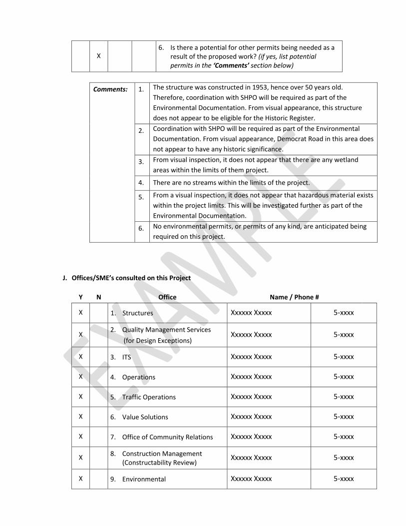
X 6. Is there a potential for other permits being needed as a
result of the proposed work? (if yes, list potential permits in the ‘Comments’ section below)
Comments: 1. The structure was constructed in 1953, hence over 50 years old.
Therefore, coordination with SHPO will be required as part of the
Environmental Documentation. From visual appearance, this structure
does not appear to be eligible for the Historic Register.
2. Coordination with SHPO will be required as part of the Environmental
Documentation. From visual appearance, Democrat Road in this area does
not appear to have any historic significance.
3. From visual inspection, it does not appear that there are any wetland
areas within the limits of them project.
4. There are no streams within the limits of the project.
5. From a visual inspection, it does not appear that hazardous material exists
within the project limits. This will be investigated further as part of the
Environmental Documentation.
6. No environmental permits, or permits of any kind, are anticipated being
required on this project.
J. Offices/SME’s consulted on this Project
Y N Office Name / Phone #
X 1. Structures Xxxxxx Xxxxx 5-xxxx
X 2. Quality Management Services
(for Design Exceptions) Xxxxxx Xxxxx 5-xxxx
X 3. ITS Xxxxxx Xxxxx 5-xxxx
X 4. Operations Xxxxxx Xxxxx 5-xxxx
X 5. Traffic Operations Xxxxxx Xxxxx 5-xxxx
X 6. Value Solutions Xxxxxx Xxxxx 5-xxxx
X 7. Office of Community Relations Xxxxxx Xxxxx 5-xxxx
X 8. Construction Management
(Constructability Review) Xxxxxx Xxxxx 5-xxxx
X 9. Environmental Xxxxxx Xxxxx 5-xxxx

X 10. Communications Xxxxxx Xxxxx 5-xxxx
K. Management Systems Cross-Check/Reference Cross-Checks
Y N
X 1. Safety
X 2. Drainage
X 3. Congestion
X 4. Pavement
X 5. Project Reporting System (PRS)
X 6. Operations
L. Funding/Authorization Information
Y N
X 1. Is the Project Programmed in the STIP for all Phases of
Work? Please provide Line Item info below
2. What is the anticipated FD authorization date and
estimate? Provide info below
3. What is the anticipated CON authorization date and
estimate? Provide info below
X 4. THIS PROJECT IS EXEMPT FROM CONFORMITY
Comments: 1. Yes, Federal Bridge Deck / Superstructure Line item
2. XXXX
3. XXXX

M. Verification of Limited Scope Project Development
Y N
X
Based on the information obtained/observed during the field visit, input obtained from SME’s, and coordination/cross-checks with the various Management Systems, does the proposed scope of work for this project fit the definition of a ‘Limited Scope Project’?
Approved:
(Insert Name), Project Manager Date
Appendix ‘B’
Structural SI&A Sheet
Provide all pages of the Structural SI&A form.
Appendix ‘C’
Location Map & Straight Line
Diagram
Provide an aerial map of the project location (Google Earth) with
the project site identified.
and
Provide the Straight Line Diagram Sheet(s) with the project site
identified.
Appendix ‘D’
Photos
Provide photos to clearly highlight the issues & elements
discussed in the CD Report and the CD Checklist.
Appendix ‘E’
Detour Plan / Staging Plan
&
Approved Lane Closure Hours
Provide a schematic of feasible detour route if traffic is to be
detoured during construction.
or
Provide a preliminary staging schematic to the detail necessary to show that traffic can be maintained during construction.
also,
Provide a copy of the approved Lane Closure Hours memo as
provided from Traffic Operations.
Appendix ‘F’
Crash Data/Analysis
Include crash analysis if there are controlling substandard design
elements identified within the limits of the project for which a
Design Exception will be required.
Appendix ‘G’
Environmental Screening
Report
Include a copy of the Environmental Screening Report, which is to
be provided by the Bureau of Landscape Architecture and
Environmental Solutions.

Appendix ‘H’
As-Built Plans
Attach as-built plans if available.
or
Provide as-built plans on disc if not feasible to include in the CD
Report.

Appendix ‘I’
Final Design Scope Statement
This is the Final Design Scope Statement.