LIFE Viva Grass Recommendations on Ecosystem-based ... · The LIFE Viva Grass project, implemented...
40
LIFE Viva Grass Recommendations on Ecosystem-based Planning and Grassland Management
Transcript of LIFE Viva Grass Recommendations on Ecosystem-based ... · The LIFE Viva Grass project, implemented...
LIFE Viva Grass Recommendations on Ecosystem-based Planning and Grassland Management
LIFE Viva Grass Recommendations on Ecosystem-based Planning and Grassland Management
Authors: Anda Ruskule (BEF LV), Justas Gulbinas (BEF LT), Dana Prižavoite (BEF LV), Edgars Bojārs (BEF LV), Kristīna Veidemane (BEF LV), Žymantas Morkvėnas (BEF LT), Merle Kuris (BEF EE), Laura Remmelgas (BEF EE), Oļģerts Nikodemus (UL), Miguel Villoslada Pecina (EMU), Kalev Sepp (EMU)
Photos: Dace Iraids, Žymantas Morkvėnas, Rita Grinienė, Merle Kuris, Dace Strigune, Anda Ruskule, Gints Gārša, Inta Ādamsone
Design and layout: Lolita Piterniece
Language editor: Līvija Anna Uskale
© Baltic Environmental Forum 2019
The brochure is produced within the frame of the LIFE+ Environment Policy and Governance project “Integrated planning tool to ensure viability of grasslands” (LIFE Viva Grass, project No. LIFE13 ENV/LT/000189). The content of this publication and use of information it contains is the sole responsibility of the Baltic Environmental Forum and can in no way be taken to reflect the views of the European Union.
Prepared with a contribution from the EU LIFE Programme, Ministry of the Environment of the Republic of Lithuania, Administration of Latvian Environmental Protection Fund and Estonian Environmental Investment Centre.
1
ForewordThe LIFE Viva Grass project, implemented from June 2014 until April 2019, aims to support maintenance of biodiversity and ecosystem services provided by grasslands, through encouraging ecosystem-based planning and economically viable grassland management. As part of its preparatory actions, the project has performed an analysis of the policies and regulatory framework influencing the maintenance of grassland ecosystems in the Baltic States, evaluated existing experience in grassland management and studied best practice examples. The major task of the project was the development of an integrated planning tool, which could operationalise the ecosystem services concept into decision-making on grassland management in various planning contexts. The application of the tool ranges from a farmer’s choice of the most suitable management practices, grassland related land use and development planning by municipalities, management planning of protected areas, through to national policy-making - tailoring the rural support programmes.
The recommendations presented here have been developed based on the policy and best practice analysis, the experience of testing the tool application in the 9 case study areas (including farm, municipality and regional level) as well as several rounds of discussions at various stakeholders’ events. The aim of the recommendations is to improve the integrity of the decision-making and governance process for maintaining grassland biodiversity through optimising coordination between nature conservation and rural development policies, as well as integrating an ecosystem-based approach in land use and spatial planning. The recommendations are targeted towards policy-makers from competent authorities, as well as practitioners in Lithuania, Latvia and Estonia.
2
Content
Content ................................................................................................................ 2
Introduction ........................................................................................................ 3
Recommendations to support maintenance of grassland biodiversity and ecosystem services provided by grasslands ....................... 5
Recommendations to promote ecosystem-based planning and land management ...................................................................... 23
Recommendations to promote application of the integrated planning tool into daily processes of public administration at national, regional and municipality level ................................................... 35
3
Introduction Grasslands are among the most biologically diverse ecosystems in the world, providing a wide range of the ecosystem services essential for human welfare, e.g. biomass production for grazing animals, carbon storage, flood reduction, erosion prevention, water infiltration and purification, habitats for pollinators and protected species, etc. At the same time, semi-natural grasslands are among the most threatened habitat types in Europe – a substantial decrease in area and connectivity has been observed since the mid-20th century and the quality of the grassland habitats continues to deteriorate. This is also the case in the Baltic States, where the unfavourable conservation status of the semi-natural habitats has been confirmed by the last report of the Member States to the European Commission under the Article 17 requirements of the Habitats Directive.
The policy analysis, carried out within the LIFE Viva Grass project, confirms that the EU Common Agricultural Policy (CAP) is the strongest driver for the change in land use in the Baltic States, as well as the most influential policy instrument determining the grassland management practices and thus impacting the status of grassland ecosystems and services they provide. The financial contribution of CAP for the measures to support biodiversity maintenance is considerably higher compared to other financial mechanisms financing nature conservation. CAP and the national Rural Development Programmes (RDP) in the Baltic States support measures for maintaining grasslands and have thus minimised the trend of grassland abandonment. However, the assessment of the status of semi-natural grasslands indicates that the implementation of the RDP measures has not been efficient in halting the decline of grassland quality and thus also many of the ecosystem services provided by grasslands. The drawbacks of the rural support policy are related to rather superficial conditions for implementation of the agri-environmental measures as well as a non-motivating support policy, which is targeted more towards agriculture production, disregarding the public benefits resulting from ecosystem services provided by grasslands (e.g. healthy environment, amenities, opportunities for recreation, security etc.).
A nature conservation policy and related financing instruments (including national and EU, e.g. LIFE + programme) provides support for the restoration of semi-natural grasslands,
4
guidance on suitable management practices, as well as data collection and administration on distribution and quality of semi-natural grasslands. However, the nature conservation measures and financial resources are not sufficient for long-term maintenance of grassland biodiversity, and therefore the CAP support is acknowledged as the main financial instrument for achieving biodiversity conservation targets. This, however, requires close co-operation and coordination between the two sectors - agriculture and nature conservation - which so far has not been achieved in the Baltic States.
The ecosystem service approach offers a holistic view on interactions between nature and humans, thus providing a suitable framework for policy and decision-makers to address conflicts and synergies between environmental and socio-economic goals and to balance different interests. Application of the ecosystem service approach in rural support policy would facilitate integration of ecological principles into agricultural practice and better targeting of interventions to areas with suitable agro-ecological conditions, thus increasing the efficiency and multi-functionality of the measures applied, as well as stimulating synergies between agricultural production and other ecosystem services. The ecosystem service approach can also be operationalised through spatial planning practices by defining the land use priorities based on the ecosystem service supply potential, as well as assessing trade-offs of different development alternatives. The Viva Grass integrated planning tool is designed to support application of the ecosystem service approach in land use planning and sustainable grassland management.
Following the objectives of the LIFE Viva Grass project, as well as the concerns and opportunities described above, we have developed recommendations on how to:
Ò support maintenance of grassland biodiversity and ecosystem services provided by grasslands;
Ò foster ecosystem-based planning and land management;
Ò promote application of the integrated planning tool into daily processes of public administration at national, regional and municipality level.
5
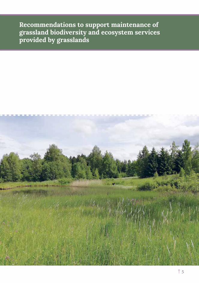
Recommendations to support maintenance of grassland biodiversity and ecosystem services provided by grasslands
6
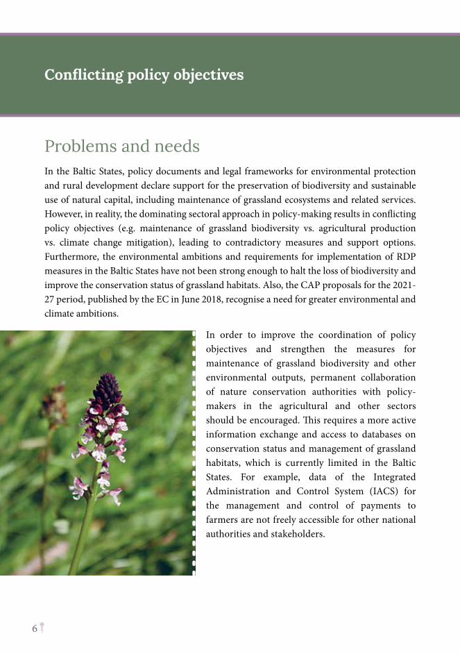
Problems and needsIn the Baltic States, policy documents and legal frameworks for environmental protection and rural development declare support for the preservation of biodiversity and sustainable use of natural capital, including maintenance of grassland ecosystems and related services. However, in reality, the dominating sectoral approach in policy-making results in conflicting policy objectives (e.g. maintenance of grassland biodiversity vs. agricultural production vs. climate change mitigation), leading to contradictory measures and support options. Furthermore, the environmental ambitions and requirements for implementation of RDP measures in the Baltic States have not been strong enough to halt the loss of biodiversity and improve the conservation status of grassland habitats. Also, the CAP proposals for the 2021-27 period, published by the EC in June 2018, recognise a need for greater environmental and climate ambitions.
In order to improve the coordination of policy objectives and strengthen the measures for maintenance of grassland biodiversity and other environmental outputs, permanent collaboration of nature conservation authorities with policy-makers in the agricultural and other sectors should be encouraged. This requires a more active information exchange and access to databases on conservation status and management of grassland habitats, which is currently limited in the Baltic States. For example, data of the Integrated Administration and Control System (IACS) for the management and control of payments to farmers are not freely accessible for other national authorities and stakeholders.
Conflicting policy objectives

7
Solutions Ò Policy development: The ecosystem service
(ES) approach as a holistic concept illustrating the complex relationship between people and nature should be applied in policy development, starting from horizontal strategic long-term policy documents up to single sector policies and programmes. It can be integrated into policy development and strategic impact assessment processes, to reveal trade-offs in ES supply resulting from different policy scenarios or targets. The ES concept can also provide a comprehensive framework for illustrating interdependencies and conflicts between policy sectors, thus helping to balance conflicting policy objectives and support programmes.
Ò Collaboration: Alignment of the policy objectives can be ensured only by strong coordination and cooperation between the interrelated policy sectors, like nature conservation and agriculture. Besides the comprehensive overview of the policy interrelations provided by the ES concept, it also requires a stronger position of the environmental sector at the policy-maker level, supported by data and knowledge on the functioning of ecosystems. In order to increase the competence and confidence of the nature conservation sector we suggest establishing a collaboration platform for competent authorities of nature conservation in the Baltic States to facilitate information exchange and a common position on environmental targets and the design of agri-environmental measures.
Ò Data management: To support cooperation among sectors in the design of rural support policy, more flexible access to farming data (e.g. IACS) and nature conservation databases should be provided to the involved institutions and experts.
Recommendation: Cross-sectoral coordination in policy development should be improved in order to avoid conflicting policy objectives or measures
8
Problems and needsThe Common Agricultural Policy (CAP) is the dominating EU funding mechanism for supporting environmental and climate action. Considering the expected reduction of the CAP budget, the funding available within RDPs remains critical to halt the loss of biodiversity and to address other environmental issues, such as mitigation of climate change, ensuring good water quality, etc. Therefore, the EC as well as national policy-makers should establish more targeted support conditions and measures for reaching the environmental objectives.
So far, the CAP objectives in relation to the environment have been very superficial and not directly linked to the obligations of EU legislation and policies, e.g. maintaining the favourable conservation status for habitat types and species of Community interest from the Habitats Directive, Annex I. This has resulted in a lack of environmental ambitions in the RDPs of the Baltic States leading to insufficiently targeted and non-effective measures to meet the environmental and biodiversity objectives. Also, the ‘greening measures’, invented in CAP Pillar I in the 2014-2020 period, in the Baltic States, as in most of the EU countries, have not been effective in delivering the desired environmental results.
Furthermore, the more favourable support conditions under Pillar I have often stimulated a shift towards intensive agricultural practices instead of applying agri-environmental measures supported by RDPs within Pillar II, including maintenance or restoration of semi-natural grasslands. The Viva Grass integrated planning tool reveals that land, which based on its agro-ecological conditions would be suitable for maintaining semi-natural grasslands, is often cultivated or used as arable land.
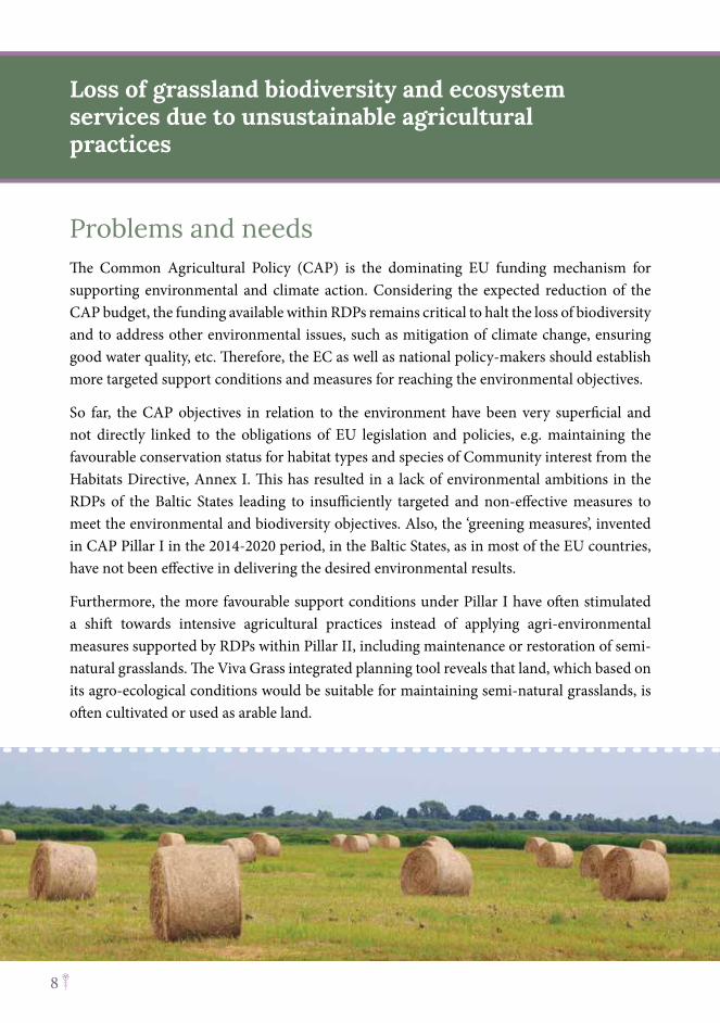
Loss of grassland biodiversity and ecosystem services due to unsustainable agricultural practices
9
Solutions Ò Competitive support conditions: The level of support in monetary terms for extensive
grassland management should be competitive compering to intensive agriculture practices in order to avoid the loss of semi-natural habitats and related ecosystem services.
Ò Targeted measures: To ensure efficient use of the limited funding resources: i) agri-environmental schemes should be more targeted to specific environmental objectives of the EU and national legal obligations; ii) more specialised measures should be designed to address specific protection needs/management requirements of threatened species and habitats; iii) measures should be targeted to areas with the highest potential for reaching desirable results (e.g. protected areas).
Ò Coherent approach in design of measures across both CAP Pillars for delivering environmental outcomes: The eco-schemes of Pillar I should be complementary and synergetic with the agri-environmental measures of Pillar II. This can be achieved by applying a tiered approach, where more general schemes with broader objectives are topped up by more targeted schemes with more specific management requirements. For example, maintenance of permanent grasslands can be ensured by eco-schemes, while agri-environmental measures target the needs of specific habitats and species of Community importance.
Ò Areas eligible for support under both Pillars should not exclude environmentally valuable habitats, including semi-natural grasslands with trees and shrubs (e.g. wooded meadows or pastures) as well as groups of trees forming landscape elements. In the case of Estonia, areas eligible for maintenance of semi-natural grassland shall not be limited to protected areas, which is not the case in Latvia and Lithuania.
Ò Non-productive investments should be applied for restoration of semi-natural grassland habitats as well as the creation of landscape features. RDP support for grassland restoration is currently not available in Latvia and only to a very limited extent in Lithuania, while in Estonia it is available from national funding.
Ò The number of grazing animals should be adequate through support schemes of both Pillars to make use of grass from semi-natural grasslands.
Recommendation: Allocation of the rural support funding should be improved to achieve the environmental & biodiversity objectives
10
Loss of grassland biodiversity and ecosystem services due to unsustainable agricultural practices
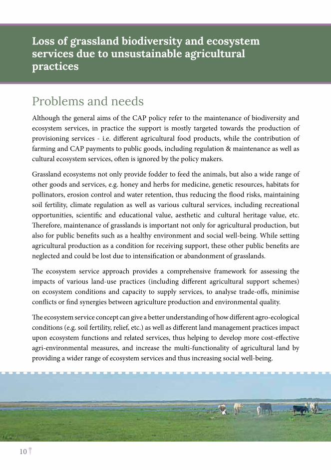
Problems and needsAlthough the general aims of the CAP policy refer to the maintenance of biodiversity and ecosystem services, in practice the support is mostly targeted towards the production of provisioning services - i.e. different agricultural food products, while the contribution of farming and CAP payments to public goods, including regulation & maintenance as well as cultural ecosystem services, often is ignored by the policy makers.
Grassland ecosystems not only provide fodder to feed the animals, but also a wide range of other goods and services, e.g. honey and herbs for medicine, genetic resources, habitats for pollinators, erosion control and water retention, thus reducing the flood risks, maintaining soil fertility, climate regulation as well as various cultural services, including recreational opportunities, scientific and educational value, aesthetic and cultural heritage value, etc. Therefore, maintenance of grasslands is important not only for agricultural production, but also for public benefits such as a healthy environment and social well-being. While setting agricultural production as a condition for receiving support, these other public benefits are neglected and could be lost due to intensification or abandonment of grasslands.
The ecosystem service approach provides a comprehensive framework for assessing the impacts of various land-use practices (including different agricultural support schemes) on ecosystem conditions and capacity to supply services, to analyse trade-offs, minimise conflicts or find synergies between agriculture production and environmental quality.
The ecosystem service concept can give a better understanding of how different agro-ecological conditions (e.g. soil fertility, relief, etc.) as well as different land management practices impact upon ecosystem functions and related services, thus helping to develop more cost-effective agri-environmental measures, and increase the multi-functionality of agricultural land by providing a wider range of ecosystem services and thus increasing social well-being.
11
Solutions Ò Increasing multi-functionality of agricultural land: Impacts of proposed measures on
an ecosystem service supply should be assessed, thus helping to design multi-functional agri-environmental schemes, which support different policy objectives. Measures for enhancing particular ecosystem services should be developed, e.g. maintaining grasslands on organic soils, to reduce CO2 emissions, and on slopes - to reduce erosion risks, as well as buffer strips along the water bodies for removal of nutrients etc.
Ò Applying a territorial approach: Precise criteria for the target areas of the interventions should be defined based on species and habitat distribution, possible threats or pressures, as well as agro-ecological conditions which determine the capacity of the ecosystem to supply services. Thus, the measures can be targeted to areas where they would address the specific environmental problem or protection needs, as well as increasing the synergies or multi-functionality in the ecosystem service supply.
Ò Considering the public benefits when calculating the payments for measures: Ecological or ecosystem service value should be included in calculations of the support level. Based on the calculations of a potential ecosystem service supply, a coefficient for delivered public benefits should be applied as a supplement in addition to compensation of the management costs.
Recommendation: Rural support policy should integrate the ecosystem service concept to ensure compliance with environmental & biodiversity objectives
The Viva Grass tool can be used in the development of support schemes under new CAP Strategic Plans by targeting the measures to areas with suitable agri-environmental conditions or the highest potential in an ecosystem service supply (e.g. based on ecosystem service mapping results, hot-spot & cold-spot analysis).
12
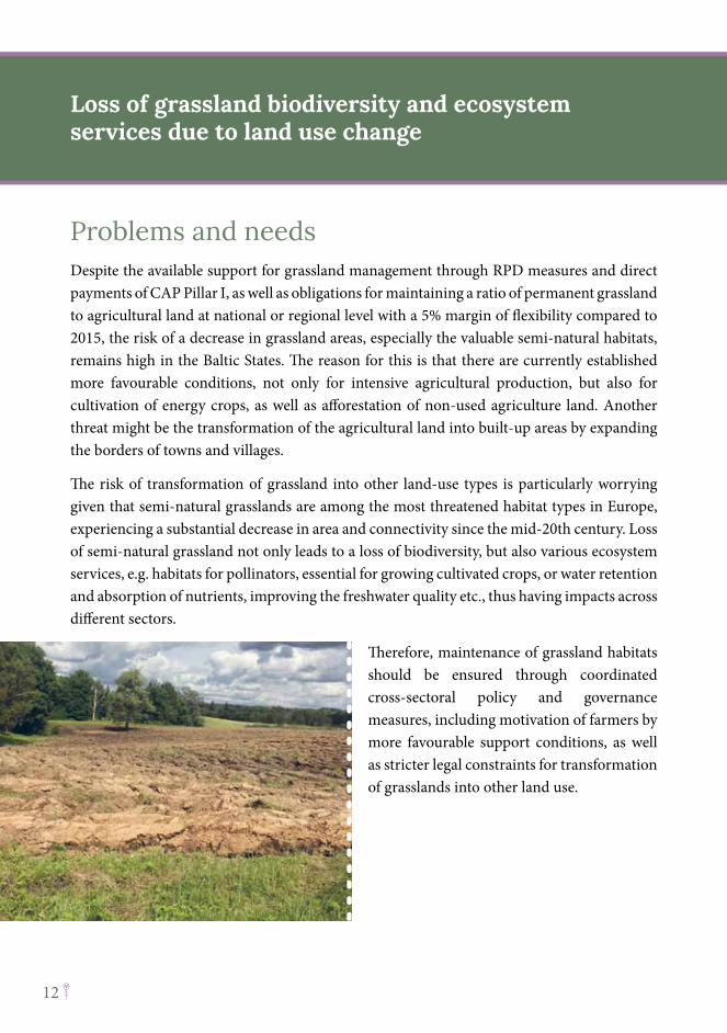
Problems and needsDespite the available support for grassland management through RPD measures and direct payments of CAP Pillar I, as well as obligations for maintaining a ratio of permanent grassland to agricultural land at national or regional level with a 5% margin of flexibility compared to 2015, the risk of a decrease in grassland areas, especially the valuable semi-natural habitats, remains high in the Baltic States. The reason for this is that there are currently established more favourable conditions, not only for intensive agricultural production, but also for cultivation of energy crops, as well as afforestation of non-used agriculture land. Another threat might be the transformation of the agricultural land into built-up areas by expanding the borders of towns and villages.
The risk of transformation of grassland into other land-use types is particularly worrying given that semi-natural grasslands are among the most threatened habitat types in Europe, experiencing a substantial decrease in area and connectivity since the mid-20th century. Loss of semi-natural grassland not only leads to a loss of biodiversity, but also various ecosystem services, e.g. habitats for pollinators, essential for growing cultivated crops, or water retention and absorption of nutrients, improving the freshwater quality etc., thus having impacts across different sectors.
Therefore, maintenance of grassland habitats should be ensured through coordinated cross-sectoral policy and governance measures, including motivation of farmers by more favourable support conditions, as well as stricter legal constraints for transformation of grasslands into other land use.
Loss of grassland biodiversity and ecosystem services due to land use change
13
Solutions Ò Competitive support conditions: As noted above
the available support for the maintenance of semi-natural grasslands should be competitive with other land uses, which can be ensured by consideration of the public benefits (i.e. ecosystem service supply) provided by grasslands in calculation of the rural support payments.
Ò Legal constraints for transformation of grassland into other land uses: All grasslands should be assessed with regard to their biodiversity value as well as their potential to supply ecosystem services. Transformation of grassland should be avoided as much as possible in areas with a high potential of ecosystem service supply and in cases of habitat types and species of Community interest of the Habitats Directive, Annex I.
Ò Better coordination of the national data sets on grassland habitats of high biological value and agricultural land use, as well as better monitoring of the status of grasslands is required to support local authorities in land use planning and decision-making on land transformation. Habitat data should be intersected with declaration data for agricultural support each year, to see changes in the distribution of habitats due to changes to arable land or other factors.
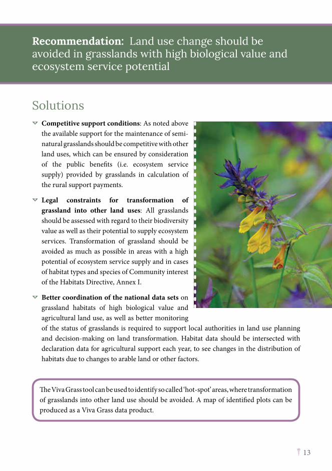
Recommendation: Land use change should be avoided in grasslands with high biological value and ecosystem service potential
The Viva Grass tool can be used to identify so called ‘hot-spot’ areas, where transformation of grasslands into other land use should be avoided. A map of identified plots can be produced as a Viva Grass data product.
14
Problems and needsGrasslands are often left unmanaged due to unreasonable administrative constraints when applying for agricultural support. This includes eligibility criteria for receiving the support from CAP Pillar I and II, set at EU level or by national authorities. Although the eligibility criteria have been broadened for the 2014-2020 period, there is still a requirement for a ‘minimum level of farming activity’, thus putting constraints on the management of marginal or very extensively used agricultural land, which might be of high value from an environmental perspective. Also, the new CAP proposal for the 2021-2027 period suggests that support shall not be granted to those, whose agricultural activity forms only an insignificant part of their overall economic activity or whose principal business activity is not agriculture. This condition can exclude NGOs and local authorities, which manage the land for environmental purposes, from being eligible.
In Lithuania, there are constraints in applying for RDP support for management of grassland habitats in cities (within protected areas), where private stakeholders cannot rent out the grassland plots and receive the RDP support. Similar problems concern the management of grasslands and wetlands, which are officially registered as forest land and administered by the State Forest Service of Lithuania. Transformation of forest grassland plots to agricultural land could be difficult, since this would lead to a decrease of the share of forest land, which is connected to the percentage of annual cutting. Thus, changing the administration rules of measures or the law of the land would provide a solution in this situation.
The nationally set eligibility criteria can also exclude areas of high biological value. For example, due to excluding areas with trees and shrubs, in Estonia the RDP support is not available for management of wooded meadows.
Loss of grassland biodiversity and ecosystem services due to administrative constraints
15
Solutions Ò Eligibility for support: In developing the new CAP and national strategic plans countries
should ensure that eligibility criteria do not exclude areas of ecologically valuable habitats, as well as management practices which are aimed at delivering environmental outputs, instead of agriculture production.
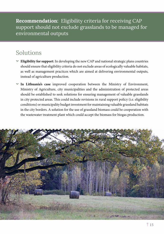
Ò In Lithuania’s case improved cooperation between the Ministry of Environment, Ministry of Agriculture, city municipalities and the administration of protected areas should be established to seek solutions for ensuring management of valuable grasslands in city protected areas. This could include revisions in rural support policy (i.e. eligibility conditions) or municipality budget investment for maintaining valuable grassland habitats in the city borders. A solution for the use of grassland biomass could be cooperation with the wastewater treatment plant which could accept the biomass for biogas production.
Recommendation: Eligibility criteria for receiving CAP support should not exclude grasslands to be managed for environmental outputs
16
Problems and needsInvasive alien species are a serious and growing problem across the European Union. They are a major cause of biodiversity loss, inflicting economic and social damage that costs the European economy over EUR 12 billion per year. Invasive alien plants are leading to a reduction in local plant biodiversity and having severe negative impacts on a variety of ecosystems and their provided services. Sustainable solutions and appropriate eradication methods must be developed to stop the spread of an invasive alien species. The EU Regulation on Invasive Alien Species, which entered into force in 2015, provides a Europe-wide framework for action to prevent, minimise and mitigate their adverse impacts on biodiversity, the economy and human health.
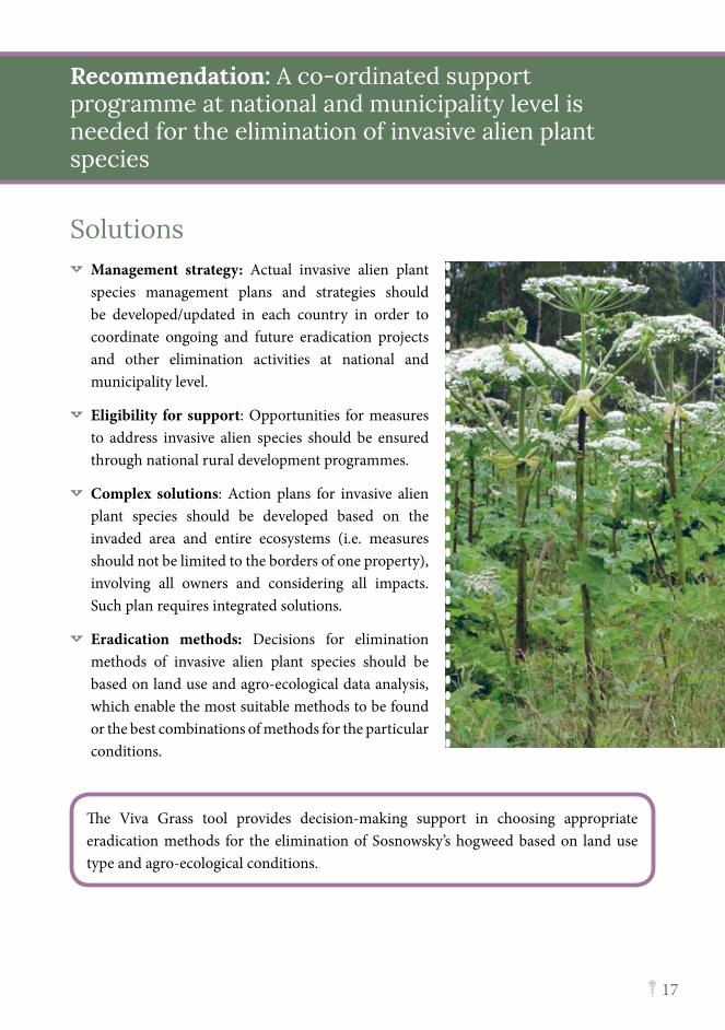
A common invasive alien plant species in all the Baltic States is Sosnowsky’s hogweed (Heracleum sosnowskyi). This is one of the most dangerous invasive species in the Baltics - because of its rapid spread and proliferation and high growth, it is endangering the natural biotic communities. The support and effective governance measures for eradication of invasive alien Sosnowsky’s hogweed have so far been insufficient in all the countries.
Estonia has developed a management plan for Sosnowsky’s hogweed to reduce its negative impact on the environment; the eradication of the alien hogweed species is coordinated by the Environmental Board and financed by the Environmental Investment Centre. In Latvia, such a national level plan was in place between 2006 and 2012, although some municipalities have their own plans and coordinated activities for Sosnowsky’s hogweed eradication. Between 2007-2008, several legal acts were adopted to localise and eradicate the species. Although the national legislation allows the penalisation of land owners who have the invasive species on their land, there were still more than 10 thousand ha of invaded areas in 2016 in Latvia. The national inventory of plots invaded by the Sosnowsky’s hogweed was completed in 2014 in Lithuania. There were several initiatives and plans developed by some municipalities to eradicate the species in their territories. Currently, the Ministry of Environment is planning to initiate the process of updating certain policies to oblige private landowners to eradicate Sosnowsky’s hogweed on their land.
Loss of grassland biodiversity and ecosystem services due to expansion of invasive alien plant species
17
Solutions Ò Management strategy: Actual invasive alien plant
species management plans and strategies should be developed/updated in each country in order to coordinate ongoing and future eradication projects and other elimination activities at national and municipality level.
Ò Eligibility for support: Opportunities for measures to address invasive alien species should be ensured through national rural development programmes.
Ò Complex solutions: Action plans for invasive alien plant species should be developed based on the invaded area and entire ecosystems (i.e. measures should not be limited to the borders of one property), involving all owners and considering all impacts. Such plan requires integrated solutions.
Ò Eradication methods: Decisions for elimination methods of invasive alien plant species should be based on land use and agro-ecological data analysis, which enable the most suitable methods to be found or the best combinations of methods for the particular conditions.
Recommendation: A co-ordinated support programme at national and municipality level is needed for the elimination of invasive alien plant species
The Viva Grass tool provides decision-making support in choosing appropriate eradication methods for the elimination of Sosnowsky’s hogweed based on land use type and agro-ecological conditions.
18
Problems and needsOne of the major drivers for decreasing the grassland area all over Europe is the decline of extensive livestock systems, based on using grass biomass as fodder. Estimates show that in areas with less developed agriculture, a large share of available grassland biomass is not used for animal feeding and is wasted, including the biomass from grasslands managed using the CAP support. Therefore, considering the comparatively low support level for maintenance of grasslands, as well as other previously described administrative constraints, grasslands are often converted to arable land, afforested or just abandoned.
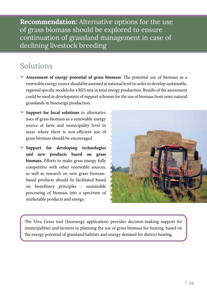
However, the grassland biomass has the potential to be used as a renewable energy source, either as a solid biomass fuel for direct combustion and heat generation, or for production of biogas and other biofuels. For example, the experience from Matsalu National Park, in Estonia, shows that grass from local semi-natural habitats (e.g. coastal meadows, including reedbeds) can be successfully used in district heating by burning the grass bales in the boiler house of Lihula. Another option is to add grass biomass to other substrates (e.g. agricultural waste - plant and animal residues, manure) used for biogas production in existing biogas plants. New technologies for biofuel production based on grass biomass are being developed, including small scale biogas production facilities, which could be operated by one farm or groups of farmers for cogeneration of heat and electricity for own needs.
At present, technologies for energy production from grass biomass are not widely used - in most cases, the production costs are too high to compete with fossil fuels or even with other renewables. e.g. wood, hydropower. However, this may change soon taking into account the limitations in the reserves of fossil fuels and rising concern about the global climate change. Grass pellets can already compete with other products in certain conditions.
The value of grass biomass can expand beyond bioenergy - it should be considered as the raw material for obtaining various chemical substances and fibres, truly implementing the concept of bioeconomy, highly supported at European Union level.
Non-efficient use of grass biomass due to a decline of livestock breeding
19
Solutions Ò Assessment of energy potential of grass biomass: The potential use of biomass as a
renewable energy source should be assessed at national level in order to develop sustainable, regional specific models for a RES mix in total energy production. Results of the assessment could be used in development of support schemes for the use of biomass from semi-natural grasslands in bioenergy production.
Ò Support for local solutions to alternative uses of grass biomass as a renewable energy source at farm and municipality level in areas where there is non-efficient use of grass biomass should be encouraged.
Ò Support for developing technologies and new products based on grass biomass. Efforts to make grass energy fully competitive with other renewable sources, as well as research on new grass biomass-based products should be facilitated based on biorefinery principles - sustainable processing of biomass into a spectrum of marketable products and energy.
Recommendation: Alternative options for the use of grass biomass should be explored to ensure continuation of grassland management in case of declining livestock breeding
The Viva Grass tool (bioenergy application) provides decision-making support for municipalities and farmers in planning the use of grass biomass for heating, based on the energy potential of grassland habitats and energy demand for district heating.
20
Problems and needsExperience from Europe as well as best practice examples from the Baltic States show that economic viability of grassland management can be increased by supporting the multi-functional use of grasslands, diversification of income from different grassland products and provided services, as well as strengthening the cooperation networks among the farmers in grassland management, new product development and marketing, as well as development of local supply chains.
However, due to the historical background – the bad experiences with collectivisation during the Soviet period, farmers in the Baltic States are still rather resistant to different forms of cooperation. Therefore, examples of successful co-operation in grassland management and development and marketing of grassland products should be advertised more.
The new CAP proposal aims to support several forms of co-operation within Pillar II, including preparation and implementation of projects as part of the European Innovation Partnership for agricultural productivity and sustainability, cooperation as part of the community-led local development (LEADER), promotion of quality schemes, cooperation with producer organisations and groups as well as ‘other forms of cooperation’, which includes collective and multi-actor approaches for environmental and climate change actions, promoting short supply chains and local markets, community-supported agriculture etc. Use of these opportunities should be promoted more in the Baltic States.
The ecosystem service concept helps to realise the different benefits provided by grasslands and thus increase the multi-functionality, promoting diversified income opportunities, as well as demonstrating the cooperation potential, since production of ecosystem services usually goes beyond the single farm. However, applying new approaches and innovative solutions requires new knowledge and skills, therefore capacity-building of farmers should be promoted.
Lack of interest by farmers in grassland management due to its low economic viability
21
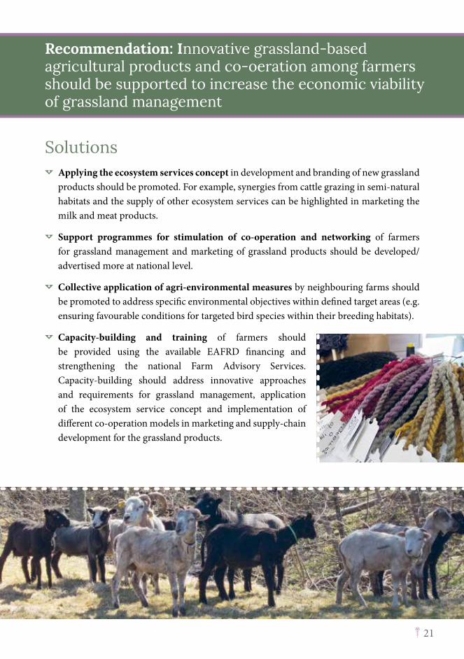
Solutions Ò Applying the ecosystem services concept in development and branding of new grassland
products should be promoted. For example, synergies from cattle grazing in semi-natural habitats and the supply of other ecosystem services can be highlighted in marketing the milk and meat products.
Ò Support programmes for stimulation of co-operation and networking of farmers for grassland management and marketing of grassland products should be developed/advertised more at national level.
Ò Collective application of agri-environmental measures by neighbouring farms should be promoted to address specific environmental objectives within defined target areas (e.g. ensuring favourable conditions for targeted bird species within their breeding habitats).
Ò Capacity-building and training of farmers should be provided using the available EAFRD financing and strengthening the national Farm Advisory Services. Capacity-building should address innovative approaches and requirements for grassland management, application of the ecosystem service concept and implementation of different co-operation models in marketing and supply-chain development for the grassland products.
Recommendation: Innovative grassland-based agricultural products and co-oeration among farmers should be supported to increase the economic viability of grassland management
22
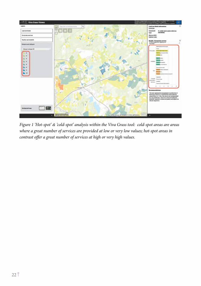
Figure 1 ‘Hot-spot’ & ‘cold-spot’ analysis within the Viva Grass tool: cold-spot areas are areas where a great number of services are provided at low or very low values; hot-spot areas in contrast offer a great number of services at high or very high values.
23
Recommendations to promote ecosystem-based planning and land management
24
Problems and needsBecause of the holistic perspective of the ecosystem service concept, it has the great potential to be applied in spatial planning for defining the land use priorities, assessing trade-offs of different development scenarios and solving conflicts between competing land uses. Spatial information on ES supply helps to better integrate environmental considerations into spatial planning and decision-making on land use change or management. The ES concept is also acknowledged as a good communication tool to discuss the impacts of different planning solutions and to raise awareness about interconnections between nature and human well-being.
ES mapping and assessment has already been used to support planning and decision-making in several EU countries. For example, in Finland ES mapping results were used in urban planning to prioritise areas which are important for a green infrastructure and which would be suitable for the development of new housing areas.
The concept of ES can be applied in planning documents of different levels, starting from national level strategic plans, development programmes and spatial plans at regional and municipality level, as well as thematic plans (e.g. for landscape or green infrastructure planning). However, so far it has not been integrated within the existing spatial planning systems of the Baltic States, although in Estonia the guidelines for preparing a comprehensive plan contains a chapter on ES.
One of the preconditions to encourage the application of the ES approach in spatial planning, is national scale mapping and assessment of ecosystems and their services (MAES process) as required by Target 5 of the EU Biodiversity Strategy 2020. However, for the purpose of spatial planning, a multi-level approach to ES mapping might be required with different degrees of mapping detail, to address specific contexts and objectives of each planning document, as well as statutory requirements for implementation of the planning instrument.
Lack of holistic view in current planning practices on the multiple benefits provided by ecosystems and trade-offs of different planning solutions
25
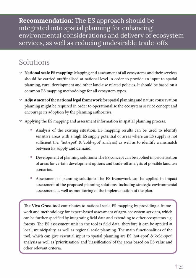
Solutions Ò National scale ES mapping: Mapping and assessment of all ecosystems and their services
should be carried out/finalised at national level in order to provide an input to spatial planning, rural development and other land-use related policies. It should be based on a common ES mapping methodology for all ecosystem types.
Ò Adjustment of the national legal framework for spatial planning and nature conservation planning might be required in order to operationalise the ecosystem service concept and encourage its adoption by the planning authorities.
Ò Applying the ES mapping and assessment information in spatial planning process:
� Analysis of the existing situation: ES mapping results can be used to identify sensitive areas with a high ES supply potential or areas where an ES supply is not sufficient (i.e. ‘hot-spot’ & ‘cold-spot’ analysis) as well as to identify a mismatch between ES supply and demand.
� Development of planning solutions: The ES concept can be applied in prioritisation of areas for certain development options and trade-off analysis of possible land use scenarios.
� Assessment of planning solutions: The ES framework can be applied in impact assessment of the proposed planning solutions, including strategic environmental assessment, as well as monitoring of the implementation of the plan.
Recommendation: The ES approach should be integrated into spatial planning for enhancing environmental considerations and delivery of ecosystem services, as well as reducing undesirable trade-offs
The Viva Grass tool contributes to national scale ES mapping by providing a frame-work and methodology for expert-based assessment of agro-ecosystem services, which can be further specified by integrating field data and extending to other ecosystems e.g. forests. The ES assessment unit in the tool is field data, therefore it can be applied at local, municipality, as well as regional scale planning. The main functionalities of the tool, which can give essential input to spatial planning are ES ‘hot-spot’ & ‘cold-spot’ analysis as well as ‘prioritisation’ and ‘classification’ of the areas based on ES value and other relevant criteria.
26
Problems and needsAlthough the potential for the application of the ES concept in spatial planning is mostly recognised by the Baltic planning authorities and stakeholders, many constraints and resistance can still be observed. One of the major obstacles for acceptance of the concept is its novelty and complexity – spatial planners lack the knowledge and capacities for mapping and assessment of ES supply. Resistance to the concept in some cases is explained due to its origins in nature conservation policy. Planners would be interested in a standardised procedure for ES mapping and assessment, as well as precise guidelines and methods for application of the ES approach at different planning levels.
Potential issues where ES could be applied at different planning levels are suggested in the table below:
Planning level/context Possible application of ES concept/questions addressedNational level strategic planning
Assessment of national policy implementationTrade-off analysis of development alternativesDefining national policy targetsDefining target areas for rural support interventions
Regional level strategic planning
Assessment of alternative development scenariosGreen infrastructure planning
Municipality level strategic and physical planning
Defining land use priorities and zoningAssessment of alternative development scenarios
Municipality level thematic planning
Landscape planning Green infrastructure planningNature-based solutions
Protected area planning Functional zoning of protected areasManagement planning and prioritisationSocio-economic assessment of nature conservation measures
Local level planning Land use planningNature-based solutions
Lack of knowledge and capacities in applying the ecosystem service concept among planners and decision-makers
27
Solutions Ò Guidelines on application of the ES approach in
spatial planning at different levels and contexts are required. The guidelines should be tailored to the national planning systems, identifying the planning context specific questions/issues where ES information can support decision-making, as well as suggest suitable methods for implementation of each step. For example, in Latvia, the LIFE Ecosystem Service project is developing recommendations for allocation of the ES approach at different governance levels.
Ò Pilot case studies on application of the ES approach at different planning levels and contexts should be initiated by planning authorities or projects.
Ò Experience exchange among ES experts and planners should be promoted at national as well as international level (e.g. by establishment of the Baltic chapter of the Ecosystem Service Partnership).
Recommendation: Suitable approaches for integration of the ES concept at different planning levels and contexts should be developed and demonstrated to planners and policy-makers
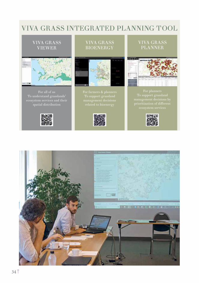
Viva Grass tool provides a framework for applying the available knowledge on agro-eco-system supply potential at different planning levels and contexts:
Ò Viva Grass Viewer offers an easy-to-use decision-making support tool for ecosystem service based land use planning at local scale, as well as an overview on distribution of an ecosystem service supply, ‘hot-spot’ & ‘cold-spot’ analysis, etc. serving as input for spatial planning at municipality or regional scale.
Ò Viva Grass Planner can support the spatial planning process at municipality or regional (and national) scale by prioritisation and classification of areas based on criteria selected by planners, decision-makers or stakeholders.
28
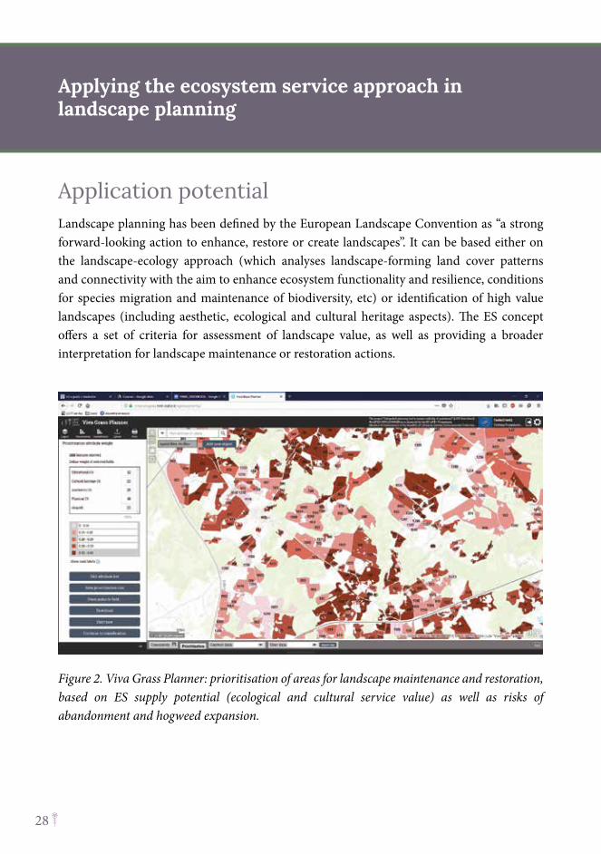
Application potentialLandscape planning has been defined by the European Landscape Convention as “a strong forward-looking action to enhance, restore or create landscapes”. It can be based either on the landscape-ecology approach (which analyses landscape-forming land cover patterns and connectivity with the aim to enhance ecosystem functionality and resilience, conditions for species migration and maintenance of biodiversity, etc) or identification of high value landscapes (including aesthetic, ecological and cultural heritage aspects). The ES concept offers a set of criteria for assessment of landscape value, as well as providing a broader interpretation for landscape maintenance or restoration actions.
Figure 2. Viva Grass Planner: prioritisation of areas for landscape maintenance and restoration, based on ES supply potential (ecological and cultural service value) as well as risks of abandonment and hogweed expansion.
Applying the ecosystem service approach in landscape planning
29
Solutions Ò Assessment of landscape value: depending on the specifics of the landscape plan, different
ecosystem services can be used to assess the landscape value. Landscape ecological value is related more to regulating services, while landscape aesthetic value and potential for tourism and recreation can largely be based on cultural ecosystem service assessment
Ò Planning of landscape management: ES supply potential can be used to prioritise areas for landscape maintenance and restoration. For example, priority for landscape restoration could be given to areas with higher ecological or cultural ecosystem service value.
Ò Stakeholder engagement in landscape planning: local knowledge and preferences can be collected and integrated into the landscape planning process through participatory methods for ES mapping and assessment. Furthermore, stakeholders can be involved in defining visions, objectives and criteria for prioritisation of the landscape management measures, as well as assigning weights to the selected criteria (i.e. application of multi-criteria decision analysis method in landscape planning).
Ò Implementation of landscape management measures: Measures for landscape maintenance should be addressed by the Rural Support Programmes, since municipality planning documents have limited possibilities of influencing the use of agricultural land. Target areas for landscape maintenance measures (e.g. restoration of landscape features/elements) should be identified by taking into account the landscape planning approach.
Recommendation: The ecosystem service approach should be promoted in the planning of landscape maintenance and restoration
Viva Grass Planner provides decision-making support in planning of landscape maintenance and restoration by prioritisation of areas based on ecosystem service supply, as well as risk factors related to landscape (tested in the case study area - Cēsis municipality, Latvia)
30
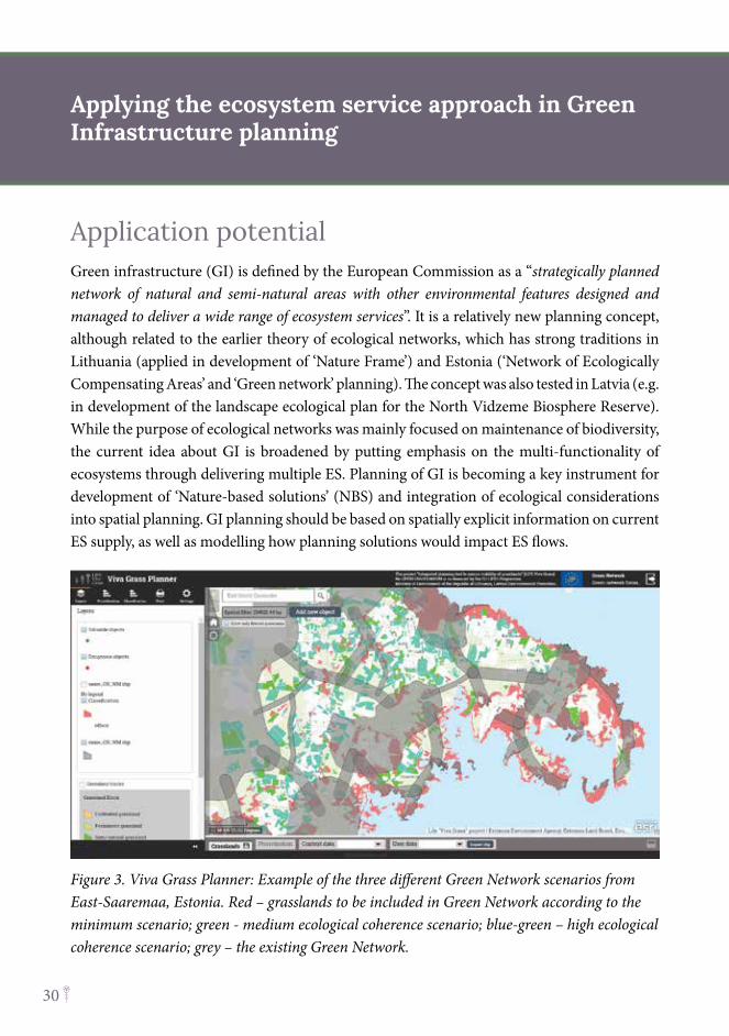
Application potentialGreen infrastructure (GI) is defined by the European Commission as a “strategically planned network of natural and semi-natural areas with other environmental features designed and managed to deliver a wide range of ecosystem services”. It is a relatively new planning concept, although related to the earlier theory of ecological networks, which has strong traditions in Lithuania (applied in development of ‘Nature Frame’) and Estonia (‘Network of Ecologically Compensating Areas’ and ‘Green network’ planning). The concept was also tested in Latvia (e.g. in development of the landscape ecological plan for the North Vidzeme Biosphere Reserve). While the purpose of ecological networks was mainly focused on maintenance of biodiversity, the current idea about GI is broadened by putting emphasis on the multi-functionality of ecosystems through delivering multiple ES. Planning of GI is becoming a key instrument for development of ‘Nature-based solutions’ (NBS) and integration of ecological considerations into spatial planning. GI planning should be based on spatially explicit information on current ES supply, as well as modelling how planning solutions would impact ES flows.
Figure 3. Viva Grass Planner: Example of the three different Green Network scenarios from East-Saaremaa, Estonia. Red – grasslands to be included in Green Network according to the minimum scenario; green - medium ecological coherence scenario; blue-green – high ecological coherence scenario; grey – the existing Green Network.
Applying the ecosystem service approach in Green Infrastructure planning
31
Solutions Ò Mapping of existing GI: The GI should be regarded as a tool: i) for biodiversity
conservation; ii) for keeping ecological coherence; and iii) a provider of multiple ES. Spatially explicit information of the distribution of ES supply, as well as the ‘hot-spot’ analysis (i.e. identification of areas where a great number of services have high or very high values), provides input data for mapping and assessment of existing GI, e.g. delineation of core areas and other GI-forming elements.
Ò Identification of problem areas: ES mapping results and ‘cold-spot’ analysis (i.e. identification of areas where a great number of services are provided at low or very low values) can help to identify problem or risk areas where improvement of GI would be needed, e.g. applying NBS for increasing ES supply. It is also recommended to identify areas within the GI that have undergone drastic land use changes, e.g. deforestation, intensification of agriculture, urbanisation.
Ò Development of scenarios for GI improvement: Information on ES supply potential can be used for prioritisation of areas for GI improvement. Furthermore, the proposed scenarios can be assessed with regard to their impact on ES supply by performing trade-off analysis. This information also helps in communicating the proposed scenarios and nature-based solutions to the concerned stakeholders.
Ò Implementation of NBS is usually based on utilisation (or imitation) of ecological processes underpinning ES supply. NBS can range from minimum interventions in management up to land use change, restoration or creation of new ecosystems. For example, NBS - restoration of floodplain grassland utilises the natural water retention capacity of grassland to mitigate flood risks, at the same time improving biodiversity and delivery of other ES.
Recommendation: The ecosystem service approach should be applied in green infrastructure planning
Viva Grass Planner provides decision-making support in planning of a green network, by prioritisation of grassland areas to be included in a green network based on ES supply (tested in case study area – Saaremaa Island, Estonia)
32
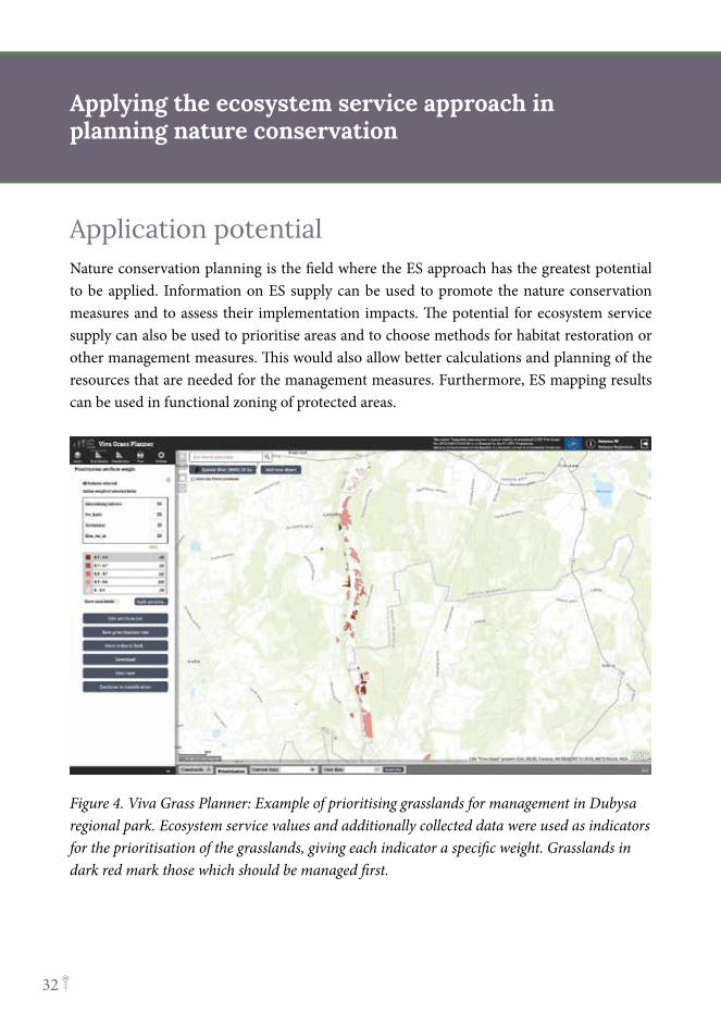
Application potentialNature conservation planning is the field where the ES approach has the greatest potential to be applied. Information on ES supply can be used to promote the nature conservation measures and to assess their implementation impacts. The potential for ecosystem service supply can also be used to prioritise areas and to choose methods for habitat restoration or other management measures. This would also allow better calculations and planning of the resources that are needed for the management measures. Furthermore, ES mapping results can be used in functional zoning of protected areas.
Figure 4. Viva Grass Planner: Example of prioritising grasslands for management in Dubysa regional park. Ecosystem service values and additionally collected data were used as indicators for the prioritisation of the grasslands, giving each indicator a specific weight. Grasslands in dark red mark those which should be managed first.
Applying the ecosystem service approach in planning nature conservation
33
Solutions Ò Prioritisation of areas for restoration or management measures: ES supply potential
in combination with other data can be used as criteria for prioritisation of areas which would be most suitable for restoration activities.
Ò Functional zoning of protected areas: ES mapping and assessment results can provide essential input for the design of the functional zones of protected areas. Information on ES supply can complement data on the conservation status of species and habitats, for defining the most suitable management regime – from strict protection up to use for recreation or nature education.
Ò Assessment of the socio-economic value: the concept provides a new framework for assessment of public benefits provided by nature assets, as well as the socio-economic impacts of the management solutions, thus helping to justify the nature conservation measures.
Ò Assessment and planning of land use changes: the concept provides options for assessing the current land use effectiveness to provide the ecosystem services needed to ensure conservation of the fundamental values of the protected area. Having this information enables policy-makers to plan targeted measures to reach the goals for the protected areas.
Recommendation: The ecosystem service approach should be applied as a basis of protected area management
Viva Grass Planner provides decision-making support in management planning of protected areas, by prioritising areas using specific indicators and ES value (tested in case study area – Dubysa regional park, Lithuania).
34
35
Recommendations to promote application of the integrated planning tool into the daily processes of public administration at national, regional and municipality level
36
Problems and needsDuring the public events and training courses organised by the LIFE Viva Grass project, a wide range of stakeholders, including public administrations, planners and researchers were introduced to the Viva Grass tool and acknowledged it as a suitable and convenient instrument to support spatial planning, nature conservation, landscape and green infrastructure planning, as well as for decision-making on management of agricultural land. The flexibility of the Viva Grass Planner is especially appreciated as the module allows the adjustment of the ES assessment scores, and to add additional criteria and data sets depending on the user-specified planning context. In turn, credibility and applicability of the Viva Grass Viewer for decision- making and planning is limited due to unsatisfactory data accuracy (land quality data, based on soil inventory from the Soviet period) as well as incomplete data coverage (i.e. it includes only agricultural land, reported to IACS).
To make the Viva Grass tool operational for the land use planning purpose, the data sets of the base map should be regularly updated, including actual data of IACS on declared management practices of agricultural land, upgraded with information on protected areas and latest habitat mapping results, as well as socio-economic information. Furthermore, it would also be very important to apply the ES calculation method provided by the tool to other ecosystem types (e.g. forests, wetlands, coastal, urban etc.) and to include relevant data sets, to make the tool more suitable for spatial planning, as well as landscape and green infrastructure planning.
Other limitations of the current version of the tool, as noted by stakeholders, include: English as the operating language of the tool; knowledge required about ES and GIS skills; software and data format required to work with Viva Grass Planner (i.e. Viva Grass Planner is based on ArcGIS online, while municipalities mostly use other software); technical problems related to server capacity; as well as the subjectivity of the expert assessment on ES supply.
Data accuracy, coverage and possibilities for regular updates as the main limitations of the tool
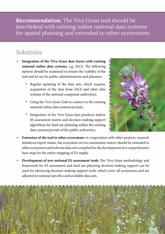
Solutions
Ò Integration of the Viva Grass data layers with existing national online data systems, e.g. IACS. The following options should be examined to ensure the viability of the tool and its use by public administrations and planners:
� Regular updating of the data sets, which requires acquisition of the data from IACS and other data systems of the national competent authorities;
� Using the Viva Grass Link to connect to the existing national online data systems/portals;
� Integration of the Viva Grass data products and/or ES assessment matrix and decision-making support algorithms for land use planning within the existing data systems/portals of the public authorities.
Ò Extension of the tool to other ecosystems: in cooperation with other projects, research initiatives/expert teams, the ecosystem service assessment matrix should be extended to other ecosystems and relevant data sets compiled for the development of a comprehensive base-map for the entire mapping of ES supply.
Ò Development of new national ES assessment tools: The Viva Grass methodology and framework for ES assessment and land use planning decision-making support can be used for advancing decision-making support tools, which cover all ecosystems and are adjusted to national specifics and available data sets.
Recommendation: The Viva Grass tool should be interlinked with existing online national data systems for spatial planning and extended to other ecosystems
The aim of the LIFE Viva Grass
project is to support maintenance of biodiversity and
ecosystem services provided by grasslands,
through encouraging ecosystem-based
planning and economically viable
grassland management.
www.vivagrass.eu