Life on the Outer Banks - National Park Service · 2015-10-08 · Life on the Outer Banks . ......
39
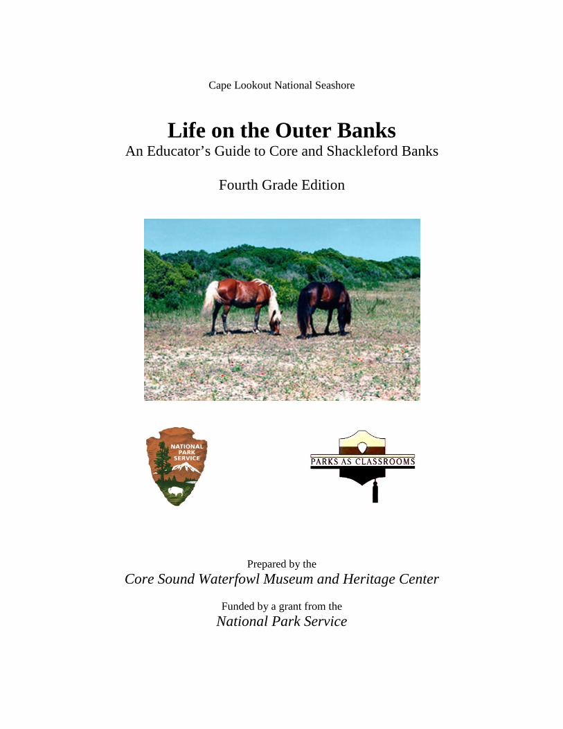
Cape Lookout National Seashore Life on the Outer Banks An Educator’s Guide to Core and Shackleford Banks Fourth Grade Edition Prepared by the Core Sound Waterfowl Museum and Heritage Center Funded by a grant from the National Park Service
Transcript of Life on the Outer Banks - National Park Service · 2015-10-08 · Life on the Outer Banks . ......
Cape Lookout National Seashore
Life on the Outer Banks An Educator’s Guide to Core and Shackleford Banks
Fourth Grade Edition
Prepared by the Core Sound Waterfowl Museum and Heritage Center
Funded by a grant from the
National Park Service
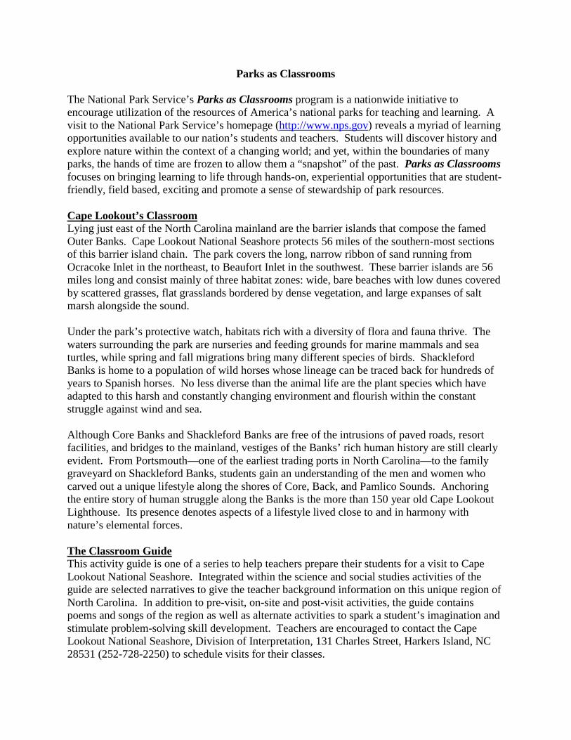
Parks as Classrooms
The National Park Service’s Parks as Classrooms program is a nationwide initiative to encourage utilization of the resources of America’s national parks for teaching and learning. A visit to the National Park Service’s homepage (http://www.nps.gov) reveals a myriad of learning opportunities available to our nation’s students and teachers. Students will discover history and explore nature within the context of a changing world; and yet, within the boundaries of many parks, the hands of time are frozen to allow them a “snapshot” of the past. Parks as Classrooms focuses on bringing learning to life through hands-on, experiential opportunities that are student-friendly, field based, exciting and promote a sense of stewardship of park resources. Cape Lookout’s Classroom Lying just east of the North Carolina mainland are the barrier islands that compose the famed Outer Banks. Cape Lookout National Seashore protects 56 miles of the southern-most sections of this barrier island chain. The park covers the long, narrow ribbon of sand running from Ocracoke Inlet in the northeast, to Beaufort Inlet in the southwest. These barrier islands are 56 miles long and consist mainly of three habitat zones: wide, bare beaches with low dunes covered by scattered grasses, flat grasslands bordered by dense vegetation, and large expanses of salt marsh alongside the sound. Under the park’s protective watch, habitats rich with a diversity of flora and fauna thrive. The waters surrounding the park are nurseries and feeding grounds for marine mammals and sea turtles, while spring and fall migrations bring many different species of birds. Shackleford Banks is home to a population of wild horses whose lineage can be traced back for hundreds of years to Spanish horses. No less diverse than the animal life are the plant species which have adapted to this harsh and constantly changing environment and flourish within the constant struggle against wind and sea. Although Core Banks and Shackleford Banks are free of the intrusions of paved roads, resort facilities, and bridges to the mainland, vestiges of the Banks’ rich human history are still clearly evident. From Portsmouth—one of the earliest trading ports in North Carolina—to the family graveyard on Shackleford Banks, students gain an understanding of the men and women who carved out a unique lifestyle along the shores of Core, Back, and Pamlico Sounds. Anchoring the entire story of human struggle along the Banks is the more than 150 year old Cape Lookout Lighthouse. Its presence denotes aspects of a lifestyle lived close to and in harmony with nature’s elemental forces. The Classroom Guide This activity guide is one of a series to help teachers prepare their students for a visit to Cape Lookout National Seashore. Integrated within the science and social studies activities of the guide are selected narratives to give the teacher background information on this unique region of North Carolina. In addition to pre-visit, on-site and post-visit activities, the guide contains poems and songs of the region as well as alternate activities to spark a student’s imagination and stimulate problem-solving skill development. Teachers are encouraged to contact the Cape Lookout National Seashore, Division of Interpretation, 131 Charles Street, Harkers Island, NC 28531 (252-728-2250) to schedule visits for their classes.
Acknowledgements Patrick Kenney, Superintendent, Cape Lookout National Seashore Karen Amspacher, Executive Director, Core Sound Waterfowl Museum & Heritage Center Coordinators: Wouter Ketel, Management Assistant, Cape Lookout National Seashore Ike Southerland, Education Director, Core Sound Waterfowl Museum & Heritage Center Primary Authors: Amy Sauls, Emerald Isle, NC Connie Mason, Morehead City, NC John Waszak, Beaufort, NC Focus Group:John Waszak, Harkers Island Elementary School Donna Small, Newport Elementary School Norma Jean Gomez, Morehead City Primary Sue Martin, Atlantic Elementary School Kathryne Capps, Newport Middle School
Tanya Scott, Newport Middle School Becky Misner, Beaufort Middle School Brooks Sutton, Arendell Parrott Academy Kimberly Hughes, White Oak Elementary School
Editors and Reviewers:Donna Small, Newport Elementary School Norma Jean Gomez, Morehead City Primary Sue Sippel, Morehead Middle School Kimberly Hughes, White Oak Elementary School John Waszak, Harkers Island Elementary School
Richard Meissner, Cape Lookout National Seashore Kerby Price, Cape Lookout National Seashore Ann Kelly, Core Sound Waterfowl Museum & Heritage Center
Digital Editing: Sharon Starks, Core Sound Waterfowl Museum & Heritage Center Mary Ann Williams, Core Sound Waterfowl Museum & Heritage Center Julie Rogers, Arendell Parrott Academy Contributors: Barbara Cohea, Cape Lookout National Seashore Karen Duggan, Cape Lookout National Seashore
Katelyn Wilkerson, Arendell Parrott Academy Kerby Price, Cape Lookout National Seashore
Special Thanks to Classroom Partners: Nancy Allen, Carteret County Schools Mike Campbell, NC Wildlife Resources Commission Lori Brinn, Albemarle-Pamlico NEP Jill Fegley, Rachel Carson Estuarine Reserve Wendy Arey-Kent, NC Aquarium, Pine Knoll Shores Wayne Justice, NC Aquarium, Pine Knoll Shores Sarah Phillips, NC Coastal Federation Teri Hathaway, NC Sea Grant Sarah Yelton, NC DENR Joanne Powell, NC Maritime Museum Ruth Gourley, NC Aquarium, Ft. Fisher Stephanie Misner, NC Aquarium, Ft. Fisher
Table of Contents
Introduction . . . . . . . . . . . . . . . . . . . . . . . . . . . . . . . . . . . . . . . . . . . . . . . . . . . . . . .
Science Lesson: Barrier Island Flora and Fauna The Geography of Shackleford Banks . . . . . . . . . . . . . . . . . . . . . . . . . . . . . . . . . . What is a Barrier Island? . . . . . . . . . . . . . . . . . . . . . . . . . . . . . . . . . . . . . . . . . . . . The Plants and Animals of Shackleford Banks . . . . . . . . . . . . . . . . . . . . . . . . . . . . The Dead Forest . . . . . . . . . . . . . . . . . . . . . . . . . . . . . . . . . . . . . . . . . . . . . . . . . . . Spotlight: Scotch Bonnet . . . . . . . . . . . . . . . . . . . . . . . . . . . . . . . . . . . . . . . . . . . . Pre-Site Visit Activity: Life History Research . . . . . . . . . . . . . . . . . . . . . . . . . . . Example: Food Web. . . . . . . . . . . . . . . . . . . . . . . . . . . . . . . . . . . . . . . . . . . . . . . List of Organisms Commonly Found at Cape Lookout . . . . . . . . . . . . . . . . . . . . . . Life History Research Rubric. . . . . . . . . . . . . . . . . . . . . . . . . . . . . . . . . . . . . . . . On-Site Activity: Field Study . . . . . . . . . . . . . . . . . . . . . . . . . . . . . . . . . . . . . . . . . . Common Organisms Tally Sheet. . . . . . . . . . . . . . . . . . . . . . . . . . . . . . . . . . . . . . Field Study Questions. . . . . . . . . . . . . . . . . . . . . . . . . . . . . . . . . . . . . . . . . . . . . . . . On-Site Activity: Tracking Wildlife . . . . . . . . . . . . . . . . . . . . . . . . . . . . . . . . . . . Post-Site Visit Activity: Animals and Their Environments . . . . . . . . . . . . . . . . . . . Photo Journal Presentation Rubric. . . . . . . . . . . . . . . . . . . . . . . . . . . . . . . . . . . . . .
Social Studies and Math Lesson: Cape Lookout Lighthouse Pre-site Visit Activity: Changes with Technology . . . . . . . . . . . . . . . . . . . . . . . . . . 1859 Lighthouse Information Sheet . . . . . . . . . . . . . . . . . . . . . . . . . . . . . . . . . . . . Chronology of Cape Lookout 1859 Lighthouse . . . . . . . . . . . . . . . . . . . . . . . . . . . . Cape Lookout Math Worksheet . . . . . . . . . . . . . . . . . . . . . . . . . . . . . . . . . . . . . . . On-Site Activity: Lighthouse Experiences . . . . . . . . . . . . . . . . . . . . . . . . . . . . . . . Design a Lighthouse . . . . . . . . . . . . . . . . . . . . . . . . . . . . . . . . . . . . . . . . . . . . . . .
Traveling Trunk Program . . . . . . . . . . . . . . . . . . . . . . . . . . . . . . . . . . . . . . . . . .
References Bibliography . . . . . . . . . . . . . . . . . . . . . . . . . . . . . . . . . . . . . . . . . . . . . . . . . . . . .
1 2 2 4 7 8 9 10 10 11 12 13 14 16 17 19
20 22 24 27 28 29
30
31
Cape Lookout National Seashore 1
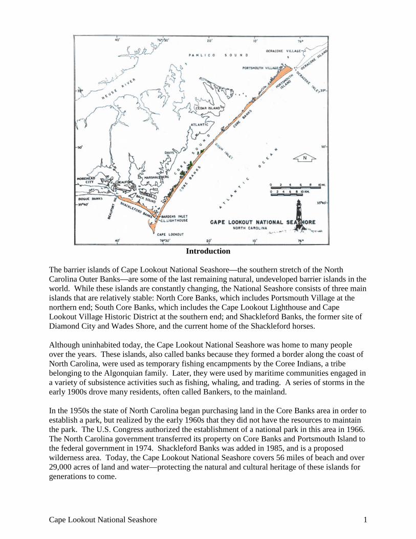
Introduction The barrier islands of Cape Lookout National Seashore—the southern stretch of the North Carolina Outer Banks—are some of the last remaining natural, undeveloped barrier islands in the world. While these islands are constantly changing, the National Seashore consists of three main islands that are relatively stable: North Core Banks, which includes Portsmouth Village at the northern end; South Core Banks, which includes the Cape Lookout Lighthouse and Cape Lookout Village Historic District at the southern end; and Shackleford Banks, the former site of Diamond City and Wades Shore, and the current home of the Shackleford horses. Although uninhabited today, the Cape Lookout National Seashore was home to many people over the years. These islands, also called banks because they formed a border along the coast of North Carolina, were used as temporary fishing encampments by the Coree Indians, a tribe belonging to the Algonquian family. Later, they were used by maritime communities engaged in a variety of subsistence activities such as fishing, whaling, and trading. A series of storms in the early 1900s drove many residents, often called Bankers, to the mainland. In the 1950s the state of North Carolina began purchasing land in the Core Banks area in order to establish a park, but realized by the early 1960s that they did not have the resources to maintain the park. The U.S. Congress authorized the establishment of a national park in this area in 1966. The North Carolina government transferred its property on Core Banks and Portsmouth Island to the federal government in 1974. Shackleford Banks was added in 1985, and is a proposed wilderness area. Today, the Cape Lookout National Seashore covers 56 miles of beach and over 29,000 acres of land and water—protecting the natural and cultural heritage of these islands for generations to come.
2 Life on the Outer Banks: Fourth Grade Edition
Life on the Outer Banks – 4th Grade Edition Science Lesson – Barrier Island Flora and Fauna
Geography of Shackleford Banks
The island of Shackleford Banks is approximately 9 miles long and 1/4 to 1/2 of a mile wide. It is the southernmost island of Cape Lookout National Seashore and is two to five miles off the coast of the mainland, near Beaufort and Harkers Island, NC. Shackleford Banks is a fairly typical barrier island, but has changed drastically since the turn of the 20th century. “It was formerly wooded in its entire length; this woodland, covering about 1250 acres, probably was composed chiefly of live oak, red cedar, yaupon holly and loblolly pine. The inner shore, on the eastward half of the island, was bordered by salt marshes” (Engles 1952). Today, the maritime forest (a forest near the ocean) is confined to the sound side of the island on the west end. Although currently uninhabited, Shackleford Banks once supported fish camps and small communities of fishermen and whalers. It was also home to a relatively large number of cattle, horses, sheep, goats, and pigs. These animals were semi-feral, meaning that they were often owned, and may have been fed and watered, by people who lived on the island, but they were allowed to roam free. Today, only the horses remain as a wild population. The location of Shackleford Banks makes it vulnerable to major weather events. Northeasterly storms (called Nor’easters) and hurricanes, which on average impact North Carolina once every four years, can be devastating to the island. Two of the most damaging hurricanes to hit Shackleford Banks struck in August of 1899 and September of 1933. The 1933 hurricane opened an inlet between Core Banks and Shackleford Banks including a portion of the community called Diamond City.
What is a Barrier Island?
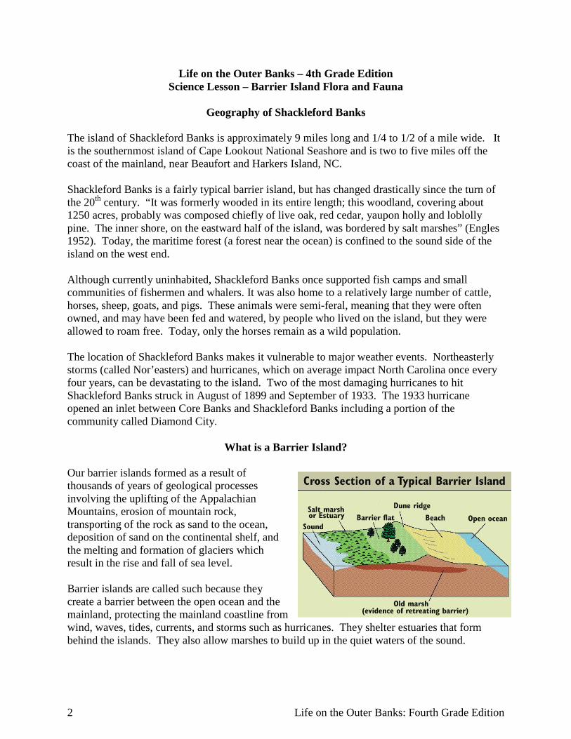
Our barrier islands formed as a result of thousands of years of geological processes involving the uplifting of the Appalachian Mountains, erosion of mountain rock, transporting of the rock as sand to the ocean, deposition of sand on the continental shelf, and the melting and formation of glaciers which result in the rise and fall of sea level. Barrier islands are called such because they create a barrier between the open ocean and the mainland, protecting the mainland coastline from wind, waves, tides, currents, and storms such as hurricanes. They shelter estuaries that form behind the islands. They also allow marshes to build up in the quiet waters of the sound.
Cape Lookout National Seashore 3
“Here at the water’s edge, where the land meets the sea with marsh and shoal, sandy beaches and muddy bottom, is where life begins for all coastal people.”
Karen Willis Amspacher, from “The Spirit of the Tidewater Community”
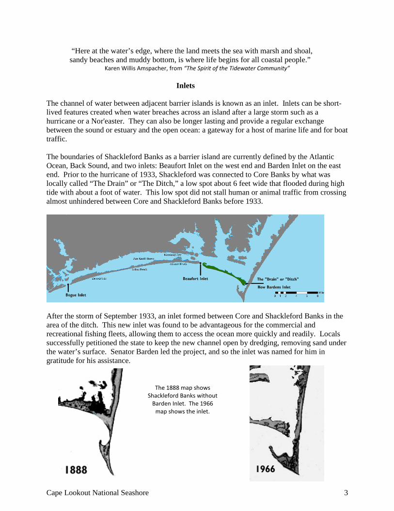
Inlets The channel of water between adjacent barrier islands is known as an inlet. Inlets can be short-lived features created when water breaches across an island after a large storm such as a hurricane or a Nor'easter. They can also be longer lasting and provide a regular exchange between the sound or estuary and the open ocean: a gateway for a host of marine life and for boat traffic. The boundaries of Shackleford Banks as a barrier island are currently defined by the Atlantic Ocean, Back Sound, and two inlets: Beaufort Inlet on the west end and Barden Inlet on the east end. Prior to the hurricane of 1933, Shackleford was connected to Core Banks by what was locally called “The Drain” or “The Ditch,” a low spot about 6 feet wide that flooded during high tide with about a foot of water. This low spot did not stall human or animal traffic from crossing almost unhindered between Core and Shackleford Banks before 1933.
After the storm of September 1933, an inlet formed between Core and Shackleford Banks in the area of the ditch. This new inlet was found to be advantageous for the commercial and recreational fishing fleets, allowing them to access the ocean more quickly and readily. Locals successfully petitioned the state to keep the new channel open by dredging, removing sand under the water’s surface. Senator Barden led the project, and so the inlet was named for him in gratitude for his assistance.
The 1888 map shows Shackleford Banks without
Barden Inlet. The 1966 map shows the inlet.
4 Life on the Outer Banks: Fourth Grade Edition
The Plants and Animals of Shackleford Banks Cape Lookout is centrally located along the coast of North Carolina. It is home to a diverse array of animal and plant life due to the mild climate, the confluence of the Labrador Current and Gulf Stream, the geographic location along the North Atlantic flyway, and the intermingling of fresh and salt water in the vast estuary that forms behind the islands.
Ocean Currents
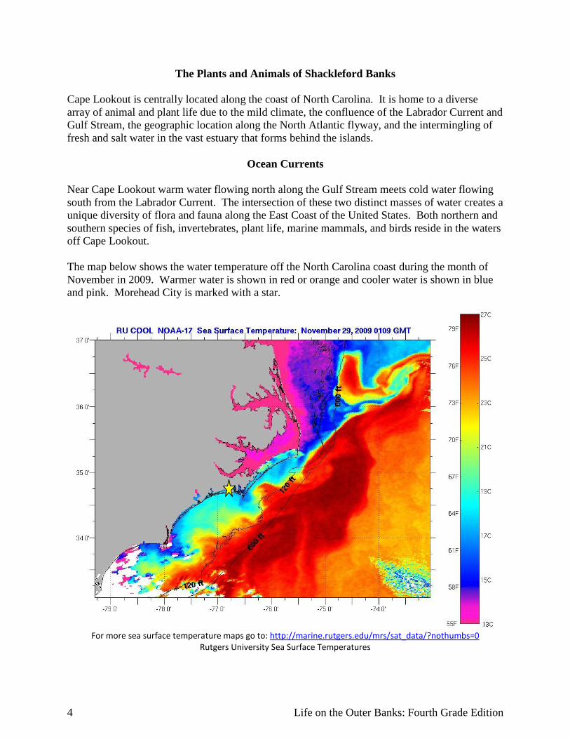
Near Cape Lookout warm water flowing north along the Gulf Stream meets cold water flowing south from the Labrador Current. The intersection of these two distinct masses of water creates a unique diversity of flora and fauna along the East Coast of the United States. Both northern and southern species of fish, invertebrates, plant life, marine mammals, and birds reside in the waters off Cape Lookout. The map below shows the water temperature off the North Carolina coast during the month of November in 2009. Warmer water is shown in red or orange and cooler water is shown in blue and pink. Morehead City is marked with a star.
For more sea surface temperature maps go to: http://marine.rutgers.edu/mrs/sat_data/?nothumbs=0
Rutgers University Sea Surface Temperatures
Cape Lookout National Seashore 5
Diversity The mixing of warm tropical currents and the colder Labrador Current brings a great deal of diversity to the Southern Atlantic coast, and accordingly, when studying the flora and fauna for this region, identification guides are needed for two regions: North Carolina to Brazil and North Carolina to Greenland. Some examples of the diversity of species in North Carolina can be found in the vegetation: bayberry plants and wax myrtles are present along our coast. Bayberry is a northern species and wax myrtle is a southern species. During the summer, it is not unusual for tropical fish, such as angelfish and sergeant majors, to visit the waters of Cape Lookout. Also, manatees—southern marine mammals—are occasionally seen in the summer and harbor seals—northern marine mammals—can be seen here at other times of the year. The diversity of plants and animals of Cape Lookout, in addition to its miles of undeveloped habitats, make Cape Lookout National Seashore a wonderful place to observe wildlife. Another reason for the rich diversity of Cape Lookout is the wide variety of habitats that are present along this stretch of barrier islands. There are large stretches of beach, marsh, and sound, as well as upland habitats like maritime forest, dunes, and even freshwater ponds, that allow many organisms to survive here.
Migration
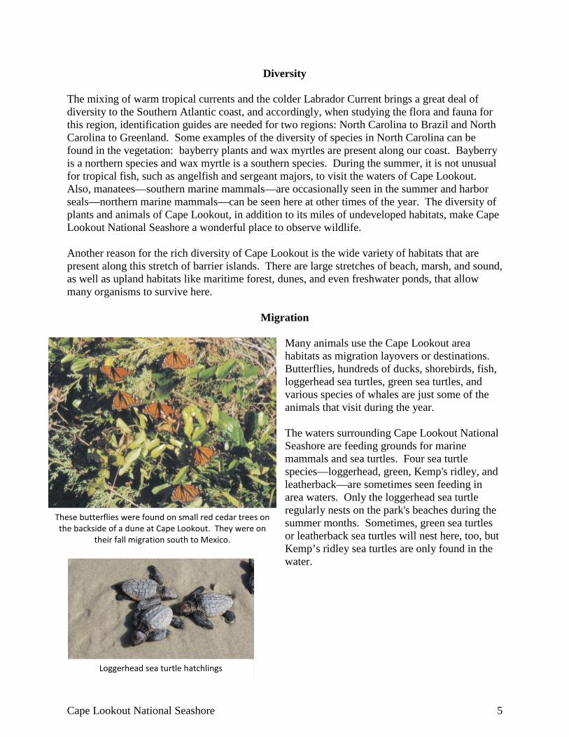
Many animals use the Cape Lookout area habitats as migration layovers or destinations. Butterflies, hundreds of ducks, shorebirds, fish, loggerhead sea turtles, green sea turtles, and various species of whales are just some of the animals that visit during the year. The waters surrounding Cape Lookout National Seashore are feeding grounds for marine mammals and sea turtles. Four sea turtle species—loggerhead, green, Kemp's ridley, and leatherback—are sometimes seen feeding in area waters. Only the loggerhead sea turtle regularly nests on the park's beaches during the summer months. Sometimes, green sea turtles or leatherback sea turtles will nest here, too, but Kemp’s ridley sea turtles are only found in the water.
These butterflies were found on small red cedar trees on the backside of a dune at Cape Lookout. They were on
their fall migration south to Mexico.
Loggerhead sea turtle hatchlings
6 Life on the Outer Banks: Fourth Grade Edition
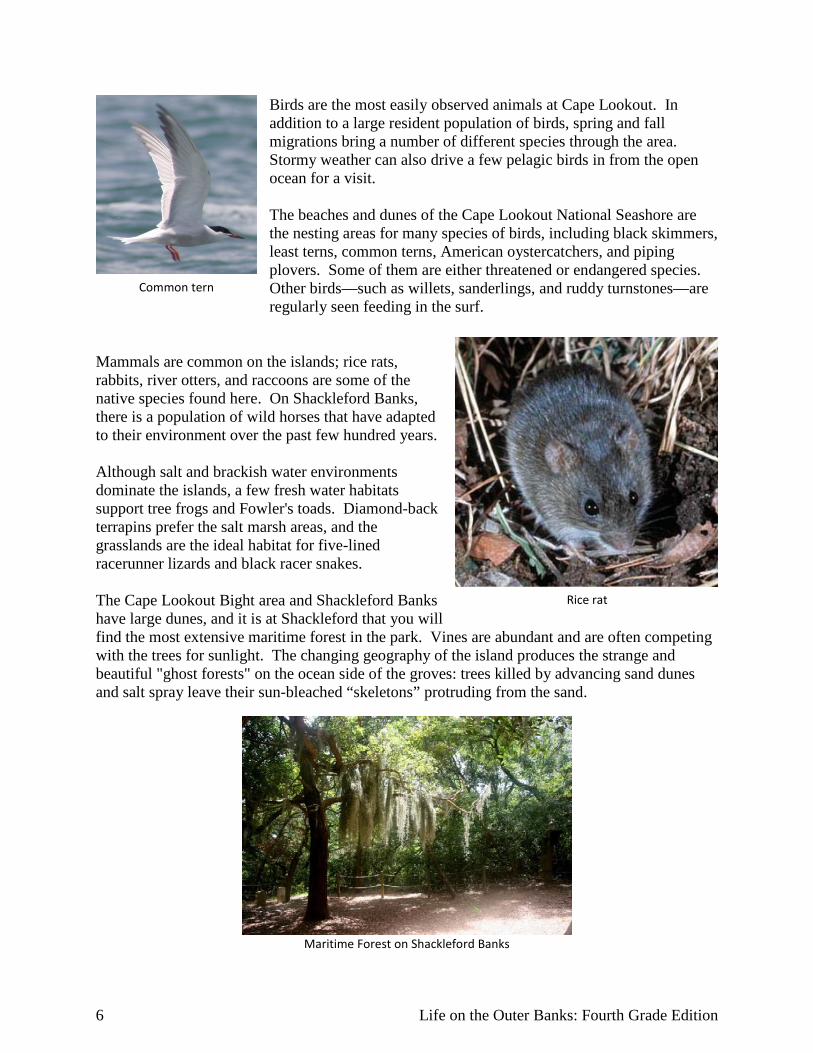
Birds are the most easily observed animals at Cape Lookout. In addition to a large resident population of birds, spring and fall migrations bring a number of different species through the area. Stormy weather can also drive a few pelagic birds in from the open ocean for a visit. The beaches and dunes of the Cape Lookout National Seashore are the nesting areas for many species of birds, including black skimmers, least terns, common terns, American oystercatchers, and piping plovers. Some of them are either threatened or endangered species. Other birds—such as willets, sanderlings, and ruddy turnstones—are regularly seen feeding in the surf.
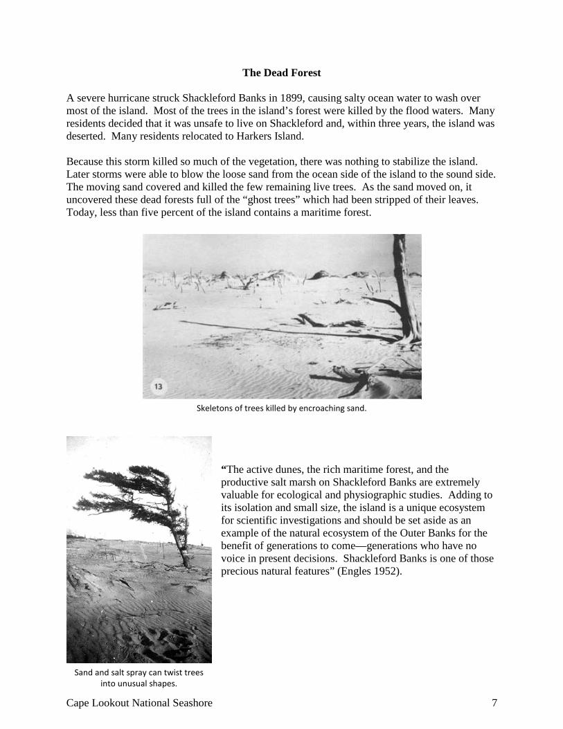
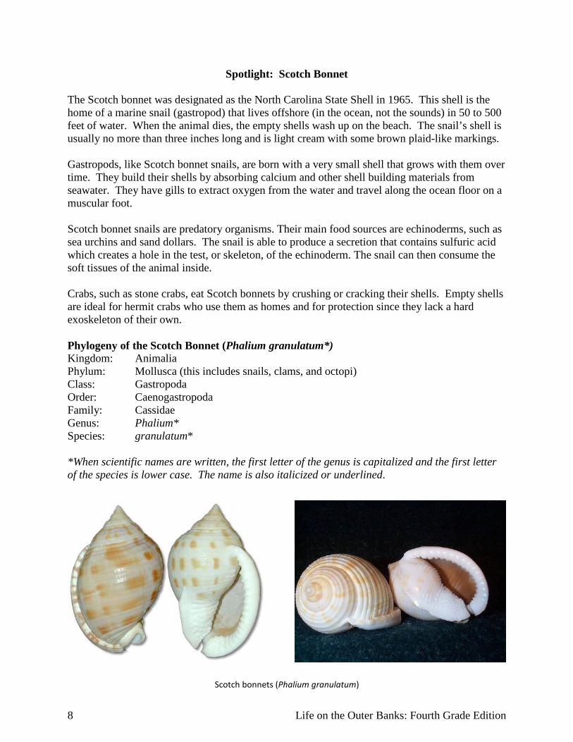
Mammals are common on the islands; rice rats, rabbits, river otters, and raccoons are some of the native species found here. On Shackleford Banks, there is a population of wild horses that have adapted to their environment over the past few hundred years. Although salt and brackish water environments dominate the islands, a few fresh water habitats support tree frogs and Fowler's toads. Diamond-back terrapins prefer the salt marsh areas, and the grasslands are the ideal habitat for five-lined racerunner lizards and black racer snakes. The Cape Lookout Bight area and Shackleford Banks have large dunes, and it is at Shackleford that you will find the most extensive maritime forest in the park. Vines are abundant and are often competing with the trees for sunlight. The changing geography of the island produces the strange and beautiful "ghost forests" on the ocean side of the groves: trees killed by advancing sand dunes and salt spray leave their sun-bleached “skeletons” protruding from the sand.
Common tern
Maritime Forest on Shackleford Banks
Rice rat
Cape Lookout National Seashore 7
The Dead Forest A severe hurricane struck Shackleford Banks in 1899, causing salty ocean water to wash over most of the island. Most of the trees in the island’s forest were killed by the flood waters. Many residents decided that it was unsafe to live on Shackleford and, within three years, the island was deserted. Many residents relocated to Harkers Island. Because this storm killed so much of the vegetation, there was nothing to stabilize the island. Later storms were able to blow the loose sand from the ocean side of the island to the sound side. The moving sand covered and killed the few remaining live trees. As the sand moved on, it uncovered these dead forests full of the “ghost trees” which had been stripped of their leaves. Today, less than five percent of the island contains a maritime forest.
“The active dunes, the rich maritime forest, and the productive salt marsh on Shackleford Banks are extremely valuable for ecological and physiographic studies. Adding to its isolation and small size, the island is a unique ecosystem for scientific investigations and should be set aside as an example of the natural ecosystem of the Outer Banks for the benefit of generations to come—generations who have no voice in present decisions. Shackleford Banks is one of those precious natural features” (Engles 1952).
Skeletons of trees killed by encroaching sand.
Sand and salt spray can twist trees into unusual shapes.
8 Life on the Outer Banks: Fourth Grade Edition
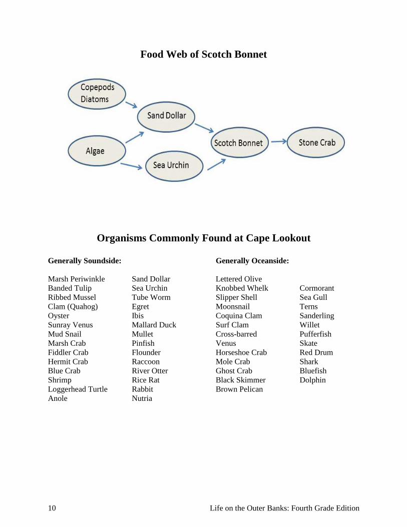
Spotlight: Scotch Bonnet The Scotch bonnet was designated as the North Carolina State Shell in 1965. This shell is the home of a marine snail (gastropod) that lives offshore (in the ocean, not the sounds) in 50 to 500 feet of water. When the animal dies, the empty shells wash up on the beach. The snail’s shell is usually no more than three inches long and is light cream with some brown plaid-like markings. Gastropods, like Scotch bonnet snails, are born with a very small shell that grows with them over time. They build their shells by absorbing calcium and other shell building materials from seawater. They have gills to extract oxygen from the water and travel along the ocean floor on a muscular foot. Scotch bonnet snails are predatory organisms. Their main food sources are echinoderms, such as sea urchins and sand dollars. The snail is able to produce a secretion that contains sulfuric acid which creates a hole in the test, or skeleton, of the echinoderm. The snail can then consume the soft tissues of the animal inside. Crabs, such as stone crabs, eat Scotch bonnets by crushing or cracking their shells. Empty shells are ideal for hermit crabs who use them as homes and for protection since they lack a hard exoskeleton of their own. Phylogeny of the Scotch Bonnet (Phalium granulatum*) Kingdom: Animalia Phylum: Mollusca (this includes snails, clams, and octopi) Class: Gastropoda Order: Caenogastropoda Family: Cassidae Genus: Phalium* Species: granulatum* *When scientific names are written, the first letter of the genus is capitalized and the first letter of the species is lower case. The name is also italicized or underlined.
Scotch bonnets (Phalium granulatum)
Cape Lookout National Seashore 9
Life on the Outer Banks – 4th Grade Edition Barrier Island Flora and Fauna – Life History Research
Pre-Site Visit Science Activity
North Carolina Essential Standards and Clarifying Objectives 4 Science
4.L.1: Understand the effects of environmental changes, adaptations and behaviors that enable animals (including humans) to survive in changing habitats.
4.L.1.2: Explain how animals meet their needs by using behaviors in response to information received from the environment.
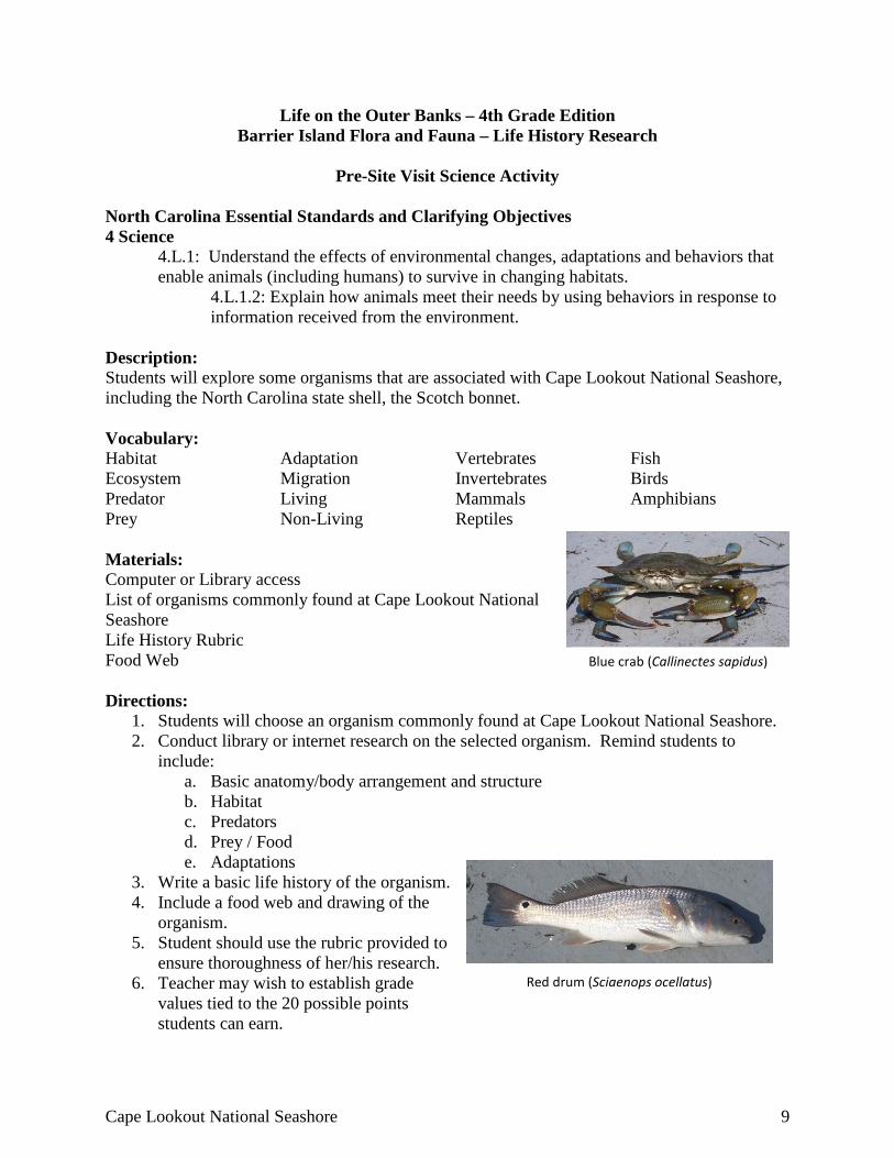
Description: Students will explore some organisms that are associated with Cape Lookout National Seashore, including the North Carolina state shell, the Scotch bonnet. Vocabulary: Habitat Adaptation Vertebrates Fish Ecosystem Migration Invertebrates Birds Predator Living Mammals Amphibians Prey Non-Living Reptiles Materials: Computer or Library access List of organisms commonly found at Cape Lookout National Seashore Life History Rubric Food Web Directions:
1. Students will choose an organism commonly found at Cape Lookout National Seashore. 2. Conduct library or internet research on the selected organism. Remind students to
include: a. Basic anatomy/body arrangement and structure b. Habitat c. Predators d. Prey / Food e. Adaptations
3. Write a basic life history of the organism. 4. Include a food web and drawing of the
organism. 5. Student should use the rubric provided to
ensure thoroughness of her/his research. 6. Teacher may wish to establish grade
values tied to the 20 possible points students can earn.
Red drum (Sciaenops ocellatus)
Blue crab (Callinectes sapidus)
10 Life on the Outer Banks: Fourth Grade Edition
Food Web of Scotch Bonnet
Organisms Commonly Found at Cape Lookout
Generally Soundside: Generally Oceanside: Marsh Periwinkle Banded Tulip Ribbed Mussel Clam (Quahog) Oyster Sunray Venus Mud Snail Marsh Crab Fiddler Crab Hermit Crab Blue Crab Shrimp Loggerhead Turtle Anole
Sand Dollar Sea Urchin Tube Worm Egret Ibis Mallard Duck Mullet Pinfish Flounder Raccoon River Otter Rice Rat Rabbit Nutria
Lettered Olive Knobbed Whelk Slipper Shell Moonsnail Coquina Clam Surf Clam Cross-barred Venus Horseshoe Crab Mole Crab Ghost Crab Black Skimmer Brown Pelican
Cormorant Sea Gull Terns Sanderling Willet Pufferfish Skate Red Drum Shark Bluefish Dolphin
Cape Lookout National Seashore 11
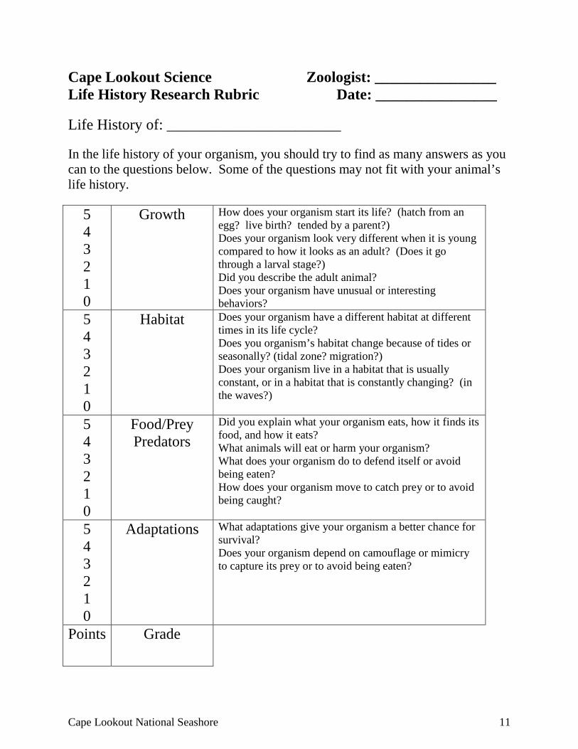
Cape Lookout Science Zoologist: ________________ Life History Research Rubric Date: ________________ Life History of: _______________________ In the life history of your organism, you should try to find as many answers as you can to the questions below. Some of the questions may not fit with your animal’s life history.
5 4 3 2 1 0
Growth How does your organism start its life? (hatch from an egg? live birth? tended by a parent?) Does your organism look very different when it is young compared to how it looks as an adult? (Does it go through a larval stage?) Did you describe the adult animal? Does your organism have unusual or interesting behaviors?
5 4 3 2 1 0
Habitat Does your organism have a different habitat at different times in its life cycle? Does you organism’s habitat change because of tides or seasonally? (tidal zone? migration?) Does your organism live in a habitat that is usually constant, or in a habitat that is constantly changing? (in the waves?)
5 4 3 2 1 0
Food/Prey Predators
Did you explain what your organism eats, how it finds its food, and how it eats? What animals will eat or harm your organism? What does your organism do to defend itself or avoid being eaten? How does your organism move to catch prey or to avoid being caught?
5 4 3 2 1 0
Adaptations What adaptations give your organism a better chance for survival? Does your organism depend on camouflage or mimicry to capture its prey or to avoid being eaten?
Points Grade
12 Life on the Outer Banks: Fourth Grade Edition
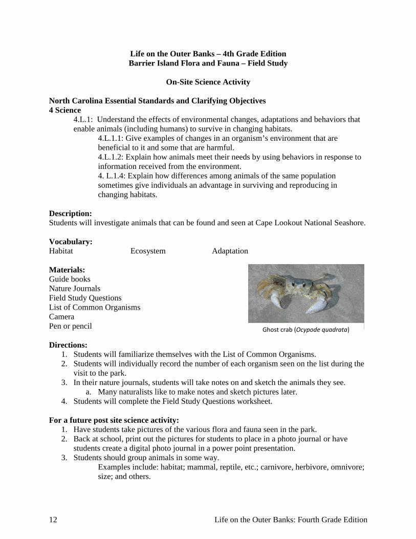
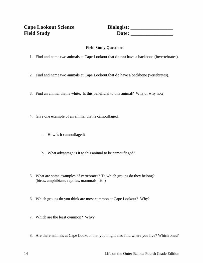
Life on the Outer Banks – 4th Grade Edition Barrier Island Flora and Fauna – Field Study
On-Site Science Activity
North Carolina Essential Standards and Clarifying Objectives 4 Science
4.L.1: Understand the effects of environmental changes, adaptations and behaviors that enable animals (including humans) to survive in changing habitats.
4.L.1.1: Give examples of changes in an organism’s environment that are beneficial to it and some that are harmful. 4.L.1.2: Explain how animals meet their needs by using behaviors in response to information received from the environment. 4. L.1.4: Explain how differences among animals of the same population sometimes give individuals an advantage in surviving and reproducing in changing habitats.
Description: Students will investigate animals that can be found and seen at Cape Lookout National Seashore. Vocabulary: Habitat Ecosystem Adaptation Materials: Guide books Nature Journals Field Study Questions List of Common Organisms Camera Pen or pencil Directions:
1. Students will familiarize themselves with the List of Common Organisms. 2. Students will individually record the number of each organism seen on the list during the
visit to the park. 3. In their nature journals, students will take notes on and sketch the animals they see.
a. Many naturalists like to make notes and sketch pictures later. 4. Students will complete the Field Study Questions worksheet.
For a future post site science activity: 1. Have students take pictures of the various flora and fauna seen in the park. 2. Back at school, print out the pictures for students to place in a photo journal or have
students create a digital photo journal in a power point presentation. 3. Students should group animals in some way.
Examples include: habitat; mammal, reptile, etc.; carnivore, herbivore, omnivore; size; and others.
Ghost crab (Ocypode quadrata)
Cape Lookout National Seashore 13
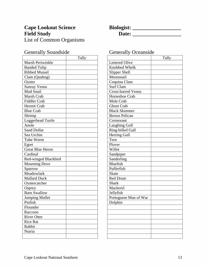
Cape Lookout Science Biologist: __________________ Field Study Date: __________________ List of Common Organisms Generally Soundside Generally Oceanside Tally Marsh Periwinkle Banded Tulip Ribbed Mussel Clam (Quahog) Oyster Sunray Venus Mud Snail Marsh Crab Fiddler Crab Hermit Crab Blue Crab Shrimp Loggerhead Turtle Anole Sand Dollar Sea Urchin Tube Worm Egret Great Blue Heron Cardinal Red-winged Blackbird Mourning Dove Sparrow Meadowlark Mallard Duck Oystercatcher Osprey Barn Swallow Jumping Mullet Pinfish Flounder Raccoon River Otter Rice Rat Rabbit Nutria
Tally Lettered Olive Knobbed Whelk Slipper Shell Moonsnail Coquina Clam Surf Clam Cross-barred Venus Horseshoe Crab Mole Crab Ghost Crab Black Skimmer Brown Pelican Cormorant Laughing Gull Ring-billed Gull Herring Gull Tern Plover Willet Sandpiper Sanderling Bluefish Pufferfish Skate Red Drum Shark Mackerel Jellyfish Portuguese Man of War Dolphin
14 Life on the Outer Banks: Fourth Grade Edition
Cape Lookout Science Biologist: ________________ Field Study Date: ________________
Field Study Questions
1. Find and name two animals at Cape Lookout that do not have a backbone (invertebrates).
2. Find and name two animals at Cape Lookout that do have a backbone (vertebrates).
3. Find an animal that is white. Is this beneficial to this animal? Why or why not?
4. Give one example of an animal that is camouflaged.
a. How is it camouflaged?
b. What advantage is it to this animal to be camouflaged?
5. What are some examples of vertebrates? To which groups do they belong? (birds, amphibians, reptiles, mammals, fish)
6. Which groups do you think are most common at Cape Lookout? Why?
7. Which are the least common? Why?
8. Are there animals at Cape Lookout that you might also find where you live? Which ones?
Cape Lookout National Seashore 15
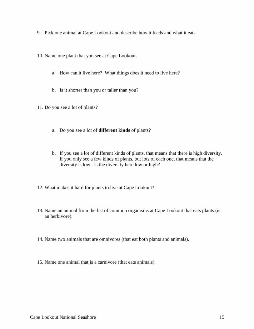
9. Pick one animal at Cape Lookout and describe how it feeds and what it eats.
10. Name one plant that you see at Cape Lookout.
a. How can it live here? What things does it need to live here?
b. Is it shorter than you or taller than you?
11. Do you see a lot of plants?
a. Do you see a lot of different kinds of plants?
b. If you see a lot of different kinds of plants, that means that there is high diversity. If you only see a few kinds of plants, but lots of each one, that means that the diversity is low. Is the diversity here low or high?
12. What makes it hard for plants to live at Cape Lookout? 13. Name an animal from the list of common organisms at Cape Lookout that eats plants (is
an herbivore).
14. Name two animals that are omnivores (that eat both plants and animals).
15. Name one animal that is a carnivore (that eats animals).
16 Life on the Outer Banks: Fourth Grade Edition
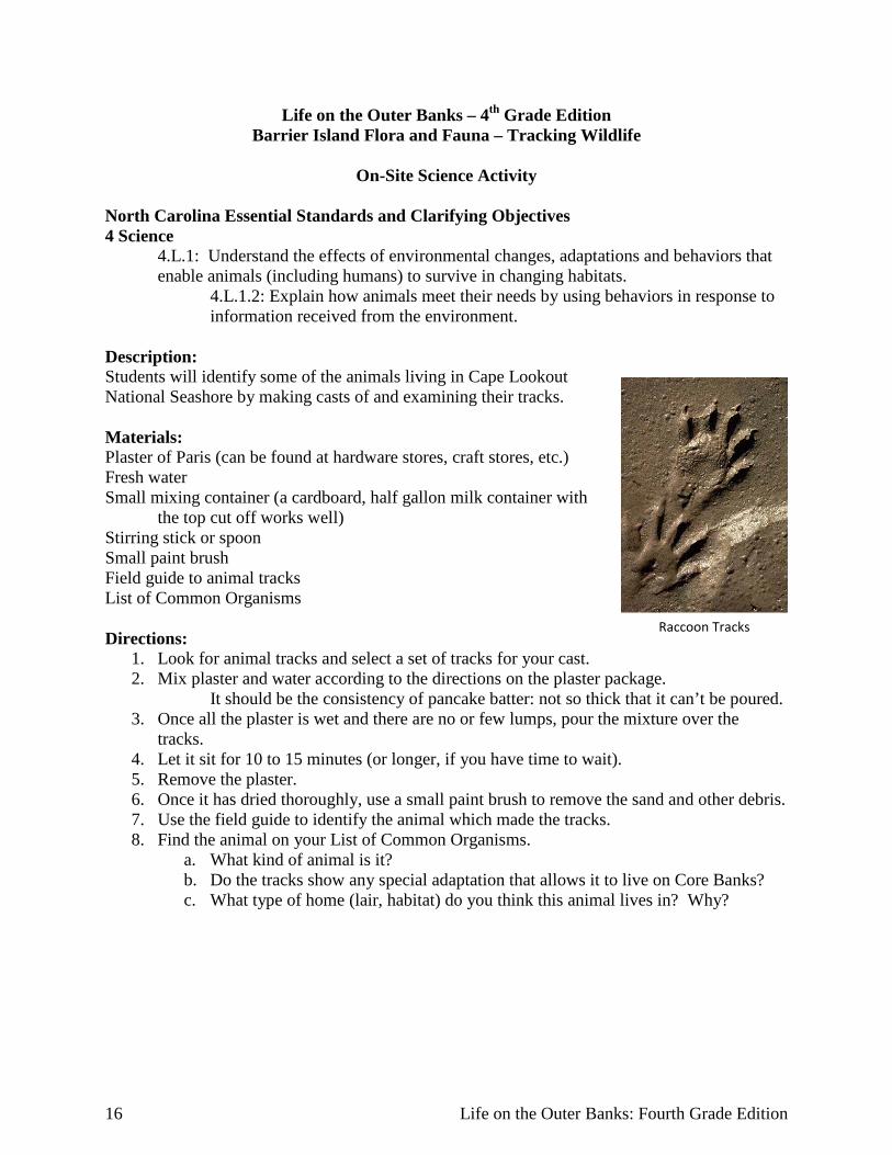
Life on the Outer Banks – 4th Grade Edition Barrier Island Flora and Fauna – Tracking Wildlife
On-Site Science Activity
North Carolina Essential Standards and Clarifying Objectives 4 Science
4.L.1: Understand the effects of environmental changes, adaptations and behaviors that enable animals (including humans) to survive in changing habitats.
4.L.1.2: Explain how animals meet their needs by using behaviors in response to information received from the environment.
Description: Students will identify some of the animals living in Cape Lookout National Seashore by making casts of and examining their tracks. Materials: Plaster of Paris (can be found at hardware stores, craft stores, etc.) Fresh water Small mixing container (a cardboard, half gallon milk container with
the top cut off works well) Stirring stick or spoon Small paint brush Field guide to animal tracks List of Common Organisms Directions:
1. Look for animal tracks and select a set of tracks for your cast. 2. Mix plaster and water according to the directions on the plaster package.
It should be the consistency of pancake batter: not so thick that it can’t be poured. 3. Once all the plaster is wet and there are no or few lumps, pour the mixture over the
tracks. 4. Let it sit for 10 to 15 minutes (or longer, if you have time to wait). 5. Remove the plaster. 6. Once it has dried thoroughly, use a small paint brush to remove the sand and other debris. 7. Use the field guide to identify the animal which made the tracks. 8. Find the animal on your List of Common Organisms.
a. What kind of animal is it? b. Do the tracks show any special adaptation that allows it to live on Core Banks? c. What type of home (lair, habitat) do you think this animal lives in? Why?
Raccoon Tracks
Cape Lookout National Seashore 17
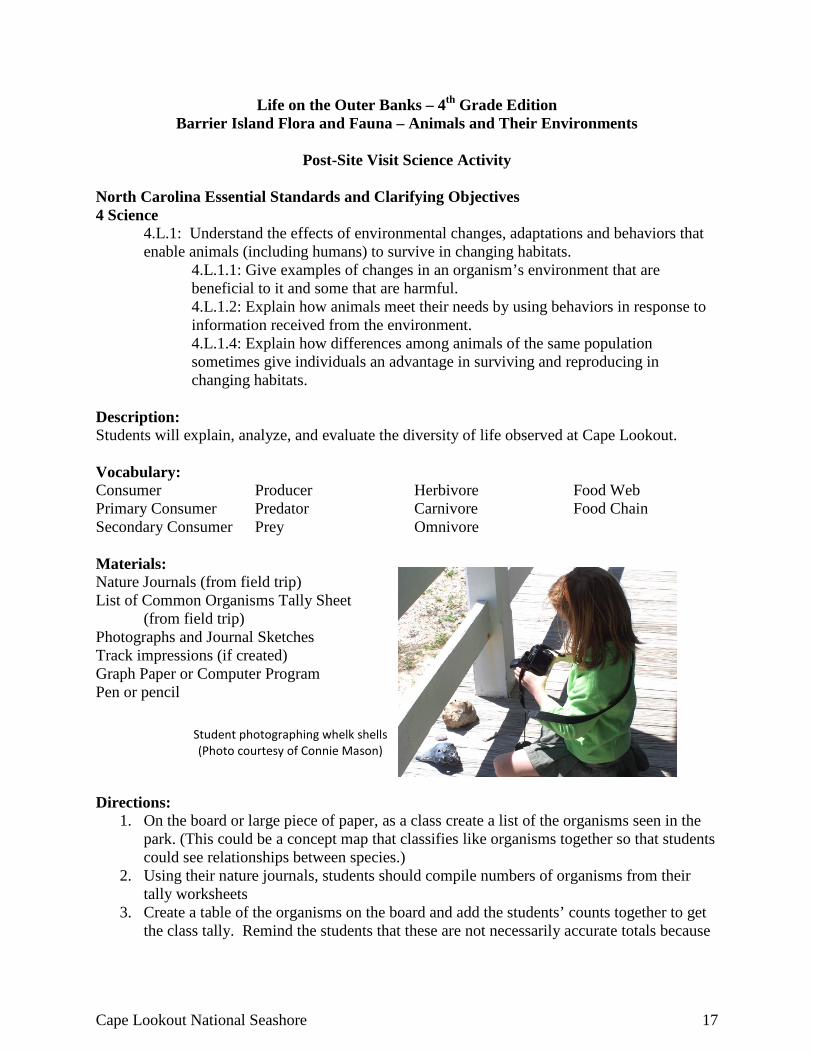
Life on the Outer Banks – 4th Grade Edition Barrier Island Flora and Fauna – Animals and Their Environments
Post-Site Visit Science Activity
North Carolina Essential Standards and Clarifying Objectives 4 Science
4.L.1: Understand the effects of environmental changes, adaptations and behaviors that enable animals (including humans) to survive in changing habitats.
4.L.1.1: Give examples of changes in an organism’s environment that are beneficial to it and some that are harmful. 4.L.1.2: Explain how animals meet their needs by using behaviors in response to information received from the environment. 4.L.1.4: Explain how differences among animals of the same population sometimes give individuals an advantage in surviving and reproducing in changing habitats.
Description: Students will explain, analyze, and evaluate the diversity of life observed at Cape Lookout. Vocabulary: Consumer Producer Herbivore Food Web Primary Consumer Predator Carnivore Food Chain Secondary Consumer Prey Omnivore Materials: Nature Journals (from field trip) List of Common Organisms Tally Sheet (from field trip) Photographs and Journal Sketches Track impressions (if created) Graph Paper or Computer Program Pen or pencil Directions:
1. On the board or large piece of paper, as a class create a list of the organisms seen in the park. (This could be a concept map that classifies like organisms together so that students could see relationships between species.)
2. Using their nature journals, students should compile numbers of organisms from their tally worksheets
3. Create a table of the organisms on the board and add the students’ counts together to get the class tally. Remind the students that these are not necessarily accurate totals because
Student photographing whelk shells (Photo courtesy of Connie Mason)
18 Life on the Outer Banks: Fourth Grade Edition
many of the organisms are being counted by several or many students. Researchers in the field have numerous ways to keep this from happening
4. On graph paper or using a computer program with graphing abilities—such as Excel—have students create a bar graph which shows the frequency of each organism seen.
5. Students should create a power point or photo journal from their field collections, making sure to include the class graph and the common and scientific name for the organism(s) in each photo. Their sketches and notes and photographs of their track impressions could be scanned to be included in their presentation. They should be given a copy of the rubric to help them self or peer review their presentations.
6. Use rubric to assess students’ work.
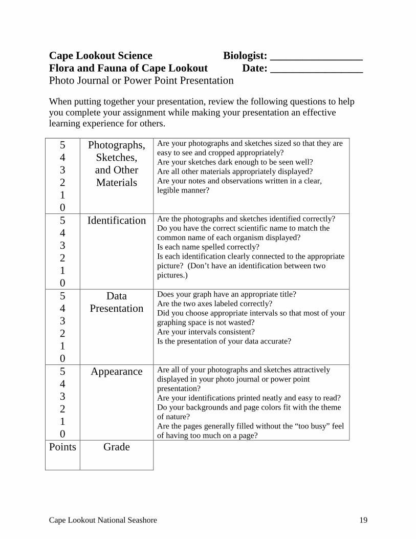
Cape Lookout National Seashore 19
Cape Lookout Science Biologist: _________________ Flora and Fauna of Cape Lookout Date: _________________ Photo Journal or Power Point Presentation When putting together your presentation, review the following questions to help you complete your assignment while making your presentation an effective learning experience for others.
5 4 3 2 1 0
Photographs, Sketches, and Other Materials
Are your photographs and sketches sized so that they are easy to see and cropped appropriately? Are your sketches dark enough to be seen well? Are all other materials appropriately displayed? Are your notes and observations written in a clear, legible manner?
5 4 3 2 1 0
Identification Are the photographs and sketches identified correctly? Do you have the correct scientific name to match the common name of each organism displayed? Is each name spelled correctly? Is each identification clearly connected to the appropriate picture? (Don’t have an identification between two pictures.)
5 4 3 2 1 0
Data Presentation
Does your graph have an appropriate title? Are the two axes labeled correctly? Did you choose appropriate intervals so that most of your graphing space is not wasted? Are your intervals consistent? Is the presentation of your data accurate?
5 4 3 2 1 0
Appearance Are all of your photographs and sketches attractively displayed in your photo journal or power point presentation? Are your identifications printed neatly and easy to read? Do your backgrounds and page colors fit with the theme of nature? Are the pages generally filled without the “too busy” feel of having too much on a page?
Points Grade
20 Life on the Outer Banks: Fourth Grade Edition
Life on the Outer Banks – 4th Grade Edition Cape Lookout Lighthouse – Changes with Technology
Pre-Site Social Studies and Math Activity
North Carolina Essential Standards and Clarifying Objectives 4 Social Studies
4.H.1: Analyze the chronology of key historical events in North Carolina history. 4.H.1.4: Analyze North Carolina’s role in major conflicts and wars from the Pre-Colonial period through Reconstruction.
4.H.2: Understand how notable structures, symbols and place names are significant to North Carolina.
4.H.2.1: Explain why important buildings, statues, monuments and place names are associated with the state’s history.
4.G.1: Understand how human, environmental and technological factors affect the growth and development of North Carolina.
4.G.1.4: Explain the impact of technology (communication, transportation and inventions) on North Carolina’s citizens, past and present.
4 Mathematics Common Core Measurement and Data Solve problems involving measurement
Cluster 2. Use the four operations to solve word problems involving distances, intervals of time, liquid volumes, masses of objects, and money, including problems involving simple fractions or decimals, and problems that require expressing measurement given in a larger unit in terms of a smaller unit. Represent measurement quantities using diagrams such as number line diagrams that feature a measurement scale.
Description: Students will learn about technological changes to the lighthouse and how those changes have affected the lives of the people at Cape Lookout. They will also learn about changes in the lighthouse due to actions supporting both the Union and Confederacy during the Civil War. Students will use their reasoning and estimation skills to complete the worksheet about sight distances. Vocabulary: Kerosene Electricity
Generator Incandescent Lamp
Automatic
Materials: Computers with internet access (optional) Study sheet: Chronology of Cape Lookout 1859 Lighthouse Math Worksheet Pens or pencils Calculators
Cape Lookout National Seashore 21
Directions: 1. Have students read the information about the 1859 lighthouse on the Cape Lookout
website: http://www.nps.gov/calo/historyculture/1859lh.htm a. or
b. Read aloud and discuss the information about the 1859 Lighthouse included with this section of the curriculum guide
2. Using the chronology of the 1859 Lighthouse, have students pick out the technological changes to the lighthouse and have them make a timeline showing the changes. (Remind them of the difference between a chronology and a timeline—chronology is a list of dates and events; a timeline accurately shows dates and intervals of time between dates.)
3. Have students think (privately or brainstorm in small groups) about how each change in technology may have affected the light keepers duties. For each of these changes have students write one or two sentences explaining their ideas of how light keepers’ jobs may have also changed.
4. Using the Chronology, discuss the physical changes that happened or were made to the lighthouse because of people’s actions during the Civil War.
5. As a class, in small groups, or individually, explore and answer the questions on the math worksheet.
6. Discuss the approaches that students or groups used to come up with their answers on the math portion of this activity.
22 Life on the Outer Banks: Fourth Grade Edition
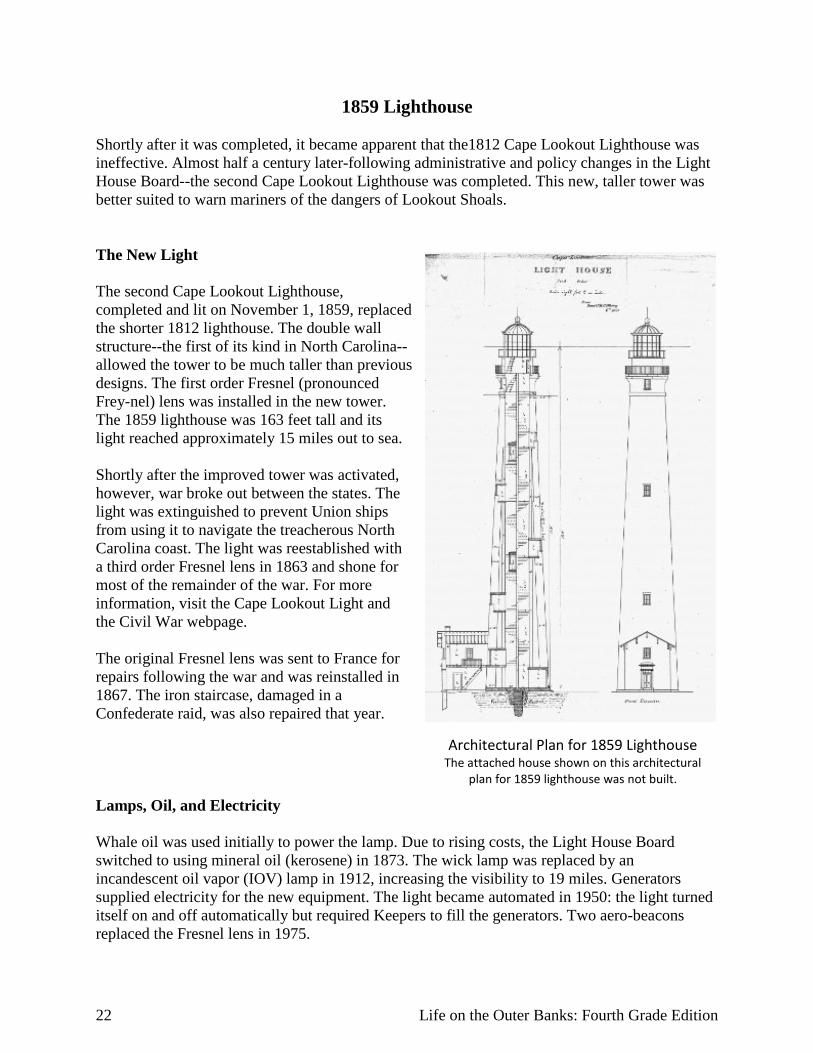
Architectural Plan for 1859 Lighthouse The attached house shown on this architectural
plan for 1859 lighthouse was not built.
1859 Lighthouse Shortly after it was completed, it became apparent that the1812 Cape Lookout Lighthouse was ineffective. Almost half a century later-following administrative and policy changes in the Light House Board--the second Cape Lookout Lighthouse was completed. This new, taller tower was better suited to warn mariners of the dangers of Lookout Shoals. The New Light The second Cape Lookout Lighthouse, completed and lit on November 1, 1859, replaced the shorter 1812 lighthouse. The double wall structure--the first of its kind in North Carolina--allowed the tower to be much taller than previous designs. The first order Fresnel (pronounced Frey-nel) lens was installed in the new tower. The 1859 lighthouse was 163 feet tall and its light reached approximately 15 miles out to sea. Shortly after the improved tower was activated, however, war broke out between the states. The light was extinguished to prevent Union ships from using it to navigate the treacherous North Carolina coast. The light was reestablished with a third order Fresnel lens in 1863 and shone for most of the remainder of the war. For more information, visit the Cape Lookout Light and the Civil War webpage. The original Fresnel lens was sent to France for repairs following the war and was reinstalled in 1867. The iron staircase, damaged in a Confederate raid, was also repaired that year. Lamps, Oil, and Electricity Whale oil was used initially to power the lamp. Due to rising costs, the Light House Board switched to using mineral oil (kerosene) in 1873. The wick lamp was replaced by an incandescent oil vapor (IOV) lamp in 1912, increasing the visibility to 19 miles. Generators supplied electricity for the new equipment. The light became automated in 1950: the light turned itself on and off automatically but required Keepers to fill the generators. Two aero-beacons replaced the Fresnel lens in 1975.
Cape Lookout National Seashore 23
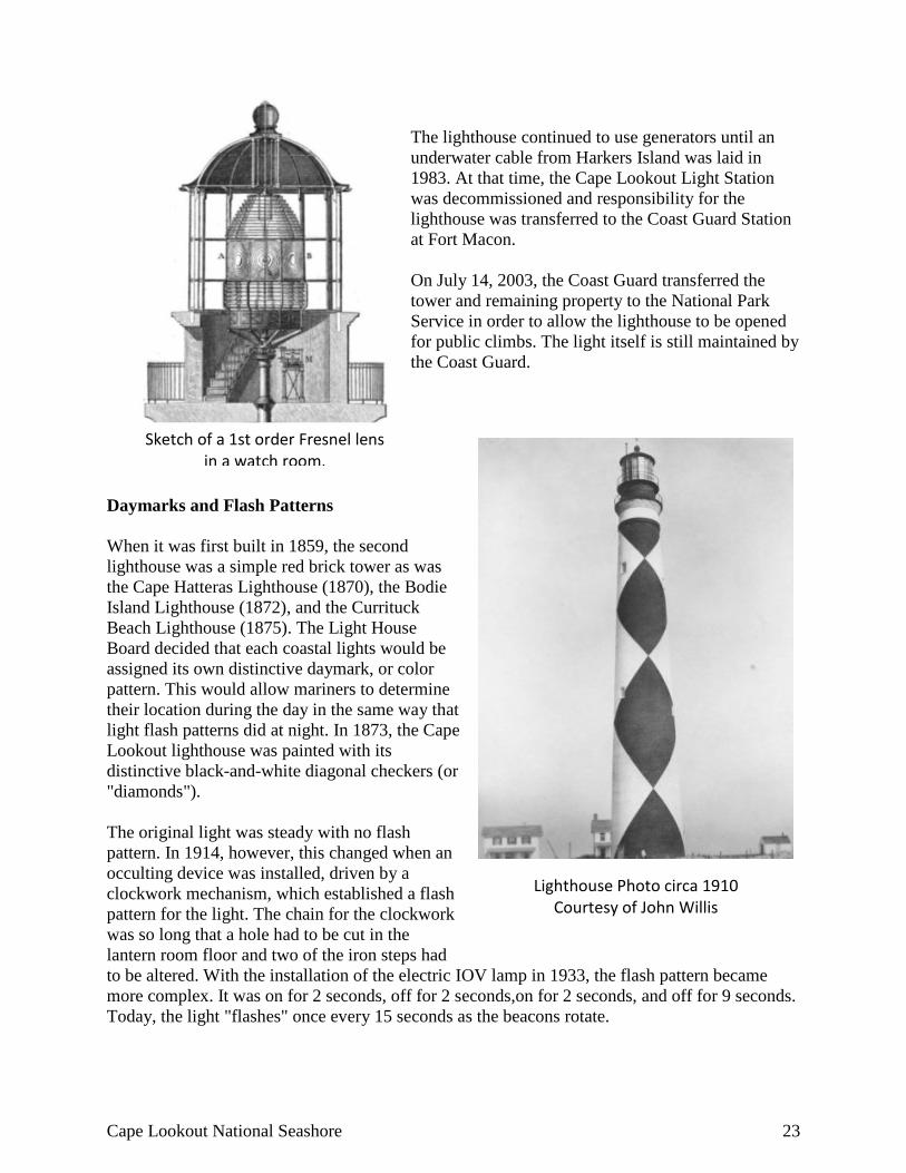
Sketch of a 1st order Fresnel lens in a watch room.
Lighthouse Photo circa 1910 Courtesy of John Willis
The lighthouse continued to use generators until an underwater cable from Harkers Island was laid in 1983. At that time, the Cape Lookout Light Station was decommissioned and responsibility for the lighthouse was transferred to the Coast Guard Station at Fort Macon. On July 14, 2003, the Coast Guard transferred the tower and remaining property to the National Park Service in order to allow the lighthouse to be opened for public climbs. The light itself is still maintained by the Coast Guard.
Daymarks and Flash Patterns When it was first built in 1859, the second lighthouse was a simple red brick tower as was the Cape Hatteras Lighthouse (1870), the Bodie Island Lighthouse (1872), and the Currituck Beach Lighthouse (1875). The Light House Board decided that each coastal lights would be assigned its own distinctive daymark, or color pattern. This would allow mariners to determine their location during the day in the same way that light flash patterns did at night. In 1873, the Cape Lookout lighthouse was painted with its distinctive black-and-white diagonal checkers (or "diamonds"). The original light was steady with no flash pattern. In 1914, however, this changed when an occulting device was installed, driven by a clockwork mechanism, which established a flash pattern for the light. The chain for the clockwork was so long that a hole had to be cut in the lantern room floor and two of the iron steps had to be altered. With the installation of the electric IOV lamp in 1933, the flash pattern became more complex. It was on for 2 seconds, off for 2 seconds,on for 2 seconds, and off for 9 seconds. Today, the light "flashes" once every 15 seconds as the beacons rotate.

24 Life on the Outer Banks: Fourth Grade Edition
Cape Lookout 1859 Lighthouse Chronology November 1, 1859
The new Cape Lookout Lighthouse is completed and lighted. It is a red brick tower, 163 ft high; a spiral iron staircase winds to the top. The first-order Fresnel lens displays a fixed light that can be seen 18 miles in good weather. This tower is the first of this new style to be built along the Outer Banks. The old 1812 tower is converted to a keeper's quarters (the old lighting apparatus is removed from the lantern) and is shown on charts as late as 1868.
May 20, 1861
North Carolina joins the Confederacy. The lenses from all coastal lighthouses and navigational beacons are ordered removed from their working locations and stored until after the war by the new Confederate government.
1862
Union troops capture Beaufort and Morehead City and, after a short battle, the Confederate troops defending Fort Macon surrender.
1863
A third-order Fresnel lens is installed in the lighthouse by the Union. Although the range is reduced, the Cape Lookout lighthouse once again warns ships of the nearby shoals. Whale oil, which is used as fuel for the light, climbs to $2.43 per gallon and the Lighthouse Board searches for a cheaper substitute fuel.
April 2, 1864 A small group of Confederate troops under the command of L.C. Harland sneak through Union lines and out to the lighthouse. Their attempt to blow up the lighthouse is unsuccessful, however the explosion does destroy the lighthouse oil supply and damages the iron stairs. With iron unavailable during the war, the damaged sections of the stairs are replaced by wooden ones. Where wooden staircase connected to the Lighthouse’s interior wall is marked by two squares of mortar and brick.
Cape Lookout National Seashore 25
1865
The Fresnel lenses from all the North Carolina lighthouses are found in Raleigh, NC The lenses are shipped back to their original manufacturers to be checked out and repaired.
1867
The temporary wooden stairs are replaced when iron once again becomes available after the war. The original first-order Fresnel lens is reinstalled. Congress sets the average rate of pay for the Keeper at $600 a year. This wage does not change for the next 50 years.
1873
The new keeper's quarters is completed. It eventually housed two assistant keepers and their families. (This is the present Keeper's Quarters Museum.) The lighthouse is painted with its distinctive diagonal black-and-white checkers to distinguish it as a day marker. Mineral oil (kerosene) becomes the fuel used to ignite the lamp.
1892
Lack of confidence in shorebased lighthouses raises the recommendation for a lightship at the southern extremity of Cape Lookout Shoals. This would protect the mariner in hazy weather when a vessel might be on the shoals before seeing the Cape Lookout Lighthouse. Congress takes no action at this time. Cape Lookout Lightship This lightship was anchored off the point of the cape to warn mariners of the dangers of Lookout Shoals.
1904
A lightship is anchored on the shoals. The steam fog signal warns mariners away from the dangerous waters. Through the years, a lightship remains on station despite being torn from its moorings during storms.
1910
The Lighthouse Board is dissolved, and replaced by the Bureau of Lighthouses.
26 Life on the Outer Banks: Fourth Grade Edition
1914
The lower gallery is widened to accommodate a storm entry over the external hatchway. The light source is changed from a wick lamp to a 75-millimeter incandescent oil vapor lamp (IOV). The change increases the light's brightness from 9,000 to 77,000 candlepower. An occulting device is also installed changing the light characteristic from a fixed white light to a "flashing" light. The light now shows "31" (three 9 second flashes of light, then one 9 second flash of light) twice every ninety seconds.
August 15, 1933
The installation of a radiobeacon and electric lighting equipment is completed. The 75-millimeter incandescent oil vapor lamp is replaced with four 250-watt T-14 electric lamps (bulbs), this change increases the candlepower from 77,000 to 160,000. Generators supply the electricity for the new equipment.
1950
The Cape Lookout Lighthouse becomes automated--making it able to turn the light on and off as needed. Electrical power is still provided by diesel powered generators, requiring someone to maintain and repair the generators. With the departure of the resident lightkeepers, the nearby Cape Lookout Coast Guard Station adds monitoring the lighthouse to its duties.
September 1975
The Fresnel lens is removed and replaced with two DCB-24 aerobeacons. These turn at the speed of one full revolution every 30 seconds. With the lights mounted back to back, the new light pattern is one “flash” every 15 seconds. The Fresnel lens is shipped to its new home – the Portsmouth Coast Guard Support Center in Virginia and placed on display.
May 18, 1982
Upon the Cape Lookout Coast Guard Station’s closure, it was immediately reopened as the Cape Lookout Light Station. This was to allow for the operation of the light until an underwater electrical cable could be laid from Harkers Island. Once this was accomplished the lighthouse would be completely automated.
Cape Lookout National Seashore 27
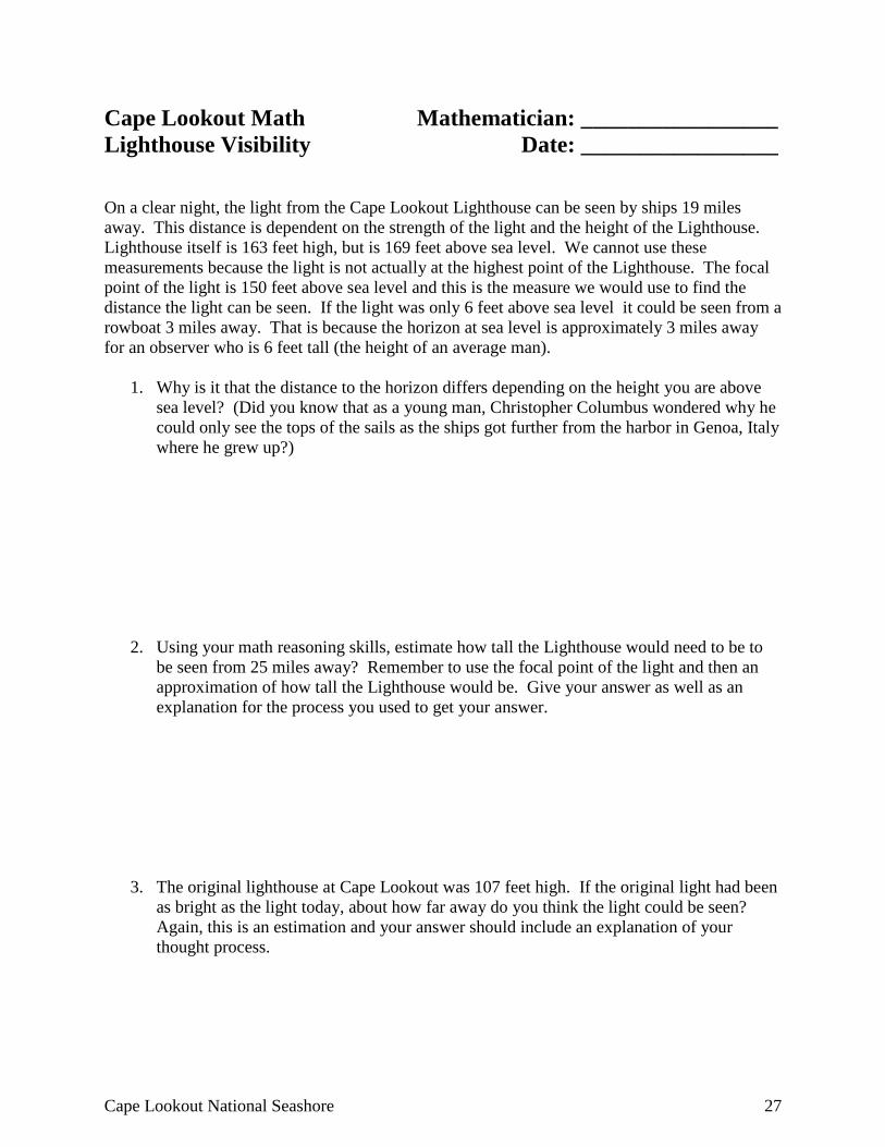
Cape Lookout Math Mathematician: _________________ Lighthouse Visibility Date: _________________ On a clear night, the light from the Cape Lookout Lighthouse can be seen by ships 19 miles away. This distance is dependent on the strength of the light and the height of the Lighthouse. Lighthouse itself is 163 feet high, but is 169 feet above sea level. We cannot use these measurements because the light is not actually at the highest point of the Lighthouse. The focal point of the light is 150 feet above sea level and this is the measure we would use to find the distance the light can be seen. If the light was only 6 feet above sea level it could be seen from a rowboat 3 miles away. That is because the horizon at sea level is approximately 3 miles away for an observer who is 6 feet tall (the height of an average man).
1. Why is it that the distance to the horizon differs depending on the height you are above sea level? (Did you know that as a young man, Christopher Columbus wondered why he could only see the tops of the sails as the ships got further from the harbor in Genoa, Italy where he grew up?)
2. Using your math reasoning skills, estimate how tall the Lighthouse would need to be to be seen from 25 miles away? Remember to use the focal point of the light and then an approximation of how tall the Lighthouse would be. Give your answer as well as an explanation for the process you used to get your answer.
3. The original lighthouse at Cape Lookout was 107 feet high. If the original light had been as bright as the light today, about how far away do you think the light could be seen? Again, this is an estimation and your answer should include an explanation of your thought process.
28 Life on the Outer Banks: Fourth Grade Edition
Life on the Outer Banks – 4th Grade Edition Cape Lookout Lighthouse – Lighthouse Experiences
On-Site Social Studies Activity
North Carolina Essential Standards and Clarifying Objectives 4 Social Studies
4.H.1: Analyze the chronology of key historical events in North Carolina history. 4.H.1.4: Analyze North Carolina’s role in major conflicts and wars from the Pre-Colonial period through Reconstruction.
4.H.2: Understand how notable structures, symbols and place names are significant to North Carolina.
4.H.2.1: Explain why important buildings, statues, monuments and place names are associated with the state’s history.
4.G.1: Understand how human, environmental and technological factors affect the growth and development of North Carolina.
4.G.1.4: Explain the impact of technology (communication, transportation and inventions) on North Carolina’s citizens, past and present.
Description: Students will visit Cape Lookout National Seashore and tour the Harkers Island Visitors’ Center and the Keep’s Quarters Museum. They will complete the scavenger hunt which is available at the Light Station Visitor’s Center. If the visit can be scheduled during the climbing season (May through September), students will climb the Lighthouse. Pre-visit reservations should be made by visiting the Cape Lookout National Seashore website. http://www.nps.gov/calo/index.htm An academic fee waiver can be requested for student groups wishing to climb the Lighthouse.
Cape Lookout National Seashore 29
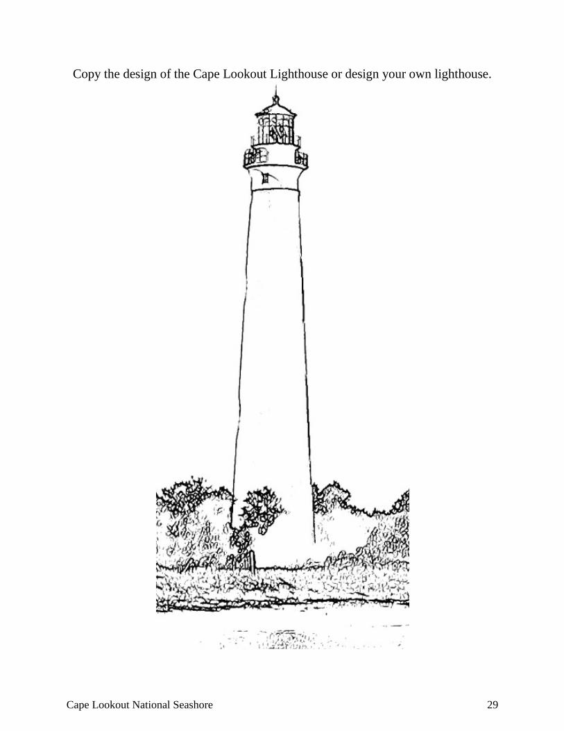
Copy the design of the Cape Lookout Lighthouse or design your own lighthouse.
30 Life on the Outer Banks: Fourth Grade Edition
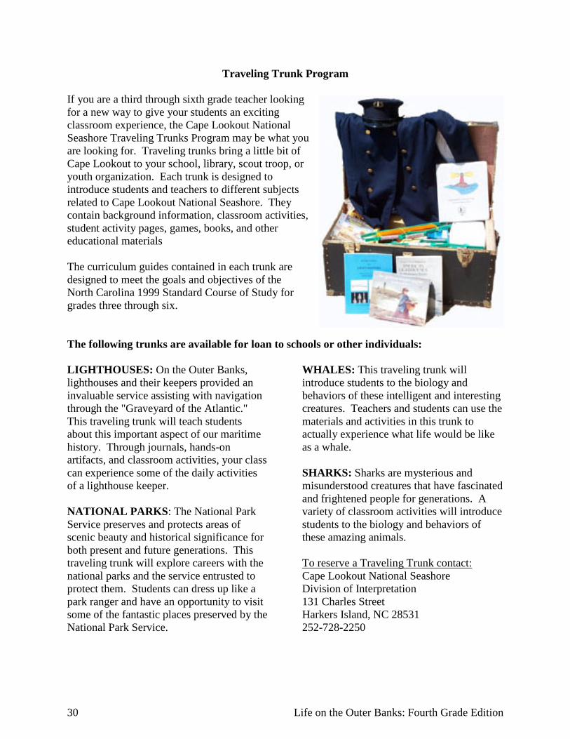
Traveling Trunk Program If you are a third through sixth grade teacher looking for a new way to give your students an exciting classroom experience, the Cape Lookout National Seashore Traveling Trunks Program may be what you are looking for. Traveling trunks bring a little bit of Cape Lookout to your school, library, scout troop, or youth organization. Each trunk is designed to introduce students and teachers to different subjects related to Cape Lookout National Seashore. They contain background information, classroom activities, student activity pages, games, books, and other educational materials The curriculum guides contained in each trunk are designed to meet the goals and objectives of the North Carolina 1999 Standard Course of Study for grades three through six. The following trunks are available for loan to schools or other individuals: LIGHTHOUSES: On the Outer Banks, lighthouses and their keepers provided an invaluable service assisting with navigation through the "Graveyard of the Atlantic." This traveling trunk will teach students about this important aspect of our maritime history. Through journals, hands-on artifacts, and classroom activities, your class can experience some of the daily activities of a lighthouse keeper. NATIONAL PARKS: The National Park Service preserves and protects areas of scenic beauty and historical significance for both present and future generations. This traveling trunk will explore careers with the national parks and the service entrusted to protect them. Students can dress up like a park ranger and have an opportunity to visit some of the fantastic places preserved by the National Park Service.
WHALES: This traveling trunk will introduce students to the biology and behaviors of these intelligent and interesting creatures. Teachers and students can use the materials and activities in this trunk to actually experience what life would be like as a whale. SHARKS: Sharks are mysterious and misunderstood creatures that have fascinated and frightened people for generations. A variety of classroom activities will introduce students to the biology and behaviors of these amazing animals. To reserve a Traveling Trunk contact: Cape Lookout National Seashore Division of Interpretation 131 Charles Street Harkers Island, NC 28531 252-728-2250
Cape Lookout National Seashore 31
Bibliography Amspacher, Karen W., ed. 1987 Island Born and Bred: a Collection of Harkers Island Food, Fun, Fact, and Fiction.
Harkers Island United Methodist Women, Owen Dunn co., New Bern. Barnes, Jay 1995 North Carolin’a Hurricane History. Chapel Hill and London: The University of North
Carolina Press. Brimley, H.,H. 1894 “Whale Fishing in North Carolina,” in Bulletin of the North Carolina Department of
Agriculture, 14 (April). Cape Lookout National Seashore 2006 Cape Lookout National Seashore Ethnographic Overview and Assessment and Harkers
Island Case Study: Scope of Work. Unpublished document. CALO Headquarters, Harkers Island.
Nd. Cape Lookout National Seashsore, NPS Scientific Monograph No. 6. Caudle, Neil, Cathy Hart, and Cassie Griffin 1980a “Storm Carved an Inlet and Broke Island’s Sleep,” June. Coastwach, North Carolina Sea
Grant College Program, Raleigh. 1980b “Fishermen keep nets and traditions well-tended,” June. Coastwatch. North Carolina
Sea Grant College Program, Raleigh. 1980c “Life Among the Loon Eaters,” August. Coastwatch. North Carolina Sear Grant
College Program, Raleigh. Cecelski, David S. 2001 The Waterman’s Song. Chapel Hill: The University of North Carolina Press. Clark, A. Howard 1887 The Whale Fishery: History and Present Condition of the Fishery. In The Fisheries and
Fishing Industries of the United States. Washington, D. C.: U.S. Commission of Fish and Fisheries.
Daniels, M. Mason Nd. “A Beautiful Church Wedding on Portsmouth Island Fifty –Seven Years Ago.”
Unpublished manuscript. Davis, P.D. and K. Hamilton 1982 The Heritage of Carteret County, North Carolina, Volume 1. Winston-Salem: Hunter
Publishing Co.
32 Life on the Outer Banks: Fourth Grade Edition
Day, Jean 1994 Cedar Island Fisher Folk. Morehead City, NC: Golden Age Press. Dunbar, Gary S. 1956 “Geographical History of the Carolina Banks.” Technical report number 8. Baton
Rouge, LA: Coastal Studies Institute, Louisiana State University. Earll, R. Edward 1887 North Carolina and its Fisheries. In The Fisheries and Fishing Industries of the United
States. Washington, D.C.: U.S. Commission of Fish and Fisheries. Engels, William L. 1952 Vertebrate Fauna of North Carolina Coastal Islands II. Notre Dame, IN: The University
of Notre Dame Press. Garrity-Blake, Barbara 1996 To fish or not to fish: occupational transitions within the commercial fishing community,
Carteret County, NC. Fisheries Research Reports to the Fisheries Moratorium Steering Committee. UNC-SG-96-06, Raleigh: North Carolina Sea Grant College Program.
1994 The Fish Factory. Knoxville: University of Tennessee Press. Garrity-Blake, Barbara and James Sabella 2009 Ethnohistorical Description of Four Communities Associated with Cape Lookout
National Seashore, Harkers Island, NC: Cape Lookout National Seashore. Government Printing Office Nd. “North Carolina and its Fisheries: in George Brown Goode. The Fisheries and Fishery
Industries of the United States. Washington, D.C. Guthrie, Suzanne Yeomans 1999 Going Home, In Our Shared Past: Diamond City and Ca’e Bankers Reunion.
Unpublished document, Core Sound Waterfowl Museum. Nd. The Ca’ebankers of Carteret by Josiah W. Bailey, Sr., Reprinted from “The Mailboat,”
Vol. 1, Nos 1 & 2. Hancock, Joel 1988 Strengthened by the Storm: the Coming of the Mormons to Harkers Island, North
Carolina, 1897-1909. Morehead City, NC: Campbell and Campbell. 1990 “Wade’s Shore Trees”, in Our Christmas Memories, The Mailboat, Harkers Island.
Cape Lookout National Seashore 33
Harkers Island Electric Membership Corporation 1989 “Fifty Years of Change: Compiled in Celebration of the 50th Anniversary of
Electrification on Harkers Island, North Carolina.” Harkers Island, NC: Harkers Island Electric Membership Corporation.
Holland, F. Ross 1968 A Survey History of Cape Lookout National Seashore. Washington, DC: National Park
Service, U.S. Department of the Interior. Impact Assessment Incorporated (IAI) 2005 An Ethnohistorical Description of the Eight Villages Adjoining Cape Hatteras National
Seashore and Interpretive Themes of History and Heritage. National Park Service, U.S. Department of the Interior.
Jones, Tommy H. 2004a Cape Lookout National Seashore Life-Saving Station Historic Structure Report. Historic
Architecture, Cultural Resources Division. Atlanta, GA: Southeast Regional Office, National Park Service.
2004b Cape Lookout National Seashore Lighthouse Keeper’s Dwelling (1907) Historic
Structure Report. Historic Architecture, Cultural Resources Division. Atlanta, GA: Southeast Regional Office, National Park Service.
2004c Cape Lookout National Seashore George Dixon House Historic Structure Report.
Historic Architecture, Cultural Resources Division. Atlanta, GA: Southeast Regional Office, National Park Service.
Little, Ruth 1998 Cape Lookout Village Historic District, Carteret County, North Carolina. National
Register of Historic Places, Washington, DC: National Park Service, U.S. Department of the Interior.
Mallinson, David J., Stephen J. Culver, Stanley R. Riggs, J.P. Walsh, Dorothea Ames, and Curtis
W. Smith. 2008 “Past, Present and Future Inlets of the Outer Banks Barrier Islands, North Carolina.” East
Carolina University. Last modified: December 2008. http://core.ecu.edu/geology/riggs/Mallinson%20et%20al.%20inlet%20white%20paper%20with%20figures.pdf.
North Carolina Maritime Museum Nd. “Commercial Fishing-America’s First Industry: Whales and Whaling,: online tour of the
North Carolina Maritime Museum, located at: http://www.ncmaritime.org/exhibits/tour.htm

34 Life on the Outer Banks: Fourth Grade Edition
Olson, Sarah 1982 Historic Resource Study, Portsmouth Village, Cape Lookout National Seashore, North
Carolina. National Park Service, U.S. Department of the Interior, Washington. Payne, Roger L. 1985 Place Names of the Outer Banks. Washington, DC: Thomas A. Williams. Pitts, Charles O. Jr. 1984 The Heritage of Carteret County Volume II. Winston-Salem, NC: Hunter Publishing
Company. Prioli, Carmine 2002 “The Stormy Birth of Cape Lookout National Seashore.” In Life at the Edge of the Sea:
Essays on North Carolina’s Coast and Coastal Culture. Candy Beal and Carmine Prioli, editors, Wilmington, NC: Coastal Carolina Press.
2007 The Wild Horses of Shackleford Banks, Winston-Salem, NC: John F. Blair. Prioli, Carmine and Edwin Martin 1998 Hope for a Good Season The Ca’s Bankers of Harkers Island, Asheboro, NC: Down
Home Press. Salter, Bryan 1975 Carteret’s Commerce and Economy, 1750-1789. In North Carolina’s Coastal Carteret
County During the American Revolution 1765-1785. Jean Kell, ed. Greenville, NC: ERA Press.
Simpson, Marcus B. and Sallie W. Simpson 1990 Whaling on the North Carolina Coast. Division of Archies and History, Raleigh: North
Carolina Department of Cultural Resources. Stick, David 1958 The Outer Banks of North Carolina. Chapel Hill: The University of North Carolina Press. 1952 Graveyard of the Atlantic, Chapel Hill: The University of North Carolina Press. United States Census Bureau Nd. Population, North Carolina, 1870-2000. Washington, DC: United States Census Bureau. Yeomans, David 1991 “The Harkers Island Fishermen”, The Mailboat, V.2, No..3, Fall. Ward, H. Trawick and R. P. Stephen Davis, Jr. 1998 Times Before History: The Archaeology of North Carolina. Chapel Hill: The University
of North Carolina Press.
Cape Lookout National Seashore 35
Williamson, Clifford 1992 Unsung Heroes of the Surf: The Lifesaving Services of Carteret County. Marshallberg,
NC: Grandma Publications. Willis, A.A. 1999 The Crowd from Off the Banks. In Our Shared Past: Diamond City and Ca’e Bankers
Reunion. Unpublished document, Core Sound Waterfowl Museum. Willis, Dot Salter and Ben Salter 2004 Portsmouth Island: Short Stories and History. Limited Edition, Frances Eubanks and
Lynn S. Salsi, eds., Columbia, SC: Montville Press. Wolfram, Walt and Natalie Schilling Estes 1997 Hoi Toide on the Outer Banks: the Story of the Ocracoke Brogue. Chapel Hill: The
University of North Carolina Press.