Tribal College Grant Programs Similarities… and Specialties Similarities… and Specialties.

1
Lesson Topic: Maps of New England
Essential Question: How and why have maps of New England changed over time?
Grade: 3
Standard/s:Common Core State StandardsCCSS.ELA-LITERACY.RI.3.9Compare and contrast the most important points and key details presented in two texts on the same topic.
Massachusetts History & Social Studies StandardsConcepts and Skills- History and Geography5. Describe the difference between a contemporary map of their city or town and the map of their city or town in the 18th, 19th, or early 20th century. (H, G)
Learning Standards- New England and Massachusetts3.1 On a map of the United States, locate the New England states (Connecticut, Rhode Island, Massachusetts, Vermont, New Hampshire, Maine) and the Atlantic Ocean. On a map of Massachusetts, locate major cities and towns, Cape Ann, Cape Cod, the Connecticut River, the Merrimack River, the Charles River, and the Berkshire Hills. (G)
Content Objective/s:Students will be able to identify key similarities and differences between two historic maps and a contemporary map of New England.
Language Objective/s:Students will be able to compare and contrast using key vocabulary and phrases to explain similarities and differences.
Materials:1616 Map of New England by John Smith1675 Map of New England by John SellerContemporary Map of New EnglandGraphic Organizer: Box ChartCompare and Contrast Vocabulary & Phrases Chart (Provided by Readworks)Computers (recommended)
Vocabulary:Historic CartographerContemporary Graphic ElementsSimilarities OceanDifferences Coastline
Bay
2
Procedures:
1. Previewa. Students will complete the preview activity at their seats before coming to the rug
for the mini-lesson or discuss the preview question prior to delving into the mini-lesson.
i. Preview Question: How do you think maps are created?
2. Mini-lesson/Note-making Activity:a. Connection: The teacher will review information regarding general geography
and the map of New England.i. Guiding Questions: What continent do we live on? What region do we
live in? What state do we live in? What city do we live in? What other states are located in New England? What ocean borders New England?
b. Turn & Talk: Students will turn to a partner and share their response to the preview question: “How do you think maps are created?”
c. Teach: The teacher will introduce the new concept that “Maps tell stories. They are constantly changing as we have new information or need to look at the world in a new way.”
i. The whole class will have an oral discussion describing a contemporary map of New England.
1. Guiding Questions: What do you notice about the map? What places does the map show? What information would the cartographer have to know to make this map?
ii. The teacher will then introduce the two historic maps of New England: 1616 created by John Smith and 1675 created by John Seller. After introducing the maps, the teacher will review and define the key vocabulary for the students
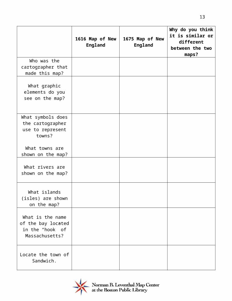
iii. The teacher will then introduce the box chart and explain how it will help the students collect information to compare and contrast the two maps.
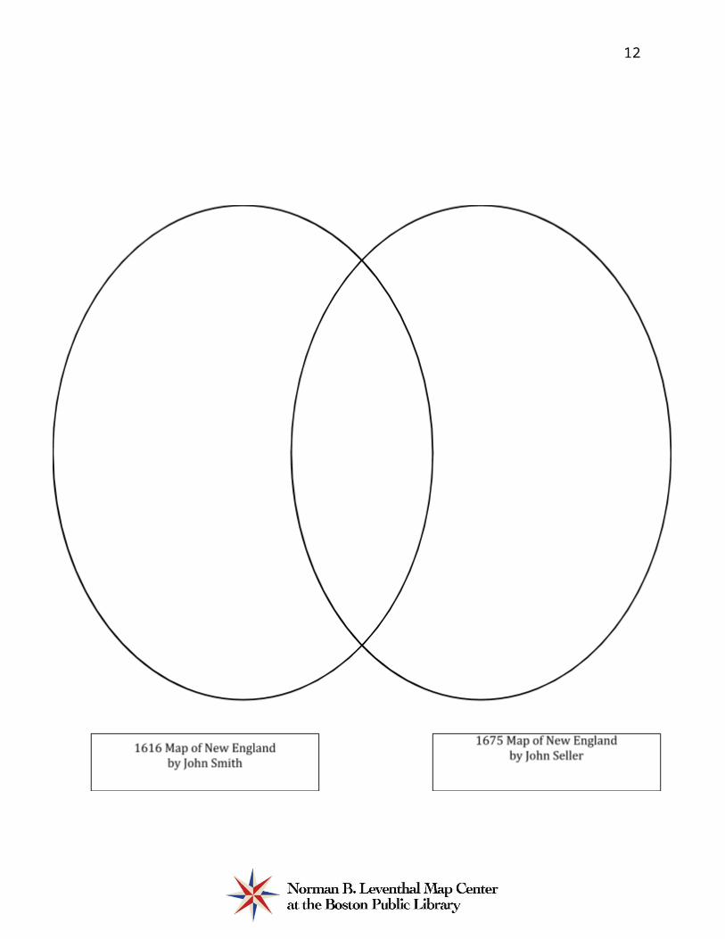
d. Independent Work: Students will work with a partner to complete the graphic organizer to identify the similarities and differences between the 1616 and 1675 maps of New England.
i. Note: Students may use either the box chart or the Venn Diagram depending on their level of comprehension. Please be sure to use the appropriate box chart for computer or paper maps.
e. Share: Students will report the information from the box chart and identify similarities and differences between the two historic maps. Teacher will record the observations on an anchor chart.

3
3. Processing Activity: Students will pretend they are John Seller, the 1675 mapmaker, and will write a letter explaining the changes they made from the 1616 map of New England. Students need to include at least 3 changes and explain reasons for those changes.
4. Extension: After completing the assignment, students may compare both historic maps to a contemporary map of New England.

4

5
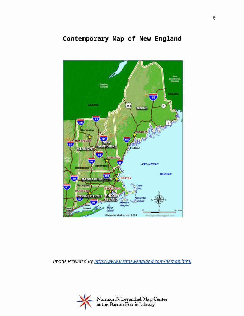
Contemporary Map of New England
Image Provided By http://www.visitnewengland.com/nemap.html
6
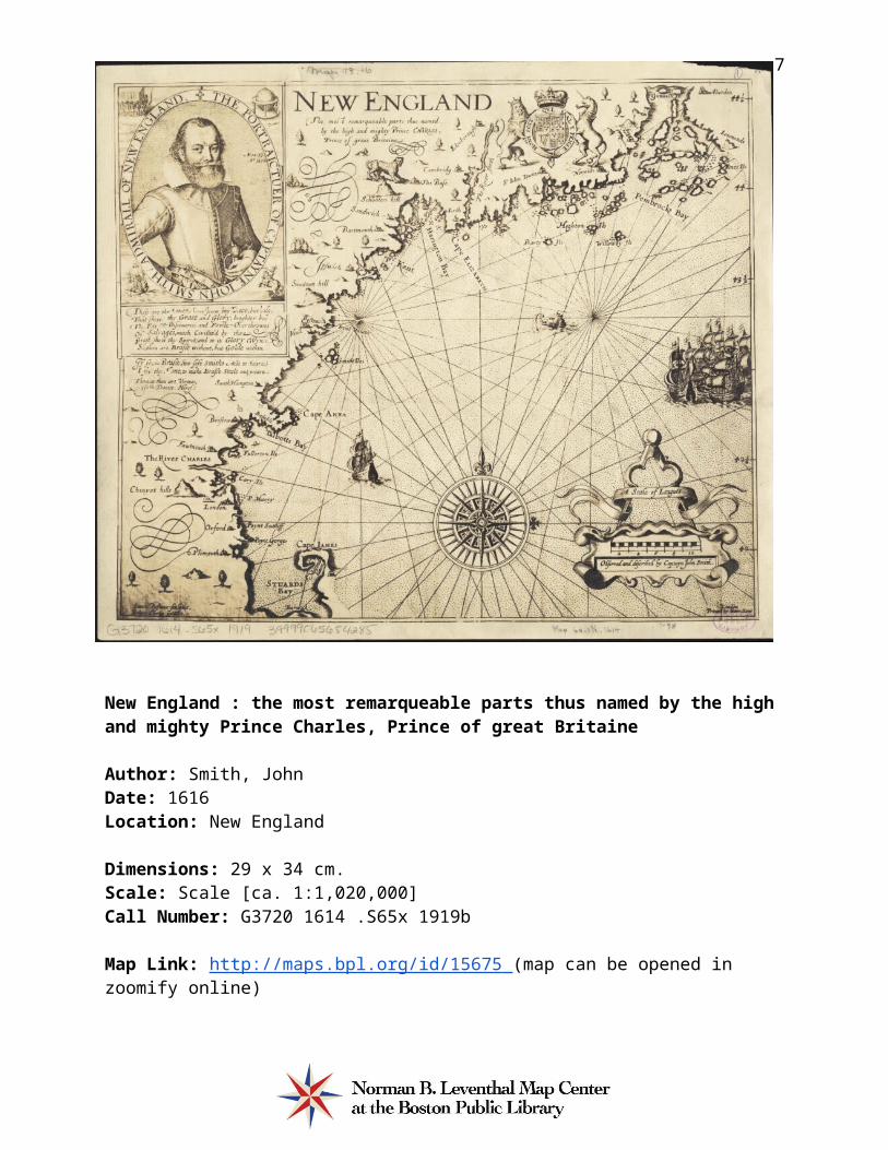
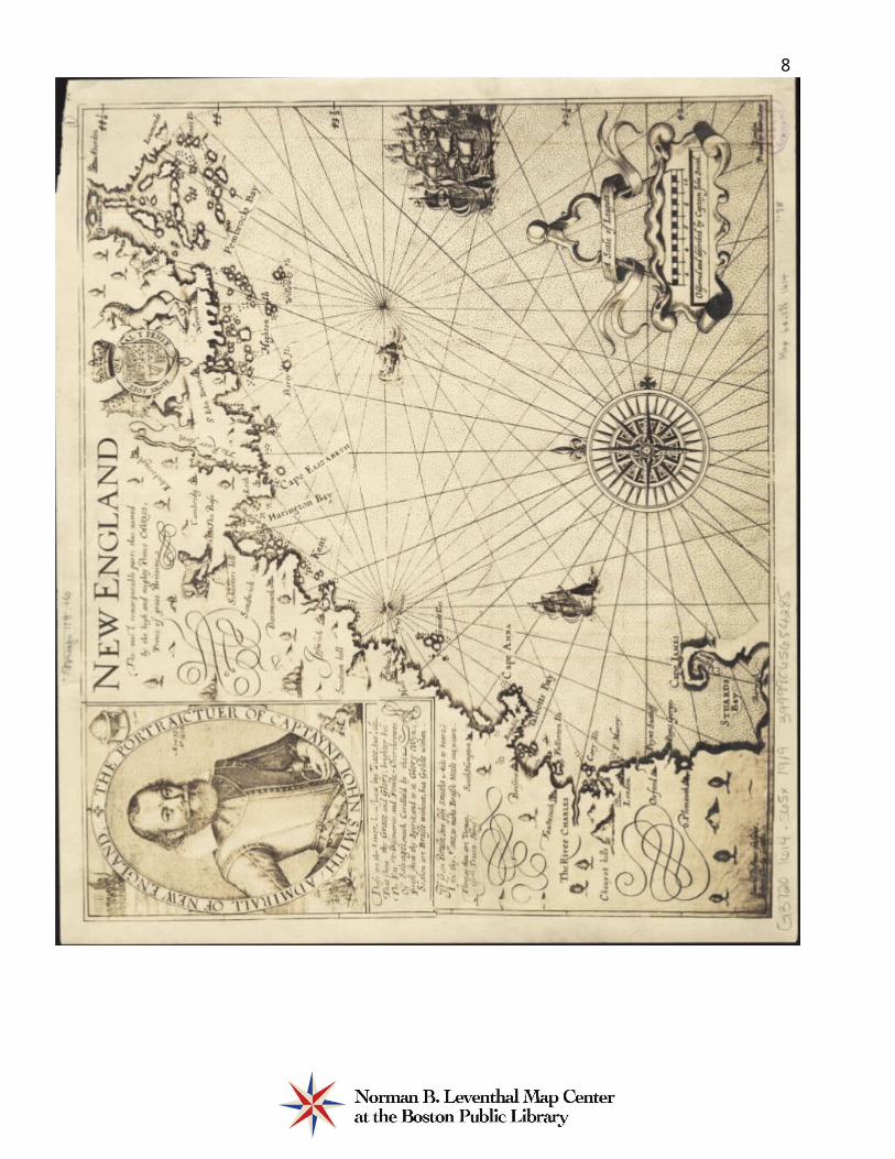
New England : the most remarqueable parts thus named by the high and mighty Prince Charles, Prince of great Britaine
Author: Smith, JohnDate: 1616Location: New England
Dimensions: 29 x 34 cm.Scale: Scale [ca. 1:1,020,000]Call Number: G3720 1614 .S65x 1919b
Map Link: http://maps.bpl.org/id/15675 (map can be opened in zoomify online)
7
8
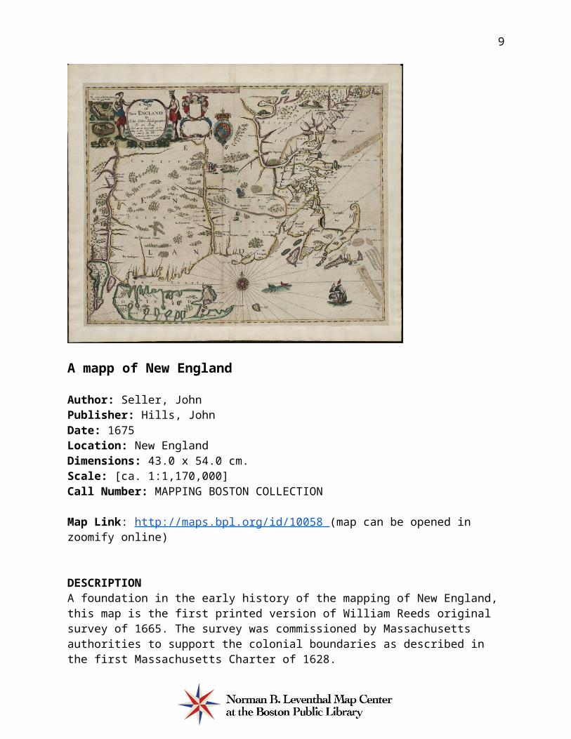
A mapp of New England
Author: Seller, JohnPublisher: Hills, JohnDate: 1675Location: New EnglandDimensions: 43.0 x 54.0 cm.Scale: [ca. 1:1,170,000]Call Number: MAPPING BOSTON COLLECTION
Map Link: http://maps.bpl.org/id/10058 (map can be opened in zoomify online)
DESCRIPTIONA foundation in the early history of the mapping of New England, this map is the first printed version of William Reeds original survey of 1665. The survey was commissioned by Massachusetts authorities to support the colonial boundaries as described in the first Massachusetts Charter of 1628.As originally proposed, the northern boundary was located thirty miles north of the Merrimack River, assuming the river followed an east-west course. When it was later discovered that inland the Merrimack River turned north, Massachusetts colonists aggressively claimed lands thirty miles north of the rivers source, an area also claimed by New Hampshire.The survey is the earliest to depict the relative position of the Hudson, Connecticut and Merrimack rivers. Also identified on the map are several towns that had been destroyed by Indians during the early months of King Philip's War.
9

10
11
1616 Map of New England
1675 Map of New England
Why do you think it is similar or
different between the two maps?
Who was the cartographer that made
this map?
What graphic elements do you see on the map?
What symbols does the cartographer use to
represent towns?
What towns are shown on the map?
What rivers are shown on the map?
What islands (isles) are shown on the map?
What is the name of the bay located in the “hook”
of Massachusetts?
Locate the town of Sandwich.
Describe where it is located along the New
England coast.
Why do you think this map was made?
12
Box Chart (For Use w/ Paper Maps)
1616 Map of New England
1675 Map of New England
Why do you think it is similar or
different between the two maps?
Who was the cartographer that made this map?
What graphic elements do you see
on the map?
How much of the Atlantic Ocean is displayed on the
map?
What is the name of the bay located in
the “hook” of Massachusetts?
How do the images around the
cartographer’s name connectto the map ?
Why do you think this map was made?
13
Extension: Contemporary Map of New England
Contemporary Map of New England
Who was the cartographer that made this map?
What graphic elements do you see on the map?
What symbols does the cartographer use to represent towns?
What towns are shown on the map?
What islands (isles) are shown on the map?
What is the name of the bay located in the “hook” of Massachusetts?
How much of the Atlantic Ocean is displayed on the map?
Why do you think this map was made?