
Latitude, Longitude, and Time Zones
30
Latitude, Longitude, and Time Zones
description
Latitude, Longitude, and Time Zones. Typical Graph. This is an example of a typical graph. It is made up of points that are connected by a line. Typical Graph. Y axis. Each point has two values:. (4,7). An ‘X’ value that runs along the horizontal ‘X’ axis and. - PowerPoint PPT Presentation
Transcript of Latitude, Longitude, and Time Zones
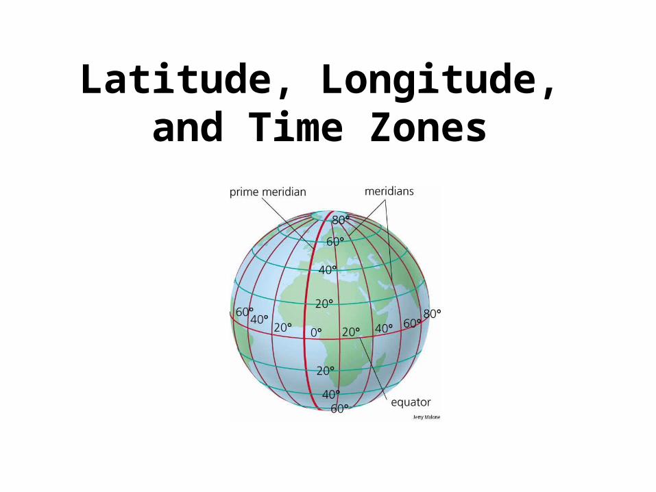
Latitude, Longitude, and Time Zones

Typical Graph
This is an example ofa typical graph.
It is made up of pointsthat are connected bya line.

Typical GraphY axis
X axis
Each point has two values:
An ‘X’ value that runs alongthe horizontal ‘X’ axis and.......
A ‘Y’ value that runs alongthe vertical ‘Y’ axis
Each point is expressed as an X value and a Yvalue with the X value written first. For example...
(4,7)
and...........
7,5)
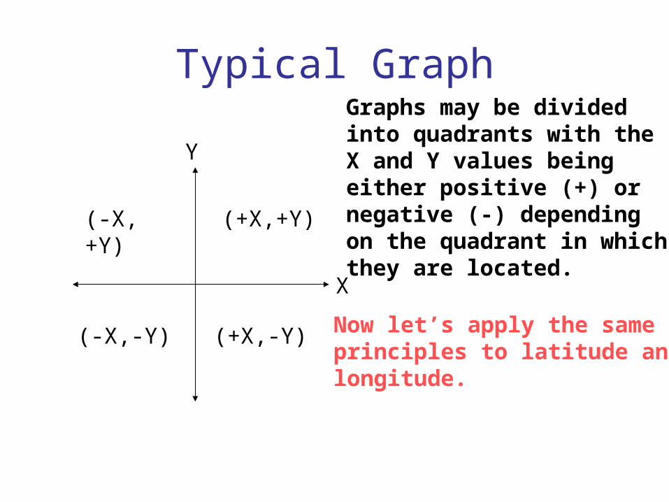
Typical Graph
X
Y
(-X,+Y)
(+X,-Y)
(+X,+Y)
(-X,-Y)
Graphs may be dividedinto quadrants with theX and Y values beingeither positive (+) ornegative (-) dependingon the quadrant in whichthey are located.
Now let’s apply the sameprinciples to latitude andlongitude.

90°S
90°N What is latitude?
Latitude is the distancefrom the equator along theY axis.
It is expressed in degrees.
The north pole is 90° N
The south pole is 90° S
And remember that theequator is 0° latitude.
What is the maximum possible latitude on Earth?
90° is maximum. You could be at 90°N or 90°S butthere is no greater latitude on Earth (or anywhere else)
0°
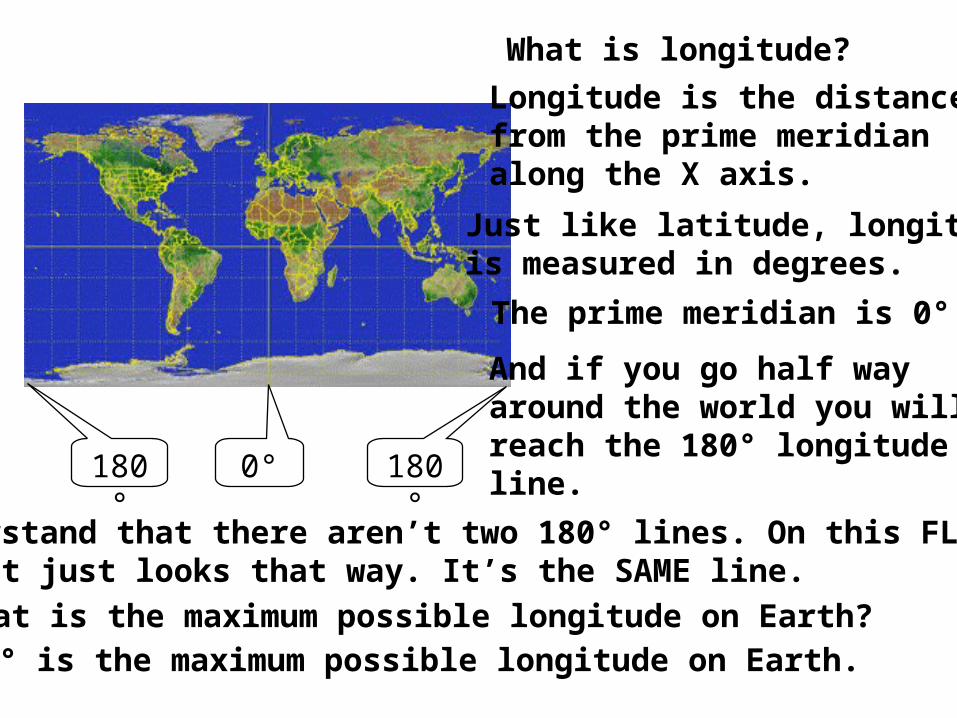
What is longitude?
Longitude is the distancefrom the prime meridianalong the X axis.
Just like latitude, longitudeis measured in degrees.
The prime meridian is 0°
0°
And if you go half wayaround the world you willreach the 180° longitudeline.180° 180°
Understand that there aren’t two 180° lines. On this FLAT map it just looks that way. It’s the SAME line.
What is the maximum possible longitude on Earth?180° is the maximum possible longitude on Earth.
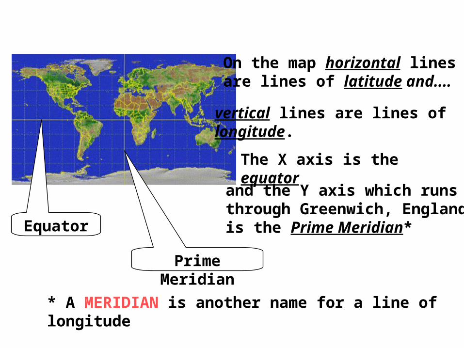
On the map horizontal linesare lines of latitude and....
vertical lines are lines oflongitude.
The X axis is the equator
and the Y axis which runsthrough Greenwich, Englandis the Prime Meridian*Equator
Prime Meridian
* A MERIDIAN is another name for a line of longitude
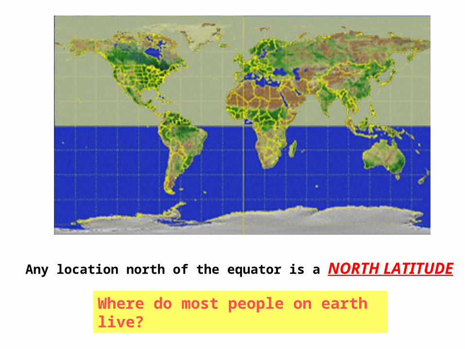
Any location north of the equator is a NORTH LATITUDE
Where do most people on earth live?
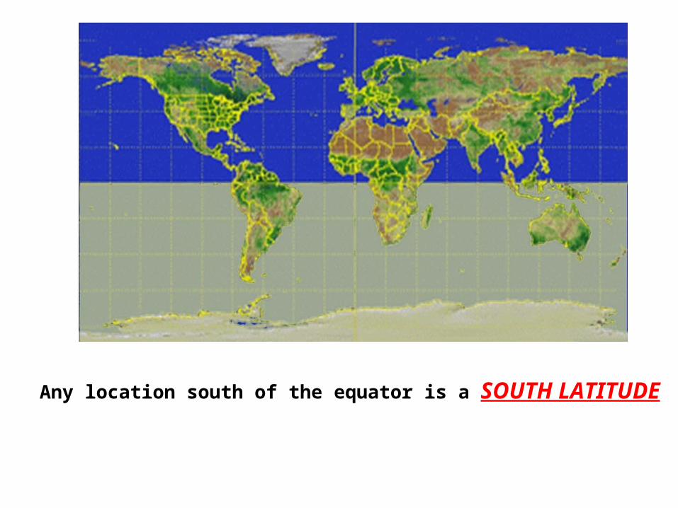
Any location south of the equator is a SOUTH LATITUDE
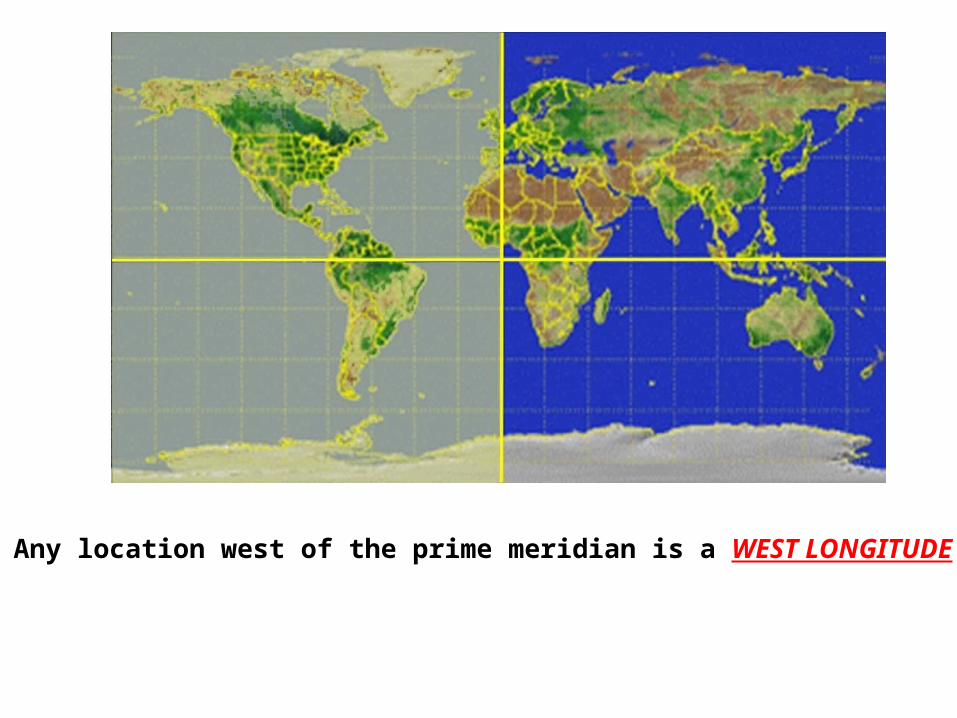
Any location west of the prime meridian is a WEST LONGITUDE
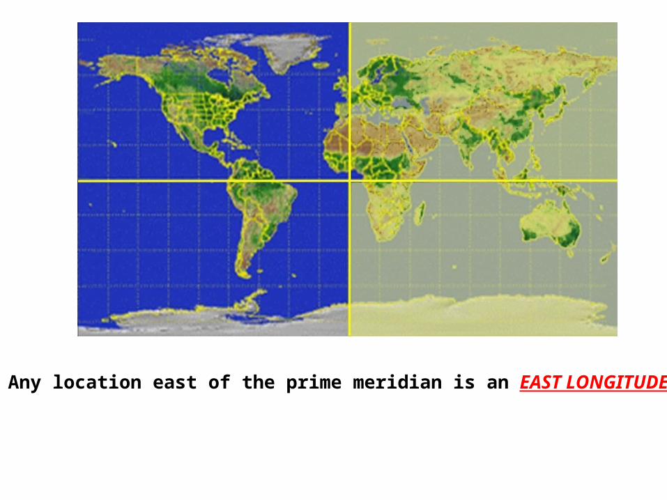
Any location east of the prime meridian is an EAST LONGITUDE
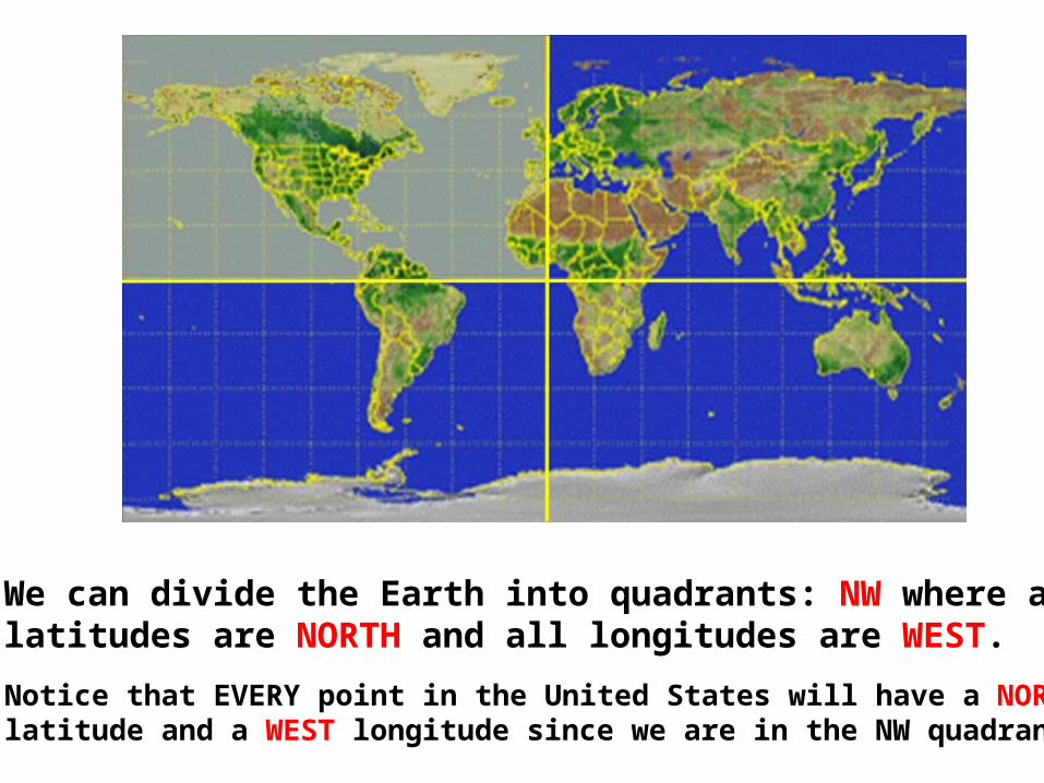
We can divide the Earth into quadrants: NW where alllatitudes are NORTH and all longitudes are WEST.
Notice that EVERY point in the United States will have a NORTHlatitude and a WEST longitude since we are in the NW quadrant.
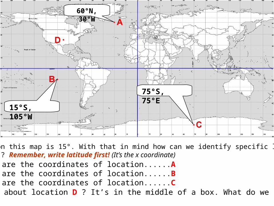
Each box on this map is 15°. With that in mind how can we identify specific locations(red dots)? Remember, write latitude first! (It’s the x coordinate)
What are the coordinates of location......A
60°N, 30°W
What are the coordinates of location......B
15°S, 105°W
What are the coordinates of location......C
75°S, 75°E
But what about location D ? It’s in the middle of a box. What do we do now?
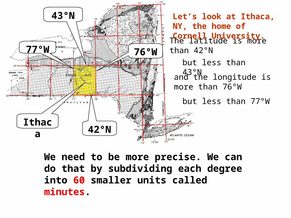
Let’s look at Ithaca, NY, the home of Cornell University.
Ithaca
The latitude is morethan 42°N
42°N
but less than 43°N
43°N
and the longitude ismore than 76°W
76°W
but less than 77°W
77°W
We need to be more precise. We can do that by subdividing each degree into 60 smaller units called minutes.

If there are 60minutes in eachdegree then halfa degree wouldbe 30 minutes.Let’s draw in the 30 minute (30’)line.
See these 2 marks?They are half way(30’) between 42°N and 43°N.Using a ruler,connect them.
The line you just drew is 42°30’N. Now let’s look at lines of longitude.See these 2 marks? They are half way (30’) between 76°W and 77°W.Using a ruler, connect them.The line you just drew is 76°30’W.Now let’s see if we can locate Ithaca more precisely.
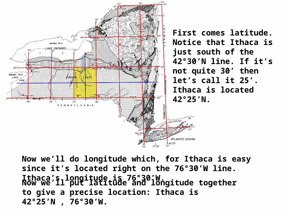
First comes latitude.Notice that Ithaca isjust south of the42°30’N line. If it’snot quite 30’ thenlet’s call it 25’.Ithaca is located 42°25’N.
Now we’ll do longitude which, for Ithaca is easy since it’s located right on the 76°30’W line. Ithaca’s longitude is 76°30’W.
Now we’ll put latitude and longitude together to give a precise location: Ithaca is 42°25’N , 76°30’W.
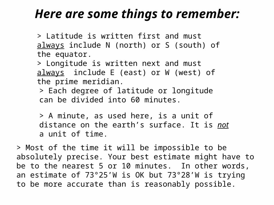
Here are some things to remember:
> Latitude is written first and must always include N (north) or S (south) of the equator.
> Longitude is written next and must always include E (east) or W (west) of the prime meridian.
> Each degree of latitude or longitude can be divided into 60 minutes.
> A minute, as used here, is a unit of distance on the earth’s surface. It is not a unit of time.
> Most of the time it will be impossible to be absolutely precise. Your best estimate might have to be to the nearest 5 or 10 minutes. In other words, an estimate of 73°25’W is OK but 73°28’W is trying to be more accurate than is reasonably possible.
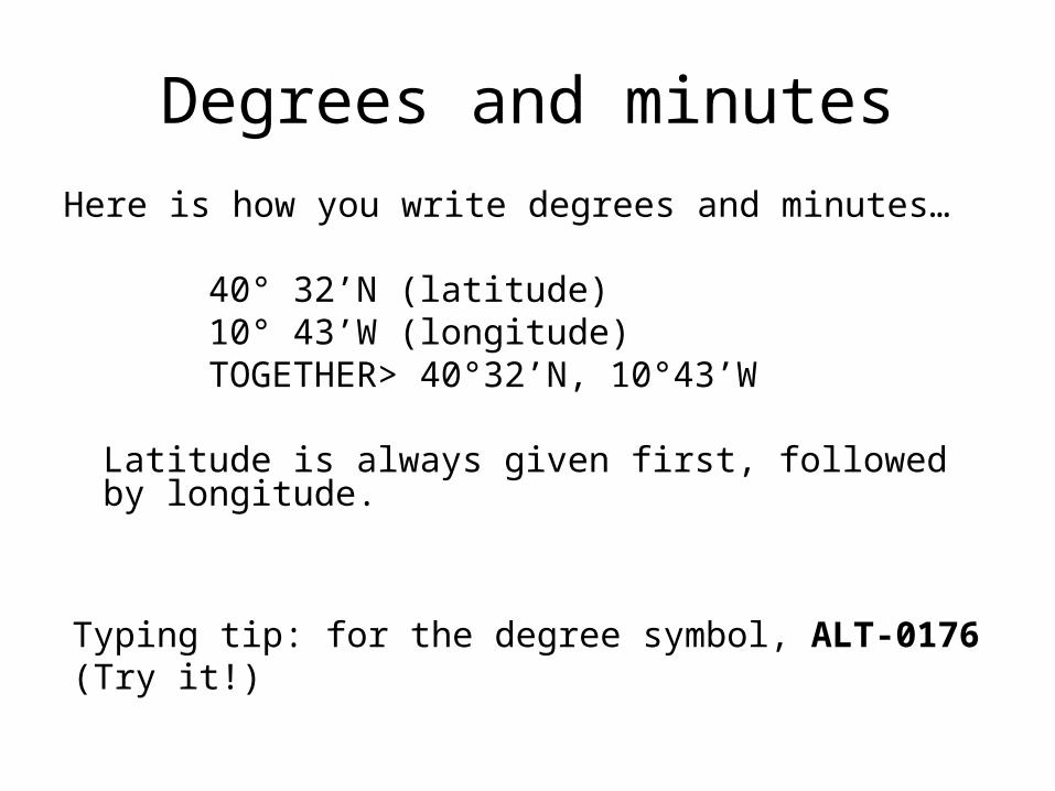
Degrees and minutes
Here is how you write degrees and minutes…
40° 32’N (latitude) 10° 43’W (longitude)
TOGETHER> 40°32’N, 10°43’W
Latitude is always given first, followed by longitude.
Typing tip: for the degree symbol, ALT-0176 (Try it!)
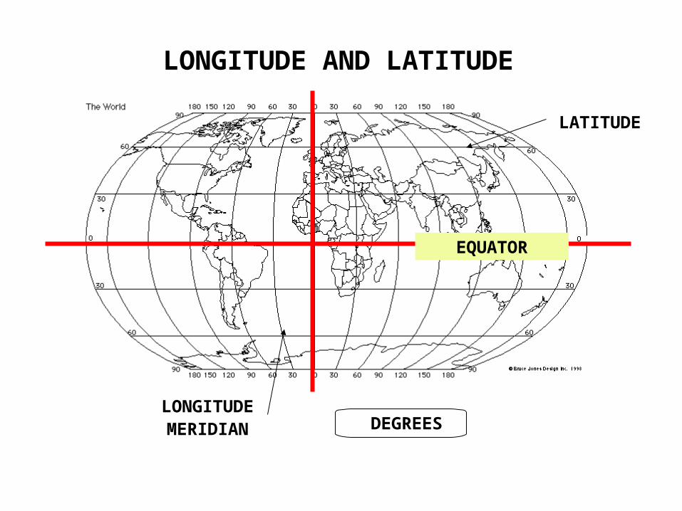
LONGITUDE AND LATITUDE
LONGITUDE
LATITUDE
MERIDIAN
EQUATOR
DEGREES

PRIME MERIDIAN
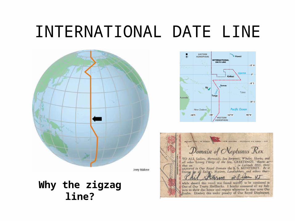
INTERNATIONAL DATE LINE
Why the zigzag line?
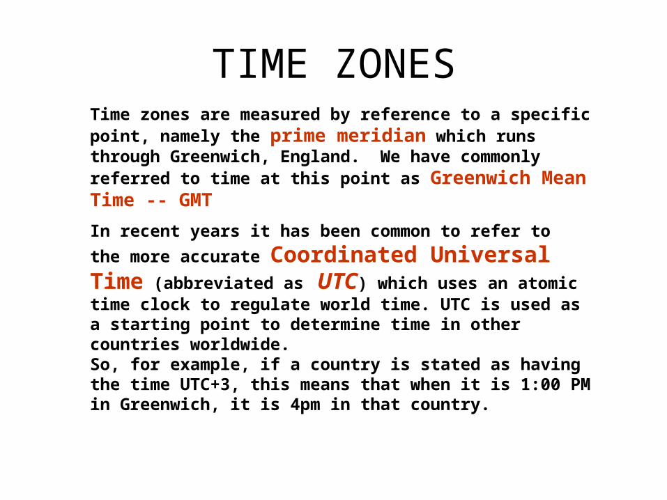
TIME ZONES
In recent years it has been common to refer to the more
accurate Coordinated Universal Time (abbreviated
as UTC) which uses an atomic time clock to regulate world time. UTC is used as a starting point to determine time in other countries worldwide.
Time zones are measured by reference to a specific point, namely the prime meridian which runs through Greenwich, England. We have commonly referred to time at this point as Greenwich Mean Time -- GMT
So, for example, if a country is stated as having the time UTC+3, this means that when it is 1:00 PM in Greenwich, it is 4pm in that country.
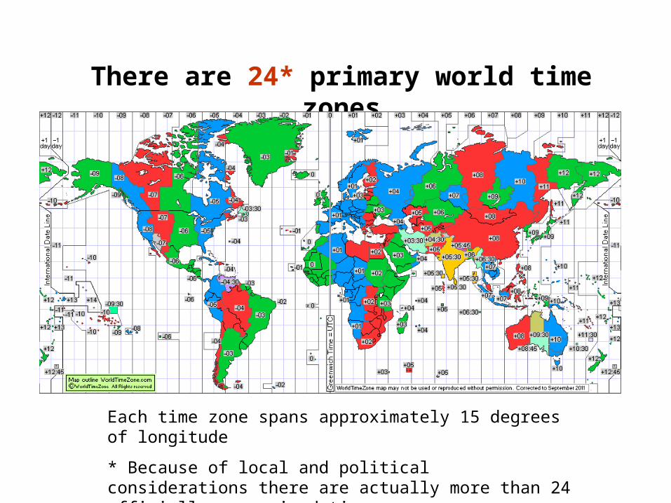
There are 24* primary world time zones
Each time zone spans approximately 15 degrees of longitude
* Because of local and political considerations there are actually more than 24 officially recognized time zones
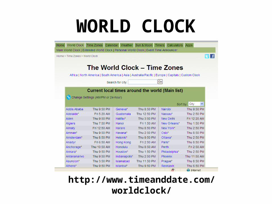
WORLD CLOCK
http://www.timeanddate.com/worldclock/
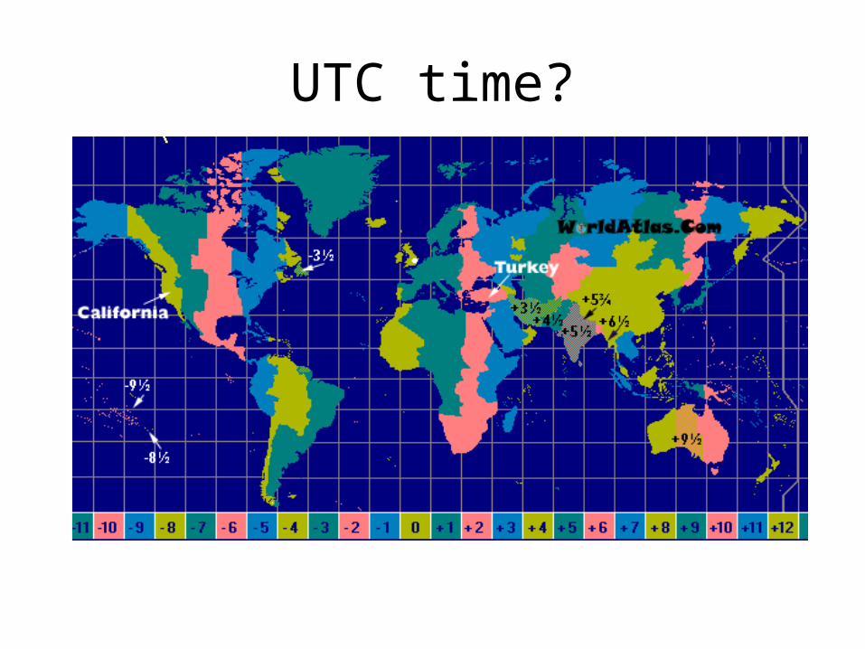
UTC time?
JET LAG?Many travelers find that they suffer from a condition known as 'jet lag' when they have crossed time zones.
This is a physiological condition triggered by the body becoming out of sync with the usual light and dark patterns to which it is accustomed.
The condition is characterized by numerous symptoms, such as extreme fatigue, disorientation and loss of appetite.
Jet lag often takes many days to recover; a rough medical guideline being one day per time zone. Sleep is seen as one of the best cures for jet lag, as is exposure to sunlight.

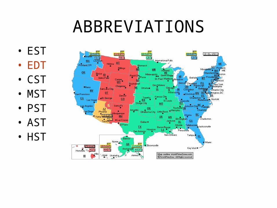
US TIME ZONES
http://www.time.gov/

FOUR US TIME ZONES

So what time is it right now in…
LONDON, England?
PARIS, France?
BOMBAY, India?
CHICAGO?
LOS ANGELOS?
LAS VEGAS?
See page 25 in your NWAt