Landscape-Scale Spatial Planning - ESRI …€¦ · livelihoods, lives, agriculture, infrastructure...
23
Assessing Climate-change Impacts on Nepal’s Forests for Landscape-Scale Spatial Planning Gokarna Jung Thapa Eric Wikramanayake Shant Raj Jnawali Judy Oglethorpe Jessica Forrest Hariyo Ban Program
-
Upload
vuongxuyen -
Category
Documents
-
view
219 -
download
0
Transcript of Landscape-Scale Spatial Planning - ESRI …€¦ · livelihoods, lives, agriculture, infrastructure...
Assessing Climate-change Impacts on Nepal’s Forests for
Landscape-Scale Spatial Planning
Gokarna Jung Thapa Eric Wikramanayake
Shant Raj Jnawali Judy Oglethorpe
Jessica Forrest
Hariyo Ban Program
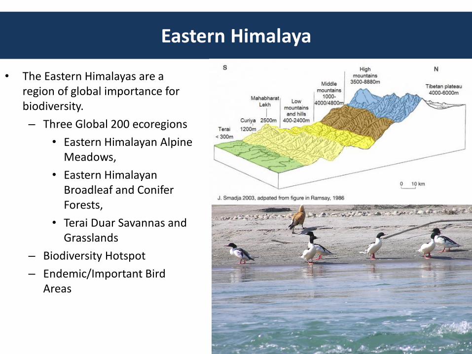
• The Eastern Himalayas are a region of global importance for biodiversity.
– Three Global 200 ecoregions
• Eastern Himalayan Alpine Meadows,
• Eastern Himalayan Broadleaf and Conifer Forests,
• Terai Duar Savannas and Grasslands
– Biodiversity Hotspot
– Endemic/Important Bird Areas
Eastern Himalaya
Climate Change
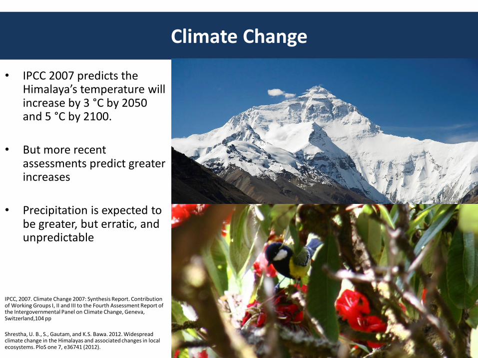
• IPCC 2007 predicts the Himalaya’s temperature will increase by 3 °C by 2050 and 5 °C by 2100.
• But more recent assessments predict greater increases
• Precipitation is expected to be greater, but erratic, and unpredictable
IPCC, 2007. Climate Change 2007: Synthesis Report. Contribution of Working Groups I, II and III to the Fourth Assessment Report of the Intergovernmental Panel on Climate Change, Geneva, Switzerland,104 pp
Shrestha, U. B., S., Gautam, and K.S. Bawa. 2012. Widespread climate change in the Himalayas and associated changes in local ecosystems. PloS one 7, e36741 (2012).
Climate Change
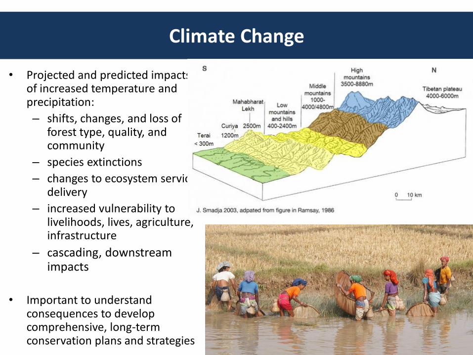
• Projected and predicted impacts of increased temperature and precipitation:
– shifts, changes, and loss of forest type, quality, and community
– species extinctions
– changes to ecosystem service delivery
– increased vulnerability to livelihoods, lives, agriculture, infrastructure
– cascading, downstream impacts
• Important to understand consequences to develop comprehensive, long-term conservation plans and strategies
Xu, J. et al. 2009. The melting Himalayas: cascading effects of climate change on water, biodiversity, and livelihoods. Conservation Biology. 23:520–30.
Climate Change Impacts in Nepal
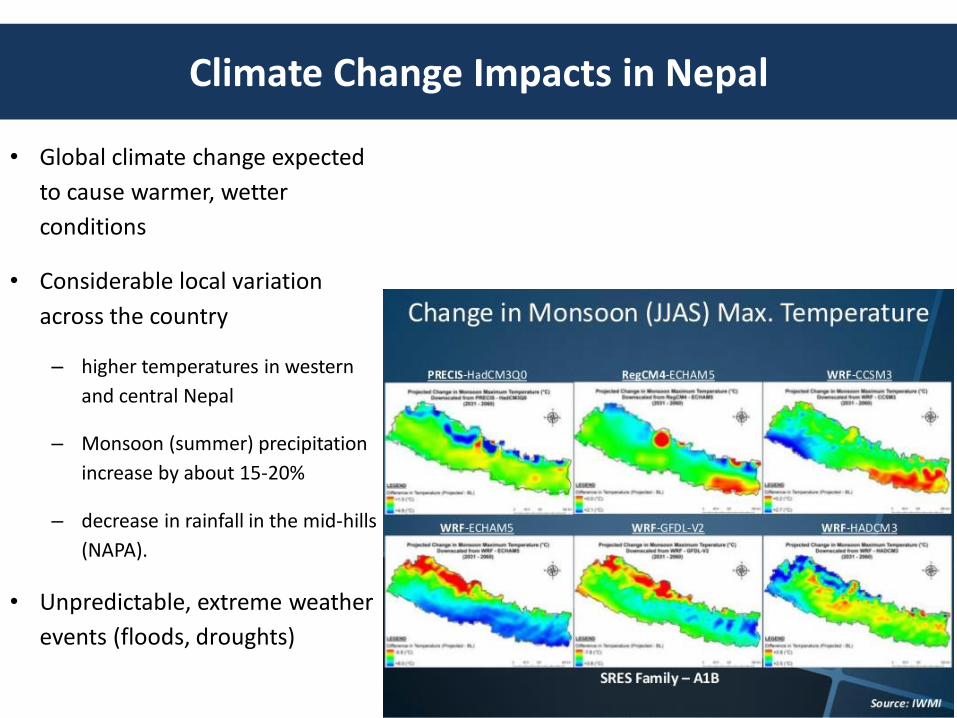
• Global climate change expected
to cause warmer, wetter
conditions
• Considerable local variation
across the country
– higher temperatures in western
and central Nepal
– Monsoon (summer) precipitation
increase by about 15-20%
– decrease in rainfall in the mid-hills
(NAPA).
• Unpredictable, extreme weather
events (floods, droughts)
Climate Change Impacts in Nepal
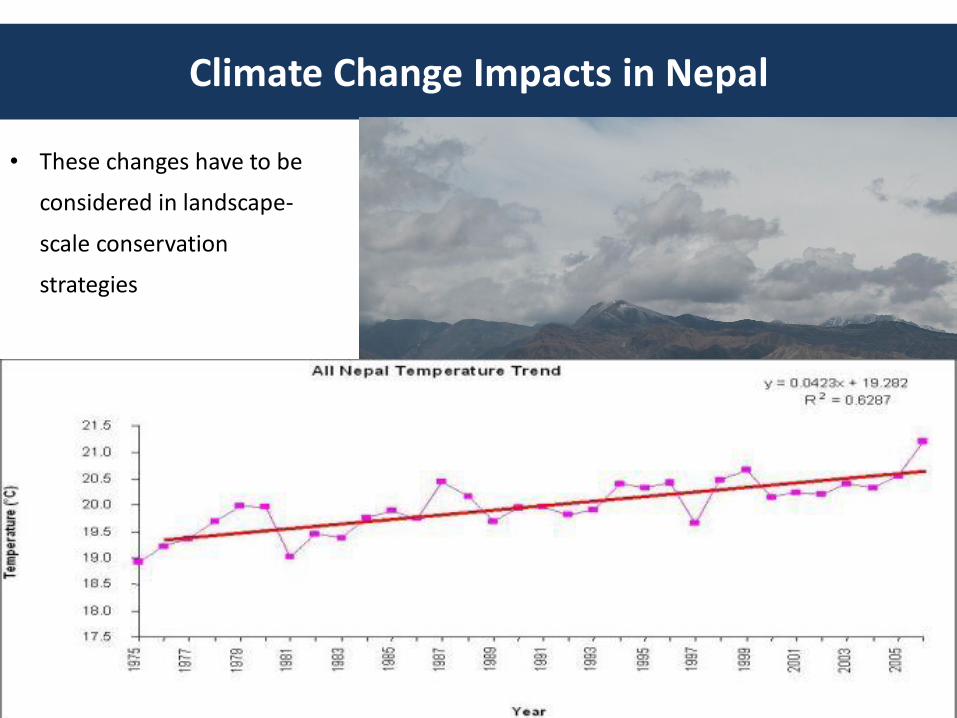
• These changes have to be
considered in landscape-
scale conservation
strategies
Climate Change-Integrated Conservation Strategies
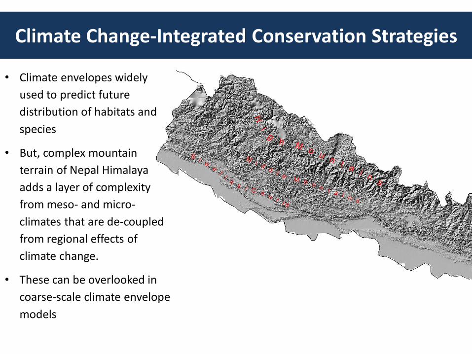
• Climate envelopes widely
used to predict future
distribution of habitats and
species
• But, complex mountain
terrain of Nepal Himalaya
adds a layer of complexity
from meso- and micro-
climates that are de-coupled
from regional effects of
climate change.
• These can be overlooked in
coarse-scale climate envelope
models
Climate Change-Integrated Conservation Strategies
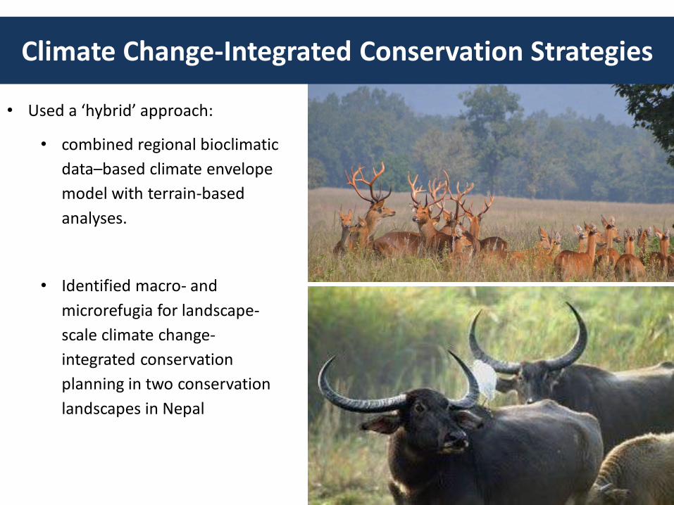
• Used a ‘hybrid’ approach:
• combined regional bioclimatic
data–based climate envelope
model with terrain-based
analyses.
• Identified macro- and
microrefugia for landscape-
scale climate change-
integrated conservation
planning in two conservation
landscapes in Nepal
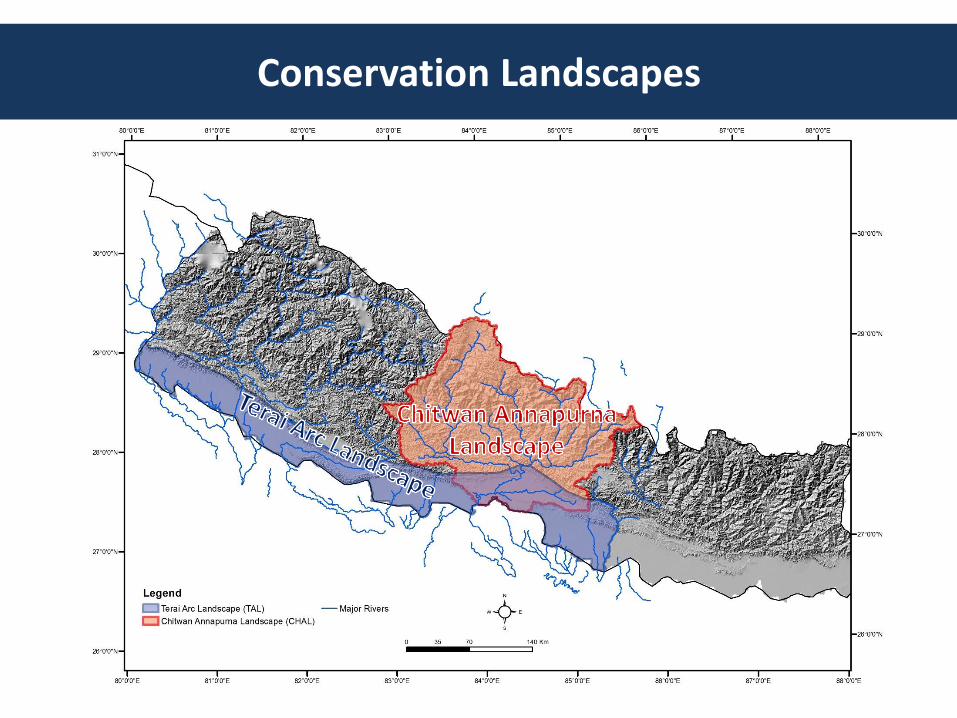
Conservation Landscapes
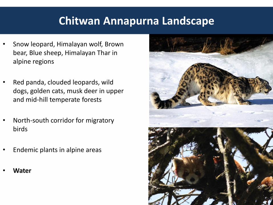
• Snow leopard, Himalayan wolf, Brown bear, Blue sheep, Himalayan Thar in alpine regions
• Red panda, clouded leopards, wild dogs, golden cats, musk deer in upper and mid-hill temperate forests
• North-south corridor for migratory birds
• Endemic plants in alpine areas
• Water
Chitwan Annapurna Landscape

• East-West connectivity for metapopulation management of tigers, leopards, elephants, and other large species
• Conservation of Siwalik/Churia mountain range
• Livelihoods through sustainable forest and water management
Terai Arc Landscape
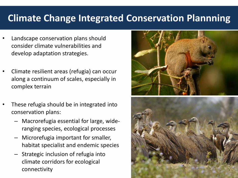
• Landscape conservation plans should consider climate vulnerabilities and develop adaptation strategies.
• Climate resilient areas (refugia) can occur along a continuum of scales, especially in complex terrain
• These refugia should be in integrated into conservation plans:
– Macrorefugia essential for large, wide-ranging species, ecological processes
– Microrefugia important for smaller, habitat specialist and endemic species
– Strategic inclusion of refugia into climate corridors for ecological connectivity
Climate Change Integrated Conservation Plannning
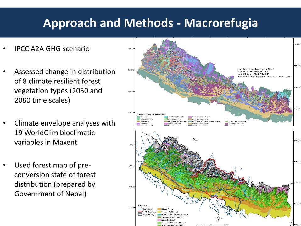
• IPCC A2A GHG scenario
• Assessed change in distribution of 8 climate resilient forest vegetation types (2050 and 2080 time scales)
• Climate envelope analyses with 19 WorldClim bioclimatic variables in Maxent
• Used forest map of pre-conversion state of forest distribution (prepared by Government of Nepal)
Approach and Methods - Macrorefugia
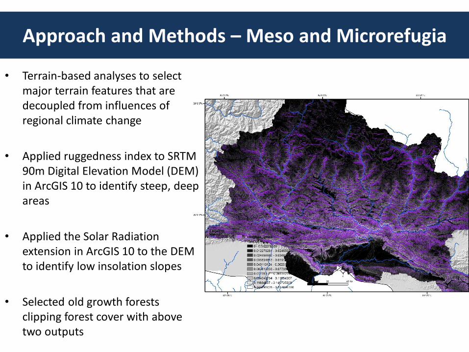
• Terrain-based analyses to select major terrain features that are decoupled from influences of regional climate change
• Applied ruggedness index to SRTM 90m Digital Elevation Model (DEM) in ArcGIS 10 to identify steep, deep areas
• Applied the Solar Radiation extension in ArcGIS 10 to the DEM to identify low insolation slopes
• Selected old growth forests clipping forest cover with above two outputs
Approach and Methods – Meso and Microrefugia
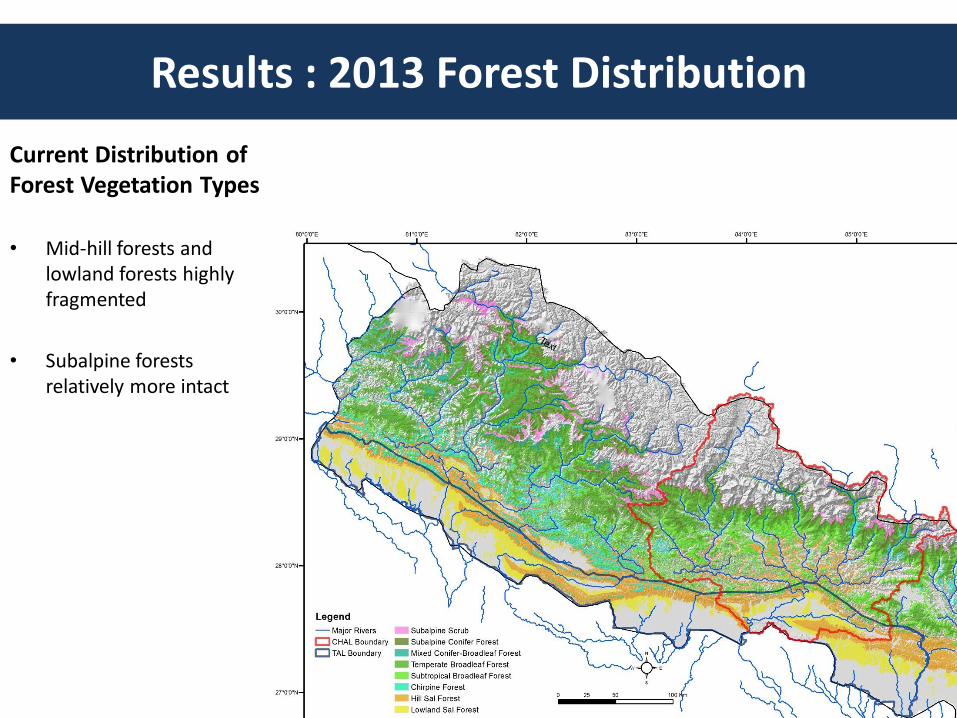
Results : 2013 Forest Distribution
Current Distribution of Forest Vegetation Types
• Mid-hill forests and lowland forests highly fragmented
• Subalpine forests relatively more intact
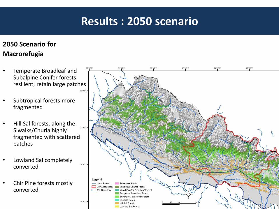
2050 Scenario for
Macrorefugia
• Temperate Broadleaf and Subalpine Conifer forests resilient, retain large patches
• Subtropical forests more fragmented
• Hill Sal forests, along the Siwalks/Churia highly fragmented with scattered patches
• Lowland Sal completely converted
• Chir Pine forests mostly converted
Results : 2050 scenario

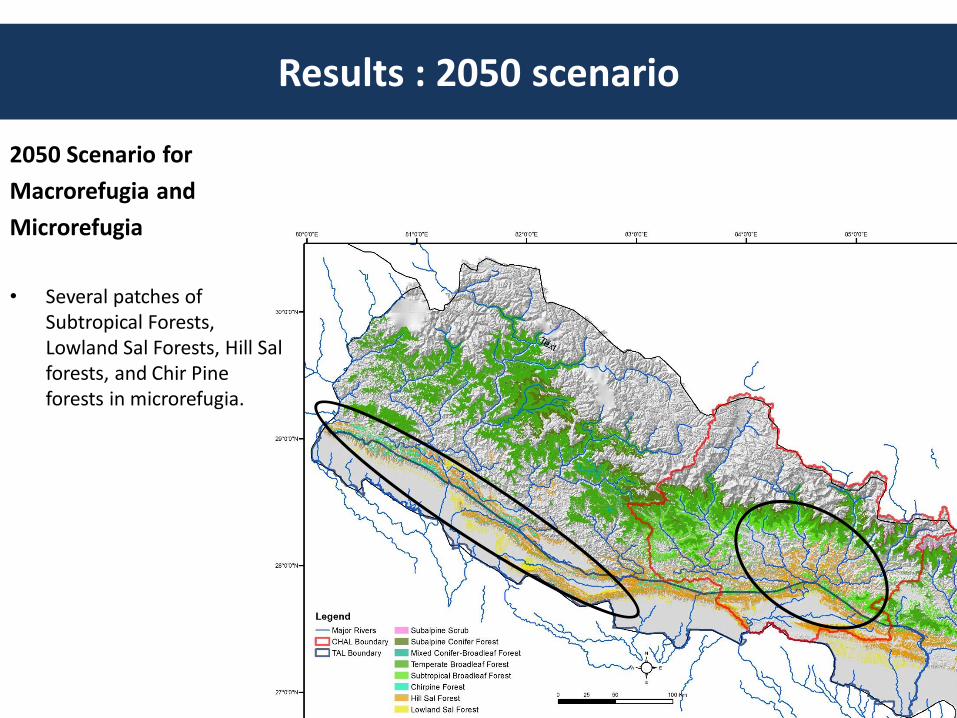
2050 Scenario for
Macrorefugia and
Microrefugia
• Several patches of Subtropical Forests, Lowland Sal Forests, Hill Sal forests, and Chir Pine forests in microrefugia.
Results : 2050 scenario
Results : 2050 scenario
2050 Scenario for
Macrorefugia and
Microrefugia
• Several patches of Subtropical Forests, Lowland Sal Forests, Hill Sal forests, and Chir Pine forests in microrefugia.
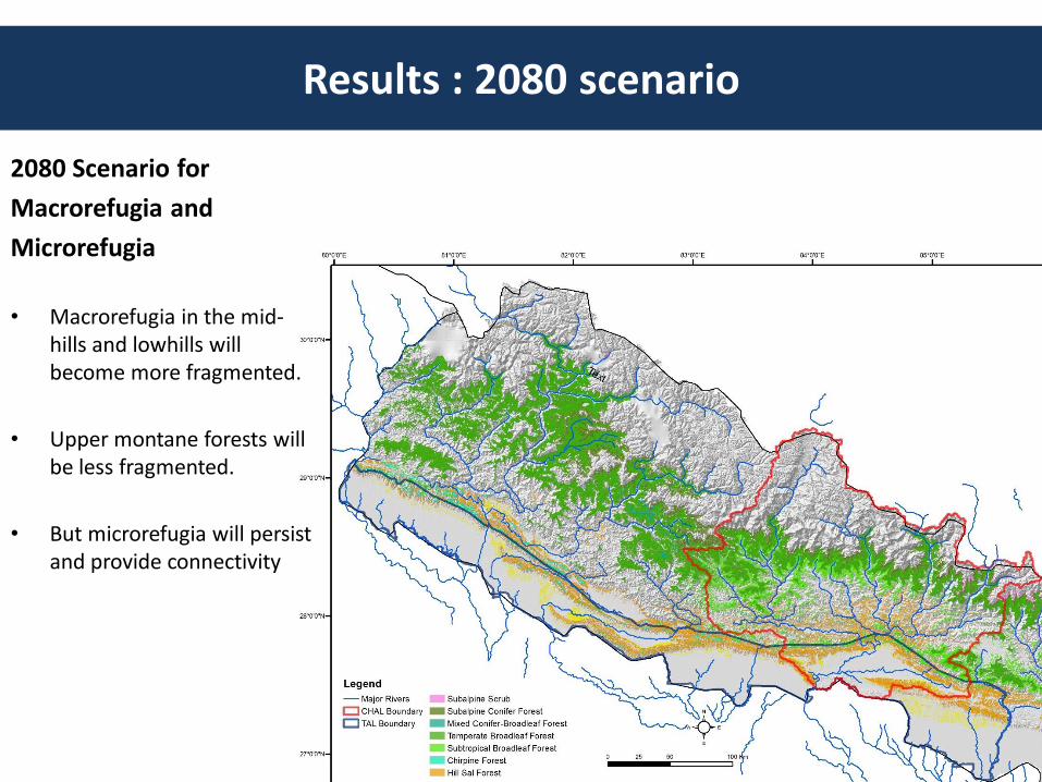
2080 Scenario for
Macrorefugia and
Microrefugia
• Macrorefugia in the mid-hills and lowhills will become more fragmented.
• Upper montane forests will be less fragmented.
• But microrefugia will persist and provide connectivity
Results : 2080 scenario
Results : Impact on forest ecosystems
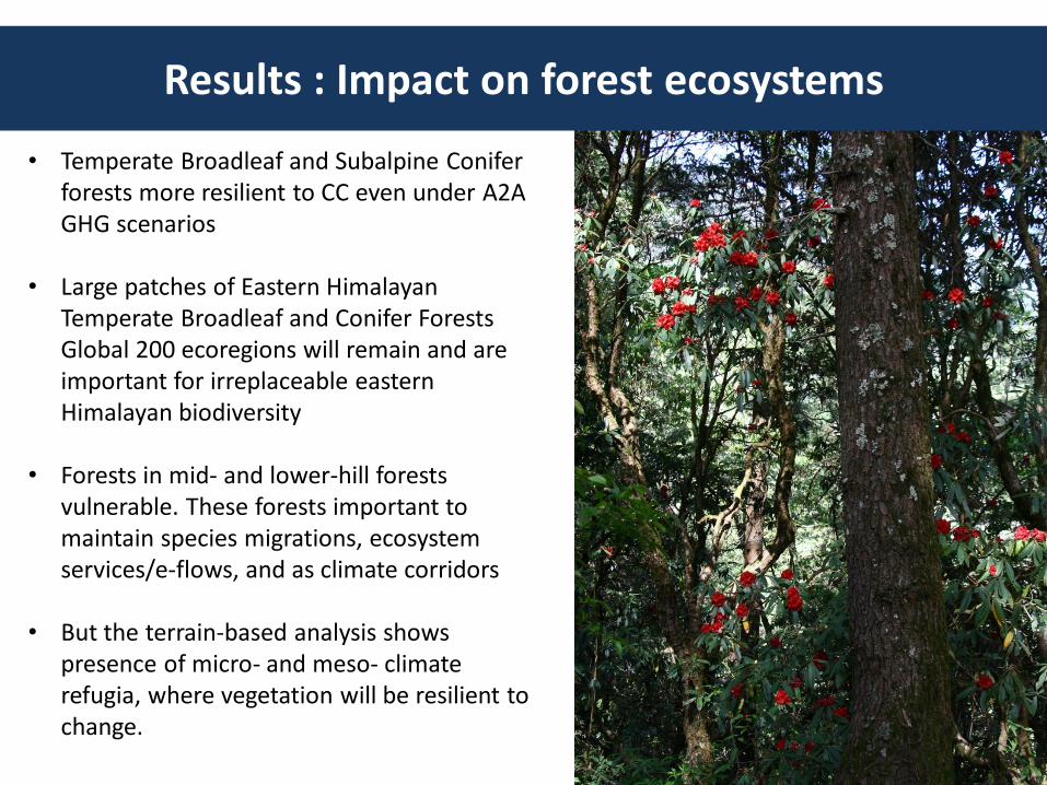
• Temperate Broadleaf and Subalpine Conifer forests more resilient to CC even under A2A GHG scenarios
• Large patches of Eastern Himalayan Temperate Broadleaf and Conifer Forests Global 200 ecoregions will remain and are important for irreplaceable eastern Himalayan biodiversity
• Forests in mid- and lower-hill forests vulnerable. These forests important to maintain species migrations, ecosystem services/e-flows, and as climate corridors
• But the terrain-based analysis shows presence of micro- and meso- climate refugia, where vegetation will be resilient to change.
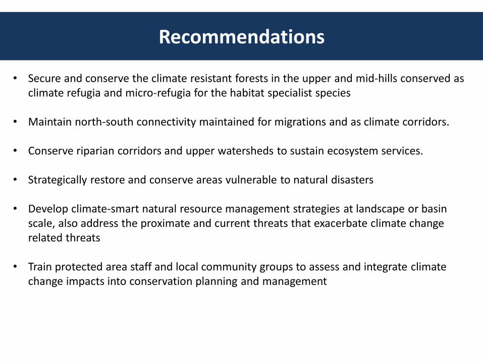
Recommendations
• Secure and conserve the climate resistant forests in the upper and mid-hills conserved as climate refugia and micro-refugia for the habitat specialist species
• Maintain north-south connectivity maintained for migrations and as climate corridors.
• Conserve riparian corridors and upper watersheds to sustain ecosystem services.
• Strategically restore and conserve areas vulnerable to natural disasters
• Develop climate-smart natural resource management strategies at landscape or basin scale, also address the proximate and current threats that exacerbate climate change related threats
• Train protected area staff and local community groups to assess and integrate climate change impacts into conservation planning and management
Acknowledgements
This presentation is made possible by the generous support of the American people through the United States Agency for International Development (USAID). The content is the responsibility of the authors and does not necessarily reflect the views of USAID or the United States Government.
THANKS