Landscape Governance in Socio-Ecological Production ... · Landscape Governance in Socio-Ecological...
56
Empowered lives. Resilient nations. Landscape Governance in Socio-Ecological Production Landscapes and Seascapes Experiences from the COMDEKS Programme in Ecuador, Ghana, and Indonesia
Transcript of Landscape Governance in Socio-Ecological Production ... · Landscape Governance in Socio-Ecological...
Empowered lives. Resilient nations.
Landscape Governance in Socio-Ecological Production Landscapes and Seascapes
Experiences from the COMDEKS Programme in Ecuador, Ghana, and Indonesia

Disclaimers: The views expressed in this publication are those of the authors and do not necessarily represent those of the United Nations Development Programme, its Executive Board, the United Nations Member States or the GEF. This is an independent publication by the COMDEKS Programme. The boundaries and names shown and the designations used on maps in this document do not imply official endorsement or acceptance by the United Nations.
Reproduction: All rights reserved. This publication or parts of it may not be reproduced, stored by means of any system or transmitted, in any form or by any medium, whether electronic, mechanical, photocopied, recorded or of any other type, without the prior permission of the United Nations Development Programme.
Authors: Harry Jonas, Natural Justice and Barbara Lassen, Natural Justice
Editors: Diana Salvemini, Nick Remple, and Tamara Tschentscher
The production of this publication was coordinated by Tamara Tschentscher, supported by Hanuma Semyonov.
Acknowledgements: This publication and the case studies profiled in it would not have been possible without the invaluable contributions and support of the GEF SGP Country Programme staff – Ana Maria Varea and Johana Jacome (Ecuador), George Ortsin (Ghana), Catharina Dwihastarini and Hery Budiarto (Indonesia) - as well as COMDEKS grantees and partners.
UNDP would like to thank the Japanese Ministry of the Environment, the United Nations University Institute for the Advanced Study of Sustainability (UNU-IAS) and the Secretariat of the United Nations Convention on Biological Diversity for their continuous support of COMDEKS, and the Global Environment Facility for the parallel co-financing provided to support COMDEKS through its Small Grants Programme.
Citation: United Nations Development Programme. 2017. Landscape Governance in Socio-Ecological Production Landscapes and Seascapes: Experiences from the COMDEKS Programme in Ecuador, Ghana, and Indonesia. UNDP, New York.
Cover photo: SGP Ghana
Designed by: Kimberly Koserowski
Published by:United Nations Development Programme, 304 East 45th Street New York, NY 10017October 2017© 2017 United Nations Development ProgrammeAll rights reserved
For more information, visit www.comdeksproject.com
Empowered lives. Resilient nations.
Landscape Governance in Socio-Ecological Production Landscapes and Seascapes: Experiences from the COMDEKS Programme in Ecuador, Ghana, and Indonesia
CONT
ENTS
01 The COMDEKS Approach 2 and Landscape Governance
02 Ecuador: the Napo River Watershed 8
03 Ghana: the Weto Range 20
04 Indonesia: Semau Island, East Nusa 36 Tenggara Kupang District
05 Conclusions 48

2
01INTRODUCTION
The Community Development and Knowledge Management for the Satoyama Initiative Programme (COMDEKS) was launched in 2011 as the flagship of the Satoyama Initiative, a global effort to promote the sustainable use of natural resources in the landscapes worked in and relied upon by rural communities.
Funded by the Japan Biodiversity Fund, COMDEKS is implemented by the United Nations Development Programme (UNDP) in partnership with the Ministry of the Environment of Japan, the Secretariat of the Convention on Biological Diversity (SCBD), and the United Nations University Institute for the Advanced Study of Sustainability (UNU-IAS), and delivered through the GEF Small Grants Programme (SGP), allowing for a fast, flexible, and proven mechanism to reach communities and civil society at the local level. As a corporate programme of the Global Environment Facility (GEF) and implemented by UNDP, SGP has served as a grant-making programme for 25 years with experience providing technical support and delivering small grants to community organizations for environment and development projects at the local level. SGP provided co-financing and technical and human resources to oversee the implementation of COMDEKS and its grants portfolio. As part of COMDEKS, small grants are provided to local community organizations with the overall long-term objective to enhance socio-ecological production landscape resilience by developing sound biodiversity management and sustainable livelihood activities with local communities to maintain, rebuild, and revitalize these landscapes.
As landscape-level approaches to natural resource management are gaining momentum around the world, it is crucial to take into account the often complex governance issues that influence how resources are allocated, used and conserved in a landscape. This publication presents experiences from successful on-the-ground actions to maintain and rebuild socio-ecological production landscapes with particular respect to landscape governance, drawing on COMDEKS-supported projects in Ecuador, Ghana and Indonesia. Two fact-finding missions were conducted in 2015 to the Weto Range in Ghana and Semau Island in Indonesia in order to collect information and views from local SGP staff, project partners and key stakeholders. Additionally, a desk review was conducted on the experiences in the Napo Watershed in Ecuador, based on available documents and input by the SGP National Coordinator and staff.
THE COMDEKS APPROACH AND LANDSCAPE GOVERNANCE
A resilient landscape system needs institutions and processes that are collaborative and flexible, and which bring together actors from various levels and sectors.

Landscape Governance in Socio-Ecological Production Landscapes and Seascapes: Experiences from the COMDEKS Programme in Ecuador, Ghana, and Indonesia
3
This publication has three principal parts:
1. The introduction briefly outlines the importance of governance in socio-ecological production landscapes and seascapes.
2. Three case studies describe the socio-ecological landscape and its governance structure at the onset of each project, the landscape strategy and activities, developments in governance during the project, and finally lessons learned and challenges ahead.
3. The conclusions attempt to sum up the lessons learned and successful approaches from these experiences with respect to landscape governance.
Seaweed farmer in Semau Island, SGP/COMDEKS Indonesia. Photo credit: Harry Jonas.

4
01 : The COMDEKS Approach and Landscape Governance
SOCIO-ECOLOGICAL PRODUCTION LANDSCAPES AND SEASCAPES
Humans have been interacting with ecosystems for millennia to produce food and fiber, collect building materials, extract energy and mineral resources, and support their spiritual and cultural lives. While some landscapes and seascapes have become degraded, others remain ecologically vital and productive, and continue to provide the basis of local sustainable livelihoods. In fact, many local land and marine use practices have evolved into highly productive and sustainable management schemes, informed by years of local adaptations and traditional knowledge. These landscapes are often characterized by a dynamic mosaic of land uses that may include crop land, home gardens, agroforestry systems, pastures, forest groves, marine and freshwater fishing grounds, and water harvesting sites, as well as community protected areas and sacred sites that are less disturbed.
These so-called “socio-ecological production landscapes and seascapes (SEPLS)” are coupled systems that are found in many places around the world under different names, and are deeply linked to local culture and knowledge. Such production landscapes have historically provided the backbone to rural economies and play an important role in the cultural and spiritual well-being of the communities that live and work in them. They also comprise a globally significant repository of biodiversity. However, the resilience and productivity of many of these landscapes has declined as economic, social, and demographic changes in nearby communities have eroded traditional landscape management systems.1
THE COMDEKS LANDSCAPE APPROACH
COMDEKS employs an integrated landscape approach to development, aimed at increasing the ecological resilience of local ecosystems – including agro-ecosystems – as well as enhancing the social and economic resilience of the communities living and working within them. The cornerstone of this approach is supporting community organizations to revitalize their landscapes through participatory land use planning that builds their awareness and capacities for governance and innovation.
The Programme is currently piloted in selected communities in 20 countries, namely: Bhutan, Brazil, Cambodia, Cameroon, Costa Rica, El Salvador, Ecuador, Ethiopia, Fiji, Ghana, India, Indonesia, Kyrgyzstan, Malawi, Mongolia, Namibia, Nepal, Niger, Slovakia, and Turkey. The target landscapes and seascapes in these countries represent a wide variety of
1 UNDP, 2014: Communities in Action for Landscape Resilience and Sustainability – the COMDEKS Programme. UNDP, New York
Socio-ecological production landscapes and seascapes have historically provided the backbone to rural economies.

5
Landscape Governance in Socio-Ecological Production Landscapes and Seascapes: Experiences from the COMDEKS Programme in Ecuador, Ghana, and Indonesia
ecosystems, including watersheds in Cambodia, Ecuador, and Costa Rica; inland water systems such as lakes in Malawi, Niger, and Kyrgyzstan; agropastoral systems in Ethiopia, Cameroon, and Brazil; mountain ecosystems in Bhutan, Ghana, India, and Nepal; coastal seascapes in Fiji, El Salvador, Indonesia, and Turkey; and grasslands in Mongolia and Namibia.
Partner communities jointly develop a Landscape Strategy, which is a living document meant to be revised and updated as communities implement projects, interpret the results, and reevaluate their choices in an adaptive landscape management cycle. The objectives identified in the landscape strategy take the form of desired landscape resilience outcomes in four different areas: enhancing ecosystem services; strengthening the sustainability of production systems; developing and diversifying livelihoods and income generation; and strengthening institutions and governance systems at the landscape level.
The latter was the focus of the case studies presented in this publication. The objective was to achieve a better understanding of the governance systems in socio-ecological production landscapes, and to document how supported projects went about strengthening these systems and institutions, both locally and at the landscape level.
LANDSCAPE GOVERNANCE
Landscape governance is concerned with the institutional arrangements, decision-making processes, policy instruments and underlying values by which multiple actors in the landscape are enabled to pursue their interests in sustainable food production, biodiversity and ecosystem service conservation, livelihood security and income generation.
Socio-ecological production landscapes and seascapes fulfill multiple functions for a diversity of actors. As such, it is necessary to identify where each of these functions is located: Which areas are, for example, set aside for conservation? Which ones for food production or other economic activities? Regulations need to be established that determine who has rights and benefits to which resources at
Crop irrigation system, SGP/COMDEKS Indonesia. Photo credit: Harry Jonas.

6
01 : The COMDEKS Approach and Landscape Governance
what time, as well as ways to enforce those rules. Governance processes also have to answer the fundamental question of who is entitled to make such decisions and based on what values.2 Importantly, questions of governance go beyond a formal attribution of authority and responsibility; they include questions about both formal and informal processes of decision-making, as well as the roles of official, customary and culture-specific rules and institutions.
An added challenge lies in the fact that a number of existing institutions already share—or compete for—authority at different levels within the landscape: local governments, state government ministries, traditional authorities, and sometimes regional bodies such as river basin authorities, for example. Typically, each institution has a defined role managing one activity or jurisdiction, but lacks the mandate or vision to manage a number of activities across the landscape in an integrated manner. For example, management of production landscapes is often divided up by sectors, with separate bodies governing forestry, agriculture, and fishing, with little cross-over or integration. Likewise, the integration of social factors into the management of such resources is often minimal or absent in existing institutions. Policy and legal frameworks also play a vital role in determining whether actors have the possibility to collaborate coherently at the landscape level, and whether communities can exercise their rights to land and resources and thereby effectively participate in decisions affecting them.
The adaptive governance of integrated landscapes is bound to be a challenge and calls for new institutional models that can represent multiple stakeholders and manage multiple activities within an integrated landscape plan. Doing so requires understanding how these activities affect one another, and managing the inherent trade-offs.3 Different types of institutional structures can contribute to multi-level and multi-actor governance. For example, networked structures make use of horizontal coordination mechanisms such as multi-stakeholder platforms, committees, forums or other deliberation spaces to link actors and institutions across multiple horizontal jurisdictions. Nested institutional arrangements distribute authority, decision-making and coordination through the engagement of organizations at multiple levels and a balance of top-down and bottom-up influence. Finally, so-called “boundary” or “bridging” organizations are institutions that facilitate collaboration and information flow between diverse knowledge communities, such as science, government and civil society.4
2 Adapted from Kozar, R., L.E. Buck, E.G. Barrow, T.C.H. Sunderland, D.E. Catacutan, C. Planicka, A.K. Hart and L. Willemen. 2014: Toward Viable Landscape Governance Systems: What Works? Washington, DC: EcoAgriculture Partners, on behalf of the Landscapes for People, Food, and Nature Initiative
3 UNDP, 2014
4 Kozar et al., 2014
Regulations need to be established that determine who has rights and benefits to which resources at what time, as well as ways to enforce those rules.
7
Landscape Governance in Socio-Ecological Production Landscapes and Seascapes: Experiences from the COMDEKS Programme in Ecuador, Ghana, and Indonesia
Several such institutional innovations have already begun to emerge in landscapes supported by COMDEKS. The programme structure has begun to generate interest in new institutional arrangements meant to better accommodate the many stakeholders and mixed activities common to the target landscapes. The fact that the variety of stakeholders within a target landscape are jointly responsible for formulating a single area-wide landscape strategy means that the parties to this strategy are already aware of each other and their interdependency, and ultimately, the need to govern the area’s resources cooperatively.5 Furthermore, the community-based approach of supported projects has led to the strengthening of governance at the local level, by developing innovative solutions while revitalizing and building on traditional systems.
The following case studies are examples of these governance innovations. The projects developed different multi-stakeholder models to achieve better integration of landscape governance, from community environmental forums in Indonesia, to a landscape-level platform in Ghana, to intensive planning processes at the level of biocorridors in Ecuador. At the local level, community groups and various forms of community agreements were used to build social capital, develop income-generating activities, and improve stewardship of natural resources.
5 UNDP, 2014
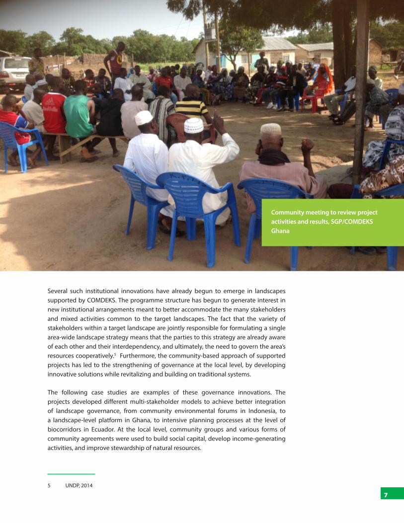
Community meeting to review project activities and results, SGP/COMDEKS Ghana

02
ECUADOR
INTRODUCTION TO THE SOCIO-ECOLOGICAL LANDSCAPE
The Napo River watershed, the target landscape selected for the implementation of COMDEKS activities in Ecuador, is located in the ecologically rich heart of the north-central Amazon. The vast array of plants, animals and microorganisms that have evolved together, creating an irreplaceable and thriving ecosystem, makes diversity the mainstay of life in the Amazon.
The local communities have also evolved within that unique ecosystem, developing a culture rooted in the understanding, appreciation and respect for the land and its resources. The diversity of biological resources and ecosystems is matched by the richness of traditional methods of resource management and indigenous peoples’ ancestral knowledge of local ecology. Most of the rural population derives income from activities related to agriculture, livestock, forestry and fishing. The local communities organize their production activities through the use of “chakras”, a space which is mainly the domain of indigenous women, where strategies of exchange, sale and subsistence are established. In these family workspaces, short-cycle crops such as corn, peanuts, naranjilla, yucca and rice are grown together. Perennial crops such as coffee, cocoa and bananas are grown in terraces from 440-1,250 meters above sea level. These seasonal cash crops are sold mostly on the local market. Banana and yucca are also used for family consumption and maize is used to raise poultry.
However, despite the strong ties between local communities and nature, the region has lost nearly 20% of its natural cover over the last fifty years, triggered mostly by the increasing prevalence of resource extraction industries. Further threats come from unsustainable agricultural practices and livestock, production activities that have had widespread impacts on the region’s fragile ecosystem. Conversion from intercropping to monoculture, farming on fragile soils and the acceleration of swidden crop rotations contribute to the depletion of nutrients, which would naturally replenish through accumulation in secondary forest biomass. As a result, communities are ultimately pushed to seek other sources of income through unsustainable extraction of forest resources, leading to accelerated deforestation and forest degradation. Finally, oil and mining throughout the region have motivated both legal and illegal activities that continue to impact and fragment the forest ecosystem and pollute water resources.
THE NAPO RIVER WATERSHED, AMAZON REGION

9
Landscape Governance in Socio-Ecological Production Landscapes and Seascapes: Experiences from the COMDEKS Programme in Ecuador, Ghana, and Indonesia
These impacts disrupt the passing on of ancestral knowledge, because forest ecosystem destruction directly affects the rural communities dependent on the sustainable management of these natural resources for their livelihoods. In consequence, ecological cycles are disrupted, and in turn this changes the cultural dynamics of knowledge transmission to new generations.
LANDSCAPE GOVERNANCE STRUCTURE
Community institutions and representation
The communities living in the landscape are mostly indigenous Kichwa communities, with some mixed communities of Kichwa and mestizo inhabitants. The communities are represented by their traditional leadership structures, which are legally recognized and are organized in second-level or third-level indigenous associations.
The Sinchi Warmicuna Association implementing fishery activities to rehabilitate native fish species, SGP/COMDEKS Ecuador
10
02 : Ecuador — The Napo River Watershed, Amazon Region
Land and resource tenure
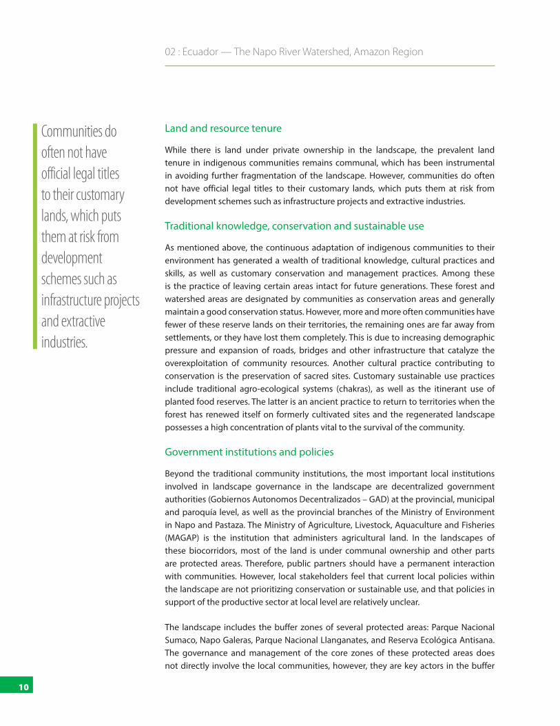
While there is land under private ownership in the landscape, the prevalent land tenure in indigenous communities remains communal, which has been instrumental in avoiding further fragmentation of the landscape. However, communities do often not have official legal titles to their customary lands, which puts them at risk from development schemes such as infrastructure projects and extractive industries.
Traditional knowledge, conservation and sustainable use
As mentioned above, the continuous adaptation of indigenous communities to their environment has generated a wealth of traditional knowledge, cultural practices and skills, as well as customary conservation and management practices. Among these is the practice of leaving certain areas intact for future generations. These forest and watershed areas are designated by communities as conservation areas and generally maintain a good conservation status. However, more and more often communities have fewer of these reserve lands on their territories, the remaining ones are far away from settlements, or they have lost them completely. This is due to increasing demographic pressure and expansion of roads, bridges and other infrastructure that catalyze the overexploitation of community resources. Another cultural practice contributing to conservation is the preservation of sacred sites. Customary sustainable use practices include traditional agro-ecological systems (chakras), as well as the itinerant use of planted food reserves. The latter is an ancient practice to return to territories when the forest has renewed itself on formerly cultivated sites and the regenerated landscape possesses a high concentration of plants vital to the survival of the community.
Government institutions and policies
Beyond the traditional community institutions, the most important local institutions involved in landscape governance in the landscape are decentralized government authorities (Gobiernos Autonomos Decentralizados – GAD) at the provincial, municipal and paroquía level, as well as the provincial branches of the Ministry of Environment in Napo and Pastaza. The Ministry of Agriculture, Livestock, Aquaculture and Fisheries (MAGAP) is the institution that administers agricultural land. In the landscapes of these biocorridors, most of the land is under communal ownership and other parts are protected areas. Therefore, public partners should have a permanent interaction with communities. However, local stakeholders feel that current local policies within the landscape are not prioritizing conservation or sustainable use, and that policies in support of the productive sector at local level are relatively unclear.
The landscape includes the buffer zones of several protected areas: Parque Nacional Sumaco, Napo Galeras, Parque Nacional Llanganates, and Reserva Ecológica Antisana. The governance and management of the core zones of these protected areas does not directly involve the local communities, however, they are key actors in the buffer
Communities do often not have official legal titles to their customary lands, which puts them at risk from development schemes such as infrastructure projects and extractive industries.

11
Landscape Governance in Socio-Ecological Production Landscapes and Seascapes: Experiences from the COMDEKS Programme in Ecuador, Ghana, and Indonesia
zones. The National System of Protected Areas also includes “bosques protectores”, of which there are several present in the landscape. Most of the GADs recognize the historical dominion of the communities over these forests. An example is the Colonso Forest, where the GAD is seeking to establish an incentive scheme (payment for ecosystem services) with the local community to secure the water supply for the city of Tena.
The Ministry of Environment manages the “Socio Bosque” programme, which provides economic incentives to communities to conserve their forests. Through this programme, the Ministry enters into conservation agreements with landholders, in which monetary compensation is provided in exchange for protection of forest cover. The purpose of the project is to create a system linking incomes with ecosystem services, creating an alternative to unsustainable forest exploitation for local livelihoods. Two communities in the landscape are currently participating in this scheme.
THE LANDSCAPE STRATEGY AND PROJECT ACTIVITIES
The goal of COMDEKS activities in the area is to consolidate, replicate, and scale up the work initiated by indigenous and rural community organizations to protect the biodiversity and culture of the areas surrounding the Napo River.
The landscape approach supported by COMDEKS in Ecuador builds upon the concept of “Biocorridors for Living Well”. “Living Well” (Buen Vivir or Sumak Kawsay) is SGP’s strategic framework for OP5, building on the 2008 Constitution of Ecuador and the National Plan for Living Well (Plan Nacional para el Buen Vivir, PNBV). This phase moved forward from the concept of sustainable livelihoods to sustainable production landscapes, enabling community production activities to generate ecological connectivity, and from the concept of community organization to community partnerships, in order to generate strategic alliances not only for the conservation and management of a community resource, but also for managing a larger area – the Biocorridor. Biocorridors for Living Well are expanses of land where ecological connectivity is reestablished, connecting fragmented habitats, incorporating compatible sustainable
The Moradores de Arajuno Association participating in a planning workshop of the Biocorridor Working Group, SGP/COMDEKS Ecuador

12
02 : Ecuador — The Napo River Watershed, Amazon Region
production activities into the landscape, and fostering community partnerships. The intention is to expand interventions over a wider area, thus increasing the impact of the work undertaken by communities and other social and institutional actors. The concept of the Biocorridor provides a new regional focus and allows systematic and participatory contributions from the areas identified to be integrated into the process of establishing and promoting Living Well by incorporating environmental, sociocultural, economic, political and institutional elements. It also endeavors to contribute to the application of the Rights of Nature and embraces a gender equality approach.
The Amazon Region, where the COMDEKS target area is located, is one of the four priority ecosystems supported by the GEF SGP Ecuador Country Programme. The five selected COMDEKS projects are distributed in two of the three Amazonian Biocorridors: Yaku Samay and Akllak Sacha. They started slightly later than the other biocorridor projects financed with GEF funding, but were immediately integrated into the relevant processes at landscape and biocorridor levels.
The COMDEKS landscape strategy in Ecuador focuses on incorporating the traditions of communities living within the vibrant ecosystems of the target area to develop sustainable socioeconomic production activities. The aim is to develop sound biodiversity management and sustainable livelihood activities through community-based initiatives to maintain, rebuild and revitalize their socio-ecological production landscapes. The strategy is focused on the following:
■ Optimal functioning of ecosystems (water, habitat, land, etc.) and conservation of biodiversity
■ Sustainable agricultural practices implemented across the landscape to enhance productivity
■ Local livelihoods of social groups within the landscape sustained and enhanced
■ Strengthened institutional capacity and participatory decision-making at the landscape level through the promotion of community working groups and conservation agreements
The five local COMDEKS projects support agro-ecological and agro-forestry innovation to diversify household production; conserve important forest ecosystems through reforestation activities and protection of micro watersheds; and promote income generation activities such as the development of sustainable tourism and fish farming using native species. COMDEKS projects are also supporting the Kichwa chakra system, using ancestral agricultural management techniques, diversifying crops and adding value to local species. Following SGP Ecuador’s best practice, the COMDEKS/SGP Country Programme in Ecuador is relying on the “SIMONAA” (Monitoring, Technical Assistance
The aim of a COMDEKS landscape strategy is to guide sound biodiversity management and sustainable livelihood activities through community-based initiatives to maintain, rebuild and revitalize SEPLS.

13
Landscape Governance in Socio-Ecological Production Landscapes and Seascapes: Experiences from the COMDEKS Programme in Ecuador, Ghana, and Indonesia
and Support System), which allows to oversee the progress and smooth running of COMDEKS projects and to provide technical assistance and on-going support to participating communities, along with participatory monitoring and evaluation (M&E) and capacity building.
Sinchi warmikuna: The project was implemented by the women’s association Tukuy Warmikuna Jatarishun Sumak Kawaymi, of the indigenous community Santa Rita. It contributed to the biocorridor through the conservation and reforestation of two streams that are part of the Rio Calmitoyacu watershed, and through the strengthening of traditional chakra management processes in three communities.
Asociacion Pashimbi: The Production Association Pashimbi implemented this project in the indigenous community Alto Tena, situated in the buffer zone of the new protected areas Reserva Biologica Colonso Chalupas. It contributed to the biocorridor through the participatory development of the management plan in the buffer zone, reforestation and conservation of water sources, improvement of sustainable livelihoods through sustainable tourism and the implementation of fish farming with native species for food sovereignty, strengthening of community organizations, and revitalization of cultural values and traditions.
River site in the target landscape for project activities, SGP/COMDEKS Ecuador
14
02 : Ecuador — The Napo River Watershed, Amazon Region
Tsatsayaku: The project, executed by the Asociacion de Productores Tsatsayaku, conserved natural resources by adding value to fine cocoa and transforming it into an emblematic product of the Canton, thereby improving the income of cocoa producers. The association, together with the 13 participating communities, also contributed to the conservation of the buffer zone of the Parque Nacional Llanganates through reforestation of micro-watershed areas.
Jatun Anzu: The project, executed by the organization CEDIME, is situated in the buffer zone of the Parque Nacional Llanganates. It contributed to connectivity by increasing the conservation area of a forest reserve and by reforesting a micro-watershed. Support for community chakras strengthened community development processes and revitalized the Kichwa culture.
AMA: Executed by the Asociacion de Moradores de Arajuno (AMA), the project is situated inside the area of influence of the Yasuní Biosphere reserve. It conserved and reforested a watershed and other forest areas, and increased the area under cocoa agroforestry systems in the chakras of the two participating Kichwa communities of Arajuno and Curaray.
RESULTS: DEVELOPMENTS IN GOVERNANCE DURING THE PROJECT
COMDEKS and the Biocorridors for Living Well
One of the major factors for success was how the concepts and focal areas of the COMDEKS approach and the framework of Biocorridors for Living Well of SGP’s Fifth Operational Phase (OP5) were harmonized. From the beginning, the COMDEKS approach of socio-ecological production landscape resilience was linked to the principles and strategies of the biocorridors. This enabled the COMDEKS projects to become part of the larger effort to preserve three biocorridors in the Amazon landscape.
Landscape-level bodies and agreements
At the beginning of OP5, a participatory regional planning phase was carried out, bringing relevant actors together in regional working groups (Grupos de Trabajo Territorial – GTT). The GTT for the Amazon involves three provinces and brings all relevant actors together, including community organizations, former SGP grant recipients, leaders of indigenous organizations, NGOs, international cooperation organizations, and the public sector such as the GADs at all three levels. The GTT generated political agreement by creating a space for dialogue and consultation to identify priorities and socio-environmental synergies. The result is a socio-environmental agreement for each region (ASOCIATE).
From the beginning, the COMDEKS approach of socio-ecological production landscape resilience in Ecuador was linked to the principles and strategies of the biocorridors.
15
Landscape Governance in Socio-Ecological Production Landscapes and Seascapes: Experiences from the COMDEKS Programme in Ecuador, Ghana, and Indonesia
Biocorridor bodies and agreements
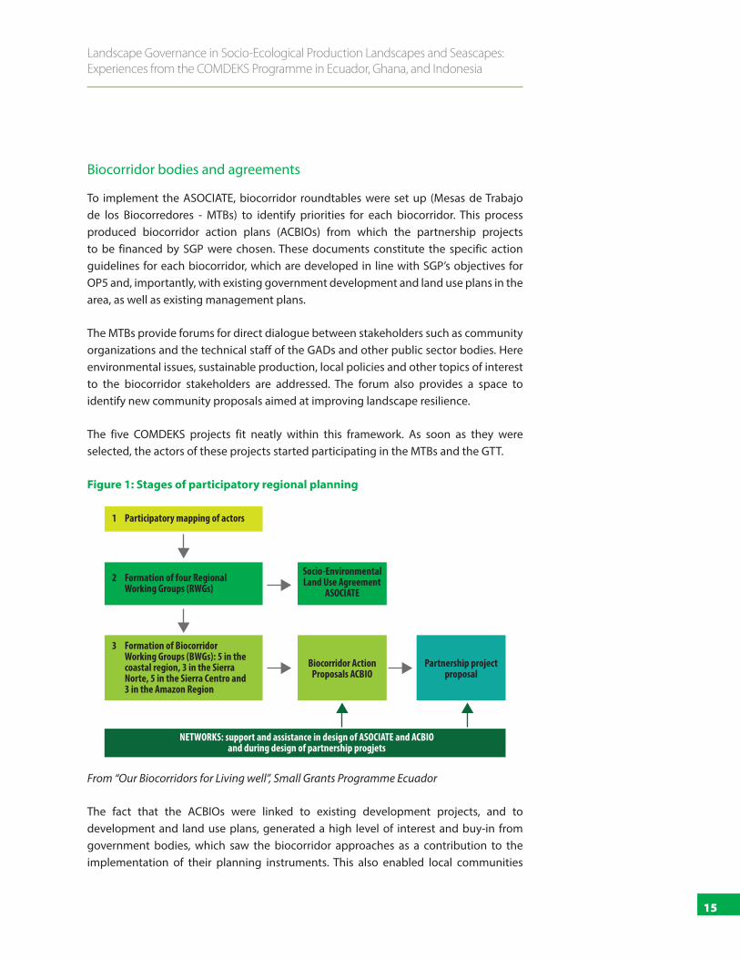
To implement the ASOCIATE, biocorridor roundtables were set up (Mesas de Trabajo de los Biocorredores - MTBs) to identify priorities for each biocorridor. This process produced biocorridor action plans (ACBIOs) from which the partnership projects to be financed by SGP were chosen. These documents constitute the specific action guidelines for each biocorridor, which are developed in line with SGP’s objectives for OP5 and, importantly, with existing government development and land use plans in the area, as well as existing management plans.
The MTBs provide forums for direct dialogue between stakeholders such as community organizations and the technical staff of the GADs and other public sector bodies. Here environmental issues, sustainable production, local policies and other topics of interest to the biocorridor stakeholders are addressed. The forum also provides a space to identify new community proposals aimed at improving landscape resilience.
The five COMDEKS projects fit neatly within this framework. As soon as they were selected, the actors of these projects started participating in the MTBs and the GTT.
Figure 1: Stages of participatory regional planning
From “Our Biocorridors for Living well”, Small Grants Programme Ecuador
The fact that the ACBIOs were linked to existing development projects, and to development and land use plans, generated a high level of interest and buy-in from government bodies, which saw the biocorridor approaches as a contribution to the implementation of their planning instruments. This also enabled local communities
Participatory mapping of actors1
Socio-Environmental Land Use Agreement
ASOCIATE
Biocorridor Action Proposals ACBIO
Partnership project proposal
Formation of four Regional Working Groups (RWGs)
2
Formation of Biocorridor Working Groups (BWGs): 5 in the coastal region, 3 in the Sierra Norte, 5 in the Sierra Centro and 3 in the Amazon Region
3
NETWORKS: support and assistance in design of ASOCIATE and ACBIO and during design of partnership progjets
16
01 : The COMDEKS Approach and Landscape Governance
participating in the MTBs to position their activities as key contributions to the environmental and social goals of government agencies. This has had the effect that requests for support from local organizations are now considered more readily by government agencies.
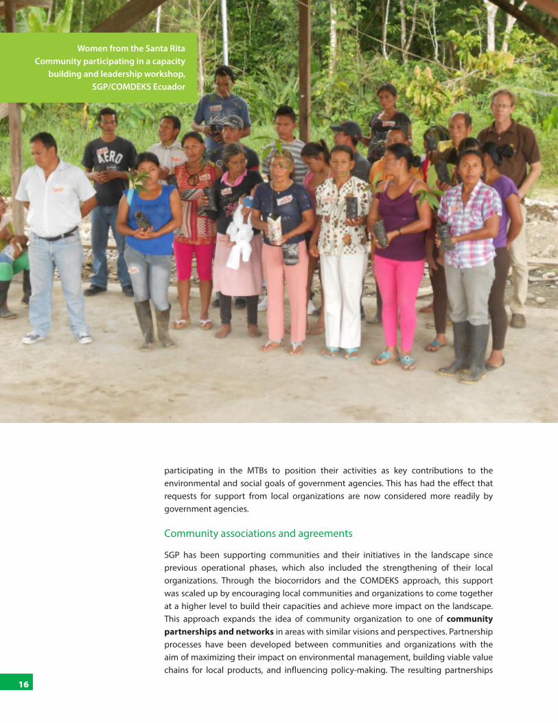
Community associations and agreements
SGP has been supporting communities and their initiatives in the landscape since previous operational phases, which also included the strengthening of their local organizations. Through the biocorridors and the COMDEKS approach, this support was scaled up by encouraging local communities and organizations to come together at a higher level to build their capacities and achieve more impact on the landscape. This approach expands the idea of community organization to one of community partnerships and networks in areas with similar visions and perspectives. Partnership processes have been developed between communities and organizations with the aim of maximizing their impact on environmental management, building viable value chains for local products, and influencing policy-making. The resulting partnerships
Women from the Santa Rita Community participating in a capacity
building and leadership workshop, SGP/COMDEKS Ecuador

17
Landscape Governance in Socio-Ecological Production Landscapes and Seascapes: Experiences from the COMDEKS Programme in Ecuador, Ghana, and Indonesia
were very diverse, according to local realities and interests, such as the valorization of local products, the conservation of certain ecosystems, or the resistance against common threats. Past initiatives have been consolidated and built on with communities working together, sharing their knowledge and experience. The requirements for these partnerships have been quite flexible. It was, for example, not required to form or officially register new organizations; often, existing associations were used.
A key governance instrument to achieve better conservation in the landscape were local community agreements. These agreements were the result of an intensive process of dialogue and awareness-raising in the local communities about the importance of conserving watersheds and forests and reforesting degraded areas. The finalized community agreements were ratified in a general assembly of community delegates. Four of these agreements were signed as part of the COMDEKS projects, achieving a total of 570 ha of forest under conservation. Through collective work (a traditional practice called minga), men and women from the communities reforested 61 ha. The agreements updated existing customary conservation practices and created new rules, making them more visible and transparent. This is a crucial step in achieving recognition, for instance, by local government authorities. The agreements were also successful in countering some external threats, such as logging.
As part of the COMDEKS project, the Asociación Pashimbi developed a management plan for the conservation of the buffer zone of the new protected area Reserva Ecologica Colonso Chalupas. This initiative, in addition to contributing to the connectivity of the biocorridor, positioned the community as a key ally for the Ministry of Environment. The protected areas also linked the COMDEKS projects Pashimbi and Sinchi Warmikuna with other communities living in the buffer zone, thereby fostering learning exchanges. These other communities are now building on Pashimbi’s experience to develop their own management plan.
LESSONS LEARNED AND CHALLENGES AHEAD
Interactions between communities and government agencies
The intensive process of developing the regional socio-environmental agreement and the biocorridor action plans was successful in securing the support of all relevant actors and institutions for the goals of conservation, sustainable use and cultural revitalization in the landscape. The GTT and MTB provide regular opportunities for stakeholders to interact. A key factor was the involvement, from the very beginning, of the GAD at all three levels, as well as the traditional authorities of the communities. The close integration of the agreements and activities with existing management plans and governmental land use and development plans ensured the buy-in and continuous interest of the public sector. The traditional authorities participated directly in the management of the COMDEKS projects, from community consultations to financial
A key governance instrument to achieve better conservation in
the landscape were local community
agreements.
18
02 : Ecuador — The Napo River Watershed, Amazon Region
management to monitoring of activities. At the same time, the emphasis on the participation of all sectors of the communities, including women and youth, sought to ensure a high level of representativeness.
One of the challenges moving forward will be to ensure the continuity and intensification of these positive relations between communities and the public sector. The MTB meetings should be ongoing in order to coordinate future actions effectively between the community associations and governmental institutions. Beyond the GADs, it will be crucial to foster closer ties with local environmental institutions to secure technical support and resources. Public institutions will also have to play their role in supporting local communities who seek to stop external threats to their lands and resources, such as from extractive industries. Communities from three of the five COMDEKS projects are facing risks to their landscapes due to neighboring oil concessions, and ongoing construction of roads and other infrastructure is a risk for landscape connectivity. So far, the public institutions in charge of environmental management have not been effective in halting these threats, and local communities have felt that they do not have anywhere to turn when their collective rights and the rights of Nature are threatened.
Conservation agreements
The sustainability of COMDEKS project activities directly rests on the commitment of the communities to conserve their forests and watersheds, as laid out in community agreements. This in turn is directly linked to the traditional management of chakras and farms as agroecological systems, which maintains ecological cycles and cultural practices. To make this possible in the long run, it will be important to strengthen the capacities of the communities, as well as the leadership and commitment of community authorities, which will enable them to obtain support from local institutions. The community authorities have to be empowered to monitor and enforce the community agreements and be held accountable for the outcomes. One recommendation is to develop simple monitoring plans to measure whether the conservation agreements reach their goal, and thereby continuously contribute to the building of the biocorridors. Local conservation agreements cannot by themselves face large threats such as oil and mining. However, they do give more visibility to the importance of local conservation areas. The conservation agreements will have to be further disseminated and accepted by government authorities and other relevant actors as instruments that reflect the dedication of local communities to the conservation of their resources.
Revitalization of traditional knowledge and culture
One of the important achievements of the COMDEKS approach has been the rescue of ancestral knowledge of community elders, especially regarding the relationships between the natural and cultural environment, which has been disappearing due to increasing urbanization. Key outcomes of this process are the valorization of local varieties as products with territorial identity (value added to products from agro-biodiversity;
Public institutions have to play their role in supporting local communities who seek to stop external threats to their lands and resources, such as from extractive industries.
19
Landscape Governance in Socio-Ecological Production Landscapes and Seascapes: Experiences from the COMDEKS Programme in Ecuador, Ghana, and Indonesia
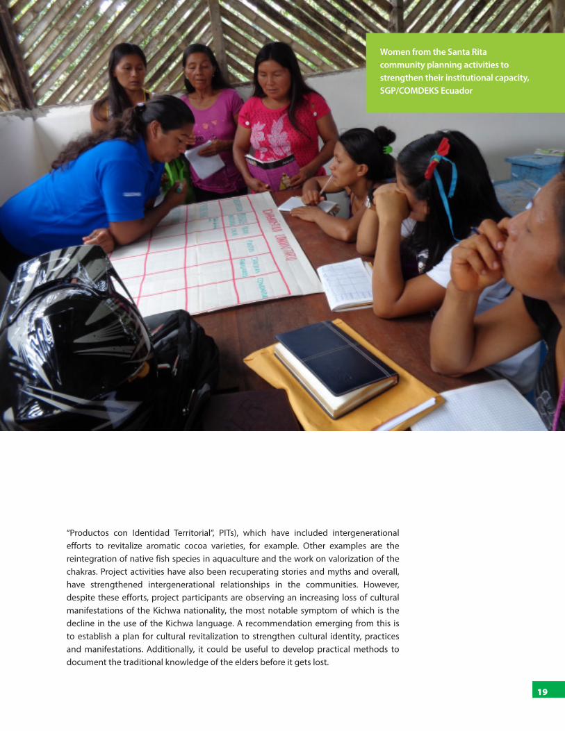
“Productos con Identidad Territorial”, PITs), which have included intergenerational efforts to revitalize aromatic cocoa varieties, for example. Other examples are the reintegration of native fish species in aquaculture and the work on valorization of the chakras. Project activities have also been recuperating stories and myths and overall, have strengthened intergenerational relationships in the communities. However, despite these efforts, project participants are observing an increasing loss of cultural manifestations of the Kichwa nationality, the most notable symptom of which is the decline in the use of the Kichwa language. A recommendation emerging from this is to establish a plan for cultural revitalization to strengthen cultural identity, practices and manifestations. Additionally, it could be useful to develop practical methods to document the traditional knowledge of the elders before it gets lost.
Women from the Santa Rita community planning activities to strengthen their institutional capacity, SGP/COMDEKS Ecuador

03
GHANA
03INTRODUCTION TO THE SOCIO-ECOLOGICAL LANDSCAPE
The Weto landscape forms the southern part of the Togo-Atakora Range, a belt of ridges and hills beginning west of Accra and extending northeast into Togo and Benin. The project area within the Weto range measures about 59,000 hectares of a mountainous mosaic landscape with diverse habitats and land uses. The most common vegetation in the landscape is open forest (51 percent of the total land area), which is comprised of a mixture of food crop farms, bush fallows, and cash crops like oil palm, oranges, and timber plantations. Closed forests (23 percent of total area) are mostly community-conserved areas, sacred groves and mountain vegetation above 80 percent gradient. The built-up area constitutes only about 5 percent of the total area. The Weto range is well-endowed with a diversified natural resource base in the form of high biodiversity, well-developed hydrological systems, rich soils, and a conducive climate, all of which form a strong resource base for economic activities and sustainable development. In addition to its rich endemic flora, the Weto Range landscape has a diversity of wildlife, including birds, bats, rodents, monkeys, waterbuck, and butterflies.
The main challenges to resilience and sustainability confronting the landscape are increasing habitat destruction; unsustainable farming practices; inadequate livelihood support systems and weak institutional capacity to support conservation in the context of economic development. Forests have been extensively degraded through poor agricultural practices, illegal logging, and frequent bush fires. Removal of vegetative cover on slopes has led to serious erosion, loss of soil fertility, and an increase in landslides. Loss of forest cover has also resulted in a reduction in stream volumes and soil moisture. These challenges have resulted in increased loss of biodiversity, reduced ecosystem services, land degradation, lower agricultural production, and have contributed to widespread poverty.
Agricultural production and income are low due both to poor farming practices and lack of access to critical inputs, including high-quality seeds and productivity-enhancing technologies. As agricultural resources degrade, people turn to the forest to meet their subsistence needs. Reduced soil fertility means that farmers who once annually harvested 7-8 bags of maize per acre during each planting season now get only 2-4 bags, decreasing income and increasing food insecurity. In turn, lack of employment opportunities beyond subsistence agriculture fuels out-migration, particularly among the young, and destabilizes communities.6
6 UNDP, 2014
THE WETO RANGE

21
Landscape Governance in Socio-Ecological Production Landscapes and Seascapes: Experiences from the COMDEKS Programme in Ecuador, Ghana, and Indonesia
LANDSCAPE GOVERNANCE STRUCTURE
The project area spans across eleven traditional and three political administrative areas, namely, the South Dayi District Assembly, and Hohoe and Ho municipalities in the Volta region. Two distinct governance systems influence the use and conservation of the landscape and its resources, namely: the customary system of traditional leaders, and the official system of government institutions. While the two systems collaborate from time to time on local development issues, they are essentially functioning in parallel.
Policy frameworks and government institutions
A number of national frameworks regulate aspects of the landscape’s resources, the most significant being the 2012 Forest and Wildlife Policy, the 2007 Food and Agriculture Sector Development Policy (FASDEP II-2008), the 1999 Land Policy, the 2006 National Wildfire Management Policy and the National Environment Policy.
Meeting of a vegetable farmers group, SGP/COMDEKS Ghana
22
03 : The Weto Range
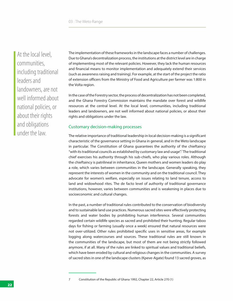
The implementation of these frameworks in the landscape faces a number of challenges. Due to Ghana’s decentralization process, the institutions at the district level are in charge of implementing most of the relevant policies. However, they lack the human resources and financial means to monitor implementation and adequately extend their services (such as awareness raising and training). For example, at the start of the project the ratio of extension officers from the Ministry of Food and Agriculture per farmer was 1:800 in the Volta region.
In the case of the Forestry sector, the process of decentralization has not been completed, and the Ghana Forestry Commission maintains the mandate over forest and wildlife resources at the central level. At the local level, communities, including traditional leaders and landowners, are not well informed about national policies, or about their rights and obligations under the law.
Customary decision-making processes
The relative importance of traditional leadership in local decision-making is a significant characteristic of the governance setting in Ghana in general, and in the Weto landscape in particular. The Constitution of Ghana guarantees the authority of the chieftaincy “with its traditional councils as established by customary law and usage”.7 The traditional chief exercises his authority through his sub-chiefs, who play various roles. Although the chieftaincy is patrilineal in inheritance, Queen mothers and women leaders do play a role, which varies between communities in the landscape. Generally speaking, they represent the interests of women in the community and on the traditional council. They advocate for women’s welfare, especially on issues relating to land tenure, access to land and widowhood rites. The de facto level of authority of traditional governance institutions, however, varies between communities and is weakening in places due to socioeconomic and cultural changes.
In the past, a number of traditional rules contributed to the conservation of biodiversity and to sustainable land use practices. Numerous sacred sites were effectively protecting forests and water bodies by prohibiting human interference. Several communities regarded certain wildlife species as sacred and prohibited their hunting. Regular taboo days for fishing or farming (usually once a week) ensured that natural resources were not over-utilized. Other rules prohibited specific uses in sensitive areas, for example logging along watercourses and sources. These traditional rules are still known in the communities of the landscape, but most of them are not being strictly followed anymore, if at all. Many of the rules are linked to spiritual values and traditional beliefs, which have been eroded by cultural and religious changes in the communities. A survey of sacred sites in one of the landscape clusters (Kpeve-Agate) found 13 sacred groves, as
7 Constitution of the Republic of Ghana 1992, Chapter 22, Article 270 (1)
At the local level, communities, including traditional leaders and landowners, are not well informed about national policies, or about their rights and obligations under the law.

23
Landscape Governance in Socio-Ecological Production Landscapes and Seascapes: Experiences from the COMDEKS Programme in Ecuador, Ghana, and Indonesia
well as a larger number of sacred rivers and watersheds and sacred caves. Other sacred sites were reported by the communities to have disappeared. A biological inventory of sacred groves and shrines in six communities showed about half of the examined sites (ranging from 0.5 ha to 5.0 ha) to still be intact, while the others showed varying degrees of encroachment.
Land and resource tenure
In contrast to other parts of Ghana, land in the Weto range is not held communally under the authority of traditional leaders. Rather, land plots belong to individual families and are managed by the family heads. As there has not been any process of land registration in the area so far, families do not hold formal titles over their land. Land transference and transactions are conducted orally, as are agreements for share-cropping or leasing of land to migrants and tenant farmers.8
8 Report of Biological inventory of Sacred Sites in the Kpeve-Agate Cluster oft he Weto Mountain Range Ecosytem. Internal COMDEKS report by the NGO ARDO
Tree nursery group at work, SGP/COMDEKS Ghana

24
03 : The Weto Range
Land ownership, however, does not automatically confer use rights over natural resources. While Ghana’s Constitution vests ownership of the land in traditional or customary leadership structures it gives the Government the right to manage the naturally occurring resources, such as timber and wildlife, on the land for economic gain. This has resulted in a series of perverse incentives that, over the decades, have tended to drive ‘illegal’ resource use and degradation or deforestation of the forest resources.9
The combination of weakening traditional governance, lack of enforcement of national laws, and uncertain tenure over natural resources have generated a de facto open access situation in many areas. This has contributed to the situation of unsustainable resource use and ecosystem degradation encountered at the beginning of the COMDEKS programme.
A potential for more local ownership: the CREMA policy
The Wildlife Division of the Forestry Commission developed a Collaborative Wildlife Management Policy in 2000 to address the challenges of wildlife management. A primary mechanism of this policy is the Community Resource Management Area (CREMA) approach. The CREMA represents a profound policy shift by permitting communities, land owners and land users an opportunity to govern and manage forest and wildlife resources within the boundaries of the CREMA, and to benefit financially or in-kind. All functional CREMAs come under a two-tiered governance structure, an approved constitution, and rules and regulations, backing in the form of local government by-laws, the power to engage their own staff and the authority to generate revenue from natural resource management. In addition, CREMAs must have defined boundaries that are agreed upon by all stakeholder communities and the traditional leadership, upon which a long-term vision, goals, management plans, activities and regulations are agreed. A CREMA is officially inaugurated when the Ministry is sufficiently satisfied to issue an official Certificate of Devolution of rights over natural resource management to the local CREMA institution.10 Currently, a new Wildlife Resources Management Bill, which would include provisions giving greater legitimacy to the CREMAs, is being debated in parliament.
9 Asare, R.A., A. Kyei, J. J. Mason, 2013: The community resource management area mechanism: a strategy to manage African forest resources for REDD+. In: Philosophical Transactions of the Royal Society B, Vol. 268, Issue 1625, September 2013
10 Ibid.
While a significant characteristic of governance in Ghana, the de facto level of authority of traditional governance institutions varies between communities and is weakening in places due to socioeconomic and cultural changes.

25
Landscape Governance in Socio-Ecological Production Landscapes and Seascapes: Experiences from the COMDEKS Programme in Ecuador, Ghana, and Indonesia
THE LANDSCAPE STRATEGY AND PROJECT ACTIVITIES
The Weto landscape strategy was developed through a participatory process involving civil society organizations (CSOs) operating in the area, traditional rulers, government service providers, opinion leaders, District Assembly members, religious groups, landowners and farmers. The Landscape Strategy prioritizes the following activities and interventions:
■ Conservation and restoration of ecosystems within the Weto landscape through forest restoration, restoration and protection of wetlands and watersheds, and installation of soil and water retention structures;
■ Sustainable production of crops, livestock, fish, forest, and non-timber forest products; diversification of agricultural landscapes and production systems;
■ Development of new livelihood enterprises, including new value-added agricultural activities as well as ecotourism and cultural tourism;
■ Promotion of participatory community-based land use planning, and adoption of action plans to prevent rapid degradation of wildlife and water resources;
■ Building the institutional capacity needed to realize the goal of integrating conservation and production;
■ Protection of areas of significant ecological importance or areas known to contain medicinal plants, including sacred groves and caves, as well as fragile areas such as hill slopes, wetlands, and estuaries;
■ Strengthening conflict resolution mechanisms in natural resource management by building upon traditional as well as new institutions and authorities to reduce insecurity and increase economic opportunities.
With these guidelines in mind, 21 local projects were selected and implemented for Ghana’s portfolio of COMDEKS landscape interventions in the Weto Range. The outcome of the innovative practices within the landscape has resulted in improvement in the following areas:
Restoring and protecting forests and watersheds
The total forest cover has increased slightly by 1 percent. The increased open forests are mixtures of food crop farms, bush fallows, and cash crops farms like oil palm, cocoa, oranges, avocado, and timber plantations. The project has planted about 1.5 million
26
03 : The Weto Range
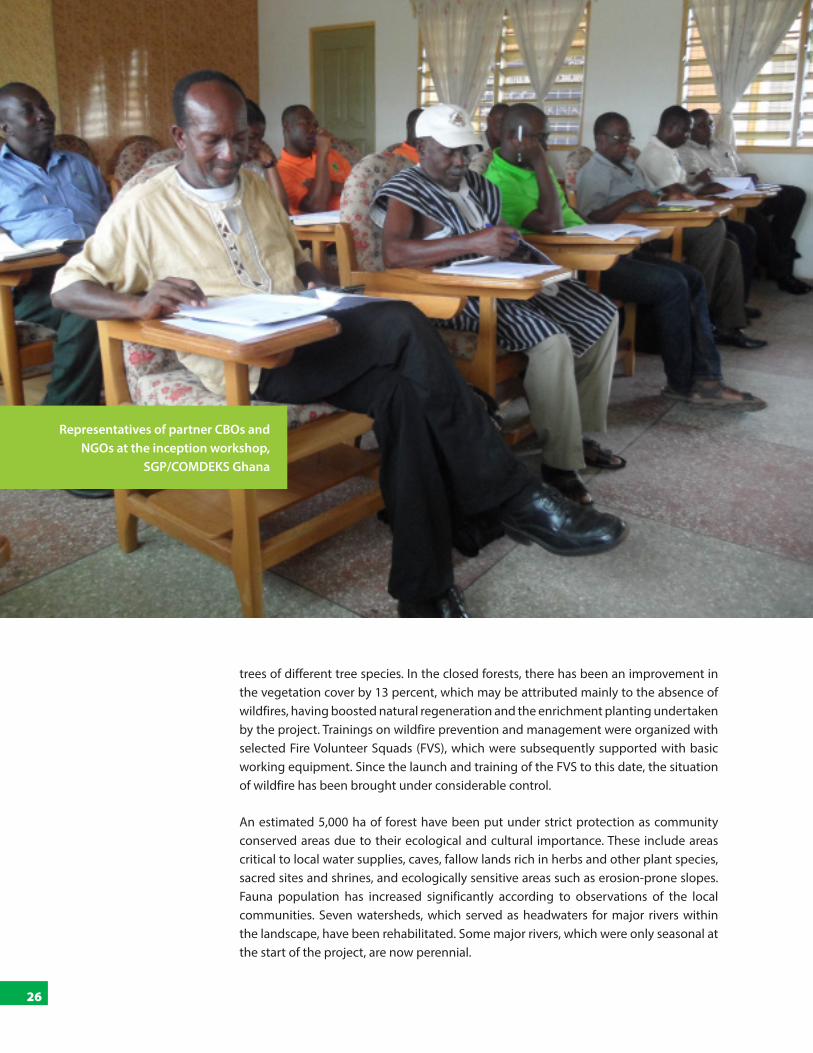
trees of different tree species. In the closed forests, there has been an improvement in the vegetation cover by 13 percent, which may be attributed mainly to the absence of wildfires, having boosted natural regeneration and the enrichment planting undertaken by the project. Trainings on wildfire prevention and management were organized with selected Fire Volunteer Squads (FVS), which were subsequently supported with basic working equipment. Since the launch and training of the FVS to this date, the situation of wildfire has been brought under considerable control.
An estimated 5,000 ha of forest have been put under strict protection as community conserved areas due to their ecological and cultural importance. These include areas critical to local water supplies, caves, fallow lands rich in herbs and other plant species, sacred sites and shrines, and ecologically sensitive areas such as erosion-prone slopes. Fauna population has increased significantly according to observations of the local communities. Seven watersheds, which served as headwaters for major rivers within the landscape, have been rehabilitated. Some major rivers, which were only seasonal at the start of the project, are now perennial.
Representatives of partner CBOs and NGOs at the inception workshop,
SGP/COMDEKS Ghana

27
Landscape Governance in Socio-Ecological Production Landscapes and Seascapes: Experiences from the COMDEKS Programme in Ecuador, Ghana, and Indonesia
Promoting agroforestry and training farmers in sustainable agricultural practices
The projects introduced agro-ecological practices and supported the diversification of the agricultural landscapes by introducing agro-forestry, management of trees on farms, diversification of production systems through the cultivation of a higher diversity of crops and promoted crop-livestock-trees integration. They supported the local farmers to invest in improved technologies of low-input agriculture, soil conservation, and improved water management practices. The innovations and introduction of new technology in agriculture also included the conservation of indigenous species, improving indigenous practices, and conserving of sustainable cultural practices. Across eight such projects, 100 lead farmers were identified, trained, and supported to establish agro-forestry farms and promote trees on farms.
Introducing alternative income opportunities
Through their sustainable livelihoods approach (SLA), the projects introduced alternative livelihood opportunities such as honey production, small ruminant rearing, oil processing, preparation and packaging of traditional medicine, and cultivation of grafted mangoes. The projects supported the establishment of 5 rural enterprises to develop sustainable trade initiatives and markets through Non Timber Forest Products (NTFP) processing; integrated livestock and small ruminants rearing (e.g. rabbits), development of fodder and feed banks, commercial fruit plantation and honey production. Most of these enterprises operate in the informal economy, while honey production is on the brink of being incorporated into formal small size enterprises. Household incomes for those participating in these enterprises have in some cases increased by 100 percent. The project also facilitated the formation of farmer trust groups following its support for farmers groups in income generation activities such as production of vegetables, soybean, and honey.
Increasing food security
Food Security was improved by measures such as creating local employment in nursery development, honey production, dry season vegetable cultivation and gardening; improving the marketing systems for honey, oil palm, gari and cassava dough; minimizing post-harvest and storage losses for cereals and grains; promoting crops adaptable to the landscape, with an emphasis on indigenous crops that had been abandoned, especially indigenous rice and leafy vegetables; introducing early warning systems within the landscape using indigenous knowledge systems; and soliciting the support of Government service providers and operating within national priority policies to provide extension services in agriculture and industry.
The Community Resource Management
Area approach represents a
profound policy shift by permitting communities, land
owners and land users an opportunity to
govern and manage forest and wildlife
resources within the boundaries of the
CREMA.
28
03 : The Weto Range
RESULTS: DEVELOPMENTS IN GOVERNANCE DURING THE PROJECT
Landscape level: the WETO Platform
At the landscape level, the most significant development in terms of governance has been the formation of the Weto Platform, which seeks to link different civil society groups, traditional authorities, and government bodies in a single institution with the goal of approaching natural resource management from a landscape-wide perspective.
The Weto Platform was initiated in 2012 by NGO beneficiaries of the COMDEKS programme. The idea emerged early on to create a body that would go beyond a simple project management committee, to coordinate the activities of civil society in the landscape, serve as a joint group to influence policy, and sustain itself beyond the lifetime of the project. Officially launched in 2014, the Platform is registered as an association and formally recognized by the government of Ghana.
The Platform has been successful in harmonizing the activities of civil society organizations in the landscape that are working on development and conservation issues. Where there was duplication of efforts before, there is now better coordination and mutual learning. Through the quarterly meetings, but also through direct exchanges, NGOs share their knowledge and approaches and have developed common strategies and principles for their work with local communities. An example of this is the strategy for community entry, which always has to involve the local chief and eldest, thereby ensuring legitimacy and buy-in from traditional authorities. The Platform has also been able to fulfill its role as an advocacy body for the landscape, for example when it succeeded to halt a stone quarry project in a sensitive area by informing and mobilizing relevant government agencies. The district assemblies in the landscape are involved in the Platform and the COMDEKS project by providing technical advice, and government service providers such as the Ghana National Fire Service and the Ministry of Food and Agriculture extension provide training at community level.
The Weto Platform seeks to link different civil society groups, traditional authorities, and government bodies in a single institution with the goal of approaching natural resource management from a landscape-wide perspective.
29
Landscape Governance in Socio-Ecological Production Landscapes and Seascapes: Experiences from the COMDEKS Programme in Ecuador, Ghana, and Indonesia
Governance Structure of the Weto Platform
The Weto Platform has a three-tiered governance structure: the Weto Governing Council, the Weto COMDEKS Consultative Body and the local community groups.
1. The Weto Governing Council is an eleven-member council made up of landowners within the range, traditional Authorities, District Assemblies and Regional Coordinating Council, opinion leaders, research institutions, and civil society organizations. Their functions include sourcing, dispersing, and managing support for the management of natural resources within the Weto range. They approve of policies governing the management of the resources, settle disputes, and ensure political and social support for the management of the area. They approve the management plan and management of the landscape. They meet twice a year to deliberate on matters arising from the operations of the platform members and other matters affecting the welfare of the Weto landscape.
2. The Weto COMDEKS Consultative Body (WCCB) is comprised of represen-tatives from the implementing CSOs under COMDEKS, representatives of other CSOs operating in the area, collaborating Ministries, Departments and Agencies, Donors and Media. The WCCB makes the day-to-day decisions and drives progress of project activities. It monitors project progress, discusses the challenges and ensures peer review of project performance, and ensures that the COMDEKS project is on course.
3. The various groups and associations formed under the COMDEKS project are described below. They are involved in the project implementation and advise the COMDEKS project management.
The Weto Platform has been registered and certified by the Government of Ghana.
Local governance innovations
In each of the project locations, community groups were created, according to the structure, livelihoods, and interests of each community. These new structures include activity groups, including women’s groups, such as for cocoa planting, bee keeping, livestock or small ruminant rearing, as well as stakeholder groups such as landowner groups and groups of traditional leaders. Some of the NGOs initiated microcredits and village or group saving schemes. The groups agreed on their internal constitutions and hold regular meetings to take their joint activities forward. Representatives of these various groups form the local project management committees who work with the supporting NGOs to decide on project activities. One group is even operating at the landscape level: the Ho West Beekeepers Association, which was active in the past but had stopped operations prior to the project activities, was revived by the COMDEKS programme.

30
03 : The Weto Range
A visibly successful approach to conservation challenges is the development of community by-laws. These laws are developed by local communities, orally or in written form, and can be ratified by the District Assembly if the community wishes to give them an official status. Under the COMDEKS project, by-laws were developed in most of the participating communities on various issues, the most common one being fire control. In some communities bushfires were completely banned, in others farmers now have to announce their intent to burn on their farm and be assisted by fire volunteers to maintain control over the fire. Other by-laws include the prohibition of logging, for example in areas prone to erosion, the prohibition of logging and farming close to water sources and streams, and a ban of chainsaws in the forests. Some of these by-laws are enforcing existing government policies that were, so far, not well known or being ignored (e.g. the prohibition of farming up to 30 m around water courses, which is stipulated in the forestry law). A few by-laws are also reviving traditional rules of the communities that were no longer enforced. The by-laws are agreed upon in the community and are then communicated to all members – traditionally by drumbeaters who are sent around the community by the chief. The chief enforces the laws, and non-compliance can carry heavy fines including money, and the slaughtering of animals. Customary rules regulate how the fines are to be used and distributed.
Hon. Angela Alorwu Tay, the Afadjato District Chief Executive, planting a tree
to commemorate the World Environment Day 2013, SGP/COMDEKS Ghana

31
Landscape Governance in Socio-Ecological Production Landscapes and Seascapes: Experiences from the COMDEKS Programme in Ecuador, Ghana, and Indonesia
Several local projects were able to create economic incentives that are directly tied to conservation actions, thereby encouraging compliance. For example, alternative livelihood activities such as beekeeping and agroforestry are located on the slopes directly under the ridge forests. These economic assets would be threatened by potential bushfires, which encouraged communities to effectively control the fires. Elsewhere, awareness raising activities demonstrated the dependence of cocoa crops on a steady water supply, and therefore the importance of preserving forests around watersheds. Finally, ecotourism activities initiated by the projects provide a direct source of income from the landscape’s natural ecosystems.
Establishment of CREMAs
Two of the COMDEKS projects have started the process of establishing CREMAs to conserve some of the most sensitive and valuable areas on the mountain ridge. Management boards have been established, which include representatives from the traditional area involved, representatives of government agencies, and the executives of local CREMA committees that were formed at community level. In accordance with the guidelines to establish a CREMA, constitutions are developed by the stakeholders to regulate resource use inside the core area. These constitutions include by-laws for example on timber, wildlife and NTFPs, as well as on tourism activities. Benefits from tourism revenues and alternative livelihood activities around the area will be shared with the landowners according to their share of land inside the area. Once the government approves the CREMAs, the communities will be able to regulate access to the areas and enforce the by-laws more effectively.
Land use planning
One of the instruments foreseen by the landscape strategy was to develop participatory land-use plans. These were to include zones for conservation, for sustainable use such as agroforestry, for forest regeneration, etc. So far, however, there has been little progress in developing them. Landowners and traditional leaders were reluctant to engage in participatory land use planning processes to define land use and conservation areas on the maps. The common fear is that the communities might lose their control over their traditional land areas if these are officially mapped, as the traditional landowners generally do not possess official land titles. A formal registration process through the Lands Commission would in theory solve the issue of uncertainty. However, the process would ascribe and fix individual ownership, which does not fit the customary, often complex land ownership and use arrangements at family level that still prevail in the communities.
LESSONS LEARNED AND CHALLENGES AHEAD
A number of governance innovations have contributed to the success of the COMDEKS programme in the Weto landscape. At the landscape level, the Weto platform has brought actors together and constitutes a real chance to maintain cohesion and momentum beyond the lifetime of the programme. At the local level, the creation of community
A visibly successful approach to
conservation challenges is the development of
community by-laws.

32
03 : The Weto Range
groups, the linking of economic incentives with conservation and sustainable use, and the development of new community by-laws have been instrumental in decreasing the pressures on the landscape’s natural resources and in building social capital. A key factor of success is the strategic involvement of traditional leaders and traditional landowners, by organizing them into groups and involving them in project decisions and activities, including income generation. The buy-in of and dialogue between these two groups has enabled communities to respond to the particular challenges posed by the complex governance and resource tenure situation of the landscape. The programme was also able to build bridges between traditional leadership and government institutions. Some of the challenges that remain, including recommendations from landscape actors on how to address them, are outlined below.
Consolidating and communicating the WETO Platform
The main challenge ahead will be to secure the means for the Platform to continue its work beyond the COMDEKS programme, and to increase its visibility. So far it is not yet well known outside of the main actors of the programme. Discussions are underway on how to confer a more visible identity to the platform as a body and, by extension, to the Weto landscape. The involvement of government agencies is also relatively ad-hoc so far. Government agencies serve as technical advisors and the platform was able to secure the support of government extension services at district level to support the landscape strategy. However, beyond the direct collaborators at district levels, the Platform is not yet known by government agencies (at the regional level, for example) as the powerful partner that it could be.
Members of the platform are also keen to use the body for joint fundraising in the future. Indeed, the member NGOs are all dependent on external project funding for their activities and communities are faced with difficulties to continue their engagement when funding cycles end. This issue of maintaining community engagement after the funding ends is one that the COMDEKS programme is facing itself. GEF SGP is working towards this goal by continuing funding in its next operational phase (OP6) in places where interventions are needed not to erode the gains achieved under COMDEKS; by introducing the Weto area and the Platform to a number of other donors and by promoting a village savings and loan scheme, which would be used to sustain the local activities of the Weto Platform in the landscape. If this Platform could generate sustainable internal funding to become more independent and support community activities in the long term, this would go a long way towards securing the achievements in the landscape.
Adapting the CREMA process to the landscape
The CREMA policy holds significant potential to improve the local governance of natural resources by transferring decision-making and use rights to communities. However, the policy was mainly created to target wildlife management in and around protected
A key factor of success is the strategic involvement of traditional leaders and traditional landowners, by organizing them into groups and involving them in project decisions and activities, including income generation.

33
Landscape Governance in Socio-Ecological Production Landscapes and Seascapes: Experiences from the COMDEKS Programme in Ecuador, Ghana, and Indonesia
areas. In the Weto landscape, the areas to be conserved are all off-reserve areas (i.e. not part of the national protected area system) and the challenges lie in managing forest resources. At this stage, it is not entirely clear which rights can be included in the process of devolution: For example, does it include the right to manage and financially benefit from timber resources? The project beneficiaries are experimenting with the adaptation of model CREMA constitutions to the local realities. The innovative CREMA pilots in the project landscape could also play a significant role in informing national policy on the needs in this and similar landscapes. A new Wildlife Resource Management Bill, which seeks to increase the legitimacy of the CREMA, is currently before parliament and might improve certainty in the future. GEF SGP has been sharing experiences on behalf of the local partners and recommending improvements to this bill.
Sustaining involvement in community groups and activities
In some communities, the chosen economic activities are taking time to become viable, for example in the case of agroforestry activities involving fruit trees. This has led to activity groups losing membership, as the return on the time invested is not perceived as significant yet over the short term. To avoid this, some NGOs have been combining economic incentives that are distributed over time: starting with economic activities
Organic compost preparation workshop by the Environmental Development Youth Movement, SGP/COMDEKS Ghana
34
03 : The Weto Range
that have a quick return on investment, such as vegetable cultivation, then medium-term activities like beekeeping and cocoa farming, and finally tree planting as a long-term investment. A remaining challenge is how to develop sustainable business models for these economic activities by up-scaling production and improving market access to develop truly viable, long-term enterprises.
Project beneficiaries also observed that it was challenging to bring members of the communities together as groups to implement communal projects, such as tree nurseries, and to keep these initiatives alive over time. Apart from the above-mentioned challenges of economic viability, one reason seems to be that community life in the landscape is organized around families, and individuals are reluctant to invest time and resources into activities when it is not clear how much their family as a whole will benefit. In some communities, the projects are therefore starting to pilot initiatives with groups organized at the family level, rather than on the basis of individual membership. This seems to have increased the interest in group activities once more.
Land use planning
Participatory land use planning is an area where the project still has to make progress, which is being hampered by the local landowners’ fears of land alienation, due to negative experiences in the past. Trust building over time and awareness raising on the purpose and benefits of land use plans will be crucial, but so will finding innovative ways to reach the ultimate goal behind land use planning: A transparent dialogue and binding agreements on which areas in the landscape should be conserved, and which should be put under various forms of sustainable use. Interestingly, even without formal land use plans there have already been agreements between landowners in communities. For example, landowners who agreed to discontinue agricultural activities around watersheds or on the mountain ridge were compensated with land elsewhere. One idea voiced by project beneficiaries is to base the rules of participatory land use plans on community by-laws inspired from customary rules, rather than formally surveying and registering land through the Land Commission, which communities seem reluctant to do.
The CREMA policy holds significant potential to improve the local governance of natural resources by transferring decision-making and use rights to communities, but needs to be amended to also address challenges of forest resource management.
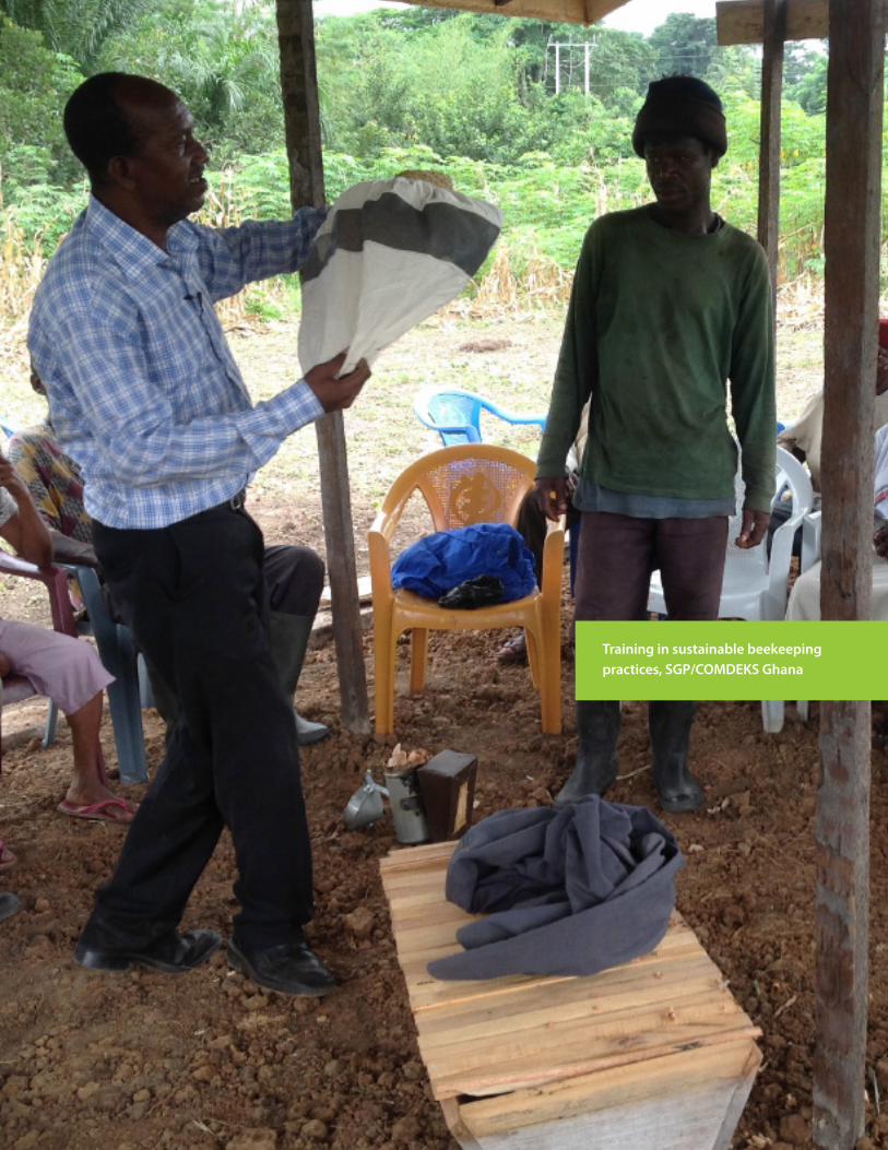
35
Landscape Governance in Socio-Ecological Production Landscapes and Seascapes: Experiences from the COMDEKS Programme in Ecuador, Ghana, and Indonesia
Training in sustainable beekeeping practices, SGP/COMDEKS Ghana
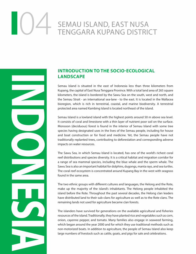
04
INDONESIA
INTRODUCTION TO THE SOCIO-ECOLOGICAL LANDSCAPE
Semau Island is situated in the east of Indonesia less than three kilometers from Kupang, the capital of East Nusa Tenggara Province. With a total land area of 265 square kilometers, the island is bordered by the Sawu Sea on the south, west and north, and the Semau Strait - an international sea-lane - to the east. It is located in the Wallacea bioregion, which is rich in terrestrial, coastal, and marine biodiversity. A terrestrial protected area named Kambing Island is located northeast of the island.
Semau Island is a lowland island with the highest points around 50 m above sea level. It consists of coral and limestone with a thin layer of nutrient poor soil on the surface. Monsoon (deciduous) forest is found in the interior of Semau Island with some tree species having designated uses in the lives of the Semau people, including for house and boat construction or for food and medicine. Yet, the Semau people have not traditionally replanted trees, contributing to deforestation and corresponding adverse impacts on water resources.
The Sawu Sea, in which Semau Island is located, has one of the world’s richest coral reef distributions and species diversity. It is a critical habitat and migration corridor for a range of sea mammal species, including the blue whale and the sperm whale. The Sawu Sea is also an important habitat for dolphins, dugongs, manta rays, and sea turtles. The coral reef ecosystem is concentrated around Kupang Bay in the west with seagrass found in the same area.
The two ethnic groups with different cultures and languages, the Helong and the Rote, make up the majority of the island’s inhabitants. The Helong people inhabited the island before the Rote. Throughout the past several decades, the Helong clan leaders have distributed land to their sub-clans for agriculture as well as to the Rote clans. The remaining lands not used for agriculture became clan forests.
The islanders have survived for generations on the available agricultural and fisheries resources of the island. Traditionally, they have planted rice and vegetables such as corn, onion, cayenne pepper, and tomato. Many families also engage in seaweed farming, which began around the year 2000 and for which they use traditional methods such as non-motorized boats. In addition to agriculture, the people of Semau Island also keep large numbers of livestock such as cattle, goats, and pigs for sale and celebrations.
SEMAU ISLAND, EAST NUSA TENGGARA KUPANG DISTRICT
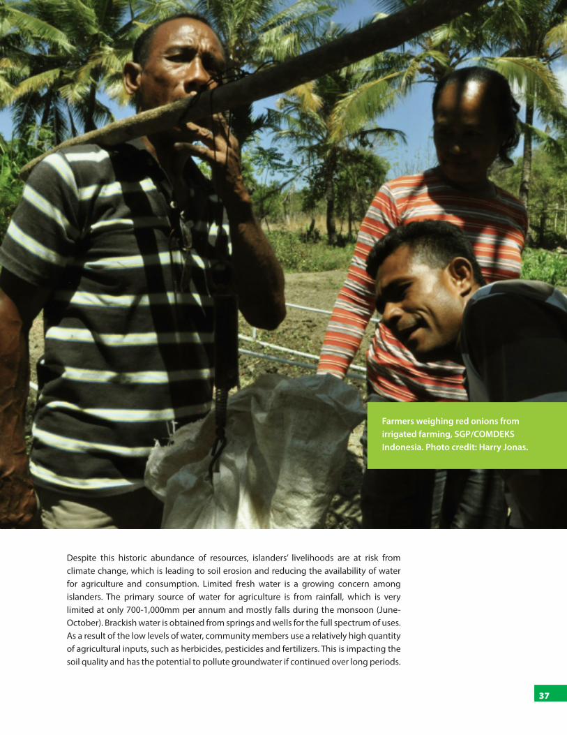
37
Landscape Governance in Socio-Ecological Production Landscapes and Seascapes: Experiences from the COMDEKS Programme in Ecuador, Ghana, and Indonesia
Despite this historic abundance of resources, islanders’ livelihoods are at risk from climate change, which is leading to soil erosion and reducing the availability of water for agriculture and consumption. Limited fresh water is a growing concern among islanders. The primary source of water for agriculture is from rainfall, which is very limited at only 700-1,000mm per annum and mostly falls during the monsoon (June-October). Brackish water is obtained from springs and wells for the full spectrum of uses. As a result of the low levels of water, community members use a relatively high quantity of agricultural inputs, such as herbicides, pesticides and fertilizers. This is impacting the soil quality and has the potential to pollute groundwater if continued over long periods.
Farmers weighing red onions from irrigated farming, SGP/COMDEKS Indonesia. Photo credit: Harry Jonas.
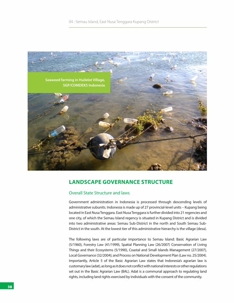
38
04 : Semau Island, East Nusa Tenggara Kupang District
LANDSCAPE GOVERNANCE STRUCTURE
Overall State Structure and laws
Government administration in Indonesia is processed through descending levels of administrative subunits. Indonesia is made up of 27 provincial-level units – Kupang being located in East Nusa Tenggara. East Nusa Tenggara is further divided into 21 regencies and one city, of which the Semau Island regency is situated in Kupang District and is divided into two administrative areas: Semau Sub-District in the north and South Semau Sub-District in the south. At the lowest tier of this administrative hierarchy is the village (desa).
The following laws are of particular importance to Semau Island: Basic Agrarian Law (5/1960), Forestry Law (41/1999), Spatial Planning Law (26/2007) Conservation of Living Things and their Ecosystems (5/1990), Coastal and Small Islands Management (27/2007), Local Governance (32/2004); and Process on National Development Plan (Law no. 25/2004). Importantly, Article 5 of the Basic Agrarian Law states that Indonesia’s agrarian law is customary law (adat), as long as it does not conflict with national interests or other regulations set out in the Basic Agrarian Law (BAL). Adat is a communal approach to regulating land rights, including land rights exercised by individuals with the consent of the community.
Seaweed farming in Huilelot Village, SGP/COMDEKS Indonesia
39
Landscape Governance in Socio-Ecological Production Landscapes and Seascapes: Experiences from the COMDEKS Programme in Ecuador, Ghana, and Indonesia
State Institutions
The Ministry of Forestry and the Ministry of Marine Affairs and Fisheries are branches of the central government that are most active in Semau Island. Nearly the entire coast of Semau Island is part of the Marine Natural Recreation Park managed by the Ministry of Forestry, while parts of the south/southeast waters belong to the Sawu Marine National Park managed by the Ministry of Marine Affairs and Fisheries.
Local Governance
At the village level, a Chief of Village (Kepala Desa) governs each of the island’s 14 villages. In addition to the state recognized Village Chief, on Semau Island there is a parallel form of traditional governance headed by Landlords (Dale Lamtua) in each village. In this context, it is interesting to note that many people living in Kupang are wary of Kupang islanders and their traditional forms of governance. Reason is the lingering belief by governmental officials, among others, that the Semau people practice animistic belief systems and/or have magical powers, which leads to a reluctance to engage with them.
Gender and Governance
Women’s voices are an important factor in families and in the decision-making processes of the village in both ethnicities, yet women remain marginalized in certain aspects. For example, they do not have the right to inherit land under a range of circumstances, including when a husband passes away before the birth of any children. This particular issue is being addressed through an increase in official registration of land, which means that once a woman receives a land title her ownership of the land overrides customary law.
THE LANDSCAPE STRATEGY AND PROJECT ACTIVITIES
At the beginning of project activities, Bingkai Indonesia conducted a baseline survey on community resilience. The data collected identified the following issues: a) scarcity of fresh water, b) overharvesting of the clan forest, c) overuse of agricultural inputs such as fertilizers, and d) low levels of knowledge and innovation in agriculture and mariculture.
Drawing on this study, Indonesia’s COMDEKS Seascape Strategy was developed, and aims to improve social and ecological production resilience of small islands and coastal communities through community-based activities. The following are the expected project outcomes:
■ Ecosystem, biodiversity and natural resources: Island ecosystem functions are preserved and enhanced through the maintenance of clan forest cover and coastal/marine/coral reef systems, and the promotion of sustainable resource use practices.
Government administration in Indonesia is
processed through descending levels of administrative
subunits: provincial-level units, regencies
or cities with sub-districts, and villages.
40
04 : Semau Island, East Nusa Tenggara Kupang District
■ Sustainable agriculture and aquaculture: Resilience of agriculture and maricul-ture systems is enhanced through improved and sustainable cultivation practices, diversification of crops and products, and improved management of water resources.
■ Community livelihoods: Community livelihoods are improved through sustain-able income generation.
Institutional governance is considered to be an important crosscutting approach to support the above three aims. It aims to create and strengthen institutional governance systems for effective participatory decision-making and knowledge-sharing at the landscape level.
The strategy document states: All COMDEKS funded activities aimed at achieving these broad outcomes across the landscape, with a particular focus on increasing agriculture and mariculture resilience. The activities aimed to raise awareness and build capacities in agriculture and mariculture management, and lead to the diversification of cultivation, improvement of water resources management, strengthen the governance structures and local institutions, and increase local innovations in the community.
As a result of the fact that governance was integrated into the activities as a crosscutting issue, the following section outlines each activity and highlights their governance dimensions.
PROJECT ACTIVITIES AND GOVERNANCE PROGRESS
COMDEKS has brought together a number of otherwise disparate groups to work towards landscape resilience through a set of coordinated activities. These include six NGOs and one Ministry:
■ Perkumpulan PIKUL: Strengthening environmental governance systems;
■ CIS Timor: Improving access to drinking water;
■ Perkumpulan Geng Motor IMUT: Strengthening farmers’ capacity for more sustainable agriculture;
■ Yayasan Pengembangan Pesisir dan Laut: Improving mariculture capacity;
■ Koperasi Tapaleuk: Supporting local initiatives;
■ Lopulalan Institute: Story-telling; and
■ Ministry of Marine Affairs and Fisheries: Construction of a desalination plant.
COMDEKS has brought together a number of otherwise disparate groups to work towards landscape resilience through a set of coordinated activities.

41
Landscape Governance in Socio-Ecological Production Landscapes and Seascapes: Experiences from the COMDEKS Programme in Ecuador, Ghana, and Indonesia
This is in itself an important governance reform. Prior to this approach, the NGOs largely worked separately. During the COMDEKS activities, these organizations have engaged as a collective, under the overall tutelage of PIKUL. The work began with an inception landscape-level workshop, which provided partner organizations with information on COMDEKS, the GEF SGP administrative process, as well as branding guidelines.
Strengthening Environmental Protection Governance Systems
Undertaken by Perkumpulan PIKUL, the overall objective of this activity supported local leaders, social innovators as well as local government and district officials regarding environmental protection in Semau Island. PIKUL also provided support to the partners (listed above) and carries out activities. After a visioning process that produced a common vision and a detailed road map, PIKUL identified local leaders and social innovators as a first step towards raising awareness on sustainable governance and management. Further activities focused on fertilizer processing, recycling waste into crafts, training on weaving and natural coloring, training on producing biogas, and forest honey beekeeping. The following paragraphs outline some examples of specific activities.
The main governance innovation in this context is the formation of environmental forums. In each of the seven villages where activities are conducted, environmental forums were established to bring together leaders and other stakeholder groups to discuss their vision for the work ahead, develop implementation plans, carry out activities and monitor progress.
Irrigation of crop fields, SGP/COMDEKS Indonesia. Photo credit: Harry Jonas

42
04 : Semau Island, East Nusa Tenggara Kupang District
Watershed conservation: Joint research with CIS Timor (below) highlighted the linkages between the overharvesting of trees for construction and fencing, and the decline in the quality of watersheds. After mapping the water resources around particular villages, they approached a number of landlords – who govern the areas – to discuss whether they would participate in a scheme to increase the overall quality of the watershed.
On the issue of governance, at the individual level, one landlord has entered into a written agreement with local community members that he will cease all harvesting of wood from a ten-hectare watershed to ensure water supplies to villagers. In return, the community members will plant trees in the watershed. When the trees mature, it has been agreed that the landlord may harvest a sustainable number of them, leaving the others to protect the watershed.
At the broader scale, there is ongoing work towards developing a written agreement – a charter – to govern the protection of the water catchment areas. Previously, access to watersheds was based on an informal and traditional system, which was subject to the vagaries of the particular landlord. The charter will set out the exact rules by which the watersheds will be governed and managed, including a dispute settlement mechanism, and will be signed in 2016 by the respective landlord and community members.
Consultation of seaweed farmers in Akle Village, SGP/COMDEKS Indonesia
43
Landscape Governance in Socio-Ecological Production Landscapes and Seascapes: Experiences from the COMDEKS Programme in Ecuador, Ghana, and Indonesia
Sand mining: A number of villages considered the quantity of sand being extracted from their beaches as being unsustainable. After a number of meetings of the local environmental forum – as set out above – and with the help of PIKUL, the villagers restricted outsiders’ access to the sand by setting up physical barriers on existing entry points to the beach. PIKUL is further assisting the communities to establish community-based tourism opportunities in these areas.
With respect to governance, the village forum continues to monitor the access to the beaches. The village forum is also working on drafting regulations for the beach, including that only locals can use the sand for non-commercial purposes and without using heavy equipment.
Improving Access to Drinking Water
Undertaken by the NGO CIS Timor, in collaboration with the National Programme on Community-based Total Sanitation, the overall objective of this activity was to improve access and management of water for six local communities. In two of the three villages it introduced pump wheels and in a third it has built a dam, including related irrigation systems. In order to strengthen water governance, CIS Timor helped establish a water committee in each village and helped the committee members engage with the National Programme’s implementing agency to establish agreements that set out the revenues they will pay and how much of those funds will be used for maintenance of the above utilities.
Additionally, CIS provided health education for children in two schools and is supporting community members to plant home gardens with fruits and vegetables; an approach that also integrates organic domestic waste into the agricultural system as fertilizer.
Strengthening Farmers’ Capacity for More Sustainable Agriculture
Undertaken by Perkumpulan Geng Motor IMUT (GMI), the overall objective of this activity was to build capacity and farming institutions and to support local innovation. Initial research on the chemical fertilizers used by community members highlighted their overuse. To address this, GMI promoted community-based permaculture. Community members initially argued that this approach was not practicable, as existing irrigation methods are highly time consuming (up to ten hours per day per family farm). Accordingly, GMI introduced a range of irrigation systems, including sprinklers and mobile hand held devices (twelve across five villages). The combination of these two approaches – in demonstration plots – led to zero chemical inputs, a reduction in time spent irrigating crops, production of two crops per year instead of one, as well as higher prices for the organic produce. Interest among other community members to replicate the approach is currently high. In addition, GMI has coordinated the planting of 300 trees, including the rain tree, mahogany and sandalwood. These trees were chosen based on their climatic suitability and ability to conserve water. In addition to PIKUL, GMI has collaborated with YPPL and KOTAK, whose work is described below.
Environmental forums were
established to bring together leaders and
other stakeholder groups to discuss
their vision for the work ahead, develop
implementation plans, carry out
activities and monitor progress.

44
04 : Semau Island, East Nusa Tenggara Kupang District
The governance value added through these activities was the collectivization of farmers. Specifically, farmers used to either travel to Kupang to sell their produce or sell to middlemen. This arrangement was either costly in terms of paying for travel or led to low prices paid by the middlemen. KOTAK has helped to set up a system through which farmers receive a guaranteed premium price by working with KOTAK to access the markets in Kupang. While the farmers work individually, they now engage as a group and can thereby generate higher profits.
Strengthening Mariculture Capacity
Undertaken by Yayasan Pengembangan Pesisir dan Laut (YPPL), the overall objective of this activity was to strengthen community capacity to improve the quality of their products generated by mariculture. In this context, activities included: improving cultivation and drying techniques, co-developing innovative business plans, training on processing seaweed products, creating a seaweed marketing network, and developing innovative techniques at the local community level on the cultivation of seaweed as well as new forms of trade. After one full growing cycle, the outcomes include the fact that farmers grow more seaweed, the dried product is of a higher quality and they are selling a variety of processed products beyond dried seaweed. To enhance ecosystem productivity, YPPL further supported mangrove restoration, thereby improving shore protection, supporting aquatic life forms (fish, prawns and shellfish) and eventually constituting a sustainable basis for harvesting of charcoal and building materials.
Seaweed to be dried, processed and sold for community income
generation, SGP/COMDEKS Indonesia

45
Landscape Governance in Socio-Ecological Production Landscapes and Seascapes: Experiences from the COMDEKS Programme in Ecuador, Ghana, and Indonesia
Supporting Local Initiatives
Undertaken by Koperasi Tapaleuk (KOTAK), the overall objective of this activity was to support the strengthening of initiatives and creative actions of communities for the protection of seascapes and landscapes on and around Semau Island. KOTAK managed a fund dedicated to supporting local communities on Semau Island who want to undertake activities that support the aims of the COMDEKS approach. In such cases, KOTAK provided capacity building to support the writing of proposals for grants of up to US$1,500. As of August 2015, 15 of the targeted 40 proposals had been received. The above four organizations have become members of KOTAK to enhance their collective approach. Additionally, KOTAK focuses on increasing communities’ access to markets, and is undertaking this work in collaboration with GMI.
Story Telling
The Lopulalan Institute (LITE), which is based in Bali, helped to generate stories of communities’ experiences by providing writing and documentation training. Their work enabled villagers to express their COMDEKS-related stories, including speaking out about their current situation, challenges and aspirations. This in turn inspired others in the communities to undertake similar work, knowing that others on the island are taking up new ideas and adopting a landscape approach to good effect. It is hoped that such stories, including those related to governance innovations and associated challenges, will further maintain and rebuild these critical production landscapes and seascapes.
RESULTS, CHALLENGES AND LESSONS LEARNED
Overall Results
The above activities and governance innovations have collectively supported improvements in a number of interrelated areas. In the terrestrial environment, these include: the establishment of a water conservation area that integrates tree planting with increased access of water to communities; improved irrigation systems and demonstration of conversion to organic forms of agriculture; greater market access; higher prices for the organic produce; and the introduction of biogas systems. In the marine environment, these improvements include: restrictions on the extraction of beach sand; mangrove restoration; improved cultivation and processing of seaweed leading to higher quality and quantity of seaweed for wholesale; and the development of seaweed-related secondary products. In addition to this, there is generally a heightened awareness of the importance of sustainable natural resource management and its related co-benefits, which the community forums and environmental education in schools contributed to considerably. Two photo-stories telling parts of this story have been published and GMI has produced a video of their work (https://www.youtube.com/watch?v=mcbNtCha5Nk).
While the farmers work individually, they now engage
as a group and can thereby generate
higher profits.

46
04 : Semau Island, East Nusa Tenggara Kupang District
New forms of governance, institutions and networks
A range of new institutions and networks has been established. First, environmental forums – which include the participation of customary authorities, community leaders, community groups and government authorities – have been set up at the village level to facilitate the restoration of damaged ecosystems and to develop a system ensuring the sustainability of these ecosystems. The Forums also meet in inter-village meetings so that issues of broader concern can be discussed and planned for. Water Committees have also been established to support improved sanitation. In addition, these groups support the development of binding agreements in the communities to ensure sustainability of activities and results. These agreements include the watershed-related charter, the sand mining-related regulations and the sanitation-related agreements as outlined above.
Challenges
The core challenges included the fact that there were communities, or certain members of communities, who did not want to engage with COMDEKS partners. This was compounded by the cultural intricacies of engaging with women and youth, clan-related divisions as well as schisms within communities. This is especially the case between the more modern and traditional elements, elite capture, competing claims over areas of the sea for seaweed farming, and the fact that government agencies remain wary of interacting with communities on the islands based on the communities’ spiritual reputation.
While the project partners suggest that the sustained approach to landscape management has been effective in addressing these challenges, concerns remain about the power of a small number of families on the island who collectively control many of the resources and how further, more systemic changes in access to natural resources can be achieved.
Lessons learned
Mapping governance arrangements and social innovators is a useful first step. It helped the project partners to develop a clear understanding of the current arrangements, identify areas for improvement, implement innovations and monitor progress.
Approaching the governance issues in an integrated manner is critical to landscape approaches. For example, water supply had to be increased to boost agricultural yield, and in order to achieve this, certain agreements had to be reached with landlords who control the watersheds. In this context, agricultural productivity is a governance issue as much as it is a technical one relating to farming methods.
Community forums and environmental education in schools have considerably contributed to increased awareness on the importance of sustainable natural resource management.
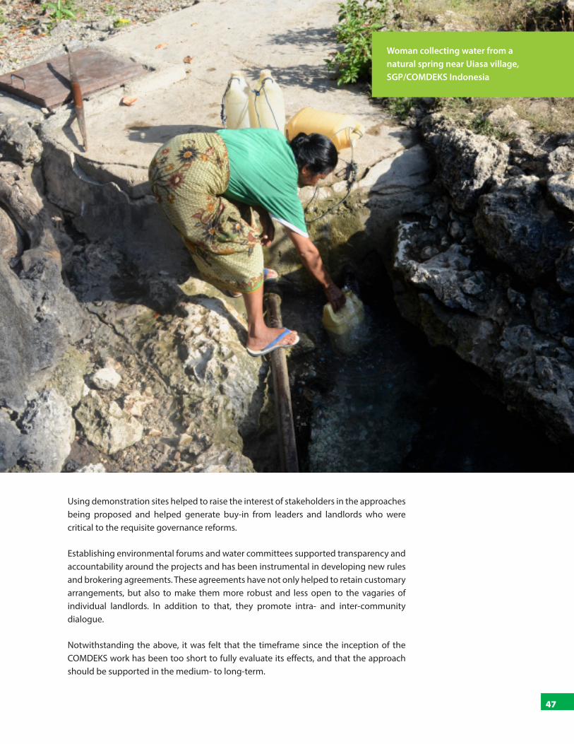
47
Landscape Governance in Socio-Ecological Production Landscapes and Seascapes: Experiences from the COMDEKS Programme in Ecuador, Ghana, and Indonesia
Using demonstration sites helped to raise the interest of stakeholders in the approaches being proposed and helped generate buy-in from leaders and landlords who were critical to the requisite governance reforms.
Establishing environmental forums and water committees supported transparency and accountability around the projects and has been instrumental in developing new rules and brokering agreements. These agreements have not only helped to retain customary arrangements, but also to make them more robust and less open to the vagaries of individual landlords. In addition to that, they promote intra- and inter-community dialogue.
Notwithstanding the above, it was felt that the timeframe since the inception of the COMDEKS work has been too short to fully evaluate its effects, and that the approach should be supported in the medium- to long-term.
Woman collecting water from a natural spring near Uiasa village, SGP/COMDEKS Indonesia

48
05OPPORTUNITIES AND CHALLENGES
The three case studies show how the local communities in the landscapes have over time developed a wealth of traditional knowledge, forms of sustainable resource management and use, rules for conservation as well as local governance arrangements. For a long time, these local governance institutions were able to conserve the resources of the community and to regulate the access, use and exchange of resources, as well as the sharing of costs and benefits. These local governance institutions, which are adapted to the individual cultural and ecological contexts, can be an essential asset for the resilience of SEPLS. However, as can be observed across the three landscapes in this publication and many others, these local governance structures are facing difficulties in coping with increasing socio-economic changes, such as exposure to modern market forces, threats from large-scale development projects, demographic changes including in- and out-migration, and cultural erosion due to outside influences. They also have inherent limitations in regulating resource use and conservation at a higher landscape level and often lack the strength to defend the community’s resources against external threats.
On the other hand, over the last decades government institutions at national, regional and local levels have been playing an increasing role in the governance of certain aspects of landscapes, through the creation of institutions for environmental and resource management, and in many places, through decentralization processes that devolve responsibilities to local government levels. However, government institutions often lack the capacities for effective governance on the ground, be it because the institutions in charge are at national level and too removed from local realities, or because decentralized institutions lack the human and financial resources to have a real impact. The lack of cross-sectoral collaboration is an added challenge, especially when taking the approach of socio-ecological production landscapes, which demands the integration of environmental, economic, social and cultural considerations.
CONCLUSIONS
Local governance structures often have inherent limitations in regulating resource use and conservation at a higher landscape level and often lack the strength to defend the community’s resources against external threats.

Landscape Governance in Socio-Ecological Production Landscapes and Seascapes: Experiences from the COMDEKS Programme in Ecuador, Ghana, and Indonesia
49
Drip irrigation system, SGP/COMDEKS Indonesia. Photo credit: Harry Jonas.
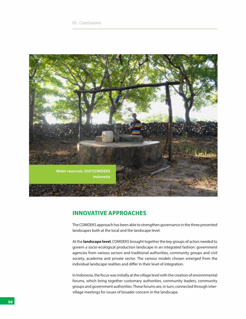
50
05 : Conclusions
INNOVATIVE APPROACHES
The COMDEKS approach has been able to strengthen governance in the three presented landscapes both at the local and the landscape level.
At the landscape level, COMDEKS brought together the key groups of actors needed to govern a socio-ecological production landscape in an integrated fashion: government agencies from various sectors and traditional authorities, community groups and civil society, academia and private sector. The various models chosen emerged from the individual landscape realities and differ in their level of integration.
In Indonesia, the focus was initially at the village level with the creation of environmental forums, which bring together customary authorities, community leaders, community groups and government authorities. These forums are, in turn, connected through inter-village meetings for issues of broader concern in the landscape.
Water reservoir, SGP/COMDEKS Indonesia

51
Landscape Governance in Socio-Ecological Production Landscapes and Seascapes: Experiences from the COMDEKS Programme in Ecuador, Ghana, and Indonesia
In Ghana, the Weto Platform seeks to link different civil society groups, traditional authorities and government bodies with the goal of approaching natural resource management from a landscape-wide perspective. While traditional and government authorities are not yet fully integrated into the regular operations of the platform, it has already been very successful at coordinating the actions of civil society and at influencing policy.
In Ecuador, the framework of Biocorridors for Living Well produced multi-stakeholder bodies at regional and corridor level. Here the decentralized government authorities played a convening role, and the strategies developed for the biocorridors were closely linked with management and land use plans, thereby ensuring buy-in. Local communities played a vital role in defining the biocorridors, contributing their knowledge and using the MTBs to enter into direct dialogue with public authorities.
At the local level, the COMDEKS projects were able to strengthen existing governance arrangements and, where necessary, innovate to meet current challenges. In all three landscapes, local communities developed local conservation agreements, some of them building on traditional rules, some developing new commitments for conserving threatened resources. In Ghana, the existing system of community by-laws even allowed for these agreements to be formally registered.
A defining characteristic of the COMDEKS approach has been the involvement of, and respect for, traditional knowledge, cultural practices and customary institutions. This has created a high sense of legitimacy and buy-in at local level. The landscape-level platforms mentioned above, and the project activities on the ground, also built bridges between traditional forms of governance and public institutions.
LOOKING AHEAD
The case studies show the benefits of creating integrated governance systems at the landscape level, but also that the models used can be as diverse as the realities of the landscape. Many factors will play a role in defining the best “fit” for a particular landscape at a particular time, including the national policy framework, the level of decentralization and capacity of public agencies, the situation of land and resource rights, the level of organization and recognition of customary governance institutions, to cite only a few. Whichever model is developed according to the realities of the landscape, it should strive for a number of characteristics, such as:
■ Ability to involve and build trust between actors from local communities, government, civil society and the private sector
■ Integration of institutions across sectors, and between the local, regional, and national level
It is important to create the space for the actors of
the landscape to analyze their
current governance structures and to discuss possible improvements.

52
05 : Conclusions
■ Inclusion of government institutions as well as customary governance systems
■ Respect for and valorization of different types of knowledge, and of different cultural values
■ Balancing of power between groups of stakeholders
■ Fair and equitable sharing of the costs and benefits of managing the landscape’s resources
■ Capacity to be adaptive and resilient to change
The three cases presented here are only a snapshot of the possible challenges and solutions. Governance is an essential dimension of resilient socio-ecological production landscapes. The COMDEKS approach takes this into account and has made governance an explicit part of the resilience indicators used throughout the participatory process of developing and implementing landscape strategies. However, to truly understand the complexities of governance realities in the landscapes, and ensure that these are taken into account in developing strategies and activities, a deeper look might be beneficial. To achieve this, it is important to create the space for the actors of the landscape to analyze their current governance realities and to discuss possible improvements. For this purpose, the COMDEKS programme is currently developing a set of tools for participatory landscape governance assessment to be used in future projects.

53
Satoyama Initiative
The Satoyama Initiative is a global effort, first proposed jointly by the United Nations University and the Ministry of the Environment of Japan (MOEJ), to realize “societies in harmony with nature” and contribute to biodiversity
conservation through the revitalization and sustainable management of “socio-ecological production landscapes and seascapes” (SEPLS). In October 2010, the International Partnership for the Satoyama Initiative (IPSI) was established to promote the activities identified by the Satoyama Initiative. IPSI is a global partnership of over 200 diverse member organizations, including national and local governments, NGOs, intergovernmental organizations, universities, and private sector organizations, aiming to facilitate and accelerate the implementation of activities under the Satoyama Initiative. With the United Nations University Institute for the Advanced Study of Sustainability (UNU-IAS) serving as its Secretariat, IPSI coordinates and supports related activities, including on-the-ground activities, policy development, and knowledge sharing activities. www.satoyama-initiative.org
Japan Biodiversity Fund (JBF)
The Japan Biodiversity Fund (JBF) was established by the Presidency of the 10th Conference of the Parties of the Convention on Biological Diversity (CBD COP 10) in support of the implementation of the Nagoya Biodiversity Outcomes. One of its key objectives is to support, at regional and sub-regional levels, Parties for the translation
of the new Strategic Plan for Biodiversity 2011-2020 into national priorities. The Convention on Biological Diversity was inspired by the world community’s growing commitment to sustainable development and entered into force in 1993. Its three main objectives are to 1) conserve biological diversity, 2) promote sustainable use of the components of biological diversity, and 3) ensure fair and equitable sharing of the benefits arising out of the utilization of genetic resources. www.cbd.int
Global Environment Facility (GEF)
The Global Environment Facility (GEF), established on the eve of the 1992 Rio Earth Summit, is a catalyst for action on the environment — and much more. Through its strategic investments, the GEF works with partners to tackle the planet’s biggest environmental issues. Our funding also helps reduce poverty, strengthen governance and achieve greater
equality between women and men. As such, we occupy a unique space in the global partnership for a more sustainable planet. www.thegef.org
Small Grants Programme (SGP)
The Small Grants Programme (SGP) is a corporate programme of the GEF implemented by the UNDP since 1992. SGP grantmaking in
over 125 countries promotes community-based innovation, capacity development, and empowerment through sustainable development projects of local civil society organizations with special consideration for indigenous peoples, women, and youth. SGP has supported over 20,000 community-based projects in biodiversity conservation, climate change mitigation and adaptation, prevention of land degradation, protection of international waters, and reduction of the impact of chemicals, while generating sustainable livelihoods. www.sgp.undp.org
United Nations Development Programme (UNDP)
UNDP partners with people at all levels of society to help build nations that can withstand crisis, and drive and sustain the kind of growth that improves the quality of life for everyone. On the ground in more than 170 countries and territories, we offer global perspective and local insight to help empower lives and build resilient nations. www.undp.org
Empowered lives. Resilient nations.

United Nations Development Programme 304 East 45th Street New York, NY 10017, USA
Web: www.undp.org
Empowered lives. Resilient nations.