Land Use in Lowell: Mapping Industrial Change Lesson.pdf · transformed into the industrial city of...
15
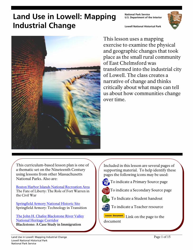
Land Use in Lowell: Mapping Industrial Change National Park Service U.S. Department of the Interior Lowell National Historical Park This lesson uses a mapping exercise to examine the physical and geographic changes that took place as the small rural community of East Chelmsford was transformed into the industrial city of Lowell. The class creates a narrative of change and thinks critically about what maps can tell us about how communities change over time. This curriculum-based lesson plan is one of a thematic set on the Nineteenth Century using lessons from other Massachusetts National Parks. Also are: Boston Harbor Islands National Recreation Area The Fate of Liberty: The Role of Fort Warren in the Civil War Springfield Armory National Historic Site Springfield Armory: Technology in Transition The John H. Chafee Blackstone River Valley National Heritage Corridor Blackstone: A Case Study in Immigration Included in this lesson are several pages of supporting material. To help identify these pages the following icons may be used: To indicate a Primary Source page To indicate a Secondary Source page To Indicate a Student handout To indicate a Teacher resource Lesson Document Link on the page to the document Land Use in Lowell: Mapping Industrial Change Page 1 of 15 Lowell National Historical Park National Park Service
-
Upload
nguyenkiet -
Category
Documents
-
view
216 -
download
0
Transcript of Land Use in Lowell: Mapping Industrial Change Lesson.pdf · transformed into the industrial city of...
Land Use in Lowell: Mapping Industrial Change
National Park Service U.S. Department of the Interior Lowell National Historical Park
This lesson uses a mapping exercise to examine the physical and geographic changes that took place as the small rural community of East Chelmsford was transformed into the industrial city of Lowell. The class creates a narrative of change and thinks critically about what maps can tell us about how communities change over time.
This curriculum-based lesson plan is one of a thematic set on the Nineteenth Century using lessons from other Massachusetts National Parks. Also are: Boston Harbor Islands National Recreation AreaThe Fate of Liberty: The Role of Fort Warren in the Civil War Springfield Armory National Historic SiteSpringfield Armory: Technology in Transition The John H. Chafee Blackstone River Valley National Heritage Corridor Blackstone: A Case Study in Immigration
Included in this lesson are several pages of supporting material. To help identify these pages the following icons may be used:
To indicate a Primary Source page
To indicate a Secondary Source page
To Indicate a Student handout
To indicate a Teacher resource
LLeessssoonn DDooccuummeenntt Link on the page to the document
Land Use in Lowell: Mapping Industrial Change Page 1 of 15 Lowell National Historical Park National Park Service
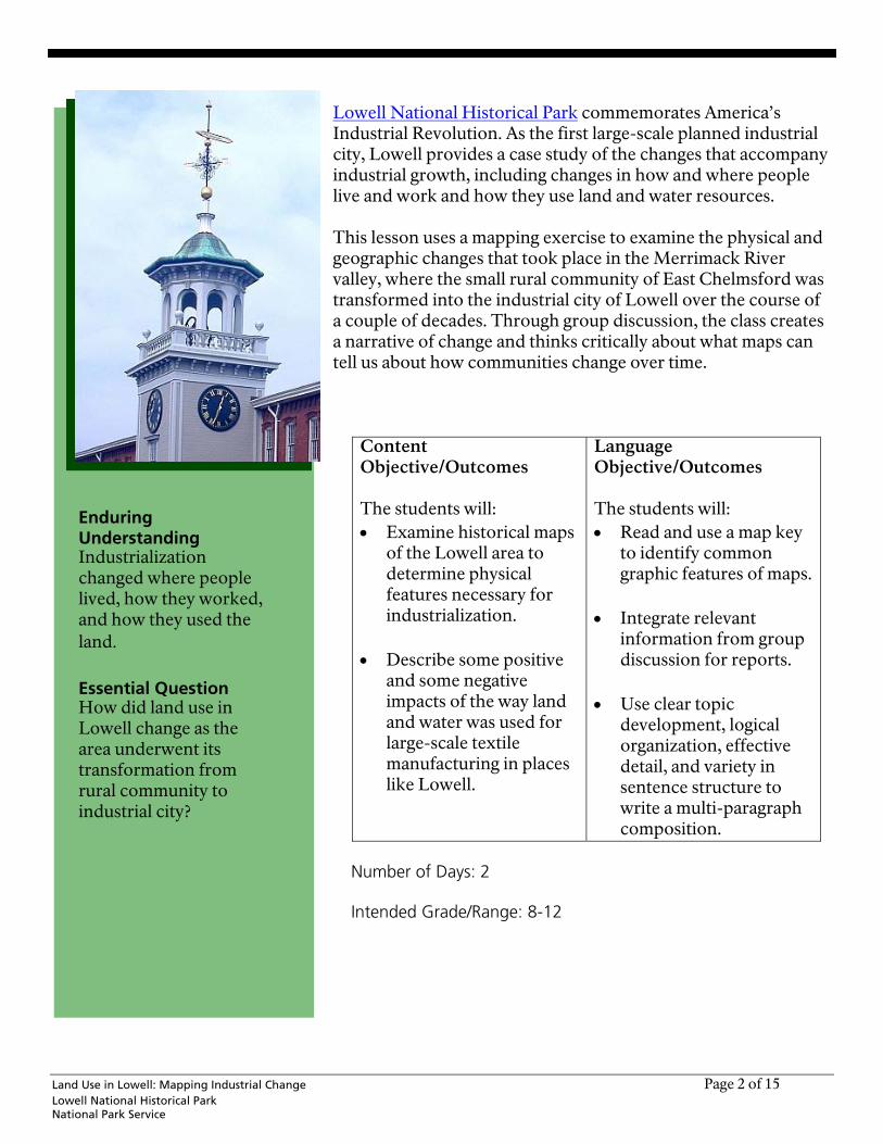
Lowell National Historical Park commemorates America’s Industrial Revolution. As the first large-scale planned industrial city, Lowell provides a case study of the changes that accompany industrial growth, including changes in how and where people live and work and how they use land and water resources. This lesson uses a mapping exercise to examine the physical and geographic changes that took place in the Merrimack River valley, where the small rural community of East Chelmsford was transformed into the industrial city of Lowell over the course of a couple of decades. Through group discussion, the class creates a narrative of change and thinks critically about what maps can tell us about how communities change over time.
Content Objective/Outcomes The students will: • Examine historical maps
of the Lowell area to determine physical features necessary for industrialization.
• Describe some positive
and some negative impacts of the way land and water was used for large-scale textile manufacturing in places like Lowell.
Language Objective/Outcomes The students will: • Read and use a map key
to identify common graphic features of maps.
• Integrate relevant information from group discussion for reports.
• Use clear topic
development, logical organization, effective detail, and variety in sentence structure to write a multi-paragraph composition.
Enduring Understanding Industrialization changed where people lived, how they worked, and how they used the land. Essential Question How did land use in Lowell change as the area underwent its transformation from rural community to industrial city?
Number of Days: 2 Intended Grade/Range: 8-12
Land Use in Lowell: Mapping Industrial Change Page 2 of 15 Lowell National Historical Park National Park Service
Teaching/Learning Sequence
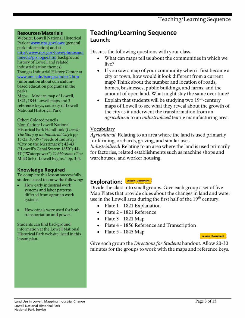
Teaching/Learning Sequence Resources/Materials Website: Lowell National Historical Park at www.nps.gov/lowe (general park information) and at http://www.nps.gov/lowe/photosmultimedia/prologue.htm(background history of Lowell and related industrialization themes) Tsongas Industrial History Center at www.uml.edu/tsongas/index2.htm (information about curriculum-based education programs in the park) Maps: Modern map of Lowell, 1821, 1845 Lowell maps and 3 reference keys, courtesy of Lowell National Historical Park
Launch: Discuss the following questions with your class.
• What can maps tell us about the communities in which we live?
• If you saw a map of your community when it first became a city or town, how would it look different from a current map? Think about the number and location of roads, homes, businesses, public buildings, and farms, and the amount of open land. What might stay the same over time?
• Explain that students will be studying two 19th-century maps of Lowell to see what they reveal about the growth of the city as it underwent the transformation from an agricultural to an industrialized textile manufacturing area. Other: Colored pencils
Non-fiction: Lowell National Historical Park Handbook (Lowell: The Story of an Industrial City): pp. 15-25, 30-39 (“Seeds of Industry,” “City on the Merrimack”) 42-43 (“Lowell’s Canal System 1850”) 44-47 (“Waterpower”) Cobblestone (The Mill Girls) “Lowell Begins,” pp. 3-4.
Vocabulary Agricultural: Relating to an area where the land is used primarily for farming, orchards, grazing, and similar uses. Industrialized: Relating to an area where the land is used primarily for factories, related establishments such as machine shops and warehouses, and worker housing.
Knowledge Required To complete this lesson successfully, students need to know the following: • How early industrial work
systems and labor patterns differed from agrarian work systems.
• How canals were used for both
transportation and power. Students can find background information at the Lowell National Historical Park website listed in this lesson plan.
Exploration: LLeessssoonn DDooccuummeenntt
Divide the class into small groups. Give each group a set of five Map Plates that provide clues about the changes in land and water use in the Lowell area during the first half of the 19th century.
• Plate 1 – 1821 Explanation • Plate 2 – 1821 Reference • Plate 3 – 1821 Map • Plate 4 – 1856 Reference and Transcription • Plate 5 – 1845 Map
LLeessssoonn DDooccuummeenntt Give each group the Directions for Students handout. Allow 20-30 minutes for the groups to work with the maps and reference keys.
Land Use in Lowell: Mapping Industrial Change Page 3 of 15 Lowell National Historical Park National Park Service
Teaching/Learning Sequence
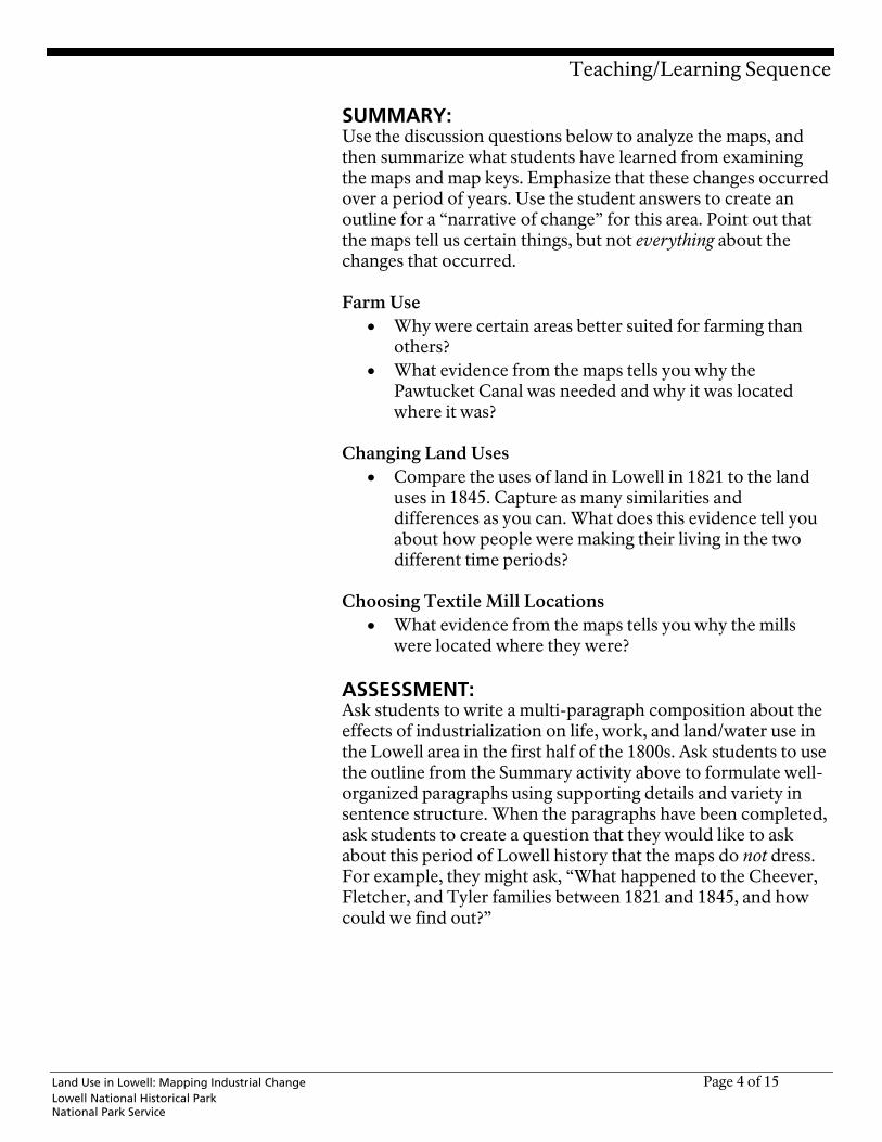
SUMMARY: Use the discussion questions below to analyze the maps, and then summarize what students have learned from examining the maps and map keys. Emphasize that these changes occurred over a period of years. Use the student answers to create an outline for a “narrative of change” for this area. Point out that the maps tell us certain things, but not everything about the changes that occurred. Farm Use
• Why were certain areas better suited for farming than others?
• What evidence from the maps tells you why the Pawtucket Canal was needed and why it was located where it was?
Changing Land Uses
• Compare the uses of land in Lowell in 1821 to the land uses in 1845. Capture as many similarities and differences as you can. What does this evidence tell you about how people were making their living in the two different time periods?
Choosing Textile Mill Locations
• What evidence from the maps tells you why the mills were located where they were?
ASSESSMENT: Ask students to write a multi-paragraph composition about the effects of industrialization on life, work, and land/water use in the Lowell area in the first half of the 1800s. Ask students to use the outline from the Summary activity above to formulate well-organized paragraphs using supporting details and variety in sentence structure. When the paragraphs have been completed, ask students to create a question that they would like to ask about this period of Lowell history that the maps do not dress. For example, they might ask, “What happened to the Cheever, Fletcher, and Tyler families between 1821 and 1845, and how could we find out?”
Land Use in Lowell: Mapping Industrial Change Page 4 of 15 Lowell National Historical Park National Park Service

Site Visit
Site Visit:
The Power of Place
Have you ever stood on the spot where some historical event occurred and felt a sense of awe and inspiration? This is the power of place you can experience when you visit a National Park. These historic places provide us with opportunities to connect with the lives of the generations before us. The power of place is that it gives history immediacy and relevance. As historian David McCullough*states, "When you stand there, in that very real, authentic place, you feel the presence of that other time, that history in a way that would be impossible did it not exist.” Visit Lowell National Historical Park to bring the ideas and the information in this lesson to life. While in the park, compare what students have explored on historical maps with what they notice about current land use. Bring the maps along, and at various points during your visit ask students to figure out which farm they would have been standing on in the pre-industrial period. Ask students to imagine the sounds and sights of this area when it was farmland. How has the area changed? What has stayed the same? By comparing and contrasting the area’s rural beginnings to what they see today, students can draw further conclusions about how the growth of industry changed life, work, and land use.
In Lowell, students can walk among the historic textile mill complexes and housing areas and along the canals that powered Lowell’s industrial growth. They can explore the actual main streets marked on the historic maps to determine present-day land uses. By traveling a short distance from the historic downtown area, students can see the powerful Pawtucket Falls up close. Teachers and students can explore all of these resources more thoroughly by participating in education programs that feature hands-on activities and tours presented by the Tsongas Industrial History Center (TIHC), a partnership of Lowell National Historical Park and University of Massachusetts Lowell. For example, in the Tsongas Center’s curriculum-based education program Power to Production, students see some of the actual canals, buildings, and other features noted on the maps used in this lesson plan. Students visit the Suffolk Mill turbine exhibit, trace the manufacture of cotton cloth from power to production using mill cutaways and interactive power-train exhibits, and observe operating power looms in the Boott Cotton
Land Use in Lowell: Mapping Industrial Change Page 5 of 15 Lowell National Historical Park National Park Service

Site Visit
Mills Museum. In the hands-on workshop, students test water wheels and build mill-and-canal systems.
Power to Production is a four-hour, fee-based program, one of many presented in Lowell National Historical Park by the Tsongas Industrial History Center. Reservations are required and can be made at 978-970-5000.
*From “History Lost and Found,” Journal of the National Trust for Historic Preservation, Winter 2002.
Land Use in Lowell: Mapping Industrial Change Page 6 of 15 Lowell National Historical Park National Park Service

Curriculum Frameworks
Connections to the Massachusetts Curriculum Framework Standards:
History
English Language Arts
HISTORY and SOCIAL SCIENCE USI.28 Explain the emergence and impact of the textile industry in New England and industrial growth generally throughout antebellum America. ENGLISH/LANGUAGE ARTS: 2.4 Integrate relevant information gathered from group discussions and interviews for reports. 13.19 Identify and use knowledge of common graphic features (charts, maps, diagrams). 19.23 Write multi-paragraph compositions that have clear topic development, logical organization, effective use of detail, and variety in sentence structure. For Special Needs or ELL students: Project the maps in the front of the room, color key features, and make your list of observations and conclusions orally, as a group.
Land Use in Lowell: Mapping Industrial Change Page 7 of 15 Lowell National Historical Park National Park Service
Teaching Sources
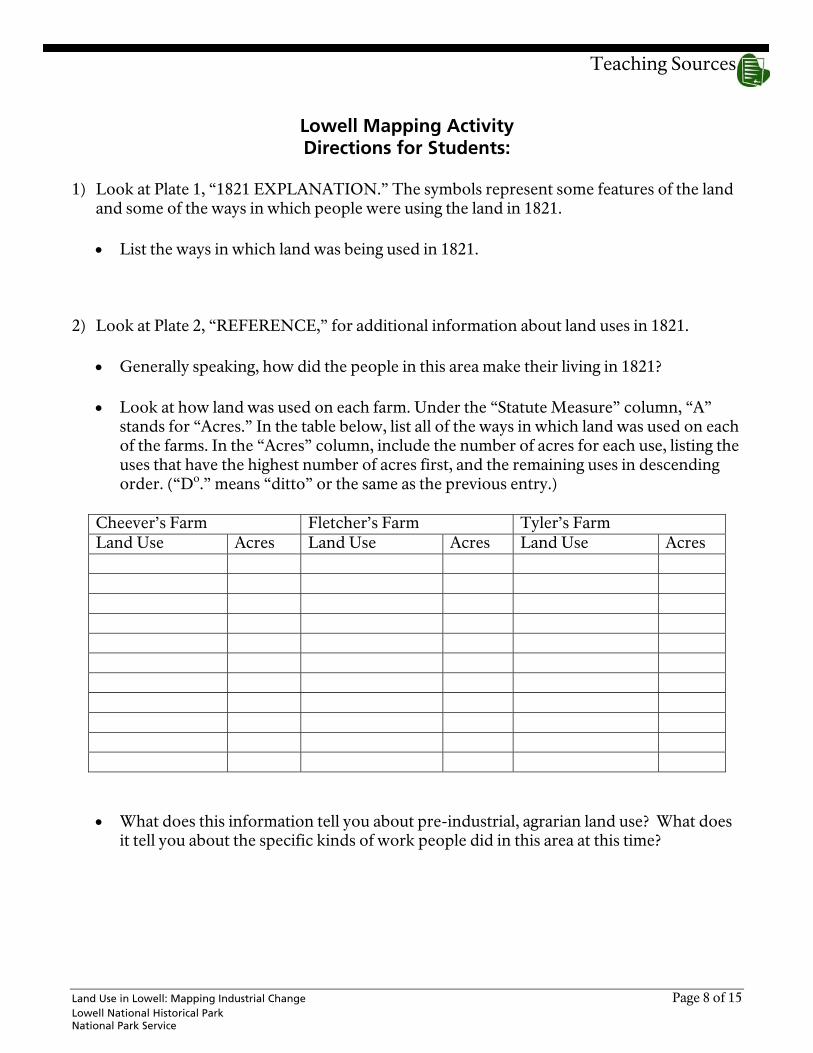
Lowell Mapping Activity Directions for Students:
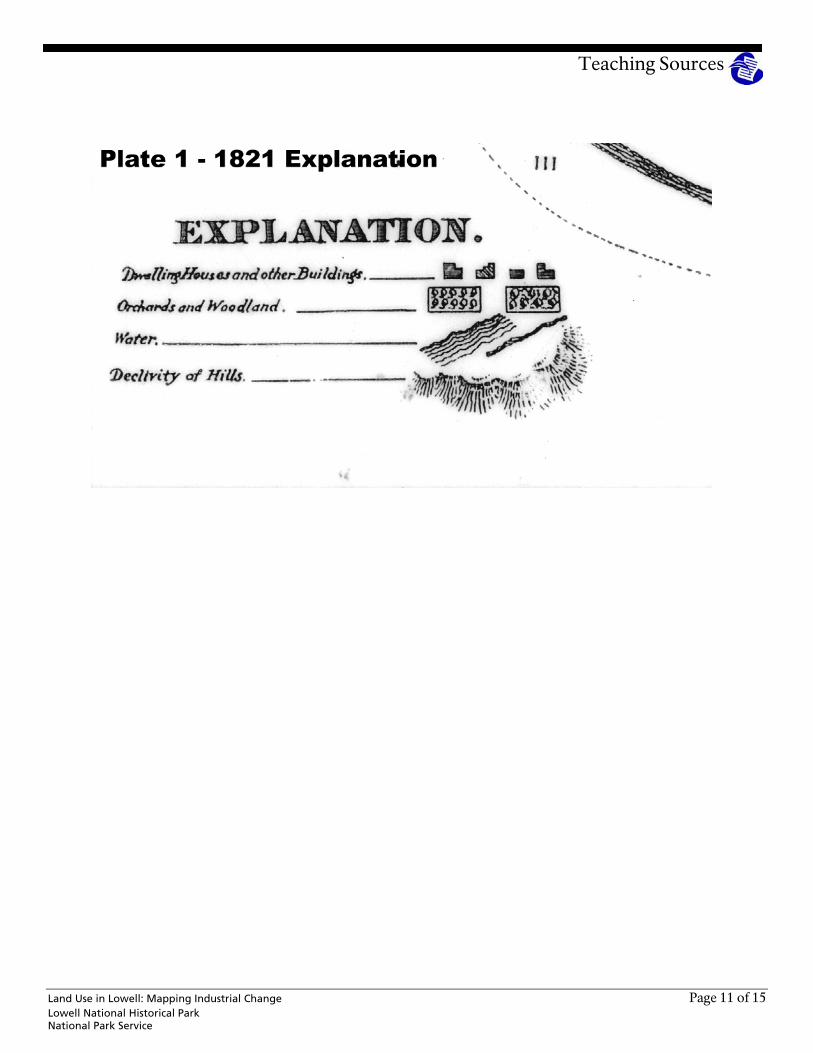
1) Look at Plate 1, “1821 EXPLANATION.” The symbols represent some features of the land
and some of the ways in which people were using the land in 1821.
• List the ways in which land was being used in 1821.
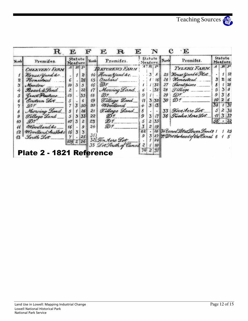
2) Look at Plate 2, “REFERENCE,” for additional information about land uses in 1821.
• Generally speaking, how did the people in this area make their living in 1821? • Look at how land was used on each farm. Under the “Statute Measure” column, “A”
stands for “Acres.” In the table below, list all of the ways in which land was used on each of the farms. In the “Acres” column, include the number of acres for each use, listing the uses that have the highest number of acres first, and the remaining uses in descending order. (“Do.” means “ditto” or the same as the previous entry.)
Cheever’s Farm Fletcher’s Farm Tyler’s Farm Land Use Acres Land Use Acres Land Use Acres
• What does this information tell you about pre-industrial, agrarian land use? What does it tell you about the specific kinds of work people did in this area at this time?
Land Use in Lowell: Mapping Industrial Change Page 8 of 15 Lowell National Historical Park National Park Service
Teaching Sources
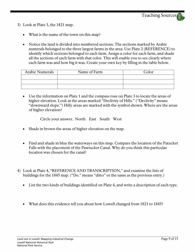
3) Look at Plate 3, the 1821 map. • What is the name of the town on this map? • Notice the land is divided into numbered sections. The sections marked by Arabic
numerals belonged to the three largest farms in the area. Use Plate 2 (REFERENCE) to identify which sections belonged to each farm. Assign a color for each farm, and shade all the sections of each farm with that color. This will enable you to see clearly where each farm was and how big it was. Create your own key by filling in the table below.
Arabic Numerals Name of Farm Color
• Use the information on Plate 1 and the compass rose on Plate 3 to locate the areas of
higher elevation. Look at the areas marked “Declivity of Hills.” (“Declivity” means “downward slope.”) Hilly areas are marked with the symbol shown. Where are the areas of higher elevation?
Circle your answer. North East South West
• Shade in brown the areas of higher elevation on the map.
• Find and shade in blue the waterways on this map. Compare the location of the Patucket
Falls with the placement of the Pawtucket Canal. Why do you think this particular location was chosen for the canal?
4) Look at Plate 4, “REFERENCE AND TRANSCRIPTION,” and examine the lists of buildings for the 1845 map. (“Do.” means “ditto” or the same as the previous entry.)
• List the two kinds of buildings identified on Plate 4, and write a description of each type.
• What does this evidence tell you about how Lowell changed from 1821 to 1845?
Land Use in Lowell: Mapping Industrial Change Page 9 of 15 Lowell National Historical Park National Park Service
Teaching Sources
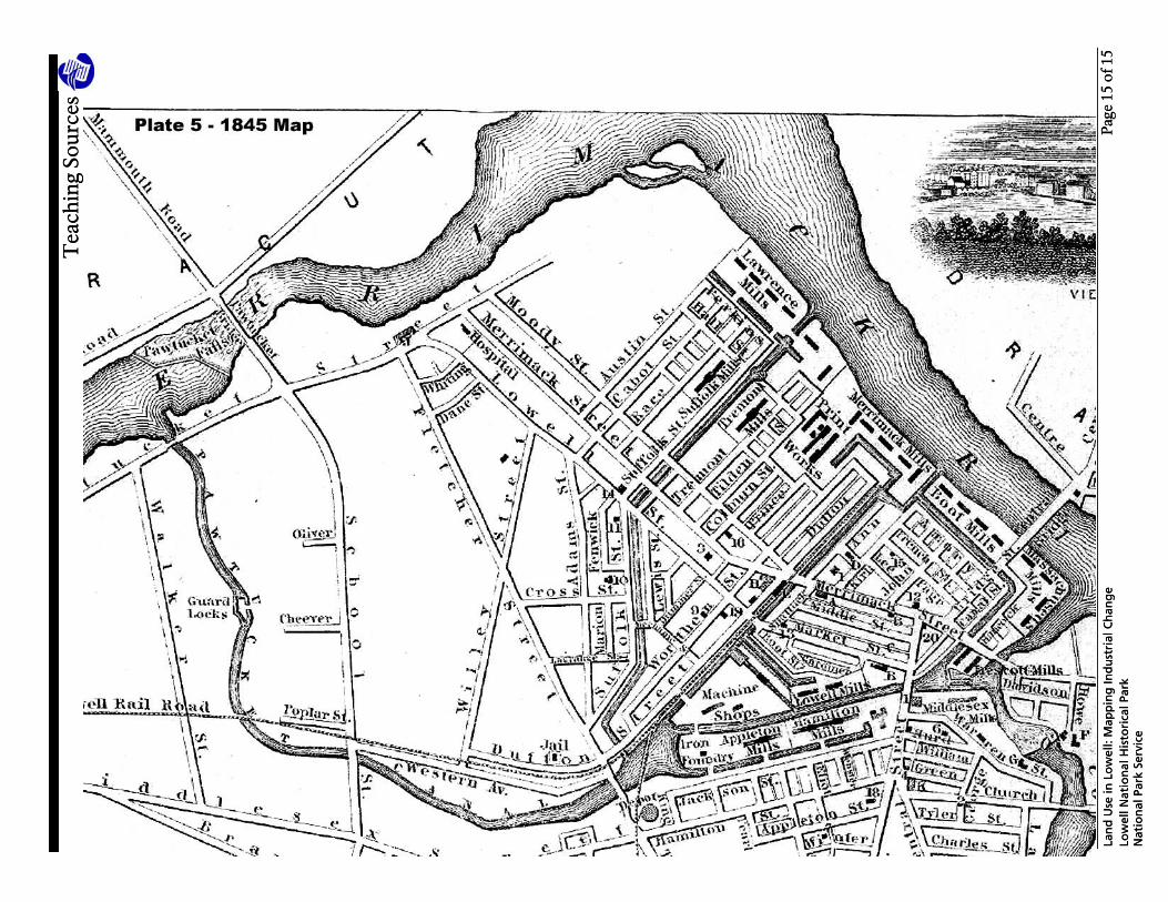
5) Compare Plate 5, the 1845 map, to Plate 1, the 1821 map.
• List the old main roads that still exist on the 1845 map. How do you think the old main roads influenced the development of the city?
• Shade in blue the waterways on the 1845 map. Compare the waterways on both maps.
What waterway changes occurred between 1821 and 1845? • Study the entire 1845 map, and list as many uses for the land as you can identify. • Now focus on the areas that, in 1821, were the major farms: Cheever’s, Fletcher’s and
Tyler’s. How was that land was being used in 1845? What does this evidence tell you about how people made their living in 1845?
• Why do you suppose the textile mills were built in these particular locations and not elsewhere in the area shown on the 1821 map?
Land Use in Lowell: Mapping Industrial Change Page 10 of 15 Lowell National Historical Park National Park Service
Teaching Sources
Land Use in Lowell: Mapping Industrial Change Page 11 of 15 Lowell National Historical Park National Park Service
Teaching Sources
Land Use in Lowell: Mapping Industrial Change Page 12 of 15 Lowell National Historical Park National Park Service

Tea
chin
g So
urce
s
Lan
d U
se in
Lo
wel
l: M
app
ing
Ind
ust
rial
Ch
ang
e
Page
13
of 1
5
Low
ell N
atio
nal
His
tori
cal P
ark
N
atio
nal
Par
k Se
rvic
e

Teaching Sources
Land Use in Lowell: Mapping Industrial Change Page 14 of 15 Lowell National Historical Park National Park Service
Tea
chin
g So
urce
s
Low
ell N
atio
nal
His
tori
cal P
ark
N
atio
nal
Par
k Se
rvic
e
Tea
chin
g So
urce
s
Lan
d U
se in
Lo
wel
l: M
app
ing
Ind
ust
rial
Ch
ang
e
Page
15
of 1
5
Lan
d U
se in
Lo
wel
l: M
app
ing
Ind
ust
rial
Ch
ang
e
Page
15
of 1
5 Lo
wel
l Nat
ion
al H
isto
rica
l Par
k
Nat
ion
al P
ark
Serv
ice