Laboratory Analysis Reveals Direct Evidence of Precolonial … Analysis Reveals... ·...
14
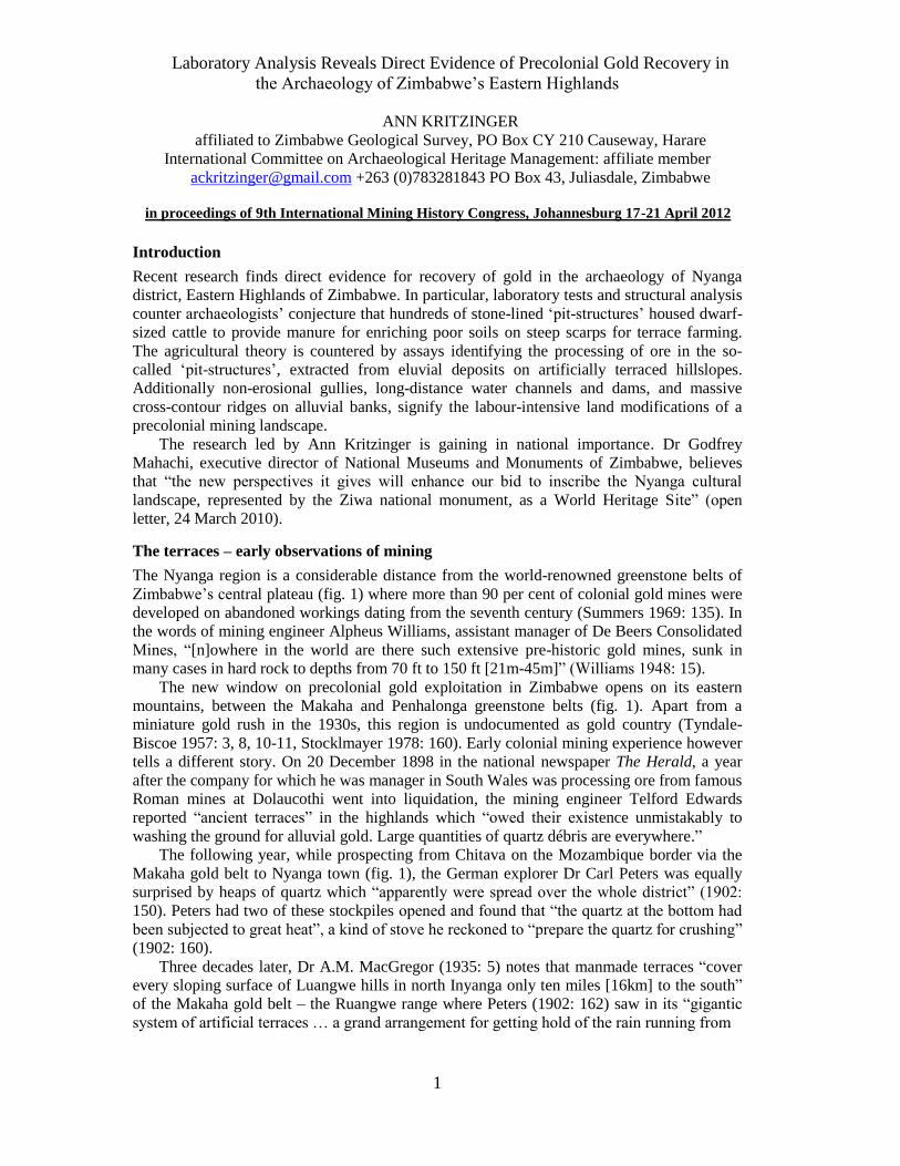
1 Laboratory Analysis Reveals Direct Evidence of Precolonial Gold Recovery in the Archaeology of Zimbabwe‟s Eastern Highlands ANN KRITZINGER affiliated to Zimbabwe Geological Survey, PO Box CY 210 Causeway, Harare International Committee on Archaeological Heritage Management: affiliate member [email protected] +263 (0)783281843 PO Box 43, Juliasdale, Zimbabwe Introduction Recent research finds direct evidence for recovery of gold in the archaeology of Nyanga district, Eastern Highlands of Zimbabwe. In particular, laboratory tests and structural analysis counter archaeologists‟ conjecture that hundreds of stone-lined „pit-structures‟ housed dwarf- sized cattle to provide manure for enriching poor soils on steep scarps for terrace farming. The agricultural theory is countered by assays identifying the processing of ore in the so- called „pit-structures‟, extracted from eluvial deposits on artificially terraced hillslopes. Additionally non-erosional gullies, long-distance water channels and dams, and massive cross-contour ridges on alluvial banks, signify the labour-intensive land modifications of a precolonial mining landscape. The research led by Ann Kritzinger is gaining in national importance. Dr Godfrey Mahachi, executive director of National Museums and Monuments of Zimbabwe, believes that “the new perspectives it gives will enhance our bid to inscribe the Nyanga cultural landscape, represented by the Ziwa national monument, as a World Heritage Site” (open letter, 24 March 2010). The terraces – early observations of mining The Nyanga region is a considerable distance from the world-renowned greenstone belts of Zimbabwe‟s central plateau (fig. 1) where more than 90 per cent of colonial gold mines were developed on abandoned workings dating from the seventh century (Summers 1969: 135). In the words of mining engineer Alpheus Williams, assistant manager of De Beers Consolidated Mines, “[n]owhere in the world are there such extensive pre-historic gold mines, sunk in many cases in hard rock to depths from 70 ft to 150 ft [21m-45m]” (Williams 1948: 15). The new window on precolonial gold exploitation in Zimbabwe opens on its eastern mountains, between the Makaha and Penhalonga greenstone belts (fig. 1). Apart from a miniature gold rush in the 1930s, this region is undocumented as gold country (Tyndale- Biscoe 1957: 3, 8, 10-11, Stocklmayer 1978: 160). Early colonial mining experience however tells a different story. On 20 December 1898 in the national newspaper The Herald, a year after the company for which he was manager in South Wales was processing ore from famous Roman mines at Dolaucothi went into liquidation, the mining engineer Telford Edwards reported “ancient terraces” in the highlands which “owed their existence unmistakably to washing the ground for alluvial gold. Large quantities of quartz débris are everywhere.” The following year, while prospecting from Chitava on the Mozambique border via the Makaha gold belt to Nyanga town (fig. 1), the German explorer Dr Carl Peters was equally surprised by heaps of quartz which “apparently were spread over the whole district” (1902: 150). Peters had two of these stockpiles opened and found that “the quartz at the bottom had been subjected to great heat”, a kind of stove he reckoned to “prepare the quartz for crushing” (1902: 160). Three decades later, Dr A.M. MacGregor (1935: 5) notes that manmade terraces “cover every sloping surface of Luangwe hills in north Inyanga only ten miles [16km] to the south” of the Makaha gold belt – the Ruangwe range where Peters (1902: 162) saw in its “gigantic system of artificial terraces … a grand arrangement for getting hold of the rain running from in proceedings of 9th International Mining History Congress, Johannesburg 17-21 April 2012
Transcript of Laboratory Analysis Reveals Direct Evidence of Precolonial … Analysis Reveals... ·...
1
Laboratory Analysis Reveals Direct Evidence of Precolonial Gold Recovery in
the Archaeology of Zimbabwe‟s Eastern Highlands
ANN KRITZINGER
affiliated to Zimbabwe Geological Survey, PO Box CY 210 Causeway, Harare
International Committee on Archaeological Heritage Management: affiliate member
[email protected] +263 (0)783281843 PO Box 43, Juliasdale, Zimbabwe
Introduction
Recent research finds direct evidence for recovery of gold in the archaeology of Nyanga
district, Eastern Highlands of Zimbabwe. In particular, laboratory tests and structural analysis
counter archaeologists‟ conjecture that hundreds of stone-lined „pit-structures‟ housed dwarf-
sized cattle to provide manure for enriching poor soils on steep scarps for terrace farming.
The agricultural theory is countered by assays identifying the processing of ore in the so-
called „pit-structures‟, extracted from eluvial deposits on artificially terraced hillslopes.
Additionally non-erosional gullies, long-distance water channels and dams, and massive
cross-contour ridges on alluvial banks, signify the labour-intensive land modifications of a
precolonial mining landscape.
The research led by Ann Kritzinger is gaining in national importance. Dr Godfrey
Mahachi, executive director of National Museums and Monuments of Zimbabwe, believes
that “the new perspectives it gives will enhance our bid to inscribe the Nyanga cultural
landscape, represented by the Ziwa national monument, as a World Heritage Site” (open
letter, 24 March 2010).
The terraces – early observations of mining
The Nyanga region is a considerable distance from the world-renowned greenstone belts of
Zimbabwe‟s central plateau (fig. 1) where more than 90 per cent of colonial gold mines were
developed on abandoned workings dating from the seventh century (Summers 1969: 135). In
the words of mining engineer Alpheus Williams, assistant manager of De Beers Consolidated
Mines, “[n]owhere in the world are there such extensive pre-historic gold mines, sunk in
many cases in hard rock to depths from 70 ft to 150 ft [21m-45m]” (Williams 1948: 15).
The new window on precolonial gold exploitation in Zimbabwe opens on its eastern
mountains, between the Makaha and Penhalonga greenstone belts (fig. 1). Apart from a
miniature gold rush in the 1930s, this region is undocumented as gold country (Tyndale-
Biscoe 1957: 3, 8, 10-11, Stocklmayer 1978: 160). Early colonial mining experience however
tells a different story. On 20 December 1898 in the national newspaper The Herald, a year
after the company for which he was manager in South Wales was processing ore from famous
Roman mines at Dolaucothi went into liquidation, the mining engineer Telford Edwards
reported “ancient terraces” in the highlands which “owed their existence unmistakably to
washing the ground for alluvial gold. Large quantities of quartz débris are everywhere.”
The following year, while prospecting from Chitava on the Mozambique border via the
Makaha gold belt to Nyanga town (fig. 1), the German explorer Dr Carl Peters was equally
surprised by heaps of quartz which “apparently were spread over the whole district” (1902:
150). Peters had two of these stockpiles opened and found that “the quartz at the bottom had
been subjected to great heat”, a kind of stove he reckoned to “prepare the quartz for crushing”
(1902: 160).
Three decades later, Dr A.M. MacGregor (1935: 5) notes that manmade terraces “cover
every sloping surface of Luangwe hills in north Inyanga only ten miles [16km] to the south”
of the Makaha gold belt – the Ruangwe range where Peters (1902: 162) saw in its “gigantic
system of artificial terraces … a grand arrangement for getting hold of the rain running from
in proceedings of 9th International Mining History Congress, Johannesburg 17-21 April 2012

2
the top.” Dr Roger Summers, then curator of the National Museums of Rhodesia, records
(1969: 38, 79) “ancient terraces” at the Ivanhoe gold claims on one of a group of Makaha
hills of which MacGregor (1935: 8) observes, “[t]he stony surface resembles a rubble left by
the removal of soil and sub-soil.”
To mining geologists and prospectors, rubble is quartz „float‟ – the quartz débris of
Edwards. Quartz is “much the most common veinstone, and … a necessary antecedent to the
finding of gold [in Zimbabwe]” (Mennell 1934: 14). Quartz rubble occurs in abundance in the
Nyanga National Park. University of Zimbabwe professor of archaeology Dr Robert Soper
describes (2005: 40) “the present ground surface” of an area he designates 1832BB35 as
“relatively gravely, doubtless due to loss of topsoil by slope wash from direct rainfall.” In fact
quartz rubble is much in evidence on most terraced hills – like those of Makaha where
MacGregor (1935: 8) presumes climatic change was the cause “permitting the underlying soil
to be washed away by rain.”
In the first decade of the nineteenth century the due diligence of mining engineer F. Fripp
had identified intentional trapping of gold in the type of hillslope run-off which Soper,
MacGregor, and Peters describe. In unnamed locations on the central plateau Fripp repeatedly
found “on steep slopes below old workings … ridges of stones, six to twelve inches in height
[15-30cm] and running often for several yards [metres] in horizontal lines along the slope. It
is suggested they were utilised as riffles for catching shed gold after rain. The sand and gravel
below each such riffle, if panned after a heavy shower, will nearly always give colours of
gold, if not more, even at the present day” (Fripp 1912: 175).
In May 2008 panning tests on terraces 6km from the western boundary of the national
park brought Fripp‟s experiment to the Eastern Highlands, with longest tails of gold from the
Figure 1. Map of Zimbabwe (left) showing location of Nyanga district in the Eastern Highlands (blue rectangle), and the greenstone belts of the central plateau (hatched). The map of Nyanga (right) features the terraced zones (grey stipple), the present research area (boxed in red), and places mentioned in the text

3
top three terraces. Results of a grab-sample exercise in July and Sept 2009 at the densely
terraced Bende Gap (fig. 2 bottom right) were found by Oxford University geologist Dr
Kevin Walsh to be “very interesting and SHOULD be followed up” (pers. comm. 03/03/2010,
correspondent‟s emphasis).
Figure 2. Top left: diagram of the geogenesis of gold, showing how the area of secondary enrichment coincides with zones of terracing on Nyanga hillslopes. Top right: the Surveyor General’s 1:50 000 topographical maps mark occurrences of ‘Ancient Terracing’. When this information is transposed on a Google Earth image and compared with geological maps, granitoids can be seen to be the dominant formation for terrace construction. Bottom right: tight terracing of hornblende slopes below the dolerite cap at Bende Gap. Bottom left: narrow terracing in close up.

4
The terraces – current assumption of agriculture
A geochemical survey of the terraces is overdue for lack of funds. It is further handicapped in
Zimbabwe by the influence on today‟s mining professionals of archaeologists‟ mid-20th-
century claims that the terraces were fields for the intensive farming of grain (Soper 2002,
Summers 1958). In the 1970s senior geologist Dr V.R. Stocklmayer makes the sweeping
statement (1978: 4) that Zimbabwe‟s terraced region was “the Granary of Central Africa,” in
spite of earlier cautions from equally senior botanist Dr H. Wild (in Summers 1958: 178) that
“[t]he terraces on dolerite have a rather poor grass cover and little depth of soil (2-3 in. at
most [5-7.5cm]) … The terraces on the steep-sided granite hills … look most unattractive
from a cultivation point of view.”
In Soper‟s opinion (2002:126) “manure must thus have been essential.” But Summers
(1958: 257) considers it “very doubtful if any of the local tribes understood the technique of
manuring.” The realities pointed out by Wild (in Summers 1958: 176) that sorghum requires
hotter drier conditions than the cool high-rainfall climate of the Eastern Highlands, and that
“any [past] increase in rainfall would prevent the growing of most of the traditional local
grains” (in Summers 1958: 261), clash with the “climatic change from wetter to [present-day]
drier conditions” proposed by MacGregor to explain surface rubble on terraces (1935: 8).
Terraces occur intermittently over an estimated 7000 sq km [4400 sq miles]. Recorded on
topographical maps from aerial photography and visible in Google Earth images, it is an
extensive landscape for which an agricultural role would suggest a population explosion
absent from oral recall (Matowanyika & Mandondo in Soper 2002: 4, 269). Tradition‟s
silence is upheld by Dr D.N. Beach (in Soper 2002: 233), who finds “it very hard to see
historical support for the idea of a larger population” in the extensive Unyama territory which
he designates the “centre of innovation” (fig. 1) – the very region of the early European
mining exploration noted above.
Single-generation settlements
That archaeological sites “represent single phases of occupation” (Soper 2002: 7) is reflected
in rarity of rubbish middens, cultural finds and burials – provoking Soper to postulate (2002:
91) that “[p]it-structures were thus units for people and their stock … [due to] apparent lack
of any other contemporaneous occupation structures.” Soper‟s “homestead occupation …
[having] little to suggest that it exceeded a single generation” (2002: 134) is at odds with
intensive farming. The pattern is however in tune with the abandoning of mineral deposits
once they are worked out.
Academic justifications that the terraces were built by a “small, locally shifting
population,” sited not from choice but from land pressure (Beach in Soper 2002: 233; see
also Summers 1958: 257), conflict with the fact that the vast expanse of terracing is
commonly within walking distance of the more fertile soils of upper stream valleys –
weakening a second argument that the terrace builders fled to the hills from Ngoni and Gaza
raids in the mid-1800s. The „Refuge‟ theory is challenged on historical issues by historian Dr
G. Mazarire (2005), as well as by Beach (1988), and fails tactically in the stark betrayal of
stone walls on the hills “looking from a distance like a striped zebra” (Peters 1902: 162).
In the 2006 season the first-ever crop trials of the millets rapoko and munga conducted
on terraces (Kritzinger 2008a: 9-10, 37) revealed the need for effective wildlife control.
Fence post-holes are archaeologically traceable, but none are detectable in terracing. Neither
have “exotic cultivated or weed species … survived as evidence of an extensive earlier
culture” (Wild in Summers 1958: 174). This observation is mirrored in site excavations
where seeds of “[c]ultigens are sparsely represented” (Soper 2002: 128).
It is this scarcity which promotes Soper to perpetuate (2002: 128; 2007: 100) “[p]ortions
of a Maize Cob” found by Summers (1958: 176) in a surface context – despite maize being a
comparatively recent introduction. Additionally in the interests of farming, Soper (2002: 35)

5
rubber-stamps Summers‟ “rule that dolerite hills only were terraced” (1958: 317) with “[t]he
preference for dolerites is clear” – thus directing attention to the more fertile dolerite soils.
Geological facts
This focus on dolerites was perpetuated, unchecked, in earlier years of the research (e.g.
Kritzinger 2008a and 2008b). Subsequent field walking, in addition to comparison of Google
Earth images and 1:50 000 topographic maps with Stocklmayer‟s 1978 and 1980 geological
maps, shows that terracing is mainly concentrated, not in dolerites, but in adamellites,
tonalites and granodiorites (fig. 2, top right). Poor in terms of fertility, these are “altered types
of granite [where] gold does occur at times” (Mennell 1934: 4).
It is well known in the geogenesis of gold that eluvial placers are formed on hillslopes
from weathering of a primary source, migrating on further weathering to enrich river beds
below (fig. 2, top left). In the case of the Eastern Highlands, bedrock and fluvial gold are
evident at the highest and lowest elevations in the profile. Placer deposits to be expected at
midslope are missing. This is the elevation of artificial terracing noted by Soper (2002: 4) as
“steep slopes and/or very stony areas”.
Washing for gold, witnessed a century ago in “rivers rising in the Nyanga mountains” by
Leonard Puzey (in Hall and Neal 1904: 364), was not an option under the trespass control of
20th-century commercial farms. Since 2000 however, political „land reform‟ and its
subsequent economic meltdown has inflicted on the region increasing numbers of illegal gold
panners. Earning considerably more than by subsistence farming, they are the makorokoza –
living testimony to the presence of gold in the rivers flowing from the terraced hills.
Two makorokoza brothers, with no formal training in geology, followed a hunch that the
gold in their traditional wooden pans won from a river circling the terraced Nyadenji hill in
Sanyatwe, came from Nyadenji itself (Kritzinger 2008b: 59-60). Sampling the highest
terraces they discovered the first of a submerged stockwork of narrow quartz veins, assaying
13-19 grams per tonne (g/t). In 2005 they registered a block of ten claims under their family
name Gungutsva (UTM 36K 0457779E/7976961N), and have since sunk three shafts and
three open cuts through Nyadenji‟s precolonial terraces. In early 2012, encouraged by
recovery of 3-7g/t Au from waste trucked 80km for milling at the government plant at Odzi
near Mutare, a commercial company is sourcing funds for a stamp mill for Gungutsva Mine.
A second gold mine has recently opened in the terraced hills of Chitava on the
Mozambique border, exploiting similar quartz veins and stringers. Not often outcropping, it
seems that the former miners missed the primary gold while stripping hillslopes of near-
surface secondary enrichment. Soil scientist Dr Katherine Verbeek (in Soper 2002: 18)
questions “indications that the soil layers except for the lowest ones of most terraces, have
been transported and deposited.” Her call for a mineralogical study to clarify this
geomorphological issue, and also the abnormally high “quartz sand fraction which occurs in
the terraces,” has not been implemented to date.
Further anomalies that Soper‟s Ziwa SN113 terrace “[s]urfaces mostly look to have
suffered some sheet erosion,” and that stone-lined drains in terrace risers “can only have
served to drain excess run-off from rainfall” at Chirangeni 55km (34 miles) north of Nyanga
town (2002: 37, 47), suggest that gold-bearing eluvial beds on hillslopes were surface-sluiced
in past ages, a harnessing of seasonal run-off in this high rainfall area in much the manner
described by Fripp – or Georgius Agricola‟s medieval torrents “flowing down from rain …
[with] particles of gold loosened from veins and stringers” (1556:347).
Quartz not cattle
The overwhelming presence of stockpiled quartz is on terraces is explained by archaeologists
as field clearance (e.g. Soper 2002: 23). The hillslope shown top right in Figure 4 is very poor
in vegetation cover, with no room for fields on the infertile soil between the quartz heaps.
They are the same type of stockpile which prompted Peters (1902: 158) to ask, “if they had

6
no connection with mining, what then could their meaning be?” A connection with mining is
confirmed in the assay result of 0.46g/t Au from a 2-kg sample taken from the heap in the
photograph.
At „pit-structure‟ sites the “presence of very frequent heaps of stones,” “stones lie so
thickly on the ground,” is noted by Summers (1958: 17, 256; see also 22, 24, 89-90), and
“heap/s of stones”, “small stones,” repeatedly mentioned by Soper (2002: e.g. 176, 181, 183,
189). Inside „pit-structure‟ tunnels, “gravelly” or “sandy” loam is found by Soper (2002: 173,
184); a “floor of fine bright gravel” near a pit by Summers (1958: 35). Type of stone is not
specified. Apart from stone-tool classification, Summers identifies quartz only for “chips” of
possible Later Stone Age date, a crystal, and a “large patch of white gravel” (1958: 63, 111,
244). Soper names quartz once only: a text reference to the section of a diagram labelled
“white stones” (2002: 58, 61).
Tunnel and drain infill “can be seen with the naked eye to be either quartz crushed to
fines or leached soil often at variance in colour to the surrounding earth” (Kritzinger 2010a:
16). It seems however that the ability to identify freshly pulverised quartz readily made with
gold-mining experience, is not at hand for archaeologists – leaving Summers with the regret
(1958: 86) that “infilling of drains was carefully sieved, but no finds were made.” In an
exercise to find any missed residues of gold, samples were taken from the tunnels and drains
of three „pit-structures‟ excavated by Summers (NP/XXXV B-D). The assay results are
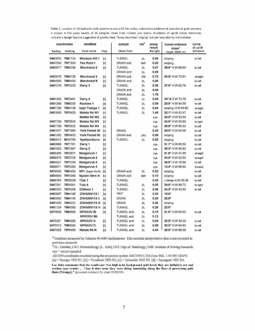
included with those of the 26 „pit-structures‟ listed in Table 1. With assays from five tanks
surveyed by Soper (NP1, Ziwa/SN113 i-iv), the grades range from 0.08 to 0.26g/t Au.
Freestanding hydraulic tanks
„Pit structure‟ is a misnomer for a feature laboriously built up from bedrock within a massive
elliptical or circular platform, through which a tunnel and drain are skilfully engineered to
retain the gradient of a hill (fig. 3). These are freestanding tanks which incorporate principles
Figure 3. Section of an hydraulically engineered tank. Its standardised plan retains the slope of a hill and incorporates entrance tunnel and exit drain. Samples for assay taken at a, b, and c. Insets illustrate components, which are feats of engineering in themselves
7

8
for recovering a heavy metal by gravity concentration. Stone-lined water channels “planned
in conjunction with groups of pits” (Summers 1958: 236) can be traced in the field to distant
sources (Figure 5, no 4). Contributing to the hydraulic plan, particularly where these channels
are absent, lines of boulders are directed uphill at many tunnel entrances.
In the words of Peters (1902: 177), these are “like two wings, so as to catch water that
might run down in great quantities, and lead it through the passage into the pit.” Observations
in rain storms and a rudimentary volume-flow experiment (January 2009) support Peter‟s
catchment verdict against the flooding inevitable in Soper‟s interpretation: sheltered
“homestead gardens” (2002: 89, 129).
A stone-paved and slab-roofed tunnel approx 7-9m long is an integral component of the
structures. This is Soper‟s “restricted passage of significant length”, its skilful engineering
explained as “the luxury of indulging in expensive symbolism in their homesteads” (2002:
111). Serious analysis of tunnel design is critical for understanding the function of the
archaeology, but a review of a century of research statistics (Kritzinger 2010a: 12-13) is
found to be markedly short on the data given in Table 1 – such as the tunnel‟s paved floor
sloping at 27.7 degrees averaged over 25 uphill entrances.
These slopes, plus their inbuilt curves, are guaranteed to make hypothesised livestock
lose its footing – the dark confines of the tunnel being the only access to the bottom of the
tanks. Nevertheless Soper (2002: 110) attaches “[a]n ideological importance” to “the relative
elevation of the house [on the platform] above the cattle in the pit.” The fact that no “remains
of dung deposits have been found in pits” is given the “inescapable” reason by Soper that
“dung was used for manure” (2002: 126). Soper elaborates that the drain‟s “basin … dammed
by a low wall” (Soper 2002: 176) and its “complex system of ditches and hollows downhill”
(2002: 76; see also 2005: 38-40) permitted the (eurocentric) practice of “impounding of slurry
effluent flushed from the pits through the drain” (2002: 91).
A report by R.D.S. Gwatkin in the 1932 issue of Rhodesia Mining Journal “that un-
educated people had no explanation for the pit-structures, but that educated people stated that
they had been used for very small cattle” (in Soper 2002: 224) implies the spreading of
received wisdom from early colonial reporting. The phenomenon of dwarf cattle providing
manure in pits, currently entrenched as fact in international academic journals, national text
books and tourist literature, is now being put to the test by experts in disciplines not
previously consulted.
Gravity concentration
Gold values from assays taken from quartz heaps on and around tank platforms, soil from the
peripheries of grindstones and milling sites (fig. 4), and the Table 1 results from tunnels and
drains, are considered by Australian metallurgist Dr Lee John to be “too high to be
background levels they are definitely ore and residue type results … Thus it does seem they
were doing something along the lines of processing gold there [Nyanga]” (pers. comm.,
02/02/09).
The Table 1 residue results “are significant enough to identify the tank systems as gold
recovery plants. Were they settling tanks … was buddling employed?” (Kritzinger 2009: 81).
Buddling is well documented in the history of premechanical mining as a method of washing
ore in water flowing over a sloping surface, often constructed in stone. Agricola (1556: 300-
339:) gives seven methods for buddling heavy metals agitated by long poles in flowing water,
particularly lead and tin. If only for their slope, length, and entry into a tank, and supposing
implementation of gravity concentration, the Nyanga tunnels would make more suitable
„trunk‟ buddles than the more common „running‟ buddle, the former‟s “much greater length
serving to transport fine material to the areas for further treatment” (Willies 1998: 51).
At the lead-mining sites of How Grove and Winster Pitts in Derbyshire, “areas for further
treatment” include „circular‟ buddles – their stone-lined tanks with water-feed launders and
small exit drains being well depicted by Willies (1998).

9
For gold, Agricola (1556: 333) describes a wooden strake “set with pieces of turf in rows
… [where] the particles of gold settle … afterwards [they are] washed down to the settling-pit
… by a strong current of water, which is let through a small launder. The concentrates are
finally collected and washed in a bowl [i.e. panned].” Agricola‟s “large settling-pit … eight
feet [2.4m] in length, breadth and depth” (1556: 316) is not far removed from the dimensions
of the Nyanga tanks (fig. 3).
Richard Dollar, geologist with a long history of active gold mining in Zimbabwe,
believes that the practice of „hindered settling‟ took place in the tanks – a premechanical
method of ore-classification (mechanised today by piston jigs):
“Once the material to be sorted is placed in the tank and then filled with water (when
it is available), preferably from the bottom because this helps to lift the whole content and
start the sorting process, then the process of jigging or puddling could begin using
wooden poles” (pers. comm. 18/03/2011).
Richards et al. note (1925: 127) that hindered settling requires a “rising current of water,
the velocity of which is much less than the free-falling velocity of the particles, but yet fast
enough so that the particles are in motion.” Running in water from the bottom would explain
the tunnel‟s entry position into the tank. It also conforms with Peters‟ conclusion (1902: 178)
that “water was then poured over [“the crushed quartz … at the bottom”], which carried away
the dust and left the gold behind. Under this theory all peculiarities of these strange buildings
… can be accounted for.” Evidence for pulverised fines directed straight into the tanks is
indicated by large grindstones positioned among the top layer of stones forming the rims of
tanks: five so far discovered in-situ at three undisturbed sites.
Figure 4. Typical ore-dressing sites showing assay results. 1) milling; 2) sorting; 3) pulverising. Shadow to left of grindstone (bottom right) is an uphill tunnel entrance to a tank, scale 50 cm
10
Sixteenth-century panning
While accepting that he is unfamiliar with Nyanga archaeology, senior lecturer at University
College of London‟s Institute of Archaeometallurgy Prof Thilo Rehren is not convinced by
Dollar‟s suggestion of hindered settling, and finds Table 1‟s “gold assays in the order of less
than 1 g/t (and often less than 0.1 g/t) … in selected samples from installations, unconvincing
for tailings of gold traditional mining” (pers. comm. 08/11/2011). But traditional recovery in
Zimbabwe as recorded by the Portuguese in documents dating from the early 1500s was
exclusively alluvial washing in wooden pans – where loss percentages, dependent on the skill
of the panner, are undetectable.
Summers elaborates (1969: 178), “it is fair to assume from their traditional use by
modern Shona,” that wooden pans “were used by their predecessors for concentrating gold
from the crushed ore in „ancient‟ times.” Although “known in West Africa at that time,” he
considers it “most unlikely that amalgamation would have been used in Rhodesia
[Zimbabwe]”. In a 1560s‟ description, the method of ore extraction in the gold fields of the
king of Kiteve (in present-day Mozambique) was seasonal visits “to the foot of the
mountains, where torrents descend … and when the earth is washed away, they find a few
little nuggets and flakes of gold” (Summers 1969: 144). Equally the description could apply
to Zimbabwe‟s Eastern Highlands across the border.
The Portuguese mention nothing about Nyanga being rich in miniature cattle and
overgrown with seasonal crops – surprising in their constant search for fresh provisions but
due, in the opinion of Beach (in Soper 2002: 222), to the “Nyanga complex [lying] largely
outside the main area of activity of Portuguese traders from the early sixteenth century
onwards.” It is conceivable that this silence dates the Nyanga archaeology earlier than 1569,
when the Portuguese governor Homem became convinced the mines his countrymen had
come to conquer “were not worth [the effort of] working,” subsequently introducing a treaty
whereby they “could trade with the local gold miners” (Summers 1969: 144; see also
Kritzinger 2012).
The jury is out about who incorporated hydraulic princliples in the design of the Nyanga
tanks. Classification of ore is an age-old technology which reduces bulk for panning, the final
stage of a premechanical process. The fact that the Table 1 residual gold values (0.04-1.78g/t)
are significantly higher than background gold levels (<0.005g/t), and are found in every tank
tested to date needs to be taken seriously in an archaeological landscape indelibly modified
by typical early mining features.
Landscape evidence
Soper notes that “[i]n the National Park and surrounding areas there are numerous very large
erosional ravines cutting the slopes, most of them with little active erosion in the present day”
(2002: 76). Summers is in agreement (1958: 22, 260) that in “extensive gullying” at Ziwa
“[e]rosion is not now active.” In June 2011 contact was made with UK mining landscape
expert David Cranstone with the field observation that heads of this type of gully are
invariably elliptical (fig. 5, no 2). This approach introduced new lines of investigation into the
research. Cranstone comments (29/07/2011):
“your elliptical-headed gullies do have similarities to our hushing features (which
have often been mistaken for natural erosion gullies in the past) … this is very
interesting! It does seem to me you may well have a hushing landscape, with „furrows‟
feeding the hush-gullies (with or without dams).”
„Furrow‟ is a term used by Summers and Soper to define an artificial water-course.
Directed to Soper‟s Plate 11 (2002: 85) showing his 2200-m long NP4 „furrow‟ which
“traverses the slope” above large elliptical-headed gullies in the Nyanga National Park,
Cranstone replies:

11
“if the picture was in Britain, I would immediately think „hush‟ – though I would
then look for a dam and/or leat to its head before I was certain … But I would now take
the possibility very seriously!” (11/08/2011).
The definition of „leat‟ in the 1962 Britannica world language edition of the Oxford
Dictionary is “an open water-course to conduct water for mills, mining works, etc.”
Cranstone (1992: 41) defines „hush‟ as “a linear gully or cleft, excavated at least in part by
artificially-controlled torrents of water, for the purpose of locating, exposing, or exploiting a
mineral vein.” Worldwide, early principles of mining are precise and predictable.
In accord with Cranstone‟s requirement for water-feed and dams relating to „hushes‟,
Soper notes (2002: 65-72) several reservoirs and/or ditches associated with gullies in his
examination of the „furrows‟ he has “broadly classified” Class 4, e.g. his NP7 „furrow‟ of
c.1200m (similar to Figure 5 no 3) which skirts “the edge of a deep erosion basin … and dips
into a reservoir.” He also quotes (2002: 9) Finch‟s interrelationship of “water furrows and
ditches and hollowed „dams‟,” and the opinion of Bolding et al (in Soper 2002: 75) that
“[m]ost furrows have a simple infrastructural set-up with temporary stone weirs diverting
water from the river” in order, he maintains, “to convey the water to the fields.”
Soper is unconvinced by “the popular conception of irrigated terrace cultivation” (2002:
72), especially in relation to “the highlands where average rainfall is well over 1000mm and
permanent streams quite frequent” (2002: 62). He resolves the problem posed by Class 4
“[w]ell-graded furrows involving more or less massive earthen banks, rarely serving
identifiable settlement sites” by concluding “that their purpose was the irrigation of
unterraced fields” (2002: 72-73). Accepting that within the Nyanga National Park and
surrounding areas traversed by Class 4 , “the soils … like most of the mature highland soils,
are extremely leached,” Soper adds that “[m]anuring would have been essential … and it
might be expected that irrigated fields were fenced for protection from wild animals.”
Soper‟s addition of unterraced fields requiring manuring to the agricultural landscape of
conjecture, coincides with an area which Hall (1904) found abandoned in the late 1890s – and
Figure 5. Landscape features. 1) ravine below Soper's 1832BB35 ‘Class 4 furrow’; 2) York Forest gully with typical elliptical head; 3) Massive bank of Class 4 water channel, Claremont; 4) narrow stone-lined water channel leading to a group of tanks, Manguruve hill

12
for which Beach records (in Soper 2002: 236) only “250 householders in [European] labour
tenancy” in 1902. Soper‟s estimation (2002: 91) that „pit-structures‟ on Rhodes Estate (now
Nyanga National Park) were abandoned “hardly earlier than the mid-19th century,” allows
only 50 years for signs of Wild‟s “exotic cultivated or weed species” to have vanished prior
to modern settlement – along with extinction of cattle dwarfism in the gene pool, with its
ability to reproduce progeny of a size to fit tunnels with in-built limits of <55cm (Table 1 and
fig. 3, left inset).
In 11 areas across 22km exhibiting the leached soil mentioned above, assays of 0.03-
0.36g/t Au, averaging 0.17g/t from fragments of quartz in gully walls support mining activity
against farming. In the Nyanga National Park, the mid-1930s witnessed the accidental
creation of two gullies by „furrows‟ bursting their banks. Soper, while accepting (2002: 76)
that “these ravines can be rapidly initiated by furrow breakage,” makes the qualification that
“human agency may well have been a contributing factor through … the activity of the pit-
structure inhabitants” – who he places in “divided houses” on or near the tank platforms.
The half-paved, half-dhaka (clay) floors of Soper‟s divided houses are a mere 5m in
diameter defined by a single ring of stones. The two types of flooring are separated by low
dhaka walls 15-50cm high, which can still be found on platforms in close proximity to the
standard feature of a slot, shown at d in Figure 3. This slot recalls the “slit” of Richards et al
(1925: 95), through which “water in falling from a height of 12 inches [30cm] or more exerts
a considerable washing force,” or the “stronger current of water … through a small launder”
to wash the [gold] particles … into the settling-pit” of Agricola (1556: 333).
Crushing, milling and stream-working
Summers interprets the „divided houses‟ as “grinding places on their apparent openness and
the consistent presence of grindstones” (Soper 2002: 109; see also Summers 1958: 82). Soper
illustrates this “openness” characteristic in his floor plans (2002: 182, 184, 189, 202, 203),
but questions “why such a large proportion of the available homestead space should have
been devoted to this particular activity [grain grinding]” (2002: 109). Inadvertently Soper
identifies the fact that these are work bays, not for domestic, but for industrial-scale grinding.
Evidence of grinding manifests in quartz chips from the resting places of heavy-duty
grindstones (fig. 4, no 3), and from the periphery of rock outcrop milling sites – their grinding
grooves an indelible record of manual liberation of gold from quartz gangue (fig. 4, no 1).
Assays of 0.07-2.04g/t Au averaging 0.45g/t from 14 sites across 25km, is direct evidence of
ore-dressing. A wide-ranging geosurvey is overdue to determine the relationship of quartz
with the archaeology, its ever-present occurrence acknowledged a century ago but ignored
ever since.
Features also requiring funding for a professional geosurvey programme are the networks
of broad cross-contour ridges running for several hundred metres and locally called mihomba.
From diagrams and photographs emailed to him, mining archaeologist Martin Strassburger
(in Kritzinger 2010b: 7) detects similarities between these Nyanga land modifications and the
streamworks of the early British tin industry. It is also possible they may be waste dumps.
They are the same cross-contour features as those observed by G. Wilson (1932: 250-57)
associated with hillsope terracing in the Iringa gold belt of southern Tanzania.
It is predicted that the current research will extend south and north of Zimbabwe‟s
Eastern Highlands, in artificially terraced zones coinciding with well known gold belts. In
effect: from South Africa‟s Mpumalanga Province in the celebrated Barberton gold belt,
through north-eastern Mozambique where mineralized quartz stockworks are presently under
commercial exploration, across the prospective Precambrian gold fields of Tanzania and
Kenya, in the extensive Adola greenstone belt which hosts Ethiopia‟s richest gold mine Lega
Dembi, the gold-mining highlands of Ethiopia, and north to the auriferous heights of Eritrea
exploited for gold since antiquity.

13
Methodology
GPS coordinates recorded with a hand-held Garmin device are plotted on 1:50 000
topographical maps (identified in Table 1). Features photographed with a rod or human scale.
Width of uphill tunnel entrances is measured between side walls; height from paved floors to
roof slabs. Gradients are recorded by a hand-held Johnson electronic inclinometer 40-6080.
Samples for assay are taken from the paved-floor level of tunnel infill, e.g. a (fig. 3); drains at
entry point b and exit c (fig. 3). Soil samples, approx 1-2 kg, are dry-sieved through 2-mm
mesh. Method of testing: fire assay, lead oxide fusion & AAS finish. The main laboratory
used is ISO/IEC 17025:2005 SANAS-accredited testing laboratory Zimlabs T0339, Harare.
Number of assays restricted by a self-funded budget.
Acknowledgements
Special thanks go to the director, geologists and chief cartographer of Zimbabwe Geological
Survey, my institution of affiliation since February 2005. To Dr Godfrey Mahachi, executive
director of National Museums and Monuments of Zimbabwe, for his unfailing
encouragement, and NMMZ chief archaeologist K.T. Chipunza, challenger of the dwarf-
cattle theory in The Herald as long ago as 1993. Not least to University of Zimbabwe senior
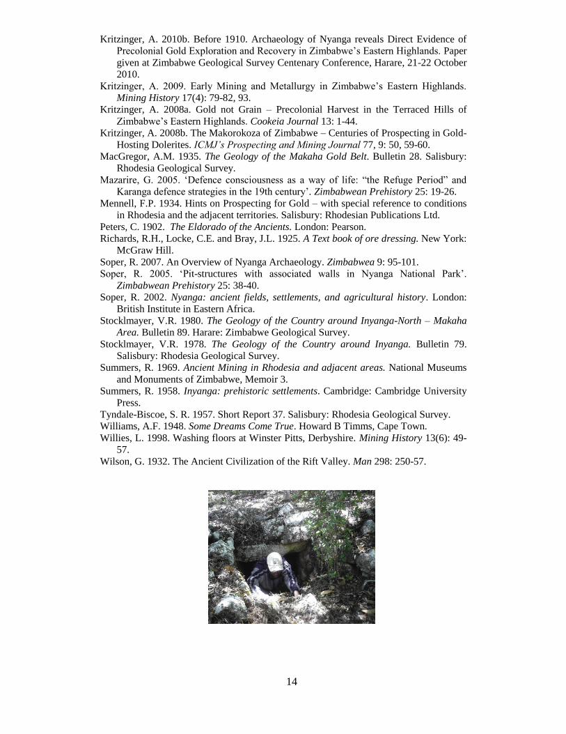
lecturer in mining and metallurgy, Kudzi Musiwa, and my fellow researcher Tendai
Gungutsva (snapshot overleaf), for their dedicated field-walking and sampling.
Recognition is due to Summers for his open-minded approach in Inyanga (1958). To
Soper for his frank disclosure of anomalies in the agricultural theories expressed in Nyanga
(2002). And, in particular, that his maps, plans and diagrams are invaluable blueprints for
future evaluation of the mining perspective.
In conclusion I must acknowledge the contribution of Carl Peters. Although he was not to
return for a final answer in developing the 180 gold claims he registered in 1899 in or near
the present-day Nyanga National Park, I found his concise account of Nyanga‟s abandoned
mining ground in his Chapter 6, „Ancient Ruins of Inyanga‟ (1902: 151-188), was closely
aligned to my own conclusions based on three years‟ experience prospecting and gold mining
in Matabeleland, Zimbabwe. Dismissed as “improbable explanations” by Soper (2002: 92),
and “so wild as to excite derision” by Summers (1958: 237), Peters‟ insights foreshadow the
present drive to enlist evaluation from mining archaeologists, mining geologists and
archaeometallurgists to unravel the industrial past of the Nyanga mountains.
References
Agricola, 1556. De Re Metallica. Basel. English translation and notes, H.C. and L.H.
Hoover, London 1912.
Beach, D.N. 1988. „Refuge‟ Archaeology, Trade and Gold Mining in Nineteenth-Century
Zimbabwe. Zimbabwean Prehistory 20: 3-8.
Cranstone D, 1992. To hush or not to hush: where, when, and how? Men Mines and
Minerals of the North Pennines: 41-48. Ed. B. Chambers. Durham: Friends of
Killhope.
Fripp, F. 1912. An Engineer‟s Notes on old Mine-workings of Transvaal and Rhodesia.
Proceeds of the Rhodesian Scientific Association 11(3): 168-181.
Hall, R.N. and Neal, W.G. 1904. The Ancient Ruins of Rhodesia. London: Methuen.
Kritzinger, A. 2012. Location of Zimbabwe‟s sixteenth-century mines identified from a
Portuguese document – with particular reference to Manyika in the Eastern
Highlands. Zimbabwea 10: 60-84.
Kritzinger, A. 2010a. Gradient and Soil Analysis Identify the Function of Stone-built
Tunnels in the Archaeology of the Eastern Highlands, Zimbabwe. Nyame Akuma 73:
10-16.
14
Kritzinger, A. 2010b. Before 1910. Archaeology of Nyanga reveals Direct Evidence of
Precolonial Gold Exploration and Recovery in Zimbabwe‟s Eastern Highlands. Paper
given at Zimbabwe Geological Survey Centenary Conference, Harare, 21-22 October
2010.
Kritzinger, A. 2009. Early Mining and Metallurgy in Zimbabwe‟s Eastern Highlands.
Mining History 17(4): 79-82, 93.
Kritzinger, A. 2008a. Gold not Grain – Precolonial Harvest in the Terraced Hills of
Zimbabwe‟s Eastern Highlands. Cookeia Journal 13: 1-44.
Kritzinger, A. 2008b. The Makorokoza of Zimbabwe – Centuries of Prospecting in Gold-
Hosting Dolerites. ICMJ’s Prospecting and Mining Journal 77, 9: 50, 59-60.
MacGregor, A.M. 1935. The Geology of the Makaha Gold Belt. Bulletin 28. Salisbury:
Rhodesia Geological Survey.
Mazarire, G. 2005. „Defence consciousness as a way of life: “the Refuge Period” and
Karanga defence strategies in the 19th century‟. Zimbabwean Prehistory 25: 19-26.
Mennell, F.P. 1934. Hints on Prospecting for Gold – with special reference to conditions
in Rhodesia and the adjacent territories. Salisbury: Rhodesian Publications Ltd.
Peters, C. 1902. The Eldorado of the Ancients. London: Pearson.
Richards, R.H., Locke, C.E. and Bray, J.L. 1925. A Text book of ore dressing. New York:
McGraw Hill.
Soper, R. 2007. An Overview of Nyanga Archaeology. Zimbabwea 9: 95-101.
Soper, R. 2005. „Pit-structures with associated walls in Nyanga National Park‟.
Zimbabwean Prehistory 25: 38-40.
Soper, R. 2002. Nyanga: ancient fields, settlements, and agricultural history. London:
British Institute in Eastern Africa.
Stocklmayer, V.R. 1980. The Geology of the Country around Inyanga-North – Makaha
Area. Bulletin 89. Harare: Zimbabwe Geological Survey.
Stocklmayer, V.R. 1978. The Geology of the Country around Inyanga. Bulletin 79.
Salisbury: Rhodesia Geological Survey.
Summers, R. 1969. Ancient Mining in Rhodesia and adjacent areas. National Museums
and Monuments of Zimbabwe, Memoir 3.
Summers, R. 1958. Inyanga: prehistoric settlements. Cambridge: Cambridge University
Press.
Tyndale-Biscoe, S. R. 1957. Short Report 37. Salisbury: Rhodesia Geological Survey.
Williams, A.F. 1948. Some Dreams Come True. Howard B Timms, Cape Town.
Willies, L. 1998. Washing floors at Winster Pitts, Derbyshire. Mining History 13(6): 49-
57.
Wilson, G. 1932. The Ancient Civilization of the Rift Valley. Man 298: 250-57.