Kildare County Councilkildare.ie/CountyCouncil/Planning/DevelopmentPlans/LocalAreaPlans/... ·...
33
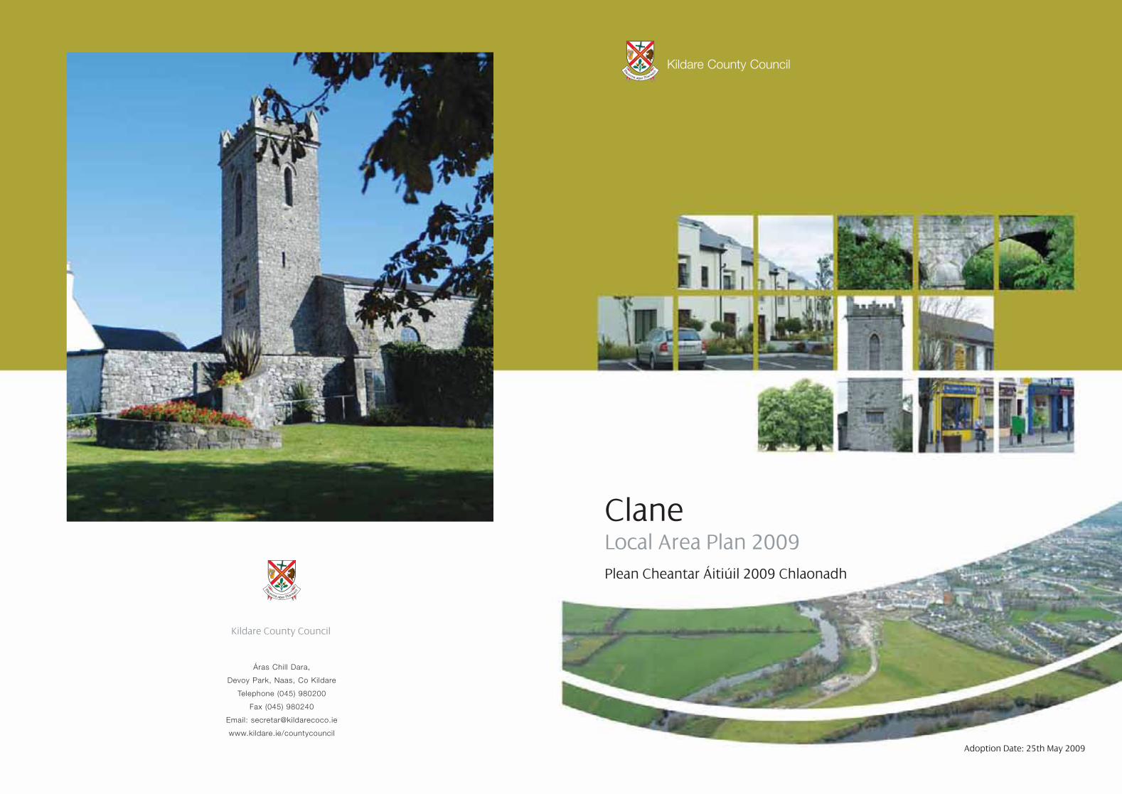
Áras Chill Dara, Devoy Park, Naas, Co Kildare Telephone (045) 980200 Fax (045) 980240 Email: [email protected] www.kildare.ie/countycouncil Kildare County Council Clane Local Area Plan 2009 Plean Cheantar Áitiúil 2009 Chlaonadh Adoption Date: 25th May 2009 Kildare County Council
Transcript of Kildare County Councilkildare.ie/CountyCouncil/Planning/DevelopmentPlans/LocalAreaPlans/... ·...
Áras Chill Dara,
Devoy Park, Naas, Co Kildare
Telephone (045) 980200
Fax (045) 980240
Email: [email protected]
www.kildare.ie/countycouncil
Kildare County Council
ClaneLocal Area Plan 2009Plean Cheantar Áitiúil 2009 Chlaonadh
Adoption Date: 25th May 2009
Kildare County Council
THE AIM OF THIS PLAN IS TO ESTABLISH A FRAMEWORK FOR THE
PHYSICAL, SOCIO-ECONOMIC, CULTURAL AND RECREATIONAL GROWTH
OF CLANE IN A PLANNED, CO-ORDINATED AND SUSTAINABLE MANNER IN
ORDER TO CONSERVE AND ENHANCE THE ESTABLISHED TRADITION AND INTRINSIC
CHARACTER OF THE TOWN. THIS LOCAL AREA PLAN SETS OUT A NUMBER
OF POLICIES AND OBJECTIVES THAT WILL HELP TO ACHIEVE THIS AIM.
Clane LAP Cover 09/06/2010 11:14 Page 1

Contents
1
Table of Contents
Part A Review Context 3
1 Introduction 3
2 Strategic Context and Relevant Policy Documents 7
3 Strategic Environmental Assessment 11
4 Population 12
5 Public Utilities 15
6 Conservation 17
7 Land Use Types 21
8 Development Vision 23
Part B 24
1 Introduction 24
2 Housing 25
3 Industry and Employment 29
4 Community, Educational, Childcare 31
and Cultural Facilities
5 Public Utilities 32
6 Transport 35
7 Amenity and Recreation 39
8 Town Centre 40
9 Re-Use and Regeneration of Derelict Sites 42
and Buildings
10 Heritage 43
11 Environment 46
Part C Specific Objectives 47
1 Land Use and Zoning Objectives 47
2 Design Briefs 55
Appendix A – Screening Decision 57
List of Tables
Table 1 - Preparation of the Clane Local Area Plan 3
Table 2 - Projected total population for Clane 12
Table 3 - Planning statistics 13
Table 4 - Built Heritage Items 17
Table 5 -Sites and Monuments Records 19
Table 6 - Town Centre Zoning 21
Table 7 - Residential Zoning 21
Table 8 - Industry and Warehousing Zoning 21
Table 9 - Open Space and Amenity Zoning 21
Table 10 - Institutional Zoning 22
Table 11 - General Development Zoning 22
Table 12 - Agriculture zoning 22
Table 13 - Specific Land Use Zoning Objectives 47
Table 14 - Zoning Matrix 53

Part A – Review Context
32
1. Introduction1.1 LAP Status and Process Part II, Chapter II, Sections 18 - 20 of the Planning andDevelopment Act 2000 (the Act), as amended, provides that aLocal Area Plan (LAP) may be prepared in respect of any areawhich a Planning Authority considers suitable, in particular forareas which require economic, physical and social renewaland for areas likely to be the subject of large-scaledevelopment within the lifetime of the Plan.
A local area plan shall be made in respect of an area which –(i) Is designated as a town in the most recent census of
population, other than a town designated as a suburb orenvirons in that census,
(ii) Has a population in excess of 2,000 and (iii) Is situated within the functional area of a planning authority
which is a county council
The written statement shall take precedence over the Mapshould any discrepancy arise between them. The period ofthis plan shall be taken as being six years from the date of itsadoption or until it is reviewed or another plan made.
The statutory time frame as set out in the Planning andDevelopment Act 2000 (as amended) commences upon the dateof public display of the Local Area Plan. The following table setsout the timeframe of the preparation of this Local Area Plan.
Table 1: Preparation of the Clane Local Area Plan
Procedure involved in the preparation of a Local Area Plan Relevant Dates
(a) Public Display of Draft Local Area Plan (≥6 weeks) 23rd October ’08 – 3rd December ’08
(b) Preparation of Manager’s Report 4th December ’08 – 14th January ’09
(≤12 weeks from date notice is placed in press - see (a) above)
(c) Consideration of the Manager’s Report by the Members of the Authority 15th January ’09 – 23rd February ’09
(6 weeks after the furnishing of the Manager’s Report to the Members) Council meeting held on 23rd February ‘09
Where, following the consideration of the Manager’s Report, it appears to the Members of the Authority that the proposal (being a
proposal to make the local area plan) should be varied or modified, and the proposed variation or modification would, if made, be a
material alteration of the proposal concerned, the following process is enacted.
(d) Publication of the notice of the proposed variation or modification. (≤ 3 Weeks)
(e) Public display of variation or modification (≤ 4 weeks) 12th March ’09 – 8th April ’09
(f) Preparation of Manager’s Report 9th April ’09 - 6th May ’09
(≤ 8 weeks from date of publication of notice – see (d) above)
(g) Consideration of the Manager’s Report by the Members of the Authority. 7th May ’09 - 25th May ’09
The Local Area Plan is either made or amended 6 weeks after the furnishing (Adopted at full Council meeting on 25/05/09)
of the Manager’s Report to the Members of the Authority.

54
1.2 Layout of document This Local Area Plan for Clane consists of a Written Statementcomprising:(i) Part A (Review Context) (ii) Part B (Specific objectives together with all relevant maps)(iii) Part C (Zoning objectives, zoning matrix and zoning maps)
The Written Statement shall take precedence over the mapsshould any discrepancy arise between them. In the fullinterpretation of all objectives for Clane, it is essential thatboth the County Development Plan (CDP) and the Local AreaPlan (LAP) are read in tandem. Where conflicting objectivesarise between the CDP and the LAP, the objectives of the CDPshall take precedence. It shall be noted that the generaldevelopment control standards applicable to the Plan area areincluded in the County Development Plan. Only specificobjectives applicable to Clane are included in this Local AreaPlan.
1.3 Plan AreaThe town is located in the central part of the county, c. 9kilometres from Naas with easy access to the M4 and M7Motorways. The town has a compact linear centre extendingalong the main street. The River Liffey flows past its outskirtsand the Grand Canal is within a couple of miles of the town.The town is a service and retail centre for its immediate ruralhinterland. The town also serves as a commuter town forworkers in Naas and Dublin.
1.4 Historic Development of ClaneThe present town of Clane has developed around a pre-norman church site located close to the River Liffey. Theimportance of the settlement declined during Medieval times.Up until the mid 20th century Clane was essentially a smallvillage with one street and a population of little over 500persons. The town expanded rapidly in the 1970’s with theconstruction of a number of low density suburban semi-detached housing schemes. Linkages between these housingestates and Main Street are poor, with access to the MainStreet only possible at either end. These poor pedestrianlinkages, together with the severe traffic congestion in thetown, have a negative impact on the vibrancy of the street.In recent years, institutional uses such as schools and thehospital have clustered on the Prosperous road along with therecently opened Aldi store, to the west of the town centre.
FFiigguurree 11 Ordnance Survey Map of Clane
FFiigguurree 22 Aerial Photo of Clane 2005

2 Strategic Context and Relevant Policy Documents
7
2.1 National Spatial Strategy The National Spatial Strategy (NSS) was published in December2002. The Strategy is a 20-year planning framework designedto achieve a better balance of social, economic, physicaldevelopment and population growth between centres.
The National Spatial Strategy identifies Clane as a town in theDublin and Mid East Region with a population of between1,500 and 5,000. Towns of this scale in the Greater Dublin Areaare generally located on or near transportation corridors radiatingfrom Dublin and are relatively close to the larger urban areas.Towns such as Clane cater for local growth in residential,employment and service functions through enhancing thebuilt environment, water services, public transport links andcapacity for development. Accommodating such additionalfunctions must however be balanced with protecting thecharacter and quality of Clane.
The National Spatial Strategy for the “Dublin and Mid-East Region”facilitates opportunities to cater for local growth inresidential, employment and service functions throughenhancing the built environment. Towns with this quality arelocated on or near important economic and transportcorridors.
2.2 Regional Planning Guidelines 2004 - 2016The Regional Planning Guidelines for the Greater Dublin Area2004 – 2016 establish a broad planning framework for theGreater Dublin area. The Regional Planning Guidelines hasidentified Clane as a small growth town within the “StrategicGreen Belt Area” outside the Dublin Metropolitan Area. Thestrategy advocates the restriction development within theseareas to meet local needs only. These guidelines call for strictcontrol of development in green belt areas so as to secure aclear definition between urban areas and rural areas.
2.3 Kildare County Development Plan 2005-2011The Kildare County Development Plan 2005-2011 sets thebroad development framework for the county of Kildare andthe development areas within its jurisdiction. The strategicobjectives of the Kildare County Development Plan 2005-2011are outlined in Section 1.3 and include the following:
1. To provide for balanced and sustainable distribution ofeconomic and social growth across the county.
2. To provide infrastructure and transportation in accordancewith the principles of sustainable development.
3. To ensure the highest quality living environments, urbancentres and civic spaces as well as open space andrecreational facilities accessible to all the citizens ofKildare.
4. To protect, conserve and enhance the built and naturalheritage of Kildare for future generations.
The County Development Plan recognises that the proximityof towns like Clane to the Dublin Metropolitan Area has resultedin increasing development pressure due to factors such asresidential preferences, housing supply/demand imbalancesfacing those who work in Dublin and increased car mobility.
2.4 Kildare 2012- An Economic, Social and Cultural StrategyThe Kildare County Development Board Strategy “Kildare2012- An Economic, Social and Cultural Strategy” sets theframework within which Kildare County Development Boardwill operate for the next 10 years. The vision of this strategy isto make “Kildare- the first choice as a place to live, learn, work,visit and do business.”
The strategy focuses on six key objectives, which are vital toensuring this vision. These are to:
1. Develop transport and communications
2. Respond to new settlement patterns
3. Respond to contrasts within the county and towns
4. Protect the environment
5. Develop education, training and capacity building and
6. Develop a sense of place.
6

98
2.8 Retail Planning GuidelinesThe Retail Planning Guidelines for Planning Authorities werepublished by the Department of the Environment, Heritageand Local Government in December 2000 and updated inJanuary 2005. The Retail Planning Guidelines provide acomprehensive framework to guide local authorities both inthe preparation of development plans and the assessment ofapplications for planning permission and retailers anddevelopers in formulating development proposals.
2.9 Greater Dublin Area - Retail Strategy 2001The main aim of the Retail Strategy for the Greater Dublin Areais to inform the statutory planning process and to ensure thatadequate provision is made for retail development. Thestrategy provides indicative advice on the scope and need forretail floorspace and how, in accordance with sustainableplanning it should be allocated.
Clane is designated as a Level 3 Town Centre in the strategy.These centres usually include supermarkets or superstoresand a range of non-retail services. It is important in centres ofthis size that new residential areas are provided in tandemwith retail centres.
2.10 Draft County Retail Strategy 2005The Draft County Retail Strategy for Kildare was prepared in2005. The terms of this Strategy have been incorporated intoChapter 7 of the Kildare County Development Plan 2005-2011. A revised County Retail Strategy for Kildare is beingprepared in 2009.
2.11 Liffey Valley StrategyThe Liffey Valley Strategy was prepared by the Office of PublicWorks and the relevant Local Authorities including KildareCounty Council and published in 2006.
The overall aims of this Strategy are twofold - to provide anintegrated management framework for the Liffey Valley, andto create a process towards the establishment of a Liffey ValleyPark which would be composed of a necklace of publiclyowned spaces within this area.
2.5 Competing in a Globalised World - An EconomicDevelopment Strategy for KildareAn Economic Development Strategy for Kildare was carriedout to inform economic development policies in the Countyfor the period to 2016, with the key aim of promoting Kildareboth nationally and internationally as a place in which to live,work and invest. Kildare County Council is committed toimplementing and building upon this strategy both nationallyand internationally.
2.6 Kildare County Housing Strategy Part V The Kildare County Housing Strategy 2005 - 2011 was adoptedas part of the Kildare County Development Plan 2005 – 2011.The strategy determines that the ratio of social housing is 8%and affordable housing is 12%. The primary purpose of thelegislative provisions is to secure completed social andaffordable housing, more quickly and more efficiently.
2.7 “Sustainable Residential Development in UrbanAreas” and “Urban Design Manual – A best practiceguide” (2008)The “Sustainable Residential Development in Urban AreasGuidelines” set out the key planning principles which shouldbe reflected in Development Plans and Local Area Plans andwhich should guide the preparation and assessment ofplanning applications for residential development in urbanareas.
The Urban Design Manual is a best practice design guide thatillustrates how policy principles can be translated into practiceby developers and their design teams and by local authorityplanners. These guidelines promote sustainable urbanhousing by ensuring that the design and layout of urbanhousing provides satisfactory accommodation for a variety ofhousehold types and sizes.

3 Strategic Environmental Assessment
11
3.1 Introduction The Strategic Environmental Assessment (SEA) process is theformal systematic evaluation of the likely significantenvironmental effects of implementing a plan or programmebefore a decision is made to adopt the plan or programme. Itinforms the plan making process of the likely environmentalimpacts of alternative actions and contributes to theintegration of environmental considerations into planmaking.
3.2 Legal FrameworkOn the 21st of July 2004, the Strategic EnvironmentalAssessment (SEA) Directive (2001/42/EC) was transposed intoIrish law through the European Communities (EnvironmentalAssessment of Certain Plans and Programmes) Regulations2004 (S.I. 435 of 2004) and the Planning and Development(Strategic Environmental Assessment) Regulations 2004 (S.I.436 of 2004). Relevant ‘Guidelines for Planning and RegionalAuthorities’ were subsequently issued by the Minister for theEnvironment, Heritage and Local Government in November2004.
Strategic Environmental Assessment is mandatory for plans,for areas with a population of 10,000 or more, Where thepopulation involved is less than 10,000, the EU Directive requiresscreening of the plan in order to establish if developmentresulting from objectives will cause significant environmentaleffects. The designated environmental authorities are thenformally consulted as part of the screening exercise.
The designated authorities are the Environmental ProtectionAgency (EPA), the Department of the Environment, Heritageand Local Government and the Department of Communications,Marine and Natural Resources. While the EPA must beconsulted in all cases, consultation with the two Departmentsis conditional on the Plan having significant effects within theremit of those Departments.
3.3 Consultation with Environmental AuthoritiesIn accordance with Article 13A(4) of the Planning andDevelopment (Strategic Environmental Assessment) Regulations2004, a Screening Assessment was prepared for the Clane LocalArea Plan (LAP) and sent to the Environmental Authorities. AScreening Decision was subsequently prepared and sent tothose environmental authorities consulted, in accordancewith Section 3.9 of the ‘Implementation of SEA Directive(2001/42/EC): Assessment of the Effects of Certain Plans andProgrammes on the Environment’ (See Appendix A).
Correspondence received from the various Departmentsis summarised as follows:
3.3.1 Department of Communications, Marine andNatural Resources(i) The implementation of this LAP should not compromise
the objectives as set out in the Water Framework Directive.The Plan will have regard to the Water Framework Directive.
(ii) Development on foot of this LAP should be consideredpremature pending suitable Sanitary Services infrastructurebeing in place to take and satisfactorily cater for anyanticipated increased loadings. Development shall bedependant upon the availability of sanitary servicesinfrastructure.
3.3.2 Department of the Environment, Heritage andLocal Government(i) It is expected that the making of a LAP for Clane will have
little negative environmental impact. However it is consideredthat the proposed Clane LAP could have a significant effecton the architectural heritage of the town, albeit beneficial.The LAP must address in detail the impact of any proposeddevelopment arising from the draft plan on thearchaeological heritage of the town.
(ii) Providing that the main aim of the plan is adhered to, i.e.to develop sustainably and conserve and enhance thenatural environment, then it is not anticipated that therewould be any significant effects in relation to naturalheritage.
3.3.3 Environmental Protection Agency No comments received
10

13
4.2 Relevant Planning HistoryWhile there are a number of planning applications currently inthe system that have not yet been decided upon, anassessment of larger development sites in Clane shows that c.680 residential units have been granted in the town in recentyears and, given the commencement dates of a significantnumber of these developments, being post the date of theundertaking of the 2006 Census (April 2006), it shall beassumed that population figures resulting from these unitswere not included in the CSO Census data and therefore thepopulation resulting from the construction of these unitswould be additional to the 2006 population figure for Clane.The following is of particular note:
However as clearly set out in Table 2, the projected populationfor Clane having regard to the Regional Planning Guidelinesshould be 7,047 by 2015 (end of the life of this Local AreaPlan).
Paragraph 7.9 of the Regional Planning Guidelines states thatthe over zoning of land is acceptable, perhaps even by one-third to one-half .On that basis it is considered reasonable toassume such an over zoning difference between the 2006 and2015 population figures (Table 2 above). Therefore, in linewith the revised Regional Planning Guidelines populationfigures a total maximum population of 7,047 would beconsidered acceptable in Clane during the life of this LocalArea Plan (Difference in population between 2015 (end of lifeof this Local Area Plan) and 2009 (start of life of this Local AreaPlan) (See Table 2 above) = 1,386 divided by a half = 693 +7047 = 7,740). The figure of 7,779 (See Table 3 above) wouldrepresent a small surplus of over zoning of the acceptabletotal maximum population as determined by the RegionalPlanning Guidelines.
4.1 BackgroundThe Kildare County Development Plan 2005-2011 (CDP)indicates a housing construction target of 400 units for Clanebetween 2002-2011. Given that the latter date only projects tomid way through this Local Area Plan period and given thatthe most recent census was carried out post the adoption ofthe current CDP, it is considered more appropriate to haveregard to the CSO data and the revised Regional PlanningGuideline (RPG) figures in order to determine the increase inpopulation over the plan period.
The 2006 census data established that there were 186,335people resident in County Kildare. Clane accounted for 4,968or 2.67% of the County’s total population.
The recently revised Regional Planning Guideline (RPG) figuresfor the Greater Dublin Area (GDA) projected an additional99,429 population for Kildare between 2003 and 2016 (totalnumber of household units i.e. 39,456 multiplied by 2.52, thisbeing the average household size following consultation withthe Regional Authority).
Given that the 2006 population figure for Clane has beenestablished and considering that the RPG figures project to2016, it was considered reasonable to project from the samebase year i.e. 2006, for the purposes of projecting for anassumed population growth over the Plan period.
Having regard to the proportion of the County’s populationresident in Clane from the 2006 Census, it shall be assumedthat Clane will continue to account for 2.67% (as above) of therevised RPG figures, which would equate to a total additionalpopulation figure of 2,310 between 2006 and 2016. (Totalpopulation 2016 minus total population 2006 as per Table 2).
4 Population
Table 2 below shows that a ‘year on year’ figure of 231 wouldassume a total population for Clane of 7047 by 2015 (the endof the six year life of this Local Area Plan).
Year on Year Figure Year Total Population
231 2006 (CSO) 4,968
2007 5,199
2008 5,430
2009 5,661
2010 5,892
2011 6,123
2012 6,354
2013 6,585
2014 6,816
2015 7,047
2016 7,278Table 2 - Projected Total Population for Clane
Table 3: Planning Statistics
Population of Clane in 2006 4968
Population resulting from construction of c. 680 units (as above) when taking an average 1713household figure of 2.52 (figure provided by the Regional Authority)
Population arising from 12.46 ha of uncommitted lands from the Clane Local Area Plan 2002, 1,098assuming a household figure of 2.52 and an average density of units per ha of 35 (low-medium residential density as per Table 15.5 of the Kildare County Development Plan 2005-2011 is 20-35).
Total envisaged population for Clane by 2015 without proposing any additional residential zoning 7,779
12

5 Public Utilities
5.1 Water Supply Clane is supplied by the North East Kildare Regional WaterSupply Scheme, taking its supply from the Ballymore EustaceWater Treatment Plant, owned and operated by Dublin CityCouncil. It is anticipated that there will be an adequate supplyof water to facilitate development during the life of this plan.
5.2 Sewerage Clane forms part of the Upper Liffey Valley Regional SewerageScheme, which also serves the towns of Naas, Newbridge, Sallins,Kill, Johnstown, Prosperous, Kilcullen, Suncroft, Athgarvan,Brownstown and the Curragh Camp. The sewerage treatmentPlant at Osberstown, which treats the wastewater collectedfrom these towns is due to be upgraded from 80,000PE to130,000PE within the lifetime of this plan, in order to meetdemand to this level within the catchment.
5.3 Surface Water DrainageThe Council recognises that surface water drainage in Clane isinadequate and the practice of disposing of surface waterthrough the combined sewerage network is unsatisfactory.
5.4 WasteKildare County Council has adopted a Waste Management Planfor Kildare (2005-2010). The Plan highlights current levels ofwaste and sets objectives whereby overall levels will be reducedand stabilised in order to comply with both national andEuropean legislative guidelines. The guidelines set down ahierarchy of preferential modes of waste management, focusingon prevention, minimisation, re-use/recycle, disposal with energyrecovery and disposal of residual waste.
Refuse collection in Clane is currently carried out by a privatecontractor on behalf of Kildare County Council.
5.5 Electricity and TelecommunicationsElectricity is supplied by the ESB transmission system, whichis adequate to serve the needs of Clane for the period of thisplan.
The telecommunications network in Clane is being upgradedprogressively. There is an increased demand for mobile phones,broadband and other telecommunications equipment toimprove the telecommunications network and provide aglobal system for mobile communications. Broadband iscurrently available in the Clane area.
Kildare County Council acknowledges the importance of thetelecommunications sector to the local and regional economy.Access to advanced information and communicationsinfrastructure is essential to development and offers acompetitive advantage in attracting economic developmentand inward investment.
5.6 FloodingA Flood Alleviation section was set up within Kildare CountyCouncil with an objective to provide surface watermanagement systems throughout the county and alleviateflooding in affected areas. Substantial work has been carriedout at the Butterstream in Clane from the River Liffey to theroundabout at Clane inner relief road to date and this schemeis still to be completed.
14 15

6 Conservation
6.1 Natural Heritage6.1.1 Natural Heritage Areas and Special Areas ofConservationThe most important habitats in the County are affordedprotection under National and/or European legislation by wayof designation as proposed Natural Heritage Areas (pNHA) andcandidate Special Areas of Conservation (cSAC). The pNHAsites, afforded protection under the Wildlife (Amendment)Act 2000, were formerly designated as Areas of ScientificInterest. The SAC sites are designated under the EU HabitatsDirective (92/43/EEC), which was transposed into Irish law inthe European Communities (Natural Habitats) Regulations,1997.
The designation of these sites at a national level is theresponsibility of the National Parks and Wildlife Division of theDepartment of the Environment, Heritage and Local Government.The designation of these sites is an ongoing process asboundaries are revised and adjusted and new sites added. TheCouncil will take cognisance of any change in boundaries thatmay occur in designated sites within the life of this plan.
There is a diversity of natural and semi natural habitats withinthe Clane environs including woodland, river and grasslandhabitats that shall be protected through the objectives in PartB of this Local Area Plan.
6.1.2 Trees and Hedgerows
The Council is mindful of the importance of mature trees indevelopments and accordingly the preservation of such treeswill be a prime consideration in the determination ofapplications for sites with trees of amenity value. All newdevelopments will be required to integrate existing trees intothe new schemes, wherever possible and to provide a treemanagement plan.
6.2 Built HeritageVernacular architecture makes a strong contribution to thecharacter of streetscapes and it is an objective of the Councilto protect vernacular architecture in Clane for the benefit offuture generations. It shall be an objective of the Council toprotect the following, named structures and their settings, inthe assessment of any development proposal.
16
Reference Item and Location DescriptionCE 1 Jones Public House, Main St. Building
CE2 Doctor’s Surgery, Main St. Building
CE3 The Corner House, Main St. Building
CE4 Church of Ireland and grounds Building and boundary
CE5 Bellaville House, Prosperous Rd. Building
CE6 Convent, Main St. Building
CE7 Catholic Church, Main St. Building and boundary
CE8 Former Garda Barracks, Main St. Building
CE9 Alexandra Bridge, Naas Rd Bridge
CE10 The Old National School, Main St. Building
CE11 Stone Barn, Ballinagappa Rd. Building
CE12 Clane Abbey and graveyard Building and boundary
CE13 Bullan Stone Monument
CE14 Clane Socket stone of cross Monument
CE15 Motte Monument
CE16 Abbeylands House Building
CE17 Stone bridge at end of Stream Park Bridge
CE18 Large stone bridge at Stream Park Bridge
CE19 The Presbytery, Main St Building
Table 4 - Built Heritage Items 17

19
6.3 Archaeological Heritage6.3.1 Sites and Monuments RecordsThe Sites and Monuments Records (SMR) list all certain orpossible archaeological sites and monuments mainly datingto before 1700AD. These lists were in many cases basedinitially on cartographic, documentary and aerial photographicsources. The record is updated on a constant basis andfocuses on monuments that predate 1700AD.
Table 5 (below) and Map 1 depict all SMR sites within or inclose proximity to the development boundary of Clane.
18
Item (Description) Location (Townland) OS Sheet No. ReferenceAbbeyland (Clane ED) Clane 14 KD014-02601Blackhall(Bodenstown ED)CarrigeenMoat Commons
Cemetery Site Clane 14 KD014-019Holy Well Capdoo Common 14 KD014-020Font (original location) Clane 14 KD014-026010Castle-Motte Carrigeen 14 KD014-026004Holy Well Carrigeen 14 KD014-026009Burial (Neolithic) Clane 14 KD014-019Effigy (high medieval) Abbeylands (Clane ED) 14 KD014-026014Font (original location) Clane 14 KD014-026010Graveyard Abbeylands (Clane ED) 14 KD014-026012Church Abbeylands (Clane ED) 14 KD014-026005
Table 5 - Sites and Monuments Records
Map 1: Built Heritage

7 Land Use Types
21
7.1 Town CentreExisting facilities and businesses within the town centreinclude a service station, Super Valu, an Aldi Store, chemist,cafes –O’Briens sandwich bar, florist, butchers, restaurants,convenience stores and a number of public houses. Much ofthe recent development in the town centre of Clane has takenplace along the main street. The Council will particularlypromote the revitalisation and consolidation of central towncentre sites in Clane. The Council recognises the importanceof maintaining a strong retail base in the town centre and willdirect appropriate retail, commercial and other uses to thetown centre. The Council recognises the need to develop astronger service sector which will strengthen Clane as agrowth centre.
7.2 Residential The Clane Development Plan 2002 zoned a total of 33hectares of land as ‘New Residential’. Of this approximately7.64 hectares of land remains uncommitted.
7.3 Industry and WarehousingClane has historically been a service town for the surroundingrural hinterland. A number of light industrial and commercialuses exist within the town. The majority of land zonedIndustrial and Warehousing development in the ClaneDevelopment Plan 2002 remains uncommitted. Additionallands to the northwest have been designated for office, lightindustry and warehousing use.
7.4 Open Space and AmenityClane has a wide variety of recreational activities includingG.A.A., soccer, rugby, tennis, equestrian centres, fishing and anumber of golf courses.
The provision of attractive recreational open space is anessential component of the Council’s vision for developingClane. The quality and location of such space is as importantas the quantity. The Council has recently established a parksdepartment to develop and maintain public open spaceswithin the county.
20
Zoning Area in 2002 Total Area in 2009Objective Development Plan Local Area PlanTown Centre c.8.6 hectares c.8.83 ha
Table 6 - Town Centre Zoning
Zoning Area in 2001/2 Total Area in 2009Objective Development Plan Local Area PlanNew Residential 33 ha 36.53 ha
* This total includesthe land usezoning ‘X:MasterplanObjective’ (8.9ha)
Existing 102.16 ha 87.24haResidential * This land use
zoning shall be renamed‘Existing /PermittedResidential’ in theLocal Area Plan.
Table 7 - Residential Zoning
Zoning Area in 2002 Total Area in 2009Objective Development Plan Local Area PlanOffice, Light 14.9 ha 18.63 haIndustry * This land use & Warehousing zoning shall be
renamed “Office, Light Industry and Warehousing” in theLocal Area Plan.
Table 8 - Office, Light Industry and Warehousing Zoning
Zoning Area in 2002 Total Area in 2009Objective Development Plan Local Area PlanOpen Space c. 30.4 ha c. 30.4 ha& Amenity * This land use
zoning shall be renamed “Open Space andAmenity” in theLocal Area Plan.
Table 9 - Open Space and Amenity Zoning
Map 2: Natural and Archaeological Heritage
8 Development Vision
22
The Strategic Vision and Strategic Policy Objectives, as set outbelow, provide the overall strategy of Kildare County Councilfor the proper planning and sustainable development ofClane. The Vision and Policy Objectives are framed within thesocio-economic, environmental and strategic planningcontexts for the future development of Clane.
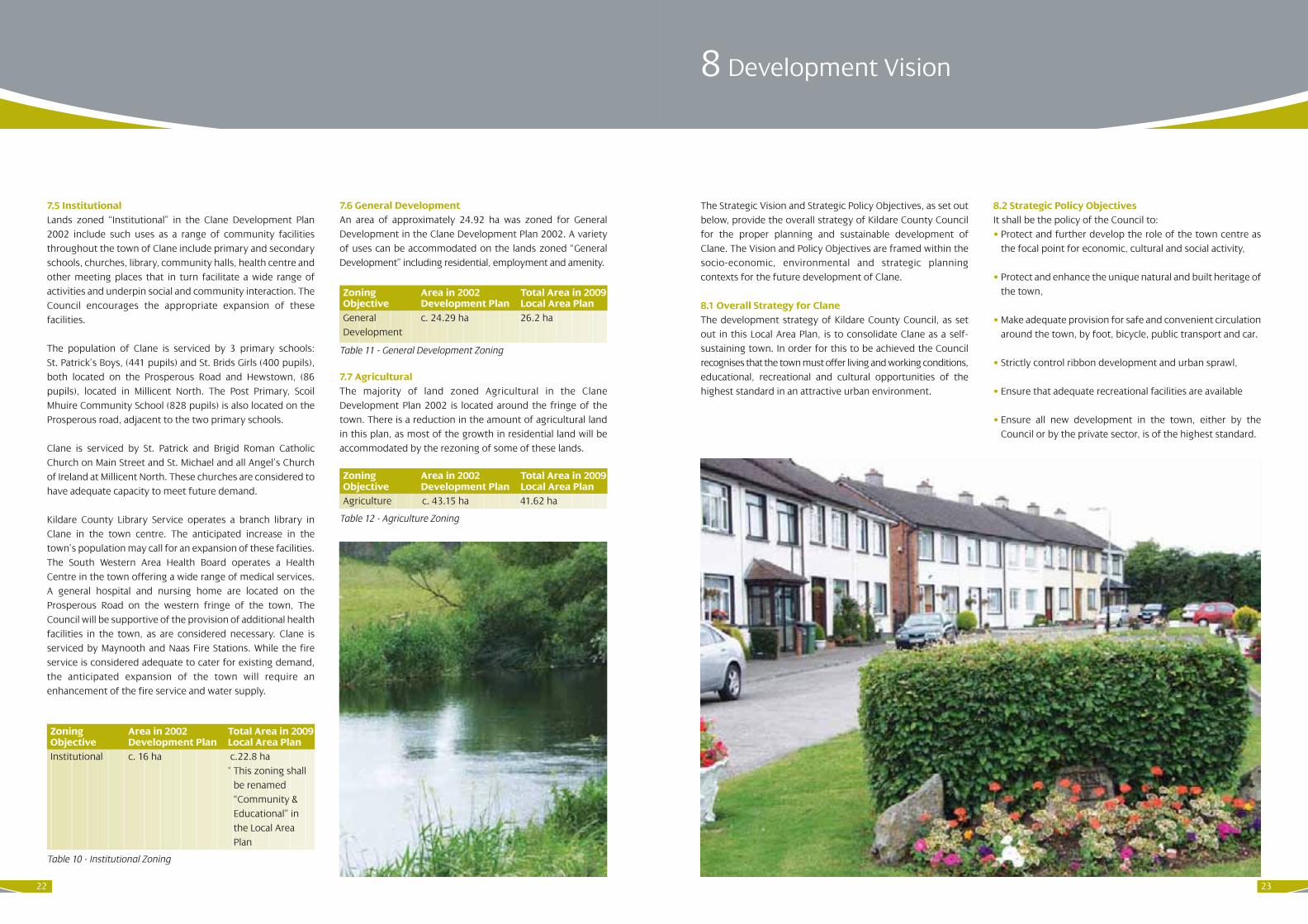
8.1 Overall Strategy for ClaneThe development strategy of Kildare County Council, as setout in this Local Area Plan, is to consolidate Clane as a self-sustaining town. In order for this to be achieved the Councilrecognises that the town must offer living and working conditions,educational, recreational and cultural opportunities of thehighest standard in an attractive urban environment.
8.2 Strategic Policy Objectives It shall be the policy of the Council to:• Protect and further develop the role of the town centre as
the focal point for economic, cultural and social activity,
• Protect and enhance the unique natural and built heritage ofthe town,
• Make adequate provision for safe and convenient circulationaround the town, by foot, bicycle, public transport and car.
• Strictly control ribbon development and urban sprawl,
• Ensure that adequate recreational facilities are available
• Ensure all new development in the town, either by theCouncil or by the private sector, is of the highest standard.
7.5 Institutional Lands zoned “Institutional” in the Clane Development Plan2002 include such uses as a range of community facilitiesthroughout the town of Clane include primary and secondaryschools, churches, library, community halls, health centre andother meeting places that in turn facilitate a wide range ofactivities and underpin social and community interaction. TheCouncil encourages the appropriate expansion of thesefacilities.
The population of Clane is serviced by 3 primary schools:St. Patrick’s Boys, (441 pupils) and St. Brids Girls (400 pupils),both located on the Prosperous Road and Hewstown, (86pupils), located in Millicent North. The Post Primary, ScoilMhuire Community School (828 pupils) is also located on theProsperous road, adjacent to the two primary schools.
Clane is serviced by St. Patrick and Brigid Roman CatholicChurch on Main Street and St. Michael and all Angel’s Churchof Ireland at Millicent North. These churches are considered tohave adequate capacity to meet future demand.
Kildare County Library Service operates a branch library inClane in the town centre. The anticipated increase in thetown’s population may call for an expansion of these facilities. The South Western Area Health Board operates a HealthCentre in the town offering a wide range of medical services.A general hospital and nursing home are located on theProsperous Road on the western fringe of the town, TheCouncil will be supportive of the provision of additional healthfacilities in the town, as are considered necessary. Clane isserviced by Maynooth and Naas Fire Stations. While the fireservice is considered adequate to cater for existing demand,the anticipated expansion of the town will require anenhancement of the fire service and water supply.
7.6 General Development An area of approximately 24.92 ha was zoned for GeneralDevelopment in the Clane Development Plan 2002. A varietyof uses can be accommodated on the lands zoned “GeneralDevelopment” including residential, employment and amenity.
7.7 AgriculturalThe majority of land zoned Agricultural in the ClaneDevelopment Plan 2002 is located around the fringe of thetown. There is a reduction in the amount of agricultural landin this plan, as most of the growth in residential land will beaccommodated by the rezoning of some of these lands.
Zoning Area in 2002 Total Area in 2009Objective Development Plan Local Area PlanInstitutional c. 16 ha c.22.8 ha
* This zoning shallbe renamed“Community &Educational” inthe Local AreaPlan
Table 10 - Institutional Zoning
Zoning Area in 2002 Total Area in 2009Objective Development Plan Local Area PlanGeneral c. 24.29 ha 26.2 haDevelopment
Table 11 - General Development Zoning
Zoning Area in 2002 Total Area in 2009Objective Development Plan Local Area PlanAgriculture c. 43.15 ha 41.62 ha
Table 12 - Agriculture Zoning
23

25
(vi) Parking areas shall be sensitively designed,appropriately landscaped and carefully integratedinto the overall development scheme.
(vii) The layout of estates shall be designed to a highquality so as to discourage anti-social behaviour.
Design:(viii) The use of high quality materials only, in the
delivery of a high standard of design.
(ix) Variety in the house types, styles, designs andsizes of proposed dwelling units throughout thedevelopment. In this regard only the highestquality proposals shall be considered and allhouse types shall be sympathetic with eachother. Variety in the amount of floor area to beprovided shall form an integral part of any newresidential development scheme in order to allowfor adequate trading up and down opportunities.Appropriately sized family units should form partof all development schemes.
(x) The consideration of the requirements of theelderly in the design of development schemes.
(xi) The surround of dormer windows shall befinished in painted plaster only, where suchwindows are considered appropriate.
(xii) There shall be Vertical emphasis on all windows.
(xiii) Solar panels, shall be encouraged in the design ofdevelopment schemes in the interests ofsustainability, particularly on south facing walls. Allproposed developments shall have due regard tothe EC Directive 2002/91/EC which relates to theenergy performance of buildings (Seehttp://www.managenergy.net/products/R210.htm for complete wording of Directive).
(xiv) All extensions to residential buildings shall besympathetic in massing and scale to the existingbuilding.
2.1 Objectives In addition to the policies of the Council outlined in Chapter 5of the Kildare County Development Plan (2005-2011) or therelevant chapter of any subsequent County DevelopmentPlan, it shall be an objective of the Council to require that thefollowing form part of development proposals;
Layout:(i) A development layout that will maximise the
safety of pedestrians and that will allow fortraffic calming by design, throughout thedevelopment scheme. In this regard curvedroutes shall be preferred as opposed to long,straight stretches of roadway. Priority shall begiven to the movement of pedestrians throughoutthe site, providing footpaths and lighting alongappropriate desire lines, for example connectingresidential units to areas of open space,connecting areas of open space to each other andcreating desire lines from the development site inthe direction of nearby amenities including towncentre facilities.
(ii) Variety in the layout of the development scheme toinclude courtyard type developments and shortcul de sacs. The monotony of long stretches ofresidential units in a linear format shall not bepermitted.
(iii) Careful consideration shall be given to therelationship between residential schemes andadjoining public roadways. Excessive stretches ofblank wall shall not front any public road withinthe development scheme.
(iv) New dwellings shall not closely overlook the rearcurtilage of existing dwellings and where this isfound to be the case, planning permission willnot be favourably considered. Houses located in apiecemeal fashion to the rear of existing houses,with inadequate independent road frontage andthat do not form part of a comprehensivedevelopment plan for the particular area areconsidered to represent sub-standard developmentand will not be permitted.
(v) Development shall not be permitted on designatedareas of open space that forms part of a sitelayout for previously permitted development.
1. Introduction
This Section states the objectives of Kildare County Council with
regards to the development of land within the boundary of the
Local Area Plan for Clane. It is the overarching objective of the
Council to implement all development in accordance with these
stated objectives in order to facilitate land use in a manner that will
promote proper planning and sustainable development.
Part B 2 Housing
24

2726
H3 All development proposals shall comply with thefollowing recent DoEHLG publications:• ‘Sustainable Residential Development in Urban Areas
– Guidelines for Planning Authorities’ (December 2008) • ‘Urban Design Manual – A best practice guide, A
companion document to the Planning Guidelines onSustainable Residential Development in Urban Areas’(December 2008).
It is considered that both documents provide essentialguidance to improving the quality of design and layoutof development schemes and should be used by; (i) Developers/agents, in the preparation of development
proposals(ii) The public, in gaining a greater understanding of
the development proposals (iii) Planners, in the assessment of development
proposals
It is strongly advised that all relevant parties haveregard to both documents when preparing orassessing development proposals. Both documentscan be viewed in full on the DoEHLG website www.environ.ie
H4 All new residential accommodation shall meet thenecessary standards of health, sanitation and designand shall be carried out generally in accordance withthe ‘Recommendations for Site Development Worksfor Housing Areas’ (DoEHLG 1998) or as updated oramended.
H5 Private housing estates shall be continued to be takenin charge (other that apartment blocks) when theyhave been completed in accordance with theconditions of the relevant planning permissions and tothe satisfaction of the Planning Authority.
H6 Applicants for developments of greater than 50 units,or where the Planning Authority deems necessary,shall submit a Social Infrastructure Assessment (SIA)which demonstrates the facilities available toadequately service the proposed development. This should include details regarding the type andlocation of facilities available in the locality includingeducation, childcare, health, recreational facilities and others such as shops and post offices. It shall
be demonstrated, as part of any planning applicationthat deficiencies, found to be arising in the availabilityof such services in the locality, shall be provided as part of the proposed scheme together with the typeand location of same. A guide to the requirements andpreparation of a social infrastructure assessment is available from the Kildare County Council PlanningDepartment or at the following web address;(http://kildare.ie/CountyCouncil/Planning/SocialInfra
structureAssessment/).
In addition, the onus shall be on the developer to satisfactorilydemonstrate how the proposed increase in population will beaccommodated in terms of education provision. In thisregard, it shall be noted that 12% and 8.5% of a population atany time is assumed to be of primary and secondary schoolgoing age respectively. Developers shall;
(i) Calculate the assumed population arising out ofa particular development proposal that wouldrequire primary and secondary school places
(ii) Provide details of the total available places andthe current spare capacity in local schools (aletter from the principal of the schools shall berequired as part of the planning application)
(iii) Where there is found to be a shortfall with regardto facilitating the population of the proposeddevelopment in local schools the onus shall beon the developer to demonstrate how additionalcapacity can be achieved.
Landscaping:It shall be an objective of the council to require the following:
(xv) The preservation and reinforcement of existingmature trees and hedgerows in new residentialareas where feasible. The felling or elimination ofexisting mature trees and hedgerows shall bestrongly resisted (See (xvi) (b) below).
(xvi) The preparation of a landscape plan, prepared bya suitably qualified person. Such a plan shallinclude proposals for the following;(a) ‘Hard’ landscaping to include a footpath and a
bicycle path
(b) Planting areas together with a plantingscheme for same. Such a planting scheme shallinclude the precise location, number andtypes of plants/native trees, together with aclear and concise planting programme. Existingtrees/planting on site shall be incorporatedinto any development scheme unless thepoor condition of such trees/planting wouldmerit the removal of same. In such instancesa case shall be made in writing, together withthe planning application, for their removal.Existing mature hedgerows provide a uniquehabitat for wildlife and all new developmentsshall protect mature hedgerows and includethem as an integral part of the overalldevelopment design.
(c) Seating arrangements both formal and informalshall be placed in areas that are overlooked todiscourage anti–social behaviour or littering.
There shall be a formal proposal for a hierarchyof public open spaces throughout the site. Thisproposal shall include;(i) Landscaped pedestrian and cyclist link routes
along desire lines (e.g. connecting residentialareas with commercial, community, educationaland employment uses). These routes shall alsobe suitable for the requirements of disabledusers. Communal bicycle racks shall be providedas an integral part of any residential scheme.
(ii) A central, functional, accessible and adequatelyoverlooked area of public open space.
(iii) Smaller areas of usable, functional, accessibleand central areas of open space throughoutthe remainder of the development site.
(iv)Having regard to both (ii) and (iii) above,residential units shall front onto areas of openspace. Gable walls or stretches of blank wallsshall not be permitted to front onto these areas.
H2 To favourably consider planning applications whichpromote the use of underused and vacant upper floors.

3 Industry and Employment
It is envisaged that the Council will continue to facilitate thecontinuity and encourage the expansion of enterprises whilestill having regard to the protection of the amenity value ofneighbouring properties.
The Council is anxious to ensure that Clane develops in abalanced manner with adequate employment opportunitiesfor the residents of the town and its hinterland.
In addition to the policies of the Council outlined in Chapter 2of the Kildare County Development Plan (2005 – 2011) or therelevant chapter of any subsequent County DevelopmentPlan, it shall be an objective of the Council:
E1 To facilitate the development of commercial, office, lightindustrial and warehousing development on appropriatelyzoned and serviced lands in co-operation with the IDA,Enterprise Ireland, the County Enterprise Board, Kelt andthe County Development Board.
E2 To safeguard residential areas and areas of highenvironmental quality from the adverse effects ofindustrial development.
E3 To ensure that all new industrial related developmentproposals are appropriately landscaped and screened inorder to minimise any adverse impacts on the amenity ofnearby residential areas.
E4 To encourage the provision of a number of incubatorunits for small enterprises, as part of larger lightindustrial or office developments.
H7 The naming of residential developments shall reflectlocal place names, language or topographical featuresas appropriate and the use of old names from thelocality as far as possible.
H8 Apartments shall only be proposed at appropriatelocations in the Town Centre. Generally apartments, orretail developments with apartments above, should belocated in the town centre zone. For the purpose of thisplan a house and maisonette is defined as a dwelling withits own external access. An apartment, flat or duplex is adwelling accessed from an internal lobby or hallway.
H9 All new residential estates shall include the “WhiteLight” Compact Fluorescent Lamp (CFL) public lightingconcept.
2.2 Taking in charge of estatesIt is the policy of Kildare County Council to take theconventional housing element of residential developments incharge once they have been completed to the satisfaction ofthe planning authority.
In mixed developments that consist of ‘conventional houses’,apartments and commercial/retail developments, the publicinfrastructure should be laid out and constructed in such amanner so that there is clear distinction between the areasand infrastructure that are to be taken in charge and thosethat will be managed by a management company.
Kildare County Council recognises that certain developmenttypes, (such as apartment blocks or developments that consistpredominantly of apartment blocks and where it would not bepractical to isolate the infrastructure serving the apartmentblocks from the conventional housing element of thedevelopment) require the creation of management companiesto manage and maintain the communal areas in thedevelopment.
In developments where management companies arerequired, these companies should be constituted inaccordance with ‘The Draft Guidelines on the Governance ofApartment Owners’ Management Companies (published bythe Office of the Director of Corporate Enforcement,December 2006) or any future national legislation orguidelines.
Where management companies have been formed forconventional housing estates or for the conventional housingelement or mixed use estates, the County Council will takethese estates in charge when they have been completed tothe satisfaction of the County Council on condition that themanagement company is wound up when the estate has beentaken in charge. Once the estate is in charge it will be a matterfor the residents of the estate to organise and arrange for themanagement and maintenance of the public open spaces inthe estate. This could be done either through the residentsassociations or some form of voluntary co-operation. TheCouncil will continue to assist residents in maintaining thepublic open space. The level of assistance will be dependanton the availability of resources.
In the limited number of cases where control of themanagement company has transferred to the residents of theestate and where the residents wish to retain the companysolely for the management and maintenance of the publicopen spaces and for no other purpose or function. TheCouncil will consider proposals from the residents of an estateto retain the management company on this basis once theestate has been taken in charge. Each individual case will beassessed on its merits.
28 29

4 Community, Educational, Childcare and Cultural Facilities
The Council recognises the importance of facilitating anenhancement of the existing and the provision of newcommunity, educational, childcare and cultural facilities intandem with an increasing population in Clane.
In addition to the policies of the Council outlined in Chapter 4of the Kildare County Development Plan (2005 – 2011) or therelevant chapter of any subsequent County DevelopmentPlan, it shall be an objective of the Council:
C 1 To ensure the provision of community, educational andcultural facilities in tandem with residential, commercialand other developments (See H6 above).
C 2 To continue to liaise with the Department of Educationand science in the active provision of school places.
C 3 To encourage shared use of existing educational andcommunity facilities for community and non-schoolpurposes where possible, in order to promotesustainable use of such infrastructure.
C 4 To support and facilitate the improvement of localclinics, Garda service, fire service, library facilities andsports facilities in Clane.
C 5 To co-operate with the Health Board in the provision ofhealth and social facilities, nursing homes and shelteredhousing.
C 6 To support the policies and recommendations outlinedin “Safer Routes to School Initiative” (DTO 2005), toensure adequate pedestrian access and safer routes toschool throughout Clane.
C 7 To facilitate the expansion of the existing schools in Claneto accommodate their future needs and to facilitate thedevelopment of sports, recreational and cultural facilitiesfor the schools.
C 8 To require the provision of childcare facilities in all newresidential developments, in accordance with the ChildcareGuidelines for Planning Authorities, 2001. The indicativestandard is one childcare facility, accommodating 20children, for every 75 dwellings. This standard may bemodified in any particular case where there are significantreasons for doing so. Criteria that may be taken intoaccount in such an assessment include the existinggeographical distribution of childcare facilities and theemerging demographic profile of the area.
C 9 To support the provision of a 5,000 - 10,000 sq. ft site fora new Adult and Further Education Centre, Literacy andBasic Education, Youth reach with the help of public andprivate stakeholders.
30 31

33
5.4 Solid Waste In addition to the policies of the Council outlined in Chapter 3of the Kildare County Development Plan (2005 – 2011) or therelevant chapter of any subsequent County DevelopmentPlan, it shall be an objective of the Council:
SW1 To ensure that Clane has an adequate solid wastecollection system,
SW2 To arrange for the provision of bring banks in easilyaccessible locations.
SW3 To regulate private contractors under the 1996 Waste Management Act by issuing waste Collection permits when the appropriate regulations are made by the Department of the Environment, Heritage and Local Government.
SW4 To endeavour to ensure that the public has easy accessto recycling banks by arranging for the provision ofbring banks where possible in easily accessiblelocations, such as retail outlets, service stations etc.
SW5 To continue to work with and encourage the localcommunity regarding waste management issuesthrough the Kildare Integrated Waste Initiative.
5.5 Flooding In addition to the policies of the Council outlined in Chapter 3of the Kildare County Development Plan (2005 – 2011) or therelevant chapter of any subsequent County DevelopmentPlan, it shall be an objective of the Council:
FL 1 To require the establishment of a buffer zone alongthe River Liffey and any proposed development alongthis water body shall be designed into all developmentschemes. This buffer zone shall form an integral partof the overall development scheme and shall includethe following features;
(i) ‘Hard’ landscaping to include a footpath and abicycle path
(ii) ‘Soft’ landscaping to include planting areastogether with a planting scheme for same. Such aplanting scheme shall include the precise location,number and types of plants/native trees, togetherwith a clear and concise planting programme.
Existing trees/planting on site shall be incorporatedinto any development scheme unless the poorcondition of such trees/planting would merit theremoval of same. In such instances a case shall bemade in writing, together with the planningapplication, for their removal.
(iii) Seating arrangements both formal and informal
FL2 Planning applications for proposed developmentsshall carry out a Flood Risk Assessment as part of theplanning application, where the subject site is:(i) Adjacent to the River Liffey, (ii) Identified on Map 3 as a Flood Event or adjacent to
an area identified as a Flood Event. (iii) Identified on Map 3 as an Area of Previous Flooding
or adjacent to an area identified as an Area ofPrevious Flooding.
FL3 It shall be an objective of the Council to prepare acatchment study for the Gollymochy River, assess itshydraulic capacity, estimate potential runoff andimplement the findings of the study.
FL4 It shall be an objective of the Council to completeworks from Millicent Road junction to Clane hospital.
5.6 Telecommunications In addition to the policies of the Council outlined in Chapter 3of the Kildare County Development Plan (2005 – 2011) or therelevant chapter of any subsequent County DevelopmentPlan, it shall be an objective of the Council:
T 1 To promote the expansion of broadband, along withthe concept of wi-fi and wireless technology. Ductingshould be shared where possible and undergroundservices should be placed where they create minimumdisturbance to road users.
T 2 To preserve significant landscape views from the visual intrusion of large- scale telecommunicationsinfrastructure.
T 3 To ensure that telecommunications infrastructure isadequately screened, integrated and /or landscapedso as to minimise any adverse visual impacts.
5 Public Utilities
32
5.1 Water In order to improve the quality of life for the residents ofClane and also to improve the attractiveness of Clane as aplace, in which to live, work and invest, it is essential thatthere is a high quality service provision of public utilitiesavailable to the area covered by this Local Area Plan.
In addition to the policies of the Council outlined in Chapter 3of the Kildare County Development Plan (2005 – 2011) or therelevant chapter of any subsequent County DevelopmentPlan, it shall be an objective of the Council:
W1 To provide water, sufficient in quantity and quality toserve all lands zoned for development in this plan andwhere this is not yet possible it shall be an objective ofthe Council to encourage only as much development ascan be provided for, based on available water supply.
W2 To minimise unaccounted for water levels (UFW) in thewater supply network,
W3 To preserve free from development the way leaves ofall public water mains.
W4 To implement the “Polluter Pays Principle” for non-domestic usage.
5.2 Surface WaterObjectivesIn addition to the policies of the Council outlined in Chapter 3of the Kildare County Development Plan (2005-2011) or therelevant chapter of any subsequent County DevelopmentPlan:
SU 1 It shall be an objective of the Council to require on sitesurface water attenuation measures if, in its opinion, adevelopment is likely to cause flooding or potentiallydestructive storm surges in existing water courses.
SU 2 It shall be an objective of the Council to establishseparate foul and surface water sewerage networks forthe town of Clane.
5.3 WastewaterIn addition to the policies of the Council outlined in Chapter 3of the Kildare County Development Plan (2005 – 2011) or therelevant chapter of any subsequent County DevelopmentPlan, it shall be an objective of the Council:
WW1 To require developers to provide adequate wastewaterservice provision for any development proposedwhere insufficient wastewater facilities are currently inplace. In this regard developers shall be required toliaise with the Sanitary Services Department of KildareCounty Council prior to the lodgement of any planningapplication, in order to ensure that any proposalsmade comply with all necessary and relevant standards.
WW2 To ensure that the necessary drainage facilities toserve the needs of all development are provided,
WW3 To ensure the separation of foul and surface watereffluents through the provision of separate sewerageand surface water run-off networks,
WW4 To ensure the changeover from septic tanks to mainsconnections in all cases where this is feasible,
WW5 To preserve free from development the way leaves ofall public sewers,
WW6 To maintain and improve existing sewerage services,
WW7 To provide the upgrades approved in the Upper LiffeyValley Regional Sewerage Scheme Extension toOsberstown Wastewater Treatment Plant Phase 3Preliminary Report.

6 Transport
6.1 Roads, Streets and Car parking In addition to the policies of the Council outlined in Chapter 3of the Kildare County Development Plan (2005-2011) or therelevant chapter of any subsequent County DevelopmentPlan, it shall be an objective of the Council:
TR1 To maintain, and improve as required, the local roadnetwork to ensure a high standard of road quality andsafety.
TR 2 To ensure insofar as possible that all transport facilitiesand services (including car parking) in the Clane areaare accessible to people with mobility needs. Car parkingshall generally be provided in accordance with“Buildings for Everyone” 2002 published by theNational Disability Authority.
TR3 To protect routes of future roads listed hereunderfrom development;(i) Clane/Kilcock Road and the Dublin Road(ii) Ballinagappa Road and the Kilcock Road(iii) Prosperous Road and the Millicent Road(iv) Moat Commons Road and the Millicent Road(v) Brooklands to the Celbridge Road
TR4 Carry out the following road improvements;(i) Realign and improve Millicent Road from
Main Street to Millicent cross roads(ii) Realign and improve the Ballinagappa Road(iii) Improve and widen Butterstream Road(iv) Upgrade and widen Nancy Lane to make it
accessible for vehicular and pedestrian traffic(v) Improve and upgrade the Prosperous Road between
Butterstream junction and Firmount Cross
TR5 Improve the following junctions;(i) At the four leg intersection to the north of Clane(ii) Between Capdoo Commons and the Dublin Road
TR6 Investigate the provision of;(i) Distinctly coloured disabled car parking spaces at
appropriate locations throughout the town, (ii) The feasibility of developing a public car park
on the approaching Regional Roads.
TR7 To investigate the provision of a vehicular bridgecrossing over the River Liffey to link with Abbeylands.
TR8 To investigate the provision of additional off streetpublic car parking in the town centre.
TR9 To ensure the provision of permanent durable surfacesto all public and private car parking facilities,
34
Map 3: Flooding Plain Map
35

3736
6.3 Pedestrian and Cycle NetworksIt is an objective of the Council to;PC1 Provide footpaths at the following locations;
(i) On the west side of Millicent Road(ii) On the east side of Capdoo Commons Road(iii) To carry out the remaining works on the amenity
walk from Main Street to the old sewage works andalong the banks of the River Liffey
(iv) Along Nancy Lane in order to utilise this route as apublic thoroughfare
(v) Linking the existing footpath between the schoolsand the hospital with the new footpath proposedas part of the Firmount Cross road improvementworks.
PC2 It is an objective of the Council to provide:(i) A pedestrian crossing over the River Liffey at
Alexandra Bridge (ii) A disabled friendly pedestrian bridge across
Butterstream on the Millicent road.
PC3 It is an objective of the Council to provide publiclighting at the following locations;(i) Along the Ballinagappa Road between Main Street
and the Local Area Plan Boundary as far as JohnSullivan centre
(ii) Along the Millicent Road. between Main Street andthe Development Boundary
(iii) Along the Capdoo Commons Road (iv) Along the Dublin Road(v) Along Nancy Lane(vi) Along the Prosperous Road between the Hospital
and Firmount Cross to link with the worksproposed as part of the Firmount Cross roadimprovement works.
PC4 It is an objective of the Council to investigate thefeasibility of providing cycle-lanes at the followinglocations:(i) From the schools on the Prosperous Road to the
Ballinagappa Road(ii) Along Nancy Lane to the rear of the three schools (iii) From College Wood Park to the Ballinagappa Road.
PC5 To facilitate and encourage cycling as a moreconvenient, popular and safe method of transport,through the designation of a cycle network, linkingpopulation, commercial, community facilities andtransport nodes.
PC6 It is an objective of the Council to ensure adequate securebicycle parking facilities are provided as part of neweducational, recreational and commercial developmentsand at key strategic locations throughout the town.
PC7 To locate bicycle stands at the Londis and Marion carparks.
PC8 It is an objective of the Council to investigate thefeasibility of further developing the Sli na Slainte (Pathto Health) routes to include a second route on theProsperous Road to link up with Nancy Lane onto theBallinagappa Road.
PC9 To have regard to the ‘Safer Routes to School’ Initiativedeveloped by The Dublin Transport Office (DTO) and toencourage a school walking bus programme within thetown in order to address significant transport, health,environmental and social issues.
PC10 To investigate the provision of a pedestrian/ cycleroute from the new residential area to the north of thetown to the school precinct on the Prosperous Road.
TR10 To provide passive traffic calming measures atappropriate locations as the need arises.
TR11 To ensure adequate car parking spaces are provided inall new developments.
TR12 To have regard to the condition, location andaccessibility of designated heritage sites and sites oflocal importance that may not be designated, in theplanning and provision of transportation services.Appropriate mitigatory measures shall be incorporatedinto any development proposal.
TR13 To improve the approach roads to Alexandra Bridge.
TR14 Too investigate making the Main Street in Clane ‘HGV free’ by improving the Kilcock Road Main Street junction to allow HGV’s to turn left onto the ring road.
TR15 To improve existing road signage on the approachroads to the town and within the town, with particularemphasis on improved signage to direct drivers to thering road.
TR16 To improve the signage warning drivers they areapproaching an area where school children will becrossing on both approaches to the schools along theProsperous Road.
TR17 To introduce pay parking into the town.
6.2 Public Transport In addition to the policies of the Council outlined in Chapter 3of the Kildare County Development Plan (2005-2011) or therelevant chapter of any subsequent County DevelopmentPlan, it shall be an objective of the Council:
PT 1 To work with all agencies to improve and developpublic transport facilities in the area and to link suchfacilities with the central urban area.
PT 2 To ensure where possible, that all public transport isaccessible to the disabled.
PT 3 To develop a park and ride facility close to the town ofClane.
PT 4 To co-operate with Bus Eireann, Dublin Bus and privateoperators in ensuring an adequate bus service in thetown and in the provision of bus stops at appropriatelocations.
PT 5 To promote the planting of native species along withnatural regeneration when considering thelandscaping requirements of new transport networks.

7 Amenity and Recreation
39
7.1 Objectives In addition to the policies of the Council outlined in Chapter13 of the Kildare County Development Plan (2005-2011) or therelevant chapter of any subsequent County DevelopmentPlan, it shall be an objective of the Council:
AR1 To provide and facilitate the provision of suitablylocated land for community use.
AR2 To continue to co-operate with community bodies inthe development of the Fair Green and otherrecreational areas in the town.
AR3 To protect the amenity and tourist value of the River Liffey, to protect its banks and develop walking routes along the river in conjunction with the relevant statutory bodies and voluntary groups and to seek an extension of the Liffey Valley Special Area Amenity Order to Clane.
AR4 To protect existing open spaces and recreational uses from encroachment by other uses.
AR5 To facilitate Clane football and rugby clubs by leasingCouncil lands as playing fields on the BallinagappaRoad.
AR 6 Any development along the Liffey Valley will be requiredto take cognisance of the Liffey Valley Strategy‘Towards a Liffey Valley Park’ and in particular of thevision and objectives set out within the strategy. Thefollowing policies from the strategy will be particularlyrelevant to developments along the Liffey corridor.
(i) It is recommended that in the case of large planningapplications and where areas of application fallwithin the visual catchment of the River, that suchapplications should have a visual impactassessment. Mitigation measures shall apply inrespect of any potential adverse visual impacts in amanner that is consistent with Strategy objectives.
(ii) Any large applications that fall within theimmediate catchment of the river as identified inthe strategy should undertake a full ecologicalsurvey as part of the application process.Appropriate consideration of the potential toimpact on water quality shall also be taken intoaccount with respect to the requirements of theWater Framework Directive Regulations.
AR7 All Planning applications will be required to facilitatethe retention of the maximum number of significanttrees and hedgerows, which must be adequatelyprotected before and during development works.
AR8 All planning applications shall include details of howtrees and hedgerows will be retained on site andprotected while the construction works are ongoing.The protection methods used should comply withBS5837:2005 ‘Trees in relation to construction-Recommendations’.
AR9 All tree and hedgerow surveys should be carried out bya suitably qualified Arborist and the survey shouldrecommend a management programme for the treesand hedgerows proposed for retention on site to becarried out by the developer prior to the developmentbeing completed or taken in charge by the CountyCouncil.
AR10 Security by way of a financial bond will be required toprotect trees and hedgerows proposed for retention.
AR11 Where it is necessary to remove trees and hedgerowsthe Council may require the planting of semi maturetrees, saplings or other plants as a condition of thepermission.
AR12 The provision of a Town Park to provide for active andpassive recreation use shall be supported.
AR13 Public allotments and community gardens can have anumber of benefits including promoting healthylifestyles, providing an inexpensive and local source of food and promoting biodiversity. It is an objective of the Council to facilitate community managedgardens/allotments.
38

8 Town Centre
8.1 Town Centre ObjectivesIn addition to the policies of the Council outlined in Chapter 7of the Kildare County Development Plan (2005-2011) or therelevant chapter of any subsequent County DevelopmentPlan, it shall be an objective of the Council:
TC1 To preserve the townscape character of the town centre by having regard to its existing pattern of two-storey building with pitched slate roofs.
TC2 To favourably consider development proposals toupgrade and expand the existing retail outlets in thetown centre especially where such outlets are underusedor vacant.
TC 3 To encourage the use of upper floors in retail premisesfor commercial or residential use.
TC 4 To require a strong street frontage where possibleonto roads and footpaths, creating definite buildinglines and continuity of the town structure.
TC 5 To require the undergrounding of utility cables in thetown centre.
TC 6 To prohibit the removal of street furniture of heritagevalue.
TC 7 To encourage the provision of high quality seatingalong the public thoroughfare of Clane.
TC 8 To ensure that the existing historic street pattern isretained.
TC 9 To ensure that the design of all commercial units is ofa high standard and respects the character of thesurrounding built environment, respects existingbuilding lines and contributes toward the creation of awell-defined streetscape. The development of large-scale retail, retail warehousing or buildings of awarehouse/shed like design shall not be permitted inthe town or in close proximity to residential units.Where appropriate, larger units should anchor smallerunits.
TC 10 To ensure that all shopfronts, signage and advertisementsdo not visually detract from the quality of thestreetscape. Poor signage, inappropriate signage (inparticular neon and plastic signs), projecting lights,internally illuminated signs and projecting signs shallnot be permitted. It shall be an objective of the Councilto investigate the viability of colour charts outliningrequirements for future colour schemes for newdevelopments in the town centre.
4140

10 Heritage
43
10.1 General HeritageIn addition to the policies of the Council outlined in Chapter17 of the Kildare County Development Plan (2005-2011) or therelevant chapter of any subsequent County DevelopmentPlan, it shall be an objective of the Council:
HE 1 To protect, conserve and enhance the natural, built andarchaeological heritage through all plans, programmesand policies.
HE 2 To ensure the maintenance of the historic characterand built form of the town centre of Clane byrespecting building heights, predominant fenestrationpatterns and cladding/roof covering with reference toadjacent and/or nearby historic buildings.
HE 3 In relation to designated sites, recorded monumentsand places and built heritage items (See Maps 1 and 2),potential developers should consult with relevantagencies as early as possible to ensure that heritageconcerns are considered early in the planning process.
10.2 Natural HeritageIn addition to the policies of the Council outlined in Chapter17 of the Kildare County Development Plan (2005-2011) or therelevant chapter of any subsequent County DevelopmentPlan, it shall be an objective of the Council:
NH 1 To protect all designated wildlife sites, including anyadditions or amendments to these, from anydevelopment that would adversely affect theirconservation value.
NH 2 To identify, protect, conserve, and enhance, whereverpossible, wildlife habitats and species of local importance,not otherwise protected by legislation. Such habitatswould include woodland, river, grassland areas andfield boundaries (hedgerows, stone walls and ditches).Such features form part of a network of habitats andcorridors, which allow wildlife to exist and flourish.
NH 3 To have regard to the County Bio-Diversity Plan andintegrate the consideration of bio-diversity into alldevelopment proposals in order to ensure theprotection and enhancement of this important aspectof the local environment.
9 Re-Use and Regeneration of Derelict Sites and Buildings
9.1 ObjectivesIn addition to the policies of the Council outlined in Chapter 7of the Kildare County Development Plan (2005-2011) or therelevant chapter of any subsequent County DevelopmentPlan, it shall be an objective of the Council:
DS 1 To survey derelict or vacant sites and to encourage andfacilitate the re-use and regeneration of derelict landand buildings in Clane as a priority. The Council will useits powers, where appropriate, to consider such sitesfor inclusion in the Register of Derelict Sites.
DS2 To seek the renewal of derelict, underused and vacantsites.
42

4544
10.3 Built Heritage In addition to the policies of the Council outlined in Chapter17 of the Kildare County Development Plan (2005-2011) or therelevant chapter of any subsequent County DevelopmentPlan, it shall be an objective of the Council:
BH 1 To promote the retention of original or early buildingfabric including timber sash windows, stonework,brickwork, joinery, render and slate. Likewise, the Councilwill encourage the re-instatement of historically correcttraditional features.
BH 2 To resist the demolition of vernacular architecture ofhistorical, cultural and aesthetic merit, which makes apositive contribution to the character, appearance andquality of the local streetscape and the sustainabledevelopment of Clane.
BH 3 To assist owners of structures of particular significancewithin Clane in their maintenance and repair throughadvice and grant aid under the Building ConservationGrants scheme operated by the DoEHLG.
BH 4 To protect those built heritage items as listed in Table4 and shown on Map 1 of this Local Area Plan.
BH 5 To protect and preserve the views to and from thoseitems listed in Table 4 and shown on Map 1 of this LocalArea Plan.
10.4 Archaeological HeritageIn addition to the policies of the Council outlined in Chapter17 of the Kildare County Development Plan (2005-2011) or therelevant chapter of any subsequent County DevelopmentPlan, it shall be an objective of the Council:
AH 1 To protect and preserve those items of archaeologicalinterest as listed in Table 5 and shown on Map 2 frominappropriate development that would adverselyeffect and/or detract from the interpretation andsetting of these sites.
AH 2 To seek the protection of burial grounds within Clanein co-operation with agencies such as the Office ofPublic Works and the National Monuments Section ofthe Department of the Environment, Heritage andLocal Government (DoEHLG), as appropriate.
AH 3 To ensure an archaeological investigation of a site is carried out by an archaeologist licensed by Duchas,prior to any development works in proximity to thoseitems listed in Table 5 and shown on Map 2.
10.4.1 Zone of Archaeological PotentialZAP 1 The Council will have regard to the Zone of Archaeological
potential within Clane when dealing with planningapplications for development and public sectordevelopment including works carried out by KildareCounty Council. This area is identified on Map 2 –Natural and Archaeological Heritage. Where permissionfor such proposals is granted, the applicant shall havedue regard to the recommendations of the Heritageand Planning Division of the DoEHLG.
NH 4 To ensure that any development proposal within thevicinity of or having an effect on a designated site, willprovide sufficient detail illustrating how it will limit anypossible impact upon the designated site and willinclude proposals for appropriate amelioration. In allsuch cases the developer shall consult with theNational Parks and Wildlife Section of the DoEHLG.
NH 5 To protect, by way of Tree Preservation Orders, treesand groups of trees of special amenity value at thefollowing locations (See Map 2);(i) Trees along all approach roads to the town within
the Local Area Plan Boundary(ii) Trees along the northern bank of the River Liffey
at Abbeylands(iii) Group of trees at Motte, near Alexandra Bridge(iv) Group of trees within the graveyard surrounding
the ruins of Clane Abbey(v) Lines of trees along the entrance avenue of
Abbeylands and within the immediate vicinity ofAbbeylands house
(vi) Trees in the area of the public open space in theStream Park
(vii) Trees to the front and rear of the Presbytery onMain Street.
(viii) Trees to the rear of Londis, located to the rear ofthe site.
(ix) Group of trees on the Prosperous Road.
NH 6 Development shall be prohibited where it is likely thatdamage would be caused either to trees protected bya Tree Preservation Order or, to those which have aparticular local amenity or nature conservation value.Development that requires the felling of mature treesof amenity value, conservation value or special interestnotwithstanding the fact that they may not be listed inthis plan, will be discouraged (See objective H1 – xvalso).
NH 7 To encourage the protection of hedgerows, whichprovide a unique habitat for wildlife. It shall beexpected that all new developments protect maturehedgerows and include hedgerows as an integral partof the overall development design (See objectives H1 –xv and xvi).
NH8 To preserve views and prospects of the River Liffeyfrom all locations and to ensure that further developmentalong the water system does not affect the quality ofthe scenic viewpoint or the waterways amenity. Newdevelopment adjacent to the riverside amenity areashall be restricted where such development couldpresent a negative visual effect or negatively disruptthe vistas available.
NH 9 To conserve and protect the natural habitats in theRiver system.
NH10 To conserve and protect Riparian (beside rivers) Corridors.New development will not be permitted within aminimum of 10m from either side of all watercoursesmeasured from the top of bank, apart from in exceptionalcircumstances, to provide: • Visual amenity of the river; • Public space and access; • Public walkways / cycleways/lighting; • Spaces to allow for the conservation and enhancement
of landscape features, such as tree coverage; • Spaces to conserve and enhance biodiversity capacity.
In all instances a buffer of 2.5m of vegetation shall beretained along the river bank to mitigate against pollutionrisks, reduce flooding potential and maintain habitat.
Redevelopment shall seek to create riparian buffer stripsof at least 2.5m, along either side of all watercoursesmeasured from the top of the bank. Riparian buffershave the greatest potential to control environmentaldamage, reduce flooding potential and provide habitats.
NH 11 Planning applications must;(i) Identify all ecological corridors, which are present
on the proposed development lands (includinghedgerows and masonry stonewalls) that are likelyto be affected by the development proposal
(ii) Identify any losses to these corridors which wouldresult if the application in question was granted, and
(iii) Show that such losses would be fully offset, if theapplication was to be granted, through thereplacement of the relevant corridors, with corridorscomposed of similar species prior to any losses tothe existing corridors.

Part C Specific Objectives
1 Land Use and Zoning ObjectivesThe key method of implementing this plan is through theidentification of Land Use Zonings and Objectives for specificsites in Clane. These are shown on Maps 5(a) and 5(b),attached, with terms and indicative land uses set out below.
The purpose of land use zoning is to indicate to propertyowners, and to the general public, the types of developmentthat the Council considers most appropriate in each zone. Italso promotes redevelopment and renewal, which allows thedeveloper to plan investment with some certainty. In thecontrol of development, zoning seeks to limit competing andincompatible uses in order to promote greater sustainabilityand environmental quality.
With due consideration to the extent and types of land usezoning objectives, the following factors have been taken intoconsideration:(a) The present development area and recent trends in
development;
(b) The amount of committed and uncommitted land withinthe existing development area;
(c) The accessibility, availability and location of land fordevelopment;
(d) The location and adequacy of existing social infrastructure(schools, community facilities, etc.);
(e) The character of the town with regard to the scale andpattern of development;
(f) The need to promote planning and sustainable developmentin accordance with national, regional and local policies andframework plans in this regard;
(g) Physical features and amenities of the town;(h) The present and future situation regarding the provision
of essential physical infrastructure – especially water,wastewater and roads;
(I) The emerging pattern of development in Clane and itsenvirons and the need to rationalise connectivity andIntegration with the town centre.
The following specific planning and land use objectives referto land zonings as identified on Maps 5(a) and 5(b), and aredefined on Table 13 below:
11 Environment
It shall be an objective of the Council; ENV 1 To require developers to demonstrate how they will
implement a “green agenda” in building design,construction and operation. In terms of environmentalperformance encompassing building design, energyefficiency, waste/waste water management, constructionand demolition waste, mobility management and CO2reduction all new developments shall demonstrate howthey intend to integrate best practice in the form of awritten submission accompanying planning applicationsin line with the EU Directive 2002/91/EC on EnergyPerformance of Buildings. The implementation datefor these sustainable building practices outlined aboveis 11sstt JJaannuuaarryy 22000088. All applicable developmentsseeking planning permission from that date will besubject to compliance with this policy. (Seehttp://www.managenergy.net/products/R210.htmfor complete wording of Directive)
ENV 2 To encourage the development of renewable energyand the development of energy infrastructure whileensuring that residential amenities and the visualamenity of the local environment are protected.
ENV 3 To ensure that illegal dumping does not occur either inor adjacent to the River Liffey.
46
Ref. Use Specific Zoning Objective
A Town Centre To provide for the development and improvement of appropriate towncentre uses including retail, commercial, office and civic use.
The purpose of this zone is to protect and enhance the special character of Clanetown centre and to provide for the development and improvement ofappropriate town centre uses including health educational and civic use, retailing,commercial, office, cultural and other uses appropriate to the centre of adeveloping town. It will be an objective of the Council to encourage the use ofbuildings and backlands and especially the full use of upper floors. Warehousingand other industrial uses will not be permitted in the town centre.
Where town centre uses are extending into existing residential areas, the type and nature of these uses shall be controlled to mitigate against unacceptable impacts on existing residential amenity.
Design briefs shall be prepared for large/strategic sites. These Design Briefs shallhave regard to the Design Brief Guidelines set out in Part C, Section 2 of this LocalArea Plan.
Table 13 Specific Land Use Zoning Objectives
47

B Existing/Permitted Residential To protect and improve existing residential amenity; to provide for appropriateinfill residential development; to provide for new and improved ancillaryservices.
This zoning principally covers existing residential areas. The zoning provides forinfill development within these existing residential areas. The primary aims of thiszoning objective are to preserve and improve residential amenity and to providefor further infill residential development at a density that is considered suitable tothe area and to the needs of the population.
Such areas, particularly where bordering the commercial centre, will be protectedfrom the pressure of development of higher order uses such as retail and offices.
C New Residential To provide for new residential development.
This zoning provides for new residential development and associated localshopping and other services incidental to residential development. While housingis the primary use in this zone, recreation, education, crèche/playschool,clinic/surgery uses, sheltered housing and small corner shops are also envisaged,subject to the preservation of neighbouring residential amenity. Permission mayalso be granted for home based economic activity within this zone, subject to thepreservation of residential amenity and traffic considerations. New residentialareas should be developed in accordance with a comprehensive plan detailing thelayout of services, roads and the landscaping of open space. A limited number ofapartments will be acceptable in this zone. However apartments should notconsist of more than 25% of the total number of residential units proposed in anyscheme.
To provide for the development and improvement of appropriate new residentialschemes.
Design briefs shall be prepared for large/strategic sites. These Design Briefs shallhave regard to the Design Brief Guidelines set out in Part C, Section 2 of this LocalArea Plan.
All new residential development proposals shall comply with the provisionsof Section 2 (Housing) of Part B of this Local Area Plan.
C1 New Residential To provide for Infill residential development.
To allow for the infill development of no more than 2 no. dwellings that are inkeeping with the existing development patterns of the area.
All new residential development proposals on this site shall incorporate theprovisions of Section 2 (Housing) of Part B of this Local Area Plan.
C2 New Residential To provide for low density residential development.
All new residential development proposals on this site shall incorporate the provisions of Section 2 (Housing) of Part B of this Local Area Plan
C3 New Residential To provide for low density serviced residential development sites.
To allow for low density serviced sites at a maximum of 6-8 units per acre (15-20 units per hectare) to provide an opportunity that allows local people to develop their own homes. Serviced residential sites should be provided to people wishing to build a house to their own design and layout. Full planning permission should be sought by the developer/landowner for the site layout and development works and outline permission for the individual houses. Each individual applicant should then submit their own design and apply for full permission on a serviced site. All new residential development proposals on this site shall incorporate the provisions of Section 2 (Housing) of Part B of this Local Area Plan.
E Community & Educational To provide for community and educational facilities.
This zoning objective provides for local civic, religious, community andeducational facilities including schools, health care, fire station, courthouse,churches, meeting halls and other community and recreational facilities.
F Open Space & Amenity To protect and provide for recreation, open space and amenity.
The areas included in this zoning objective cover both private and public openspace and are dispersed throughout the town. The aims of this land use zoningobjective are; to protect, improve and provide for recreation, open space andamenity; to protect, improve and maintain public open space; to preserve privateopen space and to provide recreational facilities.
The Council will not normally permit development that would result in a loss ofopen space within the town except where specifically provided for in this LocalArea Plan. Existing agricultural uses in open space areas will continue to bepermitted and reasonable development proposals in relation to this use will beconsidered on their merits
H Office/ Light Industry & To provide for Office, Light Industry and development.Warehousing
This zoning provides for light industrial development including offices associatedwith light industrial development. Other uses, ancillary or similar to industry andwarehousing will be considered on the merits of each planning application andmay be acceptable in this zone.
Residential or retail uses (including retail warehousing) will not be acceptable inthis zone.48 49

1.1 Zoning MatrixUses other than the primary use for which an area is zonedmay be permitted provided they are not in conflict with theprimary use-zoning objective. The Zoning Matrix (see Table14) illustrates a range of land uses together with an indicationof their broad acceptability in each of the land use zones. Theland use-zoning matrix is intended to provide guidance tolandowners and developers and is not intended to supplantthe normal planning process. An indication that a proposalwould be ‘permitted in principle’ from the matrix should notbe taken to imply a granting of permission, or indeed that aplanning application may necessarily be successful.
1.2 Application of Zoning PolicyIt is an objective of the Council to carry out its developmentcontrol function in accordance with the Matrix Table for eachzone. However, it should not be assumed that if a proposeddevelopment complies with the Matrix Table, it wouldnecessarily be accepted. The matrix relates to land use only.Other factors including density, building height, designstandards, traffic generation, environmental factors and so on,are also relevant in establishing whether or not a developmentproposal would be acceptable in a particular location andconforms to the proper planning and development of the town.
1.3 Definition of Terms1.3.1 Permitted in PrincipleThe Council will seek to ensure the development of lands andproperties in accordance with the Zoning Objectives set out inthis section of the plan. Land uses designated under eachzoning objective as ‘Permitted in Principle’ are generallyacceptable, subject to compliance with those objectives as setout in Part B of this Local Area Plan and the policies and objectivesof the Kildare County Development Plan 2005-2011.
1.3.2 Open for ConsiderationLand uses shown as ‘Open for Consideration’ are uses that arenot considered acceptable in principle in all parts of therelevant use zone. However, such uses may be acceptable incircumstances where the Council is satisfied that theproposed use would not conflict with the general objectivesfor the zone and the permitted or existing uses as well asbeing in the interests of the proper planning and sustainabledevelopment of the area.
I Agricultural To retain and protect agricultural uses.
The purpose of this zoning is to ensure the retention of agricultural uses andprotect them from urban sprawl and ribbon development. Uses which are directlyassociated with agriculture or which would not interfere with this use are open forconsideration. This includes limited housing for members of landowners’ familiesor persons who can demonstrate a need to live in the agriculture zone, tourismrelated projects and amenity uses such as playing fields or parks.
X Masterplan Objective 1 A Masterplan shall be prepared for those lands outlined in blue on Map 5(a).
This Masterplan shall encompass all of the following;
(i) A phased programme for the development of the lands. This phasing shallindicate the sequence and timescale for delivery of the road as part of Phase 1.
(ii) A requirement that a masterplan for the development of the land is agreedwith the Council, in consultation with the Clane Area Committee, prior to thegranting of any planning application on the lands. Consultation with thePlanning Authority prior to the submission of any planning application is advised.
(iii) A requirement that the proposed roads objective is constructed and open totraffic, prior to the occupation of any residential units on those lands.
(iv) A requirement that not more than 50 residential units be constructed on thelands prior to the Council entering into a contract to construct the upgrade tothe Osberstown Wastewater Treatment Plant.
(v) A requirement that no residential unit be occupied prior to thecommissioning of the upgrade to the Osberstown Wastewater TreatmentPlant.
T General Development To provide for general development.
This zoning allows for a mix of uses. In this zone it is important to avoid abrupttransitions in scale and use at the boundary of adjoining land use zones and alsoto avoid developments that would be detrimental to amenity.
T1 General Development To provide for general development.
This zoning allows for a mix of uses. In this zone it is important to avoid abrupttransitions in scale and use at the boundary of adjoining land use zones and alsoto avoid developments that would be detrimental to amenity. No housing will bepermitted under this zoning.
5150

52
1.3.3 Not PermittedLand uses which are indicated as ‘Not Permitted’ in the Landuse Zoning Matrix (Table 14) will not be permitted.
1.3.4 Other UsesProposed land uses not listed in the matrix will be consideredon the merits of the individual planning application, withreference to the most appropriate use of a similar natureindicated in the table and in relation to the general policiesand zoning objectives for the area in question of the Plan.
1.3.5 Non-Conforming UsesExisting established uses that are inconsistent with the primaryzoning objective, where legally established by continuous usefor the same purpose prior to 1st October 1964 or by aplanning permission, will not be subject to legal proceedingsunder the Act in respect of their continued use. Whereextensions or improvements of premises accommodatingthese uses are proposed each shall be considered on its meritsin accordance with the proper planning and sustainabledevelopment of the area.
1.3.6 Transitional AreasWhile the zoning objectives indicate the different uses permittedin each zone it is important to avoid abrupt transitions in scaleand use at the boundary of adjoining land use zones. In theseareas it is necessary to avoid developments that would bedetrimental to amenity.
In zones abutting residential areas, particular attention will bepaid to the uses, scale, density and appearance of developmentproposals and to landscaping and screening proposals in orderto protect the amenities of residential properties.
Development abutting amenity and open space will generallyfacilitate the passive supervision of that space, where possibleby fronting onto it.
Table 14 - Zoning Matrix
Land Use A B C E F T T1 H I XDwelling Y Y Y Y* N O N N O YGuest House/Hotel/Hostel Y O O Y N O O N N NRestaurant Y O O Y N O O N N NPub Y O N Y N O O N N NShop (convenience) Y O O Y N O O N N OShop (comparison) Y N N O N O O N N NRetail warehouse N N N N N O O N N NSchool Y O O Y O Y Y N N YMedical and Related Consultant Y O O Y N Y Y Y N OHealth centre Y O O Y N Y Y N N NNursing home Y O O Y N Y Y N N NCommunity & Sports halls Y O O Y O Y Y O O NRecreational buildings Y O O Y O Y Y O O NCultural uses, library Y O O Y O Y Y O N NOffices Y N N Y N O O O N NGarages, panel beating and car repairs N N N O N O O Y N NPetrol station O N N O N O O O O NMotor sales N N N N N O O Y N NCar parks Y N N O N O O Y N YHeavy commercial vehicle parks N N N N N N N Y N NCinema, dancehall, disco Y N N N N O O N N NWarehouse (wholesale) N N N N N O O Y N NRepository, store, depot N N N N N O O Y N NIndustry N N N N N N N O N NIndustry (Light) N N N N N O O Y N NWorkshops N N N O N O O Y N NPlaying fields O O O O Y Y Y O Y YPlace of worship Y O O Y N O O O N NPark/playground Y O O Y Y Y Y O Y YTourist camping site N N O N O O O N O NTourist Caravan Park N N O N O O O N O NHalting site N O O N O O O Y O NCattleshed/slatted unit N N N N N N N N Y NBroiler house N N N N N N N N Y NStable yard N N N N N N N N Y NAmusement Arcade N N N N N N N N N NHot food take-away O N N O N N N O N NUtility structures Y O O Y O O O Y Y NFuneral homes Y O N Y N O O Y N NCemetery O O O O O O O O O NIncinerator N N N N N N N N N NCrèche/playschool Y O O Y N Y Y O N YAdult Education/literacy/basic education/ O O O O N O O N O Yyouth reach facility
Y = permitted in principle;
O = open for consideration;
N = not permitted
* = Dwellings proposed within the lands outlined in yellow on Map 5 (a) Land Use Zoning Map, shall be ancillary to a communityand educational use only.
53

55
Area Analysis shall address the area within which the site islocated and shall identify and comment on the following in awritten statement to accompany a planning application withrespect to this site:
(i) Landmarks, gateways, views and focal points(ii) Historic influences(iii) Landscape character (to include positive and negative
edges/boundaries) and to also include a sitemanagement plan to address the management oftrees
(iv) Local facilities(v) Transport network and possible links(vi) Connections and access (including surrounding
networks for vehicles, cyclists, pedestrians, disabled)(vii) Spatial analysis (character of spaces, size and
functionality and how they interlink)
When discussing the above issues it is important to state howthey are to influence or be integrated into the proposed design.
Site Analysis shall identify and discuss the following in relationto the site:
(i) Site features (ii) Existing built form analysis(iii) Ecological assessment - including a detailed tree
survey(iv) Privacy and intrusion issues(v) Sustainable drainage(vi) Climate considerations
These issues shall be used to directly inform the proposeddesign on the site. The way in which these issues are to informthe design of the proposed development shall clearly bestated.
2.2.2 Design Concept:Having completed the area and site analysis as above, thisconcept stage shall detail the following:
(i) Conceptual layout(ii) Connections including permeability, connection to
streets, pedestrian/cycle links(iii) Key design features including street frontage, location
of gateway design features, boundary treatment (iv) Open spaces including landscape corridors
2.2.3 Scheme Design:This stage has regard to both the analysis and concept stagesand should include the following:
(i) Detailed layout(ii) Form and sketch axonometric(iii) Landscape plans (iv) Movement plans
2.2.4 Detailed Design: This final stage indicates how the proposal will look to bothpeople passing through the proposed development and thoseviewing it from a distance. The following shall be included inthis respect
(i) Sketches/perspective both from within the developmentand key views from around the site
(ii) Photographs of architecture and landscape of similartype proposals, both building treatments, plants andtrees
(iii) Landscaping to include photographs/pictures ofproposed landscape elements, boundary treatments,plants and trees
(iv) Sample materials (v) Other details including photographs of street furniture
proposed.
2.3 Town Centre Design BriefsWith respect to large/strategic sites within the town centre,proposals shall only be acceptable where:
(i) They are considered to be of high architecturalstandard in terms of design, layout, materials usedand landscaping (to include the retention of maturetrees on site unless otherwise agreed in writing withthe Planning Authority).
(ii) The design of traditional type large foodstores shallnot be permitted
(iii) A strong building line along the road frontage shall beincorporated into all design proposals. All parkingspaces and delivery areas shall be appropriatelyscreened to the rear of the development, fromadjoining land uses
(iv) They are visually pleasing when viewed from alladjacent areas
(v) They incorporate a high standard of landscapingthroughout the site. The landscaping to include theabove, shall be in place prior to the commencementof any retail activity on site.
2.1 IntroductionThe “Sustainable Residential Development in Urban Areas” andthe accompanying “Urban Design Manual – A best practiceguide” were published by the Department of the Environment,Heritage and Local Government in December 2008. Theseguidelines set out in detail the role of urban design in thedelivery of sustainable communities. In accordance withthese guidelines, this plan has prepared guidelines for thepreparation of design briefs to promote the development ofsustainable urban environments.
These guidelines have been prepared to aid the differentparties involved in the planning process – for the developerand his agents when considering acquisition of a site; for thedesign team when considering design proposals; for preplanningconsultations and when deciding planning applications.These guidelines shall be used to aid the design process.
2.2 Guidelines for the Preparation of Design BriefsDesign briefs shall be prepared for large/strategic sites andshall follow the sequence: Site Analysis, Concept Design,Scheme Design, and Detailed Design. A design statement,explaining how any proposed development addresses therelevant design brief and all relevant development controlstandards set out in the Kildare County Development Plan2005-2011 (Chapter 15), shall be submitted as part of anyplanning application within these sites.
2.2.1 Site Analysis:The ‘Site Analysis’ stage shall identify positive and negativeaspects, appraise the site’s potential with respect to landmarks,vistas, focal points, views, edges, access etc. This stage involvesboth Area Analysis and Site Analysis.
54
2 Design Briefs

To Director of Services, Community and Enterprise andForward Planning
Date 7th May 2007Re Clane LAP
Clane Local Area Plan Screening DecisionA screening submission was prepared and sent to the prescribedbodies, namely The Minister for the Environment, Heritageand Local Government, The Minister for Communications,Marine and Natural Resources and the EnvironmentalProtection Agency. Having regard to the comments receivedfrom these prescribed bodies it was considered that aStrategic Environmental Assessment should not be requiredfor the following reasons.
1. A Strategic Environmental Assessment is not mandatory forClane as its population is not greater than 10,000 persons.
2. Issues were raised by the Department of MarineCommunications and Natural Resources in relation to theprotection of water quality and the fishery status of thereceiving waters. It was also considered important toensure that the status objectives as set out in the WaterFramework Directive would not be compromised as aresult of this LAP. These issues will be dealt with throughthe implementation of the policies and objectivesincluded in the LAP.
3. Concerns were raised by the Department of MarineCommunications and Natural Resources in relation toWater Services infrastructure and the necessity toadequately take and treat the anticipated increasedloadings as a result of population increases. The upgradeof the Osberstown Treatment Plant is planned as part ofthe next phase of the Upper Liffey Valley RegionalSewerage Scheme. These issues will be dealt with throughthe LAP with the imposition of a condition limitingdevelopment until the upgrade is complete.
4. The Department of the Environment Heritage and LocalGovernment stated that while the Local Area Plan will havelittle effect on the environment, it could affect thearchitectural heritage and natural heritage (namely theButter Stream which is a salmonid spawning tributary ofthe River Liffey) of the town. These issues will be dealtwith through the strict implementation of the protectionmeasures and specific policies and objectives included inthe LAP.
Therefore it is recommended that Kildare County Councilshould not be required to carry out a Strategic EnvironmentalAssessment in the case of the Clane Local Area Plan.
Nicollas LouwSenior Executive Planner
Recommendation: ApprovedPat GallagherSenior Planner
56
Appendix A – Screening Decision

Áras Chill Dara,
Devoy Park, Naas, Co Kildare
Telephone (045) 980200
Fax (045) 980240
Email: [email protected]
www.kildare.ie/countycouncil
Kildare County Council
ClaneLocal Area Plan 2009Plean Cheantar Áitiúil 2009 Chlaonadh
Adoption Date: 25th May 2009
Kildare County Council
THE AIM OF THIS PLAN IS TO ESTABLISH A FRAMEWORK FOR THE
PHYSICAL, SOCIO-ECONOMIC, CULTURAL AND RECREATIONAL GROWTH
OF CLANE IN A PLANNED, CO-ORDINATED AND SUSTAINABLE MANNER IN
ORDER TO CONSERVE AND ENHANCE THE ESTABLISHED TRADITION AND INTRINSIC
CHARACTER OF THE TOWN. THIS LOCAL AREA PLAN SETS OUT A NUMBER
OF POLICIES AND OBJECTIVES THAT WILL HELP TO ACHIEVE THIS AIM.
Clane LAP Cover 09/06/2010 11:14 Page 1

ClaneLocal Area Plan ZONING MAP
Clane Local Area Plan Town Centre Zoning Map
Clane LAP Cover 09/06/2010 11:14 Page 2

ClaneLocal Area Plan ZONING MAP
Clane Local Area Plan Town Centre Zoning Map
Clane LAP Cover 09/06/2010 11:14 Page 2