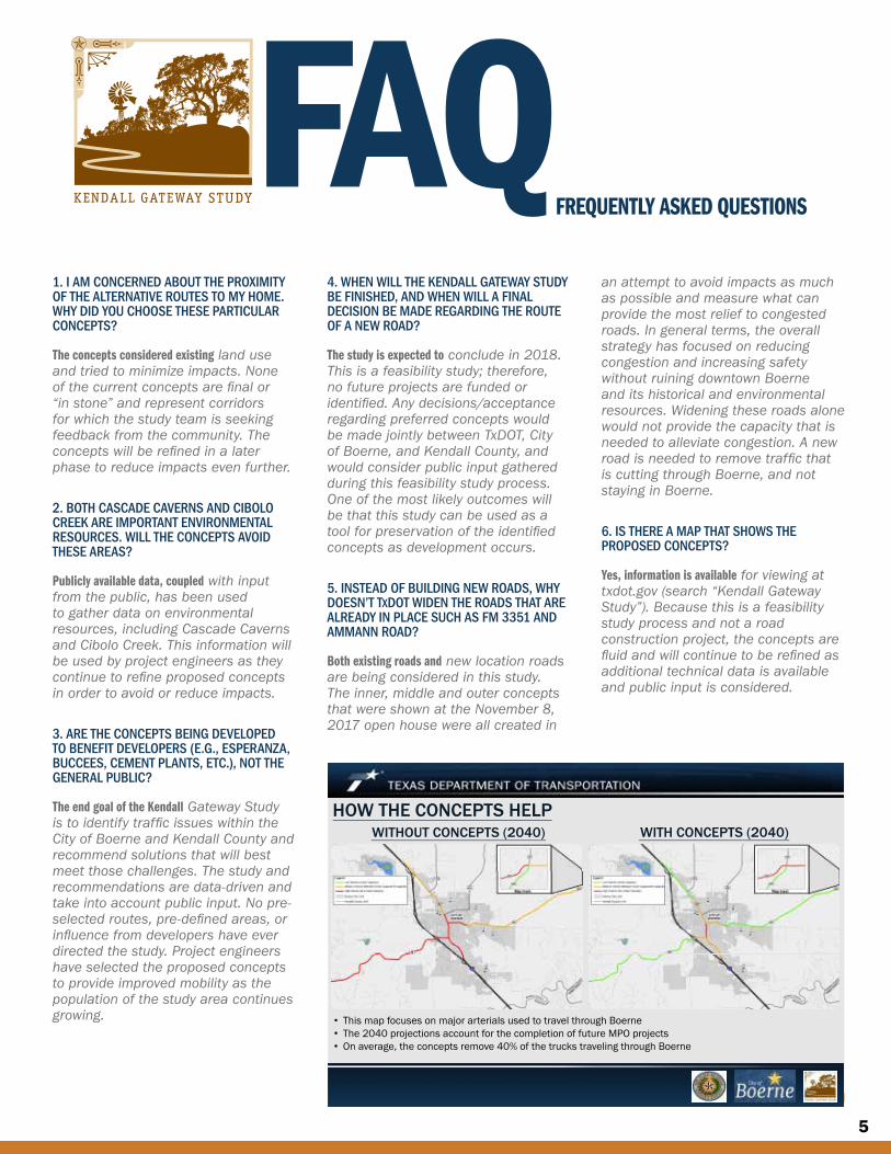
KENDALL GATEWAY STUDY -...
7
OPEN HOUSE OVERVIEW Kendall Gateway Study November 8, 2017, 6:00 to 8:00 p.m. Boerne Middle School South Boerne, Texas As part of the public involvement process for the Kendall Gateway Study, a feasibility study that has been undertaken to identify potential concepts to relieve traffic congestion in Kendall County and Boerne, the Texas Department of Transportation (TxDOT) in partnership with Kendall County and the City of Boerne, held an open house for the proposed project. The purpose of the open house was to present and discuss the traffic study, public input, and reasonable concepts. Maps showing the study area, reasonable concepts, and environmental constraints were available for viewing and comments at the open house. Study team members, including staff from TxDOT, Kendall County, and the City of Boerne, were on hand to discuss the feasibility study and answer questions. More than 160 members of the community and six elected officials were in attendance. Stations at the open house included: Feasibility Study Process; Data Results; Public Input Results; Kendall Gateway Study Area Maps; and Interactive Survey. A total of 53 comments were received during the public comment period that concluded on December 4, 2017 (the public comment period was extended beyond the original deadline of November 27). There were 1,124 participants in the interactive survey that was introduced at the November 8 meeting. Next steps include developing, evaluating, and refining potential solutions; drafting the Study report; recommending concepts; and preparing an implementation plan. IN THIS ISSUE Open House Overview.............. 1 Constraints Map ..................... 2 Response Pours In .................. 3 Event Photos .......................... 4 FAQs ...................................... 5 Study Process ......................... 7 NEWSLETTER No. 3 FEBRUARY 2018 KENDALL GATEWAY STUDY
Transcript of KENDALL GATEWAY STUDY -...
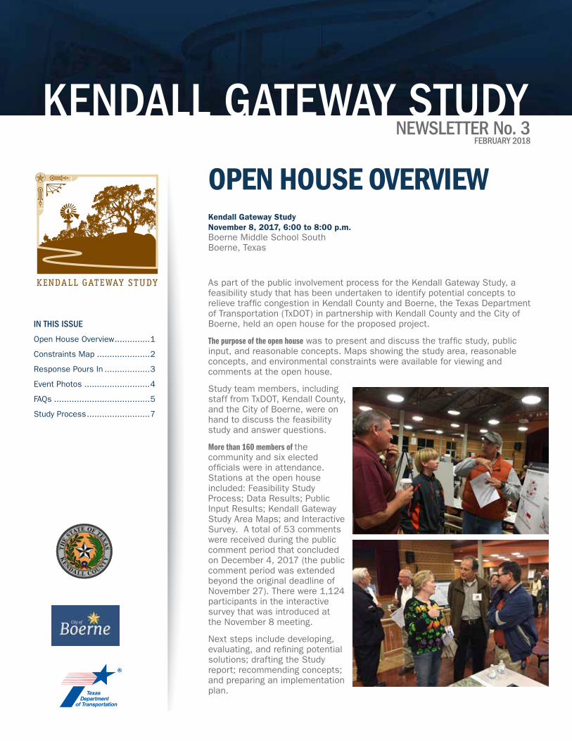
OPEN HOUSE OVERVIEWKendall Gateway Study November 8, 2017, 6:00 to 8:00 p.m.Boerne Middle School South Boerne, Texas
As part of the public involvement process for the Kendall Gateway Study, a feasibility study that has been undertaken to identify potential concepts to relieve traffic congestion in Kendall County and Boerne, the Texas Department of Transportation (TxDOT) in partnership with Kendall County and the City of Boerne, held an open house for the proposed project.
The purpose of the open house was to present and discuss the traffic study, public input, and reasonable concepts. Maps showing the study area, reasonable concepts, and environmental constraints were available for viewing and comments at the open house.
Study team members, including staff from TxDOT, Kendall County, and the City of Boerne, were on hand to discuss the feasibility study and answer questions.
More than 160 members of the community and six elected officials were in attendance. Stations at the open house included: Feasibility Study Process; Data Results; Public Input Results; Kendall Gateway Study Area Maps; and Interactive Survey. A total of 53 comments were received during the public comment period that concluded on December 4, 2017 (the public comment period was extended beyond the original deadline of November 27). There were 1,124 participants in the interactive survey that was introduced at the November 8 meeting.
Next steps include developing, evaluating, and refining potential solutions; drafting the Study report; recommending concepts; and preparing an implementation plan.
IN THIS ISSUE
Open House Overview ..............1
Constraints Map .....................2
Response Pours In ..................3
Event Photos ..........................4
FAQs ......................................5
Study Process .........................7
NEWSLETTER No. 3FEBRUARY 2018
KENDALL GATEWAY STUDY
2
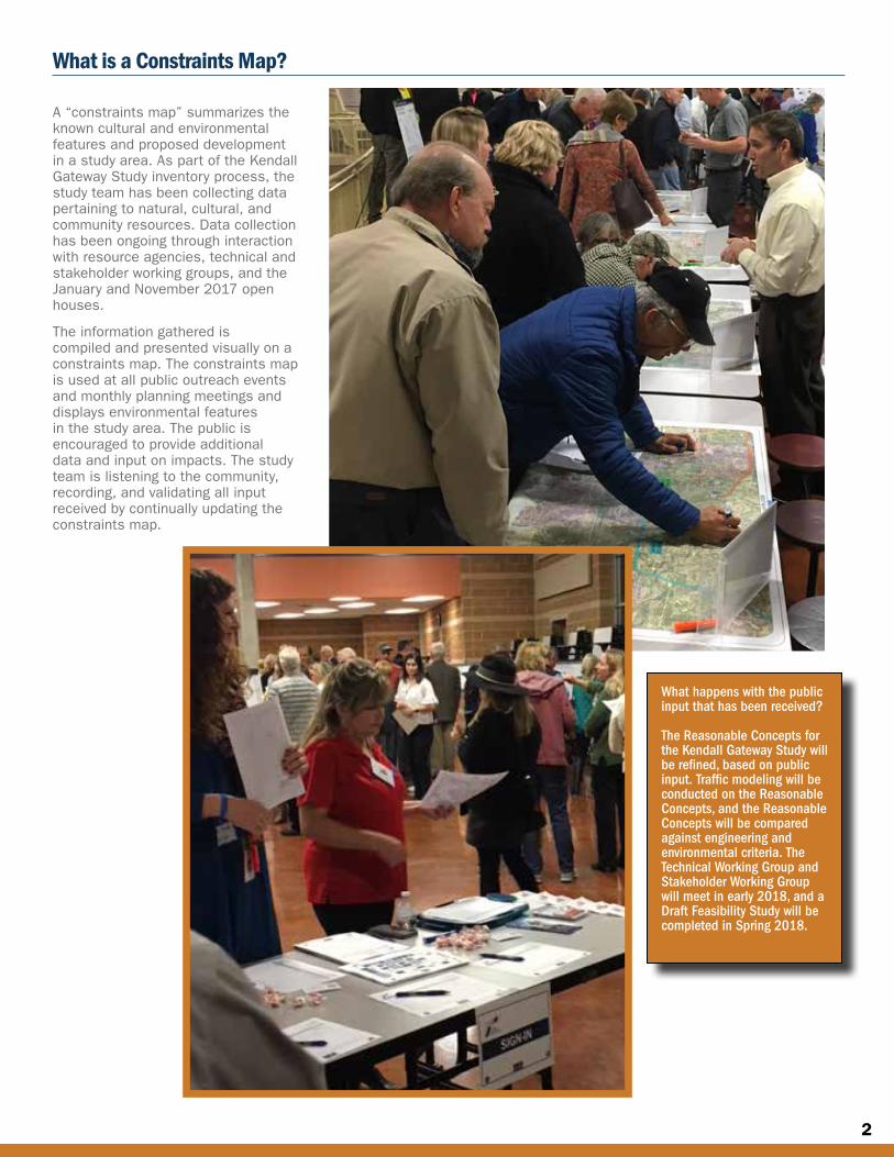
A “constraints map” summarizes the known cultural and environmental features and proposed development in a study area. As part of the Kendall Gateway Study inventory process, the study team has been collecting data pertaining to natural, cultural, and community resources. Data collection has been ongoing through interaction with resource agencies, technical and stakeholder working groups, and the January and November 2017 open houses.
The information gathered is compiled and presented visually on a constraints map. The constraints map is used at all public outreach events and monthly planning meetings and displays environmental features in the study area. The public is encouraged to provide additional data and input on impacts. The study team is listening to the community, recording, and validating all input received by continually updating the constraints map.
What is a Constraints Map?
What happens with the public input that has been received?
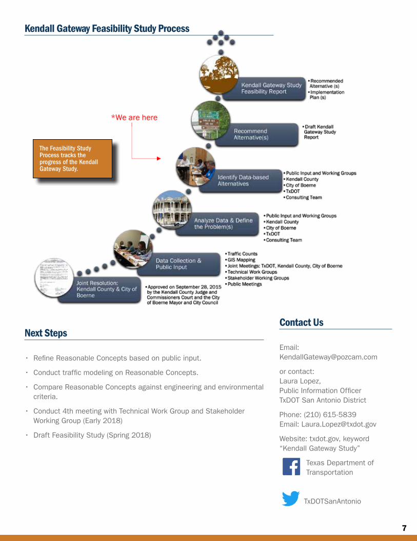
The Reasonable Concepts for the Kendall Gateway Study will be refined, based on public input. Traffic modeling will be conducted on the Reasonable Concepts, and the Reasonable Concepts will be compared against engineering and environmental criteria. The Technical Working Group and Stakeholder Working Group will meet in early 2018, and a Draft Feasibility Study will be completed in Spring 2018.
3
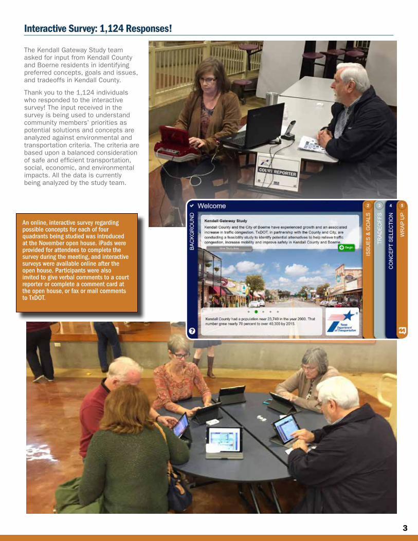
The Kendall Gateway Study team asked for input from Kendall County and Boerne residents in identifying preferred concepts, goals and issues, and tradeoffs in Kendall County.
Thank you to the 1,124 individuals who responded to the interactive survey! The input received in the survey is being used to understand community members’ priorities as potential solutions and concepts are analyzed against environmental and transportation criteria. The criteria are based upon a balanced consideration of safe and efficient transportation, social, economic, and environmental impacts. All the data is currently being analyzed by the study team.
Interactive Survey: 1,124 Responses!
An online, interactive survey regarding possible concepts for each of four quadrants being studied was introduced at the November open house. iPads were provided for attendees to complete the survey during the meeting, and interactive surveys were available online after the open house. Participants were also invited to give verbal comments to a court reporter or complete a comment card at the open house, or fax or mail comments to TxDOT.
4
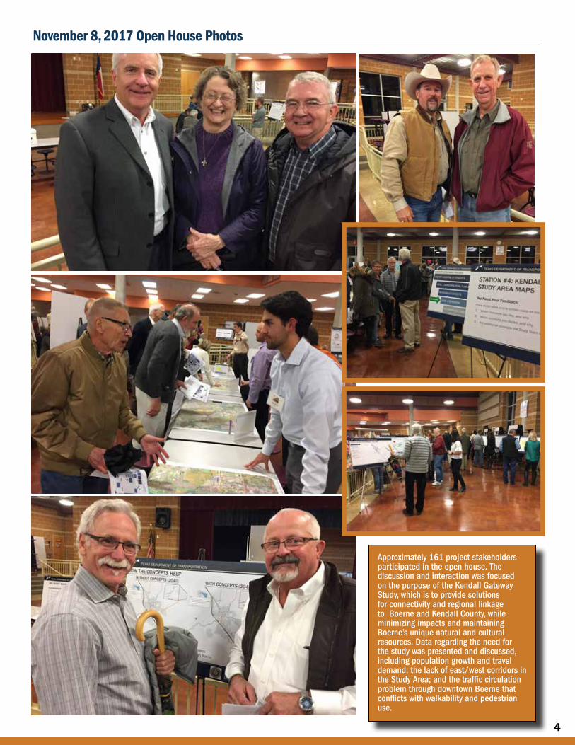
Approximately 161 project stakeholders participated in the open house. The discussion and interaction was focused on the purpose of the Kendall Gateway Study, which is to provide solutions for connectivity and regional linkage to Boerne and Kendall County, while minimizing impacts and maintaining Boerne’s unique natural and cultural resources. Data regarding the need for the study was presented and discussed, including population growth and travel demand; the lack of east/west corridors in the Study Area; and the traffic circulation problem through downtown Boerne that conflicts with walkability and pedestrian use.
November 8, 2017 Open House Photos
5
1. I AM CONCERNED ABOUT THE PROXIMITY OF THE ALTERNATIVE ROUTES TO MY HOME. WHY DID YOU CHOOSE THESE PARTICULAR CONCEPTS?
The concepts considered existing land use and tried to minimize impacts. None of the current concepts are final or “in stone” and represent corridors for which the study team is seeking feedback from the community. The concepts will be refined in a later phase to reduce impacts even further.
2. BOTH CASCADE CAVERNS AND CIBOLO CREEK ARE IMPORTANT ENVIRONMENTAL RESOURCES. WILL THE CONCEPTS AVOID THESE AREAS?
Publicly available data, coupled with input from the public, has been used to gather data on environmental resources, including Cascade Caverns and Cibolo Creek. This information will be used by project engineers as they continue to refine proposed concepts in order to avoid or reduce impacts.
3. ARE THE CONCEPTS BEING DEVELOPED TO BENEFIT DEVELOPERS (E.G., ESPERANZA, BUCCEES, CEMENT PLANTS, ETC.), NOT THE GENERAL PUBLIC?
The end goal of the Kendall Gateway Study is to identify traffic issues within the City of Boerne and Kendall County and recommend solutions that will best meet those challenges. The study and recommendations are data-driven and take into account public input. No pre-selected routes, pre-defined areas, or influence from developers have ever directed the study. Project engineers have selected the proposed concepts to provide improved mobility as the population of the study area continues growing.
4. WHEN WILL THE KENDALL GATEWAY STUDY BE FINISHED, AND WHEN WILL A FINAL DECISION BE MADE REGARDING THE ROUTE OF A NEW ROAD?
The study is expected to conclude in 2018. This is a feasibility study; therefore, no future projects are funded or identified. Any decisions/acceptance regarding preferred concepts would be made jointly between TxDOT, City of Boerne, and Kendall County, and would consider public input gathered during this feasibility study process. One of the most likely outcomes will be that this study can be used as a tool for preservation of the identified concepts as development occurs.
5. INSTEAD OF BUILDING NEW ROADS, WHY DOESN’T TxDOT WIDEN THE ROADS THAT ARE ALREADY IN PLACE SUCH AS FM 3351 AND AMMANN ROAD?
Both existing roads and new location roads are being considered in this study. The inner, middle and outer concepts that were shown at the November 8, 2017 open house were all created in
an attempt to avoid impacts as much as possible and measure what can provide the most relief to congested roads. In general terms, the overall strategy has focused on reducing congestion and increasing safety without ruining downtown Boerne and its historical and environmental resources. Widening these roads alone would not provide the capacity that is needed to alleviate congestion. A new road is needed to remove traffic that is cutting through Boerne, and not staying in Boerne.
6. IS THERE A MAP THAT SHOWS THE PROPOSED CONCEPTS?
Yes, information is available for viewing at txdot.gov (search “Kendall Gateway Study”). Because this is a feasibility study process and not a road construction project, the concepts are fluid and will continue to be refined as additional technical data is available and public input is considered.
FREQUENTLY ASKED QUESTIONS
Footer Text Date
WITHOUT CONCEPTS (2040) WITH CONCEPTS (2040)HOW THE CONCEPTS HELP
• This map focuses on major arterials used to travel through Boerne• The 2040 projections account for the completion of future MPO projects• On average, the concepts remove 40% of the trucks traveling through Boerne
6
7. IS THE STUDY LOOKING AT DRAINAGE ISSUES?
Drainage considerations as related to the Kendall Gateway Study will be featured as a key discussion item for the Kendall Gateway Feasibility Study.
8. WILL EMINENT DOMAIN BE USED TO ACQUIRE PROPERTY?
This is a feasibility study; therefore, no future projects or property acquisitions are funded or identified at this time.
9. HOW ARE ENVIRONMENTAL CONCERNS GOING TO BE HANDLED, SUCH AS THE IMPACT ON CAVES, ENDANGERED SPECIES, STREAM CROSSINGS, AQUIFER RECHARGE ZONES, WATER QUALITY AND SUPPLY, AND LIGHT POLLUTION NEAR THE MILITARY INSTALLATIONS?
A feasibility study defines a problem, gathers data, and recommends solutions that will best meet challenges. The process considers the benefits and costs of each solution, effectiveness of implementation, alternatives considered, environmental impacts, public opinions and input, as well as other factors. Engineers and planners summarize these issues and analyze the reasons for selecting a preferred alternative in their implementation plan. Environmental constraints will be identified and considered throughout all stages of project development.
10. HOW ARE COMMUNITY MEMBERS INFORMED ABOUT THE KENDALL GATEWAY STUDY?
Numerous methods are used for outreach and notification of meetings, including: U.S. mail and email to individuals listed in the project database; notices in the Boerne Star and in La Prensa (Spanish) newspapers; postings on txdot.gov; City of Boerne posts on Nextdoor and the City of Boerne website; Greater Boerne Chamber of Commerce Facebook posts; radio announcements on stations such as KTSA; City of Fair Oaks Ranch website posts; and changeable roadway message signs.
11. WHAT IS THE BEST WAY TO PROVIDE INPUT ON OUR CONCERNS RELATED TO THE KENDALL GATEWAY STUDY?
The best way to make your concerns known is by providing written comments to the study team. Email [email protected] or contact Laura Lopez, Public Information Officer, TxDOT San Antonio District, phone 210-615-5839. Email: [email protected]. Website: txdot.gov (search “Kendall Gateway Study”).
12. WHERE CAN I GET MORE INFORMATION ON THE CITY OF BOERNE THOROUGHFARE PLAN, THE TRAFFIC STUDIES THAT WERE DONE FOR THIS PROJECT, AND THE FAIR OAKS RANCH MASTER PLAN?
• Kendall Gateway Study traffic study information can be found at www.txdot.gov search for “Kendall Gateway Study”. Click on “Open House - Nov. 8, 2017”, click on “Exhibit Boards”, and traffic data starts on page 5 of the Exhibit Boards document.
• An electronic pdf copy of the City of Boerne Thoroughfare Plan is available at: www.ci.boerne.tx.us/DocumentCenter/View/221
• The City of Fair Oaks Ranch is in the process of developing a new Comprehensive Plan. For information, please go to www.futureoffairoaksranch.com/home
13. I’M REALLY CONCERNED ABOUT THE HEAVY TRUCK TRAFFIC THROUGH BOERNE AND THE PRESERVATION OF DOWNTOWN. ARE THESE THINGS BEING ADDRESSED?
Yes. The purpose of the study, as written in the Kendall Gateway Study Purpose and Need Summary, is “to provide solutions for connectivity and regional linkage to the City of Boerne and Kendall County while minimizing impacts and maintaining Boerne’s unique natural and cultural resources.” This includes reducing the number of trucks traveling through Boerne.
14. THE ILLUSTRATION OF AN “EXAMPLE FACILITY TYPE” DISPLAYED AT THE PUBLIC MEETING AND ONLINE SHOWS A 300-FOOT RIGHT-OF-WAY WITH FOUR LANES AND A GRASS MEDIAN. WHY CAN’T THE PROPOSED ROAD BE SMALLER THAN 300 FEET WITH FEWER LANES?
To provide the necessary future capacity, the concepts presented in the study include a 300-foot right-of-way in order to preserve and protect enough land to be able to build a road that will accommodate car and truck traffic, as well as provide bicycle and pedestrian paths. In some cases, the 300 feet could be reduced based on constraints and local needs, but for planning purposes, a 300-foot right-of-way will be considered the “default” right-of-way for each of the concepts.
Footer Text Date
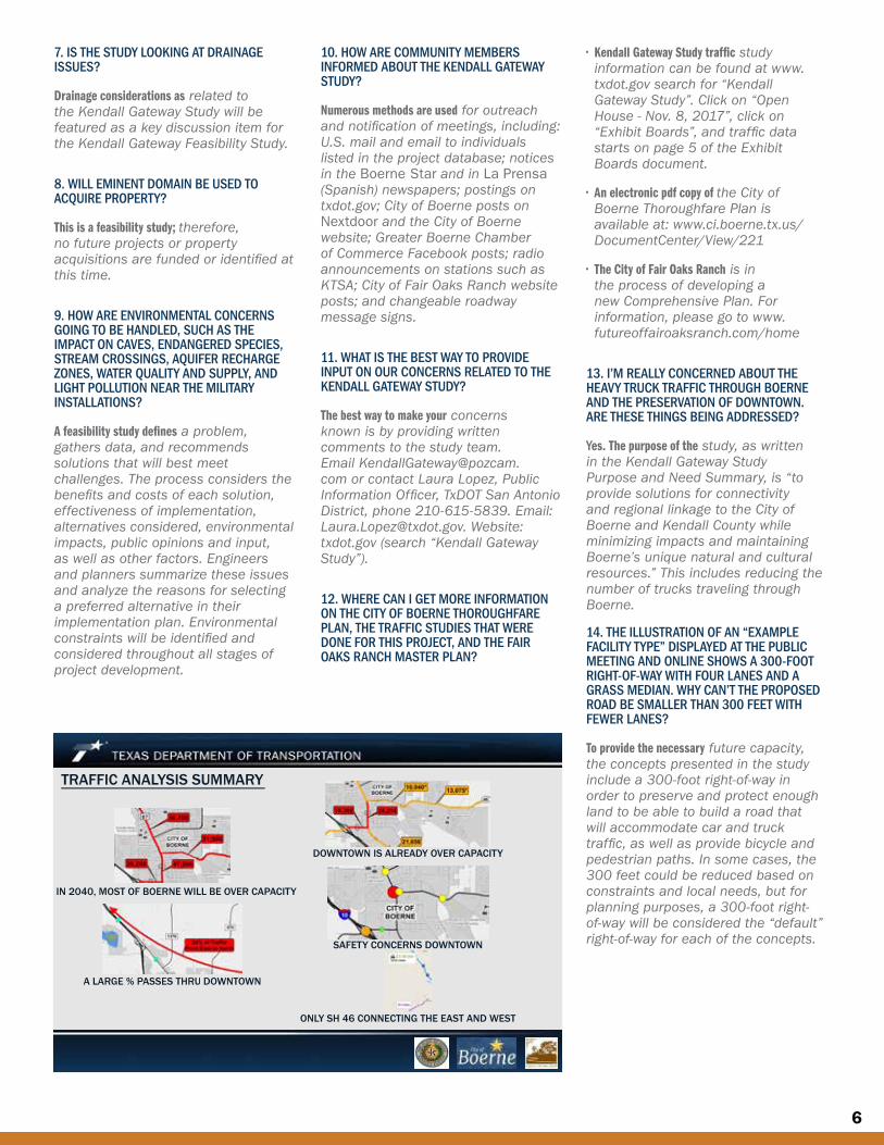
DOWNTOWN IS ALREADY OVER CAPACITY
TRAFFIC ANALYSIS SUMMARY
IN 2040, MOST OF BOERNE WILL BE OVER CAPACITY
SAFETY CONCERNS DOWNTOWN
A LARGE % PASSES THRU DOWNTOWN
ONLY SH 46 CONNECTING THE EAST AND WEST
7
Contact Us
Email: [email protected]
or contact: Laura Lopez, Public Information Officer TxDOT San Antonio District
Phone: (210) 615-5839 Email: [email protected]
Website: txdot.gov, keyword “Kendall Gateway Study”
Texas Department of Transportation
TxDOTSanAntonio
Next Steps
• Refine Reasonable Concepts based on public input.
• Conduct traffic modeling on Reasonable Concepts.
• Compare Reasonable Concepts against engineering and environmental criteria.
• Conduct 4th meeting with Technical Work Group and Stakeholder Working Group (Early 2018)
• Draft Feasibility Study (Spring 2018)
Kendall Gateway Feasibility Study Process
The Feasibility Study Process tracks the progress of the Kendall Gateway Study.