Kachemak Bay Research Reserve · The Kachemak Bay Research Reserve is the only fjord type estuary...
135
Kachemak Bay Ecological Characterization A Site Profile of the Kachemak Bay Research Reserve: A Unit of the National Estuarine Research Reserve System Compiled by Carmen Field and Coowe Walker Kachemak Bay Research Reserve Homer, Alaska Published by the Kachemak Bay Research Reserve Homer, Alaska 2003
Transcript of Kachemak Bay Research Reserve · The Kachemak Bay Research Reserve is the only fjord type estuary...

Kachemak Bay Ecological Characterization
A Site Profile of the Kachemak Bay Research Reserve: A Unit of the National Estuarine Research Reserve System
Compiled by
Carmen Field and Coowe Walker
Kachemak Bay Research Reserve Homer, Alaska
Published by the Kachemak Bay Research Reserve
Homer, Alaska 2003

Kachemak Bay Research Reserve Site Profile
1
Contents Section Page Number About this document………………………………………………………………………………………………………… .4 Acknowledgements…………………………………………………………………………………………………………… 4 Introduction to the Reserve ……………………………………………………………………………………………..5 Physical Environment Climate…………………………………………………………………………………………………… 7 Ocean and Coasts…………………………………………………………………………………..11 Geomorphology and Soils……………………………………………………………………...17 Hydrology and Water Quality………………………………………………………………. 23 Marine Environment Introduction to Marine Environment……………………………………………………. 27 Intertidal Overview………………………………………………………………………………. 30 Tidal Salt Marshes………………………………………………………………………………….32 Mudflats and Beaches………………………………………………………………………… ….37 Sand, Gravel and Cobble Beaches………………………………………………………. .40 Rocky Intertidal……………………………………………………………………………………. 43 Eelgrass Beds………………………………………………………………………………………… 46 Subtidal Overview………………………………………………………………………………… 49 Midwater Communities…………………………………………………………………………. 51 Shell debris communities…………………………………………………………………….. 53 Subtidal soft bottom communities………………………………………………………. 54 Kelp Forests…………………………………………………….…………………………………….59 Terrestrial Environment…………………………………………………………………………………………………. 61 Human Dimension Overview……………………………………………………………………………………………….. 66 Historic Economies……………………………………………………………………………….. 67 Current Socioeconomic Conditions………………………………………………………..72 Kachemak Bay in the Future…………………………………………………………………. 76 KBRR Vision Statement……………………………………………………………………………………………………. 78 KBRR Mission Statement…………………………………………………………………………………………………. 79 KBRR Goals………………………………………………………………………………………………………………………. 79 Selected References
Physical Environment……………………………………………………………………………. 80 Estuarine Environment…………………………………………………………………………. 83 Terrestrial Environment……………………………………………………………………….. 88 Historic Human Activities…………………………………………………………………….. 89 Current Socioeconomic Conditions………………………………………………………. 91
Appendix: Species Lists Marine Flora………………………………………………………………………………………….. 93 Terrestrial Flora…………………………………………………………………………………… 96 Fish………………………………………………………………………………………………………. 114 Mammals……………………………………………………………………………………………… 117 Marine Invertebrates…………………………………………………………………………… 120 Birds……………………………………………………………………………………………………..130

Kachemak Bay Research Reserve Site Profile
2
Index of Figures, Images and Maps Title Page Number Aerial view: southside of Kachemak Bay……………………………………………………………………………………….. 5 Reserve vicinity and boundary map………………………………………………………………………………………………… 6 Grewingk Glacier……………………………………………………………………………………………………………………………..7 Seasonal patterns in air and water temperature…………………………………………………………………………… 9 Satellite image of atmospheric dust……………………………………………………………………………………………….10 Bathymetry and generalized circulation patterns………………………………………………………………………….12 Coastal processes around Kachemak Bay………………………………………………………………………………………. 14 Seawall at Homer bluffs………………………………………………………………………………………………………………….14 Remote sensing chlorophyll productivity………………………………………………………………………………………. 16 Volcanoes closest to the Bay…………………………………………………………………………………………………………. 18 Homer Spit before and after the 1964 earthquake………………………………………………………………………. 19 Harding Ice Field……………………………………………………………………………………………………………………………. 20 Coal deposits…………………………………………………………………………………………………………………………………. 21 Soil Profiles……………………………………………………………………………………………………………………………………. 23 Remote sensing image of glacial and Clearwater streams…………………………………………………………… 24 Cook Inlet circulation patterns……………………………………………………………………………………………………… 28 Gull Island seabird colony……………………………………………………………………………………………………………… 30 2001 biodiversity monitoring results…………………………………………………………………………………………….. 31 Beluga Slough sunset…………………………………………………………………………………………………………………….. 32 Fox River Flats……………………………………………………………………………………………………………………………….. 36 Unconsolidated soft substrate intertidal habitat…………………………………………………………………………..37 Burrowing anemones……………………………………………………………………………………………………………………… 40 Aerial view of Homer Spit……………………………………………………………………………………………………………… 42 Rocky shoreline……………………………………………………………………………………………………………………………… 43 Sitka periwinkle…………………………………………………………………………………………………………………………….. 45 Thatched barnacle…………………………………………………………………………………………………………………………. 45 Eelgrass meadows………………………………………………………………………………………………………………………….. 47 Sunflower star, eelgrass and herring eggs……………………………………………………………………………………. 48 Generalized bathymetry……………………………………………………………………………………………………………….. 50 Larval collectors…………………………………………………………………………………………………………………………….. 52 Fate of shell material following red tide……………………………………………………………………………………….54 A food web for the head of Sadie Cove…………………………………………………………………………………………. 56 Dynamic sandwave habitat……………………………………………………………………………………………………………. 57 Bull kelp distribution 2000 and 2001…………………………………………………………………………………………….. 60 Southside landscape……………………………………………………………………………………………………………………… 61 Northside landscape……………………………………………………………………………………………………………………… 62 Northside peat wetland fen………………………………………………………………………………………………………….. 63 Southside alpine lakes…………………………………………………………………………………………………………………… 63 Beluga Slough……………………………………………………………………………………………………………………………….. 67 Harvesting cabbages…………………………………………………………………………………………………………………….. 70 Seine fishermen……………………………………………………………………………………………………………………………….70 Homer boat harbor aerial view……………………………………………………………………………………………………….70 Alaska native villager………………………………………………………………………………………………………………………70
Kachemak Bay Research Reserve Site Profile
3
Index of Figures, Images and Maps (continued) Title Page Number Horse and wagon on beach…………………………………………………………………………………………………………. 70 Historic resource extraction industries………………………………………………………………………………………. 71 Villages, towns and cities in Kachemak Bay area………………………………………………………………………. 73 Homes in Halibut Cove……………………………………………………………………………………………………………….. 77 Ecotourists…………………………………………………………………………………………………………………………………… 77 Homer small boat harbor……………………………………………………………………………………………………………… 77 Charter boat halibut fishing……………………………………………………………………………………………………….. 77 Subsistence hunting and fishing………………………………………………………………………………………………….. 78 Conducting intertidal research…………………………………………………………………………………………………… 79 Students exploring Beluga Slough………………………………………………………………………...……………………. 79

Kachemak Bay Research Reserve Site Profile
4
About this document The Kachemak Bay Research Reserve is part of the National Estuarine Research Reserve (NERR) system, that includes 26 estuaries in the United States. The program is administered through the National Atmospheric and Oceanic Administration (NOAA). As part of the NERR program, each reserve is required to prepare a site profile that summarizes the existing state of knowledge for research, monitoring and education activities, and identifies some of the research needs that should be addressed in the future. Our intent in preparing this document was to meet that requirement. In order to develop this document, we referred to the Kachemak Bay Ecological Characterization, a digital source of information important to the ecological understanding and management of the Kachemak Bay area. The Characterization was developed through a cooperative partnership between the Alaska Department of Fish and Game (ADFG) and the National Oceanic and Atmospheric Administration (NOAA) Coastal Services Center in response to requests from community members, researchers and managers for a synthesis of existing information on the Kachemak Bay area. Additional funding for the project was received from the Exxon Valdez Oil Spill Trustees Council and the National Spatial Data Infrastructure Program. This effort, initiated in 1997 during the designation process for the Reserve resulted in a CDROM of digital spatial data, images, narratives and references presenting the current state of knowledge about the Bay, published in 2001. Topics covered in the Characterization include the physical environment, ecosystem descriptions, and human uses. Annotated species lists and references are also included, as well as a geographic information system (GIS) component that organizes and displays spatial data. Organizations and individuals, including resource managers, educators, agencies, tribal and local governments, conservation groups, and land managers use this information to understand and conserve the unique character of Kachemak Bay and its surrounding watershed. Information included on the CD-ROM is now available on the Reserve’s website: www.kbayrr.org, where it will be updated and maintained as a digital document so that it continues to be a useful compilation of state of knowledge about the Bay. The site profile for the Reserve that is presented on the following pages draws largely from information contained in the Characterization, with updates provided for recent developments in research, education and facilities. In preparing this site profile in 2003, we realized that great strides in our understanding of the Bay have been made by Reserve staff and visiting researchers in a very short time. We look forward to reporting future advances in future updated site profiles. Acknowledgments Many people devoted their time and energy to develop the Kachemak Bay Ecological Characterization CDROM, and we would not have been able to develop this site profile without their efforts. Most notably, we acknowledge our colleagues that worked with us to develop the Characterization: Harry Bader, Ben Bloodworth, Bridgett Callahan, Laurie Daniels, Hans Geier, Janet Klein, Lisa Thomas, Glenn Seaman, Curtis Smith, and the team at NOAA’s Coastal Services Center led by Pace Wilber. Our current staff colleagues at the Kachemak Bay Research Reserve have added substantially to the information presented in the original Characterization. For their efforts, we thank Amy Alderfer, Steve Baird, Kim Cooney-Donohue, Rick Foster, Glenn Seaman, Carl Schoch, and Terry Thompson. This document does not give us enough opportunity to acknowledge all the people who contributed to the development of the Characterization. We hope that readers will refer to the Characterization CDROM or our website, where we gratefully acknowledge the contributions of so many. Coowe Walker and Carmen Field
Kachemak Bay Research Reserve Site Profile
5
The mission of the Kachemak Bay Research Reserve is to Enhance understanding and appreciation
of the Kachemak Bay estuary and adjacent waters to ensure that these ecosystems remain healthy and productive.
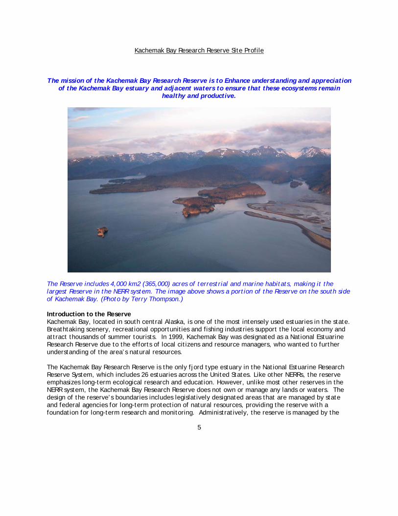
The Reserve includes 4,000 km2 (365,000) acres of terrestrial and marine habitats, making it the largest Reserve in the NERR system. The image above shows a portion of the Reserve on the south side of Kachemak Bay. (Photo by Terry Thompson.) Introduction to the Reserve Kachemak Bay, located in south central Alaska, is one of the most intensely used estuaries in the state. Breathtaking scenery, recreational opportunities and fishing industries support the local economy and attract thousands of summer tourists. In 1999, Kachemak Bay was designated as a National Estuarine Research Reserve due to the efforts of local citizens and resource managers, who wanted to further understanding of the area’s natural resources. The Kachemak Bay Research Reserve is the only fjord type estuary in the National Estuarine Research Reserve System, which includes 26 estuaries across the United States. Like other NERRs, the reserve emphasizes long-term ecological research and education. However, unlike most other reserves in the NERR system, the Kachemak Bay Research Reserve does not own or manage any lands or waters. The design of the reserve’s boundaries includes legislatively designated areas that are managed by state and federal agencies for long-term protection of natural resources, providing the reserve with a foundation for long-term research and monitoring. Administratively, the reserve is managed by the

Kachemak Bay Research Reserve Site Profile
6
National Oceanic and Atmospheric Administration (NOAA) and the Alaska Department of Fish and Game (ADFG), with input from a Council of agency and Kachemak Bay community stakeholders. The Bay’s bathymetry is characterized by a submerged glacial moraine at the mouth of the Bay, and trenches and holes reaching 175 m deep. On the south side, the Bay is guarded by jagged snow-covered peaks. Because the tree line is at only 500 m, the barren 2,000 m alpine summits resemble those of much loftier mountain ranges. The Harding Icefield, one of the last remaining alpine ice sheets left in North America, hosts seven glaciers that flow into Kachemak Bay. In contrast, the northern side is part of an extensive, lowland, physiographic province, with a gentle topographic gradient and no active glaciation. The Fox River Flats, at the head of the Bay, is a huge salt marsh that supports thousands of migratory birds every year. The inner Bay is separated from Lower Cook Inlet by a 4 km long spit extending south from the City of Homer (pop. 5,000).
The Reserve has designated boundaries that include approximately 365,000 acres of lands and waters that are within state legislatively-designated protected areas, including the Kachemak Bay and Fox River Flats Critical Habitat Areas, managed by the Alaska Department of Fish and Game, the Kachemak Bay State Park and Wilderness Area, managed by the Alaska Department of Natural Resources, and a few smaller parcels near Homer Spit and Beluga Slough owned and managed by the U.S. Fish and Wildlife Service and City of Homer.

Kachemak Bay Research Reserve Site Profile
7
Climate Both continental and maritime climate systems influence the regional climate around Kachemak Bay. The Alaska Range to the west of Cook Inlet protects Kachemak Bay from the severe, continental, arctic cold fronts that come from the interior of Alaska (National Resource Conservation Service 1999). However, cold continental air masses do come from the Matanuska Susitsna Valley, south through Cook Inlet, and bring occasional bitter cold weather to the Bay during winter months. The regional northern Gulf of Alaska weather is determined by the relative position of the Siberian high-pressure system in the winter, and the position of the east Pacific high in the summer. Cyclonic storms generally enter the region from the west. The western Gulf experiences frequent storms that can be violent, while the eastern Gulf is characterized by steady conditions associated with dissipating lows. Weather changes are mainly due to the presence or absence of a high-pressure ridge over the Gulf or North Pacific that blocks the normal progression of storms. The effect of weather patterns is the generation of wind induced currents. Low-pressure systems that enter the Gulf are associated with cyclonic (counter clockwise) winds that cause a divergence of air and water from the center of the system. Because the northern Gulf is rimmed by land, the diverging waters are trapped by the coast, causing sea level heights to increase. The mean alongshore wind component along the northern Gulf is therefore easterly and the coastal convergence results in prevailing downwelling conditions.
Katabatic winds are caused by cold air masses moving down slope as a result of gravity. The velocity of katabatic winds can be intensified by large and small-scale pressure gradients. They are also intensified by the local topography of straits and fjords. The Harding Ice Field caps the mountains to the south of Kachemak Bay and provides a constant source of cold air. Coupled with local and regional pressure gradients, violent katabatic winds in excess of 50 m/s are often generated in Kachemak Bay during the winter. During the summer, very localized katabatic bursts are common In the smaller embayments on the south coast of Kachemak Bay. (Left: Grewingk Glacier on the south side of the Bay. Photo by Janet Klein.)
The climate in the Kachemak Bay watershed is maritime, characterized by a relatively moderate seasonal range of temperatures, high humidity, and ample rain and snow. The Bay and the Pacific Ocean minimize large extremes in the air temperature, resulting in relatively mild winters and cool summers. Over the year, the mean Homer temperatures only differ by about 30 degrees Fahrenheit, from the low 60s in summer to the low 30s in winter (National Oceanic and Atmospheric

Kachemak Bay Research Reserve Site Profile
8
Administration, Climate Diagnostic Center 1998). Daily weather, however, can range from sunny and clear to hailing and rainy within the same afternoon. Most of the rain falls during late summer and fall. The majority of snow falls from November to March, and it frequently rains on warm winter days. Despite its maritime climate, the Watershed does not receive as much precipitation as nearby Seward because the Kenai Mountains create a rain shadow over the watershed. The high peaks of the Kenai Mountains and the outer coast's steep fjords trap moisture-laden clouds from the Gulf of Alaska, preventing much rain and snow from reaching Kachemak Bay.
The local wind field of Kachemak Bay is affected by 1) seasonal storm activity in the Gulf of Alaska; 2) daily pressure differentials that develop between the surrounding land mass and the ocean; and 3) flow of cold dense air from the Harding Ice Field. Large scale pressure gradients develop during the summer between the Gulf of Alaska and the continental land mass. During the day, the land mass heats up causing air over the continent to rise forming a regional low pressure cell. This rising continental air is replaced by cooler maritime air. This results in the day breeze, or sea breeze, known to most mariners. At night, the land mass cools and air over the continent stops rising. The continental air can become relatively cool compared to maritime air and a land breeze can develop. The long daylight hours during the Alaskan summer, however, can minimize this effect so that the sea breeze is maintained all night, but at a lower velocity. Climate Research There are several sources of meteorological information in the Kachemak Bay region. Kachemak Bay Research Reserve has a Campbell Scientific CR10X Weather Station installed on the Homer Spit providing meteorological data for the Bay. This station samples every fifteen minutes to produce both hourly and daily averages of air temperature, relative humidity, solar radiation, barometric pressure, precipitation, wind speed and wind direction, and photosynthetic active radiation. These data augment the weather information collected through the collaborative efforts of the National Weather Service (NWS), the Federal Aviation Administration (FAA), and the Department of Defense (DOD) for the Automated Surface Observing Systems (ASOS) program. There are two ASOS stations on Kachemak Bay. One on the north side at the Homer Airport, and one on the southside at the Seldovia Airport. The ASOS system serves as the nation's primary surface weather observing network, and is designed to support weather forecast activities and aviation operations and, at the same time, support the needs of the meteorological, hydrological, and climatological research communities. With the largest and most modern complement of weather sensors, ASOS has significantly expanded the information available to forecasters and the aviation community. Getting more information on the atmosphere, more frequently and from more locations is the key to improving forecasts and warnings. ASOS detects significant changes, disseminating hourly and special observations via the networks. ASOS reports the following basic weather elements: sky condition: cloud height and amount; visibility; type and intensity for rain, snow, and freezing rain; obstructions to vision: fog, haze; pressure: sea-level pressure, altimeter setting; ambient temperature, dew point temperature; wind: direction, speed; precipitation accumulation; and selected significant remarks including- variable cloud height, variable visibility, precipitation beginning/ending times, rapid pressure changes, pressure change tendency, wind shift, peak wind. In 2001, the National Weather Service anchored a floating weather station in Kennedy Entrance off Cape Elizabeth. The buoy was deployed by the National Data Buoy Center (NDBC) to measure pressure, temperature, wind speed and direction, and wave characteristics. Data is relayed from the buoy to a

Kachemak Bay Research Reserve Site Profile
9
data processing center in Mississippi via satellite, and then put on the Web in near real time as an aid to local mariners. KBRR researchers learn about Kachemak Bay’s oceanography by observing patterns in water temperature and wind direction collected by the NDBC buoy. For example, buoy data showed that when winds blow from the south, water temperature decreases; when winds blow from the north, water temperature increases. This may be caused by south winds accelerating the counterclockwise water surface circulation in Kennedy Entrance, resulting in cold bottom water upwelling to the surface. North winds may decelerate the circulation, slowing upwelling and driving the warm turbid water from western Cook Inlet towards the south and east. By comparing the temperature signals from the NDBC buoys to Reserve ocean sensors in Seldovia and Homer, we have learned that it takes about 2 days for a water mass to travel from Kennedy Entrance to Seldovia, and another 3 days to travel from Seldovia to Halibut Cove. Unfortunately this data buoy was destroyed by winter storms in February 2002. However, it was replaced by a Coastal-Marine Automated Network(C-MAN) station on the Barren Islands and on Flat Island in 2003. KBRR staff are researching the effects of weather on mixing and stratification patterns in the Bay, using data from the National Weather Service’s Automated Surface Observing System weather stations in Homer and Seldovia, and a third weather station that the Reserve installed on Land’s End Hotel at the end of the Homer Spit in May 2003. The C-MAN network was established by the National Data Buoy Center for the National Weather Service in the early 1980's. These weather stations typically measure barometric pressure, wind direction, speed and gust, and air temperature; however, some C-MAN stations are designed to also measure sea water temperature, water level, waves, relative humidity, precipitation, and visibility. These data are processed and transmitted hourly to users in a manner almost identical to moored buoy data. Data for the C-MAN stations at Augustine Island, the Drift River Terminal, Barren Islands and Flat Island are available on the Web at: http://www.ndbc.noaa.gov/
Seasonal patterns are indicated by a decrease in air and water temperatures. The feather plot at the top of the figure is a derivative of wind direction and wind velocity. Wind velocity tends to increase from fall to winter. Each vector indicates the direction the wind is coming from.

Kachemak Bay Research Reserve Site Profile
10
Dust, pollutants and other aerosols originating in Asia can accumulate locally in measurable quantities as shown in th SeaWiffs satellite image of the Sea of Japan at right. Local phytoplankton (shown at right) blooms can release aerosols in the form of dimethyl sulfide. The Natural Resources Conservation Service (NRCS) installs, operates, and maintains an extensive, automated system to collect snowpack and related climatic data in the Western United States called SNOTEL (for SNOwpack TELemetry). The system was designed to measure snowpack in the mountains of the West and forecast the water supply. Climate studies, air and water quality investigations, and resource management concerns are all served by the modern SNOTEL network. The high-elevation watershed locations and the broad coverage of the network provide important data collection opportunities to researchers, water managers, and emergency managers for natural disasters such as floods. There are four SNOTEL sites in the Kachemak Bay Region: Anchor River Divide, McNeil Canyon, North Bradley River, and Port Graham. For more information on the SNOTEL network and to access data from these sites see: http://www.wcc.nrcs.usda.gov/snotel. At global scales, extreme events such as volcanic eruptions, forest fires, and dust storms tend to produce large quantities of dust, smoke, or haze, which can be broadly dispersed by prevailing atmospheric conditions. For example, wind-borne dust and pollution from China and neighboring countries are known to be spreading to North America as a result of surging economic activity and farming practices in Asia. The aerosol sampling network of the IMPROVE (Interagency Monitoring of Protected Visual Environments) program routinely provides information on aerosol mass and chemical composition. IMPROVE is a cooperative of Federal and regional-state organizations established in 1985. A site at Silver Salmon Lakes on the west side of Cook Inlet (near Tuxedni Bay) is operated by the Fish and Wildlife Service. For more information on the IMPROVE program see:http://vista.cira.colostate.edu/improve/.

Kachemak Bay Research Reserve Site Profile
11
At regional and local scales, large amounts of dimethyl sulfide, or DMS, are produced by phytopankton and there can be a considerable net flux of this gas from the sea to air during intense blooms. In the atmosphere, DMS is rapidly oxidized to form aerosols of sulphuric acid, which together with dust and sea salt provide the nuclei for the condensation of atmospheric water vapor into clouds and rain. Increased concentrations of atmospheric carbon dioxide (CO2) leads to similar increases of dissolved CO2 in oceanic surface waters. This in turn leads to more phytoplankton blooms and higher production of DMS. This repeating cycle will cause incrementally more cloud formation in an atmosphere already being warmed by the greenhouse effect. KBRR scientists are working with the University of Alaska Fairbanks to maintain long-term aerosol measurements at a coastal site near Homer. For more information about this program see: http://www.gi.alaska.edu/. The University of Alaska Fairbanks operates a field observatory on Bluff Point overlooking Kachemak Bay, lower Cook Inlet, and the volcanic arc formed by Cape Douglas, Augustine Island, Mt. Iliamna, Mt. Redoubt, and Mt. Spurr. For more information about this facility see: http://www.gi.alaska.edu/. Oceans and Coasts Regional circulation in lower Cook Inlet, where Kachemak Bay is located, is strongly influenced by the east to west flow of the Alaska Coastal Current (ACC) in the Gulf of Alaska. Strong tidal currents drive the circulation in the greater Cook Inlet area. The ACC becomes entrained into the strong inflow going into Cook Inlet in the vicinity of Kennedy Entrance. Nutrient rich bottom water is upwelled as it is forced up and over the shelf break and mixed with surface water. These enriched waters are trapped along the coast and stream into Kachemak Bay following the bathymetric contours of the relict fjordal trough. The Bay's average depth is 25 fathoms (150 feet). The floor of the Bay begins as a shallow, gentle slope along the northern shore and gets steeper and deeper on the southern side. At 96 fathoms (576 feet), the Bay's deepest section is found in a trench in the outer Bay known locally as the Jakolof Trench. Kachemak Bay is split into inner and outer Bays by the Homer Spit, which extends four miles into the Bay from the northern shoreline, delimiting the inner and outer portions. In general, water flows into Kachemak Bay on the southern side and out of the Bay on the northern side. The inflowing water is more marine while the outflowing water is more estuarine, being more turbid and less saline, due to the outflow of several rivers that terminate in the Bay. Water flows between the inner and outer Bays through a narrow opening formed between the Spit and the southern shoreline. Kachemak Bay also has large gradients at small horizontal and vertical scales due to the local effects of precipitation, seasonal surface runoff, groundwater flow, and evaporation. In general, high fresh water runoff and moderate southerly winds are typical of spring and summer months, whereas low runoff, strong northerly winds and storms are more common during fall and winter. As a result, the inner Bay water column is seasonally stratified, with warmer, less saline waters near the surface during the warmer months of the year when the freshwater systems flowing into the Bay are not frozen.
Kachemak Bay Research Reserve Site Profile
12
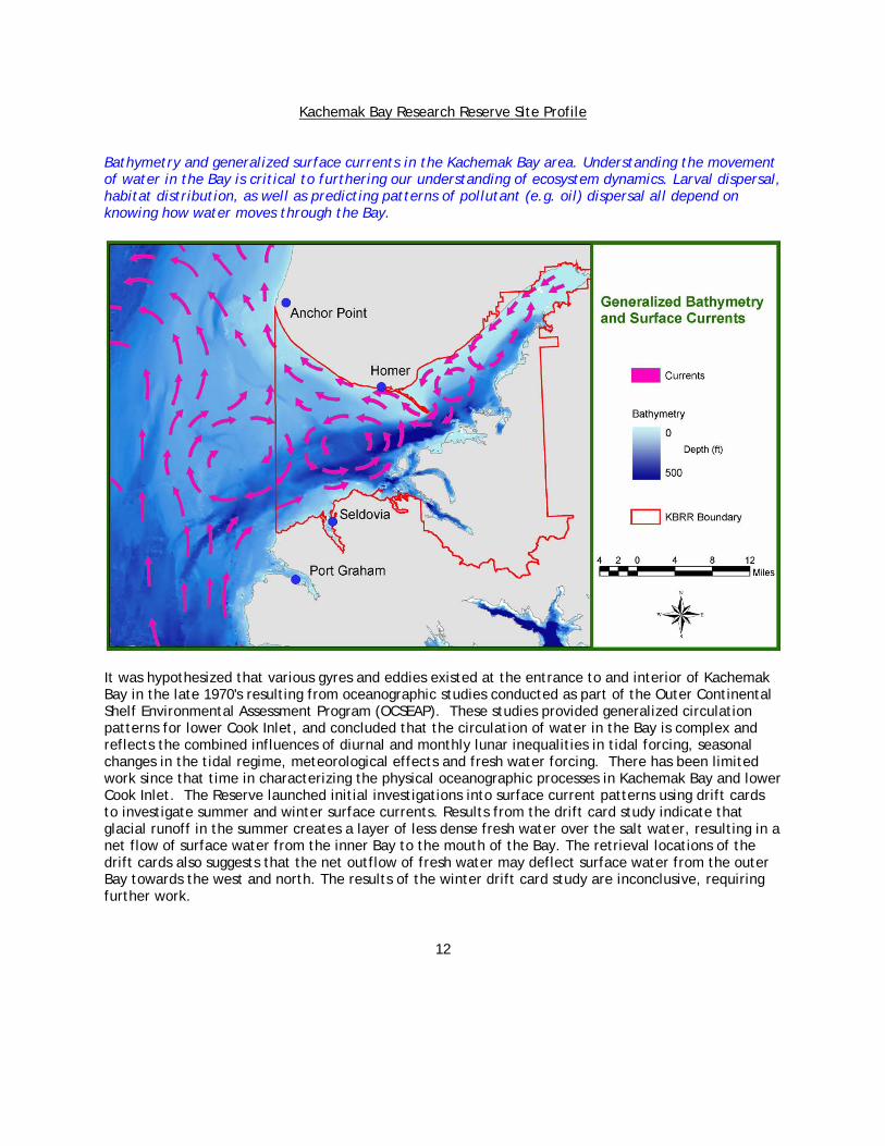
Bathymetry and generalized surface currents in the Kachemak Bay area. Understanding the movement of water in the Bay is critical to furthering our understanding of ecosystem dynamics. Larval dispersal, habitat distribution, as well as predicting patterns of pollutant (e.g. oil) dispersal all depend on knowing how water moves through the Bay.
It was hypothesized that various gyres and eddies existed at the entrance to and interior of Kachemak Bay in the late 1970's resulting from oceanographic studies conducted as part of the Outer Continental Shelf Environmental Assessment Program (OCSEAP). These studies provided generalized circulation patterns for lower Cook Inlet, and concluded that the circulation of water in the Bay is complex and reflects the combined influences of diurnal and monthly lunar inequalities in tidal forcing, seasonal changes in the tidal regime, meteorological effects and fresh water forcing. There has been limited work since that time in characterizing the physical oceanographic processes in Kachemak Bay and lower Cook Inlet. The Reserve launched initial investigations into surface current patterns using drift cards to investigate summer and winter surface currents. Results from the drift card study indicate that glacial runoff in the summer creates a layer of less dense fresh water over the salt water, resulting in a net flow of surface water from the inner Bay to the mouth of the Bay. The retrieval locations of the drift cards also suggests that the net outflow of fresh water may deflect surface water from the outer Bay towards the west and north. The results of the winter drift card study are inconclusive, requiring further work.

Kachemak Bay Research Reserve Site Profile
13
More recently, the Reserve has become a partner in the deployment of Coastal Ocean Dynamics Applications Radar (CODAR) units in Kachemak Bay and lower Cook Inlet in cooperation with the University of Alaska, Fairbanks and the National Oceanic and Atmospheric Administration. CODAR is used to measure the surface currents of the coastal ocean. A transmitter sends out a radio frequency that bounces off of the ocean surface and back to a receiver antenna. Using this information and the principles of the Doppler shift, CODAR is able to calculate the speed and direction of the surface current. These calculations are made at about every half mile across the surface and extend as far as about twenty miles offshore. Interestingly, Kachemak Bay was a test site for one of the first field trials of this technology in the late 1970's. The current CODAR research will provide maps of surface currents in the offshore waters of outer Kachemak Bay. Observation of evolving surface current fields will provide new insights into the dynamics of the top of the water column that are important to the dispersal of economically significant marine species. The long-range CODAR maps for Kachemak Bay can be viewed at: http://www.salmonproject.org/CODAR. Other oceanographic information collected at the Reserve includes a NOAA primary tide gauge mounted on the Seldovia dock that is useful for determining the difference between predicted and actual tide heights, and a seismograph that is operated as part of a cooperative network for the National Earthquake Information Center (NEIC). For more information on the tide gauge see: http://tidesonline.nos.noaa.gov/plotcomp.shtml?station_info=9455500+Seldovia,+AK. To find out more about the NEIC see: http://neic.usgs.gov/. Shoreline Processes The littoral (coastal) processes of erosion and deposition continually shape Kachemak Bay's shoreline. In neutral zones, shoreline changes happen so slowly that they are invisible to the human eye. The neutral zones of Kachemak Bay are located along the southern shore. Most are drowned glacial river valleys with steep, mountainous walls. In contrast, changes in erosional and depositional zones can be viewed on a nearly daily basis. The height of the tides, the force of the waves, and the shoreline substrates determine the extent to which littoral processes affect the shoreline. Erosional zones are typically scarps in flat-lying sedimentary rocks. These scarps are fronted by a series of berms composed of mixed sand and gravel at the high tide line. At the mid and lower intertidal there is a broad undulating, wave-cut, rock platform that is covered, in some places, by a thin layer of sand, gravel, or mud. A walk along these erosional zones will bring you into a highly dynamic area. Large boulders, several meters across, left behind by retreating glaciers, appear and disappear with the changing tides. The foundation of the sandstone and coal bluffs is eaten away by the high-energy waves that crash against the bluff bases. This weakening combined with large amounts of groundwater moving through results in severe bluff erosion. As erosive forces move sand grains from their positions in the sandstone, larger sediments are released to fall to the sea. In February 2003, a remote video monitoring station called the Argus Beach Monitoring System, (ABMS) was installed west of the Homer Spit in the city of Homer. This project is part of a collaborative research effort between the City of Homer, the Kachemak Bay Research Reserve, and the U.S. Geological Survey. The goal of this study is to understand the large-scale sediment dynamics of the Kenai Peninsula coastline for the purpose of improving coastal management decisions. This study will provide an understanding of the interactions among wave energy, seacliff response, and sediment transport in Kachemak Bay. Shoreline and morphology changes will be monitored frequently enough to

Kachemak Bay Research Reserve Site Profile
14
observe episodic changes before and after extreme tides and high waves, and long enough to determine statistical trends in sediment movement. This study will improve our understanding of the effects of sand movement on local ecological processes. The sand volume appears to have recently decreased in the nearshore, but the deeper water benthos still has considerable sediment. In fact a kelp bed was destroyed recently following a massive movement of sand during a winter storm. The kelp bed habitat was found to be buried by over 0.5 m of sand during the summer of 2001. Depositional zones are found in both the inner and outer Bay and on the northern, eastern, and southern shorelines. There are two primary types of depositional formations in the Bay. The formation that develops is determined by local hydrodynamics and bathymetry. Deltas form when short streams carry their sediment loads from the mountains down to the ocean. Once the stream reaches the sea, the sediment is rapidly released. As the tide levels fluctuate and fresh water run-off increases and decreases, the gravel beds are moved and rearranged. Over time, this dumping results in variously shaped dynamic deltas. Spits are formed when sediments are transported along shore and deposited in deeper water.
Most of the coastal erosion within the KBNERR occurs on the north side of Kachemak Bay, while neutral and depositional coastal areas occur along the Bay's southern side (left). Bluffs along the town of Homer are rapidly eroding, causing fears of property loss. In the late summer of 2002, a seawall was erected to protect the Homer bluffs. That wall was severely damaged by fall storms, greatly reducing it’s effectiveness (Right. Photo by Glenn Seaman). Water Chemistry The KBRR is one of 26 National Estuarine Research Reserves (NERR) participating in the System-Wide Monitoring Program (SWMP). The goal of SWMP is to identify and track short-term variability and long-term changes in the integrity and biodiversity of representative estuarine ecosystems and coastal watersheds. To accomplish this, each reserve has a minimum of four water quality monitoring sites. In Kachemak Bay, two Yellow Springs Instruments (YSI) Model 6600 dataloggers have been deployed since

Kachemak Bay Research Reserve Site Profile
15
July of 2001 on the ferry docks in both Homer (at the end of the Spit) and Seldovia (on the south side of the Bay). The Seldovia instrument monitors the water entering Kachemak Bay from the southwest. The Homer instrument is deployed in the path of a baroclinic flow leaving the inner Bay. This inner Bay water is largely composed of less saline, turbid glacial melt and runoff from the surrounding uplands. Both sites have dataloggers mounted 1 meter above the bottom. These instruments measure the following parameters at 15-minute intervals: water temperature, salinity, specific conductivity, pH, dissolved oxygen, turbidity, fluorescence, and depth. Surface and subsurface PAR (Photosynthetically Available Radiation) are also measured at the Seldovia location. Data are relayed in real-time to computers at the Reserve, allowing the instruments performance to be monitored without the need to make frequent trips to the sites. Four additional instruments are mounted on moorings anchored in 10 m of water at the following locations: near Port Graham to monitor the most marine endpoint of the outer Kachemak Bay flow regime; near the Herring Islands to monitor the estuarine endpoint of the outer Bay; near Halibut Cove to monitor the marine endpoint of the inner Bay; and near Bear Cove at the head of the Bay. Attached to each mooring are larval collectors, surface temperature loggers, and bottom light meters. Every month the water quality dataloggers are recalibrated and the data are screened for errors and gaps. This quality control procedure minimizes data loss by allowing quick response to instrument drift, sensor failures and bio-fouling. Basic statistical summaries are generated once per month and time series plots are produced for each deployment. In 2002, a nutrient monitoring component was added to the System-Wide Monitoring Program. The objective is to provide baseline information on inorganic nutrients for each reserve in the NERR system. All reserves are now required to perform monthly seawater sampling. Sampling stations have been established at both the Homer and Seldovia instrument sites. To address the seasonally stratified water column in Kachemak Bay, samples are collected from the surface water (1 meter below the surface) and from the bottom water. Each station is sampled in triplicate so that small scale variability can be determined for each water mass. In addition to these monthly grab samples, every month surface water from the Homer station is sampled every two hours through an entire tidal cycle. This is done using an automatic sampling device that draws a 1 liter sample at the prescribed 2 hour interval. Samples are processed and shipped to the University of Washington where all the other west coast reserves send samples for the analysis of ammonium (NH4+), nitrate (NO3-), nitrite (NO2), ortho-phosphate (PO4), and chlorophyll-a. These water samples are also analyzed for optional secondary parameters, including silica, particulate nitrogen, particulate phosphorus, dissolved total nitrogen, dissolved total phosphorus, particulate carbon, dissolved carbon, total suspended solids, and phaeopigments. More information on the System-Wide Monitoring Program and data file downloads for Kachemak Bay sites are available online: http://cdmo.baruch.sc.edu/home.html The Reserve currently conducts monthly conductivity-temperature-depth (CTD) transects from Barabara Point (near Kasitsna Bay) to Bluff Point on the Homer side to augment the data collected by the fixed instruments. The Reserve’s water quality dataloggers provide valuable information about water flowing into and out of the Bay over a time series that can be correlated with the tidal flow and weather patterns. However, the dataloggers only sample a point in space, and since the Bay is highly variable both temporally and spatially, Reserve researchers are profiling the water column at 1 km intervals along a fixed transect to gain a better understanding of larger spatial scale patterns and processes. The profiles are conducted with a caged array of instruments including a Seabird SBE 19 CTD, a Wetlabs Wetstar fluorometer, a Licor cosine PAR sensor, and a Wetlabs transmissometer. The

Kachemak Bay Research Reserve Site Profile
16
data from each cast are filtered and binned into 1 meter increments, and plotted to provide a two-dimensional slice of the Bay along the transect line. Profiling the water column provides data on how Kachemak Bay changes through the seasons. During the winter months, when glacial runoff is at a minimum and the watershed is mostly frozen, the stratification of the water column first weakens and then disappears. In the summer, the water column becomes strongly stratified. As part of the national Global Ocean Ecosystem Dynamics study (GLOBEC), Reserve staff collect measurements of optical properties on the Northeast Pacific mesoscale survey cruises, which include the waters along the continental shelf south of the Kenai Peninsula. Using optical measurements, Reserve scientists examine the quantity and types of phytoplankton, concentrations of dissolved materials, and sediment concentration and size. By understanding the flow of materials in the Gulf of Alaska, we can better understand how water from the Gulf can affect Kachemak Bay. Reserve scientists also rely on satellite remote sensing to augment oceanographic studies. A number of remote sensing satellites have been observing the Gulf of Alaska and its watersheds for the past five years and will continue to make observations into the future (e.g. Sea-viewing Wide Field-of-view Sensor SeaWiFS and Moderate Resolution Imaging Spectroradiometer (MODIS). These satellites measure the visible light emitted from the ocean so they do not work when clouds are present or the sun is very low. With quality data, it is possible to measure the timing and magnitude of the spring and fall phytoplankton blooms. Products such as sediment load can be used to assess interannual variability in sediment transport. The rapid (couple of days) changes in chlorophyll and sediment distributions can also be used to determine surface currents. As part of the Gulf Ecosystem Monitoring (GEM) program the Reserve is 1) determining what products are most likely to be of value to a diverse group of potential users, 2) determining how the data should be made available, and 3) developing the quality control checks that should be applied to the data before archiving it.
Remote sensing shows surface chlorophyll linked between the Gulf of Alaska and lower Cook Inlet. In these images, red color indicates higher phytoplankton productivity levels.

Kachemak Bay Research Reserve Site Profile
17
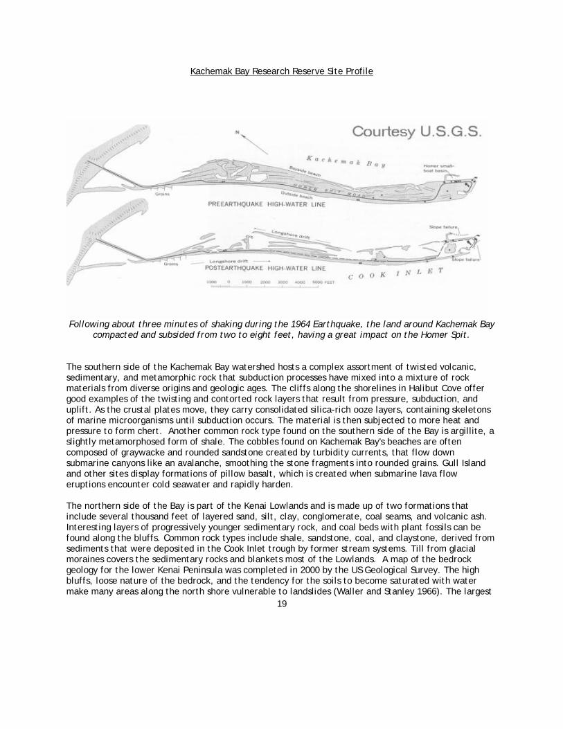
Geomorphology and Soils From steep glaciated fjords to smoldering volcanoes on the western horizon, the Kachemak Bay region exhibits the effects of dynamic geologic processes. Tectonism, the active process of plate tectonics that has been ongoing for at least 250 million years, has been a major force in southern Alaska (Swenson et al. 1997). In southcentral Alaska, where Kachemak Bay is located, the oceanic Pacific plate is moving under the continental North American plate at a rate of about two-inches-per-year (Plafker et al. 1994). The scenic Kenai Mountains, bordering the southern side of the Bay, and the volcanoes extending along the arc of the western side of Cook Inlet, resulted from this subduction. On a more recent time scale, episodic glaciation has sculpted the surface features of the Bay region for the past 25,000 years. For people living in the Kachemak Bay area, the geologic history and ongoing plate-tectonic processes produce a lively environment, subject to some of the most powerful earthquakes in the world, volcanic eruptions, coastal and headland erosion, as well as tidal flat, lagoonal and spit deposition. Volcanoes and Earthquakes Three of the world's ten strongest recorded earthquakes occurred in Alaska. Geologic evidence of prehistoric earthquakes in the Cook Inlet region indicates that there have been between six and nine major earthquakes during the past approximate 5,000 years, with an average recurrence interval of 600 to 800 years (Combellick 1997). The numerous active volcanoes sprinkled across Cook Inlet have sporadic but lasting effects on the Kachemak Bay Watershed. The volcanoes closest to the Bay include Mount Saint Augustine, Mount Redoubt, Mount Iliamna, and Mount Douglas. The most recent eruption in the Cook Inlet region was Mt. Redoubt in 1990. During this spectacular series of 23 eruptions, clouds of gases, airborne tephra, and clastic volcanic material were ejected during an eruption from a crater or vent (American Geological Institute 1976, interrupting air traffic as far away as the south central United States. Mudflows threatened nearby Cook Inlet oil operations, and ash blanketed the landscape. The eruption was the second most expensive in United States history, with estimated costs of $160 million in damage (Alaska Volcano Observatory 1999). Mt. Iliamna frequently vents gases from fumaroles, which are holes in a volcanic region that emit gas and vapors. Although it has not had a major eruption in historic times, strong seismic activity recorded in 1996 from the magma center indicates that the volcano has the potential to erupt in the future (Alaska Volcano Observatory 1999). The island of Mt. St. Augustine, located 68 miles southwest of Homer, is the youngest and most active volcano. It is believed to be the most hazardous of the Cook Inlet volcanoes, having erupted at least seven times in the last 200 years (Kienle and Swanson 1985). A debris avalanche from the violent 1883 eruption of Mt. St. Augustine produced a tsunami that hit the village of Nanwalek, on the south side of the Bay, with waves as high as 33 feet (Beget and Kienle 1992). The Homer Spit and other low-lying coastal communities in southern Cook Inlet are in danger of avalanche-generated tsunamis resulting from volcanic eruptions across on the western side of the Inlet. The second strongest earthquake ever recorded in the world was the "Good Friday" earthquake that occurred on March 27, 1964, centered between Anchorage and Valdez. This earthquake measured 9.2 on the Richter Scale and was felt around the globe. Regional vertical displacement in the form of uplift and subsidence occurred throughout Cook Inlet, the Kenai Peninsula, and the Copper River Delta. The Kachemak Bay area experienced land subsidence, landslides, earth fissures, submarine landslides, compaction, and erosion. Water quantity and quality problems were also found in well water (Waller and Stanley 1966), and the end of the Homer Spit sank deeply, stranding people. The city of Seldovia, located on the southern side of the Bay, experienced dramatic subsidence with a vertical drop of six

Kachemak Bay Research Reserve Site Profile
18
feet that completely changed its waterfront. Many spruce trees died as subsidence caused salt water to inundate the shore quickly and created "ghost forests" of silver snags. These ghost forests can be found in Halibut Cove, along the Wosnesenski River, in China Poot Bay, and in the outwash plains of the Grewingk and Portlock Glaciers (Alaska Department of Natural Resources 1995). Bedrock Geology Even the casual observer can see that large geologic contrasts exist between the northern and southern sides of the Bay. These differences are noticeable in terms of elevation, topography, rock materials, metamorphism, age, origin, and glaciation. Geologic faults, which are fractures in the rock that mark where the land has slipped, or been displaced by earth movements, are found throughout the Bay region. A segment of the Border Ranges Fault extends beneath the Bay, roughly from Seldovia to the Homer Spit, continuing as a deeply buried fault running north to the head of the Bay and beyond. On the southern side of the Bay, a fault system extends roughly parallel to the coastline of the Bay, another fault system delineates the southern flank of the mountains, and an additional fault (Seldovia Fault) defines the westernmost tip of the Bay. In addition, there are many smaller scale faults located throughout the watershed for the Bay, as well as several underlying the Bay (Bradley and Kusky 1990).
The volcanoes closest to the Bay include Mount Saint Augustine, Mount Redoubt, and Mount Iliamna.
Kachemak Bay Research Reserve Site Profile
19
Following about three minutes of shaking during the 1964 Earthquake, the land around Kachemak Bay
compacted and subsided from two to eight feet, having a great impact on the Homer Spit.
The southern side of the Kachemak Bay watershed hosts a complex assortment of twisted volcanic, sedimentary, and metamorphic rock that subduction processes have mixed into a mixture of rock materials from diverse origins and geologic ages. The cliffs along the shorelines in Halibut Cove offer good examples of the twisting and contorted rock layers that result from pressure, subduction, and uplift. As the crustal plates move, they carry consolidated silica-rich ooze layers, containing skeletons of marine microorganisms until subduction occurs. The material is then subjected to more heat and pressure to form chert. Another common rock type found on the southern side of the Bay is argillite, a slightly metamorphosed form of shale. The cobbles found on Kachemak Bay's beaches are often composed of graywacke and rounded sandstone created by turbidity currents, that flow down submarine canyons like an avalanche, smoothing the stone fragments into rounded grains. Gull Island and other sites display formations of pillow basalt, which is created when submarine lava flow eruptions encounter cold seawater and rapidly harden. The northern side of the Bay is part of the Kenai Lowlands and is made up of two formations that include several thousand feet of layered sand, silt, clay, conglomerate, coal seams, and volcanic ash. Interesting layers of progressively younger sedimentary rock, and coal beds with plant fossils can be found along the bluffs. Common rock types include shale, sandstone, coal, and claystone, derived from sediments that were deposited in the Cook Inlet trough by former stream systems. Till from glacial moraines covers the sedimentary rocks and blankets most of the Lowlands. A map of the bedrock geology for the lower Kenai Peninsula was completed in 2000 by the US Geological Survey. The high bluffs, loose nature of the bedrock, and the tendency for the soils to become saturated with water make many areas along the north shore vulnerable to landslides (Waller and Stanley 1966). The largest
Kachemak Bay Research Reserve Site Profile
20
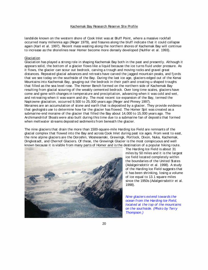
landslide known on the western shore of Cook Inlet was at Bluff Point, where a massive rockfall occurred many millennia ago (Reger 1979), and fissures along the bluff indicate that it could collapse again (Karl et al. 1997). Recent mass wasting along the northern shores of Kachemak Bay will continue to increase as the shorelines near Homer become more densely developed (Nuhfer et al. 1993). Glaciation Glaciation has played a strong role in shaping Kachemak Bay both in the past and presently. Although it appears solid, the bottom of a glacier flows like a liquid because the ice turns fluid under pressure. As it flows, the glacier can scour out bedrock, carving a trough and moving rocks and gravel great distances. Repeated glacial advances and retreats have carved the jagged mountain peaks, and fjords that we see today on the southside of the Bay. During the last ice age, glaciers edged out of the Kenai Mountains into Kachemak Bay, gouging out the bedrock in their path and creating u-shaped troughs that filled as the sea level rose. The Homer Bench formed on the northern side of Kachemak Bay resulting from glacial scouring of the weakly cemented bedrock. Over long time scales, glaciers have come and gone with changes in temperature and precipitation, advancing when it was cold and wet, and retreating when it was warm and dry. The most recent ice expansion of the Bay, termed the Naptowne glaciation, occurred 9,500 to 25,000 years ago (Reger and Pinney 1997). Moraines are an accumulation of stone and earth that is deposited by a glacier. They provide evidence that geologists use to determine how far the glacier has flowed. The Homer Spit was created as a submarine-end moraine of the glacier that filled the Bay about 14,000 to 15,000 years ago. The Archimandritof Shoals were also built during this time due to a submarine fan of deposits that formed when meltwater streams deposited sediments from beneath the glacier. The nine glaciers that drain the more than 1500-square-mile Harding Ice Field are remnants of the glacial complex that flowed into the Bay and across Cook Inlet during past ice ages. From west to east, the nine alpine glaciers are the Doroshin, Wosnesenski, Grewingk, Portlock, Dixon, Nuka, Kachemak, Dinglestadt, and Chernof Glaciers. Of these, the Grewingk Glacier is the most conspicuous and well known because it is visible from many parts of Homer and is the destination of a popular hiking route.
The Harding Ice Field is about 31 miles by 50 miles and it is the largest ice field located completely within the boundaries of the United States (Adalgeirsdottir et al. 1998). A study of the Harding Ice Field suggests that it has been shrinking, losing a volume of ice equal to 13.1 square miles since the 1950s (Adalgeirsdottir et al. 1998). Nine glaciers extend towards the ocean from the Harding Ice Field, located at the top of the mountains on the southside. (Photo by Terry Thompson.)

Kachemak Bay Research Reserve Site Profile
21
Bands of coal deposits can be seen as dark lines in the eroding bluffs of the northside of the Bay. Commercial Minerals and Resources. Photo by Janet Klein.
Commercial Minerals and Resources Although the Bay is closed to oil development, the Kenai Peninsula uplands to the north remain open to exploration. Due to the close proximity to Cook Inlet's oil wells, Kachemak Bay was explored for oil in the 1970s, and transects created for seismic exploration crisscross the northern side of the Bay. Today, many of these ‘seis lines’ are used as trails. In 1973, ninety tracts were leased for oil extraction in the outer Bay. However, public opposition over the potential impact on the Bay's rich marine life and fishing-based economy led to a buyback of these leases shortly thereafter. Public opinion was galvanized against oil drilling in the Bay when an accident involving the George Ferris drilling rig occurred. Concerns about the effects to the ecosystem and to the once robust crab and shrimp fisheries soon led to legislation prohibiting oil exploration or extraction in the Bay. Much of the natural gas in Cook Inlet has been produced from the upper Tertiary Sterling and Beluga Formations. These formations underlay the northern side of the Watershed, so it is likely that the region has natural gas deposits. Although large commercial gold resources have not been discovered in the Bay region, quartz veins bearing gold were mined near the old mining camp of Aurora, and Placer gold is sometimes found on beaches and in gravel bars (Klein 1987). Some mountains on the southern side of the Bay have yielded high-grade deposits of chrome and other ferrous metals. These deposits have been found in the outwash of Grewingk Glacier (Alaska Department of Natural Resources 1995), in Claim Point, and on Red Mountain (Klein 1987). Manganese was also found in chert at Grewingk Glacier during a geological reconnaissance study, but it was not extensively explored for commercial potential (Bradley et al. 1999).

Kachemak Bay Research Reserve Site Profile
22
Some residents still collect coal from the beach to heat their homes. Burning coal also fires the clay layered above and below the coal beds of Tertiary age layers found in the same bluffs, which create brick-red rock and clinkers that are found on beaches (Karl et al. 1997). Although coal mining used to be a thriving venture in Kachemak Bay, the coal is not high grade (sub-bituminous coal to lignite), and no commercial mining occurs today. The high cost of extracting and processing the medium grade coal currently outweighs the profits that would be gained. Extraction of sand and gravel for building materials is currently the largest mining effort in the Kachemak Bay area, especially near Anchor Point on the north side of the Bay. With growth in the Homer region, the demand for these building materials has skyrocketed. The resulting impacts on land, water, and aesthetic resources have made the placement of gravel extraction sites a controversial issue. Yet, with increased road building and other industrial needs, the gravel and sand removal operations will likely continue.
Soils The northern and southern sides of the Kachemak Bay watershed differ in geologic origin, physiography, climate, and vegetation. These contrasts give rise to soils that differ in weathering, distribution, parent material, organic content, and drainage patterns. The steep slopes and high topographic relief of the southern side cause soils to form deeper layers at the base of slopes and thinner layers on slope sides. Soil depth on the northern side is generally more evenly distributed over the landscape (Doug Van Patten, pers. comm.) While the volcanic ash content is high on both sides, the prevailing winds and proximity to the Alaska Peninsula's volcanoes causes the southern side's ash layer (average 76 cm) to be thicker than the northern side's (average 46 cm) layer. However, the northern side soils have more wind-blown, glacial-fine materials in the upper horizons than the southern side (Doug Van Patten, pers. comm.). While soils in the Kachemak Bay area may remain frozen on the surface into late spring, this region is free from permafrost just as is much of south-central coastal Alaska. On the northern side of Kachemak Bay, a porous, geologic formation called the Kenai Formation provides the basis for soils. An ancient river that once meandered through the Cook Inlet Basin created this deposit of sandstone and other sediments. Over this base material, glaciers have deposited gravel and glacial till in the form of moraines, and wind has blown thin layers of fine glacial sediments and blankets of volcanic ash. The gently rolling and previously glaciated terrain of the northern side has well-drained soils on areas of higher relief, with wet mineral soils at the base of slopes and on floodplains. Peat soils occur extensively in depressional pockets and in glacial melt water channels. Much of the soils on the Homer Bench, where many people live, were derived from materials that washed down from the bluff by erosional forces. These soils often have impermeable clay layers that do not drain well, and tend to have perched water tables trapped between the impermeable layers, some of which are tapped as wells for household supplies, although these wells are more vulnerable to contamination than those found in well-drained areas. Natural Resources Conservation Service (NRCS), originally surveyed soils on the northern side of the Bay in 1971, and a new survey will be published by the NRCS in 2004, and available as a Geographic Information System dataset. The new survey will incorporate a detailed analysis of vegetation communities in the soil sampling area. This will provide researchers and managers with previously unavailable baseline information in a GIS format.

Kachemak Bay Research Reserve Site Profile
23
Due to more plentiful precipitation and the resulting chemical and physical effects, the southern side's soils are more weathered, have more distinct horizons, and have thicker topsoil horizons than soils of the northern side. The steep valley walls and moraines of the valley floors have well-drained soils on the southern side. Wet mineral soils are generally found along rivers and near seeps from the toes of slopes, and peat soils occur between the moraines of valley floors (Doug Van Patten, pers. comm.) Only selected portions outside of the Kachemak Bay State Park were surveyed as of 1999 (Natural Resources Conservation Service 1999). Unfortunately, no formal soil surveys have been conducted inside the Kachemak Bay State Park, which encompasses much of the watershed on the south side of the Bay. The Kachemak Bay State Park Management Plan includes general descriptions of the Park's soils in relation to the habitat in which they are found (Alaska Department of Natural Resources 1995). A preliminary soil survey of the Fox River Flats, at the head of the Bay was conducted by the NRCS in 1982. The soil types include a variety of sand and silt loams commonly found on such a delta (Van Patten and Dillon 1983).
A comparison of a Benka series soil found on the northern side of the Bay (left) and a Kasitsna series soil from the south side of the Bay (right). The Kasitsna series shows much stronger soil profile development due to higher precipitation levels. (Photos by Doug Van Patten.)
Hydrology and Water Quality The northern and southern sides of Kachemak Bay’s watershed have many contrasting geomorphological, geological, climatic, vegetative, and soil characteristics. It is, therefore, no surprise that the hydrology differs between the two sides. The north side and the head of the Bay have gentle topography and much more extensive river systems than the south side of the Bay, where steep topography and glaciation limit the length of the rivers.

Kachemak Bay Research Reserve Site Profile
24
All of the streams in the Kachemak Bay watershed have two annual peak periods of streamflow. The highest one occurs in the fall (late August through November) when the most precipitation falls, and the next peak occurs in the spring and early summer when the snow melts (Savard and Scully 1984). Low-flow occurs at the end of winter, mid-February through mid-April, after which snowmelt keeps the flows running (Freethey and Scully 1980). On the southern side of the Bay, the snowmelt peak lasts longer as glaciers and snowmelt release sequestered water. Northern side streams are kept flowing by groundwater during dry months. Human impacts on groundwater supplies, such as wells, wetland filling, and other hydrologic disturbances, may weaken this important ecological link. On the southern side of the Bay, glaciers drive the hydrologic system, boosting the runoff levels in streams and rivers during what are typically low-flow periods for the northern side drainages. Because they release melted ice and snow late into the summer when ambient temperatures are highest, glaciers prolong the snow melt phase of the surface water runoff pattern. The runoff from these glaciers has important implications for the Bay's oceanography because they deliver so much water and sediment to the Bay during the summer. The fresh, turbid water forms a surface layer lens during the summer when the Bay is more stratified. The volume of flow from glacial rivers can be 10 times as much as that from clearwater rivers. For example, flood discharges for the Bradley River, which drains the Nuka and Kachemak glaciers, can be 10 times that of Fritz Creek, which is precipitation driven (Freethey and Scully 1980). However, no one has measured total annual inputs.
The water quality difference between glacial and clearwater streams is mainly found in the form of turbidity. Glacial rivers and streams carry a large sediment load of clay and silt, and this is what gives them their color and opacity. The signature plume of turbid glacial river outputs can be seen at the head of the Bay and southside of the Bay in this remote sensing image.
Glacial recession is an important factor that can change the region's hydrology over a long period of time. Glaciers sequester vast amounts of water, and as they melt, the fresh water drains into the Bay, altering salinity and possibly circulation patterns. Receding glaciers may indicate warming trends that have long-term impacts on hydrology. Glaciers can also cause flooding and large mudslides when ice dams that hold back lakes fail and release huge amounts of silt and water downstream. Flooding from a glacier-dammed lake is called a "jokulhlaups". Jokulhaups have happened several times on the

Kachemak Bay Research Reserve Site Profile
25
southern side of Kachemak Bay in the Doroshin Watershed. This type of flooding is common in Alaska and flooding would become a hazard if the southern side of the Bay were developed. Most of the lakes and ponds in Kachemak Bay’s watershed occur on the southern side. Some, such as Grewingk Glacier Lake were formed as receding glaciers left a depression behind them that filled with water. Land uplift from tectonic activity in areas with fault blocking has created lakes by land movement alone, such as China Poot Lake. These lakes form distinctive patterns along the fault zone and are a reminder of the importance of seismicity in the dynamic Kachemak Bay landscape (Savard and Scully 1984). Glacial lakes are opaque from the glacial flour found in their waters. This flour limits the growth of algae and primary producers that help fuel the food web of clear lakes. Groundwater Impermeable bedrock underlies the southern side of the Watershed, while inconsistently porous sedimentary layers of clay, gravel, coal, and sandstone lie beneath the northern side. There is very little information on the groundwater of the southern side. The northern side's aquifers often do not yield enough quantity or quality of drinkable water to justify the expense of drilling a well for domestic consumption. Indeed, the Homer region has one of the least promising groundwater supplies of all the populated regions on the Kenai Peninsula (Freethey and Scully 1980). In a study on groundwater resources, most well sites south of the escarpment crest, where the population center of Homer and needs it most, yielded less than 10 gallons of water per minute (Freethey and Scully 1980). North of the crest, however, wells often yield more than 50 gallons of water per minute. Although the Homer Spit is one of the most heavily developed sites in the area, it does not have any fresh groundwater to tap beneath it, only brackish water. Well data have been collected for sites throughout the northern side of the Bay, but the aquifers have not yet been mapped. The lack of reliable, high volume, high quality groundwater for municipal and industrial uses has had important implications as Homer and surrounding unincorporated areas have become more developed. Two-thirds of the people living in the Kachemak Bay watershed do not have their water supplied by municipal sources (Lichfield 1999). Instead, they rely upon individual wells and often have water delivered by truck from the sole city supply, the Bridge Creek Reservoir. The reliance on a single source could cause widespread problems if the Reservoir was to be threatened by an earthquake or to become contaminated by sediment or pollutants. The Bridge Creek drainage is in the Anchor River Watershed, and the Kenai Peninsula Borough is the agency that governs land uses in the area. Recently, concerns about protecting the water supply from development impacts, such as siltation from construction and contamination from improper waste disposal, led the local government of Homer to obtain extra-territorial jurisdiction over the Bridge Creek Watershed (Little 1999, Spence 1999). Water Quality The groundwater along Homer's East Bench is notorious for its rusty color and taste. This is the result of chemical processes in the soils of the wetlands that feed these aquifers and cause large amounts of ferrous iron to dissolve in the water. The Homer Bench groundwater often has concentrations of ferrous iron, higher than four-parts-per-million, greatly exceeding the threshold of 0.3 parts per million, causing water to taste awful and to stain laundry (Waller et al. 1968). Groundwater in this area also has high concentrations of sodium bicarbonate and calcium bicarbonate.

Kachemak Bay Research Reserve Site Profile
26
Fresh and marine water quality may be threatened by a myriad of sources. Septic, graywater drainfields, and outhouses are commonly used to dispose of wastes (Lichfield 1999). Septic systems and outhouses in poor condition can contribute to water quality degradation, especially as population densities increase. Other non-point pollution culprits include stream sedimentation from irresponsible construction and logging practices and fecal matter from agriculture. A study of the Fox River at the head of the Bay found high levels of fecal coliform bacteria during a time when herds of cattle were grazing on the surrounding Fox River Flats (Alaska Power Authority 1984).
In the marine environment, the Department of Environmental Conservation (DEC) monitors water quality to ensure the safety and quality of shellfish cultured on the southern side. Data from sites between the Martin River and Barabara Point indicate water quality is within acceptable limits as set by state law (18 AAC 70). However, within enclosed bays, such as Halibut and Bear Coves, DEC data indicate that bacteria and other pollutants from graywater discharge occasionally cause local water quality problems (Ostasz and Thomas 1996).
Water quality also may be adversely affected by fish processing wastes, sewage discharges, boat discharges, and other wastes from industrial activities related to marine transportation. The outfall pipe for Homer and Kachemak City’s secondary sewage treatment dischargies into Kachemak Bay approximately 2,200 feet from the shore. In Seldovia, waste undergoes primary treatment in a community septic tank and is then discharged directly into outer Seldovia Bay, 700 feet from the shore just north of Wade Point.
With the oil industry and other industries in Cook Inlet and the Kenai Peninsula, hydrocarbon contamination is another potential concern. Studies have found high hydocarbon concentrations in the sediments of the Bay (Atlas et al. 1983). The origin of the hydrocarbons could be anthropogenic, however coal and other naturally occurring petroleum resources may also be contributing to the high levels.
The damming of Bradley Lake for hydropower production in 1991 changed the freshwater input to the upper Bay and altered the pattern of runoff into the Bradley River system. The dam holds drainage from the Nuka and Kachemak Glaciers, as well as that from smaller tributaries. Because dams retain water during peak runoff periods to use for hydropower generation, the Bradley Lake Project retains flows during the fall rains and spring melts, dramatically changing runoff patterns (Rickman 1993.
The construction of roads also changes the hydrology of an area by routing water through new channels, removing vegetation, disturbing soils, and creating new, impermeable surfaces that divert runoff to smaller areas for absorption. New roads usually lead to new development, which has a host of impacts on the hydrologic system, including wetland disturbance and drainage, increased water needs for consumption and waste disposal, increased impermeable surfaces, and growing siltation of creeks and rivers from construction. The geologic nature of the region creates a lot of hillside springs and seeps. These freshwater seeps flow from the sides of hills, increasing the potential for landslides and erosion when people build on bluffs or when roads are cut into the sides of hills. Soils on the northern side of the Bay are often saturated with water, which exacerbates the potential for landslides and slumps.

Kachemak Bay Research Reserve Site Profile
27
While the Homer region and suburbs developed rapidly in the last decade, little attention was focused on how to meet demands for freshwater. More research is needed on patterns and projections of water consumption from domestic, industrial, and agricultural uses. The Homer Soil and Water District and the Cook Inlet Keeper have been cooperating on a water quality monitoring study of four watersheds on the lower Kenai Peninsula, including the Anchor River, on the north side of Kachemak Bay (Lambert 2000, Mauger 2002). The Cook Inlet Watershed is currently the focus of the U.S. Geological Survey's National Water-Quality Assessment (NAWQA) Program. This effort began in 1997 and will describe the status and trends in the quality of the Cook Inlet basin's groundwater and surface water resources.
The Natural Resources Conservation Service installs, operates, and maintains an extensive, automated system to collect snowpack and related climatic data in the western United States called SNOTEL for SNOwpack TELemetry. The system was designed to measure snowpack in the mountains of the West and forecast the water supply. The high-elevation watershed locations and the broad coverage of the network provide important data collection opportunities to researchers, water managers, and emergency managers for natural disasters such as floods. There are four SNOTEL sites in the Kachemak Bay Region are the Anchor River Divide, McNeil Canyon, North Bradley River, and Port Graham. For more information on the SNOTEL network and to access data from these sites see: http://www.wcc.nrcs.usda.gov/snotel
Marine Environment Introduction to the marine environment of Kachemak Bay Prior to establishment of the Kachemak Bay National Estuarine Research Reserve, few studies on this region’s marine life and habitats had been completed. Much of the currently available information was developed during the late 1970s through the early 1980s in response to the potential for oil and gas development in Lower Cook Inlet and the adjacent continental shelf. These studies showed that Kachemak Bay had high biological productivity and natural diversity, leading many people to suggest this area should be sheltered from the potentially negative impacts of oil and gas ventures. Alaska's estuaries are not well understood, compared to those in other states, and much remains to be discovered before an understanding and proper response to natural and environmental changes can take place. By synthesizing existing research, monitoring, and anecdotal information with newly acquired information about this region’s oceanic, nearshore, and watershed ecology, the Research Reserve hopes to gain a better understanding of natural and human processes occurring in the Gulf of Alaska, with particular emphasis on Lower Cook Inlet and Kachemak Bay. As Research Reserve scientists investigate the ecological processes of this region, historical surveys and pre-existing inventories provide a valuable, though qualitative, baseline. Large-scale ecosystem monitoring efforts funded by the Exxon Valdez Oil Spill Trustees Council, such as the Gulf Ecosystem Monitoring (GEM) Program, will also add to our understanding of large-scale ocean patterns. Reserve researchers are investigating, through baseline studies and subsequent monitoring, how the ocean affects regional and local ecological processes, how marine and estuarine ecosystems respond to shifts in ocean and watershed conditions, and how different marine and estuarine habitats are used by various organisms during different periods of their life cycle. Reserve staff seek input from the Research Reserve Council’s Research Committee, research colleagues, and dialogue with local residents. For example, longtime residents have hypothesized that marked decreases in intertidal biodiversity are taking place in Kachemak Bay. Without long-term monitoring however, it is impossible

Kachemak Bay Research Reserve Site Profile
28
to determine whether such changes are due to natural or anthropogenic causes. A study of intertidal habitats, comparing surveys from 1974 to 1976 with 1996 observations, reported no major shifts in species dominance or community health outside the range of natural variability previously observed (Pentec Environmental 1996). Researchers recognize that change over time may not signal human impacts and that natural variability is the rule, rather than the exception, for dominant species in Cook Inlet's intertidal zone. Biological Productivity Researchers have suggested that Lower Cook Inlet/outer Kachemak Bay may be one of the most biologically productive ecosystems in the world (Sambrotto and Lorenzen 1986). What makes this region so productive? In the Gulf of Alaska, high tides, frequent storms, and persistent currents stimulate strong, vertical mixing along the continental shelf. Mixing brings essential nutrients from depth up to the euphotic zone, where they support phytoplankton growth (Hood and Zimmerman 1986). Nutrient-rich waters upwelled by the Alaska Coastal Current enter the outer Bay and contributes to high productivity (Burbank 1977, Lees et al. 1980).
Offshore surface water in Kachemak Bay generally moves eastward along the southern shoreline and westward along the northern coast.
The nearshore winds that help drive upwelling vary with the strength and location of the Aleutian low pressure system (Wilson and Overland 1986). The resulting variability in upwelling and the depth of vertical mixing has important implications for biological productivity. Climate variability also affects precipitation and freshwater runoff, thus influencing the input of inorganic minerals from terrestrial sources.

Kachemak Bay Research Reserve Site Profile
29
Early studies suggest that high rates of primary production by phytoplankton during the long days of summer fuel this region's biological engines. A 1977 study found that Lower Cook Inlet's (including Kachemak Bay) phytoplankton produced an average of 7.8 grams of carbon per square meter per day (gC/m2/d ) from May to August (Larrance et al. 1977). Zooplankton graze upon phytoplankton that become prey for fish and invertebrates and then feed higher trophic levels. Most of the studies referring to high productivity in the Bay were based on Lower Cook Inlet, which includes outer Kachemak Bay. While these studies are dated, even less is known about productivity in the inner Bay. Studies were focused on the outer Bay because it was believed that this was the most important area for commercially fished species, such as shrimp and crab. At the time these studies were conducted, researchers and resource managers believed that two semi-permanent gyres in the outer Bay entrained essential nutrients and plankton, as well as crab and shrimp larvae. The prevailing theory of the time was that organic carbon would get flushed from the inner Bay into the outer Bay's gyres. Circulation patterns would intercept particulate organic carbon that would otherwise settle to the benthic communities throughout the Bay, concentrating these nutrients in a productivity hotspot in and beneath the gyres (Feder and Paul 1981). A 1981 comparative study of productivity measurements in Lower Cook Inlet found the highest benthic productivity (6.3 gC/m2/year) and infaunal biomass (400 g/m2) measurements in the vicinity of the gyres in outer Kachemak Bay (Feder and Paul 1981). However, there has been scant scientific attention towards benthic and primary productivity in the outer Bay since the studies in the early 1980s, making it impossible to determine how today's conditions compare with those of the past. Biological Diversity From kelp forests to enormous sand waves, Kachemak Bay contains a diverse underwater landscape. Approximately 125 species of fish, 11 species of marine mammals, and over 400 species of macro invertebrates dwell in the Bay's waters, where they feast on a fertile marine buffet. A sizable population of sea otters (Enhydra lutris) (approximately 400 - 600 individuals estimated by James Bodkin in 2002) attests to the invertebrate prey abundance, as otters consume one-third of their body weight daily to meet their metabolic needs (Valiela 1995). Minke whales (Balaenopetera acutorostrata), harbor porpoises (Phocoena phocoena), Steller's sea lions (Eumetopias jubaus), and harbor seals (Phoca vitulina) also thrive in the Bay. In an early comparative study, researchers found that intertidal biological communities in the Bay had a greater diversity and abundance of species than those physically similar intertidal habitats elsewhere in the Gulf of Alaska and Cook Inlet (Lees et al. 1980). Theories to explain this phenomenon included the presence of abundant food sources and reduced physical disturbances. Storm waves in the Gulf of Alaska and sea ice in Cook Inlet create bare patches in rocky intertidal communities each year (O'Clair and Zimmerman 1986). The southern shore of the inner Bay, however, does not usually accumulate enough sea ice to scour the intertidal zone. The coast is relatively protected from violent winter storms prevalent on the outer coast. Fewer physical disturbances may allow epibenthic organisms to live longer and to develop diverse and relatively stable communities. KBRR scientists have been studying intertidal biodiversity and community structure at nine sites in Kachemak Bay since 2001. The Bay is also Lower Cook Inlet's primary bird wintering habitat because of its relatively ice-free waters and comparatively protected environment (Alaska Department of Fish and Game 1993). Each spring, hundreds of thousands of migratory shorebirds, sea ducks, and other birds forage and rest in the

Kachemak Bay Research Reserve Site Profile
30
Bay, feeding on abundant invertebrates and new plant growth. The largest seabird colony in the Bay is home to eight breeding species: Tufted and Horned Puffins (Fratercula cirrhata and F. carniculata), Common Murres (Uria aalge), Pigeon Guillemots (Cepphus columba), Glaucous-winged Gulls (Larus glaucescens), Black-legged Kittiwakes (Larus tridactyla), Pelagic and Red-faced Cormorants (Phalacrocorax pelagicus and P. urile). For reasons that may be related to changing biological productivity patterns in Lower Cook Inlet, the seabird populations on Gull Island appear healthier than those found on the Barren and Chisik Islands studied by the U.S. Geological Survey's Biological Research Division.
Black-legged Kittiwakes and Common Murres nest each summer on Gull Island, the largest seabird colony in Kachemak Bay. (Photo by Carmen Field)
There have been no extensive inventories on the Bay's subtidal species. However, the high biological productivity noted in the outer Bay during early studies may translate to high biological diversity in the subtidal community. The variety and physical complexity of hard, soft, and vegetated marine habitats, such as kelp beds, eelgrass beds, and rocky and soft substrates, would accommodate a greater variety of species than those found in a more homogeneous ecosystem (Sanders 1968). Overview of Kachemak Bay’s Intertidal Zone Kachemak Bay's varied coastline, numerous freshwater sources, and diverse geomorphology generate many combinations of physical factors, creating a microcosm of southcentral Alaskan habitat types. The Bay's 28-foot tidal range generates a wide swath of intertidal habitat. On the southern shore, rocky substrates are juxtaposed with sand beaches and mud tidal flats, ranging from completely protected beaches to those with extreme wave exposure. An expansive tidal marsh blankets the head of the Bay at Fox River Flats, and numerous smaller marshes lie at the heads of protected bays and fjords. The northern shore's eroding sandstone bluffs grade into unconsolidated substrate habitats of mixed sand, gravel, and cobble beaches as well as mudflats. Eelgrass (Zostera marina) beds appear along the Bay's shoreline where sandy mudflats occur in low intertidal and shallow subtidal areas with limited wave exposure.

Kachemak Bay Research Reserve Site Profile
31
Five physical factors predominately control the distribution and abundance of biota in the intertidal zone: wave energy, bottom substrate, tidal exposure, temperature, and most importantly, salinity (Dethier and Schoch 2000, Ricketts and Calvin 1968). Much estuarine literature focuses on the primary role of salinity in determining biotic communities at the surface, water column (pelagic), and the bottom (benthos). Tenore (1972) states that salinity is "… likely the single most important factor affecting the distribution of the benthos" in estuaries, and a review of the physiological literature by Carriker (1967) notes that "for the majority of benthic estuarine species the minimal survivable salinity imposes a restraint" on distribution.
0
10
20
30
40
50
60
Port Graham Herring Islands Halibut Cove
Spring
Summer
2001 KBRR biodiversity monitoring results show that, with the onset of summer, species numbers tend to decrease toward the head of the Bay (Halibut Cove station) – presumably due to an increased influx of freshwater and organisms’ intolerance to the resulting lower salinity - while diversity increases at the Bay’s mouth (Port Graham station).
Attempts to separate the effects of salinity from other physical functions have been difficult. For example, salinity may appear to be directly affecting organisms, when in fact it is water column turbidity or relative substrate size that is the real determinant. In some cases, it is not the mean salinity that is critical but the annual variation in salinity over time (Montague and Ley 1993). In addition, the physiological effects of salinity fluctuations are confounded by other variables. As an example, mortalities that are caused by low salinities are often increased with higher temperatures (Carriker 1967), and salinity changes affect the toxicity of many pollutants such as heavy metals (Vernberg and Vernberg 1974). In general, lower salinity levels increase lethal and sub-lethal impacts of environmental stressors.
The distribution of many commercially important fishes and crustaceans with particular salinity regimes has led to the description of "salinity zones," which can be used as a basis for mapping these resources (e.g., Bulger et al. 1993, Christensen et al. 1997). A new shoreline classification methodology called SCALE (Shoreline Classification and Landscape Extrapolation) has the ability to separate the roles of sediment type, salinity, wave action, and other factors controlling estuarine community distribution and abundance. Kachemak Bay Research Reserve researchers are using SCALE as a mapping method that augments a qualitative nested hierarchical nearshore classification with basic measurements of the physical environment. The resulting physical habitat inventory has two distinct resolutions. Aerial

Kachemak Bay Research Reserve Site Profile
32
surveys by a geomorphologist and a marine biologist use low altitude videography to generate spatially comprehensive inventories and maps of physical and biological features. We then conduct detailed on-the-ground surveys to quantify the physical structure of shoreline habitats, thus providing a means for greatly increasing the spatial resolution of habitat data. We also document man-made structures and other habitat alterations within the intertidal zone. Data collected are entered into a GIS (Geographic Information System) to create a powerful database tool for comparing habitat types within and among regions over multiple spatial scales. Queries of this database will yield locations of replicate habitats that can be assessed as candidates for long-term monitoring sites. Groups including the Olympic Coast National Marine Sanctuary and the State of Washington Department of Natural Resources have adopted this method of using high-resolution physical habitat maps to aid in site selection of monitoring sites and marine reserves.
Locations and features of the shorelines that define the Bay’s intertidal communities, as well as of the diverse wildlife species that exploit them, are contained within an ArcView® project file in the Characterization’s CD-ROM.
Tidal Marshes Tidal marshes develop in a variety of places, including at river mouths, behind barrier islands, along spits, and on tidal flats. Deposition of sediment from rivers form deltas consisting of fine silt, clay, and sand upon which lush communities of salt tolerant, herbaceous sedges and succulent, tidal marsh plants develop. These areas are known by many names, including salt marshes, coastal marshes, estuarine emergent wetlands, estuarine vegetated wetlands, and brackish tidal marshes. This section describes tidal marsh communities found between the mean high watermark and the lower intertidal zone.
Beluga Slough in Homer provides year-round loafing and feeding habitat for waterfowl. (Photo by Carmen Field)

Kachemak Bay Research Reserve Site Profile
33
Although Alaska has a high percentage of wetlands, it hosts only 4% of the total vegetated tidal marshes in the United States. Alaska has a large share (28 %) of the estuarine wetlands (approximately 2,131,900 acres) in the United States; however, only 17 % (360,000 acres) of those are vegetated; most are mudflats. In contrast, 87% of the estuarine wetlands in the lower 48 states are vegetated (Hall et al. 1994). Despite the rarity of tidal marshes in Alaska, Kachemak Bay boasts two prominent and distinctly different large marshes: Fox River Flats and China Poot Bay. Smaller patches of marsh occur at the base of and along the Homer Spit, Beluga Slough, Mallard Bay/Aurora Lagoon, Glacier Spit, Halibut Cove Lagoon, Neptune Bay, Sadie Cove, Tutka, Little Tutka, Little Jakolof, Jakolof, Kasitsna, and Seldovia Bays (Crow and Koppen 1977, Hall 1988, Baird, pers. comm.). Kachemak Bay's tidal marshes are important as critical habitats for migratory and resident birds, buffers against shoreline erosion, and sources of organic material - called detritus - for the regional marine ecosystem. Coastal marshes throughout Alaska provide a resting habitat for geese, dabbling ducks, and shorebirds during migrations. They serve as feeding areas in winter and nesting sites during the summer (Watson et al. 1981). Because the Fox River Flats provide important habitat for shorebirds, ducks, and geese, the Bay and the Flats were designated as Critical Habitat Areas in 1972 and later as Western Hemisphere Shorebird Reserve Network sites. The Flats provide a primary staging, feeding, and nesting area for a variety of waterfowl and shorebirds (Erikson 1977, Crow 1978, Krasnow 1981, Krasnow and Halpin 1981, Rappaport et al. 1981, Rosenberg 1986, Alaska Department of Fish and Game 1993). Trumpeter swans (Olor buccinator) can eat as much as 20 pounds of pondweed (Potamageton sp.) and sedges (Carex sp.) per day (Watson et al. 1981), and ducks, such as the northern pintail and green-winged teal, feed on Ramenski's sedge (Carex ramenskii), creeping alkali grass (Puccinellia phryganodes), and Hulten’s alkali grass (Puccinellia hultenii) stems and seeds. Many ducks also hunt invertebrates, such as snails (Littorina sp). and euphausids that live in the tidal marsh and on the mudflats (Alaska Department of Fish and Game 1993). In addition to serving as important bird habitat, the Flats' tidal marshes provide calving areas for moose (Alces alces) and feeding grounds for black bears (Ursus americanus) in the spring. It is likely that many other wildlife species use tidal marsh areas in Kachemak Bay as well, such as voles, shrews, owls, hawks, mink (Mustela vison) and river otters (Lontra canadensis. This section has only superficially described the extensive bird activity at the Flats. Tidal Marsh Productivity Tidal marshes contribute bountiful dead organic material, called detritus, to the world’s oceans. Productivity, typically measured as the change in live plant material over an annual cycle, is higher in tidal marshes than that found in most other ecosystems and forms the basis of estuarine food chains. In northern latitude tidal marshes, such as those in Kachemak Bay, shoot biomass increases during the growing season (spring through fall), and the plants flower and die afterward. Throughout this cycle, dead organic material increases until rising temperatures the following spring allows the material to decompose. Ice action in winter removes most above ground biomass (Turner 1976). Measures of below ground productivity (roots and rhizomes) are rarely reported because of the difficulty in obtaining accurate measurements. However, where measurements are known, below ground production is considerably more than that recorded above ground (Day et al. 1989).

Kachemak Bay Research Reserve Site Profile
34
Productivity of the tidal marsh is an important component of the Bay's energy flow. When the plants die, microbial communities and invertebrates break down the dead material, releasing dissolved and particulate organic matter that supports soft-bottom communities, like mudflats and sand beaches. The large quantities of plant material produced in tidal marshes support thriving communities of diatoms and invertebrates. Some of this plant litter washes out with the tides to the Bay, and some remains in the marsh contributing to the organic content of the soils. Despite the clear importance of tidal marsh productivity, few studies have explored productivity and energy transfer through the detrital food chain in Kachemak Bay. Such research, however, has been done in many other estuaries. Observations from one study in the China Poot Bay’s tidal marsh indicate that tidal action exports 100% of the detritus layer to the Bay (Crow and Koppen 1977). Crow and Koppen measured above ground biomass of the marsh plants to estimate marsh productivity and found high net productivity; however they did not measure the roots, rhizomes, or diatoms and invertebrates that grow on and in the marsh plants, which contribute substantial food and organic matter to the ecosystem. Tidal Marsh Structuring Processes and Community Development Natural tidal marsh development depends upon land elevation, sedimentation, and hydrology, while community composition depends upon succession processes and tidal influence (Hall 1988). Tidal marshes typically develop at river mouths and behind barrier beaches and spits where reduced wave action and deposition of fine sediments provide elevated land upon which marsh plants can establish. While few terrestrial plants tolerate submersion in salt water, halophytes (salt-tolerant plants), such as Hulten’s alkali grass (Puccinellia hulteni) and sedge (Carex sp.), flourish where the estuarine influence prevents terrestrial plants from growing. The structure of vegetation reduces erosion and traps more sediment, thus building and maintaining elevation of the substrate. In Alaska, land subsidence and uplift due to isostatic rebound and tectonic processes can drastically affect marsh development and succession. As the Pacific plate slides under the North American plate, it uplifts the Kenai Mountains, slowly raising the elevation of the Kachemak Bay marshes. During the 1964 earthquake, however, the Kenai Peninsula subsided by 1 to 4 feet, substantially lowering the Cook Inlet marshes. This event changed the pattern of succession in existing marshes and caused tidal marshes to form on previously supra-tidal landforms (Batten et al. 1978). Spruce trees killed by inundating salt water on Glacier Spit and in China Poot Bay are testimony to this event. Despite subsidence, ample sediment input to the Fox River Flats from the Fox and Bradley Rivers and from Sheep Creek has probably allowed the marsh to accrete to its original elevation (Batten et al. 1978). While there are no studies specific to Kachemak Bay on the effects of subsidence and uplift on its coastal marshes, Boggs and Shephard (1999) and others have studied such effects on the Copper River Delta tidal marsh. The 1964 earthquake uplifted the Delta from 6.2 to 13.1 feet (Thilenius 1986), dramatically altering the available habitat for tidal marsh species (Hall 1988). Spatial zonation of plant species is typical of tidal marshes. Several environmental factors affect zonation, including salinity, elevation, drainage, and soil type (Hall 1988). Seaward, the salinity will be closest to that of sea water. As seawater mixes with freshwater and the tidal influence is diminished, the salinity is lowered. This salinity gradient should be especially evident in the Fox River Flats tidal marsh, where several large freshwater rivers bring freshwater runoff into the head of the Bay and the
Kachemak Bay Research Reserve Site Profile
35
topography is relatively level, resulting in an extreme tidal range. In contrast, the China Poot Bay estuary likely has less of a salinity gradient because of less freshwater inputs. Zonation patterns can also occur due to local differences in elevation, drainage, and soil type (Hall 1988). Drier sites, whether due to soil elevation or soil texture, support different vegetation than wetter sites. The oxidation-reduction status of the soil is directly related to soil moisture and substantially affects plant communities. The microorganisms that live in the tidal marsh, processing detritus and other energy sources, respire through oxidation-reduction processes - essentially the transfer of electrons. Oxygen is the most common electron acceptor; however, at the bottom of the water column and far from sources of atmospheric oxygen, other electron acceptors - such as sulfate - become important. In fact, sulfate reduction gives tidal marsh soils their characteristic "rotten-egg" smell. Grazing and trampling by cattle and horses may affect marsh composition and development at the Fox River Flats. Cattle have grazed the Flats since the late 1800s, though no baseline studies are available, making it difficult to quantify any impacts that grazing may have had over this time period. While cattle graze the uplands, they appear to prefer grazing the tidal flats, favoring sea arrow grass (Triglochin maritimum) and plantain (Plantago maratima) (Swanson and Barker 1992). To evaluate the effects of grazing and trampling on the Flats, the Natural Resources Conservation Service (NRCS) has maintained grazing enclosures since 1994, excluding hungry livestock from fenced study plots. Research Reserve scientists are currently mapping the salt marshes vegetation communities in Kachemak Bay as part of a larger coastal habitat mapping project. The China Poot Bay and Fox River Flats tidal marshes have been found in previous studies to have distinctly different vegetation communities due to a combination of the factors mentioned above. To illustrate the community types found in Kachemak Bay, the following sections summarize surveys of the Fox River Flats (Batten et al. 1978) and China Poot Bay marshes (Crow and Koppen 1977). Fox River Flats At the head of the Bay, three major glacial rivers flow into the estuary, depositing layers of silt and clay in a broad fan upon which the Fox River Flats tidal marsh has developed. The Flats are by far the largest marsh in Kachemak Bay, comprising approximately 7,100 acres of coastal marsh and mudflats (Alaska Department of Fish and Game 1993). Researchers and managers have studied the Flats more than other marsh sites in the Bay because of this area’s importance for migratory birds and because of regulatory requirements for the nearby Bradley Lake Hydropower Project (Alaska Department of Fish and Game 1993). Batten et al. (1978), ENTRIX, Inc. (1985), and Stone and Webster (1985) roughly mapped and described the vegetation of the Flats and upland communities. The Natural Resource Conservation Service in Homer also has an unpublished soil survey of this area. Because a variety of ducks, geese, and shorebirds use the Flats as a primary staging area many, several studies on bird usage have been conducted (Erikson 1977, Crow 1978, Krasnow 1981, Krasnow and Halpin 1981, Rappaport et al. 1981, Rosenberg 1986). The Kachemak Bay and Fox River Flats Critical Habitat Areas Management Plan summarizes selected results of these studies (Alaska Department of Fish and Game 1993).

Kachemak Bay Research Reserve Site Profile
36
Several tidal creeks in the Fox River Flats feature oxbows created by erosion and accretion of sediments. (Photo by Terry Thompson)
Batten et al. (1978) describes the estuarine vegetation of the Fox River Flats, as well as the vegetation of the adjacent non-estuarine wetlands and transitional uplands. Due to variations in drainage along the elevation gradient, the Flats’ plant community exhibits localized zonation within the overall community zonation pattern. For example, patches of salt-tolerant plants, such as Lyngby's sedge (Carex lyngbyaei), can be found in poorly drained patches in the upland transition zone. The following sequence characterizes the dominant marsh plant communities from seaward to upland elevations: 1) Nootka alkali grass (Puccinellia nutkaensis), 2) Ramenski's sedge, 3) Lyngby's sedge, 4) pond aquatic communities 5) inland marsh, and 6) stream banks. China Poot Bay Across the Bay from the Homer Spit, China Poot Bay supports the second largest tidal marsh in Kachemak Bay, encompassing over 600 acres. Crow and Koppen (1977) describe this marsh in detail in the "Environmental Studies of Kachemak Bay and Lower Cook Inlet" (Trasky et al. 1977). Alkali grass dominates the marsh, lending a contrast to Fox River Flats' sedge-dominated character. Crow and Koppen (1977) suggest that alkali grass owes its dominance to the high salinity found in the local soils. This tidal marsh is inundated with salt water on a daily basis, and its soil conductivity (salinity) measured 15.0 mmhos/cm (over 4.0 mmhos/cm is considered saline). Crow and Koppen (1977) identified 9 plant community complexes in the China Poot Bay tidal marsh, over half of which were co-dominated by alkali grass. Sedge dominated furthest upland and away from

Kachemak Bay Research Reserve Site Profile
37
the strongest influence of the tides. A comparison between the community compositions of Fox River Flats and China Poot Bay may demonstrate how tidal action and salinity influence tidal marsh communities. Because Batten et al. (1978) and Crow and Koppen (1977) did not use identical methods to define community types, these community descriptions should not be used to compare species diversity between these two marshes. However, Crow and Koppen (1977) commented that the China Poot plant community was not as diverse as that found in other wetlands they had studied.
Intertidal Mudflats and Beaches Kachemak Bay's unconsolidated soft-substrate intertidal habitat types, including sheltered tidal mudflats, as well as sand, gravel, and cobble beaches, each harbor distinct biological communities. They support numerous species of clams, polychaete worms, amphipods, and other invertebrates. Common invertebrates living on sand and gravel beaches include northern sand dollars (Echinarachnius parma) and Pacific sand lance (Ammodytes hexapterus). Cobble beaches typically host only a few species, those tolerant of greater wave energy and moving substrate. However, when the cobble provides a protective armor over a heterogeneous mixture of silt, sand, and other unconsolidated sediments, a rich infaunal community may live beneath. Of the unconsolidated habitats, mudflats support the greatest species diversity and biomass; cobble beaches support the fewest (Lees et al. 1980, Carroll 1994). People sometimes underestimate the ecological role of mudflats and sand or gravel beaches because most of their fauna dwell within the substrate. Yet, they are critical habitats for their specialized residents. They provide foraging grounds for shorebirds, diving and dabbling ducks, flatfish, juvenile salmon, and marine invertebrate predators, as well as spawning and nursery habitats for forage fish and juvenile crustaceans. Harbor seals (Phoca vitulina) also use mudflats and protected beaches as haulout areas; places where they routinely rest on-shore (Alaska Department of Fish and Game 1993).
This mixed sand, gravel and cobble beach between Homer and Anchor Point represents one of Kachemak Bay’s unconsolidated soft-substrate intertidal habitat types. (Photo by Carl Schoch)

Kachemak Bay Research Reserve Site Profile
38
Habitat Distribution Geomorphology, erosion, and deposition control the character and distribution of soft-substrate habitats. While sand and gravel beaches can be found in high wave energy environments, such as the western side of the Homer Spit, mudflats form only in low energy areas where finer sediments can settle, such as Mud Bay on the Spit's eastern side. Most of Kachemak Bay’s unconsolidated beaches are a mixture of sand, gravel, and mud with occasional cobbles and boulders, occurring along the Bay’s northern and inner southern shores. There are five "soft" intertidal habitat types: fine-grained sand beaches, coarse-grained sand beaches, mixed sand and gravel beaches, exposed tidal flats, and sheltered tidal mudflats. Fine-grained sand beaches usually are broad and gently sloping. Coarse-grained sand beaches are wide, steep beaches and are generally associated with river or stream mouths. Mixed sand and gravel beaches contain coarse-grained sands, gravel of varying sizes, and possibly shell fragments. Exposed tidal flats are composed of sand and/or gravel, and are associated with lagoons found at the heads of coastal bays. They are exposed to moderate wave and tidal energy and river freshwater inputs. Sheltered tidal mudflats contain soft mud or muddy sand. They occur at the heads of bays or in estuarine wetlands and are exposed to low wave activity and moderate tidal currents (National Oceanic and Atmospheric Administration Environmental Sensitivity Data - NOAA ESI). From Anchor Point east to the tip of the Homer Spit, intertidal habitats include mixed sand and gravel beaches with mudflats exposed at low tide, as well as occasional hard sand flats at lower tidal elevations. At higher tidal elevations, cobbles and boulders often armor the upper beach. From the Homer Spit's tip east to the Fox River Flats, the protected shoreline consists of mudflats at lower tidal elevation, with coarser sand and gravel substrate covering the upper beach. On the southern shore, gravel beaches dominate from Bear Cove west to Halibut Cove. Continuing west, gravel and sand spits and beaches are interspersed with rocky headlands (Sears and Zimmerman 1977). Ecological Processes & Community Composition in Mudflats Most of the studies in the mudflats of Kachemak Bay have focused on trophic dynamics at a coarse scale, with some work on patterns of abundance. Energy flow, microbial activity, chemical cycling, organic matter import and export, as well as other ecological processes have not been investigated. Kachemak Bay's mudflats provide important stopover foraging habitat for migrating birds, such as western sandpipers (Calidris mauri) and dunlins (Calidris alpina), which depend on ice-free foraging grounds during their spring migration. These sandpipers are among the millions of migrating shorebirds that focus on Baltic macoma (Macoma balthica), a small clam which can make up to 30% of the birds' diet while in Kachemak Bay (Senner and West 1978). Mudflat clams are also an important food source for waterfowl, such as greater scaups (Aythya marila), oldsquaws (Clangula hyemalis), surf scoters (Melanitta perspicillata), and black scoters (M. nigra), which feed on the mudflats throughout the winter (Sanger 1983, Lees et al. 1980). Mudflats, as well as sand and gravel beaches, support thriving populations of Pacific littleneck clams (Protothaca staminea), Pacific surf clams (Mactromeris polynyma), macomas (Macoma spp.), and softshelled clams (Mya spp.). Waterfowl and shorebirds, like the salmon and crab that forage during high tide, export mudflat nutrients to their predators in other biological communities, connecting intertidal and terrestrial ecosystems. Unconsolidated substrate habitat plays an important, but poorly understood, role as nursery and spawning habitat for several commercially and recreationally important fish and invertebrates,

Kachemak Bay Research Reserve Site Profile
39
including Pacific herring (Clupea pallasi), Tanner crabs (Chionoecetes bairdi), and Dungeness crabs (Cancer magister). Pacific herring spawn in the intertidal mudflats, and in the mixed sand, gravel, and mud beaches. These, in turn, are important prey for birds, marine mammals, and predatory fish. Tanner, or "snow" crab juveniles thrive in the sheltered mudflats east of the Homer Spit. Young Dungeness crabs thrive in China Poot Bay and other shallow protected areas, especially eelgrass beds which form in protected mixed sand and mud areas (Alaska Department of Fish and Game 1993). The Fox River Flats undoubtedly provide important nursery habitat for some of the Bay’s fish and invertebrates. As in all intertidal habitats, aspects of wave exposure, tidal elevation, and substrate largely determine the community composition and species distribution in mudflats (Ricketts and Calvin 1968). Survival in this habitat poses several challenges for its specialized residents. Unlike rocky intertidal habitat, attachment sites, shade, and hiding places on the surface are rare, so the residents usually dig a burrow to escape desiccation and predation. Burrowing, however, brings the problem of acquiring oxygen because mud can be anoxic even at shallow depths. To get sufficient oxygenated water, most organisms pump water through their burrows or use siphons to draw it from the surface (Ricketts and Calvin 1968). An organism's adaptations for capturing oxygen and food help determine how deep it lives in the soft substrate. Food resources are typically limited in the mudflats; vegetation is sparse, primary productivity is relatively low, and invertebrate prey is well-hidden in burrows. Because large macrophytes cannot attach to the loose and shifting substrate, primary productivity can be limited in soft bottom areas. However, eelgrass and algae species, such as sea lettuce (Ulva spp.), do grow on the surface, and microscopic phytoplankton live on and between large silt and clay grains. Walls of burrows created by species such as fat inkeeper worms (Echiuris echiuris alaskensis) and softshelled clams create oxygenated surface areas upon which microbial life can thrive, thus increasing the primary productivity in mudflats (Lees et al. 1980). Detritus from eelgrass, kelp, and other macrophytes form the base of the food chain in mudflats. Dead algae are transformed by bacteria into detritus that is then carried to soft-bottom communities from adjacent habitats. The same slow currents that deposit fine sediments also deposit detritus, which is then incorporated into the sediments. Most mudflat dwellers are deposit or filter feeders, gleaning minute organic particles from the sediment or water column. Filter-feeding clams and deposit-feeding worms convert the detritus into biomass (Sanger and Jones 1984). Predatory worms and gastropods, such as the moon snails (Natica aleutica and Cryptonatica affinis) are also mudflat residents. Trophic dynamics in mudflats are sensitive to shifts in productivity of "donor" communities. Changes in the productivity of phytoplankton, macroalgae, or marsh communities will affect the year-round mudflat residents, as well as the shorebirds, flatfish, and other organisms that rely on mudflats for food, spawning, or nursery habitat. Mudflat community composition varies depending on exposure to currents, sediment grain size, nutrients, and other factors (Ricketts and Calvin 1968). Biomass peaks during the summer when food is most abundant and environmental factors are most favorable for growth (Lees et al. 1980). The majority of animals are worms and clams, but burrowing anemones (Anthopleura artemisia), sea stars,

Kachemak Bay Research Reserve Site Profile
40
sea cucumbers, nudibranchs, hermit crabs, and snails are also found (Carroll 1994). Common worms include the spoonworm (Bonellia viridis), fat inkeeper, lug worm (Abarenicola pacifica), clam worm (Nephtys spp.), club worm (Priapulus caudatus), and Agazzi's peanut worm (Phascolosoma agassizii).
Burrowing anemones, common residents on Kachemak Bay’s mudflats, attach themselves to cobbles buried in the mud. (Photo by Carmen Field)
Mud Bay as a Representative Mudflat Site While mudflats are a common habitat in the Bay, Mud Bay is the only site for which we found a detailed community description (Pentec Environmental 1996, Lees et al. 1981, Dames and Moore, Inc. 1976). Despite its name, Mud Bay consists of a mixture of fine silts and clays, sand, gravel, and occasional cobbles. Although protected by the Homer Spit from westerly swells and waves, Mud Bay is exposed to winds from the head of the Bay. Blue mussels (Mytilus trossulus) attach to pieces of gravel on the surface of Mud Bay’s mudflats, and occasional periwinkles (Littorina spp.) graze the surface. Most of the fauna lives within the substrate - common invertebrates found here include worms such as the fat innkeeper and clam worms, clams - especially softshelled clams and Baltic macoma, harpacticoid copepods, mysids, and other small crustaceans (Lees 1981). Sand, Gravel, and Cobble Beaches Ecological Processes & Community Composition With the exception of a few tiny crustaceans capering about the surface, most species inhabiting sand and gravel beaches remain buried at low tide to escape desiccation, predators, and burial or disturbance from wave energy and shifting sediments. While waves pose more of a stress here than on

Kachemak Bay Research Reserve Site Profile
41
mudflats, the threat of suffocation is lower because the coarse substrate is more porous to oxygenated water. Zonation is not as clearly defined on sand and gravel beaches as it is in rocky intertidal areas. Animals dig deeply for safety and food, with generally more animals found at depth than closer to the surface. Cobble beaches exposed to pounding waves can be the most unforgiving and least biologically diverse of the intertidal habitats (McConnaughey and McConnaughey 1985). Crashing surf moves sediments frequently, burying, dislodging, and smothering residents that cannot dig fast enough to escape the rapid changes. A beach pounded regularly by surf will harbor only a few specialized species, in high concentrations, that are buried deeply in the substrate (Ricketts and Calvin 1968). However, sand or gravel beaches in sheltered environments, such as MacDonald Spit, may harbor diverse invertebrate communities living just below the surface. Sand, gravel, and cobble beaches offer less food and nutrients to invertebrates than that available in mudflats. Most residents are filter feeders, like clams. Deposit feeders, rare on sand and gravel beaches, are more abundant in mudflats (Alaska Department of Fish and Game 1993, Valiela 1995). Detritus forms the base of the food web for sand, gravel, and cobble communities, with carcasses and kelp washed up by waves contributing substantial organic nutrients (Lees et al. 1980). The species abundance and diversity, like that for other intertidal communities, is much higher in summer than it is in winter, due mainly to greater food availability of food during the ocean’s peak primary production. The types of animals that dwell on and in these beaches vary with substrate grain size and depth. Some species, such as northern sand dollars, prefer fine-grained sand such as that found on MacDonald Spit. Others, such as Pacific littleneck clams, thrive in larger-grained substrates like the gravel beaches of Sadie Cove. The Pacific razor clam (Siliqua patula), while found along the Homer Spit, is most abundant within the high wave energy beaches north of Kachemak Bay near Ninilchik. Many animals live hidden beneath the surface of sand and gravel beaches. However, compared to mudflats, coastal marshes and rocky intertidal habitats, sand and gravel beaches have a lower diversity and abundance of species (Lees et al. 1980). The most commonly found invertebrates are polychaete worms (e.g., Scolelepis sp.), cockles (e.g., Clinocardium nuttalii), other clams, and amphipods (Lees et al. 1980, Pentec Environmental 1996). Sand and gravel beaches provide spawning habitat for capelin (Mallotus villosus) and sand lance, the two primary food sources for seabirds (Sanger 1983). Each beach site is influenced by a unique set of physical processes, including wave exposure and freshwater run-off, which helps determine the composition of the biological community. Therefore, due to a unique combination of processes and biological interactions, general community descriptions cannot represent all sites within a habitat type. Homer Spit as a Representative Sand and Gravel Beach Site. Its community composition differs from that of the sandy beach on the leeward shore of MacDonald Spit, which is not subject to the same pounding surf that shifts the sand and regularly buries its infaunal life. The Homer Spit sandy beach is home to many worms, amphipods, isopods, clams, and fish. A study of its infauna found many common species, including flatworms, nemerteans, polychaetes, crustaceans, molluscs, and one fish. Polychaetes dominated, comprising 81% - 98% of the biomass, followed by gammarid amphipods (Eohaustorius eous). Of the polychaete worms, Scolelepis sp. were most abundant at all tidal levels;

Kachemak Bay Research Reserve Site Profile
42
Paraonella platybranchia, another species of marine worm, were also found though not as abundantly. Gammarid amphipods and one specific amphipod (Paraphoxus milleri) dominated the middle and lower tidal levels, respectively. Pacific surf clams were the major molluscs, and Pacific sand lance was the only fish species found. The low species diversity here, however, does not equate to low species abundance (Lees et al. 1980).
The Homer Spit’s western boundary is a mixed sand and gravel beach exposed to strong wave energy.

Kachemak Bay Research Reserve Site Profile
43
Rocky Intertidal: Bedrock and Boulder Shores Most of the rocky intertidal habitat in Kachemak Bay is found on the rugged southern shore. Large boulders strewn on the northern beaches may also exhibit the zonation and support species typical of rocky intertidal communities. Exposed rocky shores are composed of steeply dipping, vertical bedrock and have exposure to moderate to high wave energy. Similar wave energy also affects the exposed wave-cut platforms or low-lying bedrock. Sheltered rocky shores consist of vertical rock walls, bedrock outcrops, wide rock platforms, and boulder-strewn ledges. These are usually found along the inside of sheltered bays and coves. Gravel, cobble, and/or boulder beaches are typically narrow and steep (National Oceanic and Atmospheric Administration Environmental Sensitivity Index data). While the National Oceanic and Atmospheric Administration ESI maps group cobble beaches with hard substrates, such as bedrock, cobble beaches are discussed in this document within a separate section.
This GIS map shows approximate location and shore length of four types of rocky shores, ranging from exposed and sheltered rocky shores, to wave-cut platforms, to gravel, cobble, and/or boulder beaches.
Kachemak Bay Research Reserve Site Profile
44
Rocky substrate, moderate to strong wave and surf exposure, and a visible, vertical zonation pattern characterize rocky intertidal habitat. Colorful communities of invertebrates and algae grow in distinct horizontal bands dominated by rockweed (Fucus spp.), blue mussels (Mytilus trossulus), or barnacles. Physiological tolerance by these species to desiccation and their competitive and predatory interactions with other species largely determine their vertical distribution. Ecological Significance Rocky intertidal habitat supports a diverse and conspicuous assemblage of invertebrates and luxuriant macroalgal growth that produces more organic material than almost any other intertidal habitat (Lees et al. 1980). Common species include barnacles, mussels, chitons, sea urchins, grazing snails, sea stars, hermit crabs, and sea anemones; worms and sea cucumbers hide in crevices and under rocks. Kelps (Lamaria spp., Alaria fistulosa), fucoids (Fucus gairdneri), and other macroalgae (Ulva spp., Porphyra spp., Odonthalia spp.) grow in abundance during the spring and summer when extended daylight hours and upwelling from Lower Cook Inlet create intense productivity. Their biomass supports not only the rocky intertidal habitat, but soft-bottom habitats as well (Lees et al. 1980). Herbivores in the Bay’s rocky intertidal habitat include chitons (Katharina tunicata, Mopalia muscosa, Tonicella lineata), sea urchins (Strongylocentrotus droebachiensis), and grazing snails (Littorina spp. and Siphonaria thersites). Decomposing macroalgae from rocky intertidal habitat become detritus, which forms the base of the food chain for soft-bottom habitats and serves as food for filter feeders, such as barnacles, in other habitats. Deposit-feeding and filter-feeding worms, clams, and other invertebrates become food for birds and fish that forage in the Bay. The transfer of biomass from the rocky intertidal habitat to other habitats ties the health and productivity of kelp and rockweed to that of soft-bottom dwellers, such as Dungeness crabs (Cancer magister) and flatfish such as Pacific halibut (Hippoglossus stenolepis) (Lees et al. 1980, Sanger and Jones 1984, Alaska Department of Fish and Game 1993). The rocky intertidal zone is an important foraging area for marine birds and sea otters (Enhydra lutris). Sea otters must live close to abundant food supplies, such as that found along rocky shores, to maintain their high metabolism. For waterfowl such as black, surf, and white-winged scoters (Melanitta nigra, M. perspicillata, and M. fusca) and harlequin ducks (Histrionicus histrionicus), the rocky intertidal zone provides a critical foraging area for blue mussels, a major food source. While many shorebirds are associated with mudflats, surfbirds (Aphriza virgata) and black and ruddy turnstones (Arenaria interpres and A. melanocephala) prefer to forage on rocky substrates and gravel beaches (Alaska Department of Fish and Game 1993). Community Composition and Structuring Processes Diverse conditions, e.g., exposure to wind, waves, sun, in each of Kachemak Bay’s smaller inlets, cause predominant invertebrate and algae species to vary considerably. Because each site experiences particular physical conditions, general community descriptions cannot represent all sites within a habitat type. For example, Gull Island is a vertical bedrock habitat exposed to strong wave energy. Its community would differ from one found on a leeward shore of the Herring Islands, which are not subject to the same stress caused by pounding surf. Areas with swift currents, such as the opening of Jakolof Bay, support the highest abundance and diversity of invertebrates (Lees et al. 1980). Kachemak Bay Research Reserve staff are currently mapping Kachemak Bay’s intertidal habitats and conducting biological assessments of these to characterize community composition in Kachemak Bay.

Kachemak Bay Research Reserve Site Profile
45
With ample primary productivity fueling an abundant food supply, space is usually the most limiting resource in rocky intertidal communities (Ricketts and Calvin 1968). The distribution of species is governed by the competition for living space and the need to find food and shelter while avoiding predators, without desiccating or suffering from intolerable extremes in heat or cold. For example, competition for space between mussels, barnacles, and rockweed leads to the formation of distinct bands dominated by these species. While the consolidated substrate does not allow animals to burrow (as in soft-bottom habitats), cracks, crevices, overhangs, and rock bottoms create microhabitats in which invertebrates can hide from predators, minimize wave shock, and avoid desiccation. Carroll (1994) describes dominant species in each of the following four intertidal zones: splash, upper intertidal, mid-intertidal, and lower intertidal. These are described below: Splash zone: The uppermost intertidal band is the splash zone and is only occasionally wetted by waves. Periwinkle snails (Littorina scutulata and L. sitkana) characterize the uppermost reach of this zone. They share the splash zone with a few acorn barnacles (Balanus glandula) and patches of black lichen (Verrucaria sp.). Upper intertidal zone: Below the splash zone is the upper intertidal zone with its lower reaches characterized by a thick band of rockweed (Fucus gairdneri). The upper intertidal zone is exposed to air daily, so the organisms found here - such as the beach hoppers, periwinkle snails, and acorn barnacles - must be adapted to endure rapid temperature changes, desiccation, and other stresses caused by exposure.
Sitka periwinkles (Littorina sitkana) congregate within the upper intertidal zone during the spring and summer to breed. (Left. Photo by Katie Gaut). Thatched barnacles (Semialanus cariosus) ar common inhabitants of the mid-intertidal zone (Right. Photo by Alan Fukuyama). Mid-intertidal zone: The mid-intertidal zone, located below the upper intertidal, is sometimes covered by higher ebb tides and, thereby, offered some protection from desiccation. Blue mussels dominate here but share space with rockweed and both acorn barnacles and thatched barnacles (Semibalanus cariosus). Black leather chitons (Katherina tunicata) are common grazers, especially in the lower reaches of the mid-intertidal zone. Breadcrumb sponges (Halichondria panicea), hermit crabs (Pagurus

Kachemak Bay Research Reserve Site Profile
46
spp.), dogwinkle snails (Nucella spp.), sea stars, and limpets (Cryptobranchia spp.) are also common in the mid-intertidal zone. Lower intertidal zone: Thatched barnacles often dominate space in the lower intertidal zone, and black leather chitons are common here as well. Lush beds of dragon kelp (Alaria fistulosa), red algae (Odonthalia spp.), frilled anemones (Metridium senile), Christmas anemones (Urticina crassicornis), and sea stars (Evasterias troschelii, Leptasterias polaris) are commonly found in the lower intertidal zone (Carroll 1994). The diversity and highly structured zonation of rocky intertidal communities fascinates researchers and shoreline visitors. Although there has been extensive research done on intertidal community structuring processes - including zonation patterns, disturbance processes, and adaptations of organisms - in temperate regions, there has been little work done in subarctic regions such as Kachemak Bay. The cold air, shorter daylight, and long duration of winters at 59 degrees north latitude all contribute to dramatic seasonal changes. Low light conditions in winter sharply reduce algal growth, which is dependent on sunlight, nutrient availability, length and time of emersion, air temperature, and wave action. Stress from temperature changes causes high interannual variability in living biomass. Effects of these changes range from the extent of annual senescence of kelp and other macrophytes (many of which live throughout the year in temperate climates) to extreme intertidal mortality of flora and fauna. Occasionally, as in 1989 and 1999, severe cold weather kills a large percentage of the exposed mussels, barnacles, and other intertidal invertebrates, thus creating exposed surfaces for new colonization.
Since subarctic communities experience pronounced seasonal changes in intertidal community composition (and biomass), it may be inaccurate to extrapolate statistics from temperate studies to explain community structure in Kachemak Bay (Carroll 1994). Observations by Carroll (1994) and Dames and Moore, Inc. (1977) suggest that recruitment, for example, may be more important at high latitudes than interspecific relationships. While the majority of the research on rocky intertidal communities in Kachemak Bay is dated, an understanding of the background can be obtained by consulting Baxter (1983), Carroll (1994, 1996), Feder (1977,1979), Feder et al. (1979), Dames and Moore et al. (1979), Field and Field (1999), Carroll and Highsmith (1993, 1994), Houghton et al. (1997), Feder and Jewett (1986), Lees (1979), Lees et al. (1980), and Highsmith and Saupe (1997). O'Clair and O'Clair (1998) provide background on ecological processes that generally apply to Kachemak Bay. The Kachemak Bay Ecological Characterization’s invertebrate species list provides more detailed information on the diverse species inhabiting rocky intertidal habitat (see appendix of this document for list of species and KBRR website (www.kbayrr.org) for an annotated species list). Intertidal Eelgrass Beds Eelgrass (Zostera marina) grows in beds (clusters) in low intertidal and shallow subtidal sandy mudflats. Like a coral reef or kelp forest, the physical structure of the eelgrass beds provides increased living substrate and cover for myriad invertebrates and fish. The beds also generate food and nutrients for the soft bottom community through primary productivity and plant decay. The encrusting algae and invertebrates on the eelgrass blades are as important as the plant itself as food for other species. Unlike kelp, eelgrass is a flowering, marine vascular plant.

Kachemak Bay Research Reserve Site Profile
47
Eelgrass Bed Occurrence and Distribution In Kachemak Bay, especially on the northern side, eelgrass distribution is discontinuous and often occurs in circular patches, unlike the continuous bands found elsewhere (Erikson, pers. comm.). It does not grow as extensively as other macrophytes like kelp (Alaska Department of Fish and Game 1993). Eelgrass grows in shallow parts of Seldovia, Jakolof, Kasitsna, and Mud Bays (Lees 1977). Many patchy beds can also be found along the northern shore from Mud Bay to McNeil Canyon and in the Martin River Delta at the head of Kachemak Bay (Alaska Department of Fish and Game 1993, Erikson, pers. comm.). As with the Bay's other marine plant communities, the size, shape, and density of the eelgrass beds vary from season to season. Eelgrass is sensitive to turbidity and changes in water quality. The depth to which it grows is limited by light penetration.
Lush eelgrass meadows provide shelter for many species, including juvenile crab, herring, and salmon.
Eelgrass communities are common in protected estuaries (Ricketts and Calvin 1968) like Kachemak Bay. However, the Bay does not offer extensive, suitable habitat for eelgrass. This may be due in part to high turbidity in the water column on the northern shoreline. The high turbidity is a product of glacial runoff during the summer growth season, which reduces the ability of eelgrass to photosynthesize. However, eelgrass prefers some freshwater input. If intertidal eelgrass beds receive enough sunlight during low tides, they can tolerate turbid conditions quite well (McRoy, pers. comm.). Another limiting factor may be suitable substrate; eelgrass needs soft, sandy mud in shallow water that is exposed to low wave energy to grow well. Yet, the majority of the northern shore's soft substrate areas are exposed to moderate wave energy. Only the soft-bottomed, sheltered Bay heads on the southern shore support eelgrass beds; the steeply sloping bottoms and dominant hard bottoms lack this marine plant. Eelgrass Bed Community Composition Eelgrass beds typically have an associated community of hydroids, bristle worms, isopods, amphipods, shrimp, hermit crabs, gastropods, clams, and other invertebrates that graze the eelgrass blades for epiphytic diatoms, algae, bacteria, and other food sources (Ricketts and Calvin 1968.) Although no one has compiled a list of species associated with the Bay's eelgrass habitats, it is expected that this
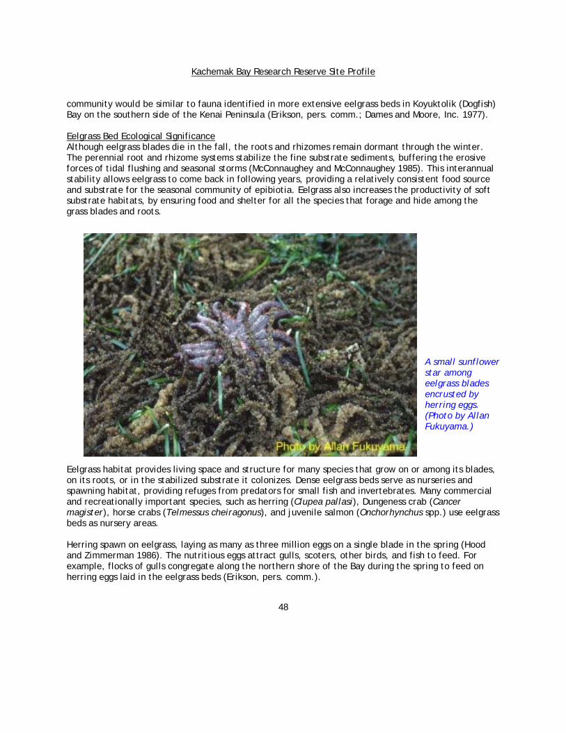
Kachemak Bay Research Reserve Site Profile
48
community would be similar to fauna identified in more extensive eelgrass beds in Koyuktolik (Dogfish) Bay on the southern side of the Kenai Peninsula (Erikson, pers. comm.; Dames and Moore, Inc. 1977).
Eelgrass Bed Ecological Significance Although eelgrass blades die in the fall, the roots and rhizomes remain dormant through the winter. The perennial root and rhizome systems stabilize the fine substrate sediments, buffering the erosive forces of tidal flushing and seasonal storms (McConnaughey and McConnaughey 1985). This interannual stability allows eelgrass to come back in following years, providing a relatively consistent food source and substrate for the seasonal community of epibiotia. Eelgrass also increases the productivity of soft substrate habitats, by ensuring food and shelter for all the species that forage and hide among the grass blades and roots.
A small sunflower star among eelgrass blades encrusted by herring eggs. (Photo by Allan Fukuyama.)
Eelgrass habitat provides living space and structure for many species that grow on or among its blades, on its roots, or in the stabilized substrate it colonizes. Dense eelgrass beds serve as nurseries and spawning habitat, providing refuges from predators for small fish and invertebrates. Many commercial and recreationally important species, such as herring (Clupea pallasi), Dungeness crab (Cancer magister), horse crabs (Telmessus cheiragonus), and juvenile salmon (Onchorhynchus spp.) use eelgrass beds as nursery areas. Herring spawn on eelgrass, laying as many as three million eggs on a single blade in the spring (Hood and Zimmerman 1986). The nutritious eggs attract gulls, scoters, other birds, and fish to feed. For example, flocks of gulls congregate along the northern shore of the Bay during the spring to feed on herring eggs laid in the eelgrass beds (Erikson, pers. comm.).

Kachemak Bay Research Reserve Site Profile
49
Some species of ducks and geese consume the plant directly, such as the Brant goose (Branta bernicla), while others forage among the leaves for epifauna. Brant depend on eelgrass for food during their long migration from Baja, California to Alaska and Canada. Almost the entire population of Brant congregates each fall and spring at Alaska’s Izembek Lagoon to forage at one of the world's largest eelgrass beds. Izembek Lagoon is located within the Izembek National Wildlife Refuge near Cold Bay on the Alaska Peninsula. These geese sometimes stop over in Kachemak Bay during their migration (Erikson, pers. comm.). Along with macroalgae, tidal marsh plants, and phytoplankton, eelgrass helps fuel the marine ecosystem through primary productivity. The abundant biomass, produced in the spring and summer growing seasons, dies in the fall and contributes substantial organic matter to Kachemak Bay’s detrital food web. Epibiota associated with eelgrass provide food for foraging fish, birds, and invertebrates. Isopods, for example, consume the eelgrass blades and conspecifics. Amphipods eat the isopods, and juvenile fish and invertebrates eat the amphipods. Human Impacts and Interactions Eelgrass indirectly provides food for people by supporting fisheries species such as Dungeness crab, salmon, and herring. Native Alaskan cultures historically made baskets, hats, and other textiles from its leaves (Wyllie-Echeverria and Thom 1994). Today, some Alaskan artists continue this tradition, twisting the grass into a fiber and creating artistic baskets. Eelgrass meadows occur in shallow water near shore and hence, are threatened by some types of coastal development activities. This plant is vulnerable because of its narrow tolerance for turbidity, sediment disturbance, and eutrophication, as well as its need for high ambient light. Turbidity can be magnified by sedimentation and water quality impacts from coastal development and logging. Eelgrass may suffer decreased photosynthesis and growth due to epiphytic algae growth on its blades and phytoplankton growth, limiting available light, caused by the addition of excess nutrients (from wastes, fertilizers, or other sources) to the nearshore environment. Changes in sedimentation patterns, propeller-wash from boats, and other physical disturbances can smother or uproot eelgrass from the fine sediments in which it grows. Although these threats have been documented in the Pacific Northwest and on the east coast of the United States (Wyllie-Echeverria and Thom 1994), their potential impacts have received little attention in Alaska. Subtidal Overview Kachemak Bay represents the fjord ecoregion in the National Estuarine Research Reserve System (NERRS). A deep, subtidal valley oriented northeast to southwest reflects the areas glacial history. As the glaciers melted during the last ice age, the sea level rose, flooding the Bay and submerging deep layers of glacial sediments. Glacial rivers continue to deposit fine silts that settle to the Bay's bottom, creating vast, unconsolidated sediment surfaces. Flushing tides, headland erosion, and successional processes continue to shape the underwater physical environment. Prominent features include Jakolof Trench, Archimandritof Shoals along the northern shelf, and many inlets and rocky islands along the southern shore. The Bay reaches its deepest point (192 meters) in Jakolof Trench, located north of Eldred Passage. The Trench may be an area of strong upwelling, supporting prey populations that attract large congregations of whales, harbor porpoise, sea birds, and

Kachemak Bay Research Reserve Site Profile
50
predatory fish. NOAA’s Kasitsna Bay Laboratory located southwest of the Trench provides opportunity to further investigate this region. Kachemak Bay’s northern shelf is probably a relict glacial moraine that forms a shallow (11 to 33 meter) triangular bank from Archimandritof Shoals to Anchor Point. The shelf supports extensive shell debris habitat, kelp beds, and mollusk reefs that are rich in life and biological diversity (Dames and Moore, Inc.1977). The Bay contains regions with disparate physical, chemical, and biological properties that suit different species. Subtidal community composition depends on factors, such as depth, substrate complexity, salinity, nutrients, current, oxygen, available light, and disturbance regimes. Larvae settlement and dispersal, predation, biological productivity, prey availability, and other biological interactions also determine which species establish a community.
Kachemak Bay’s glacially carved basin features deep holes south of the Homer Spit. The Homer Spit bisects the Bay into inner and outer zones with the inner having more freshwater influence, turbidity, and protection from Lower Cook Inlet waves. The Spit also creates a constriction that channels the racing tides into the southern side of the inner Bay. The sunlit photic zone supports photosynthesis and large populations of surface-dwelling plankton species. The aphotic zone below is

Kachemak Bay Research Reserve Site Profile
51
colder, darker, and has more marine influence because freshwater floats in a lens on the surface. No photosynthesis occurs in the aphotic zone; it receives most of its nutrients from the dead plankton and other marine life that rain down from above. Freshwater from glacial rivers carries a heavy load of fine sediments that decrease light penetration and biological productivity in turbid areas. Where waters with contrasting density, salinity, and other characteristics meet, floating debris and kelp may mark a rip line. Such boundary areas often contain a greater abundance of fish, as well as birds, people, and marine mammals that hunt fish in these areas. The Bay's subtidal communities need more study in order to determine community character, structuring processes, composition, ecological relationships, and spatial extent. Most available information on subtidal community structure and composition has been drawn from four surveys (Dames and Moore, Inc.1977, Dames and Moore, Inc. 1979, Driskell 1979, Feder and Jewett 1986). Driskell (1977) documented the Bay’s bottom substrate types and described the substrate below 10 fathoms in five units. Outer Kachemak Bay's substrate is shell debris, sand, muddy sand, and silt. The nearshore perimeter consists of cobbles and boulders. Sampling problems prevented clear mapping of habitat boundaries and have greatly limited the descriptions of communities, especially for subtidal boulder and cobble habitat. Current Subtidal Research The Research Reserve’s subtidal research currently focuses on bull kelp (Nereocystis leutkeana), kelp bed dynamics, and larval invertebrate recruitment to the Bay’s nearshore habitats. In August 2000, the spatial distribution of bull kelp beds were mapped in the Kachemak Bay Research Reserve using low altitude aerial photography and in situ measurements. Protocols were adapted from those currently used in Washington State and California for mapping Macrocystis forests. Low altitude aerial photos are being taken using a medium-format camera and a light fixed-wing aircraft to produce vertical and oblique digital imagery of individual kelp beds. These images are then geometrically corrected and the kelp beds delineated. The polygon data is entered into a GIS so that estimates of aerial extent and adjacency can be compared among beds and among years. Reserve researchers are also piloting a program to monitor the timing and abundance of larval settlement for the NERR System. As a logical extension of the NERR System Wide Monitoring Program (SWMP), measuring larval settlement over time allows the Reserve to study the linkage between larval supply and estuarine water quality. The Kachemak Bay Ecological Characterization’s 2001 CD-ROM contains GIS data on bathymetry, hydrology, seabird colonies, commercial and sport fisheries, marine invertebrates, finfish, marine mammals and selected plant distributions related to the subtidal environment.
Subtidal Midwater Communities A key fact underlying much of marine ecology is that most marine benthic organisms possess a pelagic larval stage that is capable of long-distance dispersal. This two-stage life cycle means that many populations of adults within a given area may disperse their young to other areas as zooplankton, and adult populations, in turn, may be dependent on distant populations for their own replenishment.

Kachemak Bay Research Reserve Site Profile
52
Studies conducted in the 1970s identified nearshore and oceanic zooplankton species dominated by the small copepods (Pseudocalanus spp., Acartia longiremis, and Oithona similes) – in Lower Cook Inlet and Kachemak Bay (Damkaer 1977). Dominant summer meroplankton included barnacle nauplii and crab zoea (English 1980). Damkaer (1977), Larrance et al. (1977), Sambrotto and Lorenzen (1986), Cooney (1986), English (1980), and more recent but unpublished data by Piatt et al. (Piatt, pers. comm.) describe plankton communities in detail. Cooney (1986) provides a list of zooplankton and ichthyoplankton, and Sambrotto and Lorenzen (1986) provide a list of phytoplankton identified in Gulf of Alaska studies by Hood and Zimmerman (1986). Phytoplankton species found in Lower Cook Inlet from April through August have been identified as microflagellates and the diatom species groups Thalassiosira spp. and Chaetoceros spp. (Larrance et al. 1977). The dated nature of these studies highlights the need for current research to characterize the plankton communities in Kachemak Bay, Lower Cook Inlet and the Gulf of Alaska.
The Research Reserve’s larval settlement and invasive species monitoring project entails collecting data on the species, timing, and abundance of larval settlement in Kachemak Bay. The KBRR is using several different kinds of larval collectors to mimic favored substrate types: Brushes (top left): Plastic cleaning brushes.
These are attached to our subtidal moorings and are used to attract echinoderm larvae; for example sea urchins, sea stars, brittle stars and sea cucumbers. Tuffy's™(middle left): Orange, plastic kitchen
scrubby. We bolt these onto intertidal rock and subtidal moorings. These are used primarily to collect blue mussels (Mytilus trossulus). Barnacle plates(bottom left): Squares of Safety
Walk™ tape. These usually attract common acorn barnacles (Balanus glandula), small acorn barnacles (Chthamalus dalli), and thatched barnacles (Semibalanus cariosus). Standardized Monitoring Units for the
Recruitment of Fishes (SMURF's)(noy shown): SMURF's are "nets" made of garden and snow fencing that act as mini-refugia for juvenile rockfish.
Data from this study will be useful for assessing how spatial and temporal trends in settlement are related to oceanic conditions. These data also may eventually be used to identify source (parent) populations of different flora and fauna, and where the larvae (offspring) of these populations end up by using genetic markers. Larval collectors may also serve as an early warning signal for exotic or

Kachemak Bay Research Reserve Site Profile
53
invasive species as the larvae of these organisms may be in the water column long before they can successfully recruit to the benthos. The water column community changes constantly as species follow feeding, spawning, and seasonal migration patterns. Some species, like rockfish, remain in the same general area, while others migrate on daily and seasonal cycles. Pandalid shrimp (Pandalus spp.), for example, come to the surface during the night to feed and descend to the bottom during the day to evade predators (Barr 1970). In general, summer is the peak of fish activity and fish abundance in the Bay. Halibut, for example, enter the Bay during summer to feed, but migrate to Cook Inlet and beyond during the winter. Even species like rockfish, that remain in the same general location throughout the year, are more active and may be more conspicuously colored during summer mating or nest-guarding periods (Dames and Moore, Inc. 1979). Over multi-year time scales, community composition also varies in response to prey availability, water temperatures, fishing, and other factors. For example, over the last 20 years, a major shift in community composition is evident from the results of trawl surveys and fish catches. While crab and shrimp dominated the ecosystem in the 1970s and early 1980s, gadids (cod) and flatfish now comprise the majority of species found in mid-water areas. Each year the Alaska Department of Fish and Game conducts trawl surveys in the Bay, collecting abundance and biomass estimates for fishery target shrimp species, such as pink (Pandalus borealis), humpy (P. goniurus), spot (P. platyceros), and coonstripe shrimp (P. hypsinotus), as well as groundfish species as shown on the summary of the 1995 trawl data. The most common species (by weight) in 1995 and 1997 were walleye pollock (Theragra chalcogramma) and flathead sole (Pleuronectes spp.). The Alaska Department of Fish and Game's mid-water trawl survey’s results present a snapshot portrait of the water column community. Although dated, Hood and Zimmerman (1986) and other surveys intended to document the source, movement, and habitat needs of king crab (Paralithodes camtschaticus) and shrimp larvae provide some background on the water column community (Sundberg and Clausen 1977, Haynes 1977, Haynes and Wing 1977, Haynes 1983). Subtidal - Shell Debris Communities Kachemak Bay supports abundant and diverse bivalve mollusc populations. After bivalves are killed by sea otters or die of other causes, their shells drift to the bottom and create a habitat type called shell debris. If currents allow the shells to persist, they accumulate and form extensive areas of shell debris habitat. Occasional red tide outbreaks, leading to mass mortality, may help replenish the shell supply to these habitats (Dames and Moore, Inc. 1977). Shell debris covers softer sediments and creates additional hard attachment surfaces for anemones and hydroids. Crab and other invertebrates seek cover among these shell fragments. Vast expanses of this habitat type exist throughout the Bay at elevations from 22 to 66 meters (Driskell 1979, Harness, pers. comm.). Large persistent patches of shell debris cover a triangle from the Homer Spit west towards the Inlet, and an area from MacDonald Spit towards Seldovia on the southern side, surrounding a deeper area of muddy sand, rippled sand, and silt (Driskell 1979). The northern and southern wedges of shell debris differ in community composition. According to observations by SCUBA divers, shallow and patchy shell debris communities also occur along the southern shore (Harness, pers. comm.).

Kachemak Bay Research Reserve Site Profile
54
Shell debris may accumulate after severe toxin-caused die-offs in Kachemak Bay (drawing by Nancy Mackey, courtesy of Dames and Moore, Inc.). Shell debris communities contain a diversity of deposit and suspension feeders as well as predators and scavengers, but suspension feeders dominate. Prominent taxa include barnacles, bryozoans, hydroids, shrimps, ascidians, brittle stars, sea cucumbers, sponges, gastropods, and urchins. Results from Driskell's 1977 survey showed that the northern shell debris assemblage supported a greater diversity of molluscs, bryozoans, and polychaetes (24 species) than that found in the southern debris assemblage (4 conspicuous species). The underlying non-organic substrate and current regimes differed between the two, perhaps accounting for the disparity. The northern habitat was comprised of a coarser mixture of sand, silt, and cobble than the sandier south. As water flushes from the Bay, along the northern shore out to Cook Inlet, strong tidal currents sweep past the northern side, bringing plenty of food to the filter-feeding community (Dames and Moore, Inc. 1979). The larger-grained, more stable cobble component and the strong current may lead to a more diverse community of epibenthic organisms. These surveys noted only conspicuous species, and their inconclusive results highlight the obvious holes in our knowledge of the Bay's subtidal communities.
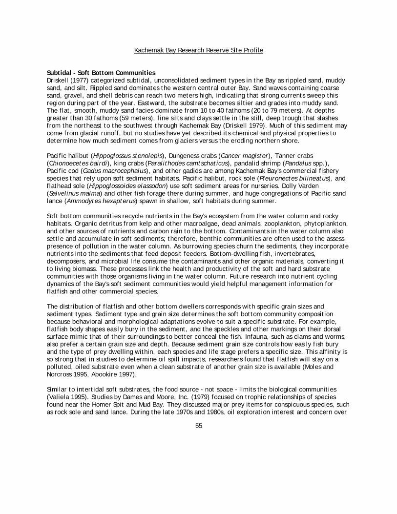
Kachemak Bay Research Reserve Site Profile
55
Subtidal - Soft Bottom Communities Driskell (1977) categorized subtidal, unconsolidated sediment types in the Bay as rippled sand, muddy sand, and silt. Rippled sand dominates the western central outer Bay. Sand waves containing coarse sand, gravel, and shell debris can reach two meters high, indicating that strong currents sweep this region during part of the year. Eastward, the substrate becomes siltier and grades into muddy sand. The flat, smooth, muddy sand facies dominate from 10 to 40 fathoms (20 to 79 meters). At depths greater than 30 fathoms (59 meters), fine silts and clays settle in the still, deep trough that slashes from the northeast to the southwest through Kachemak Bay (Driskell 1979). Much of this sediment may come from glacial runoff, but no studies have yet described its chemical and physical properties to determine how much sediment comes from glaciers versus the eroding northern shore. Pacific halibut (Hippoglossus stenolepis), Dungeness crabs (Cancer magister), Tanner crabs (Chionoecetes bairdi), king crabs (Paralithodes camtschaticus), pandalid shrimp (Pandalus spp.), Pacific cod (Gadus macrocephalus), and other gadids are among Kachemak Bay's commercial fishery species that rely upon soft sediment habitats. Pacific halibut, rock sole (Pleuronectes bilineatus), and flathead sole (Hippoglossoides elassodon) use soft sediment areas for nurseries. Dolly Varden (Salvelinus malma) and other fish forage there during summer, and huge congregations of Pacific sand lance (Ammodytes hexapterus) spawn in shallow, soft habitats during summer. Soft bottom communities recycle nutrients in the Bay's ecosystem from the water column and rocky habitats. Organic detritus from kelp and other macroalgae, dead animals, zooplankton, phytoplankton, and other sources of nutrients and carbon rain to the bottom. Contaminants in the water column also settle and accumulate in soft sediments; therefore, benthic communities are often used to the assess presence of pollution in the water column. As burrowing species churn the sediments, they incorporate nutrients into the sediments that feed deposit feeders. Bottom-dwelling fish, invertebrates, decomposers, and microbial life consume the contaminants and other organic materials, converting it to living biomass. These processes link the health and productivity of the soft and hard substrate communities with those organisms living in the water column. Future research into nutrient cycling dynamics of the Bay's soft sediment communities would yield helpful management information for flatfish and other commercial species. The distribution of flatfish and other bottom dwellers corresponds with specific grain sizes and sediment types. Sediment type and grain size determines the soft bottom community composition because behavioral and morphological adaptations evolve to suit a specific substrate. For example, flatfish body shapes easily bury in the sediment, and the speckles and other markings on their dorsal surface mimic that of their surroundings to better conceal the fish. Infauna, such as clams and worms, also prefer a certain grain size and depth. Because sediment grain size controls how easily fish bury and the type of prey dwelling within, each species and life stage prefers a specific size. This affinity is so strong that in studies to determine oil spill impacts, researchers found that flatfish will stay on a polluted, oiled substrate even when a clean substrate of another grain size is available (Moles and Norcross 1995, Abookire 1997). Similar to intertidal soft substrates, the food source - not space - limits the biological communities (Valiela 1995). Studies by Dames and Moore, Inc. (1979) focused on trophic relationships of species found near the Homer Spit and Mud Bay. They discussed major prey items for conspicuous species, such as rock sole and sand lance. During the late 1970s and 1980s, oil exploration interest and concern over
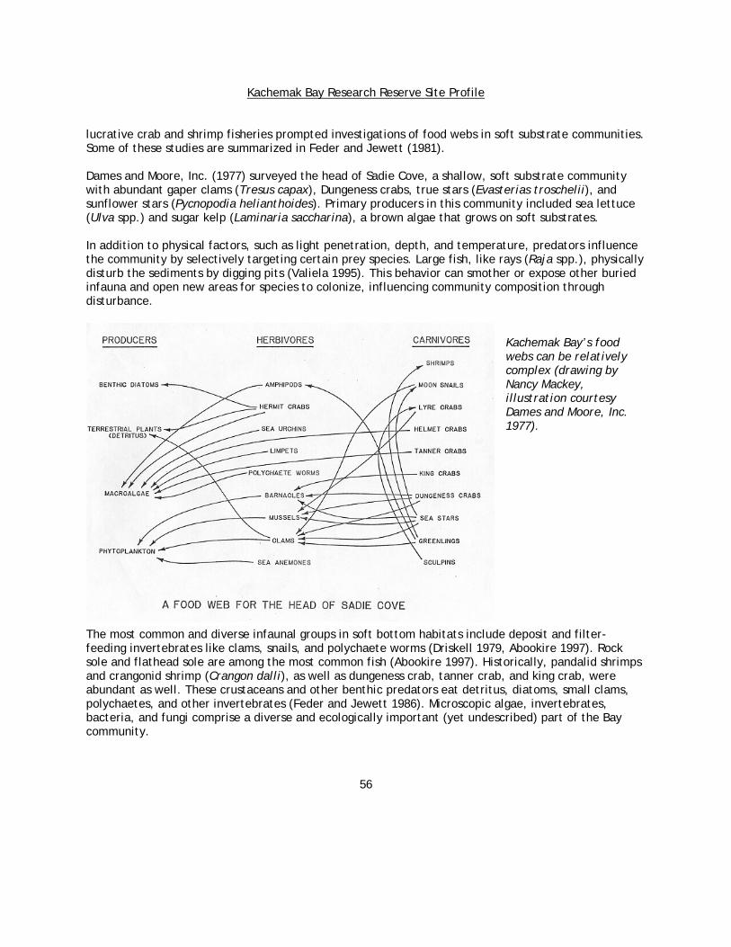
Kachemak Bay Research Reserve Site Profile
56
lucrative crab and shrimp fisheries prompted investigations of food webs in soft substrate communities. Some of these studies are summarized in Feder and Jewett (1981). Dames and Moore, Inc. (1977) surveyed the head of Sadie Cove, a shallow, soft substrate community with abundant gaper clams (Tresus capax), Dungeness crabs, true stars (Evasterias troschelii), and sunflower stars (Pycnopodia helianthoides). Primary producers in this community included sea lettuce (Ulva spp.) and sugar kelp (Laminaria saccharina), a brown algae that grows on soft substrates. In addition to physical factors, such as light penetration, depth, and temperature, predators influence the community by selectively targeting certain prey species. Large fish, like rays (Raja spp.), physically disturb the sediments by digging pits (Valiela 1995). This behavior can smother or expose other buried infauna and open new areas for species to colonize, influencing community composition through disturbance.
Kachemak Bay’s food webs can be relatively complex (drawing by Nancy Mackey, illustration courtesy Dames and Moore, Inc. 1977).
The most common and diverse infaunal groups in soft bottom habitats include deposit and filter-feeding invertebrates like clams, snails, and polychaete worms (Driskell 1979, Abookire 1997). Rock sole and flathead sole are among the most common fish (Abookire 1997). Historically, pandalid shrimps and crangonid shrimp (Crangon dalli), as well as dungeness crab, tanner crab, and king crab, were abundant as well. These crustaceans and other benthic predators eat detritus, diatoms, small clams, polychaetes, and other invertebrates (Feder and Jewett 1986). Microscopic algae, invertebrates, bacteria, and fungi comprise a diverse and ecologically important (yet undescribed) part of the Bay community.

Kachemak Bay Research Reserve Site Profile
57
Geological character and history shape the distribution of sediment and substrate, but the speed and direction of currents help determine the grain size of soft bottom materials, such as silt and sand. In general, faster current areas contain coarse-grained sediments, and ripple marks and sand waves indicate very strong currents (Driskell 1979). Community composition varies depending on substrate, currents, food availability, depth, season, and other factors. While each site differs in community composition to some degree, they share a prominent community of filter and deposit feeding invertebrates. Distinct biological communities develop on rippled sand, muddy sand, and silt bottom types because each favors different morphological and behavioral adaptations. Using representative sites from surveys conducted in the late 1970s to the early 1980s, the following section describes dominant infaunal species that were found in sand, muddy sand, and silt bottom types (as defined by Driskell 1979). Currents generated by grab, trawl, dredge, and other types of benthic sampling gear blow off the surface layers of sediments and often allow minute organisms to escape. This limits detailed, accurate community sampling and characterization. Further, each method favors different taxa, making it difficult to compare survey data from Alaska Department of Fish and Game's surveys, Feder's research on Cook Inlet, and Driskell's survey of benthic habitats. To avoid misrepresentation of typical community compositions, the following sandy, muddy sand, and silt community descriptions separate observations by the source. Subtidal Softbottom Sand AssemblagesOf the communities described in this section, surveys found that the Bay's sand assemblages had the least number of species and lowest abundance (Driskell 1979). Dominant invertebrates included surf clams (Mactromeris polynyma), white clams (Axinopsida serricata), Nuttall’s cockles (Clinocardium nuttallii), snails (Oenopota newcombei), great Alaskan tellin (Tellina lutea), plain tellin (T. modesta), and salmon tellin (T. nuculoides). The samples contained a few polychaetes, most common of which were from the family Orbiniidae. Northern sand dollars (Echinarachnius parma) were common throughout the rippled sand assemblage. Dames and Moore, Inc. (1979) studied communities in shallower soft bottom habitats than those surveyed by Driskell (1979), including Mud Bay and the sandy Homer Spit. The exposed Homer Spit's sandy bottom community, like others in the Bay, changes markedly from summer to winter as fish migrate to the Bay and nearshore from deeper waters in Lower Cook Inlet and elsewhere. Demersal flatfish dominate the community during summer, and other residents include Pacific sand lance, Pacific staghorn sculpin (Leptocottus armatus), English sole (Pleuronectes vetulus), rock sole, sturgeon poacher (Podothecus acipenserinus), and Dolly Varden. During the winter, however, the flatfish and Dolly Varden depart, leaving only low densities of sand lance, sculpin, and surf smelt (Hypomesus pretiosus) (Dames and Moore, Inc. 1979). Schooling fish, like sand lance, come towards shore to feed at high tides and retreat at low tides (Dames and Moore, Inc. 1979). Lower Cook Inlet studies by Feder and Paul (1981) included sampling sites in the vicinity of the rippled sand and coarse substrates (as defined by Driskell 1979). Feder and Paul (1981) found that in rippled-sand areas common fish species included northern sculpin (Icelinus borealis), Pacific halibut, starry flounder (Platichthys stellatus), yellowfin sole (Limanda asper), great sculpin (Myoxocephalus polyacanthocephalus), and invertebrates, such as green sea urchin (Stongylocentrotus droebachiensis) and football sea cucumbers (Cucumaria fallax). In the current-swept and sandy eastern side of the
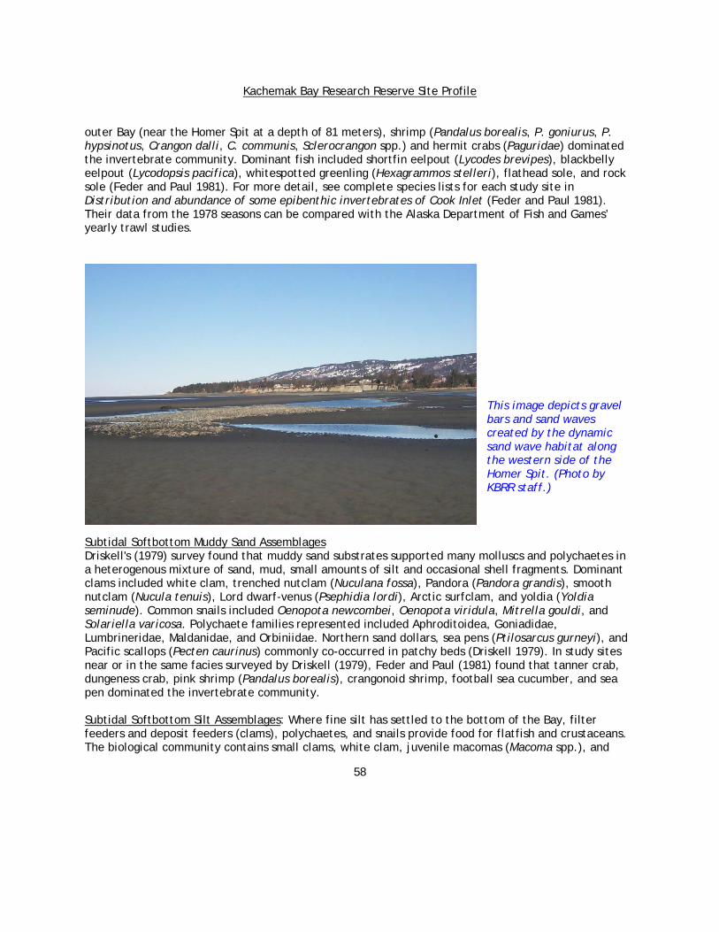
Kachemak Bay Research Reserve Site Profile
58
outer Bay (near the Homer Spit at a depth of 81 meters), shrimp (Pandalus borealis, P. goniurus, P. hypsinotus, Crangon dalli, C. communis, Sclerocrangon spp.) and hermit crabs (Paguridae) dominated the invertebrate community. Dominant fish included shortfin eelpout (Lycodes brevipes), blackbelly eelpout (Lycodopsis pacifica), whitespotted greenling (Hexagrammos stelleri), flathead sole, and rock sole (Feder and Paul 1981). For more detail, see complete species lists for each study site in Distribution and abundance of some epibenthic invertebrates of Cook Inlet (Feder and Paul 1981). Their data from the 1978 seasons can be compared with the Alaska Department of Fish and Games’ yearly trawl studies.
This image depicts gravel bars and sand waves created by the dynamic sand wave habitat along the western side of the Homer Spit. (Photo by KBRR staff.)
Subtidal Softbottom Muddy Sand AssemblagesDriskell's (1979) survey found that muddy sand substrates supported many molluscs and polychaetes in a heterogenous mixture of sand, mud, small amounts of silt and occasional shell fragments. Dominant clams included white clam, trenched nutclam (Nuculana fossa), Pandora (Pandora grandis), smooth nutclam (Nucula tenuis), Lord dwarf-venus (Psephidia lordi), Arctic surfclam, and yoldia (Yoldia seminude). Common snails included Oenopota newcombei, Oenopota viridula, Mitrella gouldi, and Solariella varicosa. Polychaete families represented included Aphroditoidea, Goniadidae, Lumbrineridae, Maldanidae, and Orbiniidae. Northern sand dollars, sea pens (Ptilosarcus gurneyi), and Pacific scallops (Pecten caurinus) commonly co-occurred in patchy beds (Driskell 1979). In study sites near or in the same facies surveyed by Driskell (1979), Feder and Paul (1981) found that tanner crab, dungeness crab, pink shrimp (Pandalus borealis), crangonoid shrimp, football sea cucumber, and sea pen dominated the invertebrate community. Subtidal Softbottom Silt Assemblages: Where fine silt has settled to the bottom of the Bay, filter feeders and deposit feeders (clams), polychaetes, and snails provide food for flatfish and crustaceans. The biological community contains small clams, white clam, juvenile macomas (Macoma spp.), and
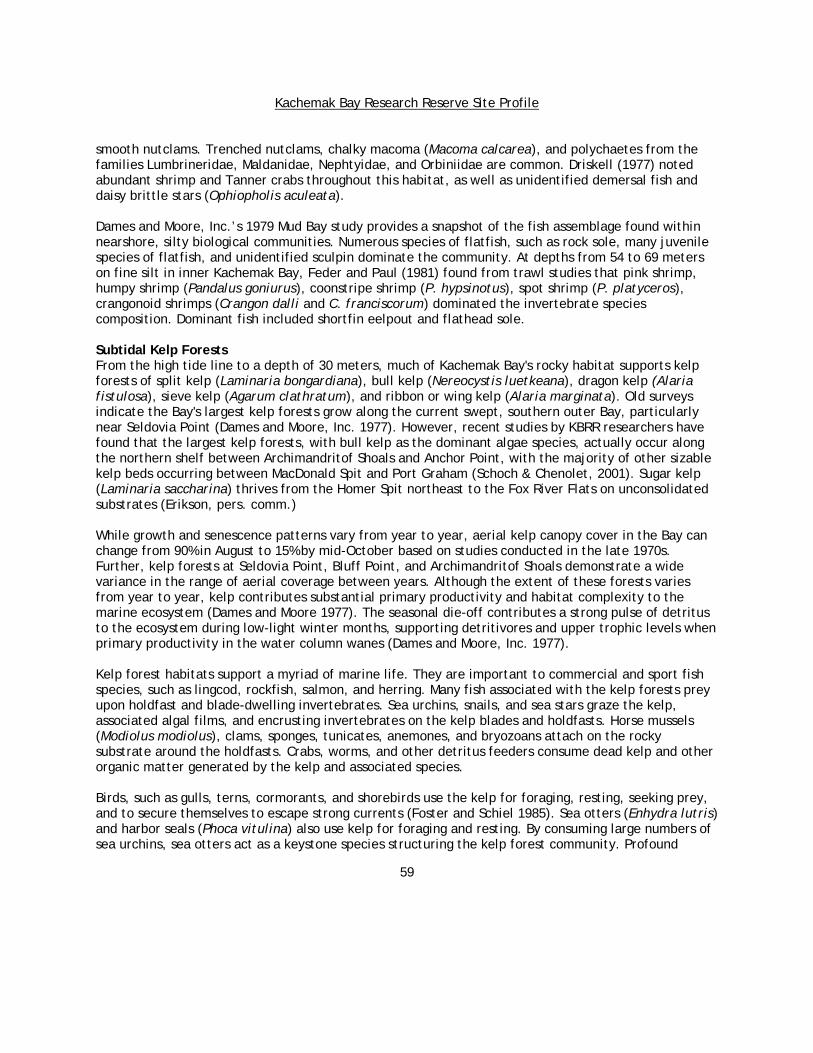
Kachemak Bay Research Reserve Site Profile
59
smooth nutclams. Trenched nutclams, chalky macoma (Macoma calcarea), and polychaetes from the families Lumbrineridae, Maldanidae, Nephtyidae, and Orbiniidae are common. Driskell (1977) noted abundant shrimp and Tanner crabs throughout this habitat, as well as unidentified demersal fish and daisy brittle stars (Ophiopholis aculeata). Dames and Moore, Inc.’s 1979 Mud Bay study provides a snapshot of the fish assemblage found within nearshore, silty biological communities. Numerous species of flatfish, such as rock sole, many juvenile species of flatfish, and unidentified sculpin dominate the community. At depths from 54 to 69 meters on fine silt in inner Kachemak Bay, Feder and Paul (1981) found from trawl studies that pink shrimp, humpy shrimp (Pandalus goniurus), coonstripe shrimp (P. hypsinotus), spot shrimp (P. platyceros), crangonoid shrimps (Crangon dalli and C. franciscorum) dominated the invertebrate species composition. Dominant fish included shortfin eelpout and flathead sole. Subtidal Kelp Forests From the high tide line to a depth of 30 meters, much of Kachemak Bay's rocky habitat supports kelp forests of split kelp (Laminaria bongardiana), bull kelp (Nereocystis luetkeana), dragon kelp (Alaria fistulosa), sieve kelp (Agarum clathratum), and ribbon or wing kelp (Alaria marginata). Old surveys indicate the Bay's largest kelp forests grow along the current swept, southern outer Bay, particularly near Seldovia Point (Dames and Moore, Inc. 1977). However, recent studies by KBRR researchers have found that the largest kelp forests, with bull kelp as the dominant algae species, actually occur along the northern shelf between Archimandritof Shoals and Anchor Point, with the majority of other sizable kelp beds occurring between MacDonald Spit and Port Graham (Schoch & Chenolet, 2001). Sugar kelp (Laminaria saccharina) thrives from the Homer Spit northeast to the Fox River Flats on unconsolidated substrates (Erikson, pers. comm.) While growth and senescence patterns vary from year to year, aerial kelp canopy cover in the Bay can change from 90% in August to 15% by mid-October based on studies conducted in the late 1970s. Further, kelp forests at Seldovia Point, Bluff Point, and Archimandritof Shoals demonstrate a wide variance in the range of aerial coverage between years. Although the extent of these forests varies from year to year, kelp contributes substantial primary productivity and habitat complexity to the marine ecosystem (Dames and Moore 1977). The seasonal die-off contributes a strong pulse of detritus to the ecosystem during low-light winter months, supporting detritivores and upper trophic levels when primary productivity in the water column wanes (Dames and Moore, Inc. 1977). Kelp forest habitats support a myriad of marine life. They are important to commercial and sport fish species, such as lingcod, rockfish, salmon, and herring. Many fish associated with the kelp forests prey upon holdfast and blade-dwelling invertebrates. Sea urchins, snails, and sea stars graze the kelp, associated algal films, and encrusting invertebrates on the kelp blades and holdfasts. Horse mussels (Modiolus modiolus), clams, sponges, tunicates, anemones, and bryozoans attach on the rocky substrate around the holdfasts. Crabs, worms, and other detritus feeders consume dead kelp and other organic matter generated by the kelp and associated species. Birds, such as gulls, terns, cormorants, and shorebirds use the kelp for foraging, resting, seeking prey, and to secure themselves to escape strong currents (Foster and Schiel 1985). Sea otters (Enhydra lutris) and harbor seals (Phoca vitulina) also use kelp for foraging and resting. By consuming large numbers of sea urchins, sea otters act as a keystone species structuring the kelp forest community. Profound
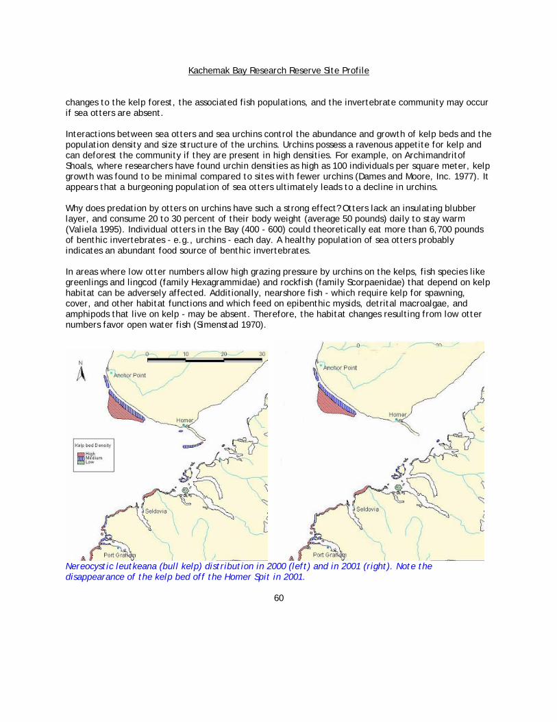
Kachemak Bay Research Reserve Site Profile
60
changes to the kelp forest, the associated fish populations, and the invertebrate community may occur if sea otters are absent. Interactions between sea otters and sea urchins control the abundance and growth of kelp beds and the population density and size structure of the urchins. Urchins possess a ravenous appetite for kelp and can deforest the community if they are present in high densities. For example, on Archimandritof Shoals, where researchers have found urchin densities as high as 100 individuals per square meter, kelp growth was found to be minimal compared to sites with fewer urchins (Dames and Moore, Inc. 1977). It appears that a burgeoning population of sea otters ultimately leads to a decline in urchins. Why does predation by otters on urchins have such a strong effect? Otters lack an insulating blubber layer, and consume 20 to 30 percent of their body weight (average 50 pounds) daily to stay warm (Valiela 1995). Individual otters in the Bay (400 - 600) could theoretically eat more than 6,700 pounds of benthic invertebrates - e.g., urchins - each day. A healthy population of sea otters probably indicates an abundant food source of benthic invertebrates.
In areas where low otter numbers allow high grazing pressure by urchins on the kelps, fish species like greenlings and lingcod (family Hexagrammidae) and rockfish (family Scorpaenidae) that depend on kelp habitat can be adversely affected. Additionally, nearshore fish - which require kelp for spawning, cover, and other habitat functions and which feed on epibenthic mysids, detrital macroalgae, and amphipods that live on kelp - may be absent. Therefore, the habitat changes resulting from low otter numbers favor open water fish (Simenstad 1970).
Nereocystic leutkeana (bull kelp) distribution in 2000 (left) and in 2001 (right). Note the disappearance of the kelp bed off the Homer Spit in 2001.

Kachemak Bay Research Reserve Site Profile
61
In 2000, over 30.6 km2 of kelp forest were mapped in the Bay by KBRR researchers using low altitude aerial photography and in situ measurements. The same protocols were repeated in 2001, but those analyses have not been completed. Preliminary estimates however, indicate a >10% decline in surface area. This was mostly due to the inundation of rocky habitat by sand over a shallow subtidal bench near the Homer Spit. The variability of each kelp bed area and density will be tracked over time as an indicator of change and kelp community health. The Reserve intends to continue these surveys for a minimum of 10 years to track kelp bed changes through at least one major cycle of known oceanic variability (the El Nino/Southern Oscillation). Correlative work stemming from aerial surveys will help focus experimental studies to determine the mechanisms of observed changes in kelp population size and density. In order to attribute shifts in spatial patterns to specific agents of change, ongoing research by Reserve staff is focusing on the effects of light limitation, salinity, and herbivory on kelp growth rates. Terrestrial Environment
The south side of the Bay has steep terrain capped by snowy peaks, primarily influenced by a maritime climate, with glacial-melt dominated streams. (Photo by Carmen Field)
There is a remarkable distinction between the vegetation communities located on the northern and southern sides of the Kachemak Bay Watershed. This dissimilarity is a reflection of differences in geology, climate, soils, and hydrology. The southern side of the Bay is a steep, mountainous, ice field. It is a physiographic province with active glaciers, as well as ice fields with tidewater terminations on the Gulf of Alaska side of the Kenai Peninsula. This area is part of the Chugach Terrane, a complex of Mesozoic strata, including sedimentary sandstone, radiolarian chert, and mafic pluton. The northern side, in contrast, is part of an extensive, lowland, physiographic province, with a gentle topographic gradient and no active glaciation. This area is part of the Kenai lowlands and includes tertiary sediments of shale, sandstone, coal, and claystone, overlain by glacial till deposits. Kachemak Bay itself occupies a structural trough between these two contrasting physiographic provinces.

Kachemak Bay Research Reserve Site Profile
62
The Fox River Valley, which encompasses the Fox, Bradley, and Sheep Rivers, lies at the head of the Bay. In this region, the open water of the Bay no longer separates the northern and southern flanks of the watershed. Instead, there is a broad riparian corridor with extensive mudflats and a salt marsh closer to the Bay. The southern side of the valley is geologically similar to the southern side of the Bay as it is part of the Kenai Mountains. The floor of the valley and the northern side of the valley are geologically similar to the northern side, which is largely comprised of surficial glacial deposits, landslide remains, and floodplain deposits. Botanists working with the Natural Resource Conservation Service (NRCS) are developing a vegetation classification for the southern Kenai Peninsula, which includes the northern side of Kachemak Bay’s watershed. However, current and/or detailed information is lacking for the head of the Bay and for the southern side.
The north side of the Bay is a relatively low-lying undulating landscape, influenced by a predominately continental climate, with stream flow driven by precipitation and groundwater. (Photo by Mike Wiedmer.)
From an aerial view, the vegetation on north side of the Bay appears as a mosaic of patches and dendritic branching. Unlike the southern side of the Bay, the northern side has not been glaciated for tens of thousands of years. Wetland plant communities are common on the northern side, and are associated with the many depressions, poor draining slopes, and riparian areas that form the intricate geomorphology. These various formations create the potential for diverse microclimates, and hence, the patchwork of vegetation. Forests of the northern watershed occur primarily on terraces (relatively level bench or step-like surfaces that break the continuity of a slope). Most of these forest communities contain Lutz spruce (Picea X lutzii), which is a hybrid between white spruce (Picea glauca) and Sitka spruce (Picea sitchensis). The occurrence of this hybrid is another example of the mixing of maritime and continental climates. Sitka spruce is a coastal species, and white spruce is an interior species (Alaback et al. 1994). Willow and paper birch (Betula papyrifera) are found with the spruce in some locations. Non-forest communities include Sitka alder (Alnus viridis sinuate) thickets, bluejoint grass (Calamagrostis canadensis)-fireweed (Epilobium angustifolium) communities, and meadows of mixed herbaceous flowers, grasses and sedges. Wetlands are common and include willow (Salix barclayii)–grass communities in riparian areas, and peatland fens in the extensive glacial lakes and drainage ways.

Kachemak Bay Research Reserve Site Profile
63
Peat wetland fens are common features occupying relict glacial lakebeds and glacial drainageways on the north side of Kachemak Bay. At left: A peatland fen in the upper reaches of the Anchor River. (Photo by Coowe Walker.)
With massive glaciers covering much of the landscape on the southern side, fewer wetlands are found. The areas of most recent deglaciation are steeply sloped, having had less time to accumulate soil. Riparian corridors are narrow and deep with streams typically originating at the foot of glaciers. Most marshes on the southern side are associated with eutrophic lakes that are in transition to marsh. Fresh water marsh communities are characterized by sedge (Carex spp.), tall cotton grass (Eriophorum spp.), willow (Salix spp.), and bog cranberry (Oxycoccux oxycoccos) (Alaska Department of Natural Resources 1995). Coastal salt marshes are associated with the many embayments that mark the southern coastline of the Bay. Left: photo of alpine lakes between Grewingk and Portlock Glaciers. (Photo by Steve Baird.)

Kachemak Bay Research Reserve Site Profile
64
On the southern side of the watershed, plant communities follow an elevation gradient from beach to forest, to subalpine to alpine, except in areas where snow slides regularly occur. Wetland plant communities are not as common as they are on the northern side; however, there are hydrophytic communities associated with the fjords and some of the alpine lakes. In snow slide areas, the vegetation within and alongside the snow chutes is stunted and succession is interrupted. The result is fingers of early succession habitat protruding into wide areas of later succession habitat (Alaska Department of Natural Resources 1995). Unfortunately, detailed plant community analysis, such as that available for the north side of the Bay, is lacking for the south side. Forested communities on the south side are dominated by Sitka spruce (Picea sitchensis) forests that grow between sea level and 666 meters in elevation. Forests of black cottonwood (Populus balsamifers trichocarpa) occur along riparian corridors, rivers and creeks, and away from the direct marine influence of the Bay. Non-forested plant communities occur in alpine and sub-alpine areas where extreme temperatures, steep slopes, and lack of soil development limit tree growth. Alder (Alnus spp.) dominate the subalpine community and occurs in variable associations with birch (Betula spp.) and willow (Salix spp.). The herb layer is diverse with a variety of grasses, wild flowers, ferns, and mosses. It is difficult to define where the subalpine ends and the alpine begins (Alaska Department of Natural Resources 1995). Above the alpine vegetation is a seemingly endless expanse of snow and ice. Nine glaciers stretch from the Gulf of Alaska to the south crest over the Kenai Mountains, blending with the Harding Ice Field and extending towards Kachemak Bay to the north.
Watershed Research In 1972, 7,200 acres of the Flats, the area nearest Kachemak Bay, was designated as a Critical Habitat Area for the purpose of protecting habitat critical to the perpetuation of wildlife. Cattle and horse grazing has been ongoing on the Flats since the late 1800s, and is still permitted. Since 1955, formal grazing rights have been leased to the Fox River Flats Cattlemen's Association, which grazes an average of 296 cattle each summer. The current grazing lease includes approximately 4,500 acres of land located within the Flats' Critical Habitat Area. Several studies on the effects of grazing on plant communities were conducted prior to the renewal of the lease in 1995. The studies included exclosure experiments, assessment of cattle utilization, evaluation of plant annual production, ecological site mapping (basic plant communities and soils), and visual reconnaissance assessments by several biologists. The results of these studies indicate that cattle prefer to graze the intertidal sedge communities and to use upland areas for loafing. The reports also indicate that grazing in the upper Fox River Valley is minimal. While these studies suggest that grazing pressure in general is light, even in the preferred intertidal areas, notable changes in plant species composition between grazed and ungrazed areas were identified, including lowered vegetation density, height and seed-head density (Swanson and Barker 1992, Swanson 1999).
During the 1980's and 1990's, the spruce forests of Kachemak Bay’s watershed experienced an epidemic spruce bark beetle (Dendroctonus rufipennis) infestation, resulting in the death of over 2.3 million acres of spruce on the Kenai Peninsula. Vast acres of dead and dying timber left in the wake of declining beetle activity have resulted in changes to hydrology, woody debris inputs to streams, and wildlife habitat. A recent socioeconomic report prepared for the Kachemak Bay region pointed to the bark beetle infestation as a major cause of anthropogenic changes to the watershed due to increased logging, development and fires. The spruce bark beetle is not new to the area, nor is it the only insect

Kachemak Bay Research Reserve Site Profile
65
to affect the region's forests. Epidemic scale outbreaks are known to have occurred on the lower Kenai Peninsula as far back as the mid-1800s. The recent epidemic, however, has certainly been the most significant terrestrial ecological disturbance to the area in recorded history (Wittwer et al. 1998), and has prompted numerous vegetation mapping efforts.
Spatial datasets on the vegetation communities in the watershed include: • Plant communities for the Kenai Peninsula have been mapped at a course scale, with an
emphasis on understanding the consequences of the spruce bark beetle infestation (www.borough.kenai.ak.us/sprucebeetle/vegmap/vegpage/veg_page.htm).
• A wetland plant community classification is being developed for the Kenai lowlands, which includes the north side of Kachemak Bay. The final product will include a GIS database of wetland plant communities that are nested within the ecosystem geomorphic setting (www.uaa.alaska.edu/enri/aknhp_web/).
Information available on the soils, surficial and subsurface geology of the area, includes: • A bedrock geology map, completed in 2000 by the US Geological Survey, is available for the
lower Kenai Peninsula (wrgis.wr.usgs.gov/open-file/of99-18/). • A soil survey for the lower Kenai Peninsula, scheduled for completion in 2004 by the
Natural Resources Conservation Service, includes detailed information on the vegetation communities associated with each soil type.
General information on the animal populations in the watershed include: • A map database showing the extent of anadromous streams for the state
(www.habitat.adfg.state.ak.us/geninfo/anadcat/anadcat.shtml), and very general maps of large game animal distributions on the Kenai Peninsula, maintained by the Alaska Department of Fish and Game.
Information on streams in the watershed includes: • Water quality monitoring on several of the streams that drain the watershed surrounding
Kachemak Bay (www.inletkeeper.org/). In addition, a variety of spatial datasets are available documenting human uses on the lower Kenai Peninsula, including parcel data, roads, stream crossings, and forest practices. These datasets provide valuable baseline information, however large knowledge gaps remain. The Research Reserve is particularly interested in leading efforts to understand the marine-freshwater interface, including:studying the effects of salmonid marine derived nutrients in the watershed and nearshore environments, understanding how watershed hydrology affects the estuarine ecosystem functions, and understanding in-stream and riparian habitat structure. In 2003, the Reserve initiated a study to investigate the presence and effects of marine derived nutrients in stream, riparian and nearshore ecosystems on the southern Kenai Peninsula. The Reserve has developed a planning tool for an area of the Kenai lowlands that provides land use planners, managers and property owners with a means for understanding wetland functions from the watershed perspective. This tool combines GIS and illustrated narratives to enable people to understand and incorporate knowledge of peatland ecosystem functions into land use planning decisions. Development of this tool led the Reserve to combine efforts with a consortium of several local groups with the purpose of developing a landscape continuum approach to researching and providing community education and outreach on watershed ecosystem processes. Partners in this effort include the Homer Soil and Water District, the Community Rivers Planning Coalition, the Kenai Watershed Forum, the Cook Inlet Keeper and the US Environmental Protection Agency. This

Kachemak Bay Research Reserve Site Profile
66
collaborative effort recently served as a focal point for developing a watershed research framework. In June 2003, the Reserve hosted a workshop of researchers that resulted in the identification of several priority research considerations that integrate headwaters to saltmarsh. The Reserve plans to continue to develop research in the saltmarsh-river mouth environment in conjunction with the larger collaborative effort, and to encourage and facilitate other partners who are developing the stream, peatland and upland research components. The vegetation communities of the many saltmarshes of the Bay were mapped during the summer of 2003, providing valuable baseline information for monitoring and research.
The Reserve’s office has a view of Beluga Slough, the largest saltmarsh in Homer. (Photo by Carmen Field.)
The Human Dimension in Kachemak Bay Overview For millennia, Kachemak Bay has attracted and provided sustenance for people. The Bay is rich in resources; this richness arises in part from the varied topography, plant and animal life, geology, and climates of the northern and southern shores. The lives of people living here have always been linked with Kachemak Bay. The oldest sites are at the water's edge. People were living along the shores of Aurora Lagoon 4,500 years ago. Older sites have been identified, but they have not been dated precisely due largely to the lack of material suitable for radiocarbon dating. The ancient residents of Kachemak Bay arrived by kayaks or larger umiaks. They settled near the water and traveled upon it. Offshore, the people harvested edible plants and animals from the intertidal areas; hunted seal, sea otters, porpoise and beluga in nearshore waters; fished in deeper waters; and harvested seabird eggs, chicks, and adults from rookeries on steep-sided islands. Onshore, the people harvested a multitude of plants, caught salmon in fresh water streams, and found temporary shelter in rock niches. They hunted caribou, Dall sheep, bears, marmots, foxes, and birds to eat. They collected slate for knives, ulus, and spear points. They used chert for arrowheads and baked red shale for beads and tiny, carved figurines. They also rounded beach boulders and pebbles for fishing weights.

Kachemak Bay Research Reserve Site Profile
67
When the Russians arrived in the late 1700s, they also came by water and sought aquatic riches, especially the pelts of sea otters. They noted schools of herring in Seldovia Bay and coal near the Homer Spit. With the purchase of Alaska by the United States in 1867, Americans trickled northward, crossing the North Pacific by boat from the west coast. The first economies of the American Period were coal and gold mining, fishing, agriculture, and fur farming. In the first eight decades of the 20th century, the development of numerous fisheries kept residents focused on the bounty of the Bay: herring, halibut, salmon, shrimp, crabs, and clams. Seldovia, the social, religious, and economic center of Kachemak Bay until the mid-1960s was water-oriented. Homes and businesses lined the waterfront. People traveled on foot or by boat and dined on foods harvested from adjacent beaches, forests, and waters. Halibut Cove has always been marine oriented, and is accessible only by boat or plane. The Dena'ina residents of Anchor Point, formerly called Laida, were probably attracted to the Anchor River for its annual salmon runs and because it provides easy access to Cook Inlet. When Caucasian settlers arrived around 1890, they came to extract Placer gold from the beach sand and gravel. In time, they turned to fishing, hunting, and homesteading to develop a small rural community that still depends on the Anchor River for its salmon and steelhead. Years before it was named in 1896, Homer began as a coal community. Over the decades, it evolved into a fishing and farming community. With the construction of the Sterling Highway in about 1950 and opening of the small boat harbor in 1964, it became the economic, cultural, and recreational hub of Kachemak Bay. Today, most Kachemak communities have diversified. Commercial fishing remains a high commodity industry even though most boats work far beyond Kachemak Bay. Tourism, especially related to sportfishing, is important. Local, state, and federal government offices are located in Homer, and almost all the basic amenities of a larger city can be found there. Some things however probably have not changed since people first explored Kachemak Bay over 5,000 years ago, such as digging clams, picking blue mussels and blueberries, walking the beaches, hunting moose, harvesting edible plants, kayaking, and watching wildlife. While many residents live where boating remains an important means of transportation, many residents have never boated on Kachemak Bay. However, few are immune to the glorious sunrises and sunsets, the high tide, backed by a southwesterly wind blasting up and over the Homer Spit road, a whale breaching, or a volcano venting smoke on the western horizon. Residents and visitors of Kachemak Bay find beauty, solace, and inspiration in the hills and mountains, or along the waters edge. Historic Economies (from the 1700’s to the 1980’s) Fishing For decades, commercial fishing has been the economic mainstay for residents of Kachemak Bay. Locally, many types of fisheries, including herring, shrimp, and crab, flourished and then declined. The salmon industry, however, has remained a vital and viable economy despite the abundance of fishing along the Gulf of Alaska and into the Bering Sea. The herring fishery was intense and short-lived. Its success depended upon the quality and quantity of the fish, availability of markets, price, and competition from American and foreign fisheries. Hundreds of "outsiders" (people who do not live in Alaska) arrived to harvest the herring in Kachemak Bay during the fall, winter, and spring fishing seasons from approximately 1911 to 1930. Like the fishery, the

Kachemak Bay Research Reserve Site Profile
68
community experienced an increase and a decrease in the population and economy for several decades. Seldovians responded rapidly to the new growth of the economy and businesses. Timber was cut and converted into lumber; salteries (processing plants) were constructed along the water's edge; a small boat building business was developed in Seldovia; and the boardwalk was built, linking people, fish, and the sea. The local industries' peak year was 1928 when the Seldovian population swelled to nearly 1,200 people and supported 20 shore salteries and two floating plants (Springer 1997). In 1929, however, there was not a single company operating in Seldovia (Springer 1997). The population and economy boom was over, causing the fleet to move elsewhere and leaving only memories, and empty buildings. Only a population of single men remained in Halibut Cove. Many factors contributed to the demise of the herring fishery, including the dumping of animal waste onto the beaches and shallow waters; implementing conservation regulations too late that were often inadequate and usually unenforced; increased competition from foreign and east coast fisheries; and competition with the newly opened fishing grounds in western Alaska, particularly at Dutch Harbor and along the Aleutian Islands. The mature, healthy herring never returned to Kachemak Bay. Yet, fishermen were not without options because the salmon fishery simultaneously developed, allowing residents to harvest herring in the spring and to continue with salmon season. Salmon catch records also date back to 1911 in Kachemak Bay, although canneries near Kenai and Kasilof operated as far back as the 1880s. Kachemak Bay has no great salmon rivers like the Kenai or the Karluk Rivers. However, from Portlock to Seldovia and from Anchor River to the Kenai River, men and women could find seasonal employment catching and processing the five species of salmon inhabiting Cook Inlet. The commercial shrimp fishery in Kachemak Bay operated from approximately 1950 to 1987 (Joel Moss pers. Comm.). It was a winter fishery that provided work and income after the summer salmon and halibut fisheries closed. Because local markets did not exist for the shellfish in those early years, the shellfish were cooked and air-shipped to Seattle. Seldovia hosted numerous shrimp processing plants until 1964. Although the cannery set records in production that year, it shut down after the Good Friday earthquake and never reopened (Springer 1997). Shrimping was a relatively stable industry with a steady market. According to Homer fisherman Robert Moss, it was "a bread and butter fishery." The shrimp industry was a mainstay of the Kachemak Bay economy until the late 1980s. The commercial harvesting of local clams was minimal and had few participants. It occurred simultaneously with the development of the salmon and herring fisheries and provided additional income for a few individuals. Kachemak Bay has about 15 species of crabs, ranging from tiny dime-size crabs to the giant king crabs. King, dungeness, and tanner (snow) crabs were harvested commercially for many years. Kachemak Bay fisherman, especially in Seldovia, experimented with harvesting and canning crab in the 1920s and 1930s. It was not until the 1950s that technology made it viable for the labor-intensive industry to fully develop (Springer 1997). The first commercial catch for the Bay dates back to 1951 (Evans et al. 1972), however all commercial crab fishing in the Bay is now closed, largely due to past overfishing. Experimentation with catching and processing halibut began in the 1920s. It wasn't until the 1940s and 1950s, however, that techniques and technologies were developed to catch, clean, pack, and transport

Kachemak Bay Research Reserve Site Profile
69
quantities quickly and cost-effectively, producing viable amounts of halibut to the industry. Kachemak fishermen were quick to experiment and develop fishing methods that would enhance the fisheries. Farming Visitors to Kachemak Bay are often surprised at the luxurious plant life proliferating in great tangles of greenery on the long summer days. A picture perfect image is formed as cattle graze, horses run, chickens scratch, gardens flourish, and people exist in a state of health from living off the bounty of the land. On a small scale, this picture was successfully realized with almost 100,000 acres of land having been found suitable for agricultural development. However, few large-scale agricultural enterprises succeeded in perfecting this image because the climatic and soil conditions were too challenging. The federal government had many legislative programs that channeled land into private ownership: homesteads, trade and manufacturing sites, and land lotteries. The Homestead Act of 1862 allowed any citizen, or intended citizen, to claim 160 acres of land free if certain requirements were met. Many Kachemak residents filed for homesteads, but few sites were patented (Johnson and Coffman 1956). Thousands of acres of potential farmland and ranchland around Anchor Point and Homer attracted considerable agricultural interest. However, only in rare cases were people able to earn an annual income from agricultural pursuits alone. The expenses of transportation, and supplemental feeding of livestock during the winter, the unpredictable nature of distant markets, and competition deterred the full development of the agricultural potential of Kachemak Bay. Fur farming flourished briefly before the Great Depression (Janson 1985). Fashion dictated the type and color of fur for that year, and when foxes were no longer fashionable, the economy collapsed and many fox farmers left their holding pens and buildings and turned to other careers (Klein 1987). Logging The historic development of Kachemak Bay depended on abundant and readily available wood. Herring salteries, salmon canneries, fish traps, corduroy roads, boats, homes, furniture, and countless other objects were constructed from locally obtained wood, especially Lutz spruce (Picea X lutzii). Initially, selective logging was practiced because the regional population was small, needs were minimal, and technology was simple. As the population increased and technology changed, harvesting and processing timber changed from the use of two-man crosscut saws to stationary and portable saw mills with crews and chainsaws. With each innovation, more wood was processed, and people moved farther afield to obtain timber. Large spruce, however, were not easy to locate. In 1899, the Cook Inlet Coal Fields Company, which built the first town of Homer, surveyed Kachemak Bay and failed to find suitable-sized trees to use as pilings for its dock (Langille 1904). Cook Inlet Coal Fields Company operated a local sawmill for a short time, but it was more cost-effective to buy and ship wood from Seattle (Langille 1904). Privately owned sawmills slabbed round logs for lumber to be used in home construction. As portable sawmills became increasingly available, more individuals milled logs for their personal use or to offer for sale. Several sawmills operated on the Homer Spit from the 1930s to 1960s. Commercial logging began on both state and private property in the 1960s and continues today, although the recent spruce bark beetle infestation has severely limited the availability of salable wood.
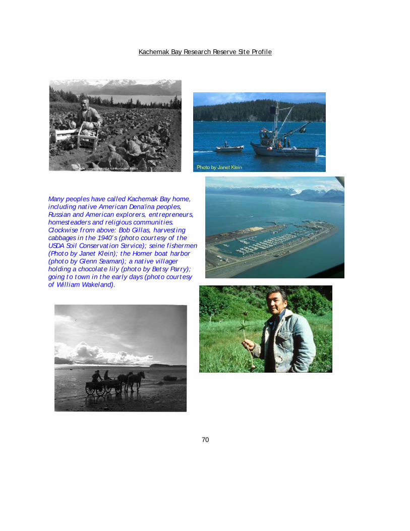
Kachemak Bay Research Reserve Site Profile
70
Many peoples have called Kachemak Bay home, including native American Dena'ina peoples, Russian and American explorers, entrepreneurs, homesteaders and religious communities. Clockwise from above: Bob Gillas, harvesting cabbages in the 1940’s (photo courtesy of the USDA Soil Conservation Service); seine fishermen (Photo by Janet Klein); the Homer boat harbor (photo by Glenn Seaman); a native villager holding a chocolate lily (photo by Betsy Parry); going to town in the early days (photo courtesy of William Wakeland).
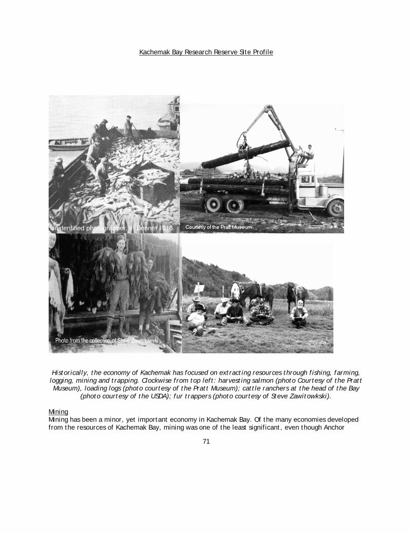
Kachemak Bay Research Reserve Site Profile
71
Historically, the economy of Kachemak has focused on extracting resources through fishing, farming, logging, mining and trapping. Clockwise from top left: harvesting salmon (photo Courtesy of the Pratt Museum), loading logs (photo courtesy of the Pratt Museum); cattle ranchers at the head of the Bay
(photo courtesy of the USDA); fur trappers (photo courtesy of Steve Zawitowkski). Mining Mining has been a minor, yet important economy in Kachemak Bay. Of the many economies developed from the resources of Kachemak Bay, mining was one of the least significant, even though Anchor

Kachemak Bay Research Reserve Site Profile
72
Point, Homer, and Aurora began as mining camps. Coal, Placer gold, chromite, limestone, and "fool's gold" have attracted individuals and mining companies to Kachemak Bay since the 1880s.
Coal was the catalyst for the early development of the northern shore and the Homer Spit. Although it was too expensive to ship to west coast markets and was of inferior quality for major commercial purposes, Kachemak coal fueled steamships and heated homes and businesses throughout south central Alaska. Chromium is a relatively rare mineral that occurs in nature only when combined with iron and oxygen in a mineral called chromite. Because chromium is used to harden steel, it is extremely important for the manufacturing of military and transportation equipment. When the United States was concerned about the importation of chromite from foreign countries, the Kachemak Bay coal fields became essential. Chromite outcrops were mined on Red Mountain, at Snow Prospect near Seldovia, and at Claim Point south of Kachemak Bay. Although studied during World War I (Gill 1922), Red Mountain was not mined until World War II, and it was not mined again until a decade later (Barry 1973). To access the mountain, the Jakolof Bay Road was constructed at sea level through spruce forests to alpine tundra. In the 1950s, Ford F8 trucks and General Motor Company's 10-wheeled General Infantry carriers transported ore almost daily down the steep grade to the Bay for many years (Springer 1997). In Jakolof Bay, the ore was stored, crushed, and stockpiled until shipped outside. Placer gold is found in the unconsolidated deposits of sand and gravel along the beach from Anchor Point to Homer. It stimulated the initial development of Anchor Point in the 1890s. Gold enticed Homer Pennock to Kachemak Bay in 1896 and 1897 (Klein 1996). However, like so many others, he and his crew abandoned south central Alaska to rush to the Klondike in 1898. Aurora was established in about 1901, not as a legitimate gold camp, but as a promotional gimmick (Sherwood 1997). It was never operational; however, it appeared to contain a dock, telephone line, buildings, and at least two tunnels (Martin et al. 1915). A wagon road was cut through the spruce from the ‘townsite’ just south of Aurora Lagoon to Portlock Creek, and several tunnels were drilled into the alleged gold-bearing dikes in the mountains. Today, from the northern bank of Portlock Creek, hikers can see one of these tunnels on the opposite shore. Current Socioeconomic Conditions Overview It is evident that profound economic change is occurring in the area. Although, economic activity is, and will continue to be determined by external forces, Homer itself is diverse by Alaskan standards. Traditional resource extraction industries, indicative of a colonial economy (timber, fisheries, and agriculture) appear to be declining, due in large part to international commodity markets, as well as an unresponsive (to economic interests) regulatory system. The rising industries of tourism and real estate speculation are also fueled by external demand. The population in the Kachemak region has grown rapidly in recent years. As of 1999, the population in the Kachemak Bay watershed was 8,935, an increase of nearly 18% since 1992, when the population was estimated to be 7,583. The official employment situation in Kachemak Bay (based on Alaska Department of Labor statistics) is highly-seasonal, with employment nearly 50 percent higher in the summer months than in the winter months. Homer and the rest of the Kachemak Bay area has been one of the earliest areas of south central Alaska to develop a significant visitor industry. Thousands of

Kachemak Bay Research Reserve Site Profile
73
people come to sightsee, fish, hike, and view nature. There are 245 boats in Homer's charter fleet (Hermann et al. 1999) and over 200 bed and breakfasts in the area (Fried and Cole 1999). The City of Homer is the economic, social, and cultural heart of human settlement in Kachemak Bay. The prominence of the boat harbor at Homer, including the commercial fishing boats and associated industrial plants, water taxis, pleasure boats, ocean freighters, and sportfishing charter boats points to the importance of maritime industries. Log and chip piles on the docks provide evidence of the wood industry as well.
Villages, towns and cities in the Kachemak Bay area
Logging and the Spruce Bark Beetle The largest potential anthropogenic disturbances in the Kachemak Bay Watershed will be caused as a reaction to an insect about the size of a small grain of wheat. The spruce bark beetle has killed most of the Lutz and white spruce in the Kachemak Bay area. The invasion of the beetle started in 1984 and spread rapidly throughout the northern watershed. Significant stem mortality occurred throughout the region by 1999. Consistent with the forest-stand dynamics paradigm (Oliver and Larson 1996), the opening of newly available growing space, as older, less stress-resistant trees die, will release suppressed advance regeneration. Consequently, marked change in crown structure and class, as well as species distribution within the stand, is anticipated and will remain an influence for an extended

Kachemak Bay Research Reserve Site Profile
74
period. Landowners may attempt to liquidate timber with remaining commercial value. So far, the largest liquidations have been by Native Corporations, the largest property landowners. With timber liquidation comes access to remote parcels of land. Timber harvesters construct roads and use large machines in the woods. This leaves previously inaccessible lands and accompanying wildlife populations open to disturbance by human activity, including motor vehicle access on both private and public lands. Residential Development Kachemak Bay holds nearly eight percent of all private lands in the entire state. For comparison, the land area of Kachemak Bay is less than one percent of total land in Alaska. The excellent transportation system found in the Kachemak Bay Watershed facilitates development. Originally, transportation to and from Homer centered on water connections by boat and seaplane. Completion of the Sterling Highway provided a route for post World War II homesteading and settlement from Anchorage. The communities on the northern side of the Bay are connected by the Sterling Highway, between Anchor Point and Homer, and by East Road (East End Road) from Homer to the head of the Bay. There are no roads across the Fox River Flats at the head of the Bay. On the southern side, service roads extend from the head of Jakolof Bay to Seldovia and from the head of the Bay to the Bradley Lake Dam. An unimproved road follows the Windy and Rocky Rivers from the head of Jakolof Bay across the Kenai Mountains to Rocky Bay on the outer coast. Commercial airline flights are scheduled to Seldovia and Homer. The Homer Airport, located near the base of the Spit, is the largest in the southern Kenai Peninsula. Approximately 57 percent of the people living in the Watershed utilize a commercial power supply. The remaining 43 percent rely on personal generators or alternative energy sources. The majority of commercial power is supplied to Anchor Point and Homer from the north through overland wires that traverse the Kenai Peninsula. In 1991, the Bradley Lake Dam was completed near the head of the Bay, and the Bradley Lake Hydroelectric Project began supplying power. This dam was controversial and fostered many environmental studies. The power produced at Bradley Lake is transmitted north, crossing Fox River Flats in overhead powerlines, to supply other communities on the Kenai Peninsula and Anchorage. A small percentage (roughly 12 percent) of the power produced at Bradley Lake is used in the Kachemak Bay watershed. A submarine cable carries power from Homer to Halibut Cove. A powerline then carries power overland to the communities of Seldovia, Port Graham, and Nanwalek. Two-thirds of the people living in the Kachemak Bay area are not hooked up to municipal water supplies. These residents rely on individual wells, water tanks, septic systems, and outhouses. The City of Homer has the largest public-water system in the area, serving approximately 4,000 residents. The Russian villages at the head of the Bay have two small public-water systems, serving approximately 270 residents. Anchor Point has one community well that serves approximately 30 residents (Lichfield, pers. comm.). Substantial development of secondary roads has transpired on the northern side of Kachemak Bay, enhancing residential and industrial activity. Homer Electric Association (HEA) provides electric services along nearly every right-of-way along these roads. Telephone service is also widely available. This infrastructure mitigates the relative isolation and inconvenience of living 10 to 20 miles out of town that one might otherwise experience and enhances further rural development. Kachemak Bay, as a result, exhibits a relatively dense, rural population pattern that is unique in Alaska. This attribute will continue to serve as an attractant for additional immigration. Other stimulants for development

Kachemak Bay Research Reserve Site Profile
75
outside of municipal boundaries include low Borough taxes, and state loans through the Alaska Housing Finance Corporation at a reduced rate for rural residences. Thus, there are strong monetary incentives for increased settlement outside of city limits. The local real estate market is very active. A lack of zoning and planning in the Borough assures that development will take place. With the exception of industrial development, residential subdivision is a recognized disturbance of greater significance than any other disturbance, particularly in rural areas. Land clearing, fencing, construction, excavation, and large populations of horses and dogs are all byproducts of increased rural population. Conflicts with the landscape, wildlife, and the ecosystem are complements of residential subdivision (Marston 1993, Davis 1994). Tourism Kachemak Bay is quite distinctive in Alaska due to the volume of intrastate tourists that frequent the region. Alaska visitors are drawn from the Anchorage area to Kachemak Bay to participate in activities such as sightseeing, camping, visiting recreational properties, wildlife and other nature viewing, kayaking, boating, and of course, sportfishing. The communities around Kachemak Bay provide a sophisticated service industry catering to tourist needs. The existing service industry in Kachemak Bay is based on small, locally owned businesses. However, it is this aspect of the tourism industry that may see the most change. If the communities of Kachemak Bay follow the trend of similarly situated communities in the Rocky Mountain West, then one can expect tourism to become more consolidated and highly capitalized over time, driving many smaller entrepreneurs out of business. Fishing The pressure on fishery resources is growing. Sport fisheries are displacing commercial fishing. For example, the percentage of chinook salmon in the Cook Inlet area that were caught by sportfishermen has risen from 12 to 50 percent. The charter boats in Homer are contributing to this increasing and changing saltwater fishery. Halibut, as well as salmon, are targeted by the charter fleet based in Homer and Anchor Point. Sportfishers from other parts of Alaska are bringing their boats to Kachemak Bay to launch and fish. Pressure by charter operations, lodges, and outfitters may be contributing to localized depletion of target species in several areas. Recent growth of charter operations, lodges, and outfitters may be contributing to overcrowding of productive grounds and declining catches for historic sport and subsistence fishermen in some areas. Currently, harvest of halibut by charter operations, lodges, or outfitters, is reallocated from the commercial fishery to the charter industry. This reallocation may increase if the projected growth of the charter industry occurs. In some areas, community stability may be affected as traditional sport, subsistence, and commercial fishermen are displaced by charter operators, lodges, and outfitters. Grazing Horses and cattle are currently grazed through lease agreements at the head of the Bay. However, there is little likelihood of an expanding agricultural industry in the Kachemak Bay Watershed, although the Watershed was once targeted to be an agricultural center for Alaska.
Hunting, Gathering and Subsistence Use Hunting and gathering are traditional and popular activities in the Kachemak Bay Watershed. Big game includes black bears (Ursus americanus), brown or grizzly bears (Ursus arctos), wolves (Canis lupis),
Kachemak Bay Research Reserve Site Profile
76
wolverine (Gulo gulo), sheep (Ovis dalli dalli), mountain goats (Oreamnos americanus), and moose (Alces alces). Small game includes waterfowl, spruce grouse (Canachites canadensis), ptarmigans (Lagopus spp.), red squirrels (Tamiasciurus hudsonicus), cranes (Grus canadensis), and snipe (Gallinago gallinago). Moose are by far the most sought after big-game species, followed by black bears and mountain goats. Alaskans who live in rural areas qualify for subsistence hunting and fishing. Non-natives, as well as natives engage in subsistence harvests. However, only native Alaskans may hunt marine mammals, such as sea otters, whales and seals. Although many residents of Kachemak Bay qualify and engage in subsistence harvests, the native villages of Port Graham and Nanwalek, located on the south side of the Bay, are unique. These villages are predominantly native, and while there are many modern conveniences (guns, motor boats, etc.) residents maintain the traditional culture of subsistence harvests. Mariculture Farming of oysters and clams (shellfish mariculture) is a relatively new economic activity with growth potential in Kachemak Bay, beginning with the 1989 Mariculture Act. The location and number of farms are as follows: Bear Cove has one farm; Halibut Cove has four farms; Peterson Bay has three farms; Little Jakolof Bay Lagoon has one farm; and Jakolof Bay has four farms. There is an operating cooperative with 14 members in Kachemak Bay for marketing and purchase of seed. The Alaska Department of Natural Resources (ADNR) typically issues permits of three-year duration for shellfish farms. Farmers seek to obtain changes allowing a 10-year permit to provide a longer planning horizon with less risk. At the time of this writing, there were about 40 additional applications pending for permits. The oysters are grown using longline culture techniques. In other states like Washington, five-acre farms are seen as large. Most farms in Kachemak Bay are one acre or less. Shellfish farmers in Kachemak Bay work second jobs, like many small farmers elsewhere in the state and nation (Hartley, pers. comm.). Litigation has been a frequent attribute of the permitting process, and such conflicts are expected to grow as the state continues to process applications. Kachemak Bay in the Future Available regional statistics demonstrate there is a relatively diversified economy in the Kachemak Bay watershed, centered in Homer (Bader et al. 2001). However, it is an economy and society that is undergoing rapid and profound change. The very character of Kachemak Bay is changing from a resource-extraction economy to a service-oriented community. As with any change in a community's economy, there will be winners and losers. Increased population brings increased demands on local services, as well as congestion and potential loss of the very attributes that drew many people to Kachemak Bay in the first place. As is evident from other recreation and retirement communities, private, local, small business ownership tends to give way to large, corporate establishments headquartered elsewhere. Rising land values will compensate landowners in the short run, but rising property values may force residents, particularly older ones, to sell in order to avoid higher property taxes. Also, young descendants of these residents will be less able to afford to stay in the community due to higher rents and lack of year around employment. The future labor force for the service sector will probably be transient and may find it difficult to afford to live in Kachemak Bay.

Kachemak Bay Research Reserve Site Profile
77
Ecotourism, sportfishing and real estate development lead the current economy of the Kachemak Bay region. Clockwise from top left: homes in Halibut Cove (photo by Glenn Seaman); ecotourist (photo by Roxanne Rickard); the Homer small boat harbor (photo by Julie Goodwin); charter boat halibut fishing
(photo by Coowe Walker).

Kachemak Bay Research Reserve Site Profile
78
Subsistence hunting and gathering are an important part of life for many Kachemak Bay residents. Left: native villager with salmon (photo by Paul McCollum); moose hunter (photo by Coowe Walker).
Current socioeconomic thinking indicates that forces outside of the Kachemak Bay watershed will be most important in determining the economic future in the local area (Bader et al. 2001). However, this certainly does not mean that residents of the Watershed cannot shape the destiny of the area. Continued strong performance of the rest of the world's economy will determine visitor traffic and investment in the communities. Like Montana and the intermountain western United States during the 1990s, local economic development efforts, particularly relating to tourism and real estate, are expected to be driven by external demand. Traditional commodity-based industries may continue to decline, including commercial fisheries, manufacturing, agriculture, and forest products, unless a dramatic shift in international market prices occurs. Even the newer entrepreneurial-owned industries may undergo consolidation. As the Northern Pacific Fisheries Management Council puts it, "Consumer demand requires only about 600 full-time equivalent vessels from over 2,000 licensed halibut charter vessels” (Northern Pacific Fishery Management Council 1999). Economic efficiency demands consolidation, and eventually, it will happen. As quotas in other fisheries show, they do lead to higher capitalization of the fisheries, meaning fewer boats and fewer crewmembers. Large developers are eyeing the Kenai Peninsula (Associated Press 1999). The mantra of the modern economy is merger, buyout, free trade, efficiency, and bigger is better. All may manifest themselves in the Kachemak Bay economy in the near future. However, the communities in the Kachemak Bay Watershed can be pivotal in determining how economic development proceeds in the region. Kachemak Bay Research Reserve Vision Statements We believe that gaining an understanding and appreciation of how high latitude coastal (watershed, estuarine, and marine) ecosystems function will lead to responsible and sustainable use of Alaskan coastal resources. We believe that the Kachemak Bay estuary and adjacent waters provide an outstanding living laboratory in which to conduct high latitude coastal research.
Kachemak Bay Research Reserve Site Profile
79
We are committed to providing leadership and building partnerships in order to conduct and promote excellence in regional research and education. Our aim is that the Reserve’s high-quality, integrated research and education programs will result in better decision-making and stewardship of coastal resources and habitats.
Mission of the Kachemak Bay Research Reserve Enhance understanding and appreciation of the Kachemak Bay estuary and adjacent waters to ensure that these ecosystems remain healthy and productive. Goals of the Kachemak Bay Research Reserve GOAL #1: Increase understanding of the natural and human processes occurring in the coastal
environment. GOAL #2: Foster responsible stewardship of the coastal environment GOAL #3: Foster a public that is involved with and supportive of Reserve activities GOAL #4: Maintain a workforce that is motivated and effective in attaining the Reserve mission GOAL #5: Recognition of Kachemak Bay Research Reserve as a regional center for research and
education
Left: Research Reserve Researcher engaged in intertidal biodiversity monitoring (photo by Katie Gaut). Right: students from Chapman Elementary explore Beluga Slough as part of the Reserve’s education programming (photo by Amy Alderfer).

Kachemak Bay Research Reserve Site Profile
80
Selected References Physical Environment Adalgeirsdottir, G. 1998. Elevation and volume changes on the Harding Icefield, Alaska. Journal of
Glaciology vol. 44 (148):570-582. Alaska Department of Natural Resources. 1995. Management Plan for Kachemak Bay State Park and
Kachemak Bay State Wilderness Park. vol. 22 Division of Parks and Outdoor Recreation. Anchorage, AK. pp. 129.
Alaska Power Authority. 1984. Bradley Lake hydroelectric project, Bradley River, Kenai Peninsula Alaska- application for license for major unconstructed project before the Federal Energy Regulatory Commission. vol. 1-10 Alaska Power Authority. Anchorage, AK.
Alaska River Forecast Center. 1999. Alaska River Forecast Center home page. http://www.alaska.net/~akrfc/index.html
Alaska Volcano Observatory. 1999. Atlas of Alaska Volcanoes. United States Geological Survey, the Geophysical Institute of the University of Alaska Fairbanks, and the State of Alaska Division of Geological and Geophysical Surveys (ADGGS). www.avo.alaska.edu
American Geological Institute 1976. Dictionary of Geological Terms. Anchor Press/Doubleday Books. Garden City, NY.
Atlas, T. M., M.I. Venkatesan, I.R. Kaplan, R.A. Freely, R.P. Griffiths, and R.Y. Morita. 1983. Distribution of hydrocarbons and microbial populations related to sedimentation processes in lower Cook Inlet and Norton Sound, Alaska. Arctic 38(3):251-261.
Barnes, F. F. and E.H. Cobb. 1959. Geology and coal resources of the Homer District, Kenai Coal Field, Alaska. Geological Survey Bulletin 1058-F:45.
Beget, J. E. and J. Kienle. 1992. Cyclic Formation of Debris Avalanches at Mount St. Augustine. Nature 356:701-704.
Bradley, D.C. and T. M. Kusky. 1990. Kinematics of late faults along Turnagain Arm, Mesozoic accretionary complex, south-central Alaska: In Dover, J.H., and J.P. Galloway, (eds). Geologic studies in Alaska by the U.S. Geological Survey, 1989: U.S. Geological Survey Bulletin 1946, p. 3-10.
Bradley, D. C., T. M. Kusky, P. J. Haeussler, S. M Karl, and D. T. Donley. 1999. Geologic Map of the Seldovia Quadrangle, South-Central Alaska. Open File Report OF 99-18.
Brabets, T. P., J. M. Dorava, G. L. Nelson, and A. M. Milner. 1999. Water-quality assessment of the Cook Inlet Basin, Alaska--Environmental setting vol. 99-4025. pp. 65.
Bright, D. B., F. E. Durham, and J. W. Knudsen. 1960. King crab investigations of Cook Inlet, Alaska. U.S. Fish and Wildlife Service. pp. 180.
Brower, Jr. W. A., R. G. Baldwin, C. N. Williams, Jr., J. L. Wise, and L. D. Leslie . 1988. Climatic Atlas of the Outer Continental Shelf Waters and Coastal Regions of Alaska vol. Volume 1, Gulf of Alaska. Arctic Environmental Information and Data Center. University of Alaska Anchorage. Anchorage, AK.
Burbank, D. C. 1977. Circulation studies in Kachemak Bay and Lower Cook Inlet. Trasky, L. L. L. B. Flagg D. C. Burbank ed(s). vol. III. Alaska Department of Fish and Game. Anchorage, AK. pp. 207.
Chester, A. J. and J. D. Larrance. 1981. Composition and vertical flux of organic matter in a large Alaskan estuary. Estuaries 4(1):42-52.
Combellick, R. A. 1997. Evidence of Prehistoric Great Earthquakes in the Cook Inlet Region, Alaska. In Guide to the Geology of the Kenai Peninsula, Alaska. Karl, Susan M. N. R. Vaughn and T. J. Ryherd ed(s). Alaska Geological Society. Anchorage, AK. pp. 128.

Kachemak Bay Research Reserve Site Profile
81
Dames and Moore, Inc. 1975. Meteorological and oceanographic conditions affecting the behavior and fate of oil spills in Kachemak Bay, Cook Inlet, Alaska. Dames and Moore, Inc., under contract to Standard Oil Company of California. pp. various pagination.
Dames and Moore, Inc. 1976. Oil spill trajectory analysis, Lower Cook Inlet, Alaska: Final Report. National Oceanic Atmospheric Administration. Anchorage, AK.
Desplanque, C. and D. I. Bray. 1985. Winter ice regime on the tidal estuaries of the northeastern portion of the Bay of Fundy, New Brunswick. Canadian Journal of Engineering 13:130-139.
Dictionary of Geologic Terms, 3th Edition. 1984. Robert L. Bates and Julia A. Jackson (eds.). Anchor Books, Doubleday: New York.
Dovichin, E. 1999. Approaching Bear Minimum. The Nature Conservancy of Alaska Magazine Spring/Summer.
Driskell, W. 1977. Benthic reconnaissance of Kachemak Bay, Alaska. Environmental Studies of Kachemak Bay and Lower Cook Inlet vol. 9.
Facts on File Dictionary of Environmental Science. 1991. L. Harold Stevenson and Bruce Wyman (eds.). Facts on File, Inc. New York, NY.
Freethey, G. W. and D. R. Scully. 1980. Water resources of the Cook Inlet basin, Alaska. USGS Hydrologic Investigations Atlas HA-620, scale 1:1,000,000.
Gatto, L. W. 1976. Baseline data on the oceanography of Cook Inlet, Alaska. CRREL Report 76-25 National Aeronautics and Space Administration. Hanover, NH. pp. 84.
Geologic Glossary. 2000. http://college.hmco.com/geology/index.html Hackett, S. W. 1976. Speculative Tectonic Evolution of the Cenozoic Shelikof Trough, South Central,
Alaska. Short Notes on Alaskan Geology. Geol. Report 5. Hayes, M. O., J. Brown, and J. Michel. 1977. Coastal morphology and sedimentation Lower Cook Inlet,
Alaska. Trasky, L. B. Flagg D. C. Burbank ed(s). vol. II. Alaska Department of Fish and Game. Anchorage, AK .pp.106.
Hoekzema, R. B. 1980. Placer Sampling and Related Bureau of Mines Activities on the Kenai Peninsula, Alaska. Open File Report 138-81.
Kalifornsky, P. 1991. A Dena'ina legacy K'tl'egh'i Sukdu, the collected writings of Peter Kalifornsky. Kari, J. and Boraas, A. ed(s). Alaska Native Language Center, University of Alaska, Fairbanks. Fairbanks, AK. pp. 485.
Karl, S. M., N. R. Vaughn, and T. J. Ryherd (eds). 1997. Guide to the Geology of the Kenai Peninsula, Alaska. pp. 128.
Kienle, J. and C. J. Nye. 1990. Volcano Tectonics of Alaska. Volcanoes of North America. C.A. Wood and J. Kienle ed(s). Cambridge University Press. pp. 8-109.
Kienle, J. and S. E. Swanson. 1985. Volcanic hazards from future eruptions of Augustine Volcano, Alaska. 2nd ed. Geophysical Institute, University of Alaska, Fairbanks. Fairbanks, AK. pp. 122, various pagination.
Kinney, P. J., D.K. Button, and D.M. Schell. 1970. Kinetics of Dissipation and Biodegradation of Crude Oil in Alaska's Cook Inlet. In Proceedings of the 1969 Joint Conferences on Prevention and Control of Oil Spills. Washington, DC American Petroleum Institute. pp. 333-40.
Klein, J. 1987. A History of Kachemak Bay: The Country, The Communities. Homer Society of Natural History. Homer, AK. pp. 115.
Knull, J. R. and R. Williamson. 1969. Oceanographic survey of Kachemak Bay, Alaska, July 1969. United States Department of the Interior, Fish and Wildlife Service, Bureau of Commercial Fisheries, Biological Laboratory, Auke Bay, Alaska. Juneau, AK. pp. 76.
Kachemak Bay Research Reserve Site Profile
82
Lambert, B. 2000. Homer soil and water conservation district. A preliminary water quality assessment of lower Kenai Peninsula salmon streams. Cook Inlet Keeper. Homer, AK. pp. 68.
Little, J. 1999. "Homer Seeks Water Rights: Reservoir Control at Issue." Anchorage Daily News. Anchorage, AK. Section B:1,3.
Lyons, J. M. 1999. "Winter’s Final Toll Mary Be in Mud, Flood." Homer News. 22 April 1999. p. 1. Mann, D. H. and D. M. Peteet. 1994. Extent and timing of the last glacial maximum in Southwest
Alaska. Quaternary Research 42:136-148. Morsell, J. W., M. M. Bingham, and R. L. Howard. 1993. Final report, Bradley River salmon escapement
monitoring and tailrace attraction studies. Alaska Energy Authority. Anchorage, AK. pp. various pagination.
Natural Resources Conservation Service. 1999. Climate Appendices. Prepared for the Lower Kenai Peninsula Soil Survey, Natural Resource Conservation Service, Homer, AK.
Natural Resources Conservation Service. unpublished manuscript. Climate Appendices Prepared for the Lower Kenai Peninsula Soil Survey. Natural Resource Conservation Service. Homer, AK.
Nelson, W. G. 1999. Cook Inlet ice formation and oil spill clean-up study. Cook Inlet Regional Citizens Advisory Council and Cook Inlet Spill Prevention and Response Inc. Kenai, AK. pp. 37, plus Appendices.
National Oceanic and Atmospheric Administration, Climate Diagnostic Center. 1998. National Oceanic and Atmospheric Administration, Climate Diagnostic Center web page. http://www.cdc.noaa.gov
Nuhfer, E. B., R. J. Proctor, J. E. Allen, Jr. J. T. Bales, J. M. Blabaum, R. C. Benson, J. DeGraff, J. L. Hynes, W. V. Knight, J. Mayberry, E. McKee, J. Montagne, D. A. Sprinkel, and J. D. Vineyard. 1993. The Citizens Guide to Geologic Hazards. The American Institute of Professional Geologists. pp. 134.
Orth, D. J. 1967. Dictionary of Alaska Place Names. United States Government Printing Office. Washington, DC.
Ostasz, M. and E. Thomas. 1996. Draft Kachemak Bay east shellfish growing report. Alaska Department of Environmental Conservation. Anchorage, AK.
Piatt, J. F. 1994. Oceanic, shelf and coastal seabird assemblages at the mouth of a tidally-mixed estuary (Cook Inlet, Alaska). National Biological Service, final report for Minerals Management Service. Anchorage, AK. pp. 33, various paginations.
Plafker, G., J. C. Moore, and G. R. Winkler. 1994. The Geology of Alaska; Geology of the Southern Alaska Margin. The Geology of North America, G. a. B. H. C. Plafker ed(s). vol. 22. Geological Society of America. Boulder, CO.
Plummer, C. C., D. McGeary , and D. H. Carlson. 1999. Physical Geology. The McGraw-Hill Companies, Inc. pp. 577.
Reger, R. D. 1979. Bluff Point landslide, a massive ancient rock failure near Homer, Alaska. Alaskan Division of Geological and Geophysical Surveys. Geologic Report 61. (Short Notes on Alaskan Geology).
Reger, R. D. and D. S. Pinney. 1997. Last major glaciation of Kenai Lowland. 1997 Guide to the Geology of the Kenai Peninsula, Alaska. S. M. Karl, N.R. Vaughn, and T.J. Ryherd ed(s). pp. 128.
Rickman, R. L. 1993. Hydrologic conditions and low-flow investigations of the lower Bradley River near Homer, Alaska, October 1991 to February 1992. United States Geological Survey. pp. 17, various pagination.
Savard, C. S. and D. R. Scully. 1984. Surface-water quantity and quality in the lower Kenai Peninsula, Alaska. United States Department of the Interior, Geological Survey. Anchorage, AK. pp. 62.
Spence, H. 1999. "City Gets Watershed Protections Powers." Homer News. Homer, AK. pp. 6.
Kachemak Bay Research Reserve Site Profile
83
Suring, L. H., K. R. Barber, C. C. Schwartz, T. N. Bailey, W. C. Shuster , and M. D. Tetreau. 1998. Analysis of cumulative effects on brown bears on the Kenai Peninsula, Southcentral Alaska. Ursus 10.
Swenson R.F. , D. L. Brimberry, P. S. Gardner, M. L. McCullough, and S. E. Trudell. 1997. Introduction to the tertiary tectonics and sedimentation of the Cook Inlet Basin; Kenai Field, the Kenai Peninsula’s largest gas field in Guide to the Geology of the Kenai Peninsula, Alaska. Karl, S. M., N. R. Vaughn, and T. J. Ryherd ed(s). Alaska Geological Society. Anchorage, AK. pp. 128.
Tarbuck, E. J. and F.K. Lutgens. 1982. Earth Science. 3rd ed. Charles E. Merrill Publishing Co. Columbus, OH.
Trasky, L. L. Flagg L. B. and D. C. Burbank. 1977. Environmental Studies of Kachemak Bay and Lower Cook Inlet. Alaska Department of Fish and Game. Anchorage, AK.
Van Patten, D. and T. Dillon. 1983. Fox River Valley, Alaska Soil Survey Area Interim Report. Van Patten, D. Personal communication. 1999. Soil Scientist, Natural Resources Conservation Service.
Homer, AK. Waller, R. M. and K.W. Stanley. 1966. Effects of the Earthquake of March 27, 1964 in the Homer Area,
Alaska. Geological Survey Prof. Paper 542-D. Waller, R. M., A. J. Feulner, and D. A. Morris. 1968. Water resources and surficial geology of the Homer
area, south-central Alaska. Hydrologic Investigation Atlas vol. HA 187. USGS. pp. 1 sheet. Wang, S. S. Y., J. Yue, J. Trujillo, and Z. Wei. 1987. Computational Modeling of Sediment Transport in
Kachemak Bay. In Proceedings of the 1987 National Conference on Hydraulic Engineering. ed. R. M. Ragan. New York, NY. American Society of Civil Engineers. pp. 930-935.
Webster’s Illustrated Encyclopedic Dictionary. 1990. Tormont Publications, Inc. Montreal, Canada. pp. 1920.
Western Regional Climate Center. 1999. Western U.S. Climate Historical Summaries for Alaska . Desert Research Institute and Western Regional Climate Center. Reno, NV.
Wilson, J. G.and J. E. Overland. 1986. Meteorology. Hood, D. W. and S. T. Zimmerman ed(s). OCS . USDOC, NOAA, NOS, and USDOI, MMS, Alaska OCS region. Anchorage, AK. pp. 31-54.
Estuarine Environment Abookire, A. 1997. Environmental factors affecting seasonal habitat and distribution of flathead sole
and rock sole in Kachemak Bay, Alaska. University of Alaska, Fairbanks. Fairbanks, AK. Alaska Department of Fish and Game. 1993. Lower Cook Inlet Salmon Run Timing Curves. Anchorage,
AK. Alaska Department of Natural Resources. 1995. Management Plan for Kachemak Bay State Park and
Kachemak Bay State Wilderness Park. vol. 22 Division of Parks and Outdoor Recreation. Anchorage, AK. pp. 129.
Anderson, P. J. and J. F. Piatt. 1999. Community reorganization in the Gulf of Alaska following ocean climate regime shift. Marine Ecology Progress Series 189:117-123.
Barr, L. 1970. Diel vertical migration of Pandalus borealis in Kachemak Bay, Alaska. Journal of Fisheries Research Bd. Canada 27(4):669-676.
Batten, A. R., S. Murphy, and D. S. Murray. 1978. Definition of Alaskan coastal wetlands by floristic criteria Environmental Protection Agency. pp.490.
Baxter, R. 1983. Mollusks of Alaska: a listing of all mollusks, terrestrial, freshwater, and marine, reported from the State of Alaska with locations of the species type, maximum sizes, and marine depth inhabited Alaska Department of Fish and Game. pp.77.

Kachemak Bay Research Reserve Site Profile
84
Boggs, K. and M. Shephard. 1999. Response of marine deltaic surfaces to major earthquake uplifts in south central Alaska. Wetlands 19(1):13-27.
Bulger, A. J., B.P. Hayden, M.E. Monaco, D.M. Nelson, and G. McCommick-Ray. 1993. "Biologically-Based Salinity Zones Derived From a Multivariate Analysis. Estuaries 16:311-322." Estuaries 16:311-22.
Burbank, D. C. 1977. Circulation studies in Kachemak Bay and Lower Cook Inlet. L. L. Trasky, L. B. Flagg, and D. C. Burbank ed(s). vol. III. Alaska Department of Fish and Game. Anchorage, AK. pp. 207.
Carriker, M. R. 1967. Ecology of Benthic Invertebrates: a perspective. in Estuaries vol. Publication No. 83 American Association for the Advancement of Science. Washington, DC. pp.442-487.
Carroll, M. L. 1994. The ecology of a high-latitude rocky intertidal community: Processes driving population dynamics in Kachemak Bay, Alaska, a thesis. University of Alaska, Fairbanks. Fairbanks, AK. pp. 226.
Carroll, M. L. 1996. Barnacle population dynamics and recruitment regulation in southcentral Alaska. J. Exp. Mar. Biol. Ecol. 199:285-302.
Carroll, M. L. and R. C. Highsmith. 1993. Predator control of prey populations mediated by catastrophic disturbance: An Alaskan intertidal example. Ecol. Soc. Amer.
Carroll, M. L. and R. C. Highsmith. 1994. Chemically-mediated recruitment of marine macrophyte. Benthic Ecol. Meeting.
Christensen, J. D., M.E. Monaco, and T.A. Lowery. 1997. An Index to Assess the Sensitivity of Gulf of Mexico Species to Changes in Estuarine Salinity Regimes. Gulf Research Reports 9:219-229.
Cooney, R. T. 1986. Zooplankton. In The Gulf of Alaska physical environment and biological resources. Hood, D. W. and S.T. Zimmerman ed(s). vol. 86-0095. USDOC, NOAA, NOS, and USDOI, MMS, Alaska OCS Region. Anchorage, AK. pp.285-303.
Crow, J. H. 1977. Food habits of shrimp in Kachemak Bay, Alaska. Environmental Studies of Kachemak Bay and Lower Cook Inlet. vol. Volume 6.
Crow, J. H. 1978. Food habits of ducks in Kachemak Bay, Alaska Unpublished Report Rutgers University. Newark, New Jersey. pp.30.
Crow, J. H. and J. D. Koppen. 1977. The salt marsh vegetation of China Poot Bay, Alaska. L. L. Trasky, L. B. Flagg, and D. C. Burbank ed(s). vol. X. Marine/Coastal Habitat Management, Alaska Department of Fish and Game. Anchorage, AK. pp. 29.
Dames and Moore, Inc. 1976. Environmental impact mitigation and monitoring program. Final Report. George F. Ferris. Kachemak Bay, AK.
Dames and Moore, Inc. 1977. Final report: Reconnaissance of the intertidal and shallow subtidal biota Lower Cook Inlet. National Oceanic and Atmospheric Administration. Seattle, WA. pp. 314.
Dames and Moore, Inc. 1979. Ecological studies of intertidal and shallow subtidal habitats in Lower Cook Inlet. In Environmental assessment of the Alaskan continental shelf, annual reports of principal investigators for the year ending March 1979 vol. IV. Outer Continental Shelf Environmental Assessment Program. Boulder, CO. pp.1-275.
Dames and Moore. 1979. A preliminary assessment of composition and food webs for demersal fish assemblages in several shallow subtidal habitats in Lower Cook Inlet, Alaska. Appendix 2 in OCSEAP Final Reports of Principal Investigators vol. 12.
Dames and Moore, Inc., D. C. Lees, J. P. Houghton, D. E. Erikson, W. B. Driskell, and D. E. Boettcher. 1979. Ecological studies of intertidal and shallow subtidal habitats in Lower Cook Inlet. Annual Report for the Dept. of Commerce, NOAA, OCSEAP. pp. 261.
Kachemak Bay Research Reserve Site Profile
85
Damkaer, D. 1977. Initial zooplankton investigations in Prince William Sound, Gulf of Alaska and Lower Cook Inlet. In Outer Continental Shelf Environmental Assessment Program. Boulder, CO. pp. 137-274.
Day, J. W. Jr., C. A. S. Hall, W. M. Kemp, and A. Yanez-Arancibia. 1989. Estuarine Ecology 1st ed. John Wiley and Sons. New York, NY. pp. 558.
Dethier, M.N. and G.C. Schoch. 2000. The Shoreline Biota of Puget Sound: Extending Spatial and Temporal Comparisons. (Estuaries submitted) (white paper: Report for the Washington State Department of Natural Resources Nearshore Habitat Program July 2000)
Driskell, W. 1979. Benthic reconnaissance of Kachemak Bay, Alaska. Trasky, L. L., L. B. Flagg, and C. Burbank ed(s). vol. VII. Alaska Department of Fish and Game. Anchorage, AK. pp. 102.
English, S. T. 1980. Lower Cook Inlet meroplankton. University of Washington. Seattle, WA. pp. 57. Erikson, D. 1977. Distribution, abundance, migration and breeding locations of marine birds, Lower
Cook Inlet, Alaska. 1976. L. L. Trasky, L. B. Flagg, and D. C. Burbank ed(s). vol. VIII. Alaska Department of Fish and Game. Anchorage, AK. pp. 182.
Feder, H. 1977. The distribution, abundance, diversity, and biology of benthic organisms in the Gulf of Alaska and the Bering Sea. In Environmental Assessment of the Alaska continental shelf, annual reports of principal investigators for the year ending march 1977. vol. VIII. Outer Continental Shelf Environmental Assessment Program. Boulder, CO. pp. 366-712.
Feder, H. 1979. Distribution, abundance, community structure and trophic relationships of the nearshore benthos of Cook Inlet and NEGOA. In Environmental assessment of the Alaskan continental shelf, annual reports of principal investigators for the year ending March 1979. vol. III. Outer Continental Shelf Environmental Assessment Program. pp. 639.
Feder, H. M. and S. C. Jewett. 1986. The subtidal benthos. In The Gulf of Alaska physical environment and biological resources. Hood, D. W. and S.T. Zimmerman ed(s). vol. 86-0095. USDOC, NOAA, NOS, and USDOI, MMS, Alaska OCS Region. Anchorage, AK. pp. 347-396.
Feder, H. and A. J. Paul. 1981. Distribution and abundance of some epibenthic invertebrates of Cook Inlet, Alaska. vol. Institute of Marine Science Report 80-3 University of Alaska. Fairbanks, AK. pp. 153.
Feder, H. M., A. J. Paul, M. Hoberg, S. Jewett, K. McCumby, J. McDonald, R. Rice, and P. Shoemaker. 1979. Distribution, abundance, and community structure and trophic relationships of the nearshore benthos of Cook Inlet and the Northeast Gulf of Alaska. vol. 3 OSCEAP Final Report. Annual Report of the Principal Investigators for the year ending March 1979. pp. 83.
Field, C. and C. Field. 1999. Alaska’s Seashore Creatures A Guide to Selected Marine Invertebrates. Alaska Northwest Books. Seattle, WA. pp. 94.
Foster, M. S. and D. R. Schiel. 1985. The Ecology of Giant Kelp Forests in California: a Community Profile. U.S. Fish and Wildlife Biological report 85.7.2.
Francis, R. C., S. R. Hare, A. B. Hollowed, and W. S. Wooster. 1998. Effects of interdecadal climate variability on the oceanic ecosystems of the northeast Pacific. Fisheries Oceanography 7(1):1-21.
Hall, J., W. E. Frayer, and B. O. Wilen. 1994. Status of Alaska Wetlands. Publication Number 94-0705-P. Anchorage, AK. U.S. Fish and Wildlife Service.
Hall, Jonathan V. 1988. Alaska Coastal Wetlands Survey. Anchorage, Alaska. U.S. Fish and Wildlife Service, Division of Operations Support.
Hare, S. R., N. J. Mantua, and R. C. Francis. 1999. Inverse production regimes: Alaska and west coast Pacific salmon. Fisheries 24:6-14.

Kachemak Bay Research Reserve Site Profile
86
Haynes, E. B. 1977. Summary status on the distribution of king crab and Pandalid shrimp larvae, Kachemak Bay-Lower Cook Inlet Alaska, 1976. Trasky, L. L., L. B. Flagg, and D. C. Burbank ed(s). vol. IV. Alaska Department of Fish and Game. Anchorage, AK. pp. 52.
Haynes, E. B. 1983. Distribution and abundance of larvae of king crab, Paralithodes camtschatica, and Pandalid shrimp in the Kachemak Bay area, Alaska, 1973 and 1976. National Marine Fisheries Service, National Oceanic and Atmospheric Administration. pp. 64, various pagination.
Haynes, E. B. and B.L. Wing. 1977. Distribution of king crab, pandalid shrimp, and brachyuran crab larvae in Kachemak Bay, Alaska, 1972. Northwest and Alaska Fisheries Center Processed Report. Auke Bay, AK.
Highsmith, R. and S. Saupe. 1997. Kachemak Bay experimental and monitoring studies: recruitment and succession in the intertidal. Coastal Marine Institute Draft Final Report vol. 1-3 University of Alaska, Coastal Marine Institute. Fairbanks, AK.
Hines, A. H., G. M. Ruiz, J. Chapman, G. I. Hansen, J. T. Carlton, N. Foster, and H. M. Feder. 2000. Biological invasions of cold-water coastal ecosystems: ballast-mediated introductions in Port Valdez / Prince William Sound, Alaska. Progress report to the Regional Citizens' Advisory Council of Prince William Sound.
Hood, D. W. and S. T. Zimmerman. 1986. The Gulf of Alaska Physical Environment and Biological Resources. OCS Study 86-0095, USDOC, NOAA, NOS, and USDOI, MMS. Anchorage, AK. pp. 655.
Houghton, J. P., R. H. Gilmore, D. C. Lees, and S. C. Lindstrom. 1997. Long-Term Stability in Lower Cook Inlet Intertidal Assemblages (You Can Go Back!). In The Cook Inlet Symposium. Watersheds 1997. Anchorage, AK. pp. 13.
Krasnow, L. D. 1981. Abundance and distribution of birds on the Fox River Flats during spring migration, 1981. Unpublished report. Marine Bird Section, U.S. Fish and Wildlife Service. Anchorage, AK. pp. 14.
Krasnow, L. D. and M. A. Halpin. 1981. Potential impacts of the Bradley Lake hydroelectric project on birds: a pre-construction study. Unpublished report. Marine Bird Section, U.S. Fish and Wildlife Service. Anchorage, AK.
Larrance, J. D., D. A. Tennant, A. J. Chester, and P. A. Ruffino. 1977. Phytoplankton and primary productivity in the northeast Gulf of Alaska and Lower Cook Inlet Final Report. Environmental Assessment of the Alaskan Continental Shelf; Annual Reports of the Principal Investigators. vol. 10. pp. 1-136.
Lees, D. C. 1979. Ecological studies of intertidal and shallow subtidal habitats in lower Cook Inlet. In Environmental Assessment of the Alaskan Continental Shelf, Annual Report. vol. 4. pp. 261.
Lees, D. C., J. P. Houghton, D. E. Erikson, W. B. Driskell, and D. E. Boettcher. 1980. Ecological studies of intertidal and shallow subtidal habitats in Lower Cook Inlet, AK. Final Report to NOAA OSCSEAP. pp. 406.
Lees, D. C., D. E. Erikson, W. B. Driskell, and M. S. Treesh. 1981. Biological investigations of Homer Spit coastal area. Homer Spit Coastal Development Program.
Lees, D. L. 1977. Reconnaissance of the intertidal and shallow subtidal biotic Lower Cook Inlet. Final Report. Outer Continental Shelf Environmental Assessment Program vol. 3. pp. 179-506.
McConnaughey, B. H. and E. McConnaughey. 1985. The Audubon Society Nature Guides: the Pacific Coast. Chanticleer Press, Inc. Alfred A. Knopf, Inc. New York, NY. pp.633.
McRoy, P. C. Personal communication, 1999. University of Alaska Institute of Marine Science.Fairbanks, AK.
Moles, A. and B. L. Norcross . 1995. Sediment preference in juvenile Pacific flatfishes. Netherlands Journal of Sea Research 34(1-3):177-182.

Kachemak Bay Research Reserve Site Profile
87
Montague, C. L. and J. A. Ley. 1993. A possible effect of salinity fluctuation on abundance of benthic vegetation and associated fauna in a northeastern Florida Bay. Estuaries 16:703-717.
National Oceanic and Atmospheric Administration. 1999. Environmental Sensitivity Data. National Oceanic and Atmospheric Administration (NOAA) Office of Ocean Resources Conservation and Assessment. Seattle, WA.
O’Clair, R. M. and C. E. O'Clair. 1998. Southeast Alaska: Rocky Shores Animals. Plant Press. Auke Bay, Alaska. pp. 564.
O'Clair, C. E. and S.T. Zimmerman. 1986. Biogeography and ecology of the intertidal and shallow subtidal communities. In The Gulf of Alaska physical environment and biological resources. Hood, D. W. and S.T. Zimmerman ed(s). vol. 86-0095. USDOC, NOAA, NOS, and USDOI, MMS, Alaska OCS Region. Anchorage, AK. pp. 305-344.
Outer Continental Shelf Environmental Assessment Program. 1984. Outer Continental Shelf Environmental Assessment Program: Comprehensive Bibliography. USDOC, NOAA, OCSEAP, NOS. Juneau, AK. pp. 607.
Pentec Environmental, Inc. 1996. A survey of selected Cook Inlet intertidal habitats. 82-004 (Revised report). Cook Inlet Regional Citizens Advisory Council. Edmonds, WA.
Rappaport, A., L. Shea, and L. Halpin. 1981. Application of the U.S. Fish and Wildlife Service’s Habitat Evaluation Procedures to the Proposed Bradley Lake Project, Alaska. Anchorage, Alaska. Western Ecological Services, U.S. Fish and Wildlife Service.
Ricketts, E. F. and J. Calvin. 1968. Between Pacific Tides. 4th ed. Hedgpeth, J. W. ed. Stanford University Press. Stanford, CA. pp. 614.
Reed, C. E. 1985. The role of wild resource use in communities of the central Kenai Peninsula and Kachemak Bay, Alaska. Technical Paper No. 106. Alaska Department of Fish and Game, Division of Subsistence. Anchorage, AK.
Rosenberg, D. H. 1986. Wetland types and bird use of the Kenai Lowlands. U.S. Fish and Wildlife Service, Division of Special Studies. Anchorage, AK. pp. 189.
Sambrotto, R. N. and C. J. Lorenzen. 1986. Phytoplankton and primary productivity. In The Gulf of Alaska Physical Environment and Biological Resources. D.W. Hood and S.T. Zimmerman ed(s). vol. OCS Study 86-0095 USDOC, NOAA, NOS, and USDOI, MMS, Alaska OCS Region. Anchorage, AK. pp. 249-282.
Sanders, H. L. 1968. Marine benthic diversity: a comparative study. American Naturalist. vol. 102:243-282.
Sanger, G. A. 1983. Diets and Food Web Relationships of Seabirds in the Gulf of Alaska and Adjacent Marine Regions. Final Report, Outer Continental Shelf Environmental Assessment Program.
Sanger, G. A. and R. D. Jones. 1984. Winter feeding ecology and trophic relationships of oldsquaws and white-winged scoters on Kachemak Bay, Alaska. in Marine Birds: their feeding ecology and commercial fisheries relationships. Canadian Wildlife Service Special Publication ed. D.N. Nettleship, G.A. Sanger, and P.F. Springer ed(s). Canadian Wildlife Service. pp. 20-28.
Sears, H. S. and S. T. Zimmerman. 1977. Alaska Intertidal Survey Atlas. USDOC NOAA NMFS Auke Bay Laboratory. Auke Bay, AK.
Senner, S. E. and G.C. West. 1978. Nutritional significance of Copper-Bering intertidal system to spring-migrating shorebirds breeding in western Alaska. Environmental Assessment of the Alaskan Continental Shelf. vol. 3. pp. 877-908.
Simenstad, C. A. 1970. Fish food habitats. Alaska Department of Fish and Game. Kodiak, AK. pp. 26. Stanek, R. T. 1985. Patterns of wild resource use in English Bay and Port Graham, Alaska. Alaska
Department of Fish and Game. Anchorage, AK. pp. 224.

Kachemak Bay Research Reserve Site Profile
88
Stone and Webster Engineering Corporation. 1986. Middle Fork diversion overland access assessment, Bradley Lake hydroelectric project. Alaska Power Authority. Anchorage, AK. pp. various pagination. Sundberg, K. A. and D. Clausen. 1977. Post-larval King Crab (Paralithodes camtschatica) distribution
and abundance in Kachemak Bay Lower Cook Inlet, Alaska, 1976. Trasky, L. L., L. B. Flagg, D. C. Burbank ed(s). vol. V. Alaska Department of Fish and Game. Anchorage, AK. pp. 36.
Swanson, J. D. and M. Barker. 1992. Fox River Flats Range Investigations. Tenore, K. R. 1972. Macrobenthos of the Pamlico River estuary, North Carolina. Ecological Monographs
42:51-69. Thilenius, J. F. 1986. Phytosociology and succession on earthquake up-lifted coastal wetlands, Copper
River delta, Alaska. Pacific Northwest Research Station, Forestry Sciences Laboratory. Juneau, AK. pp. 130.
Trasky, L. 1982. Kachemak Bay- the richest bay in the world? Alaska Fish Tales and Game Trails 14(2):7-8, 44.
Trasky, L. L., L. B. Flagg, and D. C. Burbank. 1977. Environmental Studies of Kachemak Bay and Lower Cook Inlet. Alaska Department of Fish and Game. Anchorage, AK.
Turner, R. E. 1976. Geographic variations in tidal marsh macrophyte production: A review. Contr. Mar. Sci. 20:47-68.
Valiela, I. 1995. Marine Ecological Processes. Second Edition ed. Springer-Verlag. New York, NY. pp.686.
Vernberg, F. J. and W. B. Vernberg. 1974. Pollution and Physiology of Marine Organisms Academic Press, NY.
Watson, S., N. P. Johnson, and K. A. Sundberg. 1981. Wetland Habitat Investigations in Sitka Sound, Alaska. Anchorage, Alaska. Alaska Department of Fish and Game.
Wennekens, M. P., L. B. Flagg, L. Trasky, D. C. Burbank, D. Rosenthal, and F. F. Wright. 1975. Kachemak Bay, a status report. Alaska Dept. of Fish and Game, Habitat Protection Section. Anchorage, AK. pp. 200.
Wilson, J. G. and J. E. Overland. 1986. Meteorology. Hood, D. W. and S. T. Zimmerman ed(s). vol. OCS . USDOC, NOAA, NOS, and USDOI, MMS, Alaska OCS region. Anchorage, AK. pp. 31-54.
Wyllie-Echeverria, S. and R. Thom. 1994. Managing Seagrass Systems in Western North America: Research Gaps and Needs. Alaska Sea Grant College Program. Fairbanks. pp. 28.
Zheng, J. and G. H. Kruse. In press. Recruitment patterns of Alaskan crabs and relationships to decadal shifts in climate and physical oceanography. ICES Journal of Marine Science 56.
Terrestrial Environment Alaback, P. J., J. Pojar , and A. MacKinnon. 1994. Plants of the Pacific northwest coast. Washington,
Oregon, British Columbia and Alaska. Lone Pine Publishing. Canada.pp.527. Alaska Department of Natural Resources. 1995. Management Plan for Kachemak Bay State Park and
Kachemak Bay State Wilderness Park. Division of Parks and Outdoor Recreation. Anchorage, AK. pp. 129.
Alaska Department of Natural Resources. 1998. Kenai Peninsula Spruce Beetle Epidemic Fire Danger/Behavior Status Report.
Batten, A. R., S. Murphy, and D. S. Murray. 1978. Definition of Alaskan coastal wetlands by floristic criteria Environmental Protection Agency. pp. 490.
Collins, B. 1998. Black Bears and Forests. Forest Information Series #13. Report prepared for the Interagency Forest Ecology Study Team (INFEST).

Kachemak Bay Research Reserve Site Profile
89
DeVelice, R. L., C.J. Hubbard, K. Boggs, S. Boudreau, M. Potkin, T. Boucher , and C. Wertheim. 1999. Plant community types of the Chugach National Forest: Southcentral Alaska. USDA Forest Service, Chugach National Forest. Anchorage, AK.pp.375.
Federal Energy Regulatory Commission. 1985. Bradley Lake project, FERC No 8221, Alaska, draft supplemental environmental impact statement. Federal Energy Regulatory Commission Office of Hydropower Licensing. Anchorage, AK. pp. various pagination.
Gracz, M. Personal communication, 2000. Botanist, Natural Resources Conservation Service. Homer, AK.
HDR Alaska, Inc. 1998. Hydrologic Analysis of the Funny River and Russian River Watersheds Using the Distributed Hydrology-Soil-Vegetation Model (DHSVM). Report prepared for The Nature Conservancy of Alaska.
Holstein, E.H., R.W. Their, A.S. Munson, and K.E. Gibson. 1999. The Spruce Beetle. Forest Insect and Disease Leaflet 127. U.S. Department of Agriculture, Forest Service. pp. 12.
Kenai Peninsula Borough. 1998. An Action Plan in Response to Alaska’s Spruce Bark Beetle Infestation: Final Report to Congress. Prepared by the Kenai Peninsula Spruce Bark Beetle Task Force.
Natural Resources Conservation Service. 2000. Preliminary Soil Survey for the Lower Kenai Peninsula. Homer, AK.
Natural Resources Conservation Service and Alaska Department of Natural Resources. 1994. Coordinated Resource Management Plan for the Fox River Flats Grazing Area. pp. 7, with additional tables and maps.
Stephenson, T. 1998. Moose and Forests. Interagency Forest Ecology Study Team (INFEST). pp. 2. Swanson, J. D. 1999. A Report on Fox River Flats Range Evaluations. State Range Specialist. Natural
Resources Conservation Service, Alaska. Swanson, J. D. and M. Barker. 1992. Fox River Flats Range Investigations. USDA Soil Conservatio Service
and the University of Alaska, Anchorage. Anchorage, AK. Suring, L. H., K. R. Barber, C. C. Schwartz, T. N. Bailey, W. C. Shuster, and M. D. Tetreau. 1998 .
Analysis of cumulative effects on brown bears on the Kenai Peninsula, south central Alaska. Ursus 10:107-117.
U.S. Army Corps of Engineers, Alaska District. 1982. Bradley Lake hydroelectric project, Alaska, environmental impact statement appendixes. U.S. Army Corps of Engineers Alaska District. Anchorage, AK. pp. various pagination.
Viereck, L. A., C. T. Dryness, A. R. Batten , and K. J. Wenzlick. 1992. The Alaska Vegetation Classification. General Technical Report PNW-GTR-286. U.S. Forest Service, Pacific Northwest Research Station. Portland, OR. pp. 278.
Wittwer, D., K. Mathews, K. Zogas, L. Trummer, E. Holsten, B. Svhulz, P. Hennon, M. Schultz, J. Riggs, and R. Burnside. 1998. Forest Insect Disease Conditions in Alaska. USDA Forest Service, Alaska Region and the Alaska Department of Natural Resources, Division of Forestry. Anchorage, AK.
Historic Human Activities Abbott, C. 1946. General land layout sketch map, preliminary, September 23, 1946. Homer, AK. Barry, M. J. 1973. A history of mining on the Kenai Peninsula. Alaska Northwest Publishing Company.
Anchorage, AK. Bennett, H. H. 1918. Report on a Reconnaissance (Sic) of the Soils, Agriculture, and Other Resources of
the Kenai Peninsula Region of Alaska. Washington, D.C.: U.S. Department of Agriculture GPO.

Kachemak Bay Research Reserve Site Profile
90
Boraas, A. and J. R. Klein. 1992. "Archaeology of the Point West of Halibut Cove, Kenai Peninsula, Alaska.." Anthropological Papers of the University of Alaska Press, Fairbanks, Alaska. Vol. 24, No. 1-2.
De Laguna, F. 1975. The archaeology of Cook Inlet, Alaska 2nd ed. Alaska Historical Society. Anchorage, AK. pp.264.
Erikson, D. E. and G. C. West. 1992. Checklist of birds of Kachemak Bay, Alaska (Pt. Pogibshi to Anchor River) Center for Alaska Coastal Studies. Homer, AK.
Evans, C. D., E. Buck, and et al. 1972. The Cook Inlet Environment, a Background Study of Available Knowledge, Prepared for the Army Corps of Engineers. Fairbanks, Alaska: Alaska Sea Grant Program.
Field, C. and C. Field. 1999. Alaska’s Seashore Creatures A Guide to Selected Marine Invertebrates. Alaska Northwest Books. Seattle, WA. pp.94.
Gill, A. C. 1922. Chromite of Kenai Peninsula, Alaska, USGS Bulletin 742. Washington, D.C.: Government Printing Office.
Pioneers of Homer. 1991. In Those Days. Pioneers of Homer, Alaska. Igloo 32. Homer, AK. Jacobsen, J. A. 1977. Alaskan voyage 1881-1883. University of Chicago Press. Chicago and London. Janson, L. 1985. “Those Alaska Blues, a Fox Tale.”Alaska Historical Commission Studies in History #168.
Anchorage: Alaska Historical Commission. Johnson, H. A. and R. J. Coffman. 1956. Land Occupancy, Ownership and Use on Homesteads in the
Kenai Peninsula Alaska 1955. Palmer AK: Alaska Agricultural Experiment Station, University of Alaska.
Kari, P. R. 1991. Tanaina plant lore, Dena'ina K'et'una 3rd ed. Alaska Native Language Center, University of Alaska, Fairbanks. Fairbanks, AK. pp.205.
Klein, J. R. 1984. Marine mammals of south central Alaska. Klein Hus Publishers. Homer, AK. pp.40. Klein, J. R.. 1987. A History of Kachemak Bay: The Country, The Communities. Homer Society of
Natural History, Homer, Alaska. pp. 115. Klein, J. R. 1995. Archaeology of Kachemak Bay, Alaska Kachemak Country Publications. Homer, AK. Klein, J. R. 1996. The Homer Spit, coal, gold and con men. Janet R. Klein. Homer, AK. pp.70. Langille, W. A. 1904. The Proposed Forest Reserve on the Kenai Peninsula Alaska. U.S Forest Service. Lund, M. November 1970. “Homer - Where the Trail Ends...”. Alaska Industry. Martin, G. C., B. L. Johnson, and U. S. Grant. 1915. Geology and Mineral Resources of Kenai Peninsula,
Alaska. Washington, D.C. Moss, R. 1999. Fisheries Video Workshop Homer, Alaska: Pratt Museum. Nixon, A. Personal communication. 1990s. Homer resident. Halibut Cove, AK. O’Clair, R. M. and C. E. O'Clair. 1998. Southeast Alaska: Rocky Shores Animals. Plant Press. Auke Bay,
Alaska. pp. 564. Orth, D. 1967. Dictionary of Alaska place names U.S. Government Printing Office, Geological Survey
Professional. Washington, D.C. pp. 567. Pratt, S. L. 1938. “Plain Table Survey.” Reger, D. 1974. Report to State of Alaska, Anchorage, and Homer Society of Natural History, Homer,
Alaska. Rounsefell, G. A. 1930. “Contribution to the Biology of the Pacific Herring, Clupea Pallasii, and the
Condition of the Fishery in Alaska” In Bulletin of Fisheries Document No. 1080. Washington, D.C.: U.S. Government Printing Office.
Scudder, H. C. 1970. The Alaska Salmon Trap: Its Evolution, Conflicts, and Consequences. P.25. Juneau: Alaska State Library.

Kachemak Bay Research Reserve Site Profile
91
Sherwood, M. 1997. “A north Pacific bubble, 1902-1907.” Alaska History 12 (1): pp.18-31. Soberg, R. 1991. Bridging Alaska, from the Big Delta to the Kenai Hardscratch Press. Walnut Creek, CA. Springer, S. W. 1997. Seldovia Alaska, An historical portrait of life in Herring Bay Blue Willow, Inc.
Littleton, CO. pp. 240. Stanek, R. T. 1985. Patterns of wild resource use in English Bay and Port Graham, Alaska. Alaska
Department of Fish and Game. Anchorage, AK. pp.224. Stanley, K. W. and H. Grey. 1913. “Whole Railroad on the Jeanie.” Seattle Post-Intelligencer. Seattle,
WA. Waller, R. M. and K. W. Stanley. 1966. Effects of the Earthquake of March 27, 1964 in the Homer Area,
Alaska. Geological Survey Prof. Paper 542-D. Waller, R. M. and others. 1968. Water resources and surficial geology of the Homer area, south-central
Alaska. In United States Geological Survey. pp. various pagination. Workman, W. B. and J. Lobdell. 1979. The Yukon Island Bluff Site (SEL 041), a New Manifestation of
Late Kachemak Bay Prehistory. Alaska Anthropological Association Conference. Fairbanks, AK. Workman, W. B., J. R. Klein, M. Testaguzza, and P. Zollars. 1993. 1992 Test Excavations at the Sylva
Site (SEL 245): a Stratified Late Ocean Bay Occupation in Upper Kachemak Bay, Kenai Peninsula, Alaska. Alaska Anthropological Association Conference. Anchorage, AK.
Yesner, D. R. 1977. Avian exploitation, occupational seasonality, and paleoecology of the Chugachik Island site. Anthropological Papers of the University of Alaska 18(2):23-30.
Zollars, Peter. 1982. “Chugachik Island Project Report.” Fairbanks: University of Alaska Museum. Current Socioeconomic Conditions Alaska Department of Natural Resources Division of Agriculture. 1998. Grazing Lease Agreement
Supplemental Conditions, ADL 226513 (Fox River Grazing Lease). Palmer, AK. Associated Press. 5 Dec 1999. "Developer Defaults on Kenai Peninsula Land." Fairbanks Daily News
Miner. Fairbanks AK. Camp, J. 1998. Situations and Prospects of the Kenai Peninsula Borough. Kenai Peninsula Borough
Planning Department. Soldotna, AK. Davis, T. 1994. “Subdividing the Desert: Should There Be a Vote?" Department of Community and Regional Affairs. 1999. - Snapshots: various references. Department of Community and Regional Affairs Community Database.. - Snapshots: various
references. Fried, N. and B. W. Cole. 1999. “The Kenai Peninsula.” Alaska Economic Trends. Anchorage AK:
Alaska Department of Labor. Geier, H. and D. Holland. 1991. “Economic Aspects of Federal Livestock Grazing Policy: A Regional
Economic Analysis for the Okanogan-Ferry Area in Washington.”. Washington State University, Department of Agricultural Economics. Pullman, WA.
Gold, R.L. 1985. Ranching, Mining, and the Human Impact of Natural Resource Development. Transaction Books.
Grudowski, M. and C. Pesmen. 1999. “Are You Where You Ought to Be?”. Outside. Volume XXIV:5. Hermann, M., S. T. Lee, C. Hannel, K. Criddle, H. Geier, J. Greenberg, and C. Lewis. 1999. “An
Economic Assessment of the Marine Sport Fisheries for Halibut, and Chinook and Coho Salmon in Lower Cook Inlet” Draft.

Kachemak Bay Research Reserve Site Profile
Holland, D. W., H. T. Geier, and E. G. Schuster. 1997. "Using IMPLAN to Identify Rural Development Opportunities.” General Technical Report INT-GTR-350. United States Department of Agriculture Forest Service Intermountain Research Station. Ogden UT.
Homer Chamber of Commerce. 1999. Shorebird Festival Statistics. Homer Planning Department. 1998. Homer Comprehensive Plan. Homer Planning Department.
Homer, AK. Johnson, H. A. and R. J. Coffmann. 1956. Land Occupancy, Ownership and Use on Homesteads in
the Kenai Peninsula Alaska 1955. Palmer AK: Alaska Agricultural Experiment Station, University of Alaska.
Kenai Peninsula Borough. 1999. Mill Rates Within the Kachemak Bay Watershed. Soldotna, AK. Kenai Peninsula Borough School District. 1997. Six Year Enrollment Projections and Plan, Kenai
Peninsula Borough School District 1998-99 Through 2003-04. Soldotna AK.: Kenai Peninsula Borough School District.
Logsdon, C. L., W. C. Thomas, J. Kruse, M. E. Thomas, and S. Helgath. 1974. Copper River-Wrangells Socioeconomic Overview. The Institute of Social and Economic Research and the Agricultural Experiment Station, University of Alaska for the U.S. Forest Service.
Marston, E. 1993. "Small Towns Under Siege." High Country News. Paonia, CO. Northern Pacific Fishery Management Council. 1999. Proposed Halibut Guideline Harvest Level
(GHL) Management Measures Discussion Paper. Anchorage, AK. Oliver, C. and B. C. Larson. 1996. Forest Stand Dynamics John Wiley and Sons, Inc. New York, NY. Peterson, J. 1999. Five Year Schedule of Timber Sales for the Kenai-Kodiak Area, FY-00 Through
FY-04, Agency and Public Review Draft. Division of Forestry, Alaska Department of Natural Resources, State of Alaska.
Rearden, J. 1972. A bit of Old Russia Takes Root in Alaska. National Geographic, Vol. 142, No. 3. Rearden, J. Personal Communication. 1999. Local author and community member. Ring, R. 1995. "The New West’s Servant Economy." High Country News. 17 April 1995. Paonia, CO. Sherman, K. Personal Communication. 1999. Senior Property Manager, Universityj of Alaska,
Fairbanks, Statewide Land Management. Snow, D. E. 1991. “The Lycra Landscape: Are Tourists Here to Stay?” In Northern Lights. Tillion, D. 1989. A mosaic of moments and Alaska profiles. Diana Tillion. Homer, AK. Todaro, M. P. 1981. Economic Development in the Third World Longman Inc. New York, NY.
92

Kachemak Bay Research Reserve Site Profile
APPENDIX A - SPECIES LISTS Kachemak Bay Marine Flora Division Chlorophyta (Green Algae) Arctic Sea Moss Acrosiphonia arcta Green Rope Acrosiphonia coalita Acrosiphonia duriuscula Green Tail / Green Rope Acrosiphonia mertensii Foliose Green Alga Blidingia minima Filamentous Green Alga / Cladophora sericea Graceful Green Hair Ritter’s Spongy Cushion / Codium ritteri Course Spongy Cushion Sea Hair Enteromorpha intestinalis Green String Lettuce Enteromorpha linza Branched String Lettuce Enteromorpha prolifera Seagrass Cellophone Kornmania leptoderma Green Sea Felt Derbesia marina Sea Cellophane Monostroma grevillei Monostramata fuscum Monostramata oxsperum Emerald Carpet Prasiola meridionalis Rhizoclonium riparium Twisted Sea Hair Rhizoclonium tortuosum Spongomorpha saxitalis Mermaid’s Tresses Ulothrix flacca Sea Lettuce Ulva fenestrata Division Heterokontophyta (Brown Algae) Sieve Kelp Agarum clathratum Dragon Kelp Alaria fistulosa Ribbon Kelp / Wing Kelp Alaria marginata Ribbon Kelp / Wing Kelp Alaria taeniata Bottlebrush Seaweed Analipus japonicus Chorda filum Chocolate Pencils Chordaria flagelliformis Chordaria gracilis Brown Bag Coilodesme bulligera Seersucker Costaria costata Three-ribbon Kelp Cymathere triplicata Chain Bladder Cytoseira geminata Witch’s Hair Desmarestia aculeate Flattened Acid Kelp Desmarestia ligulata Stringy Acid Kelp Desmarestia viridis Filamentous Brown Alga / Dictyosiphon foeniculaceus Golden Sea Hair Elachista fucicola Elachista lubricata Gooey Golden Seaweed Eudesme virescens Rockweed / Sea Wrack / Fucus gardneri Popweed / Bladderwrack Fucus spiralis Sea Cabbage Hedophyllum sessile Split Kelp Laminaria bongardiana Sugar Kelp Laminaria saccharina Sea Cauliflower Leathesia difformis Dark Sea Tubes Melanosiphon intestinalis
93
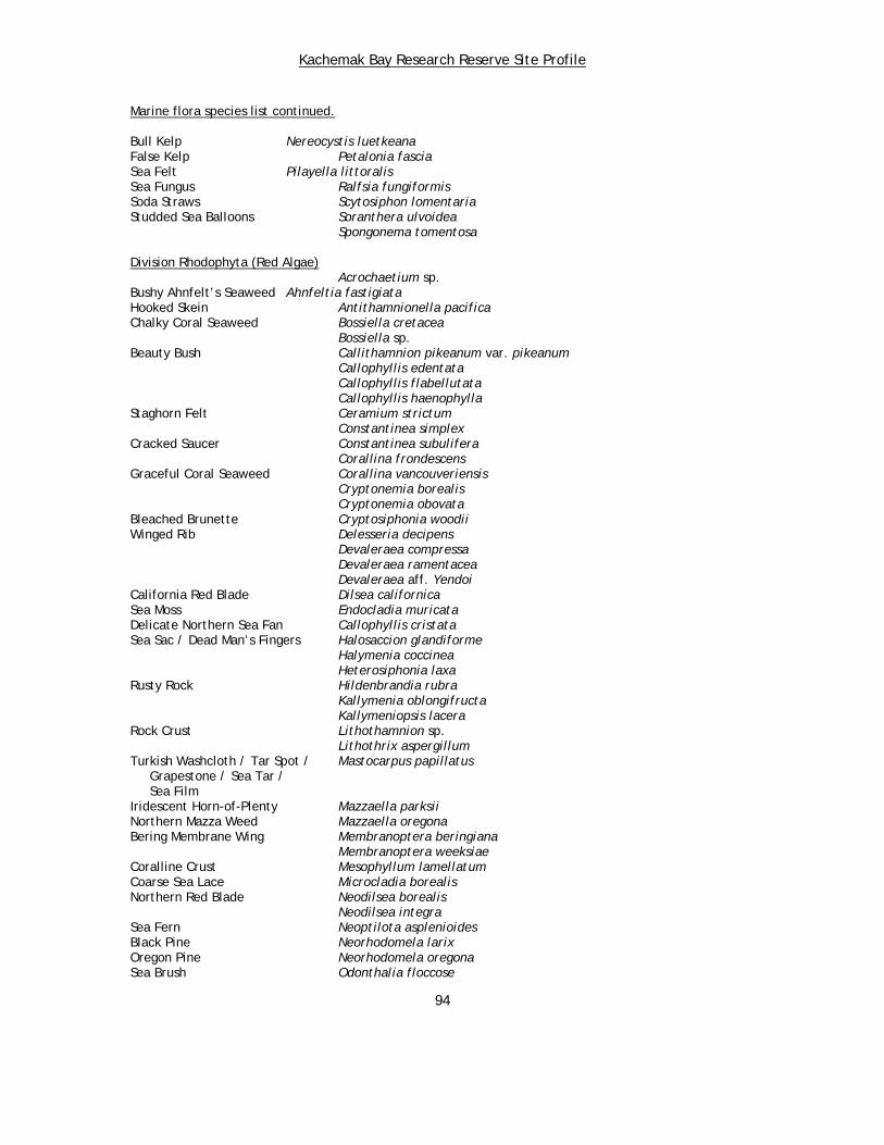
Kachemak Bay Research Reserve Site Profile
Marine flora species list continued. Bull Kelp Nereocystis luetkeana False Kelp Petalonia fascia Sea Felt Pilayella littoralis Sea Fungus Ralfsia fungiformis Soda Straws Scytosiphon lomentaria Studded Sea Balloons Soranthera ulvoidea Spongonema tomentosa Division Rhodophyta (Red Algae)
Acrochaetium sp. Bushy Ahnfelt’s Seaweed Ahnfeltia fastigiata Hooked Skein Antithamnionella pacifica Chalky Coral Seaweed Bossiella cretacea Bossiella sp. Beauty Bush Callithamnion pikeanum var. pikeanum Callophyllis edentata Callophyllis flabellutata Callophyllis haenophylla Staghorn Felt Ceramium strictum Constantinea simplex Cracked Saucer Constantinea subulifera Corallina frondescens Graceful Coral Seaweed Corallina vancouveriensis Cryptonemia borealis Cryptonemia obovata Bleached Brunette Cryptosiphonia woodii Winged Rib Delesseria decipens Devaleraea compressa Devaleraea ramentacea Devaleraea aff. Yendoi California Red Blade Dilsea californica Sea Moss Endocladia muricata Delicate Northern Sea Fan Callophyllis cristata Sea Sac / Dead Man’s Fingers Halosaccion glandiforme Halymenia coccinea Heterosiphonia laxa Rusty Rock Hildenbrandia rubra Kallymenia oblongifructa Kallymeniopsis lacera Rock Crust Lithothamnion sp. Lithothrix aspergillum Turkish Washcloth / Tar Spot / Mastocarpus papillatus Grapestone / Sea Tar / Sea Film Iridescent Horn-of-Plenty Mazzaella parksii Northern Mazza Weed Mazzaella oregona Bering Membrane Wing Membranoptera beringiana Membranoptera weeksiae Coralline Crust Mesophyllum lamellatum Coarse Sea Lace Microcladia borealis Northern Red Blade Neodilsea borealis Neodilsea integra Sea Fern Neoptilota asplenioides Black Pine Neorhodomela larix Oregon Pine Neorhodomela oregona Sea Brush Odonthalia floccose
94

Kachemak Bay Research Reserve Site Profile
Marine flora species lists continued. Odonthalia kamtschatica
Odonthalia sp. Red Opuntia Opuntiella californica Frilly Red Ribbon Palmaria callophylloides Stiff Red Ribbon Palmaria hecatensis Red Ribbon / Red Kale Palmaria mollis Sea Oak Phycodrys sp. Platythamnion sp. Pleonosporium pedicellatum Polly Hendry Polysiphonia hendryi var. luxurians Polly Pacific Polysiphonia pacifica Polysiphonia urceolata Red Cellophane Porphyra cuneiformis Porphyra fallax Japanese Laver / Porphyra kurogii Kurogi’s Laver Bull-kelp Laver Porphyra nereocystis Long Laver Porphyra pseudolinearis Porphyra variegata Black Tassel Pterosiphonia bipinnata Red Wing Ptilota filicina Rhodochorton sp. Rhodymenia liniformis Scagel’s Skein Scagelia occidentale Red Eyelet Silk Sparlingia pertusa Tokidadendron kurilensis Red Sea-cabbage Turnerella mertensiana
95
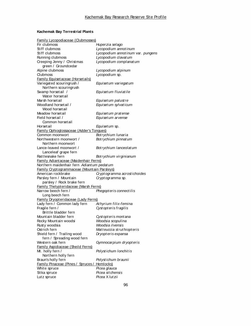
Kachemak Bay Research Reserve Site Profile
Kachemak Bay Terrestrial Plants
Family Lycopodiaceae (Clubmosses) Fir clubmoss Huperzia selago Stiff clubmoss Lycopodium annotinum Stiff clubmoss Lycopodium annotinum var. pungens Running clubmoss Lycopodium clavatum Creeping Jenny / Christmas Lycopodium complanatum green / Groundcedar Alpine clubmoss Lycopodium alpinum Clubmoss Lycopodium sp. Family Equisetaceae (Horsetails) Variegated scouringrush / Equisetum variegatum Northern scouringrush Swamp horsetail / Equisetum fluviatile Water horsetail Marsh horsetail Equisetum palustre Woodland horsetail / Equisetum sylvaticum Wood horsetail Meadow horsetail Equisetum pratense Field horsetail / Equisetum arvense Common horsetail Horsetail Equisetum sp. Family Ophioglossaceae (Adder's Tongues) Common moonwort Botrychium lunaria Northwestern moonwort / Botrychium pinnatum Northern moonwort Lance-leaved moonwort / Botrychium lanceolatum Lanceleaf grape fern Rattlesnake fern Botrychium virginianum Family Adiantaceae (Maidenhair Ferns) Northern maidenhair fern Adiantum pedatum Family Cryptogrammaceae (Mountain Parsleys) American rockbrake Cryptogramma acrostichoides Parsley fern / Mountain Cryptogramma sp. parsley / Rock brake fern Family Thelypteridaceae (Marsh Ferns) Narrow beech fern / Phegopteris connectilis Long beech fern Family Dryopteridaceae (Lady Ferns) Lady fern / Common lady fern Athyrium filix-femina Fragile fern / Cystopteris fragilis Brittle bladder fern Mountain bladder fern Cystopteris montana Rocky Mountain woodsi Woodsia scopulina Rusty woodsia Woodsia ilvensis Ostrich fern Matteuccia struthiopteris Shield fern / Trailing wood Dryopteris expansa fern / Spreading wood fern Western oak fern Gymnocarpium dryopteris Family Aspidiaceae (Sheild Ferns) Mt. holly fern / Polystichum lonchitis Northern holly fern Braun's holly fern Polystichum braunii Family Pinaceae (Pines / Spruces / Hemlocks) White spruce Picea glauca Sitka spruce Picea sitchensis Lutz spruce Picea X lutzii
96

Kachemak Bay Research Reserve Site Profile
Terrestrial flora species list continued. Black spruce Picea mariana Spruce Picea spp. Western hemlock Tsuga heterophylla Mountain hemlock Tsuga mertensiana Family Cupressaceae (Cypresses / Junipers) Common mountain juniper / Juniperus comunnis Common juniper Family Sparganiaceae (Bur-Reeds) Narrowleaf bur-reed Sparganium angustifolium Northern bur-reed Sparganium hyperboreum Family Potamogetonaceae (Pondweeds) Eelgrass / Seawrack Zostera marina Floating pondweed / Potamogeton natans Floating-weed pondweed Ribbonleaf pondweed Potamogeton epihydrus Variable pondweed Potamogeton gramineus Sago pondweed Stuckenia pectinatus Fineleaf pondweed Stuckenia filiformis Sheathed pondweed Stuckenia vaginatus Family Zannichelliaceae (Horned Pondweeds) Horned pondweed Zannichellia palustris Family Juncaginaceae (Arrow Grasses) Sea arrow grass / Triglochin maritimum Seaside arrow grass Marsh arrow grass Triglochin palustre Family Poaceae - (Grasses)Reed canary grass / Phalaris arundinacea Canary reed grass Alpine holy grass / Hierochloe alpina Alpine sweet grass Vanilla grass Hierochloe odorata Arctic sweet grass / Hierochloe pauciflora Arctic holy grass Alpine timothy / Phleum alpinum Mountain timothy Timothy Phleum pratense Field foxtail / Meadow foxtail Alopecurus pratensis Alpine foxtail / Alopecurus alpinus Boreal alopecurus Shortawn foxtail Alopecurus aequalis Redtop Agrostis gigantea Spike bentgrass / Agrostis exarata Alaska bentgrass Rough bentgrass Agrostis scabra Merten's bentgrass / Agrostis mertensii Northern bentgrass Bentgrass / Ticklegrass Agrostis sp. Bluejoint / Bluejoint reedgrass Calamagrostis canadensis Slimstem reedgrass Calamagrostis stricta Circumpolar reedgrass Calamagrostis deschampsioides Tufted hairgrass Deschampsia cespitosa Bering's tufted hairgrass Deschampsia beringensis Hairgrass Deschampsia sp. Purple mountain hairgrass / Vahlodea atropurpurea Mountain hairgrass Spiked trisetum / Spike trisetum Trisetum spicatum
97

Kachemak Bay Research Reserve Site Profile
Terrestrial flora species list continued. Timber oat grass / Danthonia intermedia Downy oat grass Arctic bluegrass Poa arctica Arctic bluegrass Poa arctica ssp. arctica Arctic bluegrass Poa arctica ssp. lanata Eminent bluegrass / Poa eminens Large-flower bluegrass / Largeflower speargrass Largeglume bluegrass Poa macrocalyx Kentucky bluegrass Poa pratensis Glaucous bluegrass Poa glauca Fowl bluegrass Poa palustris Northern bluegrass Poa stenantha Annual bluegrass Poa annua Alaska bluegrass Poa paucispicula Bluegrass Poa spp. Weak alkali grass / Torreyochloa pallida Pale false manna grass Creeping alkali grass Puccinellia phryganodes Nootka alkali grass Puccinellia nutkaensis Dwarf alkali grass Puccinellia pumila Hulten's alkali grass Puccinellia hultenii Anderson's alkali grass Puccinellia andersonii Altai fescue Festuca altaica Alpine fescue Festuca brachyphylla Red fescue Festuca rubra Fescue Festuca sp. Fringed brome Bromus ciliatus Smooth brome Bromus inermis Pumpelly's brome / Bromus inermis ssp. pumpellianus Smooth brome Alaska brome / Sitka brome Bromus sitchensis Italian rye grass Lolium perenne Meadow barley Hordeum brachyantherum Squirreltail grass / Hordeum jubatum Foxtail barley Barley Hordeum sp. Beach rye grass / Lyme grass/ Leymus mollis ssp. mollis Seabeach lyme grass / American dune grass Quackgrass / Elymus trachycaulus ssp. trachycaulus Slender wheat grass Alaskan wheat grass Elymus alaskanus ssp. latiglumis Siberian wild rye Elymus sibiricus Wheat grass Elymus sp. Family Cyperaceae (Sedges) Narrow-leaved cotton grass / Eriophorum angustifolium Tall cotton grass Tall cotton grass Eriophorum angustifolium ssp. subarcticum Tall cotton grass Eriophorum angustifolium ssp. triste Slender cotton grass Eriophorum gracile White cotton grass Eriophorum scheuchzeri Chamisso's cotton grass / Eriophorum russeolum Red cotton grass Red cotton grass Eriophorum russeolum var. albidum Arctic cotton grass Eriophorum brachyantherum
98

Kachemak Bay Research Reserve Site Profile
Terrestrial flora species list continued. Cotton grass Eriophorum sp. Alpine cotton grass / Trichophorum alpinum Alpine bulrush Tufted clubrush / Trichophorum caespitosum Tufted bulrush Creeping spike rush / Eleocharis palustris Common spike rush Kamchatka spike rush Eleocharis kamtschatica Needle spike rush Eleocharis acicularis Spikenard sedge / Spike sedge Carex nardina Yellow bog sedge / Carex gynocrates Northern bog sedge Single-spike sedge / Carex scirpoidea Northern singlespike sedge Bristle-stalked sedge / Carex leptalea Bristly-stalked sedge Yellow-flowered sedge / Carex anthoxanthea Grassy slope arctic sedge Coiled sedge Carex circinata Pyrenean sedge Carex pyrenaica ssp. micropoda Few-seeded bog sedge Carex microglochin Few-flowered sedge / Carex pauciflora Fewflower sedge Creeping sedge Carex chordorrhiza Lesser panicled sedge Carex diandra Large-headed sedge / Carex macrocephala Largehead sedge Thick-headed sedge / Carex pachystachya Chamisso sedge Presl's sedge Carex preslii Dunhead sedge Carex phaeocephala Liddon sedge Carex petasata Meadow sedge Carex praticola Closedhead sedge Carex norvegica ssp. inferalpina Gray sedge / Silvery sedge Carex canescens Soft-leaved sedge / Carex disperma Softleaf sedge Sparseflower sedge Carex tenuiflora Rye grass sedge Carex loliacea Smooth sedge / Carex laeviculmis Smoothstem sedge Bigelow's sedge Carex bigelowii Kellogg's sedge Carex lenticularis var. lipocarpa Water sedge Carex aquatilis Sitka sedge Carex aquatilis var. dives Hoppner's sedge Carex subspathacea Ramenski's sedge / Carex ramenskii Ramensk's sedge Lyngby's sedge / Carex lyngbyaei Lyngbye's sedge Golden sedge Carex aurea Long-styled sedge / Carex stylosa Variegated sedge Gmelin's sedge Carex gmelinii Mertens' sedge Carex mertensii Long-awned sedge / Carex macrochaeta
99

Kachemak Bay Research Reserve Site Profile
Terrestrial flora species list continued. Shortstalk sedge Carex podocarpa Showy sedge Carex spectabilis Small-awned sedge Carex michrochaeta Bering Sea sedge Carex michrochaeta ssp. nesophila Several-flowered sedge / Carex pluriflora Manyflower sedge Shore sedge / Mud sedge Carex limosa Poor sedge / Bog sedge / Carex magellanica Boreal bog sedge Pale sedge / Livid sedge Carex livida Beaked sedge / Carex rostrata Swollen beaked sedge Northwest Territory sedge Carex utriculata Rock sedge Carex saxatilis Round sedge Carex rotundata Sedge Carex spp. Family Araceae (Arums) Yellow skunk cabbage Lysichiton americanum Family Juncaceae (Rushes) Arctic rush Juncus arcticus Drummond's rush Juncus drummondii Mertens' rush Juncus mertensianus Chestnut rush Juncus castaneus Spreading rush / Hairyleaf rush Juncus supiniformis Northern green rush Juncus alpinoarticulatus ssp. nodulosus Bog rush / Moor rush Juncus stygius Toad rush Juncus bufonius Small-flowered woodrush Luzula parviflora Many-flowered wood rush / Luzula multiflora ssp. multiflora Common wood rush Many-flowered wood rush / Luzula multiflora Common wood rush Spiked wood rush Luzula spicata Wood rush Luzula sp. Family Liliaceae (Lilies) Northern asphodel Tofieldia coccinea Scotch false asphodel Tofieldia pusilla False asphodel / Tofieldia glutinosa Sticky false asphodel / Sticky tofieldia Green false Hellebore / Veratrum viride Corn Lily Wild chives Allium schoenoprasum Wild chives Allium schoenoprasum var. sibiricum Chocolate lily / Fritillaria camschatcensis Kamchatka fritillary / Indian rice Common alp lily Lloydia serotina False lily-of-the-valley Maianthemum dilatatum Watermelon berry / Streptopus amplexifolius Clasping twisted stalk / Wild cucumber / Claspleaf twisted stalk Family Iridaceae (Irises) Wild iris / Wild flag / Iris setosa Beachhead iris Alaska blue-eyed grass Sisyrinchium littorale
100
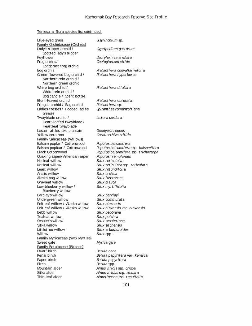
Kachemak Bay Research Reserve Site Profile
Terrestrial flora species list continued. Blue-eyed grass Sisyrinchium sp. Family Orchidaceae (Orchids) Lady's slipper orchid / Cypripedium guttatum Spotted lady's slipper Keyflower Dactylorhiza aristata Frog orchis / Coeloglossum viride Longbract frog orchid Bog orchis Platanthera convallariiefolia Green-flowered bog orchid / Platanthera hyperborea Northern rein orchid / Northern green orchid White bog orchid / Platanthera dilatata White rein orchid / Bog candle / Scent bottle Blunt-leaved orchid Platanthera obtusata Fringed orchid / Bog orchid Platanthera sp. Ladies' tresses / Hooded ladies' Spiranthes romanzoffiana tresses Twayblade orchid / Listera cordata Heart-leafed twayblade / Heartleaf twayblade Lesser rattlesnake plantain Goodyera repens Yellow coralroot Corallorrhiza trifida Family Salicaceae (Willows) Balsam poplar / Cottonwood Populus balsamifera Balsam poploar / Cottonwood Populus balsamifera ssp. balsamifera Black Cottonwood Populus balsamifera ssp. trichocarpa Quaking aspen/American aspen Populus tremuloides Netleaf willow Salix reticulata Netleaf willow Salix reticulata ssp. reticulata Least willow Salix rotundifolia Arctic willow Salix arctica Alaska bog willow Salix fuscescens Grayleaf willow Salix glauca Low blueberry willow / Salix myrtillifolia Blueberry willow Barclay's willow Salix barclayi Undergreen willow Salix commutata Feltleaf willow / Alaska willow Salix alaxensis Feltleaf willow / Alaska willow Salix alaxensis var. alaxensis Bebb willow Salix bebbiana Tealeaf willow Salix pulchra Scouler's willow Salix scouleriana Sitka willow Salix sitchensis Littletree willow Salix arbusculoides Willow Salix spp. Family Myricaceae (Wax Myrtles) Sweet gale Myrica gale Family Betulaceae (Birches) Dwarf birch Betula nana Kenai birch Betula papyrifera var. kenaica Paper birch Betula papyrifera Birch Betula spp. Mountain alder Alnus viridis ssp. crispa Sitka alder Alnus viridus ssp. sinuata Thin-leaf alder Alnus incana ssp. tenuifolia
101
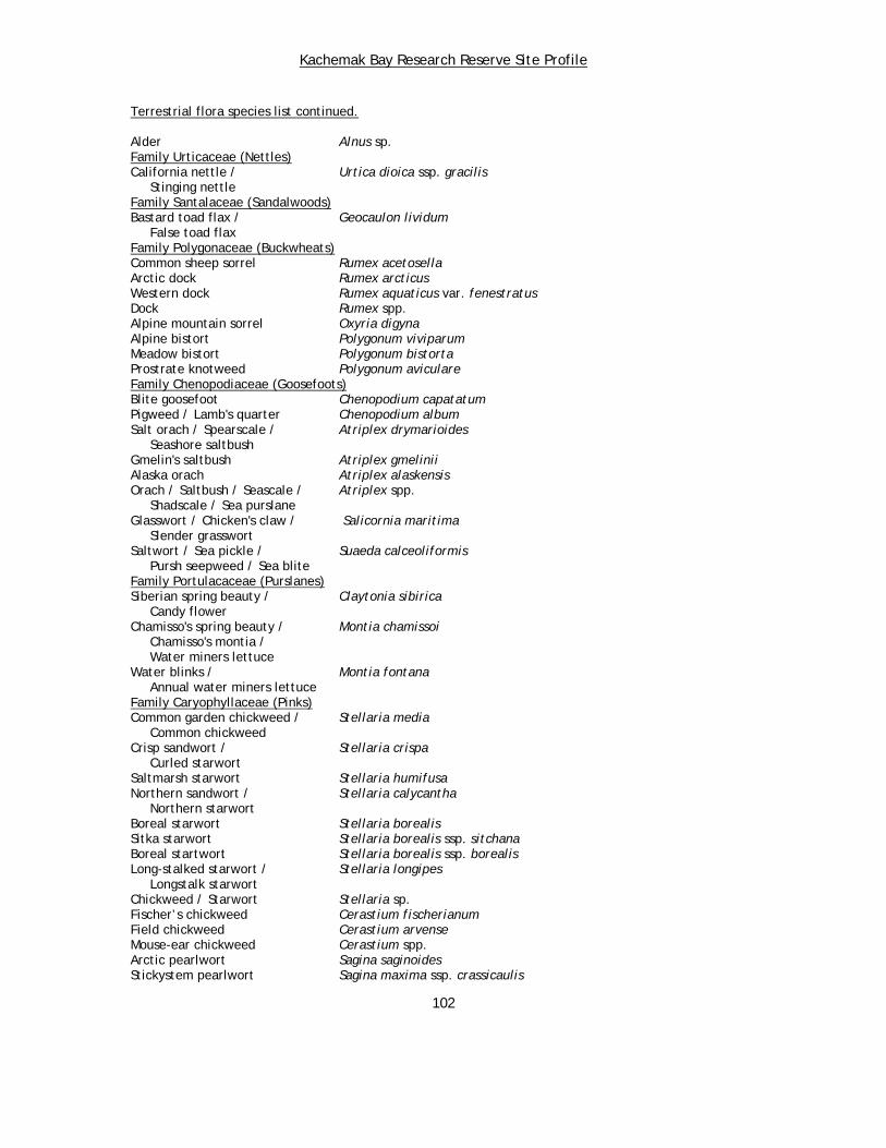
Kachemak Bay Research Reserve Site Profile
Terrestrial flora species list continued. Alder Alnus sp. Family Urticaceae (Nettles) California nettle / Urtica dioica ssp. gracilis Stinging nettle Family Santalaceae (Sandalwoods) Bastard toad flax / Geocaulon lividum False toad flax Family Polygonaceae (Buckwheats) Common sheep sorrel Rumex acetosella Arctic dock Rumex arcticus Western dock Rumex aquaticus var. fenestratus Dock Rumex spp. Alpine mountain sorrel Oxyria digyna Alpine bistort Polygonum viviparum Meadow bistort Polygonum bistorta Prostrate knotweed Polygonum aviculare Family Chenopodiaceae (Goosefoots) Blite goosefoot Chenopodium capatatum Pigweed / Lamb's quarter Chenopodium album Salt orach / Spearscale / Atriplex drymarioides Seashore saltbush Gmelin's saltbush Atriplex gmelinii Alaska orach Atriplex alaskensis Orach / Saltbush / Seascale / Atriplex spp. Shadscale / Sea purslane Glasswort / Chicken's claw / Salicornia maritima Slender grasswort Saltwort / Sea pickle / Suaeda calceoliformis Pursh seepweed / Sea blite Family Portulacaceae (Purslanes) Siberian spring beauty / Claytonia sibirica Candy flower Chamisso's spring beauty / Montia chamissoi Chamisso's montia / Water miners lettuce Water blinks / Montia fontana Annual water miners lettuce Family Caryophyllaceae (Pinks) Common garden chickweed / Stellaria media Common chickweed Crisp sandwort / Stellaria crispa Curled starwort Saltmarsh starwort Stellaria humifusa Northern sandwort / Stellaria calycantha Northern starwort Boreal starwort Stellaria borealis Sitka starwort Stellaria borealis ssp. sitchana Boreal startwort Stellaria borealis ssp. borealis Long-stalked starwort / Stellaria longipes Longstalk starwort Chickweed / Starwort Stellaria sp. Fischer’s chickweed Cerastium fischerianum Field chickweed Cerastium arvense Mouse-ear chickweed Cerastium spp. Arctic pearlwort Sagina saginoides Stickystem pearlwort Sagina maxima ssp. crassicaulis
102
Kachemak Bay Research Reserve Site Profile
Terrestrial flora species list continued. Pearlwort Sagina sp. Sandwort / Longpod stitchwort Minuartia macrocarpa Arctic stitchwort Minuartia arctica Twinflower sandwort Minuartia obtusiloba Boreal sandwort / Minuartia rubella Reddish sandwort / Beautiful sandwort Stitchwort Minuartia spp. Beach greens / Honckenya peploides Seabeach sandwort / Sea purslane / Seaside sand plant Slender mountain sandwort Arenaria capillaris Grove sandwort / Blunt-leaved Moehringia lateriflora sandwort / Bluntleaf sandwort Merckia Wilhelmsia physodes Canadian sandspurry Spergularia canadensis Moss campion / Cushion pink Silene acaulis Apetalous catchfly Silene uralensis ssp. uralensis Arctic catchfly Silene involucrata ssp. involucrata Bladder campion Silene sp. Wild carnation / Dianthus repens Boreal carnation Family Nymphaeaceae (Water Lilies) Yellow pond lily / Nuphar lutea ssp. polysepala Yellow water lily / Spatterdock / Rocky Mountain pond lily Family Ceratophyllaceae (Hornworts) Hornwort / Coon's tail Ceratophyllum demersum Family Ranunculaceae (Crowfoots / Buttercups) Alpine white marsh marigold / Caltha leptosepala White marsh marigold Yellow marsh marigold Caltha palustris Yellow marsh marigold Caltha palustris var. palustris Yellow marsh marigold Caltha palustris var. radicans Fern-leaved goldthread / Coptis aspleniifolia Fernleaf goldthread Three-leaved goldthread / Coptis trifolia Threeleaf goldthread Red baneberry / Snakeberry Actaea rubra Red baneberry / Snakeberry Actaea rubra ssp. arguta Western columbine Aquilegia formosa Tall larkspur / Delphinium glaucum Glaucous larkspur / Sierra larkspur Mountain monkshood / Aconitum delphiniifolium Larkspurleaf monkshood Larkspurleaf monkshood Anconitum delphiniifolium ssp. delphiniifolium Yellow anemone / Richardson's Anemone richardsonii anemone / Yellow thimbleweed Northern anemone / Anemone parviflora Small-flowered anemone Narcissus anemone / Anemone narcissiflora Narcissus-flowered anemone Narcissus anemone Anemone narcissiflora var. monantha Cut-leaf anemone / Anemone multifida Pacific anemone
103
Kachemak Bay Research Reserve Site Profile
Terrestrial flora species list continued. Drummond's anemone Anemone drummondii High northern buttercup Ranunculus hyperboreus Lapland buttercup Ranunculus lapponicus Shore buttercup / Alkali Ranunculus cymbalaria buttercup / Marsh buttercup Mountain buttercup / Ranunculus eschscholtzii Subalpine buttercup / Snowpatch buttercup / Eschscholtz's buttercup Snow buttercup Ranunculus nivalis Littleleaf buttercup Ranunculus abortivus Little buttercup / Ranunculus uncinatus var. parviflorus Small-flowered buttercup / Idaho buttercup Western buttercup Ranunculus occidentalis Buttercup Ranunculus spp. Alpine meadow rue Thalictrum alpinum Few-flowered meadow rue / Thalictrum sparsiflorum Fewflower meadow rue Hulten's meadow rue Thalictrum hultenii Meadow rue Thalictrum sp. Family Papaveraceae (Poppies) White poppy / Pale poppy Papaver alboroseum Family Fumariaceae (Earth Smokes) Blue corydalis / Corydalis pauciflora Fewflower fumewort Family Brassicaceae - was Cruciferae (Mustards) Arctic pennycress Thlaspi arcticum Danish scurvy grass Cochlearia groenlandica American sea rocket Cakile edentula Bird's rape / Field mustard Brassica rapa Winter cress / Barbarea orthoceras American yellow rocket Yellow cress Rorippa sp. Hispid yellow cress Rorippa palustris ssp. hispida Hoary yellow cress Rorippa barbareifolia Alpine bitter cress Cardamine bellidifolia Pennsylvania bitter cress Cardamine pensylvanica Cuckoo flower Cardamine pratensis Cuckoo flower Cardamine pratensis var. angustifolia Kamchatka rock cress / Cardamine oligosperma Few-seeded bitter cress / Little western bitter cress / Wild water cress / Umbel bitter cress Shepherd's purse Capsella bursa-pastoris Yellow arctic draba Draba nivalis Lance-fruited draba / Draba lonchocarpa Lancepod draba Rainier draba Draba ruaxes Palander's draba Draba palanderiana Yellowstone draba Draba incerta Alpine draba Draba alpina Milky draba Draba lactea Alaska draba Draba stenoloba White draba / Boreal draba Draba borealis Golden draba Draba aurea Woodland draba Draba nemorosa
104
Kachemak Bay Research Reserve Site Profile
Terrestrial flora species list continued. Arctic draba / Draba hyperborea North Pacific draba Draba Draba spp. Kamchatka rockcress Arabis kamchatica Hairy arabis / Arabis eschscholtziana Eschscholtz's rockcress Creamflower rockcress Arabis hirsuta var. pycnocarpa Spreadingpod rockcress Arabis divaricarpa Holboell's rockcress Arabis holboellii Wormseed mustard / Erysimum cheiranthoides Wormseed wallflower Shy wallflower Erysimum inconspicuum Yellow Rocket / Wallflower Erysimum sp. Family Droseraceae (Sundews) Great sundew / English sundew Drosera anglica Round-leaved sundew / Drosera rotundifolia Roundleaf sundew Family Crassulaceae (Stonecrops) Roseroot / Ledge stonecrop Rhodiola integrifolia ssp. integrifolia Family Saxifragaceae (Saxifrages) Leather-leaved saxifrage Leptarrhena pyrolifolia Fireleaf leptarrhena Purple mountain saxifrage Saxifraga oppositilofia Cushion saxifrage / Saxifraga eschscholtzii Ciliate saxifrage Thymeleaf saxifrage Saxifraga serpyllifolia Bog saxifrage / Saxifraga hirculus Yellow marsh saxifrage Spotted saxifrage / Saxifraga bronchialis Yellowdot saxifrage Funston's saxifrage Saxifraga bronchialis ssp. funstonii Prickly saxifrage / Saxifraga tricuspidata Three-toothed saxifrage Heart-leaved saxifrage / Saxifraga nelsoniana ssp. nelsoniana Cordate-leaved saxifrage / Heartleaf saxifrage Cordate-leaved saxifrage / Saxifraga nelsoniana ssp. pacifica Pacific saxifrage Brook saxifrage / Saxifraga rivularis Weak saxifrage Red-stemmed saxifrage / Saxifraga lyallii Redstem saxifrage Snow saxifrage / Saxifraga nivalis Alpine saxifrage Coast saxifrage / Saxifraga ferruginea Coastal saxifrage / Russethair saxifrage Grained saxifrage / Saxifraga foliolosa Leafystem saxifrage Tufted alpine saxifrage Saxifraga caespitosa Foam flower / Lace flower / Tiarella trifoliata Threeleaf foamflower Smooth alum root / Heuchera glabra Alpine heuchera Fringe cups / Bigflower tellima Tellima grandiflora Five-stamened mitrewort / Mitella pentandra
105

Kachemak Bay Research Reserve Site Profile
Terrestrial flora species list continued. Northern water carpet / Chrysosplenium tetradrum Northern golden saxifrage Water carpet Chrysosplenium sp. Grass-of-Parnassus Parnassia palustris Northern grass-of-Parnassus/ Parnassia palustris var. tenuis Bog star / Marsh grass-of-Parnassus Kotzebue's grass-of-Parnassus Parnassia kotzebuei Family Grossulariaceae (Currents) Stink currant Ribes bracteosum Northern black currant Ribes hudsonianum Skunk currant Ribes glandulosum Trailing black currant / Ribes laxiflorum Trailing currant Northern red currant / Ribes triste Red currant Currant Ribes spp. Family Rosaceae (Roses) Alaska spiraea / Spiraea stevenii Beauverd's spiraea Partridgefoot Luetkea pectinata Goatsbeard / Bride's feathers Aruncus dioicus var. vulgaris Oregon crab apple Malus fusca Greene's mountain ash Sorbus scopulina Native mountain ash / Sorbus sitchensis Western mountain ash Serviceberry / Saskatoon Amelanchier alnifolia serviceberry Pacific serviceberry Amelanchier florida Serviceberry Amelanchier sp. Trailing Raspberry / Rubus pedatus Strawberryleaf raspberry Cloudberry Rubus chamaemorus Nagoonberry / Rubus arcticus Arctic blackberry / Dewberry Arctic blackberry Rubus arcticus ssp. arcticus Dwarf raspberry Rubus arcticus ssp. acaulis Common raspberry / Rubus idaeus American red raspberry Salmonberry Rubus spectabilis Coastal strawberry / Fragaria chiloensis ssp. pacifica Pacific beach strawberry Strawberry Fragaria sp. Marsh five-finger / Comarum palustre Purple marsh locks Tundra rose / Dasiphora floribunda Shrubby cinquefoil Villous cinquefoil Potentilla villosa One-flowered cinquefoil Potentilla uniflora Arctic cinquefoil Potentilla nana Norwegian cinquefoil Potentilla norvegica Hooker's cinquefoil Potentilla hookeriana ssp. hookeriana Staghorn cinquefoil Potentilla bimundorum Diverse-leaved cinquefoil / Potentilla diversifolia Varileaf cinquefoil Cinquefoil Potentilla sp. Silverweed cinquefoil Argentina anserina
106
Kachemak Bay Research Reserve Site Profile
Terrestrial flora species list continued. Pacific silverweed Argentina egedii ssp. egedii Creeping sibbaldia Sibbaldia procumbens Yellow geum / Geum macrophyllum Large-leaved avens / Largeleaf avens Caltha-leaved avens / Geum calthifolium Calthaleaf avens Ross' geum / Ross' avens Geum rossii Yellow dryas / Dryas drummondii Yellow mountain avens / Drummond's mountain avens White dryas / Eightpetal Dryas octopetala mountain avens Entire-leaved mountain avens / Dryas integrifolia Entireleaf mountain avens Entireleaf mountain avens Dryas integrifolia ssp. integrifolia Menzies' burnet Sanguisorba menziesii Sitka burnet / Sanguisorba canadensis Sitka great burnet / Canadian burnet Burnet Sanguisorba sp. Prickly rose / Wild rose Rosa acicularis Nootka rose Rosa nutkana Family Leguminosae / Fabaceae (Peas) Arctic lupine Lupinus arcticus Nootka lupine Lupinus nootkatensis Alsike clover Trifolium hybridum White clover Trifolium repens Red clover Trifolium pratense Clover Trifolum spp. Alpine milk vetch Astragalus alpinus Blackish oxytrope / Oxytropis nigrescens Purple oxytrope Field locoweed Oxytropis campestris Field locoweed Oxytropis campestris var. varians Alpine sweet vetch Hedysarum alpinum Beach peavine / Beach pea Lathyrus japonicus Vetchling / Marsh pea Lathyrus palustris Family Geraniaceae (Geraniums) Wild geranium / Geranium erianthum Woolly geranium / Sticky geranium Family Balsaminaceae (Touch-Me-Nots) Western touch-me-not / Impatiens noli-tangere Common touch-me-not / Jewelweed Family Violaceae (Violets) Pioneer violet / Viola glabella Stream violet / Yellow wood violet Aleutian violet / Alaska violet Viola langsdorfii Hookedspur violet / Viola adunca Western dog violet / Early blue violet Selkirk's violet Viola selkirkii Dwarf marsh violet Viola epipsila ssp. repens Violet Viola sp. Family Elaeagnaceae (Oleasters) Soapberry / Shepherdia canadensis Russet buffalo berry
107
Kachemak Bay Research Reserve Site Profile
Terrestrial flora species list continued. Family Onagraceae (Evening Primroses / Fireweeds) Tall fireweed Chamerion angustifolium ssp. angustifolium Dwarf fireweed / River beauty Chamerion latifolium Marsh willow herb Epilobium palustre Pimpernel willow herb Epilobium anagallidifolium Willow herb Epilobium behringianum Hornemann's willow herb Epilobium hornemannii ssp. behringianum Small-leaved fireweed / Epilobium ciliatum ssp. ciliatum Fringed willow herb Fringed willow herb / Epilobium ciliatum ssp. glandulosum Glandular willow herb Willow herb Epilobium sp. Small enchanter's nightshade Circaea alpina Family Hippuridaceae - was Haloragaceae (Water Milfoils) Common mare's tail Hippuris vulgaris Four-leaved mare's tail / Hippuris tetraphylla Fourleaf mare's tail Family Araliaceae (Ginsengs) Devil's club Oplopanax horridus Family Apiaceae - was Umbelliferae (Parsleys) Purple sweet cicely / Osmorhiza purpurea Purple sweet root Blunt-fruited sweet cicely / Osmorhiza depauperata Bluntseed sweet root Thoroughwax / Bupleurum americanum American thorow wax Western water hemlock / Cicuta douglasii Douglas' water hemlock Mackenzie's water hemlock Cicuta virosa Jakutsk snow parsley Cnidium cnidiifolium Beach lovage / Scotch lovage / Ligusticum scoticum Sea lovage / Scotch licorice root / Scottish licorice root Hulten's licorice root Ligusticum scoticum ssp. hultenii Pacific hemlock parsley Conioselinum gmelinii Angelica / Seawatch angelica / Angelica lucida Seacoast angelica Kneeling angelica Angelica genuflexa Common cow parsnip / Heracleum maximum Pushki or Pootschki Family Cornaceae (Dogwoods) Swedish dwarf cornel / Cornus suecica Lapland cornel Bunchberry / Dwarf dogwood / Cornus canadensis Canadian dwarf cornel / Bunchberry dogwood Hybrid dwarf dogwood Cornus canadensis x suecica Family Pyrolaceae (Wintergreens) Pipsissewa Chimaphila umbellata ssp. occidentalis Pink wintergreen / Pyrola asarifolia Pink pyrola / Liverleaf wintergreen / Woodland wintergreen Large-flowered wintergreen / Pyrola grandiflora Arctic wintergreen Small pyrola / Pyrola minor Snowline wintergreen
108

Kachemak Bay Research Reserve Site Profile
Terrestrial flora species list continued. Round-leafed pyrola / Pyrola chlorantha Green-flowered wintergreen Pyrola / Wintergreen Pyrola sp. One-sided wintergreen / Orthilia secunda Sidebells wintergreen Shy maiden / Single delight Moneses uniflora Family Empetraceae (Crowberries) Black crowberry / Moss berry Empetrum nigrum Family Ericaceae (Heaths) Copper flower / Copperbush Cladothamnus pyrolaeflorus Northern Labrador tea / Ledum palustre ssp. decumbens Marsh Labrador tea Bog Labrador tea Ledum groenlandicum Kamchatka rhododendron Rhododendron camtschaticum Kamchatka rhododendron Rhododendron camtschaticum ssp. camtschaticum False azalea / Rusty menzesia Menziesia ferruginea Alpine azalea Loiseleuria procumbens Yellow mountain heather / Phyllodoce glanduliflora Aleutian mountain heath White arctic mountain heather Cassiope tetragona Alaska moss heather / Cassiope harrimanella Alaska mountain heather / Alaska bell heather Clubmoss mountain heather Cassiope lycopodioides Bog rosemary Andromeda polifolia Cassandra / Leatherleaf Chamaedaphne calyculata Kinnikinnick / Chipmunk's Arctostaphylos uva-ursi apples / mealberry Alpine bearberry / Arctostaphylos alpina Black bear's grapes / Alpine bear grapes Red fruit bearberry / Arctostaphylos rubra Red bear's grape Lingonberry / Vaccinium vitis-idaea Lowbush cranberry Dwarf blueberry / Vaccinium cespitosum Dwarf bilberry Oval-leaved blueberry / Vaccinium ovalifolium Oval-leaf blueberry / Early blueberry Bog blueberry Vaccinium uliginosum Bog cranberry / Vaccinium oxycoccos True cranberry / Small cranberry Family Diapensiaceae (Diapensias) Lapland diapensia / Diapensia lapponica Pincushion plant Family Primulaceae (Primroses) Pixie eyes / Primula cuneifolia Wedgeleaf primrose Wedgeleaf primrose Primula cuneifolia ssp. saxifragifolia Pygmy flower rock jasmine Androsace septentrionalis Alaska androsace / Douglasia alaskana Alaska douglasia Rock jasmine Androsace spp. Few-flowered shooting star / Dodecatheon pulchellum Pretty shooting star / Darkthroat shooting star
109

Kachemak Bay Research Reserve Site Profile
Terrestrial flora species list continued. Shooting star Dodecatheon sp. Arctic starflower Trientalis europaea Arctic starflower Trientalis europaea ssp. arctica Sea milkwort Glaux maritima Family Plumbaginaceae (Leadworts) Thrift / Thrift sea pink Armeria maritima Family Gentianaceae (Gentians) Whitish gentian Gentian algida Broad-petaled gentian Gentiana platypetala Inky gentian / Gentiana glauca Glaucous gentian / Pale gentian Swamp gentian Gentiana douglasiana Autumn dwarf gentian / Gentiana amarella ssp. acuta Northern gentian Fourpart dwarf gentian Gentiana propinqua ssp. propinqua Star gentian / Marsh felwort Lomatogonium rotatum Alpine bog swertia / Felwort Swertia perennis Family Menyanthaceae (Buckbeans) Buckbean / Bogbean Menyanthes trifoliata Family Polemoniaceae (Polemoniums) Tall jacob's ladder Polemonium acutiflorum Northern jacob's ladder Polemonium boreale Short jacob's ladder / Polemonium pulcherrimum Beautiful jacob's ladder Family Hydrophyllaceae (Waterleafs) Sitka mistmaiden / Romanzoffia sitchensis Sitka romanzoffia Family Boraginaceae (Borages) Alpine forget-me-not / Myosotis asiatica Asian forget-me-not Oysterleaf / Sea Lungwort Mertensia maritima Tall bluebells / Lungwort Mertensia paniculata Family Lamiaceae - was Labiatae (Mints) Common self-heal / Heal-all Prunella vulgaris Splitlip hemp nettle Galeopsis bifida Family Scrophulariaceae (Figworts) Yellow monkeyflower / Mimulus guttatus Seep monkeyflower American speedwell Veronica americana American alpine speedwell Veronica wormskjoldii Yellow paintbrush / Castilleja unalaschcensis Unalaska paintbrush / Alaska Indian paintbrush Subalpine eyebright Euphrasia mollis Eyebright Euphrasia disjuncta Yellow rattle / Arctic rattlebo Rhinanthus minor ssp. groenlandicus Verticulate lousewort / Pedicularis verticillata Whorled lousewort Common yellow lousewort / Pedicularis labradorica Labrador lousewort Big-toothed lousewort / Pedicularis macrodonta Muskeg lousewort Langsdorf's lousewort Pedicularis langsdorfii Sudetic lousewort Pedicularis sudetica ssp. interior Capitate lousewort Pedicularis capitata Oeder's lousewort Pedicularis oederi
110
Kachemak Bay Research Reserve Site Profile
Terrestrial flora species list continued. Woolly lousewort / Pedicularis kanei Kenai lousewort Lousewort Pedicularis sp. Family Orobanchaceae (Broomrapes) Northern groundcone / Boschniakia rossica Broomrape Family Lentibulariaceae (Bladderworts) Common butterwort Pinguicula vulgaris Hairy butterwort Pinguicula villosa Flat-leaved bladderwort / Utricularia intermedia Flatleaf bladderwort Bladderwort Utricularia sp. Family Plantaginaceae (Plantains) Goosetongue / Plantago maritima Seaside plantain Goosetongue Plantago maritima var. juncoides Ribgrass / Narrowleaf plantain Plantago lanceolata Common plantain / Plantago major Broad-leaved plantain Plantain Plantago sp. Family Rubiaceae (Madders) Northern bedstraw Galium boreale Sweet-scented bedstraw / Galium triflorum Fragrant bedstraw Small bestraw / Galium trifidum Threepetal bedstraw Threepetal bedstraw Galium trifidum ssp. trifidum Bedstraw Galium spp. Family Caprifoliaceae (Honeysuckles) Red-berried elder / Sambucus racemosa Red elderberry / Red elder Highbush cranberry / Viburnum edule Squashberry Twinflower Linnaea borealis Family Adoxaceae (Moschatels) Musk root / Moschatel Adoxa moschatellina Family Valerianaceae (Valerians) Capitate valerian / Valeriana capitata Captiate valerian Sitka valerian Valeriana sitchensis Family Campanulaceae (Bluebells) Mountain harebell / Campanula lasiocarpa Common harebell Common harebell / Campanula rotundifolia Bluebells of Scotland / Blue bell / Bell flower / Bluebell bellflower Family Asteraceae - was Compositae (Composites) Northern goldenrod / Solidago multiradiata Rocky Mountain goldenrod Rocky Mountain goldenrod Solidago multiradiata var. multiradiata Canada goldenrod Solidago canadensis Arctic aster / Siberian aster Eurybia sibirica Douglas aster Symphyotrichum subspicatum var. subspicatum Arctic alpine fleabane / Erigeron humilus Arctic daisy Tundra fleabane Erigeron hyperboreus
111

Kachemak Bay Research Reserve Site Profile
Terrestrial flora species list continued. Bitter fleabane Erigeron acris Coastal fleabane / Erigeron peregrinus Subalpine daisy / Subalpine fleabane Subalpine fleabane Erigeron peregrinus ssp. peregrinus Single-headed pussytoes / Antennaria monocephala Pygmy pussytoes Alpine pussytoes Antennaria alpina Fries' pussytoes / Antennaria friesiana ssp. alaskana Alpine pussytoes Rosy pussytoes Antennaria rosea Pulvinate pussytoes Antennaria rosea ssp. pulvinata Pussytoes Antennaria spp. Common yarrow / Achillea millefolium var. borealis Northern yarrow / Boreal yarrow Yarrow Achillea sp. Pineapple weed / Matricaria discoidea Disc mayweed Arctic daisy Dendranthema arcticum ssp. arcticum Common wormwood / Artemisia tilesii Telesii's wormwood / Tilesius' wormwood Arctic wormwood / Mountain Artemisia arctica sagwort / Boreal sagebrush Boreal sagebrush Artemisia arctica ssp. arctica Arctic sweet coltsfoot Petasites frigidus Arctic sweet coltsfoot Petasites frigidus var. nivalis Alpine nodding arnica / Arnica lessingii Nodding arnica / Lessing arnica Snow arnica Arnica frigida Mountain arnica / Arnica latifolia Broadleaf arnica Meadow arnica / Arnica chamissonis Chamisso arnica Chamisso arnica Arnica chamissonis ssp. chamissonis Alpine arnica Arnica sp. Rayless alpine butterweed Senecio pauciflorus Common groundsel / Senecio vulgaris Old-man-in-the-Spring Seabeach groundsel / Senecio psuedoarnica Beach sunflower / Beach daisy / Seaside ragwort Arrow-leaved groundsel / Senecio triangularis Arrow leaf ragwort Black-tipped groundsel / Senecio lugens Small blacktip ragwort Common dandelion Taraxacum officinale Common dandelion / Taraxacum officinale ssp. ceratophorum Horned dandelion Harp dandelion / Taraxacum lyratum Kamchatka dandelion Dandelion Taraxacum sp. Short-beaked agoseris / Agoseris glauca Pale agoseris Dwarf hawksbeard / Crepis nana Dwarf alpine hawksbeard Western rattlesnake root Prenanthes alata
112

Kachemak Bay Research Reserve Site Profile
Terrestrial flora species list continued. Rattlesnake root Prenanthes sp. Wooly hawkweed Hieracium triste Slender hawkweed Hieracium gracile Orange hawkweed Hieracium aurantiacum
113
Kachemak Bay Research Reserve Site Profile
Kachemak Bay Fish
Family Petromyzontidae (Lampreys) Pacific lamprey Lampetra tridentata Family Lamnidae (Mackerel Sharks) Salmon shark / Mackerel shark Lamna ditropis Family Squalidae (Dogfish Sharks) Pacific sleeper shark Somniosus pacificus Spiny dogfish Squalus acanthias Family Rajidae (Skates) Aleutian or Alaska skate Bathyraja sp. (either B. aleutica or B. parmifera) Big skate Raja binoculata Longnose skate Raja rhina Unidentified skate Rajidae sp. Family Congridae (Conger eels) Unidentified conger eel Congridae sp. Family Clupeidae (Herrings) Pacific herring Clupea pallasii Family Osmeridae (Smelts) Capelin / Grunion / Candlefish Mallotus villosus Longfin smelt Spirinchus thaleichthys Eulachon / Hooligan / Thaleichthys pacificus Columbia River smelt / Candlefish Unidentified smelt Osmeridae sp. Family Salmonidae (Trouts and Salmons) Bering cisco Coregonus laurettae Pink salmon / Pink / Oncorhynchus gorbuscha Humpy salmon / Humpy / Humpback Chum salmon / Chum / Oncorhynchus keta Dog salmon / Dog / Calico Silver salmon / Coho salmon Oncorhynchus kisutch Rainbow trout or Steelhead Oncorhynchus mykiss Red salmon / Red / Oncorhynchus nerka Blueback / Sockeye salmon / Sockeye / Kokanee (landlocked fish only) King salmon / King / Oncorhynchus tshawytscha Blackmouth / Spring / Chinook salmon / Chinook / Quinnat / Tyee / Tule Dolly Varden / Salvelinus malma Pacific brook char Family Moridae (Codlings) Unidentified codlings Moridae spp. Family Gadidae ( Cods) Saffron cod Eleginus gracilis Pacific cod / Gray cod / Gadus macrocephalus True cod Cod Gadus sp. Pacific tomcod / Tomcod Microgadus proximus Unidentified cod Gadidae sp. Walleye pollock / Theragra chalcogramma Pacific pollock / Bigeye pollock Family Trachipteridae (Ribbonfishes) King-of-the-salmon Trachipterus altivelis Family Gasterosteidae (Sticklebacks) Tube-snout Aulorhynchus flavidus
114

Kachemak Bay Research Reserve Site Profile
Fish species list continued. Threespine stickleback Gasterosteus aculeatu Ninespine stickleback Pungitus pungitius Family Scorpaenidae (Scorpionfishes and Rockfishes) Rougheye rockfish / Sebastes aleutianus Blacktip rockfish Pacific ocean perch / Sebastes alutus Longjaw rockfish / Pop rockfish Redbanded rockfish / Bandit / Sebastes babcocki Barber pole Shortraker rockfish / Buoy keg Sebastes borealis Dark dusky rockfish / Sebastes ciliatus (dark morph) Brown bomber Light dusky rockfish Sebastes ciliatus (light morph) Darkblotched rockfish / Sebastes crameri Blackblotched rockfish Yellowtail rockfish / Greenie Sebastes flavidus Black rockfish / Black bass Sebastes melanops Redstripe rockfish Sebastes proriger Yelloweye rockfish / Sebastes ruberrimus Rasphead rockfish /Red snapper Unidentified rockfish Sebastes sp. Family Anoplopomatidae (Sablefishes) Sablefish / Black cod Anoplopoma fimbria Family Hexagrammidae (Greenlings) Kelp greenling Hexagrammos decagrammus Whitespotted greenling Hexagrammos stelleri Greenling Hexagrammos spp. Lingcod Ophiodon elongatus Unidentified greenling Hexagrammidae sp. Family Cottidae (Sculpins) Bonyhead sculpin / Artedius notopilotus Bonehead sculpin Silverspotted sculpin Blepsias cirrhosus Sharpnose sculpin Clinocottus acuticeps Slimy sculpin Cottus cognatus Spinyhead sculpin Dasycottus setiger Bull sculpin Enophrys taurina Sculpin Gymnocanthus spp. Red Irish lord Hemilepidotus hemilepidotus Yellow Irish lord Hemilepidotus jordani Brown Irish lord Hemilepidotus spinosus Irish lord Heimilepidotus sp. Bigmouth sculpin Hemitripterus bolini Northern sculpin Icelinus borealis Sculpin Icelus spp. Pacific staghorn sculpin Leptocottus armatus Sculpin Myoxocephalus spp. Sailfin sculpin Nautichthys oculofasciatus Eyeshade sculpin Nautichthys pribilovius Tadpole sculpin Psychrolutes paradoxus Slim sculpin Radulinus asprellus Scissortail sculpin Triglops forficatus Roughspine sculpin Triglops macellus Ribbed sculpin Triglops pingeli Unidentified sculpins Cottidae spp. Family Agonidae (Poachers)
115

Kachemak Bay Research Reserve Site Profile
Fish species list continued. Smooth alligatorfish Anoplagonus inermis Aleutian alligatorfish Aspidophoroides bartoni Spinycheek starsnout / Bathyagonus infraspinatus Spinycheek starsnout poacher Starsnout poacher Bathyagonus sp. Tubenose poacher Pallasina barbata Sturgeon poacher Podothecus acipenserinus Sawback poacher Sarritor frenatus Unidentified poacher Agonidae sp. Family Cyclopteridae / Liparididae (Snailfishes) Pacific spiny lumpsucker Eumicrotremus orbis Snailfish Liparis spp. Unidentified snailfishes Liparididae spp. Unidentified lumpsucker Cyclopteridae sp. Family Serranidae (Sea basses) Unidentified sea bass Serranidae sp. Family Bathymasteridae (Ronquils) Alaskan ronquil Bathymaster caeruleofasciatus Searcher Bathymaster signatus Northern ronquil Ronquilus jordani Unidentified ronquil Bathymasteridae sp. Family Zoarcidae (Eelpouts) Shortfin eelpout Lycodes brevipes Wattled eelpout Lycodes palearis Unidentified eelpout Zoarcidae sp. Family Stichaeidae (Pricklebacks) Decorated warbonnet Chirolophis decoratus Matcheek warbonnet Chirolophis tarsodes Longsnout prickleback Lumpenella longirostris Slender eelblenny Lumpenus fabricii Daubed shanny Lumpenus maculatus Stout eelblenny Lumpenus medius Snake prickleback Lumpenus sagitta Whitebarred prickleback Poroclinus rothrocki Arctic shanny Stichaeus punctatus Unidentified prickleback Stichaeidae sp. Family Cryptacanthodidae (Wrymouths) Dwarf wrymouth Cryptacanthodes aleutensis Giant wrymouth Cryptacanthodes giganteus Family Pholidae (Gunnels) Crescent gunnel Pholis laeta Unidentified gunnels Pholis spp. Family Anarhichadidae (Wolffishes) Wolf-eel Anarrhichthys ocellatus Family Zaproridae (Prowfishes) Prowfish Zaprora silenus Family Trichodontidae (Sandfishes) Pacific sandfish / Tobiefish Trichodon trichodon Family Ammodytidae (Sand Lances) Pacific sand lance Ammodytes hexapterus Family Bothidae (Lefteye Flounders) Pacific sanddab Citharichthys sordidus Family Pleuronectidae (Righteye Flounders) Arrowtooth flounder / Atheresthes stomias Turbot / Arrowtooth halibut / Longjaw flounder / French sole
116
Kachemak Bay Research Reserve Site Profile
Fish species list continued. Rex sole / Longfin sole / Errex zachirus Longfinned sole / Longfin flounder / Witch sole Flathead sole / Paper sole / Hippoglossoides elassodon Cigarette paper Pacific halibut / Right halibut / Hippoglossus stenolepis Northern halibut Dover sole / Slime sole / Microstomus pacificus Slippery flounder or sole / Shortfinned sole Starry flounder / Grindstone / Platichthys stellatus Emerywheel / Diamond back Yellowfin sole / Muddab / Pleuronectes asper Alaska dab / Northern sole Rock sole / Rock flounder / Pleuronectes bilineatus Roughback sole / Broadfin sole / Roughscale sole / Two-lined flounder Butter sole / Pleuronectes isolepis Scalyfin flounder or sole / Bellingham sole / Skidegate sole Alaska plaice / Lemon sole/ Pleuronectes quadrituberculatus Yellow-bellied flounder Sand sole / Fringe sole / Psettichthys melanostictus Sand flounder / Spotted flounder Greenland halibut / Reinhardtius hippoglossoides Greenland turbot / Turbot / Lesser halibut / Newfoundland turbot Unidentified flatfish Pleuronectiformes sp.
117

Kachemak Bay Research Reserve Site Profile
Kachemak Bay Marine Mammals Mustelids Sea Otter Enhydra lutris Pinnipeds Steller's Sea Lion Eumetopias jubatus Harbor Seal Phoca vitulina Cetaceans Minke Whale Balaenoptera acutorostrata Fin Whale Balaenoptera physalus Humpback Whale Megaptera novaeangliae Gray Whale Eschrichtius robustus Killer Whale Orcinus orca Beluga or White Whale Delphinapterus leucas Harbor Porpoise Phocoena phocoena Dall's Porpoise Phocoenoides dalli Kachemak Bay Terrestrial Mammals Insectivores Masked Shrew Sorex cinereus Pygmy Shrew Sorex hoyi Dusky Shrew Sorex monticolus Water Shrew Sorex palustris Tundra Shrew Sorex tundrensis Bats Little Brown Bat Myotis lucifugus Canids Coyote Canis latrans Wolf Canis lupus Red Fox Vulpes vulpes Felids Lynx Lynx canadensis Mustelids River or Canadian Otter Lontra canadensis Wolverine Gulo gulo Marten Martes americana Short-tail Weasel or Ermine Mustela erminea Mink Mustela vison Ursids Black Bear Ursus americanus Brown Bear Ursus arctos Artiodactyles Moose Alces alces Caribou Rangifer tarandus Mountain Goat Oreamnos americanus Dall Sheep Ovis dalli Rodents Hoary Marmot Marmota caligata Red Squirrel Tamiasciurus hudsonicus Beaver Castor canadensis Meadow Jumping Mouse Zapus hudsonius Northern Red-backed Vole Clethrionomys rutilus Brown Lemming Lemmus trimucronatus Singing Vole Microtus miurus Tundra Vole Microtus oeconomus Meadow Vole Microtus pennsylvanicus
118

Kachemak Bay Research Reserve Site Profile
Muskrat Ondatra zibethicus Northern Bog Lemming Synaptomys borealis House Mouse Mus musculus Norway Rat Rattus norvegicus Porcupine Erethizon dorsatum Lagomorphs Snowshoe Hare Lepus americanus
119

Kachemak Bay Research Reserve Site Profile
120
Kachemak Bay Marine Invertebrates Sponges Breadcrumb sponge Halichondria panicea Purple encrusting sponge Ophlitaspongia pennata Wandering sponge Suberites ficus Boring sponge Cliona celata Tube sponge / Urn sponge Scypha ciliata or
Leucilla nuttingi Subtidal yellow sponge Myxilla lacunosa Esperiopsis rigida (?) Esperiopsis laxa Smooth scallop sponge Mycale adhaerens Lophon sp. (?) Cydonium mulleri Cnidarians (Jellyfish, Hydroids, Anemones & Sea Pens) Many-ribbed hydromedusa Aequorea aequorea sp.
Bougainvillia sp. Campanularia verticillata Calycella syringa Eutonina indicans Lafoea fruticosa Halecium marsupiale Sea spruce Abietinaria sp. Sertularella tricuspidata Scrippsia sp. Colonial hydroid Obelia sp. Ostrich-plume hydroid Aglaophenia struthionides Low tide hydoid Plumularia sp. Sea nettle Chrysaora melanaster Lion’s mane jellyfish Cyanea capillata Moon jelly Aurelia aurita Aurelia labiata Stalked jellyfish Haliclystus stejnegeri Christmas anemone Urticina crassicornis Rose anemone Urticina lofotensis Urticina sp. Burrowing anemone / Anthopleura artemisia Moonglow anemone Giant green anemone Anthopleura xanthogram mica Aggregating anemone Anthopleura elegantissima Cribrinopsis similis Brooding anemone Epiactis prolifera Diadumene sp. Cariophyllia alaskensis Frilled anemone Metridium senile Giant frilled anemone Metridium giganteum Orange colonial anemone Epizoanthus scotinus Sea pen Ptilosarcus gurneyi Sea strawberry (soft coral) Gersemia rubriformis Pink branching hydrocoral Allopora sp. Sea fans or Gorgonians Order Gorgonacea
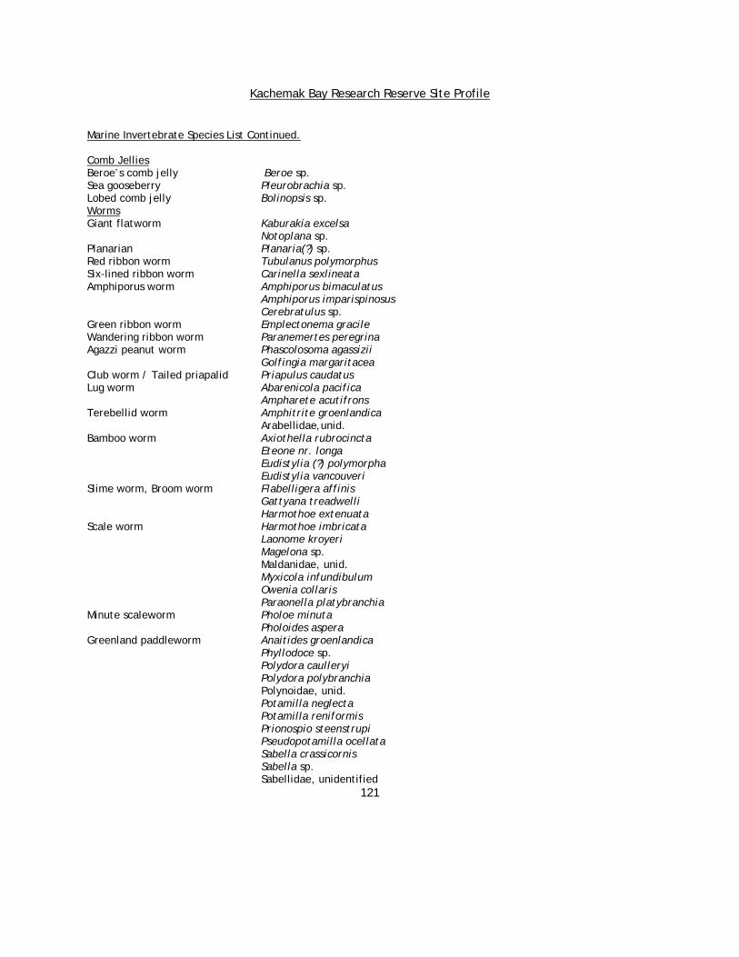
Kachemak Bay Research Reserve Site Profile
121
Marine Invertebrate Species List Continued. Comb Jellies Beroe’s comb jelly Beroe sp. Sea gooseberry Pleurobrachia sp. Lobed comb jelly Bolinopsis sp. Worms Giant flatworm Kaburakia excelsa Notoplana sp. Planarian Planaria(?) sp. Red ribbon worm Tubulanus polymorphus Six-lined ribbon worm Carinella sexlineata Amphiporus worm Amphiporus bimaculatus
Amphiporus imparispinosus Cerebratulus sp. Green ribbon worm Emplectonema gracile Wandering ribbon worm Paranemertes peregrina Agazzi peanut worm Phascolosoma agassizii Golfingia margaritacea Club worm / Tailed priapalid Priapulus caudatus Lug worm Abarenicola pacifica Ampharete acutifrons Terebellid worm Amphitrite groenlandica Arabellidae,unid. Bamboo worm Axiothella rubrocincta Eteone nr. longa Eudistylia (?) polymorpha Eudistylia vancouveri Slime worm, Broom worm Flabelligera affinis Gattyana treadwelli Harmothoe extenuata Scale worm Harmothoe imbricata Laonome kroyeri Magelona sp. Maldanidae, unid. Myxicola infundibulum Owenia collaris Paraonella platybranchia Minute scaleworm Pholoe minuta Pholoides aspera Greenland paddleworm Anaitides groenlandica Phyllodoce sp.
Polydora caulleryi Polydora polybranchia Polynoidae, unid. Potamilla neglecta Potamilla reniformis Prionospio steenstrupi Pseudopotamilla ocellata Sabella crassicornis Sabella sp. Sabellidae, unidentified

Kachemak Bay Research Reserve Site Profile
122
Marine Invertebrate Species List Continued.
Spio filicornis Sternaspis acuta Syllidae, unidentified Terebellid worm Terebellides stroemi Terebellid worm Thelepus cincinnatus Intertidal gillworm Cirratulus spectabilis Capitella capitata Typosyllis sp. Armored scale worm Halosydna brevisetosa Yellow scale worm Arctonoe vittata Giant clam worm Nereis brandti Clam worm / Pile worm Nereis vexillosa Nereis zonata other Clam worms Nereidae, unidentified other Clam worms Nephtys spp. Pink sandworm Glycera spp. Cone worm Pectinaria granulata Calcareous tube worm Serpula vermicularis Red and white tube worm Crucigera irregularis Spiral tube worm Spirorbis sp. (spirillum?) Hairy-gilled worm Thelepus crispus Scoloplos armiger Scolelepis sp. Striped sea-leach Carcinobdella cyclostomum Spoonworm Bonellia viridis Eubonellia valida Fat inkeeper Echiuris echiuris alaskensis Gastropods (snails) Cancellate hairy shell Trichotropis cancellata Gray hairy shell Trichotropis insignis Clam sucker Odostomia sp. Kennicott's whelk Beringius kennicotti Dire whelk Lirabuccinum dirum (previously Searlesia dira) Glacial whelk Buccinum glaciale Baer's whelk Buccinum baeri Big-mouthed whelk Volutharpa ampullacea Hairy triton Fusitriton oregonensis Ridged neptune Neptunea lyrata Many-ribbed trophon Boreotrophon multicostatus Spiny trophon Boreotrophon clathratus Blind limpet Cryptobranchia spp. Sitka periwinkle Littorina sitkana Checkered periwinkle Littorina scutulata Plate limpet Tectura scutum Fenestrate limpet Tectura fenestrata Mask limpet Tectura persona Duncecap limpet / Acmaea mitra Whitecap limpet Little northern limpet Lottia borealis Unstable limpet Lottia instabilis

Kachemak Bay Research Reserve Site Profile
123
Marine Invertebrate Species List Continued. Ribbed limpet Lottia digitalis Shield limpet Lottia pelta Many-ribbed puncturella Puncturella multistriata Rough keyhole limpet Diodora aspera Kachemak tubinid Spiromoelleria kachemakensis Northern white slipper snail Crepidula nummaria Western white slipper snail Crepidula perforans Velvet snail Velutina sp. Blue top snail / Calliostoma ligatum Ribbed top snail Puppet margarite Margarites pupillus Helicine's margarite Margarites helicinus Columbian obelisk Balcis (Eulima?) columbiana Frilled dogwinkle Nucella lamellosa File dogwinkle Nucella lima Emarginate dogwinkle Nucella emarginata Channelled dogwinkle Nucella canaliculata Columbian amphissa Amphissa columbiana Arctic moon snail Cryptonatica affinis Aleutian moon snail Natica aleutica Chink shell Lacuna vincta Trophon Trophonopsis tenuisculptus Trophon Trophonopsis (Scabrotrophon?) pacificus Lora snail Oenopota laevigata Lung snail Siphonaria thersites Barrel bubble snail Cylichna sp. Purple olive snail Olivella baetica Gastropods (nudibranchs) Opalescent nudibranch Hermissenda crassicornis Red nudibranch Rostanga pulchra Melanochlamys diomedea Orange-tipped janolus Janolus fuscus Balloon aeolis Eubranchus olivaceus Brown aeolis Cuthona sp. Maned nudibranch Aeolidia papillosa Golden dirona Dirona aurantia White-lined dirona Dirona albolineata Yellow-edged cadlina Cadlina luteomarginata Dall's dendronotis Dendronotus dalli Bushy-backed nudibranch Dendronotus frondosus Red dendronotis Dendronotus rufus Spotted nudibranch Diaulula sandiegensis Orange-tipped nudibranch / Triopha catalinae Clown nudibranch
Bathydoris dawsoni (?) Austrodoris sp.
Aldisa sp. Adalaria proxima Rough-mantled doris / Onchidoris bilamellata Many-gilled doris
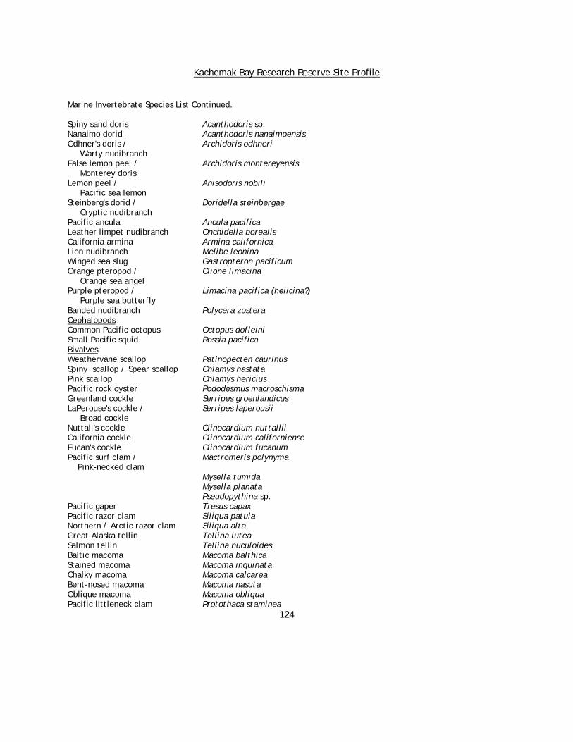
Kachemak Bay Research Reserve Site Profile
124
Marine Invertebrate Species List Continued. Spiny sand doris Acanthodoris sp. Nanaimo dorid Acanthodoris nanaimoensis Odhner's doris / Archidoris odhneri Warty nudibranch False lemon peel / Archidoris montereyensis Monterey doris Lemon peel / Anisodoris nobili Pacific sea lemon Steinberg's dorid / Doridella steinbergae Cryptic nudibranch Pacific ancula Ancula pacifica Leather limpet nudibranch Onchidella borealis California armina Armina californica Lion nudibranch Melibe leonina Winged sea slug Gastropteron pacificum Orange pteropod / Clione limacina Orange sea angel Purple pteropod / Limacina pacifica (helicina?) Purple sea butterfly Banded nudibranch Polycera zostera Cephalopods Common Pacific octopus Octopus dofleini Small Pacific squid Rossia pacifica Bivalves Weathervane scallop Patinopecten caurinus Spiny scallop / Spear scallop Chlamys hastata Pink scallop Chlamys hericius Pacific rock oyster Pododesmus macroschisma Greenland cockle Serripes groenlandicus LaPerouse's cockle / Serripes laperousii Broad cockle Nuttall's cockle Clinocardium nuttallii California cockle Clinocardium californiense Fucan's cockle Clinocardium fucanum Pacific surf clam / Mactromeris polynyma Pink-necked clam Mysella tumida Mysella planata Pseudopythina sp. Pacific gaper Tresus capax Pacific razor clam Siliqua patula Northern / Arctic razor clam Siliqua alta Great Alaska tellin Tellina lutea Salmon tellin Tellina nuculoides Baltic macoma Macoma balthica Stained macoma Macoma inquinata Chalky macoma Macoma calcarea Bent-nosed macoma Macoma nasuta Oblique macoma Macoma obliqua Pacific littleneck clam Protothaca staminea

Kachemak Bay Research Reserve Site Profile
125
Butter clam Saxidomus giganteus Kennerley's venus Humilaria kennerleyi Gem clam Lucina sp. Esquimalt astarte / Astarte esquimalti Wavy-line astarte Northern astarte / Astarte borealis Boreal astarte Wavy astarte Astarte undata Pacific bittersweet Glycymeris subobsoleta Soft-shelled clam / Softshell Mya arenaria Truncated mya / Mya truncata Truncate softshell Mya priapus Northern soft-shelled clam Mya pseudoarenaria False softshell Deep soft-shelled clam / Mya baxteri Deep softshell Ample rough mya Panomya ampla Arctic rock borer Hiatella arctica Northwest ugly clam Entodesma saxicola Blue mussel Mytilus trossulus California mussel Mytilus californianus Horse mussel Modiolus modiolus Nestling mussel / Musculus discors Discordant mussel Black mussel Musculus niger Varnished mussel Musculus vernicosus Feathery shipworm Bankia setacea Rough piddock Zirfaea pilsbryii Giant rock scallop Crassadoma gigantean Thick carditid Cyclocardia crassidens Chitons Gumboot chiton Cryptochiton stelleri Black leather chiton / Katharina tunicata Katy’s chiton Lined chiton Tonicella lineata Tiger chiton Tonicella insignis Northern red chiton Tonicella rubra Mossy chiton Mopalia muscosa Hairy chiton Mopalia ciliata Woody chiton Mopalia lignosa Red veiled chiton Placiphorella rufa Veiled chiton Placiphorella velata White chiton Ischnochiton (Lepidochitona?) albus Dwarf chiton Leptochiton rugatus Merten's chiton Lepidozona mertensii Split-plate chiton Schizoplax brandtii Schizoplax insignis Amicula amiculata Insects Narrow rove beetle Diaulota densissima

Kachemak Bay Research Reserve Site Profile
126
Marine Invertebrate Species List Continued. Mysids
Mysidacea unidentified Archaeomysis grebnitzkii Cumaceans
Lamprops sp. Lamprops carinata Lamprops quadriplicata Tanaids
Leptochelia dubia Isopods Seaweed isopod Pentidotea wosnesenskii Fewkes' isopod Idotea fewkesi Pillbug isopod Gnorimosphaeroma oregonense Pillbug / Gnorimosphaeroma sp. Sphaeromatid isopod Sea slater Ligia pallasii Saduria entomon Amphipods Beach hopper Traskorchestia traskiana Anisogammarus pugettensis Gammarid amphipod Amphipoda
(gammaridea - unidentified) Paraphoxus milleri Skeleton shrimp / Caprella sp. Caprellid
Amphipoda (caprellidae - unidentified)
Shrimps Pandalid shrimp Pandalus spp. Pink shrimp Bandalus borealis Coonstripe shrimp Pandalus hypsinotus Humpy shrimp Pandalus goniurus Spot shrimp Pandalus platyceros Dock shrimp Pandalus danae other non-pandalid shrimp Pandalopsis spp. Broken-back shrimp Heptacarpus spp. Sand or Crangonid shrimp Crangon sp. Crabs Hermit crab Pagurus spp. Hairy hermit crab Pagurus hirsutiusculus Pagurus confragosus Alaskan hermit crab Pagurus ochotensis Toothshell hermit crab Orthopagurus minimus Orange hermit crab / Elassochirus gilli Pacific red hermit crab Striped hermit crab / Elassochirus tenuimanus Widehand hermit crab Dall's hermit crab Elassochirus dalli Tube worm hermit crab Discorsopagurus schmitti
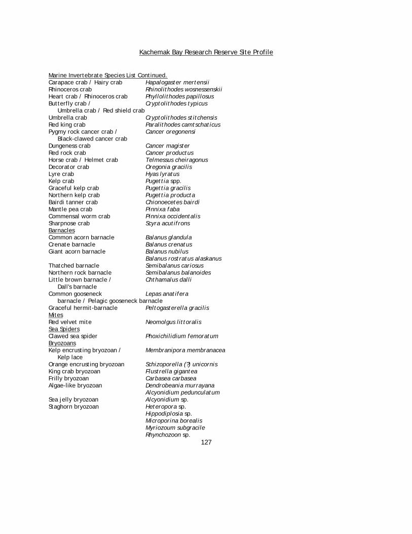
Kachemak Bay Research Reserve Site Profile
127
Marine Invertebrate Species List Continued. Carapace crab / Hairy crab Hapalogaster mertensii Rhinoceros crab Rhinolithodes wosnessenskii Heart crab / Rhinoceros crab Phyllolithodes papillosus Butterfly crab / Cryptolithodes typicus Umbrella crab / Red shield crab Umbrella crab Cryptolithodes stitchensis Red king crab Paralithodes camtschaticus Pygmy rock cancer crab / Cancer oregonensi Black-clawed cancer crab Dungeness crab Cancer magister Red rock crab Cancer productus Horse crab / Helmet crab Telmessus cheiragonus Decorator crab Oregonia gracilis Lyre crab Hyas lyratus Kelp crab Pugettia spp. Graceful kelp crab Pugettia gracilis Northern kelp crab Pugettia producta Bairdi tanner crab Chionoecetes bairdi Mantle pea crab Pinnixa faba Commensal worm crab Pinnixa occidentalis Sharpnose crab Scyra acutifrons Barnacles Common acorn barnacle Balanus glandula Crenate barnacle Balanus crenatus Giant acorn barnacle Balanus nubilus Balanus rostratus alaskanus Thatched barnacle Semibalanus cariosus Northern rock barnacle Semibalanus balanoides Little brown barnacle / Chthamalus dalli Dall's barnacle Common gooseneck Lepas anatifera barnacle / Pelagic gooseneck barnacle Graceful hermit-barnacle Peltogasterella gracilis Mites Red velvet mite Neomolgus littoralis Sea Spiders Clawed sea spider Phoxichilidium femoratum Bryozoans Kelp encrusting bryozoan / Membranipora membranacea Kelp lace Orange encrusting bryozoan Schizoporella (?) unicornis King crab bryozoan Flustrella gigantea Frilly bryozoan Carbasea carbasea Algae-like bryozoan Dendrobeania murrayana Alcyonidium pedunculatum Sea jelly bryozoan Alcyonidium sp. Staghorn bryozoan Heteropora sp. Hippodiplosia sp. Microporina borealis Myriozoum subgracile Rhynchozoon sp.

Kachemak Bay Research Reserve Site Profile
128
Marine Invertebrate Species List Continued. Brachiopods Transverse lamp shell / Terebratalia transversa Common lamp shell Black lamp shell Hemithyris psittacea Diestothyris frontalis Terebratulina sp. Smooth lamp shell Laqueus californianus Sea Stars Little six-rayed star Leptasterias hexactis Polar six-rayed star Leptasterias polaris ssp. acervata Red-banded six-rayed star Leptasterias coei Black-spined star Lethasterias nanimensis True star / Mottled star / Evasterias troschelli Troschel's star Ochre star Pisaster ochraceus Giant pink star Pisaster brevispinus Sunflower star Pycnopodia helianthoides Red-banded star / Orthasterias koehleri Rainbow star Flat-bottomed star Asterias amurensis Fish-eating star Stylasterias forreri Rose star /Spiny sun star Crossaster papposus Blood star Henricia leviuscula Henricia sanguinolenta Henricia tumida Leather star Dermasterias imbricata Cushion star / Slime star Pteraster tesselatus Morning sun star Solaster dawsoni Sun star Solaster stimpsoni Northern sun star Solaster endeca Arctic bat star Ceramaster arcticus Basket star Gorgonocephalus caryi Basket star Gorgonocephalus eucnemis Serpent star Amphiodia occidentalis Daisy brittle star / Ophiopholis aculeata Ubiquitous brittle star Sea urchins Green sea urchin Strongylocentrotus droebachiensis Red sea urchin Strongylocentrotus franciscanus Purple sea urchin Strongylocentrotus purpuratus Strongylocentrotus pallidus Northern sand dollar / Echinarachnius parma Green-spined sand dollar Sea cucumbers Alaska tar spot / Cucumaria vegae Black sea cucumber Tar spot sea cucumber Cucumaria pseudocurata Red sea cucumber / Cucumaria miniata

Kachemak Bay Research Reserve Site Profile
129
Marine Invertebrate Species List Continued. Orange sea cucumber Football sea cucumber Cucumaria fallax (pallida?) Peppered sea cucumber Cucumaria piperata Gray subtidal sea cucumber Cucumaria frondosa ssp. japonica White sea cucumber Eupentacta quinquesemita Slipper sea cucumber / Psolus chitonoides Red psolus California sea cucumber Parastichopus californicus Sweet potato sea cucumber Molpadia intermedia Rat-tailed sea cucumber / Paracaudina chilensis Sand sea cucumber Burrowing sea cucumber Leptosynapta clarki Silky sea cucumber Chiridota sp. Tunicates Western distaplia Distaplia occidentalis Sea peach Halocynthia aurantium Sea pork Aplidium solidum Spiny-headed tunicate Boltenia villosa Botryllus sp. Flattop sea squirt Chelysoma sp. Cnemidocarpa finmarkiensis Corella sp. Red sea buttons Metandrocarpa taylori Ritterella pulchra Sea bottle Styela gibbsi Sea bottle Styela montereyensis Synoicum parusti Colonial harbor tunicate Distaplia alaskensis Chain salp / Salpa fusiformis Beach bubblewrap

Kachemak Bay Research Reserve Site Profile
130
Kachemak Bay Birds (2002 updated checklist) Red-throated Loon Gavia stellata Pacific Loon Gavia pacifica Common Loon Gavia immer Yellow-billed Loon Gavia adamsii Horned Grebe Podiceps auritus Red-necked Grebe Podiceps grisegena Northern Fulmar Fulmarus glacialis Sooty Shearwater Puffinus griseus Short-tailed Shearwater Puffinus tenuirostris Fork-tailed Storm-Petrel Oceanodroma furcata Leach’s Storm-Petrel Oceanodroma leucorhoa Brandt’s Cormorant Phalacrocorax penicillatus Double-crested Cormorant Phalacrocorax auritus Red-faced Cormorant Phalacrocorax urile Pelagic Cormorant Phalacrocorax pelagicus Great Blue Heron Ardea herodias Greater White-fronted Goose Anser albifrons Emperor Goose Chen canagica Ross’s Goose Chen rossii Snow Goose Chen caerulescens Canada Goose Branta canadensis Brant Branta bernicla Trumpeter Swan Cygnus buccinator Tundra Swan Cygnus columbianus Gadwall Anas strepera Eurasian Wigeon Anas penelope American Wigeon Anas americana Mallard Anas platyrhynchos Blue-winged Teal Anas discors Northern Shoveler Anas clypeata Northern Pintail Anas acuta Green-winged Teal Anas crecca Canvasback Aythya valisineria Redhead Aythya americana Common Pochard Aythya ferina Ring-necked Duck Aythya collaris Tufted Duck Aythya fuligula Greater Scaup Aythya marila Lesser Scaup Aythya affinis Steller’s Eider Polysticta stelleri Spectacled Eider Somateria fischeri King Eider Somateria spectabilis Common Eider Somateria mollissima Harlequin Duck Histrionicus histrionicus Surf Scoter Melanitta perspicillata White-winged Scoter Melanitta fusca Black Scoter Melanitta nigra Long-tailed Duck / Oldsquaw Clangula hyemalis Bufflehead Bucephala albeola Common Goldeneye Bucephala clangula

Kachemak Bay Research Reserve Site Profile
131
Barrow’s Goldeneye Bucephala islandica Hooded Merganser Lophodytes cucullatus Common Merganser Mergus merganser Red-breasted Merganser Mergus serrator Ruddy Duck Oxyura jamaicensis Osprey Pandion haliaetus Bald Eagle Haliaeetus leucocephalus Northern Harrier Circus cyaneus Sharp-shinned Hawk Accipiter striatus Northern Goshawk Accipiter gentilis Swainson’s Hawk Buteo swainsoni Red-tailed Hawk Buteo jamaicensis Rough-legged Hawk Buteo lagopus Golden Eagle Aquila chrysaetos American Kestrel Falco sparverius Merlin Falco columbarius Gyrfalcon Falco rusticolus Peregrine Falcon Falco peregrinus Ring-necked Pheasant Phasianus colchicus Spruce Grouse Dendragapus canadensis Willow Ptarmigan Lagopus lagopus Rock Ptarmigan Lagopus mutus White-tailed Ptarmigan Lagopus leucurus American Coot Fulica americana Sandhill Crane Grus canadensis Black-bellied Plover Pluvialis squatarola American Golden-Plover Pluvialis dominica Pacific Golden-Plover Pluvialis fulva Semipalmated Plover Charadrius semipalmatus Killdeer Charadrius vociferus Black Oystercatcher Haematopus bachmani Greater Yellowlegs Tringa melanoleuca Lesser Yellowlegs Tringa flavipes Solitary Sandpiper Tringa solitaria Wandering Tattler Heteroscelus incanus Spotted Sandpiper Actitis macularia Whimbrel Numenius phaeopus Bristle-thighed Curlew Numenius tahitiensis Hudsonian Godwit Limosa haemastica Bar-tailed Godwit Limosa lapponica Marbled Godwit Limosa fedoa Ruddy Turnstone Arenaria interpres Black Turnstone Arenaria melanocephala Surfbird Aphriza virgata Red Knot Calidris canutus Sanderling Calidris alba Semipalmated Sandpiper Calidris pusilla Western Sandpiper Calidris mauri Red-necked Stint Calidris ruficollis Temminck’s Stint Calidris temminckii Least Sandpiper Calidris minutilla Baird’s Sandpiper Calidris bairdii

Kachemak Bay Research Reserve Site Profile
132
Pectoral Sandpiper Calidris melanotos Sharp-tailed Sandpiper Calidris acuminata Rock Sandpiper Calidris ptilocnemis Dunlin Calidris alpina Stilt Sandpiper Calidris himantopus Ruff Philomachus pugnax Short-billed Dowitcher Limnodromus griseus Long-billed Dowitcher Limnodromus scolopaceus Common Snipe Gallinago gallinago Red-necked Phalarope Phalaropus lobatus Red Phalarope Phalaropus fulicaria Pomarine Jaeger Stercorarius pomarinus Parasitic Jaeger Stercorarius parasiticus Long-tailed Jaeger Stercorarius longicaudus Franklin’s Gull Larus pipixcan Black-headed Gull Larus ridibundus Bonaparte’s Gull Larus philadelphia Black-tailed Gull Larus crassirostris Mew Gull Larus canus Ring-billed Gull Larus delawarensis California Gull Larus californicus Herring Gull Larus argentatus Thayer’s Gull Larus thayeri Slaty-backed Gull Larus schistisagus Western Gull Larus occidentalis Glaucous-winged Gull Larus glaucescens Glaucous Gull Larus hyperboreus Sabine’s Gull Xema sabini Black-legged Kittiwake Rissa tridactyla Red-legged Kittiwake Rissa brevirostris Ross’s Gull Rhodostethia rosea Ivory Gull Pagophila eburnea Caspian Tern Sterna caspia Arctic Tern Sterna paradisaea Aleutian Tern Sterna aleutica White-winged Tern Chlidonias leucopterus Common Murre Uria aalge Thick-billed Murre Uria lomvia Pigeon Guillemot Cepphus columba Marbled Murrelet Brachyramphus marmoratus Kittlitz’s Murrelet Brachyramphus brevirostris Ancient Murrelet Synthliboramphus antiquus Cassin’s Auklet Ptychoramphus aleuticus Parakeet Auklet Cyclorrhynchus psittacula Crested Auklet Aethia cristatella Rhinoceros Auklet Cerorhinca monocerata Horned Puffin Fratercula corniculata Tufted Puffin Fratercula cirrhata Rock Dove Columba livia Mourning Dove Zenaida macroura Western Screech-Owl Otus kennicottii Great Horned Owl Bubo virginianus
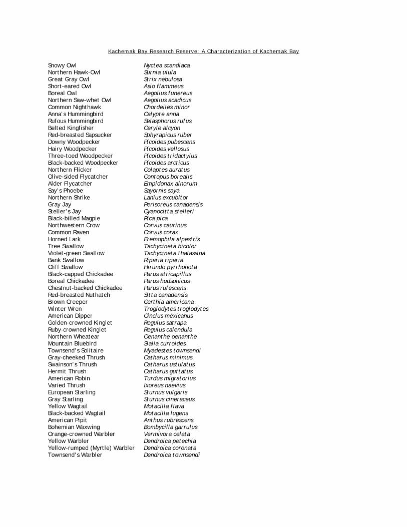
Kachemak Bay Research Reserve: A Characterization of Kachemak Bay
Snowy Owl Nyctea scandiaca Northern Hawk-Owl Surnia ulula Great Gray Owl Strix nebulosa Short-eared Owl Asio flammeus Boreal Owl Aegolius funereus Northern Saw-whet Owl Aegolius acadicus Common Nighthawk Chordeiles minor Anna’s Hummingbird Calypte anna Rufous Hummingbird Selasphorus rufus Belted Kingfisher Ceryle alcyon Red-breasted Sapsucker Sphyrapicus ruber Downy Woodpecker Picoides pubescens Hairy Woodpecker Picoides vellosus Three-toed Woodpecker Picoides tridactylus Black-backed Woodpecker Picoides arcticus Northern Flicker Colaptes auratus Olive-sided Flycatcher Contopus borealis Alder Flycatcher Empidonax alnorum Say’s Phoebe Sayornis saya Northern Shrike Lanius excubitor Gray Jay Perisoreus canadensis Steller’s Jay Cyanocitta stelleri Black-billed Magpie Pica pica Northwestern Crow Corvus caurinus Common Raven Corvus corax Horned Lark Eremophila alpestris Tree Swallow Tachycineta bicolor Violet-green Swallow Tachycineta thalassina Bank Swallow Riparia riparia Cliff Swallow Hirundo pyrrhonota Black-capped Chickadee Parus atricapillus Boreal Chickadee Parus hudsonicus Chestnut-backed Chickadee Parus rufescens Red-breasted Nuthatch Sitta canadensis Brown Creeper Certhia americana Winter Wren Troglodytes troglodytes American Dipper Cinclus mexicanus Golden-crowned Kinglet Regulus satrapa Ruby-crowned Kinglet Regulus calendula Northern Wheatear Oenanthe oenanthe Mountain Bluebird Sialia curroides Townsend’s Solitaire Myadestes townsendi Gray-cheeked Thrush Catharus minimus Swainson’s Thrush Catharus ustulatus Hermit Thrush Catharus guttatus American Robin Turdus migratorius Varied Thrush Ixoreus naevius European Starling Sturnus vulgaris Gray Starling Sturnus cineraceus Yellow Wagtail Motacilla flava Black-backed Wagtail Motacilla lugens American Pipit Anthus rubrescens Bohemian Waxwing Bombycilla garrulus Orange-crowned Warbler Vermivora celata Yellow Warbler Dendroica petechia Yellow-rumped (Myrtle) Warbler Dendroica coronata Townsend’s Warbler Dendroica townsendi

Kachemak Bay Research Reserve: A Characterization of Kachemak Bay
Blackpoll Warbler Dendroica straita American Redstart Setophaga ruticilla Northern Waterthrush Seiurus noveboracensis Common Yellowthroat Geothlypis trichas Wilson’s Warbler Wilsonia pusilla Western Tanager Piranga ludoviciana American Tree Sparrow Spizella arborea Savannah Sparrow Passerculus sandwichensis Fox Sparrow Passerella iliaca Song Sparrow Melospiza melodia Lincoln’s Sparrow Melospiza lincolnii White-throated Sparrow Zonotrichia albicollis Harris’s Sparrow Zonotrichia querula White-crowned Sparrow Zonotrichia leucophrys Golden-crowned Sparrow Zonotrichia atricapilla Dark-eyed Junco Junco hyemalis Lapland Longspur Calcarius lapponicus Rustic Bunting Emberiza rustica Snow Bunting Plectrophenax nivalis McKay’s Bunting Plectrophenax hyperboreus Red-winged Blackbird Agelaius phoeniceus Rusty Blackbird Euphagus carolinus Brown-headed Cowbird Molothrus ater Brambling Fringilla montifringilla Gray-crowned Rosy Finch Leucosticte tephrocotis Pine Grosbeak Pinicola enucleator Purple Finch Carpodacus purpureus Cassin’s Finch Carpodacus cassinii Red Crossbill Loxia curvirostra White-winged Crossbill Loxia leucoptera Common Redpoll Carduelis flammea Hoary Redpoll Carduelis hornemanni Pine Siskin Carduelis pinus American Goldfinch Carduelis tristis