J · Web view1942 - 1984 MS 8 Municipal Archives Windsor Public Library Acc. No. 1984/9 Mark Walsh...
27
J. Lewis Robinson Collection 1942 - 1984 MS 8 Municipal Archives Windsor Public Library Acc. No. 1984/9 Mark Walsh 1.5 inches/4 cm Municipal Archivist 6 Sep 1984
-
Upload
truongnhan -
Category
Documents
-
view
218 -
download
3
Transcript of J · Web view1942 - 1984 MS 8 Municipal Archives Windsor Public Library Acc. No. 1984/9 Mark Walsh...

J. Lewis Robinson Collection
1942 - 1984
MS 8
Municipal ArchivesWindsor Public Library
Acc. No. 1984/9 Mark Walsh1.5 inches/4 cm Municipal Archivist
6 Sep 1984

J. Lewis Robinson CollectionMS 8
Table of Contents
Box and Unit Listing
Biographical Sketch
Summary of the Records
Series Descriptions
Appendix I – List of Maps by Source
RAD Entries

J. Lewis Robinson CollectionMS 8
Box and Unit Listing
Box 1 MS 8 IMS 8 IIMS 8 III

J. Lewis RobinsonMS 8
Professor J. Lewis Robinson, a former resident of Windsor, has had a long and distinguished career in Canadian geography. After completing his B.A. at the University of Western Ontario. In 1940, Professor Lewis continued his studies at Syracuse University in Syracuse, New York. It was there that he completed his theses “Windsor, Ontario A Study in Urban Geography” as part of the requirements for his M.A., which degree was received in 1942.
After working three years for the territorial Department of Mines and Resources in the North West Territories, Professor Robinson accepted an appointment with the Department of Geology and Geography at the University of British Columbia in 1946.He became the first head of the newly formed Department of Geography, a position which he held from 1959 to 1968. For a number of years he acted as the department’s undergraduate advisor. Distinguished by numerous awards and author of many publications, he was a founding member of the Canadian Association of Geographers and president of that organization in 1956. In 1984 Professor Robinson retired from active academic life, and now holds the title of Professor Emeritus in the University of British Columbia Department of Geography.
Professor Robinson donated the collection to the Windsor Public Library in 1984. Researchers may also wish to contact the Department of Geography, University of Windsor, where Professor Robinson deposited several oversize maps.

MS 8 - J. Lewis Robinson Collection
‘Oldest hockey player’ one of 20 retiring this year at UBC
Prof. J. Lewis Robinson, one of Canada’s This was reflected at a recent luncheon leading geographers and a founding father held in honor of Prof. Robinson’s of UBC’s Department of Geography, retires retirement. Almost 100 former graduate on June 30 after a teaching and research students from all parts of B.C. and as far career at UBC that has spanned more than away as Ottawa came to pay tribute to a third of a century. their former teacher, who was the recipient Prof. Robinson’s association with UBC of UBC’s Master Teacher Award in 1977 began in 1946, when he joined what was and runner-up for the award in 1976. then the combined Department of Geology In addition to UBC’s top teaching HIS PICTURE SHOWNand Geography. During his 38-year career award, Prof. Robinson has received IN THIS AREA on campus, he estimates that he has taught numerous professional awards for hismore than 15,000 students, including one contributions to Canadian geography,named George Pedersen who recently including the highest award of thereturned to the University in a different Canadian Association of Geographers,capacity. which he received in 1976 for “exceptional “It’s been a wonderful experience to service to the profession of geography” andwork on the campus,” says Prof. Robinson. the Massey Medal, the highest honor of the Dr. Lewis Robinson, first head of“I love teaching and I’ve really enjoyed the Royal Canadian Geographical Society,people I’ve worked with in the which he was awarded in 1971.department.” Dr. Robinson keeps a map of Canada on One UBC activity that Dr. Robinson Prof. Robinson began his career in 1943 his office wall on which he marks new intends to keep up with is his position asas the first professional geographer to be routes he has travelled across the country centre on the geography graduate students’employed by the federal government. He in his academic pursuits. After 38 years the hockey team.was hired by the Bureau of Northwest map has become a maze of black ink, “I would really miss our Friday afternoonTerritories Administration, Department of giving credence to his reputation as games,” he says, “Besides,” he adds with aMines and Resources, to do geographical Canada’s foremost authority on Canadian grin, “if I’m not remembered for myfield work in the Arctic, organize regional geography. contributions to geography perhaps I caninformation on northern Canada and to He is the author of almost 150 gain notoriety as Canada’s oldest hockeyact as a liaison with American forces and publications, including ten books, maps of player.”officials operating in the Canadian Arctic, Canada and numerous professional articles When he joined the UBC faculty in and encyclopedia entries.1946, he was one of two professional Prof. Robinson has held a wide range ofgeographers in the geology and geography leadership roles in professionaldepartment and a key figure in the organizations in his field, and was part of adevelopment and expansion of UBC’s small group that organized the Canadiangeography program. Dr. Robinson was Association of Geographers in the earlynamed the first head of geography when it 1950s. He served as president of the There will be six graduation ceremoniesbecame a separate department in 1959, a organization in 1956. this year in the War Memorialposition he held until 1968. Dr. Robinson says he has felt a strong Gymnasium, instead of the usual three. “When I retired as head of the commitment to “promote” geography to There will be morning and afternoondepartment, I took on responsibility for our audiences outside the University ceremonies on May 30, May 31 and June 1undergraduate students,” says Prof. community throughout his career. “Over starting at 9:30 a.m. and 2:30 p.m. eachRobinson. After years of serving as the the years I’ve delivered off-campus talks to day.department’s undergraduate advisor, he between 15,000 and 20,000 people,” he In another departure from recentjokingly refers to his role as that of says. practice, there will be 10-minute“mother hen.” Prof. Robinson says he plans to slow congregation addresses at each ceremony “I’ve always had an open door policy down “just a bit” when he retires in June. given by selected members of the UBCand I’ve enjoyed being able to help “I have gathered a lot of historical data faculty.students,” he says. “When I travel around about the geography department over the The speakers, from Wednesday morningthe province I’m always meeting former years and one of my first projects will be to through Friday afternoon, in order, are:students, and even if I don’t remember write a history of UBC’s Department of Dr. Peter Larkin, dean of Graduatenames I never forget faces and I can recall Geography,” he says. Studies and associate vice-presidentthings about each one of them.” He is also working on an historical (research); Prof. Lewis Robinson In the early years of the geography geography of Vancouver which he hopes (Geography); Dr. Bernard Riedel, dean ofdepartment, Prof. Robinson would meet will be published for the city’s centennial Pharmaceutical Sciences; Prof. Pennynew students at the airport or train station, in 1986. Gouldstone (Education); Prof. Williamand he and his wife, Jo, have continued to “Several of my books need updating as Oldham (Civil engineering); Prof. Dennisentertain students in their home. well, so I’ll be busy writing for at least five Pavlich (Law). “We’ve always had a happy and close- years.”knit group of people working in the geography department, and I think thisatmosphere has a positive effect onstudents.”
MS 8 - J. Lewis Robinson Collection
Looking Over NorthlandJun 12 1954
The increasing interest ofCanadians in their northland iswell served by NORTH of 55°(Ryerson); a compilation of 16articles on various aspects of thenorth by qualified writers. Thebook is edited by Clifford Wil-
son. The most interesting article,
at least for this reader, is “Nor-thern Climate,” by J. Lewis Rob-inson, a former Windsorite, andnow chairman of the geography
division in the department ofgeology and geography, Univer-
sity of British Columbia. Dr. Robinson disproves the
notion that the Arctic and sub-Arctic regions, and their cli-
mates, roughly follow parallelsof latitude. On the contrary, the
temperature map of Canada’snorthland is, in a literal sense,
lopsided. The Arctic area, for instance,begins near the mouth of the
Mackenzie River in the north-west, and dips southeasterly toinclude the upper two-thirds ofHudson Bay. Continuing, it
curves through Northern Quebec and Labrador.
Hudson Bay, it is shown, is amixed blessing. A drainage basin
for Arctic waters, it virtuallydrives summer from the landabout it, and in that seasonbrings Arctic temperatures
much farther south than is thecase in the northwest. But it
makes some compensation bykeeping winter temperatures inits vicinity substantially below
the low points of the north- western land mass.
All sides of Arctic life andresources are touched on in thisbook – fishing, trapping, polic-ing, transport, defence, naturalwealth, and everyday living.

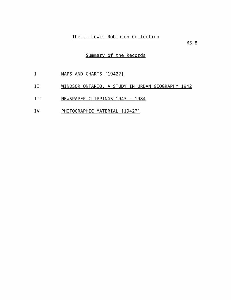
The J. Lewis Robinson CollectionMS 8
Summary of the Records
I MAPS AND CHARTS [1942?]
II WINDSOR ONTARIO, A STUDY IN URBAN GEOGRAPHY 1942
III NEWSPAPER CLIPPINGS 1943 – 1984
IV PHOTOGRAPHIC MATERIAL [1942?]

The J. Lewis Robinson CollectionMS 8 I
Maps and Charts
Series Note
The series is dated [1942?] and is comprised of Photostat copies maps, charts, and graphs. The documents are some of the research material used by J. Lewis Robinson during the completion of his Master of Arts in Geography thesis, Windsor Ontario, A Study in Urban Geography. The maps and charts document the physical and human geography of Windsor and the surrounding area from 1707 to 1942.
A complete listing of map and chart titles, along with their source and physical characteristics appear in Appendix I, “List of Maps by Source. See also J. Lewis Robinson’s thesis Windsor Ontario, A Study in Urban Geography (MS 8 II). Photographic material has been removed from the series, consult Photographic Material (MS 8 IV).
MS 8 I MAPS AND CHARTS [1942?]
Unit Description Date
1 - Maps and Charts [1942?]
The J. Lewis Robinson CollectionMS 8 II
Windsor Ontario, A Study in Urban Geography
Series Note
The series is dated 1942 and is comprised of J. Lewis Robinson’s thesis, submitted in partial fulfillment of a Master of Arts Degree in Geography. J. Lewis Robinson received his master’s degree from Syracuse University in May 1942. The thesis documents the historical geography of the city of Windsor, including its urban and commercial development.
Maps and charts complementing the information in Robinson’s thesis appear in the series Maps and Charts [1942?] (MS 8 I). Photographic material included in the thesis appear in the series Photographic Material (MS 8 IV).
MS 8 II WINDSOR ONTARIO, A STUDY IN URBAN GEOGRAPHY
Unit Description Date
1 - Windsor Ontario, A Study in Urban Geography 1942

The J. Lewis Robinson CollectionMS 8 III
Newspaper Clippings
Series Note
The series is spans 1943 to 1984 and is comprised of original and photocopied newspaper clippings documenting the professional career of J. Lewis Robinson. The newspaper clippings describe Robinson’s activities as geography professor at the University of British Columbia, including his fundamental role in establishing a Department of Geography at the university.
MS 8 III NEWSPAPER CLIPPINGS 1943 – 1984
Unit Description Date
1 -Newspaper Clippings 1943 – 1984

The J. Lewis Robinson CollectionMS 8 IV
Photographic Material
Series Note
The series is dated [1942?] and is comprised of photographs removed from the series Maps and Charts (MS 8 I) and Windsor Ontario, A Study in Urban Geography (MS 8 II), J. Lewis Robinson’s Master of Arts in Geography thesis. The photographs document the urban geography of Windsor, with an emphasis on the historical development of the city. The series is composed of 50 photographs.
Among the numerous topics documented by the photographic material are: the commercial core of Windsor, waterfront land usage, the differing residential areas in the city, the architecture of various apartment buildings and dwellings, the sunken gardens at Jackson park, Kennedy Collegiate Institute, Assumption College, and industrial areas of the city.
MS 8 IV PHOTOGRAPHIC MATERIAL [1942?]
Unit Description Date PC/# Remarks
1 -Downtown Windsor [1942?] PC/1124 -Removed from Commercial Core MS 8 IV, pg. 71
-Copy of PC/1126-Removed to PC/Collection
2 -Third Class Residences [1942?] PC/1125 -Removed from MS 8 IV, pg. 87-Removed to PC/Collection
3 -From the Top of the [1942?] PC/1126 -Copy of PC/1124 Canada Building
4 -Dwelling on McDougall St. [1942?] PC/1127 -Removed from MS 8 IV, pg. 86-Removed to PC/Collection
5 -Aerial View East from the [1942?] PC/1128 Ambassador Bridge
6 -East from the Ambassador [1942?] PC/1129 -Copy of PC/2367 Bridge
7 -Dwelling in Walkerville [1942?] PC/1130 -Copy of PC/23658 -Drouillard Road [1942?] PC/1131 -Copy of PC/2359

The J. Lewis Robinson Collection
MS 8 IV PHOTOGRAPHIC MATERIAL [1942?] - continued
Unit Description Date PC/# Remarks
9 -Aerial View of Windsor [1942?] PC/113210 -Sunken Gardens, Jackson [1942?] PC/1133 -Copy of PC/2379
Park11 -Dwelling on Riverside Drive [1942?] PC/1134 -Copy of PC/236412 -Dwellings on Goyeau Street [1942?] PC/1135 -Copy of PC/236913 -Apartment House on Goyeau [1942?] PC/1136 -Copy of PC/236014 -Kennedy Collegiate [1942?] PC/1137 -Copy of PC/237715 -Aerial View of Windsor [1942?] PC/1138 -Copy of PC/237816 -Aerial View of Windsor [1942?] PC/1139 -Copy of PC/235817 -Southwest from the [1942?] PC/1140 -Copy of PC/2349
Ambassador Bridge18 -“The Commercial Cores of [1942?] PC/2347 -Removed from
Windsor and Detroit” MS 8 II, pg. 419 -“Lake Freighters on the [1942?] PC/2348 -Removed from
Detroit River” MS 8 II, pg. 5220 -“River Front and Coal Docks [1942?] PC/2349 -Removed from
in Ward Five” MS 8 II, pg. 54-Copy of PC/1140
21 -“City of Windsor, Looking [1942?] PC/2350 -Removed from Westward from Ward One” MS 8 II, pg. 60
22 -“City of Windsor, Looking [1942?] PC/2351 -Removed from Eastward from Ward Five” MS 8 II, pg. 61
23 -“Industrial Sites in Windsor: [1942?] PC/2352 -Removed from McDougall St.” MS 8 II, pg. 65
24 -“Subsidiary Automobile [1942?] PC/2353 -Removed from Industry Located Along the MS 8 II, pg. 65 C.N.R. in Ward One”
25 -“Canadian Bridge Company” [1942?] PC/2354 -Removed from MS 8 II, pg. 26
26 -“Canadian Industries Limited” [1942?] PC/2355 -Removed from MS 8 II, pg. 27
27 -“Approach to the Railroad [1942?] PC/2356 -Removed from Tunnel to Detroit” MS 8 II, pg. 68
28 -“Looking South Along the [1942?] PC/2357 -Removed from Main Street, Ouellette MS 8 II, pg. 72 Avenue”
29 -“Looking West Towards the [1942?] PC/2358 -Removed from Ambassador Bridge” MS 8 II, pg. 72
-Copy of PC/1139

The J. Lewis Robinson Collection
MS 8 IV PHOTOGRAPHIC MATERIAL [1942?] - continued
Unit Description Date PC/# Remarks
30 -“Southern Drouillard Road” [1942?] PC/2359 -Removed from MS 8 II, pg. 75-Copy of PC/1131
31 -“Typical Apartment House [1942?] PC/2360 -Removed from of a Second Class MS 8 II, pg. 75 Residential Zone” -Copy of PC/1136
32 -“Corner of St. Mary’s Gate [1942?] PC/2361 -Removed from and Devonshire Road” MS 8 II, pg. 79
33 -“Corner of Lincoln Road [1942?] PC/2362 -Removed from and Somme Ave.” MS 8 II, pg. 79
34 -“Casgrain Place, North of [1942?] PC/2363 -Removed from London St. [University MS 8 II, pg. 79 Ave. W.]”
35 -“Riverside Drive, West of [1942?] PC/2364 -Removed from George Ave.” MS 8 II, pg. 80
-Copy of PC/113436 -“Corner of Niagara St. and [1942?] PC/2365 -Removed from
Devonshire Rd.” MS 8 II, pg. 80-Copy of PC/1130
37 -“Victoria Ave., South of [1942?] PC/2366 -Removed from Tecumseh Rd.” MS 8 II, pg. 80
38 -“First Class Residential [1942?] PC/2367 -Removed from Zone” MS 8 II, pg. 80
-Copy of PC/112939 -“Second Class Residences [1942?] PC/2368 -Removed from
Directly West of the Main MS 8 II, pg. 82 Commercial Core” -Removed to
PC/Collection40 -“Goyeau Street, North of [1942?] PC/2369 -Removed from
Hannah Street” MS 8 II, pg. 84-Copy of PC/1135
41 -“Norman Road, South of [1942?] PC/2370 -Removed from Wyandotte Street” MS 8 II, pg. 84
42 -“Hickory Road, North of [1942?] PC/2371 -Removed from Ontario Street” MS 8 II, pg. 87
43 -“Tenements on St. Antoine [1942?] PC/2372 -Removed from Street, Ward Five” MS 8 II, pg. 87
-Removed to PC/Collection

The J. Lewis Robinson Collection
MS 8 IV PHOTOGRAPHIC MATERIAL [1942?] - continued
Unit Description Date PC/# Remarks
44 -“Brick Duplexes on [1942?] PC/2373 -Removed from Monmouth Road” MS 8 II, pg. 89
45 -“Frame Homes on Walker [1942?] PC/2374 -Removed from Road” MS 8 II, pg. 89
46 -“Suburban Residences in [1942?] PC/2375 -Removed from Remington Park” MS 8 II, pg. 92
47 -“Suburban Residences in [1942?] PC/2376 -Removed from Remington Park” MS 8 II, pg. 92
48 -“Kennedy Collegiate Institute [1942?] PC/2377 -Removed from on Tecumseh Road” MS 8 II, pg. 98
-Copy of PC/113749 -“Assumption Church, with [1942?] PC/2378 -Removed from
Assumption College in the MS 8 II, pg. 98 Background” -Copy of PC/1138
50 -“Beautiful Jackson Park in [1942?] PC/2379 -Removed from South Central Windsor” MS 8 II, pg. 98
-Copy of PC/1133

The J. Lewis Robinson CollectionMS 8
Appendix I – List of maps by source, MS 8 Folder 1
Maps: courtesy of George F. Macdonald
1 “Indian Settlements in Essex County.” n.d. Pos. Photostat, 8 x 11 in. (20.25 x 28 cm)
2 Same. Neg. Photostat, 7 x 10 in. (18x 25.5 cm)
3 “Detroit District in 1707” (Carte du Detroit) Pos. Photostat, 6 ¼ x 9 5/8 in. (16 x 24.5 cm)
4 “Essex Peninsula Area as mapped in 1800 by D.W. Smith Surveyor General of Upper Canada.” Neg. Photostat, 8 x 9 ¾ in. (20.25 x 24.6 cm)
5 “Essex County in 1840.” Neg. Photostat, 6 7/8 x 7 1/8 in. (17.5 x 18.5 cm)
6 “Windsor – Sandwich Area 1850.” Pos. Photostat, 8 7/8 x 10 5/8 in. (22.6 x 27 cm)
Maps: Source – George F. Macdonald
7 “Richmond – 1835. Later Windsor, Ontario.” Neg. Photostat, 5 ¼ x 10 3/8 in. (13.5 x 26 cm)
8 “The Commercial Core of Windsor – 1871.” Pos. Photostat, 10 x 16 in. (25.5 x 41 cm)
9 “Windsor, Ont. 1872” and “Windsor, Ont. 1876.” Neg. Photostat, 8 ¼ x 9 ¾ in. (21 x 24.4 cm)
Source – City Engineer’s Office
10 “Windsor, Ont. 1885.” Neg. Photostat, 5 ¾ x 10 in. (14.5 x 25.5 cm)
11 “Windsor, Ont. 1896.” Neg. Photostat, 10 x 11 in. (25.5 x 28 cm)

The J. Lewis Robinson CollectionMS 8
Appendix I – List of maps by source, MS 8 Folder 1 - continued
12 “Sandwich, Ont. 1896.” Neg. Photostat, 4 x 9 ¾ in. (10.5 x 24.6 cm)
Walkerville Maps
13 “Walkerville Distillery – Second Sheet – Special Survey No. 55 1884.” by Charles F. Good C.E., Montreal, February 1884. Neg. Photostat, 6 3/8 x 7 5/8 in. (16.5 x 19 cm)
14 Same. Pos. Photostat, 9 ¼ x 10 5/8 in. (23.5 x 27 cm)
Source: Knowles Report
15 “The Border Cities 1917 Sandwich, Windsor, Walkerville, Ford City.” Neg. Photostat, 4 7/8 x 10 in. (12.5 x 25.5 cm)
16 “Number of Stories of Houses in Windsor Ont.” (c.1942) Neg. Photostat, 10 ¾ x 21 5/8 in. (27.5 x 54 cm)
17 “Size of House Lots in Windsor Ont.” (c.1942) Neg. Photostat, 10 ¾ x 21 5/8 in. (27.5 x 54 cm)
18 “Morphological Map of Windsor Ont.” (c.1942) Neg. Photostat, 10 ¾ x 21 5/8 in. (27.5 x 54 cm)
Maps and Charts by J. Lewis Robinson (all c.1940-1942)
19 “Functional Map of Windsor Ont.” Neg. Photostat, 10 ¾ x 21 5/8 in. (27.5 x 54 cm)
20 “Windsor, Ont. – The Geographic City” Neg. Photostat, 5 ½ x 12 5/8 in. (14 x 32.5 cm)
21 “First and Third class Residences Windsor, Ont.” Original, 6 ¾ x 14 ¼ in. (17.25 x 36 cm)
22 “Industrial Areas Windsor, Ont.” Neg. Photostat, 6 ½ x 13 1/8 in. (16.5 x 34 cm)
23 “Building Construction 1935 – 1941 Windsor, Ont.” Original, 7 x 13 ½ in. (18 x 34.5 cm)

The J. Lewis Robinson CollectionMS 8
Appendix I – List of maps by source, MS 8 Folder 1 - continued
24 Same. Positive Photostat, stamped “Canada Dept. of National War Services Censorship of Publications Passed for Publication.”
25 Chart showing population growth of:1) Windsor, 1840-19402) Detroit and Border Cities, 1840-19403) Border Cities, 1870-1935. Original, 22 x 14 ½ in. (54.5 x 37.5 cm)

J. Lewis Robinson Collection (MS 8)
Dates of creation: 1942 – 1984
Extent of descriptive unit: 0.04m of textual records. --25 maps.--35 photographs
Biographical sketch: J. Lewis Robinson, a former resident of Windsor, Ontario, has had a long and distinguished career in Canadian geography. After completing his B.A. at the University of Western Ontario in 1940, Lewis continued his studies at Syracuse University in Syracuse, New York. It was there that he completed his thesis Windsor, Ontario A Study in Urban Geography as part of the requirements for his M.A., a degree received in 1942.
After working three years for the territorial Department of Mines and Resources in the North West Territories, Robinson accepted an appointment with the Department of Geology and Geography at the University of British Columbia in 1946. He became the first head of the newly formed Department of Geography, a position which he hold from 1959-1968. For a number of years he acted as the department’s undergraduate advisor. Distinguished by numerous awards and author of many publications, he was a founding member of the Canadian Association of Geographers and president of that organization in 1956. In 1984, Robinson retired from active academic life, and now holds the title of Professor Emeritus in the University of British Columbia Department of Geography.
Custodial history: The records of the J. Lewis Robinson collection were donated to the Windsor Public Library by Robinson in 1984, and subsequently transferred to the Municipal Archives that same year. An additional accrual was received in 1986.
Scope and content: The fonds consists of Lewis J. Robinson Master of Arts in Geography thesis, accompanying maps and charts and photographs. Original and photocopied news clippings reflect Robinson’s professional career and accomplishments as a professor at the University of British Columbia. The fonds is divided into four series Maps and Charts (MS 8 I), Windsor Ontario, A Study in Urban Geography (MS 8 II), Newspaper Clippings (MS 8 III), and Photographic Material (MS 8 IV).
Notes: There are a number of gaps in the records. – Detailed finding aid available: J. Lewis Robinson Collection (MS 8).

The J. Lewis Robinson Collection
Maps and Charts (MS 8 I)
Dates of creation: [1942?]
Extent of descriptive unit: 25 maps; 27.5 x 54 cm or smaller
Scope and content: The series consists of photostatic reproductions of maps, charts, and graphs. The documents are some of the research material used by J. Lewis Robinson during the completion of his Master of Arts in Geography thesis, Windsor Ontario, A Study in Urban Geography. The material documents the physical and human geography of Windsor and the surrounding area from 1707 to 1942.
Note: A complete listing of map and chart titles along with their source and physical characteristics appears in Appendix I to the finding aid J. Lewis Robinson Collection (MS 8). –See also J. Lewis Robinson’s thesis in the series Windsor Ontario, A Study in Urban Geography (MS 8 II). –Photographic material removed from the series appear in the series Photographic Material (MS 8 IV).
Windsor Ontario, A Study in Urban Geography (MS 8 II)
Date of creation: 1942
Extent of descriptive unit: 0.025m of textual records
Scope and content: The series consists of J. Lewis Robinson’s thesis submitted in partial fulfillment of a Master of Arts Degree in Geography at Syracuse University. The thesis documents the historical geography of the city of Windsor, including its urban and commercial development.
Notes: Maps and charts complementing the information in Robinson’s thesis appears in the series Maps and Charts (MS 8 I). –Photographic material removed from the thesis appears in the series Photographic Material (MS 8 IV).
Newspaper Clippings (MS 8 III)
Dates of creation: 1943 – 1984
Extent of descriptive unit: 0.0075m of textual records
Scope and content: The series consists of original and photocopied newspaper clippings documenting the professional career of J. Lewis Robinson. The clippings describe his activities as geography professor at the University of British Columbia, including the fundamental role he played in the establishment of a Department of Geography at the university.

The J. Lewis Robinson Collection
Photographic Material (MS 8 IV)
Date of creation: [1942?]
Extent of descriptive unit: 50 photographs: b&w; 8.5 x 11.5cm or smaller
Scope and content: The series is comprised of photographs removed from the two series Maps and Charts (MS 8 I) and Windsor Ontario, A Study in Urban Geography (MS 8 IV). The photographs document the urban geography of Windsor, with an emphasis on the historical development of the city. Among the numerous topics documented by the photographic material are: the commercial core of Windsor, waterfront land usage, the differing residential areas in the city, the architecture of various apartment buildings and dwellings, the sunken gardens at Jackson Park, Kennedy Collegiate Institute, Assumption College, and industrial areas of the city.