Ivanpah Energy Center Final Environmental Impact Statement
122
Transcript of Ivanpah Energy Center Final Environmental Impact Statement

FINAL
ENVIRONMENTAL IMPACT STATEMENT
Prepared For:
Lead Agency
United States Department of the Interior Bureau of Land Management
Las Vegas Field Office
Cooperating Agency
United States Department of Energy Western Area Power Administration
DOE/EIS-0354
On Behalf Of:
Ivanpah Energy Center, LP A Diamond Generating Corporation Company
Los Angeles, California
Submitted By:
PARSONS
MAY 2003
N-75475 N-57100 N-75476 N-75474 N-75471 N-75477 N-75895 N-75472 N-75493

Abstract
Abstract Ivanpah Energy Center, L.P., a Diamond Generating Corporation Company, a subsidiary of Mitsubishi Corporation proposes to construct and operate a 500 Megawatt (MW) gas-fired electric power generating station in southern Clark County, Nevada. The facility would be known as the Ivanpah Energy Center, LP (IEC). The Environmental Impact Statement evaluates several potential plant sites, two of which were determined to be reasonable alternatives for development. Construction at either site would require consideration of a natural gas supply pipeline, access roads, process water availability and conveyance, telecommunications, and electrical transmission interconnections to the southern Nevada power grid. The purpose of the proposed project is to provide additional reliable electrical generating capacity within the southwestern United States to aid in meeting near-term and future power needs. The BLM has a jurisdictional trust responsibility over public lands that would be affected by the project, and because the proposed project is a major federal action, the preparation of an Environmental Impact Statement (EIS) under the National Environmental Policy Act (NEPA) of 1969 is required to evaluate potential impacts and alternatives for project planning and environmental protection. Electric power generated at the base load facility would enter the southern Nevada power grid through the Mead Substation which is operated by Western Area Power Administration (Western). The proposed interconnection will require new installation and modification of Western’s equipment at Mead; Western is required to provide NEPA compliance for this subsequent federal action. The BLM and Western have reviewed and approved the information and analyses set forth in the EIS. The Draft EIS (published in November 2002) evaluated potential impacts and mitigation measures that would be associated with construction of the facility at either a site located near Goodsprings, Nevada or a facility located near Primm, Nevada. The Primm, Nevada plant site became commercially unavailable subsequent to issuing the Draft EIS and prior to issuing the Final EIS. Therefore, alternatives that remain viable and under consideration by the BLM are the proposed Goodsprings Plant Site (and ancillary facilities) and the No Action Alternative. Very few comments were received on the Draft EIS; therefore, the BLM elected to prepare this FEIS in an abbreviated format consisting of:
• the status of the project, • response to comments, • errata sheets by DEIS section, and • supplemental information.
May 2003 PARSONS

Contents
Table of Contents
Acronyms and Abbreviations
Section 1 Project Status ................................................................................................ 1-1
1.0 Status of EIS Process To-Date...................................................................... 1-1
1.1 Overview of DEIS Findings......................................................................... 1-1
1.2 Unresolved Issues and How They Were Resolved ...................................... 1-1
1.3 Mitigation Measures Unique to the IEC Project.......................................... 1-2
1.4 Project Design Refinements ........................................................................ 1-6
1.5 Balance of EIS Process ............................................................................... 1-7
1.6 Contents of the FEIS..................................................................................... 1-9
Section 2 Response to Comments .................................................................. 2-1 to 2-65
Section 3 Errata Sheets.................................................................................... 3-1 to 3-16
Section 4 Supplemental Information ......................................................................... 4-1
4.1 Floodplain Statement of Findings ............................................................... 4-1
4.2 Western’s Fault Duty Mitigation ................................................................ 4-1
4.3 Thermal Plume Analysis ............................................................................. 4-2
4.4 Archaeological Analyses ............................................................................ 4-3
4.5 Paleontological Analyses ............................................................................ 4-7
4.6 Tribal Consultation ..................................................................................... 4-9
4.7 Expanded “No Action” Text ..................................................................... 4-10
4.8 Revised Acreage Tables ............................................................................ 4-12
4.9 HAP Emissions .......................................................................................... 4-17
4.10 Relocation of Table Mountain Substation ............................................... 4-18
May 2003 PARSONS
i

Contents
May 2003 PARSONS
ii
List of Figures
Figure 4-1 Modified Circuit Configuration ................................................................ 4-20
Figure 4-2 Typical 230/34.5 kV Structure Configuration .......................................... 4-21
Figure 4-3 Reconfiguration of Ivanpah Energy Center ............................................. 4-22
List of Tables
Table 1-1 Appeals Process............................................................................................ 1-8

Acronyms & Abbreviations
ACRONYMS AND ABBREVIATIONS °F degrees Fahrenheit
Afy Acre-feet per year APE Area of Potential Effect
ARPA Archaeological Resources Protection Act BACT Best available control technology
BLM Bureau of Land Management B.P. Before present BRP Basin and Range Province
Btu/hr British thermal units per hour CO Carbon monoxide
COM Plan Construction, operations, and maintenance plan CTG Combustion turbine generator
DAQM Clark County Department of Air Quality Management DEIS Draft environmental impact statement DOI Department of the Interior EA Environmental assessment EIS Environmental impact statement
ERMA Extensive recreation management area FAA Federal Aviation Administration FEIS Final Environmental Impact Statement
FLPMA Federal Land Policy and Management Act of 1976 I–15 Interstate 15 IEC Ivanpah Energy Center, LP
KRGT Kern River Gas Transmission kV Kilovolt
LOS Level of service LVVWD Las Vegas Valley Water District
MBTA Migratory Bird Treaty Act mg/L Milligrams per liter
MP Mile post mph Miles per hour
NAAQS National Ambient Air Quality Standards NAGPRA Native American Graves Protection and Repatriation Act of 1990
NDOT Nevada Department of Transportation NDOW Nevada Department of Wildlife NDWR Nevada Division of Water Resources NEPA National Environmental Policy Act NERC North American Reliability Council NHPA National Historic Preservation Act
NO Nitric oxide NO2 Nitrogen dioxides
May 2003 iv PARSONS

Acronyms & Abbreviations
May 2003 iv PARSONS
NOI Notice of intent NOx Nitrogen oxides
NRHP National Register of Historic Places NRS Nevada Revised Statute
O3 Ozone Pb Lead
PM10 Particulate matter less than 10 microns in diameter POD Plan of Development ppm Parts per million PSD Prevention of Significant Deterioration RMP Resource Management Plan ROW Right-of-way
SHPO State Historic Preservation Office S.N.O.R.E. Southern Nevada Off-Road Enthusiasts
SCR Selective catalytic reduction SO2 Sulfur dioxides SOx Sulfur oxides SR State route
STG Steam turbine generator TDS Total dissolved solids
UPRR Union Pacific Railroad USEPA United States Environmental Protection Agency USFWS U.S. Fish and Wildlife Service
USGS United States Geological Survey VEA Valley Electric Association VOC Volatile organic compound
Western Western Area Power Administration

Disclaimer
National Environmental Policy Act (NEPA) Disclosure Statement Bureau of Land Management Environmental Impact Statement Ivanpah Energy Center
The President’s Council on Environmental Quality (CEQ) regulations at 40 CFR 1506.5(c) require that consultants preparing an environmental impact statement (EIS) execute a disclosure specifying that they have no financial or other interest in the outcome of the project. The term “financial interest or other interest in the outcome of the project” for the purposes of this disclosure is defined in the March 23, 1981, guidance “Forty Most Asked Questions Concerning CEQ’s National Environmental Policy Act Regulations,” 46 FR 18026-18038 at questions 17a and b. “Financial or other interest in the outcome of the project” includes “any financial benefit such as a promise of future construction or design work in the project, as well as indirect benefits the contractor is aware of (e.g., if the project would aid proposals sponsored by the firm’s other clients).” 46 FR 18026-18038 at 18031. In accordance with these requirements, Parsons has prepared this EIS on behalf of the Bureau of Land Management and declares no financial or other interest in the outcome of the proposed project.
Certified by: ________________________ ___5 May 2003___ George R. High, EIS Manager Date Parsons 840 Grier Drive, Suite 340 Las Vegas, Nevada 89119
Section 1 Project Status
SECTION 1 PROJECT STATUS
1.0 Status of EIS Process To-Date
Preparation of the Ivanpah Energy Center (IEC) Environmental Impact Statement (EIS) was initiated by the Bureau of Land Management (BLM) with a Notice of Intent (NOI) that was published on February 15, 2002 in the 2002 Federal Register, Vol. 67, Number 32. The NOI included a summary of the proposed project; the locations, dates, and times of public scoping meetings; and BLM contact information. A Legal Notice providing the same information as the NOI was published weekly in the Las Vegas Review-Journal during three consecutive weeks on February 18, 2002, February 25, 2002, and March 4, 2002. The process of notification also included distribution of the NOI to numerous federal, state, and county agencies, city officials, and various interested parties. Copies of the NOI and the NOI distribution list can be found in the IEC Public Scoping Document that has been prepared as part of the EIS process.
Following publication of the NOI, the scoping process began. Public scoping allowed the public and interested parties the opportunity to express their concerns about the proposed action and to identify issues to be addressed in the EIS. Comments were compiled in the Public Scoping Document as part of the official Administrative Record, which is available to the public. Once the environmental analysis was complete, the Draft EIS was prepared and released on November 22, 2002 for public review and comment. During a 60-day public review period, formal hearings were conducted to receive public comment on the draft EIS. Public comments were compiled, evaluated, and responses were prepared and incorporated into this Final EIS.
1.1 Overview of DEIS Findings
The Draft EIS evaluated two plant site alternatives, four transmission line routes, and four alternative transmission line and water supply access options to the Goodsprings Plant Site were evaluated in detail. Results of the evaluation determined the Primm Plant Site and corresponding transmission line routes consisting of Segments 25, 10, 30, 50, 60, 60/65, 90, 110, 130, and 140 (Alternative C) to be the agency-preferred alternative.
Should the Goodsprings Plant Site be developed, the preferred transmission line route would consist of Segments 10, 30, 50, 60, 60/65, 90, 110, 130, and 140. Plant site access Option 2, which would route all transmission lines and the water line across the toe of the mountain west of the plant site and enter the plant site from the south would be considered the preferred plant access option.
1.2 Unresolved Issues and How They Were Resolved
The Draft EIS was released for public review with several unresolved issues that were identified in text. Those issues included:
May 2003 1-1 PARSONS

Section 1 Project Status
• Confirmation from the project proponent (Diamond Generating Company) that the Primm Plant Site Alternative was commercially available through an agreement with Reliant Energy. Although verbal assurances were provided on several occasions, written confirmation was not received. On February 6, 2003, the project proponent received a letter from Reliant Energy stating that the site was not available due to overriding financial reasons. Records of conversations regarding the viability of the Primm Plant Site are available for public review as part of the Administrative Record for this EIS.
• Specific information regarding the availability of process water for the Ivanpah Energy Center was not available for inclusion in the Draft EIS. Although requested on numerous occasions, all that has been received to date is limited to applications to the State Engineer requesting the use of wastewater (graywater) from the Southern Nevada Correctional Center (SNCC) as a primary water source. Documentation that would confirm the availability of supplemental water from a well that is owned and operated by the Las Vegas Valley Water District (LVVWD) also had been requested during the Draft EIS preparation process; however, such documentation has not been forthcoming and the issue remains unresolved. Records of conversations regarding the availability of water from SNCC and LVVWD are available for public review as part of the Administrative Record for this EIS. Additional information regarding water availability is provided in Section 2, pages 2-15 and 2-35 of this FEIS.
• The Draft EIS was issued prior to completion of archaeological and paleontological field surveys, as indicated on pages 5-43, 5-44, 5-132, and 5-133. Field surveys and related analyses have been completed and are now part of this Final EIS.
1.3 Mitigation Measures Unique to the IEC Project
Several development options for the Ivanpah Energy Center were identified in the DEIS as a means to reduce the severity of impacts. Those development options that are unique to the proposed project and are not necessarily included in BLM’s standard stipulations include:
routing of transmission lines entering the Goodsprings Plant Site,
routing of water supply pipeline entering the Goodsprings Plant Site,
routing of the Ivanpah – Mead #2 Transmission Line through Eldorado Valley,
structure placement, configuration, and color; use of non-specular conductor,
construction of the northern (permanent) access road to the plant site,
use of colors to minimize visual impacts,
turning lane along SR 161,
routing of the water supply pipeline east of I-15,
May 2003 1-2 PARSONS
Section 1 Project Status
bussing of construction workers to the Goodsprings Plant Site,
surety bond to cover plant site restoration following the life of the project,
restrictions on transmission line construction dates through the McCullough Range,
avoidance of helicopter overflights within the McCullough Range,
water source and purchase agreements must be in place prior to construction,
Category B desert tortoise mitigation measures to be implemented west of I-15,
storage and use of aqueous ammonia for plant operations,
use of graywater from Southern Nevada Correctional Center,
collection and re-seeding Penstemon spp., and
co-location of Table Mountain Substation at Goodsprings Plant Site.
Routing of Transmission Lines Entering the Goodsprings Plant Site
A total of five transmission line circuits would enter the Goodsprings Plant Site from the existing BLM utility corridor west of the plant site. Although the project proponent originally identified a 300-foot-wide corridor across a mountain that separates the plant site from the utility corridor, options were developed in the DEIS to identify alternative routes that would be environmentally preferable. Option 2 (as described in the DEIS) is considered to be preferable because the five circuits would be routed across the toe of the mountain, and outside of the Desert Tortoise Translocation Area. Option 2 would avoid construction on steep mountain slopes and therefore reduce the potential for related erosion. Option 2 also would reduce visual impacts that would be associated with land disturbance and the presence of single-pole transmission line structures on mountain slopes and crest. Option 2 was identified in Figure 3-12 of the DEIS.
Co-location of the Water Supply Pipeline Entering The Goodsprings Plant Site
The water supply pipeline would be co-located with the above referenced transmission line corridor (Option 2, as identified in the DEIS). Co-location of the pipeline across the toe of the mountain west of the proposed plant site would reduce overall land disturbance, avoid erosion and visual impacts that would be associated with construction on steep slopes. The alignment also would avoid, to the extent possible, construction within the Desert Tortoise Translocation Area and would minimize pumping requirements that otherwise would be needed for a pipeline across the mountain west of the proposed plant site.
Routing of the Ivanpah – Mead #2 Transmission Line Through Eldorado Valley
Although several alternative transmission line routes were evaluated as part of the DEIS, all but two were eliminated from further consideration due to environmental and/or engineering considerations. One of the two remaining routes would cross Eldorado Valley north and
May 2003 1-3 PARSONS

Section 1 Project Status
northwest of Eldorado Lake; the other would cross the valley south and southeast of the lake. Environmental impacts and engineering constraints related to the two routes were similar. Therefore, due to a desire to parallel (to the extent practicable) the existing Valley Electric Association Pahrump – Mead Transmission Line, Alternative E (as described in the DEIS as consisting of Segments 10, 20, 30, 50, 60, 90,110, 130, and 140) was selected as Environmentally Preferred.
Structure Placement, Configuration, and Color; Use of Non-Specular Conductor
As stated in the DEIS, transmission line structures are to be single-pole and constructed in a pole-for-pole configuration, to the extent practicable. The use of single-pole and pole-for-pole configuration reduces overall land disturbances, maximizes the use of previously disturbed land, and reduces visual impacts to the extent possible. Pole-for-pole construction also provides greater opportunities for line crossings, should they be needed as part of future projects.
As stated in the DEIS, the use of gray-painted structures and non-specular conductor reduces visual contrasts and related impacts. Paint specifications are: Carboline Company color #0729 (Medium Gray), paint #8819, and top coat #8809 (Acrylic Aliphatic Polyurethane).
Construction of the Northern (Permanent) Access Road to the Plant Site
Construction of the 7,500-foot-long, 20-foot-wide northern (permanent) access road would require permanent tortoise fencing along nearly the entire length (in accordance with Desert Tortoise Category B stipulations). Due to its proximity across desert tortoise Category B density habitat, the DEIS recommended that a series of culverts be included in the design to reduce the potential effects of habitat fragmentation. Placement of the culverts would be determined by a BLM biologist and should be included in related project stipulations and the Construction, Operations, and Maintenance Plan.
Use of Colors to Minimize Visual Impacts
As stated in the DEIS, visual impacts associated with the Ivanpah Energy Center (power plant) can be reduced through the use of colors that would blend with the surrounding landscape.
Turning Lane Along SR 161
As discussed in the DEIS, the project proponent proposed to install a turning lane at the north (permanent) entrance to the Goodsprings Plant Site to enhance traffic safety. The concept of a turning lane was responded to favorably by the Nevada Department of Transportation.
Routing of the Water Supply Pipeline East of I-15
The segment of the water supply pipeline that would parallel the west side of the Union Pacific Railroad right-of-way from the vicinity of the proposed water treatment plant sites to the BLM utility corridor was found to cross (in part) an area that could be of historical interest. Therefore, the area was avoided in favor of a modified route that would utilize the
May 2003 1-4 PARSONS
Section 1 Project Status
east side of the right-of-way from the water treatment plant to the BLM utility corridor where it would cross under the UPRR. This modification should be shown in the Construction, Operations, and Management Plan for the project.
Bussing of Construction Workers to the Goodsprings Plant Site
Diamond Energy has committed to the bussing of construction workers from the vicinity of Jean to the plant site during plant construction. The use of busses would minimize traffic increases along SR 161.
Surety Bond to Cover Plant Site Restoration Following the Life of the Project
A surety bond is needed that would be in place during the life of the project (approximately 30 years). The bond would be retained to ensure that Public lands are cleared, free of contamination, and restored, following the life of the project.
Restrictions on Transmission Line Construction Dates Through The McCullough Range
As stated in the DEIS, transmission line construction through the McCullough Range should be scheduled to avoid the lambing and hunting seasons. Nevada Department of Wildlife commented on the restriction period and identified the optimum construction period to extend from mid-summer through late-summer.
Avoidance of Helicopter Overflights Within the McCullough Range
If helicopters are to be used during construction of the Ivanpah-Mead Transmission Line through the McCullough Range, flight paths should not deviate from the pass where construction is taking place. Helicopter flights over upland areas can result in adverse impacts to bighorn sheep.
Water Source and Purchase Agreements Must be in Place Prior to Construction
Agreements and permits for the use of Southern Nevada Correctional Center graywater and supplemental water (to be furnished by SNCC, Las Vegas Valley Water District or a different source) must be in place prior to issuance of any Notice to Proceed from the BLM. Approvals are required from the Nevada Department of Corrections (SNCC), the Nevada State Engineer.
Category B Desert Tortoise Mitigation Measures to be Implemented West of I-15
Construction and operation of the Ivanpah Energy Center at the Goodsprings Plant Site and related transmission lines, permanent and temporary access roads, the telecommunications line, and water supply pipeline west of I-15 require desert tortoise mitigation measures applicable to Category B habitat density. Activities (primarily transmission line construction, water supply pipeline, and water treatment plant construction) east of I-15 will meet requirements for Category C habitat density. Total (permanent and temporary) lands disturbed within Category B and Category C areas are 115 and 217 acres, respectively.
May 2003 1-5 PARSONS

Section 1 Project Status
Storage and Use of Aqueous Ammonia for Plant Operations
Anhydrous ammonia will not be transported to, stored at, or used at the Ivanpah Energy Center. Aqueous ammonia will be used for plant operations.
Use of graywater from Southern Nevada Correctional Center
Graywater from the Southern Nevada Correctional Center will be used for plant operations. Supplemental water will be acquired, if needed, from a high TDS well that is owned and operated by the Las Vegas Valley Water District.
Collection and Re-seeding Penstemon spp.
The DEIS recommended seed collection and re-seeding of Penstemon bicolor bicolor and P. albomarginatus as a mitigation measure. Due to difficulties in differentiating P. bicolor bicolor and P. albomarginatus from the more common P. palmeri, it is preferable to flag individual plants during the flowering season for seed collection in the fall. In that manner, seeds from P. palmeri would not be erroneously included in the collection.
Co-location of Table Mountain Substation at Goodsprings Plant Site
A concept that would co-locate the proposed Table Mountain Substation within the Ivanpah Energy Center Goodsprings Plant site was identified following preparation of the Draft Environmental Impact Statement. The co-location would only be available as an option if the decision were to approve the Goodsprings Plant Site and if the Table Mountain Wind Energy Project were to be constructed. Co-location of the substation at the Goodsprings Plant Site would eliminate the need for the substation and related facilities that were to be constructed south of Sandy Valley Road. If implemented, the action would result in a net benefit to the environment. The proposed mitigation and related environmental impacts are addressed in Section 4.10 of the FEIS.
1.4 Project Design Refinements
Surface disturbance locations and acreages identified in the DEIS/FEIS sections are anticipated to be sufficient for the construction and operation (including maintenance) of the IEC Project and all ancillary improvements. However, due to project refinement, locations and acreages of anticipated disturbances have the potential to change. Analyses in this FEIS cover more space than would be required for the proposed facilities. For example, although the project could disturb as much as 237 acres for transmission line construction more than 485 acres were surveyed for biological and cultural resources.
The plant site and various rights-of-way were determined from a preliminary level of engineering; however, as the design is refined, the alignments may change to increase safety, minimize environmental disturbance, and provide adequate grade on steep slopes and across deep washes. These refinements could result in final alignment and slight refinement in location changes for additional workspace, staging areas, and final alignment of the linear rights-of-way.
May 2003 1-6 PARSONS

Section 1 Project Status
Where work is required outside the areas evaluated in this FEIS, additional evaluation would be performed for biological and cultural resources to ensure they were not adversely affected. Location of the workspace, date, and survey results would be documented and forwarded to the BLM. In cases where no new state or federally protected species or cultural resources are found, work would proceed. In cases where new species or cultural resources are found, the applicable agencies would provide direction prior to disturbance in that area. As-built drawings would be provided to the BLM at the end of the project.
1.5 Balance of the EIS Process
The BLM will issue a Record of Decision (ROD) for the Ivanpah Energy Center project within 30 calendar days following finalization of this Final EIS. The ROD will identify the Environmentally-Preferred Alternative, provide the rationale for the selection of the alternative, and a summary of mitigation measures that were adopted.
Western, as a cooperating agency in this process, will review the Final EIS for adequacy and if approved will adopt the document as the Western Final EIS for the proposed Valley Electric Association interconnection at Mead Substation. Western plans to issue its own ROD on the proposed interconnection after the 30-day waiting period prior to issuance of the ROD.
Once BLM’s ROD is issued, the public and other interested parties may appeal BLM’s decision to the Interior Board of Land Appeals (IBLA) (43 CFR 4.411-4.413). The appeal must be filed within 30 calendar days following issuance of the ROD. The process for filing an appeal is outlined in Table 1-1 below:
May 2003 1-7 PARSONS

Section 1 Project Status
Table 1-1 Appeals Process
Step 1 Notice of Appeal The Notice of Appeal, along with your statement of reasons must be filed in the BLM office that issued the decision:
Field Manager Bureau of Land Management Las Vegas Field Office 4701 N. Torrey Pines Drive Las Vegas, NV 89130-2301
A copy of the Notice of Appeal must be sent to the BLM Solicitor:
Regional Solicitor Pacific Southwest Region U.S. Department of the Interior 2800 Cottage Way Room E-2753 Sacramento, CA 95825-1890
Step 2 Statement of Reasons
Filed within 30 days after filing Notice of Appeal, unless statement of reasons were filed with the Notice of Appeal and sent to:
U.S. Department of the Interior Office of the Secretary Board of Land Appeals 4015 Wilson Blvd. Arlington, VA 22203 A copy sent to: Regional Solicitor Pacific Southwest Region U.S. Department of the Interior 2800 Cottage Way Room E-2753 Sacramento, CA 95825-1890
Step 3 Adverse Parties Within 15 days after each document is file, each adverse party named in the decision and the Regional and/or Field Solicitor will be served a copy of the Notice of Appeal, Statement of Reasons, and any other documents.
Step 4 Proof of Service Within 15 days after documents are served, proof of service must be filed with the U.S. Department of Interior at the address below:
U.S. Department of the Interior Office of the Secretary Board of Land Appeals 4015 Wilson Blvd. Arlington, VA 22203
43 CFR 4.411-4.413 and Form 1842-1
May 2003 1-8 PARSONS

Section 1 Project Status
1.6 Contents of the FEIS
Lead agencies are required to respond to comments received on the Draft EIS and prepare a Final EIS (40 CFR 1502.9[b] and 40 CFR 1503.4[b]). Typically, the Final EIS is a re-issue of the Draft EIS including responses to comments submitted on the Draft EIS and any new analysis or additional information. The Bureau of Land Management and Western Area Power Administration determined that comments received on the Ivanpah Energy Center DEIS did not affect the original analysis presented in the Draft EIS, and that additional analysis was not required; therefore, the FEIS has been prepared in an abbreviated format (40 CFR 1503.4[c]). The contents of the Ivanpah Energy Center Final EIS are described below:
Section 1 includes a status of the project since issuance of the Draft EIS on November 22, 2002, unresolved issues, a description of unique mitigation measures for the Proposed Goodsprings Plant Site (should it become environmentally- preferred), and an explanation of remaining activities in the EIS process.
Section 2 summarizes the agencies’ process for responding to comments and contains the BLM and Western’s formal responses to comments submitted on the Draft EIS.
Section 3 includes Errata Sheets organized by sections in the Draft EIS. Minor additions, deletions, and corrections are addressed in the errata sheets.
Section 4 provides supplemental information acquired following issuance of the Draft EIS. Topics include a floodplain statement of findings, fault duty mitigation, thermal plume analysis, results on the Archaeological Class III field surveys, results on the Paleontological field surveys, an expanded analysis of the “No-Action” Alternative, and updated acreage tables.
May 2003 1-9 PARSONS

Section 2 Response to Comments
SECTION 2 RESPONSE TO COMMENTS
The Bureau of Land Management (BLM) published a Notice of Intent to prepare an Environmental Impact Statement for the proposed Ivanpah Energy Center project on February 15, 2002 in the Federal Register. Public scoping meetings were held on March 5, 6, and 7, 2002 to identify the action, alternatives, and impacts to be addressed in the EIS. The meetings included a presentation describing the proposed project (Goodsprings Plant Site), an explanation of the NEPA process, followed by an opportunity for attendees to ask questions. Comments received during the scoping process identified issues of concern and provided the basis for analyses in preparation of the Draft EIS.
Prior to completion of the Draft EIS, Western Area Power Administration (Western) requested participation as a cooperating agency in BLM’s Ivanpah Energy Center EIS effort. The BLM and Western issued a Notice of Availability (NOA) for publication in the Federal Register on November 22, 2002, releasing the Draft EIS for a 60-day public review. Under the Council on Environmental Quality (CEQ) NEPA regulations, after preparation of the Draft EIS and prior to preparation of the Final EIS, agencies are required to obtain comments from federal agencies and request comments from the appropriate state and local agencies, Native Americans, other agencies in receipt of the environmental impact statement, the project applicant, and members of the public (40 CFR 1503.1).
During the public comment period, BLM and Western held three official public hearings to receive written and oral comments on the adequacy of the Draft EIS and the Ivanpah Energy Center project. The public hearings were held December 10, 11, and 12, 2002 in Las Vegas, Sandy Valley, and Goodsprings, Nevada, respectively. Oral comments were formally received through transcription by a certified court reporter. Comment forms were made available for the public to complete and submit to BLM. The public comment period ended on January 21, 2003.
Written comments were received by the BLM via email and mail. BLM received nine written comments from federal and state agencies, a municipality, and interested organizations. Numerous oral comments were received by transcription from participants at the three formal public hearings. The applicant submitted comments on the Draft EIS via email. BLM did not receive written comments from individuals.
All written comments as well as the oral transcripts received during the public comment period were assigned an alphanumeric identification number, consisting of a letter to denote where the comment originated and a number for each individual document as shown in the following table.
May 2003 2-1 PARSONS

Section 2 Response to Comments
Document Identification # Commentor
Federal Agencies F1 U.S. Environmental Protection Agency
F2 U.S. Fish and Wildlife Service
State Agencies S1 Nevada Historic Preservation
S2 Nevada Division of Water Resources
S3 Nevada Environmental Protection Agency
S4 Nevada Division of Wildlife
Municipality M1 City of Henderson
Organizations O1 Red Rock Audubon Society
O2 Kern River Gas Transmission Company
O3 Southern Nevada Water Authority/Las Vegas Valley Water District
Transcripts T1 Las Vegas Public Hearing
T2 Sandy Valley Public Hearing
T3 Goodsprings Public Hearing
Project Proponent P1 Ivanpah Energy Center, LP, a Diamond
Generating Corporation Company
Each document was reviewed and individual comments were identified within each document. The individual comments were then assigned an additional number as a subset of the numbered document. For example, comment S4.5 is the fourth state agency submittal (Nevada Division of Wildlife) and the fifth comment within the document.
The primary issues addressed in the comments submitted to BLM are summarized in the following list:
• Plant siting and preference to the alternative plant site
• Impacts to air quality
May 2003 2-2 PARSONS

Section 2 Response to Comments
• Impacts to water resources
• Plant and wildlife impacts
• Traffic-related impacts associated with the proposed plant site
• Visual impacts related to the proposed plant site
Under CEQ regulations (40 CFR 1503.4), agencies are required to consider comments both individually and collectively and state their response in the Final EIS by one of the following means:
1. Modify alternatives including the proposed action.
2. Develop and evaluate new alternatives.
3. Supplement, improve, or modify its analyses.
4. Make factual correction.
5. Explain why the comments do not warrant further agency response.
BLM and Western have completed their review of comments on the Ivanpah Energy Center Draft EIS. All comments received a response. Some comments did not specifically address the adequacy of the DEIS or require a response as described above, but responses were provided for clarity. Responses to the comments are provided in the following pages as part of the Final EIS.
May 2003 2-3 PARSONS

Section 2 Response to Comments

Section 2 Response to Comments
April 2003 2-4 PARSONS
RESPONSES COMMENTS F1 – U.S. EPA
Page 1 of 2

Section 2 Response to Comments
April 2003 2-5 PARSONS
COMMENTS F1 – U.S. EPA
Page 2 of 2
F1.1 See Errata Sheet Section 5.
RESPONSES
F1.1

Section 2 Response to Comments
April 2003 PARSONS 2-6
RESPONSES
F2.1
COMMENTS F2 – U.S. Fish and Wildlife
Page 1 of 5
F2.1 Comment acknowledged regarding preference for the No Action Alternative.
Section 2 Response to Comments
April 2003 2-7 PARSONS
RESPONSES
F2.3
F2.4
F2.2
F2.2 Single- and double-circuit structures will use davit arms with conductor suspended from insulators. The conductors will be separated from each other and davit arms with sufficient conductor-to-conductor and conductor-to-ground clearance to preclude electrocution of large avian species. As stated in the DEIS, “…impacts related to electrocution are not anticipated.” The comment regarding periodic surveys to monitor avian mortality is noted and, may be included as part of the project stipulations and in the Construction, Operation, and Maintenance Plan (COM Plan). F2.3 Migratory birds and measures that can be taken to avoid or minimize impacts to avian populations are addressed on pages 4-25 and 5-28. Impacts to migratory birds can be avoided or reduced by scheduling land clearing activities during periods that would avoid the nesting season. If land clearing and/or construction activities cannot be scheduled to avoid the nesting season, active nests should be identified by a qualified biologist and avoided to prevent destruction or disturbance of nests until they are no longer active. The identification and avoidance of active nests should be included in project stipulations and the project COM Plan. F2.4 The Ivanpah-Mead Transmission Line would cross the McCullough Range within McCullough Pass, regardless of plant site location. Nevada Department of Wildlife, the Fraternity of Desert Bighorn, and
COMMENTS F2 – U.S. Fish and Wildlife
Page 2 of 5

Section 2 Response to Comments
April 2003 2-8 PARSONS
other organizations routinely monitor sheep herds within the area and implement measures to support herd success. Additional monitoring that would be related to the Ivanpah Energy Center is not warranted at this time. F2.5 Temporary and permanent impacts related to the loss of habitat is referenced in numerous locations throughout the DEIS. The potential loss of habitat has been minimized, to the extent practicable by the use of existing roads and trails, co-location of the water supply pipeline and transmission line, and other factors. Restoration will be addressed as part of BLM’s stipulations and in the project COM Plan. F2.6 The potential introduction and control of noxious weeds is addressed in DEIS on pages 4-20, 4-21, 4- 22, 5-42, 5-43, and 5-131. Mitigation measures that could be taken to minimize the presence of noxious weeds are itemized in text and include use of weed free seeds, high-pressure washing of equipment, use of weed free gravel/fill, and prompt revegetation of disturbed areas. Post construction monitoring and control of noxious weeds would be included in the project stipulations and the COM Plan. F2.7 The DEIS (page 5-26) states that “Restoration plans would likely include salvaging and replanting of all barrel, cottontop, and hedgehog cactus that would be impacted during construction.” The document also states that “Yucca … and other cacti … that are over one-foot tall that would be impacted also would be salvaged and replanted.” Protocol for salvaging and replanting will be addressed in the project COM Plan and project stipulations.
RESPONSES
F2.8
F2.7
F2.6
F2.5
F2.4 Cont’d.
COMMENTS F2 – U.S. Fish and Wildlife
Page 3 of 5
Section 2 Response to Comments
April 2003 2-9 PARSONS
F2.8 BLM acknowledges that collection of Penstemon palmeri seeds should be avoided and that (as stated in the DEIS, pages 5-33, 5-35, and 5-38) seeds from P. bicolor bicolor and P. albomarginatus should be collected for reseeding. The methodology used to collect the desired seed should be addressed in BLM stipulations and the project COM Plan. F2.9 Flagging of sensitive plant species would be addressed as part of BLM’s stipulations and the project COM Plan. F2.10 Construction within desert washes will be avoided to the extent practicable. Such avoidance is most likely to be associated with minor adjustments to transmission line structure locations which would be made as part of detailed engineering and constructability reviews. Most desert washes would be spanned by the transmission lines and existing roads would be used to minimize potential impacts associated with site access. F2.11 The DEIS addresses species of concern and, to the extent practicable, provides mitigation measures that can be implemented to avoid or reduce the severity of impacts. Known locations of species of concern (i.e., Penstemon bicolor bicolor and P. albomarginatus) have been identified on maps. A qualified biologist will monitor construction activities and if such species are present at additional locations, their locations will be noted and avoided.
RESPONSES
F2.13
F2.12
F2.11
F2.10
F2.9
F2.8 Cont’d.
COMMENTS F2 – U.S. Fish and Wildlife
Page 4 of 5
Section 2 Response to Comments
April 2003 2-10 PARSONS
F2.12 Impacts to the desert tortoise were considered to be significant for those areas classified as Category B (moderately high) habitat density. Field investigations that were carried out for the project confirm that those areas are west of Interstate 15; areas of lesser density (Category C) were east of I-15 and impacts were considered to less than significant. Construction of the Ivanpah Energy Center at the Goodsprings Plant Site would result in greater loss of Category B habitat than would result from construction of the facility at the Primm Plant Site. A biological assessment has been prepared and formal Section 7 Consultation is ongoing with the U.S. Fish and Wildlife to address the contingency that the Goodsprings Plant Site could be selected. F2.13 The presence and importance of the Large Scale Translocation Site (otherwise referred to as the “Desert Tortoise Translocation Area”) is shown and is discussed in several locations in the DEIS. Impacts to the Translocation Area have been minimized to the extent possible. For example, the Goodsprings Plant Site, main access road, and telecommunications line are north of the Translocation Area and transmission and water supply corridors to the site are routed to minimize activity within the area. Stipulations that are applicable to Category B desert tortoise habitat density will be applied to all project construction and operations that are west of I-15, including those within the Translocation Area.
RESPONSES

Section 2 Response to Comments
April 2003 2-11 PARSONS
RESPONSESCOMMENTS F2 – U.S. Fish and Wildlife
Page 5 of 5
Section 2 Response to Comments
April 2003 PARSONS 2-12
RESPONSES COMMENTS
S – State of Nevada
Page 1 of 4
Section 2 Response to Comments
April 2003 2-13 PARSONS
S1
COMMENTS
S1 – State of Nevada Historic Preservation Page 2 of 4
S1 Additional information will be sent to the state Historic Preservation Office, when it becomes available.
RESPONSES

Section 2 Response to Comments
April 2003 2-14 PARSONS
S2
COMMENTS
S2 –Nevada Department of Environmental Protection
Page 3 of 4
S2 Diamond Generating has filed an application with the State Engineer for the use of graywater from SNCC. A water pollution control reuse permit will be required from the Nevada Department of Environmental Protection. All water use/reuse permits will be in place prior to issuance of BLM right-of-way grants. Stormwater permits will be prepared for the proposed plant site, access roads, the water treatment plant, and transmission lines prior to construction. A stormwater plan also will be required for the proposed plant site. All permits and plans will be addressed as part of the Construction, Operations, and Maintenance (COM) Plan.
RESPONSES

Section 2 Response to Comments
April 2003 2-15 PARSONS
S3
RESPONSES COMMENTS
S3 – Nevada Department of Water Resource
Page 4 of 4 S3 Water used for the project for construction, dust control, and operation will be provided through existing permits with the Nevada Department of Corrections and Las Vegas Valley Water District. The project proponent has proposed the use of gray water from the Southern Nevada Correctional Center (SNCC) as the primary water source for the Ivanpah Energy Center. Water from an existing well that is owned and operated by Las Vegas Valley Water District (LVVWD) was proposed as a secondary water source, should the primary water supply source be curtailed or interrupted. Diamond Generating has filed an application with the State Engineer for the use of effluent from the Southern Nevada Correctional Center (SNCC). The SNCC has filed a similar application to divert graywater discharge to Diamond Generating. To date, the BLM has not received confirmation from the project proponent that agreements have been reached with the SNCC, LVVWD, or the State Engineer that either primary source or secondary source waters will be made available for the Ivanpah Energy Center. Should agreements regarding water sources not be available, and become other than those stated in the DEIS, a Supplemental EIS would be required as to fulfill the requirements of NEPA and the BLM would not issue any Notice to Proceed until all water sources, treatment, and conveyance requirements are met.
Section 2 Response to Comments
April 2003 2-16 PARSONS
RESPONSESCOMMENTS
S4 – Nevada Department of Wildlife Page 1 of 4
S4.1 The BLM will consider the comment regarding preference for the “No Action” Alternative. S4.2 The BLM will consider the comment regarding preference for the “Primm Site” Alternative.
S4.2
S4.1

Section 2 Response to Comments
April 2003 2-17 PARSONS
RESPONSES
S4.5
S4.4
S4.3
S4.2 Cont’d.
S4.3 Comment acknowledged. S4.4 The BLM acknowledges that construction through the McCullough Range should be avoided during the raptor nesting season (April through June). Mitigation measures related to construction scheduling will be included in right-of-way grant stipulations. Structure designs will have sufficient conductor-to-conductor and conductor-to-ground distances to preclude the possibility of electrocution of avian species. Ravens and raptors may perch on structures from time-to-time; however, other structures, particularly lattice structures that are east of I-15, also are in the area and provide perching locations. If anti-perching devices are to be located on new project structures, specific structure locations and devices will be included in stipulations from the BLM and incorporated into the COM Plan.
Mitigation of potential impacts to gila monsters would be difficult, primarily because the species is most active and breeding season occurs during the summer months that would coincide with the above referenced construction period. However, eggs are laid during the late-fall and winter, when construction would not take place.
COMMENTS
S4 – Nevada Department of Wildlife Page 2 of 4

Section 2 Response to Comments
April 2003 2-18 PARSONS
RESPONSESCOMMENTS
S4 – Nevada Department of Wildlife Page 3 of 4
S4.7
S4.6
S4.5 Cont’d.
S4.5 Project scheduling to avoid the bighorn sheep lambing season was addressed on DEIS pages 5-37, 5-38, and 5- 131 in which mitigation measures included the restriction of construction through the McCullough Range from the “… spring through early-fall (April through October) …” The DEIS (pages 5-57 and 5-142) also states that construction through the McCullough Range should be scheduled to avoid “… conflict with the November-December hunting season.” Information regarding the breeding season (which begins during the early fall) was not included in the DEIS. The DEIS text should expand the period during which construction would not take place and emphasize that construction should be carried out from mid- to late summer, to the extent practicable. Specific periods for construction should be included as part of the COM Plan. S4.6 Construction of the Ivanpah Energy Center or any of its
components during the spring through summer nesting and brooding is likely to adversely impact gambel’s quail. Although the species is likely to be present throughout most of the project area, the potential for impacts could be reduced by avoiding construction within areas that have been designated as “crucial quail habitat” (refer to DEIS Figure 4-3) during the nesting and brooding season. Additional mitigation measures available include biological monitoring to identify active nesting sites that should be avoided during construction.
S4.7 The burrowing owl is protected under the Migratory Bird
Treaty Act (16 USC 703-711 Executive Order January 1, 2001), as discussed on DEIS pages 4-26 and 4-27. Nesting takes place from approximately April through August. Steps that can be taken to avoid nesting owls include bird surveys and the identification of nest sites that should be avoided during construction. Specific protocol to be followed would be addressed in the COM Plan.
Section 2 Response to Comments
April 2003 2-19 PARSONS
COMMENTS
S4 – Nevada Department of Wildlife Page 4 of 4
RESPONSES

Section 2 Response to Comments
April 2003 2-20 PARSONS
RESPONSES
COMMENTS M1 – City of Henderson
Page 1 of 7
Section 2 Response to Comments
April 2003 2-21 PARSONS
RESPONSES
M1.5
M1.4
M1.3
M1.2
M1.1
COMMENTS M1 – City of Henderson
Page 2 of 7
General Response – Many of the comments imply that the level ofdetail in the air quality analysis is insufficient to draw conclusions.Support for this position is attributed to various air quality regulatoryrequirements, both local and federal. The Draft EIS was prepared incompliance with NEPA to be used in BLM’s decision to grant Right ofWay applications under FLPMA and MLA. While the DEIS examinesthe environmental consequences of the IEC Project with regards to airquality, the agency with jurisdiction on air quality issues is the ClarkCounty Department of Air Quality Management (DAQM).Accordingly, the applicant has submitted an Application for anAuthority to Construct Certificate to the DAQM. The DAQM willconduct its own thorough analysis of the potential air quality impactsof the IEC Project and will not issue an Authority to ConstructCertificate unless all regulations are fully complied with. In addition,the Certificate will contain appropriate conditions to ensure that allrequirements are met. While detailed information typically required toobtain a permit may not be included in the DEIS, sufficientinformation from the DAQM application is presented to reasonablyevaluate project impacts. It is also worth noting that no commentswere received from Clark County. M1.1 Emissions estimates and modeling results discussed in the
DEIS were taken from the applicant’s Application for anAuthority to Construct Certificate. Detailed printouts of themodeling described in the EIS are contained in that document.The project cannot be constructed until a full analysis of theapplication is made by DAQM and an Authority to ConstructCertificate is issued.

Section 2 Response to Comments
April 2003 2-22 PARSONS
M1.2 The Primm site air quality analysis relies, in part, on themodeling done for the Goodsprings site. This wassupplemented by professional judgment as to thedifferences that might be seen at the Primm site. If thePrimm site is selected, it will be necessary for theapplicant to submit a revised application to DAQMaddressing that site specifically. Furthermore, the projectmust be found to be in compliance with applicable localand federal air quality regulations, and a permit issued,before construction can begin. The permit itself will besubject to full public review as required by DAQM andfederal regulations.
M1.3 The type of equipment used for the Reliant facility is
stated on page 5-84 as being 501FD turbines, the identicalturbines proposed for the IEC project (p. 5-81). Start-upemissions for this turbine have been evaluated in theTechnical Support Document (TSD) prepared by theDAQM for the referenced Reliant project, as stated onpage 5-84.
M1.4 As stated on page 5-83, an average heat rate of 5,983
Btu/kWh was calculated for the plant using theWestinghouse Gate-Cycle Model, which was set up forthe Westinghouse 501 FD turbine and site specificconditions. Thus, this model was specifically designed topredict the performance of the proposed turbines at theproposed site. Table 5-13 shows a summer heat rate of6,074 Btu/kWh based on the same analysis. The assumedrate of 6,600 Btu/kWh allowed for an approximately 10percent error, although the Gate Cycle model is quiteaccurate. Thus, there is sufficient conservatism built intothe calculation to ensure that emissions are notunderestimated. The 6,600 Btu/kWh rate and theemissions presented in Table 5-14 and 5-15 were used inthe application to DAQM. It is expected that theseemissions will be reflected in the DAQM permit as themaximum allowable.
RESPONSES

Section 2 Response to Comments
April 2003 2-23 PARSONS
M1.5 The commenter is correct that HAPs, including formaldehyde and benzene, would be emitted by the facility as a result of burning natural gas. Table 5-15a (included as supplemental information to the FEIS [refer to Section 4]) shows a full inventory of HAPs emissions for the facility, including emission factors and sources of those factors. Fuel use for these calculations is the same as was used for criteria pollutants. The total estimated emissions of all HAPs are 6.38 tons/yr. This is less than the limits given in DAQM Rule 12.2.18 of 10 tons/yr for a single HAP or 25 tons/yr for total HAPs. Thus, the requirements of Rule 12.2.8 would not apply for this project. This information is included in the application submitted by the applicant to the DAQM.
RESPONSES

Section 2 Response to Comments
April 2003 2-24 PARSONS
RESPONSES
M1.10
M1.9
M1.8
M1.7
M1.6
COMMENTS M1 – City of Henderson
Page 3 of 7M1.6 Ammonia emissions are based on a slip rate of 10 ppmvd, a
level to which the applicant has committed in its applicationto the DAQM. The stated emissions rate of 25.8 lb/hr perstack are based on 10 ppmvd and full load operation of theplant.
M1.7 The document states on page 5-84 that “dust control
activities would be implemented under Section 94 of the AirPollution Control Regulations on mitigating impacts ofconstruction emissions.” Fugitive dust implications for thistype of project are well known, and conditions in the dustcontrol permit required by the DAQM are designed to limitthose impacts to acceptable levels. Professional judgement,supported by the requirement for a dust permit and the factthat equipment exhaust emissions would be temporary anddispersed, has been used to make the determination thatconstruction emission impacts will not be significant.
M1.8 The 24-hour and annual PM10 isopleth maps in Figures 5-19
and 5-20, respectively, clearly show the limits of projectimpacts above EPA significance levels (defined as 5.0µg/m3 – 24-hr; and 1.0 µg/m3 - annual) during normaloperations to be contained within a few miles of the plantsite and well within the Ivanpah Valley (i.e., outside of theLas Vegas Valley and San Bernardino County PM10nonattainment areas). Table 5-20 shows that the maximumCO impacts for normal operations do not exceed theapplicable significance levels at any location, and thus alsodo not impact the Las Vegas Valley CO nonattainment area.As reported in the Las Vegas Review Journal on January 17,2003, the CO standards have not been exceeded in the LasVegas Valley in four years. The DAQM has requested, andexpects to receive, a redesignation of the Las Vegas Valleyto a status of attainment for the CO standards. Regardingimpacts from start-up emissions, PM10 and CO weremodeled for the short-term periods that would be applicableto start-up. Those results are shown in Table 5-20 based on

Section 2 Response to Comments
April 2003 2-25 PARSONS
Cold-start emissions in Table 5-19. Although start-up
impacts for both pollutants exceeded the significancelevels, these levels were not exceeded in the Las VegasValley or in San Bernardino County. NO2 impacts duringstart-up were not modeled because the NO2 standard is anannual average standard. The relatively small impact ofhigher start-up emissions on an annual basis would beoffset by the lack of emissions during extended off-lineperiods that must occur prior to start-up. It should be notedthat impacts on nonattainment areas will be evaluated bythe DAQM in the application review process.
M1.9 The gas turbines used for this project are expected to run
only at full load. The plant would sometimes run at halfload by running only one gas turbine. In that case, impactswould be approximately half of those predicted in theDEIS because the turbines will exhaust to separate stacksabout 200 ft. apart. The maximum predicted impacts arethe result of adding impacts from both stacks, each ofwhich contribute essentially one-half to the total.
M1.10 This general comment serves as an introduction to the
specific comments that follow. Responses to thosecomments are given below.
RESPONSES

Section 2 Response to Comments
April 2003 2-26 PARSONS
RESPONSES
M1.12
M1.11
M1.10 Cont’d.
COMMENTS M1 – City of Henderson
Page 4 of 7
M1.11 The method of using ISCST3 with screening meteorologicaldata has been routinely accepted by EPA and other airregulatory agencies. It is clearly a more conservativeapproach than using a one or five-year period of actualmeteorological data. As mentioned previously, Clark Countydid not comment on the modeling approach used.
In any event, a full year set of modeling quality
meteorological data in the Ivanpah Valley has recentlybecome available from the Primm Bighorn power plant site.This data set has undergone full quality assurance and qualitycontrol (QA/QC) procedures and will be used by DAQM toevaluate the combined effects of the IEC plant with theBighorn plant, other point sources in the Ivanpah Valley,Interstate 15, and the proposed Ivanpah Valley Airport. Theresults will be used by DAQM in making permitting decisionsregarding the IEC plant.
M1.12 Upon review, the commenter is correct in pointing out that the
screening meteorological conditions used in the modelinganalysis do not exactly match the SCREEN3 array ofconditions. The array of conditions used was taken fromPTPLU, another EPA screening model. The range ofconditions used is similar to those used in the SCREEN3model. In all cases, maximum project impacts were due tovery stable, low wind speed conditions, specifically stabilityclass F and a wind speed of 1.0 meter/sec. This condition, aswell as all other stable, low wind speed conditions wereincluded in the data set that was used. The F/1.0 conditionwas dominant because of the elevated terrain near the plant.Maximum impacts in elevated terrain favor F/1.0 conditionsbecause those conditions result in the minimum possibleplume dispersion prior to interaction of the plume withterrain. There is no indication that higher impacts wouldresult from the additional meteorological conditions listed inthe comment.

Section 2 Response to Comments
April 2003 2-27 PARSONS
M1.14
M1.13
M1.12 Cont’d.
COMMENTS M1 – City of Henderson
Page 5 of 7
As mentioned in Response 11 above, the project will be remodeled by DAQM with actual meteorological data. DAQM will rely on those results in its permit review. Since the DAQM cannot issue a permit that would jeopardize air quality standards or PSD increments, the project will not be allowed to have a significant impact under the DEIS definition. M1.13 The use of an annual average temperature is reasonable and generally accepted by EPA and other regulatory agencies for screening analyses. In reviewing stack parameters used in modeling, it was discovered that the actual volume flow rate, an important component of the plume rise equation, had been underestimated by 17 percent. Plume rise was calculated for all SCREEN3 meteorological conditions to compare the results from stack parameters (1) as modeled, and (2) with the correct exit velocity and an ambient temperature of 100°F. The resulting plume heights were within 3 percent for all meteorological conditions, and within 0.3 percent for the F/1.0 condition responsible for worst-case impacts. Thus, use of a higher temperature, with the correct exit velocity, would have minimal effect on results presented in the DEIS. Use of a temperature lower than 68°F would result in a higher plume rise for either exit velocity because plume rise is enhanced by greater differences between ambient and stack gas temperatures. M1.14 Although the Federal Land Managers may consider
projects more than 100 km from a Class I area, they arenot required to do so and they have declined to make sucha request for this project. The National Park Service inBoulder, Colorado was made aware of the project inAugust 2001 and was specifically asked whether they hadan interest in the project. The NPS declined to make anyrequest for involvement. The NPS is the responsibleFederal Land Manager for all three of the Class I areasmentioned in the comment.
RESPONSES

Section 2 Response to Comments
April 2003 2-28 PARSONS
RESPONSES
M1.17
M1.16
M1.15
M1.14 Cont’d.
COMMENTS M1 – City of Henderson
Page 6 of 7
M1.15 The modeling analysis in the DEIS was done in
consultation with the DAQM, who has theresponsibility to ensure that the project is incompliance with all air quality rules and regulations.
M1.16 As a worst case, one could add the difference betweenPM10 impacts during baseload and start-up conditions(1.5 µg/m3) to the “All Sources” impacts shown inTable 5-21. This would not change any conclusions ofthe DEIS. Therefore, additional modeling isunnecessary.
M1.17 A search of the EPA emissions database revealed onlytwo significant sources within 50 km of the COsignificant impact area. These included the MirageHotel at 43 km and the Clark power facility at 47 km.Annual emissions were reported as 28 tons for theMirage and 89 tons for the Clark facility. ASCREEN3 calculation was made for the Clark facilityusing a stack height of 50 feet with no plume rise. Thecalculated maximum 1-hr impact at 43 km was 1.5µg/m3. Thus, neither of these sources wouldcontribute significantly (i.e. >2000 µg/m3) in the IECsignificant impact area.
Section 2 Response to Comments
April 2003 2-29 PARSONS
RESPONSES
M1.20
M1.19
M1.18
M1.17 Cont’d.
COMMENTS M1 – City of Henderson
Page 7 of 7
M1.18 The statement on page 5-89 was based on comparingimpacts from all sources to those from the airport alone.Airport impacts were calculated in a separate ISCST3model run in which only airport emissions wereincluded. From a comparison of this run to the PSDincrement run, it was determined that airport emissionscontributed more than 99 percent of the total PSDincrement NO2 concentration of 31.6 µg/m3. It shouldbe further noted that the airport is not a legitimate PSDsource at this time because a complete application hasnot been filed with the DAQM for that facility.However, it was included due to Clark County concernsthat emissions from the IEC project could potentiallyjeopardize future airport approvals.
The grid analyzed was designed to include not all areasthat might exceed the PSD increment, but only thoseareas within the significant impact area for the project.The significant NO2 impact area for the project can bedetermined from Figure 5-18. It is the rectangle formedby the maximum extent of impacts above thesignificance level of 1.0 µg/m3 to the north, east, southand west. This definition of the significant impact areafollows DAQM guidance (Draft Guideline on AirDispersion Modeling - January 1996) (final neverissued). Figure 5-21 shows the impact of all PSDsources on a concentration isopleth map. This includesthe Ivanpah Valley Airport (stationary, mobile, &aircraft), at the request of Clark County, even thoughthe airport is not actually a PSD source since it is in theearly planning stages. No application has been deemedcomplete and no permits have been issued. Figure 5-21shows the PSD increment exceedance area (above 25µg/m3) to be in the extreme southeast corner of the grid(isopleth intervals are 5 µg/m3). Figure 5-18 shows thatproject impacts in that area are well below

Section 2 Response to Comments
April 2003 2-30 PARSONS
RESPONSES
the significance level of 1.0 µg/m3. In fact, Table 5-21 indicates that the calculated project contribution to the maximum PSD impact is 0.1 µg/m3, one-tenth of the significance level. By EPA and County standards, this means that the project is not a significant contributor to this calculated PSD increment exceedance. It is clear from Figure 5-21 that the PSD increment exceedance area would extend beyond the project significant impact area to the southeast (towards the airport sources). However, given the extremely small impact of the project in that area, it is beyond the scope of the EIS to review impacts of the airport to the east of the area modeled. These isopleth maps are sufficient to show that the project will not cause or contribute to a PSD increment violation, even if the proposed airport is considered to be a PSD source.
M1.19 Start-up conditions for affected pollutants having short-term air quality standards were modeled for the project only case. The results are shown in Table 5-20 of the DEIS, although the text failed to reference them. CO maximum impacts for the 1- hr and 8-hr averaging periods were 2417 µg/m3
and 869 µg/m3, somewhat higher than their respective significance levels of 2000 µg/m3 and 500 µg/m3. However, they are far below their respective air quality standards of 40,000 µg/m3
and 10,000 µg/m3. Maximum calculated project impacts exceed significance levels in a small area to the west of the plant site. This area includes about 0.04 sq. mi. for the maximum 1-hr impact and 0.3 sq. mi. for the 8-hr impact, both due west of the plant site. There are few sources of CO in the Ivanpah Valley, the largest probably being vehicular emissions on I-15. The Ivanpah Valley is an attainment area for CO and is clearly much
Section 2 Response to Comments
April 2003 2-31 PARSONS
RESPONSES
the Las Vegas Valley. Furthermore, the Las VegasValley has not experienced a violation of a COstandard in four years (see response to No. 8). Basedon this information and professional judgement, itwas concluded that the small contribution of theproposed project to CO concentrations in the IvanpahValley would not threaten exceedances of CO airquality standards.
Start-up impacts for PM10 were only slightly abovethose for normal operations (18.3 µg/m3 vs. 16.8µg/m3). Total PM10 impacts were not predicted tocome anywhere near air quality standards, and thissmall difference would not change that conclusion.
Annual emissions for normal operations of the plantwere calculated based on 100 percent load for allhours of the year. Any start-up emissions would haveto be preceded by a number of hours of down timeduring which there would be no emissions. It waspresumed that the downtime lack of emissions wouldmake up for the additional start-up emissions. In anyevent, maximum annual impacts were sufficientlylow so as to eliminate concerns that annual standardscould be exceeded due to occasional start-upemissions. Furthermore, this is an issue that theDAQM will have to resolve before granting a permit.
As stated previously, additional modeling will beconducted by the DAQM based on updatedmeteorological data to ensure that the project will notendanger the attainment status of the Ivanpah Valley,including when the Ivanpah Valley Airport isconsidered.
M1.20 There are currently no onsite monitoring data at thesite. Monitoring requirements will be determined bythe DAQM in its review of the air application.

Section 2 Response to Comments
April 2003 2-32 PARSONS
COMMENTS
O1 – Red Rock Audubon SocietyPage 1 of 2
O1.1
O1.4
O1.3
O1.2
O1.1 BLM has selected the Primm Plant Site as the “agency-
preferred alternative.” However, following closing of thepublic comment period, the Primm Plant site alternativebecame commercially unavailable; therefore, the proposedplant site at Goodsprings and the No Action Alternativeremain under consideration. BLM will select an“environmentally-preferred” alternative in the Record ofDecision.
O1.2 BLM will consider your comment. O1.3 BLM will develop a Restoration Plan for the Ivanpah Energy
Center project, which will include specific details regardingyucca and cacti salvage and re-location. The Restoration Planwill be part of the Construction, Operations, and MaintenancePlan that will be in place prior to construction.
O1.4 Rare plant surveys were conducted in spring 2002. Results
from the field surveys are summarized in the DEIS on page 4-18. Based on the data, “…yellow two-tone beardtongue(Penstemon bicolor ssp. bicolor), rosy two-tone beardtongue(P.bicolor ssp. roseus) and white-margined beardtongue (P.albomarginatus) potentially are present within the projectarea.” The text notes that positive identification of theseplants was not possible due to the lack of flowering.Mitigation measures, such as spanning concentrations ofsensitive plant communities and seed collection, will beaddressed in the Restoration Plan as part of Ivanpah Energy
RESPONSES

Section 2 Response to Comments
April 2003 2-33 PARSONS
O1.5 BLM will use seed mixtures that are site-specific and
compatible with the area of disturbance. Appropriateseed mixtures will be addressed in the BLM-approvedRestoration Plan specifically developed for the IvanpahEnergy Center project.
RESPONSES COMMENTS
O1 – Red Rock Audubon Society Page 2 of 2
O1.5

Section 2 Response to Comments
April 2003 2-34 PARSONS
O2.1 Your comment is acknowledged. Acreage requirements for the natural gas pipeline at the Primm Plant Site were adjusted according to your request. The changes are reflected in the revised acreage table for the Primm Plant Site provided in Section 4 of the FEIS.
RESPONSES COMMENTS O2- Kern River Gas Transmission
Company Page 1 of 1
O2.1

Section 2 Response to Comments
April 2003 2-35 PARSONS
O3.1 – O3.4 The project proponent has proposed the use of gray water from the Southern Nevada Correctional Center (SNCC) as the primary water source for the Ivanpah Energy Center. Water from an existing well that is owned and operated by Las Vegas Valley Water District (LVVWD) was proposed as a secondary water source, should the primary water supply source be curtailed or interrupted. To date, the BLM has not received confirmation from the project proponent that agreements have been reached with the SNCC, LVVWD, or the State Engineer that either primary source or secondary source waters will be made available for the Ivanpah Energy Center. Should agreements regarding water sources not be available, and become other than those stated in the DEIS, a Supplemental EIS would be required as to fulfill the requirements of NEPA and the BLM would not issue any Notice to Proceed until all water sources, treatment, and conveyance requirements are met.
RESPONSES
O3.3
O3.2
O3.1
COMMENTS
O3 – SNWA/LVVWD Page 1 of 2

Section 2 Response to Comments
April 2003 PARSONS 2-36
O3.7
O3.6
O3.5
O3.4
RESPONSES
O3.5 See Errata Sheet for Section 4 and Section 5. O3.6 See Errata Sheet for Section 4. O3.7 See Errata Sheet for Section 4.
COMMENTS
O3 – SNWA/LVVWD Page 2 of 2

Section 2 Response to Comments
April 2003 2-37 PARSONS
RESPONSES
COMMENTS
T1 – Las Vegas HearingPage 1 of 4
Section 2 Response to Comments
April 2003 2-38 PARSONS
T1.4
T1.3
T1.2
T1.1
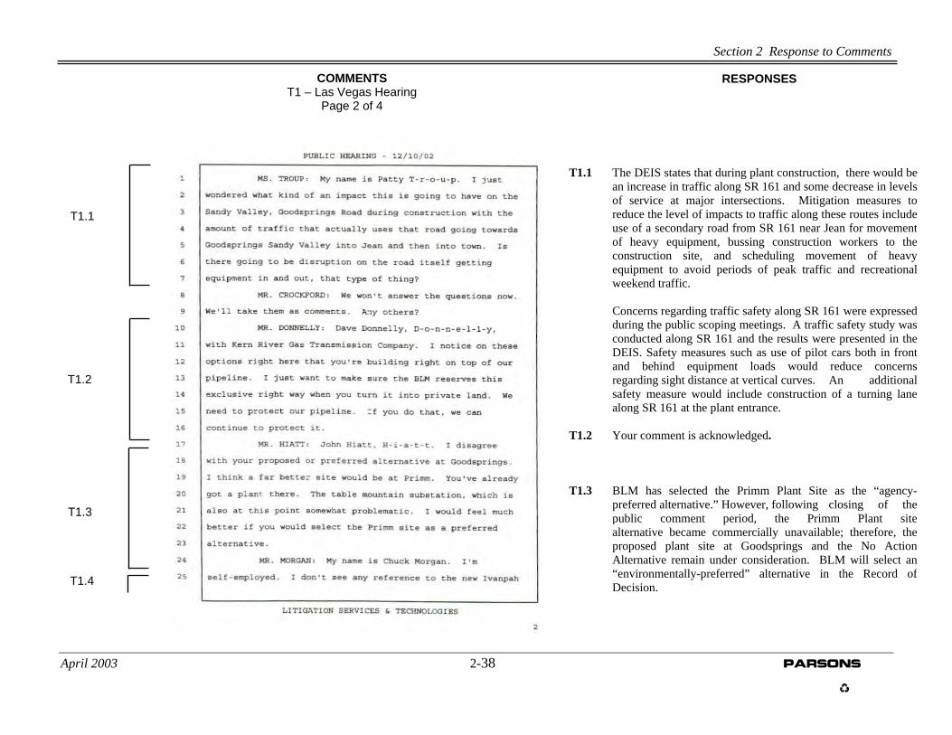
T1.1 The DEIS states that during plant construction, there would bean increase in traffic along SR 161 and some decrease in levelsof service at major intersections. Mitigation measures toreduce the level of impacts to traffic along these routes includeuse of a secondary road from SR 161 near Jean for movementof heavy equipment, bussing construction workers to theconstruction site, and scheduling movement of heavyequipment to avoid periods of peak traffic and recreationalweekend traffic.
Concerns regarding traffic safety along SR 161 were expressed during the public scoping meetings. A traffic safety study was conducted along SR 161 and the results were presented in the DEIS. Safety measures such as use of pilot cars both in front and behind equipment loads would reduce concerns regarding sight distance at vertical curves. An additional safety measure would include construction of a turning lane along SR 161 at the plant entrance. T1.2 Your comment is acknowledged.
T1.3 BLM has selected the Primm Plant Site as the “agency- preferred alternative.” However, following closing of the public comment period, the Primm Plant site alternative became commercially unavailable; therefore, the proposed plant site at Goodsprings and the No Action Alternative remain under consideration. BLM will select an “environmentally-preferred” alternative in the Record of Decision.
COMMENTS T1 – Las Vegas Hearing
Page 2 of 4
RESPONSES

Section 2 Response to Comments
April 2003 2-39 PARSONS
COMMENTS
T1 – Las Vegas Hearing Page 3 of 4
RESPONSES
T1.4 Impacts to transportation resulting from construction andoperation of the proposed Ivanpah Airport are not withinthe scope of the Ivanpah Energy Center Draft EIS;however, cumulative impacts associated with additionaldevelopment within Ivanpah Valley, including the IvanpahAirport, are addressed in Section 6, page 6-25.
T1.4 Cont’d

Section 2 Response to Comments
April 2003 2-40 PARSONS
RESPONSRESPONSES ES COMMENTS
s Page 3 of 4
COMMENTS
T1 – Las Vegas Hearing Page 4 of 4
T1 – Las Vega Hearing

Section 2 Response to Comments
April 2003 2-41 PARSONS
RESPONSES COMMENTS T2 – Sandy Valley Hearing
Page 1 of 10
Section 2 Response to Comments
April 2003 2-42 PARSONS
T2.2
T2.1
COMMENTS T2 – Sandy Valley Hearing
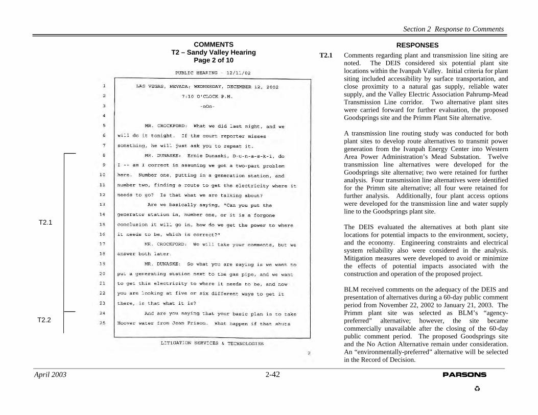
Page 2 of 10 T2.1 Comments regarding plant and transmission line siting are
noted. The DEIS considered six potential plant sitelocations within the Ivanpah Valley. Initial criteria for plantsiting included accessibility by surface transportation, andclose proximity to a natural gas supply, reliable watersupply, and the Valley Electric Association Pahrump-MeadTransmission Line corridor. Two alternative plant siteswere carried forward for further evaluation, the proposedGoodsprings site and the Primm Plant Site alternative.
A transmission line routing study was conducted for bothplant sites to develop route alternatives to transmit powergeneration from the Ivanpah Energy Center into WesternArea Power Administration’s Mead Substation. Twelvetransmission line alternatives were developed for theGoodsprings site alternative; two were retained for furtheranalysis. Four transmission line alternatives were identifiedfor the Primm site alternative; all four were retained forfurther analysis. Additionally, four plant access optionswere developed for the transmission line and water supplyline to the Goodsprings plant site. The DEIS evaluated the alternatives at both plant sitelocations for potential impacts to the environment, society,and the economy. Engineering constraints and electricalsystem reliability also were considered in the analysis.Mitigation measures were developed to avoid or minimizethe effects of potential impacts associated with theconstruction and operation of the proposed project.
BLM received comments on the adequacy of the DEIS and
presentation of alternatives during a 60-day public commentperiod from November 22, 2002 to January 21, 2003. ThePrimm plant site was selected as BLM’s “agency-preferred” alternative; however, the site becamecommercially unavailable after the closing of the 60-daypublic comment period. The proposed Goodsprings siteand the No Action Alternative remain under consideration.An “environmentally-preferred” alternative will be selectedin the Record of Decision.
RESPONSES

Section 2 Response to Comments
April 2003 2-43 PARSONS
RESPONSES
T2.5
T2.4
T2.3
T2.2 Cont’d.
COMMENTS T2 – Sandy Valley Hearing
Page 3 of 10
T2.2 As stated in the DEIS, 50 acre-feet per year (afy) is
needed for plant process water. The Southern Nevada Correctional Center (SNCC) is expected to produce a minimum of 35 afy that is generated from a low-security inmate population of approximately 240. At present, it is anticipated that the low-security inmate population will remain constant and that the prison will not reopen until at least 2008. Additional water would be acquired from a yet undisclosed groundwater source until the prison population increases to a level to fully-provide the needed water. There is no plan to use surface water from Hoover Dam or the Colorado River.
T2.3 As stated in the DEIS (page 5-81), ammonia will be used
as part of the Selective Catalytic Reduction system for nitrogen oxides (NOx) control. Although anhydrous ammonia could be used, the project proponent has committed to the use of aqueous ammonia (DEIS, page 5-61). Therefore, ammonia stored at the facility would be at concentrations and quantities below those that would present a health and safety hazard.
T2.4 BLM has selected the Primm site alternative as the
“agency-preferred” alternative; however, following closing of the public comment period, the Primm site became commercially unavailable. Therefore, the proposed Goodsprings site and the No Action Alternative remain under consideration. BLM will select an “environmentally-preferred” alternative in the Record of Decision.
T2.5 BLM will consider your comment regarding the proposed Goodsprings site.
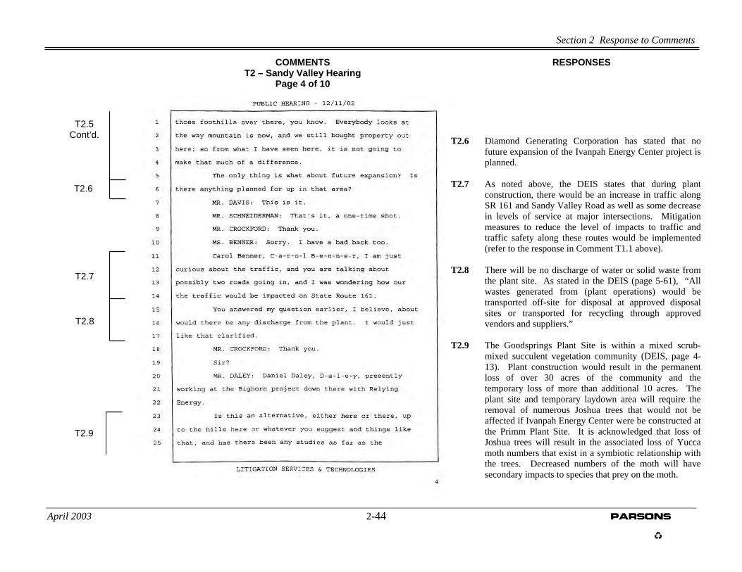
Section 2 Response to Comments
April 2003 2-44 PARSONS
T2.9
T2.6
T2.5 Cont’d.
T2.8
T2.7
RESPONSESCOMMENTS T2 – Sandy Valley Hearing
Page 4 of 10
T2.6 Diamond Generating Corporation has stated that no
future expansion of the Ivanpah Energy Center project is planned.
T2.7 As noted above, the DEIS states that during plant
construction, there would be an increase in traffic along SR 161 and Sandy Valley Road as well as some decrease in levels of service at major intersections. Mitigation measures to reduce the level of impacts to traffic and traffic safety along these routes would be implemented (refer to the response in Comment T1.1 above).
T2.8 There will be no discharge of water or solid waste from
the plant site. As stated in the DEIS (page 5-61), “All wastes generated from (plant operations) would be transported off-site for disposal at approved disposal sites or transported for recycling through approved vendors and suppliers.”
T2.9 The Goodsprings Plant Site is within a mixed scrub-
mixed succulent vegetation community (DEIS, page 4-13). Plant construction would result in the permanent loss of over 30 acres of the community and the temporary loss of more than additional 10 acres. The plant site and temporary laydown area will require the removal of numerous Joshua trees that would not be affected if Ivanpah Energy Center were be constructed at the Primm Plant Site. It is acknowledged that loss of Joshua trees will result in the associated loss of Yucca moth numbers that exist in a symbiotic relationship with the trees. Decreased numbers of the moth will have secondary impacts to species that prey on the moth.

Section 2 Response to Comments
April 2003 2-45 PARSONS
T2.12
T2.11
T2.10
T2.9 Cont’d.
RESPONSESCOMMENTS T2 – Sandy Valley Hearing
Page 5 of 10
T2.10 As stated in the DEIS, construction of the plant and
ancillary facilities would result in a short-term beneficial impact to employment. Construction personnel would be hired locally from the Las Vegas area and possibly from the communities of Goodsprings and Sandy Valley. Approximately 16 new jobs would be created for plant operations.
T2.11 Public participation is an important element in the
NEPA process. The process provides numerous opportunities for public communication with agency decision-makers about proposed actions. The BLM and Western Area Power Administration encourage comments from the public regarding the adequacy of the Ivanpah Energy Center DEIS and the alternatives evaluated and presented.
T2.12 Refer to T2.9 (above).

Section 2 Response to Comments
April 2003 PARSONS 2-46
T2.15
T2.14
T2.13
T2.12 Cont’d.
RESPONSESCOMMENTS T2 – Sandy Valley Hearing
Page 6 of 10
T2.13 As stated in the DEIS, approximately 16 new
employees would operate the plant rotating on three shifts; therefore, impacts to transportation would be negligible during plant operations.
T2.14 As noted above in the response to Comment #T2.6,
Diamond Generating Corporation has stated that no future expansion of the Ivanpah Energy Center project is planned.
T2.15 Your comments regarding the Primm Plant site
alternative discussed in the DEIS is on the record; however, as mentioned above, the Primm Plant site became commercially unavailable following closing of the public comment period.

Section 2 Response to Comments
April 2003 2-47 PARSONS
RESPONSES
T2.18
T2.17
T2.16
T2.15 Cont’d.
COMMENTS T2 – Sandy Valley Hearing
Page 7 of 10
T2.16 Your preference regarding the Primm Plant site
alternative is noted. T2.17 BLM has selected the Primm Plant Site as the “agency-
preferred alternative.” However, following closing ofthe public comment period, the Primm Plant sitealternative became commercially unavailable;therefore, the proposed plant site at Goodsprings andthe No Action Alternative remain under consideration.BLM will select an “environmentally-preferred”alternative in the Record of Decision.
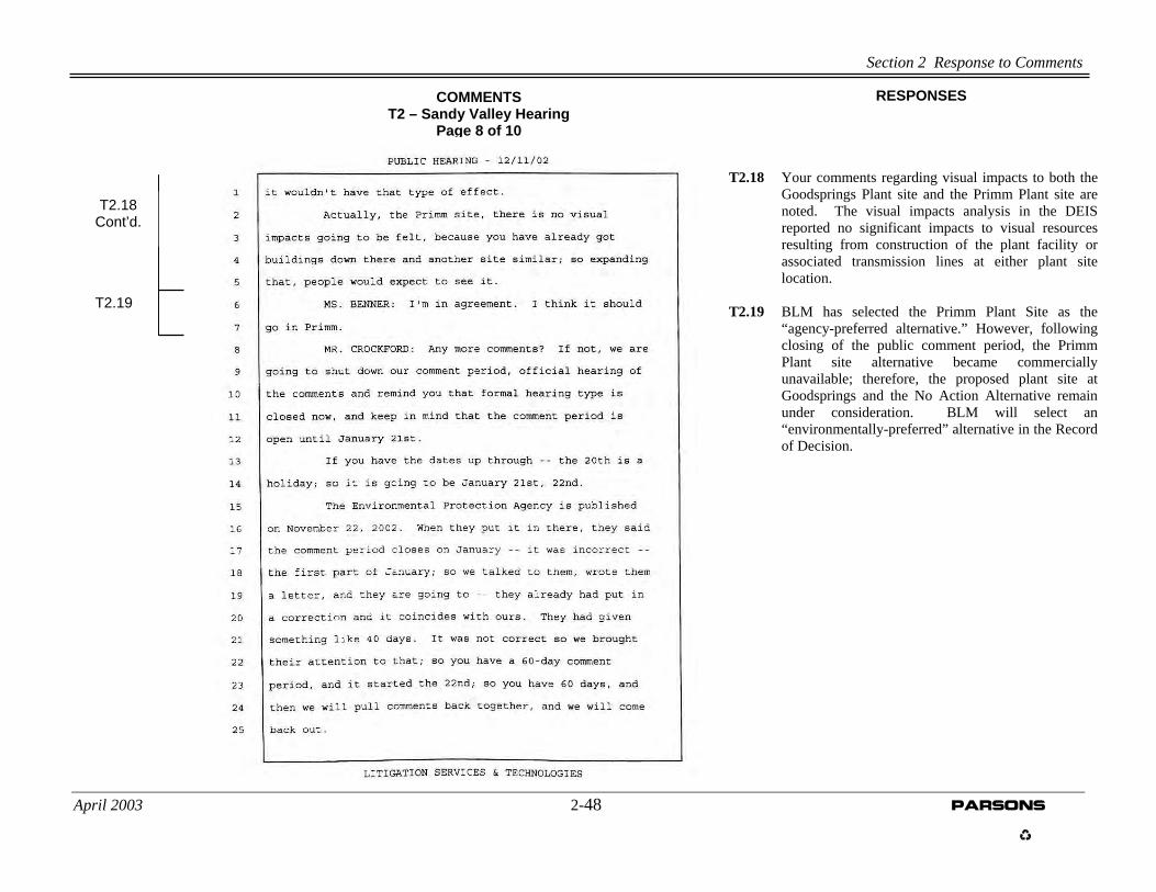
Section 2 Response to Comments
April 2003 2-48 PARSONS
T2.18 Your comments regarding visual impacts to both theGoodsprings Plant site and the Primm Plant site arenoted. The visual impacts analysis in the DEISreported no significant impacts to visual resourcesresulting from construction of the plant facility orassociated transmission lines at either plant sitelocation.
T2.19 BLM has selected the Primm Plant Site as the
“agency-preferred alternative.” However, followingclosing of the public comment period, the PrimmPlant site alternative became commerciallyunavailable; therefore, the proposed plant site atGoodsprings and the No Action Alternative remainunder consideration. BLM will select an“environmentally-preferred” alternative in the Recordof Decision.
RESPONSES
T2.19
T2.18 Cont’d.
COMMENTS T2 – Sandy Valley Hearing
Page 8 of 10

Section 2 Response to Comments
April 2003 2-49 PARSONS
RESPONSES COMMENTS T2 – Sandy Valley Hearing
Page 9 of 10
Section 2 Response to Comments
April 2003 PARSONS 2-50
RESPONSES
COMMENTS
T2 – Sandy Valley Hearing Page 10 of 10
Section 2 Response to Comments
April 2003 PARSONS 2-51
RESPONSES COMMENTS T3 – Goodsprings Hearing
Page 1 of 9
Section 2 Response to Comments
April 2003 2-52 PARSONS
T3.2
T3.1
RESPONSES COMMENTS T3 – Goodsprings Hearing
Page 2 of 9
T3.1 The DEIS states that temporary impacts to air quality
would occur during construction from increased dust created from land clearing, site preparation, and vehicle movement. Dust control during construction activities will be in compliance with Clark County’s dust control regulations. During plant operations, impacts to air quality would not be significant. The Ivanpah Energy Center is designed to be at, or below, national and local air quality standards. Additionally, modeling was performed to include emissions associated with operations of the proposed Ivanpah Airport and the Reliant Bighorn Facility. Modeling results indicate that the project’s contribution to cumulative air emissions would have a negligible impact.
T3.2 The DEIS identifies that impacts to traffic and traffic
safety will occur during construction of the plant facility. Mitigation measures to minimize impacts will be implemented. See response to Comment T1.1 above.
Section 2 Response to Comments
April 2003 2-53 PARSONS
T3.5
T3.4
T3.3
T3.2 Cont’d.
RESPONSES COMMENTS T3 – Goodsprings Hearing
Page 3 of 9
T3.3 Your comment regarding air quality impacts isacknowledged. See the response to Comment T3.1above. As stated in the DEIS, Ivanpah Energy Centerwould use refrigerated air technology which drasticallyreduces the need for water, when compared to otherpower plants of similar size. The facility would useapproximately 50 acre-feet per year (afy), of which 35afy would be provided as gray water from the SouthernNevada Correctional Center; the remaining 15 afy wouldoriginate from a yet undetermined groundwater source.
T3.4 During public scoping, Goodsprings residents suggested a
potential plant site west of I-15 between mileposts 5 and7. The DEIS evaluated the potential site along with fiveother site locations within the Ivanpah Valley. The sitesuggested by the Goodsprings residents; however, waseliminated from further consideration because it islocated within the Desert Tortoise Translocation Area,several miles of transmission line corridor outside of aBLM-designated utility corridor would be needed, and noreasonable alternative routes for construction wereavailable. A potential alternative site in Primm wasidentified by the project proponent and if constructed,would be co-located with the Reliant Bighorn PowerPlant. The Primm plant site and the proponent’sproposed site at Goodsprings were carried forward forfurther evaluation in the DEIS.
As stated above in previous comments, BLM has selectedthe Primm Plant Site as the “agency-preferredalternative;” however, the Primm Plant site alternativebecame commercially unavailable following the closingof the public comment period. Therefore, the proposedplant site at Goodsprings and the No Action Alternativeremain under consideration. BLM will select an“environmentally-preferred” alternative in the Record of

Section 2 Response to Comments
April 2003 2-54 PARSONS
T3.6
T3.5 Cont’d.
RESPONSES COMMENTS T3 – Goodsprings Hearing
Page 4 of 9
Also, see response to comment T3.1 above regardingair quality impacts associated with the constructionand operation of the Ivanpah Energy Center at theGoodsprings site.
T3.5 Potential impacts to real estate values cannot be
determined due to the volatility of the market. T3.6 BLM has selected the Primm Plant Site as the “agency-preferred alternative.” However, following the close of the public comment period, the Primm Plant site alternative became commercially unavailable; therefore, the proposed plant site at Goodsprings and the No Action Alternative remain under consideration. BLM will select an “environmentally-preferred” alternative in the Record of Decision.

Section 2 Response to Comments
April 2003 PARSONS 2-55
T3.7 See the above responses to comments T3.4 and
T3.6. T3.8 As stated above, BLM has selected the Primm
Plant Site as the “agency-preferred alternative.”However, following the close of the publiccomment period, the Primm Plant site alternativebecame commercially unavailable; therefore, theproposed plant site at Goodsprings and the NoAction Alternative remain under consideration.BLM will select an “environmentally-preferred”alternative in the Record of Decision.
T3.9
T3.8
T3.7
RESPONSES COMMENTS T3 – Goodsprings Hearing
Page 5 of 9
Section 2 Response to Comments
April 2003 PARSONS 2-56
T3.10
T3.9 Cont’d.
RESPONSES COMMENTS T3 – Goodsprings Hearing
Page 6 of 9
T3.9 Comment acknowledged. T3.10 The commenter is correct. The DEIS states that
motorists would encounter visual impacts atvarious points along I-15, SR 161, and theintersection of Sandy Valley Road and SR 161(see discussion on page 5-74 of the DEIS);however, the impact would be negligible becausethe views would be brief and of short-duration.Of the four transmission line plant accessoptions, Option 1, which would cross over themountain to interconnect with the VEA line,would create a “moderate” impact (refer to pages5-78 and 5-79 of the DEIS). The DEIS states thatuse of Option 2 or Option 3 would reduce visualimpacts associated with Option 1. BLM willconsider your comment regarding visual impactsassociated with transmission line plant accessOption 1.

Section 2 Response to Comments
April 2003 2-57 PARSONS
T3.11 As stated above, BLM has selected the Primm Plant
Site as the “agency-preferred alternative.” However,following the close of the public comment period,the Primm Plant site alternative becamecommercially unavailable; therefore, the proposedplant site at Goodsprings and the No ActionAlternative remain under consideration. BLM willselect an “environmentally-preferred” alternative inthe Record of Decision.
T3.12 The DEIS acknowledges that the Ivanpah Valley is
likely to undergo major changes as a result of futuredevelopment. As indicated in DEIS Section 6.2(Cumulative Impacts), projects such as the proposedIvanpah Valley Airport, the Las Vegas Valley WaterDistrict pipeline, and the Table Mountain Wind Farmare expected to contribute to air quality degradation,additional loss of habitat, and degradation of visualand aesthetics resources within the area. Someimpacts will be short-term and largely related toconstruction, others will persist throughout the life ofthe project. Additional impacts will result frominduced development that would be associated withmajor projects. We acknowledge the commentor’spreference for the Ivanpah Energy Center to belocated at the Primm Plant Site.
T3.12
T3.11
T3.10 Cont’d.
COMMENTS T3 – Goodsprings Hearing
Page 7 of 9
RESPONSES
Section 2 Response to Comments
April 2003 2-58 PARSONS
RESPONSES COMMENTS T3 – Goodsprings Hearing
Page 8 of 9

Section 2 Response to Comments
April 2003 2-59 PARSONS
RESPONSES
COMMENTS T3 – Goodsprings Hearing
Page 9 of 9
Section 2 Response to Comments
April 2003 PARSONS 2-60
RESPONSES
P1.11
P1.10
P1.9
P1.8
P1.7
P1.6
P1.5
P1.3 P1.4
P1.2
P1.1
COMMENTS P1 – Project Proponent (Diamond Generating)
Page 1 of 3* P1.1 While additional references to the temporary use of roads
and trails could be added, the southern access road isidentified as temporary in text on pages ES-1, ES-8, 3-22, 5-1, 5-14, 5-25, 5-32, 5-48, and 6-8 and more importantly,acreages for the southern access road are identified astemporary in Table ES-2 and Table 6-2.
P1.2 The commenter is correct. See Errata Sheet, Section 3. P1.3 The commenter is correct. See Errata Sheet, Section 5. P1.4 The commenter is correct. See Errata Sheet, Section 5. P1.5 Figure 5-7 is explained in text on page 5-72 as well as in the
legend of the figure. No additional explanation isnecessary.
P1.6 The commentor’s reference to “permanent disturbance” in
Table ES-2 is incorrect. The length and associated acreageshave no relationship to disturbance; they are provided in thetable to indicate ROW within BLM lands.
Reference to disturbance can be found under the tableheading “Land Disturbance Within BLM ROW(subheading) Temporary.” Acreages within BLM ROWhave been recalculated as 12.1. Temporary disturbance hasbeen recalculated as 48.3 acres. The corrected TemporaryAcreages for the project should total 236.4 acres. Thecorrected temporary acreages disturbed due to pipelineinstallation and total temporary acreages for the projectresult in minor modifications those pages identified by thecommenter. Detailed engineering will result in preciselengths and acreage determinations and will be included aspart of a project Construction, Operations, and MaintenancePlan, should the alternative be selected.

Section 2 Response to Comments
April 2003 2-61 PARSONS
P1.7 The commentor’s reference to “permanent disturbance” inTable ES-3 is incorrect. The length and associated acreageshave no relationship to disturbance; they are provided in thetable to indicate ROW within BLM lands.
Reference to disturbance can be found under the table heading“Land Disturbance Within BLM ROW (subheading)Temporary.” Acreages within BLM ROW have beenrecalculated as 13.8. Temporary disturbance has beenrecalculated as 55.1 acres. Adjustments to temporary landdisturbance also has been made as a result of commentsreceived from Kern River Gas Transmission Company (referto Response to Comments, O2.1) in which additional corridorwidth and temporary use areas resulted in an additional 12.7acres. The corrected Temporary Acreages for the project(using adjusted values for the water supply pipeline and thenatural gas supply pipeline) should total 278.9 acres. Thecorrected temporary acreages disturbed due to pipelineinstallation and total temporary acreages for the project resultin minor modifications those pages identified by thecommenter. Detailed engineering will result in precise lengthsand acreage determinations and will be included as part of aproject Construction, Operations, and Maintenance Plan,should the alternative be selected.
P1.8 The correct water supply pipeline length and area of temporarydisturbance for the Goodsprings Plant Site is approximately10.0 miles and 48.3 acres, respectively. Detailed engineeringwill result in precise lengths and acreage determinations andwill be included as part of a project Construction, Operations,and Maintenance Plan, should the alternative be selected.
RESPONSES

Section 2 Response to Comments
April 2003 2-62 PARSONS
P1.9 The correct water supply pipeline length and area of temporarydisturbance for the Primm Plant Site is approximately 11.4 milesand 55.1 acres, respectively. Detailed engineering will result inprecise lengths and acreage determinations and will be included aspart of a project Construction, Operations, and Maintenance Plan,should the alternative be selected.
P1.10 The DEIS states on page 5-3 that “Telecommunications would be
provided through installation of an additional cable within theexisting Bighorn telecommunications corridor.” Also, on page 5-7(Table 5-1) the DEIS states “Installation along the existing SprintCommunications lines in use by Reliant. No routing required.”Text on page 6-1 discusses the use of existing access roads andtelecommunications rights-of-way would be utilized and thattelecommunications right-of way would not be needed in TableES-3 and Table 6-3.
P1.11 The correct water supply pipeline length and area of temporary
disturbance for the Goodsprings Plant Site is approximately52,600 linear feet (10.0 miles) and 48.3 acres, respectively.Detailed engineering will result in precise lengths and acreagedeterminations and will be included as part of a projectConstruction, Operations, and Maintenance Plan, should thealternative be selected.
RESPONSES

Section 2 Response to Comments
April 2003 PARSONS 2-63
RESPONSES
P1.19
P1.18
P1.17
P1.16
P1.15
P1.14
P1.13
P1.12
P1.11 Cont’d.
COMMENTS P1 – Project Proponent (Diamond Generating)
Page 2 of 3 P1.12 Additional housing for Primm area casino workers willbe on property that is owned and operated by casinooperators. The majority of the area that is to bedeveloped is currently occupied by recreationalvehicles. The property greater than one mile from theprobable plant site location (should Ivanpah EnergyCenter be located at the Primm site). The ReliantBighorn Generating Facility is located partially betweenthe housing area and the Ivanpah Energy Center plantsite and would partially screen the Ivanpah EnergyCenter from the housing area.
P1.13 See Errata Sheet Section 6. P1.14 Comment acknowledged. P1.15 Comment acknowledged. P1.16 Comment acknowledged. Refer to Section 7 Errata
Sheet. P1.17 Stack height shown on the simulations was developed
from plant schematics provided by DiamondGenerating. The stack height and other plantcomponents were used on all simulations; topographicfeatures consisting of plant height and land forms thatscreen the plant were taken from topographic maps.The simulation shown on Figure 5-8 is correct. Nochanges to simulations are required.
P1.18 The apparent size of objects differ primarily based on distance; distant objects appear smaller than closer objects. Other factors include the relationship of a given object to other objects in proximity. For example, in figures 5-15 and 5-16, the Reliant Bighorn Generating Facility appears larger than that of the Ivanpah Energy Center because the Bighorn Facility

Section 2 Response to Comments
April 2003 PARSONS 2-64
RESPONSES
P1.20
P1.19 Cont’d.
COMMENTS P1 – Project Proponent (Diamond Generating)
Page 3 of 3 requires large cooling components that are not required
by the Ivanpah Energy Center; thus, the IvanpahEnergy Center appears smaller.
Regarding Figure 5-7, the plant was simulated to scalewith the surrounding topographic features using thesame plant schematics and measurements used in DEISFigures 5-15 and 5-16.
P1.19 The Abstract in the DEIS states: “Cultural resourcesand paleontological resources investigations areongoing, therefore, a determination of potentialimpacts to such resources cannot be made.” Otherrelated references to cultural resources andpaleontological resources are “It is currently unknownhow many archaeological sites exist in the project area.However, before any construction would be allowed, aClass III cultural resources survey would be conductedfor the area of potential effect.” An explanation ofcompliance requirements under Section 106 of NHPAalso is provided (Pages 5-43 and 5-132). Similar textregarding paleontological resources is provided inpages 5-44 and 5-132/133.
The fact that cultural resources and paleontologicalresources surveys have not been undertaken does notindicate that the DEIS is incomplete. Many projectsproceed and a ROD is issued without suchinvestigations, but with the stipulation that all culturalresources survey work (including sign-off by theSHPO) be completed prior to construction. Since issuance of the Draft EIS, both paleontologicaland cultural field surveys have been completed.Results of the cultural and paleontological fieldsurveys are discussed in Section 4 of this Final EIS.

Section 2 Response to Comments
April 2003 2-65 PARSONS
P1.20 “Negligible” and “Moderate” are terms used to providethe reader with a frame of reference. Although somesubjectivity is inherently included in the use of suchterms, they do not conflict with “significance” and areroutinely used in NEPA documents. The phrase “…lessthan significant” or “…not expected to be significant” hasbeen used throughout the DEIS to clearly indicate thatsignificant impacts are not expected, except in the case ofthe desert tortoise. The phrase appears in 54 locations inthe document – once in the Abstract, 13 times in theExecutive Summary, 27 times in Section 5 (Impacts), and13 times in Section 6 (Summary of Impacts/CumulativeImpacts). BLM is required to reduce the level(s) ofimpact(s) for all impacts; therefore, mitigation to reduceor avoid impacts, regardless of their severity, will berequired.
In reference to the reviewer’s comment, “The BLM
should not concern itself with attempting to differentiatebetween, or make decisions based upon, categories ofInsignificance… Our concern is that the seemingdifferentiation of levels of insignificance of impacts couldimproperly influence decisions.” The decision makers(BLM) have the ability to fairly evaluate the ProposedAction and the alternatives and that the use of terms suchas “negligible” or “moderate” will not result in confusion.
*Initials that precede comments refer to: RJ – R.J. Johnson, Consultant to Diamond Generating NS – Necy Sumait, ArkEnergy, Inc., Consultant to Diamond Generating RC – Reese-Chambers, Inc., Consultant to Diamond Generating
RESPONSES
Section 2 Response to Comments
April 2003 2-66 PARSONS

Section 2 Response to Comments
April 2003 2-67 PARSONS
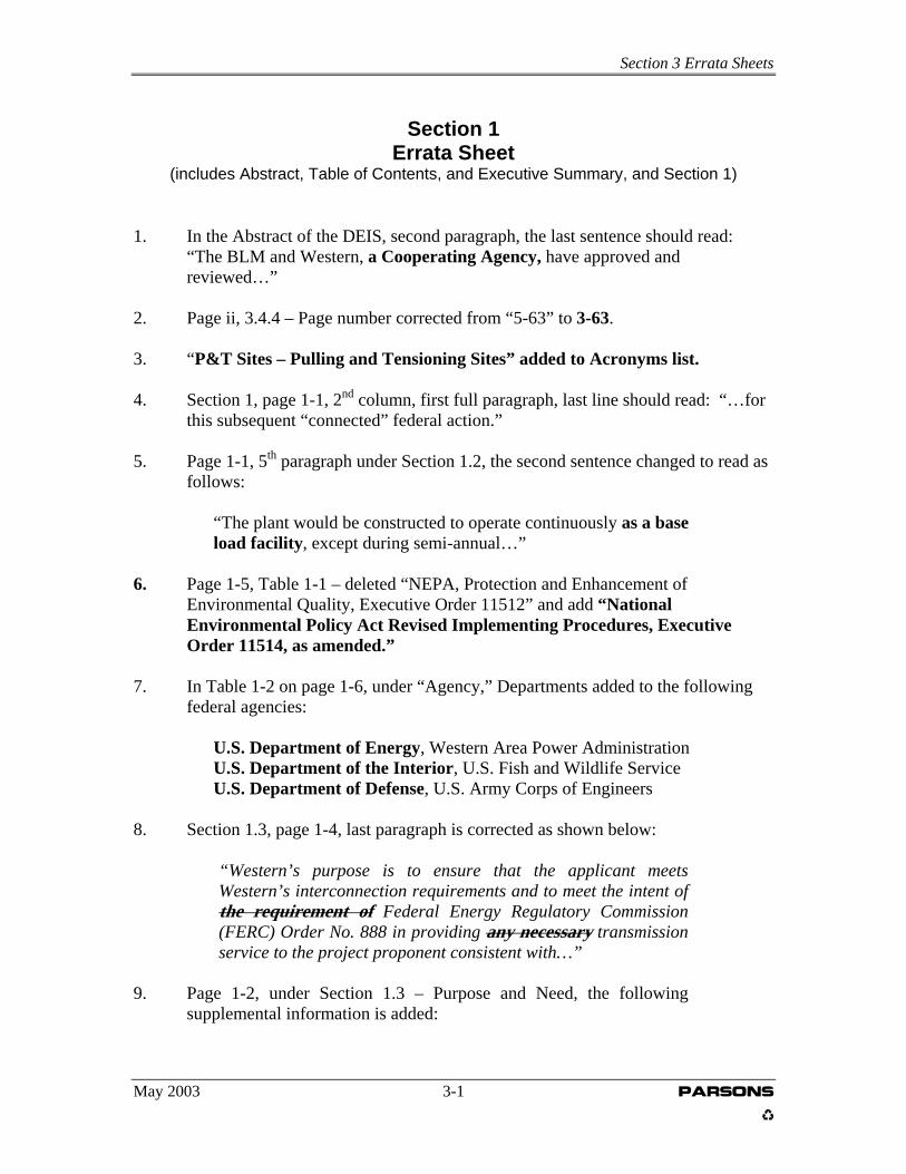
Section 3 Errata Sheets
Section 1
Errata Sheet (includes Abstract, Table of Contents, and Executive Summary, and Section 1)
1. In the Abstract of the DEIS, second paragraph, the last sentence should read: “The BLM and Western, a Cooperating Agency, have approved and
reviewed…”
2. Page ii, 3.4.4 – Page number corrected from “5-63” to 3-63. 3. “P&T Sites – Pulling and Tensioning Sites” added to Acronyms list.
4. Section 1, page 1-1, 2nd column, first full paragraph, last line should read: “…for
this subsequent “connected” federal action.” 5. Page 1-1, 5th paragraph under Section 1.2, the second sentence changed to read as
follows:
“The plant would be constructed to operate continuously as a base load facility, except during semi-annual…”
6. Page 1-5, Table 1-1 – deleted “NEPA, Protection and Enhancement of
Environmental Quality, Executive Order 11512” and add “National Environmental Policy Act Revised Implementing Procedures, Executive Order 11514, as amended.”
7. In Table 1-2 on page 1-6, under “Agency,” Departments added to the following
federal agencies:
U.S. Department of Energy, Western Area Power Administration U.S. Department of the Interior, U.S. Fish and Wildlife Service U.S. Department of Defense, U.S. Army Corps of Engineers
8. Section 1.3, page 1-4, last paragraph is corrected as shown below:
“Western’s purpose is to ensure that the applicant meets Western’s interconnection requirements and to meet the intent of the requirement of Federal Energy Regulatory Commission (FERC) Order No. 888 in providing any necessary transmission service to the project proponent consistent with…”
9. Page 1-2, under Section 1.3 – Purpose and Need, the following supplemental information is added:
May 2003 3-1 PARSONS

Section 3 Errata Sheets
“Factors contributing to the causes of California’s problems have not been universally agreed upon; however, there is general agreement among industry leaders of a core set of factors that contributed to the energy crisis. Those factors are summarized as follows:
Investment in new power generation has not kept pace with increasing power demand. California’s generation capacity decreased 2 percent from 1990 through 1999, while retail sales increased by 11 percent. Furthermore, there has been no new generation capacity constructed in California for over a decade.
To meet its demand for power, California relies on about 7 to 11
gigawatts of out-of-state generation capability, much of which is hydropower. Reduced hydropower generation has resulted from unusually low water levels in the northwestern United States.
During 2000, approximately 10 gigawatts of generation capability
was out of operation during some of the high demand times, which contributed to power shortages.
A major high voltage transmission line (known as Path 15) became
congested, thus reducing the flow of surplus electrical capacity from northern to southern California.
Many independent power generators were reluctant to sell power
to PG&E and SCE, due to financial difficulties of the two companies.
California’s wholesale electric market rules required major
utilities to purchase power through a single entity (CalPX) which precluded the ability of the utilities to enter into long-term contracts for energy. When spot market wholesale prices increased, the utilities had no option but to purchase the high-priced power.
Wholesale electricity prices increased due to an increase in
natural gas prices and the need to meet California’s power plant emissions requirements.
Major utilities within the state paid high wholesale prices, but
were unable to recover such costs because retail electricity prices were frozen.
Additional factors that contributed to power shortages and increased prices have included curtailments in electrical generation,
May 2003 3-2 PARSONS

Section 3 Errata Sheets
manipulation of pricing, and curtailment of natural gas supplies by some power and natural gas suppliers.”
10. Page 1-5, Table 1-2, “Executive Order 13084, Consultation and Coordination
with Indian Tribal Governments” was changed to “Executive Order 13175, Consultation and Coordination with Indian Tribal Governments.”
11. Page 1-5, Table 1-1, “36 USC 3001” deleted, “36 CFR 800” added.
12. Page 1-6, Table 1-2, under State of Nevada Historic Preservation
Office, the second phrase under “Permit/Approval” has been corrected to read:
“Section 106 review and concurrence; State Historic Preservation Act for Tribal and BLM lands.”
May 2003 3-3 PARSONS
Section 3 Errata Sheets
Section 2
Errata Sheet
1. Page 2-2, Table 2-1, text corrected to say U.S. Department of Defense, U.S. Army Corps of Engineers.
2. Page 2-10, 2nd column, last section title changed to: Nevada Fish and
Wildlife Office/U.S. Fish and Wildlife Service. The first sentence of the paragraph is changed to read, “…responded in a joint letter dated June 27, 2002…”
May 2003 3-4 PARSONS

Section 3 Errata Sheets
Section 3
Errata Sheet
1. Page 3-10, Section 3.3.3, second paragraph was revised as follows: “The potential plant site was eliminated from further
consideration because it is at an elevation that would reduce the efficiency of the turbine generators and because construction and operations would result in high levels of visual impacts to the Goodsprings community and travelers along Sand Valley Road.”
2. Page 3-13, right column, first full paragraph. Text at the end of the first sentence,
“…or on the State of Nevada land that is within the confines of SNCC-operated rapid infiltration basins” will be deleted.
3. Page 3-14, Table - Plant Site Alternative E – the following text moved from
“Other Factors” to “Visual Impacts”:
“A portion of the interconnection transmission lines to the proposed Table Mountain Substation would be visible from Sandy Valley Road.”
4. Page 3-29, right column, 2nd sentence, insert at the beginning of the sentence the
following text:
“Except for the facilities owned and operated by Western,”
5. Page 3-33, Segment 140 – last sentenced revised as follows:
“Segment 140 would cross over the Boulder-Mead 69-kV and under the Pahrump-Mead 230-kV Transmission Lines…”
6. Page 3-61, 2nd column, 1st sentence, revised to read, “…from the Ivanpah Switchyard to the Table Mountain…”
7. Page 3-64, first column, first sentence under “Transmission Interconnection,”
sentence changed to read, “The proposed substation additions would be located in the east portion of the230-kV area.”
8. The following text is inserted after Section 3.6:
“The BLM would retain Ivanpah Energy Center, LP’s bond or other security for the life of the project if the decision in the Record of Decision selects the Goodsprings Plant site,
May 2003 3-5 PARSONS

Section 3 Errata Sheets
Alternative E. In the event the Primm Plant Site, Alternative F is selected, the bond will be released when BLM is satisfied with reclamation efforts. A bond will not be required if the No Action Alternative is selected.”
May 2003 3-6 PARSONS
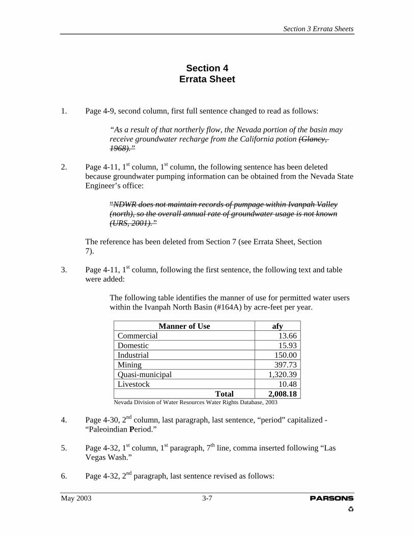
Section 3 Errata Sheets
Section 4 Errata Sheet
1. Page 4-9, second column, first full sentence changed to read as follows: “As a result of that northerly flow, the Nevada portion of the basin may receive groundwater recharge from the California potion (Glancy, 1968).” 2. Page 4-11, 1st column, 1st column, the following sentence has been deleted
because groundwater pumping information can be obtained from the Nevada State Engineer’s office:
“NDWR does not maintain records of pumpage within Ivanpah Valley (north), so the overall annual rate of groundwater usage is not known (URS, 2001).” The reference has been deleted from Section 7 (see Errata Sheet, Section 7). 3. Page 4-11, 1st column, following the first sentence, the following text and table
were added:
The following table identifies the manner of use for permitted water users within the Ivanpah North Basin (#164A) by acre-feet per year.
Manner of Use afy Commercial 13.66 Domestic 15.93 Industrial 150.00 Mining 397.73 Quasi-municipal 1,320.39 Livestock 10.48 Total 2,008.18
Nevada Division of Water Resources Water Rights Database, 2003 4. Page 4-30, 2nd column, last paragraph, last sentence, “period” capitalized - “Paleoindian Period.” 5. Page 4-32, 1st column, 1st paragraph, 7th line, comma inserted following “Las Vegas Wash.” 6. Page 4-32, 2nd paragraph, last sentence revised as follows:
May 2003 3-7 PARSONS
Section 3 Errata Sheets
“In the Great Basin area, the Archaic subsistence strategy was characterized by hunting, trapping and snaring of birds, insects, deer, antelope, mountain sheep, rabbits, and other small animals; as well as the collecting of grasses, seed, bulbs, nuts, roots, berries, and other plants.”
7. Page 4-34, 1st column, first sentence revised to read, “Over parts of the
Great Basin…;” third sentence revised to read, “…Virgin rivers;” 2nd paragraph, 3rd sentence revised to read, “…in the lower Colorado River drainage, and the Sonoran Desert, Mojave Desert,…;” 3rd paragraph, 4th sentence, replaced “repre-senting” with “representing.”
8. Page 4-42, Report Title under Report 5-1325(N) “Environ-mental” replaced with “Environmental” and “Archaeo-logical” changed to “Archaeological.”
May 2003 3-8 PARSONS
Section 3 Errata Sheets
Section 5
Errata Sheet
1. Page 5-9, first column under “Generic Mitigation,” insert “Western,” following BLM in the first sentence.
2. Page 5-11, Table 5-3, Item #10 “Hazardous materials will not be drained into the ground or into arroyos or drainages…” was deleted from the text. 3. Page 5-12, Item #19, insert “Western,” after BLM on the last line. Footnote added to the Transmission Lines column that reads:
“Regarding interconnection construction, Western would require the construction contractor to abide by all local requirements and in accordance with Western’s standard construction specifications.”
4. Page 5-12, Item #22, “When practicable” removed from text. 5. Page 5-17, 1st column, 1st paragraph, the following text was inserted at the end
of the last sentence:
“or as in the case with the propose interconnection at Mead, would involve construction within a previously developed facility area.”
6. Page 5-21, 1st paragraph under “Transmission Lines,” the text “or the Mead
interconnection…” was inserted after “options” in the last sentence.
8. Page 5-23, first paragraph, last sentence should read, “The amount of water that would be used from the well…”
8. Page 5-23, 2nd column, 2nd full paragraph, 2nd to the last sentence, has been re-written as follows: “Other users in the Ivanpah Valley North Basin total 2,008.18 afy, which represents approximately 91 percent of the annual recharge rate (NDWR, 2003).” 9. Page 5-24, 2nd column, the following sentence was added to the end of the first paragraph:
“Water required for construction at Mead Substation could come from existing Mead water supply, resulting in negligible impacts to groundwater.”
May 2003 3-9 PARSONS

Section 3 Errata Sheets
10. Page 5-43, 1st column, the following sentence added to the last paragraph of the section:
“Weed control at Mead would be accomplished in accordance with Western’s vegetation management guidelines to prevent the spread of noxious weeds.”
11. Page 5-45, left column, first paragraph, third line from the bottom of the page should read, “..received, variances and waivers for height…” 12. Page 5-50, 2nd column, at the end of the last paragraph, that following sentenced was added:
“The interconnection at Mead would not change current land use and disturbance would be limited to the existing developed facility area.”
13. Page 5-54, 2nd column, last paragraph, first sentence, inserted “or Mead
Substation” after “…Energy Center.” At the end of the last sentence, same paragraph, inserted “, or the Mead interconnection.”
14. Page 5-57, 2nd column, last paragraph, inserted “or the Mead Substation
interconnection…” after “transmission line access options.” 15. Page 5-60, 2nd column, last paragraph, added the following new sentence: “The Mead interconnect would not affect transportation.” 16. Page 5-66, 2nd column, first sentence, after “construction,” deleted “is” and
inserted “and the Mead interconnection are…” 17. Page 5-76, section titles in the 1st column and 2nd column were renamed,
“Transmission Line Interconnection at Table Mountain Substation,” replacing “Transmission Line Interconnection.”
18. Page 5-78, a new section was added above the “Transmission Line Plant Access
Options” section in the 2nd column. The section reads:
Transmission Line Interconnection at Mead Substation “The structures used for the interconnection at Mead Substation are anticipated to be the same as the existing structures creating no change in the visual contrast at the site.”
May 2003 3-10 PARSONS

Section 3 Errata Sheets
19. Page 5-80, Footnote 1 added to Summary table under mitigation measures for
transmission lines that reads, “Western will apply standard construction practices to control air emissions at interconnection construction sites.”
20. Page 5-81, 2nd column, the following text is added after the sentence that ends
with “…517 MW.”
“During periods when a single gas turbine is online, natural gas-fired supplemental duct burners may be used to ensure a combined-cycle capacity of up to 260 MW to meet minimum contractual obligations. The duct burners will not operate when both gas turbines are online.”
21. Page 5-94, Table 5-14 and 5-15. Footnote “b” should be added to rows labeled CTG No. 1 and CTG No. 2. Text for footnote “b” follows:
b Emissions include the potential effects of supplemental duct burning for single turbine operation of either CTG.
22. Page 5-98, Under “Transmission Lines” the following new paragraph was inserted after the 1st paragraph:
“Construction of the Mead interconnection would follow Western’s standard construction practices, which includes specifications for controlling dust and meeting local permitting requirements. Disturbed areas within the substation would be covered with gravel to control dust. This measure would reduce air emissions to a negligible amount.”
23. Page 5-104, the following new sentence inserted following the paragraph at the top of the 1st column:
“Noise generated from the construction of the Mead interconnection would be short-term and result in negligible impacts in the vicinity of the interconnection site.”
24. The following sentences were inserted to Section 5.2.
Page 5-114, 1st column, following the 1st paragraph
“Impacts to geological resources resulting from the interconnection construction at Mead substation would be the same as discussed for the Proposed Goodsprings Plant Site.”
May 2003 3-11 PARSONS

Section 3 Errata Sheets
Page 5-118, 2nd column, following the 1st paragraph “Impacts to mining resulting from the interconnection construction at Mead Substation would be the same as discussed for the Proposed Goodsprings Plant Site.” Page 5-121, 2nd column, following last sentence of paragraph under “Transmission Lines” “Impacts to groundwater resulting from the interconnection construction at Mead Substation would be the same as discussed for the Proposed Goodsprings Plant Site.” Page 5-126, 2nd column, following last sentence of paragraph under “Transmission Lines” “Impacts to biological resources resulting from the interconnection construction at Mead Substation would be the same as discussed for the Proposed Goodsprings Plant Site.” Page 5-137, 2nd column, following last sentence of 2nd paragraph “Impacts to land use resulting from the interconnection construction at Mead Substation would be the same as discussed for the Proposed Goodsprings Plant Site.” Page 5-139, 2nd column, following the last paragraph “Impacts to rangeland management resulting from the interconnection construction at Mead Substation would be the same as discussed for the Proposed Goodsprings Plant Site.” Page 5-142, 2nd column, following the last paragraph “Impacts to recreation resources resulting from the interconnection construction at Mead Substation would be the same as discussed for the Proposed Goodsprings Plant Site.” Page 5-145, 2nd column, top of page, following the last paragraph “Impacts to transportation resulting from the interconnection construction at Mead Substation would be the same as discussed for the Proposed Goodsprings Plant Site.” Page 5-155, 2nd column, following the last paragraph “Impacts to visual resources resulting from the interconnection construction at Mead Substation would be the same as discussed for the Proposed Goodsprings Plant Site.”
May 2003 3-12 PARSONS

Section 3 Errata Sheets
Page 5-157, 2nd column, following the last paragraph “Impacts to air quality resulting from the interconnection construction at Mead Substation would be the same as discussed for the Proposed Goodsprings Plant Site.” Page 5-159, 2nd column under “Transmission Lines,” following the paragraph “Noise impacts resulting from the interconnection construction at Mead Substation would be the same as discussed for the Proposed Goodsprings Plant Site.” Page 5-164, 2nd column, following the first paragraph “Socioeconomic impacts resulting from the interconnection construction at Mead Substation would be the same as discussed for the Proposed Goodsprings Plant Site.”
25. Page 5-120, second column, the 2nd full paragraph, last sentence has been re-written as follows:
“Other users in the Ivanpah Valley North Basin total 2,008.18 afy, which represents approximately 91 percent of the annual recharge rate (NDWR, 2003).”
26. Page 5-153, section titles in the 1st column and 2nd column were renamed,
“Transmission Line Interconnection at Table Mountain Substation,,” replacing “Transmission Line Interconnection.”
May 2003 3-13 PARSONS
Section 3 Errata Sheets
Section 6
Errata Sheet
1. Page 6-4, Subtitle in 2nd column revised from “Cultural and Paleontology” to “Cultural and Paleontological Resources.”
2. Page 6-9, the following text was added to the end of the first paragraph under
Noise: “Depending on the construction schedule for the housing development at Primm, similar impacts could be expected for the Primm site alternative.”
3. Page 6-15, 2nd column, 1st sentence revised to read, “…northern and southern
access roads to the Goodsprings Plant Site, land surrounding the plant site, and…”
May 2003 3-14 PARSONS

Section 3 Errata Sheets
Section 7
Errata Sheet
1. Additional references to Section 7:
Myrick, David, 1992. Railroads of Nevada and Eastern California: Volume II, The Southern Roads. (Reprint) University of Nevada Press, Reno. Signor, John R., 1988. The Los Angeles and Salt Lake Railroad Company, Union Pacific’s Historic Salt Lake Route. Golden West Books, San Marino.
2. The following reference has been deleted from the DEIS.
URS Corporation, 2001. Reliant Bighorn Environmental Assessment.
3. Additional reference to Section 7:
Nevada Division of Water Resource Water Rights Database, Hydrographic Basin Summary – By Manner of Use for Groundwater Sources. April 2003.
4. Additional reference to Section 7. NERC, 2001. Reliability Assessment 2001-2010. The Reliability of Bulk Electric Systems in North America, October 16, 2001.
May 2003 3-15 PARSONS

Section 3 Errata Sheets
Section 8 Errata Sheet
1. Page 8-1, Under “List of Preparers – Western,” the following was added to
the list:
“David Vader, Community Planner/Native American Liaison”
May 2003 3-16 PARSONS

Section 3 Errata Sheets
May 2003 3-17 PARSONS
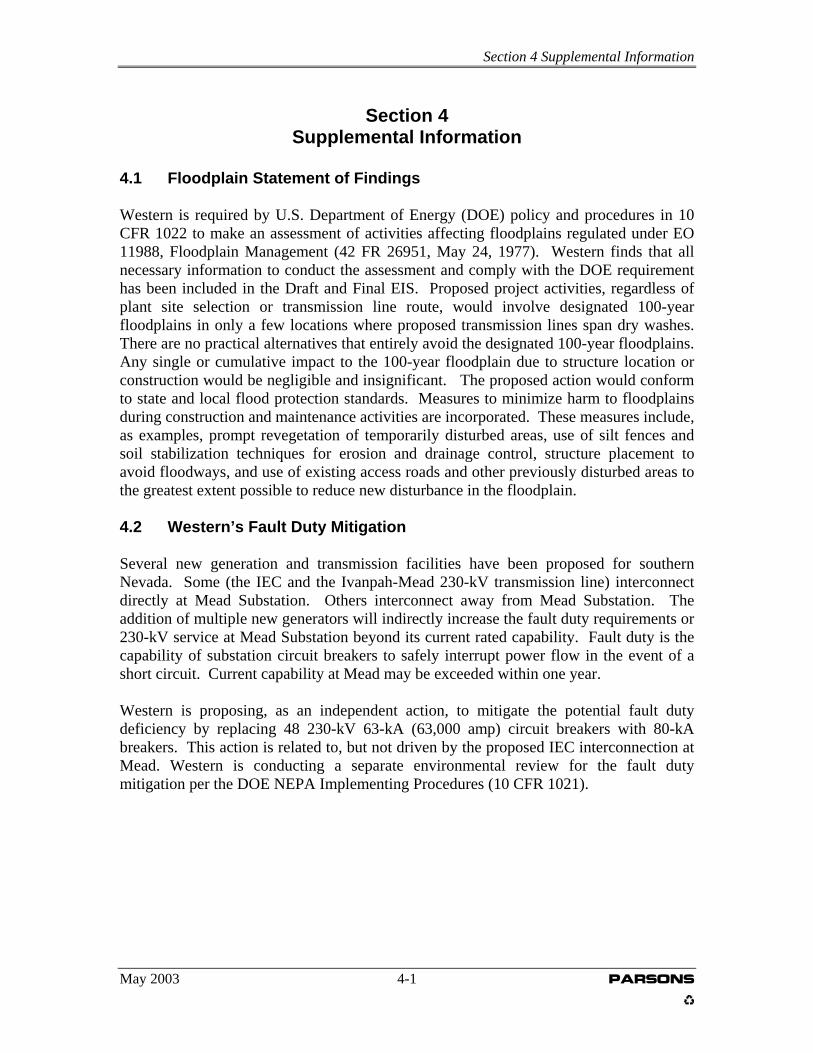
Section 4 Supplemental Information
Section 4
Supplemental Information
4.1 Floodplain Statement of Findings Western is required by U.S. Department of Energy (DOE) policy and procedures in 10 CFR 1022 to make an assessment of activities affecting floodplains regulated under EO 11988, Floodplain Management (42 FR 26951, May 24, 1977). Western finds that all necessary information to conduct the assessment and comply with the DOE requirement has been included in the Draft and Final EIS. Proposed project activities, regardless of plant site selection or transmission line route, would involve designated 100-year floodplains in only a few locations where proposed transmission lines span dry washes. There are no practical alternatives that entirely avoid the designated 100-year floodplains. Any single or cumulative impact to the 100-year floodplain due to structure location or construction would be negligible and insignificant. The proposed action would conform to state and local flood protection standards. Measures to minimize harm to floodplains during construction and maintenance activities are incorporated. These measures include, as examples, prompt revegetation of temporarily disturbed areas, use of silt fences and soil stabilization techniques for erosion and drainage control, structure placement to avoid floodways, and use of existing access roads and other previously disturbed areas to the greatest extent possible to reduce new disturbance in the floodplain. 4.2 Western’s Fault Duty Mitigation Several new generation and transmission facilities have been proposed for southern Nevada. Some (the IEC and the Ivanpah-Mead 230-kV transmission line) interconnect directly at Mead Substation. Others interconnect away from Mead Substation. The addition of multiple new generators will indirectly increase the fault duty requirements or 230-kV service at Mead Substation beyond its current rated capability. Fault duty is the capability of substation circuit breakers to safely interrupt power flow in the event of a short circuit. Current capability at Mead may be exceeded within one year. Western is proposing, as an independent action, to mitigate the potential fault duty deficiency by replacing 48 230-kV 63-kA (63,000 amp) circuit breakers with 80-kA breakers. This action is related to, but not driven by the proposed IEC interconnection at Mead. Western is conducting a separate environmental review for the fault duty mitigation per the DOE NEPA Implementing Procedures (10 CFR 1021).
May 2003 4-1 PARSONS
Section 4 Supplemental Information
4.3 Thermal Plume Analysis A concern was expressed by the BLM regarding potential effects of a thermal plume on aircraft operations at the proposed Ivanpah Airport. The concern was based on the premise that heat generated from normal plant operations could create turbulence that could affect aircraft landing or taking off from the airport. Calculations have been made regarding potential effects of a thermal plume from the Ivanpah Energy Center, if the plant were to be located at the Primm, Nevada plant site. Potential effects on aircraft operations can only be estimated due to a wide range of uncertainties related to airport design and runway orientation, specific plant site (and therefore, heat source) location, flight path orientation, and actual physical effects on aircraft stability. Thermal plume associated with the Ivanpah Energy Center would originate from the two main turbine exhaust stacks and the air cooling tower. Based on worst case atmospheric conditions (light to moderate winds [1 - 5 m/sec, or 2 - 11 mph], in the daytime or on cloud-covered nights), higher wind velocities and/or clear nights would reduce thermal plume emissions. Plume rise from the main stacks is calculated by the EPA air quality model based on engineering calculations of stack exhaust temperature and volume flow. The same equations can be used to estimate plume rise from the heated air rejected from the cooling tower. The cooling tower volume flow was estimated from fan size and power to be about 40 million standard cubic feet per minute. Based on the flow volume, the known heat capacity of air, and the rejected heat (Btus) (i.e., that not directly converted to electricity), the temperature rise above ambient can be calculated. It was assumed for this calculation that 95% of the unused British thermal units (Btus) were rejected to the atmosphere via the cooling tower. Calculated results are as follows: Plume Height from Main Stacks - 1,000 ft to 5,000 ft above ground level (higher plume is associated with lower wind speed of 2 mph) Plume Height from Cooling Tower - 3,300 ft to 15,000 ft above ground level Estimated plume heights on clear nights with light winds are 600 ft for the main stacks and 1200 ft for the cooling tower. Based on available data, the Primm plant site would be offset to the east from the flight path that would be used for the southern end of the east runway of Ivanpah Airport and commercial aircraft approaching (using instrument landing system) or departing from the nearest runway would be more than 2,000 horizontal feet from the plant site. The existing Bighorn Generating Facility would be closer to the flight path than that of the proposed Ivanpah Energy Center. Smaller aircraft on visual approach or landing could overfly the plant site; however, using a typical 20:1 flight path, such aircraft would be at a minimum altitude of 660 feet above ground level.
May 2003 4-2 PARSONS
Section 4 Supplemental Information
In summary, it unlikely that a commercial aircraft would overfly the Primm Plant site during normal takeoff or landing operations. However, the site could be overflown by smaller aircraft operating without instrument landing system. Actual effects of flights through the calculated thermal plume would differ in accordance with aircraft type, atmospheric conditions, and other factors. 4.4 Archaeological Analyses A Class III cultural resources survey was conducted following completion of the site file search, literature review, and research design. Survey transects that were conducted as part of the survey were a maximum of 30 meters apart covering the area of approximately 64 square miles, which included the area of potential effects (APE). Sixteen new sites were recorded during the survey. A site description was prepared for each site, which included artifact summaries, feature(s) descriptions, and other pertinent site data. An IMACS site form was filled out for each site. Site sketch maps were drawn for each site, and boundaries and datums were recorded using a Trimble Geo Explorer III® GPS unit. Photographs were taken of each site, and diagnostic artifacts were recorded with a GPS and plotted on the site sketch map. Shovel probes were conducted where topography suggested potential subsurface cultural deposits of the eligibility of the site was questioned. The site datum (consisting of a rebar spike with an orange cap) was established and labeled with a metal site tag for each site. Finally, sites were evaluated for eligibility using the National Register of Historic Places (NRHP) criteria, the historic contexts, and the research questions that were prepared for the project. Nine previously recorded archaeological sites that are located within the APE were revisited and IMACS forms were updated accordingly. Thirty isolated artifacts also were recorded during the Ivanpah Energy Center survey. Each of the isolated finds was recorded on an isolated find table and recorded with a GPS. There were no artifacts collected during the cultural resources survey. Inventory Results and Eligibility Recommendations. Ten previously recorded archaeological sites and 16 new archaeological sites were recorded during the Ivanpah Energy Center inventory. Of the 26 sites, 20 are historic, four are prehistoric, one is multi-component, and one is documented as an “isolated artifact.” All 16 newly recorded sites are recommended as ineligible for nomination to the NRHP. Of the 10 previously recorded sites, one is eligible and nine are ineligible for nomination to the NRHP. Although Site 26Ck5180 includes NRHP-eligible transmission line, the segment through the project area is a non-contributing element. Previously recorded sites are summarized in the following table. Location information has not been included to ensure confidentiality.
May 2003 4-3 PARSONS

Section 4 Supplemental Information
BLM No. State No. Description NRHP
Eligibility CrNV-53-4685 26Ck4685 Historical Artifact Scatter Ineligible CrNV-53-5829 26Ck4692 Historic and Modern Dump Ineligible CrNV-53-5843 26Ck4723 Historical Isolated Artifact Ineligible CrNV-53-5844 26Ck4724 Isolated Artifact Ineligible CrNV-53-7090 26Ck5090 Prehistoric and Historical Ineligible CrNV-53-5914 26Ck5180 Historic Transmission Line System Ineligible* CrNV-53-7232 26Ck5685 Railroad Eligible** 26Ck6110 Historical Artifact Scatter Ineligible 26Ck6111 Historical Artifact Scatter Ineligible 26Ck6112 Historical Artifact Scatter Ineligible *Within the project area, Site 26Ck5180 is a non-contributing element to a NRHP eligible transmission line. **The segment of 26Ck5685 within the APE is recommended as a non-contributing element. Newly Recorded Archaeological Sites Sixteen new sites were recorded during the Ivanpah Energy Center Class III field survey. Of the 16 sites, 12 are historical and four are prehistoric. All 16 newly recorded sites are recommend as ineligible for nomination to the NRHP. Newly recorded sites are summarized in the following table. Location information has not been included to ensure confidentiality. Field Number Description NRHP Eligibility IV-01 Mining Operation Ineligible IV-02 Prospecting/Mining Ineligible IV-03 Transmission Line Ineligible IV-04 Mining Operation and Camp Ineligible IV-05 Historical Artifact Scatter Ineligible IV-06 Historical Artifact Scatter Ineligible IV-07 Lithic Scatter Ineligible IV-08 Historical Artifact Scatter Ineligible IV-09 Historical Artifact Scatter Ineligible IV-10 Historic Artifact Scatter Ineligible IV-11 Historical Artifact Scatter Ineligible IV-12 Historical Artifact Scatter and Dump Ineligible IV-13 Historical Artifact Dump Ineligible IV-14 Lithic Scatter Ineligible IV-15 Lithic Scatter Ineligible IV-16 Lithic Scatter Ineligible Newly Recorded Isolated Finds A total of 30 isolated finds were recorded during field surveys for the Ivanpah Energy Center project. Historic and prehistoric finds totaled 21 and nine, respectively. Newly
May 2003 4-4 PARSONS
Section 4 Supplemental Information
recorded finds are summarized in the following table. Location information has not been included to ensure confidentiality.
May 2003 4-5 PARSONS

Section 4 Supplemental Information
Isolated Find Number
Description
IV-IF-01 Isolated rock cairn with a milled lumber post in the center that cannot be dated.
IV-IF-02 A modified five-gallon fuel can (bucket) with no base mark. IV-IF-03 A modified five-gallon fuel can with dial spout, steel bucket handle and a
spider web base pattern. IV-IF-04 Two modified, rectangular five gallon fuel cans (buckets) IV-IF-05 Five sherds and a base of a glass jar made by Brucking Glass Company
(1925 – 1971) (Toulouse, 2001)* IV-IF-06 Two aqua thick walled bottle fragments* IV-IF-07 One HIT milk can with “punch here” on it (1930 – 1975) (Simonis,
1997). IV-IF-08 One HIT milk can, not measurable. IV-IF-09 Isolated grinding slab fragment of unknown igneous material. IV-IF-10 Rock cairn, roughly curricular, 32 inches high and 46 inches wide. IV-IF-11 Chalcedony multi-directional core. IV-IF-12 Fruit can 3-15/16 x 4-9/16 IV-IF-13 10 sherds of Maopa Gray Ware with a smooth finish* IV-IF-14 Hinged tobacco tin with a ridged base IV-IF-15 Eight fragments of aqua glass with bubble inclusions* IV-IF-16 12 fragments of aqua glass with bubble inclusions “R&Co 29” on the
base. IV-IF-17 A hole-in-cap can 3-4/16 (D) x 4-7/16 (L), with a cap that is 1-11/16 IV-IF-18 20 pieces of aqua glass with a “cola” finish auto bottle* IV-IF-19 23 pieces of purple glass* IV-IF-20 An isolated distal biface fragment composed of purple siltstone. IV-IF-21 Aqua glass insulator (in 6-8 pieces) and part of a steel cable. IV-IF-22 Three amethyst glass sherds* IV-IF-23 A brown chert core and an internal flake* IV-IF-24 An isolated HIT milk can 214 X 406 cm. IV-IF-25 An isolated HIT milk can 215 X 314 cm. IV-IF-26 Two middle stage white chert flakes. IV-IF-27 Crushed HIT milk can. IV-IF-28 An isolated red chert secondary flake IV-IF-29 Three mid-late stage white chert flakes IV-IF-30 Two middle stage chert flakes * Multiple fragments from original artifacts. HIT refers to “Hole in Top”
May 2003 4-6 PARSONS

Section 4 Supplemental Information
Project-related Impacts and Summary of Conclusions Site 26CK5685, located along the Union Pacific Railroad right-of-way (ROW) near Jean, Nevada, is the only NHRP-eligible site within the APE. Site 26CK5685 is the San Pedro, Los Angeles, & Salt Lake Railroad (SP, LA, & SL). Under the leadership of William A. Clark, the SP, LA, & SL was chartered on March 20, 1901 (Myrick, 1992). The route was constructed from 1903 to 1905, and operated until 1921. The early focus of the SP, LA, & SL was the development of freight service; however, passenger service also was developed by the line. With the annexation of the City of San Pedro by Los Angeles in 1916, the railroad changed its name to the Los Angeles and Salt Lake Railroad (LA & SL) (Signor, 1988). The Union Pacific Railroad (UPRR) assumed the route in 1921 and has continuously operated, maintained, retrofitted, and upgraded the ROW. Passenger service on the LA & SL ended in 1971. By 1988, the LA & SL was formally merged into the UPRR system (Signor, 1988). The railway segment that is within the Ivanpah Energy Center APE consists of a raised fill and gravel track grade, rails and ties, and a paralleling maintenance access road. The features have been upgraded and modified and most of the original materials have been replaced by regular maintenance and/or advances in technology. Maintenance repairs and upgrades have altered or removed the original planned features of the track and only the coarse remains intact. The maintenance road also has experienced continuous use and has lost historic integrity. Significance The development of western railroads is significant to the broad pattern of regional, state, and national history. As a whole, the site has been previously recommended as eligible to the NRHP under Criteria (a) and (c). However, the segment that is located within the project area is not recommended as a contributing element to Site 26Ck5685. The operation of the UPRR within the ROW of the SP, LA, & SL Railroad has compromised the integrity of the segment. Regular maintenance and upgrades to the fill and gravel track grade, rails and ties, and the maintenance road have replaced the original historic components and only the course remains. The BLM has recommended that Site 26Ck5685 not be eligible for inclusion in the NRHP and has indicated that it is unlikely to provide any additional information beyond that gathered during the field survey. Avoidance of the site is not necessary and no additional work is needed. 4.5 Paleontological Analyses A field reconnaissance was conducted during January 15 and 16, 2003 to determine paleontological resources that could be affected by construction, operation, or maintenance of the Ivanpah Energy Center at either the Goodsprings Plant Site or the Primm Plant Site. The reconnaissance also included ancillary facilities such as: permanent and temporary access roads, transmission lines, and pipeline corridors. No
May 2003 4-7 PARSONS

Section 4 Supplemental Information
significant paleontological resources were observed during the reconnaissance; however, invertebrate fossils were noted in the Devonian Sultan Limestone, near the north end of the project area. The invertebrates consisted of molds of a small brachiopod and a poorly preserved horn coral (order Rugosa). The uppermost map unit in the area is noted on available geologic maps as Qal (Quaternary alluvium). A lower alluvial unit that was noted by Corsetti (2002), and considered by several authors to be Qoa (older Quaternary alluvium), occurs in an outcrop near the proposed Table Mountain Substation, but would not be affected by the project (regardless of plant site location). Although no fossils were observed within the unit, it contains some medium to fine grained sediments that have been interpreted as having at least a low potential for vertebrate fossils of Pleistocene age. A sequence of volcanic mud flows (lahars) and inter-bedded water laid tuffs were noted in Tertiary volcanic rocks (unit Tv) near the summit of McCullough Pass. Although the Tertiary volcanic unit was not noted in the class one (literature) survey as having paleontological potential, the presence of the inter-bedded clastic units indicates that the unit does have at least a low to moderate potential for significant paleontological resources. Cave deposits or pack rat middens were not encountered during field surveys. Survey of Transmission Line Segments and Localities Paleonotological field surveys were conducted at the proposed Goodsprings Plant Site and along transmission line corridors to Mead Substation. The following information provides an overview of resources along each transmission line segment:
Transmission Line Segment
Description
Potential Likelihood for Paleontological Resources
30 Formations noted include the Goodsprings Dolomite (DCg), Sultan Limestone (Ds), Monte Cristo Limestone, and Pleistocene to Recent alluvium (Qal).
Recrystallization of the Goodsprings Dolomite within the area precluded the presence of any paleontological resources. However, a small rugose coral was collected from the Sultan Limestone.
50 The segment lies along Quaternary alluvium (Qal).
Periodic spot-checking confirmed that depositional environment is not suitable for paleontological resources.
May 2003 4-8 PARSONS

Section 4 Supplemental Information
Transmission Line Segment
Description
Potential Likelihood for Paleontological Resources
60 A small area of Pre-Cambrian rocks (pCU) that have been metamorphosed to the point of serpentinization was noted. Outcrops of Goodsprings Dolomite and some unaltered and undivided Cambrian quartzite and shale (Cu) occur adjacent to the corridor; however no fossils were found.
Although no fossils were noted during the field reconnaissance, Tertiary volcanic rocks in the McCullough Range unconformably overly a sequence of inter-bedded volcano-clastic rocks, including several lahar flows.
90 The segment consists of Quaternary alluvium (Qal).
There is no potential for paleontological resources along the segment.
110 and 130
The segments consist of Quaternary alluvium (Qal).
There is no potential for paleontological resources along the segments.
140 The segment lies over fine grained Quaternary alluvium (Qal) which appears to be primarily of eolian deposition.
There is no potential for paleontological resources along the segment.
Conclusions Fossils were only found within the Sultan Limestone and only consisted of a small horn coral of an undetermined genus. Sultan Limestone is limited to the vicinity of the proposed Table Mountain Substation. The lack of substantative paleontological resources within the area indicates that construction, operation, and maintenance of the Ivanpah Energy Center (and ancillary facilities) at the Goodsprings Plant Site would not adversely affect paleontological resources in the area. 4.6 Tribal Consultation As discussed in the Draft EIS, the Bureau of Land Management contacted 14 Native American Tribes regarding the proposed Ivanpah Energy Center project. Upon issuance of the Draft EIS, the tribes were notified in writing that the Draft EIS was available for review. Additionally, a supplemental letter was mailed to notify interested parties, including Native American Tribes of Public Hearing meeting places, dates, and times. As of this writing, no formal comments or concerns have been submitted by the tribes. Western Area Power Administration is conducting an expanded consultation with the Native American tribes to meet Native American Consultation requirements of the U.S. Department of Energy. Comments or concerns received on the Ivanpah Energy Center as
May 2003 4-9 PARSONS

Section 4 Supplemental Information
a result of Western’s expanded Native American consultation will be recorded in the project’s Administrative Record. 4.7 Expanded “No-Action” Text Discussion of the “No Action” Alternative has been expanded at the request of BLM staff. The expanded discussion is provided by resource category in the following text.
Geology Application of the No Action Alternative would result in no affects to geological, minerals, and soils in the project area. Current and (potentially) future mining activities in the area would be unaffected for the foreseeable future.
Groundwater and Surface Water Application of the No Action Alternative would result in no affects to groundwater or surface waters in Ivanpah Valley.
Biological Resources Application of the No Action Alternative would result in no affects to biological resources in the project area. The plant site would remain in its current relatively undisturbed condition for the foreseeable future. Areas that would be used for access, water supply pipeline, and transmission lines that have been previously disturbed would continue to undergo revegetation into the future.
Cultural Resources Selection of the No Action Alternative would result in no impacts to cultural resources that are known to be, or could be, within the project area. Existing sites of archaeological interest would remain unchanged for the foreseeable future.
Paleontological Resources Important paleontological resources are not known to be present in the project area. Selection of the No Action Alternative would preclude the potential disturbance of such resources, should they be present, although presently unknown.
Land Use and Zoning Selection of the No Action Alternative would result in continuation of present land uses into the foreseeable future. The alternative would preclude rezoning of plant site lands to industrial use; the plant, access roads, water supply pipeline, or transmission lines would not be constructed.
Rangeland Management Grazing in the area is presently limited to the Jean Lake Allotment, which is located west of I-15. A No Action Alternative would result in no affect to grazing; areas that would
May 2003 4-10 PARSONS

Section 4 Supplemental Information
receive relatively minor temporary impacts due to transmission line construction would remain in their present, previously disturbed condition.
Recreation The Ivanpah Energy Center, access roads, and water supply pipeline would be located within an area of little or no recreational use. A portion of the transmission line crosses areas that are used for recreational purposes. However, if the proposed action were not to be constructed, ongoing recreational activities would continue unaffected.
Transportation Traffic levels and safety along SR 161 would remain at current levels if the Ivanpah Energy Center were not to be constructed.
Hazardous Materials Selection of the No Action Alternative would ensure that no hazardous or non-hazardous materials would be in use as a result of the Ivanpah Energy Center. However, the presence of such substances would continue to occur through other sources.
Visual Resources If the Ivanpah Energy Center or any of the project components were not to be constructed, visual resources within those areas would remain in their present condition. The plant site, access roads, wastewater treatment plant site, and transmission line corridors would remain in their present condition, which includes native desert and areas that have been previously modified as a result of industrial facilities, roads, and transmission lines.
Climate and Air Quality Numerous mobile and stationary emission sources are presently in the Ivanpah Valley. If the Ivanpah Energy Center were not to be constructed, those sources would continue to be present. However, incremental increases to air pollutants that would be attributable to the facility would not be incurred.
Noise The Goodsprings area is relatively remote and absent of noise-generating activities that are common within metropolitan areas. Selection of the No Action Alternative would eliminate potential sources of noise from the Ivanpah Energy Center, but would not ensure that other (possibly more offensive) noise levels would not be introduced in the area as development within Ivanpah Valley increases.
Socioeconomics and Environmental Justice If the Ivanpah Energy Center or any of its components were not to be constructed, benefits to employment, local tax revenues, and local businesses would not be realized.
May 2003 4-11 PARSONS

Section 4 Supplemental Information
Consequently, implementation of the No Action Alternative would result in no affect on Goodsprings, Jean, or Clark County in general.
4.8 Revised Acreage Tables Acreage tables presented as Tables ES-2 and ES-3 and corresponding Tables 6-2 and 6-3 in the DEIS have been revised as a result of comments received. The revisions represent minor adjustments in proposed water supply pipeline lengths and acreages reported for the Goodsprings and Primm Plant Site Alternatives and additional temporary work areas that would be needed to construct the natural gas supply pipeline from the Kern River Gas Transmission pipeline to the Primm Plant Site. The revised tables are presented as follows:
May 2003 4-12 PARSONS

Section 4 Supplemental Information
Areas of Disturbance by Project Component Proposed Goodsprings Plant Site Alternative
Goodsprings Site – includes Option 2 across toe of mountain and line to Table Mountain
BLM ROW Land Disturbance Within BLM ROW
Land Disturbance Outside of BLM ROW
Private and State
Lands
Permanent Temporary Permanent Temporary
Ivanpah Energy Center
Plant Site (N-75493) 30.0 30.0
Temporary Laydown Area (N-75493)
10.0 10.0
Natural Gas Supply Pipeline (N-75471)
Negligible Negligible Negligible
Telecommunications Line (N-75895) (1)
1.7 0.8
Access Roads (N-75493) Northern Access Road (County Road 53Y) (2)
2.7
Southern Access Road (3) 2.6
Water Treatment Plant (no BLM permit required)
State of Nevada Land
0.7
Water Supply Pipeline (N-75475)
Parallel to UPRR ROW and Co-located with Transmission Corridor (~52,600 linear ft)
12.1 (4)
48.3 (5)
Ivanpah-Mead #2, Ivanpah-Table Mountain #1 & #2, and Pahrump-Mead Interconnections (N-75471 and N-75472)
Approx. Line Length (~251,000 linear ft)
Pole Sites (380) <0.1 Pole Work Areas (100x200 each)
174.5
P&T Sites 2.8 (6) 27.6 (7)
New Access Roads 4.8 (8)
Spur Roads 4.1 (9) 5.2 (10)
OPGW 69.2 (11)
Temp. Laydown Areas (total) 18.0
Total Proposed Goodsprings Site
38.9* 236.4 2.7 53.4 0.7
May 2003 4-13 PARSONS

Section 4 Supplemental Information
Goodsprings Site – includes Option 2 across toe of mountain and line to Table Mountain (1) Total length - 7,200 linear ft -- 10 ft wide permanent ROW, 25 ft temporary disturbance along 1,400 linear feet. (2) 7,500 linear ft – increase from 10 ft wide to 26 ft wide, pave 20 ft. width. (3) 14,000 linear ft – increase from 10 ft side to 18 ft wide. (4) 10 ft wide permanent ROW, partially within project transmission line corridors, (5) 40 ft wide temporary disturbance (6) 4 sites within ROW, (100x300 each) (7) 40 sites outside of ROW, (100x300 each) (8) 5,000 linear feet x 18 ft, from Table Mountain Sub. to Mead Sub. (2.1 ac), plus 6,500 linear feet x 18 ft, across toe of mountain (2.7 ac) (9) 10,000 linear feet (spur roads) x 18 ft (4.1 ac) (10) 12,500 linear feet (spur roads) x 18 ft from Table Mountain Sub. to Mead Sub. (5.2 ac) (11) OPGW = 12 ft wide throughout length of ROW Note: Linear feet and acreages among transmission line alternatives and plant access options differ slightly. *Includes Western Area Power Administration’s withdrawn lands at the Mead Substation.
May 2003 4-14 PARSONS

Section 4 Supplemental Information
Areas of Disturbance by Project Component
Primm Plant Site Alternative Primm Site – Includes to Table Mountain Circuit
BLM ROW Land Disturbance Within BLM ROW
Land Disturbance Outside of BLM ROW
Private and State Lands
Permanent Temporary Permanent Temporary Ivanpah Energy Center
Plant Site (N-75493) Private
Industrial Land
30.0
Temporary Laydown Area (N-75493)
Private Industrial
Land
10.0
Natural Gas Supply Pipeline (N-75471)
19.9 (1) 0.5 (2) 32.1 (3)
Telecommunications Line (N-75895)
None required
Access Roads (N-75493) None required
Water Treatment Plant (no BLM permit required)
State of Nevada Land
0.7
Water Supply Pipeline (N-75475)
Parallel to UPRR ROW (~60,000 linear ft) 13.8 (4)
55.1 (5)
Ivanpah-Mead and Ivanpah-Table Mountain Circuits (N-75471 and N-75472)
Approx. Line Length (~285,900 linear ft)
Pole Sites (410) <0.1 Pole Work Areas (100x200 each) 188.3
P&T Sites 3.4(6) 30.3(7)
New Access Roads 4.2(8)
Spur Roads 4.1(9) 5.2(10)
OPGW 78.8(11)
Temp. Laydown Areas (total) 18.0
Total Primm Site Alternative 8.8* 278.9 - 0 - 53.5 40.7
May 2003 4-15 PARSONS
Section 4 Supplemental Information
(1) 0.5 ac metering station plus 19.4 ac permanent pipeline ROW (50 ft width) (2) 100 x 200 ft metering station (3) 1.0 acre temporary workspace at metering station, 2.0 acre temporary workspace along pipeline corridor, and 75 foot-wide temporary disturbance along pipeline ROW (16,900 linear ft x 75 foot-wide = 29.1 acres. (4) 10 ft wide permanent ROW (5) 40 ft wide temporary disturbance (an alternative using transmission line corridors would result in 69,800 linear feet, and 64.1 acres of disturbance). (6) 5 sites within ROW, (100x300 each) (7) 44 sites outside of ROW, (100x300 each) (8) 5,000 linear feet x 18 ft, from Table Mountain Sub. to Mead Sub.(2.1 ac), plus 5,000 linear feet x 18 ft from IEC to the north (2.1 ac) (9) 10,000 linear ft (spur roads) x 18 ft (4.1 ac) (10) 12,500 linear feet x 18 ft from Table Mountain Sub. to Mead Sub. (5.2 ac) (11) OPGW = 12 ft wide throughout length of ROW Note: Linear feet and acreages among transmission line and water supply pipeline alternatives options differ slightly. *Includes Western Area Power Administration’s withdrawn lands at the Mead Substation.
May 2003 4-16 PARSONS

Section 4 Supplemental Information
4.9 HAP Emissions The table below (replaces Table 5-15a of the DEIS) shows a full inventory of HAPs emissions for the Ivanpah Energy Center facility. As discussed in Section 2, Response to Comment # M1.5, the total estimated emissions of all HAPs are 6.38 tons/yr. This is less than the limits given in DAQM Rule 12.2.18 of 10 tons/yr for a single HAP or 25tons/yr for total HAPs. Thus, the requirements of Rule 12.2.8 would not apply for this project. This information is included in the application submitted by the applicant to the DAQM.
Estimated Hazardous Air Pollutant (HAP) Emissions
Turbines Aux. Boiler Fire Water Pump HAP Emfac a
lb/MMBtu tons/yr Emfac a lb/MMBtu tons/yr Emfac a
lb/MMBtu tons/year
Formaldehyde b 1.1 x 10⁻⁴ 1.64 7.1 x 10⁻⁵ 4.3 x 10⁻⁵ 7.9 x 10⁻⁴ 4.0 x 10⁻⁶
Benzene 1.2 x 10⁻⁵ 0.18 2.0 x 10⁻⁶ 1.2 x 10⁻⁶ 7.8 x 10⁻⁴ 3.9 x 10⁻⁵
1,3 Butadiene 4.3 x 10⁻⁷ 0.01 Acrolein 6.4 x 10⁻⁶ 0.10 7.9 x 10⁻⁶ 3.9 x 10⁻⁷
Dichlorobenzene -- 1.1 x 10⁻⁶ 6.9 x 10⁻⁷ Naphthalene 1.3 x 10⁻⁶ 0.02 5.8 x 10⁻⁷ 1.0 x 10⁻³ 1.3 x 10⁻⁴ 6.5 x 10⁻⁶
Toluene 1.3 x 10⁻⁴ 1.94 3.2 x 10⁻⁶ 3.5 x 10⁻⁷ 2.8 x 10⁻⁴ 1.4 x 10⁻⁵
PAH 2.2 x 10⁻⁶ 0.03 8.2 x 10⁻⁵ 4.1 x 10⁻⁶
Propylene Oxide 2.9 x 10⁻⁵ 0.43 2.8 x 10⁻⁴ 1.4 x 10⁻⁵
Acetaldehyde 4.0 x 10⁻⁵ 0.60 2.5 x 10⁻⁵ 1.3 x 10⁻⁶
Xylenes 6.4 x 10⁻⁵ 0.97 1.9 x 10⁻⁴ 9.7 x 10⁻⁶
Ethyl benzene 3.2 x 10⁻⁵ 0.48 Arsenic -- -- 1.9 x 10⁻⁷ 1.1 x 10⁻⁷ Beryllium -- -- 1.1 x 10⁻⁸ 6.9 x 10⁻⁹ Cadmium -- -- 1.1 x 10⁻⁶ 6.3 x 10⁻⁷ Chromium -- -- 1.3 x 10⁻⁶ 8.0 x 10⁻⁷ Cobalt -- -- 8.0 x 10⁻⁸ 4.8 x 10⁻⁸ Manganese -- -- 3.6 x 10⁻⁷ 2.2 x 10⁻⁷ Mercury -- -- 2.5 x 10⁻⁷ 1.5 x 10⁻⁷ Nickel -- -- 2.0 x 10⁻⁶ 1.2 x 10⁻⁶ Polycyclic Organic Matter -- -- 8.4 x 10⁻⁷ 5.0 x 10⁻⁷
Selenium -- -- 2.3 x 10⁻⁸ 1.4 x 10⁻⁸ Subtotals (tons/yr) 6.38 1.0 x 10⁻³ 9.3 x 10⁻⁵
TOTAL HAPS 6.38 tons/yr a HAPS emission factors are from AP-42: Turbines - Section 3.1; Aux Boiler: Section 1.4; Pump: Section 3.4 b Formaldehyde emissions reduced by 85% control efficiency provided by CO oxidation catalyst. (S. Roy, Docket A-95-51, USEPA, December 30, 1999). No credit taken for control of other HAP constituents.
May 2003 4-17 PARSONS
Section 4 Supplemental Information
4.10 Relocation of Table Mountain Substation A concept that would co-locate the proposed Table Mountain Substation for the Table Mountain Wind Generation Facility (TMWGF) within the Ivanpah Energy Center Goodsprings plant site (if selected) was identified after the preparation of the Draft Environmental Impact Statement. If such a co-location were to take place, it would prove beneficial to both projects and the environment in general. If the Table Mountain Substation were to be co-located at the Ivanpah Energy Center, potential visual impacts of the Table Mountain Substation along Sandy Valley Road would be mitigated and 10 acres of currently undeveloped public land would not be required. The Table Mountain Substation is not part of the Ivanpah Energy Center project; however, both facilities would interconnect with the Valley Electric Association system. Two 230-kV circuits would interconnect the two facilities and would enhance overall electrical systems reliability. The two new circuits would slightly increase visual impacts between Sandy Valley Road and the co-located substation. These two circuits and the Table Mountain portion of the IEC substation would not be constructed if Table Mountain Wind Energy Project were not to be constructed. The co-location would only be a viable option if both the Goodsprings Plant Site and the Table Mountain Wind Energy Project were constructed. Development of the Ivanpah Energy Center at the Goodsprings Plant Site would eliminate the need for a separate Table Mountain Substation. If the Ivanpah Energy Center were not to be developed, but the Table Mountain Wind Energy Project were to be developed, previously identified plans for the Table Mountain Substation along Sandy Valley Road would remain unchanged. Relocation of the Table Mountain Substation to the Ivanpah Energy Center at the Goodsprings Plant Site would require four 34.5-kV circuits to be constructed from the vicinity of the proposed Table Mountain Substation site near Sandy Valley Road to the Ivanpah Energy Center switchyard. Existing Pahrump-Mead 230-kV single-circuit structures from Sandy Valley Road through Crystal Pass would be rebuilt to include two 34.5-kV circuits that would be constructed under the 230-kV circuit. The other two 34.5-kV circuits would be installed within the corridor that would have been used for the 230-kV double-circuit interconnections. The four 34.5-kV circuits would enter the Ivanpah Energy Center across the toe of the mountain west of the plant site (as originally described as Option 2 and shown on Figure 3-12 in the DEIS). Two 230-kV circuits would continue to be needed to interconnect to the existing VEA Pahrump-Mead 230-kV Transmission Line and one single-circuit 230-kV transmission line would be required for the Ivanpah-Mead Transmission Line, as originally proposed. The original circuit configuration was shown on Figure 3-8 of the DEIS; the modified circuit configuration is shown on the following figure (Figure 4-1). The lines would be constructed within the same parallel corridors, as originally described in the DEIS; no additional land or right-of-way would be required. Structure configurations would consist of combinations of 230-kV single-circuit with 34.5-kV underbuilt circuits. A typical 230/34.5-kV structure configuration is shown on Figure 4-2.
May 2003 4-18 PARSONS

Section 4 Supplemental Information
Land required for the reconfigured 230-kV and 34.5-kV circuits would be essentially the same as originally proposed for the Ivanpah Energy Center Goodsprings Plant Site. Although not part of the Ivanpah Energy Center Project, Table Mountain Substation would no longer be needed, thus eliminating related impacts along Sandy Valley Road. Inclusion of the substation at the Ivanpah Energy Center would be within the original footprint of the facility and essentially the same number of single-pole structures would be required. The original Ivanpah Energy Center footprint would remain unchanged; components within the plant site would be reconfigured, as shown on Figure 4-3. Potential impacts related to the co-location of Table Mountain Substation are summarized in the following table (Table 4-1).
May 2003 4-19 PARSONS