ITEM #: 22 DATE: 01-09-18 COUNCIL ACTION FORM …
17
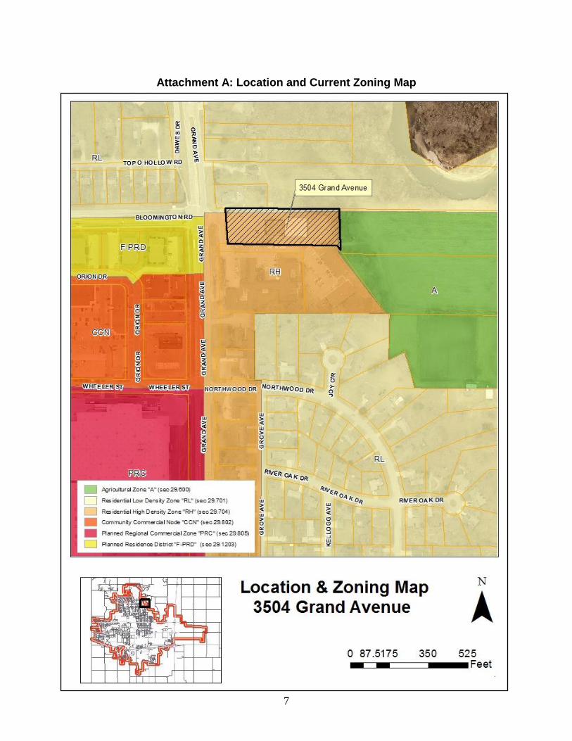
1 ITEM #: 22 DATE: 01-09-18 COUNCIL ACTION FORM SUBJECT: REZONING FROM RH (RESIDENTIAL HIGH DENSITY) TO NC (NEIGHBORHOOD COMMERCIAL) FOR A PROPERTY LOCATED AT 3504 GRAND AVENUE BACKGROUND: The property owner, Heartland Baptist Church, is requesting rezoning of a single parcel of land located at 3504 Grand Avenue from RH (Residential High Density) to NC (Neighborhood Commercial). The site, is located on the east side of the intersection of Grand Avenue and Bloomington Road, and includes 1.83 acres (79,516 square feet) (see Attachment A: Location and Zoning Map). The property is designate as Residential High Density on the future land use map the Land Use Policy Plan (LUPP). On September 19, 2017, the City Council directed that a rezoning application was the preferred option for consideration of changing use of the site compared to a Highway Oriented Commercial LUPP change application. This direction was in response to a letter received from Heartland Baptist Church (see Attachment D: Applicant’s Letter), and a letter received from Habitat for Humanity (see Attachment E: Habitat for Humanity Letter). Habitat for Humanity of Central Iowa proposes to relocate their main office, presently located at 401 Clark Avenue, and their retail store, presently located at 402 E. Lincoln Way, to the site at 3504 Grand Avenue. Stand alone office and retail sales and service uses, as proposed for this site, are not permitted in the RH zoning district. Rezoning of the site to NC allows the proposed uses in pre-existing buildings on a lot with a maximum lot area of 100,000 square feet, subject to approval of a Special Use Permit by the Zoning Board of Adjustment. The Special Use Permit requirement is triggered by the size of the property exceeding 20,000 square feet. If the rezoning is approved, the applicant would proceed with a Special Use Permit application for use of the site to address operational aspects of the business. The site contains a vacant building, previously occupied by Heartland Baptist Church, with 12,598 square feet of gross floor area. The vacant building is a single-story structure without a basement. A garage/storage building (6,000 sq. ft.) and a small storage shed are located behind the main building. The applicant intends to establish their planned uses with the existing structures without any alterations to the exterior, or changes to parking areas. Further analysis of the rezoning petition is found in the Addendum.
Transcript of ITEM #: 22 DATE: 01-09-18 COUNCIL ACTION FORM …

1
ITEM #: 22 DATE: 01-09-18
COUNCIL ACTION FORM SUBJECT: REZONING FROM RH (RESIDENTIAL HIGH DENSITY) TO NC
(NEIGHBORHOOD COMMERCIAL) FOR A PROPERTY LOCATED AT 3504 GRAND AVENUE
BACKGROUND: The property owner, Heartland Baptist Church, is requesting rezoning of a single parcel of land located at 3504 Grand Avenue from RH (Residential High Density) to NC (Neighborhood Commercial). The site, is located on the east side of the intersection of Grand Avenue and Bloomington Road, and includes 1.83 acres (79,516 square feet) (see Attachment A: Location and Zoning Map). The property is designate as Residential High Density on the future land use map the Land Use Policy Plan (LUPP). On September 19, 2017, the City Council directed that a rezoning application was the preferred option for consideration of changing use of the site compared to a Highway Oriented Commercial LUPP change application. This direction was in response to a letter received from Heartland Baptist Church (see Attachment D: Applicant’s Letter), and a letter received from Habitat for Humanity (see Attachment E: Habitat for Humanity Letter). Habitat for Humanity of Central Iowa proposes to relocate their main office, presently located at 401 Clark Avenue, and their retail store, presently located at 402 E. Lincoln Way, to the site at 3504 Grand Avenue. Stand alone office and retail sales and service uses, as proposed for this site, are not permitted in the RH zoning district. Rezoning of the site to NC allows the proposed uses in pre-existing buildings on a lot with a maximum lot area of 100,000 square feet, subject to approval of a Special Use Permit by the Zoning Board of Adjustment. The Special Use Permit requirement is triggered by the size of the property exceeding 20,000 square feet. If the rezoning is approved, the applicant would proceed with a Special Use Permit application for use of the site to address operational aspects of the business. The site contains a vacant building, previously occupied by Heartland Baptist Church, with 12,598 square feet of gross floor area. The vacant building is a single-story structure without a basement. A garage/storage building (6,000 sq. ft.) and a small storage shed are located behind the main building. The applicant intends to establish their planned uses with the existing structures without any alterations to the exterior, or changes to parking areas. Further analysis of the rezoning petition is found in the Addendum.

2
At the December 20, 2017 Planning & Zoning Commission meeting, the Commission recommended by a vote of 5-0 to approve the rezoning of the property located at 3504 Grand Avenue without conditions. The owners of property at 3514 Grand Avenue and 3526 Grand Avenue, which both abut the north property line of the site, were in attendance and expressed their concerns about potential commercial uses that may locate on the property if rezoned to Neighborhood Commercial (NC). They did not object to use of the property by the Habitat for Humanity organization, provided it did not involve large trucks transporting building materials to and from the site. They would object to using the site for a restaurant, given the traffic, and trash that would be generated by such a use. They requested that the rezoning include restrictions to further limit the types of uses that may locate on the site, including prohibiting restaurants. ALTERNATIVES: 1. The City Council can approve the request for rezoning from RH (Residential High
Density) to NC (Neighborhood Commercial) for the property located at 3504 Grand Avenue, as proposed by the rezoning request and supported by the findings of fact.
2. The City Council can deny the request for rezoning from (RH) Residential High
Density to (NC) Neighborhood Commercial for the property located at 3504 Grand Avenue, if the Commission finds that the City’s regulations and policies are not met.
3. The City Council can defer action on this request and refer it back to City staff and/or the applicant for additional information.
CITY MANAGER’S RECOMMENDED ACTION: The current RH zoning of the site is consistent with the Land Use Policy Plan land use designation and supports the use of the site as either a church or redevelopment with high density residential. Limited mixed use is also allowed with the current RH zoning district. However, the desire to have 100% commercial use of the site is not permitted within RH zoning. The proposed rezoning to NC can be found to be consistent with the allowances of the LUPP for small scale commercial zones and that the use of the site would not displace existing housing, despite the fact that it is not designated as commercial on the future land use map. Infrastructure is in place to serve the intended use. The applicant’s proposed use is compatible with the surrounding uses, given the low volume of traffic anticipated for this site. Site improvements are currently non-conforming for the RH zoning with parking between the building and the street and lack of landscaping that meets current requirements. The rezoning to NC will not cure these deficiencies and the property will continue to have non-conformities upon its reuse if a special use permit is approved. The use of the site consistent with a special use permit ensures that future uses can be

3
accommodated in a manner that is compatible with the surroundings without specifying details in a rezoning master plan with the requested NC zoning district. In response to the concerns expressed at the Planning and Zoning Commission meeting by neighboring property owners, the Zoning Board of Adjustment could choose to exclude certain uses presently allowed in the NC zone, as part of the approval of the Special Use Permit. Therefore, it is the recommendation of the City Manager that the City Council act in accordance with Alternative #1, which is to approve the request for rezoning from (RH) Residential High Density to (NC) Neighborhood Commercial as proposed by the rezoning request, and supported by the findings of fact.
4
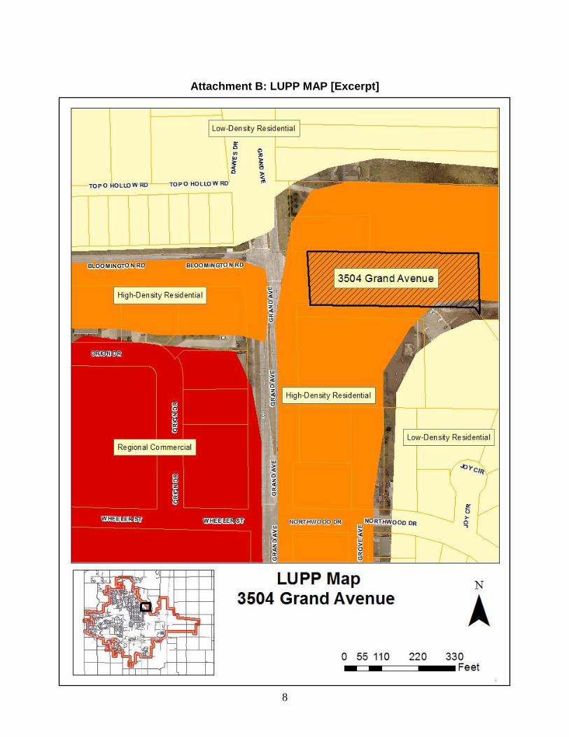
ADDENDUM: Land Use Policy Plan Future Land Use Map. No change in the land use designation is proposed in relation in relation to the rezoning request. The Land Use Policy Plan (LUPP) Future Land Use Map designates this site as High-Density Residential. This designation is applied along the east side of Grand Avenue between Bloomington Road and 24th (see Attachment B: LUPP Map). Commercial uses are most commonly associated with Commercial designations on the Future Land Use Map that include: Highway-Oriented Commercial; Downtown Services Center; Regional Commercial; and Commercial Nodes. Staff concluded upon review of the Highway Oriented Commercial land use designation that it was inappropriate for the site based upon the LUPP’s policies to discourage expanded strip commercial development. Additionally, the site was not associated with a commercial node to support its rezoning to a traditional commercial zone. The only remaining option for considering small scale commercial use was to consider a rezoning to Neighborhood Commercial. The proposed NC zoning does not have a corresponding commercial designation on the Future Land Use Map of the LUPP. There are no specific siting criteria for the zoning district, only the general discussion of its intent and purpose within Chapter 2 of the Land Use Plan. Neighborhood Commercial is of limited applicability within existing areas of the City for sites that did not meet the other commercial land use policies of the City and were also small scale in nature. There are generally six other areas of the community with NC zoning. The land use designations of these areas on the Future Land Use Map include One- and Two-Family Medium-Density Residential, High-Density Residential, Downtown Services Center, and Highway-Oriented Commercial. The six areas zoned as NC are described as follows:
Properties east of Grand Avenue and north of 24th Street includes a bank and a hardware store, and are designated as High-Density Residential;
The area west of Grand Avenue between 5th Street and 6th Street includes three office buildings, and is designated as One- and Two-Family Medium-Density Residential;
The area east of Clark Avenue to the east side of Duff Avenue between 6th Street and 7th Street includes a grocery store, single family homes, apartment buildings, offices, parking lots, an auto repair business, and a convenience store, and is designated as Downtown Services Center;
Property southeast of the intersection of S. Hazel Avenue and Lincoln Way is used as general office and designated as One- and Two-Family Medium-Density Residential;

5
Property at 926 S. 16th Street includes a restaurant and is designated as High-Density Residential; and,
The area along Florida Avenue and Reliable Street includes a heating and air conditioning business, a painting company, self-storage units, single family homes, and a former grain elevator being converted for other commercial uses.
Existing/Proposed Zoning. The current zoning of the property is RH (Residential High Density). On August 28, 2001, the City Council approved Ordinance No. 3624, amending the official zoning map by changing the zoning of the eastern portion of the property located at 3504 Grand Avenue from RL (Residential Low Density) to RH (Residential High Density). The western portion of the parcel was already zoned as RH. At the time, the property was occupied by a Heartland Baptist Church, which was a conforming use of the property as a religious institution in the RH zone. The proposed zoning of the property is NC (Neighborhood Commercial). The NC zone has more restrictive use limits than other zones, and requires Zoning Board of Adjustment (ZBA) approval of a Special Use Permit (SUP) for larger sites, such as the subject property. Continued use of the property by a religious institution would be allowed without triggering the requirement for a SUP. However, a change of the use on the site to a commercial use would require a SUP, since the size of the property exceeds 20,000 square feet. A SUP would be considered only if the rezoning is approved first. Permitted Uses. The proposed NC zoning category allows a more limited range of uses than the HOC (Highway-Oriented Commercial) zoning district. Permitted uses in the NC zone include:
Household Living;
Office;
Retail Sales and Services – General;
Entertainment, Restaurant and Recreation Trade;
Community Facilities;
Social Service Providers;
Religious Institutions;
Basic Utilities;
Personal Wireless Communication Facilities; and,
Child Day Care Facilities. The maximum lot area for pre-existing buildings and pre-existing neighborhood commercial centers is 100,000 square feet (with approval by Special Use Permit according to Section 29.1503).

6
The portion of the existing parking lot for the subject property that is located between the building and the street does not conform to the off-street parking regulations for the NC zone. Minimum required building setbacks in the NC zone are met by the location of the existing principal building on the site; however, the location of the building does not conform to the maximum allowed building setback of 60 feet from the street lot line. Existing Uses of Land. Land uses that occupy the subject property and other surrounding properties are described:
Location Existing Land Uses Subject Property Former Church Building and Accessory Structures
North Single Family Homes
East Farmland, Skunk River
South Healthcare Facility
West Apartment Buildings
Public Infrastructure. All public infrastructure is available and has the capacity to serve the site. Public Notice. Notice was mailed to property owners within 200 feet of the subject site and a sign was posted on the subject property. As of this writing, no comments have been received. Findings of Fact. Based upon an analysis of the proposed rezoning and laws pertinent to the applicant’s request, staff makes the following findings of fact: 1. Ames Municipal Code Section 29.1507(2) allows owners of fifty percent (50%) or
more of the area of the lots in any district desired for rezoning to file an application requesting that the City Council rezone the property. The owner of this single parcel has requested the rezoning.
2. The subject property has been designated on the Land Use Policy Plan (LUPP)
Future Land Use Map as High-Density Residential.
3. There is no corresponding land use designation on the Future Land Use Map for the NC (Neighborhood Commercial) zoning designation.
4. Infrastructure is in place to serve the proposed use of this site.
7
Attachment A: Location and Current Zoning Map
8
Attachment B: LUPP MAP [Excerpt]

9
Attachment C: Rezoning Plat

10
Attachment D: Applicant’s Letter
11
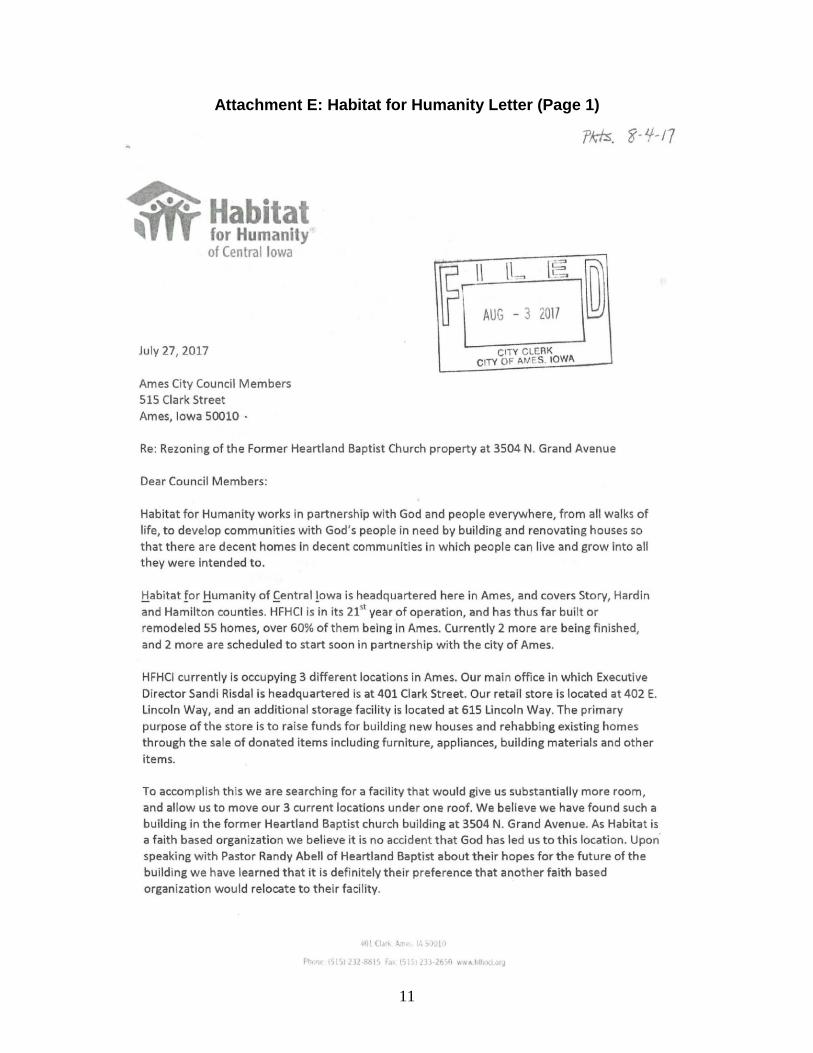
Attachment E: Habitat for Humanity Letter (Page 1)
12
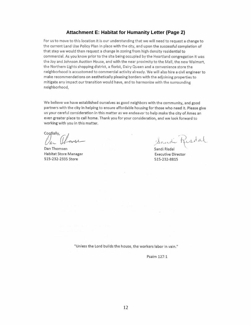
Attachment E: Habitat for Humanity Letter (Page 2)
13
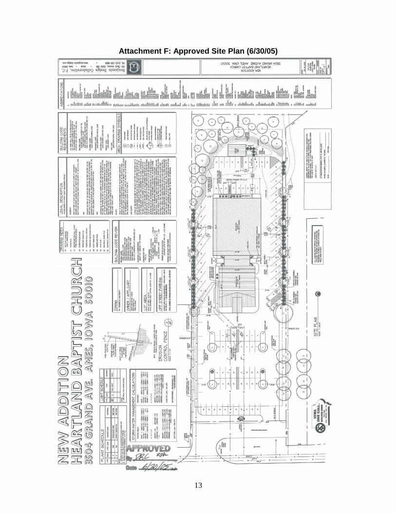
Attachment F: Approved Site Plan (6/30/05)

14
Attachment G: Existing Building Elevations

DO NOT WRITE IN THE SPACE ABOVE THIS LINE, RESERVED FOR RECORDERPrepared by: City Clerk’s Office, 515 Clark Avenue, Ames, IA 50010 Phone: 515-239-5105
Return to: Ames City Clerk, P.O. Box 811, Ames, IA 50010
ORDINANCE NO.
AN ORDINANCE AMENDING THE OFFICIAL ZONING MAP OF THECITY OF AMES, IOWA, AS PROVIDED FOR IN SECTION 29.301 OF THEMUNICIPAL CODE OF THE CITY OF AMES, IOWA, BY CHANGING THEBOUNDARIES OF THE DISTRICTS ESTABLISHED AND SHOWN ONSAID MAP AS PROVIDED IN SECTION 29.1507 OF THE MUNICIPALCODE OF THE CITY OF AMES, IOWA; REPEALING ALL ORDINANCESAND PARTS OF ORDINANCES IN CONFLICT HEREWITH ANDESTABLISHING AN EFFECTIVE DATE
BE IT HEREBY ORDAINED by the City Council of the City of Ames, Iowa;
Section 1: The Official Zoning Map of the City of Ames, Iowa, as provided for inSection 29.301 of the Municipal Code of the City of Ames, Iowa, is amended by changing theboundaries of the districts established and shown on said Map in the manner authorized bySection 29.1507 of the Municipal Code of the City of Ames, Iowa, as follows: That the real estate,generally located at 3504 Grand Avenue, is rezoned from Residential High Density (RH) toNeighborhood Commercial (NC).
Real Estate Description: A TRACT IN THE NORTHWEST QUARTER OF THE SOUTHWEST QUARTER OF
SECTION 26, TOWNSHIP 84 NORTH, RANGE 26 WEST OF THE 5TH P.M., CITY OFAMES, STORY COUNTY, IOWA, AS DESCRIBED IN THE QUIT CLAIM DEED FILEDAT INST. NO.12-00201 AND BEING MORE CURRENTLY DESCRIBED ASFOLLOWS: COMMENCING AT THE WEST QUARTER CORNER OF SAID SECTION26: THENCE S 00°18’50” E, 209.67 FEET ALONG THE WEST LINE OF SAIDSECTION TO THE NORTH LINE OF THE SOUTH 120 FEET OF THE NORTH 10ACRES OF SAID NORTHWEST QUARTER OF THE SOUTHWEST QUARTER;THENCE S 88°39’42” E, 94.28 FEET ALONG SAID LINE TO THE EAST RIGHT OFWAY LINE OF U.S. HIGHWAY #69 AND THE POINT OF BEGINNING; THENCECONTINUING S 88°39’42” E, 186.60 FEET; THENCE S 88°45’05” E, 322.22 FEET;THENCE S 00°18’50” E, 175.98 FEET; THENCE N 36°58’52” W, 25.46 FEET; THENCEN 89°02’23” W, 486.43 FEET TO THE EAST RIGHT OF WAY LINE OF U.S.HIGHWAY #69 AND A POINT ON A CURVE; THENCE NORTHERLY 159.06 FEETALONG SAID RIGHT OF WAY LINE AND SAID CURVE CONCAVE TO THE WEST,
HAVING A RADIUS OF 8701.93 FEET, A CENTRAL ANGLE OF 1°02’50” ANDBEING SUBTENDED BY A CHORD WHICH BEARS N 02°52’20” W, 159.06 FEET TOTHE POINT OF BEGINNING, CONTAINING 1.83 ACRES.
Section 2: All other ordinances and parts of ordinances in conflict herewith are herebyrepealed to the extent of such conflict.
Section 3: This ordinance is in full force and effect from and after its adoption andpublication as provided by law.
ADOPTED THIS ________ day of _________________________, ______.
_________________________________ ____________________________________Diane R. Voss, City Clerk Ann H. Campbell, Mayor
2