ISO/TC 211 Workshop Standards in Action · ISO/TC 211 Workshop Standards in Action Swiss...
34
1, 23.08.00 Workshop ISO/TC211 Standards in Action ISO/TC 211 Workshop Standards in Action Swiss Contribution
Transcript of ISO/TC 211 Workshop Standards in Action · ISO/TC 211 Workshop Standards in Action Swiss...
1, 23.08.00 Workshop ISO/TC211 Standards in Action
ISO/TC 211 Workshop
Standards in Action
Swiss Contribution
2, 7.3.01 Workshop ISO/TC211 Standards in Action
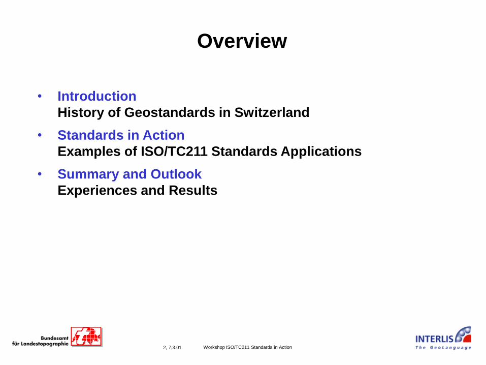
Overview
• Introduction
History of Geostandards in Switzerland
• Standards in Action
Examples of ISO/TC211 Standards Applications
• Summary and Outlook
Experiences and Results
3, 23.08.00 Workshop ISO/TC211 Standards in Action
Introduction
History of Geostandards in Switzerland
M101

4, 7.3.01 Workshop ISO/TC211 Standards in Action
M105
Introduction
• Motivation for using a Geostandard in Switzerland
Format
Converter

5, 7.3.01 Workshop ISO/TC211 Standards in Action
M105
Introduction
• Motivation for using a Geostandard in Switzerland
Standardized
Transfer Service

6, 7.3.01 Workshop ISO/TC211 Standards in Action
M202
Introduction
History:
1985 development of model-based
Geostandard (INTERLIS 1)
1992 Swiss law: use standard for the documentation
of land surveying data
1992 - 2000 development of conceptual models
for various application domains,
corresponding data acquisition
followed by data transfer between different GIS
1998 - 2000 development of second version of standard
(INTERLIS 2)
based on current IT,
and experiences with INTERLIS 1,
and requirements of ISO/TC211, PT CSL
7, 7.3.01 Workshop ISO/TC211 Standards in Action
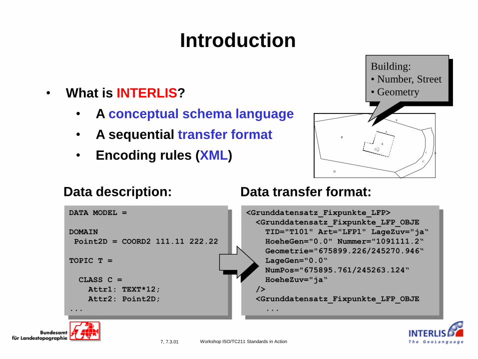
Introduction
• What is INTERLIS?
• A conceptual schema language
• A sequential transfer format
• Encoding rules (XML)
<Grunddatensatz_Fixpunkte_LFP>
<Grunddatensatz_Fixpunkte_LFP_OBJE
TID="T101" Art="LFP1" LageZuv="ja“
HoeheGen="0.0" Nummer="1091111.2“
Geometrie="675899.226/245270.946“
LageGen="0.0“
NumPos="675895.761/245263.124“
HoeheZuv="ja“
/>
<Grunddatensatz_Fixpunkte_LFP_OBJE
...
DATA MODEL =
DOMAIN
Point2D = COORD2 111.11 222.22
TOPIC T =
CLASS C =
Attr1: TEXT*12;
Attr2: Point2D;
...
Data description: Data transfer format:
b
D
B
A
a
c d
C
1
Building:
• Number, Street
• Geometry
8, 7.3.01 Workshop ISO/TC211 Standards in Action
Structure of the transfer file:
M204
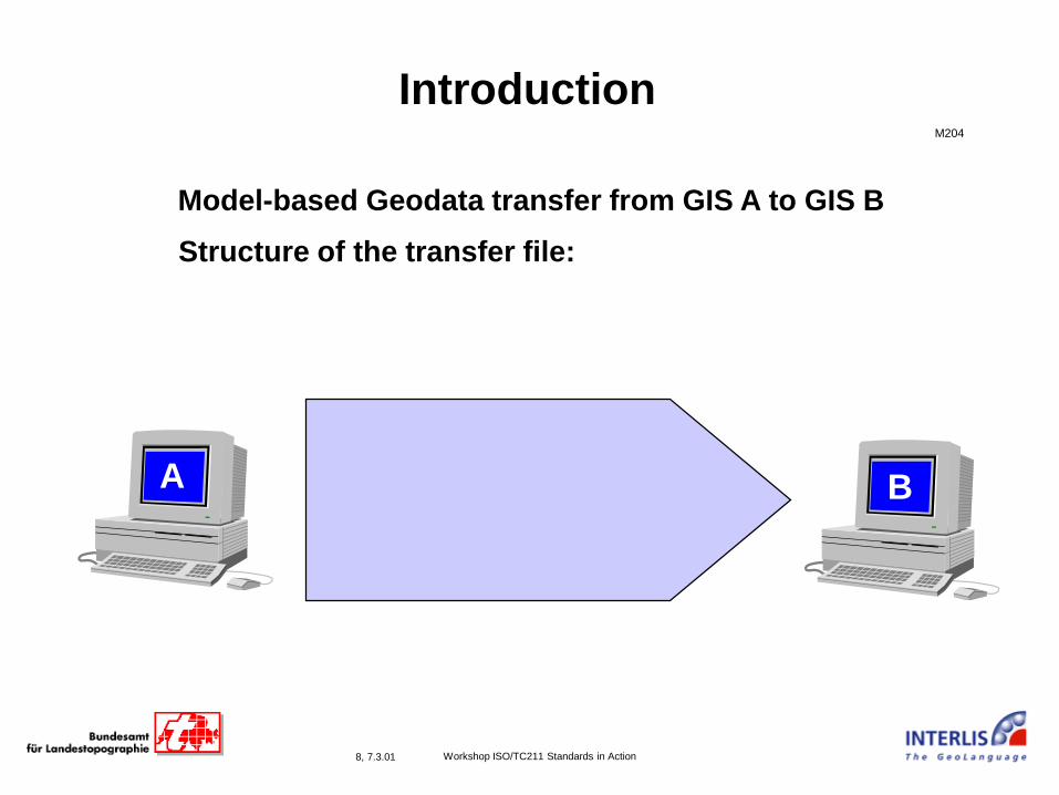
Introduction
Model-based Geodata transfer from GIS A to GIS B
A B

9, 7.3.01 Workshop ISO/TC211 Standards in Action
Structure of the transfer file:
M204
Introduction
Model-based Geodata transfer from GIS A to GIS B
A B
Hier Namen eingeben
titel
comment
comment
Hier Namen eingeben
Hier Titel eingeben
Kommentar 1
Kommentar 2
Hier Namen eingeben
Hier Titel eingeben
Kommentar 1
Kommentar 2
Hier Namen eingeben
Hier Titel eingeben
Kommentar 1
Kommentar 2
Hier Namen eingeben
Hier Titel eingeben
Kommentar 1
Kommentar 2
first data model
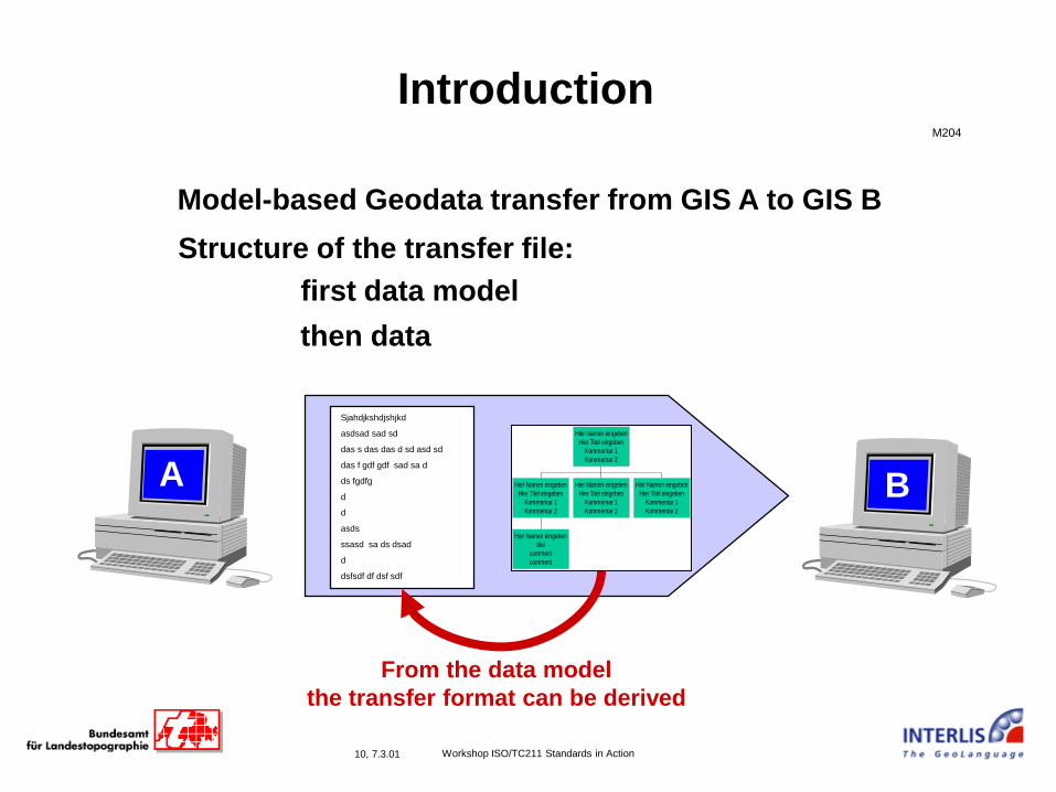
10, 7.3.01 Workshop ISO/TC211 Standards in Action
Structure of the transfer file:
M204
Introduction
Model-based Geodata transfer from GIS A to GIS B
A B
From the data model
the transfer format can be derived
Hier Namen eingeben
titel
comment
comment
Hier Namen eingeben
Hier Titel eingeben
Kommentar 1
Kommentar 2
Hier Namen eingeben
Hier Titel eingeben
Kommentar 1
Kommentar 2
Hier Namen eingeben
Hier Titel eingeben
Kommentar 1
Kommentar 2
Hier Namen eingeben
Hier Titel eingeben
Kommentar 1
Kommentar 2
first data model
Sjahdjkshdjshjkd
asdsad sad sd
das s das das d sd asd sd
das f gdf gdf sad sa d
ds fgdfg
d
d
asds
ssasd sa ds dsad
d
dsfsdf df dsf sdf
then data
11, 7.3.01 Workshop ISO/TC211 Standards in Action
IntroductionM203.2
12, 7.3.01 Workshop ISO/TC211 Standards in Action
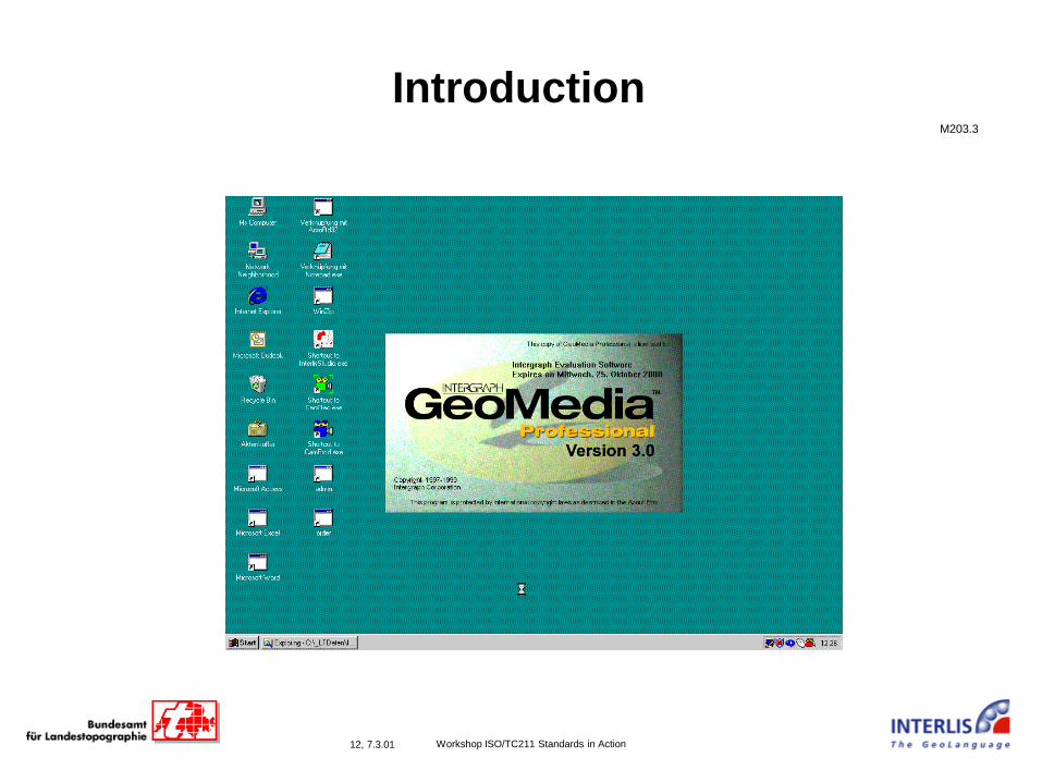
IntroductionM203.3
13, 7.3.01 Workshop ISO/TC211 Standards in Action
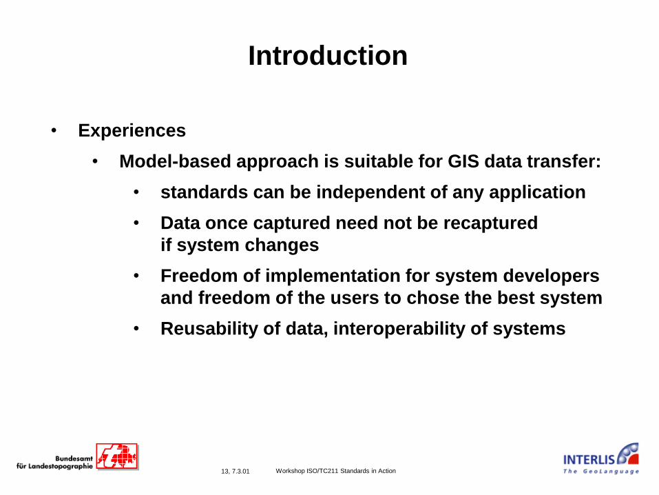
Introduction
• Experiences
• Model-based approach is suitable for GIS data transfer:
• standards can be independent of any application
• Data once captured need not be recaptured
if system changes
• Freedom of implementation for system developers
and freedom of the users to chose the best system
• Reusability of data, interoperability of systems
14, 7.3.01 Workshop ISO/TC211 Standards in Action
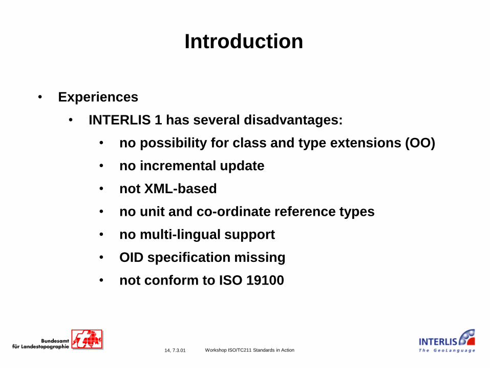
Introduction
• Experiences
• INTERLIS 1 has several disadvantages:
• no possibility for class and type extensions (OO)
• no incremental update
• not XML-based
• no unit and co-ordinate reference types
• no multi-lingual support
• OID specification missing
• not conform to ISO 19100
15, 23.08.00 Workshop ISO/TC211 Standards in Action
Standards in Action
Examples of ISO/TC211 Standards
Applications

16, 7.3.01 Workshop ISO/TC211 Standards in Action
M202
Standards in Action
History:
1985 development of model-based
Geostandard (INTERLIS 1)
1992 Swiss law: use standard for the documentation
of land surveying data
1992 - 2000 development of conceptual models
for various application domains,
corresponding data acquisition
followed by data transfer between different GIS
1998 - 2000 development of second version of standard
(INTERLIS 2)
based on current IT,
and experiences with INTERLIS 1,
and requirements of ISO/TC211, PT CSL
17, 7.3.01 Workshop ISO/TC211 Standards in Action
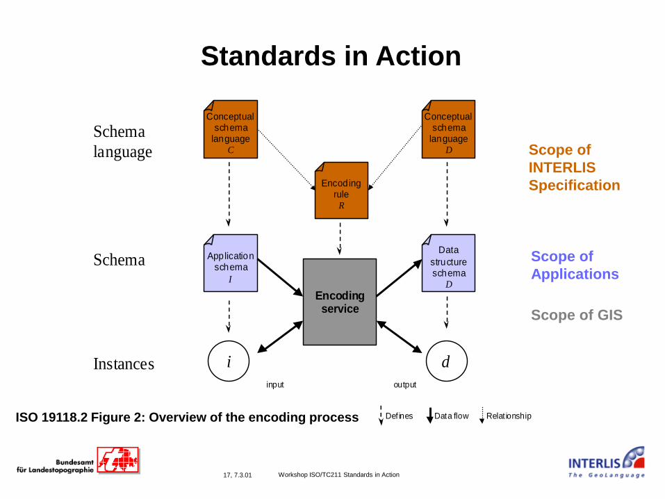
Encodingservice
Applicationschema
I
Conceptualschema
languageC
Data
structureschema
D
EncodingruleR
Defines Data flow
input output
Relat ionship
Conceptualschema
languageD
Instances
Schema
Schema
language
i d
Standards in Action
ISO 19118.2 Figure 2: Overview of the encoding process
Scope of
INTERLIS
Specification
Scope of
Applications
Scope of GIS
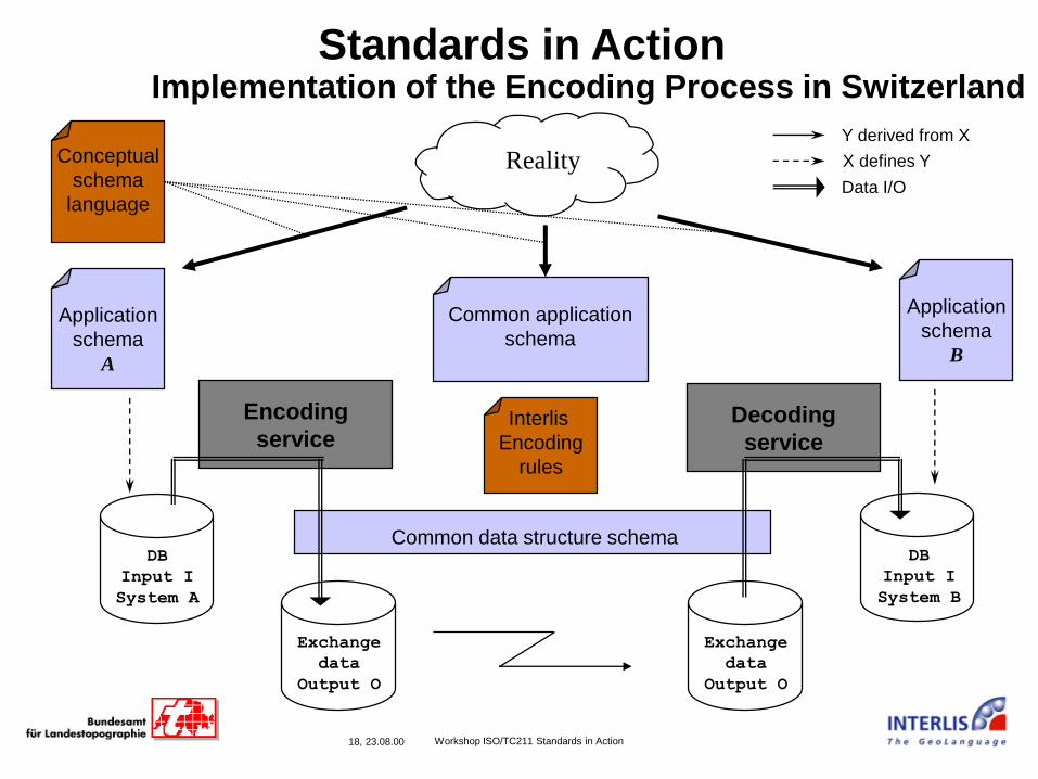
18, 23.08.00 Workshop ISO/TC211 Standards in Action
Encoding
service
Application
schema
A
Conceptual
schema
language
Interlis
Encoding
rules
Y derived from X
DB
Input I
System A
Application
schema
B
Common application
schema
Decoding
service
DB
Input I
System B
Exchange
data
Output O
Exchange
data
Output O
Reality X defines Y
Data I/O
Standards in ActionImplementation of the Encoding Process in Switzerland
Common data structure schema

19, 7.3.01 Workshop ISO/TC211 Standards in Action
Standards in Action
INTERLIS-CSL UML Element
MODEL Package(s)
TOPIC Package in package
CLASS Class
CLASS (ABSTRACT) Abstract class
-> (Association) Association
-<> (Aggregation) Aggregation Association
LIST OF, BAG OF Composition Association
CLASS A EXTENDS B Generalization
M221
20, 7.3.01 Workshop ISO/TC211 Standards in Action
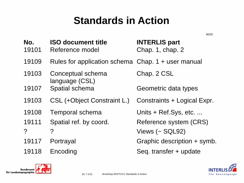
Standards in ActionM220
No. ISO document title INTERLIS part19101 Reference model Chap. 1, chap. 2
19109 Rules for application schema Chap. 1 + user manual
19103 Conceptual schemalanguage (CSL)
Chap. 2 CSL
19107 Spatial schema Geometric data types
19103 CSL (+Object Constraint L.) Constraints + Logical Expr.
19108 Temporal schema Units + Ref.Sys, etc. ...
19111 Spatial ref. by coord. Reference system (CRS)
? ? Views (~ SQL92)
19117 Portrayal Graphic description + symb.
19118 Encoding Seq. transfer + update
21, 7.3.01 Workshop ISO/TC211 Standards in Action
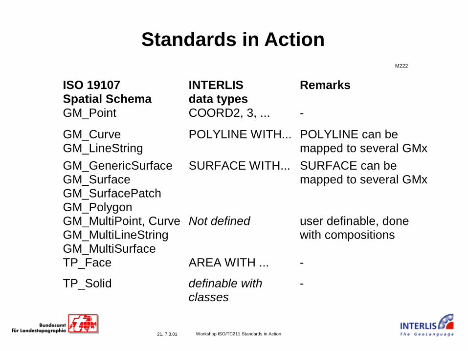
Standards in Action
ISO 19107Spatial Schema
INTERLISdata types
Remarks
GM_Point COORD2, 3, ... -
GM_CurveGM_LineString
POLYLINE WITH... POLYLINE can bemapped to several GMx
GM_GenericSurfaceGM_SurfaceGM_SurfacePatchGM_Polygon
SURFACE WITH... SURFACE can bemapped to several GMx
GM_MultiPoint, CurveGM_MultiLineStringGM_MultiSurface
Not defined user definable, donewith compositions
TP_Face AREA WITH ... -
TP_Solid definable withclasses
-
M222

22, 7.3.01 Workshop ISO/TC211 Standards in Action
Standards in Action
• Example
• Data modeling with UML
• UML-input and data model refinement in INTERLIS
• INTERLIS compiler produces output data model as
XML Schema/DTD (+ empty data section)
• Data consistent to defined data model in XML(-DTD +
data section)
R204
23, 7.3.01 Workshop ISO/TC211 Standards in Action
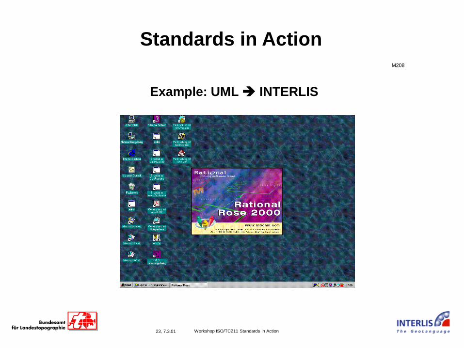
Standards in ActionM208
Example: UML ➔ INTERLIS

24, 7.3.01 Workshop ISO/TC211 Standards in Action
Standards in ActionM209
Example: INTERLIS schema

25, 7.3.01 Workshop ISO/TC211 Standards in Action
Standards in Action
Example: compile INTERLIS ➔ XML (or DTD or XML Schema)
M210
ili2 compiler ili to DTD
26, 7.3.01 Workshop ISO/TC211 Standards in Action
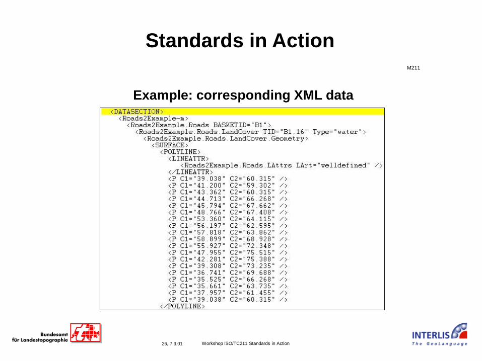
Standards in Action
Example: corresponding XML data
DATA
M211
27, 7.3.01 Workshop ISO/TC211 Standards in Action
Standards in Action
Implementation Experiences:
• Application experts develop system independent
conceptual schemas
• GIS can implement encoding services on an abstract
(= application independent) level!
• Transfer format or service (API) need not be developed
but is automatically derived from the conceptual
application schema by using the encoding rules!
R204
28, 7.3.01 Workshop ISO/TC211 Standards in Action
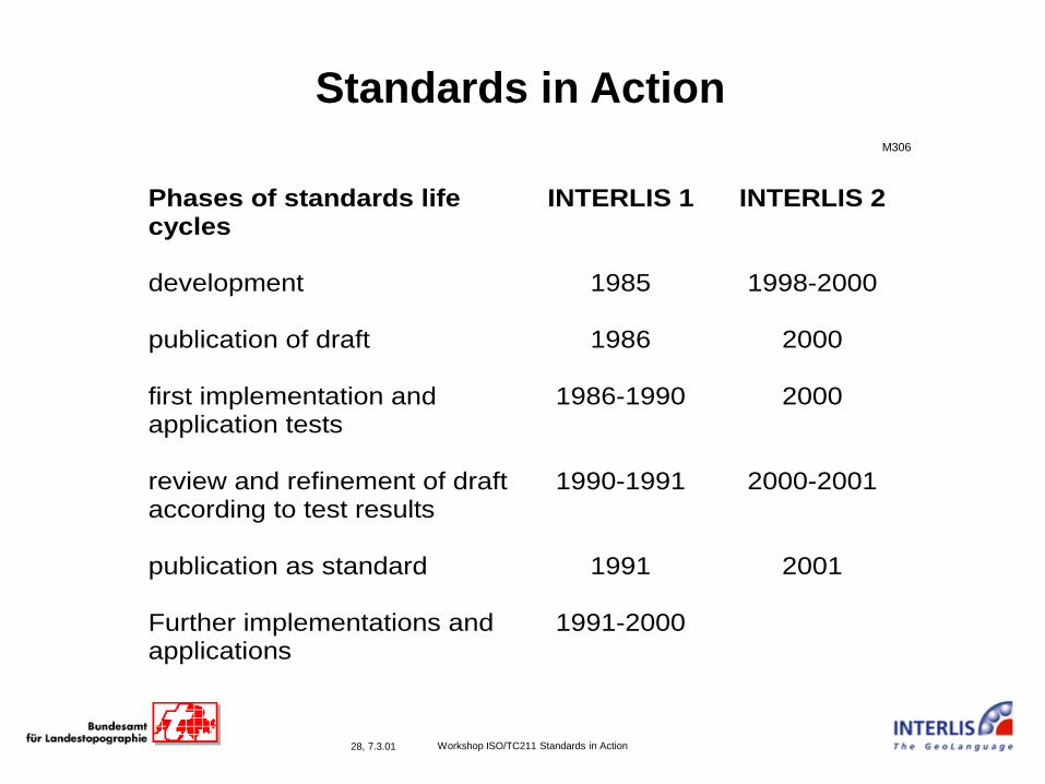
Standards in Action
Phases of standards lifecycles
INTERLIS 1 INTERLIS 2
development 1985 1998-2000
publication of draft 1986 2000
first implementation andapplication tests
1986-1990 2000
review and refinement of draftaccording to test results
1990-1991 2000-2001
publication as standard 1991 2001
Further implementations andapplications
1991-2000
M306
29, 7.3.01 Workshop ISO/TC211 Standards in Action
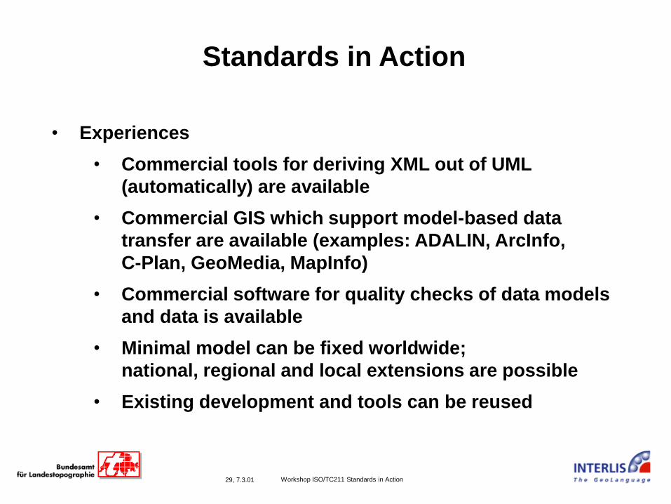
Standards in Action
• Experiences
• Commercial tools for deriving XML out of UML
(automatically) are available
• Commercial GIS which support model-based data
transfer are available (examples: ADALIN, ArcInfo,
C-Plan, GeoMedia, MapInfo)
• Commercial software for quality checks of data models
and data is available
• Minimal model can be fixed worldwide;
national, regional and local extensions are possible
• Existing development and tools can be reused

30, 23.08.00 Workshop ISO/TC211 Standards in Action
Summary and Outlook
Experiences and Results
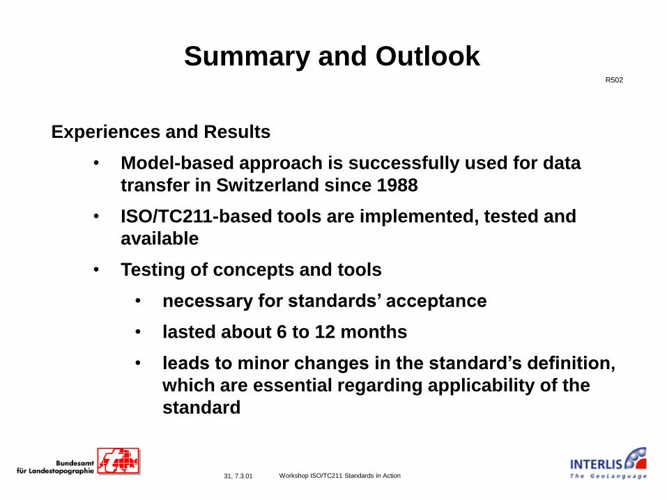
31, 7.3.01 Workshop ISO/TC211 Standards in Action
R502
Summary and Outlook
Experiences and Results
• Model-based approach is successfully used for data
transfer in Switzerland since 1988
• ISO/TC211-based tools are implemented, tested and
available
• Testing of concepts and tools
• necessary for standards’ acceptance
• lasted about 6 to 12 months
• leads to minor changes in the standard’s definition,
which are essential regarding applicability of the
standard
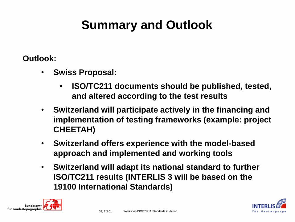
32, 7.3.01 Workshop ISO/TC211 Standards in Action
Summary and Outlook
Outlook:
• Swiss Proposal:
• ISO/TC211 documents should be published, tested,
and altered according to the test results
• Switzerland will participate actively in the financing and
implementation of testing frameworks (example: project
CHEETAH)
• Switzerland offers experience with the model-based
approach and implemented and working tools
• Switzerland will adapt its national standard to further
ISO/TC211 results (INTERLIS 3 will be based on the
19100 International Standards)
33, 7.3.01 Workshop ISO/TC211 Standards in Action
Supported by
Coordination de l’information géographique et des systèmes d’information géographique
Coordinamento del informazione geografica e dei sistemi di informazione geografica
Coordination of geographic information and geographic information systems
Koordination der Geoinformation und geografischen Informationssysteme
34, 7.3.01 Workshop ISO/TC211 Standards in Action
Appendix: Contact
http://www.interlis.ch
fax +41 31 963 22 97