overview Global Navigation Satellite Systems (GNSS): GPS ...
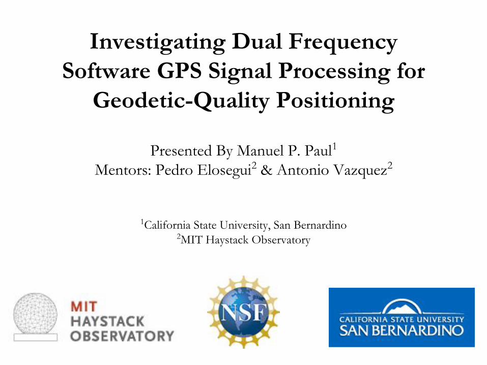
Investigating Dual Frequency Software GPS Signal Processing for
Geodetic-Quality Positioning
Presented By Manuel P. Paul1Mentors: Pedro Elosegui2 & Antonio Vazquez2
1California State University, San Bernardino2MIT Haystack Observatory

Outline
• Review of GPS– Basic Operation– Carriers & Codes Transmitted
• Scientific Motivation• Hardware vs Software GPS Receivers
– Current Public GPS Software Defined Receivers (SDRs)– Application & Testing of Public GPS SDRs
• Field Work• Next Steps• Acknowledgements
Picture of Block III: Most recent deployed GPS Satellite
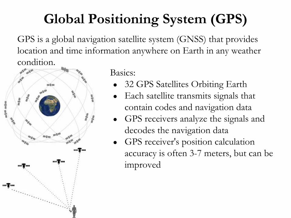
Global Positioning System (GPS)GPS is a global navigation satellite system (GNSS) that provides location and time information anywhere on Earth in any weather condition.
Basics:● 32 GPS Satellites Orbiting Earth● Each satellite transmits signals that
contain codes and navigation data● GPS receivers analyze the signals and
decodes the navigation data● GPS receiver's position calculation
accuracy is often 3-7 meters, but can be improved
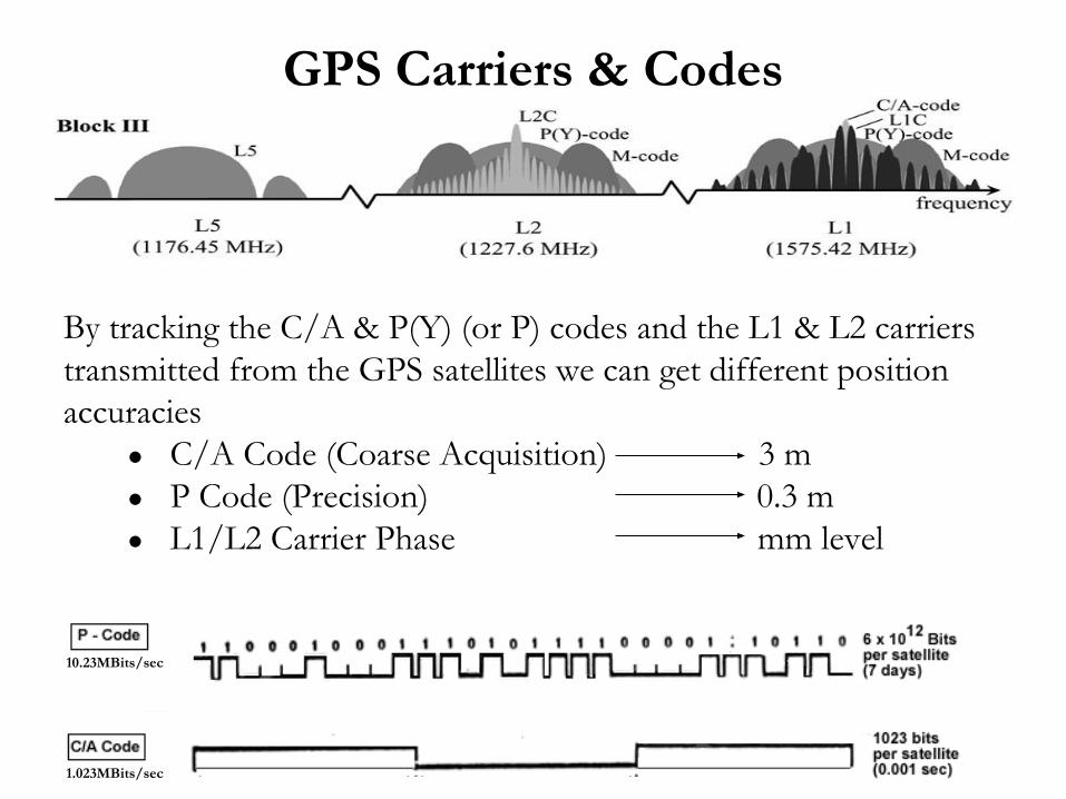
GPS Carriers & Codes
By tracking the C/A & P(Y) (or P) codes and the L1 & L2 carriers transmitted from the GPS satellites we can get different position accuracies
● C/A Code (Coarse Acquisition) 3 m ● P Code (Precision) 0.3 m ● L1/L2 Carrier Phase mm level
10.23MBits/sec
1.023MBits/sec
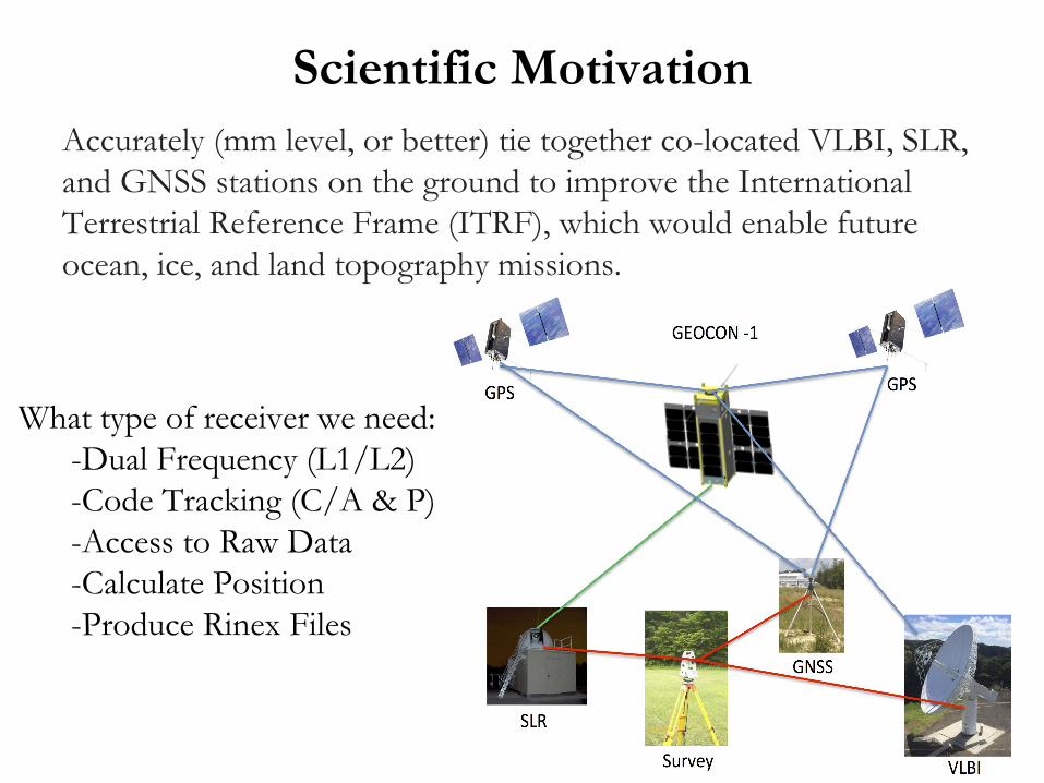
Scientific MotivationAccurately (mm level, or better) tie together co-located VLBI, SLR, and GNSS stations on the ground to improve the International Terrestrial Reference Frame (ITRF), which would enable future ocean, ice, and land topography missions.
What type of receiver we need:-Dual Frequency (L1/L2)-Code Tracking (C/A & P)-Access to Raw Data-Calculate Position -Produce Rinex Files

GPS Receivers
Hardware:Closed Designs
No Access to Raw DataLimited InterfacesExpensiveExtra Unneeded Features
Software:Open DesignsEasily AccessedInexpensivePersonalizableLess Electronics Used
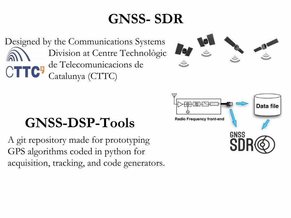
GNSS- SDRDesigned by the Communications Systems
Division at Centre Technològic de Telecomunicacions de Catalunya (CTTC)
GNSS-DSP-ToolsA git repository made for prototyping GPS algorithms coded in python for acquisition, tracking, and code generators.

Application & Testing of SDRs
Are there any already well designed GPS SDRs that can do L1, L2, C/A, & P code Acquisition & Tracking?
SDR L1 Carrier L2 Carrier C/A Code P Code
GNSS-SDR YES NO YES NO
GNSS-DSP-Tools NO NO YES NO
GNSS-SDR● Able to calculate basic
position using C/A code● Able to run in realtime or
via data file input● Coded in C++ made editing
code difficult● Well Designed and Efficient
GNSS-DSP-Tool● Analyzed data file to give
general acquisition ● Coded in python● Simple L1 & C/A tracking
algorithms
SDR L1 Carrier L2 Carrier C/A Code P Code
GNSS-SDR YES NO YES NO
GNSS-DSP-Tools NO NO YES NO

Field WorkAntenna(L1/L2)
Hardware
Rinex Files
Software Radio
Software Radio
L1 Data
L2 Data

Next Steps● We seek to generate L2 & P code acquisition & tracking
algorithms and add them to the already built SDRs. ● Currently working on P code acquisition ● Plan on implementing Z Tracking technique for measuring L2
carrier phase.
AcknowledgementsSpecial Thanks!Pedro Elosegui Frank Lind Victor PankratiusAntonio Vazquez Ryan Volz Jason SooHooAnthea Coster Will Rogers Tom Brown
MIT Haystack Observatory & National Science Foundation
GNSS-DSP-Tools: https://github.com/pmonta/GNSS-DSP-toolsGNSS-SDR: http://gnss-sdr.org/