Introduction to Physical Geography
15
Introduction to Physical Geography Figure 1
-
Upload
adam-dastrup -
Category
Education
-
view
114 -
download
5
Transcript of Introduction to Physical Geography
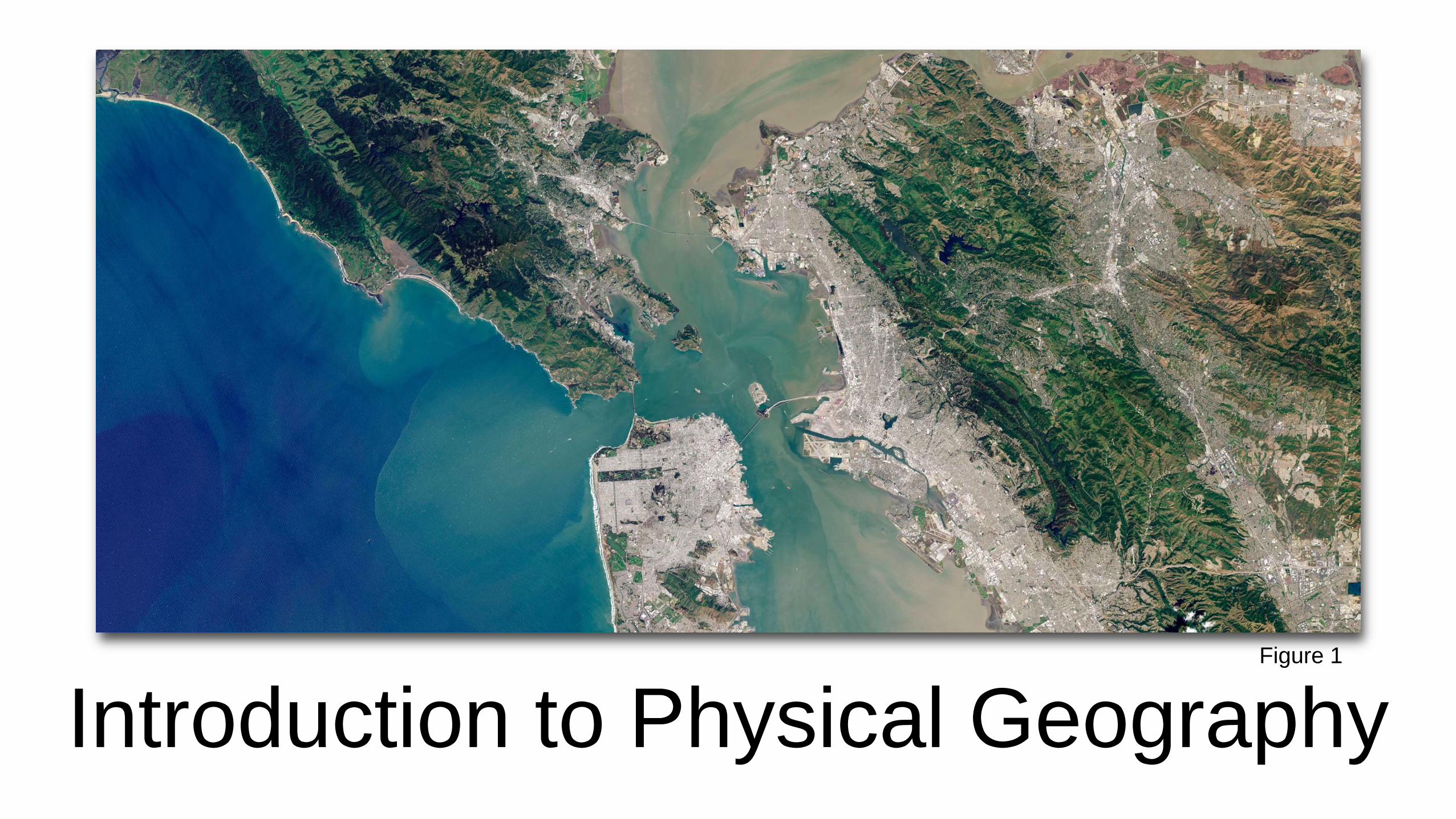
Introduction to Physical GeographyFigure 1

What is Geography
• Geography is the study of the physical and cultural environments of
Earth.
• Physical geography is the study of Earth and all of it’s components:
lithosphere, hydrosphere, cryosphere, atmosphere, and
biosphere.
• The geographic continuum is the range of disciplines and sub-
disciplines under the umbrella of geographic or spatial science.

Scientific Inquiry• Science is a path to gaining knowledge
about the natural world.
• Scientific inquiry is the process of
acquiring a body of scientific knowledge
through scientific questioning.
• Scientists use the scientific method as
a ways to standardize scientific inquiry so
that the process is clear, open, and
repeatable by other scientists.
• Science is the realm of data, facts, and
observations, not moral or religious
judgements. Figure 2
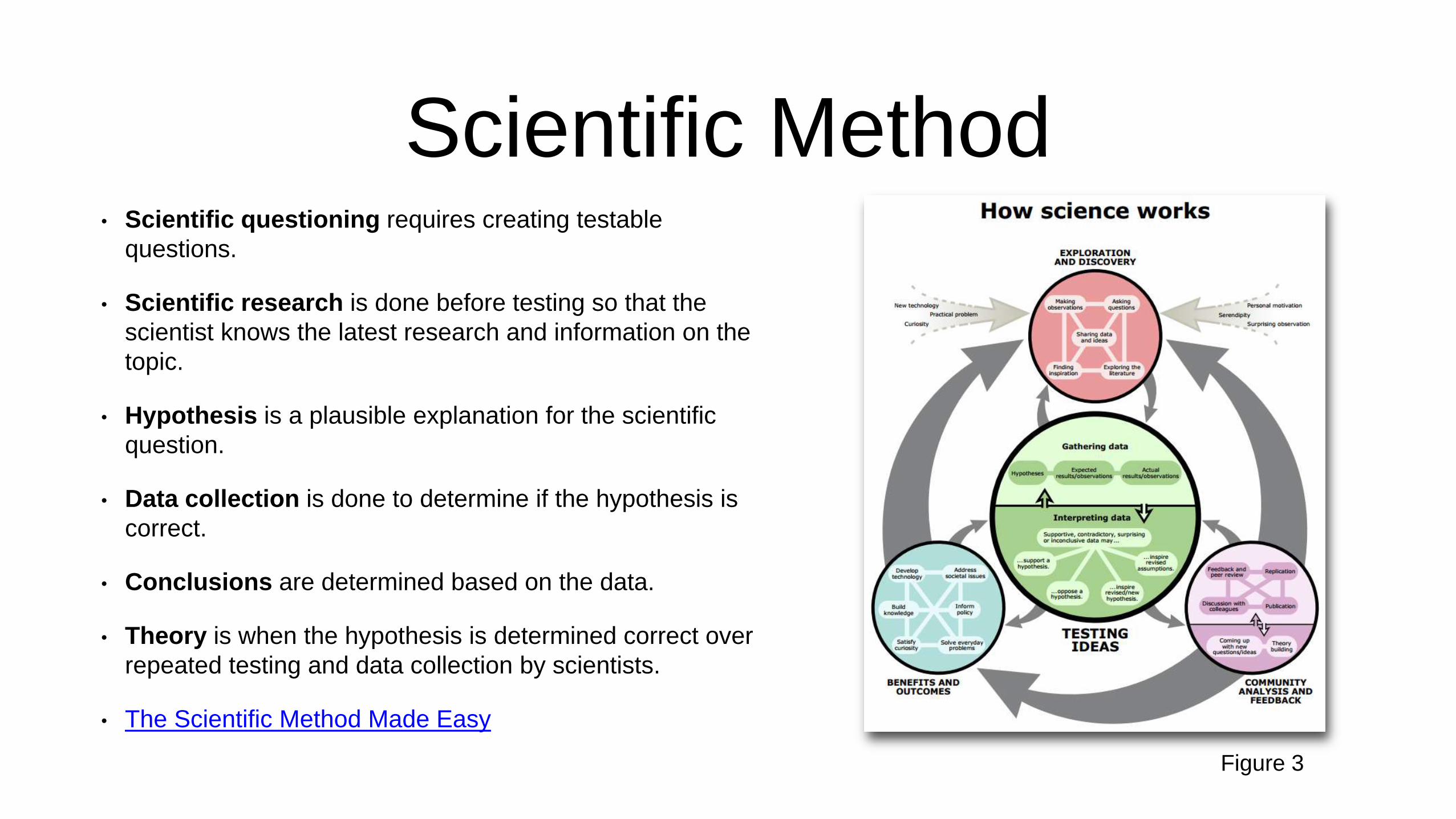
Scientific Method• Scientific questioning requires creating testable
questions.
• Scientific research is done before testing so that the
scientist knows the latest research and information on the
topic.
• Hypothesis is a plausible explanation for the scientific
question.
• Data collection is done to determine if the hypothesis is
correct.
• Conclusions are determined based on the data.
• Theory is when the hypothesis is determined correct over
repeated testing and data collection by scientists.
• The Scientific Method Made Easy
Figure 3

Geographic Grid System
• Great circles are circles that divide the
earth into a circumference of two equal
halves.
• Ex: Circle of illumination, plane of the
ecliptic, equator
• Small circles are circles that cut the earth,
but not into equal halves.
• Ex: Tropic of Cancer, Tropic of
Capricorn, Arctic Circle, Antarctic Circle
Figure 4
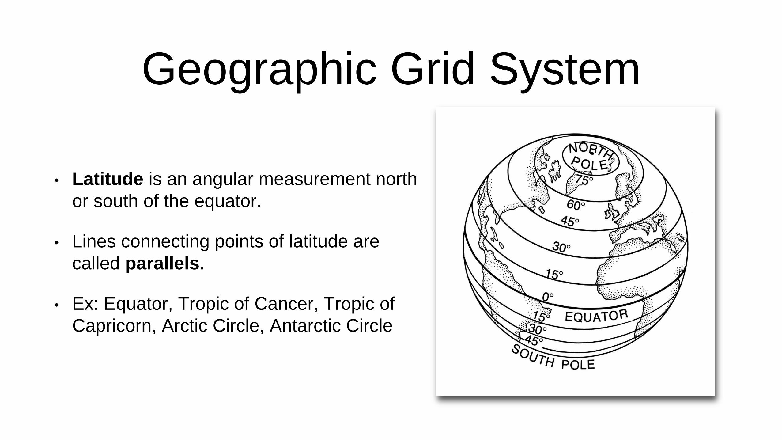
Geographic Grid System
• Latitude is an angular measurement north
or south of the equator.
• Lines connecting points of latitude are
called parallels.
• Ex: Equator, Tropic of Cancer, Tropic of
Capricorn, Arctic Circle, Antarctic Circle
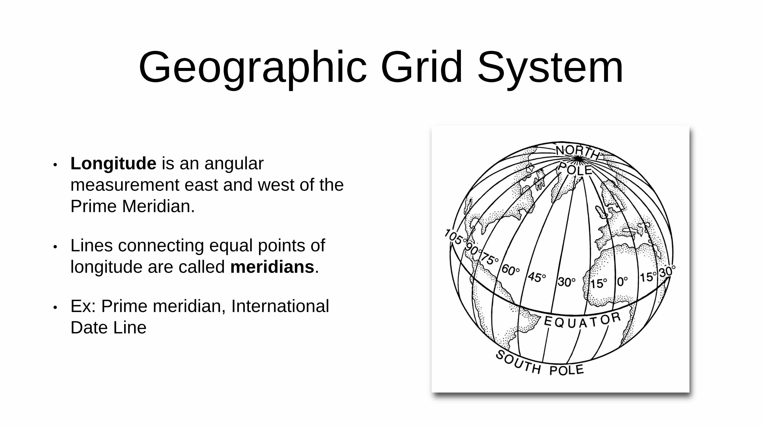
Geographic Grid System
• Longitude is an angular
measurement east and west of the
Prime Meridian.
• Lines connecting equal points of
longitude are called meridians.
• Ex: Prime meridian, International
Date Line

Time
Figure 7

Geospatial Technology
• Geospatial technology is a term used to describe all of the
technologies used by spatial scientists. (i.e. spatial data, remote
sensing, global positioning systems, and geographic information
systems)
• Data about the earth is either spatial or non-spatial.
• Big data is a term used to describe data sets that are so large and
complex that regular database management systems can not
accurately or properly process the information.

Geospatial Technology• Remote sensing is technology that
allows humans to study objects
without being in direct physical
contact with them.
• Remote sensors can be airborne or
satellite based.
• Remote sensors can be active or
passive.
• Remote sensors can be
geostationary or polar orbiting.
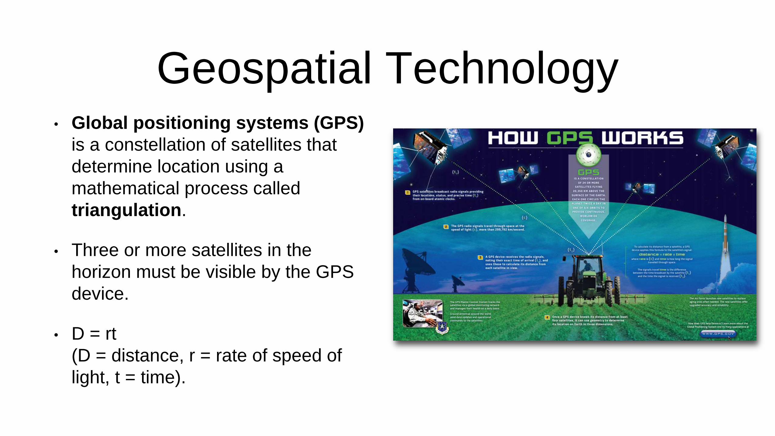
Geospatial Technology• Global positioning systems (GPS)
is a constellation of satellites that
determine location using a
mathematical process called
triangulation.
• Three or more satellites in the
horizon must be visible by the GPS
device.
• D = rt
(D = distance, r = rate of speed of
light, t = time).
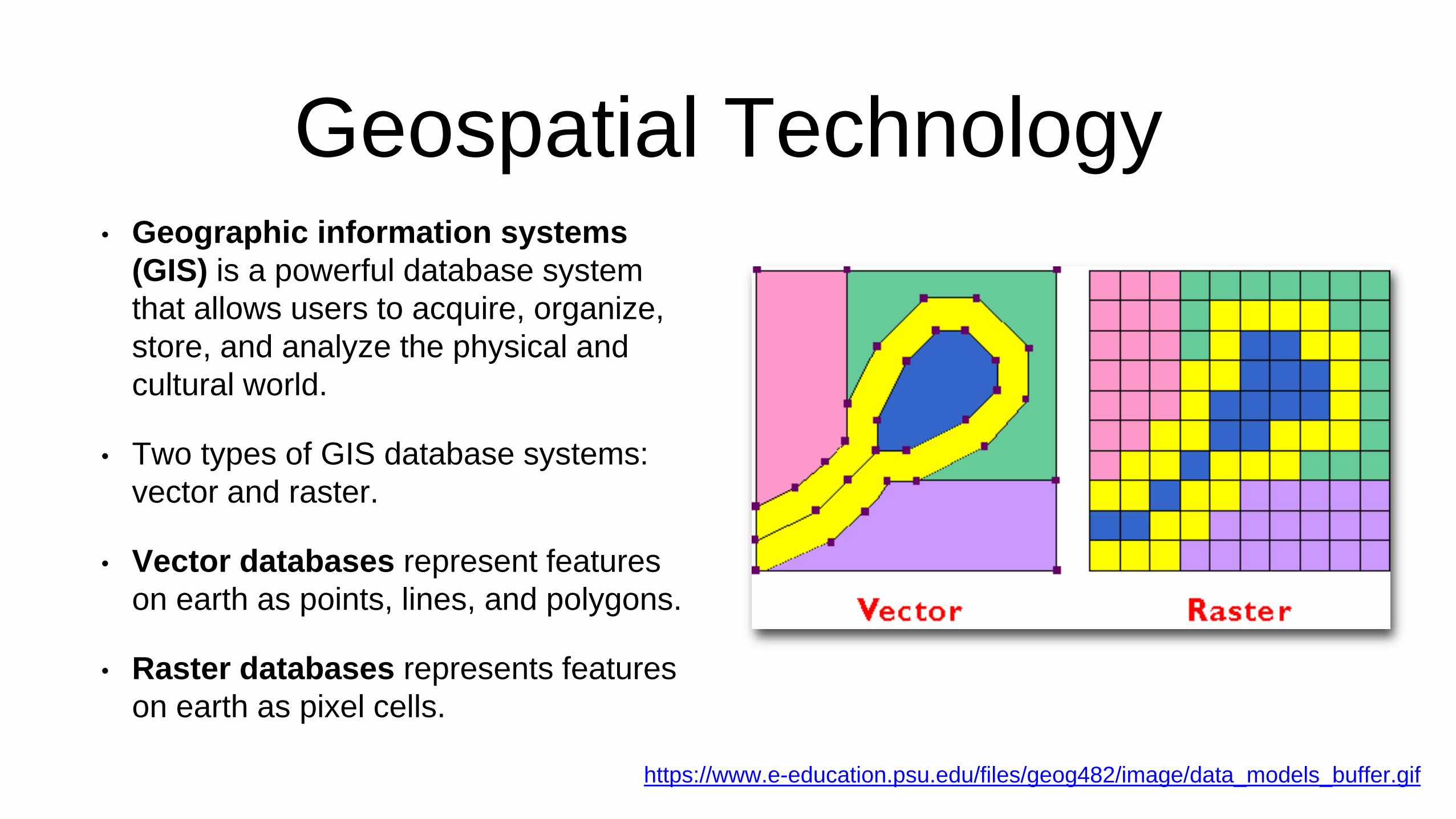
Geospatial Technology• Geographic information systems
(GIS) is a powerful database system
that allows users to acquire, organize,
store, and analyze the physical and
cultural world.
• Two types of GIS database systems:
vector and raster.
• Vector databases represent features
on earth as points, lines, and polygons.
• Raster databases represents features
on earth as pixel cells.
https://www.e-education.psu.edu/files/geog482/image/data_models_buffer.gif

Geospatial Revolution